Using Historic Landscape Characterisation
Using Historic Landscape Characterisation
Using Historic Landscape Characterisation

Create successful ePaper yourself
Turn your PDF publications into a flip-book with our unique Google optimized e-Paper software.
Spatial Planning<br />
The most ambitious example of using<br />
HLC strategically in relation to major<br />
development is in the Thames Gateway.<br />
Here, in response to the government’s<br />
“sustainable communities” programme,<br />
HLC has been taken to new levels of<br />
complexity. The Thames Gateway<br />
characterisation is a deliberately broadbrush<br />
overview designed to be the<br />
foundation for more future detailed work<br />
as the Thames Gateway proposals<br />
move from general masterplanning to<br />
specific site proposals.<br />
THAMES GATEWAY – the character of “sustainable communities”<br />
The Thames Gateway characterisation, carried out by Chris Blandford Associates for<br />
English Heritage and Essex and Kent County Councils, took the Kent and Essex HLCs<br />
as its starting point. These two HLCs had used different methods, and were first<br />
combined in simplified form to produce a consistent sub-regional HLC, itself a useful<br />
step towards the next, regional, stage of HLC. From this was drawn a set of rural HLC<br />
character areas, for each of which ‘key feature’ type descriptions were prepared.<br />
A second characterisation was prepared for urban, built-up areas, using some of the<br />
methods developed in townscape HLC, and townscape character areas were defined.<br />
A third set of character areas drew together our understanding of the archaeological<br />
resource, to highlight the probable as yet unresolved archaeological deposits in each<br />
area. A combined set of general historic environment character areas was produced,<br />
and finally basic sensitivity maps were produced of each of the three layers.<br />
This large GIS-based dataset will be available for planners, architects and developers,<br />
enabling them to understand the starting point of their developments. It is not at this<br />
stage an impact assessment tool – further local work would be needed for that – but it<br />
gives sub-regional contexts for individual areas and, most important of all, reverses<br />
commonly held assumptions that this region has no historic significance.<br />
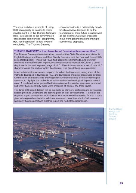
Dartford Road<br />
Bridge over<br />
the River<br />
Thames<br />
© NMR<br />
35