Using Historic Landscape Characterisation
Using Historic Landscape Characterisation
Using Historic Landscape Characterisation

Create successful ePaper yourself
Turn your PDF publications into a flip-book with our unique Google optimized e-Paper software.
Partnership, Learning and Outreach<br />
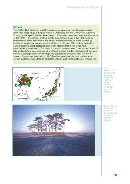
Suffolk<br />
The Suffolk HLC has been used for a number of analyses, including comparative<br />
landscape mapping (e.g. English Nature’s Lifescapes and the Countryside Agency’s<br />
County <strong>Landscape</strong> Character Assessment). It has also been used to examine aspects<br />
of the SMR. For example, plotting Bronze Age barrows against the HLC mapping<br />
revealed that these monuments are almost entirely restricted to areas covered by<br />
heathland, commons, late enclosed heathland or 19th and 20th century plantations.<br />
Further analysis using geological data demonstrated that these areas have<br />
predominantly sandy soils. The close correlation between round barrows and areas of<br />
late enclosure/marginal land may strengthen the claim that the distribution of barrows<br />
reflects a correspondence of geology and detection levels rather than the actual<br />
spread of prehistoric populations. HLC has thus prompted discussion about why<br />
certain landscape types feature particular patterns and concentrations of monuments.<br />
The<br />
distribution of<br />
Bronze Age<br />
barrows<br />
compared<br />
with HLC<br />
types in<br />
Suffolk<br />
© Suffolk<br />
County<br />
Council<br />
Round barrow<br />
known as<br />
Pole Hill,<br />
Foxhall Heath,<br />
© Suffolk<br />
County<br />
Council<br />
45