Teaching Earth Sciences - Earth Science Teachers' Association
Teaching Earth Sciences - Earth Science Teachers' Association
Teaching Earth Sciences - Earth Science Teachers' Association

You also want an ePaper? Increase the reach of your titles
YUMPU automatically turns print PDFs into web optimized ePapers that Google loves.
<strong>Teaching</strong><br />
ISSN 0957-8005<br />
<strong>Earth</strong> <strong><strong>Science</strong>s</strong><br />
Magazine of the <strong>Earth</strong> <strong>Science</strong> Teachers’ <strong>Association</strong><br />
Vol 35 No 1 2010<br />
www.esta-uk.net Registered Charity No. 1005331
<strong>Teaching</strong> <strong>Earth</strong> <strong><strong>Science</strong>s</strong>: Guide for Authors<br />
The TES Editorial Team welcomes original articles on topics related to <strong>Earth</strong> science education, sent to tes.<br />
esta@gmail.com with the author’s full name, title and address and email address.<br />
Copy deadlines:<br />
30 June for September publication and 31 December for March publication<br />
Word length:<br />
Up to approximately 2,500 words<br />
Graphics:<br />
• Please ensure all graphics are of a high resolution (at least 300dpi).<br />
• It is also important to remember that images will be reproduced in black & white, so please<br />
do not send us images where colour is important to it making sense. (For example, there is no<br />
point using a graph with a colour key for a black & white print).<br />
• Please do not use scanned images.<br />
• Please send all graphics as separate files.<br />
• Figures, tables and photographs must be captioned and referenced in the text<br />
Scientific units:<br />
Please use SI units throughout, except where this is inappropriate (in which case please include a<br />
conversion table).<br />
Format:<br />
• Abstract of approximately 100 words (unless the article is a review)<br />
• Appropriate headings to signpost the structure of the article<br />
• References<br />
References:<br />
Please use the Harvard Referencing System. Examples below:<br />
Articles:<br />
Mayer, V. (1995) Using the <strong>Earth</strong> system for integrating the science curriculum. <strong>Science</strong> Education,<br />
79(4), pp. 375-391.<br />
Books:<br />
McPhee, J. (1986) Rising from the Plains. New York: Fraux, Giroux & Strauss.<br />
Copyright:<br />
• There are no copyright restrictions on original material published in <strong>Teaching</strong> <strong>Earth</strong> <strong><strong>Science</strong>s</strong> if<br />
it is required for use in the classroom or lecture room.<br />
• Copyright material reproduced in TES by permission of other publications, rests with the<br />
original publisher.<br />
• Permission must be sought from the Editor to reproduce original material from <strong>Teaching</strong> <strong>Earth</strong><br />
<strong><strong>Science</strong>s</strong> in other publications and appropriate acknowledgement must be given.
Contents<br />
From the Editor<br />
Hazel Clark 2<br />
From the Chair<br />
Niki Whitburn 3<br />
Fred Broadhurst remembered<br />
Derek Brumhead 5<br />
Geology and Society – ESTA Annual Course and<br />
Conference 2010, Leicester<br />
Gawen Jenkin 7<br />
ESTA Conference, Southampton, 2009 9<br />
<strong>Teaching</strong> ideas from the ‘Bring and Share’ at the Post-16 Day, ESTA<br />
Conference, Southampton, 2009 11<br />
Sub-surf Rocks! ESTA at Southampton<br />
Hazel Mather 19<br />
Climate change and sustainable development education through<br />
the lens of Google <strong>Earth</strong><br />
Matthew Chilcott and Simon Haslett 20<br />
Explosive volcanoes and the climate<br />
Morgan Jones 24<br />
Greenhouse to icehouse: Arctic climate change 55-33 million years<br />
ago<br />
Ian Harding 31<br />
Climate change – save the planet<br />
Ros Todhunter 36<br />
The Tomlinson-Brown Trust: supporting the teaching of <strong>Earth</strong><br />
sciences<br />
Tex Wales 38<br />
Can the design and construction of new school and college<br />
buildings be compatible with environmental sustainability?<br />
Maggie Williams 40<br />
Peneplains and plate tectonics<br />
Mark Hayward 43<br />
A Brief History of Oz: an Australian perspective of continental<br />
evolution<br />
Rick Ramsdale 48<br />
Convoluted structural geology<br />
Alan Richardson 52<br />
Somerset <strong>Earth</strong> <strong>Science</strong> Centre opens<br />
Martin Whiteley 56<br />
Reviews 57<br />
Diary dates 67<br />
<strong>Teaching</strong> <strong>Earth</strong> <strong><strong>Science</strong>s</strong><br />
<strong>Teaching</strong> <strong>Earth</strong> <strong><strong>Science</strong>s</strong> is published biannually<br />
by the <strong>Earth</strong> <strong>Science</strong> Teachers’ <strong>Association</strong>.<br />
ESTA aims to encourage and support the<br />
teaching of <strong>Earth</strong> sciences, whether as a single<br />
subject, or as part of science or geography<br />
courses.<br />
Full membership is £32.00; student and retired<br />
membership £16.00.<br />
Registered Charity No. 1005331<br />
Contributions to future issues of <strong>Teaching</strong><br />
<strong>Earth</strong> <strong><strong>Science</strong>s</strong> will be welcomed and should be<br />
addressed to the Editor<br />
Opinions and comments in this issue are<br />
the personal views of the authors and do<br />
not necessarily represent the views of the<br />
<strong>Association</strong><br />
Designed, typeset and printed in the United<br />
Kingdom by Hobbs the Printers Ltd, Totton,<br />
Hampshire, SO40 3WX<br />
Website: www.hobbs.uk.com<br />
Editors<br />
Hazel Clark – Editor<br />
Mick de Pomerai – Copy Editor<br />
Email: tes.esta@gmail.com<br />
Advertising<br />
Jane Hughes (retiring)<br />
Email: tes.esta@gmail.com<br />
Reviews Editor<br />
Pete Loader<br />
Email: peteloader@yahoo.co.uk<br />
Council Officers<br />
Chair<br />
Niki Whitburn<br />
Email: n.w.whitburn@bishop.ac.uk<br />
Chair Designate<br />
Cally Oldershaw<br />
cally.oldershaw@btopenworld.com<br />
Secretary<br />
Ros Todhunter<br />
Email: rostodhunter@aol.com<br />
Membership Secretary<br />
Mike Tuke<br />
Email: miketuke@btinternet.com<br />
Treasurer<br />
Jane Giffould<br />
Email: jgiffould@aol.com<br />
Primary Co-ordinator<br />
Tracy Atkinson<br />
Email: tracy@kinson1.freeserve.co.uk<br />
Secondary Co-ordinator<br />
Chris King<br />
Email: chris@cjhking.plus.com<br />
Higher Education Co-ordinator<br />
Clive Trueman<br />
Email: trueman@noc.soton.ac.uk<br />
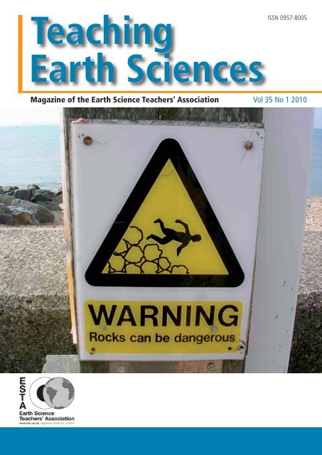
Front Cover:<br />
The danger makes<br />
fieldwork so much more<br />
exciting than sitting in<br />
a nice warm lab! A sign<br />
at Milford-on-Sea taken<br />
on the Conference field<br />
visit to observe the<br />
coastal hazards.<br />
Peter Kennett<br />
peter.kennett@tiscali.co.uk<br />
Do you have a photo for the cover<br />
of our next issue?<br />
If so, please send it in!<br />
www.esta-uk.net Vol 35 No 1 2010 <strong>Teaching</strong> <strong>Earth</strong> <strong><strong>Science</strong>s</strong>
From the Editor<br />
Hazel Clark<br />
I have just returned to work after the Christmas<br />
shut down, and as usual have put on more<br />
clothing to come inside the building! My work<br />
colleagues are laughing, but looking somewhat<br />
enviously at my Steptoe-like mittens and Paddington<br />
Bear style hat!<br />
Following on from the torrential rain during October and<br />
November and associated floods, we are now skating<br />
over the ice in one of the longest cold periods that I can<br />
remember in this part of the country.<br />
Topically, as part of its Year of Environment, Liverpool<br />
has hosted Wild in Art’s Go Penguins http://www.<br />
gopenguins.co.uk/site/ – a Winter’s Trail around the<br />
city that focuses on climate change and provides hints<br />
for ways that we can become greener. As well as the full<br />
sized penguins, there were also schools colonies where<br />
the decoration of each penguin was designed by the<br />
children in association with classroom activities related to<br />
climate change. What a fun way of getting the message<br />
across and it has certainly been enjoyable waddling around<br />
the Trail and interacting with the other people doing the<br />
same thing. Perhaps the most poignant penguin was the<br />
one decorated with two penguins standing on different<br />
ice flows, tears rolling down their faces and the tag line<br />
‘global warming splits up families’. Now the penguins (in<br />
association with the Environment Agency) are advocating<br />
recycling to reduce the impact on landfill sites. They<br />
themselves will be recycled as they are being auctioned off<br />
to raise funds for the Lord Mayor’s charities.<br />
On a more serious note, it is with great sorrow that I<br />
report the loss of Fred Broadhurst and Frank Mosely, both<br />
renowned teachers and communicators, who had long<br />
standing ties with the <strong>Association</strong>. An obituary for Fred has<br />
been included in this issue and I hope to have an obituary<br />
for Frank ready for publication later in the year.<br />
As usual, there is a varied collection of articles for your<br />
edification and delight such as a taster to let you know<br />
what will be happening at the Leicester Conference and<br />
why you will be foolish to miss it! There are several articles<br />
related to the Southampton Conference including the ever<br />
popular ‘Bring and Share’ and an item related to the free<br />
CD (included with this issue) on Sub-surf rocks, plus a bit<br />
of a theme on climate change. Then there is a mixture of<br />
articles covering such diverse areas as building design and<br />
environmental sustainability; peneplains and plate tectonics;<br />
a history of Australia; convoluted structural geology and<br />
ending up in the Somerset <strong>Earth</strong> <strong>Science</strong> Centre.<br />
I have taken the Editorial decision to reintroduce the<br />
geological howlers. I understand that there were some<br />
complaints a few years ago, but I feel that we can all learn<br />
from the misconceptions that are revealed in some of<br />
the howlers. They are also jolly useful for filling in spaces<br />
between articles and I would rather use something that will<br />
make us smile than leave a blank space. I can remember<br />
one of my school friend’s answers in a housecraft exam. The<br />
question was “where is the hottest part of the oven and<br />
why”. Answer “the flame – try putting your finger in it!”<br />
Not quite the answer the teacher was looking for, but valid<br />
none the less. So, please keep sending your howlers in.<br />
As usual, I end with a plea. Your magazine is only as<br />
good as the articles that you supply. Please get fingers to<br />
keyboards and send your work to tes.esta@gmail.com.<br />
I look forward to hearing from you soon.<br />
Hazel Clark<br />
Editor TES<br />
COPY Deadlines<br />
TES 35 2 30 June 2010 for publication in September 2010<br />
TES 36 1 31 December 2010 for publication in March 2011
From the Chair<br />
Niki Whitburn<br />
Welcome to issue one of 2010. It doesn’t seem a<br />
decade since we celebrated the new millennium and<br />
I set off to my first GeoSciEd conference in Sydney.<br />
Little did I realise at the time how differently this<br />
decade might unfold for me, including changes<br />
in direction and involvement, some fascinating<br />
conferences and meeting so many interesting people.<br />
Looking back at my life in the previous century it<br />
looks quite tame, although it didn’t seem so at the<br />
time in a challenging primary classroom.<br />
This time I am writing as gales and floods cover the country.<br />
Living where I do, in a hilly, wooded area, our usual<br />
concerns are the millions of leaves covering the garden<br />
and the hope that all the nearby trees are strong and<br />
healthy, thus not liable to come down. However, these<br />
concerns seem small compared to those of the residents<br />
of Cumbria who have suffered such horrendous flooding,<br />
described as a one in a thousand years event. This leads me<br />
to think of all the geological links to what is happening in<br />
Cumbria. Indeed one of the primary workshops is focussed<br />
around rivers and erosion, and linked to underlying rocks<br />
and soils and drainage. All this will have played a part in<br />
the recent events, together with weather systems and the<br />
water cycle. Indeed the events form an ideal topic for an up<br />
to the minute investigation for schools, which could also<br />
be linked to the human aspect with several cross curricular<br />
links.<br />
Once again we experienced an excellent conference at<br />
Southampton, my personal highlight being the talk by<br />
Iain Stewart where we were treated to extracts from his<br />
next TV programme. It was also interesting to talk to Iain<br />
about how his television work fits around and integrates<br />
with his work at Plymouth University. Our thanks go to<br />
Clive Truman for all his very hard work organising the<br />
event for us, which I know at times was fraught with<br />
problems, particularly when the Oceanography Centre’s<br />
boat, Callista, was not available at fairly short notice.<br />
His problem solving skills were much to the fore here and<br />
resulted in delegates being able to visit the Boat Show as<br />
an added extra. You can read more about conference<br />
within this issue.<br />
I recently met with Gawen Jenkin at Leicester, who is<br />
already well ahead with the plans for conference 2010 the<br />
theme of which is Geology and Society. Changing the Inset<br />
workshops from Friday to Saturday had limited success<br />
at Southampton, however the Primary and Key Stage 3/4<br />
workshops will again be on Saturday at Leicester, with<br />
them forming two of the strands within the programme.<br />
Durham has been booked for 2011, for the first weekend<br />
in July.<br />
During conference we held our AGM at which there<br />
were several retirements and elections. Maggie Williams<br />
retired as Treasurer, having looked after our finances so<br />
well for the last few years. If I needed to know anything<br />
Maggie always had the information at her fingertips and<br />
has guided me through many a puzzling moment. We<br />
owe a great debt of thanks for all she has done, which<br />
has not just involved the treasurer’s role, but many other<br />
aspects as well. In fact we shan’t be losing her as a very<br />
active member as she has taken on the role of Newsletter<br />
Editor together with sponsorship liaison person relating<br />
to our moneys from PESGB. Thank you Maggie for all you<br />
have done and continue to do. Dawn Windley finished her<br />
term as outgoing Chair, my thanks to her for all she did<br />
as Chair and for her advice and help over the past year.<br />
Jane Giffould takes over as Treasurer and Cally Oldershaw,<br />
who was one of the previous editors of TES, has become<br />
Chair Designate. Stephen Davies is now our display boards<br />
manager. He would very much like to know if any of you<br />
are attending any conferences where we are represented<br />
(particularly ASE and the Geographical <strong>Association</strong>) and<br />
could spare an hour to spend with our new improved<br />
display. Jane Ladson is standing down as our Advertising<br />
Officer and to date we still have no one to replace her.<br />
Please consider taking on this important role, which is<br />
quite flexible as far as timing and input. For the future,<br />
Ros Todhunter is standing down as Secretary at the next<br />
AGM (September 2010) so we are looking for someone to<br />
replace her. If you would like any information about the<br />
role please do contact her.<br />
You will by now have received your second issue of ESTA<br />
News, to keep you up to date between magazines. Maggie<br />
www.esta-uk.net Vol 35 No 1 2010 <strong>Teaching</strong> <strong>Earth</strong> <strong><strong>Science</strong>s</strong>
would very much like contributions for future issues,<br />
snippets of news, outlines of courses or events, new<br />
publications, photographs of students at work in the field,<br />
or short items that you would like included. Please send<br />
them to Maggie by 15th May 2010 for publication in June<br />
2010.<br />
Finally, I have recently been contacted by the Managing<br />
Editor of a new European publication – Central European<br />
Journal of Geosciences (CEJG) with an invitation for<br />
members to submit articles for publication. More<br />
information can be found at www.versita.com/science/<br />
geosciences/cejg or e mail the editor Kate Cyran at<br />
kcyran@versita.com. And don’t forget we are always<br />
looking for articles for TES.<br />
Niki Whitburn<br />
ESTA Chair<br />
Stop Press<br />
Elizabeth Devon (a long standing member<br />
of ESTA) has been awarded the Geological<br />
<strong>Association</strong>’s prestigious Halstead Medal.<br />
This medal is awarded for work of<br />
outstanding merit, deemed to further the<br />
objectives of the <strong>Association</strong> and to promote<br />
Geology.<br />
Elizabeth retired from teaching at Stonar<br />
School, Atworth but is still very active in<br />
promoting <strong>Earth</strong> <strong><strong>Science</strong>s</strong> through her<br />
work as a facilitator with the ESEU, ESTA,<br />
<strong>Earth</strong>learningideas and geo-conservation in<br />
Wiltshire.<br />
I am sure that you will all join me in congratulating Elizabeth on this achievement.<br />
Hazel Clark (Editor)<br />
Your journal<br />
needs YOU!<br />
Wanted, enthusiastic person to co-ordinate the adverts<br />
in <strong>Teaching</strong> <strong>Earth</strong> <strong><strong>Science</strong>s</strong>.<br />
To find out what the job entails please contact<br />
Jane Hughes via contact@esta-uk.net<br />
<strong>Teaching</strong> <strong>Earth</strong> <strong><strong>Science</strong>s</strong> Vol 35 No 1 2010 www.esta-uk.net
Fred Broadhurst remembered<br />
5 February 1928 – 1 October 2009<br />
Frederick Munro Broadhurst, always known as Fred,<br />
was born in Withington, Manchester, the only child of<br />
parents May and Fred. Fred spent his childhood and<br />
early adulthood in Burnage where he attended the<br />
local primary school, known as The Acacias and later<br />
in 1939, the William Hulme School.<br />
In 1946, at the age of 18, Fred volunteered to become<br />
a ‘Bevin Boy’ at Bradford Colliery in east Manchester.<br />
Working underground, managing the coal trucks<br />
transporting the coal to the surface, inspired his love of<br />
geology (especially the Coal Measures). He decided to<br />
further his education and (whilst working down the pit)<br />
attended day release and night school classes at Stockport<br />
College, studying science subjects to enable him to gain<br />
entry to university. In 1948, with the help of the exserviceman’s<br />
grant, he left the pit to study Geology at<br />
Manchester University<br />
Fred graduated in 1951 with a First Class Honours degree.<br />
He became an Assistant Lecturer, then soon afterwards a<br />
Lecturer, going on to gain his M.Sc. in 1953 and his Ph.D.<br />
in 1956. Subsequently he became a Senior Lecturer, and a<br />
supervisor for twenty PhD students.<br />
One highlight of Fred’s career was the discovery in 1960 of<br />
the near-complete skeleton of a 14 foot (4.3m) Plesiosaur.<br />
The remains were found in the Alum Shales of the Upper<br />
Lias at Ravenscar on a University field trip and caused<br />
great excitement at the time. Later, Fred returned with<br />
his students and spent ten days excavating the reptile.<br />
For many years it was displayed in a large purpose-built<br />
showcase outside the Geology Departmental library (1970-<br />
90) and is now in the Manchester Museum.<br />
Over thirty years ago I arranged for Fred’s rough sketch<br />
of the plesiosaur (with baby added!) to be used on the<br />
Manchester Geological <strong>Association</strong> membership card. It is<br />
now the <strong>Association</strong>’s logo. At the time many knew of the<br />
logo’s origin although unfortunately no official note was<br />
made.<br />
One of Fred’s many contributions was the creation of an<br />
extraordinary network of links between adult education<br />
classes, higher education, university research and a range<br />
of communities throughout northwest England. Hundreds,<br />
if not thousands, of people all over the region knew Fred<br />
from his wonderful Workers’ Educational <strong>Association</strong><br />
(WEA), Manchester University Extra-Mural (later CCE) and<br />
Wimslow Guild classes, day courses, field excursions and<br />
visits abroad. You could not meet any person interested<br />
in geology who did not know Fred. His passing leaves a<br />
gap that will never be filled. He made science in general<br />
and geology in particular both interesting and accessible.<br />
The success of his teaching was a result of his boundless<br />
enthusiasm for his subject, plus his patience and courtesy<br />
in dealing with everyone he met. He had the gift of making<br />
those with little knowledge of the subject feel just as<br />
important as the knowledgeable ones, and nobody ever<br />
felt left out. I spent most of my career in adult education<br />
and I can say that Fred was the greatest adult educator I<br />
have ever met. I have never known a person so universally<br />
appreciated and admired. So, how appropriate that, in<br />
2000, he should receive a national award as Adult Tutor of<br />
the Year in North West England at the Millennium Dome in<br />
London.<br />
Fred also contributed greatly to the summer school held<br />
at Bangor University which was held jointly by the WEA<br />
and the Extra-Mural Department each year. Ian Foster and<br />
www.esta-uk.net Vol 35 No 1 2010 <strong>Teaching</strong> <strong>Earth</strong> <strong><strong>Science</strong>s</strong>
Fred worked together to deliver a weekend course there as<br />
recently as 1996, combining their specialities as ‘Rocks and<br />
Rails’.<br />
In 1990, Fred retired from Manchester University to<br />
concentrate on his work with the WEA and CCE, lecturing<br />
at many day/evening classes and organizing foreign<br />
geological trips with the Wilmslow Guild. With Paul Selden,<br />
he was leader and field guide author for visits to places as<br />
far apart as Norway, the western USA and New Zealand.<br />
The work involved in the academic preparation and<br />
infrastructure of each course was immense, but the huge<br />
ability and attention to detail of both Fred and Paul ensured<br />
some memorable trips.<br />
Fred published over 50 articles, often in association with<br />
other eminent geologists, in journals of international<br />
repute. In 1982, he was awarded the prestigious John<br />
Phillips Medal of Yorkshire Geological Society for major<br />
contributions to our knowledge of the geology of<br />
Northern England, and later was awarded the Silver Medal<br />
of Liverpool Geological Society. Despite his academic<br />
eminence, it was very easy to discuss any aspect of the<br />
subject with him. In recent years his more general writing<br />
brought geology to the attention of the public – the<br />
popular 2001 book Rocky Rambles in the Peak District<br />
(which shows his skill as an illustrator), the Guide to the<br />
building stones of the Trafford Centre, and the recent<br />
superb revision in 2008 of the Guide to the building stones<br />
of Central Manchester (with Morven Simpson). This last<br />
book, first published in 1975, was a pioneer in opening<br />
a new field in the teaching of geology, and over the next<br />
few years a plethora of town and city guides for the UK<br />
appeared. The work involved in researching these guides<br />
shows Fred at his best (along with Morven) – tracking down<br />
architects and stone masons and discovering the names<br />
of the often unusual rock types. Such work could involve<br />
delicate negotiation (e.g. arranging with management for<br />
students to be allowed to crawl around the floors of the<br />
Trafford Centre!) something that Fred was excellent at.<br />
I first met Fred forty years ago leading a geological trail<br />
walk in Lyme Park. Over the succeeding years we met many<br />
times and I benefited so much from his knowledge and<br />
expertise imparted with much generosity; always up to<br />
date, of course, with the latest developments and theories,<br />
and this continued into his ‘retirement’. The last walk<br />
that I went with him was with the MGA group at Styal in<br />
July 2009. It lasted an hour and a half, with Fred going at<br />
his usual 150mph. At the end when we were all looking<br />
forward to a cup of tea, Fred said he must be off to take a<br />
second group around. What more can one say?<br />
He had a lovely sense of humour. My favourite example<br />
was when we were in Dublin, thirty years ago, with the<br />
Palaeontological <strong>Association</strong>. We came across a bus stop<br />
sign which said – ‘The following buses do not stop here’.<br />
We both fell about laughing and each took a photograph.<br />
No doubt his will still be there among the many thousand<br />
others. What a treasure trove there must be amongst<br />
those?<br />
It’s only a few months ago since we were emailing each<br />
other about re-arranging his talk to the New Mills Local<br />
History Society (‘New Mills 300 million years ago’!) and<br />
getting down to finishing a trail on the Torrs gorge. It<br />
is shocking that such a seemingly indestructible person<br />
should be taken so quickly in this way. When we lose<br />
someone like Fred, it reminds us all of our own mortality.<br />
Despite his enormous commitments, Fred was a wonderful<br />
family man. Having met Rosemary at a University Union<br />
dance, they married in 1958, and had two children Andy<br />
and Caroline. Now, there are also four grandchildren.<br />
Fred took great delight in his children and grandchildren<br />
and had a fantastic relationship with them. His love of<br />
mountains and walking in the Peak District was passed on<br />
to the family and the walks continued until summer of this<br />
year when Fred started to feel poorly.<br />
At the beautifully simple funeral ceremony, his<br />
grandchildren each gave a moving appreciation of their<br />
‘inspirational’ grandfather. His presence will be missed but<br />
the ‘Fred Effect’ will pass on for generations to come.<br />
Derek Brumhead<br />
Manchester Geological <strong>Association</strong><br />
DDB@tesco.net<br />
<strong>Teaching</strong> <strong>Earth</strong> <strong><strong>Science</strong>s</strong> Vol 35 No 1 2010 www.esta-uk.net
Geology and Society –<br />
ESTA Annual Course and Conference,<br />
Leicester 2010<br />
A wet, grey Wednesday afternoon in December. The<br />
Copenhagen summit looks likely to end in deadlock,<br />
or worse an impotent compromise, and I’m still<br />
thinking about Attenborough’s Horizon programme<br />
last week on world population. Is it our fault the state<br />
that the planet is in? After all, geologists found all<br />
the hydrocarbons and made it possible to combust<br />
them in such quantities! And we sustained economic<br />
and population growth by meeting the challenge of<br />
providing more, and cheaper, natural resources – from<br />
copper to extend electricity supply, tantalum for every<br />
mobile phone, to cement and bricks for new houses!<br />
Or, were geologists just responding to the needs of<br />
society? And in fact are we not the potential saviours<br />
of humanity – heroes that told everyone that climate<br />
change was possible – and, furthermore, can actually<br />
do something about it (with carbon sequestration,<br />
and more controversially nuclear energy)? May you<br />
live in interesting times…!<br />
such as methane hydrates will all be explained by experts in<br />
the field.<br />
Perhaps the future of the human race lies in the stars<br />
– or at least nearby planets – so we will have planetary<br />
geologists talking about recent research on the geology of<br />
Mars. The practical application of geology, in a more down<br />
to <strong>Earth</strong> sense – solving crime – will be examined by two<br />
keynote speakers on forensic geology. Dr Laurance Donnelly<br />
(Wardell-Armstrong) is a geologist who has collaborated<br />
with a number of police forces in their investigations,<br />
and for 11 years, has applied geological capabilities and<br />
expertise to search for buried murder victims. Dr Jane<br />
Evans, (Head of <strong>Science</strong>-based Archaeology, NERC Isotope<br />
Geosciences Laboratory) will show how an understanding<br />
of bedrock geology, and its isotopic composition, can<br />
The manifold interactions of the geology of spaceship<br />
<strong>Earth</strong> with the people who live on it are explored in the<br />
theme of this year’s ESTA annual conference at Leicester:<br />
‘Geology and Society’. It is after all the human-angle that<br />
really engages many of our students – ‘Will that volcano<br />
erupt? Can we safely build there? Can we provide water<br />
for this village?’ This theme we hope embodies many of<br />
the forward-looking (and ultimately optimistic!) areas of<br />
applied research taking place in the Leicester department,<br />
whilst not neglecting more traditional geology.<br />
Whilst details of the programme are still being arranged,<br />
here is a taster of what we plan to offer:<br />
Dr Jan Zalasiewicz, author of ‘The <strong>Earth</strong> After Us’, will<br />
discuss whether, as a result of the effects of human<br />
activity on the global environment, we are entering a new<br />
Geological Era – the Anthropocene. Complementing this,<br />
Prof. Mike Petterson will discuss sustainable development<br />
and how geology can be a force for good in delivering<br />
economic benefits to developing countries. Examining<br />
carbon in particular, the carbon cycle, recent climate<br />
change, geological carbon sequestration and novel fuels<br />
The National Space Centre, Leicester. © Leicester Shire Promotions Ltd.<br />
www.esta-uk.net Vol 35 No 1 2010 <strong>Teaching</strong> <strong>Earth</strong> <strong><strong>Science</strong>s</strong>
Jane – a 6.4 metres long sub-adult Tyrannosaurus rex skeleton, part of the Flying<br />
Dinosaurs and origin of birds display in the Leicester Geology Department.<br />
Photography by Design Services, ©University of Leicester.<br />
be used to trace the origins and migration of human<br />
communities – as well as modern murder victims.<br />
Of course geology is not just of practical use;<br />
comprehending the vastness of <strong>Earth</strong> history gives us<br />
geologists a unique perspective on how we relate to the<br />
planet and the incredible story of the evolution of life.<br />
To remind us of the beauty and grandeur of life on <strong>Earth</strong><br />
Prof. David Siveter will present a special evening lecture<br />
on exceptionally preserved fossils including the ornate<br />
3-dimensionally-preserved species from the Herefordshire<br />
Lagerstätte.<br />
Talks will form just part of the conference, with plenty of<br />
opportunities for hands-on action in workshops, INSET<br />
courses (for Primary, KS3/4, Post-16 and HE), and fieldwork<br />
on the Sunday. Workshop subjects planned include remote<br />
sensing and GIS, comets and meteorites, reconstructing<br />
diet from vertebrate skulls, and ocean drilling – to name<br />
just a few! Field trip options are planned to include<br />
Charnwood Forest – home to Charnia – the oldest<br />
macrofossils in the UK, the fossil-packed Jurassic rocks to<br />
the east, hands-on shallow geophysics, a visit to a major<br />
quarry operation, or a tour of rock sculptures (geology and<br />
art!) in the beautiful university Botanic Gardens.<br />
Tungsten carbide drill head – entrance foyer, Leicester Geology Department.<br />
Photography by Design Services, ©University of Leicester.<br />
And if all that isn’t enough to whet your appetite there will<br />
be plenty of opportunities to socialise, both day and night.<br />
We are currently seeking generous sponsorship of the<br />
conference from industry and are delighted to announce<br />
that we plan to hold the conference dinner at the award<br />
winning National Space Centre visitor and educational<br />
centre. As well as a dinner within the Planets gallery,<br />
the evening will include a drinks reception in the Rocket<br />
Tower, space simulator rides, a 360° film show in the Space<br />
Theatre and free access to all the galleries including the<br />
<strong>Earth</strong> from Space, the Planets, and Exploring the Universe.<br />
From the mantle to outer space, from the first fossils to the<br />
Anthropocene – we hope ESTA 2010 will have something<br />
for everyone!<br />
Dr Gawen Jenkin<br />
Department of Geology, University of Leicester.<br />
The ESTA Annual Course and Conference will be<br />
hosted by the University of Leicester on the 17th-<br />
19th September 2010. Leicester is centrally located in<br />
the UK and easily reached by train, bus, road and air.<br />
The Geology Department is home to a pet dinosaur<br />
called Jane. Further details of the conference will<br />
be posted on the ESTA website http://www.estauk.net/leicester%20conference.html<br />
or for further<br />
information contact Gawen Jenkin,<br />
geology@le.ac.uk.<br />
"Pillow lavas were formed when the shelly<br />
limestone hardened"<br />
<strong>Teaching</strong> <strong>Earth</strong> <strong><strong>Science</strong>s</strong> Vol 35 No 1 2010 www.esta-uk.net
ESTA Conference,<br />
Southampton 2009<br />
Photos by Peter Kennett<br />
Figure 1 The R.V.Bill Conway is dwarfed by the cruise liner moored nearby<br />
Figure 4 Marine organisms in very smelly mud<br />
Figure 2 Dredging in the Southampton Water<br />
Figure 5 A strict dress code is required in the halls of residence<br />
Figure 3 Investigating the contents of the dredge<br />
Figure 6 Ian West describes the coastal processes around Milford-on-Sea<br />
www.esta-uk.net Vol 35 No 1 2010 <strong>Teaching</strong> <strong>Earth</strong> <strong><strong>Science</strong>s</strong>
Figure 7 Ros Todhunter makes presentation to Clive Trueman at the celebration dinner for organising such a splendid conference<br />
Figure 8 Cliff erosion at Barton-on-Sea<br />
Figure 9 Intrepid geologists face danger in search of answers<br />
10 <strong>Teaching</strong> <strong>Earth</strong> <strong><strong>Science</strong>s</strong> Vol 35 No 1 2010 www.esta-uk.net
<strong>Teaching</strong> Ideas from the ‘Bring and<br />
Share’ at the Post-16 Day, ESTA<br />
Conference, Southampton, 2009<br />
The ‘Bring and Share’ session at the ESTA Conference in Southampton in 2009 was as well supported and popular<br />
as ever, with many splendid contributions. We are very grateful for all the contributions and particularly to those<br />
people willing to ‘go the extra mile’ of writing them up (shown by asterisks). They were wide-ranging, thoughtful<br />
and fun. Read on to find out more.<br />
• *Paul Grant ‘A tea towel Isle of Wight monocline’<br />
• Dave Rowley, Wells Cathedral School, Wells: ‘Reading list’<br />
• *Chris Bedford, Radley College, Abingdon: ‘Radiometric dating made simple’<br />
• *Peter Kennett, Chris King and Elizabeth Devon ‘<strong>Earth</strong>learningidea – one year on’<br />
• **Elizabeth Devon: ‘Impact calculator’ and ‘Make your own spectroscope’<br />
• Mike Tuke, ESTA: ‘Faulting and outcrop patterns’<br />
• ***Pete Loader, St Bedes College, Manchester: ‘Stable slopes – another angle’, ‘Death assemblages in a<br />
nutshell’ and ‘A chip off the old block – in 3D’<br />
• Dawn Windley, Thomas Rotherham College, Rotherham: ‘Geological Family Fortunes’<br />
• *Dave Turner, Matlock High School: ‘Papier-mâché palaeo’<br />
• Abigail Brown, Hagley Catholic High School, Hagley: ‘Drag and drop’<br />
• Rebecca Gould, Scarborough Sixth Form College: ‘What do you want?’<br />
• *William Lynn and Nichole Sloan, Oakgrove College: ‘Fossil revision cards – updated’<br />
• *The Geological Society: ‘Speakers list’<br />
• *Chris King, Keele University: ‘New GCSE geology textbook, The planet we live on – the beginnings of the<br />
<strong>Earth</strong> <strong><strong>Science</strong>s</strong>’<br />
Could the post-16 ‘bring and share at Leicester 2010 be even better than this? Do come and find out, and please bring your<br />
own ‘bring and share’ ideas. With your contributions, another dynamic and uplifting session is in prospect.<br />
Chris King.<br />
www.esta-uk.net Vol 35 No 1 2010 <strong>Teaching</strong> <strong>Earth</strong> <strong><strong>Science</strong>s</strong> 11
Idea Title:<br />
Presenter:<br />
Brief description:<br />
A tea towel Isle of Wight monocline<br />
Paul Grant, ESEU Facilitator, eseu@keele.ac.uk<br />
A table cloth or carpet is commonly used to illustrate how horizontal compression causes folding, at a<br />
range of educational levels. This demonstrates fold shortening of the <strong>Earth</strong>’s crust.<br />
However, if a pre-existing weakness occurs, deformational strain may well be concentrated along<br />
these weaknesses, and this can also be demonstrated using a tea towel instead of the table cloth /<br />
carpet. The line of weakness is induced by ironing a sharp crease into the tea towel.<br />
Put the tea towel onto a table top with the ironed crease facing downwards, then ‘compress’ the tea<br />
towel to produce marginal folds (equivalent to the Alps – see below) and, at a distance a fold – which<br />
may be geometrically equivalent to the Isle of Wight monocline (see photos).<br />
A good example of this style of deformation is the Wessex-Weald sedimentary basins, which were<br />
formed as a consequence of crustal thinning generating normal fault zones with an approximately<br />
E-W strike. These are the zones of weakness. Alpine compression as a result of the collision of Africa<br />
and Europe caused intense deformation at the plate margins, but strain was also transmitted long<br />
distances across Europe resulting in the open fold of the Weald and Thames Basin. The zones of<br />
concentrated deformation are exemplified by the Isle of Wight Monoclinal system, formed as shown<br />
in the photographs. See, Hillis R.R. et al (2008) Cenozoic exhumation of the southern British Isles.<br />
Geology 36, 371-374 for a more detailed explanation.<br />
The tea towel before deformation<br />
by stresses from left and right<br />
The ‘Isle of Wight Monocline’<br />
formed between ‘Europe’ and ‘Africa’<br />
If the tea towel is placed with the ironed crease facing upwards, then ‘compressing’ the tea towel<br />
produces marginal folds again and, at a distance, a sharp up-lift – comparable to the structures above<br />
blind thrusts.<br />
Age range:<br />
Apparatus/<br />
materials needed:<br />
KS4 and older<br />
Tea towel<br />
12 <strong>Teaching</strong> <strong>Earth</strong> <strong><strong>Science</strong>s</strong> Vol 35 No 1 2010 www.esta-uk.net
Idea Title:<br />
Presenter:<br />
Brief description:<br />
Radiometric dating made simple<br />
Chris Bedford, Radley College, OX14 2HR, cmb@radley.org.uk<br />
Different coloured chocolates (see apparatus list) are used to show the following:<br />
• changing parent:daughter ratios as radioactive decay proceeds<br />
• effect of loss or gain of daughter or parent isotope and potential errors caused<br />
Age range: 16+<br />
Start with (say) sixteen chocolates of one colour – this represents the number of parent atoms at time<br />
zero. One by one, replace with different coloured chocolates (daughter atoms) until half of the original<br />
number have been replaced. One half-life has now passed. Continue for another two or three<br />
half-lives. Discuss the changing ratio of parent to daughter atoms as decay proceeds. One could start<br />
again with a different number of parent atoms (chocolates) to show that it is the parent:daughter<br />
ratio that is important, not the original number of atoms.<br />
Now investigate the possible errors caused by loss or gain of parent or daughter chocolates. The most<br />
obvious is to remove (eat) some or all of the daughter chocolates (eg. loss of daughter argon due<br />
to weathering or metamorphism) after some have had time to accumulate. Discuss the new parent:<br />
daughter ratio and what the age appears to be. Various other scenarios can also be modelled, e.g.<br />
daughter chocolates present to begin with (presence of non-radiogenic daughter atoms in the rock),<br />
addition of parent chocolates during decay (hydrothermal addition of parent potassium), etc.<br />
Apparatus/<br />
materials needed:<br />
One packet of Milkybar moments (white)<br />
One packet of Galaxy Minstrels (brown)<br />
(though any sweets of two different colours are of course possible)<br />
Idea Title:<br />
Presenter:<br />
Brief description:<br />
Age range:<br />
Apparatus/<br />
materials needed:<br />
New GCSE geology book, ‘The planet we live on – the beginnings of the <strong>Earth</strong> sciences’<br />
from: http://www.learndev.org/<strong>Science</strong>WorkBooks.html<br />
Chris King, Keele University, chris@cjhking.plus.com<br />
A new geology textbook is available free online from the web address above. It is Book six in the<br />
‘Basic books in science’ series, written particularly for students in developing countries who have no<br />
access to printed materials. It has been written to the new GCSE Geology specification (WJEC), to<br />
double as a GCSE geology textbook, with the same format as the geology specification of:<br />
• Reading rock exposures: how rock exposures contain evidence of how they were formed and<br />
subsequently deformed<br />
• Reading landscapes: how landscapes contain evidence of the relationship between past and present<br />
processes and the underlying geology<br />
• Understanding the ‘big ideas’: major concepts that underpin our current understanding of the<br />
<strong>Earth</strong><br />
• Fitting the major geological events that have affected the <strong>Earth</strong> into a timeline<br />
• Understanding the importance of current geological events, as commonly reported in the media<br />
• Understanding what geologists do: how geologists use investigational skills in their work today<br />
14 upwards<br />
The downloaded pdf file of the book from the website<br />
www.esta-uk.net Vol 35 No 1 2010 <strong>Teaching</strong> <strong>Earth</strong> <strong><strong>Science</strong>s</strong> 13
Idea Title:<br />
Presenter:<br />
Brief description:<br />
<strong>Earth</strong>learningidea one year on<br />
Peter Kennett, Chris King and Elizabeth Devon, <strong>Earth</strong>learningidea, info@earthlearningidea.com<br />
http://www.earthlearningidea.com is a voluntary website, which is continuing to provide simple<br />
ideas for <strong>Earth</strong> science teaching with limited equipment, and which has now reached over 145 countries.<br />
The following activities from the website were demonstrated:<br />
Craters on the Moon – why are the Moon’s craters such different shapes and sizes?<br />
Darwin’s big coral atoll idea – try thinking like Darwin did to solve the coral atoll mystery.<br />
The format of the activities was shown through a live web link, and exemplified by the activity:<br />
Trail-making – make your own “fossil” animal trails, featuring an ESTA member in a compromising<br />
position!<br />
Age range:<br />
Apparatus/<br />
materials needed:<br />
Top Primary to Secondary<br />
a) sand tray, cocoa powder, sifter, ball bearings of various sizes, ruler or tape measure, catapult (optional!).<br />
b) simple model – two sheets of A4 paper and some sticky tape: deluxe model – fabric, wire, needle<br />
and thread, small fish tank, water<br />
c) access to data projector with live web link.<br />
Idea Title:<br />
Presenter:<br />
Brief description:<br />
Impact calculator, found at: http://down2earth.eu/impact_calculator<br />
Elizabeth Devon, <strong>Earth</strong>learningidea, info@earthlearningidea.com<br />
Choose asteroid diameter, trajectory angle, object velocity, projectile density, target density and then<br />
choose your target. You can see the crater size, crater depth and assess impact energy data.<br />
Age range: 10 – 100<br />
Apparatus/<br />
materials needed:<br />
Access to the internet<br />
Idea Title:<br />
Presenter:<br />
Brief description:<br />
Age range:<br />
Apparatus/<br />
materials needed:<br />
Make your own spectroscope, as shown at: http://www.cs.cmu.edu/~zhuxj/astro/<br />
html/spectrometer.html<br />
Elizabeth Devon, <strong>Earth</strong>learningidea, info@earthlearningidea.com<br />
Using a cardboard cut-out and a small piece from an old CD, pupils can make their own spectroscopes<br />
10 – 14 years<br />
Cardboard cereal box<br />
Old CD<br />
14 <strong>Teaching</strong> <strong>Earth</strong> <strong><strong>Science</strong>s</strong> Vol 35 No 1 2010 www.esta-uk.net
Idea Title:<br />
Presenter:<br />
Brief description:<br />
Stable slopes – another angle<br />
Pete Loader, St Bedes College, Manchester, peteloader@yahoo.co.uk<br />
An old, clear plastic CD case with the internal moulding removed is marked on the outside with a<br />
selection of appropriate slope angles (e.g. 30˚, 40˚, 60˚ etc) with a permanent marker pen. The empty<br />
CD case is part-filled (trial and error) with dry sand. Children’s “playsand” works well but can be<br />
adapted to investigate stable slope angles in other fine materials (shape, size sorting of grains). The<br />
CD is tilted to the vertical and the sand finds its own stable angle (~32˚). This is useful in the classroom<br />
and in the field for demonstration<br />
<br />
The CD case before tilting …<br />
…. and after<br />
Age range:<br />
Apparatus/<br />
materials needed:<br />
All<br />
An empty clear CD case with inner moulding removed.<br />
Dry sand (Children’s play sand is good)<br />
Sellotape and/or sealer<br />
Permanent marker pen for writing on plastic case.<br />
Idea Title:<br />
Presenter:<br />
Brief description:<br />
Age range:<br />
Apparatus/<br />
materials needed:<br />
Papier-mâché palaeo<br />
Dave Turner, Highfields School, Matlock.<br />
Dave showed how his students had made mega models of macro fossils as teaching aids using the<br />
resources of his friendly school art department.<br />
Any<br />
Chicken wire<br />
PVA or cellulose glue<br />
Newspaper<br />
Paint<br />
www.esta-uk.net Vol 35 No 1 2010 <strong>Teaching</strong> <strong>Earth</strong> <strong><strong>Science</strong>s</strong> 15
Idea Title:<br />
Presenter:<br />
Brief description:<br />
Death Assemblages – in a nutshell<br />
Pete Loader, St Bedes College, Manchester, peteloader@yahoo.co.uk<br />
The shells of pistachio nuts are used as an analogue for bivalve shells. When randomly dropped into<br />
a bowl of water they nearly always orientate with the concave part of the shell facing upwards (the<br />
shell providing least resistance to the water in this direction (see photo). When the water is then<br />
stirred the shells generally flip over to show a typical transported “death” assemblage identified in<br />
some shelly limestones. This works well as a laboratory coursework investigation and simple statistics<br />
can be easily obtained by counting with the significance of the results evaluated against probability.<br />
This works well if around 25 shells are used in a standard kitchen mixing bowl (or equivalent). If more<br />
are used (greater density) the shells often interfere with each other and form an imbrication also seen<br />
in some limestones (photo).<br />
Nutshell ‘bivalves’ after dropping into water<br />
‘Imbricated’ nutshell ‘bivalves’<br />
Age range:<br />
Apparatus/<br />
materials needed:<br />
All<br />
A bag of pistachio nuts<br />
Bowl (or equivalent)<br />
Water<br />
A good film to watch whilst shelling (and eating) the nuts<br />
Idea Title:<br />
Presenters:<br />
Brief description:<br />
Age range:<br />
Apparatus/<br />
materials needed:<br />
Fossil revision cards – updated<br />
William Lynn, Foyle and Londonderry College, and Nicole Sloane, Oakgrove Integrated College,<br />
Northern Ireland, roc_chic_nic@hotmail.com<br />
This unique collection of 24 A6 revision cards for the four AS and A2 modules has been updated.<br />
It describes the morphology, evolutionary changes, description and function of body parts for the<br />
main invertebrate fossil groups and plants including Ammonites; Belemnites; Bivalves; Brachiopods;<br />
Crinoids; Corals; Echinoids, Gastropods; Graptolites; Trilobites. Many schools are currently using sets<br />
of these purchased for their students and are finding them invaluable.<br />
A-Level<br />
None – other than the cards. Please contact the authors for more details.<br />
16 <strong>Teaching</strong> <strong>Earth</strong> <strong><strong>Science</strong>s</strong> Vol 35 No 1 2010 www.esta-uk.net
Idea Title:<br />
Presenter:<br />
Brief description:<br />
A chip off the old block – in 3D, from http://geology.isu.edu/topo/blocks/<br />
Pete Loader, St Bedes College, Manchester, peteloader@yahoo.co.uk<br />
This is an excellent website and a must for all attempting to show geological mapwork structures in<br />
3D. GeoBlocks 3D contains interactive QuickTime Virtual Reality (QTVR) movies exploring the three-dimensional<br />
nature of geology, specifically geologic structures within blocks. It was created by Stephen<br />
J. Reynolds, Debra E. Leedy, and Julia K. Johnson, Arizona State University. You can rotate the blocks,<br />
make them partially transparent to view their internal structure, cut through or erode them, displace<br />
faults, and more. It is excellent and it also comes with downloadable exercises and worksheets!<br />
Example: Transparent folds and faults<br />
Worksheet example<br />
Age range:<br />
Apparatus/<br />
materials needed:<br />
All – particularly GCSE to A2<br />
Computer<br />
Web address – http://geology.isu.edu/topo/blocks/<br />
Idea Title:<br />
Speakers list from: http://www.geolsoc.org.uk/gsl/education/schools/page5537.html<br />
Presenter:<br />
Brief description:<br />
Age range:<br />
Apparatus/<br />
materials needed:<br />
The Geological Society<br />
The Society publishes a list of speakers willing and keen to visit local schools to make presentations to<br />
students about geology on a range of topics. The seven page list can be downloaded from the web<br />
address above.<br />
14 upwards<br />
The list from the web address above<br />
www.esta-uk.net Vol 35 No 1 2010 <strong>Teaching</strong> <strong>Earth</strong> <strong><strong>Science</strong>s</strong> 17
18 <strong>Teaching</strong> <strong>Earth</strong> <strong><strong>Science</strong>s</strong> Vol 35 No 1 2010 www.esta-uk.net
Sub-surf Rocks! ESTA at Southampton<br />
Hazel Mather<br />
Sub-surf Rocks! is a new, free online resource aimed at<br />
enhancing A-level geology teaching using seismic data.<br />
It was produced by the charity UKOGL (UK Onshore<br />
Geophysical Library) using datasets from its public<br />
domain UK onshore seismic data archive. The website<br />
www.sub-surfrocks.co.uk has been loaded to CD-<br />
ROM and a copy is included with this issue of TES.<br />
The resource was developed with help from members<br />
of ESTA and is designed to relate to A-level geology<br />
teaching requirements. At the launch in Southampton,<br />
delegates were given a brief tour of the website which<br />
supplies information in short sections and uses audio-visual<br />
presentations and animations. Topics include:- background<br />
information on seismic exploration; how seismic data<br />
are acquired; how to interpret seismic data; a glossary of<br />
keywords used in the text; some embedded mathematics<br />
and a quiz. A case study of the hydrocarbon-producing<br />
Weald Basin contains a ready-to-use student exercise and<br />
features a 3-D model provided by the British Geological<br />
Survey illustrating the relationships between the solid<br />
geology, geological cross-section and seismic data.<br />
Those at the session were then let loose with coloured<br />
pencils and a copy of the seismic line (downloadable as A3<br />
or A4 colour or greyscale printable files from the CD<br />
or website) and invited to ‘find the oil’ for themselves.<br />
The exercise requires the interpretation of three horizons<br />
and the picking of several faults. Many delegates<br />
commented on the excellent quality of the data<br />
which clearly depicts the structural features. There is<br />
a stratigraphical column to complete and questions<br />
encouraging students to identify source, reservoir and<br />
cap rocks before finally picking a location to drill.<br />
A PowerPoint presentation with ‘the answer’ finished<br />
off the session, although as is often the case with<br />
interpretation, there may not be a definitive answer<br />
giving scope for interesting extension activities.<br />
UKOGL has also made available PDF images of all the<br />
seismic lines in its library. Seismic coverage of the UK is<br />
pretty good and so it may be possible for you to download<br />
an image of subsurface under your school or town. See<br />
the UKOGL website at www.ukogl.org.uk for free<br />
downloads.<br />
Finally I apologise for the title, it was irresistible!<br />
Hazel Mather<br />
pink.house@virgin.net<br />
'technology and transport has improved so<br />
much in recent years that the coal mines are<br />
now located away from the coalfields'<br />
www.esta-uk.net Vol 35 No 1 2010 <strong>Teaching</strong> <strong>Earth</strong> <strong><strong>Science</strong>s</strong> 19
Climate change and sustainable<br />
development education through the<br />
lens of Google <strong>Earth</strong><br />
Matthew Chilcott and Simon K. Haslett<br />
Abstract<br />
Climate change impacts and sustainable development<br />
issues span many spaces and scales, from individual<br />
homes through to local communities, regions, nations<br />
and beyond, but requiring of students to appreciate<br />
these diverse contexts is challenging. Google <strong>Earth</strong><br />
is a software package that may be downloaded free<br />
of charge from the internet and provides continuous<br />
global satellite imagery. It has the potential to<br />
offer opportunities for educators to embed world<br />
sustainability themes within the curricula of almost<br />
any subject. The Sands of Time – A Google <strong>Earth</strong><br />
Approach to Climate Change Education e-publication<br />
provides a case study that employs Google <strong>Earth</strong> in<br />
examining climate change impacts and sustainable<br />
development issues in North Africa. This article shows<br />
how educators can make use of the same tool in<br />
engaging students with digital technology in climate<br />
change and sustainable development education.<br />
Introduction<br />
Google <strong>Earth</strong> offers educators and the public a new<br />
and engaging method of exploring and learning about<br />
the World. It is a virtual globe, map and a Geographical<br />
Information System (GIS). It maps the earth by the<br />
superimposition of images obtained from satellite imagery,<br />
aerial photography and GIS 3D globe. It has proved<br />
popular as a tool, with its easy to use simple navigation<br />
features, and the ability to integrate other forms of internet<br />
published content such as photographs from Panoramio<br />
and video sequences from Youtube. As a consequence of<br />
its widespread use, Google <strong>Earth</strong> offers the opportunity<br />
for knowledge transfer and inclusion of the World’s<br />
community in exploring climate change through a visually<br />
stimulating and interactive medium. The potential for its<br />
use across curriculum areas may yet to be fully utilised<br />
and as educators seek engaging ways of offering students<br />
increased levels of technology enhanced learning it is<br />
possible to predict its increasing use across disciplines.<br />
Academic research that employs Google <strong>Earth</strong> spans a<br />
number of disciplines, including archaeology, biodiversity,<br />
earth sciences, geography, health, planning, tourism, urban<br />
development and water technology. Although Google <strong>Earth</strong><br />
launched its Outreach programme in 2007, its use in Higher<br />
Education (HE) as a learning resource to support global<br />
issues education has not been extensively documented in<br />
the literature, but is beginning to be evaluated in the earth<br />
sciences (e.g. Haslett, 2009a; Thorndycraft et al., 2009).<br />
The functionality of Google <strong>Earth</strong> has enabled the<br />
development of large budget digital media productions<br />
that utilise Google <strong>Earth</strong>’s integrated application layers to<br />
tell stories and reveal the human impact on the landscape.<br />
These developments help contextualize climate change<br />
issues for global audiences and seek to widen access and<br />
participation of the world’s citizens in contributing to<br />
reducing carbon emissions. These are excellent resources<br />
that seek to engage with a broad breadth of users and<br />
delivery contexts from the public, policy makers, scientists<br />
to the classroom. Arguably, however, the broad approach<br />
these take loose a sense of the ‘local’ case study that<br />
contextualizes climate change impact on place and time in<br />
many traditional educational contexts.<br />
Against this backdrop it remains highly pertinent for<br />
other educators to use Google <strong>Earth</strong> to raise awareness<br />
of climate change impacts in location specific contexts.<br />
This is particularly evident when considering arid and<br />
desert climates where the impact of climate change can be<br />
tracked and investigated using the core satellite image data<br />
in Google <strong>Earth</strong>.<br />
For example, the use of Google <strong>Earth</strong> in sustainable<br />
development in business and industry is beginning to<br />
gather pace. Indeed, the Google <strong>Earth</strong> website highlights<br />
the growing application of the technology to industry<br />
and business, with relevance to employment areas in<br />
commercial and residential real estate, architecture<br />
and engineering, insurance, media, public and nongovernmental<br />
organizations, national and local<br />
government, and defence, security and intelligence.<br />
Embedding sustainable development through the use of<br />
Google <strong>Earth</strong> provides an exciting opportunity to raise<br />
student awareness in global sustainability issues and<br />
exposes them to useful employability skills.<br />
20 <strong>Teaching</strong> <strong>Earth</strong> <strong><strong>Science</strong>s</strong> Vol 35 No 1 2010 www.esta-uk.net
Potential exists to use Google <strong>Earth</strong> in a virtual learning<br />
environment, in a conventional classroom, or laboratory or<br />
field setting, whether in supervised groups or self-directed,<br />
and may be applied in almost any subject area studied at<br />
HE Institutions. At the University of Wales, Newport, we<br />
have developed an e-publication entitled The Sands of<br />
Time: A Google <strong>Earth</strong> Approach to Climate Change<br />
Education (Haslett & Savage, 2009) that can be argued to<br />
have broad relevance. The e-publication clearly has the<br />
potential to support student outreach programmes and offcampus<br />
activities, such as expeditions and voluntary<br />
placements. It is hoped that this research will help to<br />
promote Google <strong>Earth</strong> in the University portfolio of online<br />
learning resources in the UK and abroad. The e-publication<br />
(Haslett & Savage, 2009) is tailored directly for educators<br />
and reports on a sustainable development and climate<br />
change case study developed as part of a Higher Education<br />
Academy-Geography, <strong>Earth</strong> and Environmental <strong><strong>Science</strong>s</strong><br />
Subject Centre Funded Project. It includes an introduction<br />
to climate change, a detailed case study and an educational<br />
exercise all of which are available for free educational use.<br />
The publication can be accessed directly from<br />
http://idl.newport.ac.uk/celt/sandsoftime. The<br />
resource has been produced using the Adobe Flash<br />
creative authoring tool and incorporates Digital <strong>Earth</strong><br />
video sequences created using the Google <strong>Earth</strong> Pro video<br />
capturing tool. This was added to with wider free to use<br />
educational contextual video sequences obtained from<br />
the Open2.Net creative archive. The publication has been<br />
produced with an intuitive design which includes an inbuilt<br />
navigation function to enhance accessibility. This enables<br />
users of the publication to explore the materials using<br />
the arrow keys on computer keyboards in addition to<br />
navigating via chapter headings.<br />
Google <strong>Earth</strong> Case Study – Climate Change and North<br />
Africa.<br />
Haslett & Savage (2009) present a case study of climate<br />
change impacts in western North Africa that can be<br />
investigated through a blended learning approach using<br />
Google <strong>Earth</strong>. The case study originated from palaeoclimate<br />
research undertaken on deep-sea cores collected by the<br />
Ocean Drilling Program (ODP) offshore Cap Blanc on the<br />
coast of Mauritania (Haslett & Davies, 2006). The data<br />
has contributed to the development of a blended learning<br />
exercise that attempts to encourage learners to evaluate<br />
the past in order to understand the present (Haslett,<br />
2009b). The main conclusion from the palaeoclimatic<br />
data is that warmer Atlantic sea-surface temperatures<br />
(SSTs) have promoted, in the past, increased North African<br />
aridification. Armed with this theory, students are then<br />
able to view atmospheric and SST records since the early<br />
20th century and relate this to episodes of North African<br />
aridity. Moreover, in relation to Mauritania, students can<br />
chart the urban development of Nouakchott, the capital<br />
city of Mauritania (located on the coast close to Cap<br />
Blanc) (Chenal & Kaufmann, 2008), which itself appears<br />
to correspond to local cycles and aridity and, therefore,<br />
climate change.<br />
Figure 1 Haslett, S.K., Savage, N. (2009) The Sands of Time: A Google <strong>Earth</strong> Approach to Climate Change Education. Newport: University of Wales. Available from http://idl.<br />
newport.ac.uk/celt/sandsoftime/ (accessed 18th December 2009).<br />
• Figure 1 is provided with the University of Wales, Newport’s endorsement for use in the publication.<br />
www.esta-uk.net Vol 35 No 1 2010 <strong>Teaching</strong> <strong>Earth</strong> <strong><strong>Science</strong>s</strong> 21
Figure 2 NASA <strong>Earth</strong> Observatory (2006) Satellite image of Nouakchott, Mauritania, showing sand dunes threatening to take over the city.<br />
Available from: http://earthobservatory.nasa.gov/IOTD/view.php?id=6234 (accessed 22nd December 2009).<br />
• Figure 2 has been sourced from the NASA <strong>Earth</strong> Laboratory and is provided with a creative commons licence referenced here:<br />
http://commons.wikimedia.org/wiki/File:Nouakchott_L7_20010109_lrg.jpg<br />
Google <strong>Earth</strong> can be employed to examine the city of<br />
Nouakchott and its eastern border with the Sahara<br />
Desert. It is clear from Google <strong>Earth</strong> images that desert<br />
sands are encroaching into the streets of Nouakchott<br />
suburbs, leading to the abandonment of some buildings.<br />
Google <strong>Earth</strong> images also reveal that further to the east,<br />
environmental management practices are being deployed<br />
to arrest the westward migration of the desert dunes,<br />
including the planting of vegetation on the stoss side<br />
of dunes, and the construction of a gridwork of fences<br />
to trap and stabilise moving sand fields. Jensen & Hajej<br />
(2001) document these management practices in relation<br />
to preventing dunes blocking roadways in Mauritania,<br />
but the same techniques are being used to reduce sand<br />
inundation of the city itself. This technique of constructing<br />
a ‘green belt’ around the city is becoming a widespread<br />
practice in North Africa, where they are also referred to<br />
as Green Necklaces and Green Walls (CEN-SAD, 2008).<br />
Google <strong>Earth</strong> can be used to examine these features and<br />
using the oblique view facility it is possible to clearly place<br />
these within the geomorphological context of the desert<br />
landscape. This case study demonstrates the valuable<br />
contribution that Google <strong>Earth</strong> can make to student<br />
learning as part of a blended learning approach, where<br />
Google <strong>Earth</strong> exercises are complimented by data exercises<br />
and research literature.<br />
22 <strong>Teaching</strong> <strong>Earth</strong> <strong><strong>Science</strong>s</strong> Vol 35 No 1 2010 www.esta-uk.net
Conclusion<br />
Since the development of The Sands of Time e-publication<br />
Google have developed their own series of Climate<br />
Change Tours that are available for educators to utilise<br />
within the Google <strong>Earth</strong> platform. Working in partnership<br />
with Climate Change leaders, including Al Gore and<br />
Steve Schneider, alongside Greenpeace and the World<br />
Wildlife Fund an increasing number of climate change<br />
tours are available from their Climate Change in Google<br />
<strong>Earth</strong> website (Google <strong>Earth</strong>, 2009). In the UK, the<br />
Meteorological (MET) Office in collaboration with the<br />
Hadley Centre and other agencies have also utilised Google<br />
<strong>Earth</strong> to educate about the impact of Climate Change<br />
with a focus on temperature change and greenhouse gas<br />
emission scenarios (MET Office, 2008).<br />
In consideration of the fast evolving nature of the web<br />
based applications the work of Goodchild (2007) is worthy<br />
of continued review in relation to the accommodation of<br />
broad and distinct audiences and connections between<br />
problems and objectives for digital earth applications and<br />
the potential for ‘virtual collaboratories’ for educators to<br />
produce shared content for digital earth platforms.<br />
Whilst the use of Google <strong>Earth</strong> and other online tools<br />
provides educators with a wealth of opportunities to enrich<br />
the student experience of sustainable development and<br />
climate change education across subject areas it is worthy<br />
of reflection that the Joint Information Systems Committee<br />
in their recent Green Information Communication<br />
Technology (ICT) briefing paper (JISC, 2009) highlight the<br />
estimate that the global use of ICT accounts for 2% of all<br />
carbon dioxide emissions. In the case of UK further and<br />
higher education institutions 500,000 tonnes of carbon<br />
dioxide emissions are estimated to be produced through<br />
the use of ICT on an annual basis. As the teaching of this<br />
curriculum area embraces relevant online platforms too<br />
there is a need to also consider the carbon footprint of<br />
such activity in an ever increasingly digital world.<br />
References<br />
CEN-SAD (2008) The Green Wall initiative for the Sahara and the Sahel.<br />
Tunis: Sahara and Sahel Observatory, Introductory Note No. 3, 44pp.<br />
Chenal, J. & Kaufmann, V. (2008) Nouakchott. Cities, 25, 163–175.<br />
Goodchild, M. (2007) Citizens as sensors: the world of volunteered<br />
geography. GeoJournal, 69, 211-221.<br />
Google <strong>Earth</strong> (2009) Climate Change in Google <strong>Earth</strong> Available from:<br />
http://www.google.com/landing/cop15/ (accessed 14th December<br />
2009)<br />
Haslett, S. K. (2009a) Prior use of Google <strong>Earth</strong> by undergraduate<br />
Geography students. Planet (HEA-GEES Subject Centre Journal), No. 22,<br />
43-47.<br />
Haslett, S. (2009b) Unravelling the then and there to understand the<br />
here and now: relevance of palaeoclimatology to climate change<br />
education. In Climate Change: Global Risks, Challenges and Decisions.<br />
IOP Conference Series: <strong>Earth</strong> and Environmental <strong>Science</strong>, 6,<br />
doi:10.1088/1755-1307/6/7/072026.<br />
Haslett, S. K. & Davies, C. F. C. (2006) Late Quaternary climate-ocean<br />
changes in western North Africa: offshore geochemical evidence.<br />
Transactions of the Institute of British Geographers, NS 31 (1), 34-52.<br />
Haslett, S. K. & Savage, N. (2009) The Sands of Time: A Google <strong>Earth</strong><br />
Approach to Climate Change Education. Newport: University of Wales.<br />
Available from http://idl.newport.ac.uk/celt/sandsoftime/ (accessed<br />
18th December 2009).<br />
Jensen, A. M. & Hajej, M. S. (2001) The Road of Hope: control of moving<br />
sand dunes in Mauritania. Unasylva, 52, 31-36.<br />
JISC Briefing Paper (2009) Green ICT Managing sustainable ICT in<br />
education and research. Available from http://www.jisc.ac.uk/media/<br />
documents/publications/bpgreenictv1.pdf (accessed 14th December<br />
2009)<br />
MET Office (2008) Climate Change in Google <strong>Earth</strong>. Available from<br />
http://www.metoffice.gov.uk/climatechange/guide/keyfacts/<br />
google.html (accessed 14th December 2009)<br />
Thorndycraft, V. R., Thompson, D. & Tomlinson, E. (2009) Google <strong>Earth</strong>,<br />
virtual fieldwork and quantitative methods in Physical Geography. Planet<br />
(HEA-GEES Subject Centre Journal), No. 22, 48-51.<br />
Matthew Chilcott<br />
Institute of Digital Learning, University of Wales, Newport,<br />
Allt-yr-yn Avenue, Newport, NP20 5DA, UK.<br />
Matthew.Chilcott@newport.ac.uk<br />
Simon K. Haslett<br />
Centre for Excellence in Learning and <strong>Teaching</strong>, University<br />
of Wales, Newport, Lodge Road, Caerleon, NP18 3QT, UK.<br />
Simon.Haslett@newport.ac.uk<br />
Choice of section X, Y or Z<br />
– candidate choice = "A"!<br />
www.esta-uk.net Vol 35 No 1 2010 <strong>Teaching</strong> <strong>Earth</strong> <strong><strong>Science</strong>s</strong> 23
Explosive volcanoes and the climate<br />
Morgan Jones<br />
Introduction<br />
Volcanic eruptions, an awe inspiring testament<br />
to the power of Nature, have rightly taken their<br />
place alongside such heavyweights as Dinosaurs in<br />
enthusing younger generations to take an active<br />
interest in <strong>Earth</strong> <strong>Science</strong>. However, due to the sporadic<br />
and infrequent nature of eruptions, there are still<br />
gaps in scientific understanding of the causes and<br />
effects of such phenomena. An emerging field of<br />
study is the influence that volcanoes exert on the<br />
climate. Effects associated with volcanic eruptions<br />
have been shown to have an adverse effect on the<br />
climate system over a period of days to decades. As<br />
eruptions are infrequent and large eruptions even<br />
more so, we still know little about the nuances of<br />
these climatic effects. While this field of scientific<br />
study has made great strides forward, the lack of<br />
observational evidence available means there are<br />
still gaps in our understanding. In this article, I will<br />
summarise what we currently know about volcanic<br />
eruptions, and then focus on how the atmosphere,<br />
oceans, and terrestrial environments are affected by<br />
these events.<br />
Explosive Eruption Dynamics<br />
When high viscosity magmas move towards the surface,<br />
the volatiles in the magma start to form bubbles that<br />
cannot easily escape. If the rate of ascent is also high, then<br />
the internal pressure of these bubbles eventually exceeds<br />
the viscous relaxation rate of the melt, rupturing the films<br />
between bubbles and causes the magma to disintegrate<br />
in a brittle fashion. The upwards flow of the mixture is<br />
suddenly changed from being dependent on the viscous<br />
properties of the magma (~ 10 7 Pascal seconds) to that<br />
of the inertial forces of the gas phase (10 -5 Pa s). It is this<br />
huge 12 order of magnitude jump in dynamic viscosity<br />
that propels the disintegrating mass out of the vent close<br />
to the speed of sound (Woods & Wohletz, 1991). A good<br />
historical example of such an eruption is the 1991 eruption<br />
of Pinatubo, Philippines.<br />
The rapid injection of the gas-particle mixture into the<br />
atmosphere leads to significant entrainment of the<br />
surrounding air. The air is heated, expands and dilutes<br />
the solid component of the erupted material, which<br />
significantly reduces the eruption column density and<br />
gives the jet buoyancy. This is countered by initial negative<br />
buoyancy and the transference of momentum to the<br />
surrounding air. Sufficient entrainment of air allows part of<br />
the eruption column to become buoyant and rise through<br />
the atmosphere (Sparks et al., 1986). The rising mass of<br />
material forms an umbrella cloud when it reaches neutral<br />
buoyancy, which has been estimated to be between 27<br />
and 38 km above sea level for larger eruptions (Woods &<br />
Wohletz, 1991) (Figure 1). The high intensity of explosive<br />
eruptions and the fine particle size allow tephra to remain<br />
airborne for days, capable of travelling over 3000 km<br />
from the source prior to deposition in extreme cases<br />
(Oppenheimer, 2002).<br />
Eruption size and frequency<br />
Explosive volcanic eruptions can be extremely large. The<br />
standard way of expressing the size of a large eruption<br />
is using the volume of pre-erupted magma that is<br />
subsequently evacuated, termed the Dense Rock Equivalent<br />
(DRE). To give an idea of scale, the 1980 eruption of Mount<br />
St. Helens (USA) erupted about 1 km 3 DRE magma, while<br />
the largest known historical eruption, the 1815 eruption<br />
of Tambora (Indonesia), is estimated to have erupted 30 to<br />
50 km 3 DRE of magma (Self et al., 2004). Explosive supereruptions,<br />
a term made famous by the BBC docudrama on<br />
Yellowstone (USA), are now defined as eruptions with preerupted<br />
volumes in excess of 400 km 3 . This is equivalent<br />
to an erupted mass of 10 15 kg. The largest super-eruption<br />
deposits discovered in the geological record are predicted<br />
to have been over 100 times larger than Tambora (1000’s<br />
of km 3 DRE), dwarfing anything witnessed in historical<br />
times.<br />
These super-eruptions are extremely rare events so it is very<br />
difficult to evaluate their occurrence globally, regionally,<br />
or for an individual volcano (Coles & Sparks, 2006). The<br />
average global repose period for super-eruptions exceeding<br />
1000 km 3 DRE magma, based on geological evidence, is<br />
0.3 to 1 Million years (Mason et al., 2004; Self, 2006).<br />
However, large magnitude volcanism is episodic in nature<br />
24 <strong>Teaching</strong> <strong>Earth</strong> <strong><strong>Science</strong>s</strong> Vol 35 No 1 2010 www.esta-uk.net
Figure 1 A simple diagram showing the eruption column and cloud for a super-eruption. A) The eruption involves the evacuation of a magma chamber, causing the rocks above<br />
to subside. This forms a Caldera. B) Part of the upwards flow out of the magma chamber remains negatively buoyant in the atmosphere, spreading out radially as pyroclastic<br />
flows. The deposits from these are called ignimbrites. C) Part of the eruption becomes positively buoyant thanks to the entrainment and heating of surrounding air. This rises<br />
until it reaches neutral buoyancy. D) Once at neutral buoyancy, the ash and gas spread out to form an “umbrella cloud” in the high atmosphere.<br />
and each super-volcano has a unique behaviour. It is<br />
plausible to have two super-eruptions from separate centres<br />
in quick succession.<br />
Atmospheric impact<br />
“I had a dream, which was not all a dream.<br />
The bright sun was extinguished, and the stars<br />
Did wander darkling in the eternal space,<br />
Rayless, and pathless, and the icy earth<br />
Swung blind and blackening in the moonless air;<br />
Morn came and went -and came, and brought no day,<br />
And men forgot their passions in the dread<br />
Of this their desolation; and all hearts<br />
Were chilled into a selfish prayer for light.”<br />
This is an excerpt from a poem entitled “The Darkness” by<br />
Lord Byron in 1816. His poetry was inspired by what has<br />
become known as the “year without summer”, where the<br />
far off Tambora volcano in Indonesia had darkened the sky<br />
and lowered global surface temperatures after erupting in<br />
1815. Lord Byron was not alone in his gloomy outlook, his<br />
guest at his summer house that year was Mary Shelley, who<br />
wrote “Frankenstein” in a morbid literary competition with<br />
Lord Byron.<br />
Sulphuric acid aerosol (H 2<br />
SO 4<br />
) is the main cause of this<br />
atmospheric disturbance, which forms from reactions of<br />
H 2<br />
S and SO 2<br />
with water (Figure 2). Atmospheric lifetimes<br />
of H 2<br />
SO 4<br />
are significantly increased in the stratosphere<br />
compared to the troposphere due to the lack of removal<br />
by precipitation. Therefore, stratospheric residence times<br />
are governed by gravitational sedimentation, which takes<br />
between 1 to 3 years for historic eruptions (Robock, 2000).<br />
For explosive eruptions, the formation of an eruption<br />
column means that volcanic emissions can be transported<br />
into the stratosphere, and therefore lengthen the<br />
atmospheric residence time (Figure 2). The 1991 eruption<br />
of Mt. Pinatubo (Philippines) was the first opportunity to<br />
track a sulphate aerosol cloud in the stratosphere using<br />
satellite imagery. The cloud first spread longitudinally,<br />
encircling the globe within a few weeks (Bluth et al.,<br />
1992). Latitudinal mixing appears to take much longer, the<br />
Pinatubo cloud was initially constrained between 20 o S and<br />
30 o N (Long & Stowe, 1994). Thorough mixing throughout<br />
the stratosphere occurred within 6 months (McCormick et<br />
al., 1995), therefore affecting the whole globe.<br />
The solid particles (termed tephra or ash) have a short<br />
atmospheric residence time, with most of the ash deposited<br />
within a few weeks of eruption. Small quantities of very<br />
fine tephra can remain suspended for a few months<br />
(Robock, 2000), but the impact on scattering incoming<br />
radiation is comparatively brief. Sulphur has a large effect<br />
on the <strong>Earth</strong>’s radiation budget as H 2<br />
SO 4<br />
aerosol particles<br />
have a typical radius of 0.5 µm, comparable to the peak<br />
wavelength in the electromagnetic spectrum from our<br />
Sun. These particles strongly scatter short-wave radiation<br />
and partially absorb in the near infra-red (Andronova et<br />
al., 1999). Incoming light is scattered in all directions, with<br />
back-scattering increasing the net planetary albedo (the<br />
reflectivity of a surface) and forward-scattering increasing<br />
the downwards diffuse radiation (Figure 2). The backscatter<br />
effect is more dominant, causing a net cooling at<br />
the surface during the day as less total radiation reaches<br />
the surface (Harshvardhan, 1979). This phenomenon has<br />
become known as a “Volcanic Winter” (Rampino et al.,<br />
www.esta-uk.net Vol 35 No 1 2010 <strong>Teaching</strong> <strong>Earth</strong> <strong><strong>Science</strong>s</strong> 25
Figure 2 A schematic diagram showing the difference between explosive and quiescent emissions from volcanoes, adapted from Robock (2000). This shows the mechanisms<br />
behind surface cooling and stratospheric warming, and the importance of aerosols reaching the stratosphere for the longevity of the climatic impact.<br />
1988). The absorption of sulphuric acid aerosol in the near<br />
infra-red leads to greater adsorption of re-emitted longwave<br />
radiation from the ground, leading to a net heating<br />
in the stratosphere (Figure 2). This partial adsorption would<br />
affect incoming long-wave radiation too, such that the<br />
Moon would appear blue during a Volcanic Winter. While<br />
the phrase “Once in a blue Moon” means to have two<br />
full Moons within a calendar month, this may offer an<br />
alternative explanation for the origin of this saying. The<br />
effect of stratospheric heating has important implications<br />
for surface temperatures during winter months, which will<br />
be explored in the next section.<br />
While the emissions of H 2<br />
O, CO 2<br />
and N 2<br />
are dwarfed<br />
by atmospheric concentrations, their effects on other<br />
atmospheric processes could be significant. The availability<br />
of water is integral to the formation of H 2<br />
SO 4<br />
, and it is<br />
feasible that H 2<br />
O and CO 2<br />
emissions could affect other<br />
chemical reactions that interplay with the radiation<br />
budget, such as the impact of volcanic eruptions on<br />
cirrus cloud formation (e.g. Sassen et al., 1995) (Figure<br />
2). Cloud formation is a poorly constrained factor in our<br />
understanding of the atmosphere, and may be equally<br />
important for the radiation budget of the <strong>Earth</strong>.<br />
Terrestrial impacts<br />
The formation of a Volcanic Winter has a pronounced<br />
effect on surface temperatures, which affect terrestrial<br />
environments more than the oceans due to the relative<br />
latent heat capacities. The observed reduction in global<br />
radiative forcing after the eruption of Mt Pinatubo was<br />
from 237 to 232.5 W m -2 (Sarmiento, 1993). A computer<br />
simulation of an eruption 100x the size of Pinatubo (the<br />
size of a typical super-eruption) predicts the initial reduction<br />
in this case would be from 237 to 177 W m -2 (Jones et al.,<br />
2005). In this extreme case, the Sun’s disc would no longer<br />
be visible and the rest of the sky would be brighter due to<br />
the forward scatter. The 100x Pinatubo simulation results in<br />
a predicted 10 o C drop in mean land surface temperatures<br />
(Jones et al., 2005) (Figure 3). Both evaporation rates<br />
and the atmosphere’s water capacity would decrease in<br />
response to cooling, slowing the hydrological cycle. This<br />
in turn would decrease the latent heat transfer from the<br />
oceans to the atmosphere. Heterogeneities in cooling<br />
between continents and oceans affect the frequency,<br />
strength and location of global circulation patterns such<br />
as the El Niño Southern Oscillation (ENSO). Therefore, the<br />
global response would be irregular, leading to dominant<br />
cooling and localised warming in some instances.<br />
26 <strong>Teaching</strong> <strong>Earth</strong> <strong><strong>Science</strong>s</strong> Vol 35 No 1 2010 www.esta-uk.net
Figure 3 Predicted annual surface temperature changes (°C) from a modelled super-eruption eruption 100 times the size of Pinatubo (from Jones et al., 2005). All of the<br />
temperature changes are negative. The continents have larger changes due to the inferior latent heat capacity compared to water, while the moderate cooling in western<br />
Europe is due to Winter Warming. The annual average is still a net cooling. This extreme temperature change is predicted to return to near normal after 10 years (Jones et al.,<br />
2005).<br />
The adsorption of outgoing radiation by sulphate aerosols<br />
causes stratospheric heating, particularly in the tropics<br />
where the Sun’s rays are strongest (Figure 2). During a<br />
Volcanic Winter, this increases the latitudinal temperature<br />
gradient between the tropics and the poles. The net result<br />
is a strengthening of the polar vortex. As these equatorpole<br />
winds are affected by coriolis forces, the mid-latitude<br />
jet streams are also strengthened which affects wind speeds<br />
at ground level. This in turn transfers more latent heat from<br />
the oceans to the atmosphere and from the atmosphere<br />
to land. Therefore, during winter months the sulphate<br />
aerosols in the stratosphere cause a relative warming of the<br />
western sides of northern hemisphere continents (Figure<br />
3). This ‘Winter Warming’ has been observed for historic<br />
tropical eruptions (Robock, 2000) and is predicted for more<br />
extreme scenarios (Jones et al., 2005).<br />
An extreme Volcanic Winter will severely disrupt ecosystems<br />
and flora, while the deposition of ash will kill terrestrial<br />
biota. An increase in hard freezes would kill off vast<br />
swathes of vegetation (Rampino & Ambrose, 2000), while a<br />
sluggish hydrological cycle will increase drought frequency<br />
(Jones et al., 2005). The decrease in direct short-wave<br />
radiation and the increase in diffuse radiation will affect<br />
primary productivity. Though there is a net decrease in<br />
incoming radiation, several studies have argued that<br />
increased diffuse radiation leads to enhanced net primary<br />
productivity (Gu et al., 2003; Krakauer & Randerson, 2003).<br />
Counter-intuitive though this sounds, diffuse radiation is<br />
able to penetrate deeper into a forest canopy than direct<br />
radiation, allowing a greater amount of photosynthesis per<br />
land surface area. There will be a point where the reduction<br />
in net radiation associated with larger eruptions outweighs<br />
this effect.<br />
The greatest destruction of vegetation occurs in areas<br />
affected by tephra deposition. Most forms of agriculture<br />
and flora are severely hampered by ash deposition<br />
exceeding 10 mm (Sparks et al., 2005). Plants are affected<br />
by both burial and the release of toxic metals and acids<br />
that become attached to the tephra in the volcanic cloud.<br />
Ecosystems that are particularly vulnerable are those with<br />
low turnover rates, such as ponds, lakes and soils (Frogner-<br />
Kockum et al., 2006). If flora gets destroyed by ash<br />
deposition, observations from historical eruptions suggest<br />
that the recovery can take decades (Fagan & Bishop, 2000;<br />
Knight & Chase, 2005). If a continent is affected by ash<br />
deposition, as is possible from super-volcanoes such as<br />
www.esta-uk.net Vol 35 No 1 2010 <strong>Teaching</strong> <strong>Earth</strong> <strong><strong>Science</strong>s</strong> 27
Yellowstone (USA), then re-colonisation of pioneer species<br />
will take even longer as recovery of flora must do so from<br />
the edges of the affected area. There is new evidence to<br />
suggest that the large Toba (Sumatra, Indonesia) eruption<br />
around 73,000 years ago caused major deforestation in<br />
and around India, where forested areas were replaced by<br />
wooded to open grassland (Williams et al., 2009).<br />
A large ash blanket can affect surface temperatures by<br />
raising the surface albedo. Tephra can have a dry albedo<br />
as high as 0.7 (comparable to snow) so the local radiative<br />
effect of ash deposition leads to less heat retention by<br />
vegetation and the reflection of a greater proportion of<br />
incoming radiation (Jones et al., 2007). This instigates<br />
localised relative surface cooling. This climatic disruption<br />
from an ash blanket will last for longer than that induced<br />
by stratospheric aerosols as a slowing of the hydrological<br />
cycle, the scale of the ash blanket, and the cohesive<br />
nature of fine tephra will prolong the residence time of<br />
the ash blanket (Collins & Dunne, 1986). A key factor to<br />
the subsequent climate forcing is the geomorphology and<br />
location of the area affected by ash deposition. Coverage<br />
of an archipelago will differ considerably from a continent,<br />
as an ash blanket covering the latter would affect a<br />
greater surface area and would have a longer residence<br />
time. Deposition of ash into ocean surface waters has its<br />
own capacity to alter the climate, so the ratio between<br />
continental and oceanic effects is dictated by what<br />
proportion of the fallout area they cover. The residence<br />
time of an ash blanket is dependent on local precipitation<br />
patterns, as deposition in a tropical environment would<br />
lead to quicker erosion than deposition in a more arid<br />
environment.<br />
Oceanic impact<br />
As with terrestrial ecosystems, the aerosol induced<br />
Volcanic Winter will affect marine primary productivity. A<br />
net decrease in direct solar radiation thins the euphotic<br />
zone, limiting the depth to which photosynthesis can<br />
occur. This would be a transient effect limited to the<br />
lifetime of the stratospheric aerosols, but may affect the<br />
health of stationary organisms such as corals. While the<br />
temperature changes in the oceans are much less than<br />
terrestrial ecosystems, the previously described effects<br />
in the atmosphere and on land alter global heat and<br />
freshwater fluxes and therefore the temperature and<br />
salinity of the surface oceans. This is particularly important<br />
in the North Atlantic, where the increase in winds speeds<br />
that causes the Winter Warming lead to an increase in the<br />
thermo-haline circulation. Again, this effect is predicted<br />
to be transient (Jones et al., 2005), but an important<br />
consideration nonetheless.<br />
Another key factor is the deposition of tephra directly<br />
into ocean surface waters, which can lead to rapid<br />
biogeochemical changes. The solid particles in an eruption<br />
cloud act as nuclei for condensing gases, aerosols and<br />
metal salts (Rose, 1977; Oskarsson, 1980). These surface<br />
accumulations are highly soluble, dissolving rapidly on<br />
contact with water (Frogner et al., 2001; Duggen et al.,<br />
2007). Both nutrients and toxins are released into the<br />
water column, which have the potential to both fertilize<br />
and poison surface water environments (Frogner-Kockum<br />
et al., 2006; Duggen et al., 2007). This has important<br />
ramifications for the ocean-atmosphere system, as it<br />
has been suggested that an enhancement in primary<br />
productivity from increased nutrient supply could increase<br />
the biological pump for atmospheric CO 2<br />
(Sarmiento,<br />
1993; Watson, 1997). Mechanical mixing experiments<br />
using volcanic ash with seawater suggests that deposition<br />
of just 4mm of ash coverage can significantly increase<br />
micronutrient levels (Jones & Gislason, 2008).<br />
These are new and exciting developments but the science<br />
is still in its infancy. Any increase in marine primary<br />
productivity would be offset by the decrease in incoming<br />
radiation during the Volcanic Winter. Moreover, the<br />
potential for fertilisation is dependent on the pre-existing<br />
chemistry of surface waters (Duggen et al., 2009). Areas<br />
that have high nutrient levels but low chlorophyll levels,<br />
such as the eastern-equatorial Pacific Ocean, can have<br />
large phytoplankton bloom when enriched in key limiting<br />
nutrients such as Fe (e.g. Morel et al., 1991). Deposition in<br />
areas with regular replenishment of nutrients, such as areas<br />
of upwelling, may have a more limited impact. Importantly,<br />
nutrient release is accompanied by the release of elements<br />
that can inhibit biological growth, including many that<br />
are fertilisers at lower concentrations (Sunda, 1988-1989;<br />
Bruland et al., 1991).<br />
Ecosystem stress is further increased by a transient drop in<br />
pH due to acids such as H 2<br />
SO 4<br />
(Frogner et al., 2001; Jones<br />
& Gislason, 2008). Decreases in pH levels affect organisms<br />
dependent on CaCO 3<br />
for shell or skeleton formation<br />
(Riebesell et al., 2000; Feely et al., 2004). Biogenic<br />
carbonate precipitation is dominated by micro-organisms<br />
(Milliman, 1993), suggesting that declines in these species<br />
has serious implications for food web structure and health.<br />
Decreases in pH would lead to reduced calcification rates,<br />
malformation, and enhanced dissolution of susceptible<br />
organisms. This is the same problem receiving attention<br />
in the world’s media at present with the rising CO 2<br />
levels<br />
from human activity causing an “ocean acidification” (e.g.<br />
Riebesell et al., 2000), except this is a natural transient<br />
effect. Whether this effect occurs at all is dependent on<br />
the magnitude of tephra deposition, the chemistry of the<br />
dissolving acids (which vary considerably in quantity and<br />
speciation between volcanoes), and the extent of diffusion<br />
and mixing in the water column. In summary, there are<br />
many unknowns associated with the fate of volcanic<br />
28 <strong>Teaching</strong> <strong>Earth</strong> <strong><strong>Science</strong>s</strong> Vol 35 No 1 2010 www.esta-uk.net
emissions in ocean surface waters, but initial studies<br />
suggest that in some cases the effects may be considerable.<br />
Conclusion<br />
I hope this summary has conveyed to you the difficulties<br />
associated with assessing the impact of a future eruption,<br />
as there are many variables to be taken into consideration<br />
and there are still big gaps in our understanding. Large<br />
eruptions have been suggested as possible catalysts for<br />
longer term changes to the ocean-earth system (Rampino<br />
& Self, 1992), though this relationship remains contentious<br />
(e.g. Oppenheimer, 2002). Predictions of a 100x Pinatubo<br />
sulphate aerosol forcing suggest that the depressed<br />
temperatures during Volcanic Winter are insufficient to<br />
initiate a glaciation at current climatic conditions (Jones<br />
et al., 2005) (Figure 3). Deforestation and an increase in<br />
surface albedo from tephra deposition encourage more<br />
persistent snow cover (Jones et al., 2007). While these<br />
effects last longer than the Volcanic Winter and would<br />
act as an amplifier to the cooling signal, the scale of the<br />
disturbance appears inadequate to instigate prolonged<br />
changes to the climate at current conditions.<br />
While the aerosol induced Volcanic Winter is the dominant<br />
forcing for historic eruptions, there are other factors that<br />
may only become significant for larger eruptions. Terrestrial<br />
surface effects can have a large effect on the carbon cycle,<br />
such as changes to soil respiration, deforestation, and<br />
changes to primary productivity. In marine environments,<br />
variations in marine primary productivity can have a large<br />
impact on atmospheric CO 2<br />
levels. However, predicting<br />
these changes is extremely difficult, and could feasibly<br />
be unique for each eruption as much depends on the<br />
time, location, chemistry, and magnitude of the eruption.<br />
Timescales of ecosystem stresses, fertilization events,<br />
and recovery of flora and fauna are poorly constrained,<br />
although it is plausible that these disruptions could<br />
combine to significantly enhance decadal, centurial, or even<br />
millennial climatic variability.<br />
Super-eruptions that have occurred in the Upper<br />
Pleistocene have been implicated as bottlenecks for human<br />
and animal populations, based on evidence of overall low<br />
human genetic diversity (Rampino & Ambrose, 2000).<br />
Major historic eruptions have caused famines, plagues,<br />
and crop failures, so the impact of an event the scale of a<br />
super-eruption will have serious implications for food web<br />
structure and health. If a super-eruption were to occur<br />
in the near future (a very big “if”) the impact would be<br />
catastrophic. Agriculture and water supply would be initially<br />
devastated in many communities, with supplies unable<br />
to sustain the current human population. The Northern<br />
Hemisphere would be particularly threatened as this is<br />
where most food production occurs and where population<br />
densities are highest (Self, 2006). Such large events are<br />
extremely uncommon, so the chances of one occurring<br />
in our lifetime are very slim. However, there will be future<br />
super-eruptions, so it is imperative that we learn all we can<br />
about such phenomena.<br />
References<br />
Andronova, N.G., Rozanov, E.V., Yang, F., Schlesinger, M.E. & Stenchikov,<br />
G.L. (1999) Radiative forcing by volcanic aerosols from 1850 to 1994.<br />
Journal of Geophysical Research, 104, pp.16807-16826.<br />
Bluth, G.J., Doiron, S.D., Schnetzler, C.C., Krueger, A.J. & Waleter, L.S.<br />
(1992) Global tracking of the SO2 clouds fro the June 1991 Mount<br />
Pinatubo eruptions. Geophysical Research Letters, 19(2), pp.151-154.<br />
Bruland, K.W., Donat, J.R. & Hutchins, D.A. (1991) Interactive influences<br />
of bioactive trace metals on biological production in oceanic waters.<br />
Limnology and oceanography, 36(8), pp.1555-1577.<br />
Coles, S.G. & Sparks, R.S.J. (2006) Extreme Value Methods for Modelling<br />
Historical Series of Large Volcanic Magnitudes. In: Mader, H.M. et al. (Eds.)<br />
Statistics in Volcanology. London.<br />
Collins, B.D. & Dunne, T. (1986) Erosion of tephra from the 1980 eruption<br />
of Mount St. Helens. Geological Society of America Bulletin, 97(7),<br />
pp.896-905.<br />
Duggen, S., Croot, P., Schacht, U. & Hoffmann, L. (2007) Subduction zone<br />
volcanic ash can fertilize the surface ocean and stimulate phytoplankton<br />
growth: Evidence from biogeochemical experiments and satellite data.<br />
Geophysical Research Letters, 34, L01612.<br />
Duggen, S., Olgun, N., Croot, P., Hoffmann, L., Dietze, H. & Teschner,<br />
C. (2009) The role of airborne volcanic ash for the surface ocean<br />
biogeochemical iron-cycle: a review. Biogeosciences Discussions, 6,<br />
pp.6441-6489.<br />
Fagan, W. & Bishop, J. (2000) Trophic interactions during primary<br />
succession: herbivores slow a plant reinvasion at Mount St. Helens.<br />
American Naturalist, 155, pp.238-251.<br />
Feely, R., Sabine, C., Lee, K., Berelson, W., Kleypas, J., Fabry, V. & Millero, F.<br />
(2004) Impact of Anthropogenic CO2 on the CaCO3 system in the oceans.<br />
<strong>Science</strong>, 305(5682), pp.362-366.<br />
Frogner-Kockum, P.C., Herbert, R.B. & Gislason, S.R. (2006) A diverse<br />
ecosystem response to volcanic aerosols. Chemical Geology, 231,<br />
pp.57-66.<br />
Frogner, P., Gislason, S.R. & Oskarsson, N. (2001) Fertilizing potential of<br />
volcanic ash in ocean surface water. Geology, 29(6), pp.487-490.<br />
Gu, L., Baldocchi, D.D., Wofsy, S.C., Munger, J.W., Michalsky, J.J.,<br />
Urbanski, S.P. & Boden, T.A. (2003) Response of a deciduous forest to<br />
the Mount Pinatubo eruption: enhanced photosynthesis. <strong>Science</strong> 299,<br />
pp.2035-2038.<br />
Harshvardhan, (1979) Perturbation of the zonal radiation balance by a<br />
stratospheric aerosol layer. Journal of the Atmospheric <strong><strong>Science</strong>s</strong>, 36(7),<br />
pp.1274-1285.<br />
Jones, G.S., Gregory, J.M., Stott, P.A., Tett, S.F.B. & Thorpe, R.B. (2005) An<br />
AOGCM simulation of the climatic response to a volcanic super-eruption.<br />
Climate Dynamics, 25(7-8), pp.725-738.<br />
Jones, M.T. & Gislason, S.R. (2008) Rapid releases of metal salts<br />
and nutrients following the deposition of volcanic ash into aqueous<br />
environments. Geochimica et cosmochimica acta, 72, pp.3661-3680.<br />
Jones, M.T., Sparks, R.S.J. & Valdes, P.J. (2007) The climatic impact of<br />
supervolcanic ash blankets. Climate Dynamics, 29(6), pp.553-564.<br />
Knight, T. & Chase, J., 2005. Ecological succession: out of the ash. Current<br />
Biology, 15(22), R926-R927.<br />
Krakauer, N.Y. & Randerson, J.T. (2003) Do volcanic eruptions enhance<br />
or diminish net primary production? Evidence from tree rings. Global<br />
Biogeochemical Cycles, 17(4), p.1118.<br />
Long, C.S. & Stowe, L.L. (1994) Using the NOAA/AVHHR to study<br />
stratospheric aerosol optical thicknesses following the Mt. Pinatubo<br />
eruption. Geophysical Research Letters, 21(20) pp.2215-2218.<br />
www.esta-uk.net Vol 35 No 1 2010 <strong>Teaching</strong> <strong>Earth</strong> <strong><strong>Science</strong>s</strong> 29
Mason, B.G., Pyle, D.M. & Oppenheimer, C. (2004) The size and frequency<br />
of the largest explosive eruptions on <strong>Earth</strong>. Bulletin of Volcanology, 66,<br />
pp.735-748.<br />
McCormick, M.P., Thomason, L.W. & Trepte, C.R. (1995) Atmospheric<br />
effects of the Mt. Pinatubo eruption. Nature, 373, pp.399-404.<br />
Milliman, J. (1993) Production and accumulation of calcium carbonate in<br />
the ocean: budget of a nonsteady state. Global Biogeochemical Cycles, 7,<br />
pp.927-957.<br />
Morel, F., Reuter, J. & Price, N. (1991) Iron nutrition of phytoplankton and<br />
its possible importance in the ecology of ocean regions with high nutrient<br />
and low biomass. Oceanography, 4, pp.56-61.<br />
Oppenheimer, C. (2002) Limited global change due to the largest known<br />
Quaternary eruption, Toba ~ 74kyr bp? Quaternary <strong>Science</strong> Reviews, 21,<br />
pp.1593-1609.<br />
Oskarsson, N. (1980) The interaction between volcanic gases and tephra:<br />
fluorine adhering to tephra of the 1970 Hekla eruption. Journal of<br />
volcanology and geothermal research 8, pp.251-266.<br />
Rampino, M. & Self, S. (1992) Volcanic winter and accelerated glaciation<br />
following the Toba super-eruption. Nature, 359, pp.50-52.<br />
Rampino, M.R. & Ambrose, S.H. (2000) Volcanic winter in the Garden<br />
of Eden: The Toba supereruption and the Late Pleistocene human<br />
population crash. Geological Society of America Special Paper, 345, pp.71-<br />
82.<br />
Rampino, M.R., Self, S. & Stothers, R.B. (1988) Volcanic Winters. Annual<br />
Review of <strong>Earth</strong> and Planetary <strong><strong>Science</strong>s</strong>, 16, pp.73-99.<br />
Riebesell, U., Zondervan, I., Rost, B., Tortell, P., Zeebe, R. & Morel, F. (2000)<br />
Reduced calcification of marine phytoplankton in response to increased<br />
atmospheric CO2. Nature, 407, pp.364-367.<br />
Robock, A. (2000) Volcanic Eruptions and Climate. Reviews of Geophysics,<br />
38(2), pp.191-219.<br />
Rose, W.I. (1977) Scavenging of volcanic aerosol by ash: atmospheric and<br />
volcanologic implications. Geology, 5, pp.621-624.<br />
Sarmiento, J.L. (1993) Atmospheric CO2 stalled. Nature, 365 pp.697-698.<br />
Sassen, K., Starr, D.O., Mace, G.G., Poellot, M.R., Melfi, S.H., Eberhard,<br />
W.L., Spinhirne, J.D., Eloranta, E.W., Hagen, D.E. & Hallet, J. (1995)<br />
The 5-6 December 1991 FIRE IFO II jet stream cirrus case study: Possible<br />
influences of volcanic aerosols. Journal of the Atmospheric <strong><strong>Science</strong>s</strong>, 52,<br />
pp.97-123.<br />
Self, S. (2006) The effects and consequences of very large explosive<br />
eruptions. Philosphical Transactions of the Royal Society, 365, pp.2073-<br />
2097.<br />
Self, S., Gertisser, T., Thordason, T., Rampino, M. & Wolff, J.A. (2004)<br />
Magma volume, volatile emissions, and stratospheric aerosols from the<br />
1815 eruption of Tambora. Geophysical Research Letters, 31 L20608.<br />
Sparks, R., Moore, J. & Rice, C. (1986) The initial giant umbrella cloud of<br />
the May 18th 1980, explosive eruption of Mount St. Helens. Journal of<br />
volcanology and geothermal research, 28(3-4), pp.257-274.<br />
Sparks, S., Self, S., Grattan, J., Oppenheimer, C., Pyle, D. & Rymer, H.<br />
(2005) Supereruptions: Global Effects and Future Threats. Report of a<br />
Geological Society of London Working Group, 25 pp.<br />
Sunda, W. (1988-1989) Trace metal interactions with marine<br />
phytoplankton. Biological Oceanography, 6, pp.411-442.<br />
Watson, A. (1997) Volcanic Fe, CO2, ocean productivity and climate.<br />
Nature, 385, pp.587-588.<br />
Williams, M.A.J., Ambrose, S.H., van der Kaars, S., Ruehlemann, C.,<br />
Chattopadhyaya, U., Pal, J. & Chauhan, P.R. (2009) Environmental<br />
impact of the 73 ka Toba super-eruption in South Asia. Palaeogeography,<br />
palaeoclimatology, palaeoecology, 284, pp.295-314.<br />
Woods, A.W. & Wohletz, K. (1991) Dimensions and dynamics of coignimbrite<br />
eruption columns. Nature 350 pp.225-228.<br />
A more comprehensive list of references can be<br />
obtained by emailing me at the address below.<br />
Morgan Jones<br />
Morgan.jones@lmtg.obs-mip.fr<br />
"Lava contains vesicles, which are small air<br />
holes which can indicate the direction of the<br />
<strong>Earth</strong>’s magnetic field at the time."<br />
30 <strong>Teaching</strong> <strong>Earth</strong> <strong><strong>Science</strong>s</strong> Vol 35 No 1 2010 www.esta-uk.net
Greenhouse to icehouse:<br />
Arctic climate change 55–33 million years ago<br />
Ian C. Harding<br />
Abstract<br />
Until recently little had been known about the<br />
palaeoclimatic or palaeoceanographic history of the<br />
Arctic, a region that has a major role in regulating<br />
modern climate. However, over the past five years<br />
the availability of new study material has permitted<br />
the first glimpses of the dramatic events that have<br />
characterised the past 55 million years of Arctic<br />
history, from the ice-free greenhouse climate of<br />
the early Palaeogene to the onset of Northern<br />
Hemisphere glaciation.<br />
Introduction<br />
The Arctic has a crucial role to play in global climate<br />
regulation due to the interaction between the atmosphere,<br />
oceans and ice cover, and the transport of water, heat and<br />
salt – not least in being a major site for the generation<br />
of cold bottom waters to drive the global conveyor belt<br />
(Rahmstorf, 2002). However, extensive media coverage<br />
has recently demonstrated the amplified effect of<br />
anthropogenically-induced climatic warming on this region<br />
(IPCC AR4, 2007), resulting not only in major reductions<br />
in the area and thickness of summer sea ice, the area of<br />
multi-year sea ice (Comiso et al., 2008; Stroeve et al.,<br />
2008), but also the extent of fresh water discharge into<br />
the Arctic (Peterson et al., 2002). Predictions have been<br />
made that the Arctic will experience ice-free summers<br />
by the year 2100 (Boe et al., 2009), although there are<br />
indications this may be a conservative estimate. Indeed<br />
the summer of 2009 saw the first trans-Arctic crossing by<br />
cargo ships from eastern Asia to Europe without the aid<br />
of ice-breakers (Paterson, 2009). However, whilst there is<br />
still significant uncertainty regarding predictions of future<br />
climate evolution in the Arctic, we have recently begun<br />
to understand more about past climatic variations in this<br />
region, which may help to constrain climate projections.<br />
Climatic conditions of the geological past can be<br />
deduced from a variety of different proxies, from the<br />
sedimentological to the geochemical. Just as desert<br />
sandstones, evaporites, coals, tropical limestones, laterites<br />
and bauxites can provide evidence of ancient warmth,<br />
cold climates can be inferred from the presence of tillites,<br />
ice-rafted dropstones and the surface textures present on<br />
mineral grains ground in continental ice masses (Eldrett<br />
et al., 2004; Eldrett et al., 2007). Micropalaeontology<br />
also has a major role to play in palaeoclimatic and<br />
palaeoceanographic studies, by examining the evolution<br />
and extinction of different microscopic organisms and<br />
their palaeogeographic distributions. However, in order to<br />
quantify the magnitude of climatic change, geochemical<br />
studies can be undertaken on such microfossils: such as<br />
stable oxygen isotopes or magnesium/calcium ratios. Such<br />
measures have been successfully used to discern the course<br />
of climatic events 65-33 million years ago (Palaeogene) in<br />
other parts of the world, from the Antarctic to the Pacific<br />
Ocean (Zachos et al., 2001; Figure 1), often by using the<br />
continuous sedimentary records locked in deep-sea cores<br />
drilled successively by the Deep Sea Drilling Project (DSDP),<br />
Ocean Drilling Program (ODP) and the current Integrated<br />
Figure 1 Benthic oxygen isotope curve for the Palaeogene, illustrating the climatic<br />
events discussed in the text (modified from Zachos et al., 2001).<br />
www.esta-uk.net Vol 35 No 1 2010 <strong>Teaching</strong> <strong>Earth</strong> <strong><strong>Science</strong>s</strong> 31
Ocean Drilling Program (IODP). Regrettably it has proven<br />
extremely difficult to determine conditions over this period<br />
in the Arctic, firstly as there is a lack of both land-based<br />
outcrop material or deep-sea sediment cores available to<br />
study, and that material which is available contains very few<br />
calcareous microfossils to utilize for geochemical analysis<br />
(Eldrett et al., 2007).<br />
However, new research has recently begun to clarify<br />
climatic events in high northern latitudes, firstly by<br />
identifying and producing accurate ages for an almost<br />
complete Palaeogene record from ODP core 913B from<br />
the Norwegian-Greenland Sea (Eldrett et al., 2004), and<br />
for outcrop sections on the island of Vest Spitsbergen<br />
in the Svalbard Archipelago (Harding et al., 2008). In<br />
addition, the cores resulting from the first European-led<br />
IODP cruise to the high Arctic, the Arctic Coring Expedition<br />
(ACEX), have also produced new material with which<br />
to examine northern high latitude climatic fluctuations<br />
(Moran & Backman, 2006). In order to combat the lack of<br />
the conventional calcite-walled microfossils in these cores,<br />
researchers have turned to the very rich assemblages of<br />
organic-walled microfossils in these cores which include<br />
the remains of planktonic dinoflagellates and terrestriallyderived<br />
spores and pollen (Eldrett et al., 2004; Eldrett et<br />
al., 2009). New organic geochemical palaeotemperature<br />
proxies have also been developed: the TEX 86<br />
sea-surface<br />
temperature (Schouten et al., 2002) and CBT/MBT soil/air<br />
temperature (Weijers et al., 2007a) proxies. These are based<br />
on quantifying the abundance of certain biomolecules<br />
(membrane lipids) produced by, respectively, marine and<br />
terrestrial crenarcheotal bacteria.<br />
The PETM (~55 million years ago)<br />
The PETM is identified by a massive negative stable carbon<br />
isotope perturbation in both carbonate and organic<br />
carbon which marks the Palaeocene-Eocene boundary,<br />
approximately 55 million year ago (Sluijs et al., 2007).<br />
This negative carbon isotope excursion is believed to<br />
have resulted from an input of at least 1.5 x 10 18 g of<br />
13<br />
C-depleted carbon, probably in the form of methane<br />
from dissociating seafloor gas hydrates (Dickens et al.,<br />
1995), an amount similar in magnitude and composition to<br />
current and future predictions of fossil fuel emissions. The<br />
PETM lasted for some 170,000 years, and evidence from<br />
low and mid-latitude sites indicate that this geologically<br />
transient event was accompanied by major environmental<br />
perturbations including a 4–8 ºC rise in surface and deepsea<br />
temperatures and major terrestrial and marine biotic<br />
changes (Sluijs et al., 2007). However, until the ACEX core<br />
material became available, virtually nothing was known<br />
about this event in the high northern latitudes.<br />
Both the sediments from the ACEX core and the Central<br />
Basin of Vest Spitsbergen have yielded a mass occurrence<br />
of the PETM marker-species of dinoflagellate Apectodinium<br />
augustum (Sluijs et al., 2006; Harding et al, 2008; Figure<br />
2). This species first appeared in tropical latitudes before<br />
the PETM, but migrated polewards as global sea surface<br />
temperatures rose during the warming event (Crouch et<br />
al., 2001), and provide an initial indication of how elevated<br />
sea surface temperatures may have been in the Arctic at<br />
this time. Just how high the temperatures were has been<br />
estimated using the TEX 86<br />
(Sluijs et al., 2006) and CBT/MBT<br />
(Weijers et al., 2007b) organic geochemical proxies – and<br />
A striking picture of Arctic climatic perturbations has<br />
started to emerge from these cores, specifically three<br />
major events (Thomas et al., 2006; Zachos et al., 2001):<br />
the Palaeocene-Eocene Thermal Maximum (PETM), the<br />
mid-Eocene Azolla Event and the greenhouse to icehouse<br />
transition at the Eocene-Oligocene boundary (EOB).<br />
Figure 2<br />
a) Negative stable carbon isotope excursion as recorded in the Longyearbyen<br />
section on Vest Spitsbergen.<br />
b) Absolute abundance data for the PETM-marker species of dinoflagellate cyst<br />
Apectodinium augustum (inset). Grey band marks main isotope excursion event.<br />
32 <strong>Teaching</strong> <strong>Earth</strong> <strong><strong>Science</strong>s</strong> Vol 35 No 1 2010 www.esta-uk.net
the results are extremely striking. It has been estimated that<br />
Arctic (summer) temperatures increased from around 18 ºC<br />
to over 23 ºC during this event (Sluijs et al., 2006; Weijers<br />
et al., 2007b). These extremely high values indicate that<br />
the Arctic would probably have been ice-free year round.<br />
The temperatures are so high that climate models find<br />
them difficult to replicate, indicating that greenhouse gas<br />
concentrations must have been much higher than those<br />
of the present day and probably operated in conjunction<br />
with other feedback mechanisms to result in such high<br />
early Palaeogene Arctic temperatures (Sluijs et al., 2006).<br />
Sedimentological evidence from the Vest Spitsbergen<br />
sections indicates that at the height of the warming<br />
event sea level reached its maximum level (possibly due to<br />
thermal expansion), resulting in a marine incursion, water<br />
column stratification, and lowered bottom-water oxygen<br />
levels. Stratification was further enhanced by surface water<br />
freshening which was caused by an increase in terrestrial<br />
runoff – another consequence of the global warming<br />
– indicated by huge abundances of low salinity plankton. A<br />
picture emerges of an ice-free Arctic PETM characterised by<br />
high eustatic sea levels, and stratified, deoxygenated water<br />
masses supporting unusual, high-dominance plankton<br />
assemblages.<br />
The Azolla Event (~50 million years ago)<br />
The dramatically enhanced high northern latitude<br />
precipitation indicated by the Arctic PETM results<br />
described above corroborates fully coupled palaeoclimate<br />
simulations of the early Palaeogene greenhouse world.<br />
However, the ACEX core provided some even more<br />
extraordinary evidence for such conditions in the form of<br />
massive abundances of the reproductive structures of the<br />
free-floating fern Azolla found in middle Eocene Arctic<br />
sediments (Brinkhuis et al., 2006). Azolla was clearly<br />
flourishing in the restricted Arctic Basin surface waters<br />
(Figure 3). These surface waters are beieved to have been<br />
freshened by increased terrestrial runoff, as the only<br />
other microfossil present in these sediments are also of<br />
freshwater affinity: diatoms and chrysophyte cysts. These<br />
freshened surface waters existed in the Arctic for a period<br />
of some 800,000 years. Lower concentrations of Azolla<br />
are also found in marine sediments from the Nordic seas<br />
surrounding the Arctic, and it has been suggested that<br />
these occurrences may represent spill-overs of freshwater<br />
from the Arctic Ocean which transported the fern<br />
remains further south (Brinkhuis et al., 2006; Figure 3).<br />
An increase in salinity and sea surface temperatures seem<br />
to have terminated the Azolla blooms in the Arctic Basin.<br />
However, it has been postulated that the high Palaeogene<br />
atmospheric carbon dioxide levels could have been reduced<br />
by the Azolla blooms, CO 2<br />
being converted into organic<br />
carbon that was then locked into Arctic bottom sediments,<br />
so high are the concentrations of Azolla and other organic<br />
material in these middle Eocene sediments.<br />
The Eocene-Oligocene greenhouse-icehouse transition<br />
(~33.5 million years ago)<br />
The boundary between the Eocene and Oligocene epochs<br />
(~33.5 million years ago) is a critical phase in <strong>Earth</strong> history.<br />
An array of geological records, including a rapid two-step<br />
shift in benthic foraminiferal oxygen isotopes (the<br />
Oi-1 glaciation event), and climate modelling experiments<br />
indicate a profound shift in global climate, from a world<br />
largely free of polar ice caps to one in which Antarctic ice<br />
sheets approached their modern size (DeConto & Pollard,<br />
2003). However, until recently there was very little known<br />
of the early glaciation history in the high northern latitudes<br />
(Zachos et al., 2001). New analyses of ODP Site 913B has<br />
yielded evidence for extensive ice-rafted debris, including<br />
dropstones up to 7cm in diameter, in late Eocene to early<br />
Oligocene sediments from the Norwegian–Greenland Sea<br />
that were deposited between about 38 and 30 million<br />
years ago (Eldrett et al., 2007). These dropstones are likely<br />
to have been rafted to the site of deposition by glacial ice<br />
(shed from nearby East Greenland) rather than sea ice,<br />
something corroborated by grain surface structures. These<br />
data suggest the existence of isolated glaciers on Greenland<br />
about 20 million years earlier than had been supposed<br />
previously (Eldrett et al., 2007).<br />
Figure 3 Palaeogeographic reconstruction of the Arctic Ocean during the Azolla<br />
event, showing positions of the ACEX site (ODP Site 302-4a) in the Arctic and ODP<br />
Site 913B in the Norwegian-Greenland Sea. Large white arrows indicate suggested<br />
routes of freshwater spill-overs carrying Azolla into the Nordic seas (based on<br />
Brinkhuis et al., 2006).<br />
Other studies have now corroborated the sedimentological<br />
evidence for climatic deterioration in the Arctic prior to the<br />
Eocene-Oligocene boundary (EOB). Our studies using the<br />
CBT/MBT proxy indicates a mean annual air temperature<br />
(MAAT) in the late Eocene of ~13–15 °C, with a gradual<br />
www.esta-uk.net Vol 35 No 1 2010 <strong>Teaching</strong> <strong>Earth</strong> <strong><strong>Science</strong>s</strong> 33
Figure 4<br />
a) Striated dropstone from Eocene sediments of the ODP 913B core.<br />
b) Quartz grain exhibiting surface features (e.g. conchoidal fractures) resulting from abrasion in continental ice.<br />
c) Electron micrographs of warm indicator Eocene pollen grains extracted from ODP 913B samples.<br />
long-term cooling of ~3–5 °C starting near the EOB<br />
(Schouten et al., 2008). We have now corroborated this<br />
evidence by employing another set of proxy data derived<br />
from the well preserved spore and pollen assemblages<br />
extracted from samples from Site 913B. These terrestrially<br />
derived microfossils have permitted the determination of<br />
the first high northern latitude terrestrial climate estimates<br />
for the Eocene to Oligocene interval (Eldrett et al., 2009),<br />
including mean annual precipitation and temperature<br />
estimates. By comparing the known climatic tolerances<br />
of the fossil forms with their nearest living relatives, a<br />
method known as Bioclimatic Analysis has indicated that<br />
the most striking temperature variation is represented not<br />
in mean annual or warm monthly mean temperatures,<br />
but in the cold-month (winter) mean temperatures, which<br />
demonstrate a cooling of ~5-6 ºC down to values of<br />
0–2 ºC across the EOB. This therefore indicates increased<br />
seasonality set in before the Oi-1 event and serves to<br />
demonstrate that the stable oxygen isotope shift across the<br />
EOB records both a temperature decrease and a build-up of<br />
ice. However, the relatively warm summer temperatures at<br />
that time mean that continental ice on East Greenland was<br />
probably restricted to alpine outlet glaciers (Eldrett et al.,<br />
2009, Weijers et al., 2007a).<br />
Conclusions<br />
The new palaeoclimate records described above have<br />
radically improved our understanding of the dramatic<br />
environmental changes that occurred through the Arctic<br />
Palaeogene. By illustrating some of the climatic variability<br />
34 <strong>Teaching</strong> <strong>Earth</strong> <strong><strong>Science</strong>s</strong> Vol 35 No 1 2010 www.esta-uk.net
experienced by this region have been over the last 55<br />
million years, we can provide a geological context for those<br />
developing predictions for the future climatic development<br />
of this region.<br />
References<br />
Boe, J., Hall, A. & Qu, X. (2009) September sea-ice cover in the Arctic<br />
Ocean projected to vanish by 2100. Nature Geoscience, 2, pp.341-343.<br />
Brinkhuis, H. et al. (2006) Episodic fresh surface waters in the Eocene<br />
Arctic Ocean. Nature, 441, pp.606-609.<br />
Comiso, J.C., Parkinson, C.L., Gersten, R. & Stock, L. (2008) Accelerated<br />
decline in the Arctic sea ice cover. Geophysical Research Letters, 35.<br />
Crouch, E.M., Heilmann-Clausen, C., Brinkhuis, H., Morgans, H.E.G.,<br />
Rogers, K.M., Egger, H. & Schmitz, B. (2001) Global dinoflagellate event<br />
associated with the late Paleocene thermal maximum. Geology, 29,<br />
pp.315-318.<br />
Deconto, R.M. & Pollard, D. (2003) Rapid Cenozoic glaciation of Antarctica<br />
induced by declining atmospheric CO2. Nature, 421, pp.245-249.<br />
Dickens, G.R., O’Neil, J.R., Rea, D.K. & Owen, R.M. (1995) Dissociation of<br />
oceanic methane hydrate as a cause of the carbon isotope excursion at the<br />
end of the Paleocene. Paleoceanography, 10, pp.965-971.<br />
Eldrett, J.S., Harding, I.C., Firth, J.V. & Roberts, A.P. (2004)<br />
Magnetostratigraphic calibration of Eocene-Oligocene dinoflagellate cyst<br />
biostratigraphy from the Norwegian-Greenland Seal. Marine Geology, 204,<br />
pp.91-127.<br />
Eldrett, J.C., Harding, I.C., Wilson, P.A., Butler, E. & Roberts, A.P. (2007)<br />
Continental ice in Greenland during the Eocene and Oligocene. Nature,<br />
446, pp.176-179.<br />
Eldrett, J.S., Greenwood, D.R., Harding, I.C. & Huber, M. (2009) Increased<br />
seasonality through the Eocene to Oligocene transition in northern high<br />
latitudes. Nature, 459, pp.969-973.<br />
Harding, I., Marshall, J., Palike, H., Wilson, P., Roberts, A. & Anonymous<br />
(2008) The Palaeocene-Eocene Thermal Maximum in the high Arctic:<br />
A high resolution multi-proxy study from Spitsbergen. International<br />
Geological Congress, Abstracts = Congres Geologique International,<br />
Resumes, 33.<br />
Intergovernmental Panel on Climate Change (2007) Climate Change<br />
2007: The Physical <strong>Science</strong> Basis. Contribution of Working Group I to the<br />
Fourth Assessment Report of the Intergovernmental Panel on Climate<br />
Change. In: SOLOMAN, S. et al. (eds.). Cambridge University Press,<br />
Cambridge, UK.<br />
Moran, K. & Backman, J. (2006) The Arctic Coring Expedition (ACEX)<br />
recovers a Cenozoic history of the Arctic Ocean. Oceanography, 19,<br />
pp.162-167.<br />
Paterson, T. (2009) A triumph for man, a disaster for mankind [Online].<br />
The Independent Newspaper. Available: http://www.independent.<br />
co.uk/environment/climate-change/a-triumph-for-man-a-disasterfor-mankind-1786128.html<br />
Accessed January 12th 2010].<br />
Peterson, B.J., Holmes, R.M., Mcclelland, J.W., Voeroesmarty, C.J.,<br />
Lammers, R.B., Shiklomanov, A.I., Shiklomanov, I.A. & Rahmstorf, S. (2002)<br />
Increasing River Discharge to the Arctic Ocean. <strong>Science</strong> (Washington), 298,<br />
pp.2171-2173.<br />
Rahmstorf, S. (2002) Ocean circulation and climate during the past<br />
120,000 years. Nature, 419, pp.207-214.<br />
Schouten, S., Hopmans, E.C., Schefuss, E. & Sinninghe Damste, J.S. (2002)<br />
Distributional variations in marine crenarchaeotal membrane lipids; a<br />
new tool for reconstructing ancient sea water temperatures? <strong>Earth</strong> and<br />
Planetary <strong>Science</strong> Letters, 204, pp.1-2.<br />
Schouten, S., Eldrett, J., Greenwood, D.R., Harding, I., Baas, M., &<br />
Ssinninghe Damsté, J.S. (2008) Onset of long-term cooling of Greenland<br />
near the Eocene-Oligocene boundary as revealed by branched tetraether<br />
lipids. Geology, 36, pp.147-150.<br />
SLUIJS, A., Schouten, S., Pagani, M., Woltering, M., Brinkhuis, H.,<br />
Sinninghe Damsté, J.S., Dickens, G.R., Huber, M., Reichart, G.J. & Stein,<br />
R. (2006) Subtropical Arctic ocean temperatures during the Palaeocene/<br />
Eocene thermal maximum. Nature, 441, pp.610-613.<br />
Sluijs, A., Bowen, G.J., Brinkhuis, H., Lourens, L.J. & Thomas, E. (2007)<br />
The Palaeocene-Eocene thermal maximum super greenhouse: biotic and<br />
geochemical signatures, age models and mechanisms of global change.<br />
In: Williams, M., Hayward, A.M., Gregory, F.J. & Schmidt, D. N. (Eds.) Deep<br />
Time Perspectives on Climate Change: Marrying the Signal from Computer<br />
Models and Biological Proxies. London: The Geological Society.<br />
Stroeve, J., Serreze, M., Drobot, S., Gearheard, S., Holland, M., Maslanik,<br />
J., Meier, W. & Scambos, T. (2008) Arctic Sea ice extent plummets in 2007.<br />
Eos, Transactions, American Geophysical Union, 89, pp.13-14.<br />
Thomas, E., Brinkhuis, H., Huber, M. & Roehl, U. (2006) An Ocean view of<br />
The early Cenozoic Greenhouse World. Oceanography, 19, pp.94-103.<br />
Weijers, J.W.H., Schouten, S., Van Den Donker, J.C., Hopmans,<br />
E.C. & Sinninghe Damsté, J.S. (2007a) Environmental controls on<br />
bacterial tetraether membrane lipid distribution in soils. Geochimica et<br />
Cosmochimica Acta, 71, pp.703-713.<br />
Weijers, J.W.H., Schouten, S., Sluijs, A., Brinkhuis, H. & Sinninghe Damsté,<br />
J.S. (2007b) Warm arctic continents during the Palaeocene-Eocene thermal<br />
maximum. <strong>Earth</strong> and Planetary <strong>Science</strong> Letters, 261, pp.230-238.<br />
Zachos, J., Pagani, M., Sloan, L., Thomas, E. & Billups, K. (2001) Trends,<br />
rhythms, and aberrations in global climate 65 Ma to present. <strong>Science</strong>, 292,<br />
pp.686-693.<br />
Zachos, J.C., Schouten, S., Bohaty, S., Quattlebaum, T., Sluijs, A.,<br />
Brinkhuis, H., Gibbs, S.J. & Bralower, T.J. (2006) Extreme warming of midlatitude<br />
coastal ocean during the Paleocene-Eocene Thermal Maximum;<br />
inferences from TEX 86<br />
and isotope data. Geology, 34, pp.737-740.<br />
Ian Harding<br />
School of Ocean & <strong>Earth</strong> <strong>Science</strong>, University of<br />
Southampton, National Oceanography Centre, European<br />
Way, Southampton, SO17 3RT.<br />
ich@noc.soton.ac.uk<br />
Cause of Mass Extinction...... “the earth<br />
was hit by a giant ammonite”<br />
www.esta-uk.net Vol 35 No 1 2010 <strong>Teaching</strong> <strong>Earth</strong> <strong><strong>Science</strong>s</strong> 35
‘Climate Change.........Save the Planet’<br />
This is the cry we hear from those demanding action<br />
on reducing global warming. But shouldn’t it be “Save<br />
the Developed Nations’ Lifestyles” as the planet<br />
will remain even when the climate changes – it’s our<br />
standard of living that will change.<br />
As <strong>Earth</strong> Scientists should we be considering how geology<br />
and the exploitation of our <strong>Earth</strong>’s finite resources fit into<br />
this changing global human picture?<br />
If you teach <strong>Earth</strong> <strong>Science</strong> you are already interested in how<br />
the <strong>Earth</strong> is formed, how <strong>Earth</strong> systems work over time<br />
and how we explore and exploit the <strong>Earth</strong>’s resources from<br />
soil to oil. The next step could be to take this knowledge<br />
further and into the future .........<br />
• What <strong>Earth</strong> resources will be left in the future?<br />
• How sustainable are our resources?<br />
• When will they run out?<br />
• What problems will <strong>Earth</strong> Scientists be solving in 40<br />
to 50 years time.<br />
• What skills do we teach our students today to be of<br />
use in the future?<br />
These links have been put together by an ESTA member<br />
with an interest in fostering interdisciplinary approaches,<br />
who has endeavoured to select a few starting points,<br />
which may not be common knowledge in some geological<br />
circles, but that have relevance to both present and future<br />
generations. Have a look at the list, it’s compiled so that<br />
anybody interested in the how <strong>Earth</strong> <strong>Science</strong> will meet our<br />
future needs can, at no expense except their time, view<br />
some relevant material covering soil, food, peak oil and<br />
sustainability.<br />
And just to make sure you have the alternative arguments<br />
for the causes of global warming I have put in an extra<br />
website, number 8 below – an interesting geological<br />
viewpoint to promote discussion with your students.<br />
What do you think? How are we going to cope in a<br />
changing world?<br />
Let’s have a discussion, is this topic relevant to the <strong>Earth</strong><br />
<strong>Science</strong> curriculum? Environmental <strong>Science</strong> curriculum?<br />
Citizenship curriculum? Why don’t you tell us your views?<br />
Ros Todhunter<br />
ESTA Secretary<br />
36 <strong>Teaching</strong> <strong>Earth</strong> <strong><strong>Science</strong>s</strong> Vol 35 No 1 2010 www.esta-uk.net
Climate Change . . . Save the Planet links<br />
1. The award-winning documentary by Megan Quinn: “The Power of Community: How Cuba survived Peak<br />
Oil.” This is a well informed documentary. It brings home the reality, rather than speculation, of basic skills needed<br />
in Oil shortage, and how no one person or profession is exempt – all will need to adapt. It is an ideal example of<br />
people who had to adapt quickly to living local with very little warning. There is also the documentary’s website:<br />
www.powerofcommunity.org/cm/index.php Megan Quinn is considered by many a good spokesperson for the<br />
next generation. She has studied peak oil, foreign policy and is trained communicator. See written interview:<br />
www.inthewake.org/quinn1.html<br />
2. Further to the case study of Cuba, Monty Don (president of the Soil <strong>Association</strong>) includes three gardens from<br />
Cuba in Programme One of his BBC series “Around the World in 80 Gardens”: www.bbc.co.uk/gardening/<br />
tv_and_radio/aroundtheworld_index2.shtml#programme_one This site has links to the Cuba Organic<br />
Support Group (COSG)<br />
3. The DVD by EF Schumacher “Life of the edge of the Forest”, 1977 touches on the End Of Growth Economy.<br />
It is available through http://www.efschumacher.co.uk/index.htm The EF Schumacher Society: linking people, land,<br />
and community by building local economies. http://www.smallisbeautiful.org/index.html<br />
4. Richard K. Lester, MIT Professor of Nuclear <strong>Science</strong> and Engineering and Director of the Industrial Performance<br />
Center. Transcript of speech addressing US governors on 14th July 2008, “Energy Innovation: What’s Here and<br />
What’s Coming” http://www.theoildrum.com/pdf/theoildrum_4323.pdf<br />
5. Dr Alice Roberts is a senior lecturer of Anatomy, Archaeology and Anthropology at Bristol University, as well as a<br />
writer and media presenter. Her BBC Radio 4 programmes, “Costing the <strong>Earth</strong>, The Great Mineral Heist” touches<br />
on the depletion of mineral content in some soils and food: www.bbc.co.uk/radio4/programmes/people/<br />
VGVmL25hbWUvcm9iZXJ0cywgYWxpY2UgKGJiYyBwcmVzZW50ZXIp<br />
6. Professor Iain Stewart’s comment at the ESTA 2009 Conference Keynote lecture was approximately: ‘If we are<br />
intelligent, now is the time to show it.’ Could this theme be developed to including world food issues and soil<br />
degradation? Link to his television series, “<strong>Earth</strong>: the Power of the Planet”: www.plymouth.ac.uk/Planet<strong>Earth</strong><br />
7. Richard Heinberg of the Post Carbon Institute delivered the Soil <strong>Association</strong>’s Lady Eve Balfour Memorial<br />
Lecture 2007, “What Will We Eat When The Oil Runs Out?” Transcript: www.energybulletin.net/node/38091;<br />
Short video clip: www.youtube.com/watch?v=_S0RvVrdvF0 Heinberg also has his own website: www.<br />
richardheinberg.com/Home.htm; and Post Carbon Institute www.postcarbon.org/<br />
8. Global warming? Don’t wait up! The <strong>Earth</strong> has her own tricks to keep the carbon count in control By Ian Plimer,<br />
Professor of Geology at the University of Adelaide. Read more: http://www.dailymail.co.uk/debate/article-<br />
1231673/Global-warming-Dont-wait-The-<strong>Earth</strong>-tricks-carbon-count-control.html Ian Plimer’s book, Heaven<br />
and <strong>Earth</strong>: global warming – the missing science, is published by Quartet Books.<br />
www.esta-uk.net Vol 35 No 1 2010 <strong>Teaching</strong> <strong>Earth</strong> <strong><strong>Science</strong>s</strong> 37
The Tomlinson-Brown Trust:<br />
Supporting the <strong>Teaching</strong> of <strong>Earth</strong> <strong><strong>Science</strong>s</strong><br />
Tex Wales<br />
Abstract<br />
The Tomlinson-Brown Trust (TBT) is a charitable trust<br />
which welcomes applications for funding from schools<br />
across the age range needing financial support for<br />
<strong>Earth</strong> <strong>Science</strong> initiatives. This article describes how the<br />
Trust came about, some of the initiatives it has already<br />
supported and how to apply for a grant.<br />
Introduction<br />
Between the late 1930s and the early 1960s, Yardley, a<br />
co-educational Grammar School situated in Birmingham’s<br />
inner city, was one of the very few secondary schools<br />
throughout the UK which offered Geology as a Higher<br />
School Certificate/A Level subject in its 6th Form. In fact,<br />
while not unique, it was very special and arguably the lead<br />
school in this science in England and Wales.<br />
Geology had been introduced into the 6th Form curriculum<br />
by Dr. Mabel Tomlinson (the senior Geography teacher),<br />
a distinguished academic and field Geologist whose<br />
research had provided the definitive interpretation of the<br />
River Severn terraces. On her retirement in 1959 she was<br />
succeeded by Geoff Brown who was privileged to carry on,<br />
expand and enhance this tradition into the mid 60s.<br />
These two teachers inspired generations of pupils with<br />
their enthusiasm for <strong>Earth</strong> science. Each year they made<br />
it possible for the brightest to go on to University and<br />
subsequently to take up distinguished careers in many fields<br />
of the <strong>Earth</strong> <strong><strong>Science</strong>s</strong>, particularly in teaching, research in<br />
the petroleum and mining industries, and the Geological<br />
Survey.<br />
public awareness of <strong>Earth</strong> <strong>Science</strong> issues. This is done by<br />
raising and managing funds to make awards accessible<br />
to school students (under 18 years), schools and youth<br />
organizations and to individuals or groups who seek<br />
financial support in order to pursue practical projects (field<br />
or laboratory work etc).<br />
The Trust relies on donations from career geologists and<br />
others wishing to support the teaching of <strong>Earth</strong> <strong><strong>Science</strong>s</strong>.<br />
TBT’s mission is to promote the study of <strong>Earth</strong> <strong><strong>Science</strong>s</strong><br />
in both Primary and Secondary Schools as a component<br />
part of the <strong>Science</strong> curriculum. In so doing help create an<br />
increased knowledge, understanding and awareness of the<br />
natural world, its present condition and future challenges.<br />
Being a relatively small, private charity TBT needs to target<br />
its support to what it considers as ‘value for money’<br />
initiatives.<br />
This currently includes:<br />
• Supporting field visits – provision of additional<br />
funding that would make a field trip viable, and/or<br />
help particularly deserving pupils who perhaps<br />
might not otherwise have the opportunity of<br />
participating in a field trip.<br />
• ‘Pump priming’ new <strong>Earth</strong> <strong><strong>Science</strong>s</strong> initiatives.<br />
TBT has previously supported:<br />
Rock and Fossil Road show for Primary Schools<br />
The “Rock and Fossil Road Show” targets Key Stage 2<br />
classes of up to 30 primary aged pupils. Pupils (age range<br />
Fifty years on, the teaching of Geology at Yardley has long<br />
since gone. Thankfully however, the tradition lives on in the<br />
form of the Tomlinson-Brown Trust.<br />
The Tomlinson Brown Trust<br />
The Trust was formed in 2004 by a group of these<br />
Yardley <strong>Earth</strong> Scientists and its interest was focused upon<br />
the Abberley and Malvern Hills Geopark (Hereford and<br />
Worcestershire <strong>Earth</strong> Heritage Trust). The general aim is to<br />
promote and encourage the appreciation, education and<br />
38 <strong>Teaching</strong> <strong>Earth</strong> <strong><strong>Science</strong>s</strong> Vol 35 No 1 2010 www.esta-uk.net
14-18) from King Edward VI Five Ways School, Birmingham,<br />
support the Road Show by each supervising 4 young pupils<br />
in the testing of rock with acids etc. and the handling of<br />
specimens of igneous, sedimentary and metamorphic rocks<br />
and fossils.<br />
TBT funds helped with transport costs for the road show<br />
which to date has visited twelve primary schools.<br />
Field visits to Iceland<br />
TBT supported field trips to Iceland for King Edward VI Five<br />
Ways School, Birmingham in 2008 & 2009 by providing:<br />
• assistance with general transport costs<br />
• individual grants to students without which they<br />
would have been unable to attend field trips<br />
<strong>Earth</strong> Heritage Trust – ‘Champions Project’<br />
The Champions Project aims to increase community<br />
awareness and understanding of <strong>Earth</strong> Heritage by<br />
encouraging local groups to champion RIGS sites on their<br />
doorstep. This involves people in monitoring site conditions;<br />
reporting any changes and/or threats to the site; using the<br />
site for education and/or recreation and learning about<br />
its unique importance and place in the wider geology and<br />
landscape of the area.<br />
For further information about the Champions Project<br />
contact the project manager Eve Miles: Phone: 01905<br />
855184 or email e.miles@worc.ac.uk website http://<br />
www.earthheritagetrust.org TBT has agreed to support<br />
selected schools with funding to help them prepare for<br />
Champions Project activities.<br />
Applications<br />
TBT welcomes applications for funding from primary and<br />
secondary schools who require financial support for <strong>Earth</strong><br />
<strong>Science</strong> initiatives.<br />
For more information about TBT<br />
and its support activities or an<br />
application form please contact:<br />
Tex Wales, Secretary,<br />
Tomlinson-Brown Trust<br />
0121 705 5805<br />
Note from the editor – there is now a link to TBT on the<br />
ESTA website under resources. See http://www.estauk.net/tomlinsonbrown_trust.html<br />
"Radon can easily mix with the reservoir<br />
water and intoxicate the water which would<br />
affect the drinkers of the water."<br />
www.esta-uk.net Vol 35 No 1 2010 <strong>Teaching</strong> <strong>Earth</strong> <strong><strong>Science</strong>s</strong> 39
Can the design and construction of new<br />
school and college buildings be compatible<br />
with environmental sustainability?<br />
Sustainability is all about meeting the needs of the<br />
present without compromising the needs of future<br />
generations. The need to reduce our CO 2<br />
emissions<br />
and energy consumption is one of our most pressing<br />
concerns and according to CABE (The Commission<br />
for Architecture and the Built Environment) “The<br />
construction and servicing of buildings is responsible<br />
for approximately 50% of UK carbon emissions.<br />
Improving the energy efficiency of new and existing<br />
stock is therefore essential if we are to achieve the<br />
government’s target of a 60% reduction in CO2<br />
emissions by 2050”. (See: http://www.cabe.org.uk/<br />
publications/environmental-sustainability-and-thebuilt-environment)<br />
This short article outlines how an ESTA member (as Head of<br />
Geology and Assistant Principal with responsible for Estates,<br />
Premises & Services) worked in partnership with architects<br />
and construction teams on a project to create a new library<br />
and learning centre in a Further Education college. One<br />
challenge of this project was to discover how the design<br />
and construction a new educational building that could be<br />
compatible with environmental sustainability.<br />
About the building project<br />
The main aim of this project was to create light, airy<br />
learning and teaching spaces in a new learning resources<br />
block as a replacement for an existing library area. This<br />
original library, housed in a typical flat-roofed building<br />
of the 1960s, was cramped, had limited work areas and<br />
insufficient computing facilities. The new three-storey<br />
building (Figure 1) was planned to provide an inviting and<br />
attractive learning environment where students could<br />
easily access a library and learning resources and would<br />
be provided with a range of work spaces and computing<br />
facilities.<br />
How did the project team plan to meet environmental<br />
sustainability themes?<br />
The team not only considered the environmental impact<br />
from the design, construction and operation of the building<br />
project, but also considered the environmental impacts with<br />
respect to the materials and equipment that would be used<br />
in the building upon its completion.<br />
Environmental impact from the design, construction<br />
and operation of the project<br />
The following design features were included in the project<br />
as an attempt to ensure the programme was compatible<br />
with environmental sustainability:<br />
Figure 1 The Learning Curve<br />
• The building has a two-tiered roof with a “green<br />
roof” at the lower level – a living roof planted<br />
with Sedum (an alpine plant), to retain and<br />
manage rainwater, help to improve air quality, add<br />
insulation and provide diverse habitats for small<br />
plants and insects (Figure 2).<br />
• The design incorporated wind catchers – these are<br />
40 <strong>Teaching</strong> <strong>Earth</strong> <strong><strong>Science</strong>s</strong> Vol 35 No 1 2010 www.esta-uk.net
Figure 2 The living roof planted with Sedum<br />
environmentally friendly methods of providing<br />
natural ventilation to the space, so there would<br />
be no need to make use of mechanical ventilation<br />
systems run by electricity (Figure 3). Wind catcher<br />
systems are designed to operate so that warm air<br />
rising to roof level decreases the air pressure within<br />
buildings, allowing cooler air to enter the via the<br />
units. The resultant change in air pressure produces<br />
sufficient airflow. Furthermore, wind blowing onto<br />
the windward side of a ventilation stack increases<br />
the throughput of air and encourages stale and<br />
stagnant air to be extracted through the leeward<br />
side of the roof unit.<br />
• Sun pipes were included, providing shafts of<br />
natural light into the upper floor of the building<br />
and helping to reduce electricity consumption. The<br />
sun pipe system (Figure 4) makes use of the Sun’s<br />
renewable energy by reflecting and intensifying<br />
sunlight down through highly reflective, mirrorfinish<br />
aluminium tubes.<br />
• High value insulation materials were integrated<br />
into the design – the specification exceeded U<br />
values (overall coefficient of heat transmission) at<br />
the time of construction. (Note: U values indicate<br />
the heat flow through materials)<br />
• The 3-storey block was constructed on a sloping<br />
ground surface and the site layout of was planned<br />
so that part of the lower ground floor was set<br />
into the ground. It is 1.8m below existing ground<br />
Figure 3 A wind catcher<br />
Figure 4 The sun pipe system reflects and intensifies sunlight down through highly<br />
reflective, mirror-finish aluminium tubes.<br />
www.esta-uk.net Vol 35 No 1 2010 <strong>Teaching</strong> <strong>Earth</strong> <strong><strong>Science</strong>s</strong> 41
level, reducing the visual impact and scale of the<br />
block. This means that from outside the college’s<br />
perimeter fence it gives the impression of a 2-<br />
storey building. There are only windows on one<br />
side of the building on all floors. Infrequently-used<br />
storage rooms are located on the ‘dark’ side,<br />
below ground level, reducing electricity costs for<br />
lighting.<br />
• The building is predominantly UVPC-free.<br />
• MDF (medium density fibreboard) is not used for<br />
the construction of the building.<br />
• No carcinogenic construction materials were used<br />
in the building of the Centre.<br />
• The building has a siphonic drainage system that<br />
incorporated one full-bore pipe, which is more<br />
efficient than the traditional 6 or 7 rainwater pipes<br />
that could have been used on a building of this<br />
size. Consequently this drainage system avoids<br />
wasting building resources because it significantly<br />
cuts down the amount of plastic pipe work<br />
required.<br />
Environmental impact with respect to the materials<br />
and equipment used in the building.<br />
The following items were included in the scheme with<br />
a view to try to be compatible with environmental<br />
sustainability:<br />
• The project included installation of energy efficient<br />
PCs, scanners & printers i.e. machines that shut<br />
down automatically when not in use.<br />
• MDF (medium density fibreboard) was not used in<br />
the Centre’s furniture.<br />
• Energy efficient hand dryers were installed in the<br />
toilet facilities and the toilet rolls are largely made<br />
of recycled material.<br />
• The Centre’s printers and photocopiers use paper<br />
made with a high percentage of recycled material<br />
or paper manufactured from sustainable forests.<br />
• Notice boards in the Centre are made of board<br />
that contained a high proportion of recycled<br />
material.<br />
• Permanent display boards in the Learning Centre<br />
are used to raise environmental awareness<br />
(amongst staff and students) by having information<br />
about environmental issues on display.<br />
• Collection facilities were installed in the building<br />
to collect batteries, plastic bottles, aluminium cans,<br />
printer cartridges and paper for recycling.<br />
Conclusion<br />
This project showed that an environmentally sustainable<br />
building could:<br />
1. Reduce energy use, pollution and water use.<br />
2. Recycle materials and hence reduce waste during<br />
the building’s lifetime.<br />
3. Use low environmental impact materials produced<br />
from renewable sources.<br />
4. Be managed to ensure the buildings’ sustainable<br />
design features are used effectively.<br />
From my (limited) experience I would therefore suggest<br />
that the design and construction of new school or<br />
college buildings can be compatible with environmental<br />
sustainability. At the start of this project in 2000/1, the<br />
key idea of integrating environmental sustainability into<br />
the design process from its beginning was a novel idea,<br />
but since this project was completed it is encouraging to<br />
note that there has been considerable progress towards<br />
developing a code for sustainable buildings. (See:<br />
www.towards-sustainability.co.uk/issues/built/ and<br />
www.ukgbc.org/site/). Moreover a better buildings<br />
initiative, recognising success through the annual Better<br />
Public Building Award (www.betterpublicbuildings.<br />
org.uk), has since been established.<br />
I hope that this brief article will highlight a number of<br />
useful points that could be helpful either to initiate debate<br />
with students about environmental sustainability issues<br />
in the news or to increase their awareness of how such<br />
issues can be related to their own ‘work environments’.<br />
The study of geology engages students in a range of issues<br />
that include sustainable development. By suggesting to<br />
students how, even on a local or small scale, the buildings<br />
they use can encourage living and working patterns that<br />
reduce consumption of natural resources and increase<br />
biodiversity could be useful in helping our students<br />
develop positive attitudes regarding “protection and<br />
responsible stewardship of their environment” (part of the<br />
“wider curriculum” referred to in the new AS/A Geology<br />
specifications).<br />
Other useful links<br />
www.greenflagaward.org.uk<br />
www.buildingforlife.org<br />
Maggie Williams<br />
hiatus@liv.ac.uk<br />
42 <strong>Teaching</strong> <strong>Earth</strong> <strong><strong>Science</strong>s</strong> Vol 35 No 1 2010 www.esta-uk.net
Peneplains and plate tectonics<br />
Mark Hayward<br />
Abstract<br />
Regional-scale erosion surfaces known as peneplains<br />
preoccupied geomorphologists for about sixty years of<br />
the twentieth century. By the time the theory of plate<br />
tectonics had become embedded in the <strong>Earth</strong> sciences,<br />
the peneplain concept had virtually disappeared<br />
from view. Recent research, however, indicates that<br />
the concept, albeit in a revised form, could have an<br />
important role to play in understanding landforms on<br />
a large scale in the context of plate tectonics.<br />
Introduction<br />
It is surprising that two recent physical geography texts<br />
(Holden, 2008 and McKnight & Hess, 2008) devote no<br />
space to landforms at the regional scale. The latter, an<br />
American text, includes a map of world landform regions,<br />
but states that the pattern is random and will not be<br />
considered any further! The other text, a widely used<br />
British one at undergraduate level, covers plate tectonics<br />
briefly. The explanation of regional-scale surface features<br />
is an important aspect of geomorphology that has been<br />
quite neglected. The theory of plate tectonics provides a<br />
framework to explain the distribution of landform regions.<br />
The peneplain concept provided geomorphologists with<br />
a phenomenon that can be mapped and correlated from<br />
place to place at a regional scale (morphostratigraphy).<br />
The quantitative revolution in geography from the<br />
1960s onwards led to an emphasis on smaller-scale<br />
process studies. This was a paradigm shift away from the<br />
dominance of Davisian denudation chronology, which<br />
underpinned the peneplain concept. Meanwhile, a better<br />
understanding of tectonics undermined the eustatic<br />
view of world-wide changes in base level that many<br />
geomorphologists believed in.<br />
It is not intended to argue for a return to W M Davis’s cycle<br />
of youth-maturity-old age that dominated geomorphology<br />
for half a century towards the end of the last millennium.<br />
This article will focus on one of his important concepts,<br />
the peneplain, and summarise some recent research by<br />
<strong>Earth</strong> scientists, while setting it alongside arguably its<br />
stratigraphic counterpart, the unconformity. Google<br />
Scholar was used to search for relevant recent research,<br />
using the keywords peneplain, planation surface and<br />
unconformity. Most ‘hits’ were in the form of abstracts,<br />
but several were pdf files. Unless otherwise stated, the<br />
term peneplain will be used in a broad sense, following<br />
Fairbridge & Finkl (1980): ‘a polygenetic surface of low<br />
relief’: in other words, an extensive lowland formed by<br />
weathering and erosion.<br />
Do peneplains exist?<br />
Peneplains were once fundamental to geomorphological<br />
analysis (Figure 1). Phillips (2002) however, states that<br />
‘despite more than a century of effort, no convincing<br />
example of a contemporary peneplain has been identified,<br />
and the identification of relict peneplains is uncertain and<br />
controversial’. He sets out to demonstrate mathematically<br />
that the relationship between erosion and deposition rates<br />
and uplift or erosion are ‘dynamically unstable’. Therefore,<br />
tectonic stability alone is insufficient to account for the<br />
lack of peneplains, and must be considered together with,<br />
for example, changes in sea level, climate and isostatic<br />
changes.<br />
Nevertheless, whether considering large-scale surface<br />
features of the <strong>Earth</strong>, or extensive unconformities in the<br />
geological record, evidence of widespread erosion surfaces,<br />
or planation surfaces (therefore peneplains in Fairbridge’s<br />
sense) is incontrovertible.<br />
Examples of peneplains in recent research<br />
Coltori et al (2007) write that ‘Planation surfaces are<br />
an old-fashioned topic in geomorphology, but they are<br />
nevertheless important where they make up much of<br />
the landscape’. Furthermore, ‘These surfaces indicate<br />
that eastern Africa underwent long episodes of tectonic<br />
quiescence during which erosion processes were able<br />
to planate the surface at altitudes not too far from sea<br />
level’; in other words they are peneplains in the Davisian<br />
sense. Successive planation leads to stepped topography.<br />
Peulvast & Claudino Sales (2004) have re-evaluated<br />
stepped planation surfaces in North East Brazil, relating<br />
them to continental rifting and Atlantic opening in the<br />
Cretaceous. Campbell et al (2006) document the Neogene<br />
www.esta-uk.net Vol 35 No 1 2010 <strong>Teaching</strong> <strong>Earth</strong> <strong><strong>Science</strong>s</strong> 43
Figure 1 Wales is a classic example of an area mapped in terms of planation surfaces interpreted as Davisian peneplains (Brown, 1960) with successive incision events related<br />
to eustatic sea level fall. This view is of the Black Mountains near Abergavenny.<br />
geological history of lowland Amazonia. They describe a<br />
major peneplain, an isochronous, Pan-Amazonian feature<br />
that formed following the early to mid-Miocene phase of<br />
Andean tectonic uplift. Peneplanation may have begun<br />
about 15 Ma and ended about 9.5–9.0 Ma. A thin cover<br />
of sediments was then laid down over most of lowland<br />
Amazonia, burying the peneplain, which is readily observed<br />
in riverbank exposures as an angular unconformity. The<br />
authors correlate this unconformity with surfaces elsewhere<br />
in South America, linking the erosional phase to ‘a common<br />
cause, which is interpreted to be the still on-going collision<br />
between the South American and Nazca tectonic plates’.<br />
The Appalachian region of eastern North America was a<br />
classic location for identifying peneplains. Stanford et al<br />
(2001) correlate late Cenozoic fluvial deposits and erosional<br />
landforms and Coastal Plain marine deposits to identify<br />
periods of valley incision and planation, with incision<br />
related to glacioeustatic lowering of sea level during<br />
growth of the Antarctic ice sheet in the Middle to Late<br />
Miocene and initiation of Northern Hemisphere ice sheets<br />
in the Late Pliocene. The authors make the bold claim<br />
that planation in coastal regions of low relief on passive<br />
margins can be achieved in less than 20 million years, with<br />
dissection in less than 5 million years.<br />
As can be seen from the above, <strong>Earth</strong> scientists are still<br />
continuing to identify peneplains, and these are sometimes<br />
interpreted in the original sense of an erosional lowland<br />
reduced to near base level at the end of an extended<br />
period (cycle?) of erosion. However, it is preferable to<br />
use the meaning of the term adopted by Fairbridge<br />
(above). He believed that the complex history of subdued<br />
cratonic surfaces, with their occasional pedological<br />
evidence, veneers of marine deposits, and periodic<br />
tectonic disturbances, needed a multidisciplinary<br />
approach: which called for a ‘meeting of the minds’<br />
between geomorphology, soil science, stratigraphy,<br />
palaeoclimatology and plate tectonics (Fairbridge, 1988).<br />
Battiau-Queney (1996) reviews a number of weathering<br />
indicators that can be used to study past surfaces, but<br />
stresses that weathering alone is unlikely to be able to<br />
produce extensive lowlands, and that there may have been<br />
geomorphological systems in the past with no modern<br />
analogues. Fluvially-based erosional explanations, she<br />
claims, are likely to be inadequate as well.<br />
Peneplains and tectonic activity<br />
Erosion surfaces have been observed in alpine locations.<br />
Babault et al (2005) produced a very interesting paper on<br />
the Pyrenees, where high elevation peneplains had been<br />
44 <strong>Teaching</strong> <strong>Earth</strong> <strong><strong>Science</strong>s</strong> Vol 35 No 1 2010 www.esta-uk.net
Figure 2 Planation surfaces (peneplains in the broad sense) continue to be identified, including in high relief areas. This is the Alps seen from Thun in Switzerland.<br />
traditionally interpreted as a product of fluvial erosion<br />
to base level. These authors propose an interpretation in<br />
which deposition of material from the highland zone in the<br />
piedmont zone causes a rise in the base level of the range,<br />
which greatly reduces the erosive efficiency of the drainage<br />
system and leads to the progressive smoothing of the relief.<br />
They believe that their model could apply to other alpine<br />
ranges. Babault and colleagues (2007) have subsequently<br />
devised an experimental model supporting their field<br />
observations. This idea has generated much debate, and<br />
the interpretation of the Pyrenees has been questioned<br />
(e.g. Sinclair et al 2008). In the Alps themselves, Linder<br />
(2005) describes where Cretaceous sediments are cut off<br />
by a major unconformity. On this surface occur a number<br />
of fossil dolines (limestone solution hollows). This period of<br />
erosion was caused by the emergence of the<br />
area from the shrinking Tethys Sea due to forebulge during<br />
the Early to Middle Eocene. Sinclair et al (op. cit.) believe<br />
that the Alps (Figure 2) and the Apennines are active<br />
mountain belts whereas the Pyrenees are not. Coltori<br />
& Pieruccini (2000) discuss the significance of a major<br />
planation surface cutting across the Apennines in Italy.<br />
The authors noted that: (1) it is better preserved on harder<br />
rocks; (2) it cuts strata ranging in age from Palaeozoic to<br />
early Lower Pliocene; (3) it smoothed-off tectonic structures<br />
older than early Lower Pliocene; (4) it is buried below<br />
continental and marine deposits younger than late Lower<br />
Pliocene; (5) it is displaced and deformed by reactivation<br />
of thrust faults and high angle normal faults. The authors<br />
found the planation surface useful in providing information<br />
about rates of uplift and faulting in the Apennines. From<br />
another point of view, however, the phenomenon is<br />
another demonstration of a widespread peneplain and<br />
associated unconformity.<br />
Sheth (2007) places peneplains as a central theme in his<br />
review of the Deccan plateau in India. Sheth regards the<br />
top of the Deccan basalt pile in the Western Ghats as a<br />
heavily lateritised planation surface of late Cretaceous<br />
to early Tertiary age which developed after the eruptions<br />
during stable tectonic conditions. Laterite is a type of<br />
tropical soil typical of semiarid regions today, characterised<br />
by enrichment of iron oxide. Laterite is also found in places<br />
underneath the Deccan lava flows, which themselves<br />
have covered a number of planation surfaces. Weathering<br />
products, called saprolites, have been found on a number<br />
of the ancient land surfaces. More specifically, scientists<br />
may also refer to palaeosols (fossil soils). These should<br />
include evidence of pedological processes as well as<br />
weathering.<br />
www.esta-uk.net Vol 35 No 1 2010 <strong>Teaching</strong> <strong>Earth</strong> <strong><strong>Science</strong>s</strong> 45
It should be noted that peneplains have sometimes been<br />
regarded as marine planation surfaces. Le Masurier &<br />
Landis (1996) and Landis et al (2008) present evidence<br />
for such in New Zealand and Antarctica, with major<br />
implications for tectonic history and evolution. Garcia-<br />
Catellanos et al (2000) explain how marine planation<br />
surfaces in the Ardennes-Eifel region have been deformed<br />
by Quaternary uplift related to a hotspot associated with<br />
volcanism, as in the case of the well-known Laacher See.<br />
Discussion and Conclusions<br />
Clearly, large-scale geomorphology<br />
(“megageomorphology”) has been the subject of a<br />
number of recent studies in the <strong>Earth</strong> sciences, and is a<br />
topic that invites, no, requires the collaboration of different<br />
scientists with their own expertise. Regionally extensive<br />
areas of low relief, denudational and not sedimentary<br />
basins, occur on all the continents. Widespread<br />
unconformities are known to occur. High level plateaus<br />
can be mapped. The surfaces which have been exposed<br />
to extended periods of weathering and erosion and<br />
have not been scoured by Quaternary ice sheets, can<br />
provide evidence in the form of palaeosols and sediments<br />
which provide evidence to enable interpretation of their<br />
formation, geological history, and, sometimes, dating. Even<br />
in those regions intensively glaciated, there are occurrences<br />
of saprolites on planation surfaces, as, for example,<br />
demonstrated in Scandinavia by Lidmar-Bergström (1999).<br />
The roles of weathering, fluvial and marine planation,<br />
tectonic activity, isostasy and eustasy can be assessed in the<br />
light of the evidence and plate tectonics. Classic localities<br />
can be re-evaluated in relation to modern theory and<br />
observations (Aalto, 2006).<br />
For the geology teacher, unconformities are a fact of life,<br />
and like book-ends in the library of <strong>Earth</strong> history. Relating<br />
them to major erosional hiatuses leading to peneplains on<br />
land, marginal sedimentation in epeiric seas and tectonic<br />
activity indicates the intellectual excitement that is available<br />
in topics like geological history or palaeogeography.<br />
Ah, geography… What about the teacher of physical<br />
geography and geomorphology? Can we say farewell to<br />
gabions and groynes? Alas, geomorphology, particularly<br />
landforms on a large scale, plays a minor role, if any, in<br />
modern AS/A2 specifications. Judging by the two texts<br />
referred to above, the same may be true at undergraduate<br />
introductory level on both sides of the Atlantic. This is a<br />
shame, because geomorphology without plate tectonics is<br />
like biology without evolution, the Bible without Genesis,<br />
Hamlet without the Prince.<br />
<strong>Earth</strong> scientists need the breadth of vision of, for example,<br />
Fairbridge & Finkl (1980). Here is a preliminary attempt to<br />
explain the occurrence of peneplains on cratons in terms of<br />
cycles over long time spans. Such investigations will require<br />
interdisciplinary collaboration between geomorphologists<br />
(typically in geography departments in Europe) and<br />
geologists. Babault et al (2006) believe that geomorphology<br />
needs geophysics, ‘considering both deep lithospheric and<br />
surface processes because any surface uplift originates at<br />
depth in the <strong>Earth</strong>’. Fairbridge’s call for a ‘meeting of the<br />
minds’, referred to above, should not be forgotten.<br />
Cratons are major elements of global megageomorphology,<br />
along with their sedimentary covers. Orogenic belts of<br />
various ages stand out as linear features on maps, and<br />
within these there are surfaces mapable and interpretable<br />
as peneplains. Therefore, the pattern the world’s landform<br />
regions is far from random, but is explicable within the<br />
theory of plate tectonics.<br />
References<br />
Aalto, K.R. (2006) The Klamath peneplain: a review of J S Diller’s classic<br />
erosion surface. Geological Society of America Special Publications, 410,<br />
pp.451-463.<br />
Babault, J., van den Driessche, J., Bonnet, S., Castellort, S. & Crave, A.<br />
(2005) Origin of the highly elevated Pyrenean peneplain. Tectonics, 24,<br />
TC2010, doi:10.1029/2004TC001697.<br />
Babault, J. (2006) Reply to comment by Yanni Gunnell and Marc Calvet on<br />
‘‘Origin of the highly elevated Pyrenean peneplain”. Tectonics, 25 TC3004,<br />
doi:10.1029/2005TC001922.<br />
Babault, J., Bonnet, S., van den Driessche, J. & Crave, A. (2007) High<br />
elevation of low-relief surfaces in mountain belts: does it equate to postorogenic<br />
surface uplift? Terra Nova, 19, pp.272–277.<br />
Battiau-Queney, Y. (1996) A tentative classification of paleoweathering<br />
formations based on geomorphological criteria. Geomorphology, 16,<br />
pp.87-102.<br />
Brown, E.H. (1960) The Relief and Drainage of Wales. Cardiff: University of<br />
Wales Press.<br />
Campbell, K.E. Jr., Frailey, C.D. & Romero-Pittman, L. (2006) The Pan-<br />
Amazonian Ucayali Peneplain, late Neogene sedimentation in Amazonia,<br />
and the birth of the modern Amazon River system. Palaeogeography,<br />
Palaeoclimatology, Palaeoecology, 239, pp.166-219.<br />
Coltori, M, & Pieruccini, P. (2000) A late Lower Pliocene planation surface<br />
across the Italian Peninsula: a key tool in neotectonic studies. Journal of<br />
Geodynamics, 29, pp.323-328.<br />
Coltori, M., Dramis, F. & Ollier, C.D. (2007) Planation surfaces in Northern<br />
Ethiopia. Geomorphology, 89, pp.287-296.<br />
Fairbridge, R.W. (1988) Cyclical patterns of exposure, weathering and<br />
burial of cratonic surfaces, with some examples from North America and<br />
Australia. Geografiska Annaler Series A, 70, pp.277-283.<br />
Fairbridge, R.W. & Finkl, C.W. Jr. (1980) Cratonic erosional unconformities<br />
and peneplains. Journal of Geology, 80, pp.69-86.<br />
Garcia-Castellanos, D., Cloetingh, S. & van Balen, R. (2000) Modelling<br />
the Middle Pleistocene uplift in the Ardennes-Rhenish Massif: thermomechanical<br />
weakening under the Eifel? Global and Planetary Change, 27,<br />
pp.39-52.<br />
Holden, J. (2008) Physical Geography and Environment: an Introduction.<br />
Second Edition. Harlow: Pearson Education.<br />
Landis, C.A., Campbell, H.J., Begg, J.G., Mildenhall, D.C., Patterson, A.M.<br />
& Trewick, S.A. (2008) The Waipounamu erosion surface: questioning the<br />
antiquity of the New Zealand land surface and terrestrial fauna and flora.<br />
Geological Magazine, 145, pp.173-197.<br />
Le Masurier, W.E. & Landis. C.A. (1996) Mantle plume activity recorded<br />
by low-relief erosion surfaces in West Antarctica and New Zealand.<br />
Geological Society of America Bulletin, 108, pp.1450-1466.<br />
46 <strong>Teaching</strong> <strong>Earth</strong> <strong><strong>Science</strong>s</strong> Vol 35 No 1 2010 www.esta-uk.net
Lidmar-Bergström, K. (1999) Uplift histories revealed by landforms of the<br />
Scandinavian domes. Geological Society of London Special Publications,<br />
162, pp.85-91.<br />
Linder, P. (2005) An Eocene paleodoline in the Morcles Nappe of Azeindaz<br />
(Canton of Vaud, Switzerland). Eclogae Geologicae Helvetiae, 98, pp.51-<br />
56.<br />
McKnight, T.L. & Hess, D. (2008) Physical Geography: a Landscape<br />
Appreciation. Harlow: Pearson Education.<br />
Peulvast, J.P. & Claudino Sales, V. (2004) Stepped erosion surfaces and<br />
palaeolandforms in the northern Brazilian “Nordeste”: constraints and<br />
modes of morphotectonic evolution. Geomorphology, 62, pp.89-122.<br />
Phillips, J.D. (2002) Erosion, isostatic response and the missing peneplains.<br />
Geomorphology, 45, pp.225-241.<br />
Sheth, H.C. (2007) Plume-related regional pre-volcanic uplift in the Deccan<br />
Traps: absence of evidence, evidence of absence. Geological Society of<br />
America Special Papers, 430, pp.785-813.<br />
Sinclair, H.D., Gibson, M., Lynn, G. & Stuart, F. (2008) The Evidence for a<br />
Pyrenean Resurrection: a response to Babault et al (2008). Basin Research<br />
doi: 10.1111/j.1365-2117.2008.00391.x<br />
Stanford, S.D., Ashley, G.M. & Brenner, G.J. (2001) Late Cenozoic fluvial<br />
stratigraphy of the New Jersey Piedmont: a record of glacioeustasy,<br />
planation, and incision on a low-relief passive margin. Journal of Geology,<br />
109, pp.265-276.<br />
Mark Hayward<br />
Queen Mary’s College, Basingstoke.<br />
mark.hayward@qmc.ac.uk<br />
"C14 has a half life of 14 years"<br />
www.esta-uk.net Vol 35 No 1 2010 <strong>Teaching</strong> <strong>Earth</strong> <strong><strong>Science</strong>s</strong> 47
A Brief History of Oz:<br />
an Australian perspective of continental evolution<br />
Rick Ramsdale<br />
Abstract<br />
Plate tectonic reconstructions use the convention of<br />
presenting Africa as the central reference point when<br />
illustrating plate movements. As a result it is not<br />
easy to see what was going on in the antipodes. This<br />
article summarises 3500 million years of continental<br />
evolution from the point of view of Australia, a<br />
continent with a long, eventful, and far from marginal<br />
geological history.<br />
Introduction<br />
The diagrams in this article are based on recent<br />
reconstructions, but have been redrawn to simplify general<br />
events in a long and complex sequence. They mainly use<br />
present day coastlines instead of shelf or ancient cratons<br />
to aid recognition. No scales are given other than modern<br />
Australia is around 3800km from east to west. Many useful<br />
websites are available for anyone wanting to follow up the<br />
various interpretations of continental movements. Some are<br />
listed at the end.<br />
Australia is literally an ancient land. Many of the present<br />
day surfaces across central and Western Australia are<br />
exhumed erosion surfaces dating back to the Mesozoic.<br />
However, the earliest evidence for an extensively weathered<br />
erosion surface is in Western Australia. This surface is<br />
overlain by cherts and basalts that have been dated at 3500<br />
million years (Ma).<br />
Around 2900Ma the gold deposits in the Pilbara craton<br />
were emplaced and about 2600 to 1900Ma the huge<br />
banded iron oxide formations of the Hamersley Range<br />
were formed. These events occurred on small, disparate<br />
fragments of crust which were brought together by<br />
Precambrian plate movements to form the core of the<br />
continent we now know as Australia. The subsequent<br />
2000Ma has also been eventful (Figure 1).<br />
The growth of core Australia. [3500 to 1600Ma]<br />
All continents have recognizable ancient metamorphic<br />
cores which have younger rocks deposited on top or<br />
‘welded on’ around their edges by orogenesis. The crust<br />
comprising Australia can be roughly divided into two parts.<br />
The ancient Precambrian core is in the west and Cambrian<br />
and younger rocks on what is now the eastern seaboard.<br />
The Tasman line is the boundary between these two<br />
different pieces of crust (Figure 2).<br />
Evidence comes from the radiometric ages. For example,<br />
the Yilgarn granites are 3000 to 2600Ma. In northern<br />
Pilbara there are sediments and basalts dated at 2800<br />
to 2700Ma lying unconfomably over the granites and<br />
greenstones. While in the Gawler craton there are granites,<br />
basaltic volcanics and gneiss which were metamorphosed<br />
between 2640 and 2300Ma. Careful study has revealed<br />
that these pieces of crust have very different geological<br />
histories. This indicates that not only are they very old<br />
but also that they were separated from each other before<br />
about 2200 Ma.<br />
The Pilbara and Yilgarn cratons came together between<br />
2200 and 1620Ma with orogenic events suggesting that<br />
there were four periods of compression. As a result there<br />
are several Precambrian basins lying close to the cratons<br />
Figure 1 Timeline of the Evolution of Australian Continental Crust (data taken from Johnson).<br />
48 <strong>Teaching</strong> <strong>Earth</strong> <strong><strong>Science</strong>s</strong> Vol 35 No 1 2010 www.esta-uk.net
The formation of Gondwana (and Laurussia) [750 to<br />
500Ma]<br />
During the period 750 to 500Ma plate tectonic forces<br />
caused the ancient cratonic areas of South America and<br />
Africa to collide with what was left of Rodinia (which by<br />
now had been locked together for at least 600Ma – a time<br />
span longer than the Phanerozoic). This collision formed a<br />
new super-continent, called Gondwana made up of South<br />
Africa, and South America in the west, and Australia,<br />
India and Antarctica in the east (Figure 4). This huge<br />
continent, and the evidence contained in its late Paleozoic<br />
and Mesozoic rocks, occupies a special place in the<br />
development of the Continental Drift/Plate Tectonics story.<br />
Figure 2 Sketch map of the main structural elements of Australia (adapted from<br />
Johnson and Lane). Cratons: P = Pilbara; Y = Yilgarn; G = Gawler. Amadeus,<br />
Musgrave and Capricorn are examples of Precambrian basins and fold belts.<br />
The Tasman Line divides Precambrian from Post Precambrian Australia.<br />
with a roughly WNW – ESE strike (Figure 2). The Gawler<br />
craton collided towards the end of this period, completing<br />
the main scaffolding of Australia’s continental core as we<br />
now know it. Just a couple of millennia later this nucleus<br />
had been expanded by further collisions to form a supercontinent<br />
called Rodinia.<br />
The formation of Rodinia. [1300 to 750Ma]<br />
When re-assembled, Rodinia comprises the Australian<br />
cratons, most of Antarctica, India and Laurentia (which<br />
is currently, of course, in the northern hemisphere).<br />
Fragmentary evidence also suggests that the African<br />
cratons of Congo, Kalahari and West Africa, plus the<br />
Amazonian craton of South America, and possibly<br />
fragments of China were also close by. Igneous rocks<br />
related to these collisions have been dated at 1300 to<br />
1100Ma.<br />
The break-up of this supercontinent left only the India-<br />
Australia-Antarctica ‘remnants’ of Rodinia locked together.<br />
This fragmentation is signaled in the geological record by<br />
basic intrusions and volcanics in places that are now as far<br />
apart as Australia, India, Madagascar and North America.<br />
These events have recently given radiometric dates between<br />
830 and 795Ma indicating a significant period of basic<br />
magmatism related to this period of continental rifting.<br />
Meanwhile, in the northern hemisphere, other fragments<br />
of continental crust were beginning to come together to<br />
form a second super-continent called Laurussia. During<br />
the Carboniferous and Permian periods this northern<br />
super-continent, collided with the northwestern edge<br />
of Gondwana, forming a single slab of continental crust<br />
containing almost all of the known continental fragments<br />
of the time. This really enormous slab of crust is called<br />
Pangaea (Figure 5).<br />
The formation of Pangaea [350 to 225Ma]<br />
Such a large piece of continental crust was not able to<br />
remain together for more than a few million years before<br />
rifting caused fragmentation about 240Ma. Plate tectonic<br />
forces caused the fragments to disperse around the globe<br />
– no doubt only to collide again at some future point on<br />
Figure 4 Gondwana at 180 Ma (adapted from Johnson). An = Antarctica;<br />
Au = Australia; In = India; Af = Africa; Sa = South America<br />
Figure 3 Rodinia at around 750Ma,<br />
soon after its breakup (adapted<br />
from Johnson). An = Antarctica;<br />
Au = Australia; Ba = Baltica; In =<br />
India; La = Laurentia; Si = Siberia;<br />
TL = Tasman Line. (At this time the<br />
Antarctic peninsular was not in its<br />
present position, nor was the eastern<br />
seaboard of Australia. The precise<br />
form and extent of the northern<br />
Indian crust is unclear, and is now<br />
buried below the Himalaya.)<br />
Figure 5 Pangaea around 200 Ma (loosely adapted from the uwgb website).<br />
An = Antarctica; Au = Australia; In = India; Af = Africa; Sa = South America<br />
www.esta-uk.net Vol 35 No 1 2010 <strong>Teaching</strong> <strong>Earth</strong> <strong><strong>Science</strong>s</strong> 49
its other side. The rifting marked the end of Pangaea, but<br />
in the southern hemisphere the India-Australia-Antarctica<br />
fragments remained together for a further 60 million years.<br />
Building Australia East of the Tasman Line<br />
[550 to 0Ma].<br />
In Australia west of the Tasman Line, most of the last 500<br />
million years have been characterised by tensional stresses.<br />
These created subsiding basins and allowed infrequent<br />
marine transgressions to deposit shallow water successions<br />
unconformably over the Precambrian with shoreline and<br />
alluvial fans along the margins of those cratons that still<br />
remained above sea level.<br />
However, to the east things were very different. Here,<br />
the geological successions are indicative of a series of<br />
destructive plate margins and suggest an intermittent<br />
succession of arc and trench structures building<br />
progressively further eastwards over time (Figure 6). Deep<br />
water marine deposition began in the Cambrian, and<br />
continued into the Ordovician allowing graptolitic muds<br />
and turbidites to accumulate to the east of the Stavelly<br />
andesitic arc, and shallow marine carbonates to the west.<br />
This was terminated at 460 to 435Ma by the Benambran<br />
orogeny. Then, slightly further eastwards the deep ocean<br />
sediments, volcanics and turbidites of the Molong arc,<br />
dated at 420 to 415Ma began to accumulate.<br />
During the Devonian the Calliope Arc sequence was being<br />
formed about 300 km east of the position of the Molong<br />
arc deposits. These rocks indicate andesitic and rhyolitic<br />
volcanism was occurring in a belt from Central New South<br />
Wales, northwards to Queensland. The Tabberabberan<br />
orogeny at 390 to 385Ma ended this cycle of<br />
sedimentation, only for another system, the Bowen-Hunter<br />
arc, to develop even further eastwards, characterised by<br />
major eruptions of rhyolitic lavas and tuffs.<br />
In this way orogenic strips were accreted onto the eastern<br />
side of the Australian Precambrian core throughout most<br />
of the Phanerozoic. Compression and volcanism continued<br />
intermittently into the mid Cretaceous. However, by the<br />
late Cretaceous crustal doming and extensional faulting<br />
had begun, signaling the onset of widespread rifting. After<br />
1600 million years, these southern continental slabs had<br />
started to part-company.<br />
During the Phanerozoic most of the western Australian<br />
area was terrestrial with few marine transgressions, the two<br />
most notable being in the Ordovician and the Cretaceous.<br />
However, during the Carboniferous/Permian a period of<br />
general uplift created a large emergent area, and it was at<br />
this time that the classic Gondwana successions began to<br />
be formed across the super-continent.<br />
The Carboniferous/Permian Gondwana Succcession<br />
[325 to 250 Ma].<br />
In part, it was the combination of Carboniferous glacial<br />
deposits and the overlying Permian coal seams rich in<br />
Glossopteris flora found in now widely spaced continents<br />
that persuaded Wegener to suggest in 1915 that a single<br />
large southern continent had once existed and had<br />
subsequently broken up and the fragments moved apart.<br />
Figure 6 Periods of Andesite/Rhyolite Volcanism East of the Tasman Line (adapted<br />
from Johnson). Along with other geological evidence, these episodes of acidic<br />
and intermediate volcanism indicate the development of a series of destructive<br />
plate margins. These added crustal material to Australia east of the Tasman Line<br />
throughout the Phanerozoic.<br />
During the Carboniferous Gondwana was close to the<br />
South Pole and a significant glacial episode occurred<br />
between 325 to 295Ma. Striated pavements, varved clays<br />
and tillite deposits were left across parts of Australia, India,<br />
Antarctica, Africa and South America. This was followed<br />
by thick deposits of Permian coal across all these areas,<br />
which are only preserved in basins due to post Permian<br />
deformation and erosion. Despite being widely separated<br />
50 <strong>Teaching</strong> <strong>Earth</strong> <strong><strong>Science</strong>s</strong> Vol 35 No 1 2010 www.esta-uk.net
The fracturing of Gondwana was a prolonged affair and<br />
began in the northwest of what is now Australia in the mid<br />
Jurassic, at about 154Ma. The rifting proceeded to unravel<br />
roughly in an anticlockwise direction, almost like tugging<br />
on a loose thread. The southern rifting began around<br />
99Ma and separation from Antarctica was complete by<br />
around 84Ma. On the east coast the fracturing rifted away<br />
the New Zealand crustal slab and opened the Tasman and<br />
Coral Seas in the east and north east. Then, except for the<br />
spreading Southern Ocean Ridge, it just stopped.<br />
Figure 7 The Indo-Australian Plate today (adapted from Johnson). Au = Australia;<br />
In = India; PNG = Papua New Guinea; NZ = New Zealand; CS = Coral Sea;<br />
TS = Tasman Sea<br />
by plate movements these terrestrial Gondwana deposits<br />
have important botanical similarities linking them together.<br />
There are, however, significant differences between these<br />
coal seams and the Carboniferous ones familiar to us in<br />
Europe, apart from the obvious point that these deposits<br />
are Permian in age.<br />
Unlike the flora of the European coal basins, which were<br />
spore-bearing, fern-like lycopods (e.g. Lepidodendron)<br />
these Permian plants were gymnosperms (like Glossopteris).<br />
These plants are akin to conifers which are modern<br />
gymnosperms. The plant fossils from Gondwana show<br />
strong growth rings and have leaf fossils concentrated<br />
in certain sedimentary layers with very few in the beds<br />
just above and below. Both features are taken to indicate<br />
marked seasonal temperature changes from summer to<br />
winter, meaning that these coal seams formed in temperate<br />
climates, not tropical ones. These coal seams accumulated<br />
as peat in high latitude basins where it was the cold<br />
temperatures preventing complete decay of the organic<br />
deposits, rather than burial in anoxic tropical delta-top<br />
sediments.<br />
During the Triassic, the Bowen orogeny deformed these<br />
coal deposits causing folding, thrusting and uplift, allowing<br />
erosion to separate the outcrops across the whole area of<br />
Gondwana. Later rifting, of course, separated them even<br />
further.<br />
The fragmentation of Gondwana [154 to 0Ma].<br />
The usual pattern of continental rifting and subsidence can<br />
be recognized around the Australian coast marking the<br />
breakup of Gondwana into its modern constituent parts,<br />
although the rifted sections are now buried or subsided<br />
below sea level.<br />
In the meantime, constructive plate margins had moved<br />
Africa and South America westwards whilst India had<br />
sped northwards to bury its northern part deep below<br />
the Eurasian crust in the spectacular Himalayan collision.<br />
The opening of the Southern Ocean has allowed a cold<br />
circumpolar current to establish itself and this has affected<br />
the weather systems and caused Antarctica to become<br />
colder, and the interior of Australia to become drier.<br />
Today the Indo-Australian plate can be observed moving<br />
northeastwards at approximately 67mm per year. On its<br />
leading edge is a destructive margin just north of Papua<br />
New Guinea (PNG). India is now firmly lodged on the<br />
western side of the plate whilst on the eastern edge is a<br />
complex plate margin through New Zealand, which leaves<br />
part of South Island on the adjacent Pacific plate. But that<br />
is another story.<br />
Further reading<br />
Johnson D. (2004) The Geology of Australia. Cambridge University Press.<br />
Lane P. (2007) Geology of Western Australia’s National Parks: geology for<br />
everyone. Margaret River, Western Australia<br />
Websites<br />
For plate reconstruction maps:<br />
http://www.uwgb.edu/dutchs/platetec/<br />
plhist94.htm#300my Accessed February 2010.<br />
For plate reconstructions with inferred plate margins:<br />
http://www.scotese.com/precambr.htm Accessed<br />
February 2010.<br />
For further details on Glossopterids:<br />
http://www.ucmp.berkeley.edu/seedplants/<br />
pteridosperms/glossopterids.html Accessed February<br />
2010.<br />
Rick Ramsdale<br />
Rick.ramsdale@btinternet.com<br />
www.esta-uk.net Vol 35 No 1 2010 <strong>Teaching</strong> <strong>Earth</strong> <strong><strong>Science</strong>s</strong> 51
Convoluted Structural Geology<br />
Alan Richardson<br />
For many years I have submitted formal comments to<br />
the WJEC regarding their A level geology examination<br />
papers. While I consider the system by which the<br />
board responds to these to be deeply flawed, it<br />
was most gratifying to see one of my repeated<br />
observations finally bear fruit in the pages of <strong>Teaching</strong><br />
<strong>Earth</strong> <strong><strong>Science</strong>s</strong> (Vol 34; No 1), in the form of Pete<br />
Loader’s affirmation that two limbs with different<br />
angles of dip do not constitute an asymmetric fold.<br />
However, I found myself less impressed with the<br />
response of the ‘OCR AS/A2 Geology Author Team’<br />
to Mike Brooks’ helpful observations regarding the<br />
factual errors in their recent book. All too often I<br />
have heard science teachers justify the dissemination<br />
of untruths by claiming that the real explanation is<br />
too complex for their students. There can never be<br />
a justification for teaching students something they<br />
will later have to unlearn. It is our job to help them<br />
approach the truth, if necessary in small steps: we<br />
have to present complex ideas in ways that they can<br />
understand. If it is too complex for them to achieve<br />
complete understanding, then we must stop at the<br />
point beyond which comprehension falters. I hope<br />
the following notes will clarify some aspects of fold<br />
geometry, and offer an accessible explanation of the<br />
development of asymmetric folds that approaches<br />
the truth without overwhelming the average A’ level<br />
student, yet avoids an explanation that would be<br />
subsequently contradicted in higher level courses.<br />
Descriptors of fold geometry are frequently confused,<br />
even in university texts. However, there is an elegant logic<br />
to the terminology which, if presented in a systematic<br />
manner, makes it easy to assimilate. Figure 1 shows the<br />
main elements of a fold. The hinge is the zone of maximum<br />
curvature and separates two limbs. The axial plane is an<br />
imaginary plane, which bisects the angle between the<br />
limbs. The fold axis can be thought of as the orientation of<br />
a line on the folded surface, which can be moved across<br />
the surface without flexing. It is often easiest to identify it<br />
along the hinge line (the line of maximum curvature), but<br />
the axis is an orientation, and can be identified in other<br />
ways (such as the intersection of bedding with axial planar<br />
Figure 1 The structural elements of a fold.<br />
cleavage), without the fold itself being observed: it does<br />
not have a particular location on the fold.<br />
Many aspects of fold geometry can be described by<br />
reference to a small set of logical criteria. Most students<br />
are familiar with the concepts of wavelength and<br />
amplitude (Figure 2), and can apply them reliably. Figure 3<br />
illustrates the concept of fold symmetry: irrespective of the<br />
orientation of a fold, a symmetric fold has limbs of equal<br />
length, while an asymmetric fold has limbs of different<br />
length. To suggest otherwise would demand an explanation<br />
of why the term ‘symmetry’ has a different definition in the<br />
context of geology.<br />
In many texts, folds with limbs of different dips are<br />
erroneously defined as being asymmetric. The folds may<br />
be symmetric or asymmetric, but the variation in limb dip<br />
is a function of attitude. Attitude is determined by the<br />
orientations of the axial plane and the limbs, as shown<br />
in Figure 4. In 4a, the limbs have similar dips, so the<br />
axial plane is more or less vertical – the fold is therefore<br />
Figure 2 Wavelength is measured between two adjacent antiformal (or synformal)<br />
hinges. Amplitude is half the distance between antiformal and synformal hinges,<br />
measured at right angles at the wavelength.<br />
52 <strong>Teaching</strong> <strong>Earth</strong> <strong><strong>Science</strong>s</strong> Vol 35 No 1 2010 www.esta-uk.net
Figure 5 Plunge refers to the dip of the fold axis. In a non-plunging fold, it is<br />
horizontal.<br />
Figure 3 A symmetric fold has limbs of equal length: the fold axes are<br />
perpendicular to the enveloping surface. In an asymmetric fold, the limbs are<br />
unequal, and the axial planes are oblique to the enveloping surface.<br />
Figure 4 Fold attitude is defined by the orientation of the axial plane and the<br />
younging directions of the limbs.<br />
Figure 6 The inter-limb angle of a non-plunging fold can be calculated by<br />
subtracting the sum of the dips of the two limbs from 180˚.<br />
described as ‘upright’. In 4b, the axial plane has moved<br />
away from the upright, but the younging direction in both<br />
limbs is upwards – the fold is therefore said to be ‘inclined’.<br />
4c shows a fold in which the axial plane is so inclined that<br />
the younging direction in one limb is now downwards,<br />
allowing the fold to be defined as ‘overturned’. In 4d,<br />
the axial plane is more or less horizontal and the fold is<br />
‘recumbent’. It is the inclined fold that is most frequently<br />
mis-identified as asymmetric.<br />
Plunge refers to the inclination of the fold axis: a plunging<br />
fold has an inclined axis (Figure 5b); if the axis is horizontal,<br />
the fold is described as non-plunging (Figure 5a). The<br />
attitude of the axial plane is irrelevant.<br />
The inter-limb angle, as the name implies, is the angle<br />
between the limbs. In a non-plunging fold, it can be<br />
calculated by adding together the dips of the two limbs,<br />
and subtracting them from 180˚: the remainder is the interlimb<br />
angle, as shown in Figure 6. This gives 5 categories of<br />
fold (Figure 7):<br />
• gentle folds have an inter-limb angle of<br />
120˚ – 180˚.<br />
• open folds, in which the inter-limb angle is<br />
70˚ – 120˚.<br />
Figure 7 Five categories of fold can be recognised based in inter-limb angles.<br />
• close folds with an inter-limb angle of 30˚ – 70˚.<br />
• tight, in which the onter-limb angle is less than 30˚<br />
• isoclinal (literally, “equal dip”) if the limbs are<br />
approximately parallel.<br />
In some systems of classification, the ‘gentle’ and ‘open’<br />
categories are merged, as are the ‘closed’ and ‘tight’<br />
for inter-limb angles greater than, and less than 90˚<br />
respectively.<br />
Figure 8 illustrates the difference between cylindrical folds,<br />
which are persistent and have straight hinge lines (8a), and<br />
non-cylindrical folds, which are impersistent (8b).<br />
www.esta-uk.net Vol 35 No 1 2010 <strong>Teaching</strong> <strong>Earth</strong> <strong><strong>Science</strong>s</strong> 53
Figure 10 Antiforms and synforms can be identified from dip information alone.<br />
Figure 8 Cylindrical folds have straight hinges, while those of non-cylindrical folds<br />
are not.<br />
If two adjacent folded surfaces have the same shape, the<br />
fold they enclose is a similar fold: the layer will be thicker<br />
in the hinge than in the limbs (Figure 9a). If the distance<br />
between the two surfaces remains constant (in other words,<br />
the thickness of the layer does not vary) the deformed layer<br />
constitutes a parallel fold (Figure 9b). The deformation of a<br />
sequence of rocks displaying a range of competencies will<br />
generate parallel folds in the competent layers, and similar<br />
folds in the incompetent layers (Figure 9c).<br />
Upward-arching (or upward-closing) folds are antiforms;<br />
those which arch or close downwards are synforms. In the<br />
absence of way-up criteria, folds cannot be classified as<br />
anticlines or synclines. In the former, the oldest rocks are<br />
found in the core of the fold (whether it closes upwards<br />
or downwards); in the latter, the youngest rocks are in<br />
the fold core. Figure 10 illustrates the dip information by<br />
which antiforms and synforms are identified. Figures 11a<br />
and 11b show the criteria by which anticlines and synclines<br />
are defined – way-up criteria are used to identify the<br />
younging directions shown on the diagrams. Both anticlines<br />
and synclines can be antiformal or synformal – the two<br />
pairs of terms are not interchangeable. Neutral folds<br />
close sideways, so they cannot be defined as antiforms or<br />
Figure 11a Synclines and anticlines in a normal sequence.<br />
Figure 11b Synclines and anticlines in an inverted sequence.<br />
synforms. However, their attitude does not preclude their<br />
identification as anticlines or synclines.<br />
Figure 9 The inner and outer surfaces of a similar fold have the same curvature, and<br />
the thickness of the layer increases in the hinge. In a parallel fold, the curvature of<br />
the inner surface is much tighter than that of the outer, and the layer maintains the<br />
same thickness at all points.<br />
The crest of a fold is the highest part of an antiform; the<br />
trough is the lowest part of a synform. If the folds are<br />
upright, these are likely to coincide with the fold hinges,<br />
however, in folds with other attitudes they may not<br />
(Figure 12).<br />
54 <strong>Teaching</strong> <strong>Earth</strong> <strong><strong>Science</strong>s</strong> Vol 35 No 1 2010 www.esta-uk.net
The foregoing is a summary of terms that can be used to<br />
describe and record folds. Once students are familiar with<br />
the ways in which folds can vary, it is possible to consider<br />
their interpretation in terms of mechanisms of formation.<br />
In this article, I would just like to deal with the topical<br />
problem of explaining the development of symmetric and<br />
asymmetric folds, which the OCR AS/A2 Geology Author<br />
Team seem to suggest is too complicated to be explained to<br />
A level students, without employing a fallacy. The following<br />
is not a full explanation, and will leave the able student<br />
asking more questions, but it takes a step in the direction<br />
of the truth and will not have to be unlearnt if the student<br />
progresses to a higher level of study.<br />
In each of the following examples, only the maximum<br />
principal stress axis (σ max<br />
) is shown. In the first scenario,<br />
the three layers have the same competence (ductility) and<br />
lie at right angles to the axis of compression. The layers all<br />
get thinner, and extend in a direction at right angles to this<br />
axis, however, no folds develop (Figure 13a).<br />
In the second case, the axis of compression lies parallel to<br />
the layers, but once again, all three layers are ductile, and<br />
have identical physical properties. Consequently, they all<br />
behave in exactly the same way: thickening and shortening<br />
without folds developing (Figure 13b).<br />
If a layer cannot accommodate the shortening by a<br />
consequent thickening, it will buckle. In the third situation,<br />
the axis of compression is parallel to the layers, and leads to<br />
the development of symmetric folds Figure 13c).<br />
However, if the axis of compression is oblique to the<br />
layering, as in the fourth case, the resulting folds will be<br />
asymmetric (13d).<br />
Figure 12 The locations of crests, troughs and hinges in an overturned antiform and<br />
corresponding synform.<br />
In summary: if the axis of compression is more or less<br />
perpendicular to the layers, shortening will not produce<br />
folds. If it is parallel to the layers, shortening generates<br />
symmetric folds. If it is oblique to the layers, the result will<br />
be asymmetric folds. At A level, I do not think it needs to<br />
be any more difficult than that. Nevertheless, this limited<br />
explanation can be used to explain why the two limbs of a<br />
developing fold may develop parasitic folds with opposite<br />
senses of asymmetry: the erroneous description of the<br />
development of asymmetry offered by the OCR team offers<br />
no help in explaining the phenomenon.<br />
If an individual teacher conveys a misconception to a class,<br />
it disadvantages a few individuals. When an author does<br />
the same, more students are exposed to the error, but the<br />
teacher can overcome it through lectures or handouts.<br />
However, when examiners publish misconceptions in<br />
textbooks, specifications and mark schemes, teachers<br />
are faced with a dilemma: do they teach the untruths,<br />
knowing that they will be rewarded in the exam, or do they<br />
teach the truth and run the risk of their students being<br />
penalised when the examiners’ mark scheme offers no<br />
credit for the correct responses? Ultimately it is up to all<br />
teachers of Geology to feedback to the examiners through<br />
formal channels whenever errors are identified. Equally it<br />
is the professional responsibility of examination boards to<br />
respond formally in such a way that all teachers are aware<br />
of the arguments and resolutions, so that no candidates are<br />
disadvantaged.<br />
Figure 13 The ways in which layered sequences respond to compression are<br />
controlled by many variables. The development of asymmetric folds can be<br />
explained very simply in terms of the axis of compression being oblique to the<br />
deforming layers.<br />
Alan Richardson<br />
as.richardson@virgin.net<br />
www.esta-uk.net Vol 35 No 1 2010 <strong>Teaching</strong> <strong>Earth</strong> <strong><strong>Science</strong>s</strong> 55
Somerset <strong>Earth</strong> <strong>Science</strong> Centre Opens<br />
Martin Whiteley<br />
The new Somerset <strong>Earth</strong> <strong>Science</strong> Centre<br />
was formally opened in July 2009 by Her<br />
Royal Highness, The Princess Royal. The<br />
centre, which is adjacent to Moons Hill<br />
Quarry in Stoke St Michael, near Shepton<br />
Mallet, provides learning experiences for<br />
school children and students of all ages<br />
through classroom activities and field<br />
work.<br />
Funded and managed by the Mendip Quarry<br />
Producers (MQP), an association of the<br />
leading quarrying companies in Somerset, the<br />
purpose-built centre offers a range of flexible,<br />
curriculum-led topics for students in Key<br />
Stages 1 to 4 and those in further and higher<br />
education. Topics depend on the age of pupil,<br />
but include all aspects of quarrying, geological sciences,<br />
river studies, environmental impact management and<br />
sustainable development. Students are based at the centre,<br />
with field work opportunities in the adjacent lake and<br />
woodland, and excursions to local quarries and nationally<br />
important geological sites such as Tedbury Camp Quarry<br />
and the De La Beche unconformity in nearby Vallis Vale.<br />
The Somerset <strong>Earth</strong> <strong>Science</strong> Centre has evolved from the<br />
MQP’s East Mendip Study Centre which for 12 years was<br />
located next to Hanson’s Whatley Quarry. Since it opened<br />
in 1997, the centre received over 4,000 visitors a year from<br />
some 50 different schools, colleges, organisations and<br />
clubs.<br />
In 2005 it became clear that a major upgrade to the<br />
facilities, or a new building, was needed to guarantee its<br />
future. The MQP secured a grant from Somerset Minerals<br />
Forum to consider the options and in due course a<br />
decision was made to build a new facility at Moons Hill.<br />
Capital funding was secured primarily from the MQP, with<br />
contributions from Somerset County Council’s Aggregates<br />
Levy Sustainability Fund and other sponsors. The centre is<br />
managed by a charitable company with directors appointed<br />
from the MQP and the District Council.<br />
HRH The Princess Royal opening the new Somerset <strong>Earth</strong> <strong>Science</strong> Centre on 29th July 2009.<br />
The new £600,000 single-storey building has a large<br />
classroom and display area, staff office, changing rooms<br />
and toilets. Some of the internal walls incorporate local<br />
building stones and the attractive external façade is faced<br />
with Lower Lias limestone. The building is designed to be<br />
carbon neutral and features a number of energy saving<br />
initiatives, including its own wind-power turbine and<br />
ground source heat pumps.<br />
The Somerset <strong>Earth</strong> <strong>Science</strong> Centre will continue to<br />
provide all educational activities free of charge and you are<br />
encouraged to make use of this unique facility. For further<br />
information and to discuss how the centre can help your<br />
teaching requirements, talk to either Gill Odolphie or Mary<br />
May.<br />
Website: www.earthsciencecentre.org.uk<br />
Email: info@earthsciencecentre.org.uk<br />
Phone: 01749 840156<br />
Martin Whiteley<br />
mjwhiteley@yahoo.co.uk<br />
56 <strong>Teaching</strong> <strong>Earth</strong> <strong><strong>Science</strong>s</strong> Vol 35 No 1 2010 www.esta-uk.net
Reviews<br />
The Control of Nature<br />
John McPhee<br />
Farrar, Straus & Giroux. 1990<br />
ISBN13: 978-0-374-52259-9 $9.46<br />
First published in<br />
1989, this book<br />
may not be a new<br />
addition to <strong>Earth</strong><br />
<strong>Science</strong> teachers’<br />
bookshelves but<br />
is nevertheless an<br />
engaging book<br />
that has charm<br />
and relevance to<br />
those interested<br />
in the engineering<br />
challenges faced<br />
in tackling some<br />
of man’s biggest<br />
battles with nature.<br />
It is of particular interest to those following the WJEC<br />
AS Geology specification (GL3 – Geology & the Human<br />
Environment).<br />
More of an historical account of events than a geological<br />
one, McPhee details the strategies and tactics through<br />
which people attempt to control nature and carries us to<br />
the front lines of the still-raging battle between man and<br />
nature.<br />
The book focuses on three key locations : Louisiana, on<br />
the lower Mississippi River, USA, where even today<br />
engineers are fighting a continuing battle with the river<br />
which threatens to follow a new route to the sea and cut<br />
off New Orleans and Baton Rouge from the rest of the<br />
United States; Iceland where inhabitants confront the red<br />
hot lava of the 1973 volcanic eruption in an attempt to<br />
save the crucial harbour of Heimaey, Westmann Islands;<br />
and Los Angeles, USA where basins are built to catch<br />
devastating debris flows from the San Gabriel Mountains.<br />
Unflinchingly honest, yet unashamedly editorial, the three<br />
long stories (or chapters) pit relentless nature against<br />
mankind in a clash of wills reminiscent of Greek tragedy.<br />
What emerges are tales of determination, folly and grim<br />
triumph; a modern mythology where nature supplies the<br />
gods and man plays himself at his imperfect best.<br />
If you have been lucky enough to visit the Westmann<br />
Islands, Iceland yourself, Chapter Two is perhaps of most<br />
interest. Here, McPhee brings to life the 1973 eruption and<br />
the people involved in the taming of the volcano – Eldfell.<br />
There are vivid comparisons made to Vesuvius in AD79,<br />
Hawaiian eruptions and the controlled bombing of Etna,<br />
Sicily by the military in an attempt to divert the devastating<br />
lava flows and save land and lives. McPhee’s research<br />
involves eye witness accounts and key quotes from those<br />
involved in the battle at the time. The stories are well told<br />
and bear witness to the ultimate resilience of the people of<br />
the Westmann Islands.<br />
McPhee doesn’t just write about science, he writes<br />
about people who apply and sometimes defy science in<br />
their struggle to control nature and protect themselves<br />
from the inevitable. Blending the best of Sunday-paper<br />
feature writing with the drama and insight of a novelist,<br />
he has produced a fascinating account of the struggle of<br />
the engineers in New Orleans, the Icelandic people on<br />
Heimaey and the head-in-the-sand mentality of Southern<br />
Californians when it comes to mudslides.<br />
I would recommend the book to any students of Geology,<br />
or indeed Geography but also to <strong>Earth</strong> <strong>Science</strong> teachers to<br />
gain a further insight into some of the major geological/<br />
historic events of the last 40 years. My only real criticism of<br />
the book is that whilst there are illustrations, there are no<br />
maps (or diagrams) in the book to put the locations into<br />
a geographical context and readers would have benefited<br />
greatly from such inclusions.<br />
Dawn Windley<br />
www.esta-uk.net Vol 35 No 1 2010 <strong>Teaching</strong> <strong>Earth</strong> <strong><strong>Science</strong>s</strong> 57
Death of an Ocean –<br />
A Geological Borders Ballad<br />
Euan Clarkson & Brian Upton<br />
Dunedin 2009<br />
ISBN 9781906716028 £25.00<br />
Put your feet up,<br />
have a glass ready,<br />
and thoroughly<br />
enjoy a book which<br />
is easy to read<br />
while also being<br />
informative. Do<br />
we need anything<br />
else on Iapetus<br />
and Caledonian<br />
Mountains? Yes<br />
we need this book<br />
that gives a concise<br />
account with<br />
reference to South<br />
East Scotland (an<br />
area east of the Clyde valley and M74).<br />
The experienced authors Euan Clarkson, a retired professor<br />
of palaeontology, and Brian Upton a retired professor of<br />
petrology write about the demise of the Iapetus Ocean and<br />
the subsequent Caledonian Mountain Chain, followed by<br />
the changes in environment during Scotland’s northward<br />
drift. The book also includes information on graptolite<br />
ecosystems, plus occasional references to pioneers of<br />
geology who worked in this region. Reference is made to<br />
James Hutton (with good description of Sicar Point) and<br />
Arthur Holmes both of whom are referred to as the great<br />
‘Time Lords’- move over Dr Who!<br />
The target audience is everyone from the amateur<br />
geologists, AS/A2 students to the professional geologist.<br />
For the student it includes many concise explanations of<br />
geological phenomena for example radiometric dating.<br />
The book is not intended to be a comprehensive field guide<br />
although all sites referred to are those that have been used<br />
for teaching students e.g. the famous graptolite site at<br />
Dobb’s Lynn which still looks similar to when I visited it over<br />
40 years ago, but with this new found knowledge I can’t<br />
wait to go back – (and I also hope the waffle house is still<br />
there in Moffat).<br />
The illustrations and photographs add to the text although<br />
some photos could do with more annotation e.g. how easy<br />
is it for an amateur to distinguish the fault in photograph<br />
5.2 of the folds and faults at Pettico Wick.<br />
It would be useful to see a grid reference given to the<br />
key localities and then listed in a page at the back of the<br />
book. This would help anyone who wished to visit this<br />
region to locate the sites with more precision, compared<br />
with following a description such as ‘exposures of pillow<br />
lava near Noble House, SE of A701 between Leadburn and<br />
Romanno Bridge’.<br />
These are minor criticisms as this book is one of the<br />
best geological reads I have encountered. Some of my<br />
geological knowledge has been reinforced, but I have also<br />
learnt many new things. But more than this, reading the<br />
book has given me a desire to revisit this area of Scotland<br />
(which is well known as ‘Bill McClaren Country’ in the<br />
world of rugby union) but will be known from now on as<br />
the classical geological region displaying evidence for the<br />
‘Death of an Ocean’<br />
This is a book that brings the region alive, the authors<br />
are to be complimented on their style of writing and<br />
the content. I thoroughly recommend this book to all<br />
geologists, those starting on the path or those coming<br />
to the end. This book is a template for anyone else who<br />
wishes to write about the geology of any other region of<br />
the British Isles. Finally, as someone who has also been<br />
involved with folk music, this book is a ‘ballad’ which will<br />
stand the ‘sands of time’.<br />
Ray Humphries<br />
Deep Time Cabaret:<br />
An <strong>Earth</strong> <strong>Science</strong> Drama<br />
Time present and time past<br />
Are both present in time future<br />
And time future contained in time<br />
past.<br />
T S Elliot: Four Quartets Burnt Norman<br />
I spent last Halloween watching a new show with an <strong>Earth</strong><br />
science theme: Deep Time Cabaret. The production was<br />
at the Harlequin Theatre in Northwich, a town famed for<br />
its exploitation of the <strong>Earth</strong>’s resources, namely salt, and<br />
a town that has been blighted by the exploitation of the<br />
<strong>Earth</strong>’s resources. Recently millions of pounds have been<br />
spent in Northwich grouting up the old flooded salt mines<br />
as both mines and town were on the verge of collapse.<br />
The play had opened in another mining part of Britain, the<br />
Forest of Dean; the first performance was underground in<br />
the Clearwell Caverns, a former haematite mine, followed<br />
by a performance at the <strong>Science</strong> Festival in Manchester.<br />
58 <strong>Teaching</strong> <strong>Earth</strong> <strong><strong>Science</strong>s</strong> Vol 35 No 1 2010 www.esta-uk.net
The starting point of the Deep Time Cabaret (written<br />
and directed by Bob Frith of the Horse and Bamboo<br />
Company) was the exploitation of the geological resources<br />
of Rossendale – sandstone quarrying and coal mining.<br />
The Deep Time Cabaret links into the myths and legends<br />
of miners and quarrymen – spirits, ghosts and grey ladies<br />
seen in mines. Similar mining and quarrying legends are<br />
common across the country from Rossendale to the Forest<br />
of Dean. These myths and stories are also in the Tales<br />
of Hoffman – the Cabaret uses a film excerpt by Tracey<br />
Holland to pick up this theme, with fleeting glimpses of a<br />
grey shadowy figure, or was it a wolf, flitting through the<br />
murky mine passages.<br />
The overall theme that runs through the Deep Time<br />
Cabaret is time; linking the past to the future and the<br />
future to the past. Showing that the exploitation of <strong>Earth</strong>’s<br />
resources is limited by time – the <strong>Earth</strong> resources are finite.<br />
The set is a wooden framework of trestles and ladders<br />
up and across the stage, with objects, baskets, lamps<br />
and tools hanging down. Like the wooden supports of<br />
an underground mine – reminiscent of the old mining<br />
photos of the Cornish mines or my trips underground in<br />
the Florence (haematite) Mine at Egremont, west Cumbria,<br />
the Bronze Age copper workings at the Great Orme,<br />
Llandudno, the Ecton Copper Mines of Derbyshire and the<br />
Snailbeach lead and zinc mines of Shropshire.<br />
The Deep Time Cabaret opens with a steady beat of piano<br />
music, with the occasional sound of far off digging and<br />
hacking of rocks, chanting songs in foreign tongues or<br />
strong accents. Could these be the lost voices of former<br />
miners or miners working just around the corner of the<br />
mine passages? As the light dimmed two men with<br />
head lamps appeared, then total darkness. The miners<br />
demonstrated not seeing their hands in front their faces.<br />
The same darkness as underground at Egremont, Ecton<br />
and Snailbeach when we were all told to turn off our lamps<br />
– very black, very quiet – a sense of waiting and listening,<br />
hearing the weight of the rocks above our heads.<br />
A person appeared holding a candle in their mouth – again<br />
an image seen on the old Cornish mining photos. The<br />
underground theme is well set, as the miners climb up and<br />
through and over the wooden framework in the dark with<br />
haulage noises from a far off mine shaft. This mining theme<br />
particularly appeals to me as an ex-coal geologist and to my<br />
delight the mine surveyors then appeared with a selection<br />
of instruments, getting the measure of the underground<br />
<strong>Earth</strong>.<br />
The Cabaret was divided into acts, introduced with the use<br />
of a blackboard. The act titled ‘Deep Time Lecture’ really<br />
appealed to me, with its very effective use of mixed media<br />
from songs to films to the disembodied ‘Stephen Hawking’<br />
voice of science explaining seriously the slow speed of<br />
continent movement. Again the hand motif occurs, this<br />
time to demonstrate the rate of growth of finger nails and<br />
the rate of plate movement.<br />
This is really the first introduction to the ‘Deep Time’<br />
concept in the Cabaret, which is developed again to my<br />
liking with the use of food and geological processes.<br />
While one actor fills bags with slices of different types of<br />
bread and cakes, another fixes the bags to a cable across<br />
the stage and hauls them like mine tubs across the stage,<br />
where they are received, emptied and the bread and<br />
cakes are stacked layer by layer in a transparent container<br />
– repeated time after time. Eventually the layers are<br />
compressed. The repetition simulates the slowness of the<br />
transport and deposition of layers of sediment and the<br />
slowness of time it takes to compress layers of sediments<br />
to layers of rock. The stacking and compressing of layers<br />
goes on all the while to the sound track of the ‘Stephen<br />
Hawking’ voice of serious science repeating and repeating<br />
..........‘ millions of years’ .........’ gradual compression’.<br />
The myths and legends of the mine workers’ lives<br />
underground are portrayed very effectively with Punch<br />
and Judy type puppets and shadow puppets accompanied<br />
by a drippy, drip, drip of water sound track. The mining<br />
machinery shadow show has a definite Heath Robinson feel<br />
about it. The theme the Cabaret now introduced appears<br />
to be how Mother <strong>Earth</strong> or the spirit of the mines agrees<br />
to the exploitation of the heart and wealth of the <strong>Earth</strong>,<br />
but at a price. As if the wealth of the <strong>Earth</strong> is on loan. I<br />
assume implying how mined <strong>Earth</strong> resources are finite<br />
– not renewable, with the message that the price of past<br />
excavation and exploitation is paid in the future.<br />
www.esta-uk.net Vol 35 No 1 2010 <strong>Teaching</strong> <strong>Earth</strong> <strong><strong>Science</strong>s</strong> 59
The Deep Time Cabaret then changes tack to deep space<br />
and to even deeper time with the stars, the constellations<br />
and the universe interwoven with mythology of the Greek<br />
gods – harder for myself to grasp as I’m definitely a downto-earth<br />
geologist and preferably an under-the-earth<br />
geologist, rather than away with the stars. But the use of<br />
the woman mine worker’s white shawl as the projection<br />
screen for the images of the Milky Way was fascinating.<br />
I went to see the Deep Time Cabaret with no idea of what<br />
it would offer and came away delighted at the mining links,<br />
the sedimentary bread and cake layers and the songs, but<br />
surprised at the Lancashire clog dance. I do recommend<br />
you to go and see the show or welcome it into your school.<br />
Deep Time Cabaret is certainly a new way to view scientific<br />
concepts and definitely sparks cross-curriculum discussion<br />
on science, myths, our mining heritage, all set against the<br />
beating heart of the <strong>Earth</strong> and the ticking clock of Deep<br />
Time measuring time present, time past and time future.<br />
Deep Time Cabaret is supported by the Heritage Lottery<br />
Fund, Groundwork Pennine Lancashire and the Arts Council<br />
England. Web materials are available for schools as an<br />
education packet from http://www.horseandbamboo.<br />
org/deeptimecabaret.htm<br />
Ros Todhunter<br />
rostodhunter@aol.com<br />
Deserts and desert<br />
environments<br />
Laity, J.<br />
Chichester: Wiley-Blackwell. 2008. 342 + xiii pages.<br />
ISBN: 978-1-57718-033-3. £29.99<br />
Western society has been interested in the warm deserts of<br />
the world ever since the days of 18th Century exploration,<br />
yet the focus of<br />
this interest has<br />
changed over<br />
time. The era<br />
of exploration,<br />
colonisation and<br />
reconnaissance<br />
mapping<br />
has passed,<br />
but deserts<br />
increasingly have<br />
become a focus<br />
of scientific and<br />
applied studies<br />
owing to their<br />
vast areal extent, ever-growing human populations, the<br />
significant resource potential of many areas, and issues<br />
such as land degradation and biodiversity loss.<br />
The book Deserts and Desert Environments by Laity<br />
reflects this growing interest, and forms part of<br />
Wiley-Blackwell’s Environmental Systems and Global<br />
Change Series, which is aimed primarily at advanced<br />
undergraduates and graduates taking degree courses in<br />
the geosciences and cognate disciplines. In line with the<br />
ethos of this series, Laity aims to portray an understanding<br />
of the desert environment as a whole – its climate,<br />
hydrology, geomorphology, and basic biology – and to<br />
illustrate human interactions and environmental concerns.<br />
Nevertheless, the emphasis throughout the book is on<br />
geomorphic systems.<br />
Chapter 1 starts by defining the desert system, including<br />
its physical and biological components, and outlines how<br />
desert characteristics vary regionally and globally, and how<br />
they have changed over time. Chapter 2 expands on this<br />
theme of global variation by outlining the major deserts of<br />
the world, and illustrating their great diversity. Subsequent<br />
chapters examine the physical components of deserts<br />
in more detail: the climatic and hydrologic frameworks<br />
(Chapters 3 and 4); past and present lake systems (Chapter<br />
5); weathering and hillslope systems (Chapter 6); soils and<br />
landsurface characteristics (Chapter 7); the role of water as<br />
a landforming agent (Chapter 8) and aeolian processes and<br />
landforms, including sand transport and dune formation<br />
(Chapter 9) and erosive landforms and dust transport<br />
(Chapter 10).<br />
Thus far, the book’s content is similar to many other desert<br />
geomorphology textbooks, but where it differs is in its<br />
more explicit consideration of the nature, environmental<br />
requirements, and geomorphic impacts of desert plant and<br />
animal communities (Chapters 11 and 12). The coverage<br />
is brief, but reflects a growing recognition of the need to<br />
link atmospheric, hydrospheric, geospheric and biospheric<br />
processes if we are to gain an integrated understanding<br />
of desert system dynamics. Throughout the book there<br />
are references to human-environment interactions and<br />
environmental concerns, and Chapter 13 considers human<br />
impacts more explicitly, particularly in the context of the<br />
oft-used but contested term ‘desertification’.<br />
The book adopts a global perspective, with examples and<br />
case studies drawn from many desert areas of the world.<br />
The academic literature on deserts is well represented<br />
and reasonably up-to-date, especially with respect to<br />
geomorphology: an extensive reference list (35 pages)<br />
contains a number of ‘old classics’ and a smattering of<br />
more recent studies from this millennium, including several<br />
with a 2007 publication date.<br />
60 <strong>Teaching</strong> <strong>Earth</strong> <strong><strong>Science</strong>s</strong> Vol 35 No 1 2010 www.esta-uk.net
With an introductory textbook of this nature, however,<br />
coverage of some topics inevitably is unclear, uneven or<br />
patchy, and there are some debatable statements. For<br />
instance, terms such as ‘deserts’, ‘semi deserts’, ‘arid’,<br />
‘hyper arid’ ‘semiarid’, ‘dry-sub humid’, ‘dry lands’, ‘true<br />
deserts’ and ‘desert fringes’ are all introduced within the<br />
first 12 lines of Chapter 1 but the definitions of – and<br />
differences and similarities between – these related<br />
terms are never made clear, and what little explanation<br />
is provided is likely to confuse rather than clarify. This<br />
lack of clarity with regard to these key terms persists<br />
throughout the book, and is particularly acute when the<br />
first figure seems to use a different definition of ‘desert’<br />
than is given in the first paragraph of Chapter 2, while<br />
the figures in Chapter 2 use yet another classification<br />
and map ‘deserts’ and ‘arid regions’ separately. In terms<br />
of the balance of topic coverage, around 51 pages are<br />
devoted to aeolian processes and landforms (Chapters 9<br />
and 10), but river processes and landforms are covered<br />
in only around 20 pages (Chapters 4 and 8), despite the<br />
fact that rivers are a more important geomorphic agent<br />
than the wind in many deserts. In examining water as a<br />
geomorphic agent, the role of groundwater sapping in<br />
slope and valley development is stressed (Chapter 8), but<br />
there is no acknowledgement of recent studies that have<br />
challenged this interpretation. Wetlands are given relatively<br />
short shrift, despite the fact that collectively they can fulfill<br />
important biological, sedimentological, and hydrochemical<br />
functions in many deserts, although to some extent this is<br />
counterbalanced by the emphasis on lake systems (Chapter<br />
5). The role of fire – increasingly recognised as an important<br />
agent of physical and biological change in deserts – is<br />
mentioned only briefly in a few places (the term ‘fire’ does<br />
not even appear in the index).<br />
images don’t really add anything further in the way of<br />
understanding. Even where scale bars have been included<br />
in photographs of features at ground level, the units on<br />
the scale bars are not obvious or are not explained in the<br />
captions, again making them very hard to interpret. This is<br />
a shame, for otherwise the layout, typeface and production<br />
of the book are very good.<br />
Now for the litmus test: will I be recommending this<br />
book for my own advanced undergraduate class in desert<br />
geomorphology or for my postgraduate students? The<br />
answer is ‘yes’. Despite its shortcomings, it contains<br />
enough information and different perspectives to be<br />
suggested reading alongside other desert geomorphology<br />
textbooks. At the very least, I will be recommending that<br />
the book finds its way onto the library shelves.<br />
Stephen Tooth<br />
Rivers Basin Dynamics and Hydrology Research Group<br />
Aberystwyth University<br />
Dorset and East Devon<br />
landscape and geology<br />
Malcolm Hart.<br />
The Crowood Press. 2009. 240 pages<br />
ISBN: 978-1847970893 Softback £18.99,<br />
These sorts of issues are by no means unique to this<br />
desert book, and on the whole it does a good job in<br />
conveying the distinctiveness and diversity of deserts and<br />
desert research. The most disappointing aspect, however,<br />
is undoubtedly the quality of some of the illustrations.<br />
The preface (p.xiii) claims that: “One of the goals of this<br />
book is to provide the reader with imagery designed to<br />
enhance their understanding of global deserts …. [and]<br />
illustrate the spatial dimensions and regional topography<br />
of deserts”. While the book does include a large number<br />
of maps, ground-level and aerial photographs, and orbital<br />
(satellite) imagery, some of which are annotated, many of<br />
the aerial photographs and orbital images are completely<br />
lacking scales or coordinate systems. For those readers<br />
unfamiliar with deserts, these images will be very hard to<br />
interpret without scales, and they cannot be easily related<br />
to other sources of desert imagery (e.g. on Google <strong>Earth</strong>)<br />
without coordinates. Some black-and-white images are<br />
also reproduced as colour plates in the centre of the book,<br />
yet without the requisite scales and coordinates, the colour<br />
This is a very welcome addition to the growing number<br />
of guides to the Jurassic Coast of East Devon and Dorset.<br />
Written by Malcolm Hart, Professor of Micropalaeontology<br />
at the University of Plymouth, the book is a winning<br />
combination of academic rigour and well illustrated travel<br />
guide. It will prove an invaluable resource for Geography,<br />
Geology, Archaeology and Environmental <strong>Science</strong> teachers<br />
www.esta-uk.net Vol 35 No 1 2010 <strong>Teaching</strong> <strong>Earth</strong> <strong><strong>Science</strong>s</strong> 61
when planning field visits to the area as it covers not only<br />
the well known, well trodden locations but a large number<br />
that are off the beaten track but equally important, well<br />
explained and grid referenced.<br />
The introduction addresses the wider geological setting<br />
of the region in terms of earth systems processes with<br />
reference to tectonics, climate change, ocean/atmospheric<br />
processes and the evolution of life. The structural controls<br />
on the formation of the Wessex Basin are explained in a<br />
clear and concise style which will be of particular interest to<br />
geologists.<br />
The book is generously illustrated with over 240 colour<br />
photographs plus a number useful maps and diagrams<br />
to guide the reader through the myriad of sites of<br />
interest along this spectacular stretch of coastline. The<br />
book is divided into three main sections, the first deals<br />
with the geology and geomorphology of the region<br />
and has considerable detail on the stratigraphical and<br />
palaeontological highlights of the area. The second explains<br />
and evaluates the impact of man on the landscape from the<br />
earliest settlers through Roman times to the impact of the<br />
extractive industry and the present day. Finally, conservation<br />
issues and the future of the area both in the short term<br />
and the much longer geological term are considered in a<br />
scientific and sober fashion.<br />
There is a useful glossary of terms and a further reading list<br />
at the end which complements the informative and well<br />
written text. On balance, this is an excellent introduction to<br />
area and probably the most comprehensive guide published<br />
to-date. In short, an essential purchase.<br />
Ian Kenyon,<br />
Truro School<br />
<strong>Earth</strong>’s Climate – Past and<br />
Future 2nd Edition<br />
William F Ruddiman<br />
W.H.Freeman & Company 2007 388 pages<br />
ISBN 0-7167-8490-4 Paperback £58.99<br />
This book leaves no stone unturned in attempting to<br />
identify the possible causes of climate change through a<br />
range of scales from the geological past into the future.<br />
Topics are covered very thoroughly in a detailed text which<br />
is supported by numerous colour images. A well structured<br />
book it is subdivided into 5 main sections; framework of<br />
Climate <strong>Science</strong>, Tectonic-scale Climate Change, Orbital-<br />
Scale Climate Change, Deglacial Climate Change, Historical<br />
and Future Change which are then further sub-divided into<br />
a total of 19 chapters. For teachers wishing to use the book<br />
as the basis for an entire course there are course outlines<br />
allocating lectures to the chapters, all based upon the US<br />
Semester system.<br />
Although the language and detail would, in my opinion,<br />
be too challenging for even the most able A level student<br />
the book provides a valuable source of material for teachers<br />
delivering climate change in A level Geology, Geography<br />
or <strong>Science</strong>. Even then some may find that they simply dip<br />
in and out for specific images and data. Several of the<br />
chapters can, however, be directly related to current A Level<br />
Geology specifications. Each chapter contains a series of<br />
Review Questions and reference to additional resources.<br />
Following 14 chapters on the physical causes of climate<br />
change linked to orbital changes, plate tectonics and<br />
astronomical control the final 5 chapters assess the past,<br />
present and future role of humans in altering the climate of<br />
our planet.<br />
62 <strong>Teaching</strong> <strong>Earth</strong> <strong><strong>Science</strong>s</strong> Vol 35 No 1 2010 www.esta-uk.net
<strong>Earth</strong>’s Climate provides a multidisciplinary approach which<br />
in the latter stages develops a clear chronological sequence<br />
of recent change. The book concludes with useful<br />
appendices on the Isotopes of Oxygen and Carbon and a<br />
particularly useful glossary.<br />
I would certainly consider this book as a one off copy for<br />
the library to support the development of resources but as<br />
a text book for student use it is both aimed at, and is more<br />
appropriate for, degree level specialists.<br />
Stuart Hitch<br />
Department of Geography and Geology<br />
King Edward VI Grammar School<br />
Chelmsford<br />
Essex CM1 3SX<br />
Journeys from the Centre of<br />
the <strong>Earth</strong>:<br />
How Geology shaped Civilisation<br />
Iain Stewart.<br />
Century 2004 Hardcover: 288 pages<br />
ISBN-13: 978-1844138135. £10.50<br />
Four of the most impressive Wonders of the Ancient World<br />
were destroyed by earthquakes (being the Colossus of<br />
Rhodes, the Temple of Zeus, the Temple of Artemis and the<br />
Mausoleum of Halicarnassus), which shows the power that<br />
the planet can bring to bear against humanity. It is clear<br />
that however strong a man-made building is, it is always at<br />
risk from the ever-moving earth. The power of the earth to<br />
affect civilisation is the main subject of this book.<br />
<strong>Earth</strong>’s geology has had a constant effect on the various<br />
civilisations that have colonised its surface since the end<br />
of the last ice age (c. 12,000 years ago). This book looks<br />
at history through the eyes of a geologist, from the<br />
glorious colours of the Lascaux Caves (painted c. 15,000<br />
years ago) through to the modern day, though the book<br />
is centred about the Mediterranean civilisations from the<br />
Old Kingdom Egyptians in around 3000BC to near the end<br />
of the Roman Empire in around AD 500. It examines the<br />
geology and history of the Mediterranean from Gibraltar in<br />
the West to the Black Sea and the Dead Sea in the East. As<br />
Stewart says, the period since 1784 has been designated by<br />
some, ‘The Human Age’. This was the first time that man<br />
made more of a difference to the atmosphere than the<br />
natural outpourings of gas (from volcanoes/cows etc).<br />
It is important to note that geology does not only effect<br />
civilisation through cataclysmic events. As the sands of time<br />
slowly fall, a gradual change of climate can spell doom for<br />
a flourishing society. Over the last 10,000 years, Stewart<br />
tells us the amount of rainfall in the various countries<br />
around the Mediterranean has varied massively. In less than<br />
1500 years (2200BC-700BC), the Greeks went from trying<br />
to conserve ever last drop of rain and river water in huge<br />
underground cisterns, to flood control as the rivers swelled<br />
and they could not control the sheer volume of water<br />
passing through them.<br />
Everyone knows that geography has a huge effect on<br />
history (hence why the French study them as one subject<br />
– histoire-géo), but the aim of this book is to show that<br />
geology has just as significant an effect. While you may<br />
want to build a city (e.g. Rome, which was built on top of<br />
seven hills) or a fort on top of a hill (geography), you also<br />
need to make sure that the water table is high and the<br />
rocks are porous so that you can get enough water through<br />
wells to last out a siege (geology).<br />
While being a serious piece of academic writing, the main<br />
purpose of this book is to popularise geology. There are<br />
no footnotes or endnotes and annoyingly no index. This<br />
does make finding anything in the book rather difficult.<br />
However, the photographs are amazing and many of the<br />
diagrams (drawn by Stewart himself) are very useful indeed.<br />
A few more maps might have been helpful to see an<br />
overview of the area in question, but it is all laudable work.<br />
This book would certainly be of use to anyone doing A<br />
level or above in Geology, History (mostly Ancient History<br />
rather than Modern History), Archaeology, Geography,<br />
Classical Civilisation or Sociology. I found the book to be a<br />
tremendous read as well as being highly informative, and<br />
would thoroughly recommend it to anyone with an interest<br />
in the physical world and its effect on society.<br />
Benedict Sharrock,<br />
A level student, Geology Dept. St. Bede’s College,<br />
Manchester<br />
www.esta-uk.net Vol 35 No 1 2010 <strong>Teaching</strong> <strong>Earth</strong> <strong><strong>Science</strong>s</strong> 63
Introduction to paleobiology<br />
and the fossil record.<br />
M.J. Benton and D.A.T. Harper.<br />
Wiley-Blackwell, Oxford. 2009.<br />
ISBN 978-1-4051-8646-9. Paperback. £34.50.<br />
Companion website:<br />
http://www.blackwellpublishing.com/paleobiology<br />
Each fossil group is covered in adequate detail – it is of<br />
interest to see that the graptolites occupy 13 pages, by<br />
comparison with the 26 (smaller) pages in Clarkson’s<br />
textbook. Indeed, the book could well be used beyond<br />
second year level. Illustrations, both line drawings and<br />
photographs, are mostly clear. The text is always readable,<br />
and for those chapters for which the reviewer has some<br />
experience, commendably accurate. It may be noted that<br />
individual chapters have been read by experts in that field.<br />
The general chapters form a major part of the book,<br />
and could almost form a separate textbook in their own<br />
right. Fossils in time and space includes a good account<br />
of biostratigraphy, and the use of fossils, leading to types<br />
of zonation. It also includes a description of sequence<br />
stratigraphy, leading to the recognition of cycles of<br />
astronomical change, and cyclostratigraphy. The chapter<br />
on taphonomy is an excellent account of the physical<br />
and chemical changes taking place after death, with the<br />
illustrations of the muscle fibres of a Jurassic horseshoe<br />
crab the highlight. I particularly liked the quotation from<br />
Frankenstein which prefaced this chapter!<br />
Palaeontology is very well served at the present, by<br />
textbooks ranging from those suitable for school use (such<br />
as Milsom and Rigby’s Fossils at a glance) to advanced<br />
textbooks (e.g. Clarkson’s Invertebrate palaeontology<br />
and evolution). However, not all cover the whole field of<br />
palaeontology, which Introduction to palaeobiology and<br />
the fossil record does. The book is intended for first- and<br />
second-year university geologists and biologists.<br />
In total, this book is an incredible tour-de-force, imparting<br />
both so much knowledge, and the tools with which to<br />
examine and interpret finds. Its breadth of coverage<br />
would aptly entitle it to be called an encyclopaedia of<br />
palaeontology, and as such, will provide almost all a student<br />
would require for a palaeontology course, and at its price it<br />
is a bargain. It can be enthusiastically recommended.<br />
Denis Bates<br />
Aberystwyth<br />
The field is covered in twenty chapters, the first seven<br />
being on general topics: Paleontology as a science<br />
(American spelling is used throughout); Fossils in time and<br />
space; Taphonomy and the quality of the fossil record;<br />
Paleoecology and paleoclimates; Macroevolution and the<br />
history of life; Fossil form and function; Mass extinctions<br />
and biodiversity loss. A chapter on the origin of life leads<br />
to eleven chapters on specific fossil groups, including<br />
fossil plants and trace fossils. A final chapter covers the<br />
diversification of life. In addition to the written book,<br />
there is also a companion resources website. A series of<br />
special topic boxes are scattered throughout the text: Hot<br />
topics/debates; Paleobiological tool; Exceptional and new<br />
discoveries; Quantitative methods; Cladogram/classification.<br />
For each chapter, there are review questions, a reading list,<br />
and a further list of references (publications are given up to<br />
2008).<br />
64 <strong>Teaching</strong> <strong>Earth</strong> <strong><strong>Science</strong>s</strong> Vol 35 No 1 2010 www.esta-uk.net
Excursion Guide to the<br />
Geology of East Sutherland<br />
and Caithness (Second<br />
Edition)<br />
Edited by Nigel Trewin and Andrew Hurst<br />
Publisher Dunedin in association with Aberdeen<br />
Geological Society. 2009<br />
ISBN 13: 9781906716011. Price: £14.99<br />
through fluvial, aeolian and playa lake deposits<br />
to the deep lake laminitis with the world famous<br />
fossil fish fauna.<br />
• The Jurassic succession adjacent to Helmsdale fault<br />
which is demonstrated with particular reference<br />
to the famous Helmsdale Boulder Beds deposited<br />
beside an active submarine fault scarp, and the<br />
Lower Jurassic succession which has an affinity with<br />
the Beatrice Oilfield.<br />
All the excursions are colour coded for easy reference, well<br />
planned and informative Each begins with the purpose for<br />
that excursion; clear information on access; other general<br />
information; tides; length of time needed to complete the<br />
excursion and even the best time of the year to go.<br />
Each itinerary is easy to follow with all localities located<br />
using grid references. The itineraries are illustrated with<br />
clear maps and diagrams and fabulous photographs. If you<br />
sat down and looked only at the photographs you will learn<br />
a great deal about sedimentary rocks and structures.<br />
If you like fossils this book has superb cartoon diagrams<br />
to show how the flora and fauna relate to different<br />
environments e.g. in relation to the Helmsdale Boulder<br />
Beds, plus other information on trace fossils in the Ousdale<br />
Mudstones, and fish in the Achannaras Beds.<br />
It would take you at least a week to follow all the<br />
excursions which vary from a 1-2 hours itinerary to whole<br />
day excursions. However, don’t worry if the weather is<br />
unsuitable, the letter H on the excursion map indicates a<br />
convenient hostelry!<br />
Why did I select this for my first book review? Immediately I<br />
was impressed by the quality of the photographs. Secondly<br />
it is an area of Scotland I am unfamiliar with and thought it<br />
was time to brush up on my knowledge.<br />
I found this book to be a well illustrated (and not just<br />
the photographs) and well informed excursion guide<br />
that provides a good overview to the geology of North<br />
East Scotland. The book begins with a comprehensive<br />
account of the geological history of the area (35 pages)<br />
followed by guides to six geological excursions Golspie;<br />
Borra; Kintradwell to Helmsdale; Ousdale; Caithness and<br />
Kildonna.<br />
Both editors are Professors at the Department of Geology<br />
and Petroleum Geology, School of Geosciences, University<br />
of Aberdeen. Andrew Hurst specialises in Petroleum<br />
geology while Nigel Trewin specialises in early terrestrial<br />
environments, palaeoecology and sedimentology. Their<br />
knowledge and expertise is evident in the amount of detail<br />
contained within this excursion guide. Some knowledge<br />
of geology is expected from the reader, but I recommend<br />
this excursion guide to anyone who wishes to study the<br />
geology of North East Scotland and as a library book for<br />
students who are following the Evolution of Britain module<br />
at A2.<br />
Ray Humphreys<br />
The excursions are focussed on:–<br />
• The Devonian Old Red Sandstone of Caithness<br />
and covers the major features of the Caithness<br />
Flagstone from the marginal unconformities,<br />
www.esta-uk.net Vol 35 No 1 2010 <strong>Teaching</strong> <strong>Earth</strong> <strong><strong>Science</strong>s</strong> 65
Vesuvius – A Biography<br />
Alwyn Scarth<br />
Terra Publishing 2009,<br />
ISBN 978-1-903544-25-9 £24.95<br />
needed spatial dimension as the various stories unfold.<br />
Most of these are written with the immediacy of an eye<br />
witness account and Scarth has graphically detailed the<br />
eruptions, sometimes on an hourly basis. The chapters are<br />
well referenced with further reading at the end and an<br />
extensive bibliography. I particularly like the many aside<br />
notes, blocked in a different background colour, which<br />
further develop a geological point, some social comment,<br />
or simply an interesting piece of historical perspective.<br />
So we read that “Soon after 10.00 a.m. on 17th December<br />
(1631), it seemed indeed that the Last Judgement was<br />
about to be delivered.... An old women in Granatello<br />
described how the flow had emerged completely white,<br />
‘like a silver baton’ and had rolled over the ground at first<br />
(as a pyroclastic flow).” Written in this way the science<br />
is secondary but implicit in the narrative for those with a<br />
geological background. And it makes a great read.<br />
Vesuvius is a dangerous volcano, though quite how<br />
dangerous I was not really aware of until reading this book.<br />
Most students in exams will recall specifics of the AD 79<br />
eruption that destroyed Pompeii and Herculaneum (some<br />
even using the correct spelling) and, true to form, this<br />
book details this eruption, but only as one of the many<br />
events that has transformed Naples and the surrounding<br />
Province of Campania. For Alwyn Scarth, well known to<br />
us for his many books on the subject of volcanoes, has<br />
written a biography of Vesuvius from its birth long before<br />
mankind first settled in the region, right up to the present,<br />
with some worrying speculation about the inevitable future<br />
events.<br />
The book was written in 2009 and is currently only<br />
published in hardback by Terra Publishing – well known<br />
to us to be specialists in producing readable books in the<br />
<strong>Earth</strong> sciences. This book is no exception and consists of 13<br />
chapters chronicling the daily history of each major event,<br />
not only of Vesuvius, but also the Campi Flegrei caldera to<br />
the west. This is based on the latest geological research,<br />
backed up by contemporary historical accounts. Each<br />
chapter is well illustrated with black and white satellite<br />
images, photos, maps, diagrams and art that give a much<br />
Campania has one of the longest recorded human histories<br />
anywhere in the world, and volcanoes have played a<br />
dominant role in fashioning the human environment. This<br />
is, therefore, not just a biography of a volcano but, also<br />
bound up in the pyroclastic deposits, mudflows and lava,<br />
is a biography of the changing social, spiritual, intellectual<br />
and political development of Campania as it finds its place<br />
in the changing world. So in addition to the letters of Pliny<br />
the Younger and the aid relief organised by the Roman<br />
Emperor Titus following the AD79 eruption, we read about<br />
the archaeological work of Giuseppe Fiorelli in excavating<br />
the remains at Pompeii, and learn of the work of Sir<br />
William Hamilton (of Emma Hamilton and Admiral Nelson<br />
fame) in the 1760’s as one of the founders of modern<br />
volcanology. And there are many more.<br />
In all, this is a very readable book for the non specialist as<br />
well as those with a little more geological knowledge and<br />
a great book to take with you should you be intending<br />
to take the equivalent of the eighteenth century “Grand<br />
Tour”. There are also some great case studies for students<br />
taking the Geology of the Human Environment course at<br />
AS. You are promised explosive stuff and this book delivers.<br />
And with this view of the volcanic history of the region, the<br />
overriding impression is that, inevitably, this is something of<br />
which we have not heard the last!<br />
Peter Loader<br />
St. Bede’s College, Manchester<br />
66 <strong>Teaching</strong> <strong>Earth</strong> <strong><strong>Science</strong>s</strong> Vol 35 No 1 2010 www.esta-uk.net
Diary<br />
March 2010<br />
1st March until 11th April<br />
Veolia Environnement Wildlife Photographer of the Year<br />
exhibition<br />
Natural History Museum<br />
Cromwell Road<br />
London<br />
SW7 5BD<br />
1st March until 27th May<br />
Ida fossil cast on display<br />
Natural History Museum<br />
Cromwell Road<br />
London<br />
SW7 5BD<br />
10th March<br />
Lecture: Carbon Capture and Storage: Our Only Hope to<br />
Avoid Global Warming?<br />
The Geological Society,<br />
Burlington House.<br />
Piccadilly, London,<br />
W1J 0BG<br />
Contact: www.geolsoc.org.uk/<br />
24th – 25th March<br />
Conference: Carbon Storage Opportunities in<br />
The North Sea<br />
The Geological Society,<br />
Burlington House.<br />
Piccadilly, London,<br />
W1J 0BG<br />
Contact: www.geolsoc.org.uk/<br />
27th – 28th March<br />
Rock’n’Gem Show<br />
Cheltenham Racecourse<br />
Prestbury Park,<br />
Cheltenham,<br />
Gloucester<br />
Contact: www.rockngem.co.uk<br />
April 2010<br />
9th – 10th April<br />
Geographical <strong>Association</strong> Conference: Geography: The Big<br />
Picture<br />
Derby University<br />
Contact: www.geography.org.uk<br />
14th April<br />
Lecture: The Search for Source Rocks on Mars<br />
The Geological Society,<br />
Burlington House.<br />
Piccadilly, London,<br />
W1J 0BG<br />
Contact: www.geolsoc.org.uk/<br />
24th – 25th April<br />
Rock’n’Gem Show<br />
Newark Showground,<br />
Winthorpe,<br />
Newark, Notts<br />
Contact: www.rockngem.co.uk<br />
May 2010<br />
12th May<br />
Lecture: The Evolution of a Megaproject on Sakhalin Island<br />
The Geological Society,<br />
Burlington House.<br />
Piccadilly, London,<br />
W1J 0BG<br />
Contact: www.geolsoc.org.uk/<br />
June 2010<br />
5th – 6th June<br />
Rock’n’Gem Show<br />
Kempton Park Racecourse<br />
Staines Road East (A308),<br />
Sunbury on Thames, West London<br />
Contact: www.rockngem.co.uk<br />
www.esta-uk.net Vol 35 No 1 2010 <strong>Teaching</strong> <strong>Earth</strong> <strong><strong>Science</strong>s</strong> 67
9th June<br />
Lecture: The Chemistry of the Oceans: Past, Present &<br />
Future<br />
The Geological Society,<br />
Burlington House.<br />
Piccadilly, London,<br />
W1J 0BG<br />
Contact: www.geolsoc.org.uk/<br />
26th – 27th June<br />
Rock’n’Gem Show<br />
Elsecar Heritage Centre<br />
Elsecar,<br />
South Yorkshire.<br />
Contact: www.rockngem.co.uk<br />
30th June<br />
Conference – Lyell Meeting 2010: Comparing the<br />
geological and fossil records: implications for biodiversity<br />
studies<br />
Flett Lecture Theatre,<br />
Natural History Museum,<br />
Cromwell Road<br />
London<br />
SW7 5BD<br />
Contact: www.nhm.ac.uk<br />
July 2010<br />
3rd – 4th July<br />
Rock’n’Gem Show<br />
Newcastle Racecourse<br />
High Gosforth Park,<br />
Newcastle-upon-Tyne<br />
Contact: www.rockngem.co.uk<br />
August 2010<br />
7th – 8th August<br />
Rock’n’Gem Show<br />
Kempton Park Racecourse<br />
Staines Road East (A308)<br />
Sunbury on Thames,<br />
West London.<br />
Contact: www.rockngem.co.uk<br />
14th – 15th August<br />
Rock’n’Gem Show<br />
Royal Welsh Showground<br />
Builth Wells,<br />
Mid Wales.<br />
Contact: www.rockngem.co.uk<br />
September 2010<br />
8th September<br />
Lecture: A Lot of Hot Air: Degassing and Volcanic Eruptions<br />
The Geological Society,<br />
Burlington House.<br />
Piccadilly, London,<br />
W1J 0BG<br />
Contact: www.geolsoc.org.uk/<br />
17th – 19th September<br />
ESTA Annual Course & Conference<br />
Leicester University<br />
Contact: linmarshall@btinternet.com<br />
68 <strong>Teaching</strong> <strong>Earth</strong> <strong><strong>Science</strong>s</strong> Vol 35 No 1 2010 www.esta-uk.net