Teaching Earth Sciences - Earth Science Teachers' Association
Teaching Earth Sciences - Earth Science Teachers' Association
Teaching Earth Sciences - Earth Science Teachers' Association

Create successful ePaper yourself
Turn your PDF publications into a flip-book with our unique Google optimized e-Paper software.
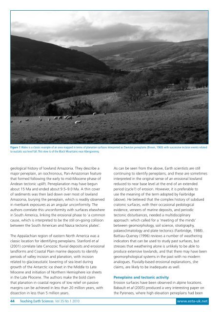
Figure 1 Wales is a classic example of an area mapped in terms of planation surfaces interpreted as Davisian peneplains (Brown, 1960) with successive incision events related<br />
to eustatic sea level fall. This view is of the Black Mountains near Abergavenny.<br />
geological history of lowland Amazonia. They describe a<br />
major peneplain, an isochronous, Pan-Amazonian feature<br />
that formed following the early to mid-Miocene phase of<br />
Andean tectonic uplift. Peneplanation may have begun<br />
about 15 Ma and ended about 9.5–9.0 Ma. A thin cover<br />
of sediments was then laid down over most of lowland<br />
Amazonia, burying the peneplain, which is readily observed<br />
in riverbank exposures as an angular unconformity. The<br />
authors correlate this unconformity with surfaces elsewhere<br />
in South America, linking the erosional phase to ‘a common<br />
cause, which is interpreted to be the still on-going collision<br />
between the South American and Nazca tectonic plates’.<br />
The Appalachian region of eastern North America was a<br />
classic location for identifying peneplains. Stanford et al<br />
(2001) correlate late Cenozoic fluvial deposits and erosional<br />
landforms and Coastal Plain marine deposits to identify<br />
periods of valley incision and planation, with incision<br />
related to glacioeustatic lowering of sea level during<br />
growth of the Antarctic ice sheet in the Middle to Late<br />
Miocene and initiation of Northern Hemisphere ice sheets<br />
in the Late Pliocene. The authors make the bold claim<br />
that planation in coastal regions of low relief on passive<br />
margins can be achieved in less than 20 million years, with<br />
dissection in less than 5 million years.<br />
As can be seen from the above, <strong>Earth</strong> scientists are still<br />
continuing to identify peneplains, and these are sometimes<br />
interpreted in the original sense of an erosional lowland<br />
reduced to near base level at the end of an extended<br />
period (cycle?) of erosion. However, it is preferable to<br />
use the meaning of the term adopted by Fairbridge<br />
(above). He believed that the complex history of subdued<br />
cratonic surfaces, with their occasional pedological<br />
evidence, veneers of marine deposits, and periodic<br />
tectonic disturbances, needed a multidisciplinary<br />
approach: which called for a ‘meeting of the minds’<br />
between geomorphology, soil science, stratigraphy,<br />
palaeoclimatology and plate tectonics (Fairbridge, 1988).<br />
Battiau-Queney (1996) reviews a number of weathering<br />
indicators that can be used to study past surfaces, but<br />
stresses that weathering alone is unlikely to be able to<br />
produce extensive lowlands, and that there may have been<br />
geomorphological systems in the past with no modern<br />
analogues. Fluvially-based erosional explanations, she<br />
claims, are likely to be inadequate as well.<br />
Peneplains and tectonic activity<br />
Erosion surfaces have been observed in alpine locations.<br />
Babault et al (2005) produced a very interesting paper on<br />
the Pyrenees, where high elevation peneplains had been<br />
44 <strong>Teaching</strong> <strong>Earth</strong> <strong><strong>Science</strong>s</strong> Vol 35 No 1 2010 www.esta-uk.net