National Meteorological Library and Archive Fact sheet 15 - Met Office
National Meteorological Library and Archive Fact sheet 15 - Met Office
National Meteorological Library and Archive Fact sheet 15 - Met Office

You also want an ePaper? Increase the reach of your titles
YUMPU automatically turns print PDFs into web optimized ePapers that Google loves.
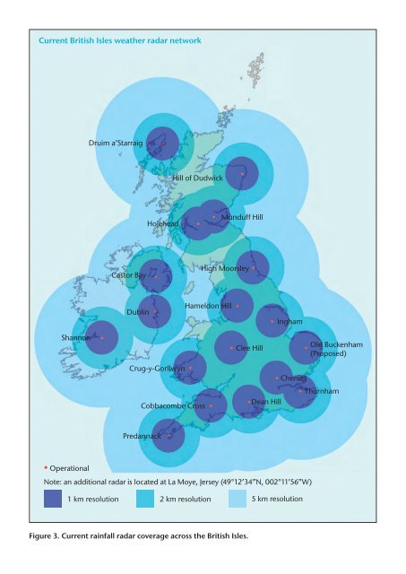
Current British Isles weather radar network<br />
Druim a’Starraig<br />
Hill of Dudwick<br />
Holehead<br />
Munduff Hill<br />
Castor Bay<br />
High Moorsley<br />
Dublin<br />
Hameldon Hill<br />
Ingham<br />
Shannon<br />
Clee Hill<br />
Old Buckenham<br />
(Proposed)<br />
Crug-y-Gorllwyn<br />
Cobbacombe Cross<br />
Dean Hill<br />
Chenies<br />
Thurnham<br />
Predannack<br />
• Operational<br />
Note: an additional radar is located at La Moye, Jersey (49°12’34”N, 002°11’56”W)<br />
1 km resolution 2 km resolution<br />
5 km resolution<br />
Figure 3. Current rainfall radar coverage across the British Isles.