Salt Lake City International Airport Terminal Redevelopment ...
Salt Lake City International Airport Terminal Redevelopment ...
Salt Lake City International Airport Terminal Redevelopment ...

Create successful ePaper yourself
Turn your PDF publications into a flip-book with our unique Google optimized e-Paper software.
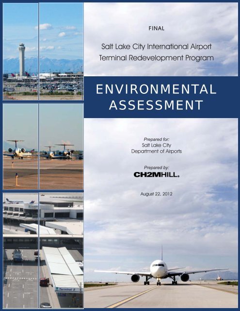
FINAL<br />
<strong>Salt</strong> <strong>Lake</strong> <strong>City</strong> <strong>International</strong> <strong>Airport</strong><br />
<strong>Terminal</strong> <strong>Redevelopment</strong> Program<br />
ENVIRONMENTAL<br />
ASSESSMENT<br />
Prepared for:<br />
<strong>Salt</strong> <strong>Lake</strong> <strong>City</strong><br />
Department of <strong>Airport</strong>s<br />
Prepared by:<br />
August 22, 2012<br />
TBG012712153950RDD
Final<br />
<strong>Salt</strong> <strong>Lake</strong> <strong>City</strong> <strong>International</strong> <strong>Airport</strong><br />
<strong>Terminal</strong> <strong>Redevelopment</strong> Program<br />
Environmental Assessment<br />
Prepared for<br />
<strong>Salt</strong> <strong>Lake</strong> <strong>City</strong> Department of <strong>Airport</strong>s<br />
776 North <strong>Terminal</strong> Drive<br />
<strong>Salt</strong> <strong>Lake</strong> <strong>City</strong>, Utah 84116<br />
August 2012<br />
215 South State Street<br />
Suite 1000<br />
<strong>Salt</strong> <strong>Lake</strong> <strong>City</strong>, Utah 84111
Executive Summary<br />
This Environmental Assessment (EA) has been prepared pursuant to the National<br />
Environmental Policy Act (NEPA), in accordance with the requirements of Federal Aviation<br />
Administration (FAA) Orders 5050.4B and 1050.1E. This EA analyzes and discloses the<br />
impacts associated with the proposed <strong>Terminal</strong> <strong>Redevelopment</strong> Program (TRP or Proposed<br />
Action) at <strong>Salt</strong> <strong>Lake</strong> <strong>City</strong> <strong>International</strong> <strong>Airport</strong> (SLC or the <strong>Airport</strong>).<br />
Purpose and Need<br />
Much of the existing terminal complex at SLC was designed and built more than 50 years<br />
ago and, although it has been expanded and renovated during this period, the original<br />
structures and layout remain largely the same. These facilities were not designed to meet<br />
current standards of energy efficiency or seismic safety, and the age of these structures leads<br />
to increased maintenance requirements and costs to the <strong>Airport</strong> and its users. In addition, as<br />
the airline and airport industry have experienced dramatic changes during the last 50 years,<br />
the existing terminal complex has become functionally obsolete, as shown in Exhibit ES-1.<br />
The Proposed Action would meet the following specific needs:<br />
<br />
<br />
<br />
Problems with Existing Aging Infrastructure. The existing terminal complex is 50 years<br />
old, requires extensive ongoing maintenance, is not energy efficient, does not provide<br />
current airline industry standard levels of service (LOS), and does not meet current<br />
seismic design standards.<br />
Respond to Changes in the Air Transportation System. Since the terminal facilities at<br />
SLC were planned and built, the aviation industry has experienced significant changes<br />
in the way airline passenger traffic is handled. The following major changes have<br />
occurred in the industry over the past 50 years:<br />
<br />
<br />
<br />
<br />
<br />
The introduction of hub and spoke route systems, which made the ability of<br />
passengers to transfer quickly from an arriving aircraft to a departing aircraft a key<br />
requirement<br />
Increasingly stringent security requirements, requiring more space for passenger<br />
screening<br />
Changes in baggage handling and delivery demands<br />
Increasing need for well-placed concessions to generate revenue, to reduce pressure<br />
on public funding sources<br />
The advent of ticketless travel, which has decreased the area required for ticketing<br />
and check-in<br />
Enhance Operational Efficiency. The existing terminal configuration requires<br />
redundant facilities for passenger check-in and baggage screening, baggage claim,<br />
enplaning and deplaning curbsides, and associated mechanical systems. The current<br />
terminal configuration also results in inefficient aircraft movement in the terminal area.<br />
RDD/102790005 (NLH4349.DOCX)<br />
TBG012712153950RDD<br />
ES-1
Existing terminal complex is 50 years<br />
old, requires extensive ongoing<br />
maintenance, is not energy efficient, and<br />
does not provide current industry<br />
standard levels of service.<br />
Concourse layout<br />
contributes to airfield<br />
congestion, increased<br />
aircraft emissions, and<br />
increased fuel use.<br />
CONCOURSE<br />
INTERNATIONAL<br />
ARRIVALS BLDG<br />
TERMINAL 2<br />
TERMINAL 1<br />
CONCOURSE<br />
<strong>Terminal</strong> configuration requires redundant facilities for passenger<br />
check-in, passenger and baggage screening, baggage claim, enplaning<br />
and deplaning curbsides, and associated mechanical systems.<br />
Exhibit ES-1 Inefficiencies of the<br />
Existing <strong>Terminal</strong> Complex<br />
<strong>Salt</strong> <strong>Lake</strong> <strong>City</strong> <strong>International</strong> <strong>Airport</strong><br />
<strong>Terminal</strong> <strong>Redevelopment</strong> Program<br />
SLC\399292\Inefficiencies_<strong>Terminal</strong>Complex.ai MAR-12 ckm
EXECUTIVE SUMMARY<br />
Proposed Action<br />
The Proposed Action shown in Exhibit ES-2 would consolidate separate passenger<br />
processing facilities into a single facility serving all concourses and gates and includes the<br />
following components:<br />
<br />
<br />
<br />
<br />
<br />
<br />
<br />
Phased replacement of the <strong>Airport</strong>’s terminals and concourses<br />
Reconstruction of taxiways and ramps in the terminal complex as required to<br />
accommodate aircraft circulation in the reconfigured terminal area<br />
Construction of a replacement parking garage<br />
Replacement rental car facilities in the new parking garage, including new rent-a-car<br />
(RAC) counters, ready-return spaces, and a quick-turn-around (QTA) facility<br />
A new remote service site for offices and rental car storage areas, located south of the<br />
existing economy parking lot<br />
New terminal roadways and improvements within the terminal complex<br />
New central utility plant (CUP) located west of the replacement parking garage<br />
In addition to consolidating terminal facilities, the Proposed Action would better accommodate<br />
the current and forecast mix of aircraft. The <strong>Airport</strong> now has about 86 narrow-body<br />
equivalent gates, 1 56 of which are served with loading bridges (SLC, 2011). The Proposed<br />
Action would provide between 72 and 74 gates (or about 76 narrow-body equivalent gates),<br />
depending on the average size of the aircraft using the <strong>Airport</strong>. All of these gates would be<br />
served with loading bridges.<br />
The terminal, concourses, and connectors in the Proposed Action would provide a net<br />
increase of 644,328 square feet, or 62 percent, compared to the existing facilities. This<br />
additional space would enable the <strong>Airport</strong> to provide industry standard LOSs and provide<br />
additional space for concessions, to enhance revenue generation and passenger convenience.<br />
A new parking garage would be centered south of the new terminal building, with two<br />
pedestrian bridges connecting the second level of the garage to the new terminal. The new<br />
garage would provide 3,636 short-term and long-term parking spaces, compared to the<br />
1,834 spaces provided in the existing parking garage. Rental car facilities would be located<br />
on the first level of the parking garage. A new customer service building containing rental<br />
car customer service counters and office space would be located on the ground floor of a<br />
separate building immediately adjacent to the north side of the parking garage. The second<br />
floor of this building would contain the termini of the pedestrian bridges, and provide space<br />
for the development of airline check-in counters and a station for the future light rail<br />
extension to the new terminal building. A rental car QTA facility would be located south of<br />
the new parking garage to accommodate fueling and other servicing facilities.<br />
1 “Narrow-body equivalent gate” expresses the passenger handling capacity of an aircraft gate at a terminal in terms of the<br />
number of narrow-body aircraft that would accommodate the same number of passengers. For example, a gate sized for a<br />
wide-body aircraft, such as a Boeing 777, would represent more than one NBE gate. In contrast, a gate designed for<br />
regional jet or commuter aircraft would represent less than one NBE gate.<br />
RDD/102790005 (NLH4349.DOCX)<br />
TBG012712153950RDD<br />
ES-3
D<br />
C<br />
B<br />
SOUTH CONCOURSE WEST<br />
SOUTH CONCOURSE EAST<br />
TERMINAL<br />
RAC<br />
PARKING<br />
CUP<br />
QTA<br />
REMOTE SERVICE SITE<br />
New Construction<br />
Existing Renovated<br />
Note: RAC = rental car facilities<br />
0 250 500 1,000 Feet<br />
\\JAFAR\PROJ\SLC_405943\MAPFILES\AFFECTEDENVIRONMENT\PROPOSEDACTION_ROADS.MXD SSAVAGE1 06/20/2012 10:29:09 AM<br />
¹<br />
Exhibit ES-2 Proposed Action<br />
<strong>Salt</strong> <strong>Lake</strong> <strong>City</strong> <strong>International</strong> <strong>Airport</strong><br />
<strong>Terminal</strong> <strong>Redevelopment</strong> Program
EXECUTIVE SUMMARY<br />
Additional facilities for the rental car operations would be located south of the <strong>Airport</strong>’s<br />
economy parking lot. This area would become the rental car remote service site and would<br />
provide space for vehicle maintenance bays, offices, and miscellaneous equipment storage.<br />
The area around the service buildings would be paved to provide an area for vehicle storage<br />
and fleet changeover.<br />
The <strong>Airport</strong> entrance roadway system would remain unchanged until reaching the exit<br />
leading to the new parking garage, which would be followed by successive exits for the new<br />
terminal. Entering motorists would continue to encounter the same sequence of decision<br />
points as today. The Proposed Action would replace the current single-level terminal<br />
curbside roadway with a two-level roadway, with the arrival roadway on the lower, or<br />
baggage claim, level and the departure roadway on the upper, or ticketing, level. Beyond<br />
the curbside roads, most of the existing access and circulation roadways would remain<br />
unchanged. Outbound roadway sections could be widened to improve operations and<br />
accommodate forecast demands. In addition, terminal roads would be temporarily relocated<br />
to accommodate terminal construction and road construction.<br />
A new CUP is included to serve the redeveloped terminal complex. The CUP would be<br />
located west of the proposed parking garage and southwest of the proposed terminal. The<br />
CUP layout would accommodate equipment throughout the construction associated with<br />
the TRP. Construction of the facilities within the CUP would be phased into the future,<br />
when warranted. The size and storage capacity of the various components of the CUP<br />
would depend on the final systems selected for the terminal complex.<br />
The Proposed Action would reserve a suitable location adjacent to the QTA and parking<br />
garage facility for the future relocated light rail station. The Utah Transportation Authority<br />
is responsible for finalizing the design and is the responsible agency for funding the<br />
construction. The future light rail station relocation project is included in this EA because<br />
the final location of the light rail station is reflected in the <strong>Airport</strong> Layout Plan (ALP) for the<br />
TRP, making it a federal action subject to NEPA.<br />
The <strong>Salt</strong> <strong>Lake</strong> <strong>City</strong> Department of <strong>Airport</strong>s (SLCDA) proposes to begin construction of the<br />
Proposed Action in 2013 (design starting in 2012) and complete construction in about 2024.<br />
The sponsor is requesting the following actions from the FAA as the lead federal agency:<br />
<br />
<br />
<br />
<br />
FAA acceptance of the Final EA<br />
FAA issuance of a Finding of No Significant Impact<br />
FAA unconditional approval of the ALP for the TRP<br />
Possible issuance of <strong>Airport</strong> Improvement Program grants for construction<br />
Alternatives<br />
The alternatives considered to meet the previously described passenger terminal needs<br />
include actions that could be taken by the SLCDA, with FAA approval, such as selecting a<br />
different location or configuration for the passenger terminal, or building a supplemental or<br />
replacement airport to reduce or eliminate the need to improve facilities at SLC. Other<br />
alternatives that are outside the authority of the SLCDA or the FAA are also considered.<br />
These other options include the use of demand management techniques to reduce or<br />
RDD/102790005 (NLH4349.DOCX)<br />
TBG012712153950RDD<br />
ES-5
EXECUTIVE SUMMARY<br />
eliminate the need for new passenger handling facilities, the use of other airports, or the use<br />
of other modes of transportation that may reduce the need for improvements at the <strong>Airport</strong>.<br />
<strong>Terminal</strong> Development Alternatives<br />
As the transfer point between surface and air transportation, passenger terminals must be<br />
easily accessible from the surface transportation systems and the airfield circulation system.<br />
At a major airport, such as SLC, the area required for passenger handling facilities, automobile<br />
access and parking, and airfield circulation is extensive. The existing terminal<br />
complex at SLC is well located in all of these respects. Although other sites on or adjacent to<br />
the <strong>Airport</strong> might be considered for a replacement terminal complex, no other site offers<br />
similar benefits. Exhibit ES-3 shows the constraints of six potential terminal locations<br />
(labeled A through F) at SLC. These constraints and limitations include:<br />
<br />
<br />
<br />
<br />
The size of the area needed to accommodate the necessary facilities and the necessary<br />
separation from existing runways<br />
The need to avoid area required for airfield circulation<br />
Proximity to access roadways<br />
Surrounding development, infrastructure, and environmental factors<br />
Area A, the existing terminal area, is the best located with respect to airfield circulation and<br />
the regional surface transportation system. Continued use of this area would minimize<br />
impacts to the natural and manmade environments compared to developing a new site by<br />
avoiding the need to develop undeveloped areas, or to acquire and relocate off-<strong>Airport</strong><br />
development. For these reasons, alternatives that would relocate the terminal complex from<br />
Area A would not be prudent; terminal planning has, therefore, focused on the existing<br />
project area shown in Exhibit ES-1. Exhibit ES-4 shows terminal concepts developed for SLC<br />
in master planning studies dating back to 1975.<br />
Potential <strong>Terminal</strong> Configurations<br />
During the last 35 years, the SLCDA has examined dozens of concepts for providing<br />
terminal facilities. As noted above, these concepts have focused on the existing terminal area<br />
as the most logical location for a passenger terminal complex (see Exhibit ES-4). These<br />
concepts have generally approached terminal development in one of three ways:<br />
<br />
<br />
<br />
Multiple terminals<br />
Single terminal<br />
Hybrid<br />
Single-terminal concepts (1997 Concept H and 2010 Proposed Action) would minimize the<br />
need for duplicate facilities and would provide maximum flexibility in responding to<br />
changes in air transportation service patterns. Single-terminal concepts would also<br />
minimize congestion and delay in the terminal area by eliminating dead-end taxilanes and<br />
chokepoints between concourses. The multiple-terminal and hybrid concepts do not meet<br />
the purpose and need for the Proposed Action and are not retained for detailed<br />
consideration.<br />
ES-6<br />
RDD/102790005 (NLH4349.DOCX)<br />
TBG012712153950RDD
B<br />
215<br />
D<br />
A<br />
C<br />
E<br />
C<br />
80<br />
F<br />
<strong>Airport</strong> Boundary<br />
<strong>Airport</strong> Building<br />
Water Body<br />
<strong>Airport</strong> Pavement<br />
Air Carrier Runway<br />
GA Runway<br />
Air Carrier Runway Circulation<br />
Off-<strong>Airport</strong> Development<br />
Interstate Highway<br />
Major <strong>Airport</strong> Access Route<br />
Exhibit ES-3 Site Constraints<br />
<strong>Salt</strong> <strong>Lake</strong> <strong>City</strong> <strong>International</strong> <strong>Airport</strong><br />
<strong>Terminal</strong> <strong>Redevelopment</strong> Program<br />
SLC\399292\SLC<strong>Airport</strong>\SiteConstraints.ai NOV-10 ckm
EXECUTIVE SUMMARY<br />
Other <strong>Salt</strong> <strong>Lake</strong> <strong>City</strong> <strong>International</strong> <strong>Airport</strong> Alternatives<br />
The SLCDA has investigated other means of meeting at least some of the needs identified<br />
previously under Purpose and Need without redeveloping the terminals. In addition, FAA<br />
Order 1050.1E, Paragraph 506.e., states that “Alternatives not within the jurisdiction of the<br />
lead agency, but within the jurisdiction of the Federal government, should be considered.”<br />
Two potential alternatives fall into this category:<br />
<br />
<br />
Renovation and Rehabilitation. In addition to considering the terminal development<br />
concepts described earlier, the SLCDA has investigated the cost of maintaining the<br />
existing terminal complex. In 2009, the SLCDA commissioned an Asset Preservation<br />
Study (Jacobs Engineering, 2009) that estimated the cost of renovating the existing<br />
terminal facilities at more than $61 million. This study only looked at the items needed<br />
to maintain the structures and did not address the cost of bringing the facilities into<br />
compliance with current seismic design standards or industry standard LOS.<br />
Addressing these seismic design and LOS deficiencies would go well beyond the<br />
concept of renovation and rehabilitation. Therefore, this alternative does not meet the<br />
purpose and need for the Proposed Action and is not retained for detailed evaluation.<br />
Implementing Demand Management Measures. Historically, measures such as slot<br />
quotas or congestion pricing have been proposed to reduce congestion at airports with<br />
excessive levels of airfield congestion and delay. In concept, activity or demand<br />
management might address some of the needs identified under Purpose and Need by<br />
spreading peak activity levels over a longer period, thus reducing congestion and<br />
enhancing passenger LOS. This alternative would not eliminate the problems of aging<br />
infrastructure, respond to changes in the air transportation system, or enhance<br />
operational efficiency. In addition, measures that would restrict airlines’ flexibility in<br />
providing air service could be viewed as imposing an undue burden on interstate<br />
commerce and being contrary to the tenets of airline deregulation. Although such<br />
measures have been supported in rare cases of high-density airports with excessive<br />
levels of airfield delay, there is no precedent for such measures being imposed to reduce<br />
terminal and landside congestion in the United States. This alternative is not retained for<br />
detailed evaluation.<br />
Non-<strong>Salt</strong> <strong>Lake</strong> <strong>City</strong> <strong>International</strong> <strong>Airport</strong> Alternatives<br />
Other alternatives that would not entail development at SLC might enhance the efficiency of<br />
existing terminal facilities by reducing the level of activity these facilities must<br />
accommodate. In concept, reducing the intensity of peak period demand might reduce<br />
congestion and enable the terminals to provide higher passenger LOSs. Alternatively,<br />
diverting demand to other airports or modes of transportation might also reduce congestion<br />
and provide higher LOSs with a less intensive development program.<br />
In practice, alternatives that manage or divert demand typically address broad congestion<br />
and LOS issues rather than site-specific problems. For example, the lack of airport capacity<br />
in general might be addressed if current or future demand at a given airport were reduced<br />
through diversion to some other mode of transportation or alternative airport. In contrast,<br />
correcting inefficient terminal layouts and outdated infrastructure would require a sitespecific<br />
solution even if total demand were reduced.<br />
ES-8<br />
RDD/102790005 (NLH4349.DOCX)<br />
TBG012712153950RDD
Existing<br />
1975 <strong>Terminal</strong> Area Plan<br />
1981 Alternative 1 1981 Alternative 5 1986 Alternative 10<br />
1986 Alternative "B-3"<br />
1988 Recommended<br />
1997 Concept "B"<br />
1997 Concept "H"<br />
2010 Proposed Action<br />
SOURCES: <strong>Salt</strong> <strong>Lake</strong> <strong>City</strong> <strong>International</strong> <strong>Airport</strong> Master Plan Study, prepared for the SLCDA, 1975; <strong>Salt</strong> <strong>Lake</strong> <strong>City</strong> <strong>International</strong> <strong>Airport</strong> Master Plan<br />
Update, Passenger <strong>Terminal</strong> Area Alternatives Evaluation, prepared for the SLCDA, 1981; Special <strong>Terminal</strong> Area Study, Final Report, <strong>Salt</strong> <strong>Lake</strong> <strong>City</strong><br />
<strong>International</strong> <strong>Airport</strong> Master Plan Update, prepared for the SLCDA, 1986; <strong>Salt</strong> <strong>Lake</strong> <strong>City</strong> <strong>International</strong> <strong>Airport</strong> Master Plan Update, prepared for the<br />
SLCDA, 1988; <strong>Salt</strong> <strong>Lake</strong> <strong>City</strong> <strong>International</strong> <strong>Airport</strong> Master Plan Update and Part 150 Study Update, prepared for the SLCDA, 1997; <strong>Terminal</strong><br />
Development Program, Task 2, Program Validation and Preliminary Planning, prepared for the SLCDA, 2010.<br />
0<br />
¹<br />
SEA \\JAFAR\PROJ\SLC_405943\MAPFILES\HISTORICALALTERNATIVES.MXD SSAVAGE 10/20/2011 3:46:00 PM<br />
750 1,500 3,000 Feet<br />
Existing <strong>Airport</strong> Building Selection<br />
Existing Pavement<br />
Stream<br />
Water Body<br />
Exhibit ES-4 Historical Alternatives<br />
<strong>Salt</strong> <strong>Lake</strong> <strong>City</strong> <strong>International</strong> <strong>Airport</strong><br />
<strong>Terminal</strong> <strong>Redevelopment</strong> Program
EXECUTIVE SUMMARY<br />
Although the SLCDA and the FAA have little ability to limit, divert, or manage demand, the<br />
FAA, as the lead federal agency, must consider alternatives beyond those in its (or the<br />
sponsor’s) direct control. Conceptually, alternatives that would reduce the demand for<br />
passenger facilities at SLC could meet some of the needs identified under Purpose and<br />
Need. The following alternatives in this category were considered:<br />
<br />
<br />
<br />
Replacing the <strong>Airport</strong> (New <strong>Airport</strong>). Although this concept could meet the needs<br />
identified under Purpose and Need, the cost of such an alternative would be extremely<br />
high compared to the Proposed Action. Furthermore, the resulting <strong>Airport</strong> would likely<br />
be less convenient to population centers and would likely have a much greater impact<br />
on the natural and/or manmade environment because it would either develop<br />
previously undeveloped lands or displace existing urban development. The Wasatch<br />
Mountains to the east and the Oquirrh Mountains to the west of the <strong>Salt</strong> <strong>Lake</strong> <strong>City</strong><br />
Metropolitan Area would also limit the possible locations of a new airport serving the<br />
region. This concept would not be prudent because of its environmental, social, and<br />
economic consequences, and it is not retained for detailed evaluation.<br />
Using Another <strong>Airport</strong>. SLC, located about 5 miles west of downtown <strong>Salt</strong> <strong>Lake</strong> <strong>City</strong> on<br />
Interstate 80, is conveniently located to serve the air transportation needs of the <strong>Salt</strong><br />
<strong>Lake</strong> <strong>City</strong> Metropolitan Area. The FAA National Plan of Integrated <strong>Airport</strong> Systems<br />
(NPIAS) lists two airports, South Valley Regional and Bolinder Field/Tooele Valley,<br />
within 25 miles of SLC. The NPIAS identifies three additional airports within 50 miles of<br />
SLC. None of these airports has the airfield or surface access capacity to accommodate<br />
air carrier operations without essentially being rebuilt. Using another airport as either a<br />
replacement or a supplement for SLC would, therefore, require nearly the same level of<br />
investment as building a replacement <strong>Airport</strong>, and would have similar potential for<br />
environmental impacts. This concept would not be prudent because of its<br />
environmental, social, and economic consequences, and is not retained for detailed<br />
evaluation.<br />
Using Other Modes of Transportation or Communications. Alternative modes of<br />
transportation offer feasible alternatives for air travelers, particularly for trips of 1 day or<br />
less (about 500 road miles). At longer distances, alternative modes of transportation<br />
become less desirable because of the amount of time lost by travelers. Diverting demand<br />
to other modes of transportation or communications, such as video conferencing, might<br />
address some of the needs identified under Purpose and Need by reducing congestion<br />
in the terminals, thereby enhancing passenger LOS. Although neither the FAA nor the<br />
SLCDA has the authority to mandate the use of alternative modes of transportation,<br />
automobiles already attract some passengers that might otherwise use air<br />
transportation. Two of the <strong>Airport</strong>’s top 20 destinations (Denver and Las Vegas) are<br />
within 500 miles of SLC and collectively account for 9 percent of the <strong>Airport</strong>’s passenger<br />
traffic (LeighFisher, 2010). The effects of diversion to automobile travel are already<br />
reflected in existing and forecast aviation passenger demand. To the extent that<br />
conventional rail traffic and telecommunications, including video conferencing, compete<br />
with air transportation, those effects are also reflected in existing levels of air passenger<br />
demand. Improvements in rail transportation, such as the introduction of high-speed<br />
rail service, and/or increased use of video conferencing could affect the growth in air<br />
travel in the future, but would not alleviate existing deficiencies. This concept would not<br />
RDD/102790005 (NLH4349.DOCX)<br />
TBG012712153950RDD<br />
ES-11
EXECUTIVE SUMMARY<br />
meet purpose and need for the Proposed Action and is not retained for detailed<br />
evaluation.<br />
Alternatives Eliminated from Detailed Consideration<br />
Alternatives that would not meet the purpose and need for the Proposed Action are not<br />
reasonable alternatives and are not carried forward for detailed consideration. Similarly,<br />
alternatives that would entail substantially greater environmental, social, or economic costs<br />
than the Proposed Action are not considered to be prudent and are not carried forward.<br />
Table ES-1 summarizes the reasons these alternatives are not carried forward.<br />
TABLE ES-1<br />
Alternatives Eliminated from Detailed Consideration<br />
Alternative<br />
Reason for Elimination<br />
Multiple <strong>Terminal</strong>s<br />
Hybrid <strong>Terminal</strong><br />
Renovation and Rehabilitation<br />
Replacing the <strong>Airport</strong> (New <strong>Airport</strong>)<br />
Using Another <strong>Airport</strong><br />
Implementing Demand Management<br />
Measures<br />
Using Other Modes of Transportation or<br />
Communications<br />
Would not meet the purpose and need for the Proposed Action and<br />
would have environmental consequences similar to those of the<br />
Proposed Action.<br />
Would not meet the purpose and need for the Proposed Action and<br />
would have environmental consequences similar to those of the<br />
Proposed Action.<br />
Would not meet the purpose and need for the Proposed Action.<br />
Some degree of renovation and rehabilitation would be undertaken<br />
as part of the No Action Alternative.<br />
Would entail substantially greater environmental, social, and/or<br />
economic costs than the Proposed Action.<br />
Would entail substantially greater environmental, social, and/or<br />
economic costs than the Proposed Action.<br />
Would not meet the purpose and need for the Proposed Action.<br />
Would not meet the purpose and need for the Proposed Action.<br />
Evaluation of Reasonable Alternatives<br />
Two alternatives are retained for detailed evaluation: the Proposed Action and the No<br />
Action Alternative. To define the issues and provide a clear basis for choice between these<br />
two alternatives, Table ES-2 compares the alternatives with respect to the ability to meet the<br />
identified purpose and need, technical and economic factors, passenger terminal LOS,<br />
environmental impacts, and regulatory requirements.<br />
ES-12<br />
RDD/102790005 (NLH4349.DOCX)<br />
TBG012712153950RDD
EXECUTIVE SUMMARY<br />
TABLE ES-2<br />
Comparison of Alternatives Retained for Detailed Evaluation<br />
Alternatives<br />
Evaluation Criteria<br />
Ability to Meet Purpose and Need<br />
Replace Aging Infrastructure<br />
Respond to Changes in the Air<br />
Transportation System<br />
Enhance Operational Efficiency<br />
Technical and Economic Factors<br />
No Action<br />
Would not replace existing<br />
infrastructure. Renovation and<br />
rehabilitation efforts described in<br />
Section 3.1.2.1 would be required<br />
to maintain the existing facilities,<br />
but would not eliminate existing<br />
inefficiencies.<br />
Would not reconfigure terminals to<br />
support current and future air<br />
service patterns.<br />
Would continue redundancy in<br />
passenger handling facilities and<br />
inefficient aircraft circulation in the<br />
terminal area.<br />
Proposed Action<br />
Would replace existing<br />
infrastructure with modern,<br />
energy efficient facilities.<br />
Would provide flexible facilities<br />
to meet functional needs of the<br />
current air transportation system<br />
and avoid functional<br />
obsolescence in the future.<br />
Would reduce redundancy in<br />
passenger handling facilities and<br />
enhance the efficiency of aircraft<br />
circulation in the terminal area.<br />
Average Aircraft Delay (minutes per<br />
operation)<br />
Annual Cost of Aircraft Delay and<br />
Taxi In and Out Time<br />
Roadway LOS (peak period, on<br />
arrival and departure roadways)<br />
4.55 (2025). 4.04 (2025).<br />
$153 million (2025). $145 million (2025).<br />
E/F – very unacceptable (2025). A/B – good (2025).<br />
Passenger <strong>Terminal</strong> LOS<br />
Public Circulation Areas –<br />
Industry Standard = 20.5 ft 2 /PHP a<br />
Departure Lounge Areas –<br />
Industry Standard = 10.8 ft 2 /PHP a<br />
15.7 ft 2 /PHP (28 MAP, about<br />
2025).<br />
10.8 ft 2 /PHP (28 MAP, about<br />
2025).<br />
35.0 ft 2 /PHP (28 MAP, about<br />
2025).<br />
14.9 ft 2 /PHP (28 MAP, about<br />
2025).<br />
Baggage Claim Areas –<br />
6.4 ft 2 /PHP (28 MAP, about 2025). 9.3 ft 2 /PHP (28 MAP, about<br />
Industry Standard = 17.2 ft 2 /PHP a 2025).<br />
1,420 ft 2 /PHP (28 MAP, about<br />
Security Screening Checkpoints –<br />
1,750 ft 2 /checkpoint b<br />
Industry Standard =<br />
2025).<br />
1,980 ft 2 /PHP (28 MAP, about<br />
2025).<br />
Public Restrooms –<br />
2.1 ft 2 /PHP (28 MAP, about 2025). 4.8 ft 2 /PHP (28 MAP, about<br />
Industry Standard = 3.5 ft 2 /PHP c 2025).<br />
4,950 ft 2 /PHP (28 MAP, about<br />
Retail and Food/Beverage<br />
10,000 ft 2 /MEP c<br />
Concessions – Industry Standard = 2025).<br />
7,640 ft 2 /PHP (28 MAP, about<br />
2025).<br />
RDD/102790005 (NLH4349.DOCX)<br />
TBG012712153950RDD<br />
ES-13
EXECUTIVE SUMMARY<br />
TABLE ES-2<br />
Comparison of Alternatives Retained for Detailed Evaluation<br />
Alternatives<br />
Evaluation Criteria<br />
Environmental Impacts<br />
Air Quality – Operations<br />
No Action<br />
Would have higher annual<br />
emissions from aircraft and surface<br />
vehicle operations than the<br />
Proposed Action.<br />
Proposed Action<br />
Would have lower annual aircraft<br />
and surface vehicle emissions<br />
than the No Action Alternative.<br />
Air Quality – Construction Not applicable. Construction emissions would<br />
be less than de minimis.<br />
Water Quality<br />
Energy Supply, Natural Resources,<br />
and Sustainable Design –<br />
Building Efficiency<br />
Energy Supply, Natural Resources,<br />
and Sustainable Design –<br />
Aircraft Fuel Use<br />
Regulatory Requirements<br />
Stormwater Discharge Permit<br />
Revision<br />
Continued compliance with water<br />
discharge permit requirements<br />
would maintain water quality<br />
standards.<br />
Would continue use of old,<br />
inefficient terminal buildings.<br />
Not applicable.<br />
Continued compliance with<br />
UPDES Permit No. UT0024988.<br />
Continued compliance with<br />
water discharge permit<br />
requirements would maintain<br />
water quality standards.<br />
Would increase building<br />
envelope, but would also<br />
increase energy efficiency.<br />
Would reduce fuel consumption<br />
compared to the No Action<br />
Alternative.<br />
Update UPDES Permit<br />
No. UT0024988.<br />
a Source: <strong>International</strong> Air Transport Association, 2004 (LOS C [acceptable] assumed)<br />
b Source: Transportation Security Administration, 2010<br />
c Source: de Neufville and Odoni, 2003<br />
Notes:<br />
ft 2 = square feet<br />
MAP = million annual passengers (enplaned and deplaned)<br />
PHP = peak hour passenger<br />
UPDES = Utah Pollutant Discharge Elimination System<br />
The No Action Alternative would not meet the purpose and need because it would not<br />
replace aging infrastructure, enhance the operational efficiency of the <strong>Airport</strong>, or respond to<br />
changes in the air transportation system. The No Action Alternative would be inferior to the<br />
Proposed Action Alternative with respect to all technical and economic factors, and<br />
passenger LOS. Although construction of the Proposed Action would generate short-term<br />
air quality impacts, these would not be significant and would be offset in the long term by<br />
reduced emissions from aircraft and surface vehicle operations. The Proposed Action would<br />
have minimal effect on other natural environmental resources because the project is located<br />
in a previously developed area served by adequate stormwater conveyance and treatment<br />
facilities. The Proposed Action Alternative would have no effect on the human environment<br />
through changes in noise exposure, surface traffic, or land use.<br />
ES-14<br />
RDD/102790005 (NLH4349.DOCX)<br />
TBG012712153950RDD
EXECUTIVE SUMMARY<br />
Affected Environment and Environmental Consequences<br />
The setting of the Proposed Action is intensively developed and isolated from surrounding<br />
natural environmental features and urban development, as illustrated by the project area<br />
shown in Exhibit ES-5. In addition, the Proposed Action Alternative would not differ from<br />
the No Action Alternative with respect to the volume or distribution of aircraft operations<br />
or surface traffic. The proposed terminal redevelopment would slightly increase the amount<br />
of impervious surface, but the resulting increase in stormwater runoff would be<br />
accommodated by the existing and planned drainage system and would continue to meet<br />
permit requirements. For these reasons, the Proposed Action would have minimal effects on<br />
the natural and human environments. Summaries of the impacts on individual resources<br />
follow.<br />
Air Quality<br />
The proposed redevelopment of the terminal complex would reduce congestion and delay<br />
for aircraft on the taxiways and ramps surrounding the terminal complex and for surface<br />
vehicles on the terminal roadway system. As a result, air emissions from aircraft and<br />
vehicles would be reduced compared to the No Action Alternative.<br />
In addition, the existing terminal complex does not take advantage of energy-efficient<br />
technologies and designs developed over the last 50 years. New terminal facilities would<br />
incorporate more energy-efficient design and materials and would be built to U.S. Green<br />
Building Code Leadership in Energy and Environmental Design (LEED) Silver standards.<br />
The new facilities are expected to reduce energy consumption and associated air emissions<br />
compared to the No Action Alternative.<br />
<strong>Redevelopment</strong> of the terminal complex would entail the demolition of existing structures,<br />
as well as the construction of new structures, airfield pavement, and roads. Although this<br />
construction activity would generate air emissions, those emissions would be well below the<br />
de minimis levels that would require a conformity demonstration under the General<br />
Conformity Rule.<br />
Water Quality<br />
<strong>Redevelopment</strong> of the terminal complex would largely be restricted to areas that are<br />
currently paved or otherwise developed impervious surfaces, and would not materially<br />
increase the amount or alter the nature of surface water runoff. The new terminal complex<br />
would require paving about 60 acres of currently undeveloped area, which represents an<br />
increase of about 4.7 percent in the <strong>Airport</strong>’s existing impervious surface. The current mix of<br />
development and activities in this area, and the level of such activities, would remain the<br />
same as under the No Action Alternative. Consequently, the quality of the water flowing<br />
from these surfaces would remain essentially unchanged.<br />
The <strong>Airport</strong>’s network of drainage infrastructure has been designed to accommodate the<br />
increased stormwater runoff while continuing to meet the water quantity and quality limits<br />
incorporated in its UPDES permit and <strong>Salt</strong> <strong>Lake</strong> County Flood Control permit. Continued<br />
compliance with these permits would preclude significant degradation of receiving waters.<br />
RDD/102790005 (NLH4349.DOCX)<br />
TBG012712153950RDD<br />
ES-15
W<br />
2670 N<br />
2200<br />
32 00 W<br />
2100 N<br />
16 R<br />
16 L<br />
C ORRA L LN<br />
1700 N<br />
17<br />
MORTON DR<br />
HAROLD GATTY DR<br />
AMELIA EARHART DR<br />
WRIGHT<br />
BROTHERS DR<br />
34 L<br />
TERMINAL DR<br />
§¨¦ 215<br />
§¨¦ 80 35<br />
100 N<br />
14<br />
34 R<br />
32<br />
C ST<br />
700 N<br />
NORTH TEMPLE ST<br />
1 95 0 W<br />
150 S<br />
5200 W<br />
2650<br />
W<br />
<strong>Airport</strong> Boundary<br />
Project Area<br />
0 750 1,500 3,000 Feet<br />
\\JAFAR\PROJ\SLC_405943\MAPFILES\AFFECTEDENVIRONMENT\PROJECTAREAMAP.MXD SSAVAGE1 04/16/2012 10:34:57 AM<br />
¹<br />
Exhibit ES-5 Project Area<br />
<strong>Salt</strong> <strong>Lake</strong> <strong>City</strong> <strong>International</strong> <strong>Airport</strong><br />
<strong>Terminal</strong> <strong>Redevelopment</strong> Program
EXECUTIVE SUMMARY<br />
Floodplains<br />
The project area is located outside regulated floodplains. The proposed terminal<br />
redevelopment would add 60 acres of impervious surface, which would increase the<br />
amount of impervious surface at the <strong>Airport</strong> by 4.7 percent. This increase is within the water<br />
discharge quantity permitted for the <strong>Airport</strong> and could be accommodated by the existing<br />
storm drainage facilities; therefore, no impact to floodplain capacity is expected.<br />
Wetlands<br />
Although wetlands are present at and adjacent to the <strong>Airport</strong>, the proposed terminal<br />
redevelopment would not directly or indirectly affect wetlands. The proposed<br />
redevelopment would include three areas, totaling 60 acres, that are not already paved or<br />
otherwise developed. The 2005 delineation of the <strong>Airport</strong>’s wetlands (SLCDA, 2005)<br />
included a survey of the project area, generally the area between Runways 16R/34L and<br />
16L/34R, because the area had been disturbed during previous <strong>Airport</strong> expansion, resulting<br />
in modified wetlands hydrology and soils. In approving this document, the U.S. Army<br />
Corps of Engineers did not suggest revisiting this area. As noted previously, the Proposed<br />
Action would not materially alter the quality or volume of water flowing from the <strong>Airport</strong><br />
into the surrounding waterways. Therefore, the Proposed Action would not indirectly affect<br />
wetlands adjacent to the <strong>Airport</strong>.<br />
Biotic Resources<br />
The FAA Desk Reference (FAA, 2007a) defines “biotic resources” as the types of flora<br />
(plants) and fauna (for example, fish, birds, reptiles, amphibians, marine mammals, and<br />
coral reefs) in a particular area. The term also includes rivers, lakes, wetlands, forests,<br />
upland communities, and other habitat types supporting the flora and the aquatic and avian<br />
fauna. The project area is largely paved or otherwise developed, and contains little or no<br />
natural vegetation and limited landscaped vegetation. Although the new terminal complex<br />
would require paving about 60 acres of currently undeveloped area, this area has been<br />
graded and is surrounded by active aircraft movement areas and/or roadways.<br />
Federally Listed Endangered or Threatened Species<br />
The factors limiting the potential impacts to biotic resources from the alternatives under<br />
consideration also limit their potential effects on federally listed endangered or threatened<br />
species. As stated above, the project area is largely paved or otherwise developed, and<br />
contains little or no natural vegetation and limited landscaped vegetation. In addition, the<br />
project area does not contain federally designated critical habitat for any listed species.<br />
Hazardous Materials<br />
A records review conducted through Environmental Data Research, Inc., identified six<br />
incidents involving hazardous waste in the project area. All but one record have been closed<br />
by regulatory agencies. The one open incident involves the 1993 closure of a rental car<br />
company’s leaking underground storage tank near the proposed rental car QTA facility.<br />
Contaminated soil was removed, but residual groundwater contamination could remain at<br />
the site, so the record continues to be administered by the Utah Department of<br />
Environmental Quality (UDEQ), Division of Environmental Response and Remediation.<br />
Contractors excavating soils near this one site could encounter low amounts of soil<br />
RDD/102790005 (NLH4349.DOCX)<br />
TBG012712153950RDD<br />
ES-17
EXECUTIVE SUMMARY<br />
contamination, as well as contaminated groundwater. Best management practices would be<br />
established to minimize hazardous materials risks to contractors and members of the public.<br />
Construction crews would likely bring fuel, cleaning solvents, paints, and raw materials<br />
onsite to build the proposed improvements. Proper handling, storage, and disposal of these<br />
materials, as required in bid specifications, would prevent adverse effects on the<br />
environment.<br />
Solid Waste<br />
Solid waste generation and disposal within the replacement terminal would remain<br />
essentially the same for either alternative. Solid waste would continue to be disposed of at<br />
the <strong>Salt</strong> <strong>Lake</strong> Valley Landfill by Waste Management of Utah. This landfill is a permitted<br />
Class I facility that is able to accept municipal waste, commercial solid waste, small-quantity<br />
household hazardous waste, industrial waste, asbestos waste, and infectious waste.<br />
According to data from UDEQ, Division of Solid and Hazardous Waste, the landfill has a<br />
remaining capacity of 450 acres or 29 million tons (UDEQ, 2010b). On the basis of current<br />
and historical disposal rates and the available capacity, the <strong>Salt</strong> <strong>Lake</strong> Valley Landfill is<br />
anticipated to have a remaining life of 25 years.<br />
Energy Supply, Natural Resources and Sustainable Design<br />
The TRP would increase the square footage of terminal and concourse space by about<br />
62 percent, compared to the No Action Alternative. However, the project would replace old,<br />
inefficient facilities with new facilities employing current technologies to save energy and<br />
reduce the use of natural resources, such as water. To be consistent with <strong>Salt</strong> <strong>Lake</strong> <strong>City</strong><br />
policy, these new facilities would be built to LEED Silver standards. In its preliminary<br />
planning, the project team identified opportunities to enhance sustainability in the following<br />
areas: (1) aviation benchmarking, (2) designing for climate, (3) water conservation,<br />
(4) energy conservation, (5) electrical consumption, and (6) materials and waste. As the<br />
program enters the design phase, the project team will incorporate these opportunities.<br />
Historic Properties<br />
The potential impacts of the alternatives under consideration on historic resources are<br />
limited, because the potentially historic <strong>Airport</strong> buildings were extensively remodeled in the<br />
past and almost nothing remains from the original structures. A confirmation letter from the<br />
Utah State Historic Preservation Office (2012) concurred that no historic resources would be<br />
affected within the project area.<br />
Noise<br />
The FAA Desk Reference states that, “<strong>Airport</strong> development actions that change airport<br />
runway configurations, aircraft operations and/or movements, aircraft types using the<br />
airport, or aircraft flight characteristics may affect existing and future noise levels.” As<br />
noted earlier, the Proposed Action and No Action Alternatives would experience the same<br />
level of aircraft activity through the forecast period. Consultation with FAA <strong>Airport</strong> Traffic<br />
Control Tower staff indicates that, as at most airports, the SLC runways are assigned on the<br />
basis of the direction from which aircraft arrive or to which they are departing, not<br />
according to their assigned terminal gates. The Proposed Action would not change <strong>Airport</strong><br />
runway configurations, aircraft operations and/or movements, aircraft types using the<br />
ES-18<br />
RDD/102790005 (NLH4349.DOCX)<br />
TBG012712153950RDD
EXECUTIVE SUMMARY<br />
<strong>Airport</strong>, or aircraft flight characteristics that might affect existing and future noise levels<br />
and, therefore, would not cause noise impacts.<br />
Compatible Land Use<br />
The FAA Desk Reference states that, “If the noise analysis described in Chapter 17 of this<br />
Desk Reference concludes that there is no significant noise impact, a similar conclusion<br />
usually may be made about compatible land uses.” As noted earlier, the alternatives under<br />
consideration would not differ with respect to noise impacts; this supports the conclusion<br />
that the Proposed Action would not cause compatible land use impacts.<br />
Light Emissions and Visual Impacts<br />
Neither the Proposed Action nor the No Action Alternative would create an annoyance to<br />
local communities near construction activities or operations. The proposed project would be<br />
located in the <strong>Airport</strong>’s terminal complex, which is completely within <strong>Airport</strong> property and<br />
surrounded by existing <strong>Airport</strong> development that includes a wide variety of aeronauticalrelated<br />
light sources. Operation of the Proposed Action would be similar to existing<br />
operations with respect to roadway lighting, parking garage lighting, and terminal facility<br />
lighting.<br />
U.S. Department of Transportation Section 4(f) Resources<br />
Neither the Proposed Action nor the No Action Alternative would directly or indirectly<br />
affect land subject to U.S. Department of Transportation Section 4(f). The proposed project is<br />
completely within <strong>Airport</strong> property, which does not contain the resources listed under<br />
Section 4(f). The closest Section 4(f) resource to the project area is Wingpointe Golf Course,<br />
which is located south of the project area at the entrance to the <strong>Airport</strong> from Interstate 80.<br />
Wingpointe Golf Course is owned by the <strong>Airport</strong>. No further analysis or mitigation is<br />
planned.<br />
Social Impacts<br />
Neither the Proposed Action nor the No Action Alternative would pose health or safety<br />
risks to children, affect homes or off-<strong>Airport</strong> businesses, divide or disrupt communities, or<br />
change local surface transportation patterns. The proposed project would remain on <strong>Airport</strong><br />
property, mostly on previously developed land. The proposed TRP would occupy<br />
essentially the same area as the existing terminal complex.<br />
The Proposed Action could cause short-term impacts to <strong>Airport</strong> retail and concessions by<br />
necessitating temporary relocations and shifting of retail/concession locations during<br />
construction activities. In the longer term, the increased terminal and concourse space<br />
would provide an opportunity for more retail and concession space that could generate<br />
additional economic activity. No further analysis or mitigation is planned.<br />
Environmental Justice<br />
Neither the Proposed Action nor the No Action Alternative would affect minority or lowincome<br />
populations. The project would be located completely within <strong>Airport</strong> property and<br />
would not disrupt local communities or any population in the <strong>Salt</strong> <strong>Lake</strong> <strong>City</strong> area. As noted<br />
previously, the Proposed Action would not alter the number, types, or flight paths of<br />
RDD/102790005 (NLH4349.DOCX)<br />
TBG012712153950RDD<br />
ES-19
EXECUTIVE SUMMARY<br />
aircraft flying in and out of the <strong>Airport</strong> and would not change noise levels, compared to the<br />
No Action Alternative. No further analysis or mitigation is planned.<br />
Induced Socioeconomic Impacts<br />
The No Action Alternative and the Proposed Action would accommodate the same level of<br />
passenger, aircraft, and vehicular activity, indicating that the <strong>Airport</strong>’s long-term economic<br />
impact on the community would be similar in either case. The proposed TRP would<br />
increase the area available for retail and concessions by about 10 percent. Assuming the<br />
same level of employment and revenue per square foot, the additional economic impact<br />
would be beneficial, but would have no material effect on the regional economy. The<br />
Proposed Action would not, therefore, generate growth in excess of that supported by the<br />
No Action Alternative. In addition, because both alternatives would continue to use the<br />
same entrance points, the Proposed Action would not cause shifts in population movement.<br />
The Proposed Action would replace old, inefficient structures with new facilities<br />
incorporating modern energy and water conservation concepts. These new facilities could<br />
reduce the demand for public services relative to the No Action Alternative.<br />
The Proposed Action could cause short-term, construction related disruption to <strong>Airport</strong><br />
retail and concessions because retailers and concessionaries would be relocated and shifted,<br />
depending on the location of construction activities. In the longer term, as noted previously,<br />
the increased terminal and concourse space would provide opportunities for more retail and<br />
concession space that could generate additional economic activity. No further analysis or<br />
mitigation is planned.<br />
Cumulative Effects<br />
The previous discussions of environmental consequences show that the impacts of the<br />
proposed TRP would be limited to the <strong>Airport</strong>. Exhibit ES-5 shows that the project area is<br />
separated from the surrounding area by major <strong>Airport</strong> and highway infrastructure. Because<br />
the project area is geographically isolated, the investigation of past, present, and reasonably<br />
foreseeable future actions focuses on actions within the <strong>Airport</strong> boundaries. A review of the<br />
available NEPA documentation for the past and present projects at SLC shows that only a<br />
few projects would have the potential to contribute to cumulative effects when considered<br />
in combination with the Proposed Action. In general, the potential contributions to<br />
cumulative impacts consisted of surface water, stormwater, and air quality effects from<br />
construction activity. The impacts of these actions would not exceed thresholds of<br />
significance for any resource when considered in combination with the Proposed Action.<br />
Similarly, a review of project descriptions for planned <strong>Airport</strong> projects indicates little<br />
potential for future projects to exceed thresholds of significance for any resource when<br />
considered in combination with the Proposed Action.<br />
ES-20<br />
RDD/102790005 (NLH4349.DOCX)<br />
TBG012712153950RDD
Contents<br />
Page<br />
Chapter<br />
Executive Summary ...................................................................................................................... ES-1<br />
Acronyms and Abbreviations ......................................................................................................... ix<br />
1 Purpose and Need .............................................................................................................. 1-1<br />
1.1 Purpose and Need Statement ............................................................................... 1-1<br />
1.2 Problems with Existing Aging Infrastructure .................................................... 1-2<br />
1.2.1 Maintenance and Rehabilitation ............................................................. 1-4<br />
1.2.2 Energy Efficiency ....................................................................................... 1-4<br />
1.2.3 Current Seismic Design Standards ......................................................... 1-4<br />
1.2.4 Existing Levels of Service ......................................................................... 1-6<br />
1.3 Respond to Changes in the Air Transportation System .................................... 1-6<br />
1.3.1 Changing Patterns of Air Service ............................................................ 1-7<br />
1.3.2 Changing Facility Requirements ............................................................. 1-9<br />
1.4 Enhance Operational Efficiency ........................................................................... 1-9<br />
1.4.1 Aircraft Circulation ................................................................................... 1-9<br />
1.4.2 Vehicular Circulation .............................................................................. 1-10<br />
1.5 Aviation Demand Forecasts ................................................................................ 1-11<br />
1.5.1 Historical Aviation Activity ................................................................... 1-11<br />
1.5.2 Federal Aviation Administration <strong>Terminal</strong> Area Forecast ................ 1-11<br />
1.5.3 Recommended Forecast .......................................................................... 1-14<br />
2 Proposed Action .................................................................................................................. 2-1<br />
2.1 <strong>Terminal</strong> <strong>Redevelopment</strong> Program ..................................................................... 2-1<br />
2.1.1 Aircraft Gates ............................................................................................. 2-3<br />
2.1.2 Passenger <strong>Terminal</strong> Space ........................................................................ 2-3<br />
2.1.3 Parking and Rental Car Facilities ............................................................ 2-4<br />
2.1.4 Roadways and Associated Infrastructure .............................................. 2-5<br />
2.1.5 Central Utility Plant .................................................................................. 2-6<br />
2.1.6 Relocated Light Rail Station ..................................................................... 2-6<br />
2.2 Development Phasing ............................................................................................ 2-7<br />
2.3 Consistency with the <strong>Airport</strong> Layout Plan ......................................................... 2-7<br />
3 Alternatives.......................................................................................................................... 3-1<br />
3.1 Range of Potential Alternatives ............................................................................ 3-1<br />
3.1.1 <strong>Terminal</strong> Development Alternatives ...................................................... 3-1<br />
3.1.2 Other <strong>Salt</strong> <strong>Lake</strong> <strong>City</strong> <strong>International</strong> <strong>Airport</strong> Alternatives ..................... 3-9<br />
3.1.3 Non-<strong>Salt</strong> <strong>Lake</strong> <strong>City</strong> <strong>International</strong> <strong>Airport</strong> Alternatives ..................... 3-10<br />
3.2 Alternatives Eliminated from Detailed Consideration ................................... 3-12<br />
3.3 Evaluation of Reasonable Alternatives ............................................................. 3-13<br />
3.3.1 Alternatives Considered in Detail ......................................................... 3-13<br />
3.3.2 Comparison of Reasonable Alternatives .............................................. 3-18<br />
RDD/102790005 (NLH4349.DOCX)<br />
TBG012712153950RDD<br />
III
Contents, Continued<br />
Page<br />
4 Affected Environment ....................................................................................................... 4-1<br />
4.1 Project Location ...................................................................................................... 4-1<br />
4.2 Human Environment............................................................................................. 4-4<br />
4.2.1 Existing Noise and Compatible Land Use ............................................ 4-4<br />
4.2.2 Historic Cultural Resources and U.S. Department of<br />
Transportation Act Section 4(f) ............................................................... 4-5<br />
4.2.3 Social and Socioeconomic Characteristics ............................................. 4-5<br />
4.3 Natural Environment ............................................................................................ 4-6<br />
4.3.1 Climate and Air Quality .......................................................................... 4-6<br />
4.3.2 Water Resources ...................................................................................... 4-10<br />
4.3.3 Biotic Resources ....................................................................................... 4-12<br />
4.3.4 Hazardous Materials and Solid Waste ................................................. 4-14<br />
4.3.5 Existing Hazardous Sites and Contaminated Properties .................. 4-15<br />
4.4 Past, Present, and Reasonably Foreseeable Future Actions ........................... 4-17<br />
4.4.1 Past Projects ............................................................................................. 4-17<br />
4.4.2 Current Projects ....................................................................................... 4-18<br />
4.4.3 Reasonably Foreseeable Future Projects .............................................. 4-18<br />
5 Environmental Consequences ......................................................................................... 5-1<br />
5.1 Air Quality .............................................................................................................. 5-2<br />
5.1.1 Regulatory Setting .................................................................................... 5-2<br />
5.1.2 Thresholds of Significance ....................................................................... 5-4<br />
5.1.3 Methodologies ........................................................................................... 5-5<br />
5.1.4 Environmental Impacts ............................................................................ 5-8<br />
5.1.5 Potential Mitigation ................................................................................ 5-13<br />
5.2 Water Quality ....................................................................................................... 5-13<br />
5.2.1 Regulatory Setting .................................................................................. 5-14<br />
5.2.2 Thresholds of Significance ..................................................................... 5-14<br />
5.2.3 Methodologies ......................................................................................... 5-14<br />
5.2.4 Environmental Impacts .......................................................................... 5-15<br />
5.2.5 Potential Mitigation ................................................................................ 5-18<br />
5.3 Floodplains ........................................................................................................... 5-18<br />
5.3.1 Regulatory Setting .................................................................................. 5-18<br />
5.3.2 Thresholds of Significance ..................................................................... 5-18<br />
5.3.3 Methodologies ......................................................................................... 5-18<br />
5.3.4 Environmental Impacts .......................................................................... 5-18<br />
5.3.5 Potential Mitigation ................................................................................ 5-19<br />
5.4 Wetlands ................................................................................................................ 5-19<br />
5.4.1 Regulatory Setting .................................................................................. 5-20<br />
5.4.2 Thresholds of Significance ..................................................................... 5-22<br />
5.4.3 Methodologies ......................................................................................... 5-22<br />
5.4.4 Environmental Impacts .......................................................................... 5-22<br />
IV<br />
RDD/102790005 (NLH4349.DOCX)<br />
TBG012712153950RDD
Contents, Continued<br />
Page<br />
5.4.5 Potential Mitigation ................................................................................ 5-23<br />
5.5 Biotic Resources .................................................................................................... 5-24<br />
5.5.1 Regulatory Setting ................................................................................... 5-24<br />
5.5.2 Thresholds of Significance ..................................................................... 5-24<br />
5.5.3 Methodologies ......................................................................................... 5-25<br />
5.5.4 Environmental Impacts .......................................................................... 5-25<br />
5.5.5 Potential Mitigation ................................................................................ 5-27<br />
5.6 Federally Listed Endangered or Threatened Species ...................................... 5-27<br />
5.6.1 Regulatory Setting ................................................................................... 5-27<br />
5.6.2 Thresholds of Significance ..................................................................... 5-27<br />
5.6.3 Methodologies ......................................................................................... 5-27<br />
5.6.4 Environmental Impacts .......................................................................... 5-27<br />
5.6.5 Potential Mitigation ................................................................................ 5-29<br />
5.7 Hazardous Materials ............................................................................................ 5-30<br />
5.7.1 Regulatory Setting ................................................................................... 5-30<br />
5.7.2 Thresholds of Significance ..................................................................... 5-30<br />
5.7.3 Methodologies ......................................................................................... 5-30<br />
5.7.4 Environmental Impacts .......................................................................... 5-31<br />
5.7.5 Potential Mitigation ................................................................................ 5-34<br />
5.8 Solid Waste ............................................................................................................ 5-34<br />
5.8.1 Regulatory Setting ................................................................................... 5-34<br />
5.8.2 Thresholds of Significance ..................................................................... 5-35<br />
5.8.3 Methodologies ......................................................................................... 5-35<br />
5.8.4 Environmental Impacts of the Alternatives ......................................... 5-35<br />
5.8.5 Potential Mitigation ................................................................................ 5-36<br />
5.9 Energy Supply, Natural Resources, and Sustainable Design ......................... 5-36<br />
5.9.1 Regulatory Setting ................................................................................... 5-37<br />
5.9.2 Thresholds of Significance ..................................................................... 5-37<br />
5.9.3 Methodologies ......................................................................................... 5-37<br />
5.9.4 Environmental Impacts .......................................................................... 5-37<br />
5.9.5 Potential Mitigation ................................................................................ 5-39<br />
5.10 Historic Properties ................................................................................................ 5-39<br />
5.10.1 Regulatory Setting ................................................................................... 5-39<br />
5.10.2 Thresholds of Significance ..................................................................... 5-39<br />
5.10.3 Methodologies ......................................................................................... 5-40<br />
5.10.4 Environmental Impacts .......................................................................... 5-41<br />
5.10.5 Potential Mitigation ................................................................................ 5-42<br />
5.11 Noise ....................................................................................................................... 5-42<br />
5.12 Compatible Land Use .......................................................................................... 5-43<br />
5.13 Light Emissions and Visual Effects .................................................................... 5-43<br />
5.14 U.S. Department of Transportation Section 4(f) Resources ............................ 5-43<br />
RDD/102790005 (NLH4349.DOCX)<br />
TBG012712153950RDD<br />
V
Contents, Continued<br />
Page<br />
5.15 Social Impacts ....................................................................................................... 5-44<br />
5.16 Environmental Justice ......................................................................................... 5-44<br />
5.17 Induced Socioeconomic Impacts ........................................................................ 5-45<br />
5.18 Cumulative Effects ............................................................................................... 5-45<br />
5.18.1 Regulatory Setting .................................................................................. 5-46<br />
5.18.2 Thresholds of Significance ..................................................................... 5-46<br />
5.18.3 Methodologies ......................................................................................... 5-47<br />
5.18.4 Past, Present, and Reasonably Foreseeable Future Actions .............. 5-47<br />
5.18.5 Evaluation of Cumulative Effects ......................................................... 5-49<br />
6 Agency and Public Involvement ..................................................................................... 6-1<br />
6.1 Scoping .................................................................................................................... 6-1<br />
6.1.1 Agency Scoping Meeting ......................................................................... 6-1<br />
6.1.2 Public Information Meeting .................................................................... 6-2<br />
6.1.3 Results of Scoping ..................................................................................... 6-2<br />
6.2 Post-scoping Coordination ................................................................................... 6-3<br />
6.3 Public Hearing ........................................................................................................ 6-3<br />
7 List of Preparers.................................................................................................................. 7-1<br />
8 References ........................................................................................................................... 8-1<br />
Appendices<br />
A<br />
B<br />
C<br />
D<br />
E<br />
F<br />
G<br />
Technical Memorandum: Aviation Demand Forecasts<br />
<strong>Terminal</strong> Area Configuration and Construction Activities<br />
Environmental Data Resources, Inc., Database Search Report<br />
Air Quality<br />
Technical Memorandum: <strong>Salt</strong> <strong>Lake</strong> <strong>City</strong> <strong>International</strong> <strong>Airport</strong> – Drainage Impacts<br />
Historic, Architectural, Archaeological, and Cultural Resources<br />
Agency and Public Involvement<br />
VI<br />
RDD/102790005 (NLH4349.DOCX)<br />
TBG012712153950RDD
Contents, Continued<br />
Page<br />
Tables<br />
1-1 Public Parking and Rental Car Deficiencies .................................................................... 1-7<br />
1-2 <strong>Terminal</strong> Deficiencies ........................................................................................................ 1-10<br />
1-3 Aircraft Delay and Taxi Time .......................................................................................... 1-10<br />
2-1 Comparison of Existing and Proposed <strong>Terminal</strong> Facilities ........................................... 2-3<br />
2-2 Comparison of Existing and Proposed Parking and Rental Car Facilities .................. 2-5<br />
2-3 Proposed Action Construction Steps ................................................................................ 2-8<br />
3-1 Alternatives Eliminated from Detailed Consideration ................................................ 3-13<br />
3-2 Comparison of Alternatives Retained for Detailed Evaluation .................................. 3-18<br />
4-1 National Ambient Air Quality Standards ........................................................................ 4-8<br />
4-2 Discharge Points ................................................................................................................ 4-12<br />
4-3 U.S. Fish and Wildlife Service Endangered, Threatened, and Candidate<br />
Species for <strong>Salt</strong> <strong>Lake</strong> County, Utah ................................................................................. 4-13<br />
4-4 Summary of Hazardous Materials Currently Used in <strong>Airport</strong> Operations .............. 4-15<br />
4-5 Summary of Past Environmental Categorical Exclusions at <strong>Salt</strong> <strong>Lake</strong> <strong>City</strong><br />
<strong>International</strong> <strong>Airport</strong> ......................................................................................................... 4-17<br />
5-1 Stationary Source Emissions, 2011 .................................................................................... 5-6<br />
5-2 Stationary Sources and Related Activities ....................................................................... 5-7<br />
5-3 No Action Alternative Ongoing Construction Project Emissions ................................ 5-9<br />
5-4 No Action Alternative Mobile-source Emissions, Existing (2009), 2020, and 2025 .... 5-9<br />
5-5 Peak Year Construction Emissions, 2016 ....................................................................... 5-10<br />
5-6 Proposed Action Mobile-source Emissions, Existing (2009), 2020, and 2025 ............ 5-10<br />
5-7 Discharge Limitations and Monitoring Requirements ................................................ 5-15<br />
5-8 Endangered, Threatened, and Candidate Species for <strong>Salt</strong> <strong>Lake</strong> County, Utah ........ 5-28<br />
5-9 Environmental Data Resources, Inc., Records within the Proposed Action<br />
Footprint ............................................................................................................................. 5-32<br />
5-10 Summary of Past, Present, and Reasonably Foreseeable Future Actions .................. 5-49<br />
7-1 List of Preparers ................................................................................................................... 7-1<br />
RDD/102790005 (NLH4349.DOCX)<br />
TBG012712153950RDD<br />
VII
Contents, Continued<br />
Page<br />
Exhibits<br />
1-1 Inefficiencies of the Existing <strong>Terminal</strong> Complex ............................................................ 1-3<br />
1-2 Annual Asset Preservation Costs ..................................................................................... 1-5<br />
1-3 Changes in Air Service Patterns ........................................................................................ 1-8<br />
1-4 Existing and Future <strong>Terminal</strong> Roadway Level of Service ........................................... 1-12<br />
1-5 Historical and Forecast Aviation Activity ..................................................................... 1-13<br />
2-1 Proposed Action .................................................................................................................. 2-2<br />
2-2 <strong>Airport</strong> Layout Plan – <strong>Terminal</strong> Area .............................................................................. 2-9<br />
3-1 Site Constraints .................................................................................................................... 3-3<br />
3-2 Historical Alternatives ....................................................................................................... 3-7<br />
4-1 Project Map .......................................................................................................................... 4-2<br />
4-2 Location Map ....................................................................................................................... 4-3<br />
4-3 Air Monitoring Stations in the Vicinity of the <strong>Airport</strong> .................................................. 4-9<br />
4-4 Project Water Bodies ......................................................................................................... 4-11<br />
4-5 Hazardous Record Locations .......................................................................................... 4-16<br />
5-1 New Impervious Surface ................................................................................................. 5-17<br />
5-2 Wetlands Delineation Input ............................................................................................ 5-21<br />
5-3 Project Area ........................................................................................................................ 5-48<br />
VIII<br />
RDD/102790005 (NLH4349.DOCX)<br />
TBG012712153950RDD
Acronyms and Abbreviations<br />
<strong>Airport</strong><br />
ALP<br />
AST<br />
BIOTICS<br />
CAA<br />
CatEx<br />
CEQ<br />
CFR<br />
cfs<br />
CIP<br />
CO<br />
CUP<br />
dB<br />
DERR<br />
DNL<br />
DOT<br />
EDMS<br />
EDR<br />
<strong>Salt</strong> <strong>Lake</strong> <strong>City</strong> <strong>International</strong> <strong>Airport</strong><br />
<strong>Airport</strong> Layout Plan<br />
aboveground storage tank<br />
Biodiversity Tracking and Conservation System<br />
Clean Air Act<br />
Environmental Categorical Exclusion<br />
Council on Environmental Quality<br />
Code of Federal Regulations<br />
cubic feet per second<br />
Capital Improvement Plan<br />
carbon monoxide<br />
central utility plant<br />
decibel<br />
Utah Department of Environmental Quality, Division of<br />
Environmental Response and Remediation<br />
day-night average sound level<br />
U.S. Department of Transportation<br />
Emissions Dispersion Modeling System<br />
Environmental Data Resources, Inc.<br />
ESA Endangered Species Act of 1973<br />
FAA<br />
Federal Aviation Administration<br />
FAA Desk Reference Environmental Desk Reference for <strong>Airport</strong> Actions<br />
FEMA<br />
FONSI<br />
GA<br />
Governor’s Report<br />
HOK<br />
Federal Emergency Management Agency<br />
Finding of No Significant Impact<br />
General Aviation<br />
Economic Report to the Governor<br />
Hellmuth, Obata + Kassabaum, Inc.<br />
RDD/102790005 (NLH4349.DOCX)<br />
TBG012712153950RDD<br />
IX
ACRONYMS AND ABBREVIATIONS<br />
I-15 Interstate 15<br />
I-80 Interstate 80<br />
I-215 Interstate 215<br />
IATA<br />
ISR<br />
LEED<br />
LOS<br />
LTO<br />
LUST<br />
MAP<br />
MEP<br />
NAAQS<br />
NAS<br />
NBE<br />
NEPA<br />
NO 2<br />
NOx<br />
NPIAS<br />
NPCC<br />
O 3<br />
PCA<br />
PM 2.5<br />
PM 10<br />
QTA<br />
RAC<br />
SHPO<br />
SIP<br />
SLC<br />
SLCDA<br />
SO 2<br />
<strong>International</strong> Air Transport Association<br />
Indirect Source Review<br />
Leadership in Energy and Environmental Design<br />
level of service<br />
landing and take-off<br />
leaking underground storage tank<br />
million annual passengers<br />
million annual enplanements<br />
National Ambient Air Quality Standards<br />
National Airspace System<br />
narrow-body equivalent<br />
National Environmental Policy Act<br />
nitrogen dioxide<br />
oxides of nitrogen<br />
National Plan of Integrated <strong>Airport</strong> Systems<br />
North Point Consolidated Canal<br />
ozone<br />
pre-conditioned air<br />
particulate matter 2.5 microns in diameter and smaller<br />
particulate matter 10 microns in diameter and smaller<br />
quick-turn-around<br />
rent-a-car<br />
State Historic Preservation Office<br />
State Implementation Plan<br />
<strong>Salt</strong> <strong>Lake</strong> <strong>City</strong> <strong>International</strong> <strong>Airport</strong><br />
<strong>Salt</strong> <strong>Lake</strong> <strong>City</strong> Department of <strong>Airport</strong>s<br />
sulfur dioxide<br />
X<br />
RDD/102790005 (NLH4349.DOCX)<br />
TBG012712153950RDD
ACRONYMS AND ABBREVIATIONS<br />
TAF<br />
TGO<br />
TMDL<br />
ton/year<br />
TRP<br />
TSA<br />
UDEQ<br />
UPDES<br />
USACE<br />
USEPA<br />
USFWS<br />
USGBC<br />
USC<br />
UST<br />
UTA<br />
VOC<br />
WUS<br />
<strong>Terminal</strong> Area Forecast<br />
touch-and-go<br />
total maximum daily load<br />
ton(s) per year<br />
<strong>Terminal</strong> <strong>Redevelopment</strong> Program<br />
Transportation Security Administration<br />
Utah Department of Environmental Quality<br />
Utah Pollutant Discharge Elimination System<br />
U.S. Army Corps of Engineers<br />
U.S. Environmental Protection Agency<br />
U.S. Fish and Wildlife Service<br />
U.S. Green Building Code<br />
U.S. Code<br />
underground storage tank<br />
Utah Transit Authority<br />
volatile organic compound<br />
waters of the U.S.<br />
RDD/102790005 (NLH4349.DOCX)<br />
TBG012712153950RDD<br />
XI
CHAPTER 1<br />
Purpose and Need<br />
Paragraph 706.b. of Federal Aviation Administration (FAA) Order 5050.4B provides<br />
guidance on the content of the purpose and need section of Environmental Assessments<br />
(EA). Paragraph 706.b. recommends that the purpose and need be defined on the basis of<br />
the airport sponsor’s goals and objectives, and the FAA statutory objectives. Additionally,<br />
Paragraph 706.b. recommends that the purpose and need statement summarize the benefits<br />
of the project and describe the proposed time frame for carrying out the action.<br />
The purpose of the <strong>Terminal</strong> <strong>Redevelopment</strong> Program (TRP or Proposed Action) is to meet<br />
the current need to modernize the aging terminal complex at <strong>Salt</strong> <strong>Lake</strong> <strong>City</strong> <strong>International</strong><br />
<strong>Airport</strong> (SLC or the <strong>Airport</strong>) and to respond to ongoing changes in the national air<br />
transportation system. This chapter describes the specific needs that will be met by the<br />
Proposed Action and provides supporting information on these needs, as follows:<br />
<br />
<br />
<br />
<br />
<br />
Section 1.1 – Purpose and Need Statement: Describes the purpose and need for the<br />
Proposed Action in the context of the FAA’s statutory mandate to provide for the safe,<br />
efficient, and secure operation of the National Airspace System (NAS). This section also<br />
describes the proposed federal actions and time frame for implementation. This<br />
statement is supported by the subsequent sections.<br />
Section 1.2 – Problems with Existing Aging Infrastructure: Describes the costs of<br />
maintaining the existing terminal complex, especially costs associated with ongoing<br />
maintenance requirements and energy consumption. In addition, the existing terminal<br />
buildings do not conform to current seismic design standards.<br />
Section 1.3 – Respond to Changes in the Air Transportation System: Explains that,<br />
because changes in the national air transportation system have altered the way terminals<br />
are used, the existing terminal complex no longer provides levels of service (LOS)<br />
consistent with industry standards.<br />
Section 1.4 – Enhance Operational Efficiency: Explains how the existing configuration<br />
decreases passenger convenience, necessitates redundant passenger and baggage<br />
handling facilities, and results in inefficient aircraft movement in the terminal area.<br />
Section 1.5 – Aviation Demand Forecasts: Summarizes the forecasts of aviation demand<br />
used to assess future requirements. This section also demonstrates that these forecasts<br />
comply with FAA guidelines for consistency with the FAA <strong>Terminal</strong> Area Forecast<br />
(TAF) for SLC.<br />
1.1 Purpose and Need Statement<br />
Much of the existing terminal complex at SLC was designed and built more than 50 years<br />
ago and, although it has been expanded and renovated during this period, the original<br />
structures and layout remain largely the same. These facilities were not designed to meet<br />
current standards of energy efficiency or seismic safety, and the age of these structures leads<br />
RDD/102790005 (NLH4349.DOCX) 1-1<br />
TBG012712153950RDD
CHAPTER 1 PURPOSE AND NEED<br />
to increased maintenance requirements and costs to the <strong>Airport</strong> and its users. In addition, as<br />
the airline and airport industry have experienced dramatic changes during the last 50 years,<br />
the existing terminal complex shown in Exhibit 1-1 has become functionally obsolete.<br />
Specifically, the Proposed Action would meet the following needs:<br />
<br />
<br />
<br />
Problems with Existing Aging Infrastructure. The existing terminal complex is 50 years<br />
old, requires extensive ongoing maintenance, is not energy efficient, does not provide<br />
current airline industry standard LOSs, and does not meet current seismic design<br />
standards. Section 1.2 provides additional information regarding the need to replace<br />
aging infrastructure.<br />
Respond to Changes in the Air Transportation System. Since the terminal facilities at<br />
SLC were planned and built, the aviation industry has experienced significant changes<br />
in the way airline passenger traffic is handled. The introduction of the hub and spoke<br />
system following airline deregulation in 1979 made the ability of passengers to transfer<br />
quickly from an arriving aircraft to a departing aircraft a key requirement. More<br />
recently, airports have had to increase the space allocated to meet increasingly stringent<br />
security requirements and changes in baggage handling and delivery demands.<br />
Growing pressure on public funding sources has increased the need to provide<br />
adequate, well-positioned space for retail concessions, both to generate revenue and to<br />
enhance passenger convenience. The advent of ticketless travel has decreased the area<br />
required for ticketing and check-in. The likelihood that air service will continue to<br />
evolve emphasizes the need to design flexible facilities to avoid functional obsolescence.<br />
Section 1.3 provides additional information regarding changes in the air transportation<br />
system since the terminals were planned and built.<br />
Enhance Operational Efficiency. The existing terminal configuration requires<br />
redundant facilities for passenger check-in and baggage screening, baggage claim,<br />
enplaning and deplaning curbsides, and associated mechanical systems. Section 1.4<br />
provides additional information regarding the need to enhance operational efficiency.<br />
The <strong>Salt</strong> <strong>Lake</strong> <strong>City</strong> Department of <strong>Airport</strong>s (SLCDA), the <strong>Airport</strong> sponsor, proposes to begin<br />
construction of the Proposed Action in 2013 (design starting in 2012) and complete<br />
construction in about 2024. The sponsor is requesting the following actions from the FAA as<br />
the lead federal agency:<br />
<br />
<br />
<br />
<br />
FAA acceptance of the Final EA<br />
FAA issuance of a Finding of No Significant Impact (FONSI)<br />
FAA unconditional approval of the <strong>Airport</strong> Layout Plan (ALP) for the TRP<br />
Possible issuance of <strong>Airport</strong> Improvement Program grants for construction<br />
1.2 Problems with Existing Aging Infrastructure<br />
The advanced age of the existing facilities increases the effort and expense of operating and<br />
maintaining the terminal complex and, because these facilities are not as energy efficient as<br />
contemporary construction, increases energy consumption compared to modern terminal<br />
facilities. In addition, the existing facilities do not meet current seismic design standards.<br />
Finally, several components of the existing complex do not provide an adequate passenger<br />
1-2 RDD/102790005 (NLH4349.DOCX)<br />
TBG012712153950RDD
Existing terminal complex is 50 years<br />
old, requires extensive ongoing<br />
maintenance, is not energy efficient, and<br />
does not provide current industry<br />
standard levels of service.<br />
Concourse layout<br />
contributes to airfield<br />
congestion, increased<br />
aircraft emissions, and<br />
increased fuel use.<br />
CONCOURSE<br />
INTERNATIONAL<br />
ARRIVALS BLDG<br />
TERMINAL 2<br />
TERMINAL 1<br />
CONCOURSE<br />
<strong>Terminal</strong> configuration requires redundant facilities for passenger<br />
check-in, passenger and baggage screening, baggage claim, enplaning<br />
and deplaning curbsides, and associated mechanical systems.<br />
Exhibit 1-1 Inefficiencies of the<br />
Existing <strong>Terminal</strong> Complex<br />
<strong>Salt</strong> <strong>Lake</strong> <strong>City</strong> <strong>International</strong> <strong>Airport</strong><br />
<strong>Terminal</strong> <strong>Redevelopment</strong> Program<br />
SLC\399292\Inefficiencies_<strong>Terminal</strong>Complex.ai MAR-12 ckm
CHAPTER 1 PURPOSE AND NEED<br />
LOS at present and will become more deficient over time. This section summarizes the<br />
effects of aging infrastructure on maintenance, energy consumption, and design<br />
requirements.<br />
1.2.1 Maintenance and Rehabilitation<br />
The recent Asset Preservation Study of the <strong>Airport</strong> (Jacobs Engineering, 2009) identified the<br />
seven types of maintenance and repair requirements not typically addressed in the course of<br />
normal operation and maintenance of the terminal building. The SLCDA would need to<br />
spend $61,584,148 to address the following identified needs (see Exhibit 1-2):<br />
<br />
<br />
<br />
<br />
<br />
<br />
<br />
Component Renewal. Projected replacement of a building system or system component<br />
as it reaches the end of its useful life.<br />
Cyclic Maintenance. Requirement that recurs based on normal wear patterns, such as<br />
painting, caulking, and carpet replacement.<br />
Deferred Maintenance. Items that currently are physically or operationally defective<br />
and have not been scheduled for corrective action or maintenance has been postponed<br />
because of lack of resources.<br />
Investigative. A special category for the segregation of items that need more precise<br />
definition before the specific deficiency can be determined and the corrective action<br />
identified.<br />
Life Cycle Maintenance and Repair. Components of an equipment asset that would<br />
require repair or replacement during the estimated design life of the asset.<br />
Preventive Maintenance. Scheduled inspections to determine the condition of building<br />
equipment and components; includes making minor adjustments and identifying<br />
potential problems.<br />
Safety. Items that need to be corrected immediately to prevent injury or accident.<br />
1.2.2 Energy Efficiency<br />
The existing terminal complex does not take advantage of energy-efficient technologies and<br />
designs developed during the last 50 years. New development offers opportunities to<br />
reduce energy consumption that could not be cost-effectively retrofitted into the existing<br />
terminal complex. Recognizing the growing concern for sustainable development and<br />
energy efficiency, <strong>Salt</strong> <strong>Lake</strong> <strong>City</strong> has adopted the policy that all public buildings owned<br />
and controlled by <strong>Salt</strong> <strong>Lake</strong> <strong>City</strong> Corporation be built or renovated using the U.S. Green<br />
Building Code (USGBC) Leadership in Energy and Environmental Design (LEED)<br />
standards at the Certified level. This goal was updated to LEED Silver level certification in<br />
January 2006.<br />
1.2.3 Current Seismic Design Standards<br />
The asset preservation requirements described in Section 1.2.1 do not include improvements<br />
needed to meet current seismic design standards. The <strong>Airport</strong> is located in the intermountain<br />
fault zone and lies near the <strong>Salt</strong> <strong>Lake</strong> <strong>City</strong> Segment of the Wasatch fault. Geologic<br />
seismic hazard mapping indicates that this site could experience severe lateral ground<br />
1-4 RDD/102790005 (NLH4349.DOCX)<br />
TBG012712153950RDD
$16,000,000<br />
$14,000,000<br />
$12,000,000<br />
$10,000,000<br />
$8,000,000<br />
$6,000,000<br />
$4,000,000<br />
$2,000,000<br />
$0<br />
Years 0 1 2 3 4 5 6 7 8 9 10 11<br />
Source: Asset Preservation Study, Jacobs Engineering for the <strong>Salt</strong> <strong>Lake</strong> <strong>City</strong> Department of <strong>Airport</strong>s, February 2009.<br />
LEGEND:<br />
CR = Component Renewal<br />
CY = Cyclic Maintenance<br />
DM = Deferred Maintenance<br />
IX = Investigative<br />
LR = Life Cycle Maintenance and Repair<br />
PM = Preventive Maintenance<br />
SF = Safety<br />
Totals<br />
Exhibit 1-2 Annual Asset Preservation Costs<br />
<strong>Salt</strong> <strong>Lake</strong> <strong>City</strong> <strong>International</strong> <strong>Airport</strong><br />
<strong>Terminal</strong> <strong>Redevelopment</strong> Program<br />
SLC\399292\AnnualAssetPreservation_v1.ai MAR-12 ckm
CHAPTER 1 PURPOSE AND NEED<br />
shaking during a major seismic event. In recent years, with heightened awareness of the<br />
seismic risk that exists in the <strong>Salt</strong> <strong>Lake</strong> valley, building officials have adopted more stringent<br />
building codes that require buildings to be designed and constructed to resist the shaking<br />
and lateral forces that are generated during an earthquake. Many of the buildings at SLC<br />
were built before the current building codes were adopted and could sustain significant<br />
damage during a large earthquake. The need for structural repairs to the existing terminal<br />
building after a major seismic event could be substantial, and the repairs could take months,<br />
if not years, to complete.<br />
Major renovations required to address the seismic deficiencies at the <strong>Airport</strong> would trigger<br />
the need to comply with seismic design standards incorporated in the current building code.<br />
Although meeting these seismic design standards would be consistent with the FAA’s<br />
mandate to ensure a safe NAS, this additional requirement would substantially increase the<br />
cost and disruption of renovations to the existing structures.<br />
1.2.4 Existing Levels of Service<br />
A 2003 terminal area capacity analysis (HNTB, 2003) determined that the following<br />
components of the existing terminal complex were at or approaching an undesirable LOS 2 :<br />
<br />
<br />
<br />
<br />
<br />
<br />
<br />
Security checkpoints passenger screening and queuing<br />
Meeter/greeter 3 waiting areas<br />
Departure lounges in <strong>Terminal</strong> Two<br />
Concourse circulation in <strong>Terminal</strong> Two<br />
Ticket counter circulation in <strong>Terminal</strong>s One and Two (affected by Transportation<br />
Security Administration [TSA] baggage screening operation)<br />
Concessions in <strong>Terminal</strong> Two<br />
Rental car lobby counter, queuing and circulation<br />
At the time of the analysis (2002), the <strong>Airport</strong> accommodated 18.66 million annual<br />
passengers (MAP). Since then, passenger volumes have increased to 20.41 MAP. These<br />
deficiencies will become more severe in the future. A recent study of roadway, parking, and<br />
rental car facilities concluded that close-in public parking and rental car facilities were at or<br />
approaching capacity, as shown in Table 1-1. Over the next 10 years, the SLCDA will need<br />
to provide more than 1,600 additional garage parking spaces, nearly twice the number<br />
currently provided, and an additional 9 acres for rental car facilities, an increase of<br />
28 percent.<br />
1.3 Respond to Changes in the Air Transportation System<br />
In the 50 years since the current terminal complex was initially designed and built, changes<br />
in security requirements, airline operations, and airport funding have altered the functional<br />
requirements of airport passenger terminals in several important ways. The growth in<br />
passenger traffic described in Section 1.2.4 has intensified the problems caused by these<br />
functional changes. These functional changes cannot be accommodated within the existing<br />
2 Defined as LOS D – a poor LOS characterized by severe congestion, unstable flow, and undesirable delay.<br />
3 People meeting arriving passengers at the airport.<br />
1-6 RDD/102790005 (NLH4349.DOCX)<br />
TBG012712153950RDD
CHAPTER 1 PURPOSE AND NEED<br />
terminal structures. This section describes specific problems with the terminal, airside, and<br />
landside components of the passenger handling facilities at the <strong>Airport</strong>.<br />
TABLE 1-1<br />
Public Parking and Rental Car Deficiencies<br />
Facility<br />
Public Parking (spaces)<br />
Currently<br />
Available<br />
Demand<br />
2008 2013 2018<br />
Parking Garage 1,766 3,030 3,120 3,480<br />
Economy Surface Lots 10,040 7,070 7,280 8,120<br />
Rental Car Facilities (acres)<br />
Ready Return 6.9 9.5 9.7 10.9<br />
QTA Facility 6.6 10.0 10.2 11.5<br />
Service Center 18.3 16.1 16.5 18.5<br />
Total Rental Car Facilities 31.8 35.6 36.5 40.8<br />
Source: Jacobs Consultancy, 2010<br />
Notes:<br />
Red numbers indicate demand greater than current supply.<br />
QTA = quick-turn-around<br />
The existing terminal complex shown in Exhibit 1-1 was planned to facilitate passenger<br />
flows to and from individual, or “unit,” terminals. The resulting configuration of unit<br />
terminals and concourses limits the ability of the <strong>Airport</strong> to accommodate changing patterns<br />
in air service because the gates are divided among five different concourses tied to individual<br />
passenger processing facilities. This configuration also limits the options for allocating<br />
space in response to changing demand because functional areas are widely separated.<br />
1.3.1 Changing Patterns of Air Service<br />
Currently, about 44 percent of the passengers at SLC connect from one flight to another.<br />
Since 1980, this percentage has varied from as little as 33 percent to more than 60 percent<br />
(between 1987 and 1992) (HNTB, 2003, Table 1.2). Changes in the proportion of connecting<br />
and originating passenger place different demands on the terminal and landside facilities.<br />
The changing relationship between aircraft gates and passenger demand further illustrates<br />
the need for terminal facilities that can be adapted to changing conditions.<br />
Exhibit 1-3 shows that, since 1990, the types of aircraft providing passenger service at SLC<br />
and the number of passengers per aircraft have varied greatly, placing different types of<br />
demand on passenger handling facilities. As the proportion of regional or commuter carriers<br />
increases, the average number of passengers per aircraft decreases. Between 2001 and 2004,<br />
the number of passengers per aircraft decreased from 71 to 55, although total passenger<br />
throughput increased. This type of change alters the number and mix of gates required to<br />
accommodate aircraft and affects the demand for passenger handling facilities, including<br />
curbside, ticketing, security screening, concessions, departure hold lounges, and baggage<br />
claim. The existing terminal configuration limits flexibility in responding to changing<br />
RDD/102790005 (NLH4349.DOCX) 1-7<br />
TBG012712153950RDD
450,000<br />
400,000<br />
70<br />
350,000<br />
300,000<br />
65<br />
Annual Operations<br />
250,000<br />
200,000<br />
150,000<br />
60<br />
Passengers / Operation<br />
100,000<br />
55<br />
50,000<br />
0<br />
50<br />
1990<br />
1991<br />
1992<br />
1993<br />
1994<br />
1995<br />
1996<br />
1997<br />
1998<br />
1999<br />
2000<br />
2001<br />
2002<br />
2003<br />
2004<br />
2005<br />
2006<br />
2007<br />
2008<br />
2009<br />
Source: Appendix A, Technical Memorandum, Aviation Demand Forecasts, <strong>Salt</strong> <strong>Lake</strong> <strong>City</strong> <strong>International</strong> <strong>Airport</strong><br />
Environmental Assessment, Tables 10 and 15, LeighFisher, August 2010.<br />
LEGEND:<br />
Air Carrier<br />
Commuter<br />
Total Commercial<br />
Passengers per Operation<br />
Exhibit 1-3 Changes in Air Service Patterns<br />
<strong>Salt</strong> <strong>Lake</strong> <strong>City</strong> <strong>International</strong> <strong>Airport</strong><br />
<strong>Terminal</strong> <strong>Redevelopment</strong> Program<br />
SLC\399292\AirServicePattern_v1.ai MAR-12<br />
ckm
CHAPTER 1 PURPOSE AND NEED<br />
industry practices. Consolidating passenger handling facilities would facilitate the development<br />
of flexible gate modules that could be reconfigured to accommodate different mixtures<br />
of aircraft sizes.<br />
1.3.2 Changing Facility Requirements<br />
In 1960, when <strong>Terminal</strong> One was built, passenger screening requirements did not exist.<br />
Passengers and the people meeting them or dropping them off (meeters/greeters) had<br />
access to all public areas, including departure lounges and concessions. After the<br />
introduction of security screening, only ticketed passengers were allowed past the screening<br />
checkpoint. This division of the terminal into “secure” and “non-secure” zones greatly complicated<br />
space planning in passenger terminals, creating the need to provide duplicate<br />
facilities in some cases.<br />
In 1995, the terminals provided less than 4,000 square feet of public security screening area,<br />
less than 0.5 percent of the total terminal area (HNTB, 1997, Tables 2.3 and 2.4). Over the<br />
years, the space required for screening increased, especially after the terrorist attacks of<br />
September 11, 2001. The recent terminal space program prepared for the TRP allocates more<br />
than 26,000 square feet for passenger and employee screening (HOK, 2010, Section 4), about<br />
13,000 square feet more than the terminal area provided in 1995. In contrast to increasing<br />
requirements for screening, the need for ticketing lobby space has been decreasing in recent<br />
years with the advent of electronic ticketing and the introduction of self-service ticketing<br />
kiosks. In 1995, about 18,000 square feet, or 1.8 percent of the total terminal area, were<br />
allocated to passenger ticketing or check-in. Current estimates of ticketing and check-in<br />
space required per peak hour enplaned passenger are nearly 30 percent lower than the<br />
terminals currently provide.<br />
These changes in the way that airports and airlines accommodate passengers, coupled with<br />
passenger activity growth over the last several decades, mean that the existing facilities no<br />
longer provide adequate passenger LOSs. The <strong>International</strong> Air Transport Association<br />
(IATA) publishes passenger LOS guidelines for airport terminal facilities that are accepted<br />
throughout the aviation industry. Table 1-2 compares current IATA guidelines with the<br />
existing terminal facilities at SLC and identifies existing and projected deficiencies.<br />
1.4 Enhance Operational Efficiency<br />
The existing terminal configuration distributes gates in five widely separated concourses in<br />
two domestic terminals and the <strong>International</strong> Arrivals Building (see Exhibit 1-1). This<br />
configuration reduces the <strong>Airport</strong>’s efficiency in accomplishing several important functions.<br />
1.4.1 Aircraft Circulation<br />
The current <strong>Airport</strong> layout places aircraft gates on a series of dead-end or cul-de-sac<br />
taxilanes. Aircraft arriving at or departing from the outer gates at the entrance to these<br />
taxilanes block aircraft using the inner gates, causing congestion and delay. Table 1-3 shows<br />
the average minutes of delay per operation and the average taxi time for air carrier aircraft<br />
at the <strong>Airport</strong>. At present (2009), air carrier aircraft at the <strong>Airport</strong> average 3.28 minutes of<br />
delay; this is expected to increase to 4.55 minutes per aircraft by 2025. Over the last 10 years,<br />
delays at the 35 busiest airports in the nation have averaged between 3 and 4 minutes,<br />
although individual airports have experienced substantially higher levels. To put the cost of<br />
RDD/102790005 (NLH4349.DOCX) 1-9<br />
TBG012712153950RDD
CHAPTER 1 PURPOSE AND NEED<br />
this delay in perspective, per operation, a minute of delay costs an average of about $24 for<br />
the aircraft currently operating at the <strong>Airport</strong>. As the number of aircraft operations grow,<br />
the total cost of delay will increase. By 2025, each minute of excess delay per operation<br />
would cost aircraft operators a total of over $11 million per year.<br />
TABLE 1-2<br />
<strong>Terminal</strong> Deficiencies<br />
Functional Areas<br />
Industry Standard<br />
Available Area a<br />
Existing (2009) Future (2024)<br />
Public Circulation Areas (1) 20.5 b 22.0 15.7<br />
Departure Lounge Areas (1) 10.8 b 15.0 10.8<br />
Baggage Claim Areas (1) 17.2 c 8.9 6.4<br />
Security Screening Checkpoints (2) 1,750 d 1,420 1,420<br />
Public Restrooms (3) 3.5 b 2.9 2.1<br />
Retail and Food/Beverage Concessions (3) 10,000 e 6,910 4,950<br />
a Area per person (unless otherwise noted)<br />
b Square feet per peak hour passenger<br />
c Square feet per peak hour deplaned passenger<br />
d Square feet per checkpoint<br />
e Square feet per million enplaned passengers<br />
Sources:<br />
(1) IATA, 2004 (LOS C assumed)<br />
(2) TSA, 2010<br />
(3) de Neufville and Odoni, 2003<br />
Note:<br />
Red numbers indicate less than industry standard LOS.<br />
TABLE 1-3<br />
Aircraft Delay and Taxi Time<br />
Activity<br />
Level<br />
Average Delay<br />
(minutes per operation)<br />
Average Taxi Time<br />
(minutes)<br />
Departures Arrivals Average Taxi Out Taxi In Overall<br />
2009 3.4 3.16 3.28 11.68 5.54 8.6<br />
2020 3.73 4.08 3.91 11.96 5.57 8.77<br />
2025 4.52 4.8 4.55 12.49 5.56 9.02<br />
Source: LeighFisher, 2012<br />
1.4.2 Vehicular Circulation<br />
The existing <strong>Airport</strong> entry and exit roadways provide adequate capacity to accommodate<br />
the estimated demand through the forecast period. Entry and exit roadways are expected to<br />
operate at LOS C, an acceptable LOS, or better through 2025. In contrast, the <strong>Terminal</strong> Two<br />
Arrivals curbside, <strong>Terminal</strong> Two Departures curbside, and rental car exit and road operate<br />
at LOS D during both morning and afternoon peak periods. These conditions are expected<br />
to worsen to LOS E, an unsatisfactory operating condition, by 2025. Additionally, the<br />
through lanes on the Arrivals roadways at <strong>Terminal</strong> Two are expected to experience LOS F<br />
1-10 RDD/102790005 (NLH4349.DOCX)<br />
TBG012712153950RDD
CHAPTER 1 PURPOSE AND NEED<br />
conditions during both morning and afternoon peak periods, likely causing traffic queues<br />
extending into the <strong>Terminal</strong> One curbsides. Exhibit 1-4 shows the LOS analysis for the<br />
existing curbsides with traffic volumes for 2009, 2015, 2020, and 2025.<br />
1.5 Aviation Demand Forecasts<br />
FAA Order 5050.4B, Paragraph 706.b.(3), states the following:<br />
The Purpose and Need statement should be based on current aviation forecast<br />
data presented in an appendix to the EA. In developing an action’s Purpose and<br />
Need statement, the airport sponsor’s airport planners should coordinate with<br />
FAA and the responsible FAA. This coordination is necessary because the<br />
sponsor’s forecasts must be reasonably consistent with FAA’s <strong>Terminal</strong> Area<br />
Forecast (TAF). FAA uses the following guidelines to determine the acceptability<br />
of a sponsor’s forecasts.<br />
(a) A 5-year forecast should be within 10% of the TAF.<br />
(b) A 10-year forecast should be within 15% of the TAF.<br />
Exhibit 1-5 shows historical and forecast aviation activity at SLC. The following sections<br />
describe historical aviation activity and the current forecast of enplaned (departing)<br />
passengers and aircraft operations, and compare these forecasts to the TAF. Appendix A,<br />
Technical Memorandum: Aviation Demand Forecasts, provides more detailed information.<br />
1.5.1 Historical Aviation Activity<br />
SLC is one of 29 large hub airports serving the NAS (FAA, 2010a). It is the only commercial<br />
airport serving the air travel needs of the <strong>Salt</strong> <strong>Lake</strong> <strong>City</strong> metropolitan area and is the<br />
primary air carrier airport for the State of Utah, accounting for 99 percent of commercial air<br />
passengers in the state. The <strong>Airport</strong> is also a connecting hub for Delta Air Lines, which<br />
accounted for over 74 percent of the <strong>Airport</strong>’s enplaned passengers in 2009. In 2009,<br />
44 percent of the passengers traveling through SLC connected to other flights (LeighFisher,<br />
2010). Over the last 20 years, enplaned passengers and aircraft operations have experienced<br />
periods of growth and decline resulting from general economic conditions as well as airline<br />
service decisions. Between 1990 and 2009, passenger volumes at SLC increased more than<br />
70 percent, averaging 2.9 percent annually. Aircraft activity grew 23 percent during the<br />
same period, averaging 1.1 percent annually. Between 1996 and 2004, the number of<br />
enplaned passengers decreased, reflecting reductions in service by mainline and low-cost<br />
carriers and increased airfares. Since 2004, passenger traffic has generally followed enplaned<br />
passenger trends in the nation, but has also been affected by changes in airline service<br />
patterns at SLC.<br />
1.5.2 Federal Aviation Administration <strong>Terminal</strong> Area Forecast<br />
Each year, the FAA Office of Policy and Plans prepares and publishes the TAF, a forecast of<br />
aviation activity predicted to occur at the nation’s airports. The TAF is prepared to meet the<br />
budget and planning needs of the FAA and to provide information that can be used by state<br />
and local authorities, the aviation industry, and the general public. As shown in Exhibit 1-5,<br />
the 2009 TAF projects a return to growth beginning in 2010 and averaging 2.3 percent<br />
annually for enplanements and 1.8 percent annually for aircraft operations. These rates are<br />
similar to those experienced over the last 19 years.<br />
RDD/102790005 (NLH4349.DOCX) 1-11<br />
TBG012712153950RDD
2009 2015<br />
2020 2025<br />
Source: LF Traffic Analysis Technical Memorandum<br />
LOS A/B<br />
LOS C<br />
LOS D<br />
LOS E<br />
LOS F<br />
Exhibit 1-4 Existing and Future <strong>Terminal</strong><br />
Roadway Level of Service<br />
<strong>Salt</strong> <strong>Lake</strong> <strong>City</strong> <strong>International</strong> <strong>Airport</strong><br />
<strong>Terminal</strong> <strong>Redevelopment</strong> Program<br />
SLC \399292\<strong>Terminal</strong>Roadway_LOEs.ai<br />
JAN-12 ckm
18<br />
16<br />
14<br />
En nplaned Pass sengers (milli ons)<br />
12<br />
10<br />
8<br />
6<br />
AllowableVariation<br />
fromTAF<br />
4<br />
-<br />
2<br />
Historical Forecast<br />
1990 2000 2009 2014 2019 2024 2030<br />
Historical SLC 2010 Forecast FAA 2010 TAF<br />
600<br />
500<br />
ions (thousa nds)<br />
Total Air rcraft Operat<br />
400<br />
300<br />
200<br />
AllowableVariation<br />
fromTAF<br />
100<br />
-<br />
Historical<br />
Forecast<br />
1990 2000 2009 2014 2019 2024 2030<br />
Historical SLC 2010 Forecast FAA 2010 TAF<br />
Source: Technical Memorandum, Aviation Demand Forecasts for <strong>Salt</strong> <strong>Lake</strong> <strong>City</strong> <strong>International</strong> <strong>Airport</strong>, LeighFisher, August 2010.<br />
Exhibit 1-5 Historical and Forecast Aviation Activity<br />
<strong>Salt</strong> <strong>Lake</strong> <strong>City</strong> <strong>International</strong> <strong>Airport</strong><br />
<strong>Terminal</strong> <strong>Redevelopment</strong> Program<br />
SLC \399292\Historical-ForecastAviation_v1.ai DEC-11 ckm
CHAPTER 1 PURPOSE AND NEED<br />
1.5.3 Recommended Forecast<br />
Although the dynamic nature of air transportation makes predicting aircraft and passenger<br />
activity complex, airport plans must be based on estimates of the future needs for each of<br />
the airport’s major functional areas (for example, airfield, terminal, landside, access<br />
roadways, cargo). FAA Advisory Circular 150/5070-6B, <strong>Airport</strong> Master Plans (FAA, 2005a),<br />
states that, “Forecasts of future levels of aviation activity are the basis for effective planning<br />
decisions in airport planning. These estimates are used to determine the need for new or<br />
expanded facilities.”<br />
FAA Order 5050.4B, Paragraph 504.b., stipulates that forecasts used in the National<br />
Environmental Policy Act (NEPA) process should be within 10 percent of the TAF at the<br />
5-year forecast period and within 15 percent at the 10-year forecast period. The base year for<br />
the forecasts used in this EA is 2009; the last full year of data before the start of the EA<br />
process. The 5- and 10-year comparisons fall at 2014 and 2019, respectively. Exhibit 1-5<br />
shows that these aviation demand forecasts closely parallel the FAA 2009 TAF for SLC. The<br />
enplaned passenger forecast is within 4.9 percent of the FAA 2009 TAF for 2014 and within<br />
3.0 percent for 2019. The enplaned passenger growth rate (an average increase of 2.2 percent<br />
per year between 2009 and 2030) is slightly lower than the rate forecast by the FAA in the<br />
2009 TAF. Similarly, the forecast of aircraft operations is within 0.3 percent of the FAA 2009<br />
TAF in 2014 and 2.0 percent in 2019. The forecast growth rate in total aircraft operations (an<br />
average increase of 1.4 percent per year between 2009 and 2030) is slightly lower than the<br />
rate forecast by the FAA in the 2009 TAF for the <strong>Airport</strong>.<br />
The FAA approved these forecasts for use in this EA in October 2010 (Luey, 2010, personal<br />
communication). Since that time, the FAA has updated the TAF. A review of the<br />
preliminary 2011 TAF provided by FAA (Luey, 2011, personal communication) shows that<br />
passenger and aircraft operations growth forecasts are generally consistent with those in<br />
earlier editions of the TAF. The preliminary forecasts are slightly lower than the previous<br />
TAF but remain well within the 10 percent and 15 percent ranges described above.<br />
1-14 RDD/102790005 (NLH4349.DOCX)<br />
TBG012712153950RDD
CHAPTER 2<br />
Proposed Action<br />
This chapter describes the TRP (also called the Proposed Action), which best meets the<br />
purpose and need described in Chapter 1 in accordance with NEPA. The SLCDA will also<br />
seek FAA’s unconditional approval of the ALP for the TRP. This chapter describes the<br />
Proposed Action as follows:<br />
<br />
<br />
Section 2.1 – <strong>Terminal</strong> <strong>Redevelopment</strong> Program: Describes the major components of<br />
the TRP consisting of aircraft gates, passenger terminal space, parking and rental car<br />
facilities, roadways and associated infrastructure, and the central utility plant (CUP).<br />
Section 2.2 – Development Phasing: Outlines the steps required to redevelop the<br />
terminal complex while maintaining passenger, aircraft, and surface vehicle traffic.<br />
<br />
Section 2.3 – Consistency with the <strong>Airport</strong> Layout Plan: Shows the ALP reflecting<br />
implementation of the Proposed Action.<br />
2.1 <strong>Terminal</strong> <strong>Redevelopment</strong> Program<br />
The Proposed Action (Exhibit 2-1) would consolidate separate passenger processing<br />
facilities into a single facility serving all concourses and gates and includes the following<br />
components:<br />
<br />
<br />
<br />
<br />
<br />
<br />
<br />
Phased replacement of the <strong>Airport</strong>’s terminals and concourses<br />
Reconstruction of taxiways and ramps in the terminal complex as required to<br />
accommodate aircraft circulation in the reconfigured terminal area<br />
Construction of a replacement parking garage<br />
Replacement rental car facilities in the new parking garage, including new rent-a-car<br />
(RAC) counters, ready-return spaces, and a QTA facility<br />
A new remote service site for rental car offices and rental car storage areas, located south<br />
of the existing economy parking lot<br />
New terminal roadways and improvements within the terminal complex<br />
New CUP located west of the replacement parking garage<br />
RDD/102790005 (NLH4349.DOCX) 2-1<br />
TBG012712153950RDD
D<br />
C<br />
B<br />
SOUTH CONCOURSE WEST<br />
SOUTH CONCOURSE EAST<br />
TERMINAL<br />
RAC<br />
PARKING<br />
CUP<br />
QTA<br />
REMOTE SERVICE SITE<br />
New Construction<br />
Existing Renovated<br />
Note: RAC = rental car facilities<br />
0 250 500 1,000 Feet<br />
\\JAFAR\PROJ\SLC_405943\MAPFILES\AFFECTEDENVIRONMENT\PROPOSEDACTION_ROADS.MXD SSAVAGE1 06/20/2012 10:29:09 AM<br />
¹<br />
Exhibit 2-1 Proposed Action<br />
<strong>Salt</strong> <strong>Lake</strong> <strong>City</strong> <strong>International</strong> <strong>Airport</strong><br />
<strong>Terminal</strong> <strong>Redevelopment</strong> Program
CHAPTER 2 PROPOSED ACTION<br />
2.1.1 Aircraft Gates<br />
In 2009, the base year for this EA, the <strong>Airport</strong> had about 80 narrow-body equivalent (NBE)<br />
gates 4 (the <strong>Airport</strong> now has 86 gates [SLC, 2011], 56 of which are served with loading<br />
bridges). The number of aircraft gates that would be provided at the end of construction<br />
would vary between 72 and 74 (about 76 NBE gates, all served with loading bridges),<br />
depending on the average size of the aircraft using the <strong>Airport</strong>.<br />
2.1.2 Passenger <strong>Terminal</strong> Space<br />
The proposed replacement terminal would consist of a 684,174-square-foot facility<br />
(Hellmuth, Obata + Kassabaum, Inc. [HOK], 2011) located south and west of the existing<br />
terminal complex and directly west of the existing parking garage (see Exhibit 2-1). The<br />
proposed terminal would consist of a central building consolidating security checkpoints,<br />
airline ticketing counters and offices, baggage claim and make-up areas, and other<br />
passenger processing facilities. As shown in Exhibit 2-1, this central processing facility<br />
would serve a series of new and existing concourses and replace the two existing unit<br />
terminals, in which multiple passenger processing facilities serve connected concourses.<br />
The Proposed Action includes a 397,985-square-foot South Concourse West and a<br />
300,471-square-foot South Concourse East. Projecting from South Concourse East would be<br />
connectors to renovated portions of existing Concourses B, C, and D. The connectors and the<br />
remaining portions of Concourses B, C, and D total 296,385 square feet.<br />
The terminal, concourses, and connectors in the Proposed Action would provide a net<br />
increase of 644,328 square feet, or 62 percent, compared to the existing facilities. Table 2-1<br />
compares the area of the passenger terminal and concourses that would be provided by the<br />
Proposed Action with existing conditions.<br />
TABLE 2-1<br />
Comparison of Existing and Proposed <strong>Terminal</strong> Facilities<br />
Area<br />
(square feet)<br />
<strong>Terminal</strong>s and Concourses<br />
Existing<br />
Proposed Project<br />
Totals 1,034,689 a 1,679,017 b<br />
<strong>Terminal</strong>s 679,153 c 684,174<br />
Concourses 355,536 994,843 d<br />
a Source: HNTB, 1997, Table 2.5<br />
Source: HOK, 2011<br />
Includes existing <strong>Terminal</strong> One and <strong>Terminal</strong> Two<br />
d Includes unfinished space under the concourse, at ground level (<strong>Terminal</strong> Building Development Concepts,<br />
September 9, 2011)<br />
4 Narrow-body equivalent gate” expresses the passenger handling capacity of an aircraft gate at a terminal in terms of the<br />
number of narrow-body aircraft that would accommodate the same number of passengers. For example, a gate sized for a<br />
wide-body aircraft, such as a Boeing 777, would represent more than one NBE gate. In contrast, a gate designed for<br />
regional jet or commuter aircraft would represent less than one NBE gate.<br />
RDD/102790005 (NLH4349.DOCX) 2-3<br />
TBG012712153950RDD
CHAPTER 2 PROPOSED ACTION<br />
The proposed terminal layout includes three levels:<br />
<br />
<br />
<br />
Level 1 – Level 1 would be at grade. Level 1 would include curbside lanes for<br />
passengers in commercial vehicles. This level would also include international baggage<br />
claim, employee security screening, and an inbound and outbound baggage handling<br />
system. Below Level 1 would be an area reserved for utilities.<br />
Level 2 – Level 2 would provide pedestrian bridges between the proposed parking<br />
garage and the terminal. The bridges would also provide grade-separated access to the<br />
arrivals curbside lanes to be used by motorists in private vehicles picking up deplaning<br />
passengers. This level would include domestic baggage claim, TSA security checkpoints,<br />
food courts and other retail concessions, and access to gate lounges located on the South<br />
Concourse. Level 2 would also provide the connection to the remaining existing<br />
concourses. The HOK Preliminary Plan (HOK, 2010) also shows a Level 2 mezzanine<br />
corridor for mechanical areas, airline support offices, and other airline uses.<br />
Level 3 – Level 3 is designated for airline ticketing and check-in counters. This level<br />
would provide the departure curbside lanes for motorists dropping off enplaning<br />
passengers. After ticketing, departing passengers would descend to Level 2 for security<br />
and access to gates. <strong>Airport</strong> administration offices would also be located on Level 3.<br />
2.1.3 Parking and Rental Car Facilities<br />
The proposed replacement parking garage would be a five-level building approximately<br />
400 feet deep and 900 feet wide, centered south of the new terminal building. Rental car<br />
facilities would be located on the first level of the parking garage. Two pedestrian bridges<br />
would connect the second level of the garage to the new terminal. The second level of the<br />
parking garage would be designated as short-term public parking and Levels 3, 4, and 5<br />
would be used for long-term public parking. These four levels of public parking would<br />
provide 3,636 parking spaces, compared to the 1,834 spaces provided in the existing parking<br />
garage. A new customer service building containing rental car customer service counters<br />
and office space would be located on the ground floor of a separate building on the north<br />
side of and immediately adjacent to the parking garage. The second floor of this building<br />
would contain the termini of the two pedestrian bridges, and provide space for the<br />
development of airline check-in counters and a station for the future light rail extension to<br />
the new terminal building. Depending on demand, the parking garage could be constructed<br />
in phases.<br />
Existing car rental facilities are located on the ground floor of the existing parking garage<br />
directly across from the terminal buildings. The new rental car facility would also be located<br />
on the first level of the new parking garage. Located south of the new parking garage would<br />
be the rental car QTA facility, which would be approximately 660 feet wide by 360 feet deep.<br />
Rental car employees would move the returned vehicles from the first level of the parking<br />
garage to the QTA facility, where the cars would be fueled and washed. The vehicles would<br />
then move to the short-term storage area located on the roof of the QTA facility. When<br />
needed, these “clean” vehicles would be moved from the short-term storage area back to<br />
Level 1, where they would be parked in “ready” car parking spaces.<br />
Additional facilities for rental car operations would be located south of the <strong>Airport</strong>’s<br />
economy parking lot. This area would become the rental car remote service site and would<br />
2-4 RDD/102790005 (NLH4349.DOCX)<br />
TBG012712153950RDD
CHAPTER 2 PROPOSED ACTION<br />
provide space for vehicle maintenance bays, offices, and miscellaneous equipment storage.<br />
The area around the service buildings would be paved to provide an area for vehicle storage<br />
and fleet changeover.<br />
The existing parking garage is connected to <strong>Terminal</strong> One and <strong>Terminal</strong> Two. This existing<br />
parking garage provides 1,766 parking spaces on three levels. The existing economy parking<br />
lot is located south of the terminal complex and provides 10,040 stalls. The proposed QTA<br />
facility would be constructed on the northern portion of the economy lot and would<br />
displace between 1,000 and 1,100 existing surface parking spaces.<br />
Table 2-2 presents a comparison of the existing and proposed parking and rental car<br />
facilities.<br />
TABLE 2-2<br />
Comparison of Existing and Proposed Parking and Rental Car Facilities<br />
Parking and Roadways Existing a Proposed Project b<br />
Total Public Garage Parking Spaces 1,766 3,636<br />
Total Public Surface Lot Spaces 10,040 8,900<br />
Rental Car Parking Spaces (in garage) 805 1,170<br />
Rental Car QTA Facility Spaces NA 612 (stacking)<br />
a Source: SLCDA, 2010a<br />
b Source: HOK, 2011<br />
Note:<br />
NA = not applicable<br />
2.1.4 Roadways and Associated Infrastructure<br />
The <strong>Airport</strong> entrance roadway system would remain unchanged until reaching the exit<br />
leading to the new parking garage, which would be followed by successive exits for the new<br />
terminal. Entering motorists would continue to encounter the same sequence of decision<br />
points as today: (1) terminal versus commercial vehicles, (2) parking/rental cars versus<br />
terminal building, and (3) departures/check-in versus arrivals/baggage claim. The terminal<br />
curbside roadways would be new; however, most of the existing access and circulation<br />
roadways would remain unchanged. Outbound roadway sections could be widened to<br />
improve operations and accommodate forecast demands (HOK, 2010, Section 8). In<br />
addition, terminal roads would be temporarily relocated to accommodate terminal<br />
construction and road construction.<br />
2.1.4.1 Arrivals and Commercial Vehicle Roadway<br />
The at-grade arrivals roadway, adjacent to the ground floor of the terminal, would be used<br />
by commercial vehicles, such as courtesy vehicles, door-to-door vans, public transit buses,<br />
charter buses, taxicabs, and limousines picking up passengers. Private vehicle arrival lanes<br />
would be located next to the commercial vehicle lanes. There would be five at-grade lanes to<br />
serve motorists picking up arriving airline passengers. An overhead canopy would be<br />
installed over these curbside areas to protect passengers from rain and snow, and to<br />
provide shade.<br />
RDD/102790005 (NLH4349.DOCX) 2-5<br />
TBG012712153950RDD
CHAPTER 2 PROPOSED ACTION<br />
2.1.4.2 Departure Roadway<br />
A five-lane, elevated roadway located at the terminal building passenger check-in level<br />
would provide curbside access for private vehicles, taxicabs, and limousines dropping off<br />
passengers. An overhead canopy would be installed over the departure lanes to protect<br />
passengers from the weather. This elevated departures roadway and curbside would<br />
replace the existing at-grade departure roadway.<br />
2.1.4.3 Garage and Rental Car Quick-turn-around Facility<br />
The new garage entrance roadway would have three lanes. All three lanes would diverge<br />
from the <strong>Airport</strong> entrance roadway and ascend a helical ramp to the second floor of the<br />
parking garage. Vehicles would enter the garage from the east and exit the garage to the<br />
west.<br />
The rental car QTA facility would be located south of the new parking garage. Dedicated<br />
roadways would link the parking garage to the QTA facility, providing a separate<br />
circulation path for moving rental cars between the parking garage and the QTA facility.<br />
2.1.5 Central Utility Plant<br />
A new CUP is included to serve the redeveloped terminal complex. The CUP would be<br />
located west of the proposed parking garage and southwest of the proposed terminal. The<br />
CUP would accommodate the following utilities:<br />
<br />
<br />
<br />
<br />
<br />
Chilled water<br />
Pre-conditioned air (PCA) glycol<br />
Thermal storage<br />
Steam boilers<br />
Standby power system<br />
The CUP layout would accommodate equipment throughout construction associated with<br />
the TRP. Construction of the facilities within the CUP would be phased into the future,<br />
when warranted. The size and storage capacity of the various components of the CUP<br />
would depend on the final systems selected for the terminal complex. Low-temperature<br />
chillers in the CUP would generate chilled glycol at approximately 20 degrees Fahrenheit to<br />
supply the cooling for PCA handlers at each gate. PCA air handlers typically deliver air for<br />
aircraft cooling at low temperatures, approximately 40 degrees Fahrenheit, and require<br />
cooling fluid near water’s freezing point. This cooling necessitates circulation of a mix of<br />
propylene glycol and water to the aircraft gates. The CUP would have a separate PCA<br />
glycol system with chillers, cooling towers, and pumps. Central, water-cooled chillers<br />
would be more energy efficient than point-of-use, air-cooled refrigeration systems at the<br />
PCA air handlers (HOK, 2010, Section 8).<br />
2.1.6 Relocated Light Rail Station<br />
According to the Utah Transit Authority (UTA), construction of the <strong>Airport</strong> TRAX Line was<br />
about 50 percent complete in January 2012 (UTA, 2012). The <strong>Airport</strong> TRAX Line will connect<br />
to Arena station at 400 West South Temple. UTA will construct the <strong>Airport</strong> Station just<br />
south of <strong>Terminal</strong> One, as shown on the current ALP. The <strong>Airport</strong> TRAX Line project also<br />
includes the construction of a welcome center within the <strong>Airport</strong> station.<br />
2-6 RDD/102790005 (NLH4349.DOCX)<br />
TBG012712153950RDD
CHAPTER 2 PROPOSED ACTION<br />
The Proposed Action would reserve a suitable location adjacent to the QTA and parking<br />
garage facility for the future relocated light rail station. UTA is responsible for finalizing the<br />
design and is the responsible agency for funding the construction. The future light rail<br />
station relocation project is included in this EA because the final location of the light rail<br />
station is reflected on the ALP, making it a federal action subject to NEPA.<br />
2.2 Development Phasing<br />
Construction of the Proposed Action would entail redevelopment of the existing terminal<br />
complex at SLC while maintaining passenger, aircraft, and surface vehicle traffic. The TRP,<br />
which is estimated to be complete in about 2024, would be divided into 16 steps, as shown<br />
in Table 2-3. Appendix B shows the terminal area configuration and construction activities<br />
during these construction phases.<br />
2.3 Consistency with the <strong>Airport</strong> Layout Plan<br />
The Proposed Action represents partial build-out of the TRP reflected in the current ALP<br />
shown in Exhibit 2-2. The SLCDA, as the <strong>Airport</strong> sponsor, will request unconditional<br />
approval of an ALP amendment showing completion of the Proposed Action. Exhibit 2-2<br />
also shows that the Proposed Action is consistent with the long term terminal development<br />
plan for SLC reflected in the ALP. As shown in Exhibit 2-2, the ultimate future plan includes<br />
an additional North Concourse, which would be evaluated and designed when demand<br />
necessitates.<br />
RDD/102790005 (NLH4349.DOCX) 2-7<br />
TBG012712153950RDD
CHAPTER 2 PROPOSED ACTION<br />
TABLE 2-3<br />
Proposed Action Construction Steps<br />
Step Construction/Demolition Number of Gates<br />
1 Renovation of Concourse A.<br />
Construction of QTA facility.<br />
Construction of rental car service site south of economy lot.<br />
2 Demolition of south portion of Concourse E and surrounding apron.<br />
Construction of CUP and entry and exit roadways to existing terminals,<br />
and demolition of support buildings around roadway.<br />
3 Construction of terminal and South Concourse West.<br />
Apron paving surrounding South Concourse West.<br />
Continued construction of CUP.<br />
4 Construction of rental car facility and parking garage.<br />
Continued construction of terminal and South Concourse West.<br />
5 Construction of entry and exit roadways between terminal and the rental<br />
car facility.<br />
<br />
Continued construction of rental car facility, parking garage, terminal,<br />
and South Concourse West.<br />
6 Demolition of roadways to existing terminals, <strong>Terminal</strong> One,<br />
<strong>Terminal</strong> Two, existing parking garage, and Concourse E.<br />
Paving of apron surrounding Concourse E.<br />
<br />
Renovation of walkways north of existing <strong>Terminal</strong> One and<br />
<strong>Terminal</strong> Two.<br />
7 There would be no renovation, demolition, or construction in Step 7. 70 (70–72)<br />
8 Construction of South Concourse East.<br />
Paving of apron south of South Concourse East.<br />
84<br />
72<br />
72<br />
72<br />
72<br />
72<br />
70 (70–72)<br />
9 There would be no renovation, demolition or construction in Step 9. 75 (75–77)<br />
10 Paving of apron north of South Concourse East.<br />
Demolition of existing walkways linking Concourses B, C, and D.<br />
75 (75–77)<br />
11 There would be no renovation, demolition or construction in Step 11. 78 (78–80)<br />
12 Construction of additional west concourse to South Concourse West.<br />
Paving of apron surrounding additional South Concourse West.<br />
77 (76–78)<br />
13 Renovation of remaining portion of existing Concourse B. 75 (75–77)<br />
14 Renovation of remaining portion of existing Concourse D.<br />
Demolition of existing <strong>International</strong> Arrivals Building.<br />
15 Renovation of remaining portion of existing Concourse B.<br />
Demolition of northern portion of existing Concourse B.<br />
16 Demolition of Concourse A.<br />
Paving of apron surrounding demolished area of Concourse A.<br />
74 (74–76)<br />
73 (73–75)<br />
72 (72–74)<br />
2-8 RDD/102790005 (NLH4349.DOCX)<br />
TBG012712153950RDD
Source: HNTB AutoCAD drawings, January 2009<br />
Existing Building<br />
Ultimate <strong>Terminal</strong> Development<br />
Exhibit 2-2 <strong>Airport</strong> Layout Plan – <strong>Terminal</strong> Area<br />
<strong>Salt</strong> <strong>Lake</strong> <strong>City</strong> <strong>International</strong> <strong>Airport</strong><br />
<strong>Terminal</strong> <strong>Redevelopment</strong> Program<br />
SLC \399292\Future<strong>Airport</strong>Plan_v1.ai FEB-12 ckm
CHAPTER 3<br />
Alternatives<br />
This chapter discusses alternatives to the Proposed Action, consistent with the guidance<br />
provided in FAA Order 5050.4B, Paragraph 706.d., which describes the purpose of the<br />
alternatives analysis as follows:<br />
This section is based on the Purpose and Need statement. It is “the heart of the<br />
environmental document” (40 CFR [Code of Federal Regulations] 1502.14).<br />
This section compares the no action, the proposed action, and reasonable<br />
alternatives (if any), and each reasonable alternative’s expected environmental<br />
effects.<br />
As stated in Section 1.1, Purpose and Need Statement, the proposed improvements at the<br />
<strong>Airport</strong> are intended to replace aging terminal and landside infrastructure, respond to<br />
changes in the air transportation system, and enhance operational efficiency. The following<br />
sections describe the range of alternatives that could be considered to possibly meet these<br />
needs:<br />
<br />
<br />
<br />
Section 3.1 – Range of Potential Alternatives: Outlines the FAA’s guidance for<br />
establishing the range of alternatives to be considered and reviews a wide range of<br />
potential alternatives to the TRP.<br />
Section 3.2 – Alternatives Eliminated from Detailed Consideration: Explains why<br />
certain alternatives identified in Section 3.1 were not retained for detailed consideration.<br />
Section 3.3 – Evaluation of Reasonable Alternatives: Describes the alternatives retained<br />
for detailed consideration and compares these alternatives in terms of environmental,<br />
operational, and economic factors.<br />
3.1 Range of Potential Alternatives<br />
A wide range of alternatives has been considered to meet the needs identified in Chapter 1.<br />
These alternatives include ways to achieve the stated purpose and need that are within the<br />
sponsor’s or FAA’s purview as well as those outside the FAA’s jurisdiction. Alternatives<br />
within the purview of the SLCDA and FAA include development of other terminal<br />
concepts. Other types of alternatives, such as demand management, the use of other<br />
airports, or the use of other modes of transportation that may reduce the need for<br />
improvements at the <strong>Airport</strong>, are not within the control of the SLCDA or the FAA.<br />
3.1.1 <strong>Terminal</strong> Development Alternatives<br />
As the transfer point between surface and air transportation, passenger terminals must be<br />
easily accessible from the surface transportation systems and the airfield circulation system.<br />
At a major airport, such as SLC, the area required for passenger handling facilities, automobile<br />
access and parking, and airfield circulation is extensive. The existing terminal<br />
complex at SLC is well located in all of these respects. Although other sites on or adjacent to<br />
the <strong>Airport</strong> might be considered for a replacement terminal complex, no other site offers<br />
similar benefits. This section describes the major constraints limiting the range of potential<br />
RDD/102790005 (NLH4349.DOCX) 3-1<br />
TBG012712153950RDD
CHAPTER 3 ALTERNATIVES<br />
terminal sites at the <strong>Airport</strong> and examines the effects of these constraints on possible<br />
alternatives to the existing site.<br />
3.1.1.1 Constraints to <strong>Terminal</strong> Development<br />
Exhibit 3-1 shows the major site constraints limiting terminal development options at SLC.<br />
These constraints include surrounding transportation facilities and urban development as<br />
well as the existing runway system. Altering this development pattern sufficiently to<br />
accommodate a new terminal complex would entail substantial additional costs and impacts<br />
to the human and/or natural environment. The following discussion reviews these planning<br />
considerations for specific areas in and around the <strong>Airport</strong>:<br />
<br />
<br />
<br />
<br />
Size of Area Needed and Separation from Existing Runways. The existing terminal<br />
complex, shown as Area A in Exhibit 3-1, includes the terminal buildings (shown as<br />
<strong>Airport</strong> buildings) as well as the associated roadways, parking facilities, and airfield<br />
circulation areas (shown as <strong>Airport</strong> paving). This area must also provide space for the<br />
taxiway system serving the runways.<br />
Airfield Circulation. As noted previously, the terminal complex must be easily<br />
accessible from the runways used by commercial aircraft. At SLC, passenger aircraft<br />
primarily use the two longest parallel runways on either side of the terminal complex. A<br />
terminal location between two primary runways (Areas A and B in Exhibit 3-1) would<br />
be well located with respect to airfield access and circulation. Locating terminals outside<br />
these parallel runways would cause a substantial increase in ground taxi time for about<br />
half of the aircraft operations, and would likely create additional delays because aircraft<br />
using the more distant runway would have to taxi long distances around the closer<br />
runway or wait for opportunities to cross the closer runway.<br />
Proximity to Access Roadways. As an intermodal facility, a passenger terminal must<br />
provide access to and from the regional surface transportation network. Exhibit 3-1<br />
shows that the existing terminal complex is served by a system of exit and entrance<br />
ramps on Interstate 80 (I-80), which is located near the interchange with Interstate 215<br />
(I-215). This existing network of interstate highways and access ramps provides easy<br />
access to the <strong>Airport</strong> from anywhere in the <strong>Salt</strong> <strong>Lake</strong> <strong>City</strong> metropolitan area. As shown<br />
in Exhibit 3-1, Area A is already served by the existing freeway entrance and exit ramps.<br />
Surrounding Development, Infrastructure, and Environmental Factors. A new<br />
terminal location would entail either development of previously undeveloped areas or<br />
redevelopment of existing facilities. The areas north and west of the existing terminal<br />
complex (Areas B and D in Exhibit 3-1) are generally undeveloped; these areas include<br />
water bodies and wetlands that would require substantial modification. Areas south of<br />
the terminal complex include an interstate highway and associated entrance and exit<br />
ramps and several water bodies. <strong>Terminal</strong> development to the south (Area F in<br />
Exhibit 3-1) would, therefore, require relocating major transportation facilities and<br />
substantially altering water bodies. Exhibit 3-1 also shows that Area C, east of the<br />
terminal complex, is already occupied by <strong>Airport</strong> uses and that Area E, farther east, is<br />
occupied by the <strong>Airport</strong>, General Aviation (GA), and urban development. Displaced<br />
<strong>Airport</strong> facilities would need to be relocated elsewhere on the <strong>Airport</strong> property.<br />
Displaced off-<strong>Airport</strong> development would be acquired and might be relocated<br />
anywhere in the region.<br />
3-2 RDD/102790005 (NLH4349.DOCX)<br />
TBG012712153950RDD
B<br />
215<br />
D<br />
A<br />
C<br />
E<br />
C<br />
80<br />
F<br />
<strong>Airport</strong> Boundary<br />
<strong>Airport</strong> Building<br />
Water Body<br />
<strong>Airport</strong> Pavement<br />
Air Carrier Runway<br />
GA Runway<br />
Air Carrier Runway Circulation<br />
Off-<strong>Airport</strong> Development<br />
Interstate Highway<br />
Major <strong>Airport</strong> Access Route<br />
Exhibit 3-1 Site Constraints<br />
<strong>Salt</strong> <strong>Lake</strong> <strong>City</strong> <strong>International</strong> <strong>Airport</strong><br />
<strong>Terminal</strong> <strong>Redevelopment</strong> Program<br />
SLC\399292\SLC<strong>Airport</strong>\SiteConstraints.ai NOV-10 ckm
CHAPTER 3 ALTERNATIVES<br />
3.1.1.2 Conceptual <strong>Terminal</strong> Locations<br />
The previous section identified a series of potential terminal development sites in the<br />
context of the major constraints to development at SLC (see Exhibit 3-1). A summary<br />
evaluation of these potential terminal development locations follows:<br />
<br />
<br />
<br />
<br />
<br />
Area A. As noted previously, the existing terminal area is centrally located with respect<br />
to the airfield and the surface transportation system. This area also has sufficient room<br />
to accommodate the required facilities and is largely paved, thus limiting the amount of<br />
additional impervious surface needed.<br />
Area B. This potential terminal location is north of the existing terminal complex and<br />
shares some of the existing terminal’s benefits in terms of airfield circulation and, to a<br />
lesser degree, surface access. This area is also located between the primary air carrier<br />
runways and would have similar accessibility. This area could also be served by the<br />
existing ramps to and from I-80; however, the on-<strong>Airport</strong> travel distance would increase<br />
by a mile or more, depending upon the location of future curbside and parking facilities.<br />
Alternatively, access might be provided from I-215, although this option would require<br />
substantial expansion of the ramp system at that location. This site would also require<br />
construction of a substantial amount of impervious surface because much of this area is<br />
not paved. Finally, development in this area would likely require alteration of existing<br />
drainage systems and could cause wetlands impacts north of the <strong>Airport</strong>.<br />
Area C. This area is located between Runway 16L/34R, one of the <strong>Airport</strong>’s two primary<br />
air carrier runways, and Runway 17/35, a secondary air carrier runway. Airfield access<br />
from this area would not be as easy, especially for aircraft assigned to Runway 16R/34L,<br />
and the space available for terminal development would not be as large as in Areas A or<br />
B. In addition, a new access roadway system would be required to serve this site. The<br />
proximity of this area to the intersection of I-80 and I-215 would make development of a<br />
new access roadway from I-80 difficult. Alternative access might be provided from I-215;<br />
however, as noted for Area B, such an option would require substantial expansion of the<br />
I-215 ramp system.<br />
Area D. This area is located on the western perimeter of the <strong>Airport</strong>, west of<br />
Runway 16R/34L, which is the westernmost primary air carrier runway. Providing<br />
airfield access to this site would require crossing the Surplus Canal and numerous other<br />
drainage courses, introducing a substantial amount of impervious surface into a largely<br />
undeveloped drainage basin, and potentially significant wetland impacts. This area is<br />
located on the periphery of the airfield and would have poor access to two of the<br />
<strong>Airport</strong>’s three air carrier runways. Providing surface access into this area would require<br />
substantial expansion or relocation of the existing ramps to and from I-80. Constructing<br />
new terminal and surface access facilities would also require the acquisition of existing<br />
off-<strong>Airport</strong> development located immediately west of the <strong>Airport</strong>, along I-80.<br />
Area E. Located on the eastern perimeter of the <strong>Airport</strong>, east of Runway 17/35, this<br />
area is similar to Area D in that it is on the periphery of the airfield and would have<br />
poor access to both of the <strong>Airport</strong>’s primary air carrier runways. Providing sufficient<br />
area for terminal development would likely require acquisition of the entire area<br />
between Runway 17/35 and I-215 and relocation of most of the GA facilities. The area<br />
3-4 RDD/102790005 (NLH4349.DOCX)<br />
TBG012712153950RDD
CHAPTER 3 ALTERNATIVES<br />
available for the terminal would be substantially smaller than the area that would be<br />
provided in Areas A or B.<br />
Area F. Developing a new terminal complex to the south, shown as Area F in Exhibit 3-1,<br />
would require extensive realignment of the I-80 corridor and redevelopment of both the<br />
airfield and landside circulation systems. This concept would also entail the<br />
introduction of impervious surface in undeveloped areas and substantial property<br />
acquisition.<br />
Of the potential terminal sites at SLC, Area A is the best located with respect to airfield<br />
circulation and the regional surface transportation system. Continued use of this area would<br />
minimize impacts to the natural and manmade environments compared to developing a<br />
new site by avoiding the need to develop undeveloped areas, or to acquire and relocate off-<br />
<strong>Airport</strong> development. For these reasons, alternatives that would relocate the terminal<br />
complex from Area A would not be prudent. 5<br />
3.1.1.3 Potential <strong>Terminal</strong> Configurations<br />
The purpose of an airport passenger terminal is to facilitate the transfer of passengers from<br />
various modes of surface transportation to aircraft and vice versa. An airport passenger<br />
terminal connects the National Air Transportation System to the regional surface<br />
transportation system(s). A terminal must also accommodate passenger movement between<br />
aircraft loading positions and arrival and departure curbsides, as well as vehicular parking<br />
facilities. In addition, a terminal provides various supporting passenger handling facilities,<br />
including ticketing, baggage claim, security checkpoints, and concessions.<br />
During the last 35 years, the SLCDA has examined dozens of concepts for providing these<br />
facilities. For the most part, these concepts have focused on the existing terminal area as the<br />
most logical location for a passenger terminal complex. Exhibit 3-2 shows examples of the<br />
terminal concepts developed through the following planning efforts:<br />
<br />
<strong>Salt</strong> <strong>Lake</strong> <strong>City</strong> <strong>International</strong> <strong>Airport</strong> Master Plan Study (TRA <strong>Airport</strong> Consultants et al.,<br />
1975)<br />
<strong>Salt</strong> <strong>Lake</strong> <strong>City</strong> <strong>International</strong> <strong>Airport</strong> Master Plan Update (TRA <strong>Airport</strong> Consultants, 1981)<br />
Special <strong>Terminal</strong> Area Study (TRA <strong>Airport</strong> Consultants, 1986)<br />
<br />
<br />
<br />
<strong>Airport</strong> Master Plan Update, <strong>Salt</strong> <strong>Lake</strong> <strong>City</strong> <strong>International</strong> <strong>Airport</strong> (TRA <strong>Airport</strong> Consulting<br />
et al., 1988)<br />
<strong>Airport</strong> Master Plan Update and FAR Part 150 Study Update, <strong>Salt</strong> <strong>Lake</strong> <strong>City</strong> <strong>International</strong><br />
<strong>Airport</strong> (HNTB, 1997)<br />
<strong>Terminal</strong> Development Program, <strong>Salt</strong> <strong>Lake</strong> <strong>City</strong> <strong>International</strong> <strong>Airport</strong>, Task 2, Program<br />
Validation and Preliminary Planning (HOK, 2010)<br />
5 FAA Order 5050.4B, Paragraph 1007.e(5)(a), defines prudent as follows: “The term, ’prudent’ refers to rationale<br />
judgment…A project may be possible, but not prudent when one considers its safety, policy, environmental, social, or<br />
economic consequences.”<br />
RDD/102790005 (NLH4349.DOCX) 3-5<br />
TBG012712153950RDD
CHAPTER 3 ALTERNATIVES<br />
The concepts shown in Exhibit 3-2 generally approach terminal development in one of the<br />
following ways:<br />
<br />
<br />
<br />
Multiple <strong>Terminal</strong>s. Earlier planning studies (1975 and 1981) generally linked passenger<br />
handling functions such as ticketing, baggage claim, curbsides, and security checkpoints,<br />
to individual concourses containing the airline gates, associated hold rooms, and<br />
supporting facilities. Although this concept minimizes the distance between passenger<br />
handling functions and their associated gates, the resulting layout requires redundant<br />
facilities and can become inefficient when individual airlines need more gates than can<br />
be accommodated in the connected concourse. In such cases, passengers on connecting<br />
flights may need to transfer between terminals, which greatly increases walking<br />
distances and complicates the separation of secure and non-secure terminal areas.<br />
Single <strong>Terminal</strong>. More recent planning studies (1997 and 2010) have recommended<br />
consolidating passenger handling facilities in a single location with direct access to all<br />
concourses and gates. This layout is much more flexible in accommodating the changing<br />
needs of individual airlines, especially when airlines need more gates than can be<br />
provided in a single concourse. In addition, this concept eliminates the need for multiple<br />
curbsides, ticketing lobbies, security check points, and baggage claim areas.<br />
Hybrid. Several concepts link a limited number of individual terminals to multiple<br />
concourses (1981 through 1997). This approach provides more flexibility than the earlier<br />
concepts linking multiple terminals to individual concourses, but still requires more<br />
redundancy and is less flexible than single-terminal concepts. The existing terminal<br />
complex is essentially a hybrid serving five concourses from two domestic terminals and<br />
an international arrivals building.<br />
The terminal concepts shown in Exhibit 3-2 would be developed within the existing<br />
terminal area and all would, therefore, have similar effects in terms of new impervious<br />
surface, changes in stormwater flows, and downstream effects on the natural environment.<br />
These concepts also would have similar effects on the surrounding roadway systems<br />
because they would continue to use the existing access roadways.<br />
These concepts differ with respect to flexibility and efficiency. Single-terminal concepts<br />
(1997 Concept H and 2010 Proposed Action) would minimize the need for duplicate<br />
facilities and would provide maximum flexibility in responding to changes in air<br />
transportation service patterns. Single-terminal concepts would also minimize congestion<br />
and delay in the terminal area by eliminating dead-end taxilanes and chokepoints between<br />
concourses. The multiple-terminal and hybrid concepts described above do not meet the<br />
purpose and need for the Proposed Action shown in Exhibit 1-1 and are not retained for<br />
detailed consideration.<br />
3-6 RDD/102790005 (NLH4349.DOCX)<br />
TBG012712153950RDD
Existing<br />
1975 <strong>Terminal</strong> Area Plan<br />
1981 Alternative 1 1981 Alternative 5 1986 Alternative 10<br />
1986 Alternative "B-3"<br />
1988 Recommended<br />
1997 Concept "B"<br />
1997 Concept "H"<br />
2010 Proposed Action<br />
SOURCES: <strong>Salt</strong> <strong>Lake</strong> <strong>City</strong> <strong>International</strong> <strong>Airport</strong> Master Plan Study, prepared for the SLCDA, 1975; <strong>Salt</strong> <strong>Lake</strong> <strong>City</strong> <strong>International</strong> <strong>Airport</strong> Master Plan<br />
Update, Passenger <strong>Terminal</strong> Area Alternatives Evaluation, prepared for the SLCDA, 1981; Special <strong>Terminal</strong> Area Study, Final Report, <strong>Salt</strong> <strong>Lake</strong> <strong>City</strong><br />
<strong>International</strong> <strong>Airport</strong> Master Plan Update, prepared for the SLCDA, 1986; <strong>Salt</strong> <strong>Lake</strong> <strong>City</strong> <strong>International</strong> <strong>Airport</strong> Master Plan Update, prepared for the<br />
SLCDA, 1988; <strong>Salt</strong> <strong>Lake</strong> <strong>City</strong> <strong>International</strong> <strong>Airport</strong> Master Plan Update and Part 150 Study Update, prepared for the SLCDA, 1997; <strong>Terminal</strong><br />
Development Program, Task 2, Program Validation and Preliminary Planning, prepared for the SLCDA, 2010.<br />
0<br />
¹<br />
SEA \\JAFAR\PROJ\SLC_405943\MAPFILES\HISTORICALALTERNATIVES.MXD SSAVAGE 10/20/2011 3:46:00 PM<br />
750 1,500 3,000 Feet<br />
Existing <strong>Airport</strong> Building Selection<br />
Existing Pavement<br />
Stream<br />
Water Body<br />
Exhibit 3-2 Historical Alternatives<br />
<strong>Salt</strong> <strong>Lake</strong> <strong>City</strong> <strong>International</strong> <strong>Airport</strong><br />
<strong>Terminal</strong> <strong>Redevelopment</strong> Program
CHAPTER 3 ALTERNATIVES<br />
3.1.2 Other <strong>Salt</strong> <strong>Lake</strong> <strong>City</strong> <strong>International</strong> <strong>Airport</strong> Alternatives<br />
The SLCDA has investigated other means of meeting at least some of the needs identified in<br />
Section 1.1, Purpose and Need Statement, without redeveloping the terminals. In addition,<br />
FAA Order 1050.1E, Paragraph 506.e., states that “Alternatives not within the jurisdiction<br />
of the lead agency, but within the jurisdiction of the federal government, should be<br />
considered.” This section identifies other alternatives that might be considered to meet the<br />
purpose and need described in Section 1.1.<br />
3.1.2.1 Renovation and Rehabilitation<br />
In addition to considering the terminal development concepts described earlier, the SLCDA<br />
has also investigated the cost of maintaining the existing terminal complex. In 2009, the<br />
SLCDA commissioned an Asset Preservation Study (Jacobs Engineering, 2009) that<br />
estimated the cost of renovating the existing terminal facilities at more than $61 million (see<br />
Exhibit 1-2). This study only looked at the items needed to maintain the structures and did<br />
not address the cost of bringing the facilities into compliance with current seismic design<br />
standards or industry standard LOS. An assessment of the ability of this alternative to meet<br />
the purpose and need for the Proposed Action follows:<br />
<br />
<br />
<br />
Problems with Existing Aging Infrastructure. The Asset Preservation Study<br />
(Jacobs Engineering, 2009) identified and estimated the costs of component renewal,<br />
cyclic maintenance (for example, carpet and paint), deferred maintenance, demolition,<br />
life cycle maintenance and repair, preventive maintenance, and meeting safety<br />
requirements to maintain the existing terminal complex over the next 10 years. This<br />
effort focused on needs not typically addressed in the course of normal operation and<br />
maintenance efforts. Completing all of these maintenance and renewal actions would<br />
preserve the existing facilities, but would not enhance the efficiency of major building<br />
systems, as described in Section 1.2.<br />
Respond to Changes in the Air Transportation System. This concept would retain the<br />
existing terminal complex and, therefore, perpetuate existing problems in reacting to<br />
changes in air service patterns and airline requirements, as described in Section 1.3.<br />
Enhance Operational Efficiency. By retaining the existing terminal layout, this concept<br />
would also perpetuate existing problems, including redundant passenger handling<br />
facilities, excessive walking distances, inefficient aircraft circulation in the terminal<br />
complex, and inefficient surface vehicle circulation on the terminal roadways, as<br />
described in Section 1.4.<br />
The alternative of renovating and rehabilitating the existing terminal facilities does not meet<br />
the purpose and need for the Proposed Action outlined in Section 1.1.<br />
3.1.2.2 Implementing Demand Management Measures<br />
Historically, measures such as slot quotas or congestion pricing have been proposed to<br />
reduce congestion at airports with excessive levels of airfield congestion and delay. In<br />
concept, activity or demand management might address some of the needs identified in<br />
Section 1.1 by spreading peak activity levels over a longer period, thus reducing congestion<br />
RDD/102790005 (NLH4349.DOCX) 3-9<br />
TBG012712153950RDD
CHAPTER 3 ALTERNATIVES<br />
and enhancing passenger LOS. An assessment of the potential for demand management<br />
measures to meet the purpose and need of the Proposed Action follows:<br />
<br />
<br />
<br />
Problems with Existing Aging Infrastructure. Demand management measures are<br />
intended to maximize the capacity of the existing infrastructure, and would not address<br />
the needs described in Section 1.2.<br />
Respond to Changes in the Air Transportation System. Demand management<br />
measures would not alter the function or configuration of the existing terminals and<br />
would not enhance the <strong>Airport</strong>’s flexibility to accommodate changes in air service<br />
patterns and airline requirements described in Section 1.3. Also, because demand<br />
management seeks to modify the behavior of users by encouraging or mandating<br />
patterns of use that do not arise naturally, its application would not be consistent with<br />
the purpose of responding to the changing needs of the air transportation system.<br />
Enhance Operational Efficiency. Demand management measures would not eliminate<br />
the duplication of passenger handling facilities, excessive walking distances, inefficient<br />
aircraft circulation, or inefficient surface vehicle circulation described in Section 1.4.<br />
This alternative would not meet the purpose and need for the Proposed Action. In addition,<br />
federal law and grant assurances that the SLCDA has entered into with the federal<br />
government require access to the <strong>Airport</strong> on fair and reasonable terms, without unjust<br />
discrimination, and without imposing an undue burden on interstate commerce. Measures<br />
that would restrict airlines’ flexibility in providing air service could be viewed as imposing<br />
an undue burden on interstate commerce and being contrary to the tenets of airline<br />
deregulation. Although such measures have been supported in rare cases of high-density<br />
airports with excessive levels of airfield delay, there is no precedent for such measures being<br />
imposed to reduce terminal and landside congestion in the United States.<br />
3.1.3 Non-<strong>Salt</strong> <strong>Lake</strong> <strong>City</strong> <strong>International</strong> <strong>Airport</strong> Alternatives<br />
Other non-development concepts might enhance the efficiency of existing terminal facilities<br />
by reducing the level of activity these facilities must accommodate. In concept, reducing the<br />
intensity of peak period demand might reduce congestion and enable the terminals to<br />
provide higher passenger LOSs. Alternatively, diverting demand to other airports or modes<br />
of transportation might also reduce congestion and provide higher LOSs with a less<br />
intensive development program.<br />
In practice, alternatives that manage or divert demand typically address broad congestion<br />
and LOS issues rather than site-specific problems. For example, the lack of airport capacity<br />
in general might be addressed if current or future demand at a given airport were reduced<br />
through diversion to some other mode of transportation or alternative airport. In contrast,<br />
correcting inefficient terminal layouts and outdated infrastructure would require a sitespecific<br />
solution even if total demand were reduced. Although the SLCDA and the FAA<br />
have little ability to limit, divert, or manage demand, the FAA, as the lead federal agency,<br />
must consider alternatives beyond those in its (or the sponsor’s) direct control. Conceptually,<br />
alternatives that would reduce the demand for passenger facilities at SLC could meet<br />
some of the needs identified in Section 1.1. An assessment of the ability of such alternatives<br />
to meet the purpose and need for the Proposed Action follows.<br />
3-10 RDD/102790005 (NLH4349.DOCX)<br />
TBG012712153950RDD
CHAPTER 3 ALTERNATIVES<br />
3.1.3.1 Replacing the <strong>Airport</strong> (New <strong>Airport</strong>)<br />
A replacement <strong>Airport</strong> would presumably be designed to accommodate the current and<br />
forecast needs of the airlines serving SLC and would, therefore, meet the needs identified in<br />
Section 1.1, as described below:<br />
<br />
<br />
<br />
Problems with Existing Aging Infrastructure. A new <strong>Airport</strong> would entail the<br />
development of new infrastructure.<br />
Respond to Changes in the Air Transportation System. A new <strong>Airport</strong> could be<br />
designed to accommodate current and forecast airline needs and would likely provide<br />
the flexibility needed to respond to the evolving requirements of a dynamic air<br />
transportation system.<br />
Enhance Operational Efficiency. A new <strong>Airport</strong> could be designed to avoid redundant<br />
passenger handling facilities, excessive walking distances, inefficient aircraft circulation,<br />
and inefficient surface vehicle circulation.<br />
Although this concept could meet the needs identified in Section 1.1, the cost of such an<br />
alternative would be extremely high compared to the Proposed Action. Furthermore, the<br />
resulting airport would likely be less convenient to population centers and would likely<br />
have a much greater impact on the natural and/or manmade environment because it would<br />
either develop previously undeveloped lands or displace existing urban development. The<br />
Wasatch Mountains to the east and the Oquirrh Mountains to the west of the <strong>Salt</strong> <strong>Lake</strong> <strong>City</strong><br />
Metropolitan Area would also limit the possible locations of a new airport serving the<br />
region. This concept would not, therefore, be prudent because of its environmental, social,<br />
and economic consequences.<br />
3.1.3.2 Using Another <strong>Airport</strong><br />
SLC, located about 5 miles west of downtown <strong>Salt</strong> <strong>Lake</strong> <strong>City</strong> on I-80, is conveniently located<br />
to serve the air transportation needs of the <strong>Salt</strong> <strong>Lake</strong> <strong>City</strong> Metropolitan Area. The FAA<br />
National Plan of Integrated <strong>Airport</strong> Systems (NPIAS) lists two airports, South Valley<br />
Regional and Bolinder Field/Tooele Valley, within 25 miles of SLC (FAA, 2010a). The<br />
NPIAS identifies three additional airports within 50 miles of SLC. None of these airports has<br />
the airfield or surface access capacity to accommodate air carrier operations without<br />
essentially being rebuilt.<br />
Using another airport as either a replacement or a supplement for SLC would, therefore,<br />
require nearly the same level of investment as building a replacement <strong>Airport</strong>, and would<br />
have similar potential for environmental impacts. Although this concept could meet the<br />
needs identified in Section 1.1, it would not be prudent because of its environmental, social,<br />
and economic consequences.<br />
3.1.3.3 Using Other Modes of Transportation or Communications<br />
Alternative modes of transportation offer feasible alternatives for air travelers, particularly<br />
for trips of 1 day or less (about 500 road miles). At longer distances, alternative modes of<br />
transportation become less desirable because of the amount of time lost by travelers.<br />
Diverting demand to other modes of transportation or communications, such as video<br />
conferencing, might address some of the needs identified in Section 1.1 by reducing<br />
congestion in the terminals, thereby enhancing passenger LOS. An assessment of the<br />
RDD/102790005 (NLH4349.DOCX) 3-11<br />
TBG012712153950RDD
CHAPTER 3 ALTERNATIVES<br />
potential for alternative modes of transportation or communications to meet the purpose<br />
and need of the Proposed Action follows:<br />
<br />
<br />
<br />
Need to Replace Aging Infrastructure. Use of alternative modes of transportation or<br />
increased use of communications would not address the need to replace aging<br />
infrastructure described in Section 1.2.<br />
Need to Respond to Changes in the Air Transportation System. Using other modes of<br />
transportation would not alter the function or configuration of the existing terminals<br />
and would not enhance the <strong>Airport</strong>’s flexibility to accommodate changes in air service<br />
patterns and airline requirements described in Section 1.3.<br />
Need to Enhance Operational Efficiency. Diverting traffic to other modes of<br />
transportation or communications would not eliminate the duplication of passenger<br />
handling facilities, excessive walking distances, inefficient aircraft circulation, or<br />
inefficient surface vehicle circulation described in Section 1.4.<br />
This alternative would not meet the purpose and need for the Proposed Action. Although<br />
neither the FAA nor the SLCDA has the authority to mandate the use of alternative modes<br />
of transportation, automobiles already attract some passengers that might otherwise use air<br />
transportation. Two of the <strong>Airport</strong>’s top 20 destinations (Denver and Las Vegas) are within<br />
500 miles of SLC and collectively account for 9 percent of the <strong>Airport</strong>’s passenger traffic<br />
(LeighFisher, 2010, Table 11). The effects of diversion to automobile travel are already<br />
reflected in existing and forecast aviation passenger demand. To the extent that<br />
conventional rail traffic and telecommunications, including video conferencing, compete<br />
with air transportation, those effects are also reflected in existing levels of air passenger<br />
demand. Improvements in rail transportation, such as the introduction of high-speed rail<br />
service, and/or increased use of video conferencing could affect the growth in air travel in<br />
the future, but would not alleviate existing deficiencies.<br />
3.2 Alternatives Eliminated from Detailed Consideration<br />
FAA Order 1050.1E, Paragraph 405.d., states that “Other reasonable alternatives are to be<br />
considered in preparing an EA to the degree commensurate with the nature of the proposed<br />
action and agency experience with the environmental issues involved. Generally, the greater<br />
the degree of impacts, the wider the range of alternatives that should be considered” [emphasis<br />
added].<br />
Alternatives that would not meet the needs identified in Chapter 1, Purpose and Need, are<br />
not reasonable alternatives to the Proposed Action and are not carried forward for detailed<br />
consideration. Similarly, alternatives that would entail substantially 6 greater environmental,<br />
social, or economic costs than the Proposed Action are not considered to be prudent and are<br />
not carried forward. Table 3-1 lists the alternatives eliminated from detailed consideration<br />
and summarizes the reasons these alternatives are not carried forward.<br />
Of the alternatives considered, only consolidating passenger handling facilities in a single<br />
location with direct access to all concourses and gates is recommended for detailed<br />
6 The term, “substantially,” must be considered in the context of the offsetting benefits associated with the action that would<br />
cause the environmental, social, or economic costs.<br />
3-12 RDD/102790005 (NLH4349.DOCX)<br />
TBG012712153950RDD
CHAPTER 3 ALTERNATIVES<br />
consideration. This alternative, the Proposed Action, together with the alternative of taking<br />
no action (the No Action Alternative) are carried forward. In accordance with NEPA, the No<br />
Action Alternative must be considered (as further explained in Section 3.3.1). The No Action<br />
Alternative also serves as the basis of comparison for assessing environmental<br />
consequences.<br />
TABLE 3-1<br />
Alternatives Eliminated from Detailed Consideration<br />
Alternative<br />
Reason for Elimination<br />
Multiple <strong>Terminal</strong>s<br />
Hybrid <strong>Terminal</strong><br />
Renovation and Rehabilitation<br />
Replacing the <strong>Airport</strong> (New <strong>Airport</strong>)<br />
Using Another <strong>Airport</strong><br />
Implementing Demand Management<br />
Measures<br />
Using Other Modes of Transportation or<br />
Communications<br />
Would not meet the purpose and need for the Proposed Action<br />
and would have environmental consequences similar to those of<br />
the Proposed Action.<br />
Would not meet the purpose and need for the Proposed Action<br />
and would have environmental consequences similar to those of<br />
the Proposed Action.<br />
Would not meet the purpose and need for the Proposed Action.<br />
Some degree of renovation and rehabilitation would be<br />
undertaken as part of the No Action Alternative.<br />
Would entail substantially greater environmental, social, and/or<br />
economic costs than the Proposed Action.<br />
Would entail substantially greater environmental, social, and/or<br />
economic costs than the Proposed Action.<br />
Would not meet the purpose and need for the Proposed Action.<br />
Would not meet the purpose and need for the Proposed Action.<br />
3.3 Evaluation of Reasonable Alternatives<br />
FAA Order 1050.1E, Paragraph 405.d., states that, “The EA briefly presents the<br />
environmental impacts of the Proposed Action and the reasonable alternatives in<br />
comparative form to sharply define the issues and provide a clear basis for choice among<br />
options by the approving official.” Consistent with this guidance, this section first describes<br />
the physical and operational characteristics of the two alternatives retained for detailed<br />
consideration and then compares these alternatives in terms of environmental, operational,<br />
and economic factors and compares the ability of these alternatives to meet the purpose and<br />
need for the Proposed Action.<br />
3.3.1 Alternatives Considered in Detail<br />
FAA Order 5050.4B, Paragraph 706.d.(5), gives the following additional guidance on the<br />
range of alternatives to be considered in an EA:<br />
If there are no unresolved conflicts concerning alternative uses of available<br />
resources, the range of alternatives may be limited to the no action and proposed<br />
action alternatives.”<br />
RDD/102790005 (NLH4349.DOCX) 3-13<br />
TBG012712153950RDD
CHAPTER 3 ALTERNATIVES<br />
This section of FAA Order 5050.4B also provides the following guidance on the<br />
consideration of “unresolved conflicts” and other factors in establishing the range of<br />
alternatives to be considered:<br />
(a) Unresolved conflicts may exist between the project proponent and those<br />
wishing to use affected environmental resources for non-airport purposes.<br />
Typically, an unresolved conflict exists when an airport development project<br />
concerns involves or more special purpose law (see paragraph 9t) 7 . Each<br />
reasonable alternative description should contain only that information needed<br />
to explain it to someone unfamiliar with airport planning or operations and<br />
documentation to support it. An example of an unresolved conflict would be<br />
when an airport sponsor proposes locating a runway in a wetland, while a<br />
project opponent states the same wetland is valuable for flood retention.<br />
(b) In addition to the unresolved conflicts noted in paragraph 706.d.(5)(a), an<br />
EA’s range of reasonable alternatives may expand after considering:<br />
1. The proposed action’s complexity.<br />
2. The variety of expected environmental impacts.<br />
3. Agency experience in dealing with the action’s expected environmental<br />
issues.<br />
The Proposed Action would not generate significant environmental impacts (see<br />
Section 3.3.2) and would not adversely affect resources addressed by special purpose laws<br />
as defined in FAA Order 5050.4B. Given the Proposed Action’s lack of potentially significant<br />
environmental impacts, and the absence of unresolved conflicts, only the No Action<br />
Alternative and the Proposed Action Alternative are retained for detailed consideration.<br />
3.3.1.1 No Action Alternative<br />
As noted earlier, the No Action Alternative must be considered in detail under NEPA and<br />
FAA orders. Under this alternative, no physical development requiring environmental<br />
review approvals under NEPA would be undertaken. As described below, the No Action<br />
Alternative would accommodate the same level of activity as the Proposed Action<br />
Alternative, the lack of proposed terminal improvements would lead to increased airfield,<br />
roadway, and terminal congestion and associated increases in air emissions and energy<br />
consumption.<br />
Physical Development<br />
Under the No Action Alternative, only previously approved development and/or<br />
development projects that would not require FAA NEPA approval would be constructed. In<br />
2009, the <strong>Airport</strong> had about 80 NBE gates 8 . Although new terminal facilities would not be<br />
constructed under this alternative, the number of aircraft gates could vary, depending on<br />
7 FAA Order 5050.4B, Paragraph 9.t., defines “Special Purpose Laws” as “Federal laws, regulations, executive orders, or<br />
departmental orders that are outside NEPA.” Examples include the Endangered Species Act of 1973 (ESA),<br />
U.S. Department of Transportation (DOT) Section 4(f), Section 404 of the Clean Water Act, and others.<br />
8 “Narrow-body equivalent gate” expresses the passenger handling capacity of an aircraft gate at a terminal in terms of the<br />
number of narrow-body aircraft that would accommodate the same number of passengers. For example, a gate sized for a<br />
wide-body aircraft, such as a Boeing 777, would represent more than one NBE gate. In contrast, a gate designed for<br />
regional jet or commuter aircraft would represent less than one NBE gate.<br />
3-14 RDD/102790005 (NLH4349.DOCX)<br />
TBG012712153950RDD
CHAPTER 3 ALTERNATIVES<br />
the mix of gates in the existing terminals. Use of the <strong>Airport</strong> facilities shown in Exhibit 1-1<br />
would continue.<br />
The following ongoing and previously approved development projects would be<br />
constructed under this alternative:<br />
Completion of the Light Rail Station (ongoing). This project received a FONSI in 2009<br />
and is under construction.<br />
<br />
<br />
<br />
<br />
End-of-Runway Deicing Pads (ongoing). SLCDA has initiated a program to construct a<br />
total of six deicing pads at the ends of Runways 16R/34R and 16L/34L, the primary air<br />
carrier runways, as well as on Taxiways L and S on the east side of the airfield. The<br />
program was initiated in 2008 and is expected to continue through 2020.<br />
North Cargo Apron Expansion (planned for 2012). To accommodate deicing operations<br />
on the approach end of Runway 16L/34R and associated taxiways, the FedEx facility<br />
will require relocation to the north cargo area. The North Cargo Apron Expansion will<br />
provide ramp space for FedEx and other future cargo needs. This project will enable the<br />
SLCDA to locate all cargo carriers in the newer north cargo area as shown and planned<br />
on the ALP.<br />
Snow Equipment Storage Building (planned for 2012). This project will construct a<br />
storage facility and an access road to the airfield for snow equipment and materials.<br />
Pavement Overlay and Rehabilitation Projects (planned for 2012 to 2014). The first of<br />
five projects is scheduled to start construction in early 2012 and the last is scheduled to<br />
start construction in early 2014.<br />
In addition to these previously approved projects, renovations to the existing terminal<br />
facilities might occur under the No Action Alternative. The No Action Alternative would<br />
not modify the <strong>Airport</strong> entrance road or otherwise alter surface transportation patterns in<br />
the surrounding area.<br />
Operational Characteristics<br />
In the absence of airside, landside, or terminal improvements, levels of congestion and delay<br />
for aircraft in the terminal apron area and vehicles on the terminal area roads would<br />
increase as demand levels increased over time. As described in Section 1.5, the<br />
FAA-approved aviation demand forecasts for this EA project passenger demand to increase<br />
from 10.2 million annual enplanements (MEP) in 2009 to 14.2 MEP by 2024, an annual<br />
growth rate of about 2.2 percent. These forecasts also project passenger airline aircraft<br />
departures 9 to increase from 139,084 in 2009 to 171,800 by 2024, an annual growth rate of<br />
about 1.4 percent (see Appendix A, Technical Memorandum: Aviation Demand Forecasts,<br />
for more details). Section 1.4.1 shows that, under the No Action Alternative, aircraft taxi<br />
time, including delays, would increase from an average of 11.9 to 13.6 minutes per operation<br />
by 2025.<br />
Average roadway speeds, a measure of traffic congestion, would drop from 19.5 miles per<br />
hour in 2009 to 19.0 miles per hour by 2025. Peak period roadway LOSs on the most<br />
congested arrival and departure roadways will degrade from C and D (acceptable to<br />
9 Passenger airline aircraft represent the types of aircraft that would use the gates and aircraft circulation areas in the terminal<br />
complex.<br />
RDD/102790005 (NLH4349.DOCX) 3-15<br />
TBG012712153950RDD
CHAPTER 3 ALTERNATIVES<br />
unsatisfactory) in 2009 to E and F (very unsatisfactory) by 2025. Although curbside<br />
congestion would reach undesirable levels by the end of the planning period, forecast<br />
increases in demand, congestion, and delay would not constrain growth or otherwise alter<br />
the operational characteristics of the <strong>Airport</strong> because of the lack of alternative airports and<br />
the ability of passengers to avoid congested curbsides by entering <strong>Airport</strong> parking lots<br />
before the curbsides or allowing extra time during peak periods.<br />
Potential Effect of Increased Congestion and Delay on Levels of Activity<br />
The FAA NPIAS notes that 17 of the nation’s 35 busiest air carrier airports operated at<br />
between 3 and 5 minutes of average delay per operation in 2009; this is similar to the<br />
forecast level of delay at SLC (FAA, 2010a, Chapter 2). The NPIAS also shows that average<br />
delay levels have been higher in recent years, indicating that higher levels of delay are<br />
acceptable. The FAA’s guidance on benefit-cost analysis (FAA, 1999) states that experience<br />
at congested airports shows that average delays of more than 10 minutes per operation may<br />
be considered “severe” and that “… it would be more realistic to reflect a flat or only<br />
slightly escalating rate of growth once delay reaches 20 minutes [per operation].” Projected<br />
levels of delay at the <strong>Airport</strong> would not approach the levels at which experience indicates<br />
that demand would be constrained. Under the No Action Alternative, SLC would, therefore,<br />
accommodate forecast aircraft and associated passenger activity through the forecast period.<br />
Potential Effect of Increased Congestion and Delay on Runway Use<br />
As at most airports, FAA air traffic controllers assign runways at SLC on the basis of an<br />
aircraft’s route of flight, not on the location of an aircraft in the terminal complex. Aircraft<br />
arriving from or departing to the east are typically assigned to the eastern parallel runway,<br />
and aircraft arriving from or departing to the west are typically assigned to the western<br />
parallel runway. An increase in airfield congestion would not alter that practice.<br />
Long-term Development Potential<br />
Although the No Action Alternative would not increase the number of gates or other<br />
terminal facilities at the <strong>Airport</strong>, it would not preclude future development in response to<br />
growth in demand. Exhibit 3-2 shows that a wide range of expansion concepts could be<br />
based on the existing terminal complex.<br />
3.3.1.2 Proposed Action – <strong>Terminal</strong> <strong>Redevelopment</strong> Program<br />
The Proposed Action would consolidate separate passenger processing facilities into a<br />
single facility serving all concourses and gates. This alternative would be developed within<br />
the physical envelope of the existing terminal complex and would have minimal effects<br />
outside that envelope. The Proposed Action would accommodate the same level of<br />
passenger, aircraft, and vehicular activity as the No Action Alternative but, because of<br />
increased efficiency in aircraft circulation, would cause lower levels of congestion, delay,<br />
and associated energy consumption and air emissions.<br />
Physical Development<br />
As described in Chapter 2, the proposed replacement terminal consists of a 684,174-squarefoot<br />
facility located south and west of the existing terminal complex and directly west of the<br />
existing parking garage (see Exhibit 2-1). This central processing facility would serve a series<br />
of new and existing concourses. Depending on the level of demand at completion, the<br />
concourses supported by this central processing facility would provide between 72 and<br />
3-16 RDD/102790005 (NLH4349.DOCX)<br />
TBG012712153950RDD
CHAPTER 3 ALTERNATIVES<br />
74 gates, or about 76 NBE gates 10 (see Exhibit 2-2). The Proposed Action would also include<br />
the following supporting facilities:<br />
<br />
<br />
<br />
<br />
Replacement parking garage<br />
Replacement rental car facilities, including a new ready return area, service counters,<br />
QTA facility, and remote service site (located at the south end of the <strong>Airport</strong>)<br />
New terminal roadways and terminal roadway improvements within the terminal<br />
complex<br />
New mechanical plant located west of the replacement parking garage<br />
<br />
Light rail platform at the new terminal<br />
Operational Characteristics<br />
The proposed airside, landside, and terminal improvements would reduce aircraft and<br />
vehicular congestion and delay, compared to the No Action Alternative. As described<br />
previously, congestion and delay associated with the No Action Alternative would not<br />
constrain forecast growth in aviation activity. Under the Proposed Action Alternative, the<br />
<strong>Airport</strong> would, therefore, experience the same volume of aircraft and passenger traffic as<br />
under the No Action Alternative.<br />
Potential Effect of Reduced Congestion and Delay on Levels of Activity<br />
The Proposed Action Alternative would increase airfield and roadway efficiency compared<br />
to the No Action Alternative. By 2025, the Proposed Action would reduce annual average<br />
aircraft taxi in and out time from 4.6 to 4.0 minutes per operation and increase average<br />
roadway speeds from 19.0 to 20.2 miles per hour compared to the No Action Alternative. As<br />
described in the previous discussion of the No Action Alternative, forecast increases in<br />
demand, congestion, and delay would not be so severe as to constrain growth or otherwise<br />
alter the operational characteristics of the <strong>Airport</strong>. Decreased airfield and roadway<br />
congestion would enhance airfield and roadway efficiency compared to the No Action<br />
Alternative, but would not result in increased levels of activity.<br />
Potential Effect of Reduced Congestion and Delay on Runway Use<br />
As noted in the previous discussion of the No Action Alternative, FAA air traffic controllers<br />
assign runways at SLC on the basis of an aircraft’s route of flight, not on the location of an<br />
aircraft in the terminal complex. Neither the increase in airfield congestion associated with<br />
the No Action Alternative nor the terminal area improvements of the Proposed Action<br />
Alternative would alter that practice. The Proposed Action Alternative would, therefore,<br />
experience the same runway use patterns as the No Action Alternative.<br />
Long-term Development Potential<br />
Although the Proposed Action would not increase the number of aircraft gates, it would set<br />
the direction for future terminal development. Exhibit 3-2 shows that the Proposed Action<br />
would be compatible with future development of a north concourse as proposed in<br />
“Concept H,” which was the preferred alternative in the 1997 Master Plan Update (HNTB,<br />
2007). Exhibit 3-2 also shows that future terminal growth could be accommodated else-<br />
10 The number of NBE gates could vary from 74 to 76, depending on the mix of aircraft anticipated as the program nears<br />
completion.<br />
RDD/102790005 (NLH4349.DOCX) 3-17<br />
TBG012712153950RDD
CHAPTER 3 ALTERNATIVES<br />
where. The Proposed Action, therefore, establishes a pattern for future growth, but does not<br />
increase the development potential of the site.<br />
3.3.2 Comparison of Reasonable Alternatives<br />
Table 3-2 compares the technical, operational, environmental, and regulatory characteristics<br />
of the No Action and the Proposed Action Alternatives.<br />
TABLE 3-2<br />
Comparison of Alternatives Retained for Detailed Evaluation<br />
Alternatives<br />
Evaluation Criteria<br />
Ability to Meet Purpose and Need<br />
Replace Aging Infrastructure<br />
Respond to Changes in the Air<br />
Transportation System<br />
Enhance Operational Efficiency<br />
Technical and Economic Factors<br />
No Action<br />
Would not replace existing<br />
infrastructure. Renovation and<br />
rehabilitation efforts described in<br />
Section 3.1.2.1 would be required<br />
to maintain the existing facilities,<br />
but would not eliminate existing<br />
inefficiencies.<br />
Would not reconfigure terminals to<br />
support current and future air<br />
service patterns.<br />
Would continue redundancy in<br />
passenger handling facilities and<br />
inefficient aircraft circulation in the<br />
terminal area.<br />
Proposed Action<br />
Would replace existing<br />
infrastructure with modern,<br />
energy efficient facilities.<br />
Would provide flexible facilities<br />
to meet functional needs of the<br />
current air transportation system<br />
and avoid functional<br />
obsolescence in the future.<br />
Would reduce redundancy in<br />
passenger handling facilities and<br />
enhance the efficiency of aircraft<br />
circulation in the terminal area.<br />
Average Aircraft Delay (minutes per<br />
operation)<br />
Annual Cost of Aircraft Delay and<br />
Taxi In and Out Time<br />
Roadway LOS (peak period, on<br />
arrival and departure roadways)<br />
4.55 (2025). 4.04 (2025).<br />
$153 million (2025). $145 million (2025).<br />
E/F (2025). A/B (2025).<br />
Passenger <strong>Terminal</strong> LOS<br />
Public Circulation Areas –<br />
Industry Standard = 20.5 ft 2 /PHP a<br />
Departure Lounge Areas –<br />
Industry Standard = 10.8 ft 2 /PHP a<br />
15.7 ft 2 /PHP (28 MAP, about<br />
2025).<br />
10.8 ft 2 /PHP (28 MAP, about<br />
2025).<br />
35.0 ft 2 /PHP (28 MAP, about<br />
2025).<br />
14.9 ft 2 /PHP (28 MAP, about<br />
2025).<br />
Baggage Claim Areas –<br />
6.4 ft 2 /PHP (28 MAP, about 2025). 9.3 ft 2 /PHP (28 MAP, about<br />
Industry Standard = 17.2 ft 2 /PHP a 2025).<br />
1,420 ft 2 /PHP (28 MAP, about<br />
Security Screening Checkpoints –<br />
1,750 ft 2 /checkpoint b<br />
Industry Standard =<br />
2025).<br />
1,980 ft 2 /PHP (28 MAP, about<br />
2025).<br />
Public Restrooms –<br />
2.1 ft 2 /PHP (28 MAP, about 2025). 4.8 ft 2 /PHP (28 MAP, about<br />
Industry Standard = 3.5 ft 2 /PHP c 2025).<br />
3-18 RDD/102790005 (NLH4349.DOCX)<br />
TBG012712153950RDD
CHAPTER 3 ALTERNATIVES<br />
TABLE 3-2<br />
Comparison of Alternatives Retained for Detailed Evaluation<br />
Alternatives<br />
Evaluation Criteria<br />
No Action<br />
Proposed Action<br />
4,950 ft 2 /PHP (28 MAP, about<br />
Retail and Food/Beverage<br />
10,000 ft 2 /MEP c<br />
Concessions – Industry Standard = 2025).<br />
7,640 ft 2 /PHP (28 MAP, about<br />
2025).<br />
Environmental Impacts<br />
Air Quality – Operations<br />
Would have higher annual<br />
emissions from aircraft and surface<br />
vehicle operations than the<br />
Proposed Action.<br />
Would have lower annual aircraft<br />
and surface vehicle emissions<br />
than the No Action Alternative.<br />
Air Quality – Construction Not applicable. Construction emissions would<br />
be less than de minimis.<br />
Water Quality<br />
Energy Supply, Natural Resources,<br />
and Sustainable Design –<br />
Building Efficiency<br />
Energy Supply, Natural Resources,<br />
and Sustainable Design –<br />
Aircraft Fuel Use<br />
Regulatory Requirements<br />
Continued compliance with water<br />
discharge permit requirements<br />
would maintain water quality<br />
standards.<br />
Would continue use of old,<br />
inefficient terminal buildings.<br />
Not applicable.<br />
Continued compliance with<br />
water discharge permit<br />
requirements would maintain<br />
water quality standards.<br />
Would increase building<br />
envelope, but would also<br />
increase energy efficiency.<br />
Would reduce fuel consumption<br />
compared to the No Action<br />
Alternative.<br />
Stormwater Discharge Permit<br />
Revision<br />
a Source: IATA, 2004 (LOS C assumed)<br />
b Source: TSA, 2010<br />
c Source: de Neufville and Odoni, 2003<br />
Continued compliance with<br />
UPDES Permit No. UT0024988.<br />
Update UPDES Permit<br />
No. UT0024988.<br />
Notes:<br />
ft 2 = square feet<br />
PHP = peak hour passenger<br />
UPDES = Utah Pollutant Discharge Elimination System<br />
RDD/102790005 (NLH4349.DOCX) 3-19<br />
TBG012712153950RDD
CHAPTER 4<br />
Affected Environment<br />
In compliance with FAA Order 5050.4B, National Environmental Policy Act (NEPA)<br />
Implementing Instructions for <strong>Airport</strong> Actions, this chapter describes existing environmental<br />
conditions of the potentially affected geographic area for the SLC TRP. This chapter is<br />
organized as follows:<br />
<br />
<br />
<br />
<br />
Section 4.1 – Project Location: Describes the proposed project location and the area<br />
surrounding the <strong>Airport</strong>. This section also provides a synopsis of the existing <strong>Airport</strong><br />
facilities.<br />
Section 4.2 – Human Environment: Describes the human environmental characteristics<br />
of the area that are likely to be affected by the TRP.<br />
Section 4.3 – Natural Environment: Describes natural environmental resources that are<br />
likely to be affected by the TRP.<br />
Section 4.4 – Past, Present, and Reasonably Foreseeable Future Actions: Describes past,<br />
present, and reasonably foreseeable projects in the project environs that might contribute<br />
to cumulative impacts when considered in combination with the effects of the TRP.<br />
As described in Chapter 2, the TRP comprises the phased replacement of the <strong>Airport</strong>’s main<br />
terminal and concourses, including a replacement parking garage, new rental car facilities<br />
that include a remote service site, and associated access improvements in the terminal<br />
complex area. A new mechanical plant located west of the future parking garage is also<br />
included.<br />
This chapter describes only the environmental resources that the Proposed Action and the<br />
No Action Alternative are likely to affect. Three resources identified in the Environmental<br />
Desk Reference for <strong>Airport</strong> Actions (FAA Desk Reference) (FAA, 2007a) – coastal resources,<br />
farmlands, and wild and scenic rivers – are not present in the project footprint, would not be<br />
affected by the Proposed Action and its alternatives, and are not discussed in this chapter.<br />
4.1 Project Location<br />
As shown in Exhibit 4-1, the site of the TRP at SLC would occupy the existing terminal<br />
complex area, between the <strong>Airport</strong>’s two main parallel runways. Construction of the TRP<br />
would be limited to previously developed areas on <strong>Airport</strong> property.<br />
The project would be located 5 miles northwest of downtown <strong>Salt</strong> <strong>Lake</strong> <strong>City</strong>, mainly within<br />
the city limits, in <strong>Salt</strong> <strong>Lake</strong> County, as shown in Exhibit 4-2. <strong>Salt</strong> <strong>Lake</strong> <strong>City</strong> is located in<br />
northwestern Utah.<br />
Three major interstate highways are located around SLC. I-80 runs east and west and is<br />
located just south of <strong>Airport</strong> property. Interstate 15 (I-15) runs north and south and is<br />
located east of <strong>Airport</strong> property; I-215 is the loop from I-15 that provides access to <strong>Salt</strong> <strong>Lake</strong><br />
<strong>City</strong>, and is also located east of the <strong>Airport</strong>.<br />
RDD/102790005 (NLH4349.DOCX) 4-1<br />
TBG012712153950RDD
16 R<br />
16 L<br />
17<br />
14<br />
HAROLD GATTY DR<br />
WRIGHT<br />
BROTHERS DR<br />
AMELIA EARHART DR<br />
TERMINAL DR<br />
32<br />
§¨¦ 80<br />
34 L<br />
100 N<br />
34 R<br />
35<br />
Existing Renovated<br />
New Construction<br />
Rental Car Remote Service Site<br />
0 500 1,000 2,000 Feet<br />
\\JAFAR\PROJ\SLC_405943\MAPFILES\AFFECTEDENVIRONMENT\PROJECTMAP.MXD SSAVAGE 2/24/2012 11:00:27 AM<br />
¹<br />
Exhibit 4-1 Project Map<br />
<strong>Salt</strong> <strong>Lake</strong> <strong>City</strong> <strong>International</strong> <strong>Airport</strong><br />
<strong>Terminal</strong> <strong>Redevelopment</strong> Program
DAVIS COUNTY<br />
Centerville<br />
West<br />
Bountiful<br />
Woods Cross<br />
Bountiful<br />
North <strong>Salt</strong> <strong>Lake</strong><br />
SALT LAKE COUNTY<br />
§¨¦ 80 §¨¦ 215 §¨¦ 15 £¤ 89<br />
<strong>Salt</strong> <strong>Lake</strong> <strong>City</strong><br />
UV201<br />
West Valley <strong>City</strong><br />
Taylorsville<br />
South <strong>Salt</strong> <strong>Lake</strong><br />
§¨¦ 15 §¨¦ 15 §¨¦ 80<br />
Holladay<br />
Murray<br />
West Jordan<br />
<strong>Airport</strong> Boundary<br />
Light Rail<br />
<strong>City</strong><br />
Freeway<br />
Runway<br />
County<br />
Highway<br />
Water Body Existing Renovated<br />
0 0.5 1 2 Miles<br />
Street<br />
Open Space New Construction<br />
¹<br />
\\JAFAR\PROJ\SLC_405943\MAPFILES\AFFECTEDENVIRONMENT\LOCATIONAREA.MXD SSAVAGE 1/27/2012 11:19:59 AM<br />
Exhibit 4-2 Location Map<br />
<strong>Salt</strong> <strong>Lake</strong> <strong>City</strong> <strong>International</strong> <strong>Airport</strong><br />
<strong>Terminal</strong> <strong>Redevelopment</strong> Program
CHAPTER 4 AFFECTED ENVIRONMENT<br />
SLC is operated and managed by the SLCDA, a department of <strong>Salt</strong> <strong>Lake</strong> <strong>City</strong> Corporation.<br />
<strong>Salt</strong> <strong>Lake</strong> <strong>City</strong>’s Mayor, <strong>City</strong> Council, and a nine-member advisory board of citizen<br />
volunteers oversee the <strong>Airport</strong>.<br />
The airfield consists of three air carrier runways and a GA runway. The three air carrier<br />
runways are as follows:<br />
<br />
<br />
<br />
Runway 16L/34R – 12,003 feet long<br />
Runway 16R/34L – 12,000 feet long<br />
Runway 17/35 – 9,596 feet long<br />
Runway 14/32 is the GA runway and is 4,900 feet long. The <strong>Airport</strong> has three terminals and<br />
five concourses. The terminals are called <strong>Terminal</strong> One, <strong>Terminal</strong> Two, and the <strong>International</strong><br />
<strong>Terminal</strong>, and the concourses are lettered A through E. In 2009, the base year for this EA, the<br />
<strong>Airport</strong> had about 80 NBE gates 11 (the <strong>Airport</strong> now has 86 gates [SLC, 2011]). Delta Air<br />
Lines operates at <strong>Terminal</strong>s One and Two. SkyWest Airlines operates from <strong>Terminal</strong> Two.<br />
Other domestic airlines use <strong>Terminal</strong> One. <strong>International</strong> air service, chartered flights, and<br />
U.S. Customs are located in the <strong>International</strong> <strong>Terminal</strong>.<br />
The existing short-term parking garage is located just south of the terminals and can<br />
accommodate 1,766 vehicles. The economy parking lot, located farther south, can<br />
accommodate approximately 10,040 vehicles (SLCDA, 2010a).<br />
4.2 Human Environment<br />
The proposed project footprint boundaries are centered between the <strong>Airport</strong>’s two primary<br />
parallel runways, completely within <strong>Airport</strong> property, on developed land (see Exhibit 4-1).<br />
This section describes resources related to the human environment that are located on<br />
<strong>Airport</strong> property and in the surrounding area. The following discussion of the human<br />
environment begins with a review of the existing noise environment. The subsequent<br />
sections describe historic and DOT Section 4(f) resources, and social and socioeconomic<br />
characteristics.<br />
4.2.1 Existing Noise and Compatible Land Use<br />
According to the <strong>Salt</strong> <strong>Lake</strong> <strong>City</strong> Planning and Zoning Department, the <strong>Airport</strong> is buffered<br />
on all sides by compatible land uses 12 . Compatible land uses generally include industrial,<br />
manufacturing, and open spaces. Non-compatible land uses generally include residential<br />
areas and noise-sensitive facilities, such as schools, churches, hospitals, and libraries.<br />
North of <strong>Airport</strong> property, there are wetlands, floodplains, and waterways. The areas west<br />
and south of <strong>Airport</strong> property are zoned light and heavy industrial (manufacturing), along<br />
with open space that borders the I-80 corridor where Wingpointe Golf Course is located (on<br />
<strong>Airport</strong> property). The areas east and northeast of <strong>Airport</strong> property are zoned commercial<br />
11 “Narrow-body equivalent gate” expresses the passenger handling capacity of an aircraft gate at a terminal in terms of the<br />
number of narrow-body aircraft that would accommodate the same number of passengers. For example, a gate sized for a<br />
wide-body aircraft, such as a Boeing 777, would represent more than one NBE gate. In contrast, a gate designed for<br />
regional jet or commuter aircraft would represent less than one NBE gate.<br />
12 http://www.slcgov.com/ced/planning/.<br />
4-4 RDD/102790005 (NLH4349.DOCX)<br />
TBG012712153950RDD
CHAPTER 4 AFFECTED ENVIRONMENT<br />
(BP – business park). Adjacent to the commercial development is the I-215 corridor. On the<br />
east side of I-215 is residential development.<br />
The most current noise contours for both existing conditions and future forecast activity<br />
levels were provided in the 1997 Part 150 Noise Study (HNTB, 1997). There are no<br />
incompatible zoning and land use designations within the 65-decibel (dB) day-night average<br />
sound level (DNL) noise contour.<br />
4.2.2 Historic Cultural Resources and U.S. Department of Transportation Act<br />
Section 4(f)<br />
This section describes existing historic resources and resources addressed under Section 4(f)<br />
of the DOT Act of 1966 that are located in the terminal area.<br />
4.2.2.1 Historic Cultural Resources<br />
A literature review at the Utah Division of State History revealed that the entire <strong>Airport</strong><br />
property has been previously surveyed for cultural resources. During previous construction<br />
projects, cultural resources have been unearthed on <strong>Airport</strong> property. The closest cultural<br />
resource site, located within 1 mile of the <strong>Airport</strong> terminals, is 42SL302, the Surplus Canal.<br />
The Surplus Canal has been considered eligible for listing on the National Register of<br />
Historic Places (NRHP) because of its importance in the growth and development of<br />
<strong>Salt</strong> <strong>Lake</strong> <strong>City</strong>. The canal has been modified several times, most recently in the 1990s, to<br />
accommodate construction of Runway 16R/34L.<br />
An architectural field visit on May 11, 2009, included an interview with the SLCDA staff<br />
architect (Spader, 2009, personal communication). Information gathered during the<br />
interview concluded that <strong>Terminal</strong> One, Concourses A and B, and the mechanical plant<br />
were all built in 1958 (with occupancy in 1961) and, therefore, have reached the 50-year<br />
threshold for consideration as historic resources under the National Historic Preservation<br />
Act. Each potentially historic building has been extensively remodeled, and no building<br />
retains its original, historic integrity (Spader, 2009, personal communication). A letter from<br />
the Utah State Historic Preservation Office (SHPO) concurring with the finding that no<br />
historic properties would be affected by the Proposed Action (Utah SHPO, 2012) was<br />
received on February 27, 2012.<br />
4.2.2.2 U.S. Department of Transportation Act Section 4(f)<br />
DOT Section 4(f) resources under the DOT Act consist of any publicly owned lands,<br />
including public parks, recreation areas, wildlife refuges, or any land from a historic site of<br />
national, state, or local significance. No Section 4(f) resources are located within the project<br />
footprint. The closest Section 4(f) resource to the project footprint is Wingpointe Golf<br />
Course. Wingpointe is owned by the SLCDA, is part of <strong>Airport</strong> property, and is located just<br />
north of I-80.<br />
4.2.3 Social and Socioeconomic Characteristics<br />
The <strong>Airport</strong> in an integral part of the state and local social and socioeconomic environment.<br />
This section describes the economic and population characteristics of this environment, as<br />
well as the contributions the <strong>Airport</strong> makes through direct employment and aviation-related<br />
or dependent businesses located at and around the <strong>Airport</strong>.<br />
RDD/102790005 (NLH4349.DOCX) 4-5<br />
TBG012712153950RDD
CHAPTER 4 AFFECTED ENVIRONMENT<br />
4.2.3.1 Employment<br />
The 2010 Economic Report to the Governor (Governor’s Report) reported the unemployment<br />
rate almost doubling, from 3.4 percent in 2008 to 6.5 percent in 2009 (Governor’s Office<br />
of Planning and Budget, 2010). Construction employment declined 22.6 percent, after a<br />
decline of 12.5 percent in 2008, and is forecast to decline 13.6 percent in 2010, for a third year<br />
of contraction.<br />
The 2010 Governor’s Report shows that <strong>Airport</strong> vendors and companies related to air<br />
transportation include Delta Air Lines and SkyWest Airlines, which employ 3,000 to<br />
4,000 individuals. United Parcel Service uses the cargo terminal at the south end of the<br />
<strong>Airport</strong>, and also employs 3,000 to 4,000 individuals.<br />
4.2.3.2 Population<br />
According to the 2009 Governor’s Report, the State of Utah’s population increased<br />
1.5 percent during 2008, to approximately 2,800,100 (Governor’s Office of Planning and<br />
Budget, 2009). A total of 42,310 people was added to Utah’s population in 2009, with<br />
3.7 percent of this increase coming from people moving into the state. The Governor’s<br />
Report projected that population would grow to 3.7 million in 2020, 4.4 million in 2030,<br />
5.2 million in 2040, 6.0 million in 2050, and 6.8 million in 2060.<br />
4.2.3.3 <strong>Airport</strong> Economic Impact<br />
The 2004 Economic Impact of Utah’s <strong>Airport</strong>s, prepared for the Utah <strong>Airport</strong> Systems by the<br />
Utah Department of Transportation’s Division of Aeronautics, determined that the direct<br />
economic output from the <strong>Airport</strong> was $1.56 billion dollars annually (Utah Department of<br />
Transportation, 2004). The <strong>Airport</strong> and the businesses at the <strong>Airport</strong> provided 13,500 jobs,<br />
with wages of $505 million dollars. With these direct impacts added to secondary impacts<br />
attributed from the <strong>Airport</strong>, such as visitor-related spending and secondary off-airport<br />
businesses supported by aviation activity, the <strong>Airport</strong> contributed $2.70 billion in payroll<br />
from 101,257 jobs and provided an economic output of $5.34 billion dollars (Utah<br />
Department of Transportation, 2004).<br />
A 2007 study, the Utah Continuous <strong>Airport</strong> System Plan, also conducted by the Utah<br />
Department of Transportation’s Division of Aeronautics, assessed the needs of Utah airports<br />
(Utah Department of Transportation, 2007). This study stated that the <strong>Airport</strong> provides the<br />
greatest economic benefit to the statewide and local economies.<br />
4.3 Natural Environment<br />
As mentioned earlier, the project footprint boundaries are centered between the <strong>Airport</strong>’s<br />
two primary parallel runways, completely within <strong>Airport</strong> property, on developed land. This<br />
section describes resources within that project footprint related to the natural environment.<br />
This section also describes the limited resources related to the natural environment that are<br />
located within <strong>Airport</strong> property and the surrounding area, including climate and air quality,<br />
water resources, biotic resources, and hazardous and solid waste.<br />
4.3.1 Climate and Air Quality<br />
<strong>Salt</strong> <strong>Lake</strong> <strong>City</strong> sits in a valley at the foot of three mountain ranges: the Wasatch range to the<br />
east, the Oquirrhs to the west, and the Traverse to the south. These mountain ranges shelter<br />
4-6 RDD/102790005 (NLH4349.DOCX)<br />
TBG012712153950RDD
CHAPTER 4 AFFECTED ENVIRONMENT<br />
the valley from storms in the winter, but are also instrumental in developing thunderstorms<br />
that drift over the valley in the summer.<br />
The climate of <strong>Salt</strong> <strong>Lake</strong> County is characterized as semi-arid, with four well-defined<br />
seasons. The mean wind speed averages 8.8 miles per hour. Some strong winds are<br />
associated with easterly winds blowing from the canyons or local severe thunderstorms.<br />
However, overall prevailing winds are from the south-southeast 13 .<br />
4.3.1.1 Air Pollutants and Ambient Air Quality Standards<br />
The U.S. Environmental Protection Agency (USEPA) has established criteria for airborne<br />
concentrations of carbon monoxide (CO), ozone (O 3 ), nitrogen dioxide (NO 2 ), sulfur dioxide<br />
(SO 2 ), particulate matter 10 microns in diameter and smaller (PM 10 ), particulate matter<br />
2.5 microns in diameter and smaller (PM 2.5 ), and lead. These standards are called the<br />
National Ambient Air Quality Standards (NAAQS), and the pollutants they address are<br />
often called “criteria pollutants.” Although states may establish more stringent air quality<br />
standards than the NAAQS, the state of Utah has not done so.<br />
For some criteria pollutants, separate standards have been set for different durations of time<br />
(for example, 1-hour, 24-hour, and annual standards). Most standards have been set to<br />
protect public health. For other criteria pollutants, standards have been based on other<br />
values, such as protection of crops, protection of materials, or avoidance of nuisance<br />
conditions. A summary of NAAQS for criteria pollutants, along with information on their<br />
health and environmental effects, is provided in Table 4-1.<br />
4.3.1.2 Existing Air Quality<br />
According to the Utah Department of Environmental Quality (UDEQ), Division of Air<br />
Quality, <strong>Salt</strong> <strong>Lake</strong> County is in nonattainment for PM 10 (moderate), PM 2.5 (no significance<br />
level designated), and SO 2 (request for redesignation to attainment was submitted to USEPA<br />
in 2005) (UDEQ, 2010a). The county is a maintenance area for O 3 . The county is also in<br />
maintenance for CO through a re-designation by USEPA in 1999.<br />
The Utah Air Monitoring Network includes six ambient air quality monitoring stations<br />
throughout <strong>Salt</strong> <strong>Lake</strong> County. These stations sample and record outdoor levels of air<br />
pollutants on a regular basis. Exhibit 4-3 shows the names and locations of monitoring sites<br />
in the vicinity of SLC. No air monitoring stations are currently located on or adjacent to<br />
<strong>Airport</strong> property.<br />
The results from these air monitoring stations show that O 3 , PM 10 , PM 2.5 , and NO 2 pollutant<br />
levels exceeded the NAAQS in 2006, 2007, and 2008. The O 3 standards were exceeded at the<br />
Hawthorne, Beach, Cottonwood, and Bountiful sites; the PM 2.5 standards at the Hawthorne,<br />
Cottonwood, Magna, North <strong>Salt</strong> <strong>Lake</strong>, Rose Park, and Bountiful sites; the PM 10 standards at<br />
the Hawthorne (only in 2008), Cottonwood (also only in 2008), and North <strong>Salt</strong> <strong>Lake</strong> sites;<br />
and the NO 2 standard at the Bountiful site (only in 2007).<br />
13 http://www.slcclassic.com/info/area_info/climate.htm.<br />
RDD/102790005 (NLH4349.DOCX) 4-7<br />
TBG012712153950RDD
CHAPTER 4 AFFECTED ENVIRONMENT<br />
TABLE 4-1<br />
National Ambient Air Quality Standards<br />
Pollutant Duration NAAQS Comments<br />
CO 1 hour 35 ppm<br />
(40 mg/m 3 )<br />
8 hour 9 ppm<br />
(10 mg/m 3 )<br />
CO is a colorless, odorless, tasteless gas; can temporarily accumulate<br />
in localized “hot spots” in calm weather conditions and in the winter.<br />
O 3 1 hour 0.12 ppm O 3 is a secondary pollutant, formed by daytime reactions of NO x and<br />
8 hour 0.08 ppm<br />
volatile hydrocarbons rather than being directly emitted by natural or<br />
human-made sources.<br />
NO 2 1 hour 100 ppb NO 2 , nitric oxide, and the nitrate radical are collectively called NO x ,<br />
Annual<br />
and NO 2 is the compound commonly measured with air quality<br />
0.053 ppm<br />
monitors. NO x is generally emitted in the form of nitric oxide, which is<br />
(100 µg/m 3 )<br />
oxidized to NO 2 .<br />
SO 2 1 hour NA For human-made sources, SO 2 is emitted primarily by the combustion<br />
3 hour<br />
of sulfur-containing fuels and sulfuric acid manufacturing. SO 2 can lead<br />
0.5 ppm<br />
to the formation of acidic precipitation and in elevated concentrations<br />
(1,300 µg/m 3 )<br />
impair human lung functions and plant growth.<br />
24 hours 0.14 ppm<br />
(365 µg/m 3 )<br />
Respirable<br />
Particulate<br />
Matter<br />
(PM 10 )<br />
Fine<br />
Particulate<br />
Matter<br />
(PM 2.5 )<br />
Annual<br />
0.03 ppm<br />
(80 µg/m 3 )<br />
24 hours 150 µg/m 3 Particulate matter comprises very small particles of dirt, dust, soot, or<br />
Annual<br />
24 hours<br />
NA<br />
35 µg/m 3<br />
liquid droplets called aerosols. The regulatory standards are<br />
segregated by sizes (respirable is 10 microns or less [PM 10 ] and fine is<br />
2.5 microns or less [PM 2.5 ]). Particulate matter is formed from both<br />
natural and human-made sources, including wind erosion,<br />
overexposed soils (that is, fugitive dust), the burning of fossil fuels and<br />
Annual 15 µg/m 3 incineration of solid wastes, and exhaust from internal combustion<br />
engines.<br />
Lead Monthly<br />
Quarterly<br />
NA<br />
1.5 µg/m 3<br />
Lead is a heavy metal most commonly associated with emissions from<br />
industrial sources, including waste oil and solid waste incineration, iron<br />
and steel production, lead smelting, and battery and lead alkyl<br />
manufacturing.<br />
Source: http://www.airquality.utah.gov/Public-Interest/about_pollutants/About_pollutants.htm<br />
Notes:<br />
µg/m 3 = microgram(s) per cubic meter<br />
mg/m 3 = milligram(s) per cubic meter<br />
NA = not applicable<br />
NO x = oxides of nitrogen<br />
ppb = part(s) per billion<br />
ppm = part(s) per million<br />
4-8 RDD/102790005 (NLH4349.DOCX)<br />
TBG012712153950RDD
HARO LD GAT TY D R<br />
AMEL IA EARH ART DR<br />
15 0 S<br />
80<br />
10 0 N<br />
21 0 N<br />
2 0 W<br />
26 70 N<br />
17 0 N<br />
70 0 N<br />
215<br />
O<br />
Great <strong>Salt</strong> <strong>Lake</strong><br />
Bountiful - BV<br />
68<br />
106<br />
89<br />
106<br />
SLC<br />
<strong>International</strong><br />
<strong>Airport</strong><br />
32 0 W<br />
CO R AL L N<br />
North <strong>Salt</strong> <strong>Lake</strong> - N2<br />
M R T ON DR<br />
C ST<br />
80<br />
WRIG HT BRO T HERS D R<br />
TER MI NAL D R<br />
NORT H TEM PL E ST<br />
19 50 W<br />
15<br />
52 00 W<br />
26 50 W<br />
Beach -B4<br />
215<br />
270<br />
Hawthrone - HW<br />
201<br />
Magna -MG<br />
201<br />
Rose Park - RP<br />
89<br />
Cottonwood -CW<br />
Air Quality Monitor Station<br />
<strong>Airport</strong> Boundary<br />
Limited Access Highway<br />
Residential<br />
Arterial<br />
Water Body<br />
<strong>City</strong><br />
National Forest<br />
0 0.5 1 2 Miles<br />
Exhibit 4-3 Air Monitoring<br />
Stations in the Vicinity of the <strong>Airport</strong><br />
<strong>Salt</strong> <strong>Lake</strong> <strong>City</strong> <strong>International</strong> <strong>Airport</strong><br />
<strong>Terminal</strong> <strong>Redevelopment</strong> Program<br />
SEA \\JAFAR\PROJ\SLC_405943\MAPFILES\AIRQUALITY.MXD JBRENTIN 2/22/2011 09:33:09
CHAPTER 4 AFFECTED ENVIRONMENT<br />
4.3.2 Water Resources<br />
This section describes the existing water resources located in the project footprint and<br />
around the <strong>Airport</strong>. These resources include natural bodies of water and drainage systems,<br />
wetlands, and floodplains.<br />
4.3.2.1 Water Bodies and Drainage Systems<br />
The <strong>Airport</strong> is located south of the Great <strong>Salt</strong> <strong>Lake</strong>, which makes up the delta wetlands on<br />
the southeast arm of the lake. The Jordan River, which drains Utah <strong>Lake</strong> and the <strong>Salt</strong> <strong>Lake</strong><br />
valley, flows north into the Great <strong>Salt</strong> <strong>Lake</strong>, passing the <strong>Airport</strong> approximately 2 miles to the<br />
east.<br />
As shown in Exhibit 4-4, a large canal system is used to convey water from the Jordan River,<br />
along the south and west sides of the <strong>Airport</strong>, and then farther west to lands that are<br />
irrigated. The Surplus Canal crosses I-80 just south of the <strong>Airport</strong>, then continues west along<br />
the south boundary of the <strong>Airport</strong> until it wraps around the west side and turns to the west.<br />
Another canal, the North Point Consolidated Canal (NPCC), branches off from and parallels<br />
the Surplus Canal until the two canals separate from each other on the west side of the<br />
<strong>Airport</strong>. A branch of the NPCC wraps around the west and north sides of the <strong>Airport</strong><br />
property. No natural creeks or rivers enter the project footprint, and all open channels have<br />
been rerouted and channelized over the years. These channels are controlled by the NPCC<br />
operators, wetland management, and staff from local duck clubs that are located near<br />
<strong>Airport</strong> property.<br />
The canal system that wraps around the <strong>Airport</strong> is used to discharge stormwater from the<br />
<strong>Airport</strong> and for irrigation and water supply to maintain wetlands and areas used by duck<br />
clubs. Stormwater from the <strong>Airport</strong> drains into the Surplus Canal, and stormwater from the<br />
east side of the property drains into a canal that conveys the stormwater to the <strong>City</strong> Drain.<br />
The <strong>City</strong> Drain closely follows the Jordan River and also empties into Farmington Bay in the<br />
Great <strong>Salt</strong> <strong>Lake</strong>. As described in the 2006 UPDES permit for the <strong>Airport</strong>, five points of<br />
discharge are regulated. The authorization to discharge provided under this permit is<br />
limited to outfalls specifically designated in Table 4-2 as discharge locations. Discharges at<br />
any location not authorized under the UPDES permit may be subject to penalties.<br />
The topography, structures, and pipe system layout define the boundaries of the drainage<br />
areas. Most of the <strong>Airport</strong> terminal complex and parking are located in the south drainage<br />
area. In this area, stormwater flows into a pipe that carries it south of the parking lot, into a<br />
series of detention ponds, before discharging into the Surplus Canal at UPDES Outfalls 002<br />
and 005.<br />
As shown in Exhibit 4-4, the stormwater runoff from the project footprint is divided into<br />
three basins: the West Drainage Area, South Drainage Area, and East Drainage Area. The<br />
receiving waters for each drainage area are as follows:<br />
East Drainage Area: <strong>City</strong> Drain (UPDES Outfalls 001 and 004)<br />
South Drainage Area: Surplus Canal (UPDES Outfalls 002 and 005)<br />
West Drainage Area: Surplus Canal (UPDES Outfall 003A)<br />
4-10 RDD/102790005 (NLH4349.DOCX)<br />
TBG012712153950RDD
2670 N<br />
2 2 0 0 W<br />
3 200 W<br />
2100 N<br />
North Point Consolidated Canal<br />
16 R<br />
16 L<br />
West<br />
Drainage<br />
Area<br />
1700 N<br />
Drain<br />
C O RR A L L N<br />
<strong>City</strong><br />
17<br />
M OR TON DR<br />
Surplus Canal<br />
003A<br />
East<br />
Drainage<br />
Area<br />
001<br />
C S T<br />
215<br />
North Point Consolidated Canal<br />
14<br />
700 N<br />
Surplus Canal<br />
HAROLD GATTY DR<br />
AMELIA EARHART DR<br />
WRIGHT BROTHERS DR<br />
005<br />
South<br />
Drainage<br />
Area<br />
TERMINAL DR<br />
32<br />
C ity Drai n<br />
1 950 W<br />
80<br />
34 L<br />
002<br />
100 N<br />
34 R<br />
Surplus Canal<br />
004<br />
35<br />
NORTH TEMPLE ST<br />
150 S<br />
5200 W<br />
2 6 5 0 W<br />
UPDES Outfall<br />
Drainage Boundary<br />
Detention Pond<br />
0 750 1,500 3,000 Feet<br />
Exhibit 4-4 Project Water Bodies<br />
<strong>Salt</strong> <strong>Lake</strong> <strong>City</strong> <strong>International</strong> <strong>Airport</strong><br />
<strong>Terminal</strong> <strong>Redevelopment</strong> Program<br />
SEA \\JAFAR\PROJ\SLC_405943\MAPFILES\WATERBODIES.MXD JBRENTIN 2/22/2011 09:20:23
CHAPTER 4 AFFECTED ENVIRONMENT<br />
TABLE 4-2<br />
Discharge Points<br />
Outfall Number<br />
Location of Discharge Point<br />
001 The discharge point is located on the east side of the <strong>Airport</strong>, at the eastside pump station.<br />
The discharge will include a midfield basin groundwater component during non-storm<br />
periods. The receiving water is the <strong>City</strong> Drain.<br />
002 The discharge point is on the south boundary of the <strong>Airport</strong>. The receiving water is the<br />
Surplus Canal.<br />
003A<br />
This discharge point is on the west side of the <strong>Airport</strong>. The receiving water is the Surplus<br />
Canal.<br />
004 The discharge point is on the eastern side of the south boundary of <strong>Airport</strong> property. The<br />
discharge will include a midfield detention basin groundwater component during storm<br />
periods. The <strong>City</strong> Drain is the receiving water under normal conditions, and the Surplus<br />
Canal is the receiving water during storm events.<br />
005 The discharge point is located on the western side of the south boundary of <strong>Airport</strong><br />
property, from ponds south of the main middle runway. The receiving water is Surplus<br />
Canal.<br />
4.3.2.2 Wetlands<br />
The U.S. Fish and Wildlife Service (USFWS) National Wetlands Inventory online database<br />
shows palustrine emergent temporarily flooded wetlands near the proposed South<br />
Concourse West and the proposed future concourse expansion area at the North Concourse<br />
West (USFWS, 2010a). However, because of previous <strong>Airport</strong> development, these features<br />
no longer exist. No wetlands are present in the project footprint. National Wetlands<br />
Inventory data for the surrounding area show wetlands northwest of the <strong>Airport</strong>, toward<br />
the Surplus Canal and the Great <strong>Salt</strong> <strong>Lake</strong> (USFWS, 2010a).<br />
4.3.2.3 Floodplains<br />
The existing Federal Emergency Management Agency (FEMA) map for the area surrounding<br />
the <strong>Airport</strong> is based on Flood Insurance Rate Maps from November 2011. These are the<br />
currently approved FEMA maps for the area. A review of these maps showed that the<br />
Proposed Action is not within the Special Flood Hazard Area.<br />
4.3.3 Biotic Resources<br />
As discussed earlier, habitats near the <strong>Airport</strong> include open water and wetland habitats of<br />
the Great <strong>Salt</strong> <strong>Lake</strong> to the west and north, and urban development to the south and east. The<br />
project footprint is completely developed, and contains little to no natural vegetation and<br />
limited landscaped vegetation. Pavement, buildings, runways, and gravel dominate the<br />
project footprint.<br />
The <strong>Airport</strong>’s Wildlife Hazard Management Plan (SLCDA, 2007a) describes management<br />
techniques used to minimize the aviation hazards posed by wildlife found on <strong>Airport</strong><br />
property. The plan includes management of species including ducks, gulls, Canada goose<br />
(Branta canadensis), white-faced ibis (Plegadis chihi), swallows, European starlings (Sturnus<br />
vulgaris), horned lark (Eremophila alpestris), raptors, American white pelican (Pelecanus<br />
erythrorhynchos), and red fox (Vulpes vulpes). Other avian species that may be found in the<br />
area include mourning dove (Zenaida macroura), house sparrow (Passer domesticus), house<br />
4-12 RDD/102790005 (NLH4349.DOCX)<br />
TBG012712153950RDD
CHAPTER 4 AFFECTED ENVIRONMENT<br />
finch (Carpodacus mexicanus), American robin (Turdus migratorius), and rock dove (Columba<br />
livia). Mammal species that may be found in the area include skunks, domestic cats, and<br />
mice.<br />
As shown in Table 4-3, USFWS lists six threatened, endangered, or candidate species for <strong>Salt</strong><br />
<strong>Lake</strong> County (USFWS, 2010b).<br />
TABLE 4-3<br />
U.S. Fish and Wildlife Service Endangered, Threatened, and Candidate Species for <strong>Salt</strong> <strong>Lake</strong> County, Utah<br />
Scientific Name Common Name Status Habitat Association<br />
Falco peregrinus<br />
tundrius<br />
Arctic peregrine<br />
falcon<br />
Recovery<br />
Various open situations, especially with suitable<br />
nesting areas, such as cliffs, mountains, forests,<br />
and human population centers<br />
Coccyzus<br />
americanus<br />
Yellow-billed<br />
cuckoo<br />
Candidate<br />
Dense lowland riparian areas<br />
Charadrius<br />
montanus<br />
Mountain plover<br />
Proposed<br />
threatened<br />
Grazed shortgrass prairie and fallow fields<br />
Lotichthys<br />
phlegethontis<br />
Least chub Candidate Alkaline springs<br />
Chasmistes liorus June sucker Endangered Utah <strong>Lake</strong> and tributaries<br />
Lynx canadensis Canada lynx Threatened Boreal and montane regions<br />
Source: USFWS, 2010b<br />
The Utah Division of Wildlife Resources also maintains a list of species of concern for the<br />
state. This list is based on known species occurrences and species observations from the<br />
Utah Natural Heritage Program Biodiversity Tracking and Conservation System (BIOTICS)<br />
(Utah Division of Wildlife Resources, 2010a). Twenty-five species are listed for <strong>Salt</strong> <strong>Lake</strong><br />
County (Utah Division of Wildlife Resources, 2010a). However, on the basis of species<br />
distributions and habitat associations, none of these species are expected to be found in the<br />
project footprint.<br />
Although they are no longer listed under the federal ESA, bald eagles (Haliaeetus<br />
leucocephalus) are still protected under the Bald and Golden Eagle Protection Act<br />
(16 U.S. Code [USC] 668–668c). Bald eagles nest in tall trees, usually near water bodies where<br />
fish and waterfowl prey are available. Wintering areas are also commonly associated with<br />
open water (Utah Division of Wildlife Resources, 2010b). Bald eagles use the Great <strong>Salt</strong> <strong>Lake</strong><br />
and other water habitats near the <strong>Airport</strong>; however, in general, bald eagles avoid areas with<br />
nearby human activity and development.<br />
The Utah Division of Wildlife Resources also maintains a list of species of concern for the<br />
state. This list is based on known species occurrences and species observations from<br />
BIOTICS (Utah Division of Wildlife Resources, 2010a). Twenty-five species are listed for<br />
<strong>Salt</strong> <strong>Lake</strong> County (Utah Division of Wildlife Resources, 2010a). On the basis of species<br />
distributions and habitat associations with these species, none of these species are expected<br />
to be found in the project footprint.<br />
RDD/102790005 (NLH4349.DOCX) 4-13<br />
TBG012712153950RDD
CHAPTER 4 AFFECTED ENVIRONMENT<br />
4.3.4 Hazardous Materials and Solid Waste<br />
This section describes existing conditions related to solid waste generation, handling, and<br />
disposal, as well as current practices related to hazardous material storage and use at SLC.<br />
This section also describes existing hazardous material sites and contaminated properties in<br />
the project footprint.<br />
4.3.4.1 Solid Waste<br />
Solid waste generation and disposal is overseen by the <strong>Airport</strong> Facility Maintenance<br />
Division of the SLCDA. The <strong>Airport</strong> currently generates approximately 3,650 tons per year<br />
(ton/year) of solid waste. This estimate is based on an average of the annual tonnage<br />
disposed of from 2002 through 2009. Solid waste diversion in the terminals is encouraged by<br />
the placement of recycling receptacles, which accept appropriate plastic materials and<br />
paper; however, this diversion only removes a small amount of refuse from the overall solid<br />
waste stream. Cardboard materials and newspaper are removed from the solid waste<br />
stream and placed in onsite compactors. Together, the cardboard, paper, and plastic account<br />
for an average of 255 ton/year of waste removed from the waste stream, or a little more<br />
than 7 percent of the average annual solid waste tonnage. Remaining cardboard, aluminum,<br />
and some other recyclables are removed by the disposal contractor offsite, at a solid waste<br />
transfer station. The removed recyclables are then recycled at a local recycling facility. Waste<br />
Management of Utah is the designated contractor responsible for collecting and removing<br />
solid waste and recyclables from the <strong>Airport</strong>.<br />
Solid waste from the <strong>Airport</strong> is disposed of at the <strong>Salt</strong> <strong>Lake</strong> Valley Landfill by Waste<br />
Management of Utah. This landfill is a permitted Class I facility that is capable of accepting<br />
municipal waste, commercial solid waste, small-quantity household hazardous waste,<br />
industrial waste, asbestos waste, and infectious waste (UDEQ, 2010b). According to existing<br />
data from the UDEQ Division of Solid and Hazardous Waste, the <strong>Salt</strong> <strong>Lake</strong> Valley Landfill<br />
has a remaining capacity of 450 acres or 29 million tons (UDEQ, 2010b). On the basis of<br />
current and historical disposal rates and the available capacity, the <strong>Salt</strong> <strong>Lake</strong> Valley Landfill<br />
is anticipated to have a remaining life of 25 years.<br />
Solid waste from passenger airplanes (including flight kitchens), individual airline offices<br />
and ticketing centers, cargo airplanes and cargo shipment centers, and <strong>Airport</strong> tenants<br />
(retail stores and restaurants) and other <strong>Airport</strong> users is managed individually by each<br />
entity through its own waste and recycling removal contracts.<br />
4.3.4.2 Hazardous Materials<br />
Various products and chemicals classified as hazardous materials under state or federal law<br />
are used at the <strong>Airport</strong>. The most commonly used hazardous materials are petroleum<br />
products, such as diesel fuel, motor oil, asphalt tack, used oil, hydraulic fluid, transmission<br />
fluid, dielectric oil, and gear oil. Other hazardous materials stored and used in large<br />
quantities include deicing and anti-icing chemicals used for snow and ice removal on paved<br />
areas and runways at the <strong>Airport</strong>. Smaller quantities of other hazardous materials may be<br />
used in daily operations to clean and maintain equipment or vehicles and as part of<br />
janitorial services; however, these hazardous materials are typically stored and used in<br />
quantities that are considered de minimis. Table 4-4 summarizes the hazardous materials that<br />
are used or generated in material quantities in <strong>Airport</strong> operations.<br />
4-14 RDD/102790005 (NLH4349.DOCX)<br />
TBG012712153950RDD
CHAPTER 4 AFFECTED ENVIRONMENT<br />
TABLE 4-4<br />
Summary of Hazardous Materials Currently Used in <strong>Airport</strong> Operations<br />
Hazardous Material Quantity (gallons) Use<br />
Diesel Fuel 67,132 Vehicles and emergency generators<br />
Motor Oil 1,162 Vehicles and mechanical equipment<br />
Asphalt Tack 1,204 Surfacing of runways and paved areas<br />
Used Oil 1,440 Generated from equipment and vehicle maintenance<br />
Hydraulic Fluid 3,264 Vehicles and equipment<br />
Transmission Fluid 100 Vehicles and equipment<br />
Dielectric Oil >700 a Electrical transformers<br />
Gear Oil 228 Equipment<br />
a Dielectric oil is stored in 55-gallon drums in varying quantities throughout the year. A minimum of 700 gallons is<br />
typically present onsite at any time.<br />
Deicing at the <strong>Airport</strong> occurs at aircraft deicing facilities located in the terminal area. The<br />
end-of-runway deicing facilities will include new glycol collection systems, glycol storage<br />
facilities, deicing operations control facilities and other support facilities for deicing<br />
personnel. These new deicing facilities will further reduce deicer discharge and runoff to the<br />
environment. The deicing facility projects are in various phases of design and construction.<br />
Additional information is provided in Section 4.4.<br />
In addition to the hazardous materials identified in Table 4-4, hazardous materials are<br />
stored in underground and aboveground storage tanks (UST and AST, respectively) that are<br />
operated by other entities on <strong>Airport</strong> property. For example, the Air National Guard owns<br />
and operates its own fuel system, as does the GA area east of the terminal area. The <strong>Airport</strong><br />
owns and operates a hydrant fuel system that consists of large ASTs at the fuel farm and an<br />
underground network of piping that conveys the fuel to hydrants at the terminal. Rental car<br />
agencies store gasoline and diesel fuel in smaller ASTs and USTs that are located in the<br />
project footprint. It is possible that some of the ASTs and USTs located at the rental car<br />
facilities would need to be properly closed and removed as part of construction activities,<br />
particularly construction associated with the proposed rental car parking garage and rental<br />
car QTA lot and the road improvements south of the proposed terminal.<br />
4.3.5 Existing Hazardous Sites and Contaminated Properties<br />
A hazardous waste site/environmental incident database search was conducted for the<br />
project footprint. The assessment was performed by Environmental Data Resources, Inc.<br />
(EDR), and included reviews of various federal, state, local, and tribal databases. To capture<br />
potential hazardous waste sites and environmental incidents that might be located outside<br />
<strong>Airport</strong> boundaries, the search radius was extended to 2 miles beyond the proposed project<br />
footprint. The complete EDR database search report is included as Appendix C.<br />
The EDR database search revealed the presence of more than 300 database entries or<br />
incidents within the 2-mile search radius. There were 12 database records within the project<br />
footprint. Exhibit 4-5 shows the EDR database search results. Chapter 5, Environmental<br />
Consequences, discusses these sites and whether they would cause a low, moderate, or high<br />
potential impact to the project footprint.<br />
RDD/102790005 (NLH4349.DOCX) 4-15<br />
TBG012712153950RDD
20<br />
B2<br />
B18<br />
A1<br />
A<br />
A14<br />
C<br />
C19<br />
D<br />
E<br />
D23<br />
E<br />
Sights at Elevation Equal to or<br />
Higher than Target Property<br />
Site at Elevation Lower than<br />
Target Property<br />
Target Site Quarter Mile Buffer<br />
0 250 500 1,000 Feet<br />
Exhibit 4-5 Hazardous Record<br />
Locations<br />
<strong>Salt</strong> <strong>Lake</strong> <strong>City</strong> <strong>International</strong> <strong>Airport</strong><br />
<strong>Terminal</strong> <strong>Redevelopment</strong> Program<br />
\\JAFAR\PROJ\SLC_405943\MAPFILES\AFFECTEDENVIRONMENT\BASEMAPJLB.MXD JBRENTIN 2/25/2011 09:59:26
CHAPTER 4 AFFECTED ENVIRONMENT<br />
4.4 Past, Present, and Reasonably Foreseeable Future<br />
Actions<br />
This section identifies past, present, and reasonably foreseeable projects in the project<br />
environs that might contribute to cumulative impacts when considered in combination with<br />
the effects of the TRP at SLC. Section 5.18, Cumulative Effects, describes the potential<br />
cumulative impacts of these projects when considered in combination with the Proposed<br />
Action.<br />
4.4.1 Past Projects<br />
The <strong>Airport</strong> became a commercial aviation facility in the 1950s, when it upgraded its gravel<br />
airstrips to three runways to support commercial aircraft and equipped the primary runway<br />
with an instrument landing system. <strong>Terminal</strong> One was dedicated in the 1960s and<br />
<strong>Terminal</strong> Two was built in the late 1970s. Through the 1980s and 1990s, ground access<br />
improvements were made; a new runway was built; existing runways were rehabilitated<br />
and extended; and support facilities were built, including a new Aircraft Rescue Firefighting<br />
Facility in 1997, a cargo complex in 1998, and a new air traffic control tower and terminal<br />
radar approach control facility in 1999.<br />
A review of recently completed Environmental Categorical Exclusion (CatEx) reports<br />
helped determine projects completed at the <strong>Airport</strong> in the last 3 years and their potential<br />
contribution to cumulative impacts. Most of the CatEx reports prepared referred to the 2005<br />
<strong>Salt</strong> <strong>Lake</strong> <strong>City</strong> Environmental Baseline Conditions Report (PB Aviation, 2005), which was<br />
prepared as an “existing conditions” document to assist the SLCDA in preparing CatEx<br />
reports. Only two of the CatEx reports, for the two projects listed in Table 4-5, listed an<br />
environmental resource that required analysis.<br />
TABLE 4-5<br />
Summary of Past Environmental Categorical Exclusions at <strong>Salt</strong> <strong>Lake</strong> <strong>City</strong> <strong>International</strong> <strong>Airport</strong><br />
Project Name<br />
Construction<br />
Start Date<br />
Environmental Resource<br />
Runway 16R-34L Storm Drainage Improvements May 2007 Surface Water and Stormwater<br />
Reconstruction of Taxiway H (H4-H7) 2008 Stormwater<br />
Sources: Runway 16R-34L Storm Drainage Improvements CatEx Report (SLCDA, 2007b); Reconstruction of<br />
Taxiway H CatEx Report (SLCDA, 2008)<br />
The Emergency Access Road to 16R/34L project, originally planned for 2012 in the June 30,<br />
2010, SLC Capital Improvement Program (SLCDA, 2010b), has recently been completed. In<br />
this project, an existing dirt road was regraded and improved with asphalt millings to<br />
provide better fire and emergency access to the south end of Runway 34L.<br />
Another recently completed project is the North Support Tunnel Rehabilitation Project,<br />
which involved repairing the concrete overlay in the tee intersection of the North Support<br />
Tunnel. The concrete overlay material was removed and replaced with an asphalt surface<br />
RDD/102790005 (NLH4349.DOCX) 4-17<br />
TBG012712153950RDD
CHAPTER 4 AFFECTED ENVIRONMENT<br />
course on the road. Vertical joints and cracks in the tunnel walls have been routed and<br />
resealed as part of the project.<br />
The <strong>Airport</strong> is implementing an end-of-runway deicing program. This multi-phased<br />
program involves constructing a total of six deicing pads at the ends of Runways 16R/34L,<br />
16L/34R, and 17/35. The program began in 2008, and construction of the program will be<br />
completed in 2020. The Taxiway L deicing pad has been completed.<br />
4.4.2 Current Projects<br />
The Runway 34L deicing pad is under construction. In addition, the light rail station, which<br />
received a FONSI in 2009, is under construction.<br />
4.4.3 Reasonably Foreseeable Future Projects<br />
To identify reasonably foreseeable projects that could contribute to the cumulative effect of<br />
the Proposed Action, all projects on the SLCDA’s 2011–2012 capital improvement project list<br />
(SLCDA, no date) were considered.<br />
Most of the future projects listed in the Capital Improvement Program relate to the terminal<br />
and airfield projects incorporated in the TRP and are addressed in the analysis of projectrelated<br />
impacts. The following three projects are not incorporated in the TRP and, therefore,<br />
have the potential to contribute to cumulative impacts when considered in combination<br />
with the Proposed Action:<br />
<br />
<br />
<br />
Snow Equipment Storage Building. This project is being planned in response to FAA<br />
Advisory Circular 150/5220-18A, Buildings for Storage and Maintenance of <strong>Airport</strong> Snow<br />
and Ice Control Equipment and Materials (FAA, 2007b). This project will involve<br />
constructing a storage facility and an access road to the airfield for snow equipment and<br />
materials. During development of the previous Capital Improvement Program, this<br />
project was delayed to 2012. It is anticipated that this project will begin in spring 2012<br />
and be completed by the end of 2012.<br />
End-of-Runway Deicing Pads. As mentioned in Section 4.4.1, the runway deicing<br />
program at the <strong>Airport</strong> is scheduled for construction between 2008 and 2020. The<br />
SLCDA has initiated a program to construct a total of six deicing pads at the ends of<br />
Runways 16R/34L and 16L/34L; the primary air carrier runways; and Taxiways L<br />
and S, on the east side of the airfield. Runway deicing pads are scheduled on Runway<br />
End 34L in two phases. Phase I is scheduled to be constructed between late 2011 and the<br />
first half of 2012. Phase II of Runway End 34L is scheduled to be constructed between<br />
late 2012 and the first half of 2013. Runway deicing pads are also scheduled on Runway<br />
End 34R in two phases. Phase I of Runway End 34R is scheduled to be constructed<br />
between late 2013 and the first half of 2014. Phase II of Runway End 34R is scheduled<br />
between late 2014 and the first half of 2015.<br />
North Cargo Apron Expansion. To accommodate deicing operations on Runway<br />
End 34R and associated taxiways, the FedEx facility would also require relocation to the<br />
north cargo area. The new ramp in the north cargo area would provide ramp space for<br />
FedEx and other future cargo needs. The design for the ramp is complete and<br />
implementation of this project will depend on funding approval. This project will enable<br />
the SLCDA to locate all cargo carriers in the newer north cargo area as shown and<br />
4-18 RDD/102790005 (NLH4349.DOCX)<br />
TBG012712153950RDD
CHAPTER 4 AFFECTED ENVIRONMENT<br />
planned on the ALP. This project is planned to begin in the spring of 2012 and be<br />
completed by the end of 2012.<br />
<br />
<br />
Pavement Overlay and Rehabilitation Projects. The following pavement overlay and<br />
pavement rehabilitation projects are phased across 2 years. The first project is scheduled<br />
to start construction in early 2012 and the last project is scheduled to start construction<br />
in early 2014. The pavement overlay and rehabilitation projects include the following<br />
elements:<br />
<br />
<br />
<br />
<br />
<br />
Apron reconstruction between the existing service road and Taxiway H<br />
Asphalt Overlay, Phase VIII (includes miscellaneous roads and parking lots)<br />
Pavement Rehabilitation at Runway 16L/34R<br />
Asphalt Overlay, Phase IX (includes miscellaneous roads and parking lots)<br />
Pavement Reconstruction at Taxiway S<br />
Potential Future Development. Future terminal development might include a north<br />
concourse located about 1,450 feet north of the proposed south concourse. This northern<br />
concourse would potentially mimic the southern concourse, with a North Concourse<br />
West wing and North Concourse East wing (see Exhibit 2-2). The possible consequences<br />
of this potential future terminal development plan are not addressed in the analysis of<br />
cumulative impacts because of its speculative nature. For example, the extent and timing<br />
of development and the nature of the aircraft that would use the new terminal in the<br />
future are not reasonably foreseeable. Development of such a northern concourse would<br />
occur if growth continued at the <strong>Airport</strong> beyond the current forecast period and demand<br />
warranted additional concourse space.<br />
RDD/102790005 (NLH4349.DOCX) 4-19<br />
TBG012712153950RDD
CHAPTER 5<br />
Environmental Consequences<br />
In compliance with FAA Order 5050.4B, National Environmental Policy Act (NEPA)<br />
Implementing Instructions for <strong>Airport</strong> Projects (FAA, 2006), this chapter describes<br />
environmental consequences of implementing the two alternatives retained for detailed<br />
consideration: the No Action Alternative, and the TRP (the Proposed Action). In addition,<br />
this section describes the cumulative environmental consequences associated with<br />
implementing the Proposed Action in combination with other past, present, and reasonably<br />
foreseeable future actions. The analysis of environmental consequences examines the effects<br />
of the Proposed Action in 2025, which represents the first full year of operation for the TRP<br />
and is the end of the forecast period.<br />
The analysis of environmental consequences conforms to the listing of resource categories<br />
provided in the FAA Desk Reference (FAA, 2007a). As noted in Chapter 4, Affected<br />
Environment, the following resources identified in the FAA Desk Reference are not present<br />
in the project area, would not be affected by the Proposed Action and its alternatives, and<br />
are not evaluated in this chapter: coastal barriers and coastal zone management, farmlands,<br />
and wild and scenic rivers.<br />
As described in Section 3.3, the alternatives retained for detailed consideration would not<br />
require any physical development beyond the area currently occupied by the terminal<br />
complex and supporting facilities. The terminal complex is separated from the surrounding<br />
off-airport environment by extensive airfield and surface transportation facilities. This area<br />
is largely paved and is served by adequate airfield and surface transportation facilities.<br />
Section 3.3 also explains that these alternatives would not increase <strong>Airport</strong> capacity or<br />
energy consumption, alter flight patterns, or change off-airport surface transportation<br />
patterns. For these reasons, the alternatives under consideration would have no material<br />
effect with respect to off-airport noise and land use compatibility or community<br />
development. The analyses of related resource categories explain the reasons that these<br />
resources would not be affected.<br />
Other resources found in the surrounding environment could be affected by the alternatives<br />
under consideration. After an introduction summarizing the nature of each alternative’s<br />
effect on the potentially affected resource, the sections in this chapter provide the following<br />
information:<br />
<br />
<br />
<br />
<br />
<br />
Description of regulatory requirements<br />
Definition of thresholds of significance<br />
Methodology used in the analysis of impacts<br />
Environmental impacts of the alternatives<br />
Mitigation measures for significant impacts, and measures to avoid and minimize less<br />
than significant impacts<br />
RDD/102790005 (NLH4349.DOCX) 5-1<br />
TBG012712153950RDD
CHAPTER 5 ENVIRONMENTAL CONSEQUENCES<br />
This chapter also examines the potential for the Proposed Action to contribute to cumulative<br />
effects when considered in combination with other past, present, and reasonably foreseeable<br />
actions.<br />
5.1 Air Quality<br />
<strong>Redevelopment</strong> of the terminal complex as proposed by the Proposed Action would reduce<br />
congestion and delay both for aircraft on the taxiways and ramps surrounding the terminal<br />
complex and for surface vehicles on the terminal roadway system. As a result, air emissions<br />
from aircraft and vehicles would be reduced compared to the No Action Alternative.<br />
As described in Section 1.4, the existing terminal complex does not take advantage of<br />
energy-efficient technologies and designs developed during the last 50 years. <strong>Salt</strong> <strong>Lake</strong> <strong>City</strong><br />
has adopted the policy that public buildings owned and controlled by <strong>Salt</strong> <strong>Lake</strong> <strong>City</strong><br />
Corporation be built or renovated using the USGBC LEED standards at the Certified level.<br />
This goal was updated to LEED Silver level certification in January 2006. Although the new<br />
terminal complex would increase the terminal area by about 62 percent, it would<br />
incorporate more energy-efficient design and materials. Thus, the new facilities are expected<br />
to reduce energy consumption and associated air emissions compared to the No Action<br />
Alternative.<br />
<strong>Redevelopment</strong> of the terminal complex would entail the demolition of existing structures,<br />
as well as the construction of new structures, airfield pavement, and roads. Although this<br />
construction activity would generate air emissions, those emissions would be well below the<br />
de minimis levels that would require a conformity demonstration under the General<br />
Conformity Rule.<br />
5.1.1 Regulatory Setting<br />
The <strong>Airport</strong> is subject to federal, state, and local air quality regulations, which are enforced<br />
primarily by the UDEQ, Division of Air Quality. Section 4.3.1, describes applicable air<br />
quality standards and existing conditions at the <strong>Airport</strong>. This section describes the<br />
regulatory requirements and responsibilities for compliance with these regulations.<br />
5.1.1.1 Clean Air Act<br />
Pursuant to the federal Clean Air Act (CAA), the USEPA has established NAAQS for the<br />
following criteria pollutants: CO, O 3 , NO 2 , SO 2 , PM 10 , PM 2.5 , and lead (see Table 4-1). These<br />
NAAQS have been established to protect human health and public welfare. Although<br />
individual states may establish more stringent air quality standards than the NAAQS, the<br />
State of Utah has not done so.<br />
USEPA designates areas where air quality does not meet the NAAQS as “nonattainment”<br />
areas. Nonattainment areas where air quality has improved to levels that meet the NAAQS<br />
are redesignated as “maintenance” areas. The <strong>Airport</strong> is located in <strong>Salt</strong> <strong>Lake</strong> County, a<br />
designated maintenance area for O 3 and CO, and a nonattainment area for PM 10 , PM 2.5 ,<br />
and SO 2 . Any state with nonattainment or maintenance areas must develop a State<br />
Implementation Plan (SIP) to bring such areas into attainment with the NAAQS 14 . The <strong>Salt</strong><br />
14 The time by which areas must reach attainment varies depending upon the date an area is designated as non-attainment or<br />
maintenance, the degree of non-attainment, and the specific pollutant. For CO, the revised SIP for <strong>Salt</strong> <strong>Lake</strong> <strong>City</strong> extends<br />
through 2019; for ozone, the revised SIP for the 8-hour standard extends through 2014; for SO 2 , the revised SIP extended<br />
through 2003 and a re-designation has been requested; for PM 10 , the SIP extended through 2003.<br />
5-2 RDD/102790005 (NLH4349.DOCX)<br />
TBG012712153950RDD
CHAPTER 5 ENVIRONMENTAL CONSEQUENCES<br />
<strong>Lake</strong> County portion of the Utah SIP 15 addresses O 3 and CO, PM 10 , PM 2.5 , and SO 2 . Volatile<br />
organic compounds (VOC) and NO x are precursor pollutants for the formation of O 3 and<br />
are, therefore, included in emissions inventories developed for plans to achieve or maintain<br />
the O 3 NAAQS.<br />
Under Section 176(c)(1) of the CAA, federal agencies that “engage in, support in any way or<br />
provide financial assistance for, license or permit, or approve any activity” must<br />
demonstrate that such actions do not interfere with state and local plans to bring an area<br />
into attainment with the NAAQS (42 USC Section 7506(c)). Federal agencies cannot fund or<br />
approve activities that do not conform to the applicable SIP.<br />
5.1.1.2 General Conformity Rule<br />
CAA Section 176(c) requires USEPA to publish regulations and develop procedures for<br />
federal agencies to ensure that federal actions conform to the applicable SIP and do not<br />
interfere with strategies employed to attain the NAAQS. USEPA has developed the<br />
Transportation Conformity Rule to cover highways and similar projects, and the General<br />
Conformity Rule to cover other projects, such as airport development.<br />
The General Conformity Rule establishes de minimis levels for project-related direct and<br />
indirect emissions, below which the action is presumed to conform to the SIP (40 CFR<br />
Part 93, Subpart 153). These de minimis levels depend on the degree of nonattainment for a<br />
given pollutant in the region. The de minimis levels are 100 ton/year for the relevant<br />
pollutants in <strong>Salt</strong> <strong>Lake</strong> County (CO, VOCs, NO x , SO 2 , PM 10 , and PM 2.5 ).<br />
A general conformity determination is required for any federal action proposed in a<br />
nonattainment or maintenance area if total project-related direct and indirect emissions<br />
would equal or exceed the annual de minimis emissions levels. FAA Order 1050.1E,<br />
Appendix A, Section 2, defines direct and indirect emissions as follows:<br />
Direct emissions are those that are caused by or initiated by the Federal action<br />
and occur at the same time and place as the action. Indirect emissions are those<br />
caused by the Federal action, but occur later in time and/or may be removed in<br />
distance from the action. Temporary construction emissions must be considered<br />
in determining whether emission threshold levels are exceeded. (See EPA General<br />
Conformity Questions and Answers, dated November 1994.)<br />
The order further defines direct and indirect emissions as follows:<br />
In addition, the General Conformity Rule adopted the exclusive definition of<br />
indirect emissions, which excludes emissions that may be attributable to the<br />
Federal action, but that the FAA has no authority to control. The FAA is<br />
responsible for assessing only direct and indirect emissions of criteria pollutants<br />
and precursors that are caused by a Federal action, are reasonably foreseeable,<br />
and can practicably be controlled by the FAA through its continuing program<br />
responsibility. The FAA may compare emissions with and without the proposed<br />
Federal action during the year in which emissions are projected to be greatest in<br />
determining whether emission threshold levels are exceeded.<br />
15 http://www.airquality.utah.gov/Planning/SIP/index.htm.<br />
RDD/102790005 (NLH4349.DOCX) 5-3<br />
TBG012712153950RDD
CHAPTER 5 ENVIRONMENTAL CONSEQUENCES<br />
5.1.1.3 Indirect Source Review<br />
The State of Utah requires an Indirect Source Review (ISR) for a federal action that has the<br />
potential to cause an increase in net emissions from indirect sources 16 , such as motor<br />
vehicles on highways, parking at sports and entertainment facilities, or aircraft operations.<br />
The ISR sets thresholds for increased operation of the indirect sources. When a federal<br />
action has the potential to exceed these thresholds, an air quality review is required to assess<br />
the character and impact of the additional emissions. The Utah ISR program no longer<br />
requires permitting for new or expanded parking facilities 17 .<br />
5.1.1.4 Federal Aviation Administration Responsibilities<br />
As lead agency, the FAA is responsible for ensuring that federal actions at airports located<br />
in designated nonattainment and maintenance areas conform to the applicable SIP. The<br />
FAA may not, therefore, approve or fund a project that, through additional air pollutant<br />
emissions, would have the following result:<br />
<br />
<br />
<br />
Cause or contribute to a new violation of any NAAQS.<br />
Increase the frequency or severity of any existing NAAQS violations.<br />
Delay the timely attainment of NAAQS, planned interim emissions decreases, or other<br />
SIP milestones.<br />
5.1.2 Thresholds of Significance<br />
FAA Order 1050.1E, Change 1, Appendix A, Section 2.3, provides the following guidance<br />
regarding the significance of a project’s air quality impacts: “Potentially significant air<br />
quality impacts associated with an FAA project or action would be demonstrated by the<br />
project or action exceeding one or more of the NAAQS for any of the time periods<br />
analyzed.” Chapter 1, Paragraph 6.e.(5) of the FAA Desk Reference (FAA, 2007a) provides<br />
the following additional guidance on determining significance:<br />
(b) When the emissions inventory shows total net emissions are below<br />
de minimis levels. If total net emissions of the proposed airport action or<br />
alternative analyzed are below de minimis thresholds, and is determined not<br />
regionally significant 18 , no further air quality analysis is needed. Therefore, the<br />
responsible FAA official may conclude the following:<br />
(1) For NEPA purposes. The action and/or alternatives (if alternatives<br />
are evaluated) will not cause a significant air quality impact, since it is<br />
unlikely the pollutant concentration analyzed would exceed a NAAQS<br />
(See FAA Air Quality Handbook, pg. 14, Section 2.1.5); and/or<br />
(2) For General Conformity purposes. FAA need not conduct<br />
additional analysis or make a General Conformity Determination.<br />
16 Indirect sources are defined as sources of emissions that would occur later in time or are removed in distance from the<br />
federal action.<br />
17 Telephone conversation with Jay Morris, Section Manager, Minor Source Compliance, Utah Division of Air Quality, May<br />
2012.<br />
18 The requirement to consider regional significance has been eliminated by the USEPA in the 2006 Revisions to the General<br />
Conformity Regulations, EPA-HQ-OAR-2006-0669; FRL-9131-7.<br />
5-4 RDD/102790005 (NLH4349.DOCX)<br />
TBG012712153950RDD
CHAPTER 5 ENVIRONMENTAL CONSEQUENCES<br />
5.1.3 Methodologies<br />
The analysis of air quality impacts consisted of developing comparative air emissions<br />
inventories of airport-related criteria pollutants for the two alternatives being considered.<br />
The following discussion outlines the methods used to prepare these emissions inventories<br />
for aircraft and surface vehicle activity; stationary sources, such as generators; and<br />
construction. More detailed descriptions of model inputs and assumptions are provided in<br />
Technical Memorandum: Emissions Modeling (see Appendix D).<br />
5.1.3.1 Emissions from Aircraft Operations<br />
As required by FAA guidance (FAA, 2007a), the evaluation of <strong>Airport</strong>-related emissions was<br />
conducted by using the current version (5.1.3) of the FAA’s Emissions Dispersion Modeling<br />
System (EDMS). Emissions were estimated for existing conditions (2009), 2020, and 2025<br />
year by using the FAA-approved activity forecasts for the <strong>Airport</strong>, which are provided in<br />
Appendix A, Technical Memorandum: Aviation Demand Forecasts.<br />
Aircraft emissions were estimated for each aircraft by landing and takeoff (LTO) cycle. An<br />
LTO consists of two operations, a landing and a takeoff. A complete LTO cycle includes four<br />
modes of operation: approach, taxi (in and out)/idle, takeoff, and climb-out. In addition, at<br />
SLC, some aircraft conduct pilot training activities called a touch-and-go (TGO). TGOs also<br />
comprise two operations and the TGO cycle consists of the same modes of operation as the<br />
LTO, except that there is no taxi/idle time while the aircraft is on the ground. Aircraft<br />
operations below 3,000 feet above ground level, including TGO operations, are included in<br />
the air emissions inventory. FAA’s EDMS produces estimates of the fuel burned by each<br />
aircraft as it operates in these modes, as well as emissions of criteria pollutants.<br />
The amount of time that each type of aircraft typically spends in each mode of operation<br />
described above was used in emissions calculations. The TRP would affect the time aircraft<br />
spend taxiing on the ground, but would not affect airborne time. The EDMS calculations,<br />
therefore, assume default time values included in the EDMS model for the airborne times in<br />
each mode (approach, take-off, and climb-out). These values are specific to the performance<br />
characteristics of each type of aircraft. Without the project (that is, under the No Action<br />
Alternative), the estimated total taxi-in and -out times, including delay, would increase from<br />
11.9 minutes per operation under existing (2009) conditions to 13.6 minutes in 2025. This<br />
increase in taxi times reflects the increasing levels of aircraft delay as demand increases over<br />
time. The Proposed Action would reduce average aircraft taxi time by 0.7 minute, or<br />
approximately 5 percent, per operation in 2025, compared to the No Action Alternative.<br />
Technical Memorandum: Airfield Simulation (see Appendix D) describes the analysis of<br />
aircraft taxi and delay times in more detail.<br />
5.1.3.2 Emissions from Surface Vehicles<br />
The current version (5.1.3) of EDMS was also used to estimate emissions from surface<br />
vehicles. The EDMS Default Fleet Mix, which includes vehicles of all types, fuels, and ages,<br />
was assumed to accurately represent the distribution of surface roadway traffic. No<br />
distinction was made between vehicle miles travel from passenger cars and heavy-duty<br />
vehicles. This standard distribution was applied to all <strong>Airport</strong> roadway segments.<br />
This analysis is based on roadway data that include curbside dwell times, transportation<br />
mode splits, crosswalk pedestrian volumes, crosswalk pedestrian speeds, traffic splits per<br />
RDD/102790005 (NLH4349.DOCX) 5-5<br />
TBG012712153950RDD
CHAPTER 5 ENVIRONMENTAL CONSEQUENCES<br />
terminal, free-flow speeds, and roadway geometry. Parking data used in this analysis were<br />
provided by <strong>Airport</strong> staff and include hourly entrance volumes, exit volumes, and parking<br />
durations. Annual traffic volumes are assumed to increase in direct proportion to the<br />
forecast growth in originating passengers (see Appendix A, Technical Memorandum:<br />
Aviation Demand Forecasts). Technical Memorandum: Traffic Analysis (see Appendix D)<br />
describes the analysis of vehicle miles traveled and average speeds in more detail.<br />
5.1.3.3 Emissions from Stationary Sources<br />
Stationary emissions sources at the <strong>Airport</strong> consist of boilers, a fire training burn pit,<br />
emergency generators, fuel tanks, an incinerator for waste from international flights, roads<br />
(where vehicle travel results in particulate matter from dust), aircraft painting spray booths,<br />
and fuel tanks. The SLCDA submits emissions inventory reports to the UDEQ Division of<br />
Air Quality on a 3-year cycle. Table 5-1 summarizes the results of the most recent report,<br />
submitted for 2012 (data from 2011). Emissions from stationary sources would represent less<br />
than 5 percent of estimated 2012 <strong>Airport</strong> emissions from aircraft and surface vehicle<br />
operations for any pollutant.<br />
TABLE 5-1<br />
Stationary Source Emissions, 2011<br />
Estimated Emissions<br />
Sources<br />
CO VOCs NO x SO x PM 10 PM 2.5<br />
Boilers (ton/year) 1.08 0.25 7.60 0.03 0.34 0.34<br />
Burn Pit (ton/year) 1.91 2.35 0.35 0.00 0.00 0.00<br />
Generators (ton/year) 0.61 0.16 2.61 0.11 0.12 0.12<br />
Incinerator (ton/year) a 0.00 0.00 0.00 0.00 0.00 0.00<br />
Roads (ton/year) 0.78<br />
Spray Booths (ton/year) 0.39<br />
Fuel Tanks (ton/year)<br />
Vacuum (ton/year) 0.03 0.03<br />
Totals (ton/year) 3.60 3.15 10.56 0.14 1.27 0.49<br />
Percent of Operations 0.1 1.1 0.8 0.1 4.7 1.9<br />
Emissions b<br />
a Incinerator is no longer used because refuse from international flights is disposed of offsite.<br />
b See Table 5-4.<br />
Sources: Stationary sources – UDEQ, Division of Air Quality, Emission Inventory for Calendar Year 2011,<br />
Form A; mobile sources – Technical Memorandum: Emissions Modeling (see Appendix D)<br />
Emissions from stationary sources can be affected by a wide range of activities. For instance,<br />
fuel tank emissions are related to the number and type of aircraft taking on fuel. Emissions<br />
from sources such as boilers are related to heating and cooling demand in buildings, and<br />
could be affected by changes in passenger demand and the size and energy efficiency of<br />
buildings. Other stationary emissions sources, such as spray booths, serve commercial<br />
5-6 RDD/102790005 (NLH4349.DOCX)<br />
TBG012712153950RDD
CHAPTER 5 ENVIRONMENTAL CONSEQUENCES<br />
activities such as aircraft maintenance, and may not be related to changes in aircraft activity.<br />
Table 5-2 lists the primary factors affecting emissions from stationary sources.<br />
TABLE 5-2<br />
Stationary Sources and Related Activities<br />
Sources<br />
Related Activities<br />
Boilers<br />
Burn Pit<br />
Generators<br />
Incinerator<br />
Roads<br />
Spray Booths<br />
Emissions from use of boilers in heating and cooling of buildings are related to passenger<br />
volumes and building types.<br />
Fire training requirements are not directly related to <strong>Airport</strong> activity levels.<br />
Emergency power requirements and maintenance testing are not directly related to <strong>Airport</strong><br />
activity levels.<br />
<strong>International</strong> waste disposal rates are related to international aircraft arrivals.<br />
Dust emissions from roadways are related to the volume of vehicular activity.<br />
Emissions from aircraft painting are not directly related to activity levels.<br />
Source: JBR Environmental Consultants for the SLCDA, 2009<br />
5.1.3.4 Emissions from Construction Activity<br />
Construction activity is estimated from the volume of material and the equipment required<br />
for construction and/or demolition for the individual projects incorporated in the TRP.<br />
These materials estimates are derived from planning and programming studies prepared by<br />
the SLCDA architectural consultant, HOK. Technical Memorandum: Construction<br />
Emissions Calculations (see Appendix D) provides more detailed information on the<br />
development of these emissions estimates. Construction-related emissions would be<br />
generated by the following activities:<br />
<br />
<br />
<br />
Construction. Heavy, diesel-powered equipment would be used during site preparation<br />
and project construction to perform activities such as clearing, grading, excavating, and<br />
paving. Total hours of operation for each piece of equipment were estimated and<br />
applied to emissions factors from the USEPA NONROAD model to estimate the exhaust<br />
emissions of criteria pollutants.<br />
Material transport. The quantities of materials reflected in the cost estimates developed<br />
by HOK were used to determine the amount of material that would be transported to<br />
the construction site. It was assumed that heavy, diesel-powered trucks would be used<br />
to haul the materials from offsite suppliers over distances ranging from about 2 to<br />
nearly 7 miles, depending on the typical supplier locations for specific materials (see<br />
Technical Memorandum: Construction Emissions Calculations, Attachment A<br />
[Appendix D]).<br />
Construction worker travel. Employee vehicle trips to and from the work site were<br />
represented as light-duty vehicles. The number of trips was based on the assumption<br />
that there would be an average of 10 workers per crew, each driving a separate vehicle.<br />
The average round-trip distance is assumed to be 20 miles, at an average speed of<br />
30 miles per hour.<br />
RDD/102790005 (NLH4349.DOCX) 5-7<br />
TBG012712153950RDD
CHAPTER 5 ENVIRONMENTAL CONSEQUENCES<br />
Analysis of quarterly construction equipment activity levels indicates that the peak year for<br />
construction emissions would be 2016 because of the overlap of individual projects (see<br />
Technical Memorandum: Construction Emissions Calculations, Attachment C, Project<br />
Schedule [Appendix D]). Emissions for individual projects were assumed to be evenly<br />
distributed throughout the duration of that project. Technical Memorandum: Construction<br />
Emissions Calculations, Attachment D, Peak Period Emissions (see Appendix D), shows the<br />
overlap of projects used to calculate the peak construction emissions by quarter and<br />
calendar year.<br />
5.1.4 Environmental Impacts<br />
In accordance with the requirements of NEPA and FAA guidance (FAA, 2007a), this section<br />
compares the air emissions estimated for the Proposed Action versus the No Action<br />
Alternative. The following subsections address conditions in 2025, reflecting the first full<br />
year of operations of the TRP and the end of the forecast period. This evaluation of<br />
environmental impacts is divided into the following sections:<br />
<br />
<br />
<br />
<br />
<br />
No Action Alternative. Summarizes the operational emissions of the No Action<br />
Alternative as a baseline for assessing the impacts of the Proposed Action. This<br />
alternative does not have associated construction emissions.<br />
Proposed Action. Describes the Proposed Action. As described in Section 3.3, both of the<br />
alternatives retained for detailed consideration would accommodate the same volume of<br />
aircraft and surface vehicle activity each year, but the Proposed Action would reduce<br />
emissions from aircraft and surface vehicles due to improvements in airside and<br />
landside efficiency and reduction in congestion. Unlike the No Action Alternative, the<br />
Proposed Action would also involve construction and associated emissions.<br />
Conformity Analysis. Compares project-related direct and indirect emissions, including<br />
construction emissions for the Proposed Action and the No Action Alternative for the<br />
peak construction year (2016), to determine whether a conformity determination is<br />
required.<br />
Toxic Air Contaminants and Hazardous Air Pollutants. Explains the effects of the<br />
Proposed Action, compared to the No Action Alternative, with respect to toxic air<br />
contaminants and hazardous air pollutants.<br />
Greenhouse Gases. Summarizes the contribution of the <strong>Airport</strong> to national greenhouse<br />
gas emissions.<br />
5.1.4.1 No Action Alternative<br />
Under the No Action Alternative, the existing terminal complex would continue to be used<br />
and, although substantial renovation would be required, new terminal construction projects<br />
would not be undertaken. Proposed non-terminal development projects would continue as<br />
planned. As described in Section 3.3.1.1, implementation of five projects would continue<br />
under this alternative. These projects would be constructed with or without implementation<br />
of the proposed terminal improvements; therefore, the effects of these projects are included<br />
in the baseline against which the Proposed Action Alternative is compared.<br />
5-8 RDD/102790005 (NLH4349.DOCX)<br />
TBG012712153950RDD
CHAPTER 5 ENVIRONMENTAL CONSEQUENCES<br />
Construction Emissions<br />
Although the No Action Alternative does not entail development of new terminal<br />
or landside facilities, several ongoing or planned projects would be constructed (see<br />
Sections 4.4.2 and 4.4.3). Table 5-3 shows that construction of these facilities would generate<br />
less than de minimis emissions levels; that is, less than 100 ton/year of the relevant pollutants<br />
in <strong>Salt</strong> <strong>Lake</strong> County. Emissions for ongoing construction would likely be similar in the<br />
future.<br />
TABLE 5-3<br />
No Action Alternative Ongoing Construction Project Emissions<br />
Estimated Emissions (ton/year)<br />
Year<br />
CO VOCs NO x SO x PM 10<br />
2009 4.12 1.28 12.22 1.12 1.06<br />
2010 14.13 4.43 43.08 3.93 3.82<br />
2011 (projected) 5.80 1.90 17.69 1.63 1.57<br />
Source: SLCDA, 2010c<br />
Operational Emissions<br />
Table 5-4 shows that, by 2025, emissions of criteria pollutants, except CO, would increase<br />
from existing levels under the No Action Alternative. This projected increase in emissions is<br />
due to the forecast growth in aircraft activity and surface vehicle activity, coupled with the<br />
resulting increase in congestion and delay. CO emissions would decrease over the analysis<br />
period and VOC emissions would decrease between 2009 and 2020 as a result of projected<br />
improvements in surface vehicle emissions rates.<br />
TABLE 5-4<br />
No Action Alternative Mobile-source Emissions, Existing (2009), 2020, and 2025<br />
Estimated Emissions (ton/year)<br />
Year<br />
CO VOCs NO x SO x PM 10 PM 2.5<br />
Existing (2009) 2,917.3 298.8 1,296.5 124.7 26.9 26.3<br />
2020 1,949.1 289.1 1,437.6 147.4 27.6 27.0<br />
2025 2,014.1 316.8 1,563.4 160.8 29.5 28.9<br />
Source: Technical Memorandum: Emissions Modeling (see Appendix D)<br />
5.1.4.2 Proposed Action<br />
The Proposed Action would involve a multi-year construction process with associated<br />
construction-related emissions that would not occur under the No Action Alternative. As<br />
described in Section 3.3, the Proposed Action would accommodate the same volume of<br />
passengers, aircraft, and surface vehicles as the No Action Alternative. As a result, the<br />
operational emissions would differ from those of the No Action Alternative only with<br />
respect to the relative efficiency of the alternatives. Thus, because the proposed TRP would<br />
enhance airfield and landside efficiency, it would have lower emissions from aircraft and<br />
surface vehicles compared to the No Action Alternative.<br />
RDD/102790005 (NLH4349.DOCX) 5-9<br />
TBG012712153950RDD
CHAPTER 5 ENVIRONMENTAL CONSEQUENCES<br />
Temporary construction emissions represent the only project-related increase in direct<br />
emissions. In the absence of increased traffic levels (see Section 3.3), the Proposed Action<br />
would not lead to indirect emissions. The total emissions related to the Proposed Action<br />
would be below the applicable de minimis levels, indicating that no further air quality impact<br />
or general conformity analysis is required. Implementing the Proposed Action would not<br />
cause an exceedance of any threshold of significance for air quality impacts.<br />
Construction Emissions<br />
The emissions estimates shown in Table 5-5 reflect construction activity in 2016, the peak<br />
construction year for the TRP. The reason 2016 would be the peak year is that eight projects<br />
would overlap in the first quarter of 2016 and six projects would overlap during the<br />
remaining three quarters of 2016. These projects include the landside roads, terminal<br />
building, apron facility, rental car building, rental car service facility, and the parking<br />
garage, which will generate the highest levels of emissions. A more detailed description of<br />
the calculation methodology is provided in Technical Memorandum: Construction<br />
Emissions Calculations (see Appendix D). Attachment D of that technical memorandum<br />
(see Appendix D) provides a detailed breakout of emissions by quarter. As shown in<br />
Table 5-5, peak year construction emissions would remain well below the de minimis level<br />
of 100 ton/year for the applicable criteria pollutants: CO, VOCs, NO x , SO 2 , PM 10 , and PM 2.5 .<br />
TABLE 5-5<br />
Peak Year Construction Emissions, 2016<br />
Emissions (ton/year)<br />
CO VOCs NO x SO x PM 10 PM 2.5<br />
Total Emissions 4.78 3.97 14.34 0.45 0.60 0.53<br />
Source: Technical Memorandum: Construction Emissions Calculations, Attachment D (see Appendix D)<br />
Operational Emissions<br />
Table 5-6 shows the aircraft and surface vehicle emissions inventories for the Proposed<br />
Action for 2020 and 2025. As described in Chapter 3, the TRP would reduce emissions of<br />
relevant criteria pollutants from both aircraft and surface vehicles, compared to the<br />
No Action Alternative. This reduction would result from the fact that, although both<br />
alternatives would accommodate the same level of aircraft and surface vehicle activity, the<br />
Proposed Action would reduce congestion and delay, compared to the No Action<br />
Alternative.<br />
TABLE 5-6<br />
Proposed Action Mobile-source Emissions, Existing (2009), 2020, and 2025<br />
Estimated Emissions (ton/year)<br />
Year<br />
CO VOCs NO x SO x PM 10 PM 2.5<br />
Existing (2009) 2,917.3 298.8 1,296.5 124.7 26.9 26.3<br />
2020 1,916.1 284.9 1,434.4 146.6 27.5 26.9<br />
Compared to No Action -33.0 -4.2 -3.2 -0.8 -0.1 -0.1<br />
2025 1,989.9 316.7 1,563.0 160.7 29.3 28.7<br />
Compared to No Action -24.2 -0.2 -0.3 -0.2 -0.2 -0.2<br />
Source: Technical Memorandum: Construction Emissions Calculations, Attachment D (see Appendix D)<br />
5-10 RDD/102790005 (NLH4349.DOCX)<br />
TBG012712153950RDD
CHAPTER 5 ENVIRONMENTAL CONSEQUENCES<br />
The proposed TRP would not affect the levels of aircraft, passenger, or vehicular activity<br />
compared to the No Action Alternative and, therefore, would not affect emissions from<br />
stationary sources that are related to activity levels. Similarly, the TRP would not alter the<br />
need to test generators or conduct fire training. Although the proposed new terminal<br />
facilities would be 62 percent larger than the existing facilities, they would be designed to<br />
current energy-efficiency standards (the <strong>City</strong> of <strong>Salt</strong> <strong>Lake</strong> requires new public buildings to<br />
be designed to LEED Silver standards). New energy-efficient building techniques can<br />
substantially reduce energy consumption and associated emissions from boilers or similar<br />
equipment, compared to the design standards incorporated in the existing structures.<br />
Because the level of energy savings would depend upon the final design, it is not possible to<br />
assess the tradeoff between increased building size and decreased energy consumption per<br />
unit area. On the basis of the information available at this stage of the development process,<br />
this analysis assumes that stationary source emissions would be the same for the Proposed<br />
Action and the No Action Alternative, and does not further address emissions from<br />
stationary sources.<br />
Indirect Emissions<br />
As noted earlier in this section, indirect emissions might be caused by future actions that are<br />
reasonably foreseeable consequences of the Proposed Action and over which the FAA<br />
would have control through its continuing program responsibility. Such actions might<br />
include future <strong>Airport</strong> development that might be triggered by the Proposed Action.<br />
Although future <strong>Airport</strong> development is inevitable over the long term, implementing the<br />
Proposed Action would not necessarily cause or accelerate such development. As described<br />
in Section 3.3, the No Action Alternative would accommodate the same volume of aircraft,<br />
passenger, and vehicular activity as the Proposed Action. Implementation of the proposed<br />
TRP would not eliminate a constraint on forecast growth that would lead to additional<br />
aviation activity and associated economic growth that could generate indirect emissions.<br />
As noted in Table 2-2, the proposed TRP would increase the number of public parking<br />
spaces from 12,611 to 14,318 and increase the number of rental car parking spaces from 805<br />
to 1,782. The total number of passenger and rental car parking spaces would increase by<br />
1,707, or 13.5 percent, compared to the No Action Alternative. Without the proposed<br />
increase in parking spaces, passengers might not find a convenient parking space during<br />
peak periods. This shortage would likely have the following consequences:<br />
<br />
<br />
<br />
<br />
<br />
<br />
Increased time spent circulating in parking lots<br />
Increased use of off-airport parking facilities<br />
Increased passenger drop-off and pick-up traffic<br />
Increased use of taxicabs and shuttle service<br />
Increased use of the curbside roads by recirculating vehicles<br />
Increased use of public transit<br />
Because of the numerous options available for passengers to access an airport, the lack of<br />
convenient parking does not materially constrain passenger activity. All but one of the<br />
potential consequences listed above would increase the vehicle miles traveled per<br />
passenger. That exception, use of public transit, accounts for a relatively small proportion of<br />
passenger access at airports. A recent review of public transportation mode share at major<br />
U.S. airports found that public transportation accounts for between 6 and 23 percent of<br />
RDD/102790005 (NLH4349.DOCX) 5-11<br />
TBG012712153950RDD
CHAPTER 5 ENVIRONMENTAL CONSEQUENCES<br />
passenger trips to and from airports (Transportation Resource Board, 2008). The proportion<br />
of transit use is greatest at airports located in dense urban areas with extensive transit<br />
infrastructure, such as the San Francisco Bay Area, the New York Metropolitan Area, and<br />
Boston. On balance, a shortage of convenient parking opportunities would likely increase<br />
the volume of traffic on <strong>Airport</strong> roads and associated air emissions.<br />
As described in Section 3.3.1.1, the No Action Alternative would accommodate the same<br />
number of passengers and vehicles as the proposed TRP, but at higher levels of congestion.<br />
Table 5-6 shows that the TRP would decrease emissions from mobile sources, including<br />
surface vehicles. In 2025, the TRP would reduce surface vehicle CO emissions by 4.1 percent<br />
and VOC emissions by 3.6 percent, compared to the No Action Alternative (see, Technical<br />
Memorandum: Emissions Modeling [Appendix D]).<br />
5.1.4.3 Conformity Analysis<br />
A General Conformity determination is required for federal actions if total net direct and<br />
indirect emissions would exceed any applicable de minimis levels. The General Conformity<br />
rules require consideration of the following analysis years [40 CFR 93.183]:<br />
1. The year mandated by the federal CAA amendments for attainment by the region or the<br />
latest year for which emissions are projected in the maintenance plan. The current CO<br />
maintenance plan shows continued attainment through 2019.<br />
2. The year in which the total direct and indirect emissions from the project are greatest. As<br />
is noted in previous sections, once constructed, the Proposed Action would reduce<br />
operational emissions. Temporary emission increases due to construction would occur,<br />
and the peak year of construction emissions would be 2016.<br />
3. Any year for which the SIP (or a maintenance plan included in the SIP) specifies an<br />
emissions budget. The CO maintenance plan, which is part of the SIP 19 , contains<br />
forecasts for point sources, area sources, on-road sources, and non-road sources for 1993,<br />
2004, 2005, 2008, 2011, 2014, 2017, and 2019. The PM 10 maintenance plan contains<br />
forecasts for 2008, 2011, 2014, and 2017. The SO x maintenance plan demonstrates<br />
continued attainment through 2016.<br />
In accordance with the General Conformity requirements, the first test is to compare projectrelated<br />
emissions to the applicable de minimis levels. The construction schedule for the<br />
Proposed Action extends beyond the SIP demonstration years listed above, and the full<br />
operational efficiencies of the Proposed Action would not be realized until completion of<br />
construction in 2024. Construction emissions, therefore, represent the only project-related<br />
emissions during the period covered by the SIP. As shown in Table 5-5, construction<br />
emissions in 2016, the peak year for construction emissions, would be below the applicable<br />
de minimis levels; therefore, project-related emissions would be less than de minimis levels<br />
for the demonstration years identified in the relevant SIP documents. Technical<br />
Memorandum: Construction Emissions Calculations, Attachment D, Peak Period Emissions<br />
(see Appendix D), tabulates construction emissions by quarter for the entire construction<br />
period. A General Conformity determination would not be required because the total net<br />
direct and indirect emissions would not exceed any applicable de minimis level.<br />
19 http://www.airquality.utah.gov/Planning/SIP/SIP_Areas/<strong>Salt</strong>-<strong>Lake</strong>.htm.<br />
5-12 RDD/102790005 (NLH4349.DOCX)<br />
TBG012712153950RDD
CHAPTER 5 ENVIRONMENTAL CONSEQUENCES<br />
5.1.4.4 Toxic Air Contaminants and Hazardous Air Pollutants<br />
Toxic air contaminants and hazardous air pollutants are components of VOC and<br />
particulate emissions. The Proposed Action would reduce aircraft-related VOC and<br />
particulate emissions compared to the No Action Alternative (as shown in Table 5-4).<br />
Operation of this alternative would, therefore, reduce toxic air contaminant and hazardous<br />
air pollutant emissions compared to the No Action Alternative.<br />
5.1.4.5 Greenhouse Gases<br />
FAA TAF data indicate that aircraft operations at the <strong>Airport</strong> represented 0.35 percent of<br />
U.S. aviation activity in 2009 (FAA, 2010b). Assuming that greenhouse gases are generated<br />
in proportion to the level of activity, greenhouse gas emissions associated with existing and<br />
future aviation activity at the <strong>Airport</strong> would be expected to represent less than 0.01 percent<br />
of U.S.-based greenhouse gases (FAA, 2005b). Therefore, greenhouse gas emissions from the<br />
Proposed Action would not be significant.<br />
Table 5-6 shows that the Proposed Action would reduce emissions of all pollutants,<br />
compared to the No Action Alternative. These reductions would be due to reduced airfield<br />
and landside congestion and delay compared to the No Action Alternative as described in<br />
Section 3.3.1.2. These improvements would also reduce greenhouse gas emissions,<br />
compared to the No Action Alternative.<br />
5.1.5 Potential Mitigation<br />
The Proposed Action would not result in significant air quality impacts; therefore, no<br />
mitigation would be required. Although construction emissions would not require<br />
mitigation, measures to minimize construction emissions would include incorporating the<br />
provisions of FAA Advisory Circular 150/5370-10F, Standards for Specifying Construction of<br />
<strong>Airport</strong>s (FAA, 2011), in project specifications.<br />
5.2 Water Quality<br />
The Proposed Action would be largely restricted to areas that are currently paved or<br />
otherwise developed impervious surfaces, and would not materially increase the amount or<br />
alter the nature of surface water runoff. The new terminal complex would require paving<br />
about 60 acres of currently undeveloped area, which represents an increase of about<br />
4.7 percent in the <strong>Airport</strong>’s existing impervious surface 20 . The current mix of development<br />
and activities in this area, and the level of such activities, would remain the same as under<br />
the No Action Alternative. Consequently, the quality of the water flowing from these<br />
surfaces would remain essentially unchanged.<br />
The <strong>Airport</strong> maintains a network of drainage infrastructure that includes catch basins,<br />
manholes, trunk line and lateral pipes, ditches and swales, detention ponds, pump stations,<br />
sub-drains, diversion and overflow structures, outfalls, and water quality treatment facilities<br />
(for example, oil-water separators). As described in Section 4.3.2.1, stormwater generated<br />
and collected on <strong>Airport</strong> property discharges to one of five outfalls, three of which primarily<br />
discharge to the Surplus Canal and two of which primarily discharge to the <strong>City</strong> Drain (see<br />
Table 4-2 and Exhibit 4-4). The Surplus Canal, which is part of an extensive regional<br />
20 Based on 1,284 acres of impervious surface, as estimated for the Master Drainage Study (CH2M HILL, 1997).<br />
RDD/102790005 (NLH4349.DOCX) 5-13<br />
TBG012712153950RDD
CHAPTER 5 ENVIRONMENTAL CONSEQUENCES<br />
drainage system, crosses I-80 just south of the <strong>Airport</strong>, then continues west along the south<br />
boundary of the <strong>Airport</strong> until it wraps around the west side and turns to the west.<br />
The <strong>Airport</strong> holds a UPDES permit with the UDEQ Division of Water Quality. UPDES<br />
Permit No. UT0024988 establishes guidelines for stormwater quality monitoring, sampling,<br />
and effluent limitations for various constituents. <strong>Salt</strong> <strong>Lake</strong> County Flood Control<br />
Permit No. 1547 restricts the <strong>Airport</strong> to a combined total allowable discharge of 100 cubic<br />
feet per second (cfs) for the five outfalls. The proposed redevelopment of the terminal<br />
complex would remain within these parameters.<br />
5.2.1 Regulatory Setting<br />
The federal Clean Water Act, Section 303(d), requires states to identify waters that do not<br />
meet water quality standards and for which a total maximum daily load (TMDL) needs to<br />
be developed. TMDLs are developed for individual water bodies and for each pollutant<br />
within that water body that does not meet water quality standards. A TMDL establishes<br />
limits for pollutants to allow the water body to meet water quality standards.<br />
UPDES Permit No. UT0024988 establishes monitoring and effluent limits for the outfalls<br />
shown in Exhibit 4-4. The <strong>Airport</strong> also operates under <strong>Salt</strong> <strong>Lake</strong> County Flood Control<br />
Permit No. 1547, which restricts effluent rate to a combined total of 100 cfs or less for the<br />
five outfalls. The UPDES regulates development to prevent the Surplus Canal from<br />
exceeding its mandated discharge rate. Table 5-7 shows the discharge limitations and<br />
monitoring requirements at these outfalls.<br />
5.2.2 Thresholds of Significance<br />
FAA Order 1050.1E, Change 1, Appendix A, Section 17.3, provides the following guidance<br />
in establishing the threshold of significant impact for water resources:<br />
When an action has the potential to exceed water quality standards, there are<br />
water quality problems that cannot be avoided or satisfactorily mitigated, or<br />
there would be difficulty in obtaining a permit or authorization, there may be a<br />
significant impact.<br />
5.2.3 Methodologies<br />
As noted previously, water quality impacts could be caused if the proposed TRP resulted in<br />
exceedances of water quality standards in any receiving water. As noted in Section 4.3.2.1,<br />
stormwater from the <strong>Airport</strong> drains into the Surplus Canal, which ultimately empties into<br />
the Great <strong>Salt</strong> <strong>Lake</strong>. Outlets to these drainage systems are regulated under UPDES Permit<br />
No. UT0024988 and <strong>Salt</strong> <strong>Lake</strong> County Flood Control Permit No. 1547. Water discharged<br />
from the <strong>Airport</strong> into the receiving waters currently meets applicable water quality<br />
standards. Therefore, the analysis of water quality impacts determined whether the<br />
proposed development would alter the pattern or volume of stormwater discharge<br />
sufficiently to cause exceedances of any of the discharge limitations listed in Table 5-7.<br />
5-14 RDD/102790005 (NLH4349.DOCX)<br />
TBG012712153950RDD
CHAPTER 5 ENVIRONMENTAL CONSEQUENCES<br />
TABLE 5-7<br />
Discharge Limitations and Monitoring Requirements<br />
Limitations<br />
Monitoring Requirements<br />
Metrics<br />
30-Day<br />
Average<br />
7-Day<br />
Average<br />
Daily<br />
Minimum<br />
Daily<br />
Maximum Frequency Sample Type<br />
Flow (cfs) -- -- -- -- Monthly Instantaneous<br />
Oil, grease (mg/L) -- -- -- 10 Monthly Grab<br />
pH (s.u.) -- -- 6.5 9.0 Monthly Grab<br />
BOD 5 (mg/L) -- -- -- -- Monthly Grab<br />
Source: UPDES Permit No. UT0024988<br />
Notes:<br />
-- = not applicable<br />
BOD 5 = 5-day biochemical oxygen demand<br />
Grab = grab sample; a single “dip and take” at a representative point<br />
Instantaneous = instantaneous sample; a single reading, observation or measurement<br />
mg/L = milligrams per liter<br />
s.u. = standard unit<br />
The 1997 Master Drainage Study for SLC (CH2M HILL, 1997) developed hydrologic and<br />
hydraulic models using the Hydrologic Engineering Center (HEC)-1 model and the USEPA<br />
Stormwater Management Model, respectively. These numeric models were used to simulate<br />
the system’s performance during specific design storm events to determine the ability of the<br />
drainage system to continue meeting regulatory requirements and develop recommended<br />
drainage improvements. The analysis of the proposed TRP examined the proposed<br />
development to assess its consistency with the recommendations of the 1997 Master<br />
Drainage Study, the potential for altering drainage basin boundaries, and the ability of<br />
existing and planned drainage infrastructure to accommodate the proposed increase in<br />
impervious surface area. Appendix E, Technical Memorandum: <strong>Salt</strong> <strong>Lake</strong> <strong>City</strong> <strong>International</strong><br />
<strong>Airport</strong> – Drainage Impacts, describes this analysis in more detail.<br />
5.2.4 Environmental Impacts<br />
In accordance with the requirements of NEPA and FAA guidance (FAA, 2007a), this section<br />
compares the water quality impacts of the No Action and Proposed Action Alternatives. The<br />
following subsections address conditions in 2025, reflecting completion of the TRP. This<br />
evaluation of environmental impacts addresses impacts from construction activities as well<br />
as post-construction operations.<br />
5.2.4.1 No Action Alternative<br />
Under the No Action Alternative, the existing terminal complex would continue to be used<br />
and, although substantial renovation would be required, new terminal construction projects<br />
would not be undertaken. Proposed non-terminal development projects would continue as<br />
planned. As described in Section 3.3.1.1, implementation of five projects would continue<br />
under this alternative. Because these projects would be constructed with or without<br />
implementation of the proposed terminal improvements, the effects of these projects are<br />
included in the baseline against which the Proposed Action is compared.<br />
RDD/102790005 (NLH4349.DOCX) 5-15<br />
TBG012712153950RDD
CHAPTER 5 ENVIRONMENTAL CONSEQUENCES<br />
Construction Activity<br />
Although the No Action Alternative does not entail the development of new terminal or<br />
landside facilities, several ongoing or planned projects would be constructed (see<br />
Sections 4.4.2 and 4.4.3). Use of the best management practices described in Item 1156 of<br />
FAA Advisory Circular 150/5370-10F, Standards for Specifying Construction of <strong>Airport</strong>s<br />
(FAA, 2011), would prevent significant impacts to the receiving waters.<br />
Ongoing Operation<br />
Although no additional terminal facilities or associated aircraft ramp areas would be<br />
constructed, passenger, aircraft, and surface vehicle activity would continue to increase as<br />
described in Section 3.3.1.1. This additional activity would increase the deposition of soot on<br />
airfield and roadway pavements, which would eventually flow into the stormwater system.<br />
This growth would also increase water use, wastewater generation, and use of deicing<br />
materials. The existing and planned water supply and drainage systems have been designed<br />
to accommodate this growth and continue to maintain water quality standards.<br />
5.2.4.2 Proposed Action<br />
The Proposed Action would increase the amount of impervious surface at the <strong>Airport</strong> by<br />
about 60 acres, or 4.7 percent. As described in Section 3.3.1.2, the Proposed Action would<br />
accommodate the same volume of passengers, aircraft, and surface vehicles as the No<br />
Action Alternative. For that reason, water use, wastewater generation, and use of deicing<br />
materials would be the same as under the No Action Alternative. Exhibit 5-1 shows the<br />
areas representing new impervious surface in relation to the existing drainage basins, major<br />
drain lines, and outfalls.<br />
Construction Activity<br />
With the exception of 60 acres of new impervious surface, construction activity would be<br />
restricted to existing paved areas and would not expose large areas of soil to erosion. Use of<br />
the best management practices described on page 156 of FAA Advisory Circular 150/<br />
5370-10F, Standards for Specifying Construction of <strong>Airport</strong>s (FAA, 2011), would prevent<br />
significant impacts to the receiving waters.<br />
Ongoing Operation<br />
Existing detention and pumping facilities are designed to limit discharge to levels at or<br />
below allowable rates specified in the UPDES permit. The <strong>Airport</strong> would be required to<br />
maintain these standards by designing, constructing, and operating new facilities in<br />
continued compliance with the conditions and discharge limitations of the permit. Although<br />
construction of the proposed TRP would increase the amount of impervious surface at the<br />
<strong>Airport</strong> by 4.7 percent, the project would not alter the drainage system, meaning that the<br />
same outfalls would connect the <strong>Airport</strong>’s drainage system to the receiving waters (see<br />
Exhibit 5-1). Appendix E, Technical Memorandum: <strong>Salt</strong> <strong>Lake</strong> <strong>City</strong> <strong>International</strong> <strong>Airport</strong> –<br />
Drainage Impacts, describes this analysis in more detail.<br />
As described in Section 5.1.4.2, the Proposed Action would reduce particulate emissions<br />
compared to the No Action Alternative, which would, therefore, reduce the deposition of<br />
soot onto airfield and roadway pavements (see Table 5-6). The Proposed Action would,<br />
therefore, slightly reduce pollutants in runoff compared to the No Action Alternative.<br />
5-16 RDD/102790005 (NLH4349.DOCX)<br />
TBG012712153950RDD
West<br />
Drainage<br />
Area<br />
17<br />
!<br />
003A<br />
East<br />
Drainage<br />
Area<br />
001<br />
!<br />
C ST<br />
North Point Consolidated Canal<br />
14<br />
Surplus Canal<br />
WRIGHT BROTHERS DR<br />
34 L<br />
!<br />
005<br />
South<br />
Drainage<br />
Area<br />
TERMINAL DR<br />
!<br />
002<br />
100 N<br />
34 R<br />
32<br />
<strong>City</strong> Drain<br />
Surplus Canal<br />
!<br />
004<br />
35<br />
NORTH TEMPLE ST<br />
2650 W<br />
! UPDES Outfall<br />
Major Drain Lines<br />
Drainage Boundary New Impervious Surface<br />
Detention Pond<br />
Project Area<br />
0 750 1,500 3,000 Feet<br />
Water Body ¹<br />
\\JAFAR\PROJ\SLC_405943\MAPFILES\AFFECTEDENVIRONMENT\NEWIMPERVIOUSSURFACE.MXD SSAVAGE1 04/16/2012 10:36:04 AM<br />
Exhibit 5-1 New Impervious Surface<br />
<strong>Salt</strong> <strong>Lake</strong> <strong>City</strong> <strong>International</strong> <strong>Airport</strong><br />
<strong>Terminal</strong> <strong>Redevelopment</strong> Program
CHAPTER 5 ENVIRONMENTAL CONSEQUENCES<br />
5.2.5 Potential Mitigation<br />
The Proposed Action would not result in significant water quality impacts; therefore, no<br />
mitigation would be required. Although construction effluent would not require mitigation,<br />
measures to minimize construction effluent would include incorporating the provisions of<br />
FAA Advisory Circular 150/5370-10F, Standards for Specifying Construction of <strong>Airport</strong>s (FAA,<br />
2011), in project specifications.<br />
5.3 Floodplains<br />
The project area is located outside regulated floodplains. As discussed in Section 5.2, the<br />
proposed TRP would add 60 acres of impervious surface, which would increase the amount<br />
of impervious surface at the <strong>Airport</strong> by 4.7 percent. This increase is within the water<br />
discharge volume permitted for the <strong>Airport</strong> and could be accommodated by the existing<br />
storm drainage facilities; therefore, no impact to floodplain capacity is expected.<br />
5.3.1 Regulatory Setting<br />
Federal, state, and local development regulations prohibit substantial floodplain<br />
encroachment and reduction of flood capacity storage. Floodplains are regulated under<br />
several federal statutes, including those that follow:<br />
Executive Order 11988, Floodplain Management (1977)<br />
DOT Order 5650.2, Floodplain Management and Protection<br />
Executive Order 11988 directs federal agencies to take actions to reduce the risk of flood<br />
loss; minimize flood impacts on human safety, health, and welfare; and restore and preserve<br />
floodplain natural and beneficial values. Executive Order 11988 bans approving actions in a<br />
floodplain unless no other practicable alternative exists, and measures to minimize<br />
unavoidable short-term and long-term impacts are included. DOT Order 5650.2 establishes<br />
DOT policies and procedures to carry out Executive Order 11988. To comply with Executive<br />
Order 11988 and DOT Order 5650.2, <strong>Airport</strong> development actions must avoid floodplains, if<br />
a practicable alternative exists.<br />
5.3.2 Thresholds of Significance<br />
On the basis of FAA Order 1050.1E, Change 1, Appendix A, Section 9.3, a significant impact<br />
on floodplains would occur if the Proposed Action resulted in “notable adverse effects on<br />
natural and beneficial floodplain values.”<br />
5.3.3 Methodologies<br />
Analysis of current FEMA floodplain mapping shows that the proposed TRP would not<br />
encroach into the floodplain. Section 5.2, Water Quality, concludes that proposed<br />
development at the <strong>Airport</strong> would not materially increase the volume of stormwater<br />
flowing from the <strong>Airport</strong> boundary to the extent that it could affect floodplain levels.<br />
5.3.4 Environmental Impacts<br />
In accordance with the requirements of NEPA and FAA guidance (FAA, 2007a), this section<br />
compares the floodplain impacts of the alternatives retained for detailed consideration. The<br />
following subsections address conditions in 2025, reflecting completion of the TRP. This<br />
5-18 RDD/102790005 (NLH4349.DOCX)<br />
TBG012712153950RDD
CHAPTER 5 ENVIRONMENTAL CONSEQUENCES<br />
evaluation of environmental impacts addresses impacts from construction activities as well<br />
as post-construction operations.<br />
5.3.4.1 No Action Alternative<br />
Under the No Action Alternative, the existing terminal complex would continue to be used<br />
and, although substantial renovation would be required, new terminal construction projects<br />
would not be undertaken. Proposed non-terminal development projects would continue as<br />
planned. As described in Section 3.3.1.1, implementation of five projects would continue<br />
under this alternative. Because these projects would be constructed with or without<br />
implementation of the proposed terminal improvements, the effects of these projects are<br />
included in the baseline against which the Proposed Action is compared.<br />
Construction Activity<br />
The projects under the No Action Alternative were approved through a previous CatEx<br />
report dated April 1, 2004 (SLCDA, 2004).<br />
Ongoing Operation<br />
Although passenger and aircraft activity would continue to increase at the <strong>Airport</strong>, this<br />
growth would not result in any projects that would encroach into floodplains.<br />
5.3.4.2 Proposed Action<br />
The Proposed Action would be located outside the floodplain.<br />
Construction Activity<br />
Construction activity associated with the Proposed Action would not occur within the<br />
floodplain. Therefore, no impacts to the floodplain would occur.<br />
Ongoing Operation<br />
The Proposed Action would not directly affect floodplains through encroachment. Although<br />
it would increase the amount of impervious surface on the <strong>Airport</strong> by about 60 acres, or<br />
4.7 percent, continued compliance with the <strong>Airport</strong>’s UPDES permit requirements would<br />
prevent increased flow to receiving waters that might affect floodplain elevations.<br />
Therefore, the proposed TRP would not directly or indirectly affect floodplains, when<br />
compared to the No Action Alternative.<br />
5.3.5 Potential Mitigation<br />
The Proposed Action would not result in impacts to floodplains. Therefore, no mitigation<br />
would be necessary or proposed.<br />
5.4 Wetlands<br />
Although wetlands are present at and adjacent to the <strong>Airport</strong>, the proposed TRP would not<br />
directly or indirectly affect wetlands. As noted in previous sections, redevelopment of the<br />
terminal complex would largely be restricted to previously developed areas. Exhibit 5-1<br />
shows that the proposed terminal redevelopment would include three areas, totaling<br />
60 acres, that are not already paved or otherwise developed. The 2005 delineation of the<br />
<strong>Airport</strong>’s wetlands (SLCDA, 2005) included a survey of the project area, generally the area<br />
between Runways 16R/34L and 16L/34R, because the area had been disturbed during<br />
RDD/102790005 (NLH4349.DOCX) 5-19<br />
TBG012712153950RDD
CHAPTER 5 ENVIRONMENTAL CONSEQUENCES<br />
previous <strong>Airport</strong> expansion, resulting in modified wetlands hydrology and soils (see<br />
Exhibit 5-2). In approving this document, the U.S. Army Corps of Engineers (USACE) did<br />
not suggest revisiting this area. Section 5.2 explains that the Proposed Action would not<br />
materially alter the volume or quality of water flowing from the <strong>Airport</strong> into the<br />
surrounding waterways; therefore, the Proposed Action would not indirectly affect<br />
wetlands adjacent to the <strong>Airport</strong>.<br />
5.4.1 Regulatory Setting<br />
Wetlands at and around the <strong>Airport</strong> are subject to federal and state regulations. Federal<br />
wetland regulations are as follows:<br />
<br />
<br />
<br />
Section 404 of the Clean Water Act (Federal Water Pollution Control Act, as amended;<br />
33 USC, Part 1251 et seq.) and Section 10 of the Rivers and Harbors Act of 1889.<br />
USACE is authorized to implement Section 404 and Section 10 regulatory programs.<br />
Wetlands adjacent to, abutting, or with significant hydrologic connections to waters of<br />
the U.S. (WUS) are regulated by the USACE. Section 404 requires project proponents to<br />
demonstrate that all efforts have been made to avoid and minimize impacts to wetlands.<br />
Executive Order 11990, Protection of Wetlands. This executive order requires federal<br />
agencies to ensure that their actions minimize or avoid the destruction, loss, or<br />
degradation of wetlands and to ensure the protection, preservation, and enhancement of<br />
the nation’s wetlands to the fullest extent practicable during the planning, construction,<br />
funding, and operation of transportation facilities and projects.<br />
DOT Order 5660.1A, Preservation of the Nation’s Wetlands. This DOT order requires<br />
that transportation facilities should be planned, constructed, and operated to ensure<br />
protection and enhancement of wetlands.<br />
The State of Utah defines “waters of the state” as “all streams, lakes, ponds, marshes,<br />
watercourses, waterways, wells, springs, irrigation systems, drainage systems, and all other<br />
bodies or accumulations of water, surface and underground, natural or artificial, public or<br />
private, which are contained within, flow through, or border upon this state or any portion<br />
of the state….” 21 In addition, the UPDES states that, “‘waters of the State’ includes<br />
‘wetlands’ as defined in the federal Clean Water Act.” Utah has not adopted regulations or<br />
policies regarding mitigation of wetlands impacts, but does review actions that require<br />
federal Section 404 permits for consistency with state water quality standards under its<br />
Section 401 certification process. The Proposed Action does not trigger state wetland<br />
jurisdiction.<br />
21 http://www.rules.utah.gov/publicat/code/r317/r317-008.htm.<br />
5-20 RDD/102790005 (NLH4349.DOCX)<br />
TBG012712153950RDD
¹<br />
0 500 3,000 Feet<br />
Imagery taken from<br />
National Geospatial-Intelligence Agency (NGA)<br />
1-foot resolution color aerial photography, 2003<br />
Map courtesy of SWCA<br />
Unpaved Areas to be Developed<br />
Project Area<br />
Exhibit 5-2 Wetlands Delineation Input<br />
<strong>Salt</strong> <strong>Lake</strong> <strong>City</strong> <strong>International</strong> <strong>Airport</strong><br />
<strong>Terminal</strong> <strong>Redevelopment</strong> Program<br />
\\snowbird\<strong>Salt</strong>lakecityairport\399292\Figures\Natives\Wetlands_Delineation_Input_v1.ai APR-12 ckm
CHAPTER 5 ENVIRONMENTAL CONSEQUENCES<br />
5.4.2 Thresholds of Significance<br />
FAA Order 1050.1E, Change 1, Appendix A, Section 18.3, specifies the following thresholds<br />
of significance for wetlands:<br />
A significant impact would occur when the proposed action causes any of the<br />
following:<br />
18.3a. The action would adversely affect the function of a wetland to protect the<br />
quality or quantity of municipal water supplies, including sole source, potable<br />
water aquifers.<br />
18.3b. The action would substantially alter the hydrology needed to sustain the<br />
functions and values of the affected wetland or any wetlands to which it is<br />
connected.<br />
18.3c. The action would substantially reduce the affected wetland’s ability to retain<br />
floodwaters or storm-associated runoff, thereby threatening public health, safety or<br />
welfare (this includes cultural, recreational, and scientific resources important to<br />
the public, or property).<br />
18.3d. The action would adversely affect the maintenance of natural systems that<br />
support wildlife and fish habitat or economically-important timber, food, or fiber<br />
resources in the affected or surrounding wetlands.<br />
5.4.3 Methodologies<br />
Review of the 2005 Wetlands Delineation Report (SLCDA, 2005) determined that no<br />
wetlands or water bodies are within the proposed TRP footprint, indicating that the project<br />
would not directly affect wetlands or other WUS (see Exhibit 5-2). Potential indirect impacts<br />
to wetlands or other WUS elsewhere at the <strong>Airport</strong> and in the surrounding area could be<br />
caused by changes in the quantity or quality of water flowing out of the project area.<br />
Section 5.2.3 describes the methods used to evaluate potential changes in water quality and<br />
quantity. The analysis presented in Section 5.2.4 concludes that the Proposed Action would<br />
not materially alter the volume or quality of water flowing from the <strong>Airport</strong> into the<br />
receiving waters.<br />
5.4.4 Environmental Impacts<br />
In accordance with the requirements of NEPA and FAA guidance (FAA, 2007a), this section<br />
compares the potential wetlands and WUS impacts of the alternatives retained for detailed<br />
consideration. The following subsections address conditions in 2025, reflecting completion<br />
of the TRP. This evaluation of environmental impacts addresses impacts from construction<br />
activities as well as post-construction operations.<br />
The project area is generally between Runways 16R/34L and 16L/34R. As noted previously,<br />
this areas was not surveyed for wetlands because it had already been disturbed as the<br />
<strong>Airport</strong> expanded, resulting in modified wetlands hydrology and soils.<br />
5.4.4.1 No Action Alternative<br />
Under the No Action Alternative, the existing terminal complex would continue to be used<br />
and, although substantial renovation would be required, new terminal construction projects<br />
would not be undertaken. Proposed non-terminal development projects would continue as<br />
5-22 RDD/102790005 (NLH4349.DOCX)<br />
TBG012712153950RDD
CHAPTER 5 ENVIRONMENTAL CONSEQUENCES<br />
planned. As described in Section 3.3.1.1, implementation of five projects would continue<br />
under this alternative. Because these projects would be constructed with or without<br />
implementation of the proposed terminal improvements, the effects of these projects are<br />
included in the baseline against which the Proposed Action is compared. Any such projects<br />
would conform to UPDES Permit No. UT0024988, as described in Section 5.2.<br />
Construction Activity<br />
Although the No Action Alternative would not entail development of new terminal or<br />
landside facilities, the planned construction of the five non-terminal projects mentioned in<br />
Section 5.4.4.1 would continue. Construction activity associated with these projects would<br />
not directly affect wetlands. Use of the best management practices described in page 156 of<br />
FAA Advisory Circular 150/5370-10F, Standards for Specifying Construction of <strong>Airport</strong>s (FAA,<br />
2011), would prevent significant impacts to the receiving waters that could affect wetlands<br />
or other WUS elsewhere at or adjacent to the <strong>Airport</strong>.<br />
Ongoing Operation<br />
As noted previously, the project area has already been disturbed, resulting in modified<br />
wetlands hydrology and soils. Also, as described in Section 5.2.4.1, the existing and planned<br />
water supply and drainage systems have been designed to accommodate anticipated<br />
growth and continue to maintain the quality standards of water flowing from the <strong>Airport</strong><br />
into receiving waters that might be classified as wetlands or other WUS.<br />
5.4.4.2 Proposed Action<br />
Exhibit 5-2 shows that the project area does not include wetlands or other WUS. As<br />
described in Section 5.2.4.2, the increases in the amount of impervious surface would not<br />
materially alter the volume or quality of water flowing from the <strong>Airport</strong> into receiving<br />
waters that could, in turn, affect wetlands elsewhere at or adjacent to the <strong>Airport</strong>.<br />
Construction Activity<br />
Construction activity would not occur in or adjacent to wetlands or other water bodies.<br />
Use of the best management practices described in page 156 of FAA Advisory<br />
Circular 150/5370-10F, Standards for Specifying Construction of <strong>Airport</strong>s (FAA, 2011), would<br />
prevent significant impacts on the receiving waters that could, in turn, affect wetlands or<br />
other WUS elsewhere at or adjacent to the <strong>Airport</strong>.<br />
Ongoing Operation<br />
The proposed TRP would not directly affect wetlands or other WUS. In addition,<br />
Section 5.2.4.2 concludes that the proposed TRP would not materially alter the volume or<br />
quality of water flowing from the <strong>Airport</strong> into receiving waters. As described in<br />
Section 5.2.4.2, the continued compliance with the <strong>Airport</strong>’s permit requirements would<br />
preclude degradation of the quality of water flowing from the <strong>Airport</strong> into receiving waters.<br />
The Proposed Action would not indirectly affect wetlands and other WUS elsewhere on or<br />
around the <strong>Airport</strong>, when compared to the No Action Alternative.<br />
5.4.5 Potential Mitigation<br />
The Proposed Action would not affect wetlands, other WUS, or waters of the state;<br />
therefore, no mitigation would be required. As noted in Section 5.2.5, measures to minimize<br />
construction effluent would include incorporating the provisions of FAA Advisory<br />
RDD/102790005 (NLH4349.DOCX) 5-23<br />
TBG012712153950RDD
CHAPTER 5 ENVIRONMENTAL CONSEQUENCES<br />
Circular 150/5370-10F, Standards for Specifying Construction of <strong>Airport</strong>s (FAA, 2011), in project<br />
specifications.<br />
5.5 Biotic Resources<br />
The FAA Desk Reference (FAA, 2007a) defines “biotic resources” as the types of flora<br />
(plants) and fauna (for example, fish, birds, reptiles, amphibians, marine mammals, and<br />
coral reefs) in a particular area. The term also includes rivers, lakes, wetlands, forests,<br />
upland communities, and other habitat types supporting the flora and the aquatic and avian<br />
fauna. The project area is largely paved or otherwise developed, and contains little or no<br />
natural vegetation and limited landscaped vegetation. Although the new terminal complex<br />
would require paving about 60 acres of undeveloped area, this area has been graded and is<br />
surrounded by active aircraft movement areas and/or roadways.<br />
5.5.1 Regulatory Setting<br />
Biotic community protection is not limited to species identified as threatened or<br />
endangered. FAA Order 1050.1E states that, “An action need not involve a threat of<br />
extinction to federally listed species to meet the NEPA standard of significance.” The order<br />
directs NEPA practitioners to consider other factors, including population dynamics, after<br />
consulting with agencies and organizations having jurisdiction or special expertise. A list of<br />
potentially applicable regulations follows.<br />
<br />
<br />
<br />
<br />
16 USC Section 662(a), Fish and Wildlife Coordination Act. This law requires federal<br />
agencies taking an action or funding an action that would affect a stream or water body<br />
to consult with USFWS.<br />
49 USC Section 47106(c)(1)(B), Environmental Requirements. When review of an<br />
application for an airport development action involving a new airport, a new runway, or<br />
a major runway extension indicates that the action would have significant adverse<br />
effects on natural resources including fish and wildlife, the Secretary of Transportation<br />
may approve that application, but only after finding that no possible and prudent<br />
alternative exists and that every reasonable step has been taken to minimize the adverse<br />
effects.<br />
16 USC 668–668c (as amended), The Bald and Golden Eagle Protection Act. This law<br />
protects bald and golden eagles by prohibiting (except under certain conditions) the<br />
taking, possession, and commerce of such birds. “Take” is defined under this act as “to<br />
harass, harm, pursue, hunt, shoot, wound, kill, trap, capture, or collect or attempt to<br />
engage in any such conduct,” including modification to species’ habitats.<br />
16 USC 703 et seq. (as amended), Migratory Bird Treaty Act of 1918. This law prohibits<br />
actions that may “take” a migratory bird species. If an action may take a migratory bird<br />
or affect its breeding habitat, consultation with USFWS is needed. If it is determined that<br />
there are no feasible alternatives to taking the migratory bird or its nest, USFWS must<br />
issue a permit for the taking. Mitigation is typically required as part of the permit.<br />
5.5.2 Thresholds of Significance<br />
A significant impact to biotic resources would include effects to designated critical habitat<br />
for threatened and endangered species, including effects to water resources critical to fish,<br />
5-24 RDD/102790005 (NLH4349.DOCX)<br />
TBG012712153950RDD
CHAPTER 5 ENVIRONMENTAL CONSEQUENCES<br />
wildlife, and plant resources. For this EA, biotic resources also include species protected by<br />
the Migratory Bird Treaty Act, which prohibits private parties from intentionally taking a<br />
migratory bird, its eggs, or nests.<br />
5.5.3 Methodologies<br />
A review of the habitats on <strong>Airport</strong> property, particularly within the project footprint, and<br />
around the <strong>Airport</strong>, was used for assessing impacts to biotic resources. The review consisted<br />
of examining maps and documentation, such as maps from the <strong>Airport</strong>’s Wildlife Hazard<br />
Management Plan (SLCDA, 2007a) and documentation from Utah Division of Wildlife<br />
Resources.<br />
5.5.4 Environmental Impacts<br />
Neither the Proposed Action nor the No Action Alternative would affect high-quality<br />
habitat. The project area has been intensively developed to accommodate aircraft and<br />
surface vehicle circulation, and contains little to no natural vegetation and limited<br />
landscaped vegetation. As shown in Exhibit 4-1, the project area is dominated by existing<br />
airfield, roadway, and parking pavement, in addition to terminal and supporting buildings.<br />
5.5.4.1 No Action Alternative<br />
The No Action Alternative serves as the baseline against which the impacts of the Proposed<br />
Action are measured. This alternative differs from existing conditions because passenger,<br />
aircraft, and surface vehicle activity would continue to increase as described in<br />
Section 3.3.1.1 even though no additional terminal facilities or associated aircraft ramp areas<br />
would be constructed. In addition, continued use of the existing terminal facilities would<br />
entail substantial renovation, and construction of previously approved non-terminal<br />
development projects would continue (see Section 3.3.1.1). Because these projects would be<br />
constructed with or without implementation of the proposed terminal improvements, the<br />
effects of these projects are included in the baseline.<br />
Construction Activity<br />
Construction of the previously approved projects described in Sections 4.4.2 and 4.4.3 could<br />
result in increased wildlife mortality, displacement, and temporary and permanent habitat<br />
loss. Small, less-mobile wildlife could be killed, injured, or buried during construction.<br />
Mobile species that may inhabit the low-quality habitat in the project area (for example,<br />
skunks, squirrels, birds, and mice) would likely move away from construction activities and<br />
seek other suitable habitat outside the project area. Tracts of similar and less-developed<br />
habitat are available adjacent to the project area, and most wildlife would be expected to<br />
relocate to these areas during project construction. It is also possible that effects on water<br />
discharged to receiving waters could affect biotic communities in the <strong>Airport</strong> vicinity. As<br />
noted in Section 5.2.4.1 and 5.2.4.2, use of the best management practices described in<br />
page 156 of FAA Advisory Circular 150/5370-10F, Standards for Specifying Construction of<br />
<strong>Airport</strong>s (FAA, 2011), would prevent significant impacts on the receiving waters and<br />
associated habitats.<br />
Ongoing Operation<br />
This forecast growth in <strong>Airport</strong> activity would increase the potential for wildlife hazard<br />
incidents. Furthermore, the forecast growth could increase pollutant loading in the<br />
stormwater system, which might degrade water quality in receiving waters and associated<br />
RDD/102790005 (NLH4349.DOCX) 5-25<br />
TBG012712153950RDD
CHAPTER 5 ENVIRONMENTAL CONSEQUENCES<br />
habitats. Continued implementation of the <strong>Airport</strong>’s Wildlife Hazard Management Plan<br />
(SLCDA, 2007a) would minimize potential impacts to wildlife. In addition, the existing and<br />
planned water supply and drainage systems have been designed to accommodate this<br />
growth and continue to maintain water quality standards.<br />
5.5.4.2 Proposed Action<br />
Compared to the No Action Alternative, the Proposed Action would entail paving<br />
about 60 additional acres of unpaved but previously disturbed land. As described in<br />
Section 3.3.1.2, the Proposed Action would accommodate the same volume of passengers,<br />
aircraft, and surface vehicles as the No Action Alternative.<br />
Construction Activity<br />
Construction of the Proposed Action would have minimal impacts on biotic resources. As<br />
with construction of the previously approved projects discussed under the No Action<br />
Alternative (see Section 5.5.4.1), impacts could include increased wildlife mortality,<br />
displacement, and temporary and permanent habitat loss. Small, less-mobile wildlife could<br />
be killed, injured, or buried during construction. Mobile species that may inhabit the lowquality<br />
habitat in the project area (for example, skunks, squirrels, birds, and mice) would<br />
likely move away from construction activities and seek other suitable habitat outside the<br />
project area. Tracts of similar and less-developed habitat are available adjacent to the project<br />
area, and most wildlife is expected to relocate to these areas during project construction. It is<br />
also possible that effects on water discharged to receiving waters could affect biotic<br />
communities in the <strong>Airport</strong> vicinity, but implementation of the management practices in<br />
page 156 of FAA Advisory Circular 150/5370-10F, Standards for Specifying Construction of<br />
<strong>Airport</strong>s (FAA, 2011), would prevent significant impacts to the receiving waters and<br />
associated habitats.<br />
Ongoing Operation<br />
The operational impacts on biotic resources from the existing terminal facility would be<br />
essentially the same under the Proposed Action as under the No Action Alternative. The<br />
<strong>Airport</strong>’s Wildlife Hazard Management Plan (SLCDA, 2007a) describes management<br />
techniques used to minimize the aviation hazards posed by wildlife found on <strong>Airport</strong><br />
property. The plan describes management of species including ducks, gulls, Canada geese<br />
(Branta canadensis), white-faced ibis (Plegadis chihi), swallows, European starlings (Sturnus<br />
vulgaris), horned larks (Eremophila alpestris), raptors, American white pelicans (Pelecanus<br />
erythrorhynchos), and red foxes (Vulpes vulpes). Other avian species that may be found in the<br />
area include mourning dove (Zenaida macroura), house sparrow (Passer domesticus), house<br />
finch (Carpodacus mexicanus), American robin (Turdus migratorius), and rock dove (Columba<br />
livia). Management of these species would be the same under the Proposed Action as under<br />
the No Action Alternative. The biotic resources in the project area that would be displaced<br />
or disturbed are species adapted to human presence and are likely to be only minimally<br />
affected. The Proposed Action would not significantly affect biotic resources, compared to<br />
the No Action Alternative.<br />
5-26 RDD/102790005 (NLH4349.DOCX)<br />
TBG012712153950RDD
CHAPTER 5 ENVIRONMENTAL CONSEQUENCES<br />
5.5.5 Potential Mitigation<br />
The Proposed Action would not result in significant impacts to biotic communities;<br />
therefore, no mitigation would be required. Using best management practices during<br />
construction would minimize potential adverse effects on biotic communities in the <strong>Airport</strong><br />
vicinity resulting from impacts to the receiving waters for <strong>Airport</strong> runoff (see Section 5.2).<br />
5.6 Federally Listed Endangered or Threatened Species<br />
The factors limiting the potential impacts to biotic resources from the alternatives under<br />
consideration also limit their potential effects on federally listed endangered or threatened<br />
species. As noted in Section 5.5, the project area is largely paved or otherwise developed,<br />
and contains little or no natural vegetation and limited landscaped vegetation. In addition,<br />
the project area does not contain federally designated critical habitat for any listed species.<br />
5.6.1 Regulatory Setting<br />
The ESA was enacted to protect and conserve species listed as threatened and endangered.<br />
Under the ESA, it is unlawful for anyone (private or public entities) to take a listed species<br />
without authorization. To “take” is defined as to harm, harass, pursue, hunt, shoot, wound,<br />
kill, trap, capture, or collect a listed species. Harm includes destruction of habitat necessary<br />
for survival. According to the ESA, incidental taking, or taking that is “incidental to, not the<br />
purpose of, carrying out an otherwise lawful activity,” may be allowed, subject to specific<br />
terms and conditions and with approval from USFWS and/or National Marine Fisheries<br />
Service (NOAA Fisheries).<br />
Section 7 of the ESA, as amended, applies to federal agency actions and sets forth<br />
requirements for consultation to determine whether the Proposed Action may affect an<br />
endangered or threatened species.<br />
5.6.2 Thresholds of Significance<br />
A significant impact to federally listed threatened and endangered species would occur if<br />
the regulatory agency determined that the Proposed Action would likely jeopardize the<br />
continued existence of the species in question, or result in the destruction or adverse<br />
modification of federally designated critical habitat in the affected area.<br />
5.6.3 Methodologies<br />
A review of project area maps and an Internet research of the USFWS and Utah Division of<br />
Wildlife Resources databases were used to assess impacts to threatened and endangered<br />
species.<br />
5.6.4 Environmental Impacts<br />
Table 5-8 identifies the USFWS-listed endangered, threatened, and candidate species found<br />
in <strong>Salt</strong> <strong>Lake</strong> County (USFWS, 2010b). The project area, located in the intensively developed<br />
center of the <strong>Airport</strong> property, does not provide suitable habitats for these species, and<br />
neither alternative is expected to affect listed species. As shown in Exhibit 4-1, the project<br />
area is dominated by existing airfield and landside pavement, buildings, and graded earth.<br />
No federally designated critical habitat is located in the project area.<br />
RDD/102790005 (NLH4349.DOCX) 5-27<br />
TBG012712153950RDD
CHAPTER 5 ENVIRONMENTAL CONSEQUENCES<br />
TABLE 5-8<br />
Endangered, Threatened, and Candidate Species for <strong>Salt</strong> <strong>Lake</strong> County, Utah<br />
Scientific Name Common Name Status Habitat Association<br />
Falco peregrinus<br />
tundrius<br />
Arctic peregrine<br />
falcon<br />
Recovery<br />
Various open situations, especially with suitable<br />
nesting areas, such as cliffs, mountains, forests,<br />
and human population centers<br />
Coccyzus<br />
americanus<br />
Yellow-billed<br />
cuckoo<br />
Candidate<br />
Dense lowland riparian areas<br />
Charadrius<br />
montanus<br />
Mountain plover<br />
Proposed<br />
threatened<br />
Grazed shortgrass prairie and fallow fields<br />
Iotichthys<br />
phlegethontis<br />
Least chub Candidate Alkaline springs<br />
Chasmistes liorus June sucker Endangered Utah <strong>Lake</strong> and tributaries<br />
Lynx canadensis Canada lynx Threatened Boreal and montane regions<br />
Source: USFWS, 2010b<br />
The Utah Division of Wildlife Resources also maintains a list of species of concern for the<br />
state. This list is based on known species occurrences and species observations from Utah<br />
Natural Heritage Program’s BIOTICS. Twenty-five species are listed for <strong>Salt</strong> <strong>Lake</strong> County<br />
(Utah Division of Wildlife Resources, 2010a). Although they are no longer listed under the<br />
ESA, bald eagles (Haliaeetus leucocephalus) are still protected under the Bald and Golden<br />
Eagle Protection Act (16 USC 668–668c). Bald eagles nest in tall trees, usually near water<br />
bodies where fish and waterfowl prey are available. Wintering areas are also commonly<br />
associated with open water (Utah Division of Wildlife Resources, 2010b).<br />
USFWS threatened and endangered species and Utah Division of Wildlife Resource listed<br />
species require habitats that are not present in the project area. Bald eagles use the Great <strong>Salt</strong><br />
<strong>Lake</strong> and other water habitats near the <strong>Airport</strong>; however, in general, bald eagles avoid areas<br />
with nearby human activity and development. Given the existing operational activities at<br />
the <strong>Airport</strong>, the construction activities associated with the Proposed Action, and the<br />
continued operations at the <strong>Airport</strong>, these species would not likely use the project area as<br />
habitat.<br />
5.6.4.1 No Action Alternative<br />
Under the No Action Alternative, the existing terminal complex would continue to be used<br />
and, although substantial renovation would be required, new terminal construction projects<br />
would not be undertaken. Proposed non-terminal development projects would continue as<br />
planned. As described in Section 3.3.1.1, implementation of five projects would continue<br />
under this alternative. Because these projects would be constructed with or without<br />
implementation of the proposed terminal improvements, the effects of these projects are<br />
included in the baseline.<br />
Construction Activity<br />
Although construction of the current and reasonably foreseeable future projects described<br />
in Sections 4.4.2 and 4.4.3 would not directly affect habitats associated with listed species,<br />
effects on water discharged to receiving waters could, in turn, affect such habitats. As<br />
5-28 RDD/102790005 (NLH4349.DOCX)<br />
TBG012712153950RDD
CHAPTER 5 ENVIRONMENTAL CONSEQUENCES<br />
noted in Section 5.5.4.1, use of the best management practices described in Item 1156 of<br />
FAA Advisory Circular 150/5370-10F, Standards for Specifying Construction of <strong>Airport</strong>s (FAA,<br />
2011), would prevent significant impacts on the receiving waters and associated habitats.<br />
Ongoing Operation<br />
The ongoing operation of the <strong>Airport</strong> would not directly affect listed species because<br />
habitats in and around the project area do not support federally listed threatened,<br />
endangered, or candidate species or species of state concern. Although increased activity<br />
levels will increase pollutant loading, which might indirectly affect listed species by<br />
degrading water quality in receiving waters, the existing and planned water supply and<br />
drainage systems have been designed to accommodate this growth and continue to<br />
maintain water quality standards (see Section 5.2.4.1).<br />
5.6.4.2 Proposed Action<br />
Compared to the No Action Alternative, the Proposed Action would entail paving about<br />
60 additional acres of unpaved, but previously disturbed, land. As described in<br />
Section 3.3.1.2, the Proposed Action would accommodate the same volume of passengers,<br />
aircraft, and surface vehicles as the No Action Alternative.<br />
Construction Activity<br />
Because habitat supporting federally listed species or species of state concern is not present<br />
in the project area, construction activity associated with the Proposed Action would not<br />
directly affect these species. As mentioned in the discussion of the No Action Alternative,<br />
effects on water discharged to receiving waters could, in turn, affect such habitats. As<br />
noted in Section 5.5.4.2, use of the best management practices described in Item 1156 of<br />
FAA Advisory Circular 150/5370-10F, Standards for Specifying Construction of <strong>Airport</strong>s (FAA,<br />
2011), would prevent significant impacts on the receiving waters and associated habitats.<br />
Ongoing Operation<br />
The operational impacts on listed species would be essentially the same under the Proposed<br />
Action as under the No Action Alternative. As noted in the description of the No Action<br />
Alternative, ongoing operation of the <strong>Airport</strong> would not directly affect listed species<br />
because habitats in and around the project area do not support federally listed threatened,<br />
endangered, or candidate species or species of state concern. In addition, the existing and<br />
planned water supply and drainage systems have been designed to accommodate this<br />
growth and continue to maintain water quality standards, thus preventing indirect impacts<br />
on listed species through degradation of receiving waters and associated habitats. For these<br />
reasons, the Proposed Action would not significantly affect endangered, threatened, or<br />
candidate species, compared to the No Action Alternative.<br />
5.6.5 Potential Mitigation<br />
The Proposed Action would not result in significant impacts to federally listed species or<br />
species of state concern; therefore, no mitigation would be required. Using best<br />
management practices during construction would minimize potential adverse effects on<br />
potential habitat for protected species in the <strong>Airport</strong> vicinity that could be affected by<br />
impacts to the receiving waters for <strong>Airport</strong> runoff (see Section 5.2).<br />
RDD/102790005 (NLH4349.DOCX) 5-29<br />
TBG012712153950RDD
CHAPTER 5 ENVIRONMENTAL CONSEQUENCES<br />
5.7 Hazardous Materials<br />
To determine any known hazardous materials located in the project area, a records review<br />
was conducted by EDR. The EDR records review identified six previous incidents involving<br />
hazardous waste in the project area. All but one record have been closed by regulatory<br />
agencies. The one open incident involves the 1993 closure of a rental car company’s leaking<br />
UST (LUST). Contaminated soil was removed, but residual groundwater contamination<br />
could remain at the site, so the record continues to be administered by the UDEQ, Division<br />
of Environmental Response and Remediation (DERR). This site is located near the proposed<br />
rental car QTA facility. Thus, it is possible that contractors conducting excavation activities<br />
in the project area near this one site could encounter low amounts of soil contamination, as<br />
well as contaminated groundwater.<br />
5.7.1 Regulatory Setting<br />
As stated in the FAA Desk Reference (FAA, 2007a), federal, state, and local laws regulate<br />
hazardous materials use, storage, transport, or disposal. These laws may extend to past and<br />
future landowners of properties containing these materials. In addition, disrupting sites<br />
containing hazardous materials or contaminates could cause significant impacts to soil,<br />
surface water, groundwater, air quality, and the organisms using these resources. Therefore,<br />
<strong>Airport</strong> sponsors purchasing or developing land for <strong>Airport</strong> purposes could encounter<br />
hazardous materials contamination. Following is a list of applicable federal regulations<br />
controlling the use, storage, handling, and disposal of hazardous materials:<br />
<br />
<br />
<br />
<br />
<br />
<br />
<br />
Comprehensive Environmental Response Compensation and Liability Act<br />
Resource Conservation and Recovery Act<br />
Superfund Amendments and Reauthorization Act<br />
Toxic Substances Control Act<br />
Community Environmental Response Facilitation Act<br />
Oil Pollution Act<br />
Pollution Prevention Act<br />
5.7.2 Thresholds of Significance<br />
According to the FAA Desk Reference (FAA, 2007a), additional information or analysis of<br />
solid waste is needed only if problems are anticipated with respect to meeting the applicable<br />
local, state, tribal, or federal laws and regulations on hazardous or solid waste management.<br />
Additional data needed may include results of any further consultation with affected<br />
agencies and measures to be taken to minimize the impacts.<br />
5.7.3 Methodologies<br />
A hazardous waste site/environmental incident database search was conducted for the<br />
project area. The assessment was performed by EDR, and included reviews of various<br />
federal, state, local, and tribal databases. The following criteria were used to screen the<br />
searched records, to establish a list of sites with legitimate potential to affect the project area:<br />
<br />
Nature of Listing/Incident. A leak from a UST or AST, a spill of hazardous or<br />
dangerous materials, or other incidents involving contamination of soil and/or<br />
groundwater are considered to have potential impacts. Findings involving air quality<br />
5-30 RDD/102790005 (NLH4349.DOCX)<br />
TBG012712153950RDD
CHAPTER 5 ENVIRONMENTAL CONSEQUENCES<br />
complaints or findings with no documented release of hazardous materials or petroleum<br />
substances to soils/groundwater are not included for further consideration.<br />
<br />
<br />
Location of Listing/Incident Relative to the Proposed Project Footprint. Database<br />
entries listed as being situated upgradient or crossgradient are taken into consideration<br />
for potential impacts. Downgradient listings/incidents are generally viewed as having<br />
less risk for environmental impacts, and are not further evaluated.<br />
Proximity of Listing/Incident Relative to the Proposed Project Footprint. Database<br />
entries listed as being located within or adjacent to the Proposed Action footprint (less<br />
than 0.25 mile) are taken into consideration for potential impacts. Listings/incidents<br />
located downgradient or more than 1 mile from the project footprint are generally<br />
viewed as having little to no risk and are not further analyzed.<br />
5.7.4 Environmental Impacts<br />
The EDR database records search resulted in six records involving hazardous waste<br />
incidents in the project area. All but one record within the project area is closed. The one<br />
open record involves the removal of contaminated soil from a previously removed rental car<br />
company LUST. The record remains open because there is a potential for residual<br />
groundwater contamination at the site. Four of the other five records also involved the<br />
closure of LUSTs from rental car agencies, and those incidents are closed. The sixth record<br />
indentified by EDR, which is also closed, involved a 2003 spill of jet fuel from a pipeline<br />
trenching project. Soil contaminated during the fuel spill was removed; no groundwater<br />
contamination was reported with this incident.<br />
5.7.4.1 No Action Alternative<br />
Under the No Action Alternative, the existing terminal complex would continue to be used<br />
and, although substantial renovation would be required, new terminal construction projects<br />
would not be undertaken. Proposed non-terminal development projects would continue as<br />
planned. As described in Section 3.3.1.1, implementation of five projects would continue<br />
under this alternative. Because these projects would be constructed with or without<br />
implementation of the Proposed Action, the effects of these projects are included in the<br />
baseline against which the Proposed Action is compared.<br />
Construction Activity<br />
Hazardous impacts could occur under the No Action Alternative if renovation or<br />
construction of the previously approved non-terminal development projects affected<br />
hazardous waste sites. However, the No Action Alternative would not involve construction,<br />
demolition, or disruption of potential hazardous sites, such as USTs, related to the TRP, new<br />
parking garage, or QTA facility.<br />
Ongoing Operation<br />
The ongoing operation of the <strong>Airport</strong> would not directly affect hazardous waste sites. The<br />
No Action Alternative would not involve changes or alternations to the locations identified<br />
in the EDR records search.<br />
5.7.4.2 Proposed Action<br />
The Proposed Action would include construction, demolition, and potential impacts to<br />
hazardous waste sites. The EDR database search (see Appendix C) revealed the presence of<br />
RDD/102790005 (NLH4349.DOCX) 5-31<br />
TBG012712153950RDD
CHAPTER 5 ENVIRONMENTAL CONSEQUENCES<br />
more than 300 database entries, or incidents, within the 2-mile search radius, 217 of which<br />
were on <strong>Airport</strong> property. Maps depicting the locations of these 217 records are included<br />
with the EDR database search report in Appendix C.<br />
After screening the 217 sites with the criteria from the Section 5.7.3, 12 database records<br />
were identified in the project vicinity (Exhibit 4-5 shows the locations of the 12 sites). Six of<br />
the 12 records were determined to have moderate to high potential to affect construction<br />
activities. Those six records, their associated locations, and descriptions of the hazardous<br />
materials incidents are listed in Table 5-9.<br />
TABLE 5-9<br />
Environmental Data Resources, Inc., Records within the Proposed Action Footprint<br />
Facility/Property<br />
Name Location Database a Description<br />
Dollar Rent A Car 3861 West <strong>Terminal</strong> Drive LUST CLOSED – UST release during UST<br />
closure in 1993; incident closed by<br />
regulatory agency in 1995, but low<br />
levels of residual contamination<br />
possible<br />
Hertz Rent A Car 3757 West <strong>Terminal</strong> Drive LUST CLOSED – UST release during UST<br />
closure in 1988; incident closed by<br />
regulatory agency in 1996, but low<br />
levels of residual soil and/or<br />
groundwater contamination possible<br />
National Car Rental<br />
3801 West <strong>Terminal</strong> Drive<br />
(adjacent to <strong>Airport</strong> parking<br />
structure)<br />
LUST<br />
OPEN – Leaks from a 10,000-gallon<br />
UST contaminated soil and groundwater;<br />
contaminated soil removed, but<br />
incident remains open because of<br />
ongoing groundwater remediation and<br />
high potential for encountering<br />
contaminated groundwater<br />
Budget Rent A Car 3833 West <strong>Terminal</strong> Drive LUST CLOSED – Release of gasoline from<br />
UST during UST closure in 1992;<br />
incident closed by regulatory agency in<br />
1999, but low levels of residual soil<br />
and/or groundwater contamination<br />
possible<br />
Avis Rent A Car 3781 West <strong>Terminal</strong> Drive LUST CLOSED – LUST incident reported in<br />
1993; incident closed by regulatory<br />
agency in 1999, but residual soil and/or<br />
groundwater contamination possible<br />
GA 776 West <strong>Terminal</strong> Drive SPILLS CLOSED – Release of 500 gallons of<br />
JP-8 jet fuel from pipeline during<br />
trenching activities; soil contamination<br />
reportedly removed and no groundwater<br />
contamination reported; residual<br />
soil contamination possible<br />
a Database Key: SPILLS – This database lists incidents of spills reported to the Utah Division of Environmental<br />
Response and Remediation. LUST – This database contains an inventory of reported LUST locations and<br />
indicates whether or not a site is closed; if not closed, additional cleanup action would be required.<br />
5-32 RDD/102790005 (NLH4349.DOCX)<br />
TBG012712153950RDD
CHAPTER 5 ENVIRONMENTAL CONSEQUENCES<br />
Five of the six records for incidents within the project footprint are associated with rental car<br />
agencies located along 3800 West <strong>Terminal</strong> Drive and involve LUSTs. These five sites are<br />
located in the southern portion of the project footprint, near the proposed rental car QTA<br />
facility and the proposed roadway improvements. Four of the five rental car agency<br />
incidents have been closed by DERR. Incident closure by DERR indicates that DERR no<br />
longer considers the incident a significant risk to human health or the environment, and<br />
closure is often based on the presence or lack of receptors (that is, groundwater wells or<br />
places of public assembly) and the contaminant levels. However, contractors excavating<br />
soils in the area where a closed incident occurred could encounter low levels of residual soil<br />
and groundwater contamination (that is, below applicable risk-based levels) from these<br />
incidents.<br />
The single open incident, at National Car Rental, involved the release of gasoline from a<br />
10,000-gallon gasoline UST in 1993. Contaminated soil was removed from the site, but<br />
residual groundwater contamination remains. The site is being administered by DERR and<br />
is under active groundwater monitoring and remediation through natural attenuation.<br />
Contractors conducting excavation activities near this site could encounter low levels of soil<br />
contamination (that is, below applicable risk-based levels), as well as contaminated<br />
groundwater.<br />
The sixth record, which is also closed, involved a fuel spill during previous construction<br />
activities. According to the EDR database report, a fuel line carrying JP-8 jet fuel was<br />
ruptured during trenching activities by construction equipment. The EDR database report<br />
list the incident as occurring along <strong>Terminal</strong> Drive near <strong>Terminal</strong> One. The incident report<br />
indicates that the jet fuel and contaminated soils were removed. There is no indication that<br />
groundwater contamination resulted from the release; however, contractors could<br />
encounter contaminated soil as a result of this old fuel release.<br />
Construction Activity<br />
Construction of the Proposed Action could affect the one open incident identified in the<br />
EDR database search. The location of the open incident is along the existing rental car row<br />
and involved a 10,000-gallon gasoline leak from a UST at National Car Rental in 1993. The<br />
site continues to be administered by DERR and is under active groundwater monitoring.<br />
The site is located under the future entrance roadway, just east of the new parking<br />
garage. During construction, contractors should be made aware of the incident in case they<br />
encounter contaminated soil from this fuel release. In addition, the <strong>Airport</strong> operates an<br />
underground fuel hydrant system that would require relocation and/or reconfiguration<br />
under the Proposed Action. The existing fuel hydrant system aligns with the location of the<br />
existing aircraft gates. Under the Proposed Action, the gate locations would be<br />
reconfigured; therefore, the underground fuel hydrant lines would also require<br />
reconfiguration. The reconfigured fuel hydrant system would meet the same Part 139<br />
certification standards and UDEQ regulations as the existing system.<br />
To avoid and minimize impacts if low levels of residual soil and groundwater<br />
contamination were encountered during construction activity, SLCDA reviews<br />
environmental policies with contractors at pre-bid briefings and following contract award at<br />
pre-construction briefings. These briefings address SLCDA environmental policies,<br />
including policies with regard to hazardous materials. SLCDA routinely addresses health<br />
RDD/102790005 (NLH4349.DOCX) 5-33<br />
TBG012712153950RDD
CHAPTER 5 ENVIRONMENTAL CONSEQUENCES<br />
and construction safety with contractors, conducts safety inspections, and provides a<br />
construction and safety manual on-line.<br />
Construction crews would likely bring fuel, cleaning solvents, paints, and raw materials<br />
onsite to build the proposed improvements. Proper handling, storage, and disposal of these<br />
materials, as required in bid specifications, would prevent adverse effects on the<br />
environment.<br />
Ongoing Operation<br />
Ongoing operation of the Proposed Action would not directly affect hazardous waste sites<br />
in the project area. All but one of the hazardous waste incidents within the project area have<br />
been closed by regulatory agencies. However, the construction contractor should be made<br />
aware of the locations of previously contaminated areas. In addition, construction in the<br />
area of the open incident at the National Car Rental site should be coordinated with DERR<br />
to avoid the potential for groundwater or soil contamination. Operation of the fuel hydrant<br />
system would comply with Part 139 standards and FAA Advisory Circular 1050.15A, Fuel<br />
Storage Tanks at FAA Facilities (FAA, 1997), to prevent contamination of soil or groundwater.<br />
For these reasons, the Proposed Action would not significantly affect hazardous waste sites.<br />
5.7.5 Potential Mitigation<br />
During construction, contractors conducting excavation activities in the project area could<br />
encounter low levels of soil contamination, as well as contaminated groundwater. Using<br />
best management practices and complying with FAA Order 1050.10C, Prevention, Control<br />
and Abatement of Environmental Pollution at FAA Facilities, and FAA Advisory<br />
Circular 1050.15A, Fuel Storage Tanks at FAA Facilities (FAA, 1997), would adequately avoid<br />
or minimize risks to contractors, the public, or the environment from any pre-existing<br />
hazardous waste.<br />
5.8 Solid Waste<br />
The No Action Alternative and the Proposed Action would experience the same volumes of<br />
passenger, aircraft, and vehicular activity (see Section 3.3.1.1) and would, therefore, generate<br />
the same volume of solid waste. The Proposed Action would include demolition and<br />
construction of several large structures, including <strong>Airport</strong> terminals, concourses, and<br />
parking garages, which would temporarily increase solid waste. Construction waste would<br />
be minimized by reusing building materials whenever possible. The <strong>Salt</strong> <strong>Lake</strong> Valley<br />
Landfill has a remaining capacity of 450 acres or 29 million tons. On the basis of current and<br />
historical disposal rates and the available capacity, the <strong>Salt</strong> <strong>Lake</strong> Valley Landfill is<br />
anticipated to have a remaining life of 25 years (UDEQ, 2010b).<br />
5.8.1 Regulatory Setting<br />
According to the FAA Desk Reference (FAA, 2007a), the Solid Waste Disposal Act defines<br />
the term “solid waste” as including garbage, refuse, or sludge from a waste treatment plant,<br />
water supply treatment plant, or air pollution control facility (42 USC Section 6903(27)). The<br />
definition also includes solid, liquid, semisolid, or contained gaseous material resulting<br />
from industrial, commercial, mining, agricultural, or community activities.<br />
5-34 RDD/102790005 (NLH4349.DOCX)<br />
TBG012712153950RDD
CHAPTER 5 ENVIRONMENTAL CONSEQUENCES<br />
5.8.2 Thresholds of Significance<br />
The FAA Desk Reference (FAA, 2007a) states that additional information or analysis of solid<br />
waste is needed only if problems are anticipated with respect to meeting the applicable<br />
local, state, tribal, or federal laws and regulations on hazardous or solid waste management.<br />
Additional data needed may include results of any further consultation with affected<br />
agencies and measures to be taken to minimize the impacts.<br />
5.8.3 Methodologies<br />
A review of SLCDA solid waste policies and research into local waste management were<br />
used to determine impacts from the No Action Alternative and the Proposed Action.<br />
5.8.4 Environmental Impacts of the Alternatives<br />
Solid waste is overseen by the <strong>Airport</strong> Facility Maintenance Division of the SLCDA. Solid<br />
waste from the <strong>Airport</strong> is disposed of at the <strong>Salt</strong> <strong>Lake</strong> Valley Landfill by Waste Management<br />
of Utah. This landfill is a permitted, Class I facility that is able to accept municipal waste,<br />
commercial solid waste, small-quantity household hazardous waste, industrial waste,<br />
asbestos waste, and infectious waste (UDEQ, 2010b). According to existing data from the<br />
UDEQ Division of Solid and Hazardous Waste, the <strong>Salt</strong> <strong>Lake</strong> Valley Landfill has a<br />
remaining capacity of 450 acres or 29 million tons (UDEQ, 2010b). On the basis of current<br />
and historical disposal rates and the available capacity, the <strong>Salt</strong> <strong>Lake</strong> Valley Landfill is<br />
anticipated to have a remaining life of 25 years.<br />
5.8.4.1 No Action Alternative<br />
Under the No Action Alternative, the existing terminal complex would continue to be used<br />
and, although substantial renovation would be required, new terminal construction projects<br />
would not be undertaken. Proposed non-terminal development projects would continue as<br />
planned. As described in Section 3.3.1.1, implementation of five projects would continue<br />
under this alternative. Because these projects would be constructed with or without<br />
implementation of the Proposed Action, the effects of these projects are included in the<br />
baseline against which the Proposed Action is compared.<br />
Construction Activity<br />
Under the No Action Alternative, solid waste would include demolition and construction<br />
waste from the previously approved non-terminal development projects: completion of the<br />
light rail station, end-of-runway deicing pads, north cargo apron expansion, construction of<br />
a snow equipment storage building, and pavement overlay and rehabilitation projects (see<br />
Section 3.3.1.1).<br />
Ongoing Operation<br />
Under the No Action Alternative, solid waste disposal within the terminal would operate in<br />
a manner similar to existing conditions, but with an increased passenger activity level, as<br />
described in Section 3.3.1.1.<br />
RDD/102790005 (NLH4349.DOCX) 5-35<br />
TBG012712153950RDD
CHAPTER 5 ENVIRONMENTAL CONSEQUENCES<br />
5.8.4.2 Proposed Action<br />
The Proposed Action would temporarily increase solid waste because of demolition and<br />
other construction-related activities. The only impact to solid waste during ongoing<br />
operation of the Proposed Action would be a slight increase in solid waste disposal<br />
comparable to the slight increase in passenger activity.<br />
Construction Activity<br />
Construction of the Proposed Action would temporarily increase solid waste because of<br />
demolition and other construction-related activities. Some types of construction debris<br />
would be reused onsite or salvaged, and the remaining material would be disposed of by<br />
contractors with sufficient capacity to handle this need. Examples of construction debris that<br />
would be stored onsite and reused for future construction projects include concrete, asphalt,<br />
and fill. Scrap metal and wood debris would be salvaged.<br />
The SLCDA plans to sort construction debris and use local options for salvage material to<br />
the extent practicable. No significant or unusual impacts from solid waste are expected to be<br />
generated from the Proposed Action.<br />
Ongoing Operation<br />
Solid waste generation and disposal would be essentially the same for either alternative.<br />
The <strong>Airport</strong> Facility Maintenance Division of the SLCDA would continue to oversee solid<br />
waste disposal, and the waste would be disposed of at the <strong>Salt</strong> <strong>Lake</strong> Valley Landfill by<br />
Waste Management of Utah. This landfill is a permitted, Class I facility that is able to accept<br />
municipal waste, commercial solid waste, small-quantity household hazardous waste,<br />
industrial waste, asbestos waste, and infectious waste (UDEQ, 2010b). According to existing<br />
data from the UDEQ Division of Solid and Hazardous Waste, the <strong>Salt</strong> <strong>Lake</strong> Valley Landfill<br />
has a remaining capacity of 450 acres or 29 million tons (UDEQ, 2010b). On the basis of<br />
current and historical disposal rates and the available capacity, the <strong>Salt</strong> <strong>Lake</strong> Valley Landfill<br />
is anticipated to have a remaining life of 25 years.<br />
5.8.5 Potential Mitigation<br />
No mitigation would be required.<br />
5.9 Energy Supply, Natural Resources, and Sustainable<br />
Design<br />
The TRP would increase the square footage of terminal and concourse space by about<br />
62 percent, compared to the No Action Alternative. However, the project would replace old,<br />
inefficient facilities with new facilities employing current technologies to save energy and<br />
reduce the use of natural resources, such as water. To be consistent with <strong>Salt</strong> <strong>Lake</strong> <strong>City</strong><br />
policy, these new facilities would be built to USGBC LEED Silver standards. In its<br />
preliminary planning, the project team identified opportunities to enhance sustainability in<br />
the following areas: (1) aviation benchmarking, (2) designing for climate, (3) water<br />
conservation, (4) energy conservation, (5) electrical consumption, and (6) materials and<br />
waste. As the program enters the design phase, the project team will incorporate these<br />
opportunities.<br />
5-36 RDD/102790005 (NLH4349.DOCX)<br />
TBG012712153950RDD
CHAPTER 5 ENVIRONMENTAL CONSEQUENCES<br />
5.9.1 Regulatory Setting<br />
FAA Order 1050.1E requires that all federal actions be examined to identify whether the<br />
Proposed Action would have a measurable effect on local supply of energy or natural<br />
resources. In addition to fuel, natural resources used would include construction materials,<br />
water, and physical labor. FAA Order 1050.1E states that, “the use of natural resources other<br />
than for fuel need be examined only if the action involves a need for unusual materials or<br />
those in short supply.” Because the Proposed Action would not require use of any unusual<br />
or scarce materials, this section focuses only on energy supply issues.<br />
5.9.2 Thresholds of Significance<br />
To determine impacts on energy supplies and consumable natural resources, the FAA Desk<br />
Reference (FAA, 2007a) notes that environmental documents should contain the following<br />
information:<br />
1. Utility impacts. Proposed major changes in stationary facilities may<br />
require large demands on local existing or planned utilities. Examples of<br />
utility impacts include projected airport or terminal lighting or heating<br />
demands or water supply for terminal-related water usage and sewage<br />
disposal.<br />
2. Consumable materials. If scarce or unusual materials are needed to build<br />
the proposed action or a reasonable alternative, estimate the volumes of<br />
consumable construction material and their availability from local suppliers.<br />
3. Aircraft fuel consumption. The environmental document should discuss<br />
how proposed changes would affect existing aircraft fuel use.<br />
5.9.3 Methodologies<br />
The effect of the Proposed Action on energy consumption is largely governed by the change<br />
in the size as well as the relative efficiency of the new buildings, compared to the existing<br />
facilities. The potential for new facilities to reduce energy consumption using current<br />
energy-efficient design and materials is outlined in the preliminary planning documents<br />
prepared by HOK (HOK, 2010, Book 6).<br />
Changes in aircraft and vehicular fuel consumption were inferred from airfield and<br />
roadway simulation studies (see Technical Memorandum: Airfield Simulation and<br />
Technical Memorandum: Traffic Analysis, both in Appendix D). These studies showed that<br />
the proposed TRP would both reduce congestion and delay for aircraft, and reduce<br />
congestion and the number of vehicle miles traveled for surface vehicles.<br />
5.9.4 Environmental Impacts<br />
As mentioned earlier, the TRP would increase the area of terminal and concourse space<br />
compared to the No Action Alternative. The terminal, concourses, and connectors in the<br />
Proposed Action would provide a net increase of 644,328 square feet, or 62 percent (see<br />
Table 2-1). The Proposed Action would provide an opportunity to install current technologies<br />
to save energy, reduce the use of natural resources, and implement sustainable<br />
building design elements.<br />
RDD/102790005 (NLH4349.DOCX) 5-37<br />
TBG012712153950RDD
CHAPTER 5 ENVIRONMENTAL CONSEQUENCES<br />
5.9.4.1 No Action Alternative<br />
Under the No Action Alternative, the existing terminal complex would continue to be used<br />
and, although substantial renovation would be required, new terminal construction projects<br />
would not be undertaken. Proposed non-terminal development projects would continue as<br />
planned. As described in Section 3.3.1.1, implementation of five projects would continue<br />
under this alternative. Because these projects would be constructed with or without<br />
implementation of the Proposed Action, the effects of these projects are included in the<br />
baseline against which the Proposed Action is compared.<br />
Construction Activity<br />
The No Action Alternative would only involve construction-related impacts to energy or<br />
natural resources needed to complete the light rail station, end-of-runway deicing pads,<br />
north cargo apron expansion, snow equipment storage building, and pavement overlay and<br />
rehabilitation projects. Construction of these projects would consume energy and<br />
construction materials, but no use of scarce or unusual materials is anticipated.<br />
Ongoing Operation<br />
Under the No Action Alternative, the terminal building would need to operate and maintain<br />
utilities, including heating, cooling, water supply, and electricity, within an outdated,<br />
50-year old structure. Although these maintenance tasks would be necessary to operate any<br />
terminal building, the cost and energy use would be higher in an outdated, inefficient<br />
building compared to a modern, energy-efficient building. The No Action Alternative<br />
would not affect aircraft operations; therefore, aircraft fuel consumption would not change<br />
under this alternative.<br />
5.9.4.2 Proposed Action<br />
Compared to the No Action Alternative, the Proposed Action would reduce aircraft and<br />
surface vehicle fuel consumption and increase building efficiency. The Proposed Action<br />
would increase opportunities to implement sustainable design principles.<br />
Construction Activity<br />
Although construction of the Proposed Action would consume natural resources, none of<br />
the required materials is scarce or unusual. The Proposed Action would include<br />
construction of 994,843 square feet of concourse space and 684,174 square feet of terminal<br />
space, totaling 1,679,017 square feet of new construction. Construction of the Proposed<br />
Action would also include taxiways and ramps in the terminal complex, a replacement<br />
parking garage, replacement rental car facilities, terminal roadways, and a new CUP. The<br />
Proposed Action would not use scarce or unusual materials for construction. It is<br />
anticipated that the Proposed Action would use materials common to terminal construction,<br />
including concrete, wood, metals, and glass.<br />
Ongoing Operation<br />
A component of the Proposed Action is construction of a new CUP to serve the redeveloped<br />
terminal complex. The CUP would be located west of the proposed parking garage and<br />
southwest of the proposed terminal complex. The CUP would accommodate the following<br />
utilities:<br />
<br />
<br />
Chilled water<br />
PCA glycol<br />
5-38 RDD/102790005 (NLH4349.DOCX)<br />
TBG012712153950RDD
CHAPTER 5 ENVIRONMENTAL CONSEQUENCES<br />
<br />
<br />
<br />
Thermal storage<br />
Steam boilers<br />
Standby power system<br />
The Proposed Action would take advantage of energy-efficient technologies and designs<br />
developed during the last 50 years. Thus, the Proposed Action offers opportunities to<br />
reduce utility impacts, including energy consumption and energy costs. Recognizing the<br />
growing concern for sustainable development and energy efficiency, <strong>Salt</strong> <strong>Lake</strong> <strong>City</strong> has<br />
adopted the policy that public buildings owned and controlled by <strong>Salt</strong> <strong>Lake</strong> <strong>City</strong><br />
Corporation be built or renovated using the USGBC LEED standards at the Certified level.<br />
This goal was updated to LEED Silver level certification in January 2006.<br />
The Proposed Action would not use scarce or unusual materials. It is anticipated that the<br />
Proposed Action would use materials common to terminal construction, including concrete,<br />
wood, metals, and glass. To help meet LEED Silver goals, it is anticipated that local sources<br />
would be identified to obtain required construction materials.<br />
Although the Proposed Action would accommodate the same volume of passenger, aircraft,<br />
and surface vehicles as the No Action Alternative (see Section 3.3.1.2), the Proposed Action<br />
would reduce congestion and delay for aircraft and surface vehicles. Therefore, the<br />
Proposed Action would reduce fuel consumption, compared to the No Action Alternative.<br />
5.9.5 Potential Mitigation<br />
No mitigation would be required.<br />
5.10 Historic Properties<br />
The potential impacts of the alternatives on historic resources are limited, because the<br />
potentially historic <strong>Airport</strong> buildings were extensively remodeled in the past and almost<br />
nothing remains from the original structures. A confirmation letter from the Utah SHPO<br />
(Utah SHPO, 2012) concurred that no historic resources would be affected within the project<br />
area.<br />
5.10.1 Regulatory Setting<br />
A number of federal laws and Executive Orders provide protection for cultural resources.<br />
Most notably, Section 106 of the National Historic Preservation Act requires federal agencies<br />
to consider the effects of their undertakings on properties on or eligible for inclusion on the<br />
National Register of Historic Places (NRHP). According to FAA Order 1050.1E, the FAA is<br />
responsible for making one of three determinations: no resources affected, no adverse effect,<br />
and adverse effect.<br />
5.10.2 Thresholds of Significance<br />
The FAA Desk Reference (FAA, 2007a) defines a historic or cultural resource as, “any<br />
prehistoric or historic district, site, building, structure, or object included in, or eligible for<br />
inclusion in the National Register of Historic Places (NRHP) maintained by the Secretary of<br />
the Interior” (also see 36 CFR Section 800.16(l)). Generally, properties eligible for listing on<br />
the NRHP are at least 50 years old. Properties or sites having traditional religious or cultural<br />
RDD/102790005 (NLH4349.DOCX) 5-39<br />
TBG012712153950RDD
CHAPTER 5 ENVIRONMENTAL CONSEQUENCES<br />
importance to Native American tribes and Hawaiian organizations may qualify if the<br />
property meets the criteria for eligibility under 36 CFR Section 60.4.<br />
5.10.3 Methodologies<br />
Literature reviews, an architectural field visit, and coordination with the Utah SHPO were<br />
used to determine the historic, architectural, archaeological, and cultural impacts of the<br />
alternatives being considered. This effort is documented in Appendix F, Historic,<br />
Architectural, Archaeological, and Cultural Resources.<br />
5.10.3.1 Literature Review<br />
A literature review was conducted by CH2M HILL archaeologist, Aaron Fergusson, M.A.,<br />
RPA, at the Utah Division of State History, Antiquities Section. Both antiquities and historic<br />
preservation records were examined. The records searches focused on known archaeological<br />
resources and known historic buildings and structures within a 1-mile radius of the <strong>Airport</strong><br />
terminals and concourses.<br />
The project area has been surveyed for cultural resources. The pedestrian inventory can only<br />
identify artifacts or cultural resource sites that are visible on the surface, and much of the<br />
<strong>Airport</strong> property has been developed and covered with concrete or asphalt. The <strong>Airport</strong><br />
property is known to contain sensitive cultural resources, and many of the sites have been<br />
found during various construction projects. One cultural resource site, 42SL302, is located<br />
within 1 mile of the <strong>Airport</strong> terminals. Site 42SL302 is the Surplus Canal, which has been<br />
considered eligible for listing on the NRHP under Criteria A and C because of the canal’s<br />
importance in the growth and development of <strong>Salt</strong> <strong>Lake</strong> <strong>City</strong>. The canal has been modified<br />
and rerouted several times, most recently in the 1990s, to accommodate Runway 16R/34L.<br />
This site is outside the area of potential effect for this project and would not be affected.<br />
Significant archaeological testing and research have been conducted at another site<br />
(42SL230) located 1.9 miles northeast of the terminals, near the eastern edge of the <strong>Airport</strong><br />
property. This is a large, open site with evidence of occupation from the Archaic, Fremont,<br />
and Late Prehistoric periods (Allison et al., 1997). The site was discovered in 1994 and tested<br />
in 1995, and was then subject to more extensive surface collection and testing in 1996 and<br />
1997. This site is considered eligible for listing on the NRHP under Criterion D, but is well<br />
outside the area of potential effect and would not be affected by construction at the<br />
terminals.<br />
5.10.3.2 Architectural Field Visit<br />
The architectural field visit focused on an interview with SLCDA staff architect,<br />
Daniel Spader, on May 11, 2009. The interview with Mr. Spader concluded that<br />
<strong>Terminal</strong> One, Concourses A and B, and the mechanical plant were all built in 1958 and,<br />
therefore, have reached the 50-year threshold for consideration as historic resources under<br />
the National Historic Preservation Act (Spader, 2009, personal communication). Appendix F<br />
contains an exhibit showing the façade of <strong>Terminal</strong> One soon after its dedication (see<br />
Exhibit 1 in Historical/Architectural, Archaeological, and Cultural Resources Technical<br />
Memorandum).<br />
The potentially historic buildings at SLC have been extensively remodeled; remodeling<br />
started in 1978 and has been constant since then. For example, Concourses A and B were<br />
5-40 RDD/102790005 (NLH4349.DOCX)<br />
TBG012712153950RDD
CHAPTER 5 ENVIRONMENTAL CONSEQUENCES<br />
originally constructed as a single-level building with passenger access to airplanes from the<br />
ground level. The 1978 remodeling efforts constructed the second level and moved<br />
passenger airplane access to the second level. <strong>Terminal</strong> One has been remodeled, added on<br />
to, and changed so significantly that the only portion of the building that remains from the<br />
original construction is the world map on the floor. The mechanical plant, likewise, has<br />
changed so dramatically from its original construction that almost nothing remains from the<br />
original building. The last original air handler in <strong>Terminal</strong> One is slated to be replaced in<br />
2012.<br />
5.10.3.3 State Historic Preservation Office Coordination<br />
In January, 2012, FAA initiated Section 106 coordination with the Utah SHPO. This<br />
coordination included preparing a technical memorandum to describe the project<br />
components (Appendix F) and boundary of the area of potential effect, and presenting a<br />
determination that no historic properties would be affected by the Proposed Action. A letter<br />
from SHPO concurring with the assessment that no historic properties would be affected<br />
(Utah SHPO, 2012) was received February 27, 2012, and is included in Appendix F.<br />
5.10.4 Environmental Impacts<br />
There would be no impacts to archaeological or historic resources because the resources are<br />
not present in the project area. Potentially historic buildings in the project area have been<br />
extensively remodeled in the past and almost nothing remains from the original structures.<br />
5.10.4.1 No Action Alternative<br />
Under the No Action Alternative, the existing terminal complex would continue to be used<br />
and, although substantial renovation would be required, new terminal construction projects<br />
would not be undertaken. Proposed non-terminal development projects would continue as<br />
planned. As described in Section 3.3.1.1, implementation of five projects would continue<br />
under this alternative. Because these projects would be constructed with or without<br />
implementation of the Proposed Action, the effects of these projects are included in the<br />
baseline against which the Proposed Action is compared.<br />
Construction Activity<br />
Under the No Action Alternative, the existing terminal complex would remain and no<br />
demolition or construction would occur. There would be no historic impacts under the<br />
No Action Alternative.<br />
Ongoing Operation<br />
Under the No Action Alternative, the existing terminal complex would remain and no<br />
demolition or construction would occur. Operation of the No Action Alternative would not<br />
affect archaeological or historic resources.<br />
5.10.4.2 Proposed Action<br />
The Proposed Action would not affect archaeological or historic resources because such<br />
resources are not present in the project area. The potentially eligible buildings at the <strong>Airport</strong><br />
were extensively remodeled, starting in 1978, and have been under constant remodeling<br />
since; almost nothing remains from the original structures. Because of the extensive changes<br />
to the terminal buildings over the years, the Proposed Action would not affect historic<br />
RDD/102790005 (NLH4349.DOCX) 5-41<br />
TBG012712153950RDD
CHAPTER 5 ENVIRONMENTAL CONSEQUENCES<br />
resources. A letter from SHPO concurring with the determination that no historic properties<br />
would be affected (Utah SHPO, 2012) was received February 27, 2012.<br />
Construction Activity<br />
Construction of the Proposed Action would not affect archaeological or historic resources.<br />
No archaeological or historic resources would be demolished under the Proposed Action<br />
because there are no archaeological or historic resources in the project area.<br />
Ongoing Operation<br />
Operation of the Proposed Action would not affect archaeological or historic resources.<br />
Operation of the Proposed Action would take place in a newly constructed terminal facility.<br />
5.10.5 Potential Mitigation<br />
No mitigation would be required.<br />
5.11 Noise<br />
The FAA Desk Reference (FAA, 2007a) states the following:<br />
<strong>Airport</strong> development actions that change airport runway configurations, aircraft<br />
operations and/or movements, aircraft types using the airport, or aircraft flight<br />
characteristics may affect existing and future noise levels. FAA’s noise analysis<br />
primarily focuses on how proposed airport actions would change the cumulative<br />
noise exposure of individuals to aircraft noise in areas surrounding the airport.<br />
The introduction to this chapter of the EA explains that the alternatives under consideration<br />
would not increase <strong>Airport</strong> capacity or alter flight patterns at the <strong>Airport</strong> and, therefore,<br />
would have no material effect on off-airport noise. For these reasons, no quantitative<br />
analysis of noise impacts is required. The following discussion of potential noise impacts<br />
documents the assumptions supporting this conclusion.<br />
As described in Section 3.3, the Proposed Action would not increase the number of gates<br />
compared to the No Action Alternative or remove a constraint to increased aircraft<br />
operations. Both the No Action Alternative and the Proposed Action would accommodate<br />
the unconstrained forecast of aircraft activity presented in Appendix A, Technical<br />
Memorandum: Aviation Demand Forecasts. Both alternatives would experience the same<br />
level of aircraft activity through the forecast period.<br />
The proposed TRP would not alter the runway configuration at the <strong>Airport</strong> or otherwise<br />
affect the pattern of runway use. The “Existing” and “2010 Proposed Action” illustrations in<br />
Exhibit 3-2 show the location of the existing terminal complex and the proposed location of<br />
the terminal complex under the Proposed Action. In both illustrations, the terminal complex<br />
sits between Runways 16R/34L and 16L/34R, the <strong>Airport</strong>’s primary air carrier runways,<br />
and accesses the runway system using the same taxiways. In addition, consultation with<br />
FAA <strong>Airport</strong> Traffic Control Tower staff indicates that, as at most airports, the SLC runways<br />
are assigned on the basis of the direction from which aircraft arrive or to which they are<br />
departing, not according to their assigned terminal gates. In conclusion, the Proposed<br />
Action would not change <strong>Airport</strong> runway configurations, aircraft operations or movements,<br />
types of aircraft using the <strong>Airport</strong>, or aircraft flight characteristics that might affect existing<br />
and future noise levels and, therefore, would not cause noise impacts.<br />
5-42 RDD/102790005 (NLH4349.DOCX)<br />
TBG012712153950RDD
CHAPTER 5 ENVIRONMENTAL CONSEQUENCES<br />
5.12 Compatible Land Use<br />
The FAA Desk Reference (FAA, 2007a) states the following:<br />
If the noise analysis described in Chapter 17 of this Desk Reference concludes<br />
that there is no significant noise impact, a similar conclusion usually may be<br />
made about compatible land uses. Also, if the action would cause noise impacts<br />
that affect land uses such as social or induced socioeconomic effects<br />
(e.g., community disruption, relocation impacts, etc.), analyze those effects in<br />
the context of the affected resource(s).<br />
This discussion of potential noise impacts documents the assumptions supporting the<br />
conclusion that no land use impacts would result from implementing the Proposed Action.<br />
Section 5.11, explains that the alternatives under consideration would not differ with respect<br />
to noise impacts; this supports the conclusion that the Proposed Action would not cause a<br />
significant compatible land use impact. Exhibit 2-1 shows that the Proposed Action would<br />
be constructed and operated entirely within the existing <strong>Airport</strong> boundaries and would not<br />
alter access to the <strong>Airport</strong>. The Proposed Action would not affect off-airport land use,<br />
require acquisition, or otherwise cause community disruption. In conclusion, the Proposed<br />
Action would not cause compatible land use impacts.<br />
5.13 Light Emissions and Visual Effects<br />
FAA Order 1050.1E does not provide explicit thresholds of significance regarding light<br />
emissions. For this EA, the following guidance from FAA Order 1050.1E was considered to<br />
determine impacts related to light emissions:<br />
The responsible FAA official considers the extent to which any lighting<br />
associated with an action could create an annoyance among people in the vicinity<br />
or interfere with their normal activities.<br />
Potential annoyance from light emissions, light glare, and the direction of new light<br />
emissions that may disrupt normal activities were considered to determine an impact.<br />
Neither the Proposed Action nor the No Action Alternative would create an annoyance to<br />
local communities near construction activities or operations. The proposed project would be<br />
located in the <strong>Airport</strong>’s terminal complex, which is completely within <strong>Airport</strong> property and<br />
surrounded by existing <strong>Airport</strong> development that includes a wide variety of aeronauticalrelated<br />
light sources. Operation of the Proposed Action would be similar to existing<br />
operations with respect to roadway lighting, parking garage lighting, and terminal facility<br />
lighting. No further analysis or mitigation is planned.<br />
5.14 U.S. Department of Transportation Section 4(f)<br />
Resources<br />
The federal statutory provisions governing impacts to public parks or recreational areas are<br />
commonly known as the DOT Act, Section 4(f) provisions. Section 4(f) of the DOT Act,<br />
which is codified and renumbered as 49 USC Section 303(c), provides that the Secretary of<br />
Transportation will not approve any program or project that requires the use of any publicly<br />
RDD/102790005 (NLH4349.DOCX) 5-43<br />
TBG012712153950RDD
CHAPTER 5 ENVIRONMENTAL CONSEQUENCES<br />
owned land from a public park, recreation area, or wildlife and waterfowl refuge of<br />
national, state, or local significance or land from an historic site of national, state, or local<br />
significance as determined by the officials having jurisdiction thereof, unless there is no<br />
feasible and prudent alternative to the use of such land and such program, and the project<br />
includes all possible planning to minimize harm resulting from the use.<br />
Neither the Proposed Action nor the No Action Alternative would directly or indirectly<br />
affect land subject to Section 4(f). The proposed project would be completely within <strong>Airport</strong><br />
property, which does not contain the resources listed under Section 4(f). The closest<br />
Section 4(f) resource to the project area is Wingpointe Golf Course, which is located south of<br />
the project area, at the entrance to the <strong>Airport</strong> from I-80. Wingpointe Golf Course is owned<br />
by the <strong>Airport</strong>. No further analysis or mitigation is planned.<br />
5.15 Social Impacts<br />
As defined in FAA Order 5050.1E and the FAA Desk Reference (FAA, 2007a), social impacts<br />
include moving homes or businesses; dividing or disrupting established communities;<br />
changing surface transportation patterns; disrupting orderly, planned development; or<br />
creating a notable change in employment.<br />
Neither the Proposed Action nor the No Action Alternative would pose health or safety<br />
risks to children, affect homes or off-airport business, divide or disrupt communities, or<br />
change local surface transportation patterns. The proposed project would remain on <strong>Airport</strong><br />
property, mostly on previously developed land. The proposed TRP would occupy<br />
essentially the same area as the existing terminal complex.<br />
The Proposed Action could cause short-term impacts to <strong>Airport</strong> retail and concessions by<br />
necessitating temporary relocations and shifting of retail/concession locations during<br />
construction activities. In the longer term, the increased terminal and concourse space<br />
would provide an opportunity for more retail and concession space that could generate<br />
additional economic activity. No further analysis or mitigation is planned.<br />
5.16 Environmental Justice<br />
Executive Order 12898, Federal Actions to Address Environmental Justice in Minority Populations<br />
and Low-Income Populations, its accompanying Presidential Memorandum, and DOT<br />
Order 5610.2, Environmental Justice, require FAA to provide for meaningful public<br />
involvement by minority and low-income populations and analysis, including demographic<br />
analysis, that identifies and addresses potential impacts on these populations that may be<br />
disproportionately high and adverse.<br />
Neither the Proposed Action nor the No Action Alternative would directly or indirectly<br />
affect minority or low-income populations. The project would be located completely within<br />
<strong>Airport</strong> property and would not disrupt local communities or any population in the <strong>Salt</strong><br />
<strong>Lake</strong> <strong>City</strong> area. As noted previously, the Proposed Action would not alter the number,<br />
types, or flight paths of aircraft flying into and out of the <strong>Airport</strong> and would not change<br />
noise levels, compared to the No Action Alternative. No further analysis or mitigation is<br />
planned.<br />
5-44 RDD/102790005 (NLH4349.DOCX)<br />
TBG012712153950RDD
CHAPTER 5 ENVIRONMENTAL CONSEQUENCES<br />
5.17 Induced Socioeconomic Impacts<br />
The FAA Desk Reference (FAA, 2007a) provides the following guidance for assessing<br />
potential induced socioeconomic impacts:<br />
FAA must evaluate a proposed airport project to determine the project's potential<br />
to cause induced or secondary socioeconomic impacts on surrounding<br />
communities. When FAA determines a potential for such impacts exists, the<br />
environmental document should describe how the proposed project would affect<br />
communities by addressing the following factors, as needed.<br />
(1) shifts in patterns of population movement and growth;<br />
(2) public service demands;<br />
(3) changes in business and economic activities; or<br />
(4) other factors identified by the public.<br />
The No Action Alternative and the Proposed Action would accommodate the same level of<br />
passenger, aircraft, and vehicular activity, indicating that the <strong>Airport</strong>’s long-term economic<br />
impact on the community would be similar in either case. The proposed TRP would<br />
increase the area available for retail and concessions by about 10 percent. Assuming the<br />
same level of employment and revenue per square foot, the additional economic impact<br />
would be beneficial, but would have no material effect on the regional economy. The<br />
Proposed Action would not, therefore, generate growth in excess of that supported by the<br />
No Action Alternative. In addition, because both alternatives would continue to use the<br />
same entrance points, the Proposed Action would not cause shifts in population movement.<br />
The key drivers of public service demand at the <strong>Airport</strong>, passenger traffic and the associated<br />
economic activity, would be similar for both alternatives. As noted in Section 5.9, the<br />
Proposed Action would replace old, inefficient structures with new facilities that<br />
incorporate modern energy and water conservation concepts. These new facilities could<br />
reduce the demand for public services relative to the No Action Alternative.<br />
The Proposed Action could cause short-term, construction-related disruption to <strong>Airport</strong><br />
retail and concessions because retailers and concessionaires would be relocated and shifted,<br />
depending on the location of construction activities. In the longer term, as noted previously,<br />
the increased terminal and concourse space could provide opportunities for more retail and<br />
concession space that could generate additional economic activity. No further analysis or<br />
mitigation is planned.<br />
5.18 Cumulative Effects<br />
NEPA requires that cumulative effects be evaluated along with the direct and indirect<br />
effects of proposed actions. Council on Environmental Quality (CEQ) regulations for<br />
implementing NEPA define a cumulative effect as follows:<br />
…the impact on the environment which results from the incremental impact of<br />
the action when added to other past, present, and reasonably foreseeable future<br />
actions regardless of what agency (Federal or non-Federal) or person undertakes<br />
such other actions (40 CFR §1508.7).<br />
RDD/102790005 (NLH4349.DOCX) 5-45<br />
TBG012712153950RDD
CHAPTER 5 ENVIRONMENTAL CONSEQUENCES<br />
The following subsections review the applicable regulations and standards, identify<br />
relevant thresholds of significance, and describe the methodology used to assess cumulative<br />
effects; the past, present, and reasonably foreseeable projects that were considered for<br />
potential contributions to cumulative effects; and the potential for cumulative effects in<br />
specific environmental resource categories.<br />
5.18.1 Regulatory Setting<br />
Assessing cumulative effects may involve assumptions and uncertainties because data on<br />
the environmental effects of other past, present, and reasonably foreseeable actions are often<br />
incomplete or unavailable. As a result, impacts on resources often must be expressed in<br />
qualitative terms or as a relative change and describes the methodology used to assess<br />
potential cumulative effects.<br />
NEPA requires that potential cumulative effects of past, present, and reasonably foreseeable<br />
future actions be evaluated along with the direct and indirect impacts of the actions. FAA<br />
Order 5050.4B, Paragraph 1007.i., states the following:<br />
CEQ 1508.25 defines three types of actions one should consider when determining<br />
the scope of a NEPA process. One of the types involves cumulative actions<br />
(the others are connected actions and similar actions). CEQ 1508.7 states that a<br />
cumulative impact is the environmental effect resulting from the incremental<br />
effects of the proposed action when added to the effects of past, other present, and<br />
reasonably foreseeable future actions, regardless of the entity (i.e., Federal or non-<br />
Federal) or person that would carry out those actions. In some cases, individually<br />
minor but collectively significant actions occurring over a defined period of time<br />
can cause cumulative impacts.<br />
In addition, the CEQ provides the following guidance on assessing cumulative effects:<br />
<br />
<br />
Considering Cumulative Effects Under the National Environmental Policy Act<br />
(CEQ, 1997). This handbook provides CEQ guidance addressing cumulative effects and<br />
the regulations at 40 CFR 1500 et seq.<br />
“Guidance on the Consideration of Past Actions in Cumulative Effects Analysis”<br />
(CEQ, 2005). Depending on scoping, agencies have the discretion to determine whether<br />
and to what extent information about specific past actions is useful when conducting a<br />
cumulative effects analysis. The guidance discusses how to determine the past actions<br />
needed for agency decision making. Among other things, the guidance notes that<br />
agencies may focus on the current aggregate effects of past actions. Agencies need not<br />
delve into each individual past action’s historical details.<br />
5.18.2 Thresholds of Significance<br />
As in the analysis of other environmental consequences, the No Action Alternative serves as<br />
the reference point against which cumulative effects are measured. This analysis uses the<br />
same thresholds of significance used to assess the environmental impacts of the project<br />
alternatives discussed in the previous sections. When numerical thresholds are not available<br />
or cannot be determined, effects are analyzed in terms of relative magnitude or assessed<br />
qualitatively.<br />
5-46 RDD/102790005 (NLH4349.DOCX)<br />
TBG012712153950RDD
CHAPTER 5 ENVIRONMENTAL CONSEQUENCES<br />
5.18.3 Methodologies<br />
This analysis addresses the cumulative effects resulting from the impacts of the project<br />
alternatives combined with the impacts of other past, present, and reasonably foreseeable<br />
projects in the affected environment that could affect the same environmental resources.<br />
There are two aspects of the cumulative effects analysis: identification of past, present, and<br />
reasonably foreseeable actions that could contribute to cumulative effects in specific<br />
environmental resource categories; and identification of project-related effects that could<br />
contribute to cumulative effects in the resource categories. The analysis focuses on impacts<br />
identified previously in assessing the combined effects of the project alternatives and other<br />
identified actions.<br />
5.18.4 Past, Present, and Reasonably Foreseeable Future Actions<br />
The previous discussions of environmental consequences show that the impacts of the<br />
proposed TRP would be limited to the <strong>Airport</strong>. Exhibit 5-3 shows that the project area is<br />
separated from the surrounding area by major airport and highway infrastructure. Because<br />
the project area is geographically isolated, the investigation of past, present and reasonably<br />
foreseeable future actions focuses on actions within the <strong>Airport</strong> boundaries. CEQ gives the<br />
following guidance on the consideration of past projects or actions (CEQ, 1997):<br />
…the availability of data often determines how far back past effects are<br />
determined. Although certain types of data (e.g., forest cover) may be available<br />
for extensive periods of the past (i.e., decades), other data (e.g., water quality<br />
data) may be available for much shorter periods. Because the data describing past<br />
conditions are usually scarce, the analysis of past effects is often qualitative.<br />
FAA Order 5050.4B, Paragraph 9.q., Chapter 1, defines reasonably foreseeable future actions<br />
as on- or off-airport projects that have been developed with enough specificity to provide<br />
useful information to a decision maker and the interested public.<br />
Section 4.4 reviews the <strong>Airport</strong>’s development as a commercial service airport since the<br />
1950s. During this time, the construction of new runways, terminals, roadways, and support<br />
facilities has increased the area of impervious surface on the <strong>Airport</strong> and, in some cases,<br />
required wetland fill. The <strong>Airport</strong>’s western parallel runway, 16R/34L, was completed in<br />
1995 and is the <strong>Airport</strong>’s newest runway. In addition to the proposed TRP, planned future<br />
projects include completion of the light rail station, ongoing construction of deicing pads at<br />
runway ends, the north cargo area apron expansion, construction of a new snow equipment<br />
storage building, and pavement rehabilitation.<br />
A review of the available NEPA documentation for the past and present projects shows that<br />
only a few projects would have the potential to contribute to cumulative effects when<br />
considered in combination with the Proposed Action. Section 4.4 identified past, present,<br />
and reasonably foreseeable future actions in this area that could adversely affect<br />
environmental resources that would also be adversely affected by the alternatives under<br />
consideration. Table 5-10 lists the past, present, and reasonably foreseeable future projects<br />
that could affect at least one environmental resource, by construction period and potentially<br />
affected resource.<br />
RDD/102790005 (NLH4349.DOCX) 5-47<br />
TBG012712153950RDD
2670 N<br />
2200 W<br />
3200 W<br />
2100 N<br />
16 R<br />
16 L<br />
CORRAL LN<br />
1700 N<br />
17<br />
MORTON DR<br />
HAROLD GATTY DR<br />
AMELIA EARHART DR<br />
WRIGHT<br />
BROTHERS DR<br />
34 L<br />
TERMINAL DR<br />
§¨¦ 215<br />
§¨¦ 80 35<br />
100 N<br />
14<br />
34 R<br />
32<br />
C ST<br />
700 N<br />
NORTH TEMPLE ST<br />
1950 W<br />
150 S<br />
5200 W<br />
2650 W<br />
<strong>Airport</strong> Boundary<br />
Project Area<br />
0 750 1,500 3,000 Feet<br />
\\JAFAR\PROJ\SLC_405943\MAPFILES\AFFECTEDENVIRONMENT\PROJECTAREAMAP.MXD SSAVAGE1 04/16/2012 10:34:57 AM<br />
¹<br />
Exhibit 5-3 Project Area<br />
<strong>Salt</strong> <strong>Lake</strong> <strong>City</strong> <strong>International</strong> <strong>Airport</strong><br />
<strong>Terminal</strong> <strong>Redevelopment</strong> Program
CHAPTER 5 ENVIRONMENTAL CONSEQUENCES<br />
TABLE 5-10<br />
Summary of Past, Present, and Reasonably Foreseeable Future Actions<br />
Project Name<br />
Construction<br />
Period<br />
Potentially Affected<br />
Environmental Resource<br />
Runway 16R/34L Storm Drainage Improvements 2007 Surface Water and Stormwater<br />
Reconstruction of Taxiway H (H4-H7) 2008 Surface Water and Stormwater,<br />
Air Quality (Construction)<br />
Runway-end Deicing Pads (six total) 2008–2020 Surface Water and Stormwater,<br />
Air Quality (Construction)<br />
Emergency Access Road to Runway 16R/34L 2011–2012 Surface Water and Stormwater<br />
North Cargo Apron Expansion 2012–2012 Surface Water and Stormwater,<br />
Air Quality (Construction)<br />
Snow Equipment Storage Building 2012–2012 Surface Water and Stormwater<br />
Pavement Overlay and Rehabilitation 2012–2014 Air Quality (Construction)<br />
Source: SLCDA, 2011<br />
5.18.5 Evaluation of Cumulative Effects<br />
The following subsections analyze the potential cumulative effects for each environmental<br />
resource category in which the Proposed Action might contribute to cumulative effects<br />
when considered with other past, present, and reasonably foreseeable actions. The<br />
thresholds of significance discussed in this section are based on the guidance provided in<br />
the applicable chapters of the FAA Desk Reference (FAA, 2007a).<br />
5.18.5.1 Air Quality<br />
When considering cumulative air quality impacts, conditions during construction were<br />
considered, as well as conditions after completion of construction. As noted in Section 5.1,<br />
construction of the proposed TRP would reduce operational emissions compared to the<br />
No Action Alternative, but would temporarily increase emissions during construction.<br />
Construction activity would occur between 2013 and 2024. As described in Section 5.1.4.2,<br />
emissions for any pollutant during the peak construction year, 2016, would be less than<br />
15 ton/year, well below the de minimis level of 100 ton/year. No combination of other<br />
reasonably foreseeable future actions would cause an exceedance of the de minimis levels;<br />
therefore, no cumulative effects are anticipated.<br />
5.18.5.2 Water Quality<br />
A significant cumulative effect on water quality could occur if the project, when considered<br />
in combination with other past, present, or reasonably foreseeable actions, would cause an<br />
exceedance of water quality standards, cause water quality problems that could not be<br />
avoided or satisfactorily mitigated, or result in difficulty in obtaining a permit or<br />
authorization.<br />
Section 5.2 concluded that the proposed TRP would require paving of about 60 acres of<br />
currently undeveloped area, an increase of about 4.7 percent in the <strong>Airport</strong>’s existing<br />
impervious surface. As noted in that section, the <strong>Airport</strong> operates within the parameters of<br />
UPDES Permit No. UT0024988. This permit regulates and establishes guidelines for<br />
stormwater quality monitoring and sampling, and effluent limitations for various<br />
RDD/102790005 (NLH4349.DOCX) 5-49<br />
TBG012712153950RDD
CHAPTER 5 ENVIRONMENTAL CONSEQUENCES<br />
constituents. The <strong>Airport</strong> also operates under <strong>Salt</strong> <strong>Lake</strong> County Flood Control Permit<br />
No. 1547, which restricts outfalls to the Surplus Canal to a combined total 100 cfs or less. The<br />
water discharges from the Proposed Action, combined with the anticipated discharge from<br />
the other past, present, and reasonably foreseeable actions listed in Table 5-10, would<br />
remain within these parameters and, therefore, would not contribute to cumulative effects<br />
on receiving waters.<br />
5.18.5.3 Floodplains<br />
A significant floodplain impact could occur if the project, when considered in combination<br />
with other past, present, or reasonably foreseeable actions, adversely affected floodplain<br />
values. As noted in Section 5.3, construction and operation of the Proposed Action would<br />
not affect floodplains and, therefore, would not contribute to cumulative floodplain impacts.<br />
5.18.5.4 Wetlands<br />
A significant wetland impact could occur if the project, when considered in combination<br />
with other past, present, or reasonably foreseeable actions, affected the ability of wetlands to<br />
continue performing their functions. As noted in Section 5.4, construction and operation of<br />
the Proposed Project would not affect wetlands and, therefore, would not contribute to<br />
cumulative wetlands impacts.<br />
5.18.5.5 Biotic Resources<br />
A significant impact to biotic resources could occur under the following conditions<br />
(FAA, 2007a):<br />
<br />
<br />
The project, when considered in combination with other past, present, or reasonably<br />
foreseeable actions, would reduce the area available for species commonly found in the<br />
area to less than that required to sustain the species.<br />
The combined projects would reduce habitat supporting species not commonly<br />
occurring in the area if, in the opinion of relevant agencies, the affected habitat were<br />
needed for the survival or well being of the affected biotic resource.<br />
As noted in Section 4.3.3, the project site contains little or no natural vegetation and limited<br />
landscaped vegetation. Most of the project footprint is paved. The 60 acres of unpaved area<br />
have been graded and are routinely maintained to minimize wildlife hazard potential. As<br />
shown in Exhibit 5-1, these areas are surrounded by aircraft operating areas or roadways.<br />
On the basis of species distributions and habitat associations with these species, none of the<br />
six federally listed threatened, endangered, or candidate species found in <strong>Salt</strong> <strong>Lake</strong> County<br />
or any of the 25 species of state concern found in <strong>Salt</strong> <strong>Lake</strong> County are expected to be found<br />
in the project area. Because natural vegetation and biotic communities are not present in the<br />
project area, construction and operation of the Proposed Action would not contribute to<br />
cumulative effects to biotic resources.<br />
5.18.5.6 Endangered and Threatened Species<br />
A significant cumulative effect could occur if the combined effects of the project and other<br />
past, present, or reasonably foreseeable actions would likely jeopardize the continued<br />
existence of a listed species, or result in the destruction or adverse modification of federally<br />
designated critical habitat in the affected area. Lesser impacts, including impacts on nonlisted<br />
species, could also constitute a significant impact. As noted in the previous<br />
5-50 RDD/102790005 (NLH4349.DOCX)<br />
TBG012712153950RDD
CHAPTER 5 ENVIRONMENTAL CONSEQUENCES<br />
subsection, the Proposed Action would not affect listed species or critical habitat for such<br />
species. Construction and operation of the Proposed Action would not contribute to<br />
cumulative effects on listed species or critical habitats.<br />
5.18.5.7 Hazardous Materials<br />
A significant cumulative effect would occur under the following conditions:<br />
<br />
<br />
<br />
The project would involve a property on or eligible for the National Priorities List.<br />
The <strong>Airport</strong> would have difficulty in meeting applicable state or federal hazardous<br />
materials laws and regulations.<br />
The project would affect a site known or suspected to be contaminated.<br />
As noted in Section 5.7, the proposed TRP would not affect areas of known contamination,<br />
with the possible exception of one site that may have pre-existing soil and possible<br />
groundwater contamination. If groundwater contamination is encountered, it could be<br />
effectively managed and mitigated during construction. In addition, the Proposed Action<br />
would not substantially change the use of hazardous materials at the <strong>Airport</strong>. For these<br />
reasons, construction and operation of the Proposed Action would not contribute to<br />
cumulative hazardous materials impacts.<br />
5.18.5.8 Solid Waste<br />
A significant cumulative effect could occur if solid waste generated by the project, combined<br />
with solid waste generated by other past, present, or reasonably foreseeable actions, would<br />
cause an exceedance of the allowable landfill or incineration capacities, or if local, state, or<br />
federal agencies determined that substantial unresolved waste disposal issues existed. As<br />
noted in Section 5.8, operation of the redeveloped terminal complex would not increase the<br />
level of aircraft or passenger activity and, therefore, would not increase solid waste<br />
generation. Construction debris would be minimized through reuse to the extent possible<br />
and would not exceed available capacity. Thus, the Proposed Action would not contribute<br />
to cumulative hazardous materials impacts.<br />
5.18.5.9 Energy Supply, Natural Resources, and Sustainable Development<br />
A significant cumulative effect could occur if construction or operation of the project,<br />
combined with the effects of other past, present, or reasonably foreseeable actions,<br />
generated demands for energy or natural resources that exceeded available supplies. As<br />
noted in Section 5.9, operation of the redeveloped terminal complex would reduce energy<br />
use, compared to the No Action Alternative. Also, no rare or unusual materials would be<br />
required for construction. For these reasons, construction and operation of the Proposed<br />
Action would not contribute to cumulative impacts to energy supply, natural resources, or<br />
sustainable development.<br />
5.18.5.10 Historic Properties<br />
Appendix A, Section 11, of FAA Order 1050.1E, Change 1, states that a significant impact<br />
could occur if consultation with the SHPO or a tribe resulted in a Finding of Adverse Effect,<br />
though this finding would not automatically result in a significant impact. A cumulative<br />
effect on historic, architectural, archeological, or cultural resources could occur if<br />
construction or operation of the project, when considered in combination with other past,<br />
RDD/102790005 (NLH4349.DOCX) 5-51<br />
TBG012712153950RDD
CHAPTER 5 ENVIRONMENTAL CONSEQUENCES<br />
present, or reasonably foreseeable actions, collectively affected resources identified in<br />
consultation with the SHPO.<br />
As described in Section 5.10, consultation with the SHPO in accordance with Section 106 of<br />
the National Historic Preservation Act determined that the proposed TRP would not affect<br />
historic properties or archaeological resources. Also, none of the other past, present, and<br />
reasonably foreseeable actions listed in Table 5-10 would affect protected resources. Because<br />
there would be no effects on protected resources, there is no potential for significant adverse<br />
cumulative effects.<br />
5.18.5.11 Light Emissions and Visual Effects<br />
A significant cumulative effect could occur if construction or operation of the project,<br />
combined with the effects of other past, present, or reasonably foreseeable actions, caused<br />
the following result:<br />
<br />
<br />
An annoyance to or interference with normal activities<br />
An objectionable change to the existing visual environment, as determined through<br />
consultation with relevant federal, state, or local agencies, tribal governments, or the<br />
public<br />
Neither the Proposed action nor any of the past, present, or reasonably foreseeable future<br />
actions listed in Table 5-10 would entail the installation of lighting that would create glare in<br />
neighboring off-airport areas. In addition, as noted in Section 5.10, the proposed TRP would<br />
largely replace similar existing facilities. For these reasons, construction and operation of the<br />
Proposed Action would not contribute to cumulative light emissions or visual effects.<br />
5.18.5.12 Noise<br />
Cumulative noise impacts would be significant if the combined effects of the Proposed<br />
Action, combined with other anticipated projects or actions, resulted in a 1.5-dB DNL<br />
increase in noise levels, compared to the No Action Alternative, in a noise-sensitive land use<br />
area where the DNL is 65 dB or higher. Neither the Proposed Action nor any of the past,<br />
present, or reasonably foreseeable future actions listed in Table 5-10 would affect aircraft<br />
noise levels or contribute to cumulative effects.<br />
5.18.5.13 Compatible Land Use<br />
A significant cumulative effect on compatible land use would occur if multiple past, present,<br />
or reasonably foreseeable actions collectively changed the status of land uses to align with<br />
land use compatibility guidelines. As noted in the previous subsection, neither the Proposed<br />
Action nor any of the past, present, or reasonably foreseeable future actions listed in<br />
Table 5-10 would affect aircraft noise levels. Furthermore, none of these actions would alter<br />
existing patterns of land use or surface transportation, or otherwise disrupt surrounding<br />
development patterns. Therefore, these actions would not contribute to cumulative effects<br />
with respect to compatible land use.<br />
5.18.5.14 U.S. Department of Transportation Section 4(f)<br />
A cumulative effect on DOT Act Section 4(f) lands would occur if multiple past, present, or<br />
reasonably foreseeable actions collectively resulted in more than minimal physical use of a<br />
Section 4(f) property. In addition, a significant cumulative effect could occur if the Proposed<br />
5-52 RDD/102790005 (NLH4349.DOCX)<br />
TBG012712153950RDD
CHAPTER 5 ENVIRONMENTAL CONSEQUENCES<br />
Action, when considered in combination with other past, present, and reasonably<br />
foreseeable actions, generated constructive use effects, such as noise or other impacts that<br />
would substantially impair the resource’s use.<br />
Section 5.14 notes that the Proposed Action would not entail impacts to Section 4(f)<br />
resources or cause constructive use of any such resource. Similarly, none of the other past,<br />
present, or reasonably foreseeable actions listed in Table 5-10 would affect protected<br />
resources; therefore, no cumulative Section 4(f) impacts are expected.<br />
5.18.5.15 Social Impacts, Environmental Justice, and Children’s Environmental Health and<br />
Safety Risks<br />
A cumulative effect on socioeconomic impacts, environmental justice, or children’s<br />
environmental health and safety risks would occur if multiple past, present, or reasonably<br />
foreseeable actions collectively caused an exceedance of a threshold of significance<br />
described in the following sections, either during construction or after the project is<br />
operational:<br />
<br />
<br />
Section 5.15 – Socioeconomic Impacts<br />
Section 5.16 – Environmental Justice<br />
As noted in these sections, construction and operation of the proposed TRP would not result<br />
in adverse noise, air quality, or water quality effects that could lead to disproportionately<br />
high and adverse impacts on minority and/or low-income populations. In addition, none of<br />
the other past, present, or reasonably foreseeable actions listed in Table 5-10 would result in<br />
these types of impacts. In the absence of project-related effects on these populations, this<br />
project would not contribute to cumulative effects. Similarly, the Proposed Action would<br />
not alter conditions affecting children’s health and safety, and no cumulative effects would<br />
arise. In the absence of socioeconomic impacts, impacts on minority and/or low-income<br />
populations, or increased risk to children’s environmental health or safety, neither of the<br />
project alternatives would contribute to cumulative adverse impacts.<br />
5.18.5.16 Induced Socioeconomic Impacts<br />
A cumulative effect with respect to secondary or induced impacts would occur if multiple<br />
past, present, or reasonably foreseeable actions collectively caused an exceedance of a<br />
threshold of significance for other disciplines, as noted by FAA Order 1050.1E, Change 1.<br />
Section 5.17 shows that neither the Proposed Action nor the No Action Alternative would<br />
generate induced socioeconomic impacts. In addition, the analyses documented in this<br />
chapter show that implementation of the two alternatives would not contribute to<br />
significant cumulative effects on other resource categories. Therefore, neither of the<br />
alternatives being considered would contribute to significant adverse cumulative effects<br />
with respect to secondary or induced impacts.<br />
RDD/102790005 (NLH4349.DOCX) 5-53<br />
TBG012712153950RDD
CHAPTER 6<br />
Agency and Public Involvement<br />
This chapter summarizes the agency and public involvement activities undertaken for this<br />
EA. The primary goal of the agency and public outreach task is to identify and address<br />
concerns of state and federal regulatory agencies, as well as those of the public, regarding<br />
the proposed TRP at SLC.<br />
6.1 Scoping<br />
FAA Order 5050.4B, Paragraph 704.a., states that, “EA preparers should coordinate with<br />
resource agencies, industry groups, and the affected community as practicable and<br />
necessary to ensure the EA addresses those issues of greatest public concern.” The Order, at<br />
Paragraph 706, goes on as follows:<br />
Although scoping is not required for EAs, scoping could enhance EA preparation<br />
and content. This is especially so when the proposed action is highly controversial<br />
or involves special purpose laws or other environmental concerns. Unlike scoping<br />
for an EIS, the airport sponsor or its consultant, not FAA, conduct EA scoping.<br />
During this scoping process, SLCDA presented materials explaining the need for the<br />
proposed project, the project study area, conceptual project alternatives, and potential<br />
environmental impacts and issues of concern relating to the conceptual project alternatives.<br />
These materials are provided in Appendix G, Agency and Public Involvement.<br />
6.1.1 Agency Scoping Meeting<br />
The following agencies were invited to the agency scoping meeting held in the Kibbie<br />
Executive <strong>Terminal</strong> at SLC on June 8, 2010:<br />
<br />
<br />
<br />
<br />
<br />
<br />
<br />
<br />
<br />
<br />
<br />
<br />
<br />
<br />
<br />
<br />
USACE<br />
Federal Highway Administration<br />
UDEQ<br />
UDEQ Division of Air Quality<br />
UDEQ Division of Water Quality<br />
Utah Department of Natural Resources<br />
Utah SHPO<br />
Utah Division of Indian Affairs<br />
Utah Department of Transportation<br />
<strong>Salt</strong> <strong>Lake</strong> County Flood Control Government Center<br />
<strong>Salt</strong> <strong>Lake</strong> Valley Health Department<br />
Bureau of Air Pollution Control<br />
Bureau of Water Quality and Hazardous Waste<br />
Wasatch Front Regional Council<br />
FAA<br />
SLCDA<br />
RDD/102790005 (NLH4349.DOCX) 6-1<br />
TBG012712153950RDD
CHAPTER 6 AGENCY AND PUBLIC INVOLVEMENT<br />
<br />
<br />
UTA<br />
Federal Transit Authority<br />
Copies of the agency scoping letters are provided in Appendix G, Agency and Public<br />
Involvement.<br />
6.1.2 Public Information Meeting<br />
A public information meeting was held in the Kibbie Executive <strong>Terminal</strong> at SLC on June 8,<br />
2010, from 5:00 to 6:30 p.m. The meeting format was open house, in which stations were<br />
distributed throughout the room for the attendees to visit, gain information about the<br />
project, have questions answered, and provide feedback to the project team through one-onone<br />
conversations. Presentation materials and meeting notices are provided in Appendix G,<br />
Agency and Public Involvement. The public information meeting was advertised as follows:<br />
<br />
Announcement in The <strong>Salt</strong> <strong>Lake</strong> Tribune. An announcement of the public meeting was<br />
published in The <strong>Salt</strong> <strong>Lake</strong> Tribune on May 25 and June 7, 2010.<br />
<br />
Flyers sent by Mail. The SLCDA mailed flyers advertising the public meeting to <strong>Airport</strong><br />
stakeholders.<br />
6.1.3 Results of Scoping<br />
Comments were received from agencies and the public before, during, and after the agency<br />
scoping meeting and the public information meeting. Copies of the scoping comments from<br />
these agencies and the public are presented in Appendix G, Agency and Public<br />
Involvement.<br />
6.1.3.1 Agency Comments<br />
Seven federal, state, or local agencies raised questions at the scoping meeting or submitted<br />
comments during or after the meeting. A summary of agency comments received follows.<br />
<br />
<br />
<br />
<br />
<br />
<br />
<strong>Salt</strong> <strong>Lake</strong> County Flood Control, Dan Drumiler. Raised a question regarding increased<br />
stormwater controls and maintenance at the meeting; did not formally comment.<br />
USFWS, Nathan Darnall. Noted that the presentation indicated that there would be no<br />
wetland impacts, no runway expansion, and no utilities (pipeline or power lines) that<br />
might affect wildlife. If these assumptions change, USFWS requests time for additional<br />
comment. Encourages the use of green roofs and pervious surfaces to reduce stormwater<br />
runoff and would like to see plans include TRAX expansion.<br />
Federal Transit Authority, Charmaine Knighton. Noted that Region 8 of the Federal<br />
Transit Authority does not intend to comment.<br />
Rocky Mountain Power, Barbara Ishimatsu. Recommended that SLCDA consider costs<br />
to relocate facilities, schedule ample time for design of replacement facilities, and<br />
develop a plan for providing continuous power during construction.<br />
UDEQ Division of Water Quality, Bill Damery. Raised questions about water quality<br />
at the meeting; did not formally comment.<br />
UTA, Mary DeLoretto. Emphasized the importance of future transit connections, and<br />
convenient and visible TRAX Line station location.<br />
6-2 RDD/102790005 (NLH4349.DOCX)<br />
TBG012712153950RDD
CHAPTER 6 AGENCY AND PUBLIC INVOLVEMENT<br />
<br />
<strong>Salt</strong> <strong>Lake</strong> <strong>City</strong> Public Utilities, Brad Stewart. Recommended replacing water and sewer<br />
infrastructure, sewage pretreatment devices, and constructing lift stations in non-secure<br />
areas. Supported greywater reuse, rainwater harvesting, and a minimum building<br />
elevation of 4,220 feet. Plans to offer input on preliminary drawings when they are<br />
available.<br />
6.1.3.2 Public Comments<br />
Seven members of the public submitted comments, either at the public information meeting<br />
or in subsequent correspondence. A summary of comments received from the public<br />
follows.<br />
<br />
<br />
<br />
<br />
<br />
<br />
<br />
Jack Sederstrom. Concerned about possible tax increase.<br />
Cynthia Cook. Appreciated the open house to better understand the airport<br />
redevelopment project.<br />
Carl Stettler. Wanted to know if SLC would copy the Denver <strong>International</strong> <strong>Airport</strong><br />
terminal layout. Went on to state how important art is for children.<br />
Allen Sanderson. Noted that the redevelopment plan is similar to the plan for Atlanta;<br />
people movers plus passenger walkway, safer passenger drop-off, midway concourse<br />
access, more easily accessible car rental facilities. Recommended no temporary<br />
structures, and continued light rail planning.<br />
Ann-Marie Lence. Asked where to find the redevelopment plans; no additional<br />
comment.<br />
Doug Fullmer. Encouraged consideration of upgrading existing facilities as an<br />
alternative to the redevelopment project, and current forecasting to support<br />
redevelopment.<br />
Jhan Jensen. Supports the project.<br />
6.2 Post-scoping Coordination<br />
The FAA initiated consultation with the Utah SHPO pursuant to Section 106 of the National<br />
Historic Preservation Act. Appendix F, Historic, Architectural, Archaeological, and Cultural<br />
Resources, includes the FAA letter initiating Section 106 consultation, a technical<br />
memorandum documenting the lack of adverse effects to historic properties, and the SHPO<br />
letter of concurrence with the findings of the technical memorandum.<br />
6.3 Public Hearing<br />
A combined public meeting and public hearing was held on June 26, 2012, in the Kibbie<br />
Executive <strong>Terminal</strong> at SLC, from 5:00 to 8:00 p.m. A presentation was given at 6:00 p.m.<br />
Similar to the first public meeting, the format was open house, in that stations were<br />
distributed throughout the room for the attendees to visit, gain information about the<br />
project, have questions answered, and provide feedback to the project team through one-onone<br />
conversations. The combined public meeting and public hearing was advertised in the<br />
<strong>Salt</strong> <strong>Lake</strong> Tribune from May 25 through 27, 2012. Presentation materials and meeting notices<br />
are provided in Appendix G, Agency and Public Involvement.<br />
RDD/102790005 (NLH4349.DOCX) 6-3<br />
TBG012712153950RDD
CHAPTER 6 AGENCY AND PUBLIC INVOLVEMENT<br />
Twenty-five people attended the public meeting and public hearing, eight of which were<br />
SLCDA employees. A court recorder was present to record comments for those interested in<br />
making a verbal comment for the record. No comments were recorded by the court<br />
recorder. Comment forms were also available for those interested in leaving a written<br />
comment at the hearing, or taking a comment form and sending in a comment by the end of<br />
the comment period, which was July 13, 2012. No written comments were submitted at the<br />
public hearing, but one comment letter was submitted to the <strong>Airport</strong> before July 13.<br />
Responses to the comments in this letter are included in Appendix G.<br />
Two additional comments were submitted to the <strong>Airport</strong> via e-mail before July 13, one from<br />
the U.S. Army Corps of Engineers and one from the <strong>Salt</strong> <strong>Lake</strong> County Engineering and<br />
Flood Control Division. Responses to these comments are also provided in Appendix G.<br />
6-4 RDD/102790005 (NLH4349.DOCX)<br />
TBG012712153950RDD
CHAPTER 7<br />
List of Preparers<br />
In accordance with FAA Order 1050.1E, Change 1, Paragraph 405.h. and Section 1502.6 of<br />
the CEQ regulations, the names, titles, and responsibilities of principal team members<br />
contributing information to this EA are identified in Table 7-1.<br />
TABLE 7-1<br />
List of Preparers<br />
Preparer<br />
Responsibility<br />
FAA<br />
Hans Anker<br />
FAA Project Manager<br />
SLCDA<br />
Allen McCandless<br />
Patty Nelis<br />
Kevin Robins<br />
Director, Planning and Environment<br />
Environmental Programs Manager<br />
Director, Engineering<br />
CH2M HILL<br />
Bill Willkie<br />
Suzanne Geckle<br />
Tom Klin<br />
Alisa Swank<br />
Pamela Vanderbilt<br />
Brad Hartman, Jeff DenBleyker<br />
Katie Reagan<br />
Aaron Fergusson<br />
Staci Hill<br />
Bill VanHercke<br />
Project Management, NEPA Documentation<br />
Environmental Analysis<br />
Final Quality/Technical Review<br />
Environmental Analysis<br />
Air Quality<br />
Water Resources, Grading and Drainage, Preliminary Benefit-Cost Analysis<br />
Natural Environment<br />
Historic, Cultural, Section 4(f) Analysis<br />
Social/Socioeconomic Analysis<br />
Construction, Technical Review<br />
LeighFisher<br />
Peter Mandle<br />
Josh Cohn<br />
Linda Perry<br />
Bill Dunlay<br />
Mark Nagle<br />
Airfield Assumptions<br />
Ground Access/Circulation<br />
Aviation Forecast Validation<br />
Taxi Times<br />
Facility Requirements<br />
V-I-A Consulting<br />
Kim Clark<br />
Public Outreach<br />
RDD/102790005 (NLH4349.DOCX) 7-1<br />
TBG012712153950RDD
CHAPTER 8<br />
References<br />
Allison, J.R., A. Colman, and A. Webb. 1997. Archaeology at the <strong>Salt</strong> <strong>Lake</strong> <strong>Airport</strong>: 1996-1997<br />
Test Excavations and Data Recovery Plan. Research Report No. U96-31. Orem, Utah: Baseline<br />
Data, Inc.<br />
CH2M HILL. 1997. <strong>Salt</strong> <strong>Lake</strong> <strong>City</strong> <strong>International</strong> <strong>Airport</strong> – Master Drainage Study.<br />
Council on Environmental Quality (CEQ). 2005. “Guidance on the Consideration of Past<br />
Actions in Cumulative Effects Analysis.” Memorandum. June 24.<br />
Council on Environmental Quality (CEQ). 1997. Considering Cumulative Effects Under the<br />
National Environmental Policy Act. January.<br />
de Neufville, R., and A. Odoni. 2003. <strong>Airport</strong> Systems: Planning, Design, and Management.<br />
McGraw-Hill.<br />
Federal Aviation Administration (FAA). 2011. Standards for Specifying Construction of<br />
<strong>Airport</strong>s. FAA Advisory Circular 150/5370-10F. Office of <strong>Airport</strong> Safety & Standards,<br />
<strong>Airport</strong> Engineering Division. http://www.faa.gov/airports/resources/<br />
advisory_circulars/index.cfm/go/document.current/documentNumber/150_5370-10.<br />
September 30.<br />
Federal Aviation Administration (FAA). 2010a. Report to Congress, National Plan of Integrated<br />
<strong>Airport</strong> Systems 2011-2015. September.<br />
Federal Aviation Administration (FAA). 2010b. <strong>Terminal</strong> Area Forecast Summary Fiscal<br />
Years 2010-2030. Forecast and Performance Analysis Division, Office of Aviation Policy<br />
and Plans. http://www.faa.gov/about/office_org/headquarters_offices/apl/<br />
aviation_forecasts/taf_reports/.<br />
Federal Aviation Administration (FAA). 2007a. Environmental Desk Reference for <strong>Airport</strong><br />
Actions. Office of <strong>Airport</strong>s, Office of <strong>Airport</strong> Planning and Programming, and <strong>Airport</strong>s<br />
Planning and Environmental Division APP-400. October.<br />
Federal Aviation Administration (FAA). 2007b. Buildings for Storage and Maintenance of<br />
<strong>Airport</strong> Snow and Ice Control Equipment and Materials. FAA Advisory Circular 150/5220-18A.<br />
September.<br />
Federal Aviation Administration (FAA). 2006. National Environmental Policy Act (NEPA)<br />
Implementing Instructions for <strong>Airport</strong> Projects. FAA Order 5050.4B. April.<br />
Federal Aviation Administration (FAA). 2005a. <strong>Airport</strong> Master Plans. FAA Advisory<br />
Circular 150/5070-6B. Office of <strong>Airport</strong> Planning and Programming, Planning and<br />
Environmental Division. http://www.faa.gov/regulations_policies/advisory_circulars/<br />
index.cfm/go/document.information/documentID/22329. July 29.<br />
RDD/102790005 (NLH4349.DOCX) 8-1<br />
TBG012712153950RDD
CHAPTER 8 REFERENCES<br />
Federal Aviation Administration (FAA). 2005b. Aviation & Emissions – A Primer. Office of<br />
Environment and Energy. January.<br />
Federal Aviation Administration (FAA). 1999. FAA <strong>Airport</strong> Benefit-Cost Analysis Guidance.<br />
Office of Aviation Policy and Plans. December 15.<br />
Federal Aviation Administration (FAA). 1997. Fuel Storage Tanks at FAA Facilities. FAA<br />
Advisory Circular 1050.15A. AEE-200. http://www.faa.gov/regulations_policies/<br />
orders_notices/index.cfm/go/document.information/documentID/6406. April 30.<br />
Governor’s Office of Planning and Budget. 2010. 2010 Economic Report to the Governor.<br />
http://www.utahfoundation.org/reports/?p=589. January 7.<br />
Governor’s Office of Planning and Budget. 2009. 2009 Economic Report to the Governor.<br />
http://www.utahfoundation.org/reports/?p=107. January 9.<br />
Hellmuth, Obata + Kassabaum, Inc. (HOK). 2011. Phase I AutoCAD drawings. August 11.<br />
Hellmuth, Obata + Kassabaum, Inc. (HOK). 2010. <strong>Terminal</strong> Development Program, <strong>Salt</strong> <strong>Lake</strong><br />
<strong>City</strong> <strong>International</strong> <strong>Airport</strong>, Task 2, Program Validation and Preliminary Planning. January.<br />
HNTB. 2003. <strong>Terminal</strong> Area Capacity Analysis, Final Report. Prepared for <strong>Salt</strong> <strong>Lake</strong> <strong>City</strong><br />
<strong>International</strong> <strong>Airport</strong>. June.<br />
HNTB. 1997. <strong>Airport</strong> Master Plan Update and FAR Part 150 Study Update, <strong>Salt</strong> <strong>Lake</strong> <strong>City</strong><br />
<strong>International</strong> <strong>Airport</strong>.<br />
<strong>International</strong> Air Transport Association (IATA). 2004. <strong>Airport</strong> Development Reference Manual.<br />
January.<br />
Jacobs Consultancy. 2010. Comprehensive Landside Plan, Phase B, <strong>Salt</strong> <strong>Lake</strong> <strong>City</strong> <strong>International</strong><br />
<strong>Airport</strong>. January.<br />
Jacobs Engineering. 2009. Asset Preservation Study. Prepared for the <strong>Salt</strong> <strong>Lake</strong> <strong>City</strong><br />
Department of <strong>Airport</strong>s. February.<br />
JBR Environmental Consultants. 2009. Stationary-source information spreadsheets. Prepared<br />
for <strong>Salt</strong> <strong>Lake</strong> <strong>City</strong> Department of <strong>Airport</strong>s.<br />
LeighFisher. 2012. Technical Memorandum: Emissions Modeling. Prepared for CH2M HILL and<br />
the <strong>Salt</strong> <strong>Lake</strong> <strong>City</strong> Department of <strong>Airport</strong>s. March.<br />
LeighFisher. 2010. Technical Memorandum: Aviation Demand Forecasts. Prepared for FAA<br />
Northwest Mountain Region and the <strong>Salt</strong> <strong>Lake</strong> <strong>City</strong> Department of <strong>Airport</strong>s. August.<br />
Luey, Kevin/Federal Aviation Administration (FAA), Denver <strong>Airport</strong>s District Office. 2011.<br />
Personal communication with Linda Perry/LeighFisher. September 30.<br />
Luey, Kevin/Federal Aviation Administration (FAA), Denver <strong>Airport</strong>s District Office. 2010.<br />
Personal communication with Patty Nelis/<strong>Salt</strong> <strong>Lake</strong> <strong>City</strong> Department of <strong>Airport</strong>s.<br />
October 15.<br />
PB Aviation. 2005. <strong>Salt</strong> <strong>Lake</strong> <strong>City</strong> Environmental Baseline Conditions Report.<br />
8-2 RDD/102790005 (NLH4349.DOCX)<br />
TBG012712153950RDD
CHAPTER 8 REFERENCES<br />
<strong>Salt</strong> <strong>Lake</strong> <strong>City</strong> Department of <strong>Airport</strong>s (SLCDA). No date. <strong>Salt</strong> <strong>Lake</strong> <strong>City</strong> Department of<br />
<strong>Airport</strong>s Capital Improvement FY 2011/2012 Budget. Schedule and list of project descriptions.<br />
<strong>Salt</strong> <strong>Lake</strong> <strong>City</strong> Department of <strong>Airport</strong>s (SLCDA). 2010a. Personal communication with<br />
SLCDA staff members. November.<br />
<strong>Salt</strong> <strong>Lake</strong> <strong>City</strong> Department of <strong>Airport</strong>s (SLCDA). 2010b. <strong>Salt</strong> <strong>Lake</strong> <strong>City</strong> Department of<br />
<strong>Airport</strong>s Five-Year Capital Improvement Program. Revised June 30, 2010.<br />
<strong>Salt</strong> <strong>Lake</strong> <strong>City</strong> Department of <strong>Airport</strong>s (SLCDA). 2010c. Emissions information from <strong>Salt</strong><br />
<strong>Lake</strong> <strong>City</strong> <strong>International</strong> <strong>Airport</strong> Environmental Categorical Exclusion Reports. October.<br />
<strong>Salt</strong> <strong>Lake</strong> <strong>City</strong> Department of <strong>Airport</strong>s (SLCDA). 2008. Reconstruction of Taxiway H<br />
Environmental Categorical Exclusion Report.<br />
<strong>Salt</strong> <strong>Lake</strong> <strong>City</strong> Department of <strong>Airport</strong>s (SLCDA). 2007a. Wildlife Hazard Management Plan.<br />
Revised. April 2.<br />
<strong>Salt</strong> <strong>Lake</strong> <strong>City</strong> Department of <strong>Airport</strong>s (SLCDA). 2007b. Runway 16R-34L Storm Drainage<br />
Improvements Environmental Categorical Exclusion Report.<br />
<strong>Salt</strong> <strong>Lake</strong> <strong>City</strong> Department of <strong>Airport</strong>s (SLCDA). 2004. Project No. 2.4 Airfield Improvement<br />
Project: Apron Deicing Modifications Environmental Categorical Exclusion Report. April 1.<br />
<strong>Salt</strong> <strong>Lake</strong> <strong>City</strong> <strong>International</strong> <strong>Airport</strong> (SLC). 2011. “SLC Fast Facts.”<br />
http://www.slcairport.com/airport-overview.asp. Accessed March 2011.<br />
Spader, Daniel/<strong>Salt</strong> <strong>Lake</strong> <strong>City</strong> Department of <strong>Airport</strong>s (SLCDA) Staff Architect. 2009.<br />
Interview by Aaron Fergusson/CH2M HILL. May 11.<br />
TRA <strong>Airport</strong> Consultants. 1986. Special <strong>Terminal</strong> Area Study. November.<br />
TRA <strong>Airport</strong> Consultants. 1981. <strong>Salt</strong> <strong>Lake</strong> <strong>City</strong> <strong>International</strong> <strong>Airport</strong> Master Plan Update. June.<br />
TRA <strong>Airport</strong> Consulting; Aviation Consulting, Inc.; Lea + Elliot; Environmental Science<br />
Associates; The Parry Company; Business Smith, Inc.; and Pavement Consultants, Inc. 1988.<br />
<strong>Airport</strong> Master Plan Update, <strong>Salt</strong> <strong>Lake</strong> <strong>City</strong> <strong>International</strong> <strong>Airport</strong>.<br />
TRA <strong>Airport</strong> Consultants, The Richardson Associates, The Boeing Company/HNTB, and<br />
Battelle. 1975. <strong>Salt</strong> <strong>Lake</strong> <strong>City</strong> <strong>International</strong> <strong>Airport</strong> Master Plan Study. August.<br />
Transportation Resource Board. 2008. Ground Access to Major <strong>Airport</strong>s by Public<br />
Transportation. <strong>Airport</strong> Cooperative Research Program Report 4. Research sponsored by the<br />
Federal Aviation Administration.<br />
Transportation Security Administration (TSA). 2010. Checkpoint Evolution.<br />
http://www.tsa.gov/evolution. Accessed November 2010.<br />
U.S. Fish and Wildlife Service (USFWS). 2010a. National Wetlands Inventory, Wetlands<br />
Mapper. http://www.fws.gov/wetlands/. Updated June 22, 2010. Accessed July 13, 2010.<br />
U.S. Fish and Wildlife Service (USFWS). 2010b. Species Reports: Species by County.<br />
http://ecos.fws.gov/tess_public/countySearch!speciesByCountyReport.action?fips=49035.<br />
Updated July 13, 2010. Accessed July 13, 2010.<br />
RDD/102790005 (NLH4349.DOCX) 8-3<br />
TBG012712153950RDD
CHAPTER 8 REFERENCES<br />
Utah Department of Environmental Quality (UDEQ). 2010a. Online air quality information.<br />
Division of Air Quality. www.airquality.utah.gov. Accessed June 20, 2010.<br />
Utah Department of Environmental Quality (UDEQ). 2010b. Online landfill information.<br />
http://www.hazardouswaste.utah.gov/Solid_Waste_Section/<strong>Salt</strong>_<strong>Lake</strong>_Valley_Solid_Was<br />
te.htm. Accessed June 2010.<br />
Utah Department of Transportation. 2007. Utah Continuous <strong>Airport</strong> System Plan. Division of<br />
Aeronautics.<br />
Utah Department of Transportation. 2004. Economic Impact of Utah’s <strong>Airport</strong>s. Division of<br />
Aeronautics. Prepared for Utah <strong>Airport</strong> Systems.<br />
Utah Division of Wildlife Resources. 2010a. Utah Natural Heritage Program Biodiversity<br />
Tracking and Conservation System (BIOTICS). Accessed July 13, 2010.<br />
Utah Division of Wildlife Resources. 2010b. Bald Eagle. Utah Conservation Data Center.<br />
http://dwrcdc.nr.utah.gov/rsgis2/Search/Display.asp?FlNm=halileuc. Accessed July 13,<br />
2010.<br />
Utah State Historic Preservation Office (SHPO). 2012. “RE: <strong>Salt</strong> <strong>Lake</strong> <strong>City</strong> <strong>International</strong><br />
<strong>Airport</strong> <strong>Terminal</strong> <strong>Redevelopment</strong> Program, Section 106 Consultation.” Letter. February 22.<br />
Utah Transit Authority (UTA). 2012. <strong>Airport</strong> TRAX Line Web site.<br />
http://www.rideuta.com/mc/?page=Projects-FrontLines2015-<strong>Airport</strong>TRAXLine. Accessed<br />
March 6, 2012.<br />
8-4 RDD/102790005 (NLH4349.DOCX)<br />
TBG012712153950RDD
Appendix A<br />
Technical Memorandum:<br />
Aviation Demand Forecasts
Technical Memorandum<br />
Aviation Demand Forecasts<br />
<strong>Salt</strong> <strong>Lake</strong> <strong>City</strong> <strong>International</strong> <strong>Airport</strong><br />
Environmental Assessment<br />
Prepared for<br />
FAA Northwest Mountain Region<br />
<strong>Salt</strong> <strong>Lake</strong> <strong>City</strong> Department of <strong>Airport</strong>s<br />
November 2010<br />
Prepared by
Contents<br />
Page<br />
1.0 Introduction and Summary .................................................................................................. 1<br />
1.1 Forecast Approach ..................................................................................................... 1<br />
1.2 Enplaned Passengers ................................................................................................. 2<br />
1.3 Air Cargo ..................................................................................................................... 3<br />
1.4 Aircraft Operations .................................................................................................... 4<br />
1.5 <strong>Airport</strong> Service Region .............................................................................................. 5<br />
1.6 <strong>Airport</strong> Role ................................................................................................................. 5<br />
2.0 Economic Basis for Aviation Demand .............................................................................. 10<br />
2.1 Socioeconomic Trends ............................................................................................. 10<br />
2.2 Economic Outook ..................................................................................................... 17<br />
3.0 Historical Airline Activity .................................................................................................. 24<br />
3.1 Airline Service and Passenger Market Shares ...................................................... 24<br />
3.2 Enplaned Passengers ............................................................................................... 24<br />
3.3 Originating Passengers ............................................................................................ 29<br />
3.4 Connecting Passengers ............................................................................................ 32<br />
3.5 Monthly Airline Traffic ............................................................................................ 33<br />
3.6 Air Cargo ................................................................................................................... 37<br />
4.0 Historical Aircraft Operations ........................................................................................... 41<br />
4.1 Air Carrier ................................................................................................................. 41<br />
4.2 Air Taxi and Commuter .......................................................................................... 41<br />
4.3 General Aviation ...................................................................................................... 43<br />
4.4 Military ...................................................................................................................... 43<br />
4.5 Monthly Aircraft Operations .................................................................................. 43<br />
5.0 Aviation Demand Forecasts ................................................................................................ 45<br />
5.1 Enplaned Passengers ............................................................................................... 45<br />
5.2 Air Cargo ................................................................................................................... 52<br />
5.3 Aircraft Operations .................................................................................................. 58<br />
6.0 Comparison with the FAA 2009 TAF ................................................................................ 66<br />
Attachment A Regression Analysis<br />
Attachment B Forecasts of Aircraft Fleet and Average Annual Day<br />
Aircraft Operations<br />
<strong>Salt</strong> <strong>Lake</strong> <strong>City</strong> Department of <strong>Airport</strong>s<br />
<strong>Salt</strong> <strong>Lake</strong> <strong>City</strong> <strong>International</strong> <strong>Airport</strong> Environmental Assessment<br />
Aviation Demand Forecasts<br />
i
Figures<br />
Page<br />
1 Comparison of Enplaned Passengers Forecasts ................................................................. 2<br />
2 Total Air Cargo Forecasts ...................................................................................................... 3<br />
3 Comparison of Total Aircraft Operations Forecasts .......................................................... 4<br />
4 <strong>Salt</strong> <strong>Lake</strong> <strong>City</strong> <strong>Airport</strong> Service Region ................................................................................. 6<br />
5 Passengers Connecting Through <strong>Salt</strong> <strong>Lake</strong> <strong>City</strong> by Region ............................................. 8<br />
6 Delta Air Lines Top <strong>Airport</strong>s ................................................................................................ 9<br />
7 Comparative Distribution of Nonagricultural Employment ......................................... 13<br />
8 Monthly Unemployment Rates .......................................................................................... 15<br />
9 Historical Trends in Enplaned Passengers ....................................................................... 28<br />
10 SLC and U.S. Enplaned Passenger Trends ........................................................................ 29<br />
11 Shares of Originating Passengers ....................................................................................... 30<br />
12 Domestic Originating Passengers and Airfares ............................................................... 32<br />
13 Connecting Passengers ........................................................................................................ 33<br />
14 Enplaned Passengers Load Factors .................................................................................... 37<br />
15 Historical Trends in Air Cargo ........................................................................................... 40<br />
16 Historical and Prediced Originating Passengers ............................................................. 46<br />
17 Historical and Predicted Connecting Passengers ............................................................ 47<br />
18 Historical and Forecast Enplaned Passengers .................................................................. 52<br />
19 All-Cargo Airline Landings ................................................................................................ 53<br />
20 Monthly Air Cargo Trends .................................................................................................. 53<br />
21 Selected Air Cargo Industry Forecasts .............................................................................. 56<br />
22 Historical and Forecast Air Cargo ...................................................................................... 58<br />
23 Historical and Forecast Aircraft Operations ..................................................................... 65<br />
<strong>Salt</strong> <strong>Lake</strong> <strong>City</strong> Department of <strong>Airport</strong>s<br />
<strong>Salt</strong> <strong>Lake</strong> <strong>City</strong> <strong>International</strong> <strong>Airport</strong> Environmental Assessment<br />
Aviation Demand Forecasts<br />
ii
Tables<br />
Page<br />
1 <strong>Salt</strong> <strong>Lake</strong> <strong>City</strong> CMSA Population ............................................................................ 7<br />
2 Utah Commercial Service <strong>Airport</strong>s in 2009 ........................................................... 8<br />
3 Historical Socioeconomic Data .............................................................................. 11<br />
4 Historical Unemployment Rates ........................................................................... 14<br />
5 Major Utah Companies in 2009 ............................................................................. 16<br />
6 U.S. Economic Projections ...................................................................................... 19<br />
7 Socioeconomic Projections for <strong>Salt</strong> <strong>Lake</strong> <strong>City</strong> Primary Area and<br />
State of Utah ............................................................................................................. 22<br />
8 Airlines Serving <strong>Salt</strong> <strong>Lake</strong> <strong>City</strong> <strong>International</strong> <strong>Airport</strong> ....................................... 25<br />
9 Historical Enplaned Passengers by Airline ......................................................... 26<br />
10 Historical Enplaned Passengers ............................................................................ 27<br />
11 Top 20 Domestic Origin-Destination Passenger Markets and<br />
Airline Service in 2009 ............................................................................................ 31<br />
12 Historical Enplaned Passengers by Month .......................................................... 34<br />
13 Historical Scheduled Departing Seats by Month ................................................ 36<br />
14 Historical Passenger Airline Aircraft Landings by Month ................................ 38<br />
15 Historical Air Cargo ................................................................................................ 39<br />
16 Historical Aircraft Operations ............................................................................... 42<br />
17 Historical Total Aircraft Operations by Month ................................................... 44<br />
18 Forecasts of Enplaned Passengers ......................................................................... 50<br />
19 Forecasts of Total Air Cargo .................................................................................. 57<br />
20 Assumptions for Passenger Airline Aircraft Departure Forecasts ................... 60<br />
21 Forecasts of Total Aircraft Operations by Type .................................................. 61<br />
22 Forecasts of General Aviation Activity ................................................................ 64<br />
23 FAA TAF Forecast Comparison ............................................................................ 67<br />
24 Summary of SLC EA Forecasts Using FAA Template ....................................... 68<br />
A-1 Regression Models ................................................................................................ A-2<br />
<strong>Salt</strong> <strong>Lake</strong> <strong>City</strong> Department of <strong>Airport</strong>s<br />
<strong>Salt</strong> <strong>Lake</strong> <strong>City</strong> <strong>International</strong> <strong>Airport</strong> Environmental Assessment<br />
Aviation Demand Forecasts<br />
iii
AVIATION DEMAND FORECASTS<br />
1.0 Introduction and Summary<br />
This technical memorandum presents forecasts of aviation activity in support of an<br />
Environmental Assessment (EA) for <strong>Salt</strong> <strong>Lake</strong> <strong>City</strong> <strong>International</strong> <strong>Airport</strong> (SLC or the<br />
<strong>Airport</strong>). The forecasts presented in this memorandum are “unconstrained” and, therefore,<br />
do not include specific assumptions about the future capacity of the <strong>Airport</strong>. The forecasts<br />
are prepared for five future demand years, including an estimate for 2010 (based on year to<br />
date activity—January through March 2009—available when this report was prepared), a<br />
near-term forecast for 2011, and long-term forecasts for 2014, 2019, 2024, and 2030. The base<br />
year for the forecasts is 2009.<br />
1.1 Forecast Approach<br />
The approach used in developing forecasts for SLC included consideration of the role of the<br />
<strong>Airport</strong> in providing commercial passenger service for the State of Utah and surrounding<br />
area and recent trends in airline service development at the <strong>Airport</strong>. In particular:<br />
<br />
<br />
<br />
The enplaned passenger forecasts were developed using a variety of analytical<br />
tools, including trend analysis, regression models, and market share analysis, to<br />
address the key components of aviation activity (i.e., domestic and international,<br />
originating and connecting passengers). In addition, recent trends in airline<br />
service, particularly for Delta Air Lines, were considered in the preparation of the<br />
passenger forecasts.<br />
The air cargo forecasts are based on a review of the recent trends and key<br />
components of air cargo activity (i.e., domestic and international, enplaned and<br />
deplaned cargo (freight and mail) for passenger airlines (as belly-cargo) and allcargo<br />
airlines).<br />
The aircraft operations forecasts are based on the forecasts of passenger and cargo<br />
activity for the <strong>Airport</strong> and translated into aircraft operations by (1) disaggregating<br />
the total demand into the components (i.e., domestic and international, mainline<br />
(air carrier) and regional affiliate) and (2) making future assumptions about<br />
average aircraft size in terms of seats per departure and average enplaned<br />
passenger load factors (percentage of seats occupied, on average). In addition, the<br />
<strong>Salt</strong> <strong>Lake</strong> <strong>City</strong> Department of <strong>Airport</strong>s<br />
<strong>Salt</strong> <strong>Lake</strong> <strong>City</strong> <strong>International</strong> <strong>Airport</strong> Environmental Assessment<br />
Aviation Demand Forecasts<br />
1
AVIATION DEMAND FORECASTS<br />
future fleet plans of the airlines serving SLC were also considered based on<br />
available information.<br />
1.2 Enplaned Passengers<br />
Figure 1 presents historical enplaned passengers for 1990 through 2009 and forecasts for<br />
2010 through 2030, compared with the FAA 2009 <strong>Terminal</strong> Area Forecast (TAF) for the<br />
<strong>Airport</strong>. The enplaned passenger forecasts are based on 2009 data and are within 4.9% of<br />
the FAA 2009 TAF in 2014 and 3.0% in 2019. The enplaned passenger growth rate (an<br />
average increase of 2.2% per year between 2009 and 2030) is lower than the rate forecast by<br />
the FAA in its 2009 TAF for the <strong>Airport</strong>—an average of 2.5% per year from Federal Fiscal<br />
Year (FFY) 2009 to FFY 2030. A detailed comparison of the enplaned passenger forecasts<br />
and the FAA 2009 TAF is presented in Chapter 6.<br />
1 Comparison of Enplaned<br />
Passengers Forecasts<br />
<strong>Salt</strong> <strong>Lake</strong> <strong>City</strong> Department of <strong>Airport</strong>s<br />
<strong>Salt</strong> <strong>Lake</strong> <strong>City</strong> <strong>International</strong> <strong>Airport</strong> Environmental Assessment<br />
Aviation Demand Forecasts<br />
2
AVIATION DEMAND FORECASTS<br />
1.3 Air Cargo<br />
Figure 2 presents historical air cargo tonnage for 1990 through 2009 and forecasts for 2010<br />
through 2030. (The FAA does not prepare cargo forecasts for individual airports as part of<br />
the TAF.) Since 2000, the cargo industry nationwide and at SLC has experienced significant<br />
changes related to the events of September 11, 2001, consolidation in the air cargo industry,<br />
an increasing trend in the volume of cargo transported by truck, and the current national<br />
and global economic recessions which began in December 2007 and continued through 2009.<br />
All-cargo airlines are forecast to account for approximately 85% of total air cargo through<br />
2030, consistent with historical trends at the <strong>Airport</strong>. The cargo transported on all-cargo<br />
airlines is forecast to increase an average of 1.8% per year between 2008 and 2030, compared<br />
with an average forecast increase of 1.1% per year for passenger airlines during the same<br />
period.<br />
2 Total Air Cargo Forecasts<br />
<strong>Salt</strong> <strong>Lake</strong> <strong>City</strong> Department of <strong>Airport</strong>s<br />
<strong>Salt</strong> <strong>Lake</strong> <strong>City</strong> <strong>International</strong> <strong>Airport</strong> Environmental Assessment<br />
Aviation Demand Forecasts<br />
3
AVIATION DEMAND FORECASTS<br />
1.4 Aircraft Operations<br />
Figure 3 presents historical total aircraft operations for 1990 through 2009 and forecasts for<br />
2010 through 2030, compared with the FAA 2009 <strong>Terminal</strong> Area Forecast (TAF) for the<br />
<strong>Airport</strong>. (Total aircraft operations include air carrier, air taxi and commuter, general<br />
aviation, and military operations.) The aircraft operations forecasts are based on 2009 data<br />
and are within 0.3% of the FAA 2009 TAF in 2014 and 2.0% in 2019. The forecast growth<br />
rate in total aircraft operations (an average increase of 1.4% per year between 2009 and 2030)<br />
is lower than the rate forecast by the FAA in its 2009 TAF for the <strong>Airport</strong>—an average of<br />
1.8% per year from Federal Fiscal Year (FFY) 2009 to FFY 2030. A detailed comparison of<br />
the aircraft operations forecasts and the FAA 2009 TAF is presented in Chapter 6.<br />
3 Comparison of Total Aircraft<br />
Operations Forecasts<br />
<strong>Salt</strong> <strong>Lake</strong> <strong>City</strong> Department of <strong>Airport</strong>s<br />
<strong>Salt</strong> <strong>Lake</strong> <strong>City</strong> <strong>International</strong> <strong>Airport</strong> Environmental Assessment<br />
Aviation Demand Forecasts<br />
4
AVIATION DEMAND FORECASTS<br />
1.5 <strong>Airport</strong> Service Region<br />
The primary area of the <strong>Airport</strong> service region, both in terms of population and geography,<br />
is defined as the <strong>Salt</strong> <strong>Lake</strong> <strong>City</strong> and Ogden-Clearfield Metropolitan Statistical Areas (MSA),<br />
hereafter referred to as the <strong>Salt</strong> <strong>Lake</strong> <strong>City</strong> CMSA. * The population densities of the <strong>Salt</strong> <strong>Lake</strong><br />
<strong>City</strong> CMSA are shown in Figure 4 and reflect the importance of the six counties in the region<br />
(Davis, Morgan, <strong>Salt</strong> <strong>Lake</strong>, Summit, Tooele, and Weber counties). In 2009, the population of<br />
the <strong>Salt</strong> <strong>Lake</strong> <strong>City</strong> CMSA was 1.67 million as shown in Table 1, with <strong>Salt</strong> <strong>Lake</strong> County<br />
accounting for 62% of the total.<br />
The secondary region served by the <strong>Airport</strong>, which includes many of the counties<br />
surrounding the <strong>Salt</strong> <strong>Lake</strong> <strong>City</strong> CMSA, is defined by the location of (and the airline service<br />
offered at) other “nearby” air carrier airports. SLC is the primary passenger air carrier<br />
commercial service airport for the State of Utah and the only large hub airport with<br />
comparable service within 400 miles of the primary area. Other airports near <strong>Salt</strong> <strong>Lake</strong><br />
<strong>City</strong>, such as those in Pocatello and Twin Falls, Idaho; Ely, Nevada; Vernal, Utah; and Rock<br />
Springs, Wyoming offer limited passenger commuter service.<br />
1.6 <strong>Airport</strong> Role<br />
<strong>Salt</strong> <strong>Lake</strong> <strong>City</strong> <strong>International</strong> <strong>Airport</strong> plays an important role in the national, state, and local<br />
air transportation systems. SLC is the primary commercial service airport for the State of<br />
Utah, supports a large origin-destination passenger base, and serves as a hub for Delta Air<br />
Lines.<br />
1.6.1 Primary Commercial Service <strong>Airport</strong> in Utah<br />
Of the 11 commercial service airports in Utah, the <strong>Airport</strong> accounted for 99% of the<br />
passengers enplaned in the State and is the primary commercial service airport in Utah, as<br />
shown in Table 2. Wendover <strong>Airport</strong>, a non-hub airport 122 miles west of the <strong>Airport</strong>, is the<br />
second largest commercial service airport in Utah, with 50,354 enplaned passengers in 2009,<br />
compared to 10.2 million enplaned passengers at <strong>Salt</strong> <strong>Lake</strong> <strong>City</strong> <strong>International</strong> <strong>Airport</strong>.<br />
* In 2003, the Office of Management and Budget redefined the <strong>Salt</strong> <strong>Lake</strong> <strong>City</strong>-Ogden Metropolitan Statistical Area (Davis,<br />
<strong>Salt</strong> <strong>Lake</strong>, and Weber counties) and created two MSAs—the <strong>Salt</strong> <strong>Lake</strong> <strong>City</strong> and Ogden-Clearfield Metropolitan Statistical<br />
Areas.<br />
<strong>Salt</strong> <strong>Lake</strong> <strong>City</strong> Department of <strong>Airport</strong>s<br />
<strong>Salt</strong> <strong>Lake</strong> <strong>City</strong> <strong>International</strong> <strong>Airport</strong> Environmental Assessment<br />
Aviation Demand Forecasts<br />
5
AVIATION DEMAND FORECASTS<br />
<strong>Salt</strong> <strong>Lake</strong> <strong>City</strong> Department of <strong>Airport</strong>s<br />
<strong>Salt</strong> <strong>Lake</strong> <strong>City</strong> <strong>International</strong> <strong>Airport</strong> Environmental Assessment<br />
Aviation Demand Forecasts<br />
6
AVIATION DEMAND FORECASTS<br />
Table 1<br />
<strong>Salt</strong> <strong>Lake</strong> <strong>City</strong> CMSA Population<br />
<strong>Salt</strong> <strong>Lake</strong> <strong>City</strong> <strong>International</strong> <strong>Airport</strong> Environmental Assessment<br />
Metropolitan Statistical Area / county<br />
2009<br />
Population<br />
Percent of<br />
total<br />
<strong>Salt</strong> <strong>Lake</strong> <strong>City</strong> CMSA<br />
<strong>Salt</strong> <strong>Lake</strong> <strong>City</strong> MSA<br />
<strong>Salt</strong> <strong>Lake</strong> 1,034,989 61.9%<br />
Summit 36,969 2.2%<br />
Tooele 58,335 3.5%<br />
Subtotal 1,130,293 67.6%<br />
Ogden-Clearfield MSA<br />
Davis 300,827 18.0%<br />
Morgan 8,908 0.5%<br />
Weber 231,834 13.9%<br />
Subtotal 541,569 32.4%<br />
Total 1,671,862 100.0%<br />
CMSA = Metropolitan Statistical Area<br />
In 2003, the Office of Management and Budget redefined the <strong>Salt</strong> <strong>Lake</strong><br />
<strong>City</strong>-Ogden Metropolitan Statistical Area (Davis, <strong>Salt</strong> <strong>Lake</strong>, and Weber<br />
counties) and created two MSAs--the <strong>Salt</strong> <strong>Lake</strong> <strong>City</strong> and Ogden-Clearfield<br />
Metropolitan Statistical Areas which together make up the CMSA.<br />
Source: U.S. Census Bureau, Population Division, Table 1. Annual<br />
Estimates of the Resident Population for Counties of Utah: April 1, 2000<br />
to July 1, 2009 (CO-EST2009-01-49), Release Date: March 2010.<br />
1.6.2 Large Origin-Destination Passenger Base<br />
The <strong>Airport</strong>’s large origin-destination passenger base reflects the strength of the <strong>Salt</strong> <strong>Lake</strong><br />
<strong>City</strong> regional economy. A total of 5.7 million passengers originated from the <strong>Salt</strong> <strong>Lake</strong> <strong>City</strong><br />
CMSA in 2009, (i.e., these originating passengers did not connect with another flight at the<br />
<strong>Airport</strong>). This large base of local passengers allows Delta to (1) improve load factors and<br />
profitability and (2) maintain high frequencies for scheduling passenger connections and<br />
provides Southwest with a large market of both leisure and business travelers. According to<br />
SLCDA records, about 56% of total <strong>Airport</strong> passengers in 2009 were originating, with the<br />
remaining 44% of <strong>Airport</strong> passengers connecting between flights.<br />
<strong>Salt</strong> <strong>Lake</strong> <strong>City</strong> Department of <strong>Airport</strong>s<br />
<strong>Salt</strong> <strong>Lake</strong> <strong>City</strong> <strong>International</strong> <strong>Airport</strong> Environmental Assessment<br />
Aviation Demand Forecasts<br />
7
AVIATION DEMAND FORECASTS<br />
Table 2<br />
Utah Commercial Service <strong>Airport</strong>s in 2009<br />
<strong>Salt</strong> <strong>Lake</strong> <strong>City</strong> <strong>International</strong> <strong>Airport</strong> Environmental Assessment<br />
Aircraft type providing service to Enplaned<br />
Utah airport<br />
<strong>Salt</strong> <strong>Lake</strong> <strong>City</strong><br />
passengers<br />
<strong>Salt</strong> <strong>Lake</strong> <strong>City</strong> <strong>International</strong> -- 10,203,289<br />
Wendover Narrowbody 50,354<br />
St. George Turboprop 38,785<br />
Monument Valley Turboprop 6,896<br />
Cedar <strong>City</strong> Regional jet/turboprop 5,400<br />
Vernal Turboprop 3,780<br />
Moab Turboprop 1,900<br />
Provo Table 2 Utah Commercial Narrowbody/regional Service <strong>Airport</strong>s jet in 2009 1,503<br />
Logan Narrowbody/turboprop 785<br />
Ogden Regional jet 33<br />
Bryce Canyon Turboprop 4<br />
Total 10,312,729<br />
Sources: <strong>Salt</strong> <strong>Lake</strong> <strong>City</strong> Department of <strong>Airport</strong>s records and U.S. Department of<br />
Transportation, T100 online database, accessed April 2010.<br />
1.6.3 Hub for Delta Air Lines<br />
The <strong>Airport</strong> serves as an important connecting hub in the route system of Delta Air Lines.<br />
As shown on Figure 5, the shares of passengers connecting through the <strong>Airport</strong> in 2009<br />
5 Passengers Connecting Through <strong>Salt</strong><br />
<strong>Lake</strong> <strong>City</strong> by Region<br />
<strong>Salt</strong> <strong>Lake</strong> <strong>City</strong> Department of <strong>Airport</strong>s<br />
<strong>Salt</strong> <strong>Lake</strong> <strong>City</strong> <strong>International</strong> <strong>Airport</strong> Environmental Assessment<br />
Aviation Demand Forecasts<br />
8
AVIATION DEMAND FORECASTS<br />
reflect the <strong>Airport</strong>’s central geographic location, with the western United States (states in the<br />
Rocky Mountain and Pacific regions) accounting for 64% of connecting passengers and the<br />
eastern United States (states in the Northeast, Midwest, and South regions) accounting for<br />
31% of connecting passengers.<br />
Delta Air Lines, which includes Delta mainline and the regional/commuter airline affiliates<br />
operating as Delta Connection, accounted for 74.2% of the passengers enplaned at the<br />
<strong>Airport</strong> in 2009. (Northwest Airlines merged with Delta in 2008. The FAA approved a<br />
single operating certificate in December 2009.) Figure 6 presents scheduled departing seats<br />
in 2010 for Delta Air Lines at its top 10 airports. SLC ranks fourth among Delta’s top<br />
10 airports in 2010.<br />
6 Delta Air Lines Top <strong>Airport</strong>s<br />
1.6.4 Southwest Airlines Service at the <strong>Airport</strong><br />
Southwest Airlines started service at the <strong>Airport</strong> in 1993. The <strong>Airport</strong> is the 27 th busiest<br />
airport in Southwest’s system based on a total of 1.9 million scheduled departing seats in<br />
2010. Southwest serves 13 cities from SLC in 2010, including 6 cities in the Rocky Mountain<br />
region (Albuquerque, Boise, Denver, Las Vegas, Phoenix, Reno), 5 cities in the Pacific region<br />
(Los Angles, Oakland, Portland, Seattle, and Spokane), Chicago in the Midwest region, and<br />
Baltimore in the South region.<br />
<strong>Salt</strong> <strong>Lake</strong> <strong>City</strong> Department of <strong>Airport</strong>s<br />
<strong>Salt</strong> <strong>Lake</strong> <strong>City</strong> <strong>International</strong> <strong>Airport</strong> Environmental Assessment<br />
Aviation Demand Forecasts<br />
9
AVIATION DEMAND FORECASTS<br />
2.0 Economic Basis for Aviation Demand<br />
The economy of the <strong>Salt</strong> <strong>Lake</strong> <strong>City</strong> CMSA is an important determinant of long-term<br />
passenger demand at the <strong>Airport</strong>. The development and diversity of the economic base of<br />
an airport service region are both important to passenger traffic growth at the airport<br />
serving that region. This is particularly true where the industries in the region rely on the<br />
airport for passenger and cargo service. The <strong>Salt</strong> <strong>Lake</strong> <strong>City</strong> CMSA has a diverse economic<br />
base and is a business, trade, manufacturing, and government center. In addition, the <strong>Salt</strong><br />
<strong>Lake</strong> Primary Area serves as a transportation hub for the State of Utah and the 8-state Rocky<br />
Mountain region. * In 2009, the <strong>Salt</strong> <strong>Lake</strong> <strong>City</strong> CMSA accounted for approximately 60% of<br />
Utah population and employment.<br />
The following sections present a discussion of the economic basis for airline traffic at the<br />
<strong>Airport</strong>—the historical population, employment, and per capita income of the <strong>Salt</strong> <strong>Lake</strong> <strong>City</strong><br />
CMSA, and tourism—and a summary of the economic outlook for the United States, the<br />
State of Utah, and the <strong>Salt</strong> <strong>Lake</strong> <strong>City</strong> CMSA.<br />
2.1 Socioeconomic Trends<br />
Table 3 presents comparative trends in population, nonagricultural employment, and per<br />
capita personal income in the <strong>Salt</strong> <strong>Lake</strong> <strong>City</strong> CMSA, the State of Utah, and the United States<br />
from 1990 through 2009.<br />
2.1.1 Population<br />
As shown in Table 3, the population of the <strong>Salt</strong> <strong>Lake</strong> <strong>City</strong> CMSA increased at higher average<br />
annual growth rates than those for the nation and slightly lower growth rates than the State.<br />
Population in the <strong>Salt</strong> <strong>Lake</strong> <strong>City</strong> CMSA increased an average of 2.3% per year between 1990<br />
and 2000, and 1.9% per year between 2000 and 2009. Population growth in the <strong>Salt</strong> <strong>Lake</strong><br />
<strong>City</strong> CMSA slowed between 2000 and 2005 and increased at above average annual growth<br />
rates from 2005 through 2008, reflecting increased in-migration in response to economic<br />
growth. According to the U.S. Census Bureau, the State of Utah ranked second in the nation<br />
in terms of population growth in 2009 (Wyoming ranked first).<br />
* As defined by the U.S. Census Bureau, the Rocky Mountain region includes the states of Arizona, Colorado, Idaho,<br />
New Mexico, Montana, Nevada, Utah, and Wyoming.<br />
<strong>Salt</strong> <strong>Lake</strong> <strong>City</strong> Department of <strong>Airport</strong>s<br />
<strong>Salt</strong> <strong>Lake</strong> <strong>City</strong> <strong>International</strong> <strong>Airport</strong> Environmental Assessment<br />
Aviation Demand Forecasts<br />
10
AVIATION DEMAND FORECASTS<br />
TABLE 3<br />
Historical Socioeconomic Data<br />
<strong>Salt</strong> <strong>Lake</strong> <strong>City</strong> <strong>International</strong> <strong>Airport</strong> Environmental Assessment<br />
Nonagricultural employment Per capita personal income,<br />
Population (thousands) (thousands) in 2009 dollars<br />
<strong>Salt</strong> <strong>Lake</strong><br />
<strong>City</strong> CMSA<br />
State of<br />
Utah<br />
United<br />
States<br />
<strong>Salt</strong> <strong>Lake</strong><br />
<strong>City</strong> CMSA<br />
State of<br />
Utah<br />
United<br />
States<br />
<strong>Salt</strong> <strong>Lake</strong><br />
<strong>City</strong> CMSA<br />
State of<br />
Utah<br />
United<br />
States<br />
1990 1,125.7 1,729.7 249,464 502.2 723.6 109,487 $ 26,548 $ 24,392 $ 31,789<br />
1991 1,157.0 1,771.9 252,153 512.8 745.3 108,375 26,490 24,490 31,318<br />
1992 1,192.1 1,821.5 255,030 529.7 768.6 108,726 26,812 24,879 31,990<br />
1993 1,228.9 1,876.0 257,783 558.3 809.8 110,844 27,144 25,308 32,013<br />
1994 1,263.1 1,930.4 260,327 590.7 859.7 114,291 28,053 26,132 32,624<br />
1995 1,291.9 1,976.8 262,803 623.9 907.5 117,298 28,973 26,915 33,180<br />
1996 1,320.7 2,022.3 265,229 656.9 954.4 119,708 29,982 27,824 33,945<br />
1997 1,351.2 2,065.4 267,784 682.4 993.5 122,776 31,075 28,811 34,913<br />
1998 1,373.8 2,100.6 270,248 701.5 1,023.2 125,930 32,349 30,112 36,621<br />
1999 1,394.8 2,129.8 272,691 721.6 1,048.5 128,993 32,815 30,566 37,335<br />
2000 1,417.5 2,244.3 282,172 740.0 1,075.4 131,785 34,164 30,545 37,772<br />
2001 1,441.7 2,291.3 285,082 750.3 1,081.3 131,826 34,626 30,932 37,729<br />
2002 1,463.7 2,334.5 287,804 741.3 1,073.4 130,341 34,297 30,586 37,519<br />
2003 1,487.5 2,379.9 290,326 735.9 1,074.1 129,999 33,645 30,123 37,627<br />
2004 1,511.5 2,438.9 293,046 749.4 1,104.3 131,435 34,240 30,479 38,480<br />
2005 1,536.0 2,499.6 295,753 775.8 1,148.0 133,703 35,437 31,436 38,913<br />
2006 1,576.0 2,583.7 298,593 809.9 1,203.7 136,086 36,690 32,284 40,118<br />
2007 1,610.0 2,663.8 301,580 839.9 1,253.3 137,598 37,547 32,904 40,759<br />
2008 1,642.6 2,727.3 304,375 842.2 1,252.5 136,790 36,349 31,936 40,023<br />
2009 1,671.9 2,784.6 307,007 804.2 1,191.8 130,920 n.a 30,875 39,172<br />
Percent increase (decrease)<br />
2000-2001 1.7 2.1 1.0 1.4 0.5 0.0 1.4 1.3 (0.1)<br />
2001-2002 1.5 1.9 1.0 (1.2) (0.7) (1.1) (1.0) (1.1) (0.6)<br />
2002-2003 1.6 1.9 0.9 (0.7) 0.1 (0.3) (1.9) (1.5) 0.3<br />
2003-2004 1.6 2.5 0.9 1.8 2.8 1.1 1.8 1.2 2.3<br />
2004-2005 1.6 2.5 0.9 3.5 4.0 1.7 3.5 3.1 1.1<br />
2005-2006 2.6 3.4 1.0 4.4 4.9 1.8 3.5 2.7 3.1<br />
2006-2007 2.2 3.1 1.0 3.7 4.1 1.1 2.3 1.9 1.6<br />
2007-2008 2.0 2.4 0.9 0.3 (0.1) (0.6) (3.2) (2.9) (1.8)<br />
2008-2009 1.8 2.1 0.9 (4.5) (4.8) (4.3) n.a. (3.3) (2.1)<br />
Average annual percent increase (decrease)<br />
1990-2000 2.3 2.6 1.2 4.0 4.0 1.9 2.6% 2.3 1.7<br />
2000-2009 1.9 2.4 0.9 0.9 1.1 (0.1) 0.7(a) 0.1 0.4<br />
1990-2009 2.1 2.5 1.1 2.5 2.7 0.9 1.7(b) 1.2 1.1<br />
Notes: <strong>Salt</strong> <strong>Lake</strong> <strong>City</strong> CMSA consists of the <strong>Salt</strong> <strong>Lake</strong> <strong>City</strong> and the Ogden-Clearfield Metropolitan Statistical<br />
Areas (MSA), including the counties of Davis, Morgan, <strong>Salt</strong> <strong>Lake</strong>, Summit, Tooele, and Weber.<br />
n.a. = Not available.<br />
(a) Represents the average annual percent change from 2000 through 2008.<br />
(b) Represents the average annual percent change from 1990 through 2008.<br />
Sources: U.S. Department of Commerce, Bureau of the Census, Population Estimates Program, Population Division,<br />
on-line database, accessed April 2010.<br />
U.S. Department of Labor, Bureau of Labor Statistics, www.bls.gov, accessed April 2010.<br />
U.S. Department of Commerce, Bureau of Economic Analysis, www.bea.gov, accessed April 2010.<br />
<strong>Salt</strong> <strong>Lake</strong> <strong>City</strong> Department of <strong>Airport</strong>s<br />
<strong>Salt</strong> <strong>Lake</strong> <strong>City</strong> <strong>International</strong> <strong>Airport</strong> Environmental Assessment<br />
Aviation Demand Forecasts<br />
11
AVIATION DEMAND FORECASTS<br />
2.1.2 Employment<br />
Since 1990, nonagricultural employment in the <strong>Salt</strong> <strong>Lake</strong> <strong>City</strong> CMSA increased at average<br />
annual growth rates similar to those for the State, but higher than national rates, as shown in<br />
Table 3. Following the trends in population, nonagricultural employment in the <strong>Salt</strong> <strong>Lake</strong><br />
<strong>City</strong> CMSA and the State expanded during the 1990s, increasing an average of 4.0% per year<br />
between 1990 and 2000, compared with slower growth between 2000 and 2009 (an average<br />
of 0.9% per year).<br />
2.1.3 Income<br />
Per capita income growth (in 2009 constant dollars) in the <strong>Salt</strong> <strong>Lake</strong> <strong>City</strong> CMSA has<br />
increased since 1990, as shown in Table 3. From 2000 to 2008 (the most recent year<br />
available), the <strong>Salt</strong> <strong>Lake</strong> <strong>City</strong> CMSA’s per capita income increased an average of 0.7% per<br />
year, compared to 0.5% per year in the State and 0.6% per year in the United States. In 2008,<br />
the average per capita income in the <strong>Salt</strong> <strong>Lake</strong> <strong>City</strong> CMSA was less than that for the nation<br />
but higher than the State average.<br />
2.1.4 Nonagricultural Employment by Industry Sector<br />
Figure 7 presents a comparison of historical nonagricultural employment by industry sector<br />
for the <strong>Salt</strong> <strong>Lake</strong> <strong>City</strong> CMSA in 2000 and 2009, and for Utah and the United States in 2009.<br />
Employment in business and financial services (23.9%), trade (20.2%), and government<br />
(17.2%) accounted for 61.3% of total nonagricultural employment in the <strong>Salt</strong> <strong>Lake</strong> <strong>City</strong><br />
CMSA.<br />
2.1.5 Unemployment Rates<br />
In addition to the employment trends cited above, unemployment rates are also indicative<br />
of the general economic climate. Table 4 shows comparative annual unemployment rates in<br />
the <strong>Salt</strong> <strong>Lake</strong> <strong>City</strong> CMSA, the State, and the nation as a whole for 2000 through 2009. The<br />
unemployment rate in the <strong>Salt</strong> <strong>Lake</strong> <strong>City</strong> CMSA has followed the trends in the State and<br />
remained equal or lower than that in the nation during this period.<br />
Since the beginning of the current recession in December 2007, monthly unemployment<br />
rates in the <strong>Salt</strong> <strong>Lake</strong> <strong>City</strong> CMSA, the State, and the United States have increased, as shown<br />
on Figure 8. In April 2010, the <strong>Salt</strong> <strong>Lake</strong> <strong>City</strong> CMSA unemployment rate was 6.9%, similar<br />
to that for the State (7.0%), but lower than that for the nation (9.5%).<br />
<strong>Salt</strong> <strong>Lake</strong> <strong>City</strong> Department of <strong>Airport</strong>s<br />
<strong>Salt</strong> <strong>Lake</strong> <strong>City</strong> <strong>International</strong> <strong>Airport</strong> Environmental Assessment<br />
Aviation Demand Forecasts<br />
12
AVIATION DEMAND FORECASTS<br />
2.1.6 Major Utah Companies<br />
Fourteen of Utah’s top 20 private companies are located in the <strong>Salt</strong> <strong>Lake</strong> <strong>City</strong> CMSA, with<br />
the remaining six companies located in the secondary area of the <strong>Airport</strong> service region, as<br />
shown in Table 5. Of the top 20 private companies in Utah, sixteen are located in the<br />
<strong>Salt</strong> <strong>Lake</strong> <strong>City</strong> CMSA and three are in the secondary area of the <strong>Airport</strong> service region.<br />
<strong>Salt</strong> <strong>Lake</strong> <strong>City</strong> Department of <strong>Airport</strong>s<br />
<strong>Salt</strong> <strong>Lake</strong> <strong>City</strong> <strong>International</strong> <strong>Airport</strong> Environmental Assessment<br />
Aviation Demand Forecasts<br />
13
AVIATION DEMAND FORECASTS<br />
Table 4<br />
Historical Unemployment Rates<br />
<strong>Salt</strong> <strong>Lake</strong> <strong>City</strong> <strong>International</strong> <strong>Airport</strong> Environmental Assessment<br />
Year <strong>Salt</strong> <strong>Lake</strong> <strong>City</strong> CMSA State of Utah United States<br />
2000 3.3% 3.4% 4.0%<br />
2001 4.4% 4.4% 4.7%<br />
2002 5.8% 5.8% 5.8%<br />
2003 5.8% 5.7% 6.0%<br />
2004 5.1% 5.1% 5.5%<br />
2005 4.2% 4.1% 5.1%<br />
2006 3.0% 3.0% 4.6%<br />
2007 2.8% 2.8% 4.6%<br />
2008 3.7% 3.7% 5.8%<br />
2009 6.5% 6.6% 9.3%<br />
Notes: Unemployment rates represent annual averages for calendar years and<br />
are not seasonally adjusted.<br />
<strong>Salt</strong> <strong>Lake</strong> <strong>City</strong> CMSA consists of the <strong>Salt</strong> <strong>Lake</strong> <strong>City</strong> and the<br />
Ogden-Clearfield Metropolitan Statistical Areas (MSA), including<br />
the counties of Davis, Morgan, <strong>Salt</strong> <strong>Lake</strong>, Summit, Tooele, and Weber.<br />
Source: U.S. Department of Labor, Bureau of Labor Statistics, www.bls.gov,<br />
accessed April 2010.<br />
<strong>Salt</strong> <strong>Lake</strong> <strong>City</strong> Department of <strong>Airport</strong>s<br />
<strong>Salt</strong> <strong>Lake</strong> <strong>City</strong> <strong>International</strong> <strong>Airport</strong> Environmental Assessment<br />
Aviation Demand Forecasts<br />
14
AVIATION DEMAND FORECASTS<br />
2.1.7 Tourism<br />
Tourism represents an important source of economic activity in the <strong>Salt</strong> <strong>Lake</strong> <strong>City</strong> CMSA<br />
and the State of Utah. Utah is home to five national parks—Arches, Bryce Canyon,<br />
Canyonlands, Capitol Reef, and Zion--43 State parks, and 13 ski resorts. According to the<br />
Utah Office of Tourism, estimated spending by visitors to Utah was $6.2 billion in 2009.<br />
Visitor spending in Utah supported 110,000 jobs in travel and tourism-related industries<br />
(approximately 9% of the State’s nonagricultural employment) in 2009. Approximately 75%<br />
of Utah’s visitors come from the western United States, primarily from the states of Arizona,<br />
California, Colorado, Idaho, Nevada, and Texas. <strong>International</strong> travelers accounted for<br />
nearly 4% of Utah visitors with the top markets including Canada, France, Germany, Japan,<br />
Mexico, the Netherlands, South Korea, and the United Kingdom.<br />
<strong>Salt</strong> <strong>Lake</strong> <strong>City</strong> Department of <strong>Airport</strong>s<br />
<strong>Salt</strong> <strong>Lake</strong> <strong>City</strong> <strong>International</strong> <strong>Airport</strong> Environmental Assessment<br />
Aviation Demand Forecasts<br />
15
AVIATION DEMAND FORECASTS<br />
TABLE 5<br />
Major Utah Companies in 2009<br />
<strong>Salt</strong> <strong>Lake</strong> <strong>City</strong> <strong>International</strong> <strong>Airport</strong> Environmental Assessment<br />
Top 20 Private Companies<br />
Rank Company County Principal industry<br />
Number of<br />
employees<br />
1 Intermountain Healthcare <strong>Salt</strong> <strong>Lake</strong> Health care 26,000<br />
2 Flying J Inc. Utah Energy - Fuel distributor 15,000<br />
3 Management Training Corp. Davis Correctional facilities/job centers 10,000<br />
4 Boart Longyear Company <strong>Salt</strong> <strong>Lake</strong> Nonmetallic mineral services 9,464<br />
5 Regence BlueCross BlueShield of Utah <strong>Salt</strong> <strong>Lake</strong> Health care 7,500<br />
6 Sinclair Oil <strong>Salt</strong> <strong>Lake</strong> Hotel, ski resort and gas stations 5,000<br />
7 Sportsman's Warehouse <strong>Salt</strong> <strong>Lake</strong> Outdoor retailer 4,650<br />
8 C.R. England Inc. <strong>Salt</strong> <strong>Lake</strong> Refrigerated trucking 4,500<br />
9 Brigham Young University Utah Education 4,085<br />
10 Larry H. Miller <strong>Salt</strong> <strong>Lake</strong> Auto dealerships 3,800<br />
11 Focus Communications Weber Telemarketing 2,600<br />
12 Western Wats Utah Market research firm 2,550<br />
13 Clyde Companies Utah Mineral manufacturing 2,445<br />
14 ARUP <strong>Salt</strong> <strong>Lake</strong> Medical Laboratory testing 2,300<br />
15 Garff Enterprises Inc. <strong>Salt</strong> <strong>Lake</strong> Auto dealerships 2,200<br />
16 Harmon <strong>City</strong> Inc. <strong>Salt</strong> <strong>Lake</strong> Grocery Store 2,000<br />
17 ICON Health and Fitness Inc. Cache Fitness equipment manufacturer 2,000<br />
18 Deer Valley Resort Summit Ski resort 1,975<br />
19 Brush Resources Inc. Millard Metal Production 1,862<br />
20 Young Electric Sign Company <strong>Salt</strong> <strong>Lake</strong> Custom Signs 1,608<br />
Top 20 Public Companies<br />
Rank Company County Principal industry<br />
2008 Revenue<br />
(millions)<br />
1 Huntsman Corporation (a) <strong>Salt</strong> <strong>Lake</strong> Synthetics $10,215<br />
2 Zions Bancorp. (b) <strong>Salt</strong> <strong>Lake</strong> Regional pacific banks 3,530<br />
3 SkyWest Airlines (b) Washington Regional Airlines 3,496<br />
4 Questar (b) <strong>Salt</strong> <strong>Lake</strong> Independent oil and gas 3,465<br />
5 NuSkin Enterprises Utah Direct sales, skin care, and wellness 1,248<br />
6 Headwaters Inc. <strong>Salt</strong> <strong>Lake</strong> General building materials 886<br />
7 Overstock.com <strong>Salt</strong> <strong>Lake</strong> Catalog and mail order home delivery 834<br />
8 USANA Health Services <strong>Salt</strong> <strong>Lake</strong> Drug related products 429<br />
9 Myriad Genetics <strong>Salt</strong> <strong>Lake</strong> Diagnostic substances 334<br />
10 Omniture Utah Business software and services 296<br />
11 Extra Space Storage <strong>Salt</strong> <strong>Lake</strong> REIT-Industry 273<br />
12 Franklin Covey <strong>Salt</strong> <strong>Lake</strong> Office supplies 260<br />
13 Merit Medical Systems <strong>Salt</strong> <strong>Lake</strong> Medical instruments and supplies 227<br />
14 Security National Financial Corporation <strong>Salt</strong> <strong>Lake</strong> Mortgage investment 220<br />
15 Schiff Nutrition Int’l <strong>Salt</strong> <strong>Lake</strong> Drug Related 177<br />
16 Nutraceutical Int’l Summit Drug Related 167<br />
17 Imergent Inc. Utah Internet development and services 128<br />
18 Sonic Innovations Inc. <strong>Salt</strong> <strong>Lake</strong> Medical appliances and equipment 125<br />
19 inContact <strong>Salt</strong> <strong>Lake</strong> Call center software 79<br />
20 ClearOne Communications Inc. <strong>Salt</strong> <strong>Lake</strong> Audio conferencing 40<br />
Notes: Employees are full-time equivalents.<br />
Three of the five largest employers in Utah--Hill Air Force Base, State Of Utah, and the University of Utah--are from the<br />
public sector and are not listed.<br />
(a) Fortune 500 company.<br />
(b) Fortune 1,000 company.<br />
Source: Utah Business Book of Lists (2009 Data), as reported by the Economic Development Corporation of Utah,<br />
Utah Business and Economic Profile, 2010.<br />
<strong>Salt</strong> <strong>Lake</strong> <strong>City</strong> Department of <strong>Airport</strong>s<br />
<strong>Salt</strong> <strong>Lake</strong> <strong>City</strong> <strong>International</strong> <strong>Airport</strong> Environmental Assessment<br />
Aviation Demand Forecasts<br />
16
AVIATION DEMAND FORECASTS<br />
2.2 Economic Outlook<br />
Economic activity in the <strong>Salt</strong> <strong>Lake</strong> <strong>City</strong> CMSA and the State is directly linked to the<br />
production of goods and services in the rest of the United States. Both airline travel and the<br />
movement of cargo through the <strong>Airport</strong> depend on the economic linkages between the<br />
regional, State, and national economies.<br />
2.2.1 U.S. Economy<br />
The U.S. economy, after expanding from November 2001 to December 2007, entered into a<br />
recession, which was triggered by a contraction in the real estate markets combined with a<br />
surge in energy and other commodity prices in 2006. As the economy weakened, a number<br />
of factors contributed to the intensity and duration of the recession, including:<br />
<br />
<br />
<br />
<br />
<br />
A financial system crisis in the United States triggered by a decrease in real estate<br />
prices and the value of real estate backed investment securities and other financial<br />
assets during the summer of 2007. This was followed by sub-prime mortgagerelated<br />
problems with some large investment and commercial banks during the<br />
first half of 2008 and the collapse of Lehman Brothers and the near collapse of AIG<br />
in the second half of 2008.<br />
National unemployment rates (seasonally adjusted) increased from 5.8% in<br />
July 2008 to 10.0% in December 2009, reflecting the loss of 7 million jobs during<br />
this period.<br />
Consumer spending, which historically accounts for about 70% of U.S. Gross<br />
Domestic Product (GDP), became constrained by the loss of home equity, tight<br />
credit, modest income growth, and high unemployment in a weak labor market.<br />
Consumer borrowing began declining in the fourth quarter of 2008 and accelerated<br />
to an 8.5% annual rate of decline by November 2009.<br />
A significant decline in U.S. economic performance, measured by decreases in<br />
U.S. GDP during four consecutive quarters beginning with the third quarter of<br />
2008 through the second quarter of 2009.<br />
A global economic recession, the fourth since World War II, declared by the<br />
<strong>International</strong> Monetary Fund (IMF) in April 2009, related to the spillover effects<br />
from the U.S. recession and financial crisis.<br />
<strong>Salt</strong> <strong>Lake</strong> <strong>City</strong> Department of <strong>Airport</strong>s<br />
<strong>Salt</strong> <strong>Lake</strong> <strong>City</strong> <strong>International</strong> <strong>Airport</strong> Environmental Assessment<br />
Aviation Demand Forecasts<br />
17
AVIATION DEMAND FORECASTS<br />
During the fourth quarter of 2008, Congress passed the Emergency Economic Stabilization<br />
Act of 2008, which provided for a government bailout of troubled banks, and approved<br />
$17.4 billion in loan guarantees for the U.S. auto industry.<br />
Although the National Bureau of Economic Research * has not officially announced the end<br />
of the current recession, there is general agreement among economists that the recession<br />
ended in the second quarter of 2009. Recent trends in U.S. GDP (in 2005 dollars) suggest<br />
that economic growth is strengthening, with increases in each of the last three quarters—<br />
2.2% in the third quarter of 2009, 5.6% in the fourth quarter of 2009, and 3.2% in the first<br />
quarter of 2010. Unemployment rates, however, remain at historically high levels (9.9% in<br />
April 2010) and continue to dampen the prospects for an economic recovery.<br />
At its April 2010 meeting, the Federal Open Market Committee (FOMC) expected the<br />
economic recovery to continue but at a slower rate of growth in output and employment<br />
than past recoveries from deep recessions. The FOMC’s April 2010 outlook included the<br />
following observations.<br />
<br />
<br />
<br />
Consumer spending and business outlays for equipment and software were seen<br />
as broadly consistent with a moderate pace of economic recovery.<br />
The labor market appeared to be starting to improve, but job growth was expected<br />
to be modest.<br />
The continued expansion of economic activity would be supported by a number of<br />
factors, including accommodative monetary policy and the improved condition of<br />
financial markets and institutions.<br />
Table 6 presents a comparison of U.S. economic projections prepared by the Congressional<br />
Budget Office (CBO), the Blue Chip Consensus, and the FOMC. Consistent with the CBO<br />
projections, both the Blue Chip Consensus and the FOMC projections reflect the effects of<br />
fiscal stimulus and Federal Reserve measures to provide support to credit markets. The<br />
long-term growth rates for each of three projections (through 2020) do not include<br />
assumptions regarding further economic and other shocks, and all three projections show<br />
GDP growth of ranging from 2.0% to 3.0%. This rate of growth is significantly less than<br />
world-wide growth projections, especially in emerging economies like India and China.<br />
* The National Bureau of Economic Research is a nonprofit economic research organization which determines the start and end<br />
dates of U.S. economic cycles.<br />
<strong>Salt</strong> <strong>Lake</strong> <strong>City</strong> Department of <strong>Airport</strong>s<br />
<strong>Salt</strong> <strong>Lake</strong> <strong>City</strong> <strong>International</strong> <strong>Airport</strong> Environmental Assessment<br />
Aviation Demand Forecasts<br />
18
AVIATION DEMAND FORECASTS<br />
Table 6<br />
U.S. Economic Projections<br />
<strong>Salt</strong> <strong>Lake</strong> <strong>City</strong> <strong>International</strong> <strong>Airport</strong> Environmental Assessment<br />
Average annual percent increase (decrease) (a)<br />
Historical<br />
1980-2009 2009-2010<br />
Projected<br />
2010-2011 2009-2020<br />
Real GDP<br />
CBO 2.8% 2.1% 2.4% 2.9%<br />
Blue Chip Consensus 2.9 3.1 (b)<br />
FOMC 2.7 – 4.0 3.0 – 4.6 2.4 – 3.0<br />
CPI-U<br />
CBO 3.4% 1.6% 1.1% 1.7%<br />
Blue Chip Consensus 1.7 2.0 (b)<br />
Calendar year average rates<br />
Unemployment rate (percent)<br />
CBO 6.2% (c) 10.1% 9.5% 5.0% (d)<br />
Blue Chip Consensus 10.0 9.3 (b)<br />
FOMC 8.6 – 9.7 7.2 – 8.7 5.0 – 6.3<br />
3-Month Treasury Bill rate<br />
CBO 5.5% (c) 0.2% 0.7% 4.8% (d)<br />
Blue Chip Consensus 0.5 1.8 (b)<br />
10-Year Treasury Note rate<br />
CBO 7.2% (c) 3.6% 3.9% 5.6% (d)<br />
Blue Chip Consensus 4.0 4.6 (b)<br />
CBO= Congressional Budget Office<br />
CPI-U = Consumer price index for all urban consumers<br />
FOMC = Federal Reserve Board, Federal Open Market Committee<br />
GDP = Gross Domestic Product<br />
Note: The Blue Chip Consensus is the average of about 50 forecasts by private-sector economists.<br />
(a) Represents the percent change between the fourth quarters of the years indicated, except for 1980 through<br />
2009.<br />
(b) The January 2010 Blue Chip Consensus extends only through 2011.<br />
(c) Represents the average from 1980 through 2009 (estimated).<br />
(d) Level in 2020.<br />
Sources: Congressional Budget Office, The Budget and Economic Outlook, Fiscal Years 2010 to 2020, January<br />
2010 (including data for the Blue Chip Consensus). Federal Reserve Board, Federal Open Market Committee,<br />
Summary of Economic Projections , April 27-28, 2010, published May 19, 2010.<br />
<strong>Salt</strong> <strong>Lake</strong> <strong>City</strong> Department of <strong>Airport</strong>s<br />
<strong>Salt</strong> <strong>Lake</strong> <strong>City</strong> <strong>International</strong> <strong>Airport</strong> Environmental Assessment<br />
Aviation Demand Forecasts<br />
19
AVIATION DEMAND FORECASTS<br />
2.2.2 Utah Economy<br />
Similar to the nation, Utah’s economy contracted during 2009. Employment, which<br />
increased slightly during 2008, decreased 4.8% in 2009. Further, the unemployment rate<br />
almost doubled, from 3.7% in 2008 to 6.6% in 2009. The housing collapse combined with<br />
business caution about building new plants, resulted in construction employment<br />
decreasing 22.6%, after a decrease of 12.5% in 2008.<br />
According to the Utah Governor’s Office of Planning and Budget, Demographics and<br />
Economic Analysis (DEA), Utah’s economy is expected to gradually strengthen during 2010<br />
and Utah’s recovery will parallel that of the nation. * The DEA’s key expectations for 2010<br />
include:<br />
<br />
<br />
Employment is forecast to decline 0.7% in 2010, but subdued job increases should<br />
begin by the second quarter.<br />
Construction employment is forecast to decline 13.6%, a third year of contraction.<br />
Housing permits are forecast to remain near historic lows throughout 2010.<br />
<br />
<br />
Strengthening consumer confidence, the end of the housing downturn, increasing<br />
credit, and higher stock prices will support the economy during 2010.<br />
Though economic activity will improve, reduced hiring will drive a slight increase in<br />
the unemployment rate from 6.5% in 2009 to 6.8% in 2010.<br />
The DEA expects strong long-term population and economic growth over the next half<br />
century. Utah's population is expected to more than triple from 2.2 million in 2000 to 6.8<br />
million in 2060. The growth rate, which will exceed that of the nation, will be sustained by a<br />
rapid rate of natural increase and a well diversified economy. As the state grows, new<br />
population centers off the Wasatch Front will emerge.<br />
2.2.3 <strong>Salt</strong> <strong>Lake</strong> <strong>City</strong> CMSA Economy<br />
The <strong>Salt</strong> <strong>Lake</strong> <strong>City</strong> CMSA accounts for a large share of population and economic activity in<br />
Utah, with 60% of the State’s population and 67% of the State’s total nonagricultural<br />
employment in 2009. Similar to Utah, the economy of the <strong>Salt</strong> <strong>Lake</strong> <strong>City</strong> CMSA contracted<br />
during 2009, with a 4.5% decrease in employment between 2008 and 2009. The<br />
* Utah Governor’s Office of Planning and Budget, Department of Economic Analysis, 2010 Economic Report to the Governor,<br />
www.governor.utah.gov/dea. The Demographic and Economic Analysis (DEA) section of the Governor's Office of Planning<br />
and Budget manages, analyzes and disseminates economic, demographic and fiscal data in order to contribute to improved<br />
planning, budgeting and policy-making in Utah State Government.<br />
<strong>Salt</strong> <strong>Lake</strong> <strong>City</strong> Department of <strong>Airport</strong>s<br />
<strong>Salt</strong> <strong>Lake</strong> <strong>City</strong> <strong>International</strong> <strong>Airport</strong> Environmental Assessment<br />
Aviation Demand Forecasts<br />
20
AVIATION DEMAND FORECASTS<br />
unemployment rate for the <strong>Salt</strong> <strong>Lake</strong> <strong>City</strong> CMSA increased from 3.7% in 2008 to 6.5% in<br />
2009—a similar increase to that for the State.<br />
Employment weakness is expected in 2010 across industry sectors. Projections of economic<br />
activity through 2030 (the last year of the forecast period) are summarized below and<br />
presented in Table 7.<br />
<br />
<br />
<br />
Population—DEA projects that the population of the <strong>Salt</strong> <strong>Lake</strong> <strong>City</strong> CMSA will<br />
increase an average of 1.8% per year between 2009 and 2030, similar to the rate for<br />
the State (2.2% growth per year).<br />
Nonagricultural employment—Nonagricultural employment in the <strong>Salt</strong> <strong>Lake</strong> <strong>City</strong><br />
CMSA is projected to increase an average of 1.4% per year between 2009 and 2030,<br />
somewhat lower than the projection for Utah (1.9%). Short-term projections of<br />
nonagricultural employment in the <strong>Salt</strong> <strong>Lake</strong> <strong>City</strong> CMSA are not available, but are<br />
expected to be similar to the projections for the State—a decrease of 0.7% in 2010<br />
and an increase of 1.6% in 2011.<br />
Total personal income— Projections of total personal income (in 2009 dollars) in<br />
the <strong>Salt</strong> <strong>Lake</strong> <strong>City</strong> CMSA are not available, but are expected to be similar to the<br />
short-term projections for the State—increases of 1.3% in 2010 and 2011.<br />
<strong>Salt</strong> <strong>Lake</strong> <strong>City</strong> Department of <strong>Airport</strong>s<br />
<strong>Salt</strong> <strong>Lake</strong> <strong>City</strong> <strong>International</strong> <strong>Airport</strong> Environmental Assessment<br />
Aviation Demand Forecasts<br />
21
AVIATION DEMAND FORECASTS<br />
Table 7<br />
Socioeconomic Projections for the <strong>Salt</strong> <strong>Lake</strong> <strong>City</strong> Primary Area and State of Utah<br />
<strong>Salt</strong> <strong>Lake</strong> <strong>City</strong> <strong>International</strong> <strong>Airport</strong> Environmental Assessment<br />
Average annual percent change<br />
Historical<br />
Projected<br />
1990-2009 2009-2010 2010-2011 2011-2015 2015-2020 2020-2030<br />
Population<br />
<strong>Salt</strong> <strong>Lake</strong> <strong>City</strong> primary area 2.1% n.a. n.a. 1.8% 1.8% 1.4%<br />
State of Utah 2.5% 1.7% 1.7% 2.2% 2.2% 1.9%<br />
Nonagricultural employment<br />
<strong>Salt</strong> <strong>Lake</strong> <strong>City</strong> primary area 2.5% n.a. n.a. 1.7% 1.2% 1.1%<br />
State of Utah 2.7% -0.7% 1.6% 2.2% 1.7% 1.6%<br />
7 Socioeconomic<br />
Projections for <strong>Salt</strong> <strong>Lake</strong> <strong>City</strong><br />
CMSA and State of Utah<br />
Personal income (in 2009 dollars)<br />
State of Utah 1.2% 1.3% 1.3% n.a. n.a. n.a.<br />
Note: The <strong>Salt</strong> <strong>Lake</strong> <strong>City</strong> CMSA consists of the <strong>Salt</strong> <strong>Lake</strong> <strong>City</strong> and the Ogden-Clearfield<br />
Metropolitan Statistical Areas (MSA), including the counties of Davis, Morgan, <strong>Salt</strong> <strong>Lake</strong>,<br />
Summit, Tooele, and Weber.<br />
n.a. = Not available.<br />
Source: State of Utah, Governor's Office of Planning and Budget, 2008 Baseline Projections, and<br />
Economic Indicators for Utah and the United States (short-term forecasts), May 2010,<br />
www.governor.utah.gov/dea, accessed June 2010.<br />
<strong>Salt</strong> <strong>Lake</strong> <strong>City</strong> Department of <strong>Airport</strong>s<br />
<strong>Salt</strong> <strong>Lake</strong> <strong>City</strong> <strong>International</strong> <strong>Airport</strong> Environmental Assessment<br />
Aviation Demand Forecasts<br />
22
AVIATION DEMAND FORECASTS<br />
2.2.4 Risks to the Economic Outlook<br />
While the projections presented in this section represent a range of the most likely economic<br />
scenarios, there are some risks to the economic outlook. In the near term, the principal risk<br />
is that the federal government’s policy response to the current financial crisis and recession<br />
in the United States may not be effective in providing the foundation for a recovery in the<br />
near-term. Inflation risks still persist due to the sizable amount of liquidity that the Federal<br />
Reserve Bank has injected into the banking system, which could eventually trigger upward<br />
pressures on prices. A prolonged global slowdown extending beyond 2009 could result in a<br />
lower average annual growth rate in the economies of the United States, Utah, and the <strong>Salt</strong><br />
<strong>Lake</strong> <strong>City</strong> CMSA in the near-term. In the longer term, the principal risks to U.S. economic<br />
performance are the sizable external and fiscal deficits. The continuing deficits in the U.S.<br />
balance of payments could result in greater volatility in the currency markets, which would<br />
then translate into higher interest rates and, therefore, slower economic growth. These risks<br />
could be compounded if the fiscal deficit does not shrink within the next 5 years, thereby<br />
leading to much larger financing requirements and subsequent increases in interest rates,<br />
which could lead to slower investment and, consequently, slower productivity growth.<br />
<strong>Salt</strong> <strong>Lake</strong> <strong>City</strong> Department of <strong>Airport</strong>s<br />
<strong>Salt</strong> <strong>Lake</strong> <strong>City</strong> <strong>International</strong> <strong>Airport</strong> Environmental Assessment<br />
Aviation Demand Forecasts<br />
23
AVIATION DEMAND FORECASTS<br />
3.0 Historical Airline Activity<br />
A review of airline activity at the <strong>Airport</strong> provided the foundation for the enplaned<br />
passenger forecasts and included an analysis of (1) airline passenger service and market<br />
shares, (2) overall trends in enplaned passengers, (3) originating passengers, including<br />
overall trends, top origin-destination markets, and airfares, (4) connecting passengers, and<br />
(5) monthly airline traffic for enplaned passengers, scheduled departing seats, and<br />
passenger airline landings. In addition, a review of air cargo activity is included in this<br />
section as a basis for the air cargo forecasts.<br />
3.1 Airline Service and Passenger Market Shares<br />
Table 8 lists the passenger airlines scheduled to provide service at the <strong>Airport</strong> as of June<br />
2010. In addition, several charter passenger airlines and all-cargo airlines provide service at<br />
the <strong>Airport</strong>.<br />
The market shares for the passenger airlines serving the <strong>Airport</strong> are shown in Table 9. In<br />
2009, Delta Air Lines (mainline and regional affiliates) had the largest market share of<br />
enplaned passengers (74.2%) at the <strong>Airport</strong>, followed by Southwest (12.8%), and United<br />
Airlines (mainline and regional affiliates, with 3.6%). The share of <strong>Airport</strong> passengers<br />
enplaned by Delta Air Lines (mainline and regional affiliates) decreased from 76.9% in 2005<br />
to 74.2% in 2009, with regional affiliates accounting for a somewhat larger share of Delta<br />
passengers in 2009.<br />
3.2 Enplaned Passengers<br />
The number of enplaned passengers at the <strong>Airport</strong> increased an average of 2.9% per year<br />
between 1990 and 2009, exceeding growth in the nation as a whole during this period (an<br />
average of 2.2% per year), as shown in Table 10 and on Figure 9. Much of the growth in<br />
passenger traffic at the <strong>Airport</strong> during this period was driven by regional affiliates and low<br />
cost carriers, with mainline activity decreasing an average of 1.0% per year between 1990<br />
and 2009.<br />
<strong>Salt</strong> <strong>Lake</strong> <strong>City</strong> Department of <strong>Airport</strong>s<br />
<strong>Salt</strong> <strong>Lake</strong> <strong>City</strong> <strong>International</strong> <strong>Airport</strong> Environmental Assessment<br />
Aviation Demand Forecasts<br />
24
AVIATION DEMAND FORECASTS<br />
TABLE 8<br />
Airlines Serving <strong>Salt</strong> <strong>Lake</strong> <strong>International</strong> <strong>Airport</strong><br />
<strong>Salt</strong> <strong>Lake</strong> <strong>City</strong> <strong>International</strong> <strong>Airport</strong> Environmental Assessment<br />
Scheduled passenger service<br />
Charter passenger service<br />
U.S.-flag Airlines<br />
Casino Express<br />
Mainline service<br />
Champion Air<br />
Am erican Airlines<br />
D&D Aviation<br />
Continental Airlines<br />
Keystone<br />
Delta Air Lines (a)<br />
Kitty Hawk Charters<br />
United Airlines<br />
Miami Air <strong>International</strong><br />
US Airways 8 Airlines Serving Piedmont <strong>Lake</strong> Airlines<br />
Ryan <strong>International</strong><br />
Low cost carriers <strong>City</strong> <strong>International</strong> Sports <strong>Airport</strong> Jet<br />
Frontier<br />
Sun Country<br />
JetBlue<br />
Southwest<br />
All-cargo service<br />
ABX Air (DHL)<br />
Regional affiliates<br />
Aero Charter and Transport<br />
Express Jet (Continental Express) Airnet Systems<br />
Mesa (US Airways Express)<br />
Ameriflight<br />
Mesaba (Delta)<br />
Capitol Cargo (DHL)<br />
Republic Airways (Frontier)<br />
Corporate Air<br />
Shuttle America (United Express<br />
Empire Airlines<br />
Skywest (Delta Connection)<br />
Federal Express<br />
Skywest (United Express)<br />
United Parcel Service<br />
Western Air Express<br />
Foreign-flag airlines<br />
Aerom exico<br />
Air Canada Jazz<br />
(a) Northwest merged with Delta in October 2008. The FAA approved a single<br />
operating certificate in December 2009.<br />
Source: <strong>Salt</strong> <strong>Lake</strong> <strong>City</strong> Department of <strong>Airport</strong>s records.<br />
<strong>Salt</strong> <strong>Lake</strong> <strong>City</strong> Department of <strong>Airport</strong>s<br />
<strong>Salt</strong> <strong>Lake</strong> <strong>City</strong> <strong>International</strong> <strong>Airport</strong> Environmental Assessment<br />
Aviation Demand Forecasts<br />
25
AVIATION DEMAND FORECASTS<br />
TABLE 9<br />
Historical Enplaned Passengers By Airline<br />
<strong>Salt</strong> <strong>Lake</strong> <strong>City</strong> <strong>International</strong> <strong>Airport</strong> Environmental Assessment<br />
Enplaned passengers Airline shares of enplaned passengers<br />
2005 2006 2007 2008 2009 2005 2006 2007 2008 2009<br />
Domestic<br />
Mainline service<br />
Delta (combined airline) (a)<br />
Delta 4,825,597 4,256,221 4,263,310 3,934,953 3,777,742 43.5% 39.5% 38.7% 37.9% 37.0%<br />
Northwest 184,837 130,621 129,641 129,635 211,786 1.7% 1.2% 1.2% 1.2% 2.1%<br />
5,010,434 4,386,842 4,392,951 4,064,588 3,989,528 45.1% 40.8% 39.9% 39.1% 39.1%<br />
American 259,137 293,271 304,568 277,961 276,794 2.3% 2.7% 2.8% 2.7% 2.7%<br />
US Airways (b) 138,735 171,113 198,054 197,038 161,776 1.2% 1.6% 1.8% 1.9% 1.6%<br />
United 293,051 288,732 239,421 212,870 108,224 2.6% 2.7% 2.2% 2.0% 1.1%<br />
Continental 121,940 107,779 108,007 98,770 88,708 1.1% 1.0% 1.0% 1.0% 0.9%<br />
5,823,297 5,247,737 5,243,001 4,851,227 4,625,030 52.5% 48.8% 47.6% 46.7% 45.3%<br />
Low cost carriers<br />
Southwest 1,171,161 1,414,685 1,483,336 1,400,044 1,306,076 10.5% 13.1% 13.5% 13.5% 12.8%<br />
Frontier 122,101 199,752 228,942 234,944 210,273 1.1% 1.9% 2.1% 2.3% 2.1%<br />
JetBlue 104,461 132,659 180,998 248,189 183,300 0.9% 1.2% 1.6% 2.4% 1.8%<br />
Other (c) 1,051 197 633 215 74 0.0% 0.0% 0.0% 0.0% 0.0%<br />
1,398,774 1,747,293 1,893,909 1,883,392 1,699,723 12.6% 16.2% 17.2% 18.1% 16.7%<br />
Regional affiliate<br />
Delta (combined airline) (a)<br />
Delta Connection (d) 3,385,154 3,308,435 3,399,732 3,181,698 3,148,194 30.5% 30.7% 30.9% 30.6% 30.9%<br />
Northwest Airlink (e) 13,129 10,911 4,343 20,773 222,433 0.1% 0.1% 0.0% 0.2% 2.2%<br />
3,398,283 3,319,346 3,404,075 3,202,471 3,370,627 30.6% 30.8% 30.9% 30.8% 33.0%<br />
United Express (Skywest and Shuttle America) 169,372 181,039 191,023 183,459 259,328 1.5% 1.7% 1.7% 1.8% 2.5%<br />
US Airways (Air Midwest and Mesa) 102,249 37,164 37,183 23,873 15,286 0.9% 0.3% 0.3% 0.2% 0.1%<br />
Continental Express (Express Jet) 31,924 42,919 36,033 27,302 15,417 0.3% 0.4% 0.3% 0.3% 0.2%<br />
Frontier Express (Republic Airways) -- -- -- -- 1,322 0.0% 0.0% 0.0% 0.0% 0.0%<br />
9 Historical Enplaned<br />
Passengers By Airline<br />
3,701,828 3,580,468 3,668,314 3,437,105 3,661,980 33.3% 33.3% 33.3% 33.1% 35.9%<br />
Charters 8,690 5,104 3,159 2,337 1,166 0.1% 0.0% 0.0% 0.0% 0.0%<br />
Subtotal--Domestic 10,932,589 10,580,602 10,808,383 10,174,061 9,987,899 98.5% 98.3% 98.2% 97.9% 97.9%<br />
<strong>International</strong><br />
Delta (combined airline) (a)<br />
Delta 44,385 77,487 94,841 106,236 98,301 0.4% 0.7% 0.9% 1.0% 1.0%<br />
Northwest -- -- -- -- 11,294 0.0% 0.0% 0.0% 0.0% 0.1%<br />
SkyWest (Delta Connection) 93,201 81,840 96,462 106,998 102,366 0.8% 0.8% 0.9% 1.0% 1.0%<br />
137,586 159,327 191,303 213,234 211,961 1.2% 1.5% 1.7% 2.1% 2.1%<br />
Other 31,288 22,274 9,015 5,524 3,429 0.3% 0.2% 0.1% 0.1% 0.0%<br />
Subtotal--<strong>International</strong> 168,874 181,601 200,318 218,758 215,390 1.5% 1.7% 1.8% 2.1% 2.1%<br />
Total <strong>Airport</strong> 11,101,463 10,762,203 11,008,701 10,392,819 10,203,289 100.0% 100.0% 100.0% 100.0% 100.0%<br />
(a) Northwest merged with Delta in 2008. The FAA approved a single operating certificate in December 2009.<br />
(b) Includes activity of America West Airlines, which merged with US Airways in September 2005.<br />
(c) Includes Allegiant and American Trans Air (which ceased operations in 2006).<br />
(d) Includes Atlantic Southeast Airlines, Comair, Express Jet, Shuttle America, and Skywest Airlines.<br />
(e) Includes Compass Airlines, Mesaba Airlines, and Pinnacle Airlines.<br />
Source: <strong>Salt</strong> <strong>Lake</strong> <strong>City</strong> Department of <strong>Airport</strong>s records.<br />
<strong>Salt</strong> <strong>Lake</strong> <strong>City</strong> Department of <strong>Airport</strong>s<br />
<strong>Salt</strong> <strong>Lake</strong> <strong>City</strong> <strong>International</strong> <strong>Airport</strong> Environmental Assessment<br />
Aviation Demand Forecasts<br />
26
AVIATION DEMAND FORECASTS<br />
TABLE 10<br />
Historical Enplaned Passengers<br />
<strong>Salt</strong> <strong>Lake</strong> <strong>City</strong> <strong>International</strong> <strong>Airport</strong> Environmental Assessment<br />
United States<br />
<strong>Salt</strong> <strong>Lake</strong> <strong>City</strong> <strong>International</strong> <strong>Airport</strong><br />
SLC percent of<br />
United States<br />
Annual<br />
percent<br />
change<br />
Originating<br />
passenger trips<br />
per person Total<br />
Percent<br />
connecting<br />
Annual<br />
percent<br />
change<br />
Originating Connecting Total<br />
1990 3,027,248 2,940,482 5,967,730 --% 49% 2.7 457,126,741 --% 1.31%<br />
1991 3,173,507 3,039,511 6,213,018 4.1 49% 2.7 445,582,404 (2.5) 1.39%<br />
1992 3,607,407 3,312,969 6,920,376 11.4 48% 3.0 467,683,985 5.0 1.48%<br />
1993 4,356,701 3,555,270 7,911,971 14.3 45% 3.5 480,254,905 2.7 1.65%<br />
1994 5,082,551 3,686,481 8,769,032 10.8 42% 4.0 521,516,928 8.6 1.68%<br />
1995 5,626,771 3,547,151 9,173,922 4.6 39% 4.4 544,232,232 4.4 1.69%<br />
1996 5,994,334 4,499,401 10,493,735 14.4 43% 4.5 578,144,887 6.2 1.82%<br />
1997 5,925,099 4,540,867 10,465,966 (0.3) 43% 4.4 597,653,608 3.4 1.75%<br />
1998 5,851,766 4,245,270 10,097,036 (3.5) 42% 4.3 619,478,030 3.7 1.63%<br />
1999 5,311,470 4,623,822 9,935,292 (1.6) 47% 3.8 638,596,504 3.1 1.56%<br />
2000 5,441,522 4,465,015 9,906,537 (0.3) 45% 3.8 670,112,980 4.9 1.48%<br />
2001 5,272,300 4,080,841 9,353,141 (5.6) 44% 3.7 624,449,965 (6.8) 1.50%<br />
2002 5,042,699 4,285,506 9,328,205 (0.3) 46% 3.4 614,742,482 (1.6) 1.52%<br />
2003 5,040,830 4,191,505 9,232,335 (1.0) 45% 3.4 649,546,281 5.7 1.42%<br />
2004 5,444,345 3,752,299 9,196,644 (0.4) 41% 3.6 703,706,603 8.3 1.31%<br />
2005 6,046,561 5,054,902 11,101,463 20.7 46% 3.9 734,955,348 4.4 1.51%<br />
2006 6,169,484 4,592,719 10,762,203 (3.1) 43% 3.9 736,933,510 0.3 1.46%<br />
2007 6,157,129 4,851,572 11,008,701 2.3 44% 3.8 761,133,338 3.3 1.45%<br />
2008 5,760,644 4,632,175 10,392,819 (5.6) 45% 3.5 732,297,287 (3.8) 1.42%<br />
2009 5,678,841 4,524,448 10,203,289 (1.8) 44% 3.4 693,485,531 (5.3) 1.47%<br />
10 Historical Enplaned<br />
Passengers<br />
Table 10 Historical<br />
Enplaned Passengers<br />
Percent increase (decrease)<br />
2000-2001 (3.1) (8.6) (5.6) (3.2) (4.7) (6.8) 1.3<br />
2001-2002 (4.4) 5.0 (0.3) 5.3 (5.8) (1.6) 1.3<br />
2002-2003 (0.0) (2.2) (1.0) (1.2) (1.6) 5.7 (6.3)<br />
2003-2004 8.0 (10.5) (0.4) (10.1) 6.3 8.3 (8.1)<br />
2004-2005 11.1 34.7 20.7 11.6 9.3 4.4 15.6<br />
2005-2006 2.0 (9.1) (3.1) (6.3) (0.6) 0.3 (3.3)<br />
2006-2007 (0.2) 5.6 2.3 3.3 (2.3) 3.3 (1.0)<br />
2007-2008 (6.4) (4.5) (5.6) 1.1 (8.3) (3.8) (1.9)<br />
2008-2009 (1.4) (2.3) (1.8) (0.5) (3.1) (5.3) 3.7<br />
Average annual percent increase (decrease)<br />
1990-1996 12.1 7.3 9.9 (2.3) 9.1 4.0<br />
1996-2004 (1.2) (2.2) (1.6) (0.6) (2.8) 2.5<br />
2004-2005 11.1 34.7 20.7 11.6 9.3 4.4<br />
2005-2006 2.0 (9.1) (3.1) (6.3) (0.6) 0.3<br />
2006-2009 (2.7) (0.5) (1.8) 1.3 (4.6) (2.0)<br />
1990-2009 3.4 2.3 2.9 (0.6) 1.2 2.2<br />
Sources: <strong>Salt</strong> <strong>Lake</strong> <strong>City</strong> Department of <strong>Airport</strong>s records and U.S. Department of Transportation, T100 online database, accessed April 2010.<br />
<strong>Salt</strong> <strong>Lake</strong> <strong>City</strong> Department of <strong>Airport</strong>s<br />
<strong>Salt</strong> <strong>Lake</strong> <strong>City</strong> <strong>International</strong> <strong>Airport</strong> Environmental Assessment<br />
Aviation Demand Forecasts<br />
27
AVIATION DEMAND FORECASTS<br />
9 Historical Trends in<br />
Enplaned Passengers<br />
From 1996 (the peak traffic year in the 1990s) to 2004, the number of enplaned passengers at<br />
the <strong>Airport</strong> decreased an average of 1.6% per year, reflecting reductions in service by<br />
mainline and low cost carriers and increased airfares (discussed in the following sections).<br />
Since 2004, changes in airline service at the <strong>Airport</strong> have affected passenger traffic trends,<br />
including:<br />
<br />
<br />
<br />
In 2005, the number of enplaned passengers at the <strong>Airport</strong> increased 20.7% as a<br />
result of an expansion of service by Delta Air Lines and its regional affiliate, Skywest<br />
Airlines.<br />
In 2006, SLC passenger traffic decreased 3.1% in response to reductions in service<br />
(which approximated 2004 levels) by Delta Air Lines and its regional affiliate. An<br />
expansion in service by Southwest Airlines in 2006 offset Delta’s service reductions.<br />
From 2006 to 2009, the number of passengers enplaned at the <strong>Airport</strong> decreased an<br />
average of 1.3% per year, while enplaned passengers on regional affiliates increased<br />
1.6% during this period.<br />
<strong>Salt</strong> <strong>Lake</strong> <strong>City</strong> Department of <strong>Airport</strong>s<br />
<strong>Salt</strong> <strong>Lake</strong> <strong>City</strong> <strong>International</strong> <strong>Airport</strong> Environmental Assessment<br />
Aviation Demand Forecasts<br />
28
AVIATION DEMAND FORECASTS<br />
As noted earlier and shown on Figure 10, average annual growth in the number of enplaned<br />
passengers at SLC exceeded that for the nation as a whole from 1990 through 2009. SLC<br />
passenger traffic has generally followed enplaned passenger trends in the nation,<br />
particularly during times of national economic recession, but varied during times of service<br />
changes at SLC.<br />
10 SLC and U.S. Enplaned<br />
Passenger Trends<br />
3.3 Originating Passengers<br />
The key factors affecting O&D passenger demand are the demographics and economy of the<br />
region served by an airport as well as airline service and airfares. As shown in Table 10, the<br />
number of originating (O&D) passengers at the <strong>Airport</strong> increased an average of 3.4%<br />
between 1990 through 2009, faster than the overall growth in enplaned passengers.<br />
From 1990 through 1996 (the period of low cost carrier service introduction and<br />
development), the number of originating passengers at the <strong>Airport</strong> increased an average of<br />
12.1% per year. From 1996 to 2004, the number of SLC originating passengers decreased an<br />
average of 1.2% per year, reflecting an average increase in domestic airfares of 4.2% per year<br />
(faster than the average increase in the Consumer Price Index of 2.3% per year) and an<br />
average decrease of 1.3% per year in low cost carrier departures at SLC during this period.<br />
<strong>Salt</strong> <strong>Lake</strong> <strong>City</strong> Department of <strong>Airport</strong>s<br />
<strong>Salt</strong> <strong>Lake</strong> <strong>City</strong> <strong>International</strong> <strong>Airport</strong> Environmental Assessment<br />
Aviation Demand Forecasts<br />
29
AVIATION DEMAND FORECASTS<br />
Since 2004, the number of originating passengers at SLC increased an average of 0.9% per<br />
year, increasing at higher rates between 2005 and 2006 when Delta expanded service.<br />
As shown on Figure 11, low cost carriers and regional affiliates accounted for approximately<br />
55% of originating passengers in 2009, while mainline airlines accounted for the remaining<br />
45%. From 2002 to 2009, regional affiliates more than doubled their share of originating<br />
passengers, increasing from 12% in 2002 to 28% in 2009.<br />
11 Shares of Originating<br />
Passengers<br />
3.3.1 Origin-Destination Markets<br />
Table 11 presents the <strong>Airport</strong>’s top 20 domestic O&D passenger markets in 2009. Table 10<br />
also shows the average number of scheduled domestic seats on daily nonstop departures<br />
from the <strong>Airport</strong> to each of the top markets in 2009. Of the 12.6 million scheduled daily<br />
nonstop seats from the <strong>Airport</strong>, 69.5% are to the top 20 markets listed in the table. The<br />
Los Angeles Metropolitan Area (including Los Angeles <strong>International</strong>, Bob Hope, Ontario<br />
<strong>International</strong>, John Wayne and Long Beach airports) was SLC’s largest originating<br />
passenger market in 2009 with 11.3% of total originating passengers, followed by<br />
San Francisco market, with 6.0% of total originating passengers.<br />
<strong>Salt</strong> <strong>Lake</strong> <strong>City</strong> Department of <strong>Airport</strong>s<br />
<strong>Salt</strong> <strong>Lake</strong> <strong>City</strong> <strong>International</strong> <strong>Airport</strong> Environmental Assessment<br />
Aviation Demand Forecasts<br />
30
AVIATION DEMAND FORECASTS<br />
Table 11<br />
Top 20 Domestic Origin-Destination Passenger Markets and Airline Service in 2009<br />
<strong>Salt</strong> <strong>Lake</strong> <strong>City</strong> <strong>International</strong> <strong>Airport</strong> Environmental Assessment<br />
Scheduled domestic departing seats<br />
Percent of<br />
total<br />
Total<br />
Regional<br />
affiliates<br />
Low cost<br />
carriers<br />
Mainline<br />
Percent of<br />
originating airline<br />
passengers<br />
Air miles<br />
from <strong>Salt</strong><br />
<strong>Lake</strong> <strong>City</strong><br />
Rank Origin-destination market<br />
1 Los Angeles (a) 590 11.3% 543,627 297,873 391,446 1,232,946 9.8%<br />
2 San Francisco (b) 598 6.0% 203,939 179,350 336,366 719,655 5.7%<br />
3 Denver 389 5.5% 166,274 544,999 305,174 1,016,447 8.0%<br />
4 Phoenix 507 5.2% 365,577 327,382 138,226 831,185 6.6%<br />
5 Las Vegas 368 4.5% 341,712 355,770 49,340 746,822 5.9%<br />
6 New York (c) 1,982 4.2% 365,644 52,350 -- 417,994 3.3%<br />
7 Washington D.C. (d) 1,845 3.8% 225,331 49,210 -- 274,541 2.2%<br />
8 Seattle 688 3.7% 247,045 148,007 87,574 482,626 3.8%<br />
9 San Diego 626 3.5% 166,329 45,600 95,812 307,741 2.4%<br />
10 Chicago (e) 1,254 3.0% 184,570 106,954 144,600 436,124 3.5%<br />
11 Portland 629 2.8% 147,434 124,203 82,336 353,973 2.8%<br />
12 Dallas-Fort Worth (f) 1,003 2.5% 276,540 -- 97,184 373,724 3.0%<br />
13 Atlanta 1,584 2.0% 529,568 -- -- 529,568 4.2%<br />
14 Orlando 1,924 1.9% 121,506 1,233 -- 122,739 1.0%<br />
15 Houston (g) 1,193 1.9% 95,792 -- 122,516 218,308 1.7%<br />
16 Sacramento 532 1.4% 115,251 -- 54,678 169,929 1.3%<br />
17 Philadelphia 1,920 1.4% 100,775 -- -- 100,775 0.8%<br />
18 Miami (h) 2,079 1.4% 34,605 -- -- 34,605 0.3%<br />
19 Minneapolis- St. Paul 988 1.3% 213,719 -- 71,030 284,749 2.3%<br />
20 Boston 573 1.3% 115,199 -- -- 115,199 0.9%<br />
Table 11 Top 20 Domestic<br />
Origin-Destination Passenger<br />
Markets and Airline Service in<br />
2009<br />
Cities listed 68.6% 4,560,437 2,232,931 1,976,282 8,769,650 69.5%<br />
Other cities 31.4% 1,032,332 351,261 2,473,850 3,857,443 30.5%<br />
All U.S. cities 100.0% 5,592,769 2,584,192 4,450,132 12,627,093 100.0%<br />
(a) Los Angeles <strong>International</strong>, Bob Hope, Ontario <strong>International</strong>, John Wayne (Orange County), and Long Beach airports.<br />
(b) San Francisco, Oakland, and Mineta San Jose international airports.<br />
(c) Newark Liberty <strong>International</strong>, LaGuardia, and John F. Kennedy <strong>International</strong> airports.<br />
(d) Reagan Washington National, Baltimore/Washington <strong>International</strong> Thurgood Marshall, and Washington Dulles <strong>International</strong> airports.<br />
(e) Chicago O'Hare and Midway international airports.<br />
(f) Dallas/Fort Worth <strong>International</strong> <strong>Airport</strong> and Love Field.<br />
(g) Bush Intercontinental <strong>Airport</strong>/Houston and William P. Hobby <strong>Airport</strong>.<br />
(h) Fort Lauderdale-Hollywood <strong>International</strong>, Miami <strong>International</strong> <strong>Airport</strong>.<br />
Sources: U.S. Department of Transportation, Origin-Destination Survey of Airline Passenger Traffic, Domestic , 2009.<br />
Official Airline Guides, Inc. online database, accessed May 2010, for domestic destinations. An additional<br />
277,749 scheduled seats were provided to international destinations in 2009.<br />
<strong>Salt</strong> <strong>Lake</strong> <strong>City</strong> Department of <strong>Airport</strong>s<br />
<strong>Salt</strong> <strong>Lake</strong> <strong>City</strong> <strong>International</strong> <strong>Airport</strong> Environmental Assessment<br />
Aviation Demand Forecasts<br />
31
AVIATION DEMAND FORECASTS<br />
3.3.2 Originating Passengers and Airfares<br />
Figure 12 provides a comparison of changes in the number of originating passengers and<br />
average domestic airfares at the <strong>Airport</strong> in 1990 through 2009. SLC airfares, in nominal<br />
dollars, decreased an average of 9.2% per year between 1990 and 1996 with the initiation of<br />
service low cost carrier service, including Morris Air in 1992, Southwest Airlines in 1993,<br />
and Frontier Airlines in 1995. From 1996 to 2004, domestic airfares increased an average of<br />
4.2% per year (faster than the average increase in the Consumer Price Index of 2.3% per<br />
year). Since 2004, domestic airfares have increased an average of 1.6% per year, slower than<br />
the increase in consumer prices.<br />
12 Domestic Originating<br />
Passengers and Airfares<br />
3.4 Connecting Passengers<br />
As shown in Table 10, the number of connecting passengers at the <strong>Airport</strong> increased an<br />
average of 2.3% per year from 1990 through 2009, slower than the overall growth in<br />
enplaned passengers. Connecting passenger traffic is determined by the route network<br />
decisions of the hubbing airlines. (See earlier discussion under Section 1.6, “<strong>Airport</strong> Role”<br />
for a description of the <strong>Airport</strong> role as an important connecting hub in the route system of<br />
Delta Air Lines). As shown on Figure 13, Delta Connection has accounted for an increasing<br />
share of Delta’s connecting passengers since 1996—from 8% in 1996 to 48% in 2009.<br />
<strong>Salt</strong> <strong>Lake</strong> <strong>City</strong> Department of <strong>Airport</strong>s<br />
<strong>Salt</strong> <strong>Lake</strong> <strong>City</strong> <strong>International</strong> <strong>Airport</strong> Environmental Assessment<br />
Aviation Demand Forecasts<br />
32
AVIATION DEMAND FORECASTS<br />
13 Connecting Passengers<br />
3.5 Monthly Airline Traffic<br />
Trends in monthly airline traffic, including enplaned passengers, passenger airline landings,<br />
and scheduled departing seats are presented in the following sections.<br />
3.5.1 Monthly Enplaned Passengers<br />
Table 12 presents monthly enplaned passenger data for the <strong>Airport</strong> for January 2000<br />
through March 2010. The monthly data show the seasonal variation in enplaned passenger<br />
traffic, with peak levels occurring from June through August and the lowest monthly<br />
activity occurring from November through February. Since June 2009, monthly passenger<br />
traffic increased year-over-year in each month, except for a slight decrease in February 2010<br />
(0.3%), reflecting a recovery in traffic from the current economic recession and financial<br />
crisis.<br />
<strong>Salt</strong> <strong>Lake</strong> <strong>City</strong> Department of <strong>Airport</strong>s<br />
<strong>Salt</strong> <strong>Lake</strong> <strong>City</strong> <strong>International</strong> <strong>Airport</strong> Environmental Assessment<br />
Aviation Demand Forecasts<br />
33
AVIATION DEMAND FORECASTS<br />
Table 12<br />
Historical Enplaned Passengers by Month<br />
<strong>Salt</strong> <strong>Lake</strong> <strong>City</strong> <strong>International</strong> <strong>Airport</strong> Environmental Assessment<br />
Month<br />
Year January February March April May June July August September October November December Total<br />
2000 739,183 757,903 903,871 795,261 800,565 909,267 967,926 965,184 775,980 782,018 747,231 762,148 9,906,537<br />
2001 749,435 715,435 877,387 773,477 780,411 881,616 953,021 955,381 565,634 676,861 684,988 739,495 9,353,141<br />
2002 720,657 681,759 853,649 733,421 757,553 842,722 876,840 865,771 718,408 758,952 698,234 820,239 9,328,205<br />
2003 757,370 710,525 844,121 692,408 719,654 835,862 893,264 885,484 708,335 754,502 677,569 753,241 9,232,335<br />
2004 699,276 703,114 793,797 714,830 715,882 837,965 881,565 856,660 735,398 749,662 719,578 788,917 9,196,644<br />
2005 798,559 837,898 1,019,280 898,809 917,030 1,008,231 1,084,481 1,037,311 872,732 881,104 819,143 835,062 11,009,640<br />
2006 852,195 791,672 967,369 860,831 853,871 961,625 1,022,435 1,008,813 854,108 883,210 824,161 881,366 10,761,656<br />
2007 885,928 808,571 969,232 888,157 898,548 1,003,059 1,053,773 1,064,684 871,279 887,754 827,366 850,350 11,008,701<br />
2008 881,800 859,903 986,477 861,562 863,121 942,789 992,409 975,006 758,283 787,611 699,016 784,842 10,392,819<br />
2009 781,310 736,432 874,665 824,094 827,546 953,215 1,047,961 1,008,678 815,105 809,911 739,336 785,036 10,203,289<br />
2010 794,198 734,178 877,633<br />
2000-2001 1.4 (5.6) (2.9) (2.7) (2.5) (3.0) (1.5) (1.0) (27.1) (13.4) (8.3) (3.0) (5.6)<br />
2001-2002 (3.8) (4.7) (2.7) (5.2) (2.9) (4.4) (8.0) (9.4) 27.0 12.1 1.9 10.9 (0.3)<br />
2002-2003 5.1 4.2 (1.1) (5.6) (5.0) (0.8) 1.9 2.3 (1.4) (0.6) (3.0) (8.2) (1.0)<br />
2003-2004 (7.7) (1.0) (6.0) 3.2 (0.5) 0.3 (1.3) (3.3) 3.8 (0.6) 6.2 4.7 (0.4)<br />
2004-2005 14.2 19.2 28.4 25.7 28.1 20.3 23.0 21.1 18.7 17.5 13.8 5.8 19.7<br />
2005-2006 6.7 (5.5) (5.1) (4.2) (6.9) (4.6) (5.7) (2.7) (2.1) 0.2 0.6 5.5 (2.3)<br />
2006-2007 4.0 2.1 0.2 3.2 5.2 4.3 3.1 5.5 2.0 0.5 0.4 (3.5) 2.3<br />
2007-2008 (0.5) 6.3 1.8 (3.0) (3.9) (6.0) (5.8) (8.4) (13.0) (11.3) (15.5) (7.7) (5.6)<br />
2008-2009 (11.4) (14.4) (11.3) (4.3) (4.1) 1.1 5.6 3.5 7.5 2.8 5.8 0.0 (1.8)<br />
2009-2010 1.6 (0.3) 0.3<br />
Table 12 Historical<br />
Enplaned Passengers by Month<br />
Percent increase (decrease)<br />
Percent of total<br />
2000 7.5% 7.7% 9.1% 8.0% 8.1% 9.2% 9.8% 9.7% 7.8% 7.9% 7.5% 7.7% 100.0%<br />
2001 8.0% 7.6% 9.4% 8.3% 8.3% 9.4% 10.2% 10.2% 6.0% 7.2% 7.3% 7.9% 100.0%<br />
2002 7.7% 7.3% 9.2% 7.9% 8.1% 9.0% 9.4% 9.3% 7.7% 8.1% 7.5% 8.8% 100.0%<br />
2003 8.2% 7.7% 9.1% 7.5% 7.8% 9.1% 9.7% 9.6% 7.7% 8.2% 7.3% 8.2% 100.0%<br />
2004 7.6% 7.6% 8.6% 7.8% 7.8% 9.1% 9.6% 9.3% 8.0% 8.2% 7.8% 8.6% 100.0%<br />
2005 7.3% 7.6% 9.3% 8.2% 8.3% 9.2% 9.9% 9.4% 7.9% 8.0% 7.4% 7.6% 100.0%<br />
2006 7.9% 7.4% 9.0% 8.0% 7.9% 8.9% 9.5% 9.4% 7.9% 8.2% 7.7% 8.2% 100.0%<br />
2007 8.0% 7.3% 8.8% 8.1% 8.2% 9.1% 9.6% 9.7% 7.9% 8.1% 7.5% 7.7% 100.0%<br />
2008 8.5% 8.3% 9.5% 8.3% 8.3% 9.1% 9.5% 9.4% 7.3% 7.6% 6.7% 7.6% 100.0%<br />
2009 7.7% 7.2% 8.6% 8.1% 8.1% 9.3% 10.3% 9.9% 8.0% 7.9% 7.2% 7.7% 100.0%<br />
Note: Data include domestic and international passengers enplaned on mainline and regional passenger airlines.<br />
Source: <strong>Salt</strong> <strong>Lake</strong> <strong>City</strong> Department of <strong>Airport</strong>s records.<br />
<strong>Salt</strong> <strong>Lake</strong> <strong>City</strong> Department of <strong>Airport</strong>s<br />
<strong>Salt</strong> <strong>Lake</strong> <strong>City</strong> <strong>International</strong> <strong>Airport</strong> Environmental Assessment<br />
Aviation Demand Forecasts<br />
34
AVIATION DEMAND FORECASTS<br />
3.5.2 Monthly Scheduled Departing Seats<br />
Table 13 presents monthly scheduled departing seats data for the <strong>Airport</strong> for January 2000<br />
through March 2010. The trends in the number of scheduled departing seats follow the<br />
seasonal variation in enplaned passengers. The peak month shares of annual seats are less<br />
than the peak month shares of enplaned passengers, largely because of differences in<br />
monthly load factors (the percentage of occupied seats on an aircraft). From July 2009<br />
through June 2010, the number of monthly scheduled departing seats decreased year-overyear<br />
in each month, except from July through September 2009, reflecting the<br />
implementation of announced airline capacity reductions. Advance schedule data for last 6<br />
months of 2010 (July through December 2010) show a decrease of approximately 2% in<br />
seating capacity in 2010 compared with 2009 (based on schedule data accessed in May 2010).<br />
From September through December 2010, seating capacity at the <strong>Airport</strong> is expected to<br />
exceed capacity in the same period of 2009.<br />
3.5.3 Enplaned Passenger Load Factor<br />
As shown on Figure 14, enplaned passenger load factors at SLC ranged from a low of 72% in<br />
November 2008 to a high of 85% during the peak summer months of 2007. Load factors in<br />
recent years decreased as a result of reduced passenger demand related to the national<br />
economic recession and financial credit crisis. At the same time, reductions in airline<br />
seating capacity have resulted in increased load factors.<br />
3.5.4 Monthly Passenger Airline Landings<br />
Table 14 presents monthly passenger airline landings data for the <strong>Airport</strong> for January 2000<br />
through March 2010. Similar to the trend in scheduled departing seats, the number of<br />
monthly passenger airline landings decreased year-over-year in each month from December<br />
2007 through May 2009, except for February 2008, reflecting the implementation of<br />
announced airline capacity reductions. From June through November 2009, monthly<br />
passenger airline landings increased year-over-year in each month. Since December 2009,<br />
passenger airline landings have decreased in each month, following the trend in scheduled<br />
departing seats.<br />
<strong>Salt</strong> <strong>Lake</strong> <strong>City</strong> Department of <strong>Airport</strong>s<br />
<strong>Salt</strong> <strong>Lake</strong> <strong>City</strong> <strong>International</strong> <strong>Airport</strong> Environmental Assessment<br />
Aviation Demand Forecasts<br />
35
AVIATION DEMAND FORECASTS<br />
Table 13<br />
Historical Scheduled Departing Seats by Month<br />
<strong>Salt</strong> <strong>Lake</strong> <strong>City</strong> <strong>International</strong> <strong>Airport</strong> Environmental Assessment<br />
Month<br />
Year January February March April May June July August September October November December Total<br />
2000 1,178,148 1,096,730 1,168,496 1,123,335 1,160,351 1,159,389 1,190,887 1,201,149 1,155,348 1,182,585 1,119,551 1,193,150 13,929,119<br />
2001 1,194,511 1,056,640 1,180,657 1,126,327 1,156,174 1,166,677 1,215,225 1,207,665 1,157,581 1,120,689 1,091,640 1,144,782 13,818,568<br />
2002 1,148,992 1,043,243 1,152,474 1,106,197 1,135,500 1,123,104 1,164,414 1,183,909 1,111,498 1,141,780 1,088,684 1,137,019 13,536,814<br />
2003 1,136,813 1,042,315 1,152,855 1,062,246 1,032,059 1,109,632 1,139,065 1,145,491 1,093,263 1,115,407 1,059,885 1,109,968 13,198,999<br />
2004 1,058,562 993,887 1,066,473 1,014,640 1,058,483 1,081,007 1,109,405 1,113,091 1,052,294 1,073,134 1,034,509 1,107,992 12,763,477<br />
2005 1,127,289 1,143,729 1,286,199 1,211,968 1,256,171 1,255,584 1,308,053 1,315,077 1,239,467 1,266,994 1,185,368 1,096,041 14,691,940<br />
2006 1,095,268 992,832 1,159,077 1,093,891 1,117,828 1,163,637 1,221,017 1,232,313 1,108,520 1,119,885 1,073,122 1,147,792 13,525,182<br />
2007 1,151,789 1,029,504 1,180,292 1,107,758 1,109,584 1,184,860 1,240,332 1,247,773 1,122,817 1,138,505 1,111,226 1,158,396 13,782,836<br />
2008 1,178,448 1,106,744 1,187,874 1,099,172 1,118,425 1,193,204 1,232,125 1,191,125 994,595 1,014,756 964,069 1,045,196 13,325,733<br />
2009 1,063,934 984,571 1,113,661 1,066,636 1,084,085 1,176,500 1,248,347 1,204,957 997,451 1,006,207 947,603 1,010,890 12,904,842<br />
2010 1,005,827 923,712 1,042,001 981,818 1,021,664 1,093,349 1,163,990 1,155,850 1,062,295 1,068,183 1,034,182 1,078,442 12,631,313<br />
Percent increase (decrease)<br />
2000-2001 1.4 (3.7) 1.0 0.3 (0.4) 0.6 2.0 0.5 0.2 (5.2) (2.5) (4.1) (0.8)<br />
2001-2002 (3.8) (1.3) (2.4) (1.8) (1.8) (3.7) (4.2) (2.0) (4.0) 1.9 (0.3) (0.7) (2.0)<br />
2002-2003 (1.1) (0.1) 0.0 (4.0) (9.1) (1.2) (2.2) (3.2) (1.6) (2.3) (2.6) (2.4) (2.5)<br />
2003-2004 (6.9) (4.6) (7.5) (4.5) 2.6 (2.6) (2.6) (2.8) (3.7) (3.8) (2.4) (0.2) (3.3)<br />
2004-2005 6.5 15.1 20.6 19.4 18.7 16.1 17.9 18.1 17.8 18.1 14.6 (1.1) 15.1<br />
2005-2006 (2.8) (13.2) (9.9) (9.7) (11.0) (7.3) (6.7) (6.3) (10.6) (11.6) (9.5) 4.7 (7.9)<br />
2006-2007 5.2 3.7 1.8 1.3 (0.7) 1.8 1.6 1.3 1.3 1.7 3.6 0.9 1.9<br />
2007-2008 2.3 7.5 0.6 (0.8) 0.8 0.7 (0.7) (4.5) (11.4) (10.9) (13.2) (9.8) (3.3)<br />
2008-2009 (9.7) (11.0) (6.2) (3.0) (3.1) (1.4) 1.3 1.2 0.3 (0.8) (1.7) (3.3) (3.2)<br />
2009-2010 (5.5) (6.2) (6.4) (8.0) (5.8) (7.1) (6.8) (4.1) 6.5 6.2 9.1 6.7 (2.1)<br />
Percent of total<br />
2000 8.5% 7.9% 8.4% 8.1% 8.3% 8.3% 8.5% 8.6% 8.3% 8.5% 8.0% 8.6% 100.0%<br />
2001 8.6% 7.6% 8.5% 8.2% 8.4% 8.4% 8.8% 8.7% 8.4% 8.1% 7.9% 8.3% 100.0%<br />
2002 8.5% 7.7% 8.5% 8.2% 8.4% 8.3% 8.6% 8.7% 8.2% 8.4% 8.0% 8.4% 100.0%<br />
2003 8.6% 7.9% 8.7% 8.0% 7.8% 8.4% 8.6% 8.7% 8.3% 8.5% 8.0% 8.4% 100.0%<br />
2004 8.3% 7.8% 8.4% 7.9% 8.3% 8.5% 8.7% 8.7% 8.2% 8.4% 8.1% 8.7% 100.0%<br />
2005 7.7% 7.8% 8.8% 8.2% 8.6% 8.5% 8.9% 9.0% 8.4% 8.6% 8.1% 7.5% 100.0%<br />
2006 8.1% 7.3% 8.6% 8.1% 8.3% 8.6% 9.0% 9.1% 8.2% 8.3% 7.9% 8.5% 100.0%<br />
2007 8.4% 7.5% 8.6% 8.0% 8.1% 8.6% 9.0% 9.1% 8.1% 8.3% 8.1% 8.4% 100.0%<br />
2008 8.8% 8.3% 8.9% 8.2% 8.4% 9.0% 9.2% 8.9% 7.5% 7.6% 7.2% 7.8% 100.0%<br />
2009 8.2% 7.6% 8.6% 8.3% 8.4% 9.1% 9.7% 9.3% 7.7% 7.8% 7.3% 7.8% 100.0%<br />
2010 8.0% 7.3% 8.2% 7.8% 8.1% 8.7% 9.2% 9.2% 8.4% 8.5% 8.2% 8.5% 100.0%<br />
Notes: Data include seats on domestic and international flights on mainline and regional passenger airlines.<br />
Source: Official Airline Guides, Inc., online database, accessed May 2010.<br />
<strong>Salt</strong> <strong>Lake</strong> <strong>City</strong> Department of <strong>Airport</strong>s<br />
<strong>Salt</strong> <strong>Lake</strong> <strong>City</strong> <strong>International</strong> <strong>Airport</strong> Environmental Assessment<br />
Aviation Demand Forecasts<br />
36
AVIATION DEMAND FORECASTS<br />
14 Enplaned Passengers Load Factors<br />
3.6 Air Cargo<br />
Table 15 presents data on total air cargo (enplaned and deplaned) at the <strong>Airport</strong> in 1990<br />
through 2009. Enplaned air cargo at the <strong>Airport</strong> accounted for about 50% of total cargo<br />
tonnage (enplaned plus deplaned) in 2009. Total air cargo tonnage increased an average of<br />
0.9% per year between 1990 and 2009, but has decreased each year since 1999 (except for<br />
2003), reflecting:<br />
<br />
<br />
<br />
The economic recession in 2001 and the current recession that began in December<br />
2007<br />
A reduction in available belly-cargo capacity on passenger airlines as a result of<br />
increases in the use of regional jet aircraft and low-cost carrier operations which<br />
have less cargo capacity that larger air carrier aircraft<br />
The availability of reduced-cost belly-cargo capacity, particularly on widebody<br />
aircraft designed for containerized cargo, and direct international freighter service at<br />
other gateway airports, such as Chicago O’Hare, Los Angeles, and<br />
Dallas/Fort Worth international airports<br />
<strong>Salt</strong> <strong>Lake</strong> <strong>City</strong> Department of <strong>Airport</strong>s<br />
<strong>Salt</strong> <strong>Lake</strong> <strong>City</strong> <strong>International</strong> <strong>Airport</strong> Environmental Assessment<br />
Aviation Demand Forecasts<br />
37
AVIATION DEMAND FORECASTS<br />
Table 14<br />
Historical Passenger Airline Aircraft Landings by Month<br />
<strong>Salt</strong> <strong>Lake</strong> <strong>City</strong> <strong>International</strong> <strong>Airport</strong> Environmental Assessment<br />
Month<br />
Year January February March April May June July August September October November December Total<br />
2000 9,861 9,234 10,013 9,566 9,865 9,978 10,269 10,368 9,938 9,894 9,316 9,460 117,762<br />
2001 9,667 8,932 10,020 9,626 9,893 10,300 10,918 11,045 9,233 10,544 10,337 10,704 121,219<br />
2002 10,893 10,031 11,201 10,736 11,042 10,944 11,545 11,722 11,048 11,178 10,685 11,010 132,035<br />
2003 11,048 10,183 11,433 10,812 10,430 11,330 11,703 11,756 11,306 11,460 11,004 11,354 133,819<br />
2004 11,614 11,240 12,148 11,628 12,139 12,341 12,732 12,696 12,057 12,275 11,772 12,246 144,888<br />
2005 12,344 12,956 14,767 13,977 14,391 14,357 15,029 15,223 14,355 14,669 13,860 12,314 168,242<br />
2006 12,142 11,059 12,893 12,137 12,475 13,021 13,792 13,913 12,475 12,592 12,015 12,752 151,266<br />
2007 12,800 11,557 13,268 12,318 12,220 13,514 14,098 14,095 12,408 12,718 12,343 12,708 154,047<br />
2008 12,669 12,039 13,114 11,957 11,836 12,403 13,089 12,549 10,815 10,977 10,435 11,214 143,097<br />
2009 11,386 10,520 11,818 11,352 11,581 12,518 13,481 12,951 10,893 11,122 10,453 11,009 139,084<br />
2010 11,117 10,110 11,429<br />
Percent change<br />
2000-2001 (2.0) (3.3) 0.1 0.6 0.3 3.2 6.3 6.5 (7.1) 6.6 11.0 13.2 2.9<br />
2001-2002 12.7 12.3 11.8 11.5 11.6 6.3 5.7 6.1 19.7 6.0 3.4 2.9 8.9<br />
2002-2003 1.4 1.5 2.1 0.7 (5.5) 3.5 1.4 0.3 2.3 2.5 3.0 3.1 1.4<br />
2003-2004 5.1 10.4 6.3 7.5 16.4 8.9 8.8 8.0 6.6 7.1 7.0 7.9 8.3<br />
2004-2005 6.3 15.3 21.6 20.2 18.6 16.3 18.0 19.9 19.1 19.5 17.7 0.6 16.1<br />
2005-2006 (1.6) (14.6) (12.7) (13.2) (13.3) (9.3) (8.2) (8.6) (13.1) (14.2) (13.3) 3.6 (10.1)<br />
2006-2007 5.4 4.5 2.9 1.5 (2.0) 3.8 2.2 1.3 (0.5) 1.0 2.7 (0.3) 1.8<br />
2007-2008 (1.0) 4.2 (1.2) (2.9) (3.1) (8.2) (7.2) (11.0) (12.8) (13.7) (15.5) (11.8) (7.1)<br />
2008-2009 (10.1) (12.6) (9.9) (5.1) (2.2) 0.9 3.0 3.2 0.7 1.3 0.2 (1.8) (2.8)<br />
2009-2010 (2.4) (3.9) (3.3)<br />
Percent of total<br />
2000 8.4% 7.8% 8.5% 8.1% 8.4% 8.5% 8.7% 8.8% 8.4% 8.4% 7.9% 8.0% 100.0%<br />
2001 8.0% 7.4% 8.3% 7.9% 8.2% 8.5% 9.0% 9.1% 7.6% 8.7% 8.5% 8.8% 100.0%<br />
2002 8.3% 7.6% 8.5% 8.1% 8.4% 8.3% 8.7% 8.9% 8.4% 8.5% 8.1% 8.3% 100.0%<br />
2003 8.3% 7.6% 8.5% 8.1% 7.8% 8.5% 8.7% 8.8% 8.4% 8.6% 8.2% 8.5% 100.0%<br />
2004 8.0% 7.8% 8.4% 8.0% 8.4% 8.5% 8.8% 8.8% 8.3% 8.5% 8.1% 8.5% 100.0%<br />
2005 7.3% 7.7% 8.8% 8.3% 8.6% 8.5% 8.9% 9.0% 8.5% 8.7% 8.2% 7.3% 100.0%<br />
2006 8.0% 7.3% 8.5% 8.0% 8.2% 8.6% 9.1% 9.2% 8.2% 8.3% 7.9% 8.4% 100.0%<br />
2007 8.3% 7.5% 8.6% 8.0% 7.9% 8.8% 9.2% 9.1% 8.1% 8.3% 8.0% 8.2% 100.0%<br />
2008 8.9% 8.4% 9.2% 8.4% 8.3% 8.7% 9.1% 8.8% 7.6% 7.7% 7.3% 7.8% 100.0%<br />
2009 8.2% 7.6% 8.5% 8.2% 8.3% 9.0% 9.7% 9.3% 7.8% 8.0% 7.5% 7.9% 100.0%<br />
Note: Data include domestic and international aircraft landings for mainline and regional passenger airlines.<br />
Source: <strong>Salt</strong> <strong>Lake</strong> <strong>City</strong> Department of <strong>Airport</strong>s records.<br />
<strong>Salt</strong> <strong>Lake</strong> <strong>City</strong> Department of <strong>Airport</strong>s<br />
<strong>Salt</strong> <strong>Lake</strong> <strong>City</strong> <strong>International</strong> <strong>Airport</strong> Environmental Assessment<br />
Aviation Demand Forecasts<br />
38
AVIATION DEMAND FORECASTS<br />
TABLE 15<br />
Historical Air Cargo<br />
<strong>Salt</strong> <strong>Lake</strong> <strong>City</strong> <strong>International</strong> <strong>Airport</strong> Environmental Assessment<br />
<strong>Salt</strong> <strong>Lake</strong> <strong>City</strong> <strong>International</strong> <strong>Airport</strong><br />
Freight Express Mail Total<br />
Annual percent<br />
change<br />
1990 82,069 1,418 41,989 125,475 --%<br />
1991 90,094 289 54,346 144,728 15.3<br />
1992 116,420 253 58,318 174,991 20.9<br />
1993 137,555 - 60,225 197,781 13.0<br />
1994 148,748 - 63,450 212,198 7.3<br />
1995 155,076 - 61,954 217,030 2.3<br />
1996 183,071 - 68,204 251,275 15.8<br />
1997 205,090 - 73,689 278,780 10.9<br />
1998 201,236 - 74,328 275,564 (1.2)<br />
1999 202,735 - 84,268 287,003 4.2<br />
2000 171,188 33,481 78,245 282,913 (1.4)<br />
2001 151,761 31,719 55,347 238,828 (15.6)<br />
2002 170,825 40,600 26,863 238,288 (0.2)<br />
2003 175,675 37,254 26,179 239,108 0.3<br />
2004 178,465 35,846 18,965 233,276 (2.4)<br />
2005 160,147 36,588 14,627 211,362 (9.4)<br />
2006 154,869 37,402 7,701 199,972 (5.4)<br />
2007 167,053 23,445 5,433 195,931 (2.0)<br />
2008 142,017 30,296 4,708 177,020 (9.7)<br />
2009 116,012 28,687 4,777 149,476 (15.6)<br />
Average annual percent increase (decrease)<br />
1990-2000 7.6 37.2 6.4 8.5<br />
2000-2009 (4.2) (1.7) (26.7) (6.8)<br />
1990-2009 1.8 17.2 (10.8) 0.9<br />
Note: Includes enplaned and deplaned cargo, measured in short tons. (A short ton<br />
is equal to 2,000 pounds.)<br />
Source: <strong>Salt</strong> <strong>Lake</strong> <strong>City</strong> Department of <strong>Airport</strong>s records.<br />
<strong>Salt</strong> <strong>Lake</strong> <strong>City</strong> Department of <strong>Airport</strong>s<br />
<strong>Salt</strong> <strong>Lake</strong> <strong>City</strong> <strong>International</strong> <strong>Airport</strong> Environmental Assessment<br />
Aviation Demand Forecasts<br />
39
AVIATION DEMAND FORECASTS<br />
<br />
<br />
An increasing trend among freight forwarders to bypass airports and truck cargo to<br />
gateways that have available reduced-cost belly-cargo capacity<br />
The reorganization and consolidation in the cargo industry in response to the<br />
increase in fuel prices in 2008 and the national economic recession<br />
As shown on Figure 15, in 2009, about 85% of total air cargo at SLC was transported by allcargo<br />
airlines (integrated carriers and regional feeders), with the remaining 15% handled by<br />
the passenger airlines serving the <strong>Airport</strong> as belly cargo. From 1990 to 2009, air cargo<br />
tonnage on all-cargo airlines increased an average of 4.8% per year, compared with an<br />
average decrease of 6.0% in air cargo handled by passenger airlines during the same period.<br />
Air cargo tonnage on all-cargo airlines decreased in 5 of the past 19 years—except for a<br />
decrease in 2005, four of the past annual decreases corresponded to national economic<br />
recessions.<br />
<strong>Salt</strong> <strong>Lake</strong> <strong>City</strong> Department of <strong>Airport</strong>s<br />
<strong>Salt</strong> <strong>Lake</strong> <strong>City</strong> <strong>International</strong> <strong>Airport</strong> Environmental Assessment<br />
Aviation Demand Forecasts<br />
40
AVIATION DEMAND FORECASTS<br />
4.0 Historical Aircraft Operations<br />
This chapter summarizes historical total aircraft operations at the <strong>Airport</strong> in 1990 through<br />
2009. Aircraft operations include the total number of departures and arrivals by air carrier,<br />
air taxi and commuter, general aviation, and military aircraft. An aircraft operation is<br />
defined as either a takeoff or a landing at the <strong>Airport</strong>.<br />
4.1 Air Carrier<br />
Air carrier operations are those performed in revenue service by the passenger and all-cargo<br />
airlines serving the <strong>Airport</strong>. Included are scheduled flights, charter flights, diverted flights,<br />
and ferry operations (empty flights). The FAA defines an air carrier aircraft, for traffic count<br />
purposes, as capable of carrying more than 60 passengers and provides a list of model types<br />
that are counted as air carrier operations (Appendix 3 in Order JO 7210.3V), even though the<br />
aircraft is conducting air freight operations. * As shown in Table 16, air carrier aircraft<br />
operations increased an average of 0.8% per year between 1990 and 2009, including an<br />
average decrease of 0.3% per year between 2000 and 2009.<br />
4.2 Air Taxi and Commuter<br />
Air taxi and commuter operations consist of unscheduled operations of “for hire” air taxis<br />
and the scheduled operations of commuter airlines. The FAA defines air taxi and commuter<br />
operations as those performed by aircraft other than those listed in Appendix 3 noted above<br />
and which use three-letter company designators. Fractional ownership and management<br />
companies and corporate flight departments that use a three-letter company designator are<br />
included in air taxi operations. As shown in Table 16, air taxi and commuter aircraft<br />
operations increased an average of 4.4% per year between 1990 and 2009, the fastest<br />
growing category of aircraft operations.<br />
* U.S. Department of Transportation, Federal Aviation Administration, Order JO 7210.3V, February 14, 2008, revised 7/31/08,<br />
3/12/09, and 8/27/09.<br />
<strong>Salt</strong> <strong>Lake</strong> <strong>City</strong> Department of <strong>Airport</strong>s<br />
<strong>Salt</strong> <strong>Lake</strong> <strong>City</strong> <strong>International</strong> <strong>Airport</strong> Environmental Assessment<br />
Aviation Demand Forecasts<br />
41
AVIATION DEMAND FORECASTS<br />
Table 16<br />
Historical Aircraft Operations<br />
<strong>Salt</strong> <strong>Lake</strong> <strong>City</strong> <strong>International</strong> <strong>Airport</strong> Environmental Assessment<br />
Air carrier<br />
Air taxi/<br />
commuter<br />
General aviation Military Total<br />
1990 150,758 60,367 87,097 5,123 303,345<br />
1991 155,485 62,167 79,363 4,649 301,664<br />
1992 162,095 68,410 84,684 5,229 320,418<br />
1993 173,942 69,481 82,076 4,568 330,067<br />
1994 179,277 75,160 83,877 4,307 342,621<br />
1995 186,315 83,554 85,004 4,567 359,440<br />
1996 197,583 93,310 78,956 4,360 374,209<br />
1997 192,968 99,460 75,033 4,382 371,843<br />
1998 185,504 99,550 76,041 4,238 365,333<br />
1999 182,060 104,088 79,059 4,224 369,431<br />
2000 173,671 108,581 80,716 3,965 366,933<br />
2001 158,872 127,627 80,616 3,167 370,282<br />
2002 151,888 162,370 79,259 13,477 406,994<br />
2003 144,312 169,083 80,779 6,278 400,452<br />
2004 129,223 203,103 77,932 2,988 413,246<br />
2005 168,433 210,858 73,170 2,753 455,214<br />
2006 165,035 186,202 66,324 1,927 419,488<br />
2007 166,816 186,311 65,794 2,075 420,996<br />
2008 169,154 159,051 59,634 2,076 389,915<br />
2009 175,142 136,849 58,611 2,078 372,680<br />
Percent increase (decrease)<br />
2000-2001 (8.5) 17.5 (0.1) (20.1) 0.9<br />
2001-2002 (4.4) 27.2 (1.7) 325.5 9.9<br />
2002-2003 (5.0) 4.1 1.9 (53.4) (1.6)<br />
2003-2004 (10.5) 20.1 (3.5) (52.4) 3.2<br />
2004-2005 30.3 3.8 (6.1) (7.9) 10.2<br />
2005-2006 (2.0) (11.7) (9.4) (30.0) (7.8)<br />
2006-2007 1.1 0.1 (0.8) 7.7 0.4<br />
2007-2008 1.4 (14.6) (9.4) 0.0 (7.4)<br />
2008-2009 3.5 (14.0) (1.7) 0.1 (4.4)<br />
Average annual percent increase (decrease)<br />
1990-2000 1.4 6.0 (0.8) (2.5) 1.9<br />
2000-2009 0.1 2.6 (3.5) (6.9) 0.2<br />
1990-2009 0.8 4.4 (2.1) (4.6) 1.1<br />
Sources: U.S. Department of Transportation, Federal Aviation Administration, Air Traffic<br />
Activity System (ATADS), online database.<br />
<strong>Salt</strong> <strong>Lake</strong> <strong>City</strong> Department of <strong>Airport</strong>s<br />
<strong>Salt</strong> <strong>Lake</strong> <strong>City</strong> <strong>International</strong> <strong>Airport</strong> Environmental Assessment<br />
Aviation Demand Forecasts<br />
42
AVIATION DEMAND FORECASTS<br />
4.3 General Aviation<br />
General aviation operations include all civil aircraft operations not classified as air carrier or<br />
air taxi and commuter operations. As shown in Table 16, general aviation aircraft<br />
operations at SLC decreased an average of 2.1% per year between 1990 and 2009, similar to<br />
the average decrease of 2.0% per year for the nation as a whole during this period.<br />
According to SLCDA, a total of 301 aircraft were based at the <strong>Airport</strong> in 2009, including 204<br />
single engine, 46 multi-engine, 36 jet engine, and 15 helicopters.<br />
4.4 Military<br />
Military aircraft operations at the <strong>Airport</strong> have generally been in the range of approximately<br />
2,000 to 3,000 operations per year during the last five years, as shown in Table 16.<br />
Historically, military operations have varied with geopolitical trends.<br />
4.5 Monthly Aircraft Operations<br />
Table 17 presents monthly total aircraft operations data for the <strong>Airport</strong> for January 2000<br />
through March 2010. The monthly data show the seasonal variation in total aircraft<br />
operations, with July and August accounting for 9.6% and 9.3%, respectively, of annual<br />
operations in 2009. From 2000 through 2009, July and August accounted for the peak share<br />
of annual aircraft operations at the <strong>Airport</strong>, with an average of 9.0% and 8.9%, respectively,<br />
of annual operations.<br />
<strong>Salt</strong> <strong>Lake</strong> <strong>City</strong> Department of <strong>Airport</strong>s<br />
<strong>Salt</strong> <strong>Lake</strong> <strong>City</strong> <strong>International</strong> <strong>Airport</strong> Environmental Assessment<br />
Aviation Demand Forecasts<br />
43
AVIATION DEMAND FORECASTS<br />
Table 17<br />
Historical Total Aircraft Operations by Month<br />
<strong>Salt</strong> <strong>Lake</strong> <strong>City</strong> <strong>International</strong> <strong>Airport</strong> Environmental Assessment<br />
Month<br />
Year January February March April May June July August September October November December Total<br />
2000 29,187 28,007 31,095 30,064 31,036 32,307 32,714 32,950 31,418 30,609 28,381 29,165 366,933<br />
2001 29,025 27,460 31,845 29,173 31,515 32,190 33,415 33,415 27,489 33,586 31,477 29,692 370,282<br />
2002 32,768 29,880 34,764 32,790 34,604 34,812 36,189 36,328 34,601 35,412 32,741 32,105 406,994<br />
2003 33,176 30,301 34,441 30,738 32,053 33,307 35,793 35,281 35,352 35,102 31,737 33,171 400,452<br />
2004 31,900 32,305 38,342 33,391 35,338 35,026 36,171 35,183 34,119 33,440 34,145 33,886 413,246<br />
2005 32,586 35,934 40,247 37,596 38,427 39,317 41,070 41,009 39,269 38,151 37,333 34,275 455,214<br />
2006 34,535 31,999 36,081 32,977 35,170 36,076 37,528 37,914 34,311 35,368 32,875 34,654 419,488<br />
2007 35,083 32,949 37,822 34,081 34,181 36,502 37,796 38,334 32,652 34,856 33,423 33,317 420,996<br />
2008 34,008 33,420 36,040 32,530 32,300 33,871 34,845 33,960 29,854 30,475 28,179 30,433 389,915<br />
2009 30,596 28,249 31,623 29,939 31,201 32,735 35,621 34,667 30,286 29,610 28,710 29,443 372,680<br />
2010 29,854 28,434 31,510<br />
Percent increase (decrease)<br />
2000-2001 (0.6) (2.0) 2.4 (3.0) 1.5 (0.4) 2.1 1.4 (12.5) 9.7 10.9 1.8 0.9<br />
2001-2002 12.9 8.8 9.2 12.4 9.8 8.1 8.3 8.7 25.9 5.4 4.0 8.1 9.9<br />
2002-2003 1.2 1.4 (0.9) (6.3) (7.4) (4.3) (1.1) (2.9) 2.2 (0.9) (3.1) 3.3 (1.6)<br />
2003-2004 (3.8) 6.6 11.3 8.6 10.2 5.2 1.1 (0.3) (3.5) (4.7) 7.6 2.2 3.2<br />
2004-2005 2.2 11.2 5.0 12.6 8.7 12.3 13.5 16.6 15.1 14.1 9.3 1.1 10.2<br />
2005-2006 6.0 (11.0) (10.4) (12.3) (8.5) (8.2) (8.6) (7.5) (12.6) (7.3) (11.9) 1.1 (7.8)<br />
2006-2007 1.6 3.0 4.8 3.3 (2.8) 1.2 0.7 1.1 (4.8) (1.4) 1.7 (3.9) 0.4<br />
2007-2008 (3.1) 1.4 (4.7) (4.6) (5.5) (7.2) (7.8) (11.4) (8.6) (12.6) (15.7) (8.7) (7.4)<br />
2008-2009 (10.0) (15.5) (12.3) (8.0) (3.4) (3.4) 2.2 2.1 1.4 (2.8) 1.9 (3.3) (4.4)<br />
2009-2010 (2.4) 0.7 (0.4)<br />
Percent of total<br />
2000 8.0% 7.6% 8.5% 8.2% 8.5% 8.8% 8.9% 9.0% 8.6% 8.3% 7.7% 7.9% 100.0%<br />
2001 7.8% 7.4% 8.6% 7.9% 8.5% 8.7% 9.0% 9.0% 7.4% 9.1% 8.5% 8.0% 100.0%<br />
2002 8.1% 7.3% 8.5% 8.1% 8.5% 8.6% 8.9% 8.9% 8.5% 8.7% 8.0% 7.9% 100.0%<br />
2003 8.3% 7.6% 8.6% 7.7% 8.0% 8.3% 8.9% 8.8% 8.8% 8.8% 7.9% 8.3% 100.0%<br />
2004 7.7% 7.8% 9.3% 8.1% 8.6% 8.5% 8.8% 8.5% 8.3% 8.1% 8.3% 8.2% 100.0%<br />
2005 7.2% 7.9% 8.8% 8.3% 8.4% 8.6% 9.0% 9.0% 8.6% 8.4% 8.2% 7.5% 100.0%<br />
2006 8.2% 7.6% 8.6% 7.9% 8.4% 8.6% 8.9% 9.0% 8.2% 8.4% 7.8% 8.3% 100.0%<br />
2007 8.3% 7.8% 9.0% 8.1% 8.1% 8.7% 9.0% 9.1% 7.8% 8.3% 7.9% 7.9% 100.0%<br />
2008 8.7% 8.6% 9.2% 8.3% 8.3% 8.7% 8.9% 8.7% 7.7% 7.8% 7.2% 7.8% 100.0%<br />
2009 8.2% 7.6% 8.5% 8.0% 8.4% 8.8% 9.6% 9.3% 8.1% 7.9% 7.7% 7.9% 100.0%<br />
Note: Data include passenger and cargo airline, general aviation, military, and air taxi operations.<br />
Source: Federal Aviation Administration, Air Traffic Activity System (ATADS), online database, accessed May 2010.<br />
<strong>Salt</strong> <strong>Lake</strong> <strong>City</strong> Department of <strong>Airport</strong>s<br />
<strong>Salt</strong> <strong>Lake</strong> <strong>City</strong> <strong>International</strong> <strong>Airport</strong> Environmental Assessment<br />
Aviation Demand Forecasts<br />
44
AVIATION DEMAND FORECASTS<br />
5.0 Aviation Demand Forecasts<br />
This chapter summarizes the forecasts of enplaned passengers, air cargo, and total aircraft<br />
operations for SLC, including the forecast approach, methodology, and assumptions. The<br />
forecasts are prepared for five future demand years, including an estimate for 2010 (based<br />
on year to date activity—January through March 2010—available when this report was<br />
prepared), a near-term forecast for 2011, and long-term forecasts for 2014, 2019, 2024, and<br />
2030. The base year for the forecasts is 2009.<br />
5.1 Enplaned Passengers<br />
This section summarizes the key elements considered in the preparation of enplaned<br />
passenger forecasts for SLC.<br />
5.1.1 Forecast Approach and Methodology<br />
The forecast methodology incorporated a multi-tiered approach to evaluate passenger<br />
traffic in the <strong>Salt</strong> <strong>Lake</strong> <strong>City</strong> CMSA, including: (1) a historical trend analysis of enplaned<br />
passengers, (2) a regression analysis of historical originating passengers in the <strong>Salt</strong> <strong>Lake</strong> <strong>City</strong><br />
CMSA, (3) an analysis of the role of the <strong>Airport</strong> as a connecting hub, and (5) an analysis of<br />
low-cost carrier and other airline service at SLC. It was recognized that a single approach<br />
would not provide input on all of the key factors that affect passenger demand.<br />
5.1.1.1 Enplaned Passenger Trends<br />
As discussed earlier in Section 3.2 “Enplaned Passengers”, the number of enplaned<br />
passengers at the <strong>Airport</strong> increased an average of 2.9% per year between 1990 and 2009,<br />
exceeding growth in the nation as a whole during this period (an average of 2.2% per year).<br />
However, much of the growth during this period was driven by the introduction and<br />
development of low cost carrier service in the 1990s. Since 2000, the average annual growth<br />
in enplaned passengers at the <strong>Airport</strong> slowed to 0.3% per year, including variations related<br />
to the adjustments in Delta service and the two national economic recessions. Growth in the<br />
number of enplaned passengers at the <strong>Airport</strong> is expected to exceed that of the 2000 to 2009<br />
period in the long-term.<br />
5.1.1.2 Originating Passengers<br />
The trend in SLC originating passengers can be explained by a regression analysis relating<br />
passenger trends to economic and airline industry metrics. As shown in Figure 16, the<br />
<strong>Salt</strong> <strong>Lake</strong> <strong>City</strong> Department of <strong>Airport</strong>s<br />
<strong>Salt</strong> <strong>Lake</strong> <strong>City</strong> <strong>International</strong> <strong>Airport</strong> Environmental Assessment<br />
Aviation Demand Forecasts<br />
45
AVIATION DEMAND FORECASTS<br />
historical trend in originating passengers relates strongly to the predicted values from a<br />
regression model which includes <strong>Salt</strong> <strong>Lake</strong> <strong>City</strong> CMSA nonagricultural employment and<br />
SLC airline yields (cents per passenger-mile, in 2009 dollars). The relationship is strongest,<br />
however, when a variable for September 11 is included to reflect the structural changes that<br />
occurred in the airline industry since 2001. In addition, variables for the buildup of low cost<br />
carrier service in 1993 and 1994 as well as a variable for Delta’s service adjustment in 2005<br />
and 2006 also strengthened the model. Attachment A presents a summary of the regression<br />
model and statistics.<br />
16 Historical and Prediced<br />
Originating Passengers<br />
5.1.1.3 Connecting Passengers<br />
As noted earlier in Section 1.6, “<strong>Airport</strong> Role”, the large base of originating passengers<br />
allows Delta to (1) improve load factors and profitability and (2) maintain high frequencies<br />
for scheduling passenger connections. As shown on Figure 17, the historical trend in<br />
connecting passengers relates to the predicted values from a regression model which<br />
includes SLC originating passengers. Although this model explains 75% of the variation in<br />
connecting passengers (compared with 93% in the originating passenger model), the results<br />
are strong enough to confirm that a large originating passenger base is important to the<br />
development and growth of SLC as a connecting hub.<br />
<strong>Salt</strong> <strong>Lake</strong> <strong>City</strong> Department of <strong>Airport</strong>s<br />
<strong>Salt</strong> <strong>Lake</strong> <strong>City</strong> <strong>International</strong> <strong>Airport</strong> Environmental Assessment<br />
Aviation Demand Forecasts<br />
46
AVIATION DEMAND FORECASTS<br />
17 Historical and Predicted<br />
Connecting Passengers<br />
5.1.1.4 Airline Service<br />
As discussed earlier in Section 3.2 “Enplaned Passengers”, enplaned passenger trends at the<br />
<strong>Airport</strong> have been affected by changes in airline service, including the introduction and<br />
development of low cost carrier service and adjustments to Delta’s service as the hub<br />
carrier. Historical and projected economic activity in the <strong>Salt</strong> <strong>Lake</strong> <strong>City</strong> CMSA suggests that<br />
organic growth in airline service will continue to support a growing O&D passenger base.<br />
The development of airline service to supporting the connecting hub will largely depend on<br />
the route decisions of Delta Air Lines.<br />
5.1.2 Forecast Assumptions<br />
Forecasts of enplaned passengers were developed taking into account analyses of the<br />
economic basis for airline traffic, analyses of historical airline traffic, and an assessment of<br />
the key factors that may affect future airline traffic, as discussed in earlier sections. In<br />
general, it was assumed that, in the long term, changes in airline traffic at the <strong>Airport</strong> will<br />
occur largely as a function of growth in the population and economy of the <strong>Airport</strong> service<br />
region and changes in airline service. It was also assumed that continued development of<br />
airline service at the <strong>Airport</strong> will not be constrained by the availability of aviation fuel, longterm<br />
limitations in airline fleet capacity, limitations in the capacity of the air traffic control<br />
<strong>Salt</strong> <strong>Lake</strong> <strong>City</strong> Department of <strong>Airport</strong>s<br />
<strong>Salt</strong> <strong>Lake</strong> <strong>City</strong> <strong>International</strong> <strong>Airport</strong> Environmental Assessment<br />
Aviation Demand Forecasts<br />
47
AVIATION DEMAND FORECASTS<br />
system or the <strong>Airport</strong>, or government policies or actions that restrict growth. Also<br />
considered were recent and potential developments in the national economy and in the air<br />
transportation industry as they have affected or may affect airline traffic at the <strong>Airport</strong>.<br />
In the near term, it was assumed that:<br />
<br />
<br />
<br />
Slow recovery from the economic recession, weak growth in the U.S. and <strong>Salt</strong> <strong>Lake</strong><br />
<strong>City</strong> CMSA economies, and reduced disposable income will depress the demand<br />
for airline travel through 2010.<br />
Aviation fuel prices will stabilize at levels that are historically high, but lower than<br />
the record prices reached in mid-2008.<br />
Delta and other airlines will reduce domestic and international seat capacity<br />
consistent with airline schedules published in June 2010.<br />
From 2011 through 2030, passenger numbers at the <strong>Airport</strong> are forecast to increase<br />
gradually on the basis of the assumptions that:<br />
<br />
<br />
<br />
<br />
<br />
<br />
The U.S. economy will recover from the recession and experience sustained GDP<br />
growth averaging between 2.0% and 2.5% per year, consistent with the historical<br />
trends and long-term growth in GDP projected by the Congressional Budget Office<br />
(see Table 6 in Chapter 2.0).<br />
The economy of the <strong>Salt</strong> <strong>Lake</strong> <strong>City</strong> CMSA will increase at a rate comparable to that<br />
of the United States as a whole as projected by the Utah Governor’s Office of<br />
Planning and Budget (see Table 7 in Chapter 2.0).<br />
A generally stable international political environment and safety and security<br />
precautions will ensure airline traveler confidence in aviation without imposing<br />
unreasonable inconveniences.<br />
There will be no major disruption of airline service or airline travel behavior as a<br />
result of international hostilities or terrorist acts or threats.<br />
The <strong>Airport</strong> will continue to be a principal connecting hub for Delta Air Lines and<br />
be served by low cost carriers.<br />
The airlines serving the <strong>Airport</strong> will be financially viable and able to add the<br />
seating capacity required to accommodate additional demand.<br />
<strong>Salt</strong> <strong>Lake</strong> <strong>City</strong> Department of <strong>Airport</strong>s<br />
<strong>Salt</strong> <strong>Lake</strong> <strong>City</strong> <strong>International</strong> <strong>Airport</strong> Environmental Assessment<br />
Aviation Demand Forecasts<br />
48
AVIATION DEMAND FORECASTS<br />
<br />
Competition among the airlines serving the <strong>Airport</strong> will ensure the continued<br />
availability of competitive airfares.<br />
5.1.3 Estimated Enplaned Passengers in 2010<br />
In 2010, the number of enplaned passengers at the <strong>Airport</strong> is estimated to total 10.4 million,<br />
a 1.5% increase from the 2009 number, reflecting actual data for the first 3 months of 2010<br />
(January through March), published flight schedules for the <strong>Airport</strong>, announced airline<br />
service additions at the <strong>Airport</strong>, and airline industry guidance regarding reductions in<br />
seating capacity for 2010.<br />
5.1.4 Originating Passenger Forecasts<br />
The number of originating passengers at SLC is forecast to increase an average of 2.3% per<br />
year between 2009 and 2030, from 5.7 million in 2009 to 9.1 million in 2030, as shown in<br />
Table 18. The forecasts of originating passengers at SLC were based on:<br />
<br />
<br />
<br />
<br />
<br />
<br />
A review of historical trends in domestic originating passengers at SLC as<br />
summarized in Section 3.3 “Originating Passengers” and shown in Table 10 in<br />
Chapter 3.0<br />
A regression analysis of historical originating passengers at SLC that relates the<br />
changes in passenger demand to changes in the key explanatory variables, as<br />
discussed earlier in the Section 5.1.1.2 “Originating Passengers” and shown on<br />
Figure 15 in Chapter 5.0<br />
Regional projections of <strong>Salt</strong> <strong>Lake</strong> <strong>City</strong> CMSA nonagricultural employment by the<br />
Utah Governor’s Office of Planning and Budget (see Table 7 in Chapter 2.0)<br />
An average decrease of 0.4% per year in real airline yield (in 2000 dollars) reflecting<br />
continued improvement in technology and aircraft efficiencies (excluding taxes and<br />
ancillary fees), but less than the FAA Aerospace Forecasts of domestic yield (an<br />
average decrease of 0.8% per year between 2009 and 2030) *<br />
An evaluation of low cost carrier service trends at SLC and the effect of that service<br />
on domestic originating passenger demand<br />
Professional judgment in evaluating the reasonableness of the forecast results<br />
* U.S. Department of Transportation, Federal Aviation Administration, FAA Aerospace Forecasts: FFY 2009 – 2030, March 2010.<br />
<strong>Salt</strong> <strong>Lake</strong> <strong>City</strong> Department of <strong>Airport</strong>s<br />
<strong>Salt</strong> <strong>Lake</strong> <strong>City</strong> <strong>International</strong> <strong>Airport</strong> Environmental Assessment<br />
Aviation Demand Forecasts<br />
49
AVIATION DEMAND FORECASTS<br />
Table 18<br />
Forecasts of Enplaned Passengers<br />
<strong>Salt</strong> <strong>Lake</strong> <strong>City</strong> <strong>International</strong> <strong>Airport</strong> Environmental Assessment<br />
The forecasts presented in this table were prepared using the information and assumptions given in the accompanying text. Inevitably, some of the assumptions<br />
used to develop the forecasts will not be realized and unanticipated events and circumstances may occur. Therefore, there are likely to be differences between<br />
the forecast and actual results, and those differences may be material.<br />
Historical Estimated<br />
Forecast<br />
2009 2010 2011 2014 2019 2024 2030<br />
ENPLANED PASSENGERS<br />
Domestic<br />
Mainline (a) 4,638,816 4,586,000 4,676,000 5,060,000 5,660,000 6,288,000 7,127,000<br />
Regional affiliate 3,653,216 3,898,000 3,938,000 4,262,000 4,768,000 5,298,000 6,008,000<br />
Low cost carriers 1,695,867 1,626,000 1,638,000 1,770,000 1,975,000 2,187,000 2,469,000<br />
9,987,899 10,110,000 10,252,000 11,092,000 12,403,000 13,773,000 15,604,000<br />
<strong>International</strong> 215,390 245,000 252,000 290,000 366,000 462,000 612,000<br />
10,203,289 10,355,000 10,504,000 11,382,000 12,769,000 14,235,000 16,216,000<br />
Average annual percent<br />
change -- 1.5% 1.4% 2.7% 2.3% 2.2% 2.2%<br />
Originating<br />
Domestic 5,532,444 5,576,000 5,657,000 6,113,000 6,816,000 7,546,000 8,509,000<br />
<strong>International</strong> 146,397 210,000 226,000 262,000 334,000 426,000 571,000<br />
5,678,841 5,786,000 5,883,000 6,375,000 7,150,000 7,972,000 9,080,000<br />
Connecting 4,524,448 4,569,000 4,621,000 5,007,000 5,619,000 6,263,000 7,136,000<br />
10,203,289 10,355,000 10,504,000 11,382,000 12,769,000 14,235,000 16,216,000<br />
Percent connecting 44% 44% 44% 44% 44% 44% 44%<br />
Percent originating 56% 56% 56% 56% 56% 56% 56%<br />
PASSENGER AIRLINE<br />
AIRCRAFT<br />
DEPARTURES<br />
Domestic<br />
Mainline (a) 35,003 34,100 34,800 37,500 41,600 45,700 51,200<br />
Regional affiliate 81,848 83,300 84,100 89,400 95,200 100,200 106,300<br />
Low cost carriers 19,092 16,400 16,500 17,700 19,600 21,500 24,000<br />
135,943 133,800 135,400 144,600 156,400 167,400 181,500<br />
<strong>International</strong> 3,141 2,700 2,800 3,100 3,700 4,400 5,400<br />
139,084 136,500 138,200 147,700 160,100 171,800 186,900<br />
Average annual percent<br />
change -1.9% 1.2% 2.2% 1.6% 1.4% 1.4%<br />
Note: The base year for the forecasts is 2009.<br />
(a) Includes charters.<br />
Sources: Historical: <strong>Salt</strong> <strong>Lake</strong> <strong>City</strong> Aviation Department records. Forecast: Leigh Fisher, June 2010.<br />
<strong>Salt</strong> <strong>Lake</strong> <strong>City</strong> Department of <strong>Airport</strong>s<br />
<strong>Salt</strong> <strong>Lake</strong> <strong>City</strong> <strong>International</strong> <strong>Airport</strong> Environmental Assessment<br />
Aviation Demand Forecasts<br />
50
AVIATION DEMAND FORECASTS<br />
5.1.5 Connecting Passenger Forecasts<br />
The number of connecting passengers at SLC is forecast to increase an average of 2.2% per<br />
year between 2009 and 2030, from 4.5 million in 2008 to 7.1 million in 2030, as shown in<br />
Table 18. The forecasts of connecting passengers at SLC were based on:<br />
<br />
<br />
A review of historical trends in connecting passengers at SLC as summarized in<br />
Section 1.6 “<strong>Airport</strong> Role” and Section 3.4 “Connecting Passengers” and shown in<br />
Table 10 in Chapter 3.0.<br />
A forecast percent of connecting passengers averaging 44% during the forecast<br />
period consistent with historical trends and the assumption that SLC will continue to<br />
be a principal connecting hub for Delta Air Lines.<br />
5.1.6 Total Enplaned Passenger Forecasts<br />
Total enplaned passengers at SLC are forecast to increase an average of 2.2% per year<br />
between 2009 and 2030, equal to the annual growth rate forecast in the FAA 2009 TAF for<br />
the <strong>Airport</strong>—2.2% from FFY 2008 to FFY 2030. <strong>International</strong> enplaned passengers are<br />
forecast to account for a larger share of total enplaned passengers, increasing from 1.4% in<br />
2009 to 3.5% in 2028. The number of international passengers enplaned at the <strong>Airport</strong> is<br />
forecast to increase an average of 5.1% per year between 2009 and 2030, compared with an<br />
average increase of 2.1% per year for domestic enplaned passengers. Figure 18 presents the<br />
enplaned passenger forecasts for SLC from 2009 through 2030.<br />
<strong>Salt</strong> <strong>Lake</strong> <strong>City</strong> Department of <strong>Airport</strong>s<br />
<strong>Salt</strong> <strong>Lake</strong> <strong>City</strong> <strong>International</strong> <strong>Airport</strong> Environmental Assessment<br />
Aviation Demand Forecasts<br />
51
AVIATION DEMAND FORECASTS<br />
18 Historical and Forecast<br />
Enplaned Passengers<br />
5.2 Air Cargo<br />
This section summarizes the key elements considered in the preparation of air cargo<br />
forecasts for SLC.<br />
5.2.1 Forecast Approach and Methodology<br />
The forecasts of air cargo were based on a combination of inputs, including (1) an evaluation<br />
of the passenger airlines and cargo carriers providing cargo service at SLC in relation to<br />
trends in the nation, (2) an analysis of historical air cargo at SLC by major component<br />
(enplaned and deplaned cargo, freight and mail), (3) monthly trends in air cargo at SLC in<br />
recent years, and (4) a review of cargo forecasts prepared by Boeing and Airbus. Although<br />
econometric analyses of SLC air cargo trends were tested, a reliable regression model could<br />
not be developed using available data.<br />
5.2.1.1 Air Cargo Service<br />
As discussed earlier in Section 3.6 “Air Cargo”, about 85% of total air cargo at SLC was<br />
transported by all-cargo airlines (integrated carriers and regional feeders), with the<br />
<strong>Salt</strong> <strong>Lake</strong> <strong>City</strong> Department of <strong>Airport</strong>s<br />
<strong>Salt</strong> <strong>Lake</strong> <strong>City</strong> <strong>International</strong> <strong>Airport</strong> Environmental Assessment<br />
Aviation Demand Forecasts<br />
52
AVIATION DEMAND FORECASTS<br />
remaining 15% handled by the passenger airlines serving the <strong>Airport</strong> as belly cargo. As<br />
shown in Figure 19, integrated carriers such as FedEx and UPS operate air carrier aircraft<br />
(e.g., Boeing 727, 757 and 767) and accounted for about 33% of all-cargo airline landings in<br />
2009, with regional feeders operating commuter aircraft (e.g., Beechcraft 99 and 1900)<br />
accounting for the remaining 67%.<br />
19 All-Cargo Airline<br />
Landings<br />
5.2.1.2 Air Cargo Trends<br />
As discussed earlier in Section 3.6 “Air Cargo”, air cargo tonnage on all-cargo airlines<br />
increased an average of 4.8% per year between 1990 and 2009, compared with an average<br />
decrease of 6.0% in air cargo handled by passenger airlines during the same period. Given<br />
the dedicated capacity of all-cargo airlines at the <strong>Airport</strong> and the large share of regional<br />
affiliates and low cost carriers providing passenger service, it is expected that all-cargo<br />
airlines will continue to account for about 85% of air cargo tonnage at SLC during the<br />
forecast period.<br />
5.2.1.3 Monthly Trends in Air Cargo<br />
The air cargo industry, both nationally and globally, recorded double-digit decreases in<br />
cargo activity in 2008 and 2009 as a result of increased fuel prices and the national and<br />
global economic recessions. Cargo tonnage at SLC showed similar declines. As shown on<br />
<strong>Salt</strong> <strong>Lake</strong> <strong>City</strong> Department of <strong>Airport</strong>s<br />
<strong>Salt</strong> <strong>Lake</strong> <strong>City</strong> <strong>International</strong> <strong>Airport</strong> Environmental Assessment<br />
Aviation Demand Forecasts<br />
53
AVIATION DEMAND FORECASTS<br />
Figure 20, monthly data for cargo tonnage at SLC through March 2010 suggest that cargo<br />
volumes have stabilized in recent months.<br />
5.2.1.4 Air Cargo Industry Forecasts<br />
A review of independent industry cargo forecasts of world cargo traffic by region prepared<br />
by Boeing and Airbus provided an indication of the range of growth expected in air cargo,<br />
as shown on Figure 21. In addition, the FAA prepares forecasts of cargo revenue ton miles<br />
as part of the national aerospace forecasts, as noted previously, it does not prepare air cargo<br />
forecasts for individual airports as part of the TAF.<br />
5.2.2 Forecast Assumptions<br />
Forecasts of air cargo were developed taking into account analyses of the economic basis for<br />
airline traffic, analyses of historical air cargo, and an assessment of the key factors that may<br />
affect future airline traffic, as discussed in earlier sections. In general, it was assumed that,<br />
in the long term, changes in air cargo at the <strong>Airport</strong> will occur largely as a function of<br />
growth in the population and economy of the <strong>Airport</strong> service region and changes in allcargo<br />
airline service.<br />
<strong>Salt</strong> <strong>Lake</strong> <strong>City</strong> Department of <strong>Airport</strong>s<br />
<strong>Salt</strong> <strong>Lake</strong> <strong>City</strong> <strong>International</strong> <strong>Airport</strong> Environmental Assessment<br />
Aviation Demand Forecasts<br />
54
AVIATION DEMAND FORECASTS<br />
5.2.3 Estimated Air Cargo in 2010<br />
In 2010, air cargo at the <strong>Airport</strong> is estimated to total 155,500 tons, a 4.1% increase from<br />
the 2009 number, reflecting actual data for the first 3 months of 2010 (January through<br />
March) and a review of historical trends in air cargo.<br />
<strong>Salt</strong> <strong>Lake</strong> <strong>City</strong> Department of <strong>Airport</strong>s<br />
<strong>Salt</strong> <strong>Lake</strong> <strong>City</strong> <strong>International</strong> <strong>Airport</strong> Environmental Assessment<br />
Aviation Demand Forecasts<br />
55
AVIATION DEMAND FORECASTS<br />
5.2.4 All-Cargo Airline Air Cargo Forecasts<br />
All-cargo airlines accounted for 85% of total air cargo tonnage at SLC in 2009. Air cargo<br />
handled by all-cargo airlines at SLC is forecast to increase an average of 1.8% per year<br />
between 2009 and 2030, from 126,823 tons in 2009 to 200,800 tons in 2030, as shown in<br />
Table 19. The forecasts of all-cargo airline air cargo at SLC were based on:<br />
<br />
<br />
<br />
A review of historical trends in all-cargo airline air cargo (integrated carriers and<br />
regional feeders) at SLC.<br />
A review of independent industry forecasts of world cargo traffic by region prepared<br />
by the FAA, Boeing, and Airbus.<br />
Forecast assumptions for air cargo growth at SLC, based on a review of historical<br />
trends, recent data for air cargo, particularly in the context of a national and global<br />
economic recession, independent industry forecasts, and professional judgment in<br />
evaluating the reasonableness of the forecast results.<br />
5.2.5 Passenger Airline Air Cargo Forecasts<br />
Passenger airlines accounted for 15% of total air cargo tonnage at SLC in 2009. Air cargo<br />
handled by passenger airlines at SLC is forecast to increase an average of 1.0% per year<br />
between 2009 and 2030, from 22,541 tons in 2009 to 35,200 tons in 2030, as shown in Table 18.<br />
The forecasts of air cargo transported by passenger airlines at SLC are related to the growth<br />
in passenger airline aircraft operations and the available belly cargo space.<br />
5.2.6 Total Air Cargo Forecasts<br />
Total cargo tonnage at SLC is forecast to increase an average of 1.8% per year between 2009<br />
and 2030, from 149,364 tons in 2009 to 236,000 tons in 2030, as shown in Table 19 and on<br />
Figure 22. All-cargo airline cargo tonnage is forecast to account for 85% of total cargo<br />
tonnage during the forecast period.<br />
<strong>Salt</strong> <strong>Lake</strong> <strong>City</strong> Department of <strong>Airport</strong>s<br />
<strong>Salt</strong> <strong>Lake</strong> <strong>City</strong> <strong>International</strong> <strong>Airport</strong> Environmental Assessment<br />
Aviation Demand Forecasts<br />
56
AVIATION DEMAND FORECASTS<br />
Table 19<br />
Forecasts of Total Air Cargo<br />
<strong>Salt</strong> <strong>Lake</strong> <strong>City</strong> <strong>International</strong> <strong>Airport</strong> Environmental Assessment<br />
The forecasts presented in this table were prepared using the information and assumptions given in the accompanying text. Inevitably,<br />
some of the assumptions used to develop the forecasts will not be realized and unanticipated events and circumstances may occur.<br />
Therefore, there are likely to be differences between the forecast and actual results, and those differences may be material.<br />
Historical Estimated<br />
Forecast<br />
2009 2010 2011 2014 2019 2024 2030<br />
TOTAL AIR CARGO (tons)<br />
All-Cargo airlines<br />
Air carrier 119,759 124,200 127,900 136,200 152,600 166,800 179,700<br />
Regional feeder 7,064 7,200 7,500 7,900 8,700 9,700 10,900<br />
126,823 131,400 135,400 144,100 161,300 176,500 190,600<br />
Passenger airlines 22,541 23,600 23,600 24,300 25,500 26,800 28,500<br />
Total air cargo 149,364 155,000 159,000 168,400 186,800 203,300 219,100<br />
Average annual percent change -- 3.8% 2.6% 1.9% 2.1% 1.7% 1.3%<br />
ALL-CARGO AIRLINE AIRCRAFT<br />
DEPARTURES (d)<br />
All-Cargo airlines<br />
Air carrier 2,540 2,570 2,570 2,730 3,060 3,340 3,600<br />
Regional feeder 6,329 6,350 6,350 6,670 7,370 8,130 9,160<br />
Total all-cargo departures 8,869 8,920 8,920 9,400 10,430 11,470 12,760<br />
Average annual percent change -- 0.6% 0.0% 1.8% 2.1% 1.9% 1.8%<br />
CARGO PER OPERATION (in tons)<br />
All-Cargo airlines<br />
Air carrier 23.6 24.2 24.9 24.9 24.9 25.0 25.0<br />
Regional feeder 0.6 0.6 0.6 0.6 0.6 0.6 0.6<br />
Note: Includes enplaned and deplaned cargo in tons.<br />
Sources: Historical: <strong>Salt</strong> <strong>Lake</strong> <strong>City</strong> Aviation Department records. Forecast: Leigh Fisher, June 2010.<br />
<strong>Salt</strong> <strong>Lake</strong> <strong>City</strong> Department of <strong>Airport</strong>s<br />
<strong>Salt</strong> <strong>Lake</strong> <strong>City</strong> <strong>International</strong> <strong>Airport</strong> Environmental Assessment<br />
Aviation Demand Forecasts<br />
57
AVIATION DEMAND FORECASTS<br />
22 Historical and Forecast<br />
Air Cargo<br />
5.3 Aircraft Operations<br />
This section summarizes the forecasts of total aircraft operations, including passenger<br />
airline, all-cargo airline, general aviation, and military operations.<br />
5.3.1 Forecast Approach and Methodology<br />
The forecasts of total aircraft operations are derived from the forecasts of passenger and<br />
cargo demand described earlier and an evaluation of general aviation and military<br />
operations. In particular:<br />
<br />
<br />
The forecasts of passenger airline aircraft departures are based on the enplaned<br />
passenger forecasts and assumptions regarding average aircraft size and enplaned<br />
passenger load factor.<br />
The forecasts of all-cargo airline aircraft departures are based on the air cargo<br />
forecasts and assumptions regarding average cargo tonnage per operation and type<br />
of all-cargo service (integrated carrier or regional feeder).<br />
<strong>Salt</strong> <strong>Lake</strong> <strong>City</strong> Department of <strong>Airport</strong>s<br />
<strong>Salt</strong> <strong>Lake</strong> <strong>City</strong> <strong>International</strong> <strong>Airport</strong> Environmental Assessment<br />
Aviation Demand Forecasts<br />
58
AVIATION DEMAND FORECASTS<br />
<br />
<br />
The forecasts of general aviation aircraft operations are based on the number of<br />
aircraft based at an airport, the average daily utilization of those aircraft, and<br />
assumptions regarding aircraft utilization in the future.<br />
The forecasts of military aircraft operations are based on data for the base year of the<br />
forecasts and carried forward through the forecast period. Military operations<br />
typically increase and decrease with geopolitical trends and therefore this activity<br />
may vary in a given year.<br />
5.3.2 Forecast Assumptions<br />
Table 20 presents the forecast assumptions for passenger airline aircraft operations,<br />
including assumptions for the average number of per departure, the average number of<br />
seats per departure, and the average enplaned passenger load factor. The assumptions for<br />
the average cargo tonnage per operation are presented in Table 19.<br />
5.3.3 Estimated Aircraft Operations in 2010<br />
In 2010, the number of aircraft operations at the <strong>Airport</strong> is estimated to total 369,040, a 1.0%<br />
decrease from the 2009 number, reflecting actual data for the first 3 months of 2010 (January<br />
through March).<br />
5.3.4 Passenger Airline Aircraft Operations Forecasts<br />
Passenger aircraft operations include total departures and arrivals performed by mainline<br />
and regional affiliate aircraft in the service of transporting passengers, as shown in Table 21.<br />
Passenger airline aircraft operations were calculated by dividing the enplaned passenger<br />
forecasts by category (e.g., domestic and international, mainline and regional affiliate) by<br />
the estimated number of passengers enplaned per departure. In 2009, the average number<br />
of passengers enplaned per departure for the <strong>Airport</strong> as a whole was approximately 73, as<br />
shown in Table 20. This number is expected to increase slowly over the forecast period<br />
based on an estimated increase in the average number of seats per aircraft and an estimated<br />
load factor, or percent of available seats filled with passengers. The average number of<br />
passengers enplaned per departure is expected to reach approximately 87 in 2030. Dividing<br />
the enplaned passenger forecasts by the forecast number of passengers enplaned per<br />
departure yields passenger airline aircraft departures. The forecast departures were then<br />
multiplied by two to yield passenger airline aircraft operations for each category of activity.<br />
<strong>Salt</strong> <strong>Lake</strong> <strong>City</strong> Department of <strong>Airport</strong>s<br />
<strong>Salt</strong> <strong>Lake</strong> <strong>City</strong> <strong>International</strong> <strong>Airport</strong> Environmental Assessment<br />
Aviation Demand Forecasts<br />
59
AVIATION DEMAND FORECASTS<br />
Table 20<br />
Assumptions for Passenger Airline Aircraft Departure Forecasts<br />
<strong>Salt</strong> <strong>Lake</strong> <strong>City</strong> <strong>International</strong> <strong>Airport</strong> Environmental Assessment<br />
The forecasts presented in this table were prepared using the information and assumptions given in the accompanying text. Inevitably, some of the assumptions<br />
used to develop the forecasts will not be realized and unanticipated events and circumstances may occur. Therefore, there are likely to be differences between the<br />
forecast and actual results, and those differences may be material.<br />
Historical Estimated<br />
Forecast<br />
2009 2010 2011 2014 2019 2024 2030<br />
ENPLANED PASSENGERS PER DEPARTURE<br />
Domestic<br />
Mainline (a) 133.4 134.0 134.0 134.4 135.8 137.1 138.8<br />
Regional affiliate 44.6 46.8 46.8 47.7 50.1 52.9 56.5<br />
Low cost carriers 88.8 99.3 99.4 99.7 100.7 101.8 103.0<br />
Domestic subtotal 73.5 75.5 75.7 76.6 79.3 82.3 86.0<br />
<strong>International</strong> 68.6 91.8 91.1 93.3 99.1 105.8 114.3<br />
<strong>Airport</strong> total 73.4 75.9 76.0 77.0 79.8 82.9 86.8<br />
SEATS PER DEPARTURE<br />
Domestic<br />
Mainline (a) 159.5 157.6 157.6 157.6 158.4 159.2 160.2<br />
Regional affiliate 54.0 55.8 55.8 56.1 58.6 61.6 65.5<br />
Low cost carriers 137.2 137.0 137.0 137.0 137.7 138.4 139.2<br />
Domestic subtotal 92.6 91.2 91.2 92.3 95.1 98.1 101.9<br />
<strong>International</strong> 86.7 104.1 104.1 106.2 112.2 119.0 127.7<br />
<strong>Airport</strong> total 92.5 91.5 91.5 92.6 95.5 98.7 102.7<br />
ENPLANED PASSENGER LOAD FACTOR<br />
Domestic<br />
Mainline (a) 83.6% 85.0% 85.0% 85.3% 85.7% 86.2% 86.7%<br />
Regional affiliate 82.7% 83.9% 83.9% 85.0% 85.4% 85.8% 86.3%<br />
Low cost carriers 64.7% 72.5% 72.6% 72.8% 73.2% 73.5% 74.0%<br />
Domestic subtotal 79.3% 82.8% 83.0% 83.0% 83.4% 83.9% 84.4%<br />
<strong>International</strong> 79.1% 88.2% 87.5% 87.8% 88.4% 88.9% 89.5%<br />
<strong>Airport</strong> total 79.3% 82.9% 83.1% 83.1% 83.6% 84.0% 84.5%<br />
Note: The base year for the forecasts is 2009.<br />
(a) Includes charter airlines.<br />
Sources: Historical: <strong>Salt</strong> <strong>Lake</strong> <strong>City</strong> Aviation Department records. Forecast: Leigh Fisher, June 2010.<br />
<strong>Salt</strong> <strong>Lake</strong> <strong>City</strong> Department of <strong>Airport</strong>s<br />
<strong>Salt</strong> <strong>Lake</strong> <strong>City</strong> <strong>International</strong> <strong>Airport</strong> Environmental Assessment<br />
Aviation Demand Forecasts<br />
60
AVIATION DEMAND FORECASTS<br />
Table 21<br />
Forecasts of Total Aircraft Operations by Type<br />
<strong>Salt</strong> <strong>Lake</strong> <strong>City</strong> <strong>International</strong> <strong>Airport</strong> Environmental Assessment<br />
The forecasts presented in this table were prepared using the information and assumptions given in the accompanying text. Inevitably, some of<br />
the assumptions used to develop the forecasts will not be realized and unanticipated events and circumstances may occur. Therefore, there<br />
are likely to be differences between the forecast and actual results, and those differences may be material.<br />
Historical Estimated<br />
Forecast<br />
2009 2010 2011 2014 2019 2024 2030<br />
PASSENGER AIRLINE AIRCRAFT<br />
OPERATIONS<br />
Domestic<br />
Mainline (a) 70,006 68,200 69,600 75,000 83,200 91,400 102,400<br />
Regional affiliate 163,696 166,600 168,200 178,800 190,400 200,400 212,600<br />
Low cost carriers 38,184 32,800 33,000 35,400 39,200 43,000 48,000<br />
271,886 267,600 270,800 289,200 312,800 334,800 363,000<br />
<strong>International</strong> 6,282 5,400 5,600 6,200 7,400 8,800 10,800<br />
Total passenger operations 278,168 273,000 276,400 295,400 320,200 343,600 373,800<br />
Average annual percent change -- -1.9% 1.2% 2.2% 1.6% 1.4% 1.4%<br />
ALL-CARGO AIRLINE AIRCRAFT<br />
OPERATIONS<br />
Air carrier 5,080 5,140 5,140 5,460 6,120 6,680 7,200<br />
Air taxi 12,658 12,700 12,700 13,340 14,740 16,260 18,320<br />
Total all-cargo operations 17,738 17,840 17,840 18,800 20,860 22,940 25,520<br />
Average annual percent change -- 0.6% 0.0% 1.8% 2.1% 1.9% 1.8%<br />
GENERAL AVIATION OPERATIONS<br />
Itinerant 58,167 59,400 60,000 62,270 66,450 70,960 76,840<br />
Local 444 700 700 730 780 830 900<br />
Total general aviation operations 58,611 60,100 60,700 63,000 67,230 71,790 77,740<br />
Average annual percent change -- 2.5% 1.0% 1.2% 1.3% 1.3% 1.3%<br />
MILITARY OPERATIONS<br />
Itinerant 2,078 2,000 2,000 2,000 2,000 2,000 2,000<br />
Local - 100 100 100 100 100 100<br />
Total military operations 2,078 2,100 2,100 2,100 2,100 2,100 2,100<br />
OTHER ACTIVITY (b) 16,085 16,000 16,000 17,000 19,000 20,000 22,000<br />
TOTAL AIRPORT--AIRCRAFT<br />
OPERATIONS 372,680 369,040 373,040 396,300 429,390 460,430 501,160<br />
Average annual percent change -- -1.0% 1.1% 2.0% 1.6% 1.4% 1.4%<br />
Note: Aircraft operations include departures and arrivals.<br />
(a) Includes charter airlines.<br />
(b) Includes nonscheduled and empty flights. Other operations accounted for 5.2% of commercial airline (passenger and all-cargo)<br />
operations in 2009 and are assumed to account for this share in future years.<br />
Sources: Historical: <strong>Salt</strong> <strong>Lake</strong> <strong>City</strong> Aviation Department records and U.S. Department of Transportation, Federal Aviation<br />
Administration, ATADS online database. Forecast: LeighFisher, June 2010.<br />
<strong>Salt</strong> <strong>Lake</strong> <strong>City</strong> Department of <strong>Airport</strong>s<br />
<strong>Salt</strong> <strong>Lake</strong> <strong>City</strong> <strong>International</strong> <strong>Airport</strong> Environmental Assessment<br />
Aviation Demand Forecasts<br />
61
AVIATION DEMAND FORECASTS<br />
Passenger airline aircraft operations at SLC are forecast to increase from 278,168 in 2009 to<br />
366,400 operations in 2030, an average increase of 1.4% per year, as shown in Table 21.<br />
<strong>International</strong> passenger airline aircraft operations at the <strong>Airport</strong> are forecast to increase an<br />
average of 2.6% per year between 2009 and 2030, compared with an average increase of 1.4%<br />
per year for domestic passenger airline aircraft operations.<br />
5.3.5 All-Cargo Airline Aircraft Operation Forecasts<br />
Cargo airline operations at SLC include the flight activity by airlines dedicated exclusively<br />
to the transportation of freight such as FedEx and UPS and by commuter/regional size<br />
aircraft. Air carrier size aircraft that perform all-cargo operations at the airport include<br />
aircraft models such as the Boeing 727, 757 and 767, in addition to other narrowbody and<br />
widebody jet aircraft. Commuter or regional aircraft that perform all-cargo operations at<br />
the airport include small turboprop aircraft such as the Beechcraft 99 and 1900. In 2009,<br />
there were 8,889 cargo airline operations performed at the <strong>Airport</strong>.<br />
The forecast of all-cargo operations was developed by first estimating the share of future<br />
cargo tonnage expected to be carried by air carrier and commuter aircraft. The cargo<br />
tonnage expected to be carried by all-cargo carriers was then divided by an estimated cargo<br />
tons per departure ratio to yield total air carrier cargo operations. For example, air carrier<br />
all-cargo aircraft carried approximately 23.6 tons (47,100 pounds) per departure in 2009.<br />
The ratio of tons per departure is expected to increase gradually over the forecast period to<br />
account for larger aircraft entering the fleet of all-cargo carriers.<br />
Cargo airline aircraft operations at SLC are forecast to increase from 17,738 in 2009 to<br />
26,120 operations in 2030, an average increase of 1.7% per year, as shown in Table 21.<br />
5.3.6 General Aviation Aircraft Operation Forecasts<br />
General aviation (GA) activity includes all flight operations by aircraft other than scheduled<br />
or charter passenger aircraft and military aircraft. GA includes not only pilot training and<br />
recreational flights on small single engine or multi-engine propeller driven aircraft, but also<br />
operations on large business jet aircraft.<br />
On a nationwide basis, the number of general aviation aircraft operations has been in slow<br />
decline due to factors such as increases in aircraft, fuel, and insurance costs, as well as<br />
increased avionic instrument requirements. The current economic recession and the<br />
financial credit crisis reduced general aviation activity nationwide. For the future, the FAA<br />
expects general aviation traffic to recover slowly.<br />
<strong>Salt</strong> <strong>Lake</strong> <strong>City</strong> Department of <strong>Airport</strong>s<br />
<strong>Salt</strong> <strong>Lake</strong> <strong>City</strong> <strong>International</strong> <strong>Airport</strong> Environmental Assessment<br />
Aviation Demand Forecasts<br />
62
AVIATION DEMAND FORECASTS<br />
The flight operations of GA aircraft are categorized as local or itinerant operations. Local<br />
operations are flights that operate within visual range or close proximity of the airport.<br />
Itinerant operations typically include those flights that leave the airport destined for another<br />
airport and require the filing of flight plans with the local air traffic control authorities.<br />
Historically, itinerant operations have represented the majority of GA operations at the<br />
<strong>Airport</strong> and in 2009 accounted for nearly all of GA operations, as shown in Tables 21 and 22.<br />
The current distribution of GA operations between itinerant and local operations is<br />
anticipated to remain constant over the 2009 through 2030 forecast horizon. The total<br />
number of general aviation operations is forecast to increase an average of 1.4% per year<br />
from 2009 through 2030, which includes an estimated increase of 2.5% in 2010 based on<br />
actual data for January through March 2010. The GA aircraft operations forecast growth<br />
rate is higher than the annual growth rate forecast in the FAA 2009 TAF for the <strong>Airport</strong>—an<br />
average increase of 0.7% per year from FFY 2008 to FFY 2030—but equal to the FAA<br />
Aerospace forecast growth rate for national general aviation operations.<br />
In 2009, a total of 301 aircraft were based at the <strong>Airport</strong>, including 204 single-engine, 46<br />
multi-engine, 36 jet, and 15 helicopters, as shown in Table 22. The total number of based<br />
aircraft at the <strong>Airport</strong> is forecast to increase an average of 1.3% per year between 2009 and<br />
2030.<br />
5.3.7 Military Aircraft Operation Forecasts<br />
Military operations at the <strong>Airport</strong> varied considerably from 1990 through 2009, but in the<br />
last five years, averaged approximately 2,200 operations per year. In 2009, military<br />
operations totaled 2,078. Military operations are expected remain at a level of about<br />
2,100 operations from 2009 through 2028, as shown in Table 21.<br />
5.3.8 Total Aircraft Operations Forecasts<br />
Total aircraft operations at SLC are forecast to increase from 372,680 in 2009 to 493,360<br />
operations in 2030, an average increase of 1.4% per year, as shown in Table 22 and on<br />
Figure 23.<br />
<strong>Salt</strong> <strong>Lake</strong> <strong>City</strong> Department of <strong>Airport</strong>s<br />
<strong>Salt</strong> <strong>Lake</strong> <strong>City</strong> <strong>International</strong> <strong>Airport</strong> Environmental Assessment<br />
Aviation Demand Forecasts<br />
63
AVIATION DEMAND FORECASTS<br />
Table 22<br />
Forecasts of General Aviation Activity<br />
<strong>Salt</strong> <strong>Lake</strong> <strong>City</strong> <strong>International</strong> <strong>Airport</strong> Environmental Assessment<br />
The forecasts presented in this table were prepared using the information and assumptions given in the accompanying text. Inevitably,<br />
some of the assumptions used to develop the forecasts will not be realized and unanticipated events and circumstances may occur.<br />
Therefore, there are likely to be differences between the forecast and actual results, and those differences may be material.<br />
Historical Estimated<br />
Baseline<br />
2009 2010 2011 2014 2019 2024 2030<br />
GENERAL AVIATION OPERATIONS<br />
Itinerant 58,167 59,400 60,000 62,270 66,450 70,960 76,840<br />
Local 444 700 700 730 780 830 900<br />
GENERAL AVIATION OPERATIONS 58,611 60,100 60,700 63,000 67,230 71,790 77,740<br />
Average annual percent change -- 2.5% 1.0% 1.2% 1.3% 1.3% 1.3%<br />
BASED AIRCRAFT<br />
Single Engine (Nonjet) 204 203 202 200 200 207 216<br />
Multi Engine (Nonjet) 46 46 46 46 46 46 47<br />
Jet Engine 36 37 38 44 54 82 105<br />
Helicopter 15 15 16 18 21 26 30<br />
Other - - - - - - -<br />
TOTAL BASED AIRCRAFT 301 302 303 308 321 362 398<br />
Average annual percent change -- 0.2% 0.3% 0.6% 0.8% 1.2% 1.6%<br />
GENERAL AVIATION OPERATIONS<br />
PER BASED AIRCRAFT 195 199 201 205 210 198 195<br />
Average annual percent change -- 2.3% 0.7% 0.7% 0.5% -0.6% -0.2%<br />
Note: Aircraft operations include departures and arrivals.<br />
Sources: Historical: <strong>Salt</strong> <strong>Lake</strong> <strong>City</strong> Department of Aviation records and U.S. Department of Transportation, Federal Aviation<br />
Administration, ATADS online database. Forecast: LeighFisher, June 2010.<br />
<strong>Salt</strong> <strong>Lake</strong> <strong>City</strong> Department of <strong>Airport</strong>s<br />
<strong>Salt</strong> <strong>Lake</strong> <strong>City</strong> <strong>International</strong> <strong>Airport</strong> Environmental Assessment<br />
Aviation Demand Forecasts<br />
64
AVIATION DEMAND FORECASTS<br />
23 Historical and Forecast<br />
Aircraft Operations<br />
<strong>Salt</strong> <strong>Lake</strong> <strong>City</strong> Department of <strong>Airport</strong>s<br />
<strong>Salt</strong> <strong>Lake</strong> <strong>City</strong> <strong>International</strong> <strong>Airport</strong> Environmental Assessment<br />
Aviation Demand Forecasts<br />
65
AVIATION DEMAND FORECASTS<br />
6.0 Comparison with the FAA 2009 TAF<br />
Table 23 presents a comparison of the aviation demand forecasts prepared for SLC and the<br />
Federal Aviation Administration’s 2009 <strong>Terminal</strong> Area Forecast (FAA 2009 TAF) for the<br />
<strong>Airport</strong>. The forecasts are compared for the components of total enplaned passengers,<br />
commercial aircraft operations and total aircraft operations. The format of Table 23 is based<br />
on the template provided by the FAA for the comparison of airport planning forecasts and<br />
the FAA TAF. * As required in the FAA guidance, the results are presented for the base year<br />
of 2009 and forecast horizons years which are equal to the base year, plus 1, 5, 10 and<br />
15 years (2010, 2014, 2019, and 2024). The SLC aviation demand forecasts have been<br />
compared graphically with the FAA 2009 TAF in the figures presented throughout this<br />
report, including Figures 1 and 3 in Chapter 1.<br />
The key findings of the comparison of the SLC aviation demand forecasts with the FAA<br />
2009 TAF are:<br />
<br />
<br />
<br />
<br />
The forecast of enplaned passengers for SLC is higher than the TAF. The variance<br />
between the SLC enplaned passenger forecast and the FAA 2009 TAF is less than<br />
10.0%--4.9% in 2014 and 3.0% in 2019, as shown in Table 23.<br />
The forecast of commercial operations for SLC varies from the FAA 2009 TAF by<br />
10.0% or less (-0.3% in 2014 and -2.8% in 2019).<br />
The variance between the forecasts of total aircraft operations is similar to the<br />
variance for commercial operations (-0.3% in 2014 and 2.0% in 2019).<br />
Overall, the SLC aviation demand forecasts are similar to the FAA 2009 TAF for<br />
the <strong>Airport</strong> and “differ by less than 10 percent in the 5-year forecast period, and<br />
15 percent in the 10-year forecast period”, as stipulated in the FAA forecast<br />
guidance.<br />
Table 24 presents a summary of the SLC aviation demand forecasts using a second template<br />
provided by the FAA.<br />
* U.S. Department of Transportation, Federal Aviation Administration, Forecasting Aviation Activity by <strong>Airport</strong>, July 2001, and<br />
Review and Approval of Aviation Forecasts, June 2008, http://www.faa.gov.<br />
<strong>Salt</strong> <strong>Lake</strong> <strong>City</strong> Department of <strong>Airport</strong>s<br />
<strong>Salt</strong> <strong>Lake</strong> <strong>City</strong> <strong>International</strong> <strong>Airport</strong> Environmental Assessment<br />
Aviation Demand Forecasts<br />
66
AVIATION DEMAND FORECASTS<br />
Table 23<br />
FAA TAF Forecast Comparison<br />
<strong>Salt</strong> <strong>Lake</strong> <strong>City</strong> <strong>International</strong> <strong>Airport</strong> Environmental Assessment<br />
Year (a)<br />
<strong>Salt</strong> <strong>Lake</strong> <strong>City</strong><br />
<strong>International</strong><br />
<strong>Airport</strong> EA<br />
FAA 2009 TAF<br />
SLC EA vs. 2009 TAF<br />
(percent variance)<br />
Passenger Enplanements<br />
Base yr. 2009 10,203,289 9,724,778 4.9%<br />
Base yr. + 5yrs. 2014 11,382,000 10,848,369 4.9%<br />
Base yr. + 10yrs. 2019 12,769,000 12,397,085 3.0%<br />
Base yr. + 15yrs. 2024 14,235,000 14,097,537 1.0%<br />
Commercial Operations<br />
Base yr. 2009 311,991 312,951 -0.3%<br />
Base yr. + 5yrs. 2014 331,200 332,156 -0.3%<br />
Base yr. + 10yrs. 2019 360,060 370,394 -2.8%<br />
Base yr. + 15yrs. 2024 386,540 411,250 -6.0%<br />
Total Operations<br />
Base yr. 2009 372,680 374,004 -0.4%<br />
Base yr. + 5yrs. 2014 396,300 397,637 -0.3%<br />
Base yr. + 10yrs. 2019 429,390 438,047 -2.0%<br />
Base yr. + 15yrs. 2024 460,430 481,177 -4.3%<br />
(a) The <strong>Salt</strong> <strong>Lake</strong> <strong>City</strong> <strong>International</strong> <strong>Airport</strong> EA was prepared on a calendar year basis and the<br />
FAA 2009 TAF was prepared on a U.S. government fiscal year basis (October through September).<br />
(b) Commercial operations include operations by passenger airlines, all-cargo airlines, and air taxi operators.<br />
(c) Total operations include commercial operations plus operations by general aviation and military.<br />
Sources: Base year 2009 (actual)--<strong>Salt</strong> <strong>Lake</strong> <strong>City</strong> Aviation Department records.<br />
SLC EA Forecasts--LeighFisher, June 2010.<br />
FAA 2009 TAF for SLC--U.S. Department of Transportation, Federal Aviation<br />
Administration, online database, accessed January 2010.<br />
<strong>Salt</strong> <strong>Lake</strong> <strong>City</strong> Department of <strong>Airport</strong>s<br />
<strong>Salt</strong> <strong>Lake</strong> <strong>City</strong> <strong>International</strong> <strong>Airport</strong> Environmental Assessment<br />
Aviation Demand Forecasts<br />
67
AVIATION DEMAND FORECASTS<br />
Table 24<br />
Summary of SLC EA Forecasts Using FAA Template<br />
<strong>Salt</strong> <strong>Lake</strong> <strong>City</strong> <strong>International</strong> <strong>Airport</strong> Environmental Assessment<br />
Base year + 1<br />
year<br />
Base year + 5<br />
years<br />
Forecast Average annual compound growth rates<br />
Base year + 10<br />
years<br />
Base year + 15<br />
years<br />
Base year to +1<br />
year<br />
Base year to +5<br />
years<br />
Base year to<br />
+10 years<br />
Base year to<br />
+15 years<br />
Base year<br />
2009 2010 2014 2019 2024 2009 - 2010 2009 - 2014 2009 - 2019 2009 - 2024<br />
Passenger enplanements<br />
Air carrier (a) 6,550,073 6,457,000 7,120,000 8,001,000 8,937,000 -1.4% 1.7% 2.0% 2.1%<br />
Commuter (b) 3,653,216 3,898,000 4,262,000 4,768,000 5,298,000 6.7% 3.1% 2.7% 2.5%<br />
Total 10,203,289 10,355,000 11,382,000 12,769,000 14,235,000 1.5% 2.2% 2.3% 2.2%<br />
Aircraft operations<br />
Itinerant<br />
Air carrier 175,142 166,386 170,364 184,464 204,456 -5.0% -0.6% 0.5% 1.0%<br />
Commuter/air taxi 136,849 140,454 139,876 146,736 155,604 2.6% 0.4% 0.7% 0.9%<br />
Total commercial operations 311,991 306,840 310,240 331,200 360,060 -1.7% -0.1% 0.6% 1.0%<br />
General aviation 58,167 59,400 62,270 66,450 70,960 2.1% 1.4% 1.3% 1.3%<br />
Military 2,078 2,000 2,000 2,000 2,000 -3.8% -0.8% -0.4% -0.3%<br />
Local<br />
General aviation 444 700 730 780 830 57.7% 10.5% 5.8% 4.3%<br />
Military -- 100 100 100 100 -- -- -- --<br />
Total operations 372,680 369,040 375,340 400,530 433,950 -1.0% 0.1% 0.7% 1.0%<br />
Cargo/mail (enplaned + deplaned tons) 149,364 155,000 168,400 186,800 203,300 3.8% 2.4% 2.3% 2.1%<br />
Based Aircraft<br />
Single engine (nonjet) 204 203 200 200 207 -0.4% -0.3% -0.2% 0.1%<br />
Multi-engine (nonjet) 46 46 46 46 46 -0.3% 0.0% 0.0% 0.0%<br />
Jet engine 36 37 44 54 82 3.2% 3.9% 4.2% 5.7%<br />
Helicopter 15 15 18 21 26 3.3% 3.5% 3.3% 3.9%<br />
Other -- -- -- -- -- 0.0% 0.0% 0.0% 0.0%<br />
Total 301 302 308 321 362 0.2% 0.4% 0.6% 1.2%<br />
Operational factors<br />
Average aircraft size (seats)<br />
Air Carrier (a) 147.7 148.7 148.6 149.5 150.5<br />
Commuter (b) 54.0 55.8 56.1 58.6 61.6<br />
Average enplaning load factor<br />
Air Carrier (a) 77.5% 81.6% 82.1% 82.5% 83.0%<br />
Commuter (b) 82.7% 83.9% 85.0% 85.4% 85.8%<br />
GA operations per based aircraft 195 199 205 210 198<br />
Note: The <strong>Salt</strong> <strong>Lake</strong> <strong>City</strong> <strong>International</strong> <strong>Airport</strong> EA Update was prepared on a calendar year basis and the FAA 2009 TAF was prepared on a<br />
U.S. government fiscal year basis (October through September).<br />
charter airline activity as summarized in the<br />
which includes flights using regional aircraft with<br />
Sources: Base year 2009 (actual)--<strong>Salt</strong> <strong>Lake</strong> <strong>City</strong> Aviation Department records. SLC EA Forecasts--LeighFisher, June 2010.<br />
FAA 2009 TAF for SLC--U.S. Department of Transportation, Federal Aviation Administration, online database, accessed January 2010.<br />
<strong>Salt</strong> <strong>Lake</strong> <strong>City</strong> Department of <strong>Airport</strong>s<br />
<strong>Salt</strong> <strong>Lake</strong> <strong>City</strong> <strong>International</strong> <strong>Airport</strong> Environmental Assessment<br />
Aviation Demand Forecasts<br />
68
AVIATION DEMAND FORECASTS<br />
Attachment A Regression Analysis<br />
Regression analysis compares the historical relationship between a dependent variable, in<br />
this case, enplaned passengers, and an independent or “predictor” variable. The predictor<br />
variable is eventually used to project future levels of the dependent variable. In aviation<br />
demand forecasts, the predictor variable is typically represented by an economic or<br />
demographic metric such as population, employment, or personal income. Regression<br />
analyses produce a mathematical equation that identifies the strength or reliability of the<br />
historical correlation between the dependent variable (enplaned passengers) and predictor<br />
variables. The statistical reliability of this equation is typically measured by a regression<br />
statistic known as “R-squared.” An R-squared of 1.0 would represent a perfect historical<br />
correlation between the dependent and predictor variable and suggest that the<br />
measurement of this historical relationship will be a reliable predictor of future results.<br />
Dummy variables * were used in this analysis to reflect the effect of one-time events that<br />
occurred over a short period of time but shifted demand above or below the historical trend<br />
line. The use of dummy variables increases the model fit as measured by the R-squared<br />
statistic. For example, the September 11, 2001 terrorist events resulted in a decrease of 5.6%<br />
in enplaned passengers at SLC in 2001. Similarly, the development of low cost carrier<br />
service during the 1990s resulted in an average increase in the number of enplaned<br />
passengers at SLC of 9.9% per year between 1990 and 1996, compared with an average<br />
increase of 2.9% per year between 1990 and 2009. In addition, the service adjustments by<br />
Delta Air Lines in the 2000s resulted in an increase of 20.5% in 2005 and a decrease of 3.1%<br />
in 2006. A regression model of SLC passenger traffic from 1990 through 2009 without<br />
dummy variables for these events would produce an R-squared statistic of 77%, compared<br />
with an R-squared statistic of 93% for a model with these dummy variables. Generally,<br />
regression models with R-squared statistics of more than 90% are considered more reliable<br />
as a basis for forecasting because most of the historical variation has been adequately<br />
explained (assuming that other statistical tests are met).<br />
Two regression models were defined during the forecast process to represent passenger<br />
demand and are presented in Table A-1.<br />
* In regression analysis, a dummy variable takes the values 0 or 1 to indicate the absence or presence of some effect that may be<br />
expected to shift the outcome.<br />
<strong>Salt</strong> <strong>Lake</strong> <strong>City</strong> Department of <strong>Airport</strong>s<br />
<strong>Salt</strong> <strong>Lake</strong> <strong>City</strong> <strong>International</strong> <strong>Airport</strong> Environmental Assessment<br />
Aviation Demand Forecasts<br />
A-1
AVIATION DEMAND FORECASTS<br />
Table A-1<br />
Regression Models<br />
<strong>Salt</strong> <strong>Lake</strong> <strong>City</strong> <strong>International</strong> <strong>Airport</strong> Environmental Assessment<br />
Regression model Coefficient t-statistic<br />
ORIGINATING PASSENGER MODEL<br />
Dependent variable = ln(SLC originating passengers)<br />
Independent variables<br />
ln(SLC CMSA nonagricultural employment) 0.85 4.80<br />
ln(SLC domestic airline yield, 2009 dollars) -0.75 -5.40<br />
Dummy variable for post 2001 period -0.24 -5.81<br />
Dummy variable for buildup of low cost carrier service<br />
(1993 and 1994) 0.11 2.47<br />
Dummy variable for Delta Air Lines service<br />
adjustments (2005 and 2006) 0.09 1.95<br />
Constant 12.03 -1.75<br />
Observations 20<br />
Adjusted R-squared 0.93<br />
CONNECTING PASSENGER MODEL<br />
Dependent variable = ln(SLC connecting passengers)<br />
Independent variables<br />
ln(SLC originating passengers) 0.65 3.84<br />
Constant 5.15 7.51<br />
Observations 20<br />
Adjusted R-squared 0.74<br />
Source: LeighFisher, June 2010.<br />
<strong>Salt</strong> <strong>Lake</strong> <strong>City</strong> Department of <strong>Airport</strong>s<br />
<strong>Salt</strong> <strong>Lake</strong> <strong>City</strong> <strong>International</strong> <strong>Airport</strong> Environmental Assessment<br />
Aviation Demand Forecasts<br />
A-2
AVIATION DEMAND FORECASTS<br />
Attachment B Forecasts of Aircraft Fleet and<br />
Average Annual Day Aircraft Operations<br />
This attachment summarizes the forecasts of aircraft fleet and average annual day (AAD)<br />
aircraft operations for the <strong>Airport</strong> for 2020 and 2025, including passenger airline, all-cargo<br />
airline, general aviation, and military operations.<br />
Forecast Approach and Methodology<br />
The forecasts of AAD aircraft operations and aircraft fleet were based on a 2009 base year<br />
distribution of operations by equipment type. The 2009 distribution was developed using a<br />
combination of source data, including: published passenger airline schedules and the FAA’s<br />
databases including the Enhanced Traffic Management System Counts (ETMSC),<br />
Operations Network (OPSNET), Air Traffic Activity Data System (ATADS), and Air Traffic<br />
Control (ATC)/FAA data for the <strong>Airport</strong>. In addition, input from key stakeholders was<br />
provided by <strong>Airport</strong> management to validate fleet mix assumptions.<br />
The forecasts of AAD aircraft operations are derived from the annual forecasts of aircraft<br />
operations presented in Table 21. Table B-1 presents annual and average annual day aircraft<br />
operations 1 by type of operation for 2009 (the base year) and forecasts for 2020 and 2025.<br />
The AAD aircraft operations forecasts summarized in Table B-1 are the control totals for the<br />
development of detailed airline schedules and the distribution of aircraft operations by<br />
equipment type.<br />
Aircraft Fleet Forecasts<br />
Aircraft fleet forecasts for the <strong>Airport</strong> in 2020 and 2025 are presented in Table B-2 in terms of<br />
AAD aircraft operations. Assumptions regarding likely changes in fleet mix over the<br />
forecast period were based on the analysis of 2009 base year data, airline aircraft orders, and<br />
other reference data. A summary of active aircraft fleets and orders by airline and<br />
equipment type were compiled and reviewed in preparing the aircraft fleet forecasts. The<br />
active aircraft fleets and orders are presented for selected major U.S. airlines, low cost<br />
carriers, regional affiliates, and all-cargo airlines (Table B-6). The AAD fleet mix was based<br />
1 AAD aircraft operations are derived by dividing total annual operations by 365 days.<br />
<strong>Salt</strong> <strong>Lake</strong> <strong>City</strong> Department of <strong>Airport</strong>s<br />
<strong>Salt</strong> <strong>Lake</strong> <strong>City</strong> <strong>International</strong> <strong>Airport</strong> Environmental Assessment<br />
Aviation Demand Forecasts<br />
B-1
AVIATION DEMAND FORECASTS<br />
on the following available information and assumptions:<br />
<br />
An average aircraft useful life is assumed to average 25 to 30 years. For example, the<br />
average age of the B-737-300 aircraft ranges from 18-23 years for the two airlines—<br />
Continental and Southwest—that operated those aircraft at the <strong>Airport</strong> in 2009. It is<br />
assumed that the B-737-300 aircraft will decrease in number and be replaced by<br />
newer, more fuel efficient aircraft by 2025.<br />
<br />
The rate at which older, less fuel efficient aircraft are retired from the fleet will<br />
depend on a combination of factors, including the financial ability of individual<br />
airlines to purchase new aircraft, the ability of aircraft manufacturers to produce<br />
replacement aircraft, the backlog of aircraft orders, the price of aviation fuel and the<br />
availability of credit and financing.<br />
<br />
Older, less fuel efficient aircraft are assumed to be replaced with aircraft of similar<br />
size (in terms of available seats) and range (in miles) consistent with the existing<br />
orders of individual airlines for replacement aircraft. For example, Southwest<br />
Airlines plans to replace its B-737-300 aircraft with the B-737-700 aircraft. In 2009,<br />
Southwest received delivery of a total of 13 new B-737-300 aircraft and retired 13 of<br />
its older B-737-300 aircraft. 2<br />
New aircraft such as the B-787-8 (first delivery is planned for the first quarter of 2011<br />
as of the writing of this report) and orders for other aircraft such as the B-737-800,<br />
A319, and A320 aircraft are included in the aircraft fleet during the forecast period.<br />
In October 2010, Southwest Airlines announced plans to convert orders for the B-<br />
737-700 aircraft to the B-737-800 aircraft, which was tentatively agreed to by the<br />
Southwest Airlines Pilot Association on October 14, 2010.<br />
<br />
The average size of the regional aircraft fleet at the <strong>Airport</strong> (in terms of seats per<br />
departure) is assumed to increase during the forecast period, reflecting input from<br />
airlines provided to <strong>Airport</strong> management and the overall increasing trend in the<br />
average aircraft size in the regional airline industry. On September 2, 2010, Comair,<br />
a wholly owned Delta Air Lines regional affiliate, announced plans to reduce the<br />
number of 50-seat regional jets in its fleet to 16 by 2012 (from 83 in 2009).<br />
2 Southwest Airlines, Form 10K, filed with the U.S. Securities and Exchange Commission on January 29, 2010.<br />
<strong>Salt</strong> <strong>Lake</strong> <strong>City</strong> Department of <strong>Airport</strong>s<br />
Aviation Demand Forecasts<br />
<strong>Salt</strong> <strong>Lake</strong> <strong>City</strong> <strong>International</strong> <strong>Airport</strong> Environmental Assessment<br />
B-2
AVIATION DEMAND FORECASTS<br />
<br />
The types of aircraft used for military and general aviation aircraft operations at the<br />
<strong>Airport</strong> were obtained from the FAA’s Enhanced Traffic Management System<br />
Counts (ETMSC).<br />
As shown in Table B-2, passenger airlines accounted for 74.5% of total <strong>Airport</strong> aircraft<br />
operations in 2009, including 72.7% for domestic passenger service and 1.8% for<br />
international passenger service. General aviation accounted for the next largest share with<br />
15.8%, followed by all-cargo airlines (4.9%), non-scheduled air taxi activity, including<br />
operations by fractional ownership companies, corporate flight departments, and charters<br />
(4.3%), and military (less than 1%).<br />
Average Annual Day Aircraft Operation Forecasts<br />
AAD aircraft operations by time of day, profile stage, and equipment type for 2009 (the base<br />
year) and forecasts for 2020 and 2025 are presented in Tables B-3, B-4, and B-5. The AAD<br />
aircraft operations forecasts are based on the analysis of aircraft fleets described earlier as<br />
well as:<br />
<br />
The percent of day and night ** arrivals and departures by type of operation and<br />
equipment type based on detailed data for July 2009<br />
<br />
The percent of aircraft departures by profile stage (see definitions of profile stage in<br />
Tables B-3, B-4, and B-5) by type of operation and equipment type based on detailed<br />
data for July 2009<br />
<br />
It was assumed that the percent distribution of aircraft operations by time of day and<br />
profile stage would remain relatively unchanged in 2020 and 2025, except for the<br />
introduction of new aircraft and markets, particularly for international service.<br />
Figure B-1 presents the hourly distribution of total AAD aircraft operations at the<br />
<strong>Airport</strong> in 2009 and forecasts for 2020 and 2025. Figure B-2 presents the distribution<br />
of AAD aircraft departures at the <strong>Airport</strong> by profile stage in 2009 and forecasts for<br />
2020 and 2025.<br />
** Daytime = 7:00 a.m. to 9:59 p.m.; Nighttime = 10:00 p.m. to 6:59 a.m.<br />
<strong>Salt</strong> <strong>Lake</strong> <strong>City</strong> Department of <strong>Airport</strong>s<br />
<strong>Salt</strong> <strong>Lake</strong> <strong>City</strong> <strong>International</strong> <strong>Airport</strong> Environmental Assessment<br />
Aviation Demand Forecasts<br />
B-3
AVIATION DEMAND FORECASTS<br />
Departures<br />
80<br />
60<br />
40<br />
20<br />
Figure B-1<br />
HISTORICAL AND FORECAST AVERAGE ANNUAL DAY<br />
AIRCRAFT OPERATIONS BY HOUR<br />
<strong>Salt</strong> <strong>Lake</strong> <strong>City</strong> <strong>International</strong> <strong>Airport</strong><br />
0<br />
20<br />
Arrivals<br />
40<br />
60<br />
80<br />
0 1 2 3 4 5 6 7 8 9 10 11 12 13 14 15 16 17 18 19 20 21 22 23<br />
Hour of the day<br />
2009 2020 2025<br />
Sources: Historical: <strong>Salt</strong> <strong>Lake</strong> <strong>City</strong> Aviation Department records, Official Airline Guides, Inc., online database, and U.S.<br />
Department of Transportation, Federal Aviation Administration, ATADS and ETMS online database, accessed June 2010.<br />
Forecast: LeighFisher, June 2010.<br />
700<br />
Figure B-2<br />
HISTORICAL AND FORECAST AVERAGE ANNUAL DAY<br />
AIRCRAFT DEPARTURES BY PROFILE STAGE<br />
<strong>Salt</strong> <strong>Lake</strong> <strong>City</strong> <strong>International</strong> <strong>Airport</strong><br />
Number of<br />
AAD aircraft departures<br />
600<br />
500<br />
400<br />
300<br />
200<br />
100<br />
0<br />
2009 2020 2025 2009 2020 2025<br />
Daytime<br />
Nighttime<br />
Profile stage:<br />
1 2 3 4 5 6 7<br />
Sources: Historical: <strong>Salt</strong> <strong>Lake</strong> <strong>City</strong> Aviation Department records, Official Airline Guides, Inc., online database, and U.S.<br />
Department of Transportation, Federal Aviation Administration, ATADS and ETMS online database, accessed June 2010.<br />
Forecast: LeighFisher, June 2010.<br />
<strong>Salt</strong> <strong>Lake</strong> <strong>City</strong> Department of <strong>Airport</strong>s<br />
<strong>Salt</strong> <strong>Lake</strong> <strong>City</strong> <strong>International</strong> <strong>Airport</strong> Environmental Assessment<br />
Aviation Demand Forecasts<br />
B-4
Table B-1<br />
Average Annual Day Forecasts of Total Aircraft Operations by Type<br />
<strong>Salt</strong> <strong>Lake</strong> <strong>City</strong> <strong>International</strong> <strong>Airport</strong> Environmental Assessment<br />
The forecasts presented in this table were prepared using the information and assumptions given in the accompanying text. Inevitably,<br />
some of the assumptions used to develop the forecasts will not be realized and unanticipated events and circumstances may occur.<br />
Therefore, there are likely to be differences between the forecast and actual results, and those differences may be material.<br />
Annual totals<br />
Average annual day<br />
Historical Forecast<br />
Historical Forecast<br />
2009 2020 2025 2009 2020 2025<br />
PASSENGER AIRLINE AIRCRAFT OPERATIONS<br />
Domestic<br />
Mainline (a) 70,006 85,000 93,000 192 233 255<br />
Regional affiliate 163,696 192,000 202,000 448 526 553<br />
Low cost carriers 38,184 40, 44, 000 105000<br />
110 121<br />
271,886 317, 339, 000 745 000<br />
868 929<br />
<strong>International</strong> 6,282 8, 9, 000 17000<br />
22 25<br />
TOTAL PASSENGER OPERATIONS 278,168 325,000 348,000 762 890 953<br />
Average annual percent change --<br />
ALL-CARGO AIRLINE AIRCRAFT OPERATIONS<br />
Air carrier 5,080 6,000 7,000 14 16 19<br />
Air taxi 12,658 15, 17, 000 35 000<br />
41 47<br />
TOTAL ALL-CARGO OPERATIONS 17,738 21,000 23,000 49 58 63<br />
Average annual percent change --<br />
GENERAL AVIATION OPERATIONS<br />
Itinerant 58,167 67,000 72,000 159 184 197<br />
Local 444 1, 1, 000 000 1 3 3<br />
TOTAL GENERAL AVIATION OPERATIONS 58,611 68,000 73,000 161 186 200<br />
Average annual percent change --<br />
MILITARY OPERATIONS<br />
Itinerant 2,078 2,000 2,000 6 5 5<br />
Local - - - - - -<br />
TOTAL MILITARY OPERATIONS 2,078 2,000 2,000 6 5 5<br />
OTHER ACTIVITY (b) 16,085 19,000 20,000 44 52 55<br />
TOTAL AIRPORT--AIRCRAFT OPERATIONS 372,680 435,000 467,000 1,021 1,192 1,279<br />
Note: Aircraft operations include departures and arrivals.<br />
(a) Includes charter airlines.<br />
(b) Includes nonscheduled and empty flights. Other operations accounted for 5.2% of commercial airline (passenger and all-cargo)<br />
operations in 2009 and are assumed to account for this share in future years.<br />
Sources: Historical: <strong>Salt</strong> <strong>Lake</strong> <strong>City</strong> Aviation Department records, Official Airline Guides, Inc., online database,<br />
U. S. Department of Transportation, Federal Aviation Administration, ATADS and ETMS online database,<br />
ac cessed June 2010. Forecast: LeighFisher, June 2010.
Table B-2<br />
Forecasts of Average Annual Day Aircraft Operatios by Equipment Type<br />
<strong>Salt</strong> <strong>Lake</strong> <strong>City</strong> <strong>International</strong> <strong>Airport</strong> Environmental Assessment<br />
The forecasts presented in this table were prepared using the information and assumptions given in the accompanying text. Inevitably, some of the assumptions used to develop the<br />
forecasts will not be realized and unanticipated events and circumstances may occur. Therefore, there are likely to be differences between the forecast and actual results, and those<br />
differences may be material.<br />
Average annual day (AAD) aircraft operations Percent of total<br />
Seats per Aircraft Historical Forecast Historical<br />
Forecast<br />
aircraft age (years) 2009 2020 2025 2009 2020 2025<br />
PASSENGER AIRLINES<br />
Domestic<br />
Mainline<br />
Narrowbody<br />
A318 120 5 2 2 4 0.2% 0.2% 0.3%<br />
A319 120-136 2-9 13 21 46 1.3% 1.8% 3.6%<br />
A320 138-158 3-15 24 35 40 2.3% 2.9% 3.1%<br />
B-737-300/400/500 137/144/122 13-23 42 24 -- 4.1% 2.0% 0.0%<br />
B-737-700 (G) 124-137 1-10 44 74 101 4.3% 6.2% 7.9%<br />
B-737-800 (H) 148-167 7-10 54 102 114 5.3% 8.6% 8.9%<br />
MD 80 140-150 19-20 12 10 10 1.2% 0.8% 0.8%<br />
MD 90 150 14 45 43 43 4. 4% 3.6% 3.4%<br />
236 311 358 23.0% 26.1% 28.0%<br />
B-757-100/200 110-190 17 57 46 43 5.6% 3.9% 3.4%<br />
Widebody<br />
B-767-300 183-225 13-16 6 2 -- 0.6% 0.2% 0.0%<br />
B-787-8 210-250 n.a. --13 22 0. 0% 1.1% 1.7%<br />
6 15 22 06% 0.6% 13% 1.3% 17% 1.7%<br />
Regional affiliate<br />
Canadair Regional Jet 50 6-8 216 58 57 21.1% 4.9% 4.5%<br />
Embraer Regional Jet 135/140/145 37/44/50 6 2 -- -- 0.2% 0.0% 0.0%<br />
Embraer Regional Jet 190 94-99 1 -- 4 4 0.0% 0.3% 0.3%<br />
Canadair Regional Jet 700 70-76 6 80 164 164 7.8% 13.8% 12.8%<br />
Canadair Regional Jet 900 76-86 1 86 204 212 8.4% 17.1% 16.6%<br />
Embraer 120 (EM2) 30 12 62 68 6. 0% 5.2% 5.3%<br />
446 492 505 43. 5% 41.3% 39.5%<br />
Domestic subtotal 745 864 928 72.7% 72.6% 72.5%<br />
<strong>International</strong><br />
Mainline and Foreign Flag<br />
Narrowbody<br />
A319 120-136 2-9 -- 2 2 0.0% 0.2% 0.2%<br />
B-737-800 (H) 148-167 7-10 -- 810 0. 0% 0.7% 0.8%<br />
-- 10 12 0.0% 0.8% 0.9%<br />
Widebody<br />
A330-200 243-275 5 2 2 2 0.2% 0.2% 0.2%<br />
B-767 168-174 19-23 2 -- -- 0.2% 0.0% 0.0%<br />
B-787-8 210-250 n.a. -- 2 20. 0% 0.2% 0.2%<br />
4 4 4 0.4% 0.3% 0.3%<br />
Regional affiliate<br />
Canadair Regional Jet 50 6-8 8 -- -- 0.8% 0.0% 0.0%<br />
Canadair Regional Jet 700 70-76 6 2 2 2 0.2% 0.2% 0.2%<br />
Canadair Regional Jet 900 76-86 1 4 8 80. 4% 0.7% 0.6%<br />
14 10 10 1. 4% 0.8% 0.8%<br />
<strong>International</strong> subtotal 18 24 26 1.8% 2.0% 2.0%<br />
TOTAL PASSENGER AIRLINES 763 888 954 74.4% 74.6% 74.5%
Table B-2 (page 2 of 2)<br />
Forecasts of Average Annual Day Aircraft Operatios by Equipment Type<br />
<strong>Salt</strong> <strong>Lake</strong> <strong>City</strong> <strong>International</strong> <strong>Airport</strong> Environmental Assessment<br />
Average annual day (AAD) aircraft operations Percent of total<br />
Seats per Aircraft Historical Forecast Historical<br />
Forecast<br />
aircraft age (years) 2009 2020 2025 2009 2020 2025<br />
ALL-CARGO AIRLINES<br />
Air carrier<br />
Widebody<br />
A306 n.a. n.a. 18 22 24 1.8% 1.8% 1.9%<br />
DC-10 n.a. n.a. 4 4 40. 4% 0.3% 0.3%<br />
22 26 28 2.1% 2.2% 2.2%<br />
Regional feeder<br />
AT43 n.a. n.a. 2 2 2 0.2% 0.2% 0.2%<br />
B190 n.a. n.a. 2 2 2 0.2% 0.2% 0.2%<br />
BE99 n.a. n.a. 6 6 8 0.6% 0.5% 0.6%<br />
C208 n.a. n.a. 10 12 12 1.0% 1.0% 0.9%<br />
SW4 n.a. n.a. 810 12 0. 8% 0.8% 0.9%<br />
28 32 36 2.7% 2.7% 2.8%<br />
TOTAL ALL-CARGO AIRLINES 50 58 64 4.9% 4.9% 5.0%<br />
GENERAL AVIATION<br />
Business Jet multi-engine heavy n.a. n.a. 46 56 56 4.5% 4.7% 4.4%<br />
Business Jet multi-engine light plus n.a. n.a. 54 62 68 5.3% 5.2% 5.3%<br />
Multi-engine turboprop n.a. n.a. 34 38 44 3.3% 3.2% 3.4%<br />
Single engine n.a. n.a. 28 30 32 2. 7% 2.5% 2.5%<br />
TOTAL GENERAL AVIATION 162 186 200 15.8% 58% 15.6% 56% 15.6% 56%<br />
MILITARY OPERATIONS (b)<br />
Transport aircraft (C130, KC135) n.a. n.a. 6 6 6 0.6% 0.5% 0.5%<br />
OTHER ACTIVITY (a)<br />
Air taxi<br />
Business Jet multi-engine heavy n.a. n.a. 28 32 34 2.7% 2.7% 2.7%<br />
Business Jet multi-engine light plus n.a. n.a. 16 20 22 1. 6% 1.7% 1.7%<br />
TOTAL OTHER ACTIVITY 44 52 56 4.3% 4.4% 4.4%<br />
TOTAL AIRPORT AIRCRAFT OPERATIONS 1,025 1,190 1,280 100.0% 100.0% 100.0%<br />
Notes: Totals may not add due to rounding.<br />
Seat s per aircraft vary by airline. Source: Official Airline Guide, Inc., online database, accessed January 2010.<br />
Av erage age (years): Individual airline filings with the U.S. Securities and Exchange Commission.<br />
Sources: Historical: <strong>Salt</strong> <strong>Lake</strong> <strong>City</strong> Aviation Department records, Official Airline Guides, Inc., online database, U.S. Department of Transportation,<br />
Feder al Aviation Administration, ATADS and ETMS online database, accessed June 2010. Forecast: LeighFisher, June 2010.
Table B-3<br />
Average Annual Day Aircraft Operations by Time of Day, Profile Stage, and Equipment Type: 2009<br />
<strong>Salt</strong> <strong>Lake</strong> <strong>City</strong> <strong>International</strong> <strong>Airport</strong> Environmental Assessment<br />
Departures<br />
Daytime Nighttime<br />
Arrivals<br />
Profile stage Day Profile stage<br />
Night<br />
Day Night Total 1 2 3 4 5 6 7 8 9 Total 1 2 3 4 5 6 7 8 9 Total Total<br />
PASSENGER AIRLINES<br />
Domestic<br />
Mainline<br />
Narrowbody<br />
A318 1 -- 1 1 -- -- -- -- -- -- -- -- 1 -- -- -- -- -- -- -- -- -- -- 1<br />
A319 5 2 7 5 1 -- -- -- -- -- -- -- 6 -- -- -- -- -- -- -- -- -- -- 6<br />
A320 8 4 12 4 5 1 -- -- -- -- -- -- 10 -- 1 -- 1 -- -- -- -- -- 2 12<br />
B-737-300/400/500 19 2 21 10 7 3 -- -- -- -- -- -- 20 -- -- 1 -- -- -- -- -- -- 1 21<br />
B-737-700 (G) 20 2 22 13 5 1 1 -- -- -- -- -- 20 2 -- -- -- -- -- -- -- -- 2 22<br />
B-737-800 (H) 27 -- 27 8 6 6 7 -- -- -- -- -- 27 -- -- -- -- -- -- -- -- -- -- 27<br />
MD 80 5 1 6 -- 3 2 -- -- -- -- -- -- 5 -- 1 -- -- -- -- -- -- -- 1 6<br />
MD 90 23 -- 23 5 12 5 -- -- -- -- -- -- 22 -- -- -- -- -- -- -- -- -- -- 22<br />
108 11 119 46 39 18 8 -- -- -- -- -- 111 2 2 1 1 -- -- -- -- -- 6 117<br />
B-757-100/200 26 2 28 3 8 5 11 -- -- -- -- -- 27 -- -- 1 1 -- -- -- -- -- 2 29<br />
Widebody<br />
B-767-300 3 -- 3 -- -- 1 -- 2 -- -- -- -- 3 -- -- -- -- -- -- -- -- -- -- 3<br />
B-787-8 --- -- -- -- -- -- -- -- -- -- -- --- -- -- -- -- -- -- -- -- -- --<br />
3 -- 3 -- -- 1 -- 2 -- -- -- -- 3 -- -- -- -- -- -- -- -- -- -- 3<br />
Regional affiliate<br />
Canadair Regional Jet 107 1 108 74 33 -- -- -- -- -- -- -- 107 1 -- -- -- -- -- -- -- -- 1 108<br />
Embraer Regional Jet 135/140/145 1 -- 1 -- -- 1 -- -- -- -- -- -- 1 -- -- -- -- -- -- -- -- -- -- 1<br />
Embraer Regional Jet 190 -- -- -- -- -- -- -- -- -- -- -- -- -- -- -- -- -- -- -- -- -- -- -- --<br />
Canadair Regional Jet 700 37 3 40 20 14 4 -- -- -- -- -- -- 38 1 1 -- -- -- -- -- -- -- 2 40<br />
Canadair Regional Jet 900 43 -- 43 11 17 15 -- -- -- -- -- -- 43 -- -- -- -- -- -- -- -- -- -- 43<br />
Embraer 120 (EM2) 31 -- 31 31 -- -- -- -- -- -- -- -- 31 -- -- -- -- -- -- -- -- -- -- 31<br />
219 4223 136 64 20 -- -- -- -- -- -- 220 2 1 -- -- -- -- -- -- -- 3 223<br />
Domestic subtotal 356 17 373 185 111 44 19 2 -- -- -- -- 361 4 3 2 2 -- -- -- -- -- 11 372<br />
<strong>International</strong><br />
Mainline and Foreign Flag<br />
Narrowbody<br />
A319 -- -- -- -- -- -- -- -- -- -- -- -- -- -- -- -- -- -- -- -- -- -- -- --<br />
B-737-800 (H) --- -- -- -- -- -- -- -- -- -- -- --- -- -- -- -- -- -- -- -- -- --<br />
-- -- -- -- -- -- -- -- -- -- -- -- -- -- -- -- -- -- -- -- -- -- -- --<br />
Widebody<br />
A330-200 1 -- 1 -- -- -- -- -- -- 1 -- -- 1 -- -- -- -- -- -- -- -- -- -- 1<br />
B-767 1 -- 1 -- -- -- -- -- 1 -- -- -- 1 -- -- -- -- -- -- -- -- -- -- 1<br />
B-787-8 --- -- -- -- -- -- -- -- -- -- -- --- -- -- -- -- -- -- -- -- -- --<br />
2 -- 2 -- -- -- -- -- 1 1 -- -- 2 -- -- -- -- -- -- -- -- -- -- 2<br />
Regional affiliate<br />
Canadair Regional Jet 4 -- 4 -- 4 -- -- -- -- -- -- -- 4 -- -- -- -- -- -- -- -- -- -- 4<br />
Canadair Regional Jet 700 1 -- 1 -- 1 -- -- -- -- -- -- -- 1 -- -- -- -- -- -- -- -- -- -- 1<br />
Canadair Regional Jet 900 2-- 2-- 1 1 -- -- -- -- -- -- 2-- -- -- -- -- -- -- -- -- -- 2<br />
7-- 7-- 6 1 -- -- -- -- -- -- 7-- -- -- -- -- -- -- -- -- -- 7<br />
<strong>International</strong> subtotal 9 -- 9 -- 6 1 -- -- 1 1 -- -- 9 -- -- -- -- -- -- -- -- -- -- 9<br />
TOTAL PASSENGER AIRLINES 365 17 382 185 117 45 19 2 1 1 -- -- 370 4 3 2 2 -- -- -- -- -- 11 381
Table B-3 (page 2 of 2)<br />
Average Annual Day Aircraft Operations by Time of Day, Profile Stage, and Equipment Type: 2009<br />
<strong>Salt</strong> <strong>Lake</strong> <strong>City</strong> <strong>International</strong> <strong>Airport</strong> Environmental Assessment<br />
Departures<br />
Daytime Nighttime<br />
Arrivals Profile stage Day Profile stage<br />
Night<br />
Day Night Total 1 2 3 4 5 6 7 8 9 Total 1 2 3 4 5 6 7 8 9 Total Total<br />
ALL-CARGO AIRLINES<br />
Domestic<br />
Air carrier<br />
Widebody<br />
A306 7 2 9 1 1 1 -- -- -- -- -- -- 3 3 -- 3 -- -- -- -- -- -- 6 9<br />
DC-10 1 1 2-- -- 1 -- -- -- -- -- -- 1-- -- 1 -- -- -- -- -- -- 1 2<br />
8 3 11 1 1 2 -- -- -- -- -- -- 4 3 -- 4 -- -- -- -- -- -- 7 11<br />
Regional feeder<br />
AT43 1 -- 1 1 -- -- -- -- -- -- -- -- 1 -- -- -- -- -- -- -- -- -- -- 1<br />
B190 1 -- 1 1 -- -- -- -- -- -- -- -- 1 -- -- -- -- -- -- -- -- -- -- 1<br />
BE99 3 -- 3 2 -- -- -- -- -- -- -- -- 2 1 -- -- -- -- -- -- -- -- 1 3<br />
C208 5 -- 5 4 -- -- -- -- -- -- -- -- 4 1 -- -- -- -- -- -- -- -- 1 5<br />
SW4 4-- 4 2 -- -- -- -- -- -- -- -- 2 2 -- -- -- -- -- -- -- -- 2 4<br />
14 -- 14 10 -- -- -- -- -- -- -- -- 10 4 -- -- -- -- -- -- -- -- 4 14<br />
TOTAL ALL-CARGO AIRLINES 22 3 25 11 1 2 -- -- -- -- -- -- 14 7 -- 4 -- -- -- -- -- -- 11 25<br />
GENERAL AVIATION<br />
Business Jet multi-engine heavy 21 2 23 12 8 1 1 -- -- -- -- -- 22 -- -- -- 1 -- -- -- -- -- 1 23<br />
Business Jet multi-engine light plus 26 1 27 16 7 1 -- -- -- -- -- -- 24 2 1 -- -- -- -- -- -- -- 3 27<br />
Multi-engine turboprop 17 -- 17 9 5 2 -- -- -- -- -- -- 16 1 -- -- -- -- -- -- -- -- 1 17<br />
Single engine 14 -- 14 9 4 -- -- -- -- -- -- -- 13 1 -- -- -- -- -- -- -- -- 1 14<br />
TOTAL GENERAL AVIATION 78 3 81 46 24 4 1 -- -- -- -- -- 75 4 1 -- 1 -- -- -- -- -- 6 81<br />
MILITARY OPERATIONS (b)<br />
Transport aircraft (C130, KC135) 3 -- 3 3 -- -- -- -- -- -- -- -- 3 -- -- -- -- -- -- -- -- -- -- 3<br />
OTHER ACTIVITY (a)<br />
Air taxi<br />
Business Jet multi-engine heavy 14 -- 14 4 8 1 -- -- -- -- -- -- 13 -- 1 -- -- -- -- -- -- -- 1 14<br />
Business Jet multi-engine light plus 8-- 8 3 5 -- -- -- -- -- -- -- 8-- -- -- -- -- -- -- -- -- -- 8<br />
TOTAL OTHER ACTIVITY 22 -- 22 7 13 1 -- -- -- -- -- -- 21 -- 1 -- -- -- -- -- -- -- 1 22<br />
TOTAL AIRPORT AIRCRAFT OPERATIONS 490 23 513 252 155 52 20 2 1 1 -- -- 483 15 5 6 3 -- -- -- -- -- 29 512<br />
Notes: Daytime = 7:00 a.m. to 9:59 p.m.; Nighttime = 10:00 p.m. to 6:59 a.m.<br />
T otals may not add due to rounding.<br />
Profile stage = a one-digit number that distinguishes members in a profile group. It is called "stage" because it is used to identify stage lengths for departure profiles. Stage length is a range of trip distances.<br />
Departure stage lengths (in nautical miles) are defined as follows:<br />
1. 0 to 500 4. 1,501 to 2,500 7. 4,501 to 5,500<br />
2. 501 to 1,000 5. 2,501 to 3,500 8. 5,501 to 6,500<br />
3. 1,001 to 1,500 6. 3,501 to 4,500 9. over 6,500<br />
(a) Other activity includes nonscheduled and empty flights.<br />
Sources: Historical: <strong>Salt</strong> <strong>Lake</strong> <strong>City</strong> Aviation Department records, Official Airline Guides, Inc., online database, U.S. Department of Transportation,<br />
Feder al Aviation Administration, ATADS and ETMS online database, accessed June 2010. Forecast: LeighFisher, June 2010.
Table B-4<br />
Average Annual Day Aircraft Operations by Time of Day, Profile Stage, and Equipment Type: 2020<br />
<strong>Salt</strong> <strong>Lake</strong> <strong>City</strong> <strong>International</strong> <strong>Airport</strong> Environmental Assessment<br />
The forecasts presented in this table were prepared using the information and assumptions given in the accompanying text. Inevitably, some of the assumptions used to develop the forecasts will not be realized and unanticipated events and circumstances may<br />
occur. Therefore, there are likely to be differences between the forecast and actual results, and those differences may be material.<br />
Departures<br />
Daytime Nighttime<br />
Arrivals Profile stage Day Profile stage<br />
Night<br />
Day Night Total 1 2 3 4 5 6 7 8 9 Total 1 2 3 4 5 6 7 8 9 Total Total<br />
PASSENGER AIRLINES<br />
Domestic<br />
Mainline<br />
Narrowbody<br />
A318 1 -- 1 1 -- -- -- -- -- -- -- -- 1 -- -- -- -- -- -- -- -- -- -- 1<br />
A319 9 2 11 8 1 1 -- -- -- -- -- -- 10 -- -- -- -- -- -- -- -- -- -- 10<br />
A320 12 5 17 7 7 1 -- -- -- -- -- -- 15 -- 1 -- 2 -- -- -- -- -- 3 18<br />
B-737-300/400/500 11 1 12 5 6 1 -- -- -- -- -- -- 12 -- -- -- -- -- -- -- -- -- -- 12<br />
B-737-700 (G) 35 2 37 20 10 3 2 -- -- -- -- -- 35 2 -- -- -- -- -- -- -- -- 2 37<br />
B-737-800 (H) 49 2 51 10 16 12 12 -- -- -- -- -- 50 -- -- 1 -- -- -- -- -- -- 1 51<br />
MD 80 4 1 5 -- 2 2 -- -- -- -- -- -- 4 -- 1 -- -- -- -- -- -- -- 1 5<br />
MD 90 22 -- 22 5 12 4 -- -- -- -- -- -- 21 -- -- -- -- -- -- -- -- -- -- 21<br />
143 13 156 56 54 24 14 -- -- -- -- -- 148 2 2 1 2 -- -- -- -- -- 7 155<br />
B-757-100/200 21 1 22 2 8 5 8 -- -- -- -- -- 23 -- -- -- 1 -- -- -- -- -- 1 24<br />
Widebody<br />
B-767-300 1 -- 1 -- -- -- -- 1 -- -- -- -- 1 -- -- -- -- -- -- -- -- -- -- 1<br />
B-787-8 6 1 7-- 1 2 1 1 -- -- -- -- 5-- -- 1 -- -- -- -- -- -- 1 6<br />
7 1 8 -- 1 2 1 2 -- -- -- -- 6 -- -- 1 -- -- -- -- -- -- 1 7<br />
Regional affiliate<br />
Canadair Regional Jet 29 -- 29 23 6 -- -- -- -- -- -- -- 29 -- -- -- -- -- -- -- -- -- -- 29<br />
Embraer Regional Jet 135/140/145 -- -- -- -- -- -- -- -- -- -- -- -- -- -- -- -- -- -- -- -- -- -- -- --<br />
Embraer Regional Jet 190 2 -- 2 1 -- 1 -- -- -- -- -- -- 2 -- -- -- -- -- -- -- -- -- -- 2<br />
Canadair Regional Jet 700 79 3 82 53 21 5 -- -- -- -- -- -- 79 2 1 -- -- -- -- -- -- -- 3 82<br />
Canadair Regional Jet 900 101 1 102 45 41 16 -- -- -- -- -- -- 102 -- -- -- -- -- -- -- -- -- -- 102<br />
Embraer 120 (EM2) 31 -- 31 31 -- -- -- -- -- -- -- -- 31 -- -- -- -- -- -- -- -- -- -- 31<br />
242 4246 153 68 22 -- -- -- -- -- -- 243 2 1 -- -- -- -- -- -- -- 3 246<br />
Domestic subtotal 413 19 432 211 131 53 23 2 -- -- -- -- 420 4 3 2 3 -- -- -- -- -- 12 432<br />
<strong>International</strong><br />
Mainline and Foreign Flag<br />
Narrowbody<br />
A319 1 -- 1 -- 1 -- -- -- -- -- -- -- 1 -- -- -- -- -- -- -- -- -- -- 1<br />
B-737-800 (H) 4-- 4-- 2 -- 2 -- -- -- -- -- 4-- -- -- -- -- -- -- -- -- -- 4<br />
5 -- 5 -- 3 -- 2 -- -- -- -- -- 5 -- -- -- -- -- -- -- -- -- -- 5<br />
Widebody<br />
A330-200 1 -- 1 -- -- -- -- -- -- 1 -- -- 1 -- -- -- -- -- -- -- -- -- -- 1<br />
B-767 -- -- -- -- -- -- -- -- -- -- -- -- -- -- -- -- -- -- -- -- -- -- -- --<br />
B-787-8 1-- 1-- -- -- -- -- 1 -- -- -- 1-- -- -- -- -- -- -- -- -- -- 1<br />
2 -- 2 -- -- -- -- -- 1 1 -- -- 2 -- -- -- -- -- -- -- -- -- -- 2<br />
Regional affiliate<br />
Canadair Regional Jet -- -- -- -- -- -- -- -- -- -- -- -- -- -- -- -- -- -- -- -- -- -- -- --<br />
Canadair Regional Jet 700 1 -- 1 -- 1 -- -- -- -- -- -- -- 1 -- -- -- -- -- -- -- -- -- -- 1<br />
Canadair Regional Jet 900 4-- 4-- 2 2 -- -- -- -- -- -- 4-- -- -- -- -- -- -- -- -- -- 4<br />
5-- 5-- 3 2 -- -- -- -- -- -- 5-- -- -- -- -- -- -- -- -- -- 5<br />
<strong>International</strong> subtotal 12 -- 12 -- 6 2 2 -- 1 1 -- -- 12 -- -- -- -- -- -- -- -- -- -- 12<br />
TOTAL PASSENGER AIRLINES 425 19 444 211 137 55 25 2 1 1 -- -- 432 4 3 2 3 -- -- -- -- -- 12 444
Table B-4 (page 2 of 2)<br />
Average Annual Day Aircraft Operations by Time of Day, Profile Stage, and Equipment Type: 2020<br />
<strong>Salt</strong> <strong>Lake</strong> <strong>City</strong> <strong>International</strong> <strong>Airport</strong> Environmental Assessment<br />
Departures<br />
Daytime Nighttime<br />
Arrivals Profile stage Day Profile stage<br />
Night<br />
Day Night Total 1 2 3 4 5 6 7 8 9 Total 1 2 3 4 5 6 7 8 9 Total Total<br />
ALL-CARGO AIRLINES<br />
Domestic<br />
Air carrier<br />
Widebody<br />
A306 8 3 11 1 2 1 -- -- -- -- -- -- 4 4 -- 3 -- -- -- -- -- -- 7 11<br />
DC-10 1 1 2-- -- 1 -- -- -- -- -- -- 1-- -- 1 -- -- -- -- -- -- 1 2<br />
9 4 13 1 2 2 -- -- -- -- -- -- 5 4 -- 4 -- -- -- -- -- -- 8 13<br />
Regional feeder<br />
AT43 1 -- 1 1 -- -- -- -- -- -- -- -- 1 -- -- -- -- -- -- -- -- -- -- 1<br />
B190 1 -- 1 1 -- -- -- -- -- -- -- -- 1 -- -- -- -- -- -- -- -- -- -- 1<br />
BE99 3 -- 3 2 -- -- -- -- -- -- -- -- 2 1 -- -- -- -- -- -- -- -- 1 3<br />
C208 6 -- 6 4 -- -- -- -- -- -- -- -- 4 2 -- -- -- -- -- -- -- -- 2 6<br />
SW4 5-- 5 3 -- -- -- -- -- -- -- -- 3 2 -- -- -- -- -- -- -- -- 2 5<br />
16 -- 16 11 -- -- -- -- -- -- -- -- 11 5 -- -- -- -- -- -- -- -- 5 16<br />
TOTAL ALL-CARGO AIRLINES 25 4 29 12 2 2 -- -- -- -- -- -- 16 9 -- 4 -- -- -- -- -- -- 13 29<br />
GENERAL AVIATION<br />
Business Jet multi-engine heavy 26 2 28 14 9 2 2 -- -- -- -- -- 27 -- -- -- 1 -- -- -- -- -- 1 28<br />
Business Jet multi-engine light plus 30 1 31 19 7 1 -- -- -- -- -- -- 27 3 1 -- -- -- -- -- -- -- 4 31<br />
Multi-engine turboprop 19 -- 19 10 5 3 -- -- -- -- -- -- 18 1 -- -- -- -- -- -- -- -- 1 19<br />
Single engine 15 -- 15 9 5 -- -- -- -- -- -- -- 14 1 -- -- -- -- -- -- -- -- 1 15<br />
TOTAL GENERAL AVIATION 90 3 93 52 26 6 2 -- -- -- -- -- 86 5 1 -- 1 -- -- -- -- -- 7 93<br />
MILITARY OPERATIONS (b)<br />
Transport aircraft (C130, KC135) 3 -- 3 3 -- -- -- -- -- -- -- -- 3 -- -- -- -- -- -- -- -- -- -- 3<br />
OTHER ACTIVITY (a)<br />
Air taxi<br />
Business Jet multi-engine heavy 16 -- 16 4 10 1 -- -- -- -- -- -- 15 -- 1 -- -- -- -- -- -- -- 1 16<br />
Business Jet multi-engine light plus 10 -- 10 5 5 -- -- -- -- -- -- -- 10 -- -- -- -- -- -- -- -- -- -- 10<br />
TOTAL OTHER ACTIVITY 26 -- 26 9 15 1 -- -- -- -- -- -- 25 -- 1 -- -- -- -- -- -- -- 1 26<br />
TOTAL AIRPORT AIRCRAFT OPERATIONS 569 26 595 287 180 64 27 2 1 1 -- -- 562 18 5 6 4 -- -- -- -- -- 33 595<br />
Notes: Daytime = 7:00 a.m. to 9:59 p.m.; Nighttime = 10:00 p.m. to 6:59 a.m.<br />
T otals may not add due to rounding.<br />
Profile stage = a one-digit number that distinguishes members in a profile group. It is called "stage" because it is used to identify stage lengths for departure profiles. Stage length is a range of trip distances.<br />
Departure stage lengths (in nautical miles) are defined as follows:<br />
1. 0 to 500 4. 1,501 to 2,500 7. 4,501 to 5,500<br />
2. 501 to 1,000 5. 2,501 to 3,500 8. 5,501 to 6,500<br />
3. 1,001 to 1,500 6. 3,501 to 4,500 9. over 6,500<br />
(a) Other activity includes nonscheduled and empty flights.<br />
Sources: Historical: <strong>Salt</strong> <strong>Lake</strong> <strong>City</strong> Aviation Department records, Official Airline Guides, Inc., online database, U.S. Department of Transportation,<br />
Feder al Aviation Administration, ATADS and ETMS online database, accessed June 2010. Forecast: LeighFisher, June 2010.
Table B-5<br />
Average Annual Day Aircraft Operations by Time of Day, Profile Stage, and Equipment Type: 2025<br />
<strong>Salt</strong> <strong>Lake</strong> <strong>City</strong> <strong>International</strong> <strong>Airport</strong> Environmental Assessment<br />
The forecasts presented in this table were prepared using the information and assumptions given in the accompanying text. Inevitably, some of the assumptions used to develop the forecasts will not be realized and unanticipated events and circumstances may<br />
occur. Therefore, there are likely to be differences between the forecast and actual results, and those differences may be material.<br />
Departures<br />
Daytime Nighttime<br />
Arrivals Profile stage Day Profile stage<br />
Night<br />
Day Night Total 1 2 3 4 5 6 7 8 9 Total 1 2 3 4 5 6 7 8 9 Total Total<br />
PASSENGER AIRLINES<br />
Domestic<br />
Mainline<br />
Narrowbody<br />
A318 2 -- 2 2 -- -- -- -- -- -- -- -- 2 -- -- -- -- -- -- -- -- -- -- 2<br />
A319 21 2 23 14 6 3 -- -- -- -- -- -- 23 -- -- -- -- -- -- -- -- -- -- 23<br />
A320 15 5 20 7 8 2 -- -- -- -- -- -- 17 -- 1 -- 2 -- -- -- -- -- 3 20<br />
B-737-300/400/500 -- -- -- -- -- -- -- -- -- -- -- -- -- -- -- -- -- -- -- -- -- -- -- --<br />
B-737-700 (G) 48 3 51 26 16 4 2 -- -- -- -- -- 48 2 -- -- -- -- -- -- -- -- 2 50<br />
B-737-800 (H) 55 2 57 10 21 12 12 -- -- -- -- -- 55 -- -- 1 1 -- -- -- -- -- 2 57<br />
MD 80 4 1 5 -- 2 2 -- -- -- -- -- -- 4 -- 1 -- -- -- -- -- -- -- 1 5<br />
MD 90 22 -- 22 5 12 4 -- -- -- -- -- -- 21 -- -- -- -- -- -- -- -- -- -- 21<br />
167 13 180 64 65 27 14 -- -- -- -- -- 170 2 2 1 3 -- -- -- -- -- 8 178<br />
B-757-100/200 20 1 21 2 7 5 7 -- -- -- -- -- 21 -- -- -- 1 -- -- -- -- -- 1 22<br />
Widebody<br />
B-767-300 -- -- -- -- -- -- -- -- -- -- -- -- -- -- -- -- -- -- -- -- -- -- -- --<br />
B-787-8 10 11 -- 3 3 2 2 -- -- -- -- 10 -- -- 1 -- -- -- -- -- -- 1 11<br />
10 1 11 -- 3 3 2 2 -- -- -- -- 10 -- -- 1 -- -- -- -- -- -- 1 11<br />
Regional affiliate<br />
Canadair Regional Jet 28 -- 28 23 6 -- -- -- -- -- -- -- 29 -- -- -- -- -- -- -- -- -- -- 29<br />
Embraer Regional Jet 135/140/145 -- -- -- -- -- -- -- -- -- -- -- -- -- -- -- -- -- -- -- -- -- -- -- --<br />
Embraer Regional Jet 190 2 -- 2 1 -- 1 -- -- -- -- -- -- 2 -- -- -- -- -- -- -- -- -- -- 2<br />
Canadair Regional Jet 700 79 3 82 53 22 4 -- -- -- -- -- -- 79 2 1 -- -- -- -- -- -- -- 3 82<br />
Canadair Regional Jet 900 105 1 106 50 40 16 -- -- -- -- -- -- 106 -- -- -- -- -- -- -- -- -- -- 106<br />
Embraer 120 (EM2) 34 -- 34 34 -- -- -- -- -- -- -- -- 34 -- -- -- -- -- -- -- -- -- -- 34<br />
248 4252 161 68 21 -- -- -- -- -- -- 250 2 1 -- -- -- -- -- -- -- 3 253<br />
Domestic subtotal 445 19 464 227 143 56 23 2 -- -- -- -- 451 4 3 2 4 -- -- -- -- -- 13 464<br />
<strong>International</strong><br />
Mainline and Foreign Flag<br />
Narrowbody<br />
A319 1 -- 1 -- 1 -- -- -- -- -- -- -- 1 -- -- -- -- -- -- -- -- -- -- 1<br />
B-737-800 (H) 5-- 5-- 2 1 2 -- -- -- -- -- 5-- -- -- -- -- -- -- -- -- -- 5<br />
6 -- 6 -- 3 1 2 -- -- -- -- -- 6 -- -- -- -- -- -- -- -- -- -- 6<br />
Widebody<br />
A330-200 1 -- 1 -- -- -- -- -- -- 1 -- -- 1 -- -- -- -- -- -- -- -- -- -- 1<br />
B-767 -- -- -- -- -- -- -- -- -- -- -- -- -- -- -- -- -- -- -- -- -- -- -- --<br />
B-787-8 1-- 1-- -- -- -- -- 1 -- -- -- 1-- -- -- -- -- -- -- -- -- -- 1<br />
2 -- 2 -- -- -- -- -- 1 1 -- -- 2 -- -- -- -- -- -- -- -- -- -- 2<br />
Regional affiliate<br />
Canadair Regional Jet -- -- -- -- -- -- -- -- -- -- -- -- -- -- -- -- -- -- -- -- -- -- -- --<br />
Canadair Regional Jet 700 1 -- 1 -- 1 -- -- -- -- -- -- -- 1 -- -- -- -- -- -- -- -- -- -- 1<br />
Canadair Regional Jet 900 4-- 4-- 2 2 -- -- -- -- -- -- 4-- -- -- -- -- -- -- -- -- -- 4<br />
5-- 5-- 3 2 -- -- -- -- -- -- 5-- -- -- -- -- -- -- -- -- -- 5<br />
<strong>International</strong> subtotal 13 -- 13 -- 6 3 2 -- 1 1 -- -- 13 -- -- -- -- -- -- -- -- -- -- 13<br />
TOTAL PASSENGER AIRLINES 458 19 477 227 149 59 25 2 1 1 -- -- 464 4 3 2 4 -- -- -- -- -- 13 477
Table B-5 (page 2 of 2)<br />
Average Annual Day Aircraft Operations by Time of Day, Profile Stage, and Equipment Type: 2025<br />
<strong>Salt</strong> <strong>Lake</strong> <strong>City</strong> <strong>International</strong> <strong>Airport</strong> Environmental Assessment<br />
Departures<br />
Daytime Nighttime<br />
Arrivals Profile stage Day Profile stage<br />
Night<br />
Day Night Total 1 2 3 4 5 6 7 8 9 Total 1 2 3 4 5 6 7 8 9 Total Total<br />
ALL-CARGO AIRLINES<br />
Domestic<br />
Air carrier<br />
Widebody<br />
A306 9 3 12 1 2 1 -- -- -- -- -- -- 4 4 -- 4 -- -- -- -- -- -- 8 12<br />
DC-10 1 1 2-- -- 1 -- -- -- -- -- -- 1-- -- 1 -- -- -- -- -- -- 1 2<br />
10 4 14 1 2 2 -- -- -- -- -- -- 5 4 -- 5 -- -- -- -- -- -- 9 14<br />
Regional feeder<br />
AT43 1 -- 1 1 -- -- -- -- -- -- -- -- 1 -- -- -- -- -- -- -- -- -- -- 1<br />
B190 1 -- 1 1 -- -- -- -- -- -- -- -- 1 -- -- -- -- -- -- -- -- -- -- 1<br />
BE99 4 -- 4 3 -- -- -- -- -- -- -- -- 3 1 -- -- -- -- -- -- -- -- 1 4<br />
C208 6 -- 6 4 -- -- -- -- -- -- -- -- 4 2 -- -- -- -- -- -- -- -- 2 6<br />
SW4 6-- 6 4 -- -- -- -- -- -- -- -- 4 2 -- -- -- -- -- -- -- -- 2 6<br />
18 -- 18 13 -- -- -- -- -- -- -- -- 13 5 -- -- -- -- -- -- -- -- 5 18<br />
TOTAL ALL-CARGO AIRLINES 28 4 32 14 2 2 -- -- -- -- -- -- 18 9 -- 5 -- -- -- -- -- -- 14 32<br />
GENERAL AVIATION<br />
Business Jet multi-engine heavy 26 2 28 14 9 2 2 -- -- -- -- -- 27 -- -- -- 1 -- -- -- -- -- 1 28<br />
Business Jet multi-engine light plus 33 1 34 20 9 1 -- -- -- -- -- -- 30 3 1 -- -- -- -- -- -- -- 4 34<br />
Multi-engine turboprop 22 -- 22 13 5 3 -- -- -- -- -- -- 21 1 -- -- -- -- -- -- -- -- 1 22<br />
Single engine 16 -- 16 10 5 -- -- -- -- -- -- -- 15 1 -- -- -- -- -- -- -- -- 1 16<br />
TOTAL GENERAL AVIATION 97 3 100 57 28 6 2 -- -- -- -- -- 93 5 1 -- 1 -- -- -- -- -- 7 100<br />
MILITARY OPERATIONS (b)<br />
Transport aircraft (C130, KC135) 3 -- 3 3 -- -- -- -- -- -- -- -- 3 -- -- -- -- -- -- -- -- -- -- 3<br />
OTHER ACTIVITY (a)<br />
Air taxi<br />
Business Jet multi-engine heavy 17 -- 17 4 11 1 -- -- -- -- -- -- 16 -- 1 -- -- -- -- -- -- -- 1 17<br />
Business Jet multi-engine light plus 11 -- 11 5 6 -- -- -- -- -- -- -- 11 -- -- -- -- -- -- -- -- -- -- 11<br />
TOTAL OTHER ACTIVITY 28 -- 28 9 17 1 -- -- -- -- -- -- 27 -- 1 -- -- -- -- -- -- -- 1 28<br />
TOTAL AIRPORT AIRCRAFT OPERATIONS 614 26 640 310 196 68 27 2 1 1 -- -- 605 18 5 7 5 -- -- -- -- -- 35 640<br />
Notes: Daytime = 7:00 a.m. to 9:59 p.m.; Nighttime = 10:00 p.m. to 6:59 a.m.<br />
T otals may not add due to rounding.<br />
Profile stage = a one-digit number that distinguishes members in a profile group. It is called "stage" because it is used to identify stage lengths for departure profiles. Stage length is a range of trip distances.<br />
Departure stage lengths (in nautical miles) are defined as follows:<br />
1. 0 to 500 4. 1,501 to 2,500 7. 4,501 to 5,500<br />
2. 501 to 1,000 5. 2,501 to 3,500 8. 5,501 to 6,500<br />
3. 1,001 to 1,500 6. 3,501 to 4,500 9. over 6,500<br />
(a) Other activity includes nonscheduled and empty flights.<br />
Sources: Historical: <strong>Salt</strong> <strong>Lake</strong> <strong>City</strong> Aviation Department records, Official Airline Guides, Inc., online database, U.S. Department of Transportation,<br />
Feder al Aviation Administration, ATADS and ETMS online database, accessed June 2010. Forecast: LeighFisher, June 2010.
Table B-6<br />
Active Aircraft Fleets by Airline and Equipment Type for Selected U.S. Airlines: As of December 31, 2009<br />
<strong>Salt</strong> <strong>Lake</strong> <strong>City</strong> <strong>International</strong> <strong>Airport</strong> Environmental Assessment<br />
Average<br />
age (years)<br />
Actual 2009<br />
Number<br />
of aircraft<br />
Delta<br />
Percent of<br />
fleet<br />
Projected<br />
number of<br />
aircraft in<br />
2014<br />
Orders/<br />
options<br />
Average<br />
age (years)<br />
Actual 2009<br />
Number of<br />
aircraft<br />
American<br />
Percent<br />
of fleet<br />
Projected<br />
number of<br />
aircraft in<br />
2014<br />
Aircraft type/model<br />
Narrowbody<br />
A318 -- -- -- -- -- -- -- -- -- --<br />
A319 8 57 5.8% 57 -- -- -- -- -- --<br />
A320 15 69 7.0% 69 -- -- -- -- -- --<br />
A321 -- -- -- -- -- -- -- -- -- --<br />
B-717-200 -- -- -- -- -- -- -- -- -- --<br />
B-727-200 -- -- -- -- -- -- -- -- -- --<br />
B-737-300 -- -- -- -- -- -- -- -- -- --<br />
B-737-400 -- -- -- -- -- -- -- -- -- --<br />
B-737-400C -- -- -- -- -- -- -- -- -- --<br />
B-737-400F -- -- -- -- -- -- -- -- -- --<br />
B-737-500 -- -- -- -- -- -- -- -- -- --<br />
B-737-700 1 10 1.0% 10 -- -- -- -- -- --<br />
B-737-800 9 71 7.2% 71 11 7 108 12.1% 235 64<br />
B-737-900 -- -- -- -- -- -- -- -- -- --<br />
B-737-900ER -- -- -- -- -- -- -- -- -- --<br />
DC-9 38 66 6.7% -- -- -- -- -- -- --<br />
MD 80 20 116 11.8% 116 -- 19 258 29.0% 132 --<br />
MD 90 14 16 1. 6% 16 -- -- --- ---<br />
405 41.2% 339 366 41.1% 367<br />
B-757<br />
B-757-100/200 17 165 16.8% 165 -- 15 124 13.9% 124 --<br />
B-757-300 7 16 1. 6% 16 -- -- --- ---<br />
181 18.4% 181 124 13.9% 124<br />
Widebody<br />
A300-600 -- -- -- -- -- -- -- -- -- --<br />
A310-200/300 -- -- -- -- -- -- -- -- -- --<br />
A330-200 5 11 1.1% 11 -- -- -- -- -- --<br />
A330-300 4 20 2.0% 20 -- -- -- -- -- --<br />
A340-300 -- -- -- -- -- -- -- -- -- --<br />
A350-800 -- -- -- -- -- -- -- -- -- --<br />
A350-900 -- -- -- -- -- -- -- -- -- --<br />
B-747-100/200 -- -- -- -- -- -- -- -- -- --<br />
B-747-400 16 16 1.6% 16 -- -- -- -- -- --<br />
B-767-200 -- -- -- -- -- 23 15 1.7% 15 --<br />
B-767-300 18 14 1.4% 14 -- -- -- -- -- --<br />
B-767-300ER 14 56 5.7% 56 -- 16 58 6.5% 58 --<br />
B-767-400 9 21 2.1% 21 -- -- -- -- -- --<br />
B-777-200ER 10 8 0.8% 8 2 9 47 5.3% 54 7<br />
B-777-200LR 1 8 0.8% 8 -- -- -- -- -- --<br />
B-777F -- -- -- -- -- -- -- -- -- --<br />
B-787-8 -- -- -- 13 18 -- -- -- -- --<br />
B-787-9 -- -- -- -- -- -- -- -- -- 100<br />
DC-10F/MD-10F -- -- -- -- -- -- -- -- -- --<br />
MD-11 -- --- --- -- --- ---<br />
154 15.7% 167 120 13.5% 127<br />
Regional aircraft<br />
Bombardier 200 (Q200) -- -- -- -- -- -- -- -- -- --<br />
Bombardier 400 (Q400) -- -- -- -- -- -- -- -- -- --<br />
Canadair Regional Jet 100 12 70 7.1% n.a. -- -- -- -- -- --<br />
Canadair Regional Jet 200 7 27 2.7% n.a. -- -- -- -- -- --<br />
Canadair Regional Jet 700 6 15 1.5% n.a. -- 7 25 2.8% n.a. --<br />
Canadair Regional Jet 900 2 54 5.5% n.a. -- -- -- -- -- --<br />
Cessna 208 -- -- -- -- -- -- -- -- -- --<br />
Embraer 120 -- -- -- -- -- -- -- -- -- --<br />
Embraer Regional Jet 135 -- -- -- -- -- 10 39 4.4% n.a. --<br />
Embraer Regional Jet 140 -- -- -- -- -- 8 59 6.6% n.a. --<br />
Embraer Regional Jet 145 -- -- -- -- -- 8 118 13.3% n.a. --<br />
Embraer Regional Jet 170 -- -- -- -- -- -- -- -- -- --<br />
Embraer Regional Jet 175 2 36 3.7% n.a. -- -- -- -- -- --<br />
Embraer Regional Jet 190 -- -- -- -- -- -- -- -- -- --<br />
SAAB 340 12 41 4.2% n.a. -- -- -- -- -- --<br />
ATR -- --- -- -- 15 39 4. 4% n.a. --<br />
243 24.7% 9 280 31.5%<br />
TOTAL FLEET 14 983 100.0% 31 n.a. 890 100.0% 171<br />
TOTAL FLEET (excluding<br />
regional aircraft) 740 687 15 610 618<br />
Orders/<br />
options
Table B-6 (page 2 of 7)<br />
Active Aircraft Fleets by Airline and Equipment Type for Selected U.S. Airlines: As of December 31, 2009<br />
<strong>Salt</strong> <strong>Lake</strong> <strong>City</strong> <strong>International</strong> <strong>Airport</strong> Environmental Assessment<br />
Average age<br />
(years)<br />
Actual 2009<br />
Number<br />
of aircraft<br />
Southwest<br />
Percent<br />
of fleet<br />
Projected<br />
number of<br />
aircraft in<br />
2014<br />
Orders/<br />
options<br />
Average<br />
age (years)<br />
Actual 2009<br />
Number of<br />
aircraft<br />
United (a)<br />
Percent<br />
of fleet<br />
Projected<br />
number of<br />
aircraft in<br />
2014<br />
Aircraft type/model<br />
Narrowbody<br />
A318 -- -- -- -- -- -- -- -- -- --<br />
A319 -- -- -- -- -- 10 55 8.5% 76 23<br />
A320 -- -- -- -- -- 12 97 15.0% 115 19<br />
A321 -- -- -- -- -- -- -- -- -- --<br />
B-717-200 -- -- -- -- -- -- -- -- -- --<br />
B-727-200 -- -- -- -- -- -- -- -- -- --<br />
B-737-300 18 172 32.0% 172 -- -- -- -- -- --<br />
B-737-400 -- -- -- -- -- -- -- -- -- --<br />
B-737-400C -- -- -- -- -- -- -- -- -- --<br />
B-737-400F -- -- -- -- -- -- -- -- -- --<br />
B-737-500 19 25 4.7% 25 -- -- -- -- -- --<br />
B-737-700 6 340 63.3% 403 154 -- -- -- -- --<br />
B-737-800 -- -- -- -- -- -- -- -- -- --<br />
B-737-900 -- -- -- -- -- -- -- -- -- --<br />
B-737-900ER -- -- -- -- -- -- -- -- -- --<br />
DC-9 -- -- -- -- -- -- -- -- -- --<br />
MD 80 -- -- -- -- -- -- -- -- -- --<br />
MD 90 -- --- --- -- -- ---<br />
537 100.0% 600 152 23.6% 191<br />
B-757<br />
B-757-100/200 -- -- -- -- -- 18 96 14.9% 96 --<br />
B-757-300 -- --- --- -- -- ---<br />
-- 0.0% -- 96 14.9% 96<br />
Widebody<br />
A300-600 -- -- -- -- -- -- -- -- -- --<br />
A310-200/300 -- -- -- -- -- -- -- -- -- --<br />
A330-200 -- -- -- -- -- -- -- -- -- --<br />
A330-300 -- -- -- -- -- -- -- -- -- --<br />
A340-300 -- -- -- -- -- -- -- -- -- --<br />
A350-800 -- -- -- -- -- -- -- -- -- --<br />
A350-900 -- -- -- -- -- -- -- -- -- 25<br />
B-747-100/200 -- -- -- -- -- -- -- -- -- --<br />
B-747-400 -- -- -- -- -- 15 25 3.9% 25 --<br />
B-767-200 -- -- -- -- -- -- -- -- -- --<br />
B-767-300 -- -- -- -- -- 15 35 5.4% 35 --<br />
B-767-300ER -- -- -- -- -- -- -- -- -- --<br />
B-767-400 -- -- -- -- -- -- -- -- -- --<br />
B-777-200ER -- -- -- -- -- 11 52 8.1% 52 --<br />
B-777-200LR -- -- -- -- -- -- -- -- -- --<br />
B-777F -- -- -- -- -- -- -- -- -- --<br />
B-787-8 -- -- -- -- -- -- -- -- -- 25<br />
B-787-9 -- -- -- -- -- -- -- -- -- --<br />
DC-10F/MD-10F -- -- -- -- -- -- -- -- -- --<br />
MD-11 -- --- --- -- -- ---<br />
-- -- 0.0% -- -- 112 17.4% 112<br />
Regional aircraft<br />
Bombardier 200 (Q200) -- -- -- -- -- -- -- -- -- --<br />
Bombardier 400 (Q400) -- -- -- -- -- -- -- -- -- --<br />
Canadair Regional Jet 100 -- -- -- -- -- -- -- -- n.a. --<br />
Canadair Regional Jet 200 -- -- -- -- -- -- 91 14.1% n.a. --<br />
Canadair Regional Jet 700 -- -- -- -- -- -- 108 16.7% n.a. --<br />
Canadair Regional Jet 900 -- -- -- -- -- -- -- -- n.a. --<br />
Cessna 208 -- -- -- -- -- -- -- -- -- --<br />
Embraer 120 -- -- -- -- -- -- 12 1.9% n.a. --<br />
Embraer Regional Jet 135 -- -- -- -- -- -- -- -- n.a. --<br />
Embraer Regional Jet 140 -- -- -- -- -- -- -- -- n.a. --<br />
Embraer Regional Jet 145 -- -- -- -- -- -- 36 5.6% n.a. --<br />
Embraer Regional Jet 170 -- -- -- -- -- -- 38 5.9% n.a. --<br />
Embraer Regional Jet 175 -- -- -- -- -- -- -- -- n.a. --<br />
Embraer Regional Jet 190 -- -- -- -- -- -- -- -- n.a. --<br />
SAAB 340 -- -- -- -- -- -- -- -- n.a. --<br />
ATR -- --- -- -- -- -- n.a. --<br />
-- 0.0% 285 44.2%<br />
TOTAL FLEET 11 537 100.0% 600 n.a. 645 100.0% 92<br />
TOTAL FLEET (excluding<br />
regional aircraft) 537 600 13 360 399<br />
Orders/<br />
options
Table B-6 (page 3 of 7)<br />
Active Aircraft Fleets by Airline and Equipment Type for Selected U.S. Airlines: As of December 31, 2009<br />
<strong>Salt</strong> <strong>Lake</strong> <strong>City</strong> <strong>International</strong> <strong>Airport</strong> Environmental Assessment<br />
Average<br />
age (years)<br />
Actual 2009<br />
Number of<br />
aircraft<br />
US Airways<br />
Percent<br />
of fleet<br />
Projected<br />
number of<br />
aircraft in<br />
2014<br />
Orders/<br />
options<br />
Average age<br />
(years)<br />
Actual 2009<br />
Number of<br />
aircraft<br />
Continental (a)<br />
Percent<br />
of fleet<br />
Projected<br />
number of<br />
aircraft in<br />
2014<br />
Aircraft type/model<br />
Narrowbody<br />
A318 -- -- -- -- -- -- -- -- -- --<br />
A319 9 93 26.3% 96 3 -- -- -- -- --<br />
A320 11 69 19.5% 96 50 -- -- -- -- --<br />
A321 5 44 12.4% 71 14 -- -- -- -- --<br />
B-717-200 -- -- -- -- -- -- -- -- -- --<br />
B-727-200 -- -- -- -- -- -- -- -- -- --<br />
B-737-300 22 26 7.3% -- -- 24 3 0.5% -- --<br />
B-737-400 20 40 11.3% -- -- -- -- -- -- --<br />
B-737-400C -- -- -- -- -- -- -- -- -- --<br />
B-737-400F -- -- -- -- -- -- -- -- -- --<br />
B-737-500 -- -- -- -- -- 14 34 5.7% -- --<br />
B-737-700 -- -- -- -- -- 11 36 6.0% 72 30<br />
B-737-800 -- -- -- -- -- 8 117 19.5% 130 18<br />
B-737-900 -- -- -- -- -- 8 12 2.0% 12 --<br />
B-737-900ER 1 30 5.0% 37 3<br />
DC-9 -- -- -- -- -- -- -- -- -- --<br />
MD 80 -- -- -- -- -- -- -- -- -- --<br />
MD 90 -- -- -- -- -- ---<br />
272 76.8% 263 232 38.6% 251<br />
B-757<br />
B-757-100/200 19 35 9.9% 15 -- 13 41 6.8% 41 --<br />
B-757-300 -- -- -- 7 183. 0% 18 --<br />
35 9.9% 15 59 9.8% 59<br />
Widebody<br />
A300-600 -- -- -- -- -- -- -- -- -- --<br />
A310-200/300 -- -- -- -- -- -- -- -- -- --<br />
A330-200 0 3 0.8% 5 20 -- -- -- -- --<br />
A330-300 9 9 2.5% 9 -- -- -- -- -- --<br />
A340-300 -- -- -- -- -- -- -- -- -- --<br />
A350-800 -- -- -- -- -- -- -- -- -- --<br />
A350-900 -- -- -- -- 22 -- -- -- -- --<br />
B-747-100/200 -- -- -- -- -- -- -- -- -- --<br />
B-747-400 -- -- -- -- -- -- -- -- -- --<br />
B-767-200 20 10 2.8% 10 -- 9 10 1.7% 10 --<br />
B-767-300 -- -- -- -- -- -- -- -- -- --<br />
B-767-300ER -- -- -- -- -- -- -- -- -- --<br />
B-767-400 -- -- -- -- -- 8 16 2.7% 16 --<br />
B-777-200ER -- -- -- -- -- 10 20 3.3% 23 3<br />
B-777-200LR -- -- -- -- -- -- -- -- -- --<br />
B-777F -- -- -- -- -- -- -- -- -- --<br />
B-787-8 -- -- -- -- -- -- -- -- 11 11<br />
B-787-9 -- -- -- -- -- -- -- -- -- --<br />
DC-10F/MD-10F -- -- -- -- -- -- -- -- -- --<br />
MD-11 -- -- -- -- -- ---<br />
22 6.2% 24 46 7.7% 60<br />
Regional aircraft<br />
Bombardier 200 (Q200) -- -- -- -- -- n.a. 16 2.7% n.a. --<br />
Bombardier 400 (Q400) -- -- -- -- -- n.a. 14 2.3% n.a. --<br />
Canadair Regional Jet 100 -- -- -- -- -- -- -- -- -- --<br />
Canadair Regional Jet 200 -- -- -- -- -- n.a. 7 1.2% n.a. --<br />
Canadair Regional Jet 700 -- -- -- -- -- -- -- -- -- --<br />
Canadair Regional Jet 900 -- -- -- -- -- -- -- -- -- --<br />
Cessna 208 -- -- -- -- -- -- -- -- -- --<br />
Embraer 120 -- -- -- -- -- -- -- -- -- --<br />
Embraer Regional Jet 135 -- -- -- -- -- -- -- -- -- --<br />
Embraer Regional Jet 140 -- -- -- -- -- -- -- -- -- --<br />
Embraer Regional Jet 145 -- -- -- -- -- n.a. 227 37.8% n.a. --<br />
Embraer Regional Jet 170 -- -- -- -- 20 -- -- -- -- --<br />
Embraer Regional Jet 175 -- -- -- -- -- -- -- -- -- --<br />
Embraer Regional Jet 190 1 25 7.1% 23 27 -- -- -- -- --<br />
SAAB 340 -- -- -- -- -- -- -- -- -- --<br />
ATR -- -- -- -- -- -- --<br />
25 7.1% 23 264 43.9%<br />
TOTAL FLEET 12 354 100.0% 325 156 9 601 100.0% 65<br />
TOTAL FLEET (excluding<br />
regional aircraft) 329 302 337 370<br />
Orders/<br />
options
Table B-6 (page 4 of 7)<br />
Active Aircraft Fleets by Airline and Equipment Type for Selected U.S. Airlines: As of December 31, 2009<br />
<strong>Salt</strong> <strong>Lake</strong> <strong>City</strong> <strong>International</strong> <strong>Airport</strong> Environmental Assessment<br />
Average<br />
age (years)<br />
Actual 2009<br />
Number of<br />
aircraft<br />
JetBlue<br />
Percent<br />
of fleet<br />
Projected<br />
number of<br />
aircraft in<br />
2014<br />
Orders/<br />
options<br />
Average age<br />
(years)<br />
Frontier (excludes Air Midwest and Republic)<br />
Actual 2009<br />
Projected<br />
number of<br />
Number of<br />
aircraft<br />
Percent<br />
of fleet<br />
aircraft in<br />
2014<br />
Aircraft type/model<br />
Narrowbody<br />
A318 -- -- -- -- -- 5 9 17.0% 9 --<br />
A319 -- -- -- -- -- 6 38 71.7% 38 --<br />
A320 5 110 72.8% 150 87 4 4 7.5% 15 8<br />
A321 -- -- -- -- -- -- -- -- -- --<br />
B-717-200 -- -- -- -- -- -- -- -- -- --<br />
B-727-200 -- -- -- -- -- -- -- -- -- --<br />
B-737-300 -- -- -- -- -- -- -- -- -- --<br />
B-737-400 -- -- -- -- -- -- -- -- -- --<br />
B-737-400C -- -- -- -- -- -- -- -- -- --<br />
B-737-400F -- -- -- -- -- -- -- -- -- --<br />
B-737-500 -- -- -- -- -- -- -- -- -- --<br />
B-737-700 -- -- -- -- -- -- -- -- -- --<br />
B-737-800 -- -- -- -- -- -- -- -- -- --<br />
B-737-900 -- -- -- -- -- -- -- -- -- --<br />
B-737-900ER -- -- -- -- -- -- -- -- -- --<br />
DC-9 -- -- -- -- -- -- -- -- -- --<br />
MD 80 -- -- -- -- -- -- -- -- -- --<br />
MD 90 -- -- --- -- -- ---<br />
110 72.8% 150 51 96.2% 62<br />
B-757<br />
B-757-100/200 -- -- -- -- -- -- -- -- -- --<br />
B-757-300 -- -- --- -- -- ---<br />
-- 0.0% -- -- 0.0% --<br />
Widebody<br />
A300-600 -- -- -- -- -- -- -- -- -- --<br />
A310-200/300 -- -- -- -- -- -- -- -- -- --<br />
A330-200 -- -- -- -- -- -- -- -- -- --<br />
A330-300 -- -- -- -- -- -- -- -- -- --<br />
A340-300 -- -- -- -- -- -- -- -- -- --<br />
A350-800 -- -- -- -- -- -- -- -- -- --<br />
A350-900 -- -- -- -- -- -- -- -- -- --<br />
B-747-100/200 -- -- -- -- -- -- -- -- -- --<br />
B-747-400 -- -- -- -- -- -- -- -- -- --<br />
B-767-200 -- -- -- -- -- -- -- -- -- --<br />
B-767-300 -- -- -- -- -- -- -- -- -- --<br />
B-767-300ER -- -- -- -- -- -- -- -- -- --<br />
B-767-400 -- -- -- -- -- -- -- -- -- --<br />
B-777-200ER -- -- -- -- -- -- -- -- -- --<br />
B-777-200LR -- -- -- -- -- -- -- -- -- --<br />
B-777F -- -- -- -- -- -- -- -- -- --<br />
B-787-8 -- -- -- -- -- -- -- -- -- --<br />
B-787-9 -- -- -- -- -- -- -- -- -- --<br />
DC-10F/MD-10F -- -- -- -- -- -- -- -- -- --<br />
MD-11 -- -- --- -- -- ---<br />
-- 0.0% -- -- 0.0% --<br />
Regional aircraft<br />
Bombardier 200 (Q200) -- -- -- -- -- -- -- -- -- --<br />
Bombardier 400 (Q400) -- -- -- -- -- -- -- -- -- --<br />
Canadair Regional Jet 100 -- -- -- -- -- -- -- -- -- --<br />
Canadair Regional Jet 200 -- -- -- -- -- -- -- -- -- --<br />
Canadair Regional Jet 700 -- -- -- -- -- -- -- -- -- --<br />
Canadair Regional Jet 900 -- -- -- -- -- -- -- -- -- --<br />
Cessna 208 -- -- -- -- -- -- -- -- -- --<br />
Embraer 120 -- -- -- -- -- -- -- -- -- --<br />
Embraer Regional Jet 135 -- -- -- -- -- -- -- -- -- --<br />
Embraer Regional Jet 140 -- -- -- -- -- -- -- -- -- --<br />
Embraer Regional Jet 145 -- -- -- -- -- -- 2 3.8% n.a. --<br />
Embraer Regional Jet 170 -- -- -- -- -- -- -- -- -- --<br />
Embraer Regional Jet 175 -- -- -- -- -- -- -- -- -- --<br />
Embraer Regional Jet 190 3 41 27.2% 70 150 -- -- -- -- --<br />
SAAB 340 -- -- -- -- -- -- -- -- -- --<br />
ATR -- -- --- -- -- -- --<br />
41 27.2% 70 2 3.8%<br />
TOTAL FLEET 151 100.0% 220 237 6 53 100.0% 8<br />
TOTAL FLEET (excluding<br />
regional aircraft) 110 150 51 62<br />
Orders/<br />
options
Table B-6 (page 5 of 7)<br />
Active Aircraft Fleets by Airline and Equipment Type for Selected U.S. Airlines: As of December 31, 2009<br />
<strong>Salt</strong> <strong>Lake</strong> <strong>City</strong> <strong>International</strong> <strong>Airport</strong> Environmental Assessment<br />
Skywest (excludes Atlantic Southeast Airlines)<br />
Actual 2009<br />
Projected<br />
number of<br />
Number of<br />
aircraft<br />
Percent<br />
of fleet<br />
aircraft in<br />
2014<br />
Average<br />
age (years)<br />
Orders/<br />
options<br />
Average age<br />
(years)<br />
Actual 2009<br />
Number of<br />
aircraft<br />
Federal Express<br />
Percent<br />
of fleet<br />
Projected<br />
number of<br />
aircraft in<br />
2014<br />
Aircraft type/model<br />
Narrowbody<br />
A318 -- -- -- -- -- -- -- -- -- --<br />
A319 -- -- -- -- -- -- -- -- -- --<br />
A320 -- -- -- -- -- -- -- -- -- --<br />
A321 -- -- -- -- -- -- -- -- -- --<br />
B-717-200 -- -- -- -- -- -- -- -- -- --<br />
B-727-200 -- -- -- -- -- -- 77 11.6% -- --<br />
B-737-300 -- -- -- -- -- -- -- -- -- --<br />
B-737-400 -- -- -- -- -- -- -- -- -- --<br />
B-737-400C -- -- -- -- -- -- -- -- -- --<br />
B-737-400F -- -- -- -- -- -- -- -- -- --<br />
B-737-500 -- -- -- -- -- -- -- -- -- --<br />
B-737-700 -- -- -- -- -- -- -- -- -- --<br />
B-737-800 -- -- -- -- -- -- -- -- -- --<br />
B-737-900 -- -- -- -- -- -- -- -- -- --<br />
B-737-900ER -- -- -- -- -- -- -- -- -- --<br />
DC-9 -- -- -- -- -- -- -- -- -- --<br />
MD 80 -- -- -- -- -- -- -- -- -- --<br />
MD 90 -- -- --- -- -- ---<br />
-- 0.0% -- 77 11.6% --<br />
B-757<br />
B-757-100/200 -- -- -- -- -- -- 36 5.4% 85 --<br />
B-757-300 -- -- --- -- -- ---<br />
-- 0.0% -- 36 5.4% 85<br />
Widebody<br />
A300-600 -- -- -- -- -- -- 71 10.7% 71 --<br />
A310-200/300 -- -- -- -- -- -- 49 7.4% 44 --<br />
A330-200 -- -- -- -- -- -- -- -- -- --<br />
A330-300 -- -- -- -- -- -- -- -- -- --<br />
A340-300 -- -- -- -- -- -- -- -- -- --<br />
A350-800 -- -- -- -- -- -- -- -- -- --<br />
A350-900 -- -- -- -- -- -- -- -- -- --<br />
B-747-100/200 -- -- -- -- -- -- -- -- -- --<br />
B-747-400 -- -- -- -- -- -- -- -- -- --<br />
B-767-200 -- -- -- -- -- -- -- -- -- --<br />
B-767-300 -- -- -- -- -- -- -- -- -- --<br />
B-767-300ER -- -- -- -- -- -- -- -- -- --<br />
B-767-400 -- -- -- -- -- -- -- -- -- --<br />
B-777-200ER -- -- -- -- -- -- -- -- -- --<br />
B-777-200LR -- -- -- -- -- -- -- -- -- --<br />
B-777F 6 0.9% 19 27<br />
B-787-8 -- -- -- -- -- -- -- -- -- --<br />
B-787-9 -- -- -- -- -- -- -- -- -- --<br />
DC-10F/MD-10F -- -- -- -- -- -- 75 11.3% 75 --<br />
MD-11 -- -- --- -- 59 8. 9% 59 --<br />
-- 0.0% -- 260 39.2% 268<br />
Regional aircraft<br />
Bombardier 200 (Q200) -- -- -- -- -- -- -- -- -- --<br />
Bombardier 400 (Q400) -- -- -- -- -- -- -- -- -- --<br />
Canadair Regional Jet 100 -- -- -- -- -- -- -- -- -- --<br />
Canadair Regional Jet 200 8 84 50.9% n.a. -- -- -- -- -- --<br />
Canadair Regional Jet 700 5 61 37.0% n.a. 26 -- -- -- -- --<br />
Canadair Regional Jet 900 2 11 6.7% n.a. -- -- -- -- -- --<br />
Cessna 208 -- -- -- -- -- -- 252 38.0% -- --<br />
Embraer 120 13 9 5.5% n.a. -- -- -- -- -- --<br />
Embraer Regional Jet 135 -- -- -- -- -- -- -- -- -- --<br />
Embraer Regional Jet 140 -- -- -- -- -- -- -- -- -- --<br />
Embraer Regional Jet 145 -- -- -- -- -- -- -- -- -- --<br />
Embraer Regional Jet 170 -- -- -- -- -- -- -- -- -- --<br />
Embraer Regional Jet 175 -- -- -- -- -- -- -- -- -- --<br />
Embraer Regional Jet 190 -- -- -- -- -- -- -- -- -- --<br />
SAAB 340 -- -- -- -- -- -- -- -- -- --<br />
ATR -- -- -- -- -- 39 5. 9% -- --<br />
165 100.0% 291 43.8%<br />
TOTAL FLEET 6 165 100.0% 0 664 100.0% 27<br />
TOTAL FLEET (excluding<br />
regional aircraft) -- -- 373 353<br />
Orders/<br />
options
Table B-6 (page 6 of 7)<br />
Active Aircraft Fleets by Airline and Equipment Type for Selected U.S. Airlines: As of December 31, 2009<br />
<strong>Salt</strong> <strong>Lake</strong> <strong>City</strong> <strong>International</strong> <strong>Airport</strong> Environmental Assessment<br />
Average<br />
age<br />
(years)<br />
Actual 2009<br />
Number of<br />
aircraft<br />
United Parcel Service<br />
Percent<br />
of fleet<br />
Projected<br />
number of<br />
aircraft in<br />
2014<br />
Orders/<br />
options<br />
Aircraft type/model<br />
Narrowbody<br />
A318 -- -- -- -- --<br />
A319 -- -- -- -- --<br />
A320 -- -- -- -- --<br />
A321 -- -- -- -- --<br />
B-717-200 -- -- -- -- --<br />
B-727-200 -- -- -- -- --<br />
B-737-300 -- -- -- -- --<br />
B-737-400 -- -- -- -- --<br />
B-737-400C -- -- -- -- --<br />
B-737-400F -- -- -- -- --<br />
B-737-500 -- -- -- -- --<br />
B-737-700 -- -- -- -- --<br />
B-737-800 -- -- -- -- --<br />
B-737-900 -- -- -- -- --<br />
B-737-900ER -- -- -- -- --<br />
DC-9 -- -- -- -- --<br />
MD 80 -- -- -- -- --<br />
MD 90 -- -- ---<br />
-- 0.0% --<br />
B-757<br />
B-757-100/200 -- 75 35.4% 75 --<br />
B-757-300 -- -- ---<br />
75 35.4% 75<br />
Widebody<br />
A300-600 -- 53 25.0% 53 --<br />
A310-200/300 -- -- -- -- --<br />
A330-200 -- -- -- -- --<br />
A330-300 -- -- -- -- --<br />
A340-300 -- -- -- -- --<br />
A350-800 -- -- -- -- --<br />
A350-900 -- -- -- -- --<br />
B-747-100/200 -- -- -- -- --<br />
B-747-400 -- 12 5.7% 10 --<br />
B-767-200 -- -- -- -- --<br />
B-767-300 -- 34 16.0% 59 25<br />
B-767-300ER -- -- -- -- --<br />
B-767-400 -- -- -- -- --<br />
B-777-200ER -- -- -- -- --<br />
B-777-200LR -- -- -- -- --<br />
B-777F -- -- -- -- --<br />
B-787-8 -- -- -- -- --<br />
B-787-9 -- -- -- -- --<br />
DC-10F/MD-10F -- -- -- -- --<br />
MD-11 -- 38 17. 9% 38 --<br />
137 64.6% 160<br />
Regional aircraft<br />
Bombardier 200 (Q200) --<br />
Bombardier 400 (Q400) -- -- -- -- --<br />
Canadair Regional Jet 100 -- -- -- -- --<br />
Canadair Regional Jet 200 -- -- -- -- --<br />
Canadair Regional Jet 700 -- -- -- -- --<br />
Canadair Regional Jet 900 -- -- -- -- --<br />
Cessna 208 -- -- -- -- --<br />
Embraer 120 -- -- -- -- --<br />
Embraer Regional Jet 135 -- -- -- -- --<br />
Embraer Regional Jet 140 -- -- -- -- --<br />
Embraer Regional Jet 145 -- -- -- -- --<br />
Embraer Regional Jet 170 -- -- -- -- --<br />
Embraer Regional Jet 175 -- -- -- -- --<br />
Embraer Regional Jet 190 -- -- -- -- --<br />
SAAB 340 -- -- -- -- --<br />
ATR -- -- -- --<br />
-- 0.0%<br />
TOTAL FLEET 212 100.0% 25<br />
TOTAL FLEET (excluding<br />
regional aircraft) 212 235
Table B-6 (page 7 of 7)<br />
Active Aircraft Fleets by Airline and Equipment Type for Selected U.S. Airlines: As of December 31, 2009<br />
<strong>Salt</strong> <strong>Lake</strong> <strong>City</strong> <strong>International</strong> <strong>Airport</strong> Environmental Assessment<br />
n.a. = Not available<br />
(a) Includes the aircraft of regional affiliates operating under mainline airline capacity purchase lease agreements.<br />
Sources: Actual 2009: Individual airline filings with the U.S. Securities and Exchange Commission, Form 10K, 2009.<br />
Projected 2014 and orders and options: ESG Aviation Airline Services, The Airline Monitor, October 2010.
Appendix B<br />
<strong>Terminal</strong> Area Configuration and<br />
Construction Activities
Aviation +<br />
Transportation<br />
SLC <strong>Terminal</strong> <strong>Redevelopment</strong> Program<br />
Phasing Studies – Construction Sequence<br />
Option 1-ET EA Phasing August 11, 2011<br />
March 25, 2009
PROJECT UPDATE<br />
SALT LAKE CITY INTERNATIONAL AIRPORT August 11, 2011
PROJECT UPDATE<br />
SALT LAKE CITY INTERNATIONAL AIRPORT August 11, 2011
PROJECT UPDATE<br />
SALT LAKE CITY INTERNATIONAL AIRPORT August 11, 2011
PROJECT UPDATE<br />
SALT LAKE CITY INTERNATIONAL AIRPORT August 11, 2011
PROJECT UPDATE<br />
SALT LAKE CITY INTERNATIONAL AIRPORT August 11, 2011
PROJECT UPDATE<br />
SALT LAKE CITY INTERNATIONAL AIRPORT August 11, 2011
PROJECT UPDATE<br />
SALT LAKE CITY INTERNATIONAL AIRPORT August 11, 2011
PROJECT UPDATE<br />
SALT LAKE CITY INTERNATIONAL AIRPORT August 11, 2011
PROJECT UPDATE<br />
SALT LAKE CITY INTERNATIONAL AIRPORT August 11, 2011
PROJECT UPDATE<br />
SALT LAKE CITY INTERNATIONAL AIRPORT August 11, 2011
PROJECT UPDATE<br />
SALT LAKE CITY INTERNATIONAL AIRPORT August 11, 2011
PROJECT UPDATE<br />
SALT LAKE CITY INTERNATIONAL AIRPORT August 11, 2011
PROJECT UPDATE<br />
SALT LAKE CITY INTERNATIONAL AIRPORT August 11, 2011
PROJECT UPDATE<br />
SALT LAKE CITY INTERNATIONAL AIRPORT August 11, 2011
PROJECT UPDATE<br />
SALT LAKE CITY INTERNATIONAL AIRPORT August 11, 2011
PROJECT UPDATE<br />
SALT LAKE CITY INTERNATIONAL AIRPORT August 11, 2011
PROJECT UPDATE<br />
SALT LAKE CITY INTERNATIONAL AIRPORT August 11, 2011
PROJECT UPDATE<br />
SALT LAKE CITY INTERNATIONAL AIRPORT August 11, 2011
PROJECT UPDATE<br />
SALT LAKE CITY INTERNATIONAL AIRPORT August 11, 2011
Appendix C<br />
Environmental Data Resources, Inc.,<br />
Database Search Report
<strong>Terminal</strong> <strong>Redevelopment</strong> Program<br />
<strong>Terminal</strong> DR<br />
<strong>Salt</strong> <strong>Lake</strong> <strong>City</strong>, UT 84116<br />
Inquiry Number: 02814573.1r<br />
July 12, 2010<br />
The<br />
EDR Radius Map<br />
Report<br />
with GeoCheck®<br />
440 Wheelers Farms Road<br />
Milford, CT 06461<br />
Toll Free: 800.352.0050<br />
www.edrnet.com<br />
FORM-NULL-MEN
TABLE OF CONTENTS<br />
SECTION<br />
PAGE<br />
Executive Summary<br />
ES1<br />
Overview Map 2<br />
Detail Map 3<br />
Map Findings Summary 4<br />
Map Findings 7<br />
Orphan Summary 310<br />
Government Records Searched/Data Currency Tracking<br />
GR-1<br />
GEOCHECK ADDENDUM<br />
Physical Setting Source Addendum A-1<br />
Physical Setting Source Summary A-2<br />
Physical Setting SSURGO Soil Map A-5<br />
Physical Setting Source Map A-12<br />
Physical Setting Source Map Findings A-14<br />
Physical Setting Source Records Searched A-88<br />
Thank you for your business.<br />
Please contact EDR at 1-800-352-0050<br />
with any questions or comments.<br />
Disclaimer - Copyright and Trademark Notice<br />
This Report contains certain information obtained from a variety of public and other sources reasonably available to Environmental Data<br />
Resources, Inc. It cannot be concluded from this Report that coverage information for the target and surrounding properties does not exist from<br />
other sources. NO WARRANTY EXPRESSED OR IMPLIED, IS MADE WHATSOEVER IN CONNECTION WITH THIS REPORT. ENVIRONMENTAL<br />
DATA RESOURCES, INC. SPECIFICALLY DISCLAIMS THE MAKING OF ANY SUCH WARRANTIES, INCLUDING WITHOUT LIMITATION,<br />
MERCHANTABILITY OR FITNESS FOR A PARTICULAR USE OR PURPOSE. ALL RISK IS ASSUMED BY THE USER. IN NO EVENT SHALL<br />
ENVIRONMENTAL DATA RESOURCES, INC. BE LIABLE TO ANYONE, WHETHER ARISING OUT OF ERRORS OR OMISSIONS, NEGLIGENCE,<br />
ACCIDENT OR ANY OTHER CAUSE, FOR ANY LOSS OF DAMAGE, INCLUDING, WITHOUT LIMITATION, SPECIAL, INCIDENTAL,<br />
CONSEQUENTIAL, OR EXEMPLARY DAMAGES. ANY LIABILITY ON THE PART OF ENVIRONMENTAL DATA RESOURCES, INC. IS STRICTLY<br />
LIMITED TO A REFUND OF THE AMOUNT PAID FOR THIS REPORT. Purchaser accepts this Report "AS IS". Any analyses, estimates, ratings,<br />
environmental risk levels or risk codes provided in this Report are provided for illustrative purposes only, and are not intended to provide, nor<br />
should they be interpreted as providing any facts regarding, or prediction or forecast of, any environmental risk for any property. Only a Phase I<br />
Environmental Site Assessment performed by an environmental professional can provide information regarding the environmental risk for any<br />
property. Additionally, the information provided in this Report is not to be construed as legal advice.<br />
Copyright 2010 by Environmental Data Resources, Inc. All rights reserved. Reproduction in any media or format, in whole<br />
or in part, of any report or map of Environmental Data Resources, Inc., or its affiliates, is prohibited without prior written permission.<br />
EDR and its logos (including Sanborn and Sanborn Map) are trademarks of Environmental Data Resources, Inc. or its affiliates. All other<br />
trademarks used herein are the property of their respective owners.<br />
TC02814573.1r Page 1
EXECUTIVE SUMMARY<br />
A search of available environmental records was conducted by Environmental Data Resources, Inc (EDR).<br />
The report was designed to assist parties seeking to meet the search requirements of EPA’s Standards<br />
and Practices for All Appropriate Inquiries (40 CFR Part 312), the ASTM Standard Practice for<br />
Environmental Site Assessments (E 1527-05) or custom requirements developed for the evaluation of<br />
environmental risk associated with a parcel of real estate.<br />
TARGET PROPERTY INFORMATION<br />
ADDRESS<br />
COORDINATES<br />
TERMINAL DR<br />
SALT LAKE CITY, UT 84116<br />
Latitude (North):<br />
40.786200 - 40˚ 47’ 10.3’’<br />
Longitude (West):<br />
111.982100 - 111˚ 58’ 55.6’’<br />
Universal Tranverse Mercator: Zone 12<br />
UTM X (Meters):<br />
417134.8<br />
UTM Y (Meters):<br />
4515276.0<br />
Elevation:<br />
4236 ft. above sea level<br />
USGS TOPOGRAPHIC MAP ASSOCIATED WITH TARGET PROPERTY<br />
Target Property Map:<br />
Most Recent Revision:<br />
West Map:<br />
Most Recent Revision:<br />
40111-G8 SALT LAKE CITY NORTH, UT<br />
2001<br />
40112-G1 SALTAIR, UT<br />
2001<br />
TARGET PROPERTY SEARCH RESULTS<br />
The target property was not listed in any of the databases searched by EDR.<br />
DATABASES WITH NO MAPPED SITES<br />
No mapped sites were found in EDR’s search of available ("reasonably ascertainable ") government<br />
records either on the target property or within the search radius around the target property for the<br />
following databases:<br />
STANDARD ENVIRONMENTAL RECORDS<br />
Federal NPL site list<br />
NPL<br />
Proposed NPL<br />
NPL LIENS<br />
National Priority List<br />
Proposed National Priority List Sites<br />
Federal Superfund Liens<br />
Federal Delisted NPL site list<br />
Delisted NPL<br />
National Priority List Deletions<br />
TC02814573.1r EXECUTIVE SUMMARY 1
EXECUTIVE SUMMARY<br />
Federal CERCLIS list<br />
FEDERAL FACILITY<br />
Federal Facility Site Information listing<br />
Federal RCRA non-CORRACTS TSD facilities list<br />
RCRA-TSDF<br />
RCRA - Treatment, Storage and Disposal<br />
Federal institutional controls / engineering controls registries<br />
US ENG CONTROLS Engineering Controls Sites List<br />
US INST CONTROL Sites with Institutional Controls<br />
State- and tribal - equivalent CERCLIS<br />
SHWS<br />
This state does not maintain a SHWS list. See the Federal CERCLIS list and Federal<br />
NPL list.<br />
State and tribal leaking storage tank lists<br />
INDIAN LUST<br />
Leaking Underground Storage Tanks on Indian Land<br />
State and tribal registered storage tank lists<br />
INDIAN UST<br />
Underground Storage Tanks on Indian Land<br />
FEMA UST<br />
Underground Storage Tank Listing<br />
State and tribal institutional control / engineering control registries<br />
INST CONTROL<br />
Sites with Institutional Controls<br />
State and tribal voluntary cleanup sites<br />
VCP<br />
Voluntary Cleanup Sites List<br />
INDIAN VCP<br />
Voluntary Cleanup Priority Listing<br />
State and tribal Brownfields sites<br />
BROWNFIELDS<br />
Brownfields Assessment Sites Listing<br />
ADDITIONAL ENVIRONMENTAL RECORDS<br />
Local Brownfield lists<br />
US BROWNFIELDS<br />
A Listing of Brownfields Sites<br />
Local Lists of Landfill / Solid Waste Disposal Sites<br />
ODI<br />
Open Dump Inventory<br />
DEBRIS REGION 9 Torres Martinez Reservation Illegal Dump Site Locations<br />
INDIAN ODI<br />
Report on the Status of Open Dumps on Indian Lands<br />
Local Lists of Hazardous waste / Contaminated Sites<br />
US CDL<br />
Clandestine Drug Labs<br />
TC02814573.1r EXECUTIVE SUMMARY 2
EXECUTIVE SUMMARY<br />
CDL<br />
US HIST CDL<br />
Local Land Records<br />
LIENS 2<br />
LUCIS<br />
Methamphetamine Contaminated Properties Listing<br />
National Clandestine Laboratory Register<br />
CERCLA Lien Information<br />
Land Use Control Information System<br />
Other Ascertainable Records<br />
DOT OPS<br />
Incident and Accident Data<br />
DOD<br />
Department of Defense Sites<br />
FUDS<br />
Formerly Used Defense Sites<br />
CONSENT<br />
Superfund (CERCLA) Consent Decrees<br />
ROD<br />
Records Of Decision<br />
UMTRA<br />
Uranium Mill Tailings Sites<br />
MINES<br />
Mines Master Index File<br />
TSCA<br />
Toxic Substances Control Act<br />
RADINFO<br />
Radiation Information Database<br />
RAATS<br />
RCRA Administrative Action Tracking System<br />
DRYCLEANERS<br />
Registered Drycleaners<br />
INDIAN RESERV<br />
Indian Reservations<br />
SCRD DRYCLEANERS State Coalition for Remediation of Drycleaners Listing<br />
PCB TRANSFORMER PCB Transformer Registration Database<br />
COAL ASH EPA<br />
Coal Combustion Residues Surface Impoundments List<br />
COAL ASH DOE<br />
Sleam-Electric Plan Operation Data<br />
EDR PROPRIETARY RECORDS<br />
EDR Proprietary Records<br />
Manufactured Gas Plants<br />
EDR Proprietary Manufactured Gas Plants<br />
SURROUNDING SITES: SEARCH RESULTS<br />
Surrounding sites were identified in the following databases.<br />
Elevations have been determined from the USGS Digital Elevation Model and should be evaluated on<br />
a relative (not an absolute) basis. Relative elevation information between sites of close proximity<br />
should be field verified. Sites with an elevation equal to or higher than the target property have been<br />
differentiated below from sites with an elevation lower than the target property.<br />
Page numbers and map identification numbers refer to the EDR Radius Map report where detailed<br />
data on individual sites can be reviewed.<br />
Sites listed in bold italics are in multiple databases.<br />
Unmappable (orphan) sites are not considered in the foregoing analysis.<br />
STANDARD ENVIRONMENTAL RECORDS<br />
Federal CERCLIS list<br />
TC02814573.1r EXECUTIVE SUMMARY 3
EXECUTIVE SUMMARY<br />
CERCLIS: The Comprehensive Environmental Response, Compensation and Liability Information System<br />
contains data on potentially hazardous waste sites that have been reported to the USEPA by states,<br />
municipalities, private companies and private persons, pursuant to Section 103 of the Comprehensive<br />
Environmental Response, Compensation and Liability Act (CERCLA). CERCLIS contains sites which are either<br />
proposed to or on the National Priorities List (NPL) and sites which are in the screening and assessment phase<br />
for possible inclusion on the NPL.<br />
A review of the CERCLIS list, as provided by EDR, and dated 01/29/2010 has revealed that there are 2<br />
CERCLIS sites within approximately 2 miles of the target property.<br />
____________________ Lower Elevation<br />
________ Address<br />
Direction ___________________ / Distance Map _____ ID Page _____<br />
151ST REFUELING UNIT, UTAH AIR 151 ARG/EM BUILDING 162 E 1 - 2 (1.329 mi.) 120 68<br />
NORTHWEST OIL DRAIN ROSE PARK TO 1000 N E 1 - 2 (1.827 mi.) 311 282<br />
Federal CERCLIS NFRAP site List<br />
CERC-NFRAP: Archived sites are sites that have been removed and archived from the inventory of CERCLIS<br />
sites. Archived status indicates that, to the best of EPA’s knowledge, assessment at a site has been completed<br />
and that EPA has determined no further steps will be taken to list this site on the National Priorities List<br />
(NPL), unless information indicates this decision was not appropriate or other considerations require a<br />
recommendation for listing at a later time. This decision does not necessarily mean that there is no hazard<br />
associated with a given site; it only means that, based upon available information, the location is not judged<br />
to be a potential NPL site.<br />
A review of the CERC-NFRAP list, as provided by EDR, and dated 06/23/2009 has revealed that there are<br />
2 CERC-NFRAP sites within approximately 2 miles of the target property.<br />
____________________ Lower Elevation<br />
________ Address<br />
Direction ___________________ / Distance Map _____ ID Page _____<br />
UNISYS CORPORATION 322 NORTH SPERRY WAY (2 ESE 1 - 2 (1.626 mi.) AN247 215<br />
BECKS SPUR LAND FILL (2200 NO 1300 WEST 2200 NORTH ENE 1 - 2 (1.666 mi.) 257 220<br />
Federal RCRA CORRACTS facilities list<br />
CORRACTS: CORRACTS is a list of handlers with RCRA Corrective Action Activity. This report shows<br />
which nationally-defined corrective action core events have occurred for every handler that has had corrective<br />
action activity.<br />
A review of the CORRACTS list, as provided by EDR, and dated 03/25/2010 has revealed that there are 2<br />
CORRACTS sites within approximately 2 miles of the target property.<br />
____________________ Lower Elevation<br />
________ Address<br />
Direction ___________________ / Distance Map _____ ID Page _____<br />
UNISYS CORPORATION 640 NORTH 2200 WEST E 1 - 2 (1.513 mi.) AB195 150<br />
EASTON TECHNICAL PRODUCTS, INC 5040 W. HAROLD GATTY DR WSW 1 - 2 (1.567 mi.) AJ223 189<br />
TC02814573.1r EXECUTIVE SUMMARY 4
EXECUTIVE SUMMARY<br />
Federal RCRA generators list<br />
RCRA-LQG: RCRAInfo is EPA’s comprehensive information system, providing access to data supporting<br />
the Resource Conservation and Recovery Act (RCRA) of 1976 and the Hazardous and Solid Waste Amendments (HSWA)<br />
of 1984. The database includes selective information on sites which generate, transport, store, treat and/or<br />
dispose of hazardous waste as defined by the Resource Conservation and Recovery Act (RCRA). Large quantity<br />
generators (LQGs) generate over 1,000 kilograms (kg) of hazardous waste, or over 1 kg of acutely hazardous<br />
waste per month.<br />
A review of the RCRA-LQG list, as provided by EDR, and dated 02/17/2010 has revealed that there are 6<br />
RCRA-LQG sites within approximately 2 miles of the target property.<br />
____________________ Lower Elevation<br />
________ Address<br />
Direction ___________________ / Distance Map _____ ID Page _____<br />
NPS OUTSIDE SALES 431 NORTH WRIGHT BROTHEWSW 1 - 2 (1.371 mi.) R133 80<br />
L-3 COMMUNICATIONS, CS-WEST 640 NORTH 2200 WEST E 1 - 2 (1.513 mi.) AB192 141<br />
THE BOEING COMPANY 1215 NORTH SPERRY WY ENE 1 - 2 (1.542 mi.) AF208 167<br />
EASTON TECHNICAL PRODUCTS, INC 5040 W. HAROLD GATTY DR WSW 1 - 2 (1.567 mi.) AJ223 189<br />
L-3 COMMUNICATION 322 NORTH 2200 WEST ESE 1 - 2 (1.626 mi.) AN245 212<br />
NORTHROP GRUMMAN GUIDANCE AND 2211 WEST NORTH TEMPLE SE 1 - 2 (1.794 mi.) BA308 269<br />
RCRA-SQG: RCRAInfo is EPA’s comprehensive information system, providing access to data supporting<br />
the Resource Conservation and Recovery Act (RCRA) of 1976 and the Hazardous and Solid Waste Amendments (HSWA)<br />
of 1984. The database includes selective information on sites which generate, transport, store, treat and/or<br />
dispose of hazardous waste as defined by the Resource Conservation and Recovery Act (RCRA). Small quantity<br />
generators (SQGs) generate between 100 kg and 1,000 kg of hazardous waste per month.<br />
A review of the RCRA-SQG list, as provided by EDR, and dated 02/17/2010 has revealed that there are<br />
14 RCRA-SQG sites within approximately 2 miles of the target property.<br />
____________________ Equal/Higher Elevation<br />
________ Address<br />
Direction ___________________ / Distance Map _____ ID Page _____<br />
SALT LAKE CITY INTERNATIONAL A 776 NORTH TERMINAL DRIV SE 0 - 1/8 (0.053 mi.) A5 8<br />
DELTA AIR LINES 765 NORTH TERMINAL DRIV ESE 0 - 1/8 (0.069 mi.) C17 14<br />
CHEVRON SALT LAKE AIRPORT P/L SALT LAKE INT’L AIRPORT WSW 0 - 1/8 (0.081 mi.) B18 22<br />
____________________ Lower Elevation<br />
________ Address<br />
Direction ___________________ / Distance _____ Map ID _____ Page<br />
HERTZ CORPORATION 3757 WEST TERMINAL R NNW 1/8 - 1/4 (0.129 mi.) 20 24<br />
CEPHALON SALT LAKE CITY OPER. 4710 WILEY POST WAY SW 1 - 2 (1.431 mi.) U140 91<br />
US FEDERAL AVIATION ADMIN FMP 645 NORTH 2265 WEST E 1 - 2 (1.433 mi.) V142 95<br />
US FAA SALT LAKE HUB SECTOR AF 645 NORTH 2275 WEST ESE 1 - 2 (1.433 mi.) W147 98<br />
SMITHS FOOD & DRUG FLEET DEPT. 535 NORTH 2300 WEST ESE 1 - 2 (1.435 mi.) W148 100<br />
CEPHALON (PREV. ANESTA CORP 4745 WILEY POST WAY SUI SW 1 - 2 (1.462 mi.) U155 104<br />
CHEVRON PIPE LINE UANG P/L DEL 765 N 2200 W E 1 - 2 (1.495 mi.) Y170 119<br />
HOYT USA 475 NORTH NEIL ARMSTRON WSW 1 - 2 (1.533 mi.) AC203 160<br />
TSA AT SALT LAKE CITY INTERNAT 2284 WEST 160 NORTH ESE 1 - 2 (1.694 mi.) AR271 230<br />
ACETO CORPORATION 5185 HAROLD GATTY DRIVE W 1 - 2 (1.742 mi.) AV292 248<br />
EDO CORPORATION FIBER SCIENCE 506 NORTH BILLY MITCHEL WSW 1 - 2 (1.743 mi.) AX294 251<br />
TC02814573.1r EXECUTIVE SUMMARY 5
EXECUTIVE SUMMARY<br />
RCRA-CESQG: RCRAInfo is EPA’s comprehensive information system, providing access to data supporting<br />
the Resource Conservation and Recovery Act (RCRA) of 1976 and the Hazardous and Solid Waste Amendments (HSWA)<br />
of 1984. The database includes selective information on sites which generate, transport, store, treat and/or<br />
dispose of hazardous waste as defined by the Resource Conservation and Recovery Act (RCRA). Conditionally<br />
exempt small quantity generators (CESQGs) generate less than 100 kg of hazardous waste, or less than 1 kg of<br />
acutely hazardous waste per month.<br />
A review of the RCRA-CESQG list, as provided by EDR, and dated 02/17/2010 has revealed that there are<br />
23 RCRA-CESQG sites within approximately 2 miles of the target property.<br />
____________________ Equal/Higher Elevation<br />
________ Address<br />
Direction ___________________ / Distance Map _____ ID Page _____<br />
MODERN DISPLAY SERVICES INC. 3370 WEST 500 SOUTH S 1 - 2 (1.932 mi.) 329 295<br />
____________________ Lower Elevation<br />
________ Address<br />
Direction ___________________ / Distance _____ Map ID _____ Page<br />
UNITED PARCEL SERVICE 370 NORTH 3700 WEST SSE 1/2 - 1 (0.644 mi.) I43 37<br />
FEDERAL EXPRESS CORPORATION 220 NORTH 3700 WEST S 1/2 - 1 (0.762 mi.) K90 51<br />
GE MEDICAL SYSTEM - OEC 640 WRIGHT BROTHERS DR. W 1 - 2 (1.254 mi.) N114 62<br />
NORTHWEST PIPELINE AVIATION 649 NORTH 2360 WEST E 1 - 2 (1.313 mi.) 117 65<br />
GE OEC MEDICAL SYSTEMS INC. 4745 AMELIA EARHART DR. WSW 1 - 2 (1.352 mi.) Q128 74<br />
OEC MEDICAL SYSTEMS, INC. 384 WRIGHT BRO. DRIVE WSW 1 - 2 (1.367 mi.) R132 78<br />
HARLAND CLARKE HOLDING CORPORA 4867 HAROLD GATTY DRIVE WSW 1 - 2 (1.380 mi.) S135 86<br />
UTAH SCIENTIFIC 4750 WILEY POST WY SUIT SW 1 - 2 (1.467 mi.) U158 107<br />
WORLD HEART 4750 WEST WILEY POST WA SW 1 - 2 (1.467 mi.) U159 109<br />
WINTERSTEIGER 217 WRIGHT BROS. DR SW 1 - 2 (1.494 mi.) 168 115<br />
UTAH AIR NATIONAL GUARD BASE 765 NORTH 2200 WEST E 1 - 2 (1.495 mi.) Y171 120<br />
THE BOEING CO., TULSA DIVISION 810 NORTH 2200 WEST E 1 - 2 (1.504 mi.) AA183 131<br />
INTERNATIONAL AIRPORT CAMPUS 551 NORTH 2200 WEST E 1 - 2 (1.506 mi.) AB185 135<br />
UNITED PARCEL SERVICE 439 NORTH NEIL ARMSTRON WSW 1 - 2 (1.539 mi.) AE207 166<br />
UNISYS 480 NORTH 2200 WEST ESE 1 - 2 (1.547 mi.) AG212 177<br />
SET SURFACE ENGINEERING TECH 425 NEIL ARMSTRONG WSW 1 - 2 (1.548 mi.) AE213 179<br />
SOUTHWEST AIRLINES 171 NORTH 2400 WEST SE 1 - 2 (1.601 mi.) AK237 205<br />
INFLABLOC PHARMACEUTICALS 2150 WEST DAUNTLESS AVE ENE 1 - 2 (1.601 mi.) AL238 207<br />
CARDIOPULMONICS INC 5060 WEST AMELIA EARHAR WSW 1 - 2 (1.717 mi.) AU278 234<br />
TEXTILE CARE SERVICES 5120 WEST AMELIA EARHAR WSW 1 - 2 (1.765 mi.) 299 262<br />
TEXSCAN MSI 124 NORTH CHARLES LINDB WSW 1 - 2 (1.842 mi.) 314 285<br />
C-STORE INC. 2198 WEST NORTH TEMPLE ESE 1 - 2 (1.860 mi.) BC318 288<br />
Federal ERNS list<br />
ERNS: The Emergency Response Notification System records and stores information on reported<br />
releases of oil and hazardous substances. The source of this database is the U.S. EPA.<br />
A review of the ERNS list, as provided by EDR, and dated 12/31/2009 has revealed that there are 15<br />
ERNS sites within approximately 2 miles of the target property.<br />
____________________ Equal/Higher Elevation<br />
________ Address<br />
Direction ___________________ / Distance Map _____ ID Page _____<br />
776 NORTH TERMINAL DRIVE 776 NORTH TERMINAL DRIV SE 0 - 1/8 (0.053 mi.) A3 8<br />
776 NORTH TERMINAL DRIVE 776 NORTH TERMINAL DRIV SE 0 - 1/8 (0.053 mi.) A7 10<br />
765 NORTH TERMINAL DR 765 NORTH TERMINAL DR ESE 0 - 1/8 (0.069 mi.) C15 13<br />
____________________ Lower Elevation<br />
________ Address<br />
Direction ___________________ / Distance _____ Map ID _____ Page<br />
SALT LAKE CITY INTERNATIONAL A SALT LAKE CITY INTERNAT SE 1/2 - 1 (0.517 mi.) H36 32<br />
220 N. 3700 WEST 220 N. 3700 WEST S 1/2 - 1 (0.762 mi.) K81 49<br />
TC02814573.1r EXECUTIVE SUMMARY 6
EXECUTIVE SUMMARY<br />
____________________ Lower Elevation<br />
Address ________ Direction ___________________ / Distance _____ Map ID _____ Page<br />
765 NORTH 2200 WEST 765 NORTH 2200 WEST E 1 - 2 (1.495 mi.) Y172 124<br />
765 NORTH 2200 WEST 765 NORTH 2200 WEST E 1 - 2 (1.495 mi.) Y175 126<br />
640 N 2200 W 640 N 2200 W E 1 - 2 (1.513 mi.) AB197 154<br />
470 N 2400 WEST 470 N 2400 WEST SE 1 - 2 (1.572 mi.) AK231 202<br />
322 NORTH 2200 WEST 322 NORTH 2200 WEST ESE 1 - 2 (1.626 mi.) AN246 215<br />
2333 WEST NORTH TEMPLE 2333 WEST NORTH TEMPLE SE 1 - 2 (1.656 mi.) AO253 219<br />
238 NORTH 2200 WEST 238 NORTH 2200 WEST ESE 1 - 2 (1.683 mi.) AQ262 223<br />
238 N 2200W 238 N 2200W ESE 1 - 2 (1.706 mi.) AS275 233<br />
594 N. BILLY MITCHELL RD 594 N. BILLY MITCHELL R W 1 - 2 (1.732 mi.) AV288 246<br />
5787 W. HARROLD GADDY DR 5787 W. HARROLD GADDY D W 1 - 2 (1.998 mi.) 347 309<br />
State and tribal landfill and/or solid waste disposal site lists<br />
SWF/LF: The Solid Waste Facilities/Landfill Sites records typically contain an inventory of solid<br />
waste disposal facilities or landfills in a particular state. The data come from the Department of<br />
Environmental Quality’s Landfill Inventory/Closed Solid Waste Land Disposal Sites.<br />
A review of the SWF/LF list, as provided by EDR, and dated 06/01/2009 has revealed that there is 1<br />
SWF/LF site within approximately 2 miles of the target property.<br />
____________________ Equal/Higher Elevation<br />
________ Address<br />
Direction ___________________ / Distance Map _____ ID Page _____<br />
WASTE MANAGEMENT SALT LAKE C/D 3550 WEST 500 SOUTH S 1 - 2 (1.941 mi.) BG334 300<br />
State and tribal leaking storage tank lists<br />
LUST: The Leaking Underground Storage Tank Incident Reports contain an inventory of reported<br />
leaking underground storage tank incidents. The data come from the Department of Environmental Quality’s<br />
Potential Leaking UST Sites.<br />
A review of the LUST list, as provided by EDR, and dated 04/22/2010 has revealed that there are 31<br />
LUST sites within approximately 2 miles of the target property.<br />
____________________ Equal/Higher Elevation<br />
________ Address<br />
Direction ___________________ / Distance Map _____ ID Page _____<br />
DOLLAR RENT A CAR 3861 TERMINAL DR ESE 0 - 1/8 (0.015 mi.) A1 7<br />
Date Closed: 4/28/1995<br />
NATIONAL CAR RENTAL 3801 W TERMINAL DR W 0 - 1/8 (0.037 mi.) B2 7<br />
HERTZ RENT A CAR RENTAL 3757 TERMINAL BLVD ESE 0 - 1/8 (0.110 mi.) C19 23<br />
Date Closed: 3/28/1996<br />
MILLION AIR 303 N 2370 W ESE 1 - 2 (1.470 mi.) X162 112<br />
Date Closed: 7/11/1996<br />
FORMER PRECISION AIR 20 SOUTH 2400 WEST SE 1 - 2 (1.786 mi.) AZ307 268<br />
Date Closed: 4/20/2000<br />
Date Closed: 10/26/2000<br />
BONNEVILLE ARTEMIA INTERNATION 2904 S 500 W SSE 1 - 2 (1.987 mi.) BJ344 306<br />
Date Closed: 8/16/2001<br />
____________________ Lower Elevation<br />
________ Address<br />
Direction ___________________ / Distance _____ Map ID _____ Page<br />
K & T INC DBA BUDGET RENT A CA 3833 NEW TERMINAL DR S 1/4 - 1/2 (0.437 mi.) G32 29<br />
Date Closed: 7/26/1999<br />
TC02814573.1r EXECUTIVE SUMMARY 7
EXECUTIVE SUMMARY<br />
____________________ Lower Elevation<br />
Address ________ Direction ___________________ / Distance _____ Map ID _____ Page<br />
UNITED AIRLINES AIR CARGO SALT LAKE INTERNATIONAL SE 1/2 - 1 (0.522 mi.) H37 32<br />
Date Closed: 6/6/1995<br />
Date Closed: 4/21/2006<br />
FAA-SALT LAKE VORTAC E/G 3 MILES N OF SLC INTL A SE 1/2 - 1 (0.522 mi.) H39 33<br />
Date Closed: 5/17/1999<br />
S.L.C. AIRPORT TU-1 BOILER PLA TU-1 GENERATOR SE 1/2 - 1 (0.580 mi.) 40 34<br />
Date Closed: 2/16/1999<br />
FAA-SLC RVR E/G 34R MIDFIELD 34-16 SLC AIRP E 1/2 - 1 (0.657 mi.) 44 39<br />
Date Closed: 4/2/1999<br />
FAA-SLC GS E/G RUNWAY 34 SALT LAKE CIT SE 1/2 - 1 (0.677 mi.) 46 40<br />
Date Closed: 6/17/1999<br />
FEDERAL EXPRESS CORPORATION 220 N 3700 W S 1/2 - 1 (0.762 mi.) K89 50<br />
Date Closed: 2/10/2010<br />
Date Closed: 6/3/2002<br />
FAA-SALT LAKE CITY LOC E/G RUNWAY 16 SLC AIRPORT ESE 1/2 - 1 (0.805 mi.) 100 54<br />
Date Closed: 4/10/2000<br />
AVIS RENT-A-CAR 3781 TERMINAL DR , SLC S 1/2 - 1 (0.860 mi.) 102 55<br />
Date Closed: 10/29/1999<br />
SALT LAKE JET CENTER FUEL FARM APPROX 2280 W 470 N ESE 1 - 2 (1.417 mi.) T137 89<br />
Date Closed: 2/16/2000<br />
NEWVECTOR COMMUNICATIONS INC 4745 WILEY POST WAY STE SW 1 - 2 (1.462 mi.) U156 106<br />
Date Closed: 10/26/1998<br />
OLD INTERMOUNTAIN PIPER APPROX 400 N 2370 W ESE 1 - 2 (1.481 mi.) 167 114<br />
UTAH AIR NATIONAL GUARD BASE 765 NORTH 2200 WEST E 1 - 2 (1.495 mi.) Y171 120<br />
Date Closed: 4/22/1996<br />
FAA - AIR TRAFFIC CONTROL CENT 2150 W 700 N E 1 - 2 (1.557 mi.) AH216 181<br />
Date Closed: 7/2/1993<br />
Date Closed: 3/4/2002<br />
EASTON TECHNICAL PRODUCTS, INC 5040 W. HAROLD GATTY DR WSW 1 - 2 (1.567 mi.) AJ223 189<br />
Date Closed: 5/1/1992<br />
Date Closed: 9/25/2002<br />
COMPANY HANGAR AIRCRAFT OPERAT 171 N 2400 W SE 1 - 2 (1.601 mi.) AK235 204<br />
Date Closed: 4/4/1995<br />
UDOT AIR HANGAR 105 NORTH 2400 WEST SE 1 - 2 (1.608 mi.) AM242 210<br />
Date Closed: 3/30/2004<br />
Date Closed: 6/6/2002<br />
ADVANTAGE RENT-A-CAR 2375 W NORTH TEMPLE SE 1 - 2 (1.629 mi.) AM249 216<br />
Date Closed: 4/18/2007<br />
CONTINENTAL AIRLINES 2445 W JETWAY AVE SE 1 - 2 (1.665 mi.) AP256 219<br />
Date Closed: 11/4/1998<br />
ALAMO RENT A CAR 37 N 2400 W SE 1 - 2 (1.713 mi.) AT277 234<br />
Date Closed: 9/15/1992<br />
Date Closed: 6/8/2009<br />
RADISSON AIRPORT INN 2177 W NORTH TEMPLE ESE 1 - 2 (1.829 mi.) BA312 285<br />
Date Closed: 5/12/1997<br />
C STORE 2198 W NORTH TEMPLE ESE 1 - 2 (1.860 mi.) BC319 290<br />
Date Closed: 1/29/1997<br />
Date Closed: 1/29/1997<br />
TC02814573.1r EXECUTIVE SUMMARY 8
EXECUTIVE SUMMARY<br />
____________________ Lower Elevation<br />
Address ________ Direction ___________________ / Distance _____ Map ID _____ Page<br />
SKAGG’S ALPHA BETA, INC. 5201 AMELIA EARHART DR WSW 1 - 2 (1.875 mi.) BD322 291<br />
Date Closed: 12/9/1992<br />
PARK-N-JET 2085 W NORTH TEMPLE ESE 1 - 2 (1.945 mi.) BF336 302<br />
Date Closed: 7/1/2009<br />
PST TERMINAL 1875 N 900 W E 1 - 2 (1.966 mi.) BI340 304<br />
Date Closed: 6/24/1996<br />
LAST: The Leaking Aboveground Storage Tanks database<br />
A review of the LAST list, as provided by EDR, and dated 01/01/2010 has revealed that there are 2<br />
LAST sites within approximately 2 miles of the target property.<br />
____________________ Lower Elevation<br />
________ Address<br />
Direction ___________________ / Distance Map _____ ID Page _____<br />
SLC AIRPORT FUEL SYSTEM 3930 W 1070 N NNW 1/4 - 1/2 (0.479 mi.) 34 30<br />
Date Closed: 1995-08-31 00:00:00<br />
SERVISAIR TANK FARM APPROX 2280 W 470 N ESE 1 - 2 (1.564 mi.) AI219 184<br />
Date Closed: 2004-03-31 00:00:00<br />
State and tribal registered storage tank lists<br />
UST: The Underground Storage Tank database contains a listing of Facility, Owner, Location &<br />
Tanks not Closed or Removed. USTs are regulated under Subtitle I of the Resource Conservation and Recovery Act<br />
(RCRA). The data come from the Department of Environmental Quality’s Facilities with at Least One Non-exempt<br />
Tank.<br />
A review of the UST list, as provided by EDR, and dated 04/22/2010 has revealed that there are 58 UST<br />
sites within approximately 2 miles of the target property.<br />
____________________ Equal/Higher Elevation<br />
________ Address<br />
Direction ___________________ / Distance Map _____ ID Page _____<br />
DOLLAR RENT A CAR 3861 TERMINAL DR ESE 0 - 1/8 (0.015 mi.) A1 7<br />
NATIONAL CAR RENTAL 3801 W TERMINAL DR W 0 - 1/8 (0.037 mi.) B2 7<br />
HERTZ RENT A CAR RENTAL 3757 TERMINAL BLVD ESE 0 - 1/8 (0.110 mi.) C19 23<br />
MILLION AIR 303 N 2370 W ESE 1 - 2 (1.470 mi.) X162 112<br />
THRIFTY CAR RENTAL 15 S 2400 W SE 1 - 2 (1.786 mi.) AZ306 268<br />
FORMER PRECISION AIR 20 SOUTH 2400 WEST SE 1 - 2 (1.786 mi.) AZ307 268<br />
BONNEVILLE ARTEMIA INTERNATION 2904 S 500 W SSE 1 - 2 (1.987 mi.) BJ344 306<br />
____________________ Lower Elevation<br />
________ Address<br />
Direction ___________________ / Distance _____ Map ID _____ Page<br />
ALAMO RENT A CAR 706 N 3800 W S 1/8 - 1/4 (0.175 mi.) D21 26<br />
HERTZ RENT A CAR 681 N 3800 W S 1/8 - 1/4 (0.201 mi.) D23 26<br />
AVIS UTAH, INC. 656 N 3800 W S 1/8 - 1/4 (0.230 mi.) E25 27<br />
BUDGET RENT A CAR 641 N 3800 W S 1/8 - 1/4 (0.250 mi.) E27 28<br />
S.L.C. INTERNATIONAL AIRPORT LOWER B CONCOURSE SE 1/4 - 1/2 (0.269 mi.) 28 28<br />
NATIONAL CAR RENTAL 606 N 3800 W S 1/4 - 1/2 (0.292 mi.) F29 28<br />
DOLLAR RENT A CAR 601 N 3800 W S 1/4 - 1/2 (0.299 mi.) F30 28<br />
S.L.C. INTERNATIONAL AIRPORT BUS PLAZA TU-1 SSW 1/4 - 1/2 (0.300 mi.) 31 29<br />
K & T INC DBA BUDGET RENT A CA 3833 NEW TERMINAL DR S 1/4 - 1/2 (0.437 mi.) G32 29<br />
SLC AIRPORT FUEL SYSTEM 3930 W 1070 N NNW 1/4 - 1/2 (0.479 mi.) 34 30<br />
TC02814573.1r EXECUTIVE SUMMARY 9
EXECUTIVE SUMMARY<br />
____________________ Lower Elevation<br />
Address ________ Direction ___________________ / Distance _____ Map ID _____ Page<br />
EAST AIRFIELD VAULT RUNWAY 14/32 SOUTH PERI SE 1/2 - 1 (0.517 mi.) H35 32<br />
UNITED AIRLINES AIR CARGO SALT LAKE INTERNATIONAL SE 1/2 - 1 (0.522 mi.) H37 32<br />
S.L.C.INTL. AIRPORT (WESTERN)/ AMF BOX 2200 SE 1/2 - 1 (0.522 mi.) H38 33<br />
FAA-SALT LAKE VORTAC E/G 3 MILES N OF SLC INTL A SE 1/2 - 1 (0.522 mi.) H39 33<br />
S.L.C. AIRPORT TU-1 BOILER PLA TU-1 GENERATOR SE 1/2 - 1 (0.580 mi.) 40 34<br />
EAST-WEST ELECTRICAL DISTRIBUT 1231 N 3875 W SE 1/2 - 1 (0.624 mi.) 42 36<br />
FAA-SLC RVR E/G 34R MIDFIELD 34-16 SLC AIRP E 1/2 - 1 (0.657 mi.) 44 39<br />
FAA-SALT LAKE CITY RTR-B E/G SALT LAKE CITY AIRPORT, SE 1/2 - 1 (0.667 mi.) 45 39<br />
FAA-SLC GS E/G RUNWAY 34 SALT LAKE CIT SE 1/2 - 1 (0.677 mi.) 46 40<br />
FAA-SALT LAKE CITY MM E/G SOUTH RUNWAY 34 SALT LA SE 1/2 - 1 (0.717 mi.) 50 43<br />
FAA-SALT LAKE CITY ATBM SLC AIRPORT SE 1/2 - 1 (0.739 mi.) 51 44<br />
FAA-SALT LAKE CITY ASR-8 SALT LAKE CITY AIRPORT SE 1/2 - 1 (0.757 mi.) 52 44<br />
FEDERAL EXPRESS CORPORATION 220 N 3700 W S 1/2 - 1 (0.762 mi.) K89 50<br />
FAA-SALT LAKE CITY ALS -34 SOUTH RUNWAY 34 SALT LA SE 1/2 - 1 (0.765 mi.) 99 54<br />
FAA-SALT LAKE CITY LOC E/G RUNWAY 16 SLC AIRPORT ESE 1/2 - 1 (0.805 mi.) 100 54<br />
S.L.C. INTERNATIONAL AIRPORT OLD FAA GENERATOR SE 1/2 - 1 (0.814 mi.) 101 55<br />
AVIS RENT-A-CAR 3781 TERMINAL DR , SLC S 1/2 - 1 (0.860 mi.) 102 55<br />
FORMER ARMY RESERVE HANGAR 581 N 2360 W ESE 1 - 2 (1.329 mi.) O119 67<br />
SALT LAKE JET CENTER FUEL FARM APPROX 2280 W 470 N ESE 1 - 2 (1.417 mi.) T137 89<br />
FEDERAL AVIATION ADMINISTRATIO 645 N 2265 W E 1 - 2 (1.433 mi.) V143 97<br />
FAA-SALT LAKE CITY ASR 8 & ASR 337 N 2370 W ESE 1 - 2 (1.460 mi.) X151 102<br />
NAT’L WEATHER SERV. FORECAST 337 N 2370 W ESE 1 - 2 (1.460 mi.) X154 103<br />
NEWVECTOR COMMUNICATIONS INC 4745 WILEY POST WAY STE SW 1 - 2 (1.462 mi.) U156 106<br />
OLD INTERMOUNTAIN PIPER APPROX 400 N 2370 W ESE 1 - 2 (1.481 mi.) 167 114<br />
UTAH AIR NATIONAL GUARD BASE 765 NORTH 2200 WEST E 1 - 2 (1.495 mi.) Y171 120<br />
COUNTRY PRIDE FOODS 501 N 2200 W E 1 - 2 (1.506 mi.) AB187 137<br />
FAA - AIR TRAFFIC CONTROL CENT 2150 W 700 N E 1 - 2 (1.557 mi.) AH216 181<br />
EASTON TECHNICAL PRODUCTS, INC 5040 W. HAROLD GATTY DR WSW 1 - 2 (1.567 mi.) AJ223 189<br />
COMPANY HANGAR AIRCRAFT OPERAT 171 N 2400 W SE 1 - 2 (1.601 mi.) AK235 204<br />
UDOT AIR HANGAR 105 NORTH 2400 WEST SE 1 - 2 (1.608 mi.) AM242 210<br />
L-3 COMMUNICATION 322 NORTH 2200 WEST ESE 1 - 2 (1.626 mi.) AN245 212<br />
ADVANTAGE RENT-A-CAR 2375 W NORTH TEMPLE SE 1 - 2 (1.629 mi.) AM249 216<br />
CONTINENTAL AIRLINES 2445 W JETWAY AVE SE 1 - 2 (1.665 mi.) AP256 219<br />
KEYSTONE AVIATION HANGAR 5 2284 W 160 N ESE 1 - 2 (1.694 mi.) AR272 232<br />
ALAMO RENT A CAR 37 N 2400 W SE 1 - 2 (1.713 mi.) AT277 234<br />
TRANS WEST AIR SERVICE INC. 2282 W NORTH TEMPLE SE 1 - 2 (1.742 mi.) AW290 248<br />
WELLS FARGO CENTRAL OP. BLDG 260 NORTH CHARLES LINDB WSW 1 - 2 (1.750 mi.) 296 258<br />
C STORE 2198 W NORTH TEMPLE ESE 1 - 2 (1.860 mi.) BC319 290<br />
SKAGG’S ALPHA BETA, INC. 5201 AMELIA EARHART DR WSW 1 - 2 (1.875 mi.) BD322 291<br />
PARK-N-JET 2085 W NORTH TEMPLE ESE 1 - 2 (1.945 mi.) BF336 302<br />
PST TERMINAL 1875 N 900 W E 1 - 2 (1.966 mi.) BI340 304<br />
AST: The Aboveground Storage Tank database contains registered ASTs. The data come from the<br />
Department of Environmental Quality’s Facilities with at Least One Non-exempt Tank.<br />
A review of the AST list, as provided by EDR, and dated 01/01/2010 has revealed that there are 12 AST<br />
sites within approximately 2 miles of the target property.<br />
____________________ Lower Elevation<br />
________ Address<br />
Direction ___________________ / Distance Map _____ ID Page _____<br />
SLC AIRPORT FUEL SYSTEM 3930 W 1070 N NNW 1/4 - 1/2 (0.479 mi.) 34 30<br />
FAA-SALT LAKE CITY RTR-B E/G SALT LAKE CITY AIRPORT, SE 1/2 - 1 (0.667 mi.) 45 39<br />
FAA-SLC GS E/G RUNWAY 34 SALT LAKE CIT SE 1/2 - 1 (0.677 mi.) 46 40<br />
FAA-SALT LAKE CITY MM E/G SOUTH RUNWAY 34 SALT LA SE 1/2 - 1 (0.717 mi.) 50 43<br />
FAA-SALT LAKE CITY LOC E/G RUNWAY 16 SLC AIRPORT ESE 1/2 - 1 (0.805 mi.) 100 54<br />
TC02814573.1r EXECUTIVE SUMMARY 10
EXECUTIVE SUMMARY<br />
____________________ Lower Elevation<br />
Address ________ Direction ___________________ / Distance _____ Map ID _____ Page<br />
SALT LAKE JET CENTER FUEL FARM APPROX 2280 W 470 N ESE 1 - 2 (1.417 mi.) T137 89<br />
MILLION AIR TANK FARM APPROX 2280 W 470 N ESE 1 - 2 (1.432 mi.) T141 94<br />
FAA-SALT LAKE CITY ASR 8 & ASR 337 N 2370 W ESE 1 - 2 (1.460 mi.) X151 102<br />
NEWVECTOR COMMUNICATIONS INCOR 4745 WILEY POST WAY STE SW 1 - 2 (1.462 mi.) U157 107<br />
SERVISAIR TANK FARM APPROX 2280 W 470 N ESE 1 - 2 (1.564 mi.) AI220 184<br />
ADVANTAGE RENT-A-CAR 2375 W NORTH TEMPLE SE 1 - 2 (1.629 mi.) AM249 216<br />
ENTERPRISE RENT A CAR 72 NORTH 2400 WEST SE 1 - 2 (1.668 mi.) AP258 221<br />
ADDITIONAL ENVIRONMENTAL RECORDS<br />
Records of Emergency Release Reports<br />
HMIRS: The Hazardous Materials Incident Report System contains hazardous material spill incidents<br />
reported to the Department of Transportation. The source of this database is the U.S. EPA.<br />
A review of the HMIRS list, as provided by EDR, and dated 04/06/2010 has revealed that there are 60<br />
HMIRS sites within approximately 2 miles of the target property.<br />
____________________ Equal/Higher Elevation<br />
________ Address<br />
Direction ___________________ / Distance Map _____ ID Page _____<br />
Not reported 776 NORTH TERMINAL DRIV SE 0 - 1/8 (0.053 mi.) A4 8<br />
Not reported 776 N TERMINAL DR SE 0 - 1/8 (0.053 mi.) A6 10<br />
Not reported 776 N. TERMINAL DR (AIR SE 0 - 1/8 (0.053 mi.) A8 10<br />
3815 W 1580 NO 3815 W 1580 NO N 1 - 2 (1.223 mi.) M107 57<br />
3815 W 1580 NO 3815 W 1580 NO N 1 - 2 (1.223 mi.) M108 57<br />
3815 WEST 1580 NORTH 3815 WEST 1580 NORTH N 1 - 2 (1.224 mi.) M109 57<br />
Not reported 3815 W. 1580 N. N 1 - 2 (1.224 mi.) M110 57<br />
3975 WEST 1580 NORTH 3975 WEST 1580 NORTH N 1 - 2 (1.243 mi.) 111 57<br />
Not reported 3700 WEST 2200 NORTH N 1 - 2 (1.850 mi.) 316 287<br />
____________________ Lower Elevation<br />
________ Address<br />
Direction ___________________ / Distance _____ Map ID _____ Page<br />
220 N 3700 W 220 N 3700 W S 1/2 - 1 (0.762 mi.) K53 44<br />
Not reported 220 N 3700 W S 1/2 - 1 (0.762 mi.) K54 44<br />
Not reported 220 N 3700 W S 1/2 - 1 (0.762 mi.) K55 45<br />
220 N 3700 W 220 N 3700 W S 1/2 - 1 (0.762 mi.) K56 45<br />
220 N 3700 W 220 N 3700 W S 1/2 - 1 (0.762 mi.) K57 45<br />
Not reported 220 NORTH 3700 WEST S 1/2 - 1 (0.762 mi.) K58 45<br />
Not reported 220 N 3700 W S 1/2 - 1 (0.762 mi.) K59 45<br />
220 N 3700 W 220 N 3700 W S 1/2 - 1 (0.762 mi.) K60 45<br />
Not reported 220 N 3700 W S 1/2 - 1 (0.762 mi.) K61 46<br />
Not reported 220 NORTH 3700 WEST S 1/2 - 1 (0.762 mi.) K62 46<br />
Not reported 220 N 3700 W S 1/2 - 1 (0.762 mi.) K63 46<br />
220 N 3700 W 220 N 3700 W S 1/2 - 1 (0.762 mi.) K64 46<br />
220 N 3700 W 220 N 3700 W S 1/2 - 1 (0.762 mi.) K65 46<br />
Not reported 220 N 3700 WEST S 1/2 - 1 (0.762 mi.) K66 46<br />
Not reported 220 N 3700 W S 1/2 - 1 (0.762 mi.) K67 47<br />
220 N 3700 W 220 N 3700 W S 1/2 - 1 (0.762 mi.) K68 47<br />
220 N 3700 W 220 N 3700 W S 1/2 - 1 (0.762 mi.) K69 47<br />
220 N 3700 W 220 N 3700 W S 1/2 - 1 (0.762 mi.) K70 47<br />
220 N 3700 W 220 N 3700 W S 1/2 - 1 (0.762 mi.) K71 47<br />
220 N 3700 W 220 N 3700 W S 1/2 - 1 (0.762 mi.) K72 47<br />
Not reported 220 N 3700 W S 1/2 - 1 (0.762 mi.) K73 48<br />
TC02814573.1r EXECUTIVE SUMMARY 11
EXECUTIVE SUMMARY<br />
____________________ Lower Elevation<br />
Address ________ Direction ___________________ / Distance _____ Map ID _____ Page<br />
Not reported 220 N 3700 W S 1/2 - 1 (0.762 mi.) K74 48<br />
Not reported 220 N 3700 W S 1/2 - 1 (0.762 mi.) K75 48<br />
220 N 3700 W 220 N 3700 W S 1/2 - 1 (0.762 mi.) K76 48<br />
220 N 3700 W 220 N 3700 W S 1/2 - 1 (0.762 mi.) K77 48<br />
220 N 3700 W 220 N 3700 W S 1/2 - 1 (0.762 mi.) K78 48<br />
220 N 3700 W 220 N 3700 W S 1/2 - 1 (0.762 mi.) K79 49<br />
220 N 3700 W 220 N 3700 W S 1/2 - 1 (0.762 mi.) K80 49<br />
220 N 3700 W 220 N 3700 W S 1/2 - 1 (0.762 mi.) K82 49<br />
220 N 3700 W 220 N 3700 W S 1/2 - 1 (0.762 mi.) K83 49<br />
220 N 3700 W 220 N 3700 W S 1/2 - 1 (0.762 mi.) K84 49<br />
Not reported 220 N 3700 W S 1/2 - 1 (0.762 mi.) K85 50<br />
220 N 3700 W 220 N 3700 W S 1/2 - 1 (0.762 mi.) K86 50<br />
220 N 3700 W 220 N 3700 W S 1/2 - 1 (0.762 mi.) K87 50<br />
Not reported 220 NORTH 3700 WEST S 1/2 - 1 (0.762 mi.) K88 50<br />
Not reported 220 N 3700 W S 1/2 - 1 (0.762 mi.) K91 53<br />
Not reported 220 NORTH 3700 WEST S 1/2 - 1 (0.762 mi.) K92 53<br />
Not reported 220 N 3700 W S 1/2 - 1 (0.762 mi.) K93 53<br />
Not reported 220 NORTH 3700 WEST S 1/2 - 1 (0.762 mi.) K94 53<br />
Not reported 220 NORTH 3700 WEST S 1/2 - 1 (0.762 mi.) K95 53<br />
Not reported 220 NORTH 3700 WEST S 1/2 - 1 (0.762 mi.) K96 53<br />
Not reported 220 N 3700 W S 1/2 - 1 (0.762 mi.) K97 54<br />
Not reported 220 N 3700 W S 1/2 - 1 (0.762 mi.) K98 54<br />
Not reported 220 NORTH 3700 WEST SSE 1/2 - 1 (0.936 mi.) L104 56<br />
Not reported 220 NORTH 3700 WEST SSE 1/2 - 1 (0.936 mi.) L105 56<br />
Not reported 220 NORTH 3700 WEST SSE 1/2 - 1 (0.936 mi.) L106 56<br />
Not reported 470 NO 2400 W SE 1 - 2 (1.572 mi.) AK226 200<br />
Not reported 72 NORTH 2400 WEST SE 1 - 2 (1.668 mi.) AP259 221<br />
Not reported 220 NORTH 2200 WEST ESE 1 - 2 (1.695 mi.) AQ273 233<br />
Not reported 5066 AMELIA EARHART DRI WSW 1 - 2 (1.722 mi.) AU279 237<br />
Not reported 5066 AMELIA EARHART DRI WSW 1 - 2 (1.722 mi.) AU280 237<br />
SPILLS: Incidents reported to the Division of Environmental Response and Remediation .<br />
A review of the SPILLS list, as provided by EDR, and dated 03/31/2010 has revealed that there are 32<br />
SPILLS sites within approximately 2 miles of the target property.<br />
____________________ Equal/Higher Elevation<br />
________ Address<br />
Direction ___________________ / Distance Map _____ ID Page _____<br />
Not reported 776 N. TERMINAL DRIVE- SE 0 - 1/8 (0.053 mi.) A10 11<br />
Not reported 776 N TERMINAL DRIVE SE 0 - 1/8 (0.053 mi.) A11 11<br />
Not reported 776 NORTH TERMINAL DRIV SE 0 - 1/8 (0.053 mi.) A12 12<br />
Not reported 776 N. TERMINAL DR. SE 0 - 1/8 (0.053 mi.) A13 12<br />
Not reported 770 NORTH TERMINAL DRIV SE 0 - 1/8 (0.061 mi.) A14 13<br />
Not reported 765 NORTH TERMINAL DRIV ESE 0 - 1/8 (0.069 mi.) C16 13<br />
Not reported 303 NORTH 2370 WEST ESE 1 - 2 (1.470 mi.) X164 113<br />
Not reported 3000 SOUTH 500 WEST SSE 1 - 2 (1.970 mi.) 341 304<br />
DATS TRUCKING INC, 3330 WEST 500 SOUTH SSE 1 - 2 (1.996 mi.) BJ346 307<br />
____________________ Lower Elevation<br />
________ Address<br />
Direction ___________________ / Distance _____ Map ID _____ Page<br />
UNITED AIRLINES AIR CARGO SALT LAKE INTERNATIONAL SE 1/2 - 1 (0.522 mi.) H37 32<br />
Not reported 320 NORTH 3700 WEST SSE 1/2 - 1 (0.684 mi.) I47 40<br />
Not reported 220 NORTH 3700 WEST - S SSE 1/2 - 1 (0.936 mi.) L103 56<br />
Not reported 384 WRIGHT BROTHERS DRI WSW 1 - 2 (1.366 mi.) R130 77<br />
Not reported 4867 HAROLD GATTY DRIVE WSW 1 - 2 (1.380 mi.) S134 85<br />
TC02814573.1r EXECUTIVE SUMMARY 12
EXECUTIVE SUMMARY<br />
____________________ Lower Elevation<br />
Address ________ Direction ___________________ / Distance _____ Map ID _____ Page<br />
Not reported 337 NORTH 2370 WEST ESE 1 - 2 (1.460 mi.) X150 102<br />
NEWVECTOR COMMUNICATIONS INC 4745 WILEY POST WAY STE SW 1 - 2 (1.462 mi.) U156 106<br />
UTAH AIR NATIONAL GUARD 765 NORTH 2200 WEST E 1 - 2 (1.495 mi.) Y169 117<br />
Not reported 765 N. 2200 W. BUILDING E 1 - 2 (1.497 mi.) Y176 126<br />
Not reported I-80 / BANGERTER HIGHWA S 1 - 2 (1.507 mi.) 188 137<br />
Not reported 640 N 2200 W E 1 - 2 (1.513 mi.) AB194 150<br />
Not reported 470 NORTH 2400 WEST SE 1 - 2 (1.572 mi.) AK228 201<br />
Not reported 235 N. 2400 W. SE 1 - 2 (1.594 mi.) AK234 203<br />
Not reported 322 N. 2200 WEST ESE 1 - 2 (1.626 mi.) AN244 211<br />
Not reported 2333 WEST NORTH TEMPLE SE 1 - 2 (1.656 mi.) AO251 217<br />
Not reported 2445 WEST JETWAY AVENUE SE 1 - 2 (1.665 mi.) AP254 219<br />
Not reported 238 NORTH 2200 WEST ESE 1 - 2 (1.683 mi.) AQ261 222<br />
Not reported 176 NORTH 2200 WEST ESE 1 - 2 (1.724 mi.) AS281 237<br />
Not reported 594 N. BILLY MITCHELL R W 1 - 2 (1.732 mi.) AV284 243<br />
Not reported 2242 WEST NORTH TEMPLE SE 1 - 2 (1.772 mi.) AW301 264<br />
Not reported 2110 WEST NORTH TEMPLE ESE 1 - 2 (1.908 mi.) BF328 294<br />
Not reported 1886 WEST 900 NORTH E 1 - 2 (1.964 mi.) BI337 303<br />
Not reported 288 NORTH 1950 WEST ESE 1 - 2 (1.965 mi.) 338 303<br />
Other Ascertainable Records<br />
RCRA-NonGen: RCRAInfo is EPA’s comprehensive information system, providing access to data supporting<br />
the Resource Conservation and Recovery Act (RCRA) of 1976 and the Hazardous and Solid Waste Amendments (HSWA)<br />
of 1984. The database includes selective information on sites which generate, transport, store, treat and/or<br />
dispose of hazardous waste as defined by the Resource Conservation and Recovery Act (RCRA). Non-Generators do<br />
not presently generate hazardous waste.<br />
A review of the RCRA-NonGen list, as provided by EDR, and dated 02/17/2010 has revealed that there<br />
are 16 RCRA-NonGen sites within approximately 2 miles of the target property.<br />
____________________ Lower Elevation<br />
________ Address<br />
Direction ___________________ / Distance Map _____ ID Page _____<br />
SKYWEST AIRLINE SALT LAKE CITY 1129 NORTH 3950 WEST NNW 1/2 - 1 (0.601 mi.) 41 35<br />
GREAT WESTERN PUBLISHING-SLC 640 NORTH WRIGHT BROTHEW 1 - 2 (1.254 mi.) N112 57<br />
PANEL PRINTS INC. 410 NORTH WRIGHT BROS D WSW 1 - 2 (1.341 mi.) P122 69<br />
DELUXE CHECK PRINTERS INC 4745 AMELIA EARHART, SU WSW 1 - 2 (1.352 mi.) Q124 71<br />
BECTON-DICKINSON CO INC. 810 N 2200 W E 1 - 2 (1.504 mi.) AA184 133<br />
UNISYS CORPORATION 640 NORTH 2200 WEST E 1 - 2 (1.513 mi.) AB195 150<br />
WESTERN SPRAY PAINTING 563 NORTH NEIL ARMSTRON WSW 1 - 2 (1.518 mi.) AC198 154<br />
BEEHIVE INTERNATIONAL# 4910 AMELIA EARHART DR WSW 1 - 2 (1.525 mi.) AD200 158<br />
BARKEN INTRNL SALT LAKE CITY INTL AIR NE 1 - 2 (1.536 mi.) 204 163<br />
US FED AVIATION ADMIN SLC ARTC 2150 WEST 700 NORTH E 1 - 2 (1.557 mi.) AH218 182<br />
MAJESTIC AIRLINES 180 NORTH 2400 WEST SE 1 - 2 (1.601 mi.) AK241 209<br />
THE BOEING CO., TULSA DIVISION 236 NORTH 2200 WEST ESE 1 - 2 (1.685 mi.) AQ265 226<br />
VIKTRON LIKA UTAH 594 NORTH BILLY MITCHEL W 1 - 2 (1.732 mi.) AV283 238<br />
BROKEN ARROW ENVIRONMENTAL INC 8960 N HWY 40 WSW 1 - 2 (1.757 mi.) 298 258<br />
SKAGGS ALPHA BETA 369 BILLY MITCHELL WY WSW 1 - 2 (1.784 mi.) AY304 266<br />
ENVIRONMENTAL IMPACT LLC 683 NORTH MORTEN DRIVE E 1 - 2 (1.939 mi.) BH333 299<br />
TC02814573.1r EXECUTIVE SUMMARY 13
EXECUTIVE SUMMARY<br />
TRIS: The Toxic Chemical Release Inventory System identifies facilities that release toxic<br />
chemicals to the air, water, and land in reportable quantities under SARA Title III, Section 313. The source<br />
of this database is the U.S. EPA.<br />
A review of the TRIS list, as provided by EDR, and dated 12/31/2008 has revealed that there are 3<br />
TRIS sites within approximately 2 miles of the target property.<br />
____________________ Lower Elevation<br />
________ Address<br />
Direction ___________________ / Distance Map _____ ID Page _____<br />
U.S. DOD USAF UTAH ANG BASE RA 765 N 2200 W E 1 - 2 (1.495 mi.) Y174 125<br />
L-3 COMMUNICATIONS CSW 640 N 2200 W E 1 - 2 (1.513 mi.) AB191 141<br />
EASTON TECHNICAL PRODUCTS, INC 5040 W. HAROLD GATTY DR WSW 1 - 2 (1.567 mi.) AJ223 189<br />
FTTS: FTTS tracks administrative cases and pesticide enforcement actions and compliance<br />
activities related to FIFRA, TSCA and EPCRA (Emergency Planning and Community Right-to-Know Act) over the<br />
previous five years. To maintain currency, EDR contacts the Agency on a quarterly basis.<br />
A review of the FTTS list, as provided by EDR, and dated 04/09/2009 has revealed that there are 2<br />
FTTS sites within approximately 2 miles of the target property.<br />
____________________ Lower Elevation<br />
________ Address<br />
Direction ___________________ / Distance Map _____ ID Page _____<br />
MCDONNELL DOUGLAS CORP, DOUGLA 1215 NORTH 2200 WEST ENE 1 - 2 (1.542 mi.) AF210 176<br />
BINGHAM ENVIRONMENTAL, INC. 5160 WILEY POST ROAD WSW 1 - 2 (1.908 mi.) BE326 293<br />
HIST FTTS: A complete administrative case listing from the FIFRA/TSCA Tracking System (FTTS) for all<br />
ten EPA regions. The information was obtained from the National Compliance Database (NCDB). NCDB supports<br />
the implementation of FIFRA (Federal Insecticide, Fungicide, and Rodenticide Act) and TSCA (Toxic Substances<br />
Control Act). Some EPA regions are now closing out records. Because of that, and the fact that some EPA<br />
regions are not providing EPA Headquarters with updated records, it was decided to create a HIST FTTS<br />
database. It included records that may not be included in the newer FTTS database updates. This database is<br />
no longer updated.<br />
A review of the HIST FTTS list, as provided by EDR, and dated 10/19/2006 has revealed that there are<br />
2 HIST FTTS sites within approximately 2 miles of the target property.<br />
____________________ Lower Elevation<br />
________ Address<br />
Direction ___________________ / Distance Map _____ ID Page _____<br />
MCDONNELL DOUGLAS CORP, DOUGLA 1215 NORTH 2200 WEST ENE 1 - 2 (1.542 mi.) AF210 176<br />
BINGHAM ENVIRONMENTAL, INC. 5160 WILEY POST ROAD WSW 1 - 2 (1.908 mi.) BE326 293<br />
SSTS: Section 7 of the Federal Insecticide, Fungicide and Rodenticide Act, as amended (92 Stat.<br />
829) requires all registered pesticide-producing establishments to submit a report to the Environmental<br />
Protection Agency by March 1st each year. Each establishment must report the types and amounts of pesticides,<br />
active ingredients and devices being produced, and those having been produced and sold or distributed in the<br />
past year.<br />
A review of the SSTS list, as provided by EDR, and dated 12/31/2008 has revealed that there is 1 SSTS<br />
site within approximately 2 miles of the target property.<br />
____________________ Lower Elevation<br />
________ Address<br />
Direction ___________________ / Distance Map _____ ID Page _____<br />
US MAGNESIUM, LLC 238 NO. 2200 W ESE 1 - 2 (1.683 mi.) AQ264 223<br />
TC02814573.1r EXECUTIVE SUMMARY 14
EXECUTIVE SUMMARY<br />
ICIS: The Integrated Compliance Information System (ICIS) supports the information needs of the<br />
national enforcement and compliance program as well as the unique needs of the National Pollutant Discharge<br />
Elimination System (NPDES) program.<br />
A review of the ICIS list, as provided by EDR, and dated 04/24/2010 has revealed that there are 3<br />
ICIS sites within approximately 2 miles of the target property.<br />
____________________ Equal/Higher Elevation<br />
________ Address<br />
Direction ___________________ / Distance Map _____ ID Page _____<br />
METAL MANAGEMENT WEST, INC. 3260 WEST 500 SOUTH S 1 - 2 (1.937 mi.) BG331 297<br />
____________________ Lower Elevation<br />
________ Address<br />
Direction ___________________ / Distance _____ Map ID _____ Page<br />
TUBING MANUFACTURING FACILITY 5040 HAROLD GATTY DRIVE WSW 1 - 2 (1.567 mi.) AJ221 185<br />
VIKTRON LIKA UTAH 594 NORTH BILLY MITCHEL W 1 - 2 (1.737 mi.) AV289 246<br />
PADS: The PCB Activity Database identifies generators, transporters, commercial storers and/or<br />
brokers and disposers of PCBs who are required to notify the United States Environmental Protection Agency of<br />
such activities. The source of this database is the U.S. EPA.<br />
A review of the PADS list, as provided by EDR, and dated 09/01/2009 has revealed that there are 2<br />
PADS sites within approximately 2 miles of the target property.<br />
____________________ Lower Elevation<br />
________ Address<br />
Direction ___________________ / Distance Map _____ ID Page _____<br />
SALT LAKE (HUB) AIRWAY FAC SEC 2298 WEST 650 NORTH E 1 - 2 (1.351 mi.) 123 71<br />
BROKEN ARROW ENVIRONMENTAL INC 8960 N HWY 40 WSW 1 - 2 (1.757 mi.) 298 258<br />
MLTS: The Material Licensing Tracking System is maintained by the Nuclear Regulatory Commission<br />
and contains a list fo approximately 8,100 sites which possess or use radioactive materials and are subject to<br />
NRC licensing requirements.<br />
A review of the MLTS list, as provided by EDR, and dated 03/18/2010 has revealed that there are 3<br />
MLTS sites within approximately 2 miles of the target property.<br />
____________________ Lower Elevation<br />
________ Address<br />
Direction ___________________ / Distance Map _____ ID Page _____<br />
BECTON DICKINSON IMMUNODIAGNOS 810 N. 2200 WEST E 1 - 2 (1.504 mi.) AA180 129<br />
BINGHAM ENVIRONMENTAL INC. 5160 WILEY POST WAY WSW 1 - 2 (1.908 mi.) BE324 292<br />
BINGHAM ENVIRONMENTAL, INCORPO 5160 WILEY POST WAY WSW 1 - 2 (1.908 mi.) BE327 294<br />
FINDS: The Facility Index System contains both facility information and "pointers" to other<br />
sources of information that contain more detail. These include: RCRIS; Permit Compliance System (PCS);<br />
Aerometric Information Retrieval System (AIRS); FATES (FIFRA [Federal Insecticide Fungicide Rodenticide Act]<br />
and TSCA Enforcement System, FTTS [FIFRA/TSCA Tracking System]; CERCLIS; DOCKET (Enforcement Docket used to<br />
manage and track information on civil judicial enforcement cases for all environmental statutes); Federal<br />
Underground Injection Control (FURS); Federal Reporting Data System (FRDS); Surface Impoundments (SIA); TSCA<br />
Chemicals in Commerce Information System (CICS); PADS; RCRA-J (medical waste transporters/disposers); TRIS;<br />
and TSCA. The source of this database is the U.S. EPA/NTIS.<br />
A review of the FINDS list, as provided by EDR, and dated 04/14/2010 has revealed that there are 124<br />
FINDS sites within approximately 2 miles of the target property.<br />
____________________ Equal/Higher Elevation<br />
________ Address<br />
Direction ___________________ / Distance Map _____ ID Page _____<br />
SALT LAKE CITY INTERNATIONAL A 776 NORTH TERMINAL DRIV SE 0 - 1/8 (0.053 mi.) A5 8<br />
TC02814573.1r EXECUTIVE SUMMARY 15
EXECUTIVE SUMMARY<br />
____________________ Equal/Higher Elevation<br />
Address ________ Direction ___________________ / Distance _____ Map ID _____ Page<br />
FEDERAL AVIATION ADMINISTRATIO 776 NORTH TERMINAL DRIV SE 0 - 1/8 (0.053 mi.) A9 10<br />
DELTA AIR LINES 765 NORTH TERMINAL DRIV ESE 0 - 1/8 (0.069 mi.) C17 14<br />
CHEVRON SALT LAKE AIRPORT P/L SALT LAKE INT’L AIRPORT WSW 0 - 1/8 (0.081 mi.) B18 22<br />
AMES CONSTRUCTION 303 NORTH 2370 WEST ESE 1 - 2 (1.470 mi.) X163 113<br />
KEYSTONE AVIATION 303 N 2370 W ESE 1 - 2 (1.470 mi.) X165 114<br />
KEYSTONE AVIATION 303 NORTH 2370 WEST ESE 1 - 2 (1.470 mi.) X166 114<br />
THRIFTY CAR RENTAL 15 S 2400 W SE 1 - 2 (1.786 mi.) AZ305 268<br />
20TH CENTURY LITES 1560 W 2200 N NE 1 - 2 (1.875 mi.) BB320 291<br />
MODERN DISPLAY SERVICES INC. 3370 WEST 500 SOUTH S 1 - 2 (1.932 mi.) 329 295<br />
METAL MANAGEMENT WEST, INC. 3260 WEST 500 SOUTH S 1 - 2 (1.936 mi.) BG330 296<br />
DATS TRUCKING INC, 3330 WEST 500 SOUTH SSE 1 - 2 (1.996 mi.) BJ345 307<br />
____________________ Lower Elevation<br />
________ Address<br />
Direction ___________________ / Distance _____ Map ID _____ Page<br />
HERTZ CORPORATION 3757 WEST TERMINAL R NNW 1/8 - 1/4 (0.129 mi.) 20 24<br />
ALAMO RENT A CAR 706 N 3800 W S 1/8 - 1/4 (0.175 mi.) D22 26<br />
AVIS UTAH INCORPORATED 656 N 3800 W S 1/8 - 1/4 (0.229 mi.) E24 27<br />
BUDGET RENT A CAR 641 N 3800 W S 1/8 - 1/4 (0.249 mi.) E26 27<br />
K & T INCORPORATED DBA BUDGET 3833 NEW TERMINAL DR S 1/4 - 1/2 (0.437 mi.) G33 30<br />
UNITED PARCEL SERVICE 370 NORTH 3700 WEST SSE 1/2 - 1 (0.644 mi.) I43 37<br />
MARKETING RESERVATION TRAINING 3842 WEST 1200 NORTH N 1/2 - 1 (0.706 mi.) J48 41<br />
FEDERAL EXPRESS CORPORATION 220 NORTH 3700 WEST S 1/2 - 1 (0.762 mi.) K90 51<br />
GREAT WESTERN PUBLISHING-SLC 640 NORTH WRIGHT BROTHEW 1 - 2 (1.254 mi.) N112 57<br />
PUBLISHING FACILITY 640 N WRIGHT BROTHERS D W 1 - 2 (1.254 mi.) N113 62<br />
GE MEDICAL SYSTEM - OEC 640 WRIGHT BROTHERS DR. W 1 - 2 (1.254 mi.) N114 62<br />
PRINTING PRESS AND THERMAL OXI 590 WRIGHT BROTHERS DR W 1 - 2 (1.255 mi.) N115 64<br />
NORTHWEST PIPELINE AVIATION 649 NORTH 2360 WEST E 1 - 2 (1.313 mi.) 117 65<br />
FORMER ARMY RESERVE HANGER 581 N 2360 W ESE 1 - 2 (1.329 mi.) O118 67<br />
151ST REFUELING UNIT, UTAH AIR 151 ARG/EM BUILDING 162 E 1 - 2 (1.329 mi.) 120 68<br />
PANEL PRESS INC 410 N WRIGHT BROTHERS D WSW 1 - 2 (1.340 mi.) P121 69<br />
PANEL PRINTS INC. 410 NORTH WRIGHT BROS D WSW 1 - 2 (1.341 mi.) P122 69<br />
FOODSERVICE SPECIALTY BAKERS 4745 AMELIA EARHART DRI WSW 1 - 2 (1.352 mi.) Q125 73<br />
DELUXE CHECK PRINTERS INC 4745 AMELIA EARHART, SU WSW 1 - 2 (1.352 mi.) Q126 73<br />
GE OEC MEDICAL SYSTEMS 4745 AMELIA EARHART DRI WSW 1 - 2 (1.352 mi.) Q127 74<br />
GE OEC MEDICAL SYSTEMS 384 WRIGHT BROTHERS DRI WSW 1 - 2 (1.366 mi.) R129 77<br />
OEC MEDICAL SYSTEMS, INC 384 WRIGHT BROTHER DR WSW 1 - 2 (1.366 mi.) R131 77<br />
NPS OUTSIDE SALES 431 NORTH WRIGHT BROTHEWSW 1 - 2 (1.371 mi.) R133 80<br />
JOHN H HARLAND CO 4867 HAROLD GATTY DRIVE WSW 1 - 2 (1.380 mi.) S136 88<br />
LEHI INDEPENDENT POWER ASSOCIA UNK ESE 1 - 2 (1.423 mi.) T138 90<br />
CEPHALON SALT LAKE CITY OPER. 4710 WILEY POST WAY SW 1 - 2 (1.431 mi.) U139 90<br />
US FEDERAL AVIATION ADMIN FMP 645 NORTH 2265 WEST E 1 - 2 (1.433 mi.) V142 95<br />
FEDERAL AVIATION ADMINISTRATIO 645 N 2265 W E 1 - 2 (1.433 mi.) V144 97<br />
SALT LAKE JET CENTER 369 N 2370 W ESE 1 - 2 (1.433 mi.) T145 97<br />
BARKEN INTERNATIONAL 369 N 2370 W ESE 1 - 2 (1.433 mi.) T146 98<br />
US FAA SALT LAKE HUB SECTOR AF 645 NORTH 2275 WEST ESE 1 - 2 (1.433 mi.) W147 98<br />
SMITHS FOOD & DRUG FLEET DEPT. 535 NORTH 2300 WEST ESE 1 - 2 (1.435 mi.) W148 100<br />
INT’L AIRPORT EASTSIDE 350 N 2300 W ESE 1 - 2 (1.449 mi.) W149 101<br />
NATIONAL WEATHER SERVICE FORCA 337 N 2370 W ESE 1 - 2 (1.460 mi.) X152 103<br />
FAA SALT LAKE CITY ASR & ASR 9 337 N 2370 W ESE 1 - 2 (1.460 mi.) X153 103<br />
CEPHALON (PREV. ANESTA CORP 4745 WILEY POST WAY SUI SW 1 - 2 (1.462 mi.) U155 104<br />
NEWVECTOR COMMUNICATIONS INCOR 4745 WILEY POST WAY STE SW 1 - 2 (1.462 mi.) U157 107<br />
UTAH SCIENTIFIC 4750 WILEY POST WY SUIT SW 1 - 2 (1.467 mi.) U158 107<br />
ARTELL VIDEO SYSTEMS INCORPORA 4750 WILEY POST WAY SW 1 - 2 (1.467 mi.) U160 112<br />
WORLD HEART 4750 WEST WILEY POST WA SW 1 - 2 (1.467 mi.) U161 112<br />
WINTERSTEIGER 217 WRIGHT BROS. DR SW 1 - 2 (1.494 mi.) 168 115<br />
CHEVRON PIPE LINE UANG P/L DEL 765 N 2200 W E 1 - 2 (1.495 mi.) Y170 119<br />
TC02814573.1r EXECUTIVE SUMMARY 16
EXECUTIVE SUMMARY<br />
____________________ Lower Elevation<br />
Address ________ Direction ___________________ / Distance _____ Map ID _____ Page<br />
U.S. AIR FORCE UTAH ANG BASE R 765 N 2200 W E 1 - 2 (1.495 mi.) Y173 125<br />
GADDIS INVESTMENT 810 NORTH 2200 WEST E 1 - 2 (1.504 mi.) AA181 129<br />
BECTON-DICKINSON CO INC. 810 N 2200 W E 1 - 2 (1.504 mi.) AA182 131<br />
THE BOEING CO., TULSA DIVISION 810 NORTH 2200 WEST E 1 - 2 (1.504 mi.) AA183 131<br />
INTERNATIONAL AIRPORT CAMPUS 551 NORTH 2200 WEST E 1 - 2 (1.506 mi.) AB185 135<br />
COUNTRY PRIDE FOODS 501 N 2200 W E 1 - 2 (1.506 mi.) AB186 137<br />
L-3 COMMUNICATIONS, CS-WEST 640 NORTH 2200 WEST E 1 - 2 (1.513 mi.) AB192 141<br />
PARAMAX SYSTEMS CORP PARAMAX 640 N. 2200 W. E 1 - 2 (1.513 mi.) AB193 149<br />
ELECTRONICS MANUFACTURING FACI 640 N 2200 W E 1 - 2 (1.513 mi.) AB196 154<br />
WESTERN SPRAY PAINTING 563 NORTH NEIL ARMSTRON WSW 1 - 2 (1.518 mi.) AC198 154<br />
HOYT USA 543 N NEIL ARMSTRONG DR WSW 1 - 2 (1.521 mi.) AC199 157<br />
BEEHIVE INTERNATIONAL# 4910 AMELIA EARHART DR WSW 1 - 2 (1.525 mi.) AD201 159<br />
FINISHING SHOP FOR METAL & PLA 505 N NEIL ARMSTRONG RD WSW 1 - 2 (1.527 mi.) AC202 160<br />
HOYT USA 475 NORTH NEIL ARMSTRON WSW 1 - 2 (1.533 mi.) AC203 160<br />
BARKEN INTRNL SALT LAKE CITY INTL AIR NE 1 - 2 (1.536 mi.) 204 163<br />
TREASURE CHEST ADVERTISING 430 NORTH NEIL ARMSTRON WSW 1 - 2 (1.538 mi.) AE205 165<br />
SALT LAKE INTERNATIONAL CENTER 430 NEIL ARMSTRONG RD WSW 1 - 2 (1.538 mi.) AE206 165<br />
UNITED PARCEL SERVICE 439 NORTH NEIL ARMSTRON WSW 1 - 2 (1.539 mi.) AE207 166<br />
THE BOEING COMPANY 1215 NORTH SPERRY WY ENE 1 - 2 (1.542 mi.) AF208 167<br />
CEMENT PLANT 1100 W 2200 N ENE 1 - 2 (1.546 mi.) AF211 176<br />
SET SURFACE ENGINEERING TECH 425 NEIL ARMSTRONG WSW 1 - 2 (1.548 mi.) AE213 179<br />
FAA AIR TRAFFIC CONTROL CENTER 2150 W 700 N E 1 - 2 (1.550 mi.) AH214 181<br />
WATERLINE BREAK 470 N 2200 W ESE 1 - 2 (1.551 mi.) AG215 181<br />
US FED AVIATION ADMIN SLC ARTC 2150 WEST 700 NORTH E 1 - 2 (1.557 mi.) AH217 182<br />
UNISYS 420 NORTH 2200 WEST ESE 1 - 2 (1.567 mi.) AI222 188<br />
EASTON TECHNICAL PRODUCTS, INC 5040 HAROLD GATTY DRIVE WSW 1 - 2 (1.567 mi.) AJ225 199<br />
JET FUEL 470 N 2400 W SE 1 - 2 (1.572 mi.) AK227 200<br />
HUDSON GENERAL LLC 470 N 2400 W SE 1 - 2 (1.572 mi.) AK229 201<br />
SERVISAIR & SHELL/GLOBEGROUND/ 470 NORTH 2400 WEST SE 1 - 2 (1.572 mi.) AK230 202<br />
SCHENKERS INT’L FORWARDERS INC 4980 AMELIA EARHART DR WSW 1 - 2 (1.582 mi.) 232 202<br />
COMPANY HANGER AIRCRAFT OPERAT 171 N 2400 W SE 1 - 2 (1.601 mi.) AK236 204<br />
SOUTHWEST AIRLINES 171 NORTH 2400 WEST SE 1 - 2 (1.601 mi.) AK237 205<br />
INFLABLOC PHARMACEUTICALS 2150 WEST DAUNTLESS AVE ENE 1 - 2 (1.601 mi.) AL239 208<br />
MAJESTIC AIRLINES 180 NORTH 2400 WEST SE 1 - 2 (1.601 mi.) AK240 209<br />
CEMENT PLANT NUMBER 3 1100 N 2200 W ENE 1 - 2 (1.613 mi.) 243 211<br />
L-3 COMMUNICATION 322 NORTH 2200 WEST ESE 1 - 2 (1.626 mi.) AN245 212<br />
UNISYS CORPORATION 322 N 2200 W ESE 1 - 2 (1.626 mi.) AN248 216<br />
ADVANTAGE RENT A CAR 2375 W NORTH TEMPLE SE 1 - 2 (1.629 mi.) AM250 217<br />
AIRPORT INN AND SUITES 2333 W N TEMPLE SE 1 - 2 (1.656 mi.) AO252 218<br />
CONTINENTAL AIRLINES 2445 JETWAY AVE SE 1 - 2 (1.665 mi.) AP255 219<br />
BECKS SPUR LAND FILL (2200 NO 1300 WEST 2200 NORTH ENE 1 - 2 (1.666 mi.) 257 220<br />
MAGNESIUM CORPORATION AMERICA 238 NORTH 2200 WEST ESE 1 - 2 (1.683 mi.) AQ263 223<br />
MCDONNELL DOUGLAS 236 N 2200 WEST ESE 1 - 2 (1.685 mi.) AQ268 229<br />
THE BOEING CO., TULSA DIVISION 236 NORTH 2200 WEST ESE 1 - 2 (1.685 mi.) AQ269 230<br />
TSA AT SALT LAKE CITY INTERNAT TERMINAL 2 PARKING STRU ESE 1 - 2 (1.693 mi.) AR270 230<br />
AMERICAN STORES COMPANY HANGAR 2280 W 160 N ESE 1 - 2 (1.697 mi.) AR274 233<br />
ALAMO RENT A CAR 37 N 2400 W SE 1 - 2 (1.713 mi.) AT276 233<br />
CARDIOPULMONICS INC 5060 WEST AMELIA EARHAR WSW 1 - 2 (1.717 mi.) AU278 234<br />
VIKTRON LIKA UTAH 594 NORTH BILLY MITCHEL W 1 - 2 (1.732 mi.) AV283 238<br />
PHOTO IMAGABLE SOLDER MASK PRO 594 BILLY MITCHELL RD W 1 - 2 (1.732 mi.) AV287 246<br />
TRANS WEST AIR SERVICE INCORPO 2282 W NORTH TEMPLE SE 1 - 2 (1.742 mi.) AW291 248<br />
ACETO CORPORATION 5185 HAROLD GATTY DRIVE W 1 - 2 (1.742 mi.) AV293 251<br />
EDO CORPORATION FIBER SCIENCE 506 NORTH BILLY MITCHEL WSW 1 - 2 (1.743 mi.) AX294 251<br />
CARGO-LINK INTERNATIONAL 5106 AMELIA EARHART DR WSW 1 - 2 (1.754 mi.) AU297 258<br />
TEXTILE CARE SERVICES 5120 WEST AMELIA EARHAR WSW 1 - 2 (1.765 mi.) 299 262<br />
NATIONAL WEATHER SERVICE, WRH 2242 WEST NORTH TEMPLE SE 1 - 2 (1.772 mi.) AW300 264<br />
TC02814573.1r EXECUTIVE SUMMARY 17
EXECUTIVE SUMMARY<br />
____________________ Lower Elevation<br />
Address ________ Direction ___________________ / Distance _____ Map ID _____ Page<br />
EMERGENCY GENERATOR 2242 W NORTH TEMPLE SE 1 - 2 (1.772 mi.) AW302 266<br />
SKAGGS ALPHA BETA 369 BILLY MITCHELL WY WSW 1 - 2 (1.784 mi.) AY303 266<br />
NORTHROP GRUMMAN GUIDANCE AND 2211 WEST NORTH TEMPLE SE 1 - 2 (1.794 mi.) BA308 269<br />
NORTHWEST OIL DRAIN ROSE PARK TO 1000 N E 1 - 2 (1.827 mi.) 311 282<br />
RADISON AIRPORT INN 2177 W NORTH TEMPLE ESE 1 - 2 (1.829 mi.) BA313 285<br />
TEXSCAN MSI 124 NORTH CHARLES LINDB WSW 1 - 2 (1.842 mi.) 314 285<br />
SANITATION PLANT 5275 W HAROLD GATTY DR W 1 - 2 (1.849 mi.) 315 287<br />
C-STORE INC. 2198 WEST NORTH TEMPLE ESE 1 - 2 (1.860 mi.) BC318 288<br />
SKAGGS ALPHA BETA INCORPORATED 5201 AMELIA EARHART DR WSW 1 - 2 (1.875 mi.) BD321 291<br />
AT&T UNIVERSAL CARD SERVICES 5201 AMELIA EARHART DRI WSW 1 - 2 (1.875 mi.) BD323 292<br />
BINGHAM ENVIRONMENTAL, INCORPO 5160 WILEY POST WAY WSW 1 - 2 (1.908 mi.) BE325 293<br />
ENVIRONMENTAL IMPACT LLC 683 NORTH MORTEN DRIVE E 1 - 2 (1.939 mi.) BH332 298<br />
PST TERMINAL 1875 N 900 W E 1 - 2 (1.966 mi.) BI339 304<br />
MEADOWLARK SCHOOL 497 N MORTON DR ESE 1 - 2 (1.975 mi.) 342 305<br />
NPDES: A listing of Division of Water Quality permits.<br />
A review of the NPDES list, as provided by EDR, and dated 04/05/2010 has revealed that there are 23<br />
NPDES sites within approximately 2 miles of the target property.<br />
____________________ Equal/Higher Elevation<br />
________ Address<br />
Direction ___________________ / Distance Map _____ ID Page _____<br />
SKY WEST PROJECT 1440 NORTH 2200 WEST NE 1 - 2 (1.859 mi.) BB317 288<br />
WASTE MANAGEMENT SALT LAKE C/D 3550 WEST 500 SOUTH S 1 - 2 (1.941 mi.) BG335 301<br />
DATS TRUCKING INC, 3330 WEST 500 SOUTH SSE 1 - 2 (1.996 mi.) BJ346 307<br />
____________________ Lower Elevation<br />
________ Address<br />
Direction ___________________ / Distance _____ Map ID _____ Page<br />
MARKETING RESERVATION TRAINING 3842 WEST 1200 NORTH N 1/2 - 1 (0.706 mi.) J49 42<br />
JH TILE 550 NORTH WRIGHT BROTHE WSW 1 - 2 (1.294 mi.) 116 65<br />
UTAH AIR NATIONAL GUARD 765 NORTH 2200 WEST E 1 - 2 (1.495 mi.) Y169 117<br />
PLANT# 3 900 W 2200 NORTH E 1 - 2 (1.498 mi.) Z177 126<br />
PLANT #3 900 W 2200 N E 1 - 2 (1.498 mi.) Z178 127<br />
GADDIS INVESTMENTS 810 NORTH 2200 WEST E 1 - 2 (1.504 mi.) AA179 128<br />
GADDIS INVESTMENT 810 NORTH 2200 WEST E 1 - 2 (1.504 mi.) AA181 129<br />
L-3 COMMUNICATIONS-CSW 640 NORTH 2200 WEST E 1 - 2 (1.513 mi.) AB190 139<br />
THE BOEING COMPANY 1215 NORTH 2200 WEST ENE 1 - 2 (1.542 mi.) AF209 174<br />
EASTON TECHINICAL PRODUCTS 5040 WEST HAROLD GATTY WSW 1 - 2 (1.567 mi.) AJ224 197<br />
END OF RUNWAY DEICE PROGRAM 2800 WEST NORTH TEMPLE SE 1 - 2 (1.589 mi.) 233 203<br />
SPRINGHILL SUITES MARRIOTT 4955 WILEY POST WAY WSW 1 - 2 (1.674 mi.) 260 221<br />
MCDONNELL DOUGLAS 236 N 2200 W ESE 1 - 2 (1.685 mi.) AQ266 228<br />
MCDONNELL DOUGLAS 236 N 2200 WEST ESE 1 - 2 (1.685 mi.) AQ267 228<br />
UTAH PIPE TRADES EDUCATION PRO 640 NORTH BILLY MITCHEL W 1 - 2 (1.729 mi.) AV282 238<br />
VIKTRON UTAH 594 NORTH BILLY MITCHEL W 1 - 2 (1.732 mi.) AV285 243<br />
EDO FIBER SCIENCE 506 NORTH BILLY MITCHEL WSW 1 - 2 (1.743 mi.) AX295 256<br />
NORTHROP GRUMMAN BUILDING ADDI 2211 WEST NORTH TEMPLE SE 1 - 2 (1.794 mi.) BA309 279<br />
LITTON SYSTEMS 2211 W NORTH TEMPLE SE 1 - 2 (1.794 mi.) BA310 281<br />
MULTI-AGENCY OFFICE BLDG. 251 N. 1950 WEST ESE 1 - 2 (1.984 mi.) 343 305<br />
TC02814573.1r EXECUTIVE SUMMARY 18
EXECUTIVE SUMMARY<br />
Due to poor or inadequate address information, the following sites were not mapped:<br />
Site Name Database(s)<br />
____________ ____________<br />
MCGILLIS JEWISH COMMUNITY CENTER S FTTS,HIST FTTS INSP<br />
GRANITE SCHOOL DISTRICT FTTS,FINDS,HIST FTTS INSP<br />
SALT LAKE CITY SCHOOL DISTRICT FTTS,HIST FTTS INSP<br />
BULLOUGHS INSULATION\BEAVER COUNTY FTTS,HIST FTTS INSP,FINDS<br />
MORTON SALT FTTS,HIST FTTS INSP<br />
ZECCO CORRACTS,RCRA-LQG,MANIFEST,MANIFEST,RAATS,RCRA-TS<br />
ALLIANT TECHSYSTEMS - BACCHUS WORK CORRACTS,FINDS,TRIS,RCRA-TSDF,MANIFEST,HAZNET,INST C<br />
ENERCOR CERCLIS-NFRAP<br />
US MAGNESIUM LLC CERCLIS-NFRAP,FINDS,TRIS,RCRA-LQG<br />
BULLOUGH ASBESTOS CERCLIS-NFRAP<br />
BROWN DUMP, LEON CERCLIS-NFRAP<br />
FAA-SALT LAKE CITY ATBM E/G FINDS,LUST,UST<br />
KENNECOTT MAGNA CONCENTRATOR FINDS,RCRA-LQG<br />
EMERALD SERVICES, INC. RCRA-NLR<br />
UTAH POWER HYDRAULIC FINDS,RCRA-NLR<br />
RIVERSIDE CEBTER - TRADES FINDS,RCRA-CESQG<br />
CONTINENTAL AIRLINES FINDS,RCRA-CESQG<br />
KENNECOT UTAH COPPER - ARBOR PARK ICIS<br />
VAN WATERS & ROGERS INC (SUB OF UN SSTS<br />
KUCC MOLYBDENUM AUTOCLAVE PROCESSI NPDES<br />
TC02814573.1r EXECUTIVE SUMMARY 19
EDR Inc.<br />
138 kV<br />
138 kV<br />
138 kV<br />
138 kV 138 kV 138 kV<br />
138 kV 138 kV 138 kV<br />
138 kV<br />
138 kV<br />
138 kV
EDR Inc.
MAP FINDINGS SUMMARY<br />
Search<br />
Target Distance Total<br />
Database Property (Miles) < 1/8 1/8 - 1/4 1/4 - 1/2 1/2 - 1 > 1 Plotted<br />
STANDARD ENVIRONMENTAL RECORDS<br />
Federal NPL site list<br />
NPL<br />
Proposed NPL<br />
NPL LIENS<br />
2.000<br />
2.000<br />
2.000<br />
0<br />
0<br />
0<br />
0<br />
0<br />
0<br />
0<br />
0<br />
0<br />
0<br />
0<br />
0<br />
0<br />
0<br />
0<br />
0<br />
0<br />
0<br />
Federal Delisted NPL site list<br />
Delisted NPL<br />
2.000<br />
0<br />
0<br />
0<br />
0<br />
0<br />
0<br />
Federal CERCLIS list<br />
CERCLIS<br />
FEDERAL FACILITY<br />
2.000<br />
2.000<br />
0<br />
0<br />
0<br />
0<br />
0<br />
0<br />
0<br />
0<br />
2<br />
0<br />
2<br />
0<br />
Federal CERCLIS NFRAP site List<br />
CERC-NFRAP<br />
2.000<br />
0<br />
0<br />
0<br />
0<br />
2<br />
2<br />
Federal RCRA CORRACTS facilities list<br />
CORRACTS<br />
2.000<br />
0<br />
0<br />
0<br />
0<br />
2<br />
2<br />
Federal RCRA non-CORRACTS TSD facilities list<br />
RCRA-TSDF<br />
2.000<br />
0<br />
0<br />
0<br />
0<br />
0<br />
0<br />
Federal RCRA generators list<br />
RCRA-LQG<br />
RCRA-SQG<br />
RCRA-CESQG<br />
2.000<br />
2.000<br />
2.000<br />
0<br />
3<br />
0<br />
0<br />
1<br />
0<br />
0<br />
0<br />
0<br />
0<br />
0<br />
2<br />
6<br />
10<br />
21<br />
6<br />
14<br />
23<br />
Federal institutional controls /<br />
engineering controls registries<br />
US ENG CONTROLS<br />
US INST CONTROL<br />
2.000<br />
2.000<br />
0<br />
0<br />
0<br />
0<br />
0<br />
0<br />
0<br />
0<br />
0<br />
0<br />
0<br />
0<br />
Federal ERNS list<br />
ERNS<br />
2.000<br />
3<br />
0<br />
0<br />
2<br />
10<br />
15<br />
State- and tribal - equivalent CERCLIS<br />
SHWS<br />
N/A<br />
N/A<br />
N/A<br />
N/A<br />
N/A<br />
N/A<br />
N/A<br />
State and tribal landfill and/or<br />
solid waste disposal site lists<br />
SWF/LF<br />
2.000<br />
0<br />
0<br />
0<br />
0<br />
1<br />
1<br />
State and tribal leaking storage tank lists<br />
LUST<br />
LAST<br />
INDIAN LUST<br />
2.000<br />
2.000<br />
2.000<br />
3<br />
0<br />
0<br />
0<br />
0<br />
0<br />
1<br />
1<br />
0<br />
8<br />
0<br />
0<br />
19<br />
1<br />
0<br />
31<br />
2<br />
0<br />
State and tribal registered storage tank lists<br />
UST<br />
2.000<br />
3<br />
4<br />
6<br />
17<br />
28<br />
58<br />
TC02814573.1r Page 4
MAP FINDINGS SUMMARY<br />
Search<br />
Target Distance Total<br />
Database Property (Miles) < 1/8 1/8 - 1/4 1/4 - 1/2 1/2 - 1 > 1 Plotted<br />
AST<br />
INDIAN UST<br />
FEMA UST<br />
2.000<br />
2.000<br />
2.000<br />
0<br />
0<br />
0<br />
0<br />
0<br />
0<br />
1<br />
0<br />
0<br />
4<br />
0<br />
0<br />
7<br />
0<br />
0<br />
12<br />
0<br />
0<br />
State and tribal institutional<br />
control / engineering control registries<br />
INST CONTROL<br />
2.000<br />
0<br />
0<br />
0<br />
0<br />
0<br />
0<br />
State and tribal voluntary cleanup sites<br />
VCP<br />
INDIAN VCP<br />
2.000<br />
2.000<br />
0<br />
0<br />
0<br />
0<br />
0<br />
0<br />
0<br />
0<br />
0<br />
0<br />
0<br />
0<br />
State and tribal Brownfields sites<br />
BROWNFIELDS<br />
2.000<br />
0<br />
0<br />
0<br />
0<br />
0<br />
0<br />
ADDITIONAL ENVIRONMENTAL RECORDS<br />
Local Brownfield lists<br />
US BROWNFIELDS<br />
2.000<br />
0<br />
0<br />
0<br />
0<br />
0<br />
0<br />
Local Lists of Landfill / Solid<br />
Waste Disposal Sites<br />
ODI<br />
DEBRIS REGION 9<br />
INDIAN ODI<br />
2.000<br />
2.000<br />
2.000<br />
0<br />
0<br />
0<br />
0<br />
0<br />
0<br />
0<br />
0<br />
0<br />
0<br />
0<br />
0<br />
0<br />
0<br />
0<br />
0<br />
0<br />
0<br />
Local Lists of Hazardous waste /<br />
Contaminated Sites<br />
US CDL<br />
CDL<br />
US HIST CDL<br />
2.000<br />
2.000<br />
2.000<br />
0<br />
0<br />
0<br />
0<br />
0<br />
0<br />
0<br />
0<br />
0<br />
0<br />
0<br />
0<br />
0<br />
0<br />
0<br />
0<br />
0<br />
0<br />
Local Land Records<br />
LIENS 2<br />
LUCIS<br />
2.000<br />
2.000<br />
0<br />
0<br />
0<br />
0<br />
0<br />
0<br />
0<br />
0<br />
0<br />
0<br />
0<br />
0<br />
Records of Emergency Release Reports<br />
HMIRS<br />
SPILLS<br />
2.000<br />
2.000<br />
3<br />
6<br />
0<br />
0<br />
0<br />
0<br />
46<br />
3<br />
11<br />
23<br />
60<br />
32<br />
Other Ascertainable Records<br />
RCRA-NonGen<br />
DOT OPS<br />
DOD<br />
FUDS<br />
CONSENT<br />
ROD<br />
UMTRA<br />
MINES<br />
TRIS<br />
2.000<br />
2.000<br />
2.000<br />
2.000<br />
2.000<br />
2.000<br />
2.000<br />
2.000<br />
2.000<br />
0<br />
0<br />
0<br />
0<br />
0<br />
0<br />
0<br />
0<br />
0<br />
0<br />
0<br />
0<br />
0<br />
0<br />
0<br />
0<br />
0<br />
0<br />
0<br />
0<br />
0<br />
0<br />
0<br />
0<br />
0<br />
0<br />
0<br />
1<br />
0<br />
0<br />
0<br />
0<br />
0<br />
0<br />
0<br />
0<br />
15<br />
0<br />
0<br />
0<br />
0<br />
0<br />
0<br />
0<br />
3<br />
16<br />
0<br />
0<br />
0<br />
0<br />
0<br />
0<br />
0<br />
3<br />
TC02814573.1r Page 5
MAP FINDINGS SUMMARY<br />
Search<br />
Target Distance Total<br />
Database Property (Miles) < 1/8 1/8 - 1/4 1/4 - 1/2 1/2 - 1 > 1 Plotted<br />
TSCA<br />
FTTS<br />
HIST FTTS<br />
SSTS<br />
ICIS<br />
PADS<br />
MLTS<br />
RADINFO<br />
FINDS<br />
RAATS<br />
DRYCLEANERS<br />
NPDES<br />
INDIAN RESERV<br />
SCRD DRYCLEANERS<br />
PCB TRANSFORMER<br />
COAL ASH EPA<br />
COAL ASH DOE<br />
2.000<br />
2.000<br />
2.000<br />
2.000<br />
2.000<br />
2.000<br />
2.000<br />
2.000<br />
2.000<br />
2.000<br />
2.000<br />
2.000<br />
2.000<br />
2.000<br />
2.000<br />
2.000<br />
2.000<br />
0<br />
0<br />
0<br />
0<br />
0<br />
0<br />
0<br />
0<br />
4<br />
0<br />
0<br />
0<br />
0<br />
0<br />
0<br />
0<br />
0<br />
0<br />
0<br />
0<br />
0<br />
0<br />
0<br />
0<br />
0<br />
4<br />
0<br />
0<br />
0<br />
0<br />
0<br />
0<br />
0<br />
0<br />
0<br />
0<br />
0<br />
0<br />
0<br />
0<br />
0<br />
0<br />
1<br />
0<br />
0<br />
0<br />
0<br />
0<br />
0<br />
0<br />
0<br />
0<br />
0<br />
0<br />
0<br />
0<br />
0<br />
0<br />
0<br />
3<br />
0<br />
0<br />
1<br />
0<br />
0<br />
0<br />
0<br />
0<br />
0<br />
2<br />
2<br />
1<br />
3<br />
2<br />
3<br />
0<br />
112<br />
0<br />
0<br />
22<br />
0<br />
0<br />
0<br />
0<br />
0<br />
0<br />
2<br />
2<br />
1<br />
3<br />
2<br />
3<br />
0<br />
124<br />
0<br />
0<br />
23<br />
0<br />
0<br />
0<br />
0<br />
0<br />
EDR PROPRIETARY RECORDS<br />
EDR Proprietary Records<br />
Manufactured Gas Plants<br />
2.000<br />
0<br />
0<br />
0<br />
0<br />
0<br />
0<br />
NOTES:<br />
TP = Target Property<br />
NR = Not Requested at this Search Distance<br />
Sites may be listed in more than one database<br />
N/A = This State does not maintain a SHWS list. See the Federal CERCLIS list.<br />
TC02814573.1r Page 6
Map ID<br />
Direction<br />
Distance<br />
Elevation<br />
Site<br />
MAP FINDINGS<br />
Database(s)<br />
EDR ID Number<br />
EPA ID Number<br />
A1 DOLLAR RENT A CAR<br />
LUST U000813153<br />
ESE 3861 TERMINAL DR UST N/A<br />
< 1/8 SALT LAKE CITY, UT 84122<br />
0.015 mi.<br />
77 ft. Site 1 of 13 in cluster A<br />
Relative:<br />
Higher<br />
Actual:<br />
4238 ft.<br />
LUST:<br />
Facility ID:<br />
Release Id:<br />
Closed Date:<br />
Notification Date:<br />
Owner Name:<br />
Owner Address:<br />
Owner <strong>City</strong>:<br />
Owner State:<br />
Owner Zip:<br />
Owner <strong>City</strong>,St,Zip:<br />
Project Manager:<br />
4001501<br />
ICJ<br />
4/28/1995<br />
5/13/1993<br />
DOLLAR RENT A CAR<br />
AMF BOX 22083<br />
SALT LAKE CITY<br />
UT<br />
84122<br />
SALT LAKE CITY, UT 84122<br />
[Evan Sullivan]<br />
UST:<br />
Facility ID:<br />
Owner Name:<br />
Owner Address:<br />
Owner <strong>City</strong>,St,Zip:<br />
Owner Phone:<br />
Total Tanks:<br />
Closed Tanks:<br />
4001501<br />
DOLLAR RENT A CAR<br />
AMF BOX 22083<br />
SALT LAKE CITY, UT 84122<br />
(801) 575-2580<br />
1<br />
1<br />
B2 NATIONAL CAR RENTAL<br />
LUST U000558855<br />
West 3801 W TERMINAL DR UST N/A<br />
< 1/8 SALT LAKE CITY, UT 84116<br />
0.037 mi.<br />
196 ft. Site 1 of 2 in cluster B<br />
Relative:<br />
Higher<br />
Actual:<br />
4237 ft.<br />
LUST:<br />
Facility ID:<br />
Release Id:<br />
Closed Date:<br />
Notification Date:<br />
Owner Name:<br />
Owner Address:<br />
Owner <strong>City</strong>:<br />
Owner State:<br />
Owner Zip:<br />
Owner <strong>City</strong>,St,Zip:<br />
Project Manager:<br />
4001089<br />
HPB<br />
Not reported<br />
6/12/1992<br />
MIDWEST CAR CORPORATION<br />
P O BOX 800<br />
KAUKAUNA<br />
WI<br />
54130<br />
KAUKAUNA, WI 54130<br />
Mike Pecorelli<br />
UST:<br />
Facility ID:<br />
Owner Name:<br />
Owner Address:<br />
Owner <strong>City</strong>,St,Zip:<br />
Owner Phone:<br />
Total Tanks:<br />
Closed Tanks:<br />
4001089<br />
MIDWEST CAR CORPORATION<br />
P O BOX 800<br />
KAUKAUNA, WI 54130<br />
(414) 766-3581<br />
1<br />
1<br />
TC02814573.1r Page 7
Map ID<br />
Direction<br />
Distance<br />
Elevation<br />
Site<br />
MAP FINDINGS<br />
Database(s)<br />
EDR ID Number<br />
EPA ID Number<br />
A3 776 NORTH TERMINAL DRIVE ERNS 92275782<br />
SE 776 NORTH TERMINAL DRIVE N/A<br />
< 1/8 SALT LAKE CITY, UT 84116<br />
0.053 mi.<br />
280 ft. Site 2 of 13 in cluster A<br />
Relative:<br />
Equal<br />
Click this hyperlink while viewing on your computer to access<br />
additional ERNS detail in the EDR Site Report.<br />
Actual:<br />
4236 ft.<br />
A4 HMIRS 98010426<br />
SE 776 NORTH TERMINAL DRIVE N/A<br />
< 1/8 SALT LAKE CITY, UT<br />
0.053 mi.<br />
280 ft. Site 3 of 13 in cluster A<br />
Relative:<br />
Equal<br />
Click this hyperlink while viewing on your computer to access<br />
additional HMIRS detail in the EDR Site Report.<br />
Actual:<br />
4236 ft.<br />
A5 SALT LAKE CITY INTERNATIONAL AIRPORT RCRA-SQG 1000120168<br />
SE 776 NORTH TERMINAL DRIVE FINDS UTD982595662<br />
< 1/8 SALT LAKE CITY, UT 84122<br />
0.053 mi.<br />
280 ft. Site 4 of 13 in cluster A<br />
Relative:<br />
Equal<br />
Actual:<br />
4236 ft.<br />
RCRA-SQG:<br />
Date form received by agency:02/17/1989<br />
Facility name:<br />
SLC INTERNATIONAL AIRPORT<br />
Facility address:<br />
776 NORTH TERMINAL DR<br />
SALT LAKE CITY, UT 84116<br />
EPA ID:<br />
UTD982595662<br />
Mailing address:<br />
AMF BOX 22084<br />
SALT LAKE CITY, UT 84122<br />
Contact:<br />
STEVEN DOMINO<br />
Contact address:<br />
AMF BOX 22084<br />
SALT LAKE CITY, UT 84122<br />
Contact country:<br />
US<br />
Contact telephone:<br />
(801) 575-2991<br />
Contact email:<br />
Not reported<br />
EPA Region:<br />
08<br />
Classification:<br />
Small Small Quantity Generator<br />
Description:<br />
Handler: generates more than 100 and less than 1000 kg of hazardous<br />
waste during any calendar month and accumulates less than 6000 kg of<br />
hazardous waste at any time; or generates 100 kg or less of hazardous<br />
waste during any calendar month, and accumulates more than 1000 kg of<br />
hazardous waste at any time<br />
Owner/Operator Summary:<br />
Owner/operator name:<br />
Owner/operator address:<br />
Owner/operator country:<br />
Owner/operator telephone:<br />
Legal status:<br />
Owner/Operator Type:<br />
Owner/Op start date:<br />
Owner/Op end date:<br />
SALT LAKE CITY CORP<br />
DATA NOT REQUESTED<br />
DATA NOT REQUESTED, UT 99999<br />
Not reported<br />
(999) 999-9999<br />
Municipal<br />
Owner<br />
Not reported<br />
Not reported<br />
Handler Activities Summary:<br />
TC02814573.1r Page 8
Map ID<br />
Direction<br />
Distance<br />
Elevation<br />
Site<br />
MAP FINDINGS<br />
Database(s)<br />
EDR ID Number<br />
EPA ID Number<br />
SALT LAKE CITY INTERNATIONAL AIRPORT (Continued) 1000120168<br />
U.S. importer of hazardous waste:<br />
Mixed waste (haz. and radioactive):<br />
Recycler of hazardous waste:<br />
Transporter of hazardous waste:<br />
Treater, storer or disposer of HW:<br />
Underground injection activity:<br />
On-site burner exemption:<br />
Furnace exemption:<br />
Used oil fuel burner:<br />
Used oil processor:<br />
User oil refiner:<br />
Used oil fuel marketer to burner:<br />
Used oil Specification marketer:<br />
Used oil transfer facility:<br />
Used oil transporter:<br />
Off-site waste receiver:<br />
No<br />
Unknown<br />
No<br />
No<br />
No<br />
No<br />
No<br />
No<br />
No<br />
No<br />
No<br />
No<br />
No<br />
No<br />
No<br />
Verified to be non-commercial<br />
Hazardous Waste Summary:<br />
Waste code:<br />
Waste name:<br />
Waste code:<br />
Waste name:<br />
Violation Status:<br />
FINDS:<br />
F003<br />
THE FOLLOWING SPENT NON-HALOGENATED SOLVENTS: XYLENE, ACETONE, ETHYL<br />
ACETATE, ETHYL BENZENE, ETHYL ETHER, METHYL ISOBUTYL KETONE, N-BUTYL<br />
ALCOHOL, CYCLOHEXANONE, AND METHANOL; ALL SPENT SOLVENT<br />
MIXTURES/BLENDS CONTAINING, BEFORE USE, ONLY THE ABOVE SPENT<br />
NON-HALOGENATED SOLVENTS; AND ALL SPENT SOLVENT MIXTURES/BLENDS<br />
CONTAINING, BEFORE USE, ONE OR MORE OF THE ABOVE NON-HALOGENATED<br />
SOLVENTS, AND, A TOTAL OF TEN PERCENT OR MORE (BY VOLUME) OF ONE OR<br />
MORE OF THOSE SOLVENTS LISTED IN F001, F002, F004, AND F005, AND STILL<br />
BOTTOMS FROM THE RECOVERY OF THESE SPENT SOLVENTS AND SPENT SOLVENT<br />
MIXTURES.<br />
F005<br />
THE FOLLOWING SPENT NON-HALOGENATED SOLVENTS: TOLUENE, METHYL ETHYL<br />
KETONE, CARBON DISULFIDE, ISOBUTANOL, PYRIDINE, BENZENE,<br />
2-ETHOXYETHANOL, AND 2-NITROPROPANE; ALL SPENT SOLVENT MIXTURES/BLENDS<br />
CONTAINING, BEFORE USE, A TOTAL OF TEN PERCENT OR MORE (BY VOLUME) OF<br />
ONE OR MORE OF THE ABOVE NON-HALOGENATED SOLVENTS OR THOSE SOLVENTS<br />
LISTED IN F001, F002, OR F004; AND STILL BOTTOMS FROM THE RECOVERY OF<br />
THESE SPENT SOLVENTS AND SPENT SOLVENT MIXTURES.<br />
No violations found<br />
Registry ID:<br />
110002380316<br />
Environmental Interest/Information System<br />
The NEI (National Emissions Inventory) database contains information<br />
on stationary and mobile sources that emit criteria air pollutants and<br />
their precursors, as well as hazardous air pollutants (HAPs).<br />
US National Pollutant Discharge Elimination System (NPDES) module of<br />
the Compliance Information System (ICIS) tracks surface water permits<br />
issued under the Clean Water Act. Under NPDES, all facilities that<br />
discharge pollutants from any point source into waters of the United<br />
States are required to obtain a permit. The permit will likely contain<br />
limits on what can be discharged, impose monitoring and reporting<br />
requirements, and include other provisions to ensure that the<br />
TC02814573.1r Page 9
Map ID<br />
Direction<br />
Distance<br />
Elevation<br />
Site<br />
MAP FINDINGS<br />
Database(s)<br />
EDR ID Number<br />
EPA ID Number<br />
SALT LAKE CITY INTERNATIONAL AIRPORT (Continued) 1000120168<br />
discharge does not adversely affect water quality.<br />
RCRAInfo is a national information system that supports the Resource<br />
Conservation and Recovery Act (RCRA) program through the tracking of<br />
events and activities related to facilities that generate, transport,<br />
and treat, store, or dispose of hazardous waste. RCRAInfo allows RCRA<br />
program staff to track the notification, permit, compliance, and<br />
corrective action activities required under RCRA.<br />
PCS (Permit Compliance System) is a computerized management<br />
information system that contains data on National Pollutant Discharge<br />
Elimination System (NPDES) permit holding facilities. PCS tracks the<br />
permit, compliance, and enforcement status of NPDES facilities.<br />
A6 HMIRS 97060475<br />
SE 776 N TERMINAL DR N/A<br />
< 1/8 SALT LAKE CITY, UT<br />
0.053 mi.<br />
280 ft. Site 5 of 13 in cluster A<br />
Relative:<br />
Equal<br />
Click this hyperlink while viewing on your computer to access<br />
additional HMIRS detail in the EDR Site Report.<br />
Actual:<br />
4236 ft.<br />
A7 776 NORTH TERMINAL DRIVE ERNS 2003655864<br />
SE 776 NORTH TERMINAL DRIVE N/A<br />
< 1/8 SALT LAKE CITY, UT 84116<br />
0.053 mi.<br />
280 ft. Site 6 of 13 in cluster A<br />
Relative:<br />
Equal<br />
Click this hyperlink while viewing on your computer to access<br />
additional ERNS detail in the EDR Site Report.<br />
Actual:<br />
4236 ft.<br />
A8 HMIRS 97110570<br />
SE 776 N. TERMINAL DR (AIRPORT) N/A<br />
< 1/8 SALT LAKE CITY, UT<br />
0.053 mi.<br />
280 ft. Site 7 of 13 in cluster A<br />
Relative:<br />
Equal<br />
Click this hyperlink while viewing on your computer to access<br />
additional HMIRS detail in the EDR Site Report.<br />
Actual:<br />
4236 ft.<br />
A9 FEDERAL AVIATION ADMINISTRATION FINDS 1004605583<br />
SE 776 NORTH TERMINAL DRIVE N/A<br />
< 1/8 SALT LAKE CITY, UT 84114<br />
0.053 mi.<br />
280 ft. Site 8 of 13 in cluster A<br />
Relative:<br />
Equal<br />
Actual:<br />
4236 ft.<br />
FINDS:<br />
Registry ID:<br />
110001884462<br />
Environmental Interest/Information System<br />
AFS (Aerometric Information Retrieval System (AIRS) Facility<br />
Subsystem) replaces the former Compliance Data System (CDS), the<br />
TC02814573.1r Page 10
Map ID<br />
Direction<br />
Distance<br />
Elevation<br />
Site<br />
MAP FINDINGS<br />
Database(s)<br />
EDR ID Number<br />
EPA ID Number<br />
FEDERAL AVIATION ADMINISTRATION (Continued) 1004605583<br />
National Emission Data System (NEDS), and the Storage and Retrieval of<br />
Aerometric Data (SAROAD). AIRS is the national repository for<br />
information concerning airborne pollution in the United States. AFS is<br />
used to track emissions and compliance data from industrial plants.<br />
AFS data are utilized by states to prepare State Implementation Plans<br />
to comply with regulatory programs and by EPA as an input for the<br />
estimation of total national emissions. AFS is undergoing a major<br />
redesign to support facility operating permits required under Title V<br />
of the Clean Air Act.<br />
A10 SPILLS S105222990<br />
SE 776 N. TERMINAL DRIVE- NEW SKYWEST FACIL N/A<br />
< 1/8 SALT LAKE CITY, UT<br />
0.053 mi.<br />
280 ft. Site 9 of 13 in cluster A<br />
Relative:<br />
Equal<br />
Actual:<br />
4236 ft.<br />
SPILLS:<br />
New Incident Number: 1001<br />
Old incident number: 94101<br />
Date Reported:<br />
4/15/1994<br />
Incident Start Date:<br />
Not reported<br />
Responsible Party Name: UNKNOWN<br />
RP Address:<br />
Not reported<br />
RP Phone:<br />
(000)-000-0000<br />
Highway:<br />
Not reported<br />
Milemarker:<br />
Not reported<br />
Incident Summary: DISCOVERED CONTAMINATED SOIL AND GROUND WATER WHILE INSTALLING SEWER<br />
LINE FOR NEW SKYWEST FACIL. USED TO BE AN OLD FUEL FARM IN THE AREA<br />
FOR MANY YEARS. HAVE HAD SOIL AND GROUND WATER TESTED. WILL CONTINUE<br />
WITH SITE ASSESSMENT. SUBSTANCES RELEASED: FLIGHT FUEL- EXTENT NOT<br />
KNOWN<br />
A11 SPILLS S109540459<br />
SE 776 N TERMINAL DRIVE N/A<br />
< 1/8 SALT LAKE CITY, UT<br />
0.053 mi.<br />
280 ft. Site 10 of 13 in cluster A<br />
Relative:<br />
Equal<br />
Actual:<br />
4236 ft.<br />
SPILLS:<br />
New Incident Number: 7346<br />
Old incident number: Not reported<br />
Date Reported:<br />
3/29/2009<br />
Incident Start Date:<br />
3/29/2009<br />
Responsible Party Name: <strong>Salt</strong> <strong>Lake</strong> <strong>City</strong> Dept. of <strong>Airport</strong>s<br />
RP Address:<br />
776 N <strong>Terminal</strong> Drive<br />
RP Phone:<br />
Not reported<br />
Highway:<br />
Not reported<br />
Milemarker:<br />
0<br />
Incident Summary: Plane lost fuel off end of runway when landing gear collapsed.<br />
Estimate 100 gallons was released 20-30 gallons was not recovered and<br />
had absorbed into the ground. No impact to surface waters. Before<br />
remediation can begin Blue Stakes must be called out. Release is<br />
secure.<br />
TC02814573.1r Page 11
Map ID<br />
Direction<br />
Distance<br />
Elevation<br />
Site<br />
MAP FINDINGS<br />
Database(s)<br />
EDR ID Number<br />
EPA ID Number<br />
A12 SPILLS S105222928<br />
SE 776 NORTH TERMINAL DRIVE N/A<br />
< 1/8 SALT LAKE CITY, UT<br />
0.053 mi.<br />
280 ft. Site 11 of 13 in cluster A<br />
Relative:<br />
Equal<br />
Actual:<br />
4236 ft.<br />
SPILLS:<br />
New Incident Number: 612<br />
Old incident number: 92183<br />
Date Reported:<br />
7/27/1992<br />
Incident Start Date:<br />
7/26/1992<br />
Responsible Party Name: AIRPORT AUTHORITY<br />
RP Address:<br />
776 NORTH TERMINAL DRIVE<br />
RP Phone:<br />
(801)-575-2995<br />
Highway:<br />
Not reported<br />
Milemarker:<br />
Not reported<br />
Incident Summary: JET FUEL SPILLED JET A FUEL 50 GALLONS FAULTY VALVE ON AIRPLANE<br />
CONTAINED AND ABSORBED WITH CAT LITTER AND WILL BE DISPOSED OF<br />
New Incident Number: 5015<br />
Old incident number: Not reported<br />
Date Reported:<br />
9/3/2003<br />
Incident Start Date:<br />
9/3/2003<br />
Responsible Party Name: Harper Excavation (SLC)<br />
RP Address:<br />
Not reported<br />
RP Phone:<br />
Not reported<br />
Highway:<br />
Not reported<br />
Milemarker:<br />
0<br />
Incident Summary: Caller reports a trackhoe, operated by a contractor doing work at the<br />
airport, had cracked a fuel supply line while digging a trench.<br />
Released material was JP-8 jet fuel in the amount of 500 gallons.<br />
Most of the fuel was contained in the trench, but some ran into the<br />
airports self-contained storm water drain system. TW was called in to<br />
remediate. The have skimmed the retention pond and recovered fuel in<br />
the trench. The affected soils will be removed on 9/04/03.<br />
A13 SPILLS S108031410<br />
SE 776 N. TERMINAL DR. N/A<br />
< 1/8 SALT LAKE CITY, UT<br />
0.053 mi.<br />
280 ft. Site 12 of 13 in cluster A<br />
Relative:<br />
Equal<br />
Actual:<br />
4236 ft.<br />
SPILLS:<br />
New Incident Number: 6081<br />
Old incident number: Not reported<br />
Date Reported:<br />
6/9/2006<br />
Incident Start Date:<br />
6/9/2006<br />
Responsible Party Name: SLC Int’l <strong>Airport</strong><br />
RP Address:<br />
776 N. <strong>Terminal</strong> Dr. (3800 West)<br />
RP Phone:<br />
8015753472<br />
Highway:<br />
Not reported<br />
Milemarker:<br />
0<br />
Incident Summary: Maintenance crews spilled approximately half of a 55-gallon drum of<br />
"blue juice" (toilet flush solution) onto the runway near the United<br />
Cargo area. The liquid contains a germicide. No liquid reached any<br />
storm drains. Response: Crews are containing the liquid with "kitty<br />
litter" absorbent and will dispose of the spent material. The blue<br />
juice was unused and not contaminated.<br />
TC02814573.1r Page 12
Map ID<br />
Direction<br />
Distance<br />
Elevation<br />
Site<br />
MAP FINDINGS<br />
Database(s)<br />
EDR ID Number<br />
EPA ID Number<br />
A14 SPILLS S105222903<br />
SE 770 NORTH TERMINAL DRIVE N/A<br />
< 1/8 SALT LAKE CITY, UT<br />
0.061 mi.<br />
325 ft. Site 13 of 13 in cluster A<br />
Relative:<br />
Equal<br />
Actual:<br />
4236 ft.<br />
SPILLS:<br />
New Incident Number: 463<br />
Old incident number: 92022<br />
Date Reported:<br />
1/25/1992<br />
Incident Start Date:<br />
1/25/1992<br />
Responsible Party Name: Avis<br />
RP Address:<br />
<strong>International</strong> <strong>Airport</strong><br />
RP Phone:<br />
(801)-575-2684<br />
Highway:<br />
Not reported<br />
Milemarker:<br />
Not reported<br />
Incident Summary: Gasoline Gasoline 5 Gal.<br />
C15 765 NORTH TERMINAL DR ERNS 2003639736<br />
ESE 765 NORTH TERMINAL DR N/A<br />
< 1/8 SALT LAKE CITY, UT<br />
0.069 mi.<br />
365 ft. Site 1 of 4 in cluster C<br />
Relative:<br />
Equal<br />
Click this hyperlink while viewing on your computer to access<br />
additional ERNS detail in the EDR Site Report.<br />
Actual:<br />
4236 ft.<br />
C16 SPILLS S105811369<br />
ESE 765 NORTH TERMINAL DRIVE SLC, SLC INT’L AIRPORT N/A<br />
< 1/8 SALT LAKE CITY, UT<br />
0.069 mi.<br />
365 ft. Site 2 of 4 in cluster C<br />
Relative:<br />
Equal<br />
Actual:<br />
4236 ft.<br />
SPILLS:<br />
New Incident Number: 4824<br />
Old incident number: Not reported<br />
Date Reported:<br />
3/17/2003<br />
Incident Start Date:<br />
3/14/2003<br />
Responsible Party Name: Delta Airlines<br />
RP Address:<br />
1020 Delta Blvd Dept 885, Bldg A2 Atlanta GA 30354<br />
RP Phone:<br />
404-714-4658<br />
Highway:<br />
Not reported<br />
Milemarker:<br />
0<br />
Incident Summary: Delta crew noted one of their ground support vehicles (de-icing<br />
truck) spewing black smoke. They removed it from service and parked<br />
it in a corner of the repair facility for followup inspection the<br />
following day (Saturday). Upon inspection of the vehicle the<br />
following day, the Delta crew discovered that it had leaked an<br />
estimated 20-30 gallons of hydraulic fluid and determined that a<br />
hydraulic valve failed. They cleaned up and recovered an estimated 10<br />
gallons the remaining fraction flowed to a floor drain in the<br />
building. Delta is currently determining the cause but will revise<br />
procedures to avoid recurrence. 11:30 AM SLCIA provided a courtesy<br />
notification. SLCIA reported that due to mis-communication they were<br />
just notified of the incident today 3/17/03 late this morning. Delta<br />
reported to SLCIA that they cleaned up the spill but noted that 25-30<br />
gallons of the fluid entered a floor drain that feeds into the storm<br />
water system at the east mid-field pump station.<br />
TC02814573.1r Page 13
Map ID<br />
Direction<br />
Distance<br />
Elevation<br />
Site<br />
MAP FINDINGS<br />
Database(s)<br />
EDR ID Number<br />
EPA ID Number<br />
C17 DELTA AIR LINES RCRA-SQG 1000394809<br />
ESE 765 NORTH TERMINAL DRIVE FINDS UTD112359997<br />
< 1/8 SALT LAKE CITY, UT 84116<br />
0.069 mi.<br />
365 ft. Site 3 of 4 in cluster C<br />
Relative:<br />
Equal<br />
Actual:<br />
4236 ft.<br />
RCRA-SQG:<br />
Date form received by agency:05/10/2007<br />
Facility name:<br />
DELTA AIR LINES<br />
Facility address:<br />
3625 WEST 510 NORTH DEPT. 587<br />
SALT LAKE CITY, UT 84122<br />
EPA ID:<br />
UTD112359997<br />
Mailing address:<br />
AMF 22003, DEPT. 587<br />
SALT LAKE CITY, UT 84122<br />
Contact:<br />
GARY E LINDEBURG<br />
Contact address:<br />
P.O. BOX AMF 22003<br />
SALT LAKE CITY, UT 84122<br />
Contact country:<br />
US<br />
Contact telephone:<br />
(801) 578-2618<br />
Contact email:<br />
Not reported<br />
EPA Region:<br />
08<br />
Land type:<br />
Private<br />
Classification:<br />
Small Small Quantity Generator<br />
Description:<br />
Handler: generates more than 100 and less than 1000 kg of hazardous<br />
waste during any calendar month and accumulates less than 6000 kg of<br />
hazardous waste at any time; or generates 100 kg or less of hazardous<br />
waste during any calendar month, and accumulates more than 1000 kg of<br />
hazardous waste at any time<br />
Owner/Operator Summary:<br />
Owner/operator name:<br />
Owner/operator address:<br />
Owner/operator country:<br />
Owner/operator telephone:<br />
Legal status:<br />
Owner/Operator Type:<br />
Owner/Op start date:<br />
Owner/Op end date:<br />
Owner/operator name:<br />
Owner/operator address:<br />
Owner/operator country:<br />
Owner/operator telephone:<br />
Legal status:<br />
Owner/Operator Type:<br />
Owner/Op start date:<br />
Owner/Op end date:<br />
DELTA AIRLINES<br />
3625 WEST 510 NORTH<br />
SALT LAKE CITY, UT 84116<br />
US<br />
(801) 578-2618<br />
Private<br />
Operator<br />
04/01/1987<br />
Not reported<br />
DELTA AIR LINES<br />
AMF 22033 DEPT.587<br />
SALT LAKE CITY, UT 84122<br />
US<br />
(801) 578-2518<br />
Private<br />
Owner<br />
04/01/1987<br />
Not reported<br />
Handler Activities Summary:<br />
U.S. importer of hazardous waste:<br />
Mixed waste (haz. and radioactive):<br />
Recycler of hazardous waste:<br />
Transporter of hazardous waste:<br />
Treater, storer or disposer of HW:<br />
Underground injection activity:<br />
On-site burner exemption:<br />
No<br />
No<br />
No<br />
No<br />
No<br />
No<br />
No<br />
TC02814573.1r Page 14
Map ID<br />
Direction<br />
Distance<br />
Elevation<br />
Site<br />
MAP FINDINGS<br />
Database(s)<br />
EDR ID Number<br />
EPA ID Number<br />
DELTA AIR LINES (Continued) 1000394809<br />
Furnace exemption:<br />
Used oil fuel burner:<br />
Used oil processor:<br />
User oil refiner:<br />
Used oil fuel marketer to burner:<br />
Used oil Specification marketer:<br />
Used oil transfer facility:<br />
Used oil transporter:<br />
Off-site waste receiver:<br />
No<br />
No<br />
No<br />
No<br />
No<br />
No<br />
No<br />
No<br />
Commercial status unknown<br />
Historical Generators:<br />
Date form received by agency:09/12/2005<br />
Facility name:<br />
DELTA AIR LINES<br />
Site name:<br />
DELTA AIR LINES-SALT LAKE CITY<br />
Classification:<br />
Conditionally Exempt Small Quantity Generator<br />
Date form received by agency:07/10/2003<br />
Facility name:<br />
DELTA AIR LINES<br />
Site name:<br />
DELTA AIR LINES-SALT LAKE CITY<br />
Classification:<br />
Small Quantity Generator<br />
Date form received by agency:01/23/2002<br />
Facility name:<br />
DELTA AIR LINES<br />
Site name:<br />
DELTA AIR LINES-SALT LAKE CITY<br />
Classification:<br />
Small Quantity Generator<br />
Date form received by agency:05/21/2001<br />
Facility name:<br />
DELTA AIR LINES<br />
Site name:<br />
DELTA AIR LINES, INC.<br />
Classification:<br />
Large Quantity Generator<br />
Date form received by agency:08/03/1998<br />
Facility name:<br />
DELTA AIR LINES<br />
Site name:<br />
DELTA AIR LINES - SALT LAKE CITY<br />
Classification:<br />
Large Quantity Generator<br />
Date form received by agency:02/04/1994<br />
Facility name:<br />
DELTA AIR LINES<br />
Site name:<br />
DELTA AIR LINES, INC. - SEA<br />
Classification:<br />
Large Quantity Generator<br />
Date form received by agency:03/09/1992<br />
Facility name:<br />
DELTA AIR LINES<br />
Site name:<br />
DELTA AIR LINES, INC. SLC<br />
Classification:<br />
Large Quantity Generator<br />
Date form received by agency:08/01/1986<br />
Facility name:<br />
DELTA AIR LINES<br />
Site name:<br />
DELTA AIR LINES-SALT LAKE CITY<br />
Classification:<br />
Conditionally Exempt Small Quantity Generator<br />
Hazardous Waste Summary:<br />
Waste code:<br />
Waste name:<br />
D001<br />
IGNITABLE HAZARDOUS WASTES ARE THOSE WASTES WHICH HAVE A FLASHPOINT OF<br />
LESS THAN 140 DEGREES FAHRENHEIT AS DETERMINED BY A PENSKY-MARTENS<br />
CLOSED CUP FLASH POINT TESTER. ANOTHER METHOD OF DETERMINING THE<br />
TC02814573.1r Page 15
Map ID<br />
Direction<br />
Distance<br />
Elevation<br />
Site<br />
MAP FINDINGS<br />
Database(s)<br />
EDR ID Number<br />
EPA ID Number<br />
DELTA AIR LINES (Continued) 1000394809<br />
FLASH POINT OF A WASTE IS TO REVIEW THE MATERIAL SAFETY DATA SHEET,<br />
WHICH CAN BE OBTAINED FROM THE MANUFACTURER OR DISTRIBUTOR OF THE<br />
MATERIAL. LACQUER THINNER IS AN EXAMPLE OF A COMMONLY USED SOLVENT<br />
WHICH WOULD BE CONSIDERED AS IGNITABLE HAZARDOUS WASTE.<br />
Waste code:<br />
Waste name:<br />
Waste code:<br />
Waste name:<br />
Waste code:<br />
Waste name:<br />
Waste code:<br />
Waste name:<br />
Waste code:<br />
Waste name:<br />
Waste code:<br />
Waste name:<br />
Waste code:<br />
Waste name:<br />
Waste code:<br />
Waste name:<br />
Waste code:<br />
Waste name:<br />
Waste code:<br />
D006<br />
CADMIUM<br />
D007<br />
CHROMIUM<br />
D008<br />
LEAD<br />
D009<br />
MERCURY<br />
D018<br />
BENZENE<br />
D035<br />
METHYL ETHYL KETONE<br />
F001<br />
THE FOLLOWING SPENT HALOGENATED SOLVENTS USED IN DEGREASING:<br />
TETRACHLOROETHYLENE, TRICHLOROETHYLENE, METHYLENE CHLORIDE,<br />
1,1,1-TRICHLOROETHANE, CARBON TETRACHLORIDE, AND CHLORINATED<br />
FLUOROCARBONS; ALL SPENT SOLVENT MIXTURES/BLENDS USED IN DEGREASING<br />
CONTAINING, BEFORE USE, A TOTAL OF TEN PERCENT OR MORE (BY VOLUME) OF<br />
ONE OR MORE OF THE ABOVE HALOGENATED SOLVENTS OR THOSE SOLVENTS LISTED<br />
IN F002, F004, AND F005, AND STILL BOTTOMS FROM THE RECOVERY OF THESE<br />
SPENT SOLVENTS AND SPENT SOLVENT MIXTURES.<br />
F002<br />
THE FOLLOWING SPENT HALOGENATED SOLVENTS: TETRACHLOROETHYLENE,<br />
METHYLENE CHLORIDE, TRICHLOROETHYLENE, 1,1,1-TRICHLOROETHANE,<br />
CHLOROBENZENE, 1,1,2-TRICHLORO-1,2,2-TRIFLUOROETHANE,<br />
ORTHO-DICHLOROBENZENE, TRICHLOROFLUOROMETHANE, AND<br />
1,1,2-TRICHLOROETHANE; ALL SPENT SOLVENT MIXTURES/BLENDS CONTAINING,<br />
BEFORE USE, A TOTAL OF TEN PERCENT OR MORE (BY VOLUME) OF ONE OR MORE<br />
OF THE ABOVE HALOGENATED SOLVENTS OR THOSE LISTED IN F001, F004, OR<br />
F005, AND STILL BOTTOMS FROM THE RECOVERY OF THESE SPENT SOLVENTS AND<br />
SPENT SOLVENT MIXTURES.<br />
F003<br />
THE FOLLOWING SPENT NON-HALOGENATED SOLVENTS: XYLENE, ACETONE, ETHYL<br />
ACETATE, ETHYL BENZENE, ETHYL ETHER, METHYL ISOBUTYL KETONE, N-BUTYL<br />
ALCOHOL, CYCLOHEXANONE, AND METHANOL; ALL SPENT SOLVENT<br />
MIXTURES/BLENDS CONTAINING, BEFORE USE, ONLY THE ABOVE SPENT<br />
NON-HALOGENATED SOLVENTS; AND ALL SPENT SOLVENT MIXTURES/BLENDS<br />
CONTAINING, BEFORE USE, ONE OR MORE OF THE ABOVE NON-HALOGENATED<br />
SOLVENTS, AND, A TOTAL OF TEN PERCENT OR MORE (BY VOLUME) OF ONE OR<br />
MORE OF THOSE SOLVENTS LISTED IN F001, F002, F004, AND F005, AND STILL<br />
BOTTOMS FROM THE RECOVERY OF THESE SPENT SOLVENTS AND SPENT SOLVENT<br />
MIXTURES.<br />
F004<br />
TC02814573.1r Page 16
Map ID<br />
Direction<br />
Distance<br />
Elevation<br />
Site<br />
MAP FINDINGS<br />
Database(s)<br />
EDR ID Number<br />
EPA ID Number<br />
DELTA AIR LINES (Continued) 1000394809<br />
Waste name:<br />
Waste code:<br />
Waste name:<br />
THE FOLLOWING SPENT NON-HALOGENATED SOLVENTS: CRESOLS AND CRESYLIC<br />
ACID, AND NITROBENZENE; ALL SPENT SOLVENT MIXTURES/BLENDS CONTAINING,<br />
BEFORE USE, A TOTAL OF TEN PERCENT OR MORE (BY VOLUME) OF ONE OR MORE<br />
OF THE ABOVE NON-HALOGENATED SOLVENTS OR THOSE SOLVENTS LISTED IN<br />
F001, F002, AND F005; AND STILL BOTTOMS FROM THE RECOVERY OF THESE<br />
SPENT SOLVENTS AND SPENT SOLVENT MIXTURES.<br />
F005<br />
THE FOLLOWING SPENT NON-HALOGENATED SOLVENTS: TOLUENE, METHYL ETHYL<br />
KETONE, CARBON DISULFIDE, ISOBUTANOL, PYRIDINE, BENZENE,<br />
2-ETHOXYETHANOL, AND 2-NITROPROPANE; ALL SPENT SOLVENT MIXTURES/BLENDS<br />
CONTAINING, BEFORE USE, A TOTAL OF TEN PERCENT OR MORE (BY VOLUME) OF<br />
ONE OR MORE OF THE ABOVE NON-HALOGENATED SOLVENTS OR THOSE SOLVENTS<br />
LISTED IN F001, F002, OR F004; AND STILL BOTTOMS FROM THE RECOVERY OF<br />
THESE SPENT SOLVENTS AND SPENT SOLVENT MIXTURES.<br />
Facility Has Received Notices of Violations:<br />
Regulation violated: SR - inadequate plans<br />
Area of violation:<br />
Generators - General<br />
Date violation determined: 05/02/1996<br />
Date achieved compliance: 08/05/1996<br />
Violation lead agency: State<br />
Enforcement action: WRITTEN INFORMAL<br />
Enforcement action date: 07/05/1996<br />
Enf. disposition status: Not reported<br />
Enf. disp. status date: Not reported<br />
Enforcement lead agency: State<br />
Proposed penalty amount: Not reported<br />
Final penalty amount: Not reported<br />
Paid penalty amount: Not reported<br />
Regulation violated:<br />
Area of violation:<br />
Date violation determined:<br />
Date achieved compliance:<br />
Violation lead agency:<br />
Enforcement action:<br />
Enforcement action date:<br />
Enf. disposition status:<br />
Enf. disp. status date:<br />
Enforcement lead agency:<br />
Proposed penalty amount:<br />
Final penalty amount:<br />
Paid penalty amount:<br />
Regulation violated:<br />
Area of violation:<br />
Date violation determined:<br />
Date achieved compliance:<br />
Violation lead agency:<br />
Enforcement action:<br />
Enforcement action date:<br />
Enf. disposition status:<br />
Enf. disp. status date:<br />
Enforcement lead agency:<br />
Proposed penalty amount:<br />
Final penalty amount:<br />
Not reported<br />
Generators - General<br />
03/06/1990<br />
03/12/1990<br />
State<br />
INITIAL 3008(A) COMPLIANCE<br />
08/28/1990<br />
Not reported<br />
Not reported<br />
State<br />
2500<br />
2500<br />
2500<br />
Not reported<br />
Generators - General<br />
11/29/1989<br />
09/28/1990<br />
State<br />
INITIAL 3008(A) COMPLIANCE<br />
03/06/1990<br />
Not reported<br />
Not reported<br />
State<br />
Not reported<br />
Not reported<br />
TC02814573.1r Page 17
Map ID<br />
Direction<br />
Distance<br />
Elevation<br />
Site<br />
MAP FINDINGS<br />
Database(s)<br />
EDR ID Number<br />
EPA ID Number<br />
DELTA AIR LINES (Continued) 1000394809<br />
Paid penalty amount:<br />
Regulation violated:<br />
Area of violation:<br />
Date violation determined:<br />
Date achieved compliance:<br />
Violation lead agency:<br />
Enforcement action:<br />
Enforcement action date:<br />
Enf. disposition status:<br />
Enf. disp. status date:<br />
Enforcement lead agency:<br />
Proposed penalty amount:<br />
Final penalty amount:<br />
Paid penalty amount:<br />
Not reported<br />
Not reported<br />
Generators - General<br />
11/29/1989<br />
09/28/1990<br />
State<br />
INITIAL 3008(A) COMPLIANCE<br />
08/28/1990<br />
Not reported<br />
Not reported<br />
State<br />
2500<br />
2500<br />
2500<br />
Not reported<br />
Generators - General<br />
03/07/1989<br />
03/07/1989<br />
State<br />
INITIAL 3008(A) COMPLIANCE<br />
03/07/1989<br />
Not reported<br />
Not reported<br />
State<br />
Not reported<br />
Not reported<br />
Not reported<br />
Not reported<br />
Generators - General<br />
03/07/1989<br />
03/31/1989<br />
State<br />
INITIAL 3008(A) COMPLIANCE<br />
03/07/1989<br />
Not reported<br />
Not reported<br />
State<br />
Not reported<br />
Not reported<br />
Not reported<br />
Not reported<br />
Generators - General<br />
03/07/1989<br />
03/07/1989<br />
State<br />
FINAL 3008(A) COMPLIANCE ORDER<br />
05/31/1990<br />
Not reported<br />
Not reported<br />
State<br />
10000<br />
10000<br />
10000<br />
TC02814573.1r Page 18
Map ID<br />
Direction<br />
Distance<br />
Elevation<br />
Site<br />
MAP FINDINGS<br />
Database(s)<br />
EDR ID Number<br />
EPA ID Number<br />
DELTA AIR LINES (Continued) 1000394809<br />
Regulation violated:<br />
Area of violation:<br />
Date violation determined:<br />
Date achieved compliance:<br />
Violation lead agency:<br />
Enforcement action:<br />
Enforcement action date:<br />
Enf. disposition status:<br />
Enf. disp. status date:<br />
Enforcement lead agency:<br />
Proposed penalty amount:<br />
Final penalty amount:<br />
Paid penalty amount:<br />
Regulation violated:<br />
Not reported<br />
Generators - General<br />
03/07/1989<br />
04/14/1989<br />
State<br />
INITIAL 3008(A) COMPLIANCE<br />
03/07/1989<br />
Not reported<br />
Not reported<br />
State<br />
Not reported<br />
Not reported<br />
Not reported<br />
Not reported<br />
Generators - General<br />
03/07/1989<br />
03/31/1989<br />
State<br />
FINAL 3008(A) COMPLIANCE ORDER<br />
05/31/1990<br />
Not reported<br />
Not reported<br />
State<br />
10000<br />
10000<br />
10000<br />
Not reported<br />
Generators - General<br />
03/07/1989<br />
04/14/1989<br />
State<br />
FINAL 3008(A) COMPLIANCE ORDER<br />
05/31/1990<br />
Not reported<br />
Not reported<br />
State<br />
10000<br />
10000<br />
10000<br />
Not reported<br />
Generators - General<br />
01/18/1989<br />
06/30/1990<br />
State<br />
WRITTEN INFORMAL<br />
03/07/1989<br />
Not reported<br />
Not reported<br />
State<br />
Not reported<br />
Not reported<br />
Not reported<br />
Not reported<br />
TC02814573.1r Page 19
Map ID<br />
Direction<br />
Distance<br />
Elevation<br />
Site<br />
MAP FINDINGS<br />
Database(s)<br />
EDR ID Number<br />
EPA ID Number<br />
DELTA AIR LINES (Continued) 1000394809<br />
Area of violation:<br />
Date violation determined:<br />
Date achieved compliance:<br />
Violation lead agency:<br />
Enforcement action:<br />
Enforcement action date:<br />
Enf. disposition status:<br />
Enf. disp. status date:<br />
Enforcement lead agency:<br />
Proposed penalty amount:<br />
Final penalty amount:<br />
Paid penalty amount:<br />
Regulation violated:<br />
Area of violation:<br />
Date violation determined:<br />
Date achieved compliance:<br />
Violation lead agency:<br />
Enforcement action:<br />
Enforcement action date:<br />
Enf. disposition status:<br />
Enf. disp. status date:<br />
Enforcement lead agency:<br />
Proposed penalty amount:<br />
Final penalty amount:<br />
Paid penalty amount:<br />
Generators - General<br />
01/18/1989<br />
06/30/1990<br />
State<br />
FINAL 3008(A) COMPLIANCE ORDER<br />
05/31/1990<br />
Not reported<br />
Not reported<br />
State<br />
10000<br />
10000<br />
10000<br />
Not reported<br />
Generators - General<br />
01/18/1989<br />
06/30/1990<br />
State<br />
REFERRAL TO ATTORNEY GENERAL<br />
09/29/1989<br />
Not reported<br />
Not reported<br />
State<br />
Not reported<br />
Not reported<br />
Not reported<br />
Not reported<br />
Generators - General<br />
01/18/1989<br />
06/30/1990<br />
State<br />
INITIAL 3008(A) COMPLIANCE<br />
03/07/1989<br />
Not reported<br />
Not reported<br />
State<br />
Not reported<br />
Not reported<br />
Not reported<br />
Not reported<br />
Generators - General<br />
01/18/1989<br />
06/30/1990<br />
State<br />
Not reported<br />
Not reported<br />
Not reported<br />
Not reported<br />
Not reported<br />
Not reported<br />
Not reported<br />
Not reported<br />
Evaluation Action Summary:<br />
Evaluation date:<br />
05/02/1996<br />
TC02814573.1r Page 20
Map ID<br />
Direction<br />
Distance<br />
Elevation<br />
Site<br />
MAP FINDINGS<br />
Database(s)<br />
EDR ID Number<br />
EPA ID Number<br />
DELTA AIR LINES (Continued) 1000394809<br />
Evaluation:<br />
Area of violation:<br />
Date achieved compliance:<br />
Evaluation lead agency:<br />
Evaluation date:<br />
Evaluation:<br />
Area of violation:<br />
Date achieved compliance:<br />
Evaluation lead agency:<br />
Evaluation date:<br />
Evaluation:<br />
Area of violation:<br />
Date achieved compliance:<br />
Evaluation lead agency:<br />
Evaluation date:<br />
Evaluation:<br />
Area of violation:<br />
Date achieved compliance:<br />
Evaluation lead agency:<br />
Evaluation date:<br />
Evaluation:<br />
Area of violation:<br />
Date achieved compliance:<br />
Evaluation lead agency:<br />
Evaluation date:<br />
Evaluation:<br />
Area of violation:<br />
Date achieved compliance:<br />
Evaluation lead agency:<br />
Evaluation date:<br />
Evaluation:<br />
Area of violation:<br />
Date achieved compliance:<br />
Evaluation lead agency:<br />
FINDS:<br />
COMPLIANCE EVALUATION INSPECTION ON-SITE<br />
Generators - General<br />
08/05/1996<br />
State<br />
11/29/1989<br />
COMPLIANCE SCHEDULE EVALUATION<br />
Generators - General<br />
09/28/1990<br />
State<br />
11/29/1989<br />
COMPLIANCE SCHEDULE EVALUATION<br />
Generators - General<br />
03/12/1990<br />
State<br />
01/20/1989<br />
COMPLIANCE EVALUATION INSPECTION ON-SITE<br />
Generators - General<br />
03/07/1989<br />
State<br />
01/20/1989<br />
COMPLIANCE EVALUATION INSPECTION ON-SITE<br />
Generators - General<br />
04/14/1989<br />
State<br />
01/20/1989<br />
COMPLIANCE EVALUATION INSPECTION ON-SITE<br />
Generators - General<br />
03/31/1989<br />
State<br />
01/18/1989<br />
COMPLIANCE EVALUATION INSPECTION ON-SITE<br />
Generators - General<br />
06/30/1990<br />
State<br />
Registry ID:<br />
110001138402<br />
Environmental Interest/Information System<br />
AFS (Aerometric Information Retrieval System (AIRS) Facility<br />
Subsystem) replaces the former Compliance Data System (CDS), the<br />
National Emission Data System (NEDS), and the Storage and Retrieval of<br />
Aerometric Data (SAROAD). AIRS is the national repository for<br />
information concerning airborne pollution in the United States. AFS is<br />
used to track emissions and compliance data from industrial plants.<br />
AFS data are utilized by states to prepare State Implementation Plans<br />
to comply with regulatory programs and by EPA as an input for the<br />
estimation of total national emissions. AFS is undergoing a major<br />
redesign to support facility operating permits required under Title V<br />
of the Clean Air Act.<br />
TC02814573.1r Page 21
Map ID<br />
Direction<br />
Distance<br />
Elevation<br />
Site<br />
MAP FINDINGS<br />
Database(s)<br />
EDR ID Number<br />
EPA ID Number<br />
DELTA AIR LINES (Continued) 1000394809<br />
RCRAInfo is a national information system that supports the Resource<br />
Conservation and Recovery Act (RCRA) program through the tracking of<br />
events and activities related to facilities that generate, transport,<br />
and treat, store, or dispose of hazardous waste. RCRAInfo allows RCRA<br />
program staff to track the notification, permit, compliance, and<br />
corrective action activities required under RCRA.<br />
B18 CHEVRON SALT LAKE AIRPORT P/L DELIVERY F RCRA-SQG 1000434268<br />
WSW SALT LAKE INT’L AIRPORT<br />
FINDS UTD000826388<br />
< 1/8 SALT LAKE CITY, UT 84112<br />
0.081 mi.<br />
429 ft. Site 2 of 2 in cluster B<br />
Relative:<br />
Higher<br />
Actual:<br />
4237 ft.<br />
RCRA-SQG:<br />
Date form received by agency:08/18/1980<br />
Facility name:<br />
CHEVRON SALT LAKE AIRPORT P/L DELIVERY F<br />
Facility address:<br />
SALT LAKE INT AIRPORT<br />
SALT LAKE CITY, UT 84116<br />
EPA ID:<br />
UTD000826388<br />
Mailing address:<br />
PO BOX 25117<br />
SALT LAKE CITY, UT 84125<br />
Contact:<br />
DAVID BLACK<br />
Contact address:<br />
PO BOX 25117<br />
SALT LAKE CITY, UT 84125<br />
Contact country:<br />
US<br />
Contact telephone:<br />
(801) 322-1511<br />
Contact email:<br />
Not reported<br />
EPA Region:<br />
08<br />
Classification:<br />
Small Small Quantity Generator<br />
Description:<br />
Handler: generates more than 100 and less than 1000 kg of hazardous<br />
waste during any calendar month and accumulates less than 6000 kg of<br />
hazardous waste at any time; or generates 100 kg or less of hazardous<br />
waste during any calendar month, and accumulates more than 1000 kg of<br />
hazardous waste at any time<br />
Handler Activities Summary:<br />
U.S. importer of hazardous waste:<br />
Mixed waste (haz. and radioactive):<br />
Recycler of hazardous waste:<br />
Transporter of hazardous waste:<br />
Treater, storer or disposer of HW:<br />
Underground injection activity:<br />
On-site burner exemption:<br />
Furnace exemption:<br />
Used oil fuel burner:<br />
Used oil processor:<br />
User oil refiner:<br />
Used oil fuel marketer to burner:<br />
Used oil Specification marketer:<br />
Used oil transfer facility:<br />
Used oil transporter:<br />
Off-site waste receiver:<br />
No<br />
Unknown<br />
No<br />
No<br />
No<br />
No<br />
No<br />
No<br />
No<br />
No<br />
No<br />
No<br />
No<br />
No<br />
No<br />
Verified to be non-commercial<br />
Hazardous Waste Summary:<br />
Waste code:<br />
Waste name:<br />
D000<br />
Not Defined<br />
TC02814573.1r Page 22
Map ID<br />
Direction<br />
Distance<br />
Elevation<br />
Site<br />
MAP FINDINGS<br />
Database(s)<br />
EDR ID Number<br />
EPA ID Number<br />
CHEVRON SALT LAKE AIRPORT P/L DELIVERY F (Continued) 1000434268<br />
Waste code:<br />
Waste name:<br />
Violation Status:<br />
FINDS:<br />
Registry ID:<br />
D001<br />
IGNITABLE HAZARDOUS WASTES ARE THOSE WASTES WHICH HAVE A FLASHPOINT OF<br />
LESS THAN 140 DEGREES FAHRENHEIT AS DETERMINED BY A PENSKY-MARTENS<br />
CLOSED CUP FLASH POINT TESTER. ANOTHER METHOD OF DETERMINING THE<br />
FLASH POINT OF A WASTE IS TO REVIEW THE MATERIAL SAFETY DATA SHEET,<br />
WHICH CAN BE OBTAINED FROM THE MANUFACTURER OR DISTRIBUTOR OF THE<br />
MATERIAL. LACQUER THINNER IS AN EXAMPLE OF A COMMONLY USED SOLVENT<br />
WHICH WOULD BE CONSIDERED AS IGNITABLE HAZARDOUS WASTE.<br />
No violations found<br />
110007197363<br />
Environmental Interest/Information System<br />
AFS (Aerometric Information Retrieval System (AIRS) Facility<br />
Subsystem) replaces the former Compliance Data System (CDS), the<br />
National Emission Data System (NEDS), and the Storage and Retrieval of<br />
Aerometric Data (SAROAD). AIRS is the national repository for<br />
information concerning airborne pollution in the United States. AFS is<br />
used to track emissions and compliance data from industrial plants.<br />
AFS data are utilized by states to prepare State Implementation Plans<br />
to comply with regulatory programs and by EPA as an input for the<br />
estimation of total national emissions. AFS is undergoing a major<br />
redesign to support facility operating permits required under Title V<br />
of the Clean Air Act.<br />
RCRAInfo is a national information system that supports the Resource<br />
Conservation and Recovery Act (RCRA) program through the tracking of<br />
events and activities related to facilities that generate, transport,<br />
and treat, store, or dispose of hazardous waste. RCRAInfo allows RCRA<br />
program staff to track the notification, permit, compliance, and<br />
corrective action activities required under RCRA.<br />
C19 HERTZ RENT A CAR RENTAL<br />
LUST U000813227<br />
ESE 3757 TERMINAL BLVD UST N/A<br />
< 1/8 SALT LAKE CITY, UT 84122<br />
0.110 mi.<br />
581 ft. Site 4 of 4 in cluster C<br />
Relative:<br />
Equal<br />
Actual:<br />
4236 ft.<br />
LUST:<br />
Facility ID:<br />
Release Id:<br />
Closed Date:<br />
Notification Date:<br />
Owner Name:<br />
Owner Address:<br />
Owner <strong>City</strong>:<br />
Owner State:<br />
Owner Zip:<br />
Owner <strong>City</strong>,St,Zip:<br />
Project Manager:<br />
4001297<br />
FCY<br />
3/28/1996<br />
6/28/1988<br />
HERTZ CORPORATION<br />
P O BOX 22044<br />
SALT LAKE CITY<br />
UT<br />
84122<br />
SALT LAKE CITY, UT 84122<br />
[Dale Urban]<br />
UST:<br />
Facility ID:<br />
Owner Name:<br />
4001297<br />
HERTZ CORPORATION<br />
TC02814573.1r Page 23
Map ID<br />
Direction<br />
Distance<br />
Elevation<br />
Site<br />
MAP FINDINGS<br />
Database(s)<br />
EDR ID Number<br />
EPA ID Number<br />
HERTZ RENT A CAR RENTAL (Continued)<br />
Owner Address: P O BOX 22044<br />
Owner <strong>City</strong>,St,Zip: SALT LAKE CITY, UT 84122<br />
Owner Phone: (801) 575-2683<br />
Total Tanks: 5<br />
Closed Tanks: 5<br />
U000813227<br />
20 HERTZ CORPORATION RCRA-SQG 1000657254<br />
NNW 3757 WEST TERMINAL R FINDS UTD988071171<br />
1/8-1/4 SALT LAKE CITY, UT 84116<br />
0.129 mi.<br />
679 ft.<br />
Relative:<br />
Lower<br />
Actual:<br />
4229 ft.<br />
RCRA-SQG:<br />
Date form received by agency:03/04/2009<br />
Facility name:<br />
HERTZ CORPORATION<br />
Facility address:<br />
681 NORTH 3800 WEST<br />
SALT LAKE CITY, UT 84116<br />
EPA ID:<br />
UTD988071171<br />
Mailing address:<br />
P.O. BOX 22044<br />
SALT LAKE CITY, UT 84122<br />
Contact:<br />
JOHN K FULLER<br />
Contact address:<br />
3800 WEST<br />
SALT LAKE CITY, UT 84116<br />
Contact country:<br />
US<br />
Contact telephone:<br />
(801) 575-2683<br />
Telephone ext.:<br />
8681<br />
Contact email:<br />
JKFULLER@HERTZ.COM<br />
EPA Region:<br />
08<br />
Land type:<br />
Private<br />
Classification:<br />
Small Small Quantity Generator<br />
Description:<br />
Handler: generates more than 100 and less than 1000 kg of hazardous<br />
waste during any calendar month and accumulates less than 6000 kg of<br />
hazardous waste at any time; or generates 100 kg or less of hazardous<br />
waste during any calendar month, and accumulates more than 1000 kg of<br />
hazardous waste at any time<br />
Owner/Operator Summary:<br />
Owner/operator name:<br />
Owner/operator address:<br />
Owner/operator country:<br />
Owner/operator telephone:<br />
Legal status:<br />
Owner/Operator Type:<br />
Owner/Op start date:<br />
Owner/Op end date:<br />
Owner/operator name:<br />
Owner/operator address:<br />
Owner/operator country:<br />
Owner/operator telephone:<br />
Legal status:<br />
Owner/Operator Type:<br />
Owner/Op start date:<br />
Owner/Op end date:<br />
HERTZ CORPORATION<br />
681 NORTH 3800 WEST<br />
SALT LAKE CITY, UT 84116<br />
US<br />
(801) 575-2683<br />
Private<br />
Operator<br />
11/01/1986<br />
Not reported<br />
HERTZ CORPORATION<br />
681 NORTH 3800 WEST<br />
SALT LAKE CITY, UT 84116<br />
US<br />
(801) 575-2683<br />
Private<br />
Owner<br />
11/01/1986<br />
Not reported<br />
TC02814573.1r Page 24
Map ID<br />
Direction<br />
Distance<br />
Elevation<br />
Site<br />
MAP FINDINGS<br />
Database(s)<br />
EDR ID Number<br />
EPA ID Number<br />
HERTZ CORPORATION (Continued) 1000657254<br />
Handler Activities Summary:<br />
U.S. importer of hazardous waste:<br />
Mixed waste (haz. and radioactive):<br />
Recycler of hazardous waste:<br />
Transporter of hazardous waste:<br />
Treater, storer or disposer of HW:<br />
Underground injection activity:<br />
On-site burner exemption:<br />
Furnace exemption:<br />
Used oil fuel burner:<br />
Used oil processor:<br />
User oil refiner:<br />
Used oil fuel marketer to burner:<br />
Used oil Specification marketer:<br />
Used oil transfer facility:<br />
Used oil transporter:<br />
Off-site waste receiver:<br />
No<br />
No<br />
No<br />
No<br />
No<br />
No<br />
No<br />
No<br />
No<br />
No<br />
No<br />
No<br />
No<br />
No<br />
No<br />
Verified to be non-commercial<br />
Universal Waste Summary:<br />
Waste type:<br />
Accumulated waste on-site:<br />
Generated waste on-site:<br />
Waste type:<br />
Accumulated waste on-site:<br />
Generated waste on-site:<br />
Waste type:<br />
Accumulated waste on-site:<br />
Generated waste on-site:<br />
Waste type:<br />
Accumulated waste on-site:<br />
Generated waste on-site:<br />
Batteries<br />
No<br />
Not reported<br />
Lamps<br />
No<br />
Not reported<br />
Pesticides<br />
No<br />
Not reported<br />
Thermostats<br />
No<br />
Not reported<br />
Historical Generators:<br />
Date form received by agency:04/25/1991<br />
Facility name:<br />
HERTZ CORPORATION<br />
Classification:<br />
Small Quantity Generator<br />
Hazardous Waste Summary:<br />
Waste code:<br />
Waste name:<br />
Violation Status:<br />
D009<br />
MERCURY<br />
No violations found<br />
Evaluation Action Summary:<br />
Evaluation date:<br />
Evaluation:<br />
Area of violation:<br />
Date achieved compliance:<br />
Evaluation lead agency:<br />
FINDS:<br />
02/24/2009<br />
COMPLIANCE ASSISTANCE VISIT<br />
Not reported<br />
Not reported<br />
State<br />
TC02814573.1r Page 25
Map ID<br />
Direction<br />
Distance<br />
Elevation<br />
Site<br />
MAP FINDINGS<br />
Database(s)<br />
EDR ID Number<br />
EPA ID Number<br />
HERTZ CORPORATION (Continued) 1000657254<br />
Registry ID:<br />
110005204894<br />
Environmental Interest/Information System<br />
RCRAInfo is a national information system that supports the Resource<br />
Conservation and Recovery Act (RCRA) program through the tracking of<br />
events and activities related to facilities that generate, transport,<br />
and treat, store, or dispose of hazardous waste. RCRAInfo allows RCRA<br />
program staff to track the notification, permit, compliance, and<br />
corrective action activities required under RCRA.<br />
D21 ALAMO RENT A CAR<br />
UST U004137891<br />
South 706 N 3800 W N/A<br />
1/8-1/4 SALT LAKE CITY, UT 84122<br />
0.175 mi.<br />
924 ft. Site 1 of 3 in cluster D<br />
Relative:<br />
Lower<br />
Actual:<br />
4234 ft.<br />
UST:<br />
Facility ID:<br />
Owner Name:<br />
Owner Address:<br />
Owner <strong>City</strong>,St,Zip:<br />
Owner Phone:<br />
Total Tanks:<br />
Closed Tanks:<br />
4001917<br />
SALT LAKE CITY DEPARTMENT OF AIRPORTS<br />
PO BOX 145550<br />
SALT LAKE CITY, UT 84114<br />
(801) 575-2995<br />
1<br />
0<br />
D22 ALAMO RENT A CAR FINDS 1005795454<br />
South 706 N 3800 W N/A<br />
1/8-1/4 SALT LAKE CITY, UT 84122<br />
0.175 mi.<br />
925 ft. Site 2 of 3 in cluster D<br />
Relative:<br />
Lower<br />
Actual:<br />
4234 ft.<br />
FINDS:<br />
Registry ID:<br />
110002276162<br />
Environmental Interest/Information System<br />
The CIM (Utah - Common Identifier Mechanism) is Utah’s Department of<br />
Environmental Quality (UDEQ) mechanism for compliance and permitting<br />
operations.<br />
D23 HERTZ RENT A CAR<br />
UST U004137890<br />
South 681 N 3800 W N/A<br />
1/8-1/4 SALT LAKE CITY, UT 84122<br />
0.201 mi.<br />
1062 ft. Site 3 of 3 in cluster D<br />
Relative:<br />
Lower<br />
Actual:<br />
4233 ft.<br />
UST:<br />
Facility ID:<br />
Owner Name:<br />
Owner Address:<br />
Owner <strong>City</strong>,St,Zip:<br />
Owner Phone:<br />
Total Tanks:<br />
4001915<br />
SALT LAKE CITY DEPARTMENT OF AIRPORTS<br />
PO BOX 145550<br />
SALT LAKE CITY, UT 84114<br />
(801) 575-2995<br />
1<br />
TC02814573.1r Page 26
Map ID<br />
Direction<br />
Distance<br />
Elevation<br />
Site<br />
MAP FINDINGS<br />
Database(s)<br />
EDR ID Number<br />
EPA ID Number<br />
HERTZ RENT A CAR (Continued)<br />
U004137890<br />
Closed Tanks:<br />
0<br />
E24 AVIS UTAH INCORPORATED FINDS 1005795308<br />
South 656 N 3800 W N/A<br />
1/8-1/4 SALT LAKE CITY, UT 84122<br />
0.229 mi.<br />
1211 ft. Site 1 of 4 in cluster E<br />
Relative:<br />
Lower<br />
Actual:<br />
4232 ft.<br />
FINDS:<br />
Registry ID:<br />
110002277562<br />
Environmental Interest/Information System<br />
The CIM (Utah - Common Identifier Mechanism) is Utah’s Department of<br />
Environmental Quality (UDEQ) mechanism for compliance and permitting<br />
operations.<br />
E25 AVIS UTAH, INC.<br />
UST U004137892<br />
South 656 N 3800 W N/A<br />
1/8-1/4 SALT LAKE CITY, UT 84122<br />
0.230 mi.<br />
1217 ft. Site 2 of 4 in cluster E<br />
Relative:<br />
Lower<br />
Actual:<br />
4232 ft.<br />
UST:<br />
Facility ID:<br />
Owner Name:<br />
Owner Address:<br />
Owner <strong>City</strong>,St,Zip:<br />
Owner Phone:<br />
Total Tanks:<br />
Closed Tanks:<br />
4001951<br />
SALT LAKE CITY DEPARTMENT OF AIRPORTS<br />
PO BOX 145550<br />
SALT LAKE CITY, UT 84114<br />
(801) 575-2995<br />
2<br />
0<br />
E26 BUDGET RENT A CAR FINDS 1005795258<br />
South 641 N 3800 W N/A<br />
1/8-1/4 SALT LAKE CITY, UT 84122<br />
0.249 mi.<br />
1314 ft. Site 3 of 4 in cluster E<br />
Relative:<br />
Lower<br />
Actual:<br />
4232 ft.<br />
FINDS:<br />
Registry ID:<br />
110002278437<br />
Environmental Interest/Information System<br />
The CIM (Utah - Common Identifier Mechanism) is Utah’s Department of<br />
Environmental Quality (UDEQ) mechanism for compliance and permitting<br />
operations.<br />
TC02814573.1r Page 27
Map ID<br />
Direction<br />
Distance<br />
Elevation<br />
Site<br />
MAP FINDINGS<br />
Database(s)<br />
EDR ID Number<br />
EPA ID Number<br />
E27 BUDGET RENT A CAR<br />
UST U004137893<br />
South 641 N 3800 W N/A<br />
1/8-1/4 SALT LAKE CITY, UT 84122<br />
0.250 mi.<br />
1319 ft. Site 4 of 4 in cluster E<br />
Relative:<br />
Lower<br />
Actual:<br />
4232 ft.<br />
UST:<br />
Facility ID:<br />
Owner Name:<br />
Owner Address:<br />
Owner <strong>City</strong>,St,Zip:<br />
Owner Phone:<br />
Total Tanks:<br />
Closed Tanks:<br />
4001916<br />
SALT LAKE CITY DEPARTMENT OF AIRPORTS<br />
PO BOX 145550<br />
SALT LAKE CITY, UT 84114<br />
(801) 575-2995<br />
2<br />
0<br />
28 S.L.C. INTERNATIONAL AIRPORT<br />
UST U000813416<br />
SE LOWER B CONCOURSE N/A<br />
1/4-1/2 SALT LAKE CITY, UT 84112<br />
0.269 mi.<br />
1421 ft.<br />
Relative:<br />
Lower<br />
Actual:<br />
4232 ft.<br />
UST:<br />
Facility ID:<br />
Owner Name:<br />
Owner Address:<br />
Owner <strong>City</strong>,St,Zip:<br />
Owner Phone:<br />
Total Tanks:<br />
Closed Tanks:<br />
4000824<br />
SALT LAKE CITY CORPORATION<br />
325 W 800 S<br />
SALT LAKE CITY, UT 84101<br />
(801) 535-6962<br />
1<br />
1<br />
F29 NATIONAL CAR RENTAL<br />
UST U004137889<br />
South 606 N 3800 W N/A<br />
1/4-1/2 SALT LAKE CITY, UT 84122<br />
0.292 mi.<br />
1540 ft. Site 1 of 2 in cluster F<br />
Relative:<br />
Lower<br />
Actual:<br />
4232 ft.<br />
UST:<br />
Facility ID:<br />
Owner Name:<br />
Owner Address:<br />
Owner <strong>City</strong>,St,Zip:<br />
Owner Phone:<br />
Total Tanks:<br />
Closed Tanks:<br />
4001937<br />
SALT LAKE CITY DEPARTMENT OF AIRPORTS<br />
PO BOX 145550<br />
SALT LAKE CITY, UT 84114<br />
(801) 575-2995<br />
1<br />
0<br />
F30 DOLLAR RENT A CAR<br />
UST U004137894<br />
South 601 N 3800 W N/A<br />
1/4-1/2 SALT LAKE CITY, UT 84122<br />
0.299 mi.<br />
1579 ft. Site 2 of 2 in cluster F<br />
Relative:<br />
Lower<br />
Actual:<br />
4232 ft.<br />
UST:<br />
Facility ID:<br />
Owner Name:<br />
Owner Address:<br />
Owner <strong>City</strong>,St,Zip:<br />
Owner Phone:<br />
4001918<br />
SALT LAKE CITY DEPARTMENT OF AIRPORTS<br />
PO BOX 145550<br />
SALT LAKE CITY, UT 84114<br />
(801) 575-2995<br />
TC02814573.1r Page 28
Map ID<br />
Direction<br />
Distance<br />
Elevation<br />
Site<br />
MAP FINDINGS<br />
Database(s)<br />
EDR ID Number<br />
EPA ID Number<br />
DOLLAR RENT A CAR (Continued)<br />
U004137894<br />
Total Tanks:<br />
Closed Tanks:<br />
1<br />
0<br />
31 S.L.C. INTERNATIONAL AIRPORT<br />
UST U000559026<br />
SSW BUS PLAZA TU-1 N/A<br />
1/4-1/2 SALT LAKE CITY, UT 84112<br />
0.300 mi.<br />
1582 ft.<br />
Relative:<br />
Lower<br />
Actual:<br />
4232 ft.<br />
UST:<br />
Facility ID:<br />
Owner Name:<br />
Owner Address:<br />
Owner <strong>City</strong>,St,Zip:<br />
Owner Phone:<br />
Total Tanks:<br />
Closed Tanks:<br />
4000821<br />
SALT LAKE CITY CORPORATION<br />
325 W 800 S<br />
SALT LAKE CITY, UT 84101<br />
(801) 535-6962<br />
2<br />
2<br />
G32 K & T INC DBA BUDGET RENT A CAR<br />
LUST U000813255<br />
South 3833 NEW TERMINAL DR UST N/A<br />
1/4-1/2 SALT LAKE CITY, UT 84122<br />
0.437 mi.<br />
2308 ft. Site 1 of 2 in cluster G<br />
Relative:<br />
Lower<br />
Actual:<br />
4232 ft.<br />
LUST:<br />
Facility ID:<br />
Release Id:<br />
Closed Date:<br />
Notification Date:<br />
Owner Name:<br />
Owner Address:<br />
Owner <strong>City</strong>:<br />
Owner State:<br />
Owner Zip:<br />
Owner <strong>City</strong>,St,Zip:<br />
Project Manager:<br />
4000473<br />
HPC<br />
7/26/1999<br />
6/12/1992<br />
BUDGET RENT A CAR<br />
AMF BOX 22112<br />
SALT LAKE CITY<br />
UT<br />
84122<br />
SALT LAKE CITY, UT 84122<br />
[Robin Jenkins]<br />
UST:<br />
Facility ID:<br />
Owner Name:<br />
Owner Address:<br />
Owner <strong>City</strong>,St,Zip:<br />
Owner Phone:<br />
Total Tanks:<br />
Closed Tanks:<br />
4000473<br />
BUDGET RENT A CAR<br />
AMF BOX 22112<br />
SALT LAKE CITY, UT 84122<br />
(801) 363-1501<br />
3<br />
3<br />
TC02814573.1r Page 29
Map ID<br />
Direction<br />
Distance<br />
Elevation<br />
Site<br />
MAP FINDINGS<br />
Database(s)<br />
EDR ID Number<br />
EPA ID Number<br />
G33 K & T INCORPORATED DBA BUDGET RENT A CAR FINDS 1005797750<br />
South 3833 NEW TERMINAL DR N/A<br />
1/4-1/2 SALT LAKE CITY, UT 84101<br />
0.437 mi.<br />
2308 ft. Site 2 of 2 in cluster G<br />
Relative:<br />
Lower<br />
Actual:<br />
4232 ft.<br />
FINDS:<br />
Registry ID:<br />
110002167967<br />
Environmental Interest/Information System<br />
The CIM (Utah - Common Identifier Mechanism) is Utah’s Department of<br />
Environmental Quality (UDEQ) mechanism for compliance and permitting<br />
operations.<br />
34 SLC AIRPORT FUEL SYSTEM<br />
UST U000813278<br />
NNW 3930 W 1070 N LAST N/A<br />
1/4-1/2 SALT LAKE CITY, UT 84116<br />
AST<br />
0.479 mi.<br />
2530 ft.<br />
Relative:<br />
Lower<br />
Actual:<br />
4229 ft.<br />
UST:<br />
Facility ID:<br />
Owner Name:<br />
Owner Address:<br />
Owner <strong>City</strong>,St,Zip:<br />
Owner Phone:<br />
Total Tanks:<br />
Closed Tanks:<br />
4000518<br />
AIRCRAFT SERVICE INTERNATIONAL GROUP<br />
PO BOX 22287<br />
SALT LAKE CITY, UT 84122<br />
(801) 531-4710<br />
7<br />
5<br />
LAST:<br />
Facility ID:<br />
Release ID:<br />
Site Type:<br />
Federal Registered:<br />
Date Closed:<br />
Facility ID:<br />
Release ID:<br />
Site Type:<br />
Federal Registered:<br />
Date Closed:<br />
4000518<br />
GRB<br />
AST w/RP Lead (Agreement)<br />
False<br />
Not reported<br />
4000518<br />
IZG<br />
AST w/RP Lead<br />
False<br />
1995-08-31 00:00:00<br />
AST:<br />
Owner Name:<br />
Facility Id:<br />
Tank Id:<br />
Tank Status:<br />
Substance Stored:<br />
Tank Capacity:<br />
AST:<br />
Owner Name:<br />
Facility Id:<br />
Tank Id:<br />
Tank Status:<br />
Substance Stored:<br />
Tank Capacity:<br />
AIRCRAFT SERVICE INTERNATIONAL GROUP<br />
4000518<br />
12<br />
Currently In Use<br />
Jet Fuel<br />
1680000<br />
True<br />
AIRCRAFT SERVICE INTERNATIONAL GROUP<br />
4000518<br />
13<br />
Currently In Use<br />
Jet Fuel<br />
1680000<br />
TC02814573.1r Page 30
Map ID<br />
Direction<br />
Distance<br />
Elevation<br />
Site<br />
MAP FINDINGS<br />
Database(s)<br />
EDR ID Number<br />
EPA ID Number<br />
SLC AIRPORT FUEL SYSTEM (Continued)<br />
U000813278<br />
AST:<br />
True<br />
Owner Name:<br />
Facility Id:<br />
Tank Id:<br />
Tank Status:<br />
Substance Stored:<br />
Tank Capacity:<br />
AST:<br />
Owner Name:<br />
Facility Id:<br />
Tank Id:<br />
Tank Status:<br />
Substance Stored:<br />
Tank Capacity:<br />
AST:<br />
Owner Name:<br />
Facility Id:<br />
Tank Id:<br />
Tank Status:<br />
Substance Stored:<br />
Tank Capacity:<br />
AST:<br />
Owner Name:<br />
Facility Id:<br />
Tank Id:<br />
Tank Status:<br />
Substance Stored:<br />
Tank Capacity:<br />
AST:<br />
Owner Name:<br />
Facility Id:<br />
Tank Id:<br />
Tank Status:<br />
Substance Stored:<br />
Tank Capacity:<br />
AST:<br />
Owner Name:<br />
Facility Id:<br />
Tank Id:<br />
Tank Status:<br />
Substance Stored:<br />
Tank Capacity:<br />
AST:<br />
AIRCRAFT SERVICE INTERNATIONAL GROUP<br />
4000518<br />
14<br />
Currently In Use<br />
Gasoline<br />
18000<br />
True<br />
AIRCRAFT SERVICE INTERNATIONAL GROUP<br />
4000518<br />
15<br />
Currently In Use<br />
Diesel<br />
12000<br />
True<br />
AIRCRAFT SERVICE INTERNATIONAL GROUP<br />
4000518<br />
8<br />
Currently In Use<br />
Jet Fuel<br />
210000<br />
True<br />
AIRCRAFT SERVICE INTERNATIONAL GROUP<br />
4000518<br />
9<br />
Currently In Use<br />
Jet Fuel<br />
210000<br />
True<br />
AIRCRAFT SERVICE INTERNATIONAL GROUP<br />
4000518<br />
10<br />
Currently In Use<br />
Jet Fuel<br />
1260000<br />
True<br />
AIRCRAFT SERVICE INTERNATIONAL GROUP<br />
4000518<br />
11<br />
Currently In Use<br />
Jet Fuel<br />
1260000<br />
True<br />
TC02814573.1r Page 31
Map ID<br />
Direction<br />
Distance<br />
Elevation<br />
Site<br />
MAP FINDINGS<br />
Database(s)<br />
EDR ID Number<br />
EPA ID Number<br />
H35 EAST AIRFIELD VAULT<br />
UST U003229697<br />
SE RUNWAY 14/32 SOUTH PERIMETER RD, SALT LAKE INTERNA N/A<br />
1/2-1 SALT LAKE CITY, UT 84122<br />
0.517 mi.<br />
2732 ft. Site 1 of 5 in cluster H<br />
Relative:<br />
Lower<br />
Actual:<br />
4229 ft.<br />
UST:<br />
Facility ID:<br />
Owner Name:<br />
Owner Address:<br />
Owner <strong>City</strong>,St,Zip:<br />
Owner Phone:<br />
Total Tanks:<br />
Closed Tanks:<br />
4002180<br />
SALT LAKE CITY DEPARTMENT OF AIRPORTS<br />
PO BOX 145550<br />
SALT LAKE CITY, UT 84114<br />
(801) 575-2995<br />
1<br />
0<br />
H36 SALT LAKE CITY INTERNATIONAL AIRPORT ERNS 8720921<br />
SE SALT LAKE CITY INTERNATIONAL AIRPORT N/A<br />
1/2-1 SALT LAKE CITY, UT<br />
0.517 mi.<br />
2732 ft. Site 2 of 5 in cluster H<br />
Relative:<br />
Lower<br />
Click this hyperlink while viewing on your computer to access<br />
additional ERNS detail in the EDR Site Report.<br />
Actual:<br />
4229 ft.<br />
H37 UNITED AIRLINES AIR CARGO<br />
LUST U003367146<br />
SE SALT LAKE INTERNATIONAL AIRPORT,GATE B-7 UST N/A<br />
1/2-1 SALT LAKE CITY, UT 84122<br />
SPILLS<br />
0.522 mi.<br />
2754 ft. Site 3 of 5 in cluster H<br />
Relative:<br />
Lower<br />
Actual:<br />
4229 ft.<br />
LUST:<br />
Facility ID:<br />
Release Id:<br />
Closed Date:<br />
Notification Date:<br />
Owner Name:<br />
Owner Address:<br />
Owner <strong>City</strong>:<br />
Owner State:<br />
Owner Zip:<br />
Owner <strong>City</strong>,St,Zip:<br />
Project Manager:<br />
4001105<br />
GDA<br />
6/6/1995<br />
9/14/1990<br />
UNITED AIRLINES<br />
AMF BOX 22004<br />
SALT LAKE CITY<br />
UT<br />
84122<br />
SALT LAKE CITY, UT 84122<br />
[Robin Jenkins]<br />
Facility ID:<br />
Release Id:<br />
Closed Date:<br />
Notification Date:<br />
Owner Name:<br />
Owner Address:<br />
Owner <strong>City</strong>:<br />
Owner State:<br />
Owner Zip:<br />
Owner <strong>City</strong>,St,Zip:<br />
Project Manager:<br />
4001105<br />
MBG<br />
4/21/2006<br />
2/22/2006<br />
UNITED AIRLINES<br />
AMF BOX 22004<br />
SALT LAKE CITY<br />
UT<br />
84122<br />
SALT LAKE CITY, UT 84122<br />
[DeAnn Rasmussen]<br />
UST:<br />
Facility ID:<br />
Owner Name:<br />
4001105<br />
UNITED AIRLINES<br />
TC02814573.1r Page 32
Map ID<br />
Direction<br />
Distance<br />
Elevation<br />
Site<br />
MAP FINDINGS<br />
Database(s)<br />
EDR ID Number<br />
EPA ID Number<br />
UNITED AIRLINES AIR CARGO (Continued)<br />
Owner Address: AMF BOX 22004<br />
Owner <strong>City</strong>,St,Zip: SALT LAKE CITY, UT 84122<br />
Owner Phone: (801) 575-2364<br />
Total Tanks: 3<br />
Closed Tanks: 3<br />
U003367146<br />
SPILLS:<br />
New Incident Number: 1829<br />
Old incident number: 96111<br />
Date Reported:<br />
4/3/1996<br />
Incident Start Date:<br />
Not reported<br />
Responsible Party Name: Not Reported<br />
RP Address:<br />
Not reported<br />
RP Phone:<br />
Not reported<br />
Highway:<br />
Not reported<br />
Milemarker:<br />
Not reported<br />
Incident Summary: Called in to report they would be using their De-contamination shower<br />
on a pepper-gas-sprayed individual. Said they were required to report<br />
when ever it is used so a record of what has been washed through it<br />
can be kept.<br />
H38 S.L.C.INTL. AIRPORT<br />
UST U003229690<br />
SE (WESTERN)/ AMF BOX 22003 N/A<br />
1/2-1 SALT LAKE CITY, UT 84122<br />
0.522 mi.<br />
2754 ft. Site 4 of 5 in cluster H<br />
Relative:<br />
Lower<br />
Actual:<br />
4229 ft.<br />
UST:<br />
Facility ID:<br />
Owner Name:<br />
Owner Address:<br />
Owner <strong>City</strong>,St,Zip:<br />
Owner Phone:<br />
Total Tanks:<br />
Closed Tanks:<br />
4001257<br />
WESTERN AIRLINES<br />
6060 AVION<br />
LOS ANGELES, CA 90045<br />
(213) 216-3607<br />
1<br />
1<br />
H39 FAA-SALT LAKE VORTAC E/G<br />
LUST U000813431<br />
SE 3 MILES N OF SLC INTL AIRPORT UST N/A<br />
1/2-1 SALT LAKE CITY, UT 84116<br />
0.522 mi.<br />
2755 ft. Site 5 of 5 in cluster H<br />
Relative:<br />
Lower<br />
Actual:<br />
4229 ft.<br />
LUST:<br />
Facility ID:<br />
Release Id:<br />
Closed Date:<br />
Notification Date:<br />
Owner Name:<br />
Owner Address:<br />
Owner <strong>City</strong>:<br />
Owner State:<br />
Owner Zip:<br />
Owner <strong>City</strong>,St,Zip:<br />
Project Manager:<br />
4001757<br />
KTE<br />
5/17/1999<br />
11/23/1998<br />
FAA SALT LAKE SMO SAFETY OFFICE<br />
2150 W 700 N BUILDING 1<br />
SALT LAKE CITY<br />
UT<br />
84116<br />
SALT LAKE CITY, UT 84116<br />
Mike Pecorelli<br />
TC02814573.1r Page 33
Map ID<br />
Direction<br />
Distance<br />
Elevation<br />
Site<br />
MAP FINDINGS<br />
Database(s)<br />
EDR ID Number<br />
EPA ID Number<br />
FAA-SALT LAKE VORTAC E/G (Continued)<br />
U000813431<br />
UST:<br />
Facility ID:<br />
Owner Name:<br />
Owner Address:<br />
Owner <strong>City</strong>,St,Zip:<br />
Owner Phone:<br />
Total Tanks:<br />
Closed Tanks:<br />
4001757<br />
FAA SALT LAKE SMO SAFETY OFFICE<br />
2150 W 700 N BUILDING 1<br />
SALT LAKE CITY, UT 84116<br />
(801) 320-2059<br />
1<br />
1<br />
40 S.L.C. AIRPORT TU-1 BOILER PLANT<br />
LUST U000813415<br />
SE TU-1 GENERATOR UST N/A<br />
1/2-1 SALT LAKE CITY, UT 84112<br />
0.580 mi.<br />
3061 ft.<br />
Relative:<br />
Lower<br />
Actual:<br />
4232 ft.<br />
LUST:<br />
Facility ID:<br />
Release Id:<br />
Closed Date:<br />
Notification Date:<br />
Owner Name:<br />
Owner Address:<br />
Owner <strong>City</strong>:<br />
Owner State:<br />
Owner Zip:<br />
Owner <strong>City</strong>,St,Zip:<br />
Project Manager:<br />
4000823<br />
LNL<br />
Not reported<br />
3/4/2002<br />
SALT LAKE CITY DEPARTMENT OF AIRPORTS<br />
PO BOX 145550<br />
SALT LAKE CITY<br />
UT<br />
84114<br />
SALT LAKE CITY, UT 84114<br />
Morgan Atkinson<br />
Facility ID:<br />
Release Id:<br />
Closed Date:<br />
Notification Date:<br />
Owner Name:<br />
Owner Address:<br />
Owner <strong>City</strong>:<br />
Owner State:<br />
Owner Zip:<br />
Owner <strong>City</strong>,St,Zip:<br />
Project Manager:<br />
Facility ID:<br />
Release Id:<br />
Closed Date:<br />
Notification Date:<br />
Owner Name:<br />
Owner Address:<br />
Owner <strong>City</strong>:<br />
Owner State:<br />
Owner Zip:<br />
Owner <strong>City</strong>,St,Zip:<br />
Project Manager:<br />
4000823<br />
KUG<br />
2/16/1999<br />
12/22/1998<br />
SALT LAKE CITY DEPARTMENT OF AIRPORTS<br />
PO BOX 145550<br />
SALT LAKE CITY<br />
UT<br />
84114<br />
SALT LAKE CITY, UT 84114<br />
Mike Pecorelli<br />
4000823<br />
MAE<br />
Not reported<br />
10/17/2005<br />
SALT LAKE CITY DEPARTMENT OF AIRPORTS<br />
PO BOX 145550<br />
SALT LAKE CITY<br />
UT<br />
84114<br />
SALT LAKE CITY, UT 84114<br />
Morgan Atkinson<br />
UST:<br />
Facility ID:<br />
Owner Name:<br />
Owner Address:<br />
Owner <strong>City</strong>,St,Zip:<br />
4000823<br />
SALT LAKE CITY DEPARTMENT OF AIRPORTS<br />
PO BOX 145550<br />
SALT LAKE CITY, UT 84114<br />
TC02814573.1r Page 34
Map ID<br />
Direction<br />
Distance<br />
Elevation<br />
Site<br />
MAP FINDINGS<br />
Database(s)<br />
EDR ID Number<br />
EPA ID Number<br />
S.L.C. AIRPORT TU-1 BOILER PLANT (Continued)<br />
Owner Phone: (801) 575-2995<br />
Total Tanks: 1<br />
Closed Tanks: 1<br />
U000813415<br />
41 SKYWEST AIRLINE SALT LAKE CITY RCRA-NonGen 1000696417<br />
NNW 1129 NORTH 3950 WEST UTD988074761<br />
1/2-1 SALT LAKE CITY, UT 84116<br />
0.601 mi.<br />
3175 ft.<br />
Relative:<br />
Lower<br />
Actual:<br />
4229 ft.<br />
RCRA-NonGen:<br />
Date form received by agency:07/09/2007<br />
Facility name:<br />
SKYWEST AIRLINE SALT LAKE CITY<br />
Facility address:<br />
1129 NORTH 3950 WEST<br />
SALT LAKE CITY, UT 84116<br />
EPA ID:<br />
UTD988074761<br />
Mailing address:<br />
PO BOX 22305<br />
SALT LAKE CITY, UT 841220305<br />
Contact:<br />
ROBERT LAPP<br />
Contact address:<br />
PO BOX 22305<br />
SALT LAKE CITY, UT 841220305<br />
Contact country:<br />
US<br />
Contact telephone:<br />
(801) 575-2050<br />
Contact email:<br />
Not reported<br />
EPA Region:<br />
08<br />
Land type:<br />
Private<br />
Classification:<br />
Non-Generator<br />
Description:<br />
Handler: Non-Generators do not presently generate hazardous waste<br />
Owner/Operator Summary:<br />
Owner/operator name:<br />
Owner/operator address:<br />
Owner/operator country:<br />
Owner/operator telephone:<br />
Legal status:<br />
Owner/Operator Type:<br />
Owner/Op start date:<br />
Owner/Op end date:<br />
SALT LAKE CITY<br />
AMF BOX 22084<br />
SALT LAKE CITY, UT 84122<br />
Not reported<br />
(801) 575-2408<br />
Private<br />
Owner<br />
01/01/0001<br />
Not reported<br />
Handler Activities Summary:<br />
U.S. importer of hazardous waste:<br />
Mixed waste (haz. and radioactive):<br />
Recycler of hazardous waste:<br />
Transporter of hazardous waste:<br />
Treater, storer or disposer of HW:<br />
Underground injection activity:<br />
On-site burner exemption:<br />
Furnace exemption:<br />
Used oil fuel burner:<br />
Used oil processor:<br />
User oil refiner:<br />
Used oil fuel marketer to burner:<br />
Used oil Specification marketer:<br />
Used oil transfer facility:<br />
Used oil transporter:<br />
Off-site waste receiver:<br />
No<br />
No<br />
No<br />
No<br />
No<br />
No<br />
No<br />
No<br />
No<br />
No<br />
No<br />
No<br />
No<br />
No<br />
No<br />
Verified to be non-commercial<br />
TC02814573.1r Page 35
Map ID<br />
Direction<br />
Distance<br />
Elevation<br />
Site<br />
MAP FINDINGS<br />
Database(s)<br />
EDR ID Number<br />
EPA ID Number<br />
SKYWEST AIRLINE SALT LAKE CITY (Continued) 1000696417<br />
Historical Generators:<br />
Date form received by agency:04/01/1992<br />
Facility name:<br />
SKYWEST AIRLINE SALT LAKE CITY<br />
Classification:<br />
Not a generator, verified<br />
Hazardous Waste Summary:<br />
Waste code:<br />
Waste name:<br />
Waste code:<br />
Waste name:<br />
Violation Status:<br />
D001<br />
IGNITABLE HAZARDOUS WASTES ARE THOSE WASTES WHICH HAVE A FLASHPOINT OF<br />
LESS THAN 140 DEGREES FAHRENHEIT AS DETERMINED BY A PENSKY-MARTENS<br />
CLOSED CUP FLASH POINT TESTER. ANOTHER METHOD OF DETERMINING THE<br />
FLASH POINT OF A WASTE IS TO REVIEW THE MATERIAL SAFETY DATA SHEET,<br />
WHICH CAN BE OBTAINED FROM THE MANUFACTURER OR DISTRIBUTOR OF THE<br />
MATERIAL. LACQUER THINNER IS AN EXAMPLE OF A COMMONLY USED SOLVENT<br />
WHICH WOULD BE CONSIDERED AS IGNITABLE HAZARDOUS WASTE.<br />
F003<br />
THE FOLLOWING SPENT NON-HALOGENATED SOLVENTS: XYLENE, ACETONE, ETHYL<br />
ACETATE, ETHYL BENZENE, ETHYL ETHER, METHYL ISOBUTYL KETONE, N-BUTYL<br />
ALCOHOL, CYCLOHEXANONE, AND METHANOL; ALL SPENT SOLVENT<br />
MIXTURES/BLENDS CONTAINING, BEFORE USE, ONLY THE ABOVE SPENT<br />
NON-HALOGENATED SOLVENTS; AND ALL SPENT SOLVENT MIXTURES/BLENDS<br />
CONTAINING, BEFORE USE, ONE OR MORE OF THE ABOVE NON-HALOGENATED<br />
SOLVENTS, AND, A TOTAL OF TEN PERCENT OR MORE (BY VOLUME) OF ONE OR<br />
MORE OF THOSE SOLVENTS LISTED IN F001, F002, F004, AND F005, AND STILL<br />
BOTTOMS FROM THE RECOVERY OF THESE SPENT SOLVENTS AND SPENT SOLVENT<br />
MIXTURES.<br />
No violations found<br />
Evaluation Action Summary:<br />
Evaluation date:<br />
Evaluation:<br />
Area of violation:<br />
Date achieved compliance:<br />
Evaluation lead agency:<br />
07/06/2007<br />
COMPLIANCE ASSISTANCE VISIT<br />
Not reported<br />
Not reported<br />
State<br />
42 EAST-WEST ELECTRICAL DISTRIBUTION<br />
UST U003150610<br />
SE 1231 N 3875 W N/A<br />
1/2-1 SALT LAKE CITY, UT 84122<br />
0.624 mi.<br />
3294 ft.<br />
Relative:<br />
Lower<br />
Actual:<br />
4232 ft.<br />
UST:<br />
Facility ID:<br />
Owner Name:<br />
Owner Address:<br />
Owner <strong>City</strong>,St,Zip:<br />
Owner Phone:<br />
Total Tanks:<br />
Closed Tanks:<br />
4002002<br />
SALT LAKE CITY DEPARTMENT OF AIRPORTS<br />
PO BOX 145550<br />
SALT LAKE CITY, UT 84114<br />
(801) 575-2995<br />
2<br />
0<br />
TC02814573.1r Page 36
Map ID<br />
Direction<br />
Distance<br />
Elevation<br />
Site<br />
MAP FINDINGS<br />
Database(s)<br />
EDR ID Number<br />
EPA ID Number<br />
I43 UNITED PARCEL SERVICE RCRA-CESQG 1004788915<br />
SSE 370 NORTH 3700 WEST FINDS UTR000002162<br />
1/2-1 SALT LAKE CITY, UT 84122<br />
0.644 mi.<br />
3403 ft. Site 1 of 2 in cluster I<br />
Relative:<br />
Lower<br />
Actual:<br />
4229 ft.<br />
RCRA-CESQG:<br />
Date form received by agency:10/21/1996<br />
Facility name:<br />
UNITED PARCEL SERVICE<br />
Facility address:<br />
370 NORTH 3700 WEST<br />
AIR CARGO BLDG #2<br />
SALT LAKE CITY, UT 84122<br />
EPA ID:<br />
UTR000002162<br />
Mailing address:<br />
PARKWAY BLVD<br />
WEST VALLEY CITY, UT 84119<br />
Contact:<br />
DAVID TAPPENDORF<br />
Contact address:<br />
2040 PARKWAY BLVD<br />
WEST VALLEY CITY, UT 84119<br />
Contact country:<br />
US<br />
Contact telephone:<br />
(801) 973-3625<br />
Contact email:<br />
Not reported<br />
EPA Region:<br />
08<br />
Classification:<br />
Conditionally Exempt Small Quantity Generator<br />
Description:<br />
Handler: generates 100 kg or less of hazardous waste per calendar<br />
month, and accumulates 1000 kg or less of hazardous waste at any time;<br />
or generates 1 kg or less of acutely hazardous waste per calendar<br />
month, and accumulates at any time: 1 kg or less of acutely hazardous<br />
waste; or 100 kg or less of any residue or contaminated soil, waste or<br />
other debris resulting from the cleanup of a spill, into or on any<br />
land or water, of acutely hazardous waste; or generates 100 kg or less<br />
of any residue or contaminated soil, waste or other debris resulting<br />
from the cleanup of a spill, into or on any land or water, of acutely<br />
hazardous waste during any calendar month, and accumulates at any<br />
time: 1 kg or less of acutely hazardous waste; or 100 kg or less of<br />
any residue or contaminated soil, waste or other debris resulting from<br />
the cleanup of a spill, into or on any land or water, of acutely<br />
hazardous waste<br />
Owner/Operator Summary:<br />
Owner/operator name:<br />
Owner/operator address:<br />
Owner/operator country:<br />
Owner/operator telephone:<br />
Legal status:<br />
Owner/Operator Type:<br />
Owner/Op start date:<br />
Owner/Op end date:<br />
SLC CORP/DIR OF AIRPORTS<br />
AMF BOX 22084 SL INT’L AIRPORT<br />
SALT LAKE CITY, UT 84122<br />
Not reported<br />
(801) 973-3625<br />
Private<br />
Owner<br />
Not reported<br />
Not reported<br />
Handler Activities Summary:<br />
U.S. importer of hazardous waste:<br />
Mixed waste (haz. and radioactive):<br />
Recycler of hazardous waste:<br />
Transporter of hazardous waste:<br />
Treater, storer or disposer of HW:<br />
Underground injection activity:<br />
On-site burner exemption:<br />
Furnace exemption:<br />
No<br />
Unknown<br />
No<br />
No<br />
No<br />
No<br />
No<br />
No<br />
TC02814573.1r Page 37
Map ID<br />
Direction<br />
Distance<br />
Elevation<br />
Site<br />
MAP FINDINGS<br />
Database(s)<br />
EDR ID Number<br />
EPA ID Number<br />
UNITED PARCEL SERVICE (Continued) 1004788915<br />
Used oil fuel burner:<br />
Used oil processor:<br />
User oil refiner:<br />
Used oil fuel marketer to burner:<br />
Used oil Specification marketer:<br />
Used oil transfer facility:<br />
Used oil transporter:<br />
Off-site waste receiver:<br />
No<br />
No<br />
No<br />
No<br />
No<br />
No<br />
No<br />
Verified to be non-commercial<br />
Hazardous Waste Summary:<br />
Waste code:<br />
Waste name:<br />
Waste code:<br />
Waste name:<br />
Waste code:<br />
Waste name:<br />
Waste code:<br />
Waste name:<br />
Waste code:<br />
Waste name:<br />
Waste code:<br />
Waste name:<br />
Waste code:<br />
Waste name:<br />
Violation Status:<br />
FINDS:<br />
D000<br />
Not Defined<br />
D001<br />
IGNITABLE HAZARDOUS WASTES ARE THOSE WASTES WHICH HAVE A FLASHPOINT OF<br />
LESS THAN 140 DEGREES FAHRENHEIT AS DETERMINED BY A PENSKY-MARTENS<br />
CLOSED CUP FLASH POINT TESTER. ANOTHER METHOD OF DETERMINING THE<br />
FLASH POINT OF A WASTE IS TO REVIEW THE MATERIAL SAFETY DATA SHEET,<br />
WHICH CAN BE OBTAINED FROM THE MANUFACTURER OR DISTRIBUTOR OF THE<br />
MATERIAL. LACQUER THINNER IS AN EXAMPLE OF A COMMONLY USED SOLVENT<br />
WHICH WOULD BE CONSIDERED AS IGNITABLE HAZARDOUS WASTE.<br />
D002<br />
A WASTE WHICH HAS A PH OF LESS THAN 2 OR GREATER THAN 12.5 IS<br />
CONSIDERED TO BE A CORROSIVE HAZARDOUS WASTE. SODIUM HYDROXIDE, A<br />
CAUSTIC SOLUTION WITH A HIGH PH, IS OFTEN USED BY INDUSTRIES TO CLEAN<br />
OR DEGREASE PARTS. HYDROCHLORIC ACID, A SOLUTION WITH A LOW PH, IS<br />
USED BY MANY INDUSTRIES TO CLEAN METAL PARTS PRIOR TO PAINTING. WHEN<br />
THESE CAUSTIC OR ACID SOLUTIONS BECOME CONTAMINATED AND MUST BE<br />
DISPOSED, THE WASTE WOULD BE A CORROSIVE HAZARDOUS WASTE.<br />
D003<br />
A MATERIAL IS CONSIDERED TO BE A REACTIVE HAZARDOUS WASTE IF IT IS<br />
NORMALLY UNSTABLE, REACTS VIOLENTLY WITH WATER, GENERATES TOXIC GASES<br />
WHEN EXPOSED TO WATER OR CORROSIVE MATERIALS, OR IF IT IS CAPABLE OF<br />
DETONATION OR EXPLOSION WHEN EXPOSED TO HEAT OR A FLAME. ONE EXAMPLE<br />
OF SUCH WASTE WOULD BY WASTE GUNPOWDER.<br />
D006<br />
CADMIUM<br />
D007<br />
CHROMIUM<br />
D008<br />
LEAD<br />
No violations found<br />
Registry ID:<br />
110005209176<br />
Environmental Interest/Information System<br />
RCRAInfo is a national information system that supports the Resource<br />
Conservation and Recovery Act (RCRA) program through the tracking of<br />
events and activities related to facilities that generate, transport,<br />
TC02814573.1r Page 38
Map ID<br />
Direction<br />
Distance<br />
Elevation<br />
Site<br />
MAP FINDINGS<br />
Database(s)<br />
EDR ID Number<br />
EPA ID Number<br />
UNITED PARCEL SERVICE (Continued) 1004788915<br />
and treat, store, or dispose of hazardous waste. RCRAInfo allows RCRA<br />
program staff to track the notification, permit, compliance, and<br />
corrective action activities required under RCRA.<br />
44 FAA-SLC RVR E/G 34R<br />
LUST U000813179<br />
East MIDFIELD 34-16 SLC AIRPORT UST N/A<br />
1/2-1 SALT LAKE CITY, UT 84116<br />
0.657 mi.<br />
3470 ft.<br />
Relative:<br />
Lower<br />
Actual:<br />
4232 ft.<br />
LUST:<br />
Facility ID:<br />
Release Id:<br />
Closed Date:<br />
Notification Date:<br />
Owner Name:<br />
Owner Address:<br />
Owner <strong>City</strong>:<br />
Owner State:<br />
Owner Zip:<br />
Owner <strong>City</strong>,St,Zip:<br />
Project Manager:<br />
4001404<br />
JWY<br />
4/2/1999<br />
1/10/1997<br />
FAA SALT LAKE SMO SAFETY OFFICE<br />
2150 W 700 N BUILDING 1<br />
SALT LAKE CITY<br />
UT<br />
84116<br />
SALT LAKE CITY, UT 84116<br />
Mike Pecorelli<br />
UST:<br />
Facility ID:<br />
Owner Name:<br />
Owner Address:<br />
Owner <strong>City</strong>,St,Zip:<br />
Owner Phone:<br />
Total Tanks:<br />
Closed Tanks:<br />
4001404<br />
FAA SALT LAKE SMO SAFETY OFFICE<br />
2150 W 700 N BUILDING 1<br />
SALT LAKE CITY, UT 84116<br />
(801) 320-2059<br />
1<br />
1<br />
45 FAA-SALT LAKE CITY RTR-B E/G<br />
UST U003150430<br />
SE SALT LAKE CITY AIRPORT, SOUTH OF RUNWAY 34 AST N/A<br />
1/2-1 SALT LAKE CITY, UT 84116<br />
0.667 mi.<br />
3522 ft.<br />
Relative:<br />
Lower<br />
Actual:<br />
4232 ft.<br />
UST:<br />
Facility ID:<br />
Owner Name:<br />
Owner Address:<br />
Owner <strong>City</strong>,St,Zip:<br />
Owner Phone:<br />
Total Tanks:<br />
Closed Tanks:<br />
4001416<br />
FAA SALT LAKE SMO SAFETY OFFICE<br />
2150 W 700 N BUILDING 1<br />
SALT LAKE CITY, UT 84116<br />
(801) 320-2059<br />
1<br />
1<br />
AST:<br />
Owner Name:<br />
Facility Id:<br />
Tank Id:<br />
Tank Status:<br />
Substance Stored:<br />
Tank Capacity:<br />
FAA SALT LAKE SMO SAFETY OFFICE<br />
4001416<br />
2<br />
Currently In Use<br />
Not Listed<br />
500<br />
TC02814573.1r Page 39
Map ID<br />
Direction<br />
Distance<br />
Elevation<br />
Site<br />
MAP FINDINGS<br />
Database(s)<br />
EDR ID Number<br />
EPA ID Number<br />
FAA-SALT LAKE CITY RTR-B E/G (Continued)<br />
AST:<br />
True<br />
U003150430<br />
46 FAA-SLC GS E/G<br />
LUST U000813183<br />
SE RUNWAY 34 SALT LAKE CITY AIRPORT UST N/A<br />
1/2-1 SALT LAKE CITY, UT 84116<br />
AST<br />
0.677 mi.<br />
3576 ft.<br />
Relative:<br />
Lower<br />
Actual:<br />
4232 ft.<br />
LUST:<br />
Facility ID:<br />
Release Id:<br />
Closed Date:<br />
Notification Date:<br />
Owner Name:<br />
Owner Address:<br />
Owner <strong>City</strong>:<br />
Owner State:<br />
Owner Zip:<br />
Owner <strong>City</strong>,St,Zip:<br />
Project Manager:<br />
4001408<br />
KRR<br />
6/17/1999<br />
10/22/1998<br />
FAA SALT LAKE SMO SAFETY OFFICE<br />
2150 W 700 N BUILDING 1<br />
SALT LAKE CITY<br />
UT<br />
84116<br />
SALT LAKE CITY, UT 84116<br />
Mark Crim<br />
UST:<br />
Facility ID:<br />
Owner Name:<br />
Owner Address:<br />
Owner <strong>City</strong>,St,Zip:<br />
Owner Phone:<br />
Total Tanks:<br />
Closed Tanks:<br />
4001408<br />
FAA SALT LAKE SMO SAFETY OFFICE<br />
2150 W 700 N BUILDING 1<br />
SALT LAKE CITY, UT 84116<br />
(801) 320-2059<br />
1<br />
1<br />
AST:<br />
Owner Name:<br />
Facility Id:<br />
Tank Id:<br />
Tank Status:<br />
Substance Stored:<br />
Tank Capacity:<br />
AST:<br />
FAA SALT LAKE SMO SAFETY OFFICE<br />
4001408<br />
2<br />
Currently In Use<br />
Diesel<br />
500<br />
True<br />
I47 SPILLS S105743057<br />
SSE 320 NORTH 3700 WEST N/A<br />
1/2-1 SALT LAKE CITY, UT<br />
0.684 mi.<br />
3612 ft. Site 2 of 2 in cluster I<br />
Relative:<br />
Lower<br />
Actual:<br />
4229 ft.<br />
SPILLS:<br />
New Incident Number:<br />
Old incident number:<br />
Date Reported:<br />
Incident Start Date:<br />
Responsible Party Name:<br />
RP Address:<br />
RP Phone:<br />
Highway:<br />
Milemarker:<br />
4760<br />
Not reported<br />
1/13/2003<br />
1/13/2003<br />
Unknown<br />
Not reported<br />
Not reported<br />
Not reported<br />
0<br />
TC02814573.1r Page 40
Map ID<br />
Direction<br />
Distance<br />
Elevation<br />
Site<br />
MAP FINDINGS<br />
Database(s)<br />
EDR ID Number<br />
EPA ID Number<br />
(Continued)<br />
Incident Summary:<br />
Callers from US Post Office facility located at the SLC <strong>International</strong><br />
<strong>Airport</strong> called to report strong, obnoxious odors during the night. At<br />
21:00 hours employees were bothered by strong sulphurous odor, calm<br />
air, no noticeable wind. At 05:00 hours the next morning the<br />
employees again had very strong, sulfurous odors, causing headaches<br />
in some. Winds were reported as light out of the south. Ms. Donahue<br />
also told the duty officer that the employees of FedEx, next door had<br />
called some days before this event and said they were experiencing an<br />
odor causing some to be sick. This airport facility has been<br />
experiencing this problem for about 2-3 weeks. This is an ongoing<br />
event, air samples were sent to lab for analysis yesterday with<br />
expected results by Friday 17th.<br />
S105743057<br />
New Incident Number: 5136<br />
Old incident number: Not reported<br />
Date Reported:<br />
12/30/2003<br />
Incident Start Date:<br />
12/29/2003<br />
Responsible Party Name: U.S. Postal Service<br />
RP Address:<br />
320 North 3700 West, SLC<br />
RP Phone:<br />
(801) 974-2266<br />
Highway:<br />
Not reported<br />
Milemarker:<br />
0<br />
Incident Summary: Report via a fax 01-05-04 from UDEQ/DWQ: A release of an estimated 60<br />
gallons of glycol was spilled to the ground. Some time during the<br />
night between 01:00 and 04:00 a sprinkler head was broken releasing a<br />
60/40 mix of water and glycol. The SLVHD investigated and determined<br />
than no waterways were affected. The sprinkler system was repaired on<br />
12-30-03. The contact for the facility is Jerry Jensen, (303)<br />
589-1253.<br />
J48 MARKETING RESERVATION TRAINING FINDS 1010351137<br />
North 3842 WEST 1200 NORTH N/A<br />
1/2-1 SALT LAKE CITY, UT 84122<br />
0.706 mi.<br />
3725 ft. Site 1 of 2 in cluster J<br />
Relative:<br />
Lower<br />
Actual:<br />
4232 ft.<br />
FINDS:<br />
Registry ID:<br />
110030920421<br />
Environmental Interest/Information System<br />
US National Pollutant Discharge Elimination System (NPDES) module of<br />
the Compliance Information System (ICIS) tracks surface water permits<br />
issued under the Clean Water Act. Under NPDES, all facilities that<br />
discharge pollutants from any point source into waters of the United<br />
States are required to obtain a permit. The permit will likely contain<br />
limits on what can be discharged, impose monitoring and reporting<br />
requirements, and include other provisions to ensure that the<br />
discharge does not adversely affect water quality.<br />
TC02814573.1r Page 41
Map ID<br />
Direction<br />
Distance<br />
Elevation<br />
Site<br />
MAP FINDINGS<br />
Database(s)<br />
EDR ID Number<br />
EPA ID Number<br />
J49 MARKETING RESERVATION TRAINING<br />
NPDES S107869117<br />
North 3842 WEST 1200 NORTH N/A<br />
1/2-1 SALT LAKE CITY, UT 84122<br />
0.706 mi.<br />
3725 ft. Site 2 of 2 in cluster J<br />
Relative:<br />
Lower<br />
Actual:<br />
4232 ft.<br />
NPDES:<br />
Facid:<br />
Not reported<br />
Permit Number:<br />
UTR000283<br />
Status of Owner/Operator:<br />
Not reported<br />
Facility Contact Name:<br />
Not reported<br />
Facility Operator Name:<br />
DELTA AIRLINES<br />
Facility Operator Contact Person: Not reported<br />
Group 1:<br />
Not reported<br />
Group 2:<br />
Not reported<br />
Group 3:<br />
Not reported<br />
Group 4:<br />
Not reported<br />
Group 5:<br />
Not reported<br />
Issue Date:<br />
10/11/1994<br />
Effective Date:<br />
Not reported<br />
Expiration Date:<br />
9/30/1997<br />
Municipal Operating Storm Sewer System: MUNICIPAL<br />
Receiving Water Body:<br />
LEE DRAIN<br />
Primary SIC Code:<br />
Not reported<br />
Primary Sector:<br />
Not reported<br />
Certification Name:<br />
Not reported<br />
Amount Paid:<br />
270<br />
Inactivated:<br />
Not reported<br />
No Exposure:<br />
Not reported<br />
Not Received:<br />
Not reported<br />
Fac Oper Address:<br />
3842 WEST 1200 NORTH<br />
Fac Oper <strong>City</strong>:<br />
SALT LAKE CITY<br />
Fac Oper State:<br />
UT<br />
Fac Oper Zip:<br />
84122-<br />
Fac Oper Phone #:<br />
(801) 575-8651<br />
Fac Site Lat:<br />
Not reported<br />
Fac Site Long:<br />
Not reported<br />
Secondary Sector:<br />
Not reported<br />
Third Sector:<br />
Not reported<br />
Fourth Sector:<br />
Not reported<br />
Date Noi Received:<br />
10/10/1994<br />
Date Noi Complete:<br />
Not reported<br />
Permit Name:<br />
Not reported<br />
State Water Body Name:<br />
Not reported<br />
Facid:<br />
Permit Number:<br />
Status of Owner/Operator:<br />
Facility Contact Name:<br />
Facility Operator Name:<br />
Facility Operator Contact Person:<br />
Group 1:<br />
Group 2:<br />
Group 3:<br />
Group 4:<br />
Group 5:<br />
Issue Date:<br />
Effective Date:<br />
Expiration Date:<br />
Not reported<br />
UTR000283<br />
Not reported<br />
Not reported<br />
Not reported<br />
Not reported<br />
Not reported<br />
Not reported<br />
Not reported<br />
Not reported<br />
Not reported<br />
10/11/1994<br />
10/11/1994<br />
9/30/1997<br />
TC02814573.1r Page 42
Map ID<br />
Direction<br />
Distance<br />
Elevation<br />
Site<br />
MAP FINDINGS<br />
Database(s)<br />
EDR ID Number<br />
EPA ID Number<br />
MARKETING RESERVATION TRAINING (Continued)<br />
Municipal Operating Storm Sewer System: Not reported<br />
Receiving Water Body:<br />
Not reported<br />
Primary SIC Code:<br />
Not reported<br />
Primary Sector:<br />
Not reported<br />
Certification Name:<br />
Not reported<br />
Amount Paid:<br />
Not reported<br />
Inactivated:<br />
Not reported<br />
No Exposure:<br />
Not reported<br />
Not Received:<br />
Not reported<br />
Fac Oper Address:<br />
Not reported<br />
Fac Oper <strong>City</strong>:<br />
Not reported<br />
Fac Oper State:<br />
Not reported<br />
Fac Oper Zip:<br />
Not reported<br />
Fac Oper Phone #:<br />
Not reported<br />
Fac Site Lat:<br />
40.79638<br />
Fac Site Long:<br />
111.98076<br />
Secondary Sector:<br />
Not reported<br />
Third Sector:<br />
Not reported<br />
Fourth Sector:<br />
Not reported<br />
Date Noi Received:<br />
Not reported<br />
Date Noi Complete:<br />
Not reported<br />
Permit Name:<br />
DELTA AIRLINES<br />
State Water Body Name:<br />
LEE CREEK<br />
S107869117<br />
50 FAA-SALT LAKE CITY MM E/G<br />
UST U000813182<br />
SE SOUTH RUNWAY 34 SALT LAKE AIRPORT AST N/A<br />
1/2-1 SALT LAKE CITY, UT 84116<br />
0.717 mi.<br />
3788 ft.<br />
Relative:<br />
Lower<br />
Actual:<br />
4232 ft.<br />
UST:<br />
Facility ID:<br />
Owner Name:<br />
Owner Address:<br />
Owner <strong>City</strong>,St,Zip:<br />
Owner Phone:<br />
Total Tanks:<br />
Closed Tanks:<br />
4001412<br />
FAA SALT LAKE SMO SAFETY OFFICE<br />
2150 W 700 N BUILDING 1<br />
SALT LAKE CITY, UT 84116<br />
(801) 320-2059<br />
1<br />
1<br />
AST:<br />
Owner Name:<br />
Facility Id:<br />
Tank Id:<br />
Tank Status:<br />
Substance Stored:<br />
Tank Capacity:<br />
AST:<br />
FAA SALT LAKE SMO SAFETY OFFICE<br />
4001412<br />
1<br />
Currently In Use<br />
Other<br />
200<br />
True<br />
TC02814573.1r Page 43
Map ID<br />
Direction<br />
Distance<br />
Elevation<br />
Site<br />
MAP FINDINGS<br />
Database(s)<br />
EDR ID Number<br />
EPA ID Number<br />
51 FAA-SALT LAKE CITY ATBM<br />
UST U000558626<br />
SE SLC AIRPORT N/A<br />
1/2-1 SALT LAKE CITY, UT 84116<br />
0.739 mi.<br />
3904 ft.<br />
Relative:<br />
Lower<br />
Actual:<br />
4232 ft.<br />
UST:<br />
Facility ID:<br />
Owner Name:<br />
Owner Address:<br />
Owner <strong>City</strong>,St,Zip:<br />
Owner Phone:<br />
Total Tanks:<br />
Closed Tanks:<br />
4001406<br />
FAA SALT LAKE SMO SAFETY OFFICE<br />
2150 W 700 N BUILDING 1<br />
SALT LAKE CITY, UT 84116<br />
(801) 320-2059<br />
1<br />
1<br />
52 FAA-SALT LAKE CITY ASR-8<br />
UST U000813180<br />
SE SALT LAKE CITY AIRPORT N/A<br />
1/2-1 SALT LAKE CITY, UT 84116<br />
0.757 mi.<br />
3997 ft.<br />
Relative:<br />
Lower<br />
Actual:<br />
4232 ft.<br />
UST:<br />
Facility ID:<br />
Owner Name:<br />
Owner Address:<br />
Owner <strong>City</strong>,St,Zip:<br />
Owner Phone:<br />
Total Tanks:<br />
Closed Tanks:<br />
4001414<br />
FAA SALT LAKE SMO SAFETY OFFICE<br />
2150 W 700 N BUILDING 1<br />
SALT LAKE CITY, UT 84116<br />
(801) 320-2059<br />
1<br />
1<br />
K53 220 N 3700 W HMIRS 2008438334<br />
South 220 N 3700 W N/A<br />
1/2-1 SALT LAKE CITY, UT<br />
0.762 mi.<br />
4023 ft. Site 1 of 46 in cluster K<br />
Relative:<br />
Lower<br />
Click this hyperlink while viewing on your computer to access<br />
additional HMIRS detail in the EDR Site Report.<br />
Actual:<br />
4229 ft.<br />
K54 HMIRS 2001030682<br />
South 220 N 3700 W N/A<br />
1/2-1 SALT LAKE CITY, UT<br />
0.762 mi.<br />
4023 ft. Site 2 of 46 in cluster K<br />
Relative:<br />
Lower<br />
Actual:<br />
4229 ft.<br />
Click this hyperlink while viewing on your computer to access<br />
additional HMIRS detail in the EDR Site Report.<br />
TC02814573.1r Page 44
Map ID<br />
Direction<br />
Distance<br />
Elevation<br />
Site<br />
MAP FINDINGS<br />
Database(s)<br />
EDR ID Number<br />
EPA ID Number<br />
K55 HMIRS 9999030577<br />
South 220 N 3700 W N/A<br />
1/2-1 SALT LAKE CITY, UT<br />
0.762 mi.<br />
4023 ft. Site 3 of 46 in cluster K<br />
Relative:<br />
Lower<br />
Click this hyperlink while viewing on your computer to access<br />
additional HMIRS detail in the EDR Site Report.<br />
Actual:<br />
4229 ft.<br />
K56 220 N 3700 W HMIRS 2007430343<br />
South 220 N 3700 W N/A<br />
1/2-1 SALT LAKE CITY, UT<br />
0.762 mi.<br />
4023 ft. Site 4 of 46 in cluster K<br />
Relative:<br />
Lower<br />
Click this hyperlink while viewing on your computer to access<br />
additional HMIRS detail in the EDR Site Report.<br />
Actual:<br />
4229 ft.<br />
K57 220 N 3700 W HMIRS 2007433243<br />
South 220 N 3700 W N/A<br />
1/2-1 SALT LAKE CITY, UT<br />
0.762 mi.<br />
4023 ft. Site 5 of 46 in cluster K<br />
Relative:<br />
Lower<br />
Click this hyperlink while viewing on your computer to access<br />
additional HMIRS detail in the EDR Site Report.<br />
Actual:<br />
4229 ft.<br />
K58 HMIRS 20018051<br />
South 220 NORTH 3700 WEST N/A<br />
1/2-1 SALT LAKE CITY, UT<br />
0.762 mi.<br />
4023 ft. Site 6 of 46 in cluster K<br />
Relative:<br />
Lower<br />
Click this hyperlink while viewing on your computer to access<br />
additional HMIRS detail in the EDR Site Report.<br />
Actual:<br />
4229 ft.<br />
K59 HMIRS 2001686<br />
South 220 N 3700 W N/A<br />
1/2-1 SALT LAKE CITY, UT<br />
0.762 mi.<br />
4023 ft. Site 7 of 46 in cluster K<br />
Relative:<br />
Lower<br />
Click this hyperlink while viewing on your computer to access<br />
additional HMIRS detail in the EDR Site Report.<br />
Actual:<br />
4229 ft.<br />
K60 220 N 3700 W HMIRS 2007444697<br />
South 220 N 3700 W N/A<br />
1/2-1 SALT LAKE CITY, UT<br />
0.762 mi.<br />
4023 ft. Site 8 of 46 in cluster K<br />
Relative:<br />
Lower<br />
Actual:<br />
4229 ft.<br />
Click this hyperlink while viewing on your computer to access<br />
additional HMIRS detail in the EDR Site Report.<br />
TC02814573.1r Page 45
Map ID<br />
Direction<br />
Distance<br />
Elevation<br />
Site<br />
MAP FINDINGS<br />
Database(s)<br />
EDR ID Number<br />
EPA ID Number<br />
K61 HMIRS 2001020806<br />
South 220 N 3700 W N/A<br />
1/2-1 SALT LAKE CITY, UT<br />
0.762 mi.<br />
4023 ft. Site 9 of 46 in cluster K<br />
Relative:<br />
Lower<br />
Click this hyperlink while viewing on your computer to access<br />
additional HMIRS detail in the EDR Site Report.<br />
Actual:<br />
4229 ft.<br />
K62 HMIRS 9900004175<br />
South 220 NORTH 3700 WEST N/A<br />
1/2-1 SALT LAKE CITY, UT<br />
0.762 mi.<br />
4023 ft. Site 10 of 46 in cluster K<br />
Relative:<br />
Lower<br />
Click this hyperlink while viewing on your computer to access<br />
additional HMIRS detail in the EDR Site Report.<br />
Actual:<br />
4229 ft.<br />
K63 HMIRS 20015303<br />
South 220 N 3700 W N/A<br />
1/2-1 SALT LAKE CITY, UT<br />
0.762 mi.<br />
4023 ft. Site 11 of 46 in cluster K<br />
Relative:<br />
Lower<br />
Click this hyperlink while viewing on your computer to access<br />
additional HMIRS detail in the EDR Site Report.<br />
Actual:<br />
4229 ft.<br />
K64 220 N 3700 W HMIRS 2008446473<br />
South 220 N 3700 W N/A<br />
1/2-1 SALT LAKE CITY, UT<br />
0.762 mi.<br />
4023 ft. Site 12 of 46 in cluster K<br />
Relative:<br />
Lower<br />
Click this hyperlink while viewing on your computer to access<br />
additional HMIRS detail in the EDR Site Report.<br />
Actual:<br />
4229 ft.<br />
K65 220 N 3700 W HMIRS 2008457103<br />
South 220 N 3700 W N/A<br />
1/2-1 SALT LAKE CITY, UT<br />
0.762 mi.<br />
4023 ft. Site 13 of 46 in cluster K<br />
Relative:<br />
Lower<br />
Click this hyperlink while viewing on your computer to access<br />
additional HMIRS detail in the EDR Site Report.<br />
Actual:<br />
4229 ft.<br />
K66 HMIRS 2004091447<br />
South 220 N 3700 WEST N/A<br />
1/2-1 SALT LAKE CITY, UT<br />
0.762 mi.<br />
4023 ft. Site 14 of 46 in cluster K<br />
Relative:<br />
Lower<br />
Actual:<br />
4229 ft.<br />
Click this hyperlink while viewing on your computer to access<br />
additional HMIRS detail in the EDR Site Report.<br />
TC02814573.1r Page 46
Map ID<br />
Direction<br />
Distance<br />
Elevation<br />
Site<br />
MAP FINDINGS<br />
Database(s)<br />
EDR ID Number<br />
EPA ID Number<br />
K67 HMIRS 20011198<br />
South 220 N 3700 W N/A<br />
1/2-1 SALT LAKE CITY, UT<br />
0.762 mi.<br />
4023 ft. Site 15 of 46 in cluster K<br />
Relative:<br />
Lower<br />
Click this hyperlink while viewing on your computer to access<br />
additional HMIRS detail in the EDR Site Report.<br />
Actual:<br />
4229 ft.<br />
K68 220 N 3700 W HMIRS 2008432310<br />
South 220 N 3700 W N/A<br />
1/2-1 SALT LAKE CITY, UT<br />
0.762 mi.<br />
4023 ft. Site 16 of 46 in cluster K<br />
Relative:<br />
Lower<br />
Click this hyperlink while viewing on your computer to access<br />
additional HMIRS detail in the EDR Site Report.<br />
Actual:<br />
4229 ft.<br />
K69 220 N 3700 W HMIRS 2008427998<br />
South 220 N 3700 W N/A<br />
1/2-1 SALT LAKE CITY, UT<br />
0.762 mi.<br />
4023 ft. Site 17 of 46 in cluster K<br />
Relative:<br />
Lower<br />
Click this hyperlink while viewing on your computer to access<br />
additional HMIRS detail in the EDR Site Report.<br />
Actual:<br />
4229 ft.<br />
K70 220 N 3700 W HMIRS 2005701511<br />
South 220 N 3700 W N/A<br />
1/2-1 SALT LAKE CITY, UT<br />
0.762 mi.<br />
4023 ft. Site 18 of 46 in cluster K<br />
Relative:<br />
Lower<br />
Click this hyperlink while viewing on your computer to access<br />
additional HMIRS detail in the EDR Site Report.<br />
Actual:<br />
4229 ft.<br />
K71 220 N 3700 W HMIRS 2008440483<br />
South 220 N 3700 W N/A<br />
1/2-1 SALT LAKE CITY, UT<br />
0.762 mi.<br />
4023 ft. Site 19 of 46 in cluster K<br />
Relative:<br />
Lower<br />
Click this hyperlink while viewing on your computer to access<br />
additional HMIRS detail in the EDR Site Report.<br />
Actual:<br />
4229 ft.<br />
K72 220 N 3700 W HMIRS 2009047844<br />
South 220 N 3700 W N/A<br />
1/2-1 SALT LAKE CITY, UT 84122<br />
0.762 mi.<br />
4023 ft. Site 20 of 46 in cluster K<br />
Relative:<br />
Lower<br />
Actual:<br />
4229 ft.<br />
Click this hyperlink while viewing on your computer to access<br />
additional HMIRS detail in the EDR Site Report.<br />
TC02814573.1r Page 47
Map ID<br />
Direction<br />
Distance<br />
Elevation<br />
Site<br />
MAP FINDINGS<br />
Database(s)<br />
EDR ID Number<br />
EPA ID Number<br />
K73 HMIRS 2004111198<br />
South 220 N 3700 W N/A<br />
1/2-1 SALT LAKE CITY, UT<br />
0.762 mi.<br />
4023 ft. Site 21 of 46 in cluster K<br />
Relative:<br />
Lower<br />
Click this hyperlink while viewing on your computer to access<br />
additional HMIRS detail in the EDR Site Report.<br />
Actual:<br />
4229 ft.<br />
K74 HMIRS 9999040688<br />
South 220 N 3700 W N/A<br />
1/2-1 SALT LAKE CITY, UT<br />
0.762 mi.<br />
4023 ft. Site 22 of 46 in cluster K<br />
Relative:<br />
Lower<br />
Click this hyperlink while viewing on your computer to access<br />
additional HMIRS detail in the EDR Site Report.<br />
Actual:<br />
4229 ft.<br />
K75 HMIRS 9900003560<br />
South 220 N 3700 W N/A<br />
1/2-1 SALT LAKE CITY, UT<br />
0.762 mi.<br />
4023 ft. Site 23 of 46 in cluster K<br />
Relative:<br />
Lower<br />
Click this hyperlink while viewing on your computer to access<br />
additional HMIRS detail in the EDR Site Report.<br />
Actual:<br />
4229 ft.<br />
K76 220 N 3700 W HMIRS 2008441210<br />
South 220 N 3700 W N/A<br />
1/2-1 SALT LAKE CITY, UT<br />
0.762 mi.<br />
4023 ft. Site 24 of 46 in cluster K<br />
Relative:<br />
Lower<br />
Click this hyperlink while viewing on your computer to access<br />
additional HMIRS detail in the EDR Site Report.<br />
Actual:<br />
4229 ft.<br />
K77 220 N 3700 W HMIRS 2005702944<br />
South 220 N 3700 W N/A<br />
1/2-1 SALT LAKE CITY, UT<br />
0.762 mi.<br />
4023 ft. Site 25 of 46 in cluster K<br />
Relative:<br />
Lower<br />
Click this hyperlink while viewing on your computer to access<br />
additional HMIRS detail in the EDR Site Report.<br />
Actual:<br />
4229 ft.<br />
K78 220 N 3700 W HMIRS 2007444560<br />
South 220 N 3700 W N/A<br />
1/2-1 SALT LAKE CITY, UT<br />
0.762 mi.<br />
4023 ft. Site 26 of 46 in cluster K<br />
Relative:<br />
Lower<br />
Actual:<br />
4229 ft.<br />
Click this hyperlink while viewing on your computer to access<br />
additional HMIRS detail in the EDR Site Report.<br />
TC02814573.1r Page 48
Map ID<br />
Direction<br />
Distance<br />
Elevation<br />
Site<br />
MAP FINDINGS<br />
Database(s)<br />
EDR ID Number<br />
EPA ID Number<br />
K79 220 N 3700 W HMIRS 2007437884<br />
South 220 N 3700 W N/A<br />
1/2-1 SALT LAKE CITY, UT<br />
0.762 mi.<br />
4023 ft. Site 27 of 46 in cluster K<br />
Relative:<br />
Lower<br />
Click this hyperlink while viewing on your computer to access<br />
additional HMIRS detail in the EDR Site Report.<br />
Actual:<br />
4229 ft.<br />
K80 220 N 3700 W HMIRS 2005700662<br />
South 220 N 3700 W N/A<br />
1/2-1 SALT LAKE CITY, UT<br />
0.762 mi.<br />
4023 ft. Site 28 of 46 in cluster K<br />
Relative:<br />
Lower<br />
Click this hyperlink while viewing on your computer to access<br />
additional HMIRS detail in the EDR Site Report.<br />
Actual:<br />
4229 ft.<br />
K81 220 N. 3700 WEST ERNS 2005603248<br />
South 220 N. 3700 WEST N/A<br />
1/2-1 SALT LAKE CITY, UT 84119<br />
0.762 mi.<br />
4023 ft. Site 29 of 46 in cluster K<br />
Relative:<br />
Lower<br />
Click this hyperlink while viewing on your computer to access<br />
additional ERNS detail in the EDR Site Report.<br />
Actual:<br />
4229 ft.<br />
K82 220 N 3700 W HMIRS 2008443308<br />
South 220 N 3700 W N/A<br />
1/2-1 SALT LAKE CITY, UT<br />
0.762 mi.<br />
4023 ft. Site 30 of 46 in cluster K<br />
Relative:<br />
Lower<br />
Click this hyperlink while viewing on your computer to access<br />
additional HMIRS detail in the EDR Site Report.<br />
Actual:<br />
4229 ft.<br />
K83 220 N 3700 W HMIRS 2008446889<br />
South 220 N 3700 W N/A<br />
1/2-1 SALT LAKE CITY, UT<br />
0.762 mi.<br />
4023 ft. Site 31 of 46 in cluster K<br />
Relative:<br />
Lower<br />
Click this hyperlink while viewing on your computer to access<br />
additional HMIRS detail in the EDR Site Report.<br />
Actual:<br />
4229 ft.<br />
K84 220 N 3700 W HMIRS 2008436473<br />
South 220 N 3700 W N/A<br />
1/2-1 SALT LAKE CITY, UT<br />
0.762 mi.<br />
4023 ft. Site 32 of 46 in cluster K<br />
Relative:<br />
Lower<br />
Actual:<br />
4229 ft.<br />
Click this hyperlink while viewing on your computer to access<br />
additional HMIRS detail in the EDR Site Report.<br />
TC02814573.1r Page 49
Map ID<br />
Direction<br />
Distance<br />
Elevation<br />
Site<br />
MAP FINDINGS<br />
Database(s)<br />
EDR ID Number<br />
EPA ID Number<br />
K85 HMIRS 9900014128<br />
South 220 N 3700 W N/A<br />
1/2-1 SALT LAKE CITY, UT<br />
0.762 mi.<br />
4023 ft. Site 33 of 46 in cluster K<br />
Relative:<br />
Lower<br />
Click this hyperlink while viewing on your computer to access<br />
additional HMIRS detail in the EDR Site Report.<br />
Actual:<br />
4229 ft.<br />
K86 220 N 3700 W HMIRS 2008429675<br />
South 220 N 3700 W N/A<br />
1/2-1 SALT LAKE CITY, UT<br />
0.762 mi.<br />
4023 ft. Site 34 of 46 in cluster K<br />
Relative:<br />
Lower<br />
Click this hyperlink while viewing on your computer to access<br />
additional HMIRS detail in the EDR Site Report.<br />
Actual:<br />
4229 ft.<br />
K87 220 N 3700 W HMIRS 2008436475<br />
South 220 N 3700 W N/A<br />
1/2-1 SALT LAKE CITY, UT<br />
0.762 mi.<br />
4023 ft. Site 35 of 46 in cluster K<br />
Relative:<br />
Lower<br />
Click this hyperlink while viewing on your computer to access<br />
additional HMIRS detail in the EDR Site Report.<br />
Actual:<br />
4229 ft.<br />
K88 HMIRS 9999031304<br />
South 220 NORTH 3700 WEST N/A<br />
1/2-1 SALT LAKE CITY, UT<br />
0.762 mi.<br />
4023 ft. Site 36 of 46 in cluster K<br />
Relative:<br />
Lower<br />
Click this hyperlink while viewing on your computer to access<br />
additional HMIRS detail in the EDR Site Report.<br />
Actual:<br />
4229 ft.<br />
K89 FEDERAL EXPRESS CORPORATION LUST 1000455203<br />
South 220 N 3700 W UST N/A<br />
1/2-1 SALT LAKE CITY, UT 84122<br />
0.762 mi.<br />
4023 ft. Site 37 of 46 in cluster K<br />
Relative:<br />
Lower<br />
Actual:<br />
4229 ft.<br />
LUST:<br />
Facility ID:<br />
Release Id:<br />
Closed Date:<br />
Notification Date:<br />
Owner Name:<br />
Owner Address:<br />
Owner <strong>City</strong>:<br />
Owner State:<br />
Owner Zip:<br />
Owner <strong>City</strong>,St,Zip:<br />
Project Manager:<br />
4001437<br />
LVZ<br />
2/10/2010<br />
5/7/2004<br />
FEDEX ENVIRONMENTAL MANAGEMENT DEPT<br />
3620 HACKS CROSS RD BLDG B 2ND FLOOR<br />
MEMPHIS<br />
TN<br />
38125<br />
MEMPHIS, TN 38125<br />
Mike Pecorelli<br />
Facility ID:<br />
Release Id:<br />
4001437<br />
KVN<br />
TC02814573.1r Page 50
Map ID<br />
Direction<br />
Distance<br />
Elevation<br />
Site<br />
MAP FINDINGS<br />
Database(s)<br />
EDR ID Number<br />
EPA ID Number<br />
FEDERAL EXPRESS CORPORATION (Continued) 1000455203<br />
Closed Date:<br />
Notification Date:<br />
Owner Name:<br />
Owner Address:<br />
Owner <strong>City</strong>:<br />
Owner State:<br />
Owner Zip:<br />
Owner <strong>City</strong>,St,Zip:<br />
Project Manager:<br />
6/3/2002<br />
1/20/1999<br />
FEDEX ENVIRONMENTAL MANAGEMENT DEPT<br />
3620 HACKS CROSS RD BLDG B 2ND FLOOR<br />
MEMPHIS<br />
TN<br />
38125<br />
MEMPHIS, TN 38125<br />
Mike Pecorelli<br />
UST:<br />
Facility ID:<br />
Owner Name:<br />
Owner Address:<br />
Owner <strong>City</strong>,St,Zip:<br />
Owner Phone:<br />
Total Tanks:<br />
Closed Tanks:<br />
4001437<br />
FEDEX ENVIRONMENTAL MANAGEMENT DEPT<br />
3620 HACKS CROSS RD BLDG B 2ND FLOOR<br />
MEMPHIS, TN 38125<br />
(901) 434-8468<br />
2<br />
2<br />
K90 FEDERAL EXPRESS CORPORATION RCRA-CESQG 1004788662<br />
South 220 NORTH 3700 WEST FINDS UTD988066577<br />
1/2-1 SALT LAKE CITY, UT 84122<br />
0.762 mi.<br />
4023 ft. Site 38 of 46 in cluster K<br />
Relative:<br />
Lower<br />
Actual:<br />
4229 ft.<br />
RCRA-CESQG:<br />
Date form received by agency:07/10/1990<br />
Facility name:<br />
FEDERAL EXPRESS CORPORATION<br />
Facility address:<br />
220 NORTH 3700 WEST<br />
SALT LAKE CITY, UT 84122<br />
EPA ID:<br />
UTD988066577<br />
Mailing address:<br />
NORTH 3700 WEST<br />
SALT LAKE CITY, UT 84122<br />
Contact:<br />
EARL PHILLIPS<br />
Contact address:<br />
220 NORTH 3700 WEST<br />
SALT LAKE CITY, UT 84122<br />
Contact country:<br />
US<br />
Contact telephone:<br />
(801) 539-8775<br />
Contact email:<br />
Not reported<br />
EPA Region:<br />
08<br />
Classification:<br />
Conditionally Exempt Small Quantity Generator<br />
Description:<br />
Handler: generates 100 kg or less of hazardous waste per calendar<br />
month, and accumulates 1000 kg or less of hazardous waste at any time;<br />
or generates 1 kg or less of acutely hazardous waste per calendar<br />
month, and accumulates at any time: 1 kg or less of acutely hazardous<br />
waste; or 100 kg or less of any residue or contaminated soil, waste or<br />
other debris resulting from the cleanup of a spill, into or on any<br />
land or water, of acutely hazardous waste; or generates 100 kg or less<br />
of any residue or contaminated soil, waste or other debris resulting<br />
from the cleanup of a spill, into or on any land or water, of acutely<br />
hazardous waste during any calendar month, and accumulates at any<br />
time: 1 kg or less of acutely hazardous waste; or 100 kg or less of<br />
any residue or contaminated soil, waste or other debris resulting from<br />
the cleanup of a spill, into or on any land or water, of acutely<br />
hazardous waste<br />
TC02814573.1r Page 51
Map ID<br />
Direction<br />
Distance<br />
Elevation<br />
Site<br />
MAP FINDINGS<br />
Database(s)<br />
EDR ID Number<br />
EPA ID Number<br />
FEDERAL EXPRESS CORPORATION (Continued) 1004788662<br />
Owner/Operator Summary:<br />
Owner/operator name:<br />
Owner/operator address:<br />
Owner/operator country:<br />
Owner/operator telephone:<br />
Legal status:<br />
Owner/Operator Type:<br />
Owner/Op start date:<br />
Owner/Op end date:<br />
FEDERAL EXPRESS CORP<br />
2003 CORPORATE AVE<br />
MEMPHIS, TN 38132<br />
Not reported<br />
(901) 395-3761<br />
Private<br />
Owner<br />
Not reported<br />
Not reported<br />
Handler Activities Summary:<br />
U.S. importer of hazardous waste:<br />
Mixed waste (haz. and radioactive):<br />
Recycler of hazardous waste:<br />
Transporter of hazardous waste:<br />
Treater, storer or disposer of HW:<br />
Underground injection activity:<br />
On-site burner exemption:<br />
Furnace exemption:<br />
Used oil fuel burner:<br />
Used oil processor:<br />
User oil refiner:<br />
Used oil fuel marketer to burner:<br />
Used oil Specification marketer:<br />
Used oil transfer facility:<br />
Used oil transporter:<br />
Off-site waste receiver:<br />
No<br />
Unknown<br />
No<br />
No<br />
No<br />
No<br />
No<br />
No<br />
No<br />
No<br />
No<br />
Yes<br />
No<br />
No<br />
No<br />
Verified to be non-commercial<br />
Hazardous Waste Summary:<br />
Waste code:<br />
Waste name:<br />
Violation Status:<br />
FINDS:<br />
D001<br />
IGNITABLE HAZARDOUS WASTES ARE THOSE WASTES WHICH HAVE A FLASHPOINT OF<br />
LESS THAN 140 DEGREES FAHRENHEIT AS DETERMINED BY A PENSKY-MARTENS<br />
CLOSED CUP FLASH POINT TESTER. ANOTHER METHOD OF DETERMINING THE<br />
FLASH POINT OF A WASTE IS TO REVIEW THE MATERIAL SAFETY DATA SHEET,<br />
WHICH CAN BE OBTAINED FROM THE MANUFACTURER OR DISTRIBUTOR OF THE<br />
MATERIAL. LACQUER THINNER IS AN EXAMPLE OF A COMMONLY USED SOLVENT<br />
WHICH WOULD BE CONSIDERED AS IGNITABLE HAZARDOUS WASTE.<br />
No violations found<br />
Registry ID:<br />
110002165914<br />
Environmental Interest/Information System<br />
RCRAInfo is a national information system that supports the Resource<br />
Conservation and Recovery Act (RCRA) program through the tracking of<br />
events and activities related to facilities that generate, transport,<br />
and treat, store, or dispose of hazardous waste. RCRAInfo allows RCRA<br />
program staff to track the notification, permit, compliance, and<br />
corrective action activities required under RCRA.<br />
The CIM (Utah - Common Identifier Mechanism) is Utah’s Department of<br />
Environmental Quality (UDEQ) mechanism for compliance and permitting<br />
operations.<br />
TC02814573.1r Page 52
Map ID<br />
Direction<br />
Distance<br />
Elevation<br />
Site<br />
MAP FINDINGS<br />
Database(s)<br />
EDR ID Number<br />
EPA ID Number<br />
K91 HMIRS 9900002639<br />
South 220 N 3700 W N/A<br />
1/2-1 SALT LAKE CITY, UT<br />
0.762 mi.<br />
4023 ft. Site 39 of 46 in cluster K<br />
Relative:<br />
Lower<br />
Click this hyperlink while viewing on your computer to access<br />
additional HMIRS detail in the EDR Site Report.<br />
Actual:<br />
4229 ft.<br />
K92 HMIRS 9998030683<br />
South 220 NORTH 3700 WEST N/A<br />
1/2-1 SALT LAKE CITY, UT<br />
0.762 mi.<br />
4023 ft. Site 40 of 46 in cluster K<br />
Relative:<br />
Lower<br />
Click this hyperlink while viewing on your computer to access<br />
additional HMIRS detail in the EDR Site Report.<br />
Actual:<br />
4229 ft.<br />
K93 HMIRS 9999031132<br />
South 220 N 3700 W N/A<br />
1/2-1 SALT LAKE CITY, UT<br />
0.762 mi.<br />
4023 ft. Site 41 of 46 in cluster K<br />
Relative:<br />
Lower<br />
Click this hyperlink while viewing on your computer to access<br />
additional HMIRS detail in the EDR Site Report.<br />
Actual:<br />
4229 ft.<br />
K94 HMIRS 9900002816<br />
South 220 NORTH 3700 WEST N/A<br />
1/2-1 SALT LAKE CITY, UT<br />
0.762 mi.<br />
4023 ft. Site 42 of 46 in cluster K<br />
Relative:<br />
Lower<br />
Click this hyperlink while viewing on your computer to access<br />
additional HMIRS detail in the EDR Site Report.<br />
Actual:<br />
4229 ft.<br />
K95 HMIRS 9999050180<br />
South 220 NORTH 3700 WEST N/A<br />
1/2-1 SALT LAKE CITY, UT<br />
0.762 mi.<br />
4023 ft. Site 43 of 46 in cluster K<br />
Relative:<br />
Lower<br />
Click this hyperlink while viewing on your computer to access<br />
additional HMIRS detail in the EDR Site Report.<br />
Actual:<br />
4229 ft.<br />
K96 HMIRS 9998041153<br />
South 220 NORTH 3700 WEST N/A<br />
1/2-1 SALT LAKE CITY, UT<br />
0.762 mi.<br />
4023 ft. Site 44 of 46 in cluster K<br />
Relative:<br />
Lower<br />
Actual:<br />
4229 ft.<br />
Click this hyperlink while viewing on your computer to access<br />
additional HMIRS detail in the EDR Site Report.<br />
TC02814573.1r Page 53
Map ID<br />
Direction<br />
Distance<br />
Elevation<br />
Site<br />
MAP FINDINGS<br />
Database(s)<br />
EDR ID Number<br />
EPA ID Number<br />
K97 HMIRS 2002044780<br />
South 220 N 3700 W N/A<br />
1/2-1 SALT LAKE CITY, UT<br />
0.762 mi.<br />
4023 ft. Site 45 of 46 in cluster K<br />
Relative:<br />
Lower<br />
Click this hyperlink while viewing on your computer to access<br />
additional HMIRS detail in the EDR Site Report.<br />
Actual:<br />
4229 ft.<br />
K98 HMIRS 9900002126<br />
South 220 N 3700 W N/A<br />
1/2-1 SALT LAKE CITY, UT<br />
0.762 mi.<br />
4023 ft. Site 46 of 46 in cluster K<br />
Relative:<br />
Lower<br />
Click this hyperlink while viewing on your computer to access<br />
additional HMIRS detail in the EDR Site Report.<br />
Actual:<br />
4229 ft.<br />
99 FAA-SALT LAKE CITY ALS -34<br />
UST U003150439<br />
SE SOUTH RUNWAY 34 SALT LAKE CITY AIRPORT N/A<br />
1/2-1 SALT LAKE CITY, UT 84116<br />
0.765 mi.<br />
4038 ft.<br />
Relative:<br />
Lower<br />
Actual:<br />
4232 ft.<br />
UST:<br />
Facility ID:<br />
Owner Name:<br />
Owner Address:<br />
Owner <strong>City</strong>,St,Zip:<br />
Owner Phone:<br />
Total Tanks:<br />
Closed Tanks:<br />
4001988<br />
FAA SALT LAKE SMO SAFETY OFFICE<br />
2150 W 700 N BUILDING 1<br />
SALT LAKE CITY, UT 84116<br />
(801) 320-2059<br />
1<br />
0<br />
100 FAA-SALT LAKE CITY LOC E/G<br />
LUST U000558628<br />
ESE RUNWAY 16 SLC AIRPORT UST N/A<br />
1/2-1 SALT LAKE CITY, UT 84116<br />
AST<br />
0.805 mi.<br />
4248 ft.<br />
Relative:<br />
Lower<br />
Actual:<br />
4232 ft.<br />
LUST:<br />
Facility ID:<br />
Release Id:<br />
Closed Date:<br />
Notification Date:<br />
Owner Name:<br />
Owner Address:<br />
Owner <strong>City</strong>:<br />
Owner State:<br />
Owner Zip:<br />
Owner <strong>City</strong>,St,Zip:<br />
Project Manager:<br />
4001405<br />
KRO<br />
4/10/2000<br />
10/22/1998<br />
FAA SALT LAKE SMO SAFETY OFFICE<br />
2150 W 700 N BUILDING 1<br />
SALT LAKE CITY<br />
UT<br />
84116<br />
SALT LAKE CITY, UT 84116<br />
[Robin Jenkins]<br />
UST:<br />
Facility ID:<br />
Owner Name:<br />
Owner Address:<br />
Owner <strong>City</strong>,St,Zip:<br />
4001405<br />
FAA SALT LAKE SMO SAFETY OFFICE<br />
2150 W 700 N BUILDING 1<br />
SALT LAKE CITY, UT 84116<br />
TC02814573.1r Page 54
Map ID<br />
Direction<br />
Distance<br />
Elevation<br />
Site<br />
MAP FINDINGS<br />
Database(s)<br />
EDR ID Number<br />
EPA ID Number<br />
FAA-SALT LAKE CITY LOC E/G (Continued)<br />
U000558628<br />
Owner Phone:<br />
Total Tanks:<br />
Closed Tanks:<br />
(801) 320-2059<br />
1<br />
1<br />
AST:<br />
Owner Name:<br />
Facility Id:<br />
Tank Id:<br />
Tank Status:<br />
Substance Stored:<br />
Tank Capacity:<br />
AST:<br />
FAA SALT LAKE SMO SAFETY OFFICE<br />
4001405<br />
2<br />
Currently In Use<br />
Not Listed<br />
500<br />
True<br />
101 S.L.C. INTERNATIONAL AIRPORT<br />
UST U000813417<br />
SE OLD FAA GENERATOR N/A<br />
1/2-1 SALT LAKE CITY, UT 84112<br />
0.814 mi.<br />
4299 ft.<br />
Relative:<br />
Lower<br />
Actual:<br />
4229 ft.<br />
UST:<br />
Facility ID:<br />
Owner Name:<br />
Owner Address:<br />
Owner <strong>City</strong>,St,Zip:<br />
Owner Phone:<br />
Total Tanks:<br />
Closed Tanks:<br />
4000825<br />
SALT LAKE CITY CORPORATION<br />
325 W 800 S<br />
SALT LAKE CITY, UT 84101<br />
(801) 535-6962<br />
1<br />
1<br />
102 AVIS RENT-A-CAR<br />
LUST U003229688<br />
South 3781 TERMINAL DR , SLC AIRPORT UST N/A<br />
1/2-1 SALT LAKE CITY, UT 84122<br />
0.860 mi.<br />
4543 ft.<br />
Relative:<br />
Lower<br />
Actual:<br />
4229 ft.<br />
LUST:<br />
Facility ID:<br />
Release Id:<br />
Closed Date:<br />
Notification Date:<br />
Owner Name:<br />
Owner Address:<br />
Owner <strong>City</strong>:<br />
Owner State:<br />
Owner Zip:<br />
Owner <strong>City</strong>,St,Zip:<br />
Project Manager:<br />
4000046<br />
IIL<br />
10/29/1999<br />
11/1/1993<br />
AVIS RENT A CAR<br />
900 OLD COUNTRY RD DEPT 93-IT<br />
GARDEN CITY<br />
NY<br />
11530<br />
GARDEN CITY, NY 11530<br />
Mike Pecorelli<br />
UST:<br />
Facility ID:<br />
Owner Name:<br />
Owner Address:<br />
Owner <strong>City</strong>,St,Zip:<br />
Owner Phone:<br />
Total Tanks:<br />
Closed Tanks:<br />
4000046<br />
AVIS RENT A CAR<br />
900 OLD COUNTRY RD DEPT 93-IT<br />
GARDEN CITY, NY 11530<br />
(516) 222-3424<br />
4<br />
4<br />
TC02814573.1r Page 55
Map ID<br />
Direction<br />
Distance<br />
Elevation<br />
Site<br />
MAP FINDINGS<br />
Database(s)<br />
EDR ID Number<br />
EPA ID Number<br />
L103 SPILLS S106424020<br />
SSE 220 NORTH 3700 WEST - SALT LAKE INT’L AIRPORT N/A<br />
1/2-1 SALT LAKE CITY, UT<br />
0.936 mi.<br />
4944 ft. Site 1 of 4 in cluster L<br />
Relative:<br />
Lower<br />
Actual:<br />
4229 ft.<br />
SPILLS:<br />
New Incident Number: 5195<br />
Old incident number: Not reported<br />
Date Reported:<br />
3/8/2004<br />
Incident Start Date:<br />
12/29/2003<br />
Responsible Party Name: Federal Express<br />
RP Address:<br />
220 North 3700 West - SLC Int’l <strong>Airport</strong><br />
RP Phone:<br />
Not reported<br />
Highway:<br />
Not reported<br />
Milemarker:<br />
0<br />
Incident Summary: Caller reported that an overfill released 75 gallons of diesel fuel<br />
to a storm drain. Caller did not know if storm drain is part of a<br />
containment system for overfills or a public storm drain. TW company<br />
was contacted at time of the release and performed cleanup services.<br />
Contact at TW Company is Jeremy Furse (801) 699-1102.<br />
L104 HMIRS 2000018711<br />
SSE 220 NORTH 3700 WEST N/A<br />
1/2-1 SALT LAKE, UT<br />
0.936 mi.<br />
4944 ft. Site 2 of 4 in cluster L<br />
Relative:<br />
Lower<br />
Click this hyperlink while viewing on your computer to access<br />
additional HMIRS detail in the EDR Site Report.<br />
Actual:<br />
4229 ft.<br />
L105 HMIRS 9900016953<br />
SSE 220 NORTH 3700 WEST N/A<br />
1/2-1 SALT LAKE, UT<br />
0.936 mi.<br />
4944 ft. Site 3 of 4 in cluster L<br />
Relative:<br />
Lower<br />
Click this hyperlink while viewing on your computer to access<br />
additional HMIRS detail in the EDR Site Report.<br />
Actual:<br />
4229 ft.<br />
L106 HMIRS 2000018710<br />
SSE 220 NORTH 3700 WEST N/A<br />
1/2-1 SALT LAKE, UT<br />
0.936 mi.<br />
4944 ft. Site 4 of 4 in cluster L<br />
Relative:<br />
Lower<br />
Actual:<br />
4229 ft.<br />
Click this hyperlink while viewing on your computer to access<br />
additional HMIRS detail in the EDR Site Report.<br />
TC02814573.1r Page 56
Map ID<br />
Direction<br />
Distance<br />
Elevation<br />
Site<br />
MAP FINDINGS<br />
Database(s)<br />
EDR ID Number<br />
EPA ID Number<br />
M107 3815 W 1580 NO HMIRS 2009051724<br />
North 3815 W 1580 NO N/A<br />
> 1 SALT LAKE CITY, UT 84116<br />
1.223 mi.<br />
6458 ft. Site 1 of 4 in cluster M<br />
Relative:<br />
Higher<br />
Click this hyperlink while viewing on your computer to access<br />
additional HMIRS detail in the EDR Site Report.<br />
Actual:<br />
4245 ft.<br />
M108 3815 W 1580 NO HMIRS 2009050406<br />
North 3815 W 1580 NO N/A<br />
> 1 SALT LAKE CITY, UT 84116<br />
1.223 mi.<br />
6458 ft. Site 2 of 4 in cluster M<br />
Relative:<br />
Higher<br />
Click this hyperlink while viewing on your computer to access<br />
additional HMIRS detail in the EDR Site Report.<br />
Actual:<br />
4245 ft.<br />
M109 3815 WEST 1580 NORTH HMIRS 2005708134<br />
North 3815 WEST 1580 NORTH N/A<br />
> 1 SALT LAKE CITY, UT<br />
1.224 mi.<br />
6465 ft. Site 3 of 4 in cluster M<br />
Relative:<br />
Higher<br />
Click this hyperlink while viewing on your computer to access<br />
additional HMIRS detail in the EDR Site Report.<br />
Actual:<br />
4245 ft.<br />
M110 HMIRS 20014397<br />
North 3815 W. 1580 N. N/A<br />
> 1 SALT LAKE CITY, UT<br />
1.224 mi.<br />
6465 ft. Site 4 of 4 in cluster M<br />
Relative:<br />
Higher<br />
Click this hyperlink while viewing on your computer to access<br />
additional HMIRS detail in the EDR Site Report.<br />
Actual:<br />
4245 ft.<br />
111 3975 WEST 1580 NORTH HMIRS 2008429738<br />
North 3975 WEST 1580 NORTH N/A<br />
> 1 SALT LAKE CITY, UT<br />
1.243 mi.<br />
6563 ft.<br />
Relative:<br />
Higher<br />
Click this hyperlink while viewing on your computer to access<br />
additional HMIRS detail in the EDR Site Report.<br />
Actual:<br />
4245 ft.<br />
N112 GREAT WESTERN PUBLISHING-SLC RCRA-NonGen 1001091721<br />
West 640 NORTH WRIGHT BROTHERS DR. FINDS UTR000001081<br />
> 1 SALT LAKE CITY, UT 84116<br />
MANIFEST<br />
1.254 mi.<br />
6622 ft. Site 1 of 4 in cluster N<br />
Relative:<br />
Lower<br />
Actual:<br />
4224 ft.<br />
RCRA-NonGen:<br />
Date form received by agency:03/20/2007<br />
Facility name:<br />
GREAT WESTERN PUBLISHING-SLC<br />
Facility address:<br />
640 NORTH WRIGHT BROTHERS DR.<br />
SALT LAKE CITY, UT 84116<br />
TC02814573.1r Page 57
Map ID<br />
Direction<br />
Distance<br />
Elevation<br />
Site<br />
MAP FINDINGS<br />
Database(s)<br />
EDR ID Number<br />
EPA ID Number<br />
GREAT WESTERN PUBLISHING-SLC (Continued) 1001091721<br />
EPA ID:<br />
Mailing address:<br />
Contact:<br />
Contact address:<br />
Contact country:<br />
Contact telephone:<br />
Contact email:<br />
EPA Region:<br />
Land type:<br />
Classification:<br />
Description:<br />
UTR000001081<br />
SAME AS ABOVE<br />
SALT LAKE CITY, UT 84116<br />
DAVID HELMSING<br />
640 NORTH WRIGHT BROTHERS DR.<br />
SALT LAKE CITY, UT 84116<br />
US<br />
(801) 533-0850<br />
Not reported<br />
08<br />
Private<br />
Non-Generator<br />
Handler: Non-Generators do not presently generate hazardous waste<br />
Owner/Operator Summary:<br />
Owner/operator name:<br />
Owner/operator address:<br />
Owner/operator country:<br />
Owner/operator telephone:<br />
Legal status:<br />
Owner/Operator Type:<br />
Owner/Op start date:<br />
Owner/Op end date:<br />
GREAT WESTERN PUBLISHING INC.<br />
1850 EAST WATKINS SUITE 20<br />
PHOENIX, AZ 85034<br />
Not reported<br />
(602) 229-1212<br />
Private<br />
Owner<br />
01/01/0001<br />
Not reported<br />
Handler Activities Summary:<br />
U.S. importer of hazardous waste:<br />
Mixed waste (haz. and radioactive):<br />
Recycler of hazardous waste:<br />
Transporter of hazardous waste:<br />
Treater, storer or disposer of HW:<br />
Underground injection activity:<br />
On-site burner exemption:<br />
Furnace exemption:<br />
Used oil fuel burner:<br />
Used oil processor:<br />
User oil refiner:<br />
Used oil fuel marketer to burner:<br />
Used oil Specification marketer:<br />
Used oil transfer facility:<br />
Used oil transporter:<br />
Off-site waste receiver:<br />
No<br />
No<br />
No<br />
No<br />
No<br />
No<br />
No<br />
No<br />
No<br />
No<br />
No<br />
No<br />
No<br />
No<br />
No<br />
Commercial status unknown<br />
Historical Generators:<br />
Date form received by agency:03/20/2006<br />
Facility name:<br />
GREAT WESTERN PUBLISHING-SLC<br />
Classification:<br />
Not a generator, verified<br />
Date form received by agency:02/05/1996<br />
Facility name:<br />
GREAT WESTERN PUBLISHING-SLC<br />
Classification:<br />
Small Quantity Generator<br />
Violation Status:<br />
No violations found<br />
Evaluation Action Summary:<br />
TC02814573.1r Page 58
Map ID<br />
Direction<br />
Distance<br />
Elevation<br />
Site<br />
MAP FINDINGS<br />
Database(s)<br />
EDR ID Number<br />
EPA ID Number<br />
GREAT WESTERN PUBLISHING-SLC (Continued) 1001091721<br />
Evaluation date:<br />
Evaluation:<br />
Area of violation:<br />
Date achieved compliance:<br />
Evaluation lead agency:<br />
FINDS:<br />
07/02/1996<br />
FOCUSED COMPLIANCE INSPECTION<br />
Not reported<br />
Not reported<br />
State<br />
Registry ID:<br />
110001884701<br />
Environmental Interest/Information System<br />
AFS (Aerometric Information Retrieval System (AIRS) Facility<br />
Subsystem) replaces the former Compliance Data System (CDS), the<br />
National Emission Data System (NEDS), and the Storage and Retrieval of<br />
Aerometric Data (SAROAD). AIRS is the national repository for<br />
information concerning airborne pollution in the United States. AFS is<br />
used to track emissions and compliance data from industrial plants.<br />
AFS data are utilized by states to prepare State Implementation Plans<br />
to comply with regulatory programs and by EPA as an input for the<br />
estimation of total national emissions. AFS is undergoing a major<br />
redesign to support facility operating permits required under Title V<br />
of the Clean Air Act.<br />
RCRAInfo is a national information system that supports the Resource<br />
Conservation and Recovery Act (RCRA) program through the tracking of<br />
events and activities related to facilities that generate, transport,<br />
and treat, store, or dispose of hazardous waste. RCRAInfo allows RCRA<br />
program staff to track the notification, permit, compliance, and<br />
corrective action activities required under RCRA.<br />
NY MANIFEST:<br />
EPA ID:<br />
Country:<br />
Mailing Name:<br />
Mailing Contact:<br />
Mailing Address:<br />
Mailing Address 2:<br />
Mailing <strong>City</strong>:<br />
Mailing State:<br />
Mailing Zip:<br />
Mailing Zip4:<br />
Mailing Country:<br />
Mailing Phone:<br />
UTR000001081<br />
USA<br />
GREAT WESTERN PUBLISHING<br />
EDWIN TAMOUA<br />
640 NORTH WRIGHT BROTHERS<br />
Not reported<br />
SALT LAKE CITY<br />
UT<br />
84116<br />
Not reported<br />
USA<br />
801-533-0850<br />
Document ID:<br />
Manifest Status:<br />
Trans1 State ID:<br />
Trans2 State ID:<br />
Generator Ship Date:<br />
Trans1 Recv Date:<br />
Trans2 Recv Date:<br />
TSD Site Recv Date:<br />
Part A Recv Date:<br />
Part B Recv Date:<br />
Generator EPA ID:<br />
NYG0552051<br />
Not reported<br />
NYD980769947<br />
Not reported<br />
06/03/1998<br />
06/03/1998<br />
Not reported<br />
06/29/1998<br />
Not reported<br />
Not reported<br />
UTR000001081<br />
TC02814573.1r Page 59
Map ID<br />
Direction<br />
Distance<br />
Elevation<br />
Site<br />
MAP FINDINGS<br />
Database(s)<br />
EDR ID Number<br />
EPA ID Number<br />
GREAT WESTERN PUBLISHING-SLC (Continued) 1001091721<br />
Trans1 EPA ID:<br />
Trans2 EPA ID:<br />
TSDF ID:<br />
Waste Code:<br />
Quantity:<br />
Units:<br />
Number of Containers:<br />
Container Type:<br />
Handling Method:<br />
Specific Gravity:<br />
Year:<br />
Manifest Tracking Num:<br />
Import Ind:<br />
Export Ind:<br />
Discr Quantity Ind:<br />
Discr Type Ind:<br />
Discr Residue Ind:<br />
Discr Partial Reject Ind:<br />
Discr Full Reject Ind:<br />
Manifest Ref Num:<br />
Alt Fac RCRA Id:<br />
Alt Fac Sign Date:<br />
Mgmt Method Type Code:<br />
NYD045604964<br />
Not reported<br />
11282PNY<br />
D011 - SILVER 5.0 MG/L TCLP<br />
00105<br />
G - Gallons (liquids only)* (8.3 pounds)<br />
007<br />
DF - Fiberboard or plastic drums (glass)<br />
T Chemical, physical, or biological treatment.<br />
01.00<br />
98<br />
Not reported<br />
Not reported<br />
Not reported<br />
Not reported<br />
Not reported<br />
Not reported<br />
Not reported<br />
Not reported<br />
Not reported<br />
Not reported<br />
Not reported<br />
Not reported<br />
Document ID:<br />
Manifest Status:<br />
Trans1 State ID:<br />
Trans2 State ID:<br />
Generator Ship Date:<br />
Trans1 Recv Date:<br />
Trans2 Recv Date:<br />
TSD Site Recv Date:<br />
Part A Recv Date:<br />
Part B Recv Date:<br />
Generator EPA ID:<br />
Trans1 EPA ID:<br />
Trans2 EPA ID:<br />
TSDF ID:<br />
Waste Code:<br />
Quantity:<br />
Units:<br />
Number of Containers:<br />
Container Type:<br />
Handling Method:<br />
Specific Gravity:<br />
Year:<br />
Manifest Tracking Num:<br />
Import Ind:<br />
Export Ind:<br />
Discr Quantity Ind:<br />
Discr Type Ind:<br />
Discr Residue Ind:<br />
Discr Partial Reject Ind:<br />
Discr Full Reject Ind:<br />
Manifest Ref Num:<br />
Alt Fac RCRA Id:<br />
NYG1358037<br />
Not reported<br />
NYD980769947<br />
Not reported<br />
10/14/1998<br />
10/14/1998<br />
Not reported<br />
11/18/1998<br />
Not reported<br />
Not reported<br />
UTR000001081<br />
NYD045604964<br />
Not reported<br />
Not reported<br />
D011 - SILVER 5.0 MG/L TCLP<br />
00045<br />
G - Gallons (liquids only)* (8.3 pounds)<br />
003<br />
DF - Fiberboard or plastic drums (glass)<br />
R Material recovery of more than 75 percent of the total material.<br />
01.00<br />
98<br />
Not reported<br />
Not reported<br />
Not reported<br />
Not reported<br />
Not reported<br />
Not reported<br />
Not reported<br />
Not reported<br />
Not reported<br />
Not reported<br />
TC02814573.1r Page 60
Map ID<br />
Direction<br />
Distance<br />
Elevation<br />
Site<br />
MAP FINDINGS<br />
Database(s)<br />
EDR ID Number<br />
EPA ID Number<br />
GREAT WESTERN PUBLISHING-SLC (Continued) 1001091721<br />
Alt Fac Sign Date:<br />
Mgmt Method Type Code:<br />
Not reported<br />
Not reported<br />
Document ID:<br />
Manifest Status:<br />
Trans1 State ID:<br />
Trans2 State ID:<br />
Generator Ship Date:<br />
Trans1 Recv Date:<br />
Trans2 Recv Date:<br />
TSD Site Recv Date:<br />
Part A Recv Date:<br />
Part B Recv Date:<br />
Generator EPA ID:<br />
Trans1 EPA ID:<br />
Trans2 EPA ID:<br />
TSDF ID:<br />
Waste Code:<br />
Quantity:<br />
Units:<br />
Number of Containers:<br />
Container Type:<br />
Handling Method:<br />
Specific Gravity:<br />
Year:<br />
Manifest Tracking Num:<br />
Import Ind:<br />
Export Ind:<br />
Discr Quantity Ind:<br />
Discr Type Ind:<br />
Discr Residue Ind:<br />
Discr Partial Reject Ind:<br />
Discr Full Reject Ind:<br />
Manifest Ref Num:<br />
Alt Fac RCRA Id:<br />
Alt Fac Sign Date:<br />
Mgmt Method Type Code:<br />
NYB7117074<br />
Completed after the designated time period for a TSDF to get a copy to the DEC<br />
11282PNY<br />
Not reported<br />
971212<br />
971212<br />
Not reported<br />
980113<br />
Not reported<br />
980209<br />
UTR000001081<br />
NYD980769947<br />
Not reported<br />
NYD045604964<br />
D002 - NON-LISTED CORROSIVE WASTES<br />
00045<br />
G - Gallons (liquids only)* (8.3 pounds)<br />
003<br />
DF - Fiberboard or plastic drums (glass)<br />
R Material recovery of more than 75 percent of the total material.<br />
120<br />
97<br />
Not reported<br />
Not reported<br />
Not reported<br />
Not reported<br />
Not reported<br />
Not reported<br />
Not reported<br />
Not reported<br />
Not reported<br />
Not reported<br />
Not reported<br />
Not reported<br />
Document ID:<br />
Manifest Status:<br />
Trans1 State ID:<br />
Trans2 State ID:<br />
Generator Ship Date:<br />
Trans1 Recv Date:<br />
Trans2 Recv Date:<br />
TSD Site Recv Date:<br />
Part A Recv Date:<br />
Part B Recv Date:<br />
Generator EPA ID:<br />
Trans1 EPA ID:<br />
Trans2 EPA ID:<br />
TSDF ID:<br />
Waste Code:<br />
Quantity:<br />
Units:<br />
NYG1083798<br />
Not reported<br />
NYD980769947<br />
Not reported<br />
02/02/1999<br />
02/02/1999<br />
Not reported<br />
02/11/1999<br />
Not reported<br />
Not reported<br />
UTR000001081<br />
NYD045604964<br />
Not reported<br />
Not reported<br />
D011 - SILVER 5.0 MG/L TCLP<br />
00045<br />
G - Gallons (liquids only)* (8.3 pounds)<br />
TC02814573.1r Page 61
Map ID<br />
Direction<br />
Distance<br />
Elevation<br />
Site<br />
MAP FINDINGS<br />
Database(s)<br />
EDR ID Number<br />
EPA ID Number<br />
GREAT WESTERN PUBLISHING-SLC (Continued) 1001091721<br />
Number of Containers:<br />
Container Type:<br />
Handling Method:<br />
Specific Gravity:<br />
Year:<br />
Manifest Tracking Num:<br />
Import Ind:<br />
Export Ind:<br />
Discr Quantity Ind:<br />
Discr Type Ind:<br />
Discr Residue Ind:<br />
Discr Partial Reject Ind:<br />
Discr Full Reject Ind:<br />
Manifest Ref Num:<br />
Alt Fac RCRA Id:<br />
Alt Fac Sign Date:<br />
Mgmt Method Type Code:<br />
003<br />
DF - Fiberboard or plastic drums (glass)<br />
R Material recovery of more than 75 percent of the total material.<br />
01.00<br />
99<br />
Not reported<br />
Not reported<br />
Not reported<br />
Not reported<br />
Not reported<br />
Not reported<br />
Not reported<br />
Not reported<br />
Not reported<br />
Not reported<br />
Not reported<br />
Not reported<br />
N113 PUBLISHING FACILITY FINDS 1007841054<br />
West 640 N WRIGHT BROTHERS DR N/A<br />
> 1 SALT LAKE CITY, UT 84116<br />
1.254 mi.<br />
6622 ft. Site 2 of 4 in cluster N<br />
Relative:<br />
Lower<br />
Actual:<br />
4224 ft.<br />
FINDS:<br />
Registry ID:<br />
110020098142<br />
Environmental Interest/Information System<br />
The CIM (Utah - Common Identifier Mechanism) is Utah’s Department of<br />
Environmental Quality (UDEQ) mechanism for compliance and permitting<br />
operations.<br />
N114 GE MEDICAL SYSTEM - OEC RCRA-CESQG 1004789093<br />
West 640 WRIGHT BROTHERS DR. FINDS UTR000006130<br />
> 1 SALT LAKE CITY, UT 84116<br />
1.254 mi.<br />
6622 ft. Site 3 of 4 in cluster N<br />
Relative:<br />
Lower<br />
Actual:<br />
4224 ft.<br />
RCRA-CESQG:<br />
Date form received by agency:11/01/2000<br />
Facility name:<br />
GE MEDICAL SYSTEM - OEC<br />
Facility address:<br />
640 WRIGHT BROTHERS DR.<br />
SALT LAKE CITY, UT 84116<br />
EPA ID:<br />
UTR000006130<br />
Mailing address:<br />
WRIGHT BROTHERS DRIVE<br />
SALT LAKE CITY, UT 84116<br />
Contact:<br />
KATHERIN MOODY<br />
Contact address:<br />
640 WRIGHT BROTHERS DRIVE<br />
SALT LAKE CITY, UT 84116<br />
Contact country:<br />
US<br />
Contact telephone:<br />
(801) 536-4906<br />
Contact email:<br />
Not reported<br />
EPA Region:<br />
08<br />
Land type:<br />
Private<br />
TC02814573.1r Page 62
Map ID<br />
Direction<br />
Distance<br />
Elevation<br />
Site<br />
MAP FINDINGS<br />
Database(s)<br />
EDR ID Number<br />
EPA ID Number<br />
GE MEDICAL SYSTEM - OEC (Continued) 1004789093<br />
Classification:<br />
Description:<br />
Conditionally Exempt Small Quantity Generator<br />
Handler: generates 100 kg or less of hazardous waste per calendar<br />
month, and accumulates 1000 kg or less of hazardous waste at any time;<br />
or generates 1 kg or less of acutely hazardous waste per calendar<br />
month, and accumulates at any time: 1 kg or less of acutely hazardous<br />
waste; or 100 kg or less of any residue or contaminated soil, waste or<br />
other debris resulting from the cleanup of a spill, into or on any<br />
land or water, of acutely hazardous waste; or generates 100 kg or less<br />
of any residue or contaminated soil, waste or other debris resulting<br />
from the cleanup of a spill, into or on any land or water, of acutely<br />
hazardous waste during any calendar month, and accumulates at any<br />
time: 1 kg or less of acutely hazardous waste; or 100 kg or less of<br />
any residue or contaminated soil, waste or other debris resulting from<br />
the cleanup of a spill, into or on any land or water, of acutely<br />
hazardous waste<br />
Owner/Operator Summary:<br />
Owner/operator name:<br />
Owner/operator address:<br />
Owner/operator country:<br />
Owner/operator telephone:<br />
Legal status:<br />
Owner/Operator Type:<br />
Owner/Op start date:<br />
Owner/Op end date:<br />
GENERAL ELECTRIC CO.<br />
3135 EASTERN TURNPIKE<br />
FAIRFIELD, CT 06431<br />
Not reported<br />
(801) 536-4906<br />
Private<br />
Owner<br />
01/01/0001<br />
Not reported<br />
Handler Activities Summary:<br />
U.S. importer of hazardous waste:<br />
Mixed waste (haz. and radioactive):<br />
Recycler of hazardous waste:<br />
Transporter of hazardous waste:<br />
Treater, storer or disposer of HW:<br />
Underground injection activity:<br />
On-site burner exemption:<br />
Furnace exemption:<br />
Used oil fuel burner:<br />
Used oil processor:<br />
User oil refiner:<br />
Used oil fuel marketer to burner:<br />
Used oil Specification marketer:<br />
Used oil transfer facility:<br />
Used oil transporter:<br />
Off-site waste receiver:<br />
No<br />
Unknown<br />
No<br />
Yes<br />
No<br />
No<br />
No<br />
No<br />
No<br />
No<br />
No<br />
No<br />
No<br />
No<br />
No<br />
Verified to be non-commercial<br />
Hazardous Waste Summary:<br />
Waste code:<br />
Waste name:<br />
Waste code:<br />
Waste name:<br />
Waste code:<br />
Waste name:<br />
Waste code:<br />
D000<br />
Not Defined<br />
D007<br />
CHROMIUM<br />
D008<br />
LEAD<br />
D009<br />
TC02814573.1r Page 63
Map ID<br />
Direction<br />
Distance<br />
Elevation<br />
Site<br />
MAP FINDINGS<br />
Database(s)<br />
EDR ID Number<br />
EPA ID Number<br />
GE MEDICAL SYSTEM - OEC (Continued) 1004789093<br />
Waste name:<br />
Violation Status:<br />
MERCURY<br />
No violations found<br />
Evaluation Action Summary:<br />
Evaluation date:<br />
Evaluation:<br />
Area of violation:<br />
Date achieved compliance:<br />
Evaluation lead agency:<br />
FINDS:<br />
07/17/2007<br />
COMPLIANCE ASSISTANCE VISIT<br />
Not reported<br />
Not reported<br />
State<br />
Registry ID:<br />
110005211920<br />
Environmental Interest/Information System<br />
US National Pollutant Discharge Elimination System (NPDES) module of<br />
the Compliance Information System (ICIS) tracks surface water permits<br />
issued under the Clean Water Act. Under NPDES, all facilities that<br />
discharge pollutants from any point source into waters of the United<br />
States are required to obtain a permit. The permit will likely contain<br />
limits on what can be discharged, impose monitoring and reporting<br />
requirements, and include other provisions to ensure that the<br />
discharge does not adversely affect water quality.<br />
RCRAInfo is a national information system that supports the Resource<br />
Conservation and Recovery Act (RCRA) program through the tracking of<br />
events and activities related to facilities that generate, transport,<br />
and treat, store, or dispose of hazardous waste. RCRAInfo allows RCRA<br />
program staff to track the notification, permit, compliance, and<br />
corrective action activities required under RCRA.<br />
N115 PRINTING PRESS AND THERMAL OXIDIZER FINDS 1005795736<br />
West 590 WRIGHT BROTHERS DR N/A<br />
> 1 SALT LAKE CITY, UT 84116<br />
1.255 mi.<br />
6628 ft. Site 4 of 4 in cluster N<br />
Relative:<br />
Lower<br />
Actual:<br />
4224 ft.<br />
FINDS:<br />
Registry ID:<br />
110002272264<br />
Environmental Interest/Information System<br />
The CIM (Utah - Common Identifier Mechanism) is Utah’s Department of<br />
Environmental Quality (UDEQ) mechanism for compliance and permitting<br />
operations.<br />
TC02814573.1r Page 64
Map ID<br />
Direction<br />
Distance<br />
Elevation<br />
Site<br />
MAP FINDINGS<br />
Database(s)<br />
EDR ID Number<br />
EPA ID Number<br />
116 JH TILE<br />
NPDES S109539636<br />
WSW 550 NORTH WRIGHT BROTHERS DRIVE N/A<br />
> 1 SALT LAKE CITY, UT 84111<br />
1.294 mi.<br />
6830 ft.<br />
Relative:<br />
Lower<br />
Actual:<br />
4225 ft.<br />
NPDES:<br />
Facid:<br />
490000099673<br />
Permit Number:<br />
UTR110121<br />
Status of Owner/Operator:<br />
Not reported<br />
Facility Contact Name:<br />
Not reported<br />
Facility Operator Name:<br />
Not reported<br />
Facility Operator Contact Person: Not reported<br />
Group 1:<br />
Not reported<br />
Group 2:<br />
Not reported<br />
Group 3:<br />
Not reported<br />
Group 4:<br />
Not reported<br />
Group 5:<br />
Not reported<br />
Issue Date:<br />
Not reported<br />
Effective Date:<br />
Not reported<br />
Expiration Date:<br />
4/30/2009<br />
Municipal Operating Storm Sewer System: Not reported<br />
Receiving Water Body:<br />
Not reported<br />
Primary SIC Code:<br />
Not reported<br />
Primary Sector:<br />
Not reported<br />
Certification Name:<br />
Not reported<br />
Amount Paid:<br />
Not reported<br />
Inactivated:<br />
Not reported<br />
No Exposure:<br />
Not reported<br />
Not Received:<br />
Not reported<br />
Fac Oper Address:<br />
Not reported<br />
Fac Oper <strong>City</strong>:<br />
Not reported<br />
Fac Oper State:<br />
Not reported<br />
Fac Oper Zip:<br />
Not reported<br />
Fac Oper Phone #:<br />
Not reported<br />
Fac Site Lat:<br />
Not reported<br />
Fac Site Long:<br />
Not reported<br />
Secondary Sector:<br />
Not reported<br />
Third Sector:<br />
Not reported<br />
Fourth Sector:<br />
Not reported<br />
Date Noi Received:<br />
Not reported<br />
Date Noi Complete:<br />
Not reported<br />
Permit Name:<br />
Not reported<br />
State Water Body Name:<br />
Not reported<br />
117 NORTHWEST PIPELINE AVIATION RCRA-CESQG 1004788744<br />
East 649 NORTH 2360 WEST FINDS UTD988074530<br />
> 1 SALT LAKE CITY, UT 84116<br />
1.313 mi.<br />
6933 ft.<br />
Relative:<br />
Lower<br />
Actual:<br />
4232 ft.<br />
RCRA-CESQG:<br />
Date form received by agency:02/21/1992<br />
Facility name:<br />
NORTHWEST PIPELINE AVIATION<br />
Facility address:<br />
649 NORTH 2360 WEST<br />
SALT LAKE CITY, UT 84116<br />
EPA ID:<br />
UTD988074530<br />
Mailing address:<br />
MS 10368 PO BOX 58900<br />
SALT LAKE CITY, UT 841580900<br />
Contact:<br />
SANDY FISHLER<br />
TC02814573.1r Page 65
Map ID<br />
Direction<br />
Distance<br />
Elevation<br />
Site<br />
MAP FINDINGS<br />
Database(s)<br />
EDR ID Number<br />
EPA ID Number<br />
NORTHWEST PIPELINE AVIATION (Continued) 1004788744<br />
Contact address:<br />
Contact country:<br />
Contact telephone:<br />
Contact email:<br />
EPA Region:<br />
Classification:<br />
Description:<br />
MS 10368 PO BOX 58900<br />
SALT LAKE CITY, UT 841580900<br />
US<br />
(801) 584-6730<br />
Not reported<br />
08<br />
Conditionally Exempt Small Quantity Generator<br />
Handler: generates 100 kg or less of hazardous waste per calendar<br />
month, and accumulates 1000 kg or less of hazardous waste at any time;<br />
or generates 1 kg or less of acutely hazardous waste per calendar<br />
month, and accumulates at any time: 1 kg or less of acutely hazardous<br />
waste; or 100 kg or less of any residue or contaminated soil, waste or<br />
other debris resulting from the cleanup of a spill, into or on any<br />
land or water, of acutely hazardous waste; or generates 100 kg or less<br />
of any residue or contaminated soil, waste or other debris resulting<br />
from the cleanup of a spill, into or on any land or water, of acutely<br />
hazardous waste during any calendar month, and accumulates at any<br />
time: 1 kg or less of acutely hazardous waste; or 100 kg or less of<br />
any residue or contaminated soil, waste or other debris resulting from<br />
the cleanup of a spill, into or on any land or water, of acutely<br />
hazardous waste<br />
Owner/Operator Summary:<br />
Owner/operator name:<br />
Owner/operator address:<br />
Owner/operator country:<br />
Owner/operator telephone:<br />
Legal status:<br />
Owner/Operator Type:<br />
Owner/Op start date:<br />
Owner/Op end date:<br />
NORTHWEST PIPELINE CORPORATION<br />
PO BOX 58900<br />
SALT LAKE CITY, UT 84158<br />
Not reported<br />
(801) 584-6730<br />
Private<br />
Owner<br />
Not reported<br />
Not reported<br />
Handler Activities Summary:<br />
U.S. importer of hazardous waste:<br />
Mixed waste (haz. and radioactive):<br />
Recycler of hazardous waste:<br />
Transporter of hazardous waste:<br />
Treater, storer or disposer of HW:<br />
Underground injection activity:<br />
On-site burner exemption:<br />
Furnace exemption:<br />
Used oil fuel burner:<br />
Used oil processor:<br />
User oil refiner:<br />
Used oil fuel marketer to burner:<br />
Used oil Specification marketer:<br />
Used oil transfer facility:<br />
Used oil transporter:<br />
Off-site waste receiver:<br />
No<br />
Unknown<br />
No<br />
No<br />
No<br />
No<br />
No<br />
No<br />
No<br />
No<br />
No<br />
No<br />
No<br />
No<br />
No<br />
Verified to be non-commercial<br />
Hazardous Waste Summary:<br />
Waste code:<br />
Waste name:<br />
D001<br />
IGNITABLE HAZARDOUS WASTES ARE THOSE WASTES WHICH HAVE A FLASHPOINT OF<br />
LESS THAN 140 DEGREES FAHRENHEIT AS DETERMINED BY A PENSKY-MARTENS<br />
CLOSED CUP FLASH POINT TESTER. ANOTHER METHOD OF DETERMINING THE<br />
TC02814573.1r Page 66
Map ID<br />
Direction<br />
Distance<br />
Elevation<br />
Site<br />
MAP FINDINGS<br />
Database(s)<br />
EDR ID Number<br />
EPA ID Number<br />
NORTHWEST PIPELINE AVIATION (Continued) 1004788744<br />
FLASH POINT OF A WASTE IS TO REVIEW THE MATERIAL SAFETY DATA SHEET,<br />
WHICH CAN BE OBTAINED FROM THE MANUFACTURER OR DISTRIBUTOR OF THE<br />
MATERIAL. LACQUER THINNER IS AN EXAMPLE OF A COMMONLY USED SOLVENT<br />
WHICH WOULD BE CONSIDERED AS IGNITABLE HAZARDOUS WASTE.<br />
Violation Status:<br />
FINDS:<br />
Registry ID:<br />
No violations found<br />
110005206062<br />
Environmental Interest/Information System<br />
RCRAInfo is a national information system that supports the Resource<br />
Conservation and Recovery Act (RCRA) program through the tracking of<br />
events and activities related to facilities that generate, transport,<br />
and treat, store, or dispose of hazardous waste. RCRAInfo allows RCRA<br />
program staff to track the notification, permit, compliance, and<br />
corrective action activities required under RCRA.<br />
O118 FORMER ARMY RESERVE HANGER FINDS 1005796670<br />
ESE 581 N 2360 W N/A<br />
> 1 SALT LAKE CITY, UT 84116<br />
1.329 mi.<br />
7016 ft. Site 1 of 2 in cluster O<br />
Relative:<br />
Lower<br />
Actual:<br />
4229 ft.<br />
FINDS:<br />
Registry ID:<br />
110002166049<br />
Environmental Interest/Information System<br />
The CIM (Utah - Common Identifier Mechanism) is Utah’s Department of<br />
Environmental Quality (UDEQ) mechanism for compliance and permitting<br />
operations.<br />
O119 FORMER ARMY RESERVE HANGAR<br />
UST U003379096<br />
ESE 581 N 2360 W N/A<br />
> 1 SALT LAKE CITY, UT 84122<br />
1.329 mi.<br />
7016 ft. Site 2 of 2 in cluster O<br />
Relative:<br />
Lower<br />
Actual:<br />
4229 ft.<br />
UST:<br />
Facility ID:<br />
Owner Name:<br />
Owner Address:<br />
Owner <strong>City</strong>,St,Zip:<br />
Owner Phone:<br />
Total Tanks:<br />
Closed Tanks:<br />
4002203<br />
SALT LAKE CITY DEPARTMENT OF AIRPORTS<br />
PO BOX 145550<br />
SALT LAKE CITY, UT 84114<br />
(801) 575-2995<br />
1<br />
1<br />
TC02814573.1r Page 67
Map ID<br />
Direction<br />
Distance<br />
Elevation<br />
Site<br />
MAP FINDINGS<br />
Database(s)<br />
EDR ID Number<br />
EPA ID Number<br />
120 151ST REFUELING UNIT, UTAH AIR NATIONAL GUARD CERCLIS 1000984306<br />
East 151 ARG/EM BUILDING 1624 FINDS UT0000984286<br />
> 1 SALT LAKE CITY, UT 84116<br />
1.329 mi.<br />
7016 ft.<br />
Relative:<br />
Lower<br />
Actual:<br />
4229 ft.<br />
CERCLIS:<br />
Site ID:<br />
Federal Facility:<br />
NPL Status:<br />
Non NPL Status:<br />
0801481<br />
Federal Facility<br />
Not on the NPL<br />
Assessment Complete - Decision Needed<br />
CERCLIS Site Contact Name(s):<br />
Contact Name:<br />
Jim Kiefer<br />
Contact Tel:<br />
(303) 312-6907<br />
Contact Title:<br />
Remedial Project Manager (RPM)<br />
CERCLIS Site Alias Name(s):<br />
Alias Name:<br />
UTAH AIR NATIONAL GUARD 151ST REFUELING<br />
Alias Address:<br />
151 ARG/EM BUILING 1624<br />
SALT LAKE CITY, UT 84116<br />
Alias Name:<br />
ARMY RESERVE AVIATION HELICOPTER UNIT<br />
Alias Address:<br />
Not reported<br />
UT<br />
Alias Name:<br />
151ST AIR REFUELING GROUP<br />
Alias Address:<br />
Not reported<br />
UT<br />
Alias Name:<br />
151ST REFUELING UNIT, UTAH AIR NATIONAL GUARD<br />
Alias Address:<br />
151 ARG/EM, BLDG 1624<br />
SALT LAKE CITY, UT 59725<br />
Site Description: THE SITE IS LOCATED EAST OF THE SALT LAKE INTERNATIONAL AIRPORT. THE SITE HAS<br />
BEEN A LEAKING UNDERGROUND STORAGE TANK (LUST) SITE FOR OVER 2 YEARS. SOLVENTS<br />
WERE DISCOVERED IN THE SOIL AND GROUNDWATER (TCE, 1,1-DCE, AND 1,1,1-TCA).<br />
CERCLIS Assessment History:<br />
Action:<br />
Date Started:<br />
Date Completed:<br />
Priority Level:<br />
DISCOVERY<br />
Not reported<br />
05/30/88<br />
Not reported<br />
Action:<br />
Date Started:<br />
Date Completed:<br />
Priority Level:<br />
Action:<br />
Date Started:<br />
Date Completed:<br />
Priority Level:<br />
Action:<br />
Date Started:<br />
Date Completed:<br />
Priority Level:<br />
FEDERAL FACILITY PRELIMINARY ASSESSMENT REVIEW<br />
05/30/88<br />
11/30/89<br />
Low priority for further assessment<br />
FEDERAL FACILITY SITE INSPECTION REVIEW<br />
10/30/92<br />
03/30/93<br />
Higher priority for further assessment<br />
FEDERAL FACILITY REMEDIAL INVESTIGATION<br />
08/30/05<br />
Not reported<br />
Not reported<br />
FINDS:<br />
TC02814573.1r Page 68
Map ID<br />
Direction<br />
Distance<br />
Elevation<br />
Site<br />
MAP FINDINGS<br />
Database(s)<br />
EDR ID Number<br />
EPA ID Number<br />
151ST REFUELING UNIT, UTAH AIR NATIONAL GUARD (Continued) 1000984306<br />
Registry ID:<br />
110009314143<br />
Environmental Interest/Information System<br />
The NEI (National Emissions Inventory) database contains information<br />
on stationary and mobile sources that emit criteria air pollutants and<br />
their precursors, as well as hazardous air pollutants (HAPs).<br />
CERCLIS (Comprehensive Environmental Response, Compensation, and<br />
Liability Information System) is the Superfund database that is used<br />
to support management in all phases of the Superfund program. The<br />
system contains information on all aspects of hazardous waste sites,<br />
including an inventory of sites, planned and actual site activities,<br />
and financial information.<br />
The CIM (Utah - Common Identifier Mechanism) is Utah’s Department of<br />
Environmental Quality (UDEQ) mechanism for compliance and permitting<br />
operations.<br />
P121 PANEL PRESS INC FINDS 1007738292<br />
WSW 410 N WRIGHT BROTHERS DRIVE N/A<br />
> 1 SALT LAKE CITY, UT 84116<br />
1.340 mi.<br />
7073 ft. Site 1 of 2 in cluster P<br />
Relative:<br />
Lower<br />
Actual:<br />
4224 ft.<br />
FINDS:<br />
Registry ID:<br />
110020077520<br />
Environmental Interest/Information System<br />
The CIM (Utah - Common Identifier Mechanism) is Utah’s Department of<br />
Environmental Quality (UDEQ) mechanism for compliance and permitting<br />
operations.<br />
P122 PANEL PRINTS INC. RCRA-NonGen 1001198144<br />
WSW 410 NORTH WRIGHT BROS DRIVE FINDS UTR000002808<br />
> 1 SALT LAKE CITY, UT 84116<br />
1.341 mi.<br />
7082 ft. Site 2 of 2 in cluster P<br />
Relative:<br />
Lower<br />
Actual:<br />
4225 ft.<br />
RCRA-NonGen:<br />
Date form received by agency:03/03/2009<br />
Facility name:<br />
PANEL PRINTS INC.<br />
Facility address:<br />
410 NORTH WRIGHT BROS DRIVE<br />
SALT LAKE CITY, UT 84116<br />
EPA ID:<br />
UTR000002808<br />
Mailing address:<br />
NORTH WRIGHT BROS DRIVE<br />
SALT LAKE CITY, UT 84116<br />
Contact:<br />
JOHN SMITH<br />
Contact address:<br />
410 NORTH WRIGHT BROS DRIVE<br />
SALT LAKE CITY, UT 84116<br />
Contact country:<br />
US<br />
Contact telephone:<br />
(801) 533-0194<br />
Contact email:<br />
Not reported<br />
EPA Region:<br />
08<br />
TC02814573.1r Page 69
Map ID<br />
Direction<br />
Distance<br />
Elevation<br />
Site<br />
MAP FINDINGS<br />
Database(s)<br />
EDR ID Number<br />
EPA ID Number<br />
PANEL PRINTS INC. (Continued) 1001198144<br />
Land type:<br />
Classification:<br />
Description:<br />
Facility is not located on Indian land. Additional information is not known.<br />
Non-Generator<br />
Handler: Non-Generators do not presently generate hazardous waste<br />
Owner/Operator Summary:<br />
Owner/operator name:<br />
Owner/operator address:<br />
Owner/operator country:<br />
Owner/operator telephone:<br />
Legal status:<br />
Owner/Operator Type:<br />
Owner/Op start date:<br />
Owner/Op end date:<br />
LAIRD INC.<br />
5016 PARKWAY PLAZA BLVD<br />
CHARLOTTE, NC 28217<br />
Not reported<br />
(704) 424-9779<br />
Private<br />
Owner<br />
Not reported<br />
Not reported<br />
Handler Activities Summary:<br />
U.S. importer of hazardous waste:<br />
Mixed waste (haz. and radioactive):<br />
Recycler of hazardous waste:<br />
Transporter of hazardous waste:<br />
Treater, storer or disposer of HW:<br />
Underground injection activity:<br />
On-site burner exemption:<br />
Furnace exemption:<br />
Used oil fuel burner:<br />
Used oil processor:<br />
User oil refiner:<br />
Used oil fuel marketer to burner:<br />
Used oil Specification marketer:<br />
Used oil transfer facility:<br />
Used oil transporter:<br />
Off-site waste receiver:<br />
No<br />
No<br />
No<br />
No<br />
No<br />
No<br />
No<br />
No<br />
No<br />
No<br />
No<br />
No<br />
No<br />
No<br />
No<br />
Verified to be non-commercial<br />
Historical Generators:<br />
Date form received by agency:04/07/1997<br />
Facility name:<br />
PANEL PRINTS INC.<br />
Classification:<br />
Small Quantity Generator<br />
Hazardous Waste Summary:<br />
Waste code:<br />
Waste name:<br />
Violation Status:<br />
D001<br />
IGNITABLE HAZARDOUS WASTES ARE THOSE WASTES WHICH HAVE A FLASHPOINT OF<br />
LESS THAN 140 DEGREES FAHRENHEIT AS DETERMINED BY A PENSKY-MARTENS<br />
CLOSED CUP FLASH POINT TESTER. ANOTHER METHOD OF DETERMINING THE<br />
FLASH POINT OF A WASTE IS TO REVIEW THE MATERIAL SAFETY DATA SHEET,<br />
WHICH CAN BE OBTAINED FROM THE MANUFACTURER OR DISTRIBUTOR OF THE<br />
MATERIAL. LACQUER THINNER IS AN EXAMPLE OF A COMMONLY USED SOLVENT<br />
WHICH WOULD BE CONSIDERED AS IGNITABLE HAZARDOUS WASTE.<br />
No violations found<br />
Evaluation Action Summary:<br />
Evaluation date:<br />
Evaluation:<br />
Area of violation:<br />
Date achieved compliance:<br />
02/24/2009<br />
COMPLIANCE ASSISTANCE VISIT<br />
Not reported<br />
Not reported<br />
TC02814573.1r Page 70
Map ID<br />
Direction<br />
Distance<br />
Elevation<br />
Site<br />
MAP FINDINGS<br />
Database(s)<br />
EDR ID Number<br />
EPA ID Number<br />
PANEL PRINTS INC. (Continued) 1001198144<br />
Evaluation lead agency:<br />
FINDS:<br />
State<br />
Registry ID:<br />
110005209602<br />
Environmental Interest/Information System<br />
RCRAInfo is a national information system that supports the Resource<br />
Conservation and Recovery Act (RCRA) program through the tracking of<br />
events and activities related to facilities that generate, transport,<br />
and treat, store, or dispose of hazardous waste. RCRAInfo allows RCRA<br />
program staff to track the notification, permit, compliance, and<br />
corrective action activities required under RCRA.<br />
123 SALT LAKE (HUB) AIRWAY FAC SEC PADS 1004605815<br />
East 2298 WEST 650 NORTH UT5690549139<br />
> 1 SALT LAKE CITY, UT 84116<br />
1.351 mi.<br />
7131 ft.<br />
Relative:<br />
Lower<br />
Actual:<br />
4232 ft.<br />
PADS:<br />
EPAID:<br />
Facility name:<br />
Facility Address:<br />
Facility country:<br />
Generator:<br />
Storer:<br />
Transporter:<br />
Disposer:<br />
Research facility:<br />
Smelter:<br />
Facility owner name:<br />
Contact title:<br />
Contact name:<br />
Contact tel:<br />
Contact extension:<br />
Mailing address:<br />
Mailing country:<br />
Cert. title:<br />
Cert. name:<br />
Cert. date:<br />
Date received:<br />
UT5690549139<br />
SALT LAKE (HUB) AIRWAY FAC SEC<br />
2298 WEST 650 NORTH<br />
SALT LAKE CITY, UT 84116<br />
US<br />
Yes<br />
No<br />
No<br />
No<br />
No<br />
No<br />
U.S. GOVERNMENT (FAA)<br />
Not reported<br />
BEVAN, STEVE<br />
(801)524-5180<br />
Not reported<br />
337 NORTH 2370 WEST<br />
SALT LAKE CITY, UT 84116<br />
US<br />
Not reported<br />
Not reported<br />
12/18/1992<br />
12/22/1992<br />
Q124 DELUXE CHECK PRINTERS INC RCRA-NonGen 1010335654<br />
WSW 4745 AMELIA EARHART, SUITE 480 UTD127169571<br />
> 1 SALT LAKE CITY, UT 84116<br />
1.352 mi.<br />
7137 ft. Site 1 of 5 in cluster Q<br />
Relative:<br />
Lower<br />
Actual:<br />
4225 ft.<br />
RCRA-NonGen:<br />
Date form received by agency:02/22/2007<br />
Facility name:<br />
DELUXE CHECK PRINTERS INC<br />
Facility address:<br />
4745 AMELIA EARHART, SUITE 480<br />
SALT LAKE CITY, UT 84116<br />
TC02814573.1r Page 71
Map ID<br />
Direction<br />
Distance<br />
Elevation<br />
Site<br />
MAP FINDINGS<br />
Database(s)<br />
EDR ID Number<br />
EPA ID Number<br />
DELUXE CHECK PRINTERS INC (Continued) 1010335654<br />
EPA ID:<br />
Mailing address:<br />
Contact:<br />
Contact address:<br />
Contact country:<br />
Contact telephone:<br />
Contact email:<br />
EPA Region:<br />
Classification:<br />
Description:<br />
UTD127169571<br />
AMELIA EARHART, SUITE 480<br />
SALT LAKE CITY, UT 84116<br />
BARRY LARSON<br />
4745 AMELIA EARHART, SUITE 480<br />
SALT LAKE CITY, UT 84116<br />
US<br />
(801) 537-7865<br />
Not reported<br />
08<br />
Non-Generator<br />
Handler: Non-Generators do not presently generate hazardous waste<br />
Owner/Operator Summary:<br />
Owner/operator name:<br />
Owner/operator address:<br />
Owner/operator country:<br />
Owner/operator telephone:<br />
Legal status:<br />
Owner/Operator Type:<br />
Owner/Op start date:<br />
Owner/Op end date:<br />
CORPORATION<br />
DATA NOT REQUESTED<br />
DATA NOT REQUESTED, UT 99999<br />
Not reported<br />
(999) 999-9999<br />
Private<br />
Owner<br />
01/01/0001<br />
Not reported<br />
Handler Activities Summary:<br />
U.S. importer of hazardous waste:<br />
Mixed waste (haz. and radioactive):<br />
Recycler of hazardous waste:<br />
Transporter of hazardous waste:<br />
Treater, storer or disposer of HW:<br />
Underground injection activity:<br />
On-site burner exemption:<br />
Furnace exemption:<br />
Used oil fuel burner:<br />
Used oil processor:<br />
User oil refiner:<br />
Used oil fuel marketer to burner:<br />
Used oil Specification marketer:<br />
Used oil transfer facility:<br />
Used oil transporter:<br />
Off-site waste receiver:<br />
No<br />
No<br />
No<br />
No<br />
No<br />
No<br />
No<br />
No<br />
No<br />
No<br />
No<br />
No<br />
No<br />
No<br />
No<br />
Commercial status unknown<br />
Historical Generators:<br />
Date form received by agency:09/15/1986<br />
Facility name:<br />
DELUXE CHECK PRINTERS INC<br />
Classification:<br />
Not a generator, verified<br />
Hazardous Waste Summary:<br />
Waste code:<br />
Waste name:<br />
F001<br />
THE FOLLOWING SPENT HALOGENATED SOLVENTS USED IN DEGREASING:<br />
TETRACHLOROETHYLENE, TRICHLOROETHYLENE, METHYLENE CHLORIDE,<br />
1,1,1-TRICHLOROETHANE, CARBON TETRACHLORIDE, AND CHLORINATED<br />
FLUOROCARBONS; ALL SPENT SOLVENT MIXTURES/BLENDS USED IN DEGREASING<br />
CONTAINING, BEFORE USE, A TOTAL OF TEN PERCENT OR MORE (BY VOLUME) OF<br />
ONE OR MORE OF THE ABOVE HALOGENATED SOLVENTS OR THOSE SOLVENTS LISTED<br />
TC02814573.1r Page 72
Map ID<br />
Direction<br />
Distance<br />
Elevation<br />
Site<br />
MAP FINDINGS<br />
Database(s)<br />
EDR ID Number<br />
EPA ID Number<br />
DELUXE CHECK PRINTERS INC (Continued) 1010335654<br />
IN F002, F004, AND F005, AND STILL BOTTOMS FROM THE RECOVERY OF THESE<br />
SPENT SOLVENTS AND SPENT SOLVENT MIXTURES.<br />
Violation Status:<br />
No violations found<br />
Q125 FOODSERVICE SPECIALTY BAKERS FINDS 1004605685<br />
WSW 4745 AMELIA EARHART DRIVE #460 N/A<br />
> 1 SALT LAKE CITY, UT 84116<br />
1.352 mi.<br />
7137 ft. Site 2 of 5 in cluster Q<br />
Relative:<br />
Lower<br />
Actual:<br />
4225 ft.<br />
FINDS:<br />
Registry ID:<br />
110001885149<br />
Environmental Interest/Information System<br />
AFS (Aerometric Information Retrieval System (AIRS) Facility<br />
Subsystem) replaces the former Compliance Data System (CDS), the<br />
National Emission Data System (NEDS), and the Storage and Retrieval of<br />
Aerometric Data (SAROAD). AIRS is the national repository for<br />
information concerning airborne pollution in the United States. AFS is<br />
used to track emissions and compliance data from industrial plants.<br />
AFS data are utilized by states to prepare State Implementation Plans<br />
to comply with regulatory programs and by EPA as an input for the<br />
estimation of total national emissions. AFS is undergoing a major<br />
redesign to support facility operating permits required under Title V<br />
of the Clean Air Act.<br />
The CIM (Utah - Common Identifier Mechanism) is Utah’s Department of<br />
Environmental Quality (UDEQ) mechanism for compliance and permitting<br />
operations.<br />
Q126 DELUXE CHECK PRINTERS INC FINDS 1010456222<br />
WSW 4745 AMELIA EARHART, SUITE 480 N/A<br />
> 1 SALT LAKE CITY, UT 84116<br />
1.352 mi.<br />
7137 ft. Site 3 of 5 in cluster Q<br />
Relative:<br />
Lower<br />
Actual:<br />
4225 ft.<br />
FINDS:<br />
Registry ID:<br />
110031321013<br />
Environmental Interest/Information System<br />
RCRAInfo is a national information system that supports the Resource<br />
Conservation and Recovery Act (RCRA) program through the tracking of<br />
events and activities related to facilities that generate, transport,<br />
and treat, store, or dispose of hazardous waste. RCRAInfo allows RCRA<br />
program staff to track the notification, permit, compliance, and<br />
corrective action activities required under RCRA.<br />
TC02814573.1r Page 73
Map ID<br />
Direction<br />
Distance<br />
Elevation<br />
Site<br />
MAP FINDINGS<br />
Database(s)<br />
EDR ID Number<br />
EPA ID Number<br />
Q127 GE OEC MEDICAL SYSTEMS FINDS 1012087496<br />
WSW 4745 AMELIA EARHART DRIVE N/A<br />
> 1 SALT LAKE CITY, UT 84116<br />
1.352 mi.<br />
7137 ft. Site 4 of 5 in cluster Q<br />
Relative:<br />
Lower<br />
Actual:<br />
4225 ft.<br />
FINDS:<br />
Registry ID:<br />
110038451519<br />
Environmental Interest/Information System<br />
US National Pollutant Discharge Elimination System (NPDES) module of<br />
the Compliance Information System (ICIS) tracks surface water permits<br />
issued under the Clean Water Act. Under NPDES, all facilities that<br />
discharge pollutants from any point source into waters of the United<br />
States are required to obtain a permit. The permit will likely contain<br />
limits on what can be discharged, impose monitoring and reporting<br />
requirements, and include other provisions to ensure that the<br />
discharge does not adversely affect water quality.<br />
RCRAInfo is a national information system that supports the Resource<br />
Conservation and Recovery Act (RCRA) program through the tracking of<br />
events and activities related to facilities that generate, transport,<br />
and treat, store, or dispose of hazardous waste. RCRAInfo allows RCRA<br />
program staff to track the notification, permit, compliance, and<br />
corrective action activities required under RCRA.<br />
Q128 GE OEC MEDICAL SYSTEMS INC. RCRA-CESQG 1012188944<br />
WSW 4745 AMELIA EARHART DR. UTR000010181<br />
> 1 SALT LAKE CITY, UT 84116<br />
1.352 mi.<br />
7137 ft. Site 5 of 5 in cluster Q<br />
Relative:<br />
Lower<br />
Actual:<br />
4225 ft.<br />
RCRA-CESQG:<br />
Date form received by agency:12/16/2008<br />
Facility name:<br />
GE OEC MEDICAL SYSTEMS INC.<br />
Facility address:<br />
4745 AMELIA EARHART DR.<br />
SALT LAKE CITY, UT 84116<br />
EPA ID:<br />
UTR000010181<br />
Mailing address:<br />
WRIGHT BROTHERS DRIVE<br />
SALT LAKE CITY, UT 84116<br />
Contact:<br />
MARY K BARRACO<br />
Contact address:<br />
AMELIA EARHART DR.<br />
SALT LAKE CITY, UT 84116<br />
Contact country:<br />
US<br />
Contact telephone:<br />
(801) 536-4906<br />
Contact email:<br />
MARY.BARRACO@MED.GE.COM<br />
EPA Region:<br />
08<br />
Classification:<br />
Conditionally Exempt Small Quantity Generator<br />
Description:<br />
Handler: generates 100 kg or less of hazardous waste per calendar<br />
month, and accumulates 1000 kg or less of hazardous waste at any time;<br />
or generates 1 kg or less of acutely hazardous waste per calendar<br />
month, and accumulates at any time: 1 kg or less of acutely hazardous<br />
waste; or 100 kg or less of any residue or contaminated soil, waste or<br />
other debris resulting from the cleanup of a spill, into or on any<br />
land or water, of acutely hazardous waste; or generates 100 kg or less<br />
of any residue or contaminated soil, waste or other debris resulting<br />
from the cleanup of a spill, into or on any land or water, of acutely<br />
hazardous waste during any calendar month, and accumulates at any<br />
TC02814573.1r Page 74
Map ID<br />
Direction<br />
Distance<br />
Elevation<br />
Site<br />
MAP FINDINGS<br />
Database(s)<br />
EDR ID Number<br />
EPA ID Number<br />
GE OEC MEDICAL SYSTEMS INC. (Continued) 1012188944<br />
time: 1 kg or less of acutely hazardous waste; or 100 kg or less of<br />
any residue or contaminated soil, waste or other debris resulting from<br />
the cleanup of a spill, into or on any land or water, of acutely<br />
hazardous waste<br />
Owner/Operator Summary:<br />
Owner/operator name:<br />
Owner/operator address:<br />
Owner/operator country:<br />
Owner/operator telephone:<br />
Legal status:<br />
Owner/Operator Type:<br />
Owner/Op start date:<br />
Owner/Op end date:<br />
Owner/operator name:<br />
Owner/operator address:<br />
Owner/operator country:<br />
Owner/operator telephone:<br />
Legal status:<br />
Owner/Operator Type:<br />
Owner/Op start date:<br />
Owner/Op end date:<br />
BRT PROPERTIES LLC<br />
11111 SANTA MONICA BLVD SUITE 1800<br />
LOS ANGELES, CA 90025<br />
US<br />
(801) 536-4906<br />
Private<br />
Owner<br />
08/14/2003<br />
Not reported<br />
GE OEC MEDICAL SYSTEMS, INC.<br />
AMELIA EARHART DR.<br />
SALT LAKE CITY, UT 84116<br />
US<br />
(801) 536-4906<br />
Private<br />
Operator<br />
05/03/2008<br />
Not reported<br />
Handler Activities Summary:<br />
U.S. importer of hazardous waste:<br />
Mixed waste (haz. and radioactive):<br />
Recycler of hazardous waste:<br />
Transporter of hazardous waste:<br />
Treater, storer or disposer of HW:<br />
Underground injection activity:<br />
On-site burner exemption:<br />
Furnace exemption:<br />
Used oil fuel burner:<br />
Used oil processor:<br />
User oil refiner:<br />
Used oil fuel marketer to burner:<br />
Used oil Specification marketer:<br />
Used oil transfer facility:<br />
Used oil transporter:<br />
Off-site waste receiver:<br />
No<br />
No<br />
No<br />
No<br />
No<br />
No<br />
No<br />
No<br />
No<br />
No<br />
No<br />
No<br />
No<br />
No<br />
No<br />
Commercial status unknown<br />
Universal Waste Summary:<br />
Waste type:<br />
Accumulated waste on-site:<br />
Generated waste on-site:<br />
Waste type:<br />
Accumulated waste on-site:<br />
Generated waste on-site:<br />
Waste type:<br />
Accumulated waste on-site:<br />
Generated waste on-site:<br />
Batteries<br />
No<br />
Not reported<br />
Lamps<br />
No<br />
Not reported<br />
Pesticides<br />
No<br />
Not reported<br />
TC02814573.1r Page 75
Map ID<br />
Direction<br />
Distance<br />
Elevation<br />
Site<br />
MAP FINDINGS<br />
Database(s)<br />
EDR ID Number<br />
EPA ID Number<br />
GE OEC MEDICAL SYSTEMS INC. (Continued) 1012188944<br />
Waste type:<br />
Accumulated waste on-site:<br />
Generated waste on-site:<br />
Thermostats<br />
No<br />
Not reported<br />
Hazardous Waste Summary:<br />
Waste code:<br />
Waste name:<br />
Waste code:<br />
Waste name:<br />
Waste code:<br />
Waste name:<br />
Waste code:<br />
Waste name:<br />
Waste code:<br />
Waste name:<br />
Waste code:<br />
Waste name:<br />
Violation Status:<br />
D001<br />
IGNITABLE HAZARDOUS WASTES ARE THOSE WASTES WHICH HAVE A FLASHPOINT OF<br />
LESS THAN 140 DEGREES FAHRENHEIT AS DETERMINED BY A PENSKY-MARTENS<br />
CLOSED CUP FLASH POINT TESTER. ANOTHER METHOD OF DETERMINING THE<br />
FLASH POINT OF A WASTE IS TO REVIEW THE MATERIAL SAFETY DATA SHEET,<br />
WHICH CAN BE OBTAINED FROM THE MANUFACTURER OR DISTRIBUTOR OF THE<br />
MATERIAL. LACQUER THINNER IS AN EXAMPLE OF A COMMONLY USED SOLVENT<br />
WHICH WOULD BE CONSIDERED AS IGNITABLE HAZARDOUS WASTE.<br />
D002<br />
A WASTE WHICH HAS A PH OF LESS THAN 2 OR GREATER THAN 12.5 IS<br />
CONSIDERED TO BE A CORROSIVE HAZARDOUS WASTE. SODIUM HYDROXIDE, A<br />
CAUSTIC SOLUTION WITH A HIGH PH, IS OFTEN USED BY INDUSTRIES TO CLEAN<br />
OR DEGREASE PARTS. HYDROCHLORIC ACID, A SOLUTION WITH A LOW PH, IS<br />
USED BY MANY INDUSTRIES TO CLEAN METAL PARTS PRIOR TO PAINTING. WHEN<br />
THESE CAUSTIC OR ACID SOLUTIONS BECOME CONTAMINATED AND MUST BE<br />
DISPOSED, THE WASTE WOULD BE A CORROSIVE HAZARDOUS WASTE.<br />
D003<br />
A MATERIAL IS CONSIDERED TO BE A REACTIVE HAZARDOUS WASTE IF IT IS<br />
NORMALLY UNSTABLE, REACTS VIOLENTLY WITH WATER, GENERATES TOXIC GASES<br />
WHEN EXPOSED TO WATER OR CORROSIVE MATERIALS, OR IF IT IS CAPABLE OF<br />
DETONATION OR EXPLOSION WHEN EXPOSED TO HEAT OR A FLAME. ONE EXAMPLE<br />
OF SUCH WASTE WOULD BY WASTE GUNPOWDER.<br />
D035<br />
METHYL ETHYL KETONE<br />
F003<br />
THE FOLLOWING SPENT NON-HALOGENATED SOLVENTS: XYLENE, ACETONE, ETHYL<br />
ACETATE, ETHYL BENZENE, ETHYL ETHER, METHYL ISOBUTYL KETONE, N-BUTYL<br />
ALCOHOL, CYCLOHEXANONE, AND METHANOL; ALL SPENT SOLVENT<br />
MIXTURES/BLENDS CONTAINING, BEFORE USE, ONLY THE ABOVE SPENT<br />
NON-HALOGENATED SOLVENTS; AND ALL SPENT SOLVENT MIXTURES/BLENDS<br />
CONTAINING, BEFORE USE, ONE OR MORE OF THE ABOVE NON-HALOGENATED<br />
SOLVENTS, AND, A TOTAL OF TEN PERCENT OR MORE (BY VOLUME) OF ONE OR<br />
MORE OF THOSE SOLVENTS LISTED IN F001, F002, F004, AND F005, AND STILL<br />
BOTTOMS FROM THE RECOVERY OF THESE SPENT SOLVENTS AND SPENT SOLVENT<br />
MIXTURES.<br />
F005<br />
THE FOLLOWING SPENT NON-HALOGENATED SOLVENTS: TOLUENE, METHYL ETHYL<br />
KETONE, CARBON DISULFIDE, ISOBUTANOL, PYRIDINE, BENZENE,<br />
2-ETHOXYETHANOL, AND 2-NITROPROPANE; ALL SPENT SOLVENT MIXTURES/BLENDS<br />
CONTAINING, BEFORE USE, A TOTAL OF TEN PERCENT OR MORE (BY VOLUME) OF<br />
ONE OR MORE OF THE ABOVE NON-HALOGENATED SOLVENTS OR THOSE SOLVENTS<br />
LISTED IN F001, F002, OR F004; AND STILL BOTTOMS FROM THE RECOVERY OF<br />
THESE SPENT SOLVENTS AND SPENT SOLVENT MIXTURES.<br />
No violations found<br />
TC02814573.1r Page 76
Map ID<br />
Direction<br />
Distance<br />
Elevation<br />
Site<br />
MAP FINDINGS<br />
Database(s)<br />
EDR ID Number<br />
EPA ID Number<br />
R129 GE OEC MEDICAL SYSTEMS FINDS 1012087282<br />
WSW 384 WRIGHT BROTHERS DRIVE N/A<br />
> 1 SALT LAKE CITY, UT 84116<br />
1.366 mi.<br />
7212 ft. Site 1 of 5 in cluster R<br />
Relative:<br />
Lower<br />
Actual:<br />
4225 ft.<br />
FINDS:<br />
Registry ID:<br />
110038451528<br />
Environmental Interest/Information System<br />
US National Pollutant Discharge Elimination System (NPDES) module of<br />
the Compliance Information System (ICIS) tracks surface water permits<br />
issued under the Clean Water Act. Under NPDES, all facilities that<br />
discharge pollutants from any point source into waters of the United<br />
States are required to obtain a permit. The permit will likely contain<br />
limits on what can be discharged, impose monitoring and reporting<br />
requirements, and include other provisions to ensure that the<br />
discharge does not adversely affect water quality.<br />
R130 SPILLS S105743065<br />
WSW 384 WRIGHT BROTHERS DRIVE N/A<br />
> 1 SALT LAKE CITY, UT<br />
1.366 mi.<br />
7212 ft. Site 2 of 5 in cluster R<br />
Relative:<br />
Lower<br />
Actual:<br />
4225 ft.<br />
SPILLS:<br />
New Incident Number: 4786<br />
Old incident number: Not reported<br />
Date Reported:<br />
2/12/2003<br />
Incident Start Date:<br />
2/12/2003<br />
Responsible Party Name: Unknown<br />
RP Address:<br />
Not reported<br />
RP Phone:<br />
Not reported<br />
Highway:<br />
Not reported<br />
Milemarker:<br />
0<br />
Incident Summary: Noticed odor @ 08:30 and it grew stronger until he called @09:00.<br />
Wind from SE. Also noticed it last night at 18:00 @ I-80 and I-215<br />
interchange. Described as petroleum - natural gas with diesel.<br />
R131 OEC MEDICAL SYSTEMS, INC FINDS 1007839760<br />
WSW 384 WRIGHT BROTHER DR N/A<br />
> 1 SALT LAKE CITY, UT 84116<br />
1.366 mi.<br />
7212 ft. Site 3 of 5 in cluster R<br />
Relative:<br />
Lower<br />
Actual:<br />
4225 ft.<br />
FINDS:<br />
Registry ID:<br />
110020085129<br />
Environmental Interest/Information System<br />
RCRAInfo is a national information system that supports the Resource<br />
Conservation and Recovery Act (RCRA) program through the tracking of<br />
events and activities related to facilities that generate, transport,<br />
and treat, store, or dispose of hazardous waste. RCRAInfo allows RCRA<br />
program staff to track the notification, permit, compliance, and<br />
corrective action activities required under RCRA.<br />
TC02814573.1r Page 77
Map ID<br />
Direction<br />
Distance<br />
Elevation<br />
Site<br />
MAP FINDINGS<br />
Database(s)<br />
EDR ID Number<br />
EPA ID Number<br />
OEC MEDICAL SYSTEMS, INC (Continued) 1007839760<br />
The CIM (Utah - Common Identifier Mechanism) is Utah’s Department of<br />
Environmental Quality (UDEQ) mechanism for compliance and permitting<br />
operations.<br />
ICIS (Integrated Compliance Information System) is the Integrated<br />
Compliance Information System and provides a database that, when<br />
complete, will contain integrated Enforcement and Compliance<br />
information across most of EPA’s programs. The vision for ICIS is to<br />
replace EPA’s independent databases that contain Enforcement data with<br />
a single repository for that information. Currently, ICIS contains all<br />
Federal Administrative and Judicial enforcement actions. This<br />
information is maintained in ICIS by EPA in the Regional offices and<br />
it Headquarters. A future release of ICIS will replace the Permit<br />
Compliance System (PCS) which supports the NPDES and will integrate<br />
that information with Federal actions already in the system. ICIS also<br />
has the capability to track other activities occurring in the Region<br />
that support Compliance and Enforcement programs. These include;<br />
Incident Tracking, Compliance Assistance, and Compliance Monitoring.<br />
R132 OEC MEDICAL SYSTEMS, INC. RCRA-CESQG 1004788802<br />
WSW 384 WRIGHT BRO. DRIVE UTD988078747<br />
> 1 SALT LAKE CITY, UT 84116<br />
1.367 mi.<br />
7219 ft. Site 4 of 5 in cluster R<br />
Relative:<br />
Lower<br />
Actual:<br />
4225 ft.<br />
RCRA-CESQG:<br />
Date form received by agency:12/27/1994<br />
Facility name:<br />
OEC MEDICAL SYSTEMS, INC.<br />
Facility address:<br />
384 WRIGHT BRO. DRIVE<br />
SALT LAKE CITY, UT 84116<br />
EPA ID:<br />
UTD988078747<br />
Mailing address:<br />
P.O. BOX 25296<br />
SALT LAKE CITY, UT 841250296<br />
Contact:<br />
LARRY HAASCH<br />
Contact address:<br />
384 WRIGHT BRO. DRIVE<br />
SALT LAKE CITY, UT 84116<br />
Contact country:<br />
US<br />
Contact telephone:<br />
(801) 328-9300<br />
Contact email:<br />
Not reported<br />
EPA Region:<br />
08<br />
Classification:<br />
Conditionally Exempt Small Quantity Generator<br />
Description:<br />
Handler: generates 100 kg or less of hazardous waste per calendar<br />
month, and accumulates 1000 kg or less of hazardous waste at any time;<br />
or generates 1 kg or less of acutely hazardous waste per calendar<br />
month, and accumulates at any time: 1 kg or less of acutely hazardous<br />
waste; or 100 kg or less of any residue or contaminated soil, waste or<br />
other debris resulting from the cleanup of a spill, into or on any<br />
land or water, of acutely hazardous waste; or generates 100 kg or less<br />
of any residue or contaminated soil, waste or other debris resulting<br />
from the cleanup of a spill, into or on any land or water, of acutely<br />
hazardous waste during any calendar month, and accumulates at any<br />
time: 1 kg or less of acutely hazardous waste; or 100 kg or less of<br />
any residue or contaminated soil, waste or other debris resulting from<br />
the cleanup of a spill, into or on any land or water, of acutely<br />
hazardous waste<br />
TC02814573.1r Page 78
Map ID<br />
Direction<br />
Distance<br />
Elevation<br />
Site<br />
MAP FINDINGS<br />
Database(s)<br />
EDR ID Number<br />
EPA ID Number<br />
OEC MEDICAL SYSTEMS, INC. (Continued) 1004788802<br />
Owner/Operator Summary:<br />
Owner/operator name:<br />
Owner/operator address:<br />
Owner/operator country:<br />
Owner/operator telephone:<br />
Legal status:<br />
Owner/Operator Type:<br />
Owner/Op start date:<br />
Owner/Op end date:<br />
OEC MEDICAL SYSTEMS INC<br />
384 WRIGHT BRO. DRIVE<br />
SALT LAKE CITY, UT 84116<br />
Not reported<br />
(801) 328-9300<br />
Private<br />
Owner<br />
Not reported<br />
Not reported<br />
Handler Activities Summary:<br />
U.S. importer of hazardous waste:<br />
Mixed waste (haz. and radioactive):<br />
Recycler of hazardous waste:<br />
Transporter of hazardous waste:<br />
Treater, storer or disposer of HW:<br />
Underground injection activity:<br />
On-site burner exemption:<br />
Furnace exemption:<br />
Used oil fuel burner:<br />
Used oil processor:<br />
User oil refiner:<br />
Used oil fuel marketer to burner:<br />
Used oil Specification marketer:<br />
Used oil transfer facility:<br />
Used oil transporter:<br />
Off-site waste receiver:<br />
No<br />
Unknown<br />
No<br />
No<br />
No<br />
No<br />
No<br />
No<br />
No<br />
No<br />
No<br />
No<br />
No<br />
No<br />
No<br />
Verified to be non-commercial<br />
Hazardous Waste Summary:<br />
Waste code:<br />
Waste name:<br />
Waste code:<br />
Waste name:<br />
Waste code:<br />
Waste name:<br />
Waste code:<br />
Waste name:<br />
D000<br />
Not Defined<br />
D001<br />
IGNITABLE HAZARDOUS WASTES ARE THOSE WASTES WHICH HAVE A FLASHPOINT OF<br />
LESS THAN 140 DEGREES FAHRENHEIT AS DETERMINED BY A PENSKY-MARTENS<br />
CLOSED CUP FLASH POINT TESTER. ANOTHER METHOD OF DETERMINING THE<br />
FLASH POINT OF A WASTE IS TO REVIEW THE MATERIAL SAFETY DATA SHEET,<br />
WHICH CAN BE OBTAINED FROM THE MANUFACTURER OR DISTRIBUTOR OF THE<br />
MATERIAL. LACQUER THINNER IS AN EXAMPLE OF A COMMONLY USED SOLVENT<br />
WHICH WOULD BE CONSIDERED AS IGNITABLE HAZARDOUS WASTE.<br />
D035<br />
METHYL ETHYL KETONE<br />
F003<br />
THE FOLLOWING SPENT NON-HALOGENATED SOLVENTS: XYLENE, ACETONE, ETHYL<br />
ACETATE, ETHYL BENZENE, ETHYL ETHER, METHYL ISOBUTYL KETONE, N-BUTYL<br />
ALCOHOL, CYCLOHEXANONE, AND METHANOL; ALL SPENT SOLVENT<br />
MIXTURES/BLENDS CONTAINING, BEFORE USE, ONLY THE ABOVE SPENT<br />
NON-HALOGENATED SOLVENTS; AND ALL SPENT SOLVENT MIXTURES/BLENDS<br />
CONTAINING, BEFORE USE, ONE OR MORE OF THE ABOVE NON-HALOGENATED<br />
SOLVENTS, AND, A TOTAL OF TEN PERCENT OR MORE (BY VOLUME) OF ONE OR<br />
MORE OF THOSE SOLVENTS LISTED IN F001, F002, F004, AND F005, AND STILL<br />
BOTTOMS FROM THE RECOVERY OF THESE SPENT SOLVENTS AND SPENT SOLVENT<br />
MIXTURES.<br />
TC02814573.1r Page 79
Map ID<br />
Direction<br />
Distance<br />
Elevation<br />
Site<br />
MAP FINDINGS<br />
Database(s)<br />
EDR ID Number<br />
EPA ID Number<br />
OEC MEDICAL SYSTEMS, INC. (Continued) 1004788802<br />
Waste code:<br />
Waste name:<br />
Violation Status:<br />
F005<br />
THE FOLLOWING SPENT NON-HALOGENATED SOLVENTS: TOLUENE, METHYL ETHYL<br />
KETONE, CARBON DISULFIDE, ISOBUTANOL, PYRIDINE, BENZENE,<br />
2-ETHOXYETHANOL, AND 2-NITROPROPANE; ALL SPENT SOLVENT MIXTURES/BLENDS<br />
CONTAINING, BEFORE USE, A TOTAL OF TEN PERCENT OR MORE (BY VOLUME) OF<br />
ONE OR MORE OF THE ABOVE NON-HALOGENATED SOLVENTS OR THOSE SOLVENTS<br />
LISTED IN F001, F002, OR F004; AND STILL BOTTOMS FROM THE RECOVERY OF<br />
THESE SPENT SOLVENTS AND SPENT SOLVENT MIXTURES.<br />
No violations found<br />
R133 NPS OUTSIDE SALES RCRA-LQG 1004789103<br />
WSW 431 NORTH WRIGHT BROTHERS DRIV FINDS UTR000006247<br />
> 1 SALT, UT 84116<br />
1.371 mi.<br />
7238 ft. Site 5 of 5 in cluster R<br />
Relative:<br />
Lower<br />
Actual:<br />
4225 ft.<br />
RCRA-LQG:<br />
Date form received by agency:01/23/2008<br />
Facility name:<br />
NPS OUTSIDE SALES<br />
Facility address:<br />
431 NORTH WRIGHT BROTHERS DRIV<br />
SALT LAKE, UT 84116<br />
EPA ID:<br />
UTR000006247<br />
Mailing address:<br />
SOUTH EMPIRE ROAD<br />
SALT LAKE CITY, UT 84104<br />
Contact:<br />
LEWIS WALL<br />
Contact address:<br />
Not reported<br />
Not reported<br />
Contact country:<br />
Not reported<br />
Contact telephone:<br />
(801) 328-3986<br />
Telephone ext.:<br />
290<br />
Contact email:<br />
LWALL@NPSSTORE.COM<br />
EPA Region:<br />
08<br />
Land type:<br />
Private<br />
Classification:<br />
Large Quantity Generator<br />
Description:<br />
Handler: generates 1,000 kg or more of hazardous waste during any<br />
calendar month; or generates more than 1 kg of acutely hazardous waste<br />
during any calendar month; or generates more than 100 kg of any<br />
residue or contaminated soil, waste or other debris resulting from the<br />
cleanup of a spill, into or on any land or water, of acutely hazardous<br />
waste during any calendar month; or generates 1 kg or less of acutely<br />
hazardous waste during any calendar month, and accumulates more than 1<br />
kg of acutely hazardous waste at any time; or generates 100 kg or less<br />
of any residue or contaminated soil, waste or other debris resulting<br />
from the cleanup of a spill, into or on any land or water, of acutely<br />
hazardous waste during any calendar month, and accumulates more than<br />
100 kg of that material at any time<br />
Owner/Operator Summary:<br />
Owner/operator name:<br />
Owner/operator address:<br />
Owner/operator country:<br />
Owner/operator telephone:<br />
Legal status:<br />
Owner/Operator Type:<br />
Owner/Op start date:<br />
Owner/Op end date:<br />
KELLY N. FARMER<br />
102 NORTH 900 EAST<br />
BOUNTIFUL, UT 84010<br />
Not reported<br />
(801) 292-0901<br />
Private<br />
Owner<br />
01/01/0001<br />
Not reported<br />
TC02814573.1r Page 80
Map ID<br />
Direction<br />
Distance<br />
Elevation<br />
Site<br />
MAP FINDINGS<br />
Database(s)<br />
EDR ID Number<br />
EPA ID Number<br />
NPS OUTSIDE SALES (Continued) 1004789103<br />
Owner/operator name:<br />
Owner/operator address:<br />
Owner/operator country:<br />
Owner/operator telephone:<br />
Legal status:<br />
Owner/Operator Type:<br />
Owner/Op start date:<br />
Owner/Op end date:<br />
Owner/operator name:<br />
Owner/operator address:<br />
Owner/operator country:<br />
Owner/operator telephone:<br />
Legal status:<br />
Owner/Operator Type:<br />
Owner/Op start date:<br />
Owner/Op end date:<br />
NATIONAL PRODUCT SALES, INC.<br />
SOUTH EMPIRE ROAD<br />
SALT LAKE CITY, UT 84104<br />
US<br />
Not reported<br />
Private<br />
Owner<br />
12/17/1999<br />
Not reported<br />
NATIONAL PRODUCT SALES, INC.<br />
Not reported<br />
Not reported<br />
US<br />
Not reported<br />
Private<br />
Operator<br />
12/17/1999<br />
Not reported<br />
Handler Activities Summary:<br />
U.S. importer of hazardous waste:<br />
Mixed waste (haz. and radioactive):<br />
Recycler of hazardous waste:<br />
Transporter of hazardous waste:<br />
Treater, storer or disposer of HW:<br />
Underground injection activity:<br />
On-site burner exemption:<br />
Furnace exemption:<br />
Used oil fuel burner:<br />
Used oil processor:<br />
User oil refiner:<br />
Used oil fuel marketer to burner:<br />
Used oil Specification marketer:<br />
Used oil transfer facility:<br />
Used oil transporter:<br />
Off-site waste receiver:<br />
No<br />
No<br />
No<br />
No<br />
No<br />
No<br />
No<br />
No<br />
No<br />
No<br />
No<br />
No<br />
No<br />
No<br />
No<br />
Commercial status unknown<br />
Universal Waste Summary:<br />
Waste type:<br />
Accumulated waste on-site:<br />
Generated waste on-site:<br />
Waste type:<br />
Accumulated waste on-site:<br />
Generated waste on-site:<br />
Waste type:<br />
Accumulated waste on-site:<br />
Generated waste on-site:<br />
Waste type:<br />
Accumulated waste on-site:<br />
Generated waste on-site:<br />
Batteries<br />
No<br />
Not reported<br />
Lamps<br />
No<br />
Not reported<br />
Pesticides<br />
No<br />
Not reported<br />
Thermostats<br />
No<br />
Not reported<br />
TC02814573.1r Page 81
Map ID<br />
Direction<br />
Distance<br />
Elevation<br />
Site<br />
MAP FINDINGS<br />
Database(s)<br />
EDR ID Number<br />
EPA ID Number<br />
NPS OUTSIDE SALES (Continued) 1004789103<br />
Historical Generators:<br />
Date form received by agency:01/04/2008<br />
Facility name:<br />
NPS OUTSIDE SALES<br />
Classification:<br />
Small Quantity Generator<br />
Date form received by agency:04/18/2007<br />
Facility name:<br />
NPS OUTSIDE SALES<br />
Classification:<br />
Large Quantity Generator<br />
Date form received by agency:03/09/2001<br />
Facility name:<br />
NPS OUTSIDE SALES<br />
Classification:<br />
Small Quantity Generator<br />
Hazardous Waste Summary:<br />
Waste code:<br />
Waste name:<br />
Waste code:<br />
Waste name:<br />
Waste code:<br />
Waste name:<br />
Waste code:<br />
Waste name:<br />
Waste code:<br />
Waste name:<br />
Waste code:<br />
Waste name:<br />
Waste code:<br />
Waste name:<br />
D001<br />
IGNITABLE HAZARDOUS WASTES ARE THOSE WASTES WHICH HAVE A FLASHPOINT OF<br />
LESS THAN 140 DEGREES FAHRENHEIT AS DETERMINED BY A PENSKY-MARTENS<br />
CLOSED CUP FLASH POINT TESTER. ANOTHER METHOD OF DETERMINING THE<br />
FLASH POINT OF A WASTE IS TO REVIEW THE MATERIAL SAFETY DATA SHEET,<br />
WHICH CAN BE OBTAINED FROM THE MANUFACTURER OR DISTRIBUTOR OF THE<br />
MATERIAL. LACQUER THINNER IS AN EXAMPLE OF A COMMONLY USED SOLVENT<br />
WHICH WOULD BE CONSIDERED AS IGNITABLE HAZARDOUS WASTE.<br />
D002<br />
A WASTE WHICH HAS A PH OF LESS THAN 2 OR GREATER THAN 12.5 IS<br />
CONSIDERED TO BE A CORROSIVE HAZARDOUS WASTE. SODIUM HYDROXIDE, A<br />
CAUSTIC SOLUTION WITH A HIGH PH, IS OFTEN USED BY INDUSTRIES TO CLEAN<br />
OR DEGREASE PARTS. HYDROCHLORIC ACID, A SOLUTION WITH A LOW PH, IS<br />
USED BY MANY INDUSTRIES TO CLEAN METAL PARTS PRIOR TO PAINTING. WHEN<br />
THESE CAUSTIC OR ACID SOLUTIONS BECOME CONTAMINATED AND MUST BE<br />
DISPOSED, THE WASTE WOULD BE A CORROSIVE HAZARDOUS WASTE.<br />
D003<br />
A MATERIAL IS CONSIDERED TO BE A REACTIVE HAZARDOUS WASTE IF IT IS<br />
NORMALLY UNSTABLE, REACTS VIOLENTLY WITH WATER, GENERATES TOXIC GASES<br />
WHEN EXPOSED TO WATER OR CORROSIVE MATERIALS, OR IF IT IS CAPABLE OF<br />
DETONATION OR EXPLOSION WHEN EXPOSED TO HEAT OR A FLAME. ONE EXAMPLE<br />
OF SUCH WASTE WOULD BY WASTE GUNPOWDER.<br />
D007<br />
CHROMIUM<br />
D008<br />
LEAD<br />
U061<br />
BENZENE, 1,1’-(2,2,2-TRICHLOROETHYLIDENE)BIS[4-CHLORO-<br />
D001<br />
IGNITABLE HAZARDOUS WASTES ARE THOSE WASTES WHICH HAVE A FLASHPOINT OF<br />
LESS THAN 140 DEGREES FAHRENHEIT AS DETERMINED BY A PENSKY-MARTENS<br />
CLOSED CUP FLASH POINT TESTER. ANOTHER METHOD OF DETERMINING THE<br />
FLASH POINT OF A WASTE IS TO REVIEW THE MATERIAL SAFETY DATA SHEET,<br />
WHICH CAN BE OBTAINED FROM THE MANUFACTURER OR DISTRIBUTOR OF THE<br />
MATERIAL. LACQUER THINNER IS AN EXAMPLE OF A COMMONLY USED SOLVENT<br />
WHICH WOULD BE CONSIDERED AS IGNITABLE HAZARDOUS WASTE.<br />
TC02814573.1r Page 82
Map ID<br />
Direction<br />
Distance<br />
Elevation<br />
Site<br />
MAP FINDINGS<br />
Database(s)<br />
EDR ID Number<br />
EPA ID Number<br />
NPS OUTSIDE SALES (Continued) 1004789103<br />
Waste code:<br />
Waste name:<br />
Waste code:<br />
Waste name:<br />
Waste code:<br />
Waste name:<br />
Waste code:<br />
Waste name:<br />
Waste code:<br />
Waste name:<br />
Waste code:<br />
Waste name:<br />
Waste code:<br />
Waste name:<br />
Waste code:<br />
Waste name:<br />
Waste code:<br />
Waste name:<br />
Waste code:<br />
Waste name:<br />
Waste code:<br />
Waste name:<br />
Waste code:<br />
Waste name:<br />
Waste code:<br />
Waste name:<br />
D002<br />
A WASTE WHICH HAS A PH OF LESS THAN 2 OR GREATER THAN 12.5 IS<br />
CONSIDERED TO BE A CORROSIVE HAZARDOUS WASTE. SODIUM HYDROXIDE, A<br />
CAUSTIC SOLUTION WITH A HIGH PH, IS OFTEN USED BY INDUSTRIES TO CLEAN<br />
OR DEGREASE PARTS. HYDROCHLORIC ACID, A SOLUTION WITH A LOW PH, IS<br />
USED BY MANY INDUSTRIES TO CLEAN METAL PARTS PRIOR TO PAINTING. WHEN<br />
THESE CAUSTIC OR ACID SOLUTIONS BECOME CONTAMINATED AND MUST BE<br />
DISPOSED, THE WASTE WOULD BE A CORROSIVE HAZARDOUS WASTE.<br />
D004<br />
ARSENIC<br />
D005<br />
BARIUM<br />
D008<br />
LEAD<br />
D009<br />
MERCURY<br />
D035<br />
METHYL ETHYL KETONE<br />
U002<br />
ACETONE (I)<br />
U044<br />
CHLOROFORM<br />
U121<br />
METHANE, TRICHLOROFLUORO-<br />
U134<br />
HYDROFLUORIC ACID (C,T)<br />
U154<br />
METHANOL (I)<br />
U160<br />
2-BUTANONE, PEROXIDE (R,T)<br />
U188<br />
PHENOL<br />
Biennial Reports:<br />
Last Biennial Reporting Year: 2009<br />
Annual Waste Handled:<br />
Waste code:<br />
Waste name:<br />
D001<br />
IGNITABLE HAZARDOUS WASTES ARE THOSE WASTES WHICH HAVE A FLASHPOINT OF<br />
LESS THAN 140 DEGREES FAHRENHEIT AS DETERMINED BY A PENSKY-MARTENS<br />
CLOSED CUP FLASH POINT TESTER. ANOTHER METHOD OF DETERMINING THE<br />
FLASH POINT OF A WASTE IS TO REVIEW THE MATERIAL SAFETY DATA SHEET,<br />
WHICH CAN BE OBTAINED FROM THE MANUFACTURER OR DISTRIBUTOR OF THE<br />
MATERIAL. LACQUER THINNER IS AN EXAMPLE OF A COMMONLY USED SOLVENT<br />
WHICH WOULD BE CONSIDERED AS IGNITABLE HAZARDOUS WASTE.<br />
TC02814573.1r Page 83
Map ID<br />
Direction<br />
Distance<br />
Elevation<br />
Site<br />
MAP FINDINGS<br />
Database(s)<br />
EDR ID Number<br />
EPA ID Number<br />
NPS OUTSIDE SALES (Continued) 1004789103<br />
Amount (Lbs):<br />
Waste code:<br />
Waste name:<br />
Amount (Lbs):<br />
Waste code:<br />
Waste name:<br />
Amount (Lbs):<br />
Waste code:<br />
Waste name:<br />
Amount (Lbs):<br />
Waste code:<br />
Waste name:<br />
Amount (Lbs):<br />
Waste code:<br />
Waste name:<br />
Amount (Lbs):<br />
Waste code:<br />
Waste name:<br />
Amount (Lbs):<br />
Waste code:<br />
Waste name:<br />
Amount (Lbs):<br />
Waste code:<br />
Waste name:<br />
Amount (Lbs):<br />
Waste code:<br />
Waste name:<br />
Amount (Lbs):<br />
Waste code:<br />
Waste name:<br />
Amount (Lbs):<br />
Waste code:<br />
Waste name:<br />
Amount (Lbs):<br />
Waste code:<br />
7029<br />
D002<br />
A WASTE WHICH HAS A PH OF LESS THAN 2 OR GREATER THAN 12.5 IS<br />
CONSIDERED TO BE A CORROSIVE HAZARDOUS WASTE. SODIUM HYDROXIDE, A<br />
CAUSTIC SOLUTION WITH A HIGH PH, IS OFTEN USED BY INDUSTRIES TO CLEAN<br />
OR DEGREASE PARTS. HYDROCHLORIC ACID, A SOLUTION WITH A LOW PH, IS<br />
USED BY MANY INDUSTRIES TO CLEAN METAL PARTS PRIOR TO PAINTING. WHEN<br />
THESE CAUSTIC OR ACID SOLUTIONS BECOME CONTAMINATED AND MUST BE<br />
DISPOSED, THE WASTE WOULD BE A CORROSIVE HAZARDOUS WASTE.<br />
4411<br />
D003<br />
A MATERIAL IS CONSIDERED TO BE A REACTIVE HAZARDOUS WASTE IF IT IS<br />
NORMALLY UNSTABLE, REACTS VIOLENTLY WITH WATER, GENERATES TOXIC GASES<br />
WHEN EXPOSED TO WATER OR CORROSIVE MATERIALS, OR IF IT IS CAPABLE OF<br />
DETONATION OR EXPLOSION WHEN EXPOSED TO HEAT OR A FLAME. ONE EXAMPLE<br />
OF SUCH WASTE WOULD BY WASTE GUNPOWDER.<br />
19<br />
D004<br />
ARSENIC<br />
112<br />
D005<br />
BARIUM<br />
481<br />
D008<br />
LEAD<br />
155<br />
D009<br />
MERCURY<br />
465<br />
D035<br />
METHYL ETHYL KETONE<br />
1121<br />
U002<br />
ACETONE (I)<br />
386<br />
U044<br />
CHLOROFORM<br />
112<br />
U121<br />
METHANE, TRICHLOROFLUORO-<br />
19<br />
U134<br />
HYDROFLUORIC ACID (C,T)<br />
204<br />
U154<br />
TC02814573.1r Page 84
Map ID<br />
Direction<br />
Distance<br />
Elevation<br />
Site<br />
MAP FINDINGS<br />
Database(s)<br />
EDR ID Number<br />
EPA ID Number<br />
NPS OUTSIDE SALES (Continued) 1004789103<br />
Waste name:<br />
Amount (Lbs):<br />
Waste code:<br />
Waste name:<br />
Amount (Lbs):<br />
Waste code:<br />
Waste name:<br />
Amount (Lbs):<br />
METHANOL (I)<br />
33<br />
U160<br />
2-BUTANONE, PEROXIDE (R,T)<br />
116<br />
U181<br />
BENZENAMINE, 2-METHYL-5-NITRO-<br />
70<br />
Violation Status:<br />
No violations found<br />
Evaluation Action Summary:<br />
Evaluation date:<br />
Evaluation:<br />
Area of violation:<br />
Date achieved compliance:<br />
Evaluation lead agency:<br />
FINDS:<br />
11/06/2007<br />
COMPLIANCE EVALUATION INSPECTION ON-SITE<br />
Not reported<br />
Not reported<br />
State<br />
Registry ID:<br />
110006453596<br />
Environmental Interest/Information System<br />
RCRAInfo is a national information system that supports the Resource<br />
Conservation and Recovery Act (RCRA) program through the tracking of<br />
events and activities related to facilities that generate, transport,<br />
and treat, store, or dispose of hazardous waste. RCRAInfo allows RCRA<br />
program staff to track the notification, permit, compliance, and<br />
corrective action activities required under RCRA.<br />
S134 SPILLS S107526093<br />
WSW 4867 HAROLD GATTY DRIVE N/A<br />
> 1 SALT LAKE CITY, UT<br />
1.380 mi.<br />
7287 ft. Site 1 of 3 in cluster S<br />
Relative:<br />
Lower<br />
Actual:<br />
4228 ft.<br />
SPILLS:<br />
New Incident Number: 5894<br />
Old incident number: Not reported<br />
Date Reported:<br />
12/12/2005<br />
Incident Start Date:<br />
12/12/2005<br />
Responsible Party Name: Unknown<br />
RP Address:<br />
Not reported<br />
RP Phone:<br />
Not reported<br />
Highway:<br />
Not reported<br />
Milemarker:<br />
0<br />
Incident Summary: Caller made intial contact to DAQ Air Monitoring Center personnel.<br />
Caller reports heavy ambient odors of diesel and jet exhaust<br />
(manifest as an atmospheric plume) outside the facility. Odor has<br />
been so bad that employees have been getting sick and reporting head<br />
ache symptoms. Caller stated that in response, they have shut down<br />
the HVAC to prevent further infusion of ambient air/odor into the<br />
facility. This type of event has occurred on several occassions over<br />
past several weeks now. Last week the facility called 911. Hazmat<br />
TC02814573.1r Page 85
Map ID<br />
Direction<br />
Distance<br />
Elevation<br />
Site<br />
MAP FINDINGS<br />
Database(s)<br />
EDR ID Number<br />
EPA ID Number<br />
(Continued)<br />
crew dispatched to the facility and administered oxygen to<br />
individuals. The faciilty is located in the <strong>International</strong> Center<br />
complex several hundreds of yards west of the west runway of SL Int’l<br />
<strong>Airport</strong>.<br />
S107526093<br />
S135 HARLAND CLARKE HOLDING CORPORATION RCRA-CESQG 1010336627<br />
WSW 4867 HAROLD GATTY DRIVE UTD988078374<br />
> 1 SALT LAKE CITY, UT 84116<br />
1.380 mi.<br />
7287 ft. Site 2 of 3 in cluster S<br />
Relative:<br />
Lower<br />
Actual:<br />
4228 ft.<br />
RCRA-CESQG:<br />
Date form received by agency:03/24/2009<br />
Facility name:<br />
HARLAND CLARKE HOLDING CORPORATION<br />
Facility address:<br />
4867 HAROLD GATTY DRIVE<br />
SALT LAKE CITY, UT 84116<br />
EPA ID:<br />
UTD988078374<br />
Mailing address:<br />
HAROLD GATTY DRIVE<br />
SALT LAKE CITY, UT 84116<br />
Contact:<br />
NICK PIRAINO<br />
Contact address:<br />
4867 HAROLD GATTY DRIVE<br />
SALT LAKE CITY, UT 84116<br />
Contact country:<br />
US<br />
Contact telephone:<br />
(801) 933-4302<br />
Contact email:<br />
Not reported<br />
EPA Region:<br />
08<br />
Land type:<br />
Private<br />
Classification:<br />
Conditionally Exempt Small Quantity Generator<br />
Description:<br />
Handler: generates 100 kg or less of hazardous waste per calendar<br />
month, and accumulates 1000 kg or less of hazardous waste at any time;<br />
or generates 1 kg or less of acutely hazardous waste per calendar<br />
month, and accumulates at any time: 1 kg or less of acutely hazardous<br />
waste; or 100 kg or less of any residue or contaminated soil, waste or<br />
other debris resulting from the cleanup of a spill, into or on any<br />
land or water, of acutely hazardous waste; or generates 100 kg or less<br />
of any residue or contaminated soil, waste or other debris resulting<br />
from the cleanup of a spill, into or on any land or water, of acutely<br />
hazardous waste during any calendar month, and accumulates at any<br />
time: 1 kg or less of acutely hazardous waste; or 100 kg or less of<br />
any residue or contaminated soil, waste or other debris resulting from<br />
the cleanup of a spill, into or on any land or water, of acutely<br />
hazardous waste<br />
Owner/Operator Summary:<br />
Owner/operator name:<br />
Owner/operator address:<br />
Owner/operator country:<br />
Owner/operator telephone:<br />
Legal status:<br />
Owner/Operator Type:<br />
Owner/Op start date:<br />
Owner/Op end date:<br />
Owner/operator name:<br />
Owner/operator address:<br />
HARLAND CLARKE HOLDING CORP<br />
LAUREATE DRIVE<br />
SAN ANTONIO, TX 78249<br />
US<br />
(801) 537-1040<br />
Private<br />
Owner<br />
05/01/2007<br />
Not reported<br />
HARLAND CLARKE<br />
HAROLD GATTY DRIVE<br />
SALT LAKE CITY, UT 84116<br />
TC02814573.1r Page 86
Map ID<br />
Direction<br />
Distance<br />
Elevation<br />
Site<br />
MAP FINDINGS<br />
Database(s)<br />
EDR ID Number<br />
EPA ID Number<br />
HARLAND CLARKE HOLDING CORPORATION (Continued) 1010336627<br />
Owner/operator country:<br />
Owner/operator telephone:<br />
Legal status:<br />
Owner/Operator Type:<br />
Owner/Op start date:<br />
Owner/Op end date:<br />
Owner/operator name:<br />
Owner/operator address:<br />
Owner/operator country:<br />
Owner/operator telephone:<br />
Legal status:<br />
Owner/Operator Type:<br />
Owner/Op start date:<br />
Owner/Op end date:<br />
Owner/operator name:<br />
Owner/operator address:<br />
Owner/operator country:<br />
Owner/operator telephone:<br />
Legal status:<br />
Owner/Operator Type:<br />
Owner/Op start date:<br />
Owner/Op end date:<br />
US<br />
(801) 537-1040<br />
Private<br />
Operator<br />
05/01/2007<br />
Not reported<br />
HARLAND CLARKE HOLDING CO.<br />
LAUREATE DRIVE<br />
SAN ANTONIO, TX 78249<br />
US<br />
(801) 933-4302<br />
Private<br />
Owner<br />
05/01/2007<br />
Not reported<br />
R.M. LEASING ONE NORWEST CENTER<br />
1700 LINCOLN ST SUITE 3950<br />
DENVER, CO 80203<br />
Not reported<br />
(303) 830-2221<br />
Private<br />
Owner<br />
01/01/0001<br />
Not reported<br />
Handler Activities Summary:<br />
U.S. importer of hazardous waste:<br />
Mixed waste (haz. and radioactive):<br />
Recycler of hazardous waste:<br />
Transporter of hazardous waste:<br />
Treater, storer or disposer of HW:<br />
Underground injection activity:<br />
On-site burner exemption:<br />
Furnace exemption:<br />
Used oil fuel burner:<br />
Used oil processor:<br />
User oil refiner:<br />
Used oil fuel marketer to burner:<br />
Used oil Specification marketer:<br />
Used oil transfer facility:<br />
Used oil transporter:<br />
Off-site waste receiver:<br />
No<br />
No<br />
No<br />
No<br />
No<br />
No<br />
No<br />
No<br />
No<br />
No<br />
No<br />
No<br />
No<br />
No<br />
No<br />
Commercial status unknown<br />
Universal Waste Summary:<br />
Waste type:<br />
Accumulated waste on-site:<br />
Generated waste on-site:<br />
Waste type:<br />
Accumulated waste on-site:<br />
Generated waste on-site:<br />
Waste type:<br />
Accumulated waste on-site:<br />
Batteries<br />
No<br />
Not reported<br />
Lamps<br />
No<br />
Not reported<br />
Pesticides<br />
No<br />
TC02814573.1r Page 87
Map ID<br />
Direction<br />
Distance<br />
Elevation<br />
Site<br />
MAP FINDINGS<br />
Database(s)<br />
EDR ID Number<br />
EPA ID Number<br />
HARLAND CLARKE HOLDING CORPORATION (Continued) 1010336627<br />
Generated waste on-site:<br />
Waste type:<br />
Accumulated waste on-site:<br />
Generated waste on-site:<br />
Not reported<br />
Thermostats<br />
No<br />
Not reported<br />
Historical Generators:<br />
Date form received by agency:03/04/2009<br />
Facility name:<br />
HARLAND CLARKE HOLDING CORPORATION<br />
Classification:<br />
Conditionally Exempt Small Quantity Generator<br />
Date form received by agency:03/05/1993<br />
Facility name:<br />
HARLAND CLARKE HOLDING CORPORATION<br />
Site name:<br />
JOHN H HARLAND CO<br />
Classification:<br />
Small Quantity Generator<br />
Hazardous Waste Summary:<br />
Waste code:<br />
Waste name:<br />
Waste code:<br />
Waste name:<br />
Violation Status:<br />
D001<br />
IGNITABLE HAZARDOUS WASTES ARE THOSE WASTES WHICH HAVE A FLASHPOINT OF<br />
LESS THAN 140 DEGREES FAHRENHEIT AS DETERMINED BY A PENSKY-MARTENS<br />
CLOSED CUP FLASH POINT TESTER. ANOTHER METHOD OF DETERMINING THE<br />
FLASH POINT OF A WASTE IS TO REVIEW THE MATERIAL SAFETY DATA SHEET,<br />
WHICH CAN BE OBTAINED FROM THE MANUFACTURER OR DISTRIBUTOR OF THE<br />
MATERIAL. LACQUER THINNER IS AN EXAMPLE OF A COMMONLY USED SOLVENT<br />
WHICH WOULD BE CONSIDERED AS IGNITABLE HAZARDOUS WASTE.<br />
F003<br />
THE FOLLOWING SPENT NON-HALOGENATED SOLVENTS: XYLENE, ACETONE, ETHYL<br />
ACETATE, ETHYL BENZENE, ETHYL ETHER, METHYL ISOBUTYL KETONE, N-BUTYL<br />
ALCOHOL, CYCLOHEXANONE, AND METHANOL; ALL SPENT SOLVENT<br />
MIXTURES/BLENDS CONTAINING, BEFORE USE, ONLY THE ABOVE SPENT<br />
NON-HALOGENATED SOLVENTS; AND ALL SPENT SOLVENT MIXTURES/BLENDS<br />
CONTAINING, BEFORE USE, ONE OR MORE OF THE ABOVE NON-HALOGENATED<br />
SOLVENTS, AND, A TOTAL OF TEN PERCENT OR MORE (BY VOLUME) OF ONE OR<br />
MORE OF THOSE SOLVENTS LISTED IN F001, F002, F004, AND F005, AND STILL<br />
BOTTOMS FROM THE RECOVERY OF THESE SPENT SOLVENTS AND SPENT SOLVENT<br />
MIXTURES.<br />
No violations found<br />
Evaluation Action Summary:<br />
Evaluation date:<br />
Evaluation:<br />
Area of violation:<br />
Date achieved compliance:<br />
Evaluation lead agency:<br />
02/24/2009<br />
COMPLIANCE ASSISTANCE VISIT<br />
Not reported<br />
Not reported<br />
State<br />
S136 JOHN H HARLAND CO FINDS 1010456173<br />
WSW 4867 HAROLD GATTY DRIVE N/A<br />
> 1 SALT LAKE CITY, UT 84116<br />
1.380 mi.<br />
7287 ft. Site 3 of 3 in cluster S<br />
Relative:<br />
Lower<br />
Actual:<br />
4228 ft.<br />
FINDS:<br />
Registry ID:<br />
110031312611<br />
TC02814573.1r Page 88
Map ID<br />
Direction<br />
Distance<br />
Elevation<br />
Site<br />
MAP FINDINGS<br />
Database(s)<br />
EDR ID Number<br />
EPA ID Number<br />
JOHN H HARLAND CO (Continued) 1010456173<br />
Environmental Interest/Information System<br />
RCRAInfo is a national information system that supports the Resource<br />
Conservation and Recovery Act (RCRA) program through the tracking of<br />
events and activities related to facilities that generate, transport,<br />
and treat, store, or dispose of hazardous waste. RCRAInfo allows RCRA<br />
program staff to track the notification, permit, compliance, and<br />
corrective action activities required under RCRA.<br />
The CIM (Utah - Common Identifier Mechanism) is Utah’s Department of<br />
Environmental Quality (UDEQ) mechanism for compliance and permitting<br />
operations.<br />
T137 SALT LAKE JET CENTER FUEL FARM<br />
LUST U003150435<br />
ESE APPROX 2280 W 470 N UST N/A<br />
> 1 SALT LAKE CITY, UT 84116<br />
AST<br />
1.417 mi.<br />
7480 ft. Site 1 of 5 in cluster T<br />
Relative:<br />
Lower<br />
Actual:<br />
4232 ft.<br />
LUST:<br />
Facility ID:<br />
Release Id:<br />
Closed Date:<br />
Notification Date:<br />
Owner Name:<br />
Owner Address:<br />
Owner <strong>City</strong>:<br />
Owner State:<br />
Owner Zip:<br />
Owner <strong>City</strong>,St,Zip:<br />
Project Manager:<br />
4000913<br />
JNU<br />
2/16/2000<br />
5/31/1996<br />
SALT LAKE JET CENTER INC<br />
369 N 2370 W<br />
SALT LAKE CITY<br />
UT<br />
84116<br />
SALT LAKE CITY, UT 84116<br />
[Robin Jenkins]<br />
UST:<br />
Facility ID:<br />
Owner Name:<br />
Owner Address:<br />
Owner <strong>City</strong>,St,Zip:<br />
Owner Phone:<br />
Total Tanks:<br />
Closed Tanks:<br />
4000913<br />
SALT LAKE JET CENTER INC<br />
369 N 2370 W<br />
SALT LAKE CITY, UT 84116<br />
(801) 595-6438<br />
1<br />
0<br />
AST:<br />
Owner Name:<br />
Facility Id:<br />
Tank Id:<br />
Tank Status:<br />
Substance Stored:<br />
Tank Capacity:<br />
AST:<br />
Owner Name:<br />
Facility Id:<br />
Tank Id:<br />
Tank Status:<br />
Substance Stored:<br />
Tank Capacity:<br />
AST:<br />
SALT LAKE JET CENTER INC<br />
4000913<br />
2<br />
Currently In Use<br />
Jet Fuel<br />
26000<br />
True<br />
SALT LAKE JET CENTER INC<br />
4000913<br />
3<br />
Currently In Use<br />
Jet Fuel<br />
26000<br />
True<br />
TC02814573.1r Page 89
Map ID<br />
Direction<br />
Distance<br />
Elevation<br />
Site<br />
MAP FINDINGS<br />
Database(s)<br />
EDR ID Number<br />
EPA ID Number<br />
SALT LAKE JET CENTER FUEL FARM (Continued)<br />
Owner Name: SALT LAKE JET CENTER INC<br />
Facility Id:<br />
4000913<br />
Tank Id:<br />
4<br />
Tank Status: Currently In Use<br />
Substance Stored: Av Gas<br />
Tank Capacity: 16900<br />
AST:<br />
True<br />
U003150435<br />
Owner Name:<br />
Facility Id:<br />
Tank Id:<br />
Tank Status:<br />
Substance Stored:<br />
Tank Capacity:<br />
AST:<br />
SALT LAKE JET CENTER INC<br />
4000913<br />
5<br />
Currently In Use<br />
Av Gas<br />
16900<br />
True<br />
T138 LEHI INDEPENDENT POWER ASSOCIATES FINDS 1006313807<br />
ESE UNK N/A<br />
> 1 UNK, UT 99999<br />
1.423 mi.<br />
7514 ft. Site 2 of 5 in cluster T<br />
Relative:<br />
Lower<br />
Actual:<br />
4232 ft.<br />
FINDS:<br />
Registry ID:<br />
110012510531<br />
Environmental Interest/Information System<br />
CAMDBS (Clean Air Markets Division Business System) is a national<br />
information system that supports the implementation of market-based<br />
air pollution control programs administered by the Clean Air Markets<br />
Division, within the Office of Air and Radiation. These programs<br />
include the Acid Rain Program, established by Title IV of the Clean<br />
Air Act Amendments of 1990, and regional programs designed reduce the<br />
transport of ozone. These emissions trading programs allows regulated<br />
facilities (primarily electric utilities) to adopt the most<br />
cost-effective strategies to reduce emissions at their units. Units<br />
that reduce their emissions below the number of allowances they hold<br />
-- each allowance is equivalent to one ton of sulfur dioxide or<br />
nitrogen oxides -- may trade allowances with other units in their<br />
system, sell them to other utilities on the open market or through EPA<br />
auctions, or bank them to cover emissions in future years. CAMDBS<br />
functions include registering responsible officials, establishing<br />
allowance accounts, reporting hourly emissions data, and transferring<br />
allowances between accounts.<br />
U139 CEPHALON SALT LAKE CITY OPER. FINDS 1009332068<br />
SW 4710 WILEY POST WAY N/A<br />
> 1 SALT LAKE CITY, UT 84116<br />
1.431 mi.<br />
7554 ft. Site 1 of 9 in cluster U<br />
Relative:<br />
Lower<br />
Actual:<br />
4228 ft.<br />
FINDS:<br />
Registry ID:<br />
110024547409<br />
TC02814573.1r Page 90
Map ID<br />
Direction<br />
Distance<br />
Elevation<br />
Site<br />
MAP FINDINGS<br />
Database(s)<br />
EDR ID Number<br />
EPA ID Number<br />
CEPHALON SALT LAKE CITY OPER. (Continued) 1009332068<br />
Environmental Interest/Information System<br />
AFS (Aerometric Information Retrieval System (AIRS) Facility<br />
Subsystem) replaces the former Compliance Data System (CDS), the<br />
National Emission Data System (NEDS), and the Storage and Retrieval of<br />
Aerometric Data (SAROAD). AIRS is the national repository for<br />
information concerning airborne pollution in the United States. AFS is<br />
used to track emissions and compliance data from industrial plants.<br />
AFS data are utilized by states to prepare State Implementation Plans<br />
to comply with regulatory programs and by EPA as an input for the<br />
estimation of total national emissions. AFS is undergoing a major<br />
redesign to support facility operating permits required under Title V<br />
of the Clean Air Act.<br />
RCRAInfo is a national information system that supports the Resource<br />
Conservation and Recovery Act (RCRA) program through the tracking of<br />
events and activities related to facilities that generate, transport,<br />
and treat, store, or dispose of hazardous waste. RCRAInfo allows RCRA<br />
program staff to track the notification, permit, compliance, and<br />
corrective action activities required under RCRA.<br />
U140 CEPHALON SALT LAKE CITY OPER. RCRA-SQG 1009312485<br />
SW 4710 WILEY POST WAY UTR000008896<br />
> 1 SALT LAKE CITY, UT 84116<br />
1.431 mi.<br />
7554 ft. Site 2 of 9 in cluster U<br />
Relative:<br />
Lower<br />
Actual:<br />
4228 ft.<br />
RCRA-SQG:<br />
Date form received by agency:02/13/2006<br />
Facility name:<br />
CEPHALON SALT LAKE CITY OPER.<br />
Facility address:<br />
4710 WILEY POST WAY<br />
SALT LAKE CITY, UT 84116<br />
EPA ID:<br />
UTR000008896<br />
Mailing address:<br />
WILEY POST WAY<br />
SALT LAKE CITY, UT 84116<br />
Contact:<br />
TIM RHEES<br />
Contact address:<br />
WILEY POST WAY<br />
SALT LAKE CITY, UT 84116<br />
Contact country:<br />
US<br />
Contact telephone:<br />
(801) 401-7552<br />
Contact email:<br />
Not reported<br />
EPA Region:<br />
08<br />
Land type:<br />
Private<br />
Classification:<br />
Small Small Quantity Generator<br />
Description:<br />
Handler: generates more than 100 and less than 1000 kg of hazardous<br />
waste during any calendar month and accumulates less than 6000 kg of<br />
hazardous waste at any time; or generates 100 kg or less of hazardous<br />
waste during any calendar month, and accumulates more than 1000 kg of<br />
hazardous waste at any time<br />
Owner/Operator Summary:<br />
Owner/operator name:<br />
Owner/operator address:<br />
Owner/operator country:<br />
Owner/operator telephone:<br />
Legal status:<br />
CEPHALON INC.<br />
WILEY POST WAY<br />
SALT LAKE CITY, UT 84116<br />
US<br />
(801) 401-7552<br />
Private<br />
TC02814573.1r Page 91
Map ID<br />
Direction<br />
Distance<br />
Elevation<br />
Site<br />
MAP FINDINGS<br />
Database(s)<br />
EDR ID Number<br />
EPA ID Number<br />
CEPHALON SALT LAKE CITY OPER. (Continued) 1009312485<br />
Owner/Operator Type:<br />
Owner/Op start date:<br />
Owner/Op end date:<br />
Owner/operator name:<br />
Owner/operator address:<br />
Owner/operator country:<br />
Owner/operator telephone:<br />
Legal status:<br />
Owner/Operator Type:<br />
Owner/Op start date:<br />
Owner/Op end date:<br />
Operator<br />
02/22/2006<br />
Not reported<br />
CEPHALON INC.<br />
MOORES ROAD<br />
FRAZER, PA 19355<br />
US<br />
(801) 401-7552<br />
Private<br />
Owner<br />
02/22/2006<br />
Not reported<br />
Handler Activities Summary:<br />
U.S. importer of hazardous waste:<br />
Mixed waste (haz. and radioactive):<br />
Recycler of hazardous waste:<br />
Transporter of hazardous waste:<br />
Treater, storer or disposer of HW:<br />
Underground injection activity:<br />
On-site burner exemption:<br />
Furnace exemption:<br />
Used oil fuel burner:<br />
Used oil processor:<br />
User oil refiner:<br />
Used oil fuel marketer to burner:<br />
Used oil Specification marketer:<br />
Used oil transfer facility:<br />
Used oil transporter:<br />
Off-site waste receiver:<br />
No<br />
No<br />
No<br />
No<br />
No<br />
No<br />
No<br />
No<br />
No<br />
No<br />
No<br />
No<br />
No<br />
No<br />
No<br />
Commercial status unknown<br />
Hazardous Waste Summary:<br />
Waste code:<br />
Waste name:<br />
Waste code:<br />
Waste name:<br />
Waste code:<br />
Waste name:<br />
Waste code:<br />
Waste name:<br />
D001<br />
IGNITABLE HAZARDOUS WASTES ARE THOSE WASTES WHICH HAVE A FLASHPOINT OF<br />
LESS THAN 140 DEGREES FAHRENHEIT AS DETERMINED BY A PENSKY-MARTENS<br />
CLOSED CUP FLASH POINT TESTER. ANOTHER METHOD OF DETERMINING THE<br />
FLASH POINT OF A WASTE IS TO REVIEW THE MATERIAL SAFETY DATA SHEET,<br />
WHICH CAN BE OBTAINED FROM THE MANUFACTURER OR DISTRIBUTOR OF THE<br />
MATERIAL. LACQUER THINNER IS AN EXAMPLE OF A COMMONLY USED SOLVENT<br />
WHICH WOULD BE CONSIDERED AS IGNITABLE HAZARDOUS WASTE.<br />
D002<br />
A WASTE WHICH HAS A PH OF LESS THAN 2 OR GREATER THAN 12.5 IS<br />
CONSIDERED TO BE A CORROSIVE HAZARDOUS WASTE. SODIUM HYDROXIDE, A<br />
CAUSTIC SOLUTION WITH A HIGH PH, IS OFTEN USED BY INDUSTRIES TO CLEAN<br />
OR DEGREASE PARTS. HYDROCHLORIC ACID, A SOLUTION WITH A LOW PH, IS<br />
USED BY MANY INDUSTRIES TO CLEAN METAL PARTS PRIOR TO PAINTING. WHEN<br />
THESE CAUSTIC OR ACID SOLUTIONS BECOME CONTAMINATED AND MUST BE<br />
DISPOSED, THE WASTE WOULD BE A CORROSIVE HAZARDOUS WASTE.<br />
D008<br />
LEAD<br />
D009<br />
MERCURY<br />
TC02814573.1r Page 92
Map ID<br />
Direction<br />
Distance<br />
Elevation<br />
Site<br />
MAP FINDINGS<br />
Database(s)<br />
EDR ID Number<br />
EPA ID Number<br />
CEPHALON SALT LAKE CITY OPER. (Continued) 1009312485<br />
Waste code:<br />
Waste name:<br />
Waste code:<br />
Waste name:<br />
Waste code:<br />
Waste name:<br />
Waste code:<br />
Waste name:<br />
Waste code:<br />
Waste name:<br />
Waste code:<br />
Waste name:<br />
Waste code:<br />
Waste name:<br />
Waste code:<br />
Waste name:<br />
Waste code:<br />
Waste name:<br />
Violation Status:<br />
F002<br />
THE FOLLOWING SPENT HALOGENATED SOLVENTS: TETRACHLOROETHYLENE,<br />
METHYLENE CHLORIDE, TRICHLOROETHYLENE, 1,1,1-TRICHLOROETHANE,<br />
CHLOROBENZENE, 1,1,2-TRICHLORO-1,2,2-TRIFLUOROETHANE,<br />
ORTHO-DICHLOROBENZENE, TRICHLOROFLUOROMETHANE, AND<br />
1,1,2-TRICHLOROETHANE; ALL SPENT SOLVENT MIXTURES/BLENDS CONTAINING,<br />
BEFORE USE, A TOTAL OF TEN PERCENT OR MORE (BY VOLUME) OF ONE OR MORE<br />
OF THE ABOVE HALOGENATED SOLVENTS OR THOSE LISTED IN F001, F004, OR<br />
F005, AND STILL BOTTOMS FROM THE RECOVERY OF THESE SPENT SOLVENTS AND<br />
SPENT SOLVENT MIXTURES.<br />
F003<br />
THE FOLLOWING SPENT NON-HALOGENATED SOLVENTS: XYLENE, ACETONE, ETHYL<br />
ACETATE, ETHYL BENZENE, ETHYL ETHER, METHYL ISOBUTYL KETONE, N-BUTYL<br />
ALCOHOL, CYCLOHEXANONE, AND METHANOL; ALL SPENT SOLVENT<br />
MIXTURES/BLENDS CONTAINING, BEFORE USE, ONLY THE ABOVE SPENT<br />
NON-HALOGENATED SOLVENTS; AND ALL SPENT SOLVENT MIXTURES/BLENDS<br />
CONTAINING, BEFORE USE, ONE OR MORE OF THE ABOVE NON-HALOGENATED<br />
SOLVENTS, AND, A TOTAL OF TEN PERCENT OR MORE (BY VOLUME) OF ONE OR<br />
MORE OF THOSE SOLVENTS LISTED IN F001, F002, F004, AND F005, AND STILL<br />
BOTTOMS FROM THE RECOVERY OF THESE SPENT SOLVENTS AND SPENT SOLVENT<br />
MIXTURES.<br />
F005<br />
THE FOLLOWING SPENT NON-HALOGENATED SOLVENTS: TOLUENE, METHYL ETHYL<br />
KETONE, CARBON DISULFIDE, ISOBUTANOL, PYRIDINE, BENZENE,<br />
2-ETHOXYETHANOL, AND 2-NITROPROPANE; ALL SPENT SOLVENT MIXTURES/BLENDS<br />
CONTAINING, BEFORE USE, A TOTAL OF TEN PERCENT OR MORE (BY VOLUME) OF<br />
ONE OR MORE OF THE ABOVE NON-HALOGENATED SOLVENTS OR THOSE SOLVENTS<br />
LISTED IN F001, F002, OR F004; AND STILL BOTTOMS FROM THE RECOVERY OF<br />
THESE SPENT SOLVENTS AND SPENT SOLVENT MIXTURES.<br />
P075<br />
NICOTINE, & SALTS<br />
P098<br />
POTASSIUM CYANIDE<br />
U017<br />
BENZAL CHLORIDE<br />
U080<br />
METHANE, DICHLORO-<br />
U095<br />
[1,1’-BIPHENYL]-4,4’-DIAMINE, 3,3’-DIMETHYL-<br />
U097<br />
CARBAMIC CHLORIDE, DIMETHYL-<br />
No violations found<br />
Evaluation Action Summary:<br />
Evaluation date:<br />
Evaluation:<br />
Area of violation:<br />
Date achieved compliance:<br />
12/15/2008<br />
COMPLIANCE EVALUATION INSPECTION ON-SITE<br />
Not reported<br />
Not reported<br />
TC02814573.1r Page 93
Map ID<br />
Direction<br />
Distance<br />
Elevation<br />
Site<br />
MAP FINDINGS<br />
Database(s)<br />
EDR ID Number<br />
EPA ID Number<br />
CEPHALON SALT LAKE CITY OPER. (Continued) 1009312485<br />
Evaluation lead agency:<br />
State<br />
T141 MILLION AIR TANK FARM<br />
AST A100214969<br />
ESE APPROX 2280 W 470 N N/A<br />
> 1 SALT LAKE CITY, UT<br />
1.432 mi.<br />
7559 ft. Site 3 of 5 in cluster T<br />
Relative:<br />
Lower<br />
Actual:<br />
4232 ft.<br />
AST:<br />
Owner Name:<br />
Facility Id:<br />
Tank Id:<br />
Tank Status:<br />
Substance Stored:<br />
Tank Capacity:<br />
AST:<br />
KEYSTONE AVIATION LLC<br />
4002337<br />
1<br />
Currently In Use<br />
Jet Fuel<br />
28000<br />
True<br />
Owner Name:<br />
Facility Id:<br />
Tank Id:<br />
Tank Status:<br />
Substance Stored:<br />
Tank Capacity:<br />
AST:<br />
Owner Name:<br />
Facility Id:<br />
Tank Id:<br />
Tank Status:<br />
Substance Stored:<br />
Tank Capacity:<br />
AST:<br />
Owner Name:<br />
Facility Id:<br />
Tank Id:<br />
Tank Status:<br />
Substance Stored:<br />
Tank Capacity:<br />
AST:<br />
Owner Name:<br />
Facility Id:<br />
Tank Id:<br />
Tank Status:<br />
Substance Stored:<br />
Tank Capacity:<br />
AST:<br />
KEYSTONE AVIATION LLC<br />
4002337<br />
2<br />
Currently In Use<br />
Jet Fuel<br />
28000<br />
True<br />
KEYSTONE AVIATION LLC<br />
4002337<br />
3<br />
Currently In Use<br />
Av Gas<br />
16800<br />
True<br />
KEYSTONE AVIATION LLC<br />
4002337<br />
4<br />
Currently In Use<br />
Av Gas<br />
16800<br />
True<br />
KEYSTONE AVIATION LLC<br />
4002337<br />
5<br />
Currently In Use<br />
Gasoline<br />
16800<br />
True<br />
TC02814573.1r Page 94
Map ID<br />
Direction<br />
Distance<br />
Elevation<br />
Site<br />
MAP FINDINGS<br />
Database(s)<br />
EDR ID Number<br />
EPA ID Number<br />
V142 US FEDERAL AVIATION ADMIN FMP RCRA-SQG 1000228144<br />
East 645 NORTH 2265 WEST FINDS UT3690590036<br />
> 1 SALT LAKE CITY, UT 84116<br />
1.433 mi.<br />
7564 ft. Site 1 of 3 in cluster V<br />
Relative:<br />
Lower<br />
Actual:<br />
4232 ft.<br />
RCRA-SQG:<br />
Date form received by agency:12/07/1987<br />
Facility name:<br />
US FEDERAL AVIATION ADMIN FMP<br />
Facility address:<br />
645 NORTH 2265 WEST<br />
SALT LAKE CITY, UT 84116<br />
EPA ID:<br />
UT3690590036<br />
Mailing address:<br />
NORTH 2265 WEST<br />
SALT LAKE CITY, UT 84116<br />
Contact:<br />
DARRELL SHAFFER<br />
Contact address:<br />
645 NORTH 2265 WEST<br />
SALT LAKE CITY, UT 84116<br />
Contact country:<br />
US<br />
Contact telephone:<br />
(801) 524-4286<br />
Contact email:<br />
Not reported<br />
EPA Region:<br />
08<br />
Classification:<br />
Small Small Quantity Generator<br />
Description:<br />
Handler: generates more than 100 and less than 1000 kg of hazardous<br />
waste during any calendar month and accumulates less than 6000 kg of<br />
hazardous waste at any time; or generates 100 kg or less of hazardous<br />
waste during any calendar month, and accumulates more than 1000 kg of<br />
hazardous waste at any time<br />
Owner/Operator Summary:<br />
Owner/operator name:<br />
Owner/operator address:<br />
Owner/operator country:<br />
Owner/operator telephone:<br />
Legal status:<br />
Owner/Operator Type:<br />
Owner/Op start date:<br />
Owner/Op end date:<br />
Owner/operator name:<br />
Owner/operator address:<br />
Owner/operator country:<br />
Owner/operator telephone:<br />
Legal status:<br />
Owner/Operator Type:<br />
Owner/Op start date:<br />
Owner/Op end date:<br />
US GOVT SALT LAKE CITY<br />
DATA NOT REQUESTED<br />
DATA NOT REQUESTED, UT 99999<br />
Not reported<br />
(999) 999-9999<br />
Federal<br />
Owner<br />
Not reported<br />
Not reported<br />
NAME UNKNOWN<br />
Not reported<br />
Not reported<br />
Not reported<br />
Not reported<br />
Federal<br />
Operator<br />
Not reported<br />
Not reported<br />
Handler Activities Summary:<br />
U.S. importer of hazardous waste:<br />
Mixed waste (haz. and radioactive):<br />
Recycler of hazardous waste:<br />
Transporter of hazardous waste:<br />
Treater, storer or disposer of HW:<br />
Underground injection activity:<br />
On-site burner exemption:<br />
Furnace exemption:<br />
No<br />
Unknown<br />
No<br />
No<br />
No<br />
No<br />
No<br />
No<br />
TC02814573.1r Page 95
Map ID<br />
Direction<br />
Distance<br />
Elevation<br />
Site<br />
MAP FINDINGS<br />
Database(s)<br />
EDR ID Number<br />
EPA ID Number<br />
US FEDERAL AVIATION ADMIN FMP (Continued) 1000228144<br />
Used oil fuel burner:<br />
Used oil processor:<br />
User oil refiner:<br />
Used oil fuel marketer to burner:<br />
Used oil Specification marketer:<br />
Used oil transfer facility:<br />
Used oil transporter:<br />
Off-site waste receiver:<br />
No<br />
No<br />
No<br />
No<br />
No<br />
No<br />
No<br />
Verified to be non-commercial<br />
Hazardous Waste Summary:<br />
Waste code:<br />
Waste name:<br />
Waste code:<br />
Waste name:<br />
Waste code:<br />
Waste name:<br />
Violation Status:<br />
FINDS:<br />
F001<br />
THE FOLLOWING SPENT HALOGENATED SOLVENTS USED IN DEGREASING:<br />
TETRACHLOROETHYLENE, TRICHLOROETHYLENE, METHYLENE CHLORIDE,<br />
1,1,1-TRICHLOROETHANE, CARBON TETRACHLORIDE, AND CHLORINATED<br />
FLUOROCARBONS; ALL SPENT SOLVENT MIXTURES/BLENDS USED IN DEGREASING<br />
CONTAINING, BEFORE USE, A TOTAL OF TEN PERCENT OR MORE (BY VOLUME) OF<br />
ONE OR MORE OF THE ABOVE HALOGENATED SOLVENTS OR THOSE SOLVENTS LISTED<br />
IN F002, F004, AND F005, AND STILL BOTTOMS FROM THE RECOVERY OF THESE<br />
SPENT SOLVENTS AND SPENT SOLVENT MIXTURES.<br />
F003<br />
THE FOLLOWING SPENT NON-HALOGENATED SOLVENTS: XYLENE, ACETONE, ETHYL<br />
ACETATE, ETHYL BENZENE, ETHYL ETHER, METHYL ISOBUTYL KETONE, N-BUTYL<br />
ALCOHOL, CYCLOHEXANONE, AND METHANOL; ALL SPENT SOLVENT<br />
MIXTURES/BLENDS CONTAINING, BEFORE USE, ONLY THE ABOVE SPENT<br />
NON-HALOGENATED SOLVENTS; AND ALL SPENT SOLVENT MIXTURES/BLENDS<br />
CONTAINING, BEFORE USE, ONE OR MORE OF THE ABOVE NON-HALOGENATED<br />
SOLVENTS, AND, A TOTAL OF TEN PERCENT OR MORE (BY VOLUME) OF ONE OR<br />
MORE OF THOSE SOLVENTS LISTED IN F001, F002, F004, AND F005, AND STILL<br />
BOTTOMS FROM THE RECOVERY OF THESE SPENT SOLVENTS AND SPENT SOLVENT<br />
MIXTURES.<br />
F004<br />
THE FOLLOWING SPENT NON-HALOGENATED SOLVENTS: CRESOLS AND CRESYLIC<br />
ACID, AND NITROBENZENE; ALL SPENT SOLVENT MIXTURES/BLENDS CONTAINING,<br />
BEFORE USE, A TOTAL OF TEN PERCENT OR MORE (BY VOLUME) OF ONE OR MORE<br />
OF THE ABOVE NON-HALOGENATED SOLVENTS OR THOSE SOLVENTS LISTED IN<br />
F001, F002, AND F005; AND STILL BOTTOMS FROM THE RECOVERY OF THESE<br />
SPENT SOLVENTS AND SPENT SOLVENT MIXTURES.<br />
No violations found<br />
Registry ID:<br />
110005195485<br />
Environmental Interest/Information System<br />
RCRAInfo is a national information system that supports the Resource<br />
Conservation and Recovery Act (RCRA) program through the tracking of<br />
events and activities related to facilities that generate, transport,<br />
and treat, store, or dispose of hazardous waste. RCRAInfo allows RCRA<br />
program staff to track the notification, permit, compliance, and<br />
corrective action activities required under RCRA.<br />
TC02814573.1r Page 96
Map ID<br />
Direction<br />
Distance<br />
Elevation<br />
Site<br />
MAP FINDINGS<br />
Database(s)<br />
EDR ID Number<br />
EPA ID Number<br />
V143 FEDERAL AVIATION ADMINISTRATION<br />
UST U003150364<br />
East 645 N 2265 W N/A<br />
> 1 SALT LAKE CITY, UT 84116<br />
1.433 mi.<br />
7564 ft. Site 2 of 3 in cluster V<br />
Relative:<br />
Lower<br />
Actual:<br />
4232 ft.<br />
UST:<br />
Facility ID:<br />
Owner Name:<br />
Owner Address:<br />
Owner <strong>City</strong>,St,Zip:<br />
Owner Phone:<br />
Total Tanks:<br />
Closed Tanks:<br />
4000286<br />
FAA SALT LAKE SMO SAFETY OFFICE<br />
2150 W 700 N BUILDING 1<br />
SALT LAKE CITY, UT 84116<br />
(801) 320-2059<br />
1<br />
1<br />
V144 FEDERAL AVIATION ADMINISTRATION FINDS 1007676859<br />
East 645 N 2265 W N/A<br />
> 1 SALT LAKE CITY, UT 84101<br />
1.433 mi.<br />
7564 ft. Site 3 of 3 in cluster V<br />
Relative:<br />
Lower<br />
Actual:<br />
4232 ft.<br />
FINDS:<br />
Registry ID:<br />
110020076923<br />
Environmental Interest/Information System<br />
The CIM (Utah - Common Identifier Mechanism) is Utah’s Department of<br />
Environmental Quality (UDEQ) mechanism for compliance and permitting<br />
operations.<br />
T145 SALT LAKE JET CENTER FINDS 1007840204<br />
ESE 369 N 2370 W N/A<br />
> 1 SALT LAKE CITY, UT 84101<br />
1.433 mi.<br />
7568 ft. Site 4 of 5 in cluster T<br />
Relative:<br />
Lower<br />
Actual:<br />
4232 ft.<br />
FINDS:<br />
Registry ID:<br />
110020089571<br />
Environmental Interest/Information System<br />
AFS (Aerometric Information Retrieval System (AIRS) Facility<br />
Subsystem) replaces the former Compliance Data System (CDS), the<br />
National Emission Data System (NEDS), and the Storage and Retrieval of<br />
Aerometric Data (SAROAD). AIRS is the national repository for<br />
information concerning airborne pollution in the United States. AFS is<br />
used to track emissions and compliance data from industrial plants.<br />
AFS data are utilized by states to prepare State Implementation Plans<br />
to comply with regulatory programs and by EPA as an input for the<br />
estimation of total national emissions. AFS is undergoing a major<br />
redesign to support facility operating permits required under Title V<br />
of the Clean Air Act.<br />
The CIM (Utah - Common Identifier Mechanism) is Utah’s Department of<br />
Environmental Quality (UDEQ) mechanism for compliance and permitting<br />
operations.<br />
TC02814573.1r Page 97
Map ID<br />
Direction<br />
Distance<br />
Elevation<br />
Site<br />
MAP FINDINGS<br />
Database(s)<br />
EDR ID Number<br />
EPA ID Number<br />
T146 BARKEN INTERNATIONAL FINDS 1005797477<br />
ESE 369 N 2370 W N/A<br />
> 1 SALT LAKE CITY, UT 84111<br />
1.433 mi.<br />
7568 ft. Site 5 of 5 in cluster T<br />
Relative:<br />
Lower<br />
Actual:<br />
4232 ft.<br />
FINDS:<br />
Registry ID:<br />
110002155186<br />
Environmental Interest/Information System<br />
The CIM (Utah - Common Identifier Mechanism) is Utah’s Department of<br />
Environmental Quality (UDEQ) mechanism for compliance and permitting<br />
operations.<br />
W147 US FAA SALT LAKE HUB SECTOR AFS RCRA-SQG 1000227642<br />
ESE 645 NORTH 2275 WEST FINDS UT4690590043<br />
> 1 SALT LAKE CITY, UT 84116<br />
1.433 mi.<br />
7568 ft. Site 1 of 3 in cluster W<br />
Relative:<br />
Lower<br />
Actual:<br />
4230 ft.<br />
RCRA-SQG:<br />
Date form received by agency:07/29/1988<br />
Facility name:<br />
US FAA SALT LAKE HUB SECTOR AFS<br />
Facility address:<br />
645 NORTH 2275 WEST<br />
SALT LAKE CITY, UT 84116<br />
EPA ID:<br />
UT4690590043<br />
Mailing address:<br />
NORTH 2370 WEST<br />
SALT LAKE CITY, UT 84116<br />
Contact:<br />
CHUCK PALUMBO<br />
Contact address:<br />
337 NORTH 2370 WEST<br />
SALT LAKE CITY, UT 84116<br />
Contact country:<br />
US<br />
Contact telephone:<br />
(801) 524-5180<br />
Contact email:<br />
Not reported<br />
EPA Region:<br />
08<br />
Classification:<br />
Small Small Quantity Generator<br />
Description:<br />
Handler: generates more than 100 and less than 1000 kg of hazardous<br />
waste during any calendar month and accumulates less than 6000 kg of<br />
hazardous waste at any time; or generates 100 kg or less of hazardous<br />
waste during any calendar month, and accumulates more than 1000 kg of<br />
hazardous waste at any time<br />
Owner/Operator Summary:<br />
Owner/operator name:<br />
Owner/operator address:<br />
Owner/operator country:<br />
Owner/operator telephone:<br />
Legal status:<br />
Owner/Operator Type:<br />
Owner/Op start date:<br />
Owner/Op end date:<br />
Owner/operator name:<br />
Owner/operator address:<br />
Owner/operator country:<br />
NAME UNKNOWN<br />
Not reported<br />
Not reported<br />
Not reported<br />
Not reported<br />
Federal<br />
Operator<br />
Not reported<br />
Not reported<br />
FEDERAL AVIATION ADMIN<br />
DATA NOT REQUESTED<br />
DATA NOT REQUESTED, UT 99999<br />
Not reported<br />
TC02814573.1r Page 98
Map ID<br />
Direction<br />
Distance<br />
Elevation<br />
Site<br />
MAP FINDINGS<br />
Database(s)<br />
EDR ID Number<br />
EPA ID Number<br />
US FAA SALT LAKE HUB SECTOR AFS (Continued) 1000227642<br />
Owner/operator telephone:<br />
Legal status:<br />
Owner/Operator Type:<br />
Owner/Op start date:<br />
Owner/Op end date:<br />
(999) 999-9999<br />
Federal<br />
Owner<br />
Not reported<br />
Not reported<br />
Handler Activities Summary:<br />
U.S. importer of hazardous waste:<br />
Mixed waste (haz. and radioactive):<br />
Recycler of hazardous waste:<br />
Transporter of hazardous waste:<br />
Treater, storer or disposer of HW:<br />
Underground injection activity:<br />
On-site burner exemption:<br />
Furnace exemption:<br />
Used oil fuel burner:<br />
Used oil processor:<br />
User oil refiner:<br />
Used oil fuel marketer to burner:<br />
Used oil Specification marketer:<br />
Used oil transfer facility:<br />
Used oil transporter:<br />
Off-site waste receiver:<br />
No<br />
Unknown<br />
No<br />
No<br />
No<br />
No<br />
No<br />
No<br />
No<br />
No<br />
No<br />
No<br />
No<br />
No<br />
No<br />
Verified to be non-commercial<br />
Hazardous Waste Summary:<br />
Waste code:<br />
Waste name:<br />
Waste code:<br />
Waste name:<br />
Waste code:<br />
Waste name:<br />
Waste code:<br />
F001<br />
THE FOLLOWING SPENT HALOGENATED SOLVENTS USED IN DEGREASING:<br />
TETRACHLOROETHYLENE, TRICHLOROETHYLENE, METHYLENE CHLORIDE,<br />
1,1,1-TRICHLOROETHANE, CARBON TETRACHLORIDE, AND CHLORINATED<br />
FLUOROCARBONS; ALL SPENT SOLVENT MIXTURES/BLENDS USED IN DEGREASING<br />
CONTAINING, BEFORE USE, A TOTAL OF TEN PERCENT OR MORE (BY VOLUME) OF<br />
ONE OR MORE OF THE ABOVE HALOGENATED SOLVENTS OR THOSE SOLVENTS LISTED<br />
IN F002, F004, AND F005, AND STILL BOTTOMS FROM THE RECOVERY OF THESE<br />
SPENT SOLVENTS AND SPENT SOLVENT MIXTURES.<br />
F003<br />
THE FOLLOWING SPENT NON-HALOGENATED SOLVENTS: XYLENE, ACETONE, ETHYL<br />
ACETATE, ETHYL BENZENE, ETHYL ETHER, METHYL ISOBUTYL KETONE, N-BUTYL<br />
ALCOHOL, CYCLOHEXANONE, AND METHANOL; ALL SPENT SOLVENT<br />
MIXTURES/BLENDS CONTAINING, BEFORE USE, ONLY THE ABOVE SPENT<br />
NON-HALOGENATED SOLVENTS; AND ALL SPENT SOLVENT MIXTURES/BLENDS<br />
CONTAINING, BEFORE USE, ONE OR MORE OF THE ABOVE NON-HALOGENATED<br />
SOLVENTS, AND, A TOTAL OF TEN PERCENT OR MORE (BY VOLUME) OF ONE OR<br />
MORE OF THOSE SOLVENTS LISTED IN F001, F002, F004, AND F005, AND STILL<br />
BOTTOMS FROM THE RECOVERY OF THESE SPENT SOLVENTS AND SPENT SOLVENT<br />
MIXTURES.<br />
F004<br />
THE FOLLOWING SPENT NON-HALOGENATED SOLVENTS: CRESOLS AND CRESYLIC<br />
ACID, AND NITROBENZENE; ALL SPENT SOLVENT MIXTURES/BLENDS CONTAINING,<br />
BEFORE USE, A TOTAL OF TEN PERCENT OR MORE (BY VOLUME) OF ONE OR MORE<br />
OF THE ABOVE NON-HALOGENATED SOLVENTS OR THOSE SOLVENTS LISTED IN<br />
F001, F002, AND F005; AND STILL BOTTOMS FROM THE RECOVERY OF THESE<br />
SPENT SOLVENTS AND SPENT SOLVENT MIXTURES.<br />
X002<br />
TC02814573.1r Page 99
Map ID<br />
Direction<br />
Distance<br />
Elevation<br />
Site<br />
MAP FINDINGS<br />
Database(s)<br />
EDR ID Number<br />
EPA ID Number<br />
US FAA SALT LAKE HUB SECTOR AFS (Continued) 1000227642<br />
Waste name:<br />
Violation Status:<br />
FINDS:<br />
Registry ID:<br />
POLYCHLORINATED BIPHENOLS (PCBs)<br />
No violations found<br />
110005195537<br />
Environmental Interest/Information System<br />
RCRAInfo is a national information system that supports the Resource<br />
Conservation and Recovery Act (RCRA) program through the tracking of<br />
events and activities related to facilities that generate, transport,<br />
and treat, store, or dispose of hazardous waste. RCRAInfo allows RCRA<br />
program staff to track the notification, permit, compliance, and<br />
corrective action activities required under RCRA.<br />
W148 SMITHS FOOD & DRUG FLEET DEPT. RCRA-SQG 1000837375<br />
ESE 535 NORTH 2300 WEST FINDS UTD988077079<br />
> 1 SALT LAKE CITY, UT 84116<br />
1.435 mi.<br />
7576 ft. Site 2 of 3 in cluster W<br />
Relative:<br />
Lower<br />
Actual:<br />
4229 ft.<br />
RCRA-SQG:<br />
Date form received by agency:08/12/1992<br />
Facility name:<br />
SMITHS FOOD & DRUG FLEET DEPT.<br />
Facility address:<br />
535 NORTH 2300 WEST<br />
SALT LAKE CITY, UT 84116<br />
EPA ID:<br />
UTD988077079<br />
Mailing address:<br />
NORTH 2300 WEST<br />
SALT LAKE CITY, UT 84116<br />
Contact:<br />
WAYNE NIELSON<br />
Contact address:<br />
535 NORTH 2300 WEST<br />
SALT LAKE CITY, UT 84116<br />
Contact country:<br />
US<br />
Contact telephone:<br />
(801) 974-1400<br />
Contact email:<br />
Not reported<br />
EPA Region:<br />
08<br />
Classification:<br />
Small Small Quantity Generator<br />
Description:<br />
Handler: generates more than 100 and less than 1000 kg of hazardous<br />
waste during any calendar month and accumulates less than 6000 kg of<br />
hazardous waste at any time; or generates 100 kg or less of hazardous<br />
waste during any calendar month, and accumulates more than 1000 kg of<br />
hazardous waste at any time<br />
Owner/Operator Summary:<br />
Owner/operator name:<br />
Owner/operator address:<br />
Owner/operator country:<br />
Owner/operator telephone:<br />
Legal status:<br />
Owner/Operator Type:<br />
Owner/Op start date:<br />
Owner/Op end date:<br />
SMITHS FOOD & DRUG<br />
1550 SOUTH REDWOOD ROAD<br />
SALT LAKE CITY, UT 84116<br />
Not reported<br />
(801) 974-1400<br />
Private<br />
Owner<br />
Not reported<br />
Not reported<br />
Handler Activities Summary:<br />
TC02814573.1r Page 100
Map ID<br />
Direction<br />
Distance<br />
Elevation<br />
Site<br />
MAP FINDINGS<br />
Database(s)<br />
EDR ID Number<br />
EPA ID Number<br />
SMITHS FOOD & DRUG FLEET DEPT. (Continued) 1000837375<br />
U.S. importer of hazardous waste:<br />
Mixed waste (haz. and radioactive):<br />
Recycler of hazardous waste:<br />
Transporter of hazardous waste:<br />
Treater, storer or disposer of HW:<br />
Underground injection activity:<br />
On-site burner exemption:<br />
Furnace exemption:<br />
Used oil fuel burner:<br />
Used oil processor:<br />
User oil refiner:<br />
Used oil fuel marketer to burner:<br />
Used oil Specification marketer:<br />
Used oil transfer facility:<br />
Used oil transporter:<br />
Off-site waste receiver:<br />
No<br />
Unknown<br />
No<br />
No<br />
No<br />
No<br />
No<br />
No<br />
No<br />
No<br />
No<br />
No<br />
No<br />
No<br />
No<br />
Verified to be non-commercial<br />
Hazardous Waste Summary:<br />
Waste code:<br />
Waste name:<br />
Violation Status:<br />
FINDS:<br />
D001<br />
IGNITABLE HAZARDOUS WASTES ARE THOSE WASTES WHICH HAVE A FLASHPOINT OF<br />
LESS THAN 140 DEGREES FAHRENHEIT AS DETERMINED BY A PENSKY-MARTENS<br />
CLOSED CUP FLASH POINT TESTER. ANOTHER METHOD OF DETERMINING THE<br />
FLASH POINT OF A WASTE IS TO REVIEW THE MATERIAL SAFETY DATA SHEET,<br />
WHICH CAN BE OBTAINED FROM THE MANUFACTURER OR DISTRIBUTOR OF THE<br />
MATERIAL. LACQUER THINNER IS AN EXAMPLE OF A COMMONLY USED SOLVENT<br />
WHICH WOULD BE CONSIDERED AS IGNITABLE HAZARDOUS WASTE.<br />
No violations found<br />
Registry ID:<br />
110005206570<br />
Environmental Interest/Information System<br />
RCRAInfo is a national information system that supports the Resource<br />
Conservation and Recovery Act (RCRA) program through the tracking of<br />
events and activities related to facilities that generate, transport,<br />
and treat, store, or dispose of hazardous waste. RCRAInfo allows RCRA<br />
program staff to track the notification, permit, compliance, and<br />
corrective action activities required under RCRA.<br />
W149 INT’L AIRPORT EASTSIDE FINDS 1010353838<br />
ESE 350 N 2300 W N/A<br />
> 1 SALT LAKE CITY, UT 84116<br />
1.449 mi.<br />
7651 ft. Site 3 of 3 in cluster W<br />
Relative:<br />
Lower<br />
Actual:<br />
4232 ft.<br />
FINDS:<br />
Registry ID:<br />
110030927521<br />
Environmental Interest/Information System<br />
US National Pollutant Discharge Elimination System (NPDES) module of<br />
the Compliance Information System (ICIS) tracks surface water permits<br />
issued under the Clean Water Act. Under NPDES, all facilities that<br />
discharge pollutants from any point source into waters of the United<br />
States are required to obtain a permit. The permit will likely contain<br />
TC02814573.1r Page 101
Map ID<br />
Direction<br />
Distance<br />
Elevation<br />
Site<br />
MAP FINDINGS<br />
Database(s)<br />
EDR ID Number<br />
EPA ID Number<br />
INT’L AIRPORT EASTSIDE (Continued) 1010353838<br />
limits on what can be discharged, impose monitoring and reporting<br />
requirements, and include other provisions to ensure that the<br />
discharge does not adversely affect water quality.<br />
X150 SPILLS S105743070<br />
ESE 337 NORTH 2370 WEST N/A<br />
> 1 SALT LAKE CITY, UT<br />
1.460 mi.<br />
7708 ft. Site 1 of 10 in cluster X<br />
Relative:<br />
Lower<br />
Actual:<br />
4234 ft.<br />
SPILLS:<br />
New Incident Number: 4801<br />
Old incident number: Not reported<br />
Date Reported:<br />
2/24/2003<br />
Incident Start Date:<br />
Not reported<br />
Responsible Party Name: Not reported<br />
RP Address:<br />
Not reported<br />
RP Phone:<br />
Not reported<br />
Highway:<br />
Not reported<br />
Milemarker:<br />
0<br />
Incident Summary: Caller reports strong odors inside the building were observed when<br />
employees arrived between 07:20 and 08:00 today. The odor dissipated<br />
after the doors were opened for a period of time. The office is<br />
closed over the weekend. Caller also reports the odor was strongest<br />
during the Christmas holidays, however, they have experienced it a<br />
few times since then. Several employees have reported feeling sick in<br />
the stomach and/or experienced headaches. The odor is described as<br />
not quite the same as jet fuel, but more like natural gas or a<br />
petroleum product. The office is located immediately east of the<br />
runways and is south of the National Guard office. The NOAA reports<br />
that at the airport at 07:56 today the wind speed was 5 knots (~ 5<br />
mph) from the southwest (210 degrees).<br />
X151 FAA-SALT LAKE CITY ASR 8 & ASR 9 E/G<br />
UST U003150431<br />
ESE 337 N 2370 W AST N/A<br />
> 1 SALT LAKE CITY, UT 84116<br />
1.460 mi.<br />
7708 ft. Site 2 of 10 in cluster X<br />
Relative:<br />
Lower<br />
Actual:<br />
4234 ft.<br />
UST:<br />
Facility ID:<br />
Owner Name:<br />
Owner Address:<br />
Owner <strong>City</strong>,St,Zip:<br />
Owner Phone:<br />
Total Tanks:<br />
Closed Tanks:<br />
4001415<br />
FAA SALT LAKE SMO SAFETY OFFICE<br />
2150 W 700 N BUILDING 1<br />
SALT LAKE CITY, UT 84116<br />
(801) 320-2059<br />
1<br />
1<br />
AST:<br />
Owner Name:<br />
Facility Id:<br />
Tank Id:<br />
Tank Status:<br />
Substance Stored:<br />
Tank Capacity:<br />
FAA SALT LAKE SMO SAFETY OFFICE<br />
4001415<br />
1<br />
Currently In Use<br />
Diesel<br />
2500<br />
TC02814573.1r Page 102
Map ID<br />
Direction<br />
Distance<br />
Elevation<br />
Site<br />
MAP FINDINGS<br />
Database(s)<br />
EDR ID Number<br />
EPA ID Number<br />
FAA-SALT LAKE CITY ASR 8 & ASR 9 E/G (Continued)<br />
AST:<br />
True<br />
U003150431<br />
X152 NATIONAL WEATHER SERVICE FORCAST FINDS 1005794013<br />
ESE 337 N 2370 W N/A<br />
> 1 SALT LAKE CITY, UT 84109<br />
1.460 mi.<br />
7708 ft. Site 3 of 10 in cluster X<br />
Relative:<br />
Lower<br />
Actual:<br />
4234 ft.<br />
FINDS:<br />
Registry ID:<br />
110002291608<br />
Environmental Interest/Information System<br />
The CIM (Utah - Common Identifier Mechanism) is Utah’s Department of<br />
Environmental Quality (UDEQ) mechanism for compliance and permitting<br />
operations.<br />
X153 FAA SALT LAKE CITY ASR & ASR 9 E G FINDS 1005794753<br />
ESE 337 N 2370 W N/A<br />
> 1 SALT LAKE CITY, UT 84109<br />
1.460 mi.<br />
7708 ft. Site 4 of 10 in cluster X<br />
Relative:<br />
Lower<br />
Actual:<br />
4234 ft.<br />
FINDS:<br />
Registry ID:<br />
110002283840<br />
Environmental Interest/Information System<br />
The CIM (Utah - Common Identifier Mechanism) is Utah’s Department of<br />
Environmental Quality (UDEQ) mechanism for compliance and permitting<br />
operations.<br />
X154 NAT’L WEATHER SERV. FORECAST<br />
UST U003150398<br />
ESE 337 N 2370 W N/A<br />
> 1 SALT LAKE CITY, UT 84116<br />
1.460 mi.<br />
7708 ft. Site 5 of 10 in cluster X<br />
Relative:<br />
Lower<br />
Actual:<br />
4234 ft.<br />
UST:<br />
Facility ID:<br />
Owner Name:<br />
Owner Address:<br />
Owner <strong>City</strong>,St,Zip:<br />
Owner Phone:<br />
Total Tanks:<br />
Closed Tanks:<br />
4000645<br />
NATIONAL WEATHER SERVICE<br />
125 S STATE<br />
SALT LAKE CITY, UT 84147<br />
(801) 524-5120<br />
1<br />
1<br />
TC02814573.1r Page 103
Map ID<br />
Direction<br />
Distance<br />
Elevation<br />
Site<br />
MAP FINDINGS<br />
Database(s)<br />
EDR ID Number<br />
EPA ID Number<br />
U155 CEPHALON (PREV. ANESTA CORP). RCRA-SQG 1004788836<br />
SW 4745 WILEY POST WAY SUITE 650 FINDS UTR000000281<br />
> 1 SALT LAKE CITY, UT 84116<br />
1.462 mi.<br />
7722 ft. Site 3 of 9 in cluster U<br />
Relative:<br />
Lower<br />
Actual:<br />
4226 ft.<br />
RCRA-SQG:<br />
Date form received by agency:10/24/2000<br />
Facility name:<br />
CEPHALON (PREV. ANESTA CORP).<br />
Facility address:<br />
4745 WILEY POST WAY SUITE 650<br />
SALT LAKE CITY, UT 84116<br />
EPA ID:<br />
UTR000000281<br />
Mailing address:<br />
WILEY POST WAY SUITE 650<br />
SALT LAKE CITY, UT 84116<br />
Contact:<br />
BRUCE HIATT<br />
Contact address:<br />
4745 WILEY POST WAY SUITE 650<br />
SALT LAKE CITY, UT 84116<br />
Contact country:<br />
US<br />
Contact telephone:<br />
(801) 401-7498<br />
Contact email:<br />
Not reported<br />
EPA Region:<br />
08<br />
Land type:<br />
Private<br />
Classification:<br />
Small Small Quantity Generator<br />
Description:<br />
Handler: generates more than 100 and less than 1000 kg of hazardous<br />
waste during any calendar month and accumulates less than 6000 kg of<br />
hazardous waste at any time; or generates 100 kg or less of hazardous<br />
waste during any calendar month, and accumulates more than 1000 kg of<br />
hazardous waste at any time<br />
Owner/Operator Summary:<br />
Owner/operator name:<br />
Owner/operator address:<br />
Owner/operator country:<br />
Owner/operator telephone:<br />
Legal status:<br />
Owner/Operator Type:<br />
Owner/Op start date:<br />
Owner/Op end date:<br />
CEPHALON INCORPORATED<br />
145 BRANDYWINE PARKWAY<br />
WEST CHESTER, PA 19380<br />
Not reported<br />
(610) 738-6131<br />
Private<br />
Owner<br />
01/01/0001<br />
Not reported<br />
Handler Activities Summary:<br />
U.S. importer of hazardous waste:<br />
Mixed waste (haz. and radioactive):<br />
Recycler of hazardous waste:<br />
Transporter of hazardous waste:<br />
Treater, storer or disposer of HW:<br />
Underground injection activity:<br />
On-site burner exemption:<br />
Furnace exemption:<br />
Used oil fuel burner:<br />
Used oil processor:<br />
User oil refiner:<br />
Used oil fuel marketer to burner:<br />
Used oil Specification marketer:<br />
Used oil transfer facility:<br />
Used oil transporter:<br />
Off-site waste receiver:<br />
No<br />
Unknown<br />
No<br />
No<br />
No<br />
No<br />
No<br />
No<br />
No<br />
No<br />
No<br />
No<br />
No<br />
No<br />
No<br />
Commercial status unknown<br />
TC02814573.1r Page 104
Map ID<br />
Direction<br />
Distance<br />
Elevation<br />
Site<br />
MAP FINDINGS<br />
Database(s)<br />
EDR ID Number<br />
EPA ID Number<br />
CEPHALON (PREV. ANESTA CORP). (Continued) 1004788836<br />
Historical Generators:<br />
Date form received by agency:03/15/1995<br />
Facility name:<br />
CEPHALON (PREV. ANESTA CORP).<br />
Site name:<br />
CEPHAALON (PREV. ANESTA CORP).<br />
Classification:<br />
Conditionally Exempt Small Quantity Generator<br />
Hazardous Waste Summary:<br />
Waste code:<br />
Waste name:<br />
Waste code:<br />
Waste name:<br />
Waste code:<br />
Waste name:<br />
Waste code:<br />
Waste name:<br />
Waste code:<br />
Waste name:<br />
Waste code:<br />
Waste name:<br />
Violation Status:<br />
D001<br />
IGNITABLE HAZARDOUS WASTES ARE THOSE WASTES WHICH HAVE A FLASHPOINT OF<br />
LESS THAN 140 DEGREES FAHRENHEIT AS DETERMINED BY A PENSKY-MARTENS<br />
CLOSED CUP FLASH POINT TESTER. ANOTHER METHOD OF DETERMINING THE<br />
FLASH POINT OF A WASTE IS TO REVIEW THE MATERIAL SAFETY DATA SHEET,<br />
WHICH CAN BE OBTAINED FROM THE MANUFACTURER OR DISTRIBUTOR OF THE<br />
MATERIAL. LACQUER THINNER IS AN EXAMPLE OF A COMMONLY USED SOLVENT<br />
WHICH WOULD BE CONSIDERED AS IGNITABLE HAZARDOUS WASTE.<br />
F003<br />
THE FOLLOWING SPENT NON-HALOGENATED SOLVENTS: XYLENE, ACETONE, ETHYL<br />
ACETATE, ETHYL BENZENE, ETHYL ETHER, METHYL ISOBUTYL KETONE, N-BUTYL<br />
ALCOHOL, CYCLOHEXANONE, AND METHANOL; ALL SPENT SOLVENT<br />
MIXTURES/BLENDS CONTAINING, BEFORE USE, ONLY THE ABOVE SPENT<br />
NON-HALOGENATED SOLVENTS; AND ALL SPENT SOLVENT MIXTURES/BLENDS<br />
CONTAINING, BEFORE USE, ONE OR MORE OF THE ABOVE NON-HALOGENATED<br />
SOLVENTS, AND, A TOTAL OF TEN PERCENT OR MORE (BY VOLUME) OF ONE OR<br />
MORE OF THOSE SOLVENTS LISTED IN F001, F002, F004, AND F005, AND STILL<br />
BOTTOMS FROM THE RECOVERY OF THESE SPENT SOLVENTS AND SPENT SOLVENT<br />
MIXTURES.<br />
P034<br />
2-CYCLOHEXYL-4,6-DINITROPHENOL<br />
U002<br />
ACETONE (I)<br />
U003<br />
ACETONITRILE (I,T)<br />
U050<br />
CHRYSENE<br />
No violations found<br />
Evaluation Action Summary:<br />
Evaluation date:<br />
Evaluation:<br />
Area of violation:<br />
Date achieved compliance:<br />
Evaluation lead agency:<br />
FINDS:<br />
12/15/2008<br />
COMPLIANCE EVALUATION INSPECTION ON-SITE<br />
Not reported<br />
Not reported<br />
State<br />
Registry ID:<br />
110009508461<br />
Environmental Interest/Information System<br />
RCRAInfo is a national information system that supports the Resource<br />
Conservation and Recovery Act (RCRA) program through the tracking of<br />
TC02814573.1r Page 105
Map ID<br />
Direction<br />
Distance<br />
Elevation<br />
Site<br />
MAP FINDINGS<br />
Database(s)<br />
EDR ID Number<br />
EPA ID Number<br />
CEPHALON (PREV. ANESTA CORP). (Continued) 1004788836<br />
events and activities related to facilities that generate, transport,<br />
and treat, store, or dispose of hazardous waste. RCRAInfo allows RCRA<br />
program staff to track the notification, permit, compliance, and<br />
corrective action activities required under RCRA.<br />
U156 NEWVECTOR COMMUNICATIONS INC<br />
LUST U003379137<br />
SW 4745 WILEY POST WAY STE 600 UST N/A<br />
> 1 SALT LAKE CITY, UT 84116<br />
SPILLS<br />
1.462 mi.<br />
7722 ft. Site 4 of 9 in cluster U<br />
Relative:<br />
Lower<br />
Actual:<br />
4226 ft.<br />
LUST:<br />
Facility ID:<br />
Release Id:<br />
Closed Date:<br />
Notification Date:<br />
Owner Name:<br />
Owner Address:<br />
Owner <strong>City</strong>:<br />
Owner State:<br />
Owner Zip:<br />
Owner <strong>City</strong>,St,Zip:<br />
Project Manager:<br />
4000655<br />
KPY<br />
10/26/1998<br />
9/9/1998<br />
NEWVECTOR COMMUNICATIONS INC<br />
141 E 200 S<br />
SALT LAKE CITY<br />
UT<br />
84111<br />
SALT LAKE CITY, UT 84111<br />
[Robin Jenkins]<br />
UST:<br />
Facility ID:<br />
Owner Name:<br />
Owner Address:<br />
Owner <strong>City</strong>,St,Zip:<br />
Owner Phone:<br />
Total Tanks:<br />
Closed Tanks:<br />
4000655<br />
NEWVECTOR COMMUNICATIONS INC<br />
141 E 200 S<br />
SALT LAKE CITY, UT 84111<br />
(801) 891-0115<br />
2<br />
2<br />
SPILLS:<br />
New Incident Number: 4959<br />
Old incident number: Not reported<br />
Date Reported:<br />
7/15/2003<br />
Incident Start Date:<br />
7/15/2003<br />
Responsible Party Name: Ceflon Corporation<br />
RP Address:<br />
4745 Wiley Post Way SLC<br />
RP Phone:<br />
401-7486<br />
Highway:<br />
Not reported<br />
Milemarker:<br />
0<br />
Incident Summary: 50 square foot equivelent area of oil released to ashpalt was<br />
contained with booms and absorbants. An irrigation ditch 200 feet<br />
away was not impacted.<br />
TC02814573.1r Page 106
Map ID<br />
Direction<br />
Distance<br />
Elevation<br />
Site<br />
MAP FINDINGS<br />
Database(s)<br />
EDR ID Number<br />
EPA ID Number<br />
U157 NEWVECTOR COMMUNICATIONS INCORPORATED FINDS 1005793957<br />
SW 4745 WILEY POST WAY STE 600 AST N/A<br />
> 1 SALT LAKE CITY, UT 84116<br />
1.462 mi.<br />
7722 ft. Site 5 of 9 in cluster U<br />
Relative:<br />
Lower<br />
Actual:<br />
4226 ft.<br />
FINDS:<br />
Registry ID:<br />
110002292082<br />
Environmental Interest/Information System<br />
The CIM (Utah - Common Identifier Mechanism) is Utah’s Department of<br />
Environmental Quality (UDEQ) mechanism for compliance and permitting<br />
operations.<br />
AST:<br />
Owner Name:<br />
Facility Id:<br />
Tank Id:<br />
Tank Status:<br />
Substance Stored:<br />
Tank Capacity:<br />
AST:<br />
NEWVECTOR COMMUNICATIONS INC<br />
4000655<br />
3<br />
Permanently Out of Use<br />
Diesel<br />
2000<br />
True<br />
U158 UTAH SCIENTIFIC RCRA-CESQG 1000455200<br />
SW 4750 WILEY POST WY SUITE 150 FINDS UTD988066882<br />
> 1 SALT LAKE CITY, UT 84116<br />
1.467 mi.<br />
7744 ft. Site 6 of 9 in cluster U<br />
Relative:<br />
Lower<br />
Actual:<br />
4226 ft.<br />
RCRA-CESQG:<br />
Date form received by agency:08/13/1990<br />
Facility name:<br />
UTAH SCIENTIFIC<br />
Facility address:<br />
4750 WILEY POST WY SUITE 150<br />
SALT LAKE CITY, UT 84116<br />
EPA ID:<br />
UTD988066882<br />
Mailing address:<br />
WILEY POST WY SUITE 150<br />
SALT LAKE CITY, UT 84116<br />
Contact:<br />
SUSAN ZOLLINGER<br />
Contact address:<br />
4750 WILEY POST WY SUITE 150<br />
SALT LAKE CITY, UT 84116<br />
Contact country:<br />
US<br />
Contact telephone:<br />
(801) 575-3283<br />
Contact email:<br />
Not reported<br />
EPA Region:<br />
08<br />
Land type:<br />
Facility is not located on Indian land. Additional information is not known.<br />
Classification:<br />
Conditionally Exempt Small Quantity Generator<br />
Description:<br />
Handler: generates 100 kg or less of hazardous waste per calendar<br />
month, and accumulates 1000 kg or less of hazardous waste at any time;<br />
or generates 1 kg or less of acutely hazardous waste per calendar<br />
month, and accumulates at any time: 1 kg or less of acutely hazardous<br />
waste; or 100 kg or less of any residue or contaminated soil, waste or<br />
other debris resulting from the cleanup of a spill, into or on any<br />
land or water, of acutely hazardous waste; or generates 100 kg or less<br />
of any residue or contaminated soil, waste or other debris resulting<br />
from the cleanup of a spill, into or on any land or water, of acutely<br />
hazardous waste during any calendar month, and accumulates at any<br />
time: 1 kg or less of acutely hazardous waste; or 100 kg or less of<br />
TC02814573.1r Page 107
Map ID<br />
Direction<br />
Distance<br />
Elevation<br />
Site<br />
MAP FINDINGS<br />
Database(s)<br />
EDR ID Number<br />
EPA ID Number<br />
UTAH SCIENTIFIC (Continued) 1000455200<br />
any residue or contaminated soil, waste or other debris resulting from<br />
the cleanup of a spill, into or on any land or water, of acutely<br />
hazardous waste<br />
Owner/Operator Summary:<br />
Owner/operator name:<br />
Owner/operator address:<br />
Owner/operator country:<br />
Owner/operator telephone:<br />
Legal status:<br />
Owner/Operator Type:<br />
Owner/Op start date:<br />
Owner/Op end date:<br />
DYNATECH<br />
DATA NOT REQUESTED<br />
DATA NOT REQUESTED, UT 99999<br />
Not reported<br />
(999) 999-9999<br />
Private<br />
Owner<br />
Not reported<br />
Not reported<br />
Handler Activities Summary:<br />
U.S. importer of hazardous waste:<br />
Mixed waste (haz. and radioactive):<br />
Recycler of hazardous waste:<br />
Transporter of hazardous waste:<br />
Treater, storer or disposer of HW:<br />
Underground injection activity:<br />
On-site burner exemption:<br />
Furnace exemption:<br />
Used oil fuel burner:<br />
Used oil processor:<br />
User oil refiner:<br />
Used oil fuel marketer to burner:<br />
Used oil Specification marketer:<br />
Used oil transfer facility:<br />
Used oil transporter:<br />
Off-site waste receiver:<br />
No<br />
Unknown<br />
No<br />
No<br />
No<br />
No<br />
No<br />
No<br />
No<br />
No<br />
No<br />
No<br />
No<br />
No<br />
No<br />
Verified to be non-commercial<br />
Hazardous Waste Summary:<br />
Waste code:<br />
Waste name:<br />
Waste code:<br />
Waste name:<br />
Violation Status:<br />
D001<br />
IGNITABLE HAZARDOUS WASTES ARE THOSE WASTES WHICH HAVE A FLASHPOINT OF<br />
LESS THAN 140 DEGREES FAHRENHEIT AS DETERMINED BY A PENSKY-MARTENS<br />
CLOSED CUP FLASH POINT TESTER. ANOTHER METHOD OF DETERMINING THE<br />
FLASH POINT OF A WASTE IS TO REVIEW THE MATERIAL SAFETY DATA SHEET,<br />
WHICH CAN BE OBTAINED FROM THE MANUFACTURER OR DISTRIBUTOR OF THE<br />
MATERIAL. LACQUER THINNER IS AN EXAMPLE OF A COMMONLY USED SOLVENT<br />
WHICH WOULD BE CONSIDERED AS IGNITABLE HAZARDOUS WASTE.<br />
F003<br />
THE FOLLOWING SPENT NON-HALOGENATED SOLVENTS: XYLENE, ACETONE, ETHYL<br />
ACETATE, ETHYL BENZENE, ETHYL ETHER, METHYL ISOBUTYL KETONE, N-BUTYL<br />
ALCOHOL, CYCLOHEXANONE, AND METHANOL; ALL SPENT SOLVENT<br />
MIXTURES/BLENDS CONTAINING, BEFORE USE, ONLY THE ABOVE SPENT<br />
NON-HALOGENATED SOLVENTS; AND ALL SPENT SOLVENT MIXTURES/BLENDS<br />
CONTAINING, BEFORE USE, ONE OR MORE OF THE ABOVE NON-HALOGENATED<br />
SOLVENTS, AND, A TOTAL OF TEN PERCENT OR MORE (BY VOLUME) OF ONE OR<br />
MORE OF THOSE SOLVENTS LISTED IN F001, F002, F004, AND F005, AND STILL<br />
BOTTOMS FROM THE RECOVERY OF THESE SPENT SOLVENTS AND SPENT SOLVENT<br />
MIXTURES.<br />
No violations found<br />
TC02814573.1r Page 108
Map ID<br />
Direction<br />
Distance<br />
Elevation<br />
Site<br />
MAP FINDINGS<br />
Database(s)<br />
EDR ID Number<br />
EPA ID Number<br />
UTAH SCIENTIFIC (Continued) 1000455200<br />
Evaluation Action Summary:<br />
Evaluation date:<br />
Evaluation:<br />
Area of violation:<br />
Date achieved compliance:<br />
Evaluation lead agency:<br />
FINDS:<br />
03/11/2008<br />
COMPLIANCE ASSISTANCE VISIT<br />
Not reported<br />
Not reported<br />
State<br />
Registry ID:<br />
110009507747<br />
Environmental Interest/Information System<br />
RCRAInfo is a national information system that supports the Resource<br />
Conservation and Recovery Act (RCRA) program through the tracking of<br />
events and activities related to facilities that generate, transport,<br />
and treat, store, or dispose of hazardous waste. RCRAInfo allows RCRA<br />
program staff to track the notification, permit, compliance, and<br />
corrective action activities required under RCRA.<br />
U159 WORLD HEART RCRA-CESQG 1010336095<br />
SW 4750 WEST WILEY POST WAY UTD982586711<br />
> 1 SALT LAKE CITY, UT 84116<br />
1.467 mi.<br />
7744 ft. Site 7 of 9 in cluster U<br />
Relative:<br />
Lower<br />
Actual:<br />
4226 ft.<br />
RCRA-CESQG:<br />
Date form received by agency:09/27/2005<br />
Facility name:<br />
WORLD HEART<br />
Facility address:<br />
4750 WEST WILEY POST WAY<br />
SALT LAKE CITY, UT 84116<br />
EPA ID:<br />
UTD982586711<br />
Mailing address:<br />
WEST WILEY POST WAY<br />
SALT LAKE CITY, UT 84116<br />
Contact:<br />
HOLLEY MOSS<br />
Contact address:<br />
4750 WEST WILEY POST WAY<br />
SALT LAKE CITY, UT 84116<br />
Contact country:<br />
US<br />
Contact telephone:<br />
(801) 355-6255<br />
Contact email:<br />
Not reported<br />
EPA Region:<br />
08<br />
Land type:<br />
Private<br />
Classification:<br />
Conditionally Exempt Small Quantity Generator<br />
Description:<br />
Handler: generates 100 kg or less of hazardous waste per calendar<br />
month, and accumulates 1000 kg or less of hazardous waste at any time;<br />
or generates 1 kg or less of acutely hazardous waste per calendar<br />
month, and accumulates at any time: 1 kg or less of acutely hazardous<br />
waste; or 100 kg or less of any residue or contaminated soil, waste or<br />
other debris resulting from the cleanup of a spill, into or on any<br />
land or water, of acutely hazardous waste; or generates 100 kg or less<br />
of any residue or contaminated soil, waste or other debris resulting<br />
from the cleanup of a spill, into or on any land or water, of acutely<br />
hazardous waste during any calendar month, and accumulates at any<br />
time: 1 kg or less of acutely hazardous waste; or 100 kg or less of<br />
any residue or contaminated soil, waste or other debris resulting from<br />
the cleanup of a spill, into or on any land or water, of acutely<br />
hazardous waste<br />
TC02814573.1r Page 109
Map ID<br />
Direction<br />
Distance<br />
Elevation<br />
Site<br />
MAP FINDINGS<br />
Database(s)<br />
EDR ID Number<br />
EPA ID Number<br />
WORLD HEART (Continued) 1010336095<br />
Owner/Operator Summary:<br />
Owner/operator name:<br />
Owner/operator address:<br />
Owner/operator country:<br />
Owner/operator telephone:<br />
Legal status:<br />
Owner/Operator Type:<br />
Owner/Op start date:<br />
Owner/Op end date:<br />
Owner/operator name:<br />
Owner/operator address:<br />
Owner/operator country:<br />
Owner/operator telephone:<br />
Legal status:<br />
Owner/Operator Type:<br />
Owner/Op start date:<br />
Owner/Op end date:<br />
Owner/operator name:<br />
Owner/operator address:<br />
Owner/operator country:<br />
Owner/operator telephone:<br />
Legal status:<br />
Owner/Operator Type:<br />
Owner/Op start date:<br />
Owner/Op end date:<br />
Owner/operator name:<br />
Owner/operator address:<br />
Owner/operator country:<br />
Owner/operator telephone:<br />
Legal status:<br />
Owner/Operator Type:<br />
Owner/Op start date:<br />
Owner/Op end date:<br />
ASSET MANAGEMENT SERVICES<br />
WILEY POST WAY<br />
SALT LAKE CITY, UT 84116<br />
US<br />
(999) 999-9999<br />
Private<br />
Owner<br />
01/01/1989<br />
Not reported<br />
ASSET MANAGEMENT SERVICE4S<br />
WILEY POST PLAZA LLC<br />
SALT LAKE CITY, UT 84116<br />
US<br />
(801) 355-6255<br />
Private<br />
Owner<br />
01/01/1989<br />
Not reported<br />
WORLD HEART<br />
WILEY POST WAY<br />
SALT LAKE CITY, UT 84116<br />
US<br />
(801) 355-6255<br />
Private<br />
Operator<br />
12/13/1983<br />
Not reported<br />
RESEARCH MEDICAL<br />
WILEY POST WAY<br />
SALT LAKE CITY, UT 84116<br />
US<br />
(801) 355-6255<br />
Private<br />
Operator<br />
01/01/1989<br />
Not reported<br />
Handler Activities Summary:<br />
U.S. importer of hazardous waste:<br />
Mixed waste (haz. and radioactive):<br />
Recycler of hazardous waste:<br />
Transporter of hazardous waste:<br />
Treater, storer or disposer of HW:<br />
Underground injection activity:<br />
On-site burner exemption:<br />
Furnace exemption:<br />
Used oil fuel burner:<br />
Used oil processor:<br />
User oil refiner:<br />
Used oil fuel marketer to burner:<br />
Used oil Specification marketer:<br />
Used oil transfer facility:<br />
No<br />
No<br />
No<br />
No<br />
No<br />
No<br />
No<br />
No<br />
No<br />
No<br />
No<br />
No<br />
No<br />
No<br />
TC02814573.1r Page 110
Map ID<br />
Direction<br />
Distance<br />
Elevation<br />
Site<br />
MAP FINDINGS<br />
Database(s)<br />
EDR ID Number<br />
EPA ID Number<br />
WORLD HEART (Continued) 1010336095<br />
Used oil transporter:<br />
Off-site waste receiver:<br />
No<br />
Commercial status unknown<br />
Historical Generators:<br />
Date form received by agency:05/04/1989<br />
Facility name:<br />
WORLD HEART<br />
Site name:<br />
RESEARCH MEDICAL<br />
Classification:<br />
Not a generator, verified<br />
Hazardous Waste Summary:<br />
Waste code:<br />
Waste name:<br />
Waste code:<br />
Waste name:<br />
Waste code:<br />
Waste name:<br />
Waste code:<br />
Waste name:<br />
Waste code:<br />
Waste name:<br />
Waste code:<br />
Waste name:<br />
Waste code:<br />
Waste name:<br />
Violation Status:<br />
D001<br />
IGNITABLE HAZARDOUS WASTES ARE THOSE WASTES WHICH HAVE A FLASHPOINT OF<br />
LESS THAN 140 DEGREES FAHRENHEIT AS DETERMINED BY A PENSKY-MARTENS<br />
CLOSED CUP FLASH POINT TESTER. ANOTHER METHOD OF DETERMINING THE<br />
FLASH POINT OF A WASTE IS TO REVIEW THE MATERIAL SAFETY DATA SHEET,<br />
WHICH CAN BE OBTAINED FROM THE MANUFACTURER OR DISTRIBUTOR OF THE<br />
MATERIAL. LACQUER THINNER IS AN EXAMPLE OF A COMMONLY USED SOLVENT<br />
WHICH WOULD BE CONSIDERED AS IGNITABLE HAZARDOUS WASTE.<br />
D002<br />
A WASTE WHICH HAS A PH OF LESS THAN 2 OR GREATER THAN 12.5 IS<br />
CONSIDERED TO BE A CORROSIVE HAZARDOUS WASTE. SODIUM HYDROXIDE, A<br />
CAUSTIC SOLUTION WITH A HIGH PH, IS OFTEN USED BY INDUSTRIES TO CLEAN<br />
OR DEGREASE PARTS. HYDROCHLORIC ACID, A SOLUTION WITH A LOW PH, IS<br />
USED BY MANY INDUSTRIES TO CLEAN METAL PARTS PRIOR TO PAINTING. WHEN<br />
THESE CAUSTIC OR ACID SOLUTIONS BECOME CONTAMINATED AND MUST BE<br />
DISPOSED, THE WASTE WOULD BE A CORROSIVE HAZARDOUS WASTE.<br />
U045<br />
METHANE, CHLORO- (I, T)<br />
U056<br />
BENZENE, HEXAHYDRO- (I)<br />
U112<br />
ACETIC ACID ETHYL ESTER (I)<br />
U159<br />
2-BUTANONE (I,T)<br />
U213<br />
FURAN, TETRAHYDRO-(I)<br />
No violations found<br />
Evaluation Action Summary:<br />
Evaluation date:<br />
Evaluation:<br />
Area of violation:<br />
Date achieved compliance:<br />
Evaluation lead agency:<br />
03/18/2008<br />
COMPLIANCE ASSISTANCE VISIT<br />
Not reported<br />
Not reported<br />
State<br />
TC02814573.1r Page 111
Map ID<br />
Direction<br />
Distance<br />
Elevation<br />
Site<br />
MAP FINDINGS<br />
Database(s)<br />
EDR ID Number<br />
EPA ID Number<br />
U160 ARTELL VIDEO SYSTEMS INCORPORATED FINDS 1005797531<br />
SW 4750 WILEY POST WAY N/A<br />
> 1 SALT LAKE CITY, UT 84116<br />
1.467 mi.<br />
7744 ft. Site 8 of 9 in cluster U<br />
Relative:<br />
Lower<br />
Actual:<br />
4226 ft.<br />
FINDS:<br />
Registry ID:<br />
110002153954<br />
Environmental Interest/Information System<br />
The CIM (Utah - Common Identifier Mechanism) is Utah’s Department of<br />
Environmental Quality (UDEQ) mechanism for compliance and permitting<br />
operations.<br />
U161 WORLD HEART FINDS 1010456212<br />
SW 4750 WEST WILEY POST WAY N/A<br />
> 1 SALT LAKE CITY, UT 84116<br />
1.467 mi.<br />
7744 ft. Site 9 of 9 in cluster U<br />
Relative:<br />
Lower<br />
Actual:<br />
4226 ft.<br />
FINDS:<br />
Registry ID:<br />
110031320915<br />
Environmental Interest/Information System<br />
RCRAInfo is a national information system that supports the Resource<br />
Conservation and Recovery Act (RCRA) program through the tracking of<br />
events and activities related to facilities that generate, transport,<br />
and treat, store, or dispose of hazardous waste. RCRAInfo allows RCRA<br />
program staff to track the notification, permit, compliance, and<br />
corrective action activities required under RCRA.<br />
X162 MILLION AIR<br />
LUST U003150427<br />
ESE 303 N 2370 W UST N/A<br />
> 1 SALT LAKE CITY, UT 84116<br />
1.470 mi.<br />
7762 ft. Site 6 of 10 in cluster X<br />
Relative:<br />
Equal<br />
Actual:<br />
4236 ft.<br />
LUST:<br />
Facility ID:<br />
Release Id:<br />
Closed Date:<br />
Notification Date:<br />
Owner Name:<br />
Owner Address:<br />
Owner <strong>City</strong>:<br />
Owner State:<br />
Owner Zip:<br />
Owner <strong>City</strong>,St,Zip:<br />
Project Manager:<br />
4002057<br />
JGA<br />
7/11/1996<br />
11/21/1995<br />
DAVID K RICHARDS<br />
303 N 2370 W<br />
SALT LAKE CITY<br />
UT<br />
84116<br />
SALT LAKE CITY, UT 84116<br />
[Robin Jenkins]<br />
UST:<br />
Facility ID:<br />
Owner Name:<br />
Owner Address:<br />
4002057<br />
DAVID K RICHARDS<br />
303 N 2370 W<br />
TC02814573.1r Page 112
Map ID<br />
Direction<br />
Distance<br />
Elevation<br />
Site<br />
MAP FINDINGS<br />
Database(s)<br />
EDR ID Number<br />
EPA ID Number<br />
MILLION AIR (Continued)<br />
Owner <strong>City</strong>,St,Zip: SALT LAKE CITY, UT 84116<br />
Owner Phone: (801) 359-2085<br />
Total Tanks: 1<br />
Closed Tanks: 1<br />
U003150427<br />
X163 AMES CONSTRUCTION FINDS 1005517761<br />
ESE 303 NORTH 2370 WEST N/A<br />
> 1 SALT LAKE CITY, UT 84116<br />
1.470 mi.<br />
7762 ft. Site 7 of 10 in cluster X<br />
Relative:<br />
Equal<br />
Actual:<br />
4236 ft.<br />
FINDS:<br />
Registry ID:<br />
110002058745<br />
Environmental Interest/Information System<br />
AFS (Aerometric Information Retrieval System (AIRS) Facility<br />
Subsystem) replaces the former Compliance Data System (CDS), the<br />
National Emission Data System (NEDS), and the Storage and Retrieval of<br />
Aerometric Data (SAROAD). AIRS is the national repository for<br />
information concerning airborne pollution in the United States. AFS is<br />
used to track emissions and compliance data from industrial plants.<br />
AFS data are utilized by states to prepare State Implementation Plans<br />
to comply with regulatory programs and by EPA as an input for the<br />
estimation of total national emissions. AFS is undergoing a major<br />
redesign to support facility operating permits required under Title V<br />
of the Clean Air Act.<br />
X164 SPILLS S105223402<br />
ESE 303 NORTH 2370 WEST N/A<br />
> 1 SALT LAKE CITY, UT<br />
1.470 mi.<br />
7762 ft. Site 8 of 10 in cluster X<br />
Relative:<br />
Equal<br />
Actual:<br />
4236 ft.<br />
SPILLS:<br />
New Incident Number: 3237<br />
Old incident number: 99274<br />
Date Reported:<br />
9/27/1999<br />
Incident Start Date:<br />
9/27/1999<br />
Responsible Party Name: Not Reported<br />
RP Address:<br />
Not reported<br />
RP Phone:<br />
Not reported<br />
Highway:<br />
Not reported<br />
Milemarker:<br />
Not reported<br />
Incident Summary: A pilot opened the wrong valve in his plane resulting in the spillage<br />
of 100 gallons of Jet A aviation fuel. Some of the fuel flowed into<br />
the airport drainage system. <strong>Salt</strong> <strong>Lake</strong> <strong>City</strong> Fire Department at the<br />
airport supervised pumping of the fuel out of the drainage system.<br />
Impacted soil in the drainage area was also removed. No fuel<br />
reportedly got off-site.<br />
TC02814573.1r Page 113
Map ID<br />
Direction<br />
Distance<br />
Elevation<br />
Site<br />
MAP FINDINGS<br />
Database(s)<br />
EDR ID Number<br />
EPA ID Number<br />
X165 KEYSTONE AVIATION FINDS 1007841066<br />
ESE 303 N 2370 W N/A<br />
> 1 SALT LAKE CITY, UT 84101<br />
1.470 mi.<br />
7762 ft. Site 9 of 10 in cluster X<br />
Relative:<br />
Equal<br />
Actual:<br />
4236 ft.<br />
FINDS:<br />
Registry ID:<br />
110020098268<br />
Environmental Interest/Information System<br />
The CIM (Utah - Common Identifier Mechanism) is Utah’s Department of<br />
Environmental Quality (UDEQ) mechanism for compliance and permitting<br />
operations.<br />
X166 KEYSTONE AVIATION FINDS 1004605683<br />
ESE 303 NORTH 2370 WEST N/A<br />
> 1 SALT LAKE CITY, UT 84116<br />
1.470 mi.<br />
7762 ft. Site 10 of 10 in cluster X<br />
Relative:<br />
Equal<br />
Actual:<br />
4236 ft.<br />
FINDS:<br />
Registry ID:<br />
110001884970<br />
Environmental Interest/Information System<br />
AFS (Aerometric Information Retrieval System (AIRS) Facility<br />
Subsystem) replaces the former Compliance Data System (CDS), the<br />
National Emission Data System (NEDS), and the Storage and Retrieval of<br />
Aerometric Data (SAROAD). AIRS is the national repository for<br />
information concerning airborne pollution in the United States. AFS is<br />
used to track emissions and compliance data from industrial plants.<br />
AFS data are utilized by states to prepare State Implementation Plans<br />
to comply with regulatory programs and by EPA as an input for the<br />
estimation of total national emissions. AFS is undergoing a major<br />
redesign to support facility operating permits required under Title V<br />
of the Clean Air Act.<br />
The CIM (Utah - Common Identifier Mechanism) is Utah’s Department of<br />
Environmental Quality (UDEQ) mechanism for compliance and permitting<br />
operations.<br />
167 OLD INTERMOUNTAIN PIPER<br />
LUST U003150370<br />
ESE APPROX 400 N 2370 W UST N/A<br />
> 1 SALT LAKE CITY, UT 84116<br />
1.481 mi.<br />
7822 ft.<br />
Relative:<br />
Lower<br />
Actual:<br />
4232 ft.<br />
LUST:<br />
Facility ID:<br />
Release Id:<br />
Closed Date:<br />
Notification Date:<br />
Owner Name:<br />
Owner Address:<br />
Owner <strong>City</strong>:<br />
4002126<br />
JRE<br />
Not reported<br />
8/6/1996<br />
SALT LAKE CITY DEPARTMENT OF AIRPORTS<br />
PO BOX 145550<br />
SALT LAKE CITY<br />
TC02814573.1r Page 114
Map ID<br />
Direction<br />
Distance<br />
Elevation<br />
Site<br />
MAP FINDINGS<br />
Database(s)<br />
EDR ID Number<br />
EPA ID Number<br />
OLD INTERMOUNTAIN PIPER (Continued)<br />
Owner State: UT<br />
Owner Zip: 84114<br />
Owner <strong>City</strong>,St,Zip: SALT LAKE CITY, UT 84114<br />
Project Manager: Hillary Mason<br />
U003150370<br />
UST:<br />
Facility ID:<br />
Owner Name:<br />
Owner Address:<br />
Owner <strong>City</strong>,St,Zip:<br />
Owner Phone:<br />
Total Tanks:<br />
Closed Tanks:<br />
4002126<br />
SALT LAKE CITY DEPARTMENT OF AIRPORTS<br />
PO BOX 145550<br />
SALT LAKE CITY, UT 84114<br />
(801) 575-2995<br />
2<br />
2<br />
168 WINTERSTEIGER RCRA-CESQG 1004788743<br />
SW 217 WRIGHT BROS. DR FINDS UTD988074522<br />
> 1 SALT LAKE CITY, UT 84116<br />
1.494 mi.<br />
7889 ft.<br />
Relative:<br />
Lower<br />
Actual:<br />
4227 ft.<br />
RCRA-CESQG:<br />
Date form received by agency:02/24/1992<br />
Facility name:<br />
WINTERSTEIGER<br />
Facility address:<br />
217 WRIGHT BROS. DR<br />
SALT LAKE CITY, UT 84116<br />
EPA ID:<br />
UTD988074522<br />
Mailing address:<br />
WRIGHT BROS. DR<br />
SALT LAKE CITY, UT 84116<br />
Contact:<br />
STEVE TOMLINSON<br />
Contact address:<br />
217 WRIGHT BROS. DR<br />
SALT LAKE CITY, UT 84116<br />
Contact country:<br />
US<br />
Contact telephone:<br />
(801) 355-6550<br />
Contact email:<br />
Not reported<br />
EPA Region:<br />
08<br />
Classification:<br />
Conditionally Exempt Small Quantity Generator<br />
Description:<br />
Handler: generates 100 kg or less of hazardous waste per calendar<br />
month, and accumulates 1000 kg or less of hazardous waste at any time;<br />
or generates 1 kg or less of acutely hazardous waste per calendar<br />
month, and accumulates at any time: 1 kg or less of acutely hazardous<br />
waste; or 100 kg or less of any residue or contaminated soil, waste or<br />
other debris resulting from the cleanup of a spill, into or on any<br />
land or water, of acutely hazardous waste; or generates 100 kg or less<br />
of any residue or contaminated soil, waste or other debris resulting<br />
from the cleanup of a spill, into or on any land or water, of acutely<br />
hazardous waste during any calendar month, and accumulates at any<br />
time: 1 kg or less of acutely hazardous waste; or 100 kg or less of<br />
any residue or contaminated soil, waste or other debris resulting from<br />
the cleanup of a spill, into or on any land or water, of acutely<br />
hazardous waste<br />
Owner/Operator Summary:<br />
Owner/operator name:<br />
Owner/operator address:<br />
Owner/operator country:<br />
Owner/operator telephone:<br />
WINTERSTEIGER GMBH<br />
PO BOX 204 DIMMELSTRASSEG<br />
RIED AUSTRIA, UT 99999<br />
Not reported<br />
(999) 999-9999<br />
TC02814573.1r Page 115
Map ID<br />
Direction<br />
Distance<br />
Elevation<br />
Site<br />
MAP FINDINGS<br />
Database(s)<br />
EDR ID Number<br />
EPA ID Number<br />
WINTERSTEIGER (Continued) 1004788743<br />
Legal status:<br />
Owner/Operator Type:<br />
Owner/Op start date:<br />
Owner/Op end date:<br />
Private<br />
Owner<br />
Not reported<br />
Not reported<br />
Handler Activities Summary:<br />
U.S. importer of hazardous waste:<br />
Mixed waste (haz. and radioactive):<br />
Recycler of hazardous waste:<br />
Transporter of hazardous waste:<br />
Treater, storer or disposer of HW:<br />
Underground injection activity:<br />
On-site burner exemption:<br />
Furnace exemption:<br />
Used oil fuel burner:<br />
Used oil processor:<br />
User oil refiner:<br />
Used oil fuel marketer to burner:<br />
Used oil Specification marketer:<br />
Used oil transfer facility:<br />
Used oil transporter:<br />
Off-site waste receiver:<br />
No<br />
Unknown<br />
No<br />
No<br />
No<br />
No<br />
No<br />
No<br />
No<br />
No<br />
No<br />
No<br />
No<br />
No<br />
No<br />
Verified to be non-commercial<br />
Hazardous Waste Summary:<br />
Waste code:<br />
Waste name:<br />
Violation Status:<br />
FINDS:<br />
D001<br />
IGNITABLE HAZARDOUS WASTES ARE THOSE WASTES WHICH HAVE A FLASHPOINT OF<br />
LESS THAN 140 DEGREES FAHRENHEIT AS DETERMINED BY A PENSKY-MARTENS<br />
CLOSED CUP FLASH POINT TESTER. ANOTHER METHOD OF DETERMINING THE<br />
FLASH POINT OF A WASTE IS TO REVIEW THE MATERIAL SAFETY DATA SHEET,<br />
WHICH CAN BE OBTAINED FROM THE MANUFACTURER OR DISTRIBUTOR OF THE<br />
MATERIAL. LACQUER THINNER IS AN EXAMPLE OF A COMMONLY USED SOLVENT<br />
WHICH WOULD BE CONSIDERED AS IGNITABLE HAZARDOUS WASTE.<br />
No violations found<br />
Registry ID:<br />
110005206053<br />
Environmental Interest/Information System<br />
RCRAInfo is a national information system that supports the Resource<br />
Conservation and Recovery Act (RCRA) program through the tracking of<br />
events and activities related to facilities that generate, transport,<br />
and treat, store, or dispose of hazardous waste. RCRAInfo allows RCRA<br />
program staff to track the notification, permit, compliance, and<br />
corrective action activities required under RCRA.<br />
TC02814573.1r Page 116
Map ID<br />
Direction<br />
Distance<br />
Elevation<br />
Site<br />
MAP FINDINGS<br />
Database(s)<br />
EDR ID Number<br />
EPA ID Number<br />
Y169 UTAH AIR NATIONAL GUARD<br />
SPILLS S105222798<br />
East 765 NORTH 2200 WEST NPDES N/A<br />
> 1 SALT LAKE CITY, UT 84116<br />
1.495 mi.<br />
7894 ft. Site 1 of 8 in cluster Y<br />
Relative:<br />
Lower<br />
Actual:<br />
4230 ft.<br />
SPILLS:<br />
New Incident Number: 3066<br />
Old incident number: 99200<br />
Date Reported:<br />
7/24/1999<br />
Incident Start Date:<br />
7/24/1999<br />
Responsible Party Name: Utah Air National Guard<br />
RP Address:<br />
765 North 2200 West <strong>Salt</strong> <strong>Lake</strong> <strong>City</strong><br />
RP Phone:<br />
595-2122<br />
Highway:<br />
Not reported<br />
Milemarker:<br />
Not reported<br />
Incident Summary: Approximately 5 gallons of JP-8 jet fuel was released. Release<br />
occurred during refueling operation. Not sure if spill resulted from<br />
combination of tank being topped off and heat of the day caused fuel<br />
to expand and back-flow out, or if it was due to a defective fuel<br />
nozzle. All product was cleaned up. No impact to waters.<br />
New Incident Number: 4705<br />
Old incident number: Not reported<br />
Date Reported:<br />
11/27/2002<br />
Incident Start Date:<br />
11/27/2002<br />
Responsible Party Name: National Guard<br />
RP Address:<br />
Not reported<br />
RP Phone:<br />
Not reported<br />
Highway:<br />
Not reported<br />
Milemarker:<br />
0<br />
Incident Summary: Lines from above ground storage tanks, located at the National Guard<br />
northwest side of the facility, cross over the <strong>City</strong> Drain Canal.<br />
Personnel observed an odor then discovered a release of JP-8 jet fuel<br />
from a bad seal on a pipe. Leak has been stopped and a contractor has<br />
been called to mitigate. Booms have been deployed 1/2 mile from the<br />
point of release, and a canal gate has been closed in the effort to<br />
contain the release. Volume of release is estimated at 800 to 1000<br />
gallons. Additional information per NRC report - Sheen on the canal<br />
is estimated 1/4 mile in length. Canal is approximately 4 feet in<br />
width. 15:30 SLVHD reports that T.W. Company has been contracted to<br />
remediate.<br />
NPDES:<br />
Facid:<br />
Not reported<br />
Permit Number:<br />
UTR000436<br />
Status of Owner/Operator:<br />
Not reported<br />
Facility Contact Name:<br />
MJR CHRIS BUCKNER<br />
Facility Operator Name:<br />
UTAH NATIONAL GUARD BASE<br />
Facility Operator Contact Person: CPT CHRIS BUCKNER<br />
Group 1:<br />
Not reported<br />
Group 2:<br />
Not reported<br />
Group 3:<br />
Not reported<br />
Group 4:<br />
Not reported<br />
Group 5:<br />
S<br />
Issue Date:<br />
12/3/2007<br />
Effective Date:<br />
3/1/2008<br />
Expiration Date:<br />
12/31/2012<br />
Municipal Operating Storm Sewer System: SALT LAKE CITY<br />
TC02814573.1r Page 117
Map ID<br />
Direction<br />
Distance<br />
Elevation<br />
Site<br />
MAP FINDINGS<br />
Database(s)<br />
EDR ID Number<br />
EPA ID Number<br />
UTAH AIR NATIONAL GUARD (Continued)<br />
S105222798<br />
Receiving Water Body:<br />
Primary SIC Code:<br />
Primary Sector:<br />
Certification Name:<br />
Amount Paid:<br />
Inactivated:<br />
No Exposure:<br />
Not Received:<br />
Fac Oper Address:<br />
Fac Oper <strong>City</strong>:<br />
Fac Oper State:<br />
Fac Oper Zip:<br />
Fac Oper Phone #:<br />
Fac Site Lat:<br />
Fac Site Long:<br />
Secondary Sector:<br />
Third Sector:<br />
Fourth Sector:<br />
Date Noi Received:<br />
Date Noi Complete:<br />
Permit Name:<br />
State Water Body Name:<br />
GREAT SALT LAKE<br />
4581<br />
S<br />
COL BRENT E WINGET<br />
500<br />
Not reported<br />
Not reported<br />
Not reported<br />
765 NORTH 2200 WEST<br />
SALT LAKE<br />
UT<br />
841162999<br />
8012452122<br />
0<br />
0<br />
Not reported<br />
Not reported<br />
Not reported<br />
12/3/2007<br />
12/3/2007<br />
Not reported<br />
Not reported<br />
Facid:<br />
Not reported<br />
Permit Number:<br />
UTR000436<br />
Status of Owner/Operator:<br />
Not reported<br />
Facility Contact Name:<br />
Not reported<br />
Facility Operator Name:<br />
Not reported<br />
Facility Operator Contact Person: Not reported<br />
Group 1:<br />
Not reported<br />
Group 2:<br />
Not reported<br />
Group 3:<br />
Not reported<br />
Group 4:<br />
Not reported<br />
Group 5:<br />
Not reported<br />
Issue Date:<br />
3/1/2008<br />
Effective Date:<br />
3/1/2008<br />
Expiration Date:<br />
12/31/2012<br />
Municipal Operating Storm Sewer System: Not reported<br />
Receiving Water Body:<br />
Not reported<br />
Primary SIC Code:<br />
Not reported<br />
Primary Sector:<br />
Not reported<br />
Certification Name:<br />
Not reported<br />
Amount Paid:<br />
Not reported<br />
Inactivated:<br />
Not reported<br />
No Exposure:<br />
Not reported<br />
Not Received:<br />
Not reported<br />
Fac Oper Address:<br />
Not reported<br />
Fac Oper <strong>City</strong>:<br />
Not reported<br />
Fac Oper State:<br />
Not reported<br />
Fac Oper Zip:<br />
Not reported<br />
Fac Oper Phone #:<br />
8012452122<br />
Fac Site Lat:<br />
40.786416<br />
Fac Site Long:<br />
-111.95378<br />
Secondary Sector:<br />
Not reported<br />
Third Sector:<br />
Not reported<br />
Fourth Sector:<br />
Not reported<br />
Date Noi Received:<br />
Not reported<br />
TC02814573.1r Page 118
Map ID<br />
Direction<br />
Distance<br />
Elevation<br />
Site<br />
MAP FINDINGS<br />
Database(s)<br />
EDR ID Number<br />
EPA ID Number<br />
UTAH AIR NATIONAL GUARD (Continued)<br />
S105222798<br />
Date Noi Complete:<br />
Permit Name:<br />
State Water Body Name:<br />
Not reported<br />
UTAH AIR NATIONAL GUARD BASE<br />
GREAT SALT LAKE<br />
Y170 CHEVRON PIPE LINE UANG P/L DELIVERY FACI RCRA-SQG 1000434269<br />
East 765 N 2200 W FINDS UTD000826396<br />
> 1 SALT LAKE CITY, UT 84116<br />
1.495 mi.<br />
7894 ft. Site 2 of 8 in cluster Y<br />
Relative:<br />
Lower<br />
Actual:<br />
4230 ft.<br />
RCRA-SQG:<br />
Date form received by agency:08/18/1980<br />
Facility name:<br />
CHEVRON PIPE LINE UANG P/L DELIVERY FACI<br />
Facility address:<br />
765 N 2200 W<br />
SALT LAKE CITY, UT 84116<br />
EPA ID:<br />
UTD000826396<br />
Mailing address:<br />
PO BOX 25117<br />
SALT LAKE CITY, UT 84125<br />
Contact:<br />
DAVID BLACK<br />
Contact address:<br />
PO BOX 25117<br />
SALT LAKE CITY, UT 84125<br />
Contact country:<br />
US<br />
Contact telephone:<br />
(801) 322-1511<br />
Contact email:<br />
Not reported<br />
EPA Region:<br />
08<br />
Classification:<br />
Small Small Quantity Generator<br />
Description:<br />
Handler: generates more than 100 and less than 1000 kg of hazardous<br />
waste during any calendar month and accumulates less than 6000 kg of<br />
hazardous waste at any time; or generates 100 kg or less of hazardous<br />
waste during any calendar month, and accumulates more than 1000 kg of<br />
hazardous waste at any time<br />
Handler Activities Summary:<br />
U.S. importer of hazardous waste:<br />
Mixed waste (haz. and radioactive):<br />
Recycler of hazardous waste:<br />
Transporter of hazardous waste:<br />
Treater, storer or disposer of HW:<br />
Underground injection activity:<br />
On-site burner exemption:<br />
Furnace exemption:<br />
Used oil fuel burner:<br />
Used oil processor:<br />
User oil refiner:<br />
Used oil fuel marketer to burner:<br />
Used oil Specification marketer:<br />
Used oil transfer facility:<br />
Used oil transporter:<br />
Off-site waste receiver:<br />
No<br />
Unknown<br />
No<br />
No<br />
No<br />
No<br />
No<br />
No<br />
No<br />
No<br />
No<br />
No<br />
No<br />
No<br />
No<br />
Verified to be non-commercial<br />
Hazardous Waste Summary:<br />
Waste code:<br />
Waste name:<br />
Waste code:<br />
Waste name:<br />
D000<br />
Not Defined<br />
D001<br />
IGNITABLE HAZARDOUS WASTES ARE THOSE WASTES WHICH HAVE A FLASHPOINT OF<br />
LESS THAN 140 DEGREES FAHRENHEIT AS DETERMINED BY A PENSKY-MARTENS<br />
TC02814573.1r Page 119
Map ID<br />
Direction<br />
Distance<br />
Elevation<br />
Site<br />
MAP FINDINGS<br />
Database(s)<br />
EDR ID Number<br />
EPA ID Number<br />
CHEVRON PIPE LINE UANG P/L DELIVERY FACI (Continued) 1000434269<br />
CLOSED CUP FLASH POINT TESTER. ANOTHER METHOD OF DETERMINING THE<br />
FLASH POINT OF A WASTE IS TO REVIEW THE MATERIAL SAFETY DATA SHEET,<br />
WHICH CAN BE OBTAINED FROM THE MANUFACTURER OR DISTRIBUTOR OF THE<br />
MATERIAL. LACQUER THINNER IS AN EXAMPLE OF A COMMONLY USED SOLVENT<br />
WHICH WOULD BE CONSIDERED AS IGNITABLE HAZARDOUS WASTE.<br />
Violation Status:<br />
FINDS:<br />
Registry ID:<br />
No violations found<br />
110006364898<br />
Environmental Interest/Information System<br />
RCRAInfo is a national information system that supports the Resource<br />
Conservation and Recovery Act (RCRA) program through the tracking of<br />
events and activities related to facilities that generate, transport,<br />
and treat, store, or dispose of hazardous waste. RCRAInfo allows RCRA<br />
program staff to track the notification, permit, compliance, and<br />
corrective action activities required under RCRA.<br />
Y171 UTAH AIR NATIONAL GUARD BASE RCRA-CESQG 1000237463<br />
East 765 NORTH 2200 WEST LUST UT1570090018<br />
> 1 SALT LAKE CITY, UT 84116<br />
UST<br />
1.495 mi.<br />
7894 ft. Site 3 of 8 in cluster Y<br />
Relative:<br />
Lower<br />
Actual:<br />
4230 ft.<br />
RCRA-CESQG:<br />
Date form received by agency:08/09/2001<br />
Facility name:<br />
UTAH AIR NATIONAL GUARD BASE<br />
Facility address:<br />
765 NORTH 2200 WEST<br />
SALT LAKE CITY, UT 84116<br />
EPA ID:<br />
UT1570090018<br />
Mailing address:<br />
NORTH 2200 WEST<br />
SALT LAKE CITY, UT 84116<br />
Contact:<br />
GENE BUCKNER<br />
Contact address:<br />
765 NORTH 2200 WEST<br />
SALT LAKE CITY, UT 84116<br />
Contact country:<br />
US<br />
Contact telephone:<br />
(801) 595-2122<br />
Contact email:<br />
Not reported<br />
EPA Region:<br />
08<br />
Land type:<br />
Federal<br />
Classification:<br />
Conditionally Exempt Small Quantity Generator<br />
Description:<br />
Handler: generates 100 kg or less of hazardous waste per calendar<br />
month, and accumulates 1000 kg or less of hazardous waste at any time;<br />
or generates 1 kg or less of acutely hazardous waste per calendar<br />
month, and accumulates at any time: 1 kg or less of acutely hazardous<br />
waste; or 100 kg or less of any residue or contaminated soil, waste or<br />
other debris resulting from the cleanup of a spill, into or on any<br />
land or water, of acutely hazardous waste; or generates 100 kg or less<br />
of any residue or contaminated soil, waste or other debris resulting<br />
from the cleanup of a spill, into or on any land or water, of acutely<br />
hazardous waste during any calendar month, and accumulates at any<br />
time: 1 kg or less of acutely hazardous waste; or 100 kg or less of<br />
any residue or contaminated soil, waste or other debris resulting from<br />
the cleanup of a spill, into or on any land or water, of acutely<br />
hazardous waste<br />
TC02814573.1r Page 120
Map ID<br />
Direction<br />
Distance<br />
Elevation<br />
Site<br />
MAP FINDINGS<br />
Database(s)<br />
EDR ID Number<br />
EPA ID Number<br />
UTAH AIR NATIONAL GUARD BASE (Continued) 1000237463<br />
Owner/Operator Summary:<br />
Owner/operator name:<br />
Owner/operator address:<br />
Owner/operator country:<br />
Owner/operator telephone:<br />
Legal status:<br />
Owner/Operator Type:<br />
Owner/Op start date:<br />
Owner/Op end date:<br />
Owner/operator name:<br />
Owner/operator address:<br />
Owner/operator country:<br />
Owner/operator telephone:<br />
Legal status:<br />
Owner/Operator Type:<br />
Owner/Op start date:<br />
Owner/Op end date:<br />
FEDERAL GOVERNMENT<br />
DATA NOT REQUESTED<br />
DATA NOT REQUESTED, UT 99999<br />
Not reported<br />
(999) 999-9999<br />
Federal<br />
Owner<br />
01/01/0001<br />
Not reported<br />
NAME UNKNOWN<br />
Not reported<br />
Not reported<br />
Not reported<br />
Not reported<br />
Federal<br />
Operator<br />
Not reported<br />
Not reported<br />
Handler Activities Summary:<br />
U.S. importer of hazardous waste:<br />
Mixed waste (haz. and radioactive):<br />
Recycler of hazardous waste:<br />
Transporter of hazardous waste:<br />
Treater, storer or disposer of HW:<br />
Underground injection activity:<br />
On-site burner exemption:<br />
Furnace exemption:<br />
Used oil fuel burner:<br />
Used oil processor:<br />
User oil refiner:<br />
Used oil fuel marketer to burner:<br />
Used oil Specification marketer:<br />
Used oil transfer facility:<br />
Used oil transporter:<br />
Off-site waste receiver:<br />
No<br />
Unknown<br />
No<br />
No<br />
No<br />
No<br />
No<br />
No<br />
No<br />
No<br />
No<br />
No<br />
No<br />
No<br />
No<br />
Verified to be non-commercial<br />
Historical Generators:<br />
Date form received by agency:08/03/1998<br />
Facility name:<br />
UTAH AIR NATIONAL GUARD BASE<br />
Site name:<br />
UTAH AIR NATIONAL GUARD<br />
Classification:<br />
Large Quantity Generator<br />
Date form received by agency:02/08/1996<br />
Facility name:<br />
UTAH AIR NATIONAL GUARD BASE<br />
Site name:<br />
UTAH AIR NATL. GUARD<br />
Classification:<br />
Large Quantity Generator<br />
Date form received by agency:02/28/1994<br />
Facility name:<br />
UTAH AIR NATIONAL GUARD BASE<br />
Classification:<br />
Large Quantity Generator<br />
Date form received by agency:02/16/1994<br />
Facility name:<br />
UTAH AIR NATIONAL GUARD BASE<br />
TC02814573.1r Page 121
Map ID<br />
Direction<br />
Distance<br />
Elevation<br />
Site<br />
MAP FINDINGS<br />
Database(s)<br />
EDR ID Number<br />
EPA ID Number<br />
UTAH AIR NATIONAL GUARD BASE (Continued) 1000237463<br />
Classification:<br />
Small Quantity Generator<br />
Hazardous Waste Summary:<br />
Waste code:<br />
Waste name:<br />
Waste code:<br />
Waste name:<br />
Waste code:<br />
Waste name:<br />
Waste code:<br />
Waste name:<br />
Waste code:<br />
Waste name:<br />
Waste code:<br />
Waste name:<br />
Waste code:<br />
Waste name:<br />
Waste code:<br />
Waste name:<br />
Waste code:<br />
Waste name:<br />
Waste code:<br />
Waste name:<br />
Waste code:<br />
Waste name:<br />
D000<br />
Not Defined<br />
D001<br />
IGNITABLE HAZARDOUS WASTES ARE THOSE WASTES WHICH HAVE A FLASHPOINT OF<br />
LESS THAN 140 DEGREES FAHRENHEIT AS DETERMINED BY A PENSKY-MARTENS<br />
CLOSED CUP FLASH POINT TESTER. ANOTHER METHOD OF DETERMINING THE<br />
FLASH POINT OF A WASTE IS TO REVIEW THE MATERIAL SAFETY DATA SHEET,<br />
WHICH CAN BE OBTAINED FROM THE MANUFACTURER OR DISTRIBUTOR OF THE<br />
MATERIAL. LACQUER THINNER IS AN EXAMPLE OF A COMMONLY USED SOLVENT<br />
WHICH WOULD BE CONSIDERED AS IGNITABLE HAZARDOUS WASTE.<br />
D006<br />
CADMIUM<br />
D007<br />
CHROMIUM<br />
D008<br />
LEAD<br />
D009<br />
MERCURY<br />
D011<br />
SILVER<br />
D018<br />
BENZENE<br />
D035<br />
METHYL ETHYL KETONE<br />
F001<br />
THE FOLLOWING SPENT HALOGENATED SOLVENTS USED IN DEGREASING:<br />
TETRACHLOROETHYLENE, TRICHLOROETHYLENE, METHYLENE CHLORIDE,<br />
1,1,1-TRICHLOROETHANE, CARBON TETRACHLORIDE, AND CHLORINATED<br />
FLUOROCARBONS; ALL SPENT SOLVENT MIXTURES/BLENDS USED IN DEGREASING<br />
CONTAINING, BEFORE USE, A TOTAL OF TEN PERCENT OR MORE (BY VOLUME) OF<br />
ONE OR MORE OF THE ABOVE HALOGENATED SOLVENTS OR THOSE SOLVENTS LISTED<br />
IN F002, F004, AND F005, AND STILL BOTTOMS FROM THE RECOVERY OF THESE<br />
SPENT SOLVENTS AND SPENT SOLVENT MIXTURES.<br />
F002<br />
THE FOLLOWING SPENT HALOGENATED SOLVENTS: TETRACHLOROETHYLENE,<br />
METHYLENE CHLORIDE, TRICHLOROETHYLENE, 1,1,1-TRICHLOROETHANE,<br />
CHLOROBENZENE, 1,1,2-TRICHLORO-1,2,2-TRIFLUOROETHANE,<br />
ORTHO-DICHLOROBENZENE, TRICHLOROFLUOROMETHANE, AND<br />
1,1,2-TRICHLOROETHANE; ALL SPENT SOLVENT MIXTURES/BLENDS CONTAINING,<br />
BEFORE USE, A TOTAL OF TEN PERCENT OR MORE (BY VOLUME) OF ONE OR MORE<br />
OF THE ABOVE HALOGENATED SOLVENTS OR THOSE LISTED IN F001, F004, OR<br />
F005, AND STILL BOTTOMS FROM THE RECOVERY OF THESE SPENT SOLVENTS AND<br />
SPENT SOLVENT MIXTURES.<br />
TC02814573.1r Page 122
Map ID<br />
Direction<br />
Distance<br />
Elevation<br />
Site<br />
MAP FINDINGS<br />
Database(s)<br />
EDR ID Number<br />
EPA ID Number<br />
UTAH AIR NATIONAL GUARD BASE (Continued) 1000237463<br />
Waste code:<br />
Waste name:<br />
Waste code:<br />
Waste name:<br />
Waste code:<br />
Waste name:<br />
Waste code:<br />
Waste name:<br />
Waste code:<br />
Waste name:<br />
Waste code:<br />
Waste name:<br />
Violation Status:<br />
F003<br />
THE FOLLOWING SPENT NON-HALOGENATED SOLVENTS: XYLENE, ACETONE, ETHYL<br />
ACETATE, ETHYL BENZENE, ETHYL ETHER, METHYL ISOBUTYL KETONE, N-BUTYL<br />
ALCOHOL, CYCLOHEXANONE, AND METHANOL; ALL SPENT SOLVENT<br />
MIXTURES/BLENDS CONTAINING, BEFORE USE, ONLY THE ABOVE SPENT<br />
NON-HALOGENATED SOLVENTS; AND ALL SPENT SOLVENT MIXTURES/BLENDS<br />
CONTAINING, BEFORE USE, ONE OR MORE OF THE ABOVE NON-HALOGENATED<br />
SOLVENTS, AND, A TOTAL OF TEN PERCENT OR MORE (BY VOLUME) OF ONE OR<br />
MORE OF THOSE SOLVENTS LISTED IN F001, F002, F004, AND F005, AND STILL<br />
BOTTOMS FROM THE RECOVERY OF THESE SPENT SOLVENTS AND SPENT SOLVENT<br />
MIXTURES.<br />
F005<br />
THE FOLLOWING SPENT NON-HALOGENATED SOLVENTS: TOLUENE, METHYL ETHYL<br />
KETONE, CARBON DISULFIDE, ISOBUTANOL, PYRIDINE, BENZENE,<br />
2-ETHOXYETHANOL, AND 2-NITROPROPANE; ALL SPENT SOLVENT MIXTURES/BLENDS<br />
CONTAINING, BEFORE USE, A TOTAL OF TEN PERCENT OR MORE (BY VOLUME) OF<br />
ONE OR MORE OF THE ABOVE NON-HALOGENATED SOLVENTS OR THOSE SOLVENTS<br />
LISTED IN F001, F002, OR F004; AND STILL BOTTOMS FROM THE RECOVERY OF<br />
THESE SPENT SOLVENTS AND SPENT SOLVENT MIXTURES.<br />
U031<br />
1-BUTANOL (I)<br />
U159<br />
2-BUTANONE (I,T)<br />
U220<br />
BENZENE, METHYL-<br />
U239<br />
BENZENE, DIMETHYL- (I,T)<br />
No violations found<br />
Evaluation Action Summary:<br />
Evaluation date:<br />
Evaluation:<br />
Area of violation:<br />
Date achieved compliance:<br />
Evaluation lead agency:<br />
LUST:<br />
Facility ID:<br />
Release Id:<br />
Closed Date:<br />
Notification Date:<br />
Owner Name:<br />
Owner Address:<br />
Owner <strong>City</strong>:<br />
Owner State:<br />
Owner Zip:<br />
Owner <strong>City</strong>,St,Zip:<br />
Project Manager:<br />
08/02/2007<br />
COMPLIANCE ASSISTANCE VISIT<br />
Not reported<br />
Not reported<br />
State<br />
4001640<br />
LVC<br />
Not reported<br />
2/10/2004<br />
UTAH AIR NATIONAL GUARD<br />
765 N 2200 W<br />
SALT LAKE CITY<br />
UT<br />
84116<br />
SALT LAKE CITY, UT 84116<br />
Melissa Turchi<br />
Facility ID:<br />
Release Id:<br />
4001640<br />
ICT<br />
TC02814573.1r Page 123
Map ID<br />
Direction<br />
Distance<br />
Elevation<br />
Site<br />
MAP FINDINGS<br />
Database(s)<br />
EDR ID Number<br />
EPA ID Number<br />
UTAH AIR NATIONAL GUARD BASE (Continued) 1000237463<br />
Closed Date:<br />
Notification Date:<br />
Owner Name:<br />
Owner Address:<br />
Owner <strong>City</strong>:<br />
Owner State:<br />
Owner Zip:<br />
Owner <strong>City</strong>,St,Zip:<br />
Project Manager:<br />
Facility ID:<br />
Release Id:<br />
Closed Date:<br />
Notification Date:<br />
Owner Name:<br />
Owner Address:<br />
Owner <strong>City</strong>:<br />
Owner State:<br />
Owner Zip:<br />
Owner <strong>City</strong>,St,Zip:<br />
Project Manager:<br />
Facility ID:<br />
Release Id:<br />
Closed Date:<br />
Notification Date:<br />
Owner Name:<br />
Owner Address:<br />
Owner <strong>City</strong>:<br />
Owner State:<br />
Owner Zip:<br />
Owner <strong>City</strong>,St,Zip:<br />
Project Manager:<br />
4/22/1996<br />
6/7/1993<br />
UTAH AIR NATIONAL GUARD<br />
765 N 2200 W<br />
SALT LAKE CITY<br />
UT<br />
84116<br />
SALT LAKE CITY, UT 84116<br />
[Tamie Call]<br />
4001640<br />
IMB<br />
Not reported<br />
9/3/1993<br />
UTAH AIR NATIONAL GUARD<br />
765 N 2200 W<br />
SALT LAKE CITY<br />
UT<br />
84116<br />
SALT LAKE CITY, UT 84116<br />
Melissa Turchi<br />
4001640<br />
MNI<br />
Not reported<br />
7/7/2009<br />
UTAH AIR NATIONAL GUARD<br />
765 N 2200 W<br />
SALT LAKE CITY<br />
UT<br />
84116<br />
SALT LAKE CITY, UT 84116<br />
Morgan Atkinson<br />
UST:<br />
Facility ID:<br />
Owner Name:<br />
Owner Address:<br />
Owner <strong>City</strong>,St,Zip:<br />
Owner Phone:<br />
Total Tanks:<br />
Closed Tanks:<br />
4001640<br />
UTAH AIR NATIONAL GUARD<br />
765 N 2200 W<br />
SALT LAKE CITY, UT 84116<br />
(801) 595-2157<br />
11<br />
8<br />
Y172 765 NORTH 2200 WEST ERNS 2009910885<br />
East 765 NORTH 2200 WEST N/A<br />
> 1 SALT LAKE CITY, UT 84116<br />
1.495 mi.<br />
7894 ft. Site 4 of 8 in cluster Y<br />
Relative:<br />
Lower<br />
Actual:<br />
4230 ft.<br />
Click this hyperlink while viewing on your computer to access<br />
additional ERNS detail in the EDR Site Report.<br />
TC02814573.1r Page 124
Map ID<br />
Direction<br />
Distance<br />
Elevation<br />
Site<br />
MAP FINDINGS<br />
Database(s)<br />
EDR ID Number<br />
EPA ID Number<br />
Y173 U.S. AIR FORCE UTAH ANG BASE RANGE FINDS 1011852686<br />
East 765 N 2200 W N/A<br />
> 1 SALT LAKE CITY, UT 84116<br />
1.495 mi.<br />
7894 ft. Site 5 of 8 in cluster Y<br />
Relative:<br />
Lower<br />
Actual:<br />
4230 ft.<br />
FINDS:<br />
Registry ID:<br />
110037148556<br />
Environmental Interest/Information System<br />
AFS (Aerometric Information Retrieval System (AIRS) Facility<br />
Subsystem) replaces the former Compliance Data System (CDS), the<br />
National Emission Data System (NEDS), and the Storage and Retrieval of<br />
Aerometric Data (SAROAD). AIRS is the national repository for<br />
information concerning airborne pollution in the United States. AFS is<br />
used to track emissions and compliance data from industrial plants.<br />
AFS data are utilized by states to prepare State Implementation Plans<br />
to comply with regulatory programs and by EPA as an input for the<br />
estimation of total national emissions. AFS is undergoing a major<br />
redesign to support facility operating permits required under Title V<br />
of the Clean Air Act.<br />
US EPA TRIS (Toxics Release Inventory System) contains information<br />
from facilities on the amounts of over 300 listed toxic chemicals that<br />
these facilities release directly to air, water, land, or that are<br />
transported off-site.<br />
US National Pollutant Discharge Elimination System (NPDES) module of<br />
the Compliance Information System (ICIS) tracks surface water permits<br />
issued under the Clean Water Act. Under NPDES, all facilities that<br />
discharge pollutants from any point source into waters of the United<br />
States are required to obtain a permit. The permit will likely contain<br />
limits on what can be discharged, impose monitoring and reporting<br />
requirements, and include other provisions to ensure that the<br />
discharge does not adversely affect water quality.<br />
RCRAInfo is a national information system that supports the Resource<br />
Conservation and Recovery Act (RCRA) program through the tracking of<br />
events and activities related to facilities that generate, transport,<br />
and treat, store, or dispose of hazardous waste. RCRAInfo allows RCRA<br />
program staff to track the notification, permit, compliance, and<br />
corrective action activities required under RCRA.<br />
The CIM (Utah - Common Identifier Mechanism) is Utah’s Department of<br />
Environmental Quality (UDEQ) mechanism for compliance and permitting<br />
operations.<br />
Y174 U.S. DOD USAF UTAH ANG BASE RANGE TRIS 1012010196<br />
East 765 N 2200 W 84116SRFRC76<br />
> 1 SALT LAKE CITY, UT 84116<br />
1.495 mi.<br />
7894 ft. Site 6 of 8 in cluster Y<br />
Relative:<br />
Lower<br />
Actual:<br />
4230 ft.<br />
TC02814573.1r Page 125
Map ID<br />
Direction<br />
Distance<br />
Elevation<br />
Site<br />
MAP FINDINGS<br />
Database(s)<br />
EDR ID Number<br />
EPA ID Number<br />
Y175 765 NORTH 2200 WEST ERNS 2008910885<br />
East 765 NORTH 2200 WEST N/A<br />
> 1 SALT LAKE CITY, UT 84116<br />
1.495 mi.<br />
7894 ft. Site 7 of 8 in cluster Y<br />
Relative:<br />
Lower<br />
Click this hyperlink while viewing on your computer to access<br />
additional ERNS detail in the EDR Site Report.<br />
Actual:<br />
4230 ft.<br />
Y176 SPILLS S105223022<br />
East 765 N. 2200 W. BUILDING 208 N/A<br />
> 1 SALT LAKE CITY, UT<br />
1.497 mi.<br />
7902 ft. Site 8 of 8 in cluster Y<br />
Relative:<br />
Lower<br />
Actual:<br />
4230 ft.<br />
SPILLS:<br />
New Incident Number: 1222<br />
Old incident number: 94346<br />
Date Reported:<br />
12/3/1994<br />
Incident Start Date:<br />
12/3/1994<br />
Responsible Party Name: UTANG<br />
RP Address:<br />
765 N. 2200 W.-151 ARG-EM BLDG.1624<br />
RP Phone:<br />
(801)-575-2157<br />
Highway:<br />
Not reported<br />
Milemarker:<br />
Not reported<br />
Incident Summary: ALARM ON INTERSTITIAL MONITOR LEAK DETECTOR ON USED-OIL UNDERGROUND<br />
STORAGE TANK IS GOING OFF. NOT CERTAIN WHETHER IT IS AN ACTUAL<br />
RELEASE OR A DEFECTIVE MONITOR. WILL HAVE TESTED AS SOON AS POSSIBLE<br />
AND WILL REPORT BACK. IT IS ON A NEW DOUBLE-WALL TANK AND THERE IS NO<br />
INVENTORY LOSS. 12/4/94 13:10 -- FOLLOW-UP: MONITORING DEVICE ON UST<br />
WAS DEFECTIVE. DISCONNECTED WIRE CAUSED ALARM. THEY WILL CONTINUE TO<br />
OBSERVE LEVELS OF PRODUCT IN TANK AND WILL HAVE A TIGHTNESS TEST<br />
CONDUCTED. THEY WILL FOLLOW UP WITH LUST BRANCH.<br />
Z177 PLANT# 3<br />
NPDES S107868895<br />
East 900 W 2200 NORTH N/A<br />
> 1 NO SLC, UT 84116<br />
1.498 mi.<br />
7910 ft. Site 1 of 2 in cluster Z<br />
Relative:<br />
Lower<br />
Actual:<br />
4229 ft.<br />
NPDES:<br />
Facid:<br />
Not reported<br />
Permit Number:<br />
UTR000044<br />
Status of Owner/Operator:<br />
Not reported<br />
Facility Contact Name:<br />
ALEX GILBERT<br />
Facility Operator Name:<br />
Not reported<br />
Facility Operator Contact Person: Not reported<br />
Group 1:<br />
Not reported<br />
Group 2:<br />
Not reported<br />
Group 3:<br />
Not reported<br />
Group 4:<br />
Not reported<br />
Group 5:<br />
Not reported<br />
Issue Date:<br />
9/29/1992<br />
Effective Date:<br />
10/1/1992<br />
Expiration Date:<br />
9/30/1997<br />
Municipal Operating Storm Sewer System: SALT LAKE CITY<br />
Receiving Water Body:<br />
SALT LAKE SEWAGE CANAL<br />
Primary SIC Code:<br />
3273<br />
Primary Sector:<br />
Not reported<br />
TC02814573.1r Page 126
Map ID<br />
Direction<br />
Distance<br />
Elevation<br />
Site<br />
MAP FINDINGS<br />
Database(s)<br />
EDR ID Number<br />
EPA ID Number<br />
PLANT# 3 (Continued)<br />
S107868895<br />
Certification Name:<br />
Amount Paid:<br />
Inactivated:<br />
No Exposure:<br />
Not Received:<br />
Fac Oper Address:<br />
Fac Oper <strong>City</strong>:<br />
Fac Oper State:<br />
Fac Oper Zip:<br />
Fac Oper Phone #:<br />
Fac Site Lat:<br />
Fac Site Long:<br />
Secondary Sector:<br />
Third Sector:<br />
Fourth Sector:<br />
Date Noi Received:<br />
Date Noi Complete:<br />
Permit Name:<br />
State Water Body Name:<br />
ALEX GILBERT<br />
1620<br />
Not reported<br />
Not reported<br />
Not reported<br />
Not reported<br />
Not reported<br />
Not reported<br />
Not reported<br />
Not reported<br />
0<br />
0<br />
Not reported<br />
Not reported<br />
Not reported<br />
9/12/1999<br />
9/12/1999<br />
Not reported<br />
Not reported<br />
Z178 PLANT #3<br />
NPDES S108911696<br />
East 900 W 2200 N N/A<br />
> 1 NORTH SALT LAKE CITY, UT 84116<br />
1.498 mi.<br />
7910 ft. Site 2 of 2 in cluster Z<br />
Relative:<br />
Lower<br />
Actual:<br />
4229 ft.<br />
NPDES:<br />
Facid:<br />
Not reported<br />
Permit Number:<br />
UTR000044<br />
Status of Owner/Operator:<br />
Not reported<br />
Facility Contact Name:<br />
Not reported<br />
Facility Operator Name:<br />
Not reported<br />
Facility Operator Contact Person: Not reported<br />
Group 1:<br />
Not reported<br />
Group 2:<br />
Not reported<br />
Group 3:<br />
Not reported<br />
Group 4:<br />
Not reported<br />
Group 5:<br />
Not reported<br />
Issue Date:<br />
10/1/1992<br />
Effective Date:<br />
10/1/1992<br />
Expiration Date:<br />
9/30/1997<br />
Municipal Operating Storm Sewer System: Not reported<br />
Receiving Water Body:<br />
Not reported<br />
Primary SIC Code:<br />
Not reported<br />
Primary Sector:<br />
Not reported<br />
Certification Name:<br />
Not reported<br />
Amount Paid:<br />
Not reported<br />
Inactivated:<br />
Not reported<br />
No Exposure:<br />
Not reported<br />
Not Received:<br />
Not reported<br />
Fac Oper Address:<br />
Not reported<br />
Fac Oper <strong>City</strong>:<br />
Not reported<br />
Fac Oper State:<br />
Not reported<br />
Fac Oper Zip:<br />
Not reported<br />
Fac Oper Phone #:<br />
8012664491<br />
Fac Site Lat:<br />
40.74947<br />
Fac Site Long:<br />
111.91660<br />
Secondary Sector:<br />
Not reported<br />
TC02814573.1r Page 127
Map ID<br />
Direction<br />
Distance<br />
Elevation<br />
Site<br />
MAP FINDINGS<br />
Database(s)<br />
EDR ID Number<br />
EPA ID Number<br />
PLANT #3 (Continued)<br />
S108911696<br />
Third Sector:<br />
Fourth Sector:<br />
Date Noi Received:<br />
Date Noi Complete:<br />
Permit Name:<br />
State Water Body Name:<br />
Not reported<br />
Not reported<br />
Not reported<br />
Not reported<br />
Concrete Products Company<br />
<strong>Salt</strong> <strong>Lake</strong> Sewage Canal<br />
AA179 GADDIS INVESTMENTS<br />
NPDES S109539261<br />
East 810 NORTH 2200 WEST N/A<br />
> 1 SALT LAKE CITY, UT 84116<br />
1.504 mi.<br />
7941 ft. Site 1 of 6 in cluster AA<br />
Relative:<br />
Lower<br />
Actual:<br />
4229 ft.<br />
NPDES:<br />
Facid:<br />
490000099394<br />
Permit Number:<br />
UTR000994<br />
Status of Owner/Operator:<br />
Not reported<br />
Facility Contact Name:<br />
Not reported<br />
Facility Operator Name:<br />
Not reported<br />
Facility Operator Contact Person: Not reported<br />
Group 1:<br />
Not reported<br />
Group 2:<br />
Not reported<br />
Group 3:<br />
Not reported<br />
Group 4:<br />
Not reported<br />
Group 5:<br />
Not reported<br />
Issue Date:<br />
Not reported<br />
Effective Date:<br />
Not reported<br />
Expiration Date:<br />
12/31/2009 11:59:59 PM<br />
Municipal Operating Storm Sewer System: Not reported<br />
Receiving Water Body:<br />
Not reported<br />
Primary SIC Code:<br />
Not reported<br />
Primary Sector:<br />
Not reported<br />
Certification Name:<br />
Not reported<br />
Amount Paid:<br />
Not reported<br />
Inactivated:<br />
Not reported<br />
No Exposure:<br />
Not reported<br />
Not Received:<br />
Not reported<br />
Fac Oper Address:<br />
Not reported<br />
Fac Oper <strong>City</strong>:<br />
Not reported<br />
Fac Oper State:<br />
Not reported<br />
Fac Oper Zip:<br />
Not reported<br />
Fac Oper Phone #:<br />
Not reported<br />
Fac Site Lat:<br />
Not reported<br />
Fac Site Long:<br />
Not reported<br />
Secondary Sector:<br />
Not reported<br />
Third Sector:<br />
Not reported<br />
Fourth Sector:<br />
Not reported<br />
Date Noi Received:<br />
Not reported<br />
Date Noi Complete:<br />
Not reported<br />
Permit Name:<br />
Not reported<br />
State Water Body Name:<br />
Not reported<br />
TC02814573.1r Page 128
Map ID<br />
Direction<br />
Distance<br />
Elevation<br />
Site<br />
MAP FINDINGS<br />
Database(s)<br />
EDR ID Number<br />
EPA ID Number<br />
AA180 BECTON DICKINSON IMMUNODIAGNOSTICS MLTS 1001206558<br />
East 810 N. 2200 WEST N/A<br />
> 1 SALT LAKE CITY, UT 84116<br />
1.504 mi.<br />
7941 ft. Site 2 of 6 in cluster AA<br />
Relative:<br />
Lower<br />
Actual:<br />
4229 ft.<br />
MLTS:<br />
License Number:<br />
First License Date:<br />
License Date:<br />
Lic. Expiration Date:<br />
Contact Name:<br />
Contact Phone:<br />
Institution Code:<br />
Primary Program:<br />
Department:<br />
Building:<br />
States Allowing Use:<br />
License Use:<br />
Store Material Use:<br />
Redistribution Use:<br />
Incinerate Use:<br />
Burial Use:<br />
Last Inspection Date:<br />
Next Inspection Date:<br />
Inspector Name:<br />
Status:<br />
43-14991-01<br />
0<br />
10/23/1986<br />
11/30/1987<br />
Not reported<br />
Not reported<br />
14991<br />
Not reported<br />
AUTOMATED IMMUNCHEMISTRY SYSTEMS<br />
Not reported<br />
Not reported<br />
Not reported<br />
No<br />
No<br />
No<br />
No<br />
10/1983<br />
11/1111<br />
Not reported<br />
Not reported<br />
AA181 GADDIS INVESTMENT FINDS 1011850584<br />
East 810 NORTH 2200 WEST NPDES N/A<br />
> 1 SALT LAKE CITY, UT 84116<br />
1.504 mi.<br />
7941 ft. Site 3 of 6 in cluster AA<br />
Relative:<br />
Lower<br />
Actual:<br />
4229 ft.<br />
FINDS:<br />
Registry ID:<br />
110037102159<br />
Environmental Interest/Information System<br />
US National Pollutant Discharge Elimination System (NPDES) module of<br />
the Compliance Information System (ICIS) tracks surface water permits<br />
issued under the Clean Water Act. Under NPDES, all facilities that<br />
discharge pollutants from any point source into waters of the United<br />
States are required to obtain a permit. The permit will likely contain<br />
limits on what can be discharged, impose monitoring and reporting<br />
requirements, and include other provisions to ensure that the<br />
discharge does not adversely affect water quality.<br />
NPDES:<br />
Facid:<br />
Permit Number:<br />
Status of Owner/Operator:<br />
Facility Contact Name:<br />
Facility Operator Name:<br />
Facility Operator Contact Person:<br />
Group 1:<br />
Group 2:<br />
Group 3:<br />
Not reported<br />
UTR000994<br />
Not reported<br />
Not reported<br />
THE BOEING COMPANY<br />
Not reported<br />
Not reported<br />
Not reported<br />
Not reported<br />
TC02814573.1r Page 129
Map ID<br />
Direction<br />
Distance<br />
Elevation<br />
Site<br />
MAP FINDINGS<br />
Database(s)<br />
EDR ID Number<br />
EPA ID Number<br />
GADDIS INVESTMENT (Continued) 1011850584<br />
Group 4:<br />
Not reported<br />
Group 5:<br />
Not reported<br />
Issue Date:<br />
4/7/2008<br />
Effective Date:<br />
4/7/2008<br />
Expiration Date:<br />
12/31/2009<br />
Municipal Operating Storm Sewer System: Not reported<br />
Receiving Water Body:<br />
Not reported<br />
Primary SIC Code:<br />
Not reported<br />
Primary Sector:<br />
Not reported<br />
Certification Name:<br />
Not reported<br />
Amount Paid:<br />
Not reported<br />
Inactivated:<br />
Not reported<br />
No Exposure:<br />
Not reported<br />
Not Received:<br />
Not reported<br />
Fac Oper Address:<br />
1215 NORTH 2200 WEST<br />
Fac Oper <strong>City</strong>:<br />
SALT LAKE CITY<br />
Fac Oper State:<br />
UT<br />
Fac Oper Zip:<br />
84116<br />
Fac Oper Phone #:<br />
Not reported<br />
Fac Site Lat:<br />
Not reported<br />
Fac Site Long:<br />
Not reported<br />
Secondary Sector:<br />
Not reported<br />
Third Sector:<br />
Not reported<br />
Fourth Sector:<br />
Not reported<br />
Date Noi Received:<br />
4/7/2008<br />
Date Noi Complete:<br />
4/7/2008<br />
Permit Name:<br />
Not reported<br />
State Water Body Name:<br />
Not reported<br />
Facid:<br />
Not reported<br />
Permit Number:<br />
UTR000994<br />
Status of Owner/Operator:<br />
Not reported<br />
Facility Contact Name:<br />
Not reported<br />
Facility Operator Name:<br />
Katie Skordal<br />
Facility Operator Contact Person: Not reported<br />
Group 1:<br />
Not reported<br />
Group 2:<br />
Not reported<br />
Group 3:<br />
Not reported<br />
Group 4:<br />
Not reported<br />
Group 5:<br />
Not reported<br />
Issue Date:<br />
4/7/2008<br />
Effective Date:<br />
4/7/2008<br />
Expiration Date:<br />
12/31/2009<br />
Municipal Operating Storm Sewer System: Not reported<br />
Receiving Water Body:<br />
Not reported<br />
Primary SIC Code:<br />
Not reported<br />
Primary Sector:<br />
Not reported<br />
Certification Name:<br />
Not reported<br />
Amount Paid:<br />
Not reported<br />
Inactivated:<br />
Not reported<br />
No Exposure:<br />
Not reported<br />
Not Received:<br />
Not reported<br />
Fac Oper Address:<br />
Not reported<br />
Fac Oper <strong>City</strong>:<br />
Not reported<br />
Fac Oper State:<br />
Not reported<br />
Fac Oper Zip:<br />
Not reported<br />
Fac Oper Phone #:<br />
Not reported<br />
TC02814573.1r Page 130
Map ID<br />
Direction<br />
Distance<br />
Elevation<br />
Site<br />
MAP FINDINGS<br />
Database(s)<br />
EDR ID Number<br />
EPA ID Number<br />
GADDIS INVESTMENT (Continued) 1011850584<br />
Fac Site Lat:<br />
Fac Site Long:<br />
Secondary Sector:<br />
Third Sector:<br />
Fourth Sector:<br />
Date Noi Received:<br />
Date Noi Complete:<br />
Permit Name:<br />
State Water Body Name:<br />
40.787<br />
111.953<br />
Not reported<br />
Not reported<br />
Not reported<br />
Not reported<br />
Not reported<br />
The Boeing Company<br />
Surplus Canal/<strong>Salt</strong> <strong>Lake</strong> <strong>City</strong> Storm Water Sewer<br />
AA182 BECTON-DICKINSON CO INC. FINDS 1010456243<br />
East 810 N 2200 W N/A<br />
> 1 SALT LAKE CITY, UT 84116<br />
1.504 mi.<br />
7941 ft. Site 4 of 6 in cluster AA<br />
Relative:<br />
Lower<br />
Actual:<br />
4229 ft.<br />
FINDS:<br />
Registry ID:<br />
110031313335<br />
Environmental Interest/Information System<br />
RCRAInfo is a national information system that supports the Resource<br />
Conservation and Recovery Act (RCRA) program through the tracking of<br />
events and activities related to facilities that generate, transport,<br />
and treat, store, or dispose of hazardous waste. RCRAInfo allows RCRA<br />
program staff to track the notification, permit, compliance, and<br />
corrective action activities required under RCRA.<br />
AA183 THE BOEING CO., TULSA DIVISION, SLC RCRA-CESQG 1004788895<br />
East 810 NORTH 2200 WEST FINDS UTR000001792<br />
> 1 SALT LAKE CITY, UT 84116<br />
1.504 mi.<br />
7941 ft. Site 5 of 6 in cluster AA<br />
Relative:<br />
Lower<br />
Actual:<br />
4229 ft.<br />
RCRA-CESQG:<br />
Date form received by agency:08/14/1996<br />
Facility name:<br />
THE BOEING CO., TULSA DIVISION, SLC<br />
Facility address:<br />
810 NORTH 2200 WEST<br />
SALT LAKE CITY, UT 84116<br />
EPA ID:<br />
UTR000001792<br />
Mailing address:<br />
NORTH 2200 WEST<br />
SALT LAKE CITY, UT 84116<br />
Contact:<br />
JUSTIN GARNER<br />
Contact address:<br />
1215 NORTH 2200 WEST<br />
SALT LAKE CITY, UT 84116<br />
Contact country:<br />
US<br />
Contact telephone:<br />
(801) 537-6488<br />
Contact email:<br />
Not reported<br />
EPA Region:<br />
08<br />
Classification:<br />
Conditionally Exempt Small Quantity Generator<br />
Description:<br />
Handler: generates 100 kg or less of hazardous waste per calendar<br />
month, and accumulates 1000 kg or less of hazardous waste at any time;<br />
or generates 1 kg or less of acutely hazardous waste per calendar<br />
month, and accumulates at any time: 1 kg or less of acutely hazardous<br />
waste; or 100 kg or less of any residue or contaminated soil, waste or<br />
TC02814573.1r Page 131
Map ID<br />
Direction<br />
Distance<br />
Elevation<br />
Site<br />
MAP FINDINGS<br />
Database(s)<br />
EDR ID Number<br />
EPA ID Number<br />
THE BOEING CO., TULSA DIVISION, SLC (Continued) 1004788895<br />
other debris resulting from the cleanup of a spill, into or on any<br />
land or water, of acutely hazardous waste; or generates 100 kg or less<br />
of any residue or contaminated soil, waste or other debris resulting<br />
from the cleanup of a spill, into or on any land or water, of acutely<br />
hazardous waste during any calendar month, and accumulates at any<br />
time: 1 kg or less of acutely hazardous waste; or 100 kg or less of<br />
any residue or contaminated soil, waste or other debris resulting from<br />
the cleanup of a spill, into or on any land or water, of acutely<br />
hazardous waste<br />
Owner/Operator Summary:<br />
Owner/operator name:<br />
Owner/operator address:<br />
Owner/operator country:<br />
Owner/operator telephone:<br />
Legal status:<br />
Owner/Operator Type:<br />
Owner/Op start date:<br />
Owner/Op end date:<br />
GADDIS INVESTMENT<br />
675 EAST 2100 SOUTH STE 150<br />
SALT LAKE CITY, UT 84106<br />
Not reported<br />
(801) 487-3236<br />
Private<br />
Owner<br />
Not reported<br />
Not reported<br />
Handler Activities Summary:<br />
U.S. importer of hazardous waste:<br />
Mixed waste (haz. and radioactive):<br />
Recycler of hazardous waste:<br />
Transporter of hazardous waste:<br />
Treater, storer or disposer of HW:<br />
Underground injection activity:<br />
On-site burner exemption:<br />
Furnace exemption:<br />
Used oil fuel burner:<br />
Used oil processor:<br />
User oil refiner:<br />
Used oil fuel marketer to burner:<br />
Used oil Specification marketer:<br />
Used oil transfer facility:<br />
Used oil transporter:<br />
Off-site waste receiver:<br />
No<br />
Unknown<br />
No<br />
No<br />
No<br />
No<br />
No<br />
No<br />
No<br />
No<br />
No<br />
No<br />
No<br />
No<br />
No<br />
Verified to be non-commercial<br />
Hazardous Waste Summary:<br />
Waste code:<br />
Waste name:<br />
Waste code:<br />
Waste name:<br />
F002<br />
THE FOLLOWING SPENT HALOGENATED SOLVENTS: TETRACHLOROETHYLENE,<br />
METHYLENE CHLORIDE, TRICHLOROETHYLENE, 1,1,1-TRICHLOROETHANE,<br />
CHLOROBENZENE, 1,1,2-TRICHLORO-1,2,2-TRIFLUOROETHANE,<br />
ORTHO-DICHLOROBENZENE, TRICHLOROFLUOROMETHANE, AND<br />
1,1,2-TRICHLOROETHANE; ALL SPENT SOLVENT MIXTURES/BLENDS CONTAINING,<br />
BEFORE USE, A TOTAL OF TEN PERCENT OR MORE (BY VOLUME) OF ONE OR MORE<br />
OF THE ABOVE HALOGENATED SOLVENTS OR THOSE LISTED IN F001, F004, OR<br />
F005, AND STILL BOTTOMS FROM THE RECOVERY OF THESE SPENT SOLVENTS AND<br />
SPENT SOLVENT MIXTURES.<br />
F003<br />
THE FOLLOWING SPENT NON-HALOGENATED SOLVENTS: XYLENE, ACETONE, ETHYL<br />
ACETATE, ETHYL BENZENE, ETHYL ETHER, METHYL ISOBUTYL KETONE, N-BUTYL<br />
ALCOHOL, CYCLOHEXANONE, AND METHANOL; ALL SPENT SOLVENT<br />
MIXTURES/BLENDS CONTAINING, BEFORE USE, ONLY THE ABOVE SPENT<br />
TC02814573.1r Page 132
Map ID<br />
Direction<br />
Distance<br />
Elevation<br />
Site<br />
MAP FINDINGS<br />
Database(s)<br />
EDR ID Number<br />
EPA ID Number<br />
THE BOEING CO., TULSA DIVISION, SLC (Continued) 1004788895<br />
NON-HALOGENATED SOLVENTS; AND ALL SPENT SOLVENT MIXTURES/BLENDS<br />
CONTAINING, BEFORE USE, ONE OR MORE OF THE ABOVE NON-HALOGENATED<br />
SOLVENTS, AND, A TOTAL OF TEN PERCENT OR MORE (BY VOLUME) OF ONE OR<br />
MORE OF THOSE SOLVENTS LISTED IN F001, F002, F004, AND F005, AND STILL<br />
BOTTOMS FROM THE RECOVERY OF THESE SPENT SOLVENTS AND SPENT SOLVENT<br />
MIXTURES.<br />
Violation Status:<br />
FINDS:<br />
Registry ID:<br />
No violations found<br />
110005208925<br />
Environmental Interest/Information System<br />
RCRAInfo is a national information system that supports the Resource<br />
Conservation and Recovery Act (RCRA) program through the tracking of<br />
events and activities related to facilities that generate, transport,<br />
and treat, store, or dispose of hazardous waste. RCRAInfo allows RCRA<br />
program staff to track the notification, permit, compliance, and<br />
corrective action activities required under RCRA.<br />
AA184 BECTON-DICKINSON CO INC. RCRA-NonGen 1010335798<br />
East 810 N 2200 W UTD980953251<br />
> 1 SALT LAKE CITY, UT 84116<br />
1.504 mi.<br />
7941 ft. Site 6 of 6 in cluster AA<br />
Relative:<br />
Lower<br />
Actual:<br />
4229 ft.<br />
RCRA-NonGen:<br />
Date form received by agency:02/22/2007<br />
Facility name:<br />
BECTON-DICKINSON CO INC.<br />
Facility address:<br />
810 N 2200 W<br />
SALT LAKE CITY, UT 84116<br />
EPA ID:<br />
UTD980953251<br />
Mailing address:<br />
N 2200 W<br />
SALT LAKE CITY, UT 84116<br />
Contact:<br />
NEAL LANAGERMAN<br />
Contact address:<br />
810 N 2200 W<br />
SALT LAKE CITY, UT 84116<br />
Contact country:<br />
US<br />
Contact telephone:<br />
(619) 565-0302<br />
Contact email:<br />
Not reported<br />
EPA Region:<br />
08<br />
Classification:<br />
Non-Generator<br />
Description:<br />
Handler: Non-Generators do not presently generate hazardous waste<br />
Handler Activities Summary:<br />
U.S. importer of hazardous waste:<br />
Mixed waste (haz. and radioactive):<br />
Recycler of hazardous waste:<br />
Transporter of hazardous waste:<br />
Treater, storer or disposer of HW:<br />
Underground injection activity:<br />
On-site burner exemption:<br />
Furnace exemption:<br />
Used oil fuel burner:<br />
Used oil processor:<br />
User oil refiner:<br />
No<br />
No<br />
No<br />
No<br />
No<br />
No<br />
No<br />
No<br />
No<br />
No<br />
No<br />
TC02814573.1r Page 133
Map ID<br />
Direction<br />
Distance<br />
Elevation<br />
Site<br />
MAP FINDINGS<br />
Database(s)<br />
EDR ID Number<br />
EPA ID Number<br />
BECTON-DICKINSON CO INC. (Continued) 1010335798<br />
Used oil fuel marketer to burner:<br />
Used oil Specification marketer:<br />
Used oil transfer facility:<br />
Used oil transporter:<br />
Off-site waste receiver:<br />
No<br />
No<br />
No<br />
No<br />
Commercial status unknown<br />
Historical Generators:<br />
Date form received by agency:01/17/1985<br />
Facility name:<br />
BECTON-DICKINSON CO INC.<br />
Classification:<br />
Not a generator, verified<br />
Hazardous Waste Summary:<br />
Waste code:<br />
Waste name:<br />
Waste code:<br />
Waste name:<br />
Waste code:<br />
Waste name:<br />
Waste code:<br />
Waste name:<br />
Waste code:<br />
Waste name:<br />
D001<br />
IGNITABLE HAZARDOUS WASTES ARE THOSE WASTES WHICH HAVE A FLASHPOINT OF<br />
LESS THAN 140 DEGREES FAHRENHEIT AS DETERMINED BY A PENSKY-MARTENS<br />
CLOSED CUP FLASH POINT TESTER. ANOTHER METHOD OF DETERMINING THE<br />
FLASH POINT OF A WASTE IS TO REVIEW THE MATERIAL SAFETY DATA SHEET,<br />
WHICH CAN BE OBTAINED FROM THE MANUFACTURER OR DISTRIBUTOR OF THE<br />
MATERIAL. LACQUER THINNER IS AN EXAMPLE OF A COMMONLY USED SOLVENT<br />
WHICH WOULD BE CONSIDERED AS IGNITABLE HAZARDOUS WASTE.<br />
D002<br />
A WASTE WHICH HAS A PH OF LESS THAN 2 OR GREATER THAN 12.5 IS<br />
CONSIDERED TO BE A CORROSIVE HAZARDOUS WASTE. SODIUM HYDROXIDE, A<br />
CAUSTIC SOLUTION WITH A HIGH PH, IS OFTEN USED BY INDUSTRIES TO CLEAN<br />
OR DEGREASE PARTS. HYDROCHLORIC ACID, A SOLUTION WITH A LOW PH, IS<br />
USED BY MANY INDUSTRIES TO CLEAN METAL PARTS PRIOR TO PAINTING. WHEN<br />
THESE CAUSTIC OR ACID SOLUTIONS BECOME CONTAMINATED AND MUST BE<br />
DISPOSED, THE WASTE WOULD BE A CORROSIVE HAZARDOUS WASTE.<br />
F002<br />
THE FOLLOWING SPENT HALOGENATED SOLVENTS: TETRACHLOROETHYLENE,<br />
METHYLENE CHLORIDE, TRICHLOROETHYLENE, 1,1,1-TRICHLOROETHANE,<br />
CHLOROBENZENE, 1,1,2-TRICHLORO-1,2,2-TRIFLUOROETHANE,<br />
ORTHO-DICHLOROBENZENE, TRICHLOROFLUOROMETHANE, AND<br />
1,1,2-TRICHLOROETHANE; ALL SPENT SOLVENT MIXTURES/BLENDS CONTAINING,<br />
BEFORE USE, A TOTAL OF TEN PERCENT OR MORE (BY VOLUME) OF ONE OR MORE<br />
OF THE ABOVE HALOGENATED SOLVENTS OR THOSE LISTED IN F001, F004, OR<br />
F005, AND STILL BOTTOMS FROM THE RECOVERY OF THESE SPENT SOLVENTS AND<br />
SPENT SOLVENT MIXTURES.<br />
F003<br />
THE FOLLOWING SPENT NON-HALOGENATED SOLVENTS: XYLENE, ACETONE, ETHYL<br />
ACETATE, ETHYL BENZENE, ETHYL ETHER, METHYL ISOBUTYL KETONE, N-BUTYL<br />
ALCOHOL, CYCLOHEXANONE, AND METHANOL; ALL SPENT SOLVENT<br />
MIXTURES/BLENDS CONTAINING, BEFORE USE, ONLY THE ABOVE SPENT<br />
NON-HALOGENATED SOLVENTS; AND ALL SPENT SOLVENT MIXTURES/BLENDS<br />
CONTAINING, BEFORE USE, ONE OR MORE OF THE ABOVE NON-HALOGENATED<br />
SOLVENTS, AND, A TOTAL OF TEN PERCENT OR MORE (BY VOLUME) OF ONE OR<br />
MORE OF THOSE SOLVENTS LISTED IN F001, F002, F004, AND F005, AND STILL<br />
BOTTOMS FROM THE RECOVERY OF THESE SPENT SOLVENTS AND SPENT SOLVENT<br />
MIXTURES.<br />
F005<br />
THE FOLLOWING SPENT NON-HALOGENATED SOLVENTS: TOLUENE, METHYL ETHYL<br />
KETONE, CARBON DISULFIDE, ISOBUTANOL, PYRIDINE, BENZENE,<br />
TC02814573.1r Page 134
Map ID<br />
Direction<br />
Distance<br />
Elevation<br />
Site<br />
MAP FINDINGS<br />
Database(s)<br />
EDR ID Number<br />
EPA ID Number<br />
BECTON-DICKINSON CO INC. (Continued) 1010335798<br />
2-ETHOXYETHANOL, AND 2-NITROPROPANE; ALL SPENT SOLVENT MIXTURES/BLENDS<br />
CONTAINING, BEFORE USE, A TOTAL OF TEN PERCENT OR MORE (BY VOLUME) OF<br />
ONE OR MORE OF THE ABOVE NON-HALOGENATED SOLVENTS OR THOSE SOLVENTS<br />
LISTED IN F001, F002, OR F004; AND STILL BOTTOMS FROM THE RECOVERY OF<br />
THESE SPENT SOLVENTS AND SPENT SOLVENT MIXTURES.<br />
Waste code:<br />
Waste name:<br />
Waste code:<br />
Waste name:<br />
Waste code:<br />
Waste name:<br />
Violation Status:<br />
U002<br />
ACETONE (I)<br />
U003<br />
ACETONITRILE (I,T)<br />
U239<br />
BENZENE, DIMETHYL- (I,T)<br />
No violations found<br />
AB185 INTERNATIONAL AIRPORT CAMPUS RCRA-CESQG 1004788767<br />
East 551 NORTH 2200 WEST FINDS UTD988077392<br />
> 1 SALT LAKE CITY, UT 84116<br />
1.506 mi.<br />
7951 ft. Site 1 of 12 in cluster AB<br />
Relative:<br />
Lower<br />
Actual:<br />
4232 ft.<br />
RCRA-CESQG:<br />
Date form received by agency:09/11/1992<br />
Facility name:<br />
INTERNATIONAL AIRPORT CAMPUS<br />
Facility address:<br />
551 NORTH 2200 WEST<br />
SALT LAKE CITY, UT 84116<br />
EPA ID:<br />
UTD988077392<br />
Mailing address:<br />
NORTH 2200 WEST<br />
SALT LAKE CITY, UT 84116<br />
Contact:<br />
RICHARD VAN ALLEN<br />
Contact address:<br />
551 NORTH 2200 WEST<br />
SALT LAKE CITY, UT 84116<br />
Contact country:<br />
US<br />
Contact telephone:<br />
(801) 967-4276<br />
Contact email:<br />
Not reported<br />
EPA Region:<br />
08<br />
Classification:<br />
Conditionally Exempt Small Quantity Generator<br />
Description:<br />
Handler: generates 100 kg or less of hazardous waste per calendar<br />
month, and accumulates 1000 kg or less of hazardous waste at any time;<br />
or generates 1 kg or less of acutely hazardous waste per calendar<br />
month, and accumulates at any time: 1 kg or less of acutely hazardous<br />
waste; or 100 kg or less of any residue or contaminated soil, waste or<br />
other debris resulting from the cleanup of a spill, into or on any<br />
land or water, of acutely hazardous waste; or generates 100 kg or less<br />
of any residue or contaminated soil, waste or other debris resulting<br />
from the cleanup of a spill, into or on any land or water, of acutely<br />
hazardous waste during any calendar month, and accumulates at any<br />
time: 1 kg or less of acutely hazardous waste; or 100 kg or less of<br />
any residue or contaminated soil, waste or other debris resulting from<br />
the cleanup of a spill, into or on any land or water, of acutely<br />
hazardous waste<br />
Owner/Operator Summary:<br />
Owner/operator name:<br />
Owner/operator address:<br />
SALT LAKE COMMUNITY COLLEGE<br />
4600 SOUTH REDWOOD ROAD<br />
SALT LAKE CITY, UT 84130<br />
TC02814573.1r Page 135
Map ID<br />
Direction<br />
Distance<br />
Elevation<br />
Site<br />
MAP FINDINGS<br />
Database(s)<br />
EDR ID Number<br />
EPA ID Number<br />
INTERNATIONAL AIRPORT CAMPUS (Continued) 1004788767<br />
Owner/operator country:<br />
Owner/operator telephone:<br />
Legal status:<br />
Owner/Operator Type:<br />
Owner/Op start date:<br />
Owner/Op end date:<br />
Not reported<br />
(801) 967-4276<br />
State<br />
Owner<br />
Not reported<br />
Not reported<br />
Handler Activities Summary:<br />
U.S. importer of hazardous waste:<br />
Mixed waste (haz. and radioactive):<br />
Recycler of hazardous waste:<br />
Transporter of hazardous waste:<br />
Treater, storer or disposer of HW:<br />
Underground injection activity:<br />
On-site burner exemption:<br />
Furnace exemption:<br />
Used oil fuel burner:<br />
Used oil processor:<br />
User oil refiner:<br />
Used oil fuel marketer to burner:<br />
Used oil Specification marketer:<br />
Used oil transfer facility:<br />
Used oil transporter:<br />
Off-site waste receiver:<br />
No<br />
Unknown<br />
No<br />
No<br />
No<br />
No<br />
No<br />
No<br />
No<br />
No<br />
No<br />
No<br />
No<br />
No<br />
No<br />
Verified to be non-commercial<br />
Hazardous Waste Summary:<br />
Waste code:<br />
Waste name:<br />
Violation Status:<br />
FINDS:<br />
D001<br />
IGNITABLE HAZARDOUS WASTES ARE THOSE WASTES WHICH HAVE A FLASHPOINT OF<br />
LESS THAN 140 DEGREES FAHRENHEIT AS DETERMINED BY A PENSKY-MARTENS<br />
CLOSED CUP FLASH POINT TESTER. ANOTHER METHOD OF DETERMINING THE<br />
FLASH POINT OF A WASTE IS TO REVIEW THE MATERIAL SAFETY DATA SHEET,<br />
WHICH CAN BE OBTAINED FROM THE MANUFACTURER OR DISTRIBUTOR OF THE<br />
MATERIAL. LACQUER THINNER IS AN EXAMPLE OF A COMMONLY USED SOLVENT<br />
WHICH WOULD BE CONSIDERED AS IGNITABLE HAZARDOUS WASTE.<br />
No violations found<br />
Registry ID:<br />
110005206794<br />
Environmental Interest/Information System<br />
RCRAInfo is a national information system that supports the Resource<br />
Conservation and Recovery Act (RCRA) program through the tracking of<br />
events and activities related to facilities that generate, transport,<br />
and treat, store, or dispose of hazardous waste. RCRAInfo allows RCRA<br />
program staff to track the notification, permit, compliance, and<br />
corrective action activities required under RCRA.<br />
TC02814573.1r Page 136
Map ID<br />
Direction<br />
Distance<br />
Elevation<br />
Site<br />
MAP FINDINGS<br />
Database(s)<br />
EDR ID Number<br />
EPA ID Number<br />
AB186 COUNTRY PRIDE FOODS FINDS 1005794988<br />
East 501 N 2200 W N/A<br />
> 1 SALT LAKE CITY, UT 84116<br />
1.506 mi.<br />
7954 ft. Site 2 of 12 in cluster AB<br />
Relative:<br />
Lower<br />
Actual:<br />
4232 ft.<br />
FINDS:<br />
Registry ID:<br />
110002281389<br />
Environmental Interest/Information System<br />
The CIM (Utah - Common Identifier Mechanism) is Utah’s Department of<br />
Environmental Quality (UDEQ) mechanism for compliance and permitting<br />
operations.<br />
AB187 COUNTRY PRIDE FOODS<br />
UST U003150646<br />
East 501 N 2200 W N/A<br />
> 1 SALT LAKE CITY, UT 84126<br />
1.506 mi.<br />
7954 ft. Site 3 of 12 in cluster AB<br />
Relative:<br />
Lower<br />
Actual:<br />
4232 ft.<br />
UST:<br />
Facility ID:<br />
Owner Name:<br />
Owner Address:<br />
Owner <strong>City</strong>,St,Zip:<br />
Owner Phone:<br />
Total Tanks:<br />
Closed Tanks:<br />
4001174<br />
CONAGRA POULTRY COMPANY<br />
422 N WASHINGTON<br />
EL DORADO, AR 71731<br />
(501) 863-1670<br />
2<br />
2<br />
188 SPILLS S107739170<br />
South I-80 / BANGERTER HIGHWAY N/A<br />
> 1 SALT LAKE CITY, UT<br />
1.507 mi.<br />
7959 ft.<br />
Relative:<br />
Lower<br />
Actual:<br />
4232 ft.<br />
SPILLS:<br />
New Incident Number: 5935<br />
Old incident number: Not reported<br />
Date Reported:<br />
2/7/2006<br />
Incident Start Date:<br />
2/7/2006<br />
Responsible Party Name: Watkins Motor Line<br />
RP Address:<br />
PO Box 95002 <strong>Lake</strong>land FL 33804<br />
RP Phone:<br />
800-456-4545<br />
Highway:<br />
I-80 & Bangerter Highway<br />
Milemarker:<br />
0<br />
Incident Summary: Truck accident along I-80 westbound and Bangerter Highway ruptured a<br />
saddle tank and released an estimated 60 gallons of diesel. Two zones<br />
of contamination will be addressed. An zone with estimated area of<br />
15ft x 6ft on the asphalt has been mitigated with absorbant, and an<br />
area 10ft x 10ft on the shoulder will be excavated after utility<br />
locates are completed. No surface waters have been impacted. TW<br />
Company has been dispatched and is now on scene to remediate. Fire<br />
Dept. and <strong>Salt</strong> <strong>Lake</strong> Valley Health Dept. are on-scene.<br />
TC02814573.1r Page 137
Map ID<br />
Direction<br />
Distance<br />
Elevation<br />
Site<br />
MAP FINDINGS<br />
Database(s)<br />
EDR ID Number<br />
EPA ID Number<br />
AB189 UNISYS CORPORATION HAZNET 1001954973<br />
East 640 NORTH 2200 WEST N/A<br />
> 1 SALT LAKE CITY, UT 84116<br />
1.513 mi.<br />
7988 ft. Site 4 of 12 in cluster AB<br />
Relative:<br />
Lower<br />
Actual:<br />
4232 ft.<br />
HAZNET:<br />
Gepaid:<br />
Contact:<br />
Telephone:<br />
Facility Addr2:<br />
Mailing Name:<br />
Mailing Address:<br />
Mailing <strong>City</strong>,St,Zip:<br />
Gen County:<br />
TSD EPA ID:<br />
TSD County:<br />
Waste Category:<br />
Disposal Method:<br />
Tons:<br />
Facility County:<br />
UTD009073214<br />
UNISYS MASTER BLUEBELL TRUST<br />
8015945035<br />
Not reported<br />
Not reported<br />
640 NORTH 2200 WEST<br />
SALT LAKE CITY, UT 841160000<br />
99<br />
CAD009452657<br />
San Mateo<br />
Not reported<br />
Recycler<br />
.1500<br />
99<br />
Gepaid:<br />
Contact:<br />
Telephone:<br />
Facility Addr2:<br />
Mailing Name:<br />
Mailing Address:<br />
Mailing <strong>City</strong>,St,Zip:<br />
Gen County:<br />
TSD EPA ID:<br />
TSD County:<br />
Waste Category:<br />
Disposal Method:<br />
Tons:<br />
Facility County:<br />
Gepaid:<br />
Contact:<br />
Telephone:<br />
Facility Addr2:<br />
Mailing Name:<br />
Mailing Address:<br />
Mailing <strong>City</strong>,St,Zip:<br />
Gen County:<br />
TSD EPA ID:<br />
TSD County:<br />
Waste Category:<br />
Disposal Method:<br />
Tons:<br />
Facility County:<br />
Gepaid:<br />
Contact:<br />
Telephone:<br />
Facility Addr2:<br />
Mailing Name:<br />
Mailing Address:<br />
Mailing <strong>City</strong>,St,Zip:<br />
UTD009073214<br />
UNISYS MASTER BLUEBELL TRUST<br />
8015945035<br />
Not reported<br />
Not reported<br />
640 NORTH 2200 WEST<br />
SALT LAKE CITY, UT 841160000<br />
99<br />
CAD050806850<br />
Los Angeles<br />
Other inorganic solid waste<br />
Transfer Station<br />
.1100<br />
99<br />
UTD009073214<br />
UNISYS MASTER BLUEBELL TRUST<br />
8015945035<br />
Not reported<br />
Not reported<br />
640 NORTH 2200 WEST<br />
SALT LAKE CITY, UT 841160000<br />
99<br />
CAD050806850<br />
Los Angeles<br />
Not reported<br />
Transfer Station<br />
.0600<br />
99<br />
UTD009073214<br />
UNISYS MASTER BLUEBELL TRUST<br />
8015945035<br />
Not reported<br />
Not reported<br />
640 NORTH 2200 WEST<br />
SALT LAKE CITY, UT 841160000<br />
TC02814573.1r Page 138
Map ID<br />
Direction<br />
Distance<br />
Elevation<br />
Site<br />
MAP FINDINGS<br />
Database(s)<br />
EDR ID Number<br />
EPA ID Number<br />
UNISYS CORPORATION (Continued) 1001954973<br />
Gen County:<br />
TSD EPA ID:<br />
TSD County:<br />
Waste Category:<br />
Disposal Method:<br />
Tons:<br />
Facility County:<br />
Gepaid:<br />
Contact:<br />
Telephone:<br />
Facility Addr2:<br />
Mailing Name:<br />
Mailing Address:<br />
Mailing <strong>City</strong>,St,Zip:<br />
Gen County:<br />
TSD EPA ID:<br />
TSD County:<br />
Waste Category:<br />
Disposal Method:<br />
Tons:<br />
Facility County:<br />
99<br />
CAD050806850<br />
Los Angeles<br />
Unspecified organic liquid mixture<br />
Transfer Station<br />
.0175<br />
99<br />
UTD009073214<br />
UNISYS MASTER BLUEBELL TRUST<br />
8015945035<br />
Not reported<br />
Not reported<br />
640 NORTH 2200 WEST<br />
SALT LAKE CITY, UT 841160000<br />
99<br />
CAD050806850<br />
Los Angeles<br />
Laboratory waste chemicals<br />
Transfer Station<br />
.0025<br />
99<br />
Click this hyperlink while viewing on your computer to access<br />
9 additional CA_HAZNET: record(s) in the EDR Site Report.<br />
AB190 L-3 COMMUNICATIONS-CSW NPDES S107869237<br />
East 640 NORTH 2200 WEST N/A<br />
> 1 SALT LAKE CITY, UT 84116<br />
1.513 mi.<br />
7988 ft. Site 5 of 12 in cluster AB<br />
Relative:<br />
Lower<br />
Actual:<br />
4232 ft.<br />
NPDES:<br />
Facid:<br />
Not reported<br />
Permit Number:<br />
UTR000412<br />
Status of Owner/Operator:<br />
Not reported<br />
Facility Contact Name:<br />
MIKE BOSKO<br />
Facility Operator Name:<br />
L-3 COMMUNICATIONS-CSW<br />
Facility Operator Contact Person: DAN MACDONALD<br />
Group 1:<br />
Not reported<br />
Group 2:<br />
AC<br />
Group 3:<br />
Not reported<br />
Group 4:<br />
Not reported<br />
Group 5:<br />
Not reported<br />
Issue Date:<br />
1/5/2005<br />
Effective Date:<br />
1/1/2005<br />
Expiration Date:<br />
12/31/2009<br />
Municipal Operating Storm Sewer System: SALT LAKE CITY<br />
Receiving Water Body:<br />
BRIGHTON CANAL<br />
Primary SIC Code:<br />
3679<br />
Primary Sector:<br />
AC<br />
Certification Name:<br />
JOHN M. HILL<br />
Amount Paid:<br />
500<br />
Inactivated:<br />
Not reported<br />
No Exposure:<br />
Not reported<br />
Not Received:<br />
Not reported<br />
Fac Oper Address:<br />
640 NORTH 2200 WEST<br />
Fac Oper <strong>City</strong>:<br />
SALT LAKE CITY<br />
TC02814573.1r Page 139
Map ID<br />
Direction<br />
Distance<br />
Elevation<br />
Site<br />
MAP FINDINGS<br />
Database(s)<br />
EDR ID Number<br />
EPA ID Number<br />
L-3 COMMUNICATIONS-CSW (Continued) S107869237<br />
Fac Oper State:<br />
Fac Oper Zip:<br />
Fac Oper Phone #:<br />
Fac Site Lat:<br />
Fac Site Long:<br />
Secondary Sector:<br />
Third Sector:<br />
Fourth Sector:<br />
Date Noi Received:<br />
Date Noi Complete:<br />
Permit Name:<br />
State Water Body Name:<br />
UT<br />
841160850<br />
8015942000<br />
40 46 59<br />
111 57 57<br />
Not reported<br />
Not reported<br />
Not reported<br />
12/22/2004<br />
12/22/2004<br />
Not reported<br />
Not reported<br />
Facid:<br />
Not reported<br />
Permit Number:<br />
UTR000412<br />
Status of Owner/Operator:<br />
Not reported<br />
Facility Contact Name:<br />
Not reported<br />
Facility Operator Name:<br />
Not reported<br />
Facility Operator Contact Person: Not reported<br />
Group 1:<br />
Not reported<br />
Group 2:<br />
Not reported<br />
Group 3:<br />
Not reported<br />
Group 4:<br />
Not reported<br />
Group 5:<br />
Not reported<br />
Issue Date:<br />
1/1/2005<br />
Effective Date:<br />
1/1/2005<br />
Expiration Date:<br />
12/31/2009<br />
Municipal Operating Storm Sewer System: Not reported<br />
Receiving Water Body:<br />
Not reported<br />
Primary SIC Code:<br />
Not reported<br />
Primary Sector:<br />
Not reported<br />
Certification Name:<br />
Not reported<br />
Amount Paid:<br />
Not reported<br />
Inactivated:<br />
Not reported<br />
No Exposure:<br />
Not reported<br />
Not Received:<br />
Not reported<br />
Fac Oper Address:<br />
Not reported<br />
Fac Oper <strong>City</strong>:<br />
Not reported<br />
Fac Oper State:<br />
Not reported<br />
Fac Oper Zip:<br />
Not reported<br />
Fac Oper Phone #:<br />
8015942027<br />
Fac Site Lat:<br />
40.783446<br />
Fac Site Long:<br />
-111.953318<br />
Secondary Sector:<br />
Not reported<br />
Third Sector:<br />
Not reported<br />
Fourth Sector:<br />
Not reported<br />
Date Noi Received:<br />
Not reported<br />
Date Noi Complete:<br />
Not reported<br />
Permit Name:<br />
L-3 COMMUNICATIONS - CSW<br />
State Water Body Name:<br />
BRIGHTON CANAL<br />
Facid:<br />
Permit Number:<br />
Status of Owner/Operator:<br />
Facility Contact Name:<br />
Facility Operator Name:<br />
Facility Operator Contact Person:<br />
490000098512<br />
UTR000412<br />
Not reported<br />
Not reported<br />
Not reported<br />
Not reported<br />
TC02814573.1r Page 140
Map ID<br />
Direction<br />
Distance<br />
Elevation<br />
Site<br />
MAP FINDINGS<br />
Database(s)<br />
EDR ID Number<br />
EPA ID Number<br />
L-3 COMMUNICATIONS-CSW (Continued) S107869237<br />
Group 1:<br />
Not reported<br />
Group 2:<br />
Not reported<br />
Group 3:<br />
Not reported<br />
Group 4:<br />
Not reported<br />
Group 5:<br />
Not reported<br />
Issue Date:<br />
Not reported<br />
Effective Date:<br />
Not reported<br />
Expiration Date:<br />
12/31/2009<br />
Municipal Operating Storm Sewer System: Not reported<br />
Receiving Water Body:<br />
Not reported<br />
Primary SIC Code:<br />
Not reported<br />
Primary Sector:<br />
Not reported<br />
Certification Name:<br />
Not reported<br />
Amount Paid:<br />
Not reported<br />
Inactivated:<br />
Not reported<br />
No Exposure:<br />
Not reported<br />
Not Received:<br />
Not reported<br />
Fac Oper Address:<br />
Not reported<br />
Fac Oper <strong>City</strong>:<br />
Not reported<br />
Fac Oper State:<br />
Not reported<br />
Fac Oper Zip:<br />
Not reported<br />
Fac Oper Phone #:<br />
Not reported<br />
Fac Site Lat:<br />
Not reported<br />
Fac Site Long:<br />
Not reported<br />
Secondary Sector:<br />
Not reported<br />
Third Sector:<br />
Not reported<br />
Fourth Sector:<br />
Not reported<br />
Date Noi Received:<br />
Not reported<br />
Date Noi Complete:<br />
Not reported<br />
Permit Name:<br />
Not reported<br />
State Water Body Name:<br />
Not reported<br />
AB191 L-3 COMMUNICATIONS CSW TRIS 1006815865<br />
East 640 N 2200 W 84116L3CMM64<br />
> 1 SALT LAKE CITY, UT 84116<br />
1.513 mi.<br />
7988 ft. Site 6 of 12 in cluster AB<br />
Relative:<br />
Lower<br />
Actual:<br />
4232 ft.<br />
AB192 L-3 COMMUNICATIONS, CS-WEST RCRA-LQG 1001198139<br />
East 640 NORTH 2200 WEST FINDS UTR000000307<br />
> 1 SALT LAKE CITY, UT 84116<br />
1.513 mi.<br />
7988 ft. Site 7 of 12 in cluster AB<br />
Relative:<br />
Lower<br />
Actual:<br />
4232 ft.<br />
RCRA-LQG:<br />
Date form received by agency:01/28/2008<br />
Facility name:<br />
L-3 COMMUNICATIONS, CS-WEST<br />
Facility address:<br />
640 N. 2200 WEST<br />
P.O. BOX 16850<br />
SALT LAKE CITY, UT 84116<br />
EPA ID:<br />
UTR000000307<br />
Mailing address:<br />
N. 2200 WEST<br />
P. O. BOX 16850<br />
SALT LAKE CITY, UT 84116<br />
TC02814573.1r Page 141
Map ID<br />
Direction<br />
Distance<br />
Elevation<br />
Site<br />
MAP FINDINGS<br />
Database(s)<br />
EDR ID Number<br />
EPA ID Number<br />
L-3 COMMUNICATIONS, CS-WEST (Continued) 1001198139<br />
Contact:<br />
Contact address:<br />
Contact country:<br />
Contact telephone:<br />
Telephone ext.:<br />
Contact email:<br />
EPA Region:<br />
Land type:<br />
Classification:<br />
Description:<br />
MICHAEL A BOSKO<br />
Not reported<br />
Not reported<br />
Not reported<br />
(801) 594-2000<br />
2035<br />
MICHAEL.A.BOSKO@L-3COM.COM<br />
08<br />
Private<br />
Large Quantity Generator<br />
Handler: generates 1,000 kg or more of hazardous waste during any<br />
calendar month; or generates more than 1 kg of acutely hazardous waste<br />
during any calendar month; or generates more than 100 kg of any<br />
residue or contaminated soil, waste or other debris resulting from the<br />
cleanup of a spill, into or on any land or water, of acutely hazardous<br />
waste during any calendar month; or generates 1 kg or less of acutely<br />
hazardous waste during any calendar month, and accumulates more than 1<br />
kg of acutely hazardous waste at any time; or generates 100 kg or less<br />
of any residue or contaminated soil, waste or other debris resulting<br />
from the cleanup of a spill, into or on any land or water, of acutely<br />
hazardous waste during any calendar month, and accumulates more than<br />
100 kg of that material at any time<br />
Owner/Operator Summary:<br />
Owner/operator name:<br />
Owner/operator address:<br />
Owner/operator country:<br />
Owner/operator telephone:<br />
Legal status:<br />
Owner/Operator Type:<br />
Owner/Op start date:<br />
Owner/Op end date:<br />
Owner/operator name:<br />
Owner/operator address:<br />
Owner/operator country:<br />
Owner/operator telephone:<br />
Legal status:<br />
Owner/Operator Type:<br />
Owner/Op start date:<br />
Owner/Op end date:<br />
L-3 COMMUNICATIONS, CS-WEST<br />
Not reported<br />
Not reported<br />
US<br />
Not reported<br />
Private<br />
Operator<br />
04/29/1997<br />
Not reported<br />
BAY BRIDGE REALTY PARTNERS<br />
ONE EMBARCADERO CENTER SUITE 2405<br />
SAN FRANCISCO, CA 94111<br />
US<br />
Not reported<br />
Private<br />
Owner<br />
12/01/1998<br />
Not reported<br />
Handler Activities Summary:<br />
U.S. importer of hazardous waste:<br />
Mixed waste (haz. and radioactive):<br />
Recycler of hazardous waste:<br />
Transporter of hazardous waste:<br />
Treater, storer or disposer of HW:<br />
Underground injection activity:<br />
On-site burner exemption:<br />
Furnace exemption:<br />
Used oil fuel burner:<br />
Used oil processor:<br />
User oil refiner:<br />
No<br />
No<br />
No<br />
No<br />
No<br />
No<br />
No<br />
No<br />
No<br />
No<br />
No<br />
TC02814573.1r Page 142
Map ID<br />
Direction<br />
Distance<br />
Elevation<br />
Site<br />
MAP FINDINGS<br />
Database(s)<br />
EDR ID Number<br />
EPA ID Number<br />
L-3 COMMUNICATIONS, CS-WEST (Continued) 1001198139<br />
Used oil fuel marketer to burner:<br />
Used oil Specification marketer:<br />
Used oil transfer facility:<br />
Used oil transporter:<br />
Off-site waste receiver:<br />
No<br />
No<br />
No<br />
No<br />
Commercial status unknown<br />
Universal Waste Summary:<br />
Waste type:<br />
Accumulated waste on-site:<br />
Generated waste on-site:<br />
Waste type:<br />
Accumulated waste on-site:<br />
Generated waste on-site:<br />
Waste type:<br />
Accumulated waste on-site:<br />
Generated waste on-site:<br />
Waste type:<br />
Accumulated waste on-site:<br />
Generated waste on-site:<br />
Batteries<br />
No<br />
Not reported<br />
Lamps<br />
No<br />
Not reported<br />
Pesticides<br />
No<br />
Not reported<br />
Thermostats<br />
No<br />
Not reported<br />
Historical Generators:<br />
Date form received by agency:02/24/2006<br />
Facility name:<br />
L-3 COMMUNICATIONS, CS-WEST<br />
Classification:<br />
Large Quantity Generator<br />
Date form received by agency:02/27/2004<br />
Facility name:<br />
L-3 COMMUNICATIONS, CS-WEST<br />
Site name:<br />
L-3 COMMUNICATIONS<br />
Classification:<br />
Large Quantity Generator<br />
Date form received by agency:09/18/2002<br />
Facility name:<br />
L-3 COMMUNICATIONS, CS-WEST<br />
Site name:<br />
L-3 COMMUNICATIONS INC.<br />
Classification:<br />
Large Quantity Generator<br />
Date form received by agency:05/09/2002<br />
Facility name:<br />
L-3 COMMUNICATIONS, CS-WEST<br />
Site name:<br />
L-3 COMMUNICATIONS INC.<br />
Classification:<br />
Large Quantity Generator<br />
Date form received by agency:02/07/2002<br />
Facility name:<br />
L-3 COMMUNICATIONS, CS-WEST<br />
Site name:<br />
L-3 COMMUNICATIONS<br />
Classification:<br />
Large Quantity Generator<br />
Date form received by agency:01/25/2002<br />
Facility name:<br />
L-3 COMMUNICATIONS, CS-WEST<br />
Site name:<br />
L-3 COMMUNICATIONS INC.<br />
Classification:<br />
Small Quantity Generator<br />
Date form received by agency:05/21/2001<br />
Facility name:<br />
L-3 COMMUNICATIONS, CS-WEST<br />
Site name:<br />
L-3 COMMUNICATIONS CS-W<br />
TC02814573.1r Page 143
Map ID<br />
Direction<br />
Distance<br />
Elevation<br />
Site<br />
MAP FINDINGS<br />
Database(s)<br />
EDR ID Number<br />
EPA ID Number<br />
L-3 COMMUNICATIONS, CS-WEST (Continued) 1001198139<br />
Classification:<br />
Large Quantity Generator<br />
Date form received by agency:12/18/1998<br />
Facility name:<br />
L-3 COMMUNICATIONS, CS-WEST<br />
Site name:<br />
L-3 COMMUNICATIONS INC.<br />
Classification:<br />
Large Quantity Generator<br />
Hazardous Waste Summary:<br />
Waste code:<br />
Waste name:<br />
Waste code:<br />
Waste name:<br />
Waste code:<br />
Waste name:<br />
Waste code:<br />
Waste name:<br />
Waste code:<br />
Waste name:<br />
Waste code:<br />
Waste name:<br />
Waste code:<br />
Waste name:<br />
Waste code:<br />
Waste name:<br />
Waste code:<br />
Waste name:<br />
Waste code:<br />
Waste name:<br />
Waste code:<br />
Waste name:<br />
D001<br />
IGNITABLE HAZARDOUS WASTES ARE THOSE WASTES WHICH HAVE A FLASHPOINT OF<br />
LESS THAN 140 DEGREES FAHRENHEIT AS DETERMINED BY A PENSKY-MARTENS<br />
CLOSED CUP FLASH POINT TESTER. ANOTHER METHOD OF DETERMINING THE<br />
FLASH POINT OF A WASTE IS TO REVIEW THE MATERIAL SAFETY DATA SHEET,<br />
WHICH CAN BE OBTAINED FROM THE MANUFACTURER OR DISTRIBUTOR OF THE<br />
MATERIAL. LACQUER THINNER IS AN EXAMPLE OF A COMMONLY USED SOLVENT<br />
WHICH WOULD BE CONSIDERED AS IGNITABLE HAZARDOUS WASTE.<br />
D002<br />
A WASTE WHICH HAS A PH OF LESS THAN 2 OR GREATER THAN 12.5 IS<br />
CONSIDERED TO BE A CORROSIVE HAZARDOUS WASTE. SODIUM HYDROXIDE, A<br />
CAUSTIC SOLUTION WITH A HIGH PH, IS OFTEN USED BY INDUSTRIES TO CLEAN<br />
OR DEGREASE PARTS. HYDROCHLORIC ACID, A SOLUTION WITH A LOW PH, IS<br />
USED BY MANY INDUSTRIES TO CLEAN METAL PARTS PRIOR TO PAINTING. WHEN<br />
THESE CAUSTIC OR ACID SOLUTIONS BECOME CONTAMINATED AND MUST BE<br />
DISPOSED, THE WASTE WOULD BE A CORROSIVE HAZARDOUS WASTE.<br />
D003<br />
A MATERIAL IS CONSIDERED TO BE A REACTIVE HAZARDOUS WASTE IF IT IS<br />
NORMALLY UNSTABLE, REACTS VIOLENTLY WITH WATER, GENERATES TOXIC GASES<br />
WHEN EXPOSED TO WATER OR CORROSIVE MATERIALS, OR IF IT IS CAPABLE OF<br />
DETONATION OR EXPLOSION WHEN EXPOSED TO HEAT OR A FLAME. ONE EXAMPLE<br />
OF SUCH WASTE WOULD BY WASTE GUNPOWDER.<br />
D004<br />
ARSENIC<br />
D005<br />
BARIUM<br />
D006<br />
CADMIUM<br />
D007<br />
CHROMIUM<br />
D008<br />
LEAD<br />
D009<br />
MERCURY<br />
D010<br />
SELENIUM<br />
D011<br />
SILVER<br />
TC02814573.1r Page 144
Map ID<br />
Direction<br />
Distance<br />
Elevation<br />
Site<br />
MAP FINDINGS<br />
Database(s)<br />
EDR ID Number<br />
EPA ID Number<br />
L-3 COMMUNICATIONS, CS-WEST (Continued) 1001198139<br />
Waste code:<br />
Waste name:<br />
Waste code:<br />
Waste name:<br />
Waste code:<br />
Waste name:<br />
Waste code:<br />
Waste name:<br />
Waste code:<br />
Waste name:<br />
Waste code:<br />
Waste name:<br />
Waste code:<br />
Waste name:<br />
Waste code:<br />
Waste name:<br />
Waste code:<br />
Waste name:<br />
Waste code:<br />
Waste name:<br />
Waste code:<br />
Waste name:<br />
Waste code:<br />
Waste name:<br />
Waste code:<br />
Waste name:<br />
Waste code:<br />
D035<br />
METHYL ETHYL KETONE<br />
F003<br />
THE FOLLOWING SPENT NON-HALOGENATED SOLVENTS: XYLENE, ACETONE, ETHYL<br />
ACETATE, ETHYL BENZENE, ETHYL ETHER, METHYL ISOBUTYL KETONE, N-BUTYL<br />
ALCOHOL, CYCLOHEXANONE, AND METHANOL; ALL SPENT SOLVENT<br />
MIXTURES/BLENDS CONTAINING, BEFORE USE, ONLY THE ABOVE SPENT<br />
NON-HALOGENATED SOLVENTS; AND ALL SPENT SOLVENT MIXTURES/BLENDS<br />
CONTAINING, BEFORE USE, ONE OR MORE OF THE ABOVE NON-HALOGENATED<br />
SOLVENTS, AND, A TOTAL OF TEN PERCENT OR MORE (BY VOLUME) OF ONE OR<br />
MORE OF THOSE SOLVENTS LISTED IN F001, F002, F004, AND F005, AND STILL<br />
BOTTOMS FROM THE RECOVERY OF THESE SPENT SOLVENTS AND SPENT SOLVENT<br />
MIXTURES.<br />
F005<br />
THE FOLLOWING SPENT NON-HALOGENATED SOLVENTS: TOLUENE, METHYL ETHYL<br />
KETONE, CARBON DISULFIDE, ISOBUTANOL, PYRIDINE, BENZENE,<br />
2-ETHOXYETHANOL, AND 2-NITROPROPANE; ALL SPENT SOLVENT MIXTURES/BLENDS<br />
CONTAINING, BEFORE USE, A TOTAL OF TEN PERCENT OR MORE (BY VOLUME) OF<br />
ONE OR MORE OF THE ABOVE NON-HALOGENATED SOLVENTS OR THOSE SOLVENTS<br />
LISTED IN F001, F002, OR F004; AND STILL BOTTOMS FROM THE RECOVERY OF<br />
THESE SPENT SOLVENTS AND SPENT SOLVENT MIXTURES.<br />
F007<br />
SPENT CYANIDE PLATING BATH SOLUTIONS FROM ELECTROPLATING OPERATIONS<br />
F019<br />
WASTEWATER TREATMENT SLUDGES FROM THE CHEMICAL CONVERSION COATING OF<br />
ALUMINUM EXCEPT FROM ZIRCONIUM PHOSPHATING IN ALUMINUM CAN WASHING<br />
WHEN SUCH PHOSPHATING IS AN EXCLUSIVE CONVERSION COATING PROCESS.<br />
P010<br />
ARSENIC ACID H3ASO4<br />
P030<br />
CYANIDES (SOLUBLE CYANIDE SALTS), NOT OTHERWISE SPECIFIED<br />
U002<br />
ACETONE (I)<br />
U080<br />
METHANE, DICHLORO-<br />
U151<br />
MERCURY<br />
U154<br />
METHANOL (I)<br />
U159<br />
2-BUTANONE (I,T)<br />
U161<br />
METHYL ISOBUTYL KETONE (I)<br />
U220<br />
TC02814573.1r Page 145
Map ID<br />
Direction<br />
Distance<br />
Elevation<br />
Site<br />
MAP FINDINGS<br />
Database(s)<br />
EDR ID Number<br />
EPA ID Number<br />
L-3 COMMUNICATIONS, CS-WEST (Continued) 1001198139<br />
Waste name:<br />
Waste code:<br />
Waste name:<br />
BENZENE, METHYL-<br />
U239<br />
BENZENE, DIMETHYL- (I,T)<br />
Biennial Reports:<br />
Last Biennial Reporting Year: 2009<br />
Annual Waste Handled:<br />
Waste code:<br />
Waste name:<br />
Amount (Lbs):<br />
Waste code:<br />
Waste name:<br />
Amount (Lbs):<br />
Waste code:<br />
Waste name:<br />
Amount (Lbs):<br />
Waste code:<br />
Waste name:<br />
Amount (Lbs):<br />
Waste code:<br />
Waste name:<br />
Amount (Lbs):<br />
Waste code:<br />
Waste name:<br />
Amount (Lbs):<br />
Waste code:<br />
Waste name:<br />
Amount (Lbs):<br />
Waste code:<br />
Waste name:<br />
Amount (Lbs):<br />
D001<br />
IGNITABLE HAZARDOUS WASTES ARE THOSE WASTES WHICH HAVE A FLASHPOINT OF<br />
LESS THAN 140 DEGREES FAHRENHEIT AS DETERMINED BY A PENSKY-MARTENS<br />
CLOSED CUP FLASH POINT TESTER. ANOTHER METHOD OF DETERMINING THE<br />
FLASH POINT OF A WASTE IS TO REVIEW THE MATERIAL SAFETY DATA SHEET,<br />
WHICH CAN BE OBTAINED FROM THE MANUFACTURER OR DISTRIBUTOR OF THE<br />
MATERIAL. LACQUER THINNER IS AN EXAMPLE OF A COMMONLY USED SOLVENT<br />
WHICH WOULD BE CONSIDERED AS IGNITABLE HAZARDOUS WASTE.<br />
4807<br />
D002<br />
A WASTE WHICH HAS A PH OF LESS THAN 2 OR GREATER THAN 12.5 IS<br />
CONSIDERED TO BE A CORROSIVE HAZARDOUS WASTE. SODIUM HYDROXIDE, A<br />
CAUSTIC SOLUTION WITH A HIGH PH, IS OFTEN USED BY INDUSTRIES TO CLEAN<br />
OR DEGREASE PARTS. HYDROCHLORIC ACID, A SOLUTION WITH A LOW PH, IS<br />
USED BY MANY INDUSTRIES TO CLEAN METAL PARTS PRIOR TO PAINTING. WHEN<br />
THESE CAUSTIC OR ACID SOLUTIONS BECOME CONTAMINATED AND MUST BE<br />
DISPOSED, THE WASTE WOULD BE A CORROSIVE HAZARDOUS WASTE.<br />
3067<br />
D003<br />
A MATERIAL IS CONSIDERED TO BE A REACTIVE HAZARDOUS WASTE IF IT IS<br />
NORMALLY UNSTABLE, REACTS VIOLENTLY WITH WATER, GENERATES TOXIC GASES<br />
WHEN EXPOSED TO WATER OR CORROSIVE MATERIALS, OR IF IT IS CAPABLE OF<br />
DETONATION OR EXPLOSION WHEN EXPOSED TO HEAT OR A FLAME. ONE EXAMPLE<br />
OF SUCH WASTE WOULD BY WASTE GUNPOWDER.<br />
7663<br />
D005<br />
BARIUM<br />
7663<br />
D006<br />
CADMIUM<br />
9403<br />
D007<br />
CHROMIUM<br />
32340<br />
D008<br />
LEAD<br />
32749<br />
D009<br />
MERCURY<br />
30<br />
TC02814573.1r Page 146
Map ID<br />
Direction<br />
Distance<br />
Elevation<br />
Site<br />
MAP FINDINGS<br />
Database(s)<br />
EDR ID Number<br />
EPA ID Number<br />
L-3 COMMUNICATIONS, CS-WEST (Continued) 1001198139<br />
Waste code:<br />
Waste name:<br />
Amount (Lbs):<br />
Waste code:<br />
Waste name:<br />
Amount (Lbs):<br />
Waste code:<br />
Waste name:<br />
Amount (Lbs):<br />
Waste code:<br />
Waste name:<br />
Amount (Lbs):<br />
Waste code:<br />
Waste name:<br />
Amount (Lbs):<br />
Waste code:<br />
Waste name:<br />
Amount (Lbs):<br />
Waste code:<br />
Waste name:<br />
Amount (Lbs):<br />
Waste code:<br />
Waste name:<br />
Amount (Lbs):<br />
Waste code:<br />
Waste name:<br />
D010<br />
SELENIUM<br />
7663<br />
D035<br />
METHYL ETHYL KETONE<br />
13731<br />
F003<br />
THE FOLLOWING SPENT NON-HALOGENATED SOLVENTS: XYLENE, ACETONE, ETHYL<br />
ACETATE, ETHYL BENZENE, ETHYL ETHER, METHYL ISOBUTYL KETONE, N-BUTYL<br />
ALCOHOL, CYCLOHEXANONE, AND METHANOL; ALL SPENT SOLVENT<br />
MIXTURES/BLENDS CONTAINING, BEFORE USE, ONLY THE ABOVE SPENT<br />
NON-HALOGENATED SOLVENTS; AND ALL SPENT SOLVENT MIXTURES/BLENDS<br />
CONTAINING, BEFORE USE, ONE OR MORE OF THE ABOVE NON-HALOGENATED<br />
SOLVENTS, AND, A TOTAL OF TEN PERCENT OR MORE (BY VOLUME) OF ONE OR<br />
MORE OF THOSE SOLVENTS LISTED IN F001, F002, F004, AND F005, AND STILL<br />
BOTTOMS FROM THE RECOVERY OF THESE SPENT SOLVENTS AND SPENT SOLVENT<br />
MIXTURES.<br />
1740<br />
F005<br />
THE FOLLOWING SPENT NON-HALOGENATED SOLVENTS: TOLUENE, METHYL ETHYL<br />
KETONE, CARBON DISULFIDE, ISOBUTANOL, PYRIDINE, BENZENE,<br />
2-ETHOXYETHANOL, AND 2-NITROPROPANE; ALL SPENT SOLVENT MIXTURES/BLENDS<br />
CONTAINING, BEFORE USE, A TOTAL OF TEN PERCENT OR MORE (BY VOLUME) OF<br />
ONE OR MORE OF THE ABOVE NON-HALOGENATED SOLVENTS OR THOSE SOLVENTS<br />
LISTED IN F001, F002, OR F004; AND STILL BOTTOMS FROM THE RECOVERY OF<br />
THESE SPENT SOLVENTS AND SPENT SOLVENT MIXTURES.<br />
2592<br />
F006<br />
WASTEWATER TREATMENT SLUDGES FROM ELECTROPLATING OPERATIONS EXCEPT<br />
FROM THE FOLLOWING PROCESSES: (1) SULFURIC ACID ANODIZING OF ALUMINUM;<br />
(2) TIN PLATING ON CARBON STEEL; (3) ZINC PLATING (SEGREGATED BASIS)<br />
ON CARBON STEEL; (4) ALUMINUM OR ZINC-ALUMINUM PLATING ON CARBON<br />
STEEL; (5) CLEANING/STRIPPING ASSOCIATED WITH TIN, ZINC AND ALUMINUM<br />
PLATING ON CARBON STEEL; AND (6) CHEMICAL ETCHING AND MILLING OF<br />
ALUMINUM.<br />
97<br />
F007<br />
SPENT CYANIDE PLATING BATH SOLUTIONS FROM ELECTROPLATING OPERATIONS<br />
97<br />
F019<br />
WASTEWATER TREATMENT SLUDGES FROM THE CHEMICAL CONVERSION COATING OF<br />
ALUMINUM EXCEPT FROM ZIRCONIUM PHOSPHATING IN ALUMINUM CAN WASHING<br />
WHEN SUCH PHOSPHATING IS AN EXCLUSIVE CONVERSION COATING PROCESS.<br />
7663<br />
P030<br />
CYANIDES (SOLUBLE CYANIDE SALTS), NOT OTHERWISE SPECIFIED<br />
3067<br />
U002<br />
ACETONE (I)<br />
TC02814573.1r Page 147
Map ID<br />
Direction<br />
Distance<br />
Elevation<br />
Site<br />
MAP FINDINGS<br />
Database(s)<br />
EDR ID Number<br />
EPA ID Number<br />
L-3 COMMUNICATIONS, CS-WEST (Continued) 1001198139<br />
Amount (Lbs):<br />
Waste code:<br />
Waste name:<br />
Amount (Lbs):<br />
Waste code:<br />
Waste name:<br />
Amount (Lbs):<br />
Waste code:<br />
Waste name:<br />
Amount (Lbs):<br />
Waste code:<br />
Waste name:<br />
Amount (Lbs):<br />
Waste code:<br />
Waste name:<br />
Amount (Lbs):<br />
8072<br />
U154<br />
METHANOL (I)<br />
3067<br />
U159<br />
2-BUTANONE (I,T)<br />
8072<br />
U161<br />
METHYL ISOBUTYL KETONE (I)<br />
3067<br />
U220<br />
BENZENE, METHYL-<br />
12879<br />
U239<br />
BENZENE, DIMETHYL- (I,T)<br />
11139<br />
Facility Has Received Notices of Violations:<br />
Regulation violated: SR - R315-5.34/R315-7-11.4<br />
Area of violation:<br />
Generators - General<br />
Date violation determined: 08/23/2005<br />
Date achieved compliance: 09/16/2005<br />
Violation lead agency: State<br />
Enforcement action: WRITTEN INFORMAL<br />
Enforcement action date: 08/23/2005<br />
Enf. disposition status: Not reported<br />
Enf. disp. status date: Not reported<br />
Enforcement lead agency: State<br />
Proposed penalty amount: Not reported<br />
Final penalty amount: Not reported<br />
Paid penalty amount: Not reported<br />
Evaluation Action Summary:<br />
Evaluation date:<br />
Evaluation:<br />
Area of violation:<br />
Date achieved compliance:<br />
Evaluation lead agency:<br />
FINDS:<br />
07/27/2005<br />
COMPLIANCE EVALUATION INSPECTION ON-SITE<br />
Generators - General<br />
09/16/2005<br />
State<br />
Registry ID:<br />
110001882936<br />
Environmental Interest/Information System<br />
AFS (Aerometric Information Retrieval System (AIRS) Facility<br />
Subsystem) replaces the former Compliance Data System (CDS), the<br />
National Emission Data System (NEDS), and the Storage and Retrieval of<br />
Aerometric Data (SAROAD). AIRS is the national repository for<br />
information concerning airborne pollution in the United States. AFS is<br />
used to track emissions and compliance data from industrial plants.<br />
AFS data are utilized by states to prepare State Implementation Plans<br />
TC02814573.1r Page 148
Map ID<br />
Direction<br />
Distance<br />
Elevation<br />
Site<br />
MAP FINDINGS<br />
Database(s)<br />
EDR ID Number<br />
EPA ID Number<br />
L-3 COMMUNICATIONS, CS-WEST (Continued) 1001198139<br />
to comply with regulatory programs and by EPA as an input for the<br />
estimation of total national emissions. AFS is undergoing a major<br />
redesign to support facility operating permits required under Title V<br />
of the Clean Air Act.<br />
The NEI (National Emissions Inventory) database contains information<br />
on stationary and mobile sources that emit criteria air pollutants and<br />
their precursors, as well as hazardous air pollutants (HAPs).<br />
US EPA TRIS (Toxics Release Inventory System) contains information<br />
from facilities on the amounts of over 300 listed toxic chemicals that<br />
these facilities release directly to air, water, land, or that are<br />
transported off-site.<br />
US National Pollutant Discharge Elimination System (NPDES) module of<br />
the Compliance Information System (ICIS) tracks surface water permits<br />
issued under the Clean Water Act. Under NPDES, all facilities that<br />
discharge pollutants from any point source into waters of the United<br />
States are required to obtain a permit. The permit will likely contain<br />
limits on what can be discharged, impose monitoring and reporting<br />
requirements, and include other provisions to ensure that the<br />
discharge does not adversely affect water quality.<br />
RCRAInfo is a national information system that supports the Resource<br />
Conservation and Recovery Act (RCRA) program through the tracking of<br />
events and activities related to facilities that generate, transport,<br />
and treat, store, or dispose of hazardous waste. RCRAInfo allows RCRA<br />
program staff to track the notification, permit, compliance, and<br />
corrective action activities required under RCRA.<br />
The CIM (Utah - Common Identifier Mechanism) is Utah’s Department of<br />
Environmental Quality (UDEQ) mechanism for compliance and permitting<br />
operations.<br />
AB193 PARAMAX SYSTEMS CORP PARAMAX FINDS 1006079364<br />
East 640 N. 2200 W. N/A<br />
> 1 SALT LAKE CITY, UT 84116<br />
1.513 mi.<br />
7988 ft. Site 8 of 12 in cluster AB<br />
Relative:<br />
Lower<br />
Actual:<br />
4232 ft.<br />
FINDS:<br />
Registry ID:<br />
110002136894<br />
Environmental Interest/Information System<br />
US EPA TRIS (Toxics Release Inventory System) contains information<br />
from facilities on the amounts of over 300 listed toxic chemicals that<br />
these facilities release directly to air, water, land, or that are<br />
transported off-site.<br />
TC02814573.1r Page 149
Map ID<br />
Direction<br />
Distance<br />
Elevation<br />
Site<br />
MAP FINDINGS<br />
Database(s)<br />
EDR ID Number<br />
EPA ID Number<br />
AB194 SPILLS S106053659<br />
East 640 N 2200 W N/A<br />
> 1 SALT LAKE CITY, UT<br />
1.513 mi.<br />
7988 ft. Site 9 of 12 in cluster AB<br />
Relative:<br />
Lower<br />
Actual:<br />
4232 ft.<br />
SPILLS:<br />
New Incident Number: 5040<br />
Old incident number: Not reported<br />
Date Reported:<br />
9/19/2003<br />
Incident Start Date:<br />
9/19/2003<br />
Responsible Party Name: Dan McDonald/L3 Communications<br />
RP Address:<br />
640 N 2200 W<br />
RP Phone:<br />
(801) 594-2027<br />
Highway:<br />
Not reported<br />
Milemarker:<br />
0<br />
Incident Summary: A chemist in a laboratory dropped a 3 liter beaker containing a<br />
solution of potassium silver cyanide. <strong>Salt</strong> <strong>Lake</strong> HazMat was called in<br />
a decontaminated 6 people. Over 200 people were evacuated from the<br />
building. TW Company was called in and cleaned up the liquid from a 4<br />
square foot area on the floor. TW is conducting air monitoring in the<br />
building. Duty Officer recommended that L3 call NRC & Report Spill.<br />
Reportable quantity of potassium silver cyanide is 1 lb.<br />
AB195 UNISYS CORPORATION CORRACTS 1000390596<br />
East 640 NORTH 2200 WEST RCRA-NonGen UTD009073214<br />
> 1 SALT LAKE CITY, UT 84116<br />
1.513 mi.<br />
7988 ft. Site 10 of 12 in cluster AB<br />
Relative:<br />
Lower<br />
Actual:<br />
4232 ft.<br />
CORRACTS:<br />
EPA ID:<br />
EPA Region:<br />
Area Name:<br />
Actual Date:<br />
Action:<br />
NAICS Code(s):<br />
Original schedule date:<br />
Schedule end date:<br />
UTD009073214<br />
08<br />
ENTIRE FACILITY<br />
09/04/1997<br />
CA075LO - CA Prioritization, Facility or area was assigned a low<br />
corrective action priority<br />
Not reported<br />
Not reported<br />
Not reported<br />
EPA ID:<br />
UTD009073214<br />
EPA Region:<br />
08<br />
Area Name:<br />
ENTIRE FACILITY<br />
Actual Date:<br />
09/16/1996<br />
Action:<br />
CA750NR - Migration of Contaminated Groundwater under Control,<br />
Effective 2/5/1999 per revised program guidance: This code for No<br />
release to groundwater should no longer be used<br />
NAICS Code(s): Not reported<br />
Original schedule date: Not reported<br />
Schedule end date: Not reported<br />
EPA ID:<br />
EPA Region:<br />
Area Name:<br />
Actual Date:<br />
Action:<br />
UTD009073214<br />
08<br />
ENTIRE FACILITY<br />
09/16/1996<br />
CA725NC - Current Human Exposures Under Control, Effective 2/5/1999<br />
per revised program guidance: This code for -No control measures<br />
TC02814573.1r Page 150
Map ID<br />
Direction<br />
Distance<br />
Elevation<br />
Site<br />
MAP FINDINGS<br />
Database(s)<br />
EDR ID Number<br />
EPA ID Number<br />
UNISYS CORPORATION (Continued) 1000390596<br />
NAICS Code(s):<br />
Original schedule date:<br />
Schedule end date:<br />
EPA ID:<br />
EPA Region:<br />
Area Name:<br />
Actual Date:<br />
Action:<br />
NAICS Code(s):<br />
Original schedule date:<br />
Schedule end date:<br />
necessary- should no longer be used<br />
Not reported<br />
Not reported<br />
Not reported<br />
UTD009073214<br />
08<br />
ENTIRE FACILITY<br />
09/16/1996<br />
CA070NO - RFA Determination Of Need For An RFI, RFI is Not Necessary<br />
Not reported<br />
Not reported<br />
Not reported<br />
EPA ID:<br />
UTD009073214<br />
EPA Region:<br />
08<br />
Area Name:<br />
ENTIRE FACILITY<br />
Actual Date:<br />
09/16/1996<br />
Action:<br />
CA225NR - Stabilization Measures Evaluation, This facility is, not<br />
amenable to stabilization activity at the, present time for reasons<br />
other than (1) it appears to be technically, infeasible or<br />
inappropriate (NF) or (2) there is a lack of technical, information<br />
(IN). Reasons for this conclusion may be the status of, closure at the<br />
facility, the degree of risk, timing considerations, the status of<br />
corrective action work at the facility, or other, administrative<br />
considerations<br />
NAICS Code(s): Not reported<br />
Original schedule date: Not reported<br />
Schedule end date: Not reported<br />
RCRA-NonGen:<br />
Date form received by agency:02/22/2007<br />
Facility name:<br />
UNISYS CORPORATION<br />
Facility address:<br />
640 NORTH 2200 WEST<br />
SALT LAKE CITY, UT 84116<br />
EPA ID:<br />
UTD009073214<br />
Mailing address:<br />
NORTH 2200 WEST<br />
SALT LAKE CITY, UT 84116<br />
Contact:<br />
MICHAEL BOSKO<br />
Contact address:<br />
640 NORTH 2200 WEST<br />
SALT LAKE CITY, UT 84116<br />
Contact country:<br />
US<br />
Contact telephone:<br />
(801) 594-5035<br />
Contact email:<br />
Not reported<br />
EPA Region:<br />
08<br />
Land type:<br />
Private<br />
Classification:<br />
Non-Generator<br />
Description:<br />
Handler: Non-Generators do not presently generate hazardous waste<br />
Owner/Operator Summary:<br />
Owner/operator name:<br />
Owner/operator address:<br />
Owner/operator country:<br />
Owner/operator telephone:<br />
Legal status:<br />
UNISYS MASTER BLUEBELL TRUST<br />
PO BOX 500<br />
PHILADELPHIA, PA 19424<br />
Not reported<br />
(215) 542-6926<br />
Private<br />
TC02814573.1r Page 151
Map ID<br />
Direction<br />
Distance<br />
Elevation<br />
Site<br />
MAP FINDINGS<br />
Database(s)<br />
EDR ID Number<br />
EPA ID Number<br />
UNISYS CORPORATION (Continued) 1000390596<br />
Owner/Operator Type:<br />
Owner/Op start date:<br />
Owner/Op end date:<br />
Owner<br />
01/01/0001<br />
Not reported<br />
Handler Activities Summary:<br />
U.S. importer of hazardous waste:<br />
Mixed waste (haz. and radioactive):<br />
Recycler of hazardous waste:<br />
Transporter of hazardous waste:<br />
Treater, storer or disposer of HW:<br />
Underground injection activity:<br />
On-site burner exemption:<br />
Furnace exemption:<br />
Used oil fuel burner:<br />
Used oil processor:<br />
User oil refiner:<br />
Used oil fuel marketer to burner:<br />
Used oil Specification marketer:<br />
Used oil transfer facility:<br />
Used oil transporter:<br />
Off-site waste receiver:<br />
No<br />
No<br />
No<br />
No<br />
No<br />
No<br />
No<br />
No<br />
No<br />
No<br />
No<br />
No<br />
No<br />
No<br />
No<br />
Commercial status unknown<br />
Historical Generators:<br />
Date form received by agency:03/11/2002<br />
Facility name:<br />
UNISYS CORPORATION<br />
Classification:<br />
Not a generator, verified<br />
Date form received by agency:02/15/1994<br />
Facility name:<br />
UNISYS CORPORATION<br />
Site name:<br />
UNISYS SLC OPERATIONS<br />
Classification:<br />
Large Quantity Generator<br />
Date form received by agency:08/23/1993<br />
Facility name:<br />
UNISYS CORPORATION<br />
Classification:<br />
Small Quantity Generator<br />
Date form received by agency:03/10/1992<br />
Facility name:<br />
UNISYS CORPORATION<br />
Site name:<br />
UNISYS SLC OPERATIONS<br />
Classification:<br />
Large Quantity Generator<br />
Date form received by agency:03/30/1990<br />
Facility name:<br />
UNISYS CORPORATION<br />
Site name:<br />
UNISYS SLC OPERATIONS<br />
Classification:<br />
Large Quantity Generator<br />
Corrective Action Summary:<br />
Event date:<br />
Event:<br />
Event date:<br />
Event:<br />
09/16/1996<br />
RFA Determination Of Need For An RFI, RFI is Not Necessary;<br />
09/16/1996<br />
Current Human Exposures under Control, Effective 2/5/1999 per revised<br />
program guidance: This code for ’No control measures necessary’ should<br />
no longer be used. Previously entered NC status codes should be<br />
updated, but may remain in the database until they are replaced by<br />
more recent codes.<br />
TC02814573.1r Page 152
Map ID<br />
Direction<br />
Distance<br />
Elevation<br />
Site<br />
MAP FINDINGS<br />
Database(s)<br />
EDR ID Number<br />
EPA ID Number<br />
UNISYS CORPORATION (Continued) 1000390596<br />
Event date:<br />
Event:<br />
Event date:<br />
Event:<br />
Event date:<br />
Event:<br />
Event date:<br />
Event:<br />
Event date:<br />
Event:<br />
09/16/1996<br />
Stabilization Measures Evaluation,This facility is not amenable to<br />
stabilization activity at the present time for reasons other than 1-<br />
it appears to be technically infeasible or inappropriate (NF) or 2-<br />
there is a lack of technical information (IN). Reasons for this<br />
conclusion may be the status of closure at the facility, the degree of<br />
risk, timing considerations, the status of corrective action work at<br />
the facility, or other administrative considerations.<br />
09/16/1996<br />
CA077L<br />
09/16/1996<br />
Igration of Contaminated Groundwater under Control, Effective 2/5/1999<br />
per revised program guidance: This code for ’No release to<br />
groundwater’ should no longer be used. Previously entered NR status<br />
codes should be updated, but may remain in the database until they are<br />
replaced by more recent codes.<br />
09/16/1996<br />
CA076L<br />
09/04/1997<br />
CA Prioritization, Facility or area was assigned a low corrective<br />
action priority.<br />
Facility Has Received Notices of Violations:<br />
Regulation violated: Not reported<br />
Area of violation:<br />
LDR - General<br />
Date violation determined: 10/21/1988<br />
Date achieved compliance: 11/25/1988<br />
Violation lead agency: EPA<br />
Enforcement action: Not reported<br />
Enforcement action date: Not reported<br />
Enf. disposition status: Not reported<br />
Enf. disp. status date: Not reported<br />
Enforcement lead agency: Not reported<br />
Proposed penalty amount: Not reported<br />
Final penalty amount: Not reported<br />
Paid penalty amount: Not reported<br />
Regulation violated:<br />
Area of violation:<br />
Date violation determined:<br />
Date achieved compliance:<br />
Violation lead agency:<br />
Enforcement action:<br />
Enforcement action date:<br />
Enf. disposition status:<br />
Enf. disp. status date:<br />
Enforcement lead agency:<br />
Proposed penalty amount:<br />
Final penalty amount:<br />
Paid penalty amount:<br />
Not reported<br />
Generators - General<br />
12/05/1985<br />
06/04/1986<br />
State<br />
WRITTEN INFORMAL<br />
04/14/1986<br />
Not reported<br />
Not reported<br />
State<br />
Not reported<br />
Not reported<br />
Not reported<br />
Evaluation Action Summary:<br />
TC02814573.1r Page 153
Map ID<br />
Direction<br />
Distance<br />
Elevation<br />
Site<br />
MAP FINDINGS<br />
Database(s)<br />
EDR ID Number<br />
EPA ID Number<br />
UNISYS CORPORATION (Continued) 1000390596<br />
Evaluation date:<br />
Evaluation:<br />
Area of violation:<br />
Date achieved compliance:<br />
Evaluation lead agency:<br />
Evaluation date:<br />
Evaluation:<br />
Area of violation:<br />
Date achieved compliance:<br />
Evaluation lead agency:<br />
Evaluation date:<br />
Evaluation:<br />
Area of violation:<br />
Date achieved compliance:<br />
Evaluation lead agency:<br />
10/21/1988<br />
NON-FINANCIAL RECORD REVIEW<br />
LDR - General<br />
11/25/1988<br />
EPA<br />
09/01/1988<br />
FOCUSED COMPLIANCE INSPECTION<br />
Not reported<br />
Not reported<br />
State<br />
12/05/1985<br />
COMPLIANCE EVALUATION INSPECTION ON-SITE<br />
Generators - General<br />
06/04/1986<br />
State<br />
AB196 ELECTRONICS MANUFACTURING FACILITY FINDS 1005795674<br />
East 640 N 2200 W N/A<br />
> 1 SALT LAKE CITY, UT 84116<br />
1.513 mi.<br />
7988 ft. Site 11 of 12 in cluster AB<br />
Relative:<br />
Lower<br />
Actual:<br />
4232 ft.<br />
FINDS:<br />
Registry ID:<br />
110002273307<br />
Environmental Interest/Information System<br />
The CIM (Utah - Common Identifier Mechanism) is Utah’s Department of<br />
Environmental Quality (UDEQ) mechanism for compliance and permitting<br />
operations.<br />
AB197 640 N 2200 W ERNS 2003700137<br />
East 640 N 2200 W N/A<br />
> 1 SALT LAKE CITY, UT 84116<br />
1.513 mi.<br />
7988 ft. Site 12 of 12 in cluster AB<br />
Relative:<br />
Lower<br />
Click this hyperlink while viewing on your computer to access<br />
additional ERNS detail in the EDR Site Report.<br />
Actual:<br />
4232 ft.<br />
AC198 WESTERN SPRAY PAINTING RCRA-NonGen 1001091745<br />
WSW 563 NORTH NEIL ARMSTRONG WAY FINDS UTR000001321<br />
> 1 SALT LAKE CITY, UT 84116<br />
1.518 mi.<br />
8014 ft. Site 1 of 4 in cluster AC<br />
Relative:<br />
Lower<br />
Actual:<br />
4227 ft.<br />
RCRA-NonGen:<br />
Date form received by agency:03/20/2006<br />
Facility name:<br />
WESTERN SPRAY PAINTING<br />
Facility address:<br />
563 NORTH NEIL ARMSTRONG WAY<br />
SALT LAKE CITY, UT 84116<br />
EPA ID:<br />
UTR000001321<br />
Mailing address:<br />
NORTH NEIL ARMSTRONG WAY<br />
TC02814573.1r Page 154
Map ID<br />
Direction<br />
Distance<br />
Elevation<br />
Site<br />
MAP FINDINGS<br />
Database(s)<br />
EDR ID Number<br />
EPA ID Number<br />
WESTERN SPRAY PAINTING (Continued) 1001091745<br />
Contact:<br />
Contact address:<br />
Contact country:<br />
Contact telephone:<br />
Contact email:<br />
EPA Region:<br />
Land type:<br />
Classification:<br />
Description:<br />
SALT LAKE CITY, UT 84116<br />
MARILYN PANCO<br />
563 NORTH NEIL ARMSTRONG WAY<br />
SALT LAKE CITY, UT 84116<br />
US<br />
(801) XXX-XXXX<br />
Not reported<br />
08<br />
Private<br />
Non-Generator<br />
Handler: Non-Generators do not presently generate hazardous waste<br />
Owner/Operator Summary:<br />
Owner/operator name:<br />
Owner/operator address:<br />
Owner/operator country:<br />
Owner/operator telephone:<br />
Legal status:<br />
Owner/Operator Type:<br />
Owner/Op start date:<br />
Owner/Op end date:<br />
Owner/operator name:<br />
Owner/operator address:<br />
Owner/operator country:<br />
Owner/operator telephone:<br />
Legal status:<br />
Owner/Operator Type:<br />
Owner/Op start date:<br />
Owner/Op end date:<br />
WESTERN SPRAY PAINTING<br />
563 NORTH NEIL ARMSTRONG WAY<br />
SALT LAKE CITY, U8 4116<br />
Not reported<br />
(801) 99-9999<br />
Private<br />
Owner<br />
01/01/0001<br />
Not reported<br />
WESTERN SPRAY PAINTING<br />
563 NORTH NEIL ARMSTRONG WAY<br />
SALT LAKE CITY, U8 4116<br />
Not reported<br />
(801) 99-9999<br />
Private<br />
Owner<br />
Not reported<br />
Not reported<br />
Handler Activities Summary:<br />
U.S. importer of hazardous waste:<br />
Mixed waste (haz. and radioactive):<br />
Recycler of hazardous waste:<br />
Transporter of hazardous waste:<br />
Treater, storer or disposer of HW:<br />
Underground injection activity:<br />
On-site burner exemption:<br />
Furnace exemption:<br />
Used oil fuel burner:<br />
Used oil processor:<br />
User oil refiner:<br />
Used oil fuel marketer to burner:<br />
Used oil Specification marketer:<br />
Used oil transfer facility:<br />
Used oil transporter:<br />
Off-site waste receiver:<br />
Unknown<br />
Unknown<br />
No<br />
No<br />
No<br />
No<br />
Unknown<br />
Unknown<br />
No<br />
No<br />
No<br />
No<br />
No<br />
No<br />
No<br />
Commercial status unknown<br />
Historical Generators:<br />
Date form received by agency:03/07/1996<br />
Facility name:<br />
WESTERN SPRAY PAINTING<br />
Classification:<br />
Small Quantity Generator<br />
TC02814573.1r Page 155
Map ID<br />
Direction<br />
Distance<br />
Elevation<br />
Site<br />
MAP FINDINGS<br />
Database(s)<br />
EDR ID Number<br />
EPA ID Number<br />
WESTERN SPRAY PAINTING (Continued) 1001091745<br />
Hazardous Waste Summary:<br />
Waste code:<br />
Waste name:<br />
Waste code:<br />
Waste name:<br />
Waste code:<br />
Waste name:<br />
Waste code:<br />
Waste name:<br />
Waste code:<br />
Waste name:<br />
Waste code:<br />
Waste name:<br />
Waste code:<br />
Waste name:<br />
D001<br />
IGNITABLE HAZARDOUS WASTES ARE THOSE WASTES WHICH HAVE A FLASHPOINT OF<br />
LESS THAN 140 DEGREES FAHRENHEIT AS DETERMINED BY A PENSKY-MARTENS<br />
CLOSED CUP FLASH POINT TESTER. ANOTHER METHOD OF DETERMINING THE<br />
FLASH POINT OF A WASTE IS TO REVIEW THE MATERIAL SAFETY DATA SHEET,<br />
WHICH CAN BE OBTAINED FROM THE MANUFACTURER OR DISTRIBUTOR OF THE<br />
MATERIAL. LACQUER THINNER IS AN EXAMPLE OF A COMMONLY USED SOLVENT<br />
WHICH WOULD BE CONSIDERED AS IGNITABLE HAZARDOUS WASTE.<br />
D035<br />
METHYL ETHYL KETONE<br />
F003<br />
THE FOLLOWING SPENT NON-HALOGENATED SOLVENTS: XYLENE, ACETONE, ETHYL<br />
ACETATE, ETHYL BENZENE, ETHYL ETHER, METHYL ISOBUTYL KETONE, N-BUTYL<br />
ALCOHOL, CYCLOHEXANONE, AND METHANOL; ALL SPENT SOLVENT<br />
MIXTURES/BLENDS CONTAINING, BEFORE USE, ONLY THE ABOVE SPENT<br />
NON-HALOGENATED SOLVENTS; AND ALL SPENT SOLVENT MIXTURES/BLENDS<br />
CONTAINING, BEFORE USE, ONE OR MORE OF THE ABOVE NON-HALOGENATED<br />
SOLVENTS, AND, A TOTAL OF TEN PERCENT OR MORE (BY VOLUME) OF ONE OR<br />
MORE OF THOSE SOLVENTS LISTED IN F001, F002, F004, AND F005, AND STILL<br />
BOTTOMS FROM THE RECOVERY OF THESE SPENT SOLVENTS AND SPENT SOLVENT<br />
MIXTURES.<br />
F005<br />
THE FOLLOWING SPENT NON-HALOGENATED SOLVENTS: TOLUENE, METHYL ETHYL<br />
KETONE, CARBON DISULFIDE, ISOBUTANOL, PYRIDINE, BENZENE,<br />
2-ETHOXYETHANOL, AND 2-NITROPROPANE; ALL SPENT SOLVENT MIXTURES/BLENDS<br />
CONTAINING, BEFORE USE, A TOTAL OF TEN PERCENT OR MORE (BY VOLUME) OF<br />
ONE OR MORE OF THE ABOVE NON-HALOGENATED SOLVENTS OR THOSE SOLVENTS<br />
LISTED IN F001, F002, OR F004; AND STILL BOTTOMS FROM THE RECOVERY OF<br />
THESE SPENT SOLVENTS AND SPENT SOLVENT MIXTURES.<br />
D001<br />
IGNITABLE HAZARDOUS WASTES ARE THOSE WASTES WHICH HAVE A FLASHPOINT OF<br />
LESS THAN 140 DEGREES FAHRENHEIT AS DETERMINED BY A PENSKY-MARTENS<br />
CLOSED CUP FLASH POINT TESTER. ANOTHER METHOD OF DETERMINING THE<br />
FLASH POINT OF A WASTE IS TO REVIEW THE MATERIAL SAFETY DATA SHEET,<br />
WHICH CAN BE OBTAINED FROM THE MANUFACTURER OR DISTRIBUTOR OF THE<br />
MATERIAL. LACQUER THINNER IS AN EXAMPLE OF A COMMONLY USED SOLVENT<br />
WHICH WOULD BE CONSIDERED AS IGNITABLE HAZARDOUS WASTE.<br />
D035<br />
METHYL ETHYL KETONE<br />
F003<br />
THE FOLLOWING SPENT NON-HALOGENATED SOLVENTS: XYLENE, ACETONE, ETHYL<br />
ACETATE, ETHYL BENZENE, ETHYL ETHER, METHYL ISOBUTYL KETONE, N-BUTYL<br />
ALCOHOL, CYCLOHEXANONE, AND METHANOL; ALL SPENT SOLVENT<br />
MIXTURES/BLENDS CONTAINING, BEFORE USE, ONLY THE ABOVE SPENT<br />
NON-HALOGENATED SOLVENTS; AND ALL SPENT SOLVENT MIXTURES/BLENDS<br />
CONTAINING, BEFORE USE, ONE OR MORE OF THE ABOVE NON-HALOGENATED<br />
SOLVENTS, AND, A TOTAL OF TEN PERCENT OR MORE (BY VOLUME) OF ONE OR<br />
MORE OF THOSE SOLVENTS LISTED IN F001, F002, F004, AND F005, AND STILL<br />
BOTTOMS FROM THE RECOVERY OF THESE SPENT SOLVENTS AND SPENT SOLVENT<br />
MIXTURES.<br />
TC02814573.1r Page 156
Map ID<br />
Direction<br />
Distance<br />
Elevation<br />
Site<br />
MAP FINDINGS<br />
Database(s)<br />
EDR ID Number<br />
EPA ID Number<br />
WESTERN SPRAY PAINTING (Continued) 1001091745<br />
Waste code:<br />
Waste name:<br />
Violation Status:<br />
F005<br />
THE FOLLOWING SPENT NON-HALOGENATED SOLVENTS: TOLUENE, METHYL ETHYL<br />
KETONE, CARBON DISULFIDE, ISOBUTANOL, PYRIDINE, BENZENE,<br />
2-ETHOXYETHANOL, AND 2-NITROPROPANE; ALL SPENT SOLVENT MIXTURES/BLENDS<br />
CONTAINING, BEFORE USE, A TOTAL OF TEN PERCENT OR MORE (BY VOLUME) OF<br />
ONE OR MORE OF THE ABOVE NON-HALOGENATED SOLVENTS OR THOSE SOLVENTS<br />
LISTED IN F001, F002, OR F004; AND STILL BOTTOMS FROM THE RECOVERY OF<br />
THESE SPENT SOLVENTS AND SPENT SOLVENT MIXTURES.<br />
No violations found<br />
Evaluation Action Summary:<br />
Evaluation date:<br />
Evaluation:<br />
Area of violation:<br />
Date achieved compliance:<br />
Evaluation lead agency:<br />
FINDS:<br />
11/14/1996<br />
FOCUSED COMPLIANCE INSPECTION<br />
Not reported<br />
Not reported<br />
State<br />
Registry ID:<br />
110001884774<br />
Environmental Interest/Information System<br />
AFS (Aerometric Information Retrieval System (AIRS) Facility<br />
Subsystem) replaces the former Compliance Data System (CDS), the<br />
National Emission Data System (NEDS), and the Storage and Retrieval of<br />
Aerometric Data (SAROAD). AIRS is the national repository for<br />
information concerning airborne pollution in the United States. AFS is<br />
used to track emissions and compliance data from industrial plants.<br />
AFS data are utilized by states to prepare State Implementation Plans<br />
to comply with regulatory programs and by EPA as an input for the<br />
estimation of total national emissions. AFS is undergoing a major<br />
redesign to support facility operating permits required under Title V<br />
of the Clean Air Act.<br />
RCRAInfo is a national information system that supports the Resource<br />
Conservation and Recovery Act (RCRA) program through the tracking of<br />
events and activities related to facilities that generate, transport,<br />
and treat, store, or dispose of hazardous waste. RCRAInfo allows RCRA<br />
program staff to track the notification, permit, compliance, and<br />
corrective action activities required under RCRA.<br />
AC199 HOYT USA FINDS 1005797675<br />
WSW 543 N NEIL ARMSTRONG DRIVE N/A<br />
> 1 SALT LAKE CITY, UT 84116<br />
1.521 mi.<br />
8031 ft. Site 2 of 4 in cluster AC<br />
Relative:<br />
Lower<br />
Actual:<br />
4227 ft.<br />
FINDS:<br />
Registry ID:<br />
110002264950<br />
Environmental Interest/Information System<br />
AFS (Aerometric Information Retrieval System (AIRS) Facility<br />
Subsystem) replaces the former Compliance Data System (CDS), the<br />
National Emission Data System (NEDS), and the Storage and Retrieval of<br />
Aerometric Data (SAROAD). AIRS is the national repository for<br />
TC02814573.1r Page 157
Map ID<br />
Direction<br />
Distance<br />
Elevation<br />
Site<br />
MAP FINDINGS<br />
Database(s)<br />
EDR ID Number<br />
EPA ID Number<br />
HOYT USA (Continued) 1005797675<br />
information concerning airborne pollution in the United States. AFS is<br />
used to track emissions and compliance data from industrial plants.<br />
AFS data are utilized by states to prepare State Implementation Plans<br />
to comply with regulatory programs and by EPA as an input for the<br />
estimation of total national emissions. AFS is undergoing a major<br />
redesign to support facility operating permits required under Title V<br />
of the Clean Air Act.<br />
The CIM (Utah - Common Identifier Mechanism) is Utah’s Department of<br />
Environmental Quality (UDEQ) mechanism for compliance and permitting<br />
operations.<br />
AD200 BEEHIVE INTERNATIONAL# RCRA-NonGen 1010335356<br />
WSW 4910 AMELIA EARHART DR UTD041311069<br />
> 1 SALT LAKE CITY, UT 84125<br />
1.525 mi.<br />
8051 ft. Site 1 of 2 in cluster AD<br />
Relative:<br />
Lower<br />
Actual:<br />
4228 ft.<br />
RCRA-NonGen:<br />
Date form received by agency:02/22/2007<br />
Facility name:<br />
BEEHIVE INTERNATIONAL#<br />
Facility address:<br />
4910 AMELIA EARHART DR<br />
SALT LAKE CITY, UT 84125<br />
EPA ID:<br />
UTD041311069<br />
Mailing address:<br />
PO BOX 25668<br />
SALT LAKE CITY, UT 84125<br />
Contact:<br />
GEORGE VILLEPONTEAUX<br />
Contact address:<br />
PO BOX 25668<br />
SALT LAKE CITY, UT 84125<br />
Contact country:<br />
US<br />
Contact telephone:<br />
(801) 355-6000<br />
Contact email:<br />
Not reported<br />
EPA Region:<br />
08<br />
Classification:<br />
Non-Generator<br />
Description:<br />
Handler: Non-Generators do not presently generate hazardous waste<br />
Handler Activities Summary:<br />
U.S. importer of hazardous waste:<br />
Mixed waste (haz. and radioactive):<br />
Recycler of hazardous waste:<br />
Transporter of hazardous waste:<br />
Treater, storer or disposer of HW:<br />
Underground injection activity:<br />
On-site burner exemption:<br />
Furnace exemption:<br />
Used oil fuel burner:<br />
Used oil processor:<br />
User oil refiner:<br />
Used oil fuel marketer to burner:<br />
Used oil Specification marketer:<br />
Used oil transfer facility:<br />
Used oil transporter:<br />
Off-site waste receiver:<br />
No<br />
No<br />
No<br />
No<br />
No<br />
No<br />
No<br />
No<br />
No<br />
No<br />
No<br />
No<br />
No<br />
No<br />
No<br />
Commercial status unknown<br />
Historical Generators:<br />
Date form received by agency:08/18/1980<br />
TC02814573.1r Page 158
Map ID<br />
Direction<br />
Distance<br />
Elevation<br />
Site<br />
MAP FINDINGS<br />
Database(s)<br />
EDR ID Number<br />
EPA ID Number<br />
BEEHIVE INTERNATIONAL# (Continued) 1010335356<br />
Facility name:<br />
Classification:<br />
BEEHIVE INTERNATIONAL#<br />
Not a generator, verified<br />
Hazardous Waste Summary:<br />
Waste code:<br />
Waste name:<br />
Waste code:<br />
Waste name:<br />
Violation Status:<br />
F001<br />
THE FOLLOWING SPENT HALOGENATED SOLVENTS USED IN DEGREASING:<br />
TETRACHLOROETHYLENE, TRICHLOROETHYLENE, METHYLENE CHLORIDE,<br />
1,1,1-TRICHLOROETHANE, CARBON TETRACHLORIDE, AND CHLORINATED<br />
FLUOROCARBONS; ALL SPENT SOLVENT MIXTURES/BLENDS USED IN DEGREASING<br />
CONTAINING, BEFORE USE, A TOTAL OF TEN PERCENT OR MORE (BY VOLUME) OF<br />
ONE OR MORE OF THE ABOVE HALOGENATED SOLVENTS OR THOSE SOLVENTS LISTED<br />
IN F002, F004, AND F005, AND STILL BOTTOMS FROM THE RECOVERY OF THESE<br />
SPENT SOLVENTS AND SPENT SOLVENT MIXTURES.<br />
F002<br />
THE FOLLOWING SPENT HALOGENATED SOLVENTS: TETRACHLOROETHYLENE,<br />
METHYLENE CHLORIDE, TRICHLOROETHYLENE, 1,1,1-TRICHLOROETHANE,<br />
CHLOROBENZENE, 1,1,2-TRICHLORO-1,2,2-TRIFLUOROETHANE,<br />
ORTHO-DICHLOROBENZENE, TRICHLOROFLUOROMETHANE, AND<br />
1,1,2-TRICHLOROETHANE; ALL SPENT SOLVENT MIXTURES/BLENDS CONTAINING,<br />
BEFORE USE, A TOTAL OF TEN PERCENT OR MORE (BY VOLUME) OF ONE OR MORE<br />
OF THE ABOVE HALOGENATED SOLVENTS OR THOSE LISTED IN F001, F004, OR<br />
F005, AND STILL BOTTOMS FROM THE RECOVERY OF THESE SPENT SOLVENTS AND<br />
SPENT SOLVENT MIXTURES.<br />
No violations found<br />
AD201 BEEHIVE INTERNATIONAL# FINDS 1000242225<br />
WSW 4910 AMELIA EARHART DR N/A<br />
> 1 SALT LAKE CITY, UT 84125<br />
1.525 mi.<br />
8051 ft. Site 2 of 2 in cluster AD<br />
Relative:<br />
Lower<br />
Actual:<br />
4228 ft.<br />
FINDS:<br />
Registry ID:<br />
110005197018<br />
Environmental Interest/Information System<br />
NCDB (National Compliance Data Base) supports implementation of the<br />
Federal Insecticide, Fungicide, and Rodenticide Act (FIFRA) and the<br />
Toxic Substances Control Act (TSCA). The system tracks inspections in<br />
regions and states with cooperative agreements, enforcement actions,<br />
and settlements.<br />
RCRAInfo is a national information system that supports the Resource<br />
Conservation and Recovery Act (RCRA) program through the tracking of<br />
events and activities related to facilities that generate, transport,<br />
and treat, store, or dispose of hazardous waste. RCRAInfo allows RCRA<br />
program staff to track the notification, permit, compliance, and<br />
corrective action activities required under RCRA.<br />
TC02814573.1r Page 159
Map ID<br />
Direction<br />
Distance<br />
Elevation<br />
Site<br />
MAP FINDINGS<br />
Database(s)<br />
EDR ID Number<br />
EPA ID Number<br />
AC202 FINISHING SHOP FOR METAL & PLASTIC PARTS FINDS 1005773952<br />
WSW 505 N NEIL ARMSTRONG RD N/A<br />
> 1 SALT LAKE CITY, UT 84116<br />
1.527 mi.<br />
8065 ft. Site 3 of 4 in cluster AC<br />
Relative:<br />
Lower<br />
Actual:<br />
4227 ft.<br />
FINDS:<br />
Registry ID:<br />
110002275190<br />
Environmental Interest/Information System<br />
The CIM (Utah - Common Identifier Mechanism) is Utah’s Department of<br />
Environmental Quality (UDEQ) mechanism for compliance and permitting<br />
operations.<br />
AC203 HOYT USA RCRA-SQG 1000472422<br />
WSW 475 NORTH NEIL ARMSTRONG RD FINDS UTD988069860<br />
> 1 SALT LAKE CITY, UT 84116<br />
1.533 mi.<br />
8092 ft. Site 4 of 4 in cluster AC<br />
Relative:<br />
Lower<br />
Actual:<br />
4227 ft.<br />
RCRA-SQG:<br />
Date form received by agency:03/03/2009<br />
Facility name:<br />
HOYT ARCHERY COMPANY<br />
Facility address:<br />
543 NORTH NEIL ARMSTRONG ROAD<br />
SALT LAKE CITY, UT 84116<br />
EPA ID:<br />
UTD988069860<br />
Mailing address:<br />
NEIL ARMSTRONG ROAD<br />
SALT LAKE CITY, UT 84116<br />
Contact:<br />
TERRY BENSON<br />
Contact address:<br />
475 NORTH NEIL ARMSTRONG RD<br />
SALT LAKE CITY, UT 84116<br />
Contact country:<br />
US<br />
Contact telephone:<br />
(801) 363-2990<br />
Telephone ext.:<br />
4282<br />
Contact email:<br />
Not reported<br />
EPA Region:<br />
08<br />
Land type:<br />
Private<br />
Classification:<br />
Small Small Quantity Generator<br />
Description:<br />
Handler: generates more than 100 and less than 1000 kg of hazardous<br />
waste during any calendar month and accumulates less than 6000 kg of<br />
hazardous waste at any time; or generates 100 kg or less of hazardous<br />
waste during any calendar month, and accumulates more than 1000 kg of<br />
hazardous waste at any time<br />
Owner/Operator Summary:<br />
Owner/operator name:<br />
Owner/operator address:<br />
Owner/operator country:<br />
Owner/operator telephone:<br />
Legal status:<br />
Owner/Operator Type:<br />
Owner/Op start date:<br />
Owner/Op end date:<br />
Owner/operator name:<br />
Owner/operator address:<br />
PROLOGIS<br />
NEIL ARMSTRONG ROAD<br />
SALT LAKE CITY, UT 84116<br />
US<br />
(801) 363-2990<br />
Private<br />
Owner<br />
01/01/1984<br />
Not reported<br />
HOYT ARCHERY COMPANY<br />
NEIL ARMSTRONG ROAD<br />
TC02814573.1r Page 160
Map ID<br />
Direction<br />
Distance<br />
Elevation<br />
Site<br />
MAP FINDINGS<br />
Database(s)<br />
EDR ID Number<br />
EPA ID Number<br />
HOYT USA (Continued) 1000472422<br />
Owner/operator country:<br />
Owner/operator telephone:<br />
Legal status:<br />
Owner/Operator Type:<br />
Owner/Op start date:<br />
Owner/Op end date:<br />
Owner/operator name:<br />
Owner/operator address:<br />
Owner/operator country:<br />
Owner/operator telephone:<br />
Legal status:<br />
Owner/Operator Type:<br />
Owner/Op start date:<br />
Owner/Op end date:<br />
SALT LAKE CITY, UT 84116<br />
US<br />
(801) 363-2990<br />
Private<br />
Operator<br />
01/01/1984<br />
Not reported<br />
JAS D. EASTON INC<br />
DATA NOT REQUESTED<br />
DATA NOT REQUESTED, UT 99999<br />
Not reported<br />
(999) 999-9999<br />
Private<br />
Owner<br />
Not reported<br />
Not reported<br />
Handler Activities Summary:<br />
U.S. importer of hazardous waste:<br />
Mixed waste (haz. and radioactive):<br />
Recycler of hazardous waste:<br />
Transporter of hazardous waste:<br />
Treater, storer or disposer of HW:<br />
Underground injection activity:<br />
On-site burner exemption:<br />
Furnace exemption:<br />
Used oil fuel burner:<br />
Used oil processor:<br />
User oil refiner:<br />
Used oil fuel marketer to burner:<br />
Used oil Specification marketer:<br />
Used oil transfer facility:<br />
Used oil transporter:<br />
Off-site waste receiver:<br />
No<br />
No<br />
No<br />
No<br />
No<br />
No<br />
No<br />
No<br />
No<br />
No<br />
No<br />
No<br />
No<br />
No<br />
No<br />
Verified to be non-commercial<br />
Universal Waste Summary:<br />
Waste type:<br />
Accumulated waste on-site:<br />
Generated waste on-site:<br />
Waste type:<br />
Accumulated waste on-site:<br />
Generated waste on-site:<br />
Waste type:<br />
Accumulated waste on-site:<br />
Generated waste on-site:<br />
Waste type:<br />
Accumulated waste on-site:<br />
Generated waste on-site:<br />
Batteries<br />
No<br />
Not reported<br />
Lamps<br />
No<br />
Not reported<br />
Pesticides<br />
No<br />
Not reported<br />
Thermostats<br />
No<br />
Not reported<br />
Historical Generators:<br />
Date form received by agency:12/05/1990<br />
Facility name:<br />
HOYT ARCHERY COMPANY<br />
TC02814573.1r Page 161
Map ID<br />
Direction<br />
Distance<br />
Elevation<br />
Site<br />
MAP FINDINGS<br />
Database(s)<br />
EDR ID Number<br />
EPA ID Number<br />
HOYT USA (Continued) 1000472422<br />
Site name:<br />
Classification:<br />
HOYT USA<br />
Small Quantity Generator<br />
Hazardous Waste Summary:<br />
Waste code:<br />
Waste name:<br />
Waste code:<br />
Waste name:<br />
Waste code:<br />
Waste name:<br />
Waste code:<br />
Waste name:<br />
Waste code:<br />
Waste name:<br />
Waste code:<br />
Waste name:<br />
Violation Status:<br />
D001<br />
IGNITABLE HAZARDOUS WASTES ARE THOSE WASTES WHICH HAVE A FLASHPOINT OF<br />
LESS THAN 140 DEGREES FAHRENHEIT AS DETERMINED BY A PENSKY-MARTENS<br />
CLOSED CUP FLASH POINT TESTER. ANOTHER METHOD OF DETERMINING THE<br />
FLASH POINT OF A WASTE IS TO REVIEW THE MATERIAL SAFETY DATA SHEET,<br />
WHICH CAN BE OBTAINED FROM THE MANUFACTURER OR DISTRIBUTOR OF THE<br />
MATERIAL. LACQUER THINNER IS AN EXAMPLE OF A COMMONLY USED SOLVENT<br />
WHICH WOULD BE CONSIDERED AS IGNITABLE HAZARDOUS WASTE.<br />
D018<br />
BENZENE<br />
D035<br />
METHYL ETHYL KETONE<br />
D039<br />
TETRACHLOROETHYLENE<br />
F003<br />
THE FOLLOWING SPENT NON-HALOGENATED SOLVENTS: XYLENE, ACETONE, ETHYL<br />
ACETATE, ETHYL BENZENE, ETHYL ETHER, METHYL ISOBUTYL KETONE, N-BUTYL<br />
ALCOHOL, CYCLOHEXANONE, AND METHANOL; ALL SPENT SOLVENT<br />
MIXTURES/BLENDS CONTAINING, BEFORE USE, ONLY THE ABOVE SPENT<br />
NON-HALOGENATED SOLVENTS; AND ALL SPENT SOLVENT MIXTURES/BLENDS<br />
CONTAINING, BEFORE USE, ONE OR MORE OF THE ABOVE NON-HALOGENATED<br />
SOLVENTS, AND, A TOTAL OF TEN PERCENT OR MORE (BY VOLUME) OF ONE OR<br />
MORE OF THOSE SOLVENTS LISTED IN F001, F002, F004, AND F005, AND STILL<br />
BOTTOMS FROM THE RECOVERY OF THESE SPENT SOLVENTS AND SPENT SOLVENT<br />
MIXTURES.<br />
F005<br />
THE FOLLOWING SPENT NON-HALOGENATED SOLVENTS: TOLUENE, METHYL ETHYL<br />
KETONE, CARBON DISULFIDE, ISOBUTANOL, PYRIDINE, BENZENE,<br />
2-ETHOXYETHANOL, AND 2-NITROPROPANE; ALL SPENT SOLVENT MIXTURES/BLENDS<br />
CONTAINING, BEFORE USE, A TOTAL OF TEN PERCENT OR MORE (BY VOLUME) OF<br />
ONE OR MORE OF THE ABOVE NON-HALOGENATED SOLVENTS OR THOSE SOLVENTS<br />
LISTED IN F001, F002, OR F004; AND STILL BOTTOMS FROM THE RECOVERY OF<br />
THESE SPENT SOLVENTS AND SPENT SOLVENT MIXTURES.<br />
No violations found<br />
Evaluation Action Summary:<br />
Evaluation date:<br />
Evaluation:<br />
Area of violation:<br />
Date achieved compliance:<br />
Evaluation lead agency:<br />
Evaluation date:<br />
Evaluation:<br />
Area of violation:<br />
Date achieved compliance:<br />
10/28/2009<br />
COMPLIANCE EVALUATION INSPECTION ON-SITE<br />
Not reported<br />
Not reported<br />
State<br />
02/24/2009<br />
COMPLIANCE ASSISTANCE VISIT<br />
Not reported<br />
Not reported<br />
TC02814573.1r Page 162
Map ID<br />
Direction<br />
Distance<br />
Elevation<br />
Site<br />
MAP FINDINGS<br />
Database(s)<br />
EDR ID Number<br />
EPA ID Number<br />
HOYT USA (Continued) 1000472422<br />
Evaluation lead agency:<br />
FINDS:<br />
State<br />
Registry ID:<br />
110005204199<br />
Environmental Interest/Information System<br />
RCRAInfo is a national information system that supports the Resource<br />
Conservation and Recovery Act (RCRA) program through the tracking of<br />
events and activities related to facilities that generate, transport,<br />
and treat, store, or dispose of hazardous waste. RCRAInfo allows RCRA<br />
program staff to track the notification, permit, compliance, and<br />
corrective action activities required under RCRA.<br />
204 BARKEN INTRNL RCRA-NonGen 1000268685<br />
NE SALT LAKE CITY INTL AIRPORT<br />
FINDS UTD981548068<br />
> 1 SALT LAKE CITY, UT 84122<br />
1.536 mi.<br />
8111 ft.<br />
Relative:<br />
Lower<br />
Actual:<br />
4232 ft.<br />
RCRA-NonGen:<br />
Date form received by agency:10/15/2009<br />
Facility name:<br />
BARKEN INTRNL<br />
Facility address:<br />
SALT LAKE CITY INTL AIRPORT<br />
SALT LAKE CITY, UT 84122<br />
EPA ID:<br />
UTD981548068<br />
Mailing address:<br />
BOX 22269 AMF<br />
SALT LAKE CITY, UT 84122<br />
Contact:<br />
ROBERT ELLER<br />
Contact address:<br />
BOX 22269 AMF<br />
SALT LAKE CITY, UT 84122<br />
Contact country:<br />
US<br />
Contact telephone:<br />
(801) 539-7700<br />
Contact email:<br />
Not reported<br />
EPA Region:<br />
08<br />
Land type:<br />
Facility is not located on Indian land. Additional information is not known.<br />
Classification:<br />
Non-Generator<br />
Description:<br />
Handler: Non-Generators do not presently generate hazardous waste<br />
Owner/Operator Summary:<br />
Owner/operator name:<br />
Owner/operator address:<br />
Owner/operator country:<br />
Owner/operator telephone:<br />
Legal status:<br />
Owner/Operator Type:<br />
Owner/Op start date:<br />
Owner/Op end date:<br />
KEN HEPNER<br />
DATA NOT REQUESTED<br />
DATA NOT REQUESTED, UT 99999<br />
Not reported<br />
(999) 999-9999<br />
Private<br />
Owner<br />
Not reported<br />
Not reported<br />
Handler Activities Summary:<br />
U.S. importer of hazardous waste:<br />
Mixed waste (haz. and radioactive):<br />
Recycler of hazardous waste:<br />
Transporter of hazardous waste:<br />
Treater, storer or disposer of HW:<br />
No<br />
No<br />
No<br />
No<br />
No<br />
TC02814573.1r Page 163
Map ID<br />
Direction<br />
Distance<br />
Elevation<br />
Site<br />
MAP FINDINGS<br />
Database(s)<br />
EDR ID Number<br />
EPA ID Number<br />
BARKEN INTRNL (Continued) 1000268685<br />
Underground injection activity:<br />
On-site burner exemption:<br />
Furnace exemption:<br />
Used oil fuel burner:<br />
Used oil processor:<br />
User oil refiner:<br />
Used oil fuel marketer to burner:<br />
Used oil Specification marketer:<br />
Used oil transfer facility:<br />
Used oil transporter:<br />
Off-site waste receiver:<br />
No<br />
No<br />
No<br />
No<br />
No<br />
No<br />
No<br />
No<br />
No<br />
No<br />
Verified to be non-commercial<br />
Historical Generators:<br />
Date form received by agency:04/02/1987<br />
Facility name:<br />
BARKEN INTRNL<br />
Classification:<br />
Small Quantity Generator<br />
Hazardous Waste Summary:<br />
Waste code:<br />
Waste name:<br />
Waste code:<br />
Waste name:<br />
Waste code:<br />
Waste name:<br />
Waste code:<br />
Waste name:<br />
Violation Status:<br />
D000<br />
Not Defined<br />
D001<br />
IGNITABLE HAZARDOUS WASTES ARE THOSE WASTES WHICH HAVE A FLASHPOINT OF<br />
LESS THAN 140 DEGREES FAHRENHEIT AS DETERMINED BY A PENSKY-MARTENS<br />
CLOSED CUP FLASH POINT TESTER. ANOTHER METHOD OF DETERMINING THE<br />
FLASH POINT OF A WASTE IS TO REVIEW THE MATERIAL SAFETY DATA SHEET,<br />
WHICH CAN BE OBTAINED FROM THE MANUFACTURER OR DISTRIBUTOR OF THE<br />
MATERIAL. LACQUER THINNER IS AN EXAMPLE OF A COMMONLY USED SOLVENT<br />
WHICH WOULD BE CONSIDERED AS IGNITABLE HAZARDOUS WASTE.<br />
F002<br />
THE FOLLOWING SPENT HALOGENATED SOLVENTS: TETRACHLOROETHYLENE,<br />
METHYLENE CHLORIDE, TRICHLOROETHYLENE, 1,1,1-TRICHLOROETHANE,<br />
CHLOROBENZENE, 1,1,2-TRICHLORO-1,2,2-TRIFLUOROETHANE,<br />
ORTHO-DICHLOROBENZENE, TRICHLOROFLUOROMETHANE, AND<br />
1,1,2-TRICHLOROETHANE; ALL SPENT SOLVENT MIXTURES/BLENDS CONTAINING,<br />
BEFORE USE, A TOTAL OF TEN PERCENT OR MORE (BY VOLUME) OF ONE OR MORE<br />
OF THE ABOVE HALOGENATED SOLVENTS OR THOSE LISTED IN F001, F004, OR<br />
F005, AND STILL BOTTOMS FROM THE RECOVERY OF THESE SPENT SOLVENTS AND<br />
SPENT SOLVENT MIXTURES.<br />
F004<br />
THE FOLLOWING SPENT NON-HALOGENATED SOLVENTS: CRESOLS AND CRESYLIC<br />
ACID, AND NITROBENZENE; ALL SPENT SOLVENT MIXTURES/BLENDS CONTAINING,<br />
BEFORE USE, A TOTAL OF TEN PERCENT OR MORE (BY VOLUME) OF ONE OR MORE<br />
OF THE ABOVE NON-HALOGENATED SOLVENTS OR THOSE SOLVENTS LISTED IN<br />
F001, F002, AND F005; AND STILL BOTTOMS FROM THE RECOVERY OF THESE<br />
SPENT SOLVENTS AND SPENT SOLVENT MIXTURES.<br />
No violations found<br />
Evaluation Action Summary:<br />
Evaluation date:<br />
Evaluation:<br />
Area of violation:<br />
Date achieved compliance:<br />
10/01/2009<br />
COMPLIANCE ASSISTANCE VISIT<br />
Not reported<br />
Not reported<br />
TC02814573.1r Page 164
Map ID<br />
Direction<br />
Distance<br />
Elevation<br />
Site<br />
MAP FINDINGS<br />
Database(s)<br />
EDR ID Number<br />
EPA ID Number<br />
BARKEN INTRNL (Continued) 1000268685<br />
Evaluation lead agency:<br />
FINDS:<br />
State<br />
Registry ID:<br />
110008176151<br />
Environmental Interest/Information System<br />
RCRAInfo is a national information system that supports the Resource<br />
Conservation and Recovery Act (RCRA) program through the tracking of<br />
events and activities related to facilities that generate, transport,<br />
and treat, store, or dispose of hazardous waste. RCRAInfo allows RCRA<br />
program staff to track the notification, permit, compliance, and<br />
corrective action activities required under RCRA.<br />
AE205 TREASURE CHEST ADVERTISING FINDS 1012105051<br />
WSW 430 NORTH NEIL ARMSTRONG WAY N/A<br />
> 1 SALT LAKE CITY, UT 84116<br />
1.538 mi.<br />
8119 ft. Site 1 of 4 in cluster AE<br />
Relative:<br />
Lower<br />
Actual:<br />
4227 ft.<br />
FINDS:<br />
Registry ID:<br />
110038771031<br />
Environmental Interest/Information System<br />
AFS (Aerometric Information Retrieval System (AIRS) Facility<br />
Subsystem) replaces the former Compliance Data System (CDS), the<br />
National Emission Data System (NEDS), and the Storage and Retrieval of<br />
Aerometric Data (SAROAD). AIRS is the national repository for<br />
information concerning airborne pollution in the United States. AFS is<br />
used to track emissions and compliance data from industrial plants.<br />
AFS data are utilized by states to prepare State Implementation Plans<br />
to comply with regulatory programs and by EPA as an input for the<br />
estimation of total national emissions. AFS is undergoing a major<br />
redesign to support facility operating permits required under Title V<br />
of the Clean Air Act.<br />
AE206 SALT LAKE INTERNATIONAL CENTER FINDS 1005795572<br />
WSW 430 NEIL ARMSTRONG RD N/A<br />
> 1 SALT LAKE CITY, UT 84116<br />
1.538 mi.<br />
8119 ft. Site 2 of 4 in cluster AE<br />
Relative:<br />
Lower<br />
Actual:<br />
4227 ft.<br />
FINDS:<br />
Registry ID:<br />
110002274690<br />
Environmental Interest/Information System<br />
The CIM (Utah - Common Identifier Mechanism) is Utah’s Department of<br />
Environmental Quality (UDEQ) mechanism for compliance and permitting<br />
operations.<br />
TC02814573.1r Page 165
Map ID<br />
Direction<br />
Distance<br />
Elevation<br />
Site<br />
MAP FINDINGS<br />
Database(s)<br />
EDR ID Number<br />
EPA ID Number<br />
AE207 UNITED PARCEL SERVICE RCRA-CESQG 1004789125<br />
WSW 439 NORTH NEIL ARMSTRONG RD. FINDS UTR000006460<br />
> 1 SALT LAKE CITY, UT 84116<br />
1.539 mi.<br />
8125 ft. Site 3 of 4 in cluster AE<br />
Relative:<br />
Lower<br />
Actual:<br />
4227 ft.<br />
RCRA-CESQG:<br />
Date form received by agency:03/09/2001<br />
Facility name:<br />
UNITED PARCEL SERVICE<br />
Facility address:<br />
439 NORTH NEIL ARMSTRONG RD.<br />
SALT LAKE CITY, UT 84116<br />
EPA ID:<br />
UTR000006460<br />
Mailing address:<br />
NORTH NEIL ARMSTRONG RD.<br />
SALT LAKE CITY, UT 84116<br />
Contact:<br />
ROBERT PELLICER<br />
Contact address:<br />
439 NORTH NEIL ARMSTRONG RD.<br />
SALT LAKE CITY, UT 84116<br />
Contact country:<br />
US<br />
Contact telephone:<br />
(801) 322-2042<br />
Contact email:<br />
Not reported<br />
EPA Region:<br />
08<br />
Classification:<br />
Conditionally Exempt Small Quantity Generator<br />
Description:<br />
Handler: generates 100 kg or less of hazardous waste per calendar<br />
month, and accumulates 1000 kg or less of hazardous waste at any time;<br />
or generates 1 kg or less of acutely hazardous waste per calendar<br />
month, and accumulates at any time: 1 kg or less of acutely hazardous<br />
waste; or 100 kg or less of any residue or contaminated soil, waste or<br />
other debris resulting from the cleanup of a spill, into or on any<br />
land or water, of acutely hazardous waste; or generates 100 kg or less<br />
of any residue or contaminated soil, waste or other debris resulting<br />
from the cleanup of a spill, into or on any land or water, of acutely<br />
hazardous waste during any calendar month, and accumulates at any<br />
time: 1 kg or less of acutely hazardous waste; or 100 kg or less of<br />
any residue or contaminated soil, waste or other debris resulting from<br />
the cleanup of a spill, into or on any land or water, of acutely<br />
hazardous waste<br />
Owner/Operator Summary:<br />
Owner/operator name:<br />
Owner/operator address:<br />
Owner/operator country:<br />
Owner/operator telephone:<br />
Legal status:<br />
Owner/Operator Type:<br />
Owner/Op start date:<br />
Owner/Op end date:<br />
UNITED PARCEL SERVICE<br />
439 NORTH NEIL ARMSTRONG RD.<br />
SALT LAKE CITY, UT 84116<br />
Not reported<br />
(801) 322-2042<br />
Private<br />
Owner<br />
01/01/0001<br />
Not reported<br />
Handler Activities Summary:<br />
U.S. importer of hazardous waste:<br />
Mixed waste (haz. and radioactive):<br />
Recycler of hazardous waste:<br />
Transporter of hazardous waste:<br />
Treater, storer or disposer of HW:<br />
Underground injection activity:<br />
On-site burner exemption:<br />
Furnace exemption:<br />
Used oil fuel burner:<br />
No<br />
Unknown<br />
No<br />
No<br />
No<br />
No<br />
No<br />
No<br />
No<br />
TC02814573.1r Page 166
Map ID<br />
Direction<br />
Distance<br />
Elevation<br />
Site<br />
MAP FINDINGS<br />
Database(s)<br />
EDR ID Number<br />
EPA ID Number<br />
UNITED PARCEL SERVICE (Continued) 1004789125<br />
Used oil processor:<br />
User oil refiner:<br />
Used oil fuel marketer to burner:<br />
Used oil Specification marketer:<br />
Used oil transfer facility:<br />
Used oil transporter:<br />
Off-site waste receiver:<br />
No<br />
No<br />
No<br />
No<br />
No<br />
No<br />
Verified to be non-commercial<br />
Hazardous Waste Summary:<br />
Waste code:<br />
Waste name:<br />
Waste code:<br />
Waste name:<br />
Waste code:<br />
Waste name:<br />
Waste code:<br />
Waste name:<br />
Violation Status:<br />
FINDS:<br />
U019<br />
BENZENE (I,T)<br />
U044<br />
CHLOROFORM<br />
U147<br />
2,5-FURANDIONE<br />
U239<br />
BENZENE, DIMETHYL- (I,T)<br />
No violations found<br />
Registry ID:<br />
110005212162<br />
Environmental Interest/Information System<br />
RCRAInfo is a national information system that supports the Resource<br />
Conservation and Recovery Act (RCRA) program through the tracking of<br />
events and activities related to facilities that generate, transport,<br />
and treat, store, or dispose of hazardous waste. RCRAInfo allows RCRA<br />
program staff to track the notification, permit, compliance, and<br />
corrective action activities required under RCRA.<br />
AF208 THE BOEING COMPANY RCRA-LQG 1000339304<br />
ENE 1215 NORTH SPERRY WY FINDS UTD981550858<br />
> 1 SALT LAKE CITY, UT 84116<br />
1.542 mi.<br />
8141 ft. Site 1 of 4 in cluster AF<br />
Relative:<br />
Lower<br />
Actual:<br />
4229 ft.<br />
RCRA-LQG:<br />
Date form received by agency:02/27/2008<br />
Facility name:<br />
THE BOEING COMPANY<br />
Facility address:<br />
1215 NORTH 2200 WEST<br />
SALT LAKE CITY, UT 841164128<br />
EPA ID:<br />
UTD981550858<br />
Mailing address:<br />
NORTH 2200 WEST<br />
SALT LAKE, UT 841164128<br />
Contact:<br />
KATHERINE J SKORDAL<br />
Contact address:<br />
Not reported<br />
Not reported<br />
Contact country:<br />
Not reported<br />
Contact telephone:<br />
(801) 537-5951<br />
Contact email:<br />
KATHERINE.SKORDAL@BOEING.COM<br />
EPA Region:<br />
08<br />
Land type:<br />
Municipal<br />
TC02814573.1r Page 167
Map ID<br />
Direction<br />
Distance<br />
Elevation<br />
Site<br />
MAP FINDINGS<br />
Database(s)<br />
EDR ID Number<br />
EPA ID Number<br />
THE BOEING COMPANY (Continued) 1000339304<br />
Classification:<br />
Description:<br />
Large Quantity Generator<br />
Handler: generates 1,000 kg or more of hazardous waste during any<br />
calendar month; or generates more than 1 kg of acutely hazardous waste<br />
during any calendar month; or generates more than 100 kg of any<br />
residue or contaminated soil, waste or other debris resulting from the<br />
cleanup of a spill, into or on any land or water, of acutely hazardous<br />
waste during any calendar month; or generates 1 kg or less of acutely<br />
hazardous waste during any calendar month, and accumulates more than 1<br />
kg of acutely hazardous waste at any time; or generates 100 kg or less<br />
of any residue or contaminated soil, waste or other debris resulting<br />
from the cleanup of a spill, into or on any land or water, of acutely<br />
hazardous waste during any calendar month, and accumulates more than<br />
100 kg of that material at any time<br />
Owner/Operator Summary:<br />
Owner/operator name:<br />
Owner/operator address:<br />
Owner/operator country:<br />
Owner/operator telephone:<br />
Legal status:<br />
Owner/Operator Type:<br />
Owner/Op start date:<br />
Owner/Op end date:<br />
Owner/operator name:<br />
Owner/operator address:<br />
Owner/operator country:<br />
Owner/operator telephone:<br />
Legal status:<br />
Owner/Operator Type:<br />
Owner/Op start date:<br />
Owner/Op end date:<br />
THE BOEING COMPANY<br />
NORTH RIVERSIDE<br />
CHICAGO, IL 60606<br />
US<br />
Not reported<br />
Municipal<br />
Owner<br />
08/13/1998<br />
Not reported<br />
THE BOEING COMPANY<br />
Not reported<br />
Not reported<br />
US<br />
Not reported<br />
Municipal<br />
Operator<br />
08/13/1998<br />
Not reported<br />
Handler Activities Summary:<br />
U.S. importer of hazardous waste:<br />
Mixed waste (haz. and radioactive):<br />
Recycler of hazardous waste:<br />
Transporter of hazardous waste:<br />
Treater, storer or disposer of HW:<br />
Underground injection activity:<br />
On-site burner exemption:<br />
Furnace exemption:<br />
Used oil fuel burner:<br />
Used oil processor:<br />
User oil refiner:<br />
Used oil fuel marketer to burner:<br />
Used oil Specification marketer:<br />
Used oil transfer facility:<br />
Used oil transporter:<br />
Off-site waste receiver:<br />
No<br />
No<br />
No<br />
No<br />
No<br />
No<br />
No<br />
No<br />
No<br />
No<br />
No<br />
No<br />
No<br />
No<br />
No<br />
Commercial status unknown<br />
Universal Waste Summary:<br />
Waste type:<br />
Accumulated waste on-site:<br />
Batteries<br />
Yes<br />
TC02814573.1r Page 168
Map ID<br />
Direction<br />
Distance<br />
Elevation<br />
Site<br />
MAP FINDINGS<br />
Database(s)<br />
EDR ID Number<br />
EPA ID Number<br />
THE BOEING COMPANY (Continued) 1000339304<br />
Generated waste on-site:<br />
Waste type:<br />
Accumulated waste on-site:<br />
Generated waste on-site:<br />
Waste type:<br />
Accumulated waste on-site:<br />
Generated waste on-site:<br />
Waste type:<br />
Accumulated waste on-site:<br />
Generated waste on-site:<br />
Not reported<br />
Lamps<br />
Yes<br />
Not reported<br />
Pesticides<br />
No<br />
Not reported<br />
Thermostats<br />
Yes<br />
Not reported<br />
Historical Generators:<br />
Date form received by agency:01/31/2006<br />
Facility name:<br />
THE BOEING COMPANY<br />
Site name:<br />
THE BOEING COMPANY - SALT LAKE CITY UTAH<br />
Classification:<br />
Large Quantity Generator<br />
Date form received by agency:01/21/2004<br />
Facility name:<br />
THE BOEING COMPANY<br />
Site name:<br />
THE BOEING COMPANY - SALT LAKE CITY<br />
Classification:<br />
Large Quantity Generator<br />
Date form received by agency:01/30/2002<br />
Facility name:<br />
THE BOEING COMPANY<br />
Site name:<br />
THE BOEING COMPANY-- SALT LAKE<br />
Classification:<br />
Large Quantity Generator<br />
Date form received by agency:05/21/2001<br />
Facility name:<br />
THE BOEING COMPANY<br />
Classification:<br />
Large Quantity Generator<br />
Date form received by agency:08/03/1998<br />
Facility name:<br />
THE BOEING COMPANY<br />
Site name:<br />
THE BOEING COMPANY, DAPD<br />
Classification:<br />
Large Quantity Generator<br />
Date form received by agency:02/19/1996<br />
Facility name:<br />
THE BOEING COMPANY<br />
Site name:<br />
DOUGLAS AIRCRAFT CO.<br />
Classification:<br />
Large Quantity Generator<br />
Date form received by agency:02/18/1994<br />
Facility name:<br />
THE BOEING COMPANY<br />
Site name:<br />
MCDONNELL DOUGLAS CORPORATION<br />
Classification:<br />
Large Quantity Generator<br />
Date form received by agency:03/25/1992<br />
Facility name:<br />
THE BOEING COMPANY<br />
Site name:<br />
MCDONNELL DOUGLAS CORP.<br />
Classification:<br />
Large Quantity Generator<br />
Date form received by agency:02/19/1990<br />
Facility name:<br />
THE BOEING COMPANY<br />
Site name:<br />
MCDONNELL DOUGLAS CORP.<br />
TC02814573.1r Page 169
Map ID<br />
Direction<br />
Distance<br />
Elevation<br />
Site<br />
MAP FINDINGS<br />
Database(s)<br />
EDR ID Number<br />
EPA ID Number<br />
THE BOEING COMPANY (Continued) 1000339304<br />
Classification:<br />
Large Quantity Generator<br />
Date form received by agency:11/20/1987<br />
Facility name:<br />
THE BOEING COMPANY<br />
Site name:<br />
THE BOEING CO., TULSA DIVISION, SLC<br />
Classification:<br />
Large Quantity Generator<br />
Hazardous Waste Summary:<br />
Waste code:<br />
Waste name:<br />
Waste code:<br />
Waste name:<br />
Waste code:<br />
Waste name:<br />
Waste code:<br />
Waste name:<br />
Waste code:<br />
Waste name:<br />
Waste code:<br />
Waste name:<br />
Waste code:<br />
Waste name:<br />
Waste code:<br />
Waste name:<br />
D001<br />
IGNITABLE HAZARDOUS WASTES ARE THOSE WASTES WHICH HAVE A FLASHPOINT OF<br />
LESS THAN 140 DEGREES FAHRENHEIT AS DETERMINED BY A PENSKY-MARTENS<br />
CLOSED CUP FLASH POINT TESTER. ANOTHER METHOD OF DETERMINING THE<br />
FLASH POINT OF A WASTE IS TO REVIEW THE MATERIAL SAFETY DATA SHEET,<br />
WHICH CAN BE OBTAINED FROM THE MANUFACTURER OR DISTRIBUTOR OF THE<br />
MATERIAL. LACQUER THINNER IS AN EXAMPLE OF A COMMONLY USED SOLVENT<br />
WHICH WOULD BE CONSIDERED AS IGNITABLE HAZARDOUS WASTE.<br />
D002<br />
A WASTE WHICH HAS A PH OF LESS THAN 2 OR GREATER THAN 12.5 IS<br />
CONSIDERED TO BE A CORROSIVE HAZARDOUS WASTE. SODIUM HYDROXIDE, A<br />
CAUSTIC SOLUTION WITH A HIGH PH, IS OFTEN USED BY INDUSTRIES TO CLEAN<br />
OR DEGREASE PARTS. HYDROCHLORIC ACID, A SOLUTION WITH A LOW PH, IS<br />
USED BY MANY INDUSTRIES TO CLEAN METAL PARTS PRIOR TO PAINTING. WHEN<br />
THESE CAUSTIC OR ACID SOLUTIONS BECOME CONTAMINATED AND MUST BE<br />
DISPOSED, THE WASTE WOULD BE A CORROSIVE HAZARDOUS WASTE.<br />
D007<br />
CHROMIUM<br />
D008<br />
LEAD<br />
D009<br />
MERCURY<br />
D035<br />
METHYL ETHYL KETONE<br />
F002<br />
THE FOLLOWING SPENT HALOGENATED SOLVENTS: TETRACHLOROETHYLENE,<br />
METHYLENE CHLORIDE, TRICHLOROETHYLENE, 1,1,1-TRICHLOROETHANE,<br />
CHLOROBENZENE, 1,1,2-TRICHLORO-1,2,2-TRIFLUOROETHANE,<br />
ORTHO-DICHLOROBENZENE, TRICHLOROFLUOROMETHANE, AND<br />
1,1,2-TRICHLOROETHANE; ALL SPENT SOLVENT MIXTURES/BLENDS CONTAINING,<br />
BEFORE USE, A TOTAL OF TEN PERCENT OR MORE (BY VOLUME) OF ONE OR MORE<br />
OF THE ABOVE HALOGENATED SOLVENTS OR THOSE LISTED IN F001, F004, OR<br />
F005, AND STILL BOTTOMS FROM THE RECOVERY OF THESE SPENT SOLVENTS AND<br />
SPENT SOLVENT MIXTURES.<br />
F003<br />
THE FOLLOWING SPENT NON-HALOGENATED SOLVENTS: XYLENE, ACETONE, ETHYL<br />
ACETATE, ETHYL BENZENE, ETHYL ETHER, METHYL ISOBUTYL KETONE, N-BUTYL<br />
ALCOHOL, CYCLOHEXANONE, AND METHANOL; ALL SPENT SOLVENT<br />
MIXTURES/BLENDS CONTAINING, BEFORE USE, ONLY THE ABOVE SPENT<br />
NON-HALOGENATED SOLVENTS; AND ALL SPENT SOLVENT MIXTURES/BLENDS<br />
CONTAINING, BEFORE USE, ONE OR MORE OF THE ABOVE NON-HALOGENATED<br />
SOLVENTS, AND, A TOTAL OF TEN PERCENT OR MORE (BY VOLUME) OF ONE OR<br />
TC02814573.1r Page 170
Map ID<br />
Direction<br />
Distance<br />
Elevation<br />
Site<br />
MAP FINDINGS<br />
Database(s)<br />
EDR ID Number<br />
EPA ID Number<br />
THE BOEING COMPANY (Continued) 1000339304<br />
MORE OF THOSE SOLVENTS LISTED IN F001, F002, F004, AND F005, AND STILL<br />
BOTTOMS FROM THE RECOVERY OF THESE SPENT SOLVENTS AND SPENT SOLVENT<br />
MIXTURES.<br />
Waste code:<br />
Waste name:<br />
F005<br />
THE FOLLOWING SPENT NON-HALOGENATED SOLVENTS: TOLUENE, METHYL ETHYL<br />
KETONE, CARBON DISULFIDE, ISOBUTANOL, PYRIDINE, BENZENE,<br />
2-ETHOXYETHANOL, AND 2-NITROPROPANE; ALL SPENT SOLVENT MIXTURES/BLENDS<br />
CONTAINING, BEFORE USE, A TOTAL OF TEN PERCENT OR MORE (BY VOLUME) OF<br />
ONE OR MORE OF THE ABOVE NON-HALOGENATED SOLVENTS OR THOSE SOLVENTS<br />
LISTED IN F001, F002, OR F004; AND STILL BOTTOMS FROM THE RECOVERY OF<br />
THESE SPENT SOLVENTS AND SPENT SOLVENT MIXTURES.<br />
Biennial Reports:<br />
Last Biennial Reporting Year: 2009<br />
Annual Waste Handled:<br />
Waste code:<br />
Waste name:<br />
Amount (Lbs):<br />
Waste code:<br />
Waste name:<br />
Amount (Lbs):<br />
Waste code:<br />
Waste name:<br />
Amount (Lbs):<br />
Waste code:<br />
Waste name:<br />
Amount (Lbs):<br />
Waste code:<br />
Waste name:<br />
Amount (Lbs):<br />
Waste code:<br />
Waste name:<br />
Amount (Lbs):<br />
Waste code:<br />
Waste name:<br />
D001<br />
IGNITABLE HAZARDOUS WASTES ARE THOSE WASTES WHICH HAVE A FLASHPOINT OF<br />
LESS THAN 140 DEGREES FAHRENHEIT AS DETERMINED BY A PENSKY-MARTENS<br />
CLOSED CUP FLASH POINT TESTER. ANOTHER METHOD OF DETERMINING THE<br />
FLASH POINT OF A WASTE IS TO REVIEW THE MATERIAL SAFETY DATA SHEET,<br />
WHICH CAN BE OBTAINED FROM THE MANUFACTURER OR DISTRIBUTOR OF THE<br />
MATERIAL. LACQUER THINNER IS AN EXAMPLE OF A COMMONLY USED SOLVENT<br />
WHICH WOULD BE CONSIDERED AS IGNITABLE HAZARDOUS WASTE.<br />
11522.1<br />
D002<br />
A WASTE WHICH HAS A PH OF LESS THAN 2 OR GREATER THAN 12.5 IS<br />
CONSIDERED TO BE A CORROSIVE HAZARDOUS WASTE. SODIUM HYDROXIDE, A<br />
CAUSTIC SOLUTION WITH A HIGH PH, IS OFTEN USED BY INDUSTRIES TO CLEAN<br />
OR DEGREASE PARTS. HYDROCHLORIC ACID, A SOLUTION WITH A LOW PH, IS<br />
USED BY MANY INDUSTRIES TO CLEAN METAL PARTS PRIOR TO PAINTING. WHEN<br />
THESE CAUSTIC OR ACID SOLUTIONS BECOME CONTAMINATED AND MUST BE<br />
DISPOSED, THE WASTE WOULD BE A CORROSIVE HAZARDOUS WASTE.<br />
7636.4<br />
D007<br />
CHROMIUM<br />
48476.3<br />
D008<br />
LEAD<br />
1050<br />
D009<br />
MERCURY<br />
45<br />
D035<br />
METHYL ETHYL KETONE<br />
11522.1<br />
F002<br />
THE FOLLOWING SPENT HALOGENATED SOLVENTS: TETRACHLOROETHYLENE,<br />
METHYLENE CHLORIDE, TRICHLOROETHYLENE, 1,1,1-TRICHLOROETHANE,<br />
CHLOROBENZENE, 1,1,2-TRICHLORO-1,2,2-TRIFLUOROETHANE,<br />
TC02814573.1r Page 171
Map ID<br />
Direction<br />
Distance<br />
Elevation<br />
Site<br />
MAP FINDINGS<br />
Database(s)<br />
EDR ID Number<br />
EPA ID Number<br />
THE BOEING COMPANY (Continued) 1000339304<br />
Amount (Lbs):<br />
Waste code:<br />
Waste name:<br />
Amount (Lbs):<br />
Waste code:<br />
Waste name:<br />
Amount (Lbs):<br />
ORTHO-DICHLOROBENZENE, TRICHLOROFLUOROMETHANE, AND<br />
1,1,2-TRICHLOROETHANE; ALL SPENT SOLVENT MIXTURES/BLENDS CONTAINING,<br />
BEFORE USE, A TOTAL OF TEN PERCENT OR MORE (BY VOLUME) OF ONE OR MORE<br />
OF THE ABOVE HALOGENATED SOLVENTS OR THOSE LISTED IN F001, F004, OR<br />
F005, AND STILL BOTTOMS FROM THE RECOVERY OF THESE SPENT SOLVENTS AND<br />
SPENT SOLVENT MIXTURES.<br />
1387<br />
F003<br />
THE FOLLOWING SPENT NON-HALOGENATED SOLVENTS: XYLENE, ACETONE, ETHYL<br />
ACETATE, ETHYL BENZENE, ETHYL ETHER, METHYL ISOBUTYL KETONE, N-BUTYL<br />
ALCOHOL, CYCLOHEXANONE, AND METHANOL; ALL SPENT SOLVENT<br />
MIXTURES/BLENDS CONTAINING, BEFORE USE, ONLY THE ABOVE SPENT<br />
NON-HALOGENATED SOLVENTS; AND ALL SPENT SOLVENT MIXTURES/BLENDS<br />
CONTAINING, BEFORE USE, ONE OR MORE OF THE ABOVE NON-HALOGENATED<br />
SOLVENTS, AND, A TOTAL OF TEN PERCENT OR MORE (BY VOLUME) OF ONE OR<br />
MORE OF THOSE SOLVENTS LISTED IN F001, F002, F004, AND F005, AND STILL<br />
BOTTOMS FROM THE RECOVERY OF THESE SPENT SOLVENTS AND SPENT SOLVENT<br />
MIXTURES.<br />
39804.1<br />
F005<br />
THE FOLLOWING SPENT NON-HALOGENATED SOLVENTS: TOLUENE, METHYL ETHYL<br />
KETONE, CARBON DISULFIDE, ISOBUTANOL, PYRIDINE, BENZENE,<br />
2-ETHOXYETHANOL, AND 2-NITROPROPANE; ALL SPENT SOLVENT MIXTURES/BLENDS<br />
CONTAINING, BEFORE USE, A TOTAL OF TEN PERCENT OR MORE (BY VOLUME) OF<br />
ONE OR MORE OF THE ABOVE NON-HALOGENATED SOLVENTS OR THOSE SOLVENTS<br />
LISTED IN F001, F002, OR F004; AND STILL BOTTOMS FROM THE RECOVERY OF<br />
THESE SPENT SOLVENTS AND SPENT SOLVENT MIXTURES.<br />
41191.1<br />
Facility Has Received Notices of Violations:<br />
Regulation violated: Not reported<br />
Area of violation:<br />
TSD IS-Contingency Plan and Emergency Procedures<br />
Date violation determined: 08/07/2007<br />
Date achieved compliance: 09/24/2007<br />
Violation lead agency: State<br />
Enforcement action: WRITTEN INFORMAL<br />
Enforcement action date: 09/13/2007<br />
Enf. disposition status: Not reported<br />
Enf. disp. status date: Not reported<br />
Enforcement lead agency: State<br />
Proposed penalty amount: Not reported<br />
Final penalty amount: Not reported<br />
Paid penalty amount: Not reported<br />
Evaluation Action Summary:<br />
Evaluation date:<br />
Evaluation:<br />
Area of violation:<br />
Date achieved compliance:<br />
Evaluation lead agency:<br />
Evaluation date:<br />
Evaluation:<br />
08/07/2007<br />
COMPLIANCE EVALUATION INSPECTION ON-SITE<br />
TSD IS-Contingency Plan and Emergency Procedures<br />
09/24/2007<br />
State<br />
02/27/2001<br />
COMPLIANCE EVALUATION INSPECTION ON-SITE<br />
TC02814573.1r Page 172
Map ID<br />
Direction<br />
Distance<br />
Elevation<br />
Site<br />
MAP FINDINGS<br />
Database(s)<br />
EDR ID Number<br />
EPA ID Number<br />
THE BOEING COMPANY (Continued) 1000339304<br />
Area of violation:<br />
Date achieved compliance:<br />
Evaluation lead agency:<br />
Evaluation date:<br />
Evaluation:<br />
Area of violation:<br />
Date achieved compliance:<br />
Evaluation lead agency:<br />
FINDS:<br />
Not reported<br />
Not reported<br />
State<br />
05/10/1995<br />
COMPLIANCE EVALUATION INSPECTION ON-SITE<br />
Not reported<br />
Not reported<br />
State<br />
Registry ID:<br />
110001881287<br />
Environmental Interest/Information System<br />
AFS (Aerometric Information Retrieval System (AIRS) Facility<br />
Subsystem) replaces the former Compliance Data System (CDS), the<br />
National Emission Data System (NEDS), and the Storage and Retrieval of<br />
Aerometric Data (SAROAD). AIRS is the national repository for<br />
information concerning airborne pollution in the United States. AFS is<br />
used to track emissions and compliance data from industrial plants.<br />
AFS data are utilized by states to prepare State Implementation Plans<br />
to comply with regulatory programs and by EPA as an input for the<br />
estimation of total national emissions. AFS is undergoing a major<br />
redesign to support facility operating permits required under Title V<br />
of the Clean Air Act.<br />
NCDB (National Compliance Data Base) supports implementation of the<br />
Federal Insecticide, Fungicide, and Rodenticide Act (FIFRA) and the<br />
Toxic Substances Control Act (TSCA). The system tracks inspections in<br />
regions and states with cooperative agreements, enforcement actions,<br />
and settlements.<br />
The NEI (National Emissions Inventory) database contains information<br />
on stationary and mobile sources that emit criteria air pollutants and<br />
their precursors, as well as hazardous air pollutants (HAPs).<br />
US National Pollutant Discharge Elimination System (NPDES) module of<br />
the Compliance Information System (ICIS) tracks surface water permits<br />
issued under the Clean Water Act. Under NPDES, all facilities that<br />
discharge pollutants from any point source into waters of the United<br />
States are required to obtain a permit. The permit will likely contain<br />
limits on what can be discharged, impose monitoring and reporting<br />
requirements, and include other provisions to ensure that the<br />
discharge does not adversely affect water quality.<br />
RCRAInfo is a national information system that supports the Resource<br />
Conservation and Recovery Act (RCRA) program through the tracking of<br />
events and activities related to facilities that generate, transport,<br />
and treat, store, or dispose of hazardous waste. RCRAInfo allows RCRA<br />
program staff to track the notification, permit, compliance, and<br />
corrective action activities required under RCRA.<br />
The CIM (Utah - Common Identifier Mechanism) is Utah’s Department of<br />
Environmental Quality (UDEQ) mechanism for compliance and permitting<br />
operations.<br />
TC02814573.1r Page 173
Map ID<br />
Direction<br />
Distance<br />
Elevation<br />
Site<br />
MAP FINDINGS<br />
Database(s)<br />
EDR ID Number<br />
EPA ID Number<br />
AF209 THE BOEING COMPANY<br />
NPDES S107869023<br />
ENE 1215 NORTH 2200 WEST N/A<br />
> 1 SALT LAKE CITY, UT 84116<br />
1.542 mi.<br />
8141 ft. Site 2 of 4 in cluster AF<br />
Relative:<br />
Lower<br />
Actual:<br />
4229 ft.<br />
NPDES:<br />
Facid:<br />
Not reported<br />
Permit Number:<br />
UTR000187<br />
Status of Owner/Operator:<br />
Not reported<br />
Facility Contact Name:<br />
BLAKE IZATT<br />
Facility Operator Name:<br />
THE BOEING COMPANY<br />
Facility Operator Contact Person: JUSTIN GARNER<br />
Group 1:<br />
Not reported<br />
Group 2:<br />
AB<br />
Group 3:<br />
Not reported<br />
Group 4:<br />
Not reported<br />
Group 5:<br />
Not reported<br />
Issue Date:<br />
1/30/2010<br />
Effective Date:<br />
1/1/2010<br />
Expiration Date:<br />
12/31/2014<br />
Municipal Operating Storm Sewer System: SALT LAKE CITY<br />
Receiving Water Body:<br />
DRAINAGE CANAL NORTH OF PLANT<br />
Primary SIC Code:<br />
3728<br />
Primary Sector:<br />
AB<br />
Certification Name:<br />
TODD SILVA<br />
Amount Paid:<br />
500<br />
Inactivated:<br />
Not reported<br />
No Exposure:<br />
Not reported<br />
Not Received:<br />
Not reported<br />
Fac Oper Address:<br />
1215 NORTH 2200 WEST<br />
Fac Oper <strong>City</strong>:<br />
SLC<br />
Fac Oper State:<br />
UT<br />
Fac Oper Zip:<br />
84116<br />
Fac Oper Phone #:<br />
8015376488<br />
Fac Site Lat:<br />
40 57 46<br />
Fac Site Long:<br />
111 57 17<br />
Secondary Sector:<br />
Not reported<br />
Third Sector:<br />
Not reported<br />
Fourth Sector:<br />
Not reported<br />
Date Noi Received:<br />
11/16/2009<br />
Date Noi Complete:<br />
11/16/2009<br />
Permit Name:<br />
Not reported<br />
State Water Body Name:<br />
Not reported<br />
Facid:<br />
Permit Number:<br />
Status of Owner/Operator:<br />
Facility Contact Name:<br />
Facility Operator Name:<br />
Facility Operator Contact Person:<br />
Group 1:<br />
Group 2:<br />
Group 3:<br />
Group 4:<br />
Group 5:<br />
Issue Date:<br />
Effective Date:<br />
Expiration Date:<br />
Not reported<br />
UTR000187<br />
Not reported<br />
Not reported<br />
Not reported<br />
Not reported<br />
Not reported<br />
Not reported<br />
Not reported<br />
Not reported<br />
Not reported<br />
1/1/2005<br />
1/1/2005<br />
12/31/2009<br />
TC02814573.1r Page 174
Map ID<br />
Direction<br />
Distance<br />
Elevation<br />
Site<br />
MAP FINDINGS<br />
Database(s)<br />
EDR ID Number<br />
EPA ID Number<br />
THE BOEING COMPANY (Continued)<br />
Municipal Operating Storm Sewer System: Not reported<br />
Receiving Water Body:<br />
Not reported<br />
Primary SIC Code:<br />
Not reported<br />
Primary Sector:<br />
Not reported<br />
Certification Name:<br />
Not reported<br />
Amount Paid:<br />
Not reported<br />
Inactivated:<br />
Not reported<br />
No Exposure:<br />
Not reported<br />
Not Received:<br />
Not reported<br />
Fac Oper Address:<br />
Not reported<br />
Fac Oper <strong>City</strong>:<br />
Not reported<br />
Fac Oper State:<br />
Not reported<br />
Fac Oper Zip:<br />
Not reported<br />
Fac Oper Phone #:<br />
8015376400<br />
Fac Site Lat:<br />
40.77079<br />
Fac Site Long:<br />
111.95346<br />
Secondary Sector:<br />
Not reported<br />
Third Sector:<br />
Not reported<br />
Fourth Sector:<br />
Not reported<br />
Date Noi Received:<br />
Not reported<br />
Date Noi Complete:<br />
Not reported<br />
Permit Name:<br />
THE BOEING COMPANY<br />
State Water Body Name:<br />
CITY DRAIN SURPLUS CANAL<br />
S107869023<br />
Facid:<br />
490000098382<br />
Permit Number:<br />
UTR000187<br />
Status of Owner/Operator:<br />
Not reported<br />
Facility Contact Name:<br />
Not reported<br />
Facility Operator Name:<br />
Not reported<br />
Facility Operator Contact Person: Not reported<br />
Group 1:<br />
Not reported<br />
Group 2:<br />
Not reported<br />
Group 3:<br />
Not reported<br />
Group 4:<br />
Not reported<br />
Group 5:<br />
Not reported<br />
Issue Date:<br />
Not reported<br />
Effective Date:<br />
Not reported<br />
Expiration Date:<br />
12/31/2009<br />
Municipal Operating Storm Sewer System: Not reported<br />
Receiving Water Body:<br />
Not reported<br />
Primary SIC Code:<br />
Not reported<br />
Primary Sector:<br />
Not reported<br />
Certification Name:<br />
Not reported<br />
Amount Paid:<br />
Not reported<br />
Inactivated:<br />
Not reported<br />
No Exposure:<br />
Not reported<br />
Not Received:<br />
Not reported<br />
Fac Oper Address:<br />
Not reported<br />
Fac Oper <strong>City</strong>:<br />
Not reported<br />
Fac Oper State:<br />
Not reported<br />
Fac Oper Zip:<br />
Not reported<br />
Fac Oper Phone #:<br />
Not reported<br />
Fac Site Lat:<br />
Not reported<br />
Fac Site Long:<br />
Not reported<br />
Secondary Sector:<br />
Not reported<br />
Third Sector:<br />
Not reported<br />
Fourth Sector:<br />
Not reported<br />
TC02814573.1r Page 175
Map ID<br />
Direction<br />
Distance<br />
Elevation<br />
Site<br />
MAP FINDINGS<br />
Database(s)<br />
EDR ID Number<br />
EPA ID Number<br />
THE BOEING COMPANY (Continued)<br />
S107869023<br />
Date Noi Received:<br />
Date Noi Complete:<br />
Permit Name:<br />
State Water Body Name:<br />
Not reported<br />
Not reported<br />
Not reported<br />
Not reported<br />
AF210 MCDONNELL DOUGLAS CORP, DOUGLAS AIRCRAFT FTTS 1009517984<br />
ENE 1215 NORTH 2200 WEST HIST FTTS N/A<br />
> 1 SALT LAKE CITY, UT 84116<br />
1.542 mi.<br />
8141 ft. Site 3 of 4 in cluster AF<br />
Relative:<br />
Lower<br />
Actual:<br />
4229 ft.<br />
FTTS INSP:<br />
Inspection Number:<br />
Region:<br />
Inspection Date:<br />
Inspector:<br />
Violation occurred:<br />
Investigation Type:<br />
Investigation Reason:<br />
Legislation Code:<br />
Facility Function:<br />
1996081512798 1<br />
08<br />
08/15/96<br />
K. ATENCIO<br />
No<br />
EPCRA, Enforcement, Federal Conducted<br />
Neutral Scheme, Region<br />
EPCRA<br />
User<br />
HIST FTTS INSP:<br />
Inspection Number:<br />
Region:<br />
Inspection Date:<br />
Inspector:<br />
Violation occurred:<br />
Investigation Type:<br />
Investigation Reason:<br />
Legislation Code:<br />
Facility Function:<br />
1996081512798 1<br />
08<br />
Not reported<br />
K. ATENCIO<br />
No<br />
EPCRA, Enforcement, Federal Conducted<br />
Neutral Scheme, Region<br />
EPCRA<br />
User<br />
AF211 CEMENT PLANT FINDS 1006323072<br />
ENE 1100 W 2200 N N/A<br />
> 1 SALT LAKE CITY, UT 84116<br />
1.546 mi.<br />
8164 ft. Site 4 of 4 in cluster AF<br />
Relative:<br />
Lower<br />
Actual:<br />
4230 ft.<br />
FINDS:<br />
Registry ID:<br />
110012627489<br />
Environmental Interest/Information System<br />
The NEI (National Emissions Inventory) database contains information<br />
on stationary and mobile sources that emit criteria air pollutants and<br />
their precursors, as well as hazardous air pollutants (HAPs).<br />
TC02814573.1r Page 176
Map ID<br />
Direction<br />
Distance<br />
Elevation<br />
Site<br />
MAP FINDINGS<br />
Database(s)<br />
EDR ID Number<br />
EPA ID Number<br />
AG212 UNISYS RCRA-CESQG 1006811798<br />
ESE 480 NORTH 2200 WEST UTR000007369<br />
> 1 SALT LAKE CITY, UT 84116<br />
1.547 mi.<br />
8170 ft. Site 1 of 2 in cluster AG<br />
Relative:<br />
Lower<br />
Actual:<br />
4229 ft.<br />
RCRA-CESQG:<br />
Date form received by agency:01/31/2003<br />
Facility name:<br />
UNISYS<br />
Facility address:<br />
480 NORTH 2200 WEST<br />
SALT LAKE CITY, UT 84116<br />
EPA ID:<br />
UTR000007369<br />
Contact:<br />
IRENE SIMONS<br />
Contact address:<br />
480 NORTH 2200 WEST<br />
SALT LAKE CITY, UT 84116<br />
Contact country:<br />
US<br />
Contact telephone:<br />
(801) 594-5060<br />
Contact email:<br />
Not reported<br />
EPA Region:<br />
08<br />
Classification:<br />
Conditionally Exempt Small Quantity Generator<br />
Description:<br />
Handler: generates 100 kg or less of hazardous waste per calendar<br />
month, and accumulates 1000 kg or less of hazardous waste at any time;<br />
or generates 1 kg or less of acutely hazardous waste per calendar<br />
month, and accumulates at any time: 1 kg or less of acutely hazardous<br />
waste; or 100 kg or less of any residue or contaminated soil, waste or<br />
other debris resulting from the cleanup of a spill, into or on any<br />
land or water, of acutely hazardous waste; or generates 100 kg or less<br />
of any residue or contaminated soil, waste or other debris resulting<br />
from the cleanup of a spill, into or on any land or water, of acutely<br />
hazardous waste during any calendar month, and accumulates at any<br />
time: 1 kg or less of acutely hazardous waste; or 100 kg or less of<br />
any residue or contaminated soil, waste or other debris resulting from<br />
the cleanup of a spill, into or on any land or water, of acutely<br />
hazardous waste<br />
Owner/Operator Summary:<br />
Owner/operator name:<br />
Owner/operator address:<br />
Owner/operator country:<br />
Owner/operator telephone:<br />
Legal status:<br />
Owner/Operator Type:<br />
Owner/Op start date:<br />
Owner/Op end date:<br />
Owner/operator name:<br />
Owner/operator address:<br />
Owner/operator country:<br />
Owner/operator telephone:<br />
Legal status:<br />
Owner/Operator Type:<br />
Owner/Op start date:<br />
Owner/Op end date:<br />
C.B. RICHARD ELLIS<br />
480 NORTH 2200 WEST<br />
SALT LAKE CITY, UT 84116<br />
US<br />
(801) 594-5060<br />
Private<br />
Operator<br />
12/17/1998<br />
Not reported<br />
BAY BRIDGE CORPORATE, LLC<br />
480 NORTH 2200 WEST<br />
SALT LAKE CITY, UT 84116<br />
US<br />
(801) 594-5060<br />
Private<br />
Owner<br />
12/17/1998<br />
Not reported<br />
Handler Activities Summary:<br />
U.S. importer of hazardous waste:<br />
No<br />
TC02814573.1r Page 177
Map ID<br />
Direction<br />
Distance<br />
Elevation<br />
Site<br />
MAP FINDINGS<br />
Database(s)<br />
EDR ID Number<br />
EPA ID Number<br />
UNISYS (Continued) 1006811798<br />
Mixed waste (haz. and radioactive):<br />
Recycler of hazardous waste:<br />
Transporter of hazardous waste:<br />
Treater, storer or disposer of HW:<br />
Underground injection activity:<br />
On-site burner exemption:<br />
Furnace exemption:<br />
Used oil fuel burner:<br />
Used oil processor:<br />
User oil refiner:<br />
Used oil fuel marketer to burner:<br />
Used oil Specification marketer:<br />
Used oil transfer facility:<br />
Used oil transporter:<br />
Off-site waste receiver:<br />
No<br />
No<br />
No<br />
No<br />
No<br />
No<br />
No<br />
No<br />
No<br />
No<br />
No<br />
No<br />
No<br />
No<br />
Commercial status unknown<br />
Hazardous Waste Summary:<br />
Waste code:<br />
Waste name:<br />
Waste code:<br />
Waste name:<br />
Waste code:<br />
Waste name:<br />
Waste code:<br />
Waste name:<br />
D001<br />
IGNITABLE HAZARDOUS WASTES ARE THOSE WASTES WHICH HAVE A FLASHPOINT OF<br />
LESS THAN 140 DEGREES FAHRENHEIT AS DETERMINED BY A PENSKY-MARTENS<br />
CLOSED CUP FLASH POINT TESTER. ANOTHER METHOD OF DETERMINING THE<br />
FLASH POINT OF A WASTE IS TO REVIEW THE MATERIAL SAFETY DATA SHEET,<br />
WHICH CAN BE OBTAINED FROM THE MANUFACTURER OR DISTRIBUTOR OF THE<br />
MATERIAL. LACQUER THINNER IS AN EXAMPLE OF A COMMONLY USED SOLVENT<br />
WHICH WOULD BE CONSIDERED AS IGNITABLE HAZARDOUS WASTE.<br />
D002<br />
A WASTE WHICH HAS A PH OF LESS THAN 2 OR GREATER THAN 12.5 IS<br />
CONSIDERED TO BE A CORROSIVE HAZARDOUS WASTE. SODIUM HYDROXIDE, A<br />
CAUSTIC SOLUTION WITH A HIGH PH, IS OFTEN USED BY INDUSTRIES TO CLEAN<br />
OR DEGREASE PARTS. HYDROCHLORIC ACID, A SOLUTION WITH A LOW PH, IS<br />
USED BY MANY INDUSTRIES TO CLEAN METAL PARTS PRIOR TO PAINTING. WHEN<br />
THESE CAUSTIC OR ACID SOLUTIONS BECOME CONTAMINATED AND MUST BE<br />
DISPOSED, THE WASTE WOULD BE A CORROSIVE HAZARDOUS WASTE.<br />
F002<br />
THE FOLLOWING SPENT HALOGENATED SOLVENTS: TETRACHLOROETHYLENE,<br />
METHYLENE CHLORIDE, TRICHLOROETHYLENE, 1,1,1-TRICHLOROETHANE,<br />
CHLOROBENZENE, 1,1,2-TRICHLORO-1,2,2-TRIFLUOROETHANE,<br />
ORTHO-DICHLOROBENZENE, TRICHLOROFLUOROMETHANE, AND<br />
1,1,2-TRICHLOROETHANE; ALL SPENT SOLVENT MIXTURES/BLENDS CONTAINING,<br />
BEFORE USE, A TOTAL OF TEN PERCENT OR MORE (BY VOLUME) OF ONE OR MORE<br />
OF THE ABOVE HALOGENATED SOLVENTS OR THOSE LISTED IN F001, F004, OR<br />
F005, AND STILL BOTTOMS FROM THE RECOVERY OF THESE SPENT SOLVENTS AND<br />
SPENT SOLVENT MIXTURES.<br />
F003<br />
THE FOLLOWING SPENT NON-HALOGENATED SOLVENTS: XYLENE, ACETONE, ETHYL<br />
ACETATE, ETHYL BENZENE, ETHYL ETHER, METHYL ISOBUTYL KETONE, N-BUTYL<br />
ALCOHOL, CYCLOHEXANONE, AND METHANOL; ALL SPENT SOLVENT<br />
MIXTURES/BLENDS CONTAINING, BEFORE USE, ONLY THE ABOVE SPENT<br />
NON-HALOGENATED SOLVENTS; AND ALL SPENT SOLVENT MIXTURES/BLENDS<br />
CONTAINING, BEFORE USE, ONE OR MORE OF THE ABOVE NON-HALOGENATED<br />
SOLVENTS, AND, A TOTAL OF TEN PERCENT OR MORE (BY VOLUME) OF ONE OR<br />
MORE OF THOSE SOLVENTS LISTED IN F001, F002, F004, AND F005, AND STILL<br />
BOTTOMS FROM THE RECOVERY OF THESE SPENT SOLVENTS AND SPENT SOLVENT<br />
MIXTURES.<br />
TC02814573.1r Page 178
Map ID<br />
Direction<br />
Distance<br />
Elevation<br />
Site<br />
MAP FINDINGS<br />
Database(s)<br />
EDR ID Number<br />
EPA ID Number<br />
UNISYS (Continued) 1006811798<br />
Waste code:<br />
Waste name:<br />
Violation Status:<br />
F005<br />
THE FOLLOWING SPENT NON-HALOGENATED SOLVENTS: TOLUENE, METHYL ETHYL<br />
KETONE, CARBON DISULFIDE, ISOBUTANOL, PYRIDINE, BENZENE,<br />
2-ETHOXYETHANOL, AND 2-NITROPROPANE; ALL SPENT SOLVENT MIXTURES/BLENDS<br />
CONTAINING, BEFORE USE, A TOTAL OF TEN PERCENT OR MORE (BY VOLUME) OF<br />
ONE OR MORE OF THE ABOVE NON-HALOGENATED SOLVENTS OR THOSE SOLVENTS<br />
LISTED IN F001, F002, OR F004; AND STILL BOTTOMS FROM THE RECOVERY OF<br />
THESE SPENT SOLVENTS AND SPENT SOLVENT MIXTURES.<br />
No violations found<br />
AE213 SET SURFACE ENGINEERING TECH RCRA-CESQG 1004789138<br />
WSW 425 NEIL ARMSTRONG FINDS UTR000006593<br />
> 1 SALT LAKE CITY, UT 84116<br />
1.548 mi.<br />
8172 ft. Site 4 of 4 in cluster AE<br />
Relative:<br />
Lower<br />
Actual:<br />
4228 ft.<br />
RCRA-CESQG:<br />
Date form received by agency:05/29/2001<br />
Facility name:<br />
SET SURFACE ENGINEERING TECH<br />
Facility address:<br />
425 NEIL ARMSTRONG<br />
SALT LAKE CITY, UT 84116<br />
EPA ID:<br />
UTR000006593<br />
Mailing address:<br />
NEIL ARMSTRONG<br />
SALT LAKE CITY, UT 84116<br />
Contact:<br />
GEM OSAKI<br />
Contact address:<br />
425 NEIL ARMSTRONG<br />
SALT LAKE CITY, UT 84116<br />
Contact country:<br />
US<br />
Contact telephone:<br />
(801) 350-3681<br />
Contact email:<br />
Not reported<br />
EPA Region:<br />
08<br />
Classification:<br />
Conditionally Exempt Small Quantity Generator<br />
Description:<br />
Handler: generates 100 kg or less of hazardous waste per calendar<br />
month, and accumulates 1000 kg or less of hazardous waste at any time;<br />
or generates 1 kg or less of acutely hazardous waste per calendar<br />
month, and accumulates at any time: 1 kg or less of acutely hazardous<br />
waste; or 100 kg or less of any residue or contaminated soil, waste or<br />
other debris resulting from the cleanup of a spill, into or on any<br />
land or water, of acutely hazardous waste; or generates 100 kg or less<br />
of any residue or contaminated soil, waste or other debris resulting<br />
from the cleanup of a spill, into or on any land or water, of acutely<br />
hazardous waste during any calendar month, and accumulates at any<br />
time: 1 kg or less of acutely hazardous waste; or 100 kg or less of<br />
any residue or contaminated soil, waste or other debris resulting from<br />
the cleanup of a spill, into or on any land or water, of acutely<br />
hazardous waste<br />
Owner/Operator Summary:<br />
Owner/operator name:<br />
Owner/operator address:<br />
Owner/operator country:<br />
Owner/operator telephone:<br />
Legal status:<br />
Owner/Operator Type:<br />
Owner/Op start date:<br />
Owner/Op end date:<br />
BIO SURFACE ENGINEERING TECH<br />
425 NEIL ARMSTRONG<br />
SALT LAKE CITY, UT 84116<br />
Not reported<br />
(801) 350-3681<br />
Private<br />
Owner<br />
01/01/0001<br />
Not reported<br />
TC02814573.1r Page 179
Map ID<br />
Direction<br />
Distance<br />
Elevation<br />
Site<br />
MAP FINDINGS<br />
Database(s)<br />
EDR ID Number<br />
EPA ID Number<br />
SET SURFACE ENGINEERING TECH (Continued) 1004789138<br />
Handler Activities Summary:<br />
U.S. importer of hazardous waste:<br />
Mixed waste (haz. and radioactive):<br />
Recycler of hazardous waste:<br />
Transporter of hazardous waste:<br />
Treater, storer or disposer of HW:<br />
Underground injection activity:<br />
On-site burner exemption:<br />
Furnace exemption:<br />
Used oil fuel burner:<br />
Used oil processor:<br />
User oil refiner:<br />
Used oil fuel marketer to burner:<br />
Used oil Specification marketer:<br />
Used oil transfer facility:<br />
Used oil transporter:<br />
Off-site waste receiver:<br />
No<br />
Unknown<br />
No<br />
No<br />
No<br />
No<br />
No<br />
No<br />
No<br />
No<br />
No<br />
No<br />
No<br />
No<br />
No<br />
Verified to be non-commercial<br />
Hazardous Waste Summary:<br />
Waste code:<br />
Waste name:<br />
Waste code:<br />
Waste name:<br />
Violation Status:<br />
FINDS:<br />
D001<br />
IGNITABLE HAZARDOUS WASTES ARE THOSE WASTES WHICH HAVE A FLASHPOINT OF<br />
LESS THAN 140 DEGREES FAHRENHEIT AS DETERMINED BY A PENSKY-MARTENS<br />
CLOSED CUP FLASH POINT TESTER. ANOTHER METHOD OF DETERMINING THE<br />
FLASH POINT OF A WASTE IS TO REVIEW THE MATERIAL SAFETY DATA SHEET,<br />
WHICH CAN BE OBTAINED FROM THE MANUFACTURER OR DISTRIBUTOR OF THE<br />
MATERIAL. LACQUER THINNER IS AN EXAMPLE OF A COMMONLY USED SOLVENT<br />
WHICH WOULD BE CONSIDERED AS IGNITABLE HAZARDOUS WASTE.<br />
D002<br />
A WASTE WHICH HAS A PH OF LESS THAN 2 OR GREATER THAN 12.5 IS<br />
CONSIDERED TO BE A CORROSIVE HAZARDOUS WASTE. SODIUM HYDROXIDE, A<br />
CAUSTIC SOLUTION WITH A HIGH PH, IS OFTEN USED BY INDUSTRIES TO CLEAN<br />
OR DEGREASE PARTS. HYDROCHLORIC ACID, A SOLUTION WITH A LOW PH, IS<br />
USED BY MANY INDUSTRIES TO CLEAN METAL PARTS PRIOR TO PAINTING. WHEN<br />
THESE CAUSTIC OR ACID SOLUTIONS BECOME CONTAMINATED AND MUST BE<br />
DISPOSED, THE WASTE WOULD BE A CORROSIVE HAZARDOUS WASTE.<br />
No violations found<br />
Registry ID:<br />
110009450245<br />
Environmental Interest/Information System<br />
RCRAInfo is a national information system that supports the Resource<br />
Conservation and Recovery Act (RCRA) program through the tracking of<br />
events and activities related to facilities that generate, transport,<br />
and treat, store, or dispose of hazardous waste. RCRAInfo allows RCRA<br />
program staff to track the notification, permit, compliance, and<br />
corrective action activities required under RCRA.<br />
TC02814573.1r Page 180
Map ID<br />
Direction<br />
Distance<br />
Elevation<br />
Site<br />
MAP FINDINGS<br />
Database(s)<br />
EDR ID Number<br />
EPA ID Number<br />
AH214 FAA AIR TRAFFIC CONTROL CENTER FINDS 1005794792<br />
East 2150 W 700 N N/A<br />
> 1 SALT LAKE CITY, UT 84101<br />
1.550 mi.<br />
8184 ft. Site 1 of 4 in cluster AH<br />
Relative:<br />
Lower<br />
Actual:<br />
4230 ft.<br />
FINDS:<br />
Registry ID:<br />
110002283181<br />
Environmental Interest/Information System<br />
The CIM (Utah - Common Identifier Mechanism) is Utah’s Department of<br />
Environmental Quality (UDEQ) mechanism for compliance and permitting<br />
operations.<br />
AG215 WATERLINE BREAK FINDS 1010353549<br />
ESE 470 N 2200 W N/A<br />
> 1 SALT LAKE CITY, UT 84116<br />
1.551 mi.<br />
8187 ft. Site 2 of 2 in cluster AG<br />
Relative:<br />
Lower<br />
Actual:<br />
4229 ft.<br />
FINDS:<br />
Registry ID:<br />
110030927095<br />
Environmental Interest/Information System<br />
US National Pollutant Discharge Elimination System (NPDES) module of<br />
the Compliance Information System (ICIS) tracks surface water permits<br />
issued under the Clean Water Act. Under NPDES, all facilities that<br />
discharge pollutants from any point source into waters of the United<br />
States are required to obtain a permit. The permit will likely contain<br />
limits on what can be discharged, impose monitoring and reporting<br />
requirements, and include other provisions to ensure that the<br />
discharge does not adversely affect water quality.<br />
AH216 FAA - AIR TRAFFIC CONTROL CENTER<br />
LUST U003150462<br />
East 2150 W 700 N UST N/A<br />
> 1 SALT LAKE CITY, UT 84116<br />
1.557 mi.<br />
8219 ft. Site 2 of 4 in cluster AH<br />
Relative:<br />
Lower<br />
Actual:<br />
4230 ft.<br />
LUST:<br />
Facility ID:<br />
Release Id:<br />
Closed Date:<br />
Notification Date:<br />
Owner Name:<br />
Owner Address:<br />
Owner <strong>City</strong>:<br />
Owner State:<br />
Owner Zip:<br />
Owner <strong>City</strong>,St,Zip:<br />
Project Manager:<br />
4000287<br />
HYE<br />
7/2/1993<br />
12/18/1992<br />
FAA SALT LAKE SMO SAFETY OFFICE<br />
2150 W 700 N BUILDING 1<br />
SALT LAKE CITY<br />
UT<br />
84116<br />
SALT LAKE CITY, UT 84116<br />
[Dale Urban]<br />
Facility ID:<br />
Release Id:<br />
4000287<br />
IKG<br />
TC02814573.1r Page 181
Map ID<br />
Direction<br />
Distance<br />
Elevation<br />
Site<br />
MAP FINDINGS<br />
Database(s)<br />
EDR ID Number<br />
EPA ID Number<br />
FAA - AIR TRAFFIC CONTROL CENTER (Continued)<br />
Closed Date: 3/4/2002<br />
Notification Date: 12/16/1993<br />
Owner Name: FAA SALT LAKE SMO SAFETY OFFICE<br />
Owner Address: 2150 W 700 N BUILDING 1<br />
Owner <strong>City</strong>: SALT LAKE CITY<br />
Owner State: UT<br />
Owner Zip: 84116<br />
Owner <strong>City</strong>,St,Zip: SALT LAKE CITY, UT 84116<br />
Project Manager: Melissa Turchi<br />
U003150462<br />
UST:<br />
Facility ID:<br />
Owner Name:<br />
Owner Address:<br />
Owner <strong>City</strong>,St,Zip:<br />
Owner Phone:<br />
Total Tanks:<br />
Closed Tanks:<br />
4000287<br />
FAA SALT LAKE SMO SAFETY OFFICE<br />
2150 W 700 N BUILDING 1<br />
SALT LAKE CITY, UT 84116<br />
(801) 320-2059<br />
9<br />
5<br />
AH217 US FED AVIATION ADMIN SLC ARTCC FINDS 1010454123<br />
East 2150 WEST 700 NORTH N/A<br />
> 1 SALT LAKE CITY, UT 84116<br />
1.557 mi.<br />
8219 ft. Site 3 of 4 in cluster AH<br />
Relative:<br />
Lower<br />
Actual:<br />
4230 ft.<br />
FINDS:<br />
Registry ID:<br />
110031304238<br />
Environmental Interest/Information System<br />
RCRAInfo is a national information system that supports the Resource<br />
Conservation and Recovery Act (RCRA) program through the tracking of<br />
events and activities related to facilities that generate, transport,<br />
and treat, store, or dispose of hazardous waste. RCRAInfo allows RCRA<br />
program staff to track the notification, permit, compliance, and<br />
corrective action activities required under RCRA.<br />
AH218 US FED AVIATION ADMIN SLC ARTCC RCRA-NonGen 1010335003<br />
East 2150 WEST 700 NORTH UT8690590056<br />
> 1 SALT LAKE CITY, UT 84116<br />
1.557 mi.<br />
8219 ft. Site 4 of 4 in cluster AH<br />
Relative:<br />
Lower<br />
Actual:<br />
4230 ft.<br />
RCRA-NonGen:<br />
Date form received by agency:01/24/1991<br />
Facility name:<br />
US FED AVIATION ADMIN SLC ARTCC<br />
Facility address:<br />
2150 WEST 700 NORTH<br />
SALT LAKE CITY, UT 84116<br />
EPA ID:<br />
UT8690590056<br />
Mailing address:<br />
WEST 700 NORTH<br />
SALT LAKE CITY, UT 84116<br />
Contact:<br />
GEORGE-A HAWKINS<br />
Contact address:<br />
2150 WEST 700 NORTH<br />
SALT LAKE CITY, UT 84116<br />
Contact country:<br />
US<br />
TC02814573.1r Page 182
Map ID<br />
Direction<br />
Distance<br />
Elevation<br />
Site<br />
MAP FINDINGS<br />
Database(s)<br />
EDR ID Number<br />
EPA ID Number<br />
US FED AVIATION ADMIN SLC ARTCC (Continued) 1010335003<br />
Contact telephone:<br />
Contact email:<br />
EPA Region:<br />
Classification:<br />
Description:<br />
(801) 539-3153<br />
Not reported<br />
08<br />
Non-Generator<br />
Handler: Non-Generators do not presently generate hazardous waste<br />
Owner/Operator Summary:<br />
Owner/operator name:<br />
Owner/operator address:<br />
Owner/operator country:<br />
Owner/operator telephone:<br />
Legal status:<br />
Owner/Operator Type:<br />
Owner/Op start date:<br />
Owner/Op end date:<br />
Owner/operator name:<br />
Owner/operator address:<br />
Owner/operator country:<br />
Owner/operator telephone:<br />
Legal status:<br />
Owner/Operator Type:<br />
Owner/Op start date:<br />
Owner/Op end date:<br />
FED AVIATION ADMIN SLC ARTCC<br />
2150 WEST 700 NORTH<br />
SALT LAKE CITY, UT 84116<br />
Not reported<br />
(801) 539-3250<br />
Federal<br />
Owner<br />
01/01/0001<br />
Not reported<br />
NAME UNKNOWN<br />
Not reported<br />
Not reported<br />
Not reported<br />
Not reported<br />
Federal<br />
Operator<br />
01/01/0001<br />
Not reported<br />
Handler Activities Summary:<br />
U.S. importer of hazardous waste:<br />
Mixed waste (haz. and radioactive):<br />
Recycler of hazardous waste:<br />
Transporter of hazardous waste:<br />
Treater, storer or disposer of HW:<br />
Underground injection activity:<br />
On-site burner exemption:<br />
Furnace exemption:<br />
Used oil fuel burner:<br />
Used oil processor:<br />
User oil refiner:<br />
Used oil fuel marketer to burner:<br />
Used oil Specification marketer:<br />
Used oil transfer facility:<br />
Used oil transporter:<br />
Off-site waste receiver:<br />
No<br />
Unknown<br />
No<br />
No<br />
No<br />
No<br />
No<br />
No<br />
No<br />
No<br />
No<br />
No<br />
No<br />
No<br />
No<br />
Commercial status unknown<br />
Hazardous Waste Summary:<br />
Waste code:<br />
Waste name:<br />
F003<br />
THE FOLLOWING SPENT NON-HALOGENATED SOLVENTS: XYLENE, ACETONE, ETHYL<br />
ACETATE, ETHYL BENZENE, ETHYL ETHER, METHYL ISOBUTYL KETONE, N-BUTYL<br />
ALCOHOL, CYCLOHEXANONE, AND METHANOL; ALL SPENT SOLVENT<br />
MIXTURES/BLENDS CONTAINING, BEFORE USE, ONLY THE ABOVE SPENT<br />
NON-HALOGENATED SOLVENTS; AND ALL SPENT SOLVENT MIXTURES/BLENDS<br />
CONTAINING, BEFORE USE, ONE OR MORE OF THE ABOVE NON-HALOGENATED<br />
SOLVENTS, AND, A TOTAL OF TEN PERCENT OR MORE (BY VOLUME) OF ONE OR<br />
MORE OF THOSE SOLVENTS LISTED IN F001, F002, F004, AND F005, AND STILL<br />
BOTTOMS FROM THE RECOVERY OF THESE SPENT SOLVENTS AND SPENT SOLVENT<br />
TC02814573.1r Page 183
Map ID<br />
Direction<br />
Distance<br />
Elevation<br />
Site<br />
MAP FINDINGS<br />
Database(s)<br />
EDR ID Number<br />
EPA ID Number<br />
US FED AVIATION ADMIN SLC ARTCC (Continued) 1010335003<br />
MIXTURES.<br />
Waste code:<br />
Waste name:<br />
Violation Status:<br />
U133<br />
HYDRAZINE (R,T)<br />
No violations found<br />
AI219 SERVISAIR TANK FARM<br />
LAST S106560704<br />
ESE APPROX 2280 W 470 N N/A<br />
> 1 SALT LAKE CITY, UT<br />
1.564 mi.<br />
8259 ft. Site 1 of 3 in cluster AI<br />
Relative:<br />
Lower<br />
Actual:<br />
4232 ft.<br />
LAST:<br />
Facility ID:<br />
Release ID:<br />
Site Type:<br />
Federal Registered:<br />
Date Closed:<br />
4002356<br />
LVM<br />
AST w/RP Lead<br />
False<br />
2004-03-31 00:00:00<br />
AI220 SERVISAIR TANK FARM<br />
AST A100251615<br />
ESE APPROX 2280 W 470 N N/A<br />
> 1 SALT LAKE CITY, UT<br />
1.564 mi.<br />
8259 ft. Site 2 of 3 in cluster AI<br />
Relative:<br />
Lower<br />
Actual:<br />
4232 ft.<br />
AST:<br />
Owner Name:<br />
Facility Id:<br />
Tank Id:<br />
Tank Status:<br />
Substance Stored:<br />
Tank Capacity:<br />
AST:<br />
SERVISAIR<br />
4002356<br />
11<br />
Currently In Use<br />
Jet Fuel<br />
100000<br />
True<br />
Owner Name:<br />
Facility Id:<br />
Tank Id:<br />
Tank Status:<br />
Substance Stored:<br />
Tank Capacity:<br />
AST:<br />
Owner Name:<br />
Facility Id:<br />
Tank Id:<br />
Tank Status:<br />
Substance Stored:<br />
Tank Capacity:<br />
AST:<br />
Owner Name:<br />
Facility Id:<br />
Tank Id:<br />
Tank Status:<br />
Substance Stored:<br />
Tank Capacity:<br />
SERVISAIR<br />
4002356<br />
12<br />
Currently In Use<br />
Jet Fuel<br />
150000<br />
True<br />
SERVISAIR<br />
4002356<br />
13<br />
Currently In Use<br />
Gasoline<br />
16000<br />
True<br />
SERVISAIR<br />
4002356<br />
14<br />
Currently In Use<br />
Diesel<br />
8000<br />
TC02814573.1r Page 184
Map ID<br />
Direction<br />
Distance<br />
Elevation<br />
Site<br />
MAP FINDINGS<br />
Database(s)<br />
EDR ID Number<br />
EPA ID Number<br />
SERVISAIR TANK FARM (Continued)<br />
A100251615<br />
AST:<br />
True<br />
AJ221 TUBING MANUFACTURING FACILITY ICIS 1011605326<br />
WSW 5040 HAROLD GATTY DRIVE SALT LAKE CITY UT 841162860 N/A<br />
> 1 SALT LAKE CITY, UT 84116<br />
1.567 mi.<br />
8272 ft. Site 1 of 4 in cluster AJ<br />
Relative:<br />
Lower<br />
Actual:<br />
4228 ft.<br />
ICIS:<br />
Enforcement Action ID:<br />
FRS ID:<br />
Program ID:<br />
Action Name:<br />
Facility Name:<br />
Facility Address:<br />
Enforcement Action Type:<br />
Facility County:<br />
EPA Region #:<br />
08-2000-0323<br />
110010797218<br />
NET 490350093<br />
EASTON TECHNICAL PRODUCTS<br />
TUBING MANUFACTURING FACILITY<br />
5040 HAROLD GATTY DRIVE SALT LAKE CITY UT 841162860<br />
SALT LAKE CITY, Utah 841162860<br />
EPCRA 325 Action For Penalty<br />
<strong>Salt</strong> <strong>Lake</strong><br />
9<br />
Enforcement Action ID:<br />
FRS ID:<br />
Program ID:<br />
Action Name:<br />
Facility Name:<br />
Facility Address:<br />
Enforcement Action Type:<br />
Facility County:<br />
EPA Region #:<br />
Enforcement Action ID:<br />
FRS ID:<br />
Program ID:<br />
Action Name:<br />
Facility Name:<br />
Facility Address:<br />
Enforcement Action Type:<br />
Facility County:<br />
EPA Region #:<br />
Enforcement Action ID:<br />
FRS ID:<br />
Program ID:<br />
Action Name:<br />
Facility Name:<br />
Facility Address:<br />
Enforcement Action Type:<br />
Facility County:<br />
EPA Region #:<br />
Enforcement Action ID:<br />
FRS ID:<br />
Program ID:<br />
Action Name:<br />
Facility Name:<br />
08-2000-0323<br />
110010797218<br />
CIM 490000000669<br />
EASTON TECHNICAL PRODUCTS<br />
TUBING MANUFACTURING FACILITY<br />
5040 HAROLD GATTY DRIVE SALT LAKE CITY UT 841162860<br />
SALT LAKE CITY, Utah 841162860<br />
EPCRA 325 Action For Penalty<br />
<strong>Salt</strong> <strong>Lake</strong><br />
9<br />
08-2000-0323<br />
110010797218<br />
NEI NTIUT10365<br />
EASTON TECHNICAL PRODUCTS<br />
TUBING MANUFACTURING FACILITY<br />
5040 HAROLD GATTY DRIVE SALT LAKE CITY UT 841162860<br />
SALT LAKE CITY, Utah 841162860<br />
EPCRA 325 Action For Penalty<br />
<strong>Salt</strong> <strong>Lake</strong><br />
9<br />
08-2000-0323<br />
110010797218<br />
NEI NEI42047<br />
EASTON TECHNICAL PRODUCTS<br />
Not reported<br />
5040 HAROLD GATTY DRIVE SALT LAKE CITY UT 841162860<br />
SALT LAKE CITY, Utah 841162860<br />
EPCRA 325 Action For Penalty<br />
<strong>Salt</strong> <strong>Lake</strong><br />
9<br />
08-2000-0323<br />
110010797218<br />
NEI NEIUT10365<br />
EASTON TECHNICAL PRODUCTS<br />
Not reported<br />
TC02814573.1r Page 185
Map ID<br />
Direction<br />
Distance<br />
Elevation<br />
Site<br />
MAP FINDINGS<br />
Database(s)<br />
EDR ID Number<br />
EPA ID Number<br />
TUBING MANUFACTURING FACILITY (Continued) 1011605326<br />
Facility Address:<br />
Enforcement Action Type:<br />
Facility County:<br />
EPA Region #:<br />
Enforcement Action ID:<br />
FRS ID:<br />
Program ID:<br />
Action Name:<br />
Facility Name:<br />
Facility Address:<br />
Enforcement Action Type:<br />
Facility County:<br />
EPA Region #:<br />
Enforcement Action ID:<br />
FRS ID:<br />
Program ID:<br />
Action Name:<br />
Facility Name:<br />
Facility Address:<br />
Enforcement Action Type:<br />
Facility County:<br />
EPA Region #:<br />
Enforcement Action ID:<br />
FRS ID:<br />
Program ID:<br />
Action Name:<br />
Facility Name:<br />
Facility Address:<br />
Enforcement Action Type:<br />
Facility County:<br />
EPA Region #:<br />
Enforcement Action ID:<br />
FRS ID:<br />
Program ID:<br />
Action Name:<br />
Facility Name:<br />
Facility Address:<br />
Enforcement Action Type:<br />
Facility County:<br />
EPA Region #:<br />
Enforcement Action ID:<br />
FRS ID:<br />
Program ID:<br />
Action Name:<br />
Facility Name:<br />
Facility Address:<br />
5040 HAROLD GATTY DRIVE SALT LAKE CITY UT 841162860<br />
SALT LAKE CITY, Utah 841162860<br />
EPCRA 325 Action For Penalty<br />
<strong>Salt</strong> <strong>Lake</strong><br />
9<br />
08-2000-0323<br />
110010797218<br />
FRS 110010797218<br />
EASTON TECHNICAL PRODUCTS<br />
EASTON TECHNICAL PRODUCTS, INCORPORATED<br />
5040 HAROLD GATTY DRIVE SALT LAKE CITY UT 841162860<br />
SALT LAKE CITY, Utah 841162860<br />
EPCRA 325 Action For Penalty<br />
<strong>Salt</strong> <strong>Lake</strong><br />
9<br />
08-2000-0323<br />
110010797218<br />
TRIS 84116STNLM5040W<br />
EASTON TECHNICAL PRODUCTS<br />
EASTON TECHNICAL PRODS.<br />
5040 HAROLD GATTY DRIVE SALT LAKE CITY UT 841162860<br />
SALT LAKE CITY, Utah 841162860<br />
EPCRA 325 Action For Penalty<br />
<strong>Salt</strong> <strong>Lake</strong><br />
9<br />
08-2000-0323<br />
110010797218<br />
AIRS/AFS 4903500093<br />
EASTON TECHNICAL PRODUCTS<br />
EASTON TECHNICAL PRODUCTS<br />
5040 HAROLD GATTY DRIVE SALT LAKE CITY UT 841162860<br />
SALT LAKE CITY, Utah 841162860<br />
EPCRA 325 Action For Penalty<br />
<strong>Salt</strong> <strong>Lake</strong><br />
9<br />
08-2000-0323<br />
110010797218<br />
NEI NTI42047<br />
EASTON TECHNICAL PRODUCTS<br />
EASTON TECHNICAL PRODUCTS<br />
5040 HAROLD GATTY DRIVE SALT LAKE CITY UT 841162860<br />
SALT LAKE CITY, Utah 841162860<br />
EPCRA 325 Action For Penalty<br />
<strong>Salt</strong> <strong>Lake</strong><br />
9<br />
08-2000-0323<br />
110010797218<br />
RCRAINFO UTD039862792<br />
EASTON TECHNICAL PRODUCTS<br />
EASTON TECHNICAL PRODUCTS, INC.<br />
5040 HAROLD GATTY DRIVE SALT LAKE CITY UT 841162860<br />
SALT LAKE CITY, Utah 841162860<br />
TC02814573.1r Page 186
Map ID<br />
Direction<br />
Distance<br />
Elevation<br />
Site<br />
MAP FINDINGS<br />
Database(s)<br />
EDR ID Number<br />
EPA ID Number<br />
TUBING MANUFACTURING FACILITY (Continued) 1011605326<br />
Enforcement Action Type:<br />
Facility County:<br />
EPA Region #:<br />
Enforcement Action ID:<br />
FRS ID:<br />
Program ID:<br />
Action Name:<br />
Facility Name:<br />
Facility Address:<br />
Enforcement Action Type:<br />
Facility County:<br />
EPA Region #:<br />
EPCRA 325 Action For Penalty<br />
<strong>Salt</strong> <strong>Lake</strong><br />
9<br />
08-2000-0323<br />
110010797218<br />
NTI NTI42047<br />
EASTON TECHNICAL PRODUCTS<br />
EASTON TECHNICAL TUBING<br />
5040 HAROLD GATTY DRIVE SALT LAKE CITY UT 841162860<br />
SALT LAKE CITY, Utah 841162860<br />
EPCRA 325 Action For Penalty<br />
<strong>Salt</strong> <strong>Lake</strong><br />
9<br />
Program ID:<br />
Facility Name:<br />
Address:<br />
Tribal Indicator:<br />
Fed Facility:<br />
NAIC Code:<br />
SIC Code:<br />
Program ID:<br />
Facility Name:<br />
Address:<br />
Tribal Indicator:<br />
Fed Facility:<br />
NAIC Code:<br />
SIC Code:<br />
Program ID:<br />
Facility Name:<br />
Address:<br />
Tribal Indicator:<br />
Fed Facility:<br />
NAIC Code:<br />
SIC Code:<br />
Program ID:<br />
Facility Name:<br />
Address:<br />
Tribal Indicator:<br />
Fed Facility:<br />
NAIC Code:<br />
SIC Code:<br />
Program ID:<br />
Facility Name:<br />
Address:<br />
Tribal Indicator:<br />
Fed Facility:<br />
NAIC Code:<br />
SIC Code:<br />
Program ID:<br />
AIRS/AFS 4903500093<br />
EASTON TECHNICAL PRODUCTS, INCORPORATED<br />
5040 HAROLD GATTY DRIVE<br />
N<br />
No<br />
Not reported<br />
3949<br />
CIM 490000000669<br />
EASTON TECHNICAL PRODUCTS, INCORPORATED<br />
5040 HAROLD GATTY DRIVE<br />
N<br />
No<br />
Not reported<br />
3949<br />
FRS 110010797218<br />
EASTON TECHNICAL PRODUCTS, INCORPORATED<br />
5040 HAROLD GATTY DRIVE<br />
N<br />
No<br />
Not reported<br />
3949<br />
NEI NEI42047<br />
EASTON TECHNICAL PRODUCTS, INCORPORATED<br />
5040 HAROLD GATTY DRIVE<br />
N<br />
No<br />
Not reported<br />
3949<br />
NEI NEIUT10365<br />
EASTON TECHNICAL PRODUCTS, INCORPORATED<br />
5040 HAROLD GATTY DRIVE<br />
N<br />
No<br />
Not reported<br />
3949<br />
NEI NTI42047<br />
TC02814573.1r Page 187
Map ID<br />
Direction<br />
Distance<br />
Elevation<br />
Site<br />
MAP FINDINGS<br />
Database(s)<br />
EDR ID Number<br />
EPA ID Number<br />
TUBING MANUFACTURING FACILITY (Continued) 1011605326<br />
Facility Name:<br />
Address:<br />
Tribal Indicator:<br />
Fed Facility:<br />
NAIC Code:<br />
SIC Code:<br />
Program ID:<br />
Facility Name:<br />
Address:<br />
Tribal Indicator:<br />
Fed Facility:<br />
NAIC Code:<br />
SIC Code:<br />
Program ID:<br />
Facility Name:<br />
Address:<br />
Tribal Indicator:<br />
Fed Facility:<br />
NAIC Code:<br />
SIC Code:<br />
Program ID:<br />
Facility Name:<br />
Address:<br />
Tribal Indicator:<br />
Fed Facility:<br />
NAIC Code:<br />
SIC Code:<br />
Program ID:<br />
Facility Name:<br />
Address:<br />
Tribal Indicator:<br />
Fed Facility:<br />
NAIC Code:<br />
SIC Code:<br />
Program ID:<br />
Facility Name:<br />
Address:<br />
Tribal Indicator:<br />
Fed Facility:<br />
NAIC Code:<br />
SIC Code:<br />
EASTON TECHNICAL PRODUCTS, INCORPORATED<br />
5040 HAROLD GATTY DRIVE<br />
N<br />
No<br />
Not reported<br />
3949<br />
NEI NTIUT10365<br />
EASTON TECHNICAL PRODUCTS, INCORPORATED<br />
5040 HAROLD GATTY DRIVE<br />
N<br />
No<br />
Not reported<br />
3949<br />
NET 490350093<br />
EASTON TECHNICAL PRODUCTS, INCORPORATED<br />
5040 HAROLD GATTY DRIVE<br />
N<br />
No<br />
Not reported<br />
3949<br />
NTI NTI42047<br />
EASTON TECHNICAL PRODUCTS, INCORPORATED<br />
5040 HAROLD GATTY DRIVE<br />
N<br />
No<br />
Not reported<br />
3949<br />
RCRAINFO UTD039862792<br />
EASTON TECHNICAL PRODUCTS, INCORPORATED<br />
5040 HAROLD GATTY DRIVE<br />
N<br />
No<br />
Not reported<br />
3949<br />
TRIS 84116STNLM5040W<br />
EASTON TECHNICAL PRODUCTS, INCORPORATED<br />
5040 HAROLD GATTY DRIVE<br />
N<br />
No<br />
Not reported<br />
3949<br />
AI222 UNISYS FINDS 1012100185<br />
ESE 420 NORTH 2200 WEST N/A<br />
> 1 SALT LAKE CITY, UT 84101<br />
1.567 mi.<br />
8274 ft. Site 3 of 3 in cluster AI<br />
Relative:<br />
Lower<br />
Actual:<br />
4232 ft.<br />
FINDS:<br />
Registry ID:<br />
110038783046<br />
Environmental Interest/Information System<br />
TC02814573.1r Page 188
Map ID<br />
Direction<br />
Distance<br />
Elevation<br />
Site<br />
MAP FINDINGS<br />
Database(s)<br />
EDR ID Number<br />
EPA ID Number<br />
UNISYS (Continued) 1012100185<br />
AFS (Aerometric Information Retrieval System (AIRS) Facility<br />
Subsystem) replaces the former Compliance Data System (CDS), the<br />
National Emission Data System (NEDS), and the Storage and Retrieval of<br />
Aerometric Data (SAROAD). AIRS is the national repository for<br />
information concerning airborne pollution in the United States. AFS is<br />
used to track emissions and compliance data from industrial plants.<br />
AFS data are utilized by states to prepare State Implementation Plans<br />
to comply with regulatory programs and by EPA as an input for the<br />
estimation of total national emissions. AFS is undergoing a major<br />
redesign to support facility operating permits required under Title V<br />
of the Clean Air Act.<br />
AJ223 EASTON TECHNICAL PRODUCTS, INC. CORRACTS 1000417244<br />
WSW 5040 W. HAROLD GATTY DR. RCRA-LQG 84116STNLM50<br />
> 1 SALT LAKE CITY, UT 84116<br />
TRIS<br />
1.567 mi. LUST<br />
8276 ft. Site 2 of 4 in cluster AJ<br />
UST<br />
Relative:<br />
Lower<br />
Actual:<br />
4228 ft.<br />
CORRACTS:<br />
EPA ID:<br />
EPA Region:<br />
Area Name:<br />
Actual Date:<br />
Action:<br />
NAICS Code(s):<br />
Original schedule date:<br />
Schedule end date:<br />
UTD039862792<br />
08<br />
ENTIRE FACILITY<br />
09/04/1997<br />
CA075LO - CA Prioritization, Facility or area was assigned a low<br />
corrective action priority<br />
33992<br />
Sporting and Athletic Goods Manufacturing<br />
Not reported<br />
Not reported<br />
EPA ID:<br />
EPA Region:<br />
Area Name:<br />
Actual Date:<br />
Action:<br />
NAICS Code(s):<br />
Original schedule date:<br />
Schedule end date:<br />
EPA ID:<br />
EPA Region:<br />
Area Name:<br />
Actual Date:<br />
Action:<br />
NAICS Code(s):<br />
Original schedule date:<br />
Schedule end date:<br />
EPA ID:<br />
EPA Region:<br />
Area Name:<br />
UTD039862792<br />
08<br />
ENTIRE FACILITY<br />
09/15/1997<br />
CA750IN - Migration of Contaminated Groundwater under Control, More<br />
information is needed to make a determination<br />
33992<br />
Sporting and Athletic Goods Manufacturing<br />
Not reported<br />
Not reported<br />
UTD039862792<br />
08<br />
ENTIRE FACILITY<br />
09/15/1997<br />
CA725IN - Current Human Exposures Under Control, More information is<br />
needed to make a determination<br />
33992<br />
Sporting and Athletic Goods Manufacturing<br />
Not reported<br />
Not reported<br />
UTD039862792<br />
08<br />
ENTIRE FACILITY<br />
TC02814573.1r Page 189
Map ID<br />
Direction<br />
Distance<br />
Elevation<br />
Site<br />
MAP FINDINGS<br />
Database(s)<br />
EDR ID Number<br />
EPA ID Number<br />
EASTON TECHNICAL PRODUCTS, INC. (Continued) 1000417244<br />
Actual Date:<br />
Action:<br />
NAICS Code(s):<br />
Original schedule date:<br />
Schedule end date:<br />
EPA ID:<br />
EPA Region:<br />
Area Name:<br />
Actual Date:<br />
Action:<br />
NAICS Code(s):<br />
Original schedule date:<br />
Schedule end date:<br />
09/16/1996<br />
CA070YE - RFA Determination Of Need For An RFI, RFI is Necessary<br />
33992<br />
Sporting and Athletic Goods Manufacturing<br />
Not reported<br />
Not reported<br />
UTD039862792<br />
08<br />
ENTIRE FACILITY<br />
10/06/1989<br />
CA100 - RFI Imposition<br />
33992<br />
Sporting and Athletic Goods Manufacturing<br />
Not reported<br />
Not reported<br />
RCRA-LQG:<br />
Date form received by agency:02/25/2008<br />
Facility name:<br />
EASTON TECHNICAL PRODUCTS, INC.<br />
Facility address:<br />
5040 WEST HAROLD GATTY DR.<br />
SALT LAKE CITY, UT 84116<br />
EPA ID:<br />
UTD039862792<br />
Mailing address:<br />
WEST HAROLD GATTY DR.<br />
SALT LAKE CITY, UT 84116<br />
Contact:<br />
DAVID G DUKE<br />
Contact address:<br />
Not reported<br />
Not reported<br />
Contact country:<br />
Not reported<br />
Contact telephone:<br />
(801) 526-6213<br />
Contact email:<br />
DGD@EASTONTP.COM<br />
EPA Region:<br />
08<br />
Land type:<br />
Private<br />
Classification:<br />
Large Quantity Generator<br />
Description:<br />
Handler: generates 1,000 kg or more of hazardous waste during any<br />
calendar month; or generates more than 1 kg of acutely hazardous waste<br />
during any calendar month; or generates more than 100 kg of any<br />
residue or contaminated soil, waste or other debris resulting from the<br />
cleanup of a spill, into or on any land or water, of acutely hazardous<br />
waste during any calendar month; or generates 1 kg or less of acutely<br />
hazardous waste during any calendar month, and accumulates more than 1<br />
kg of acutely hazardous waste at any time; or generates 100 kg or less<br />
of any residue or contaminated soil, waste or other debris resulting<br />
from the cleanup of a spill, into or on any land or water, of acutely<br />
hazardous waste during any calendar month, and accumulates more than<br />
100 kg of that material at any time<br />
Owner/Operator Summary:<br />
Owner/operator name:<br />
Owner/operator address:<br />
Owner/operator country:<br />
Owner/operator telephone:<br />
Legal status:<br />
Owner/Operator Type:<br />
Owner/Op start date:<br />
GREG EASTON<br />
Not reported<br />
Not reported<br />
US<br />
Not reported<br />
Private<br />
Operator<br />
12/01/2001<br />
TC02814573.1r Page 190
Map ID<br />
Direction<br />
Distance<br />
Elevation<br />
Site<br />
MAP FINDINGS<br />
Database(s)<br />
EDR ID Number<br />
EPA ID Number<br />
EASTON TECHNICAL PRODUCTS, INC. (Continued) 1000417244<br />
Owner/Op end date:<br />
Owner/operator name:<br />
Owner/operator address:<br />
Owner/operator country:<br />
Owner/operator telephone:<br />
Legal status:<br />
Owner/Operator Type:<br />
Owner/Op start date:<br />
Owner/Op end date:<br />
Not reported<br />
JAMES L. EASTON<br />
HASKELL AVENUE SUITE 350<br />
VAN NUYS, CA 91406<br />
US<br />
Not reported<br />
Private<br />
Owner<br />
02/01/1980<br />
Not reported<br />
Handler Activities Summary:<br />
U.S. importer of hazardous waste:<br />
Mixed waste (haz. and radioactive):<br />
Recycler of hazardous waste:<br />
Transporter of hazardous waste:<br />
Treater, storer or disposer of HW:<br />
Underground injection activity:<br />
On-site burner exemption:<br />
Furnace exemption:<br />
Used oil fuel burner:<br />
Used oil processor:<br />
User oil refiner:<br />
Used oil fuel marketer to burner:<br />
Used oil Specification marketer:<br />
Used oil transfer facility:<br />
Used oil transporter:<br />
Off-site waste receiver:<br />
No<br />
No<br />
No<br />
No<br />
No<br />
No<br />
No<br />
No<br />
No<br />
No<br />
No<br />
No<br />
No<br />
No<br />
No<br />
Commercial status unknown<br />
Universal Waste Summary:<br />
Waste type:<br />
Accumulated waste on-site:<br />
Generated waste on-site:<br />
Waste type:<br />
Accumulated waste on-site:<br />
Generated waste on-site:<br />
Waste type:<br />
Accumulated waste on-site:<br />
Generated waste on-site:<br />
Waste type:<br />
Accumulated waste on-site:<br />
Generated waste on-site:<br />
Batteries<br />
No<br />
Not reported<br />
Lamps<br />
No<br />
Not reported<br />
Pesticides<br />
No<br />
Not reported<br />
Thermostats<br />
No<br />
Not reported<br />
Historical Generators:<br />
Date form received by agency:02/23/2006<br />
Facility name:<br />
EASTON TECHNICAL PRODUCTS, INC.<br />
Site name:<br />
EASTON TECHNICAL PRODUCTS<br />
Classification:<br />
Large Quantity Generator<br />
Date form received by agency:02/25/2004<br />
Facility name:<br />
EASTON TECHNICAL PRODUCTS, INC.<br />
Site name:<br />
EASTON TECHNICAL PRODUCTS<br />
TC02814573.1r Page 191
Map ID<br />
Direction<br />
Distance<br />
Elevation<br />
Site<br />
MAP FINDINGS<br />
Database(s)<br />
EDR ID Number<br />
EPA ID Number<br />
EASTON TECHNICAL PRODUCTS, INC. (Continued) 1000417244<br />
Classification:<br />
Large Quantity Generator<br />
Date form received by agency:02/20/2002<br />
Facility name:<br />
EASTON TECHNICAL PRODUCTS, INC.<br />
Site name:<br />
EASTON TECHNICAL PRODUCTS<br />
Classification:<br />
Large Quantity Generator<br />
Date form received by agency:05/21/2001<br />
Facility name:<br />
EASTON TECHNICAL PRODUCTS, INC.<br />
Site name:<br />
EASTON TECHNICAL PRODUCTS<br />
Classification:<br />
Large Quantity Generator<br />
Date form received by agency:08/03/1998<br />
Facility name:<br />
EASTON TECHNICAL PRODUCTS, INC.<br />
Site name:<br />
EASTON TECHNICAL PRODUCTS INC.<br />
Classification:<br />
Large Quantity Generator<br />
Date form received by agency:02/26/1996<br />
Facility name:<br />
EASTON TECHNICAL PRODUCTS, INC.<br />
Site name:<br />
EASTON ALUMINUM, INC.<br />
Classification:<br />
Large Quantity Generator<br />
Date form received by agency:03/01/1994<br />
Facility name:<br />
EASTON TECHNICAL PRODUCTS, INC.<br />
Site name:<br />
EASTON ALUMINUM INC<br />
Classification:<br />
Large Quantity Generator<br />
Date form received by agency:03/27/1992<br />
Facility name:<br />
EASTON TECHNICAL PRODUCTS, INC.<br />
Site name:<br />
EASTON ALUMINUM, INC.<br />
Classification:<br />
Large Quantity Generator<br />
Date form received by agency:02/21/1990<br />
Facility name:<br />
EASTON TECHNICAL PRODUCTS, INC.<br />
Site name:<br />
EASTON ALUMINUM, INC.<br />
Classification:<br />
Large Quantity Generator<br />
Date form received by agency:10/06/1986<br />
Facility name:<br />
EASTON TECHNICAL PRODUCTS, INC.<br />
Classification:<br />
Large Quantity Generator<br />
Hazardous Waste Summary:<br />
Waste code:<br />
Waste name:<br />
Waste code:<br />
Waste name:<br />
Waste code:<br />
Waste name:<br />
D001<br />
IGNITABLE HAZARDOUS WASTES ARE THOSE WASTES WHICH HAVE A FLASHPOINT OF<br />
LESS THAN 140 DEGREES FAHRENHEIT AS DETERMINED BY A PENSKY-MARTENS<br />
CLOSED CUP FLASH POINT TESTER. ANOTHER METHOD OF DETERMINING THE<br />
FLASH POINT OF A WASTE IS TO REVIEW THE MATERIAL SAFETY DATA SHEET,<br />
WHICH CAN BE OBTAINED FROM THE MANUFACTURER OR DISTRIBUTOR OF THE<br />
MATERIAL. LACQUER THINNER IS AN EXAMPLE OF A COMMONLY USED SOLVENT<br />
WHICH WOULD BE CONSIDERED AS IGNITABLE HAZARDOUS WASTE.<br />
D007<br />
CHROMIUM<br />
D018<br />
BENZENE<br />
TC02814573.1r Page 192
Map ID<br />
Direction<br />
Distance<br />
Elevation<br />
Site<br />
MAP FINDINGS<br />
Database(s)<br />
EDR ID Number<br />
EPA ID Number<br />
EASTON TECHNICAL PRODUCTS, INC. (Continued) 1000417244<br />
Waste code:<br />
Waste name:<br />
Waste code:<br />
Waste name:<br />
Waste code:<br />
Waste name:<br />
Waste code:<br />
Waste name:<br />
D035<br />
METHYL ETHYL KETONE<br />
F002<br />
THE FOLLOWING SPENT HALOGENATED SOLVENTS: TETRACHLOROETHYLENE,<br />
METHYLENE CHLORIDE, TRICHLOROETHYLENE, 1,1,1-TRICHLOROETHANE,<br />
CHLOROBENZENE, 1,1,2-TRICHLORO-1,2,2-TRIFLUOROETHANE,<br />
ORTHO-DICHLOROBENZENE, TRICHLOROFLUOROMETHANE, AND<br />
1,1,2-TRICHLOROETHANE; ALL SPENT SOLVENT MIXTURES/BLENDS CONTAINING,<br />
BEFORE USE, A TOTAL OF TEN PERCENT OR MORE (BY VOLUME) OF ONE OR MORE<br />
OF THE ABOVE HALOGENATED SOLVENTS OR THOSE LISTED IN F001, F004, OR<br />
F005, AND STILL BOTTOMS FROM THE RECOVERY OF THESE SPENT SOLVENTS AND<br />
SPENT SOLVENT MIXTURES.<br />
F003<br />
THE FOLLOWING SPENT NON-HALOGENATED SOLVENTS: XYLENE, ACETONE, ETHYL<br />
ACETATE, ETHYL BENZENE, ETHYL ETHER, METHYL ISOBUTYL KETONE, N-BUTYL<br />
ALCOHOL, CYCLOHEXANONE, AND METHANOL; ALL SPENT SOLVENT<br />
MIXTURES/BLENDS CONTAINING, BEFORE USE, ONLY THE ABOVE SPENT<br />
NON-HALOGENATED SOLVENTS; AND ALL SPENT SOLVENT MIXTURES/BLENDS<br />
CONTAINING, BEFORE USE, ONE OR MORE OF THE ABOVE NON-HALOGENATED<br />
SOLVENTS, AND, A TOTAL OF TEN PERCENT OR MORE (BY VOLUME) OF ONE OR<br />
MORE OF THOSE SOLVENTS LISTED IN F001, F002, F004, AND F005, AND STILL<br />
BOTTOMS FROM THE RECOVERY OF THESE SPENT SOLVENTS AND SPENT SOLVENT<br />
MIXTURES.<br />
F005<br />
THE FOLLOWING SPENT NON-HALOGENATED SOLVENTS: TOLUENE, METHYL ETHYL<br />
KETONE, CARBON DISULFIDE, ISOBUTANOL, PYRIDINE, BENZENE,<br />
2-ETHOXYETHANOL, AND 2-NITROPROPANE; ALL SPENT SOLVENT MIXTURES/BLENDS<br />
CONTAINING, BEFORE USE, A TOTAL OF TEN PERCENT OR MORE (BY VOLUME) OF<br />
ONE OR MORE OF THE ABOVE NON-HALOGENATED SOLVENTS OR THOSE SOLVENTS<br />
LISTED IN F001, F002, OR F004; AND STILL BOTTOMS FROM THE RECOVERY OF<br />
THESE SPENT SOLVENTS AND SPENT SOLVENT MIXTURES.<br />
Biennial Reports:<br />
Last Biennial Reporting Year: 2009<br />
Annual Waste Handled:<br />
Waste code:<br />
Waste name:<br />
Amount (Lbs):<br />
Waste code:<br />
Waste name:<br />
Amount (Lbs):<br />
Waste code:<br />
Waste name:<br />
Amount (Lbs):<br />
D001<br />
IGNITABLE HAZARDOUS WASTES ARE THOSE WASTES WHICH HAVE A FLASHPOINT OF<br />
LESS THAN 140 DEGREES FAHRENHEIT AS DETERMINED BY A PENSKY-MARTENS<br />
CLOSED CUP FLASH POINT TESTER. ANOTHER METHOD OF DETERMINING THE<br />
FLASH POINT OF A WASTE IS TO REVIEW THE MATERIAL SAFETY DATA SHEET,<br />
WHICH CAN BE OBTAINED FROM THE MANUFACTURER OR DISTRIBUTOR OF THE<br />
MATERIAL. LACQUER THINNER IS AN EXAMPLE OF A COMMONLY USED SOLVENT<br />
WHICH WOULD BE CONSIDERED AS IGNITABLE HAZARDOUS WASTE.<br />
27135<br />
D007<br />
CHROMIUM<br />
114<br />
D018<br />
BENZENE<br />
13840<br />
TC02814573.1r Page 193
Map ID<br />
Direction<br />
Distance<br />
Elevation<br />
Site<br />
MAP FINDINGS<br />
Database(s)<br />
EDR ID Number<br />
EPA ID Number<br />
EASTON TECHNICAL PRODUCTS, INC. (Continued) 1000417244<br />
Waste code:<br />
Waste name:<br />
Amount (Lbs):<br />
Waste code:<br />
Waste name:<br />
Amount (Lbs):<br />
Waste code:<br />
Waste name:<br />
Amount (Lbs):<br />
Waste code:<br />
Waste name:<br />
Amount (Lbs):<br />
D035<br />
METHYL ETHYL KETONE<br />
15468<br />
F002<br />
THE FOLLOWING SPENT HALOGENATED SOLVENTS: TETRACHLOROETHYLENE,<br />
METHYLENE CHLORIDE, TRICHLOROETHYLENE, 1,1,1-TRICHLOROETHANE,<br />
CHLOROBENZENE, 1,1,2-TRICHLORO-1,2,2-TRIFLUOROETHANE,<br />
ORTHO-DICHLOROBENZENE, TRICHLOROFLUOROMETHANE, AND<br />
1,1,2-TRICHLOROETHANE; ALL SPENT SOLVENT MIXTURES/BLENDS CONTAINING,<br />
BEFORE USE, A TOTAL OF TEN PERCENT OR MORE (BY VOLUME) OF ONE OR MORE<br />
OF THE ABOVE HALOGENATED SOLVENTS OR THOSE LISTED IN F001, F004, OR<br />
F005, AND STILL BOTTOMS FROM THE RECOVERY OF THESE SPENT SOLVENTS AND<br />
SPENT SOLVENT MIXTURES.<br />
15468<br />
F003<br />
THE FOLLOWING SPENT NON-HALOGENATED SOLVENTS: XYLENE, ACETONE, ETHYL<br />
ACETATE, ETHYL BENZENE, ETHYL ETHER, METHYL ISOBUTYL KETONE, N-BUTYL<br />
ALCOHOL, CYCLOHEXANONE, AND METHANOL; ALL SPENT SOLVENT<br />
MIXTURES/BLENDS CONTAINING, BEFORE USE, ONLY THE ABOVE SPENT<br />
NON-HALOGENATED SOLVENTS; AND ALL SPENT SOLVENT MIXTURES/BLENDS<br />
CONTAINING, BEFORE USE, ONE OR MORE OF THE ABOVE NON-HALOGENATED<br />
SOLVENTS, AND, A TOTAL OF TEN PERCENT OR MORE (BY VOLUME) OF ONE OR<br />
MORE OF THOSE SOLVENTS LISTED IN F001, F002, F004, AND F005, AND STILL<br />
BOTTOMS FROM THE RECOVERY OF THESE SPENT SOLVENTS AND SPENT SOLVENT<br />
MIXTURES.<br />
15468<br />
F005<br />
THE FOLLOWING SPENT NON-HALOGENATED SOLVENTS: TOLUENE, METHYL ETHYL<br />
KETONE, CARBON DISULFIDE, ISOBUTANOL, PYRIDINE, BENZENE,<br />
2-ETHOXYETHANOL, AND 2-NITROPROPANE; ALL SPENT SOLVENT MIXTURES/BLENDS<br />
CONTAINING, BEFORE USE, A TOTAL OF TEN PERCENT OR MORE (BY VOLUME) OF<br />
ONE OR MORE OF THE ABOVE NON-HALOGENATED SOLVENTS OR THOSE SOLVENTS<br />
LISTED IN F001, F002, OR F004; AND STILL BOTTOMS FROM THE RECOVERY OF<br />
THESE SPENT SOLVENTS AND SPENT SOLVENT MIXTURES.<br />
15468<br />
Corrective Action Summary:<br />
Event date:<br />
Event:<br />
Event date:<br />
Event:<br />
Event date:<br />
Event:<br />
Event date:<br />
Event:<br />
Event date:<br />
Event:<br />
10/06/1989<br />
RFI Imposition<br />
09/16/1996<br />
RFA Determination Of Need For An RFI, RFI is Necessary;<br />
09/04/1997<br />
CA076LO<br />
09/04/1997<br />
CA Prioritization, Facility or area was assigned a low corrective<br />
action priority.<br />
09/04/1997<br />
CA077LO<br />
TC02814573.1r Page 194
Map ID<br />
Direction<br />
Distance<br />
Elevation<br />
Site<br />
MAP FINDINGS<br />
Database(s)<br />
EDR ID Number<br />
EPA ID Number<br />
EASTON TECHNICAL PRODUCTS, INC. (Continued) 1000417244<br />
Event date:<br />
Event:<br />
Event date:<br />
Event:<br />
09/15/1997<br />
Igration of Contaminated Groundwater under Control, More information<br />
is needed to make a determination.<br />
09/15/1997<br />
Current Human Exposures under Control, More information is needed to<br />
make a determination.<br />
Facility Has Received Notices of Violations:<br />
Regulation violated: SR - r315-5-2<br />
Area of violation:<br />
Generators - General<br />
Date violation determined: 08/28/2002<br />
Date achieved compliance: 09/28/2002<br />
Violation lead agency: State<br />
Enforcement action: WRITTEN INFORMAL<br />
Enforcement action date: 08/28/2002<br />
Enf. disposition status: Not reported<br />
Enf. disp. status date: Not reported<br />
Enforcement lead agency: State<br />
Proposed penalty amount: Not reported<br />
Final penalty amount: Not reported<br />
Paid penalty amount: Not reported<br />
Regulation violated:<br />
Area of violation:<br />
Date violation determined:<br />
Date achieved compliance:<br />
Violation lead agency:<br />
Enforcement action:<br />
Enforcement action date:<br />
Enf. disposition status:<br />
Enf. disp. status date:<br />
Enforcement lead agency:<br />
Proposed penalty amount:<br />
Final penalty amount:<br />
Paid penalty amount:<br />
Not reported<br />
Generators - General<br />
02/11/1988<br />
06/10/1988<br />
State<br />
WRITTEN INFORMAL<br />
05/05/1988<br />
Not reported<br />
Not reported<br />
State<br />
Not reported<br />
Not reported<br />
Not reported<br />
Not reported<br />
Generators - General<br />
02/11/1988<br />
06/10/1988<br />
State<br />
Not reported<br />
Not reported<br />
Not reported<br />
Not reported<br />
Not reported<br />
Not reported<br />
Not reported<br />
Not reported<br />
Evaluation Action Summary:<br />
Evaluation date:<br />
Evaluation:<br />
Area of violation:<br />
Date achieved compliance:<br />
09/17/2008<br />
COMPLIANCE EVALUATION INSPECTION ON-SITE<br />
Not reported<br />
Not reported<br />
TC02814573.1r Page 195
Map ID<br />
Direction<br />
Distance<br />
Elevation<br />
Site<br />
MAP FINDINGS<br />
Database(s)<br />
EDR ID Number<br />
EPA ID Number<br />
EASTON TECHNICAL PRODUCTS, INC. (Continued) 1000417244<br />
Evaluation lead agency:<br />
Evaluation date:<br />
Evaluation:<br />
Area of violation:<br />
Date achieved compliance:<br />
Evaluation lead agency:<br />
Evaluation date:<br />
Evaluation:<br />
Area of violation:<br />
Date achieved compliance:<br />
Evaluation lead agency:<br />
Evaluation date:<br />
Evaluation:<br />
Area of violation:<br />
Date achieved compliance:<br />
Evaluation lead agency:<br />
Evaluation date:<br />
Evaluation:<br />
Area of violation:<br />
Date achieved compliance:<br />
Evaluation lead agency:<br />
State<br />
08/14/2002<br />
COMPLIANCE EVALUATION INSPECTION ON-SITE<br />
Generators - General<br />
09/28/2002<br />
State<br />
08/24/1994<br />
COMPLIANCE EVALUATION INSPECTION ON-SITE<br />
Not reported<br />
Not reported<br />
State<br />
08/08/1988<br />
FOCUSED COMPLIANCE INSPECTION<br />
Not reported<br />
Not reported<br />
State<br />
02/11/1988<br />
FOCUSED COMPLIANCE INSPECTION<br />
Not reported<br />
Not reported<br />
State<br />
Evaluation date:<br />
Evaluation:<br />
Area of violation:<br />
Date achieved compliance:<br />
Evaluation lead agency:<br />
LUST:<br />
Facility ID:<br />
Release Id:<br />
Closed Date:<br />
Notification Date:<br />
Owner Name:<br />
Owner Address:<br />
Owner <strong>City</strong>:<br />
Owner State:<br />
Owner Zip:<br />
Owner <strong>City</strong>,St,Zip:<br />
Project Manager:<br />
02/11/1988<br />
COMPLIANCE EVALUATION INSPECTION ON-SITE<br />
Generators - General<br />
06/10/1988<br />
State<br />
4001306<br />
GGX<br />
5/1/1992<br />
11/5/1990<br />
EASTON TECHNICAL PRODUCTS INC<br />
5040 W HAROLD GATTY DR<br />
SALT LAKE CITY<br />
UT<br />
84116<br />
SALT LAKE CITY, UT 84116<br />
[Paul Zahn]<br />
Facility ID:<br />
Release Id:<br />
Closed Date:<br />
Notification Date:<br />
Owner Name:<br />
Owner Address:<br />
Owner <strong>City</strong>:<br />
Owner State:<br />
Owner Zip:<br />
Owner <strong>City</strong>,St,Zip:<br />
Project Manager:<br />
4001306<br />
LPA<br />
9/25/2002<br />
7/30/2002<br />
EASTON TECHNICAL PRODUCTS INC<br />
5040 W HAROLD GATTY DR<br />
SALT LAKE CITY<br />
UT<br />
84116<br />
SALT LAKE CITY, UT 84116<br />
Mike Pecorelli<br />
TC02814573.1r Page 196
Map ID<br />
Direction<br />
Distance<br />
Elevation<br />
Site<br />
MAP FINDINGS<br />
Database(s)<br />
EDR ID Number<br />
EPA ID Number<br />
EASTON TECHNICAL PRODUCTS, INC. (Continued) 1000417244<br />
UST:<br />
Facility ID:<br />
Owner Name:<br />
Owner Address:<br />
Owner <strong>City</strong>,St,Zip:<br />
Owner Phone:<br />
Total Tanks:<br />
Closed Tanks:<br />
4001306<br />
EASTON TECHNICAL PRODUCTS INC<br />
5040 W HAROLD GATTY DR<br />
SALT LAKE CITY, UT 84116<br />
(801) 539-1400<br />
1<br />
0<br />
AJ224 EASTON TECHINICAL PRODUCTS<br />
NPDES S107868662<br />
WSW 5040 WEST HAROLD GATTY DRIVE N/A<br />
> 1 SALT LAKE CITY, UT 84116<br />
1.567 mi.<br />
8276 ft. Site 3 of 4 in cluster AJ<br />
Relative:<br />
Lower<br />
Actual:<br />
4228 ft.<br />
NPDES:<br />
Facid:<br />
Not reported<br />
Permit Number:<br />
UTR000149<br />
Status of Owner/Operator:<br />
Not reported<br />
Facility Contact Name:<br />
Not reported<br />
Facility Operator Name:<br />
TODD M. ROBINSON<br />
Facility Operator Contact Person: Not reported<br />
Group 1:<br />
Not reported<br />
Group 2:<br />
Not reported<br />
Group 3:<br />
Not reported<br />
Group 4:<br />
Not reported<br />
Group 5:<br />
Not reported<br />
Issue Date:<br />
1/1/2007<br />
Effective Date:<br />
1/1/2007<br />
Expiration Date:<br />
12/31/2011<br />
Municipal Operating Storm Sewer System: Not reported<br />
Receiving Water Body:<br />
Not reported<br />
Primary SIC Code:<br />
9999<br />
Primary Sector:<br />
Not reported<br />
Certification Name:<br />
Not reported<br />
Amount Paid:<br />
Not reported<br />
Inactivated:<br />
Not reported<br />
No Exposure:<br />
Not reported<br />
Not Received:<br />
Not reported<br />
Fac Oper Address:<br />
5040 WEST HAROLD GATTY<br />
Fac Oper <strong>City</strong>:<br />
SALT LAKE CITY<br />
Fac Oper State:<br />
UT<br />
Fac Oper Zip:<br />
841162897<br />
Fac Oper Phone #:<br />
Not reported<br />
Fac Site Lat:<br />
+40.781944<br />
Fac Site Long:<br />
-112.011111<br />
Secondary Sector:<br />
Not reported<br />
Third Sector:<br />
Not reported<br />
Fourth Sector:<br />
Not reported<br />
Date Noi Received:<br />
Not reported<br />
Date Noi Complete:<br />
Not reported<br />
Permit Name:<br />
EASTON TECHINICAL PRODUCTS<br />
State Water Body Name:<br />
GOGGIN DRAIN<br />
Facid:<br />
Permit Number:<br />
Status of Owner/Operator:<br />
490000098751<br />
UTR000149<br />
Not reported<br />
TC02814573.1r Page 197
Map ID<br />
Direction<br />
Distance<br />
Elevation<br />
Site<br />
MAP FINDINGS<br />
Database(s)<br />
EDR ID Number<br />
EPA ID Number<br />
EASTON TECHINICAL PRODUCTS (Continued)<br />
Facility Contact Name:<br />
Not reported<br />
Facility Operator Name:<br />
Not reported<br />
Facility Operator Contact Person: Not reported<br />
Group 1:<br />
Not reported<br />
Group 2:<br />
Not reported<br />
Group 3:<br />
Not reported<br />
Group 4:<br />
Not reported<br />
Group 5:<br />
Not reported<br />
Issue Date:<br />
Not reported<br />
Effective Date:<br />
Not reported<br />
Expiration Date:<br />
12/31/2011<br />
Municipal Operating Storm Sewer System: Not reported<br />
Receiving Water Body:<br />
Not reported<br />
Primary SIC Code:<br />
Not reported<br />
Primary Sector:<br />
Not reported<br />
Certification Name:<br />
Not reported<br />
Amount Paid:<br />
Not reported<br />
Inactivated:<br />
Not reported<br />
No Exposure:<br />
Not reported<br />
Not Received:<br />
Not reported<br />
Fac Oper Address:<br />
Not reported<br />
Fac Oper <strong>City</strong>:<br />
Not reported<br />
Fac Oper State:<br />
Not reported<br />
Fac Oper Zip:<br />
Not reported<br />
Fac Oper Phone #:<br />
Not reported<br />
Fac Site Lat:<br />
Not reported<br />
Fac Site Long:<br />
Not reported<br />
Secondary Sector:<br />
Not reported<br />
Third Sector:<br />
Not reported<br />
Fourth Sector:<br />
Not reported<br />
Date Noi Received:<br />
Not reported<br />
Date Noi Complete:<br />
Not reported<br />
Permit Name:<br />
Not reported<br />
State Water Body Name:<br />
Not reported<br />
S107868662<br />
Facid:<br />
Not reported<br />
Permit Number:<br />
UTR000149<br />
Status of Owner/Operator:<br />
Not reported<br />
Facility Contact Name:<br />
TODD M. ROBINSON<br />
Facility Operator Name:<br />
EASTON TECHNICAL PRODUCTS<br />
Facility Operator Contact Person: STEWART HOGAN<br />
Group 1:<br />
Not reported<br />
Group 2:<br />
Not reported<br />
Group 3:<br />
Not reported<br />
Group 4:<br />
F<br />
Group 5:<br />
Not reported<br />
Issue Date:<br />
1/1/2007<br />
Effective Date:<br />
1/1/2007<br />
Expiration Date:<br />
12/31/2011<br />
Municipal Operating Storm Sewer System: SALT LAKE CITY<br />
Receiving Water Body:<br />
GOGGIN DRAIN<br />
Primary SIC Code:<br />
3949<br />
Primary Sector:<br />
F<br />
Certification Name:<br />
TODD M. ROBINSON<br />
Amount Paid:<br />
500<br />
Inactivated:<br />
Not reported<br />
No Exposure:<br />
Not reported<br />
TC02814573.1r Page 198
Map ID<br />
Direction<br />
Distance<br />
Elevation<br />
Site<br />
MAP FINDINGS<br />
Database(s)<br />
EDR ID Number<br />
EPA ID Number<br />
EASTON TECHINICAL PRODUCTS (Continued)<br />
Not Received:<br />
Not reported<br />
Fac Oper Address:<br />
5040 WEST HAROLD GATTY DRIVE<br />
Fac Oper <strong>City</strong>:<br />
SALT LAKE CITY<br />
Fac Oper State:<br />
UT<br />
Fac Oper Zip:<br />
84116-2897<br />
Fac Oper Phone #:<br />
(801) 539-1400<br />
Fac Site Lat:<br />
40 46 55<br />
Fac Site Long:<br />
112 00 40<br />
Secondary Sector:<br />
Not reported<br />
Third Sector:<br />
Not reported<br />
Fourth Sector:<br />
Not reported<br />
Date Noi Received:<br />
11/13/2006<br />
Date Noi Complete:<br />
11/13/2006<br />
Permit Name:<br />
Not reported<br />
State Water Body Name:<br />
Not reported<br />
S107868662<br />
AJ225 EASTON TECHNICAL PRODUCTS, INCORPORATED FINDS 1005831358<br />
WSW 5040 HAROLD GATTY DRIVE N/A<br />
> 1 SALT LAKE CITY, UT 84116<br />
1.567 mi.<br />
8276 ft. Site 4 of 4 in cluster AJ<br />
Relative:<br />
Lower<br />
Actual:<br />
4228 ft.<br />
FINDS:<br />
Registry ID:<br />
110010797218<br />
Environmental Interest/Information System<br />
AFS (Aerometric Information Retrieval System (AIRS) Facility<br />
Subsystem) replaces the former Compliance Data System (CDS), the<br />
National Emission Data System (NEDS), and the Storage and Retrieval of<br />
Aerometric Data (SAROAD). AIRS is the national repository for<br />
information concerning airborne pollution in the United States. AFS is<br />
used to track emissions and compliance data from industrial plants.<br />
AFS data are utilized by states to prepare State Implementation Plans<br />
to comply with regulatory programs and by EPA as an input for the<br />
estimation of total national emissions. AFS is undergoing a major<br />
redesign to support facility operating permits required under Title V<br />
of the Clean Air Act.<br />
The NEI (National Emissions Inventory) database contains information<br />
on stationary and mobile sources that emit criteria air pollutants and<br />
their precursors, as well as hazardous air pollutants (HAPs).<br />
US EPA TRIS (Toxics Release Inventory System) contains information<br />
from facilities on the amounts of over 300 listed toxic chemicals that<br />
these facilities release directly to air, water, land, or that are<br />
transported off-site.<br />
US National Pollutant Discharge Elimination System (NPDES) module of<br />
the Compliance Information System (ICIS) tracks surface water permits<br />
issued under the Clean Water Act. Under NPDES, all facilities that<br />
discharge pollutants from any point source into waters of the United<br />
States are required to obtain a permit. The permit will likely contain<br />
limits on what can be discharged, impose monitoring and reporting<br />
requirements, and include other provisions to ensure that the<br />
discharge does not adversely affect water quality.<br />
RCRAInfo is a national information system that supports the Resource<br />
TC02814573.1r Page 199
Map ID<br />
Direction<br />
Distance<br />
Elevation<br />
Site<br />
MAP FINDINGS<br />
Database(s)<br />
EDR ID Number<br />
EPA ID Number<br />
EASTON TECHNICAL PRODUCTS, INCORPORATED (Continued) 1005831358<br />
Conservation and Recovery Act (RCRA) program through the tracking of<br />
events and activities related to facilities that generate, transport,<br />
and treat, store, or dispose of hazardous waste. RCRAInfo allows RCRA<br />
program staff to track the notification, permit, compliance, and<br />
corrective action activities required under RCRA.<br />
The CIM (Utah - Common Identifier Mechanism) is Utah’s Department of<br />
Environmental Quality (UDEQ) mechanism for compliance and permitting<br />
operations.<br />
ICIS (Integrated Compliance Information System) is the Integrated<br />
Compliance Information System and provides a database that, when<br />
complete, will contain integrated Enforcement and Compliance<br />
information across most of EPA’s programs. The vision for ICIS is to<br />
replace EPA’s independent databases that contain Enforcement data with<br />
a single repository for that information. Currently, ICIS contains all<br />
Federal Administrative and Judicial enforcement actions. This<br />
information is maintained in ICIS by EPA in the Regional offices and<br />
it Headquarters. A future release of ICIS will replace the Permit<br />
Compliance System (PCS) which supports the NPDES and will integrate<br />
that information with Federal actions already in the system. ICIS also<br />
has the capability to track other activities occurring in the Region<br />
that support Compliance and Enforcement programs. These include;<br />
Incident Tracking, Compliance Assistance, and Compliance Monitoring.<br />
PCS (Permit Compliance System) is a computerized management<br />
information system that contains data on National Pollutant Discharge<br />
Elimination System (NPDES) permit holding facilities. PCS tracks the<br />
permit, compliance, and enforcement status of NPDES facilities.<br />
AK226 HMIRS 91040015<br />
SE 470 NO 2400 W N/A<br />
> 1 SALT LAKE CITY, UT<br />
1.572 mi.<br />
8298 ft. Site 1 of 12 in cluster AK<br />
Relative:<br />
Lower<br />
Click this hyperlink while viewing on your computer to access<br />
additional HMIRS detail in the EDR Site Report.<br />
Actual:<br />
4229 ft.<br />
AK227 JET FUEL FINDS 1010509007<br />
SE 470 N 2400 W N/A<br />
> 1 SALT LAKE CITY, UT 84116<br />
1.572 mi.<br />
8298 ft. Site 2 of 12 in cluster AK<br />
Relative:<br />
Lower<br />
Actual:<br />
4229 ft.<br />
FINDS:<br />
Registry ID:<br />
110032608462<br />
Environmental Interest/Information System<br />
US National Pollutant Discharge Elimination System (NPDES) module of<br />
the Compliance Information System (ICIS) tracks surface water permits<br />
issued under the Clean Water Act. Under NPDES, all facilities that<br />
discharge pollutants from any point source into waters of the United<br />
States are required to obtain a permit. The permit will likely contain<br />
limits on what can be discharged, impose monitoring and reporting<br />
TC02814573.1r Page 200
Map ID<br />
Direction<br />
Distance<br />
Elevation<br />
Site<br />
MAP FINDINGS<br />
Database(s)<br />
EDR ID Number<br />
EPA ID Number<br />
JET FUEL (Continued) 1010509007<br />
requirements, and include other provisions to ensure that the<br />
discharge does not adversely affect water quality.<br />
AK228 SPILLS S109345684<br />
SE 470 NORTH 2400 WEST N/A<br />
> 1 SALT LAKE CITY, UT<br />
1.572 mi.<br />
8298 ft. Site 3 of 12 in cluster AK<br />
Relative:<br />
Lower<br />
Actual:<br />
4229 ft.<br />
SPILLS:<br />
New Incident Number: 2271<br />
Old incident number: 97103<br />
Date Reported:<br />
3/24/1997<br />
Incident Start Date:<br />
3/24/1997<br />
Responsible Party Name: D & D Aviation<br />
RP Address:<br />
470 North 2400 West SLC UT 84116<br />
RP Phone:<br />
Not reported<br />
Highway:<br />
Not reported<br />
Milemarker:<br />
Not reported<br />
Incident Summary: Pilots transferring fuel from one tank to another. Accidently left<br />
transfer valve open. Fuel started venting out of the wing and spilled<br />
approx. 25 gallons. Jet-A fuel. Clean up Absorb-all absorbent, then<br />
placed into 55 drums. Spill completely contained on Tarmac.<br />
New Incident Number: 7048<br />
Old incident number: Not reported<br />
Date Reported:<br />
8/1/2008<br />
Incident Start Date:<br />
8/1/2008<br />
Responsible Party Name: Service Air<br />
RP Address:<br />
Not reported<br />
RP Phone:<br />
8015608312<br />
Highway:<br />
Not reported<br />
Milemarker:<br />
0<br />
Incident Summary: Caller reported the release of 25 gallons Jet-A fuel. Release<br />
occurred due to mechanical failure while refueling a tanker truck in<br />
the tank farm area. Jet fuel released to the concrete surface around<br />
the tank farm with a small quantity entering a nearby storm drain.<br />
SLC <strong>Airport</strong> (Ken Pratt) and Fire Dept. were notified at the time of<br />
the release. RESPONSE: A vac-truck was used to remove fuel from<br />
inside the storm drain and booms deployed in downgradient storm<br />
drains within the system to contain the release. No sheen was<br />
observed in the oil/water separator indicating that the release had<br />
not left the airport property. Service Air will continue to monitor<br />
booms.<br />
AK229 HUDSON GENERAL LLC FINDS 1005795732<br />
SE 470 N 2400 W N/A<br />
> 1 SALT LAKE CITY, UT 84116<br />
1.572 mi.<br />
8298 ft. Site 4 of 12 in cluster AK<br />
Relative:<br />
Lower<br />
Actual:<br />
4229 ft.<br />
FINDS:<br />
Registry ID:<br />
110002272512<br />
TC02814573.1r Page 201
Map ID<br />
Direction<br />
Distance<br />
Elevation<br />
Site<br />
MAP FINDINGS<br />
Database(s)<br />
EDR ID Number<br />
EPA ID Number<br />
HUDSON GENERAL LLC (Continued) 1005795732<br />
Environmental Interest/Information System<br />
The CIM (Utah - Common Identifier Mechanism) is Utah’s Department of<br />
Environmental Quality (UDEQ) mechanism for compliance and permitting<br />
operations.<br />
AK230 SERVISAIR & SHELL/GLOBEGROUND/HUDSON. FINDS 1012105049<br />
SE 470 NORTH 2400 WEST N/A<br />
> 1 SALT LAKE CITY, UT 84116<br />
1.572 mi.<br />
8298 ft. Site 5 of 12 in cluster AK<br />
Relative:<br />
Lower<br />
Actual:<br />
4229 ft.<br />
FINDS:<br />
Registry ID:<br />
110038770960<br />
Environmental Interest/Information System<br />
AFS (Aerometric Information Retrieval System (AIRS) Facility<br />
Subsystem) replaces the former Compliance Data System (CDS), the<br />
National Emission Data System (NEDS), and the Storage and Retrieval of<br />
Aerometric Data (SAROAD). AIRS is the national repository for<br />
information concerning airborne pollution in the United States. AFS is<br />
used to track emissions and compliance data from industrial plants.<br />
AFS data are utilized by states to prepare State Implementation Plans<br />
to comply with regulatory programs and by EPA as an input for the<br />
estimation of total national emissions. AFS is undergoing a major<br />
redesign to support facility operating permits required under Title V<br />
of the Clean Air Act.<br />
AK231 470 N 2400 WEST ERNS 91207310<br />
SE 470 N 2400 WEST N/A<br />
> 1 SALT LAKE CITY, UT<br />
1.572 mi.<br />
8298 ft. Site 6 of 12 in cluster AK<br />
Relative:<br />
Lower<br />
Click this hyperlink while viewing on your computer to access<br />
additional ERNS detail in the EDR Site Report.<br />
Actual:<br />
4229 ft.<br />
232 SCHENKERS INT’L FORWARDERS INC FINDS 1004606238<br />
WSW 4980 AMELIA EARHART DR N/A<br />
> 1 SALT LAKE CITY, UT 84116<br />
1.582 mi.<br />
8352 ft.<br />
Relative:<br />
Lower<br />
Actual:<br />
4228 ft.<br />
FINDS:<br />
Registry ID:<br />
110011612077<br />
Environmental Interest/Information System<br />
NCDB (National Compliance Data Base) supports implementation of the<br />
Federal Insecticide, Fungicide, and Rodenticide Act (FIFRA) and the<br />
Toxic Substances Control Act (TSCA). The system tracks inspections in<br />
regions and states with cooperative agreements, enforcement actions,<br />
and settlements.<br />
TC02814573.1r Page 202
Map ID<br />
Direction<br />
Distance<br />
Elevation<br />
Site<br />
MAP FINDINGS<br />
Database(s)<br />
EDR ID Number<br />
EPA ID Number<br />
233 END OF RUNWAY DEICE PROGRAM<br />
NPDES S109608959<br />
SE 2800 WEST NORTH TEMPLE N/A<br />
> 1 SALT LAKE CITY, UT 84114<br />
1.589 mi.<br />
8391 ft.<br />
Relative:<br />
Lower<br />
Actual:<br />
4232 ft.<br />
NPDES:<br />
Facid:<br />
490000102189<br />
Permit Number:<br />
UTR316557<br />
Status of Owner/Operator:<br />
Not reported<br />
Facility Contact Name:<br />
Not reported<br />
Facility Operator Name:<br />
Not reported<br />
Facility Operator Contact Person: Not reported<br />
Group 1:<br />
Not reported<br />
Group 2:<br />
Not reported<br />
Group 3:<br />
Not reported<br />
Group 4:<br />
Not reported<br />
Group 5:<br />
Not reported<br />
Issue Date:<br />
Not reported<br />
Effective Date:<br />
Not reported<br />
Expiration Date:<br />
9/1/2010<br />
Municipal Operating Storm Sewer System: Not reported<br />
Receiving Water Body:<br />
Not reported<br />
Primary SIC Code:<br />
Not reported<br />
Primary Sector:<br />
Not reported<br />
Certification Name:<br />
Not reported<br />
Amount Paid:<br />
Not reported<br />
Inactivated:<br />
Not reported<br />
No Exposure:<br />
Not reported<br />
Not Received:<br />
Not reported<br />
Fac Oper Address:<br />
Not reported<br />
Fac Oper <strong>City</strong>:<br />
Not reported<br />
Fac Oper State:<br />
Not reported<br />
Fac Oper Zip:<br />
Not reported<br />
Fac Oper Phone #:<br />
Not reported<br />
Fac Site Lat:<br />
Not reported<br />
Fac Site Long:<br />
Not reported<br />
Secondary Sector:<br />
Not reported<br />
Third Sector:<br />
Not reported<br />
Fourth Sector:<br />
Not reported<br />
Date Noi Received:<br />
Not reported<br />
Date Noi Complete:<br />
Not reported<br />
Permit Name:<br />
Not reported<br />
State Water Body Name:<br />
Not reported<br />
AK234 SPILLS S105223356<br />
SE 235 N. 2400 W. N/A<br />
> 1 SALT LAKE CITY, UT<br />
1.594 mi.<br />
8418 ft. Site 7 of 12 in cluster AK<br />
Relative:<br />
Lower<br />
Actual:<br />
4229 ft.<br />
SPILLS:<br />
New Incident Number:<br />
Old incident number:<br />
Date Reported:<br />
Incident Start Date:<br />
Responsible Party Name:<br />
RP Address:<br />
RP Phone:<br />
Highway:<br />
3085<br />
99030<br />
1/24/1999<br />
1/24/1999<br />
Million Air<br />
<strong>Salt</strong> <strong>Lake</strong> <strong>City</strong> Corporate <strong>Airport</strong><br />
(801)359-2085<br />
Not reported<br />
TC02814573.1r Page 203
Map ID<br />
Direction<br />
Distance<br />
Elevation<br />
Site<br />
MAP FINDINGS<br />
Database(s)<br />
EDR ID Number<br />
EPA ID Number<br />
(Continued)<br />
Milemarker:<br />
Incident Summary:<br />
Not reported<br />
Towing a plane and the tow bar broke. Plane rolled and punched the<br />
fuel tank. Approximately 300 gallons of fuel were spilled into a<br />
canal known as the <strong>City</strong> Drain. <strong>Salt</strong> <strong>Lake</strong> <strong>City</strong> Fire Department, <strong>Salt</strong><br />
<strong>Lake</strong> County Health, and <strong>Airport</strong> Emergency Response responded. Much of<br />
the spill appeared to have been contained by an oil/water separator<br />
at the edge of airport property. DEQ on-site assistance was<br />
requested. Staff responded and provided sorbent booms until the<br />
cleanup contractor could take over.<br />
S105223356<br />
AK235 COMPANY HANGAR AIRCRAFT OPERATIONS<br />
LUST U003150363<br />
SE 171 N 2400 W UST N/A<br />
> 1 SALT LAKE CITY, UT 84116<br />
1.601 mi.<br />
8453 ft. Site 8 of 12 in cluster AK<br />
Relative:<br />
Lower<br />
Actual:<br />
4229 ft.<br />
LUST:<br />
Facility ID:<br />
Release Id:<br />
Closed Date:<br />
Notification Date:<br />
Owner Name:<br />
Owner Address:<br />
Owner <strong>City</strong>:<br />
Owner State:<br />
Owner Zip:<br />
Owner <strong>City</strong>,St,Zip:<br />
Project Manager:<br />
4001670<br />
IMQ<br />
4/4/1995<br />
3/3/1994<br />
AMERICAN STORES CO C/O ALBERTSONS INC<br />
PO BOX 20<br />
BOISE<br />
ID<br />
83726<br />
BOISE, ID 83726<br />
[Jim Martin]<br />
UST:<br />
Facility ID:<br />
Owner Name:<br />
Owner Address:<br />
Owner <strong>City</strong>,St,Zip:<br />
Owner Phone:<br />
Total Tanks:<br />
Closed Tanks:<br />
4001670<br />
AMERICAN STORES CO C/O ALBERTSONS INC<br />
PO BOX 20<br />
BOISE, ID 83726<br />
(208) 395-5245<br />
2<br />
2<br />
AK236 COMPANY HANGER AIRCRAFT OPERATIONS FINDS 1005794902<br />
SE 171 N 2400 W N/A<br />
> 1 SALT LAKE CITY, UT 84116<br />
1.601 mi.<br />
8453 ft. Site 9 of 12 in cluster AK<br />
Relative:<br />
Lower<br />
Actual:<br />
4229 ft.<br />
FINDS:<br />
Registry ID:<br />
110002281959<br />
Environmental Interest/Information System<br />
The CIM (Utah - Common Identifier Mechanism) is Utah’s Department of<br />
Environmental Quality (UDEQ) mechanism for compliance and permitting<br />
operations.<br />
TC02814573.1r Page 204
Map ID<br />
Direction<br />
Distance<br />
Elevation<br />
Site<br />
MAP FINDINGS<br />
Database(s)<br />
EDR ID Number<br />
EPA ID Number<br />
AK237 SOUTHWEST AIRLINES RCRA-CESQG 1004788848<br />
SE 171 NORTH 2400 WEST FINDS UTR000000612<br />
> 1 SALT LAKE CITY, UT 84116<br />
1.601 mi.<br />
8453 ft. Site 10 of 12 in cluster AK<br />
Relative:<br />
Lower<br />
Actual:<br />
4229 ft.<br />
RCRA-CESQG:<br />
Date form received by agency:08/11/1995<br />
Facility name:<br />
SOUTHWEST AIRLINES<br />
Facility address:<br />
171 NORTH 2400 WEST<br />
SALT LAKE CITY, UT 84116<br />
EPA ID:<br />
UTR000000612<br />
Mailing address:<br />
NORTH 2400 WEST<br />
SALT LAKE CITY, UT 84116<br />
Contact:<br />
RANDY GILLESPIE<br />
Contact address:<br />
P.O. BOX 36611 HDQ 4GC<br />
DALLAS, TX 75235<br />
Contact country:<br />
US<br />
Contact telephone:<br />
(214) 904-4479<br />
Contact email:<br />
Not reported<br />
EPA Region:<br />
08<br />
Classification:<br />
Conditionally Exempt Small Quantity Generator<br />
Description:<br />
Handler: generates 100 kg or less of hazardous waste per calendar<br />
month, and accumulates 1000 kg or less of hazardous waste at any time;<br />
or generates 1 kg or less of acutely hazardous waste per calendar<br />
month, and accumulates at any time: 1 kg or less of acutely hazardous<br />
waste; or 100 kg or less of any residue or contaminated soil, waste or<br />
other debris resulting from the cleanup of a spill, into or on any<br />
land or water, of acutely hazardous waste; or generates 100 kg or less<br />
of any residue or contaminated soil, waste or other debris resulting<br />
from the cleanup of a spill, into or on any land or water, of acutely<br />
hazardous waste during any calendar month, and accumulates at any<br />
time: 1 kg or less of acutely hazardous waste; or 100 kg or less of<br />
any residue or contaminated soil, waste or other debris resulting from<br />
the cleanup of a spill, into or on any land or water, of acutely<br />
hazardous waste<br />
Owner/Operator Summary:<br />
Owner/operator name:<br />
Owner/operator address:<br />
Owner/operator country:<br />
Owner/operator telephone:<br />
Legal status:<br />
Owner/Operator Type:<br />
Owner/Op start date:<br />
Owner/Op end date:<br />
SALT LAKE CITY AUTHORITY<br />
776 NO.TERMINAL DR. TUI RM 213<br />
SALT LAKE CITY, UT 84116<br />
Not reported<br />
(801) 575-2400<br />
Municipal<br />
Owner<br />
Not reported<br />
Not reported<br />
Handler Activities Summary:<br />
U.S. importer of hazardous waste:<br />
Mixed waste (haz. and radioactive):<br />
Recycler of hazardous waste:<br />
Transporter of hazardous waste:<br />
Treater, storer or disposer of HW:<br />
Underground injection activity:<br />
On-site burner exemption:<br />
Furnace exemption:<br />
Used oil fuel burner:<br />
No<br />
Unknown<br />
No<br />
No<br />
No<br />
No<br />
No<br />
No<br />
No<br />
TC02814573.1r Page 205
Map ID<br />
Direction<br />
Distance<br />
Elevation<br />
Site<br />
MAP FINDINGS<br />
Database(s)<br />
EDR ID Number<br />
EPA ID Number<br />
SOUTHWEST AIRLINES (Continued) 1004788848<br />
Used oil processor:<br />
User oil refiner:<br />
Used oil fuel marketer to burner:<br />
Used oil Specification marketer:<br />
Used oil transfer facility:<br />
Used oil transporter:<br />
Off-site waste receiver:<br />
No<br />
No<br />
No<br />
No<br />
No<br />
No<br />
Verified to be non-commercial<br />
Hazardous Waste Summary:<br />
Waste code:<br />
Waste name:<br />
Waste code:<br />
Waste name:<br />
Waste code:<br />
Waste name:<br />
Waste code:<br />
Waste name:<br />
Waste code:<br />
Waste name:<br />
Waste code:<br />
Waste name:<br />
Violation Status:<br />
FINDS:<br />
D000<br />
Not Defined<br />
D001<br />
IGNITABLE HAZARDOUS WASTES ARE THOSE WASTES WHICH HAVE A FLASHPOINT OF<br />
LESS THAN 140 DEGREES FAHRENHEIT AS DETERMINED BY A PENSKY-MARTENS<br />
CLOSED CUP FLASH POINT TESTER. ANOTHER METHOD OF DETERMINING THE<br />
FLASH POINT OF A WASTE IS TO REVIEW THE MATERIAL SAFETY DATA SHEET,<br />
WHICH CAN BE OBTAINED FROM THE MANUFACTURER OR DISTRIBUTOR OF THE<br />
MATERIAL. LACQUER THINNER IS AN EXAMPLE OF A COMMONLY USED SOLVENT<br />
WHICH WOULD BE CONSIDERED AS IGNITABLE HAZARDOUS WASTE.<br />
D006<br />
CADMIUM<br />
D007<br />
CHROMIUM<br />
D035<br />
METHYL ETHYL KETONE<br />
F005<br />
THE FOLLOWING SPENT NON-HALOGENATED SOLVENTS: TOLUENE, METHYL ETHYL<br />
KETONE, CARBON DISULFIDE, ISOBUTANOL, PYRIDINE, BENZENE,<br />
2-ETHOXYETHANOL, AND 2-NITROPROPANE; ALL SPENT SOLVENT MIXTURES/BLENDS<br />
CONTAINING, BEFORE USE, A TOTAL OF TEN PERCENT OR MORE (BY VOLUME) OF<br />
ONE OR MORE OF THE ABOVE NON-HALOGENATED SOLVENTS OR THOSE SOLVENTS<br />
LISTED IN F001, F002, OR F004; AND STILL BOTTOMS FROM THE RECOVERY OF<br />
THESE SPENT SOLVENTS AND SPENT SOLVENT MIXTURES.<br />
No violations found<br />
Registry ID:<br />
110005208202<br />
Environmental Interest/Information System<br />
RCRAInfo is a national information system that supports the Resource<br />
Conservation and Recovery Act (RCRA) program through the tracking of<br />
events and activities related to facilities that generate, transport,<br />
and treat, store, or dispose of hazardous waste. RCRAInfo allows RCRA<br />
program staff to track the notification, permit, compliance, and<br />
corrective action activities required under RCRA.<br />
TC02814573.1r Page 206
Map ID<br />
Direction<br />
Distance<br />
Elevation<br />
Site<br />
MAP FINDINGS<br />
Database(s)<br />
EDR ID Number<br />
EPA ID Number<br />
AL238 INFLABLOC PHARMACEUTICALS RCRA-CESQG 1010568288<br />
ENE 2150 WEST DAUNTLESS AVE. SUITE UTR000009597<br />
> 1 SALT LAKE CITY, UT 84116<br />
1.601 mi.<br />
8454 ft. Site 1 of 2 in cluster AL<br />
Relative:<br />
Lower<br />
Actual:<br />
4233 ft.<br />
RCRA-CESQG:<br />
Date form received by agency:07/05/2007<br />
Facility name:<br />
INFLABLOC PHARMACEUTICALS<br />
Facility address:<br />
2150 WEST DAUNTLESS AVE. SUITE<br />
SALT LAKE CITY, UT 84116<br />
EPA ID:<br />
UTR000009597<br />
Mailing address:<br />
DAUNTLESS AVE. SUITE 101<br />
SALT LAKE CITY, UT 84116<br />
Contact:<br />
BONNIE J ARCHER<br />
Contact address:<br />
DAUNTLESS AVE. SUITE 101<br />
SALT LAKE CITY, UT 84116<br />
Contact country:<br />
US<br />
Contact telephone:<br />
(801) 303-1876<br />
Contact email:<br />
Not reported<br />
EPA Region:<br />
08<br />
Classification:<br />
Conditionally Exempt Small Quantity Generator<br />
Description:<br />
Handler: generates 100 kg or less of hazardous waste per calendar<br />
month, and accumulates 1000 kg or less of hazardous waste at any time;<br />
or generates 1 kg or less of acutely hazardous waste per calendar<br />
month, and accumulates at any time: 1 kg or less of acutely hazardous<br />
waste; or 100 kg or less of any residue or contaminated soil, waste or<br />
other debris resulting from the cleanup of a spill, into or on any<br />
land or water, of acutely hazardous waste; or generates 100 kg or less<br />
of any residue or contaminated soil, waste or other debris resulting<br />
from the cleanup of a spill, into or on any land or water, of acutely<br />
hazardous waste during any calendar month, and accumulates at any<br />
time: 1 kg or less of acutely hazardous waste; or 100 kg or less of<br />
any residue or contaminated soil, waste or other debris resulting from<br />
the cleanup of a spill, into or on any land or water, of acutely<br />
hazardous waste<br />
Owner/Operator Summary:<br />
Owner/operator name:<br />
Owner/operator address:<br />
Owner/operator country:<br />
Owner/operator telephone:<br />
Legal status:<br />
Owner/Operator Type:<br />
Owner/Op start date:<br />
Owner/Op end date:<br />
Owner/operator name:<br />
Owner/operator address:<br />
Owner/operator country:<br />
Owner/operator telephone:<br />
Legal status:<br />
Owner/Operator Type:<br />
Owner/Op start date:<br />
Owner/Op end date:<br />
INFLABLOC PHARMACEUTICALS<br />
DAUNTLESS AVE STE 101<br />
SALT LAKE CITY, UT 84116<br />
US<br />
(801) 303-1876<br />
Private<br />
Operator<br />
01/01/1994<br />
Not reported<br />
HCPI/UTAH, LLC - HEALTH CARE PROP.<br />
KILROY AIRPORT WAY STE 300<br />
LONG BEACH, CA 90806<br />
US<br />
(801) 303-1876<br />
Private<br />
Owner<br />
01/01/1994<br />
Not reported<br />
TC02814573.1r Page 207
Map ID<br />
Direction<br />
Distance<br />
Elevation<br />
Site<br />
MAP FINDINGS<br />
Database(s)<br />
EDR ID Number<br />
EPA ID Number<br />
INFLABLOC PHARMACEUTICALS (Continued) 1010568288<br />
Handler Activities Summary:<br />
U.S. importer of hazardous waste:<br />
Mixed waste (haz. and radioactive):<br />
Recycler of hazardous waste:<br />
Transporter of hazardous waste:<br />
Treater, storer or disposer of HW:<br />
Underground injection activity:<br />
On-site burner exemption:<br />
Furnace exemption:<br />
Used oil fuel burner:<br />
Used oil processor:<br />
User oil refiner:<br />
Used oil fuel marketer to burner:<br />
Used oil Specification marketer:<br />
Used oil transfer facility:<br />
Used oil transporter:<br />
Off-site waste receiver:<br />
No<br />
No<br />
No<br />
No<br />
No<br />
No<br />
No<br />
No<br />
No<br />
No<br />
No<br />
No<br />
No<br />
No<br />
No<br />
Commercial status unknown<br />
Hazardous Waste Summary:<br />
Waste code:<br />
Waste name:<br />
Waste code:<br />
Waste name:<br />
Violation Status:<br />
D003<br />
A MATERIAL IS CONSIDERED TO BE A REACTIVE HAZARDOUS WASTE IF IT IS<br />
NORMALLY UNSTABLE, REACTS VIOLENTLY WITH WATER, GENERATES TOXIC GASES<br />
WHEN EXPOSED TO WATER OR CORROSIVE MATERIALS, OR IF IT IS CAPABLE OF<br />
DETONATION OR EXPLOSION WHEN EXPOSED TO HEAT OR A FLAME. ONE EXAMPLE<br />
OF SUCH WASTE WOULD BY WASTE GUNPOWDER.<br />
F003<br />
THE FOLLOWING SPENT NON-HALOGENATED SOLVENTS: XYLENE, ACETONE, ETHYL<br />
ACETATE, ETHYL BENZENE, ETHYL ETHER, METHYL ISOBUTYL KETONE, N-BUTYL<br />
ALCOHOL, CYCLOHEXANONE, AND METHANOL; ALL SPENT SOLVENT<br />
MIXTURES/BLENDS CONTAINING, BEFORE USE, ONLY THE ABOVE SPENT<br />
NON-HALOGENATED SOLVENTS; AND ALL SPENT SOLVENT MIXTURES/BLENDS<br />
CONTAINING, BEFORE USE, ONE OR MORE OF THE ABOVE NON-HALOGENATED<br />
SOLVENTS, AND, A TOTAL OF TEN PERCENT OR MORE (BY VOLUME) OF ONE OR<br />
MORE OF THOSE SOLVENTS LISTED IN F001, F002, F004, AND F005, AND STILL<br />
BOTTOMS FROM THE RECOVERY OF THESE SPENT SOLVENTS AND SPENT SOLVENT<br />
MIXTURES.<br />
No violations found<br />
AL239 INFLABLOC PHARMACEUTICALS FINDS 1010498461<br />
ENE 2150 WEST DAUNTLESS AVE. SUITE 101 N/A<br />
> 1 SALT LAKE CITY, UT 84116<br />
1.601 mi.<br />
8454 ft. Site 2 of 2 in cluster AL<br />
Relative:<br />
Lower<br />
Actual:<br />
4233 ft.<br />
FINDS:<br />
Registry ID:<br />
110032662134<br />
Environmental Interest/Information System<br />
RCRAInfo is a national information system that supports the Resource<br />
Conservation and Recovery Act (RCRA) program through the tracking of<br />
events and activities related to facilities that generate, transport,<br />
and treat, store, or dispose of hazardous waste. RCRAInfo allows RCRA<br />
program staff to track the notification, permit, compliance, and<br />
corrective action activities required under RCRA.<br />
TC02814573.1r Page 208
Map ID<br />
Direction<br />
Distance<br />
Elevation<br />
Site<br />
MAP FINDINGS<br />
Database(s)<br />
EDR ID Number<br />
EPA ID Number<br />
AK240 MAJESTIC AIRLINES FINDS 1010455627<br />
SE 180 NORTH 2400 WEST N/A<br />
> 1 SALT LAKE CITY, UT 84116<br />
1.601 mi.<br />
8454 ft. Site 11 of 12 in cluster AK<br />
Relative:<br />
Lower<br />
Actual:<br />
4229 ft.<br />
FINDS:<br />
Registry ID:<br />
110031311621<br />
Environmental Interest/Information System<br />
RCRAInfo is a national information system that supports the Resource<br />
Conservation and Recovery Act (RCRA) program through the tracking of<br />
events and activities related to facilities that generate, transport,<br />
and treat, store, or dispose of hazardous waste. RCRAInfo allows RCRA<br />
program staff to track the notification, permit, compliance, and<br />
corrective action activities required under RCRA.<br />
AK241 MAJESTIC AIRLINES RCRA-NonGen 1010336645<br />
SE 180 NORTH 2400 WEST UTD988078754<br />
> 1 SALT LAKE CITY, UT 84116<br />
1.601 mi.<br />
8454 ft. Site 12 of 12 in cluster AK<br />
Relative:<br />
Lower<br />
Actual:<br />
4229 ft.<br />
RCRA-NonGen:<br />
Date form received by agency:02/22/2007<br />
Facility name:<br />
MAJESTIC AIRLINES<br />
Facility address:<br />
180 NORTH 2400 WEST<br />
SALT LAKE CITY, UT 84116<br />
EPA ID:<br />
UTD988078754<br />
Mailing address:<br />
AMF PO BOX 22242<br />
SALT LAKE CITY, UT 84122<br />
Contact:<br />
GORDON MCINTOSH<br />
Contact address:<br />
AMF PO BOX 22242<br />
SALT LAKE CITY, UT 84122<br />
Contact country:<br />
US<br />
Contact telephone:<br />
(801) 539-0612<br />
Contact email:<br />
Not reported<br />
EPA Region:<br />
08<br />
Classification:<br />
Non-Generator<br />
Description:<br />
Handler: Non-Generators do not presently generate hazardous waste<br />
Owner/Operator Summary:<br />
Owner/operator name:<br />
Owner/operator address:<br />
Owner/operator country:<br />
Owner/operator telephone:<br />
Legal status:<br />
Owner/Operator Type:<br />
Owner/Op start date:<br />
Owner/Op end date:<br />
MAJESTIC HOLDING CO.<br />
AMF PO BOX 22242<br />
SALT LAKE CITY, UT 84122<br />
Not reported<br />
(801) 539-0612<br />
Private<br />
Owner<br />
01/01/0001<br />
Not reported<br />
Handler Activities Summary:<br />
U.S. importer of hazardous waste:<br />
Mixed waste (haz. and radioactive):<br />
Recycler of hazardous waste:<br />
Transporter of hazardous waste:<br />
No<br />
No<br />
No<br />
No<br />
TC02814573.1r Page 209
Map ID<br />
Direction<br />
Distance<br />
Elevation<br />
Site<br />
MAP FINDINGS<br />
Database(s)<br />
EDR ID Number<br />
EPA ID Number<br />
MAJESTIC AIRLINES (Continued) 1010336645<br />
Treater, storer or disposer of HW:<br />
Underground injection activity:<br />
On-site burner exemption:<br />
Furnace exemption:<br />
Used oil fuel burner:<br />
Used oil processor:<br />
User oil refiner:<br />
Used oil fuel marketer to burner:<br />
Used oil Specification marketer:<br />
Used oil transfer facility:<br />
Used oil transporter:<br />
Off-site waste receiver:<br />
No<br />
No<br />
No<br />
No<br />
No<br />
No<br />
No<br />
No<br />
No<br />
No<br />
No<br />
Commercial status unknown<br />
Historical Generators:<br />
Date form received by agency:04/30/1993<br />
Facility name:<br />
MAJESTIC AIRLINES<br />
Classification:<br />
Not a generator, verified<br />
Hazardous Waste Summary:<br />
Waste code:<br />
Waste name:<br />
Violation Status:<br />
D001<br />
IGNITABLE HAZARDOUS WASTES ARE THOSE WASTES WHICH HAVE A FLASHPOINT OF<br />
LESS THAN 140 DEGREES FAHRENHEIT AS DETERMINED BY A PENSKY-MARTENS<br />
CLOSED CUP FLASH POINT TESTER. ANOTHER METHOD OF DETERMINING THE<br />
FLASH POINT OF A WASTE IS TO REVIEW THE MATERIAL SAFETY DATA SHEET,<br />
WHICH CAN BE OBTAINED FROM THE MANUFACTURER OR DISTRIBUTOR OF THE<br />
MATERIAL. LACQUER THINNER IS AN EXAMPLE OF A COMMONLY USED SOLVENT<br />
WHICH WOULD BE CONSIDERED AS IGNITABLE HAZARDOUS WASTE.<br />
No violations found<br />
AM242 UDOT AIR HANGAR<br />
LUST U003733135<br />
SE 105 NORTH 2400 WEST UST N/A<br />
> 1 SALT LAKE CITY, UT 84116<br />
1.608 mi.<br />
8489 ft. Site 1 of 3 in cluster AM<br />
Relative:<br />
Lower<br />
Actual:<br />
4229 ft.<br />
LUST:<br />
Facility ID:<br />
Release Id:<br />
Closed Date:<br />
Notification Date:<br />
Owner Name:<br />
Owner Address:<br />
Owner <strong>City</strong>:<br />
Owner State:<br />
Owner Zip:<br />
Owner <strong>City</strong>,St,Zip:<br />
Project Manager:<br />
4002262<br />
LSW<br />
3/30/2004<br />
6/12/2003<br />
SALT LAKE CITY DEPARTMENT OF AIRPORTS<br />
PO BOX 145550<br />
SALT LAKE CITY<br />
UT<br />
84114<br />
SALT LAKE CITY, UT 84114<br />
Melissa Turchi<br />
Facility ID:<br />
Release Id:<br />
Closed Date:<br />
Notification Date:<br />
Owner Name:<br />
Owner Address:<br />
Owner <strong>City</strong>:<br />
Owner State:<br />
Owner Zip:<br />
4002262<br />
LEP<br />
6/6/2002<br />
4/27/2000<br />
SALT LAKE CITY DEPARTMENT OF AIRPORTS<br />
PO BOX 145550<br />
SALT LAKE CITY<br />
UT<br />
84114<br />
TC02814573.1r Page 210
Map ID<br />
Direction<br />
Distance<br />
Elevation<br />
Site<br />
MAP FINDINGS<br />
Database(s)<br />
EDR ID Number<br />
EPA ID Number<br />
UDOT AIR HANGAR (Continued)<br />
Owner <strong>City</strong>,St,Zip: SALT LAKE CITY, UT 84114<br />
Project Manager: Melissa Turchi<br />
U003733135<br />
UST:<br />
Facility ID:<br />
Owner Name:<br />
Owner Address:<br />
Owner <strong>City</strong>,St,Zip:<br />
Owner Phone:<br />
Total Tanks:<br />
Closed Tanks:<br />
4002262<br />
SALT LAKE CITY DEPARTMENT OF AIRPORTS<br />
PO BOX 145550<br />
SALT LAKE CITY, UT 84114<br />
(801) 575-2995<br />
3<br />
3<br />
243 CEMENT PLANT NUMBER 3 FINDS 1005795809<br />
ENE 1100 N 2200 W N/A<br />
> 1 SALT LAKE CITY, UT 84116<br />
1.613 mi.<br />
8518 ft.<br />
Relative:<br />
Lower<br />
Actual:<br />
4229 ft.<br />
FINDS:<br />
Registry ID:<br />
110002271489<br />
Environmental Interest/Information System<br />
The CIM (Utah - Common Identifier Mechanism) is Utah’s Department of<br />
Environmental Quality (UDEQ) mechanism for compliance and permitting<br />
operations.<br />
AN244 SPILLS S109033970<br />
ESE 322 N. 2200 WEST N/A<br />
> 1 SALT LAKE CITY, UT<br />
1.626 mi.<br />
8587 ft. Site 1 of 5 in cluster AN<br />
Relative:<br />
Lower<br />
Actual:<br />
4232 ft.<br />
SPILLS:<br />
New Incident Number: 6879<br />
Old incident number: Not reported<br />
Date Reported:<br />
4/2/2008<br />
Incident Start Date:<br />
4/2/2008<br />
Responsible Party Name: STI Trucking<br />
RP Address:<br />
Not reported<br />
RP Phone:<br />
Not reported<br />
Highway:<br />
Not reported<br />
Milemarker:<br />
Not reported<br />
Incident Summary: Caller reported that an engine breakdown in a semi-truck caused the<br />
release of an unknown quantity (caller estimated 2-10 gallons of used<br />
oil) to the parking lot at L3 Communications. Caller stated that some<br />
of the used oil entered into a ditch adjacent to the parking lot.<br />
Ditch did have standing water. Lincoln Environmental was contracted<br />
to provide spill cleanup services. Absorbants were used in the<br />
parking lot and the ditch to contain the spill. UPDATE#1 4/2/2008<br />
17:00: Information from Rusty Grover (Lincoln Environmental). Rusty<br />
stated spill was estimated at 8-10 gallons. Driver was apparently<br />
unaware of the release and drove along the parking lot heading north<br />
leaving a trail of used oil behind. Driver eventually became aware of<br />
the problem and stopped the truck over a storm drain in the parking<br />
TC02814573.1r Page 211
Map ID<br />
Direction<br />
Distance<br />
Elevation<br />
Site<br />
MAP FINDINGS<br />
Database(s)<br />
EDR ID Number<br />
EPA ID Number<br />
(Continued)<br />
lot. Only a residual amount of oil reportedly entered the storm<br />
drain. Booms were placed along the adjacent ditch where the storm<br />
drain discharges and microbe solution was inserted into the storm<br />
drain to break down the oil. No evidence of oil was observed in the<br />
ditch. Kevin Okleberry (SLVHD) had visited the scene.<br />
S109033970<br />
AN245 L-3 COMMUNICATION RCRA-LQG 1000368898<br />
ESE 322 NORTH 2200 WEST FINDS UTT500010152<br />
> 1 SALT LAKE CITY, UT 84116<br />
UST<br />
1.626 mi.<br />
8587 ft. Site 2 of 5 in cluster AN<br />
Relative:<br />
Lower<br />
Actual:<br />
4232 ft.<br />
RCRA-LQG:<br />
Date form received by agency:03/18/2003<br />
Facility name:<br />
L-3 COMMUNICATION<br />
Facility address:<br />
322 NORTH 2200 WEST<br />
SALT LAKE CITY, UT 84116<br />
EPA ID:<br />
UTT500010152<br />
Mailing address:<br />
NORTH 2200 WEST<br />
SALT LAKE CITY, UT 84116<br />
Contact:<br />
L-3 COMMUNICATION<br />
Contact address:<br />
322 NORTH 2200 WEST<br />
SALT LAKE CITY, UT 84116<br />
Contact country:<br />
US<br />
Contact telephone:<br />
(999) 999-9999<br />
Contact email:<br />
Not reported<br />
EPA Region:<br />
08<br />
Land type:<br />
Private<br />
Classification:<br />
Large Quantity Generator<br />
Description:<br />
Handler: generates 1,000 kg or more of hazardous waste during any<br />
calendar month; or generates more than 1 kg of acutely hazardous waste<br />
during any calendar month; or generates more than 100 kg of any<br />
residue or contaminated soil, waste or other debris resulting from the<br />
cleanup of a spill, into or on any land or water, of acutely hazardous<br />
waste during any calendar month; or generates 1 kg or less of acutely<br />
hazardous waste during any calendar month, and accumulates more than 1<br />
kg of acutely hazardous waste at any time; or generates 100 kg or less<br />
of any residue or contaminated soil, waste or other debris resulting<br />
from the cleanup of a spill, into or on any land or water, of acutely<br />
hazardous waste during any calendar month, and accumulates more than<br />
100 kg of that material at any time<br />
Owner/Operator Summary:<br />
Owner/operator name:<br />
Owner/operator address:<br />
Owner/operator country:<br />
Owner/operator telephone:<br />
Legal status:<br />
Owner/Operator Type:<br />
Owner/Op start date:<br />
Owner/Op end date:<br />
Owner/operator name:<br />
Owner/operator address:<br />
Owner/operator country:<br />
L-3 COMMUNICATIONS<br />
NORTH 2200 WEST<br />
SALT LAKE CITY, UT 84116<br />
US<br />
(999) 999-9999<br />
Private<br />
Operator<br />
01/01/1996<br />
Not reported<br />
L-3 COMMUNICATION<br />
NORTH 2200 WEST<br />
SALT LAKE CITY, UT 84116<br />
US<br />
TC02814573.1r Page 212
Map ID<br />
Direction<br />
Distance<br />
Elevation<br />
Site<br />
MAP FINDINGS<br />
Database(s)<br />
EDR ID Number<br />
EPA ID Number<br />
L-3 COMMUNICATION (Continued) 1000368898<br />
Owner/operator telephone:<br />
Legal status:<br />
Owner/Operator Type:<br />
Owner/Op start date:<br />
Owner/Op end date:<br />
Owner/operator name:<br />
Owner/operator address:<br />
Owner/operator country:<br />
Owner/operator telephone:<br />
Legal status:<br />
Owner/Operator Type:<br />
Owner/Op start date:<br />
Owner/Op end date:<br />
(999) 999-9999<br />
Private<br />
Owner<br />
01/01/1996<br />
Not reported<br />
CB RICHARD ELLIS<br />
322 NORTH 2200 WEST<br />
SALT LAKE CITY, UT 84116<br />
Not reported<br />
(801) 594-5060<br />
Private<br />
Owner<br />
03/11/2002<br />
Not reported<br />
Handler Activities Summary:<br />
U.S. importer of hazardous waste:<br />
Mixed waste (haz. and radioactive):<br />
Recycler of hazardous waste:<br />
Transporter of hazardous waste:<br />
Treater, storer or disposer of HW:<br />
Underground injection activity:<br />
On-site burner exemption:<br />
Furnace exemption:<br />
Used oil fuel burner:<br />
Used oil processor:<br />
User oil refiner:<br />
Used oil fuel marketer to burner:<br />
Used oil Specification marketer:<br />
Used oil transfer facility:<br />
Used oil transporter:<br />
Off-site waste receiver:<br />
No<br />
No<br />
No<br />
No<br />
No<br />
No<br />
No<br />
No<br />
No<br />
No<br />
No<br />
No<br />
No<br />
No<br />
No<br />
Commercial status unknown<br />
Historical Generators:<br />
Date form received by agency:03/11/2002<br />
Facility name:<br />
L-3 COMMUNICATION<br />
Site name:<br />
UNISYS CORPORATION<br />
Classification:<br />
Conditionally Exempt Small Quantity Generator<br />
Date form received by agency:08/15/1980<br />
Facility name:<br />
L-3 COMMUNICATION<br />
Site name:<br />
UNISYS CORPORATION<br />
Classification:<br />
Not a generator, verified<br />
Facility Has Received Notices of Violations:<br />
Regulation violated: SR - R315-5.34/R315-7-16.4<br />
Area of violation:<br />
Generators - General<br />
Date violation determined: 08/23/2005<br />
Date achieved compliance: 09/16/2005<br />
Violation lead agency: State<br />
Enforcement action: Not reported<br />
Enforcement action date: Not reported<br />
Enf. disposition status: Not reported<br />
Enf. disp. status date: Not reported<br />
Enforcement lead agency: Not reported<br />
TC02814573.1r Page 213
Map ID<br />
Direction<br />
Distance<br />
Elevation<br />
Site<br />
MAP FINDINGS<br />
Database(s)<br />
EDR ID Number<br />
EPA ID Number<br />
L-3 COMMUNICATION (Continued) 1000368898<br />
Proposed penalty amount:<br />
Final penalty amount:<br />
Paid penalty amount:<br />
Regulation violated:<br />
Area of violation:<br />
Date violation determined:<br />
Date achieved compliance:<br />
Violation lead agency:<br />
Enforcement action:<br />
Enforcement action date:<br />
Enf. disposition status:<br />
Enf. disp. status date:<br />
Enforcement lead agency:<br />
Proposed penalty amount:<br />
Final penalty amount:<br />
Paid penalty amount:<br />
Not reported<br />
Not reported<br />
Not reported<br />
Not reported<br />
Generators - General<br />
03/12/1986<br />
03/17/1986<br />
State<br />
WRITTEN INFORMAL<br />
03/17/1986<br />
Not reported<br />
Not reported<br />
State<br />
Not reported<br />
Not reported<br />
Not reported<br />
Not reported<br />
Generators - General<br />
01/31/1985<br />
03/07/1985<br />
State<br />
WRITTEN INFORMAL<br />
02/15/1985<br />
Not reported<br />
Not reported<br />
State<br />
Not reported<br />
Not reported<br />
Not reported<br />
Evaluation Action Summary:<br />
Evaluation date:<br />
Evaluation:<br />
Area of violation:<br />
Date achieved compliance:<br />
Evaluation lead agency:<br />
Evaluation date:<br />
Evaluation:<br />
Area of violation:<br />
Date achieved compliance:<br />
Evaluation lead agency:<br />
Evaluation date:<br />
Evaluation:<br />
Area of violation:<br />
Date achieved compliance:<br />
Evaluation lead agency:<br />
FINDS:<br />
07/27/2005<br />
COMPLIANCE EVALUATION INSPECTION ON-SITE<br />
Generators - General<br />
09/16/2005<br />
State<br />
03/12/1986<br />
FOCUSED COMPLIANCE INSPECTION<br />
Generators - General<br />
03/17/1986<br />
State<br />
01/31/1985<br />
COMPLIANCE EVALUATION INSPECTION ON-SITE<br />
Generators - General<br />
03/07/1985<br />
State<br />
Registry ID:<br />
110002303187<br />
Environmental Interest/Information System<br />
RCRAInfo is a national information system that supports the Resource<br />
TC02814573.1r Page 214
Map ID<br />
Direction<br />
Distance<br />
Elevation<br />
Site<br />
MAP FINDINGS<br />
Database(s)<br />
EDR ID Number<br />
EPA ID Number<br />
L-3 COMMUNICATION (Continued) 1000368898<br />
Conservation and Recovery Act (RCRA) program through the tracking of<br />
events and activities related to facilities that generate, transport,<br />
and treat, store, or dispose of hazardous waste. RCRAInfo allows RCRA<br />
program staff to track the notification, permit, compliance, and<br />
corrective action activities required under RCRA.<br />
UST:<br />
Facility ID:<br />
Owner Name:<br />
Owner Address:<br />
Owner <strong>City</strong>,St,Zip:<br />
Owner Phone:<br />
Total Tanks:<br />
Closed Tanks:<br />
4000957<br />
SPERRY CORPORATION<br />
322 N 2200 W<br />
SALT LAKE CITY, UT 84116<br />
(801) 539-5253<br />
3<br />
3<br />
AN246 322 NORTH 2200 WEST ERNS 90172723<br />
ESE 322 NORTH 2200 WEST N/A<br />
> 1 SALT LAKE CITY, UT<br />
1.626 mi.<br />
8587 ft. Site 3 of 5 in cluster AN<br />
Relative:<br />
Lower<br />
Click this hyperlink while viewing on your computer to access<br />
additional ERNS detail in the EDR Site Report.<br />
Actual:<br />
4232 ft.<br />
AN247 UNISYS CORPORATION CERC-NFRAP 1003877308<br />
ESE 322 NORTH SPERRY WAY (2200 WEST) UTD137400040<br />
> 1 SALT LAKE CITY, UT 84116<br />
1.626 mi.<br />
8587 ft. Site 4 of 5 in cluster AN<br />
Relative:<br />
Lower<br />
Actual:<br />
4232 ft.<br />
CERC-NFRAP:<br />
Site ID:<br />
Federal Facility:<br />
NPL Status:<br />
Non NPL Status:<br />
0800027<br />
Not a Federal Facility<br />
Not on the NPL<br />
NFRAP<br />
CERCLIS-NFRAP Site Contact Name(s):<br />
Contact Title:<br />
Site Assessment Manager<br />
Contact Name:<br />
Gwen Christiansen<br />
Contact Tel:<br />
(303) 312-6463<br />
Contact Title:<br />
Contact Name:<br />
Contact Tel:<br />
Contact Title:<br />
Contact Name:<br />
Contact Tel:<br />
IMC<br />
Dianna Lim<br />
(303) 312-7830<br />
Summer Intern<br />
Margaret Williams<br />
(303) 312-6943<br />
CERCLIS-NFRAP Assessment History:<br />
Action:<br />
DISCOVERY<br />
Date Started:<br />
Not reported<br />
Date Completed:<br />
05/27/1987<br />
Priority Level:<br />
Not reported<br />
TC02814573.1r Page 215
Map ID<br />
Direction<br />
Distance<br />
Elevation<br />
Site<br />
MAP FINDINGS<br />
Database(s)<br />
EDR ID Number<br />
EPA ID Number<br />
UNISYS CORPORATION (Continued) 1003877308<br />
Action:<br />
Date Started:<br />
Date Completed:<br />
Priority Level:<br />
Action:<br />
Date Started:<br />
Date Completed:<br />
Priority Level:<br />
PRELIMINARY ASSESSMENT<br />
Not reported<br />
02/21/1989<br />
NFRAP: No further Remedial Action planned<br />
ARCHIVE SITE<br />
Not reported<br />
02/21/1989<br />
Not reported<br />
AN248 UNISYS CORPORATION FINDS 1007841601<br />
ESE 322 N 2200 W N/A<br />
> 1 SALT LAKE CITY, UT 84116<br />
1.626 mi.<br />
8587 ft. Site 5 of 5 in cluster AN<br />
Relative:<br />
Lower<br />
Actual:<br />
4232 ft.<br />
FINDS:<br />
Registry ID:<br />
110020103680<br />
Environmental Interest/Information System<br />
The CIM (Utah - Common Identifier Mechanism) is Utah’s Department of<br />
Environmental Quality (UDEQ) mechanism for compliance and permitting<br />
operations.<br />
AM249 ADVANTAGE RENT-A-CAR<br />
LUST U003150392<br />
SE 2375 W NORTH TEMPLE UST N/A<br />
> 1 SALT LAKE CITY, UT 84116<br />
AST<br />
1.629 mi.<br />
8600 ft. Site 2 of 3 in cluster AM<br />
Relative:<br />
Lower<br />
Actual:<br />
4229 ft.<br />
LUST:<br />
Facility ID:<br />
Release Id:<br />
Closed Date:<br />
Notification Date:<br />
Owner Name:<br />
Owner Address:<br />
Owner <strong>City</strong>:<br />
Owner State:<br />
Owner Zip:<br />
Owner <strong>City</strong>,St,Zip:<br />
Project Manager:<br />
4000325<br />
MGI<br />
4/18/2007<br />
4/13/2007<br />
WALKER SOUTHWEST PROPERTIES LLC<br />
PO BOX 17967<br />
SAN ANTONIO<br />
TX<br />
78217<br />
SAN ANTONIO, TX 78217<br />
UST<br />
UST:<br />
Facility ID:<br />
Owner Name:<br />
Owner Address:<br />
Owner <strong>City</strong>,St,Zip:<br />
Owner Phone:<br />
Total Tanks:<br />
Closed Tanks:<br />
4000325<br />
WALKER SOUTHWEST PROPERTIES LLC<br />
PO BOX 17967<br />
SAN ANTONIO, TX 78217<br />
(210) 541-0618<br />
5<br />
5<br />
AST:<br />
TC02814573.1r Page 216
Map ID<br />
Direction<br />
Distance<br />
Elevation<br />
Site<br />
MAP FINDINGS<br />
Database(s)<br />
EDR ID Number<br />
EPA ID Number<br />
ADVANTAGE RENT-A-CAR (Continued)<br />
Owner Name: WALKER SOUTHWEST PROPERTIES LLC<br />
Facility Id:<br />
4000325<br />
Tank Id:<br />
5<br />
Tank Status: Permanently Out of Use<br />
Substance Stored: Gasoline<br />
Tank Capacity: 2000<br />
AST:<br />
True<br />
U003150392<br />
AM250 ADVANTAGE RENT A CAR FINDS 1005795469<br />
SE 2375 W NORTH TEMPLE N/A<br />
> 1 SALT LAKE CITY, UT 84116<br />
1.629 mi.<br />
8600 ft. Site 3 of 3 in cluster AM<br />
Relative:<br />
Lower<br />
Actual:<br />
4229 ft.<br />
FINDS:<br />
Registry ID:<br />
110002275797<br />
Environmental Interest/Information System<br />
The CIM (Utah - Common Identifier Mechanism) is Utah’s Department of<br />
Environmental Quality (UDEQ) mechanism for compliance and permitting<br />
operations.<br />
AO251 SPILLS S105223455<br />
SE 2333 WEST NORTH TEMPLE N/A<br />
> 1 SALT LAKE CITY, UT<br />
1.656 mi.<br />
8745 ft. Site 1 of 3 in cluster AO<br />
Relative:<br />
Lower<br />
Actual:<br />
4229 ft.<br />
SPILLS:<br />
New Incident Number: 3563<br />
Old incident number: Not reported<br />
Date Reported:<br />
8/9/2000<br />
Incident Start Date:<br />
8/9/2000<br />
Responsible Party Name: Dan Ryan (<strong>Airport</strong> Inn)<br />
RP Address:<br />
2333 West North Temple, <strong>Salt</strong> <strong>Lake</strong> <strong>City</strong><br />
RP Phone:<br />
801-539-0438<br />
Highway:<br />
Not reported<br />
Milemarker:<br />
0<br />
Incident Summary: Randy Erickson is a maintenance employee for the <strong>Airport</strong> Inn, Dan<br />
Ryan is the manager. Over the past month or so, Mr. Erickson has<br />
replaced several air conditioners and refrigerators in the motel and<br />
stock piled them in the parking lot. Mr. Ryan told him to send the<br />
units to a scrap yard to get them out of the parking lot. Each unit<br />
is self-contained and still has freon in it. Mr. Erickson explained<br />
that they would need to have the freon evacuated prior to sending<br />
them off for scrap. Upon some investigation, they (Mr. Ryan & Mr.<br />
Erickson) found that it would cost approximately $100 per unit to<br />
have the freon evacuated. On the afternoon of August 9, when Mr.<br />
Erickson was not on the property, Mr. Ryan took a hack saw and cut<br />
the copper tubing on 20 ac units and 6 refrigerators, allowed the<br />
freon to escape to the atmosphere. When Mr. Ericksen returned to the<br />
property, he called Haz Mat and was immediately fired by Mr. Ryan for<br />
doing so. Haz Mat found no material on the site (it had all escaped<br />
to the atmosphere) but they did call in SLC Police. Officer Chad<br />
TC02814573.1r Page 217
Map ID<br />
Direction<br />
Distance<br />
Elevation<br />
Site<br />
MAP FINDINGS<br />
Database(s)<br />
EDR ID Number<br />
EPA ID Number<br />
(Continued)<br />
Lambourne was the officer on site (799-3104) and he collected<br />
criminal evidence. SLCPD case #00149-660. Mr. Ryan is claiming that<br />
he did not know that his actions were criminal and Mr. Erickson is<br />
claiming that he was not sure of the severity of the situation but<br />
was aware that some regulations applied to freon and had informed Mr.<br />
Ryan of this prior to Mr. Ryan’s actions. Attempts to reach the<br />
Attorney Generals Office were futile. All other notifications made by<br />
e-mail.<br />
S105223455<br />
AO252 AIRPORT INN AND SUITES FINDS 1005694673<br />
SE 2333 W N TEMPLE N/A<br />
> 1 SALT LAKE CITY, UT 84116<br />
1.656 mi.<br />
8745 ft. Site 2 of 3 in cluster AO<br />
Relative:<br />
Lower<br />
Actual:<br />
4229 ft.<br />
FINDS:<br />
Registry ID:<br />
110010675849<br />
Environmental Interest/Information System<br />
AFS (Aerometric Information Retrieval System (AIRS) Facility<br />
Subsystem) replaces the former Compliance Data System (CDS), the<br />
National Emission Data System (NEDS), and the Storage and Retrieval of<br />
Aerometric Data (SAROAD). AIRS is the national repository for<br />
information concerning airborne pollution in the United States. AFS is<br />
used to track emissions and compliance data from industrial plants.<br />
AFS data are utilized by states to prepare State Implementation Plans<br />
to comply with regulatory programs and by EPA as an input for the<br />
estimation of total national emissions. AFS is undergoing a major<br />
redesign to support facility operating permits required under Title V<br />
of the Clean Air Act.<br />
ICIS (Integrated Compliance Information System) is the Integrated<br />
Compliance Information System and provides a database that, when<br />
complete, will contain integrated Enforcement and Compliance<br />
information across most of EPA’s programs. The vision for ICIS is to<br />
replace EPA’s independent databases that contain Enforcement data with<br />
a single repository for that information. Currently, ICIS contains all<br />
Federal Administrative and Judicial enforcement actions. This<br />
information is maintained in ICIS by EPA in the Regional offices and<br />
it Headquarters. A future release of ICIS will replace the Permit<br />
Compliance System (PCS) which supports the NPDES and will integrate<br />
that information with Federal actions already in the system. ICIS also<br />
has the capability to track other activities occurring in the Region<br />
that support Compliance and Enforcement programs. These include;<br />
Incident Tracking, Compliance Assistance, and Compliance Monitoring.<br />
TC02814573.1r Page 218
Map ID<br />
Direction<br />
Distance<br />
Elevation<br />
Site<br />
MAP FINDINGS<br />
Database(s)<br />
EDR ID Number<br />
EPA ID Number<br />
AO253 2333 WEST NORTH TEMPLE ERNS 2000538201<br />
SE 2333 WEST NORTH TEMPLE N/A<br />
> 1 SALT LAKE CITY, UT 84116<br />
1.656 mi.<br />
8745 ft. Site 3 of 3 in cluster AO<br />
Relative:<br />
Lower<br />
Click this hyperlink while viewing on your computer to access<br />
additional ERNS detail in the EDR Site Report.<br />
Actual:<br />
4229 ft.<br />
AP254 SPILLS S105743063<br />
SE 2445 WEST JETWAY AVENUE N/A<br />
> 1 SALT LAKE CITY, UT<br />
1.665 mi.<br />
8790 ft. Site 1 of 5 in cluster AP<br />
Relative:<br />
Lower<br />
Actual:<br />
4229 ft.<br />
SPILLS:<br />
New Incident Number: 4780<br />
Old incident number: Not reported<br />
Date Reported:<br />
2/9/2003<br />
Incident Start Date:<br />
2/9/2003<br />
Responsible Party Name: Unknown<br />
RP Address:<br />
Not reported<br />
RP Phone:<br />
Not reported<br />
Highway:<br />
Not reported<br />
Milemarker:<br />
0<br />
Incident Summary: The "smell" that has been ongoing was reported. They called<br />
immediately upon noticing this smell. Winds were calm & smell was<br />
very strong.<br />
AP255 CONTINENTAL AIRLINES FINDS 1005796803<br />
SE 2445 JETWAY AVE N/A<br />
> 1 SALT LAKE CITY, UT 84116<br />
1.665 mi.<br />
8793 ft. Site 2 of 5 in cluster AP<br />
Relative:<br />
Lower<br />
Actual:<br />
4229 ft.<br />
FINDS:<br />
Registry ID:<br />
110002164773<br />
Environmental Interest/Information System<br />
The CIM (Utah - Common Identifier Mechanism) is Utah’s Department of<br />
Environmental Quality (UDEQ) mechanism for compliance and permitting<br />
operations.<br />
AP256 CONTINENTAL AIRLINES<br />
LUST U003544844<br />
SE 2445 W JETWAY AVE UST N/A<br />
> 1 SALT LAKE CITY, UT 84116<br />
1.665 mi.<br />
8793 ft. Site 3 of 5 in cluster AP<br />
Relative:<br />
Lower<br />
Actual:<br />
4229 ft.<br />
LUST:<br />
Facility ID:<br />
Release Id:<br />
Closed Date:<br />
Notification Date:<br />
Owner Name:<br />
4000267<br />
HHP<br />
11/4/1998<br />
12/31/1991<br />
CONTINENTAL AIRLINES<br />
TC02814573.1r Page 219
Map ID<br />
Direction<br />
Distance<br />
Elevation<br />
Site<br />
MAP FINDINGS<br />
Database(s)<br />
EDR ID Number<br />
EPA ID Number<br />
CONTINENTAL AIRLINES (Continued)<br />
Owner Address: 15333 JOHN F KENNEDY BLVD STE 420<br />
Owner <strong>City</strong>: HOUSTON<br />
Owner State: TX<br />
Owner Zip: 77032<br />
Owner <strong>City</strong>,St,Zip: HOUSTON, TX 77032<br />
Project Manager: [Victor Scherer]<br />
U003544844<br />
UST:<br />
Facility ID:<br />
Owner Name:<br />
Owner Address:<br />
Owner <strong>City</strong>,St,Zip:<br />
Owner Phone:<br />
Total Tanks:<br />
Closed Tanks:<br />
4000267<br />
CONTINENTAL AIRLINES<br />
15333 JOHN F KENNEDY BLVD STE 420<br />
HOUSTON, TX 77032<br />
(713) 985-1519<br />
1<br />
1<br />
257 BECKS SPUR LAND FILL (2200 NORTH) CERC-NFRAP 1001201255<br />
ENE 1300 WEST 2200 NORTH FINDS UT0001909415<br />
> 1 SALT LAKE CITY, UT 84116<br />
1.666 mi.<br />
8795 ft.<br />
Relative:<br />
Lower<br />
Actual:<br />
4229 ft.<br />
CERC-NFRAP:<br />
Site ID:<br />
Federal Facility:<br />
NPL Status:<br />
Non NPL Status:<br />
0801599<br />
Not a Federal Facility<br />
Not on the NPL<br />
NFRAP<br />
CERCLIS-NFRAP Site Contact Name(s):<br />
Contact Title:<br />
Site Assessment Manager<br />
Contact Name:<br />
Gwen Christiansen<br />
Contact Tel:<br />
(303) 312-6463<br />
Contact Title:<br />
Contact Name:<br />
Contact Tel:<br />
Contact Title:<br />
Contact Name:<br />
Contact Tel:<br />
IMC<br />
Dianna Lim<br />
(303) 312-7830<br />
Summer Intern<br />
Margaret Williams<br />
(303) 312-6943<br />
CERCLIS-NFRAP Site Alias Name(s):<br />
Alias Name:<br />
BECKS SPUR LAND FILL (2200 NORTH)<br />
Alias Address:<br />
1300 WEST 2200 NORTH<br />
SALT LAKE, UT 84116<br />
CERCLIS-NFRAP Assessment History:<br />
Action:<br />
DISCOVERY<br />
Date Started:<br />
Not reported<br />
Date Completed:<br />
04/30/1997<br />
Priority Level:<br />
Not reported<br />
Action:<br />
Date Started:<br />
Date Completed:<br />
Priority Level:<br />
PRELIMINARY ASSESSMENT<br />
Not reported<br />
02/07/2000<br />
Low priority for further assessment<br />
TC02814573.1r Page 220
Map ID<br />
Direction<br />
Distance<br />
Elevation<br />
Site<br />
MAP FINDINGS<br />
Database(s)<br />
EDR ID Number<br />
EPA ID Number<br />
BECKS SPUR LAND FILL (2200 NORTH) (Continued) 1001201255<br />
Action:<br />
Date Started:<br />
Date Completed:<br />
Priority Level:<br />
Action:<br />
Date Started:<br />
Date Completed:<br />
Priority Level:<br />
SITE INSPECTION<br />
11/07/2001<br />
05/13/2004<br />
NFRAP: No further Remedial Action planned<br />
ARCHIVE SITE<br />
Not reported<br />
02/15/2007<br />
Not reported<br />
FINDS:<br />
Registry ID:<br />
110009314330<br />
Environmental Interest/Information System<br />
The CIM (Utah - Common Identifier Mechanism) is Utah’s Department of<br />
Environmental Quality (UDEQ) mechanism for compliance and permitting<br />
operations.<br />
AP258 ENTERPRISE RENT A CAR<br />
AST A100277374<br />
SE 72 NORTH 2400 WEST N/A<br />
> 1 SALT LAKE CITY, UT<br />
1.668 mi.<br />
8809 ft. Site 4 of 5 in cluster AP<br />
Relative:<br />
Lower<br />
Actual:<br />
4229 ft.<br />
AST:<br />
Owner Name:<br />
Facility Id:<br />
Tank Id:<br />
Tank Status:<br />
Substance Stored:<br />
Tank Capacity:<br />
AST:<br />
ENTERPRISE RENT A CAR<br />
4002367<br />
1<br />
Currently In Use<br />
Gasoline<br />
3000<br />
True<br />
AP259 HMIRS 91090069<br />
SE 72 NORTH 2400 WEST N/A<br />
> 1 SALT LAKE CITY, UT<br />
1.668 mi.<br />
8809 ft. Site 5 of 5 in cluster AP<br />
Relative:<br />
Lower<br />
Click this hyperlink while viewing on your computer to access<br />
additional HMIRS detail in the EDR Site Report.<br />
Actual:<br />
4229 ft.<br />
260 SPRINGHILL SUITES MARRIOTT<br />
NPDES S108911798<br />
WSW 4955 WILEY POST WAY N/A<br />
> 1 SALT LAKE CITY, UT 84116<br />
1.674 mi.<br />
8840 ft.<br />
Relative:<br />
Lower<br />
Actual:<br />
4228 ft.<br />
NPDES:<br />
Facid:<br />
Permit Number:<br />
Status of Owner/Operator:<br />
Facility Contact Name:<br />
490000098101<br />
UTR109280<br />
Not reported<br />
Not reported<br />
TC02814573.1r Page 221
Map ID<br />
Direction<br />
Distance<br />
Elevation<br />
Site<br />
MAP FINDINGS<br />
Database(s)<br />
EDR ID Number<br />
EPA ID Number<br />
SPRINGHILL SUITES MARRIOTT (Continued)<br />
Facility Operator Name:<br />
Not reported<br />
Facility Operator Contact Person: Not reported<br />
Group 1:<br />
Not reported<br />
Group 2:<br />
Not reported<br />
Group 3:<br />
Not reported<br />
Group 4:<br />
Not reported<br />
Group 5:<br />
Not reported<br />
Issue Date:<br />
Not reported<br />
Effective Date:<br />
Not reported<br />
Expiration Date:<br />
1/3/2009<br />
Municipal Operating Storm Sewer System: Not reported<br />
Receiving Water Body:<br />
Not reported<br />
Primary SIC Code:<br />
Not reported<br />
Primary Sector:<br />
Not reported<br />
Certification Name:<br />
Not reported<br />
Amount Paid:<br />
Not reported<br />
Inactivated:<br />
Not reported<br />
No Exposure:<br />
Not reported<br />
Not Received:<br />
Not reported<br />
Fac Oper Address:<br />
Not reported<br />
Fac Oper <strong>City</strong>:<br />
Not reported<br />
Fac Oper State:<br />
Not reported<br />
Fac Oper Zip:<br />
Not reported<br />
Fac Oper Phone #:<br />
Not reported<br />
Fac Site Lat:<br />
Not reported<br />
Fac Site Long:<br />
Not reported<br />
Secondary Sector:<br />
Not reported<br />
Third Sector:<br />
Not reported<br />
Fourth Sector:<br />
Not reported<br />
Date Noi Received:<br />
Not reported<br />
Date Noi Complete:<br />
Not reported<br />
Permit Name:<br />
Not reported<br />
State Water Body Name:<br />
Not reported<br />
S108911798<br />
AQ261 SPILLS S105222923<br />
ESE 238 NORTH 2200 WEST N/A<br />
> 1 SALT LAKE CITY, UT<br />
1.683 mi.<br />
8889 ft. Site 1 of 10 in cluster AQ<br />
Relative:<br />
Lower<br />
Actual:<br />
4232 ft.<br />
SPILLS:<br />
New Incident Number: 543<br />
Old incident number: 92103<br />
Date Reported:<br />
6/15/1992<br />
Incident Start Date:<br />
6/22/1992<br />
Responsible Party Name: Mag Corp<br />
RP Address:<br />
238 North 2200 West, SLC<br />
RP Phone:<br />
(801)-532-2043<br />
Highway:<br />
Not reported<br />
Milemarker:<br />
Not reported<br />
Incident Summary: Equipment breakdown Chlorine 63 Tons<br />
TC02814573.1r Page 222
Map ID<br />
Direction<br />
Distance<br />
Elevation<br />
Site<br />
MAP FINDINGS<br />
Database(s)<br />
EDR ID Number<br />
EPA ID Number<br />
AQ262 238 NORTH 2200 WEST ERNS 2003642855<br />
ESE 238 NORTH 2200 WEST N/A<br />
> 1 SALT LAKE CITY, UT 84116<br />
1.683 mi.<br />
8889 ft. Site 2 of 10 in cluster AQ<br />
Relative:<br />
Lower<br />
Click this hyperlink while viewing on your computer to access<br />
additional ERNS detail in the EDR Site Report.<br />
Actual:<br />
4232 ft.<br />
AQ263 MAGNESIUM CORPORATION AMERICA MAGCORP FINDS 1006301169<br />
ESE 238 NORTH 2200 WEST N/A<br />
> 1 SALT LAKE CITY, UT 84116<br />
1.683 mi.<br />
8889 ft. Site 3 of 10 in cluster AQ<br />
Relative:<br />
Lower<br />
Actual:<br />
4232 ft.<br />
FINDS:<br />
Registry ID:<br />
110012360337<br />
Environmental Interest/Information System<br />
NCDB (National Compliance Data Base) supports implementation of the<br />
Federal Insecticide, Fungicide, and Rodenticide Act (FIFRA) and the<br />
Toxic Substances Control Act (TSCA). The system tracks inspections in<br />
regions and states with cooperative agreements, enforcement actions,<br />
and settlements.<br />
ICIS (Integrated Compliance Information System) is the Integrated<br />
Compliance Information System and provides a database that, when<br />
complete, will contain integrated Enforcement and Compliance<br />
information across most of EPA’s programs. The vision for ICIS is to<br />
replace EPA’s independent databases that contain Enforcement data with<br />
a single repository for that information. Currently, ICIS contains all<br />
Federal Administrative and Judicial enforcement actions. This<br />
information is maintained in ICIS by EPA in the Regional offices and<br />
it Headquarters. A future release of ICIS will replace the Permit<br />
Compliance System (PCS) which supports the NPDES and will integrate<br />
that information with Federal actions already in the system. ICIS also<br />
has the capability to track other activities occurring in the Region<br />
that support Compliance and Enforcement programs. These include;<br />
Incident Tracking, Compliance Assistance, and Compliance Monitoring.<br />
SSTS (Section Seven Tracking System ) evolved from the FIFRA and TSCA<br />
Enforcement System (FATES). SSTS tracks the registration of all<br />
pesticide-producing establishments and tracks annually the types and<br />
amounts of pesticides, active ingredients, and related devices that<br />
are produced, sold, or distributed each year.<br />
AQ264 US MAGNESIUM, LLC SSTS 1009307741<br />
ESE 238 NO. 2200 W N/A<br />
> 1 SALT LAKE CITY, UT 84116<br />
1.683 mi.<br />
8889 ft. Site 4 of 10 in cluster AQ<br />
Relative:<br />
Lower<br />
Actual:<br />
4232 ft.<br />
SSTS:<br />
Product:<br />
Contact:<br />
Status:<br />
Registration Number:<br />
CHLORINE<br />
Not reported<br />
Not reported<br />
063802UT001<br />
TC02814573.1r Page 223
Map ID<br />
Direction<br />
Distance<br />
Elevation<br />
Site<br />
MAP FINDINGS<br />
Database(s)<br />
EDR ID Number<br />
EPA ID Number<br />
US MAGNESIUM, LLC (Continued) 1009307741<br />
Report Year:<br />
Permit:<br />
Product Number:<br />
Product Type:<br />
Product Class:<br />
Product Use:<br />
UOM:<br />
Market:<br />
Region:<br />
Zero product:<br />
Pesticide RUP report:<br />
Product:<br />
Contact:<br />
Status:<br />
Registration Number:<br />
Report Year:<br />
Permit:<br />
Product Number:<br />
Product Type:<br />
Product Class:<br />
Product Use:<br />
UOM:<br />
Market:<br />
Region:<br />
Zero product:<br />
Pesticide RUP report:<br />
Product:<br />
Contact:<br />
Status:<br />
Registration Number:<br />
Report Year:<br />
Permit:<br />
Product Number:<br />
Product Type:<br />
Product Class:<br />
Product Use:<br />
UOM:<br />
Market:<br />
Region:<br />
Zero product:<br />
Pesticide RUP report:<br />
Product:<br />
Contact:<br />
Status:<br />
Registration Number:<br />
Report Year:<br />
Permit:<br />
Product Number:<br />
Product Type:<br />
Product Class:<br />
Product Use:<br />
UOM:<br />
Market:<br />
Region:<br />
2001<br />
Registered<br />
06380200001<br />
End-use blend, formulation, or concentrate<br />
Water Purifier - Point of Use<br />
All other products<br />
Not reported<br />
Marketed in the United States<br />
08<br />
Not reported<br />
Not reported<br />
CHLORINE<br />
Not reported<br />
Not reported<br />
063802UT001<br />
2002<br />
Registered<br />
06390200001<br />
End-use blend, formulation, or concentrate<br />
Water Purifier - Point of Use<br />
Restricted use only<br />
Not reported<br />
Marketed in the United States<br />
08<br />
Not reported<br />
Not reported<br />
CHLORINE<br />
Not reported<br />
Not reported<br />
063802UT001<br />
2003<br />
Registered<br />
06390200001<br />
End-use blend, formulation, or concentrate<br />
Water Purifier - Point of Use<br />
Restricted use only<br />
Not reported<br />
Marketed in the United States<br />
08<br />
Not reported<br />
Not reported<br />
CHLORINE<br />
Not reported<br />
Not reported<br />
063802UT001<br />
2004<br />
Not reported<br />
106390200001<br />
End-use blend, formulation, or concentrate<br />
Water Purifier - Point of Use<br />
Restricted use only<br />
Not reported<br />
Marketed in the United States<br />
Not reported<br />
TC02814573.1r Page 224
Map ID<br />
Direction<br />
Distance<br />
Elevation<br />
Site<br />
MAP FINDINGS<br />
Database(s)<br />
EDR ID Number<br />
EPA ID Number<br />
US MAGNESIUM, LLC (Continued) 1009307741<br />
Zero product:<br />
Pesticide RUP report:<br />
Product:<br />
Contact:<br />
Status:<br />
Registration Number:<br />
Report Year:<br />
Permit:<br />
Product Number:<br />
Product Type:<br />
Product Class:<br />
Product Use:<br />
UOM:<br />
Market:<br />
Region:<br />
Zero product:<br />
Pesticide RUP report:<br />
Product:<br />
Contact:<br />
Status:<br />
Registration Number:<br />
Report Year:<br />
Permit:<br />
Product Number:<br />
Product Type:<br />
Product Class:<br />
Product Use:<br />
UOM:<br />
Market:<br />
Region:<br />
Zero product:<br />
Pesticide RUP report:<br />
Product:<br />
Contact:<br />
Status:<br />
Registration Number:<br />
Report Year:<br />
Permit:<br />
Product Number:<br />
Product Type:<br />
Product Class:<br />
Product Use:<br />
UOM:<br />
Market:<br />
Region:<br />
Zero product:<br />
Pesticide RUP report:<br />
Product:<br />
Contact:<br />
Status:<br />
Registration Number:<br />
Report Year:<br />
Permit:<br />
Not reported<br />
Not reported<br />
CHLORINE<br />
Not reported<br />
Not reported<br />
063802UT001<br />
2005<br />
Not reported<br />
06390200001<br />
End-use blend, formulation, or concentrate<br />
Water Purifier - Point of Use<br />
Restricted use only<br />
Not reported<br />
Marketed in the United States<br />
Not reported<br />
Not reported<br />
Not reported<br />
CHLORINE<br />
Not reported<br />
Not reported<br />
063802-UT-001<br />
2006<br />
Not reported<br />
063902-00001<br />
Not reported<br />
Not reported<br />
Not reported<br />
Not reported<br />
Not reported<br />
Not reported<br />
Not reported<br />
Not reported<br />
CHLORINE<br />
Not reported<br />
Not reported<br />
063802UT001<br />
2007<br />
Registered<br />
06390200001<br />
End-use blend, formulation, or concentrate<br />
Water Purifier - Point of Use<br />
Restricted use only<br />
Not reported<br />
Marketed in the United States<br />
08<br />
Not reported<br />
Not reported<br />
CHLORINE<br />
G. THOMAS TRIPP ENVIRONMENTAL MANAGER P: 801-532-1522<br />
Not reported<br />
063802-UT-001<br />
2008<br />
Not reported<br />
TC02814573.1r Page 225
Map ID<br />
Direction<br />
Distance<br />
Elevation<br />
Site<br />
MAP FINDINGS<br />
Database(s)<br />
EDR ID Number<br />
EPA ID Number<br />
US MAGNESIUM, LLC (Continued) 1009307741<br />
Product Number:<br />
Product Type:<br />
Product Class:<br />
Product Use:<br />
UOM:<br />
Market:<br />
Region:<br />
Zero product:<br />
Pesticide RUP report:<br />
63902-1<br />
End-use blend, formulation, or concentrate<br />
Not reported<br />
Not reported<br />
Not reported<br />
Marketed in the United States<br />
8<br />
No<br />
1<br />
AQ265 THE BOEING CO., TULSA DIVISION, SLC RCRA-NonGen 1010336578<br />
ESE 236 NORTH 2200 WEST UTD988077103<br />
> 1 SALT LAKE CITY, UT 84116<br />
1.685 mi.<br />
8896 ft. Site 5 of 10 in cluster AQ<br />
Relative:<br />
Lower<br />
Actual:<br />
4232 ft.<br />
RCRA-NonGen:<br />
Date form received by agency:02/22/2007<br />
Facility name:<br />
THE BOEING CO., TULSA DIVISION, SLC<br />
Facility address:<br />
236 NORTH 2200 WEST<br />
SALT LAKE CITY, UT 84116<br />
EPA ID:<br />
UTD988077103<br />
Mailing address:<br />
NORTH 2200 WEST<br />
SALT LAKE, UT 84116<br />
Contact:<br />
JUSTIN GARNER<br />
Contact address:<br />
1215 NORTH 2200 WEST<br />
SALT LAKE, UT 84116<br />
Contact country:<br />
US<br />
Contact telephone:<br />
(801) 537-6488<br />
Contact email:<br />
Not reported<br />
EPA Region:<br />
08<br />
Classification:<br />
Non-Generator<br />
Description:<br />
Handler: Non-Generators do not presently generate hazardous waste<br />
Owner/Operator Summary:<br />
Owner/operator name:<br />
Owner/operator address:<br />
Owner/operator country:<br />
Owner/operator telephone:<br />
Legal status:<br />
Owner/Operator Type:<br />
Owner/Op start date:<br />
Owner/Op end date:<br />
JACOBSEN INVESTMENT COMPANY<br />
265 EAST 100 SOUTH SUITE 265<br />
SALT LAKE CITY, UT 84111<br />
Not reported<br />
(801) 531-6587<br />
State<br />
Owner<br />
01/01/0001<br />
Not reported<br />
Handler Activities Summary:<br />
U.S. importer of hazardous waste:<br />
Mixed waste (haz. and radioactive):<br />
Recycler of hazardous waste:<br />
Transporter of hazardous waste:<br />
Treater, storer or disposer of HW:<br />
Underground injection activity:<br />
On-site burner exemption:<br />
Furnace exemption:<br />
Used oil fuel burner:<br />
Used oil processor:<br />
User oil refiner:<br />
No<br />
No<br />
No<br />
No<br />
No<br />
No<br />
No<br />
No<br />
No<br />
No<br />
No<br />
TC02814573.1r Page 226
Map ID<br />
Direction<br />
Distance<br />
Elevation<br />
Site<br />
MAP FINDINGS<br />
Database(s)<br />
EDR ID Number<br />
EPA ID Number<br />
THE BOEING CO., TULSA DIVISION, SLC (Continued) 1010336578<br />
Used oil fuel marketer to burner:<br />
Used oil Specification marketer:<br />
Used oil transfer facility:<br />
Used oil transporter:<br />
Off-site waste receiver:<br />
No<br />
No<br />
No<br />
No<br />
Commercial status unknown<br />
Historical Generators:<br />
Date form received by agency:08/14/1992<br />
Facility name:<br />
THE BOEING CO., TULSA DIVISION, SLC<br />
Classification:<br />
Not a generator, verified<br />
Hazardous Waste Summary:<br />
Waste code:<br />
Waste name:<br />
Waste code:<br />
Waste name:<br />
Waste code:<br />
Waste name:<br />
Waste code:<br />
Waste name:<br />
Waste code:<br />
Waste name:<br />
Violation Status:<br />
D007<br />
CHROMIUM<br />
D008<br />
LEAD<br />
F001<br />
THE FOLLOWING SPENT HALOGENATED SOLVENTS USED IN DEGREASING:<br />
TETRACHLOROETHYLENE, TRICHLOROETHYLENE, METHYLENE CHLORIDE,<br />
1,1,1-TRICHLOROETHANE, CARBON TETRACHLORIDE, AND CHLORINATED<br />
FLUOROCARBONS; ALL SPENT SOLVENT MIXTURES/BLENDS USED IN DEGREASING<br />
CONTAINING, BEFORE USE, A TOTAL OF TEN PERCENT OR MORE (BY VOLUME) OF<br />
ONE OR MORE OF THE ABOVE HALOGENATED SOLVENTS OR THOSE SOLVENTS LISTED<br />
IN F002, F004, AND F005, AND STILL BOTTOMS FROM THE RECOVERY OF THESE<br />
SPENT SOLVENTS AND SPENT SOLVENT MIXTURES.<br />
F003<br />
THE FOLLOWING SPENT NON-HALOGENATED SOLVENTS: XYLENE, ACETONE, ETHYL<br />
ACETATE, ETHYL BENZENE, ETHYL ETHER, METHYL ISOBUTYL KETONE, N-BUTYL<br />
ALCOHOL, CYCLOHEXANONE, AND METHANOL; ALL SPENT SOLVENT<br />
MIXTURES/BLENDS CONTAINING, BEFORE USE, ONLY THE ABOVE SPENT<br />
NON-HALOGENATED SOLVENTS; AND ALL SPENT SOLVENT MIXTURES/BLENDS<br />
CONTAINING, BEFORE USE, ONE OR MORE OF THE ABOVE NON-HALOGENATED<br />
SOLVENTS, AND, A TOTAL OF TEN PERCENT OR MORE (BY VOLUME) OF ONE OR<br />
MORE OF THOSE SOLVENTS LISTED IN F001, F002, F004, AND F005, AND STILL<br />
BOTTOMS FROM THE RECOVERY OF THESE SPENT SOLVENTS AND SPENT SOLVENT<br />
MIXTURES.<br />
F005<br />
THE FOLLOWING SPENT NON-HALOGENATED SOLVENTS: TOLUENE, METHYL ETHYL<br />
KETONE, CARBON DISULFIDE, ISOBUTANOL, PYRIDINE, BENZENE,<br />
2-ETHOXYETHANOL, AND 2-NITROPROPANE; ALL SPENT SOLVENT MIXTURES/BLENDS<br />
CONTAINING, BEFORE USE, A TOTAL OF TEN PERCENT OR MORE (BY VOLUME) OF<br />
ONE OR MORE OF THE ABOVE NON-HALOGENATED SOLVENTS OR THOSE SOLVENTS<br />
LISTED IN F001, F002, OR F004; AND STILL BOTTOMS FROM THE RECOVERY OF<br />
THESE SPENT SOLVENTS AND SPENT SOLVENT MIXTURES.<br />
No violations found<br />
TC02814573.1r Page 227
Map ID<br />
Direction<br />
Distance<br />
Elevation<br />
Site<br />
MAP FINDINGS<br />
Database(s)<br />
EDR ID Number<br />
EPA ID Number<br />
AQ266 MCDONNELL DOUGLAS<br />
NPDES S107869024<br />
ESE 236 N 2200 W N/A<br />
> 1 SALT LAKE CITY, UT 84116<br />
1.685 mi.<br />
8896 ft. Site 6 of 10 in cluster AQ<br />
Relative:<br />
Lower<br />
Actual:<br />
4232 ft.<br />
NPDES:<br />
Facid:<br />
Not reported<br />
Permit Number:<br />
UTR000188<br />
Status of Owner/Operator:<br />
Not reported<br />
Facility Contact Name:<br />
Not reported<br />
Facility Operator Name:<br />
MCDONNELL DOUGLAS CORP<br />
Facility Operator Contact Person: Not reported<br />
Group 1:<br />
P<br />
Group 2:<br />
Not reported<br />
Group 3:<br />
Not reported<br />
Group 4:<br />
Not reported<br />
Group 5:<br />
Not reported<br />
Issue Date:<br />
2/8/1993<br />
Effective Date:<br />
Not reported<br />
Expiration Date:<br />
2/7/1998<br />
Municipal Operating Storm Sewer System: SALT LAKE CITY SEWER<br />
Receiving Water Body:<br />
Not reported<br />
Primary SIC Code:<br />
3721<br />
Primary Sector:<br />
Not reported<br />
Certification Name:<br />
Not reported<br />
Amount Paid:<br />
270<br />
Inactivated:<br />
Not reported<br />
No Exposure:<br />
Not reported<br />
Not Received:<br />
Not reported<br />
Fac Oper Address:<br />
1215 N 2200 W<br />
Fac Oper <strong>City</strong>:<br />
SALT LAKE CITY<br />
Fac Oper State:<br />
UT<br />
Fac Oper Zip:<br />
84116-<br />
Fac Oper Phone #:<br />
(801) 537-6488<br />
Fac Site Lat:<br />
Not reported<br />
Fac Site Long:<br />
Not reported<br />
Secondary Sector:<br />
Not reported<br />
Third Sector:<br />
Not reported<br />
Fourth Sector:<br />
Not reported<br />
Date Noi Received:<br />
2/16/1993<br />
Date Noi Complete:<br />
Not reported<br />
Permit Name:<br />
Not reported<br />
State Water Body Name:<br />
Not reported<br />
AQ267 MCDONNELL DOUGLAS<br />
NPDES S108911591<br />
ESE 236 N 2200 WEST N/A<br />
> 1 SALT LAKE CITY, UT 84116<br />
1.685 mi.<br />
8896 ft. Site 7 of 10 in cluster AQ<br />
Relative:<br />
Lower<br />
Actual:<br />
4232 ft.<br />
NPDES:<br />
Facid:<br />
Permit Number:<br />
Status of Owner/Operator:<br />
Facility Contact Name:<br />
Facility Operator Name:<br />
Facility Operator Contact Person:<br />
Group 1:<br />
Group 2:<br />
Not reported<br />
UTR000188<br />
Not reported<br />
Not reported<br />
Not reported<br />
Not reported<br />
Not reported<br />
Not reported<br />
TC02814573.1r Page 228
Map ID<br />
Direction<br />
Distance<br />
Elevation<br />
Site<br />
MAP FINDINGS<br />
Database(s)<br />
EDR ID Number<br />
EPA ID Number<br />
MCDONNELL DOUGLAS (Continued)<br />
Group 3:<br />
Not reported<br />
Group 4:<br />
Not reported<br />
Group 5:<br />
Not reported<br />
Issue Date:<br />
2/8/1993<br />
Effective Date:<br />
2/8/1993<br />
Expiration Date:<br />
2/7/1998<br />
Municipal Operating Storm Sewer System: Not reported<br />
Receiving Water Body:<br />
Not reported<br />
Primary SIC Code:<br />
Not reported<br />
Primary Sector:<br />
Not reported<br />
Certification Name:<br />
Not reported<br />
Amount Paid:<br />
Not reported<br />
Inactivated:<br />
Not reported<br />
No Exposure:<br />
Not reported<br />
Not Received:<br />
Not reported<br />
Fac Oper Address:<br />
Not reported<br />
Fac Oper <strong>City</strong>:<br />
Not reported<br />
Fac Oper State:<br />
Not reported<br />
Fac Oper Zip:<br />
Not reported<br />
Fac Oper Phone #:<br />
Not reported<br />
Fac Site Lat:<br />
40.774466<br />
Fac Site Long:<br />
-111.953318<br />
Secondary Sector:<br />
Not reported<br />
Third Sector:<br />
Not reported<br />
Fourth Sector:<br />
Not reported<br />
Date Noi Received:<br />
Not reported<br />
Date Noi Complete:<br />
Not reported<br />
Permit Name:<br />
MCDONNEL DOUGLAS CORP<br />
State Water Body Name:<br />
SALT LAKE COUNTY SEWER<br />
S108911591<br />
AQ268 MCDONNELL DOUGLAS FINDS 1010507945<br />
ESE 236 N 2200 WEST N/A<br />
> 1 SALT LAKE CITY, UT 84116<br />
1.685 mi.<br />
8896 ft. Site 8 of 10 in cluster AQ<br />
Relative:<br />
Lower<br />
Actual:<br />
4232 ft.<br />
FINDS:<br />
Registry ID:<br />
110032605697<br />
Environmental Interest/Information System<br />
US National Pollutant Discharge Elimination System (NPDES) module of<br />
the Compliance Information System (ICIS) tracks surface water permits<br />
issued under the Clean Water Act. Under NPDES, all facilities that<br />
discharge pollutants from any point source into waters of the United<br />
States are required to obtain a permit. The permit will likely contain<br />
limits on what can be discharged, impose monitoring and reporting<br />
requirements, and include other provisions to ensure that the<br />
discharge does not adversely affect water quality.<br />
TC02814573.1r Page 229
Map ID<br />
Direction<br />
Distance<br />
Elevation<br />
Site<br />
MAP FINDINGS<br />
Database(s)<br />
EDR ID Number<br />
EPA ID Number<br />
AQ269 THE BOEING CO., TULSA DIVISION, SLC FINDS 1010455551<br />
ESE 236 NORTH 2200 WEST N/A<br />
> 1 SALT LAKE CITY, UT 84116<br />
1.685 mi.<br />
8896 ft. Site 9 of 10 in cluster AQ<br />
Relative:<br />
Lower<br />
Actual:<br />
4232 ft.<br />
FINDS:<br />
Registry ID:<br />
110031314959<br />
Environmental Interest/Information System<br />
RCRAInfo is a national information system that supports the Resource<br />
Conservation and Recovery Act (RCRA) program through the tracking of<br />
events and activities related to facilities that generate, transport,<br />
and treat, store, or dispose of hazardous waste. RCRAInfo allows RCRA<br />
program staff to track the notification, permit, compliance, and<br />
corrective action activities required under RCRA.<br />
AR270 TSA AT SALT LAKE CITY INTERNATIONAL FINDS 1007451786<br />
ESE TERMINAL 2 PARKING STRUCTURE LEVEL 3 N/A<br />
> 1 SALT LAKE CITY, UT 84116<br />
1.693 mi.<br />
8942 ft. Site 1 of 4 in cluster AR<br />
Relative:<br />
Lower<br />
Actual:<br />
4229 ft.<br />
FINDS:<br />
Registry ID:<br />
110017866932<br />
Environmental Interest/Information System<br />
RCRAInfo is a national information system that supports the Resource<br />
Conservation and Recovery Act (RCRA) program through the tracking of<br />
events and activities related to facilities that generate, transport,<br />
and treat, store, or dispose of hazardous waste. RCRAInfo allows RCRA<br />
program staff to track the notification, permit, compliance, and<br />
corrective action activities required under RCRA.<br />
AR271 TSA AT SALT LAKE CITY INTERNATIONAL RCRA-SQG 1007371765<br />
ESE 2284 WEST 160 NORTH UTR000007955<br />
> 1 SALT LAKE CITY, UT 84116<br />
1.694 mi.<br />
8945 ft. Site 2 of 4 in cluster AR<br />
Relative:<br />
Lower<br />
Actual:<br />
4229 ft.<br />
RCRA-SQG:<br />
Date form received by agency:10/26/2007<br />
Facility name:<br />
TSA AT SALT LAKE CITY INTERNATIONAL<br />
Facility address:<br />
TERMINAL 2 PARKING STRUCTURE<br />
ROOM 400<br />
SALT LAKE CITY, UT 84116<br />
EPA ID:<br />
UTR000007955<br />
Mailing address:<br />
WEST 160 NORTH<br />
SALT LAKE CITY, UT 84116<br />
Contact:<br />
DODD L CLARK<br />
Contact address:<br />
2 PARKING STRUCTURE LEVEL 3 ROOM 400<br />
SALT LAKE CITY, UT 84116<br />
Contact country:<br />
US<br />
Contact telephone:<br />
(801) 524-5178<br />
TC02814573.1r Page 230
Map ID<br />
Direction<br />
Distance<br />
Elevation<br />
Site<br />
MAP FINDINGS<br />
Database(s)<br />
EDR ID Number<br />
EPA ID Number<br />
TSA AT SALT LAKE CITY INTERNATIONAL (Continued) 1007371765<br />
Contact email:<br />
EPA Region:<br />
Classification:<br />
Description:<br />
DODD.CLARK@DHS.GOV<br />
08<br />
Small Small Quantity Generator<br />
Handler: generates more than 100 and less than 1000 kg of hazardous<br />
waste during any calendar month and accumulates less than 6000 kg of<br />
hazardous waste at any time; or generates 100 kg or less of hazardous<br />
waste during any calendar month, and accumulates more than 1000 kg of<br />
hazardous waste at any time<br />
Owner/Operator Summary:<br />
Owner/operator name:<br />
Owner/operator address:<br />
Owner/operator country:<br />
Owner/operator telephone:<br />
Legal status:<br />
Owner/Operator Type:<br />
Owner/Op start date:<br />
Owner/Op end date:<br />
Owner/operator name:<br />
Owner/operator address:<br />
Owner/operator country:<br />
Owner/operator telephone:<br />
Legal status:<br />
Owner/Operator Type:<br />
Owner/Op start date:<br />
Owner/Op end date:<br />
Owner/operator name:<br />
Owner/operator address:<br />
Owner/operator country:<br />
Owner/operator telephone:<br />
Legal status:<br />
Owner/Operator Type:<br />
Owner/Op start date:<br />
Owner/Op end date:<br />
Owner/operator name:<br />
Owner/operator address:<br />
Owner/operator country:<br />
Owner/operator telephone:<br />
Legal status:<br />
Owner/Operator Type:<br />
Owner/Op start date:<br />
Owner/Op end date:<br />
TSA<br />
2284 WEST 160 NORTH<br />
SALT LAKE CITY, UT 84122<br />
US<br />
(801) 631-2613<br />
Federal<br />
Operator<br />
09/01/2001<br />
Not reported<br />
SALT LAKE CITY<br />
CITY & COUNTY BUILDING<br />
SALT LAKE CITY, UT 84101<br />
US<br />
(801) 524-5178<br />
Other<br />
Owner<br />
01/01/1930<br />
Not reported<br />
SALT LAKE CITY<br />
CITY AND COUNTY BLDG<br />
SALT LAKE CITY, UT 84101<br />
US<br />
(801) 631-2613<br />
Federal<br />
Owner<br />
01/01/1920<br />
Not reported<br />
TRANSPORTATION SECURITY ADMINISTRATION<br />
PARKING STRUCTION, LEVEL 3 ROOM 400<br />
SALT LAKE CITY, UT 84116<br />
US<br />
(801) 524-5178<br />
Federal<br />
Operator<br />
10/19/2007<br />
Not reported<br />
Handler Activities Summary:<br />
U.S. importer of hazardous waste:<br />
Mixed waste (haz. and radioactive):<br />
Recycler of hazardous waste:<br />
Transporter of hazardous waste:<br />
Treater, storer or disposer of HW:<br />
No<br />
No<br />
No<br />
No<br />
No<br />
TC02814573.1r Page 231
Map ID<br />
Direction<br />
Distance<br />
Elevation<br />
Site<br />
MAP FINDINGS<br />
Database(s)<br />
EDR ID Number<br />
EPA ID Number<br />
TSA AT SALT LAKE CITY INTERNATIONAL (Continued) 1007371765<br />
Underground injection activity:<br />
On-site burner exemption:<br />
Furnace exemption:<br />
Used oil fuel burner:<br />
Used oil processor:<br />
User oil refiner:<br />
Used oil fuel marketer to burner:<br />
Used oil Specification marketer:<br />
Used oil transfer facility:<br />
Used oil transporter:<br />
Off-site waste receiver:<br />
No<br />
No<br />
No<br />
No<br />
No<br />
No<br />
No<br />
No<br />
No<br />
No<br />
Commercial status unknown<br />
Historical Generators:<br />
Date form received by agency:05/25/2004<br />
Facility name:<br />
TSA AT SALT LAKE CITY INTERNATIONAL<br />
Classification:<br />
Conditionally Exempt Small Quantity Generator<br />
Hazardous Waste Summary:<br />
Waste code:<br />
Waste name:<br />
Waste code:<br />
Waste name:<br />
Waste code:<br />
Waste name:<br />
Violation Status:<br />
D001<br />
IGNITABLE HAZARDOUS WASTES ARE THOSE WASTES WHICH HAVE A FLASHPOINT OF<br />
LESS THAN 140 DEGREES FAHRENHEIT AS DETERMINED BY A PENSKY-MARTENS<br />
CLOSED CUP FLASH POINT TESTER. ANOTHER METHOD OF DETERMINING THE<br />
FLASH POINT OF A WASTE IS TO REVIEW THE MATERIAL SAFETY DATA SHEET,<br />
WHICH CAN BE OBTAINED FROM THE MANUFACTURER OR DISTRIBUTOR OF THE<br />
MATERIAL. LACQUER THINNER IS AN EXAMPLE OF A COMMONLY USED SOLVENT<br />
WHICH WOULD BE CONSIDERED AS IGNITABLE HAZARDOUS WASTE.<br />
D002<br />
A WASTE WHICH HAS A PH OF LESS THAN 2 OR GREATER THAN 12.5 IS<br />
CONSIDERED TO BE A CORROSIVE HAZARDOUS WASTE. SODIUM HYDROXIDE, A<br />
CAUSTIC SOLUTION WITH A HIGH PH, IS OFTEN USED BY INDUSTRIES TO CLEAN<br />
OR DEGREASE PARTS. HYDROCHLORIC ACID, A SOLUTION WITH A LOW PH, IS<br />
USED BY MANY INDUSTRIES TO CLEAN METAL PARTS PRIOR TO PAINTING. WHEN<br />
THESE CAUSTIC OR ACID SOLUTIONS BECOME CONTAMINATED AND MUST BE<br />
DISPOSED, THE WASTE WOULD BE A CORROSIVE HAZARDOUS WASTE.<br />
D003<br />
A MATERIAL IS CONSIDERED TO BE A REACTIVE HAZARDOUS WASTE IF IT IS<br />
NORMALLY UNSTABLE, REACTS VIOLENTLY WITH WATER, GENERATES TOXIC GASES<br />
WHEN EXPOSED TO WATER OR CORROSIVE MATERIALS, OR IF IT IS CAPABLE OF<br />
DETONATION OR EXPLOSION WHEN EXPOSED TO HEAT OR A FLAME. ONE EXAMPLE<br />
OF SUCH WASTE WOULD BY WASTE GUNPOWDER.<br />
No violations found<br />
AR272 KEYSTONE AVIATION HANGAR 5<br />
UST U003150438<br />
ESE 2284 W 160 N N/A<br />
> 1 SALT LAKE CITY, UT 84116<br />
1.694 mi.<br />
8945 ft. Site 3 of 4 in cluster AR<br />
Relative:<br />
Lower<br />
Actual:<br />
4229 ft.<br />
UST:<br />
Facility ID:<br />
Owner Name:<br />
Owner Address:<br />
Owner <strong>City</strong>,St,Zip:<br />
Owner Phone:<br />
Total Tanks:<br />
4001953<br />
KEYSTONE AVIATION LLC<br />
303 N 2370 W<br />
SALT LAKE CITY, UT 84116<br />
(801) 359-2085<br />
2<br />
TC02814573.1r Page 232
Map ID<br />
Direction<br />
Distance<br />
Elevation<br />
Site<br />
MAP FINDINGS<br />
Database(s)<br />
EDR ID Number<br />
EPA ID Number<br />
KEYSTONE AVIATION HANGAR 5 (Continued)<br />
Closed Tanks:<br />
0<br />
U003150438<br />
AQ273 HMIRS 20018666<br />
ESE 220 NORTH 2200 WEST N/A<br />
> 1 SALT LAKE CITY, UT<br />
1.695 mi.<br />
8950 ft. Site 10 of 10 in cluster AQ<br />
Relative:<br />
Lower<br />
Click this hyperlink while viewing on your computer to access<br />
additional HMIRS detail in the EDR Site Report.<br />
Actual:<br />
4232 ft.<br />
AR274 AMERICAN STORES COMPANY HANGAR FINDS 1005795455<br />
ESE 2280 W 160 N N/A<br />
> 1 SALT LAKE CITY, UT 84116<br />
1.697 mi.<br />
8962 ft. Site 4 of 4 in cluster AR<br />
Relative:<br />
Lower<br />
Actual:<br />
4229 ft.<br />
FINDS:<br />
Registry ID:<br />
110002276171<br />
Environmental Interest/Information System<br />
The CIM (Utah - Common Identifier Mechanism) is Utah’s Department of<br />
Environmental Quality (UDEQ) mechanism for compliance and permitting<br />
operations.<br />
AS275 238 N 2200W ERNS 93341025<br />
ESE 238 N 2200W N/A<br />
> 1 SALT LAKE CITY, UT 84116<br />
1.706 mi.<br />
9009 ft. Site 1 of 2 in cluster AS<br />
Relative:<br />
Lower<br />
Click this hyperlink while viewing on your computer to access<br />
additional ERNS detail in the EDR Site Report.<br />
Actual:<br />
4232 ft.<br />
AT276 ALAMO RENT A CAR FINDS 1005795452<br />
SE 37 N 2400 W N/A<br />
> 1 SALT LAKE CITY, UT 84116<br />
1.713 mi.<br />
9045 ft. Site 1 of 2 in cluster AT<br />
Relative:<br />
Lower<br />
Actual:<br />
4229 ft.<br />
FINDS:<br />
Registry ID:<br />
110002276144<br />
Environmental Interest/Information System<br />
The CIM (Utah - Common Identifier Mechanism) is Utah’s Department of<br />
Environmental Quality (UDEQ) mechanism for compliance and permitting<br />
operations.<br />
TC02814573.1r Page 233
Map ID<br />
Direction<br />
Distance<br />
Elevation<br />
Site<br />
MAP FINDINGS<br />
Database(s)<br />
EDR ID Number<br />
EPA ID Number<br />
AT277 ALAMO RENT A CAR<br />
LUST U003150372<br />
SE 37 N 2400 W UST N/A<br />
> 1 SALT LAKE CITY, UT 84116<br />
1.713 mi.<br />
9045 ft. Site 2 of 2 in cluster AT<br />
Relative:<br />
Lower<br />
Actual:<br />
4229 ft.<br />
LUST:<br />
Facility ID:<br />
Release Id:<br />
Closed Date:<br />
Notification Date:<br />
Owner Name:<br />
Owner Address:<br />
Owner <strong>City</strong>:<br />
Owner State:<br />
Owner Zip:<br />
Owner <strong>City</strong>,St,Zip:<br />
Project Manager:<br />
4000012<br />
FYS<br />
9/15/1992<br />
7/27/1990<br />
ALAMO RENT A CAR INC<br />
110 S E 6TH ST MAIL BOX 409<br />
FORT LAUDERDALE<br />
FL<br />
33301<br />
FORT LAUDERDALE, FL 33301<br />
[Rocky Stonestreet]<br />
Facility ID:<br />
Release Id:<br />
Closed Date:<br />
Notification Date:<br />
Owner Name:<br />
Owner Address:<br />
Owner <strong>City</strong>:<br />
Owner State:<br />
Owner Zip:<br />
Owner <strong>City</strong>,St,Zip:<br />
Project Manager:<br />
4000012<br />
IOO<br />
6/8/2009<br />
5/10/1994<br />
ALAMO RENT A CAR INC<br />
110 S E 6TH ST MAIL BOX 409<br />
FORT LAUDERDALE<br />
FL<br />
33301<br />
FORT LAUDERDALE, FL 33301<br />
Mike Pecorelli<br />
UST:<br />
Facility ID:<br />
Owner Name:<br />
Owner Address:<br />
Owner <strong>City</strong>,St,Zip:<br />
Owner Phone:<br />
Total Tanks:<br />
Closed Tanks:<br />
4000012<br />
ALAMO RENT A CAR INC<br />
110 S E 6TH ST MAIL BOX 409<br />
FORT LAUDERDALE, FL 33301<br />
(305) 527-6516<br />
1<br />
1<br />
AU278 CARDIOPULMONICS INC RCRA-CESQG 1004788677<br />
WSW 5060 WEST AMELIA EARHART DR FINDS UTD988069878<br />
> 1 SALT LAKE CITY, UT 84116<br />
1.717 mi.<br />
9068 ft. Site 1 of 4 in cluster AU<br />
Relative:<br />
Lower<br />
Actual:<br />
4228 ft.<br />
RCRA-CESQG:<br />
Date form received by agency:12/05/1990<br />
Facility name:<br />
CARDIOPULMONICS INC<br />
Facility address:<br />
5060 WEST AMELIA EARHART DR<br />
SALT LAKE CITY, UT 84116<br />
EPA ID:<br />
UTD988069878<br />
Mailing address:<br />
WEST AMELIA EARHART DR<br />
SALT LAKE CITY, UT 84116<br />
Contact:<br />
RICK GAYKOWSKI<br />
Contact address:<br />
5060 WEST AMELIA EARHART DR<br />
SALT LAKE CITY, UT 84116<br />
Contact country:<br />
US<br />
Contact telephone:<br />
(801) 350-3600<br />
TC02814573.1r Page 234
Map ID<br />
Direction<br />
Distance<br />
Elevation<br />
Site<br />
MAP FINDINGS<br />
Database(s)<br />
EDR ID Number<br />
EPA ID Number<br />
CARDIOPULMONICS INC (Continued) 1004788677<br />
Contact email:<br />
EPA Region:<br />
Classification:<br />
Description:<br />
Not reported<br />
08<br />
Conditionally Exempt Small Quantity Generator<br />
Handler: generates 100 kg or less of hazardous waste per calendar<br />
month, and accumulates 1000 kg or less of hazardous waste at any time;<br />
or generates 1 kg or less of acutely hazardous waste per calendar<br />
month, and accumulates at any time: 1 kg or less of acutely hazardous<br />
waste; or 100 kg or less of any residue or contaminated soil, waste or<br />
other debris resulting from the cleanup of a spill, into or on any<br />
land or water, of acutely hazardous waste; or generates 100 kg or less<br />
of any residue or contaminated soil, waste or other debris resulting<br />
from the cleanup of a spill, into or on any land or water, of acutely<br />
hazardous waste during any calendar month, and accumulates at any<br />
time: 1 kg or less of acutely hazardous waste; or 100 kg or less of<br />
any residue or contaminated soil, waste or other debris resulting from<br />
the cleanup of a spill, into or on any land or water, of acutely<br />
hazardous waste<br />
Owner/Operator Summary:<br />
Owner/operator name:<br />
Owner/operator address:<br />
Owner/operator country:<br />
Owner/operator telephone:<br />
Legal status:<br />
Owner/Operator Type:<br />
Owner/Op start date:<br />
Owner/Op end date:<br />
CARDIOPULMONICS CAPITAL FIRMS<br />
DATA NOT REQUESTED<br />
DATA NOT REQUESTED, UT 99999<br />
Not reported<br />
(999) 999-9999<br />
Private<br />
Owner<br />
Not reported<br />
Not reported<br />
Handler Activities Summary:<br />
U.S. importer of hazardous waste:<br />
Mixed waste (haz. and radioactive):<br />
Recycler of hazardous waste:<br />
Transporter of hazardous waste:<br />
Treater, storer or disposer of HW:<br />
Underground injection activity:<br />
On-site burner exemption:<br />
Furnace exemption:<br />
Used oil fuel burner:<br />
Used oil processor:<br />
User oil refiner:<br />
Used oil fuel marketer to burner:<br />
Used oil Specification marketer:<br />
Used oil transfer facility:<br />
Used oil transporter:<br />
Off-site waste receiver:<br />
No<br />
Unknown<br />
No<br />
No<br />
No<br />
No<br />
No<br />
No<br />
No<br />
No<br />
No<br />
No<br />
No<br />
No<br />
No<br />
Verified to be non-commercial<br />
Hazardous Waste Summary:<br />
Waste code:<br />
Waste name:<br />
D001<br />
IGNITABLE HAZARDOUS WASTES ARE THOSE WASTES WHICH HAVE A FLASHPOINT OF<br />
LESS THAN 140 DEGREES FAHRENHEIT AS DETERMINED BY A PENSKY-MARTENS<br />
CLOSED CUP FLASH POINT TESTER. ANOTHER METHOD OF DETERMINING THE<br />
FLASH POINT OF A WASTE IS TO REVIEW THE MATERIAL SAFETY DATA SHEET,<br />
WHICH CAN BE OBTAINED FROM THE MANUFACTURER OR DISTRIBUTOR OF THE<br />
MATERIAL. LACQUER THINNER IS AN EXAMPLE OF A COMMONLY USED SOLVENT<br />
WHICH WOULD BE CONSIDERED AS IGNITABLE HAZARDOUS WASTE.<br />
TC02814573.1r Page 235
Map ID<br />
Direction<br />
Distance<br />
Elevation<br />
Site<br />
MAP FINDINGS<br />
Database(s)<br />
EDR ID Number<br />
EPA ID Number<br />
CARDIOPULMONICS INC (Continued) 1004788677<br />
Waste code:<br />
Waste name:<br />
Waste code:<br />
Waste name:<br />
Waste code:<br />
Waste name:<br />
Waste code:<br />
Waste name:<br />
Waste code:<br />
Waste name:<br />
Violation Status:<br />
FINDS:<br />
Registry ID:<br />
D002<br />
A WASTE WHICH HAS A PH OF LESS THAN 2 OR GREATER THAN 12.5 IS<br />
CONSIDERED TO BE A CORROSIVE HAZARDOUS WASTE. SODIUM HYDROXIDE, A<br />
CAUSTIC SOLUTION WITH A HIGH PH, IS OFTEN USED BY INDUSTRIES TO CLEAN<br />
OR DEGREASE PARTS. HYDROCHLORIC ACID, A SOLUTION WITH A LOW PH, IS<br />
USED BY MANY INDUSTRIES TO CLEAN METAL PARTS PRIOR TO PAINTING. WHEN<br />
THESE CAUSTIC OR ACID SOLUTIONS BECOME CONTAMINATED AND MUST BE<br />
DISPOSED, THE WASTE WOULD BE A CORROSIVE HAZARDOUS WASTE.<br />
D003<br />
A MATERIAL IS CONSIDERED TO BE A REACTIVE HAZARDOUS WASTE IF IT IS<br />
NORMALLY UNSTABLE, REACTS VIOLENTLY WITH WATER, GENERATES TOXIC GASES<br />
WHEN EXPOSED TO WATER OR CORROSIVE MATERIALS, OR IF IT IS CAPABLE OF<br />
DETONATION OR EXPLOSION WHEN EXPOSED TO HEAT OR A FLAME. ONE EXAMPLE<br />
OF SUCH WASTE WOULD BY WASTE GUNPOWDER.<br />
F001<br />
THE FOLLOWING SPENT HALOGENATED SOLVENTS USED IN DEGREASING:<br />
TETRACHLOROETHYLENE, TRICHLOROETHYLENE, METHYLENE CHLORIDE,<br />
1,1,1-TRICHLOROETHANE, CARBON TETRACHLORIDE, AND CHLORINATED<br />
FLUOROCARBONS; ALL SPENT SOLVENT MIXTURES/BLENDS USED IN DEGREASING<br />
CONTAINING, BEFORE USE, A TOTAL OF TEN PERCENT OR MORE (BY VOLUME) OF<br />
ONE OR MORE OF THE ABOVE HALOGENATED SOLVENTS OR THOSE SOLVENTS LISTED<br />
IN F002, F004, AND F005, AND STILL BOTTOMS FROM THE RECOVERY OF THESE<br />
SPENT SOLVENTS AND SPENT SOLVENT MIXTURES.<br />
F003<br />
THE FOLLOWING SPENT NON-HALOGENATED SOLVENTS: XYLENE, ACETONE, ETHYL<br />
ACETATE, ETHYL BENZENE, ETHYL ETHER, METHYL ISOBUTYL KETONE, N-BUTYL<br />
ALCOHOL, CYCLOHEXANONE, AND METHANOL; ALL SPENT SOLVENT<br />
MIXTURES/BLENDS CONTAINING, BEFORE USE, ONLY THE ABOVE SPENT<br />
NON-HALOGENATED SOLVENTS; AND ALL SPENT SOLVENT MIXTURES/BLENDS<br />
CONTAINING, BEFORE USE, ONE OR MORE OF THE ABOVE NON-HALOGENATED<br />
SOLVENTS, AND, A TOTAL OF TEN PERCENT OR MORE (BY VOLUME) OF ONE OR<br />
MORE OF THOSE SOLVENTS LISTED IN F001, F002, F004, AND F005, AND STILL<br />
BOTTOMS FROM THE RECOVERY OF THESE SPENT SOLVENTS AND SPENT SOLVENT<br />
MIXTURES.<br />
F005<br />
THE FOLLOWING SPENT NON-HALOGENATED SOLVENTS: TOLUENE, METHYL ETHYL<br />
KETONE, CARBON DISULFIDE, ISOBUTANOL, PYRIDINE, BENZENE,<br />
2-ETHOXYETHANOL, AND 2-NITROPROPANE; ALL SPENT SOLVENT MIXTURES/BLENDS<br />
CONTAINING, BEFORE USE, A TOTAL OF TEN PERCENT OR MORE (BY VOLUME) OF<br />
ONE OR MORE OF THE ABOVE NON-HALOGENATED SOLVENTS OR THOSE SOLVENTS<br />
LISTED IN F001, F002, OR F004; AND STILL BOTTOMS FROM THE RECOVERY OF<br />
THESE SPENT SOLVENTS AND SPENT SOLVENT MIXTURES.<br />
No violations found<br />
110005204206<br />
Environmental Interest/Information System<br />
RCRAInfo is a national information system that supports the Resource<br />
Conservation and Recovery Act (RCRA) program through the tracking of<br />
events and activities related to facilities that generate, transport,<br />
and treat, store, or dispose of hazardous waste. RCRAInfo allows RCRA<br />
TC02814573.1r Page 236
Map ID<br />
Direction<br />
Distance<br />
Elevation<br />
Site<br />
MAP FINDINGS<br />
Database(s)<br />
EDR ID Number<br />
EPA ID Number<br />
CARDIOPULMONICS INC (Continued) 1004788677<br />
program staff to track the notification, permit, compliance, and<br />
corrective action activities required under RCRA.<br />
AU279 HMIRS 95070989<br />
WSW 5066 AMELIA EARHART DRIVE N/A<br />
> 1 SALT LAKE CITY, UT<br />
1.722 mi.<br />
9093 ft. Site 2 of 4 in cluster AU<br />
Relative:<br />
Lower<br />
Click this hyperlink while viewing on your computer to access<br />
additional HMIRS detail in the EDR Site Report.<br />
Actual:<br />
4228 ft.<br />
AU280 HMIRS 95090078<br />
WSW 5066 AMELIA EARHART DRIVE N/A<br />
> 1 SALT LAKE CITY, UT<br />
1.722 mi.<br />
9093 ft. Site 3 of 4 in cluster AU<br />
Relative:<br />
Lower<br />
Click this hyperlink while viewing on your computer to access<br />
additional HMIRS detail in the EDR Site Report.<br />
Actual:<br />
4228 ft.<br />
AS281 SPILLS S106053662<br />
ESE 176 NORTH 2200 WEST N/A<br />
> 1 SALT LAKE CITY, UT<br />
1.724 mi.<br />
9104 ft. Site 2 of 2 in cluster AS<br />
Relative:<br />
Lower<br />
Actual:<br />
4230 ft.<br />
SPILLS:<br />
New Incident Number: 5046<br />
Old incident number: Not reported<br />
Date Reported:<br />
9/23/2003<br />
Incident Start Date:<br />
9/22/2003<br />
Responsible Party Name: H M G Management<br />
RP Address:<br />
176 North 2200 West, <strong>Salt</strong> <strong>Lake</strong> <strong>City</strong>, Utah<br />
RP Phone:<br />
322-2505<br />
Highway:<br />
Not reported<br />
Milemarker:<br />
0<br />
Incident Summary: Maintenance workers in this building noticed the reservoirs for<br />
hydraulic fluid for the elevators were less than half full, meaning<br />
that at least 15 - 20 gallons of hydraulic fluid had leaked into the<br />
floor of the elevator shaft. Upon inspection, it was observed the<br />
leak was more like 55 gallons. Response: Nova Consulting was brought<br />
in and has been in contact with DSHW. They plan to dispose the oil,<br />
the contaminated concrete in the shaft, and any contaminated soil in<br />
appropriate landfill (probably ET Technology landfill).<br />
TC02814573.1r Page 237
Map ID<br />
Direction<br />
Distance<br />
Elevation<br />
Site<br />
MAP FINDINGS<br />
Database(s)<br />
EDR ID Number<br />
EPA ID Number<br />
AV282 UTAH PIPE TRADES EDUCATION PROGRAM<br />
NPDES S109992748<br />
West 640 NORTH BILLY MITCHELL ROAD N/A<br />
> 1 SALT LAKE CITY, UT 84116<br />
1.729 mi.<br />
9131 ft. Site 1 of 10 in cluster AV<br />
Relative:<br />
Lower<br />
Actual:<br />
4228 ft.<br />
NPDES:<br />
Facid:<br />
490000102814<br />
Permit Number:<br />
UTR322712<br />
Status of Owner/Operator:<br />
Not reported<br />
Facility Contact Name:<br />
Not reported<br />
Facility Operator Name:<br />
Not reported<br />
Facility Operator Contact Person: Not reported<br />
Group 1:<br />
Not reported<br />
Group 2:<br />
Not reported<br />
Group 3:<br />
Not reported<br />
Group 4:<br />
Not reported<br />
Group 5:<br />
Not reported<br />
Issue Date:<br />
Not reported<br />
Effective Date:<br />
Not reported<br />
Expiration Date:<br />
8/15/2010<br />
Municipal Operating Storm Sewer System: Not reported<br />
Receiving Water Body:<br />
Not reported<br />
Primary SIC Code:<br />
Not reported<br />
Primary Sector:<br />
Not reported<br />
Certification Name:<br />
Not reported<br />
Amount Paid:<br />
Not reported<br />
Inactivated:<br />
Not reported<br />
No Exposure:<br />
Not reported<br />
Not Received:<br />
Not reported<br />
Fac Oper Address:<br />
Not reported<br />
Fac Oper <strong>City</strong>:<br />
Not reported<br />
Fac Oper State:<br />
Not reported<br />
Fac Oper Zip:<br />
Not reported<br />
Fac Oper Phone #:<br />
Not reported<br />
Fac Site Lat:<br />
Not reported<br />
Fac Site Long:<br />
Not reported<br />
Secondary Sector:<br />
Not reported<br />
Third Sector:<br />
Not reported<br />
Fourth Sector:<br />
Not reported<br />
Date Noi Received:<br />
Not reported<br />
Date Noi Complete:<br />
Not reported<br />
Permit Name:<br />
Not reported<br />
State Water Body Name:<br />
Not reported<br />
AV283 VIKTRON LIKA UTAH RCRA-NonGen 1000143374<br />
West 594 NORTH BILLY MITCHELL RD FINDS UTD980954168<br />
> 1 SALT LAKE CITY, UT 84116<br />
1.732 mi.<br />
9143 ft. Site 2 of 10 in cluster AV<br />
Relative:<br />
Lower<br />
Actual:<br />
4228 ft.<br />
RCRA-NonGen:<br />
Date form received by agency:03/25/2008<br />
Facility name:<br />
VIKTRON LIKA UTAH<br />
Facility address:<br />
594 NORTH BILLY MITCHELL RD<br />
SALT LAKE CITY, UT 84116<br />
EPA ID:<br />
UTD980954168<br />
Mailing address:<br />
NORTH BILLY MITCHELL RD<br />
SALT LAKE CITY, UT 84116<br />
Contact:<br />
GARY MEYER<br />
TC02814573.1r Page 238
Map ID<br />
Direction<br />
Distance<br />
Elevation<br />
Site<br />
MAP FINDINGS<br />
Database(s)<br />
EDR ID Number<br />
EPA ID Number<br />
VIKTRON LIKA UTAH (Continued) 1000143374<br />
Contact address:<br />
Contact country:<br />
Contact telephone:<br />
Contact email:<br />
EPA Region:<br />
Land type:<br />
Classification:<br />
Description:<br />
594 NORTH BILLY MITCHELL RD<br />
SALT LAKE CITY, UT 84116<br />
US<br />
(801) 596-1024<br />
Not reported<br />
08<br />
Facility is not located on Indian land. Additional information is not known.<br />
Non-Generator<br />
Handler: Non-Generators do not presently generate hazardous waste<br />
Owner/Operator Summary:<br />
Owner/operator name:<br />
Owner/operator address:<br />
Owner/operator country:<br />
Owner/operator telephone:<br />
Legal status:<br />
Owner/Operator Type:<br />
Owner/Op start date:<br />
Owner/Op end date:<br />
VIKTRON LP<br />
343 ST PAUL BLVD<br />
CAROL STREAM, IL 60188<br />
Not reported<br />
(708) 668-3900<br />
Private<br />
Owner<br />
01/01/0001<br />
Not reported<br />
Handler Activities Summary:<br />
U.S. importer of hazardous waste:<br />
Mixed waste (haz. and radioactive):<br />
Recycler of hazardous waste:<br />
Transporter of hazardous waste:<br />
Treater, storer or disposer of HW:<br />
Underground injection activity:<br />
On-site burner exemption:<br />
Furnace exemption:<br />
Used oil fuel burner:<br />
Used oil processor:<br />
User oil refiner:<br />
Used oil fuel marketer to burner:<br />
Used oil Specification marketer:<br />
Used oil transfer facility:<br />
Used oil transporter:<br />
Off-site waste receiver:<br />
No<br />
No<br />
No<br />
No<br />
No<br />
No<br />
No<br />
No<br />
No<br />
No<br />
No<br />
No<br />
No<br />
No<br />
No<br />
Verified to be non-commercial<br />
Historical Generators:<br />
Date form received by agency:09/18/2002<br />
Facility name:<br />
VIKTRON LIKA UTAH<br />
Classification:<br />
Small Quantity Generator<br />
Date form received by agency:05/21/2001<br />
Facility name:<br />
VIKTRON LIKA UTAH<br />
Site name:<br />
VIKTRON UTAH<br />
Classification:<br />
Large Quantity Generator<br />
Date form received by agency:08/03/1998<br />
Facility name:<br />
VIKTRON LIKA UTAH<br />
Site name:<br />
VIKTRON UTAH<br />
Classification:<br />
Large Quantity Generator<br />
Date form received by agency:02/19/1996<br />
Facility name:<br />
VIKTRON LIKA UTAH<br />
TC02814573.1r Page 239
Map ID<br />
Direction<br />
Distance<br />
Elevation<br />
Site<br />
MAP FINDINGS<br />
Database(s)<br />
EDR ID Number<br />
EPA ID Number<br />
VIKTRON LIKA UTAH (Continued) 1000143374<br />
Classification:<br />
Large Quantity Generator<br />
Date form received by agency:11/30/1994<br />
Facility name:<br />
VIKTRON LIKA UTAH<br />
Classification:<br />
Large Quantity Generator<br />
Date form received by agency:02/28/1994<br />
Facility name:<br />
VIKTRON LIKA UTAH<br />
Site name:<br />
LIKA - UTAH<br />
Classification:<br />
Large Quantity Generator<br />
Date form received by agency:03/27/1992<br />
Facility name:<br />
VIKTRON LIKA UTAH<br />
Site name:<br />
LIKA - UTAH<br />
Classification:<br />
Large Quantity Generator<br />
Date form received by agency:04/01/1990<br />
Facility name:<br />
VIKTRON LIKA UTAH<br />
Site name:<br />
LIKA UTAH AKA JR UTAH<br />
Classification:<br />
Large Quantity Generator<br />
Facility Has Received Notices of Violations:<br />
Regulation violated: Not reported<br />
Area of violation:<br />
Generators - General<br />
Date violation determined: 08/14/1987<br />
Date achieved compliance: 01/26/1988<br />
Violation lead agency: State<br />
Enforcement action: Not reported<br />
Enforcement action date: Not reported<br />
Enf. disposition status: Not reported<br />
Enf. disp. status date: Not reported<br />
Enforcement lead agency: Not reported<br />
Proposed penalty amount: Not reported<br />
Final penalty amount: Not reported<br />
Paid penalty amount: Not reported<br />
Regulation violated:<br />
Area of violation:<br />
Date violation determined:<br />
Date achieved compliance:<br />
Violation lead agency:<br />
Enforcement action:<br />
Enforcement action date:<br />
Enf. disposition status:<br />
Enf. disp. status date:<br />
Enforcement lead agency:<br />
Proposed penalty amount:<br />
Final penalty amount:<br />
Paid penalty amount:<br />
Regulation violated:<br />
Area of violation:<br />
Date violation determined:<br />
Date achieved compliance:<br />
Violation lead agency:<br />
Enforcement action:<br />
Enforcement action date:<br />
Not reported<br />
Generators - General<br />
08/14/1987<br />
01/26/1988<br />
State<br />
WRITTEN INFORMAL<br />
11/02/1987<br />
Not reported<br />
Not reported<br />
State<br />
Not reported<br />
Not reported<br />
Not reported<br />
Not reported<br />
Generators - General<br />
08/28/1986<br />
10/31/1986<br />
State<br />
Not reported<br />
Not reported<br />
TC02814573.1r Page 240
Map ID<br />
Direction<br />
Distance<br />
Elevation<br />
Site<br />
MAP FINDINGS<br />
Database(s)<br />
EDR ID Number<br />
EPA ID Number<br />
VIKTRON LIKA UTAH (Continued) 1000143374<br />
Enf. disposition status:<br />
Enf. disp. status date:<br />
Enforcement lead agency:<br />
Proposed penalty amount:<br />
Final penalty amount:<br />
Paid penalty amount:<br />
Regulation violated:<br />
Area of violation:<br />
Date violation determined:<br />
Date achieved compliance:<br />
Violation lead agency:<br />
Enforcement action:<br />
Enforcement action date:<br />
Enf. disposition status:<br />
Enf. disp. status date:<br />
Enforcement lead agency:<br />
Proposed penalty amount:<br />
Final penalty amount:<br />
Paid penalty amount:<br />
Not reported<br />
Not reported<br />
Not reported<br />
Not reported<br />
Not reported<br />
Not reported<br />
Not reported<br />
Generators - General<br />
08/28/1986<br />
10/31/1986<br />
State<br />
INITIAL 3008(A) COMPLIANCE<br />
09/25/1986<br />
Not reported<br />
Not reported<br />
State<br />
Not reported<br />
Not reported<br />
Not reported<br />
Not reported<br />
Generators - General<br />
08/28/1986<br />
10/31/1986<br />
State<br />
WRITTEN INFORMAL<br />
09/25/1986<br />
Not reported<br />
Not reported<br />
State<br />
Not reported<br />
Not reported<br />
Not reported<br />
Not reported<br />
Generators - General<br />
03/12/1986<br />
03/19/1986<br />
State<br />
WRITTEN INFORMAL<br />
03/17/1986<br />
Not reported<br />
Not reported<br />
State<br />
Not reported<br />
Not reported<br />
Not reported<br />
Evaluation Action Summary:<br />
Evaluation date:<br />
Evaluation:<br />
Area of violation:<br />
Date achieved compliance:<br />
Evaluation lead agency:<br />
Evaluation date:<br />
03/25/2008<br />
COMPLIANCE ASSISTANCE VISIT<br />
Not reported<br />
Not reported<br />
State<br />
02/03/1999<br />
TC02814573.1r Page 241
Map ID<br />
Direction<br />
Distance<br />
Elevation<br />
Site<br />
MAP FINDINGS<br />
Database(s)<br />
EDR ID Number<br />
EPA ID Number<br />
VIKTRON LIKA UTAH (Continued) 1000143374<br />
Evaluation:<br />
Area of violation:<br />
Date achieved compliance:<br />
Evaluation lead agency:<br />
Evaluation date:<br />
Evaluation:<br />
Area of violation:<br />
Date achieved compliance:<br />
Evaluation lead agency:<br />
Evaluation date:<br />
Evaluation:<br />
Area of violation:<br />
Date achieved compliance:<br />
Evaluation lead agency:<br />
Evaluation date:<br />
Evaluation:<br />
Area of violation:<br />
Date achieved compliance:<br />
Evaluation lead agency:<br />
Evaluation date:<br />
Evaluation:<br />
Area of violation:<br />
Date achieved compliance:<br />
Evaluation lead agency:<br />
Evaluation date:<br />
Evaluation:<br />
Area of violation:<br />
Date achieved compliance:<br />
Evaluation lead agency:<br />
Evaluation date:<br />
Evaluation:<br />
Area of violation:<br />
Date achieved compliance:<br />
Evaluation lead agency:<br />
FINDS:<br />
COMPLIANCE EVALUATION INSPECTION ON-SITE<br />
Not reported<br />
Not reported<br />
State<br />
08/14/1987<br />
COMPLIANCE EVALUATION INSPECTION ON-SITE<br />
Generators - General<br />
01/26/1988<br />
State<br />
08/28/1986<br />
COMPLIANCE EVALUATION INSPECTION ON-SITE<br />
Generators - General<br />
10/31/1986<br />
State<br />
08/28/1986<br />
FOCUSED COMPLIANCE INSPECTION<br />
Not reported<br />
Not reported<br />
State<br />
03/12/1986<br />
FOCUSED COMPLIANCE INSPECTION<br />
Generators - General<br />
03/19/1986<br />
State<br />
12/03/1985<br />
COMPLIANCE EVALUATION INSPECTION ON-SITE<br />
Not reported<br />
Not reported<br />
State<br />
06/05/1985<br />
COMPLIANCE EVALUATION INSPECTION ON-SITE<br />
Not reported<br />
Not reported<br />
State<br />
Registry ID:<br />
110000469500<br />
Environmental Interest/Information System<br />
AFS (Aerometric Information Retrieval System (AIRS) Facility<br />
Subsystem) replaces the former Compliance Data System (CDS), the<br />
National Emission Data System (NEDS), and the Storage and Retrieval of<br />
Aerometric Data (SAROAD). AIRS is the national repository for<br />
information concerning airborne pollution in the United States. AFS is<br />
used to track emissions and compliance data from industrial plants.<br />
AFS data are utilized by states to prepare State Implementation Plans<br />
to comply with regulatory programs and by EPA as an input for the<br />
estimation of total national emissions. AFS is undergoing a major<br />
redesign to support facility operating permits required under Title V<br />
of the Clean Air Act.<br />
TC02814573.1r Page 242
Map ID<br />
Direction<br />
Distance<br />
Elevation<br />
Site<br />
MAP FINDINGS<br />
Database(s)<br />
EDR ID Number<br />
EPA ID Number<br />
VIKTRON LIKA UTAH (Continued) 1000143374<br />
US EPA TRIS (Toxics Release Inventory System) contains information<br />
from facilities on the amounts of over 300 listed toxic chemicals that<br />
these facilities release directly to air, water, land, or that are<br />
transported off-site.<br />
RCRAInfo is a national information system that supports the Resource<br />
Conservation and Recovery Act (RCRA) program through the tracking of<br />
events and activities related to facilities that generate, transport,<br />
and treat, store, or dispose of hazardous waste. RCRAInfo allows RCRA<br />
program staff to track the notification, permit, compliance, and<br />
corrective action activities required under RCRA.<br />
ICIS (Integrated Compliance Information System) is the Integrated<br />
Compliance Information System and provides a database that, when<br />
complete, will contain integrated Enforcement and Compliance<br />
information across most of EPA’s programs. The vision for ICIS is to<br />
replace EPA’s independent databases that contain Enforcement data with<br />
a single repository for that information. Currently, ICIS contains all<br />
Federal Administrative and Judicial enforcement actions. This<br />
information is maintained in ICIS by EPA in the Regional offices and<br />
it Headquarters. A future release of ICIS will replace the Permit<br />
Compliance System (PCS) which supports the NPDES and will integrate<br />
that information with Federal actions already in the system. ICIS also<br />
has the capability to track other activities occurring in the Region<br />
that support Compliance and Enforcement programs. These include;<br />
Incident Tracking, Compliance Assistance, and Compliance Monitoring.<br />
AV284 SPILLS S105222897<br />
West 594 N. BILLY MITCHELL ROAD N/A<br />
> 1 SALT LAKE CITY, UT<br />
1.732 mi.<br />
9143 ft. Site 3 of 10 in cluster AV<br />
Relative:<br />
Lower<br />
Actual:<br />
4228 ft.<br />
SPILLS:<br />
New Incident Number: 413<br />
Old incident number: 91148<br />
Date Reported:<br />
11/18/1991<br />
Incident Start Date:<br />
11/15/1991<br />
Responsible Party Name: Not Reported<br />
RP Address:<br />
594 N. BILLY MITCHELL ROAD<br />
RP Phone:<br />
(801)-596-1024<br />
Highway:<br />
Not reported<br />
Milemarker:<br />
Not reported<br />
Incident Summary: SODIUM HYDROXIDE SPI SODIUM HYROXIDE 750 LBS<br />
AV285 VIKTRON UTAH<br />
NPDES S107868943<br />
West 594 NORTH BILLY MITCHELL ROAD N/A<br />
> 1 SALT LAKE CITY, UT 84116<br />
1.732 mi.<br />
9143 ft. Site 4 of 10 in cluster AV<br />
Relative:<br />
Lower<br />
Actual:<br />
4228 ft.<br />
NPDES:<br />
Facid:<br />
Permit Number:<br />
Status of Owner/Operator:<br />
Not reported<br />
UTR000096<br />
Not reported<br />
TC02814573.1r Page 243
Map ID<br />
Direction<br />
Distance<br />
Elevation<br />
Site<br />
MAP FINDINGS<br />
Database(s)<br />
EDR ID Number<br />
EPA ID Number<br />
VIKTRON UTAH (Continued)<br />
Facility Contact Name:<br />
BRIAN ST. CLAIR<br />
Facility Operator Name:<br />
VIKTRON UTAH<br />
Facility Operator Contact Person: BRIAN ST. CLAIR<br />
Group 1:<br />
Not reported<br />
Group 2:<br />
AC<br />
Group 3:<br />
Not reported<br />
Group 4:<br />
Not reported<br />
Group 5:<br />
Not reported<br />
Issue Date:<br />
3/5/1998<br />
Effective Date:<br />
3/5/1998<br />
Expiration Date:<br />
12/31/1999<br />
Municipal Operating Storm Sewer System: Not reported<br />
Receiving Water Body:<br />
GOGGIN CANAL<br />
Primary SIC Code:<br />
3672<br />
Primary Sector:<br />
AC<br />
Certification Name:<br />
DAVE STEINERT<br />
Amount Paid:<br />
200<br />
Inactivated:<br />
Not reported<br />
No Exposure:<br />
Not reported<br />
Not Received:<br />
Not reported<br />
Fac Oper Address:<br />
594 NORTH BILLY MITCHELL ROAD<br />
Fac Oper <strong>City</strong>:<br />
SALT LAKE CITY<br />
Fac Oper State:<br />
UT<br />
Fac Oper Zip:<br />
84116<br />
Fac Oper Phone #:<br />
8015961024<br />
Fac Site Lat:<br />
404648<br />
Fac Site Long:<br />
1120051<br />
Secondary Sector:<br />
Not reported<br />
Third Sector:<br />
Not reported<br />
Fourth Sector:<br />
Not reported<br />
Date Noi Received:<br />
10/29/1997<br />
Date Noi Complete:<br />
10/29/1997<br />
Permit Name:<br />
Not reported<br />
State Water Body Name:<br />
Not reported<br />
S107868943<br />
AV286 VIKTRON UTAH<br />
HAZNET S104584246<br />
West 594 N BILLY MITCHELL RD N/A<br />
> 1 SALT LAKE CITY, UT 84116<br />
1.732 mi.<br />
9143 ft. Site 5 of 10 in cluster AV<br />
Relative:<br />
Lower<br />
Actual:<br />
4228 ft.<br />
HAZNET:<br />
Gepaid:<br />
Contact:<br />
Telephone:<br />
Facility Addr2:<br />
Mailing Name:<br />
Mailing Address:<br />
Mailing <strong>City</strong>,St,Zip:<br />
Gen County:<br />
TSD EPA ID:<br />
TSD County:<br />
Waste Category:<br />
Disposal Method:<br />
Tons:<br />
UTD980954168<br />
VIKTRON UTAH<br />
0000000000<br />
Not reported<br />
Not reported<br />
594 BILLY MITCHELL RD<br />
SALT LAKE CITY, UT 841162856<br />
99<br />
CAD008488025<br />
Los Angeles<br />
Aqueous solution with metals (restricted levels and Alkaline solution<br />
(pH 12.5) with metals (antimony, arsenic, barium, beryllium,<br />
cadmium, chromium, cobalt, copper, lead, mercury, molybdenum, nickel,<br />
selenium, silver, thallium, vanadium, and zinc) )<br />
Not reported<br />
20.0160<br />
TC02814573.1r Page 244
Map ID<br />
Direction<br />
Distance<br />
Elevation<br />
Site<br />
MAP FINDINGS<br />
Database(s)<br />
EDR ID Number<br />
EPA ID Number<br />
VIKTRON UTAH (Continued)<br />
S104584246<br />
Facility County:<br />
99<br />
Gepaid:<br />
Contact:<br />
Telephone:<br />
Facility Addr2:<br />
Mailing Name:<br />
Mailing Address:<br />
Mailing <strong>City</strong>,St,Zip:<br />
Gen County:<br />
TSD EPA ID:<br />
TSD County:<br />
Waste Category:<br />
Disposal Method:<br />
Tons:<br />
Facility County:<br />
Gepaid:<br />
Contact:<br />
Telephone:<br />
Facility Addr2:<br />
Mailing Name:<br />
Mailing Address:<br />
Mailing <strong>City</strong>,St,Zip:<br />
Gen County:<br />
TSD EPA ID:<br />
TSD County:<br />
Waste Category:<br />
Disposal Method:<br />
Tons:<br />
Facility County:<br />
Gepaid:<br />
Contact:<br />
Telephone:<br />
Facility Addr2:<br />
Mailing Name:<br />
Mailing Address:<br />
Mailing <strong>City</strong>,St,Zip:<br />
Gen County:<br />
TSD EPA ID:<br />
TSD County:<br />
Waste Category:<br />
Disposal Method:<br />
Tons:<br />
Facility County:<br />
Gepaid:<br />
Contact:<br />
Telephone:<br />
Facility Addr2:<br />
Mailing Name:<br />
Mailing Address:<br />
Mailing <strong>City</strong>,St,Zip:<br />
UTD980954168<br />
VIKTRON UTAH<br />
0000000000<br />
Not reported<br />
Not reported<br />
594 BILLY MITCHELL RD<br />
SALT LAKE CITY, UT 841162856<br />
99<br />
CAD008488025<br />
Los Angeles<br />
Aqueous solution with metals (restricted levels and Alkaline solution<br />
(pH 12.5) with metals (antimony, arsenic, barium, beryllium,<br />
cadmium, chromium, cobalt, copper, lead, mercury, molybdenum, nickel,<br />
selenium, silver, thallium, vanadium, and zinc) )<br />
Treatment, Tank<br />
181.8120<br />
99<br />
UTD980954168<br />
VIKTRON UTAH<br />
0000000000<br />
Not reported<br />
Not reported<br />
594 BILLY MITCHELL RD<br />
SALT LAKE CITY, UT 841162856<br />
99<br />
CAD009452657<br />
San Mateo<br />
Off-specification, aged, or surplus organics<br />
Not reported<br />
.0000<br />
99<br />
UTD980954168<br />
VIKTRON UTAH<br />
0000000000<br />
Not reported<br />
Not reported<br />
594 BILLY MITCHELL RD<br />
SALT LAKE CITY, UT 841162856<br />
99<br />
CAD009452657<br />
San Mateo<br />
Other inorganic solid waste<br />
Recycler<br />
.2125<br />
99<br />
UTD980954168<br />
VIKTRON UTAH<br />
0000000000<br />
Not reported<br />
Not reported<br />
594 BILLY MITCHELL RD<br />
SALT LAKE CITY, UT 841162856<br />
TC02814573.1r Page 245
Map ID<br />
Direction<br />
Distance<br />
Elevation<br />
Site<br />
MAP FINDINGS<br />
Database(s)<br />
EDR ID Number<br />
EPA ID Number<br />
VIKTRON UTAH (Continued)<br />
Gen County: 99<br />
TSD EPA ID: CAD009452657<br />
TSD County: San Mateo<br />
Waste Category: Off-specification, aged, or surplus organics<br />
Disposal Method: Treatment, Incineration<br />
Tons:<br />
.0500<br />
Facility County: 99<br />
S104584246<br />
Click this hyperlink while viewing on your computer to access<br />
37 additional CA_HAZNET: record(s) in the EDR Site Report.<br />
AV287 PHOTO IMAGABLE SOLDER MASK PROCESS FINDS 1005773995<br />
West 594 BILLY MITCHELL RD N/A<br />
> 1 SALT LAKE CITY, UT 84116<br />
1.732 mi.<br />
9143 ft. Site 6 of 10 in cluster AV<br />
Relative:<br />
Lower<br />
Actual:<br />
4228 ft.<br />
FINDS:<br />
Registry ID:<br />
110002275038<br />
Environmental Interest/Information System<br />
The NEI (National Emissions Inventory) database contains information<br />
on stationary and mobile sources that emit criteria air pollutants and<br />
their precursors, as well as hazardous air pollutants (HAPs).<br />
The CIM (Utah - Common Identifier Mechanism) is Utah’s Department of<br />
Environmental Quality (UDEQ) mechanism for compliance and permitting<br />
operations.<br />
AV288 594 N. BILLY MITCHELL RD ERNS 91237856<br />
West 594 N. BILLY MITCHELL RD N/A<br />
> 1 SALT LAKE CITY, UT<br />
1.732 mi.<br />
9143 ft. Site 7 of 10 in cluster AV<br />
Relative:<br />
Lower<br />
Click this hyperlink while viewing on your computer to access<br />
additional ERNS detail in the EDR Site Report.<br />
Actual:<br />
4228 ft.<br />
AV289 VIKTRON LIKA UTAH ICIS 1011623913<br />
West 594 NORTH BILLY MITCHELL ROAD SALT LAKE CITY UT 8411628 N/A<br />
> 1 SALT LAKE CITY, UT 84116<br />
1.737 mi.<br />
9170 ft. Site 8 of 10 in cluster AV<br />
Relative:<br />
Lower<br />
Actual:<br />
4228 ft.<br />
ICIS:<br />
Enforcement Action ID:<br />
FRS ID:<br />
Program ID:<br />
Action Name:<br />
Facility Name:<br />
Facility Address:<br />
Enforcement Action Type:<br />
08-2000-0325<br />
110000469500<br />
RCRAINFO UTD980954168<br />
VIKTRON, LIMITED<br />
VIKTRON LIKA UTAH<br />
594 NORTH BILLY MITCHELL ROAD SALT LAKE CITY UT 841162856<br />
SALT LAKE CITY, Utah 841162856<br />
EPCRA 325 Action For Penalty<br />
TC02814573.1r Page 246
Map ID<br />
Direction<br />
Distance<br />
Elevation<br />
Site<br />
MAP FINDINGS<br />
Database(s)<br />
EDR ID Number<br />
EPA ID Number<br />
VIKTRON LIKA UTAH (Continued) 1011623913<br />
Facility County:<br />
EPA Region #:<br />
Enforcement Action ID:<br />
FRS ID:<br />
Program ID:<br />
Action Name:<br />
Facility Name:<br />
Facility Address:<br />
Enforcement Action Type:<br />
Facility County:<br />
EPA Region #:<br />
Enforcement Action ID:<br />
FRS ID:<br />
Program ID:<br />
Action Name:<br />
Facility Name:<br />
Facility Address:<br />
Enforcement Action Type:<br />
Facility County:<br />
EPA Region #:<br />
Enforcement Action ID:<br />
FRS ID:<br />
Program ID:<br />
Action Name:<br />
Facility Name:<br />
Facility Address:<br />
Enforcement Action Type:<br />
Facility County:<br />
EPA Region #:<br />
<strong>Salt</strong> <strong>Lake</strong><br />
9<br />
08-2000-0325<br />
110000469500<br />
AIRS/AFS 4903500260<br />
VIKTRON, LIMITED<br />
LIKA-UTAH<br />
594 NORTH BILLY MITCHELL ROAD SALT LAKE CITY UT 841162856<br />
SALT LAKE CITY, Utah 841162856<br />
EPCRA 325 Action For Penalty<br />
<strong>Salt</strong> <strong>Lake</strong><br />
9<br />
08-2000-0325<br />
110000469500<br />
TRIS 84116LKTH 594NB<br />
VIKTRON, LIMITED<br />
VIKTRON UTAH<br />
594 NORTH BILLY MITCHELL ROAD SALT LAKE CITY UT 841162856<br />
SALT LAKE CITY, Utah 841162856<br />
EPCRA 325 Action For Penalty<br />
<strong>Salt</strong> <strong>Lake</strong><br />
9<br />
08-2000-0325<br />
110000469500<br />
FRS 110000469500<br />
VIKTRON, LIMITED<br />
VIKTRON UTAH<br />
594 NORTH BILLY MITCHELL ROAD SALT LAKE CITY UT 841162856<br />
SALT LAKE CITY, Utah 841162856<br />
EPCRA 325 Action For Penalty<br />
<strong>Salt</strong> <strong>Lake</strong><br />
9<br />
Program ID:<br />
Facility Name:<br />
Address:<br />
Tribal Indicator:<br />
Fed Facility:<br />
NAIC Code:<br />
SIC Code:<br />
Program ID:<br />
Facility Name:<br />
Address:<br />
Tribal Indicator:<br />
Fed Facility:<br />
NAIC Code:<br />
SIC Code:<br />
Program ID:<br />
Facility Name:<br />
Address:<br />
Tribal Indicator:<br />
AIRS/AFS 4903500260<br />
VIKTRON UTAH<br />
594 NORTH BILLY MITCHELL ROAD<br />
N<br />
No<br />
Not reported<br />
Not reported<br />
FRS 110000469500<br />
VIKTRON UTAH<br />
594 NORTH BILLY MITCHELL ROAD<br />
N<br />
No<br />
Not reported<br />
Not reported<br />
RCRAINFO UTD980954168<br />
VIKTRON UTAH<br />
594 NORTH BILLY MITCHELL ROAD<br />
N<br />
TC02814573.1r Page 247
Map ID<br />
Direction<br />
Distance<br />
Elevation<br />
Site<br />
MAP FINDINGS<br />
Database(s)<br />
EDR ID Number<br />
EPA ID Number<br />
VIKTRON LIKA UTAH (Continued) 1011623913<br />
Fed Facility:<br />
NAIC Code:<br />
SIC Code:<br />
Program ID:<br />
Facility Name:<br />
Address:<br />
Tribal Indicator:<br />
Fed Facility:<br />
NAIC Code:<br />
SIC Code:<br />
No<br />
Not reported<br />
Not reported<br />
TRIS 84116LKTH 594NB<br />
VIKTRON UTAH<br />
594 NORTH BILLY MITCHELL ROAD<br />
N<br />
No<br />
Not reported<br />
Not reported<br />
AW290 TRANS WEST AIR SERVICE INC.<br />
UST U003367110<br />
SE 2282 W NORTH TEMPLE N/A<br />
> 1 SALT LAKE CITY, UT 84116<br />
1.742 mi.<br />
9196 ft. Site 1 of 5 in cluster AW<br />
Relative:<br />
Lower<br />
Actual:<br />
4229 ft.<br />
UST:<br />
Facility ID:<br />
Owner Name:<br />
Owner Address:<br />
Owner <strong>City</strong>,St,Zip:<br />
Owner Phone:<br />
Total Tanks:<br />
Closed Tanks:<br />
4002187<br />
TRANS WEST AIR SERVICE INC<br />
2282 W NORTH TEMPLE<br />
SALT LAKE CITY, UT 84116<br />
(801) 261-4400<br />
2<br />
0<br />
AW291 TRANS WEST AIR SERVICE INCORPORATED FINDS 1005793231<br />
SE 2282 W NORTH TEMPLE N/A<br />
> 1 SALT LAKE CITY, UT 84116<br />
1.742 mi.<br />
9196 ft. Site 2 of 5 in cluster AW<br />
Relative:<br />
Lower<br />
Actual:<br />
4229 ft.<br />
FINDS:<br />
Registry ID:<br />
110002300590<br />
Environmental Interest/Information System<br />
The CIM (Utah - Common Identifier Mechanism) is Utah’s Department of<br />
Environmental Quality (UDEQ) mechanism for compliance and permitting<br />
operations.<br />
AV292 ACETO CORPORATION RCRA-SQG 1006817860<br />
West 5185 HAROLD GATTY DRIVE UTR000007526<br />
> 1 SALT LAKE CITY, UT 84116<br />
1.742 mi.<br />
9197 ft. Site 9 of 10 in cluster AV<br />
Relative:<br />
Lower<br />
Actual:<br />
4228 ft.<br />
RCRA-SQG:<br />
Date form received by agency:06/17/2003<br />
Facility name:<br />
ACETO CORPORATION<br />
Facility address:<br />
5185 HAROLD GATTY DRIVE<br />
SALT LAKE CITY, UT 84116<br />
EPA ID:<br />
UTR000007526<br />
TC02814573.1r Page 248
Map ID<br />
Direction<br />
Distance<br />
Elevation<br />
Site<br />
MAP FINDINGS<br />
Database(s)<br />
EDR ID Number<br />
EPA ID Number<br />
ACETO CORPORATION (Continued) 1006817860<br />
Mailing address:<br />
Contact:<br />
Contact address:<br />
Contact country:<br />
Contact telephone:<br />
Contact email:<br />
EPA Region:<br />
Classification:<br />
Description:<br />
ONE HOLLOW LANE<br />
LAKE SUCCESS, NY 11042<br />
ISABELLA LAMORTE<br />
ONE HOLLOW LANE<br />
LAKE SUCCESS, NY 11042<br />
Not reported<br />
(516) 627-6000<br />
Not reported<br />
08<br />
Small Small Quantity Generator<br />
Handler: generates more than 100 and less than 1000 kg of hazardous<br />
waste during any calendar month and accumulates less than 6000 kg of<br />
hazardous waste at any time; or generates 100 kg or less of hazardous<br />
waste during any calendar month, and accumulates more than 1000 kg of<br />
hazardous waste at any time<br />
Owner/Operator Summary:<br />
Owner/operator name:<br />
Owner/operator address:<br />
Owner/operator country:<br />
Owner/operator telephone:<br />
Legal status:<br />
Owner/Operator Type:<br />
Owner/Op start date:<br />
Owner/Op end date:<br />
Owner/operator name:<br />
Owner/operator address:<br />
Owner/operator country:<br />
Owner/operator telephone:<br />
Legal status:<br />
Owner/Operator Type:<br />
Owner/Op start date:<br />
Owner/Op end date:<br />
AMERICAN DISTRIBUTION CENTER<br />
HAROLD GATTY DRIVE<br />
SALT LAKE CITY, UT 84116<br />
Not reported<br />
(516) 627-6000<br />
Private<br />
Operator<br />
06/17/2003<br />
Not reported<br />
ACETO CORPORATION<br />
HAROLD GATTY DRIVE<br />
SALT LAKE CITY, UT 84116<br />
Not reported<br />
(516) 627-6000<br />
Private<br />
Owner<br />
06/17/2003<br />
Not reported<br />
Handler Activities Summary:<br />
U.S. importer of hazardous waste:<br />
Mixed waste (haz. and radioactive):<br />
Recycler of hazardous waste:<br />
Transporter of hazardous waste:<br />
Treater, storer or disposer of HW:<br />
Underground injection activity:<br />
On-site burner exemption:<br />
Furnace exemption:<br />
Used oil fuel burner:<br />
Used oil processor:<br />
User oil refiner:<br />
Used oil fuel marketer to burner:<br />
Used oil Specification marketer:<br />
Used oil transfer facility:<br />
Used oil transporter:<br />
Off-site waste receiver:<br />
No<br />
No<br />
No<br />
No<br />
No<br />
No<br />
No<br />
No<br />
No<br />
No<br />
No<br />
No<br />
No<br />
No<br />
No<br />
Commercial status unknown<br />
TC02814573.1r Page 249
Map ID<br />
Direction<br />
Distance<br />
Elevation<br />
Site<br />
MAP FINDINGS<br />
Database(s)<br />
EDR ID Number<br />
EPA ID Number<br />
ACETO CORPORATION (Continued) 1006817860<br />
Hazardous Waste Summary:<br />
Waste code:<br />
Waste name:<br />
Waste code:<br />
Waste name:<br />
Waste code:<br />
Waste name:<br />
Waste code:<br />
Waste name:<br />
Waste code:<br />
Waste name:<br />
Waste code:<br />
Waste name:<br />
Waste code:<br />
Waste name:<br />
Waste code:<br />
Waste name:<br />
Waste code:<br />
Waste name:<br />
Waste code:<br />
Waste name:<br />
Waste code:<br />
Waste name:<br />
Waste code:<br />
Waste name:<br />
Waste code:<br />
Waste name:<br />
Violation Status:<br />
D001<br />
IGNITABLE HAZARDOUS WASTES ARE THOSE WASTES WHICH HAVE A FLASHPOINT OF<br />
LESS THAN 140 DEGREES FAHRENHEIT AS DETERMINED BY A PENSKY-MARTENS<br />
CLOSED CUP FLASH POINT TESTER. ANOTHER METHOD OF DETERMINING THE<br />
FLASH POINT OF A WASTE IS TO REVIEW THE MATERIAL SAFETY DATA SHEET,<br />
WHICH CAN BE OBTAINED FROM THE MANUFACTURER OR DISTRIBUTOR OF THE<br />
MATERIAL. LACQUER THINNER IS AN EXAMPLE OF A COMMONLY USED SOLVENT<br />
WHICH WOULD BE CONSIDERED AS IGNITABLE HAZARDOUS WASTE.<br />
D002<br />
A WASTE WHICH HAS A PH OF LESS THAN 2 OR GREATER THAN 12.5 IS<br />
CONSIDERED TO BE A CORROSIVE HAZARDOUS WASTE. SODIUM HYDROXIDE, A<br />
CAUSTIC SOLUTION WITH A HIGH PH, IS OFTEN USED BY INDUSTRIES TO CLEAN<br />
OR DEGREASE PARTS. HYDROCHLORIC ACID, A SOLUTION WITH A LOW PH, IS<br />
USED BY MANY INDUSTRIES TO CLEAN METAL PARTS PRIOR TO PAINTING. WHEN<br />
THESE CAUSTIC OR ACID SOLUTIONS BECOME CONTAMINATED AND MUST BE<br />
DISPOSED, THE WASTE WOULD BE A CORROSIVE HAZARDOUS WASTE.<br />
D003<br />
A MATERIAL IS CONSIDERED TO BE A REACTIVE HAZARDOUS WASTE IF IT IS<br />
NORMALLY UNSTABLE, REACTS VIOLENTLY WITH WATER, GENERATES TOXIC GASES<br />
WHEN EXPOSED TO WATER OR CORROSIVE MATERIALS, OR IF IT IS CAPABLE OF<br />
DETONATION OR EXPLOSION WHEN EXPOSED TO HEAT OR A FLAME. ONE EXAMPLE<br />
OF SUCH WASTE WOULD BY WASTE GUNPOWDER.<br />
D004<br />
ARSENIC<br />
D005<br />
BARIUM<br />
D006<br />
CADMIUM<br />
D007<br />
CHROMIUM<br />
D008<br />
LEAD<br />
D009<br />
MERCURY<br />
D010<br />
SELENIUM<br />
D011<br />
SILVER<br />
U002<br />
ACETONE (I)<br />
U004<br />
ACETOPHENONE<br />
No violations found<br />
TC02814573.1r Page 250
Map ID<br />
Direction<br />
Distance<br />
Elevation<br />
Site<br />
MAP FINDINGS<br />
Database(s)<br />
EDR ID Number<br />
EPA ID Number<br />
AV293 ACETO CORPORATION FINDS 1007056738<br />
West 5185 HAROLD GATTY DRIVE N/A<br />
> 1 SALT LAKE CITY, UT 84116<br />
1.742 mi.<br />
9197 ft. Site 10 of 10 in cluster AV<br />
Relative:<br />
Lower<br />
Actual:<br />
4228 ft.<br />
FINDS:<br />
Registry ID:<br />
110015321908<br />
Environmental Interest/Information System<br />
RCRAInfo is a national information system that supports the Resource<br />
Conservation and Recovery Act (RCRA) program through the tracking of<br />
events and activities related to facilities that generate, transport,<br />
and treat, store, or dispose of hazardous waste. RCRAInfo allows RCRA<br />
program staff to track the notification, permit, compliance, and<br />
corrective action activities required under RCRA.<br />
AX294 EDO CORPORATION FIBER SCIENCE DIVISION RCRA-SQG 1000109268<br />
WSW 506 NORTH BILLY MITCHELL ROAD FINDS UTD045231396<br />
> 1 SALT LAKE CITY, UT 84116<br />
1.743 mi.<br />
9204 ft. Site 1 of 2 in cluster AX<br />
Relative:<br />
Lower<br />
Actual:<br />
4228 ft.<br />
RCRA-SQG:<br />
Date form received by agency:03/30/2004<br />
Facility name:<br />
EDO CORPORATION FIBER SCIENCE<br />
Facility address:<br />
506 NORTH BILLY MITCHELL ROAD<br />
SALT LAKE CITY, UT 84116<br />
EPA ID:<br />
UTD045231396<br />
Mailing address:<br />
NORTH BILLY MITCHELL ROAD<br />
SALT LAKE CITY, UT 84116<br />
Contact:<br />
WILLIAM A NIX<br />
Contact address:<br />
NORTH BILLY MITCHELL ROAD<br />
SALT LAKE CITY, UT 84116<br />
Contact country:<br />
US<br />
Contact telephone:<br />
(801) 486-7481<br />
Contact email:<br />
Not reported<br />
EPA Region:<br />
08<br />
Land type:<br />
Private<br />
Classification:<br />
Small Small Quantity Generator<br />
Description:<br />
Handler: generates more than 100 and less than 1000 kg of hazardous<br />
waste during any calendar month and accumulates less than 6000 kg of<br />
hazardous waste at any time; or generates 100 kg or less of hazardous<br />
waste during any calendar month, and accumulates more than 1000 kg of<br />
hazardous waste at any time<br />
Owner/Operator Summary:<br />
Owner/operator name:<br />
Owner/operator address:<br />
Owner/operator country:<br />
Owner/operator telephone:<br />
Legal status:<br />
Owner/Operator Type:<br />
Owner/Op start date:<br />
Owner/Op end date:<br />
EDO CORPORATION<br />
NORTH BILLY MITCHELL ROAD<br />
SALT LAKE CITY, UT 84116<br />
US<br />
(801) 486-7481<br />
Private<br />
Operator<br />
01/02/1983<br />
Not reported<br />
TC02814573.1r Page 251
Map ID<br />
Direction<br />
Distance<br />
Elevation<br />
Site<br />
MAP FINDINGS<br />
Database(s)<br />
EDR ID Number<br />
EPA ID Number<br />
EDO CORPORATION FIBER SCIENCE DIVISION (Continued) 1000109268<br />
Owner/operator name:<br />
Owner/operator address:<br />
Owner/operator country:<br />
Owner/operator telephone:<br />
Legal status:<br />
Owner/Operator Type:<br />
Owner/Op start date:<br />
Owner/Op end date:<br />
CERRITOS ASSOCIATES<br />
506 NO. BILLY MITCHELL RD<br />
SALT LAKE CITY, UT 84116<br />
US<br />
(801) 486-7481<br />
Private<br />
Owner<br />
01/01/1970<br />
Not reported<br />
Handler Activities Summary:<br />
U.S. importer of hazardous waste:<br />
Mixed waste (haz. and radioactive):<br />
Recycler of hazardous waste:<br />
Transporter of hazardous waste:<br />
Treater, storer or disposer of HW:<br />
Underground injection activity:<br />
On-site burner exemption:<br />
Furnace exemption:<br />
Used oil fuel burner:<br />
Used oil processor:<br />
User oil refiner:<br />
Used oil fuel marketer to burner:<br />
Used oil Specification marketer:<br />
Used oil transfer facility:<br />
Used oil transporter:<br />
Off-site waste receiver:<br />
No<br />
No<br />
No<br />
No<br />
No<br />
No<br />
No<br />
No<br />
No<br />
No<br />
No<br />
No<br />
No<br />
No<br />
No<br />
Commercial status unknown<br />
Historical Generators:<br />
Date form received by agency:02/28/2001<br />
Facility name:<br />
EDO CORPORATION FIBER SCIENCE<br />
Site name:<br />
EDO CORP-FIBER SCIENCE DIV<br />
Classification:<br />
Not a generator, verified<br />
Date form received by agency:03/07/1996<br />
Facility name:<br />
EDO CORPORATION FIBER SCIENCE<br />
Site name:<br />
EDO CORP.-FIBER SCIENCE DIV.<br />
Classification:<br />
Large Quantity Generator<br />
Date form received by agency:02/26/1990<br />
Facility name:<br />
EDO CORPORATION FIBER SCIENCE<br />
Site name:<br />
EDO CORPORATION, FIBER SCIENCE DIV.<br />
Classification:<br />
Small Quantity Generator<br />
Date form received by agency:08/15/1980<br />
Facility name:<br />
EDO CORPORATION FIBER SCIENCE<br />
Site name:<br />
EDO CORP-FIBER SCIENCE DIV<br />
Classification:<br />
Large Quantity Generator<br />
Hazardous Waste Summary:<br />
Waste code:<br />
Waste name:<br />
D001<br />
IGNITABLE HAZARDOUS WASTES ARE THOSE WASTES WHICH HAVE A FLASHPOINT OF<br />
LESS THAN 140 DEGREES FAHRENHEIT AS DETERMINED BY A PENSKY-MARTENS<br />
CLOSED CUP FLASH POINT TESTER. ANOTHER METHOD OF DETERMINING THE<br />
FLASH POINT OF A WASTE IS TO REVIEW THE MATERIAL SAFETY DATA SHEET,<br />
WHICH CAN BE OBTAINED FROM THE MANUFACTURER OR DISTRIBUTOR OF THE<br />
TC02814573.1r Page 252
Map ID<br />
Direction<br />
Distance<br />
Elevation<br />
Site<br />
MAP FINDINGS<br />
Database(s)<br />
EDR ID Number<br />
EPA ID Number<br />
EDO CORPORATION FIBER SCIENCE DIVISION (Continued) 1000109268<br />
MATERIAL. LACQUER THINNER IS AN EXAMPLE OF A COMMONLY USED SOLVENT<br />
WHICH WOULD BE CONSIDERED AS IGNITABLE HAZARDOUS WASTE.<br />
Waste code:<br />
Waste name:<br />
Waste code:<br />
Waste name:<br />
Waste code:<br />
Waste name:<br />
Waste code:<br />
Waste name:<br />
Waste code:<br />
Waste name:<br />
Waste code:<br />
Waste name:<br />
Waste code:<br />
Waste name:<br />
D002<br />
A WASTE WHICH HAS A PH OF LESS THAN 2 OR GREATER THAN 12.5 IS<br />
CONSIDERED TO BE A CORROSIVE HAZARDOUS WASTE. SODIUM HYDROXIDE, A<br />
CAUSTIC SOLUTION WITH A HIGH PH, IS OFTEN USED BY INDUSTRIES TO CLEAN<br />
OR DEGREASE PARTS. HYDROCHLORIC ACID, A SOLUTION WITH A LOW PH, IS<br />
USED BY MANY INDUSTRIES TO CLEAN METAL PARTS PRIOR TO PAINTING. WHEN<br />
THESE CAUSTIC OR ACID SOLUTIONS BECOME CONTAMINATED AND MUST BE<br />
DISPOSED, THE WASTE WOULD BE A CORROSIVE HAZARDOUS WASTE.<br />
F003<br />
THE FOLLOWING SPENT NON-HALOGENATED SOLVENTS: XYLENE, ACETONE, ETHYL<br />
ACETATE, ETHYL BENZENE, ETHYL ETHER, METHYL ISOBUTYL KETONE, N-BUTYL<br />
ALCOHOL, CYCLOHEXANONE, AND METHANOL; ALL SPENT SOLVENT<br />
MIXTURES/BLENDS CONTAINING, BEFORE USE, ONLY THE ABOVE SPENT<br />
NON-HALOGENATED SOLVENTS; AND ALL SPENT SOLVENT MIXTURES/BLENDS<br />
CONTAINING, BEFORE USE, ONE OR MORE OF THE ABOVE NON-HALOGENATED<br />
SOLVENTS, AND, A TOTAL OF TEN PERCENT OR MORE (BY VOLUME) OF ONE OR<br />
MORE OF THOSE SOLVENTS LISTED IN F001, F002, F004, AND F005, AND STILL<br />
BOTTOMS FROM THE RECOVERY OF THESE SPENT SOLVENTS AND SPENT SOLVENT<br />
MIXTURES.<br />
F005<br />
THE FOLLOWING SPENT NON-HALOGENATED SOLVENTS: TOLUENE, METHYL ETHYL<br />
KETONE, CARBON DISULFIDE, ISOBUTANOL, PYRIDINE, BENZENE,<br />
2-ETHOXYETHANOL, AND 2-NITROPROPANE; ALL SPENT SOLVENT MIXTURES/BLENDS<br />
CONTAINING, BEFORE USE, A TOTAL OF TEN PERCENT OR MORE (BY VOLUME) OF<br />
ONE OR MORE OF THE ABOVE NON-HALOGENATED SOLVENTS OR THOSE SOLVENTS<br />
LISTED IN F001, F002, OR F004; AND STILL BOTTOMS FROM THE RECOVERY OF<br />
THESE SPENT SOLVENTS AND SPENT SOLVENT MIXTURES.<br />
U019<br />
BENZENE (I,T)<br />
U105<br />
BENZENE, 1-METHYL-2,4-DINITRO-<br />
U159<br />
2-BUTANONE (I,T)<br />
U220<br />
BENZENE, METHYL-<br />
Facility Has Received Notices of Violations:<br />
Regulation violated: SR - r315-5<br />
Area of violation:<br />
Generators - General<br />
Date violation determined: 09/21/2000<br />
Date achieved compliance: 12/01/2000<br />
Violation lead agency: State<br />
Enforcement action: WRITTEN INFORMAL<br />
Enforcement action date: 09/21/2000<br />
Enf. disposition status: Not reported<br />
Enf. disp. status date: Not reported<br />
Enforcement lead agency: State<br />
Proposed penalty amount: Not reported<br />
TC02814573.1r Page 253
Map ID<br />
Direction<br />
Distance<br />
Elevation<br />
Site<br />
MAP FINDINGS<br />
Database(s)<br />
EDR ID Number<br />
EPA ID Number<br />
EDO CORPORATION FIBER SCIENCE DIVISION (Continued) 1000109268<br />
Final penalty amount:<br />
Paid penalty amount:<br />
Regulation violated:<br />
Area of violation:<br />
Date violation determined:<br />
Date achieved compliance:<br />
Violation lead agency:<br />
Enforcement action:<br />
Enforcement action date:<br />
Enf. disposition status:<br />
Enf. disp. status date:<br />
Enforcement lead agency:<br />
Proposed penalty amount:<br />
Final penalty amount:<br />
Paid penalty amount:<br />
Regulation violated:<br />
Area of violation:<br />
Date violation determined:<br />
Date achieved compliance:<br />
Violation lead agency:<br />
Enforcement action:<br />
Enforcement action date:<br />
Enf. disposition status:<br />
Enf. disp. status date:<br />
Enforcement lead agency:<br />
Proposed penalty amount:<br />
Final penalty amount:<br />
Not reported<br />
Not reported<br />
SR - R315-5<br />
Generators - General<br />
09/21/2000<br />
12/01/2000<br />
State<br />
WRITTEN INFORMAL<br />
09/21/2000<br />
Not reported<br />
Not reported<br />
State<br />
Not reported<br />
Not reported<br />
Not reported<br />
Not reported<br />
Generators - General<br />
02/07/1989<br />
07/17/1989<br />
State<br />
WRITTEN INFORMAL<br />
06/27/1989<br />
Not reported<br />
Not reported<br />
State<br />
Not reported<br />
Not reported<br />
Not reported<br />
Not reported<br />
Generators - General<br />
01/29/1985<br />
09/05/1985<br />
State<br />
Not reported<br />
Not reported<br />
Not reported<br />
Not reported<br />
Not reported<br />
Not reported<br />
Not reported<br />
Not reported<br />
Not reported<br />
Generators - General<br />
01/29/1985<br />
09/05/1985<br />
State<br />
WRITTEN INFORMAL<br />
02/25/1985<br />
Not reported<br />
Not reported<br />
State<br />
Not reported<br />
Not reported<br />
TC02814573.1r Page 254
Map ID<br />
Direction<br />
Distance<br />
Elevation<br />
Site<br />
MAP FINDINGS<br />
Database(s)<br />
EDR ID Number<br />
EPA ID Number<br />
EDO CORPORATION FIBER SCIENCE DIVISION (Continued) 1000109268<br />
Paid penalty amount:<br />
Regulation violated:<br />
Area of violation:<br />
Date violation determined:<br />
Date achieved compliance:<br />
Violation lead agency:<br />
Enforcement action:<br />
Enforcement action date:<br />
Enf. disposition status:<br />
Enf. disp. status date:<br />
Enforcement lead agency:<br />
Proposed penalty amount:<br />
Final penalty amount:<br />
Paid penalty amount:<br />
Not reported<br />
Not reported<br />
Generators - General<br />
01/29/1985<br />
09/05/1985<br />
State<br />
INITIAL 3008(A) COMPLIANCE<br />
02/25/1985<br />
Not reported<br />
Not reported<br />
State<br />
5000<br />
5000<br />
Not reported<br />
Evaluation Action Summary:<br />
Evaluation date:<br />
Evaluation:<br />
Area of violation:<br />
Date achieved compliance:<br />
Evaluation lead agency:<br />
Evaluation date:<br />
Evaluation:<br />
Area of violation:<br />
Date achieved compliance:<br />
Evaluation lead agency:<br />
Evaluation date:<br />
Evaluation:<br />
Area of violation:<br />
Date achieved compliance:<br />
Evaluation lead agency:<br />
FINDS:<br />
09/21/2000<br />
COMPLIANCE EVALUATION INSPECTION ON-SITE<br />
Generators - General<br />
12/01/2000<br />
State<br />
02/07/1989<br />
COMPLIANCE EVALUATION INSPECTION ON-SITE<br />
Generators - General<br />
07/17/1989<br />
State<br />
01/29/1985<br />
COMPLIANCE EVALUATION INSPECTION ON-SITE<br />
Generators - General<br />
09/05/1985<br />
State<br />
Registry ID:<br />
110000896754<br />
Environmental Interest/Information System<br />
AFS (Aerometric Information Retrieval System (AIRS) Facility<br />
Subsystem) replaces the former Compliance Data System (CDS), the<br />
National Emission Data System (NEDS), and the Storage and Retrieval of<br />
Aerometric Data (SAROAD). AIRS is the national repository for<br />
information concerning airborne pollution in the United States. AFS is<br />
used to track emissions and compliance data from industrial plants.<br />
AFS data are utilized by states to prepare State Implementation Plans<br />
to comply with regulatory programs and by EPA as an input for the<br />
estimation of total national emissions. AFS is undergoing a major<br />
redesign to support facility operating permits required under Title V<br />
of the Clean Air Act.<br />
The NEI (National Emissions Inventory) database contains information<br />
on stationary and mobile sources that emit criteria air pollutants and<br />
their precursors, as well as hazardous air pollutants (HAPs).<br />
US EPA TRIS (Toxics Release Inventory System) contains information<br />
TC02814573.1r Page 255
Map ID<br />
Direction<br />
Distance<br />
Elevation<br />
Site<br />
MAP FINDINGS<br />
Database(s)<br />
EDR ID Number<br />
EPA ID Number<br />
EDO CORPORATION FIBER SCIENCE DIVISION (Continued) 1000109268<br />
from facilities on the amounts of over 300 listed toxic chemicals that<br />
these facilities release directly to air, water, land, or that are<br />
transported off-site.<br />
US National Pollutant Discharge Elimination System (NPDES) module of<br />
the Compliance Information System (ICIS) tracks surface water permits<br />
issued under the Clean Water Act. Under NPDES, all facilities that<br />
discharge pollutants from any point source into waters of the United<br />
States are required to obtain a permit. The permit will likely contain<br />
limits on what can be discharged, impose monitoring and reporting<br />
requirements, and include other provisions to ensure that the<br />
discharge does not adversely affect water quality.<br />
RCRAInfo is a national information system that supports the Resource<br />
Conservation and Recovery Act (RCRA) program through the tracking of<br />
events and activities related to facilities that generate, transport,<br />
and treat, store, or dispose of hazardous waste. RCRAInfo allows RCRA<br />
program staff to track the notification, permit, compliance, and<br />
corrective action activities required under RCRA.<br />
The CIM (Utah - Common Identifier Mechanism) is Utah’s Department of<br />
Environmental Quality (UDEQ) mechanism for compliance and permitting<br />
operations.<br />
ICIS (Integrated Compliance Information System) is the Integrated<br />
Compliance Information System and provides a database that, when<br />
complete, will contain integrated Enforcement and Compliance<br />
information across most of EPA’s programs. The vision for ICIS is to<br />
replace EPA’s independent databases that contain Enforcement data with<br />
a single repository for that information. Currently, ICIS contains all<br />
Federal Administrative and Judicial enforcement actions. This<br />
information is maintained in ICIS by EPA in the Regional offices and<br />
it Headquarters. A future release of ICIS will replace the Permit<br />
Compliance System (PCS) which supports the NPDES and will integrate<br />
that information with Federal actions already in the system. ICIS also<br />
has the capability to track other activities occurring in the Region<br />
that support Compliance and Enforcement programs. These include;<br />
Incident Tracking, Compliance Assistance, and Compliance Monitoring.<br />
AX295 EDO FIBER SCIENCE<br />
NPDES S107869095<br />
WSW 506 NORTH BILLY MITCHELL DRIVE N/A<br />
> 1 SALT LAKE CITY, UT 84116<br />
1.743 mi.<br />
9204 ft. Site 2 of 2 in cluster AX<br />
Relative:<br />
Lower<br />
Actual:<br />
4228 ft.<br />
NPDES:<br />
Facid:<br />
Permit Number:<br />
Status of Owner/Operator:<br />
Facility Contact Name:<br />
Facility Operator Name:<br />
Facility Operator Contact Person:<br />
Group 1:<br />
Group 2:<br />
Group 3:<br />
Group 4:<br />
Group 5:<br />
Not reported<br />
UTR000261<br />
Not reported<br />
Not reported<br />
Not reported<br />
Not reported<br />
Not reported<br />
Not reported<br />
Not reported<br />
Not reported<br />
Not reported<br />
TC02814573.1r Page 256
Map ID<br />
Direction<br />
Distance<br />
Elevation<br />
Site<br />
MAP FINDINGS<br />
Database(s)<br />
EDR ID Number<br />
EPA ID Number<br />
EDO FIBER SCIENCE (Continued)<br />
Issue Date:<br />
3/1/2008<br />
Effective Date:<br />
3/1/2008<br />
Expiration Date:<br />
12/31/2012<br />
Municipal Operating Storm Sewer System: Not reported<br />
Receiving Water Body:<br />
Not reported<br />
Primary SIC Code:<br />
Not reported<br />
Primary Sector:<br />
Not reported<br />
Certification Name:<br />
Not reported<br />
Amount Paid:<br />
Not reported<br />
Inactivated:<br />
Not reported<br />
No Exposure:<br />
Not reported<br />
Not Received:<br />
Not reported<br />
Fac Oper Address:<br />
Not reported<br />
Fac Oper <strong>City</strong>:<br />
Not reported<br />
Fac Oper State:<br />
Not reported<br />
Fac Oper Zip:<br />
Not reported<br />
Fac Oper Phone #:<br />
8015371800<br />
Fac Site Lat:<br />
40.77984<br />
Fac Site Long:<br />
112.01462<br />
Secondary Sector:<br />
Not reported<br />
Third Sector:<br />
Not reported<br />
Fourth Sector:<br />
Not reported<br />
Date Noi Received:<br />
Not reported<br />
Date Noi Complete:<br />
Not reported<br />
Permit Name:<br />
EDO FIBER SCIENCE<br />
State Water Body Name:<br />
JORDAN RIVER<br />
S107869095<br />
Facid:<br />
Not reported<br />
Permit Number:<br />
UTR000261<br />
Status of Owner/Operator:<br />
Not reported<br />
Facility Contact Name:<br />
DIANA CLICH<br />
Facility Operator Name:<br />
EDO FIBER SCIENCE<br />
Facility Operator Contact Person: BILL NIX<br />
Group 1:<br />
Not reported<br />
Group 2:<br />
Not reported<br />
Group 3:<br />
Not reported<br />
Group 4:<br />
Not reported<br />
Group 5:<br />
Y<br />
Issue Date:<br />
12/21/2007<br />
Effective Date:<br />
3/1/2008<br />
Expiration Date:<br />
12/31/2012<br />
Municipal Operating Storm Sewer System: SALT LAKE CITY<br />
Receiving Water Body:<br />
JORDAN RIVER<br />
Primary SIC Code:<br />
3296<br />
Primary Sector:<br />
Y<br />
Certification Name:<br />
MICHAEL THERSON<br />
Amount Paid:<br />
500<br />
Inactivated:<br />
Not reported<br />
No Exposure:<br />
Not reported<br />
Not Received:<br />
Not reported<br />
Fac Oper Address:<br />
506 NORTH BILLY MITCHELL DRIVE<br />
Fac Oper <strong>City</strong>:<br />
SALT LAKE<br />
Fac Oper State:<br />
UT<br />
Fac Oper Zip:<br />
84116<br />
Fac Oper Phone #:<br />
8015371800<br />
Fac Site Lat:<br />
0<br />
Fac Site Long:<br />
0<br />
TC02814573.1r Page 257
Map ID<br />
Direction<br />
Distance<br />
Elevation<br />
Site<br />
MAP FINDINGS<br />
Database(s)<br />
EDR ID Number<br />
EPA ID Number<br />
EDO FIBER SCIENCE (Continued)<br />
S107869095<br />
Secondary Sector:<br />
Third Sector:<br />
Fourth Sector:<br />
Date Noi Received:<br />
Date Noi Complete:<br />
Permit Name:<br />
State Water Body Name:<br />
Not reported<br />
Not reported<br />
Not reported<br />
12/21/2007<br />
12/21/2007<br />
Not reported<br />
Not reported<br />
296 WELLS FARGO CENTRAL OP. BLDG<br />
UST U003229698<br />
WSW 260 NORTH CHARLES LINDBERGH DR N/A<br />
> 1 SALT LAKE CITY, UT 84125<br />
1.750 mi.<br />
9240 ft.<br />
Relative:<br />
Lower<br />
Actual:<br />
4228 ft.<br />
UST:<br />
Facility ID:<br />
Owner Name:<br />
Owner Address:<br />
Owner <strong>City</strong>,St,Zip:<br />
Owner Phone:<br />
Total Tanks:<br />
Closed Tanks:<br />
4000298<br />
WELLS FARGO<br />
5201 W AMELIA EARHART DR<br />
SALT LAKE CITY, UT 84116<br />
(801) 246-6114<br />
2<br />
2<br />
AU297 CARGO-LINK INTERNATIONAL FINDS 1004606236<br />
WSW 5106 AMELIA EARHART DR N/A<br />
> 1 SALT LAKE CITY, UT 84116<br />
1.754 mi.<br />
9261 ft. Site 4 of 4 in cluster AU<br />
Relative:<br />
Lower<br />
Actual:<br />
4228 ft.<br />
FINDS:<br />
Registry ID:<br />
110011612095<br />
Environmental Interest/Information System<br />
NCDB (National Compliance Data Base) supports implementation of the<br />
Federal Insecticide, Fungicide, and Rodenticide Act (FIFRA) and the<br />
Toxic Substances Control Act (TSCA). The system tracks inspections in<br />
regions and states with cooperative agreements, enforcement actions,<br />
and settlements.<br />
298 BROKEN ARROW ENVIRONMENTAL INC. RCRA-NonGen 1000842647<br />
WSW 8960 N HWY 40 PADS UTD980635890<br />
> 1 LAKEPOINT, UT 84074<br />
MANIFEST<br />
1.757 mi.<br />
9280 ft.<br />
Relative:<br />
Lower<br />
Actual:<br />
4228 ft.<br />
RCRA-NonGen:<br />
Date form received by agency:08/13/2007<br />
Facility name:<br />
BROKEN ARROW ENVIRONMENTAL INC.<br />
Facility address:<br />
8960 NORTH HIGHWAY 40<br />
LAKEPOINT, UT 84074<br />
EPA ID:<br />
UTD980635890<br />
Mailing address:<br />
P.O. BOX 580<br />
TOOELE, UT 84074<br />
TC02814573.1r Page 258
Map ID<br />
Direction<br />
Distance<br />
Elevation<br />
Site<br />
MAP FINDINGS<br />
Database(s)<br />
EDR ID Number<br />
EPA ID Number<br />
BROKEN ARROW ENVIRONMENTAL INC. (Continued) 1000842647<br />
Contact:<br />
Contact address:<br />
Contact country:<br />
Contact telephone:<br />
Contact email:<br />
EPA Region:<br />
Land type:<br />
Classification:<br />
Description:<br />
DAN OWEN<br />
P.O. BOX 580<br />
TOOELE, UT 84074<br />
US<br />
(801) 355-0527<br />
Not reported<br />
08<br />
Private<br />
Non-Generator<br />
Handler: Non-Generators do not presently generate hazardous waste<br />
Owner/Operator Summary:<br />
Owner/operator name:<br />
Owner/operator address:<br />
Owner/operator country:<br />
Owner/operator telephone:<br />
Legal status:<br />
Owner/Operator Type:<br />
Owner/Op start date:<br />
Owner/Op end date:<br />
Owner/operator name:<br />
Owner/operator address:<br />
Owner/operator country:<br />
Owner/operator telephone:<br />
Legal status:<br />
Owner/Operator Type:<br />
Owner/Op start date:<br />
Owner/Op end date:<br />
Owner/operator name:<br />
Owner/operator address:<br />
Owner/operator country:<br />
Owner/operator telephone:<br />
Legal status:<br />
Owner/Operator Type:<br />
Owner/Op start date:<br />
Owner/Op end date:<br />
USPCI INC<br />
P.O. BOX 210799<br />
COLUMBIA, SC 29221<br />
Not reported<br />
(801) 252-2000<br />
Private<br />
Owner<br />
Not reported<br />
Not reported<br />
US POLLUTION CONTROL INC<br />
PO BOX 210799<br />
COLUMBIA, SC 29221<br />
Not reported<br />
(803) 551-4313<br />
Private<br />
Owner<br />
Not reported<br />
Not reported<br />
GROSCOST & BUNN INVESTMENT INC.<br />
P.O. BOX 580<br />
TOOELE, UT 84074<br />
Not reported<br />
(801) 355-0527<br />
Private<br />
Owner<br />
01/01/0001<br />
Not reported<br />
Handler Activities Summary:<br />
U.S. importer of hazardous waste:<br />
Mixed waste (haz. and radioactive):<br />
Recycler of hazardous waste:<br />
Transporter of hazardous waste:<br />
Treater, storer or disposer of HW:<br />
Underground injection activity:<br />
On-site burner exemption:<br />
Furnace exemption:<br />
Used oil fuel burner:<br />
Used oil processor:<br />
User oil refiner:<br />
Used oil fuel marketer to burner:<br />
Used oil Specification marketer:<br />
No<br />
No<br />
No<br />
No<br />
No<br />
No<br />
No<br />
No<br />
No<br />
No<br />
No<br />
No<br />
No<br />
TC02814573.1r Page 259
Map ID<br />
Direction<br />
Distance<br />
Elevation<br />
Site<br />
MAP FINDINGS<br />
Database(s)<br />
EDR ID Number<br />
EPA ID Number<br />
BROKEN ARROW ENVIRONMENTAL INC. (Continued) 1000842647<br />
Used oil transfer facility:<br />
Used oil transporter:<br />
Off-site waste receiver:<br />
No<br />
No<br />
Commercial status unknown<br />
Historical Generators:<br />
Date form received by agency:03/09/1998<br />
Facility name:<br />
BROKEN ARROW ENVIRONMENTAL INC.<br />
Classification:<br />
Not a generator, verified<br />
Date form received by agency:08/01/1997<br />
Facility name:<br />
BROKEN ARROW ENVIRONMENTAL INC.<br />
Classification:<br />
Not a generator, verified<br />
Date form received by agency:06/20/1996<br />
Facility name:<br />
BROKEN ARROW ENVIRONMENTAL INC.<br />
Classification:<br />
Not a generator, verified<br />
Date form received by agency:03/04/1992<br />
Facility name:<br />
BROKEN ARROW ENVIRONMENTAL INC.<br />
Site name:<br />
EDO CORP. FIBER SCIENCE DIV.<br />
Classification:<br />
Large Quantity Generator<br />
Date form received by agency:02/27/1990<br />
Facility name:<br />
BROKEN ARROW ENVIRONMENTAL INC.<br />
Site name:<br />
SALT LAKE CIRCUITS<br />
Classification:<br />
Large Quantity Generator<br />
Hazardous Waste Summary:<br />
Waste code:<br />
Waste name:<br />
Waste code:<br />
Waste name:<br />
Waste code:<br />
Waste name:<br />
Violation Status:<br />
NONE<br />
None<br />
D001<br />
IGNITABLE HAZARDOUS WASTES ARE THOSE WASTES WHICH HAVE A FLASHPOINT OF<br />
LESS THAN 140 DEGREES FAHRENHEIT AS DETERMINED BY A PENSKY-MARTENS<br />
CLOSED CUP FLASH POINT TESTER. ANOTHER METHOD OF DETERMINING THE<br />
FLASH POINT OF A WASTE IS TO REVIEW THE MATERIAL SAFETY DATA SHEET,<br />
WHICH CAN BE OBTAINED FROM THE MANUFACTURER OR DISTRIBUTOR OF THE<br />
MATERIAL. LACQUER THINNER IS AN EXAMPLE OF A COMMONLY USED SOLVENT<br />
WHICH WOULD BE CONSIDERED AS IGNITABLE HAZARDOUS WASTE.<br />
D003<br />
A MATERIAL IS CONSIDERED TO BE A REACTIVE HAZARDOUS WASTE IF IT IS<br />
NORMALLY UNSTABLE, REACTS VIOLENTLY WITH WATER, GENERATES TOXIC GASES<br />
WHEN EXPOSED TO WATER OR CORROSIVE MATERIALS, OR IF IT IS CAPABLE OF<br />
DETONATION OR EXPLOSION WHEN EXPOSED TO HEAT OR A FLAME. ONE EXAMPLE<br />
OF SUCH WASTE WOULD BY WASTE GUNPOWDER.<br />
No violations found<br />
Evaluation Action Summary:<br />
Evaluation date:<br />
Evaluation:<br />
Area of violation:<br />
Date achieved compliance:<br />
Evaluation lead agency:<br />
08/08/2007<br />
COMPLIANCE ASSISTANCE VISIT<br />
Not reported<br />
Not reported<br />
State<br />
TC02814573.1r Page 260
Map ID<br />
Direction<br />
Distance<br />
Elevation<br />
Site<br />
MAP FINDINGS<br />
Database(s)<br />
EDR ID Number<br />
EPA ID Number<br />
BROKEN ARROW ENVIRONMENTAL INC. (Continued) 1000842647<br />
Evaluation date:<br />
Evaluation:<br />
Area of violation:<br />
Date achieved compliance:<br />
Evaluation lead agency:<br />
PADS:<br />
EPAID:<br />
Facility name:<br />
Facility Address:<br />
Facility country:<br />
Generator:<br />
Storer:<br />
Transporter:<br />
Disposer:<br />
Research facility:<br />
Smelter:<br />
Facility owner name:<br />
Contact title:<br />
Contact name:<br />
Contact tel:<br />
Contact extension:<br />
Mailing address:<br />
Mailing country:<br />
Cert. title:<br />
Cert. name:<br />
Cert. date:<br />
Date received:<br />
01/17/1989<br />
COMPLIANCE EVALUATION INSPECTION ON-SITE<br />
Not reported<br />
Not reported<br />
State<br />
UTD980635890<br />
USPCI TRANS DIV<br />
8960 N HWY 40<br />
LAKEPOINT, UT 84074<br />
US<br />
No<br />
No<br />
Yes<br />
No<br />
No<br />
No<br />
USPCI<br />
Not reported<br />
WARNER JAY<br />
(801)252-2000<br />
Not reported<br />
8960 N HWY 40<br />
LAKEPOINT, UT 84074<br />
US<br />
Not reported<br />
Not reported<br />
10/21/1988<br />
3/21/1990<br />
MANIFEST:<br />
GEN Cert Date:<br />
Transporter Recpt Date:<br />
Number Of Containers:<br />
Container Type:<br />
Waste Code1:<br />
Waste Code2:<br />
Waste Code3:<br />
Comment:<br />
Fee Exempt Code:<br />
TSDF Name:<br />
TSDF ID:<br />
TSDF Date:<br />
Date Imported:<br />
Transporter 2 Name:<br />
Transporter 2 ID:<br />
Manifest Docket Number:<br />
Waste Description:<br />
Quantity:<br />
WT/Vol Units:<br />
Item Number:<br />
Transporter Name:<br />
Transporter EPA ID:<br />
GEN Cert Date:<br />
Transporter Recpt Date:<br />
Transporter 2 Recpt Date:<br />
9/30/1996<br />
Not reported<br />
0<br />
Not reported<br />
R007<br />
Not reported<br />
Not reported<br />
Not reported<br />
Not reported<br />
PPM, INC.<br />
PAD981113749<br />
Not reported<br />
4/4/1997<br />
Not reported<br />
Not reported<br />
Not reported<br />
Not reported<br />
Not reported<br />
Not reported<br />
Not reported<br />
Not reported<br />
Not reported<br />
Not reported<br />
Not reported<br />
Not reported<br />
TC02814573.1r Page 261
Map ID<br />
Direction<br />
Distance<br />
Elevation<br />
Site<br />
MAP FINDINGS<br />
Database(s)<br />
EDR ID Number<br />
EPA ID Number<br />
BROKEN ARROW ENVIRONMENTAL INC. (Continued) 1000842647<br />
TSDF Recpt Date:<br />
EPA ID:<br />
Transporter 2 ID:<br />
Not reported<br />
Not reported<br />
Not reported<br />
299 TEXTILE CARE SERVICES RCRA-CESQG 1004788654<br />
WSW 5120 WEST AMELIA EARHART DR FINDS UTD982590887<br />
> 1 SALT LAKE CITY, UT 84116<br />
1.765 mi.<br />
9320 ft.<br />
Relative:<br />
Lower<br />
Actual:<br />
4228 ft.<br />
RCRA-CESQG:<br />
Date form received by agency:02/01/1990<br />
Facility name:<br />
TEXTILE CARE SERVICES<br />
Facility address:<br />
5120 WEST AMELIA EARHART DR<br />
SALT LAKE CITY, UT 84116<br />
EPA ID:<br />
UTD982590887<br />
Mailing address:<br />
WEST AMELIA EARHART DR<br />
SALT LAKE CITY, UT 84116<br />
Contact:<br />
JIM-D PORRETT<br />
Contact address:<br />
5120 WEST AMELIA EARHART DR<br />
SALT LAKE CITY, UT 84116<br />
Contact country:<br />
US<br />
Contact telephone:<br />
(801) 537-1045<br />
Contact email:<br />
Not reported<br />
EPA Region:<br />
08<br />
Classification:<br />
Conditionally Exempt Small Quantity Generator<br />
Description:<br />
Handler: generates 100 kg or less of hazardous waste per calendar<br />
month, and accumulates 1000 kg or less of hazardous waste at any time;<br />
or generates 1 kg or less of acutely hazardous waste per calendar<br />
month, and accumulates at any time: 1 kg or less of acutely hazardous<br />
waste; or 100 kg or less of any residue or contaminated soil, waste or<br />
other debris resulting from the cleanup of a spill, into or on any<br />
land or water, of acutely hazardous waste; or generates 100 kg or less<br />
of any residue or contaminated soil, waste or other debris resulting<br />
from the cleanup of a spill, into or on any land or water, of acutely<br />
hazardous waste during any calendar month, and accumulates at any<br />
time: 1 kg or less of acutely hazardous waste; or 100 kg or less of<br />
any residue or contaminated soil, waste or other debris resulting from<br />
the cleanup of a spill, into or on any land or water, of acutely<br />
hazardous waste<br />
Owner/Operator Summary:<br />
Owner/operator name:<br />
Owner/operator address:<br />
Owner/operator country:<br />
Owner/operator telephone:<br />
Legal status:<br />
Owner/Operator Type:<br />
Owner/Op start date:<br />
Owner/Op end date:<br />
TEXTILE CARE SERVICES INC<br />
DATA NOT REQUESTED<br />
DATA NOT REQUESTED, UT 99999<br />
Not reported<br />
(999) 999-9999<br />
Private<br />
Owner<br />
Not reported<br />
Not reported<br />
Handler Activities Summary:<br />
U.S. importer of hazardous waste:<br />
Mixed waste (haz. and radioactive):<br />
Recycler of hazardous waste:<br />
No<br />
Unknown<br />
No<br />
TC02814573.1r Page 262
Map ID<br />
Direction<br />
Distance<br />
Elevation<br />
Site<br />
MAP FINDINGS<br />
Database(s)<br />
EDR ID Number<br />
EPA ID Number<br />
TEXTILE CARE SERVICES (Continued) 1004788654<br />
Transporter of hazardous waste:<br />
Treater, storer or disposer of HW:<br />
Underground injection activity:<br />
On-site burner exemption:<br />
Furnace exemption:<br />
Used oil fuel burner:<br />
Used oil processor:<br />
User oil refiner:<br />
Used oil fuel marketer to burner:<br />
Used oil Specification marketer:<br />
Used oil transfer facility:<br />
Used oil transporter:<br />
Off-site waste receiver:<br />
No<br />
No<br />
No<br />
No<br />
No<br />
No<br />
No<br />
No<br />
No<br />
No<br />
No<br />
No<br />
Verified to be non-commercial<br />
Hazardous Waste Summary:<br />
Waste code:<br />
Waste name:<br />
Waste code:<br />
Waste name:<br />
Violation Status:<br />
FINDS:<br />
F001<br />
THE FOLLOWING SPENT HALOGENATED SOLVENTS USED IN DEGREASING:<br />
TETRACHLOROETHYLENE, TRICHLOROETHYLENE, METHYLENE CHLORIDE,<br />
1,1,1-TRICHLOROETHANE, CARBON TETRACHLORIDE, AND CHLORINATED<br />
FLUOROCARBONS; ALL SPENT SOLVENT MIXTURES/BLENDS USED IN DEGREASING<br />
CONTAINING, BEFORE USE, A TOTAL OF TEN PERCENT OR MORE (BY VOLUME) OF<br />
ONE OR MORE OF THE ABOVE HALOGENATED SOLVENTS OR THOSE SOLVENTS LISTED<br />
IN F002, F004, AND F005, AND STILL BOTTOMS FROM THE RECOVERY OF THESE<br />
SPENT SOLVENTS AND SPENT SOLVENT MIXTURES.<br />
F002<br />
THE FOLLOWING SPENT HALOGENATED SOLVENTS: TETRACHLOROETHYLENE,<br />
METHYLENE CHLORIDE, TRICHLOROETHYLENE, 1,1,1-TRICHLOROETHANE,<br />
CHLOROBENZENE, 1,1,2-TRICHLORO-1,2,2-TRIFLUOROETHANE,<br />
ORTHO-DICHLOROBENZENE, TRICHLOROFLUOROMETHANE, AND<br />
1,1,2-TRICHLOROETHANE; ALL SPENT SOLVENT MIXTURES/BLENDS CONTAINING,<br />
BEFORE USE, A TOTAL OF TEN PERCENT OR MORE (BY VOLUME) OF ONE OR MORE<br />
OF THE ABOVE HALOGENATED SOLVENTS OR THOSE LISTED IN F001, F004, OR<br />
F005, AND STILL BOTTOMS FROM THE RECOVERY OF THESE SPENT SOLVENTS AND<br />
SPENT SOLVENT MIXTURES.<br />
No violations found<br />
Registry ID:<br />
110005202388<br />
Environmental Interest/Information System<br />
RCRAInfo is a national information system that supports the Resource<br />
Conservation and Recovery Act (RCRA) program through the tracking of<br />
events and activities related to facilities that generate, transport,<br />
and treat, store, or dispose of hazardous waste. RCRAInfo allows RCRA<br />
program staff to track the notification, permit, compliance, and<br />
corrective action activities required under RCRA.<br />
TC02814573.1r Page 263
Map ID<br />
Direction<br />
Distance<br />
Elevation<br />
Site<br />
MAP FINDINGS<br />
Database(s)<br />
EDR ID Number<br />
EPA ID Number<br />
AW300 NATIONAL WEATHER SERVICE, WRH FINDS 1012105047<br />
SE 2242 WEST NORTH TEMPLE N/A<br />
> 1 SALT LAKE CITY, UT 84116<br />
1.772 mi.<br />
9355 ft. Site 3 of 5 in cluster AW<br />
Relative:<br />
Lower<br />
Actual:<br />
4229 ft.<br />
FINDS:<br />
Registry ID:<br />
110038770942<br />
Environmental Interest/Information System<br />
AFS (Aerometric Information Retrieval System (AIRS) Facility<br />
Subsystem) replaces the former Compliance Data System (CDS), the<br />
National Emission Data System (NEDS), and the Storage and Retrieval of<br />
Aerometric Data (SAROAD). AIRS is the national repository for<br />
information concerning airborne pollution in the United States. AFS is<br />
used to track emissions and compliance data from industrial plants.<br />
AFS data are utilized by states to prepare State Implementation Plans<br />
to comply with regulatory programs and by EPA as an input for the<br />
estimation of total national emissions. AFS is undergoing a major<br />
redesign to support facility operating permits required under Title V<br />
of the Clean Air Act.<br />
AW301 SPILLS S105743052<br />
SE 2242 WEST NORTH TEMPLE N/A<br />
> 1 SALT LAKE CITY, UT<br />
1.772 mi.<br />
9355 ft. Site 4 of 5 in cluster AW<br />
Relative:<br />
Lower<br />
Actual:<br />
4229 ft.<br />
SPILLS:<br />
New Incident Number: 4743<br />
Old incident number: Not reported<br />
Date Reported:<br />
12/23/2002<br />
Incident Start Date:<br />
12/23/2002<br />
Responsible Party Name: Unknown<br />
RP Address:<br />
Not reported<br />
RP Phone:<br />
Not reported<br />
Highway:<br />
Not reported<br />
Milemarker:<br />
0<br />
Incident Summary: 12/23/02 17:00 DEQ Public Relations personnel Dave Allison at DEQ<br />
APE-Bldg 2 contacted the duty officer regarding an odor similar to<br />
natural gas(?) in their 2nd floor office. DERR contacted the <strong>Salt</strong><br />
<strong>Lake</strong> <strong>City</strong> Fire Dept. dispatch (FD-Dispatch). FD-Dispatch informed<br />
DERR that they ve been receiving calls all day. Crews had been<br />
dispatched in an effort to determine a source. Questar had also been<br />
contacted and dispatched. No source had yet been identified, but the<br />
<strong>Lake</strong> Affect had been offered as one possible source. The duty officer<br />
informed the DEQ PIO and associates of these developments. 18:18 <strong>Salt</strong><br />
<strong>Lake</strong> Valley Health (SLVHD) Steve Beach contacted DERR to report a<br />
possible chemical plume release, noted at 17:00 in the area of 210<br />
North 2200 West in <strong>Salt</strong> <strong>Lake</strong> <strong>City</strong>. FD-Dispatch and SLVHD dispatched<br />
to the National Weather Service (NWS) facility located at 2242 West<br />
North Temple near <strong>Salt</strong> <strong>Lake</strong> Int l <strong>Airport</strong>. SLVHD reported to DERR of<br />
several individuals reported symptons illness as a result of the<br />
plume. Per NWS personnel, winds were from the south, hence the odor<br />
appears to originate from the south. 19:50 DERR spoke again with<br />
SLVHD to inform of a containment vessel located at the manufacturing<br />
facility at 2200 West North Temple as a possible source of natural<br />
gas or propane - the duty officer commented that actual material<br />
TC02814573.1r Page 264
Map ID<br />
Direction<br />
Distance<br />
Elevation<br />
Site<br />
MAP FINDINGS<br />
Database(s)<br />
EDR ID Number<br />
EPA ID Number<br />
(Continued)<br />
content of the vessel had not been identified. SLVHD stated knowledge<br />
of a facility within the industrial zone south of the airport<br />
(adjacent to the city impound lot) that allegedly employs an odorous<br />
bovine enzyme solution to process spent X-ray film. 12/24/02 21:45<br />
NWS (Mike 524-4377) contacted DERR to report that the odor like a<br />
sulfide smell had returned in force for a third time since yesterday<br />
(1) yesterday at 17:00, (2) last night at 22:00, and now. The NWS was<br />
specific to state that winds were from the Southwest at 2-3 knots as<br />
of 21:40. The caller stated that individuals at the facility reported<br />
symptoms including: burning throats and lungs, nausea, and headache.<br />
The caller stated that several also noted symptoms that were<br />
recognized in recollection: the caller stated that they observed<br />
difficulty writing as noted by a change in the hand writing. The<br />
caller and others that had worked last night (12/23) reviewed<br />
hand-writing of log entries, and in recollection, made the<br />
observation that it had been difficult to write and offered the<br />
change in writing attributable to a loss of motor control. The caller<br />
related brief instances of possible symptoms of exposure among other<br />
individuals: one co-worker, whom is pregnant, had passed out while<br />
another man went home and later suffered a stroke(?). The caller<br />
stated that the latter consulted with his physician, and related the<br />
events of the plume. The physician then offered that the symptoms may<br />
be the result of a chemical exposure rather than those of a stroke.<br />
Finally, the NWS stated that one individual while traveling westbound<br />
home last night (12/23) made the following observations: the<br />
traveler, with window down, noted that the odor extended from 2200<br />
West to the junction where North Temple splits off, north into the<br />
airport, and south to I-80 and Bangerter Highway. The traveler<br />
observed a distinct and dramatic boundary as he passed from odor to<br />
fresh air at this latter junction. The NWS caller stated that winds<br />
last night were also from the southwest at ~ 4mph. 22:30 DERR uable<br />
to contact the SLVHD duty officer, contacted FD-Dispatch, whom<br />
notified DERR of their recent contact with SLVHD. FD-Dispatch stated<br />
that SLVHD was currently engaged with another incident but had been<br />
notified and would respond to this event. 22:50 SLVHD related to DERR<br />
of Fire Dept. deployment of monitoring equipment and detection tubes<br />
etc., with minimal detection. DERR offered to coordinate with DEQ<br />
Div. of Air Quality regarding the possibility to deploy, with<br />
training to operate, air sample collection devices, e.g. SUMA<br />
canister, to the NWS facility. SLVHD would call back to NWS personnel<br />
to inform them of the support structure - availability of Dept. of<br />
Health epidemiology personnel etc., if any individuals, potentially<br />
impacted by the plume, wished to discuss health issues, etc. SLVHD<br />
will continue to coordinate with the Fire Dept. in an effort to<br />
locate the source. 12/26/02 16:35 Call received by our administrative<br />
staff from Mr. Dave Herman associated with <strong>Salt</strong> <strong>Lake</strong> <strong>City</strong> Int l<br />
<strong>Airport</strong> Emergency Management. 12/27/02 12:10 DERR spoke with Mr.<br />
Herman. He reports that the natural gas odor has been an on-going<br />
issue since Monday 12/23/02. The airport Fire Dept. dispatch center<br />
has been receiving complaint calls daily, with a max of 15 in one<br />
day, since Monday from airport tenants. The airport Fire Dept. crews<br />
have been dispatched 2-5 times daily in response to this issue. Main<br />
dispatch number is 575-2401. <strong>Airport</strong> Environmental Manager is Tim<br />
Gwynette 575-2995. The issue of the airport glycol retention ponds as<br />
a possible source (of the odor) was raised in discussion. Given that<br />
the plume appears more of a petroleum-base odor, glycol does not seem<br />
the appropriate source. DERR informed airport personnel of all prior<br />
S105743052<br />
TC02814573.1r Page 265
Map ID<br />
Direction<br />
Distance<br />
Elevation<br />
Site<br />
MAP FINDINGS<br />
Database(s)<br />
EDR ID Number<br />
EPA ID Number<br />
(Continued)<br />
efforts to date (as noted above). Mr. Herman stated that they would<br />
like to resolve the issue asap since it is causing an impact not only<br />
on airport personnel but also merchants and customers. Mr. Herman<br />
requested that we please keep them informed.<br />
S105743052<br />
AW302 EMERGENCY GENERATOR FINDS 1005795702<br />
SE 2242 W NORTH TEMPLE N/A<br />
> 1 SALT LAKE CITY, UT 84116<br />
1.772 mi.<br />
9355 ft. Site 5 of 5 in cluster AW<br />
Relative:<br />
Lower<br />
Actual:<br />
4229 ft.<br />
FINDS:<br />
Registry ID:<br />
110002273101<br />
Environmental Interest/Information System<br />
The CIM (Utah - Common Identifier Mechanism) is Utah’s Department of<br />
Environmental Quality (UDEQ) mechanism for compliance and permitting<br />
operations.<br />
AY303 SKAGGS ALPHA BETA FINDS 1010456242<br />
WSW 369 BILLY MITCHELL WY N/A<br />
> 1 SALT LAKE CITY, UT 84116<br />
1.784 mi.<br />
9419 ft. Site 1 of 2 in cluster AY<br />
Relative:<br />
Lower<br />
Actual:<br />
4228 ft.<br />
FINDS:<br />
Registry ID:<br />
110031313317<br />
Environmental Interest/Information System<br />
RCRAInfo is a national information system that supports the Resource<br />
Conservation and Recovery Act (RCRA) program through the tracking of<br />
events and activities related to facilities that generate, transport,<br />
and treat, store, or dispose of hazardous waste. RCRAInfo allows RCRA<br />
program staff to track the notification, permit, compliance, and<br />
corrective action activities required under RCRA.<br />
AY304 SKAGGS ALPHA BETA RCRA-NonGen 1010335687<br />
WSW 369 BILLY MITCHELL WY UTD149864878<br />
> 1 SALT LAKE CITY, UT 84116<br />
1.784 mi.<br />
9419 ft. Site 2 of 2 in cluster AY<br />
Relative:<br />
Lower<br />
Actual:<br />
4228 ft.<br />
RCRA-NonGen:<br />
Date form received by agency:02/22/2007<br />
Facility name:<br />
SKAGGS ALPHA BETA<br />
Facility address:<br />
369 BILLY MITCHELL WY<br />
SALT LAKE CITY, UT 84116<br />
EPA ID:<br />
UTD149864878<br />
Mailing address:<br />
PO BOX 30658<br />
SALT LAKE CITY, UT 84130<br />
Contact:<br />
MARGIE LONG<br />
TC02814573.1r Page 266
Map ID<br />
Direction<br />
Distance<br />
Elevation<br />
Site<br />
MAP FINDINGS<br />
Database(s)<br />
EDR ID Number<br />
EPA ID Number<br />
SKAGGS ALPHA BETA (Continued) 1010335687<br />
Contact address:<br />
Contact country:<br />
Contact telephone:<br />
Contact email:<br />
EPA Region:<br />
Classification:<br />
Description:<br />
PO BOX 30658<br />
SALT LAKE CITY, UT 84130<br />
US<br />
(801) 537-3002<br />
Not reported<br />
08<br />
Non-Generator<br />
Handler: Non-Generators do not presently generate hazardous waste<br />
Owner/Operator Summary:<br />
Owner/operator name:<br />
Owner/operator address:<br />
Owner/operator country:<br />
Owner/operator telephone:<br />
Legal status:<br />
Owner/Operator Type:<br />
Owner/Op start date:<br />
Owner/Op end date:<br />
SKAGGS ALPHA BETA<br />
DATA NOT REQUESTED<br />
DATA NOT REQUESTED, UT 99999<br />
Not reported<br />
(999) 999-9999<br />
Private<br />
Owner<br />
01/01/0001<br />
Not reported<br />
Handler Activities Summary:<br />
U.S. importer of hazardous waste:<br />
Mixed waste (haz. and radioactive):<br />
Recycler of hazardous waste:<br />
Transporter of hazardous waste:<br />
Treater, storer or disposer of HW:<br />
Underground injection activity:<br />
On-site burner exemption:<br />
Furnace exemption:<br />
Used oil fuel burner:<br />
Used oil processor:<br />
User oil refiner:<br />
Used oil fuel marketer to burner:<br />
Used oil Specification marketer:<br />
Used oil transfer facility:<br />
Used oil transporter:<br />
Off-site waste receiver:<br />
No<br />
No<br />
No<br />
No<br />
No<br />
No<br />
No<br />
No<br />
No<br />
No<br />
No<br />
No<br />
No<br />
No<br />
No<br />
Commercial status unknown<br />
Historical Generators:<br />
Date form received by agency:05/27/1988<br />
Facility name:<br />
SKAGGS ALPHA BETA<br />
Classification:<br />
Not a generator, verified<br />
Hazardous Waste Summary:<br />
Waste code:<br />
Waste name:<br />
Violation Status:<br />
F005<br />
THE FOLLOWING SPENT NON-HALOGENATED SOLVENTS: TOLUENE, METHYL ETHYL<br />
KETONE, CARBON DISULFIDE, ISOBUTANOL, PYRIDINE, BENZENE,<br />
2-ETHOXYETHANOL, AND 2-NITROPROPANE; ALL SPENT SOLVENT MIXTURES/BLENDS<br />
CONTAINING, BEFORE USE, A TOTAL OF TEN PERCENT OR MORE (BY VOLUME) OF<br />
ONE OR MORE OF THE ABOVE NON-HALOGENATED SOLVENTS OR THOSE SOLVENTS<br />
LISTED IN F001, F002, OR F004; AND STILL BOTTOMS FROM THE RECOVERY OF<br />
THESE SPENT SOLVENTS AND SPENT SOLVENT MIXTURES.<br />
No violations found<br />
TC02814573.1r Page 267
Map ID<br />
Direction<br />
Distance<br />
Elevation<br />
Site<br />
MAP FINDINGS<br />
Database(s)<br />
EDR ID Number<br />
EPA ID Number<br />
AZ305 THRIFTY CAR RENTAL FINDS 1005793145<br />
SE 15 S 2400 W N/A<br />
> 1 SALT LAKE CITY, UT 84116<br />
1.786 mi.<br />
9427 ft. Site 1 of 3 in cluster AZ<br />
Relative:<br />
Equal<br />
Actual:<br />
4236 ft.<br />
FINDS:<br />
Registry ID:<br />
110002301205<br />
Environmental Interest/Information System<br />
The CIM (Utah - Common Identifier Mechanism) is Utah’s Department of<br />
Environmental Quality (UDEQ) mechanism for compliance and permitting<br />
operations.<br />
AZ306 THRIFTY CAR RENTAL<br />
UST U003150443<br />
SE 15 S 2400 W N/A<br />
> 1 SALT LAKE CITY, UT 84116<br />
1.786 mi.<br />
9427 ft. Site 2 of 3 in cluster AZ<br />
Relative:<br />
Equal<br />
Actual:<br />
4236 ft.<br />
UST:<br />
Facility ID:<br />
Owner Name:<br />
Owner Address:<br />
Owner <strong>City</strong>,St,Zip:<br />
Owner Phone:<br />
Total Tanks:<br />
Closed Tanks:<br />
4001812<br />
LEWIS TRANSPORTATION GROUP LLC<br />
15 S 2400 W<br />
SALT LAKE CITY, UT 84116<br />
(801) 595-6677<br />
2<br />
0<br />
AZ307 FORMER PRECISION AIR<br />
LUST U003711914<br />
SE 20 SOUTH 2400 WEST UST N/A<br />
> 1 SALT LAKE CITY, UT 84116<br />
1.786 mi.<br />
9430 ft. Site 3 of 3 in cluster AZ<br />
Relative:<br />
Equal<br />
Actual:<br />
4236 ft.<br />
LUST:<br />
Facility ID:<br />
Release Id:<br />
Closed Date:<br />
Notification Date:<br />
Owner Name:<br />
Owner Address:<br />
Owner <strong>City</strong>:<br />
Owner State:<br />
Owner Zip:<br />
Owner <strong>City</strong>,St,Zip:<br />
Project Manager:<br />
4002258<br />
LCJ<br />
4/20/2000<br />
12/8/1999<br />
SALT LAKE CITY DEPARTMENT OF AIRPORTS<br />
PO BOX 145550<br />
SALT LAKE CITY<br />
UT<br />
84114<br />
SALT LAKE CITY, UT 84114<br />
[Robin Jenkins]<br />
Facility ID:<br />
Release Id:<br />
Closed Date:<br />
Notification Date:<br />
Owner Name:<br />
Owner Address:<br />
Owner <strong>City</strong>:<br />
Owner State:<br />
4002258<br />
LGH<br />
10/26/2000<br />
8/8/2000<br />
SALT LAKE CITY DEPARTMENT OF AIRPORTS<br />
PO BOX 145550<br />
SALT LAKE CITY<br />
UT<br />
TC02814573.1r Page 268
Map ID<br />
Direction<br />
Distance<br />
Elevation<br />
Site<br />
MAP FINDINGS<br />
Database(s)<br />
EDR ID Number<br />
EPA ID Number<br />
FORMER PRECISION AIR (Continued)<br />
Owner Zip: 84114<br />
Owner <strong>City</strong>,St,Zip: SALT LAKE CITY, UT 84114<br />
Project Manager: [Robin Jenkins]<br />
U003711914<br />
UST:<br />
Facility ID:<br />
Owner Name:<br />
Owner Address:<br />
Owner <strong>City</strong>,St,Zip:<br />
Owner Phone:<br />
Total Tanks:<br />
Closed Tanks:<br />
4002258<br />
SALT LAKE CITY DEPARTMENT OF AIRPORTS<br />
PO BOX 145550<br />
SALT LAKE CITY, UT 84114<br />
(801) 575-2995<br />
2<br />
2<br />
BA308 NORTHROP GRUMMAN GUIDANCE AND ELECTRONIC RCRA-LQG 1000417245<br />
SE 2211 WEST NORTH TEMPLE FINDS UTD073095804<br />
> 1 SALT LAKE CITY, UT 84116<br />
MANIFEST<br />
1.794 mi.<br />
9471 ft. Site 1 of 5 in cluster BA<br />
Relative:<br />
Lower<br />
Actual:<br />
4230 ft.<br />
RCRA-LQG:<br />
Date form received by agency:02/02/2008<br />
Facility name:<br />
NORTHROP GRUMMAN GUIDANCE AND ELECTRONIC<br />
Site name:<br />
NORTHROP GRUMMAN GUIDANCE AND ELECTRONICS<br />
Facility address:<br />
2211 WEST NORTH TEMPLE<br />
SALT LAKE CITY, UT 84116<br />
EPA ID:<br />
UTD073095804<br />
Mailing address:<br />
WEST NORTH TEMPLE<br />
SALT LAKE, UT 84116<br />
Contact:<br />
ALICE D ZAMORA<br />
Contact address:<br />
Not reported<br />
Not reported<br />
Contact country:<br />
Not reported<br />
Contact telephone:<br />
3236587<br />
Contact email:<br />
ALICE.ZAMORA@NGC.COM<br />
EPA Region:<br />
08<br />
Land type:<br />
Private<br />
Classification:<br />
Large Quantity Generator<br />
Description:<br />
Handler: generates 1,000 kg or more of hazardous waste during any<br />
calendar month; or generates more than 1 kg of acutely hazardous waste<br />
during any calendar month; or generates more than 100 kg of any<br />
residue or contaminated soil, waste or other debris resulting from the<br />
cleanup of a spill, into or on any land or water, of acutely hazardous<br />
waste during any calendar month; or generates 1 kg or less of acutely<br />
hazardous waste during any calendar month, and accumulates more than 1<br />
kg of acutely hazardous waste at any time; or generates 100 kg or less<br />
of any residue or contaminated soil, waste or other debris resulting<br />
from the cleanup of a spill, into or on any land or water, of acutely<br />
hazardous waste during any calendar month, and accumulates more than<br />
100 kg of that material at any time<br />
Owner/Operator Summary:<br />
Owner/operator name:<br />
Owner/operator address:<br />
Owner/operator country:<br />
Owner/operator telephone:<br />
Legal status:<br />
NORTHROP GRUMMAN GUIDANCE ELECTRONICS<br />
CENTURY PARK<br />
CENTURY CITY, CA 90067<br />
US<br />
Not reported<br />
Private<br />
TC02814573.1r Page 269
Map ID<br />
Direction<br />
Distance<br />
Elevation<br />
Site<br />
MAP FINDINGS<br />
Database(s)<br />
EDR ID Number<br />
EPA ID Number<br />
NORTHROP GRUMMAN GUIDANCE AND ELECTRONIC (Continued) 1000417245<br />
Owner/Operator Type:<br />
Owner/Op start date:<br />
Owner/Op end date:<br />
Owner/operator name:<br />
Owner/operator address:<br />
Owner/operator country:<br />
Owner/operator telephone:<br />
Legal status:<br />
Owner/Operator Type:<br />
Owner/Op start date:<br />
Owner/Op end date:<br />
Owner<br />
06/30/1957<br />
Not reported<br />
NOTHROP GRUMMAN GUIDANCE<br />
Not reported<br />
Not reported<br />
US<br />
Not reported<br />
Private<br />
Operator<br />
06/30/1957<br />
Not reported<br />
Handler Activities Summary:<br />
U.S. importer of hazardous waste:<br />
Mixed waste (haz. and radioactive):<br />
Recycler of hazardous waste:<br />
Transporter of hazardous waste:<br />
Treater, storer or disposer of HW:<br />
Underground injection activity:<br />
On-site burner exemption:<br />
Furnace exemption:<br />
Used oil fuel burner:<br />
Used oil processor:<br />
User oil refiner:<br />
Used oil fuel marketer to burner:<br />
Used oil Specification marketer:<br />
Used oil transfer facility:<br />
Used oil transporter:<br />
Off-site waste receiver:<br />
No<br />
No<br />
No<br />
No<br />
No<br />
No<br />
No<br />
No<br />
No<br />
No<br />
No<br />
No<br />
No<br />
No<br />
No<br />
Commercial status unknown<br />
Universal Waste Summary:<br />
Waste type:<br />
Accumulated waste on-site:<br />
Generated waste on-site:<br />
Waste type:<br />
Accumulated waste on-site:<br />
Generated waste on-site:<br />
Waste type:<br />
Accumulated waste on-site:<br />
Generated waste on-site:<br />
Waste type:<br />
Accumulated waste on-site:<br />
Generated waste on-site:<br />
Batteries<br />
Yes<br />
Not reported<br />
Lamps<br />
Yes<br />
Not reported<br />
Pesticides<br />
No<br />
Not reported<br />
Thermostats<br />
No<br />
Not reported<br />
Historical Generators:<br />
Date form received by agency:10/17/2007<br />
Facility name:<br />
NORTHROP GRUMMAN GUIDANCE AND ELECTRONIC<br />
Site name:<br />
NORTHROP GRUMMAN GUIDANCE AND ELECTRONICS COMPANY, INC.<br />
Classification:<br />
Large Quantity Generator<br />
Date form received by agency:02/16/2006<br />
TC02814573.1r Page 270
Map ID<br />
Direction<br />
Distance<br />
Elevation<br />
Site<br />
MAP FINDINGS<br />
Database(s)<br />
EDR ID Number<br />
EPA ID Number<br />
NORTHROP GRUMMAN GUIDANCE AND ELECTRONIC (Continued) 1000417245<br />
Facility name:<br />
Site name:<br />
Classification:<br />
NORTHROP GRUMMAN GUIDANCE AND ELECTRONIC<br />
LITTON SYSTEMS, INC.<br />
Large Quantity Generator<br />
Date form received by agency:02/25/2004<br />
Facility name:<br />
NORTHROP GRUMMAN GUIDANCE AND ELECTRONIC<br />
Site name:<br />
LITTON SYSTEMS, INC.<br />
Classification:<br />
Large Quantity Generator<br />
Date form received by agency:11/18/2003<br />
Facility name:<br />
NORTHROP GRUMMAN GUIDANCE AND ELECTRONIC<br />
Site name:<br />
LITTON SYSTEMS INC<br />
Classification:<br />
Large Quantity Generator<br />
Date form received by agency:11/18/2003<br />
Facility name:<br />
NORTHROP GRUMMAN GUIDANCE AND ELECTRONIC<br />
Site name:<br />
LITTON SYSTEMS INC<br />
Classification:<br />
Large Quantity Generator<br />
Date form received by agency:09/11/2003<br />
Facility name:<br />
NORTHROP GRUMMAN GUIDANCE AND ELECTRONIC<br />
Site name:<br />
LITTON SYSTEMS INC<br />
Classification:<br />
Large Quantity Generator<br />
Date form received by agency:05/13/2002<br />
Facility name:<br />
NORTHROP GRUMMAN GUIDANCE AND ELECTRONIC<br />
Site name:<br />
GUIDANCE AND CONTROL, LITTON SYSTEM<br />
Classification:<br />
Large Quantity Generator<br />
Date form received by agency:05/21/2001<br />
Facility name:<br />
NORTHROP GRUMMAN GUIDANCE AND ELECTRONIC<br />
Site name:<br />
GUIDANCE AND CONTROL, LITTON SYSTEMS<br />
Classification:<br />
Large Quantity Generator<br />
Date form received by agency:08/03/1998<br />
Facility name:<br />
NORTHROP GRUMMAN GUIDANCE AND ELECTRONIC<br />
Site name:<br />
LITTON GUIDANCE & CONTROL SYSTEMS<br />
Classification:<br />
Large Quantity Generator<br />
Date form received by agency:02/28/1996<br />
Facility name:<br />
NORTHROP GRUMMAN GUIDANCE AND ELECTRONIC<br />
Site name:<br />
LITTON SYSTEMS<br />
Classification:<br />
Large Quantity Generator<br />
Date form received by agency:02/25/1994<br />
Facility name:<br />
NORTHROP GRUMMAN GUIDANCE AND ELECTRONIC<br />
Site name:<br />
LITTON SYSTEMS<br />
Classification:<br />
Large Quantity Generator<br />
Date form received by agency:03/18/1992<br />
Facility name:<br />
NORTHROP GRUMMAN GUIDANCE AND ELECTRONIC<br />
Site name:<br />
LITTON SYSTEMS<br />
Classification:<br />
Large Quantity Generator<br />
Date form received by agency:03/12/1990<br />
Facility name:<br />
NORTHROP GRUMMAN GUIDANCE AND ELECTRONIC<br />
Site name:<br />
LITTON SYSTEMS<br />
TC02814573.1r Page 271
Map ID<br />
Direction<br />
Distance<br />
Elevation<br />
Site<br />
MAP FINDINGS<br />
Database(s)<br />
EDR ID Number<br />
EPA ID Number<br />
NORTHROP GRUMMAN GUIDANCE AND ELECTRONIC (Continued) 1000417245<br />
Classification:<br />
Large Quantity Generator<br />
Date form received by agency:07/10/1980<br />
Facility name:<br />
NORTHROP GRUMMAN GUIDANCE AND ELECTRONIC<br />
Site name:<br />
LITTON SYSTEMS INC<br />
Classification:<br />
Not a generator, verified<br />
Hazardous Waste Summary:<br />
Waste code:<br />
Waste name:<br />
Waste code:<br />
Waste name:<br />
Waste code:<br />
Waste name:<br />
Waste code:<br />
Waste name:<br />
Waste code:<br />
Waste name:<br />
Waste code:<br />
Waste name:<br />
Waste code:<br />
Waste name:<br />
Waste code:<br />
Waste name:<br />
Waste code:<br />
Waste name:<br />
Waste code:<br />
Waste name:<br />
Waste code:<br />
Waste name:<br />
D001<br />
IGNITABLE HAZARDOUS WASTES ARE THOSE WASTES WHICH HAVE A FLASHPOINT OF<br />
LESS THAN 140 DEGREES FAHRENHEIT AS DETERMINED BY A PENSKY-MARTENS<br />
CLOSED CUP FLASH POINT TESTER. ANOTHER METHOD OF DETERMINING THE<br />
FLASH POINT OF A WASTE IS TO REVIEW THE MATERIAL SAFETY DATA SHEET,<br />
WHICH CAN BE OBTAINED FROM THE MANUFACTURER OR DISTRIBUTOR OF THE<br />
MATERIAL. LACQUER THINNER IS AN EXAMPLE OF A COMMONLY USED SOLVENT<br />
WHICH WOULD BE CONSIDERED AS IGNITABLE HAZARDOUS WASTE.<br />
D002<br />
A WASTE WHICH HAS A PH OF LESS THAN 2 OR GREATER THAN 12.5 IS<br />
CONSIDERED TO BE A CORROSIVE HAZARDOUS WASTE. SODIUM HYDROXIDE, A<br />
CAUSTIC SOLUTION WITH A HIGH PH, IS OFTEN USED BY INDUSTRIES TO CLEAN<br />
OR DEGREASE PARTS. HYDROCHLORIC ACID, A SOLUTION WITH A LOW PH, IS<br />
USED BY MANY INDUSTRIES TO CLEAN METAL PARTS PRIOR TO PAINTING. WHEN<br />
THESE CAUSTIC OR ACID SOLUTIONS BECOME CONTAMINATED AND MUST BE<br />
DISPOSED, THE WASTE WOULD BE A CORROSIVE HAZARDOUS WASTE.<br />
D003<br />
A MATERIAL IS CONSIDERED TO BE A REACTIVE HAZARDOUS WASTE IF IT IS<br />
NORMALLY UNSTABLE, REACTS VIOLENTLY WITH WATER, GENERATES TOXIC GASES<br />
WHEN EXPOSED TO WATER OR CORROSIVE MATERIALS, OR IF IT IS CAPABLE OF<br />
DETONATION OR EXPLOSION WHEN EXPOSED TO HEAT OR A FLAME. ONE EXAMPLE<br />
OF SUCH WASTE WOULD BY WASTE GUNPOWDER.<br />
D005<br />
BARIUM<br />
D006<br />
CADMIUM<br />
D007<br />
CHROMIUM<br />
D008<br />
LEAD<br />
D009<br />
MERCURY<br />
D011<br />
SILVER<br />
D021<br />
CHLOROBENZENE<br />
D022<br />
CHLOROFORM<br />
TC02814573.1r Page 272
Map ID<br />
Direction<br />
Distance<br />
Elevation<br />
Site<br />
MAP FINDINGS<br />
Database(s)<br />
EDR ID Number<br />
EPA ID Number<br />
NORTHROP GRUMMAN GUIDANCE AND ELECTRONIC (Continued) 1000417245<br />
Waste code:<br />
Waste name:<br />
Waste code:<br />
Waste name:<br />
Waste code:<br />
Waste name:<br />
Waste code:<br />
Waste name:<br />
Waste code:<br />
Waste name:<br />
Waste code:<br />
Waste name:<br />
Waste code:<br />
Waste name:<br />
Waste code:<br />
Waste name:<br />
Waste code:<br />
Waste name:<br />
D028<br />
1,2-DICHLOROETHANE<br />
D029<br />
1,1-DICHLOROETHYLENE<br />
D035<br />
METHYL ETHYL KETONE<br />
D040<br />
TRICHLOROETHYLENE<br />
F001<br />
THE FOLLOWING SPENT HALOGENATED SOLVENTS USED IN DEGREASING:<br />
TETRACHLOROETHYLENE, TRICHLOROETHYLENE, METHYLENE CHLORIDE,<br />
1,1,1-TRICHLOROETHANE, CARBON TETRACHLORIDE, AND CHLORINATED<br />
FLUOROCARBONS; ALL SPENT SOLVENT MIXTURES/BLENDS USED IN DEGREASING<br />
CONTAINING, BEFORE USE, A TOTAL OF TEN PERCENT OR MORE (BY VOLUME) OF<br />
ONE OR MORE OF THE ABOVE HALOGENATED SOLVENTS OR THOSE SOLVENTS LISTED<br />
IN F002, F004, AND F005, AND STILL BOTTOMS FROM THE RECOVERY OF THESE<br />
SPENT SOLVENTS AND SPENT SOLVENT MIXTURES.<br />
F002<br />
THE FOLLOWING SPENT HALOGENATED SOLVENTS: TETRACHLOROETHYLENE,<br />
METHYLENE CHLORIDE, TRICHLOROETHYLENE, 1,1,1-TRICHLOROETHANE,<br />
CHLOROBENZENE, 1,1,2-TRICHLORO-1,2,2-TRIFLUOROETHANE,<br />
ORTHO-DICHLOROBENZENE, TRICHLOROFLUOROMETHANE, AND<br />
1,1,2-TRICHLOROETHANE; ALL SPENT SOLVENT MIXTURES/BLENDS CONTAINING,<br />
BEFORE USE, A TOTAL OF TEN PERCENT OR MORE (BY VOLUME) OF ONE OR MORE<br />
OF THE ABOVE HALOGENATED SOLVENTS OR THOSE LISTED IN F001, F004, OR<br />
F005, AND STILL BOTTOMS FROM THE RECOVERY OF THESE SPENT SOLVENTS AND<br />
SPENT SOLVENT MIXTURES.<br />
F003<br />
THE FOLLOWING SPENT NON-HALOGENATED SOLVENTS: XYLENE, ACETONE, ETHYL<br />
ACETATE, ETHYL BENZENE, ETHYL ETHER, METHYL ISOBUTYL KETONE, N-BUTYL<br />
ALCOHOL, CYCLOHEXANONE, AND METHANOL; ALL SPENT SOLVENT<br />
MIXTURES/BLENDS CONTAINING, BEFORE USE, ONLY THE ABOVE SPENT<br />
NON-HALOGENATED SOLVENTS; AND ALL SPENT SOLVENT MIXTURES/BLENDS<br />
CONTAINING, BEFORE USE, ONE OR MORE OF THE ABOVE NON-HALOGENATED<br />
SOLVENTS, AND, A TOTAL OF TEN PERCENT OR MORE (BY VOLUME) OF ONE OR<br />
MORE OF THOSE SOLVENTS LISTED IN F001, F002, F004, AND F005, AND STILL<br />
BOTTOMS FROM THE RECOVERY OF THESE SPENT SOLVENTS AND SPENT SOLVENT<br />
MIXTURES.<br />
F005<br />
THE FOLLOWING SPENT NON-HALOGENATED SOLVENTS: TOLUENE, METHYL ETHYL<br />
KETONE, CARBON DISULFIDE, ISOBUTANOL, PYRIDINE, BENZENE,<br />
2-ETHOXYETHANOL, AND 2-NITROPROPANE; ALL SPENT SOLVENT MIXTURES/BLENDS<br />
CONTAINING, BEFORE USE, A TOTAL OF TEN PERCENT OR MORE (BY VOLUME) OF<br />
ONE OR MORE OF THE ABOVE NON-HALOGENATED SOLVENTS OR THOSE SOLVENTS<br />
LISTED IN F001, F002, OR F004; AND STILL BOTTOMS FROM THE RECOVERY OF<br />
THESE SPENT SOLVENTS AND SPENT SOLVENT MIXTURES.<br />
F006<br />
WASTEWATER TREATMENT SLUDGES FROM ELECTROPLATING OPERATIONS EXCEPT<br />
FROM THE FOLLOWING PROCESSES: (1) SULFURIC ACID ANODIZING OF ALUMINUM;<br />
TC02814573.1r Page 273
Map ID<br />
Direction<br />
Distance<br />
Elevation<br />
Site<br />
MAP FINDINGS<br />
Database(s)<br />
EDR ID Number<br />
EPA ID Number<br />
NORTHROP GRUMMAN GUIDANCE AND ELECTRONIC (Continued) 1000417245<br />
(2) TIN PLATING ON CARBON STEEL; (3) ZINC PLATING (SEGREGATED BASIS)<br />
ON CARBON STEEL; (4) ALUMINUM OR ZINC-ALUMINUM PLATING ON CARBON<br />
STEEL; (5) CLEANING/STRIPPING ASSOCIATED WITH TIN, ZINC AND ALUMINUM<br />
PLATING ON CARBON STEEL; AND (6) CHEMICAL ETCHING AND MILLING OF<br />
ALUMINUM.<br />
Waste code:<br />
Waste name:<br />
Waste code:<br />
Waste name:<br />
Waste code:<br />
Waste name:<br />
Waste code:<br />
Waste name:<br />
LABP<br />
LAB PACK<br />
P015<br />
BERYLLIUM<br />
P098<br />
POTASSIUM CYANIDE<br />
U228<br />
ETHENE, TRICHLORO-<br />
Biennial Reports:<br />
Last Biennial Reporting Year: 2009<br />
Annual Waste Handled:<br />
Waste code:<br />
Waste name:<br />
Amount (Lbs):<br />
Waste code:<br />
Waste name:<br />
Amount (Lbs):<br />
Waste code:<br />
Waste name:<br />
Amount (Lbs):<br />
Waste code:<br />
Waste name:<br />
Amount (Lbs):<br />
Waste code:<br />
Waste name:<br />
Amount (Lbs):<br />
D001<br />
IGNITABLE HAZARDOUS WASTES ARE THOSE WASTES WHICH HAVE A FLASHPOINT OF<br />
LESS THAN 140 DEGREES FAHRENHEIT AS DETERMINED BY A PENSKY-MARTENS<br />
CLOSED CUP FLASH POINT TESTER. ANOTHER METHOD OF DETERMINING THE<br />
FLASH POINT OF A WASTE IS TO REVIEW THE MATERIAL SAFETY DATA SHEET,<br />
WHICH CAN BE OBTAINED FROM THE MANUFACTURER OR DISTRIBUTOR OF THE<br />
MATERIAL. LACQUER THINNER IS AN EXAMPLE OF A COMMONLY USED SOLVENT<br />
WHICH WOULD BE CONSIDERED AS IGNITABLE HAZARDOUS WASTE.<br />
21275<br />
D002<br />
A WASTE WHICH HAS A PH OF LESS THAN 2 OR GREATER THAN 12.5 IS<br />
CONSIDERED TO BE A CORROSIVE HAZARDOUS WASTE. SODIUM HYDROXIDE, A<br />
CAUSTIC SOLUTION WITH A HIGH PH, IS OFTEN USED BY INDUSTRIES TO CLEAN<br />
OR DEGREASE PARTS. HYDROCHLORIC ACID, A SOLUTION WITH A LOW PH, IS<br />
USED BY MANY INDUSTRIES TO CLEAN METAL PARTS PRIOR TO PAINTING. WHEN<br />
THESE CAUSTIC OR ACID SOLUTIONS BECOME CONTAMINATED AND MUST BE<br />
DISPOSED, THE WASTE WOULD BE A CORROSIVE HAZARDOUS WASTE.<br />
5845<br />
D003<br />
A MATERIAL IS CONSIDERED TO BE A REACTIVE HAZARDOUS WASTE IF IT IS<br />
NORMALLY UNSTABLE, REACTS VIOLENTLY WITH WATER, GENERATES TOXIC GASES<br />
WHEN EXPOSED TO WATER OR CORROSIVE MATERIALS, OR IF IT IS CAPABLE OF<br />
DETONATION OR EXPLOSION WHEN EXPOSED TO HEAT OR A FLAME. ONE EXAMPLE<br />
OF SUCH WASTE WOULD BY WASTE GUNPOWDER.<br />
3643<br />
D006<br />
CADMIUM<br />
3643<br />
D007<br />
CHROMIUM<br />
6780<br />
TC02814573.1r Page 274
Map ID<br />
Direction<br />
Distance<br />
Elevation<br />
Site<br />
MAP FINDINGS<br />
Database(s)<br />
EDR ID Number<br />
EPA ID Number<br />
NORTHROP GRUMMAN GUIDANCE AND ELECTRONIC (Continued) 1000417245<br />
Waste code:<br />
Waste name:<br />
Amount (Lbs):<br />
Waste code:<br />
Waste name:<br />
Amount (Lbs):<br />
Waste code:<br />
Waste name:<br />
Amount (Lbs):<br />
Waste code:<br />
Waste name:<br />
Amount (Lbs):<br />
Waste code:<br />
Waste name:<br />
Amount (Lbs):<br />
Waste code:<br />
Waste name:<br />
Amount (Lbs):<br />
Waste code:<br />
Waste name:<br />
Amount (Lbs):<br />
Waste code:<br />
Waste name:<br />
Amount (Lbs):<br />
Waste code:<br />
Waste name:<br />
Amount (Lbs):<br />
Waste code:<br />
Waste name:<br />
D008<br />
LEAD<br />
2919<br />
D009<br />
MERCURY<br />
3679<br />
D011<br />
SILVER<br />
3643<br />
D022<br />
CHLOROFORM<br />
1548<br />
D028<br />
1,2-DICHLOROETHANE<br />
1548<br />
D029<br />
1,1-DICHLOROETHYLENE<br />
1548<br />
D035<br />
METHYL ETHYL KETONE<br />
16714<br />
F001<br />
THE FOLLOWING SPENT HALOGENATED SOLVENTS USED IN DEGREASING:<br />
TETRACHLOROETHYLENE, TRICHLOROETHYLENE, METHYLENE CHLORIDE,<br />
1,1,1-TRICHLOROETHANE, CARBON TETRACHLORIDE, AND CHLORINATED<br />
FLUOROCARBONS; ALL SPENT SOLVENT MIXTURES/BLENDS USED IN DEGREASING<br />
CONTAINING, BEFORE USE, A TOTAL OF TEN PERCENT OR MORE (BY VOLUME) OF<br />
ONE OR MORE OF THE ABOVE HALOGENATED SOLVENTS OR THOSE SOLVENTS LISTED<br />
IN F002, F004, AND F005, AND STILL BOTTOMS FROM THE RECOVERY OF THESE<br />
SPENT SOLVENTS AND SPENT SOLVENT MIXTURES.<br />
11963<br />
F002<br />
THE FOLLOWING SPENT HALOGENATED SOLVENTS: TETRACHLOROETHYLENE,<br />
METHYLENE CHLORIDE, TRICHLOROETHYLENE, 1,1,1-TRICHLOROETHANE,<br />
CHLOROBENZENE, 1,1,2-TRICHLORO-1,2,2-TRIFLUOROETHANE,<br />
ORTHO-DICHLOROBENZENE, TRICHLOROFLUOROMETHANE, AND<br />
1,1,2-TRICHLOROETHANE; ALL SPENT SOLVENT MIXTURES/BLENDS CONTAINING,<br />
BEFORE USE, A TOTAL OF TEN PERCENT OR MORE (BY VOLUME) OF ONE OR MORE<br />
OF THE ABOVE HALOGENATED SOLVENTS OR THOSE LISTED IN F001, F004, OR<br />
F005, AND STILL BOTTOMS FROM THE RECOVERY OF THESE SPENT SOLVENTS AND<br />
SPENT SOLVENT MIXTURES.<br />
11963<br />
F003<br />
THE FOLLOWING SPENT NON-HALOGENATED SOLVENTS: XYLENE, ACETONE, ETHYL<br />
ACETATE, ETHYL BENZENE, ETHYL ETHER, METHYL ISOBUTYL KETONE, N-BUTYL<br />
ALCOHOL, CYCLOHEXANONE, AND METHANOL; ALL SPENT SOLVENT<br />
MIXTURES/BLENDS CONTAINING, BEFORE USE, ONLY THE ABOVE SPENT<br />
NON-HALOGENATED SOLVENTS; AND ALL SPENT SOLVENT MIXTURES/BLENDS<br />
TC02814573.1r Page 275
Map ID<br />
Direction<br />
Distance<br />
Elevation<br />
Site<br />
MAP FINDINGS<br />
Database(s)<br />
EDR ID Number<br />
EPA ID Number<br />
NORTHROP GRUMMAN GUIDANCE AND ELECTRONIC (Continued) 1000417245<br />
Amount (Lbs):<br />
Waste code:<br />
Waste name:<br />
Amount (Lbs):<br />
Waste code:<br />
Waste name:<br />
Amount (Lbs):<br />
Waste code:<br />
Waste name:<br />
Amount (Lbs):<br />
Waste code:<br />
Waste name:<br />
Amount (Lbs):<br />
Waste code:<br />
Waste name:<br />
Amount (Lbs):<br />
Waste code:<br />
Waste name:<br />
Amount (Lbs):<br />
CONTAINING, BEFORE USE, ONE OR MORE OF THE ABOVE NON-HALOGENATED<br />
SOLVENTS, AND, A TOTAL OF TEN PERCENT OR MORE (BY VOLUME) OF ONE OR<br />
MORE OF THOSE SOLVENTS LISTED IN F001, F002, F004, AND F005, AND STILL<br />
BOTTOMS FROM THE RECOVERY OF THESE SPENT SOLVENTS AND SPENT SOLVENT<br />
MIXTURES.<br />
13442<br />
F005<br />
THE FOLLOWING SPENT NON-HALOGENATED SOLVENTS: TOLUENE, METHYL ETHYL<br />
KETONE, CARBON DISULFIDE, ISOBUTANOL, PYRIDINE, BENZENE,<br />
2-ETHOXYETHANOL, AND 2-NITROPROPANE; ALL SPENT SOLVENT MIXTURES/BLENDS<br />
CONTAINING, BEFORE USE, A TOTAL OF TEN PERCENT OR MORE (BY VOLUME) OF<br />
ONE OR MORE OF THE ABOVE NON-HALOGENATED SOLVENTS OR THOSE SOLVENTS<br />
LISTED IN F001, F002, OR F004; AND STILL BOTTOMS FROM THE RECOVERY OF<br />
THESE SPENT SOLVENTS AND SPENT SOLVENT MIXTURES.<br />
13071<br />
F006<br />
WASTEWATER TREATMENT SLUDGES FROM ELECTROPLATING OPERATIONS EXCEPT<br />
FROM THE FOLLOWING PROCESSES: (1) SULFURIC ACID ANODIZING OF ALUMINUM;<br />
(2) TIN PLATING ON CARBON STEEL; (3) ZINC PLATING (SEGREGATED BASIS)<br />
ON CARBON STEEL; (4) ALUMINUM OR ZINC-ALUMINUM PLATING ON CARBON<br />
STEEL; (5) CLEANING/STRIPPING ASSOCIATED WITH TIN, ZINC AND ALUMINUM<br />
PLATING ON CARBON STEEL; AND (6) CHEMICAL ETCHING AND MILLING OF<br />
ALUMINUM.<br />
370<br />
F007<br />
SPENT CYANIDE PLATING BATH SOLUTIONS FROM ELECTROPLATING OPERATIONS<br />
174<br />
P098<br />
POTASSIUM CYANIDE<br />
174<br />
U002<br />
ACETONE (I)<br />
890<br />
U228<br />
ETHENE, TRICHLORO-<br />
3643<br />
Facility Has Received Notices of Violations:<br />
Regulation violated: Not reported<br />
Area of violation:<br />
Generators - General<br />
Date violation determined: 03/20/1986<br />
Date achieved compliance: 11/18/1986<br />
Violation lead agency: State<br />
Enforcement action: Not reported<br />
Enforcement action date: Not reported<br />
Enf. disposition status: Not reported<br />
Enf. disp. status date: Not reported<br />
Enforcement lead agency: Not reported<br />
Proposed penalty amount: Not reported<br />
Final penalty amount: Not reported<br />
TC02814573.1r Page 276
Map ID<br />
Direction<br />
Distance<br />
Elevation<br />
Site<br />
MAP FINDINGS<br />
Database(s)<br />
EDR ID Number<br />
EPA ID Number<br />
NORTHROP GRUMMAN GUIDANCE AND ELECTRONIC (Continued) 1000417245<br />
Paid penalty amount:<br />
Regulation violated:<br />
Area of violation:<br />
Date violation determined:<br />
Date achieved compliance:<br />
Violation lead agency:<br />
Enforcement action:<br />
Enforcement action date:<br />
Enf. disposition status:<br />
Enf. disp. status date:<br />
Enforcement lead agency:<br />
Proposed penalty amount:<br />
Final penalty amount:<br />
Paid penalty amount:<br />
Not reported<br />
Not reported<br />
Generators - General<br />
03/20/1986<br />
11/18/1986<br />
State<br />
WRITTEN INFORMAL<br />
09/26/1986<br />
Not reported<br />
Not reported<br />
State<br />
Not reported<br />
Not reported<br />
Not reported<br />
Not reported<br />
Generators - General<br />
03/12/1985<br />
05/06/1985<br />
State<br />
WRITTEN INFORMAL<br />
04/11/1985<br />
Not reported<br />
Not reported<br />
State<br />
Not reported<br />
Not reported<br />
Not reported<br />
Evaluation Action Summary:<br />
Evaluation date:<br />
Evaluation:<br />
Area of violation:<br />
Date achieved compliance:<br />
Evaluation lead agency:<br />
Evaluation date:<br />
Evaluation:<br />
Area of violation:<br />
Date achieved compliance:<br />
Evaluation lead agency:<br />
Evaluation date:<br />
Evaluation:<br />
Area of violation:<br />
Date achieved compliance:<br />
Evaluation lead agency:<br />
Evaluation date:<br />
Evaluation:<br />
Area of violation:<br />
Date achieved compliance:<br />
Evaluation lead agency:<br />
FINDS:<br />
02/07/2006<br />
COMPLIANCE EVALUATION INSPECTION ON-SITE<br />
Not reported<br />
Not reported<br />
State<br />
06/02/1999<br />
COMPLIANCE EVALUATION INSPECTION ON-SITE<br />
Not reported<br />
Not reported<br />
State<br />
03/20/1986<br />
COMPLIANCE EVALUATION INSPECTION ON-SITE<br />
Generators - General<br />
11/18/1986<br />
State<br />
03/12/1985<br />
COMPLIANCE EVALUATION INSPECTION ON-SITE<br />
Generators - General<br />
05/06/1985<br />
State<br />
TC02814573.1r Page 277
Map ID<br />
Direction<br />
Distance<br />
Elevation<br />
Site<br />
MAP FINDINGS<br />
Database(s)<br />
EDR ID Number<br />
EPA ID Number<br />
NORTHROP GRUMMAN GUIDANCE AND ELECTRONIC (Continued) 1000417245<br />
Registry ID:<br />
110000896772<br />
Environmental Interest/Information System<br />
AFS (Aerometric Information Retrieval System (AIRS) Facility<br />
Subsystem) replaces the former Compliance Data System (CDS), the<br />
National Emission Data System (NEDS), and the Storage and Retrieval of<br />
Aerometric Data (SAROAD). AIRS is the national repository for<br />
information concerning airborne pollution in the United States. AFS is<br />
used to track emissions and compliance data from industrial plants.<br />
AFS data are utilized by states to prepare State Implementation Plans<br />
to comply with regulatory programs and by EPA as an input for the<br />
estimation of total national emissions. AFS is undergoing a major<br />
redesign to support facility operating permits required under Title V<br />
of the Clean Air Act.<br />
The NEI (National Emissions Inventory) database contains information<br />
on stationary and mobile sources that emit criteria air pollutants and<br />
their precursors, as well as hazardous air pollutants (HAPs).<br />
US EPA TRIS (Toxics Release Inventory System) contains information<br />
from facilities on the amounts of over 300 listed toxic chemicals that<br />
these facilities release directly to air, water, land, or that are<br />
transported off-site.<br />
US National Pollutant Discharge Elimination System (NPDES) module of<br />
the Compliance Information System (ICIS) tracks surface water permits<br />
issued under the Clean Water Act. Under NPDES, all facilities that<br />
discharge pollutants from any point source into waters of the United<br />
States are required to obtain a permit. The permit will likely contain<br />
limits on what can be discharged, impose monitoring and reporting<br />
requirements, and include other provisions to ensure that the<br />
discharge does not adversely affect water quality.<br />
RCRAInfo is a national information system that supports the Resource<br />
Conservation and Recovery Act (RCRA) program through the tracking of<br />
events and activities related to facilities that generate, transport,<br />
and treat, store, or dispose of hazardous waste. RCRAInfo allows RCRA<br />
program staff to track the notification, permit, compliance, and<br />
corrective action activities required under RCRA.<br />
The CIM (Utah - Common Identifier Mechanism) is Utah’s Department of<br />
Environmental Quality (UDEQ) mechanism for compliance and permitting<br />
operations.<br />
NY MANIFEST:<br />
EPA ID:<br />
Country:<br />
Mailing Name:<br />
Mailing Contact:<br />
Mailing Address:<br />
Mailing Address 2:<br />
Mailing <strong>City</strong>:<br />
Mailing State:<br />
Mailing Zip:<br />
Mailing Zip4:<br />
Mailing Country:<br />
UTD073095804<br />
USA<br />
LITTON SYSTEMS<br />
CURT BARRETT<br />
2211 WEST NORTH TEMPLE<br />
Not reported<br />
SALT LAKE CITY<br />
UT<br />
84116<br />
Not reported<br />
USA<br />
TC02814573.1r Page 278
Map ID<br />
Direction<br />
Distance<br />
Elevation<br />
Site<br />
MAP FINDINGS<br />
Database(s)<br />
EDR ID Number<br />
EPA ID Number<br />
NORTHROP GRUMMAN GUIDANCE AND ELECTRONIC (Continued) 1000417245<br />
Mailing Phone:<br />
801-323-6566<br />
Document ID:<br />
Manifest Status:<br />
Trans1 State ID:<br />
Trans2 State ID:<br />
Generator Ship Date:<br />
Trans1 Recv Date:<br />
Trans2 Recv Date:<br />
TSD Site Recv Date:<br />
Part A Recv Date:<br />
Part B Recv Date:<br />
Generator EPA ID:<br />
Trans1 EPA ID:<br />
Trans2 EPA ID:<br />
TSDF ID:<br />
Waste Code:<br />
Quantity:<br />
Units:<br />
Number of Containers:<br />
Container Type:<br />
Handling Method:<br />
Specific Gravity:<br />
Year:<br />
Manifest Tracking Num:<br />
Import Ind:<br />
Export Ind:<br />
Discr Quantity Ind:<br />
Discr Type Ind:<br />
Discr Residue Ind:<br />
Discr Partial Reject Ind:<br />
Discr Full Reject Ind:<br />
Manifest Ref Num:<br />
Alt Fac RCRA Id:<br />
Alt Fac Sign Date:<br />
Mgmt Method Type Code:<br />
NYB8494371<br />
Completed after the designated time period for a TSDF to get a copy to the DEC<br />
11278PNY<br />
Not reported<br />
970731<br />
970731<br />
Not reported<br />
970811<br />
Not reported<br />
970826<br />
UTD073095804<br />
NYD980769947<br />
Not reported<br />
NYD000632372<br />
D001 - NON-LISTED IGNITABLE WASTES<br />
00001<br />
P - Pounds<br />
001<br />
CF - Fiber or plastic boxes, cartons<br />
T Chemical, physical, or biological treatment.<br />
100<br />
97<br />
Not reported<br />
Not reported<br />
Not reported<br />
Not reported<br />
Not reported<br />
Not reported<br />
Not reported<br />
Not reported<br />
Not reported<br />
Not reported<br />
Not reported<br />
Not reported<br />
BA309 NORTHROP GRUMMAN BUILDING ADDITION<br />
NPDES S110295469<br />
SE 2211 WEST NORTH TEMPLE N/A<br />
> 1 SALT LAKE CITY, UT 84116<br />
1.794 mi.<br />
9471 ft. Site 2 of 5 in cluster BA<br />
Relative:<br />
Lower<br />
Actual:<br />
4230 ft.<br />
NPDES:<br />
Facid:<br />
Permit Number:<br />
Status of Owner/Operator:<br />
Facility Contact Name:<br />
Facility Operator Name:<br />
Facility Operator Contact Person:<br />
Group 1:<br />
Group 2:<br />
Group 3:<br />
Group 4:<br />
Group 5:<br />
Issue Date:<br />
Effective Date:<br />
490000103902<br />
UTR333810<br />
Not reported<br />
Not reported<br />
Not reported<br />
Not reported<br />
Not reported<br />
Not reported<br />
Not reported<br />
Not reported<br />
Not reported<br />
Not reported<br />
Not reported<br />
TC02814573.1r Page 279
Map ID<br />
Direction<br />
Distance<br />
Elevation<br />
Site<br />
MAP FINDINGS<br />
Database(s)<br />
EDR ID Number<br />
EPA ID Number<br />
NORTHROP GRUMMAN BUILDING ADDITION (Continued)<br />
Expiration Date:<br />
1/12/2011<br />
Municipal Operating Storm Sewer System: Not reported<br />
Receiving Water Body:<br />
Not reported<br />
Primary SIC Code:<br />
Not reported<br />
Primary Sector:<br />
Not reported<br />
Certification Name:<br />
Not reported<br />
Amount Paid:<br />
Not reported<br />
Inactivated:<br />
Not reported<br />
No Exposure:<br />
Not reported<br />
Not Received:<br />
Not reported<br />
Fac Oper Address:<br />
Not reported<br />
Fac Oper <strong>City</strong>:<br />
Not reported<br />
Fac Oper State:<br />
Not reported<br />
Fac Oper Zip:<br />
Not reported<br />
Fac Oper Phone #:<br />
Not reported<br />
Fac Site Lat:<br />
Not reported<br />
Fac Site Long:<br />
Not reported<br />
Secondary Sector:<br />
Not reported<br />
Third Sector:<br />
Not reported<br />
Fourth Sector:<br />
Not reported<br />
Date Noi Received:<br />
Not reported<br />
Date Noi Complete:<br />
Not reported<br />
Permit Name:<br />
Not reported<br />
State Water Body Name:<br />
Not reported<br />
S110295469<br />
Facid:<br />
Not reported<br />
Permit Number:<br />
UTR333810<br />
Status of Owner/Operator:<br />
Not reported<br />
Facility Contact Name:<br />
Not reported<br />
Facility Operator Name:<br />
JASON KIRHAM<br />
Facility Operator Contact Person: Not reported<br />
Group 1:<br />
Not reported<br />
Group 2:<br />
Not reported<br />
Group 3:<br />
Not reported<br />
Group 4:<br />
Not reported<br />
Group 5:<br />
Not reported<br />
Issue Date:<br />
1/12/2010<br />
Effective Date:<br />
1/12/2010<br />
Expiration Date:<br />
1/12/2011<br />
Municipal Operating Storm Sewer System: Not reported<br />
Receiving Water Body:<br />
Not reported<br />
Primary SIC Code:<br />
Not reported<br />
Primary Sector:<br />
Not reported<br />
Certification Name:<br />
Not reported<br />
Amount Paid:<br />
Not reported<br />
Inactivated:<br />
Not reported<br />
No Exposure:<br />
Not reported<br />
Not Received:<br />
Not reported<br />
Fac Oper Address:<br />
Not reported<br />
Fac Oper <strong>City</strong>:<br />
Not reported<br />
Fac Oper State:<br />
Not reported<br />
Fac Oper Zip:<br />
Not reported<br />
Fac Oper Phone #:<br />
Not reported<br />
Fac Site Lat:<br />
Not reported<br />
Fac Site Long:<br />
Not reported<br />
Secondary Sector:<br />
Not reported<br />
Third Sector:<br />
Not reported<br />
TC02814573.1r Page 280
Map ID<br />
Direction<br />
Distance<br />
Elevation<br />
Site<br />
MAP FINDINGS<br />
Database(s)<br />
EDR ID Number<br />
EPA ID Number<br />
NORTHROP GRUMMAN BUILDING ADDITION (Continued)<br />
Fourth Sector:<br />
Not reported<br />
Date Noi Received:<br />
Not reported<br />
Date Noi Complete:<br />
Not reported<br />
Permit Name:<br />
SIRQ, Inc<br />
State Water Body Name:<br />
JORDAN RIVER<br />
S110295469<br />
BA310 LITTON SYSTEMS<br />
NPDES S107868966<br />
SE 2211 W NORTH TEMPLE N/A<br />
> 1 SALT LAKE CITY, UT 84116<br />
1.794 mi.<br />
9471 ft. Site 3 of 5 in cluster BA<br />
Relative:<br />
Lower<br />
Actual:<br />
4230 ft.<br />
NPDES:<br />
Facid:<br />
Not reported<br />
Permit Number:<br />
UTR000124<br />
Status of Owner/Operator:<br />
Not reported<br />
Facility Contact Name:<br />
Not reported<br />
Facility Operator Name:<br />
Not reported<br />
Facility Operator Contact Person: Not reported<br />
Group 1:<br />
Not reported<br />
Group 2:<br />
Not reported<br />
Group 3:<br />
Not reported<br />
Group 4:<br />
Not reported<br />
Group 5:<br />
Not reported<br />
Issue Date:<br />
10/1/1992<br />
Effective Date:<br />
10/1/1992<br />
Expiration Date:<br />
9/30/1997<br />
Municipal Operating Storm Sewer System: Not reported<br />
Receiving Water Body:<br />
Not reported<br />
Primary SIC Code:<br />
Not reported<br />
Primary Sector:<br />
Not reported<br />
Certification Name:<br />
Not reported<br />
Amount Paid:<br />
Not reported<br />
Inactivated:<br />
Not reported<br />
No Exposure:<br />
Not reported<br />
Not Received:<br />
Not reported<br />
Fac Oper Address:<br />
Not reported<br />
Fac Oper <strong>City</strong>:<br />
Not reported<br />
Fac Oper State:<br />
Not reported<br />
Fac Oper Zip:<br />
Not reported<br />
Fac Oper Phone #:<br />
Not reported<br />
Fac Site Lat:<br />
40.77149<br />
Fac Site Long:<br />
111.95383<br />
Secondary Sector:<br />
Not reported<br />
Third Sector:<br />
Not reported<br />
Fourth Sector:<br />
Not reported<br />
Date Noi Received:<br />
Not reported<br />
Date Noi Complete:<br />
Not reported<br />
Permit Name:<br />
Northrop Grumman<br />
State Water Body Name:<br />
<strong>City</strong> Drain West Branch<br />
Facid:<br />
Permit Number:<br />
Status of Owner/Operator:<br />
Facility Contact Name:<br />
Facility Operator Name:<br />
Facility Operator Contact Person:<br />
Group 1:<br />
Not reported<br />
UTR000124<br />
Not reported<br />
Not reported<br />
LITTON SYSTEMS<br />
Not reported<br />
Not reported<br />
TC02814573.1r Page 281
Map ID<br />
Direction<br />
Distance<br />
Elevation<br />
Site<br />
MAP FINDINGS<br />
Database(s)<br />
EDR ID Number<br />
EPA ID Number<br />
LITTON SYSTEMS (Continued)<br />
Group 2:<br />
Not reported<br />
Group 3:<br />
Not reported<br />
Group 4:<br />
Not reported<br />
Group 5:<br />
Not reported<br />
Issue Date:<br />
10/1/1992<br />
Effective Date:<br />
10/1/1992<br />
Expiration Date:<br />
9/30/1997<br />
Municipal Operating Storm Sewer System: Not reported<br />
Receiving Water Body:<br />
CITY DRAIN WEST BRANCH<br />
Primary SIC Code:<br />
3812<br />
Primary Sector:<br />
Not reported<br />
Certification Name:<br />
Not reported<br />
Amount Paid:<br />
270<br />
Inactivated:<br />
Not reported<br />
No Exposure:<br />
03/28/2010<br />
Not Received:<br />
Not reported<br />
Fac Oper Address:<br />
2211 WEST NORTH TEMPLE<br />
Fac Oper <strong>City</strong>:<br />
SALT LAKE<br />
Fac Oper State:<br />
UT<br />
Fac Oper Zip:<br />
84116-<br />
Fac Oper Phone #:<br />
(801) 539-1200<br />
Fac Site Lat:<br />
Not reported<br />
Fac Site Long:<br />
Not reported<br />
Secondary Sector:<br />
Not reported<br />
Third Sector:<br />
Not reported<br />
Fourth Sector:<br />
Not reported<br />
Date Noi Received:<br />
Not reported<br />
Date Noi Complete:<br />
Not reported<br />
Permit Name:<br />
Not reported<br />
State Water Body Name:<br />
Not reported<br />
S107868966<br />
311 NORTHWEST OIL DRAIN CERCLIS 1000197937<br />
East ROSE PARK TO 1000 N<br />
FINDS UTD980667000<br />
> 1 SALT LAKE CITY, UT 84116<br />
1.827 mi.<br />
9647 ft.<br />
Relative:<br />
Lower<br />
Actual:<br />
4229 ft.<br />
CERCLIS:<br />
Site ID:<br />
Federal Facility:<br />
NPL Status:<br />
Non NPL Status:<br />
0800677<br />
Not a Federal Facility<br />
Not on the NPL<br />
Referred to Removal - NFRAP<br />
CERCLIS Site Contact Name(s):<br />
Contact Name:<br />
Nancy Mueller<br />
Contact Tel:<br />
(303) 312-6602<br />
Contact Title:<br />
Community Involvement Coordinator<br />
Contact Name:<br />
Contact Tel:<br />
Contact Title:<br />
Kathryn Hernandez<br />
(303) 312-6101<br />
Remedial Project Manager (RPM)<br />
CERCLIS Site Alias Name(s):<br />
Alias Name:<br />
ROSE PARK CANALS<br />
Alias Address:<br />
ROSE PARK TO 1000 N<br />
SALT LAKE CITY, UT 84116<br />
Site Description: DRAINAGE CANALS FOR SEWAGE AND INDUSTRIAL WASTE WERE FILLED IN. PRP SEARCH IS<br />
TC02814573.1r Page 282
Map ID<br />
Direction<br />
Distance<br />
Elevation<br />
Site<br />
MAP FINDINGS<br />
Database(s)<br />
EDR ID Number<br />
EPA ID Number<br />
NORTHWEST OIL DRAIN (Continued) 1000197937<br />
COMMENCING.<br />
CERCLIS Assessment History:<br />
Action:<br />
Date Started:<br />
Date Completed:<br />
Priority Level:<br />
DISCOVERY<br />
Not reported<br />
10/01/80<br />
Not reported<br />
Action:<br />
Date Started:<br />
Date Completed:<br />
Priority Level:<br />
Action:<br />
Date Started:<br />
Date Completed:<br />
Priority Level:<br />
Action:<br />
Date Started:<br />
Date Completed:<br />
Priority Level:<br />
Action:<br />
Date Started:<br />
Date Completed:<br />
Priority Level:<br />
Action:<br />
Date Started:<br />
Date Completed:<br />
Priority Level:<br />
Action:<br />
Date Started:<br />
Date Completed:<br />
Priority Level:<br />
Action:<br />
Date Started:<br />
Date Completed:<br />
Priority Level:<br />
Action:<br />
Date Started:<br />
Date Completed:<br />
Priority Level:<br />
Action:<br />
Date Started:<br />
Date Completed:<br />
Priority Level:<br />
Action:<br />
Date Started:<br />
Date Completed:<br />
Priority Level:<br />
PRELIMINARY ASSESSMENT<br />
Not reported<br />
11/01/80<br />
Higher priority for further assessment<br />
PRELIMINARY ASSESSMENT<br />
Not reported<br />
09/29/87<br />
Higher priority for further assessment<br />
SITE INSPECTION<br />
Not reported<br />
08/19/91<br />
Referred to Removal, no further Rmdl Asmt<br />
NON-NATIONAL PRIORITIES LIST POTENTIALLY RESPONSIBLE PARTY SEARCH<br />
09/03/92<br />
06/02/93<br />
Not reported<br />
NON-NATIONAL PRIORITIES LIST POTENTIALLY RESPONSIBLE PARTY SEARCH<br />
04/06/98<br />
10/21/99<br />
Search Complete, Viable PRPs<br />
COMBINED REMEDIAL INVESTIGATION/FEASIBILITY STUDY<br />
05/12/98<br />
03/01/01<br />
Not reported<br />
ISSUE REQUEST LETTERS (104E)<br />
Not reported<br />
05/08/01<br />
Not reported<br />
ISSUE REQUEST LETTERS (104E)<br />
Not reported<br />
10/31/01<br />
Not reported<br />
ISSUE REQUEST LETTERS (104E)<br />
Not reported<br />
03/01/02<br />
Not reported<br />
ISSUE REQUEST LETTERS (104E)<br />
Not reported<br />
04/15/02<br />
Not reported<br />
TC02814573.1r Page 283
Map ID<br />
Direction<br />
Distance<br />
Elevation<br />
Site<br />
MAP FINDINGS<br />
Database(s)<br />
EDR ID Number<br />
EPA ID Number<br />
NORTHWEST OIL DRAIN (Continued) 1000197937<br />
Action:<br />
Date Started:<br />
Date Completed:<br />
Priority Level:<br />
Action:<br />
Date Started:<br />
Date Completed:<br />
Priority Level:<br />
Action:<br />
Date Started:<br />
Date Completed:<br />
Priority Level:<br />
Action:<br />
Date Started:<br />
Date Completed:<br />
Priority Level:<br />
Action:<br />
Date Started:<br />
Date Completed:<br />
Priority Level:<br />
Action:<br />
Date Started:<br />
Date Completed:<br />
Priority Level:<br />
POTENTIALLY RESPONSIBLE PARTY REMEDIAL INVESTIGATION/FEASIBILITY<br />
STUDY<br />
03/01/01<br />
08/22/02<br />
Not reported<br />
ENGINEERING EVALUATION/COST ANALYSIS<br />
08/22/02<br />
04/29/03<br />
Not reported<br />
ADMINISTRATIVE ORDER ON CONSENT<br />
Not reported<br />
09/18/03<br />
Not reported<br />
ADMINISTRATIVE ORDER ON CONSENT<br />
Not reported<br />
04/15/04<br />
Not reported<br />
TECHNICAL ASSISTANCE<br />
12/02/08<br />
01/20/09<br />
Not reported<br />
POTENTIALLY RESPONSIBLE PARTY REMOVAL<br />
01/19/04<br />
Not reported<br />
Cleaned up<br />
FINDS:<br />
Registry ID:<br />
110008533998<br />
Environmental Interest/Information System<br />
CERCLIS (Comprehensive Environmental Response, Compensation, and<br />
Liability Information System) is the Superfund database that is used<br />
to support management in all phases of the Superfund program. The<br />
system contains information on all aspects of hazardous waste sites,<br />
including an inventory of sites, planned and actual site activities,<br />
and financial information.<br />
The CIM (Utah - Common Identifier Mechanism) is Utah’s Department of<br />
Environmental Quality (UDEQ) mechanism for compliance and permitting<br />
operations.<br />
ICIS (Integrated Compliance Information System) is the Integrated<br />
Compliance Information System and provides a database that, when<br />
complete, will contain integrated Enforcement and Compliance<br />
information across most of EPA’s programs. The vision for ICIS is to<br />
replace EPA’s independent databases that contain Enforcement data with<br />
a single repository for that information. Currently, ICIS contains all<br />
Federal Administrative and Judicial enforcement actions. This<br />
information is maintained in ICIS by EPA in the Regional offices and<br />
it Headquarters. A future release of ICIS will replace the Permit<br />
TC02814573.1r Page 284
Map ID<br />
Direction<br />
Distance<br />
Elevation<br />
Site<br />
MAP FINDINGS<br />
Database(s)<br />
EDR ID Number<br />
EPA ID Number<br />
NORTHWEST OIL DRAIN (Continued) 1000197937<br />
Compliance System (PCS) which supports the NPDES and will integrate<br />
that information with Federal actions already in the system. ICIS also<br />
has the capability to track other activities occurring in the Region<br />
that support Compliance and Enforcement programs. These include;<br />
Incident Tracking, Compliance Assistance, and Compliance Monitoring.<br />
BA312 RADISSON AIRPORT INN<br />
LUST S106152177<br />
ESE 2177 W NORTH TEMPLE N/A<br />
> 1 SALT LAKE CITY, UT 84116<br />
1.829 mi.<br />
9658 ft. Site 4 of 5 in cluster BA<br />
Relative:<br />
Lower<br />
Actual:<br />
4230 ft.<br />
LUST:<br />
Facility ID:<br />
Release Id:<br />
Closed Date:<br />
Notification Date:<br />
Owner Name:<br />
Owner Address:<br />
Owner <strong>City</strong>:<br />
Owner State:<br />
Owner Zip:<br />
Owner <strong>City</strong>,St,Zip:<br />
Project Manager:<br />
4002158<br />
KAG<br />
5/12/1997<br />
4/24/1997<br />
RADISSON AIRPORT INN<br />
2177 W NORTH TEMPLE<br />
SALT LAKE CITY<br />
UT<br />
84116<br />
SALT LAKE CITY, UT 84116<br />
[Robin Jenkins]<br />
BA313 RADISON AIRPORT INN FINDS 1005793563<br />
ESE 2177 W NORTH TEMPLE N/A<br />
> 1 SALT LAKE CITY, UT 84116<br />
1.829 mi.<br />
9658 ft. Site 5 of 5 in cluster BA<br />
Relative:<br />
Lower<br />
Actual:<br />
4230 ft.<br />
FINDS:<br />
Registry ID:<br />
110002296355<br />
Environmental Interest/Information System<br />
The CIM (Utah - Common Identifier Mechanism) is Utah’s Department of<br />
Environmental Quality (UDEQ) mechanism for compliance and permitting<br />
operations.<br />
314 TEXSCAN MSI RCRA-CESQG 1004788720<br />
WSW 124 NORTH CHARLES LINDBERGH DR FINDS UTD988072377<br />
> 1 SALT LAKE CITY, UT 84116<br />
1.842 mi.<br />
9727 ft.<br />
Relative:<br />
Lower<br />
Actual:<br />
4229 ft.<br />
RCRA-CESQG:<br />
Date form received by agency:08/20/1991<br />
Facility name:<br />
TEXSCAN MSI<br />
Facility address:<br />
124 NORTH CHARLES LINDBERGH DR<br />
SALT LAKE CITY, UT 84116<br />
EPA ID:<br />
UTD988072377<br />
Mailing address:<br />
NORTH CHARLES LINDBERGH DR<br />
TC02814573.1r Page 285
Map ID<br />
Direction<br />
Distance<br />
Elevation<br />
Site<br />
MAP FINDINGS<br />
Database(s)<br />
EDR ID Number<br />
EPA ID Number<br />
TEXSCAN MSI (Continued) 1004788720<br />
Contact:<br />
Contact address:<br />
Contact country:<br />
Contact telephone:<br />
Contact email:<br />
EPA Region:<br />
Classification:<br />
Description:<br />
SALT LAKE CITY, UT 84116<br />
DEVON JENSEN<br />
124 NORTH CHARLES LINDBERGH DR<br />
SALT LAKE CITY, UT 84116<br />
US<br />
(801) 359-0077<br />
Not reported<br />
08<br />
Conditionally Exempt Small Quantity Generator<br />
Handler: generates 100 kg or less of hazardous waste per calendar<br />
month, and accumulates 1000 kg or less of hazardous waste at any time;<br />
or generates 1 kg or less of acutely hazardous waste per calendar<br />
month, and accumulates at any time: 1 kg or less of acutely hazardous<br />
waste; or 100 kg or less of any residue or contaminated soil, waste or<br />
other debris resulting from the cleanup of a spill, into or on any<br />
land or water, of acutely hazardous waste; or generates 100 kg or less<br />
of any residue or contaminated soil, waste or other debris resulting<br />
from the cleanup of a spill, into or on any land or water, of acutely<br />
hazardous waste during any calendar month, and accumulates at any<br />
time: 1 kg or less of acutely hazardous waste; or 100 kg or less of<br />
any residue or contaminated soil, waste or other debris resulting from<br />
the cleanup of a spill, into or on any land or water, of acutely<br />
hazardous waste<br />
Owner/Operator Summary:<br />
Owner/operator name:<br />
Owner/operator address:<br />
Owner/operator country:<br />
Owner/operator telephone:<br />
Legal status:<br />
Owner/Operator Type:<br />
Owner/Op start date:<br />
Owner/Op end date:<br />
WENDOVER INVESTMENTS INC<br />
DATA NOT REQUESTED<br />
DATA NOT REQUESTED, UT 99999<br />
Not reported<br />
(999) 999-9999<br />
Private<br />
Owner<br />
Not reported<br />
Not reported<br />
Handler Activities Summary:<br />
U.S. importer of hazardous waste:<br />
Mixed waste (haz. and radioactive):<br />
Recycler of hazardous waste:<br />
Transporter of hazardous waste:<br />
Treater, storer or disposer of HW:<br />
Underground injection activity:<br />
On-site burner exemption:<br />
Furnace exemption:<br />
Used oil fuel burner:<br />
Used oil processor:<br />
User oil refiner:<br />
Used oil fuel marketer to burner:<br />
Used oil Specification marketer:<br />
Used oil transfer facility:<br />
Used oil transporter:<br />
Off-site waste receiver:<br />
No<br />
Unknown<br />
No<br />
No<br />
No<br />
No<br />
No<br />
No<br />
No<br />
No<br />
No<br />
No<br />
No<br />
No<br />
No<br />
Verified to be non-commercial<br />
Hazardous Waste Summary:<br />
Waste code:<br />
Waste name:<br />
D001<br />
IGNITABLE HAZARDOUS WASTES ARE THOSE WASTES WHICH HAVE A FLASHPOINT OF<br />
TC02814573.1r Page 286
Map ID<br />
Direction<br />
Distance<br />
Elevation<br />
Site<br />
MAP FINDINGS<br />
Database(s)<br />
EDR ID Number<br />
EPA ID Number<br />
TEXSCAN MSI (Continued) 1004788720<br />
LESS THAN 140 DEGREES FAHRENHEIT AS DETERMINED BY A PENSKY-MARTENS<br />
CLOSED CUP FLASH POINT TESTER. ANOTHER METHOD OF DETERMINING THE<br />
FLASH POINT OF A WASTE IS TO REVIEW THE MATERIAL SAFETY DATA SHEET,<br />
WHICH CAN BE OBTAINED FROM THE MANUFACTURER OR DISTRIBUTOR OF THE<br />
MATERIAL. LACQUER THINNER IS AN EXAMPLE OF A COMMONLY USED SOLVENT<br />
WHICH WOULD BE CONSIDERED AS IGNITABLE HAZARDOUS WASTE.<br />
Waste code:<br />
Waste name:<br />
Violation Status:<br />
FINDS:<br />
Registry ID:<br />
D008<br />
LEAD<br />
No violations found<br />
110005205492<br />
Environmental Interest/Information System<br />
RCRAInfo is a national information system that supports the Resource<br />
Conservation and Recovery Act (RCRA) program through the tracking of<br />
events and activities related to facilities that generate, transport,<br />
and treat, store, or dispose of hazardous waste. RCRAInfo allows RCRA<br />
program staff to track the notification, permit, compliance, and<br />
corrective action activities required under RCRA.<br />
315 SANITATION PLANT FINDS 1005795738<br />
West 5275 W HAROLD GATTY DR N/A<br />
> 1 SALT LAKE CITY, UT 84116<br />
1.849 mi.<br />
9760 ft.<br />
Relative:<br />
Lower<br />
Actual:<br />
4228 ft.<br />
FINDS:<br />
Registry ID:<br />
110002272282<br />
Environmental Interest/Information System<br />
The CIM (Utah - Common Identifier Mechanism) is Utah’s Department of<br />
Environmental Quality (UDEQ) mechanism for compliance and permitting<br />
operations.<br />
316 HMIRS 9998020798<br />
North 3700 WEST 2200 NORTH N/A<br />
> 1 SALT LAKE CITY, UT<br />
1.850 mi.<br />
9769 ft.<br />
Relative:<br />
Higher<br />
Actual:<br />
4245 ft.<br />
Click this hyperlink while viewing on your computer to access<br />
additional HMIRS detail in the EDR Site Report.<br />
TC02814573.1r Page 287
Map ID<br />
Direction<br />
Distance<br />
Elevation<br />
Site<br />
MAP FINDINGS<br />
Database(s)<br />
EDR ID Number<br />
EPA ID Number<br />
BB317 SKY WEST PROJECT<br />
NPDES S109539727<br />
NE 1440 NORTH 2200 WEST N/A<br />
> 1 SALT LAKE CITY, UT 84111<br />
1.859 mi.<br />
9817 ft. Site 1 of 2 in cluster BB<br />
Relative:<br />
Higher<br />
Actual:<br />
4239 ft.<br />
NPDES:<br />
Facid:<br />
490000099862<br />
Permit Number:<br />
UTR110367<br />
Status of Owner/Operator:<br />
Not reported<br />
Facility Contact Name:<br />
Not reported<br />
Facility Operator Name:<br />
Not reported<br />
Facility Operator Contact Person: Not reported<br />
Group 1:<br />
Not reported<br />
Group 2:<br />
Not reported<br />
Group 3:<br />
Not reported<br />
Group 4:<br />
Not reported<br />
Group 5:<br />
Not reported<br />
Issue Date:<br />
Not reported<br />
Effective Date:<br />
Not reported<br />
Expiration Date:<br />
5/27/2009<br />
Municipal Operating Storm Sewer System: Not reported<br />
Receiving Water Body:<br />
Not reported<br />
Primary SIC Code:<br />
Not reported<br />
Primary Sector:<br />
Not reported<br />
Certification Name:<br />
Not reported<br />
Amount Paid:<br />
Not reported<br />
Inactivated:<br />
Not reported<br />
No Exposure:<br />
Not reported<br />
Not Received:<br />
Not reported<br />
Fac Oper Address:<br />
Not reported<br />
Fac Oper <strong>City</strong>:<br />
Not reported<br />
Fac Oper State:<br />
Not reported<br />
Fac Oper Zip:<br />
Not reported<br />
Fac Oper Phone #:<br />
Not reported<br />
Fac Site Lat:<br />
Not reported<br />
Fac Site Long:<br />
Not reported<br />
Secondary Sector:<br />
Not reported<br />
Third Sector:<br />
Not reported<br />
Fourth Sector:<br />
Not reported<br />
Date Noi Received:<br />
Not reported<br />
Date Noi Complete:<br />
Not reported<br />
Permit Name:<br />
Not reported<br />
State Water Body Name:<br />
Not reported<br />
BC318 C-STORE INC. RCRA-CESQG 1004788748<br />
ESE 2198 WEST NORTH TEMPLE FINDS UTD988076162<br />
> 1 SALT LAKE CITY, UT 84116<br />
1.860 mi.<br />
9823 ft. Site 1 of 2 in cluster BC<br />
Relative:<br />
Lower<br />
Actual:<br />
4230 ft.<br />
RCRA-CESQG:<br />
Date form received by agency:05/29/1992<br />
Facility name:<br />
C-STORE INC.<br />
Facility address:<br />
2198 WEST NORTH TEMPLE<br />
SALT LAKE CITY, UT 84116<br />
EPA ID:<br />
UTD988076162<br />
Mailing address:<br />
WEST NORTH TEMPLE<br />
SALT LAKE CITY, UT 84116<br />
Contact:<br />
MICHAEL AULT<br />
TC02814573.1r Page 288
Map ID<br />
Direction<br />
Distance<br />
Elevation<br />
Site<br />
MAP FINDINGS<br />
Database(s)<br />
EDR ID Number<br />
EPA ID Number<br />
C-STORE INC. (Continued) 1004788748<br />
Contact address:<br />
Contact country:<br />
Contact telephone:<br />
Contact email:<br />
EPA Region:<br />
Classification:<br />
Description:<br />
2198 WEST NORTH TEMPLE<br />
SALT LAKE CITY, UT 84116<br />
US<br />
(801) 364-8061<br />
Not reported<br />
08<br />
Conditionally Exempt Small Quantity Generator<br />
Handler: generates 100 kg or less of hazardous waste per calendar<br />
month, and accumulates 1000 kg or less of hazardous waste at any time;<br />
or generates 1 kg or less of acutely hazardous waste per calendar<br />
month, and accumulates at any time: 1 kg or less of acutely hazardous<br />
waste; or 100 kg or less of any residue or contaminated soil, waste or<br />
other debris resulting from the cleanup of a spill, into or on any<br />
land or water, of acutely hazardous waste; or generates 100 kg or less<br />
of any residue or contaminated soil, waste or other debris resulting<br />
from the cleanup of a spill, into or on any land or water, of acutely<br />
hazardous waste during any calendar month, and accumulates at any<br />
time: 1 kg or less of acutely hazardous waste; or 100 kg or less of<br />
any residue or contaminated soil, waste or other debris resulting from<br />
the cleanup of a spill, into or on any land or water, of acutely<br />
hazardous waste<br />
Owner/Operator Summary:<br />
Owner/operator name:<br />
Owner/operator address:<br />
Owner/operator country:<br />
Owner/operator telephone:<br />
Legal status:<br />
Owner/Operator Type:<br />
Owner/Op start date:<br />
Owner/Op end date:<br />
MICHAEL AULT<br />
2198 WEST NORTH TEMPLE<br />
SALT LAKE CITY, UT 84116<br />
Not reported<br />
(801) 364-8061<br />
Private<br />
Owner<br />
Not reported<br />
Not reported<br />
Handler Activities Summary:<br />
U.S. importer of hazardous waste:<br />
Mixed waste (haz. and radioactive):<br />
Recycler of hazardous waste:<br />
Transporter of hazardous waste:<br />
Treater, storer or disposer of HW:<br />
Underground injection activity:<br />
On-site burner exemption:<br />
Furnace exemption:<br />
Used oil fuel burner:<br />
Used oil processor:<br />
User oil refiner:<br />
Used oil fuel marketer to burner:<br />
Used oil Specification marketer:<br />
Used oil transfer facility:<br />
Used oil transporter:<br />
Off-site waste receiver:<br />
No<br />
Unknown<br />
No<br />
No<br />
No<br />
No<br />
No<br />
No<br />
No<br />
No<br />
No<br />
No<br />
No<br />
No<br />
No<br />
Verified to be non-commercial<br />
Hazardous Waste Summary:<br />
Waste code:<br />
Waste name:<br />
Waste code:<br />
D000<br />
Not Defined<br />
D001<br />
TC02814573.1r Page 289
Map ID<br />
Direction<br />
Distance<br />
Elevation<br />
Site<br />
MAP FINDINGS<br />
Database(s)<br />
EDR ID Number<br />
EPA ID Number<br />
C-STORE INC. (Continued) 1004788748<br />
Waste name:<br />
Violation Status:<br />
FINDS:<br />
Registry ID:<br />
IGNITABLE HAZARDOUS WASTES ARE THOSE WASTES WHICH HAVE A FLASHPOINT OF<br />
LESS THAN 140 DEGREES FAHRENHEIT AS DETERMINED BY A PENSKY-MARTENS<br />
CLOSED CUP FLASH POINT TESTER. ANOTHER METHOD OF DETERMINING THE<br />
FLASH POINT OF A WASTE IS TO REVIEW THE MATERIAL SAFETY DATA SHEET,<br />
WHICH CAN BE OBTAINED FROM THE MANUFACTURER OR DISTRIBUTOR OF THE<br />
MATERIAL. LACQUER THINNER IS AN EXAMPLE OF A COMMONLY USED SOLVENT<br />
WHICH WOULD BE CONSIDERED AS IGNITABLE HAZARDOUS WASTE.<br />
No violations found<br />
110002279445<br />
Environmental Interest/Information System<br />
RCRAInfo is a national information system that supports the Resource<br />
Conservation and Recovery Act (RCRA) program through the tracking of<br />
events and activities related to facilities that generate, transport,<br />
and treat, store, or dispose of hazardous waste. RCRAInfo allows RCRA<br />
program staff to track the notification, permit, compliance, and<br />
corrective action activities required under RCRA.<br />
The CIM (Utah - Common Identifier Mechanism) is Utah’s Department of<br />
Environmental Quality (UDEQ) mechanism for compliance and permitting<br />
operations.<br />
BC319 C STORE LUST 1000837338<br />
ESE 2198 W NORTH TEMPLE UST N/A<br />
> 1 SALT LAKE CITY, UT 84116<br />
1.860 mi.<br />
9823 ft. Site 2 of 2 in cluster BC<br />
Relative:<br />
Lower<br />
Actual:<br />
4230 ft.<br />
LUST:<br />
Facility ID:<br />
Release Id:<br />
Closed Date:<br />
Notification Date:<br />
Owner Name:<br />
Owner Address:<br />
Owner <strong>City</strong>:<br />
Owner State:<br />
Owner Zip:<br />
Owner <strong>City</strong>,St,Zip:<br />
Project Manager:<br />
4000117<br />
JWZ<br />
1/29/1997<br />
5/10/1994<br />
C STORE INC MICHAEL AULT<br />
2198 W NORTH TEMPLE<br />
SALT LAKE CITY<br />
UT<br />
84116<br />
SALT LAKE CITY, UT 84116<br />
Mike Pecorelli<br />
Facility ID:<br />
Release Id:<br />
Closed Date:<br />
Notification Date:<br />
Owner Name:<br />
Owner Address:<br />
Owner <strong>City</strong>:<br />
Owner State:<br />
Owner Zip:<br />
Owner <strong>City</strong>,St,Zip:<br />
Project Manager:<br />
4000117<br />
GRO<br />
1/29/1997<br />
4/1/1991<br />
C STORE INC MICHAEL AULT<br />
2198 W NORTH TEMPLE<br />
SALT LAKE CITY<br />
UT<br />
84116<br />
SALT LAKE CITY, UT 84116<br />
Mike Pecorelli<br />
TC02814573.1r Page 290
Map ID<br />
Direction<br />
Distance<br />
Elevation<br />
Site<br />
MAP FINDINGS<br />
Database(s)<br />
EDR ID Number<br />
EPA ID Number<br />
C STORE (Continued) 1000837338<br />
UST:<br />
Facility ID:<br />
Owner Name:<br />
Owner Address:<br />
Owner <strong>City</strong>,St,Zip:<br />
Owner Phone:<br />
Total Tanks:<br />
Closed Tanks:<br />
4000117<br />
C STORE INC MICHAEL AULT<br />
2198 W NORTH TEMPLE<br />
SALT LAKE CITY, UT 84116<br />
(801) 364-8061<br />
6<br />
6<br />
BB320 20TH CENTURY LITES FINDS 1005797090<br />
NE 1560 W 2200 N N/A<br />
> 1 SALT LAKE CITY, UT 84116<br />
1.875 mi.<br />
9898 ft. Site 2 of 2 in cluster BB<br />
Relative:<br />
Higher<br />
Actual:<br />
4240 ft.<br />
FINDS:<br />
Registry ID:<br />
110002161570<br />
Environmental Interest/Information System<br />
The CIM (Utah - Common Identifier Mechanism) is Utah’s Department of<br />
Environmental Quality (UDEQ) mechanism for compliance and permitting<br />
operations.<br />
BD321 SKAGGS ALPHA BETA INCORPORATED FINDS 1005793379<br />
WSW 5201 AMELIA EARHART DR N/A<br />
> 1 SALT LAKE CITY, UT 84116<br />
1.875 mi.<br />
9900 ft. Site 1 of 3 in cluster BD<br />
Relative:<br />
Lower<br />
Actual:<br />
4229 ft.<br />
FINDS:<br />
Registry ID:<br />
110002298291<br />
Environmental Interest/Information System<br />
The CIM (Utah - Common Identifier Mechanism) is Utah’s Department of<br />
Environmental Quality (UDEQ) mechanism for compliance and permitting<br />
operations.<br />
BD322 SKAGG’S ALPHA BETA, INC.<br />
LUST U000813453<br />
WSW 5201 AMELIA EARHART DR UST N/A<br />
> 1 SALT LAKE CITY, UT 84116<br />
1.875 mi.<br />
9900 ft. Site 2 of 3 in cluster BD<br />
Relative:<br />
Lower<br />
Actual:<br />
4229 ft.<br />
LUST:<br />
Facility ID:<br />
Release Id:<br />
Closed Date:<br />
Notification Date:<br />
Owner Name:<br />
Owner Address:<br />
4000944<br />
HLN<br />
12/9/1992<br />
3/30/1992<br />
AMERICAN STORES CO C/O ALBERTSONS INC<br />
PO BOX 20<br />
TC02814573.1r Page 291
Map ID<br />
Direction<br />
Distance<br />
Elevation<br />
Site<br />
MAP FINDINGS<br />
Database(s)<br />
EDR ID Number<br />
EPA ID Number<br />
SKAGG’S ALPHA BETA, INC. (Continued)<br />
U000813453<br />
Owner <strong>City</strong>:<br />
Owner State:<br />
Owner Zip:<br />
Owner <strong>City</strong>,St,Zip:<br />
Project Manager:<br />
BOISE<br />
ID<br />
83726<br />
BOISE, ID 83726<br />
[Matt Sullivan]<br />
UST:<br />
Facility ID:<br />
Owner Name:<br />
Owner Address:<br />
Owner <strong>City</strong>,St,Zip:<br />
Owner Phone:<br />
Total Tanks:<br />
Closed Tanks:<br />
4000944<br />
AMERICAN STORES CO C/O ALBERTSONS INC<br />
PO BOX 20<br />
BOISE, ID 83726<br />
(208) 395-5245<br />
2<br />
2<br />
BD323 AT&T UNIVERSAL CARD SERVICES FINDS 1005490097<br />
WSW 5201 AMELIA EARHART DRIVE N/A<br />
> 1 SALT LAKE CITY, UT 84116<br />
1.875 mi.<br />
9900 ft. Site 3 of 3 in cluster BD<br />
Relative:<br />
Lower<br />
Actual:<br />
4229 ft.<br />
FINDS:<br />
Registry ID:<br />
110001885595<br />
Environmental Interest/Information System<br />
AFS (Aerometric Information Retrieval System (AIRS) Facility<br />
Subsystem) replaces the former Compliance Data System (CDS), the<br />
National Emission Data System (NEDS), and the Storage and Retrieval of<br />
Aerometric Data (SAROAD). AIRS is the national repository for<br />
information concerning airborne pollution in the United States. AFS is<br />
used to track emissions and compliance data from industrial plants.<br />
AFS data are utilized by states to prepare State Implementation Plans<br />
to comply with regulatory programs and by EPA as an input for the<br />
estimation of total national emissions. AFS is undergoing a major<br />
redesign to support facility operating permits required under Title V<br />
of the Clean Air Act.<br />
The CIM (Utah - Common Identifier Mechanism) is Utah’s Department of<br />
Environmental Quality (UDEQ) mechanism for compliance and permitting<br />
operations.<br />
BE324 BINGHAM ENVIRONMENTAL INC. MLTS 1006335683<br />
WSW 5160 WILEY POST WAY N/A<br />
> 1 SALT LAKE CITY, UT 84116<br />
1.908 mi.<br />
10073 ft. Site 1 of 4 in cluster BE<br />
Relative:<br />
Lower<br />
Actual:<br />
4230 ft.<br />
MLTS:<br />
License Number:<br />
First License Date:<br />
License Date:<br />
Lic. Expiration Date:<br />
Contact Name:<br />
Contact Phone:<br />
SUA-1556<br />
06/21/1993<br />
02/08/1994<br />
01/03/1994<br />
DAVID CLINE<br />
801-532-2230<br />
TC02814573.1r Page 292
Map ID<br />
Direction<br />
Distance<br />
Elevation<br />
Site<br />
MAP FINDINGS<br />
Database(s)<br />
EDR ID Number<br />
EPA ID Number<br />
BINGHAM ENVIRONMENTAL INC. (Continued) 1006335683<br />
Institution Code:<br />
Primary Program:<br />
Department:<br />
Building:<br />
States Allowing Use:<br />
License Use:<br />
Store Material Use:<br />
Redistribution Use:<br />
Incinerate Use:<br />
Burial Use:<br />
Last Inspection Date:<br />
Next Inspection Date:<br />
Inspector Name:<br />
Status:<br />
19575<br />
Not reported<br />
Not reported<br />
100 LINDBERGH PLAZA 2<br />
Not reported<br />
Not reported<br />
Not reported<br />
Not reported<br />
Not reported<br />
Not reported<br />
0<br />
0<br />
Not reported<br />
Not reported<br />
BE325 BINGHAM ENVIRONMENTAL, INCORPORATED FINDS 1005623165<br />
WSW 5160 WILEY POST WAY N/A<br />
> 1 SALT LAKE CITY, UT 84116<br />
1.908 mi.<br />
10073 ft. Site 2 of 4 in cluster BE<br />
Relative:<br />
Lower<br />
Actual:<br />
4230 ft.<br />
FINDS:<br />
Registry ID:<br />
110011788342<br />
Environmental Interest/Information System<br />
NCDB (National Compliance Data Base) supports implementation of the<br />
Federal Insecticide, Fungicide, and Rodenticide Act (FIFRA) and the<br />
Toxic Substances Control Act (TSCA). The system tracks inspections in<br />
regions and states with cooperative agreements, enforcement actions,<br />
and settlements.<br />
BE326 BINGHAM ENVIRONMENTAL, INC. FTTS 1007270519<br />
WSW 5160 WILEY POST ROAD HIST FTTS N/A<br />
> 1 SALT LAKE CITY, UT 84116<br />
1.908 mi.<br />
10073 ft. Site 3 of 4 in cluster BE<br />
Relative:<br />
Lower<br />
Actual:<br />
4230 ft.<br />
FTTS INSP:<br />
Inspection Number:<br />
Region:<br />
Inspection Date:<br />
Inspector:<br />
Violation occurred:<br />
Investigation Type:<br />
Investigation Reason:<br />
Legislation Code:<br />
Facility Function:<br />
199403158563 1<br />
02<br />
03/15/94<br />
D. BUXBAUM<br />
No<br />
Good Laboratory Practices<br />
Neutral Scheme, Headquarters<br />
FIFRA<br />
Laboratory<br />
HIST FTTS INSP:<br />
Inspection Number:<br />
Region:<br />
Inspection Date:<br />
Inspector:<br />
199403158563 1<br />
02<br />
Not reported<br />
D. BUXBAUM<br />
TC02814573.1r Page 293
Map ID<br />
Direction<br />
Distance<br />
Elevation<br />
Site<br />
MAP FINDINGS<br />
Database(s)<br />
EDR ID Number<br />
EPA ID Number<br />
BINGHAM ENVIRONMENTAL, INC. (Continued) 1007270519<br />
Violation occurred:<br />
Investigation Type:<br />
Investigation Reason:<br />
Legislation Code:<br />
Facility Function:<br />
No<br />
Good Laboratory Practices<br />
Neutral Scheme, Headquarters<br />
FIFRA<br />
Laboratory<br />
BE327 BINGHAM ENVIRONMENTAL, INCORPORATED MLTS 1006287338<br />
WSW 5160 WILEY POST WAY N/A<br />
> 1 SALT LAKE CITY, UT 84116<br />
1.908 mi.<br />
10073 ft. Site 4 of 4 in cluster BE<br />
Relative:<br />
Lower<br />
Actual:<br />
4230 ft.<br />
MLTS:<br />
License Number:<br />
First License Date:<br />
License Date:<br />
Lic. Expiration Date:<br />
Contact Name:<br />
Contact Phone:<br />
Institution Code:<br />
Primary Program:<br />
Department:<br />
Building:<br />
States Allowing Use:<br />
License Use:<br />
Store Material Use:<br />
Redistribution Use:<br />
Incinerate Use:<br />
Burial Use:<br />
Last Inspection Date:<br />
Next Inspection Date:<br />
Inspector Name:<br />
Status:<br />
43-19575-01<br />
01/30/1987<br />
10/19/1995<br />
01/31/1998<br />
ALAN B. TAYLOR<br />
801-532-2520<br />
19575<br />
Not reported<br />
Not reported<br />
100 LINDBERG PLAZA 2<br />
Not reported<br />
Not reported<br />
No<br />
No<br />
No<br />
No<br />
11/1993<br />
11/1998<br />
MLM<br />
Not reported<br />
BF328 SPILLS S106053645<br />
ESE 2110 WEST NORTH TEMPLE N/A<br />
> 1 SALT LAKE CITY, UT<br />
1.908 mi.<br />
10074 ft. Site 1 of 2 in cluster BF<br />
Relative:<br />
Lower<br />
Actual:<br />
4232 ft.<br />
SPILLS:<br />
New Incident Number: 4981<br />
Old incident number: Not reported<br />
Date Reported:<br />
8/8/2003<br />
Incident Start Date:<br />
Not reported<br />
Responsible Party Name: Unknown<br />
RP Address:<br />
Not reported<br />
RP Phone:<br />
Not reported<br />
Highway:<br />
Not reported<br />
Milemarker:<br />
0<br />
Incident Summary: A single abandoned drum was called in by <strong>Salt</strong> <strong>Lake</strong> <strong>City</strong> last April.<br />
Location is in a back yard of an empty building at 2110 West North<br />
Temple ("Evan’s Welding"), about one block west of DEQ. Analysis<br />
showed the contents of the barrel was just oil. Steve will send the<br />
property owner a notice to remove the drum within 10 days.<br />
TC02814573.1r Page 294
Map ID<br />
Direction<br />
Distance<br />
Elevation<br />
Site<br />
MAP FINDINGS<br />
Database(s)<br />
EDR ID Number<br />
EPA ID Number<br />
329 MODERN DISPLAY SERVICES INC. RCRA-CESQG 1004789124<br />
South 3370 WEST 500 SOUTH FINDS UTR000006452<br />
> 1 SALT LAKE CITY, UT 84102<br />
1.932 mi.<br />
10199 ft.<br />
Relative:<br />
Equal<br />
Actual:<br />
4236 ft.<br />
RCRA-CESQG:<br />
Date form received by agency:03/26/2001<br />
Facility name:<br />
MODERN DISPLAY SERVICES INC.<br />
Facility address:<br />
3370 WEST 500 SOUTH<br />
SALT LAKE CITY, UT 84102<br />
EPA ID:<br />
UTR000006452<br />
Mailing address:<br />
SOUTH 700 EAST<br />
SALT LAKE CITY, UT 84102<br />
Contact:<br />
BONNIE LABRUM<br />
Contact address:<br />
424 SOUTH 700 EAST<br />
SALT LAKE CITY, UT 84102<br />
Contact country:<br />
US<br />
Contact telephone:<br />
(801) 908-6076<br />
Contact email:<br />
Not reported<br />
EPA Region:<br />
08<br />
Classification:<br />
Conditionally Exempt Small Quantity Generator<br />
Description:<br />
Handler: generates 100 kg or less of hazardous waste per calendar<br />
month, and accumulates 1000 kg or less of hazardous waste at any time;<br />
or generates 1 kg or less of acutely hazardous waste per calendar<br />
month, and accumulates at any time: 1 kg or less of acutely hazardous<br />
waste; or 100 kg or less of any residue or contaminated soil, waste or<br />
other debris resulting from the cleanup of a spill, into or on any<br />
land or water, of acutely hazardous waste; or generates 100 kg or less<br />
of any residue or contaminated soil, waste or other debris resulting<br />
from the cleanup of a spill, into or on any land or water, of acutely<br />
hazardous waste during any calendar month, and accumulates at any<br />
time: 1 kg or less of acutely hazardous waste; or 100 kg or less of<br />
any residue or contaminated soil, waste or other debris resulting from<br />
the cleanup of a spill, into or on any land or water, of acutely<br />
hazardous waste<br />
Owner/Operator Summary:<br />
Owner/operator name:<br />
Owner/operator address:<br />
Owner/operator country:<br />
Owner/operator telephone:<br />
Legal status:<br />
Owner/Operator Type:<br />
Owner/Op start date:<br />
Owner/Op end date:<br />
MODERN DISPLAY SERVICES, INC.<br />
424 SOUTH 700 EAST<br />
SALT LAKE CITY, UT 84102<br />
Not reported<br />
(801) 355-7427<br />
Private<br />
Owner<br />
01/01/0001<br />
Not reported<br />
Handler Activities Summary:<br />
U.S. importer of hazardous waste:<br />
Mixed waste (haz. and radioactive):<br />
Recycler of hazardous waste:<br />
Transporter of hazardous waste:<br />
Treater, storer or disposer of HW:<br />
Underground injection activity:<br />
On-site burner exemption:<br />
Furnace exemption:<br />
Used oil fuel burner:<br />
No<br />
Unknown<br />
No<br />
No<br />
No<br />
No<br />
No<br />
No<br />
No<br />
TC02814573.1r Page 295
Map ID<br />
Direction<br />
Distance<br />
Elevation<br />
Site<br />
MAP FINDINGS<br />
Database(s)<br />
EDR ID Number<br />
EPA ID Number<br />
MODERN DISPLAY SERVICES INC. (Continued) 1004789124<br />
Used oil processor:<br />
User oil refiner:<br />
Used oil fuel marketer to burner:<br />
Used oil Specification marketer:<br />
Used oil transfer facility:<br />
Used oil transporter:<br />
Off-site waste receiver:<br />
No<br />
No<br />
No<br />
No<br />
No<br />
No<br />
Verified to be non-commercial<br />
Hazardous Waste Summary:<br />
Waste code:<br />
Waste name:<br />
Violation Status:<br />
FINDS:<br />
D001<br />
IGNITABLE HAZARDOUS WASTES ARE THOSE WASTES WHICH HAVE A FLASHPOINT OF<br />
LESS THAN 140 DEGREES FAHRENHEIT AS DETERMINED BY A PENSKY-MARTENS<br />
CLOSED CUP FLASH POINT TESTER. ANOTHER METHOD OF DETERMINING THE<br />
FLASH POINT OF A WASTE IS TO REVIEW THE MATERIAL SAFETY DATA SHEET,<br />
WHICH CAN BE OBTAINED FROM THE MANUFACTURER OR DISTRIBUTOR OF THE<br />
MATERIAL. LACQUER THINNER IS AN EXAMPLE OF A COMMONLY USED SOLVENT<br />
WHICH WOULD BE CONSIDERED AS IGNITABLE HAZARDOUS WASTE.<br />
No violations found<br />
Registry ID:<br />
110005212153<br />
Environmental Interest/Information System<br />
RCRAInfo is a national information system that supports the Resource<br />
Conservation and Recovery Act (RCRA) program through the tracking of<br />
events and activities related to facilities that generate, transport,<br />
and treat, store, or dispose of hazardous waste. RCRAInfo allows RCRA<br />
program staff to track the notification, permit, compliance, and<br />
corrective action activities required under RCRA.<br />
BG330 METAL MANAGEMENT WEST, INC. FINDS 1005517764<br />
South 3260 WEST 500 SOUTH N/A<br />
> 1 SALT LAKE CITY, UT 84116<br />
1.936 mi.<br />
10223 ft. Site 1 of 4 in cluster BG<br />
Relative:<br />
Equal<br />
Actual:<br />
4236 ft.<br />
FINDS:<br />
Registry ID:<br />
110001885915<br />
Environmental Interest/Information System<br />
AFS (Aerometric Information Retrieval System (AIRS) Facility<br />
Subsystem) replaces the former Compliance Data System (CDS), the<br />
National Emission Data System (NEDS), and the Storage and Retrieval of<br />
Aerometric Data (SAROAD). AIRS is the national repository for<br />
information concerning airborne pollution in the United States. AFS is<br />
used to track emissions and compliance data from industrial plants.<br />
AFS data are utilized by states to prepare State Implementation Plans<br />
to comply with regulatory programs and by EPA as an input for the<br />
estimation of total national emissions. AFS is undergoing a major<br />
redesign to support facility operating permits required under Title V<br />
of the Clean Air Act.<br />
US National Pollutant Discharge Elimination System (NPDES) module of<br />
the Compliance Information System (ICIS) tracks surface water permits<br />
TC02814573.1r Page 296
Map ID<br />
Direction<br />
Distance<br />
Elevation<br />
Site<br />
MAP FINDINGS<br />
Database(s)<br />
EDR ID Number<br />
EPA ID Number<br />
METAL MANAGEMENT WEST, INC. (Continued) 1005517764<br />
issued under the Clean Water Act. Under NPDES, all facilities that<br />
discharge pollutants from any point source into waters of the United<br />
States are required to obtain a permit. The permit will likely contain<br />
limits on what can be discharged, impose monitoring and reporting<br />
requirements, and include other provisions to ensure that the<br />
discharge does not adversely affect water quality.<br />
RCRAInfo is a national information system that supports the Resource<br />
Conservation and Recovery Act (RCRA) program through the tracking of<br />
events and activities related to facilities that generate, transport,<br />
and treat, store, or dispose of hazardous waste. RCRAInfo allows RCRA<br />
program staff to track the notification, permit, compliance, and<br />
corrective action activities required under RCRA.<br />
ICIS (Integrated Compliance Information System) is the Integrated<br />
Compliance Information System and provides a database that, when<br />
complete, will contain integrated Enforcement and Compliance<br />
information across most of EPA’s programs. The vision for ICIS is to<br />
replace EPA’s independent databases that contain Enforcement data with<br />
a single repository for that information. Currently, ICIS contains all<br />
Federal Administrative and Judicial enforcement actions. This<br />
information is maintained in ICIS by EPA in the Regional offices and<br />
it Headquarters. A future release of ICIS will replace the Permit<br />
Compliance System (PCS) which supports the NPDES and will integrate<br />
that information with Federal actions already in the system. ICIS also<br />
has the capability to track other activities occurring in the Region<br />
that support Compliance and Enforcement programs. These include;<br />
Incident Tracking, Compliance Assistance, and Compliance Monitoring.<br />
BG331 METAL MANAGEMENT WEST, INC. ICIS 1011574853<br />
South 3260 WEST 500 SOUTH SALT LAKE CITY UT 84116 N/A<br />
> 1 SALT LAKE CITY, UT 84116<br />
1.937 mi.<br />
10228 ft. Site 2 of 4 in cluster BG<br />
Relative:<br />
Equal<br />
Actual:<br />
4236 ft.<br />
ICIS:<br />
Enforcement Action ID:<br />
FRS ID:<br />
Program ID:<br />
Action Name:<br />
Facility Name:<br />
Facility Address:<br />
Enforcement Action Type:<br />
Facility County:<br />
EPA Region #:<br />
08-2007-0115<br />
110001885915<br />
FRS 110001885915<br />
METAL MANAGEMENT WEST<br />
METAL MANAGEMENT WEST, INC.<br />
3260 WEST 500 SOUTH SALT LAKE CITY UT 84116<br />
SALT LAKE CITY, Utah 84116<br />
CAA 113A Admin Compliance Order (Non-Penalty)<br />
<strong>Salt</strong> <strong>Lake</strong><br />
9<br />
Enforcement Action ID:<br />
FRS ID:<br />
Program ID:<br />
Action Name:<br />
Facility Name:<br />
Facility Address:<br />
Enforcement Action Type:<br />
Facility County:<br />
EPA Region #:<br />
08-2007-0115<br />
110001885915<br />
AIRS/AFS 4903500491<br />
METAL MANAGEMENT WEST<br />
METAL MANAGEMENT WEST/NEWELL RECYCLING<br />
3260 WEST 500 SOUTH SALT LAKE CITY UT 84116<br />
SALT LAKE CITY, Utah 84116<br />
CAA 113A Admin Compliance Order (Non-Penalty)<br />
<strong>Salt</strong> <strong>Lake</strong><br />
9<br />
TC02814573.1r Page 297
Map ID<br />
Direction<br />
Distance<br />
Elevation<br />
Site<br />
MAP FINDINGS<br />
Database(s)<br />
EDR ID Number<br />
EPA ID Number<br />
METAL MANAGEMENT WEST, INC. (Continued) 1011574853<br />
Enforcement Action ID:<br />
FRS ID:<br />
Program ID:<br />
Action Name:<br />
Facility Name:<br />
Facility Address:<br />
Enforcement Action Type:<br />
Facility County:<br />
EPA Region #:<br />
08-2007-0115<br />
110001885915<br />
RCRAINFO UTR000008730<br />
METAL MANAGEMENT WEST<br />
METAL MANAGEMENT WEST, INC.<br />
3260 WEST 500 SOUTH SALT LAKE CITY UT 84116<br />
SALT LAKE CITY, Utah 84116<br />
CAA 113A Admin Compliance Order (Non-Penalty)<br />
<strong>Salt</strong> <strong>Lake</strong><br />
9<br />
Program ID:<br />
Facility Name:<br />
Address:<br />
Tribal Indicator:<br />
Fed Facility:<br />
NAIC Code:<br />
SIC Code:<br />
Program ID:<br />
Facility Name:<br />
Address:<br />
Tribal Indicator:<br />
Fed Facility:<br />
NAIC Code:<br />
SIC Code:<br />
Program ID:<br />
Facility Name:<br />
Address:<br />
Tribal Indicator:<br />
Fed Facility:<br />
NAIC Code:<br />
SIC Code:<br />
AIRS/AFS 4903500491<br />
METAL MANAGEMENT WEST, INC.<br />
3260 WEST 500 SOUTH<br />
N<br />
Not reported<br />
Not reported<br />
5093<br />
FRS 110001885915<br />
METAL MANAGEMENT WEST, INC.<br />
3260 WEST 500 SOUTH<br />
N<br />
Not reported<br />
Not reported<br />
5093<br />
RCRAINFO UTR000008730<br />
METAL MANAGEMENT WEST, INC.<br />
3260 WEST 500 SOUTH<br />
N<br />
Not reported<br />
Not reported<br />
5093<br />
BH332 ENVIRONMENTAL IMPACT LLC FINDS 1008941020<br />
East 683 NORTH MORTEN DRIVE N/A<br />
> 1 SALT LAKE CITY, UT 84116<br />
1.939 mi.<br />
10236 ft. Site 1 of 2 in cluster BH<br />
Relative:<br />
Lower<br />
Actual:<br />
4229 ft.<br />
FINDS:<br />
Registry ID:<br />
110023057859<br />
Environmental Interest/Information System<br />
RCRAInfo is a national information system that supports the Resource<br />
Conservation and Recovery Act (RCRA) program through the tracking of<br />
events and activities related to facilities that generate, transport,<br />
and treat, store, or dispose of hazardous waste. RCRAInfo allows RCRA<br />
program staff to track the notification, permit, compliance, and<br />
corrective action activities required under RCRA.<br />
TC02814573.1r Page 298
Map ID<br />
Direction<br />
Distance<br />
Elevation<br />
Site<br />
MAP FINDINGS<br />
Database(s)<br />
EDR ID Number<br />
EPA ID Number<br />
BH333 ENVIRONMENTAL IMPACT LLC RCRA-NonGen 1008892495<br />
East 683 NORTH MORTEN DRIVE UTR000008763<br />
> 1 SALT LAKE CITY, UT 84116<br />
1.939 mi.<br />
10236 ft. Site 2 of 2 in cluster BH<br />
Relative:<br />
Lower<br />
Actual:<br />
4229 ft.<br />
RCRA-NonGen:<br />
Date form received by agency:05/21/2007<br />
Facility name:<br />
ENVIRONMENTAL IMPACT LLC<br />
Facility address:<br />
683 NORTH MORTEN DRIVE<br />
SALT LAKE CITY, UT 84116<br />
EPA ID:<br />
UTR000008763<br />
Mailing address:<br />
P.O. BOX 165003<br />
SALT LAKE CITY, UT 84116<br />
Contact:<br />
LESTER J BROOKS<br />
Contact address:<br />
P.O. BOX 165003<br />
SALT LAKE CITY, UT 84116<br />
Contact country:<br />
US<br />
Contact telephone:<br />
(801) 699-6529<br />
Contact email:<br />
Not reported<br />
EPA Region:<br />
08<br />
Land type:<br />
Private<br />
Classification:<br />
Non-Generator<br />
Description:<br />
Handler: Non-Generators do not presently generate hazardous waste<br />
Owner/Operator Summary:<br />
Owner/operator name:<br />
Owner/operator address:<br />
Owner/operator country:<br />
Owner/operator telephone:<br />
Legal status:<br />
Owner/Operator Type:<br />
Owner/Op start date:<br />
Owner/Op end date:<br />
Owner/operator name:<br />
Owner/operator address:<br />
Owner/operator country:<br />
Owner/operator telephone:<br />
Legal status:<br />
Owner/Operator Type:<br />
Owner/Op start date:<br />
Owner/Op end date:<br />
LESTER J. BROOKS<br />
NORTH MORTEN DRIVE<br />
SALT LAKE CITY, UT 84116<br />
US<br />
(801) 699-6529<br />
Private<br />
Operator<br />
11/13/2001<br />
Not reported<br />
LESTER J. BROOKS<br />
P.O. BOX 165003<br />
SALT LAKE CITY, UT 84116<br />
US<br />
(801) 699-6529<br />
Private<br />
Owner<br />
11/13/2001<br />
Not reported<br />
Handler Activities Summary:<br />
U.S. importer of hazardous waste:<br />
Mixed waste (haz. and radioactive):<br />
Recycler of hazardous waste:<br />
Transporter of hazardous waste:<br />
Treater, storer or disposer of HW:<br />
Underground injection activity:<br />
On-site burner exemption:<br />
Furnace exemption:<br />
Used oil fuel burner:<br />
Used oil processor:<br />
User oil refiner:<br />
No<br />
No<br />
No<br />
No<br />
No<br />
No<br />
No<br />
No<br />
No<br />
No<br />
No<br />
TC02814573.1r Page 299
Map ID<br />
Direction<br />
Distance<br />
Elevation<br />
Site<br />
MAP FINDINGS<br />
Database(s)<br />
EDR ID Number<br />
EPA ID Number<br />
ENVIRONMENTAL IMPACT LLC (Continued) 1008892495<br />
Used oil fuel marketer to burner:<br />
Used oil Specification marketer:<br />
Used oil transfer facility:<br />
Used oil transporter:<br />
Off-site waste receiver:<br />
No<br />
No<br />
No<br />
No<br />
Commercial status unknown<br />
Historical Generators:<br />
Date form received by agency:10/31/2005<br />
Facility name:<br />
ENVIRONMENTAL IMPACT LLC<br />
Classification:<br />
Not a generator, verified<br />
Violation Status:<br />
No violations found<br />
Evaluation Action Summary:<br />
Evaluation date:<br />
Evaluation:<br />
Area of violation:<br />
Date achieved compliance:<br />
Evaluation lead agency:<br />
05/17/2007<br />
COMPLIANCE ASSISTANCE VISIT<br />
Not reported<br />
Not reported<br />
State<br />
BG334 WASTE MANAGEMENT SALT LAKE C/D TRANSFER STATION<br />
SWF/LF S109700475<br />
South 3550 WEST 500 SOUTH N/A<br />
> 1 SALT LAKE CITY, UT 84104<br />
1.941 mi.<br />
10250 ft. Site 3 of 4 in cluster BG<br />
Relative:<br />
Equal<br />
Actual:<br />
4236 ft.<br />
SWF/LF:<br />
Facility Phone:<br />
Municipal Cubic Yards:<br />
Ownership public:<br />
Ownership private:<br />
Ownership other:<br />
Owner Type:<br />
Owner Name:<br />
Owner Contact Name:<br />
Owner Address:<br />
Owner Address 2:<br />
Owner <strong>City</strong>/State/Zip:<br />
Owner Phone:<br />
Owner Title:<br />
Contact Name:<br />
Contact Title:<br />
Contact Address:<br />
Contact <strong>City</strong>,St,Zip:<br />
Contact Phone Number:<br />
Operator name:<br />
Operator Title:<br />
Operator Address:<br />
Operator Address 2:<br />
Operator <strong>City</strong>/State/Zip:<br />
Operator Phone Number:<br />
Permit number:<br />
Permit date:<br />
Perm size < 20 tons/day:<br />
Perm size > 20 tons/day:<br />
Liner type:<br />
Monitoring SW:<br />
Monitoring leachate:<br />
Not reported<br />
Not reported<br />
Not reported<br />
Not reported<br />
Not reported<br />
Private<br />
Waste Management of Utah<br />
Lance Allen<br />
8652 South 4000 west<br />
Not reported<br />
West Jordan, Utah 84088<br />
(801) 282-8200<br />
Senior District Manager<br />
Not reported<br />
Not reported<br />
Not reported<br />
Not reported<br />
Not reported<br />
Lance Allen<br />
Senior District Manager<br />
8652 South 4000 west<br />
Not reported<br />
West Jordan, Utah 84088<br />
(801) 282-8200<br />
Not reported<br />
5 /17/2002<br />
Not reported<br />
Not reported<br />
Not reported<br />
Not reported<br />
Not reported<br />
TC02814573.1r Page 300
Map ID<br />
Direction<br />
Distance<br />
Elevation<br />
Site<br />
MAP FINDINGS<br />
Database(s)<br />
EDR ID Number<br />
EPA ID Number<br />
WASTE MANAGEMENT SALT LAKE C/D TRANSFER STATION (Continued)<br />
Leachate collection:<br />
Not reported<br />
Leachate recirculation:<br />
Not reported<br />
Gas Collection:<br />
Not reported<br />
Assigned To:<br />
Phil Burns<br />
Facility Type:<br />
Transfer Station<br />
Landfill Class:<br />
NA<br />
Facility Status:<br />
Open<br />
Lat/Long (dms):<br />
40 45 26 / 111 58 47<br />
Facility Capacity Other: Not reported<br />
Facility Area(acres):<br />
0<br />
Gw Monitoring Required: Not reported<br />
Gw Variance Comments: Not reported<br />
Liner Variance Comments: Not reported<br />
Gas Mon. variance Comments: Not reported<br />
Tons:<br />
0<br />
Open Date:<br />
2000<br />
Range 1:<br />
1 W<br />
QQ Section:<br />
Not reported<br />
Q Section:<br />
Not reported<br />
Baseline:<br />
Not reported<br />
Will Close:<br />
Not reported<br />
Cubic Yards:<br />
0<br />
Tons Per Day:<br />
Not reported<br />
Years:<br />
Not reported<br />
Accepting Waste:<br />
Not reported<br />
Alternatives Approved:<br />
Not reported<br />
Township:<br />
1 S<br />
Section:<br />
5<br />
Alternative Liner Description: Not reported<br />
Alternative Final Cover Desc: Not reported<br />
Gasoline Collection Type: Not reported<br />
Report Period:<br />
2008<br />
Date Report Received: 2 /18/2009<br />
Ground Water Report Received: Not Required<br />
Gas Monitoring Report Received: Not reported<br />
Gas Report Received:<br />
Not Required<br />
Training Report Received: Not Required<br />
Municipal Tons Received: Not reported<br />
C/D Tons Received:<br />
70901<br />
Industrial Tons Received: Not reported<br />
Other Tons Received:<br />
Not reported<br />
Compost Tons Received: Not reported<br />
Recycling Tons Received: 13600<br />
S109700475<br />
BG335 WASTE MANAGEMENT SALT LAKE C/D TRANSFER STATION<br />
NPDES S107413505<br />
South 3550 WEST 500 SOUTH N/A<br />
> 1 SALT LAKE CITY, UT 84104<br />
1.941 mi.<br />
10250 ft. Site 4 of 4 in cluster BG<br />
Relative:<br />
Equal<br />
Actual:<br />
4236 ft.<br />
NPDES:<br />
Facid:<br />
Permit Number:<br />
Status of Owner/Operator:<br />
Facility Contact Name:<br />
Facility Operator Name:<br />
Facility Operator Contact Person:<br />
Group 1:<br />
490000099369<br />
UTR000996<br />
Not reported<br />
Not reported<br />
Not reported<br />
Not reported<br />
Not reported<br />
TC02814573.1r Page 301
Map ID<br />
Direction<br />
Distance<br />
Elevation<br />
Site<br />
MAP FINDINGS<br />
Database(s)<br />
EDR ID Number<br />
EPA ID Number<br />
WASTE MANAGEMENT SALT LAKE C/D TRANSFER STATION (Continued)<br />
Group 2:<br />
Not reported<br />
Group 3:<br />
Not reported<br />
Group 4:<br />
Not reported<br />
Group 5:<br />
Not reported<br />
Issue Date:<br />
Not reported<br />
Effective Date:<br />
Not reported<br />
Expiration Date:<br />
12/31/2012 11:59:59 PM<br />
Municipal Operating Storm Sewer System: Not reported<br />
Receiving Water Body:<br />
Not reported<br />
Primary SIC Code:<br />
Not reported<br />
Primary Sector:<br />
Not reported<br />
Certification Name:<br />
Not reported<br />
Amount Paid:<br />
Not reported<br />
Inactivated:<br />
Not reported<br />
No Exposure:<br />
Not reported<br />
Not Received:<br />
Not reported<br />
Fac Oper Address:<br />
Not reported<br />
Fac Oper <strong>City</strong>:<br />
Not reported<br />
Fac Oper State:<br />
Not reported<br />
Fac Oper Zip:<br />
Not reported<br />
Fac Oper Phone #:<br />
Not reported<br />
Fac Site Lat:<br />
Not reported<br />
Fac Site Long:<br />
Not reported<br />
Secondary Sector:<br />
Not reported<br />
Third Sector:<br />
Not reported<br />
Fourth Sector:<br />
Not reported<br />
Date Noi Received:<br />
Not reported<br />
Date Noi Complete:<br />
Not reported<br />
Permit Name:<br />
Not reported<br />
State Water Body Name:<br />
Not reported<br />
S107413505<br />
BF336 PARK-N-JET<br />
LUST U003149918<br />
ESE 2085 W NORTH TEMPLE UST N/A<br />
> 1 SALT LAKE CITY, UT 84104<br />
1.945 mi.<br />
10272 ft. Site 2 of 2 in cluster BF<br />
Relative:<br />
Lower<br />
Actual:<br />
4232 ft.<br />
LUST:<br />
Facility ID:<br />
Release Id:<br />
Closed Date:<br />
Notification Date:<br />
Owner Name:<br />
Owner Address:<br />
Owner <strong>City</strong>:<br />
Owner State:<br />
Owner Zip:<br />
Owner <strong>City</strong>,St,Zip:<br />
Project Manager:<br />
4001521<br />
FKS<br />
7/1/2009<br />
12/15/1989<br />
J FRANK & ESTHER E BRASHER<br />
780 S 5600 W<br />
SALT LAKE CITY<br />
UT<br />
84104<br />
SALT LAKE CITY, UT 84104<br />
Hillary Mason<br />
UST:<br />
Facility ID:<br />
Owner Name:<br />
Owner Address:<br />
Owner <strong>City</strong>,St,Zip:<br />
Owner Phone:<br />
Total Tanks:<br />
4001521<br />
J FRANK & ESTHER E BRASHER<br />
780 S 5600 W<br />
SALT LAKE CITY, UT 84104<br />
(801) 322-1234<br />
5<br />
TC02814573.1r Page 302
Map ID<br />
Direction<br />
Distance<br />
Elevation<br />
Site<br />
MAP FINDINGS<br />
Database(s)<br />
EDR ID Number<br />
EPA ID Number<br />
PARK-N-JET (Continued)<br />
U003149918<br />
Closed Tanks:<br />
5<br />
BI337 SPILLS S109345661<br />
East 1886 WEST 900 NORTH N/A<br />
> 1 SALT LAKE CITY, UT<br />
1.964 mi.<br />
10370 ft. Site 1 of 3 in cluster BI<br />
Relative:<br />
Lower<br />
Actual:<br />
4231 ft.<br />
SPILLS:<br />
New Incident Number: 7021<br />
Old incident number: Not reported<br />
Date Reported:<br />
7/18/2008<br />
Incident Start Date:<br />
7/18/2008<br />
Responsible Party Name: Pacificorp<br />
RP Address:<br />
Not reported<br />
RP Phone:<br />
5035459651<br />
Highway:<br />
Not reported<br />
Milemarker:<br />
0<br />
Incident Summary: While investigating a power problem, crew discovered transformer<br />
failure lead to release of mineral oil. Estimated volume of release<br />
is 47 gallons. Unit is manufacturer’s labeled Non-PCB unit. Release<br />
impacted concrete pad and surrounding soils only. Pacific West is<br />
doing remedial work.<br />
338 SPILLS S105223211<br />
ESE 288 NORTH 1950 WEST N/A<br />
> 1 SALT LAKE CITY, UT<br />
1.965 mi.<br />
10373 ft.<br />
Relative:<br />
Lower<br />
Actual:<br />
4232 ft.<br />
SPILLS:<br />
New Incident Number: 2214<br />
Old incident number: 97046<br />
Date Reported:<br />
2/5/1997<br />
Incident Start Date:<br />
2/5/1997<br />
Responsible Party Name: Utah Department of Health<br />
RP Address:<br />
288 North 1950 West <strong>Salt</strong> <strong>Lake</strong> <strong>City</strong><br />
RP Phone:<br />
Not reported<br />
Highway:<br />
Not reported<br />
Milemarker:<br />
Not reported<br />
Incident Summary: A sphygmomanometer broke in the Healthy Utah Van spilling mecury over<br />
a plastic carrying case, onto the carpet and out the back of the van.<br />
UHP was notified, who contacted us for cleanup advise. I visited the<br />
van and suggested that they (1) collect as much of the liquid mecury<br />
as possible for recycling with bulb suction pipets, (2) dust the<br />
plastic case with sulfur powder to remove any residual mecury and<br />
sweep the powder into a container for recycling, (3) discard the<br />
plastic container, (4) have the impacted carpet removed. I gave them<br />
the name and phone number of a University of Utah contact (Steve<br />
Manning) who also was required to disposed of mecury contaminated<br />
materials. He will give them some options for the carpet.<br />
TC02814573.1r Page 303
Map ID<br />
Direction<br />
Distance<br />
Elevation<br />
Site<br />
MAP FINDINGS<br />
Database(s)<br />
EDR ID Number<br />
EPA ID Number<br />
BI339 PST TERMINAL FINDS 1005793597<br />
East 1875 N 900 W N/A<br />
> 1 SALT LAKE CITY, UT 84119<br />
1.966 mi.<br />
10383 ft. Site 2 of 3 in cluster BI<br />
Relative:<br />
Lower<br />
Actual:<br />
4231 ft.<br />
FINDS:<br />
Registry ID:<br />
110002295846<br />
Environmental Interest/Information System<br />
The CIM (Utah - Common Identifier Mechanism) is Utah’s Department of<br />
Environmental Quality (UDEQ) mechanism for compliance and permitting<br />
operations.<br />
BI340 PST TERMINAL<br />
LUST U003150540<br />
East 1875 N 900 W UST N/A<br />
> 1 SALT LAKE CITY, UT 84119<br />
1.966 mi.<br />
10383 ft. Site 3 of 3 in cluster BI<br />
Relative:<br />
Lower<br />
Actual:<br />
4231 ft.<br />
LUST:<br />
Facility ID:<br />
Release Id:<br />
Closed Date:<br />
Notification Date:<br />
Owner Name:<br />
Owner Address:<br />
Owner <strong>City</strong>:<br />
Owner State:<br />
Owner Zip:<br />
Owner <strong>City</strong>,St,Zip:<br />
Project Manager:<br />
4001627<br />
GCM<br />
6/24/1996<br />
9/6/1990<br />
UNION PACIFIC RAILROAD CO<br />
1416 DODGE ST ROOM 930<br />
OMAHA<br />
NE<br />
68179<br />
OMAHA, NE 68179<br />
[Evan Sullivan]<br />
UST:<br />
Facility ID:<br />
Owner Name:<br />
Owner Address:<br />
Owner <strong>City</strong>,St,Zip:<br />
Owner Phone:<br />
Total Tanks:<br />
Closed Tanks:<br />
4001627<br />
UNION PACIFIC RAILROAD CO<br />
1416 DODGE ST ROOM 930<br />
OMAHA, NE 68179<br />
(402) 271-3031<br />
1<br />
1<br />
341 SPILLS S109033909<br />
SSE 3000 SOUTH 500 WEST N/A<br />
> 1 SOUTH SALT LAKE, UT<br />
1.970 mi.<br />
10399 ft.<br />
Relative:<br />
Higher<br />
Actual:<br />
4239 ft.<br />
SPILLS:<br />
New Incident Number:<br />
Old incident number:<br />
Date Reported:<br />
Incident Start Date:<br />
Responsible Party Name:<br />
RP Address:<br />
RP Phone:<br />
6773<br />
Not reported<br />
12/10/2007<br />
10/4/2007<br />
State Painting<br />
422 West 900 South, <strong>Salt</strong> <strong>Lake</strong> <strong>City</strong>, Utah<br />
8012579799<br />
TC02814573.1r Page 304
Map ID<br />
Direction<br />
Distance<br />
Elevation<br />
Site<br />
MAP FINDINGS<br />
Database(s)<br />
EDR ID Number<br />
EPA ID Number<br />
(Continued)<br />
Highway:<br />
Milemarker:<br />
Incident Summary:<br />
Not reported<br />
Not reported<br />
Caller reported that he was employed by State Painting (an Industrial<br />
Paint & Coatings Removal and Refinishing Company) back in October.<br />
Caller states that he worked on a surface refinishing project for a<br />
water tower owned by the <strong>City</strong> of South <strong>Salt</strong> <strong>Lake</strong>. Water tower is<br />
located at approximately 3000 South 500 West in South <strong>Salt</strong> <strong>Lake</strong>.<br />
Caller reported the company was using steel shot to blast off the<br />
surface paint coating from the steel tower. Caller stated he was<br />
instructed to haul the waste paint debris from the site back to the<br />
company s property to be dumped in the yard. The waste paint debris<br />
was hauled in 55-gallon drums and described as a fine particulate.<br />
Caller was concerned that the debris was from lead based paint.<br />
Caller additionally stated he was never properly trained to perform<br />
the work or handle wastes and has since filed a complaint with Utah<br />
OSHA. Caller stated he brought his concerns up with company<br />
management but they were unresponsive. Caller asked to be informed of<br />
findings from any DEQ or SLVHD investigation.<br />
S109033909<br />
342 MEADOWLARK SCHOOL FINDS 1009748508<br />
ESE 497 N MORTON DR N/A<br />
> 1 SALT LAKE CITY, UT 84116<br />
1.975 mi.<br />
10428 ft.<br />
Relative:<br />
Lower<br />
Actual:<br />
4229 ft.<br />
FINDS:<br />
Registry ID:<br />
110026625123<br />
Environmental Interest/Information System<br />
US Geographic Names Information System (GNIS) is the official vehicle<br />
for geographic names used by the federal government and the source for<br />
applying geographic names to federal maps and other printed and<br />
electronic documents.<br />
NCES (National Center for Education Statistics) is the primary federal<br />
entity for collecting and analyzing data related to education in the<br />
United States and other nations and the institute of education<br />
sciences.<br />
343 MULTI-AGENCY OFFICE BLDG.<br />
NPDES S109539937<br />
ESE 251 N. 1950 WEST N/A<br />
> 1 SALT LAKE CITY, UT 84114<br />
1.984 mi.<br />
10477 ft.<br />
Relative:<br />
Lower<br />
Actual:<br />
4232 ft.<br />
NPDES:<br />
Facid:<br />
Permit Number:<br />
Status of Owner/Operator:<br />
Facility Contact Name:<br />
Facility Operator Name:<br />
Facility Operator Contact Person:<br />
Group 1:<br />
Group 2:<br />
490000100318<br />
UTR110861<br />
Not reported<br />
Not reported<br />
Not reported<br />
Not reported<br />
Not reported<br />
Not reported<br />
TC02814573.1r Page 305
Map ID<br />
Direction<br />
Distance<br />
Elevation<br />
Site<br />
MAP FINDINGS<br />
Database(s)<br />
EDR ID Number<br />
EPA ID Number<br />
MULTI-AGENCY OFFICE BLDG. (Continued)<br />
Group 3:<br />
Not reported<br />
Group 4:<br />
Not reported<br />
Group 5:<br />
Not reported<br />
Issue Date:<br />
Not reported<br />
Effective Date:<br />
Not reported<br />
Expiration Date:<br />
11/25/2009<br />
Municipal Operating Storm Sewer System: Not reported<br />
Receiving Water Body:<br />
Not reported<br />
Primary SIC Code:<br />
Not reported<br />
Primary Sector:<br />
Not reported<br />
Certification Name:<br />
Not reported<br />
Amount Paid:<br />
Not reported<br />
Inactivated:<br />
Not reported<br />
No Exposure:<br />
Not reported<br />
Not Received:<br />
Not reported<br />
Fac Oper Address:<br />
Not reported<br />
Fac Oper <strong>City</strong>:<br />
Not reported<br />
Fac Oper State:<br />
Not reported<br />
Fac Oper Zip:<br />
Not reported<br />
Fac Oper Phone #:<br />
Not reported<br />
Fac Site Lat:<br />
Not reported<br />
Fac Site Long:<br />
Not reported<br />
Secondary Sector:<br />
Not reported<br />
Third Sector:<br />
Not reported<br />
Fourth Sector:<br />
Not reported<br />
Date Noi Received:<br />
Not reported<br />
Date Noi Complete:<br />
Not reported<br />
Permit Name:<br />
Not reported<br />
State Water Body Name:<br />
Not reported<br />
S109539937<br />
BJ344 BONNEVILLE ARTEMIA INTERNATIONAL, INC.<br />
LUST U003149933<br />
SSE 2904 S 500 W UST N/A<br />
> 1 SALT LAKE CITY, UT 84104<br />
1.987 mi.<br />
10489 ft. Site 1 of 3 in cluster BJ<br />
Relative:<br />
Equal<br />
Actual:<br />
4236 ft.<br />
LUST:<br />
Facility ID:<br />
Release Id:<br />
Closed Date:<br />
Notification Date:<br />
Owner Name:<br />
Owner Address:<br />
Owner <strong>City</strong>:<br />
Owner State:<br />
Owner Zip:<br />
Owner <strong>City</strong>,St,Zip:<br />
Project Manager:<br />
4002035<br />
JCC<br />
8/16/2001<br />
8/11/1995<br />
Utah Straegic Alliance<br />
PO Box 9548<br />
OGDEN<br />
UT<br />
84409<br />
OGDEN, UT 84409<br />
Hillary Mason<br />
UST:<br />
Facility ID:<br />
Owner Name:<br />
Owner Address:<br />
Owner <strong>City</strong>,St,Zip:<br />
Owner Phone:<br />
Total Tanks:<br />
Closed Tanks:<br />
4002035<br />
Utah Straegic Alliance<br />
PO Box 9548<br />
OGDEN, UT 84409<br />
(801) 972-4704<br />
1<br />
1<br />
TC02814573.1r Page 306
Map ID<br />
Direction<br />
Distance<br />
Elevation<br />
Site<br />
MAP FINDINGS<br />
Database(s)<br />
EDR ID Number<br />
EPA ID Number<br />
BJ345 DATS TRUCKING INC, FINDS 1010352161<br />
SSE 3330 WEST 500 SOUTH N/A<br />
> 1 SALT LAKE CITY, UT 84104<br />
1.996 mi.<br />
10537 ft. Site 2 of 3 in cluster BJ<br />
Relative:<br />
Higher<br />
Actual:<br />
4237 ft.<br />
FINDS:<br />
Registry ID:<br />
110030925328<br />
Environmental Interest/Information System<br />
US National Pollutant Discharge Elimination System (NPDES) module of<br />
the Compliance Information System (ICIS) tracks surface water permits<br />
issued under the Clean Water Act. Under NPDES, all facilities that<br />
discharge pollutants from any point source into waters of the United<br />
States are required to obtain a permit. The permit will likely contain<br />
limits on what can be discharged, impose monitoring and reporting<br />
requirements, and include other provisions to ensure that the<br />
discharge does not adversely affect water quality.<br />
BJ346 DATS TRUCKING INC,<br />
SPILLS S108031391<br />
SSE 3330 WEST 500 SOUTH NPDES N/A<br />
> 1 SALT LAKE CITY, UT 84104<br />
1.996 mi.<br />
10537 ft. Site 3 of 3 in cluster BJ<br />
Relative:<br />
Higher<br />
Actual:<br />
4237 ft.<br />
SPILLS:<br />
New Incident Number: 6050<br />
Old incident number: Not reported<br />
Date Reported:<br />
5/15/2006<br />
Incident Start Date:<br />
5/15/2006<br />
Responsible Party Name: <strong>Salt</strong> <strong>Lake</strong> <strong>City</strong> Public Works<br />
RP Address:<br />
Not reported<br />
RP Phone:<br />
(801) 483-6821<br />
Highway:<br />
Not reported<br />
Milemarker:<br />
0<br />
Incident Summary: Truck tire blow-out ruptured a fuel system component causing a<br />
release of diesel fuel. All fuel was contained in the road and by<br />
roadway curbing. No storm drains were impacted. Hazmat repsonded and<br />
applied absorbant. PRP estimates 20-30 gallons of fuel was released.<br />
PRP reports that all fuel was captured and cleaned up.<br />
NPDES:<br />
Facid:<br />
Not reported<br />
Permit Number:<br />
UTR000794<br />
Status of Owner/Operator:<br />
Not reported<br />
Facility Contact Name:<br />
Gary Adams<br />
Facility Operator Name:<br />
Not reported<br />
Facility Operator Contact Person: Not reported<br />
Group 1:<br />
P<br />
Group 2:<br />
Not reported<br />
Group 3:<br />
Not reported<br />
Group 4:<br />
P<br />
Group 5:<br />
Not reported<br />
Issue Date:<br />
5/15/2007<br />
Effective Date:<br />
5/15/2007<br />
Expiration Date:<br />
12/31/2008<br />
Municipal Operating Storm Sewer System: <strong>Salt</strong> <strong>Lake</strong> <strong>City</strong><br />
TC02814573.1r Page 307
Map ID<br />
Direction<br />
Distance<br />
Elevation<br />
Site<br />
MAP FINDINGS<br />
Database(s)<br />
EDR ID Number<br />
EPA ID Number<br />
DATS TRUCKING INC, (Continued)<br />
S108031391<br />
Receiving Water Body:<br />
Primary SIC Code:<br />
Primary Sector:<br />
Certification Name:<br />
Amount Paid:<br />
Inactivated:<br />
No Exposure:<br />
Not Received:<br />
Fac Oper Address:<br />
Fac Oper <strong>City</strong>:<br />
Fac Oper State:<br />
Fac Oper Zip:<br />
Fac Oper Phone #:<br />
Fac Site Lat:<br />
Fac Site Long:<br />
Secondary Sector:<br />
Third Sector:<br />
Fourth Sector:<br />
Date Noi Received:<br />
Date Noi Complete:<br />
Permit Name:<br />
State Water Body Name:<br />
Great <strong>Salt</strong> <strong>Lake</strong><br />
4210<br />
Not reported<br />
Gary Adams<br />
200<br />
Not reported<br />
Not reported<br />
Not reported<br />
Not reported<br />
Not reported<br />
Not reported<br />
Not reported<br />
Not reported<br />
40 45 30<br />
111 58 27<br />
Not reported<br />
Not reported<br />
Not reported<br />
5/15/2007<br />
5/15/2007<br />
Not reported<br />
Not reported<br />
Facid:<br />
Not reported<br />
Permit Number:<br />
UTR000794<br />
Status of Owner/Operator:<br />
Not reported<br />
Facility Contact Name:<br />
Not reported<br />
Facility Operator Name:<br />
Not reported<br />
Facility Operator Contact Person: Not reported<br />
Group 1:<br />
Not reported<br />
Group 2:<br />
Not reported<br />
Group 3:<br />
Not reported<br />
Group 4:<br />
Not reported<br />
Group 5:<br />
Not reported<br />
Issue Date:<br />
5/15/2007<br />
Effective Date:<br />
5/15/2007<br />
Expiration Date:<br />
12/31/2008<br />
Municipal Operating Storm Sewer System: Not reported<br />
Receiving Water Body:<br />
Not reported<br />
Primary SIC Code:<br />
Not reported<br />
Primary Sector:<br />
Not reported<br />
Certification Name:<br />
Not reported<br />
Amount Paid:<br />
Not reported<br />
Inactivated:<br />
Not reported<br />
No Exposure:<br />
Not reported<br />
Not Received:<br />
Not reported<br />
Fac Oper Address:<br />
Not reported<br />
Fac Oper <strong>City</strong>:<br />
Not reported<br />
Fac Oper State:<br />
Not reported<br />
Fac Oper Zip:<br />
Not reported<br />
Fac Oper Phone #:<br />
8019759517<br />
Fac Site Lat:<br />
+40.758333<br />
Fac Site Long:<br />
-111.974167<br />
Secondary Sector:<br />
Not reported<br />
Third Sector:<br />
Not reported<br />
Fourth Sector:<br />
Not reported<br />
Date Noi Received:<br />
Not reported<br />
TC02814573.1r Page 308
Map ID<br />
Direction<br />
Distance<br />
Elevation<br />
Site<br />
MAP FINDINGS<br />
Database(s)<br />
EDR ID Number<br />
EPA ID Number<br />
DATS TRUCKING INC, (Continued)<br />
S108031391<br />
Date Noi Complete:<br />
Permit Name:<br />
State Water Body Name:<br />
Not reported<br />
DATS Trucking Inc.<br />
Great <strong>Salt</strong> <strong>Lake</strong><br />
347 5787 W. HARROLD GADDY DR ERNS 91229727<br />
West 5787 W. HARROLD GADDY DR N/A<br />
> 1 SALT LAKE CITY, UT<br />
1.998 mi.<br />
10550 ft.<br />
Relative:<br />
Lower<br />
Actual:<br />
4228 ft.<br />
Click this hyperlink while viewing on your computer to access<br />
additional ERNS detail in the EDR Site Report.<br />
TC02814573.1r Page 309
ORPHAN SUMMARY<br />
<strong>City</strong> EDR ID Site Name Site Address Zip Database(s)<br />
TOOELE COUNTY 1000171264 ZECCO SEC 16; T 1 N; T 12 W 84122 CORRACTS,RCRA-LQG,MANIFEST,M<br />
WEST VALLEY CITY 1000182099 ALLIANT TECHSYSTEMS - BACCHUS WORK HWY 111 84044 CORRACTS,FINDS,TRIS,RCRA-TSDF<br />
SALT LAKE CITY 1000238432 UTAH POWER HYDRAULIC 2701 WEST 900 SOUTH 84116 FINDS,RCRA-NLR<br />
MAGNA 1000312122 KENNECOTT MAGNA CONCENTRATOR 9600 WEST 2100 SOUTH 84044 FINDS,RCRA-LQG<br />
ROWLEY 1000472270 US MAGNESIUM LLC 15 MILES NORTH OF I-80 @ EXIT 84116 CERCLIS-NFRAP,FINDS,TRIS,RCRA-<br />
SALT LAKE CITY 1003877581 BROWN DUMP, LEON 4700 W 4TH - 5TH S 84104 CERCLIS-NFRAP<br />
SALT LAKE CITY 1003877598 ENERCOR 2100 NORTH 1000 WEST 84116 CERCLIS-NFRAP<br />
SALT LAKE CITY 1004604997 BULLOUGHS INSULATION\BEAVER COUNTY 50 SOUTH 800 WEST\P.O. BOX 160 84116 FTTS,HIST FTTS INSP,FINDS<br />
SALT LAKE CITY 1004605482 GRANITE SCHOOL DISTRICT 1950 WEST 150 NORTH 84116 FTTS,FINDS,HIST FTTS INSP<br />
SALT LAKE CITY 1004788736 CONTINENTAL AIRLINES SALTLAKE INTERNATIONAL AIRPORT 84122 FINDS,RCRA-CESQG<br />
SALT LAKE CITY 1004788772 RIVERSIDE CEBTER - TRADES 700 SOUTH 1040 WEST 84104 FINDS,RCRA-CESQG<br />
SALT LAKE CITY 1005438843 VAN WATERS & ROGERS INC (SUB OF UN 650 WEST 8TH SOUTH 84104 SSTS<br />
SALT LAKE CITY 1005849732 FAA-SALT LAKE CITY ATBM E/G BETWEEN TERMINAL 1 / 2, SALT 84116 FINDS,LUST,UST<br />
SALT LAKE CITY 1007210904 EMERALD SERVICES, INC. 500 SOUTH 650 WEST 84104 RCRA-NLR<br />
SALT LAKE CITY 1007287125 MORTON SALT 8800 W MORTON SALT LN/AMF BOX 84122 FTTS,HIST FTTS INSP<br />
SALT LAKE CITY 1007292778 SALT LAKE CITY SCHOOL DISTRICT 100 SOUTH 440 EAST 84114 FTTS,HIST FTTS INSP<br />
SALT LAKE CITY 1009463065 BULLOUGH ASBESTOS 800 WEST 50 SOUTH 84104 CERCLIS-NFRAP<br />
SALT LAKE CITY 1009517993 MCGILLIS JEWISH COMMUNITY CENTER S 2410 E. 1200 SOUTH 84100 FTTS,HIST FTTS INSP<br />
MAGNA 1011596288 KENNECOT UTAH COPPER - ARBOR PARK 8315 W 3595 S / 11984 W HIGHWA 84044 ICIS<br />
MAGNA S109540070 KUCC MOLYBDENUM AUTOCLAVE PROCESSI 11393 W UTAH HIGHWAY 201 (1170 84044 NPDES<br />
TC02814573.1r Page 310
GOVERNMENT RECORDS SEARCHED / DATA CURRENCY TRACKING<br />
To maintain currency of the following federal and state databases, EDR contacts the appropriate governmental agency<br />
on a monthly or quarterly basis, as required.<br />
Number of Days to Update: Provides confirmation that EDR is reporting records that have been updated within 90 days<br />
from the date the government agency made the information available to the public.<br />
STANDARD ENVIRONMENTAL RECORDS<br />
Federal NPL site list<br />
NPL: National Priority List<br />
National Priorities List (Superfund). The NPL is a subset of CERCLIS and identifies over 1,200 sites for priority<br />
cleanup under the Superfund Program. NPL sites may encompass relatively large areas. As such, EDR provides polygon<br />
coverage for over 1,000 NPL site boundaries produced by EPA’s Environmental Photographic Interpretation Center<br />
(EPIC) and regional EPA offices.<br />
Date of Government Version: 03/31/2010<br />
Date Data Arrived at EDR: 04/02/2010<br />
Date Made Active in Reports: 04/12/2010<br />
Number of Days to Update: 10<br />
Source: EPA<br />
Telephone: N/A<br />
Last EDR Contact: 05/07/2010<br />
Next Scheduled EDR Contact: 07/26/2010<br />
Data Release Frequency: Quarterly<br />
NPL Site Boundaries<br />
Sources:<br />
EPA’s Environmental Photographic Interpretation Center (EPIC)<br />
Telephone: 202-564-7333<br />
EPA Region 1 EPA Region 6<br />
Telephone 617-918-1143 Telephone: 214-655-6659<br />
EPA Region 3 EPA Region 7<br />
Telephone 215-814-5418 Telephone: 913-551-7247<br />
EPA Region 4 EPA Region 8<br />
Telephone 404-562-8033 Telephone: 303-312-6774<br />
EPA Region 5 EPA Region 9<br />
Telephone 312-886-6686 Telephone: 415-947-4246<br />
EPA Region 10<br />
Telephone 206-553-8665<br />
Proposed NPL: Proposed National Priority List Sites<br />
A site that has been proposed for listing on the National Priorities List through the issuance of a proposed rule<br />
in the Federal Register. EPA then accepts public comments on the site, responds to the comments, and places on<br />
the NPL those sites that continue to meet the requirements for listing.<br />
Date of Government Version: 03/31/2010<br />
Date Data Arrived at EDR: 04/02/2010<br />
Date Made Active in Reports: 04/12/2010<br />
Number of Days to Update: 10<br />
Source: EPA<br />
Telephone: N/A<br />
Last EDR Contact: 05/07/2010<br />
Next Scheduled EDR Contact: 07/26/2010<br />
Data Release Frequency: Quarterly<br />
NPL LIENS: Federal Superfund Liens<br />
Federal Superfund Liens. Under the authority granted the USEPA by CERCLA of 1980, the USEPA has the authority<br />
to file liens against real property in order to recover remedial action expenditures or when the property owner<br />
received notification of potential liability. USEPA compiles a listing of filed notices of Superfund Liens.<br />
Date of Government Version: 10/15/1991<br />
Date Data Arrived at EDR: 02/02/1994<br />
Date Made Active in Reports: 03/30/1994<br />
Number of Days to Update: 56<br />
Source: EPA<br />
Telephone: 202-564-4267<br />
Last EDR Contact: 05/17/2010<br />
Next Scheduled EDR Contact: 08/30/2010<br />
Data Release Frequency: No Update Planned<br />
TC02814573.1r<br />
Page GR-1
GOVERNMENT RECORDS SEARCHED / DATA CURRENCY TRACKING<br />
Federal Delisted NPL site list<br />
DELISTED NPL: National Priority List Deletions<br />
The National Oil and Hazardous Substances Pollution Contingency Plan (NCP) establishes the criteria that the<br />
EPA uses to delete sites from the NPL. In accordance with 40 CFR 300.425.(e), sites may be deleted from the<br />
NPL where no further response is appropriate.<br />
Date of Government Version: 03/31/2010<br />
Date Data Arrived at EDR: 04/02/2010<br />
Date Made Active in Reports: 04/12/2010<br />
Number of Days to Update: 10<br />
Source: EPA<br />
Telephone: N/A<br />
Last EDR Contact: 05/07/2010<br />
Next Scheduled EDR Contact: 07/26/2010<br />
Data Release Frequency: Quarterly<br />
Federal CERCLIS list<br />
CERCLIS: Comprehensive Environmental Response, Compensation, and Liability Information System<br />
CERCLIS contains data on potentially hazardous waste sites that have been reported to the USEPA by states, municipalities,<br />
private companies and private persons, pursuant to Section 103 of the Comprehensive Environmental Response, Compensation,<br />
and Liability Act (CERCLA). CERCLIS contains sites which are either proposed to or on the National Priorities<br />
List (NPL) and sites which are in the screening and assessment phase for possible inclusion on the NPL.<br />
Date of Government Version: 01/29/2010<br />
Date Data Arrived at EDR: 02/09/2010<br />
Date Made Active in Reports: 04/12/2010<br />
Number of Days to Update: 62<br />
Source: EPA<br />
Telephone: 703-412-9810<br />
Last EDR Contact: 07/12/2010<br />
Next Scheduled EDR Contact: 10/11/2010<br />
Data Release Frequency: Quarterly<br />
FEDERAL FACILITY: Federal Facility Site Information listing<br />
A listing of National Priority List (NPL) and Base Realignment and Closure (BRAC) sites found in the Comprehensive<br />
Environmental Response, Compensation and Liability Information System (CERCLIS) Database where EPAa??s Federal<br />
Facilities Restoration and Reuse Office is involved in cleanup activities.<br />
Date of Government Version: 06/23/2009<br />
Date Data Arrived at EDR: 01/15/2010<br />
Date Made Active in Reports: 02/10/2010<br />
Number of Days to Update: 26<br />
Source: Environmental Protection Agency<br />
Telephone: 703-603-8704<br />
Last EDR Contact: 04/30/2010<br />
Next Scheduled EDR Contact: 07/26/2010<br />
Data Release Frequency: Varies<br />
Federal CERCLIS NFRAP site List<br />
CERCLIS-NFRAP: CERCLIS No Further Remedial Action Planned<br />
Archived sites are sites that have been removed and archived from the inventory of CERCLIS sites. Archived status<br />
indicates that, to the best of EPA’s knowledge, assessment at a site has been completed and that EPA has determined<br />
no further steps will be taken to list this site on the National Priorities List (NPL), unless information indicates<br />
this decision was not appropriate or other considerations require a recommendation for listing at a later time.<br />
This decision does not necessarily mean that there is no hazard associated with a given site; it only means that,<br />
based upon available information, the location is not judged to be a potential NPL site.<br />
Date of Government Version: 06/23/2009<br />
Date Data Arrived at EDR: 09/02/2009<br />
Date Made Active in Reports: 09/21/2009<br />
Number of Days to Update: 19<br />
Source: EPA<br />
Telephone: 703-412-9810<br />
Last EDR Contact: 07/12/2010<br />
Next Scheduled EDR Contact: 09/13/2010<br />
Data Release Frequency: Quarterly<br />
Federal RCRA CORRACTS facilities list<br />
CORRACTS: Corrective Action Report<br />
CORRACTS identifies hazardous waste handlers with RCRA corrective action activity.<br />
TC02814573.1r<br />
Page GR-2
GOVERNMENT RECORDS SEARCHED / DATA CURRENCY TRACKING<br />
Date of Government Version: 03/25/2010<br />
Date Data Arrived at EDR: 03/31/2010<br />
Date Made Active in Reports: 05/27/2010<br />
Number of Days to Update: 57<br />
Source: EPA<br />
Telephone: 800-424-9346<br />
Last EDR Contact: 05/17/2010<br />
Next Scheduled EDR Contact: 08/30/2010<br />
Data Release Frequency: Quarterly<br />
Federal RCRA non-CORRACTS TSD facilities list<br />
RCRA-TSDF: RCRA - Treatment, Storage and Disposal<br />
RCRAInfo is EPA’s comprehensive information system, providing access to data supporting the Resource Conservation<br />
and Recovery Act (RCRA) of 1976 and the Hazardous and Solid Waste Amendments (HSWA) of 1984. The database<br />
includes selective information on sites which generate, transport, store, treat and/or dispose of hazardous waste<br />
as defined by the Resource Conservation and Recovery Act (RCRA). Transporters are individuals or entities that<br />
move hazardous waste from the generator offsite to a facility that can recycle, treat, store, or dispose of the<br />
waste. TSDFs treat, store, or dispose of the waste.<br />
Date of Government Version: 02/17/2010<br />
Date Data Arrived at EDR: 02/19/2010<br />
Date Made Active in Reports: 05/17/2010<br />
Number of Days to Update: 87<br />
Source: Environmental Protection Agency<br />
Telephone: 303-312-6149<br />
Last EDR Contact: 07/09/2010<br />
Next Scheduled EDR Contact: 10/18/2010<br />
Data Release Frequency: Quarterly<br />
Federal RCRA generators list<br />
RCRA-LQG: RCRA - Large Quantity Generators<br />
RCRAInfo is EPA’s comprehensive information system, providing access to data supporting the Resource Conservation<br />
and Recovery Act (RCRA) of 1976 and the Hazardous and Solid Waste Amendments (HSWA) of 1984. The database<br />
includes selective information on sites which generate, transport, store, treat and/or dispose of hazardous waste<br />
as defined by the Resource Conservation and Recovery Act (RCRA). Large quantity generators (LQGs) generate<br />
over 1,000 kilograms (kg) of hazardous waste, or over 1 kg of acutely hazardous waste per month.<br />
Date of Government Version: 02/17/2010<br />
Date Data Arrived at EDR: 02/19/2010<br />
Date Made Active in Reports: 05/17/2010<br />
Number of Days to Update: 87<br />
Source: Environmental Protection Agency<br />
Telephone: 303-312-6149<br />
Last EDR Contact: 07/09/2010<br />
Next Scheduled EDR Contact: 10/18/2010<br />
Data Release Frequency: Quarterly<br />
RCRA-SQG: RCRA - Small Quantity Generators<br />
RCRAInfo is EPA’s comprehensive information system, providing access to data supporting the Resource Conservation<br />
and Recovery Act (RCRA) of 1976 and the Hazardous and Solid Waste Amendments (HSWA) of 1984. The database<br />
includes selective information on sites which generate, transport, store, treat and/or dispose of hazardous waste<br />
as defined by the Resource Conservation and Recovery Act (RCRA). Small quantity generators (SQGs) generate<br />
between 100 kg and 1,000 kg of hazardous waste per month.<br />
Date of Government Version: 02/17/2010<br />
Date Data Arrived at EDR: 02/19/2010<br />
Date Made Active in Reports: 05/17/2010<br />
Number of Days to Update: 87<br />
Source: Environmental Protection Agency<br />
Telephone: 303-312-6149<br />
Last EDR Contact: 07/09/2010<br />
Next Scheduled EDR Contact: 10/18/2010<br />
Data Release Frequency: Quarterly<br />
RCRA-CESQG: RCRA - Conditionally Exempt Small Quantity Generators<br />
RCRAInfo is EPA’s comprehensive information system, providing access to data supporting the Resource Conservation<br />
and Recovery Act (RCRA) of 1976 and the Hazardous and Solid Waste Amendments (HSWA) of 1984. The database<br />
includes selective information on sites which generate, transport, store, treat and/or dispose of hazardous waste<br />
as defined by the Resource Conservation and Recovery Act (RCRA). Conditionally exempt small quantity generators<br />
(CESQGs) generate less than 100 kg of hazardous waste, or less than 1 kg of acutely hazardous waste per month.<br />
Date of Government Version: 02/17/2010<br />
Date Data Arrived at EDR: 02/19/2010<br />
Date Made Active in Reports: 05/17/2010<br />
Number of Days to Update: 87<br />
Source: Environmental Protection Agency<br />
Telephone: 303-312-6149<br />
Last EDR Contact: 07/09/2010<br />
Next Scheduled EDR Contact: 10/18/2010<br />
Data Release Frequency: Varies<br />
TC02814573.1r<br />
Page GR-3
GOVERNMENT RECORDS SEARCHED / DATA CURRENCY TRACKING<br />
Federal institutional controls / engineering controls registries<br />
US ENG CONTROLS: Engineering Controls Sites List<br />
A listing of sites with engineering controls in place. Engineering controls include various forms of caps, building<br />
foundations, liners, and treatment methods to create pathway elimination for regulated substances to enter environmental<br />
media or effect human health.<br />
Date of Government Version: 12/20/2009<br />
Date Data Arrived at EDR: 01/20/2010<br />
Date Made Active in Reports: 04/12/2010<br />
Number of Days to Update: 82<br />
Source: Environmental Protection Agency<br />
Telephone: 703-603-0695<br />
Last EDR Contact: 06/14/2010<br />
Next Scheduled EDR Contact: 09/27/2010<br />
Data Release Frequency: Varies<br />
US INST CONTROL: Sites with Institutional Controls<br />
A listing of sites with institutional controls in place. Institutional controls include administrative measures,<br />
such as groundwater use restrictions, construction restrictions, property use restrictions, and post remediation<br />
care requirements intended to prevent exposure to contaminants remaining on site. Deed restrictions are generally<br />
required as part of the institutional controls.<br />
Date of Government Version: 12/20/2009<br />
Date Data Arrived at EDR: 01/20/2010<br />
Date Made Active in Reports: 04/12/2010<br />
Number of Days to Update: 82<br />
Source: Environmental Protection Agency<br />
Telephone: 703-603-0695<br />
Last EDR Contact: 06/14/2010<br />
Next Scheduled EDR Contact: 09/27/2010<br />
Data Release Frequency: Varies<br />
Federal ERNS list<br />
ERNS: Emergency Response Notification System<br />
Emergency Response Notification System. ERNS records and stores information on reported releases of oil and hazardous<br />
substances.<br />
Date of Government Version: 12/31/2009<br />
Date Data Arrived at EDR: 01/22/2010<br />
Date Made Active in Reports: 02/11/2010<br />
Number of Days to Update: 20<br />
Source: National Response Center, United States Coast Guard<br />
Telephone: 202-267-2180<br />
Last EDR Contact: 07/09/2010<br />
Next Scheduled EDR Contact: 10/18/2010<br />
Data Release Frequency: Annually<br />
State- and tribal - equivalent CERCLIS<br />
SHWS: This state does not maintain a SHWS list. See the Federal CERCLIS list and Federal NPL list.<br />
State Hazardous Waste Sites. State hazardous waste site records are the states’ equivalent to CERCLIS. These sites<br />
may or may not already be listed on the federal CERCLIS list. Priority sites planned for cleanup using state funds<br />
(state equivalent of Superfund) are identified along with sites where cleanup will be paid for by potentially<br />
responsible parties. Available information varies by state.<br />
Date of Government Version: N/A<br />
Date Data Arrived at EDR: N/A<br />
Date Made Active in Reports: N/A<br />
Number of Days to Update: N/A<br />
Source: Department of Environmental Quality<br />
Telephone: 801-536-4100<br />
Last EDR Contact: 05/10/2010<br />
Next Scheduled EDR Contact: 08/23/2010<br />
Data Release Frequency: N/A<br />
State and tribal landfill and/or solid waste disposal site lists<br />
SWF/LF: List of Landfills<br />
Solid Waste Facilities/Landfill Sites. SWF/LF type records typically contain an inventory of solid waste disposal<br />
facilities or landfills in a particular state. Depending on the state, these may be active or inactive facilities<br />
or open dumps that failed to meet RCRA Subtitle D Section 4004 criteria for solid waste landfills or disposal<br />
sites.<br />
TC02814573.1r<br />
Page GR-4
GOVERNMENT RECORDS SEARCHED / DATA CURRENCY TRACKING<br />
Date of Government Version: 06/01/2009<br />
Date Data Arrived at EDR: 08/05/2009<br />
Date Made Active in Reports: 09/01/2009<br />
Number of Days to Update: 27<br />
Source: Department of Environmental Quality<br />
Telephone: 801-538-6170<br />
Last EDR Contact: 04/19/2010<br />
Next Scheduled EDR Contact: 08/02/2010<br />
Data Release Frequency: Semi-Annually<br />
State and tribal leaking storage tank lists<br />
LUST: Sites with Leaking Underground Storage Tanks<br />
Leaking Underground Storage Tank Incident Reports. LUST records contain an inventory of reported leaking underground<br />
storage tank incidents. Not all states maintain these records, and the information stored varies by state.<br />
Date of Government Version: 04/22/2010<br />
Date Data Arrived at EDR: 04/29/2010<br />
Date Made Active in Reports: 05/27/2010<br />
Number of Days to Update: 28<br />
Source: Department of Environmental Quality<br />
Telephone: 801-536-4115<br />
Last EDR Contact: 06/03/2010<br />
Next Scheduled EDR Contact: 08/09/2010<br />
Data Release Frequency: Quarterly<br />
LAST: Leaking Aboveground Storage Tank Sites<br />
A listing of leaking aboveground storage tank locations.<br />
Date of Government Version: 01/01/2010<br />
Date Data Arrived at EDR: 03/02/2010<br />
Date Made Active in Reports: 03/29/2010<br />
Number of Days to Update: 27<br />
Source: Department of Environmental Quality<br />
Telephone: 801-536-4141<br />
Last EDR Contact: 06/21/2010<br />
Next Scheduled EDR Contact: 09/27/2010<br />
Data Release Frequency: Varies<br />
INDIAN LUST R9: Leaking Underground Storage Tanks on Indian Land<br />
LUSTs on Indian land in Arizona, California, New Mexico and Nevada<br />
Date of Government Version: 02/01/2010<br />
Date Data Arrived at EDR: 03/03/2010<br />
Date Made Active in Reports: 04/12/2010<br />
Number of Days to Update: 40<br />
Source: Environmental Protection Agency<br />
Telephone: 415-972-3372<br />
Last EDR Contact: 05/03/2010<br />
Next Scheduled EDR Contact: 08/16/2010<br />
Data Release Frequency: Quarterly<br />
INDIAN LUST R4: Leaking Underground Storage Tanks on Indian Land<br />
LUSTs on Indian land in Florida, Mississippi and North Carolina.<br />
Date of Government Version: 03/10/2010<br />
Date Data Arrived at EDR: 03/16/2010<br />
Date Made Active in Reports: 04/12/2010<br />
Number of Days to Update: 27<br />
Source: EPA Region 4<br />
Telephone: 404-562-8677<br />
Last EDR Contact: 05/03/2010<br />
Next Scheduled EDR Contact: 08/16/2010<br />
Data Release Frequency: Semi-Annually<br />
INDIAN LUST R10: Leaking Underground Storage Tanks on Indian Land<br />
LUSTs on Indian land in Alaska, Idaho, Oregon and Washington.<br />
Date of Government Version: 05/04/2010<br />
Date Data Arrived at EDR: 05/05/2010<br />
Date Made Active in Reports: 05/27/2010<br />
Number of Days to Update: 22<br />
Source: EPA Region 10<br />
Telephone: 206-553-2857<br />
Last EDR Contact: 05/03/2010<br />
Next Scheduled EDR Contact: 08/16/2010<br />
Data Release Frequency: Quarterly<br />
INDIAN LUST R1: Leaking Underground Storage Tanks on Indian Land<br />
A listing of leaking underground storage tank locations on Indian Land.<br />
Date of Government Version: 02/19/2009<br />
Date Data Arrived at EDR: 02/19/2009<br />
Date Made Active in Reports: 03/16/2009<br />
Number of Days to Update: 25<br />
Source: EPA Region 1<br />
Telephone: 617-918-1313<br />
Last EDR Contact: 05/03/2010<br />
Next Scheduled EDR Contact: 08/16/2010<br />
Data Release Frequency: Varies<br />
TC02814573.1r<br />
Page GR-5
GOVERNMENT RECORDS SEARCHED / DATA CURRENCY TRACKING<br />
INDIAN LUST R6: Leaking Underground Storage Tanks on Indian Land<br />
LUSTs on Indian land in New Mexico and Oklahoma.<br />
Date of Government Version: 05/03/2010<br />
Date Data Arrived at EDR: 05/05/2010<br />
Date Made Active in Reports: 05/27/2010<br />
Number of Days to Update: 22<br />
Source: EPA Region 6<br />
Telephone: 214-665-6597<br />
Last EDR Contact: 05/03/2010<br />
Next Scheduled EDR Contact: 08/16/2010<br />
Data Release Frequency: Varies<br />
INDIAN LUST R7: Leaking Underground Storage Tanks on Indian Land<br />
LUSTs on Indian land in Iowa, Kansas, and Nebraska<br />
Date of Government Version: 11/04/2009<br />
Date Data Arrived at EDR: 05/04/2010<br />
Date Made Active in Reports: 07/07/2010<br />
Number of Days to Update: 64<br />
Source: EPA Region 7<br />
Telephone: 913-551-7003<br />
Last EDR Contact: 05/04/2010<br />
Next Scheduled EDR Contact: 08/16/2010<br />
Data Release Frequency: Varies<br />
INDIAN LUST R8: Leaking Underground Storage Tanks on Indian Land<br />
LUSTs on Indian land in Colorado, Montana, North Dakota, South Dakota, Utah and Wyoming.<br />
Date of Government Version: 02/25/2010<br />
Date Data Arrived at EDR: 02/25/2010<br />
Date Made Active in Reports: 04/12/2010<br />
Number of Days to Update: 46<br />
Source: EPA Region 8<br />
Telephone: 303-312-6271<br />
Last EDR Contact: 05/03/2010<br />
Next Scheduled EDR Contact: 08/16/2010<br />
Data Release Frequency: Quarterly<br />
State and tribal registered storage tank lists<br />
UST: List of Sites with Underground Storage Tanks<br />
Registered Underground Storage Tanks. UST’s are regulated under Subtitle I of the Resource Conservation and Recovery<br />
Act (RCRA) and must be registered with the state department responsible for administering the UST program. Available<br />
information varies by state program.<br />
Date of Government Version: 04/22/2010<br />
Date Data Arrived at EDR: 04/29/2010<br />
Date Made Active in Reports: 05/27/2010<br />
Number of Days to Update: 28<br />
Source: Department of Environmental Quality<br />
Telephone: 801-536-4115<br />
Last EDR Contact: 06/03/2010<br />
Next Scheduled EDR Contact: 08/09/2010<br />
Data Release Frequency: Quarterly<br />
AST: Listing of Aboveground Storage Tanks<br />
Aboveground storage tank site locations.<br />
Date of Government Version: 01/01/2010<br />
Date Data Arrived at EDR: 03/02/2010<br />
Date Made Active in Reports: 03/30/2010<br />
Number of Days to Update: 28<br />
Source: Department of Environmental Quality<br />
Telephone: 801-536-4100<br />
Last EDR Contact: 06/21/2010<br />
Next Scheduled EDR Contact: 09/27/2010<br />
Data Release Frequency: Varies<br />
INDIAN UST R8: Underground Storage Tanks on Indian Land<br />
The Indian Underground Storage Tank (UST) database provides information about underground storage tanks on Indian<br />
land in EPA Region 8 (Colorado, Montana, North Dakota, South Dakota, Utah, Wyoming and 27 Tribal Nations).<br />
Date of Government Version: 02/25/2010<br />
Date Data Arrived at EDR: 02/25/2010<br />
Date Made Active in Reports: 04/12/2010<br />
Number of Days to Update: 46<br />
Source: EPA Region 8<br />
Telephone: 303-312-6137<br />
Last EDR Contact: 05/03/2010<br />
Next Scheduled EDR Contact: 08/16/2010<br />
Data Release Frequency: Quarterly<br />
TC02814573.1r<br />
Page GR-6
GOVERNMENT RECORDS SEARCHED / DATA CURRENCY TRACKING<br />
INDIAN UST R7: Underground Storage Tanks on Indian Land<br />
The Indian Underground Storage Tank (UST) database provides information about underground storage tanks on Indian<br />
land in EPA Region 7 (Iowa, Kansas, Missouri, Nebraska, and 9 Tribal Nations).<br />
Date of Government Version: 04/01/2008<br />
Date Data Arrived at EDR: 12/30/2008<br />
Date Made Active in Reports: 03/16/2009<br />
Number of Days to Update: 76<br />
Source: EPA Region 7<br />
Telephone: 913-551-7003<br />
Last EDR Contact: 05/12/2010<br />
Next Scheduled EDR Contact: 08/16/2010<br />
Data Release Frequency: Varies<br />
INDIAN UST R10: Underground Storage Tanks on Indian Land<br />
The Indian Underground Storage Tank (UST) database provides information about underground storage tanks on Indian<br />
land in EPA Region 10 (Alaska, Idaho, Oregon, Washington, and Tribal Nations).<br />
Date of Government Version: 05/04/2010<br />
Date Data Arrived at EDR: 05/05/2010<br />
Date Made Active in Reports: 05/27/2010<br />
Number of Days to Update: 22<br />
Source: EPA Region 10<br />
Telephone: 206-553-2857<br />
Last EDR Contact: 05/03/2010<br />
Next Scheduled EDR Contact: 08/16/2010<br />
Data Release Frequency: Quarterly<br />
INDIAN UST R1: Underground Storage Tanks on Indian Land<br />
The Indian Underground Storage Tank (UST) database provides information about underground storage tanks on Indian<br />
land in EPA Region 1 (Connecticut, Maine, Massachusetts, New Hampshire, Rhode Island, Vermont and ten Tribal<br />
Nations).<br />
Date of Government Version: 02/19/2009<br />
Date Data Arrived at EDR: 02/19/2009<br />
Date Made Active in Reports: 03/16/2009<br />
Number of Days to Update: 25<br />
Source: EPA, Region 1<br />
Telephone: 617-918-1313<br />
Last EDR Contact: 05/03/2010<br />
Next Scheduled EDR Contact: 08/16/2010<br />
Data Release Frequency: Varies<br />
INDIAN UST R9: Underground Storage Tanks on Indian Land<br />
The Indian Underground Storage Tank (UST) database provides information about underground storage tanks on Indian<br />
land in EPA Region 9 (Arizona, California, Hawaii, Nevada, the Pacific Islands, and Tribal Nations).<br />
Date of Government Version: 02/01/2010<br />
Date Data Arrived at EDR: 03/03/2010<br />
Date Made Active in Reports: 04/12/2010<br />
Number of Days to Update: 40<br />
Source: EPA Region 9<br />
Telephone: 415-972-3368<br />
Last EDR Contact: 05/03/2010<br />
Next Scheduled EDR Contact: 08/16/2010<br />
Data Release Frequency: Quarterly<br />
INDIAN UST R5: Underground Storage Tanks on Indian Land<br />
The Indian Underground Storage Tank (UST) database provides information about underground storage tanks on Indian<br />
land in EPA Region 5 (Michigan, Minnesota and Wisconsin and Tribal Nations).<br />
Date of Government Version: 02/11/2010<br />
Date Data Arrived at EDR: 02/11/2010<br />
Date Made Active in Reports: 04/12/2010<br />
Number of Days to Update: 60<br />
Source: EPA Region 5<br />
Telephone: 312-886-6136<br />
Last EDR Contact: 05/03/2010<br />
Next Scheduled EDR Contact: 08/16/2010<br />
Data Release Frequency: Varies<br />
INDIAN UST R4: Underground Storage Tanks on Indian Land<br />
The Indian Underground Storage Tank (UST) database provides information about underground storage tanks on Indian<br />
land in EPA Region 4 (Alabama, Florida, Georgia, Kentucky, Mississippi, North Carolina, South Carolina, Tennessee<br />
and Tribal Nations)<br />
Date of Government Version: 03/10/2010<br />
Date Data Arrived at EDR: 03/16/2010<br />
Date Made Active in Reports: 04/12/2010<br />
Number of Days to Update: 27<br />
Source: EPA Region 4<br />
Telephone: 404-562-9424<br />
Last EDR Contact: 05/03/2010<br />
Next Scheduled EDR Contact: 08/16/2010<br />
Data Release Frequency: Semi-Annually<br />
TC02814573.1r<br />
Page GR-7
GOVERNMENT RECORDS SEARCHED / DATA CURRENCY TRACKING<br />
INDIAN UST R6: Underground Storage Tanks on Indian Land<br />
The Indian Underground Storage Tank (UST) database provides information about underground storage tanks on Indian<br />
land in EPA Region 6 (Louisiana, Arkansas, Oklahoma, New Mexico, Texas and 65 Tribes).<br />
Date of Government Version: 05/03/2010<br />
Date Data Arrived at EDR: 05/05/2010<br />
Date Made Active in Reports: 05/27/2010<br />
Number of Days to Update: 22<br />
Source: EPA Region 6<br />
Telephone: 214-665-7591<br />
Last EDR Contact: 05/03/2010<br />
Next Scheduled EDR Contact: 08/16/2010<br />
Data Release Frequency: Semi-Annually<br />
FEMA UST: Underground Storage Tank Listing<br />
A listing of all FEMA owned underground storage tanks.<br />
Date of Government Version: 01/01/2010<br />
Date Data Arrived at EDR: 02/16/2010<br />
Date Made Active in Reports: 04/12/2010<br />
Number of Days to Update: 55<br />
Source: FEMA<br />
Telephone: 202-646-5797<br />
Last EDR Contact: 04/19/2010<br />
Next Scheduled EDR Contact: 08/02/2010<br />
Data Release Frequency: Varies<br />
State and tribal institutional control / engineering control registries<br />
INST CONTROL: Sites with Institutional Controls<br />
Sites included on the Brownfields Sites listing that have institutional controls in place.<br />
Date of Government Version: 01/13/2005<br />
Date Data Arrived at EDR: 02/11/2005<br />
Date Made Active in Reports: 03/24/2005<br />
Number of Days to Update: 41<br />
Source: Department of Environmental Quality<br />
Telephone: 801-536-4100<br />
Last EDR Contact: 05/21/2010<br />
Next Scheduled EDR Contact: 08/23/2010<br />
Data Release Frequency: Varies<br />
State and tribal voluntary cleanup sites<br />
INDIAN VCP R7: Voluntary Cleanup Priority Lisitng<br />
A listing of voluntary cleanup priority sites located on Indian Land located in Region 7.<br />
Date of Government Version: 03/20/2008<br />
Date Data Arrived at EDR: 04/22/2008<br />
Date Made Active in Reports: 05/19/2008<br />
Number of Days to Update: 27<br />
Source: EPA, Region 7<br />
Telephone: 913-551-7365<br />
Last EDR Contact: 04/20/2009<br />
Next Scheduled EDR Contact: 07/20/2009<br />
Data Release Frequency: Varies<br />
VCP: Voluntary Cleanup Sites List<br />
The purpose of the program is to encourage the voluntary cleanup of sites where there has been a contaminant release<br />
threatening public health and the environment, thereby removing the stigma attached to these sites which blocks<br />
economic redevelopment. Voluntary cleanup of these sites will hopefully result in clearing the pathway for returning<br />
these properties to beneficial use.<br />
Date of Government Version: 03/08/2010<br />
Date Data Arrived at EDR: 03/10/2010<br />
Date Made Active in Reports: 03/29/2010<br />
Number of Days to Update: 19<br />
Source: Department of Environmental Quality<br />
Telephone: 801-536-4100<br />
Last EDR Contact: 06/07/2010<br />
Next Scheduled EDR Contact: 09/06/2010<br />
Data Release Frequency: Varies<br />
INDIAN VCP R1: Voluntary Cleanup Priority Listing<br />
A listing of voluntary cleanup priority sites located on Indian Land located in Region 1.<br />
Date of Government Version: 04/02/2008<br />
Date Data Arrived at EDR: 04/22/2008<br />
Date Made Active in Reports: 05/19/2008<br />
Number of Days to Update: 27<br />
Source: EPA, Region 1<br />
Telephone: 617-918-1102<br />
Last EDR Contact: 07/08/2010<br />
Next Scheduled EDR Contact: 10/18/2010<br />
Data Release Frequency: Varies<br />
TC02814573.1r<br />
Page GR-8
GOVERNMENT RECORDS SEARCHED / DATA CURRENCY TRACKING<br />
State and tribal Brownfields sites<br />
BROWNFIELDS: Brownfields Assessment Sites<br />
A Brownfields site means real property, the expansion, redevelopment or reuse of which may be complicated by the<br />
presence or potential presence of a hazardous substance, pollutant or contaminant, controlled substance or petroleum<br />
product.<br />
Date of Government Version: 03/08/2010<br />
Date Data Arrived at EDR: 03/10/2010<br />
Date Made Active in Reports: 03/29/2010<br />
Number of Days to Update: 19<br />
ADDITIONAL ENVIRONMENTAL RECORDS<br />
Source: Department of Environmental Quality<br />
Telephone: 801-536-4100<br />
Last EDR Contact: 05/24/2010<br />
Next Scheduled EDR Contact: 09/06/2010<br />
Data Release Frequency: Varies<br />
Local Brownfield lists<br />
US BROWNFIELDS: A Listing of Brownfields Sites<br />
Included in the listing are brownfields properties addresses by Cooperative Agreement Recipients and brownfields<br />
properties addressed by Targeted Brownfields Assessments. Targeted Brownfields Assessments-EPA’s Targeted Brownfields<br />
Assessments (TBA) program is designed to help states, tribes, and municipalities--especially those without EPA<br />
Brownfields Assessment Demonstration Pilots--minimize the uncertainties of contamination often associated with<br />
brownfields. Under the TBA program, EPA provides funding and/or technical assistance for environmental assessments<br />
at brownfields sites throughout the country. Targeted Brownfields Assessments supplement and work with other efforts<br />
under EPA’s Brownfields Initiative to promote cleanup and redevelopment of brownfields. Cooperative Agreement<br />
Recipients-States, political subdivisions, territories, and Indian tribes become Brownfields Cleanup Revolving<br />
Loan Fund (BCRLF) cooperative agreement recipients when they enter into BCRLF cooperative agreements with the<br />
U.S. EPA. EPA selects BCRLF cooperative agreement recipients based on a proposal and application process. BCRLF<br />
cooperative agreement recipients must use EPA funds provided through BCRLF cooperative agreement for specified<br />
brownfields-related cleanup activities.<br />
Date of Government Version: 03/02/2010<br />
Date Data Arrived at EDR: 03/23/2010<br />
Date Made Active in Reports: 05/17/2010<br />
Number of Days to Update: 55<br />
Source: Environmental Protection Agency<br />
Telephone: 202-566-2777<br />
Last EDR Contact: 06/25/2010<br />
Next Scheduled EDR Contact: 10/11/2010<br />
Data Release Frequency: Semi-Annually<br />
Local Lists of Landfill / Solid Waste Disposal Sites<br />
ODI: Open Dump Inventory<br />
An open dump is defined as a disposal facility that does not comply with one or more of the Part 257 or Part 258<br />
Subtitle D Criteria.<br />
Date of Government Version: 06/30/1985<br />
Date Data Arrived at EDR: 08/09/2004<br />
Date Made Active in Reports: 09/17/2004<br />
Number of Days to Update: 39<br />
Source: Environmental Protection Agency<br />
Telephone: 800-424-9346<br />
Last EDR Contact: 06/09/2004<br />
Next Scheduled EDR Contact: N/A<br />
Data Release Frequency: No Update Planned<br />
DEBRIS REGION 9: Torres Martinez Reservation Illegal Dump Site Locations<br />
A listing of illegal dump sites location on the Torres Martinez Indian Reservation located in eastern Riverside<br />
County and northern Imperial County, California.<br />
Date of Government Version: 01/12/2009<br />
Date Data Arrived at EDR: 05/07/2009<br />
Date Made Active in Reports: 09/21/2009<br />
Number of Days to Update: 137<br />
Source: EPA, Region 9<br />
Telephone: 415-947-4219<br />
Last EDR Contact: 07/09/2010<br />
Next Scheduled EDR Contact: 09/20/2010<br />
Data Release Frequency: Varies<br />
TC02814573.1r<br />
Page GR-9
GOVERNMENT RECORDS SEARCHED / DATA CURRENCY TRACKING<br />
INDIAN ODI: Report on the Status of Open Dumps on Indian Lands<br />
Location of open dumps on Indian land.<br />
Date of Government Version: 12/31/1998<br />
Date Data Arrived at EDR: 12/03/2007<br />
Date Made Active in Reports: 01/24/2008<br />
Number of Days to Update: 52<br />
Source: Environmental Protection Agency<br />
Telephone: 703-308-8245<br />
Last EDR Contact: 06/08/2010<br />
Next Scheduled EDR Contact: 08/23/2010<br />
Data Release Frequency: Varies<br />
Local Lists of Hazardous waste / Contaminated Sites<br />
US CDL: Clandestine Drug Labs<br />
A listing of clandestine drug lab locations. The U.S. Department of Justice ("the Department") provides this<br />
web site as a public service. It contains addresses of some locations where law enforcement agencies reported<br />
they found chemicals or other items that indicated the presence of either clandestine drug laboratories or dumpsites.<br />
In most cases, the source of the entries is not the Department, and the Department has not verified the entry<br />
and does not guarantee its accuracy. Members of the public must verify the accuracy of all entries by, for example,<br />
contacting local law enforcement and local health departments.<br />
Date of Government Version: 08/19/2009<br />
Date Data Arrived at EDR: 12/29/2009<br />
Date Made Active in Reports: 02/10/2010<br />
Number of Days to Update: 43<br />
Source: Drug Enforcement Administration<br />
Telephone: 202-307-1000<br />
Last EDR Contact: 03/08/2010<br />
Next Scheduled EDR Contact: 09/20/2010<br />
Data Release Frequency: Quarterly<br />
CDL: Methamphetamine Contaminated Properties Listing<br />
Utah Administrative Rule 19-6-901 Illegal Drug Operations Site Reporting and Decontamination Act requires local<br />
health departments to maintain a list of properties believed to be contaminated by the illegal manufacture of<br />
drugs. The following properties were reported to the <strong>Salt</strong> <strong>Lake</strong> Valley Health Department by a complaint or report<br />
from a law enforcement agency and the Department has determined that reasonable evidence exists that the property<br />
is contaminated.<br />
Date of Government Version: 01/11/2010<br />
Date Data Arrived at EDR: 03/03/2010<br />
Date Made Active in Reports: 03/29/2010<br />
Number of Days to Update: 26<br />
Source: <strong>Salt</strong> <strong>Lake</strong> Valley Health Department<br />
Telephone: 801-468-2750<br />
Last EDR Contact: 06/11/2010<br />
Next Scheduled EDR Contact: 09/13/2010<br />
Data Release Frequency: Varies<br />
US HIST CDL: National Clandestine Laboratory Register<br />
A listing of clandestine drug lab locations. The U.S. Department of Justice ("the Department") provides this<br />
web site as a public service. It contains addresses of some locations where law enforcement agencies reported<br />
they found chemicals or other items that indicated the presence of either clandestine drug laboratories or dumpsites.<br />
In most cases, the source of the entries is not the Department, and the Department has not verified the entry<br />
and does not guarantee its accuracy. Members of the public must verify the accuracy of all entries by, for example,<br />
contacting local law enforcement and local health departments.<br />
Date of Government Version: 09/01/2007<br />
Date Data Arrived at EDR: 11/19/2008<br />
Date Made Active in Reports: 03/30/2009<br />
Number of Days to Update: 131<br />
Source: Drug Enforcement Administration<br />
Telephone: 202-307-1000<br />
Last EDR Contact: 03/23/2009<br />
Next Scheduled EDR Contact: 06/22/2009<br />
Data Release Frequency: No Update Planned<br />
Local Land Records<br />
LIENS 2: CERCLA Lien Information<br />
A Federal CERCLA (’Superfund’) lien can exist by operation of law at any site or property at which EPA has spent<br />
Superfund monies. These monies are spent to investigate and address releases and threatened releases of contamination.<br />
CERCLIS provides information as to the identity of these sites and properties.<br />
TC02814573.1r<br />
Page GR-10
GOVERNMENT RECORDS SEARCHED / DATA CURRENCY TRACKING<br />
Date of Government Version: 02/05/2010<br />
Date Data Arrived at EDR: 02/11/2010<br />
Date Made Active in Reports: 04/12/2010<br />
Number of Days to Update: 60<br />
Source: Environmental Protection Agency<br />
Telephone: 202-564-6023<br />
Last EDR Contact: 05/03/2010<br />
Next Scheduled EDR Contact: 08/16/2010<br />
Data Release Frequency: Varies<br />
LUCIS: Land Use Control Information System<br />
LUCIS contains records of land use control information pertaining to the former Navy Base Realignment and Closure<br />
properties.<br />
Date of Government Version: 12/09/2005<br />
Date Data Arrived at EDR: 12/11/2006<br />
Date Made Active in Reports: 01/11/2007<br />
Number of Days to Update: 31<br />
Source: Department of the Navy<br />
Telephone: 843-820-7326<br />
Last EDR Contact: 05/24/2010<br />
Next Scheduled EDR Contact: 09/06/2010<br />
Data Release Frequency: Varies<br />
Records of Emergency Release Reports<br />
HMIRS: Hazardous Materials Information Reporting System<br />
Hazardous Materials Incident Report System. HMIRS contains hazardous material spill incidents reported to DOT.<br />
Date of Government Version: 04/06/2010<br />
Date Data Arrived at EDR: 04/07/2010<br />
Date Made Active in Reports: 05/27/2010<br />
Number of Days to Update: 50<br />
Source: U.S. Department of Transportation<br />
Telephone: 202-366-4555<br />
Last EDR Contact: 07/09/2010<br />
Next Scheduled EDR Contact: 10/18/2010<br />
Data Release Frequency: Annually<br />
SPILLS: Spills Data<br />
Incidents reported to the Division of Environmental Response and Remediation<br />
Date of Government Version: 03/31/2010<br />
Date Data Arrived at EDR: 04/29/2010<br />
Date Made Active in Reports: 05/27/2010<br />
Number of Days to Update: 28<br />
Source: Department of Environmental Quality<br />
Telephone: 801-536-4100<br />
Last EDR Contact: 04/26/2010<br />
Next Scheduled EDR Contact: 08/02/2010<br />
Data Release Frequency: Semi-Annually<br />
Other Ascertainable Records<br />
RCRA-NonGen: RCRA - Non Generators<br />
RCRAInfo is EPA’s comprehensive information system, providing access to data supporting the Resource Conservation<br />
and Recovery Act (RCRA) of 1976 and the Hazardous and Solid Waste Amendments (HSWA) of 1984. The database<br />
includes selective information on sites which generate, transport, store, treat and/or dispose of hazardous waste<br />
as defined by the Resource Conservation and Recovery Act (RCRA). Non-Generators do not presently generate hazardous<br />
waste.<br />
Date of Government Version: 02/17/2010<br />
Date Data Arrived at EDR: 02/19/2010<br />
Date Made Active in Reports: 05/17/2010<br />
Number of Days to Update: 87<br />
Source: Environmental Protection Agency<br />
Telephone: 303-312-6149<br />
Last EDR Contact: 07/09/2010<br />
Next Scheduled EDR Contact: 10/18/2010<br />
Data Release Frequency: Varies<br />
DOT OPS: Incident and Accident Data<br />
Department of Transporation, Office of Pipeline Safety Incident and Accident data.<br />
Date of Government Version: 01/12/2010<br />
Date Data Arrived at EDR: 02/09/2010<br />
Date Made Active in Reports: 04/12/2010<br />
Number of Days to Update: 62<br />
Source: Department of Transporation, Office of Pipeline Safety<br />
Telephone: 202-366-4595<br />
Last EDR Contact: 05/12/2010<br />
Next Scheduled EDR Contact: 08/23/2010<br />
Data Release Frequency: Varies<br />
TC02814573.1r<br />
Page GR-11
GOVERNMENT RECORDS SEARCHED / DATA CURRENCY TRACKING<br />
DOD: Department of Defense Sites<br />
This data set consists of federally owned or administered lands, administered by the Department of Defense, that<br />
have any area equal to or greater than 640 acres of the United States, Puerto Rico, and the U.S. Virgin Islands.<br />
Date of Government Version: 12/31/2005<br />
Date Data Arrived at EDR: 11/10/2006<br />
Date Made Active in Reports: 01/11/2007<br />
Number of Days to Update: 62<br />
Source: USGS<br />
Telephone: 703-692-8801<br />
Last EDR Contact: 04/21/2010<br />
Next Scheduled EDR Contact: 08/02/2010<br />
Data Release Frequency: Semi-Annually<br />
FUDS: Formerly Used Defense Sites<br />
The listing includes locations of Formerly Used Defense Sites properties where the US Army Corps of Engineers<br />
is actively working or will take necessary cleanup actions.<br />
Date of Government Version: 12/31/2008<br />
Date Data Arrived at EDR: 09/30/2009<br />
Date Made Active in Reports: 12/01/2009<br />
Number of Days to Update: 62<br />
Source: U.S. Army Corps of Engineers<br />
Telephone: 202-528-4285<br />
Last EDR Contact: 06/16/2010<br />
Next Scheduled EDR Contact: 09/27/2010<br />
Data Release Frequency: Varies<br />
CONSENT: Superfund (CERCLA) Consent Decrees<br />
Major legal settlements that establish responsibility and standards for cleanup at NPL (Superfund) sites. Released<br />
periodically by United States District Courts after settlement by parties to litigation matters.<br />
Date of Government Version: 04/11/2010<br />
Date Data Arrived at EDR: 04/19/2010<br />
Date Made Active in Reports: 05/17/2010<br />
Number of Days to Update: 28<br />
Source: Department of Justice, Consent Decree Library<br />
Telephone: Varies<br />
Last EDR Contact: 07/08/2010<br />
Next Scheduled EDR Contact: 10/18/2010<br />
Data Release Frequency: Varies<br />
ROD: Records Of Decision<br />
Record of Decision. ROD documents mandate a permanent remedy at an NPL (Superfund) site containing technical<br />
and health information to aid in the cleanup.<br />
Date of Government Version: 04/29/2010<br />
Date Data Arrived at EDR: 05/07/2010<br />
Date Made Active in Reports: 05/27/2010<br />
Number of Days to Update: 20<br />
Source: EPA<br />
Telephone: 703-416-0223<br />
Last EDR Contact: 06/16/2010<br />
Next Scheduled EDR Contact: 09/27/2010<br />
Data Release Frequency: Annually<br />
UMTRA: Uranium Mill Tailings Sites<br />
Uranium ore was mined by private companies for federal government use in national defense programs. When the mills<br />
shut down, large piles of the sand-like material (mill tailings) remain after uranium has been extracted from<br />
the ore. Levels of human exposure to radioactive materials from the piles are low; however, in some cases tailings<br />
were used as construction materials before the potential health hazards of the tailings were recognized.<br />
Date of Government Version: 01/05/2009<br />
Date Data Arrived at EDR: 05/07/2009<br />
Date Made Active in Reports: 05/08/2009<br />
Number of Days to Update: 1<br />
Source: Department of Energy<br />
Telephone: 505-845-0011<br />
Last EDR Contact: 06/01/2010<br />
Next Scheduled EDR Contact: 09/13/2010<br />
Data Release Frequency: Varies<br />
MINES: Mines Master Index File<br />
Contains all mine identification numbers issued for mines active or opened since 1971. The data also includes<br />
violation information.<br />
Date of Government Version: 02/12/2010<br />
Date Data Arrived at EDR: 03/10/2010<br />
Date Made Active in Reports: 05/17/2010<br />
Number of Days to Update: 68<br />
Source: Department of Labor, Mine Safety and Health Administration<br />
Telephone: 303-231-5959<br />
Last EDR Contact: 06/09/2010<br />
Next Scheduled EDR Contact: 09/20/2010<br />
Data Release Frequency: Semi-Annually<br />
TC02814573.1r<br />
Page GR-12
GOVERNMENT RECORDS SEARCHED / DATA CURRENCY TRACKING<br />
TRIS: Toxic Chemical Release Inventory System<br />
Toxic Release Inventory System. TRIS identifies facilities which release toxic chemicals to the air, water and<br />
land in reportable quantities under SARA Title III Section 313.<br />
Date of Government Version: 12/31/2008<br />
Date Data Arrived at EDR: 01/13/2010<br />
Date Made Active in Reports: 02/18/2010<br />
Number of Days to Update: 36<br />
Source: EPA<br />
Telephone: 202-566-0250<br />
Last EDR Contact: 06/04/2010<br />
Next Scheduled EDR Contact: 09/13/2010<br />
Data Release Frequency: Annually<br />
TSCA: Toxic Substances Control Act<br />
Toxic Substances Control Act. TSCA identifies manufacturers and importers of chemical substances included on the<br />
TSCA Chemical Substance Inventory list. It includes data on the production volume of these substances by plant<br />
site.<br />
Date of Government Version: 12/31/2002<br />
Date Data Arrived at EDR: 04/14/2006<br />
Date Made Active in Reports: 05/30/2006<br />
Number of Days to Update: 46<br />
Source: EPA<br />
Telephone: 202-260-5521<br />
Last EDR Contact: 07/07/2010<br />
Next Scheduled EDR Contact: 10/11/2010<br />
Data Release Frequency: Every 4 Years<br />
FTTS: FIFRA/ TSCA Tracking System - FIFRA (Federal Insecticide, Fungicide, & Rodenticide Act)/TSCA (Toxic Substances Control Act)<br />
FTTS tracks administrative cases and pesticide enforcement actions and compliance activities related to FIFRA,<br />
TSCA and EPCRA (Emergency Planning and Community Right-to-Know Act). To maintain currency, EDR contacts the<br />
Agency on a quarterly basis.<br />
Date of Government Version: 04/09/2009<br />
Date Data Arrived at EDR: 04/16/2009<br />
Date Made Active in Reports: 05/11/2009<br />
Number of Days to Update: 25<br />
Source: EPA/Office of Prevention, Pesticides and Toxic Substances<br />
Telephone: 202-566-1667<br />
Last EDR Contact: 06/01/2010<br />
Next Scheduled EDR Contact: 09/13/2010<br />
Data Release Frequency: Quarterly<br />
FTTS INSP: FIFRA/ TSCA Tracking System - FIFRA (Federal Insecticide, Fungicide, & Rodenticide Act)/TSCA (Toxic Substances Control Act)<br />
A listing of FIFRA/TSCA Tracking System (FTTS) inspections and enforcements.<br />
Date of Government Version: 04/09/2009<br />
Date Data Arrived at EDR: 04/16/2009<br />
Date Made Active in Reports: 05/11/2009<br />
Number of Days to Update: 25<br />
Source: EPA<br />
Telephone: 202-566-1667<br />
Last EDR Contact: 06/01/2010<br />
Next Scheduled EDR Contact: 09/13/2010<br />
Data Release Frequency: Quarterly<br />
HIST FTTS: FIFRA/TSCA Tracking System Administrative Case Listing<br />
A complete administrative case listing from the FIFRA/TSCA Tracking System (FTTS) for all ten EPA regions. The<br />
information was obtained from the National Compliance Database (NCDB). NCDB supports the implementation of FIFRA<br />
(Federal Insecticide, Fungicide, and Rodenticide Act) and TSCA (Toxic Substances Control Act). Some EPA regions<br />
are now closing out records. Because of that, and the fact that some EPA regions are not providing EPA Headquarters<br />
with updated records, it was decided to create a HIST FTTS database. It included records that may not be included<br />
in the newer FTTS database updates. This database is no longer updated.<br />
Date of Government Version: 10/19/2006<br />
Date Data Arrived at EDR: 03/01/2007<br />
Date Made Active in Reports: 04/10/2007<br />
Number of Days to Update: 40<br />
Source: Environmental Protection Agency<br />
Telephone: 202-564-2501<br />
Last EDR Contact: 12/17/2007<br />
Next Scheduled EDR Contact: 03/17/2008<br />
Data Release Frequency: No Update Planned<br />
HIST FTTS INSP: FIFRA/TSCA Tracking System Inspection & Enforcement Case Listing<br />
A complete inspection and enforcement case listing from the FIFRA/TSCA Tracking System (FTTS) for all ten EPA<br />
regions. The information was obtained from the National Compliance Database (NCDB). NCDB supports the implementation<br />
of FIFRA (Federal Insecticide, Fungicide, and Rodenticide Act) and TSCA (Toxic Substances Control Act). Some<br />
EPA regions are now closing out records. Because of that, and the fact that some EPA regions are not providing<br />
EPA Headquarters with updated records, it was decided to create a HIST FTTS database. It included records that<br />
may not be included in the newer FTTS database updates. This database is no longer updated.<br />
TC02814573.1r<br />
Page GR-13
GOVERNMENT RECORDS SEARCHED / DATA CURRENCY TRACKING<br />
Date of Government Version: 10/19/2006<br />
Date Data Arrived at EDR: 03/01/2007<br />
Date Made Active in Reports: 04/10/2007<br />
Number of Days to Update: 40<br />
Source: Environmental Protection Agency<br />
Telephone: 202-564-2501<br />
Last EDR Contact: 12/17/2008<br />
Next Scheduled EDR Contact: 03/17/2008<br />
Data Release Frequency: No Update Planned<br />
SSTS: Section 7 Tracking Systems<br />
Section 7 of the Federal Insecticide, Fungicide and Rodenticide Act, as amended (92 Stat. 829) requires all<br />
registered pesticide-producing establishments to submit a report to the Environmental Protection Agency by March<br />
1st each year. Each establishment must report the types and amounts of pesticides, active ingredients and devices<br />
being produced, and those having been produced and sold or distributed in the past year.<br />
Date of Government Version: 12/31/2008<br />
Date Data Arrived at EDR: 01/06/2010<br />
Date Made Active in Reports: 02/10/2010<br />
Number of Days to Update: 35<br />
Source: EPA<br />
Telephone: 202-564-4203<br />
Last EDR Contact: 05/03/2010<br />
Next Scheduled EDR Contact: 08/16/2010<br />
Data Release Frequency: Annually<br />
ICIS: Integrated Compliance Information System<br />
The Integrated Compliance Information System (ICIS) supports the information needs of the national enforcement<br />
and compliance program as well as the unique needs of the National Pollutant Discharge Elimination System (NPDES)<br />
program.<br />
Date of Government Version: 04/24/2010<br />
Date Data Arrived at EDR: 04/29/2010<br />
Date Made Active in Reports: 05/17/2010<br />
Number of Days to Update: 18<br />
Source: Environmental Protection Agency<br />
Telephone: 202-564-5088<br />
Last EDR Contact: 06/25/2010<br />
Next Scheduled EDR Contact: 10/11/2010<br />
Data Release Frequency: Quarterly<br />
PADS: PCB Activity Database System<br />
PCB Activity Database. PADS Identifies generators, transporters, commercial storers and/or brokers and disposers<br />
of PCB’s who are required to notify the EPA of such activities.<br />
Date of Government Version: 09/01/2009<br />
Date Data Arrived at EDR: 10/21/2009<br />
Date Made Active in Reports: 12/01/2009<br />
Number of Days to Update: 41<br />
Source: EPA<br />
Telephone: 202-566-0500<br />
Last EDR Contact: 04/22/2010<br />
Next Scheduled EDR Contact: 08/02/2010<br />
Data Release Frequency: Annually<br />
MLTS: Material Licensing Tracking System<br />
MLTS is maintained by the Nuclear Regulatory Commission and contains a list of approximately 8,100 sites which<br />
possess or use radioactive materials and which are subject to NRC licensing requirements. To maintain currency,<br />
EDR contacts the Agency on a quarterly basis.<br />
Date of Government Version: 03/18/2010<br />
Date Data Arrived at EDR: 04/06/2010<br />
Date Made Active in Reports: 05/27/2010<br />
Number of Days to Update: 51<br />
Source: Nuclear Regulatory Commission<br />
Telephone: 301-415-7169<br />
Last EDR Contact: 06/14/2010<br />
Next Scheduled EDR Contact: 09/27/2010<br />
Data Release Frequency: Quarterly<br />
RADINFO: Radiation Information Database<br />
The Radiation Information Database (RADINFO) contains information about facilities that are regulated by U.S.<br />
Environmental Protection Agency (EPA) regulations for radiation and radioactivity.<br />
Date of Government Version: 04/13/2010<br />
Date Data Arrived at EDR: 04/14/2010<br />
Date Made Active in Reports: 05/17/2010<br />
Number of Days to Update: 33<br />
Source: Environmental Protection Agency<br />
Telephone: 202-343-9775<br />
Last EDR Contact: 04/14/2010<br />
Next Scheduled EDR Contact: 07/26/2010<br />
Data Release Frequency: Quarterly<br />
TC02814573.1r<br />
Page GR-14
GOVERNMENT RECORDS SEARCHED / DATA CURRENCY TRACKING<br />
FINDS: Facility Index System/Facility Registry System<br />
Facility Index System. FINDS contains both facility information and ’pointers’ to other sources that contain more<br />
detail. EDR includes the following FINDS databases in this report: PCS (Permit Compliance System), AIRS (Aerometric<br />
Information Retrieval System), DOCKET (Enforcement Docket used to manage and track information on civil judicial<br />
enforcement cases for all environmental statutes), FURS (Federal Underground Injection Control), C-DOCKET (Criminal<br />
Docket System used to track criminal enforcement actions for all environmental statutes), FFIS (Federal Facilities<br />
Information System), STATE (State Environmental Laws and Statutes), and PADS (PCB Activity Data System).<br />
Date of Government Version: 04/14/2010<br />
Date Data Arrived at EDR: 04/16/2010<br />
Date Made Active in Reports: 05/27/2010<br />
Number of Days to Update: 41<br />
Source: EPA<br />
Telephone: (303) 312-6312<br />
Last EDR Contact: 07/07/2010<br />
Next Scheduled EDR Contact: 09/27/2010<br />
Data Release Frequency: Quarterly<br />
RAATS: RCRA Administrative Action Tracking System<br />
RCRA Administration Action Tracking System. RAATS contains records based on enforcement actions issued under RCRA<br />
pertaining to major violators and includes administrative and civil actions brought by the EPA. For administration<br />
actions after September 30, 1995, data entry in the RAATS database was discontinued. EPA will retain a copy of<br />
the database for historical records. It was necessary to terminate RAATS because a decrease in agency resources<br />
made it impossible to continue to update the information contained in the database.<br />
Date of Government Version: 04/17/1995<br />
Date Data Arrived at EDR: 07/03/1995<br />
Date Made Active in Reports: 08/07/1995<br />
Number of Days to Update: 35<br />
Source: EPA<br />
Telephone: 202-564-4104<br />
Last EDR Contact: 06/02/2008<br />
Next Scheduled EDR Contact: 09/01/2008<br />
Data Release Frequency: No Update Planned<br />
BRS: Biennial Reporting System<br />
The Biennial Reporting System is a national system administered by the EPA that collects data on the generation<br />
and management of hazardous waste. BRS captures detailed data from two groups: Large Quantity Generators (LQG)<br />
and Treatment, Storage, and Disposal Facilities.<br />
Date of Government Version: 12/31/2007<br />
Date Data Arrived at EDR: 02/25/2010<br />
Date Made Active in Reports: 05/12/2010<br />
Number of Days to Update: 76<br />
Source: EPA/NTIS<br />
Telephone: 800-424-9346<br />
Last EDR Contact: 05/25/2010<br />
Next Scheduled EDR Contact: 09/06/2010<br />
Data Release Frequency: Biennially<br />
DRYCLEANERS: Registered Drycleaners<br />
A listing of registered drycleaners.<br />
Date of Government Version: 01/26/2010<br />
Date Data Arrived at EDR: 01/27/2010<br />
Date Made Active in Reports: 02/22/2010<br />
Number of Days to Update: 26<br />
Source: Department of Environmental Quality<br />
Telephone: 801-536-4437<br />
Last EDR Contact: 04/23/2010<br />
Next Scheduled EDR Contact: 08/09/2010<br />
Data Release Frequency: Varies<br />
NPDES: Permitted Facilities Listing<br />
A listing of Division of Water Quality permits.<br />
Date of Government Version: 04/05/2010<br />
Date Data Arrived at EDR: 04/06/2010<br />
Date Made Active in Reports: 05/27/2010<br />
Number of Days to Update: 51<br />
Source: Department of Environmental Quality<br />
Telephone: 801-538-6146<br />
Last EDR Contact: 06/21/2010<br />
Next Scheduled EDR Contact: 10/04/2010<br />
Data Release Frequency: Varies<br />
INDIAN RESERV: Indian Reservations<br />
This map layer portrays Indian administered lands of the United States that have any area equal to or greater<br />
than 640 acres.<br />
TC02814573.1r<br />
Page GR-15
GOVERNMENT RECORDS SEARCHED / DATA CURRENCY TRACKING<br />
Date of Government Version: 12/31/2005<br />
Date Data Arrived at EDR: 12/08/2006<br />
Date Made Active in Reports: 01/11/2007<br />
Number of Days to Update: 34<br />
Source: USGS<br />
Telephone: 202-208-3710<br />
Last EDR Contact: 04/21/2010<br />
Next Scheduled EDR Contact: 08/02/2010<br />
Data Release Frequency: Semi-Annually<br />
SCRD DRYCLEANERS: State Coalition for Remediation of Drycleaners Listing<br />
The State Coalition for Remediation of Drycleaners was established in 1998, with support from the U.S. EPA Office<br />
of Superfund Remediation and Technology Innovation. It is comprised of representatives of states with established<br />
drycleaner remediation programs. Currently the member states are Alabama, Connecticut, Florida, Illinois, Kansas,<br />
Minnesota, Missouri, North Carolina, Oregon, South Carolina, Tennessee, Texas, and Wisconsin.<br />
Date of Government Version: 02/10/2010<br />
Date Data Arrived at EDR: 02/11/2010<br />
Date Made Active in Reports: 04/12/2010<br />
Number of Days to Update: 60<br />
Source: Environmental Protection Agency<br />
Telephone: 615-532-8599<br />
Last EDR Contact: 05/10/2010<br />
Next Scheduled EDR Contact: 08/09/2010<br />
Data Release Frequency: Varies<br />
COAL ASH DOE: Sleam-Electric Plan Operation Data<br />
A listing of power plants that store ash in surface ponds.<br />
Date of Government Version: 12/31/2005<br />
Date Data Arrived at EDR: 08/07/2009<br />
Date Made Active in Reports: 10/22/2009<br />
Number of Days to Update: 76<br />
Source: Department of Energy<br />
Telephone: 202-586-8719<br />
Last EDR Contact: 04/21/2010<br />
Next Scheduled EDR Contact: 08/02/2010<br />
Data Release Frequency: Varies<br />
COAL ASH EPA: Coal Combustion Residues Surface Impoundments List<br />
A listing of coal combustion residues surface impoundments with high hazard potential ratings.<br />
Date of Government Version: 11/09/2009<br />
Date Data Arrived at EDR: 12/18/2009<br />
Date Made Active in Reports: 02/10/2010<br />
Number of Days to Update: 54<br />
Source: Environmental Protection Agency<br />
Telephone: N/A<br />
Last EDR Contact: 06/14/2010<br />
Next Scheduled EDR Contact: 09/27/2010<br />
Data Release Frequency: Varies<br />
PCB TRANSFORMER: PCB Transformer Registration Database<br />
The database of PCB transformer registrations that includes all PCB registration submittals.<br />
Date of Government Version: 01/01/2008<br />
Date Data Arrived at EDR: 02/18/2009<br />
Date Made Active in Reports: 05/29/2009<br />
Number of Days to Update: 100<br />
Source: Environmental Protection Agency<br />
Telephone: 202-566-0517<br />
Last EDR Contact: 05/14/2010<br />
Next Scheduled EDR Contact: 08/16/2010<br />
Data Release Frequency: Varies<br />
FEDLAND: Federal and Indian Lands<br />
Federally and Indian administrated lands of the United States. Lands included are administrated by: Army Corps<br />
of Engineers, Bureau of Reclamation, National Wild and Scenic River, National Wildlife Refuge, Public Domain Land,<br />
Wilderness, Wilderness Study Area, Wildlife Management Area, Bureau of Indian Affairs, Bureau of Land Management,<br />
Department of Justice, Forest Service, Fish and Wildlife Service, National Park Service.<br />
Date of Government Version: 12/31/2005<br />
Date Data Arrived at EDR: 02/06/2006<br />
Date Made Active in Reports: 01/11/2007<br />
Number of Days to Update: 339<br />
EDR PROPRIETARY RECORDS<br />
Source: U.S. Geological Survey<br />
Telephone: 888-275-8747<br />
Last EDR Contact: 04/21/2010<br />
Next Scheduled EDR Contact: 08/02/2010<br />
Data Release Frequency: N/A<br />
EDR Proprietary Records<br />
TC02814573.1r<br />
Page GR-16
GOVERNMENT RECORDS SEARCHED / DATA CURRENCY TRACKING<br />
Manufactured Gas Plants: EDR Proprietary Manufactured Gas Plants<br />
The EDR Proprietary Manufactured Gas Plant Database includes records of coal gas plants (manufactured gas plants)<br />
compiled by EDR’s researchers. Manufactured gas sites were used in the United States from the 1800’s to 1950’s<br />
to produce a gas that could be distributed and used as fuel. These plants used whale oil, rosin, coal, or a mixture<br />
of coal, oil, and water that also produced a significant amount of waste. Many of the byproducts of the gas production,<br />
such as coal tar (oily waste containing volatile and non-volatile chemicals), sludges, oils and other compounds<br />
are potentially hazardous to human health and the environment. The byproduct from this process was frequently<br />
disposed of directly at the plant site and can remain or spread slowly, serving as a continuous source of soil<br />
and groundwater contamination.<br />
Date of Government Version: N/A<br />
Date Data Arrived at EDR: N/A<br />
Date Made Active in Reports: N/A<br />
Number of Days to Update: N/A<br />
Source: EDR, Inc.<br />
Telephone: N/A<br />
Last EDR Contact: N/A<br />
Next Scheduled EDR Contact: N/A<br />
Data Release Frequency: No Update Planned<br />
OTHER DATABASE(S)<br />
Depending on the geographic area covered by this report, the data provided in these specialty databases may or may not be<br />
complete. For example, the existence of wetlands information data in a specific report does not mean that all wetlands in the<br />
area covered by the report are included. Moreover, the absence of any reported wetlands information does not necessarily<br />
mean that wetlands do not exist in the area covered by the report.<br />
NY MANIFEST: Facility and Manifest Data<br />
Manifest is a document that lists and tracks hazardous waste from the generator through transporters to a TSD<br />
facility.<br />
Date of Government Version: 04/30/2010<br />
Date Data Arrived at EDR: 05/13/2010<br />
Date Made Active in Reports: 06/21/2010<br />
Number of Days to Update: 39<br />
Source: Department of Environmental Conservation<br />
Telephone: 518-402-8651<br />
Last EDR Contact: 05/13/2010<br />
Next Scheduled EDR Contact: 08/23/2010<br />
Data Release Frequency: Annually<br />
PA MANIFEST: Manifest Information<br />
Hazardous waste manifest information.<br />
Date of Government Version: 12/31/2008<br />
Date Data Arrived at EDR: 12/01/2009<br />
Date Made Active in Reports: 12/14/2009<br />
Number of Days to Update: 13<br />
Source: Department of Environmental Protection<br />
Telephone: 717-783-8990<br />
Last EDR Contact: 05/24/2010<br />
Next Scheduled EDR Contact: 09/06/2010<br />
Data Release Frequency: Annually<br />
WI MANIFEST: Manifest Information<br />
Hazardous waste manifest information.<br />
Date of Government Version: 12/31/2008<br />
Date Data Arrived at EDR: 07/17/2009<br />
Date Made Active in Reports: 08/10/2009<br />
Number of Days to Update: 24<br />
Source: Department of Natural Resources<br />
Telephone: N/A<br />
Last EDR Contact: 06/21/2010<br />
Next Scheduled EDR Contact: 10/04/2010<br />
Data Release Frequency: Annually<br />
Oil/Gas Pipelines: This data was obtained by EDR from the USGS in 1994. It is referred to by USGS as GeoData Digital Line Graphs<br />
from 1:100,000-Scale Maps. It was extracted from the transportation category including some oil, but primarily<br />
gas pipelines.<br />
Electric Power Transmission Line Data<br />
Source: Rextag Strategies Corp.<br />
Telephone: (281) 769-2247<br />
U.S. Electric Transmission and Power Plants Systems Digital GIS Data<br />
Sensitive Receptors: There are individuals deemed sensitive receptors due to their fragile immune systems and special sensitivity<br />
to environmental discharges. These sensitive receptors typically include the elderly, the sick, and children. While the location of all<br />
sensitive receptors cannot be determined, EDR indicates those buildings and facilities - schools, daycares, hospitals, medical centers,<br />
and nursing homes - where individuals who are sensitive receptors are likely to be located.<br />
TC02814573.1r<br />
Page GR-17
GOVERNMENT RECORDS SEARCHED / DATA CURRENCY TRACKING<br />
AHA Hospitals:<br />
Source: American Hospital Association, Inc.<br />
Telephone: 312-280-5991<br />
The database includes a listing of hospitals based on the American Hospital Association’s annual survey of hospitals.<br />
Medical Centers: Provider of Services Listing<br />
Source: Centers for Medicare & Medicaid Services<br />
Telephone: 410-786-3000<br />
A listing of hospitals with Medicare provider number, produced by Centers of Medicare & Medicaid Services,<br />
a federal agency within the U.S. Department of Health and Human Services.<br />
Nursing Homes<br />
Source: National Institutes of Health<br />
Telephone: 301-594-6248<br />
Information on Medicare and Medicaid certified nursing homes in the United States.<br />
Public Schools<br />
Source: National Center for Education Statistics<br />
Telephone: 202-502-7300<br />
The National Center for Education Statistics’ primary database on elementary<br />
and secondary public education in the United States. It is a comprehensive, annual, national statistical<br />
database of all public elementary and secondary schools and school districts, which contains data that are<br />
comparable across all states.<br />
Private Schools<br />
Source: National Center for Education Statistics<br />
Telephone: 202-502-7300<br />
The National Center for Education Statistics’ primary database on private school locations in the United States.<br />
Daycare Centers: Child Care Provider List<br />
Source: Department of Health<br />
Telephone: 801-538-9299<br />
Flood Zone Data: This data, available in select counties across the country, was obtained by EDR in 2003 & 2009 from the Federal<br />
Emergency Management Agency (FEMA). Data depicts 100-year and 500-year flood zones as defined by FEMA.<br />
NWI: National Wetlands Inventory. This data, available in select counties across the country, was obtained by EDR<br />
in 2002 and 2005 from the U.S. Fish and Wildlife Service.<br />
State Wetlands Data: Wetlands in Utah<br />
Source: Automated Geographic Reference Center<br />
Telephone: 801-537-9201<br />
STREET AND ADDRESS INFORMATION<br />
© 2010 Tele Atlas North America, Inc. All rights reserved. This material is proprietary and the subject of copyright protection<br />
and other intellectual property rights owned by or licensed to Tele Atlas North America, Inc. The use of this material is subject<br />
to the terms of a license agreement. You will be held liable for any unauthorized copying or disclosure of this material.<br />
TC02814573.1r<br />
Page GR-18
GEOCHECK ® - PHYSICAL SETTING SOURCE ADDENDUM<br />
TARGET PROPERTY ADDRESS<br />
TERMINAL REDEVELOPMENT PROGRAM<br />
TERMINAL DR<br />
SALT LAKE CITY, UT 84116<br />
TARGET PROPERTY COORDINATES<br />
Latitude (North):<br />
Longitude (West):<br />
Universal Tranverse Mercator:<br />
UTM X (Meters):<br />
UTM Y (Meters):<br />
Elevation:<br />
40.78620 - 40˚ 47’ 10.3’’<br />
111.9821 - 111˚ 58’ 55.6’’<br />
Zone 12<br />
417134.8<br />
4515276.0<br />
4236 ft. above sea level<br />
USGS TOPOGRAPHIC MAP<br />
Target Property Map:<br />
Most Recent Revision:<br />
West Map:<br />
Most Recent Revision:<br />
40111-G8 SALT LAKE CITY NORTH, UT<br />
2001<br />
40112-G1 SALTAIR, UT<br />
2001<br />
EDR’s GeoCheck Physical Setting Source Addendum is provided to assist the environmental professional in<br />
forming an opinion about the impact of potential contaminant migration.<br />
Assessment of the impact of contaminant migration generally has two principle investigative components:<br />
1. Groundwater flow direction, and<br />
2. Groundwater flow velocity.<br />
Groundwater flow direction may be impacted by surface topography, hydrology, hydrogeology, characteristics<br />
of the soil, and nearby wells. Groundwater flow velocity is generally impacted by the nature of the<br />
geologic strata.<br />
TC02814573.1r Page A-1
GEOCHECK ® - PHYSICAL SETTING SOURCE SUMMARY<br />
GROUNDWATER FLOW DIRECTION INFORMATION<br />
Groundwater flow direction for a particular site is best determined by a qualified environmental professional<br />
using site-specific well data. If such data is not reasonably ascertainable, it may be necessary to rely on other<br />
sources of information, such as surface topographic information, hydrologic information, hydrogeologic data<br />
collected on nearby properties, and regional groundwater flow information (from deep aquifers).<br />
TOPOGRAPHIC INFORMATION<br />
Surface topography may be indicative of the direction of surficial groundwater flow. This information can be used to<br />
assist the environmental professional in forming an opinion about the impact of nearby contaminated properties or,<br />
should contamination exist on the target property, what downgradient sites might be impacted.<br />
TARGET PROPERTY TOPOGRAPHY<br />
General Topographic Gradient:<br />
General South<br />
SURROUNDING TOPOGRAPHY: ELEVATION PROFILES<br />
Elevation (ft)<br />
Elevation (ft)<br />
4242 4228<br />
4235<br />
North<br />
4232<br />
4232<br />
4237<br />
4229<br />
4242<br />
4229<br />
4242<br />
4229<br />
4239<br />
4232<br />
4238<br />
4236<br />
4236<br />
4230<br />
4236<br />
4236<br />
TP<br />
4236<br />
4233<br />
4236<br />
4232<br />
4236<br />
4232<br />
4236<br />
4232<br />
4236<br />
4232<br />
4236<br />
4229<br />
4232<br />
4229<br />
4232<br />
4229<br />
4229<br />
South<br />
4232<br />
4232<br />
West<br />
✩Target Property Elevation: 4236 ft.<br />
East<br />
TP<br />
0 1/2 1 Miles<br />
Source: Topography has been determined from the USGS 7.5’ Digital Elevation Model and should be evaluated<br />
on a relative (not an absolute) basis. Relative elevation information between sites of close proximity<br />
should be field verified.<br />
TC02814573.1r Page A-2
GEOCHECK ® - PHYSICAL SETTING SOURCE SUMMARY<br />
HYDROLOGIC INFORMATION<br />
Surface water can act as a hydrologic barrier to groundwater flow. Such hydrologic information can be used to assist<br />
the environmental professional in forming an opinion about the impact of nearby contaminated properties or, should<br />
contamination exist on the target property, what downgradient sites might be impacted.<br />
Refer to the Physical Setting Source Map following this summary for hydrologic information (major waterways<br />
and bodies of water).<br />
FEMA FLOOD ZONE<br />
Target Property County<br />
SALT LAKE, UT<br />
Flood Plain Panel at Target Property:<br />
Additional Panels in search area:<br />
NATIONAL WETLAND INVENTORY<br />
NWI Quad at Target Property<br />
SALT LAKE CITY NORTH<br />
FEMA Flood<br />
Electronic Data<br />
YES - refer to the Overview Map and Detail Map<br />
4901050013A - FEMA Q3 Flood data<br />
4901050011A - FEMA Q3 Flood data<br />
4901050010A - FEMA Q3 Flood data<br />
NWI Electronic<br />
Data Coverage<br />
YES - refer to the Overview Map and Detail Map<br />
HYDROGEOLOGIC INFORMATION<br />
Hydrogeologic information obtained by installation of wells on a specific site can often be an indicator<br />
of groundwater flow direction in the immediate area. Such hydrogeologic information can be used to assist the<br />
environmental professional in forming an opinion about the impact of nearby contaminated properties or, should<br />
contamination exist on the target property, what downgradient sites might be impacted.<br />
AQUIFLOW ®<br />
Search Radius: 1.000 Mile.<br />
EDR has developed the AQUIFLOW Information System to provide data on the general direction of groundwater<br />
flow at specific points. EDR has reviewed reports submitted by environmental professionals to regulatory<br />
authorities at select sites and has extracted the date of the report, groundwater flow direction as determined<br />
hydrogeologically, and the depth to water table.<br />
MAP ID<br />
Not Reported<br />
LOCATION<br />
FROM TP<br />
GENERAL DIRECTION<br />
GROUNDWATER FLOW<br />
TC02814573.1r Page A-3
GEOCHECK ® - PHYSICAL SETTING SOURCE SUMMARY<br />
GROUNDWATER FLOW VELOCITY INFORMATION<br />
Groundwater flow velocity information for a particular site is best determined by a qualified environmental professional<br />
using site specific geologic and soil strata data. If such data are not reasonably ascertainable, it may be necessary<br />
to rely on other sources of information, including geologic age identification, rock stratigraphic unit and soil<br />
characteristics data collected on nearby properties and regional soil information. In general, contaminant plumes<br />
move more quickly through sandy-gravelly types of soils than silty-clayey types of soils.<br />
GEOLOGIC INFORMATION IN GENERAL AREA OF TARGET PROPERTY<br />
Geologic information can be used by the environmental professional in forming an opinion about the relative speed<br />
at which contaminant migration may be occurring.<br />
ROCK STRATIGRAPHIC UNIT<br />
GEOLOGIC AGE IDENTIFICATION<br />
Era:<br />
Cenozoic<br />
Category:<br />
System:<br />
Quaternary<br />
Series:<br />
Quaternary<br />
Code: Q (decoded above as Era, System & Series)<br />
Stratifed Sequence<br />
Geologic Age and Rock Stratigraphic Unit Source: P.G. Schruben, R.E. Arndt and W.J. Bawiec, Geology<br />
of the Conterminous U.S. at 1:2,500,000 Scale - a digital representation of the 1974 P.B. King and H.M. Beikman<br />
Map, USGS Digital Data Series DDS - 11 (1994).<br />
TC02814573.1r Page A-4
EDR Inc.<br />
1<br />
2<br />
0 1/16 1/8 1/4 Miles
GEOCHECK ® - PHYSICAL SETTING SOURCE SUMMARY<br />
DOMINANT SOIL COMPOSITION IN GENERAL AREA OF TARGET PROPERTY<br />
The U.S. Department of Agriculture’s (USDA) Soil Conservation Service (SCS) leads the National Cooperative Soil<br />
Survey (NCSS) and is responsible for collecting, storing, maintaining and distributing soil survey information<br />
for privately owned lands in the United States. A soil map in a soil survey is a representation of soil patterns<br />
in a landscape. The following information is based on Soil Conservation Service SSURGO data.<br />
Soil Map ID: 1<br />
Soil Component Name:<br />
Soil Surface Texture:<br />
Hydrologic Group:<br />
MADE LAND<br />
Not reported<br />
Soil Drainage Class:<br />
Hydric Status: Unknown<br />
Corrosion Potential - Uncoated Steel:<br />
Depth to Bedrock Min:<br />
Depth to Watertable Min:<br />
Not Reported<br />
> 0 inches<br />
> 0 inches<br />
No Layer Information available.<br />
Soil Map ID: 2<br />
Soil Component Name:<br />
Soil Surface Texture:<br />
Hydrologic Group:<br />
Soil Drainage Class:<br />
LASIL<br />
silt loam<br />
Class D - Very slow infiltration rates. Soils are clayey, have a high<br />
water table, or are shallow to an impervious layer.<br />
Somewhat poorly drained<br />
Hydric Status: Unknown<br />
Corrosion Potential - Uncoated Steel:<br />
Depth to Bedrock Min:<br />
Depth to Watertable Min:<br />
High<br />
> 0 inches<br />
> 99 inches<br />
TC02814573.1r Page A-6
GEOCHECK ® - PHYSICAL SETTING SOURCE SUMMARY<br />
Soil Layer Information<br />
Saturated<br />
Boundary<br />
Classification<br />
hydraulic<br />
Layer Upper Lower Soil Texture Class AASHTO Group Unified Soil conductivity Soil Reaction<br />
micro m/sec (pH)<br />
1<br />
2<br />
3<br />
4<br />
5<br />
6<br />
0 inches<br />
5 inches<br />
9 inches<br />
14 inches<br />
29 inches<br />
48 inches<br />
5 inches<br />
9 inches<br />
14 inches<br />
29 inches<br />
48 inches<br />
77 inches<br />
silt loam<br />
silt loam<br />
clay loam<br />
silty clay loam<br />
silt loam<br />
fine sand<br />
Silt-Clay<br />
Materials (more<br />
than 35 pct.<br />
passing No.<br />
200), Silty<br />
Soils.<br />
Silt-Clay<br />
Materials (more<br />
than 35 pct.<br />
passing No.<br />
200), Silty<br />
Soils.<br />
Silt-Clay<br />
Materials (more<br />
than 35 pct.<br />
passing No.<br />
200), Silty<br />
Soils.<br />
Silt-Clay<br />
Materials (more<br />
than 35 pct.<br />
passing No.<br />
200), Silty<br />
Soils.<br />
Silt-Clay<br />
Materials (more<br />
than 35 pct.<br />
passing No.<br />
200), Silty<br />
Soils.<br />
Silt-Clay<br />
Materials (more<br />
than 35 pct.<br />
passing No.<br />
200), Silty<br />
Soils.<br />
COARSE-GRAINED<br />
SOILS, Sands,<br />
Sands with fines,<br />
Silty Sand.<br />
COARSE-GRAINED<br />
SOILS, Sands,<br />
Sands with fines,<br />
Silty Sand.<br />
COARSE-GRAINED<br />
SOILS, Sands,<br />
Sands with fines,<br />
Silty Sand.<br />
COARSE-GRAINED<br />
SOILS, Sands,<br />
Sands with fines,<br />
Silty Sand.<br />
COARSE-GRAINED<br />
SOILS, Sands,<br />
Sands with fines,<br />
Silty Sand.<br />
COARSE-GRAINED<br />
SOILS, Sands,<br />
Sands with fines,<br />
Silty Sand.<br />
Max: 141.14<br />
Min: 42.34<br />
Max: 141.14<br />
Min: 42.34<br />
Max: 141.14<br />
Min: 42.34<br />
Max: 141.14<br />
Min: 42.34<br />
Max: 141.14<br />
Min: 42.34<br />
Max: 141.14<br />
Min: 42.34<br />
Max: 9.6<br />
Min: 9.1<br />
Max: 9.6<br />
Min: 9.1<br />
Max: 9.6<br />
Min: 9.1<br />
Max: 9.6<br />
Min: 9.1<br />
Max: 9.6<br />
Min: 9.1<br />
Max: 9.6<br />
Min: 9.1<br />
LOCAL / REGIONAL WATER AGENCY RECORDS<br />
EDR Local/Regional Water Agency records provide water well information to assist the environmental<br />
professional in assessing sources that may impact ground water flow direction, and in forming an<br />
opinion about the impact of contaminant migration on nearby drinking water wells.<br />
TC02814573.1r Page A-7
GEOCHECK ® - PHYSICAL SETTING SOURCE SUMMARY<br />
WELL SEARCH DISTANCE INFORMATION<br />
DATABASE<br />
Federal USGS<br />
Federal FRDS PWS<br />
State Database<br />
SEARCH DISTANCE (miles)<br />
2.000<br />
Nearest PWS within 2.000 miles<br />
2.000<br />
FEDERAL USGS WELL INFORMATION<br />
MAP ID<br />
H34<br />
36<br />
Q65<br />
91<br />
94<br />
Z98<br />
AG130<br />
AG136<br />
140<br />
AJ143<br />
AK145<br />
AL146<br />
AM147<br />
AJ155<br />
AJ156<br />
AO165<br />
166<br />
AU186<br />
AU192<br />
197<br />
WELL ID<br />
USGS3039544<br />
USGS3039546<br />
USGS3039432<br />
USGS3039412<br />
USGS3060543<br />
USGS3039531<br />
USGS3060552<br />
USGS3060551<br />
USGS3060559<br />
USGS3060553<br />
USGS3060545<br />
USGS3039444<br />
USGS3039445<br />
USGS3060554<br />
USGS3060555<br />
USGS3060563<br />
USGS3039521<br />
USGS3060582<br />
USGS3060583<br />
USGS3039435<br />
LOCATION<br />
FROM TP<br />
1 - 2 Miles South<br />
1 - 2 Miles SSE<br />
1 - 2 Miles NE<br />
1 - 2 Miles East<br />
1 - 2 Miles SW<br />
1 - 2 Miles SSE<br />
1 - 2 Miles WSW<br />
1 - 2 Miles WSW<br />
1 - 2 Miles West<br />
1 - 2 Miles West<br />
1 - 2 Miles WSW<br />
1 - 2 Miles North<br />
1 - 2 Miles North<br />
1 - 2 Miles West<br />
1 - 2 Miles West<br />
1 - 2 Miles West<br />
1 - 2 Miles SSE<br />
1 - 2 Miles NNW<br />
1 - 2 Miles NNW<br />
1 - 2 Miles NE<br />
FEDERAL FRDS PUBLIC WATER SUPPLY SYSTEM INFORMATION<br />
MAP ID<br />
67<br />
WELL ID<br />
UT4902290<br />
LOCATION<br />
FROM TP<br />
1 - 2 Miles ENE<br />
Note: PWS System location is not always the same as well location.<br />
STATE DATABASE WELL INFORMATION<br />
MAP ID<br />
1<br />
A2<br />
A3<br />
A4<br />
A5<br />
A6<br />
WELL ID<br />
UT4000000204509<br />
UT4000000204440<br />
UT4000000204439<br />
UT4000000204441<br />
UT4000000204443<br />
UT4000000204442<br />
LOCATION<br />
FROM TP<br />
1/4 - 1/2 Mile NW<br />
1/4 - 1/2 Mile WNW<br />
1/4 - 1/2 Mile WNW<br />
1/4 - 1/2 Mile WNW<br />
1/4 - 1/2 Mile WNW<br />
1/4 - 1/2 Mile WNW<br />
TC02814573.1r Page A-8
GEOCHECK ® - PHYSICAL SETTING SOURCE SUMMARY<br />
STATE DATABASE WELL INFORMATION<br />
MAP ID<br />
A7<br />
A8<br />
A9<br />
A10<br />
A11<br />
A12<br />
A13<br />
B14<br />
B15<br />
B16<br />
C17<br />
B18<br />
B19<br />
B20<br />
C21<br />
D22<br />
D23<br />
D24<br />
25<br />
E26<br />
E27<br />
28<br />
29<br />
F30<br />
F31<br />
G32<br />
G33<br />
35<br />
I37<br />
I38<br />
G39<br />
H40<br />
J41<br />
K42<br />
K43<br />
G44<br />
L45<br />
L46<br />
47<br />
M48<br />
M49<br />
J50<br />
51<br />
52<br />
53<br />
54<br />
N55<br />
N56<br />
O57<br />
O58<br />
59<br />
60<br />
WELL ID<br />
UT4000000204450<br />
UT4000000204456<br />
UT4000000204461<br />
UT4000000204466<br />
UT4000000204476<br />
UT4000000204430<br />
UT4000000204447<br />
UT4000000204504<br />
UT4000000204505<br />
UT4000000204506<br />
UT4000000204947<br />
UT4000000204552<br />
UT4000000204553<br />
UT4000000204554<br />
UT4000000204990<br />
UT4000000203359<br />
UT4000000203343<br />
UT4000000203296<br />
UT4000000203729<br />
UT4000000205041<br />
UT4000000205054<br />
UT4000000204468<br />
UT4000000205343<br />
UT4000000202871<br />
UT4000000202827<br />
UT4000000202775<br />
UT4000000202770<br />
UT4000000205274<br />
UT4000000204168<br />
UT4000000204169<br />
UT4000000202720<br />
UT4000000202694<br />
UT4000000205028<br />
UT4000000204393<br />
UT4000000204394<br />
UT4000000202684<br />
UT4000000204669<br />
UT4000000204670<br />
UT4000000202780<br />
UT4000000203709<br />
UT4000000203710<br />
UT4000000205061<br />
UT4000000205017<br />
UT4000000204551<br />
UT4000000202502<br />
UT4000000205151<br />
UT4000000204621<br />
UT4000000204622<br />
UT4000000203198<br />
UT4000000203199<br />
UT4000000202506<br />
UT4000000205524<br />
LOCATION<br />
FROM TP<br />
1/4 - 1/2 Mile WNW<br />
1/4 - 1/2 Mile WNW<br />
1/4 - 1/2 Mile WNW<br />
1/4 - 1/2 Mile WNW<br />
1/4 - 1/2 Mile WNW<br />
1/4 - 1/2 Mile WNW<br />
1/4 - 1/2 Mile WNW<br />
1/4 - 1/2 Mile WNW<br />
1/4 - 1/2 Mile WNW<br />
1/4 - 1/2 Mile WNW<br />
1/2 - 1 Mile NNW<br />
1/2 - 1 Mile WNW<br />
1/2 - 1 Mile WNW<br />
1/2 - 1 Mile WNW<br />
1/2 - 1 Mile NNW<br />
1/2 - 1 Mile SSW<br />
1/2 - 1 Mile SSW<br />
1/2 - 1 Mile SSW<br />
1/2 - 1 Mile SE<br />
1/2 - 1 Mile NNW<br />
1/2 - 1 Mile NNW<br />
1/2 - 1 Mile East<br />
1/2 - 1 Mile NNE<br />
1/2 - 1 Mile South<br />
1/2 - 1 Mile South<br />
1 - 2 Miles South<br />
1 - 2 Miles South<br />
1 - 2 Miles NE<br />
1 - 2 Miles West<br />
1 - 2 Miles West<br />
1 - 2 Miles South<br />
1 - 2 Miles South<br />
1 - 2 Miles WNW<br />
1 - 2 Miles West<br />
1 - 2 Miles West<br />
1 - 2 Miles South<br />
1 - 2 Miles WNW<br />
1 - 2 Miles WNW<br />
1 - 2 Miles SSW<br />
1 - 2 Miles WSW<br />
1 - 2 Miles WSW<br />
1 - 2 Miles WNW<br />
1 - 2 Miles WNW<br />
1 - 2 Miles West<br />
1 - 2 Miles SSW<br />
1 - 2 Miles NW<br />
1 - 2 Miles ENE<br />
1 - 2 Miles ENE<br />
1 - 2 Miles WSW<br />
1 - 2 Miles WSW<br />
1 - 2 Miles SSW<br />
1 - 2 Miles NE<br />
TC02814573.1r Page A-9
GEOCHECK ® - PHYSICAL SETTING SOURCE SUMMARY<br />
STATE DATABASE WELL INFORMATION<br />
MAP ID<br />
N61<br />
62<br />
P63<br />
N64<br />
Q66<br />
R68<br />
R69<br />
S70<br />
S71<br />
T72<br />
T73<br />
U74<br />
U75<br />
R76<br />
77<br />
R78<br />
R79<br />
V80<br />
V81<br />
V82<br />
P83<br />
W84<br />
W85<br />
X86<br />
X87<br />
W88<br />
89<br />
Y90<br />
Y92<br />
Z93<br />
Z95<br />
Z96<br />
Z97<br />
99<br />
Z100<br />
Z101<br />
Z102<br />
Z103<br />
104<br />
105<br />
AA106<br />
AA107<br />
AB108<br />
109<br />
110<br />
AB111<br />
112<br />
AC113<br />
AC114<br />
AC115<br />
AD116<br />
117<br />
WELL ID<br />
UT4000000204633<br />
UT4000000202620<br />
UT4000000204510<br />
UT4000000204604<br />
UT4000000205571<br />
UT4000000204768<br />
UT4000000204769<br />
UT4000000202958<br />
UT4000000202959<br />
UT4000000205742<br />
UT4000000205743<br />
UT4000000204242<br />
UT4000000204243<br />
UT4000000204837<br />
UT4000000203152<br />
UT4000000204804<br />
UT4000000204805<br />
UT4000000204853<br />
UT4000000204854<br />
UT4000000204855<br />
UT4000000204570<br />
UT4000000202681<br />
UT4000000202664<br />
UT4000000205805<br />
UT4000000205806<br />
UT4000000202557<br />
UT4000000203089<br />
UT4000000204006<br />
UT4000000204007<br />
UT4000000202135<br />
UT4000000202119<br />
UT4000000202130<br />
UT4000000202117<br />
UT4000000205988<br />
UT4000000202118<br />
UT4000000202113<br />
UT4000000202110<br />
UT4000000202107<br />
UT4000000202851<br />
UT4000000205990<br />
UT4000000202060<br />
UT4000000202061<br />
UT4000000203913<br />
UT4000000202997<br />
UT4000000205796<br />
UT4000000203842<br />
UT4000000202801<br />
UT4000000205422<br />
UT4000000205423<br />
UT4000000205424<br />
UT4000000203604<br />
UT4000000203337<br />
LOCATION<br />
FROM TP<br />
1 - 2 Miles ENE<br />
1 - 2 Miles SSW<br />
1 - 2 Miles East<br />
1 - 2 Miles ENE<br />
1 - 2 Miles NNE<br />
1 - 2 Miles WNW<br />
1 - 2 Miles WNW<br />
1 - 2 Miles SW<br />
1 - 2 Miles SW<br />
1 - 2 Miles NNW<br />
1 - 2 Miles NNW<br />
1 - 2 Miles East<br />
1 - 2 Miles East<br />
1 - 2 Miles WNW<br />
1 - 2 Miles WSW<br />
1 - 2 Miles WNW<br />
1 - 2 Miles WNW<br />
1 - 2 Miles WNW<br />
1 - 2 Miles WNW<br />
1 - 2 Miles WNW<br />
1 - 2 Miles East<br />
1 - 2 Miles SE<br />
1 - 2 Miles SE<br />
1 - 2 Miles NNW<br />
1 - 2 Miles NNW<br />
1 - 2 Miles SE<br />
1 - 2 Miles WSW<br />
1 - 2 Miles East<br />
1 - 2 Miles East<br />
1 - 2 Miles SSE<br />
1 - 2 Miles SSE<br />
1 - 2 Miles SSE<br />
1 - 2 Miles SSE<br />
1 - 2 Miles North<br />
1 - 2 Miles SSE<br />
1 - 2 Miles SSE<br />
1 - 2 Miles SSE<br />
1 - 2 Miles SSE<br />
1 - 2 Miles SE<br />
1 - 2 Miles North<br />
1 - 2 Miles SSE<br />
1 - 2 Miles SSE<br />
1 - 2 Miles ESE<br />
1 - 2 Miles WSW<br />
1 - 2 Miles NE<br />
1 - 2 Miles ESE<br />
1 - 2 Miles SW<br />
1 - 2 Miles ENE<br />
1 - 2 Miles ENE<br />
1 - 2 Miles ENE<br />
1 - 2 Miles ESE<br />
1 - 2 Miles ESE<br />
TC02814573.1r Page A-10
GEOCHECK ® - PHYSICAL SETTING SOURCE SUMMARY<br />
STATE DATABASE WELL INFORMATION<br />
MAP ID<br />
AD118<br />
AD119<br />
AC120<br />
AC121<br />
AC122<br />
AE123<br />
AE124<br />
125<br />
AF126<br />
AF127<br />
AF128<br />
AF129<br />
AH131<br />
132<br />
133<br />
134<br />
AI135<br />
137<br />
AH138<br />
AH139<br />
141<br />
AI142<br />
AJ144<br />
AN148<br />
AN149<br />
AO150<br />
AO151<br />
AO152<br />
AL153<br />
AI154<br />
AM157<br />
AP158<br />
159<br />
160<br />
AK161<br />
AK162<br />
AQ163<br />
AQ164<br />
AP167<br />
AP168<br />
AR169<br />
170<br />
171<br />
AR172<br />
AR173<br />
174<br />
AR175<br />
AS176<br />
AT177<br />
178<br />
AS179<br />
180<br />
WELL ID<br />
UT4000000203640<br />
UT4000000203585<br />
UT4000000205416<br />
UT4000000205417<br />
UT4000000205418<br />
UT4000000204919<br />
UT4000000204920<br />
UT4000000202951<br />
UT4000000202672<br />
UT4000000202673<br />
UT4000000202708<br />
UT4000000202709<br />
UT4000000202739<br />
UT4000000203353<br />
UT4000000204096<br />
UT4000000204334<br />
UT4000000206051<br />
UT4000000204280<br />
UT4000000202715<br />
UT4000000202716<br />
UT4000000202544<br />
UT4000000206069<br />
UT4000000204093<br />
UT4000000201544<br />
UT4000000201545<br />
UT4000000204422<br />
UT4000000204423<br />
UT4000000204424<br />
UT4000000206211<br />
UT4000000206079<br />
UT4000000206218<br />
UT4000000202830<br />
UT4000000206179<br />
UT4000000206215<br />
UT4000000202952<br />
UT4000000202953<br />
UT4000000201791<br />
UT4000000201792<br />
UT4000000202722<br />
UT4000000202794<br />
UT4000000203513<br />
UT4000000206132<br />
UT4000000204413<br />
UT4000000203490<br />
UT4000000203485<br />
UT4000000206257<br />
UT4000000203533<br />
UT4000000204690<br />
UT4000000205715<br />
UT4000000201508<br />
UT4000000204759<br />
UT4000000202698<br />
LOCATION<br />
FROM TP<br />
1 - 2 Miles ESE<br />
1 - 2 Miles ESE<br />
1 - 2 Miles ENE<br />
1 - 2 Miles ENE<br />
1 - 2 Miles ENE<br />
1 - 2 Miles WNW<br />
1 - 2 Miles WNW<br />
1 - 2 Miles ESE<br />
1 - 2 Miles SE<br />
1 - 2 Miles SE<br />
1 - 2 Miles SE<br />
1 - 2 Miles SE<br />
1 - 2 Miles SE<br />
1 - 2 Miles ESE<br />
1 - 2 Miles East<br />
1 - 2 Miles East<br />
1 - 2 Miles NNE<br />
1 - 2 Miles East<br />
1 - 2 Miles SE<br />
1 - 2 Miles SE<br />
1 - 2 Miles SE<br />
1 - 2 Miles NNE<br />
1 - 2 Miles West<br />
1 - 2 Miles South<br />
1 - 2 Miles South<br />
1 - 2 Miles West<br />
1 - 2 Miles West<br />
1 - 2 Miles West<br />
1 - 2 Miles North<br />
1 - 2 Miles NNE<br />
1 - 2 Miles North<br />
1 - 2 Miles ESE<br />
1 - 2 Miles NNE<br />
1 - 2 Miles North<br />
1 - 2 Miles WSW<br />
1 - 2 Miles WSW<br />
1 - 2 Miles SSE<br />
1 - 2 Miles SSE<br />
1 - 2 Miles SE<br />
1 - 2 Miles ESE<br />
1 - 2 Miles ESE<br />
1 - 2 Miles NNE<br />
1 - 2 Miles East<br />
1 - 2 Miles ESE<br />
1 - 2 Miles ESE<br />
1 - 2 Miles North<br />
1 - 2 Miles ESE<br />
1 - 2 Miles East<br />
1 - 2 Miles NE<br />
1 - 2 Miles SSE<br />
1 - 2 Miles East<br />
1 - 2 Miles ESE<br />
TC02814573.1r Page A-11
GEOCHECK ® - PHYSICAL SETTING SOURCE SUMMARY<br />
STATE DATABASE WELL INFORMATION<br />
MAP ID<br />
AS181<br />
AU182<br />
AU183<br />
AS184<br />
185<br />
AU187<br />
AU188<br />
AU189<br />
AU190<br />
191<br />
AV193<br />
AT194<br />
195<br />
AV196<br />
WELL ID<br />
UT4000000204760<br />
UT4000000206157<br />
UT4000000206158<br />
UT4000000204741<br />
UT4000000206197<br />
UT4000000206162<br />
UT4000000206163<br />
UT4000000206164<br />
UT4000000206165<br />
UT4000000204184<br />
UT4000000201359<br />
UT4000000205782<br />
UT4000000201880<br />
UT4000000201326<br />
LOCATION<br />
FROM TP<br />
1 - 2 Miles East<br />
1 - 2 Miles NNW<br />
1 - 2 Miles NNW<br />
1 - 2 Miles East<br />
1 - 2 Miles NNE<br />
1 - 2 Miles NNW<br />
1 - 2 Miles NNW<br />
1 - 2 Miles NNW<br />
1 - 2 Miles NNW<br />
1 - 2 Miles East<br />
1 - 2 Miles SSE<br />
1 - 2 Miles NE<br />
1 - 2 Miles SW<br />
1 - 2 Miles SSE<br />
OTHER STATE DATABASE INFORMATION<br />
STATE OIL/GAS WELL INFORMATION<br />
MAP ID<br />
1<br />
2<br />
WELL ID<br />
UTG400000025513<br />
UTG400000025516<br />
LOCATION<br />
FROM TP<br />
1 - 2 Miles NW<br />
1 - 2 Miles NE<br />
TC02814573.1r Page A-12
EDR Inc.<br />
UT
GEOCHECK ® - PHYSICAL SETTING SOURCE MAP FINDINGS<br />
Map ID<br />
Direction<br />
Distance<br />
Elevation<br />
1<br />
NW<br />
1/4 - 1/2 Mile<br />
Lower<br />
Database<br />
UT WELLS<br />
EDR ID Number<br />
UT4000000204509<br />
Wrnum:<br />
Type:<br />
Status:<br />
Uses:<br />
Cfs:<br />
Acft:<br />
Location:<br />
Win:<br />
Owner:<br />
Source:<br />
59-819<br />
Chexnum:<br />
Underground<br />
Summary st:<br />
APPLDIS<br />
Priority:<br />
Not Reported<br />
.015<br />
0<br />
S837 E213 W4 29 1N 1W SL<br />
0<br />
SALT LAKE CITY CORPORATION<br />
Underground Water Well Site id:<br />
Not Reported<br />
T<br />
19500628<br />
UT4000000204509<br />
A2<br />
WNW<br />
1/4 - 1/2 Mile<br />
Lower<br />
UT WELLS<br />
UT4000000204440<br />
Wrnum:<br />
Type:<br />
Status:<br />
Uses:<br />
Cfs:<br />
Acft:<br />
Location:<br />
Win:<br />
Owner:<br />
Source:<br />
59-3677<br />
Underground<br />
APPLNPR<br />
OS<br />
.015<br />
0<br />
S1220 W550 E4 30 1N 1W SL<br />
10302<br />
PAUL & JUANITA PULLAN<br />
Underground Water Well<br />
Chexnum:<br />
Summary st:<br />
Priority:<br />
Site id:<br />
Not Reported<br />
P<br />
19530603<br />
UT4000000204440<br />
A3<br />
WNW<br />
1/4 - 1/2 Mile<br />
Lower<br />
UT WELLS<br />
UT4000000204439<br />
Wrnum:<br />
Type:<br />
Status:<br />
Uses:<br />
Cfs:<br />
Acft:<br />
Location:<br />
Win:<br />
Owner:<br />
Source:<br />
59-1107<br />
Underground<br />
APPLNPR<br />
OS<br />
.015<br />
0<br />
S1220 W550 E4 30 1N 1W SL<br />
10302<br />
A. G. & BLANCHE M. PULLAN<br />
Underground Water Well<br />
Chexnum:<br />
Summary st:<br />
Priority:<br />
Site id:<br />
Not Reported<br />
P<br />
19530603<br />
UT4000000204439<br />
A4<br />
WNW<br />
1/4 - 1/2 Mile<br />
Lower<br />
UT WELLS<br />
UT4000000204441<br />
TC02814573.1r Page A-14
GEOCHECK ® - PHYSICAL SETTING SOURCE MAP FINDINGS<br />
Wrnum:<br />
Type:<br />
Status:<br />
Uses:<br />
Cfs:<br />
Acft:<br />
Location:<br />
Win:<br />
Owner:<br />
Source:<br />
59-3678<br />
Underground<br />
APPLNPR<br />
OS<br />
.015<br />
0<br />
S1220 W550 E4 30 1N 1W SL<br />
10302<br />
KENNETH & CLARA PULLAN<br />
Underground Water Well<br />
Chexnum:<br />
Summary st:<br />
Priority:<br />
Site id:<br />
Not Reported<br />
P<br />
19530603<br />
UT4000000204441<br />
A5<br />
WNW<br />
1/4 - 1/2 Mile<br />
Lower<br />
UT WELLS<br />
UT4000000204443<br />
Wrnum:<br />
Type:<br />
Status:<br />
Uses:<br />
Cfs:<br />
Acft:<br />
Location:<br />
Win:<br />
Owner:<br />
Source:<br />
59-3684<br />
Underground<br />
APPLNPR<br />
OS<br />
.015<br />
0<br />
S1220 W550 E4 30 1N 1W SL<br />
10302<br />
D. C. & FERN H. PULLAN<br />
Underground Water Well<br />
Chexnum:<br />
Summary st:<br />
Priority:<br />
Site id:<br />
Not Reported<br />
P<br />
19530603<br />
UT4000000204443<br />
A6<br />
WNW<br />
1/4 - 1/2 Mile<br />
Lower<br />
UT WELLS<br />
UT4000000204442<br />
Wrnum:<br />
Type:<br />
Status:<br />
Uses:<br />
Cfs:<br />
Acft:<br />
Location:<br />
Win:<br />
Owner:<br />
Source:<br />
59-3683<br />
Underground<br />
APPLNPR<br />
OS<br />
.015<br />
0<br />
S1220 W550 E4 30 1N 1W SL<br />
10302<br />
FLORA DRESCHSEL<br />
Underground Water Well<br />
Chexnum:<br />
Summary st:<br />
Priority:<br />
Site id:<br />
Not Reported<br />
P<br />
19530603<br />
UT4000000204442<br />
A7<br />
WNW<br />
1/4 - 1/2 Mile<br />
Lower<br />
UT WELLS<br />
UT4000000204450<br />
Wrnum:<br />
Type:<br />
Status:<br />
Uses:<br />
Cfs:<br />
Acft:<br />
Location:<br />
Win:<br />
Owner:<br />
Source:<br />
0459015M00<br />
Underground<br />
APPLAPP<br />
Not Reported<br />
0<br />
0<br />
S1178 W657 E4 30 1N 1W SL<br />
31684<br />
KLEINFELDER INC.<br />
Non-Production Well: Monitor<br />
Chexnum:<br />
Summary st:<br />
Priority:<br />
Site id:<br />
Not Reported<br />
A<br />
20041112<br />
UT4000000204450<br />
TC02814573.1r Page A-15
GEOCHECK ® - PHYSICAL SETTING SOURCE MAP FINDINGS<br />
Map ID<br />
Direction<br />
Distance<br />
Elevation<br />
A8<br />
WNW<br />
1/4 - 1/2 Mile<br />
Lower<br />
Database<br />
UT WELLS<br />
EDR ID Number<br />
UT4000000204456<br />
Wrnum:<br />
Type:<br />
Status:<br />
Uses:<br />
Cfs:<br />
Acft:<br />
Location:<br />
Win:<br />
Owner:<br />
Source:<br />
0459015M00<br />
Underground<br />
APPLAPP<br />
Not Reported<br />
0<br />
0<br />
S1153 W657 E4 30 1N 1W SL<br />
31683<br />
KLEINFELDER INC.<br />
Non-Production Well: Monitor<br />
Chexnum:<br />
Summary st:<br />
Priority:<br />
Site id:<br />
Not Reported<br />
A<br />
20041112<br />
UT4000000204456<br />
A9<br />
WNW<br />
1/4 - 1/2 Mile<br />
Lower<br />
UT WELLS<br />
UT4000000204461<br />
Wrnum:<br />
Type:<br />
Status:<br />
Uses:<br />
Cfs:<br />
Acft:<br />
Location:<br />
Win:<br />
Owner:<br />
Source:<br />
0459015M00<br />
Underground<br />
APPLAPP<br />
Not Reported<br />
0<br />
0<br />
S1123 W657 E4 30 1N 1W SL<br />
31682<br />
KLEINFELDER INC.<br />
Non-Production Well: Monitor<br />
Chexnum:<br />
Summary st:<br />
Priority:<br />
Site id:<br />
Not Reported<br />
A<br />
20041112<br />
UT4000000204461<br />
A10<br />
WNW<br />
1/4 - 1/2 Mile<br />
Lower<br />
UT WELLS<br />
UT4000000204466<br />
Wrnum:<br />
Type:<br />
Status:<br />
Uses:<br />
Cfs:<br />
Acft:<br />
Location:<br />
Win:<br />
Owner:<br />
Source:<br />
0459015M00<br />
Underground<br />
APPLAPP<br />
Not Reported<br />
0<br />
0<br />
S1098 W657 E4 30 1N 1W SL<br />
31685<br />
KLEINFELDER INC.<br />
Non-Production Well: Monitor<br />
Chexnum:<br />
Summary st:<br />
Priority:<br />
Site id:<br />
Not Reported<br />
A<br />
20041112<br />
UT4000000204466<br />
A11<br />
WNW<br />
1/4 - 1/2 Mile<br />
Higher<br />
UT WELLS<br />
UT4000000204476<br />
TC02814573.1r Page A-16
GEOCHECK ® - PHYSICAL SETTING SOURCE MAP FINDINGS<br />
Wrnum:<br />
Type:<br />
Status:<br />
Uses:<br />
Cfs:<br />
Acft:<br />
Location:<br />
Win:<br />
Owner:<br />
Source:<br />
59-1170<br />
Underground<br />
APPLNPR<br />
OS<br />
.015<br />
0<br />
S990 W650 E4 30 1N 1W SL<br />
10300<br />
A. G. & BLANCH M. PULLAN<br />
Underground Water Well<br />
Chexnum:<br />
Summary st:<br />
Priority:<br />
Site id:<br />
Not Reported<br />
P<br />
19540628<br />
UT4000000204476<br />
A12<br />
WNW<br />
1/4 - 1/2 Mile<br />
Lower<br />
UT WELLS<br />
UT4000000204430<br />
Wrnum:<br />
Type:<br />
Status:<br />
Uses:<br />
Cfs:<br />
Acft:<br />
Location:<br />
Win:<br />
Owner:<br />
Source:<br />
59-1169<br />
Underground<br />
APPLNPR<br />
S<br />
.015<br />
0<br />
S1275 W830 E4 30 1N 1W SL<br />
10333<br />
FLORA DRECHSEL<br />
Underground Water Well<br />
Chexnum:<br />
Summary st:<br />
Priority:<br />
Site id:<br />
Not Reported<br />
P<br />
19540625<br />
UT4000000204430<br />
A13<br />
WNW<br />
1/4 - 1/2 Mile<br />
Lower<br />
UT WELLS<br />
UT4000000204447<br />
Wrnum:<br />
Type:<br />
Status:<br />
Uses:<br />
Cfs:<br />
Acft:<br />
Location:<br />
Win:<br />
Owner:<br />
Source:<br />
59-794<br />
Underground<br />
APPLCERT<br />
S<br />
.029<br />
0<br />
S1210 W920 E4 30 1N 1W SL<br />
10301<br />
FLORA DRECHSEL<br />
Underground Water Well<br />
Chexnum:<br />
Summary st:<br />
Priority:<br />
Site id:<br />
Not Reported<br />
P<br />
19500324<br />
UT4000000204447<br />
B14<br />
WNW<br />
1/4 - 1/2 Mile<br />
Higher<br />
UT WELLS<br />
UT4000000204504<br />
Wrnum:<br />
Type:<br />
Status:<br />
Uses:<br />
Cfs:<br />
Acft:<br />
Location:<br />
Win:<br />
Owner:<br />
Source:<br />
59-3681<br />
Underground<br />
APPLNPR<br />
OS<br />
.015<br />
0<br />
S860 W1050 E4 30 1N 1W SL<br />
0<br />
PAUL & JAUNITA PULLAN<br />
Underground Water Well<br />
Chexnum:<br />
Summary st:<br />
Priority:<br />
Site id:<br />
Not Reported<br />
P<br />
19490919<br />
UT4000000204504<br />
TC02814573.1r Page A-17
GEOCHECK ® - PHYSICAL SETTING SOURCE MAP FINDINGS<br />
Map ID<br />
Direction<br />
Distance<br />
Elevation<br />
B15<br />
WNW<br />
1/4 - 1/2 Mile<br />
Higher<br />
Database<br />
UT WELLS<br />
EDR ID Number<br />
UT4000000204505<br />
Wrnum:<br />
Type:<br />
Status:<br />
Uses:<br />
Cfs:<br />
Acft:<br />
Location:<br />
Win:<br />
Owner:<br />
Source:<br />
59-3682<br />
Underground<br />
APPLNPR<br />
OS<br />
.015<br />
0<br />
S860 W1050 E4 30 1N 1W SL<br />
0<br />
KENNETH & CLARA PULLAN<br />
Underground Water Well<br />
Chexnum:<br />
Summary st:<br />
Priority:<br />
Site id:<br />
Not Reported<br />
P<br />
19490919<br />
UT4000000204505<br />
B16<br />
WNW<br />
1/4 - 1/2 Mile<br />
Higher<br />
UT WELLS<br />
UT4000000204506<br />
Wrnum:<br />
Type:<br />
Status:<br />
Uses:<br />
Cfs:<br />
Acft:<br />
Location:<br />
Win:<br />
Owner:<br />
Source:<br />
59-751<br />
Underground<br />
APPLNPR<br />
OS<br />
.015<br />
0<br />
S860 W1050 E4 30 1N 1W SL<br />
0<br />
D. C. & FERN H. PULLAN<br />
Underground Water Well<br />
Chexnum:<br />
Summary st:<br />
Priority:<br />
Site id:<br />
Not Reported<br />
P<br />
19490919<br />
UT4000000204506<br />
C17<br />
NNW<br />
1/2 - 1 Mile<br />
Lower<br />
UT WELLS<br />
UT4000000204947<br />
Wrnum:<br />
Type:<br />
Status:<br />
Uses:<br />
Cfs:<br />
Acft:<br />
Location:<br />
Win:<br />
Owner:<br />
Source:<br />
0759013M00<br />
Chexnum:<br />
Underground<br />
Summary st:<br />
APPLAPP<br />
Priority:<br />
Not Reported<br />
0<br />
0<br />
N807 E730 W4 29 1N 1W SL<br />
430704<br />
AIRCRAFT SERVICES GROUP INT. (ASIG)<br />
Non-Production Well: Cathodic Protection Site id:<br />
Not Reported<br />
A<br />
20071011<br />
UT4000000204947<br />
B18<br />
WNW<br />
1/2 - 1 Mile<br />
Higher<br />
UT WELLS<br />
UT4000000204552<br />
TC02814573.1r Page A-18
GEOCHECK ® - PHYSICAL SETTING SOURCE MAP FINDINGS<br />
Wrnum:<br />
Type:<br />
Status:<br />
Uses:<br />
Cfs:<br />
Acft:<br />
Location:<br />
Win:<br />
Owner:<br />
Source:<br />
59-1175<br />
Underground<br />
APPLNPR<br />
OS<br />
.015<br />
0<br />
S680 W1145 E4 30 1N 1W SL<br />
0<br />
D. C. & FERN N. PULLAN<br />
Underground Water Well<br />
Chexnum:<br />
Summary st:<br />
Priority:<br />
Site id:<br />
Not Reported<br />
P<br />
19540723<br />
UT4000000204552<br />
B19<br />
WNW<br />
1/2 - 1 Mile<br />
Higher<br />
UT WELLS<br />
UT4000000204553<br />
Wrnum:<br />
Type:<br />
Status:<br />
Uses:<br />
Cfs:<br />
Acft:<br />
Location:<br />
Win:<br />
Owner:<br />
Source:<br />
59-3679<br />
Underground<br />
APPLNPR<br />
OS<br />
.015<br />
0<br />
S680 W1145 E4 30 1N 1W SL<br />
0<br />
PAUL & JUANITA PULLAN<br />
Underground Water Well<br />
Chexnum:<br />
Summary st:<br />
Priority:<br />
Site id:<br />
Not Reported<br />
P<br />
19540723<br />
UT4000000204553<br />
B20<br />
WNW<br />
1/2 - 1 Mile<br />
Higher<br />
UT WELLS<br />
UT4000000204554<br />
Wrnum:<br />
Type:<br />
Status:<br />
Uses:<br />
Cfs:<br />
Acft:<br />
Location:<br />
Win:<br />
Owner:<br />
Source:<br />
59-3680<br />
Underground<br />
APPLNPR<br />
OS<br />
.015<br />
0<br />
S680 W1145 E4 30 1N 1W SL<br />
0<br />
KENNETH & CLARA PULLAN<br />
Underground Water Well<br />
Chexnum:<br />
Summary st:<br />
Priority:<br />
Site id:<br />
Not Reported<br />
P<br />
19540723<br />
UT4000000204554<br />
C21<br />
NNW<br />
1/2 - 1 Mile<br />
Lower<br />
UT WELLS<br />
UT4000000204990<br />
Wrnum:<br />
Type:<br />
Status:<br />
Uses:<br />
Cfs:<br />
Acft:<br />
Location:<br />
Win:<br />
Owner:<br />
Source:<br />
0759013M00<br />
Chexnum:<br />
Underground<br />
Summary st:<br />
APPLAPP<br />
Priority:<br />
Not Reported<br />
0<br />
0<br />
N909 E487 W4 29 1N 1W SL<br />
430677<br />
AIRCRAFT SERVICES GROUP INT. (ASIG)<br />
Non-Production Well: Cathodic Protection Site id:<br />
Not Reported<br />
A<br />
20071011<br />
UT4000000204990<br />
TC02814573.1r Page A-19
GEOCHECK ® - PHYSICAL SETTING SOURCE MAP FINDINGS<br />
Map ID<br />
Direction<br />
Distance<br />
Elevation<br />
D22<br />
SSW<br />
1/2 - 1 Mile<br />
Lower<br />
Wrnum:<br />
Type:<br />
Status:<br />
Uses:<br />
Cfs:<br />
Acft:<br />
Location:<br />
Win:<br />
Owner:<br />
Source:<br />
Database<br />
UT WELLS<br />
59-4951<br />
Chexnum:<br />
Not Reported<br />
Return<br />
Summary st:<br />
T<br />
APPLREJD<br />
Priority:<br />
19830608<br />
P<br />
50<br />
0<br />
N3000 E150 SW 32 1N 1W SL<br />
0<br />
CONSOLIDATED NATIONAL GAS AND ELECTRIC CORPORATION<br />
Surplus Canal<br />
Site id:<br />
UT4000000203359<br />
EDR ID Number<br />
UT4000000203359<br />
D23<br />
SSW<br />
1/2 - 1 Mile<br />
Lower<br />
UT WELLS<br />
UT4000000203343<br />
Wrnum:<br />
Type:<br />
Status:<br />
Uses:<br />
Cfs:<br />
Acft:<br />
Location:<br />
Win:<br />
Owner:<br />
Source:<br />
59-1975<br />
Chexnum:<br />
Underground<br />
Summary st:<br />
UGWCDIS<br />
Priority:<br />
Not Reported<br />
.022<br />
0<br />
S2313 W65 NE 31 1N 1W SL<br />
0<br />
SALT LAKE CITY CORPORATION<br />
Underground Water Well Site id:<br />
Not Reported<br />
T<br />
1931<br />
UT4000000203343<br />
D24<br />
SSW<br />
1/2 - 1 Mile<br />
Lower<br />
Wrnum:<br />
Type:<br />
Status:<br />
Uses:<br />
Cfs:<br />
Acft:<br />
Location:<br />
Win:<br />
Owner:<br />
Source:<br />
UT WELLS<br />
59-4951<br />
Chexnum:<br />
Not Reported<br />
Surface<br />
Summary st:<br />
T<br />
APPLREJD<br />
Priority:<br />
19830608<br />
P<br />
50<br />
0<br />
N2850 E250 SW 32 1N 1W SL<br />
0<br />
CONSOLIDATED NATIONAL GAS AND ELECTRIC CORPORATION<br />
Surplus Canal<br />
Site id:<br />
UT4000000203296<br />
UT4000000203296<br />
25<br />
SE<br />
1/2 - 1 Mile<br />
Lower<br />
UT WELLS<br />
UT4000000203729<br />
TC02814573.1r Page A-20
GEOCHECK ® - PHYSICAL SETTING SOURCE MAP FINDINGS<br />
Wrnum:<br />
Type:<br />
Status:<br />
Uses:<br />
Cfs:<br />
Acft:<br />
Location:<br />
Win:<br />
Owner:<br />
Source:<br />
59-2488<br />
Underground<br />
UGWCDIS<br />
Not Reported<br />
.015<br />
0<br />
S1300 W1126 NE 32 1N 1W SL<br />
0<br />
SALT LAKE CITY CORP.<br />
Underground Water Well<br />
Chexnum:<br />
Summary st:<br />
Priority:<br />
Site id:<br />
Not Reported<br />
T<br />
19300800<br />
UT4000000203729<br />
E26<br />
NNW<br />
1/2 - 1 Mile<br />
Lower<br />
UT WELLS<br />
UT4000000205041<br />
Wrnum:<br />
Type:<br />
Status:<br />
Uses:<br />
Cfs:<br />
Acft:<br />
Location:<br />
Win:<br />
Owner:<br />
Source:<br />
59-2995<br />
Underground<br />
UGWC<br />
DIS<br />
.033<br />
0<br />
S1360 W625 NE 30 1N 1W SL<br />
0<br />
FRANK JACKETTA<br />
Underground Water Well<br />
Chexnum:<br />
Summary st:<br />
Priority:<br />
Site id:<br />
Not Reported<br />
P<br />
1907<br />
UT4000000205041<br />
E27<br />
NNW<br />
1/2 - 1 Mile<br />
Lower<br />
UT WELLS<br />
UT4000000205054<br />
Wrnum:<br />
Type:<br />
Status:<br />
Uses:<br />
Cfs:<br />
Acft:<br />
Location:<br />
Win:<br />
Owner:<br />
Source:<br />
59-3671<br />
Underground<br />
UGWC<br />
IS<br />
.007<br />
0<br />
S1260 W580 NE 30 1N 1W SL<br />
0<br />
FRANK JACKETTA<br />
Underground Water Well<br />
Chexnum:<br />
Summary st:<br />
Priority:<br />
Site id:<br />
Not Reported<br />
P<br />
1925<br />
UT4000000205054<br />
28<br />
East<br />
1/2 - 1 Mile<br />
Lower<br />
UT WELLS<br />
UT4000000204468<br />
Wrnum:<br />
Type:<br />
Status:<br />
Uses:<br />
Cfs:<br />
Acft:<br />
Location:<br />
Win:<br />
Owner:<br />
Source:<br />
59-2668<br />
Chexnum:<br />
Underground<br />
Summary st:<br />
UGWCDIS<br />
Priority:<br />
Not Reported<br />
.022<br />
0<br />
N1601 E236 SE 29 1N 1W SL<br />
0<br />
SALT LAKE CITY CORPORATION<br />
Underground Water Well Site id:<br />
Not Reported<br />
T<br />
19220000<br />
UT4000000204468<br />
TC02814573.1r Page A-21
GEOCHECK ® - PHYSICAL SETTING SOURCE MAP FINDINGS<br />
Map ID<br />
Direction<br />
Distance<br />
Elevation<br />
29<br />
NNE<br />
1/2 - 1 Mile<br />
Higher<br />
Database<br />
UT WELLS<br />
EDR ID Number<br />
UT4000000205343<br />
Wrnum:<br />
Type:<br />
Status:<br />
Uses:<br />
Cfs:<br />
Acft:<br />
Location:<br />
Win:<br />
Owner:<br />
Source:<br />
59-249<br />
Chexnum:<br />
Underground<br />
Summary st:<br />
APPLTERM<br />
Priority:<br />
Not Reported<br />
.015<br />
0<br />
S170 E1120 N4 29 1N 1W SL<br />
0<br />
SALT LAKE CITY CORPORATION<br />
Underground Water Well Site id:<br />
Not Reported<br />
T<br />
19410619<br />
UT4000000205343<br />
F30<br />
South<br />
1/2 - 1 Mile<br />
Lower<br />
UT WELLS<br />
UT4000000202871<br />
Wrnum:<br />
Type:<br />
Status:<br />
Uses:<br />
Cfs:<br />
Acft:<br />
Location:<br />
Win:<br />
Owner:<br />
Source:<br />
59-1717<br />
Underground<br />
APPLCERT<br />
DI<br />
.008<br />
0<br />
N1052 E1247 SW 32 1N 1W SL<br />
428285<br />
ELVIRA BARRUTIA<br />
Underground Water Well<br />
Chexnum:<br />
Summary st:<br />
Priority:<br />
Site id:<br />
Not Reported<br />
P<br />
19640213<br />
UT4000000202871<br />
F31<br />
South<br />
1/2 - 1 Mile<br />
Lower<br />
UT WELLS<br />
UT4000000202827<br />
Wrnum:<br />
Type:<br />
Status:<br />
Uses:<br />
Cfs:<br />
Acft:<br />
Location:<br />
Win:<br />
Owner:<br />
Source:<br />
59-786<br />
Underground<br />
APPLCERT<br />
O<br />
.015<br />
0<br />
N875 E1175 SW 32 1N 1W SL<br />
0<br />
PAT BARRUTIA<br />
Underground Water Well<br />
Chexnum:<br />
Summary st:<br />
Priority:<br />
Site id:<br />
Not Reported<br />
P<br />
19500223<br />
UT4000000202827<br />
G32<br />
South<br />
1 - 2 Miles<br />
Lower<br />
UT WELLS<br />
UT4000000202775<br />
TC02814573.1r Page A-22
GEOCHECK ® - PHYSICAL SETTING SOURCE MAP FINDINGS<br />
Wrnum:<br />
Type:<br />
Status:<br />
Uses:<br />
Cfs:<br />
Acft:<br />
Location:<br />
Win:<br />
Owner:<br />
Source:<br />
59-2601<br />
Chexnum:<br />
Underground<br />
Summary st:<br />
UGWCDIS<br />
Priority:<br />
Not Reported<br />
.011<br />
0<br />
S4590 E2330 SW 29 1N 1W SL<br />
0<br />
SALT LAKE CITY CORPORATION<br />
Underground Water Well Site id:<br />
Not Reported<br />
T<br />
18760000<br />
UT4000000202775<br />
G33<br />
South<br />
1 - 2 Miles<br />
Lower<br />
UT WELLS<br />
UT4000000202770<br />
Wrnum:<br />
Type:<br />
Status:<br />
Uses:<br />
Cfs:<br />
Acft:<br />
Location:<br />
Win:<br />
Owner:<br />
Source:<br />
59-2596<br />
Chexnum:<br />
Underground<br />
Summary st:<br />
UGWCDIS<br />
Priority:<br />
Not Reported<br />
.011<br />
0<br />
S4623 E2182 SW 29 1N 1W SL<br />
0<br />
SALT LAKE CITY CORPORATION<br />
Underground Water Well Site id:<br />
Not Reported<br />
T<br />
18760000<br />
UT4000000202770<br />
H34<br />
South<br />
1 - 2 Miles<br />
Lower<br />
FED USGS<br />
USGS3039544<br />
Agency cd:<br />
Site name:<br />
Latitude:<br />
Longitude:<br />
Dec lon:<br />
Coor accr:<br />
Dec latlong datum:<br />
State:<br />
Country:<br />
Location map:<br />
Altitude:<br />
Altitude method:<br />
Altitude accuracy:<br />
Altitude datum:<br />
Hydrologic:<br />
Topographic:<br />
Site type:<br />
Date inventoried:<br />
Local standard time flag:<br />
Type of ground water site:<br />
Aquifer Type:<br />
Aquifer:<br />
Well depth:<br />
Source of depth data:<br />
Project number:<br />
Real time data flag:<br />
Daily flow data end date:<br />
Peak flow data begin date:<br />
USGS<br />
Site no:<br />
(B- 1- 1)32ccd- 1<br />
404616<br />
EDR Site id:<br />
1115858<br />
Dec lat:<br />
-111.98355036<br />
Coor meth:<br />
F<br />
Latlong datum:<br />
NAD83<br />
District:<br />
49<br />
County:<br />
US<br />
Land net:<br />
SLC NORTH<br />
Map scale:<br />
4220.00<br />
Interpolated from topographic map<br />
20<br />
National Geodetic Vertical Datum of 1929<br />
Jordan. Utah. Area = 791 sq.mi.<br />
Not Reported<br />
Ground-water other than Spring Date construction:<br />
Not Reported<br />
Mean greenwich time offset:<br />
Y<br />
Test hole, not completed as a well<br />
Not Reported<br />
Not Reported<br />
19.1<br />
Hole depth:<br />
owner<br />
1464915010<br />
0<br />
Daily flow data begin date:<br />
0000-00-00<br />
Daily flow data count:<br />
0000-00-00<br />
Peak flow data end date:<br />
404616111585801<br />
USGS3039544<br />
40.77105677<br />
M<br />
NAD27<br />
49<br />
035<br />
SESWSWS32 T01N R01W S<br />
Not Reported<br />
19821005<br />
MST<br />
20.0<br />
0000-00-00<br />
0<br />
0000-00-00<br />
TC02814573.1r Page A-23
GEOCHECK ® - PHYSICAL SETTING SOURCE MAP FINDINGS<br />
Peak flow data count: 0<br />
Water quality data end date:1983-02-01<br />
Ground water data begin date: 1982-10-05<br />
Ground water data count: 57<br />
Water quality data begin date: 1982-10-27<br />
Water quality data count: 2<br />
Ground water data end date: 1988-08-30<br />
Ground-water levels, Number of Measurements: 57<br />
Date<br />
Feet below<br />
Surface<br />
Feet to<br />
Sealevel<br />
Date<br />
Feet below<br />
Surface<br />
Feet to<br />
Sealevel<br />
-------------------------------------------------<br />
-------------------------------------------------<br />
1988-08-30 7.74 1988-05-31 5.09<br />
1988-04-27 4.52 1988-03-28 5.37<br />
1988-02-16 4.31 1987-11-30 4.80<br />
1987-10-28 4.39 1987-09-24 5.25<br />
1987-07-30 4.72 1987-05-03 5.37<br />
1987-03-30 4.69 1987-02-12 4.89<br />
1987-01-27 5.49 1987-01-05 4.87<br />
1986-11-25 4.94 1986-10-30 5.22<br />
1986-09-30 6.79 1986-08-25 7.63<br />
1986-07-31 7.43 1986-06-25 6.24<br />
1986-05-29 4.54 1986-04-29 2.22<br />
1986-03-26 3.91 1986-02-12 3.99<br />
1986-01-24 3.99 1985-03-12 2.62<br />
1985-02-05 5.38 1984-12-05 4.43<br />
1984-10-23 4.76 1984-05-10 3.86<br />
1984-04-26 3.69 1984-04-17 3.67<br />
1984-04-12 3.01 1984-04-03 2.85<br />
1984-03-28 3.67 1984-03-21 3.19<br />
1984-03-14 3.42 1984-03-07 3.55<br />
1984-02-27 3.83 1984-02-22 3.69<br />
1983-10-05 4.23 1983-09-07 4.13<br />
1983-08-10 6.20 1983-07-06 5.65<br />
1983-06-09 4.96 1983-05-17 3.93<br />
1983-05-05 4.30 1983-04-12 3.77<br />
1983-03-28 2.93 1983-03-07 3.93<br />
1983-02-01 3.70 1983-01-14 4.27<br />
1982-12-22 3.67 1982-11-16 4.47<br />
1982-10-27 4.07 1982-10-21 4.53<br />
1982-10-05 1.03<br />
35<br />
NE<br />
1 - 2 Miles<br />
Higher<br />
UT WELLS<br />
UT4000000205274<br />
Wrnum:<br />
Type:<br />
Status:<br />
Uses:<br />
Cfs:<br />
Acft:<br />
Location:<br />
Win:<br />
Owner:<br />
Source:<br />
59-2661<br />
Chexnum:<br />
Underground<br />
Summary st:<br />
UGWCDIS<br />
Priority:<br />
Not Reported<br />
.013<br />
0<br />
S370 W225 NE 29 1N 1W SL<br />
0<br />
SALT LAKE CITY CORPORATION<br />
Underground Water Well Site id:<br />
Not Reported<br />
T<br />
19190000<br />
UT4000000205274<br />
TC02814573.1r Page A-24
GEOCHECK ® - PHYSICAL SETTING SOURCE MAP FINDINGS<br />
Map ID<br />
Direction<br />
Distance<br />
Elevation<br />
36<br />
SSE<br />
1 - 2 Miles<br />
Lower<br />
Database<br />
FED USGS<br />
EDR ID Number<br />
USGS3039546<br />
Agency cd:<br />
USGS<br />
Site no:<br />
404619111582801<br />
Site name:<br />
(B- 1- 1)32dca- 1<br />
Latitude:<br />
404619<br />
EDR Site id:<br />
USGS3039546<br />
Longitude:<br />
1115827<br />
Dec lat:<br />
40.77189012<br />
Dec lon:<br />
-111.97493899<br />
Coor meth:<br />
M<br />
Coor accr:<br />
F<br />
Latlong datum:<br />
NAD27<br />
Dec latlong datum: NAD83<br />
District:<br />
49<br />
State:<br />
49<br />
County:<br />
035<br />
Country:<br />
US<br />
Land net:<br />
Not Reported<br />
Location map:<br />
SLC NORTH<br />
Map scale:<br />
24000<br />
Altitude:<br />
4220.00<br />
Altitude method:<br />
Interpolated from topographic map<br />
Altitude accuracy: 5<br />
Altitude datum:<br />
National Geodetic Vertical Datum of 1929<br />
Hydrologic:<br />
Jordan. Utah. Area = 791 sq.mi.<br />
Topographic:<br />
Not Reported<br />
Site type:<br />
Ground-water other than Spring Date construction:<br />
19820101<br />
Date inventoried: Not Reported<br />
Mean greenwich time offset: MST<br />
Local standard time flag: Y<br />
Type of ground water site: Test hole, not completed as a well<br />
Aquifer Type:<br />
Not Reported<br />
Aquifer:<br />
Not Reported<br />
Well depth:<br />
15.0<br />
Hole depth:<br />
15.0<br />
Source of depth data: Not Reported<br />
Project number:<br />
1464915011<br />
Real time data flag: 0<br />
Daily flow data begin date: 0000-00-00<br />
Daily flow data end date: 0000-00-00<br />
Daily flow data count: 0<br />
Peak flow data begin date: 0000-00-00<br />
Peak flow data end date: 0000-00-00<br />
Peak flow data count: 0<br />
Water quality data begin date: 0000-00-00<br />
Water quality data end date:0000-00-00<br />
Water quality data count: 0<br />
Ground water data begin date: 1982-02-02<br />
Ground water data end date: 1990-05-03<br />
Ground water data count: 12<br />
Ground-water levels, Number of Measurements: 12<br />
Date<br />
Feet below<br />
Surface<br />
Feet to<br />
Sealevel<br />
Date<br />
Feet below<br />
Surface<br />
Feet to<br />
Sealevel<br />
-------------------------------------------------<br />
-------------------------------------------------<br />
1990-05-03 7.3 1982-09-16 6.3<br />
1982-09-14 6.68 1982-08-25 6.2<br />
1982-08-09 5.8 1982-07-13 5.6<br />
1982-06-15 5.4 1982-05-25 5.4<br />
1982-04-30 5.2 1982-04-09 5.0<br />
1982-03-02 6.2 1982-02-02 6.3<br />
I37<br />
West<br />
1 - 2 Miles<br />
Lower<br />
UT WELLS<br />
UT4000000204168<br />
TC02814573.1r Page A-25
GEOCHECK ® - PHYSICAL SETTING SOURCE MAP FINDINGS<br />
Wrnum:<br />
Type:<br />
Status:<br />
Uses:<br />
Cfs:<br />
Acft:<br />
Location:<br />
Win:<br />
Owner:<br />
Source:<br />
57-10282<br />
Chexnum:<br />
Underground<br />
Summary st:<br />
APPLREJ<br />
Priority:<br />
DIMOSX<br />
0<br />
143758<br />
N0 E1160 NW 31 1N 1W SL<br />
0<br />
WESTERN WATER LLC<br />
Underground Water Wells & various Site surface id: sources<br />
Not Reported<br />
T<br />
20010523<br />
UT4000000204168<br />
I38<br />
West<br />
1 - 2 Miles<br />
Lower<br />
UT WELLS<br />
UT4000000204169<br />
Wrnum:<br />
Type:<br />
Status:<br />
Uses:<br />
Cfs:<br />
Acft:<br />
Location:<br />
Win:<br />
Owner:<br />
Source:<br />
59-5821<br />
Underground<br />
APPLUNAP<br />
DIS<br />
0<br />
56880<br />
N0 E1160 NW 31 1N 1W SL<br />
0<br />
WESTERN WATER, LLC<br />
Underground Water Wells<br />
Chexnum:<br />
Summary st:<br />
Priority:<br />
Site id:<br />
Not Reported<br />
U<br />
20060222<br />
UT4000000204169<br />
G39<br />
South<br />
1 - 2 Miles<br />
Lower<br />
UT WELLS<br />
UT4000000202720<br />
Wrnum:<br />
Type:<br />
Status:<br />
Uses:<br />
Cfs:<br />
Acft:<br />
Location:<br />
Win:<br />
Owner:<br />
Source:<br />
59-1538<br />
Chexnum:<br />
Underground<br />
Summary st:<br />
APPLDIS<br />
Priority:<br />
Not Reported<br />
.1<br />
0<br />
N600 W390 S4 32 1N 1W SL<br />
429326<br />
FRATERNAL ORDER OF EAGLES #67<br />
Underground Water Well Site id:<br />
Not Reported<br />
T<br />
19590813<br />
UT4000000202720<br />
H40<br />
South<br />
1 - 2 Miles<br />
Lower<br />
UT WELLS<br />
UT4000000202694<br />
Wrnum:<br />
Type:<br />
Status:<br />
Uses:<br />
Cfs:<br />
Acft:<br />
Location:<br />
Win:<br />
Owner:<br />
Source:<br />
59-1586<br />
Underground<br />
APPLCERT<br />
DO<br />
.007<br />
0<br />
N505 E1260 SW 32 1N 1W SL<br />
429355<br />
LEON AND LEONE BROWN<br />
Underground Water Well<br />
Chexnum:<br />
Summary st:<br />
Priority:<br />
Site id:<br />
Not Reported<br />
P<br />
19610127<br />
UT4000000202694<br />
TC02814573.1r Page A-26
GEOCHECK ® - PHYSICAL SETTING SOURCE MAP FINDINGS<br />
Map ID<br />
Direction<br />
Distance<br />
Elevation<br />
J41<br />
WNW<br />
1 - 2 Miles<br />
Lower<br />
Database<br />
UT WELLS<br />
EDR ID Number<br />
UT4000000205028<br />
Wrnum:<br />
Type:<br />
Status:<br />
Uses:<br />
Cfs:<br />
Acft:<br />
Location:<br />
Win:<br />
Owner:<br />
Source:<br />
59-3069<br />
Chexnum:<br />
Underground<br />
Summary st:<br />
UGWCDIS<br />
Priority:<br />
Not Reported<br />
.022<br />
0<br />
N3897 W3370 SE 30 1N 1W SL<br />
0<br />
TONY AND MARGARET JACKETTA<br />
Underground Water Well Site id:<br />
Not Reported<br />
T<br />
18890000<br />
UT4000000205028<br />
K42<br />
West<br />
1 - 2 Miles<br />
Lower<br />
UT WELLS<br />
UT4000000204393<br />
Wrnum:<br />
Type:<br />
Status:<br />
Uses:<br />
Cfs:<br />
Acft:<br />
Location:<br />
Win:<br />
Owner:<br />
Source:<br />
57-10282<br />
Chexnum:<br />
Underground<br />
Summary st:<br />
APPLREJ<br />
Priority:<br />
DIMOSX<br />
0<br />
143758<br />
N1210 E1060 SW 30 1N 1W SL<br />
0<br />
WESTERN WATER LLC<br />
Underground Water Wells & various Site surface id: sources<br />
Not Reported<br />
T<br />
20010523<br />
UT4000000204393<br />
K43<br />
West<br />
1 - 2 Miles<br />
Lower<br />
UT WELLS<br />
UT4000000204394<br />
Wrnum:<br />
Type:<br />
Status:<br />
Uses:<br />
Cfs:<br />
Acft:<br />
Location:<br />
Win:<br />
Owner:<br />
Source:<br />
59-5821<br />
Underground<br />
APPLUNAP<br />
DIS<br />
0<br />
56880<br />
N1210 E1060 SW 30 1N 1W SL<br />
0<br />
WESTERN WATER, LLC<br />
Underground Water Wells<br />
Chexnum:<br />
Summary st:<br />
Priority:<br />
Site id:<br />
Not Reported<br />
U<br />
20060222<br />
UT4000000204394<br />
G44<br />
South<br />
1 - 2 Miles<br />
Lower<br />
UT WELLS<br />
UT4000000202684<br />
TC02814573.1r Page A-27
GEOCHECK ® - PHYSICAL SETTING SOURCE MAP FINDINGS<br />
Wrnum:<br />
Type:<br />
Status:<br />
Uses:<br />
Cfs:<br />
Acft:<br />
Location:<br />
Win:<br />
Owner:<br />
Source:<br />
59-426<br />
Chexnum:<br />
Underground<br />
Summary st:<br />
APPLDIS<br />
Priority:<br />
Not Reported<br />
.015<br />
0<br />
N492 W200 S4 32 1N 1W SL<br />
0<br />
SALT LAKE CITY CORPORATION<br />
Underground Water Well Site id:<br />
Not Reported<br />
T<br />
19441016<br />
UT4000000202684<br />
L45<br />
WNW<br />
1 - 2 Miles<br />
Lower<br />
UT WELLS<br />
UT4000000204669<br />
Wrnum:<br />
Type:<br />
Status:<br />
Uses:<br />
Cfs:<br />
Acft:<br />
Location:<br />
Win:<br />
Owner:<br />
Source:<br />
57-10282<br />
Chexnum:<br />
Underground<br />
Summary st:<br />
APPLREJ<br />
Priority:<br />
DIMOSX<br />
0<br />
143758<br />
N2420 E1060 SW 30 1N 1W SL<br />
0<br />
WESTERN WATER LLC<br />
Underground Water Wells & various Site surface id: sources<br />
Not Reported<br />
T<br />
20010523<br />
UT4000000204669<br />
L46<br />
WNW<br />
1 - 2 Miles<br />
Lower<br />
UT WELLS<br />
UT4000000204670<br />
Wrnum:<br />
Type:<br />
Status:<br />
Uses:<br />
Cfs:<br />
Acft:<br />
Location:<br />
Win:<br />
Owner:<br />
Source:<br />
59-5821<br />
Underground<br />
APPLUNAP<br />
DIS<br />
0<br />
56880<br />
N2420 E1060 SW 30 1N 1W SL<br />
0<br />
WESTERN WATER, LLC<br />
Underground Water Wells<br />
Chexnum:<br />
Summary st:<br />
Priority:<br />
Site id:<br />
Not Reported<br />
U<br />
20060222<br />
UT4000000204670<br />
47<br />
SSW<br />
1 - 2 Miles<br />
Lower<br />
UT WELLS<br />
UT4000000202780<br />
Wrnum:<br />
Type:<br />
Status:<br />
Uses:<br />
Cfs:<br />
Acft:<br />
Location:<br />
Win:<br />
Owner:<br />
Source:<br />
59-3127<br />
Underground<br />
UGWCDIS<br />
Not Reported<br />
.045<br />
0<br />
N776 W1023 SW 32 1N 1W SL<br />
0<br />
DIAMOND PARKING<br />
Underground Water Well<br />
Chexnum:<br />
Summary st:<br />
Priority:<br />
Site id:<br />
Not Reported<br />
T<br />
18900000<br />
UT4000000202780<br />
TC02814573.1r Page A-28
GEOCHECK ® - PHYSICAL SETTING SOURCE MAP FINDINGS<br />
Map ID<br />
Direction<br />
Distance<br />
Elevation<br />
M48<br />
WSW<br />
1 - 2 Miles<br />
Lower<br />
Database<br />
UT WELLS<br />
EDR ID Number<br />
UT4000000203709<br />
Wrnum:<br />
Type:<br />
Status:<br />
Uses:<br />
Cfs:<br />
Acft:<br />
Location:<br />
Win:<br />
Owner:<br />
Source:<br />
57-10282<br />
Chexnum:<br />
Underground<br />
Summary st:<br />
APPLREJ<br />
Priority:<br />
DIMOSX<br />
0<br />
143758<br />
S1430 E1220 NW 31 1N 1W SL<br />
0<br />
WESTERN WATER LLC<br />
Underground Water Wells & various Site surface id: sources<br />
Not Reported<br />
T<br />
20010523<br />
UT4000000203709<br />
M49<br />
WSW<br />
1 - 2 Miles<br />
Lower<br />
UT WELLS<br />
UT4000000203710<br />
Wrnum:<br />
Type:<br />
Status:<br />
Uses:<br />
Cfs:<br />
Acft:<br />
Location:<br />
Win:<br />
Owner:<br />
Source:<br />
59-5821<br />
Underground<br />
APPLUNAP<br />
DIS<br />
0<br />
56880<br />
S1430 E1220 NW 31 1N 1W SL<br />
0<br />
WESTERN WATER, LLC<br />
Underground Water Wells<br />
Chexnum:<br />
Summary st:<br />
Priority:<br />
Site id:<br />
Not Reported<br />
U<br />
20060222<br />
UT4000000203710<br />
J50<br />
WNW<br />
1 - 2 Miles<br />
Lower<br />
UT WELLS<br />
UT4000000205061<br />
Wrnum:<br />
Type:<br />
Status:<br />
Uses:<br />
Cfs:<br />
Acft:<br />
Location:<br />
Win:<br />
Owner:<br />
Source:<br />
59-1381<br />
Chexnum:<br />
Underground<br />
Summary st:<br />
APPLNPR<br />
Priority:<br />
DIS<br />
.015<br />
0<br />
S1180 E1710 NW 30 1N 1W SL<br />
0<br />
TONY AND MARGARET JACKETTA<br />
Underground Water Well Site id:<br />
Not Reported<br />
P<br />
19580729<br />
UT4000000205061<br />
51<br />
WNW<br />
1 - 2 Miles<br />
Lower<br />
UT WELLS<br />
UT4000000205017<br />
TC02814573.1r Page A-29
GEOCHECK ® - PHYSICAL SETTING SOURCE MAP FINDINGS<br />
Wrnum:<br />
Type:<br />
Status:<br />
Uses:<br />
Cfs:<br />
Acft:<br />
Location:<br />
Win:<br />
Owner:<br />
Source:<br />
59-320<br />
Chexnum:<br />
Underground<br />
Summary st:<br />
APPLTERM<br />
Priority:<br />
Not Reported<br />
.015<br />
0<br />
N3847 W3870 SE 30 1N 1W SL<br />
0<br />
TONY AND MARGARET JACKETTA<br />
Underground Water Well Site id:<br />
Not Reported<br />
T<br />
19420622<br />
UT4000000205017<br />
52<br />
West<br />
1 - 2 Miles<br />
Lower<br />
UT WELLS<br />
UT4000000204551<br />
Wrnum:<br />
Type:<br />
Status:<br />
Uses:<br />
Cfs:<br />
Acft:<br />
Location:<br />
Win:<br />
Owner:<br />
Source:<br />
59-5330<br />
Chexnum:<br />
Return<br />
Summary st:<br />
TEMPEXP<br />
Priority:<br />
O<br />
0<br />
80<br />
N1980 E660 SW 30 1N 1W SL<br />
0<br />
KERN RIVER GAS TRANSMISSION COMPANY<br />
Jordan River - Surplus Canal Site id:<br />
Not Reported<br />
T<br />
19910802<br />
UT4000000204551<br />
53<br />
SSW<br />
1 - 2 Miles<br />
Lower<br />
UT WELLS<br />
UT4000000202502<br />
Wrnum:<br />
Type:<br />
Status:<br />
Uses:<br />
Cfs:<br />
Acft:<br />
Location:<br />
Win:<br />
Owner:<br />
Source:<br />
59-55<br />
Chexnum:<br />
Surface<br />
Summary st:<br />
APPLTERM<br />
Priority:<br />
Not Reported<br />
16.33<br />
0<br />
0 E83 SW 32 1N 1W SL<br />
0<br />
SALT LAKE CITY CORPORATION<br />
Williams <strong>Lake</strong><br />
Site id:<br />
Not Reported<br />
T<br />
19290731<br />
UT4000000202502<br />
54<br />
NW<br />
1 - 2 Miles<br />
Lower<br />
UT WELLS<br />
UT4000000205151<br />
Wrnum:<br />
Type:<br />
Status:<br />
Uses:<br />
Cfs:<br />
Acft:<br />
Location:<br />
Win:<br />
Owner:<br />
Source:<br />
59-1522<br />
Chexnum:<br />
Underground<br />
Summary st:<br />
APPLCERT<br />
Priority:<br />
S<br />
.021<br />
0<br />
S810 E1360 NW 30 1N 1W SL<br />
430011<br />
TONY AND MARGARET JACKETTA<br />
Underground Water Well Site id:<br />
Not Reported<br />
P<br />
19590505<br />
UT4000000205151<br />
TC02814573.1r Page A-30
GEOCHECK ® - PHYSICAL SETTING SOURCE MAP FINDINGS<br />
Map ID<br />
Direction<br />
Distance<br />
Elevation<br />
N55<br />
ENE<br />
1 - 2 Miles<br />
Higher<br />
Database<br />
UT WELLS<br />
EDR ID Number<br />
UT4000000204621<br />
Wrnum:<br />
Type:<br />
Status:<br />
Uses:<br />
Cfs:<br />
Acft:<br />
Location:<br />
Win:<br />
Owner:<br />
Source:<br />
9759016M00<br />
Underground<br />
APPLAPP<br />
Not Reported<br />
0<br />
0<br />
N2309 W2886 SE 28 1N 1W SL<br />
17049<br />
UTAH AIR NATIONAL GUARD<br />
Non-Production Well:<br />
Chexnum:<br />
Summary st:<br />
Priority:<br />
Site id:<br />
Not Reported<br />
A<br />
Not Reported<br />
UT4000000204621<br />
N56<br />
ENE<br />
1 - 2 Miles<br />
Higher<br />
UT WELLS<br />
UT4000000204622<br />
Wrnum:<br />
Type:<br />
Status:<br />
Uses:<br />
Cfs:<br />
Acft:<br />
Location:<br />
Win:<br />
Owner:<br />
Source:<br />
9857001M00<br />
Underground<br />
APPLAPP<br />
Not Reported<br />
0<br />
0<br />
N2309 W2886 SE 28 1N 1W SL<br />
17014<br />
UTAH AIR NATIONAL GUARD<br />
Non-Production Well:<br />
Chexnum:<br />
Summary st:<br />
Priority:<br />
Site id:<br />
Not Reported<br />
A<br />
Not Reported<br />
UT4000000204622<br />
O57<br />
WSW<br />
1 - 2 Miles<br />
Lower<br />
UT WELLS<br />
UT4000000203198<br />
Wrnum:<br />
Type:<br />
Status:<br />
Uses:<br />
Cfs:<br />
Acft:<br />
Location:<br />
Win:<br />
Owner:<br />
Source:<br />
57-10282<br />
Chexnum:<br />
Underground<br />
Summary st:<br />
APPLREJ<br />
Priority:<br />
DIMOSX<br />
0<br />
143758<br />
N2530 E1280 SW 31 1N 1W SL<br />
0<br />
WESTERN WATER LLC<br />
Underground Water Wells & various Site surface id: sources<br />
Not Reported<br />
T<br />
20010523<br />
UT4000000203198<br />
O58<br />
WSW<br />
1 - 2 Miles<br />
Lower<br />
UT WELLS<br />
UT4000000203199<br />
TC02814573.1r Page A-31
GEOCHECK ® - PHYSICAL SETTING SOURCE MAP FINDINGS<br />
Wrnum:<br />
Type:<br />
Status:<br />
Uses:<br />
Cfs:<br />
Acft:<br />
Location:<br />
Win:<br />
Owner:<br />
Source:<br />
59-5821<br />
Underground<br />
APPLUNAP<br />
DIS<br />
0<br />
56880<br />
N2530 E1280 SW 31 1N 1W SL<br />
0<br />
WESTERN WATER, LLC<br />
Underground Water Wells<br />
Chexnum:<br />
Summary st:<br />
Priority:<br />
Site id:<br />
Not Reported<br />
U<br />
20060222<br />
UT4000000203199<br />
59<br />
SSW<br />
1 - 2 Miles<br />
Lower<br />
UT WELLS<br />
UT4000000202506<br />
Wrnum:<br />
Type:<br />
Status:<br />
Uses:<br />
Cfs:<br />
Acft:<br />
Location:<br />
Win:<br />
Owner:<br />
Source:<br />
59-55<br />
Chexnum:<br />
Surface<br />
Summary st:<br />
APPLTERM<br />
Priority:<br />
Not Reported<br />
16.33<br />
0<br />
0 E1628 S4 31 1N 1W SL<br />
0<br />
SALT LAKE CITY CORPORATION<br />
Williams <strong>Lake</strong><br />
Site id:<br />
Not Reported<br />
T<br />
19290731<br />
UT4000000202506<br />
60<br />
NE<br />
1 - 2 Miles<br />
Higher<br />
UT WELLS<br />
UT4000000205524<br />
Wrnum:<br />
Type:<br />
Status:<br />
Uses:<br />
Cfs:<br />
Acft:<br />
Location:<br />
Win:<br />
Owner:<br />
Source:<br />
59-163<br />
Underground<br />
APPLNPR<br />
DIMOS<br />
.015<br />
0<br />
N735 E140 SW 21 1N 1W SL<br />
7894<br />
SALT LAKE CITY CORP.<br />
Underground Water Well<br />
Chexnum:<br />
Summary st:<br />
Priority:<br />
Site id:<br />
Not Reported<br />
P<br />
19400824<br />
UT4000000205524<br />
N61<br />
ENE<br />
1 - 2 Miles<br />
Lower<br />
UT WELLS<br />
UT4000000204633<br />
Wrnum:<br />
Type:<br />
Status:<br />
Uses:<br />
Cfs:<br />
Acft:<br />
Location:<br />
Win:<br />
Owner:<br />
Source:<br />
9759016M00<br />
Underground<br />
APPLAPP<br />
Not Reported<br />
0<br />
0<br />
N2348 W2655 SE 28 1N 1W SL<br />
17048<br />
UTAH AIR NATIONAL GUARD<br />
Non-Production Well:<br />
Chexnum:<br />
Summary st:<br />
Priority:<br />
Site id:<br />
Not Reported<br />
A<br />
Not Reported<br />
UT4000000204633<br />
TC02814573.1r Page A-32
GEOCHECK ® - PHYSICAL SETTING SOURCE MAP FINDINGS<br />
Map ID<br />
Direction<br />
Distance<br />
Elevation<br />
62<br />
SSW<br />
1 - 2 Miles<br />
Lower<br />
Database<br />
UT WELLS<br />
EDR ID Number<br />
UT4000000202620<br />
Wrnum:<br />
Type:<br />
Status:<br />
Uses:<br />
Cfs:<br />
Acft:<br />
Location:<br />
Win:<br />
Owner:<br />
Source:<br />
59-5384<br />
Chexnum:<br />
Surface<br />
Summary st:<br />
TEMPEXP<br />
Priority:<br />
O<br />
.03<br />
0<br />
N272 E712 S4 31 1N 1W SL<br />
0<br />
MOUNTAIN FUEL SUPPLY COMPANY<br />
Goggin Drain<br />
Site id:<br />
Not Reported<br />
T<br />
19930122<br />
UT4000000202620<br />
P63<br />
East<br />
1 - 2 Miles<br />
Lower<br />
UT WELLS<br />
UT4000000204510<br />
Wrnum:<br />
Type:<br />
Status:<br />
Uses:<br />
Cfs:<br />
Acft:<br />
Location:<br />
Win:<br />
Owner:<br />
Source:<br />
9759016M00<br />
Underground<br />
APPLAPP<br />
Not Reported<br />
0<br />
0<br />
N1847 W2549 SE 28 1N 1W SL<br />
17046<br />
UTAH AIR NATIONAL GUARD<br />
Non-Production Well:<br />
Chexnum:<br />
Summary st:<br />
Priority:<br />
Site id:<br />
Not Reported<br />
A<br />
Not Reported<br />
UT4000000204510<br />
N64<br />
ENE<br />
1 - 2 Miles<br />
Higher<br />
UT WELLS<br />
UT4000000204604<br />
Wrnum:<br />
Type:<br />
Status:<br />
Uses:<br />
Cfs:<br />
Acft:<br />
Location:<br />
Win:<br />
Owner:<br />
Source:<br />
9759016M00<br />
Underground<br />
APPLAPP<br />
Not Reported<br />
0<br />
0<br />
N2254 W2568 SE 28 1N 1W SL<br />
17047<br />
UTAH AIR NATIONAL GUARD<br />
Non-Production Well:<br />
Chexnum:<br />
Summary st:<br />
Priority:<br />
Site id:<br />
Not Reported<br />
A<br />
Not Reported<br />
UT4000000204604<br />
Q65<br />
NE<br />
1 - 2 Miles<br />
Higher<br />
FED USGS<br />
USGS3039432<br />
TC02814573.1r Page A-33
GEOCHECK ® - PHYSICAL SETTING SOURCE MAP FINDINGS<br />
Agency cd:<br />
USGS<br />
Site no:<br />
404806111580301<br />
Site name:<br />
(B- 1- 1)20dda- 1<br />
Latitude:<br />
404806<br />
EDR Site id:<br />
USGS3039432<br />
Longitude:<br />
1115803<br />
Dec lat:<br />
40.80161209<br />
Dec lon:<br />
-111.96827251<br />
Coor meth:<br />
M<br />
Coor accr:<br />
T<br />
Latlong datum:<br />
NAD27<br />
Dec latlong datum: NAD83<br />
District:<br />
49<br />
State:<br />
49<br />
County:<br />
035<br />
Country:<br />
US<br />
Land net:<br />
NESESES20 T01N R01W S<br />
Location map:<br />
SALT LAKE CITY NORTH Map scale:<br />
24000<br />
Altitude:<br />
4223.00<br />
Altitude method:<br />
Interpolated from topographic map<br />
Altitude accuracy: 20<br />
Altitude datum:<br />
National Geodetic Vertical Datum of 1929<br />
Hydrologic:<br />
Jordan. Utah. Area = 791 sq.mi.<br />
Topographic:<br />
Not Reported<br />
Site type:<br />
Ground-water other than Spring Date construction:<br />
19751010<br />
Date inventoried: Not Reported<br />
Mean greenwich time offset: MST<br />
Local standard time flag: Y<br />
Type of ground water site: Single well, other than collector or Ranney type<br />
Aquifer Type:<br />
Not Reported<br />
Aquifer:<br />
Not Reported<br />
Well depth:<br />
360<br />
Hole depth:<br />
360<br />
Source of depth data: Not Reported<br />
Project number:<br />
Not Reported<br />
Real time data flag: Not Reported<br />
Daily flow data begin date: Not Reported<br />
Daily flow data end date: Not Reported<br />
Daily flow data count: Not Reported<br />
Peak flow data begin date: Not Reported<br />
Peak flow data end date: Not Reported<br />
Peak flow data count: Not Reported<br />
Water quality data begin date: Not Reported<br />
Water quality data end date:Not Reported<br />
Water quality data count: Not Reported<br />
Ground water data begin date: Not Reported<br />
Ground water data end date: Not Reported<br />
Ground water data count: Not Reported<br />
Ground-water levels, Number of Measurements: 0<br />
Q66<br />
NNE<br />
1 - 2 Miles<br />
Higher<br />
UT WELLS<br />
UT4000000205571<br />
Wrnum:<br />
Type:<br />
Status:<br />
Uses:<br />
Cfs:<br />
Acft:<br />
Location:<br />
Win:<br />
Owner:<br />
Source:<br />
59-174<br />
Underground<br />
APPLCERT<br />
DIMOS<br />
.008<br />
0<br />
N1200 W190 SE 20 1N 1W SL<br />
7886<br />
SALT LAKE CITY CORP.<br />
Underground Water Well<br />
Chexnum:<br />
Summary st:<br />
Priority:<br />
Site id:<br />
Not Reported<br />
P<br />
19400620<br />
UT4000000205571<br />
67<br />
ENE<br />
1 - 2 Miles<br />
Lower<br />
FRDS PWS<br />
UT4902290<br />
TC02814573.1r Page A-34
GEOCHECK ® - PHYSICAL SETTING SOURCE MAP FINDINGS<br />
PWS ID:<br />
Date Initiated:<br />
PWS Name:<br />
UT4902290<br />
7706<br />
Date Deactivated:<br />
SILVER CREEK CORP.<br />
Not Reported<br />
Addressee / Facility:<br />
Not Reported<br />
Facility Latitude:<br />
<strong>City</strong> Served:<br />
Treatment Class:<br />
40 47 36<br />
SILVER CREEK JU<br />
Untreated<br />
Facility Longitude:<br />
Population:<br />
111 57 30<br />
00000025<br />
Violations information not reported.<br />
R68<br />
WNW<br />
1 - 2 Miles<br />
Lower<br />
UT WELLS<br />
UT4000000204768<br />
Wrnum:<br />
Type:<br />
Status:<br />
Uses:<br />
Cfs:<br />
Acft:<br />
Location:<br />
Win:<br />
Owner:<br />
Source:<br />
57-10282<br />
Chexnum:<br />
Underground<br />
Summary st:<br />
APPLREJ<br />
Priority:<br />
DIMOSX<br />
0<br />
143758<br />
N2730 E0 SW 30 1N 1W SL<br />
0<br />
WESTERN WATER LLC<br />
Underground Water Wells & various Site surface id: sources<br />
Not Reported<br />
T<br />
20010523<br />
UT4000000204768<br />
R69<br />
WNW<br />
1 - 2 Miles<br />
Lower<br />
UT WELLS<br />
UT4000000204769<br />
Wrnum:<br />
Type:<br />
Status:<br />
Uses:<br />
Cfs:<br />
Acft:<br />
Location:<br />
Win:<br />
Owner:<br />
Source:<br />
59-5821<br />
Underground<br />
APPLUNAP<br />
DIS<br />
0<br />
56880<br />
N2730 E0 SW 30 1N 1W SL<br />
0<br />
WESTERN WATER, LLC<br />
Underground Water Wells<br />
Chexnum:<br />
Summary st:<br />
Priority:<br />
Site id:<br />
Not Reported<br />
U<br />
20060222<br />
UT4000000204769<br />
S70<br />
SW<br />
1 - 2 Miles<br />
Lower<br />
UT WELLS<br />
UT4000000202958<br />
Wrnum:<br />
Type:<br />
Status:<br />
Uses:<br />
Cfs:<br />
Acft:<br />
Location:<br />
Win:<br />
Owner:<br />
Source:<br />
57-10282<br />
Chexnum:<br />
Underground<br />
Summary st:<br />
APPLREJ<br />
Priority:<br />
DIMOSX<br />
0<br />
143758<br />
N1600 E1390 SW 31 1N 1W SL<br />
0<br />
WESTERN WATER LLC<br />
Underground Water Wells & various Site surface id: sources<br />
Not Reported<br />
T<br />
20010523<br />
UT4000000202958<br />
TC02814573.1r Page A-35
GEOCHECK ® - PHYSICAL SETTING SOURCE MAP FINDINGS<br />
Map ID<br />
Direction<br />
Distance<br />
Elevation<br />
S71<br />
SW<br />
1 - 2 Miles<br />
Lower<br />
Database<br />
UT WELLS<br />
EDR ID Number<br />
UT4000000202959<br />
Wrnum:<br />
Type:<br />
Status:<br />
Uses:<br />
Cfs:<br />
Acft:<br />
Location:<br />
Win:<br />
Owner:<br />
Source:<br />
59-5821<br />
Underground<br />
APPLUNAP<br />
DIS<br />
0<br />
56880<br />
N1600 E1390 SW 31 1N 1W SL<br />
0<br />
WESTERN WATER, LLC<br />
Underground Water Wells<br />
Chexnum:<br />
Summary st:<br />
Priority:<br />
Site id:<br />
Not Reported<br />
U<br />
20060222<br />
UT4000000202959<br />
T72<br />
NNW<br />
1 - 2 Miles<br />
Higher<br />
UT WELLS<br />
UT4000000205742<br />
Wrnum:<br />
Type:<br />
Status:<br />
Uses:<br />
Cfs:<br />
Acft:<br />
Location:<br />
Win:<br />
Owner:<br />
Source:<br />
59-2924<br />
Underground<br />
UGWCDIS<br />
Not Reported<br />
.111<br />
0<br />
S242 W169 E4 19 1N 1W SL<br />
0<br />
THOMAS E. JEREMY<br />
Underground Water Well<br />
Chexnum:<br />
Summary st:<br />
Priority:<br />
Site id:<br />
Not Reported<br />
T<br />
1899<br />
UT4000000205742<br />
T73<br />
NNW<br />
1 - 2 Miles<br />
Higher<br />
UT WELLS<br />
UT4000000205743<br />
Wrnum:<br />
Type:<br />
Status:<br />
Uses:<br />
Cfs:<br />
Acft:<br />
Location:<br />
Win:<br />
Owner:<br />
Source:<br />
59-3668<br />
Underground<br />
UGWCDIS<br />
Not Reported<br />
.022<br />
0<br />
S242 W169 E4 19 1N 1W SL<br />
0<br />
GRACE J. CASSADAY<br />
Underground Water Well<br />
Chexnum:<br />
Summary st:<br />
Priority:<br />
Site id:<br />
Not Reported<br />
T<br />
1900<br />
UT4000000205743<br />
U74<br />
East<br />
1 - 2 Miles<br />
Lower<br />
UT WELLS<br />
UT4000000204242<br />
TC02814573.1r Page A-36
GEOCHECK ® - PHYSICAL SETTING SOURCE MAP FINDINGS<br />
Wrnum:<br />
Type:<br />
Status:<br />
Uses:<br />
Cfs:<br />
Acft:<br />
Location:<br />
Win:<br />
Owner:<br />
Source:<br />
0459009M00<br />
Underground<br />
APPLAPP<br />
Not Reported<br />
0<br />
0<br />
N290 W2210 SE 28 1N 1W SL<br />
0<br />
UTAH AIR NATIONAL GUARD<br />
Non-Production Well: Monitor<br />
Chexnum:<br />
Summary st:<br />
Priority:<br />
Site id:<br />
Not Reported<br />
A<br />
20040521<br />
UT4000000204242<br />
U75<br />
East<br />
1 - 2 Miles<br />
Lower<br />
UT WELLS<br />
UT4000000204243<br />
Wrnum:<br />
Type:<br />
Status:<br />
Uses:<br />
Cfs:<br />
Acft:<br />
Location:<br />
Win:<br />
Owner:<br />
Source:<br />
0459009M00<br />
Underground<br />
APPLAPP<br />
Not Reported<br />
0<br />
0<br />
N290 W2210 SE 28 1N 1W SL<br />
29674<br />
UTAH AIR NATIONAL GUARD<br />
Non-Production Well: Monitor<br />
Chexnum:<br />
Summary st:<br />
Priority:<br />
Site id:<br />
Not Reported<br />
A<br />
20040521<br />
UT4000000204243<br />
R76<br />
WNW<br />
1 - 2 Miles<br />
Lower<br />
UT WELLS<br />
UT4000000204837<br />
Wrnum:<br />
Type:<br />
Status:<br />
Uses:<br />
Cfs:<br />
Acft:<br />
Location:<br />
Win:<br />
Owner:<br />
Source:<br />
55-AREA<br />
Chexnum:<br />
Return<br />
Summary st:<br />
APPLEXP<br />
Priority:<br />
O<br />
0<br />
65<br />
S2200 0 NW 30 1N 1W SL<br />
0<br />
KERN RIVER GAS TRANSMISSION COMPANY<br />
Welby Jacobs Water Users CanalSite id:<br />
t91-55-39<br />
T<br />
19910813<br />
UT4000000204837<br />
77<br />
WSW<br />
1 - 2 Miles<br />
Lower<br />
UT WELLS<br />
UT4000000203152<br />
Wrnum:<br />
Type:<br />
Status:<br />
Uses:<br />
Cfs:<br />
Acft:<br />
Location:<br />
Win:<br />
Owner:<br />
Source:<br />
59-4448<br />
Chexnum:<br />
Underground<br />
Summary st:<br />
APPLLAP<br />
Priority:<br />
IO<br />
2<br />
0<br />
S2850 E610 NW 31 1N 1W SL<br />
1749<br />
SLICCAMA C/O BONNEVILLE REALTY MANAGEMENT<br />
Underground Water Wells Site id:<br />
Not Reported<br />
T<br />
19920602<br />
UT4000000203152<br />
TC02814573.1r Page A-37
GEOCHECK ® - PHYSICAL SETTING SOURCE MAP FINDINGS<br />
Map ID<br />
Direction<br />
Distance<br />
Elevation<br />
R78<br />
WNW<br />
1 - 2 Miles<br />
Lower<br />
Database<br />
UT WELLS<br />
EDR ID Number<br />
UT4000000204804<br />
Wrnum:<br />
Type:<br />
Status:<br />
Uses:<br />
Cfs:<br />
Acft:<br />
Location:<br />
Win:<br />
Owner:<br />
Source:<br />
57-10289<br />
Chexnum:<br />
Return<br />
Summary st:<br />
TEMPLAP<br />
Priority:<br />
O<br />
0<br />
48.97<br />
N2960 W50 SE 25 1N 2W SL<br />
0<br />
KERN RIVER GAS TRANSMISSION COMPANY<br />
Jordan River (Surplus Canal) Site id:<br />
Not Reported<br />
T<br />
20020322<br />
UT4000000204804<br />
R79<br />
WNW<br />
1 - 2 Miles<br />
Lower<br />
UT WELLS<br />
UT4000000204805<br />
Wrnum:<br />
Type:<br />
Status:<br />
Uses:<br />
Cfs:<br />
Acft:<br />
Location:<br />
Win:<br />
Owner:<br />
Source:<br />
57-10289<br />
Chexnum:<br />
Surface<br />
Summary st:<br />
TEMPLAP<br />
Priority:<br />
O<br />
0<br />
48.97<br />
N2960 W50 SE 25 1N 2W SL<br />
0<br />
KERN RIVER GAS TRANSMISSION COMPANY<br />
Jordan River (Surplus Canal) Site id:<br />
Not Reported<br />
T<br />
20020322<br />
UT4000000204805<br />
V80<br />
WNW<br />
1 - 2 Miles<br />
Lower<br />
UT WELLS<br />
UT4000000204853<br />
Wrnum:<br />
Type:<br />
Status:<br />
Uses:<br />
Cfs:<br />
Acft:<br />
Location:<br />
Win:<br />
Owner:<br />
Source:<br />
59-5322<br />
Chexnum:<br />
Return<br />
Summary st:<br />
TEMPEXP<br />
Priority:<br />
O<br />
0<br />
14<br />
N500 0 E4 25 1N 2W SL<br />
0<br />
KERN RIVER GAS TRANSMISSION COMPANY<br />
Surplus Canal<br />
Site id:<br />
Not Reported<br />
T<br />
19910211<br />
UT4000000204853<br />
V81<br />
WNW<br />
1 - 2 Miles<br />
Lower<br />
UT WELLS<br />
UT4000000204854<br />
TC02814573.1r Page A-38
GEOCHECK ® - PHYSICAL SETTING SOURCE MAP FINDINGS<br />
Wrnum:<br />
Type:<br />
Status:<br />
Uses:<br />
Cfs:<br />
Acft:<br />
Location:<br />
Win:<br />
Owner:<br />
Source:<br />
59-5322<br />
Chexnum:<br />
Surface<br />
Summary st:<br />
TEMPEXP<br />
Priority:<br />
O<br />
0<br />
14<br />
N500 0 E4 25 1N 2W SL<br />
0<br />
KERN RIVER GAS TRANSMISSION COMPANY<br />
Surplus Canal<br />
Site id:<br />
Not Reported<br />
T<br />
19910211<br />
UT4000000204854<br />
V82<br />
WNW<br />
1 - 2 Miles<br />
Lower<br />
UT WELLS<br />
UT4000000204855<br />
Wrnum:<br />
Type:<br />
Status:<br />
Uses:<br />
Cfs:<br />
Acft:<br />
Location:<br />
Win:<br />
Owner:<br />
Source:<br />
59-5330<br />
Chexnum:<br />
Surface<br />
Summary st:<br />
TEMPEXP<br />
Priority:<br />
O<br />
0<br />
80<br />
N500 0 E4 25 1N 2W SL<br />
0<br />
KERN RIVER GAS TRANSMISSION COMPANY<br />
Jordan River - Surplus Canal Site id:<br />
Not Reported<br />
T<br />
19910802<br />
UT4000000204855<br />
P83<br />
East<br />
1 - 2 Miles<br />
Higher<br />
UT WELLS<br />
UT4000000204570<br />
Wrnum:<br />
Type:<br />
Status:<br />
Uses:<br />
Cfs:<br />
Acft:<br />
Location:<br />
Win:<br />
Owner:<br />
Source:<br />
9759016M00<br />
Underground<br />
APPLAPP<br />
Not Reported<br />
0<br />
0<br />
N1990 W2200 SE 28 1N 1W SL<br />
16573<br />
UTAH AIR NATIONAL GUARD<br />
Non-Production Well:<br />
Chexnum:<br />
Summary st:<br />
Priority:<br />
Site id:<br />
Not Reported<br />
A<br />
Not Reported<br />
UT4000000204570<br />
W84<br />
SE<br />
1 - 2 Miles<br />
Lower<br />
UT WELLS<br />
UT4000000202681<br />
Wrnum:<br />
Type:<br />
Status:<br />
Uses:<br />
Cfs:<br />
Acft:<br />
Location:<br />
Win:<br />
Owner:<br />
Source:<br />
59-187<br />
Chexnum:<br />
Underground<br />
Summary st:<br />
APPLCERT<br />
Priority:<br />
DI<br />
.011<br />
0<br />
N490 E440 SW 33 1N 1W SL<br />
0<br />
NORTH TEMPLE INVESTMENT<br />
Underground Water Well Site id:<br />
Not Reported<br />
P<br />
19400812<br />
UT4000000202681<br />
TC02814573.1r Page A-39
GEOCHECK ® - PHYSICAL SETTING SOURCE MAP FINDINGS<br />
Map ID<br />
Direction<br />
Distance<br />
Elevation<br />
W85<br />
SE<br />
1 - 2 Miles<br />
Lower<br />
Database<br />
UT WELLS<br />
EDR ID Number<br />
UT4000000202664<br />
Wrnum:<br />
Type:<br />
Status:<br />
Uses:<br />
Cfs:<br />
Acft:<br />
Location:<br />
Win:<br />
Owner:<br />
Source:<br />
59-1211<br />
Chexnum:<br />
Underground<br />
Summary st:<br />
APPLNPR<br />
Priority:<br />
DI<br />
.015<br />
0<br />
N420 E400 SW 33 1N 1W SL<br />
0<br />
NORTH TEMPLE INVESTMENT<br />
Underground Water Well Site id:<br />
Not Reported<br />
P<br />
19550307<br />
UT4000000202664<br />
X86<br />
NNW<br />
1 - 2 Miles<br />
Higher<br />
UT WELLS<br />
UT4000000205805<br />
Wrnum:<br />
Type:<br />
Status:<br />
Uses:<br />
Cfs:<br />
Acft:<br />
Location:<br />
Win:<br />
Owner:<br />
Source:<br />
59-3673<br />
Chexnum:<br />
Underground<br />
Summary st:<br />
UGWC<br />
Priority:<br />
DIMOS<br />
.022<br />
0<br />
N140 W130 E4 19 1N 1W SL<br />
0<br />
SALT LAKE CITY CORPORATION<br />
Underground Water Well Site id:<br />
Not Reported<br />
P<br />
1900<br />
UT4000000205805<br />
X87<br />
NNW<br />
1 - 2 Miles<br />
Higher<br />
UT WELLS<br />
UT4000000205806<br />
Wrnum:<br />
Type:<br />
Status:<br />
Uses:<br />
Cfs:<br />
Acft:<br />
Location:<br />
Win:<br />
Owner:<br />
Source:<br />
59-3749<br />
Chexnum:<br />
Underground<br />
Summary st:<br />
UGWC<br />
Priority:<br />
DIMOS<br />
.022<br />
0<br />
N140 W130 E4 19 1N 1W SL<br />
0<br />
SALT LAKE CITY CORPORATION<br />
Underground Water Well Site id:<br />
Not Reported<br />
P<br />
1900<br />
UT4000000205806<br />
W88<br />
SE<br />
1 - 2 Miles<br />
Lower<br />
UT WELLS<br />
UT4000000202557<br />
TC02814573.1r Page A-40
GEOCHECK ® - PHYSICAL SETTING SOURCE MAP FINDINGS<br />
Wrnum:<br />
Type:<br />
Status:<br />
Uses:<br />
Cfs:<br />
Acft:<br />
Location:<br />
Win:<br />
Owner:<br />
Source:<br />
59-2349<br />
Chexnum:<br />
Underground<br />
Summary st:<br />
UGWC<br />
Priority:<br />
S<br />
.045<br />
0<br />
N225 E705 SW 33 1N 1W SL<br />
0<br />
NORTH TEMPLE INVESTMENT<br />
Underground Water Well Site id:<br />
Not Reported<br />
P<br />
18740000<br />
UT4000000202557<br />
89<br />
WSW<br />
1 - 2 Miles<br />
Lower<br />
UT WELLS<br />
UT4000000203089<br />
Wrnum:<br />
Type:<br />
Status:<br />
Uses:<br />
Cfs:<br />
Acft:<br />
Location:<br />
Win:<br />
Owner:<br />
Source:<br />
59-4448<br />
Chexnum:<br />
Underground<br />
Summary st:<br />
APPLLAP<br />
Priority:<br />
IO<br />
2<br />
0<br />
S3180 E220 NW 31 1N 1W SL<br />
0<br />
SLICCAMA C/O BONNEVILLE REALTY MANAGEMENT<br />
Underground Water Wells Site id:<br />
Not Reported<br />
T<br />
19920602<br />
UT4000000203089<br />
Y90<br />
East<br />
1 - 2 Miles<br />
Lower<br />
UT WELLS<br />
UT4000000204006<br />
Wrnum:<br />
Type:<br />
Status:<br />
Uses:<br />
Cfs:<br />
Acft:<br />
Location:<br />
Win:<br />
Owner:<br />
Source:<br />
0859007M00<br />
Chexnum:<br />
Underground<br />
Summary st:<br />
APPLAPP<br />
Priority:<br />
Not Reported<br />
0<br />
0<br />
S600 E1044 N4 33 1N 1W SL<br />
431714<br />
QUESTAR GAS, JUSTIN WITHERS<br />
Non-Production Well: Cathodic Protection Site id:<br />
Not Reported<br />
A<br />
20080729<br />
UT4000000204006<br />
91<br />
East<br />
1 - 2 Miles<br />
Lower<br />
FED USGS<br />
USGS3039412<br />
TC02814573.1r Page A-41
GEOCHECK ® - PHYSICAL SETTING SOURCE MAP FINDINGS<br />
Agency cd:<br />
USGS<br />
Site no:<br />
404710111570701<br />
Site name:<br />
(B- 1- 1)28dca- 1<br />
Latitude:<br />
404716<br />
EDR Site id:<br />
USGS3039412<br />
Longitude:<br />
1115712<br />
Dec lat:<br />
40.78772339<br />
Dec lon:<br />
-111.95410522<br />
Coor meth:<br />
M<br />
Coor accr:<br />
F<br />
Latlong datum:<br />
NAD27<br />
Dec latlong datum: NAD83<br />
District:<br />
49<br />
State:<br />
49<br />
County:<br />
035<br />
Country:<br />
US<br />
Land net:<br />
Not Reported<br />
Location map:<br />
S.L.C. NORTH<br />
Map scale:<br />
24000<br />
Altitude:<br />
4215.00<br />
Altitude method:<br />
Interpolated from topographic map<br />
Altitude accuracy: 5<br />
Altitude datum:<br />
National Geodetic Vertical Datum of 1929<br />
Hydrologic:<br />
Jordan. Utah. Area = 791 sq.mi.<br />
Topographic:<br />
Not Reported<br />
Site type:<br />
Ground-water other than Spring Date construction:<br />
19820101<br />
Date inventoried: Not Reported<br />
Mean greenwich time offset: MST<br />
Local standard time flag: Y<br />
Type of ground water site: Single well, other than collector or Ranney type<br />
Aquifer Type:<br />
Not Reported<br />
Aquifer:<br />
Not Reported<br />
Well depth:<br />
14.7<br />
Hole depth:<br />
14.7<br />
Source of depth data: Not Reported<br />
Project number:<br />
1464915011<br />
Real time data flag: 0<br />
Daily flow data begin date: 0000-00-00<br />
Daily flow data end date: 0000-00-00<br />
Daily flow data count: 0<br />
Peak flow data begin date: 0000-00-00<br />
Peak flow data end date: 0000-00-00<br />
Peak flow data count: 0<br />
Water quality data begin date: 0000-00-00<br />
Water quality data end date:0000-00-00<br />
Water quality data count: 0<br />
Ground water data begin date: 1982-02-02<br />
Ground water data end date: 1990-05-03<br />
Ground water data count: 22<br />
Ground-water levels, Number of Measurements: 22<br />
Date<br />
Feet below<br />
Surface<br />
Feet to<br />
Sealevel<br />
Date<br />
Feet below<br />
Surface<br />
Feet to<br />
Sealevel<br />
-------------------------------------------------<br />
-------------------------------------------------<br />
1990-05-03 4.6 1983-04-13 2.5<br />
1983-03-29 1.8 1983-03-10 2.7<br />
1983-02-25 2.9 1983-02-04 2.7<br />
1983-01-21 3.2 1982-12-27 2.6<br />
1982-11-16 4.6 1982-10-14 3.0<br />
1982-09-22 2.2 1982-09-16 4.1<br />
1982-08-25 4.7 1982-08-09 4.3<br />
1982-07-28 4.75 1982-07-13 4.2<br />
1982-06-15 3.9 1982-05-25 3.4<br />
1982-04-30 3.5 1982-04-09 2.5<br />
1982-03-02 4.4 1982-02-02 4.5<br />
Y92<br />
East<br />
1 - 2 Miles<br />
Lower<br />
UT WELLS<br />
UT4000000204007<br />
TC02814573.1r Page A-42
GEOCHECK ® - PHYSICAL SETTING SOURCE MAP FINDINGS<br />
Wrnum:<br />
Type:<br />
Status:<br />
Uses:<br />
Cfs:<br />
Acft:<br />
Location:<br />
Win:<br />
Owner:<br />
Source:<br />
0859007M00<br />
Chexnum:<br />
Underground<br />
Summary st:<br />
APPLAPP<br />
Priority:<br />
Not Reported<br />
0<br />
0<br />
S600 E1069 N4 33 1N 1W SL<br />
431713<br />
QUESTAR GAS, JUSTIN WITHERS<br />
Non-Production Well: Cathodic Protection Site id:<br />
Not Reported<br />
A<br />
20080729<br />
UT4000000204007<br />
Z93<br />
SSE<br />
1 - 2 Miles<br />
Higher<br />
UT WELLS<br />
UT4000000202135<br />
Wrnum:<br />
Type:<br />
Status:<br />
Uses:<br />
Cfs:<br />
Acft:<br />
Location:<br />
Win:<br />
Owner:<br />
Source:<br />
59-179<br />
Chexnum:<br />
Underground<br />
Summary st:<br />
APPLCERT<br />
Priority:<br />
DIMOS<br />
.007<br />
0<br />
N1656 W240 E4 05 1S 1W SL<br />
726<br />
SALT LAKE CITY CORPORATION<br />
Underground Water Well Site id:<br />
Not Reported<br />
P<br />
19400718<br />
UT4000000202135<br />
94<br />
SW<br />
1 - 2 Miles<br />
Lower<br />
FED USGS<br />
USGS3060543<br />
Agency cd:<br />
Site name:<br />
Latitude:<br />
Longitude:<br />
Dec lon:<br />
Coor accr:<br />
Dec latlong datum:<br />
State:<br />
Country:<br />
Location map:<br />
Altitude:<br />
Altitude method:<br />
Altitude accuracy:<br />
Altitude datum:<br />
Hydrologic:<br />
Topographic:<br />
Site type:<br />
Date inventoried:<br />
Local standard time flag:<br />
Type of ground water site:<br />
Aquifer Type:<br />
Aquifer:<br />
Well depth:<br />
Source of depth data:<br />
Project number:<br />
Real time data flag:<br />
Daily flow data end date:<br />
Peak flow data begin date:<br />
USGS<br />
Site no:<br />
(B- 1- 1)31ccb- 1<br />
404619<br />
EDR Site id:<br />
1120013<br />
Dec lat:<br />
-112.00438435<br />
Coor meth:<br />
T<br />
Latlong datum:<br />
NAD83<br />
District:<br />
49<br />
County:<br />
US<br />
Land net:<br />
SALTAIR<br />
Map scale:<br />
4225.00<br />
Interpolated from topographic map<br />
10<br />
National Geodetic Vertical Datum of 1929<br />
Jordan. Utah. Area = 791 sq.mi.<br />
Not Reported<br />
Ground-water other than Spring Date construction:<br />
Not Reported<br />
Mean greenwich time offset:<br />
Y<br />
Single well, other than collector or Ranney type<br />
Not Reported<br />
Not Reported<br />
600<br />
Hole depth:<br />
Not Reported<br />
Not Reported<br />
Not Reported<br />
Daily flow data begin date:<br />
Not Reported<br />
Daily flow data count:<br />
Not Reported<br />
Peak flow data end date:<br />
404619112001301<br />
USGS3060543<br />
40.77189<br />
M<br />
NAD27<br />
49<br />
035<br />
NWSWSWS31 T01N R01W S<br />
24000<br />
19760510<br />
MST<br />
600<br />
Not Reported<br />
Not Reported<br />
Not Reported<br />
TC02814573.1r Page A-43
GEOCHECK ® - PHYSICAL SETTING SOURCE MAP FINDINGS<br />
Peak flow data count: Not Reported<br />
Water quality data end date:Not Reported<br />
Ground water data begin date: Not Reported<br />
Ground water data count: Not Reported<br />
Water quality data begin date: Not Reported<br />
Water quality data count: Not Reported<br />
Ground water data end date: Not Reported<br />
Ground-water levels, Number of Measurements: 0<br />
Z95<br />
SSE<br />
1 - 2 Miles<br />
Higher<br />
UT WELLS<br />
UT4000000202119<br />
Wrnum:<br />
Type:<br />
Status:<br />
Uses:<br />
Cfs:<br />
Acft:<br />
Location:<br />
Win:<br />
Owner:<br />
Source:<br />
59-1353<br />
Chexnum:<br />
Underground<br />
Summary st:<br />
APPLCERT<br />
Priority:<br />
DIOS<br />
.104<br />
0<br />
N1555 W310 E4 05 1S 1W SL<br />
729<br />
SALT LAKE CITY CORPORATION<br />
Utah Wool Pulling Company Site id:<br />
Not Reported<br />
P<br />
19580128<br />
UT4000000202119<br />
Z96<br />
SSE<br />
1 - 2 Miles<br />
Higher<br />
UT WELLS<br />
UT4000000202130<br />
Wrnum:<br />
Type:<br />
Status:<br />
Uses:<br />
Cfs:<br />
Acft:<br />
Location:<br />
Win:<br />
Owner:<br />
Source:<br />
59-1040<br />
Chexnum:<br />
Underground<br />
Summary st:<br />
APPLDIS<br />
Priority:<br />
Not Reported<br />
.015<br />
0<br />
S1010 W145 NE 05 1S 1W SL<br />
733<br />
SALT LAKE CITY CORPORATION<br />
Underground Water Well Site id:<br />
Not Reported<br />
T<br />
Not Reported<br />
UT4000000202130<br />
Z97<br />
SSE<br />
1 - 2 Miles<br />
Higher<br />
UT WELLS<br />
UT4000000202117<br />
Wrnum:<br />
Type:<br />
Status:<br />
Uses:<br />
Cfs:<br />
Acft:<br />
Location:<br />
Win:<br />
Owner:<br />
Source:<br />
59-1353<br />
Chexnum:<br />
Underground<br />
Summary st:<br />
APPLCERT<br />
Priority:<br />
DIOS<br />
.104<br />
0<br />
N1545 W290 E4 05 1S 1W SL<br />
732<br />
SALT LAKE CITY CORPORATION<br />
Utah Wool Pulling Company Site id:<br />
Not Reported<br />
P<br />
19580128<br />
UT4000000202117<br />
TC02814573.1r Page A-44
GEOCHECK ® - PHYSICAL SETTING SOURCE MAP FINDINGS<br />
Map ID<br />
Direction<br />
Distance<br />
Elevation<br />
Z98<br />
SSE<br />
1 - 2 Miles<br />
Higher<br />
Database<br />
FED USGS<br />
EDR ID Number<br />
USGS3039531<br />
Agency cd:<br />
USGS<br />
Site no:<br />
404559111580501<br />
Site name:<br />
(C- 1- 1) 5aad- 4<br />
Latitude:<br />
404559<br />
EDR Site id:<br />
USGS3039531<br />
Longitude:<br />
1115805<br />
Dec lat:<br />
40.76633464<br />
Dec lon:<br />
-111.96882761<br />
Coor meth:<br />
M<br />
Coor accr:<br />
F<br />
Latlong datum:<br />
NAD27<br />
Dec latlong datum: NAD83<br />
District:<br />
49<br />
State:<br />
49<br />
County:<br />
035<br />
Country:<br />
US<br />
Land net:<br />
Not Reported<br />
Location map:<br />
SLC NORTH<br />
Map scale:<br />
24000<br />
Altitude:<br />
4222.00<br />
Altitude method:<br />
Interpolated from topographic map<br />
Altitude accuracy: 20<br />
Altitude datum:<br />
National Geodetic Vertical Datum of 1929<br />
Hydrologic:<br />
Jordan. Utah. Area = 791 sq.mi.<br />
Topographic:<br />
Not Reported<br />
Site type:<br />
Ground-water other than Spring Date construction:<br />
19580401<br />
Date inventoried: Not Reported<br />
Mean greenwich time offset: MST<br />
Local standard time flag: Y<br />
Type of ground water site: Single well, other than collector or Ranney type<br />
Aquifer Type:<br />
Not Reported<br />
Aquifer:<br />
VALLEY FILL<br />
Well depth:<br />
660<br />
Hole depth:<br />
Not Reported<br />
Source of depth data: owner<br />
Project number:<br />
1464915001<br />
Real time data flag: 0<br />
Daily flow data begin date: 0000-00-00<br />
Daily flow data end date: 0000-00-00<br />
Daily flow data count: 0<br />
Peak flow data begin date: 0000-00-00<br />
Peak flow data end date: 0000-00-00<br />
Peak flow data count: 0<br />
Water quality data begin date: 1967-02-24<br />
Water quality data end date:1967-02-24<br />
Water quality data count: 1<br />
Ground water data begin date: 0000-00-00<br />
Ground water data end date: 0000-00-00<br />
Ground water data count: 0<br />
Ground-water levels, Number of Measurements: 0<br />
99<br />
North<br />
1 - 2 Miles<br />
Higher<br />
UT WELLS<br />
UT4000000205988<br />
Wrnum:<br />
Type:<br />
Status:<br />
Uses:<br />
Cfs:<br />
Acft:<br />
Location:<br />
Win:<br />
Owner:<br />
Source:<br />
59-1030<br />
Chexnum:<br />
Underground<br />
Summary st:<br />
APPLDIS<br />
Priority:<br />
Not Reported<br />
.015<br />
0<br />
S1600 E1460 NW 20 1N 1W SL<br />
7890<br />
SALT LAKE CITY CORPORATION<br />
Underground Water Well Site id:<br />
Not Reported<br />
T<br />
19520710<br />
UT4000000205988<br />
TC02814573.1r Page A-45
GEOCHECK ® - PHYSICAL SETTING SOURCE MAP FINDINGS<br />
Map ID<br />
Direction<br />
Distance<br />
Elevation<br />
Z100<br />
SSE<br />
1 - 2 Miles<br />
Higher<br />
Database<br />
UT WELLS<br />
EDR ID Number<br />
UT4000000202118<br />
Wrnum:<br />
Type:<br />
Status:<br />
Uses:<br />
Cfs:<br />
Acft:<br />
Location:<br />
Win:<br />
Owner:<br />
Source:<br />
59-1090<br />
Chexnum:<br />
Underground<br />
Summary st:<br />
APPLCERT<br />
Priority:<br />
DIMOS<br />
.082<br />
0<br />
N1545 W200 E4 05 1S 1W SL<br />
730<br />
SALT LAKE CITY CORPORATION<br />
Underground Water Well Site id:<br />
Not Reported<br />
P<br />
19551201<br />
UT4000000202118<br />
Z101<br />
SSE<br />
1 - 2 Miles<br />
Higher<br />
UT WELLS<br />
UT4000000202113<br />
Wrnum:<br />
Type:<br />
Status:<br />
Uses:<br />
Cfs:<br />
Acft:<br />
Location:<br />
Win:<br />
Owner:<br />
Source:<br />
59-1549<br />
Chexnum:<br />
Underground<br />
Summary st:<br />
APPLCERT<br />
Priority:<br />
DIMOS<br />
.222<br />
0<br />
N1530 W230 E4 05 1S 1W SL<br />
740<br />
SALT LAKE CITY CORPORATION<br />
Underground Water Well Site id:<br />
Not Reported<br />
P<br />
19600116<br />
UT4000000202113<br />
Z102<br />
SSE<br />
1 - 2 Miles<br />
Higher<br />
UT WELLS<br />
UT4000000202110<br />
Wrnum:<br />
Type:<br />
Status:<br />
Uses:<br />
Cfs:<br />
Acft:<br />
Location:<br />
Win:<br />
Owner:<br />
Source:<br />
59-1549<br />
Chexnum:<br />
Underground<br />
Summary st:<br />
APPLCERT<br />
Priority:<br />
DIMOS<br />
.222<br />
0<br />
N1515 W215 E4 05 1S 1W SL<br />
739<br />
SALT LAKE CITY CORPORATION<br />
Underground Water Well Site id:<br />
Not Reported<br />
P<br />
19600116<br />
UT4000000202110<br />
Z103<br />
SSE<br />
1 - 2 Miles<br />
Higher<br />
UT WELLS<br />
UT4000000202107<br />
TC02814573.1r Page A-46
GEOCHECK ® - PHYSICAL SETTING SOURCE MAP FINDINGS<br />
Wrnum:<br />
Type:<br />
Status:<br />
Uses:<br />
Cfs:<br />
Acft:<br />
Location:<br />
Win:<br />
Owner:<br />
Source:<br />
59-1549<br />
Chexnum:<br />
Underground<br />
Summary st:<br />
APPLCERT<br />
Priority:<br />
DIMOS<br />
.222<br />
0<br />
N1509 W193 E4 05 1S 1W SL<br />
738<br />
SALT LAKE CITY CORPORATION<br />
Underground Water Well Site id:<br />
Not Reported<br />
P<br />
19600116<br />
UT4000000202107<br />
104<br />
SE<br />
1 - 2 Miles<br />
Lower<br />
UT WELLS<br />
UT4000000202851<br />
Wrnum:<br />
Type:<br />
Status:<br />
Uses:<br />
Cfs:<br />
Acft:<br />
Location:<br />
Win:<br />
Owner:<br />
Source:<br />
59-2487<br />
Underground<br />
UGWCDIS<br />
Not Reported<br />
.036<br />
0<br />
N1067 W120 S4 33 1N 1W SL<br />
0<br />
SALT LAKE CITY CORP.<br />
Underground Water Well<br />
Chexnum:<br />
Summary st:<br />
Priority:<br />
Site id:<br />
Not Reported<br />
T<br />
19080500<br />
UT4000000202851<br />
105<br />
North<br />
1 - 2 Miles<br />
Higher<br />
UT WELLS<br />
UT4000000205990<br />
Wrnum:<br />
Type:<br />
Status:<br />
Uses:<br />
Cfs:<br />
Acft:<br />
Location:<br />
Win:<br />
Owner:<br />
Source:<br />
59-1021<br />
Underground<br />
APPLNPR<br />
DI<br />
.015<br />
0<br />
S1570 W90 NE 19 1N 1W SL<br />
0<br />
JACK A. BRADSHAW<br />
Underground Water Well<br />
Chexnum:<br />
Summary st:<br />
Priority:<br />
Site id:<br />
Not Reported<br />
P<br />
19520526<br />
UT4000000205990<br />
AA106<br />
SSE<br />
1 - 2 Miles<br />
Lower<br />
UT WELLS<br />
UT4000000202060<br />
Wrnum:<br />
Type:<br />
Status:<br />
Uses:<br />
Cfs:<br />
Acft:<br />
Location:<br />
Win:<br />
Owner:<br />
Source:<br />
59-3437<br />
Chexnum:<br />
Rediversion<br />
Summary st:<br />
APPLUNAP<br />
Priority:<br />
DIMOS<br />
0<br />
100000<br />
S1300 E200 NW 04 1S 1W SL<br />
0<br />
CENTRAL UTAH WATER CONSERVANCY DISTRICT<br />
Jordan River<br />
Site id:<br />
Not Reported<br />
U<br />
19671102<br />
UT4000000202060<br />
TC02814573.1r Page A-47
GEOCHECK ® - PHYSICAL SETTING SOURCE MAP FINDINGS<br />
Map ID<br />
Direction<br />
Distance<br />
Elevation<br />
AA107<br />
SSE<br />
1 - 2 Miles<br />
Lower<br />
Database<br />
UT WELLS<br />
EDR ID Number<br />
UT4000000202061<br />
Wrnum:<br />
Type:<br />
Status:<br />
Uses:<br />
Cfs:<br />
Acft:<br />
Location:<br />
Win:<br />
Owner:<br />
Source:<br />
59-4616<br />
Chexnum:<br />
Rediversion<br />
Summary st:<br />
APPLUNAP<br />
Priority:<br />
Not Reported<br />
0<br />
100000<br />
S1300 E200 NW 04 1S 1W SL<br />
0<br />
CENTRAL UTAH WATER CONSERVANCY DISTRICT<br />
Jordan River<br />
Site id:<br />
Not Reported<br />
U<br />
19671102<br />
UT4000000202061<br />
AB108<br />
ESE<br />
1 - 2 Miles<br />
Lower<br />
UT WELLS<br />
UT4000000203913<br />
Wrnum:<br />
Type:<br />
Status:<br />
Uses:<br />
Cfs:<br />
Acft:<br />
Location:<br />
Win:<br />
Owner:<br />
Source:<br />
9255001M00<br />
Underground<br />
APPLAPP<br />
Not Reported<br />
0<br />
0<br />
S900 W800 NE 33 1N 1W SL<br />
1642<br />
UNISYS CORPORATION<br />
Non-Production Well:<br />
Chexnum:<br />
Summary st:<br />
Priority:<br />
Site id:<br />
Not Reported<br />
A<br />
Not Reported<br />
UT4000000203913<br />
109<br />
WSW<br />
1 - 2 Miles<br />
Lower<br />
UT WELLS<br />
UT4000000202997<br />
Wrnum:<br />
Type:<br />
Status:<br />
Uses:<br />
Cfs:<br />
Acft:<br />
Location:<br />
Win:<br />
Owner:<br />
Source:<br />
59-3413<br />
Chexnum:<br />
Underground<br />
Summary st:<br />
APPLLAPD<br />
Priority:<br />
Not Reported<br />
.03<br />
0<br />
N1850 W750 SE 36 1N 2W SL<br />
0<br />
ROBERT B. & PETER B. SWANER<br />
Underground Water Well Site id:<br />
Not Reported<br />
T<br />
19661129<br />
UT4000000202997<br />
110<br />
NE<br />
1 - 2 Miles<br />
Higher<br />
UT WELLS<br />
UT4000000205796<br />
TC02814573.1r Page A-48
GEOCHECK ® - PHYSICAL SETTING SOURCE MAP FINDINGS<br />
Wrnum:<br />
Type:<br />
Status:<br />
Uses:<br />
Cfs:<br />
Acft:<br />
Location:<br />
Win:<br />
Owner:<br />
Source:<br />
59-1029<br />
Chexnum:<br />
Underground<br />
Summary st:<br />
APPLDIS<br />
Priority:<br />
Not Reported<br />
.015<br />
0<br />
S2640 E1000 NW 21 1N 1W SL<br />
7893<br />
SALT LAKE CITY CORPORATION<br />
Underground Water Well Site id:<br />
Not Reported<br />
T<br />
19520710<br />
UT4000000205796<br />
AB111<br />
ESE<br />
1 - 2 Miles<br />
Lower<br />
UT WELLS<br />
UT4000000203842<br />
Wrnum:<br />
Type:<br />
Status:<br />
Uses:<br />
Cfs:<br />
Acft:<br />
Location:<br />
Win:<br />
Owner:<br />
Source:<br />
9255001M00<br />
Underground<br />
APPLAPP<br />
Not Reported<br />
0<br />
0<br />
S1100 W750 NE 33 1N 1W SL<br />
1653<br />
UNISYS CORPORATION<br />
Non-Production Well:<br />
Chexnum:<br />
Summary st:<br />
Priority:<br />
Site id:<br />
Not Reported<br />
A<br />
Not Reported<br />
UT4000000203842<br />
112<br />
SW<br />
1 - 2 Miles<br />
Lower<br />
UT WELLS<br />
UT4000000202801<br />
Wrnum:<br />
Type:<br />
Status:<br />
Uses:<br />
Cfs:<br />
Acft:<br />
Location:<br />
Win:<br />
Owner:<br />
Source:<br />
59-4126<br />
Underground<br />
APPLCERT<br />
I<br />
1.7<br />
537.399<br />
N857 W232 SE 36 1N 2W SL<br />
1748<br />
SLICCAMA<br />
Underground Water Wells<br />
Chexnum:<br />
Summary st:<br />
Priority:<br />
Site id:<br />
Not Reported<br />
P<br />
19750319<br />
UT4000000202801<br />
AC113<br />
ENE<br />
1 - 2 Miles<br />
Lower<br />
UT WELLS<br />
UT4000000205422<br />
Wrnum:<br />
Type:<br />
Status:<br />
Uses:<br />
Cfs:<br />
Acft:<br />
Location:<br />
Win:<br />
Owner:<br />
Source:<br />
59-2715<br />
Underground<br />
UGWC<br />
S<br />
.022<br />
0<br />
N25 E900 S4 21 1N 1W SL<br />
0<br />
EDWARD L. GILLMOR<br />
Underground Water Well<br />
Chexnum:<br />
Summary st:<br />
Priority:<br />
Site id:<br />
Not Reported<br />
P<br />
1891<br />
UT4000000205422<br />
TC02814573.1r Page A-49
GEOCHECK ® - PHYSICAL SETTING SOURCE MAP FINDINGS<br />
Map ID<br />
Direction<br />
Distance<br />
Elevation<br />
AC114<br />
ENE<br />
1 - 2 Miles<br />
Lower<br />
Database<br />
UT WELLS<br />
EDR ID Number<br />
UT4000000205423<br />
Wrnum:<br />
Type:<br />
Status:<br />
Uses:<br />
Cfs:<br />
Acft:<br />
Location:<br />
Win:<br />
Owner:<br />
Source:<br />
59-3564<br />
Underground<br />
UGWC<br />
S<br />
.015<br />
0<br />
N25 E900 S4 21 1N 1W SL<br />
0<br />
EDWARD LESLIE GILLMOR<br />
Underground Water Well<br />
Chexnum:<br />
Summary st:<br />
Priority:<br />
Site id:<br />
Not Reported<br />
P<br />
1891<br />
UT4000000205423<br />
AC115<br />
ENE<br />
1 - 2 Miles<br />
Lower<br />
UT WELLS<br />
UT4000000205424<br />
Wrnum:<br />
Type:<br />
Status:<br />
Uses:<br />
Cfs:<br />
Acft:<br />
Location:<br />
Win:<br />
Owner:<br />
Source:<br />
59-3650<br />
Underground<br />
UGWC<br />
S<br />
.015<br />
0<br />
N25 E900 S4 21 1N 1W SL<br />
0<br />
CHARLES F. GILLMOR<br />
Underground Water Well<br />
Chexnum:<br />
Summary st:<br />
Priority:<br />
Site id:<br />
Not Reported<br />
P<br />
1891<br />
UT4000000205424<br />
AD116<br />
ESE<br />
1 - 2 Miles<br />
Lower<br />
UT WELLS<br />
UT4000000203604<br />
Wrnum:<br />
Type:<br />
Status:<br />
Uses:<br />
Cfs:<br />
Acft:<br />
Location:<br />
Win:<br />
Owner:<br />
Source:<br />
59-5422<br />
Chexnum:<br />
Underground<br />
Summary st:<br />
FIXDLAP<br />
Priority:<br />
O<br />
.223<br />
0<br />
N875 W750 E4 33 1N 1W SL<br />
0<br />
UNISYS CORPORATION SALT LAKE CITY<br />
Underground Water Well & trenches(3) Site id:<br />
Not Reported<br />
T<br />
19980506<br />
UT4000000203604<br />
117<br />
ESE<br />
1 - 2 Miles<br />
Lower<br />
UT WELLS<br />
UT4000000203337<br />
TC02814573.1r Page A-50
GEOCHECK ® - PHYSICAL SETTING SOURCE MAP FINDINGS<br />
Wrnum:<br />
Type:<br />
Status:<br />
Uses:<br />
Cfs:<br />
Acft:<br />
Location:<br />
Win:<br />
Owner:<br />
Source:<br />
59-5422<br />
Chexnum:<br />
Underground<br />
Summary st:<br />
FIXDLAP<br />
Priority:<br />
O<br />
.223<br />
0<br />
N330 W850 E4 33 1N 1W SL<br />
0<br />
UNISYS CORPORATION SALT LAKE CITY<br />
Underground Water Well & trenches(3) Site id:<br />
Not Reported<br />
T<br />
19980506<br />
UT4000000203337<br />
AD118<br />
ESE<br />
1 - 2 Miles<br />
Lower<br />
UT WELLS<br />
UT4000000203640<br />
Wrnum:<br />
Type:<br />
Status:<br />
Uses:<br />
Cfs:<br />
Acft:<br />
Location:<br />
Win:<br />
Owner:<br />
Source:<br />
59-5422<br />
Chexnum:<br />
Underground<br />
Summary st:<br />
FIXDLAP<br />
Priority:<br />
O<br />
.223<br />
0<br />
N1000 W600 E4 33 1N 1W SL<br />
0<br />
UNISYS CORPORATION SALT LAKE CITY<br />
Underground Water Well & trenches(3) Site id:<br />
Not Reported<br />
T<br />
19980506<br />
UT4000000203640<br />
AD119<br />
ESE<br />
1 - 2 Miles<br />
Higher<br />
UT WELLS<br />
UT4000000203585<br />
Wrnum:<br />
Type:<br />
Status:<br />
Uses:<br />
Cfs:<br />
Acft:<br />
Location:<br />
Win:<br />
Owner:<br />
Source:<br />
59-5422<br />
Chexnum:<br />
Return<br />
Summary st:<br />
FIXDLAP<br />
Priority:<br />
O<br />
.223<br />
0<br />
N800 W600 E4 33 1N 1W SL<br />
0<br />
UNISYS CORPORATION SALT LAKE CITY<br />
Underground Water Well & trenches(3) Site id:<br />
Not Reported<br />
T<br />
19980506<br />
UT4000000203585<br />
AC120<br />
ENE<br />
1 - 2 Miles<br />
Lower<br />
UT WELLS<br />
UT4000000205416<br />
Wrnum:<br />
Type:<br />
Status:<br />
Uses:<br />
Cfs:<br />
Acft:<br />
Location:<br />
Win:<br />
Owner:<br />
Source:<br />
59-3561<br />
Underground<br />
UGWC<br />
S<br />
.033<br />
0<br />
N15 E1260 S4 21 1N 1W SL<br />
0<br />
EDWARD LESLIE GILLMOR<br />
Underground Water Well<br />
Chexnum:<br />
Summary st:<br />
Priority:<br />
Site id:<br />
Not Reported<br />
P<br />
1891<br />
UT4000000205416<br />
TC02814573.1r Page A-51
GEOCHECK ® - PHYSICAL SETTING SOURCE MAP FINDINGS<br />
Map ID<br />
Direction<br />
Distance<br />
Elevation<br />
AC121<br />
ENE<br />
1 - 2 Miles<br />
Lower<br />
Database<br />
UT WELLS<br />
EDR ID Number<br />
UT4000000205417<br />
Wrnum:<br />
Type:<br />
Status:<br />
Uses:<br />
Cfs:<br />
Acft:<br />
Location:<br />
Win:<br />
Owner:<br />
Source:<br />
59-3562<br />
Underground<br />
UGWC<br />
S<br />
.022<br />
0<br />
N15 E1260 S4 21 1N 1W SL<br />
0<br />
CHARLES F. GILLMOR<br />
Underground Water Well<br />
Chexnum:<br />
Summary st:<br />
Priority:<br />
Site id:<br />
Not Reported<br />
P<br />
1891<br />
UT4000000205417<br />
AC122<br />
ENE<br />
1 - 2 Miles<br />
Lower<br />
UT WELLS<br />
UT4000000205418<br />
Wrnum:<br />
Type:<br />
Status:<br />
Uses:<br />
Cfs:<br />
Acft:<br />
Location:<br />
Win:<br />
Owner:<br />
Source:<br />
59-3563<br />
Underground<br />
UGWC<br />
S<br />
.022<br />
0<br />
N15 E1260 S4 21 1N 1W SL<br />
0<br />
EDWARD L. GILLMOR<br />
Underground Water Well<br />
Chexnum:<br />
Summary st:<br />
Priority:<br />
Site id:<br />
Not Reported<br />
P<br />
1891<br />
UT4000000205418<br />
AE123<br />
WNW<br />
1 - 2 Miles<br />
Lower<br />
UT WELLS<br />
UT4000000204919<br />
Wrnum:<br />
Type:<br />
Status:<br />
Uses:<br />
Cfs:<br />
Acft:<br />
Location:<br />
Win:<br />
Owner:<br />
Source:<br />
57-10282<br />
Chexnum:<br />
Surface<br />
Summary st:<br />
APPLREJ<br />
Priority:<br />
DIMOSX<br />
0<br />
143758<br />
S1890 W1975 NE 25 1N 2W SL<br />
0<br />
WESTERN WATER LLC<br />
Underground Water Wells & various Site surface id: sources<br />
Not Reported<br />
T<br />
20010523<br />
UT4000000204919<br />
AE124<br />
WNW<br />
1 - 2 Miles<br />
Lower<br />
UT WELLS<br />
UT4000000204920<br />
TC02814573.1r Page A-52
GEOCHECK ® - PHYSICAL SETTING SOURCE MAP FINDINGS<br />
Wrnum:<br />
Type:<br />
Status:<br />
Uses:<br />
Cfs:<br />
Acft:<br />
Location:<br />
Win:<br />
Owner:<br />
Source:<br />
59-5821<br />
Surface<br />
APPLUNAP<br />
DIS<br />
0<br />
56880<br />
S1890 W1975 NE 25 1N 2W SL<br />
0<br />
WESTERN WATER, LLC<br />
Underground Water Wells<br />
Chexnum:<br />
Summary st:<br />
Priority:<br />
Site id:<br />
Not Reported<br />
U<br />
20060222<br />
UT4000000204920<br />
125<br />
ESE<br />
1 - 2 Miles<br />
Lower<br />
UT WELLS<br />
UT4000000202951<br />
Wrnum:<br />
Type:<br />
Status:<br />
Uses:<br />
Cfs:<br />
Acft:<br />
Location:<br />
Win:<br />
Owner:<br />
Source:<br />
59-3121<br />
Chexnum:<br />
Underground<br />
Summary st:<br />
UGWCDIS<br />
Priority:<br />
Not Reported<br />
.223<br />
0<br />
N1590 W1394 SE 33 1N 1W SL<br />
0<br />
SALT LAKE CITY CORPORATION<br />
Underground Water Well Site id:<br />
Not Reported<br />
T<br />
19320000<br />
UT4000000202951<br />
AF126<br />
SE<br />
1 - 2 Miles<br />
Lower<br />
UT WELLS<br />
UT4000000202672<br />
Wrnum:<br />
Type:<br />
Status:<br />
Uses:<br />
Cfs:<br />
Acft:<br />
Location:<br />
Win:<br />
Owner:<br />
Source:<br />
0859010M00<br />
Underground<br />
APPLAPP<br />
Not Reported<br />
0<br />
0<br />
N475 W2167 SE 33 1N 1W SL<br />
0<br />
STANTEC CONSULTING<br />
Non-Production Well: Monitor<br />
Chexnum:<br />
Summary st:<br />
Priority:<br />
Site id:<br />
Not Reported<br />
A<br />
20081030<br />
UT4000000202672<br />
AF127<br />
SE<br />
1 - 2 Miles<br />
Lower<br />
UT WELLS<br />
UT4000000202673<br />
Wrnum:<br />
Type:<br />
Status:<br />
Uses:<br />
Cfs:<br />
Acft:<br />
Location:<br />
Win:<br />
Owner:<br />
Source:<br />
0859010M00<br />
Underground<br />
APPLAPP<br />
Not Reported<br />
0<br />
0<br />
N475 W2167 SE 33 1N 1W SL<br />
432086<br />
STANTEC CONSULTING<br />
Non-Production Well: Monitor<br />
Chexnum:<br />
Summary st:<br />
Priority:<br />
Site id:<br />
Not Reported<br />
A<br />
20081030<br />
UT4000000202673<br />
TC02814573.1r Page A-53
GEOCHECK ® - PHYSICAL SETTING SOURCE MAP FINDINGS<br />
Map ID<br />
Direction<br />
Distance<br />
Elevation<br />
AF128<br />
SE<br />
1 - 2 Miles<br />
Lower<br />
Database<br />
UT WELLS<br />
EDR ID Number<br />
UT4000000202708<br />
Wrnum:<br />
Type:<br />
Status:<br />
Uses:<br />
Cfs:<br />
Acft:<br />
Location:<br />
Win:<br />
Owner:<br />
Source:<br />
0859010M00<br />
Underground<br />
APPLAPP<br />
Not Reported<br />
0<br />
0<br />
N620 W1888 SE 33 1N 1W SL<br />
432087<br />
STANTEC CONSULTING<br />
Non-Production Well: Monitor<br />
Chexnum:<br />
Summary st:<br />
Priority:<br />
Site id:<br />
Not Reported<br />
A<br />
20081030<br />
UT4000000202708<br />
AF129<br />
SE<br />
1 - 2 Miles<br />
Lower<br />
UT WELLS<br />
UT4000000202709<br />
Wrnum:<br />
Type:<br />
Status:<br />
Uses:<br />
Cfs:<br />
Acft:<br />
Location:<br />
Win:<br />
Owner:<br />
Source:<br />
0859010M00<br />
Underground<br />
APPLAPP<br />
Not Reported<br />
0<br />
0<br />
N620 W1888 SE 33 1N 1W SL<br />
0<br />
STANTEC CONSULTING<br />
Non-Production Well: Monitor<br />
Chexnum:<br />
Summary st:<br />
Priority:<br />
Site id:<br />
Not Reported<br />
A<br />
20081030<br />
UT4000000202709<br />
AG130<br />
WSW<br />
1 - 2 Miles<br />
Lower<br />
FED USGS<br />
USGS3060552<br />
Agency cd:<br />
Site name:<br />
Latitude:<br />
Longitude:<br />
Dec lon:<br />
Coor accr:<br />
Dec latlong datum:<br />
State:<br />
Country:<br />
Location map:<br />
Altitude:<br />
Altitude method:<br />
Altitude accuracy:<br />
Altitude datum:<br />
Hydrologic:<br />
Topographic:<br />
Site type:<br />
Date inventoried:<br />
USGS<br />
Site no:<br />
(B- 1- 2)36abc- 1<br />
404651<br />
EDR Site id:<br />
1120050<br />
Dec lat:<br />
-112.01466255<br />
Coor meth:<br />
F<br />
Latlong datum:<br />
NAD83<br />
District:<br />
49<br />
County:<br />
US<br />
Land net:<br />
SALTAIR<br />
Map scale:<br />
4220.00<br />
Interpolated from topographic map<br />
10<br />
National Geodetic Vertical Datum of 1929<br />
Jordan. Utah. Area = 791 sq.mi.<br />
Not Reported<br />
Ground-water other than Spring Date construction:<br />
Not Reported<br />
Mean greenwich time offset:<br />
404651112005001<br />
USGS3060552<br />
40.78077873<br />
M<br />
NAD27<br />
49<br />
035<br />
Not Reported<br />
24000<br />
19820101<br />
MST<br />
TC02814573.1r Page A-54
GEOCHECK ® - PHYSICAL SETTING SOURCE MAP FINDINGS<br />
Local standard time flag: Y<br />
Type of ground water site: Test hole, not completed as a well<br />
Aquifer Type:<br />
Not Reported<br />
Aquifer:<br />
Not Reported<br />
Well depth:<br />
13.0<br />
Hole depth:<br />
Not Reported<br />
Source of depth data: Not Reported<br />
Project number:<br />
1464915011<br />
Real time data flag: 0<br />
Daily flow data begin date: 0000-00-00<br />
Daily flow data end date: 0000-00-00<br />
Daily flow data count: 0<br />
Peak flow data begin date: 0000-00-00<br />
Peak flow data end date: 0000-00-00<br />
Peak flow data count: 0<br />
Water quality data begin date: 0000-00-00<br />
Water quality data end date:0000-00-00<br />
Water quality data count: 0<br />
Ground water data begin date: 1982-02-02<br />
Ground water data end date: 1989-10-25<br />
Ground water data count: 75<br />
Ground-water levels, Number of Measurements: 75<br />
Date<br />
Feet below<br />
Surface<br />
Feet to<br />
Sealevel<br />
Date<br />
Feet below<br />
Surface<br />
Feet to<br />
Sealevel<br />
-------------------------------------------------<br />
-------------------------------------------------<br />
1989-10-25 7.64 1989-09-26 7.17<br />
1989-08-28 6.73 1989-07-24 6.16<br />
1989-06-27 6.72 1989-05-30 6.54<br />
1989-04-25 7.30 1989-03-28 6.94<br />
1989-02-14 7.29 1989-01-31 8.06<br />
1988-12-29 7.97 1988-11-01 6.43<br />
1988-09-29 6.91 1988-08-30 6.56<br />
1988-07-27 5.46 1988-06-28 6.50<br />
1988-05-31 6.82 1988-04-27 6.91<br />
1988-03-28 7.64 1988-02-16 7.14<br />
1987-11-30 7.32 1987-10-28 7.22<br />
1987-09-24 6.70 1987-07-30 7.64<br />
1987-03-30 6.97 1987-02-18 6.22<br />
1985-03-12 4.35 1985-02-05 7.69<br />
1984-12-05 7.26 1984-10-23 6.31<br />
1984-05-22 6.48 1984-05-10 5.66<br />
1984-04-26 5.52 1984-04-17 5.38<br />
1984-04-12 4.88 1984-04-03 4.80<br />
1984-03-28 5.58 1984-03-21 4.57<br />
1984-03-14 5.01 1984-03-07 4.90<br />
1984-02-27 6.29 1984-02-22 5.90<br />
1984-02-06 6.74 1983-09-13 7.10<br />
1983-08-23 6.60 1983-08-10 6.90<br />
1983-07-18 6.80 1983-06-28 6.92<br />
1983-06-23 6.92 1983-06-07 6.60<br />
1983-05-18 6.90 1983-05-09 6.70<br />
1983-04-13 6.0 1983-03-29 5.2<br />
1983-03-28 5.10 1983-03-10 6.2<br />
1983-03-07 6.44 1983-02-25 6.5<br />
1983-02-04 6.1 1983-02-01 6.18<br />
1983-01-21 7.1 1982-12-27 7.0<br />
1982-11-16 8.1 1982-10-14 7.1<br />
1982-09-29 6.0 1982-09-16 7.1<br />
1982-09-14 7.40 1982-08-25 7.3<br />
1982-08-09 7.6 1982-07-13 7.6<br />
1982-06-15 7.3 1982-04-30 7.5<br />
1982-04-09 7.2 1982-03-02 8.3<br />
1982-02-02 8.5<br />
TC02814573.1r Page A-55
GEOCHECK ® - PHYSICAL SETTING SOURCE MAP FINDINGS<br />
Map ID<br />
Direction<br />
Distance<br />
Elevation<br />
AH131<br />
SE<br />
1 - 2 Miles<br />
Lower<br />
Database<br />
UT WELLS<br />
EDR ID Number<br />
UT4000000202739<br />
Wrnum:<br />
Type:<br />
Status:<br />
Uses:<br />
Cfs:<br />
Acft:<br />
Location:<br />
Win:<br />
Owner:<br />
Source:<br />
9359004M00<br />
Chexnum:<br />
Underground<br />
Summary st:<br />
APPLAPP<br />
Priority:<br />
Not Reported<br />
0<br />
0<br />
N650 W1750 SE 33 1N 1W SL<br />
2696<br />
LITTON GUIDENCE AND CONTROL SYSTEMS<br />
Non-Production Well:<br />
Site id:<br />
Not Reported<br />
A<br />
Not Reported<br />
UT4000000202739<br />
132<br />
ESE<br />
1 - 2 Miles<br />
Lower<br />
UT WELLS<br />
UT4000000203353<br />
Wrnum:<br />
Type:<br />
Status:<br />
Uses:<br />
Cfs:<br />
Acft:<br />
Location:<br />
Win:<br />
Owner:<br />
Source:<br />
59-5422<br />
Chexnum:<br />
Underground<br />
Summary st:<br />
FIXDLAP<br />
Priority:<br />
O<br />
.223<br />
0<br />
N350 W450 E4 33 1N 1W SL<br />
0<br />
UNISYS CORPORATION SALT LAKE CITY<br />
Underground Water Well & trenches(3) Site id:<br />
Not Reported<br />
T<br />
19980506<br />
UT4000000203353<br />
133<br />
East<br />
1 - 2 Miles<br />
Lower<br />
UT WELLS<br />
UT4000000204096<br />
Wrnum:<br />
Type:<br />
Status:<br />
Uses:<br />
Cfs:<br />
Acft:<br />
Location:<br />
Win:<br />
Owner:<br />
Source:<br />
59-3111<br />
Underground<br />
UGWC<br />
S<br />
.018<br />
0<br />
S265 E30 NW 34 1N 1W SL<br />
0<br />
OMNI ENTERPRISES<br />
Underground Water Well<br />
Chexnum:<br />
Summary st:<br />
Priority:<br />
Site id:<br />
Not Reported<br />
P<br />
1923<br />
UT4000000204096<br />
134<br />
East<br />
1 - 2 Miles<br />
Lower<br />
UT WELLS<br />
UT4000000204334<br />
TC02814573.1r Page A-56
GEOCHECK ® - PHYSICAL SETTING SOURCE MAP FINDINGS<br />
Wrnum:<br />
Type:<br />
Status:<br />
Uses:<br />
Cfs:<br />
Acft:<br />
Location:<br />
Win:<br />
Owner:<br />
Source:<br />
59-2790<br />
Chexnum:<br />
Underground<br />
Summary st:<br />
UGWCDIS<br />
Priority:<br />
Not Reported<br />
.022<br />
0<br />
N811 E115 SW 27 1N 1W SL<br />
0<br />
OMNI ENTERPRISES C/O ROLAND R. WRIGHT<br />
Underground Water Well Site id:<br />
Not Reported<br />
T<br />
1918<br />
UT4000000204334<br />
AI135<br />
NNE<br />
1 - 2 Miles<br />
Higher<br />
UT WELLS<br />
UT4000000206051<br />
Wrnum:<br />
Type:<br />
Status:<br />
Uses:<br />
Cfs:<br />
Acft:<br />
Location:<br />
Win:<br />
Owner:<br />
Source:<br />
59-1678<br />
Chexnum:<br />
Underground<br />
Summary st:<br />
APPLCERT<br />
Priority:<br />
DIMOS<br />
.015<br />
0<br />
S1165 W178 NE 20 1N 1W SL<br />
7888<br />
SALT LAKE CITY CORP. 300 CITY & CO. BUILDING<br />
Underground Water Well Site id:<br />
Not Reported<br />
P<br />
19621128<br />
UT4000000206051<br />
AG136<br />
WSW<br />
1 - 2 Miles<br />
Lower<br />
FED USGS<br />
USGS3060551<br />
Agency cd:<br />
Site name:<br />
Latitude:<br />
Longitude:<br />
Dec lon:<br />
Coor accr:<br />
Dec latlong datum:<br />
State:<br />
Country:<br />
Location map:<br />
Altitude:<br />
Altitude method:<br />
Altitude accuracy:<br />
Altitude datum:<br />
Hydrologic:<br />
Topographic:<br />
Site type:<br />
Date inventoried:<br />
Local standard time flag:<br />
Type of ground water site:<br />
Aquifer Type:<br />
Aquifer:<br />
Well depth:<br />
Source of depth data:<br />
Project number:<br />
Real time data flag:<br />
Daily flow data end date:<br />
Peak flow data begin date:<br />
USGS<br />
Site no:<br />
(B- 1- 1)36abc- 2<br />
404650<br />
EDR Site id:<br />
1120052<br />
Dec lat:<br />
-112.01521812<br />
Coor meth:<br />
T<br />
Latlong datum:<br />
NAD83<br />
District:<br />
49<br />
County:<br />
US<br />
Land net:<br />
SALTAIR<br />
Map scale:<br />
4225.00<br />
Interpolated from topographic map<br />
10<br />
National Geodetic Vertical Datum of 1929<br />
Jordan. Utah. Area = 791 sq.mi.<br />
Not Reported<br />
Ground-water other than Spring Date construction:<br />
Not Reported<br />
Mean greenwich time offset:<br />
Y<br />
Single well, other than collector or Ranney type<br />
Not Reported<br />
Not Reported<br />
161<br />
Hole depth:<br />
Not Reported<br />
Not Reported<br />
Not Reported<br />
Daily flow data begin date:<br />
Not Reported<br />
Daily flow data count:<br />
Not Reported<br />
Peak flow data end date:<br />
404650112005201<br />
USGS3060551<br />
40.78050095<br />
M<br />
NAD27<br />
49<br />
035<br />
SWNWNES36 T01N R01W S<br />
24000<br />
19741023<br />
MST<br />
163<br />
Not Reported<br />
Not Reported<br />
Not Reported<br />
TC02814573.1r Page A-57
GEOCHECK ® - PHYSICAL SETTING SOURCE MAP FINDINGS<br />
Peak flow data count: Not Reported<br />
Water quality data end date:Not Reported<br />
Ground water data begin date: Not Reported<br />
Ground water data count: Not Reported<br />
Water quality data begin date: Not Reported<br />
Water quality data count: Not Reported<br />
Ground water data end date: Not Reported<br />
Ground-water levels, Number of Measurements: 0<br />
137<br />
East<br />
1 - 2 Miles<br />
Lower<br />
UT WELLS<br />
UT4000000204280<br />
Wrnum:<br />
Type:<br />
Status:<br />
Uses:<br />
Cfs:<br />
Acft:<br />
Location:<br />
Win:<br />
Owner:<br />
Source:<br />
59-2306<br />
Chexnum:<br />
Underground<br />
Summary st:<br />
UGWCDIS<br />
Priority:<br />
Not Reported<br />
.027<br />
0<br />
N438 E205 SW 27 1N 1W SL<br />
0<br />
C/O ROLAND R. WRIGHT OMNI ENTERPRISES<br />
Underground Water Well Site id:<br />
Not Reported<br />
T<br />
19160000<br />
UT4000000204280<br />
AH138<br />
SE<br />
1 - 2 Miles<br />
Lower<br />
UT WELLS<br />
UT4000000202715<br />
Wrnum:<br />
Type:<br />
Status:<br />
Uses:<br />
Cfs:<br />
Acft:<br />
Location:<br />
Win:<br />
Owner:<br />
Source:<br />
0859010M00<br />
Underground<br />
APPLAPP<br />
Not Reported<br />
0<br />
0<br />
N620 W1569 SE 33 1N 1W SL<br />
432088<br />
STANTEC CONSULTING<br />
Non-Production Well: Monitor<br />
Chexnum:<br />
Summary st:<br />
Priority:<br />
Site id:<br />
Not Reported<br />
A<br />
20081030<br />
UT4000000202715<br />
AH139<br />
SE<br />
1 - 2 Miles<br />
Lower<br />
UT WELLS<br />
UT4000000202716<br />
Wrnum:<br />
Type:<br />
Status:<br />
Uses:<br />
Cfs:<br />
Acft:<br />
Location:<br />
Win:<br />
Owner:<br />
Source:<br />
0859010M00<br />
Underground<br />
APPLAPP<br />
Not Reported<br />
0<br />
0<br />
N620 W1569 SE 33 1N 1W SL<br />
0<br />
STANTEC CONSULTING<br />
Non-Production Well: Monitor<br />
Chexnum:<br />
Summary st:<br />
Priority:<br />
Site id:<br />
Not Reported<br />
A<br />
20081030<br />
UT4000000202716<br />
TC02814573.1r Page A-58
GEOCHECK ® - PHYSICAL SETTING SOURCE MAP FINDINGS<br />
Map ID<br />
Direction<br />
Distance<br />
Elevation<br />
140<br />
West<br />
1 - 2 Miles<br />
Lower<br />
Database<br />
FED USGS<br />
EDR ID Number<br />
USGS3060559<br />
Agency cd:<br />
USGS<br />
Site no:<br />
404708112005601<br />
Site name:<br />
(B- 1- 2)25cdd- 1<br />
Latitude:<br />
404708<br />
EDR Site id:<br />
USGS3060559<br />
Longitude:<br />
1120056<br />
Dec lat:<br />
40.78550089<br />
Dec lon:<br />
-112.01632933<br />
Coor meth:<br />
M<br />
Coor accr:<br />
S<br />
Latlong datum:<br />
NAD27<br />
Dec latlong datum: NAD83<br />
District:<br />
49<br />
State:<br />
49<br />
County:<br />
035<br />
Country:<br />
US<br />
Land net:<br />
Not Reported<br />
Location map:<br />
Not Reported<br />
Map scale:<br />
Not Reported<br />
Altitude:<br />
4224.00<br />
Altitude method:<br />
Interpolated from topographic map<br />
Altitude accuracy: 5.<br />
Altitude datum:<br />
National Geodetic Vertical Datum of 1929<br />
Hydrologic:<br />
Jordan. Utah. Area = 791 sq.mi.<br />
Topographic:<br />
Valley flat<br />
Site type:<br />
Ground-water other than Spring Date construction:<br />
Not Reported<br />
Date inventoried: Not Reported<br />
Mean greenwich time offset: MST<br />
Local standard time flag: Y<br />
Type of ground water site: Single well, other than collector or Ranney type<br />
Aquifer Type:<br />
Not Reported<br />
Aquifer:<br />
VALLEY FILL<br />
Well depth:<br />
105<br />
Hole depth:<br />
Not Reported<br />
Source of depth data: owner<br />
Project number:<br />
Not Reported<br />
Real time data flag: 0<br />
Daily flow data begin date: 0000-00-00<br />
Daily flow data end date: 0000-00-00<br />
Daily flow data count: 0<br />
Peak flow data begin date: 0000-00-00<br />
Peak flow data end date: 0000-00-00<br />
Peak flow data count: 0<br />
Water quality data begin date: 1965-02-17<br />
Water quality data end date:1965-09-03<br />
Water quality data count: 2<br />
Ground water data begin date: 0000-00-00<br />
Ground water data end date: 0000-00-00<br />
Ground water data count: 0<br />
Ground-water levels, Number of Measurements: 0<br />
141<br />
SE<br />
1 - 2 Miles<br />
Lower<br />
UT WELLS<br />
UT4000000202544<br />
Wrnum:<br />
Type:<br />
Status:<br />
Uses:<br />
Cfs:<br />
Acft:<br />
Location:<br />
Win:<br />
Owner:<br />
Source:<br />
0859010M00<br />
Underground<br />
APPLAPP<br />
Not Reported<br />
0<br />
0<br />
N210 W1832 SE 33 1N 1W SL<br />
432089<br />
STANTEC CONSULTING<br />
Non-Production Well: Monitor<br />
Chexnum:<br />
Summary st:<br />
Priority:<br />
Site id:<br />
Not Reported<br />
A<br />
20081030<br />
UT4000000202544<br />
TC02814573.1r Page A-59
GEOCHECK ® - PHYSICAL SETTING SOURCE MAP FINDINGS<br />
Map ID<br />
Direction<br />
Distance<br />
Elevation<br />
AI142<br />
NNE<br />
1 - 2 Miles<br />
Higher<br />
Database<br />
UT WELLS<br />
EDR ID Number<br />
UT4000000206069<br />
Wrnum:<br />
Type:<br />
Status:<br />
Uses:<br />
Cfs:<br />
Acft:<br />
Location:<br />
Win:<br />
Owner:<br />
Source:<br />
59-803<br />
Chexnum:<br />
Underground<br />
Summary st:<br />
APPLNPR<br />
Priority:<br />
IS<br />
.015<br />
0<br />
S960 W380 NE 20 1N 1W SL<br />
7889<br />
DONALD J. & MARY J. PATTON<br />
Underground Water Well Site id:<br />
Not Reported<br />
P<br />
19500421<br />
UT4000000206069<br />
AJ143<br />
West<br />
1 - 2 Miles<br />
Lower<br />
FED USGS<br />
USGS3060553<br />
Agency cd:<br />
USGS<br />
Site no:<br />
404659112005601<br />
Site name:<br />
(B- 1- 2)36baa- 1<br />
Latitude:<br />
404659<br />
EDR Site id:<br />
USGS3060553<br />
Longitude:<br />
1120056<br />
Dec lat:<br />
40.78300092<br />
Dec lon:<br />
-112.01632929<br />
Coor meth:<br />
M<br />
Coor accr:<br />
F<br />
Latlong datum:<br />
NAD27<br />
Dec latlong datum: NAD83<br />
District:<br />
49<br />
State:<br />
49<br />
County:<br />
035<br />
Country:<br />
US<br />
Land net:<br />
NENENWS36 T 1 N R 2 W S<br />
Location map:<br />
SALTAIR<br />
Map scale:<br />
10<br />
Altitude:<br />
4223.60<br />
Altitude method:<br />
Level or other surveying method<br />
Altitude accuracy: .1<br />
Altitude datum:<br />
National Geodetic Vertical Datum of 1929<br />
Hydrologic:<br />
Jordan. Utah. Area = 791 sq.mi.<br />
Topographic:<br />
Valley flat<br />
Site type:<br />
Ground-water other than Spring Date construction:<br />
1915<br />
Date inventoried: Not Reported<br />
Mean greenwich time offset: MST<br />
Local standard time flag: Y<br />
Type of ground water site: Single well, other than collector or Ranney type<br />
Aquifer Type:<br />
Not Reported<br />
Aquifer:<br />
VALLEY FILL<br />
Well depth:<br />
464<br />
Hole depth:<br />
464<br />
Source of depth data: driller<br />
Project number:<br />
464900200<br />
Real time data flag: 0<br />
Daily flow data begin date: 0000-00-00<br />
Daily flow data end date: 0000-00-00<br />
Daily flow data count: 0<br />
Peak flow data begin date: 0000-00-00<br />
Peak flow data end date: 0000-00-00<br />
Peak flow data count: 0<br />
Water quality data begin date: 1931-11-12<br />
Water quality data end date:1995-08-30<br />
Water quality data count: 46<br />
Ground water data begin date: 1931-10-09<br />
Ground water data end date: 1996-02-12<br />
Ground water data count: 206<br />
TC02814573.1r Page A-60
GEOCHECK ® - PHYSICAL SETTING SOURCE MAP FINDINGS<br />
Ground-water levels, Number of Measurements: 206<br />
Date<br />
Feet below<br />
Surface<br />
Feet to<br />
Sealevel<br />
Date<br />
Feet below<br />
Surface<br />
Feet to<br />
Sealevel<br />
-------------------------------------------------<br />
-------------------------------------------------<br />
1996-02-12 -8.47 1995-02-10 -8.55<br />
1994-02-15 -9.13 1993-02-25 -8.05<br />
1992-09-10 -8.95 1992-03-02 -10.08<br />
1992-02-13 -9.72 1991-09-20 -8.63<br />
1991-07-30 -6.7 1991-02-12 -6.95<br />
1990-08-24 -6.30 1990-02-22 -8.20<br />
1989-09-07 -6.30 1989-02-14 -7.70<br />
1988-09-19 -6.57 1988-02-16 -8.34<br />
1987-08-28 -6.85 1987-02-18 -10.50<br />
1986-09-02 -8.70 1986-02-10 -9.30<br />
1985-09-27 -9.30 1985-02-05 -9.70<br />
1984-09-06 -8.30 1984-04-03 -8.75<br />
1984-03-21 -8.90 1984-03-07 -7.70<br />
1984-02-06 -8.95 1983-09-15 -7.50<br />
1983-02-14 -8.60 1982-09-14 -6.90<br />
1982-02-10 -7.64 1981-09-04 -7.72<br />
1981-02-14 -7.55 1980-09-24 -7.00<br />
1980-02-14 -7.54 1979-09-18 -7.05<br />
1979-02-22 -8.64 1978-09-19 -7.65<br />
1978-02-21 -9.10 1977-09-14 -8.80<br />
1977-02-16 -9.00 1976-09-21 -7.50<br />
1976-02-19 -9.90 1975-09-08 -10.30<br />
1975-02-18 -10.70 1974-09-03 -11.40<br />
1974-02-25 -11.50 1973-09-11 -12.10<br />
1973-02-21 -11.50 1972-09-19 -10.70<br />
1972-02-16 -10.70 1971-09-08 -10.10<br />
1971-02-22 -10.60 1970-09-16 -10.20<br />
1970-02-17 -10.44 1969-09-02 -10.50<br />
1969-02-19 -10.30 1968-12-30 -9.90<br />
1968-11-27 -11.40 1968-10-30 -10.30<br />
1968-09-30 -10.03 1968-09-04 -9.88<br />
1968-07-31 -8.95 1968-06-28 -9.91<br />
1968-05-29 -9.93 1968-04-30 -10.13<br />
1968-03-28 -10.01 1968-02-12 -10.02<br />
1968-01-30 -9.98 1967-12-29 -9.91<br />
1967-12-05 -9.65 1967-10-30 -9.12<br />
1967-09-29 -9.21 1967-09-05 -9.15<br />
1967-07-29 -8.95 1967-06-29 -9.30<br />
1967-06-02 -9.55 1967-04-28 -9.90<br />
1967-02-17 -10.01 1967-01-31 -10.07<br />
1966-12-29 -10.18 1966-11-30 -9.90<br />
1966-10-31 -9.50 1966-09-29 -9.60<br />
1966-09-06 -9.60 1966-08-24 -9.58<br />
1966-08-01 -9.49 1966-07-14 -9.53<br />
1966-06-27 -9.66 1966-06-09 -9.90<br />
1966-05-16 -10.04 1966-04-22 -10.18<br />
1966-04-12 -10.44 1966-03-16 -10.30<br />
1966-02-23 -10.61 1966-02-04 -11.40<br />
1966-01-17 -10.56 1965-12-28 -11.30<br />
1965-12-13 -10.91 1965-11-10 -12.60<br />
1965-10-14 -10.59 1965-09-28 -10.78<br />
1965-09-03 -10.38 1965-07-27 -10.07<br />
1965-07-13 -10.09 1965-06-28 -10.12<br />
1965-06-14 -10.47 1965-06-03 -10.25<br />
1965-05-11 -10.45 1965-04-26 -10.50<br />
TC02814573.1r Page A-61
GEOCHECK ® - PHYSICAL SETTING SOURCE MAP FINDINGS<br />
Ground-water levels, continued.<br />
Date<br />
Feet below<br />
Surface<br />
Feet to<br />
Sealevel<br />
Date<br />
Feet below<br />
Surface<br />
Feet to<br />
Sealevel<br />
-------------------------------------------------<br />
-------------------------------------------------<br />
1965-04-06 -10.70 1965-03-11 -10.80<br />
1965-02-17 -11.03 1965-01-27 -11.10<br />
1965-01-11 -11.00 1964-12-23 -11.03<br />
1964-12-03 -10.95 1964-11-18 -10.79<br />
1964-10-27 -10.98 1964-10-01 -10.60<br />
1964-09-15 -10.72 1964-08-31 -8.70<br />
1964-08-19 -10.40 1964-08-04 -9.10<br />
1964-07-21 -10.70 1964-07-07 -10.50<br />
1964-06-23 -9.70 1964-06-11 -9.80<br />
1964-05-11 -10.40 1964-04-27 -10.40<br />
1964-04-13 -10.40 1964-02-26 -10.80<br />
1963-10-23 -10.55 1963-08-05 -10.30<br />
1963-02-28 -10.70 1962-12-11 -11.10<br />
1962-03-14 -10.40 1961-12-13 -10.60<br />
1961-05-23 -10.80 1961-03-20 -11.30<br />
1960-12-05 -11.40 1960-09-05 -10.90<br />
1960-05-10 -11.70 1960-01-14 -12.20<br />
1959-10-01 -9.50 1959-07-29 -9.10<br />
1959-05-20 -10.60 1959-03-10 -11.50<br />
1958-12-17 -11.60 1958-10-27 -10.80<br />
1958-07-25 -9.40 1958-06-05 -9.80<br />
1958-03-12 -9.80 1957-12-10 -9.30<br />
1957-10-18 -9.50 1957-08-20 -9.30<br />
1957-07-17 -7.80 1957-06-11 -9.70<br />
1957-04-30 -9.70 1957-03-26 -10.10<br />
1957-02-20 -9.10 1956-12-21 -11.10<br />
1955-03-29 -10.00 1953-04-20 -13.80<br />
1952-01-04 -14.20 1951-04-02 -15.20<br />
1950-12-13 -15.00 1950-04-03 -14.60<br />
1949-12-05 -14.10 1949-03-18 -15.00<br />
1948-12-09 -15.30 1948-03-23 -14.50<br />
1947-12-03 -15.00 1947-04-01 -15.10<br />
1946-12-11 -15.30 1945-12-17 -15.10<br />
1945-03-21 -15.20 1944-12-16 -15.50<br />
1944-04-08 -15.10 1943-12-07 -14.50<br />
1943-03-23 -14.55 1942-12-24 -14.70<br />
1942-04-02 -14.70 1941-12-08 -14.70<br />
1941-10-15 -14.50 1941-09-03 -14.30<br />
1941-07-16 -13.80 1941-06-02 -14.35<br />
1933-03-20 -12.67 1933-01-10 -13.47<br />
1932-12-13 -13.61 1932-11-03 -13.54<br />
1932-10-06 -13.97 1932-09-14 -13.68<br />
1932-08-12 -13.83 1932-07-08 -14.12<br />
1932-06-09 -14.19 1932-05-03 -13.97<br />
1932-04-11 -14.41 1932-03-07 -14.26<br />
1932-02-05 -14.84 1932-01-22 -14.12<br />
1932-01-09 -14.26 1931-12-15 -13.97<br />
1931-11-12 -14.56 1931-10-09 -13.90<br />
AJ144<br />
West<br />
1 - 2 Miles<br />
Lower<br />
UT WELLS<br />
UT4000000204093<br />
TC02814573.1r Page A-62
GEOCHECK ® - PHYSICAL SETTING SOURCE MAP FINDINGS<br />
Wrnum:<br />
Type:<br />
Status:<br />
Uses:<br />
Cfs:<br />
Acft:<br />
Location:<br />
Win:<br />
Owner:<br />
Source:<br />
59-2922<br />
Chexnum:<br />
Underground<br />
Summary st:<br />
UGWC<br />
Priority:<br />
S<br />
.111<br />
0<br />
S236 E2375 NW 36 1N 2W SL<br />
0<br />
FIRST SECURITY MORTGAGE COMPANY<br />
Underground Water Well Site id:<br />
Not Reported<br />
P<br />
1920<br />
UT4000000204093<br />
AK145<br />
WSW<br />
1 - 2 Miles<br />
Lower<br />
FED USGS<br />
USGS3060545<br />
Agency cd:<br />
USGS<br />
Site no:<br />
404627112004301<br />
Site name:<br />
(B- 1- 2)36dbd- 1<br />
Latitude:<br />
404627<br />
EDR Site id:<br />
USGS3060545<br />
Longitude:<br />
1120043<br />
Dec lat:<br />
40.77411214<br />
Dec lon:<br />
-112.01271796<br />
Coor meth:<br />
M<br />
Coor accr:<br />
F<br />
Latlong datum:<br />
NAD27<br />
Dec latlong datum: NAD83<br />
District:<br />
49<br />
State:<br />
49<br />
County:<br />
035<br />
Country:<br />
US<br />
Land net:<br />
Not Reported<br />
Location map:<br />
SALTAIR<br />
Map scale:<br />
24000<br />
Altitude:<br />
4225.00<br />
Altitude method:<br />
Interpolated from topographic map<br />
Altitude accuracy: 5<br />
Altitude datum:<br />
National Geodetic Vertical Datum of 1929<br />
Hydrologic:<br />
Jordan. Utah. Area = 791 sq.mi.<br />
Topographic:<br />
Not Reported<br />
Site type:<br />
Ground-water other than Spring Date construction:<br />
19770601<br />
Date inventoried: Not Reported<br />
Mean greenwich time offset: MST<br />
Local standard time flag: Y<br />
Type of ground water site: Single well, other than collector or Ranney type<br />
Aquifer Type:<br />
Not Reported<br />
Aquifer:<br />
Not Reported<br />
Well depth:<br />
224<br />
Hole depth:<br />
327<br />
Source of depth data: owner<br />
Project number:<br />
Not Reported<br />
Real time data flag: Not Reported<br />
Daily flow data begin date: Not Reported<br />
Daily flow data end date: Not Reported<br />
Daily flow data count: Not Reported<br />
Peak flow data begin date: Not Reported<br />
Peak flow data end date: Not Reported<br />
Peak flow data count: Not Reported<br />
Water quality data begin date: Not Reported<br />
Water quality data end date:Not Reported<br />
Water quality data count: Not Reported<br />
Ground water data begin date: Not Reported<br />
Ground water data end date: Not Reported<br />
Ground water data count: Not Reported<br />
Ground-water levels, Number of Measurements: 0<br />
AL146<br />
North<br />
1 - 2 Miles<br />
Higher<br />
FED USGS<br />
USGS3039444<br />
TC02814573.1r Page A-63
GEOCHECK ® - PHYSICAL SETTING SOURCE MAP FINDINGS<br />
Agency cd:<br />
USGS<br />
Site no:<br />
404845111584901<br />
Site name:<br />
(B- 1- 1)20bab- 1<br />
Latitude:<br />
404845<br />
EDR Site id:<br />
USGS3039444<br />
Longitude:<br />
1115849<br />
Dec lat:<br />
40.81244527<br />
Dec lon:<br />
-111.98105083<br />
Coor meth:<br />
M<br />
Coor accr:<br />
F<br />
Latlong datum:<br />
NAD27<br />
Dec latlong datum: NAD83<br />
District:<br />
49<br />
State:<br />
49<br />
County:<br />
035<br />
Country:<br />
US<br />
Land net:<br />
Not Reported<br />
Location map:<br />
SLC NORTH<br />
Map scale:<br />
24000<br />
Altitude:<br />
4217.00<br />
Altitude method:<br />
Interpolated from topographic map<br />
Altitude accuracy: 20<br />
Altitude datum:<br />
National Geodetic Vertical Datum of 1929<br />
Hydrologic:<br />
Jordan. Utah. Area = 791 sq.mi.<br />
Topographic:<br />
Not Reported<br />
Site type:<br />
Ground-water other than Spring Date construction:<br />
Not Reported<br />
Date inventoried: Not Reported<br />
Mean greenwich time offset: MST<br />
Local standard time flag: Y<br />
Type of ground water site: Single well, other than collector or Ranney type<br />
Aquifer Type:<br />
Not Reported<br />
Aquifer:<br />
VALLEY FILL<br />
Well depth:<br />
260<br />
Hole depth:<br />
274<br />
Source of depth data: owner<br />
Project number:<br />
1464915001<br />
Real time data flag: 0<br />
Daily flow data begin date: 0000-00-00<br />
Daily flow data end date: 0000-00-00<br />
Daily flow data count: 0<br />
Peak flow data begin date: 0000-00-00<br />
Peak flow data end date: 0000-00-00<br />
Peak flow data count: 0<br />
Water quality data begin date: 1964-09-04<br />
Water quality data end date:1965-09-08<br />
Water quality data count: 3<br />
Ground water data begin date: 1964-07-15<br />
Ground water data end date: 1964-07-15<br />
Ground water data count: 1<br />
Ground-water levels, Number of Measurements: 1<br />
Date<br />
Feet below<br />
Surface<br />
Feet to<br />
Sealevel<br />
-------------------------------------------------<br />
1964-07-15 -3.00<br />
AM147<br />
North<br />
1 - 2 Miles<br />
Higher<br />
FED USGS<br />
USGS3039445<br />
Agency cd:<br />
Site name:<br />
Latitude:<br />
Longitude:<br />
Dec lon:<br />
Coor accr:<br />
Dec latlong datum:<br />
State:<br />
Country:<br />
Location map:<br />
Altitude:<br />
Altitude method:<br />
Altitude accuracy:<br />
Altitude datum:<br />
Hydrologic:<br />
Topographic:<br />
Site type:<br />
Date inventoried:<br />
USGS<br />
Site no:<br />
(B- 1- 1)20bba- 2<br />
404845<br />
EDR Site id:<br />
1115857<br />
Dec lat:<br />
-111.98327312<br />
Coor meth:<br />
F<br />
Latlong datum:<br />
NAD83<br />
District:<br />
49<br />
County:<br />
US<br />
Land net:<br />
Not Reported<br />
Map scale:<br />
4217.00<br />
Interpolated from topographic map<br />
20<br />
National Geodetic Vertical Datum of 1929<br />
Jordan. Utah. Area = 791 sq.mi.<br />
Not Reported<br />
Ground-water other than Spring Date construction:<br />
Not Reported<br />
Mean greenwich time offset:<br />
404845111585701<br />
USGS3039445<br />
40.81244526<br />
M<br />
NAD27<br />
49<br />
035<br />
NENWNWS20 T01N R01W S<br />
Not Reported<br />
Not Reported<br />
MST<br />
TC02814573.1r Page A-64
GEOCHECK ® - PHYSICAL SETTING SOURCE MAP FINDINGS<br />
Local standard time flag: Y<br />
Type of ground water site: Single well, other than collector or Ranney type<br />
Aquifer Type:<br />
Not Reported<br />
Aquifer:<br />
Not Reported<br />
Well depth:<br />
Not Reported<br />
Hole depth:<br />
Not Reported<br />
Source of depth data: Not Reported<br />
Project number:<br />
Not Reported<br />
Real time data flag: Not Reported<br />
Daily flow data begin date: Not Reported<br />
Daily flow data end date: Not Reported<br />
Daily flow data count: Not Reported<br />
Peak flow data begin date: Not Reported<br />
Peak flow data end date: Not Reported<br />
Peak flow data count: Not Reported<br />
Water quality data begin date: Not Reported<br />
Water quality data end date:Not Reported<br />
Water quality data count: Not Reported<br />
Ground water data begin date: Not Reported<br />
Ground water data end date: Not Reported<br />
Ground water data count: Not Reported<br />
Ground-water levels, Number of Measurements: 0<br />
AN148<br />
South<br />
1 - 2 Miles<br />
Lower<br />
UT WELLS<br />
UT4000000201544<br />
Wrnum:<br />
Type:<br />
Status:<br />
Uses:<br />
Cfs:<br />
Acft:<br />
Location:<br />
Win:<br />
Owner:<br />
Source:<br />
57-10282<br />
Chexnum:<br />
Underground<br />
Summary st:<br />
APPLREJ<br />
Priority:<br />
DIMOSX<br />
0<br />
143758<br />
N2020 W2300 SE 05 1S 1W SL<br />
0<br />
WESTERN WATER LLC<br />
Underground Water Wells & various Site surface id: sources<br />
Not Reported<br />
T<br />
20010523<br />
UT4000000201544<br />
AN149<br />
South<br />
1 - 2 Miles<br />
Lower<br />
UT WELLS<br />
UT4000000201545<br />
Wrnum:<br />
Type:<br />
Status:<br />
Uses:<br />
Cfs:<br />
Acft:<br />
Location:<br />
Win:<br />
Owner:<br />
Source:<br />
59-5821<br />
Underground<br />
APPLUNAP<br />
DIS<br />
0<br />
56880<br />
N2020 W2300 SE 05 1S 1W SL<br />
0<br />
WESTERN WATER, LLC<br />
Underground Water Wells<br />
Chexnum:<br />
Summary st:<br />
Priority:<br />
Site id:<br />
Not Reported<br />
U<br />
20060222<br />
UT4000000201545<br />
AO150<br />
West<br />
1 - 2 Miles<br />
Lower<br />
UT WELLS<br />
UT4000000204422<br />
TC02814573.1r Page A-65
GEOCHECK ® - PHYSICAL SETTING SOURCE MAP FINDINGS<br />
Wrnum:<br />
Type:<br />
Status:<br />
Uses:<br />
Cfs:<br />
Acft:<br />
Location:<br />
Win:<br />
Owner:<br />
Source:<br />
59-3394<br />
Underground<br />
UGWC<br />
DS<br />
.015<br />
0<br />
N1365 W285 S4 25 1N 2W SL<br />
0<br />
EDWARD LESLIE GILLMOR<br />
Underground Water Well<br />
Chexnum:<br />
Summary st:<br />
Priority:<br />
Site id:<br />
Not Reported<br />
P<br />
18850000<br />
UT4000000204422<br />
AO151<br />
West<br />
1 - 2 Miles<br />
Lower<br />
UT WELLS<br />
UT4000000204423<br />
Wrnum:<br />
Type:<br />
Status:<br />
Uses:<br />
Cfs:<br />
Acft:<br />
Location:<br />
Win:<br />
Owner:<br />
Source:<br />
59-3465<br />
Underground<br />
UGWC<br />
DS<br />
.015<br />
0<br />
N1365 W285 S4 25 1N 2W SL<br />
0<br />
EDWARD LESLIE GILLMOR<br />
Underground Water Well<br />
Chexnum:<br />
Summary st:<br />
Priority:<br />
Site id:<br />
Not Reported<br />
P<br />
1885<br />
UT4000000204423<br />
AO152<br />
West<br />
1 - 2 Miles<br />
Lower<br />
UT WELLS<br />
UT4000000204424<br />
Wrnum:<br />
Type:<br />
Status:<br />
Uses:<br />
Cfs:<br />
Acft:<br />
Location:<br />
Win:<br />
Owner:<br />
Source:<br />
59-3466<br />
Underground<br />
UGWC<br />
DS<br />
.015<br />
0<br />
N1365 W285 S4 25 1N 2W SL<br />
0<br />
EDWARD LESLIE GILLMOR<br />
Underground Water Well<br />
Chexnum:<br />
Summary st:<br />
Priority:<br />
Site id:<br />
Not Reported<br />
P<br />
1885<br />
UT4000000204424<br />
AL153<br />
North<br />
1 - 2 Miles<br />
Higher<br />
UT WELLS<br />
UT4000000206211<br />
Wrnum:<br />
Type:<br />
Status:<br />
Uses:<br />
Cfs:<br />
Acft:<br />
Location:<br />
Win:<br />
Owner:<br />
Source:<br />
59-1556<br />
Underground<br />
APPLCERT<br />
S<br />
.015<br />
0<br />
S140 E1430 NW 20 1N 1W SL<br />
7891<br />
R. C. ASHWORTH<br />
Underground Water Well<br />
Chexnum:<br />
Summary st:<br />
Priority:<br />
Site id:<br />
Not Reported<br />
P<br />
19600409<br />
UT4000000206211<br />
TC02814573.1r Page A-66
GEOCHECK ® - PHYSICAL SETTING SOURCE MAP FINDINGS<br />
Map ID<br />
Direction<br />
Distance<br />
Elevation<br />
AI154<br />
NNE<br />
1 - 2 Miles<br />
Higher<br />
Database<br />
UT WELLS<br />
EDR ID Number<br />
UT4000000206079<br />
Wrnum:<br />
Type:<br />
Status:<br />
Uses:<br />
Cfs:<br />
Acft:<br />
Location:<br />
Win:<br />
Owner:<br />
Source:<br />
59-3676<br />
Chexnum:<br />
Underground<br />
Summary st:<br />
UGWC<br />
Priority:<br />
IS<br />
.004<br />
0<br />
S920 W160 NE 20 1N 1W SL<br />
7887<br />
DONALD J. & MARY J. PATTON<br />
Underground Water Well Site id:<br />
Not Reported<br />
P<br />
1920<br />
UT4000000206079<br />
AJ155<br />
West<br />
1 - 2 Miles<br />
Lower<br />
FED USGS<br />
USGS3060554<br />
Agency cd:<br />
USGS<br />
Site no:<br />
404700112005701<br />
Site name:<br />
(B- 1- 2)36baa- 2<br />
Latitude:<br />
404700<br />
EDR Site id:<br />
USGS3060554<br />
Longitude:<br />
1120057<br />
Dec lat:<br />
40.78327869<br />
Dec lon:<br />
-112.01660708<br />
Coor meth:<br />
M<br />
Coor accr:<br />
S<br />
Latlong datum:<br />
NAD27<br />
Dec latlong datum: NAD83<br />
District:<br />
49<br />
State:<br />
49<br />
County:<br />
035<br />
Country:<br />
US<br />
Land net:<br />
Not Reported<br />
Location map:<br />
SALTAIR<br />
Map scale:<br />
24000<br />
Altitude:<br />
4223.6<br />
Altitude method:<br />
Level or other surveying method<br />
Altitude accuracy: 20<br />
Altitude datum:<br />
National Geodetic Vertical Datum of 1929<br />
Hydrologic:<br />
Jordan. Utah. Area = 791 sq.mi.<br />
Topographic:<br />
Valley flat<br />
Site type:<br />
Ground-water other than Spring Date construction:<br />
19910312<br />
Date inventoried: Not Reported<br />
Mean greenwich time offset: MST<br />
Local standard time flag: Y<br />
Type of ground water site: Single well, other than collector or Ranney type<br />
Aquifer Type:<br />
Confined single aquifer<br />
Aquifer:<br />
VALLEY FILL<br />
Well depth:<br />
83.<br />
Hole depth:<br />
83.<br />
Source of depth data: reporting agency (generally USGS)<br />
Project number:<br />
464920500<br />
Real time data flag: 0<br />
Daily flow data begin date: 0000-00-00<br />
Daily flow data end date: 0000-00-00<br />
Daily flow data count: 0<br />
Peak flow data begin date: 0000-00-00<br />
Peak flow data end date: 0000-00-00<br />
Peak flow data count: 0<br />
Water quality data begin date: 1991-03-12<br />
Water quality data end date:1991-08-29<br />
Water quality data count: 3<br />
Ground water data begin date: 1991-07-11<br />
Ground water data end date: 1992-03-02<br />
Ground water data count: 11<br />
TC02814573.1r Page A-67
GEOCHECK ® - PHYSICAL SETTING SOURCE MAP FINDINGS<br />
Ground-water levels, Number of Measurements: 11<br />
Date<br />
Feet below<br />
Surface<br />
Feet to<br />
Sealevel<br />
Date<br />
Feet below<br />
Surface<br />
Feet to<br />
Sealevel<br />
-------------------------------------------------<br />
-------------------------------------------------<br />
1992-03-02 2.67 1992-02-03 3.26<br />
1991-12-31 3.39 1991-11-25 3.50<br />
1991-10-30 3.76 1991-09-27 3.86<br />
1991-08-29 4.14 1991-08-22 4.14<br />
1991-07-30 4.00 1991-07-15 3.83<br />
1991-07-11 3.81<br />
AJ156<br />
West<br />
1 - 2 Miles<br />
Lower<br />
FED USGS<br />
USGS3060555<br />
Agency cd:<br />
USGS<br />
Site no:<br />
404700112005703<br />
Site name:<br />
(B- 1- 2)36baa- 3<br />
Latitude:<br />
404700<br />
EDR Site id:<br />
USGS3060555<br />
Longitude:<br />
1120057<br />
Dec lat:<br />
40.78327869<br />
Dec lon:<br />
-112.01660708<br />
Coor meth:<br />
M<br />
Coor accr:<br />
S<br />
Latlong datum:<br />
NAD27<br />
Dec latlong datum: NAD83<br />
District:<br />
49<br />
State:<br />
49<br />
County:<br />
035<br />
Country:<br />
US<br />
Land net:<br />
Not Reported<br />
Location map:<br />
SALTAIR<br />
Map scale:<br />
24000<br />
Altitude:<br />
4223.8<br />
Altitude method:<br />
Level or other surveying method<br />
Altitude accuracy: 20<br />
Altitude datum:<br />
National Geodetic Vertical Datum of 1929<br />
Hydrologic:<br />
Jordan. Utah. Area = 791 sq.mi.<br />
Topographic:<br />
Valley flat<br />
Site type:<br />
Ground-water other than Spring Date construction:<br />
19910514<br />
Date inventoried: Not Reported<br />
Mean greenwich time offset: MST<br />
Local standard time flag: Y<br />
Type of ground water site: Single well, other than collector or Ranney type<br />
Aquifer Type:<br />
Confined single aquifer<br />
Aquifer:<br />
VALLEY FILL<br />
Well depth:<br />
19.<br />
Hole depth:<br />
20.<br />
Source of depth data: driller<br />
Project number:<br />
464920500<br />
Real time data flag: 0<br />
Daily flow data begin date: 0000-00-00<br />
Daily flow data end date: 0000-00-00<br />
Daily flow data count: 0<br />
Peak flow data begin date: 0000-00-00<br />
Peak flow data end date: 0000-00-00<br />
Peak flow data count: 0<br />
Water quality data begin date: 1991-05-14<br />
Water quality data end date:1991-08-29<br />
Water quality data count: 2<br />
Ground water data begin date: 1991-07-11<br />
Ground water data end date: 1992-03-02<br />
Ground water data count: 10<br />
Ground-water levels, Number of Measurements: 10<br />
Date<br />
Feet below<br />
Surface<br />
Feet to<br />
Sealevel<br />
Date<br />
Feet below<br />
Surface<br />
Feet to<br />
Sealevel<br />
-------------------------------------------------<br />
-------------------------------------------------<br />
1992-03-02 2.88 1992-02-03 4.15<br />
1991-12-31 4.43 1991-11-25 4.61<br />
1991-10-30 5.05 1991-09-27 5.47<br />
1991-08-29 6.18 1991-08-22 6.20<br />
1991-07-30 6.21 1991-07-11 5.92<br />
TC02814573.1r Page A-68
GEOCHECK ® - PHYSICAL SETTING SOURCE MAP FINDINGS<br />
Map ID<br />
Direction<br />
Distance<br />
Elevation<br />
AM157<br />
North<br />
1 - 2 Miles<br />
Higher<br />
Database<br />
UT WELLS<br />
EDR ID Number<br />
UT4000000206218<br />
Wrnum:<br />
Type:<br />
Status:<br />
Uses:<br />
Cfs:<br />
Acft:<br />
Location:<br />
Win:<br />
Owner:<br />
Source:<br />
59-3081<br />
Underground<br />
UGWC<br />
S<br />
.011<br />
0<br />
S110 E1085 NW 20 1N 1W SL<br />
0<br />
R. C. ASHWORTH<br />
Underground Water Well<br />
Chexnum:<br />
Summary st:<br />
Priority:<br />
Site id:<br />
Not Reported<br />
P<br />
19260000<br />
UT4000000206218<br />
AP158<br />
ESE<br />
1 - 2 Miles<br />
Lower<br />
UT WELLS<br />
UT4000000202830<br />
Wrnum:<br />
Type:<br />
Status:<br />
Uses:<br />
Cfs:<br />
Acft:<br />
Location:<br />
Win:<br />
Owner:<br />
Source:<br />
59-2804<br />
Underground<br />
UGWC<br />
DI<br />
.011<br />
0<br />
N935 W1115 SE 33 1N 1W SL<br />
0<br />
ELVA J. JOHNSON<br />
Underground Water Well<br />
Chexnum:<br />
Summary st:<br />
Priority:<br />
Site id:<br />
Not Reported<br />
P<br />
1932<br />
UT4000000202830<br />
159<br />
NNE<br />
1 - 2 Miles<br />
Higher<br />
UT WELLS<br />
UT4000000206179<br />
Wrnum:<br />
Type:<br />
Status:<br />
Uses:<br />
Cfs:<br />
Acft:<br />
Location:<br />
Win:<br />
Owner:<br />
Source:<br />
59-3271<br />
Underground<br />
APPLREJD<br />
DS<br />
.015<br />
0<br />
S300 E665 N4 20 1N 1W SL<br />
427892<br />
SALT LAKE CITY CORP<br />
Underground Water Well<br />
Chexnum:<br />
Summary st:<br />
Priority:<br />
Site id:<br />
Not Reported<br />
T<br />
19731108<br />
UT4000000206179<br />
160<br />
North<br />
1 - 2 Miles<br />
Higher<br />
UT WELLS<br />
UT4000000206215<br />
TC02814573.1r Page A-69
GEOCHECK ® - PHYSICAL SETTING SOURCE MAP FINDINGS<br />
Wrnum:<br />
Type:<br />
Status:<br />
Uses:<br />
Cfs:<br />
Acft:<br />
Location:<br />
Win:<br />
Owner:<br />
Source:<br />
59-1015<br />
Chexnum:<br />
Underground<br />
Summary st:<br />
APPLDIS<br />
Priority:<br />
Not Reported<br />
.015<br />
0<br />
S115 E330 NW 20 1N 1W SL<br />
7892<br />
SALT LAKE CITY CORPORATION<br />
Underground Water Well Site id:<br />
Not Reported<br />
T<br />
Not Reported<br />
UT4000000206215<br />
AK161<br />
WSW<br />
1 - 2 Miles<br />
Lower<br />
UT WELLS<br />
UT4000000202952<br />
Wrnum:<br />
Type:<br />
Status:<br />
Uses:<br />
Cfs:<br />
Acft:<br />
Location:<br />
Win:<br />
Owner:<br />
Source:<br />
59-4126<br />
Underground<br />
APPLCERT<br />
I<br />
1.7<br />
537.399<br />
N1575 E717 S4 36 1N 2W SL<br />
1750<br />
SLICCAMA<br />
Underground Water Wells<br />
Chexnum:<br />
Summary st:<br />
Priority:<br />
Site id:<br />
Not Reported<br />
P<br />
19750319<br />
UT4000000202952<br />
AK162<br />
WSW<br />
1 - 2 Miles<br />
Lower<br />
UT WELLS<br />
UT4000000202953<br />
Wrnum:<br />
Type:<br />
Status:<br />
Uses:<br />
Cfs:<br />
Acft:<br />
Location:<br />
Win:<br />
Owner:<br />
Source:<br />
59-4449<br />
Underground<br />
APPLCERT<br />
O<br />
.027<br />
0<br />
N1575 E717 S4 36 1N 2W SL<br />
1750<br />
SLICCAMA<br />
Underground Water Well<br />
Chexnum:<br />
Summary st:<br />
Priority:<br />
Site id:<br />
Not Reported<br />
P<br />
19770322<br />
UT4000000202953<br />
AQ163<br />
SSE<br />
1 - 2 Miles<br />
Lower<br />
UT WELLS<br />
UT4000000201791<br />
Wrnum:<br />
Type:<br />
Status:<br />
Uses:<br />
Cfs:<br />
Acft:<br />
Location:<br />
Win:<br />
Owner:<br />
Source:<br />
57-10282<br />
Chexnum:<br />
Underground<br />
Summary st:<br />
APPLREJ<br />
Priority:<br />
DIMOSX<br />
0<br />
143758<br />
N3070 E1155 SW 04 1S 1W SL<br />
0<br />
WESTERN WATER LLC<br />
Underground Water Wells & various Site surface id: sources<br />
Not Reported<br />
T<br />
20010523<br />
UT4000000201791<br />
TC02814573.1r Page A-70
GEOCHECK ® - PHYSICAL SETTING SOURCE MAP FINDINGS<br />
Map ID<br />
Direction<br />
Distance<br />
Elevation<br />
AQ164<br />
SSE<br />
1 - 2 Miles<br />
Lower<br />
Database<br />
UT WELLS<br />
EDR ID Number<br />
UT4000000201792<br />
Wrnum:<br />
Type:<br />
Status:<br />
Uses:<br />
Cfs:<br />
Acft:<br />
Location:<br />
Win:<br />
Owner:<br />
Source:<br />
59-5821<br />
Underground<br />
APPLUNAP<br />
DIS<br />
0<br />
56880<br />
N3070 E1155 SW 04 1S 1W SL<br />
0<br />
WESTERN WATER, LLC<br />
Underground Water Wells<br />
Chexnum:<br />
Summary st:<br />
Priority:<br />
Site id:<br />
Not Reported<br />
U<br />
20060222<br />
UT4000000201792<br />
AO165<br />
West<br />
1 - 2 Miles<br />
Lower<br />
FED USGS<br />
USGS3060563<br />
Agency cd:<br />
USGS<br />
Site no:<br />
404716112010001<br />
Site name:<br />
(B- 1- 2)25cad- 2<br />
Latitude:<br />
404716<br />
EDR Site id:<br />
USGS3060563<br />
Longitude:<br />
1120100<br />
Dec lat:<br />
40.78772308<br />
Dec lon:<br />
-112.0174405<br />
Coor meth:<br />
M<br />
Coor accr:<br />
S<br />
Latlong datum:<br />
NAD27<br />
Dec latlong datum: NAD83<br />
District:<br />
49<br />
State:<br />
49<br />
County:<br />
035<br />
Country:<br />
US<br />
Land net:<br />
Not Reported<br />
Location map:<br />
Not Reported<br />
Map scale:<br />
Not Reported<br />
Altitude:<br />
4224.00<br />
Altitude method:<br />
Level or other surveying method<br />
Altitude accuracy: .1<br />
Altitude datum:<br />
National Geodetic Vertical Datum of 1929<br />
Hydrologic:<br />
Jordan. Utah. Area = 791 sq.mi.<br />
Topographic:<br />
Valley flat<br />
Site type:<br />
Ground-water other than Spring Date construction:<br />
Not Reported<br />
Date inventoried: Not Reported<br />
Mean greenwich time offset: MST<br />
Local standard time flag: Y<br />
Type of ground water site: Single well, other than collector or Ranney type<br />
Aquifer Type:<br />
Not Reported<br />
Aquifer:<br />
VALLEY FILL<br />
Well depth:<br />
105<br />
Hole depth:<br />
Not Reported<br />
Source of depth data: owner<br />
Project number:<br />
Not Reported<br />
Real time data flag: 0<br />
Daily flow data begin date: 0000-00-00<br />
Daily flow data end date: 0000-00-00<br />
Daily flow data count: 0<br />
Peak flow data begin date: 0000-00-00<br />
Peak flow data end date: 0000-00-00<br />
Peak flow data count: 0<br />
Water quality data begin date: 1958-08-19<br />
Water quality data end date:1958-08-19<br />
Water quality data count: 1<br />
Ground water data begin date: 0000-00-00<br />
Ground water data end date: 0000-00-00<br />
Ground water data count: 0<br />
Ground-water levels, Number of Measurements: 0<br />
TC02814573.1r Page A-71
GEOCHECK ® - PHYSICAL SETTING SOURCE MAP FINDINGS<br />
Map ID<br />
Direction<br />
Distance<br />
Elevation<br />
166<br />
SSE<br />
1 - 2 Miles<br />
Lower<br />
Database<br />
FED USGS<br />
EDR ID Number<br />
USGS3039521<br />
Agency cd:<br />
USGS<br />
Site no:<br />
404537111581601<br />
Site name:<br />
(C- 1- 1) 5dab- 1<br />
Latitude:<br />
404537<br />
EDR Site id:<br />
USGS3039521<br />
Longitude:<br />
1115816<br />
Dec lat:<br />
40.76022358<br />
Dec lon:<br />
-111.97188318<br />
Coor meth:<br />
M<br />
Coor accr:<br />
F<br />
Latlong datum:<br />
NAD27<br />
Dec latlong datum: NAD83<br />
District:<br />
49<br />
State:<br />
49<br />
County:<br />
035<br />
Country:<br />
US<br />
Land net:<br />
Not Reported<br />
Location map:<br />
S L C NORTH<br />
Map scale:<br />
24000<br />
Altitude:<br />
4227.00<br />
Altitude method:<br />
Interpolated from topographic map<br />
Altitude accuracy: 5<br />
Altitude datum:<br />
National Geodetic Vertical Datum of 1929<br />
Hydrologic:<br />
Jordan. Utah. Area = 791 sq.mi.<br />
Topographic:<br />
Not Reported<br />
Site type:<br />
Ground-water other than Spring Date construction:<br />
19820101<br />
Date inventoried: Not Reported<br />
Mean greenwich time offset: MST<br />
Local standard time flag: Y<br />
Type of ground water site: Single well, other than collector or Ranney type<br />
Aquifer Type:<br />
Not Reported<br />
Aquifer:<br />
Not Reported<br />
Well depth:<br />
15.0<br />
Hole depth:<br />
15.0<br />
Source of depth data: Not Reported<br />
Project number:<br />
1464915011<br />
Real time data flag: 0<br />
Daily flow data begin date: 0000-00-00<br />
Daily flow data end date: 0000-00-00<br />
Daily flow data count: 0<br />
Peak flow data begin date: 0000-00-00<br />
Peak flow data end date: 0000-00-00<br />
Peak flow data count: 0<br />
Water quality data begin date: 0000-00-00<br />
Water quality data end date:0000-00-00<br />
Water quality data count: 0<br />
Ground water data begin date: 1982-02-02<br />
Ground water data end date: 1983-04-13<br />
Ground water data count: 17<br />
Ground-water levels, Number of Measurements: 17<br />
Date<br />
Feet below<br />
Surface<br />
Feet to<br />
Sealevel<br />
Date<br />
Feet below<br />
Surface<br />
Feet to<br />
Sealevel<br />
-------------------------------------------------<br />
-------------------------------------------------<br />
1983-04-13 2.9 1983-03-29 2.8<br />
1983-03-10 2.8 1983-02-25 2.9<br />
1983-02-04 2.8 1983-01-21 2.6<br />
1982-12-27 2.9 1982-11-16 3.7<br />
1982-09-29 2.9 1982-09-16 5.2<br />
1982-07-13 4.9 1982-05-25 4.60<br />
1982-05-05 4.6 1982-04-30 4.1<br />
1982-04-09 2.6 1982-03-03 3.2<br />
1982-02-02 3.1<br />
AP167<br />
SE<br />
1 - 2 Miles<br />
Lower<br />
UT WELLS<br />
UT4000000202722<br />
TC02814573.1r Page A-72
GEOCHECK ® - PHYSICAL SETTING SOURCE MAP FINDINGS<br />
Wrnum:<br />
Type:<br />
Status:<br />
Uses:<br />
Cfs:<br />
Acft:<br />
Location:<br />
Win:<br />
Owner:<br />
Source:<br />
59-3674<br />
Underground<br />
UGWC<br />
I<br />
.011<br />
0<br />
N625 W1000 SE 33 1N 1W SL<br />
0<br />
RUTH A. HANER<br />
Underground Water Well<br />
Chexnum:<br />
Summary st:<br />
Priority:<br />
Site id:<br />
Not Reported<br />
P<br />
1921<br />
UT4000000202722<br />
AP168<br />
ESE<br />
1 - 2 Miles<br />
Lower<br />
UT WELLS<br />
UT4000000202794<br />
Wrnum:<br />
Type:<br />
Status:<br />
Uses:<br />
Cfs:<br />
Acft:<br />
Location:<br />
Win:<br />
Owner:<br />
Source:<br />
59-3672<br />
Chexnum:<br />
Underground<br />
Summary st:<br />
UGWC<br />
Priority:<br />
I<br />
.007<br />
0<br />
N875 W830 SE 33 1N 1W SL<br />
0<br />
JOHN H. AND NAOMI F. APEDAILE<br />
Underground Water Well Site id:<br />
Not Reported<br />
P<br />
1900<br />
UT4000000202794<br />
AR169<br />
ESE<br />
1 - 2 Miles<br />
Lower<br />
UT WELLS<br />
UT4000000203513<br />
Wrnum:<br />
Type:<br />
Status:<br />
Uses:<br />
Cfs:<br />
Acft:<br />
Location:<br />
Win:<br />
Owner:<br />
Source:<br />
59-1346<br />
Chexnum:<br />
Underground<br />
Summary st:<br />
APPLNPR<br />
Priority:<br />
DI<br />
.015<br />
0<br />
N655 E295 W4 34 1N 1W SL<br />
0<br />
LOUISE C/O MARCUS URRACHAGA GALARZA<br />
Underground Water Well Site id:<br />
Not Reported<br />
P<br />
19570925<br />
UT4000000203513<br />
170<br />
NNE<br />
1 - 2 Miles<br />
Higher<br />
UT WELLS<br />
UT4000000206132<br />
Wrnum:<br />
Type:<br />
Status:<br />
Uses:<br />
Cfs:<br />
Acft:<br />
Location:<br />
Win:<br />
Owner:<br />
Source:<br />
59-1217<br />
Underground<br />
APPLNPR<br />
DIMOS<br />
.015<br />
0<br />
S580 W140 NE 20 1N 1W SL<br />
0<br />
SALT LAKE CITY CORP.<br />
Underground Water Well<br />
Chexnum:<br />
Summary st:<br />
Priority:<br />
Site id:<br />
Not Reported<br />
P<br />
19550603<br />
UT4000000206132<br />
TC02814573.1r Page A-73
GEOCHECK ® - PHYSICAL SETTING SOURCE MAP FINDINGS<br />
Map ID<br />
Direction<br />
Distance<br />
Elevation<br />
171<br />
East<br />
1 - 2 Miles<br />
Lower<br />
Database<br />
UT WELLS<br />
EDR ID Number<br />
UT4000000204413<br />
Wrnum:<br />
Type:<br />
Status:<br />
Uses:<br />
Cfs:<br />
Acft:<br />
Location:<br />
Win:<br />
Owner:<br />
Source:<br />
59-2145<br />
Underground<br />
UGWC<br />
S<br />
.045<br />
0<br />
N1280 E735 SW 27 1N 1W SL<br />
0<br />
OMNI ENTERPRISES<br />
Underground Water Well<br />
Chexnum:<br />
Summary st:<br />
Priority:<br />
Site id:<br />
Not Reported<br />
P<br />
1904<br />
UT4000000204413<br />
AR172<br />
ESE<br />
1 - 2 Miles<br />
Lower<br />
UT WELLS<br />
UT4000000203490<br />
Wrnum:<br />
Type:<br />
Status:<br />
Uses:<br />
Cfs:<br />
Acft:<br />
Location:<br />
Win:<br />
Owner:<br />
Source:<br />
59-494<br />
Underground<br />
APPLCERT<br />
DI<br />
.015<br />
0<br />
N620 E360 W4 34 1N 1W SL<br />
0<br />
LOUISE GLARZA<br />
Underground Water Well<br />
Chexnum:<br />
Summary st:<br />
Priority:<br />
Site id:<br />
Not Reported<br />
P<br />
19460322<br />
UT4000000203490<br />
AR173<br />
ESE<br />
1 - 2 Miles<br />
Lower<br />
UT WELLS<br />
UT4000000203485<br />
Wrnum:<br />
Type:<br />
Status:<br />
Uses:<br />
Cfs:<br />
Acft:<br />
Location:<br />
Win:<br />
Owner:<br />
Source:<br />
59-1337<br />
Abandoned Well<br />
APPLNPR<br />
DI<br />
.015<br />
0<br />
N614 E385 W4 34 1N 1W SL<br />
29806<br />
JUANITA M. URRECHAGA<br />
Underground Water Well<br />
Chexnum:<br />
Summary st:<br />
Priority:<br />
Site id:<br />
Not Reported<br />
P<br />
19570807<br />
UT4000000203485<br />
174<br />
North<br />
1 - 2 Miles<br />
Higher<br />
UT WELLS<br />
UT4000000206257<br />
TC02814573.1r Page A-74
GEOCHECK ® - PHYSICAL SETTING SOURCE MAP FINDINGS<br />
Wrnum:<br />
Type:<br />
Status:<br />
Uses:<br />
Cfs:<br />
Acft:<br />
Location:<br />
Win:<br />
Owner:<br />
Source:<br />
59-1155<br />
Underground<br />
APPLNPR<br />
DS<br />
.015<br />
0<br />
N225 E125 SW 17 1N 1W SL<br />
0<br />
DONALD W. HALL<br />
Underground Water Well<br />
Chexnum:<br />
Summary st:<br />
Priority:<br />
Site id:<br />
Not Reported<br />
P<br />
19540331<br />
UT4000000206257<br />
AR175<br />
ESE<br />
1 - 2 Miles<br />
Lower<br />
UT WELLS<br />
UT4000000203533<br />
Wrnum:<br />
Type:<br />
Status:<br />
Uses:<br />
Cfs:<br />
Acft:<br />
Location:<br />
Win:<br />
Owner:<br />
Source:<br />
59-2054<br />
Underground<br />
UGWCDIS<br />
Not Reported<br />
.056<br />
0<br />
S1965 E413 NW 34 1N 1W SL<br />
0<br />
LOUISE GALARZA<br />
Underground Water Well<br />
Chexnum:<br />
Summary st:<br />
Priority:<br />
Site id:<br />
Not Reported<br />
T<br />
19110000<br />
UT4000000203533<br />
AS176<br />
East<br />
1 - 2 Miles<br />
Lower<br />
UT WELLS<br />
UT4000000204690<br />
Wrnum:<br />
Type:<br />
Status:<br />
Uses:<br />
Cfs:<br />
Acft:<br />
Location:<br />
Win:<br />
Owner:<br />
Source:<br />
59-316<br />
Underground<br />
APPLNPR<br />
DS<br />
.015<br />
0<br />
S200 E730 W4 27 1N 1W SL<br />
0<br />
KEITH HOLBROOK<br />
Underground Water Well<br />
Chexnum:<br />
Summary st:<br />
Priority:<br />
Site id:<br />
Not Reported<br />
P<br />
19420609<br />
UT4000000204690<br />
AT177<br />
NE<br />
1 - 2 Miles<br />
Higher<br />
UT WELLS<br />
UT4000000205715<br />
Wrnum:<br />
Type:<br />
Status:<br />
Uses:<br />
Cfs:<br />
Acft:<br />
Location:<br />
Win:<br />
Owner:<br />
Source:<br />
59-2347<br />
Underground<br />
UGWCDIS<br />
Not Reported<br />
.022<br />
0<br />
N2290 W1655 SE 21 1N 1W SL<br />
10299<br />
ADA B. NEBEKER<br />
Underground Water Well<br />
Chexnum:<br />
Summary st:<br />
Priority:<br />
Site id:<br />
Not Reported<br />
T<br />
19180000<br />
UT4000000205715<br />
TC02814573.1r Page A-75
GEOCHECK ® - PHYSICAL SETTING SOURCE MAP FINDINGS<br />
Map ID<br />
Direction<br />
Distance<br />
Elevation<br />
178<br />
SSE<br />
1 - 2 Miles<br />
Lower<br />
Database<br />
UT WELLS<br />
EDR ID Number<br />
UT4000000201508<br />
Wrnum:<br />
Type:<br />
Status:<br />
Uses:<br />
Cfs:<br />
Acft:<br />
Location:<br />
Win:<br />
Owner:<br />
Source:<br />
59-1740<br />
Underground<br />
APPLREJD<br />
Not Reported<br />
.015<br />
0<br />
S3490 E4724 NW 05 1S 1W SL<br />
0<br />
NEILSON CONSTRUCTORS<br />
Underground Water Well<br />
Chexnum:<br />
Summary st:<br />
Priority:<br />
Site id:<br />
Not Reported<br />
T<br />
19650113<br />
UT4000000201508<br />
AS179<br />
East<br />
1 - 2 Miles<br />
Lower<br />
UT WELLS<br />
UT4000000204759<br />
Wrnum:<br />
Type:<br />
Status:<br />
Uses:<br />
Cfs:<br />
Acft:<br />
Location:<br />
Win:<br />
Owner:<br />
Source:<br />
59-4906<br />
Abandoned Well<br />
APPLCERT<br />
I<br />
.118<br />
0<br />
N10 E770 W4 27 1N 1W SL<br />
30197<br />
KENT K. NELSON<br />
Underground Water Wells<br />
Chexnum:<br />
Summary st:<br />
Priority:<br />
Site id:<br />
Not Reported<br />
P<br />
19820820<br />
UT4000000204759<br />
180<br />
ESE<br />
1 - 2 Miles<br />
Lower<br />
UT WELLS<br />
UT4000000202698<br />
Wrnum:<br />
Type:<br />
Status:<br />
Uses:<br />
Cfs:<br />
Acft:<br />
Location:<br />
Win:<br />
Owner:<br />
Source:<br />
59-3095<br />
Underground<br />
UGWCDIS<br />
Not Reported<br />
.013<br />
0<br />
N568 W710 SE 33 1N 1W SL<br />
0<br />
JAKOB WERNER<br />
Underground Water Well<br />
Chexnum:<br />
Summary st:<br />
Priority:<br />
Site id:<br />
Not Reported<br />
T<br />
19250000<br />
UT4000000202698<br />
AS181<br />
East<br />
1 - 2 Miles<br />
Lower<br />
UT WELLS<br />
UT4000000204760<br />
TC02814573.1r Page A-76
GEOCHECK ® - PHYSICAL SETTING SOURCE MAP FINDINGS<br />
Wrnum:<br />
Type:<br />
Status:<br />
Uses:<br />
Cfs:<br />
Acft:<br />
Location:<br />
Win:<br />
Owner:<br />
Source:<br />
59-4906<br />
Underground<br />
APPLCERT<br />
I<br />
.118<br />
0<br />
N15 E860 W4 27 1N 1W SL<br />
30196<br />
KENT K. NELSON<br />
Underground Water Wells<br />
Chexnum:<br />
Summary st:<br />
Priority:<br />
Site id:<br />
Not Reported<br />
P<br />
19820820<br />
UT4000000204760<br />
AU182<br />
NNW<br />
1 - 2 Miles<br />
Higher<br />
UT WELLS<br />
UT4000000206157<br />
Wrnum:<br />
Type:<br />
Status:<br />
Uses:<br />
Cfs:<br />
Acft:<br />
Location:<br />
Win:<br />
Owner:<br />
Source:<br />
59-2926<br />
Underground<br />
UGWC<br />
DS<br />
.134<br />
0<br />
S380 W2980 NE 19 1N 1W SL<br />
0<br />
THOMAS E. JEREMY<br />
Underground Water Well<br />
Chexnum:<br />
Summary st:<br />
Priority:<br />
Site id:<br />
Not Reported<br />
P<br />
190000<br />
UT4000000206157<br />
AU183<br />
NNW<br />
1 - 2 Miles<br />
Higher<br />
UT WELLS<br />
UT4000000206158<br />
Wrnum:<br />
Type:<br />
Status:<br />
Uses:<br />
Cfs:<br />
Acft:<br />
Location:<br />
Win:<br />
Owner:<br />
Source:<br />
59-3662<br />
Chexnum:<br />
Underground<br />
Summary st:<br />
UGWC<br />
Priority:<br />
DIMOS<br />
.134<br />
0<br />
S380 W2980 NE 19 1N 1W SL<br />
0<br />
SALT LAKE CITY CORPORATION<br />
Underground Water Well Site id:<br />
Not Reported<br />
P<br />
1900<br />
UT4000000206158<br />
AS184<br />
East<br />
1 - 2 Miles<br />
Lower<br />
UT WELLS<br />
UT4000000204741<br />
Wrnum:<br />
Type:<br />
Status:<br />
Uses:<br />
Cfs:<br />
Acft:<br />
Location:<br />
Win:<br />
Owner:<br />
Source:<br />
59-4906<br />
Underground<br />
APPLCERT<br />
I<br />
.118<br />
0<br />
S50 E900 W4 27 1N 1W SL<br />
0<br />
KENT K. NELSON<br />
Underground Water Wells<br />
Chexnum:<br />
Summary st:<br />
Priority:<br />
Site id:<br />
Not Reported<br />
P<br />
19820820<br />
UT4000000204741<br />
TC02814573.1r Page A-77
GEOCHECK ® - PHYSICAL SETTING SOURCE MAP FINDINGS<br />
Map ID<br />
Direction<br />
Distance<br />
Elevation<br />
185<br />
NNE<br />
1 - 2 Miles<br />
Higher<br />
Database<br />
UT WELLS<br />
EDR ID Number<br />
UT4000000206197<br />
Wrnum:<br />
Type:<br />
Status:<br />
Uses:<br />
Cfs:<br />
Acft:<br />
Location:<br />
Win:<br />
Owner:<br />
Source:<br />
59-1206<br />
Chexnum:<br />
Underground<br />
Summary st:<br />
APPLNPR<br />
Priority:<br />
DIMOS<br />
.015<br />
0<br />
S195 W140 NE 20 1N 1W SL<br />
0<br />
SALT LAKE CITY CORPORATION<br />
Underground Water Well Site id:<br />
Not Reported<br />
P<br />
19550216<br />
UT4000000206197<br />
AU186<br />
NNW<br />
1 - 2 Miles<br />
Higher<br />
FED USGS<br />
USGS3060582<br />
Agency cd:<br />
USGS<br />
Site no:<br />
404843111595001<br />
Site name:<br />
(B- 1- 1)19baa- 3<br />
Latitude:<br />
404843<br />
EDR Site id:<br />
USGS3060582<br />
Longitude:<br />
1115950<br />
Dec lat:<br />
40.81188964<br />
Dec lon:<br />
-111.99799579<br />
Coor meth:<br />
M<br />
Coor accr:<br />
F<br />
Latlong datum:<br />
NAD27<br />
Dec latlong datum: NAD83<br />
District:<br />
49<br />
State:<br />
49<br />
County:<br />
035<br />
Country:<br />
US<br />
Land net:<br />
Not Reported<br />
Location map:<br />
SALTAIR<br />
Map scale:<br />
24000<br />
Altitude:<br />
4120.00<br />
Altitude method:<br />
Interpolated from topographic map<br />
Altitude accuracy: 20<br />
Altitude datum:<br />
National Geodetic Vertical Datum of 1929<br />
Hydrologic:<br />
Jordan. Utah. Area = 791 sq.mi.<br />
Topographic:<br />
Not Reported<br />
Site type:<br />
Ground-water other than Spring Date construction:<br />
19300101<br />
Date inventoried: Not Reported<br />
Mean greenwich time offset: MST<br />
Local standard time flag: Y<br />
Type of ground water site: Single well, other than collector or Ranney type<br />
Aquifer Type:<br />
Not Reported<br />
Aquifer:<br />
VALLEY FILL<br />
Well depth:<br />
490<br />
Hole depth:<br />
Not Reported<br />
Source of depth data: owner<br />
Project number:<br />
1464915001<br />
Real time data flag: 0<br />
Daily flow data begin date: 0000-00-00<br />
Daily flow data end date: 0000-00-00<br />
Daily flow data count: 0<br />
Peak flow data begin date: 0000-00-00<br />
Peak flow data end date: 0000-00-00<br />
Peak flow data count: 0<br />
Water quality data begin date: 1931-11-13<br />
Water quality data end date:1965-09-08<br />
Water quality data count: 2<br />
Ground water data begin date: 1965-02-18<br />
Ground water data end date: 1965-02-18<br />
Ground water data count: 1<br />
TC02814573.1r Page A-78
GEOCHECK ® - PHYSICAL SETTING SOURCE MAP FINDINGS<br />
Ground-water levels, Number of Measurements: 2<br />
Date<br />
Feet below<br />
Surface<br />
Feet to<br />
Sealevel<br />
Date<br />
Feet below<br />
Surface<br />
Feet to<br />
Sealevel<br />
-------------------------------------------------<br />
-------------------------------------------------<br />
1965-02-18 -5.00 1965-02-18 -5.00<br />
AU187<br />
NNW<br />
1 - 2 Miles<br />
Lower<br />
UT WELLS<br />
UT4000000206162<br />
Wrnum:<br />
Type:<br />
Status:<br />
Uses:<br />
Cfs:<br />
Acft:<br />
Location:<br />
Win:<br />
Owner:<br />
Source:<br />
59-2925<br />
Underground<br />
UGWC<br />
DS<br />
.134<br />
0<br />
S350 W3150 NE 19 1N 1W SL<br />
0<br />
THOMAS E. JEREMY<br />
Underground Water Well<br />
Chexnum:<br />
Summary st:<br />
Priority:<br />
Site id:<br />
Not Reported<br />
P<br />
1900<br />
UT4000000206162<br />
AU188<br />
NNW<br />
1 - 2 Miles<br />
Lower<br />
UT WELLS<br />
UT4000000206163<br />
Wrnum:<br />
Type:<br />
Status:<br />
Uses:<br />
Cfs:<br />
Acft:<br />
Location:<br />
Win:<br />
Owner:<br />
Source:<br />
59-3663<br />
Chexnum:<br />
Underground<br />
Summary st:<br />
UGWC<br />
Priority:<br />
DIMOS<br />
.134<br />
0<br />
S350 W3150 NE 19 1N 1W SL<br />
0<br />
SALT LAKE CITY CORPORATION<br />
Underground Water Well Site id:<br />
Not Reported<br />
P<br />
1900<br />
UT4000000206163<br />
AU189<br />
NNW<br />
1 - 2 Miles<br />
Lower<br />
UT WELLS<br />
UT4000000206164<br />
Wrnum:<br />
Type:<br />
Status:<br />
Uses:<br />
Cfs:<br />
Acft:<br />
Location:<br />
Win:<br />
Owner:<br />
Source:<br />
59-2927<br />
Underground<br />
UGWC<br />
DS<br />
.123<br />
0<br />
S349 W3149 NE 19 1N 1W SL<br />
0<br />
THOMAS E. JEREMY<br />
Underground Water Well<br />
Chexnum:<br />
Summary st:<br />
Priority:<br />
Site id:<br />
Not Reported<br />
P<br />
1900<br />
UT4000000206164<br />
TC02814573.1r Page A-79
GEOCHECK ® - PHYSICAL SETTING SOURCE MAP FINDINGS<br />
Map ID<br />
Direction<br />
Distance<br />
Elevation<br />
AU190<br />
NNW<br />
1 - 2 Miles<br />
Lower<br />
Database<br />
UT WELLS<br />
EDR ID Number<br />
UT4000000206165<br />
Wrnum:<br />
Type:<br />
Status:<br />
Uses:<br />
Cfs:<br />
Acft:<br />
Location:<br />
Win:<br />
Owner:<br />
Source:<br />
59-3664<br />
Chexnum:<br />
Underground<br />
Summary st:<br />
UGWC<br />
Priority:<br />
DIMOS<br />
.123<br />
0<br />
S349 W3149 NE 19 1N 1W SL<br />
0<br />
SALT LAKE CITY CORPORATION<br />
Underground Water Well Site id:<br />
Not Reported<br />
P<br />
1900<br />
UT4000000206165<br />
191<br />
East<br />
1 - 2 Miles<br />
Lower<br />
UT WELLS<br />
UT4000000204184<br />
Wrnum:<br />
Type:<br />
Status:<br />
Uses:<br />
Cfs:<br />
Acft:<br />
Location:<br />
Win:<br />
Owner:<br />
Source:<br />
59-3112<br />
Underground<br />
UGWC<br />
S<br />
.022<br />
0<br />
N50 E1120 SW 27 1N 1W SL<br />
0<br />
OMNI ENTERPRISES<br />
Underground Water Well<br />
Chexnum:<br />
Summary st:<br />
Priority:<br />
Site id:<br />
Not Reported<br />
P<br />
1922<br />
UT4000000204184<br />
AU192<br />
NNW<br />
1 - 2 Miles<br />
Lower<br />
FED USGS<br />
USGS3060583<br />
Agency cd:<br />
Site name:<br />
Latitude:<br />
Longitude:<br />
Dec lon:<br />
Coor accr:<br />
Dec latlong datum:<br />
State:<br />
Country:<br />
Location map:<br />
Altitude:<br />
Altitude method:<br />
Altitude accuracy:<br />
Altitude datum:<br />
Hydrologic:<br />
Topographic:<br />
Site type:<br />
Date inventoried:<br />
USGS<br />
Site no:<br />
(B- 1- 1)19baa- 5<br />
404843<br />
EDR Site id:<br />
1115951<br />
Dec lat:<br />
-111.99827358<br />
Coor meth:<br />
F<br />
Latlong datum:<br />
NAD83<br />
District:<br />
49<br />
County:<br />
US<br />
Land net:<br />
SALT LAKE CITY NORTH Map scale:<br />
4219.80<br />
Level or other surveying method<br />
.1<br />
National Geodetic Vertical Datum of 1929<br />
Jordan. Utah. Area = 791 sq.mi.<br />
Valley flat<br />
Ground-water other than Spring Date construction:<br />
Not Reported<br />
Mean greenwich time offset:<br />
404843111595101<br />
USGS3060583<br />
40.81188964<br />
M<br />
NAD27<br />
49<br />
035<br />
NENENWS19 T01N R01W S<br />
24000<br />
1900<br />
MST<br />
TC02814573.1r Page A-80
GEOCHECK ® - PHYSICAL SETTING SOURCE MAP FINDINGS<br />
Local standard time flag: Y<br />
Type of ground water site: Single well, other than collector or Ranney type<br />
Aquifer Type:<br />
Not Reported<br />
Aquifer:<br />
VALLEY FILL<br />
Well depth:<br />
645<br />
Hole depth:<br />
645<br />
Source of depth data: owner<br />
Project number:<br />
464900200<br />
Real time data flag: 0<br />
Daily flow data begin date: 0000-00-00<br />
Daily flow data end date: 0000-00-00<br />
Daily flow data count: 0<br />
Peak flow data begin date: 0000-00-00<br />
Peak flow data end date: 0000-00-00<br />
Peak flow data count: 0<br />
Water quality data begin date: 1931-11-13<br />
Water quality data end date:1984-07-31<br />
Water quality data count: 4<br />
Ground water data begin date: 1931-10-10<br />
Ground water data end date: 1995-02-24<br />
Ground water data count: 58<br />
Ground-water levels, Number of Measurements: 116<br />
Date<br />
Feet below<br />
Surface<br />
Feet to<br />
Sealevel<br />
Date<br />
Feet below<br />
Surface<br />
Feet to<br />
Sealevel<br />
-------------------------------------------------<br />
-------------------------------------------------<br />
1995-02-24 -5.92 1995-02-24 -5.92<br />
1994-02-15 -6.75 1994-02-15 -6.75<br />
1993-02-22 -7.42 1993-02-22 -7.42<br />
1992-02-13 -7.92 1992-02-13 -7.92<br />
1991-02-12 -5.45 1991-02-12 -5.45<br />
1990-02-21 -5.10 1990-02-21 -5.10<br />
1989-02-16 -5.70 1989-02-16 -5.70<br />
1988-02-16 -5.97 1988-02-16 -5.97<br />
1987-02-17 -6.90 1987-02-17 -6.90<br />
1986-02-12 -8.10 1986-02-12 -8.10<br />
1985-02-05 -10.80 1985-02-05 -10.80<br />
1984-07-31 -9.60 1984-07-31 -9.60<br />
1984-02-06 -9.10 1984-02-06 -9.10<br />
1983-02-14 -9.20 1983-02-14 -9.20<br />
1982-02-10 -8.50 1982-02-10 -8.50<br />
1981-02-14 -6.90 1981-02-14 -6.90<br />
1980-02-15 -7.20 1980-02-15 -7.20<br />
1979-02-22 -8.25 1979-02-22 -8.25<br />
1978-02-21 -9.10 1978-02-21 -9.10<br />
1977-02-16 -10.70 1977-02-16 -10.70<br />
1976-02-19 -10.60 1976-02-19 -10.60<br />
1975-02-18 -10.70 1975-02-18 -10.70<br />
1974-02-26 -11.90 1974-02-26 -11.90<br />
1973-02-22 -11.40 1973-02-22 -11.40<br />
1972-02-16 -11.50 1972-02-16 -11.50<br />
1971-02-23 -10.40 1971-02-23 -10.40<br />
1970-02-18 -10.30 1970-02-18 -10.30<br />
1969-09-03 -9.10 1969-09-03 -9.10<br />
1969-02-18 -9.60 1969-02-18 -9.60<br />
1968-09-05 -9.70 1968-09-05 -9.70<br />
1968-02-12 -9.60 1968-02-12 -9.60<br />
1967-09-06 -9.30 1967-09-06 -9.30<br />
1967-02-13 -10.14 1967-02-13 -10.14<br />
1966-09-05 -10.00 1966-09-05 -10.00<br />
1966-02-21 -10.40 1966-02-21 -10.40<br />
1965-09-08 -10.26 1965-09-08 -10.26<br />
1935-08-02 -16.95 1935-08-02 -16.95<br />
1934-10-29 -18.10 1934-10-29 -18.10<br />
1934-08-13 -18.66 1934-08-13 -18.66<br />
1933-11-13 -18.17 1933-11-13 -18.17<br />
TC02814573.1r Page A-81
GEOCHECK ® - PHYSICAL SETTING SOURCE MAP FINDINGS<br />
Ground-water levels, continued.<br />
Date<br />
Feet below<br />
Surface<br />
Feet to<br />
Sealevel<br />
Date<br />
Feet below<br />
Surface<br />
Feet to<br />
Sealevel<br />
-------------------------------------------------<br />
-------------------------------------------------<br />
1933-05-19 -19.03 1933-05-19 -19.03<br />
1933-03-20 -19.17 1933-03-20 -19.17<br />
1933-01-11 -18.59 1933-01-11 -18.59<br />
1932-12-13 -18.88 1932-12-13 -18.88<br />
1932-11-03 -19.03 1932-11-03 -19.03<br />
1932-10-06 -19.60 1932-10-06 -19.60<br />
1932-09-12 -18.74 1932-09-12 -18.74<br />
1932-08-12 -19.53 1932-08-12 -19.53<br />
1932-07-08 -19.60 1932-07-08 -19.60<br />
1932-06-09 -19.60 1932-06-09 -19.60<br />
1932-05-03 -20.00 1932-05-03 -20.00<br />
1932-04-11 -24.00 1932-04-11 -24.00<br />
1932-03-07 -23.60 1932-03-07 -23.60<br />
1932-02-05 -24.00 1932-02-05 -24.00<br />
1932-01-11 -24.08 1932-01-11 -24.08<br />
1931-12-03 -23.36 1931-12-03 -23.36<br />
1931-11-13 -19.60 1931-11-13 -19.60<br />
1931-10-10 -18.88 1931-10-10 -18.88<br />
AV193<br />
SSE<br />
1 - 2 Miles<br />
Higher<br />
UT WELLS<br />
UT4000000201359<br />
Wrnum:<br />
Type:<br />
Status:<br />
Uses:<br />
Cfs:<br />
Acft:<br />
Location:<br />
Win:<br />
Owner:<br />
Source:<br />
0343006P00<br />
Underground<br />
APPLAPP<br />
Not Reported<br />
0<br />
0<br />
N1400 W1200 SE 05 1S 1W SL<br />
27192<br />
HENRIE, BRET & YARNELL<br />
Non-Production Well:<br />
Chexnum:<br />
Summary st:<br />
Priority:<br />
Site id:<br />
Not Reported<br />
A<br />
Not Reported<br />
UT4000000201359<br />
AT194<br />
NE<br />
1 - 2 Miles<br />
Higher<br />
UT WELLS<br />
UT4000000205782<br />
Wrnum:<br />
Type:<br />
Status:<br />
Uses:<br />
Cfs:<br />
Acft:<br />
Location:<br />
Win:<br />
Owner:<br />
Source:<br />
59-2346<br />
Underground<br />
UGWCDIS<br />
Not Reported<br />
.013<br />
0<br />
S2734 W1476 NE 21 1N 1W SL<br />
0<br />
ADA B. NEBEKER<br />
Underground Water Well<br />
Chexnum:<br />
Summary st:<br />
Priority:<br />
Site id:<br />
Not Reported<br />
T<br />
19170000<br />
UT4000000205782<br />
TC02814573.1r Page A-82
GEOCHECK ® - PHYSICAL SETTING SOURCE MAP FINDINGS<br />
Map ID<br />
Direction<br />
Distance<br />
Elevation<br />
195<br />
SW<br />
1 - 2 Miles<br />
Lower<br />
Database<br />
UT WELLS<br />
EDR ID Number<br />
UT4000000201880<br />
Wrnum:<br />
Type:<br />
Status:<br />
Uses:<br />
Cfs:<br />
Acft:<br />
Location:<br />
Win:<br />
Owner:<br />
Source:<br />
59-3857<br />
Chexnum:<br />
Underground<br />
Summary st:<br />
APPLAPP<br />
Priority:<br />
DIOS<br />
2<br />
0<br />
S2000 E100 NW 06 1S 1W SL<br />
742<br />
SALT LAKE CITY CORPORATION<br />
Underground Water Well Site id:<br />
Not Reported<br />
A<br />
19720531<br />
UT4000000201880<br />
AV196<br />
SSE<br />
1 - 2 Miles<br />
Higher<br />
UT WELLS<br />
UT4000000201326<br />
Wrnum:<br />
Type:<br />
Status:<br />
Uses:<br />
Cfs:<br />
Acft:<br />
Location:<br />
Win:<br />
Owner:<br />
Source:<br />
59-2159<br />
Underground<br />
UGWC<br />
DI<br />
.011<br />
0<br />
N1320 W1300 SE 05 1S 1W SL<br />
0<br />
TONY AND ADA KATSOS<br />
Underground Water Well<br />
Chexnum:<br />
Summary st:<br />
Priority:<br />
Site id:<br />
Not Reported<br />
P<br />
19290000<br />
UT4000000201326<br />
197<br />
NE<br />
1 - 2 Miles<br />
Higher<br />
FED USGS<br />
USGS3039435<br />
Agency cd:<br />
Site name:<br />
Latitude:<br />
Longitude:<br />
Dec lon:<br />
Coor accr:<br />
Dec latlong datum:<br />
State:<br />
Country:<br />
Location map:<br />
Altitude:<br />
Altitude method:<br />
Altitude accuracy:<br />
Altitude datum:<br />
Hydrologic:<br />
Topographic:<br />
Site type:<br />
Date inventoried:<br />
USGS<br />
Site no:<br />
(B- 1- 1)21dba- 2<br />
404820<br />
EDR Site id:<br />
1115711<br />
Dec lat:<br />
-111.95382767<br />
Coor meth:<br />
F<br />
Latlong datum:<br />
NAD83<br />
District:<br />
49<br />
County:<br />
US<br />
Land net:<br />
Not Reported<br />
Map scale:<br />
4216.00<br />
Level or other surveying method<br />
20<br />
National Geodetic Vertical Datum of 1929<br />
Jordan. Utah. Area = 791 sq.mi.<br />
Not Reported<br />
Ground-water other than Spring Date construction:<br />
Not Reported<br />
Mean greenwich time offset:<br />
404820111571101<br />
USGS3039435<br />
40.80550101<br />
M<br />
NAD27<br />
49<br />
035<br />
Not Reported<br />
Not Reported<br />
19180101<br />
MST<br />
TC02814573.1r Page A-83
GEOCHECK ® - PHYSICAL SETTING SOURCE MAP FINDINGS<br />
Local standard time flag: Y<br />
Type of ground water site: Single well, other than collector or Ranney type<br />
Aquifer Type:<br />
Not Reported<br />
Aquifer:<br />
Not Reported<br />
Well depth:<br />
300<br />
Hole depth:<br />
Not Reported<br />
Source of depth data: owner<br />
Project number:<br />
1464915001<br />
Real time data flag: 0<br />
Daily flow data begin date: 0000-00-00<br />
Daily flow data end date: 0000-00-00<br />
Daily flow data count: 0<br />
Peak flow data begin date: 0000-00-00<br />
Peak flow data end date: 0000-00-00<br />
Peak flow data count: 0<br />
Water quality data begin date: 1958-08-26<br />
Water quality data end date:1958-08-26<br />
Water quality data count: 1<br />
Ground water data begin date: 1958-08-26<br />
Ground water data end date: 1958-08-26<br />
Ground water data count: 1<br />
Ground-water levels, Number of Measurements: 1<br />
Date<br />
Feet below<br />
Surface<br />
Feet to<br />
Sealevel<br />
-------------------------------------------------<br />
1958-08-26 -3.00<br />
TC02814573.1r Page A-84
GEOCHECK ® - PHYSICAL SETTING SOURCE MAP FINDINGS<br />
Map ID<br />
Direction<br />
Distance<br />
Database<br />
EDR ID Number<br />
1<br />
NW<br />
1 - 2 Miles<br />
OIL_GAS<br />
UTG400000025513<br />
Api:<br />
Acct num:<br />
Field num:<br />
Locat foot:<br />
Utm surf n:<br />
Utm surf e:<br />
Utm bhl n:<br />
Utm bhl e:<br />
Qtr qtr:<br />
Township:<br />
Meridian:<br />
Dir horiz:<br />
Conf date:<br />
Lease type:<br />
Wellstatus:<br />
Totcum oil:<br />
Totcum gas:<br />
Totcum wtr:<br />
Ind tribe:<br />
Cbmethflag:<br />
Bond num:<br />
Ca number:<br />
Unit name:<br />
Lat surf:<br />
Long surf:<br />
Comments:<br />
Modifydate:<br />
4303516540<br />
Well name:<br />
P0233<br />
Alt addres:<br />
1<br />
Elevation:<br />
0664 FNL 1337 FWL<br />
4516452<br />
415569<br />
0<br />
0<br />
SWNW<br />
Section:<br />
010N<br />
Range:<br />
S<br />
County:<br />
Not Reported<br />
Conf flag:<br />
06/01/2008<br />
Lease num:<br />
4<br />
Abndondate:<br />
PA<br />
Well type:<br />
0<br />
0<br />
0<br />
Not Reported<br />
Multi lats:<br />
0<br />
Surfowntyp:<br />
Not Reported<br />
Bond type:<br />
Not Reported<br />
Field type:<br />
Not Reported<br />
40.79663<br />
-112.00081<br />
590824 COMPL AS WSW 5-5-59;SEE WATER RIGHTS:<br />
10/02/2008<br />
Site id:<br />
JONNIE FEE 1<br />
#<br />
4240 DF<br />
30<br />
010W<br />
SALT LAKE<br />
0<br />
FEE<br />
05/05/1959<br />
D<br />
0<br />
4<br />
Not Reported<br />
W<br />
UTG400000025513<br />
2<br />
NE<br />
1 - 2 Miles<br />
OIL_GAS<br />
UTG400000025516<br />
Api:<br />
Acct num:<br />
Field num:<br />
Locat foot:<br />
Utm surf n:<br />
Utm surf e:<br />
Utm bhl n:<br />
Utm bhl e:<br />
Qtr qtr:<br />
Township:<br />
Meridian:<br />
Dir horiz:<br />
Conf date:<br />
Lease type:<br />
Wellstatus:<br />
Totcum oil:<br />
Totcum gas:<br />
Totcum wtr:<br />
Ind tribe:<br />
Cbmethflag:<br />
4303516543<br />
P0857<br />
1<br />
1980 FSL 1980 FEL<br />
4517226<br />
419419<br />
0<br />
0<br />
NESE<br />
010N<br />
S<br />
Not Reported<br />
06/01/2008<br />
4<br />
PA<br />
0<br />
0<br />
0<br />
Not Reported<br />
0<br />
Well name:<br />
Alt addres:<br />
Elevation:<br />
Section:<br />
Range:<br />
County:<br />
Conf flag:<br />
Lease num:<br />
Abndondate:<br />
Well type:<br />
Multi lats:<br />
Surfowntyp:<br />
1<br />
#<br />
4250 GR<br />
21<br />
010W<br />
SALT LAKE<br />
0<br />
FEE<br />
05/05/1959<br />
NA<br />
0<br />
4<br />
TC02814573.1r Page A-85
GEOCHECK ® - PHYSICAL SETTING SOURCE MAP FINDINGS<br />
Bond num:<br />
Ca number:<br />
Unit name:<br />
Lat surf:<br />
Long surf:<br />
Comments:<br />
Modifydate:<br />
Not Reported<br />
Bond type:<br />
UTU60892<br />
Field type:<br />
Not Reported<br />
40.80399<br />
-111.95528<br />
050412 FEE SURF & MINERALS;SEE FILE:<br />
10/02/2008<br />
Site id:<br />
Not Reported<br />
W<br />
UTG400000025516<br />
TC02814573.1r Page A-86
GEOCHECK ® - PHYSICAL SETTING SOURCE MAP FINDINGS<br />
RADON<br />
AREA RADON INFORMATION<br />
State Database: UT Radon<br />
Radon Test Results<br />
Zip<br />
__<br />
Pct. < 4 pCi/L<br />
_____________<br />
4-10<br />
___<br />
10-20<br />
____<br />
>20<br />
__<br />
Max pCi/L<br />
________<br />
Avg<br />
__<br />
Total Sites<br />
__________<br />
84116<br />
100.0%<br />
0.0%<br />
0.0%<br />
0.0%<br />
3.4<br />
1.3<br />
15<br />
Federal EPA Radon Zone for SALT LAKE County: 2<br />
Note: Zone 1 indoor average level > 4 pCi/L.<br />
: Zone 2 indoor average level >= 2 pCi/L and
PHYSICAL SETTING SOURCE RECORDS SEARCHED<br />
TOPOGRAPHIC INFORMATION<br />
USGS 7.5’ Digital Elevation Model (DEM)<br />
Source: United States Geologic Survey<br />
EDR acquired the USGS 7.5’ Digital Elevation Model in 2002 and updated it in 2006. The 7.5 minute DEM corresponds<br />
to the USGS 1:24,000- and 1:25,000-scale topographic quadrangle maps. The DEM provides elevation data<br />
with consistent elevation units and projection.<br />
HYDROLOGIC INFORMATION<br />
Flood Zone Data: This data, available in select counties across the country, was obtained by EDR in 2003 & 2009 from the Federal<br />
Emergency Management Agency (FEMA). Data depicts 100-year and 500-year flood zones as defined by FEMA.<br />
NWI: National Wetlands Inventory. This data, available in select counties across the country, was obtained by EDR<br />
in 2002 and 2005 from the U.S. Fish and Wildlife Service.<br />
State Wetlands Data: Wetlands in Utah<br />
Source: Automated Geographic Reference Center<br />
Telephone: 801-537-9201<br />
HYDROGEOLOGIC INFORMATION<br />
AQUIFLOW R Information System<br />
Source: EDR proprietary database of groundwater flow information<br />
EDR has developed the AQUIFLOW Information System (AIS) to provide data on the general direction of groundwater<br />
flow at specific points. EDR has reviewed reports submitted to regulatory authorities at select sites and has<br />
extracted the date of the report, hydrogeologically determined groundwater flow direction and depth to water table<br />
information.<br />
GEOLOGIC INFORMATION<br />
Geologic Age and Rock Stratigraphic Unit<br />
Source: P.G. Schruben, R.E. Arndt and W.J. Bawiec, Geology of the Conterminous U.S. at 1:2,500,000 Scale - A digital<br />
representation of the 1974 P.B. King and H.M. Beikman Map, USGS Digital Data Series DDS - 11 (1994).<br />
STATSGO: State Soil Geographic Database<br />
Source: Department of Agriculture, Natural Resources Conservation Services<br />
The U.S. Department of Agriculture’s (USDA) Natural Resources Conservation Service (NRCS) leads the national<br />
Conservation Soil Survey (NCSS) and is responsible for collecting, storing, maintaining and distributing soil<br />
survey information for privately owned lands in the United States. A soil map in a soil survey is a representation<br />
of soil patterns in a landscape. Soil maps for STATSGO are compiled by generalizing more detailed (SSURGO)<br />
soil survey maps.<br />
SSURGO: Soil Survey Geographic Database<br />
Source: Department of Agriculture, Natural Resources Conservation Services (NRCS)<br />
Telephone: 800-672-5559<br />
SSURGO is the most detailed level of mapping done by the Natural Resources Conservation Services, mapping<br />
scales generally range from 1:12,000 to 1:63,360. Field mapping methods using national standards are used to<br />
construct the soil maps in the Soil Survey Geographic (SSURGO) database. SSURGO digitizing duplicates the<br />
original soil survey maps. This level of mapping is designed for use by landowners, townships and county<br />
natural resource planning and management.<br />
TC02814573.1r Page A-88
PHYSICAL SETTING SOURCE RECORDS SEARCHED<br />
LOCAL / REGIONAL WATER AGENCY RECORDS<br />
FEDERAL WATER WELLS<br />
PWS: Public Water Systems<br />
Source: EPA/Office of Drinking Water<br />
Telephone: 202-564-3750<br />
Public Water System data from the Federal Reporting Data System. A PWS is any water system which provides water to at<br />
least 25 people for at least 60 days annually. PWSs provide water from wells, rivers and other sources.<br />
PWS ENF: Public Water Systems Violation and Enforcement Data<br />
Source: EPA/Office of Drinking Water<br />
Telephone: 202-564-3750<br />
Violation and Enforcement data for Public Water Systems from the Safe Drinking Water Information System (SDWIS) after<br />
August 1995. Prior to August 1995, the data came from the Federal Reporting Data System (FRDS).<br />
USGS Water Wells: USGS National Water Inventory System (NWIS)<br />
This database contains descriptive information on sites where the USGS collects or has collected data on surface<br />
water and/or groundwater. The groundwater data includes information on wells, springs, and other sources of groundwater.<br />
STATE RECORDS<br />
Water Rights Database<br />
Source: Department of Natural Resources, Division of Water Rights<br />
Telephone: 801-538-7408<br />
OTHER STATE DATABASE INFORMATION<br />
Utah Oil, Gas and Mining Database<br />
Source: Department of Natural Resources<br />
Telephone: 801-538-5257<br />
The Well Data file contains one record of basic information for each well in the Utah Division of Oil, Gas and<br />
Mining database.<br />
RADON<br />
State Database: UT Radon<br />
Source: Department of Environmental Quality<br />
Telephone: 801-536-4250<br />
Test Results by Zip Code<br />
Area Radon Information<br />
Source: USGS<br />
Telephone: 703-356-4020<br />
The National Radon Database has been developed by the U.S. Environmental Protection Agency<br />
(USEPA) and is a compilation of the EPA/State Residential Radon Survey and the National Residential Radon Survey.<br />
The study covers the years 1986 - 1992. Where necessary data has been supplemented by information collected at<br />
private sources such as universities and research institutions.<br />
EPA Radon Zones<br />
Source: EPA<br />
Telephone: 703-356-4020<br />
Sections 307 & 309 of IRAA directed EPA to list and identify areas of U.S. with the potential for elevated indoor<br />
radon levels.<br />
OTHER<br />
<strong>Airport</strong> Landing Facilities: Private and public use landing facilities<br />
Source: Federal Aviation Administration, 800-457-6656<br />
Epicenters: World earthquake epicenters, Richter 5 or greater<br />
Source: Department of Commerce, National Oceanic and Atmospheric Administration<br />
TC02814573.1r Page A-89
PHYSICAL SETTING SOURCE RECORDS SEARCHED<br />
STREET AND ADDRESS INFORMATION<br />
© 2010 Tele Atlas North America, Inc. All rights reserved. This material is proprietary and the subject of copyright protection<br />
and other intellectual property rights owned by or licensed to Tele Atlas North America, Inc. The use of this material is subject<br />
to the terms of a license agreement. You will be held liable for any unauthorized copying or disclosure of this material.<br />
TC02814573.1r Page A-90
Appendix D<br />
Air Quality
Technical Memorandum: Emissions Modeling
Technical Memorandum<br />
Emissions Modeling<br />
<strong>Salt</strong> <strong>Lake</strong> <strong>City</strong> <strong>International</strong> <strong>Airport</strong><br />
Environmental Assessment<br />
Prepared for<br />
CH2M Hill<br />
And the<br />
<strong>Salt</strong> <strong>Lake</strong> <strong>City</strong> Department of <strong>Airport</strong>s<br />
March 2012<br />
Prepared by
EMISSIONS MODELING<br />
Contents<br />
Page<br />
1.0 Introduction ............................................................................................................................. 1<br />
2.0 Assumptions ............................................................................................................................ 2<br />
2.1 Ground Service Equipment ....................................................................................... 2<br />
2.2 Aircraft Traffic ............................................................................................................ 2<br />
2.3 Roadway Traffic ......................................................................................................... 3<br />
3.0 Results ...................................................................................................................................... 4<br />
Attachment A: EDMS Input Parameter<br />
<strong>Salt</strong> <strong>Lake</strong> <strong>City</strong> Department of <strong>Airport</strong>s<br />
<strong>Salt</strong> <strong>Lake</strong> <strong>City</strong> <strong>International</strong> <strong>Airport</strong> Environmental Assessment<br />
Emissions Modeling<br />
i
EMISSIONS MODELING<br />
1.0 Introduction<br />
The purpose of this technical memorandum is to report the results of a ‘screening level’ air<br />
quality modeling analysis prepared as part of the Environmental Assessment of the<br />
<strong>Terminal</strong> <strong>Redevelopment</strong> Program (“Project”) at <strong>Salt</strong> <strong>Lake</strong> <strong>City</strong> <strong>International</strong> <strong>Airport</strong>. As<br />
used in this memorandum, ‘screening level’ indicates that the Project specific impacts were<br />
analyzed using default values provided in the emissions model and industry accepted<br />
values for the analysis. This approach allows for the identification of general trends and the<br />
magnitude of air quality emissions, while recognizing that <strong>Airport</strong>-specific data would be<br />
required to support a refined emissions inventory. The emissions modeling includes<br />
landside and airside sources, such as surface roadway traffic, aircraft in all modes<br />
(e.g. takeoff, taxi, and landing) and ground service equipment. Emissions are modeled<br />
using FAA’s Emissions and Dispersion Modeling System (EDMS) Version 5.1.3. Five<br />
scenarios have been modeled: Baseline 2009, Build 2020, No-Build 2020, Build 2025, and<br />
No-Build 2025. Dispersion of air pollutants was not considered in this analysis since the<br />
analysis was only intended to quantify emission changes. Modeling inputs were obtained<br />
from roadway and aviation analyses prepared as part of this Environmental Assessment<br />
and can be found in the Attachment.<br />
<strong>Salt</strong> <strong>Lake</strong> <strong>City</strong> Department of <strong>Airport</strong>s<br />
<strong>Salt</strong> <strong>Lake</strong> <strong>City</strong> <strong>International</strong> <strong>Airport</strong> Environmental Assessment<br />
Emissions Modeling<br />
1
EMISSIONS MODELING<br />
2.0 Assumptions<br />
When modeling the emissions produced by roadway traffic, EDMS defaults were used for<br />
all variables except annual vehicle miles traveled (VMT) and average speed, which were<br />
obtained from the roadway analyses presented in the Attachment. When modeling the<br />
emissions produced by airside sources, EDMS defaults were used for all variables except<br />
annual departure/arrival operations and taxi times, which were obtained from the airfield<br />
analyses presented in the Attachment. Additional information on specific sources is<br />
provided below.<br />
2.1 Ground Service Equipment<br />
Ground service equipment (GSE) usage for all five scenarios were modeled using the<br />
activity profiles provided by EDMS. Use of these variables assumes no change in GSE use<br />
between build and no-build scenarios. For example, the average distance a bag tug or<br />
pushback tractor travels for each operation is assumed to be equivalent among all scenarios.<br />
Use of the default variables does not account for any changes to GSE operations resulting<br />
from changes in gate configurations. Likewise the use of the default values does not reflect<br />
potential differences in the availability and proximity of gate services (e.g. pre-conditioned<br />
air, ground power, potable water, triturators, catering facilities, or refueling infrastructure).<br />
2.2 Aircraft Traffic<br />
The number of aircraft operations was provided for an average day; the air quality<br />
modeling multiplied this average day by 365 to establish annual operations. This analysis<br />
was prepared using the default engine types * for each aircraft included in the EDMS model.<br />
EDMS includes the exact model for each of the aircraft types considered in this analysis with<br />
the exception of the Astra 1125 and the Boeing 787-800. The emissions from these aircraft<br />
were assumed to be comparable to the emissions from a Cessna 560 Citation V and a<br />
Boeing 767, respectively. It was also assumed that auxiliary power units are run for the<br />
EDMS default average of 26 minutes per landing-takeoff cycle and that the aircraft fleet mix<br />
will not vary among build and no-build scenarios.<br />
* Default engines in EDMS represent the most common engine type for a particular aircraft based on data from the BACK<br />
aviation database.<br />
<strong>Salt</strong> <strong>Lake</strong> <strong>City</strong> Department of <strong>Airport</strong>s<br />
<strong>Salt</strong> <strong>Lake</strong> <strong>City</strong> <strong>International</strong> <strong>Airport</strong> Environmental Assessment<br />
Emissions Modeling<br />
A-2
EMISSIONS MODELING<br />
2.3 Roadway Traffic<br />
The EDMS “Default Fleet Mix” which includes vehicles of all types, fuels, and ages; was<br />
assumed to accurately represent the distribution of surface roadway traffic. No distinction<br />
was made between VMT from passenger cars and heavy-duty vehicles. This standard<br />
distribution was applied to all roadway segments.<br />
<strong>Salt</strong> <strong>Lake</strong> <strong>City</strong> Department of <strong>Airport</strong>s<br />
<strong>Salt</strong> <strong>Lake</strong> <strong>City</strong> <strong>International</strong> <strong>Airport</strong> Environmental Assessment<br />
Emissions Modeling<br />
3
EMISSIONS MODELING<br />
3.0 Results<br />
Emission estimate results can be found in Table 1; Table 2 shows the net change in total<br />
emissions (i.e. the sum of aircraft, roadways, and GSE emissions). The net change is defined<br />
as the total emissions in the “build” scenario minus the total baseline emissions in the “nobuild”<br />
scenario for each future year. The results indicate a consistent decrease in emissions<br />
from the “no-build” to the “build” scenarios for each pollutant estimated.<br />
Table 1<br />
EMISSIONS ESTIMATE (TONS)<br />
Environmental Assessment<br />
<strong>Salt</strong> <strong>Lake</strong> <strong>City</strong> <strong>International</strong> <strong>Airport</strong><br />
Year Scenario Source CO VOC NOX SOX PM10 PM2.5<br />
2009 Baseline Aircraft 1172.7 227.9 1113.7 119.9 21.5 21.5<br />
Roadways 290.7 21.8 35.7 0.3 1.1 0.7<br />
GSE 1453.9 49.2 147.1 4.5 4.3 4.2<br />
Subtotal 2917.3 298.8 1296.5 124.7 26.9 26.3<br />
2020 Build Aircraft 1299.7 257.8 1382.3 143.6 24.6 24.6<br />
Roadways 256.9 14.3 15.9 0.3 0.9 0.4<br />
GSE 359.5 12.8 36.2 2.8 2.0 1.9<br />
Subtotal 1916.1 284.9 1434.4 146.6 27.5 26.9<br />
No-Build Aircraft 1321.8 261.4 1384.8 144.4 24.7 24.7<br />
Roadways 267.8 14.9 16.6 0.3 0.9 0.5<br />
GSE 359.5 12.8 36.2 2.8 2.0 1.9<br />
Subtotal 1949.1 289.1 1437.6 147.4 27.6 27.0<br />
2025 Build Aircraft 1421.8 292.1 1522.0 157.4 26.6 26.6<br />
Roadways 264.4 13.3 13.5 0.3 0.9 0.4<br />
GSE 303.7 11.3 27.6 3.0 1.8 1.7<br />
Subtotal 1989.9 316.7 1563.0 160.7 29.3 28.7<br />
No-Build Aircraft 1434.7 291.7 1521.7 157.5 26.7 26.7<br />
Roadways 275.7 13.8 14.1 0.3 1.0 0.4<br />
GSE 303.7 11.3 27.6 3.0 1.8 1.7<br />
Subtotal 2014.1 316.8 1563.4 160.8 29.5 28.9<br />
Source: LeighFisher, November 2011.<br />
Note: May not add due to rounding.<br />
<strong>Salt</strong> <strong>Lake</strong> <strong>City</strong> Department of <strong>Airport</strong>s<br />
<strong>Salt</strong> <strong>Lake</strong> <strong>City</strong> <strong>International</strong> <strong>Airport</strong> Environmental Assessment<br />
Emissions Modeling<br />
A-4
EMISSIONS MODELING<br />
Table 2<br />
BUILD VS. NO-BUILD NET CHANGE IN TOTAL EMISSIONS (TONS)<br />
Environmental Assessment<br />
<strong>Salt</strong> <strong>Lake</strong> <strong>City</strong> <strong>International</strong> <strong>Airport</strong><br />
Year CO VOC NOX SOX PM10 PM2.5<br />
2020 (33.0) (4.25) (3.2) (0.8) (0.1) (0.1)<br />
2025 (24.2) (0.2) (0.3) (0.2) (0.2) (0.2)<br />
Source: LeighFisher, November 2011.<br />
Note: Net change is defined as the total emissions in the “build”<br />
scenario minus the total baseline emissions in the “no-build”<br />
scenario.<br />
<strong>Salt</strong> <strong>Lake</strong> <strong>City</strong> Department of <strong>Airport</strong>s<br />
<strong>Salt</strong> <strong>Lake</strong> <strong>City</strong> <strong>International</strong> <strong>Airport</strong> Environmental Assessment<br />
Emissions Modeling<br />
5
EMISSIONS MODELING<br />
Attachment A: EDMS Input Parameters<br />
Table A-1<br />
ROADWAY INPUT PARAMETERS<br />
Environmental Assessment<br />
<strong>Salt</strong> <strong>Lake</strong> <strong>City</strong> <strong>International</strong> <strong>Airport</strong><br />
Year<br />
Scenario<br />
Annual<br />
Vehicle Miles<br />
Traveled<br />
Average<br />
Speed (mph)<br />
2009 Baseline 22,366,505 19.50<br />
2020 Build 27,694,864 20.20<br />
No-Build 28,868,446 19.24<br />
2025 Build 29,613,630 20.15<br />
No-Build 30,879,195 19.02<br />
Source: LeighFisher roadway analysis, November 2011.<br />
<strong>Salt</strong> <strong>Lake</strong> <strong>City</strong> Department of <strong>Airport</strong>s<br />
<strong>Salt</strong> <strong>Lake</strong> <strong>City</strong> <strong>International</strong> <strong>Airport</strong> Environmental Assessment<br />
Emissions Modeling<br />
A-1
EMISSIONS MODELING<br />
Table A-2<br />
2009 AIRCRAFT INPUT PARAMETERS<br />
Environmental Assessment<br />
<strong>Salt</strong> <strong>Lake</strong> <strong>City</strong> <strong>International</strong> <strong>Airport</strong><br />
Aircraft Annual Operations (LTOs) Average Taxi-In Time Average Taxi-Out Time<br />
AT43 365 0:02 0:06<br />
A300 3285 0:08 0:15<br />
A318 365 0:06 0:08<br />
A320 6752.5 0:04 0:12<br />
A330 365 0:05 0:15<br />
B733 7300 0:04 0:11<br />
B735 365 0:05 0:13<br />
B73G 8030 0:04 0:11<br />
B738 9855 0:05 0:15<br />
B752 365 0:05 0:13<br />
B757 10037.5 0:05 0:13<br />
B767 1460 0:05 0:11<br />
DC10 730 0:09 0:13<br />
KC35 730 0:05 0:09<br />
MD80 1825 0:05 0:11<br />
MD83 365 0:05 0:10<br />
M90 8212.5 0:05 0:11<br />
CRJ 40880 0:06 0:12<br />
CR7 14965 0:06 0:12<br />
CR9 16425 0:06 0:13<br />
CL30 1825 0:03 0:08<br />
CL60 2190 0:03 0:07<br />
LJ25 365 0:05 0:08<br />
LJ31 365 0:04 0:06<br />
LJ35 365 0:03 0:07<br />
LJ55 365 0:03 0:07<br />
LJ60 365 0:03 0:10<br />
C208 1825 0:04 0:08<br />
C210 730 0:04 0:09<br />
C425 730 0:04 0:07<br />
C441 730 0:03 0:07<br />
C501 730 0:03 0:08<br />
C525 1095 0:03 0:07<br />
C550 730 0:03 0:07<br />
C25A 1825 0:04 0:07<br />
C560 5475 0:03 0:07<br />
ASTR 730 0:03 0:09<br />
C650 365 0:03 0:08<br />
C25B 1095 0:03 0:08<br />
C680 1095 0:04 0:08<br />
C750 1825 0:03 0:07<br />
FA10 365 0:03 0:06<br />
F2TH 365 0:03 0:08<br />
TBM8 365 0:03 0:08<br />
EM2 11315 0:07 0:12<br />
ERJ 365 0:05 0:10<br />
E90 0 0:00 0:00<br />
SW4 1460 0:04 0:07<br />
GLF2 365 0:04 0:07<br />
GALX 730 0:03 0:09<br />
GLF3 365 0:03 0:11<br />
GLF4 1460 0:04 0:09<br />
G5 730 0:04 0:08<br />
C130 365 0:05 0:07<br />
MU2 730 0:03 0:07<br />
P180 730 0:04 0:08<br />
PC12 3285 0:03 0:08<br />
PA46 730 0:04 0:09<br />
B190 365 0:03 0:07<br />
BE99 1095 0:04 0:07<br />
H25B 730 0:03 0:07<br />
H25C 365 0:03 0:06<br />
BE9T 365 0:03 0:07<br />
BE20 2190 0:04 0:07<br />
BE30 730 0:04 0:07<br />
B787 0 0:00 0:00<br />
Source: LeighFisher TAAM analysis, January 2011.<br />
<strong>Salt</strong> <strong>Lake</strong> <strong>City</strong> Department of <strong>Airport</strong>s<br />
<strong>Salt</strong> <strong>Lake</strong> <strong>City</strong> <strong>International</strong> <strong>Airport</strong> Environmental Assessment<br />
Emissions Modeling<br />
A-2
EMISSIONS MODELING<br />
Aircraft<br />
Annual<br />
Operations (LTOs)<br />
Table A-3<br />
2020 AIRCRAFT INPUT PARAMETERS<br />
Environmental Assessment<br />
<strong>Salt</strong> <strong>Lake</strong> <strong>City</strong> <strong>International</strong> <strong>Airport</strong><br />
Build Scenario<br />
Avg. Taxi-In Time<br />
No-Build Scenario<br />
Avg. Taxi-In Time<br />
Build Scenario Avg.<br />
Taxi-Out Time<br />
No-Build Scenario<br />
Avg. Taxi-Out Time<br />
AT43 365 0:03 0:03 0:07 0:07<br />
A300 4015 0:07 0:07 0:14 0:16<br />
A318 365 0:04 0:06 0:10 0:11<br />
A320 10585 0:04 0:04 0:12 0:12<br />
A330 365 0:06 0:08 0:10 0:12<br />
B733 4380 0:06 0:04 0:13 0:11<br />
B735 0 0:00 0:00 0:00 0:00<br />
B73G 13505 0:06 0:04 0:13 0:12<br />
B738 20075 0:05 0:05 0:13 0:13<br />
B752 182.5 0:00 0:00 0:14 0:15<br />
B757 8212.5 0:05 0:05 0:12 0:12<br />
B767 365 0:05 0:06 0:13 0:13<br />
DC10 730 0:08 0:08 0:10 0:17<br />
KC35 730 0:04 0:04 0:08 0:08<br />
MD80 1460 0:04 0:06 0:11 0:11<br />
MD83 365 0:04 0:05 0:10 0:09<br />
M90 7847.5 0:05 0:05 0:12 0:11<br />
CRJ 10585 0:05 0:07 0:13 0:13<br />
CR7 30295 0:05 0:06 0:12 0:12<br />
CR9 38690 0:05 0:06 0:12 0:13<br />
CL30 1825 0:03 0:03 0:07 0:08<br />
CL60 2555 0:03 0:03 0:08 0:07<br />
LJ25 365 0:03 0:03 0:07 0:07<br />
LJ31 365 0:04 0:04 0:06 0:06<br />
LJ35 365 0:03 0:03 0:07 0:07<br />
LJ55 365 0:03 0:03 0:09 0:10<br />
LJ60 365 0:03 0:03 0:10 0:10<br />
C208 2190 0:04 0:04 0:09 0:09<br />
C210 730 0:04 0:04 0:10 0:10<br />
C425 730 0:04 0:04 0:06 0:07<br />
C441 730 0:03 0:03 0:08 0:09<br />
C501 1095 0:04 0:04 0:08 0:08<br />
C525 1095 0:02 0:02 0:07 0:08<br />
C550 1095 0:03 0:03 0:10 0:09<br />
C25A 2190 0:04 0:04 0:08 0:08<br />
C560 6570 0:03 0:03 0:08 0:08<br />
ASTR 730 0:03 0:03 0:08 0:09<br />
C650 365 0:04 0:04 0:07 0:06<br />
C25B 1095 0:04 0:04 0:07 0:07<br />
C680 1095 0:04 0:04 0:10 0:10<br />
C750 2555 0:03 0:03 0:08 0:08<br />
FA10 365 0:03 0:03 0:06 0:06<br />
F2TH 365 0:03 0:03 0:09 0:09<br />
TBM8 365 0:03 0:03 0:12 0:12<br />
EM2 11315 0:05 0:07 0:11 0:12<br />
ERJ 0 0:00 0:00 0:00 0:00<br />
E90 730 0:06 0:05 0:11 0:11<br />
SW4 1825 0:03 0:03 0:07 0:07<br />
GLF2 365 0:05 0:05 0:06 0:06<br />
GALX 1095 0:03 0:03 0:09 0:09<br />
GLF3 365 0:03 0:03 0:11 0:11<br />
GLF4 1825 0:04 0:04 0:08 0:08<br />
G5 1095 0:03 0:03 0:11 0:10<br />
C130 365 0:04 0:04 0:09 0:09<br />
MU2 1095 0:03 0:03 0:10 0:09<br />
P180 730 0:05 0:05 0:09 0:09<br />
PC12 3650 0:03 0:03 0:09 0:09<br />
PA46 730 0:04 0:04 0:09 0:10<br />
B190 365 0:03 0:03 0:07 0:07<br />
BE99 1095 0:04 0:04 0:07 0:07<br />
H25B 1095 0:04 0:04 0:09 0:09<br />
H25C 365 0:04 0:04 0:08 0:09<br />
BE9T 365 0:04 0:04 0:07 0:07<br />
BE20 2555 0:04 0:04 0:09 0:09<br />
BE30 730 0:03 0:03 0:10 0:09<br />
B787 2737.5 0:06 0:06 0:13 0:12<br />
Source: LeighFisher TAAM analysis, November 2011.<br />
<strong>Salt</strong> <strong>Lake</strong> <strong>City</strong> Department of <strong>Airport</strong>s<br />
<strong>Salt</strong> <strong>Lake</strong> <strong>City</strong> <strong>International</strong> <strong>Airport</strong> Environmental Assessment<br />
Emissions Modeling<br />
A-3
EMISSIONS MODELING<br />
Aircraft<br />
Annual<br />
Operations (LTOs)<br />
Table A-4<br />
2025 AIRCRAFT INPUT PARAMETERS<br />
Environmental Assessment<br />
<strong>Salt</strong> <strong>Lake</strong> <strong>City</strong> <strong>International</strong> <strong>Airport</strong><br />
Build Scenario<br />
Avg. Taxi-In Time<br />
No-Build Scenario<br />
Avg. Taxi-In Time<br />
Build Scenario<br />
Avg. Taxi-Out Time<br />
No-Build Scenario<br />
Avg. Taxi-Out Time<br />
AT43 365 0:03 0:03 0:07 0:07<br />
A300 4380 0:07 0:07 0:14 0:16<br />
A318 730 0:04 0:06 0:15 0:14<br />
A320 16060 0:05 0:05 0:12 0:13<br />
A330 365 0:07 0:06 0:12 0:11<br />
B733 0 0:00 0:00 0:00 0:00<br />
B735 0 0:00 0:00 0:00 0:00<br />
B73G 18432.5 0:06 0:04 0:14 0:12<br />
B738 22630 0:05 0:05 0:14 0:13<br />
B752 0 0:00 0:00 0:00 0:00<br />
B757 7847.5 0:05 0:05 0:13 0:13<br />
B767 0 0:00 0:00 0:00 0:00<br />
DC10 730 0:08 0:08 0:12 0:15<br />
KC35 730 0:04 0:04 0:11 0:10<br />
MD80 1460 0:04 0:06 0:10 0:12<br />
MD83 365 0:05 0:06 0:10 0:09<br />
M90 7847.5 0:05 0:05 0:12 0:12<br />
CRJ 10402.5 0:05 0:07 0:13 0:13<br />
CR7 30295 0:05 0:06 0:12 0:13<br />
CR9 40150 0:06 0:06 0:13 0:13<br />
CL30 1825 0:03 0:03 0:08 0:08<br />
CL60 2555 0:03 0:03 0:08 0:08<br />
LJ25 365 0:05 0:05 0:11 0:11<br />
LJ31 365 0:04 0:04 0:08 0:07<br />
LJ35 365 0:03 0:03 0:06 0:07<br />
LJ55 365 0:03 0:03 0:09 0:08<br />
LJ60 730 0:03 0:03 0:11 0:12<br />
C208 2190 0:04 0:04 0:09 0:09<br />
C210 730 0:05 0:04 0:11 0:12<br />
C425 1095 0:04 0:04 0:08 0:07<br />
C441 1095 0:02 0:02 0:09 0:09<br />
C501 1095 0:04 0:04 0:09 0:08<br />
C525 1460 0:02 0:02 0:07 0:07<br />
C550 1095 0:03 0:03 0:08 0:08<br />
C25A 2190 0:04 0:04 0:08 0:08<br />
C560 6935 0:03 0:03 0:09 0:09<br />
ASTR 1095 0:03 0:03 0:08 0:08<br />
C650 365 0:03 0:03 0:09 0:07<br />
C25B 1460 0:04 0:05 0:08 0:07<br />
C680 1095 0:03 0:03 0:10 0:09<br />
C750 2555 0:03 0:03 0:08 0:08<br />
FA10 365 0:03 0:03 0:07 0:07<br />
F2TH 365 0:03 0:03 0:13 0:13<br />
TBM8 365 0:03 0:03 0:13 0:12<br />
EM2 12410 0:05 0:08 0:11 0:13<br />
ERJ 0 0:00 0:00 0:00 0:00<br />
E90 730 0:04 0:05 0:11 0:11<br />
SW4 2190 0:03 0:03 0:07 0:07<br />
GLF2 365 0:05 0:05 0:08 0:09<br />
GALX 1095 0:03 0:03 0:08 0:08<br />
GLF3 365 0:03 0:03 0:12 0:12<br />
GLF4 1825 0:04 0:04 0:09 0:09<br />
G5 1095 0:04 0:04 0:10 0:12<br />
C130 365 0:04 0:04 0:09 0:09<br />
MU2 1095 0:03 0:03 0:08 0:09<br />
P180 730 0:04 0:04 0:10 0:10<br />
PC12 4015 0:03 0:03 0:09 0:09<br />
PA46 730 0:04 0:04 0:09 0:09<br />
B190 365 0:03 0:03 0:08 0:08<br />
BE99 1460 0:04 0:04 0:09 0:09<br />
H25B 1095 0:04 0:04 0:09 0:09<br />
H25C 365 0:03 0:03 0:09 0:07<br />
BE9T 365 0:03 0:03 0:08 0:08<br />
BE20 2555 0:03 0:03 0:09 0:09<br />
BE30 1095 0:04 0:04 0:09 0:09<br />
B787 4380 0:06 0:06 0:13 0:13<br />
Source: LeighFisher TAAM analysis, November 2011.<br />
<strong>Salt</strong> <strong>Lake</strong> <strong>City</strong> Department of <strong>Airport</strong>s<br />
<strong>Salt</strong> <strong>Lake</strong> <strong>City</strong> <strong>International</strong> <strong>Airport</strong> Environmental Assessment<br />
Emissions Modeling<br />
A-4
Technical Memorandum: Airfield Simulation
Technical Memorandum<br />
Airfield Simulation<br />
<strong>Salt</strong> <strong>Lake</strong> <strong>City</strong> <strong>International</strong> <strong>Airport</strong><br />
Environmental Assessment<br />
Prepared for<br />
CH2M Hill<br />
<strong>Salt</strong> <strong>Lake</strong> <strong>City</strong> Department of <strong>Airport</strong>s<br />
March 2012<br />
Prepared by
AIRFIELD SIMULATION<br />
Contents<br />
Page<br />
1.0 Overview .................................................................................................................................. 1<br />
1.1 Objectives ..................................................................................................................... 1<br />
1.2 TAAM Description ..................................................................................................... 3<br />
2.0 Modeling Assumptions ......................................................................................................... 4<br />
2.1 Forecast Demand/Flight Schedule Development ................................................. 4<br />
2.2 Weather and Wind Analysis ..................................................................................... 6<br />
2.3 Runway Configurations ............................................................................................ 6<br />
2.4 Experimental Design .................................................................................................. 8<br />
2.5 Airspace Structure and Flight Procedures .............................................................. 8<br />
2.6 Taxiway Layout .......................................................................................................... 9<br />
2.7 Gate Assignments ..................................................................................................... 11<br />
3.0 Results .................................................................................................................................... 13<br />
3.1 Simulation Validation .............................................................................................. 13<br />
3.2 Simulation Results .................................................................................................... 13<br />
3.3 Conclusions ............................................................................................................... 17<br />
Figures<br />
1 <strong>Terminal</strong> Layout Scenarios .................................................................................................... 2<br />
2 Average Day Passenger Activity .......................................................................................... 5<br />
3 Runway Operating Configurations ..................................................................................... 7<br />
4 No-Action Taxiway Layout................................................................................................. 10<br />
5 TRP Taxiway Layout ............................................................................................................ 12<br />
Tables<br />
1 Average Day Activity Levels ................................................................................................ 4<br />
2 TAAM Experimental Design ................................................................................................ 8<br />
3 Airfield Simulation Average Results ................................................................................. 14<br />
4 Airfield Simulation Annualized Results ........................................................................... 15<br />
<strong>Salt</strong> <strong>Lake</strong> <strong>City</strong> Department of <strong>Airport</strong>s<br />
<strong>Salt</strong> <strong>Lake</strong> <strong>City</strong> <strong>International</strong> <strong>Airport</strong> Environmental Assessment<br />
Airfield Simulation<br />
i
AIRFIELD SIMULATION<br />
1.0 Overview<br />
This airfield simulation analysis was performed to support the Environmental Assessment<br />
(EA) of the <strong>Terminal</strong> <strong>Redevelopment</strong> Program (TRP) at <strong>Salt</strong> <strong>Lake</strong> <strong>City</strong> <strong>International</strong> <strong>Airport</strong><br />
(the <strong>Airport</strong> or SLC). The analysis included an assessment of the TRP’s impact on aircraft<br />
taxiing movements and congestion and the delay experienced by aircraft within the terminal<br />
area.<br />
1.1 Objectives<br />
The objective of the airfield simulation was to compare the estimated changes in aircraft<br />
taxiing times and delays resulting from the TRP with those expected to occur with the No-<br />
Action plan. Illustrations of the No-Action and TRP terminal area scenarios are presented in<br />
Figure 1. The airfield-related assessment consisted of the following tasks performed for the<br />
No-Action plan and TRP:<br />
1. Evaluate taxi-out and taxi-in times for use in subsequent air quality emissions<br />
analyses<br />
2. Calculate unimpeded taxiing times and delays<br />
3. Evaluate overall average aircraft delay per operation<br />
The Total Airspace and <strong>Airport</strong> Modeller (TAAM) was used to simulate the No-Action and<br />
project scenarios. TAAM was used to estimate and compare the performance of the existing<br />
and TRP terminal and airfield layouts at the 2009 (defined as existing conditions), 2020, and<br />
2025 forecast activity levels. The results of the simulation analyses, coupled with expert<br />
judgment, were used as inputs to the air quality emissions modeling. This simulation<br />
modeling effort was undertaken in coordination with the <strong>Salt</strong> <strong>Lake</strong> <strong>City</strong> Department of<br />
<strong>Airport</strong>s (SLCDA), the FAA Air Traffic Organization (i.e., <strong>Salt</strong> <strong>Lake</strong> <strong>City</strong> Tower and<br />
<strong>Terminal</strong> Radar Approach Control), and Delta Air Lines.<br />
<strong>Salt</strong> <strong>Lake</strong> <strong>City</strong> Department of <strong>Airport</strong>s<br />
<strong>Salt</strong> <strong>Lake</strong> <strong>City</strong> <strong>International</strong> <strong>Airport</strong> Environmental Assessment<br />
Airfield Simulation<br />
1
AIRFIELD SIMULATION<br />
Figure 1<br />
TERMINAL LAYOUT SCENARIOS<br />
Environmental Assessment<br />
<strong>Salt</strong> <strong>Lake</strong> <strong>City</strong> <strong>International</strong> <strong>Airport</strong><br />
No-Action<br />
TRP<br />
Source:<br />
SLC <strong>Terminal</strong> Development Program, Phasing Studies—Construction Sequence, HOK,<br />
August 30, 2011.<br />
<strong>Salt</strong> <strong>Lake</strong> <strong>City</strong> Department of <strong>Airport</strong>s<br />
<strong>Salt</strong> <strong>Lake</strong> <strong>City</strong> <strong>International</strong> <strong>Airport</strong> Environmental Assessment<br />
Airfield Simulation<br />
2
AIRFIELD SIMULATION<br />
1.2 TAAM Description<br />
TAAM is a fast-time airfield and airspace simulation model provided by Jeppesen<br />
Optimization Solutions. A fast-time model signifies that the time required to run the<br />
simulation model is less than real-time (i.e., one minute of simulation covers more than one<br />
minutes of real-time). By contrast, a real-time simulation is one where the simulation time<br />
matches real-time. One can use TAAM to model the movement of individual aircraft<br />
operations through the airspace and on the airfield in accordance with user-specified air<br />
traffic control and ground control rules and aircraft manufacturer-specified aircraft<br />
performance characteristics.<br />
TAAM was selected for use in the Environmental Assessment for the following reasons:<br />
1. TAAM provides a superior visual modeling environment that is easily understood<br />
by key stakeholders. The model enables the user to program in flexible taxiway,<br />
runway, and gate usage rules, which permit realistic modeling of aircraft ground<br />
movements.<br />
2. TAAM has already been used extensively by key <strong>Airport</strong> tenant, Delta Air Lines at<br />
other airports.<br />
3. TAAM produces performance metrics that are well suited to the assessment of<br />
taxiway and gate operations, including the following: (1) taxiing delays, which<br />
would include any delays incurred while taxiing and in the lineup queue (i.e.,<br />
waiting in line for departure); (2) overall delays, which represent excess travel times<br />
associated with the presence of other aircraft; and (3) unimpeded aircraft taxiing<br />
times, measured as unimpeded OUT-to-OFF times (out of the gate to off the<br />
ground) for departures and unimpeded ON-to-IN times (on the ground to in the<br />
gate) for arrivals.<br />
TAAM Version 2010.2.0, Release 10, was used in this analysis.<br />
<strong>Salt</strong> <strong>Lake</strong> <strong>City</strong> Department of <strong>Airport</strong>s<br />
<strong>Salt</strong> <strong>Lake</strong> <strong>City</strong> <strong>International</strong> <strong>Airport</strong> Environmental Assessment<br />
Airfield Simulation<br />
3
AIRFIELD SIMULATION<br />
2.0 Modeling Assumptions<br />
The model inputs and assumptions used in the simulation analysis are described in the<br />
following sections.<br />
2.1 Forecast Demand/Flight Schedule Development<br />
Aircraft flight schedules for the 2009, 2020, and 2025 demand levels were developed using<br />
the annual activity forecasts. The flight schedules used in the simulation effort represent an<br />
“average annual day” (i.e., total annual activity divided by 365 days in a year). More detail<br />
on the forecast and flight schedule development can be found in “Technical Memorandum,<br />
Aviation Demand Forecasts, <strong>Salt</strong> <strong>Lake</strong> <strong>City</strong> Environmental Assessment, November 2010,<br />
LeighFisher.”<br />
Table 1 summarizes the average-day activity levels that were simulated. Commercial<br />
passenger and cargo arrivals in the flight schedules were “linked” to subsequent departing<br />
flights to provide a “matched” flight schedule for input to the TAAM modeling of terminal<br />
gate occupancy and pushback operations.<br />
Table 1<br />
AVERAGE DAY ACTIVITY LEVELS<br />
Environmental Assessment<br />
<strong>Salt</strong> <strong>Lake</strong> <strong>City</strong> <strong>International</strong> <strong>Airport</strong><br />
Year<br />
Aircraft Operations<br />
Passenger Total<br />
2009 762 1,021<br />
2020 890 1,192<br />
2025 953 1,279<br />
Source: LeighFisher, January 2011.<br />
<strong>Salt</strong> <strong>Lake</strong> <strong>City</strong> Department of <strong>Airport</strong>s<br />
<strong>Salt</strong> <strong>Lake</strong> <strong>City</strong> <strong>International</strong> <strong>Airport</strong> Environmental Assessment<br />
Airfield Simulation<br />
4
AIRFIELD SIMULATION<br />
Because the main area of focus for the simulation analysis were operations in the aircraft<br />
gate and parking apron areas, the passenger flight schedule was of particular interest.<br />
Figure 2 shows the temporal distribution of the 2009, 2020, and 2025 passenger flight<br />
schedules. This figure shows a rolling count of the number of passenger operations<br />
scheduled in the next 60 minutes, sampled every 6 minutes. Arrivals are shown plotted<br />
upward on the positive vertical or "y"-axis, and departures are shown plotted downward on<br />
the negative y-axis.<br />
Figure 2<br />
AVERAGE DAY PASSENGER ACTIVITY<br />
Environmental Assessment<br />
<strong>Salt</strong> <strong>Lake</strong> <strong>City</strong> <strong>International</strong> <strong>Airport</strong><br />
65<br />
55<br />
2009 2020 2025<br />
45<br />
35<br />
Arrivals<br />
25<br />
Rolling Hourly Operations<br />
(60 minute look ahead)<br />
15<br />
5<br />
5<br />
15<br />
25<br />
35<br />
5:00<br />
6:00<br />
7:00<br />
8:00<br />
9:00<br />
10:00<br />
11:00<br />
12:00<br />
13:00<br />
14:00<br />
15:00<br />
16:00<br />
17:00<br />
18:00<br />
19:00<br />
20:00<br />
21:00<br />
22:00<br />
23:00<br />
Departures<br />
45<br />
55<br />
65<br />
Source: LeighFisher, January 2011.<br />
Figure 2 clearly shows the arrival and departure banks of the Delta Air Lines’ hubbing<br />
operation. Additionally, the figure indicates that the future peaking pattern is assumed to<br />
be very similar to the existing peaking pattern. That is to say, it is assumed that the peaks in<br />
traffic will not significantly widen or spread with the projected increase in activity.<br />
Therefore, the demands on gate, taxiway, and runway capacities are expected to increase in<br />
2020 and 2025 as the peaks become higher and more pronounced.<br />
<strong>Salt</strong> <strong>Lake</strong> <strong>City</strong> Department of <strong>Airport</strong>s<br />
<strong>Salt</strong> <strong>Lake</strong> <strong>City</strong> <strong>International</strong> <strong>Airport</strong> Environmental Assessment<br />
Airfield Simulation<br />
5
AIRFIELD SIMULATION<br />
2.2 Weather and Wind Analysis<br />
Weather conditions—namely cloud ceiling, visibility, and wind conditions—determine the<br />
air traffic control (ATC) procedures that can be used at an airport at any given time, which<br />
in turn affect runway capacity and aircraft delay. Discussions with representatives from<br />
FAA <strong>Salt</strong> <strong>Lake</strong> <strong>City</strong> <strong>Airport</strong> Traffic Control Tower/<strong>Terminal</strong> Radar Approach Control<br />
Facility (SLC Tower/TRACON), as well as analysis of weather observation data available<br />
from the FAA Aviation System Performance Metrics (ASPM) database indicated the<br />
weather conditions to be analyzed in the simulation. It was decided to model only visual<br />
meteorological conditions (VMC) because:<br />
<br />
<br />
VMC * conditions represent the prevalent operating condition, and occur<br />
approximately 90% of the time, according to an analysis of ASPM weather data<br />
from 2009.<br />
Flow rates are higher during VMC conditions, and thus represent the most<br />
demanding conditions for gate and taxiing operations.<br />
Data for 2009 from ASPM were used to estimate the percent occurrence of north flow, those<br />
aircraft arriving and departing toward the north, and south flow operating conditions, as<br />
follows: north flow 53.5% of the time; south flow 46.5% of the time. These annual percent<br />
occurrences were confirmed with observations of the SLC Tower/TRACON and discussions<br />
with air traffic specialists at those facilities. Assumed runway use procedures are described<br />
in the following section.<br />
2.3 Runway Configurations<br />
Direction of air traffic flow is largely dictated by prevailing wind and weather conditions.<br />
Because the <strong>Airport</strong>’s primary three runways are in a north-south orientation, the two<br />
primary runway operating configurations are north flow and south flow. As discussed<br />
above, north flow and south flow occur fairly evenly, and the flow is switched based on<br />
wind and weather.<br />
Typical north and south flow runway configurations are shown in Figure 3. Runway use<br />
was simulated in accordance with these runway configurations. The majority of commercial<br />
traffic uses Runways 16R-34L and 16L-34R, while Runway 17-35 is used primarily for<br />
* VMC is defined for SLC in the ASPM database as a cloud ceiling of at least 5,300 feet and visibility of at least 3 miles; however,<br />
according to the FAA ATCT, visual approaches are conducted down to minimums of about a 9,000-foot ceiling and 5- 8 mile<br />
visibility, below which ILS approaches are conducted.<br />
<strong>Salt</strong> <strong>Lake</strong> <strong>City</strong> Department of <strong>Airport</strong>s<br />
<strong>Salt</strong> <strong>Lake</strong> <strong>City</strong> <strong>International</strong> <strong>Airport</strong> Environmental Assessment<br />
Airfield Simulation<br />
6
AIRFIELD SIMULATION<br />
military and general aviation operations, as well as an offload for some commercial<br />
operations.<br />
Figure 3<br />
RUNWAY OPERATING CONFIGURATIONS<br />
Environmental Assessment<br />
<strong>Salt</strong> <strong>Lake</strong> <strong>City</strong> <strong>International</strong> <strong>Airport</strong><br />
Note: This diagram depicts the most common runway uses in Visual Meteorological Conditions.<br />
Source: LeighFisher, based on discussions with SLC Tower/TRACON, December 2010.<br />
According to SLC Tower/TRACON, no change in runway use or runway assignment<br />
would be expected with the TRP. Runways are currently assigned based on the origins and<br />
destinations of the flights rather than on aircraft parking locations. This practice is expected<br />
to continue with implementation of the TRP. Runway preference is determined using the<br />
following criteria, in rank order: (1) proximity to arrival fix * for arrivals, and departure gate<br />
for departures; (2) offloading/balancing rules which allow aircraft to use secondary<br />
* A fix is a pre-defined point in the airspace where arrivals merge into the incoming airport.<br />
<strong>Salt</strong> <strong>Lake</strong> <strong>City</strong> Department of <strong>Airport</strong>s<br />
<strong>Salt</strong> <strong>Lake</strong> <strong>City</strong> <strong>International</strong> <strong>Airport</strong> Environmental Assessment<br />
Airfield Simulation<br />
7
AIRFIELD SIMULATION<br />
runways in peak arrival/departure peaks; and (3) proximity of aircraft parking position to<br />
runway end (e.g., General Aviation and military planes prefer to use Runway 17-35).<br />
2.4 Experimental Design<br />
The experimental design specifies the characteristics of the individual TAAM simulation<br />
runs—or “experiments”—that were conducted in the analysis. Table 2 outlines the ten<br />
simulation experiments that were performed for this analysis.<br />
Table 2<br />
TAAM EXPERIMENTAL DESIGN<br />
Environmental Assessment<br />
<strong>Salt</strong> <strong>Lake</strong> <strong>City</strong> <strong>International</strong> <strong>Airport</strong><br />
Experiment<br />
Alternative<br />
Runway<br />
Use<br />
Percent<br />
occurrence<br />
Runway Configuration (a)<br />
(arrivals | departures)<br />
Activity<br />
level<br />
1<br />
2009<br />
North<br />
Arrival priority: 34R, 34L, 35 | 34L, 35<br />
2 53.5%<br />
2020<br />
Flow<br />
Departure priority: 34L, 35 | 34R, 34L, 35<br />
3 2025<br />
4 No Action<br />
2009<br />
5 South<br />
Arrival priority: 16R, 16L, 17 | 16R, 17<br />
46.5%<br />
2020<br />
6 Flow<br />
Departure priority: 16L, 17 | 16R, 16L, 17 2025<br />
7<br />
North<br />
Arrival priority: 34R, 34L, 35 | 34L, 35 2020<br />
<strong>Terminal</strong><br />
53.5%<br />
8 Flow Departure priority: 34L, 35 | 34R, 34L, 35 2025<br />
<strong>Redevelopment</strong><br />
9 South<br />
Arrival priority: 16R, 16L, 17 | 16R, 17 2020<br />
Plan<br />
46.5%<br />
10 Flow Departure priority: 16L, 17 | 16R, 16L, 17 2025<br />
(a) Arrival priority signifies highest arrivals capacity configuration, and departure priority signifies highest<br />
departure capacity configuration<br />
Source: LeighFisher, January 2011.<br />
2.5 Airspace Structure and Flight Procedures<br />
Developing the modeling assumptions of the airspace structure and flight procedures was<br />
important for establishing the runway throughput rates, and in turn representing the<br />
appropriate demands on the terminal gates and taxiway system. The airspace structure and<br />
flight procedures assumed in TAAM were developed from (1) currently published Standard<br />
<strong>Terminal</strong> Arrival Routes (STARs) and Standard Instrument Departure Procedures (SIDs);<br />
(2) the Letter of Agreement between <strong>Salt</strong> <strong>Lake</strong> <strong>City</strong> Air Route Traffic Control Center and<br />
<strong>Salt</strong> <strong>Lake</strong> <strong>City</strong> Tower/TRACON, dated January 17, 2008; and (3) information contained in<br />
SLC Tower Order 7110.10Y, <strong>Salt</strong> <strong>Lake</strong> <strong>City</strong> ATC Tower and Air Traffic Control, dated<br />
<strong>Salt</strong> <strong>Lake</strong> <strong>City</strong> Department of <strong>Airport</strong>s<br />
<strong>Salt</strong> <strong>Lake</strong> <strong>City</strong> <strong>International</strong> <strong>Airport</strong> Environmental Assessment<br />
Airfield Simulation<br />
8
AIRFIELD SIMULATION<br />
October 30, 2009.<br />
In all experiments, arriving flights were assigned to an arrival fix on the basis of their origin<br />
airports. STARs were defined between these arrival fixes and runway ends at the <strong>Airport</strong> in<br />
accordance with actual air traffic procedures and input provided by SLC Tower/TRACON.<br />
Likewise, departing flights were assigned to departure gates on the basis of the locations of<br />
their destination cities. SIDs were defined between the runways and departure gates in<br />
accordance with actual air traffic procedures and input provided by the SLC Tower/TRACON.<br />
With respect to air traffic control rules, separation requirements specified in FAA Order<br />
JO 7110.65T, Air Traffic Control, were applied, including wake turbulence separation<br />
requirements.<br />
Airspeed restrictions for arriving flights were specified in TAAM to reflect the restrictions<br />
that are currently used by air traffic controllers. In particular, arrivals were limited to<br />
airspeeds no greater than 250 knots within SLC TRACON airspace. On final approach,<br />
arrival speeds were reduced to about 170 knots by the time aircraft reach the outer marker<br />
of the instrument landing system (ILS).<br />
In north flow, arrivals using Runways 34R and 35 were considered dependent, such that<br />
operations on one runway limit operations on the other. Likewise, in south flow, departures<br />
using Runways 16L and 17 were considered dependent.<br />
It is important to note that all findings presented in this Technical Memorandum assume<br />
that existing air traffic control procedures and runway use configurations would be retained<br />
throughout the planning period.<br />
2.6 Taxiway Layout<br />
The taxiway and taxilane geometry assumed in the No-Action scenario is shown in Figure 4.<br />
The demolition of the northern portion of Concourse B under the TRP scenario would<br />
enable existing Taxiway G to be extended full length to the end of Runway 34R. This<br />
taxiway is assumed to be constructed and operational in 2020 and 2025 for the purposes of<br />
simulation modeling in the TRP scenario. The geometric design of Taxiway G and the<br />
associated Airplane Design Group (ADG) * are shown in Figure 5. Taxiway G is designed to<br />
meet design standards for ADG-V aircraft (maximum 214 foot wingspan). However, two<br />
portions of the taxiway will not meet ADG-V taxiway separation standards including,<br />
*The Airplane Design Group (ADG) indicates the maximum aircraft wingspan a runway, taxiway, or taxilane can<br />
accommodate.<br />
<strong>Salt</strong> <strong>Lake</strong> <strong>City</strong> Department of <strong>Airport</strong>s<br />
<strong>Salt</strong> <strong>Lake</strong> <strong>City</strong> <strong>International</strong> <strong>Airport</strong> Environmental Assessment<br />
Airfield Simulation<br />
9
AIRFIELD SIMULATION<br />
(1) east of Concourse B will instead meet standards for ADG-III aircraft (maximum 118 foot<br />
wingspan), and (2) east of the Runway 34R deicing pads will instead meet standards for<br />
ADG-IV aircraft (maximum 171 foot wingspan). With relatively small percentage of ADG-V<br />
aircraft at the <strong>Airport</strong>, the aircraft size restrictions on Taxiway G are not expected to impact<br />
the majority of operations. Alternatively, larger aircraft will be expected to use Taxiway H,<br />
with little impact on overall average taxiing times.<br />
Another change in taxiway layout assumed for the future demand levels is the addition of<br />
Taxiway L, parallel to Runway 14-32. This taxiway is assumed to be constructed and<br />
operational in 2020 and 2025 for the purposes of simulation modeling in both the No-Action<br />
and TRP scenarios. However, Taxiway L is not in the vicinity of the terminal area and is<br />
expected to have limited impacts on the modeling results.<br />
Figure 4<br />
NO-ACTION TAXIWAY LAYOUT<br />
Environmental Assessment<br />
<strong>Salt</strong> <strong>Lake</strong> <strong>City</strong> <strong>International</strong> <strong>Airport</strong><br />
Source: HOK, June 2010.<br />
<strong>Salt</strong> <strong>Lake</strong> <strong>City</strong> Department of <strong>Airport</strong>s<br />
<strong>Salt</strong> <strong>Lake</strong> <strong>City</strong> <strong>International</strong> <strong>Airport</strong> Environmental Assessment<br />
Airfield Simulation<br />
10
AIRFIELD SIMULATION<br />
Taxilanes in the terminal apron area will be modified under the TRP scenario. The assumed<br />
taxilane layout and geometric design, including ADG used in the TRP models, are displayed<br />
on Figure 5. New terminal concourses (i.e. the South Concourse East and West) are<br />
depicted in darker blue. Assumptions related to the taxilane layout under the TRP scenario<br />
are listed below.<br />
<br />
<br />
Two north-south parallel ADG-V taxilanes are provided between the South<br />
Concourse West and Taxiway E.<br />
One parallel east-west ADG-V taxilane and one parallel east-west ADG-IV taxilane<br />
are provided between the north side of the South Concourse West to Taxiways A<br />
and B. The clearances are provided for independent ADG-IV pushbacks which<br />
would not obstruct flows on the taxilanes.<br />
To the south of the new South Concourse, two ADG-IVA (maximum 150 foot<br />
wingspan) taxilanes are provided on each of the east and west wings. No<br />
clearance for pushbacks is provided on these taxilanes.<br />
2.7 Gate Assignments<br />
Gate dependencies and sizes for the No-Action and TRP scenarios were provided by<br />
SLCDA. Passenger gates for the No-Action experiments were assigned based on<br />
discussions with SLCDA and a gating chart provided by Delta Air Lines. Airline gate<br />
assignments were not assumed to change from their existing use in the future years with the<br />
No-Action scenario.<br />
However, for the TRP scenario, gates assignments were changed based on assumptions<br />
developed from discussions with SLCDA. In particular, Delta Air Lines was assumed to be<br />
the tenant for the new South Concourse West, with any additional demand using Concourse<br />
C, Concourse D, and the new South Concourse East. The remainder of the gates on the new<br />
South Concourse East and Concourse B were allocated to the remaining carriers based on<br />
current airline market share at the airport.<br />
Aside from passenger terminal gate assignments, the only assumed change in parking<br />
position assignment from existing use was the relocation of FedEx aircraft parking positions<br />
from the south cargo apron to the north cargo apron in the 2020 and 2025 models for both<br />
the No-Action and TRP experiments.<br />
<strong>Salt</strong> <strong>Lake</strong> <strong>City</strong> Department of <strong>Airport</strong>s<br />
<strong>Salt</strong> <strong>Lake</strong> <strong>City</strong> <strong>International</strong> <strong>Airport</strong> Environmental Assessment<br />
Airfield Simulation<br />
11
AIRFIELD SIMULATION<br />
Figure 5<br />
TRP TAXIWAY LAYOUT<br />
Environmental Assessment<br />
<strong>Salt</strong> <strong>Lake</strong> <strong>City</strong> <strong>International</strong> <strong>Airport</strong><br />
Source: LeighFisher, based on discussions with SLCDA, November 2011.<br />
<strong>Salt</strong> <strong>Lake</strong> <strong>City</strong> Department of <strong>Airport</strong>s<br />
<strong>Salt</strong> <strong>Lake</strong> <strong>City</strong> <strong>International</strong> <strong>Airport</strong> Environmental Assessment<br />
Airfield Simulation<br />
12
AIRFIELD SIMULATION<br />
3.0 Results<br />
For purposes of estimating aircraft emissions, the primary performance metrics derived<br />
from the simulation modeling were average aircraft taxi-in and taxi-out times. The<br />
validation of the models and calculation of the results are described in the following<br />
sections.<br />
3.1 Simulation Validation<br />
Simulation validation was accomplished in two ways: (1) comparison of simulated<br />
maximum runway throughput rates and taxiing times to actual runway throughput rates<br />
and taxiing times, and (2) via visual validation (i.e., observing the TAAM computer graphics<br />
display with SLC Tower/TRACON staff).<br />
Validation of runway throughput rates was accomplished by (1) creating a series<br />
of validation flight schedules in which the levels of hourly arrival and departure demand far<br />
exceeded the anticipated capacity of the simulated runway system, (2) using these<br />
validation flight schedules in TAAM simulations, and (3) comparing the resulting runway<br />
throughput rates to actual maximum runway throughput rates as reported in the FAA’s<br />
ASPM database.<br />
In addition, draft versions of the TAAM simulation experiments prepared for the Master<br />
Plan Update were visually validated with representatives from the SLC Tower/TRACON.<br />
Comments received from these representatives, as well as from SLCDA and Delta Air Lines<br />
were incorporated into final versions of the TAAM models.<br />
3.2 Simulation Results<br />
For purposes of assessing the TRP’s impact on aircraft taxiing movements and congestion<br />
and the delay experienced by aircraft within the terminal area, the primary performance<br />
metrics used were average taxi time and average delay. The results of the simulation<br />
analysis including taxi time and delay are presented in Table 3 on a weighted-average, peraircraft<br />
basis, and in Table 4 as an annualized total basis. These metrics were computed by<br />
first multiplying (or weighting) the taxi time/delay estimates for individual TAAM<br />
simulation experiments by the estimated percent occurrence of their associated runway use<br />
configuration.<br />
<strong>Salt</strong> <strong>Lake</strong> <strong>City</strong> Department of <strong>Airport</strong>s<br />
<strong>Salt</strong> <strong>Lake</strong> <strong>City</strong> <strong>International</strong> <strong>Airport</strong> Environmental Assessment<br />
Airfield Simulation<br />
13
AIRFIELD SIMULATION<br />
Table 3<br />
AIRFIELD SIMULATION AVERAGE RESULTS<br />
Environmental Assessment<br />
<strong>Salt</strong> <strong>Lake</strong> <strong>City</strong> <strong>International</strong> <strong>Airport</strong><br />
Activity<br />
Level<br />
NO ACTION<br />
Average Delay (min/operation) Average Taxi Time (min)<br />
Arrivals Departures Average Taxi-out Taxi-in Average<br />
2009 3.16 3.40 3.28 11.68 5.54 8.60<br />
2020 4.08 3.73 3.91 11.96 5.57 8.77<br />
2025 4.58 4.52 4.55 12.49 5.56 9.02<br />
Activity<br />
Level<br />
TERMINAL REDEVELOPMENT PLAN (Option 1-ET)<br />
Average Delay (min/operation) Average Taxi Time (min)<br />
Arrivals Departures Average Taxi-out Taxi-in Average<br />
2009 N/A N/A N/A N/A N/A N/A<br />
2020 3.87 3.16 3.52 11.81 5.32 8.57<br />
2025 4.39 3.69 4.04 12.26 5.37 8.82<br />
Activity<br />
Level<br />
DIFFERENTIAL<br />
Average Delay (min/operation) Average Taxi Time (min)<br />
Arrivals Departures Average Taxi-out Taxi-in Average<br />
2009 N/A N/A N/A N/A N/A N/A<br />
2020 (0.21) (0.57) (0.39) (0.15) (0.25) (0.20)<br />
2025 (0.19) (0.83) (0.51) (0.23) (0.19) (0.20)<br />
Source: LeighFisher, November 2011.<br />
<strong>Salt</strong> <strong>Lake</strong> <strong>City</strong> Department of <strong>Airport</strong>s<br />
<strong>Salt</strong> <strong>Lake</strong> <strong>City</strong> <strong>International</strong> <strong>Airport</strong> Environmental Assessment<br />
Airfield Simulation<br />
14
AIRFIELD SIMULATION<br />
Table 4<br />
AIRFIELD SIMULATION ANNUALIZED RESULTS<br />
Environmental Assessment<br />
<strong>Salt</strong> <strong>Lake</strong> <strong>City</strong> <strong>International</strong> <strong>Airport</strong><br />
Activity<br />
Level<br />
NO ACTION<br />
Average Delay (min/operation) Average Taxi Time (min)<br />
Arrivals Departures Overall Taxi-out Taxi-in Overall<br />
2009 9,862 10,590 20,452 36,379 17,289 53,625<br />
2020 14,768 13,501 28,305 43,290 20,161 63,487<br />
2025 17,831 17,598 35,429 48,628 21,647 70,236<br />
Activity<br />
Level<br />
TERMINAL REDEVELOPMENT PLAN (Option 1-ET)<br />
Average Delay (min/operation) Average Taxi Time (min)<br />
Arrivals Departures Average Taxi-out Taxi-in Overall<br />
2009 N/A N/A N/A N/A N/A N/A<br />
2020 14,008 11,438 25,482 42,747 19,256 62,040<br />
2025 17,092 14,366 31,458 47,732 20,907 68,678<br />
Activity<br />
Level<br />
DIFFERENTIAL<br />
Average Delay (min/operation) Average Taxi Time (min)<br />
Arrivals Departures Average Taxi-out Taxi-in Overall<br />
2009 N/A N/A N/A N/A N/A N/A<br />
2020 (760) (2,063) (2,823) (543) (905) (1,448)<br />
2025 (740) (3,231) (3,971) (895) (740) (1,557)<br />
Source: LeighFisher, November 2011<br />
The main conclusion that can be drawn from the results is that the TRP would reduce<br />
taxiing times by about 0.20 minutes and delay by about 0.40 to 0.50 minutes per aircraft<br />
operation compared to the No-Action scenario. The reduction in taxi time can be attributed<br />
mainly to a reduction in congestion and delay associated with the TRP layout, due to (1) the<br />
extension of Taxiway G to full-length, (2) more flexible gate usage (fewer gate-use<br />
restriction), (3) increased aircraft pushback areas which do not obstruct circulation, and<br />
(4) introduction of dual taxilanes and the elimination of some of the constricted “throats”<br />
between concourses.<br />
Average delay per operation decreases with the TRP. It is important to note that average<br />
delay is expected to grow over time as demand increases from 2020 to 2025 (from 3.91 to<br />
4.55 minutes per operation under the No-Action scenario, and from 3.52 to 4.04 minutes per<br />
operation under the TRP scenario); thus, the average delay levels is estimated to be lower in<br />
<strong>Salt</strong> <strong>Lake</strong> <strong>City</strong> Department of <strong>Airport</strong>s<br />
<strong>Salt</strong> <strong>Lake</strong> <strong>City</strong> <strong>International</strong> <strong>Airport</strong> Environmental Assessment<br />
Airfield Simulation<br />
15
AIRFIELD SIMULATION<br />
both future years with the TRP scenario. Looking deeper into the results, the<br />
runway/sequencing delay (the time waiting in a departure queue, or being held before<br />
landing) has not changed significantly between the No-Action scenario and the TRP<br />
scenario, which was as expected because the assumed runway use did not<br />
change. Therefore, the main driver of reduced aircraft delay under the TRP scenario is the<br />
reduction in gate and taxiway delays (i.e., the time that aircraft spend waiting to get into a<br />
gate, waiting to pushback from a gate, or waiting for opposing traffic on a taxiway to clear).<br />
These results would suggest that the TRP creates a more efficient and less congested taxiing<br />
environment. The main contributors to a decrease in average delay under the TRP scenario<br />
are:<br />
<br />
The new concourses, where the majority of Delta’s hubbing operations will gate,<br />
allow for simultaneous aircraft pushbacks without blocking circulator taxiways.<br />
In the No-Action scenario, Delta makes extensive use of Concourses B and C, and<br />
the narrow throat between these two concourses forms a major bottleneck. If an<br />
aircraft is pushing back, the entire area is blocked to arrivals or other departures.<br />
In the TRP scenario, Delta’s major hubbing operations are moved to the new<br />
concourses, and Concourses B and C are not as heavily utilized, thereby decreasing<br />
the occurrence of congestion and delay in this area. In addition, the elimination of<br />
Concourse A and the northern portion of Concourse B allows more space for<br />
pushbacks.<br />
<br />
<br />
In the No-Action scenario, Concourses B, C, D, and E are mainly used by Delta’s<br />
hubbing operation, and most other carriers are concentrated on Concourses A and<br />
a portion of Concourse B. Those aircraft using the northern (lower) gates on<br />
Concourse B push back directly onto Taxiway H, a major thoroughfare. Pushbacks<br />
onto Taxiway H cause significant congestion and aircraft delays for those aircraft<br />
which must wait to avoid head-to-head taxiing. In the TRP scenario, the<br />
elimination of the northern portion of Concourse B, allowing the full-length<br />
extension of Taxiway G, provides a much more efficient route for aircraft taxiing<br />
from the Concourse B and C to Runway 16L-34R. Aircraft from Concourse B will<br />
not be pushed back onto Taxiway H and will not interrupt aircraft taxiing to and<br />
from the active runway.<br />
In the No-Action scenario, Delta’s aircraft that are pushed back from Concourse D<br />
and E are limited by a single taxilane to access Taxiway E. In the TRP scenario,<br />
<strong>Salt</strong> <strong>Lake</strong> <strong>City</strong> Department of <strong>Airport</strong>s<br />
<strong>Salt</strong> <strong>Lake</strong> <strong>City</strong> <strong>International</strong> <strong>Airport</strong> Environmental Assessment<br />
Airfield Simulation<br />
16
AIRFIELD SIMULATION<br />
Delta’s major operations are moved to the new South Concourse West. With the<br />
provision of a balanced and redundant taxilane layout, aircraft can efficiently taxi<br />
from the gates to Taxiways E and F, as well as Taxiways A and B.<br />
3.3 Conclusions<br />
The results of the simulation analyses indicate that the TRP will decrease average taxiin/out<br />
aircraft delays, resulting in a reduction in average aircraft taxiing times on the order<br />
of about 0.2 minutes per operation, equivalent to a savings in total annual taxiing time of<br />
approximately 1,500 hours. These results were provided as inputs to the emissions<br />
modeling effort, which determined the environmental impacts of the TRP from a<br />
perspective of changes in aircraft taxiing times.<br />
<strong>Salt</strong> <strong>Lake</strong> <strong>City</strong> Department of <strong>Airport</strong>s<br />
<strong>Salt</strong> <strong>Lake</strong> <strong>City</strong> <strong>International</strong> <strong>Airport</strong> Environmental Assessment<br />
Airfield Simulation<br />
17
Technical Memorandum: Traffic Analysis
Technical Memorandum<br />
Traffic Analysis<br />
<strong>Salt</strong> <strong>Lake</strong> <strong>City</strong> <strong>International</strong> <strong>Airport</strong><br />
Environmental Assessment<br />
Prepared for<br />
CH2M Hill<br />
<strong>Salt</strong> <strong>Lake</strong> <strong>City</strong> Department of <strong>Airport</strong>s<br />
March 2012<br />
Prepared by
TRAFFIC ANALYSIS<br />
Contents<br />
Page<br />
1.0 Overview .................................................................................................................................. 1<br />
2.0 Methodology ........................................................................................................................... 6<br />
2.1 Data Collection ........................................................................................................... 6<br />
2.2 Data Conversion ......................................................................................................... 8<br />
2.2.1 Annual Traffic Volumes ............................................................................... 8<br />
2.2.2 Peak Hour Traffic Volumes ......................................................................... 9<br />
2.2.3 Dwell Times ................................................................................................. 12<br />
2.2.4 Pedestrian Characteristics .......................................................................... 12<br />
2.2.5 Vehicle Mix ................................................................................................... 13<br />
2.3 Model Preparation .................................................................................................... 14<br />
2.3.1 Employee Parking ....................................................................................... 14<br />
2.3.2 Public Parking .............................................................................................. 14<br />
2.3.3 Rental Car Facilities ..................................................................................... 14<br />
2.3.4 Transit Use .................................................................................................... 15<br />
2.3.5 Private Vehicle Size ..................................................................................... 15<br />
2.3.6 Model Calibration ....................................................................................... 15<br />
2.3.7 QATAR 16<br />
2.3.8 Temporary Roadway Considerations ...................................................... 16<br />
2.3.9 Proposed Action Roadway Considerations ............................................. 16<br />
2.4 Calculations ............................................................................................................... 19<br />
3.0 Results .................................................................................................................................... 20<br />
3.1 Roadway Operations ............................................................................................... 20<br />
3.2 VMT and Average Speed ........................................................................................ 22<br />
<strong>Salt</strong> <strong>Lake</strong> <strong>City</strong> Department of <strong>Airport</strong>s<br />
<strong>Salt</strong> <strong>Lake</strong> <strong>City</strong> <strong>International</strong> <strong>Airport</strong> Environmental Assessment<br />
Traffic Analysis<br />
i
TRAFFIC ANALYSIS<br />
Figures<br />
Page<br />
1 Existing <strong>Airport</strong> Roadway Network .................................................................................... 2<br />
2 Interim/Temporary <strong>Airport</strong> Roadways .............................................................................. 4<br />
3 Future <strong>Airport</strong> Roadways ..................................................................................................... 5<br />
4 Estimated Annual Traffic Volumes...................................................................................... 9<br />
5 Estimated Existing Peak Hour Traffic Volumes .............................................................. 10<br />
6 2025 Peak Hour Traffic Volumes ........................................................................................ 11<br />
7 Dwell Time Distributions for <strong>Terminal</strong> 2 Departures Curb ........................................... 12<br />
8 3D View of VISSIM Model, AM 2025 ................................................................................ 17<br />
9 VISSIM Model of <strong>Airport</strong> Curbs, AM 2025 ....................................................................... 18<br />
10 Curbside LOS S for No Action ............................................................................................ 21<br />
Tables<br />
1 <strong>Terminal</strong> Split for Vehicular Traffic ..................................................................................... 7<br />
2 Roadway Speeds ..................................................................................................................... 8<br />
3 Commercial Vehicle Mix ..................................................................................................... 13<br />
4 Annual VMT, Average Speed Results, and Total Travel Time ...................................... 23<br />
<strong>Salt</strong> <strong>Lake</strong> <strong>City</strong> Department of <strong>Airport</strong>s<br />
Aviation Demand Forecasts<br />
<strong>Salt</strong> <strong>Lake</strong> <strong>City</strong> <strong>International</strong> <strong>Airport</strong> Environmental Assessment DRAFT (08/20/2010)<br />
ii
TRAFFIC ANALYSIS<br />
1.0 Overview<br />
This paper describes the methodology and results of the traffic analysis used to develop the<br />
surface traffic data required for the air quality analysis. The primary goal of the traffic<br />
analysis was to project the annual vehicle miles traveled (VMT) and the annual average<br />
speed for the entire <strong>Airport</strong> roadway network.<br />
This paper is divided into two sections: methodology and results. The methodology section<br />
describes (a) the data collection process, including the development of a traffic survey,<br />
(b) the conversion of data into inputs for the traffic models, (c) preparation of the VISSIM<br />
model and Quick Analysis Tool for <strong>Airport</strong> Roadways (QATAR), and (d) calculation of the<br />
final results. VISSIM (acronym from German name, “Verkehr in Stadten Simulation”) is a<br />
micro-level traffic simulation model developed by PTV used to analyze roadway operations<br />
and traffic flows. QATAR is a tool, resulting from the <strong>Airport</strong> Cooperative Research<br />
Program, used to analyze traffic operations on airport roadway weaving segments and<br />
curbside areas. The results section details the expected Level-of-Service (LOS) of the<br />
roadways and then describes the estimated annual vehicle miles traveled (VMT) and annual<br />
system-wide average speed which serve as input into the Emissions and Dispersion<br />
Modeling System (EDMS). The EDMS analysis is described in subsequent sections.<br />
The <strong>Salt</strong> <strong>Lake</strong> <strong>City</strong> <strong>International</strong> <strong>Airport</strong> roadway network is shown in Figure 1. The mainline<br />
roadway consists of a one-way loop. On the inbound segment of the roadway loop, offramps<br />
are provided for 3700 West, Commercial Vehicle Hold Lot, Cell Phone Lot, Economy<br />
Lot, rental car return, and Garage. 3700 West provides access to the Employee Lot, golf<br />
course, cargo area, post office, and <strong>Airport</strong> police department.<br />
There are three terminal buildings served by three parallel at-grade curbsides: <strong>Terminal</strong> 1,<br />
<strong>Terminal</strong> 2, and the <strong>International</strong> <strong>Terminal</strong>. The inner curb, nearest the terminal building, is<br />
the commercial vehicle curbside used by <strong>Airport</strong> busses, courtesy shuttles, and taxis.<br />
Vehicles accessing the commercial curbside enter through the Commercial Vehicle Hold Lot.<br />
The three-lane departures curbside is in the center and has a double-wide drop-off curb lane<br />
and two through lanes. Charter busses are assigned spaces near the west end of the<br />
terminals, on the departures curb. The outer curb nearest the parking garage is the arrivals<br />
curbside with two lanes: an inner double-wide lane for passenger pick-up and one thru<br />
lane. An alternative curbside is located in the garage on the second level. Passengers using<br />
<strong>Salt</strong> <strong>Lake</strong> <strong>City</strong> Department of <strong>Airport</strong>s<br />
<strong>Salt</strong> <strong>Lake</strong> <strong>City</strong> <strong>International</strong> <strong>Airport</strong> Environmental Assessment<br />
Traffic Analysis<br />
1
TRAFFIC ANALYSIS<br />
the alternative, in-garage curbside, access the terminals via pedestrian bridges between the<br />
garage and the terminals.<br />
Figure 1<br />
EXISTING AIRPORT ROADWAY NETWORK<br />
Environmental Assessment<br />
<strong>Salt</strong> <strong>Lake</strong> <strong>City</strong> <strong>International</strong> <strong>Airport</strong><br />
<strong>International</strong><br />
<strong>Terminal</strong><br />
<strong>Terminal</strong> 2<br />
Public Parking and<br />
Rental-Car Garage<br />
<strong>Terminal</strong> 1<br />
Parking<br />
Exit Plaza<br />
Rental Car<br />
QTA<br />
Economy<br />
Lot Entrance<br />
CV<br />
Hold<br />
Lot<br />
Economy Lot<br />
Cell<br />
Lot<br />
↑<br />
North<br />
Employee Lot<br />
<strong>Salt</strong> <strong>Lake</strong> <strong>City</strong> Department of <strong>Airport</strong>s<br />
<strong>Salt</strong> <strong>Lake</strong> <strong>City</strong> <strong>International</strong> <strong>Airport</strong> Environmental Assessment<br />
Traffic Analysis<br />
2
TRAFFIC ANALYSIS<br />
The parking garage is located directly across the roadways from the terminals. The top two<br />
levels of the garage are for daily parking (long-term). The second level is reserved for<br />
hourly parking (short-term). The bottom level is rental car (RAC) ready/return spaces.<br />
Customers return their cars via an entrance prior to the arrivals curbside. Departing rental<br />
car customers exit via a ramp onto the arrivals roadway at the west end of the garage. RAC<br />
jockeys use a road directly south of the garage to access quick-turn-around areas (QTAs)<br />
and service facilities.<br />
All parking customers, regardless of the parking product, use an exit plaza located in the<br />
northwest corner of the Economy Lot. Traffic exiting the parking plaza merges with the<br />
outbound segment of the <strong>Airport</strong> roadway loop. A recirculation roadway is provided, from<br />
the outbound segment to the inbound segment, on the south end of the loop.<br />
In the proposed action roadway network the loop is shortened on the north side as the<br />
terminal and curbsides are relocated to the west. A new garage will be built directly across<br />
from the new terminal building. Rental car facilities will use level 1 of the new garage and a<br />
new QTA will be built directly south of the new garage. The upper levels of the garage will<br />
be used for public parking. Figure 2 shows the temporary roadways to be used during the<br />
construction stages of the proposed action and Figure 3 shows the completed<br />
reconfiguration of the roadway network.<br />
<strong>Salt</strong> <strong>Lake</strong> <strong>City</strong> Department of <strong>Airport</strong>s<br />
<strong>Salt</strong> <strong>Lake</strong> <strong>City</strong> <strong>International</strong> <strong>Airport</strong> Environmental Assessment<br />
Traffic Analysis<br />
3
TRAFFIC ANALYSIS<br />
Figure 2<br />
INTERIM/TEMPORARY AIRPORT ROADWAYS<br />
Environmental Assessment<br />
<strong>Salt</strong> <strong>Lake</strong> <strong>City</strong> <strong>International</strong> <strong>Airport</strong><br />
↑<br />
North<br />
<strong>Salt</strong> <strong>Lake</strong> <strong>City</strong> Department of <strong>Airport</strong>s<br />
<strong>Salt</strong> <strong>Lake</strong> <strong>City</strong> <strong>International</strong> <strong>Airport</strong> Environmental Assessment<br />
Traffic Analysis<br />
4
TRAFFIC ANALYSIS<br />
Figure 3<br />
FUTURE AIRPORT ROADWAYS<br />
Environmental Assessment<br />
<strong>Salt</strong> <strong>Lake</strong> <strong>City</strong> <strong>International</strong> <strong>Airport</strong><br />
↑<br />
North<br />
<strong>Salt</strong> <strong>Lake</strong> <strong>City</strong> Department of <strong>Airport</strong>s<br />
<strong>Salt</strong> <strong>Lake</strong> <strong>City</strong> <strong>International</strong> <strong>Airport</strong> Environmental Assessment<br />
Traffic Analysis<br />
5
TRAFFIC ANALYSIS<br />
2.0 Methodology<br />
This section summarizes the methodology used for the analysis of future roadway traffic<br />
operations associated with the no-action and preferred projects. It presents (a) the data<br />
collection process, including the development of a comprehensive traffic survey, (b) the<br />
conversion of the survey data into inputs for the traffic models, (c) preparations of the<br />
VISSIM model and QATAR analysis, and (d) the calculation of the final results.<br />
2.1 Data Collection<br />
To create estimates of existing and future traffic operations, roadway traffic data were<br />
collected, including curbside dwell times, the mix of vehicles used by passengers and<br />
visitors, the volumes of pedestrians using the at-grade crosswalks, the walking speeds of<br />
pedestrians in the crosswalks, the allocation of vehicular and curbside demands among the<br />
terminals, free-flow traffic speeds, and roadway geometries.<br />
Parking data was supplied by <strong>Salt</strong> <strong>Lake</strong> <strong>City</strong> Department of <strong>Airport</strong>s (SLCDA) staff for the<br />
Economy Lot, the parking garage (hourly and daily parking), and employee parking<br />
facilities. These data included hourly entrance volumes, exit volumes, and parking<br />
durations. These data aided in the development of both peak hour traffic volumes and<br />
annual traffic volumes.<br />
In May 2010, LeighFisher designed a traffic survey plan for the <strong>Airport</strong> roadways. WILTEC,<br />
a company specializing in traffic engineering and data research, conducted the survey<br />
under the direction of LeighFisher. The survey included Automatic Traffic Recorders<br />
(ATRs), pneumatic rubber road tubes, dispersed at strategically identified locations to<br />
measure traffic volumes, in 15-minute time periods, from Monday, May 3, 2010 through<br />
Monday, May 10, 2010.<br />
On Monday, May 3, the dwell times of vehicles stopping at the Arrivals, Departures, and<br />
Commercial curbs at <strong>Terminal</strong> 1 were measured. The type of vehicle stopping was also<br />
noted, particularly on the commercial vehicle curbside. The numbers of pedestrians using<br />
the crosswalks and their time in the crosswalks were also recorded. On Tuesday, May 4,<br />
these surveys were repeated for <strong>Terminal</strong> 2. Additional observations were also made at the<br />
curbs serving the <strong>International</strong> <strong>Terminal</strong>.<br />
<strong>Salt</strong> <strong>Lake</strong> <strong>City</strong> Department of <strong>Airport</strong>s<br />
<strong>Salt</strong> <strong>Lake</strong> <strong>City</strong> <strong>International</strong> <strong>Airport</strong> Environmental Assessment<br />
Traffic Analysis<br />
6
TRAFFIC ANALYSIS<br />
The proportion of vehicular traffic generated by each of the three terminal buildings was<br />
assumed to reflect the proportion of annual originating-terminating airline passengers<br />
served by each air carrier and the terminal in which they are located as presented in the<br />
November 2010 Aviation Demand Forecasts Technical Memorandum. The resulting<br />
allocation of vehicular traffic by terminal is shown in Table 1.<br />
Table 1<br />
TERMINAL SPLIT FOR VEHICULAR TRAFFIC<br />
Environmental Assessment<br />
<strong>Salt</strong> <strong>Lake</strong> <strong>City</strong> <strong>International</strong> <strong>Airport</strong><br />
Location<br />
Vehicle Traffic Split<br />
<strong>Terminal</strong> 1 (multi-carrier) 43.5%<br />
<strong>Terminal</strong> 2 (Delta) 52.7%<br />
<strong>International</strong> <strong>Terminal</strong> 3.8%<br />
Note:<br />
Based on existing annual passengers served by each<br />
carrier.<br />
Source: Technical Memorandum, Aviation Demand<br />
Forecasts, <strong>Salt</strong> <strong>Lake</strong> <strong>City</strong> <strong>International</strong> <strong>Airport</strong><br />
Environmental Assessment, November 2010,<br />
LeighFisher.<br />
Free-flow roadway operating speeds were recorded using a “floating car” methodology<br />
(following random vehicles and recording their speed at designated locations) on May 3<br />
and 4, July 2 and 12, and on September 15, 20, 21, 22, and 25, 2010. Speeds at predetermined<br />
locations were collected and then averaged. The results of the survey are<br />
summarized in Table 2.<br />
The precise roadway geometry, number of lanes, and other physical characteristics of the<br />
roadway network were confirmed using AutoCAD drawings provided by SLCDA staff,<br />
aerial photographs, and/or on-site investigations.<br />
<strong>Salt</strong> <strong>Lake</strong> <strong>City</strong> Department of <strong>Airport</strong>s<br />
<strong>Salt</strong> <strong>Lake</strong> <strong>City</strong> <strong>International</strong> <strong>Airport</strong> Environmental Assessment<br />
Traffic Analysis<br />
7
TRAFFIC ANALYSIS<br />
Table 2<br />
ROADWAY SPEEDS<br />
Environmental Assessment<br />
<strong>Salt</strong> <strong>Lake</strong> <strong>City</strong> <strong>International</strong> <strong>Airport</strong><br />
Mainline Roadway Location Speed Limit Average Free-Flow Speed<br />
I-80 Off-Ramp 50 59.8<br />
1st Flyover 50 43.3<br />
3700 West Exit Ramp 45 39.0<br />
2nd Flyover 35 35.7<br />
Economy Park Exit Ramp 25 28.7<br />
Garage Use Exit Ramp 25 21.5<br />
Arrivals/Departures T1 Curbs 10 12.0<br />
Arrivals/Departures Int. Curb 10 12.4<br />
Garage Curb T1 10 12.7<br />
Garage Curb T2 10 11.7<br />
Garage Curb exit ramp 20 19.7<br />
Garage Roadway Merge 30 30.9<br />
Parking Toll Exit Plaza 35 34.7<br />
3rd Flyover 45 42.4<br />
4th Flyover 55 47.0<br />
Note:<br />
Minimum of ten observations at each location.<br />
Source: Collected by LeighFisher staff, May, July, and September 2010.<br />
2.2 Data Conversion<br />
Using the data gathered, estimates were prepared for annual traffic volumes, peak hour<br />
traffic volumes, dwell time distributions, pedestrian characteristics, and vehicle mix<br />
distributions.<br />
2.2.1 Annual Traffic Volumes<br />
Annual traffic volumes were estimated by (a) calculating the historical proportion of public<br />
parking transactions occurring during the first week of May in relation to annual<br />
transactions, and (b) applying this ratio to the weekly traffic volumes observed in May 2010<br />
to estimate the existing annual traffic volumes. Annual traffic volumes were assumed to<br />
increase in direct proportion to the forecasted growth in originating passengers (Technical<br />
Memorandum, Aviation Demand Forecasts, <strong>Salt</strong> <strong>Lake</strong> <strong>City</strong> <strong>International</strong> <strong>Airport</strong><br />
Environmental Assessment, November 2010, LeighFisher), which averaged 2.3% per year.<br />
Estimated existing and future annual traffic volumes are shown in Figure 4.<br />
<strong>Salt</strong> <strong>Lake</strong> <strong>City</strong> Department of <strong>Airport</strong>s<br />
<strong>Salt</strong> <strong>Lake</strong> <strong>City</strong> <strong>International</strong> <strong>Airport</strong> Environmental Assessment<br />
Traffic Analysis<br />
8
TRAFFIC ANALYSIS<br />
Figure 4<br />
ESTIMATED ANNUAL TRAFFIC VOLUMES<br />
Environmental Assessment<br />
<strong>Salt</strong> <strong>Lake</strong> <strong>City</strong> <strong>International</strong> <strong>Airport</strong><br />
↑<br />
North<br />
2.2.2 Peak Hour Traffic Volumes<br />
Peak hour traffic volumes were also derived using both parking data and the observed ATR<br />
traffic volumes. The peak hour traffic volumes on an average day in the peak month were<br />
estimated by (a) using the May 2010 traffic survey to identify the morning peak hour (9:30 –<br />
10:30 AM) and evening peak hour (4:00 – 5:00 PM), (b) analyzing historical parking data to<br />
develop a ratio of the May morning and evening peak hours to the annual peak hours,<br />
excluding holiday travel periods, and (c) applying this ratio to the May survey’s morning<br />
and evening peak hours to create an annual morning and evening peak hour. Estimates of<br />
future peak hour traffic volumes were prepared assuming traffic would increase in<br />
proportion to the forecasted growth in originating passengers (Technical Memorandum,<br />
Aviation Demand Forecasts, <strong>Salt</strong> <strong>Lake</strong> <strong>City</strong> <strong>International</strong> <strong>Airport</strong> Environmental<br />
Assessment, November 2010, LeighFisher). The existing and future peak hour volumes are<br />
shown in Figures 5 and 6, respectively.<br />
<strong>Salt</strong> <strong>Lake</strong> <strong>City</strong> Department of <strong>Airport</strong>s<br />
<strong>Salt</strong> <strong>Lake</strong> <strong>City</strong> <strong>International</strong> <strong>Airport</strong> Environmental Assessment<br />
Traffic Analysis<br />
9
TRAFFIC ANALYSIS<br />
Figure 5<br />
EXISTING PEAK HOUR TRAFFIC VOLUMES<br />
Environmental Assessment<br />
<strong>Salt</strong> <strong>Lake</strong> <strong>City</strong> <strong>International</strong> <strong>Airport</strong><br />
↑<br />
North<br />
<strong>Salt</strong> <strong>Lake</strong> <strong>City</strong> Department of <strong>Airport</strong>s<br />
<strong>Salt</strong> <strong>Lake</strong> <strong>City</strong> <strong>International</strong> <strong>Airport</strong> Environmental Assessment<br />
Traffic Analysis<br />
10
TRAFFIC ANALYSIS<br />
Figure 6<br />
ESTIMATED 2025 PEAK HOUR TRAFFIC VOLUMES<br />
Environmental Assessment<br />
<strong>Salt</strong> <strong>Lake</strong> <strong>City</strong> <strong>International</strong> <strong>Airport</strong><br />
↑<br />
North<br />
<strong>Salt</strong> <strong>Lake</strong> <strong>City</strong> Department of <strong>Airport</strong>s<br />
<strong>Salt</strong> <strong>Lake</strong> <strong>City</strong> <strong>International</strong> <strong>Airport</strong> Environmental Assessment<br />
Traffic Analysis<br />
11
TRAFFIC ANALYSIS<br />
2.2.3 Dwell Times<br />
Curbside dwell time data were recorded by location (i.e., the arrivals curbside, the<br />
departures curbsides, and the garage curbsides at both <strong>Terminal</strong>s 1 and 2), by vehicle type<br />
(e.g., private vehicle, UTA Bus, Fox Rental Car shuttle, charter bus, taxi drop-off, courtesy<br />
shuttles, and <strong>Airport</strong> shuttles), and by morning and evening peak hours. The average dwell<br />
times as well as the dwell time distribution for each of these classifications were determined.<br />
For reference, the average dwell time on the arrivals curb was approximately 3:40 (minutes:<br />
seconds) and 2:35 for the departures curb. Sample dwell time distributions for the morning<br />
and evening peak hours on the departures curb at <strong>Terminal</strong> 2 are shown in Figure 7.<br />
Figure 7<br />
DWELL TIME DISTRIBUTIONS FOR TERMINAL 2 DEPARTURES CURB<br />
Environmental Assessment<br />
<strong>Salt</strong> <strong>Lake</strong> <strong>City</strong> <strong>International</strong> <strong>Airport</strong><br />
1.0<br />
0.9<br />
0.8<br />
0.7<br />
Proportion<br />
0.6<br />
0.5<br />
0.4<br />
0.3<br />
0.2<br />
0.1<br />
MED AVG<br />
0.0<br />
00:00 02:30 05:00 07:30 10:00 12:30 15:00 17:30 20:00 22:30<br />
Minutes : Seconds<br />
PM<br />
AM<br />
2.2.4 Pedestrian Characteristics<br />
Using data collected during the traffic surveys, estimates were prepared for (a) the<br />
percentage of time, during the peak hour, that pedestrians block the flow of through-traffic<br />
at each curbside crosswalk, (b) the distribution of pedestrian walking speeds at each of the<br />
crosswalks in front of <strong>Terminal</strong>s 1 and 2, and (c) the number of pedestrians using each<br />
crosswalk during the peak hour. This analysis was prepared for the annual peak hour<br />
roadway traffic volumes described in section 2.2.2. It was assumed that pedestrian activity<br />
<strong>Salt</strong> <strong>Lake</strong> <strong>City</strong> Department of <strong>Airport</strong>s<br />
<strong>Salt</strong> <strong>Lake</strong> <strong>City</strong> <strong>International</strong> <strong>Airport</strong> Environmental Assessment<br />
Traffic Analysis<br />
12
TRAFFIC ANALYSIS<br />
at the crosswalks in front of the <strong>International</strong> <strong>Terminal</strong> would be approximately a third of a<br />
typical busy crosswalk in front of <strong>Terminal</strong> 1.<br />
Estimates of future pedestrian traffic volumes were prepared assuming traffic would<br />
increase in proportion to the forecasted growth in originating passengers shown in the<br />
Aviation Demand Forecasts Technical Memorandum; however, it was assumed that<br />
platoons would increase from 1.75 pedestrians per crossing to 2.25 pedestrians per crossing.<br />
As a result, while actual crosswalk pedestrian volumes increase at an average of 2.3% per<br />
year, the actual vehicle traffic volume blocked time increases at a smaller rate.<br />
2.2.5 Vehicle Mix<br />
Commercial vehicle traffic volumes recorded during the May traffic survey were compared<br />
with the Automatic Vehicle Identification system (AVI) data furnished by SLCDA staff. For<br />
the purpose of this analysis, commercial vehicles were divided into four categories: Employee<br />
Parking shuttle, Economy Parking shuttle, Taxis, and Courtesy Shuttles. The commercial<br />
vehicle mix is shown in Table 3. Vehicles originating, terminating, or passing through the<br />
Employee Lot, Economy Lot, Garage, Garage curb, Arrivals curbs, Departures curbs, and<br />
rental car ready/return were assumed to be private passenger vehicles. The proportion of<br />
charter busses, UTA busses, and off-airport parking and rental car shuttles was determined by<br />
volume counts at their respective curbside stops at the departures or in-garage curbs.<br />
Table 3<br />
COMMERCIAL VEHICLE MIX<br />
Environmental Assessment<br />
<strong>Salt</strong> <strong>Lake</strong> <strong>City</strong> <strong>International</strong> <strong>Airport</strong><br />
Commercial Mode AM PM<br />
Employee Park Shuttle 6.1% 6.9%<br />
Economy Park Shuttle 10.1% 11.4%<br />
Courtesy Shuttles 29.3% 37.7%<br />
Taxis 54.5% 44.0%<br />
Notes:<br />
Employee Park Shuttle and Economy Park Shuttle are<br />
busses owned and operated by the <strong>Airport</strong>.<br />
Courtesy Shuttles include minibuses and vans.<br />
Taxis include limousines, luxury vehicles, and licensed<br />
taxi cabs.<br />
Source: Traffic Survey conducted on May 3rd and 4th, 2010.<br />
AVI data, provided by the SLCDA, January 2009 and<br />
March 2009.<br />
<strong>Salt</strong> <strong>Lake</strong> <strong>City</strong> Department of <strong>Airport</strong>s<br />
<strong>Salt</strong> <strong>Lake</strong> <strong>City</strong> <strong>International</strong> <strong>Airport</strong> Environmental Assessment<br />
Traffic Analysis<br />
13
TRAFFIC ANALYSIS<br />
2.3 Model Preparation<br />
In addition to the previously described data preparation, creating the VISSIM model<br />
required use of a series of assumptions regarding employee parking, public parking, rental<br />
car facilities, future transit use, vehicle mix, vehicle trip assignments, and model calibration.<br />
Additional considerations were necessary for the temporary and proposed action roadways.<br />
2.3.1 Employee Parking<br />
Volumes of private vehicles using the employee lot, along with vehicles originating/<br />
terminating at the golf course, were gathered during the traffic survey. For purposes of<br />
estimating vehicle miles of travel within the Employee Lot, all private vehicles were<br />
assumed to drive to/from the center of parking lot. The employee parking shuttle was<br />
modeled on the existing route with the shuttles making 30 second stops at each of the four<br />
stops in the Lot. The shuttles’ stops on the curbside were modeled according to its observed<br />
dwell time distributions.<br />
2.3.2 Public Parking<br />
Volumes of private vehicles using the Economy Lot or the garage were recorded during the<br />
traffic survey. For purposes of estimating vehicle miles traveled within the Economy Lot,<br />
all private vehicles were assumed to drive to/from the center of the Economy Lot. The<br />
Economy Lot shuttle was modeled on the existing route with 30 second stops at each of<br />
twelve shuttle stops in the Lot. The shuttle’s stops on the curbside were modeled according<br />
to its observed dwell time distributions.<br />
The traffic volumes entering the Garage were assigned to Hourly - level 2 (short-term) or<br />
Daily - levels 3 and 4 (long-term) based upon the distribution of hourly and daily parking<br />
transactions. The traffic volumes entering the Garage were also split between the south and<br />
north entrances to public parking. All hourly parkers were assumed to drive to/from the<br />
middle of level 2 of the Garage. Two-thirds of daily parkers were assumed to drive to/from<br />
the middle of level 3 of the garage, while one-third of the daily parkers were assumed to<br />
drive to/from the middle of level 4, in accordance with observations made on May 3 and<br />
September 22, 2010.<br />
2.3.3 Rental Car Facilities<br />
The volume of rental car vehicles was recorded at the rental car ready/return entrance and<br />
exit. RAC vehicle volumes for customers were assumed to end/begin in the middle of level<br />
1 of the garage. Due to the complexity of the jockey operations, the interactions of the rental<br />
<strong>Salt</strong> <strong>Lake</strong> <strong>City</strong> Department of <strong>Airport</strong>s<br />
<strong>Salt</strong> <strong>Lake</strong> <strong>City</strong> <strong>International</strong> <strong>Airport</strong> Environmental Assessment<br />
Traffic Analysis<br />
14
TRAFFIC ANALYSIS<br />
car companies, and lack of data several assumptions were made. The annual number of<br />
vehicle movements by jockeys was assumed to equal the number of customer transactions.<br />
Each of these vehicle movements was assumed to be half the length of the jockey road,<br />
immediately south of the parking garage, and half the width of the east side of the<br />
QTA/service-area.<br />
2.3.4 Transit Use<br />
The Utah Transit Authority (UTA) is currently constructing an <strong>Airport</strong> TRAX (light rail)<br />
extension from downtown <strong>Salt</strong> <strong>Lake</strong> <strong>City</strong> to the <strong>Airport</strong>. Construction for the 6 mile line<br />
began in late 2009 and is scheduled to be complete in 2015.<br />
Based upon transit use at other airports, the locations where airline passengers and<br />
employees working at the <strong>Airport</strong> are expected to begin their trip to the <strong>Airport</strong>, and the<br />
portion of the Region that will be served by TRAX, it is assumed that light rail will attract<br />
approximately 4% of the airline passengers and employees working at the <strong>Airport</strong>. It is also<br />
assumed that most (roughly 75%) of these light rail passengers will be travelers originating<br />
and/or terminating their trips in downtown <strong>Salt</strong> <strong>Lake</strong> <strong>City</strong> who otherwise travel in taxicabs,<br />
rental cars, and courtesy shuttles. The remaining 25% of light rail passengers are assumed<br />
to be passengers who would otherwise park at the <strong>Airport</strong>. Thus it is estimated that the<br />
introduction of light rail service will result in a maximum reduction of 2% to 3% in roadway<br />
traffic volumes, a 1% to 2% maximum reduction in parking requirements, and no change in<br />
courtesy vehicle traffic (as these vehicles typically operate on schedules rather than based on<br />
demand). As a result, the planned light rail service is not expected to cause a material effect<br />
on inbound, outbound, or curbside roadway operations; annual vehicle miles of travel;<br />
average roadway speeds; or parking requirements.<br />
2.3.5 Private Vehicle Size<br />
No data were available regarding private vehicle mix. However, informal observations of the<br />
private vehicle mix at the <strong>Airport</strong> indicate that <strong>Airport</strong> traffic includes a much higher<br />
proportion of large vehicles than typical U.S. airports. As a result, the default mix of vehicles<br />
was altered to include more large vehicles, including pick-up trucks, SUVs, and minivans.<br />
2.3.6 Model Calibration<br />
The resulting VISSIM model was calibrated by setting speed detectors in the model at the<br />
points where speeds were recorded during the speed surveys. Using the speed detectors,<br />
vehicle speed decisions were adjusted accordingly to coincide with those observed during<br />
the speed surveys. Curbside operations were calibrated against observations made during<br />
<strong>Salt</strong> <strong>Lake</strong> <strong>City</strong> Department of <strong>Airport</strong>s<br />
<strong>Salt</strong> <strong>Lake</strong> <strong>City</strong> <strong>International</strong> <strong>Airport</strong> Environmental Assessment<br />
Traffic Analysis<br />
15
TRAFFIC ANALYSIS<br />
the traffic surveys. Screenshots from the VISSIM model of the 2025 AM peak hour are<br />
shown in Figures 8 and 9.<br />
2.3.7 QATAR<br />
Several concerns were noted in the way VISSIM was modeling the curbside operations. As<br />
a result, QATAR was used to confirm the curbside operations. It was determined that<br />
QATAR was a more efficient way to analyze the curbside operations. QATAR was<br />
primarily used to determine curbside level of service (LOS). QATAR was also used to<br />
confirm the speeds, measured in VISSIM, of vehicles in the ‘thru’ lanes at the curbside.<br />
2.3.8 Temporary Roadway Considerations<br />
The most notable change to the roadway network with the temporary roadway layout is the<br />
extension of the roadway loop to the south of the new terminal construction site (See Figure 2).<br />
This lengthens the roadway loop and adds a temporary parking exit plaza for parkers using<br />
the existing Garage.<br />
Prior to the use of the temporary roadway network, a new RAC QTA and service area will be<br />
constructed. As a result, the RAC will operate at a new QTA directly south of the site for the<br />
new Garage, while ready/return spaces temporarily remain in the existing Garage,<br />
lengthening the jockey driving route. VMT in the Economy Lot also increases because the<br />
average customer must travel farther from the entrance and exit plazas to find an empty space.<br />
2.3.9 Proposed Action Roadway Considerations<br />
In the proposed action, the curbsides are relocated from the existing terminals to the new<br />
terminal, slightly shortening the roadway loop (See Figure 3). The existing Garage is<br />
demolished and the new Garage, built directly across from the new terminal building,<br />
becomes the primary garage where 30% of long-term (Daily and Economy) parkers are<br />
assumed to park. RAC Ready/return is moved into the new garage, so jockey driving<br />
returns to current distances. However, economy parker travel distances remain at the same<br />
length as in the temporary roadway network.<br />
<strong>Salt</strong> <strong>Lake</strong> <strong>City</strong> Department of <strong>Airport</strong>s<br />
<strong>Salt</strong> <strong>Lake</strong> <strong>City</strong> <strong>International</strong> <strong>Airport</strong> Environmental Assessment<br />
Traffic Analysis<br />
16
TRAFFIC ANALYSIS<br />
Figure 8<br />
3D VIEW OF VISSIM MODEL, AM 2025<br />
Environmental Assessment<br />
<strong>Salt</strong> <strong>Lake</strong> <strong>City</strong> <strong>International</strong> <strong>Airport</strong><br />
←<br />
North<br />
<strong>Salt</strong> <strong>Lake</strong> <strong>City</strong> Department of <strong>Airport</strong>s<br />
<strong>Salt</strong> <strong>Lake</strong> <strong>City</strong> <strong>International</strong> <strong>Airport</strong> Environmental Assessment<br />
Traffic Analysis<br />
17
TRAFFIC ANALYSIS<br />
Figure 9<br />
VISSIM MODEL OF AIRPORT CURBS, AM 2025<br />
Environmental Assessment<br />
<strong>Salt</strong> <strong>Lake</strong> <strong>City</strong> <strong>International</strong> <strong>Airport</strong><br />
→<br />
North<br />
<strong>Salt</strong> <strong>Lake</strong> <strong>City</strong> Department of <strong>Airport</strong>s<br />
<strong>Salt</strong> <strong>Lake</strong> <strong>City</strong> <strong>International</strong> <strong>Airport</strong> Environmental Assessment<br />
Traffic Analysis<br />
18
TRAFFIC ANALYSIS<br />
2.4 Calculations<br />
The total annual vehicle miles of travel (VMT) for the entire <strong>Airport</strong> roadway network was<br />
calculated by multiplying the annual traffic volume on each link in the <strong>Airport</strong> roadway<br />
network by the links’ length, and then summing the VMT of all the links.<br />
The average speed results from the VISSIM and QATAR models were used as major inputs<br />
to calculate the system-wide average speed. The average speed on each roadway network<br />
link as well as average time to traverse the individual link was determined using the<br />
VISSIM model results. The calculated link travel time was used to calculate the total time<br />
spent by all vehicles traversing the link. The annual travel time spent on each link was<br />
summed to determine the total amount of time spent traveling on <strong>Airport</strong> roadways<br />
annually. This total annual travel time was divided by the VMT to calculate a system-wide<br />
annual average speed.<br />
This process for both VMT and average speed was repeated for the existing network in 2009,<br />
2015, 2020, and 2025. For the temporary roadway network and the proposed action<br />
roadway network, adjustments were made to link lengths and traffic splits, as well as<br />
adding or eliminating links when necessary. Calculations for VMT and average speed were<br />
conducted for the temporary roads in 2015, 2020, and 2025 and the proposed action network<br />
in 2020 and 2025.<br />
<strong>Salt</strong> <strong>Lake</strong> <strong>City</strong> Department of <strong>Airport</strong>s<br />
<strong>Salt</strong> <strong>Lake</strong> <strong>City</strong> <strong>International</strong> <strong>Airport</strong> Environmental Assessment<br />
Traffic Analysis<br />
19
TRAFFIC ANALYSIS<br />
3.0 Results<br />
The purpose of the exercise detailed above, was to calculate the annual VMT and systemwide<br />
average speed. A by-product of this exercise was that the expected LOS of the <strong>Airport</strong><br />
roadways was also determined. This section discusses the roadway operations (including<br />
curbsides) and then the VMT/Average Speed calculations.<br />
3.1 Roadway Operations<br />
The existing <strong>Airport</strong> entry and exit roadways provide adequate capacity to accommodate<br />
the estimated demand occurring in 2025. All entry and exit roadways are expected to<br />
operate at LOS C, an acceptable level of service, or better through 2025.<br />
Currently, LOS D is experienced on the <strong>Terminal</strong> 2 Arrivals curbside, <strong>Terminal</strong> 2 Departures<br />
curbside, and RAC-exit/Arrivals exit road during both AM and PM peak periods. In the<br />
absence of proposed improvements, those conditions are expected to worsen to LOS E, an<br />
unsatisfactory operating condition, by 2025. Additionally, the through lanes on the Arrivals<br />
Roadways at <strong>Terminal</strong> 2 are expected to experience LOS F conditions during both AM and<br />
PM peak periods, likely causing traffic queues extending into the <strong>Terminal</strong> 1 curbsides. The<br />
LOS analysis for the existing curbsides with traffic volumes for 2009, 2015, 2020, and 2025<br />
are depicted in Figure 10.<br />
With the proposed action roadway development, the entry and exit roadways remain<br />
unchanged and are expected to continue to operate satisfactorily. The proposed future<br />
terminal and <strong>Airport</strong> curbside roadways, shown in Figure 3, are expected to operate at LOS<br />
C or better.<br />
<strong>Salt</strong> <strong>Lake</strong> <strong>City</strong> Department of <strong>Airport</strong>s<br />
<strong>Salt</strong> <strong>Lake</strong> <strong>City</strong> <strong>International</strong> <strong>Airport</strong> Environmental Assessment<br />
Traffic Analysis<br />
20
TRAFFIC ANALYSIS<br />
Figure 10<br />
CURBSIDE LOS FIGURES FOR NO ACTION<br />
Environmental Assessment<br />
<strong>Salt</strong> <strong>Lake</strong> <strong>City</strong> <strong>International</strong> <strong>Airport</strong><br />
2009 2015<br />
2020<br />
2025<br />
<strong>Salt</strong> <strong>Lake</strong> <strong>City</strong> Department of <strong>Airport</strong>s<br />
<strong>Salt</strong> <strong>Lake</strong> <strong>City</strong> <strong>International</strong> <strong>Airport</strong> Environmental Assessment<br />
Traffic Analysis<br />
21
TRAFFIC ANALYSIS<br />
3.2 VMT and Average Speed<br />
The existing and estimated future annual VMT, annual average speeds, and total annual<br />
travel time are shown in Table 4. Estimates for the existing network are presented for 2009,<br />
2015, 2020, and 2025. Estimated annual VMT on the existing network is approximately 22.4<br />
million miles. Average speed on the existing network is approximately 19.5 mph. Annual<br />
VMT is estimated to increase to 30.9 million miles by 2025 and, in the absence of proposed<br />
improvements, the average speed is expected to decrease to 19.0 mph.<br />
Estimates of the VMT and average speed on the temporary roads were developed for 2015,<br />
2020, and 2025. The temporary roads increase the distance motorists must travel around the<br />
<strong>Airport</strong> roadways, increase RAC jockey driving distances, and increase Economy Lot<br />
driving distances. As a result, in 2015 VMT is estimated to increase from 25.6 million miles<br />
on the existing network to 27.2 million miles on the temporary roadways. 2015 annual<br />
average speeds are estimated to increase, however, from 19.3 mph with the existing network<br />
to 19.7 mph with the temporary roads. If the temporary roads are still operating in 2025<br />
annual VMT is expected to approach 32.9 million miles while average speed will be<br />
approximately 19.6 mph.<br />
The proposed action roadway network was evaluated using in 2020 and 2025 traffic<br />
volumes. The proposed action slightly shortens the roadway loop and returns RAC jockey<br />
driving distances to existing conditions. The 2020 VMT decreases from 28.9 million miles<br />
with the existing network to 27.7 million miles in the 2020 future roadway network. The<br />
2020 average speeds increase from 19.2 mph with the existing network to 20.2 mph with the<br />
future network. The increase in average speeds is largely a result of the improved LOS on<br />
the curbsides. The increased average speed in the proposed action results in a time savings<br />
of 130,000 annual hours for vehicles using the curbside. The 2025 future roadways are<br />
expected to have 29.6 million VMT and an average speed of 20.2 mph.<br />
<strong>Salt</strong> <strong>Lake</strong> <strong>City</strong> Department of <strong>Airport</strong>s<br />
<strong>Salt</strong> <strong>Lake</strong> <strong>City</strong> <strong>International</strong> <strong>Airport</strong> Environmental Assessment<br />
Traffic Analysis<br />
22
TRAFFIC ANALYSIS<br />
Table 4<br />
ANNUAL VMT, AVERAGE SPEED RESULTS, AND TOTAL TRAVEL TIME<br />
Environmental Assessment<br />
<strong>Salt</strong> <strong>Lake</strong> <strong>City</strong> <strong>International</strong> <strong>Airport</strong><br />
Year<br />
Vehicle Miles Traveled<br />
(VMT)<br />
Average Speed<br />
(MPH)<br />
Total Travel Time<br />
(hrs.)<br />
Existing Network<br />
2009 22,366,505 19.50 1,146,966<br />
2015 25,567,151 19.30 1,324,883<br />
2020 28,868,446 19.24 1,500,742<br />
2025 30,879,195 19.02 1,623,200<br />
Temporary Roads<br />
2015 27,212,201 19.71 1,380,327<br />
2020 30,754,651 19.66 1,564,442<br />
2025 32,912,594 19.62 1,677,754<br />
Future Network<br />
2020 27,694,864 20.20 1,371,090<br />
2025 29,613,630 20.15 1,469,352<br />
Source: Analysis and results prepared by LeighFisher, October 2011.<br />
<strong>Salt</strong> <strong>Lake</strong> <strong>City</strong> Department of <strong>Airport</strong>s<br />
<strong>Salt</strong> <strong>Lake</strong> <strong>City</strong> <strong>International</strong> <strong>Airport</strong> Environmental Assessment<br />
Traffic Analysis<br />
23
Technical Memorandum:<br />
Construction Emissions Calculations
T E C H N I C A L M E M O R A N D U M<br />
<strong>Salt</strong> <strong>Lake</strong> <strong>City</strong> <strong>International</strong> <strong>Airport</strong> - <strong>Terminal</strong><br />
<strong>Redevelopment</strong> Plan<br />
Construction Emissions Calculations<br />
Updated for Revised Phasing and Construction Plan<br />
PREPARED FOR:<br />
PREPARED BY:<br />
COPIES:<br />
Kevin Robins / SLC <strong>Airport</strong><br />
Patty Nellis / SLC <strong>Airport</strong><br />
Allen McCandless / SLC <strong>Airport</strong><br />
Kevin Luey / FAA<br />
Hans Anker / FAA<br />
William VanHercke / CH2M HILL<br />
Bill Willkie / CH2M HILL<br />
Suzanne Geckle / CH2M HILL<br />
Molly Hoppe / CH2M HILL<br />
DATE: November 29, 2011<br />
This technical memorandum will discuss the process and results of the Construction<br />
Emissions analysis for the <strong>Terminal</strong> <strong>Redevelopment</strong> Plan (TRP) at the <strong>Salt</strong> <strong>Lake</strong> <strong>City</strong><br />
<strong>International</strong> <strong>Airport</strong> (SLC).<br />
CH2M HILL is under contract to perform an Environmental Assessment of the impacts of<br />
the TRP for Phase 1 Construction only. This memorandum discusses the construction<br />
emissions anticipated during the Phase 1 build out of the proposed action between the 2 nd<br />
quarter of 2013 and the 4th quarter of 2024.<br />
Data Used<br />
The HOK/Jacobs team has been contracted by SLC to prepare a master plan that includes<br />
the TRP. As such, the data that was used was provided to the CH2M HILL team by<br />
HOK/Jacobs. The Construction emission for each individual project associated with the TRP<br />
was based on the construction quantities provided by the HOK/Jacobs team as part of the<br />
cost estimate analysis for each project, as updated on September 9, 2011. Information on the<br />
proposed sequence of construction events was used to determine the Peak Construction<br />
Emissions based on project overlap, based on the HOK power point titled “Phasing Studies -<br />
- Construction Sequence” dated August 11, 2011. In instances where an individual project<br />
was provided to CH2M HILL in one cost estimate but broken into phases for construction,<br />
such as the new Landside Roads, the Construction quantities were prorated based on area<br />
into quantities by phase.<br />
Process Used to Determine Emissions<br />
UPDATED-PHASING-SLC-EA-TRP-CONSTRUCTION-EMISSIONS-MEMO.DOCX 1<br />
COPYRIGHT 2011 BY CH2M HILL, INC. • COMPANY CONFIDENTIAL
UPDATED FOR REVISED PHASING AND CONSTRUCTION PLAN<br />
The TRP includes a series of projects. Each of these projects was analyzed as a stand-alone<br />
project in terms of the construction emissions. In general, the goal is to break down the work<br />
items associated with each project into the type of equipment generally used for the<br />
construction and the hours of work for each equipment type. For instance, on a conservative<br />
basis, an asphalt paving machine can historically pave 1,320 tons in a 10 hour shift. This<br />
equates to 132 tons / hour. If 2,000 tons of asphalt paving is required, than the asphalt<br />
paving machine is expected to be in operation for 16 hours (2,000 tons / 132 tons per hour =<br />
16 hours rounded up).<br />
A total of 22 pieces of standard construction equipment were used as a basis of the<br />
construction activities required, with slightly above average horsepower utilized to ensure a<br />
conservative approach. In general, the higher the horsepower of the engine, the higher the<br />
output rate of pollutants. Horsepower was determined from a standard list of Caterpillar<br />
equipment types as shown at the following link:<br />
http://www.cat.com/cda/layout?m=37840&x=7<br />
For many of the projects, such as constructing the new terminal, much of the work is interior<br />
finishing work. Items such as bathroom finishing, drywall, electrical finishing, etc… are<br />
considered low emissions type work. The emissions for these types of low emission work<br />
are calculated by the number of off highway trucks required to bring the materials to the<br />
site.<br />
For each major work item, such as demolition, asphalt, concrete, plumbing, etc… a search of<br />
the major suppliers of this type of construction was conducted. The average haul distance to<br />
the work site at SLC was then used. Appendix A shows a breakdown of the average haul<br />
distances for each contractor used.<br />
Anticipated employee vehicle trips to and from the work site were included as “Light Duty<br />
Vehicles”, or LDV. The number of trips was assumed to include 10 workers per crew as an<br />
average. With an average roundtrip distance of 20 miles and an average speed of 30 miles<br />
per hour, it was determined that 0.67 hours (40 minutes) per vehicle trip would be<br />
considered a conservative average.<br />
Dust generated as part of the project from the construction equipment is included with the<br />
Particulate Matter 10 (PM 10) calculations. Dust from haul roads were determined to be<br />
negligible primarily due to two factors:<br />
1. The assumption that all roads traveled on the site and to the site will be paved. The<br />
existing site is largely paved and ample room on paved surfaces will be available for<br />
haul roads to the construction site.<br />
2. As part of the <strong>Airport</strong>’s Emission Control Plan, the SLC <strong>Airport</strong> requires the<br />
Contractors to obtain a “fugitive dust permit” prior to commencing construction on<br />
the airport. The fugitive dust plan requires the Contractor to keep dust from haul<br />
roads to a minimum.<br />
Production rates and equipment types used in this analysis were gathered from the RS<br />
MEANS Cost Works 2010 program. The RS Means is an industry standard construction<br />
scheduling and cost estimating tool used by Contractors to analyze projects during bid.<br />
Production rates and equipment types used for each type of construction item are provided<br />
UPDATED-PHASING-SLC-EA-TRP-CONSTRUCTION-EMISSIONS-MEMO.DOCX 2<br />
COPYRIGHT 2011 BY CH2M HILL, INC. • COMPANY CONFIDENTIAL
UPDATED FOR REVISED PHASING AND CONSTRUCTION PLAN<br />
by the RS Means program. Many times different pieces of equipment can be used for similar<br />
construction. For instance, demolition and removal of an existing terminal may be<br />
accomplished by an excavator or a crane with a demolition ball. In these cases, the method<br />
that included the higher rate of hourly emissions was used as a conservative way to get the<br />
worst case emissions.<br />
Appendix A includes a breakdown of the construction quantities, production rates, total<br />
operating hours, and type of equipment needed to accomplish each individual project.<br />
Production rates, haul distances and total quantity of construction are utilized to compile<br />
the total number of hours of equipment used for each project.<br />
Once the total number of hours for each piece of equipment is determined, the total<br />
construction emissions for each project can be calculated. In order to do this, the amount of<br />
pollutants per hour of equipment operation must be determined. Pollution output for the<br />
following criteria pollutants is provided: Carbon Monoxide (CO), Hydrocarbons, Nitrogen<br />
Oxides (NO2), Sulfur Oxides (SO2), and Particulates. Particulate Matter is speciated into two<br />
types, PM 10 and PM 2.5. PM 10 refers to particulate matter where the aerodynamic<br />
diameter is less than or equal to 10 micrometers. PM 2.5 refers to particulate matter<br />
where the aerodynamic diameter is less than or equal to 2.5 micrometers (i.e., primary<br />
PM 10 and PM 2.5, respectively).<br />
Construction emissions factors for each equipment type was calculated from the EPA’s<br />
“NONROAD” model at the following link: http://www.epa.gov/oms/nonrdmdl.htm<br />
The NONROAD model is continually updated by the EPA with the most current<br />
information for engines, and is divided into Horsepower (HP) categories. An industry<br />
accepted grams/Hp-Hour is given. This was then converted to pounds/hour of pollutant<br />
using the following formula:<br />
Pounds/HR = grams/HP-HR * Engine HP * 2.204 pounds/1000 grams<br />
Using the NONROAD model is consistent with the emissions factors determined by the<br />
FAA and the Utah Department on Environmental Quality for preparing the state’s<br />
inventory. Emission factors for LDV was also taken from the EPA website for on road<br />
vehicles at: http://www.epa.gov/oms/hwy.htm<br />
Appendix B includes the emissions calculations, in tons of each pollutant, for each project.<br />
Determination of Peak Emissions<br />
The data obtained by using the process described above provides the total pollutants for<br />
each project. Through this analysis, it is apparent that four projects have the highest amount<br />
of pollutants due to construction emissions: Site Work, Landside Roads, the new <strong>Terminal</strong><br />
Building and the Apron Facility. All projects entail a large amount of haul for concrete or<br />
asphalt paving, usage of cranes and dozers for placing the structure, and a high number of<br />
contractor employee vehicle trips to the site.<br />
In order to assess the total pollutants of the entire TRP, a quarterly analysis of the overlap in<br />
projects was performed. The schedule shown in the HOK power point titled “Phasing<br />
UPDATED-PHASING-SLC-EA-TRP-CONSTRUCTION-EMISSIONS-MEMO.DOCX 3<br />
COPYRIGHT 2011 BY CH2M HILL, INC. • COMPANY CONFIDENTIAL
UPDATED FOR REVISED PHASING AND CONSTRUCTION PLAN<br />
Studies -- Construction Sequence” dated August 11, 2011 was used as the basis for<br />
determining the timeframe of construction and the overlap of projects. This Construction<br />
schedule is also included as Appendix C.<br />
The project duration as shown in Appendix C was used as the basis for the time frame of<br />
Construction for each individual project within the TRP. It was assumed that the emissions<br />
per project would be evenly distributed throughout the project duration. The overlap of<br />
projects was used to calculate the peak construction emissions by quarter and by calendar<br />
year, as shown in Appendix D.<br />
Conclusions<br />
Appendix D shows the criteria pollutant output by project, quarter and calendar year.<br />
Highlighted values are the Peak emissions, by total project, quarter, and calendar year. The<br />
analysis results in the 1 st quarter of 2016 as the period of highest emissions for all six criteria<br />
pollutants. The values are summarized in Exhibit 1.<br />
EXHIBIT 1 – Peak Emission Output Summary<br />
Criteria Pollutant<br />
Const Quarter &<br />
Maximum Tons<br />
Const Year and<br />
Maximum Tons<br />
Project and Maximum<br />
Tons<br />
Carbon Monoxide Q1 2016 – 4.779 Ton 2016 – 16.159 Ton Roads – 9.364 Ton<br />
Hydrocarbons Q1 2016 – 3.968 Ton 2016 – 15.30 Ton Roads – 1.619 Ton<br />
Nitrogen Oxides Q1 2016 – 14.344<br />
Ton<br />
2016 – 48.055 Ton Roads – 23.117 Ton<br />
Sulfur Oxides Q1 2016 – 0.448 Ton 2016 – 1.508 Ton Roads – 0.812 Ton<br />
Particulate Matter<br />
10 (PM 10)<br />
Particulate Matter<br />
2.5 (PM 2.5)<br />
Q1 2016 – 0.601 Ton 2016 – 2.013 Ton Roads – 1.073 Ton<br />
Q1 2016 – 0.526 Ton 2016 – 1.765 Ton Roads – 0.959 Ton<br />
The Peak emission for each criteria pollutant is in 2016. This is primarily due to the overlap<br />
of 8 projects in the 1sr quarter of 2016 and 6 projects on-going all of 2016. These projects<br />
include the highest pollutant projects in the Landside Roads, <strong>Terminal</strong> Building, Apron<br />
Facility, RAC building, RAC Service Facility, and Parking Garage.<br />
The total amount of emissions per calendar year was compared against “de minimis” levels<br />
of pollutants, in accordance with General Conformity Rule; 40 CFR 93.153(b)(1) and (2). The<br />
construction emissions never exceed “de minimis” levels during any calendar year of the<br />
project. This is due to the following factors working in the airports favor:<br />
1. Minimal haul distance from major suppliers to the airport<br />
2. Key site location off of major highways, with excellent access to the <strong>Airport</strong><br />
UPDATED-PHASING-SLC-EA-TRP-CONSTRUCTION-EMISSIONS-MEMO.DOCX 4<br />
COPYRIGHT 2011 BY CH2M HILL, INC. • COMPANY CONFIDENTIAL
UPDATED FOR REVISED PHASING AND CONSTRUCTION PLAN<br />
3. Effective scheduling of projects with high emissions that minimizes the overlap<br />
effect during construction<br />
4. Large amount of low emissions work involved with building and building finishing<br />
5. Minimal amounts of earthwork required for the project, as the site is already rough<br />
graded or being used for other pavements/buildings.<br />
UPDATED-PHASING-SLC-EA-TRP-CONSTRUCTION-EMISSIONS-MEMO.DOCX 5<br />
COPYRIGHT 2011 BY CH2M HILL, INC. • COMPANY CONFIDENTIAL
Attachment A
ASSUMPTIONS<br />
- 10 hour work days<br />
- On site batch plant. There will be no accounting for concrete travel. Just time concrete truck is<br />
being used in construction<br />
- Any line items in the following quantity spreadsheets marked "included", or similar are assumed<br />
to be accounted for under more major line items. These cells are highlighted blue.<br />
- Any line items in the following quantity spreadsheets marked "incidental", or similar are<br />
assumed to have minor emission output. The only emissions accounted for in these items is the<br />
truck needed to haul the material to the site or the crane needed to lift some of the heavier items<br />
into place. These cells are highlighted blue.<br />
- The construction emissions factors for each piece of equipment came is from the EPA Non-Road Model -<br />
URL: http://www.epa.gov/oms/nonrdmdl.htm<br />
- Construction production rates were taken from MEANS CostWorks2010<br />
- Construction production rates were taken from MEANS CostWorks2010<br />
Employee vehicle trips assumed at 30 MPH, AVG 20 miles RT = 0.67 hours per trip<br />
Haul Distances<br />
Demolition<br />
Distance (mi)<br />
Grant Mackay 3.60<br />
Icon Demolition 4.20<br />
Impact Contractors 5.00<br />
Green's Inc<br />
7.70 Time RT (HR)<br />
AVERAGE 5.13 0.34<br />
General Construction<br />
Distance (mi)<br />
Garff Construction Corp. 2.10<br />
Yeagle & Sons Construction 2.10<br />
Brundle & Brundle Construction<br />
1.90 Time RT (HR)<br />
AVERAGE 2.03 0.14<br />
Asphalt<br />
Distance (mi)<br />
Morgan Asphalt Inc 2.70<br />
Staker Paving & Construction 3.60<br />
Purser Paving 2.10<br />
Century Asphalt Paving 6.20<br />
Savage Asphalt Paving & Construction<br />
14.60 Time RT (HR)<br />
AVERAGE 5.84 0.39<br />
Concrete Plant<br />
Distance (mi)<br />
Cannon Concrete Pumping 2.10<br />
Burbidge Concrete Pumping 4.80<br />
Construction Products Company 3.50<br />
Staker & Parsons<br />
3.60 Time RT (HR)<br />
AVERAGE 3.50 0.23<br />
Steel Manufacturer/Facbrication Distance (mi)<br />
Aluma Steel 2.20<br />
Blue Star Steel 1.80<br />
GMAC Steel Inc 2.70<br />
D&S Fabrication and Machine 4.40<br />
Rex Industries<br />
4.10 Time RT (HR)<br />
AVERAGE 3.04 0.20<br />
Plumbing<br />
Distance (mi)<br />
2 Ton Plumbing & Construction 10.40<br />
Hawk Building & Plumbing 7.60<br />
Whipple Plumbing Heating & AC 3.40<br />
Shamrock Plumbing<br />
5.60 Time RT (HR)<br />
AVERAGE 6.75 0.45<br />
Excavation<br />
Distance (mi)<br />
Wind River Excavation 4.50<br />
Grant Mackay Demo & Excavation 3.60<br />
Harper Excavation 10.30<br />
Wolff Excavation<br />
3.60 Time RT (HR)<br />
AVERAGE 5.50 0.37<br />
Electrical<br />
Distance (mi)<br />
Peak Power Electric 2.10<br />
Romaine Electric 1.90<br />
Wasatch Electric<br />
3.70 Time RT (HR)<br />
AVERAGE 2.57 0.17<br />
Assumption: Trucks driving at average speed of 30mph
CONCOURSE A RENOVATION<br />
Line Items and Quantities provided by TBD Consultants <strong>Salt</strong> <strong>Lake</strong> <strong>City</strong> <strong>International</strong> <strong>Airport</strong> - Option 1-ET - Concept prepared for HOK September 9, 2011<br />
Superstructure QUANTITY UNIT PROD. RATE # OF CREWS DAYS HOURS EQUIPMENT HRS of OPERATION Assumptions<br />
Floor Construction Cement Mixers 84 8 CY per truck<br />
General Seismic Upgrade Work 43,272 SF 6,760 1 7 70 Skidsteer loader 70 Through duration of footings and slab<br />
Spray Fire-Proofing 25,675 LF 200 2 65 1300 Cranes - Diesel 70 Through duration of foundations<br />
Roof Construction Wheeled Dozer 1450 Through duration<br />
Spray Fire-Proofing 27,160 SF 5,100 4 2 80 Track Type Loader 1450 Through duration<br />
TOTAL 74 1450 Off Highway Truck 1450 Non PCC materials and dumping<br />
Exterior Closure QUANTITY UNIT PROD. RATE # OF CREWS DAYS HOURS EQUIPMENT HRS of OPERATION Assumptions<br />
Exterior Walls Rough Terrain Forklifts 380 2 for duration<br />
Repair and Upgrade on CMU Wall 11,382 SF 350 4 9 360 Skidsteer loader 380 2 for duration<br />
Repair and Upgrade Work to Metal Panels 7,215 SF 500 4 4 160 Cranes - Diesel 190 1 for duration<br />
Soffit to Overhangs 12,098 SF 6,000 1 3 30 Track-type Tractor 190 1 for duration<br />
Repair and Upgrade Work to Column Covers 193 SF Wheeled Dozer 290 1/2 Duration for loading moving material<br />
Exterior Windows 0 Off Highway Truck 533.6 Material deliveries - 4 trucks duration<br />
Metal Panel with Integral Insulated Glazing 7,215 SF 10,000 1 1 10<br />
Exterior Doors 0<br />
Single Exterior Door, Frame, Hardware 1 EA 30 1 1 10<br />
Door at Jet Bridge 8 EA 20 1 1 10<br />
TOTAL 19 580<br />
Roofing QUANTITY UNIT PROD. RATE # OF CREWS DAYS HOURS EQUIPMENT HRS of OPERATION Assumptions<br />
Roof Coverings Crane 10 1 cranes<br />
Flat Roof Covering 27,160 SF 50,000 1 1 10 Off Highway Truck 4.6 Hauling materials 4 trucks 5 RT/day<br />
Upstands and Edgings 845 LF NA<br />
Roof Accessories 939 SF NA<br />
27,160 TOTAL 1 10<br />
Interior Construction QUANTITY UNIT PROD. RATE # OF CREWS DAYS HOURS EQUIPMENT HRS of OPERATION Assumptions<br />
Partitions Off Highway Truck 3.728 4 trucks per day<br />
Stud Partitions, Drywall, Insulation 17,705 SF 10,000 1 2 20 Wheeled Dozer 2 Duration for loading moving<br />
Temporary Wall at Concession Area 2,801 SF 10,000 1 1 10<br />
Interior Doors 2,395 0<br />
Single Interior Door, Frame, Hardware 13 EA 35 1 1 10<br />
Specialties<br />
Restroom Specialties 43,272 GFA NA 5<br />
Signage 43,272 GFA NA<br />
Fire Extinguishers 43,272 GFA NA<br />
General Specialties 43,272 GFA NA<br />
Miscelaneous Carpentry 43,272 GFA NA<br />
Miscelaneous Casework 43,272 GFA NA<br />
Miscelaneous Metalwork 43272 GFA NA<br />
TOTAL 4 40<br />
Stairs QUANTITY UNIT PROD. RATE # OF CREWS DAYS HOURS EQUIPMENT HRS of OPERATION Assumptions<br />
Stair Construction Crane 10 1 crane 1 day<br />
New Railings etc to Existing Stairs 1 FLT 8 1 1 10 Off Highway Truck 1.165 5 Hauls per day<br />
TOTAL 1 10<br />
Interior Finishes QUANTITY UNIT PROD. RATE # OF CREWS DAYS HOURS EQUIPMENT HRS of OPERATION Assumptions<br />
Wall Finishes Off Highway Truck 9.2 2 trucks per day for duration bringing materials<br />
Wall Finish to Circulation Areas 12,733 SF NA 10 Wheeled Dozer 80 Moving materal around site<br />
Wall Finish to Concession Areas 9,866 SF NA<br />
Wall Finish to Restrooms 4,007 SF NA<br />
Wall Finish to Offices 9,563 SF NA<br />
Wall Finish to Service Areas 4,346 SF NA<br />
Floor Finishes<br />
Floor Finish to Circulation Area 105,800 SF NA<br />
Floor Finish to Holdrooms 4,712 SF NA<br />
Floor Finish to Concession Areas 4,879 SF NA<br />
Floor Finish to Restrooms 1,982 SF NA<br />
Floor Finish to Offices 8,030 SF NA<br />
Floor Finish to Service Areas 13,089 SF NA<br />
Bases to Circulation Areas 676 LF NA<br />
Bases to Concession Areas 420 LF NA<br />
Bases to Restrooms 401 LF NA<br />
Bases to Offices 956 LF NA<br />
Bases to Service Areas 1,011 LF NA<br />
Patch Finishes Re Seismic Work 2,535 SF NA<br />
Public Walls: Trespa, 25% Wood, 25% Stone 1 LS NA<br />
Stone and Wood to 20% of Storefront 1 LS NA<br />
Public Floors: 25% Stone 1 LS NA<br />
Terrazzo Restroom Floors 1 LS NA<br />
Public Ceilings: Wood, Specialty Metal 1 LS NA<br />
Ceiling Finishes<br />
Ceiling Finish to Circultaion Areas 15,292 SF NA<br />
Ceiling Finish to Concession Areas 4,879 SF NA 5<br />
Ceiling Finish to Restrooms 1,982 SF NA<br />
Ceiling Finish to Offices 8,030 SF NA<br />
Ceiling Finish to Service Areas 13,089 SF NA<br />
TOTAL<br />
Plumbing QUANTITY UNIT PROD. RATE # OF CREWS DAYS HOURS EQUIPMENT HRS of OPERATION Assumptions<br />
WC, Wall Hung, High Eff. Sensor Op Flush Valve 23 EA NA Off Highway Truck 22.08 3 trucks (1 per trade) 3 RT for about 5 days<br />
Urinal, Wall Hung, High Eff. Sensor Op Flush Valve 10 EA NA 5<br />
Plumbing (continued) QUANTITY UNIT PROD. RATE # OF CREWS DAYS HOURS EQUIPMENT HRS of OPERATION Assumptions
Lavatory, with Sensor Faucet 22 EA NA<br />
Janitors Sink 1 EA NA<br />
Pumps, Piping, Monitoring 1 EA NA<br />
General Plumbing 43,272 GFA 11,200 1 4 40<br />
Utility distribution 43,272 GFA Upgrades NA<br />
TOTAL 4 40<br />
OF CREWS DAYS HVAC QUANTITY UNIT PROD. RATE # HOURS EQUIPMENT HRS of OPERATION Assumptions<br />
Reuse EA Off Highway 10 RT to haul Air handling Units 1 NA 5 Truck 2.3 all materials]<br />
MCR 1 EA NA<br />
Satellite Communications Room Cooling 1 EA NA<br />
Reuse HHWS&R, CHWS&R Piping Distribution 43,272 GFA NA<br />
Reuse Ductwork, Replace VAV <strong>Terminal</strong>s, Diffusers 43,272 GFA NA<br />
Geeral Exhaust Serving New Toilet Rooms 1 EA NA<br />
Concession Areas 1 EA NA<br />
HVAC Related Items 43,272 GFA NA<br />
TOTAL<br />
Fire Protection QUANTITY UNIT PROD. RATE # OF CREWS DAYS HOURS EQUIPMENT HRS of OPERATION Assumptions<br />
Fire Protection GFA No major equipment Material/equipment minimal/incidental<br />
43,272 NA needed haul to site<br />
TOTAL<br />
Electrical QUANTITY UNIT PROD. RATE # OF CREWS DAYS HOURS EQUIPMENT HRS of OPERATION Assumptions<br />
Electrical Distribution Off Highway Truck 9.2 Haull all electrical materials to site~40 RT<br />
Provide Supports for Existing Raceways to Remain<br />
1 LS<br />
Provide 208/120V Panel with Meter at Concession Spaces, Allow 10<br />
5 EA<br />
Provide Temporary Bridge Wiring to Maintain Essential Circuits during 43,272 SF Construction NA<br />
Emergency Generators, Existing to Remain, Inspect, Test, Provide Maintenance as Requried 1 LS NA<br />
New Automatic Transfer Switches with BPIS, Feeders 1 LS NA<br />
Emergency Distribution, 277/480V 43,272 SF NA<br />
Transformers, Feeders 43,272 SF NA<br />
Emergency Distribution, 120/280V 43,272 SF NA<br />
Emergency Lighting Inverters 1 EA NA<br />
UPS (200kVA, 90 Minutes Battery Time), Feeders 1 EA NA<br />
UPS Distribution 43,272 SF NA<br />
Standby Power Connections to MCR, CR Split System AC Units, 5 LS NA<br />
Lighting & Branch Wiring<br />
Relocate Existing, Remaining Above Ground Raceways to Facilitate Seismic Activity 43,272 SF NA<br />
Supply, Install, Connect Lighting Fixtures 43,272 SF NA<br />
Lighting Controls 17,547 SF NA<br />
Convenience Power, Allow 43,272 SF NA<br />
Communication & Security<br />
Passive Infrastructure - Routing Infrastructure 43,272 SF NA<br />
Passive Infrastructure - Cabling and Comm. Room Build-Out 43,272 SF NA<br />
Passive Infrastructure - Cable Management 43,272 SF NA<br />
Active Infrastructure - Multi-Use Local Area Network 43,272 SF NA<br />
Telephony System 43,272 SF NA<br />
Common Use Systems 43,272 SF NA<br />
Integrated Systems (Resource Management, MUFIDS, Operation database, Dynmic Signage) 43,272 SF NA<br />
Computerised Maintenance Management 43,272 SF NA<br />
Radio Communications (Distributed Antenna System) 43,272 SF NA<br />
Special Electrical Systems<br />
Master Clock 43,272 SF NA<br />
Information kiosks 43,272 SF NA<br />
Access Control System 43,272 SF NA<br />
CCTV 43,272 SF NA<br />
Audio Paging System 43,272 SF NA<br />
Fire Alarm System 43,272 SF NA<br />
TOTAL<br />
Special Construction QUANTITY UNIT PROD. RATE # OF CREWS DAYS HOURS EQUIPMENT HRS of OPERATION Assumptions<br />
Protect Existing Jet EA Off Highway Haull all electrical Bridge During Apron Work 8 NA Truck 2.3 materials to site~10 RT<br />
Check-in Podiums, South Concourse 8 EA NA 1<br />
TOTAL<br />
Selective Building Demolition UNIT OF CREWS QUANTITY PROD. RATE # DAYS HOURS EQUIPMENT HRS of OPERATION Assumptions<br />
Demolish Interior Construction, GFA Skidsteer loader One for duration<br />
Finishes 43,272 NA 30<br />
Remove Exterior Walling/Glazing 7,215 SF Wheeled BH Loader 30 One for Duration<br />
8000 1 1 10<br />
Remove Existing Roofing 27,160 SF 20000 1 2 20 Off Highway Truck 13.8 Haull materials to site~40 RT<br />
Plumbing Demolition 43,272 GFA Broom 100 Clean Up<br />
NA<br />
HVAC Demolition 43,272 GFA NA<br />
Electrical Demolition 43,272 GFA NA<br />
Hazardous Components Abatement 43,272<br />
Hazmat Removal 43,272 GFA NA<br />
TOTAL 3 30<br />
Equipment type<br />
Hours of use<br />
Cement Mixers (350 HP) 84.1<br />
Soil Compactors (253 HP) 0.0 LDV - Passenger Vehicles 815.39 10 Crew Members per crew<br />
Rough Terrain Forklifts (66 HP) 380.0<br />
Concrete-Industrial Saws (46 HP) 0.0<br />
LDV - Passenger Vehicles 815.4<br />
Skidsteer loader (47 HP) 480.0<br />
Cranes - Diesel (75 HP) 280.0<br />
Pumps (45 HP) 0.0<br />
Track-type Tractor (160 HP) 190.0<br />
Wheeled Tractor (58 HP) 0.0<br />
Wheeled Dozer (498 HP) 1821.7<br />
Scraper (425 HP) 0.0<br />
Motor Grader (158 HP) 0.0<br />
Wheeled Excavator (268 HP) 0.0<br />
Wheeled BH Loader (93 HP) 30.0<br />
Track Type Loader (189 HP) 0.0<br />
Trenchers (54 HP) 0.0<br />
Off Highway Truck (535 HP) 2052.0<br />
Roller (55 HP) 0.0<br />
Track Paver (144 HP) 0.0<br />
Broom (49 HP) 100.0<br />
Rotomill (557 HP) 0.0
QTA Structure<br />
Line Items and Quantities provided by TBD Consultants <strong>Salt</strong> <strong>Lake</strong> <strong>City</strong> <strong>International</strong> <strong>Airport</strong> - Option 1-ET - Concept prepared for HOK September 9, 2011<br />
Site Improvements QUANTITY UNIT PROD. RATE # OF CREWS DAYS HOURS EQUIPMENT HRS of OPERATION Assumptions<br />
AC Paving 96,306 SF 5,000 1 20 200 Cement Mixers 250 Concrete<br />
Concrete Paving 242,018 SF 10,000 1 25 250 Soil Compactors 10 Prior to Paving<br />
Footings for Elevated Deck 242,018 SF 10,000 3 9 270 Skidsteer loader 720 Roadway<br />
Elevated Deck 242,018 SF NA Wheeled Dozer 740 1 dozers during duration<br />
Ramps to Deck 9,000 SF NA Motor Grader 720 1 during paving<br />
Staircase 7 EA 8 2 1 20 Off Highway Truck 124.2 Duration<br />
Chain Link Fence 2,580 LF NA Roller 450 during paving and base<br />
Double Vehicular Gates 2 EA NA Track Paver 720 During paving<br />
TOTAL 55 740<br />
Site Mechanical Utilities<br />
QUANTITY UNIT PROD. RATE # OF CREWS DAYS HOURS EQUIPMENT HRS of OPERATION Assumptions<br />
Drainage to Grade Level 338,324 SF NA Trenchers 80 Through duration of footings<br />
Drainage to Upper Level 242,018 SF NA Off Highway Truck 23 Material to site 10 trips per day<br />
TOTAL<br />
Site Electrical Utilities<br />
QUANTITY UNIT PROD. RATE # OF CREWS DAYS HOURS EQUIPMENT HRS of OPERATION Assumptions<br />
Lighting to Grade Level 338,324 SF NA Off Highway Truck 11.5 Material to site 10 trips per day<br />
Lighting to Upper Level 242,018 SF NA<br />
TOTAL<br />
Other Site Construction<br />
QUANTITY UNIT PROD. RATE # OF CREWS DAYS HOURS EQUIPMENT HRS of OPERATION Assumptions<br />
Wash Bay Enclosure 14 EA NA Wheeled Dozer 80 1 dozers during duration<br />
Wash Bay Equipment 14 EA NA Rough Terrain Forklift 80 1 for duration<br />
Fuel Nozzle 60 EA NA Off Highway Truck 13.8 6 trucks perday for duration<br />
Allowance for Tanks and Piping 60 EA NA<br />
Shelled Office/Ancillary Building 8,137 SF NA<br />
TOTAL<br />
LDV - Passenger Vehicles<br />
57 10 LDV's per working day<br />
Broom<br />
40 Clean Up<br />
Equipment type<br />
Cement Mixers (350 HP) 250.0<br />
Soil Compactors (253 HP) 10.0<br />
Rough Terrain Forklifts (66 HP) 80.0<br />
Concrete-Industrial Saws (46 HP) 0.0<br />
LDV - Passenger Vehicles 57.0<br />
Skidsteer loader (47 HP) 720.0<br />
Cranes - Diesel (75 HP) 0.0<br />
Pumps (45 HP) 0.0<br />
Track-type Tractor (160 HP) 0.0<br />
Wheeled Tractor (58 HP) 0.0<br />
Wheeled Dozer (498 HP) 820.0<br />
Scraper (425 HP) 0.0<br />
Motor Grader (158 HP) 720.0<br />
Wheeled Excavator (268 HP) 0.0<br />
Wheeled BH Loader (93 HP) 0.0<br />
Track Type Loader (189 HP) 0.0<br />
Trenchers (54 HP) 80.0<br />
Off Highway Truck (535 HP) 172.5<br />
Roller (55 HP) 450.0<br />
Track Paver (144 HP) 720.0<br />
Broom (49 HP) 40.0<br />
Rotomill (557 HP) 0.0<br />
Hours of use
MECHANICAL PLANT<br />
Line Items and Quantities provided by TBD Consultants <strong>Salt</strong> <strong>Lake</strong> <strong>City</strong> <strong>International</strong> <strong>Airport</strong> - Option 1-ET - Concept prepared for HOK September 9, 2011<br />
Foundations QUANTITY UNIT PROD. RATE # OF CREWS DAYS HOURS EQUIPMENT HRS of OPERATION Assumptions<br />
Standard Foundations Cement Mixers 231 8 CY per truck<br />
Footings 59,400 SF 6760 1 9 90 Soil Compactors 180 Through duration of footings and slab<br />
Slab on Grade 59,400 SF 6760 1 9 90 Concrete-Industrial Saws 180 Through duration of footings and slab<br />
Skidsteer loader<br />
180 Through duration of footings and slab<br />
Cranes - Diesel<br />
90 Through duration of foundations<br />
TOTAL 18 180 Wheeled Dozer 180 Through duration<br />
Track Type Loader<br />
180 Through duration<br />
Off Highway Truck<br />
41.4 Material to site 10 trips per day<br />
Superstructure QUANTITY UNIT PROD. RATE # OF CREWS DAYS HOURS EQUIPMENT HRS of OPERATION Assumptions<br />
Roof Structure 59,400 SF 5100 1 12 120 Rough Terrain Forklift 120 1 for duration<br />
Cranes - Diesel<br />
240 2 Cranes<br />
Wheeled Dozer<br />
120 1 Dozer for duration<br />
TOTAL 12 120 Off Highway Truck 50 6 trucks 3 RT each/ day for duration<br />
Exterior Closure QUANTITY UNIT PROD. RATE # OF CREWS DAYS HOURS EQUIPMENT HRS of OPERATION Assumptions<br />
Exterior Walls, Doors, Etc 25,316 SF 1024 1 25 250 Skidsteer loader 500 2 for duration<br />
Cranes - Diesel<br />
250 1 for duration<br />
Track-type Tractor<br />
250 1 for duration<br />
TOTAL 25 250 Wheeled Dozer 60 Duration for loading moving material<br />
Off Highway Truck<br />
34.5 Material deliveries - 6 trucks duration<br />
Roofing QUANTITY UNIT PROD. RATE # OF CREWS DAYS HOURS EQUIPMENT HRS of OPERATION Assumptions<br />
Roof Finishes 59,400 SF 6000 1 10 100 Off Highway Truck 13.8 6 trips per day for duration<br />
TOTAL 10 100<br />
Interior Construction QUANTITY UNIT PROD. RATE # OF CREWS DAYS HOURS EQUIPMENT HRS of OPERATION Assumptions<br />
Partitions, Doors, Etc 51,921 SF 20000 1 3 30 Off Highway Truck 4.14 6 trucks per day for duration<br />
Specialties 59,400 SF NA 5<br />
TOTAL 3 30<br />
Stairs QUANTITY UNIT PROD. RATE # OF CREWS DAYS HOURS EQUIPMENT HRS of OPERATION Assumptions<br />
Roof Access Ladder 1 EA NA No major equipment needed Material/equipment haul to site minimal/incidental<br />
TOTAL<br />
Interior Finishes QUANTITY UNIT PROD. RATE # OF CREWS DAYS HOURS EQUIPMENT HRS of OPERATION Assumptions<br />
Wall Finishes Off Highway Truck 16.5 5 trucks per day for duration<br />
Wall Finishes 128,424 SF 20000 1 7 70<br />
Floor Finishes 59,400 SF 20000 1 3 30<br />
Floor Bases 6,421 SF 20000 1 1 10<br />
Ceiling Finishes<br />
Ceiling Finish 59,400 SF NA<br />
TOTAL 11 110<br />
Plumbing QUANTITY UNIT PROD. RATE # OF CREWS DAYS HOURS EQUIPMENT HRS of OPERATION Assumptions<br />
Plumbing 59,400 SF NA 5 Wheeled Dozer 160 2 dozers moving material around site and basement excavation<br />
Rain/Snow Reclaimation System 1 EA NA Off Highway Truck 44.16 3 trucks (1 per trade) 3 RT for about 5 days<br />
Basement Excavation, Backfill, Disposal 600 CY 2400 1 1 10 Wheel Excavator 10 During basement excavation and backfill<br />
Shoring to Basement Excavation 2,000 SF 9600 1 1 10 Wheeled Loader 30 Moving materials around site<br />
Base Slab 400 SF 6760 1 1 10<br />
Tank Retaining Wall 1,000 SF 2400 1 1 10<br />
Slab Over Utility Tunnel 400 SF 6760 1 1 10<br />
Waterproofing Under base 400 SF 11200 1 1 10<br />
Waterproofing to Wall 1,500 SF 11200 1 1 10<br />
Waterproofing Over Roof Slab 400 SF 11200 1 1 10<br />
TOTAL 8 80<br />
HVAC QUANTITY UNIT PROD. RATE # OF CREWS DAYS HOURS EQUIPMENT HRS of OPERATION Assumptions<br />
Generating Equipment within Plant Building 5 Off Highway Truck 6 20 RT to haul all materials]<br />
Steam Boilers, 4 @ 20,000 lbs/hr 4 EA NA<br />
Pumping Systems 1 LS NA<br />
Associated Equipment, Exchangers, Tanks, Separators 1 LS NA<br />
Water Treatment 1 LS NA<br />
Flues/Chimneys 1 LS NA<br />
Seismic/Vibration Isolation 1 LS NA<br />
Chillers, 4 no. @ 1,600 Ton Each 3 EA NA<br />
Cooling Towers with Non Chemical Treatment 1 LS NA<br />
Pummping Systems 1 LS NA<br />
Associated Equipment 1 LS NA<br />
Water Treatment 1 LS NA<br />
Seismic/Vibration Isolation 1 LS NA<br />
Chillers, 2 no. @ 600 Ton Each (Pre Condition Air) 2 EA NA<br />
Cooling Towers with Non Chemical Treatment 1 LS NA<br />
Pummping Systems 1 LS NA<br />
Associated Equipment 1 LS NA<br />
Water Treatment/Storage - Glycol 1 LS NA<br />
Seismic/Vibration Isolation 1 LS NA<br />
Piping Distribution Systems within Plant Building<br />
Steam/Condensate Piping Distribution 1 LS NA 5<br />
Equipment Piping Connections 16 EA NA<br />
Insulation 1 LS NA<br />
Accessories&Specialties 1 LS NA<br />
Seismic/Vibration Isolation 1 LS NA<br />
HVAC (Continued) QUANTITY UNIT PROD. RATE # OF CREWS DAYS HOURS EQUIPMENT HRS of OPERATION Assumptions
Chilled Water Piping Distribution 1 LS NA<br />
Condenser Water Piping Distribution 1 LS NA<br />
Equipment Piping Concections 26 EA NA<br />
Insulation 1 LS NA<br />
Accessories&Specialties 1 LS NA<br />
Seismic/Vibration Isolation 1 LS NA<br />
Control/Monitoring Systems 2<br />
Steam/Condensate 1 LS NA<br />
Chilled/Condenser Water 1 LS NA<br />
Low Temp (Glycol) Chilled Water 1 LS NA<br />
HVAC Related Items<br />
Balance & Test 1 LS NA<br />
Supervision Associated with commissioning 1 LS NA<br />
Supervision - General 1 LS NA<br />
General Conidtions 1 LS NA<br />
Start Up/Mobilizing 1 LS NA<br />
Engineering 1 LS NA<br />
Detailing, Layout 1 LS NA<br />
Inserts/Sleeving/Black-outs 1 LS NA<br />
Documentation/Manuels 1 LS NA<br />
Building Support HVAC 2<br />
Air Handling/Exhaust 59,400 SF NA<br />
Distribution - Wet Side 59,400 SF NA<br />
Distribution - Dry Side 59,400 SF NA<br />
Control 59,400 SF NA<br />
HVAC Related Items 59,400 SF NA<br />
Miscelaneous Systems (Warehouse/Office) 1 LS NA<br />
Fire Protection 2<br />
Fire Protection 59,400 SF NA<br />
TOTAL<br />
Electrical QUANTITY UNIT PROD. RATE # OF CREWS DAYS HOURS EQUIPMENT HRS of OPERATION Assumptions<br />
Electrical Distribution 20 Off Highway Truck 12 40 RT to haul all materials]<br />
12.47 kV Primary Switchgear Line-Ups 1 EA NA<br />
2000/266 kVA 12.47-480/277V Padmount Transformers 4 EA NA<br />
480/277V Main Secondary Switchboards 2 EA NA<br />
Conduits from Primary Switchgear to Padmount Transformers 400 LF NA<br />
Feeders from Padmount Transformers to 480/277V Switchgear 200 LF NA<br />
12.47-4160V Transformers 4 EA NA<br />
4.16kV Chillers Swithgear, Double-Ended 2 EA NA<br />
4.16kV Feeders to Chiller Switchgear 4 EA NA<br />
4.16kVTerminations 24 EA NA<br />
Motor Control Centers, Feeders 3 EA NA<br />
Local Normal Power Distribution 59,400 SF NA<br />
Grounding 59,400 SF NA<br />
Lightning Protection 59,400 SF NA<br />
Emergency Distribution, 277/480kV 59,400 SF NA<br />
Transformers, Feeders 59,400 SF NA<br />
Emergency Distribution, 120/208kV 59,400 SF NA<br />
Emergency Lighting Inverters 1 EA NA<br />
Housekeeping Pad 1 EA NA<br />
2500A Swithboard, Feeders, 480/277V 1 EA NA<br />
Automatic Transformer Switches, Feeders 1 LS NA<br />
Connect Chillers 6 EA NA<br />
Connect Boilers 6 EA NA<br />
Misc Connections 59,400 SF NA<br />
Lighting & Branch Wiring<br />
Supply, Install, Connect Lighting Fixtures 400 EA NA<br />
Back Boxes 400 EA NA<br />
Lighting Wiring 6,000 EA NA<br />
Lighting Controls 59,400 SF NA<br />
Convenience Power, Allow 59,400 SF NA<br />
Communication & Security<br />
Passive Infrastructure - Routing Infrastructure 59,400 SF NA 2<br />
Passive Infrastructure - Cabling and Comm. Room Build-Out 59,400 SF NA<br />
Passive Infrastructure - Cable Management 59,400 SF NA<br />
Active Infrastructure - Multi-Use Local Area Network 59,400 SF NA<br />
Telephony System 59,400 SF NA<br />
Computerised Maintenance Management 59,400 SF NA<br />
Special Electrical Systems<br />
Master Clock 59,400 SF NA 2<br />
Building Automation Control System 59,400 SF NA<br />
Access Control System 59,400 SF NA<br />
Audio Paging System 59,400 SF NA<br />
Fire Alarm System 59,400 SF NA<br />
. TOTAL<br />
Other Site Construction QUANTITY UNIT PROD. RATE # OF CREWS DAYS HOURS EQUIPMENT HRS of OPERATION Assumptions<br />
Utility Line Cement Mixers 1,096 8 CY per truck<br />
Standard Footings 21,442 SF 6760 1 4 40 Soil Compactors 740 Through duration of footings and slab<br />
Slab on Grade Skidsteer loader 740 Through duration of footings and slab<br />
3'6" Thich Reinforced Concrete Base Slab 21,442 SF 6760 1 4 40 Cranes - Diesel 430 Through duration of foundations<br />
Under Floor Drainage System 21,442 SF 2000 1 11 110 Wheeled Dozer 740 Through duration<br />
Other Site Construction (Continued) QUANTITY UNIT PROD. RATE # OF CREWS DAYS HOURS EQUIPMENT HRS of OPERATION Assumptions<br />
Waterproofing Under Tunnel Slab 21,442 SF 11200 1 2 20 Track Type Loader 740 Through duration<br />
Permanent Dewatering System 21,442 SF 2000 1 11 110 Off Highway Truck 120 Non PCC materials and dumping
Basement Excavation, Backfill, Disposal 39,487 CY 2400 1 17 170<br />
Shoring to Basement Excavation 79,154 SF 9600 1 9 90<br />
2'6" Thick Exterior Concrete Wall 55,112 SF 15000 1 4 40<br />
Waterproofing Wall 55,112 SF 11200 1 5 50<br />
Perforated Drain Pipe, Granular Fill, Geofilter Fabric 3,005 LF 1500 1 3 30<br />
Roof Construction 1<br />
3'6" Concrete Cover Slab 21,442 SF 6760 1 4 40<br />
Fire Extinguisher 21,442 GFA NA<br />
General Specialties 21,442 GFA NA<br />
Miscellaneous Carpentry 21,442 GFA NA<br />
Miscellaneous Casework 21,442 GFA NA<br />
Miscellaneous Metalwork 21,442 GFA NA<br />
Wall Finishes<br />
Wall Finish to Service Areas 55,112 SF NA<br />
Floor Finish<br />
Floor Finish to Service Area 19,539 SF NA<br />
Bases to Service Areas 3,005 LF NA<br />
Ceiling Finishes<br />
Ceiling Finish to Service Areas 19,539 SF NA<br />
Plumbing<br />
General Plumbing (inc Sump Pumps) 21442 GFA NA<br />
HVAC<br />
HVAC Installation, Service Area 21,442 GFA NA<br />
Utilities Tunnel<br />
Chilled Water, 24" Dia (1 Set of S&R) 4,205 LF NA<br />
Chilled Water, 16" Dia (1 Set of S&R)<br />
4,810 LF<br />
Chilled Water , 12" Dia (1 Set of S&R)<br />
1,547 LF<br />
Chilled Water, 10" Dia (1 Set of S&R)<br />
2,254 LF<br />
Glycol Water, 14" Dia (1 Set of S&R)<br />
4,205 LF<br />
Glycol Water, 12" Dia (1 Set of S&R)<br />
4,810 LF<br />
Glycol Water, 8" Dia (1 Set of S&R)<br />
1,547 LF<br />
Glycol Water, 6" Dia (3 Sets of S&R) 2,254 LF NA<br />
Steam, 16" Dia (1 Set typical) 2,102 LF NA<br />
Steam, 14" Dia 2,405 LF NA<br />
Steam, 12" Dia 774 LF NA<br />
Steam, 8" Dia 1,127 LF NA<br />
Condensate, 6" Dia (1 Set typical)<br />
2,102 LF<br />
Condensate, 4" Dia<br />
3,179 LF<br />
Condensate, 3" Dia 1,127 LF NA<br />
Fire Protection<br />
Fire Protection 21,442 GFA NA<br />
Electrical Distribution<br />
Electrical Distribution, Service Area 21,442 SF NA<br />
Lighting&Branch Wiring<br />
Lighting and Power, Service Area 21,442 SF NA<br />
Communication & Security<br />
Communications and Security, Service Area 21,442 GFA NA<br />
Special Electrical Systems<br />
Special Electrical Systems, Service Area 21,442 GFA NA<br />
TOTAL 74 740<br />
Equipment type<br />
Hours of use<br />
LDV - Passenger Vehicles<br />
958.1 10 Crew Members per crew<br />
Cement Mixers (350 HP) 1326.6<br />
Soil Compactors (253 HP) 920.0 Broom 60 Clean Up<br />
Rough Terrain Forklifts (66 HP) 120.0<br />
Concrete-Industrial Saws (46 HP) 180.0<br />
LDV - Passenger Vehicles 958.1<br />
Skidsteer loader (47 HP) 1420.0<br />
Cranes - Diesel (75 HP) 1010.0<br />
Pumps (45 HP) 0.0<br />
Track-type Tractor (160 HP) 250.0<br />
Wheeled Tractor (58 HP) 0.0<br />
Wheeled Dozer (498 HP) 1260.0<br />
Scraper (425 HP) 0.0<br />
Motor Grader (158 HP) 0.0<br />
Wheeled Excavator (268 HP) 10.0<br />
Wheeled BH Loader (93 HP) 30.0<br />
Track Type Loader (189 HP) 920.0<br />
Trenchers (54 HP) 0.0<br />
Off Highway Truck (535 HP) 342.2<br />
Roller (55 HP) 0.0<br />
Track Paver (144 HP) 0.0<br />
Broom (49 HP) 60.0<br />
Rotomill (557 HP) 0.0
DEMO EXISTING TERMINALS - SITE WORK<br />
Line Items and Quantities provided by TBD Consultants <strong>Salt</strong> <strong>Lake</strong> <strong>City</strong> <strong>International</strong> <strong>Airport</strong> - Option 1-ET - Concept prepared for HOK September 9, 2011<br />
Demolish QUANTITY UNIT PROD. RATE # OF CREWS DAYS HOURS EQUIPMENT HRS of OPERATION Assumptions<br />
Building Elements Demolition Rough Terrain Forklifts 3720.0 One for demo<br />
Demolish Concourse E (portion) 30,000 SF 8000 1 4 40 Concrete-Industrial Saws 4050.0 Demo<br />
Demolish Remainder Concourse E 65,163 SF 8000 2 5 100 Skidsteer loader 3720.0 One for duration<br />
Demolish <strong>International</strong> Arrivals Building 154,520 SF 8000 2 10 200 Cranes - Diesel 3720.0 One for demo<br />
Demolish <strong>Terminal</strong> 2 287,043 SF 8000 2 18 360 Wheeled Dozer 3720.0 One for demo<br />
Demolish Connector 50,981 SF 8000 1 7 70 Track Type Loader 3720.0 One for demo<br />
Demolish Service Building 18,300 SF 8000 1 3 30 Off Highway Truck 855.6 Removal of waste items 10 trips per day<br />
Demolish <strong>Terminal</strong> 1 252,659 SF 8000 1 32 320<br />
Demolish Portion of Concourse D 8,569 SF 8000 1 2 20<br />
Demolish Portion of Concourse C 3,643 SF 8000 1 1 10<br />
Demolish portion of Concourse B 52,146 SF 8000 1 7 70<br />
Demolish Remainder of Concourse B 72,120 SF 8000 1 10 100<br />
Demolish Pedestrian Bridges 13,630 SF 8000 1 2 20<br />
Demolish Parking 812,589 SF 3000 1 271 2710<br />
TOTAL 372 4050<br />
Site Improvements QUANTITY UNIT PROD. RATE # OF CREWS DAYS HOURS EQUIPMENT HRS of OPERATION Assumptions<br />
Site Improvements Skidsteer loader 310.0 One for duration<br />
Shrubs and Ornamental Grasses 74,761 SF 10000 2 4 80 Cranes - Diesel 310.0 One for demo<br />
Ground Cover 53,083 SF 10000 2 3 60 Wheeled Dozer 310.0 One for demo<br />
Formal Planting/Paving Areas 97,353 SF 15000 2 4 80 Track Type Loader 310.0 One for demo<br />
Native Meadow Landscape 210,021 SF 10000 2 11 220 Off Highway Truck 60 Deliveries<br />
Ground Cover 122,820 SF 15000 1 9 90<br />
TOTAL 31 530<br />
Site Mechanical Utilities QUANTITY UNIT PROD. RATE # OF CREWS DAYS HOURS EQUIPMENT HRS of OPERATION Assumptions<br />
Site Electrical Utilities Skidsteer loader 270 One for duration<br />
Duct Bank to New <strong>Terminal</strong> Building (3 incoming services at 1000ft ea) 3,000 LF 400 1 8 80 Wheeled BH Loader 270 One for Duration<br />
Duct Bank to New South Concourse West (2 incoming services at 1000ft ea) 2,000 LF 400 1 5 50 Trenchers 35 2,000 LF per day<br />
Duct Bank to New South Concourse East (1 incoming services at 1000ft ea) 1,000 LF 400 1 3 30 Off Highway Truck 60 Deliveries<br />
Duct Bank to New South Central Utility Plant (1 incoming services at 1000ft ea) 1,000 LF 400 1 3 30 Broom 60 Cleanup<br />
Manholes 24 EA 3 1 8 80<br />
TOTAL 27 270<br />
LDV - Passenger Vehicles<br />
3082 10 crew members per crew<br />
Equipment type - 14% per demo item<br />
Hours of use<br />
Cement Mixers (350 HP) 0.0<br />
Soil Compactors (253 HP) 0.0<br />
Rough Terrain Forklifts (66 HP) 3720.0<br />
Concrete-Industrial Saws (46 HP) 4050.0<br />
LDV - Passenger Vehicles 3082.0<br />
Skidsteer loader (47 HP) 4300.0<br />
Cranes - Diesel (75 HP) 4030.0<br />
Pumps (45 HP) 0.0<br />
Track-type Tractor (160 HP) 0.0<br />
Wheeled Tractor (58 HP) 0.0<br />
Wheeled Dozer (498 HP) 4030.0<br />
Scraper (425 HP) 0.0<br />
Motor Grader (158 HP) 0.0<br />
Wheeled Excavator (268 HP) 0.0<br />
Wheeled BH Loader (93 HP) 270.0<br />
Track Type Loader (189 HP) 4030.0<br />
Trenchers (54 HP) 35.0<br />
Off Highway Truck (535 HP) 975.6<br />
Roller (55 HP) 0.0<br />
Track Paver (144 HP) 0.0<br />
Broom (49 HP) 60.0<br />
Rotomill (557 HP) 0.0
Landside Roadways<br />
Line Items and Quantities provided by TBD Consultants <strong>Salt</strong> <strong>Lake</strong> <strong>City</strong> <strong>International</strong> <strong>Airport</strong> - Option 1-ET - Concept prepared for HOK September 9, 2011<br />
Departure Road QUANTITY UNIT PROD. RATE # OF CREWS DAYS HOURS EQUIPMENT HRS of OPERATION Assumptions<br />
Site improvements Cement Mixers 110 1/2 Duration Sidewalk, C & G<br />
5" Thick AC Road; Stone Forming Ramp 37,000 SF 1,320 2 15 300 Soil Compactors 40 Prior to Paving<br />
MSE Retaining Wall at Ramped Roads 2,000 LF 250 1 8 80 Rough Terrain Forklifts 20 Illumination and signs<br />
Elevated Roadway, Bulb Tee Structure 180,733 SF 10,000 1 19 190 Skidsteer loader 870 Roadway<br />
Elevated Sidewalk 25,585 SF 1,550 2 9 180 Wheeled Dozer 435 1/2 dozers during duration<br />
18" Wide Barrier Rail 5,083 LF 3,000 1 2 20 Motor Grader 40 1 during paving<br />
Railing/Wall Adjacent to <strong>Terminal</strong> 1,342 LF 250 1 6 60 Off Highway Truck 100.05 1/2 Duration<br />
Curb and Gutter 3,485 LF 1,000 1 4 40 Roller 300 during paving and base<br />
Signage and Specialties to Roadway 145,951 SF NA Track Paver 710 During paving<br />
Drainage to Roadway 145,951 SF NA Broom 40 Clean Up<br />
Lighting to Roadway 145,951 SF NA<br />
Drainage Outside <strong>Terminal</strong> Area 71,904 SF NA<br />
Lighting Outside <strong>Terminal</strong> Area 71,904 SF NA<br />
TOTAL 63 870<br />
Comercial Vehicle Road QUANTITY UNIT PROD. RATE # OF CREWS DAYS HOURS EQUIPMENT HRS of OPERATION Assumptions<br />
Site improvements Cement Mixers 235 1/2 Duration Sidewalk, C & G<br />
10" Thick Concrete Road 10,285 SF 1,000 1 11 110 Soil Compactors 40 Prior to Paving<br />
5" Thick AC Road 46,386 SF 1,320 1 36 360 Rough Terrain Forklifts 20 Illumination and signs<br />
Concrete Sidewalk 45,555 SF 1,550 2 15 300 Skidsteer loader 560 Roadway - 1/2 time<br />
Railing/Wall Adjacent to <strong>Terminal</strong> 1,342 LF 250 1 6 60 Wheeled Dozer 560 1/2 dozers during duration<br />
Curb and Gutter 8,276 LF 1,000 1 9 90 Motor Grader 40 1 during paving<br />
Raised Crosswalks 10,261 SF 1,550 2 4 80 Off Highway Truck 128.8 1/2 Duration<br />
Light AC Paving 14,922 SF 1,320 1 12 120 Roller 470 during paving and base<br />
Signage and Specialties to Roadway 137,661 SF NA Track Paver 970 During paving<br />
Drainage to Roadway 137,661 SF NA Broom 40 Clean Up<br />
Lighting to Roadway 137,661 SF NA<br />
Drainage Outside <strong>Terminal</strong> Area 61,770 SF NA<br />
Lighting Outside <strong>Terminal</strong> Area 61,770 SF NA<br />
Canopy 43,850 SF NA<br />
Fence 1,341 LF NA<br />
TOTAL 93 1120<br />
Commercial Vehicle Hold Lot QUANTITY UNIT PROD. RATE # OF CREWS DAYS HOURS EQUIPMENT HRS of OPERATION Assumptions<br />
Site improvements Cement Mixers 10 1/2 Duration Sidewalk, C & G<br />
10" Thick Concrete Road 6,683 SF 1,000 1 7 70 Soil Compactors 10 Prior to Paving<br />
5" Thick AC Road 5,300 SF 1,320 1 5 50 Rough Terrain Forklifts 20 Illumination and signs<br />
Light AC Paving 71,558 SF 1,320 1 55 550 Skidsteer loader 345 Roadway - 1/2 time<br />
Curb and Gutter 1,480 LF 1,000 1 2 20 Wheeled Dozer 345 1/2 dozers during duration<br />
Drainage Outside <strong>Terminal</strong> Area 83,541 SF NA Motor Grader 40 1 during paving<br />
Lighting Outside <strong>Terminal</strong> Area 83,541 SF NA Off Highway Truck 79.35 1/2 Duration<br />
TOTAL 69 690 Roller 670 during paving and base<br />
Track Paver<br />
670 During paving<br />
Broom<br />
40 Clean Up<br />
Arrivals Roadway QUANTITY UNIT PROD. RATE # OF CREWS DAYS HOURS EQUIPMENT HRS of OPERATION Assumptions<br />
Site improvements Cement Mixers 130 1/2 Duration Sidewalk, C & G<br />
5" Thick AC Road 116,160 SF 1,320 1 88 880 Soil Compactors 10 Prior to Paving<br />
Concrete Sidewalk 29,223 SF 1,550 2 10 200 Rough Terrain Forklifts 20 Illumination and signs<br />
Curb and Gutter 5,823 LF 1,000 1 6 60 Skidsteer loader 440 Roadway - 1/2 time<br />
Signage and Specialties to Roadway 98,997 SF NA Wheeled Dozer 570 1/2 dozers during duration<br />
Drainage to Roadway 98,997 SF NA Motor Grader 40 1 during paving<br />
Lighting to Roadway 98,997 SF NA Off Highway Truck 131.1 1/2 Duration<br />
Drainage Outside <strong>Terminal</strong> Area 46,386 SF NA Roller 880 during paving and base<br />
Lighting Outside <strong>Terminal</strong> Area 46,386 SF NA Track Paver 1140 During paving<br />
Canopy 52,970 SF NA Broom 40 Clean Up<br />
Fence 1,341 LF NA<br />
TOTAL 104 1140<br />
New Inbound & Outbound Roads QUANTITY UNIT PROD. RATE # OF CREWS DAYS HOURS EQUIPMENT HRS of OPERATION Assumptions<br />
Site improvements Cement Mixers 75 1/2 Duration Sidewalk, C & G<br />
5" Thick AC Road 281,593 SF 1,320 2 107 2140 Soil Compactors 10 Prior to Paving<br />
Curb and Gutter 14,481 LF 1,000 1 15 150 Rough Terrain Forklifts 20 Illumination and signs<br />
Drainage Outside <strong>Terminal</strong> Area 281,593 SF NA Skidsteer loader 1145 Roadway - 1/2 time<br />
Lighting Outside <strong>Terminal</strong> Area 281,593 SF NA Wheeled Dozer 1145 1/2 dozers during duration<br />
TOTAL 122 2290 Motor Grader 40 1 during paving<br />
Off Highway Truck<br />
263.35 1/2 Duration<br />
Roller<br />
2140 during paving and base<br />
Track Paver<br />
2290 During paving<br />
Broom<br />
40 Clean Up<br />
Parking Access Roads QUANTITY UNIT PROD. RATE # OF CREWS DAYS HOURS EQUIPMENT HRS of OPERATION Assumptions<br />
Site improvements Cement Mixers 15 1/2 Duration Sidewalk, C & G<br />
5" Thick AC Road 19,847 SF 1,320 1 16 160 Soil Compactors 10 Prior to Paving<br />
Curb and Gutter 2,091 LF 1,000 1 3 30 Rough Terrain Forklifts 20 Illumination and signs<br />
Drainage Outside <strong>Terminal</strong> Area 19,847 SF NA Skidsteer loader 95 Roadway - 1/2 time<br />
Lighting Outside <strong>Terminal</strong> Area 19,847 SF NA Wheeled Dozer 95 1/2 dozers during duration<br />
Gate Arm and Ticketing Equipment 3 EA NA Motor Grader 40 1 during paving<br />
TOTAL 19 190 Off Highway Truck 43.7 Duration<br />
Roller<br />
160 during paving and base<br />
Track Paver<br />
160 During paving<br />
Broom<br />
40 Clean Up
Jockey Roads QUANTITY UNIT PROD. RATE # OF CREWS DAYS HOURS EQUIPMENT HRS of OPERATION Assumptions<br />
Site improvements Cement Mixers 55 1/2 Duration Sidewalk, C & G<br />
10" Thick Concrete Road 3,773 SF 32,280 1 1 10 Soil Compactors 10 Prior to Paving<br />
5" Thick AC Road 159,754 SF 1,320 1 122 1220 Rough Terrain Forklifts 20 Illumination and signs<br />
Precast Concrete Bridge Structure 2,542 SF 1,400 2 1 20 Skidsteer loader 720 Roadway - 1/2 time<br />
Precast Concrete Bridge Structure with Imtermediate Supports 7,182 SF 1,400 3 2 60 Wheeled Dozer 720 1/2 dozers during duration<br />
MSE Retaining Wall at Bridges 500 LF 250 1 2 20 Motor Grader 40 1 during paving<br />
Curb and Gutter 10,986 LF 1,000 1 11 110 Off Highway Truck 165.6 1/2 Duration<br />
Drainage Outside <strong>Terminal</strong> Area 166,069 SF NA Roller 10 during paving and base<br />
Lighting Outside <strong>Terminal</strong> Area 166,069 SF NA Track Paver 90 During paving<br />
TOTAL 139 1440 Broom 40 Clean Up<br />
Temporary Roadways QUANTITY UNIT PROD. RATE # OF CREWS DAYS HOURS EQUIPMENT HRS of OPERATION Assumptions<br />
Site improvements Soil Compactors 10 Prior to Paving<br />
AC Temporary Road 22,892 SF 1,320 1 18 180 Skidsteer loader 465 Roadway - 1/2 time<br />
Temporary Road on New Apron 98,400 SF 1,320 1 75 750 Wheeled Dozer 465 1/2 dozers during duration<br />
TOTAL 93 930 Motor Grader 80 1 during paving<br />
Off Highway Truck<br />
106.95 1/2 Duration<br />
Roller<br />
930 during paving and base<br />
Track Paver<br />
930 During paving<br />
Broom<br />
40 Clean Up<br />
Equipment type - 50% Breakdown<br />
Hours of use<br />
Cement Mixers (350 HP) 630.0<br />
Soil Compactors (253 HP) 140.0<br />
Rough Terrain Forklifts (66 HP) 140.0<br />
Concrete-Industrial Saws (46 HP) 0.0 LDV - Passenger Vehicles 5306.4 10 Crew Members per crew<br />
LDV - Passenger Vehicles 5306.4<br />
Skidsteer loader (47 HP) 4640.0<br />
Cranes - Diesel (75 HP) 0.0<br />
Pumps (45 HP) 0.0<br />
Track-type Tractor (160 HP) 0.0<br />
Wheeled Tractor (58 HP) 0.0<br />
Wheeled Dozer (498 HP) 4335.0<br />
Scraper (425 HP) 0.0<br />
Motor Grader (158 HP) 360.0<br />
Wheeled Excavator (268 HP) 0.0<br />
Wheeled BH Loader (93 HP) 0.0<br />
Track Type Loader (189 HP) 0.0<br />
Trenchers (54 HP) 0.0<br />
Off Highway Truck (535 HP) 1018.9<br />
Roller (55 HP) 5560.0<br />
Track Paver (144 HP) 6960.0<br />
Broom (49 HP) 320.0<br />
Rotomill (557 HP) 0.0
TERMINAL BUILDING<br />
Line Items and Quantities provided by TBD Consultants <strong>Salt</strong> <strong>Lake</strong> <strong>City</strong> <strong>International</strong> <strong>Airport</strong> - Option 1-ET - Concept prepared for HOK September 9, 2011<br />
Foundations<br />
QUANTITY UNIT PROD. RATE # OF CREWS DAYS HOURS EQUIPMENT HRS of OPERATION Assumptions<br />
Standard Foundations<br />
Cement Mixers<br />
1,876 8 CY per truck<br />
Standard Footings 254,278 SF 6,760 3 13 390 Soil Compactor 460 Through duration of foundations<br />
Slab On Grade<br />
Concrete-Industrial Saws<br />
790 Through duration of footings<br />
Slab on Grade 254,278 SF 6,760 4 10 400 Motor Grader 390 Through duration of footings<br />
Waterproofing Under Tunnel Slab 31,252 SF 11,200 2 2 40 Wheel Excavator 20 Elevator Pit<br />
Elevator Pit 19 EA 160 1 1 10 Trenchers 390 Through duration of footings<br />
Escalator Pit 36 EA 160 1 1 10 Off Highway Truck 62.1 Material to site 10 trips per day<br />
Hydrocarbon Remediation, Allow 254,278 SF NA<br />
TOTAL 27 850<br />
Basement Construction<br />
QUANTITY UNIT PROD. RATE # OF CREWS DAYS HOURS EQUIPMENT HRS of OPERATION Assumptions<br />
Basement Excavation<br />
Cement Mixer Truck<br />
181 8 CY per truck<br />
Basement Excavation, Backfill, Disposal 24,847 CY 2,400 2 6 120 Skidsteer Loader 840 1/2 for Retaining Walls<br />
Shoring to Basement Excavation 68,015 SF 9,600 2 4 80 Wheeled Dozer 330 1 dozer for duration<br />
Dewatering 24,847 CY NA Scraper 120 1 scrapers<br />
Basement Walls<br />
0 Wheel Excavator 400 2 Excavators<br />
Concrete Basement Retaining wall 28,892 SF 295 8 13 1040 Wheeled Loader 330 1 Loader<br />
Concrete Basement Interior Wall 20,096 SF 350 8 8 640 Off Highway Truck 189.75 5 trucks make 5 RT/day<br />
Waterproofing to Wall 28,892 SF 11,200 2 2 40<br />
TOTAL 33 1920<br />
Superstructure<br />
QUANTITY UNIT PROD. RATE # OF CREWS DAYS HOURS EQUIPMENT HRS of OPERATION Assumptions<br />
Floor Construction<br />
Cement Mixer Truck<br />
2,271 8 CY per truck<br />
Slab Over Utility Tunnel 31,252 SF 6,760 1 5 50 Rough Terrain Forklift 1450 1 for duration<br />
Upper Floor Construction 235,290 SF 8,000 4 8 320 Crane 800 1 Crane<br />
Mezzanine Level Structure 148,354 SF 8,000 1 19 190 Wheeled Dozer 725 1/2 Dozer for duration<br />
Additional Structure Atrium-Type Areas 200,729 SF 8,000 3 9 270 Off Highway Truck 235.98 6 trucks 3 RT each/ day for duration<br />
Roof Construction<br />
0<br />
Roof Construction 305,040 SF 5,100 4 15 600<br />
Canopy Construction 4,320 SF 5,100 2 1 20<br />
TOTAL 57 1450<br />
Exterior Closure<br />
QUANTITY UNIT PROD. RATE # OF CREWS DAYS HOURS EQUIPMENT HRS of OPERATION Assumptions<br />
Exterior Walls<br />
Cement Mixers<br />
35 8 CY per truck<br />
12" Thick CMU Wall; Drywall Inner Face 10,787 SF 350 4 8 320 Skidsteer Loader 250 1/2 for duration<br />
Metal Panel Wall/Fascia 22,494 SF 500 4 12 480 Crane 500 1 for duration<br />
Stone Clad Exterior Wall 34,875 SF 1,024 4 9 360 Wheeled Dozer 500 Duration for loading moving material<br />
Metal Louvers 5,668 SF 11,000 1 1 10 Wheeled BH Loader 240 windows and door installation<br />
Soffit to Overhangs 41,332 SF 6,000 3 3 90 Off Highway Truck 207 Haul materials 6 trucks 3RT per day<br />
Precast Column Covers 1,567 SF 1,400 1 2 20<br />
Exterior Windows<br />
Curtain Walling 101,900 SF 10,000 3 4 120<br />
Curtain Walling - with Exterior Shading 31,860 SF 6,000 1 6 60<br />
Punched Windows 3,200 SF NA<br />
Exterior Doors<br />
Single Exterior Door, Frame, Hardware 9 EA 30 1 1 10<br />
Double Exterior Door, Frame, Hardware 7 EA 20 1 1 10<br />
Automatic Double Entrance doors 12 EA 10 1 2 20<br />
Roll-Up Exterior Doors 1,344 SF 1,000 2 1 20<br />
TOTAL 50 1520<br />
Roofing<br />
QUANTITY UNIT PROD. RATE # OF CREWS DAYS HOURS EQUIPMENT HRS of OPERATION Assumptions<br />
Roof Coverings<br />
Cement Mixers<br />
8 8 CY per truck<br />
Flat Roofing 297,840 SF 50,000 1 6 60 Crane 170 1 crane<br />
Roof Deck with Pavers and Raised Planters 7,200 SF 1,500 1 5 50 Off Highway Truck 110.4 Hauling materials 6 trucks 5 RT/day<br />
Roofing to Canopy 4,320 SF 6,000 2 1 20<br />
Upstands and Edgings 5,892 LF NA<br />
Roof Accessories 297,840 SF NA<br />
Canopy 12,545 SF NA<br />
Roof Openings<br />
Monitor Glazing 9,845 SF 6,000 1 2 20<br />
Skylight 2,700 SF 2,000 1 2 20<br />
TOTAL 16 170<br />
Interior Construction<br />
QUANTITY UNIT PROD. RATE # OF CREWS DAYS HOURS EQUIPMENT HRS of OPERATION Assumptions<br />
Partitions<br />
Crane<br />
10 1 crane 1 day<br />
Stud Partitions, Drywall, Insulation 397,020 SF 20,000 2 10 200 Wheeled Dozer 330 Duration for loading moving<br />
Temporary Wall at Concession Area 24,400 SF 20,000 1 2 20 Off Highway Truck 34.5 6 trucks per day<br />
Interior Doors<br />
Single Interior Door, Frame, Hardware 170 EA 35 1 5 50<br />
Double Interior Door, Frame, Hardware 1 EA 30 1 1 10<br />
Automatic Double Entrance Doors 15 EA 10 1 2 20<br />
Roll-up Interior Shutter 2,796 SF 1,000 1 3 30<br />
Stair Construction<br />
Staircase 19 FLT 8 2 2<br />
TOTAL 25 330
Interior Finishes<br />
QUANTITY UNIT PROD. RATE # OF CREWS DAYS HOURS EQUIPMENT HRS of OPERATION Assumptions<br />
Wall Finishes<br />
Wheeled Dozer<br />
100 Moving materal around site<br />
Wall Finish to Circulation Areas 296,663 SF NA 10 Off Highway Truck 9.2 2 trucks per day for duration bringing materials<br />
Wall Finish to Concession Areas 64,532 SF NA<br />
Wall Finishto Restrooms 30,772 SF NA<br />
Wall Finish to Offices 36,583 SF NA<br />
Wall Finish to Service Areas 167,159 SF NA<br />
Floor Finishes<br />
Floor Finish to Circulation Area 321,222 SF NA 10<br />
Floor Finish to Holdrooms 3,415 SF NA<br />
Floor Finish to Concession Areas 53,809 SF NA<br />
Floor Finish to Restrooms 13,901 SF NA<br />
Floor Finish to Offices 35,768 SF NA<br />
Floor Finish to Service Areas 241,060 SF NA<br />
Bases to Circulation Areas 13,485 SF NA<br />
Bases to Concession Areas 2,934 SF NA<br />
Bases to Restrooms 3,077 SF NA<br />
Bases to Offices 3,569 SF NA<br />
Bases to Service Areas 7,598 SF NA<br />
Public Walls: Trespa, 25% Wood, 25% Stone 1 LS NA<br />
Stone and Wood to 20% of Storefront 1 LS NA<br />
Public Floors: 25% Stone 1 LS NA<br />
Terrazzo Restroom Floors 1 LS NA<br />
Public Ceilings: Wood, Specialty Metal 1 LS NA<br />
Ceiling Finishes<br />
Ceiling Finish to Circultaion Areas 324,637 SF NA 5<br />
Ceiling Finish to Concession Areas 53,809 SF NA<br />
Ceiling Finish to Restrooms 13,901 SF NA<br />
Ceiling Finish to Offices 35,768 SF NA<br />
Ceilinig Finish to Service Areas 241,060 SF NA<br />
TOTAL<br />
Conveying<br />
QUANTITY UNIT PROD. RATE # OF CREWS DAYS HOURS EQUIPMENT HRS of OPERATION Assumptions<br />
Elevators + Lifts<br />
Crane<br />
280 Moving elevators<br />
Elevator, 2 Stop 10 EA 0.5 2 10 200 Off Highway Truck 8.28<br />
Elevator, 3 Stop 10 EA 0.5 2 10 200<br />
Escalators + Moving Walkways<br />
Escalator, 1 Story 14 EA 1 1 14 140<br />
Escalator, 2 story 2 EA 1 1 2 20<br />
TOTAL 36 560<br />
Plumbing<br />
QUANTITY UNIT PROD. RATE # OF CREWS DAYS HOURS EQUIPMENT HRS of OPERATION Assumptions<br />
WC, Wall Hung, High Eff. Sensor Op Flush Valve 78 EA NA 15 Wheeled Dozer 160 2 doxers moving material around site and basement excavation<br />
Urinal, Wall Hung, High Eff. Sensor Op Flush Valve 30 EA NA Wheel Excavator 40 During basement excavation and backfill<br />
Lavatory, with Sensor Faucet 54 EA NA Wheeled Loader 80 Moving materials around site<br />
Janitors Sink 5 EA NA Off Highway Truck 32.4 3 trucks (1 per trade) 3 RT for duration<br />
Pumps, Piping, Monitoring 1 EA NA<br />
Basement Excavation, Backfill, Disposal 823 CY 2,400 1 1 10<br />
Shoring to Basement Excavation 2,664 SF 9,600 1 1 10<br />
Base Slab 493 SF 6,760 1 1 10<br />
Tank Retaining Wall 1,295 SF 2,400 1 1 10<br />
Slab Over Utility Tunnel 493 SF 6,760 1 1 10<br />
Waterproofing Under base 493 SF 11,200 1 1 10<br />
Waterproofing to Wall 1,973 SF 11,200 1 1 10<br />
Waterproofing Over Roof Slab 493 SF 11,200 1 1 10<br />
General Plumbing 669,174 GFA NA<br />
TOTAL 8 80<br />
HVAC<br />
QUANTITY UNIT PROD. RATE # OF CREWS DAYS HOURS EQUIPMENT HRS of OPERATION Assumptions<br />
Wet Side 354,945 GFA NA 10 Off Highway Truck 1.7 10 RT to haul all materials]<br />
Dry Side 354,945 GFA NA<br />
Controls 354,945 GFA NA<br />
HVAC Related Items 354,945 GFA NA<br />
Wet Side 314,229 GFA NA<br />
Dry Side 314,229 GFA NA<br />
Controls 314,229 GFA NA<br />
HVAC Related Items 314,229 GFA NA<br />
TOTAL<br />
Fire Protection<br />
QUANTITY UNIT PROD. RATE # OF CREWS DAYS HOURS EQUIPMENT HRS of OPERATION Assumptions<br />
Fire Protection 669,174 GFA NA No major equipment needed<br />
Clean Agent for MDF, IDF & Sec Elect rms 669,174 GFA NA Material/equipment haul to site minimal/incidental<br />
Fire Protection at Canopies 4,320 SF NA 5<br />
TOTAL<br />
Electrical<br />
QUANTITY UNIT PROD. RATE # OF CREWS DAYS HOURS EQUIPMENT HRS of OPERATION Assumptions<br />
Electrical Distribution<br />
Off Highway Truck<br />
6.8 Haull all electrical materials to site~40 RT<br />
12.47 kV Primary Switchgear Line-Ups 3 EA NA 20<br />
12.47kV-480/277V Transformers 12 EA NA<br />
Conduits from Primary Switchgear to Padmount Transformers 1,200 LF NA<br />
480/277V Main Secondary Switchboards, double ended with Tie Breaker 6 EA NA<br />
Feeders from Padmount Transformers to 480/277V Switchgear 600 LF NA<br />
Electrical (Continued)<br />
QUANTITY UNIT PROD. RATE # OF CREWS DAYS HOURS EQUIPMENT HRS of OPERATION Assumptions<br />
Distribution Boards, Panelboards, Feeders 277/480V 669,174 SF NA<br />
Transformers, Feeders 669,174 SF NA
Distribution Boards, Panelboards, Feeders 120/208V 669,174 SF NA<br />
Baggage Handling Distribution Boards 669,174 SF NA<br />
Connections to Baggage Handline System 8 EA NA<br />
Grounding 669,174 SF NA<br />
Lightning Protection 669,174 SF NA<br />
Emergency Distribution, 120/280V 669,174 SF NA<br />
UPS (400kVA, 249 Minutes Battery Time), Feeders 1 EA NA<br />
UPS (400kVA, 90 Minutes Battery Time), Feeders 1 EA NA<br />
UPS Distribution 669,174 EA NA<br />
Emergency Lighting Inverters 14 EA NA<br />
Add 1750kW Generators 2 EA NA<br />
Add Housekeeeping Pads 3 EA NA<br />
Add Paralleling Switchgear/ATS/S/3400A 1 EA NA<br />
Connections to HVAC Equipment 669,174 SF NA<br />
Connections to Signage 669,174 SF NA<br />
Connect Elevators 10 EA NA<br />
Connect Escalators 16 EA NA<br />
Misc Equipment connections 669,174 SF NA<br />
Lighting & Branch Wiring<br />
Supply, Install, Connect Lighting Fixtures 669,174 SF NA<br />
Lighting Controls 669,174 SF NA<br />
Convenience Power, Allow 669,174 SF NA<br />
Trench duct 888 LF NA<br />
Conduit to Trench duct 1 LS NA<br />
Communication & Security<br />
Passive Infrastructure - Routing Infrastructure 669,174 SF NA<br />
Passive Infrastructure - Cabling and Comm. Room Build-Out 669,174 SF NA<br />
Passive Infrastructure - Cable Management 669,174 SF NA<br />
Active Infrastructure - Multi-Use Local Area Network 669,174 SF NA<br />
TelephonY System 669,174 SF NA<br />
Common Use Systems 669,174 SF NA<br />
Integrated Systems (Resource Management, MUFIDS, Operation database, Dynmic Signage) 669,174 SF NA<br />
Computerised Maintenance Management 669,174 SF NA<br />
Radio Communications (Distributed Antenna System) 669,174 SF NA<br />
Special Electrical Systems<br />
Master Clock 669,174 SF NA<br />
Information kiosks 669,174 SF NA<br />
Access Control System 669,174 SF NA<br />
CCTV 669,174 SF NA<br />
Audio Paging System 669,174 SF NA<br />
Fire Alarm System 669,174 SF NA<br />
VESDA Systems 8 EA NA<br />
TOTAL<br />
Pedestrian Bridges<br />
QUANTITY UNIT PROD. RATE # OF CREWS DAYS HOURS EQUIPMENT HRS of OPERATION Assumptions<br />
Standard Footings 15,000 SF 6,760 1 3 30 Cement Mixers 65 8 CY per truck<br />
Slab On Grade 2,256 SF 6,760 1 1 10 Crane 170 1/2 on site for duration<br />
Moving Walkway Pit 480 LF 400 1 2 20 Wheeled Dozer 340 1 on site<br />
Upper Floor Construction 15,000 SF 8,000 1 2 20 Wheel Excavator 340 1 on site for duration<br />
Roof Construction 21,150 SF 8,000 1 3 30 Wheeled Loader 340 1 on site for duration<br />
Stone Clad Exterior Wall 8,826 SF 1,500 2 3 60 Off Highway Truck 36 5 Trucks (for each specialty) avg 30 RT each<br />
Soffit to Overhangs 20,450 SF 6,000 1 4 40<br />
Curtain Walling - 8" 17,920 SF 8,000 1 3 30<br />
Automatic Double Entrance Doors 4 EA 10 1 1 10<br />
Flat Roofing 21,150 SF 50,000 1 1 10<br />
Upstands and Edgings 2,437 LF NA 10<br />
Roof Accessories 21,150 SF NA<br />
Signage 15,000 GFA NA<br />
Fire Extinguishers 15,000 GFA NA<br />
Miscellaneous Carpentry 15,000 GFA NA<br />
Miscellaneous Casework 15,000 GFA NA<br />
Miscellaneous Metalwork 15,000 GFA NA<br />
Staircase 2 FLT 8 1 1 10<br />
Wall finish to Circulation Areas 24,570 SF NA<br />
Floor Finish to Circulation Areas 15,000 SF NA<br />
Bases to Circulation Areas 1,410 LF NA<br />
Public Walls: Trespa, 25% Wood, 25% Stone 1 LS NA<br />
Public Floors: 25% Stone 1 LS NA<br />
Public Ceiling: Wood, Specialty Metal 1 LS NA<br />
Ceiling Finish to Circulation Areas 14,791 SF NA<br />
Ceiling Finish to Service Areas 209 SF NA<br />
Moving Walk 48" Wide 480 LF 200 1 3 30<br />
Elevator, 2 stop 1 EA 0.5 2 1 20<br />
Elevator, 1 stop 1 EA 0.5 2 1 20<br />
General Plumbing 15,000 GFA NA<br />
HVAC Installation 15,000 GFA NA<br />
Fire Protection 21,814 GFA NA<br />
Pedestrian Bridges (Continued)<br />
QUANTITY UNIT PROD. RATE # OF CREWS DAYS HOURS EQUIPMENT HRS of OPERATION Assumptions<br />
Electrical Distribution, Allow 15,000 GFA NA<br />
Supply, Install, Connect, Light Fixtures, Lighting Controls 15,000 GFA NA<br />
Convenience Power, Allow 15,000 GFA NA
Security/CCTV, Allow 15,000 GFA NA<br />
Paging System 15,000 GFA NA<br />
Misc Communications 15,000 GFA NA<br />
Fire Alarm etc, Allow 15,181 GFA NA<br />
TOTAL 29 340<br />
LDV - Passenger Vehicles<br />
228 10 LDV's per working day<br />
Equipment type<br />
Hours of<br />
use<br />
Cement Mixers (350 HP) 4436.0<br />
Soil Compactors (253 HP) 460.0<br />
Rough Terrain Forklifts (66 HP) 1450.0<br />
Concrete-Industrial Saws (46 HP) 790.0<br />
LDV - Passenger Vehicles 227.8<br />
Skidsteer loader (47 HP) 1090.0<br />
Cranes - Diesel (75 HP) 1930.0<br />
Pumps (45 HP) 0.0<br />
Track-type Tractor (160 HP) 0.0<br />
Wheeled Tractor (58 HP) 0.0<br />
Wheeled Dozer (498 HP) 2485.0<br />
Scraper (425 HP) 120.0<br />
Motor Grader (158 HP) 390.0<br />
Wheeled Excavator (268 HP) 400.0<br />
Wheeled BH Loader (93 HP) 990.0<br />
Track Type Loader (189 HP) 0.0<br />
Trenchers (54 HP) 390.0<br />
Off Highway Truck (535 HP) 934.1<br />
Roller (55 HP) 0.0<br />
Track Paver (144 HP) 0.0<br />
Broom (49 HP) 0.0<br />
Rotomill (557 HP) 0.0
SOUTH CONCOURSE WEST<br />
Line Items and Quantities provided by TBD Consultants <strong>Salt</strong> <strong>Lake</strong> <strong>City</strong> <strong>International</strong> <strong>Airport</strong> - Option 1-ET - Concept prepared for HOK September 9, 2011<br />
Foundations QUANTITY UNIT PROD. RATE # OF CREWS DAYS HOURS EQUIPMENT HRS of OPERATION Assumptions<br />
Standard Foundations Cement Mixers 646 8 CY per truck<br />
Standard Footings 166,100 SF 6,760 2 13 260 Soil Compactors 520 Through duration of footings and slab<br />
Slan On Grade Concrete-Industrial Saws 520 Through duration of footings and slab<br />
Slab on Grade 166,100 SF 6,760 2 13 260 Skidsteer loader 520 Through duration of footings and slab<br />
Waterproofing Under Tunnel Slab 15,585 SF 11,200 1 2 20 Cranes - Diesel 260 Through duration of foundations<br />
Elevator Pit 7 EA 160 1 1 10 Wheeled Dozer 560 Through duration<br />
Escalator Pit 12 EA 160 1 1 10 Track Type Loader 560 Through duration<br />
TOTAL 30 560 Off Highway Truck 69 Material to site 10 trips per day<br />
Basement Construction QUANTITY UNIT PROD. RATE # OF CREWS DAYS HOURS EQUIPMENT HRS of OPERATION Assumptions<br />
Basement Excavation Cement Mixers 956 8 CY per truck<br />
Basement Excavation, Backfill, Disposal 12,376 CY 2,400 1 6 60 Soil Compactors 100 Through duration of excavation<br />
Shoring to Basement Excavation 33,271 SF 9,600 1 4 40 Skidsteer loader 1150 Through duration of walls<br />
Basement Walls 12,376 0 Cranes - Diesel 60 Through duration of basement ex<br />
Concrete Basement Retaining wall 30,727 SF 295 8 14 1120 Wheeled Dozer 575 Through duration of walls<br />
Waterproofing to Wall 30,727 SF 11,200 1 3 30 Track Type Loader 62 200 CY loaded per hour<br />
TOTAL 27 1250 Off Highway Truck 149 Non PCC materials and dumping at 10 CY per load<br />
Superstructure QUANTITY UNIT PROD. RATE # OF CREWS DAYS HOURS EQUIPMENT HRS of OPERATION Assumptions<br />
Floor Construction Cement Mixers 30 8 CY per truck<br />
Slab Over Utility Tunnel 15,585 SF 6,760 1 3 30 Rough Terrain Forklift 410 1 for duration<br />
Upper Floor Construction 189,400 SF 8,000 2 12 240 Cranes - Diesel 820 2 Cranes<br />
Moving Walkway Pit 1,050 LF 200 2 3 60 Wheeled Dozer 205 1/2 Dozer for duration<br />
Sterile Corridor Structure 26,900 SF 8,000 1 4 40 Off Highway Truck 170 6 trucks 3 RT each/ day for duration<br />
Roof Construction<br />
Roof Construction 368,938 SF 5,100 4 19 760<br />
TOTAL 41 1130<br />
Exterior Closure QUANTITY UNIT PROD. RATE # OF CREWS DAYS HOURS EQUIPMENT HRS of OPERATION Assumptions<br />
Exterior Walls Cement Mixers 195 8 CY per truck<br />
12" Thick CMU Wall; Drywall Inner Face 48,653 SF 350 4 35 1400 Rough Terrain Forklifts 2820 2 for duration<br />
12" Thick Metal Panel Wall/Fascia 51,401 SF 500 4 26 1040 Skidsteer loader 2820 2 for duration<br />
Stone Clad Exterior Wall 20,123 SF 1,024 2 10 200 Cranes - Diesel 1410 1 for duration<br />
Metal Louvers 11,397 SF 11,000 1 2 20 Track-type Tractor 1410 1 for duration<br />
Soffit to Overhangs 151,233 SF 6,000 1 26 260 Wheeled Dozer 705 1/2 Duration for loading moving material<br />
Precast Column Covers 8,144 SF 1,400 1 6 60 Off Highway Truck 584 Haul materials 6 trucks 3RT per day<br />
Exterior Windows 0<br />
Curtain Walling - 8" 12,386 SF 10,000 1 2 20<br />
Curtain Walling - 8" Sloped 89,816 SF 8,000 1 12 120<br />
3' Sunshade 103,440 SF 6,000 1 18 180<br />
Exterior Doors 23,717 0<br />
Single Exterior Door, Frame, Hardware 9 EA 30 1 1 10<br />
Double Exterior Door, Frame, Hardware 12 EA 20 1 1 10<br />
Door at Jet Bridge 27 EA 20 1 2 20<br />
TOTAL 141 3340<br />
Roofing QUANTITY UNIT PROD. RATE # OF CREWS DAYS HOURS EQUIPMENT HRS of OPERATION Assumptions<br />
Roof Coverings Crane 580 1 cranes<br />
Flat Roofing 304,836 SF 50,000 1 7 70 Off Highway Truck 280.6 Hauling materials 4 trucks 5 RT/day<br />
Upstands and Edgings 5,939 LS NA<br />
Monitor Curbs 304,836 SF 6,000 1 51 510<br />
Roof Accessories 304,836 SF NA<br />
Roof Openings<br />
Monitor Glazing 14,366 SF 6,000 1 3 30<br />
TOTAL 61 610<br />
Interior Construction QUANTITY UNIT PROD. RATE # OF CREWS DAYS HOURS EQUIPMENT HRS of OPERATION Assumptions<br />
Partitions Crane 180 1 crane per day<br />
Stud Partitions, Drywall, Insulation 201,643 SF 20,000 1 11 110 Wheeled Dozer 90 Duration for loading moving<br />
Glazed Partition at Sterile Corridor 9,361 SF 25,000 1 1 10 Off Highway Truck 16.56 4 trucks per day<br />
Temporary Wall at Concession Area 13,928 SF 20,000 1 1 10<br />
Interior Doors 0<br />
Single Interior Door, Frame, Hardware 132 EA 35 1 4 40<br />
Double Interior Door, Frame, Hardware 18 EA 30 1 1 10<br />
Specialties<br />
Restroom Specialties 397,985 GFA NA 5<br />
Signage 397,985 GFA NA<br />
Fire Extinguishers 397,985 GFA NA<br />
General Specialties 397,985 GFA NA<br />
Miscelaneous Carpentry 397,985 GFA NA<br />
Miscelaneous Casework 397,985 GFA NA<br />
Miscelaneous Metalwork 397,985 GFA NA<br />
TOTAL 18 180<br />
Stairs QUANTITY UNIT PROD. RATE # OF CREWS DAYS HOURS EQUIPMENT HRS of OPERATION Assumptions<br />
Stair Construction 0 Crane 10 1 crane 1 day<br />
Staircase 15 FLT 8 1 2 20 Off Highway Truck 3.45 5 Hauls per day<br />
Short Steps and Ramp 4 FLT 15 1 1 10<br />
TOTAL 3 30<br />
Interior Finishes QUANTITY UNIT PROD. RATE # OF CREWS DAYS HOURS EQUIPMENT HRS of OPERATION Assumptions<br />
Wall Finishes Off Highway Truck 9.2 2 trucks per day for duration bringing materials<br />
Wall Finish to Circulation Areas 172,675 SF NA 10 Wheeled Dozer 80 Moving materal around site<br />
Wall Finish to Concession Areas 13,102 SF NA<br />
Wall Finish to Restrooms 25,277 SF NA<br />
Wall Finish to Offices 173,904 SF NA<br />
Wall Finish to Service Areas 282,834 SF NA
Interior Finishes (Continued) QUANTITY UNIT PROD. RATE # OF CREWS DAYS HOURS EQUIPMENT HRS of OPERATION Assumptions<br />
Floor Finishes<br />
Floor Finish to Circulation Area 122,220 SF NA<br />
Floor Finish to Holdrooms 68,788 SF NA<br />
Floor Finish to Concession Areas 15,111 SF NA<br />
Floor Finish to Restrooms 12,810 SF NA<br />
Floor Finish to Offices 98,836 SF NA<br />
Floor Finish to Service Areas 80,218 SF NA<br />
Bases to Circulation Areas 8,886 LF NA<br />
Bases to Concession Areas 558 LF NA<br />
Bases to Restrooms 2,528 LF NA<br />
Bases to Offices 17,389 LF NA<br />
Bases to Service Areas 15,461 LF NA<br />
Public Walls: Trespa, 25% Wood, 25% Stone 1 LS NA<br />
Stone and Wood to 20% of Storefront 1 LS NA<br />
Public Floors: 25% Stone 1 LS NA<br />
Terrazzo Restroom Floors 1 LS NA<br />
Public Ceilings: Wood, Specialty Metal 1 LS NA<br />
Ceiling Finishes<br />
Ceiling Finish to Circultaion Areas 191,008 SF NA<br />
Ceiling Finish to Concession Areas 15,111 SF NA 5<br />
Ceiling Finish to Restrooms 12,810 SF NA<br />
Ceiling Finish to Offices 98,836 SF NA<br />
Ceilinig Finish to Service Areas 80,218 SF NA<br />
TOTAL<br />
Conveying QUANTITY UNIT PROD. RATE # OF CREWS DAYS HOURS EQUIPMENT HRS of OPERATION Assumptions<br />
Elevators + Lifts Crane 20 Moving elevators<br />
Elevator, 2 Stop 6 EA 0.5 1 12 120 Off Highway Truck 5.98<br />
Elevator, 3 Stop 1 EA 0.5 1 2 20<br />
Escalators + Moving Walkways 0<br />
Escalator, 1 Story 6 EA 1 1 6 60<br />
Moving Walk 48" Wide 1050 LF 200 1 6 60<br />
TOTAL 26 260<br />
Plumbing QUANTITY UNIT PROD. RATE # OF CREWS DAYS HOURS EQUIPMENT HRS of OPERATION Assumptions<br />
WC, Wall Hung, High Eff. Sensor Op Flush Valve 108 EA NA Wheeled Dozer 80 Dozer moving material around site and basement excavation<br />
Urinal, Wall Hung, High Eff. Sensor Op Flush Valve 38 EA NA 5 Wheel Excavator 10 During basement excavation and backfill<br />
Lavatory, with Sensor Faucet 71 EA NA Wheeled Loader 30 Moving materials around site<br />
Janitors Sink 1 EA NA Off Highway Truck 44.16 3 trucks (1 per trade) 3 RT for about 5 days<br />
Pumps, Piping, Monitoring 1 EA NA<br />
Basement Excavation, Backfill, Disposal 1,114 CY 2,400 1 1 10<br />
Shoring to Basement Excavation 3,774 SF 9,600 1 1 10<br />
Base Slab 684 SF 6,760 1 1 10<br />
Tank Retaining Wall 1,728 SF 2,400 1 1 10<br />
Slab Over Utility Tunnel 684 SF 6,760 1 1 10<br />
Waterproofing Under base 684 SF 11,200 1 1 10<br />
Waterproofing to Wall 2,738 SF 11,200 1 1 10<br />
Waterproofing Over Roof Slab 684 SF 11,200 1 1 10<br />
General Plumbing 397,985 GFA NA<br />
TOTAL 8 80<br />
HVAC QUANTITY UNIT PROD. RATE # OF CREWS DAYS HOURS EQUIPMENT HRS of OPERATION Assumptions<br />
Wet Side 293,088 GFA NA Off Highway Truck 2.3 10 RT to haul all materials]<br />
Dry Side 293,088 GFA NA 5<br />
Controls 293,088 GFA NA<br />
HVAC Related Items 293,088 GFA NA<br />
Wet Side 104,987 GFA NA<br />
Dry Side 104,987 GFA NA<br />
Controls 104,987 GFA NA<br />
HVAC Related Items 104,987 GFA NA<br />
TOTAL<br />
Fire Protection QUANTITY UNIT PROD. RATE # OF CREWS DAYS HOURS EQUIPMENT HRS of OPERATION Assumptions<br />
Fire Protection 397,985 GFA NA No major equipment needed Material/equipment haul to site minimal/incidental<br />
TOTAL<br />
Electrical QUANTITY UNIT PROD. RATE # OF CREWS DAYS HOURS EQUIPMENT HRS of OPERATION Assumptions<br />
Electrical Distribution Off Highway Truck 9.2 Haull all electrical materials to site~40 RT<br />
12.47 kV Primary Switchgear Line-Ups 2 EA NA 10<br />
2000/2000 kVA 12.47-480/277V Padmount Transformers 8 EA NA<br />
480/277V Main Secondary Switchboards 4 EA NA<br />
Conduits from Primary Switchgear to Padmount Transformers<br />
800 LF<br />
Primary conductors from primary Switchgear to Padmount Transformers 3,492 LF NA<br />
Feeders from Padmount Transformers to 480/277V Switchgear 400 LF NA<br />
Distribution Boards, Panelboards, Feeders 277/480V 397,985 SF NA<br />
Transformers, Feeders 397,985 SF NA<br />
Distribution Boards, Panelboards, Feeders 120/208V 397,985 SF NA<br />
Power to Gates 29 EA NA<br />
Grounding 397,985 SF NA<br />
Lightning Protection 397,985 SF NA<br />
Emergency Distribution, 277/480V 397,985 SF NA<br />
Transformers, Feeders 397,385 SF NA<br />
Emergency Distribution, 120/280V 397,985 SF NA<br />
Emergency Lighting Inverters 9 EA NA<br />
UPS (200kVA, 90 Minutes Battery Time), Feeders 1 EA NA<br />
UPS Distribution 397,985 EA NA<br />
Housekeeping Pad 2 EA NA<br />
3500A Swithboard, Feeders, 480/277V 1 EA NA<br />
Automatic Transformer Switches, Feeders 1 LS NA<br />
Connections to HVAC Equipment 397,985 SF NA
Electrical Distibution (Continued) QUANTITY UNIT PROD. RATE # OF CREWS DAYS HOURS EQUIPMENT HRS of OPERATION Assumptions<br />
Connections to Signage 397,985 SF NA<br />
Connect Elevators 7 EA NA<br />
Connect Escalators 6 EA NA<br />
Connect Walkways 1 EA NA<br />
Connect PCA Units 25 EA NA<br />
Connect to Firepump 1 EA NA<br />
Misc Equipment connections 397,985 SF NA<br />
Lighting & Branch Wiring<br />
Supply, Install, Connect Lighting Fixtures 397,985 SF NA<br />
Lighting Controls 397,985 SF NA<br />
Convenience Power, Allow 397,985 SF NA<br />
Communication & Security<br />
Passive Infrastructure - Routing Infrastructure 397,985 SF NA<br />
Passive Infrastructure - Cabling and Comm. Room Build-Out 397,985 SF NA<br />
Passive Infrastructure - Cable Management 397,985 SF NA<br />
Active Infrastructure - Multi-Use Local Area Network 397,985 SF NA<br />
Telephony System 397,985 SF NA<br />
Common Use Systems 397,985 SF NA<br />
Integrated Systems (Resource Management, MUFIDS, Operation database, Dynmic Signage) 397,985 SF NA<br />
Computerised Maintenance Management 397,985 SF NA<br />
Radio Communications (Distributed Antenna System) 397,985 SF NA<br />
Special Electrical Systems<br />
Master Clock 397,985 SF NA<br />
Information kiosks 397,985 SF NA<br />
Building Automation Control System 397,985 SF NA<br />
Access Control System 397,985 SF NA<br />
CCTV 397,985 SF NA<br />
Audio Paging System 397,985 SF NA<br />
Fire Alarm System 397,985 SF NA<br />
TOTAL<br />
Special Construction QUANTITY UNIT PROD. RATE # OF CREWS DAYS HOURS EQUIPMENT HRS of OPERATION Assumptions<br />
Special <strong>Airport</strong> Features 397,985 GFA NA 1 Off Highway Truck 9.2 Haull materials to site~40 RT<br />
Jet Bridge, Upper Level, South Concourse 25 EA NA 1 Broom 100 Clean Up<br />
Baggage Buddy, South Concourse 25 EA NA 1<br />
400Hz Power South Concourse<br />
500kVA Converters 4 EA NA 1<br />
90kVA Line Drop Compensator/Gate Box Combination Units 25 EA NA 1<br />
16 Zone Distribution Panels 2 EA NA 1<br />
90kVA Cables with Plugs 25 EA NA 1<br />
Shipping and Handling 1 EA NA 1<br />
Start-up and Training 1 EA NA 1<br />
Feeders to 500kVA Converters 4 EA NA 1<br />
Feeders to 16 Zone Distribution Panels 2 EA NA 1<br />
Feeders to Gateboxes 25 EA NA 1<br />
Pre Conidtioned Air, South Concourse 25 EA NA 1<br />
Potable Water Cabinets, South Concourse 25 EA NA 1<br />
Check-in Podiums, South Concourse 14 EA NA 1<br />
TOTAL<br />
LDV - Passenger Vehicles<br />
2646.5 10 Crew Members per crew<br />
Equipment type - West Half (50% of total) Hours of use Equipment type - East Half (50% of total) Hours of use<br />
Cement Mixers (350 HP) 913.4 Cement Mixers (350 HP)<br />
913.4<br />
Soil Compactors (253 HP) 310.0 Soil Compactors (253 HP)<br />
310.0<br />
Rough Terrain Forklifts (66 HP) 1615.0 Rough Terrain Forklifts (66 HP)<br />
1615.0<br />
Concrete-Industrial Saws (46 HP) 260.0 Concrete-Industrial Saws (46 HP)<br />
260.0<br />
LDV - Passenger Vehicles 1323.3 LDV - Passenger Vehicles<br />
1323.3<br />
Skidsteer loader (47 HP) 2245.0 Skidsteer loader (47 HP)<br />
2245.0<br />
Cranes - Diesel (75 HP) 1670.0 Cranes - Diesel (75 HP)<br />
1670.0<br />
Pumps (45 HP) 0.0 Pumps (45 HP)<br />
0.0<br />
Track-type Tractor (160 HP) 705.0 Track-type Tractor (160 HP)<br />
705.0<br />
Wheeled Tractor (58 HP) 0.0 Wheeled Tractor (58 HP)<br />
0.0<br />
Wheeled Dozer (498 HP) 1147.5 Wheeled Dozer (498 HP)<br />
1147.5<br />
Scraper (425 HP) 0.0 Scraper (425 HP)<br />
0.0<br />
Motor Grader (158 HP) 0.0 Motor Grader (158 HP)<br />
0.0<br />
Wheeled Excavator (268 HP) 5.0 Wheeled Excavator (268 HP)<br />
5.0<br />
Wheeled BH Loader (93 HP) 0.0 Wheeled BH Loader (93 HP)<br />
0.0<br />
Track Type Loader (189 HP) 310.9 Track Type Loader (189 HP)<br />
310.9<br />
Trenchers (54 HP) 0.0 Trenchers (54 HP)<br />
0.0<br />
Off Highway Truck (535 HP) 711.2 Off Highway Truck (535 HP)<br />
711.2<br />
Roller (55 HP) 0.0 Roller (55 HP)<br />
0.0<br />
Track Paver (144 HP) 0.0 Track Paver (144 HP)<br />
0.0<br />
Broom (49 HP) 50.0 Broom (49 HP)<br />
50.0<br />
Rotomill (557 HP) 0.0 Rotomill (557 HP)<br />
0.0
MID CONCOURSE TUNNEL<br />
Line Items and Quantities provided by TBD Consultants <strong>Salt</strong> <strong>Lake</strong> <strong>City</strong> <strong>International</strong> <strong>Airport</strong> - Option 1-ET - Concept prepared for HOK September 9, 2011<br />
Foundations QUANTITY UNIT PROD. RATE # OF CREWS DAYS HOURS EQUIPMENT HRS of OPERATION Assumptions<br />
Standard Footings Cement Mixers 105 8 CY per truck<br />
Standard Footings, South Portion 14,026 SF 6,760 1 3 30 Soil Compactors 60 Through duration of footings and slab<br />
Slab on Grade 0 Concrete-Industrial Saws 60 1,000 LF per day<br />
3'6" Thick reinforced Concrete Base Slab, South Portion 14,026 SF 6,760 1 3 30 Skidsteer loader 160 Through duration of footings and slab<br />
Watertight Junction with Existing Structure, South Portion 50 LF NA 0 Cranes - Diesel 160 Through duration of foundations<br />
Moving Walkway Pit, south Portion 795 LF 200 1 4 40 Wheeled Dozer 160 Through duration<br />
Underfloor Drainage System, South Portion 14,026 SF 11,200 1 2 20 Track Type Loader 160 Through duration<br />
Waterproofing Under Tunnel Slab, South Portion 14,026 SF 11,200 1 2 20 Off Highway Truck 120 Non PCC materials and dumping<br />
Permanent Dewatering System, South Portion 14,026 SF 11,200 1 2 20<br />
TOTAL 16 160<br />
Basement Construction QUANTITY UNIT PROD. RATE # OF CREWS DAYS HOURS EQUIPMENT HRS of OPERATION Assumptions<br />
Basement Excavation Cement Mixers 505 8 CY per truck<br />
Basement Excavation, Backfill, Disposal 23,245 CY 2,400 1 10 100 Soil Compactors 130 Through duration of excavation<br />
Shoring to Basement Excavation 24,515 SF 9,600 1 3 30 Skidsteer loader 790 Through duration of walls<br />
Basement Walls 0 Cranes - Diesel 100 Through duration of basement ex<br />
2'6" Thck Exterior Concrete Wall, South Portion 23,670 SF 300 1 79 790 Wheeled Dozer 790 Through duration of walls<br />
Watertight Junction with Existing Structure, South Portion 36 LF NA 0 Track Type Loader 116 200 CY loaded per hour<br />
12" Thick Interior Concrete Wall, South Portion 5,916 SF 350 1 17 170 Off Highway Truck 534.635 Non PCC materials and dumping at 10 CY per load<br />
Waterproofing to Walls, South Porion 23,670 SF 11,200 1 3 30<br />
Perforated Drain Pipe, Granular Fill, Geofilter Fabric, South Portion 1,742 LF 1,500 1 2 20<br />
TOTAL 114 1140<br />
Superstructure QUANTITY UNIT PROD. RATE # OF CREWS DAYS HOURS EQUIPMENT HRS of OPERATION Assumptions<br />
Roof Construction Rough Terrain Forklift 40 1 for duration<br />
3'6" Concrete Cover Slab, South Portion 14,026 SF 6,760 1 3 30 Cranes - Diesel 80 2 Cranes<br />
Watertight Junction with Existing Structre, South Portion 50 LF 300 1 1 10 Wheeled Dozer 40 1 Dozer for duration<br />
TOTAL 4 40 Off Highway Truck 17 6 trucks 3 RT each/ day for duration<br />
Plumbing QUANTITY UNIT PROD. RATE # OF CREWS DAYS HOURS EQUIPMENT HRS of OPERATION Assumptions<br />
General Plumbing, South Portion 14,026 GFA NA 1 Off Highway Truck 10.35 3 trucks (1 per trade) 3 RT for about 5 days<br />
TOTAL<br />
Equipment type<br />
Cement Mixers (350 HP) 609.4<br />
Soil Compactors (253 HP) 190.0<br />
Rough Terrain Forklifts (66 HP) 40.0<br />
Concrete-Industrial Saws (46 HP) 60.0<br />
LDV - Passenger Vehicles 911.2<br />
Skidsteer loader (47 HP) 950.0<br />
Cranes - Diesel (75 HP) 340.0<br />
Pumps (45 HP) 0.0<br />
Track-type Tractor (160 HP) 0.0<br />
Wheeled Tractor (58 HP) 0.0<br />
Wheeled Dozer (498 HP) 990.0<br />
Scraper (425 HP) 0.0<br />
Motor Grader (158 HP) 0.0<br />
Wheeled Excavator (268 HP) 0.0<br />
Wheeled BH Loader (93 HP) 0.0<br />
Track Type Loader (189 HP) 276.2<br />
Trenchers (54 HP) 0.0<br />
Off Highway Truck (535 HP) 681.5<br />
Roller (55 HP) 0.0<br />
Track Paver (144 HP) 0.0<br />
Broom (49 HP) 0.0<br />
Rotomill (557 HP) 0.0<br />
Hours of use<br />
LDV - Passenger Vehicles<br />
911.2 10 Crew Members per crew
SOUTH CONCOURSE EAST<br />
Line Items and Quantities provided by TBD Consultants <strong>Salt</strong> <strong>Lake</strong> <strong>City</strong> <strong>International</strong> <strong>Airport</strong> - Option 1-ET - Concept prepared for HOK September 9, 2011<br />
Foundations QUANTITY UNIT PROD. RATE # OF CREWS DAYS HOURS EQUIPMENT HRS of OPERATION Assumptions<br />
Standard Foundations Cement Mixers 508 8 CY per truck<br />
Standard Footings 130,600 SF 6,760 2 10 200 Soil Compactors 400 Through duration of footings and slab<br />
Slan On Grade Concrete-Industrial Saws 400 Through duration of footings and slab<br />
Slab on Grade 130,600 SF 6,760 2 10 200 Skidsteer loader 400 Through duration of footings and slab<br />
Waterproofing Under Tunnel Slab 9,371 SF 11,200 1 1 10 Cranes - Diesel 200 Through duration of foundations<br />
Elevator Pit 1 EA 160 1 1 10 Wheeled Dozer 420 Through duration<br />
TOTAL 22 420 Track Type Loader 420 Through duration<br />
Off Highway Truck<br />
50.6 Material to site 10 trips per day<br />
Basement Construction QUANTITY UNIT PROD. RATE # OF CREWS DAYS HOURS EQUIPMENT HRS of OPERATION Assumptions<br />
Basement Excavation Cement Mixer Truck 172 8 CY per truck<br />
Basement Excavation, Backfill, Disposal 7,451 CY 2,400 1 4 40 Skidsteer Loader 670 1 for Retaining Walls<br />
Shoring to Basement Excavation 20,395 SF 9,600 1 3 30 Wheeled Dozer 360 2 dozers for duration<br />
Basement Walls Scraper 70 1 scrapers<br />
Concrete Basement Retaining wall 18,639 SF 295 8 8 640 Wheel Excavator 140 2 Excavators<br />
Concrete Basement Interior Wall 9,319 SF 11,200 1 1 10 Wheeled Loader 360 2 Loaders<br />
Waterproofing to Wall 18,639 SF 11,200 1 2 20 Off Highway Truck 103.5 5 trucks make 5 RT/day<br />
TOTAL 18 740<br />
Superstructure QUANTITY UNIT PROD. RATE # OF CREWS DAYS HOURS EQUIPMENT HRS of OPERATION Assumptions<br />
Floor Construction Cement Mixer Truck 588 8 CY per truck<br />
Slab Over Utility Tunnel 9,371 SF 6,760 1 2 20 Rough Terrain Forklift 620 1 for duration<br />
Upper Floor Construction 149,900 SF 8,000 2 10 200 Crane 800 2 Cranes<br />
Moving Walkway Pit 1,050 LF 200 2 3 60 Wheeled Dozer 620 1 Dozer for duration<br />
Sterile Corridor Structure 10,600 SF 8,000 1 2 20 Off Highway Truck 103.5 6 trucks 3 RT each/ day for duration<br />
Roof Construction<br />
Roof Construction 161,972 SF 5,100 4 8 320<br />
TOTAL 25 620<br />
Exterior Closure QUANTITY UNIT PROD. RATE # OF CREWS DAYS HOURS EQUIPMENT HRS of OPERATION Assumptions<br />
Exterior Walls Cement Mixers 61 8 CY per truck<br />
12" Thick CMU Wall; Drywall Inner Face 28,054 SF 350 4 21 840 Skidsteer Loader 1880 1 for duration<br />
12" Thick Metal Panel Wall/Fascia 29,639 SF 500 4 15 600 Crane 740 1 for duration<br />
Stone Clad Exterior Wall 11,603 SF 1,024 2 6 120 Wheeled Dozer 740 Duration for loading moving material<br />
Metal Louvers 6,572 SF 11,000 1 1 10 Wheeled BH Loader 140 windows and door installation<br />
Soffit to Overhangs 75,977 SF 6,000 1 13 130 Off Highway Truck 306 Haul materials 6 trucks 3RT per day<br />
Precast Column Covers 4,697 SF 1,400 1 4 40<br />
Exterior Windows<br />
Curtain Walling - 8" 7,142 SF 10,000 1 1 10<br />
Curtain Walling - 8" Sloped 51,789 SF 8,000 1 7 70<br />
3' Sunshade 13,676 SF 6,000 1 3 30<br />
Exterior Doors 23,717 0<br />
Single Exterior Door, Frame, Hardware 4 EA 30 1 1 10<br />
Double Exterior Door, Frame, Hardware 1 EA 20 1 1 10<br />
Door at Jet Bridge 13 EA 20 1 1 10<br />
TOTAL 74 1880<br />
Roofing QUANTITY UNIT PROD. RATE # OF CREWS DAYS HOURS EQUIPMENT HRS of OPERATION Assumptions<br />
Roof Coverings Crane 440 1 cranes<br />
Flat Roofing 232,925 SF 50,000 1 5 50 Off Highway Truck 216.2 Hauling materials 4 trucks 5 RT/day<br />
Upstands and Edgings 6,244 LS NA 0<br />
Monitor Curbs 232,925 SF 6,000 1 39 390<br />
Roof Accessories 232,925 SF NA 0<br />
Roof Openings<br />
Monitor Glazing 17,593 SF 6,000 1 3 30<br />
TOTAL 47 470<br />
Interior Construction QUANTITY UNIT PROD. RATE # OF CREWS DAYS HOURS EQUIPMENT HRS of OPERATION Assumptions<br />
Partitions Wheeled Dozer 60 Duration for loading moving<br />
Stud Partitions, Drywall, Insulation 131,306 SF 20,000 1 7 70 Off Highway Truck 11.04 4 trucks per day<br />
Temporary Wall at Concession Area 17,409 SF 20,000 1 1 10<br />
Interior Doors 0<br />
Single Interior Door, Frame, Hardware 95 EA 35 1 3 30<br />
Double Interior Door, Frame, Hardware 4 EA 30 1 1 10<br />
Specialties<br />
Restroom Specialties 300,471 GFA NA 5<br />
Signage 300,471 GFA NA<br />
Fire Extinguishers 300,471 GFA NA<br />
General Specialties 300,471 GFA NA<br />
Miscelaneous Carpentry 300,471 GFA NA<br />
Miscelaneous Casework 300,471 GFA NA<br />
Miscelaneous Metalwork 300471 GFA NA<br />
TOTAL 12 120<br />
Stairs QUANTITY UNIT PROD. RATE # OF CREWS DAYS HOURS EQUIPMENT HRS of OPERATION Assumptions<br />
Stair Construction Crane 10 1 crane 1 day<br />
Staircase 3 FLT 8 1 1 10 Off Highway Truck 2.3 5 Hauls per day<br />
Short Steps and Ramp 4 FLT 15 1 1 10<br />
TOTAL 2 20<br />
Interior Finishes QUANTITY UNIT PROD. RATE # OF CREWS DAYS HOURS EQUIPMENT HRS of OPERATION Assumptions<br />
Wall Finishes Off Highway Truck 9.2 2 trucks per day for duration bringing materials<br />
Wall Finish to Circulation Areas 94,430 SF NA 10 Wheeled Dozer 80 Moving materal around site<br />
Wall Finish to Concession Areas 73,172 SF NA<br />
Wall Finish to Restrooms 29,716 SF NA<br />
Wall Finish to Offices 70,919 SF NA<br />
Interior Finishes (Continued) 32,234 UNIT PROD. RATE # OF CREWS DAYS HOURS EQUIPMENT HRS of OPERATION Assumptions
Wall Finish to Service Areas 78,461 SF NA<br />
Floor Finishes 34,949<br />
Floor Finish to Circulation Area 36,186 SF NA<br />
Floor Finish to Holdrooms 14,698 SF NA<br />
Floor Finish to Concession Areas 15,111 SF NA<br />
Floor Finish to Restrooms 12,810 SF NA<br />
Floor Finish to Offices 59,556 SF NA<br />
Floor Finish to Service Areas 76,621 SF NA<br />
Bases to Circulation Areas 5,013 LF NA<br />
Bases to Concession Areas 3,115 LF NA<br />
Bases to Restrooms 2,972 LF NA<br />
Bases to Offices 7,093 LF NA<br />
Bases to Service Areas 7,495 LF NA<br />
Public Walls: Trespa, 25% Wood, 25% Stone 1 LS NA<br />
Stone and Wood to 20% of Storefront 1 LS NA<br />
Public Floors: 25% Stone 1 LS NA<br />
Terrazzo Restroom Floors 1 LS NA<br />
Public Ceilings: Wood, Specialty Metal 1 LS NA<br />
Ceiling Finishes<br />
Ceiling Finish to Circultaion Areas 113,410 SF NA<br />
Ceiling Finish to Concession Areas 36,186 SF NA 5<br />
Ceiling Finish to Restrooms 14,698 SF NA<br />
Ceiling Finish to Offices 59,556 SF NA<br />
Ceilinig Finish to Service Areas 76,621 SF NA<br />
TOTAL<br />
Conveying QUANTITY UNIT PROD. RATE # OF CREWS DAYS HOURS EQUIPMENT HRS of OPERATION Assumptions<br />
Elevators + Lifts Crane 20 Moving elevators<br />
Elevator, 3 Stop 1 EA 0.5 1 2 20 Off Highway Truck 6.9<br />
Escalators + Moving Walkways 0<br />
Moving Walk 48" Wide 1,050 LF 200 1 6 60<br />
TOTAL 8 80<br />
Plumbing QUANTITY UNIT PROD. RATE # OF CREWS DAYS HOURS EQUIPMENT HRS of OPERATION Assumptions<br />
WC, Wall Hung, High Eff. Sensor Op Flush Valve 82 EA NA Wheeled Dozer 80 Dozer moving material around site and basement excavation<br />
Urinal, Wall Hung, High Eff. Sensor Op Flush Valve 31 EA NA 5 Off Highway Truck 44.16 3 trucks (1 per trade) 3 RT for about 5 days<br />
Lavatory, with Sensor Faucet 57 EA NA Wheel Excavator 10 During basement excavation and backfill<br />
Janitors Sink 1 EA NA Wheeled Loader 30 Moving materials around site<br />
Pumps, Piping, Monitoring 1 EA NA<br />
Basement Excavation, Backfill, Disposal 1,376 CY 2,400 1 1 10<br />
Shoring to Basement Excavation 4,660 SF 9,600 1 1 10<br />
Base Slab 845 SF 6,760 1 1 10<br />
Tank Retaining Wall 2,134 SF 2,400 1 1 10<br />
Slab Over Utility Tunnel 845 SF 6,760 1 1 10<br />
Waterproofing Under base 845 SF 11,200 1 1 10<br />
Waterproofing to Wall 3,381 SF 11,200 1 1 10<br />
Waterproofing Over Roof Slab 845 SF 11,200 1 1 10<br />
General Plumbing 300,471 GFA NA<br />
TOTAL 8 80<br />
HVAC QUANTITY UNIT PROD. RATE # OF CREWS DAYS HOURS EQUIPMENT HRS of OPERATION Assumptions<br />
Wet Side 100,000 GFA NA Off Highway Truck 2.3 10 RT to haul all materials]<br />
Dry Side 100,000 GFA NA 5<br />
Controls 100,000 GFA NA<br />
HVAC Related Items 100,000 GFA NA<br />
Wet Side 200,471 GFA NA<br />
Dry Side 200,471 GFA NA<br />
Controls 200,471 GFA NA<br />
HVAC Related Items 200,471 GFA NA<br />
TOTAL<br />
Fire Protection QUANTITY UNIT PROD. RATE # OF CREWS DAYS HOURS EQUIPMENT HRS of OPERATION Assumptions<br />
Fire Protection 300,471 GFA NA No major equipment needed Material/equipment haul to site minimal/incidental<br />
TOTAL<br />
Electrical QUANTITY UNIT PROD. RATE # OF CREWS DAYS HOURS EQUIPMENT HRS of OPERATION Assumptions<br />
Electrical Distribution Off Highway Truck 9.2 Haull all electrical materials to site~40 RT<br />
12.47 kV Primary Switchgear Line-Ups 1 EA NA 10<br />
2000/2000 kVA 12.47-480/277V Padmount Transformers 4 EA NA<br />
480/277V Main Secondary Switchboards 2 EA NA<br />
Conduits from Primary Switchgear to Padmount Transformers<br />
400 LF<br />
Feeders from Padmount Transformers to 480/277V Switchgear 200 LF NA<br />
Distribution Boards, Panelboards, Feeders 277/480V 300,471 SF NA<br />
Transformers, Feeders 300,471 SF NA<br />
Distribution Boards, Panelboards, Feeders 120/208V 300,471 SF NA<br />
Power to Gates 11 EA NA<br />
Grounding 300,471 SF NA<br />
Lightning Protection 300,471 SF NA<br />
Emergency Distribution, 277/480V 300,471 SF NA<br />
Transformers, Feeders 300,471 SF NA<br />
Emergency Distribution, 120/280V 300,471 SF NA<br />
Emergency Lighting Inverters 4 EA NA<br />
UPS (200kVA, 90 Minutes Battery Time), Feeders 1 EA NA<br />
UPS Distribution 300,471 EA NA<br />
Housekeeping Pad 1 EA NA<br />
3500A Swithboard, Feeders, 480/277V 2 EA NA<br />
Automatic Transformer Switches, Feeders 1 LS NA<br />
Connections to HVAC Equipment 300,471 SF NA<br />
Connections to Signage 300,471 SF NA<br />
Connect Elevators 1 EA NA<br />
Electrical Distibution (Continued) QUANTITY UNIT PROD. RATE # OF CREWS DAYS HOURS EQUIPMENT HRS of OPERATION Assumptions
Connect Walkways 1 EA NA<br />
Connect PCA Units 11 EA NA<br />
Connect to Firepump 1 EA NA<br />
Misc Equipment connections 300,471 SF NA<br />
Lighting & Branch Wiring<br />
Supply, Install, Connect Lighting Fixtures 300,471 SF NA<br />
Lighting Controls 300,471 SF NA<br />
Convenience Power, Allow 300,471 SF NA<br />
Communication & Security<br />
Passive Infrastructure - Routing Infrastructure 300,471 SF NA<br />
Passive Infrastructure - Cabling and Comm. Room Build-Out 300,471 SF NA<br />
Passive Infrastructure - Cable Management 300,471 SF NA<br />
Active Infrastructure - Multi-Use Local Area Network 300,471 SF NA<br />
Telephony System 300,471 SF NA<br />
Common Use Systems 300,471 SF NA<br />
Integrated Systems (Resource Management, MUFIDS, Operation database, Dynmic Signage) 300,471 SF NA<br />
Computerised Maintenance Management 300,471 SF NA<br />
Radio Communications (Distributed Antenna System) 300,471 SF NA<br />
Special Electrical Systems<br />
Master Clock 397,985 SF NA<br />
Information kiosks 397,985 SF NA<br />
Building Automation Control System 397,985 SF NA<br />
Access Control System 397,985 SF NA<br />
CCTV 397,985 SF NA<br />
Audio Paging System 397,985 SF NA<br />
Fire Alarm System 397,985 SF NA<br />
TOTAL<br />
Special Construction QUANTITY UNIT PROD. RATE # OF CREWS DAYS HOURS EQUIPMENT HRS of OPERATION Assumptions<br />
Jet Bridge, Upper Level, South Concourse 15 EA NA 1 Off Highway Truck 9.2 Haull materials to site~40 RT<br />
Baggage Buddy, South Concourse 15 EA NA 1 Broom 100 Clean Up<br />
400Hz Power South Concourse<br />
500kVA Converters 2 EA NA 1<br />
90kVA Line Drop Compensator/Gate Box Combination Units 15 EA NA 1<br />
16 Zone Distribution Panels 1 EA NA 1<br />
90kVA Cables with Plugs 15 EA NA 1<br />
Shipping and Handling 1 EA NA 1<br />
Start-up and Training 1 EA NA 1<br />
Feeders to 500kVA Converters 2 EA NA 1<br />
Feeders to 16 Zone Distribution Panels 1 EA NA 1<br />
Feeders to Gateboxes 15 EA NA 1<br />
Pre Conidtioned Air, South Concourse 15 EA NA 1<br />
Potable Water Cabinets, South Concourse 15 EA NA 1<br />
Check-in Podiums, South Concourse 10 EA NA 1<br />
TOTAL<br />
Equipment type Hours of use Equipment type - East Half (50% of total) Hours of use<br />
Cement Mixers (350 HP) 664.1 Cement Mixers (350 HP)<br />
664.1<br />
Soil Compactors (253 HP) 200.0 Soil Compactors (253 HP)<br />
200.0 LDV - Passenger Vehicles 1715.2 10 Crew Members per crew<br />
Rough Terrain Forklifts (66 HP) 310.0 Rough Terrain Forklifts (66 HP)<br />
310.0<br />
Concrete-Industrial Saws (46 HP) 200.0 Concrete-Industrial Saws (46 HP)<br />
200.0<br />
LDV - Passenger Vehicles 857.6 LDV - Passenger Vehicles<br />
857.6<br />
Skidsteer loader (47 HP) 1475.0 Skidsteer loader (47 HP)<br />
1475.0<br />
Cranes - Diesel (75 HP) 1105.0 Cranes - Diesel (75 HP)<br />
1105.0<br />
Pumps (45 HP) 0.0 Pumps (45 HP)<br />
0.0<br />
Track-type Tractor (160 HP) 0.0 Track-type Tractor (160 HP)<br />
0.0<br />
Wheeled Tractor (58 HP) 0.0 Wheeled Tractor (58 HP)<br />
0.0<br />
Wheeled Dozer (498 HP) 1180.0 Wheeled Dozer (498 HP)<br />
1180.0<br />
Scraper (425 HP) 0.0 Scraper (425 HP)<br />
0.0<br />
Motor Grader (158 HP) 0.0 Motor Grader (158 HP)<br />
0.0<br />
Wheeled Excavator (268 HP) 75.0 Wheeled Excavator (268 HP)<br />
75.0<br />
Wheeled BH Loader (93 HP) 530.0 Wheeled BH Loader (93 HP)<br />
530.0<br />
Track Type Loader (189 HP) 15.0 Track Type Loader (189 HP)<br />
15.0<br />
Trenchers (54 HP) 0.0 Trenchers (54 HP)<br />
0.0<br />
Off Highway Truck (535 HP) 437.2 Off Highway Truck (535 HP)<br />
437.2<br />
Roller (55 HP) 0.0 Roller (55 HP)<br />
0.0<br />
Track Paver (144 HP) 0.0 Track Paver (144 HP)<br />
0.0<br />
Broom (49 HP) 50.0 Broom (49 HP)<br />
50.0<br />
Rotomill (557 HP) 0.0 Rotomill (557 HP)<br />
0.0
Apron Work<br />
Line Items and Quantities provided by TBD Consultants <strong>Salt</strong> <strong>Lake</strong> <strong>City</strong> <strong>International</strong> <strong>Airport</strong> - Option 1-ET - Concept prepared for HOK September 9, 2011<br />
Selective Building Demolition QUANTITY UNIT PROD. RATE # OF CREWS DAYS HOURS EQUIPMENT HRS of OPERATION Assumptions<br />
Site Preparation Cement Mixer 62 8 CY per truck<br />
Sawcut Existing Apron (South Concourse West) 5,033 LF 1000 2 3 60 Soil Compactors 696 50,000 SF per day<br />
Remov Existing Apron (South Concourse West) 1,135,232 SF 6500 4 44 1760 Rough Terrain Forklifts 3940 One for demo<br />
Sawcut Existing Apron (South Concourse East) 2,879 LF 1000 2 2 40 Concrete-Industrial Saws 218 1,000 LF per day<br />
Remov Existing Apron (South Concourse East) 99,951 SF 6500 4 4 160 Skidsteer loader 1970 1/2 for duration<br />
Sawcut Existing Apron (Concourses A&B) 13,903 LF 1000 2 7 140 Cranes - Diesel 1460 1/2 for demo<br />
Remov Existing Apron (Concourses A&B) 482,672 SF 6500 4 19 760 Wheeled Dozer 2920 One for demo<br />
Site Improvements Track Type Loader 1460 1/2 for demo<br />
New Apron Paving, 16" Concrete, 7.5" Lean mix, 18" Stone (South Concourse West) 1,417,615 SF 4000 4 89 3560 Roller 303 Duration Paving<br />
New Apron Paving, 12" Concrete, 7.5" Lean Mix, 18" Stone (South Concourse West) 113,966 SF 4000 1 29 290 Track Paver 303 Duration Paving<br />
Tie Apron Paving to Existing (South Concourse West) 9,696 LF 2000 1 5 50 Off Highway Truck 1440 10 CY material delivery-non PCC<br />
New Apron Paving, 16" Concrete, 7.5" Lean mix, 18" Stone (South Concourse East) 1,176,307 SF 4000 4 74 2960 Rotomill 790 Duration Demo<br />
New Apron Paving, 12" Concrete, 7.5" Lean Mix, 18" Stone (South Concourse East) 211,110 SF 4000 1 53 530<br />
Tie Apron Paving to Existing (South Concourse East) 6,937 LF 2000 1 4 40<br />
New Apron Paving, 16" Concrete, 7.5" Lean mix, 18" Stone (Concourse B) 411,083 SF 4000 4 26 1040<br />
New Apron Paving, 12" Concrete, 7.5" Lean Mix, 18" Stone (Concourse B) 88,179 SF 4000 1 23 230<br />
Tie Apron Paving to Existing (Concourse B) 2,547 LF 2000 1 2 20<br />
New Apron Paving, 16" Concrete, 7.5" Lean mix, 18" Stone (Concourse A) 37,855 SF 4000 4 3 120<br />
New Apron Paving, 12" Concrete, 7.5" Lean Mix, 18" Stone (Concourse A) 21,886 SF 4000 1 6 60<br />
Tie Apron Paving to Existing (Concourse A) 212 LF 2000 1 1 10<br />
TOTAL 394 11830<br />
Site Improvements QUANTITY UNIT PROD. RATE # OF CREWS DAYS HOURS EQUIPMENT HRS of OPERATION Assumptions<br />
Site mechanical Utilities Soil Compactors 675 50,000 SF per day<br />
Adjustments to Site Utilities 3,375,059 SF 50000 5 14 700 Skidsteer loader 170 1/2 for duration<br />
Hydrant Fueling Line 6,682 LF 750 1 9 90 Wheeled BH Loader 170 1/2 for Duration<br />
Hydrant Fueling Outlet 63 EA 3 2 11 220 Trenchers 33 2,000 LF per day<br />
Site Electrical Utilities 0 Off Highway Truck 60 Deliveries<br />
Apron Light Fixtures 20 EA NA Broom 60 Cleanup<br />
TOTAL 34 1010<br />
Equipment type<br />
Hours of use<br />
Cement Mixers (350 HP) 62.2<br />
Soil Compactors (253 HP) 1370.6<br />
Rough Terrain Forklifts (66 HP) 3940.0<br />
Concrete-Industrial Saws (46 HP) 218.2<br />
LDV - Passenger Vehicles 2867.6<br />
Skidsteer loader (47 HP) 2140.0<br />
Cranes - Diesel (75 HP) 1460.0<br />
Pumps (45 HP) 0.0<br />
Track-type Tractor (160 HP) 0.0<br />
Wheeled Tractor (58 HP) 0.0<br />
Wheeled Dozer (498 HP) 2920.0<br />
Scraper (425 HP) 0.0<br />
Motor Grader (158 HP) 0.0<br />
Wheeled Excavator (268 HP) 0.0<br />
Wheeled BH Loader (93 HP) 170.0<br />
Track Type Loader (189 HP) 1460.0<br />
Trenchers (54 HP) 33.4<br />
Off Highway Truck (535 HP) 1500.0<br />
Roller (55 HP) 303.0<br />
Track Paver (144 HP) 303.0<br />
Broom (49 HP) 60.0<br />
Rotomill (557 HP) 790.0<br />
LDV - Passenger Vehicles<br />
2867.6 10 Crew Members per crew
RAC BUILDING<br />
Line Items and Quantities provided by TBD Consultants <strong>Salt</strong> <strong>Lake</strong> <strong>City</strong> <strong>International</strong> <strong>Airport</strong> - Option 1-ET - Concept prepared for HOK September 9, 2011<br />
Foundations QUANTITY UNIT PROD. RATE # OF CREWS DAYS HOURS EQUIPMENT HRS of OPERATION Assumptions<br />
Standard Foundations Cement Mixers 151 8 CY per truck<br />
Standard Footings 20,244 SF 6760 1 3 30 Soil Compactors 60 Through duration of footings and slab<br />
Slab On Grade Concrete-Industrial Saws 91.96 1,000 LF per day<br />
Slab on Grade 20,244 SF 6760 1 3 30 Skidsteer loader 90 Through duration of footings and slab<br />
Waterproofing Under Tunnel Slab 9,196 SF 11200 1 1 10 Cranes - Diesel 90 Through duration of foundations<br />
Elevator Pit 2 EA 160 1 1 10 Wheeled Dozer 90 Through duration<br />
Escalator Pit 8 EA 160 1 1 10 Track Type Loader 90 Through duration<br />
TOTAL 9 90 Off Highway Truck 120 Non PCC materials and dumping<br />
Basement Construction QUANTITY UNIT PROD. RATE # OF CREWS DAYS HOURS EQUIPMENT HRS of OPERATION Assumptions<br />
Basement Excavation Cement Mixers 584 8 CY per truck<br />
Basement Excavation, Backfill, Disposal 7315 CY 2400 1 4 40 Soil Compactors 70 Through duration of excavation<br />
Shoring to Basement Excavation 20022 SF 9600 1 3 30 Skidsteer loader 890 Through duration of walls<br />
Basement Walls Cranes - Diesel 40 Through duration of basement ex<br />
Concrete Basement Retaining wall 18290 SF 295 1 62 620 Wheeled Dozer 890 Through duration of walls<br />
Concrete Basement Interior Wall 9151 SF 350 1 27 270 Track Type Loader 37 200 CY loaded per hour<br />
Waterproofing to Wall 18290 SF 11200 1 2 20 Off Highway Truck 168 Non PCC materials and dumping at 10 CY per load<br />
TOTAL 98 980<br />
Superstructure QUANTITY UNIT PROD. RATE # OF CREWS DAYS HOURS EQUIPMENT HRS of OPERATION Assumptions<br />
Floor Construction Rough Terrain Forklift 120 1 for duration<br />
Slab Over Utility Tunnel 9196 SF 6760 1 2 20 Cranes - Diesel 100 2 Cranes for roof<br />
Upper Floor Construction 39414 SF 8000 1 5 50 Wheeled Dozer 120 1 Dozer for duration<br />
Roof Construction Off Highway Truck 50 6 trucks 3 RT each/ day for duration<br />
Roof Construction 21,053 SF 5100 1 5 50<br />
TOTAL 12 120<br />
Exterior Closure QUANTITY UNIT PROD. RATE # OF CREWS DAYS HOURS EQUIPMENT HRS of OPERATION Assumptions<br />
Exterior Walls Rough Terrain Forklifts 140 2 for duration<br />
Soffit to Overhangs 809 SF 6000 1 1 10 Skidsteer loader 140 2 for duration<br />
Exterior Windows Cranes - Diesel 70 1 for duration<br />
Curtain Wall 22,694 SF 10000 1 3 30 Track-type Tractor 70 1 for duration<br />
Exterior Doors Wheeled Dozer 70 Duration for loading moving material<br />
Single Exterior Door, Frame, Hardware 1 EA 30 1 1 10 Off Highway Truck 96.6 Material deliveries - 6 trucks duration<br />
Double Exterior Door, Frame, Hardware 1 EA 20 1 1 10<br />
Automatic Double Entrance doors 4 EA 15 1 1 10<br />
TOTAL 7 70<br />
Roofing QUANTITY UNIT PROD. RATE # OF CREWS DAYS HOURS EQUIPMENT HRS of OPERATION Assumptions<br />
Roof Coverings Crane 10 1 cranes<br />
Flat Roofing 21,053 SF 50000 1 1 10 Off Highway Truck 6.9 Hauling materials 6 trucks 5 RT/day<br />
Upstands and Edgings 416 LF NA<br />
Roof Accessories 21,053 SF NA<br />
TOTAL 1 10<br />
Interior Construction QUANTITY UNIT PROD. RATE # OF CREWS DAYS HOURS EQUIPMENT HRS of OPERATION Assumptions<br />
Partitions Off Highway Truck 9.66 6 trucks per day<br />
Stud Partitions, Drywall, Insulation 20,212 SF 20000 1 2 20 Wheeled Dozer 70 Duration for loading moving<br />
Storefront at Junction with Garage 16,170 SF 15000 1 2 20<br />
Interior Doors<br />
Single Interior Door, Frame, Hardware 23 EA 35 1 1 10<br />
Double Interior Door, Frame, Hardware 2 EA 30 1 1 10<br />
Automatic Double Entrance Doors 6 EA 15 1 1 10<br />
Specialties<br />
Restroom Specialties 68,854 GFA NA 5<br />
Signage 68,854 GFA NA<br />
Fire Extinguishers 68,854 GFA NA<br />
General Specialties 68,854 GFA NA<br />
Miscelaneous Carpentry 68,854 GFA NA<br />
Miscelaneous Casework 68,854 GFA NA<br />
Miscelaneous Metalwork 68,854 GFA NA<br />
TOTAL 7 70<br />
Stairs QUANTITY UNIT PROD. RATE # OF CREWS DAYS HOURS EQUIPMENT HRS of OPERATION Assumptions<br />
Stair Construction Crane 10 1 crane 1 day<br />
Staircase 4 EA 8 1 1 10 Off Highway Truck 1.15 5 Hauls per day<br />
TOTAL 1 10<br />
Interior Finishes QUANTITY UNIT PROD. RATE # OF CREWS DAYS HOURS EQUIPMENT HRS of OPERATION Assumptions<br />
Wall Finishes Off Highway Truck 9.2 2 trucks per day for duration bringing materials<br />
Wall Finish to Circulation Areas 46,155 SF NA 5 Wheeled Dozer 80 Moving materal around site<br />
Wall Finish to Offices 18,462 SF NA<br />
Wall Finish to Service Areas 6,726 SF NA<br />
Floor Finishes<br />
Floor Finish to Circulation Area 47,712 SF NA 4<br />
Floor Finish to Offices 17,803 SF NA<br />
Interior Finishes (Continued) QUANTITY UNIT PROD. RATE # OF CREWS DAYS HOURS EQUIPMENT HRS of OPERATION Assumptions<br />
Floor Finish to Service Areas 3,340 SF NA
Bases to Circulation Areas 211 LF NA<br />
Bases to Offices 1,780 LF NA<br />
Bases to Service Areas 132 LF NA<br />
Ceiling Finishes<br />
Ceiling Finish to Circultaion Areas 47,712 SF NA 5<br />
Ceiling Finish to Offices 17,803 SF NA<br />
Ceilinig Finish to Service Areas 3,340 SF NA<br />
TOTAL<br />
Conveying QUANTITY UNIT PROD. RATE # OF CREWS DAYS HOURS EQUIPMENT HRS of OPERATION Assumptions<br />
Elevators + Lifts Crane 20 Moving elevators<br />
Elevator, 3 Stop 2 EA 0.5 2 2 40 Off Highway Truck 13.8<br />
Escalators + Moving Walkways<br />
Escalator, 1 Story 4 EA 1 1 4 40<br />
TOTAL 6 80<br />
Plumbing QUANTITY UNIT PROD. RATE # OF CREWS DAYS HOURS EQUIPMENT HRS of OPERATION Assumptions<br />
WC, Wall Hung, High Eff. Sensor Op Flush Valve 12 EA NA Wheeled Dozer 160 2 dozers moving material around site and basement excavation<br />
Urinal, Wall Hung, High Eff. Sensor Op Flush Valve 4 EA NA 5 Off Highway Truck 44.16 3 trucks (1 per trade) 3 RT for about 5 days<br />
Lavatory, with Sensor Faucet 12 EA NA Wheel Excavator 10 During basement excavation and backfill<br />
Janitors Sink 1 EA NA Wheeled Loader 40 Moving materials around site<br />
Pumps, Piping, Monitoring 1 EA NA<br />
Basement Excavation, Backfill, Disposal 600 CY 2400 1 1 10<br />
Shoring to Basement Excavation 2,000 SF 9600 1 1 10<br />
Base Slab 400 SF 6760 1 1 10<br />
Tank Retaining Wall 1,000 SF 2400 1 1 10<br />
Slab Over Utility Tunnel 400 SF 6760 1 1 10<br />
Waterproofing Under base 400 SF 11200 1 1 10<br />
Waterproofing to Wall 1,500 SF 11200 1 1 10<br />
Waterproofing Over Roof Slab 400 SF 11200 1 1 10<br />
General Plumbing 68,854 GFA NA<br />
TOTAL 8 80<br />
HVAC QUANTITY UNIT PROD. RATE # OF CREWS DAYS HOURS EQUIPMENT HRS of OPERATION Assumptions<br />
Conventional Overhead for B/House & Consessions 9,823 GFA NA 10 Off Highway Truck 2.3 10 RT to haul all materials]<br />
Wet Side 9,823 GFA NA<br />
Dry Side 9,823 GFA NA<br />
Controls 9,823 GFA NA<br />
HVAC Related Items 9,823 GFA NA<br />
Wet Side 59,031 GFA NA<br />
Dry Side 59,031 GFA NA<br />
Controls 59,031 GFA NA<br />
HVAC Related Items 59,031 GFA NA<br />
TOTAL<br />
Fire Protection QUANTITY UNIT PROD. RATE # OF CREWS DAYS HOURS EQUIPMENT HRS of OPERATION Assumptions<br />
Fire Protection 98,854 GFA NA No major equipment needed Material/equipment haul to site minimal/incidental<br />
TOTAL<br />
Electrical QUANTITY UNIT PROD. RATE # OF CREWS DAYS HOURS EQUIPMENT HRS of OPERATION Assumptions<br />
Electrical Distribution Off Highway Truck 9.2 Haull all electrical materials to site~40 RT<br />
Distribution Boards, Panelboards, Feeders 277/480V 68,854 SF NA 20<br />
Transformers, Feeders 68,854 SF NA<br />
Distribution Boards, Panelboards, Feeders 120/208V 68,854 SF NA<br />
Grounding 68,854 SF NA<br />
Lightning Protection 68,854 SF NA<br />
Emergency Distribution, 277/480V 68,854 SF NA<br />
Transformers, Feeders 68,854 SF NA<br />
Emergency Distribution, 120/280V 68,854 SF NA<br />
Emergency Lighting Inverters 2 EA NA<br />
UPS (200kVA, 90 Minutes Battery Time), Feeders 1 EA NA<br />
UPS Distribution 1 EA NA<br />
Housekeeping Pad 1 EA NA<br />
3500A Swithboard, Feeders, 480/277V 1 EA NA<br />
Automatic Transformer Switches, Feeders 1 LS NA<br />
Connections to HVAC Equipment 68,854 SF NA<br />
Connections to Signage 68,854 SF NA<br />
Connect Elevators 2 EA NA<br />
Connect Escalators 4 EA NA<br />
Misc Equipment connections 68,854 SF NA<br />
Lighting & Branch Wiring<br />
Supply, Install, Connect Lighting Fixtures 68,854 SF NA<br />
Supply, Install, Connect Lighting Fixtures Atrium 5,653 SF NA<br />
Lighting Controls 68,854 SF NA<br />
Convenience Power, Allow 68,854 SF NA
Electrical (Continued) QUANTITY UNIT PROD. RATE # OF CREWS DAYS HOURS EQUIPMENT HRS of OPERATION Assumptions<br />
Communication & Security<br />
Passive Infrastructure - Routing Infrastructure 68,854 SF NA<br />
Passive Infrastructure - Cabling and Comm. Room Build-Out 68,854 SF NA<br />
Passive Infrastructure - Cable Management 68,854 SF NA<br />
Active Infrastructure - Multi-Use Local Area Network 68,854 SF NA<br />
Telephony System 68,854 SF NA<br />
Common Use Systems 68,854 SF NA<br />
Integrated Systems (Resource Management, MUFIDS, Operation database, Dynmic Signage) 68,854 SF NA<br />
Computerised Maintenance Management 68,854 SF NA<br />
Radio Communications (Distributed Antenna System) 68,854 SF NA<br />
Special Electrical Systems<br />
Master Clock 68,854 SF NA<br />
Information kiosks 68,854 SF NA<br />
Building Automation Control System 68,854 SF NA<br />
Access Control System 68,854 SF NA<br />
CCTV 68,854 SF NA<br />
Audio Paging System 68,854 SF NA<br />
Fire Alarm System 68,854 SF NA<br />
TOTAL<br />
Special Construction QUANTITY UNIT PROD. RATE # OF CREWS DAYS HOURS EQUIPMENT HRS of OPERATION Assumptions<br />
Special <strong>Airport</strong> Features 38,854 GFA NA Off Highway Truck 1.15 Haull materials to site 5 RT<br />
Ticket Counters, RAC Building 196 LF NA<br />
TOTAL<br />
Equipment type<br />
Hours of use<br />
LDV - Passenger Vehicles<br />
1065.3 10 Crew Members per crew<br />
Cement Mixers (350 HP) 735.3<br />
Soil Compactors (253 HP) 130.0 Broom 60 Clean Up<br />
Rough Terrain Forklifts (66 HP) 260.0<br />
Concrete-Industrial Saws (46 HP) 92.0<br />
LDV - Passenger Vehicles 1065.3<br />
Skidsteer loader (47 HP) 1120.0<br />
Cranes - Diesel (75 HP) 340.0<br />
Pumps (45 HP) 0.0<br />
Track-type Tractor (160 HP) 70.0<br />
Wheeled Tractor (58 HP) 0.0<br />
Wheeled Dozer (498 HP) 1480.0<br />
Scraper (425 HP) 0.0<br />
Motor Grader (158 HP) 0.0<br />
Wheeled Excavator (268 HP) 10.0<br />
Wheeled BH Loader (93 HP) 40.0<br />
Track Type Loader (189 HP) 0.0<br />
Trenchers (54 HP) 0.0<br />
Off Highway Truck (535 HP) 532.0<br />
Roller (55 HP) 0.0<br />
Track Paver (144 HP) 0.0<br />
Broom (49 HP) 60.0<br />
Rotomill (557 HP) 0.0
RAC Service Facility<br />
Line Items and Quantities provided by TBD Consultants <strong>Salt</strong> <strong>Lake</strong> <strong>City</strong> <strong>International</strong> <strong>Airport</strong> - Option 1-ET - Concept prepared for HOK September 9, 2011<br />
Site Preparation<br />
QUANTITY UNIT PROD. RATE # OF CREWS DAYS HOURS EQUIPMENT HRS of OPERATION Assumptions<br />
Demolish Existing RAC Service Facility 1 LS NA Rough Terrain Forklifts 40.0 One for demo<br />
TOTAL Skidsteer loader 40.0 One for duration<br />
Cranes - Diesel<br />
40.0 One for demo<br />
Wheeled Dozer<br />
40.0 One for demo<br />
Track Type Loader<br />
40.0 One for demo<br />
Off Highway Truck<br />
6.9 6 trucks per day for 5 days<br />
Site Improvements QUANTITY UNIT PROD. RATE # OF CREWS DAYS HOURS EQUIPMENT HRS of OPERATION Assumptions<br />
2" AC Overlay 1,090,866 SF 100,000 1 11 110 Cement Mixers 10 Concrete<br />
Entrance Drive 11,923 SF 32,280 1 1 10 Soil Compactors 10 Prior to Paving<br />
Rental Truck Route 6,740 SF 32,280 3 1 30 Skidsteer loader 180 Roadway<br />
Curb and Gutter 2,471 LF 1,000 1 3 30 Wheeled Dozer 180 1 dozers during duration<br />
Fencing 7,481 LF NA Motor Grader 180 1 during paving<br />
Site Access Control 1 LS NA Off Highway Truck 41.4 Duration<br />
TOTAL 16 180 Roller 150 during paving and base<br />
Track Paver<br />
150 During paving<br />
Site Mechanical Utilities<br />
QUANTITY UNIT PROD. RATE # OF CREWS DAYS HOURS EQUIPMENT HRS of OPERATION Assumptions<br />
Site Utilities 1 LS NA Off Highway Truck 11.5 Material to site 10 trips per day<br />
TOTAL<br />
Site Electrical Utilities<br />
QUANTITY UNIT PROD. RATE # OF CREWS DAYS HOURS EQUIPMENT HRS of OPERATION Assumptions<br />
Site Lighting 1 LS NA Off Highway Truck 11.5 Material to site 10 trips per day<br />
TOTAL<br />
Other Site Construction<br />
QUANTITY UNIT PROD. RATE # OF CREWS DAYS HOURS EQUIPMENT HRS of OPERATION Assumptions<br />
Medium Service Buildings 40,000 SF NA Off Highway Truck 11.5 Material to site 10 trips per day<br />
TOTAL<br />
Equipment type<br />
Hours of use<br />
LDV - Passenger Vehicles<br />
Cement Mixers (350 HP) 10.0 Broom 20 Cleanup<br />
Soil Compactors (253 HP) 10.0<br />
Rough Terrain Forklifts (66 HP) 0.0<br />
Concrete-Industrial Saws (46 HP) 0.0<br />
LDV - Passenger Vehicles 241.2<br />
Skidsteer loader (47 HP) 220.0<br />
Cranes - Diesel (75 HP) 40.0<br />
Pumps (45 HP) 0.0<br />
Track-type Tractor (160 HP) 0.0<br />
Wheeled Tractor (58 HP) 0.0<br />
Wheeled Dozer (498 HP) 220.0<br />
Scraper (425 HP) 0.0<br />
Motor Grader (158 HP) 180.0<br />
Wheeled Excavator (268 HP) 0.0<br />
Wheeled BH Loader (93 HP) 0.0<br />
Track Type Loader (189 HP) 40.0<br />
Trenchers (54 HP) 0.0<br />
Off Highway Truck (535 HP) 82.8<br />
Roller (55 HP) 150.0<br />
Track Paver (144 HP) 150.0<br />
Broom (49 HP) 20.0<br />
Rotomill (557 HP) 0.0<br />
241 10 LDV's per working day
NEW PARKING GARAGE<br />
Line Items and Quantities provided by TBD Consultants <strong>Salt</strong> <strong>Lake</strong> <strong>City</strong> <strong>International</strong> <strong>Airport</strong> - Option 1-ET - Concept prepared for HOK September 9, 2011<br />
SUPERSTRUCTURE QUANTITY UNIT PROD. RATE # OF CREWS DAYS HOURS EQUIPMENT HRS of OPERATION Assumptions<br />
Floor Construction Cement Mixers 210 Duration concrete<br />
Concrete Upper Floor Slabs (6" Slabs) 2,025,162 SF 6760 2 150 3000 Skidsteer loader 2200 Duration<br />
Concrete Columns (6" Slabs) 137,646 SF 6760 1 21 210 Cranes - Diesel 1100 1/2 for duration<br />
Concrete Beams (6" Slabs) 104,922 SF 6760 1 16 160 Wheeled Dozer 1100 1/2 duration<br />
Concrete Girders (6" Slabs) 151,200 SF 6760 1 23 230 Track Type Loader 1100 1/2 duration<br />
Rebar Epoxy Coated - Upper Floor Slabs 3,750,300 LB NA Off Highway Truck 800 Non PCC materials and dumping<br />
Rebar Epoxy Coated - Columns 1,911,750 LB NA<br />
Rebar Epoxy Coated - Beams 582,900 LB NA<br />
Rebar Epoxy Coated - Girders 840,000 LB NA<br />
Post Tensioning 1,305,873 LB NA<br />
Formwork - Upper Floor Slabs 1,745,820 SF NA<br />
Formwork - Columns (Circular) 81,038 SF NA<br />
Formwork - Beams 87,420 SF NA<br />
Formwork - Girders 72,000 SF NA<br />
Float Finish to Slab 1,745,820 SF NA<br />
Suspended Elevator Pit 12 EA 15 1 1 10<br />
Moving Walkway Pit 936 LF 1000 1 1 10<br />
Expansion Joint covers and Miscellaneous 1,745,820 SF NA<br />
Helical Ramp 8 FLT 1 1 8 80<br />
TOTAL 220 3700<br />
Exterior Wall QUANTITY UNIT PROD. RATE # OF CREWS DAYS HOURS EQUIPMENT HRS of OPERATION Assumptions<br />
Exterior Wall Rough Terrain Forklifts 300 2 for duration<br />
Exterior Walling, Garage 12,256 LF 1500 4 3 120 Crane 150 1 cranes<br />
Exterior Walling, Stair Towers 20,921 SF 2000 1 11 110 Off Highway Truck 69 Hauling materials 4 trucks 5 RT/day<br />
Exterior Doors<br />
Exterior Single Door, Frame, and Hardware 7 EA 30 1 1 10<br />
Roof Openings 0<br />
Skylight (Kallwall) 35,195 SF NA<br />
TOTAL 15 240<br />
Roofing QUANTITY UNIT PROD. RATE # OF CREWS DAYS HOURS EQUIPMENT HRS of OPERATION Assumptions<br />
Partitions Crane 70 1 cranes<br />
CMU Partitions 29,234 SF 10000 1 3 30 Off Highway Truck 32.2 Hauling materials 4 trucks 5 RT/day<br />
Aluminum Panels, Punched Windows 33,963 SF 10000 1 4 40<br />
Interior Doors<br />
Interior Single Door, Frame, Hardware 43 EA NA<br />
Specialties<br />
Signage and Other Specialties 1,745,820 GFA NA<br />
Parking Space Marking 3,588 EA NA<br />
Handicap Parking Space Marking 64 EA NA<br />
TOTAL 7 70<br />
Interior Construction EQUIPMENT HRS of OPERATION Assumptions<br />
Stair Construction Crane 50 1 cranes<br />
Stairs 40 FLT 8 1 5 50 Off Highway Truck 23 Hauling materials 4 trucks 5 RT/day<br />
Wall Finishes<br />
Paint Walls 29,234 SF NA<br />
Floor Finishes<br />
Seal Floors 1,745,820 SF NA<br />
Ceiling Finishes<br />
Paint Structural Soffit 1,745,820 SF NA<br />
TOTAL 5 50<br />
Conveying EQUIPMENT HRS of OPERATION Assumptions<br />
Elevators + L:ifts Crane 50 1 move elevators<br />
Elevator, 4 Stop, 3500 lb, 150 fpm, 2 Glass Sides 12 EA 0.5 2 12 240 Off Highway Trucks 14.95 5 trips per day<br />
Escalators + Moving Walkways<br />
Moving Walk 48" Wide 936 LF 1000 1 1 10<br />
TOTAL 13 250<br />
Plumbing QUANTITY UNIT PROD. RATE # OF CREWS DAYS HOURS EQUIPMENT HRS of OPERATION Assumptions<br />
Plumbing 1,745,820 GFA NA Off Highway Truck 5.75 About 25 trips<br />
TOTAL<br />
HVAC QUANTITY UNIT PROD. RATE # OF CREWS DAYS HOURS EQUIPMENT HRS of OPERATION Assumptions<br />
HVAC 1,745,820 GFA NA Off Highway Truck 5.75 About 25 trips<br />
TOTAL<br />
Fire Protection QUANTITY UNIT PROD. RATE # OF CREWS DAYS HOURS EQUIPMENT HRS of OPERATION Assumptions<br />
Fire Protection 1,745,820 GFA NA Off Highway Truck 5.75 About 25 trips<br />
TOTAL<br />
Electrical QUANTITY UNIT PROD. RATE # OF CREWS DAYS HOURS EQUIPMENT HRS of OPERATION Assumptions<br />
Electrical Distribution Off Highway Truck 11.5 About 50 trips<br />
Electrical Installations 1,745,820 GFA NA 5<br />
Special Electrical Systems<br />
Dynamic Signage 1,745,820 SF NA<br />
Single Space Parking Detectors 3,652 EA NA<br />
TOTAL<br />
Site Improvements QUANTITY UNIT PROD. RATE # OF CREWS DAYS HOURS EQUIPMENT HRS of OPERATION Assumptions<br />
Roadways Cement Mixers 40.00 Duration concrete<br />
2" AC Overlay 507,374 SF 10,000 1 51 510 Skidsteer loader 590 Roadway<br />
Entrance Drive 13,765 SF 3,587 1 4 40 Wheeled Dozer 295 1/2 dozers during duration<br />
Curb and Gutter 1,321 LF 1,000 1 2 20 Off Highway Truck 13.57 Duration<br />
Concrete Island at Entrances 4,104 SF 3,587 1 2 20 Roller 550 during paving and base<br />
TOTAL 59 590 Track Paver 590 During paving<br />
Site Mechanical Utilities QUANTITY UNIT PROD. RATE # OF CREWS DAYS HOURS EQUIPMENT HRS of OPERATION Assumptions<br />
Mechanical Utilities 1,745,820 GFA NA Off Highway Truck 5.75 About 25 trips<br />
TOTAL<br />
Site Electrical Utilities QUANTITY UNIT PROD. RATE # OF CREWS DAYS HOURS EQUIPMENT HRS of OPERATION Assumptions
Site Electric 1,745,820 GFA NA Off Highway Truck 5.75 About 25 trips<br />
TOTAL<br />
Equipment type<br />
Hours of use<br />
Cement Mixers (350 HP) 250.0 LDV - Passenger Vehicles 2204.3 10 Crew Members per crew<br />
Soil Compactors (253 HP) 0.0 Broom 80 Clean Up<br />
Rough Terrain Forklifts (66 HP) 300.0<br />
Concrete-Industrial Saws (46 HP) 0.0<br />
LDV - Passenger Vehicles 2204.3<br />
Skidsteer loader (47 HP) 2790.0<br />
Cranes - Diesel (75 HP) 1420.0<br />
Pumps (45 HP) 0.0<br />
Track-type Tractor (160 HP) 0.0<br />
Wheeled Tractor (58 HP) 0.0<br />
Wheeled Dozer (498 HP) 1395.0<br />
Scraper (425 HP) 0.0<br />
Motor Grader (158 HP) 0.0<br />
Wheeled Excavator (268 HP) 0.0<br />
Wheeled BH Loader (93 HP) 0.0<br />
Track Type Loader (189 HP) 1100.0<br />
Trenchers (54 HP) 0.0<br />
Off Highway Truck (535 HP) 993.0<br />
Roller (55 HP) 550.0<br />
Track Paver (144 HP) 590.0<br />
Broom (49 HP) 80.0<br />
Rotomill (557 HP) 0.0
CONNECTORS RENOVATION<br />
Line Items and Quantities provided by TBD Consultants <strong>Salt</strong> <strong>Lake</strong> <strong>City</strong> <strong>International</strong> <strong>Airport</strong> - Option 1-ET - Concept prepared for HOK September 9, 2011<br />
Superstructure QUANTITY UNIT PROD. RATE # OF CREWS DAYS HOURS EQUIPMENT HRS of OPERATION Assumptions<br />
Floor Construction Rough Terrain Forklift 40 1 for duration<br />
Structural Adjustments to Structure 21,230 SF 6,760 1 4 40 Cranes - Diesel 80 2 Cranes<br />
TOTAL 4 40 Wheeled Dozer 20 1/2 Dozer for duration<br />
Off Highway Truck<br />
17 6 trucks 3 RT each/ day for duration<br />
Exterior Closure QUANTITY UNIT PROD. RATE # OF CREWS DAYS HOURS EQUIPMENT HRS of OPERATION Assumptions<br />
Exterior Walls Rough Terrain Forklifts 60 2 for duration<br />
Structural work to Column Covers 234 SF 1,400 1 1 10 Crane 30 1 cranes<br />
Exterior Windows 0 Off Highway Truck 13.8 Hauling materials 4 trucks 5 RT/day<br />
Metal Panel with Integral Insulated Glazing 17,925 SF 10,000 1 2 20<br />
TOTAL 3 30<br />
Roofing QUANTITY UNIT PROD. RATE # OF CREWS DAYS HOURS EQUIPMENT HRS of OPERATION Assumptions<br />
Roof Coverings Crane 10 1 cranes<br />
Flat Roofing 21,230 SF 50,000 1 1 10 Off Highway Truck 4.6 Hauling materials 4 trucks 5 RT/day<br />
Upstands and Edgings 1,911 LF NA<br />
Roof Accessories 21,230 SF NA<br />
TOTAL 1 10<br />
Interior Construction QUANTITY UNIT PROD. RATE # OF CREWS DAYS HOURS EQUIPMENT HRS of OPERATION Assumptions<br />
Specialties Off Highway Truck 9.2 4 trucks per day<br />
Signage 21,230 GFA NA Wheeled Dozer 50 Duration for loading moving<br />
Fire Extinguishers 21,230 GFA NA<br />
General Specialties 21,230 GFA NA<br />
Miscelaneous Carpentry 21,230 GFA NA<br />
Miscelaneous Casework 21,230 GFA NA<br />
Miscelaneous Metalwork 21,230 GFA NA<br />
TOTAL<br />
Interior Finishes QUANTITY UNIT PROD. RATE # OF CREWS DAYS HOURS EQUIPMENT HRS of OPERATION Assumptions<br />
Wall Finishes Off Highway Truck 9.2 2 trucks per day for duration bringing materials<br />
Wall Finish to Circulation Areas 21,230 SF NA 10 Wheeled Dozer 50 Moving materal around site<br />
Floor Finishes<br />
Floor Finish to Circulation Area 21,230 SF NA<br />
Bases to Circulation Areas 574 LF NA<br />
Ceiling Finish to Circultaion Areas 21,230 SF NA<br />
TOTAL<br />
Plumbing QUANTITY UNIT PROD. RATE # OF CREWS DAYS HOURS EQUIPMENT HRS of OPERATION Assumptions<br />
General Plumbing 300,471 GFA NA Off Highway Truck 2.3 10 RT to haul all materials]<br />
TOTAL<br />
HVAC QUANTITY UNIT PROD. RATE # OF CREWS DAYS HOURS EQUIPMENT HRS of OPERATION Assumptions<br />
Wet Side 21,230 GFA NA Off Highway Truck 2.3 10 RT to haul all materials]<br />
Dry Side 21,230 GFA NA 5<br />
Controls 21,230 GFA NA<br />
HVAC Related Items 21,230 GFA NA<br />
TOTAL<br />
Fire Protection QUANTITY UNIT PROD. RATE # OF CREWS DAYS HOURS EQUIPMENT HRS of OPERATION Assumptions<br />
Fire Protection 21,230 GFA NA No major equipment needed Material/equipment haul to site minimal/incidental<br />
TOTAL<br />
Electrical QUANTITY UNIT PROD. RATE # OF CREWS DAYS HOURS EQUIPMENT HRS of OPERATION Assumptions<br />
Electrical Distribution Off Highway Truck 9.2 Haull all electrical materials to site~40 RT<br />
Distribution Boards, Panelboards, Feeders 277/480V 21,230 SF NA<br />
Transformers, Feeders 21,230 SF NA<br />
Distribution Boards, Panelboards, Feeders 120/208V 21,230 SF NA<br />
Grounding 21,230 SF NA<br />
Emergency Distribution, 277/480V 21,230 SF NA<br />
Transformers, Feeders 21,230 SF NA<br />
Emergency Distribution, 120/280V 21,230 SF NA<br />
Emergency Lighting Inverters 1 EA NA<br />
Connections to HVAC Equipment 21,230 SF NA<br />
Connections to Signage 21,230 SF NA<br />
Connect Walkways 6 EA NA<br />
Misc Equipment connections 21,230 SF NA<br />
Lighting & Branch Wiring<br />
Supply, Install, Connect Lighting Fixtures 21,230 SF NA<br />
Lighting Controls 21,230 SF NA<br />
Convenience Power, Allow 21,230 SF NA<br />
Communication & Security<br />
Passive Infrastructure - Routing Infrastructure 21,230 SF NA<br />
Passive Infrastructure - Cabling and Comm. Room Build-Out 21,230 SF NA<br />
Passive Infrastructure - Cable Management 21,230 SF NA<br />
Active Infrastructure - Multi-Use Local Area Network 21,230 SF NA<br />
Telephony System 21,230 SF NA<br />
Common Use Systems 21,230 SF NA<br />
Integrated Systems (Resource Management, MUFIDS, Operation database, Dynmic Signage) 21,230 SF NA<br />
Computerised Maintenance Management 21,230 SF NA<br />
Radio Communications (Distributed Antenna System) 21,230 SF NA<br />
Special Electrical Systems<br />
Master Clock 21,230 SF NA<br />
Information kiosks 21,230 SF NA<br />
Access Control System 21,230 SF NA<br />
CCTV 21,230 SF NA<br />
Audio Paging System 21,230 SF NA<br />
Electrical Distibution (Continued) QUANTITY UNIT PROD. RATE # OF CREWS DAYS HOURS EQUIPMENT HRS of OPERATION Assumptions
Fire Alarm System 31,214 SF NA<br />
TOTAL<br />
Selectiv Building Demolition QUANTITY UNIT PROD. RATE # OF CREWS DAYS HOURS EQUIPMENT HRS of OPERATION Assumptions<br />
Demolish Interior Construction, Finishes 21,230 GFA NA 1 Skidsteer loader 70 One for duration<br />
Remove Exterior Walling/Glazing 32,175 SF 8000 1 5 50 Wheeled BH Loader 70 One for Duration<br />
Remove Existing Roofing 21,230 SF 20000 1 2 20 Off Highway Truck 13.8 Haull materials to site~40 RT<br />
Plumbing Demolition 21,230 GFA NA Broom 100 Clean Up<br />
HVAC Demolition 21,230 GFA NA<br />
Electrical Demolition 21,230 GFA NA<br />
Hazardous Components Abatement<br />
Hazmat Removal 21,230 GFA NA<br />
TOTAL 7 70<br />
Equipment type<br />
Hours of use<br />
Cement Mixers (350 HP) 0.0<br />
Soil Compactors (253 HP) 0.0 LDV - Passenger Vehicles 301.5 10 Crew Members per crew<br />
Rough Terrain Forklifts (66 HP) 100.0<br />
Concrete-Industrial Saws (46 HP) 0.0<br />
LDV - Passenger Vehicles 301.5<br />
Skidsteer loader (47 HP) 70.0<br />
Cranes - Diesel (75 HP) 120.0<br />
Pumps (45 HP) 0.0<br />
Track-type Tractor (160 HP) 0.0<br />
Wheeled Tractor (58 HP) 0.0<br />
Wheeled Dozer (498 HP) 120.0<br />
Scraper (425 HP) 0.0<br />
Motor Grader (158 HP) 0.0<br />
Wheeled Excavator (268 HP) 0.0<br />
Wheeled BH Loader (93 HP) 70.0<br />
Track Type Loader (189 HP) 0.0<br />
Trenchers (54 HP) 0.0<br />
Off Highway Truck (535 HP) 81.0<br />
Roller (55 HP) 0.0<br />
Track Paver (144 HP) 0.0<br />
Broom (49 HP) 100.0<br />
Rotomill (557 HP) 0.0
CONCOURSE C RENOVATION<br />
Line Items and Quantities provided by TBD Consultants <strong>Salt</strong> <strong>Lake</strong> <strong>City</strong> <strong>International</strong> <strong>Airport</strong> - Option 1-ET - Concept prepared for HOK September 9, 2011<br />
Foundations QUANTITY UNIT PROD. RATE # OF CREWS DAYS HOURS EQUIPMENT HRS of OPERATION Assumptions<br />
Standard Foundations Cement Mixers 189 8 CY per truck<br />
Adjust Footings for Seismic 53,636 SF 6,760 2 4 80 Soil Compactors 160 Through duration of footings and slab<br />
Slan On Grade Skidsteer loader 160 Through duration of footings and slab<br />
Adjust Slab on Grade Re Seismic 43,780 SF 6,760 2 4 80 Cranes - Diesel 80 Through duration of foundations<br />
Adjust Paving Under Covered Area 14,398 SF 11,200 1 2 20 Wheeled Dozer 180 Through duration<br />
TOTAL 10 180 Track Type Loader 180 Through duration<br />
Off Highway Truck<br />
80 Non PCC materials and dumping<br />
Superstructure QUANTITY UNIT PROD. RATE # OF CREWS DAYS HOURS EQUIPMENT HRS of OPERATION Assumptions<br />
Floor Construction Rough Terrain Forklift 830 1 for duration<br />
General Seismic Upgrade Work 97,416 SF 6,760 1 15 150 Cranes - Diesel 860 2 Cranes<br />
Adjust Upper Floor Construction Re Seismic 53,636 SF 8,000 2 4 80 Wheeled Dozer 415 1/2 Dozer for duration<br />
Spray Fire-Proofing 53,636 LF 1,500 2 18 360 Off Highway Truck 178 6 trucks 3 RT each/ day for duration<br />
Roof Construction<br />
Adjust Roof Construction Re Seismic 58,178 SF 5,100 4 3 120<br />
Spray Fire-Proofing 58,178 SF 5,100 4 3 120<br />
TOTAL 43 830<br />
Exterior Closure QUANTITY UNIT PROD. RATE # OF CREWS DAYS HOURS EQUIPMENT HRS of OPERATION Assumptions<br />
Exterior Walls Rough Terrain Forklifts 520 2 for duration<br />
Seismic and Upgrade on CMU Wall 14,310 SF 350 4 11 440 Skidsteer loader 520 2 for duration<br />
Seismic and Upgrade Work to Metal Panels 11,700 SF 500 4 6 240 Cranes - Diesel 260 1 for duration<br />
Soffit to Overhangs 14,398 SF 6,000 1 3 30 Track-type Tractor 260 1 for duration<br />
Precast Column Covers 854 SF 1,400 1 1 10 Wheeled Dozer 385 1/2 Duration for loading moving material<br />
Seismic and Upgrade Work to Column Covers 461 SF Off Highway Truck 708.4 Material deliveries - 4 trucks duration<br />
Exterior Windows 0<br />
Metal Panel with Integral Insulated Glazing 17,550 SF 10,000 1 2 20<br />
Exterior Doors 0<br />
Single Exterior Door, Frame, Hardware 1 EA 30 1 1 10<br />
Double Exterior Door, Frame, Hardware 1 EA 20 1 1 10<br />
Door at Jet Bridge 9 EA 20 1 1 10<br />
TOTAL 26 770<br />
Roofing QUANTITY UNIT PROD. RATE # OF CREWS DAYS HOURS EQUIPMENT HRS of OPERATION Assumptions<br />
Roof Coverings Crane 20 1 cranes<br />
Flat Roof Covering 58,178 SF 50,000 1 2 20 Off Highway Truck 9.2 Hauling materials 4 trucks 5 RT/day<br />
Upstands and Edgings 2,025 LS NA<br />
Roof Accessories 58,178 SF NA<br />
TOTAL 2 20<br />
Interior Construction QUANTITY UNIT PROD. RATE # OF CREWS DAYS HOURS EQUIPMENT HRS of OPERATION Assumptions<br />
Partitions Off Highway Truck 4.6 4 trucks per day<br />
Stud Partitions, Drywall, Insulation 25,092 SF 20,000 1 2 20 Wheeled Dozer 25 Duration for loading moving<br />
Temporary Wall at Concession Area 5,758 SF 20,000 1 1 10<br />
Interior Doors 0<br />
Single Interior Door, Frame, Hardware 15 EA 35 1 1 10<br />
Double Interior Door, Frame, Hardware 1 EA 30 1 1 10<br />
Specialties<br />
Restroom Specialties 97,416 GFA NA 5<br />
Signage 97,416 GFA NA<br />
Fire Extinguishers 97,416 GFA NA<br />
General Specialties 97,416 GFA NA<br />
Miscelaneous Carpentry 97,416 GFA NA<br />
Miscelaneous Casework 97,416 GFA NA<br />
Miscelaneous Metalwork 97,416 GFA NA<br />
TOTAL 5 50<br />
Stairs QUANTITY UNIT PROD. RATE # OF CREWS DAYS HOURS EQUIPMENT HRS of OPERATION Assumptions<br />
Stair Construction 0 Crane 10 1 crane 1 day<br />
New Railings etc to Existing Stairs 3 FLT 8 1 1 10 Off Highway Truck 1.15 5 Hauls per day<br />
TOTAL 1 10<br />
Interior Finishes QUANTITY UNIT PROD. RATE # OF CREWS DAYS HOURS EQUIPMENT HRS of OPERATION Assumptions<br />
Wall Finishes Off Highway Truck 9.2 2 trucks per day for duration bringing materials<br />
Wall Finish to Circulation Areas 30,615 SF NA 10 Wheeled Dozer 80 Moving materal around site<br />
Wall Finish to Concession Areas 23,724 SF NA<br />
Wall Finish to Restrooms 9,634 SF NA<br />
Wall Finish to Offices 7,026 SF NA<br />
Floor Finishes<br />
Floor Finish to Circulation Area 30,079 SF NA<br />
Floor Finish to Holdrooms 15,170 SF NA<br />
Floor Finish to Concession Areas 11,566 SF NA<br />
Floor Finish to Restrooms 4,698 SF NA<br />
Floor Finish to Offices 20,227 SF NA<br />
Bases to Circulation Areas 1,625 LF NA<br />
Bases to Concession Areas 1,010 LF NA<br />
Bases to Restrooms 964 LF NA<br />
Bases to Offices 1,004 LF NA<br />
Patch Finishes Re Seismic Work 2,850 SF NA<br />
Public Walls: Trespa, 25% Wood, 25% Stone 1 LS NA<br />
Stone and Wood to 20% of Storefront 1 LS NA<br />
Public Floors: 25% Stone 1 LS NA<br />
Terrazzo Restroom Floors 1 LS NA<br />
Public Ceilings: Wood, Specialty Metal 1 LS NA
Interior Finishes (Continued) QUANTITY UNIT PROD. RATE # OF CREWS DAYS HOURS EQUIPMENT HRS of OPERATION Assumptions<br />
Ceiling Finishes<br />
Ceiling Finish to Circultaion Areas 45,249 SF NA<br />
Ceiling Finish to Concession Areas 11,566 SF NA 5<br />
Ceiling Finish to Restrooms 4,698 SF NA<br />
Ceiling Finish to Offices 20,227 SF NA<br />
TOTAL<br />
Plumbing QUANTITY UNIT PROD. RATE # OF CREWS DAYS HOURS EQUIPMENT HRS of OPERATION Assumptions<br />
Fixtures & Local Piping 81,740 GFA 11,200 1 8 80 Off Highway Truck 132.48 3 trucks (1 per trade) 3 RT for about 5 days<br />
Instantaneous Water Heaters/Inceptors Etc 81,740 GFA 11,200 1 8 80<br />
General Plumbing 81,740 GFA 11,200 1 8 80<br />
Utility distribution Upgrades 97,416 GFA NA<br />
TOTAL 24 240<br />
HVAC QUANTITY UNIT PROD. RATE # OF CREWS DAYS HOURS EQUIPMENT HRS of OPERATION Assumptions<br />
Reuse Air handling Units 3 EA NA 5 Off Highway Truck 2.3 10 RT to haul all materials]<br />
MCR 1 EA NA<br />
Satellite Communications Room Cooling 1 EA NA<br />
Reuse HHWS&R, CHWS&R Piping Distribution 81,740 GFA NA<br />
Reuse Ductwork, Replace VAV <strong>Terminal</strong>s, Diffusers 81,740 GFA NA<br />
Geeral Exhaust Serving New Toilet Rooms 1 EA NA<br />
Concession Areas 1 EA NA<br />
HVAC Related Items 81,740 GFA NA<br />
TOTAL<br />
Fire Protection QUANTITY UNIT PROD. RATE # OF CREWS DAYS HOURS EQUIPMENT HRS of OPERATION Assumptions<br />
Fire Protection 97,416 GFA NA No major equipment needed Material/equipment haul to site minimal/incidental<br />
TOTAL<br />
Electrical QUANTITY UNIT PROD. RATE # OF CREWS DAYS HOURS EQUIPMENT HRS of OPERATION Assumptions<br />
Electrical Distribution Off Highway Truck 9.2 Haull all electrical materials to site~40 RT<br />
Repair, Replace Distribution Boards, Panelboards, Motor Control Centers, Feeders etc 97,416 SF NA 10<br />
Transformers, Feeders 97,416 SF NA<br />
Distribution Boards, Panelboards, Feeders, 120/280V 97,416 SF NA<br />
Power to Gates 8 EA NA<br />
Provide Flexible Conduit at Seismic Joints<br />
1 LS<br />
Provide Supports for Existing Raceways to Remain<br />
1 LS<br />
Provide 208/120V Panel with Meter at Concession Spaces, Allow 10<br />
10 EA<br />
Grounding 97,416 SF NA<br />
Provide Temporary Bridge Wiring to Maintain Essential Circuits during Construction 97,416 SF NA<br />
Emergency Generators, Existing to Remain, Inspect, Test, Provide Maintenance as Requried 1 LS NA<br />
New Automatic Transfer Switches with BPIS, Feeders 1 LS NA<br />
Emergency Distribution, 277/480V 97,416 SF NA<br />
Transformers, Feeders 97,416 SF NA<br />
Emergency Distribution, 120/280V 97,416 SF NA<br />
Electrical Distibution (Continued) QUANTITY UNIT PROD. RATE # OF CREWS DAYS HOURS EQUIPMENT HRS of OPERATION Assumptions<br />
Emergency Lighting Inverters 2 EA NA<br />
UPS (200kVA, 90 Minutes Battery Time), Feeders 1 EA NA<br />
UPS Distribution 97,416 SF NA<br />
Provide Seismic Bracing for Existing UPS 1 LS NA<br />
Connections to HVAC Equipment 81,740 SF NA<br />
Connections to Signage 15,676 SF NA<br />
Connect Elevators 97,416 SF NA<br />
Connect Walkways 4 EA NA<br />
Connect PCA Units 8 EA NA<br />
Misc Equipment connections 97,416 SF NA<br />
Lighting & Branch Wiring<br />
Relocate Existing, Remaining Above Ground Raceways to Facilitate Seismic Activity 81,740 SF NA<br />
Supply, Install, Connect Lighting Fixtures 97,416 SF NA<br />
Lighting Controls 81,740 SF NA<br />
Convenience Power, Allow 97,416 SF NA<br />
Communication & Security<br />
Passive Infrastructure - Routing Infrastructure 81,740 SF NA<br />
Passive Infrastructure - Cabling and Comm. Room Build-Out 81,740 SF NA<br />
Passive Infrastructure - Cable Management 81,740 SF NA<br />
Active Infrastructure - Multi-Use Local Area Network 81,740 SF NA<br />
Telephony System 81,740 SF NA<br />
Common Use Systems 81,740 SF NA<br />
Integrated Systems (Resource Management, MUFIDS, Operation database, Dynmic Signage) 81,740 SF NA<br />
Computerised Maintenance Management 81,740 SF NA<br />
Radio Communications (Distributed Antenna System) 81,740 SF NA<br />
Special Electrical Systems<br />
Master Clock 81,740 SF NA<br />
Information kiosks 81,740 SF NA<br />
Access Control System 81,740 SF NA<br />
CCTV 81,740 SF NA<br />
Audio Paging System 81,740 SF NA<br />
Fire Alarm System 97,416 SF NA<br />
TOTAL<br />
Special Construction QUANTITY UNIT PROD. RATE # OF CREWS DAYS HOURS EQUIPMENT HRS of OPERATION Assumptions<br />
Jet Bridge, Upper Level 9 EA NA 1 Off Highway Truck 9.2 Haull materials to site~40 RT<br />
Jet Bridge Footing 9 EA NA 1 Broom 100 Clean Up<br />
Protect Existing Jet Bridge During Apron Work 3 EA NA<br />
Baggage Buddy 9 EA NA 1<br />
New Point-of-Use Systems at New Gates 9 EA NA 1<br />
150A Receptacles, Feeders 9 EA NA 1<br />
Feeders to Converters 9 EA NA 1<br />
Pre Conidtioned Air 9 EA NA 1<br />
Special Construction (Continued) QUANTITY UNIT PROD. RATE # OF CREWS DAYS HOURS EQUIPMENT HRS of OPERATION Assumptions
Potable Water Cabinets 9 EA NA 1<br />
Check-in Podiums, South Concourse 12 EA NA 1<br />
TOTAL<br />
Selectiv Building Demolition QUANTITY UNIT PROD. RATE # OF CREWS DAYS HOURS EQUIPMENT HRS of OPERATION Assumptions<br />
Demolish Interior Construction, Finishes 97,416 GFA NA Skidsteer loader 60 One for duration<br />
Remove Exterior Walling/Glazing 17,550 SF 8000 1 3 30 Wheeled BH Loader 60 One for Duration<br />
Remove Existing Roofing 58,178 SF 20000 1 3 30 Off Highway Truck 13.8 Haull materials to site~40 RT<br />
Plumbing Demolition 97,416 GFA NA Broom 100 Clean Up<br />
HVAC Demolition 97,416 GFA NA<br />
Electrical Demolition 97,416 GFA NA<br />
Hazardous Components Abatement<br />
Hazmat Removal 97,416 GFA NA<br />
TOTAL 6 60<br />
Equipment type<br />
Hours of use<br />
Cement Mixers (350 HP) 189.4 LDV - Passenger Vehicles 817 10 Crew Members per crew<br />
Soil Compactors (253 HP) 160.0<br />
Rough Terrain Forklifts (66 HP) 1350.0<br />
Concrete-Industrial Saws (46 HP) 0.0<br />
LDV - Passenger Vehicles 817.4<br />
Skidsteer loader (47 HP) 740.0<br />
Cranes - Diesel (75 HP) 1230.0<br />
Pumps (45 HP) 0.0<br />
Track-type Tractor (160 HP) 260.0<br />
Wheeled Tractor (58 HP) 0.0<br />
Wheeled Dozer (498 HP) 1085.0<br />
Scraper (425 HP) 0.0<br />
Motor Grader (158 HP) 0.0<br />
Wheeled Excavator (268 HP) 0.0<br />
Wheeled BH Loader (93 HP) 60.0<br />
Track Type Loader (189 HP) 0.0<br />
Trenchers (54 HP) 0.0<br />
Off Highway Truck (535 HP) 1157.6<br />
Roller (55 HP) 0.0<br />
Track Paver (144 HP) 0.0<br />
Broom (49 HP) 100.0<br />
Rotomill (557 HP) 0.0
CONCOURSE D RENOVATION<br />
Line Items and Quantities provided by TBD Consultants <strong>Salt</strong> <strong>Lake</strong> <strong>City</strong> <strong>International</strong> <strong>Airport</strong> - Option 1-ET - Concept prepared for HOK September 9, 2011<br />
Foundations QUANTITY UNIT PROD. RATE # OF CREWS DAYS HOURS EQUIPMENT HRS of OPERATION Assumptions<br />
Standard Foundations Cement Mixers 186 8 CY per truck<br />
Adjust Footings for Seismic 54,562 SF 6,760 2 5 100 Soil Compactors 180 Through duration of footings and slab<br />
Slan On Grade 0 Skidsteer loader 180 Through duration of footings and slab<br />
Adjust Slab on Grade Re Seismic 41,079 SF 6,760 2 4 80 Cranes - Diesel 100 Through duration of foundations<br />
Adjust Paving Under Covered Area 13,483 SF 11,200 1 2 20 Wheeled Dozer 200 Through duration<br />
TOTAL 11 200 Track Type Loader 200 Through duration<br />
Off Highway Truck<br />
80 Non PCC materials and dumping<br />
Superstructure QUANTITY UNIT PROD. RATE # OF CREWS DAYS HOURS EQUIPMENT HRS of OPERATION Assumptions<br />
Floor Construction Rough Terrain Forklift 670 1 for duration<br />
General Seismic Upgrade Work 95,641 SF 6,760 1 15 150 Cranes - Diesel 700 2 Cranes<br />
Adjust Upper Floor Construction Re Seismic 54,562 SF 8,000 2 4 80 Wheeled Dozer 335 1/2 Dozer for duration<br />
Spray Fire-Proofing 54,562 LF 3,000 2 10 200 Off Highway Truck 145 6 trucks 3 RT each/ day for duration<br />
Roof Construction 0<br />
Adjust Roof Construction Re Seismic 54,571 SF 5,100 4 3 120<br />
Spray Fire-Proofing 54,571 SF 5,100 4 3 120<br />
TOTAL 35 670<br />
Exterior Closure QUANTITY UNIT PROD. RATE # OF CREWS DAYS HOURS EQUIPMENT HRS of OPERATION Assumptions<br />
Exterior Walls Rough Terrain Forklifts 540 2 for duration<br />
Seismic and Upgrade on CMU Wall 14,309 SF 350 4 11 440 Skidsteer loader 540 2 for duration<br />
Seismic and Upgrade Work to Metal Panels 11,584 SF 500 4 6 240 Cranes - Diesel 270 1 for duration<br />
Metal Panel Wall/Fascia 1,316 SF 1,024 2 1 20 Track-type Tractor 270 1 for duration<br />
Soffit to Overhangs 13,492 SF 6,000 1 3 30 Wheeled Dozer 395 1/2 Duration for loading moving material<br />
Precast Column Covers 834 SF 1,400 1 1 10 Off Highway Truck 726.8 Material deliveries - 4 trucks duration<br />
Seismic and Upgrade Work to Column Covers<br />
449 SF<br />
Exterior Windows 0<br />
Metal Panel with Integral Insulated Glazing 18,958 SF 10,000 1 2 20<br />
Exterior Doors 0<br />
Single Exterior Door, Frame, Hardware 1 EA 30 1 1 10<br />
Double Exterior Door, Frame, Hardware 1 EA 20 1 1 10<br />
Door at Jet Bridge 4 EA 20 1 1 10<br />
TOTAL 27 790<br />
Roofing QUANTITY UNIT PROD. RATE # OF CREWS DAYS HOURS EQUIPMENT HRS of OPERATION Assumptions<br />
Roof Coverings Crane 20 1 cranes<br />
Flat Roof Covering 54,571 SF 50,000 1 2 20 Off Highway Truck 9.2 Hauling materials 4 trucks 5 RT/day<br />
Upstands and Edgings 1,995 LS NA<br />
Roof Accessories 54,571 SF NA<br />
TOTAL 2 20<br />
Interior Construction QUANTITY UNIT PROD. RATE # OF CREWS DAYS HOURS EQUIPMENT HRS of OPERATION Assumptions<br />
Partitions Off Highway Truck 5.52 4 trucks per day<br />
Stud Partitions, Drywall, Insulation 41,769 SF 20,000 1 3 30 Wheeled Dozer 30 Duration for loading moving<br />
Temporary Wall at Concession Area 5,653 SF 20,000 1 1 10<br />
Interior Doors 0<br />
Single Interior Door, Frame, Hardware 30 EA 35 1 1 10<br />
Double Interior Door, Frame, Hardware 1 EA 30 1 1 10<br />
Specialties<br />
Restroom Specialties 95,641 GFA NA 5<br />
Signage 95,641 GFA NA<br />
Fire Extinguishers 95,641 GFA NA<br />
General Specialties 95,641 GFA NA<br />
Miscelaneous Carpentry 95,641 GFA NA<br />
Miscelaneous Casework 95,641 GFA NA<br />
Miscelaneous Metalwork 95641 GFA NA<br />
TOTAL 6 60<br />
Stairs QUANTITY UNIT PROD. RATE # OF CREWS DAYS HOURS EQUIPMENT HRS of OPERATION Assumptions<br />
Stair Construction 0 Crane 10 1 crane 1 day<br />
New Railings etc to Existing Stairs 3 FLT 8 1 1 10 Off Highway Truck 1.15 5 Hauls per day<br />
TOTAL 1 10<br />
Interior Finishes QUANTITY UNIT PROD. RATE # OF CREWS DAYS HOURS EQUIPMENT HRS of OPERATION Assumptions<br />
Wall Finishes Off Highway Truck 9.2 2 trucks per day for duration bringing materials<br />
Wall Finish to Circulation Areas 29,689 SF NA 10 Wheeled Dozer 80 Moving materal around site<br />
Wall Finish to Concession Areas 23,006 SF NA<br />
Wall Finish to Restrooms 9,343 SF NA<br />
Wall Finish to Offices 22,297 SF NA<br />
Wall Finish to Service Areas 10,134 SF NA<br />
Floor Finishes<br />
Floor Finish to Circulation Area 24,974 SF NA<br />
Floor Finish to Holdrooms 11,124 SF NA<br />
Floor Finish to Concession Areas 11,518 SF NA<br />
Floor Finish to Restrooms 4,678 SF NA<br />
Floor Finish to Offices 8,960 SF NA<br />
Floor Finish to Service Areas 6,433 SF NA<br />
Bases to Circulation Areas 1,576 LF NA<br />
Bases to Concession Areas 979 LF NA<br />
Bases to Restrooms 935 LF NA<br />
Bases to Offices 2,230 LF NA<br />
Bases to Service Areas 2,356 LF NA<br />
Patch Finishes Re Seismic Work 2,850 SF NA<br />
Public Walls: Trespa, 25% Wood, 25% Stone 1 LS NA<br />
Stone and Wood to 20% of Storefront 1 LS NA<br />
Public Floors: 25% Stone 1 LS NA
Interior Finishes (Continued) QUANTITY UNIT PROD. RATE # OF CREWS DAYS HOURS EQUIPMENT HRS of OPERATION Assumptions<br />
Terrazzo Restroom Floors 1 LS NA<br />
Public Ceilings: Wood, Specialty Metal 1 LS NA<br />
Ceiling Finishes<br />
Ceiling Finish to Circultaion Areas 36,098 SF NA<br />
Ceiling Finish to Concession Areas 11,518 SF NA 5<br />
Ceiling Finish to Restrooms 4,678 SF NA<br />
Ceiling Finish to Offices 8,960 SF NA<br />
Ceilinig Finish to Service Areas 6,433 SF NA<br />
TOTAL<br />
Plumbing QUANTITY UNIT PROD. RATE # OF CREWS DAYS HOURS EQUIPMENT HRS of OPERATION Assumptions<br />
Fixtures & Local Piping 67,687 GFA 11,200 1 7 70 Off Highway Truck 115.92 3 trucks (1 per trade) 3 RT for about 5 days<br />
Instantaneous Water Heaters/Inceptors Etc 67,687 GFA 11,200 1 7 70<br />
General Plumbing 67,687 GFA 11,200 1 7 70<br />
Utility distribution Upgrades 95,641 GFA NA<br />
TOTAL 21 210<br />
HVAC QUANTITY UNIT PROD. RATE # OF CREWS DAYS HOURS EQUIPMENT HRS of OPERATION Assumptions<br />
Reuse Air handling Units 1 EA NA 5 Off Highway Truck 2.3 10 RT to haul all materials]<br />
MCR 1 EA NA<br />
Satellite Communications Room Cooling 1 EA NA<br />
Reuse HHWS&R, CHWS&R Piping Distribution 67,687 GFA NA<br />
Reuse Ductwork, Replace VAV <strong>Terminal</strong>s, Diffusers 67,687 GFA NA<br />
Geeral Exhaust Serving New Toilet Rooms 1 EA NA<br />
Concession Areas 1 EA NA<br />
HVAC Related Items 67,687 GFA NA<br />
TOTAL<br />
Fire Protection QUANTITY UNIT PROD. RATE # OF CREWS DAYS HOURS EQUIPMENT HRS of OPERATION Assumptions<br />
Fire Protection 95,641 GFA NA No major equipment needed Material/equipment haul to site minimal/incidental<br />
TOTAL<br />
Electrical QUANTITY UNIT PROD. RATE # OF CREWS DAYS HOURS EQUIPMENT HRS of OPERATION Assumptions<br />
Electrical Distribution Off Highway Truck 9.2 Haull all electrical materials to site~40 RT<br />
Repair, Replace Distribution Boards, Panelboards, Motor Control Centers, Feeders etc 95,641 SF NA 10<br />
Transformers, Feeders 95,641 SF NA<br />
Power to Gates 4 EA NA<br />
Provide Flexible Conduit at Seismic Joints<br />
1 LS<br />
Provide Supports for Existing Raceways to Remain<br />
1 LS<br />
Provide 208/120V Panel with Meter at Concession Spaces, Allow 10<br />
10 EA<br />
Grounding 95,641 SF NA<br />
Provide Temporary Bridge Wiring to Maintain Essential Circuits during Construction 95,641 SF NA<br />
Emergency Generators, Existing to Remain, Inspect, Test, Provide Maintenance as Requried 1 LS NA<br />
New Automatic Transfer Switches with BPIS, Feeders 1 LS NA<br />
Emergency Distribution, 277/480V 95,641 SF NA<br />
Transformers, Feeders 95,641 SF NA<br />
Emergency Distribution, 120/280V 95,641 SF NA<br />
Emergency Lighting Inverters 2 EA NA<br />
UPS (200kVA, 90 Minutes Battery Time), Feeders 1 EA NA<br />
UPS Distribution 95,641 SF NA<br />
Provide Seismic Bracing for Existing UPS 1 LS NA<br />
Connections to HVAC Equipment 67,687 SF NA<br />
Connections to Signage 27,954 SF NA<br />
Connect Elevators 95,641 SF NA<br />
Connect Walkways 4 EA NA<br />
Connect PCA Units 4 EA NA<br />
Misc Equipment connections 95,641 SF NA<br />
Lighting & Branch Wiring<br />
Relocate Existing, Remaining Above Ground Raceways to Facilitate Seismic Activity 67,687 SF NA<br />
Supply, Install, Connect Lighting Fixtures 95,641 SF NA<br />
Lighting Controls 95,641 SF NA<br />
Convenience Power, Allow 67,687 SF NA<br />
Communication & Security<br />
Passive Infrastructure - Routing Infrastructure 67,687 SF NA<br />
Passive Infrastructure - Cabling and Comm. Room Build-Out 67,687 SF NA<br />
Passive Infrastructure - Cable Management 67,687 SF NA<br />
Active Infrastructure - Multi-Use Local Area Network 67,687 SF NA<br />
Telephony System 67,687 SF NA<br />
Common Use Systems 67,687 SF NA<br />
Integrated Systems (Resource Management, MUFIDS, Operation database, Dynmic Signage) 67,687 SF NA<br />
Computerised Maintenance Management 67,687 SF NA<br />
Radio Communications (Distributed Antenna System) 67,687 SF NA<br />
Special Electrical Systems<br />
Master Clock 67,687 SF NA<br />
Information kiosks 67,687 SF NA<br />
Access Control System 95,641 SF NA<br />
CCTV 67,687 SF NA<br />
Audio Paging System 67,687 SF NA<br />
Fire Alarm System 95,641 SF NA<br />
TOTAL<br />
Special Construction QUANTITY UNIT PROD. RATE # OF CREWS DAYS HOURS EQUIPMENT HRS of OPERATION Assumptions<br />
Jet Bridge, Upper Level 4 EA NA 1 Off Highway Truck 9.2 Haull materials to site~40 RT<br />
Jet Bridge Footing 4 EA NA 1<br />
Protect Existing Jet Bridge During Apron Work 9 EA NA<br />
Baggage Buddy 5 EA NA 1<br />
New Point-of-Use Systems at New Gates 4 EA NA 1<br />
150A Receptacles, Feeders 4 EA NA 1<br />
Feeders to Converters 4 EA NA 1
Special Construction (Continued) QUANTITY UNIT PROD. RATE # OF CREWS DAYS HOURS EQUIPMENT HRS of OPERATION Assumptions<br />
Pre Conidtioned Air 4 EA NA 1<br />
Potable Water Cabinets 4 EA NA 1<br />
Check-in Podiums, South Concourse 13 EA NA 1<br />
TOTAL<br />
Selectiv Building Demolition QUANTITY UNIT PROD. RATE # OF CREWS DAYS HOURS EQUIPMENT HRS of OPERATION Assumptions<br />
Demolish Interior Construction, Finishes 95,641 GFA NA Skidsteer loader 60 One for duration<br />
Remove Exterior Walling/Glazing 20,274 SF 8000 1 3 30 Wheeled BH Loader 60 One for Duration<br />
Remove Existing Roofing 54,571 SF 20000 1 3 30 Off Highway Truck 13.8 Haull materials to site~40 RT<br />
Plumbing Demolition 95,641 GFA NA Broom 100 Clean Up<br />
HVAC Demolition 95,641 GFA NA<br />
Electrical Demolition 95,641 GFA NA<br />
Hazardous Components Abatement<br />
Hazmat Removal 95,641 GFA NA<br />
TOTAL 6 60<br />
Equipment type<br />
Hours of use<br />
Cement Mixers (350 HP) 186.0 LDV - Passenger Vehicles 783.9 10 Crew Members per crew<br />
Soil Compactors (253 HP) 180.0<br />
Rough Terrain Forklifts (66 HP) 1210.0<br />
Concrete-Industrial Saws (46 HP) 0.0<br />
LDV - Passenger Vehicles 783.9<br />
Skidsteer loader (47 HP) 780.0<br />
Cranes - Diesel (75 HP) 1100.0<br />
Pumps (45 HP) 0.0<br />
Track-type Tractor (160 HP) 270.0<br />
Wheeled Tractor (58 HP) 0.0<br />
Wheeled Dozer (498 HP) 1040.0<br />
Scraper (425 HP) 0.0<br />
Motor Grader (158 HP) 0.0<br />
Wheeled Excavator (268 HP) 0.0<br />
Wheeled BH Loader (93 HP) 60.0<br />
Track Type Loader (189 HP) 200.0<br />
Trenchers (54 HP) 0.0<br />
Off Highway Truck (535 HP) 1127.2<br />
Roller (55 HP) 0.0<br />
Track Paver (144 HP) 0.0<br />
Broom (49 HP) 100.0<br />
Rotomill (557 HP) 0.0
CONCOURSE B RENOVATION<br />
Line Items and Quantities provided by TBD Consultants <strong>Salt</strong> <strong>Lake</strong> <strong>City</strong> <strong>International</strong> <strong>Airport</strong> - Option 1-ET - Concept prepared for HOK September 9, 2011<br />
Foundations QUANTITY UNIT PROD. RATE # OF CREWS DAYS HOURS EQUIPMENT HRS of OPERATION Assumptions<br />
Standard Foundations Cement Mixers 102 8 CY per truck<br />
Adjust Footings for Seismic 26,150 SF 6,760 2 2 40 Soil Compactors 80 Through duration of footings and slab<br />
Slan On Grade Skidsteer loader 80 Through duration of footings and slab<br />
Adjust Slab on Grade Re Seismic 26,150 SF 6,760 2 2 40 Cranes - Diesel 40 Through duration of foundations<br />
TOTAL 4 80 Wheeled Dozer 80 Through duration<br />
Track Type Loader<br />
80 Through duration<br />
Off Highway Truck<br />
80 Non PCC materials and dumping<br />
Superstructure QUANTITY UNIT PROD. RATE # OF CREWS DAYS HOURS EQUIPMENT HRS of OPERATION Assumptions<br />
Floor Construction Rough Terrain Forklift 1430 1 for duration<br />
General Seismic Upgrade Work 78,712 SF 6,760 1 12 120 Cranes - Diesel 2860 2 Cranes<br />
Adjust Upper Floor Construction Re Seismic 49,160 SF 8,000 2 4 80 Wheeled Dozer 1410 1/2 Dozer for duration<br />
Spray Fire-Proofing 49,160 LF 200 2 123 2460 Off Highway Truck 592 6 trucks 3 RT each/ day for duration<br />
Roof Construction 0<br />
Adjust Roof Construction Re Seismic 37,738 SF 5,100 4 2 80<br />
Spray Fire-Proofing 37,738 SF 5,100 4 2 80<br />
TOTAL 143 2820<br />
Exterior Closure QUANTITY UNIT PROD. RATE # OF CREWS DAYS HOURS EQUIPMENT HRS of OPERATION Assumptions<br />
Exterior Walls Rough Terrain Forklifts 360 2 for duration<br />
Seismic and Upgrade on CMU Wall 13,167 SF 350 4 10 400 Skidsteer loader 360 2 for duration<br />
Seismic and Upgrade Work to Metal Panels 2,391 SF 500 4 2 80 Cranes - Diesel 180 1 for duration<br />
Soffit to Overhangs 6,582 SF 6,000 1 2 20 Track-type Tractor 180 1 for duration<br />
Precast Column Covers 679 SF 1,400 1 1 10 Wheeled Dozer 270 1/2 Duration for loading moving material<br />
Seismic and Upgrade Work to Column Covers 366 SF Off Highway Truck 496.8 Material deliveries - 4 trucks duration<br />
Exterior Windows 0<br />
Metal Panel with Integral Insulated Glazing 9,566 SF 10,000 1 1 10<br />
Exterior Doors 0<br />
Single Exterior Door, Frame, Hardware 1 EA 30 1 1 10<br />
Door at Jet Bridge 1 EA 20 1 1 10<br />
TOTAL 18 540<br />
Roofing QUANTITY UNIT PROD. RATE # OF CREWS DAYS HOURS EQUIPMENT HRS of OPERATION Assumptions<br />
Roof Coverings Crane 10 1 cranes<br />
Flat Roof Covering 32,732 SF 50,000 1 1 10 Off Highway Truck 4.6 Hauling materials 4 trucks 5 RT/day<br />
Upstands and Edgings 712 LF NA<br />
Roof Accessories 32,732 SF NA<br />
TOTAL 1 10<br />
Interior Construction QUANTITY UNIT PROD. RATE # OF CREWS DAYS HOURS EQUIPMENT HRS of OPERATION Assumptions<br />
Partitions Off Highway Truck 3.68 4 trucks per day<br />
Stud Partitions, Drywall, Insulation 19,851 SF 20,000 1 1 10 Wheeled Dozer 20 Duration for loading moving<br />
Temporary Wall at Concession Area 4,518 SF 20,000 1 1 10<br />
Interior Doors 0<br />
Single Interior Door, Frame, Hardware 24 EA 35 1 1 10<br />
Double Interior Door, Frame, Hardware 1 EA 30 1 1 10<br />
Specialties<br />
Restroom Specialties 75,310 GFA NA 5<br />
Signage 75,310 GFA NA<br />
Fire Extinguishers 75,310 GFA NA<br />
General Specialties 75,310 GFA NA<br />
Miscelaneous Carpentry 75,310 GFA NA<br />
Miscelaneous Casework 75,310 GFA NA<br />
Miscelaneous Metalwork 75310 GFA NA<br />
TOTAL 4 40<br />
Stairs QUANTITY UNIT PROD. RATE # OF CREWS DAYS HOURS EQUIPMENT HRS of OPERATION Assumptions<br />
Stair Construction 0 Crane 10 1 crane 1 day<br />
New Railings etc to Existing Stairs 2 FLT 8 1 1 10 Off Highway Truck 1.15 5 Hauls per day<br />
TOTAL 1 10<br />
Interior Finishes QUANTITY UNIT PROD. RATE # OF CREWS DAYS HOURS EQUIPMENT HRS of OPERATION Assumptions<br />
Wall Finishes Off Highway Truck 9.2 2 trucks per day for duration bringing materials<br />
Wall Finish to Circulation Areas 23,668 SF NA 10 Wheeled Dozer 80 Moving materal around site<br />
Wall Finish to Concession Areas 18,340 SF NA<br />
Wall Finish to Restrooms 7,448 SF NA<br />
Wall Finish to Offices 17,775 SF NA<br />
Floor Finishes<br />
Floor Finish to Circulation Area 15,450 SF NA<br />
Floor Finish to Holdrooms 6,954 SF NA<br />
Floor Finish to Concession Areas 7,466 SF NA<br />
Floor Finish to Restrooms 2,978 SF NA<br />
Floor Finish to Offices 39,509 SF NA<br />
Bases to Circulation Areas 990 LF NA<br />
Bases to Concession Areas 643 LF NA<br />
Bases to Restrooms 603 LF NA<br />
Bases to Offices 2,171 LF NA<br />
Patch Finishes Re Seismic Work 2,840 SF NA<br />
Public Walls: Trespa, 25% Wood, 25% Stone 1 LS NA<br />
Stone and Wood to 20% of Storefront 1 LS NA<br />
Public Floors: 25% Stone 1 LS NA<br />
Terrazzo Restroom Floors 1 LS NA<br />
Public Ceilings: Wood, Specialty Metal 1 LS NA<br />
Ceiling Finishes<br />
Ceiling Finish to Circultaion Areas 22,404 SF NA<br />
Ceiling Finish to Concession Areas 7,466 SF NA 5
Interior Finishes (continued) QUANTITY UNIT PROD. RATE # OF CREWS DAYS HOURS EQUIPMENT HRS of OPERATION Assumptions<br />
Ceiling Finish to Restrooms 2,978 SF NA<br />
Ceiling Finish to Offices 39,509 SF NA<br />
TOTAL<br />
Plumbing QUANTITY UNIT PROD. RATE # OF CREWS DAYS HOURS EQUIPMENT HRS of OPERATION Assumptions<br />
Fixtures & Local Piping 72,357 GFA 11,200 1 7 70 Off Highway Truck 115.92 3 trucks (1 per trade) 3 RT for about 5 days<br />
Instantaneous Water Heaters/Inceptors Etc 72,357 GFA 11,200 1 7 70<br />
General Plumbing 72,357 GFA 11,200 1 7 70<br />
Utility distribution Upgrades 75,310 GFA NA<br />
TOTAL 21 210<br />
HVAC QUANTITY UNIT PROD. RATE # OF CREWS DAYS HOURS EQUIPMENT HRS of OPERATION Assumptions<br />
Reuse Air handling Units 3 EA NA 5 Off Highway Truck 2.3 10 RT to haul all materials]<br />
MCR 1 EA NA<br />
Satellite Communications Room Cooling 1 EA NA<br />
Reuse HHWS&R, CHWS&R Piping Distribution 72,357 GFA NA<br />
Reuse Ductwork, Replace VAV <strong>Terminal</strong>s, Diffusers 72,357 GFA NA<br />
Geeral Exhaust Serving New Toilet Rooms 1 EA NA<br />
Concession Areas 1 EA NA<br />
HVAC Related Items 72,357 GFA NA<br />
TOTAL<br />
Fire Protection QUANTITY UNIT PROD. RATE # OF CREWS DAYS HOURS EQUIPMENT HRS of OPERATION Assumptions<br />
Fire Protection 75,310 GFA NA No major equipment needed Material/equipment haul to site minimal/incidental<br />
TOTAL<br />
Electrical QUANTITY UNIT PROD. RATE # OF CREWS DAYS HOURS EQUIPMENT HRS of OPERATION Assumptions<br />
Electrical Distribution Off Highway Truck 9.2 Haull all electrical materials to site~40 RT<br />
Provide Supports for Existing Raceways to Remain<br />
1 LS<br />
Provide 208/120V Panel with Meter at Concession Spaces, Allow 10<br />
10 EA<br />
Demolish Existing Bus Duct, Replace with conduit, Wire 600 LF NA<br />
Provide Temporary Bridge Wiring to Maintain Essential Circuits during Construction 75,310 SF NA<br />
Emergency Generators, Existing to Remain, Inspect, Test, Provide Maintenance as Requried 1 LS NA<br />
New Automatic Transfer Switches with BPIS, Feeders 1 LS NA<br />
Emergency Distribution, 277/480V 75,310 SF NA<br />
Transformers, Feeders 75,310 SF NA<br />
Emergency Distribution, 120/280V 75,310 SF NA<br />
Emergency Lighting Inverters 2 EA NA<br />
UPS (200kVA, 90 Minutes Battery Time), Feeders 3 EA NA<br />
UPS Distribution 75,310 SF NA<br />
Standby Power Connections to MCR, CR Split System AC Units, 15 LS NA<br />
Lighting & Branch Wiring<br />
Relocate Existing, Remaining Above Ground Raceways to Facilitate Seismic Activity 72,357 SF NA<br />
Supply, Install, Connect Lighting Fixtures 75,310 SF NA<br />
Lighting Controls 72,357 SF NA<br />
Convenience Power, Allow 75,310 SF NA<br />
Communication & Security<br />
Passive Infrastructure - Routing Infrastructure 72,357 SF NA<br />
Passive Infrastructure - Cabling and Comm. Room Build-Out 72,357 SF NA<br />
Passive Infrastructure - Cable Management 72,357 SF NA<br />
Active Infrastructure - Multi-Use Local Area Network 72,357 SF NA<br />
Telephony System 72,357 SF NA<br />
Common Use Systems 72,357 SF NA<br />
Integrated Systems (Resource Management, MUFIDS, Operation database, Dynmic Signage) 72,357 SF NA<br />
Computerised Maintenance Management 72,357 SF NA<br />
Radio Communications (Distributed Antenna System) 72,357 SF NA<br />
Special Electrical Systems<br />
Master Clock 72,357 SF NA<br />
Information kiosks 72,357 SF NA<br />
Access Control System 72,357 SF NA<br />
CCTV 72,357 SF NA<br />
Audio Paging System 72,357 SF NA<br />
Fire Alarm System 75,310 SF NA<br />
TOTAL<br />
Special Construction QUANTITY UNIT PROD. RATE # OF CREWS DAYS HOURS EQUIPMENT HRS of OPERATION Assumptions<br />
Jet Bridge, Upper Level 1 EA NA 1 Off Highway Truck 9.2 Haull materials to site~40 RT<br />
Jet Bridge, Upper Level - Relocating Existing 2 EA NA 2<br />
Jet Bridge Footing 3 EA NA 1<br />
Protect Existing Jet Bridge During Apron Work 6 EA NA<br />
Baggage Buddy 1 EA NA 1<br />
New Point-of-Use Systems at New Gates 1 EA NA 1<br />
150A Receptacles, Feeders 1 EA NA 1<br />
Feeders to Converters 1 EA NA 1<br />
Pre Conidtioned Air 1 EA NA 1<br />
Potable Water Cabinets 1 EA NA 1<br />
Check-in Podiums, South Concourse 9 EA NA 1<br />
TOTAL<br />
Selectiv Building Demolition QUANTITY UNIT PROD. RATE # OF CREWS DAYS HOURS EQUIPMENT HRS of OPERATION Assumptions<br />
Demolish Interior Construction, Finishes 75,310 GFA NA Skidsteer loader 40 One for duration<br />
Remove Exterior Walling/Glazing 9,566 SF 8000 1 2 20 Wheeled BH Loader 40 One for Duration<br />
Remove Existing Roofing 32,732 SF 20000 1 2 20 Off Highway Truck 13.8 Haull materials to site~40 RT<br />
Plumbing Demolition 75,310 GFA NA Broom 100 Clean Up<br />
HVAC Demolition 75,310 GFA NA<br />
Electrical Demolition 75,310 GFA NA<br />
Hazardous Components Abatement<br />
Hazmat Removal 75,310 GFA NA<br />
TOTAL 4 40
Equipment type<br />
Hours of use<br />
Cement Mixers (350 HP) 101.7<br />
Soil Compactors (253 HP) 80.0 LDV - Passenger Vehicles 1226.1 10 Crew Members per crew<br />
Rough Terrain Forklifts (66 HP) 1790.0<br />
Concrete-Industrial Saws (46 HP) 0.0<br />
LDV - Passenger Vehicles 1226.1<br />
Skidsteer loader (47 HP) 480.0<br />
Cranes - Diesel (75 HP) 3100.0<br />
Pumps (45 HP) 0.0<br />
Track-type Tractor (160 HP) 180.0<br />
Wheeled Tractor (58 HP) 0.0<br />
Wheeled Dozer (498 HP) 1780.0<br />
Scraper (425 HP) 0.0<br />
Motor Grader (158 HP) 0.0<br />
Wheeled Excavator (268 HP) 0.0<br />
Wheeled BH Loader (93 HP) 40.0<br />
Track Type Loader (189 HP) 80.0<br />
Trenchers (54 HP) 0.0<br />
Off Highway Truck (535 HP) 743.6<br />
Roller (55 HP) 0.0<br />
Track Paver (144 HP) 0.0<br />
Broom (49 HP) 100.0<br />
Rotomill (557 HP) 0.0
Attachment B
SPREAD SHEEET FOR CALCULATIONS OF CONSTRUCTION EQUIPMENT EMISSIONS<br />
CONCOURSE A RENOVATION<br />
Location: <strong>Salt</strong> <strong>Lake</strong> <strong>City</strong> <strong>International</strong> <strong>Airport</strong><br />
Project: <strong>Airport</strong> Expansion Program - Phase 1<br />
Emissions Source: EPA "NONROAD" Model: http://www.epa.gov/oms/nonrdmdl.htm. LDV from EPA "OnROAD" Model: http://www.epa.gov/oms/hwy.htm<br />
Equipment type - All Equipment<br />
Assumed to Operate at Full Load<br />
Hours of<br />
use<br />
CO Emissions<br />
Rate lb/hr<br />
CARBON<br />
MONOXIDE<br />
(CO) TONS<br />
HC Emission<br />
Rate lb/hr.<br />
HYDROCARBON<br />
TONS<br />
NO2<br />
Emission<br />
Rate lb/hr<br />
NITROGEN<br />
OXIDES<br />
(NO2) TONS<br />
SO2<br />
Emission<br />
Rate lb/hr<br />
SULFUR<br />
OXIDES<br />
(SO2) TONS<br />
PARTICULATE<br />
PM 10 Emission<br />
Rate lb/hr<br />
PARTICULATE<br />
PM 10 TONS<br />
PARTICULATE<br />
PM 2.5<br />
Emission Rate<br />
lb/hr<br />
Cement Mixers (Gas-350 HP) 84.1 0.648 0.027 0.128 0.005 3.3380 0.140 0.0640 0.003 0.1010 0.004 0.0585 0.002<br />
Soil Compactors (Diesel-253 HP) 0.0 0.4160 0.000 0.172 0.000 3.1040 0.000 0.0860 0.000 0.1403 0.000 0.1214 0.000<br />
Rough Terrain Forklifts (Diesel-66 HP) 380.0 0.3430 0.065 0.076 0.014 0.8130 0.154 0.0380 0.007 0.0687 0.013 0.0603 0.011<br />
Concrete-Industrial Saws (Gas-46 HP) 0.0 0.1582 0.000 0.028 0.000 0.4699 0.000 0.0140 0.000 0.0342 0.000 0.0181 0.000<br />
LDV - Passenger Vehicles (Gas) 815.4 1.3790 0.562 0.185 0.075 0.0920 0.038 0.0930 0.038 0.0000 0.000 0.0000 0.000<br />
Skidsteer loader (Diesel-47 HP) 480.0 0.1587 0.038 0.029 0.007 0.4897 0.118 0.0150 0.004 0.0351 0.008 0.0318 0.008<br />
Cranes (Diesel-75 HP) 280.0 0.3909 0.055 0.086 0.012 0.9250 0.130 0.0430 0.006 0.0782 0.011 0.0698 0.010<br />
Pumps (Gas-45 HP) 0.0 0.1519 0.000 0.028 0.000 0.4689 0.000 0.0140 0.000 0.0336 0.000 0.0178 0.000<br />
Track-type Tractor (Diesel-160 HP) 190.0 0.305 0.029 0.119 0.011 1.989 0.189 0.060 0.006 0.099 0.009 0.089 0.008<br />
Wheeled Tractor (Diesel-58 HP) 0.0 0.302 0.000 0.067 0.000 0.715 0.000 0.033 0.000 0.061 0.000 0.054 0.000<br />
Wheeled Dozer (Diesel-498 HP) 1821.7 0.923 0.841 0.183 0.167 4.749 4.326 0.091 0.083 0.144 0.131 0.133 0.121<br />
Scraper (Diesel-425 HP) 0.0 0.788 0.000 0.156 0.000 4.053 0.000 0.078 0.000 0.123 0.000 0.113 0.000<br />
Motor Grader (Diesel-158 HP) 0.0 0.303 0.000 0.117 0.000 1.951 0.000 0.058 0.000 0.097 0.000 0.085 0.000<br />
Wheeled Excavator (Diesel-268 HP) 0.0 0.4190 0.000 0.176 0.000 3.1120 0.000 0.0880 0.000 0.1413 0.000 0.1210 0.000<br />
Wheeled BH Loader (Diesel-93 HP) 30.0 0.484 0.007 0.106 0.002 1.145 0.017 0.053 0.001 0.097 0.001 0.087 0.001<br />
Track Type Loader (Diesel-189 HP) 0.0 0.311 0.000 0.128 0.000 2.319 0.000 0.064 0.000 0.105 0.000 0.095 0.000<br />
Trenchers (Gas-54 HP) 0.0 0.297 0.000 0.062 0.000 0.698 0.000 0.031 0.000 0.057 0.000 0.038 0.000<br />
Off Highway Truck (Diesel-535 HP) 2052.0 0.992 1.018 0.197 0.202 5.102 5.235 0.097 0.100 0.155 0.159 0.138 0.142<br />
Roller (Diesel-55 HP) 0.0 0.301 0.000 0.064 0.000 0.711 0.000 0.032 0.000 0.059 0.000 0.053 0.000<br />
Track Paver (Diesel-144 HP) 0.0 0.4761 0.000 0.087 0.000 1.4690 0.000 0.0440 0.000 0.1053 0.000 0.0943 0.000<br />
Broom (Diesel-49 HP) 100.0 0.1590 0.008 0.030 0.002 0.4920 0.025 0.0150 0.001 0.0357 0.002 0.0310 0.002<br />
Rotomill (Diesel-557 HP) 0.0 1.033 0.000 0.205 0.000 5.312 0.000 0.102 0.000 0.161 0.000 0.145 0.000<br />
PARTICULATE<br />
PM 2.5 TONS<br />
SUB-TOTAL EMISSIONS 2.650 0.497 10.370 0.247 0.339 0.305<br />
TOTAL CONSTRUCTION EQUIPMENT<br />
EMISSIONS<br />
CARBON MONOXIDE (CO) TONS<br />
HYDROCARBON TONS<br />
NITROGEN OXIDES (NO2)<br />
TONS<br />
SULFUR OXIDES (SO2)<br />
TONS<br />
PARTICULATE PM 10 TONS<br />
PARTICULATE PM 2.5 TONS<br />
2.650 0.497 10.370 0.247 0.339 0.305<br />
Emissions Calcs-v3.xls
SPREAD SHEEET FOR CALCULATIONS OF CONSTRUCTION EQUIPMENT EMISSIONS<br />
QTA STRUCTURE<br />
Location: <strong>Salt</strong> <strong>Lake</strong> <strong>City</strong> <strong>International</strong> <strong>Airport</strong><br />
Project: <strong>Airport</strong> Expansion Program - Phase 1<br />
Emissions Source: EPA "NONROAD" Model: http://www.epa.gov/oms/nonrdmdl.htm. LDV from EPA "OnROAD" Model: http://www.epa.gov/oms/hwy.htm<br />
Equipment type - All Equipment<br />
Assumed to Operate at Full Load<br />
Hours of<br />
use<br />
CO Emissions<br />
Rate lb/hr<br />
CARBON<br />
MONOXIDE<br />
(CO) TONS<br />
HC Emission<br />
Rate lb/hr.<br />
HYDROCARBON<br />
TONS<br />
NO2<br />
Emission<br />
Rate lb/hr<br />
NITROGEN<br />
OXIDES<br />
(NO2) TONS<br />
SO2<br />
Emission<br />
Rate lb/hr<br />
SULFUR<br />
OXIDES<br />
(SO2) TONS<br />
PARTICULATE<br />
PM 10 Emission<br />
Rate lb/hr<br />
PARTICULATE<br />
PM 10 TONS<br />
PARTICULATE<br />
PM 2.5<br />
Emission Rate<br />
lb/hr<br />
Cement Mixers (Gas-350 HP) 250.0 0.648 0.081 0.128 0.016 3.3380 0.417 0.0640 0.008 0.1010 0.013 0.0585 0.007<br />
Soil Compactors (Diesel-253 HP) 10.0 0.4160 0.002 0.172 0.001 3.1040 0.016 0.0860 0.000 0.1403 0.001 0.1214 0.001<br />
Rough Terrain Forklifts (Diesel-66 HP) 80.0 0.3430 0.014 0.076 0.003 0.8130 0.033 0.0380 0.002 0.0687 0.003 0.0603 0.002<br />
Concrete-Industrial Saws (Gas-46 HP) 0.0 0.1582 0.000 0.028 0.000 0.4699 0.000 0.0140 0.000 0.0342 0.000 0.0181 0.000<br />
LDV - Passenger Vehicles (Gas) 57.0 1.3790 0.039 0.185 0.005 0.0920 0.003 0.0930 0.003 0.0000 0.000 0.0000 0.000<br />
Skidsteer loader (Diesel-47 HP) 720.0 0.1587 0.057 0.029 0.010 0.4897 0.176 0.0150 0.005 0.0351 0.013 0.0318 0.011<br />
Cranes (Diesel-75 HP) 0.0 0.3909 0.000 0.086 0.000 0.9250 0.000 0.0430 0.000 0.0782 0.000 0.0698 0.000<br />
Pumps (Gas-45 HP) 0.0 0.1519 0.000 0.028 0.000 0.4689 0.000 0.0140 0.000 0.0336 0.000 0.0178 0.000<br />
Track-type Tractor (Diesel-160 HP) 0.0 0.305 0.000 0.119 0.000 1.989 0.000 0.060 0.000 0.099 0.000 0.089 0.000<br />
Wheeled Tractor (Diesel-58 HP) 0.0 0.302 0.000 0.067 0.000 0.715 0.000 0.033 0.000 0.061 0.000 0.054 0.000<br />
Wheeled Dozer (Diesel-498 HP) 820.0 0.923 0.378 0.183 0.075 4.749 1.947 0.091 0.037 0.144 0.059 0.133 0.055<br />
Scraper (Diesel-425 HP) 0.0 0.788 0.000 0.156 0.000 4.053 0.000 0.078 0.000 0.123 0.000 0.113 0.000<br />
Motor Grader (Diesel-158 HP) 720.0 0.303 0.109 0.117 0.042 1.951 0.702 0.058 0.021 0.097 0.035 0.085 0.031<br />
Wheeled Excavator (Diesel-268 HP) 0.0 0.4190 0.000 0.176 0.000 3.1120 0.000 0.0880 0.000 0.1413 0.000 0.1210 0.000<br />
Wheeled BH Loader (Diesel-93 HP) 0.0 0.484 0.000 0.106 0.000 1.145 0.000 0.053 0.000 0.097 0.000 0.087 0.000<br />
Track Type Loader (Diesel-189 HP) 0.0 0.311 0.000 0.128 0.000 2.319 0.000 0.064 0.000 0.105 0.000 0.095 0.000<br />
Trenchers (Gas-54 HP) 80.0 0.297 0.012 0.062 0.002 0.698 0.028 0.031 0.001 0.057 0.002 0.038 0.002<br />
Off Highway Truck (Diesel-535 HP) 172.5 0.992 0.086 0.197 0.017 5.102 0.440 0.097 0.008 0.155 0.013 0.138 0.012<br />
Roller (Diesel-55 HP) 450.0 0.301 0.068 0.064 0.014 0.711 0.160 0.032 0.007 0.059 0.013 0.053 0.012<br />
Track Paver (Diesel-144 HP) 720.0 0.4761 0.171 0.087 0.031 1.4690 0.529 0.0440 0.016 0.1053 0.038 0.0943 0.034<br />
Broom (Diesel-49 HP) 40.0 0.1590 0.003 0.030 0.001 0.4920 0.010 0.0150 0.000 0.0357 0.001 0.0310 0.001<br />
Rotomill (Diesel-557 HP) 0.0 1.033 0.000 0.205 0.000 5.312 0.000 0.102 0.000 0.161 0.000 0.145 0.000<br />
PARTICULATE<br />
PM 2.5 TONS<br />
SUB-TOTAL EMISSIONS 1.020 0.219 4.460 0.109 0.190 0.167<br />
TOTAL CONSTRUCTION EQUIPMENT<br />
EMISSIONS<br />
CARBON MONOXIDE (CO) TONS<br />
HYDROCARBON TONS<br />
NITROGEN OXIDES (NO2)<br />
TONS<br />
SULFUR OXIDES (SO2)<br />
TONS<br />
PARTICULATE PM 10 TONS<br />
PARTICULATE PM 2.5 TONS<br />
1.020 0.219 4.460 0.109 0.190 0.167<br />
Emissions Calcs-v3.xls
SPREAD SHEEET FOR CALCULATIONS OF CONSTRUCTION EQUIPMENT EMISSIONS<br />
MECHANICAL PLANT<br />
Location: <strong>Salt</strong> <strong>Lake</strong> <strong>City</strong> <strong>International</strong> <strong>Airport</strong><br />
Project: <strong>Airport</strong> Expansion Program - Phase 1<br />
Emissions Source: EPA "NONROAD" Model: http://www.epa.gov/oms/nonrdmdl.htm. LDV from EPA "OnROAD" Model: http://www.epa.gov/oms/hwy.htm<br />
Equipment type - All Equipment<br />
Assumed to Operate at Full Load<br />
Hours of<br />
use<br />
CO Emissions<br />
Rate lb/hr<br />
CARBON<br />
MONOXIDE<br />
(CO) TONS<br />
HC Emission<br />
Rate lb/hr.<br />
HYDROCARBON<br />
TONS<br />
NO2<br />
Emission<br />
Rate lb/hr<br />
NITROGEN<br />
OXIDES<br />
(NO2) TONS<br />
SO2<br />
Emission<br />
Rate lb/hr<br />
SULFUR<br />
OXIDES<br />
(SO2) TONS<br />
PARTICULATE<br />
PM 10 Emission<br />
Rate lb/hr<br />
PARTICULATE<br />
PM 10 TONS<br />
PARTICULATE<br />
PM 2.5<br />
Emission Rate<br />
lb/hr<br />
Cement Mixers (Gas-350 HP) 1326.6 0.648 0.430 0.128 0.085 3.3380 2.214 0.0640 0.042 0.1010 0.067 0.0585 0.039<br />
Soil Compactors (Diesel-253 HP) 920.0 0.4160 0.191 0.172 0.079 3.1040 1.428 0.0860 0.040 0.1403 0.065 0.1214 0.056<br />
Rough Terrain Forklifts (Diesel-66 HP) 120.0 0.3430 0.021 0.076 0.005 0.8130 0.049 0.0380 0.002 0.0687 0.004 0.0603 0.004<br />
Concrete-Industrial Saws (Gas-46 HP) 180.0 0.1582 0.014 0.028 0.003 0.4699 0.042 0.0140 0.001 0.0342 0.003 0.0181 0.002<br />
LDV - Passenger Vehicles (Gas) 958.1 1.3790 0.661 0.185 0.089 0.0920 0.044 0.0930 0.045 0.0000 0.000 0.0000 0.000<br />
Skidsteer loader (Diesel-47 HP) 1420.0 0.1587 0.113 0.029 0.021 0.4897 0.348 0.0150 0.011 0.0351 0.025 0.0318 0.023<br />
Cranes (Diesel-75 HP) 1010.0 0.3909 0.197 0.086 0.043 0.9250 0.467 0.0430 0.022 0.0782 0.039 0.0698 0.035<br />
Pumps (Gas-45 HP) 0.0 0.1519 0.000 0.028 0.000 0.4689 0.000 0.0140 0.000 0.0336 0.000 0.0178 0.000<br />
Track-type Tractor (Diesel-160 HP) 250.0 0.305 0.038 0.119 0.015 1.989 0.249 0.060 0.007 0.099 0.012 0.089 0.011<br />
Wheeled Tractor (Diesel-58 HP) 0.0 0.302 0.000 0.067 0.000 0.715 0.000 0.033 0.000 0.061 0.000 0.054 0.000<br />
Wheeled Dozer (Diesel-498 HP) 1260.0 0.923 0.581 0.183 0.115 4.749 2.992 0.091 0.057 0.144 0.091 0.133 0.084<br />
Scraper (Diesel-425 HP) 0.0 0.788 0.000 0.156 0.000 4.053 0.000 0.078 0.000 0.123 0.000 0.113 0.000<br />
Motor Grader (Diesel-158 HP) 0.0 0.303 0.000 0.117 0.000 1.951 0.000 0.058 0.000 0.097 0.000 0.085 0.000<br />
Wheeled Excavator (Diesel-268 HP) 10.0 0.4190 0.002 0.176 0.001 3.1120 0.016 0.0880 0.000 0.1413 0.001 0.1210 0.001<br />
Wheeled BH Loader (Diesel-93 HP) 30.0 0.484 0.007 0.106 0.002 1.145 0.017 0.053 0.001 0.097 0.001 0.087 0.001<br />
Track Type Loader (Diesel-189 HP) 920.0 0.311 0.143 0.128 0.059 2.319 1.067 0.064 0.029 0.105 0.048 0.095 0.044<br />
Trenchers (Gas-54 HP) 0.0 0.297 0.000 0.062 0.000 0.698 0.000 0.031 0.000 0.057 0.000 0.038 0.000<br />
Off Highway Truck (Diesel-535 HP) 342.2 0.992 0.170 0.197 0.034 5.102 0.873 0.097 0.017 0.155 0.027 0.138 0.024<br />
Roller (Diesel-55 HP) 0.0 0.301 0.000 0.064 0.000 0.711 0.000 0.032 0.000 0.059 0.000 0.053 0.000<br />
Track Paver (Diesel-144 HP) 0.0 0.4761 0.000 0.087 0.000 1.4690 0.000 0.0440 0.000 0.1053 0.000 0.0943 0.000<br />
Broom (Diesel-49 HP) 60.0 0.1590 0.005 0.030 0.001 0.4920 0.015 0.0150 0.000 0.0357 0.001 0.0310 0.001<br />
Rotomill (Diesel-557 HP) 0.0 1.033 0.000 0.205 0.000 5.312 0.000 0.102 0.000 0.161 0.000 0.145 0.000<br />
PARTICULATE<br />
PM 2.5 TONS<br />
SUB-TOTAL EMISSIONS 2.573 0.550 9.820 0.275 0.384 0.323<br />
TOTAL CONSTRUCTION EQUIPMENT<br />
EMISSIONS<br />
CARBON MONOXIDE (CO) TONS<br />
HYDROCARBON TONS<br />
NITROGEN OXIDES (NO2)<br />
TONS<br />
SULFUR OXIDES (SO2)<br />
TONS<br />
PARTICULATE PM 10 TONS<br />
PARTICULATE PM 2.5 TONS<br />
2.573 0.550 9.820 0.275 0.384 0.323<br />
Emissions Calcs-v3.xls
SPREAD SHEEET FOR CALCULATIONS OF CONSTRUCTION EQUIPMENT EMISSIONS<br />
SITE WORK<br />
Location: <strong>Salt</strong> <strong>Lake</strong> <strong>City</strong> <strong>International</strong> <strong>Airport</strong><br />
Project: <strong>Airport</strong> Expansion Program - Phase 1<br />
Emissions Source: EPA "NONROAD" Model: http://www.epa.gov/oms/nonrdmdl.htm. LDV from EPA "OnROAD" Model: http://www.epa.gov/oms/hwy.htm<br />
Equipment type - All Equipment<br />
Assumed to Operate at Full Load<br />
Hours of<br />
use<br />
CO Emissions<br />
Rate lb/hr<br />
CARBON<br />
MONOXIDE<br />
(CO) TONS<br />
HC Emission<br />
Rate lb/hr.<br />
HYDROCARBON<br />
TONS<br />
NO2<br />
Emission<br />
Rate lb/hr<br />
NITROGEN<br />
OXIDES<br />
(NO2) TONS<br />
SO2<br />
Emission<br />
Rate lb/hr<br />
SULFUR<br />
OXIDES<br />
(SO2) TONS<br />
PARTICULATE<br />
PM 10 Emission<br />
Rate lb/hr<br />
PARTICULATE<br />
PM 10 TONS<br />
PARTICULATE<br />
PM 2.5<br />
Emission Rate<br />
lb/hr<br />
Cement Mixers (Gas-350 HP) 0.0 0.648 0.000 0.128 0.000 3.3380 0.000 0.0640 0.000 0.1010 0.000 0.0585 0.000<br />
Soil Compactors (Diesel-253 HP) 0.0 0.4160 0.000 0.172 0.000 3.1040 0.000 0.0860 0.000 0.1403 0.000 0.1214 0.000<br />
Rough Terrain Forklifts (Diesel-66 HP) 3720.0 0.3430 0.638 0.076 0.141 0.8130 1.512 0.0380 0.071 0.0687 0.128 0.0603 0.112<br />
Concrete-Industrial Saws (Gas-46 HP) 4050.0 0.1582 0.320 0.028 0.057 0.4699 0.952 0.0140 0.028 0.0342 0.069 0.0181 0.037<br />
LDV - Passenger Vehicles (Gas) 3082.0 1.3790 2.125 0.185 0.285 0.0920 0.142 0.0930 0.143 0.0000 0.000 0.0000 0.000<br />
Skidsteer loader (Diesel-47 HP) 4300.0 0.1587 0.341 0.029 0.062 0.4897 1.053 0.0150 0.032 0.0351 0.075 0.0318 0.068<br />
Cranes (Diesel-75 HP) 4030.0 0.3909 0.788 0.086 0.173 0.9250 1.864 0.0430 0.087 0.0782 0.158 0.0698 0.141<br />
Pumps (Gas-45 HP) 0.0 0.1519 0.000 0.028 0.000 0.4689 0.000 0.0140 0.000 0.0336 0.000 0.0178 0.000<br />
Track-type Tractor (Diesel-160 HP) 0.0 0.305 0.000 0.119 0.000 1.989 0.000 0.060 0.000 0.099 0.000 0.089 0.000<br />
Wheeled Tractor (Diesel-58 HP) 0.0 0.302 0.000 0.067 0.000 0.715 0.000 0.033 0.000 0.061 0.000 0.054 0.000<br />
Wheeled Dozer (Diesel-498 HP) 4030.0 0.923 1.860 0.183 0.369 4.749 9.569 0.091 0.183 0.144 0.290 0.133 0.268<br />
Scraper (Diesel-425 HP) 0.0 0.788 0.000 0.156 0.000 4.053 0.000 0.078 0.000 0.123 0.000 0.113 0.000<br />
Motor Grader (Diesel-158 HP) 0.0 0.303 0.000 0.117 0.000 1.951 0.000 0.058 0.000 0.097 0.000 0.085 0.000<br />
Wheeled Excavator (Diesel-268 HP) 0.0 0.4190 0.000 0.176 0.000 3.1120 0.000 0.0880 0.000 0.1413 0.000 0.1210 0.000<br />
Wheeled BH Loader (Diesel-93 HP) 270.0 0.484 0.065 0.106 0.014 1.145 0.155 0.053 0.007 0.097 0.013 0.087 0.012<br />
Track Type Loader (Diesel-189 HP) 4030.0 0.311 0.626 0.128 0.258 2.319 4.673 0.064 0.129 0.105 0.212 0.095 0.191<br />
Trenchers (Gas-54 HP) 35.0 0.297 0.005 0.062 0.001 0.698 0.012 0.031 0.001 0.057 0.001 0.038 0.001<br />
Off Highway Truck (Diesel-535 HP) 975.6 0.992 0.484 0.197 0.096 5.102 2.489 0.097 0.047 0.155 0.076 0.138 0.067<br />
Roller (Diesel-55 HP) 0.0 0.301 0.000 0.064 0.000 0.711 0.000 0.032 0.000 0.059 0.000 0.053 0.000<br />
Track Paver (Diesel-144 HP) 0.0 0.4761 0.000 0.087 0.000 1.4690 0.000 0.0440 0.000 0.1053 0.000 0.0943 0.000<br />
Broom (Diesel-49 HP) 60.0 0.1590 0.005 0.030 0.001 0.4920 0.015 0.0150 0.000 0.0357 0.001 0.0310 0.001<br />
Rotomill (Diesel-557 HP) 0.0 1.033 0.000 0.205 0.000 5.312 0.000 0.102 0.000 0.161 0.000 0.145 0.000<br />
PARTICULATE<br />
PM 2.5 TONS<br />
SUB-TOTAL EMISSIONS 7.258 1.458 22.435 0.729 1.023 0.898<br />
TOTAL CONSTRUCTION EQUIPMENT<br />
EMISSIONS<br />
CARBON MONOXIDE (CO) TONS<br />
HYDROCARBON TONS<br />
NITROGEN OXIDES (NO2)<br />
TONS<br />
SULFUR OXIDES (SO2)<br />
TONS<br />
PARTICULATE PM 10 TONS<br />
PARTICULATE PM 2.5 TONS<br />
7.258 1.458 22.435 0.729 1.023 0.898<br />
Emissions Calcs-v3.xls
SPREAD SHEEET FOR CALCULATIONS OF CONSTRUCTION EQUIPMENT EMISSIONS<br />
LANDSIDE ROADWAYS<br />
Location: <strong>Salt</strong> <strong>Lake</strong> <strong>City</strong> <strong>International</strong> <strong>Airport</strong><br />
Project: <strong>Airport</strong> Expansion Program - Phase 1<br />
Emissions Source: EPA "NONROAD" Model: http://www.epa.gov/oms/nonrdmdl.htm. LDV from EPA "OnROAD" Model: http://www.epa.gov/oms/hwy.htm<br />
Equipment type - All Equipment<br />
Assumed to Operate at Full Load<br />
Hours of<br />
use<br />
CO Emissions<br />
Rate lb/hr<br />
CARBON<br />
MONOXIDE<br />
(CO) TONS<br />
HC Emission<br />
Rate lb/hr.<br />
HYDROCARBON<br />
TONS<br />
NO2<br />
Emission<br />
Rate lb/hr<br />
NITROGEN<br />
OXIDES<br />
(NO2) TONS<br />
SO2<br />
Emission<br />
Rate lb/hr<br />
SULFUR<br />
OXIDES<br />
(SO2) TONS<br />
PARTICULATE<br />
PM 10 Emission<br />
Rate lb/hr<br />
PARTICULATE<br />
PM 10 TONS<br />
PARTICULATE<br />
PM 2.5<br />
Emission Rate<br />
lb/hr<br />
Cement Mixers (Gas-350 HP) 630.0 0.648 0.204 0.128 0.040 3.3380 1.051 0.0640 0.020 0.1010 0.032 0.0585 0.018<br />
Soil Compactors (Diesel-253 HP) 140.0 0.4160 0.029 0.172 0.012 3.1040 0.217 0.0860 0.006 0.1403 0.010 0.1214 0.008<br />
Rough Terrain Forklifts (Diesel-66 HP) 140.0 0.3430 0.024 0.076 0.005 0.8130 0.057 0.0380 0.003 0.0687 0.005 0.0603 0.004<br />
Concrete-Industrial Saws (Gas-46 HP) 0.0 0.1582 0.000 0.028 0.000 0.4699 0.000 0.0140 0.000 0.0342 0.000 0.0181 0.000<br />
LDV - Passenger Vehicles (Gas) 5306.4 1.3790 3.659 0.185 0.490 0.0920 0.244 0.0930 0.247 0.0000 0.000 0.0000 0.000<br />
Skidsteer loader (Diesel-47 HP) 4640.0 0.1587 0.368 0.029 0.067 0.4897 1.136 0.0150 0.035 0.0351 0.081 0.0318 0.074<br />
Cranes (Diesel-75 HP) 0.0 0.3909 0.000 0.086 0.000 0.9250 0.000 0.0430 0.000 0.0782 0.000 0.0698 0.000<br />
Pumps (Gas-45 HP) 0.0 0.1519 0.000 0.028 0.000 0.4689 0.000 0.0140 0.000 0.0336 0.000 0.0178 0.000<br />
Track-type Tractor (Diesel-160 HP) 0.0 0.305 0.000 0.119 0.000 1.989 0.000 0.060 0.000 0.099 0.000 0.089 0.000<br />
Wheeled Tractor (Diesel-58 HP) 0.0 0.302 0.000 0.067 0.000 0.715 0.000 0.033 0.000 0.061 0.000 0.054 0.000<br />
Wheeled Dozer (Diesel-498 HP) 4335.0 0.923 2.001 0.183 0.397 4.749 10.293 0.091 0.197 0.144 0.312 0.133 0.288<br />
Scraper (Diesel-425 HP) 0.0 0.788 0.000 0.156 0.000 4.053 0.000 0.078 0.000 0.123 0.000 0.113 0.000<br />
Motor Grader (Diesel-158 HP) 360.0 0.303 0.055 0.117 0.021 1.951 0.351 0.058 0.010 0.097 0.017 0.085 0.015<br />
Wheeled Excavator (Diesel-268 HP) 0.0 0.4190 0.000 0.176 0.000 3.1120 0.000 0.0880 0.000 0.1413 0.000 0.1210 0.000<br />
Wheeled BH Loader (Diesel-93 HP) 0.0 0.484 0.000 0.106 0.000 1.145 0.000 0.053 0.000 0.097 0.000 0.087 0.000<br />
Track Type Loader (Diesel-189 HP) 0.0 0.311 0.000 0.128 0.000 2.319 0.000 0.064 0.000 0.105 0.000 0.095 0.000<br />
Trenchers (Gas-54 HP) 0.0 0.297 0.000 0.062 0.000 0.698 0.000 0.031 0.000 0.057 0.000 0.038 0.000<br />
Off Highway Truck (Diesel-535 HP) 1018.9 0.992 0.505 0.197 0.100 5.102 2.599 0.097 0.049 0.155 0.079 0.138 0.070<br />
Roller (Diesel-55 HP) 5560.0 0.301 0.837 0.064 0.178 0.711 1.977 0.032 0.089 0.059 0.164 0.053 0.147<br />
Track Paver (Diesel-144 HP) 6960.0 0.4761 1.657 0.087 0.303 1.4690 5.112 0.0440 0.153 0.1053 0.366 0.0943 0.328<br />
Broom (Diesel-49 HP) 320.0 0.1590 0.025 0.030 0.005 0.4920 0.079 0.0150 0.002 0.0357 0.006 0.0310 0.005<br />
Rotomill (Diesel-557 HP) 0.0 1.033 0.000 0.205 0.000 5.312 0.000 0.102 0.000 0.161 0.000 0.145 0.000<br />
PARTICULATE<br />
PM 2.5 TONS<br />
SUB-TOTAL EMISSIONS 9.364 1.619 23.117 0.812 1.073 0.959<br />
TOTAL CONSTRUCTION EQUIPMENT<br />
EMISSIONS<br />
CARBON MONOXIDE (CO)<br />
TONS<br />
HYDROCARBON TONS<br />
NITROGEN OXIDES (NO2)<br />
TONS<br />
SULFUR OXIDES (SO2)<br />
TONS<br />
PARTICULATE PM 10 TONS<br />
PARTICULATE PM 2.5 TONS<br />
9.364 1.619 23.117 0.812 1.073 0.959<br />
Emissions Calcs-v3.xls
SPREAD SHEEET FOR CALCULATIONS OF CONSTRUCTION EQUIPMENT EMISSIONS<br />
TERMINAL BUILDING<br />
Location: <strong>Salt</strong> <strong>Lake</strong> <strong>City</strong> <strong>International</strong> <strong>Airport</strong><br />
Project: <strong>Airport</strong> Expansion Program - Phase 1<br />
Emissions Source: EPA "NONROAD" Model: http://www.epa.gov/oms/nonrdmdl.htm. LDV from EPA "OnROAD" Model: http://www.epa.gov/oms/hwy.htm<br />
Equipment type - All Equipment<br />
Assumed to Operate at Full Load<br />
Hours of<br />
use<br />
CO Emissions<br />
Rate lb/hr<br />
CARBON<br />
MONOXIDE<br />
(CO) TONS<br />
HC Emission<br />
Rate lb/hr.<br />
HYDROCARBON<br />
TONS<br />
NO2<br />
Emission<br />
Rate lb/hr<br />
NITROGEN<br />
OXIDES<br />
(NO2) TONS<br />
SO2<br />
Emission<br />
Rate lb/hr<br />
SULFUR<br />
OXIDES<br />
(SO2) TONS<br />
PARTICULATE<br />
PM 10 Emission<br />
Rate lb/hr<br />
PARTICULATE<br />
PM 10 TONS<br />
PARTICULATE<br />
PM 2.5<br />
Emission Rate<br />
lb/hr<br />
Cement Mixers (Gas-350 HP) 4436.0 0.648 1.437 0.128 0.284 3.3380 7.404 0.0640 0.142 0.1010 0.224 0.0585 0.130<br />
Soil Compactors (Diesel-253 HP) 460.0 0.4160 0.096 0.172 0.040 3.1040 0.714 0.0860 0.020 0.1403 0.032 0.1214 0.028<br />
Rough Terrain Forklifts (Diesel-66 HP) 1450.0 0.3430 0.249 0.076 0.055 0.8130 0.589 0.0380 0.028 0.0687 0.050 0.0603 0.044<br />
Concrete-Industrial Saws (Gas-46 HP) 790.0 0.1582 0.062 0.028 0.011 0.4699 0.186 0.0140 0.006 0.0342 0.014 0.0181 0.007<br />
LDV - Passenger Vehicles (Gas) 227.8 1.3790 0.157 0.185 0.021 0.0920 0.010 0.0930 0.011 0.0000 0.000 0.0000 0.000<br />
Skidsteer loader (Diesel-47 HP) 1090.0 0.1587 0.086 0.029 0.016 0.4897 0.267 0.0150 0.008 0.0351 0.019 0.0318 0.017<br />
Cranes (Diesel-75 HP) 1930.0 0.3909 0.377 0.086 0.083 0.9250 0.893 0.0430 0.041 0.0782 0.075 0.0698 0.067<br />
Pumps (Gas-45 HP) 0.0 0.1519 0.000 0.028 0.000 0.4689 0.000 0.0140 0.000 0.0336 0.000 0.0178 0.000<br />
Track-type Tractor (Diesel-160 HP) 0.0 0.305 0.000 0.119 0.000 1.989 0.000 0.060 0.000 0.099 0.000 0.089 0.000<br />
Wheeled Tractor (Diesel-58 HP) 0.0 0.302 0.000 0.067 0.000 0.715 0.000 0.033 0.000 0.061 0.000 0.054 0.000<br />
Wheeled Dozer (Diesel-498 HP) 2485.0 0.923 1.147 0.183 0.227 4.749 5.901 0.091 0.113 0.144 0.179 0.133 0.165<br />
Scraper (Diesel-425 HP) 120.0 0.788 0.047 0.156 0.009 4.053 0.243 0.078 0.005 0.123 0.007 0.113 0.007<br />
Motor Grader (Diesel-158 HP) 390.0 0.303 0.059 0.117 0.023 1.951 0.380 0.058 0.011 0.097 0.019 0.085 0.017<br />
Wheeled Excavator (Diesel-268 HP) 400.0 0.4190 0.084 0.176 0.035 3.1120 0.622 0.0880 0.018 0.1413 0.028 0.1210 0.024<br />
Wheeled BH Loader (Diesel-93 HP) 990.0 0.484 0.240 0.106 0.052 1.145 0.567 0.053 0.026 0.097 0.048 0.087 0.043<br />
Track Type Loader (Diesel-189 HP) 0.0 0.311 0.000 0.128 0.000 2.319 0.000 0.064 0.000 0.105 0.000 0.095 0.000<br />
Trenchers (Gas-54 HP) 390.0 0.297 0.058 0.062 0.012 0.698 0.136 0.031 0.006 0.057 0.011 0.038 0.007<br />
Off Highway Truck (Diesel-535 HP) 934.1 0.992 0.463 0.197 0.092 5.102 2.383 0.097 0.045 0.155 0.072 0.138 0.064<br />
Roller (Diesel-55 HP) 0.0 0.301 0.000 0.064 0.000 0.711 0.000 0.032 0.000 0.059 0.000 0.053 0.000<br />
Track Paver (Diesel-144 HP) 0.0 0.4761 0.000 0.087 0.000 1.4690 0.000 0.0440 0.000 0.1053 0.000 0.0943 0.000<br />
Broom (Diesel-49 HP) 0.0 0.1590 0.000 0.030 0.000 0.4920 0.000 0.0150 0.000 0.0357 0.000 0.0310 0.000<br />
Rotomill (Diesel-557 HP) 0.0 1.033 0.000 0.205 0.000 5.312 0.000 0.102 0.000 0.161 0.000 0.145 0.000<br />
PARTICULATE<br />
PM 2.5 TONS<br />
SUB-TOTAL EMISSIONS 4.563 0.961 20.295 0.479 0.779 0.621<br />
TOTAL CONSTRUCTION EQUIPMENT<br />
EMISSIONS<br />
CARBON MONOXIDE (CO) TONS<br />
HYDROCARBON TONS<br />
NITROGEN OXIDES (NO2)<br />
TONS<br />
SULFUR OXIDES (SO2)<br />
TONS<br />
PARTICULATE PM 10 TONS<br />
PARTICULATE PM 2.5 TONS<br />
4.563 0.961 20.295 0.479 0.779 0.621<br />
Emissions Calcs-v3.xls
SPREAD SHEEET FOR CALCULATIONS OF CONSTRUCTION EQUIPMENT EMISSIONS<br />
SOUTH CONCOURSE WEST - Part 1<br />
Location: <strong>Salt</strong> <strong>Lake</strong> <strong>City</strong> <strong>International</strong> <strong>Airport</strong><br />
Project: <strong>Airport</strong> Expansion Program - Phase 1<br />
Emissions Source: EPA "NONROAD" Model: http://www.epa.gov/oms/nonrdmdl.htm. LDV from EPA "OnROAD" Model: http://www.epa.gov/oms/hwy.htm<br />
Equipment type - All Equipment<br />
Assumed to Operate at Full Load<br />
Hours of<br />
use<br />
CO Emissions<br />
Rate lb/hr<br />
CARBON<br />
MONOXIDE<br />
(CO) TONS<br />
HC Emission<br />
Rate lb/hr.<br />
HYDROCARBON<br />
TONS<br />
NO2<br />
Emission<br />
Rate lb/hr<br />
NITROGEN<br />
OXIDES<br />
(NO2) TONS<br />
SO2<br />
Emission<br />
Rate lb/hr<br />
SULFUR<br />
OXIDES<br />
(SO2) TONS<br />
PARTICULATE<br />
PM 10 Emission<br />
Rate lb/hr<br />
PARTICULATE<br />
PM 10 TONS<br />
PARTICULATE<br />
PM 2.5<br />
Emission Rate<br />
lb/hr<br />
Cement Mixers (Gas-350 HP) 913.4 0.648 0.296 0.128 0.058 3.3380 1.524 0.0640 0.029 0.1010 0.046 0.0585 0.027<br />
Soil Compactors (Diesel-253 HP) 310.0 0.4160 0.064 0.172 0.027 3.1040 0.481 0.0860 0.013 0.1403 0.022 0.1214 0.019<br />
Rough Terrain Forklifts (Diesel-66 HP) 1615.0 0.3430 0.277 0.076 0.061 0.8130 0.656 0.0380 0.031 0.0687 0.055 0.0603 0.049<br />
Concrete-Industrial Saws (Gas-46 HP) 260.0 0.1582 0.021 0.028 0.004 0.4699 0.061 0.0140 0.002 0.0342 0.004 0.0181 0.002<br />
LDV - Passenger Vehicles (Gas) 1323.3 1.3790 0.912 0.185 0.122 0.0920 0.061 0.0930 0.062 0.0000 0.000 0.0000 0.000<br />
Skidsteer loader (Diesel-47 HP) 2245.0 0.1587 0.178 0.029 0.033 0.4897 0.550 0.0150 0.017 0.0351 0.039 0.0318 0.036<br />
Cranes (Diesel-75 HP) 1670.0 0.3909 0.326 0.086 0.072 0.9250 0.772 0.0430 0.036 0.0782 0.065 0.0698 0.058<br />
Pumps (Gas-45 HP) 0.0 0.1519 0.000 0.028 0.000 0.4689 0.000 0.0140 0.000 0.0336 0.000 0.0178 0.000<br />
Track-type Tractor (Diesel-160 HP) 705.0 0.305 0.108 0.119 0.042 1.989 0.701 0.060 0.021 0.099 0.035 0.089 0.031<br />
Wheeled Tractor (Diesel-58 HP) 0.0 0.302 0.000 0.067 0.000 0.715 0.000 0.033 0.000 0.061 0.000 0.054 0.000<br />
Wheeled Dozer (Diesel-498 HP) 1147.5 0.923 0.530 0.183 0.105 4.749 2.725 0.091 0.052 0.144 0.083 0.133 0.076<br />
Scraper (Diesel-425 HP) 0.0 0.788 0.000 0.156 0.000 4.053 0.000 0.078 0.000 0.123 0.000 0.113 0.000<br />
Motor Grader (Diesel-158 HP) 0.0 0.303 0.000 0.117 0.000 1.951 0.000 0.058 0.000 0.097 0.000 0.085 0.000<br />
Wheeled Excavator (Diesel-268 HP) 5.0 0.4190 0.001 0.176 0.000 3.1120 0.008 0.0880 0.000 0.1413 0.000 0.1210 0.000<br />
Wheeled BH Loader (Diesel-93 HP) 0.0 0.484 0.000 0.106 0.000 1.145 0.000 0.053 0.000 0.097 0.000 0.087 0.000<br />
Track Type Loader (Diesel-189 HP) 310.9 0.311 0.048 0.128 0.020 2.319 0.361 0.064 0.010 0.105 0.016 0.095 0.015<br />
Trenchers (Gas-54 HP) 0.0 0.297 0.000 0.062 0.000 0.698 0.000 0.031 0.000 0.057 0.000 0.038 0.000<br />
Off Highway Truck (Diesel-535 HP) 711.2 0.992 0.353 0.197 0.070 5.102 1.814 0.097 0.034 0.155 0.055 0.138 0.049<br />
Roller (Diesel-55 HP) 0.0 0.301 0.000 0.064 0.000 0.711 0.000 0.032 0.000 0.059 0.000 0.053 0.000<br />
Track Paver (Diesel-144 HP) 0.0 0.4761 0.000 0.087 0.000 1.4690 0.000 0.0440 0.000 0.1053 0.000 0.0943 0.000<br />
Broom (Diesel-49 HP) 50.0 0.1590 0.004 0.030 0.001 0.4920 0.012 0.0150 0.000 0.0357 0.001 0.0310 0.001<br />
Rotomill (Diesel-557 HP) 0.0 1.033 0.000 0.205 0.000 5.312 0.000 0.102 0.000 0.161 0.000 0.145 0.000<br />
PARTICULATE<br />
PM 2.5 TONS<br />
SUB-TOTAL EMISSIONS 3.118 0.615 9.727 0.308 0.423 0.363<br />
TOTAL CONSTRUCTION EQUIPMENT<br />
EMISSIONS<br />
CARBON MONOXIDE (CO) TONS<br />
HYDROCARBON TONS<br />
NITROGEN OXIDES (NO2)<br />
TONS<br />
SULFUR OXIDES (SO2)<br />
TONS<br />
PARTICULATE PM 10 TONS<br />
PARTICULATE PM 2.5 TONS<br />
3.118 0.615 9.727 0.308 0.423 0.363<br />
Emissions Calcs-v3.xls
SPREAD SHEEET FOR CALCULATIONS OF CONSTRUCTION EQUIPMENT EMISSIONS<br />
MID CONCOURSE TUNNEL<br />
Location: <strong>Salt</strong> <strong>Lake</strong> <strong>City</strong> <strong>International</strong> <strong>Airport</strong><br />
Project: <strong>Airport</strong> Expansion Program - Phase 1<br />
Emissions Source: EPA "NONROAD" Model: http://www.epa.gov/oms/nonrdmdl.htm. LDV from EPA "OnROAD" Model: http://www.epa.gov/oms/hwy.htm<br />
Equipment type - All Equipment<br />
Assumed to Operate at Full Load<br />
Hours of<br />
use<br />
CO Emissions<br />
Rate lb/hr<br />
CARBON<br />
MONOXIDE<br />
(CO) TONS<br />
HC Emission<br />
Rate lb/hr.<br />
HYDROCARBON<br />
TONS<br />
NO2<br />
Emission<br />
Rate lb/hr<br />
NITROGEN<br />
OXIDES<br />
(NO2) TONS<br />
SO2<br />
Emission<br />
Rate lb/hr<br />
SULFUR<br />
OXIDES<br />
(SO2) TONS<br />
PARTICULATE<br />
PM 10 Emission<br />
Rate lb/hr<br />
PARTICULATE<br />
PM 10 TONS<br />
PARTICULATE<br />
PM 2.5<br />
Emission Rate<br />
lb/hr<br />
Cement Mixers (Gas-350 HP) 609.4 0.648 0.197 0.128 0.039 3.3380 1.017 0.0640 0.020 0.1010 0.031 0.0585 0.018<br />
Soil Compactors (Diesel-253 HP) 190.0 0.4160 0.040 0.172 0.016 3.1040 0.295 0.0860 0.008 0.1403 0.013 0.1214 0.012<br />
Rough Terrain Forklifts (Diesel-66 HP) 40.0 0.3430 0.007 0.076 0.002 0.8130 0.016 0.0380 0.001 0.0687 0.001 0.0603 0.001<br />
Concrete-Industrial Saws (Gas-46 HP) 60.0 0.1582 0.005 0.028 0.001 0.4699 0.014 0.0140 0.000 0.0342 0.001 0.0181 0.001<br />
LDV - Passenger Vehicles (Gas) 911.2 1.3790 0.628 0.185 0.084 0.0920 0.042 0.0930 0.042 0.0000 0.000 0.0000 0.000<br />
Skidsteer loader (Diesel-47 HP) 950.0 0.1587 0.075 0.029 0.014 0.4897 0.233 0.0150 0.007 0.0351 0.017 0.0318 0.015<br />
Cranes (Diesel-75 HP) 340.0 0.3909 0.066 0.086 0.015 0.9250 0.157 0.0430 0.007 0.0782 0.013 0.0698 0.012<br />
Pumps (Gas-45 HP) 0.0 0.1519 0.000 0.028 0.000 0.4689 0.000 0.0140 0.000 0.0336 0.000 0.0178 0.000<br />
Track-type Tractor (Diesel-160 HP) 0.0 0.305 0.000 0.119 0.000 1.989 0.000 0.060 0.000 0.099 0.000 0.089 0.000<br />
Wheeled Tractor (Diesel-58 HP) 0.0 0.302 0.000 0.067 0.000 0.715 0.000 0.033 0.000 0.061 0.000 0.054 0.000<br />
Wheeled Dozer (Diesel-498 HP) 990.0 0.923 0.457 0.183 0.091 4.749 2.351 0.091 0.045 0.144 0.071 0.133 0.066<br />
Scraper (Diesel-425 HP) 0.0 0.788 0.000 0.156 0.000 4.053 0.000 0.078 0.000 0.123 0.000 0.113 0.000<br />
Motor Grader (Diesel-158 HP) 0.0 0.303 0.000 0.117 0.000 1.951 0.000 0.058 0.000 0.097 0.000 0.085 0.000<br />
Wheeled Excavator (Diesel-268 HP) 0.0 0.4190 0.000 0.176 0.000 3.1120 0.000 0.0880 0.000 0.1413 0.000 0.1210 0.000<br />
Wheeled BH Loader (Diesel-93 HP) 0.0 0.484 0.000 0.106 0.000 1.145 0.000 0.053 0.000 0.097 0.000 0.087 0.000<br />
Track Type Loader (Diesel-189 HP) 276.2 0.311 0.043 0.128 0.018 2.319 0.320 0.064 0.009 0.105 0.015 0.095 0.013<br />
Trenchers (Gas-54 HP) 0.0 0.297 0.000 0.062 0.000 0.698 0.000 0.031 0.000 0.057 0.000 0.038 0.000<br />
Off Highway Truck (Diesel-535 HP) 681.5 0.992 0.338 0.197 0.067 5.102 1.739 0.097 0.033 0.155 0.053 0.138 0.047<br />
Roller (Diesel-55 HP) 0.0 0.301 0.000 0.064 0.000 0.711 0.000 0.032 0.000 0.059 0.000 0.053 0.000<br />
Track Paver (Diesel-144 HP) 0.0 0.4761 0.000 0.087 0.000 1.4690 0.000 0.0440 0.000 0.1053 0.000 0.0943 0.000<br />
Broom (Diesel-49 HP) 0.0 0.1590 0.000 0.030 0.000 0.4920 0.000 0.0150 0.000 0.0357 0.000 0.0310 0.000<br />
Rotomill (Diesel-557 HP) 0.0 1.033 0.000 0.205 0.000 5.312 0.000 0.102 0.000 0.161 0.000 0.145 0.000<br />
PARTICULATE<br />
PM 2.5 TONS<br />
SUB-TOTAL EMISSIONS 1.857 0.346 6.184 0.173 0.215 0.184<br />
TOTAL CONSTRUCTION EQUIPMENT<br />
EMISSIONS<br />
CARBON MONOXIDE (CO) TONS<br />
HYDROCARBON TONS<br />
NITROGEN OXIDES (NO2)<br />
TONS<br />
SULFUR OXIDES (SO2)<br />
TONS<br />
PARTICULATE PM 10 TONS<br />
PARTICULATE PM 2.5 TONS<br />
1.857 0.346 6.184 0.173 0.215 0.184<br />
Emissions Calcs-v3.xls
SPREAD SHEEET FOR CALCULATIONS OF CONSTRUCTION EQUIPMENT EMISSIONS<br />
SOUTH CONCOURSE EAST - Part 1<br />
Location: <strong>Salt</strong> <strong>Lake</strong> <strong>City</strong> <strong>International</strong> <strong>Airport</strong><br />
Project: <strong>Airport</strong> Expansion Program - Phase 1<br />
Emissions Source: EPA "NONROAD" Model: http://www.epa.gov/oms/nonrdmdl.htm. LDV from EPA "OnROAD" Model: http://www.epa.gov/oms/hwy.htm<br />
Equipment type - All Equipment<br />
Assumed to Operate at Full Load<br />
Hours of<br />
use<br />
CO Emissions<br />
Rate lb/hr<br />
CARBON<br />
MONOXIDE<br />
(CO) TONS<br />
HC Emission<br />
Rate lb/hr.<br />
HYDROCARBON<br />
TONS<br />
NO2<br />
Emission<br />
Rate lb/hr<br />
NITROGEN<br />
OXIDES<br />
(NO2) TONS<br />
SO2<br />
Emission<br />
Rate lb/hr<br />
SULFUR<br />
OXIDES<br />
(SO2) TONS<br />
PARTICULATE<br />
PM 10 Emission<br />
Rate lb/hr<br />
PARTICULATE<br />
PM 10 TONS<br />
PARTICULATE<br />
PM 2.5<br />
Emission Rate<br />
lb/hr<br />
Cement Mixers (Gas-350 HP) 664.1 0.648 0.215 0.128 0.043 3.3380 1.108 0.0640 0.021 0.1010 0.034 0.0585 0.019<br />
Soil Compactors (Diesel-253 HP) 200.0 0.4160 0.042 0.172 0.017 3.1040 0.310 0.0860 0.009 0.1403 0.014 0.1214 0.012<br />
Rough Terrain Forklifts (Diesel-66 HP) 310.0 0.3430 0.053 0.076 0.012 0.8130 0.126 0.0380 0.006 0.0687 0.011 0.0603 0.009<br />
Concrete-Industrial Saws (Gas-46 HP) 200.0 0.1582 0.016 0.028 0.003 0.4699 0.047 0.0140 0.001 0.0342 0.003 0.0181 0.002<br />
LDV - Passenger Vehicles (Gas) 857.6 1.3790 0.591 0.185 0.079 0.0920 0.039 0.0930 0.040 0.0000 0.000 0.0000 0.000<br />
Skidsteer loader (Diesel-47 HP) 1475.0 0.1587 0.117 0.029 0.021 0.4897 0.361 0.0150 0.011 0.0351 0.026 0.0318 0.023<br />
Cranes (Diesel-75 HP) 1105.0 0.3909 0.216 0.086 0.048 0.9250 0.511 0.0430 0.024 0.0782 0.043 0.0698 0.039<br />
Pumps (Gas-45 HP) 0.0 0.1519 0.000 0.028 0.000 0.4689 0.000 0.0140 0.000 0.0336 0.000 0.0178 0.000<br />
Track-type Tractor (Diesel-160 HP) 0.0 0.305 0.000 0.119 0.000 1.989 0.000 0.060 0.000 0.099 0.000 0.089 0.000<br />
Wheeled Tractor (Diesel-58 HP) 0.0 0.302 0.000 0.067 0.000 0.715 0.000 0.033 0.000 0.061 0.000 0.054 0.000<br />
Wheeled Dozer (Diesel-498 HP) 1180.0 0.923 0.545 0.183 0.108 4.749 2.802 0.091 0.054 0.144 0.085 0.133 0.078<br />
Scraper (Diesel-425 HP) 0.0 0.788 0.000 0.156 0.000 4.053 0.000 0.078 0.000 0.123 0.000 0.113 0.000<br />
Motor Grader (Diesel-158 HP) 0.0 0.303 0.000 0.117 0.000 1.951 0.000 0.058 0.000 0.097 0.000 0.085 0.000<br />
Wheeled Excavator (Diesel-268 HP) 75.0 0.4190 0.016 0.176 0.007 3.1120 0.117 0.0880 0.003 0.1413 0.005 0.1210 0.005<br />
Wheeled BH Loader (Diesel-93 HP) 530.0 0.484 0.128 0.106 0.028 1.145 0.303 0.053 0.014 0.097 0.026 0.087 0.023<br />
Track Type Loader (Diesel-189 HP) 15.0 0.311 0.002 0.128 0.001 2.319 0.017 0.064 0.000 0.105 0.001 0.095 0.001<br />
Trenchers (Gas-54 HP) 0.0 0.297 0.000 0.062 0.000 0.698 0.000 0.031 0.000 0.057 0.000 0.038 0.000<br />
Off Highway Truck (Diesel-535 HP) 437.2 0.992 0.217 0.197 0.043 5.102 1.115 0.097 0.021 0.155 0.034 0.138 0.030<br />
Roller (Diesel-55 HP) 0.0 0.301 0.000 0.064 0.000 0.711 0.000 0.032 0.000 0.059 0.000 0.053 0.000<br />
Track Paver (Diesel-144 HP) 0.0 0.4761 0.000 0.087 0.000 1.4690 0.000 0.0440 0.000 0.1053 0.000 0.0943 0.000<br />
Broom (Diesel-49 HP) 50.0 0.1590 0.004 0.030 0.001 0.4920 0.012 0.0150 0.000 0.0357 0.001 0.0310 0.001<br />
Rotomill (Diesel-557 HP) 0.0 1.033 0.000 0.205 0.000 5.312 0.000 0.102 0.000 0.161 0.000 0.145 0.000<br />
PARTICULATE<br />
PM 2.5 TONS<br />
SUB-TOTAL EMISSIONS 2.162 0.410 6.871 0.205 0.282 0.242<br />
TOTAL CONSTRUCTION EQUIPMENT<br />
EMISSIONS<br />
CARBON MONOXIDE (CO) TONS<br />
HYDROCARBON TONS<br />
NITROGEN OXIDES (NO2)<br />
TONS<br />
SULFUR OXIDES (SO2)<br />
TONS<br />
PARTICULATE PM 10 TONS<br />
PARTICULATE PM 2.5 TONS<br />
2.162 0.410 6.871 0.205 0.282 0.242<br />
Emissions Calcs-v3.xls
SPREAD SHEEET FOR CALCULATIONS OF CONSTRUCTION EQUIPMENT EMISSIONS<br />
APRON WORK<br />
Location: <strong>Salt</strong> <strong>Lake</strong> <strong>City</strong> <strong>International</strong> <strong>Airport</strong><br />
Project: <strong>Airport</strong> Expansion Program - Phase 1<br />
Emissions Source: EPA "NONROAD" Model: http://www.epa.gov/oms/nonrdmdl.htm. LDV from EPA "OnROAD" Model: http://www.epa.gov/oms/hwy.htm<br />
Equipment type - All Equipment<br />
Assumed to Operate at Full Load<br />
Hours of<br />
use<br />
CO Emissions<br />
Rate lb/hr<br />
CARBON<br />
MONOXIDE<br />
(CO) TONS<br />
HC Emission<br />
Rate lb/hr.<br />
HYDROCARBON<br />
TONS<br />
NO2<br />
Emission<br />
Rate lb/hr<br />
NITROGEN<br />
OXIDES<br />
(NO2) TONS<br />
SO2<br />
Emission<br />
Rate lb/hr<br />
SULFUR<br />
OXIDES<br />
(SO2) TONS<br />
PARTICULATE<br />
PM 10 Emission<br />
Rate lb/hr<br />
PARTICULATE<br />
PM 10 TONS<br />
PARTICULATE<br />
PM 2.5<br />
Emission Rate<br />
lb/hr<br />
Cement Mixers (Gas-350 HP) 62.2 0.648 0.020 0.128 0.004 3.3380 0.104 0.0640 0.002 0.1010 0.003 0.0585 0.002<br />
Soil Compactors (Diesel-253 HP) 1370.6 0.4160 0.285 0.172 0.118 3.1040 2.127 0.0860 0.059 0.1403 0.096 0.1214 0.083<br />
Rough Terrain Forklifts (Diesel-66 HP) 3940.0 0.3430 0.676 0.076 0.150 0.8130 1.602 0.0380 0.075 0.0687 0.135 0.0603 0.119<br />
Concrete-Industrial Saws (Gas-46 HP) 218.2 0.1582 0.017 0.028 0.003 0.4699 0.051 0.0140 0.002 0.0342 0.004 0.0181 0.002<br />
LDV - Passenger Vehicles (Gas) 2867.6 1.3790 1.977 0.185 0.265 0.0920 0.132 0.0930 0.133 0.0000 0.000 0.0000 0.000<br />
Skidsteer loader (Diesel-47 HP) 2140.0 0.1587 0.170 0.029 0.031 0.4897 0.524 0.0150 0.016 0.0351 0.038 0.0318 0.034<br />
Cranes (Diesel-75 HP) 1460.0 0.3909 0.285 0.086 0.063 0.9250 0.675 0.0430 0.031 0.0782 0.057 0.0698 0.051<br />
Pumps (Gas-45 HP) 0.0 0.1519 0.000 0.028 0.000 0.4689 0.000 0.0140 0.000 0.0336 0.000 0.0178 0.000<br />
Track-type Tractor (Diesel-160 HP) 0.0 0.305 0.000 0.119 0.000 1.989 0.000 0.060 0.000 0.099 0.000 0.089 0.000<br />
Wheeled Tractor (Diesel-58 HP) 0.0 0.302 0.000 0.067 0.000 0.715 0.000 0.033 0.000 0.061 0.000 0.054 0.000<br />
Wheeled Dozer (Diesel-498 HP) 2920.0 0.923 1.348 0.183 0.267 4.749 6.934 0.091 0.133 0.144 0.210 0.133 0.194<br />
Scraper (Diesel-425 HP) 0.0 0.788 0.000 0.156 0.000 4.053 0.000 0.078 0.000 0.123 0.000 0.113 0.000<br />
Motor Grader (Diesel-158 HP) 0.0 0.303 0.000 0.117 0.000 1.951 0.000 0.058 0.000 0.097 0.000 0.085 0.000<br />
Wheeled Excavator (Diesel-268 HP) 0.0 0.4190 0.000 0.176 0.000 3.1120 0.000 0.0880 0.000 0.1413 0.000 0.1210 0.000<br />
Wheeled BH Loader (Diesel-93 HP) 170.0 0.484 0.041 0.106 0.009 1.145 0.097 0.053 0.005 0.097 0.008 0.087 0.007<br />
Track Type Loader (Diesel-189 HP) 1460.0 0.311 0.227 0.128 0.093 2.319 1.693 0.064 0.047 0.105 0.077 0.095 0.069<br />
Trenchers (Gas-54 HP) 33.4 0.297 0.005 0.062 0.001 0.698 0.012 0.031 0.001 0.057 0.001 0.038 0.001<br />
Off Highway Truck (Diesel-535 HP) 1500.0 0.992 0.744 0.197 0.148 5.102 3.827 0.097 0.073 0.155 0.116 0.138 0.104<br />
Roller (Diesel-55 HP) 303.0 0.301 0.046 0.064 0.010 0.711 0.108 0.032 0.005 0.059 0.009 0.053 0.008<br />
Track Paver (Diesel-144 HP) 303.0 0.4761 0.072 0.087 0.013 1.4690 0.223 0.0440 0.007 0.1053 0.016 0.0943 0.014<br />
Broom (Diesel-49 HP) 60.0 0.1590 0.005 0.030 0.001 0.4920 0.015 0.0150 0.000 0.0357 0.001 0.0310 0.001<br />
Rotomill (Diesel-557 HP) 790.0 1.033 0.408 0.205 0.081 5.312 2.098 0.102 0.040 0.161 0.064 0.145 0.057<br />
PARTICULATE<br />
PM 2.5 TONS<br />
SUB-TOTAL EMISSIONS 6.326 1.257 20.220 0.628 0.835 0.746<br />
TOTAL CONSTRUCTION EQUIPMENT<br />
EMISSIONS<br />
CARBON MONOXIDE (CO)<br />
TONS<br />
HYDROCARBON TONS<br />
NITROGEN OXIDES (NO2)<br />
TONS<br />
SULFUR OXIDES (SO2)<br />
TONS<br />
PARTICULATE PM 10 TONS<br />
PARTICULATE PM 2.5 TONS<br />
6.326 1.257 20.220 0.628 0.835 0.746<br />
Emissions Calcs-v3.xls
SPREAD SHEEET FOR CALCULATIONS OF CONSTRUCTION EQUIPMENT EMISSIONS<br />
RAC BUILDING<br />
Location: <strong>Salt</strong> <strong>Lake</strong> <strong>City</strong> <strong>International</strong> <strong>Airport</strong><br />
Project: <strong>Airport</strong> Expansion Program - Phase 1<br />
Emissions Source: EPA "NONROAD" Model: http://www.epa.gov/oms/nonrdmdl.htm. LDV from EPA "OnROAD" Model: http://www.epa.gov/oms/hwy.htm<br />
Equipment type - All Equipment<br />
Assumed to Operate at Full Load<br />
Hours of<br />
use<br />
CO Emissions<br />
Rate lb/hr<br />
CARBON<br />
MONOXIDE<br />
(CO) TONS<br />
HC Emission<br />
Rate lb/hr.<br />
HYDROCARBON<br />
TONS<br />
NO2<br />
Emission<br />
Rate lb/hr<br />
NITROGEN<br />
OXIDES<br />
(NO2) TONS<br />
SO2<br />
Emission<br />
Rate lb/hr<br />
SULFUR<br />
OXIDES<br />
(SO2) TONS<br />
PARTICULATE<br />
PM 10 Emission<br />
Rate lb/hr<br />
PARTICULATE<br />
PM 10 TONS<br />
PARTICULATE<br />
PM 2.5<br />
Emission Rate<br />
lb/hr<br />
Cement Mixers (Gas-350 HP) 735.3 0.648 0.238 0.128 0.047 3.3380 1.227 0.0640 0.024 0.1010 0.037 0.0585 0.022<br />
Soil Compactors (Diesel-253 HP) 130.0 0.4160 0.027 0.172 0.011 3.1040 0.202 0.0860 0.006 0.1403 0.009 0.1214 0.008<br />
Rough Terrain Forklifts (Diesel-66 HP) 260.0 0.3430 0.045 0.076 0.010 0.8130 0.106 0.0380 0.005 0.0687 0.009 0.0603 0.008<br />
Concrete-Industrial Saws (Gas-46 HP) 92.0 0.1582 0.007 0.028 0.001 0.4699 0.022 0.0140 0.001 0.0342 0.002 0.0181 0.001<br />
LDV - Passenger Vehicles (Gas) 1065.3 1.3790 0.735 0.185 0.098 0.0920 0.049 0.0930 0.050 0.0000 0.000 0.0000 0.000<br />
Skidsteer loader (Diesel-47 HP) 1120.0 0.1587 0.089 0.029 0.016 0.4897 0.274 0.0150 0.008 0.0351 0.020 0.0318 0.018<br />
Cranes (Diesel-75 HP) 340.0 0.3909 0.066 0.086 0.015 0.9250 0.157 0.0430 0.007 0.0782 0.013 0.0698 0.012<br />
Pumps (Gas-45 HP) 0.0 0.1519 0.000 0.028 0.000 0.4689 0.000 0.0140 0.000 0.0336 0.000 0.0178 0.000<br />
Track-type Tractor (Diesel-160 HP) 70.0 0.305 0.011 0.119 0.004 1.989 0.070 0.060 0.002 0.099 0.003 0.089 0.003<br />
Wheeled Tractor (Diesel-58 HP) 0.0 0.302 0.000 0.067 0.000 0.715 0.000 0.033 0.000 0.061 0.000 0.054 0.000<br />
Wheeled Dozer (Diesel-498 HP) 1480.0 0.923 0.683 0.183 0.135 4.749 3.514 0.091 0.067 0.144 0.107 0.133 0.098<br />
Scraper (Diesel-425 HP) 0.0 0.788 0.000 0.156 0.000 4.053 0.000 0.078 0.000 0.123 0.000 0.113 0.000<br />
Motor Grader (Diesel-158 HP) 0.0 0.303 0.000 0.117 0.000 1.951 0.000 0.058 0.000 0.097 0.000 0.085 0.000<br />
Wheeled Excavator (Diesel-268 HP) 10.0 0.4190 0.002 0.176 0.001 3.1120 0.016 0.0880 0.000 0.1413 0.001 0.1210 0.001<br />
Wheeled BH Loader (Diesel-93 HP) 40.0 0.484 0.010 0.106 0.002 1.145 0.023 0.053 0.001 0.097 0.002 0.087 0.002<br />
Track Type Loader (Diesel-189 HP) 0.0 0.311 0.000 0.128 0.000 2.319 0.000 0.064 0.000 0.105 0.000 0.095 0.000<br />
Trenchers (Gas-54 HP) 0.0 0.297 0.000 0.062 0.000 0.698 0.000 0.031 0.000 0.057 0.000 0.038 0.000<br />
Off Highway Truck (Diesel-535 HP) 532.0 0.992 0.264 0.197 0.052 5.102 1.357 0.097 0.026 0.155 0.041 0.138 0.037<br />
Roller (Diesel-55 HP) 0.0 0.301 0.000 0.064 0.000 0.711 0.000 0.032 0.000 0.059 0.000 0.053 0.000<br />
Track Paver (Diesel-144 HP) 0.0 0.4761 0.000 0.087 0.000 1.4690 0.000 0.0440 0.000 0.1053 0.000 0.0943 0.000<br />
Broom (Diesel-49 HP) 60.0 0.1590 0.005 0.030 0.001 0.4920 0.015 0.0150 0.000 0.0357 0.001 0.0310 0.001<br />
Rotomill (Diesel-557 HP) 0.0 1.033 0.000 0.205 0.000 5.312 0.000 0.102 0.000 0.161 0.000 0.145 0.000<br />
PARTICULATE<br />
PM 2.5 TONS<br />
SUB-TOTAL EMISSIONS 2.181 0.395 7.031 0.197 0.245 0.209<br />
TOTAL CONSTRUCTION EQUIPMENT<br />
EMISSIONS<br />
CARBON MONOXIDE (CO) TONS<br />
HYDROCARBON TONS<br />
NITROGEN OXIDES (NO2)<br />
TONS<br />
SULFUR OXIDES (SO2)<br />
TONS<br />
PARTICULATE PM 10 TONS<br />
PARTICULATE PM 2.5 TONS<br />
2.181 0.395 7.031 0.197 0.245 0.209<br />
Emissions Calcs-v3.xls
SPREAD SHEEET FOR CALCULATIONS OF CONSTRUCTION EQUIPMENT EMISSIONS<br />
RAC SERVICE FACILITY<br />
Location: <strong>Salt</strong> <strong>Lake</strong> <strong>City</strong> <strong>International</strong> <strong>Airport</strong><br />
Project: <strong>Airport</strong> Expansion Program - Phase 1<br />
Emissions Source: EPA "NONROAD" Model: http://www.epa.gov/oms/nonrdmdl.htm. LDV from EPA "OnROAD" Model: http://www.epa.gov/oms/hwy.htm<br />
Equipment type - All Equipment<br />
Assumed to Operate at Full Load<br />
Hours of<br />
use<br />
CO Emissions<br />
Rate lb/hr<br />
CARBON<br />
MONOXIDE<br />
(CO) TONS<br />
HC Emission<br />
Rate lb/hr.<br />
HYDROCARBON<br />
TONS<br />
NO2<br />
Emission<br />
Rate lb/hr<br />
NITROGEN<br />
OXIDES<br />
(NO2) TONS<br />
SO2<br />
Emission<br />
Rate lb/hr<br />
SULFUR<br />
OXIDES<br />
(SO2) TONS<br />
PARTICULATE<br />
PM 10 Emission<br />
Rate lb/hr<br />
PARTICULATE<br />
PM 10 TONS<br />
PARTICULATE<br />
PM 2.5<br />
Emission Rate<br />
lb/hr<br />
Cement Mixers (Gas-350 HP) 10.0 0.648 0.003 0.128 0.001 3.3380 0.017 0.0640 0.000 0.1010 0.001 0.0585 0.000<br />
Soil Compactors (Diesel-253 HP) 10.0 0.4160 0.002 0.172 0.001 3.1040 0.016 0.0860 0.000 0.1403 0.001 0.1214 0.001<br />
Rough Terrain Forklifts (Diesel-66 HP) 0.0 0.3430 0.000 0.076 0.000 0.8130 0.000 0.0380 0.000 0.0687 0.000 0.0603 0.000<br />
Concrete-Industrial Saws (Gas-46 HP) 0.0 0.1582 0.000 0.028 0.000 0.4699 0.000 0.0140 0.000 0.0342 0.000 0.0181 0.000<br />
LDV - Passenger Vehicles (Gas) 241.2 1.3790 0.166 0.185 0.022 0.0920 0.011 0.0930 0.011 0.0000 0.000 0.0000 0.000<br />
Skidsteer loader (Diesel-47 HP) 220.0 0.1587 0.017 0.029 0.003 0.4897 0.054 0.0150 0.002 0.0351 0.004 0.0318 0.003<br />
Cranes (Diesel-75 HP) 40.0 0.3909 0.008 0.086 0.002 0.9250 0.019 0.0430 0.001 0.0782 0.002 0.0698 0.001<br />
Pumps (Gas-45 HP) 0.0 0.1519 0.000 0.028 0.000 0.4689 0.000 0.0140 0.000 0.0336 0.000 0.0178 0.000<br />
Track-type Tractor (Diesel-160 HP) 0.0 0.305 0.000 0.119 0.000 1.989 0.000 0.060 0.000 0.099 0.000 0.089 0.000<br />
Wheeled Tractor (Diesel-58 HP) 0.0 0.302 0.000 0.067 0.000 0.715 0.000 0.033 0.000 0.061 0.000 0.054 0.000<br />
Wheeled Dozer (Diesel-498 HP) 220.0 0.923 0.102 0.183 0.020 4.749 0.522 0.091 0.010 0.144 0.016 0.133 0.015<br />
Scraper (Diesel-425 HP) 0.0 0.788 0.000 0.156 0.000 4.053 0.000 0.078 0.000 0.123 0.000 0.113 0.000<br />
Motor Grader (Diesel-158 HP) 180.0 0.303 0.027 0.117 0.011 1.951 0.176 0.058 0.005 0.097 0.009 0.085 0.008<br />
Wheeled Excavator (Diesel-268 HP) 0.0 0.4190 0.000 0.176 0.000 3.1120 0.000 0.0880 0.000 0.1413 0.000 0.1210 0.000<br />
Wheeled BH Loader (Diesel-93 HP) 0.0 0.484 0.000 0.106 0.000 1.145 0.000 0.053 0.000 0.097 0.000 0.087 0.000<br />
Track Type Loader (Diesel-189 HP) 40.0 0.311 0.006 0.128 0.003 2.319 0.046 0.064 0.001 0.105 0.002 0.095 0.002<br />
Trenchers (Gas-54 HP) 0.0 0.297 0.000 0.062 0.000 0.698 0.000 0.031 0.000 0.057 0.000 0.038 0.000<br />
Off Highway Truck (Diesel-535 HP) 82.8 0.992 0.041 0.197 0.008 5.102 0.211 0.097 0.004 0.155 0.006 0.138 0.006<br />
Roller (Diesel-55 HP) 150.0 0.301 0.023 0.064 0.005 0.711 0.053 0.032 0.002 0.059 0.004 0.053 0.004<br />
Track Paver (Diesel-144 HP) 150.0 0.4761 0.036 0.087 0.007 1.4690 0.110 0.0440 0.003 0.1053 0.008 0.0943 0.007<br />
Broom (Diesel-49 HP) 20.0 0.1590 0.002 0.030 0.000 0.4920 0.005 0.0150 0.000 0.0357 0.000 0.0310 0.000<br />
Rotomill (Diesel-557 HP) 0.0 1.033 0.000 0.205 0.000 5.312 0.000 0.102 0.000 0.161 0.000 0.145 0.000<br />
PARTICULATE<br />
PM 2.5 TONS<br />
SUB-TOTAL EMISSIONS 0.433 0.082 1.240 0.041 0.052 0.047<br />
TOTAL CONSTRUCTION EQUIPMENT<br />
EMISSIONS<br />
CARBON MONOXIDE (CO) TONS<br />
HYDROCARBON TONS<br />
NITROGEN OXIDES (NO2)<br />
TONS<br />
SULFUR OXIDES (SO2)<br />
TONS<br />
PARTICULATE PM 10 TONS<br />
PARTICULATE PM 2.5 TONS<br />
0.433 0.082 1.240 0.041 0.052 0.047<br />
Emissions Calcs-v3.xls
SPREAD SHEEET FOR CALCULATIONS OF CONSTRUCTION EQUIPMENT EMISSIONS<br />
PARKING GARAGE<br />
Location: <strong>Salt</strong> <strong>Lake</strong> <strong>City</strong> <strong>International</strong> <strong>Airport</strong><br />
Project: <strong>Airport</strong> Expansion Program - Phase 1<br />
Emissions Source: EPA "NONROAD" Model: http://www.epa.gov/oms/nonrdmdl.htm. LDV from EPA "OnROAD" Model: http://www.epa.gov/oms/hwy.htm<br />
Equipment type - All Equipment<br />
Assumed to Operate at Full Load<br />
Hours of<br />
use<br />
CO Emissions<br />
Rate lb/hr<br />
CARBON<br />
MONOXIDE<br />
(CO) TONS<br />
HC Emission<br />
Rate lb/hr.<br />
HYDROCARBON<br />
TONS<br />
NO2<br />
Emission<br />
Rate lb/hr<br />
NITROGEN<br />
OXIDES<br />
(NO2) TONS<br />
SO2<br />
Emission<br />
Rate lb/hr<br />
SULFUR<br />
OXIDES<br />
(SO2) TONS<br />
PARTICULATE<br />
PM 10 Emission<br />
Rate lb/hr<br />
PARTICULATE<br />
PM 10 TONS<br />
PARTICULATE<br />
PM 2.5<br />
Emission Rate<br />
lb/hr<br />
Cement Mixers (Gas-350 HP) 250.0 0.648 0.081 0.128 0.016 3.3380 0.417 0.0640 0.008 0.1010 0.013 0.0585 0.007<br />
Soil Compactors (Diesel-253 HP) 0.0 0.4160 0.000 0.172 0.000 3.1040 0.000 0.0860 0.000 0.1403 0.000 0.1214 0.000<br />
Rough Terrain Forklifts (Diesel-66 HP) 300.0 0.3430 0.051 0.076 0.011 0.8130 0.122 0.0380 0.006 0.0687 0.010 0.0603 0.009<br />
Concrete-Industrial Saws (Gas-46 HP) 0.0 0.1582 0.000 0.028 0.000 0.4699 0.000 0.0140 0.000 0.0342 0.000 0.0181 0.000<br />
LDV - Passenger Vehicles (Gas) 2204.3 1.3790 1.520 0.185 0.204 0.0920 0.101 0.0930 0.102 0.0000 0.000 0.0000 0.000<br />
Skidsteer loader (Diesel-47 HP) 2790.0 0.1587 0.221 0.029 0.040 0.4897 0.683 0.0150 0.021 0.0351 0.049 0.0318 0.044<br />
Cranes (Diesel-75 HP) 1420.0 0.3909 0.278 0.086 0.061 0.9250 0.657 0.0430 0.031 0.0782 0.056 0.0698 0.050<br />
Pumps (Gas-45 HP) 0.0 0.1519 0.000 0.028 0.000 0.4689 0.000 0.0140 0.000 0.0336 0.000 0.0178 0.000<br />
Track-type Tractor (Diesel-160 HP) 0.0 0.305 0.000 0.119 0.000 1.989 0.000 0.060 0.000 0.099 0.000 0.089 0.000<br />
Wheeled Tractor (Diesel-58 HP) 0.0 0.302 0.000 0.067 0.000 0.715 0.000 0.033 0.000 0.061 0.000 0.054 0.000<br />
Wheeled Dozer (Diesel-498 HP) 1395.0 0.923 0.644 0.183 0.128 4.749 3.312 0.091 0.063 0.144 0.100 0.133 0.093<br />
Scraper (Diesel-425 HP) 0.0 0.788 0.000 0.156 0.000 4.053 0.000 0.078 0.000 0.123 0.000 0.113 0.000<br />
Motor Grader (Diesel-158 HP) 0.0 0.303 0.000 0.117 0.000 1.951 0.000 0.058 0.000 0.097 0.000 0.085 0.000<br />
Wheeled Excavator (Diesel-268 HP) 0.0 0.4190 0.000 0.176 0.000 3.1120 0.000 0.0880 0.000 0.1413 0.000 0.1210 0.000<br />
Wheeled BH Loader (Diesel-93 HP) 0.0 0.484 0.000 0.106 0.000 1.145 0.000 0.053 0.000 0.097 0.000 0.087 0.000<br />
Track Type Loader (Diesel-189 HP) 1100.0 0.311 0.171 0.128 0.070 2.319 1.275 0.064 0.035 0.105 0.058 0.095 0.052<br />
Trenchers (Gas-54 HP) 0.0 0.297 0.000 0.062 0.000 0.698 0.000 0.031 0.000 0.057 0.000 0.038 0.000<br />
Off Highway Truck (Diesel-535 HP) 993.0 0.992 0.493 0.197 0.098 5.102 2.533 0.097 0.048 0.155 0.077 0.138 0.069<br />
Roller (Diesel-55 HP) 550.0 0.301 0.083 0.064 0.018 0.711 0.196 0.032 0.009 0.059 0.016 0.053 0.015<br />
Track Paver (Diesel-144 HP) 590.0 0.4761 0.140 0.087 0.026 1.4690 0.433 0.0440 0.013 0.1053 0.031 0.0943 0.028<br />
Broom (Diesel-49 HP) 80.0 0.1590 0.006 0.030 0.001 0.4920 0.020 0.0150 0.001 0.0357 0.001 0.0310 0.001<br />
Rotomill (Diesel-557 HP) 0.0 1.033 0.000 0.205 0.000 5.312 0.000 0.102 0.000 0.161 0.000 0.145 0.000<br />
PARTICULATE<br />
PM 2.5 TONS<br />
SUB-TOTAL EMISSIONS 3.688 0.673 9.750 0.337 0.411 0.367<br />
TOTAL CONSTRUCTION EQUIPMENT<br />
EMISSIONS<br />
CARBON MONOXIDE (CO) TONS<br />
HYDROCARBON TONS<br />
NITROGEN OXIDES (NO2)<br />
TONS<br />
SULFUR OXIDES (SO2)<br />
TONS<br />
PARTICULATE PM 10 TONS<br />
PARTICULATE PM 2.5 TONS<br />
3.688 0.673 9.750 0.337 0.411 0.367<br />
Emissions Calcs-v3.xls
SPREAD SHEEET FOR CALCULATIONS OF CONSTRUCTION EQUIPMENT EMISSIONS<br />
CONNECTORS RENOVATION<br />
Location: <strong>Salt</strong> <strong>Lake</strong> <strong>City</strong> <strong>International</strong> <strong>Airport</strong><br />
Project: <strong>Airport</strong> Expansion Program - Phase 1<br />
Emissions Source: EPA "NONROAD" Model: http://www.epa.gov/oms/nonrdmdl.htm. LDV from EPA "OnROAD" Model: http://www.epa.gov/oms/hwy.htm<br />
Equipment type - All Equipment<br />
Assumed to Operate at Full Load<br />
Hours of<br />
use<br />
CO Emissions<br />
Rate lb/hr<br />
CARBON<br />
MONOXIDE<br />
(CO) TONS<br />
HC Emission<br />
Rate lb/hr.<br />
HYDROCARBON<br />
TONS<br />
NO2<br />
Emission<br />
Rate lb/hr<br />
NITROGEN<br />
OXIDES<br />
(NO2) TONS<br />
SO2<br />
Emission<br />
Rate lb/hr<br />
SULFUR<br />
OXIDES<br />
(SO2) TONS<br />
PARTICULATE<br />
PM 10 Emission<br />
Rate lb/hr<br />
PARTICULATE<br />
PM 10 TONS<br />
PARTICULATE<br />
PM 2.5<br />
Emission Rate<br />
lb/hr<br />
Cement Mixers (Gas-350 HP) 0.0 0.648 0.000 0.128 0.000 3.3380 0.000 0.0640 0.000 0.1010 0.000 0.0585 0.000<br />
Soil Compactors (Diesel-253 HP) 0.0 0.4160 0.000 0.172 0.000 3.1040 0.000 0.0860 0.000 0.1403 0.000 0.1214 0.000<br />
Rough Terrain Forklifts (Diesel-66 HP) 100.0 0.3430 0.017 0.076 0.004 0.8130 0.041 0.0380 0.002 0.0687 0.003 0.0603 0.003<br />
Concrete-Industrial Saws (Gas-46 HP) 0.0 0.1582 0.000 0.028 0.000 0.4699 0.000 0.0140 0.000 0.0342 0.000 0.0181 0.000<br />
LDV - Passenger Vehicles (Gas) 301.5 1.3790 0.208 0.185 0.028 0.0920 0.014 0.0930 0.014 0.0000 0.000 0.0000 0.000<br />
Skidsteer loader (Diesel-47 HP) 70.0 0.1587 0.006 0.029 0.001 0.4897 0.017 0.0150 0.001 0.0351 0.001 0.0318 0.001<br />
Cranes (Diesel-75 HP) 120.0 0.3909 0.023 0.086 0.005 0.9250 0.056 0.0430 0.003 0.0782 0.005 0.0698 0.004<br />
Pumps (Gas-45 HP) 0.0 0.1519 0.000 0.028 0.000 0.4689 0.000 0.0140 0.000 0.0336 0.000 0.0178 0.000<br />
Track-type Tractor (Diesel-160 HP) 0.0 0.305 0.000 0.119 0.000 1.989 0.000 0.060 0.000 0.099 0.000 0.089 0.000<br />
Wheeled Tractor (Diesel-58 HP) 0.0 0.302 0.000 0.067 0.000 0.715 0.000 0.033 0.000 0.061 0.000 0.054 0.000<br />
Wheeled Dozer (Diesel-498 HP) 120.0 0.923 0.055 0.183 0.011 4.749 0.285 0.091 0.005 0.144 0.009 0.133 0.008<br />
Scraper (Diesel-425 HP) 0.0 0.788 0.000 0.156 0.000 4.053 0.000 0.078 0.000 0.123 0.000 0.113 0.000<br />
Motor Grader (Diesel-158 HP) 0.0 0.303 0.000 0.117 0.000 1.951 0.000 0.058 0.000 0.097 0.000 0.085 0.000<br />
Wheeled Excavator (Diesel-268 HP) 0.0 0.4190 0.000 0.176 0.000 3.1120 0.000 0.0880 0.000 0.1413 0.000 0.1210 0.000<br />
Wheeled BH Loader (Diesel-93 HP) 70.0 0.484 0.017 0.106 0.004 1.145 0.040 0.053 0.002 0.097 0.003 0.087 0.003<br />
Track Type Loader (Diesel-189 HP) 0.0 0.311 0.000 0.128 0.000 2.319 0.000 0.064 0.000 0.105 0.000 0.095 0.000<br />
Trenchers (Gas-54 HP) 0.0 0.297 0.000 0.062 0.000 0.698 0.000 0.031 0.000 0.057 0.000 0.038 0.000<br />
Off Highway Truck (Diesel-535 HP) 81.0 0.992 0.040 0.197 0.008 5.102 0.207 0.097 0.004 0.155 0.006 0.138 0.006<br />
Roller (Diesel-55 HP) 0.0 0.301 0.000 0.064 0.000 0.711 0.000 0.032 0.000 0.059 0.000 0.053 0.000<br />
Track Paver (Diesel-144 HP) 0.0 0.4761 0.000 0.087 0.000 1.4690 0.000 0.0440 0.000 0.1053 0.000 0.0943 0.000<br />
Broom (Diesel-49 HP) 100.0 0.1590 0.008 0.030 0.002 0.4920 0.025 0.0150 0.001 0.0357 0.002 0.0310 0.002<br />
Rotomill (Diesel-557 HP) 0.0 1.033 0.000 0.205 0.000 5.312 0.000 0.102 0.000 0.161 0.000 0.145 0.000<br />
PARTICULATE<br />
PM 2.5 TONS<br />
SUB-TOTAL EMISSIONS 0.374 0.062 0.683 0.031 0.029 0.026<br />
TOTAL CONSTRUCTION EQUIPMENT<br />
EMISSIONS<br />
CARBON MONOXIDE (CO)<br />
TONS<br />
HYDROCARBON TONS<br />
NITROGEN OXIDES (NO2)<br />
TONS<br />
SULFUR OXIDES (SO2)<br />
TONS<br />
PARTICULATE PM 10 TONS<br />
PARTICULATE PM 2.5 TONS<br />
0.374 0.062 0.683 0.031 0.029 0.026<br />
Emissions Calcs-v3.xls
SPREAD SHEEET FOR CALCULATIONS OF CONSTRUCTION EQUIPMENT EMISSIONS<br />
SOUTH CONCOURSE EAST - Part 2<br />
Location: <strong>Salt</strong> <strong>Lake</strong> <strong>City</strong> <strong>International</strong> <strong>Airport</strong><br />
Project: <strong>Airport</strong> Expansion Program - Phase 1<br />
Emissions Source: EPA "NONROAD" Model: http://www.epa.gov/oms/nonrdmdl.htm. LDV from EPA "OnROAD" Model: http://www.epa.gov/oms/hwy.htm<br />
Equipment type - All Equipment<br />
Assumed to Operate at Full Load<br />
Hours of<br />
use<br />
CO Emissions<br />
Rate lb/hr<br />
CARBON<br />
MONOXIDE<br />
(CO) TONS<br />
HC Emission<br />
Rate lb/hr.<br />
HYDROCARBON<br />
TONS<br />
NO2<br />
Emission<br />
Rate lb/hr<br />
NITROGEN<br />
OXIDES<br />
(NO2) TONS<br />
SO2<br />
Emission<br />
Rate lb/hr<br />
SULFUR<br />
OXIDES<br />
(SO2) TONS<br />
PARTICULATE<br />
PM 10 Emission<br />
Rate lb/hr<br />
PARTICULATE<br />
PM 10 TONS<br />
PARTICULATE<br />
PM 2.5<br />
Emission Rate<br />
lb/hr<br />
Cement Mixers (Gas-350 HP) 664.1 0.648 0.215 0.128 0.043 3.3380 1.108 0.0640 0.021 0.1010 0.034 0.0585 0.019<br />
Soil Compactors (Diesel-253 HP) 200.0 0.4160 0.042 0.172 0.017 3.1040 0.310 0.0860 0.009 0.1403 0.014 0.1214 0.012<br />
Rough Terrain Forklifts (Diesel-66 HP) 310.0 0.3430 0.053 0.076 0.012 0.8130 0.126 0.0380 0.006 0.0687 0.011 0.0603 0.009<br />
Concrete-Industrial Saws (Gas-46 HP) 200.0 0.1582 0.016 0.028 0.003 0.4699 0.047 0.0140 0.001 0.0342 0.003 0.0181 0.002<br />
LDV - Passenger Vehicles (Gas) 857.6 1.3790 0.591 0.185 0.079 0.0920 0.039 0.0930 0.040 0.0000 0.000 0.0000 0.000<br />
Skidsteer loader (Diesel-47 HP) 1475.0 0.1587 0.117 0.029 0.021 0.4897 0.361 0.0150 0.011 0.0351 0.026 0.0318 0.023<br />
Cranes (Diesel-75 HP) 1105.0 0.3909 0.216 0.086 0.048 0.9250 0.511 0.0430 0.024 0.0782 0.043 0.0698 0.039<br />
Pumps (Gas-45 HP) 0.0 0.1519 0.000 0.028 0.000 0.4689 0.000 0.0140 0.000 0.0336 0.000 0.0178 0.000<br />
Track-type Tractor (Diesel-160 HP) 0.0 0.305 0.000 0.119 0.000 1.989 0.000 0.060 0.000 0.099 0.000 0.089 0.000<br />
Wheeled Tractor (Diesel-58 HP) 0.0 0.302 0.000 0.067 0.000 0.715 0.000 0.033 0.000 0.061 0.000 0.054 0.000<br />
Wheeled Dozer (Diesel-498 HP) 1180.0 0.923 0.545 0.183 0.108 4.749 2.802 0.091 0.054 0.144 0.085 0.133 0.078<br />
Scraper (Diesel-425 HP) 0.0 0.788 0.000 0.156 0.000 4.053 0.000 0.078 0.000 0.123 0.000 0.113 0.000<br />
Motor Grader (Diesel-158 HP) 0.0 0.303 0.000 0.117 0.000 1.951 0.000 0.058 0.000 0.097 0.000 0.085 0.000<br />
Wheeled Excavator (Diesel-268 HP) 75.0 0.4190 0.016 0.176 0.007 3.1120 0.117 0.0880 0.003 0.1413 0.005 0.1210 0.005<br />
Wheeled BH Loader (Diesel-93 HP) 530.0 0.484 0.128 0.106 0.028 1.145 0.303 0.053 0.014 0.097 0.026 0.087 0.023<br />
Track Type Loader (Diesel-189 HP) 15.0 0.311 0.002 0.128 0.001 2.319 0.017 0.064 0.000 0.105 0.001 0.095 0.001<br />
Trenchers (Gas-54 HP) 0.0 0.297 0.000 0.062 0.000 0.698 0.000 0.031 0.000 0.057 0.000 0.038 0.000<br />
Off Highway Truck (Diesel-535 HP) 437.2 0.992 0.217 0.197 0.043 5.102 1.115 0.097 0.021 0.155 0.034 0.138 0.030<br />
Roller (Diesel-55 HP) 0.0 0.301 0.000 0.064 0.000 0.711 0.000 0.032 0.000 0.059 0.000 0.053 0.000<br />
Track Paver (Diesel-144 HP) 0.0 0.4761 0.000 0.087 0.000 1.4690 0.000 0.0440 0.000 0.1053 0.000 0.0943 0.000<br />
Broom (Diesel-49 HP) 50.0 0.1590 0.004 0.030 0.001 0.4920 0.012 0.0150 0.000 0.0357 0.001 0.0310 0.001<br />
Rotomill (Diesel-557 HP) 0.0 1.033 0.000 0.205 0.000 5.312 0.000 0.102 0.000 0.161 0.000 0.145 0.000<br />
PARTICULATE<br />
PM 2.5 TONS<br />
SUB-TOTAL EMISSIONS 2.162 0.410 6.871 0.205 0.282 0.242<br />
TOTAL CONSTRUCTION EQUIPMENT<br />
EMISSIONS<br />
CARBON MONOXIDE (CO) TONS<br />
HYDROCARBON TONS<br />
NITROGEN OXIDES (NO2)<br />
TONS<br />
SULFUR OXIDES (SO2)<br />
TONS<br />
PARTICULATE PM 10 TONS<br />
PARTICULATE PM 2.5 TONS<br />
2.162 0.410 6.871 0.205 0.282 0.242<br />
Emissions Calcs-v3.xls
SPREAD SHEEET FOR CALCULATIONS OF CONSTRUCTION EQUIPMENT EMISSIONS<br />
SOUTH CONCOURSE WEST - Part 2<br />
Location: <strong>Salt</strong> <strong>Lake</strong> <strong>City</strong> <strong>International</strong> <strong>Airport</strong><br />
Project: <strong>Airport</strong> Expansion Program - Phase 1<br />
Emissions Source: EPA "NONROAD" Model: http://www.epa.gov/oms/nonrdmdl.htm. LDV from EPA "OnROAD" Model: http://www.epa.gov/oms/hwy.htm<br />
Equipment type - All Equipment<br />
Assumed to Operate at Full Load<br />
Hours of<br />
use<br />
CO Emissions<br />
Rate lb/hr<br />
CARBON<br />
MONOXIDE<br />
(CO) TONS<br />
HC Emission<br />
Rate lb/hr.<br />
HYDROCARBON<br />
TONS<br />
NO2<br />
Emission<br />
Rate lb/hr<br />
NITROGEN<br />
OXIDES<br />
(NO2) TONS<br />
SO2<br />
Emission<br />
Rate lb/hr<br />
SULFUR<br />
OXIDES<br />
(SO2) TONS<br />
PARTICULATE<br />
PM 10 Emission<br />
Rate lb/hr<br />
PARTICULATE<br />
PM 10 TONS<br />
PARTICULATE<br />
PM 2.5<br />
Emission Rate<br />
lb/hr<br />
Cement Mixers (Gas-350 HP) 913.4 0.648 0.296 0.128 0.058 3.3380 1.524 0.0640 0.029 0.1010 0.046 0.0585 0.027<br />
Soil Compactors (Diesel-253 HP) 310.0 0.4160 0.064 0.172 0.027 3.1040 0.481 0.0860 0.013 0.1403 0.022 0.1214 0.019<br />
Rough Terrain Forklifts (Diesel-66 HP) 1615.0 0.3430 0.277 0.076 0.061 0.8130 0.656 0.0380 0.031 0.0687 0.055 0.0603 0.049<br />
Concrete-Industrial Saws (Gas-46 HP) 260.0 0.1582 0.021 0.028 0.004 0.4699 0.061 0.0140 0.002 0.0342 0.004 0.0181 0.002<br />
LDV - Passenger Vehicles (Gas) 1323.3 1.3790 0.912 0.185 0.122 0.0920 0.061 0.0930 0.062 0.0000 0.000 0.0000 0.000<br />
Skidsteer loader (Diesel-47 HP) 2245.0 0.1587 0.178 0.029 0.033 0.4897 0.550 0.0150 0.017 0.0351 0.039 0.0318 0.036<br />
Cranes (Diesel-75 HP) 1670.0 0.3909 0.326 0.086 0.072 0.9250 0.772 0.0430 0.036 0.0782 0.065 0.0698 0.058<br />
Pumps (Gas-45 HP) 0.0 0.1519 0.000 0.028 0.000 0.4689 0.000 0.0140 0.000 0.0336 0.000 0.0178 0.000<br />
Track-type Tractor (Diesel-160 HP) 705.0 0.305 0.108 0.119 0.042 1.989 0.701 0.060 0.021 0.099 0.035 0.089 0.031<br />
Wheeled Tractor (Diesel-58 HP) 0.0 0.302 0.000 0.067 0.000 0.715 0.000 0.033 0.000 0.061 0.000 0.054 0.000<br />
Wheeled Dozer (Diesel-498 HP) 1147.5 0.923 0.530 0.183 0.105 4.749 2.725 0.091 0.052 0.144 0.083 0.133 0.076<br />
Scraper (Diesel-425 HP) 0.0 0.788 0.000 0.156 0.000 4.053 0.000 0.078 0.000 0.123 0.000 0.113 0.000<br />
Motor Grader (Diesel-158 HP) 0.0 0.303 0.000 0.117 0.000 1.951 0.000 0.058 0.000 0.097 0.000 0.085 0.000<br />
Wheeled Excavator (Diesel-268 HP) 5.0 0.4190 0.001 0.176 0.000 3.1120 0.008 0.0880 0.000 0.1413 0.000 0.1210 0.000<br />
Wheeled BH Loader (Diesel-93 HP) 0.0 0.484 0.000 0.106 0.000 1.145 0.000 0.053 0.000 0.097 0.000 0.087 0.000<br />
Track Type Loader (Diesel-189 HP) 310.9 0.311 0.048 0.128 0.020 2.319 0.361 0.064 0.010 0.105 0.016 0.095 0.015<br />
Trenchers (Gas-54 HP) 0.0 0.297 0.000 0.062 0.000 0.698 0.000 0.031 0.000 0.057 0.000 0.038 0.000<br />
Off Highway Truck (Diesel-535 HP) 711.2 0.992 0.353 0.197 0.070 5.102 1.814 0.097 0.034 0.155 0.055 0.138 0.049<br />
Roller (Diesel-55 HP) 0.0 0.301 0.000 0.064 0.000 0.711 0.000 0.032 0.000 0.059 0.000 0.053 0.000<br />
Track Paver (Diesel-144 HP) 0.0 0.4761 0.000 0.087 0.000 1.4690 0.000 0.0440 0.000 0.1053 0.000 0.0943 0.000<br />
Broom (Diesel-49 HP) 50.0 0.1590 0.004 0.030 0.001 0.4920 0.012 0.0150 0.000 0.0357 0.001 0.0310 0.001<br />
Rotomill (Diesel-557 HP) 0.0 1.033 0.000 0.205 0.000 5.312 0.000 0.102 0.000 0.161 0.000 0.145 0.000<br />
PARTICULATE<br />
PM 2.5 TONS<br />
SUB-TOTAL EMISSIONS 3.118 0.615 9.727 0.308 0.423 0.363<br />
TOTAL CONSTRUCTION EQUIPMENT<br />
EMISSIONS<br />
CARBON MONOXIDE (CO) TONS<br />
HYDROCARBON TONS<br />
NITROGEN OXIDES (NO2)<br />
TONS<br />
SULFUR OXIDES (SO2)<br />
TONS<br />
PARTICULATE PM 10 TONS<br />
PARTICULATE PM 2.5 TONS<br />
3.118 0.615 9.727 0.308 0.423 0.363<br />
Emissions Calcs-v3.xls
SPREAD SHEEET FOR CALCULATIONS OF CONSTRUCTION EQUIPMENT EMISSIONS<br />
CONCOURSE C RENOVATION<br />
Location: <strong>Salt</strong> <strong>Lake</strong> <strong>City</strong> <strong>International</strong> <strong>Airport</strong><br />
Project: <strong>Airport</strong> Expansion Program - Phase 1<br />
Emissions Source: EPA "NONROAD" Model: http://www.epa.gov/oms/nonrdmdl.htm. LDV from EPA "OnROAD" Model: http://www.epa.gov/oms/hwy.htm<br />
Equipment type - All Equipment<br />
Assumed to Operate at Full Load<br />
Hours of<br />
use<br />
CO Emissions<br />
Rate lb/hr<br />
CARBON<br />
MONOXIDE<br />
(CO) TONS<br />
HC Emission<br />
Rate lb/hr.<br />
HYDROCARBON<br />
TONS<br />
NO2<br />
Emission<br />
Rate lb/hr<br />
NITROGEN<br />
OXIDES<br />
(NO2) TONS<br />
SO2<br />
Emission<br />
Rate lb/hr<br />
SULFUR<br />
OXIDES<br />
(SO2) TONS<br />
PARTICULATE<br />
PM 10 Emission<br />
Rate lb/hr<br />
PARTICULATE<br />
PM 10 TONS<br />
PARTICULATE<br />
PM 2.5<br />
Emission Rate<br />
lb/hr<br />
Cement Mixers (Gas-350 HP) 189.4 0.648 0.061 0.128 0.012 3.3380 0.316 0.0640 0.006 0.1010 0.010 0.0585 0.006<br />
Soil Compactors (Diesel-253 HP) 160.0 0.4160 0.033 0.172 0.014 3.1040 0.248 0.0860 0.007 0.1403 0.011 0.1214 0.010<br />
Rough Terrain Forklifts (Diesel-66 HP) 1350.0 0.3430 0.232 0.076 0.051 0.8130 0.549 0.0380 0.026 0.0687 0.046 0.0603 0.041<br />
Concrete-Industrial Saws (Gas-46 HP) 0.0 0.1582 0.000 0.028 0.000 0.4699 0.000 0.0140 0.000 0.0342 0.000 0.0181 0.000<br />
LDV - Passenger Vehicles (Gas) 817.4 1.3790 0.564 0.185 0.076 0.0920 0.038 0.0930 0.038 0.0000 0.000 0.0000 0.000<br />
Skidsteer loader (Diesel-47 HP) 740.0 0.1587 0.059 0.029 0.011 0.4897 0.181 0.0150 0.006 0.0351 0.013 0.0318 0.012<br />
Cranes (Diesel-75 HP) 1230.0 0.3909 0.240 0.086 0.053 0.9250 0.569 0.0430 0.026 0.0782 0.048 0.0698 0.043<br />
Pumps (Gas-45 HP) 0.0 0.1519 0.000 0.028 0.000 0.4689 0.000 0.0140 0.000 0.0336 0.000 0.0178 0.000<br />
Track-type Tractor (Diesel-160 HP) 260.0 0.305 0.040 0.119 0.015 1.989 0.259 0.060 0.008 0.099 0.013 0.089 0.012<br />
Wheeled Tractor (Diesel-58 HP) 0.0 0.302 0.000 0.067 0.000 0.715 0.000 0.033 0.000 0.061 0.000 0.054 0.000<br />
Wheeled Dozer (Diesel-498 HP) 1085.0 0.923 0.501 0.183 0.099 4.749 2.576 0.091 0.049 0.144 0.078 0.133 0.072<br />
Scraper (Diesel-425 HP) 0.0 0.788 0.000 0.156 0.000 4.053 0.000 0.078 0.000 0.123 0.000 0.113 0.000<br />
Motor Grader (Diesel-158 HP) 0.0 0.303 0.000 0.117 0.000 1.951 0.000 0.058 0.000 0.097 0.000 0.085 0.000<br />
Wheeled Excavator (Diesel-268 HP) 0.0 0.4190 0.000 0.176 0.000 3.1120 0.000 0.0880 0.000 0.1413 0.000 0.1210 0.000<br />
Wheeled BH Loader (Diesel-93 HP) 60.0 0.484 0.015 0.106 0.003 1.145 0.034 0.053 0.002 0.097 0.003 0.087 0.003<br />
Track Type Loader (Diesel-189 HP) 0.0 0.311 0.000 0.128 0.000 2.319 0.000 0.064 0.000 0.105 0.000 0.095 0.000<br />
Trenchers (Gas-54 HP) 0.0 0.297 0.000 0.062 0.000 0.698 0.000 0.031 0.000 0.057 0.000 0.038 0.000<br />
Off Highway Truck (Diesel-535 HP) 1157.6 0.992 0.574 0.197 0.114 5.102 2.953 0.097 0.056 0.155 0.090 0.138 0.080<br />
Roller (Diesel-55 HP) 0.0 0.301 0.000 0.064 0.000 0.711 0.000 0.032 0.000 0.059 0.000 0.053 0.000<br />
Track Paver (Diesel-144 HP) 0.0 0.4761 0.000 0.087 0.000 1.4690 0.000 0.0440 0.000 0.1053 0.000 0.0943 0.000<br />
Broom (Diesel-49 HP) 100.0 0.1590 0.008 0.030 0.002 0.4920 0.025 0.0150 0.001 0.0357 0.002 0.0310 0.002<br />
Rotomill (Diesel-557 HP) 0.0 1.033 0.000 0.205 0.000 5.312 0.000 0.102 0.000 0.161 0.000 0.145 0.000<br />
PARTICULATE<br />
PM 2.5 TONS<br />
SUB-TOTAL EMISSIONS 2.326 0.450 7.748 0.224 0.314 0.278<br />
TOTAL CONSTRUCTION EQUIPMENT<br />
EMISSIONS<br />
CARBON MONOXIDE (CO)<br />
TONS<br />
HYDROCARBON TONS<br />
NITROGEN OXIDES (NO2)<br />
TONS<br />
SULFUR OXIDES (SO2)<br />
TONS<br />
PARTICULATE PM 10 TONS<br />
PARTICULATE PM 2.5 TONS<br />
2.326 0.450 7.748 0.224 0.314 0.278<br />
Emissions Calcs-v3.xls
SPREAD SHEEET FOR CALCULATIONS OF CONSTRUCTION EQUIPMENT EMISSIONS<br />
CONCOURSE D RENOVATION<br />
Location: <strong>Salt</strong> <strong>Lake</strong> <strong>City</strong> <strong>International</strong> <strong>Airport</strong><br />
Project: <strong>Airport</strong> Expansion Program - Phase 1<br />
Emissions Source: EPA "NONROAD" Model: http://www.epa.gov/oms/nonrdmdl.htm. LDV from EPA "OnROAD" Model: http://www.epa.gov/oms/hwy.htm<br />
Equipment type - All Equipment<br />
Assumed to Operate at Full Load<br />
Hours of<br />
use<br />
CO Emissions<br />
Rate lb/hr<br />
CARBON<br />
MONOXIDE<br />
(CO) TONS<br />
HC Emission<br />
Rate lb/hr.<br />
HYDROCARBON<br />
TONS<br />
NO2<br />
Emission<br />
Rate lb/hr<br />
NITROGEN<br />
OXIDES<br />
(NO2) TONS<br />
SO2<br />
Emission<br />
Rate lb/hr<br />
SULFUR<br />
OXIDES<br />
(SO2) TONS<br />
PARTICULATE<br />
PM 10 Emission<br />
Rate lb/hr<br />
PARTICULATE<br />
PM 10 TONS<br />
PARTICULATE<br />
PM 2.5<br />
Emission Rate<br />
lb/hr<br />
Cement Mixers (Gas-350 HP) 186.0 0.648 0.060 0.128 0.012 3.3380 0.310 0.0640 0.006 0.1010 0.009 0.0585 0.005<br />
Soil Compactors (Diesel-253 HP) 180.0 0.4160 0.037 0.172 0.015 3.1040 0.279 0.0860 0.008 0.1403 0.013 0.1214 0.011<br />
Rough Terrain Forklifts (Diesel-66 HP) 1210.0 0.3430 0.208 0.076 0.046 0.8130 0.492 0.0380 0.023 0.0687 0.042 0.0603 0.036<br />
Concrete-Industrial Saws (Gas-46 HP) 0.0 0.1582 0.000 0.028 0.000 0.4699 0.000 0.0140 0.000 0.0342 0.000 0.0181 0.000<br />
LDV - Passenger Vehicles (Gas) 783.9 1.3790 0.540 0.185 0.072 0.0920 0.036 0.0930 0.036 0.0000 0.000 0.0000 0.000<br />
Skidsteer loader (Diesel-47 HP) 780.0 0.1587 0.062 0.029 0.011 0.4897 0.191 0.0150 0.006 0.0351 0.014 0.0318 0.012<br />
Cranes (Diesel-75 HP) 1100.0 0.3909 0.215 0.086 0.047 0.9250 0.509 0.0430 0.024 0.0782 0.043 0.0698 0.038<br />
Pumps (Gas-45 HP) 0.0 0.1519 0.000 0.028 0.000 0.4689 0.000 0.0140 0.000 0.0336 0.000 0.0178 0.000<br />
Track-type Tractor (Diesel-160 HP) 270.0 0.305 0.041 0.119 0.016 1.989 0.269 0.060 0.008 0.099 0.013 0.089 0.012<br />
Wheeled Tractor (Diesel-58 HP) 0.0 0.302 0.000 0.067 0.000 0.715 0.000 0.033 0.000 0.061 0.000 0.054 0.000<br />
Wheeled Dozer (Diesel-498 HP) 1040.0 0.923 0.480 0.183 0.095 4.749 2.469 0.091 0.047 0.144 0.075 0.133 0.069<br />
Scraper (Diesel-425 HP) 0.0 0.788 0.000 0.156 0.000 4.053 0.000 0.078 0.000 0.123 0.000 0.113 0.000<br />
Motor Grader (Diesel-158 HP) 0.0 0.303 0.000 0.117 0.000 1.951 0.000 0.058 0.000 0.097 0.000 0.085 0.000<br />
Wheeled Excavator (Diesel-268 HP) 0.0 0.4190 0.000 0.176 0.000 3.1120 0.000 0.0880 0.000 0.1413 0.000 0.1210 0.000<br />
Wheeled BH Loader (Diesel-93 HP) 60.0 0.484 0.015 0.106 0.003 1.145 0.034 0.053 0.002 0.097 0.003 0.087 0.003<br />
Track Type Loader (Diesel-189 HP) 200.0 0.311 0.031 0.128 0.013 2.319 0.232 0.064 0.006 0.105 0.011 0.095 0.010<br />
Trenchers (Gas-54 HP) 0.0 0.297 0.000 0.062 0.000 0.698 0.000 0.031 0.000 0.057 0.000 0.038 0.000<br />
Off Highway Truck (Diesel-535 HP) 1127.2 0.992 0.559 0.197 0.111 5.102 2.875 0.097 0.055 0.155 0.087 0.138 0.078<br />
Roller (Diesel-55 HP) 0.0 0.301 0.000 0.064 0.000 0.711 0.000 0.032 0.000 0.059 0.000 0.053 0.000<br />
Track Paver (Diesel-144 HP) 0.0 0.4761 0.000 0.087 0.000 1.4690 0.000 0.0440 0.000 0.1053 0.000 0.0943 0.000<br />
Broom (Diesel-49 HP) 100.0 0.1590 0.008 0.030 0.002 0.4920 0.025 0.0150 0.001 0.0357 0.002 0.0310 0.002<br />
Rotomill (Diesel-557 HP) 0.0 1.033 0.000 0.205 0.000 5.312 0.000 0.102 0.000 0.161 0.000 0.145 0.000<br />
PARTICULATE<br />
PM 2.5 TONS<br />
SUB-TOTAL EMISSIONS 2.256 0.444 7.722 0.221 0.311 0.276<br />
TOTAL CONSTRUCTION EQUIPMENT<br />
EMISSIONS<br />
CARBON MONOXIDE (CO)<br />
TONS<br />
HYDROCARBON TONS<br />
NITROGEN OXIDES (NO2)<br />
TONS<br />
SULFUR OXIDES (SO2)<br />
TONS<br />
PARTICULATE PM 10 TONS<br />
PARTICULATE PM 2.5 TONS<br />
2.256 0.444 7.722 0.221 0.311 0.276<br />
Emissions Calcs-v3.xls
SPREAD SHEEET FOR CALCULATIONS OF CONSTRUCTION EQUIPMENT EMISSIONS<br />
CONCOURSE B RENOVATION<br />
Location: <strong>Salt</strong> <strong>Lake</strong> <strong>City</strong> <strong>International</strong> <strong>Airport</strong><br />
Project: <strong>Airport</strong> Expansion Program - Phase 1<br />
Emissions Source: EPA "NONROAD" Model: http://www.epa.gov/oms/nonrdmdl.htm. LDV from EPA "OnROAD" Model: http://www.epa.gov/oms/hwy.htm<br />
Equipment type - All Equipment<br />
Assumed to Operate at Full Load<br />
Hours of<br />
use<br />
CO Emissions<br />
Rate lb/hr<br />
CARBON<br />
MONOXIDE<br />
(CO) TONS<br />
HC Emission<br />
Rate lb/hr.<br />
HYDROCARBON<br />
TONS<br />
NO2<br />
Emission<br />
Rate lb/hr<br />
NITROGEN<br />
OXIDES<br />
(NO2) TONS<br />
SO2<br />
Emission<br />
Rate lb/hr<br />
SULFUR<br />
OXIDES<br />
(SO2) TONS<br />
PARTICULATE<br />
PM 10 Emission<br />
Rate lb/hr<br />
PARTICULATE<br />
PM 10 TONS<br />
PARTICULATE<br />
PM 2.5<br />
Emission Rate<br />
lb/hr<br />
Cement Mixers (Gas-350 HP) 101.7 0.648 0.033 0.128 0.007 3.3380 0.170 0.0640 0.003 0.1010 0.005 0.0585 0.003<br />
Soil Compactors (Diesel-253 HP) 80.0 0.4160 0.017 0.172 0.007 3.1040 0.124 0.0860 0.003 0.1403 0.006 0.1214 0.005<br />
Rough Terrain Forklifts (Diesel-66 HP) 1790.0 0.3430 0.307 0.076 0.068 0.8130 0.728 0.0380 0.034 0.0687 0.061 0.0603 0.054<br />
Concrete-Industrial Saws (Gas-46 HP) 0.0 0.1582 0.000 0.028 0.000 0.4699 0.000 0.0140 0.000 0.0342 0.000 0.0181 0.000<br />
LDV - Passenger Vehicles (Gas) 1226.1 1.3790 0.845 0.185 0.113 0.0920 0.056 0.0930 0.057 0.0000 0.000 0.0000 0.000<br />
Skidsteer loader (Diesel-47 HP) 480.0 0.1587 0.038 0.029 0.007 0.4897 0.118 0.0150 0.004 0.0351 0.008 0.0318 0.008<br />
Cranes (Diesel-75 HP) 3100.0 0.3909 0.606 0.086 0.133 0.9250 1.434 0.0430 0.067 0.0782 0.121 0.0698 0.108<br />
Pumps (Gas-45 HP) 0.0 0.1519 0.000 0.028 0.000 0.4689 0.000 0.0140 0.000 0.0336 0.000 0.0178 0.000<br />
Track-type Tractor (Diesel-160 HP) 180.0 0.305 0.027 0.119 0.011 1.989 0.179 0.060 0.005 0.099 0.009 0.089 0.008<br />
Wheeled Tractor (Diesel-58 HP) 0.0 0.302 0.000 0.067 0.000 0.715 0.000 0.033 0.000 0.061 0.000 0.054 0.000<br />
Wheeled Dozer (Diesel-498 HP) 1780.0 0.923 0.821 0.183 0.163 4.749 4.227 0.091 0.081 0.144 0.128 0.133 0.118<br />
Scraper (Diesel-425 HP) 0.0 0.788 0.000 0.156 0.000 4.053 0.000 0.078 0.000 0.123 0.000 0.113 0.000<br />
Motor Grader (Diesel-158 HP) 0.0 0.303 0.000 0.117 0.000 1.951 0.000 0.058 0.000 0.097 0.000 0.085 0.000<br />
Wheeled Excavator (Diesel-268 HP) 0.0 0.4190 0.000 0.176 0.000 3.1120 0.000 0.0880 0.000 0.1413 0.000 0.1210 0.000<br />
Wheeled BH Loader (Diesel-93 HP) 40.0 0.484 0.010 0.106 0.002 1.145 0.023 0.053 0.001 0.097 0.002 0.087 0.002<br />
Track Type Loader (Diesel-189 HP) 80.0 0.311 0.012 0.128 0.005 2.319 0.093 0.064 0.003 0.105 0.004 0.095 0.004<br />
Trenchers (Gas-54 HP) 0.0 0.297 0.000 0.062 0.000 0.698 0.000 0.031 0.000 0.057 0.000 0.038 0.000<br />
Off Highway Truck (Diesel-535 HP) 743.6 0.992 0.369 0.197 0.073 5.102 1.897 0.097 0.036 0.155 0.058 0.138 0.051<br />
Roller (Diesel-55 HP) 0.0 0.301 0.000 0.064 0.000 0.711 0.000 0.032 0.000 0.059 0.000 0.053 0.000<br />
Track Paver (Diesel-144 HP) 0.0 0.4761 0.000 0.087 0.000 1.4690 0.000 0.0440 0.000 0.1053 0.000 0.0943 0.000<br />
Broom (Diesel-49 HP) 100.0 0.1590 0.008 0.030 0.002 0.4920 0.025 0.0150 0.001 0.0357 0.002 0.0310 0.002<br />
Rotomill (Diesel-557 HP) 0.0 1.033 0.000 0.205 0.000 5.312 0.000 0.102 0.000 0.161 0.000 0.145 0.000<br />
PARTICULATE<br />
PM 2.5 TONS<br />
SUB-TOTAL EMISSIONS 3.094 0.591 9.072 0.295 0.404 0.362<br />
TOTAL CONSTRUCTION EQUIPMENT<br />
EMISSIONS<br />
CARBON MONOXIDE (CO) TONS<br />
HYDROCARBON TONS<br />
NITROGEN OXIDES (NO2)<br />
TONS<br />
SULFUR OXIDES (SO2)<br />
TONS<br />
PARTICULATE PM 10 TONS<br />
PARTICULATE PM 2.5 TONS<br />
3.094 0.591 9.072 0.295 0.404 0.362<br />
Emissions Calcs-v3.xls
Attachment C
ID Task Name Duration Start Finish<br />
1 Step 1 387 days Mon 4/1/13 Tue 9/23/14<br />
2 Concourse A renovation 15.05 mons Tue 7/30/13 Tue 9/23/14<br />
3 QTA 12.95 mons Mon 4/1/13 Thu 3/27/14<br />
4 Step 2 259 days Fri 3/28/14 Wed 3/25/15<br />
5 C.U.P. 12.95 mons Fri 3/28/14 Wed 3/25/15<br />
6 Demolish portion of Concourse E 3.2 mons Fri 3/28/14 Wed 6/25/14<br />
7 Demolish existing QTA facilities 3.25 mons Fri 3/28/14 Thu 6/26/14<br />
8 Temporary Roads 3.2 mons Fri 3/28/14 Wed 6/25/14<br />
9 Step 3 772 days Thu 6/26/14 Fri 6/9/17<br />
10 New <strong>Terminal</strong> 38.55 mons Fri 6/27/14 Fri 6/9/17<br />
11 South Concourse West pt1 20.35 mons Thu 6/26/14 Fri 1/15/16<br />
12 Mid-Concourse Tunnel 9.6 mons Thu 6/26/14 Fri 3/20/15<br />
13 South Concourse East pt1 10.7 mons Mon 3/23/15 Thu 1/14/16<br />
14 Boarding corridor SCW 10.75 mons Fri 1/15/16 Thu 11/10/16<br />
15 Step 4 365 days Mon 1/18/16 Fri 6/9/17<br />
16 RAC building 18.25 mons Mon 1/18/16 Fri 6/9/17<br />
17 Parking Structure 17.2 mons Mon 1/18/16 Thu 5/11/17<br />
18 Step 5 344 days Fri 1/15/16 Wed 5/10/17<br />
19 New roads 17.2 mons Fri 1/15/16 Wed 5/10/17<br />
20 Step 6 150 days Mon 6/12/17 Fri 1/5/18<br />
21 Demolish <strong>Terminal</strong>s 1&2 7.5 mons Mon 6/12/17 Fri 1/5/18<br />
22 Renovate part of connector 6.4 mons Mon 6/12/17 Wed 12/6/17<br />
23 Demolish Parking Structure 3.2 mons Mon 6/12/17 Thu 9/7/17<br />
24 Demolish remainder on Concourse E 4.27 mons Fri 9/8/17 Fri 1/5/18<br />
25 Step 7 10 days Mon 1/8/18 Fri 1/19/18<br />
26 Activate additional gates, SCW 0.5 mons Mon 1/8/18 Fri 1/19/18<br />
27 Step 8 386 days Mon 1/8/18 Mon 7/1/19<br />
28 South Concourse East pt2 19.3 mons Mon 1/8/18 Mon 7/1/19<br />
29 Connector to Concourse C 10.7 mons Mon 5/7/18 Thu 2/28/19<br />
30 Step 9 10 days Tue 7/2/19 Mon 7/15/19<br />
31 Activate gates, S side of SCE 0.5 mons Tue 7/2/19 Mon 7/15/19<br />
32 Step 10 86 days Tue 7/2/19 Tue 10/29/19<br />
33 Demolish connectors 3.29 mons Tue 7/2/19 Tue 10/1/19<br />
34 Demolish Existing CUP 4.3 mons Tue 7/2/19 Tue 10/29/19<br />
35 Step 11 10 days Wed 10/30/19 Tue 11/12/19<br />
36 Activate gates, N side of SCE 0.5 mons Wed 10/30/19 Tue 11/12/19<br />
37 Step 12 236 days Wed 10/30/19 Wed 9/23/20<br />
38 South Concourse West pt2 11.8 mons Wed 10/30/19 Wed 9/23/20<br />
39 Step 13 364 days Thu 9/24/20 Tue 2/15/22<br />
40 Concourse C renovation 18.2 mons Thu 9/24/20 Tue 2/15/22<br />
41 Step 14 364 days Wed 2/16/22 Mon 7/10/23<br />
42 IAB demolition 4.3 mons Wed 2/16/22 Wed 6/15/22<br />
43 Concourse D renovation 18.2 mons Wed 2/16/22 Mon 7/10/23<br />
44 Step 15 300 days Tue 7/11/23 Mon 9/2/24<br />
45 Concourse B renovation 15 mons Tue 7/11/23 Mon 9/2/24<br />
46 Demolish Concourse B Lower 4.35 mons Tue 7/11/23 Wed 11/8/23<br />
47 Step 16 64 days Tue 9/3/24 Fri 11/29/24<br />
48 Demolish Concourse A 3.2 mons Tue 9/3/24 Fri 11/29/24<br />
2013 2014 2015 2016 2017 2018 2019 2020 2021 2022 2023 2024 2<br />
2nd Half 1st Half 2nd Half 1st Half 2nd Half 1st Half 2nd Half 1st Half 2nd Half 1st Half 2nd Half 1st Half 2nd Half 1st Half 2nd Half 1st Half 2nd Half 1st Half 2nd Half 1st Half 2nd Half 1st Half 2nd Half 1st Half 2nd Half 1<br />
J A S O N D J F M A M J J A S O N D J F M A M J J A S O N D J F M A M J J A S O N D J F M A M J J A S O N D J F M A M J J A S O N D J F M A M J J A S O N D J F M A M J J A S O N D J F M A M J J A S O N D J F M A M J J A S O N D J F M A M J J A S O N D J F M A M J J A S O N D J F M A M J J A S O N D J<br />
Project: SLCIA Option 1-ET<br />
Date: Wed 8/17/11<br />
Task Split Progress Milestone Summary Project Summary External Tasks External Milestone Deadline<br />
TBD Consultants Page 1
Attachment D
PEAK EMISSION ACTIVITIES BY CONSTRUCTION QUARTER<br />
CARBON MONOXIDE<br />
Activity Description<br />
Start<br />
Construction<br />
End<br />
Construction<br />
# Construction<br />
Quarters<br />
Total CO Emissions<br />
(tons)<br />
Q2 -<br />
2013<br />
Q3 -<br />
2013<br />
Q4 -<br />
2013<br />
Q1 -<br />
2014<br />
Q2 -<br />
2014<br />
Q3 -<br />
Q2 -<br />
2014 Q4 - 2014 Q1 - 2015 2015<br />
Q3 -<br />
Q1 -<br />
2015 Q4 - 2015 2016<br />
Q2 -<br />
2016<br />
Q3 -<br />
2016 Q4 - 2016<br />
Q1 -<br />
2017<br />
Q2 -<br />
2017<br />
Q3 -<br />
Q1 -<br />
2017 Q4 - 2017 2018<br />
Q2 -<br />
2018<br />
Q3 -<br />
2018<br />
Q4 -<br />
2018<br />
Q1 -<br />
2019<br />
Q2 -<br />
2019<br />
Q3 -<br />
2019<br />
Q4 -<br />
2019<br />
Q1 -<br />
2020<br />
Q2 -<br />
2020<br />
Q3 -<br />
2020<br />
Q4 -<br />
2020<br />
Q1 -<br />
2021<br />
Q2 -<br />
2021<br />
Q3 -<br />
2021<br />
Q4 -<br />
2021<br />
Q1 -<br />
2022<br />
Q2 -<br />
2022<br />
Q3 -<br />
2022<br />
Q4 -<br />
2022<br />
Q1 -<br />
2023<br />
Q2 -<br />
2023<br />
Q3 -<br />
Q1 -<br />
2023 Q4 - 2023 2024<br />
Q2 -<br />
2024<br />
Q3 -<br />
2024<br />
Q4 -<br />
2024<br />
Concourse A Renovation 7/30/2013 9/23/2014 5 2.650 0.530 0.530 0.530 0.530 0.530<br />
QTA Structure 4/1/2013 3/27/2014 4 1.020 0.255 0.255 0.255 0.255<br />
Mechanical Plant 3/28/2014 3/25/2015 4 2.573 0.643 0.643 0.643 0.643<br />
Site Work 3/28/2014 6/15/2022 11 7.258 1.320 1.979 0.660 0.660 1.320 0.660 0.660<br />
Landside Roads 3/28/2014 5/10/2017 7 9.364 1.338 1.338 1.338 1.338 1.338 1.338 1.338<br />
<strong>Terminal</strong> Building 6/27/2014 6/9/2017 13 4.563 0.351 0.351 0.351 0.351 0.351 0.351 0.351 0.351 0.351 0.351 0.351 0.351 0.351<br />
South Concourse West - pt1 6/26/2014 1/15/2016 7 3.118 0.445 0.445 0.445 0.445 0.445 0.445 0.445<br />
Mid Concourse Tunnel 6/26/2014 3/20/2015 3 1.857 0.619 0.619 0.619<br />
South Concourse East - pt1 3/23/2015 1/14/2016 4 2.162 0.540 0.540 0.540 0.540<br />
Apron Facility 1/15/2016 11/10/2016 6 6.326 1.054 1.054 1.054 1.054 1.054 1.054<br />
RAC Building 1/18/2016 6/9/2017 6 2.181 0.364 0.364 0.364 0.364 0.364 0.364<br />
RAC Service Facility 1/18/2016 6/9/2017 6 0.433 0.072 0.072 0.072 0.072 0.072 0.072<br />
Parking Garage 1/18/2016 5/11/2017 6 3.688 0.615 0.615 0.615 0.615 0.615 0.615<br />
Connectors Renovation 6/12/2017 2/28/2019 6 0.374 0.062 0.062 0.062 0.062 0.062 0.062<br />
South Concourse East - pt2 1/8/2018 7/1/2019 6 2.162 0.360 0.360 0.360 0.360 0.360 0.360<br />
South Concourse West - pt2 10/30/2019 9/23/2020 4 3.118 0.780 0.780 0.780 0.780<br />
Concourse C Renovation 9/24/2020 2/15/2022 6 2.326 0.388 0.388 0.388 0.388 0.388 0.388<br />
Concourse D Renovation 2/16/2022 7/10/2023 6 2.256 0.376 0.376 0.376 0.376 0.376 0.376<br />
Concourse B Renovation 7/11/2023 9/2/2024 5 3.094 0.619 0.619 0.619 0.619 0.619<br />
TOTAL BY QUARTER - TONS/QUARTER 0.255 0.785 0.785 0.785 3.831 2.589 2.059 2.059 1.337 1.337 2.675 4.779 3.793 3.793 3.793 2.739 1.401 2.393 0.722 1.020 0.423 0.423 0.423 0.423 0.360 1.320 1.439 0.780 0.780 1.167 0.388 0.388 0.388 0.388 0.388 0.376 1.036 0.376 0.376 0.376 0.376 1.673 0.619 0.619 0.619 0.619 1.054<br />
TOTAL BY CALENDAR YEAR - TONS/YEAR 2013 = 1.825 2014 = 9.263 2015 = 7.407 2016 = 16.159 2017 = 7.255 2018 = 2.288 2019 = 3.542 2020 = 3.114 2021 = 1.551 2022 = 2.164 2023 = 3.044 2024 = 2.911<br />
TOTAL OF ENTIRE TRP IN TONS OF CARBON MONOXIDE 60.523<br />
HYDROCARBONS<br />
Activity Description<br />
Start<br />
Construction<br />
End<br />
Construction<br />
# Construction<br />
Quarters<br />
Total CO Emissions<br />
(tons)<br />
Q2 -<br />
2013<br />
Q3 -<br />
2013<br />
Q4 -<br />
2013<br />
Q1 -<br />
2014<br />
Q2 -<br />
2014<br />
Q3 -<br />
Q2 -<br />
2014 Q4 - 2014 Q1 - 2015 2015<br />
Q3 -<br />
Q1 -<br />
2015 Q4 - 2015 2016<br />
Q2 -<br />
2016<br />
Q3 -<br />
2016 Q4 - 2016<br />
Q1 -<br />
2017<br />
Q2 -<br />
2017<br />
Q3 -<br />
Q1 -<br />
2017 Q4 - 2017 2018<br />
Q2 -<br />
2018<br />
Q3 -<br />
2018<br />
Q4 -<br />
2018<br />
Q1 -<br />
2019<br />
Q2 -<br />
2019<br />
Q3 -<br />
2019<br />
Q4 -<br />
2019<br />
Q1 -<br />
2020<br />
Q2 -<br />
2020<br />
Q3 -<br />
2020<br />
Q4 -<br />
2020<br />
Q1 -<br />
2021<br />
Q2 -<br />
2021<br />
Q3 -<br />
2021<br />
Q4 -<br />
2021<br />
Q1 -<br />
2022<br />
Q2 -<br />
2022<br />
Q3 -<br />
2022<br />
Q4 -<br />
2022<br />
Q1 -<br />
2023<br />
Q2 -<br />
2023<br />
Q3 -<br />
Q1 -<br />
2023 Q4 - 2023 2024<br />
Q2 -<br />
2024<br />
Q3 -<br />
2024<br />
Q4 -<br />
2024<br />
Concourse A Renovation 7/30/2013 9/23/2014 5 0.497 0.099 0.099 0.099 0.099 0.099<br />
QTA Structure 4/1/2013 3/27/2014 4 0.219 0.055 0.055 0.055 0.055<br />
Mechanical Plant 3/28/2014 3/25/2015 4 0.550 0.137 0.137 0.137 0.137<br />
Site Work 3/28/2014 6/15/2022 11 1.458 0.265 0.398 0.133 0.133 0.265 0.133 0.133<br />
Landside Roads 3/28/2014 5/10/2017 7 1.619 3.302 3.302 3.302 3.302 3.302 3.302 3.302<br />
<strong>Terminal</strong> Building 6/27/2014 6/9/2017 13 0.961 0.074 0.074 0.074 0.074 0.074 0.074 0.074 0.074 0.074 0.074 0.074 0.074 0.074<br />
South Concourse West - pt1 6/26/2014 1/15/2016 7 0.615 0.088 0.088 0.088 0.088 0.088 0.088 0.088<br />
Mid Concourse Tunnel 6/26/2014 3/20/2015 3 0.346 0.115 0.115 0.115<br />
South Concourse East - pt1 3/23/2015 1/14/2016 4 0.410 0.102 0.102 0.102 0.102<br />
Apron Facility 1/15/2016 11/10/2016 6 1.257 0.210 0.210 0.210 0.210 0.210 0.210<br />
RAC Building 1/18/2016 6/9/2017 6 0.395 0.066 0.066 0.066 0.066 0.066 0.066<br />
RAC Service Facility 1/18/2016 6/9/2017 6 0.082 0.014 0.014 0.014 0.014 0.014 0.014<br />
Parking Garage 1/18/2016 5/11/2017 6 0.673 0.112 0.112 0.112 0.112 0.112 0.112<br />
Connectors Renovation 6/12/2017 2/28/2019 6 0.062 0.010 0.010 0.010 0.010 0.010 0.010<br />
South Concourse East - pt2 1/8/2018 7/1/2019 6 0.410 0.068 0.068 0.068 0.068 0.068 0.068<br />
South Concourse West - pt2 10/30/2019 9/23/2020 4 0.615 0.154 0.154 0.154 0.154<br />
Concourse C Renovation 9/24/2020 2/15/2022 6 0.450 0.075 0.075 0.075 0.075 0.075 0.075<br />
Concourse D Renovation 2/16/2022 7/10/2023 6 0.444 0.074 0.074 0.074 0.074 0.074 0.074<br />
Concourse B Renovation 7/11/2023 9/2/2024 5 0.591 0.118 0.118 0.118 0.118 0.118<br />
TOTAL BY QUARTER - TONS/QUARTER 0.055 0.154 0.154 0.154 3.804 0.514 0.414 0.414 0.264 0.264 3.567 3.968 3.777 3.777 3.777 3.568 0.265 0.482 0.143 0.201 0.079 0.079 0.079 0.079 0.068 0.265 0.286 0.154 0.154 0.229 0.075 0.075 0.075 0.075 0.075 0.074 0.207 0.074 0.074 0.074 0.074 0.328 0.118 0.118 0.118 0.118 0.210<br />
TOTAL BY CALENDAR YEAR - TONS/YEAR 2013 = 0.363 2014 = 4.887 2015 = 4.510 2016 = 15.300 2017 = 4.458 2018 = 0.437 2019 = 0.698 2020 = 0.611 2021 = 0.300 2022 = 0.429 2023 = 0.594 2024 = 0.564<br />
TOTAL OF ENTIRE TRP IN TONS OF HYDROCARBONS 11.651<br />
NITROGEN OXIDES<br />
Activity Description<br />
Start<br />
Construction<br />
End<br />
Construction<br />
# Construction<br />
Quarters<br />
Total CO Emissions<br />
(tons)<br />
Q2 -<br />
2013<br />
Q3 -<br />
2013<br />
Q4 -<br />
2013<br />
Q1 -<br />
2014<br />
Q2 -<br />
2014<br />
Q3 -<br />
Q2 -<br />
2014 Q4 - 2014 Q1 - 2015 2015<br />
Q3 -<br />
Q1 -<br />
2015 Q4 - 2015 2016<br />
Q2 -<br />
2016<br />
Q3 -<br />
2016 Q4 - 2016<br />
Q1 -<br />
2017<br />
Q2 -<br />
2017<br />
Q3 -<br />
Q1 -<br />
2017 Q4 - 2017 2018<br />
Q2 -<br />
2018<br />
Q3 -<br />
2018<br />
Q4 -<br />
2018<br />
Q1 -<br />
2019<br />
Q2 -<br />
2019<br />
Q3 -<br />
2019<br />
Q4 -<br />
2019<br />
Q1 -<br />
2020<br />
Q2 -<br />
2020<br />
Q3 -<br />
2020<br />
Q4 -<br />
2020<br />
Q1 -<br />
2021<br />
Q2 -<br />
2021<br />
Q3 -<br />
2021<br />
Q4 -<br />
2021<br />
Q1 -<br />
2022<br />
Q2 -<br />
2022<br />
Q3 -<br />
2022<br />
Q4 -<br />
2022<br />
Q1 -<br />
2023<br />
Q2 -<br />
2023<br />
Q3 -<br />
Q1 -<br />
2023 Q4 - 2023 2024<br />
Q2 -<br />
2024<br />
Q3 -<br />
2024<br />
Q4 -<br />
2024<br />
Concourse A Renovation 7/30/2013 9/23/2014 5 10.370 2.074 2.074 2.074 2.074 2.074<br />
QTA Structure 4/1/2013 3/27/2014 4 4.460 1.115 1.115 1.115 1.115<br />
Mechanical Plant 3/28/2014 3/25/2015 4 9.820 2.455 2.455 2.455 2.455<br />
Site Work 3/28/2014 6/15/2022 11 22.435 2.040 0.199 0.066 0.066 0.133 0.066 0.066<br />
Landside Roads 3/28/2014 5/10/2017 7 23.117 3.302 3.302 3.302 3.302 3.302 3.302 3.302<br />
<strong>Terminal</strong> Building 6/27/2014 6/9/2017 13 20.295 1.561 1.561 1.561 1.561 1.561 1.561 1.561 1.561 1.561 1.561 1.561 1.561 1.561<br />
South Concourse West - pt1 6/26/2014 1/15/2016 7 9.727 1.390 1.390 1.390 1.390 1.390 1.390 1.390<br />
Mid Concourse Tunnel 6/26/2014 3/20/2015 3 6.184 2.061 2.061 2.061<br />
South Concourse East - pt1 3/23/2015 1/14/2016 4 6.871 1.718 1.718 1.718 1.718<br />
Apron Facility 1/15/2016 11/10/2016 6 20.220 3.370 3.370 3.370 3.370 3.370 3.370<br />
RAC Building 1/18/2016 6/9/2017 6 7.031 1.172 1.172 1.172 1.172 1.172 1.172<br />
RAC Service Facility 1/18/2016 6/9/2017 6 1.240 0.207 0.207 0.207 0.207 0.207 0.207<br />
Parking Garage 1/18/2016 5/11/2017 6 9.750 1.625 1.625 1.625 1.625 1.625 1.625<br />
Connectors Renovation 6/12/2017 2/28/2019 6 0.683 0.114 0.114 0.114 0.114 0.114 0.114<br />
South Concourse East - pt2 1/8/2018 7/1/2019 6 6.871 1.145 1.145 1.145 1.145 1.145 1.145<br />
South Concourse West - pt2 10/30/2019 9/23/2020 4 9.727 2.432 2.432 2.432 2.432<br />
Concourse C Renovation 9/24/2020 2/15/2022 6 7.748 1.291 1.291 1.291 1.291 1.291 1.291<br />
Concourse D Renovation 2/16/2022 7/10/2023 6 7.722 1.287 1.287 1.287 1.287 1.287 1.287<br />
Concourse B Renovation 7/11/2023 9/2/2024 5 9.072 1.814 1.814 1.814 1.814 1.814<br />
TOTAL BY QUARTER - TONS/QUARTER 1.115 3.189 3.189 3.189 9.871 9.541 7.467 7.467 4.668 4.668 7.971 14.344 11.237 11.237 11.237 7.867 4.565 1.874 0.180 1.211 1.259 1.259 1.259 1.259 1.145 0.133 2.498 2.432 2.432 3.723 1.291 1.291 1.291 1.291 1.291 1.287 1.353 1.287 1.287 1.287 1.287 5.184 1.814 1.814 1.814 1.814 3.370<br />
TOTAL BY CALENDAR YEAR - TONS/YEAR 2013 = 7.493 2014 = 30.068 2015 = 24.774 2016 = 48.055 2017 = 14.486 2018 = 4.988 2019 = 5.035 2020 = 9.878 2021 = 5.165 2022 = 5.214 2023 = 9.573 2024 = 8.813<br />
TOTAL OF ENTIRE TRP IN TONS OF NITROGEN OXIDES 193.341<br />
SULFUR OXIDES<br />
Activity Description<br />
Start<br />
Construction<br />
End<br />
Construction<br />
# Construction<br />
Quarters<br />
Total CO Emissions<br />
(tons)<br />
Q2 -<br />
2013<br />
Q3 -<br />
2013<br />
Q4 -<br />
2013<br />
Q1 -<br />
2014<br />
Q2 -<br />
2014<br />
Q3 -<br />
Q2 -<br />
2014 Q4 - 2014 Q1 - 2015 2015<br />
Q3 -<br />
Q1 -<br />
2015 Q4 - 2015 2016<br />
Q2 -<br />
2016<br />
Q3 -<br />
2016 Q4 - 2016<br />
Q1 -<br />
2017<br />
Q2 -<br />
2017<br />
Q3 -<br />
Q1 -<br />
2017 Q4 - 2017 2018<br />
Q2 -<br />
2018<br />
Q3 -<br />
2018<br />
Q4 -<br />
2018<br />
Q1 -<br />
2019<br />
Q2 -<br />
2019<br />
Q3 -<br />
2019<br />
Q4 -<br />
2019<br />
Q1 -<br />
2020<br />
Q2 -<br />
2020<br />
Q3 -<br />
2020<br />
Q4 -<br />
2020<br />
Q1 -<br />
2021<br />
Q2 -<br />
2021<br />
Q3 -<br />
2021<br />
Q4 -<br />
2021<br />
Q1 -<br />
2022<br />
Q2 -<br />
2022<br />
Q3 -<br />
2022<br />
Q4 -<br />
2022<br />
Q1 -<br />
2023<br />
Q2 -<br />
2023<br />
Q3 -<br />
Q1 -<br />
2023 Q4 - 2023 2024<br />
Q2 -<br />
2024<br />
Q3 -<br />
2024<br />
Q4 -<br />
2024<br />
Concourse A Renovation 7/30/2013 9/23/2014 5 0.247 0.049 0.049 0.049 0.049 0.049<br />
QTA Structure 4/1/2013 3/27/2014 4 0.109 0.027 0.027 0.027 0.027<br />
Mechanical Plant 3/28/2014 3/25/2015 4 0.275 0.069 0.069 0.069 0.069<br />
Site Work 3/28/2014 6/15/2022 11 0.729 0.066 0.199 0.066 0.066 0.133 0.066 0.066<br />
Landside Roads 3/28/2014 5/10/2017 7 0.812 0.116 0.116 0.116 0.116 0.116 0.116 0.116<br />
<strong>Terminal</strong> Building 6/27/2014 6/9/2017 13 0.479 0.037 0.037 0.037 0.037 0.037 0.037 0.037 0.037 0.037 0.037 0.037 0.037 0.037<br />
South Concourse West - pt1 6/26/2014 1/15/2016 7 0.308 0.044 0.044 0.044 0.044 0.044 0.044 0.044<br />
Mid Concourse Tunnel 6/26/2014 3/20/2015 3 0.173 0.058 0.058 0.058<br />
South Concourse East - pt1 3/23/2015 1/14/2016 4 0.205 0.051 0.051 0.051 0.051<br />
Apron Facility 1/15/2016 11/10/2016 6 0.628 0.105 0.105 0.105 0.105 0.105 0.105<br />
RAC Building 1/18/2016 6/9/2017 6 0.197 0.033 0.033 0.033 0.033 0.033 0.033<br />
RAC Service Facility 1/18/2016 6/9/2017 6 0.041 0.007 0.007 0.007 0.007 0.007 0.007<br />
Parking Garage 1/18/2016 5/11/2017 6 0.337 0.056 0.056 0.056 0.056 0.056 0.056<br />
Connectors Renovation 6/12/2017 2/28/2019 6 0.031 0.005 0.005 0.005 0.005 0.005 0.005<br />
South Concourse East - pt2 1/8/2018 7/1/2019 6 0.205 0.034 0.034 0.034 0.034 0.034 0.034<br />
South Concourse West - pt2 10/30/2019 9/23/2020 4 0.308 0.077 0.077 0.077 0.077<br />
Concourse C Renovation 9/24/2020 2/15/2022 6 0.224 0.037 0.037 0.037 0.037 0.037 0.037<br />
Concourse D Renovation 2/16/2022 7/10/2023 6 0.221 0.037 0.037 0.037 0.037 0.037 0.037<br />
Concourse B Renovation 7/11/2023 9/2/2024 5 0.295 0.059 0.059 0.059 0.059 0.059<br />
TOTAL BY QUARTER - TONS/QUARTER 0.027 0.077 0.077 0.077 0.300 0.256 0.207 0.207 0.132 0.132 0.248 0.448 0.353 0.353 0.353 0.249 0.133 0.241 0.071 0.100 0.039 0.039 0.039 0.039 0.034 0.133 0.143 0.077 0.077 0.114 0.037 0.037 0.037 0.037 0.037 0.037 0.103 0.037 0.037 0.037 0.037 0.164 0.059 0.059 0.059 0.059 0.105<br />
TOTAL BY CALENDAR YEAR - TONS/YEAR 2013 = 0.181 2014 = 0.841 2015 = 0.719 2016 = 1.508 2017 = 0.694 2018 = 0.218 2019 = 0.349 2020 = 0.305 2021 = 0.149 2022 = 0.214 2023 = 0.296 2024 = 0.282<br />
TOTAL OF ENTIRE TRP IN TONS OF SULFUR OXIDES 5.823
PARTICULATES PM 10<br />
Activity Description<br />
Start<br />
Construction<br />
End<br />
Construction<br />
# Construction<br />
Quarters<br />
Total CO Emissions<br />
(tons)<br />
Q2 -<br />
2013<br />
Q3 -<br />
2013<br />
Q4 -<br />
2013<br />
Q1 -<br />
2014<br />
Q2 -<br />
2014<br />
Q3 -<br />
Q2 -<br />
2014 Q4 - 2014 Q1 - 2015 2015<br />
Q3 -<br />
Q1 -<br />
2015 Q4 - 2015 2016<br />
Q2 -<br />
2016<br />
Q3 -<br />
2016 Q4 - 2016<br />
Q1 -<br />
2017<br />
Q2 -<br />
2017<br />
Q3 -<br />
Q1 -<br />
2017 Q4 - 2017 2018<br />
Q2 -<br />
2018<br />
Q3 -<br />
2018<br />
Q4 -<br />
2018<br />
Q1 -<br />
2019<br />
Q2 -<br />
2019<br />
Q3 -<br />
2019<br />
Q4 -<br />
2019<br />
Q1 -<br />
2020<br />
Q2 -<br />
2020<br />
Q3 -<br />
2020<br />
Q4 -<br />
2020<br />
Q1 -<br />
2021<br />
Q2 -<br />
2021<br />
Q3 -<br />
2021<br />
Q4 -<br />
2021<br />
Q1 -<br />
2022<br />
Q2 -<br />
2022<br />
Q3 -<br />
2022<br />
Q4 -<br />
2022<br />
Q1 -<br />
2023<br />
Q2 -<br />
2023<br />
Q3 -<br />
Q1 -<br />
2023 Q4 - 2023 2024<br />
Q2 -<br />
2024<br />
Q3 -<br />
2024<br />
Q4 -<br />
2024<br />
Concourse A Renovation 7/30/2013 9/23/2014 5 0.339 0.068 0.068 0.068 0.068 0.068<br />
QTA Structure 4/1/2013 3/27/2014 4 0.190 0.048 0.048 0.048 0.048<br />
Mechanical Plant 3/28/2014 3/25/2015 4 0.384 0.096 0.096 0.096 0.096<br />
Site Work 3/28/2014 6/15/2022 11 1.023 0.186 0.279 0.093 0.093 0.186 0.093 0.093<br />
Landside Roads 3/28/2014 5/10/2017 7 1.073 0.153 0.153 0.153 0.153 0.153 0.153 0.153<br />
<strong>Terminal</strong> Building 6/27/2014 6/9/2017 13 0.779 0.060 0.060 0.060 0.060 0.060 0.060 0.060 0.060 0.060 0.060 0.060 0.060 0.060<br />
South Concourse West - pt1 6/26/2014 1/15/2016 7 0.423 0.060 0.060 0.060 0.060 0.060 0.060 0.060<br />
Mid Concourse Tunnel 6/26/2014 3/20/2015 3 0.215 0.072 0.072 0.072<br />
South Concourse East - pt1 3/23/2015 1/14/2016 4 0.282 0.071 0.071 0.071 0.071<br />
Apron Facility 1/15/2016 11/10/2016 6 0.835 0.139 0.139 0.139 0.139 0.139 0.139<br />
RAC Building 1/18/2016 6/9/2017 6 0.245 0.041 0.041 0.041 0.041 0.041 0.041<br />
RAC Service Facility 1/18/2016 6/9/2017 6 0.052 0.009 0.009 0.009 0.009 0.009 0.009<br />
Parking Garage 1/18/2016 5/11/2017 6 0.411 0.069 0.069 0.069 0.069 0.069 0.069<br />
Connectors Renovation 6/12/2017 2/28/2019 6 0.029 0.005 0.005 0.005 0.005 0.005 0.005<br />
South Concourse East - pt2 1/8/2018 7/1/2019 6 0.282 0.047 0.047 0.047 0.047 0.047 0.047<br />
South Concourse West - pt2 10/30/2019 9/23/2020 4 0.423 0.106 0.106 0.106 0.106<br />
Concourse C Renovation 9/24/2020 2/15/2022 6 0.314 0.052 0.052 0.052 0.052 0.052 0.052<br />
Concourse D Renovation 2/16/2022 7/10/2023 6 0.311 0.052 0.052 0.052 0.052 0.052 0.052<br />
Concourse B Renovation 7/11/2023 9/2/2024 5 0.404 0.081 0.081 0.081 0.081 0.081<br />
TOTAL BY QUARTER - TONS/QUARTER 0.048 0.115 0.115 0.115 0.503 0.356 0.288 0.288 0.191 0.191 0.344 0.601 0.470 0.470 0.470 0.331 0.178 0.344 0.098 0.140 0.052 0.052 0.052 0.052 0.047 0.186 0.199 0.106 0.106 0.158 0.052 0.052 0.052 0.052 0.052 0.052 0.145 0.052 0.052 0.052 0.052 0.220 0.081 0.081 0.081 0.081 0.139<br />
TOTAL BY CALENDAR YEAR - TONS/YEAR 2013 = 0.278 2014 = 1.263 2015 = 1.014 2016 = 2.013 2017 = 0.951 2018 = 0.296 2019 = 0.484 2020 = 0.421 2021 = 0.209 2022 = 0.300 2023 = 0.405 2024 = 0.382<br />
TOTAL OF ENTIRE TRP IN TONS OF PARTICULATES 8.015<br />
PARTICULATES PM 2.5<br />
Activity Description<br />
Start<br />
Construction<br />
End<br />
Construction<br />
# Construction<br />
Quarters<br />
Total CO Emissions<br />
(tons)<br />
Q2 -<br />
2013<br />
Q3 -<br />
2013<br />
Q4 -<br />
2013<br />
Q1 -<br />
2014<br />
Q2 -<br />
2014<br />
Q3 -<br />
Q2 -<br />
2014 Q4 - 2014 Q1 - 2015 2015<br />
Q3 -<br />
Q1 -<br />
2015 Q4 - 2015 2016<br />
Q2 -<br />
2016<br />
Q3 -<br />
2016 Q4 - 2016<br />
Q1 -<br />
2017<br />
Q2 -<br />
2017<br />
Q3 -<br />
Q1 -<br />
2017 Q4 - 2017 2018<br />
Q2 -<br />
2018<br />
Q3 -<br />
2018<br />
Q4 -<br />
2018<br />
Q1 -<br />
2019<br />
Q2 -<br />
2019<br />
Q3 -<br />
2019<br />
Q4 -<br />
2019<br />
Q1 -<br />
2020<br />
Q2 -<br />
2020<br />
Q3 -<br />
2020<br />
Q4 -<br />
2020<br />
Q1 -<br />
2021<br />
Q2 -<br />
2021<br />
Q3 -<br />
2021<br />
Q4 -<br />
2021<br />
Q1 -<br />
2022<br />
Q2 -<br />
2022<br />
Q3 -<br />
2022<br />
Q4 -<br />
2022<br />
Q1 -<br />
2023<br />
Q2 -<br />
2023<br />
Q3 -<br />
Q1 -<br />
2023 Q4 - 2023 2024<br />
Q2 -<br />
2024<br />
Q3 -<br />
2024<br />
Q4 -<br />
2024<br />
Concourse A Renovation 7/30/2013 9/23/2014 5 0.305 0.061 0.061 0.061 0.061 0.061<br />
QTA Structure 4/1/2013 3/27/2014 4 0.167 0.042 0.042 0.042 0.042<br />
Mechanical Plant 3/28/2014 3/25/2015 4 0.323 0.081 0.081 0.081 0.081<br />
Site Work 3/28/2014 6/15/2022 11 0.898 0.163 0.245 0.082 0.082 0.163 0.082 0.082<br />
Landside Roads 3/28/2014 5/10/2017 7 0.959 0.137 0.137 0.137 0.137 0.137 0.137 0.137<br />
<strong>Terminal</strong> Building 6/27/2014 6/9/2017 13 0.621 0.048 0.048 0.048 0.048 0.048 0.048 0.048 0.048 0.048 0.048 0.048 0.048 0.048<br />
South Concourse West - pt1 6/26/2014 1/15/2016 7 0.363 0.052 0.052 0.052 0.052 0.052 0.052 0.052<br />
Mid Concourse Tunnel 6/26/2014 3/20/2015 3 0.184 0.061 0.061 0.061<br />
South Concourse East - pt1 3/23/2015 1/14/2016 4 0.242 0.061 0.061 0.061 0.061<br />
Apron Facility 1/15/2016 11/10/2016 6 0.746 0.124 0.124 0.124 0.124 0.124 0.124<br />
RAC Building 1/18/2016 6/9/2017 6 0.209 0.035 0.035 0.035 0.035 0.035 0.035<br />
RAC Service Facility 1/18/2016 6/9/2017 6 0.047 0.008 0.008 0.008 0.008 0.008 0.008<br />
Parking Garage 1/18/2016 5/11/2017 6 0.367 0.061 0.061 0.061 0.061 0.061 0.061<br />
Connectors Renovation 6/12/2017 2/28/2019 6 0.026 0.004 0.004 0.004 0.004 0.004 0.004<br />
South Concourse East - pt2 1/8/2018 7/1/2019 6 0.242 0.040 0.040 0.040 0.040 0.040 0.040<br />
South Concourse West - pt2 10/30/2019 9/23/2020 4 0.363 0.091 0.091 0.091 0.091<br />
Concourse C Renovation 9/24/2020 2/15/2022 6 0.278 0.046 0.046 0.046 0.046 0.046 0.046<br />
Concourse D Renovation 2/16/2022 7/10/2023 6 0.276 0.046 0.046 0.046 0.046 0.046 0.046<br />
Concourse B Renovation 7/11/2023 9/2/2024 5 0.362 0.072 0.072 0.072 0.072 0.072<br />
TOTAL BY QUARTER - TONS/QUARTER 0.042 0.103 0.103 0.103 0.442 0.303 0.242 0.242 0.160 0.160 0.297 0.526 0.413 0.413 0.413 0.289 0.152 0.297 0.086 0.122 0.045 0.045 0.045 0.045 0.040 0.163 0.172 0.091 0.091 0.137 0.046 0.046 0.046 0.046 0.046 0.046 0.128 0.046 0.046 0.046 0.046 0.197 0.072 0.072 0.072 0.072 0.124<br />
TOTAL BY CALENDAR YEAR - TONS/YEAR 2013 = 0.247 2014 = 1.089 2015 = 0.860 2016 = 1.765 2017 = 0.824 2018 = 0.257 2019 = 0.421 2020 = 0.365 2021 = 0.186 2022 = 0.266 2023 = 0.361 2024 = 0.342<br />
TOTAL OF ENTIRE TRP IN TONS OF PARTICULATES 6.982
Appendix E<br />
Technical Memorandum: <strong>Salt</strong> <strong>Lake</strong> <strong>City</strong><br />
<strong>International</strong> <strong>Airport</strong> – Drainage Impacts
TECHNICAL MEMORANDUM<br />
<strong>Salt</strong> <strong>Lake</strong> <strong>City</strong> <strong>International</strong> <strong>Airport</strong>—Environmental<br />
Assessment and Drainage for Phase I<br />
PREPARED FOR:<br />
PREPARED BY:<br />
<strong>Salt</strong> <strong>Lake</strong> <strong>City</strong> Department of <strong>Airport</strong>s<br />
Brad Hartman, PE<br />
DATE: December 21, 2010<br />
PROJECT NUMBER: 399292<br />
Introduction<br />
The <strong>Salt</strong> <strong>Lake</strong> <strong>City</strong> <strong>International</strong> <strong>Airport</strong> (SLCIA) maintains an extensive network of<br />
drainage infrastructure including catch basins, manholes, trunk line and lateral pipes,<br />
ditches and swales, detention ponds, pump stations, subdrains, diversion and overflow<br />
structures, outfalls, and water quality treatment facilities (e.g., oil-water separators). In 1997,<br />
CH2M HILL completed a Master Drainage Study for the SLCIA. This master plan<br />
recommended improvements to address deficiencies in the then-existing airport drainage<br />
system as well as those required by ultimate buildout plans. Per the current scope of work,<br />
the purposes and objectives of this memorandum are:<br />
<br />
<br />
<br />
To summarize the conditions and assumptions outlined in the 1997 report, and in<br />
particular.<br />
Identify existing deviations from the 1997 report.<br />
Evaluate whether or not additional facilities will be required to support the<br />
proposed action so that the associated environmental impacts can be quantified.<br />
Special attention is directed toward significant changes or deviations to physical<br />
disturbances, building footprints, facility impacts, impervious area, general drainage<br />
patterns, and discharge rates and volume at key outfalls.<br />
The <strong>Salt</strong> <strong>Lake</strong> <strong>City</strong> Department of <strong>Airport</strong>s (SLCDA) provided much of the data and<br />
information used for this evaluation. In addition to meetings and workshops, SLCDA<br />
supplied computer-aided drafting (CAD) and geographic information system (GIS) data as<br />
well as project and phasing plans. Although long-term ultimate buildout plans show several<br />
new concourses (four total), it is noted that this effort applies only to Phase I of the <strong>Terminal</strong><br />
<strong>Redevelopment</strong> Program. Phase I includes the construction of a new rental car and quick<br />
turnaround facility, a parking garage, the west portion of the south concourse, a portion of<br />
the north concourse, the central utility plant, the main terminal, various roadways, and the<br />
IAB connecter. Phase I also involves the demolition and reconstruction of various aprons<br />
and the demolition of existing <strong>Terminal</strong>s 1 and 2. Therefore, all analysis is being performed<br />
with respect to the proposed action only (Phase I).<br />
TBG121710172649SLC/SLCDA EA MEMO 20101221.DOCX 1<br />
COPYRIGHT 2010 BY CH2M HILL, INC.
SALT LAKE CITY INTERNATIONAL AIRPORT—ENVIRONMENTAL ASSESSMENT AND DRAINAGE FOR PHASE I<br />
Summary of 1997 Master Drainage Study<br />
Extensive efforts were made in 1997 to help SLCDA better understand and document the<br />
drainage system that existed at the time. Numerous meetings, interviews, site visits, and<br />
surveys were conducted to assemble an inventory of the existing system. Aerial<br />
photographs, design drawings, and as-builts were also studied. A GIS database and base<br />
map was assembled and delivered to SLCDA for future use and benefit. CH2M HILL also<br />
helped SLCDA develop and refine their drainage design standards. Hydrologic and<br />
hydraulic models were developed in the Hydrologic Engineering Center (HEC)-1 model as<br />
well as the United States Environmental Protection Agency Stormwater Management<br />
Model, respectively. Using the established drainage standards, these numeric models were<br />
used to simulate the system’s performance during specific design storm events. Issues and<br />
problems were noted and solutions were proposed. A few key points from the 1997 study<br />
are as follows:<br />
<br />
<br />
<br />
<br />
The airport receives 15.3 inches of average annual precipitation (water equivalent),<br />
3.5 inches of which occur during the summer months (June through September).<br />
Average annual snowfall depth was estimated at 59.3 inches.<br />
The 10-year 3-hour storm event was allowed to surcharge (pressurize) the storm drain<br />
system up to but not above rim and grate elevations. The 100-year 72-hour storm event<br />
was allowed to flood the storm drain network but not inundate runways, taxiways, or<br />
main concourse aprons.<br />
For modeling purposes, the airport was customarily divided into several drainage<br />
basins in order to properly associate surface flows with various portions of the drainage<br />
network.<br />
Most of the lands in and around the airport are classified as hydrologic soil group C or<br />
D. These classifications represent poorly drained soils which are only worsened by the<br />
relatively flat relief of the airport.<br />
An estimated 1,284 acres of impervious area existed at the airport in 1997.<br />
<br />
<br />
<br />
The airport employed the use of several detention ponds, stormwater pump stations,<br />
and storm drains varying from 4 to 72 inches in diameter.<br />
The airport discharged stormwater to nearby canals located on the south, east, and west<br />
sides of the airport. Nearly 2,386 acres drained to the <strong>City</strong> Drain from areas generally on<br />
the east portions of the airport; 403 acres drained to the Surplus Canal from areas<br />
generally on the south portions of the airport; and 2,337 acres drained to the Surplus<br />
Canal from areas generally on the west portions of the airport.<br />
Due to the flat topography of the airport and limited options for outfalls, discharges to<br />
the canals require the pumping of stormwater flows from detention ponds to the canals.<br />
Flat slopes in the storm drain system require surcharging the pipes.<br />
Final recommendations included the upsizing of several pipe segments, the addition or<br />
expansion of detention and pumping facilities, and improvements to receiving canals. A<br />
prioritized Capital Improvement Plan, complete with estimated cost, was also included as<br />
TBG121710172649SLC/SLCDA EA MEMO 20101221.DOCX 2<br />
COPYRIGHT 2010 BY CH2M HILL, INC.
SALT LAKE CITY INTERNATIONAL AIRPORT—ENVIRONMENTAL ASSESSMENT AND DRAINAGE FOR PHASE I<br />
part of the 1997 study. Although several improvements were proposed as a result of the<br />
1997 study, approximately $22 million of the improvements are directly associated with the<br />
current proposed action. These particular improvements were primarily associated with<br />
new or upsized trunk lines and new or enlarged detention and pumping facilities.<br />
Existing Conditions Drainage<br />
Conditions described in the 1997 drainage master plan were compared with existing<br />
conditions (2010), with a primary focus on any significant changes or concerns regarding<br />
overall drainage patterns, physical disturbances, proposed buildings and footprints,<br />
impervious area, drainage facilities, and discharge rates and volume at outfalls.<br />
Several detention facilities and pump stations that were proposed in the 1997 study have<br />
since been constructed and are in operation. This includes the southwest and mid-field<br />
detention ponds and pump stations that were constructed around 2000. In other cases,<br />
drainage facilities such as the northwest and northeast detention ponds/pump stations are<br />
associated with future phases of airport expansion and have not yet been constructed due to<br />
a lack of need. General drainage basins and patterns do not appear to have significantly<br />
changed with what was proposed in 1997.<br />
The airport maintains a Utah Pollution Discharge Elimination System (UPDES) permit with<br />
the State of Utah Department of Environmental Quality, Division of Water Quality. Permit<br />
No. UT0024988 regulates and limits the rate of stormwater discharge from the airport and<br />
sets forth guidelines for stormwater quality monitoring, sampling, and effluent limitations<br />
for various constituents. All stormwater generated and collected on airport property<br />
discharges to either the Surplus Canal or the <strong>City</strong> Drain via five outfall locations included in<br />
the existing UPDES permit (see Figure 1). The UPDES permit restricts the airport to a total<br />
allowable discharge of 9.8 cubic feet per second at any given time.<br />
Although the 1997 drainage study used the 10-year 3-hour storm as a design event, SLCDA<br />
has indicated that the 25-year storm was used instead to design and construct drainage<br />
facilities. A minimum pipe diameter of 15 inches was also subsequently established by the<br />
SLCDA. It is also noted that the SLCDA designed detention facilities for the 100-year event<br />
to limit outfall discharges to levels at or below those established by permit. A 48-hour drain<br />
time was also incorporated into the design of the detention ponds to help mitigate bird<br />
attraction issues. A few other design changes (improvements) have also occurred over the<br />
past 14 years that differ from that which was proposed in the 1997 master drainage study.<br />
Examples of these design changes include the following:<br />
<br />
<br />
A trunk line, proposed as a 54-inch pipe in the 1997 study, was upsized to 66 inches.<br />
This line diverts surface runoff from the northwest portions of the proposed action<br />
footprint to the south instead of to the north.<br />
An upsized 84-inch trunk line conveys stormwater flows to the midfield detention<br />
facility. Nuisance flows are pumped from this pond to the east to the <strong>City</strong> Drain. All<br />
other stormwater flows are pumped to the south via a 36-inch line to the Surplus Canal.<br />
TBG121710172649SLC/SLCDA EA MEMO 20101221.DOCX 3<br />
COPYRIGHT 2010 BY CH2M HILL, INC.
SALT LAKE CITY INTERNATIONAL AIRPORT—ENVIRONMENTAL ASSESSMENT AND DRAINAGE FOR PHASE I<br />
Drainage and the Proposed Action<br />
Relative to the proposed action (Phase I only), the following conclusions have been made:<br />
<br />
<br />
<br />
<br />
The major drainage facilities (i.e., trunk lines and detention ponds) that are necessary to<br />
support both the existing airport operation as well as the drainage needs of the proposed<br />
action appear to already be in place.<br />
The proposed action appears to be consistent and compatible with the drainage basins<br />
and conveyance network proposed in the 1997 study that has been constructed in recent<br />
years.<br />
The current drainage system accommodates impervious area added since 1997 as well as<br />
other impervious areas which are known to be planned for the future. Proposed<br />
footprints for new terminals, buildings, or other structures per the proposed action are<br />
located on existing impervious area or areas that were considered to be impervious per<br />
the 1997 study. Therefore, the airport drainage trunk lines should be able to<br />
accommodate the flows and runoff volumes for these areas even as new terminals and<br />
buildings are constructed.<br />
Some areas that are not currently paved are being converted to parking or apron<br />
facilities, either as a part of the proposed action or to accommodate other airport needs.<br />
These unpaved areas already produce high levels of runoff as they consist of impervious<br />
soils and clays. The existing drainage system has already been sized to accommodate<br />
these areas. Examples of these areas include the following:<br />
<br />
<br />
<br />
Two unpaved areas located northwest of the existing terminals and covering<br />
approximately 28 acres will be converted to apron areas or new terminal. This<br />
paving is a direct result of the proposed action.<br />
Deicing pads, which are currently planned in existing infield areas near the south<br />
end of Runway 34 L, will impact approximately 17 acres. Deicing pads are also<br />
planned to be constructed northwest of Runway 14/32, impacting approximately<br />
9 acres. This paving is not a result of the proposed action.<br />
The “coat-hanger” area located south of the existing economy parking lot will be<br />
paved to serve the needs of the rental car operation and impacts approximately<br />
42 acres. This paving is not a result of the proposed action.<br />
<br />
<br />
SLCDA continues to use and maintain the five existing outfalls to convey airport<br />
stormwater offsite. Existing detention and pumping facilities are designed to limit<br />
discharge to levels at or below allowable rates. SLCDA appears to be operating these<br />
outfalls in compliance with the conditions of the existing UPDES permit. SLCDA has full<br />
intention of designing, constructing, and operating all new facilities so as to continue<br />
their compliance with the conditions and discharge limitations of the UPDES permit. It<br />
is noted that the permit is being renewed in May 2011.<br />
As mentioned, SLCDA has deviated in a few cases from that which was proposed in the<br />
1997 drainage master study. However, these differences appear to either be<br />
TBG121710172649SLC/SLCDA EA MEMO 20101221.DOCX 4<br />
COPYRIGHT 2010 BY CH2M HILL, INC.
SALT LAKE CITY INTERNATIONAL AIRPORT—ENVIRONMENTAL ASSESSMENT AND DRAINAGE FOR PHASE I<br />
inconsequential, at a more detailed level than the 1997 master drainage study addressed,<br />
or an improvement to what was proposed in 1997.<br />
FIGURE 1<br />
UPDES Outfall Locations for <strong>Airport</strong> Drainage<br />
OUTFALL 003A<br />
OUTFALL 001<br />
OUTFALL 005<br />
OUTFALL 002<br />
OUTFALL 004<br />
TBG121710172649SLC/SLCDA EA MEMO 20101221.DOCX 5<br />
COPYRIGHT 2010 BY CH2M HILL, INC.
Appendix F<br />
Historic, Architectural, Archaeological, and<br />
Cultural Resources
Technical Memorandum
TECHNICAL MEMORANDUM<br />
Historical/Architectural, Archaeological, and Cultural<br />
Resources Technical Memorandum<br />
PREPARED FOR:<br />
PREPARED BY:<br />
<strong>Salt</strong> <strong>Lake</strong> <strong>City</strong> Department of <strong>Airport</strong>s<br />
Aaron Fergusson - CH2M HILL<br />
DATE: January 20, 2012<br />
This technical memorandum has been prepared to discuss the potential effects to Cultural<br />
Resources from the <strong>Salt</strong> <strong>Lake</strong> <strong>City</strong> <strong>Airport</strong> <strong>Terminal</strong> <strong>Redevelopment</strong> Program. The cultural<br />
resources studies were conducted by CH2M HILL archaeologist Aaron Fergusson, M.A.,<br />
RPA, who meets the Secretary of the Interior’s Professional Qualification Standards in<br />
Archaeology and Elizabeth Calvit, who meets the Secretary of the Interior’s Professional<br />
Qualification Standards in Architectural History.<br />
In order to assess and understand the potential effects, a brief archaeological and historical<br />
context of the SLC <strong>Airport</strong> property and surrounding area has been included to evaluate<br />
individual cultural resources within the overall historical context of the area. The results of<br />
an archaeological literature review are provided, as well as the results of interviews with the<br />
SLC <strong>Airport</strong> architect for architectural resources found on the airport property.<br />
Archaeological Context<br />
The <strong>Salt</strong> <strong>Lake</strong> <strong>City</strong> <strong>Airport</strong> is located within the eastern portion of the Great Basin culture<br />
area, and for the purposes of discussion, the chronology will follow the overall framework<br />
utilized by Jennings (1986), which includes the Pre-Archaic or Paleoindian Period, the<br />
Archaic Period, the Late Archaic/Fremont Period, and the Late Prehistoric Period.<br />
Paleoindian Period (Approximately 12,000-7000 B.P./5000 B.C.)<br />
Although the precise timing and nature of human entry into North America is currently a<br />
matter of considerable debate (e.g. Dillehay 1997, 2000; Swedlund and Anderson 1999), the<br />
first period of significant recognized human occupation of the continent occurs toward the<br />
end of the Pleistocene (Cordell 1984). Human populations over much of the continent<br />
appear to have concentrated on the exploitation of large game mammals such as the<br />
mammoth during this period. The characteristic artifacts associated with this period are the<br />
lanceolate and fluted lanceolate projectile points known as Clovis, Folsom, and <strong>Lake</strong><br />
Mojave; as well as stemmed points, such as points associated with the Western Stemmed<br />
Complex. Paleo-indian Period occupation in the Great Basin is primarily known from<br />
surface artifacts rather than excavated contexts (Jones and Beck 1999:83). Surface finds of<br />
fluted and stemmed points are fairly common in Utah (Copeland and Fike 1988).<br />
Archaic Period (5000 B.C. - A.D. 300)<br />
The close of the Pleistocene and the onset of the Holocene are defined in North America by<br />
a warming and drying trend that resulted in the retreat of the glaciers and a series of<br />
1
HISTORICAL/ARCHITECTURAL, ARCHAEOLOGICAL, AND CULTURAL RESOURCES TECHNICAL MEMORANDUM<br />
changes in flora and fauna (Grayson 1993). The large mammals exploited previously became<br />
extinct, and were replaced by increased numbers of medium- and smaller-sized mammals<br />
such as artiodactyls and lagomorphs (Grayson 1993). Major shifts in material culture at this<br />
time include a reliance on smaller projectile points such as Humboldt, Pinto, Gatecliff, and<br />
Elko points. These points were mounted as a dart points and delivered with spear and atlatl<br />
(Holmer 1978). The Archaic Period is also characterized by an increase in the frequency and<br />
type of grinding and milling stones, such as manos and metates, used for seed processing<br />
(Grayson 1993:244-246).<br />
Formative Period (A.D. 300-1200)<br />
In the project area, during the latter portion of the first millennium A.D., populations<br />
developed horticulture and shifted to more sedentary lifeways. Fremont occupations most<br />
commonly date from A.D. 300 to 1300 (Madsen 1989). The material culture that characterizes<br />
the Fremont include pottery, agriculture, particular types of figurines, pit structure<br />
dwellings, basketry, ground stone pestles, carved stone tablets, and slate knives. Along the<br />
margins of the Great <strong>Salt</strong> <strong>Lake</strong>, the area is traditionally defined as the “Great <strong>Salt</strong> <strong>Lake</strong>”<br />
Fremont variant (Marwitt 1986:167-169). Major sites along the margins of the Great <strong>Salt</strong> <strong>Lake</strong><br />
appear to be primarily situated along the deltas of the Bear, Ogden/Weber, and Jordan<br />
Rivers, built on natural levees above the surrounding wetlands (Madsen 1986). Known<br />
Fremont Complex multi-household occupations along the margins of the Great <strong>Salt</strong> <strong>Lake</strong> are<br />
also characterized by a general lack of stone masonry architecture, with shallow pit<br />
structures most common. Based on features and artifacts present, occupations in rock<br />
shelters appear to represent seasonal occupations (Marwitt 1986:169).<br />
Late Prehistoric Period (A.D. 1200-1826)<br />
Beginning at around A.D. 1200 throughout the Great Basin, small triangular arrow points<br />
(Desert Side-notched and Cottonwood Triangular) along with a distinctive brownware<br />
pottery called “Intermountain Brownware” or “Shoshonean Ware” became more common.<br />
The sudden appearance of these ceramics and other aspects of material culture has been<br />
taken as evidence of an expansion of Numic-speaking peoples into the region from the<br />
Mojave Desert area (Bettinger and Baumhoff 1982). Perhaps the most significant difference<br />
between occupations of the Formative and Late Prehistoric Periods is the abandonment of<br />
maize agriculture and a return to a hunter-gatherer lifeway.<br />
By the period of historical contact with Euro-American cultures in the late 1700s, the present<br />
ethnographically known groups inhabited the region. These primarily consisted of the Ute,<br />
Shoshone, and the Paiute (Newton 2001), all groups that speak Numic languages. The early<br />
contact period is poorly known, and the record becomes primarily historical at that point.<br />
Historic Context<br />
The history of <strong>Salt</strong> <strong>Lake</strong> <strong>City</strong> begins over 1,200 miles east in the city of Nauvoo, Illinois.<br />
Under the guidance of Brigham Young, then leader of the Church of Jesus Christ of Latterday<br />
Saints (LDS) or “Mormons,” a large group of pioneers left Nauvoo and the Midwest. On<br />
July 24, 1847, the Mormons arrived in the <strong>Salt</strong> <strong>Lake</strong> Valley. Shortly thereafter, the Territory<br />
of Deseret and the <strong>City</strong> of Zion were established, known later as Utah and <strong>Salt</strong> <strong>Lake</strong> <strong>City</strong>,<br />
respectively. “The city was laid out in plats, one plat in each of the first three years. Within<br />
2
HISTORICAL/ARCHITECTURAL, ARCHAEOLOGICAL, AND CULTURAL RESOURCES TECHNICAL MEMORANDUM<br />
each plat, buildings, roads, and ditches grew with astonishing speed” (Sillitoe 1996:33).<br />
Agricultural production was key to the survival of the burgeoning population<br />
The Compromise of 1850 granted territorial status to the recently established communities<br />
in region. Although Brigham Young was declared the governor of the new Utah Territory,<br />
in late 1857, U.S. President James Buchanan appointed new territorial officers and stripped<br />
Young of his title as governor. In Young’s place, Buchanan designated Alfred Cumming of<br />
Georgia. Buchanan dispatched the new governor and territorial officers to Utah with orders<br />
to quell a so-called rebellion and remove Young from office. As many as 2,500 federal troops<br />
were ordered to accompany the group on the expedition and to assist in the suppression<br />
(Leonard 1999:70).<br />
Shortly before Johnston and his troops made it to the territorial capital an agreement was<br />
reached between Young and Cumming, resolving the “conflict” and absolving Young of any<br />
wrong-doing. Included in this agreement was a provision to establish a federal presence in<br />
the territory, at least 40 miles away from the capital city (Leonard 1999:72-78). Johnston’s<br />
troops marched through nearly deserted valley cities during June of 1858 and set up camp<br />
in Cedar Valley within Utah County. Their establishment soon became known as Camp<br />
Floyd (Sillitoe 1996:54).<br />
<strong>Salt</strong> <strong>Lake</strong> <strong>City</strong> became one of the few major urban centers between the Mississippi River and<br />
the West Coast along the northern immigration corridor. As such, the town was a natural<br />
stopping-off location for travelers between the two areas. The introduction of the railroad in<br />
the West was one of the foremost events of the nineteenth century. In 1869, railroading<br />
entered the area with the completion of the first transcontinental line running through<br />
Promontory and Corinne, north of <strong>Salt</strong> <strong>Lake</strong> <strong>City</strong>.<br />
Mining was also important in contributing to the growth of <strong>Salt</strong> <strong>Lake</strong> <strong>City</strong>; “suburbs” of the<br />
city such as Sandy, Bingham Canyon, and Alta prospered from the mines. Mining was so<br />
prevalent along the Wasatch Front that one visitor to <strong>Salt</strong> <strong>Lake</strong> <strong>City</strong> in 1880 described the<br />
area along Main Street as, “one large mining camp” (Sillitoe 1996:65).<br />
As the nineteenth century came to a close, the successes of mining, railroading, and<br />
commerce foreshadowed of the destiny of <strong>Salt</strong> <strong>Lake</strong> County and the State of Utah as a<br />
commercially and industrially formidable force in the western United States. By 1896, after<br />
the official renunciation of polygamy by the Mormon Church, the Utah Territory was<br />
granted statehood.<br />
In 1911 an isolated and desolate area was set aside for a landing strip called Basque Flats.<br />
The small landing strip was initially covered in cinders and soon after hosted the Great<br />
<strong>International</strong> Aviation Carnival. The landing strip remained a small field used mainly for<br />
training for most of the decade, until the U.S. Postal Service began air mail service to <strong>Salt</strong><br />
<strong>Lake</strong> <strong>City</strong> in 1920. Air mail service prompted the strip to grow into an air field with<br />
associated hangers and commercial buildings. The field also was renamed the Woodward<br />
Field in honor of a local aviator, John P. Woodward.<br />
By 1925 Western Air Express began contracting for the Postal Service to fly mail along<br />
routes between <strong>Salt</strong> <strong>Lake</strong> <strong>City</strong>, Las Vegas, and Los Angeles. Within a year passenger service<br />
began along the same routes and Western Air Express became Western Airlines with a<br />
major hub in <strong>Salt</strong> <strong>Lake</strong> <strong>City</strong>. As the airport traffic grew, <strong>Salt</strong> <strong>Lake</strong> <strong>City</strong> soon acquired over<br />
3
HISTORICAL/ARCHITECTURAL, ARCHAEOLOGICAL, AND CULTURAL RESOURCES TECHNICAL MEMORANDUM<br />
400 acres for the airfield, added an additional runway, and renamed it again to the <strong>Salt</strong> <strong>Lake</strong><br />
<strong>City</strong> Municipal <strong>Airport</strong>. The first official terminal was built in 1933 and United Airlines<br />
began stopping in <strong>Salt</strong> <strong>Lake</strong> <strong>City</strong> en-route between New York and San Francisco.<br />
As the airport continued to grow, in part from the addition of a third runway to meet the<br />
demands of the United States Air Force during World War II, a new terminal was planned<br />
and eventually constructed to the west of the existing terminals. The new <strong>Terminal</strong> 1 was<br />
opened in 1961 resulting in the creation of the <strong>Salt</strong> <strong>Lake</strong> <strong>City</strong> <strong>International</strong> <strong>Airport</strong>.<br />
<strong>Terminal</strong> 2 was constructed and opened in 1978, and since then the airport has gone<br />
through extensive growth and remodeling.<br />
Literature Review<br />
A literature review was conducted by CH2M HILL archaeologist Aaron Fergusson, M.A.,<br />
RPA at the Utah Division of State History. The files contained in both the Antiquities Section<br />
and the Historic Preservation Office were examined. The Antiquities Section focused on the<br />
archaeological resources known within a one-mile radius of the airport terminals and<br />
concourses. The Historic Preservation Office contains files on historic buildings and<br />
structures, and the search through these files also focused on a one-mile buffer around the<br />
airport.<br />
The entire airport property has been surveyed for cultural resources. The pedestrian<br />
inventory can only identify artifacts or cultural resource sites that are visible on the surface,<br />
and much of the airport property has been developed and covered with concrete or asphalt.<br />
The <strong>Airport</strong> property is known to contain sensitive cultural resources, and many of the sites<br />
have been found during various construction projects. One cultural resource site, 42SL302, is<br />
located within one-mile of the <strong>Airport</strong> terminals. 42SL302 is the Surplus Canal and has been<br />
considered eligible for listing on the National Register of Historic Places (NRHP) under<br />
Criterion A and C due to the canal’s importance in the growth and development of <strong>Salt</strong><br />
<strong>Lake</strong> <strong>City</strong>. The canal has been modified and rerouted several times, most recently in the<br />
1990s to accommodate Runway 16R/34L. This site is outside of the Area of Potential Effect<br />
(APE) for this project and would not be affected.<br />
Significant archaeological testing and research has been conducted at another site (42SL230),<br />
located 1.9 miles northeast of the terminals, near the eastern edge of the airport property.<br />
This site is a large, open site with evidence of occupation from the Archaic, Fremont, and<br />
Late Prehistoric periods (Allison 2002). The site was discovered in 1994, tested in 1995, and<br />
then subject to more extensive surface collection and testing in 1996 and 1997. This site is<br />
considered eligible for listing on the NRHP under Criterion D, but is well outside of the<br />
APE and will not be affected by construction at the terminals.<br />
Architectural Field Visit<br />
The architectural field visit focused on an interview with the <strong>Salt</strong> <strong>Lake</strong> <strong>City</strong> Department of<br />
<strong>Airport</strong>s staff architect Daniel Spader on May 11, 2009. The interview with Mr. Spader<br />
concluded that <strong>Terminal</strong> 1, Concourse A and B, and the Mechanical plant were all built in<br />
1958 and therefore have reached the 50 year threshold for consideration as a historic<br />
resource under the National Historic Preservation Act. Exhibit 1 shows the façade of<br />
<strong>Terminal</strong> 1 shortly after its dedication. Exhibit 2 shows a current view of <strong>Terminal</strong> 1.<br />
4
HISTORICAL/ARCHITECTURAL, ARCHAEOLOGICAL, AND CULTURAL RESOURCES TECHNICAL MEMORANDUM<br />
All of the potentially historic buildings have been extensively remodeled, starting in 1978<br />
and have been under constant remodeling since then. For example, Concourses A and B<br />
were originally constructed as a single level building with access to the planes from the<br />
ground level. The 1978 remodeling efforts constructed the second level and moved all<br />
passenger access to the second level. <strong>Terminal</strong> 1 has been remodeled, added on to, and<br />
changed so significantly that the only portion of the building that remains from the original<br />
construction is the world map in the floor (Exhibit 3).<br />
Exhibit 1. <strong>Terminal</strong> 1 Circa 1960<br />
5
HISTORICAL/ARCHITECTURAL, ARCHAEOLOGICAL, AND CULTURAL RESOURCES TECHNICAL MEMORANDUM<br />
Exhibit 2. <strong>Terminal</strong> 1 Roadway Circa 2010<br />
Exhibit 3. View of World Map in Floor<br />
6
HISTORICAL/ARCHITECTURAL, ARCHAEOLOGICAL, AND CULTURAL RESOURCES TECHNICAL MEMORANDUM<br />
The Mechanical Plant, likewise has changed so dramatically from its original construction<br />
that almost nothing remains from the original building. The last original air handler is slated<br />
to be replaced this year.<br />
Recommendations<br />
The only known archaeological site within the study area is 42SL302. This site, the Surplus<br />
Canal, is considered eligible for listing on the NRHP, however it would not be affected by<br />
this project. Other significant sites are on the airport property, but not with the APE and<br />
would not be affected.<br />
The integrity of <strong>Terminal</strong> 1, Concourse A, Concourse B, and the Mechanical Plant has been<br />
so dramatically affected as a result of the extensive remodeling changes to the buildings<br />
over the last 30 years that they cannot be considered for nomination to the National Register<br />
of Historic Places (NRHP). The remodeling and construction program of the <strong>Salt</strong> <strong>Lake</strong> <strong>City</strong><br />
<strong>International</strong> <strong>Airport</strong> has removed all of the original elements of the buildings so that<br />
nothing of the historic building remains. Therefore, <strong>Terminal</strong> 1, Concourse A, Concourse B,<br />
and the Mechanical Plant are recommended to be not eligible for listing on the NRHP.<br />
There are no known cultural resources that would be affected by the <strong>Salt</strong> <strong>Lake</strong> <strong>City</strong> <strong>Airport</strong><br />
<strong>Terminal</strong> <strong>Redevelopment</strong> Program. As with any ground-disturbing project, there remains a<br />
potential for the accidental discovery of buried cultural resources not detected through a<br />
surface inventory, or even through shovel testing. If cultural resources or materials were to<br />
be discovered during ground-disturbing activities, the work in the vicinity of the discovery<br />
should cease and the area be protected until the find can be evaluated by a qualified<br />
archaeologist. Depending on the nature of the find, additional consultation with the SHPO<br />
or Tribal leaders may be necessary before work could resume in the area of the find.<br />
References<br />
Allison, James R.<br />
2002 Archaeological Excavations at the <strong>Salt</strong> <strong>Lake</strong> <strong>Airport</strong>, Baseline Data, Inc. for the <strong>Salt</strong><br />
<strong>Lake</strong> <strong>City</strong> Department of <strong>Airport</strong>s.<br />
Bettinger, R.L. and M.A. Baumhoff<br />
1982 The Numic Spread: Great Basin Cultures in Competition. American Antiquity<br />
47:485-503.<br />
Copeland, James M., and Richard E. Fike<br />
1988 Fluted Projectile Points in Utah. Utah Archaeology 1988:5-28.<br />
Cordell, Linda<br />
1984 Prehistory of the Southwest. Academic Press, New York.<br />
Dillehay, Tom D., ed.<br />
1997 Monte Verde: A Late Pleistocene Settlement in Chile : The Archaeological Context<br />
and Interpretation (Vol 2). Smithsonian Institution Press, Washington.<br />
2000 The Settlement of the Americas: A New Prehistory. Basic Books, New York.<br />
Grayson, Donald K.<br />
7
HISTORICAL/ARCHITECTURAL, ARCHAEOLOGICAL, AND CULTURAL RESOURCES TECHNICAL MEMORANDUM<br />
1993 The Desert’s Past: A Natural Prehistory of the Great Basin. Smithsonian Institution<br />
Press, Washington.<br />
Holmer, Richard G.<br />
1978 A Mathematical Typology for Archaic Projectile Points of the Eastern Great Basin.<br />
Unpublished Ph.D. Dissertation, Department of Anthropology, University of Utah.<br />
Jennings, Jesse D.<br />
1986 Prehistory: Introduction. In Handbook of North American Indians, Volume 11:Great<br />
Basin, edited by Warren L. D=Azevedo, pp 113-119. Smithsonian Institution Press,<br />
Washington.<br />
Madsen, David B.<br />
1986 Exploring the Fremont. University of Utah Press, <strong>Salt</strong> <strong>Lake</strong> <strong>City</strong>.<br />
Marwit, John P.<br />
1986 Fremont Cultures. In Handbook of North American Indians Vol. 11: Great Basin,<br />
edited by W.L. D=Azevedo, pp.161-172. Smithsonian Institution Press, Washington.<br />
Newton, Ginny<br />
2001 The Questar, Williams, and Kern River Pipeline Project: Native American<br />
Consultation and Identification of Traditional Cultural Places. SWCA, Inc. Cultural<br />
Resources Report No. 00-206. <strong>Salt</strong> <strong>Lake</strong> <strong>City</strong>.<br />
Swedlund, Alan, and Duane Anderson<br />
1999 Gordon Creek Woman Meets Kennewick Man: New Interpretations and Protocols<br />
Regarding the Peopling of the Americas. American Antiquity 64:569-576.<br />
8
FAA Section 106 Coordination Letter
Wilson Martin<br />
Associate Director<br />
Utah State Historic Preservation Officer<br />
300 S. Rio Grande Street<br />
<strong>Salt</strong> <strong>Lake</strong> <strong>City</strong>, UT 84101<br />
Re: <strong>Salt</strong> <strong>Lake</strong> <strong>City</strong> <strong>International</strong> <strong>Airport</strong> <strong>Terminal</strong> <strong>Redevelopment</strong> Program Section 106 Consultation<br />
Dear Mr. Martin:<br />
The <strong>Salt</strong> <strong>Lake</strong> <strong>City</strong> Department of <strong>Airport</strong>s plans to redevelop the existing terminal complex at <strong>Salt</strong> <strong>Lake</strong><br />
<strong>City</strong> <strong>International</strong> <strong>Airport</strong>, which includes some structures built over 50 years ago. As the responsible<br />
Federal Agency, the Federal Aviation Administration (FAA) Denver <strong>Airport</strong>s District Office is providing<br />
the following information to facilitate your review of the project.<br />
Project Description<br />
As shown on Exhibit A, the <strong>Terminal</strong> <strong>Redevelopment</strong> Program would consolidate separate passenger<br />
processing facilities into a single facility serving all concourses and gates. The program includes the<br />
following components:<br />
<br />
Phased replacement of the <strong>Airport</strong>’s terminals and concourses<br />
<br />
<br />
<br />
<br />
<br />
Reconstruction of taxiways and ramps in the terminal complex as required to accommodate aircraft<br />
circulation in the reconfigured terminal area<br />
Construction of a replacement parking garage<br />
Replacement rental car facilities, including a new, consolidated rental car building (ConRAC) and a<br />
quick‐turn‐around (QTA) facility<br />
New terminal roadways and improvements within the terminal complex<br />
New mechanical plant located to the west of the replacement parking garage<br />
Project Location<br />
Exhibit 1 shows the location of the <strong>Terminal</strong> Development Program at <strong>Salt</strong> <strong>Lake</strong> <strong>City</strong> <strong>International</strong><br />
<strong>Airport</strong>. The Area of Potential Effect includes the existing terminal complex and associated parking areas<br />
that would be redeveloped as described above. One cultural resource site, the Surplus Canal, site<br />
42SL302, is located within one‐mile of the <strong>Airport</strong> terminals. The Surplus Canal has been considered<br />
eligible for listing on the National Register of Historic Places (NRHP) under Criterion A and C due to the<br />
canal’s importance in the growth and development of <strong>Salt</strong> <strong>Lake</strong> <strong>City</strong>. This site is outside of the APE for<br />
this project and would not be affected.<br />
Construction Dates<br />
Construction of the Proposed Action would entail redevelopment of the existing terminal complex at<br />
over an extended period commencing in 2013. The redevelopment program is expected to completed in<br />
2024.
Applicant’s Determination of Eligibility/Finding of Effect<br />
The attached technical memorandum documents the applicant’s determination of No Historic<br />
Properties Affected. The analysis documented in the memorandum shows that the initial terminal<br />
facilities have been so dramatically altered by remodeling and renovation over the last 30 years that<br />
they cannot be considered eligible for nomination to the National Register of Historic Places (NRHP). The<br />
remodeling and construction program of the <strong>Salt</strong> <strong>Lake</strong> <strong>City</strong> <strong>International</strong> <strong>Airport</strong> has removed all of the<br />
original elements of the buildings so that nothing of the historic building remains. There are no other<br />
known cultural resources that would be affected by the <strong>Salt</strong> <strong>Lake</strong> <strong>City</strong> <strong>Airport</strong> <strong>Terminal</strong> <strong>Redevelopment</strong><br />
Program.<br />
As with any ground‐disturbing project, there remains a potential for the accidental discovery of buried<br />
cultural resources not detected through a surface inventory, or even through shovel testing. If cultural<br />
resources or materials were to be discovered during ground‐disturbing activities, the work in the vicinity<br />
of the discovery should cease and the area be protected until the find can be evaluated by a qualified<br />
archaeologist. Depending on the nature of the find, additional consultation with the SHPO or Tribal<br />
leaders may be necessary before work could resume in the area of the find.<br />
Signature
Utah SHPO Concurrence
Appendix G<br />
Agency and Public Involvement
APPENDIX G<br />
Agency and Public Involvement<br />
This appendix contains the following agency scoping and public involvement materials:<br />
1. Agency and public scoping meeting presentation, and agency sign-in sheet<br />
2. Agency scoping letters<br />
3. Public information meeting notices, combined public hearing and public meeting<br />
presentation, and sign-in sheets<br />
4. Agency and public comments, and responses<br />
RDD\121070001 (CLR4916.DOC) G-1<br />
TBG012712153950RDD
Agency and Public Scoping<br />
Meeting Presentation<br />
and Agency Sign-in Sheet
<strong>Salt</strong> <strong>Lake</strong> <strong>City</strong> <strong>International</strong> <strong>Airport</strong><br />
<strong>Terminal</strong> <strong>Redevelopment</strong> Program<br />
Environmental Assessment<br />
Project Scoping Meeting<br />
June 8, 2010
Why is this Environmental Assessment<br />
Being Prepared?<br />
• The <strong>Terminal</strong> <strong>Redevelopment</strong> Program (TRP) has been<br />
proposed to replace the existing airport terminals and<br />
associated facilities, many of which are nearing the end of<br />
their design life and are in need of major maintenance or<br />
upgrades.<br />
• An Environmental Assessment (EA) will be prepared in<br />
accordance with Federal Aviation Administration (FAA)<br />
Orders 1050.1E and 5050.4B implementing the National<br />
Environmental Policy Act (NEPA)<br />
2
Why is the <strong>Terminal</strong> <strong>Redevelopment</strong><br />
Program being proposed?<br />
Existing terminals are old<br />
and require expensive<br />
ongoing maintenance and<br />
are not energy efficient<br />
Concourse layout contributes to<br />
airfield congestion, increased<br />
aircraft emissions, and fuel use<br />
<strong>Terminal</strong> layout is not<br />
conducive to efficient<br />
passenger transfer, has<br />
limited space for<br />
concessions<br />
<strong>Terminal</strong> road<br />
reconfigured to<br />
serve redeveloped<br />
terminal<br />
3
Why is the <strong>Terminal</strong> <strong>Redevelopment</strong><br />
Program being proposed?<br />
Annual <strong>Airport</strong> Operations<br />
Preliminary Aircraft Operations Estimates<br />
Estimated Runway Capacity – Annual<br />
Service Volume (ASV)<br />
Potential Aircraft Operations at End of Phase 1 (NBE Gates = 87)*<br />
Current Aircraft Operations (NBE Gates = 87)*<br />
Total Operations**<br />
Historic Operations<br />
Forecast Operations<br />
* Aircraft Operations at 6.7 percent/gate/day, NBE = Narrow-Body Equivalent<br />
** FAA <strong>Terminal</strong> Area Forecast<br />
4
Purpose and Need<br />
• Provide terminal facilities to efficiently accommodate<br />
existing and forecast passenger activity<br />
• Reduce vehicular congestion and delay on the <strong>Airport</strong><br />
road system<br />
• Reduce aircraft congestion and delay in the terminal area<br />
• Provide adequate, convenient parking facilities to meet<br />
existing and forecast demand<br />
• Reduce long-term maintenance and operating costs<br />
• Accommodate forecast growth<br />
• Reduce costs of maintaining existing structure<br />
5
Proposed Action:<br />
<strong>Terminal</strong> <strong>Redevelopment</strong> Plan<br />
• Phased replacement of the terminal and concourses<br />
• Automated people mover and tunnels connecting<br />
concourses<br />
• Road improvements to accommodate the proposed<br />
terminals and reduce congestion<br />
• New parking garage and rental car facilities<br />
• Ramp modifications to accommodate the proposed<br />
terminal footprint and reduce congestion<br />
• Upgraded mechanical plant and utilities<br />
• Demolition of existing facilities to accommodate new<br />
facilities<br />
• New mechanical plant and utilities<br />
6
Proposed Action:<br />
<strong>Terminal</strong> <strong>Redevelopment</strong> Plan – Opt 1<br />
7
Proposed Action:<br />
<strong>Terminal</strong> <strong>Redevelopment</strong> Plan – Opt 2<br />
8
Environmental Resource Categories<br />
– Noise & Compatible Land<br />
Use<br />
– Energy Supplies, Natural<br />
Resources and<br />
Sustainable Design<br />
– Light Emissions and<br />
Visual Effects<br />
– Social Impacts<br />
– Induced Socioeconomic<br />
Impacts<br />
– Coastal Barriers<br />
– Coastal Resources<br />
– Wild & Scenic Rivers<br />
– Farmlands<br />
– Air Quality<br />
– Floodplains<br />
– Water Quality<br />
– Wetlands<br />
– Biotic Resources<br />
– Federally Listed Endangered<br />
& Threatened Species<br />
– Historic and Archaeological<br />
– Department of Transportation<br />
Act: Section 4(f)<br />
– Hazardous Materials<br />
– Solid Waste<br />
– Construction Impacts<br />
– Cumulative Impacts<br />
9
Schedule – Key dates<br />
Public/Agency Scoping: June 2010<br />
Environmental Analyses: July to November 2010<br />
Draft EA Publication: Spring/Summer 2011<br />
Public Hearing: Summer 2011<br />
Final EA Publication: Fall 2011<br />
10
Agency Scoping Letters
June 1, 2010<br />
Scott Baird, Division Director<br />
<strong>Salt</strong> <strong>Lake</strong> County Flood Control<br />
Government Center<br />
2001 South State Street N3100<br />
<strong>Salt</strong> <strong>Lake</strong> <strong>City</strong>, UT84190<br />
Re:<br />
<strong>Salt</strong> <strong>Lake</strong> <strong>City</strong> <strong>International</strong> <strong>Airport</strong><br />
Environmental Assessment for <strong>Terminal</strong> <strong>Redevelopment</strong> Program<br />
Dear Mr. Baird:<br />
The <strong>Salt</strong> <strong>Lake</strong> <strong>City</strong> Department of <strong>Airport</strong>s (SLCDA) plans to conduct an Environmental Assessment (EA)<br />
in accordance with FAA Orders 1050.1E and 5050.4B implementing the National Environmental Policy<br />
Act (NEPA) for the <strong>Terminal</strong> <strong>Redevelopment</strong> Program (TRP) at <strong>Salt</strong> <strong>Lake</strong> <strong>City</strong> <strong>International</strong> <strong>Airport</strong>. The<br />
TRP would replace the existing airport terminals and associated facilities, many of which are nearing the<br />
end of their design life and are in need of major maintenance or upgrades.<br />
The existing terminals and concourses were originally built as much as 50 years ago to accommodate<br />
passengers originating and terminating travel in the <strong>Salt</strong> <strong>Lake</strong> <strong>City</strong> region. Changes in the airline industry<br />
have increased the importance of accommodating transfer as well as origin/destination passengers.<br />
Other changes in passenger security, on‐line ticketing, and concessions requirements have contributed<br />
to the obsolescence of the existing facilities. In addition, the current layout of terminal facilities is<br />
inefficient in terms of accommodating aircraft circulation in the terminal area, leading to increased fuel<br />
consumption and associated air pollutant emissions.<br />
The proposed improvements include a replacement terminal and concourses, an automated people<br />
mover and tunnels connecting the concourses, roadway improvements, a new parking garage and car<br />
rental facilities, apron modifications to accommodate the proposed terminal, an new mechanical plant<br />
and utilities, demolition of existing facilities, and construction of supporting facilities and systems. The<br />
proposed improvements addressed in this EA would have approximately the same passenger<br />
throughput capacity as the existing terminal. While the proposed layout will also accommodate future<br />
expansion when the need for additional passenger capacity is identified, any such expansion will be<br />
subject to a future NEPA process. Exhibit 1 shows the preliminary layout of the major components of the<br />
TRP.<br />
SLCDA will conduct an agency scoping meeting on Tuesday, June 8th from 1:30‐3 pm at the <strong>Salt</strong> <strong>Lake</strong> <strong>City</strong><br />
<strong>International</strong> <strong>Airport</strong> Kibbie Executive <strong>Terminal</strong>, 337 North 2370 West, <strong>Salt</strong> <strong>Lake</strong> <strong>City</strong>, to gather input<br />
from federal, state and local agencies regarding the scope of this project and analyses to be completed<br />
for the Environmental Assessment. Comments will also be accepted through Tuesday, June 22nd, and<br />
can be provided to Patty Nelis at patty.nelis@slcgov.com or (801) 575‐3472. For questions or further<br />
information, please contact Patty Nelis.<br />
Sincerely,<br />
Allen McCandless<br />
Director, Planning & Environment
<strong>Terminal</strong> <strong>Redevelopment</strong> Plan-Option 1<br />
<strong>Terminal</strong> <strong>Redevelopment</strong> Plan-Option 2<br />
Exhibit 1<br />
<strong>Salt</strong> <strong>Lake</strong> <strong>City</strong> <strong>Airport</strong> <strong>Terminal</strong> <strong>Redevelopment</strong> Program
June 1, 2010<br />
Walter Baker, Division Director<br />
UDEQ Division of Water Quality<br />
288 North 1460 West<br />
P.O. Box 144870<br />
<strong>Salt</strong> <strong>Lake</strong> <strong>City</strong>, UT84114‐4870<br />
Re:<br />
<strong>Salt</strong> <strong>Lake</strong> <strong>City</strong> <strong>International</strong> <strong>Airport</strong><br />
Environmental Assessment for <strong>Terminal</strong> <strong>Redevelopment</strong> Program<br />
Dear Mr. Baker:<br />
The <strong>Salt</strong> <strong>Lake</strong> <strong>City</strong> Department of <strong>Airport</strong>s (SLCDA) plans to conduct an Environmental Assessment (EA)<br />
in accordance with FAA Orders 1050.1E and 5050.4B implementing the National Environmental Policy<br />
Act (NEPA) for the <strong>Terminal</strong> <strong>Redevelopment</strong> Program (TRP) at <strong>Salt</strong> <strong>Lake</strong> <strong>City</strong> <strong>International</strong> <strong>Airport</strong>. The<br />
TRP would replace the existing airport terminals and associated facilities, many of which are nearing the<br />
end of their design life and are in need of major maintenance or upgrades.<br />
The existing terminals and concourses were originally built as much as 50 years ago to accommodate<br />
passengers originating and terminating travel in the <strong>Salt</strong> <strong>Lake</strong> <strong>City</strong> region. Changes in the airline industry<br />
have increased the importance of accommodating transfer as well as origin/destination passengers.<br />
Other changes in passenger security, on‐line ticketing, and concessions requirements have contributed<br />
to the obsolescence of the existing facilities. In addition, the current layout of terminal facilities is<br />
inefficient in terms of accommodating aircraft circulation in the terminal area, leading to increased fuel<br />
consumption and associated air pollutant emissions.<br />
The proposed improvements include a replacement terminal and concourses, an automated people<br />
mover and tunnels connecting the concourses, roadway improvements, a new parking garage and car<br />
rental facilities, apron modifications to accommodate the proposed terminal, an new mechanical plant<br />
and utilities, demolition of existing facilities, and construction of supporting facilities and systems. The<br />
proposed improvements addressed in this EA would have approximately the same passenger<br />
throughput capacity as the existing terminal. While the proposed layout will also accommodate future<br />
expansion when the need for additional passenger capacity is identified, any such expansion will be<br />
subject to a future NEPA process. Exhibit 1 shows the preliminary layout of the major components of the<br />
TRP.<br />
SLCDA will conduct an agency scoping meeting on Tuesday, June 8th from 1:30‐3 pm at the <strong>Salt</strong> <strong>Lake</strong> <strong>City</strong><br />
<strong>International</strong> <strong>Airport</strong> Kibbie Executive <strong>Terminal</strong>, 337 North 2370 West, <strong>Salt</strong> <strong>Lake</strong> <strong>City</strong>, to gather input<br />
from federal, state and local agencies regarding the scope of this project and analyses to be completed<br />
for the Environmental Assessment. Comments will also be accepted through Tuesday, June 22nd, and<br />
can be provided to Patty Nelis at patty.nelis@slcgov.com or (801) 575‐3472. For questions or further<br />
information, please contact Patty Nelis.<br />
Sincerely,<br />
Allen McCandless<br />
Director, Planning & Environment
<strong>Terminal</strong> <strong>Redevelopment</strong> Plan-Option 1<br />
<strong>Terminal</strong> <strong>Redevelopment</strong> Plan-Option 2<br />
Exhibit 1<br />
<strong>Salt</strong> <strong>Lake</strong> <strong>City</strong> <strong>Airport</strong> <strong>Terminal</strong> <strong>Redevelopment</strong> Program
June 1, 2010<br />
Darin Bird, Deputy Director<br />
Utah Department of Natural Resources (UDNR)<br />
1594 West North Temple<br />
P.O. Box 145610<br />
<strong>Salt</strong> <strong>Lake</strong> <strong>City</strong>, UT84114‐5610<br />
Re:<br />
<strong>Salt</strong> <strong>Lake</strong> <strong>City</strong> <strong>International</strong> <strong>Airport</strong><br />
Environmental Assessment for <strong>Terminal</strong> <strong>Redevelopment</strong> Program<br />
Dear Mr. Bird:<br />
The <strong>Salt</strong> <strong>Lake</strong> <strong>City</strong> Department of <strong>Airport</strong>s (SLCDA) plans to conduct an Environmental Assessment (EA)<br />
in accordance with FAA Orders 1050.1E and 5050.4B implementing the National Environmental Policy<br />
Act (NEPA) for the <strong>Terminal</strong> <strong>Redevelopment</strong> Program (TRP) at <strong>Salt</strong> <strong>Lake</strong> <strong>City</strong> <strong>International</strong> <strong>Airport</strong>. The<br />
TRP would replace the existing airport terminals and associated facilities, many of which are nearing the<br />
end of their design life and are in need of major maintenance or upgrades.<br />
The existing terminals and concourses were originally built as much as 50 years ago to accommodate<br />
passengers originating and terminating travel in the <strong>Salt</strong> <strong>Lake</strong> <strong>City</strong> region. Changes in the airline industry<br />
have increased the importance of accommodating transfer as well as origin/destination passengers.<br />
Other changes in passenger security, on‐line ticketing, and concessions requirements have contributed<br />
to the obsolescence of the existing facilities. In addition, the current layout of terminal facilities is<br />
inefficient in terms of accommodating aircraft circulation in the terminal area, leading to increased fuel<br />
consumption and associated air pollutant emissions.<br />
The proposed improvements include a replacement terminal and concourses, an automated people<br />
mover and tunnels connecting the concourses, roadway improvements, a new parking garage and car<br />
rental facilities, apron modifications to accommodate the proposed terminal, an new mechanical plant<br />
and utilities, demolition of existing facilities, and construction of supporting facilities and systems. The<br />
proposed improvements addressed in this EA would have approximately the same passenger<br />
throughput capacity as the existing terminal. While the proposed layout will also accommodate future<br />
expansion when the need for additional passenger capacity is identified, any such expansion will be<br />
subject to a future NEPA process. Exhibit 1 shows the preliminary layout of the major components of the<br />
TRP.<br />
SLCDA will conduct an agency scoping meeting on Tuesday, June 8th from 1:30‐3 pm at the <strong>Salt</strong> <strong>Lake</strong> <strong>City</strong><br />
<strong>International</strong> <strong>Airport</strong> Kibbie Executive <strong>Terminal</strong>, 337 North 2370 West, <strong>Salt</strong> <strong>Lake</strong> <strong>City</strong>, to gather input<br />
from federal, state and local agencies regarding the scope of this project and analyses to be completed<br />
for the Environmental Assessment. Comments will also be accepted through Tuesday, June 22nd, and<br />
can be provided to Patty Nelis at patty.nelis@slcgov.com or (801) 575‐3472. For questions or further<br />
information, please contact Patty Nelis.<br />
Sincerely,<br />
Allen McCandless<br />
Director, Planning & Environment
<strong>Terminal</strong> <strong>Redevelopment</strong> Plan-Option 1<br />
<strong>Terminal</strong> <strong>Redevelopment</strong> Plan-Option 2<br />
Exhibit 1<br />
<strong>Salt</strong> <strong>Lake</strong> <strong>City</strong> <strong>Airport</strong> <strong>Terminal</strong> <strong>Redevelopment</strong> Program
June 1, 2010<br />
Chuck Chappell<br />
Executive Director<br />
Wasatch Front Regional Council (WFRC)<br />
295 N. Jimmy Doolittle Rd<br />
<strong>Salt</strong> <strong>Lake</strong> <strong>City</strong>, UT84116<br />
Re:<br />
<strong>Salt</strong> <strong>Lake</strong> <strong>City</strong> <strong>International</strong> <strong>Airport</strong><br />
Environmental Assessment for <strong>Terminal</strong> <strong>Redevelopment</strong> Program<br />
Dear Mr. Chappell:<br />
The <strong>Salt</strong> <strong>Lake</strong> <strong>City</strong> Department of <strong>Airport</strong>s (SLCDA) plans to conduct an Environmental Assessment (EA)<br />
in accordance with FAA Orders 1050.1E and 5050.4B implementing the National Environmental Policy<br />
Act (NEPA) for the <strong>Terminal</strong> <strong>Redevelopment</strong> Program (TRP) at <strong>Salt</strong> <strong>Lake</strong> <strong>City</strong> <strong>International</strong> <strong>Airport</strong>. The<br />
TRP would replace the existing airport terminals and associated facilities, many of which are nearing the<br />
end of their design life and are in need of major maintenance or upgrades.<br />
The existing terminals and concourses were originally built as much as 50 years ago to accommodate<br />
passengers originating and terminating travel in the <strong>Salt</strong> <strong>Lake</strong> <strong>City</strong> region. Changes in the airline industry<br />
have increased the importance of accommodating transfer as well as origin/destination passengers.<br />
Other changes in passenger security, on‐line ticketing, and concessions requirements have contributed<br />
to the obsolescence of the existing facilities. In addition, the current layout of terminal facilities is<br />
inefficient in terms of accommodating aircraft circulation in the terminal area, leading to increased fuel<br />
consumption and associated air pollutant emissions.<br />
The proposed improvements include a replacement terminal and concourses, an automated people<br />
mover and tunnels connecting the concourses, roadway improvements, a new parking garage and car<br />
rental facilities, apron modifications to accommodate the proposed terminal, an new mechanical plant<br />
and utilities, demolition of existing facilities, and construction of supporting facilities and systems. The<br />
proposed improvements addressed in this EA would have approximately the same passenger<br />
throughput capacity as the existing terminal. While the proposed layout will also accommodate future<br />
expansion when the need for additional passenger capacity is identified, any such expansion will be<br />
subject to a future NEPA process. Exhibit 1 shows the preliminary layout of the major components of the<br />
TRP.<br />
SLCDA will conduct an agency scoping meeting on Tuesday, June 8th from 1:30‐3 pm at the <strong>Salt</strong> <strong>Lake</strong> <strong>City</strong><br />
<strong>International</strong> <strong>Airport</strong> Kibbie Executive <strong>Terminal</strong>, 337 North 2370 West, <strong>Salt</strong> <strong>Lake</strong> <strong>City</strong>, to gather input<br />
from federal, state and local agencies regarding the scope of this project and analyses to be completed<br />
for the Environmental Assessment. Comments will also be accepted through Tuesday, June 22nd, and<br />
can be provided to Patty Nelis at patty.nelis@slcgov.com or (801) 575‐3472. For questions or further<br />
information, please contact Patty Nelis.<br />
Sincerely,<br />
Allen McCandless<br />
Director, Planning & Environment
<strong>Terminal</strong> <strong>Redevelopment</strong> Plan-Option 1<br />
<strong>Terminal</strong> <strong>Redevelopment</strong> Plan-Option 2<br />
Exhibit 1<br />
<strong>Salt</strong> <strong>Lake</strong> <strong>City</strong> <strong>Airport</strong> <strong>Terminal</strong> <strong>Redevelopment</strong> Program
June 1, 2010<br />
Larry Crist, Field Supervisor<br />
US Fish and Wildlife Service, Utah Ecological<br />
Services Field Office<br />
2369 W Orton Circle, Suite 50<br />
West Valley <strong>City</strong>, UT84119‐7603<br />
Re:<br />
<strong>Salt</strong> <strong>Lake</strong> <strong>City</strong> <strong>International</strong> <strong>Airport</strong><br />
Environmental Assessment for <strong>Terminal</strong> <strong>Redevelopment</strong> Program<br />
Dear Mr. Crist:<br />
The <strong>Salt</strong> <strong>Lake</strong> <strong>City</strong> Department of <strong>Airport</strong>s (SLCDA) plans to conduct an Environmental Assessment (EA)<br />
in accordance with FAA Orders 1050.1E and 5050.4B implementing the National Environmental Policy<br />
Act (NEPA) for the <strong>Terminal</strong> <strong>Redevelopment</strong> Program (TRP) at <strong>Salt</strong> <strong>Lake</strong> <strong>City</strong> <strong>International</strong> <strong>Airport</strong>. The<br />
TRP would replace the existing airport terminals and associated facilities, many of which are nearing the<br />
end of their design life and are in need of major maintenance or upgrades.<br />
The existing terminals and concourses were originally built as much as 50 years ago to accommodate<br />
passengers originating and terminating travel in the <strong>Salt</strong> <strong>Lake</strong> <strong>City</strong> region. Changes in the airline industry<br />
have increased the importance of accommodating transfer as well as origin/destination passengers.<br />
Other changes in passenger security, on‐line ticketing, and concessions requirements have contributed<br />
to the obsolescence of the existing facilities. In addition, the current layout of terminal facilities is<br />
inefficient in terms of accommodating aircraft circulation in the terminal area, leading to increased fuel<br />
consumption and associated air pollutant emissions.<br />
The proposed improvements include a replacement terminal and concourses, an automated people<br />
mover and tunnels connecting the concourses, roadway improvements, a new parking garage and car<br />
rental facilities, apron modifications to accommodate the proposed terminal, an new mechanical plant<br />
and utilities, demolition of existing facilities, and construction of supporting facilities and systems. The<br />
proposed improvements addressed in this EA would have approximately the same passenger<br />
throughput capacity as the existing terminal. While the proposed layout will also accommodate future<br />
expansion when the need for additional passenger capacity is identified, any such expansion will be<br />
subject to a future NEPA process. Exhibit 1 shows the preliminary layout of the major components of the<br />
TRP.<br />
SLCDA will conduct an agency scoping meeting on Tuesday, June 8th from 1:30‐3 pm at the <strong>Salt</strong> <strong>Lake</strong> <strong>City</strong><br />
<strong>International</strong> <strong>Airport</strong> Kibbie Executive <strong>Terminal</strong>, 337 North 2370 West, <strong>Salt</strong> <strong>Lake</strong> <strong>City</strong>, to gather input<br />
from federal, state and local agencies regarding the scope of this project and analyses to be completed<br />
for the Environmental Assessment. Comments will also be accepted through Tuesday, June 22nd, and<br />
can be provided to Patty Nelis at patty.nelis@slcgov.com or (801) 575‐3472. For questions or further<br />
information, please contact Patty Nelis.<br />
Sincerely,<br />
Allen McCandless<br />
Director, Planning & Environment
<strong>Terminal</strong> <strong>Redevelopment</strong> Plan-Option 1<br />
<strong>Terminal</strong> <strong>Redevelopment</strong> Plan-Option 2<br />
Exhibit 1<br />
<strong>Salt</strong> <strong>Lake</strong> <strong>City</strong> <strong>Airport</strong> <strong>Terminal</strong> <strong>Redevelopment</strong> Program
June 1, 2010<br />
Forrest Cuch<br />
Executive Director<br />
Utah Division of Indian Affairs<br />
324 South State Street, Suite 500<br />
<strong>Salt</strong> <strong>Lake</strong> <strong>City</strong>, UT84114<br />
Re:<br />
<strong>Salt</strong> <strong>Lake</strong> <strong>City</strong> <strong>International</strong> <strong>Airport</strong><br />
Environmental Assessment for <strong>Terminal</strong> <strong>Redevelopment</strong> Program<br />
Dear Mr. Cuch:<br />
The <strong>Salt</strong> <strong>Lake</strong> <strong>City</strong> Department of <strong>Airport</strong>s (SLCDA) plans to conduct an Environmental Assessment (EA)<br />
in accordance with FAA Orders 1050.1E and 5050.4B implementing the National Environmental Policy<br />
Act (NEPA) for the <strong>Terminal</strong> <strong>Redevelopment</strong> Program (TRP) at <strong>Salt</strong> <strong>Lake</strong> <strong>City</strong> <strong>International</strong> <strong>Airport</strong>. The<br />
TRP would replace the existing airport terminals and associated facilities, many of which are nearing the<br />
end of their design life and are in need of major maintenance or upgrades.<br />
The existing terminals and concourses were originally built as much as 50 years ago to accommodate<br />
passengers originating and terminating travel in the <strong>Salt</strong> <strong>Lake</strong> <strong>City</strong> region. Changes in the airline industry<br />
have increased the importance of accommodating transfer as well as origin/destination passengers.<br />
Other changes in passenger security, on‐line ticketing, and concessions requirements have contributed<br />
to the obsolescence of the existing facilities. In addition, the current layout of terminal facilities is<br />
inefficient in terms of accommodating aircraft circulation in the terminal area, leading to increased fuel<br />
consumption and associated air pollutant emissions.<br />
The proposed improvements include a replacement terminal and concourses, an automated people<br />
mover and tunnels connecting the concourses, roadway improvements, a new parking garage and car<br />
rental facilities, apron modifications to accommodate the proposed terminal, an new mechanical plant<br />
and utilities, demolition of existing facilities, and construction of supporting facilities and systems. The<br />
proposed improvements addressed in this EA would have approximately the same passenger<br />
throughput capacity as the existing terminal. While the proposed layout will also accommodate future<br />
expansion when the need for additional passenger capacity is identified, any such expansion will be<br />
subject to a future NEPA process. Exhibit 1 shows the preliminary layout of the major components of the<br />
TRP.<br />
SLCDA will conduct an agency scoping meeting on Tuesday, June 8th from 1:30‐3 pm at the <strong>Salt</strong> <strong>Lake</strong> <strong>City</strong><br />
<strong>International</strong> <strong>Airport</strong> Kibbie Executive <strong>Terminal</strong>, 337 North 2370 West, <strong>Salt</strong> <strong>Lake</strong> <strong>City</strong>, to gather input<br />
from federal, state and local agencies regarding the scope of this project and analyses to be completed<br />
for the Environmental Assessment. Comments will also be accepted through Tuesday, June 22nd, and<br />
can be provided to Patty Nelis at patty.nelis@slcgov.com or (801) 575‐3472. For questions or further<br />
information, please contact Patty Nelis.<br />
Sincerely,<br />
Allen McCandless<br />
Director, Planning & Environment
<strong>Terminal</strong> <strong>Redevelopment</strong> Plan-Option 1<br />
<strong>Terminal</strong> <strong>Redevelopment</strong> Plan-Option 2<br />
Exhibit 1<br />
<strong>Salt</strong> <strong>Lake</strong> <strong>City</strong> <strong>Airport</strong> <strong>Terminal</strong> <strong>Redevelopment</strong> Program
June 1, 2010<br />
Royal DeLegge<br />
Director Environmental Health<br />
<strong>Salt</strong> <strong>Lake</strong> Valley Health Department (SLVHD)<br />
787 East Woodoak Lane<br />
Murray, UT84190<br />
Re:<br />
<strong>Salt</strong> <strong>Lake</strong> <strong>City</strong> <strong>International</strong> <strong>Airport</strong><br />
Environmental Assessment for <strong>Terminal</strong> <strong>Redevelopment</strong> Program<br />
Dear Mr. DeLegge:<br />
The <strong>Salt</strong> <strong>Lake</strong> <strong>City</strong> Department of <strong>Airport</strong>s (SLCDA) plans to conduct an Environmental Assessment (EA)<br />
in accordance with FAA Orders 1050.1E and 5050.4B implementing the National Environmental Policy<br />
Act (NEPA) for the <strong>Terminal</strong> <strong>Redevelopment</strong> Program (TRP) at <strong>Salt</strong> <strong>Lake</strong> <strong>City</strong> <strong>International</strong> <strong>Airport</strong>. The<br />
TRP would replace the existing airport terminals and associated facilities, many of which are nearing the<br />
end of their design life and are in need of major maintenance or upgrades.<br />
The existing terminals and concourses were originally built as much as 50 years ago to accommodate<br />
passengers originating and terminating travel in the <strong>Salt</strong> <strong>Lake</strong> <strong>City</strong> region. Changes in the airline industry<br />
have increased the importance of accommodating transfer as well as origin/destination passengers.<br />
Other changes in passenger security, on‐line ticketing, and concessions requirements have contributed<br />
to the obsolescence of the existing facilities. In addition, the current layout of terminal facilities is<br />
inefficient in terms of accommodating aircraft circulation in the terminal area, leading to increased fuel<br />
consumption and associated air pollutant emissions.<br />
The proposed improvements include a replacement terminal and concourses, an automated people<br />
mover and tunnels connecting the concourses, roadway improvements, a new parking garage and car<br />
rental facilities, apron modifications to accommodate the proposed terminal, an new mechanical plant<br />
and utilities, demolition of existing facilities, and construction of supporting facilities and systems. The<br />
proposed improvements addressed in this EA would have approximately the same passenger<br />
throughput capacity as the existing terminal. While the proposed layout will also accommodate future<br />
expansion when the need for additional passenger capacity is identified, any such expansion will be<br />
subject to a future NEPA process. Exhibit 1 shows the preliminary layout of the major components of the<br />
TRP.<br />
SLCDA will conduct an agency scoping meeting on Tuesday, June 8th from 1:30‐3 pm at the <strong>Salt</strong> <strong>Lake</strong> <strong>City</strong><br />
<strong>International</strong> <strong>Airport</strong> Kibbie Executive <strong>Terminal</strong>, 337 North 2370 West, <strong>Salt</strong> <strong>Lake</strong> <strong>City</strong>, to gather input<br />
from federal, state and local agencies regarding the scope of this project and analyses to be completed<br />
for the Environmental Assessment. Comments will also be accepted through Tuesday, June 22nd, and<br />
can be provided to Patty Nelis at patty.nelis@slcgov.com or (801) 575‐3472. For questions or further<br />
information, please contact Patty Nelis.<br />
Sincerely,<br />
Allen McCandless<br />
Director, Planning & Environment
<strong>Terminal</strong> <strong>Redevelopment</strong> Plan-Option 1<br />
<strong>Terminal</strong> <strong>Redevelopment</strong> Plan-Option 2<br />
Exhibit 1<br />
<strong>Salt</strong> <strong>Lake</strong> <strong>City</strong> <strong>Airport</strong> <strong>Terminal</strong> <strong>Redevelopment</strong> Program
June 1, 2010<br />
Royal DeLegge<br />
SLVHD Environmental Health Services<br />
Bureau of Air Pollution Control<br />
787 East Woodoak Lane<br />
Murray, UT84190<br />
Re:<br />
<strong>Salt</strong> <strong>Lake</strong> <strong>City</strong> <strong>International</strong> <strong>Airport</strong><br />
Environmental Assessment for <strong>Terminal</strong> <strong>Redevelopment</strong> Program<br />
Dear Mr. Delegge:<br />
The <strong>Salt</strong> <strong>Lake</strong> <strong>City</strong> Department of <strong>Airport</strong>s (SLCDA) plans to conduct an Environmental Assessment (EA)<br />
in accordance with FAA Orders 1050.1E and 5050.4B implementing the National Environmental Policy<br />
Act (NEPA) for the <strong>Terminal</strong> <strong>Redevelopment</strong> Program (TRP) at <strong>Salt</strong> <strong>Lake</strong> <strong>City</strong> <strong>International</strong> <strong>Airport</strong>. The<br />
TRP would replace the existing airport terminals and associated facilities, many of which are nearing the<br />
end of their design life and are in need of major maintenance or upgrades.<br />
The existing terminals and concourses were originally built as much as 50 years ago to accommodate<br />
passengers originating and terminating travel in the <strong>Salt</strong> <strong>Lake</strong> <strong>City</strong> region. Changes in the airline industry<br />
have increased the importance of accommodating transfer as well as origin/destination passengers.<br />
Other changes in passenger security, on‐line ticketing, and concessions requirements have contributed<br />
to the obsolescence of the existing facilities. In addition, the current layout of terminal facilities is<br />
inefficient in terms of accommodating aircraft circulation in the terminal area, leading to increased fuel<br />
consumption and associated air pollutant emissions.<br />
The proposed improvements include a replacement terminal and concourses, an automated people<br />
mover and tunnels connecting the concourses, roadway improvements, a new parking garage and car<br />
rental facilities, apron modifications to accommodate the proposed terminal, an new mechanical plant<br />
and utilities, demolition of existing facilities, and construction of supporting facilities and systems. The<br />
proposed improvements addressed in this EA would have approximately the same passenger<br />
throughput capacity as the existing terminal. While the proposed layout will also accommodate future<br />
expansion when the need for additional passenger capacity is identified, any such expansion will be<br />
subject to a future NEPA process. Exhibit 1 shows the preliminary layout of the major components of the<br />
TRP.<br />
SLCDA will conduct an agency scoping meeting on Tuesday, June 8th from 1:30‐3 pm at the <strong>Salt</strong> <strong>Lake</strong> <strong>City</strong><br />
<strong>International</strong> <strong>Airport</strong> Kibbie Executive <strong>Terminal</strong>, 337 North 2370 West, <strong>Salt</strong> <strong>Lake</strong> <strong>City</strong>, to gather input<br />
from federal, state and local agencies regarding the scope of this project and analyses to be completed<br />
for the Environmental Assessment. Comments will also be accepted through Tuesday, June 22nd, and<br />
can be provided to Patty Nelis at patty.nelis@slcgov.com or (801) 575‐3472. For questions or further<br />
information, please contact Patty Nelis.<br />
Sincerely,<br />
Allen McCandless<br />
Director, Planning & Environment
<strong>Terminal</strong> <strong>Redevelopment</strong> Plan-Option 1<br />
<strong>Terminal</strong> <strong>Redevelopment</strong> Plan-Option 2<br />
Exhibit 1<br />
<strong>Salt</strong> <strong>Lake</strong> <strong>City</strong> <strong>Airport</strong> <strong>Terminal</strong> <strong>Redevelopment</strong> Program
June 1, 2010<br />
Royal DeLegge<br />
SLVHD Environmental Health Services<br />
Bureau of Water Quality and Hazardous Waste<br />
787 East Woodoak Lane<br />
Murray, UT84190<br />
Re:<br />
<strong>Salt</strong> <strong>Lake</strong> <strong>City</strong> <strong>International</strong> <strong>Airport</strong><br />
Environmental Assessment for <strong>Terminal</strong> <strong>Redevelopment</strong> Program<br />
Dear Mr. Delegge:<br />
The <strong>Salt</strong> <strong>Lake</strong> <strong>City</strong> Department of <strong>Airport</strong>s (SLCDA) plans to conduct an Environmental Assessment (EA)<br />
in accordance with FAA Orders 1050.1E and 5050.4B implementing the National Environmental Policy<br />
Act (NEPA) for the <strong>Terminal</strong> <strong>Redevelopment</strong> Program (TRP) at <strong>Salt</strong> <strong>Lake</strong> <strong>City</strong> <strong>International</strong> <strong>Airport</strong>. The<br />
TRP would replace the existing airport terminals and associated facilities, many of which are nearing the<br />
end of their design life and are in need of major maintenance or upgrades.<br />
The existing terminals and concourses were originally built as much as 50 years ago to accommodate<br />
passengers originating and terminating travel in the <strong>Salt</strong> <strong>Lake</strong> <strong>City</strong> region. Changes in the airline industry<br />
have increased the importance of accommodating transfer as well as origin/destination passengers.<br />
Other changes in passenger security, on‐line ticketing, and concessions requirements have contributed<br />
to the obsolescence of the existing facilities. In addition, the current layout of terminal facilities is<br />
inefficient in terms of accommodating aircraft circulation in the terminal area, leading to increased fuel<br />
consumption and associated air pollutant emissions.<br />
The proposed improvements include a replacement terminal and concourses, an automated people<br />
mover and tunnels connecting the concourses, roadway improvements, a new parking garage and car<br />
rental facilities, apron modifications to accommodate the proposed terminal, an new mechanical plant<br />
and utilities, demolition of existing facilities, and construction of supporting facilities and systems. The<br />
proposed improvements addressed in this EA would have approximately the same passenger<br />
throughput capacity as the existing terminal. While the proposed layout will also accommodate future<br />
expansion when the need for additional passenger capacity is identified, any such expansion will be<br />
subject to a future NEPA process. Exhibit 1 shows the preliminary layout of the major components of the<br />
TRP.<br />
SLCDA will conduct an agency scoping meeting on Tuesday, June 8th from 1:30‐3 pm at the <strong>Salt</strong> <strong>Lake</strong> <strong>City</strong><br />
<strong>International</strong> <strong>Airport</strong> Kibbie Executive <strong>Terminal</strong>, 337 North 2370 West, <strong>Salt</strong> <strong>Lake</strong> <strong>City</strong>, to gather input<br />
from federal, state and local agencies regarding the scope of this project and analyses to be completed<br />
for the Environmental Assessment. Comments will also be accepted through Tuesday, June 22nd, and<br />
can be provided to Patty Nelis at patty.nelis@slcgov.com or (801) 575‐3472. For questions or further<br />
information, please contact Patty Nelis.<br />
Sincerely,<br />
Allen McCandless<br />
Director, Planning & Environment
<strong>Terminal</strong> <strong>Redevelopment</strong> Plan-Option 1<br />
<strong>Terminal</strong> <strong>Redevelopment</strong> Plan-Option 2<br />
Exhibit 1<br />
<strong>Salt</strong> <strong>Lake</strong> <strong>City</strong> <strong>Airport</strong> <strong>Terminal</strong> <strong>Redevelopment</strong> Program
June 1, 2010<br />
Mary DeLoretto<br />
Environmental Studies Manager<br />
Utah Transit Authority (UTA)<br />
699 West 200 South<br />
<strong>Salt</strong> <strong>Lake</strong> <strong>City</strong>, UT84101<br />
Re:<br />
<strong>Salt</strong> <strong>Lake</strong> <strong>City</strong> <strong>International</strong> <strong>Airport</strong><br />
Environmental Assessment for <strong>Terminal</strong> <strong>Redevelopment</strong> Program<br />
Dear Ms. DeLoretto:<br />
The <strong>Salt</strong> <strong>Lake</strong> <strong>City</strong> Department of <strong>Airport</strong>s (SLCDA) plans to conduct an Environmental Assessment (EA)<br />
in accordance with FAA Orders 1050.1E and 5050.4B implementing the National Environmental Policy<br />
Act (NEPA) for the <strong>Terminal</strong> <strong>Redevelopment</strong> Program (TRP) at <strong>Salt</strong> <strong>Lake</strong> <strong>City</strong> <strong>International</strong> <strong>Airport</strong>. The<br />
TRP would replace the existing airport terminals and associated facilities, many of which are nearing the<br />
end of their design life and are in need of major maintenance or upgrades.<br />
The existing terminals and concourses were originally built as much as 50 years ago to accommodate<br />
passengers originating and terminating travel in the <strong>Salt</strong> <strong>Lake</strong> <strong>City</strong> region. Changes in the airline industry<br />
have increased the importance of accommodating transfer as well as origin/destination passengers.<br />
Other changes in passenger security, on‐line ticketing, and concessions requirements have contributed<br />
to the obsolescence of the existing facilities. In addition, the current layout of terminal facilities is<br />
inefficient in terms of accommodating aircraft circulation in the terminal area, leading to increased fuel<br />
consumption and associated air pollutant emissions.<br />
The proposed improvements include a replacement terminal and concourses, an automated people<br />
mover and tunnels connecting the concourses, roadway improvements, a new parking garage and car<br />
rental facilities, apron modifications to accommodate the proposed terminal, an new mechanical plant<br />
and utilities, demolition of existing facilities, and construction of supporting facilities and systems. The<br />
proposed improvements addressed in this EA would have approximately the same passenger<br />
throughput capacity as the existing terminal. While the proposed layout will also accommodate future<br />
expansion when the need for additional passenger capacity is identified, any such expansion will be<br />
subject to a future NEPA process. Exhibit 1 shows the preliminary layout of the major components of the<br />
TRP.<br />
SLCDA will conduct an agency scoping meeting on Tuesday, June 8th from 1:30‐3 pm at the <strong>Salt</strong> <strong>Lake</strong> <strong>City</strong><br />
<strong>International</strong> <strong>Airport</strong> Kibbie Executive <strong>Terminal</strong>, 337 North 2370 West, <strong>Salt</strong> <strong>Lake</strong> <strong>City</strong>, to gather input<br />
from federal, state and local agencies regarding the scope of this project and analyses to be completed<br />
for the Environmental Assessment. Comments will also be accepted through Tuesday, June 22nd, and<br />
can be provided to Patty Nelis at patty.nelis@slcgov.com or (801) 575‐3472. For questions or further<br />
information, please contact Patty Nelis.<br />
Sincerely,<br />
Allen McCandless<br />
Director, Planning & Environment
<strong>Terminal</strong> <strong>Redevelopment</strong> Plan-Option 1<br />
<strong>Terminal</strong> <strong>Redevelopment</strong> Plan-Option 2<br />
Exhibit 1<br />
<strong>Salt</strong> <strong>Lake</strong> <strong>City</strong> <strong>Airport</strong> <strong>Terminal</strong> <strong>Redevelopment</strong> Program
June 1, 2010<br />
Mike George, Environmental Scientist<br />
UDEQ Division of Water Quality<br />
288 North 1460 West<br />
P.O. Box 144870<br />
<strong>Salt</strong> <strong>Lake</strong> <strong>City</strong>, UT84114‐4870<br />
Re:<br />
<strong>Salt</strong> <strong>Lake</strong> <strong>City</strong> <strong>International</strong> <strong>Airport</strong><br />
Environmental Assessment for <strong>Terminal</strong> <strong>Redevelopment</strong> Program<br />
Dear Mr. George:<br />
The <strong>Salt</strong> <strong>Lake</strong> <strong>City</strong> Department of <strong>Airport</strong>s (SLCDA) plans to conduct an Environmental Assessment (EA)<br />
in accordance with FAA Orders 1050.1E and 5050.4B implementing the National Environmental Policy<br />
Act (NEPA) for the <strong>Terminal</strong> <strong>Redevelopment</strong> Program (TRP) at <strong>Salt</strong> <strong>Lake</strong> <strong>City</strong> <strong>International</strong> <strong>Airport</strong>. The<br />
TRP would replace the existing airport terminals and associated facilities, many of which are nearing the<br />
end of their design life and are in need of major maintenance or upgrades.<br />
The existing terminals and concourses were originally built as much as 50 years ago to accommodate<br />
passengers originating and terminating travel in the <strong>Salt</strong> <strong>Lake</strong> <strong>City</strong> region. Changes in the airline industry<br />
have increased the importance of accommodating transfer as well as origin/destination passengers.<br />
Other changes in passenger security, on‐line ticketing, and concessions requirements have contributed<br />
to the obsolescence of the existing facilities. In addition, the current layout of terminal facilities is<br />
inefficient in terms of accommodating aircraft circulation in the terminal area, leading to increased fuel<br />
consumption and associated air pollutant emissions.<br />
The proposed improvements include a replacement terminal and concourses, an automated people<br />
mover and tunnels connecting the concourses, roadway improvements, a new parking garage and car<br />
rental facilities, apron modifications to accommodate the proposed terminal, an new mechanical plant<br />
and utilities, demolition of existing facilities, and construction of supporting facilities and systems. The<br />
proposed improvements addressed in this EA would have approximately the same passenger<br />
throughput capacity as the existing terminal. While the proposed layout will also accommodate future<br />
expansion when the need for additional passenger capacity is identified, any such expansion will be<br />
subject to a future NEPA process. Exhibit 1 shows the preliminary layout of the major components of the<br />
TRP.<br />
SLCDA will conduct an agency scoping meeting on Tuesday, June 8th from 1:30‐3 pm at the <strong>Salt</strong> <strong>Lake</strong> <strong>City</strong><br />
<strong>International</strong> <strong>Airport</strong> Kibbie Executive <strong>Terminal</strong>, 337 North 2370 West, <strong>Salt</strong> <strong>Lake</strong> <strong>City</strong>, to gather input<br />
from federal, state and local agencies regarding the scope of this project and analyses to be completed<br />
for the Environmental Assessment. Comments will also be accepted through Tuesday, June 22nd, and<br />
can be provided to Patty Nelis at patty.nelis@slcgov.com or (801) 575‐3472. For questions or further<br />
information, please contact Patty Nelis.<br />
Sincerely,<br />
Allen McCandless<br />
Director, Planning & Environment
<strong>Terminal</strong> <strong>Redevelopment</strong> Plan-Option 1<br />
<strong>Terminal</strong> <strong>Redevelopment</strong> Plan-Option 2<br />
Exhibit 1<br />
<strong>Salt</strong> <strong>Lake</strong> <strong>City</strong> <strong>Airport</strong> <strong>Terminal</strong> <strong>Redevelopment</strong> Program
June 1, 2010<br />
Cheryl Heying<br />
Division Director<br />
UDEQ Division of Air Quality<br />
150 North 1950 West<br />
<strong>Salt</strong> <strong>Lake</strong> <strong>City</strong>, UT84114‐4820<br />
Re:<br />
<strong>Salt</strong> <strong>Lake</strong> <strong>City</strong> <strong>International</strong> <strong>Airport</strong><br />
Environmental Assessment for <strong>Terminal</strong> <strong>Redevelopment</strong> Program<br />
Dear Ms. Heying:<br />
The <strong>Salt</strong> <strong>Lake</strong> <strong>City</strong> Department of <strong>Airport</strong>s (SLCDA) plans to conduct an Environmental Assessment (EA)<br />
in accordance with FAA Orders 1050.1E and 5050.4B implementing the National Environmental Policy<br />
Act (NEPA) for the <strong>Terminal</strong> <strong>Redevelopment</strong> Program (TRP) at <strong>Salt</strong> <strong>Lake</strong> <strong>City</strong> <strong>International</strong> <strong>Airport</strong>. The<br />
TRP would replace the existing airport terminals and associated facilities, many of which are nearing the<br />
end of their design life and are in need of major maintenance or upgrades.<br />
The existing terminals and concourses were originally built as much as 50 years ago to accommodate<br />
passengers originating and terminating travel in the <strong>Salt</strong> <strong>Lake</strong> <strong>City</strong> region. Changes in the airline industry<br />
have increased the importance of accommodating transfer as well as origin/destination passengers.<br />
Other changes in passenger security, on‐line ticketing, and concessions requirements have contributed<br />
to the obsolescence of the existing facilities. In addition, the current layout of terminal facilities is<br />
inefficient in terms of accommodating aircraft circulation in the terminal area, leading to increased fuel<br />
consumption and associated air pollutant emissions.<br />
The proposed improvements include a replacement terminal and concourses, an automated people<br />
mover and tunnels connecting the concourses, roadway improvements, a new parking garage and car<br />
rental facilities, apron modifications to accommodate the proposed terminal, an new mechanical plant<br />
and utilities, demolition of existing facilities, and construction of supporting facilities and systems. The<br />
proposed improvements addressed in this EA would have approximately the same passenger<br />
throughput capacity as the existing terminal. While the proposed layout will also accommodate future<br />
expansion when the need for additional passenger capacity is identified, any such expansion will be<br />
subject to a future NEPA process. Exhibit 1 shows the preliminary layout of the major components of the<br />
TRP.<br />
SLCDA will conduct an agency scoping meeting on Tuesday, June 8th from 1:30‐3 pm at the <strong>Salt</strong> <strong>Lake</strong> <strong>City</strong><br />
<strong>International</strong> <strong>Airport</strong> Kibbie Executive <strong>Terminal</strong>, 337 North 2370 West, <strong>Salt</strong> <strong>Lake</strong> <strong>City</strong>, to gather input<br />
from federal, state and local agencies regarding the scope of this project and analyses to be completed<br />
for the Environmental Assessment. Comments will also be accepted through Tuesday, June 22nd, and<br />
can be provided to Patty Nelis at patty.nelis@slcgov.com or (801) 575‐3472. For questions or further<br />
information, please contact Patty Nelis.<br />
Sincerely,<br />
Allen McCandless<br />
Director, Planning & Environment
<strong>Terminal</strong> <strong>Redevelopment</strong> Plan-Option 1<br />
<strong>Terminal</strong> <strong>Redevelopment</strong> Plan-Option 2<br />
Exhibit 1<br />
<strong>Salt</strong> <strong>Lake</strong> <strong>City</strong> <strong>Airport</strong> <strong>Terminal</strong> <strong>Redevelopment</strong> Program
June 1, 2010<br />
Hollis Jencks<br />
Project Manager<br />
U.S. Army Corps of Engineers (USACOE)<br />
533 West 2600 South, Suite 150<br />
Bountiful, UT84010‐7744<br />
Re:<br />
<strong>Salt</strong> <strong>Lake</strong> <strong>City</strong> <strong>International</strong> <strong>Airport</strong><br />
Environmental Assessment for <strong>Terminal</strong> <strong>Redevelopment</strong> Program<br />
Dear Hollis:<br />
The <strong>Salt</strong> <strong>Lake</strong> <strong>City</strong> Department of <strong>Airport</strong>s (SLCDA) plans to conduct an Environmental Assessment (EA)<br />
in accordance with FAA Orders 1050.1E and 5050.4B implementing the National Environmental Policy<br />
Act (NEPA) for the <strong>Terminal</strong> <strong>Redevelopment</strong> Program (TRP) at <strong>Salt</strong> <strong>Lake</strong> <strong>City</strong> <strong>International</strong> <strong>Airport</strong>. The<br />
TRP would replace the existing airport terminals and associated facilities, many of which are nearing the<br />
end of their design life and are in need of major maintenance or upgrades.<br />
The existing terminals and concourses were originally built as much as 50 years ago to accommodate<br />
passengers originating and terminating travel in the <strong>Salt</strong> <strong>Lake</strong> <strong>City</strong> region. Changes in the airline industry<br />
have increased the importance of accommodating transfer as well as origin/destination passengers.<br />
Other changes in passenger security, on‐line ticketing, and concessions requirements have contributed<br />
to the obsolescence of the existing facilities. In addition, the current layout of terminal facilities is<br />
inefficient in terms of accommodating aircraft circulation in the terminal area, leading to increased fuel<br />
consumption and associated air pollutant emissions.<br />
The proposed improvements include a replacement terminal and concourses, an automated people<br />
mover and tunnels connecting the concourses, roadway improvements, a new parking garage and car<br />
rental facilities, apron modifications to accommodate the proposed terminal, an new mechanical plant<br />
and utilities, demolition of existing facilities, and construction of supporting facilities and systems. The<br />
proposed improvements addressed in this EA would have approximately the same passenger<br />
throughput capacity as the existing terminal. While the proposed layout will also accommodate future<br />
expansion when the need for additional passenger capacity is identified, any such expansion will be<br />
subject to a future NEPA process. Exhibit 1 shows the preliminary layout of the major components of the<br />
TRP.<br />
SLCDA will conduct an agency scoping meeting on Tuesday, June 8th from 1:30‐3 pm at the <strong>Salt</strong> <strong>Lake</strong> <strong>City</strong><br />
<strong>International</strong> <strong>Airport</strong> Kibbie Executive <strong>Terminal</strong>, 337 North 2370 West, <strong>Salt</strong> <strong>Lake</strong> <strong>City</strong>, to gather input<br />
from federal, state and local agencies regarding the scope of this project and analyses to be completed<br />
for the Environmental Assessment. Comments will also be accepted through Tuesday, June 22nd, and<br />
can be provided to Patty Nelis at patty.nelis@slcgov.com or (801) 575‐3472. For questions or further<br />
information, please contact Patty Nelis.<br />
Sincerely,<br />
Allen McCandless<br />
Director, Planning & Environment
<strong>Terminal</strong> <strong>Redevelopment</strong> Plan-Option 1<br />
<strong>Terminal</strong> <strong>Redevelopment</strong> Plan-Option 2<br />
Exhibit 1<br />
<strong>Salt</strong> <strong>Lake</strong> <strong>City</strong> <strong>Airport</strong> <strong>Terminal</strong> <strong>Redevelopment</strong> Program
June 1, 2010<br />
Charmaine Knighton<br />
Deputy Regional Administrator, FTA Region VIII<br />
Federal Transit Administration (FTA)<br />
12300 W. Dakota Ave. Suite 310<br />
<strong>Lake</strong>wood, CO80228‐2583<br />
Re:<br />
<strong>Salt</strong> <strong>Lake</strong> <strong>City</strong> <strong>International</strong> <strong>Airport</strong><br />
Environmental Assessment for <strong>Terminal</strong> <strong>Redevelopment</strong> Program<br />
Dear Charmaine:<br />
The <strong>Salt</strong> <strong>Lake</strong> <strong>City</strong> Department of <strong>Airport</strong>s (SLCDA) plans to conduct an Environmental Assessment (EA)<br />
in accordance with FAA Orders 1050.1E and 5050.4B implementing the National Environmental Policy<br />
Act (NEPA) for the <strong>Terminal</strong> <strong>Redevelopment</strong> Program (TRP) at <strong>Salt</strong> <strong>Lake</strong> <strong>City</strong> <strong>International</strong> <strong>Airport</strong>. The<br />
TRP would replace the existing airport terminals and associated facilities, many of which are nearing the<br />
end of their design life and are in need of major maintenance or upgrades.<br />
The existing terminals and concourses were originally built as much as 50 years ago to accommodate<br />
passengers originating and terminating travel in the <strong>Salt</strong> <strong>Lake</strong> <strong>City</strong> region. Changes in the airline industry<br />
have increased the importance of accommodating transfer as well as origin/destination passengers.<br />
Other changes in passenger security, on‐line ticketing, and concessions requirements have contributed<br />
to the obsolescence of the existing facilities. In addition, the current layout of terminal facilities is<br />
inefficient in terms of accommodating aircraft circulation in the terminal area, leading to increased fuel<br />
consumption and associated air pollutant emissions.<br />
The proposed improvements include a replacement terminal and concourses, an automated people<br />
mover and tunnels connecting the concourses, roadway improvements, a new parking garage and car<br />
rental facilities, apron modifications to accommodate the proposed terminal, an new mechanical plant<br />
and utilities, demolition of existing facilities, and construction of supporting facilities and systems. The<br />
proposed improvements addressed in this EA would have approximately the same passenger<br />
throughput capacity as the existing terminal. While the proposed layout will also accommodate future<br />
expansion when the need for additional passenger capacity is identified, any such expansion will be<br />
subject to a future NEPA process. Exhibit 1 shows the preliminary layout of the major components of the<br />
TRP.<br />
SLCDA will conduct an agency scoping meeting on Tuesday, June 8th from 1:30‐3 pm at the <strong>Salt</strong> <strong>Lake</strong> <strong>City</strong><br />
<strong>International</strong> <strong>Airport</strong> Kibbie Executive <strong>Terminal</strong>, 337 North 2370 West, <strong>Salt</strong> <strong>Lake</strong> <strong>City</strong>, to gather input<br />
from federal, state and local agencies regarding the scope of this project and analyses to be completed<br />
for the Environmental Assessment. Comments will also be accepted through Tuesday, June 22nd, and<br />
can be provided to Patty Nelis at patty.nelis@slcgov.com or (801) 575‐3472. For questions or further<br />
information, please contact Patty Nelis.<br />
Sincerely,<br />
Allen McCandless<br />
Director, Planning & Environment
<strong>Terminal</strong> <strong>Redevelopment</strong> Plan-Option 1<br />
<strong>Terminal</strong> <strong>Redevelopment</strong> Plan-Option 2<br />
Exhibit 1<br />
<strong>Salt</strong> <strong>Lake</strong> <strong>City</strong> <strong>Airport</strong> <strong>Terminal</strong> <strong>Redevelopment</strong> Program
June 1, 2010<br />
Kevin Luey, Northwest Mountain Region<br />
Denver <strong>Airport</strong>s District Office<br />
Federal Aviation Administration<br />
26805 E. 68th Avenue, Suite 224<br />
Denver, CO80249‐6361<br />
Re:<br />
<strong>Salt</strong> <strong>Lake</strong> <strong>City</strong> <strong>International</strong> <strong>Airport</strong><br />
Environmental Assessment for <strong>Terminal</strong> <strong>Redevelopment</strong> Program<br />
Dear Mr. Luey:<br />
The <strong>Salt</strong> <strong>Lake</strong> <strong>City</strong> Department of <strong>Airport</strong>s (SLCDA) plans to conduct an Environmental Assessment (EA)<br />
in accordance with FAA Orders 1050.1E and 5050.4B implementing the National Environmental Policy<br />
Act (NEPA) for the <strong>Terminal</strong> <strong>Redevelopment</strong> Program (TRP) at <strong>Salt</strong> <strong>Lake</strong> <strong>City</strong> <strong>International</strong> <strong>Airport</strong>. The<br />
TRP would replace the existing airport terminals and associated facilities, many of which are nearing the<br />
end of their design life and are in need of major maintenance or upgrades.<br />
The existing terminals and concourses were originally built as much as 50 years ago to accommodate<br />
passengers originating and terminating travel in the <strong>Salt</strong> <strong>Lake</strong> <strong>City</strong> region. Changes in the airline industry<br />
have increased the importance of accommodating transfer as well as origin/destination passengers.<br />
Other changes in passenger security, on‐line ticketing, and concessions requirements have contributed<br />
to the obsolescence of the existing facilities. In addition, the current layout of terminal facilities is<br />
inefficient in terms of accommodating aircraft circulation in the terminal area, leading to increased fuel<br />
consumption and associated air pollutant emissions.<br />
The proposed improvements include a replacement terminal and concourses, an automated people<br />
mover and tunnels connecting the concourses, roadway improvements, a new parking garage and car<br />
rental facilities, apron modifications to accommodate the proposed terminal, an new mechanical plant<br />
and utilities, demolition of existing facilities, and construction of supporting facilities and systems. The<br />
proposed improvements addressed in this EA would have approximately the same passenger<br />
throughput capacity as the existing terminal. While the proposed layout will also accommodate future<br />
expansion when the need for additional passenger capacity is identified, any such expansion will be<br />
subject to a future NEPA process. Exhibit 1 shows the preliminary layout of the major components of the<br />
TRP.<br />
SLCDA will conduct an agency scoping meeting on Tuesday, June 8th from 1:30‐3 pm at the <strong>Salt</strong> <strong>Lake</strong> <strong>City</strong><br />
<strong>International</strong> <strong>Airport</strong> Kibbie Executive <strong>Terminal</strong>, 337 North 2370 West, <strong>Salt</strong> <strong>Lake</strong> <strong>City</strong>, to gather input<br />
from federal, state and local agencies regarding the scope of this project and analyses to be completed<br />
for the Environmental Assessment. Comments will also be accepted through Tuesday, June 22nd, and<br />
can be provided to Patty Nelis at patty.nelis@slcgov.com or (801) 575‐3472. For questions or further<br />
information, please contact Patty Nelis.<br />
Sincerely,<br />
Allen McCandless<br />
Director, Planning & Environment
<strong>Terminal</strong> <strong>Redevelopment</strong> Plan-Option 1<br />
<strong>Terminal</strong> <strong>Redevelopment</strong> Plan-Option 2<br />
Exhibit 1<br />
<strong>Salt</strong> <strong>Lake</strong> <strong>City</strong> <strong>Airport</strong> <strong>Terminal</strong> <strong>Redevelopment</strong> Program
June 1, 2010<br />
Wilson Martin<br />
Associate Director / SHPO<br />
Utah State Historic Preservation Officer (SHPO)<br />
300 S. Rio Grande Street<br />
<strong>Salt</strong> <strong>Lake</strong> <strong>City</strong>, UT84101<br />
Re:<br />
<strong>Salt</strong> <strong>Lake</strong> <strong>City</strong> <strong>International</strong> <strong>Airport</strong><br />
Environmental Assessment for <strong>Terminal</strong> <strong>Redevelopment</strong> Program<br />
Dear Mr. Martin:<br />
The <strong>Salt</strong> <strong>Lake</strong> <strong>City</strong> Department of <strong>Airport</strong>s (SLCDA) plans to conduct an Environmental Assessment (EA)<br />
in accordance with FAA Orders 1050.1E and 5050.4B implementing the National Environmental Policy<br />
Act (NEPA) for the <strong>Terminal</strong> <strong>Redevelopment</strong> Program (TRP) at <strong>Salt</strong> <strong>Lake</strong> <strong>City</strong> <strong>International</strong> <strong>Airport</strong>. The<br />
TRP would replace the existing airport terminals and associated facilities, many of which are nearing the<br />
end of their design life and are in need of major maintenance or upgrades.<br />
The existing terminals and concourses were originally built as much as 50 years ago to accommodate<br />
passengers originating and terminating travel in the <strong>Salt</strong> <strong>Lake</strong> <strong>City</strong> region. Changes in the airline industry<br />
have increased the importance of accommodating transfer as well as origin/destination passengers.<br />
Other changes in passenger security, on‐line ticketing, and concessions requirements have contributed<br />
to the obsolescence of the existing facilities. In addition, the current layout of terminal facilities is<br />
inefficient in terms of accommodating aircraft circulation in the terminal area, leading to increased fuel<br />
consumption and associated air pollutant emissions.<br />
The proposed improvements include a replacement terminal and concourses, an automated people<br />
mover and tunnels connecting the concourses, roadway improvements, a new parking garage and car<br />
rental facilities, apron modifications to accommodate the proposed terminal, an new mechanical plant<br />
and utilities, demolition of existing facilities, and construction of supporting facilities and systems. The<br />
proposed improvements addressed in this EA would have approximately the same passenger<br />
throughput capacity as the existing terminal. While the proposed layout will also accommodate future<br />
expansion when the need for additional passenger capacity is identified, any such expansion will be<br />
subject to a future NEPA process. Exhibit 1 shows the preliminary layout of the major components of the<br />
TRP.<br />
SLCDA will conduct an agency scoping meeting on Tuesday, June 8th from 1:30‐3 pm at the <strong>Salt</strong> <strong>Lake</strong> <strong>City</strong><br />
<strong>International</strong> <strong>Airport</strong> Kibbie Executive <strong>Terminal</strong>, 337 North 2370 West, <strong>Salt</strong> <strong>Lake</strong> <strong>City</strong>, to gather input<br />
from federal, state and local agencies regarding the scope of this project and analyses to be completed<br />
for the Environmental Assessment. Comments will also be accepted through Tuesday, June 22nd, and<br />
can be provided to Patty Nelis at patty.nelis@slcgov.com or (801) 575‐3472. For questions or further<br />
information, please contact Patty Nelis.<br />
Sincerely,<br />
Allen McCandless<br />
Director, Planning & Environment
<strong>Terminal</strong> <strong>Redevelopment</strong> Plan-Option 1<br />
<strong>Terminal</strong> <strong>Redevelopment</strong> Plan-Option 2<br />
Exhibit 1<br />
<strong>Salt</strong> <strong>Lake</strong> <strong>City</strong> <strong>Airport</strong> <strong>Terminal</strong> <strong>Redevelopment</strong> Program
June 1, 2010<br />
Allen McCandless<br />
Director ‐ Capital Planning & Programming<br />
<strong>Salt</strong> <strong>Lake</strong> <strong>City</strong> Department of <strong>Airport</strong>s<br />
776 North <strong>Terminal</strong> Drive<br />
<strong>Salt</strong> <strong>Lake</strong> <strong>City</strong>, UT84116<br />
Re:<br />
<strong>Salt</strong> <strong>Lake</strong> <strong>City</strong> <strong>International</strong> <strong>Airport</strong><br />
Environmental Assessment for <strong>Terminal</strong> <strong>Redevelopment</strong> Program<br />
Dear Mr. McCandless:<br />
The <strong>Salt</strong> <strong>Lake</strong> <strong>City</strong> Department of <strong>Airport</strong>s (SLCDA) plans to conduct an Environmental Assessment (EA)<br />
in accordance with FAA Orders 1050.1E and 5050.4B implementing the National Environmental Policy<br />
Act (NEPA) for the <strong>Terminal</strong> <strong>Redevelopment</strong> Program (TRP) at <strong>Salt</strong> <strong>Lake</strong> <strong>City</strong> <strong>International</strong> <strong>Airport</strong>. The<br />
TRP would replace the existing airport terminals and associated facilities, many of which are nearing the<br />
end of their design life and are in need of major maintenance or upgrades.<br />
The existing terminals and concourses were originally built as much as 50 years ago to accommodate<br />
passengers originating and terminating travel in the <strong>Salt</strong> <strong>Lake</strong> <strong>City</strong> region. Changes in the airline industry<br />
have increased the importance of accommodating transfer as well as origin/destination passengers.<br />
Other changes in passenger security, on‐line ticketing, and concessions requirements have contributed<br />
to the obsolescence of the existing facilities. In addition, the current layout of terminal facilities is<br />
inefficient in terms of accommodating aircraft circulation in the terminal area, leading to increased fuel<br />
consumption and associated air pollutant emissions.<br />
The proposed improvements include a replacement terminal and concourses, an automated people<br />
mover and tunnels connecting the concourses, roadway improvements, a new parking garage and car<br />
rental facilities, apron modifications to accommodate the proposed terminal, an new mechanical plant<br />
and utilities, demolition of existing facilities, and construction of supporting facilities and systems. The<br />
proposed improvements addressed in this EA would have approximately the same passenger<br />
throughput capacity as the existing terminal. While the proposed layout will also accommodate future<br />
expansion when the need for additional passenger capacity is identified, any such expansion will be<br />
subject to a future NEPA process. Exhibit 1 shows the preliminary layout of the major components of the<br />
TRP.<br />
SLCDA will conduct an agency scoping meeting on Tuesday, June 8th from 1:30‐3 pm at the <strong>Salt</strong> <strong>Lake</strong> <strong>City</strong><br />
<strong>International</strong> <strong>Airport</strong> Kibbie Executive <strong>Terminal</strong>, 337 North 2370 West, <strong>Salt</strong> <strong>Lake</strong> <strong>City</strong>, to gather input<br />
from federal, state and local agencies regarding the scope of this project and analyses to be completed<br />
for the Environmental Assessment. Comments will also be accepted through Tuesday, June 22nd, and<br />
can be provided to Patty Nelis at patty.nelis@slcgov.com or (801) 575‐3472. For questions or further<br />
information, please contact Patty Nelis.<br />
Sincerely,<br />
Allen McCandless<br />
Director, Planning & Environment
<strong>Terminal</strong> <strong>Redevelopment</strong> Plan-Option 1<br />
<strong>Terminal</strong> <strong>Redevelopment</strong> Plan-Option 2<br />
Exhibit 1<br />
<strong>Salt</strong> <strong>Lake</strong> <strong>City</strong> <strong>Airport</strong> <strong>Terminal</strong> <strong>Redevelopment</strong> Program
June 1, 2010<br />
Jeff Niermeyer<br />
Director of Public Utilities<br />
1530 South West Temple<br />
<strong>Salt</strong> <strong>Lake</strong> <strong>City</strong>, UT 84115<br />
Re:<br />
<strong>Salt</strong> <strong>Lake</strong> <strong>City</strong> <strong>International</strong> <strong>Airport</strong><br />
Environmental Assessment for <strong>Terminal</strong> <strong>Redevelopment</strong> Program<br />
Dear Mr. Niermeyer:<br />
The <strong>Salt</strong> <strong>Lake</strong> <strong>City</strong> Department of <strong>Airport</strong>s (SLCDA) plans to conduct an Environmental Assessment (EA)<br />
in accordance with FAA Orders 1050.1E and 5050.4B implementing the National Environmental Policy<br />
Act (NEPA) for the <strong>Terminal</strong> <strong>Redevelopment</strong> Program (TRP) at <strong>Salt</strong> <strong>Lake</strong> <strong>City</strong> <strong>International</strong> <strong>Airport</strong>. The<br />
TRP would replace the existing airport terminals and associated facilities, many of which are nearing the<br />
end of their design life and are in need of major maintenance or upgrades.<br />
The existing terminals and concourses were originally built as much as 50 years ago to accommodate<br />
passengers originating and terminating travel in the <strong>Salt</strong> <strong>Lake</strong> <strong>City</strong> region. Changes in the airline industry<br />
have increased the importance of accommodating transfer as well as origin/destination passengers.<br />
Other changes in passenger security, on‐line ticketing, and concessions requirements have contributed<br />
to the obsolescence of the existing facilities. In addition, the current layout of terminal facilities is<br />
inefficient in terms of accommodating aircraft circulation in the terminal area, leading to increased fuel<br />
consumption and associated air pollutant emissions.<br />
The proposed improvements include a replacement terminal and concourses, an automated people<br />
mover and tunnels connecting the concourses, roadway improvements, a new parking garage and car<br />
rental facilities, apron modifications to accommodate the proposed terminal, an new mechanical plant<br />
and utilities, demolition of existing facilities, and construction of supporting facilities and systems. The<br />
proposed improvements addressed in this EA would have approximately the same passenger<br />
throughput capacity as the existing terminal. While the proposed layout will also accommodate future<br />
expansion when the need for additional passenger capacity is identified, any such expansion will be<br />
subject to a future NEPA process. Exhibit 1 shows the preliminary layout of the major components of the<br />
TRP.<br />
SLCDA will conduct an agency scoping meeting on Tuesday, June 8th from 1:30‐3 pm at the <strong>Salt</strong> <strong>Lake</strong> <strong>City</strong><br />
<strong>International</strong> <strong>Airport</strong> Kibbie Executive <strong>Terminal</strong>, 337 North 2370 West, <strong>Salt</strong> <strong>Lake</strong> <strong>City</strong>, to gather input<br />
from federal, state and local agencies regarding the scope of this project and analyses to be completed<br />
for the Environmental Assessment. Comments will also be accepted through Tuesday, June 22nd, and<br />
can be provided to Patty Nelis at patty.nelis@slcgov.com or (801) 575‐3472. For questions or further<br />
information, please contact Patty Nelis.<br />
Sincerely,<br />
Allen McCandless<br />
Director, Planning & Environment
<strong>Terminal</strong> <strong>Redevelopment</strong> Plan-Option 1<br />
<strong>Terminal</strong> <strong>Redevelopment</strong> Plan-Option 2<br />
Exhibit 1<br />
<strong>Salt</strong> <strong>Lake</strong> <strong>City</strong> <strong>Airport</strong> <strong>Terminal</strong> <strong>Redevelopment</strong> Program
June 1, 2010<br />
Randy Park<br />
Region Director<br />
Utah Department of Transportation (UDOT)<br />
2010 South 2760 West<br />
<strong>Salt</strong> <strong>Lake</strong> <strong>City</strong>, UT84104<br />
Re:<br />
<strong>Salt</strong> <strong>Lake</strong> <strong>City</strong> <strong>International</strong> <strong>Airport</strong><br />
Environmental Assessment for <strong>Terminal</strong> <strong>Redevelopment</strong> Program<br />
Dear Mr. Park:<br />
The <strong>Salt</strong> <strong>Lake</strong> <strong>City</strong> Department of <strong>Airport</strong>s (SLCDA) plans to conduct an Environmental Assessment (EA)<br />
in accordance with FAA Orders 1050.1E and 5050.4B implementing the National Environmental Policy<br />
Act (NEPA) for the <strong>Terminal</strong> <strong>Redevelopment</strong> Program (TRP) at <strong>Salt</strong> <strong>Lake</strong> <strong>City</strong> <strong>International</strong> <strong>Airport</strong>. The<br />
TRP would replace the existing airport terminals and associated facilities, many of which are nearing the<br />
end of their design life and are in need of major maintenance or upgrades.<br />
The existing terminals and concourses were originally built as much as 50 years ago to accommodate<br />
passengers originating and terminating travel in the <strong>Salt</strong> <strong>Lake</strong> <strong>City</strong> region. Changes in the airline industry<br />
have increased the importance of accommodating transfer as well as origin/destination passengers.<br />
Other changes in passenger security, on‐line ticketing, and concessions requirements have contributed<br />
to the obsolescence of the existing facilities. In addition, the current layout of terminal facilities is<br />
inefficient in terms of accommodating aircraft circulation in the terminal area, leading to increased fuel<br />
consumption and associated air pollutant emissions.<br />
The proposed improvements include a replacement terminal and concourses, an automated people<br />
mover and tunnels connecting the concourses, roadway improvements, a new parking garage and car<br />
rental facilities, apron modifications to accommodate the proposed terminal, an new mechanical plant<br />
and utilities, demolition of existing facilities, and construction of supporting facilities and systems. The<br />
proposed improvements addressed in this EA would have approximately the same passenger<br />
throughput capacity as the existing terminal. While the proposed layout will also accommodate future<br />
expansion when the need for additional passenger capacity is identified, any such expansion will be<br />
subject to a future NEPA process. Exhibit 1 shows the preliminary layout of the major components of the<br />
TRP.<br />
SLCDA will conduct an agency scoping meeting on Tuesday, June 8th from 1:30‐3 pm at the <strong>Salt</strong> <strong>Lake</strong> <strong>City</strong><br />
<strong>International</strong> <strong>Airport</strong> Kibbie Executive <strong>Terminal</strong>, 337 North 2370 West, <strong>Salt</strong> <strong>Lake</strong> <strong>City</strong>, to gather input<br />
from federal, state and local agencies regarding the scope of this project and analyses to be completed<br />
for the Environmental Assessment. Comments will also be accepted through Tuesday, June 22nd, and<br />
can be provided to Patty Nelis at patty.nelis@slcgov.com or (801) 575‐3472. For questions or further<br />
information, please contact Patty Nelis.<br />
Sincerely,<br />
Allen McCandless<br />
Director, Planning & Environment
<strong>Terminal</strong> <strong>Redevelopment</strong> Plan-Option 1<br />
<strong>Terminal</strong> <strong>Redevelopment</strong> Plan-Option 2<br />
Exhibit 1<br />
<strong>Salt</strong> <strong>Lake</strong> <strong>City</strong> <strong>Airport</strong> <strong>Terminal</strong> <strong>Redevelopment</strong> Program
June 1, 2010<br />
Matthew Sibul<br />
Senior Program Manager<br />
Utah Transit Authority (UTA)<br />
699 West 200 South<br />
<strong>Salt</strong> <strong>Lake</strong> <strong>City</strong>, UT84101<br />
Re:<br />
<strong>Salt</strong> <strong>Lake</strong> <strong>City</strong> <strong>International</strong> <strong>Airport</strong><br />
Environmental Assessment for <strong>Terminal</strong> <strong>Redevelopment</strong> Program<br />
Dear Mr. Sibul:<br />
The <strong>Salt</strong> <strong>Lake</strong> <strong>City</strong> Department of <strong>Airport</strong>s (SLCDA) plans to conduct an Environmental Assessment (EA)<br />
in accordance with FAA Orders 1050.1E and 5050.4B implementing the National Environmental Policy<br />
Act (NEPA) for the <strong>Terminal</strong> <strong>Redevelopment</strong> Program (TRP) at <strong>Salt</strong> <strong>Lake</strong> <strong>City</strong> <strong>International</strong> <strong>Airport</strong>. The<br />
TRP would replace the existing airport terminals and associated facilities, many of which are nearing the<br />
end of their design life and are in need of major maintenance or upgrades.<br />
The existing terminals and concourses were originally built as much as 50 years ago to accommodate<br />
passengers originating and terminating travel in the <strong>Salt</strong> <strong>Lake</strong> <strong>City</strong> region. Changes in the airline industry<br />
have increased the importance of accommodating transfer as well as origin/destination passengers.<br />
Other changes in passenger security, on‐line ticketing, and concessions requirements have contributed<br />
to the obsolescence of the existing facilities. In addition, the current layout of terminal facilities is<br />
inefficient in terms of accommodating aircraft circulation in the terminal area, leading to increased fuel<br />
consumption and associated air pollutant emissions.<br />
The proposed improvements include a replacement terminal and concourses, an automated people<br />
mover and tunnels connecting the concourses, roadway improvements, a new parking garage and car<br />
rental facilities, apron modifications to accommodate the proposed terminal, an new mechanical plant<br />
and utilities, demolition of existing facilities, and construction of supporting facilities and systems. The<br />
proposed improvements addressed in this EA would have approximately the same passenger<br />
throughput capacity as the existing terminal. While the proposed layout will also accommodate future<br />
expansion when the need for additional passenger capacity is identified, any such expansion will be<br />
subject to a future NEPA process. Exhibit 1 shows the preliminary layout of the major components of the<br />
TRP.<br />
SLCDA will conduct an agency scoping meeting on Tuesday, June 8th from 1:30‐3 pm at the <strong>Salt</strong> <strong>Lake</strong> <strong>City</strong><br />
<strong>International</strong> <strong>Airport</strong> Kibbie Executive <strong>Terminal</strong>, 337 North 2370 West, <strong>Salt</strong> <strong>Lake</strong> <strong>City</strong>, to gather input<br />
from federal, state and local agencies regarding the scope of this project and analyses to be completed<br />
for the Environmental Assessment. Comments will also be accepted through Tuesday, June 22nd, and<br />
can be provided to Patty Nelis at patty.nelis@slcgov.com or (801) 575‐3472. For questions or further<br />
information, please contact Patty Nelis.<br />
Sincerely,<br />
Allen McCandless<br />
Director, Planning & Environment
<strong>Terminal</strong> <strong>Redevelopment</strong> Plan-Option 1<br />
<strong>Terminal</strong> <strong>Redevelopment</strong> Plan-Option 2<br />
Exhibit 1<br />
<strong>Salt</strong> <strong>Lake</strong> <strong>City</strong> <strong>Airport</strong> <strong>Terminal</strong> <strong>Redevelopment</strong> Program
June 1, 2010<br />
Amanda Smith, Executive Director<br />
Utah Department of Environmental Quality (UDEQ)<br />
168 North 1950 West<br />
P.O. Box 144810<br />
<strong>Salt</strong> <strong>Lake</strong> <strong>City</strong>, UT 84114‐4810<br />
Re:<br />
<strong>Salt</strong> <strong>Lake</strong> <strong>City</strong> <strong>International</strong> <strong>Airport</strong><br />
Environmental Assessment for <strong>Terminal</strong> <strong>Redevelopment</strong> Program<br />
Dear Mr. Sinclair:<br />
The <strong>Salt</strong> <strong>Lake</strong> <strong>City</strong> Department of <strong>Airport</strong>s (SLCDA) plans to conduct an Environmental Assessment (EA)<br />
in accordance with FAA Orders 1050.1E and 5050.4B implementing the National Environmental Policy<br />
Act (NEPA) for the <strong>Terminal</strong> <strong>Redevelopment</strong> Program (TRP) at <strong>Salt</strong> <strong>Lake</strong> <strong>City</strong> <strong>International</strong> <strong>Airport</strong>. The<br />
TRP would replace the existing airport terminals and associated facilities, many of which are nearing the<br />
end of their design life and are in need of major maintenance or upgrades.<br />
The existing terminals and concourses were originally built as much as 50 years ago to accommodate<br />
passengers originating and terminating travel in the <strong>Salt</strong> <strong>Lake</strong> <strong>City</strong> region. Changes in the airline industry<br />
have increased the importance of accommodating transfer as well as origin/destination passengers.<br />
Other changes in passenger security, on‐line ticketing, and concessions requirements have contributed<br />
to the obsolescence of the existing facilities. In addition, the current layout of terminal facilities is<br />
inefficient in terms of accommodating aircraft circulation in the terminal area, leading to increased fuel<br />
consumption and associated air pollutant emissions.<br />
The proposed improvements include a replacement terminal and concourses, an automated people<br />
mover and tunnels connecting the concourses, roadway improvements, a new parking garage and car<br />
rental facilities, apron modifications to accommodate the proposed terminal, an new mechanical plant<br />
and utilities, demolition of existing facilities, and construction of supporting facilities and systems. The<br />
proposed improvements addressed in this EA would have approximately the same passenger<br />
throughput capacity as the existing terminal. While the proposed layout will also accommodate future<br />
expansion when the need for additional passenger capacity is identified, any such expansion will be<br />
subject to a future NEPA process. Exhibit 1 shows the preliminary layout of the major components of the<br />
TRP.<br />
SLCDA will conduct an agency scoping meeting on Tuesday, June 8th from 1:30‐3 pm at the <strong>Salt</strong> <strong>Lake</strong> <strong>City</strong><br />
<strong>International</strong> <strong>Airport</strong> Kibbie Executive <strong>Terminal</strong>, 337 North 2370 West, <strong>Salt</strong> <strong>Lake</strong> <strong>City</strong>, to gather input<br />
from federal, state and local agencies regarding the scope of this project and analyses to be completed<br />
for the Environmental Assessment. Comments will also be accepted through Tuesday, June 22nd, and<br />
can be provided to Patty Nelis at patty.nelis@slcgov.com or (801) 575‐3472. For questions or further<br />
information, please contact Patty Nelis.<br />
Sincerely,<br />
Allen McCandless<br />
Director, Planning & Environment
<strong>Terminal</strong> <strong>Redevelopment</strong> Plan-Option 1<br />
<strong>Terminal</strong> <strong>Redevelopment</strong> Plan-Option 2<br />
Exhibit 1<br />
<strong>Salt</strong> <strong>Lake</strong> <strong>City</strong> <strong>Airport</strong> <strong>Terminal</strong> <strong>Redevelopment</strong> Program
June 1, 2010<br />
Ed Woolford<br />
Environmental Program Manager<br />
Federal Highway Administration (FHWA)<br />
2520 West 4700 South, Suite 9A<br />
<strong>Salt</strong> <strong>Lake</strong> <strong>City</strong>, UT84118‐1847<br />
Re:<br />
<strong>Salt</strong> <strong>Lake</strong> <strong>City</strong> <strong>International</strong> <strong>Airport</strong><br />
Environmental Assessment for <strong>Terminal</strong> <strong>Redevelopment</strong> Program<br />
Dear Mr. Woolford:<br />
The <strong>Salt</strong> <strong>Lake</strong> <strong>City</strong> Department of <strong>Airport</strong>s (SLCDA) plans to conduct an Environmental Assessment (EA)<br />
in accordance with FAA Orders 1050.1E and 5050.4B implementing the National Environmental Policy<br />
Act (NEPA) for the <strong>Terminal</strong> <strong>Redevelopment</strong> Program (TRP) at <strong>Salt</strong> <strong>Lake</strong> <strong>City</strong> <strong>International</strong> <strong>Airport</strong>. The<br />
TRP would replace the existing airport terminals and associated facilities, many of which are nearing the<br />
end of their design life and are in need of major maintenance or upgrades.<br />
The existing terminals and concourses were originally built as much as 50 years ago to accommodate<br />
passengers originating and terminating travel in the <strong>Salt</strong> <strong>Lake</strong> <strong>City</strong> region. Changes in the airline industry<br />
have increased the importance of accommodating transfer as well as origin/destination passengers.<br />
Other changes in passenger security, on‐line ticketing, and concessions requirements have contributed<br />
to the obsolescence of the existing facilities. In addition, the current layout of terminal facilities is<br />
inefficient in terms of accommodating aircraft circulation in the terminal area, leading to increased fuel<br />
consumption and associated air pollutant emissions.<br />
The proposed improvements include a replacement terminal and concourses, an automated people<br />
mover and tunnels connecting the concourses, roadway improvements, a new parking garage and car<br />
rental facilities, apron modifications to accommodate the proposed terminal, an new mechanical plant<br />
and utilities, demolition of existing facilities, and construction of supporting facilities and systems. The<br />
proposed improvements addressed in this EA would have approximately the same passenger<br />
throughput capacity as the existing terminal. While the proposed layout will also accommodate future<br />
expansion when the need for additional passenger capacity is identified, any such expansion will be<br />
subject to a future NEPA process. Exhibit 1 shows the preliminary layout of the major components of the<br />
TRP.<br />
SLCDA will conduct an agency scoping meeting on Tuesday, June 8th from 1:30‐3 pm at the <strong>Salt</strong> <strong>Lake</strong> <strong>City</strong><br />
<strong>International</strong> <strong>Airport</strong> Kibbie Executive <strong>Terminal</strong>, 337 North 2370 West, <strong>Salt</strong> <strong>Lake</strong> <strong>City</strong>, to gather input<br />
from federal, state and local agencies regarding the scope of this project and analyses to be completed<br />
for the Environmental Assessment. Comments will also be accepted through Tuesday, June 22nd, and<br />
can be provided to Patty Nelis at patty.nelis@slcgov.com or (801) 575‐3472. For questions or further<br />
information, please contact Patty Nelis.<br />
Sincerely,<br />
Allen McCandless<br />
Director, Planning & Environment
<strong>Terminal</strong> <strong>Redevelopment</strong> Plan-Option 1<br />
<strong>Terminal</strong> <strong>Redevelopment</strong> Plan-Option 2<br />
Exhibit 1<br />
<strong>Salt</strong> <strong>Lake</strong> <strong>City</strong> <strong>Airport</strong> <strong>Terminal</strong> <strong>Redevelopment</strong> Program
Public Information Meeting Notices, Combined<br />
Public Hearing and Public Meeting Presentation,<br />
and Sign-in Sheets
Ad published May 25, 2010
Ad published June 7, 2010
PUBLIC OPEN HOUSE<br />
SALT LAKE CITY INTERNATIONAL AIRPORT<br />
TERMINAL REDEVELOPMENT PROGRAM<br />
E<br />
A<br />
ENVIRONMENTAL ASSESSMENT<br />
YOU ARE INVITED<br />
Please plan to attend a public open house to<br />
discuss the <strong>Terminal</strong> <strong>Redevelopment</strong><br />
Program Environmental Assessment (EA)<br />
for the <strong>Salt</strong> <strong>Lake</strong> <strong>City</strong> <strong>International</strong> <strong>Airport</strong>.<br />
This program replaces existing airport<br />
terminals and associated facilities.<br />
PUBLIC OPEN HOUSE<br />
WHEN: TUESDAY, JUNE 8TH<br />
5:00 - 6:30 PM<br />
WHERE: KIBBIE EXECUTIVE<br />
TERMINAL<br />
337 NORTH 2370 WEST<br />
SALT LAKE CITY, UTAH<br />
• Comments will be solicited at the<br />
meeting.<br />
• Comments may also be mailed to:<br />
Patty Nelis<br />
Environmental Programs Manager<br />
PO Box 145550<br />
SLC, UT 84114-5550 or<br />
Patty.Nelis@slcgov.com<br />
COMMENTS MUST BE RECEIVED<br />
BY JUNE 22<br />
CURRENT SITUATION<br />
The existing terminals and concourses were<br />
originally i built as much as 50 years ago to<br />
accommodate passengers originating and<br />
terminating travel in the <strong>Salt</strong> <strong>Lake</strong> <strong>City</strong><br />
region. Changes in the airline industry have<br />
increased the importance of accommodating<br />
transfer as well as origin/destination<br />
passengers. Other changes in passenger<br />
security, on-line ticketing, and concessions<br />
requirements have contributed to the<br />
obsolescence of the existing facilities. In<br />
addition, the current layout of terminal<br />
facilities is inefficient in terms of<br />
accommodating aircraft circulation in the<br />
terminal area, leading to increased fuel<br />
consumption and associated air pollutant<br />
emissions.<br />
PROPOSED IMPROVEMENTS<br />
The proposed improvements addressed in<br />
this EA would replace obsolescent and<br />
inefficient facilities. The proposed layout<br />
would also accommodate future expansion<br />
when the need for additional passenger<br />
capacity is identified but any such expansion<br />
would be subject to a future National<br />
Environmental Policy Act (NEPA ) process.<br />
The proposed improvements include:<br />
• A replacement terminal and concourses<br />
• An automated people mover and tunnels<br />
connecting the concourses<br />
• Roadway improvement<br />
• A new parking garage<br />
• New car rental facilities<br />
• <strong>Terminal</strong> apron modifications to<br />
accommodate the proposed terminal<br />
• A new mechanical<br />
plant and utilities<br />
• Demolition of existing<br />
facilities
<strong>Salt</strong> <strong>Lake</strong> <strong>City</strong> <strong>International</strong> <strong>Airport</strong><br />
<strong>Terminal</strong> <strong>Redevelopment</strong> Program<br />
Environmental lA Assessment<br />
Public Hearing<br />
June 26, 2012
Goals of this Hearing<br />
• Present results of the Environmental<br />
Assessment<br />
• Solicit comments from public<br />
2
Today’s Presentation<br />
• What is the <strong>Terminal</strong> <strong>Redevelopment</strong> Program<br />
(TRP)?<br />
• Why is it being proposed?<br />
• What alternatives have been considered?<br />
• Comparison of alternatives<br />
• Environmental impacts<br />
• Next steps<br />
3
What is the <strong>Terminal</strong> <strong>Redevelopment</strong><br />
Program?<br />
• Phased replacement of<br />
terminals and concourses<br />
(72-74 contact gates).<br />
• Reconstruction of taxiways<br />
and ramps in the<br />
reconfigured terminal area.<br />
• Replacement parking garage.<br />
• Replacement rental facilities<br />
in the new parking garage:<br />
rent-a-car counters (RAC),<br />
ready-return spaces, and<br />
quick turnaround (QTA)<br />
facility.<br />
4
What is the <strong>Terminal</strong> <strong>Redevelopment</strong><br />
Program? (cont.)<br />
• New remote service site<br />
(RSS) for rental car offices<br />
and car storage areas south<br />
of the economy parking lot.<br />
• New terminal roadways and<br />
improvements within the<br />
terminal complex.<br />
• New Central Utility Plant<br />
(CUP) west of the<br />
replacement parking garage.<br />
5
Why is the <strong>Terminal</strong> <strong>Redevelopment</strong><br />
Program being proposed?<br />
Existing terminal complex is 50 years<br />
old, requires extensive ongoing<br />
maintenance, is not energy efficient,<br />
and does not provide current industry<br />
standard levels of service.<br />
Concourse layout contributes to airfield<br />
congestion, increased aircraft<br />
emissions, and increased fuel use.<br />
<strong>Terminal</strong> configuration requires<br />
redundant facilities for passenger<br />
check-in, passenger and baggage<br />
screening, baggage claim,<br />
enplaning and deplaning<br />
curbsides, and associated<br />
mechanical systems.<br />
<strong>Terminal</strong> road reconfigured to<br />
serve redeveloped terminal<br />
6
What Alternatives Were Considered?<br />
A<br />
B<br />
C<br />
D<br />
E<br />
Existing <strong>Terminal</strong> Area<br />
North of Existing <strong>Terminal</strong> between<br />
the primary parallel runways<br />
Between Runways 16L/34R and<br />
17/35 East of Existing <strong>Terminal</strong><br />
West of Runway 16R/34L and the<br />
Surplus Canal<br />
Existing GA development area<br />
between Runway 17/35 and I-215<br />
F South of I-80<br />
7
What Alternatives Were Considered?<br />
8
Comparison of Alternatives:<br />
Purpose and Need<br />
Criterion No Action Alternative Proposed TRP<br />
Replace Aging<br />
Infrastructure<br />
Respond to Changes<br />
in the Air<br />
Transportation<br />
S t<br />
No. Substantial renovation<br />
and rehabilitation would be<br />
required.<br />
No. Would not reconfigure<br />
terminals to support current<br />
and future air service<br />
tt<br />
Yes. Would replace existing<br />
infrastructure with modern,<br />
energy efficient facilities.<br />
Yes. Would provide flexible<br />
facilities to meet functional<br />
needs of the current air<br />
System patterns. transportation t ti system and<br />
avoid functional obsolescence<br />
in the future.<br />
Enhance Operational<br />
No. Would continue<br />
Yes. Would reduce redundancy<br />
Efficiency<br />
redundancy in passenger<br />
handling facilities and<br />
inefficient aircraft circulation<br />
in passenger handling facilities<br />
and enhance the efficiency of<br />
aircraft circulation in the<br />
in the terminal area. terminal area.<br />
9
Comparison of Alternatives: Technical<br />
and Economic Factors<br />
Criterion No Action Alternative Proposed TRP<br />
Average Aircraft Delay<br />
4.55 minutes per operation<br />
(2025)<br />
4.04 minutes per operation<br />
(2025)<br />
Annual Cost of Aircraft<br />
$153 million (2025) $145 million (2025)<br />
Delay and Taxi In and<br />
Out Time<br />
10
Comparison of Alternatives:<br />
Levels of Service<br />
Criterion No Action Alternative Proposed TRP<br />
Peak period LOS on arrival<br />
and departure roadways<br />
Public Circulation Areas<br />
(Industry Standard = 20.5 sq.<br />
ft. per peak hour passenger)<br />
Baggage Claim Areas<br />
(Industry Standard = 17.2 sq.<br />
ft. per peak hour passenger)<br />
Concessions (Industry<br />
Standard = 10,000 sq. ft. per<br />
million enplaned passengers)<br />
Level of Service E or F<br />
(2025)<br />
LOS E/F = very poor<br />
Level of Service A or B<br />
(2025)<br />
LOS A/B=excellent<br />
15.7 sq. ft. (2025) 35.0 sq. ft. (2025)<br />
6.4 sq. ft. (2025) 9.3 sq. ft. (2025)<br />
4,950 sq. ft. (2025) 7,640 sq. ft.<br />
11
Environmental Resources Evaluated<br />
Include:<br />
<br />
<br />
<br />
Not Applicable<br />
No Potential Impact<br />
No Significant<br />
Adverse Effect<br />
12
Findings: No Significant Adverse<br />
Impacts<br />
Resource<br />
Category<br />
Air Quality<br />
Water Quality<br />
Floodplains<br />
Wetlands<br />
Biotic Resources<br />
Summary of Project Effects<br />
The TRP would reduce congestion and air emissions from aircraft<br />
and surface vehicles compared to the No Action Alternative.<br />
Construction emissions would not require detailed evaluation.<br />
Minimal new impervious surface. Continued compliance with water<br />
discharge permit requirements would maintain water quality<br />
standards.<br />
No development in floodplains. Stormwater runoff would remain<br />
within the permitted water discharge volume.<br />
No development in wetlands. The TRP would not materially alter<br />
the volume or quality of water flowing into surrounding waterways.<br />
The project area is largely developed, contains little or no natural<br />
vegetation, and limited landscaped vegetation. Newly ypaved<br />
areas have been graded and are surrounded by active aircraft<br />
movement areas and/or roadways. The TRP would not, therefore,<br />
materially affect biotic resources.<br />
13
Findings: No Significant Adverse<br />
Impacts<br />
Resource Category<br />
Federally Listed<br />
Endangered or<br />
Threatened Species<br />
Hazardous Materials<br />
Solid Waste<br />
Energy Supply and<br />
Natural Resources &<br />
Sustainable Design<br />
Summary of Project Effects<br />
The project area is largely developed , contains little or no<br />
natural vegetation and limited landscaped vegetation. The<br />
project area does not contain federally designated critical<br />
habitat t for any listed species.<br />
One known contaminated site near the TRP remains open. If<br />
excavation activities encounter soil or groundwater<br />
contamination, best management practices and complying<br />
with FAA Order 1050.10C, Prevention, Control and<br />
Abatement would minimize potential impacts.<br />
No change in the total volume of passenger, aircraft, and<br />
vehicular activity; therefore, no change in solid waste<br />
generation. Construction waste would be minimized by<br />
reusing building materials whenever possible.<br />
Would increase building envelope, but would also increase<br />
energy efficiency – new facilities to be built to Leadership in<br />
Energy and Environmental Design (LEED) Silver standard.<br />
14
Findings: No Significant Adverse<br />
Impacts<br />
Resource Category<br />
Historic Properties<br />
Noise<br />
Compatible Land<br />
Use<br />
Light Emissions &<br />
Visual Impacts<br />
DOT Section 4(f)<br />
resources<br />
Summary of Project Effects<br />
Potential impacts to historic resources are limited because the<br />
potentially historic <strong>Airport</strong> buildings were extensively remodeled<br />
in the past and almost nothing remains from the original<br />
structures.<br />
t<br />
No change in runway use or aircraft activity levels; therefore, no<br />
potential changes in off-airport noise exposure.<br />
No change in off-airport noise exposure or off-airport<br />
development; therefore, no potential compatible land use<br />
impacts.<br />
The TRP would be completely within <strong>Airport</strong> property and<br />
surrounded by existing <strong>Airport</strong> development that includes a wide<br />
variety of aeronautical related light sources. Light sources of the<br />
TRP would be similar to existing conditions.<br />
No off-airport noise impacts or off-airport development that could<br />
affect protected resources<br />
15
Findings: No Significant Adverse<br />
Impacts<br />
Resource Category Summary of Project Effects<br />
Social Impacts<br />
Environmental<br />
Justice<br />
Induced<br />
Socioeconomic<br />
Impacts<br />
Cumulative Effects<br />
No residential or business relocation; no division or disruption of<br />
established communities; no change in off-airport surface<br />
transportation patterns; no disruption of orderly, planned<br />
development; no notable change in employment.<br />
No off-airport development or changes in noise exposure that<br />
would affect minority or low income populations.<br />
The TRP would accommodate the same level of passenger,<br />
aircraft, and vehicular activity as the No Action Alternative, thus<br />
the impact on the regional economy would be similar. The<br />
proposed TRP would increase terminal concession space by<br />
about 10 percent. Assuming the same level of employment and<br />
revenue per square foot, the additional economic impact would<br />
be beneficial, but have no material effect on the region.<br />
The TRP would not contribute to significant impacts when<br />
considered in combination with other past, present or reasonably<br />
foreseeable actions.<br />
16
Schedule<br />
• Draft EA published – May 25, 2012<br />
• Public comment period ends – July 13, 2012<br />
• Comments will be incorporated in final EA and<br />
submitted to FAA<br />
• Federal finding prepared by FAA<br />
17
How to comment . . .<br />
• Written comments can be submitted to:<br />
– Patty Nelis, Environmental Programs Manager<br />
<strong>Salt</strong> <strong>Lake</strong> <strong>City</strong> <strong>International</strong> <strong>Airport</strong><br />
PO Box 145550<br />
SLC, UT 84114-5550<br />
– All mailed comments must received by July 13, 2012<br />
• E-mail to:<br />
– Patty.Nelis@slcgov.com<br />
– All comments submitted via e-mail must be received by<br />
5 p.m. on July 13, 2012<br />
• Court reporter available tonight for public<br />
testimony 18
Agency and Public Comments, and Responses
From:<br />
To:<br />
Subject:<br />
Date:<br />
Swank, Alisa/SEA<br />
Geckle, Suzanne/CIN<br />
FW: SLC <strong>Terminal</strong> <strong>Redevelopment</strong> Project<br />
Wednesday, June 30, 2010 4:13:58 PM<br />
From: Nelis, Patty [mailto:Patty.Nelis@slcgov.com]<br />
Sent: Wednesday, June 23, 2010 2:31 PM<br />
To: 'wdamery@utah.gov'<br />
Cc: McCandless, Allen; Willkie, Bill/BAO; Swank, Alisa/SEA<br />
Subject: SLC <strong>Terminal</strong> <strong>Redevelopment</strong> Project<br />
Hi Bill,<br />
Thank you for your interest in the <strong>Airport</strong>’s <strong>Terminal</strong> <strong>Redevelopment</strong> Program. I hope I was able<br />
to answer your questions regarding water quality impacts during the construction phase of this<br />
long term project. Based on our conversation, it is my understanding that the Division of Water<br />
Quality will not be responding with a formal comment at this time.<br />
Again, thank you for your time and please feel free to call with any further questions or concerns.<br />
Best Regards,<br />
Patty Nelis<br />
Patty M. Nelis<br />
Environmental Programs Manager<br />
<strong>Salt</strong> <strong>Lake</strong> <strong>City</strong> Department of <strong>Airport</strong>s<br />
p (801) 575-3472<br />
f (801) 575-2395
From:<br />
To:<br />
Subject:<br />
Date:<br />
Swank, Alisa/SEA<br />
Geckle, Suzanne/CIN<br />
FW: <strong>Salt</strong> <strong>Lake</strong> <strong>City</strong> <strong>Airport</strong> <strong>Terminal</strong> <strong>Redevelopment</strong> Plan Environmental Assessment Scoping Letter<br />
Wednesday, June 30, 2010 4:12:25 PM<br />
From: Nathan_Darnall@fws.gov [mailto:Nathan_Darnall@fws.gov]<br />
Sent: Monday, June 14, 2010 8:04 AM<br />
To: Swank, Alisa/SEA<br />
Cc: Patty.Nelis@slcgov.com; Betsy_Herrmann@fws.gov<br />
Subject: Fw: <strong>Salt</strong> <strong>Lake</strong> <strong>City</strong> <strong>Airport</strong> <strong>Terminal</strong> <strong>Redevelopment</strong> Plan Environmental Assessment Scoping<br />
Letter<br />
Alisa,<br />
We have reviewed the presentation for the <strong>Salt</strong> <strong>Lake</strong> <strong>City</strong> <strong>International</strong> <strong>Airport</strong> <strong>Terminal</strong><br />
<strong>Redevelopment</strong> Program Environmental Assessment and do not have any significant<br />
comments at this time. Based on information in the presentation, we understand the<br />
redevelopment project will occur entirely within the footprint of existing airport facilities and<br />
that no wetlands will be affected. In addition, the project does not involve runway expansion.<br />
If the redevelopment project impacts wetlands, or expands the existing footprint closer to<br />
wetlands, or involves new utilities that might affects wildlife (pipelines, powerlines), we<br />
would like an opportunity to submit additional comments. Please consider the following:<br />
1. Use green roofs or rooftop gardens to reduce stormwater runoff which might otherwise<br />
impact the Great <strong>Salt</strong> <strong>Lake</strong> and migratory birds;<br />
2. Add pervious surfaces to increase infiltration and reduce stormwater runoff; and<br />
3. Include plans for TRAX expansion to encourage commuting and reduce carbon emissions.<br />
Thank you.<br />
Nathan<br />
-=---=--=-=-==--=-<br />
=--==-<br />
Nathan L. Darnall<br />
U.S. Fish and Wildlife Service<br />
Utah Field Office<br />
2369 Orton Circle, Suite 50<br />
West Valley <strong>City</strong>, Utah 84119<br />
801-975-3330 x137<br />
801-975-3331 (fax)<br />
nathan_darnall@fws.gov<br />
http://www.fws.gov/utahfieldoffice
Achieving sustainable native species and ecosystems<br />
through leadership, partnerships, and innovation<br />
----- Forwarded by Nathan Darnall/R6/FWS/DOI on 06/14/2010 08:40 AM -----<br />
fyi<br />
Betsy<br />
Herrmann/R6/FWS/DOI<br />
06/10/2010 12:42 PM<br />
ToNathan Darnall/R6/FWS/DOI@FWS<br />
cc<br />
SubjectFw: <strong>Salt</strong> <strong>Lake</strong> <strong>City</strong> <strong>Airport</strong> <strong>Terminal</strong><br />
<strong>Redevelopment</strong> Plan Environmental<br />
Assessment Scoping Letter<br />
----- Forwarded by Betsy Herrmann/R6/FWS/DOI on 06/10/2010 12:19 PM -----<br />
Larry<br />
Crist/R6/FWS/DOI<br />
06/10/2010 11:46 AM<br />
ToBetsy Herrmann/R6/FWS/DOI@FWS<br />
cc<br />
SubjectFw: <strong>Salt</strong> <strong>Lake</strong> <strong>City</strong> <strong>Airport</strong> <strong>Terminal</strong><br />
<strong>Redevelopment</strong> Plan Environmental<br />
Assessment Scoping Letter<br />
FYI<br />
Larry Crist<br />
Utah Field Supervisor<br />
U.S. Fish and Wildlife Service<br />
Utah Ecological Services Office<br />
2369 West Orton Circle,Suite 50<br />
West Valley, UT 84119<br />
office: 801-975-3330 X126<br />
fax: 801-975-3331<br />
----- Forwarded by Larry Crist/R6/FWS/DOI on 06/10/2010 11:45 AM -----<br />
<br />
06/10/2010 09:53 AM<br />
To,<br />
,<br />
,<br />
,<br />
,<br />
,<br />
,<br />
,<br />
,<br />
,<br />
,<br />
,<br />
,<br />
,<br />
,<br />
,<br />
,<br />
,
,<br />
,<br />
<br />
cc,<br />
<br />
Subject<strong>Salt</strong> <strong>Lake</strong> <strong>City</strong> <strong>Airport</strong> <strong>Terminal</strong><br />
<strong>Redevelopment</strong> Plan Environmental<br />
Assessment Scoping Letter<br />
A copy of the presentation given at the scoping meeting for the <strong>Salt</strong> <strong>Lake</strong> <strong>City</strong> <strong>International</strong><br />
<strong>Airport</strong> <strong>Terminal</strong> <strong>Redevelopment</strong> Program Environmental Assessment is attached for your<br />
information. Please contact Patty Nelis at the <strong>Salt</strong> <strong>Lake</strong> <strong>City</strong> Department of <strong>Airport</strong>s (801)<br />
575-3472 or Patty.Nelis@slcgov.com with any comments or questions.
From:<br />
To:<br />
Subject:<br />
Date:<br />
Swank, Alisa/SEA<br />
Geckle, Suzanne/CIN<br />
FW: SLC <strong>Terminal</strong> <strong>Redevelopment</strong> Program comment period<br />
Wednesday, June 30, 2010 4:13:43 PM<br />
From: Nelis, Patty [mailto:Patty.Nelis@slcgov.com]<br />
Sent: Wednesday, June 23, 2010 2:21 PM<br />
To: 'ddrumiler@slco.org'<br />
Cc: McCandless, Allen; Willkie, Bill/BAO; Swank, Alisa/SEA<br />
Subject: SLC <strong>Terminal</strong> <strong>Redevelopment</strong> Program comment period<br />
Hi Dan,<br />
Thank you for your phone call on June 10, 2010, in response to <strong>Airport</strong>’s <strong>Terminal</strong> <strong>Redevelopment</strong><br />
Program. I hope I was able to answer your questions with regard to storm water control and<br />
maintenance upgrades. You mentioned that you would be submitting a formal comment from <strong>Salt</strong><br />
<strong>Lake</strong> County Flood Control Engineering. Our official comment period has ended, however, we<br />
encourage you to feel free to send your comments to us by June 25 th . Please call with any<br />
questions and thank you again for your interest in the redevelopment project.<br />
Best regards,<br />
Patty Nelis<br />
Patty M. Nelis<br />
Environmental Programs Manager<br />
<strong>Salt</strong> <strong>Lake</strong> <strong>City</strong> Department of <strong>Airport</strong>s<br />
p (801) 575-3472<br />
f (801) 575-2395
From:<br />
To:<br />
Cc:<br />
Subject:<br />
Date:<br />
Willkie, Bill/BAO<br />
Nelis, Patty; Swank, Alisa/SEA<br />
McCandless, Allen; "William L. Lahey"; Robins, Kevin; Geckle, Suzanne/CIN<br />
RE: EA Scoping Document Comments<br />
Wednesday, June 30, 2010 6:10:40 PM<br />
Thanks for the copy. We’ll include it in the comments database. The comments primarily relate to<br />
the validity of the forecasts and other justification for the TRP. As we discussed, the forecast issue<br />
is one we expected to address in any case. This and Mr. Fullmer’s other questions related to other<br />
project drivers will be addressed in the statement of purpose and need. As we also discussed, we<br />
do not typically respond to questions submitted during scoping; we are merely looking for input to<br />
the process. I believe that the no action alternative and the concept Kevin mentioned about<br />
rebuilding in place to accomplish the necessary seismic retrofitting collectively represent the<br />
“upgrading” alternative he urges us to consider. We plan to address both concepts in the<br />
alternatives chapter.<br />
From: Nelis, Patty [mailto:Patty.Nelis@slcgov.com]<br />
Sent: Wednesday, June 30, 2010 2:50 PM<br />
To: Willkie, Bill/BAO; Swank, Alisa/SEA<br />
Cc: McCandless, Allen; 'William L. Lahey'; Robins, Kevin<br />
Subject: FW: EA Scoping Document Comments<br />
Mr. Fullmer contacted me on Wednesday, June 30, 2010. He mentioned that he saw the <strong>Salt</strong> <strong>Lake</strong><br />
Tribune article about the <strong>Terminal</strong> <strong>Redevelopment</strong> Plan and wanted an opportunity to provide a<br />
comment. He stated that he reads the paper every day and never saw the public notice. I<br />
discussed the issue with Bill Willkie and with his support we chose to allow Mr. Fullmer’s comment.<br />
Patty M. Nelis<br />
Environmental Programs Manager<br />
<strong>Salt</strong> <strong>Lake</strong> <strong>City</strong> Department of <strong>Airport</strong>s<br />
p (801) 575-3472<br />
f (801) 575-2395<br />
From: Doug Fullmer [mailto:difinslc@gmail.com]<br />
Sent: Wednesday, June 30, 2010 3:41 PM<br />
To: Nelis, Patty<br />
Subject: EA Scoping Document Comments<br />
SENT VIA EMAIL<br />
June 30, 2010<br />
Ms. Patty M. Nelis<br />
Environmental Programs Manager<br />
<strong>Salt</strong> <strong>Lake</strong> <strong>City</strong> Department of <strong>Airport</strong>s<br />
P.O. Box 145550<br />
<strong>Salt</strong> <strong>Lake</strong> <strong>City</strong>, Utah 84114
RE:<br />
<strong>Salt</strong> <strong>Lake</strong> <strong>International</strong> <strong>Airport</strong> <strong>Terminal</strong> <strong>Redevelopment</strong> Program<br />
EA Scoping Document Comments<br />
Dear Ms. Nelis:<br />
I appreciate the time you gave me on the phone today and your willingness to consider my<br />
comments, even though the comment period for EA Scoping Document dated June 8 2010,<br />
has past. Because it has past, I will keep by comments brief and limit them to two points.<br />
The first point I would like to comment on is the existing facilities. I would encourage the<br />
consideration of an Alternative as part of the EA that would include upgrades of the existing<br />
terminals that would resolve the maintenance and energy efficiency issues. I would think that<br />
this would be categorized as a Socioeconomic issue. The Alternative, as I see it, would<br />
include a cost benefit analysis of upgrades vs. demolition & new construction; an operations<br />
efficiency analysis to evaluate the use of the current gates; and an analysis of the current<br />
physical plant and utilities as to effective age vs. actual age.<br />
My thought is that the proposed new construction will offer only 8 additional new gates, will<br />
require a lot of demolition and reconstruction of structures that are not that old, such as the<br />
current short term parking structure and the <strong>International</strong> <strong>Terminal</strong> at steep financial cost.<br />
In my many years in real estate and government, I have often observed the willingness to<br />
replace buildings not because they have become obsolete or dysfunctional, but rather because<br />
there is a trend, in this case nationally, to move to a new more “functional and modern”<br />
model. Conversely, I have also observed buildings remodeled that should have been<br />
replaced. By including an Alternative for upgrading, it would demonstrate whether the<br />
proposed redevelopment is truly required or simply following a national trend.<br />
The second point I would like to make ties in somewhat to the first. The EA Scoping<br />
Document clearly shows a declining trend in Annual Aircraft Operations beginning in<br />
approximately 2005. While the chart in the EA does not provide actual numbers, it appears<br />
that there has been a decrease of approximately 75,000 annual aircraft operations, a 17%<br />
decrease, in a five year time frame. Yet the forecast going forward shows a return to the<br />
2005 operations level over the next 20 years. It references a FAA study but does not give a<br />
date the study was done or the basis for the increase. The correctness of this study should be<br />
a crucial factor in the consideration of redevelopment over upgrade. If the study can be<br />
substantiated as current and accurate, then that would tend to give more weight to proceeding<br />
with the proposed project. On the other hand, if the study is not correct and the annual<br />
aircraft operations continue the current decline, or level off at the current level, then it would<br />
probably give more weight to upgrading the current facilities.<br />
Page 3 of the EA Scoping Document has a diagram titled “Why is the <strong>Terminal</strong><br />
<strong>Redevelopment</strong> Program Being Proposed?” It contains many statements that portend to<br />
establish this proposal as a need and a foregone conclusion. I would hope that the<br />
information this proposal is based on is both current and without bias as to a particular<br />
conclusion.<br />
Again, thank you for allowing me to submit these comments late and for your consideration.<br />
I wish you the best as you progress through this EA process.<br />
Respectfully,
s/<br />
Doug Fullmer<br />
758 East 4125 South<br />
<strong>Salt</strong> <strong>Lake</strong> <strong>City</strong>, UT 84107<br />
801-554-9452<br />
difinslc@gmail.com
From:<br />
To:<br />
Subject:<br />
Date:<br />
Attachments:<br />
Swank, Alisa/SEA<br />
Geckle, Suzanne/CIN<br />
FW: <strong>Terminal</strong> <strong>Redevelopment</strong> Program Environmental Assessment (EA) for the <strong>Salt</strong> <strong>Lake</strong> <strong>City</strong> <strong>International</strong><br />
<strong>Airport</strong><br />
Wednesday, June 30, 2010 4:13:17 PM<br />
David Spalding.vcf<br />
-----Original Message-----<br />
From: Nelis, Patty [mailto:Patty.Nelis@slcgov.com]<br />
Sent: Wednesday, June 23, 2010 7:42 AM<br />
To: Willkie, Bill/BAO<br />
Cc: Swank, Alisa/SEA; McCandless, Allen<br />
Subject: FW: <strong>Terminal</strong> <strong>Redevelopment</strong> Program Environmental Assessment (EA) for the <strong>Salt</strong> <strong>Lake</strong> <strong>City</strong><br />
<strong>International</strong> <strong>Airport</strong><br />
Hi Bill,<br />
Mr. Spalding's contact information is attached.<br />
Patty M. Nelis<br />
Environmental Programs Manager<br />
<strong>Salt</strong> <strong>Lake</strong> <strong>City</strong> Department of <strong>Airport</strong>s<br />
p (801) 575-3472<br />
f (801) 575-2395<br />
-----Original Message-----<br />
From: Ishimatsu, Barbara [mailto:Barbara.Ishimatsu@PacifiCorp.com]<br />
Sent: Tuesday, June 22, 2010 4:30 PM<br />
To: Nelis, Patty<br />
Cc: Spalding, David<br />
Subject: <strong>Terminal</strong> <strong>Redevelopment</strong> Program Environmental Assessment (EA) for the <strong>Salt</strong> <strong>Lake</strong> <strong>City</strong><br />
<strong>International</strong> <strong>Airport</strong><br />
Dear Ms. Nelis:<br />
Rocky Mountain Power welcomes the opportunity to comment on the <strong>Terminal</strong> <strong>Redevelopment</strong> Program<br />
Environmental Assessment (EA) for the <strong>Salt</strong> <strong>Lake</strong> <strong>City</strong> <strong>International</strong> <strong>Airport</strong>. The program to remove and<br />
replace significant sections of the existing terminal facilities will impact Rocky Mountain Power electric<br />
facilities installed to serve the <strong>Airport</strong> at various locations. Rocky Mountain Power urges the EA to<br />
consider the cost to relocate those facilities and the need for replacement utility easement. In addition,<br />
project schedules should allow ample time for the design of replacement facilities, ordering long lead
materials such as transformers, and a plan for providing continuous power during construction.<br />
Rocky Mountain Power representatives are available to discuss these matters in greater detail. Please<br />
contact David Spalding for additional information.<br />
Regards,<br />
Barbara Ishimatsu<br />
Legal Counsel, Rocky Mountain Power Legal Dept.<br />
201 South Main Street, Suite 2300<br />
<strong>Salt</strong> <strong>Lake</strong> <strong>City</strong>, UT 84111<br />
P 801-220-4640<br />
F 801-220-3299<br />
Barbara.Ishimatsu@pacificorp.com<br />
THIS COMMUNICATION MAY CONTAIN CONFIDENTIAL INFORMATION AND MAY BE SUBJECT TO<br />
ATTORNEY-CLIENT PRIVILEGE, THE ATTORNEY WORK PRODUCT DOCTRINE, THE JOINT DEFENSE<br />
PRIVILEGE, AND/OR OTHER PRIVILEGES. If you are not the intended recipient(s), or the employee or<br />
agent responsible for delivery of this message to the intended recipient(s), you are hereby notified that<br />
any dissemination, distribution or copying of this e-mail message is strictly prohibited. If you have<br />
received this message in error, please immediately notify the sender and delete this e-mail message<br />
from your computer.
From:<br />
To:<br />
Cc:<br />
Subject:<br />
Date:<br />
Willkie, Bill/BAO<br />
Nelis, Patty<br />
McCandless, Allen; Geckle, Suzanne/CIN<br />
RE: SLC <strong>Airport</strong> Expansion<br />
Thursday, July 01, 2010 6:17:54 PM<br />
We can add this to the database. This comment would not require any special consideration in our<br />
work.<br />
From: Nelis, Patty [mailto:Patty.Nelis@slcgov.com]<br />
Sent: Thursday, July 01, 2010 3:06 PM<br />
To: Willkie, Bill/BAO<br />
Cc: McCandless, Allen<br />
Subject: FW: SLC <strong>Airport</strong> Expansion<br />
Another late comment!<br />
Patty M. Nelis<br />
Environmental Programs Manager<br />
<strong>Salt</strong> <strong>Lake</strong> <strong>City</strong> Department of <strong>Airport</strong>s<br />
p (801) 575-3472<br />
f (801) 575-2395<br />
From: Jensen, Jhan M Civ USAF AFMC 516 SMXS/MXDEE [mailto:Jhan.Jensen@HILL.af.mil]<br />
Sent: Thursday, July 01, 2010 4:02 PM<br />
To: Nelis, Patty<br />
Cc: YanFarah@mac.com<br />
Subject: SLC <strong>Airport</strong> Expansion<br />
The quick and the short. Please Build It!<br />
I fly regularly and I have gone through some of the best (SIN/KUL/DXB/LHR) and worst (JFK/ORD)<br />
airports in the world. <strong>Salt</strong> <strong>Lake</strong> <strong>International</strong> feels like I am going back in time whenever I go<br />
through it. The people are nice, I am a Utah native too, and the place is usually very clean. But the<br />
hub and spoke design is horrible for a lot of aircraft movements. I know Portland redid their<br />
airport 10 years ago or more, we are kind of wanting to do similar things. It has helped Portland a<br />
lot to grow, I think it would help us to get possibly more European and Asian direct flights. Also<br />
being surrounded by DEN, LAS, PHX, SEA it feels we are slowly shrinking into just a regional airport<br />
and we have to fly to one of those cities to catch international flights. I know Delta probably does<br />
not like the cost associated with the re-construction, but at what point will LAX or SFO get them to<br />
move their western hub there?<br />
Recently I just got back from a flight to London. We came into a gate that required a tug and had to<br />
sit on the plane for 15 minutes before one could make it over. With the new layout, it would help<br />
prevent this type of problem. I am also an aviation enthusiast and regularly people will tell me<br />
they love the people at SLC <strong>International</strong>, but our airport was not built for the number we seem to<br />
get through it and ON TIME! I don’t readily want huge programs that will cost tax payers a lot of<br />
money. But the airport is one of the things we need and the sooner it gets started the better!<br />
I have seen what new airports have done, can anyone say the enjoyed Denver Stapleton? If it is
planned right, a new airport can be an economic boom. But if we wait too long, like Kuala Lumpur<br />
<strong>International</strong> being late after Singapore and Bangkok, it will not matter as it will be hard get those<br />
airlines and tourist back because they decided to go to one of our neighboring states.<br />
Sorry if this is late, as I mentioned I just got back from a trip to London when I read the call for<br />
comments.<br />
Jhan Jensen
From:<br />
To:<br />
Subject:<br />
Date:<br />
Swank, Alisa/SEA<br />
Geckle, Suzanne/CIN<br />
FW: <strong>Salt</strong> <strong>Lake</strong> <strong>City</strong> <strong>Airport</strong> <strong>Terminal</strong> <strong>Redevelopment</strong> Plan Environmental Assessment Scoping Letter<br />
Wednesday, June 30, 2010 4:12:32 PM<br />
From: Charmaine.Knighton@dot.gov [mailto:Charmaine.Knighton@dot.gov]<br />
Sent: Thursday, June 17, 2010 9:38 AM<br />
To: Swank, Alisa/SEA<br />
Subject: RE: <strong>Salt</strong> <strong>Lake</strong> <strong>City</strong> <strong>Airport</strong> <strong>Terminal</strong> <strong>Redevelopment</strong> Plan Environmental Assessment Scoping<br />
Letter<br />
Alisa, Region 8 FTA does not intend to provide comments.<br />
Charmaine Knighton, P.E.<br />
Deputy Regional Administrator<br />
FTA Region VIII<br />
12300 W. Dakota Ave.; Suite 310<br />
<strong>Lake</strong>wood, CO 80228-2583<br />
charmaine.knighton@dot.gov<br />
720.963.3327 (office)<br />
720.963.3333 (fax)<br />
303.229.4058 (cell)<br />
From: Alisa.Swank@CH2M.com [mailto:Alisa.Swank@CH2M.com]<br />
Sent: Wednesday, June 16, 2010 4:45 PM<br />
To: Alisa.Swank@CH2M.com; Hollis.g.jencks@usace.army.mil; Woolford, Edward (FHWA);<br />
Larry_Crist@fws.gov; cheying@utah.gov; wbaker@utah.gov; mgeorge@utah.gov; darinbird@utah.gov;<br />
wmartin@utah.gov; fscuch@utah.gov; rpark@utah.gov; sbaird@slco.org; rdelegge@co.slc.ut.us;<br />
cchappell@wfrc.org; gscott@wfrc.org; Kevin.Luey@faa.gov; Msibul@rideuta.com;<br />
Mdeloretto@rideuta.com; Knighton, Charmaine (FTA); Jeff.niermeyer@slcgov.com;<br />
amandasmith@utah.gov<br />
Cc: Bill.Willkie@CH2M.com; Allen.McCandless@slcgov.com; Patty.Nelis@slcgov.com<br />
Subject: RE: <strong>Salt</strong> <strong>Lake</strong> <strong>City</strong> <strong>Airport</strong> <strong>Terminal</strong> <strong>Redevelopment</strong> Plan Environmental Assessment Scoping<br />
Letter<br />
This is a reminder that scoping comments on the <strong>Salt</strong> <strong>Lake</strong> <strong>City</strong> <strong>Airport</strong> <strong>Terminal</strong> <strong>Redevelopment</strong> Plan<br />
Environmental Assessment are requested by June 22nd. Thank you to those of you who have already<br />
submitted comments. If you have any further questions on the project, please contact Patty Nelis<br />
at (801) 575-3472.<br />
From: Swank, Alisa/SEA<br />
Sent: Wednesday, June 02, 2010 1:45 PM<br />
To: Hollis.g.jencks@usace.army.mil; edward.woolford@dot.gov; Larry_Crist@fws.gov;<br />
bsinclair@utah.gov; cheying@utah.gov; wbaker@utah.gov; mgeorge@utah.gov; darinbird@utah.gov;<br />
wmartin@utah.gov; fscuch@utah.gov; rpark@utah.gov; sbaird@slco.org; rdelegge@co.slc.ut.us;<br />
cchappell@wfrc.org; Greg Scott; Kevin.Luey@faa.gov; Msibul@rideuta.com; Mdeloretto@rideuta.com;<br />
charmaine.knighton@fta.dot.gov; Jeff.niermeyer@slcgov.com<br />
Cc: Willkie, Bill/BAO; McCandless, Allen; Nelis, Patty<br />
Subject: <strong>Salt</strong> <strong>Lake</strong> <strong>City</strong> <strong>Airport</strong> <strong>Terminal</strong> <strong>Redevelopment</strong> Plan Environmental Assessment Scoping Letter<br />
Dear Agency Staff Member:<br />
<strong>Salt</strong> <strong>Lake</strong> <strong>City</strong> Department of <strong>Airport</strong>s is conducting an Environmental Assessment for the <strong>Terminal</strong><br />
<strong>Redevelopment</strong> Program at <strong>Salt</strong> <strong>Lake</strong> <strong>City</strong> <strong>International</strong> <strong>Airport</strong>. As described in the attached scoping
letter, an agency scoping meeting will be held on Tuesday, June 8th from 1:30-3 pm at Kibbie<br />
Executive <strong>Terminal</strong> at 337 North 2370 West, <strong>Salt</strong> <strong>Lake</strong> <strong>City</strong>, UT, 84116. A public information meeting<br />
will be conducted on Tuesday evening. Comments will be accepted until June 22nd, 2010, and can be<br />
submitted to Patty Nelis, Environmental Programs Manager at Patty.Nelis@slcgov.com or at PO Box<br />
145550, <strong>Salt</strong> <strong>Lake</strong> <strong>City</strong>, UT 84114. For questions or further information, please contact Patty Nelis<br />
at (801) 575-3472.<br />
Alisa (Moffat) Swank<br />
Environmental Planner<br />
CH2M Hill<br />
1100 112th Avenue NE<br />
Suite 400<br />
Bellevue, WA 98004-4504<br />
Phone: (425) 233-3524<br />
Mobile: (425) 213-7307<br />
Fax: (425) 468-3124<br />
Email: Alisa.Swank@ch2m.com (please note new email address)
From:<br />
To:<br />
Subject:<br />
Date:<br />
Swank, Alisa/SEA<br />
Geckle, Suzanne/CIN<br />
FW: airport expansion plans<br />
Wednesday, June 30, 2010 4:15:12 PM<br />
-----Original Message-----<br />
From: Nelis, Patty [mailto:Patty.Nelis@slcgov.com]<br />
Sent: Monday, June 21, 2010 9:34 AM<br />
To: 'Ann-Marie Lence'<br />
Cc: McCandless, Allen; Willkie, Bill/BAO; Swank, Alisa/SEA<br />
Subject: RE: airport expansion plans<br />
Hi Ann-Marie,<br />
The terminal redevelopment plans can be found at www.slcairport.com, under the "Behind the Scenes"<br />
caption, click on, "Public meeting presentation, <strong>Terminal</strong> <strong>Redevelopment</strong> Program Environmental<br />
Assessment". There you will find a short presentation on the proposed project.<br />
Thank you for your interest and please let us know if you have any questions or comments. Please<br />
note that any official comments are due tomorrow June 22nd.<br />
Regards,<br />
Patty<br />
Patty M. Nelis<br />
Environmental Programs Manager<br />
<strong>Salt</strong> <strong>Lake</strong> <strong>City</strong> Department of <strong>Airport</strong>s<br />
p (801) 575-3472<br />
f (801) 575-2395<br />
-----Original Message-----<br />
From: Ann-Marie Lence [mailto:annmarie.lence@gmail.com]<br />
Sent: Saturday, June 19, 2010 8:25 AM<br />
To: Nelis, Patty<br />
Subject: airport expansion plans<br />
Hi Patty,<br />
How might I be able to find the plans for the renovation?<br />
Ann-Marie Lence<br />
annmarie.lence@gmail.com
From:<br />
To:<br />
Subject:<br />
Date:<br />
Swank, Alisa/SEA<br />
Geckle, Suzanne/CIN<br />
FW: airport expansion<br />
Wednesday, June 30, 2010 4:15:45 PM<br />
-----Original Message-----<br />
From: Nelis, Patty [mailto:Patty.Nelis@slcgov.com]<br />
Sent: Monday, June 21, 2010 8:52 AM<br />
To: McCandless, Allen; Willkie, Bill/BAO; Swank, Alisa/SEA<br />
Subject: FW: airport expansion<br />
Patty M. Nelis<br />
Environmental Programs Manager<br />
<strong>Salt</strong> <strong>Lake</strong> <strong>City</strong> Department of <strong>Airport</strong>s<br />
p (801) 575-3472<br />
f (801) 575-2395<br />
-----Original Message-----<br />
From: Allen Sanderson [mailto:allen@sci.utah.edu]<br />
Sent: Monday, June 21, 2010 12:12 AM<br />
To: Nelis, Patty<br />
Subject: airport expansion<br />
Hello,<br />
I recently saw the request for comments on the airport expansion.<br />
However, I could not find any current documents other than:<br />
http://www.slcairport.com/cmsdocuments/SLC_ALP_Report.pdf<br />
Could you direct me to a current version.<br />
In general, it would appear that the concourses follows a similar plan as the Atlanta airport. As some<br />
one who has flown in and out of that airport nearly as much the <strong>Salt</strong> <strong>Lake</strong> <strong>Airport</strong> I have a few<br />
comments:<br />
While many people utilize the people movers, there are many who appreciate being able to stretch their<br />
legs between flights. As such, in addition please incorporate a central passenger walk way be between<br />
all concourses such as what is found at Atlanta. Denver made a major mistake by not having a walk way<br />
between concourses and forcing all passengers to utilize the people movers.<br />
I would also ask that mid way concourse access be incorporated into the design on both sides of the<br />
concourse. Though I have rarely used these mid way access ways they will become more and more<br />
important as the airlines have become very strict on boarding cut off times. As such, when a passenger<br />
is coming off a flight in Concourse A Gate 1 and leaving out of Concourse B Gate 1 they will not have to<br />
walk all the way to the center of the concourse and back instead use a midway access point. At one<br />
point in Atlanta there were a few short cut walkways mid way between concourses.<br />
Passenger drop off pick up. From the plans I saw I could not deduce whether were only three traffic<br />
lanes like the current airport or not.<br />
The current airport is dangerous for private passenger drop off and pickup due the amount of<br />
congestion with only having three lanes fro traffic and having to cross two of them. Or a third if going<br />
to rental car counter.
From the current design it was noted that there would be a three level roadway I could not tell if there<br />
would be separated drop off and pickup. If so, this design would be a step in the right direction.<br />
However, the design is lacking sufficient detail other than to state that I feel having multiple lanes to<br />
distribute traffic is prudent otherwise traffic control systems (lights) need to installed so that passengers<br />
can cross safely. However, while having multiple lanes is helpful having the complete structure covered<br />
is necessary for inclement weather. Denver got this covering correct except it needs to allow light to<br />
come in.<br />
Finally, when renting a car I hate it when I must collect my bags and take an elevator up two levels,<br />
cross over traffic, then take another elevator down. Further, I prefer not have to take shuttle to get to<br />
the car lot. Again,it would be helpful to have current plans to make more substantial comments.<br />
Sincerely,<br />
Allen Sanderson<br />
1744 South 1900 East<br />
<strong>Salt</strong> <strong>Lake</strong> <strong>City</strong>, UT 84108
From:<br />
To:<br />
Subject:<br />
Date:<br />
Swank, Alisa/SEA<br />
Geckle, Suzanne/CIN<br />
FW: <strong>Airport</strong> <strong>Terminal</strong><br />
Wednesday, June 30, 2010 4:14:36 PM<br />
-----Original Message-----<br />
From: Nelis, Patty [mailto:Patty.Nelis@slcgov.com]<br />
Sent: Tuesday, June 08, 2010 7:26 AM<br />
To: Swank, Alisa/SEA; Willkie, Bill/BAO<br />
Cc: McCandless, Allen<br />
Subject: FW: <strong>Airport</strong> <strong>Terminal</strong><br />
Our first comment!<br />
Patty M. Nelis<br />
Environmental Programs Manager<br />
<strong>Salt</strong> <strong>Lake</strong> <strong>City</strong> Department of <strong>Airport</strong>s<br />
p (801) 575-3472<br />
f (801) 575-2395<br />
-----Original Message-----<br />
From: jhs24@xmission.com [mailto:jhs24@xmission.com]<br />
Sent: Monday, June 07, 2010 7:27 PM<br />
To: Nelis, Patty<br />
Subject: <strong>Airport</strong> <strong>Terminal</strong><br />
I have one thing to say. If property taxes are going to be raised then hell no.<br />
If the airport wants to expand then LET THE PEOPLE WHO USE IT PAY for it. TAX THE TICKETS, TAX<br />
THE RENTALS, TAX THE AIRPLANES. Leave me out of it. If you want more tourism to generate state<br />
taxes then FIND IT IN THE STATE BUDGET WITHOUT RAISING TAXES. You have GOT to be self<br />
supporting at some time. Be a WISE STEWARD of what you have and quit asking for more. I've used<br />
the airport and I pay the taxes for tickets and fees for the services when I do. Don't ask me to float a<br />
bill that I don't need or want. The airport was JUST OVERHAULED FOR THE OLYMPICS!!!!! Leave it<br />
alone!<br />
Jack Sederstrom<br />
1937 Springfield Road<br />
SLC, UT 84116
From:<br />
To:<br />
Subject:<br />
Date:<br />
Swank, Alisa/SEA<br />
Geckle, Suzanne/CIN<br />
FW: Expansion at <strong>Airport</strong><br />
Wednesday, June 30, 2010 4:14:59 PM<br />
From: Nelis, Patty [mailto:Patty.Nelis@slcgov.com]<br />
Sent: Monday, June 21, 2010 8:56 AM<br />
To: McCandless, Allen; Willkie, Bill/BAO; Swank, Alisa/SEA<br />
Subject: FW: Expansion at <strong>Airport</strong><br />
Patty M. Nelis<br />
Environmental Programs Manager<br />
<strong>Salt</strong> <strong>Lake</strong> <strong>City</strong> Department of <strong>Airport</strong>s<br />
p (801) 575-3472<br />
f (801) 575-2395<br />
From: Carl Stettler [mailto:yarlrac@yahoo.com]<br />
Sent: Saturday, June 19, 2010 3:29 PM<br />
To: Nelis, Patty<br />
Subject: Expansion at <strong>Airport</strong><br />
I understand that SLC is going to copy Denver <strong>International</strong> <strong>Airport</strong><br />
configurations, Am I right?<br />
Carl
From:<br />
To:<br />
Subject:<br />
Date:<br />
Swank, Alisa/SEA<br />
Geckle, Suzanne/CIN<br />
FW: Expansion at <strong>Airport</strong><br />
Wednesday, June 30, 2010 4:15:24 PM<br />
From: Nelis, Patty [mailto:Patty.Nelis@slcgov.com]<br />
Sent: Monday, June 21, 2010 1:58 PM<br />
To: McCandless, Allen; Willkie, Bill/BAO; Swank, Alisa/SEA<br />
Subject: FW: Expansion at <strong>Airport</strong><br />
Forwarding<br />
Patty M. Nelis<br />
Environmental Programs Manager<br />
<strong>Salt</strong> <strong>Lake</strong> <strong>City</strong> Department of <strong>Airport</strong>s<br />
p (801) 575-3472<br />
f (801) 575-2395<br />
From: Carl Stettler [mailto:yarlrac@yahoo.com]<br />
Sent: Monday, June 21, 2010 2:26 PM<br />
To: Nelis, Patty<br />
Subject: Re: Expansion at <strong>Airport</strong><br />
Hi Patty,<br />
Living in Denver gave me all the advantage why personal affection of kids<br />
behavioral with the flow of departing passengers is important. First of all,<br />
kids do like to ride the train. No more tagging the kids every time when they<br />
asked their parent "are we there yet?". I recommended that the any motions<br />
in visuals arts could extend the kids education or learning attributes. I am<br />
not an expert in child behaviors but know that any suggestions of keeping<br />
their minds occupied can do wonders in keeping them happy.<br />
I would be very happy to give some support in evaluations of designs.<br />
Carl Stettler<br />
South <strong>Salt</strong> <strong>Lake</strong>.<br />
Lived in Denver from 1994 to 2005<br />
From: "Nelis, Patty" <br />
To: Carl Stettler <br />
Cc: "McCandless, Allen" ; "Bill.Willkie@CH2M.com"<br />
; "Alisa.Swank@CH2M.com" <br />
Sent: Mon, June 21, 2010 11:58:24 AM<br />
Subject: RE: Expansion at <strong>Airport</strong><br />
Hi Mr. Stettler,<br />
In response to your question, the terminal design for SLC <strong>International</strong> will consist of a<br />
terminal building with parallel concourses, which is similar to Denver <strong>International</strong>. You<br />
can find SLC <strong>International</strong>’s redevelopment plans at www.slcairport.com, under the
“Behind the Scenes” caption, click on “Public meeting presentation, <strong>Terminal</strong><br />
<strong>Redevelopment</strong> Program Environmental Assessment”. There you will find a short<br />
presentation on the proposed project.<br />
Thank you for your interest and please let us know if you have any questions or<br />
comments. Please note that official comments are due by tomorrow, June 22 nd .<br />
Regards,<br />
Patty<br />
Patty M. Nelis<br />
Environmental Programs Manager<br />
<strong>Salt</strong> <strong>Lake</strong> <strong>City</strong> Department of <strong>Airport</strong>s<br />
p (801) 575-3472<br />
f (801) 575-2395<br />
From: Carl Stettler [mailto:yarlrac@yahoo.com]<br />
Sent: Saturday, June 19, 2010 3:29 PM<br />
To: Nelis, Patty<br />
Subject: Expansion at <strong>Airport</strong><br />
I understand that SLC is going to copy Denver <strong>International</strong> <strong>Airport</strong> configurations, Am I<br />
right?<br />
Carl
From: Nelis, Patty [mailto:Patty.Nelis@slcgov.com]<br />
Sent: Wednesday, June 23, 2010 1:56 PM<br />
To: Willkie, Bill/BAO; Swank, Alisa/SEA<br />
Subject: FW: PU comments on preliminary <strong>Airport</strong> <strong>Terminal</strong> Master Plan<br />
Patty M. Nelis<br />
Environmental Programs Manager<br />
<strong>Salt</strong> <strong>Lake</strong> <strong>City</strong> Department of <strong>Airport</strong>s<br />
p (801) 575-3472<br />
f (801) 575-2395<br />
From: McCandless, Allen<br />
Sent: Wednesday, June 23, 2010 2:46 PM<br />
To: Nelis, Patty<br />
Subject: FW: PU comments on preliminary <strong>Airport</strong> <strong>Terminal</strong> Master Plan<br />
Patty,<br />
. . . received agency comment from Brad Stewart. ‐‐Allen<br />
From: Stewart, Brad<br />
Sent: Wednesday, June 23, 2010 2:34 PM<br />
To: McCandless, Allen<br />
Cc: Niermeyer, Jeff; Reinhold, Rick; Ward, Thomas; Call, Chuck<br />
Subject: PU comments on preliminary <strong>Airport</strong> <strong>Terminal</strong> Master Plan<br />
Alan,<br />
I know that notes were taken at the recent master plan meeting, but I offer these follow‐up comments too.<br />
The water and sewer utilities on airport property are starting to age and have evolved in a non‐standard<br />
configuration. Recommend replacing water and sewer infrastructure supporting the terminals. It is wise<br />
to master plan these improvements so as to get proper alignment and sizing for “final” build‐out so that<br />
the work only needs to be done once. The changes to the water and sewer infrastructure could be<br />
phased to coincide with other construction work.<br />
<br />
<br />
<br />
<br />
<br />
Sewage pre‐treatment devices will be required for certain areas of the new terminals. For example<br />
grease traps for restaurants and sand oil separators for drains in shops and warehouse type spaces.<br />
Place elements such as sewer lift stations and main water appurtenances in non‐secure areas of the<br />
airport property so as to facilitate easier and faster response for maintenance.<br />
Some of the more aggressive LEED strategies, e.g. grey water re‐use, will bump up against health codes<br />
and regulations. Public Utilities offers to provide input for LEED design for water, sewage, and drainage<br />
elements of the plan.<br />
Rainwater harvesting and use will require water rights.<br />
Public Utilities offers to provide information on flood control and Great <strong>Salt</strong> <strong>Lake</strong> elevations. The<br />
Northwest Quadrant Master Plan is using 4217 USGS (approximately 4220 in current datum) as a<br />
minimum “no build” elevation. Recommend using this minimum elevation, or higher, for all new<br />
habitable space.
Public Utilities envisions the <strong>Airport</strong> to continue with its own storm water permit. Of course, as changes<br />
are made to the existing drainage system there will be opportunities to update the bmp water quality<br />
elements of the system.<br />
As you know the groundwater is high at the airport and is high in salts. Dewatering and pumping will<br />
likely be necessary for tunnels proposed to connect the terminals. This water might not be of a quality<br />
suitable for irrigation. Also, a water right would be necessary when deriving any beneficial use from a<br />
groundwater source.<br />
When preliminary drawings are available we will be able to offer more detailed input.<br />
Thank you for including Public Utilities at this early stage of discussion. We look forward to working with you and<br />
your consultants as the project progresses and as we can be helpful.<br />
Brad
Comments and Responses Regarding the Draft<br />
Environmental Assessment<br />
This attachment includes comments submitted to the <strong>Salt</strong> <strong>Lake</strong> <strong>City</strong> Department of <strong>Airport</strong>s<br />
(SLCDA) on the Environmental Assessment (EA) for the <strong>Terminal</strong> <strong>Redevelopment</strong> Program<br />
at <strong>Salt</strong> <strong>Lake</strong> <strong>City</strong> <strong>International</strong> <strong>Airport</strong> (SLC or <strong>Airport</strong>). Responses to individual comments<br />
follow each comment document. Each comment document is presented in its entirety in the<br />
order shown in the following index. These comment documents are annotated with<br />
numbers in the margins denoting individual comments. These numbers correspond to the<br />
responses following each comment document.<br />
Index to Comments and Responses<br />
Comments from Members of the Public:<br />
Allen Sanderson, July 12, 2012<br />
Comments from Federal, State, or Local Agencies:<br />
1. <strong>Salt</strong> <strong>Lake</strong> County Engineering and Flood Control Division, May 30, 2012<br />
2. U.S. Army Corps of Engineers, Sacramento District, June 18, 2012<br />
RDD/122330004 (NLH4768.DOCX) 1<br />
TBG01271215390RDD
1744 South 1900 East<br />
<strong>Salt</strong> <strong>Lake</strong> <strong>City</strong>, UT 84108<br />
1.801.585.0769<br />
July 12, 2012<br />
Re: SLC <strong>Terminal</strong> <strong>Redevelopment</strong> Program Environmental Assessment<br />
Dear Ms. Nelis,<br />
AS ‐ 1<br />
AS ‐ 2<br />
AS ‐ 3<br />
AS ‐ 4<br />
Thank you for the opportunity to comment on the SLC <strong>Terminal</strong> <strong>Redevelopment</strong><br />
Program Environmental Assessment. Below are my comments regarding the<br />
<strong>Redevelopment</strong>. While there is no doubt that the SLC <strong>Terminal</strong> is reaching the end of its<br />
useable life and based on today’s best practices a new terminal would be of great benefit<br />
to the public I do not believe the existing Environmental Assessment adequately<br />
addresses the requirement to present a range of alternative proposals to the public.<br />
One alternative has been presented in a very limited fashion in Section 2. That alternative<br />
should be labeled as the Preferred Alternative. The alternatives presented in Section 3<br />
have no value for comparison nor evaluation as they are all out of date with regards<br />
today’s operational needs and standards. These alternatives should be part of the<br />
appendix as historical information.<br />
For the Environmental Assessment to be complete a range of feasible alternatives need to<br />
be presented and fully evaluated in Section 2. Below I have provided alternative<br />
configuration which should be explored.<br />
Specific issues with the proposed terminal redevelopment alternative as presented in<br />
Section 2 which should be referred to as the preferred alternative.<br />
1) Overall the proposed layout lacks a detailed rational regarding the decision for<br />
the placement of the QTA and CUP in relationship to the parking structure.<br />
The placements of the QTA and CUP to the south of rather than west of the<br />
parking structure leaves a huge amount of undeveloped land to both the west<br />
and east of the parking structure. It is my understanding that the placement of<br />
the parking structure and QTA was to allow for expansion east/west and<br />
south. Such details are missing from the document. Further, if flexibility of<br />
future expansion is desired alternatives should be proposed such as has been<br />
for the north concourse.<br />
The preferred location of the QTA blocks access from the parking structure to<br />
the long term parking. Thus removes the ability of a passenger to easily walk<br />
2 RDD/122330004 (NLH4768.DOCX)<br />
TBG01271215390RDD
AS ‐ 5<br />
AS ‐ 6<br />
AS ‐ 7<br />
AS ‐ 8<br />
AS ‐ 9<br />
AS ‐ 10<br />
from the long term parking to the terminal. At the greatest demand, Table 1.1<br />
70% of the parking will be surface parking and because of the lack of walking<br />
access passengers would be required to use a shuttle system. Under the current<br />
proposal such a shuttle would be required to merge into the main traffic<br />
pattern adding to the congestion at the terminal. This additional congestion is<br />
undesirable<br />
2) The CUP is located in at least three locations within the assessment (Exhibit<br />
2-1 and 2-2, and Appendix B). No rationale is presented in terms of the<br />
locations. Of the locations shown none appear to be appropriate though<br />
perhaps as shown in Appendix B is the most reasonable location. If there is a<br />
preferred location it should be noted with the rational behind the location.<br />
3) The rental car return (RAC) appears to be between the parking structure and<br />
the terminal. The rental car return should be to the south of the parking<br />
structure. Moving it to the south would remove traffic going to the terminal. If<br />
it is planned to be south of the parking structure it is not clear.<br />
4) Roads needs to be demarcated, it would appear that roads will be constructed<br />
between the QTA and parking structure. They are not demarcated. If no roads<br />
are being proposed why are helical exit/entrances located to the south of the<br />
parking structure?<br />
5) All roads lead to the terminal which is not a good solution as it begets<br />
congestion. The number of vehicles going to the terminal should be<br />
minimized thus reducing congestion. For instance, there is no need for rental<br />
cars to be in proximity to the terminal. They should exit and return south of<br />
the parking structure. A traffic study should be part of the environmental<br />
assessment.<br />
All in all I find the preferred alternative to be lacking in details, rationale, and over all a<br />
poor configuration and thus does not merit serious consideration.<br />
Please find attached a proposed plan that would place both the QTA and CUP to the west<br />
of the parking structure. Such a design would do the following:<br />
1) Move the parking structure to the east, while locating the QTA and CUP to<br />
the west of the parking structure which would better utilize the foreground<br />
land next to the terminal while allowing for expansion to the south.<br />
2) Add a roadway between the parking structure and the long term parking. This<br />
road way could support one way or two way traffic. Two way traffic would<br />
allow recirculation without having to go around the long term parking but<br />
would require traffic signals.<br />
3) Move the Rental Agency Center (RAC) to within the parking structure. This<br />
would reduce the footprint between the parking structure and terminal thus<br />
reducing the amount of covered area needed.<br />
4) Move rental car exit/return to the south of the parking structure removing<br />
congestion around the terminal.<br />
RDD/122330004 (NLH4768.DOCX) 3<br />
TBG01271215390RDD
AS ‐ 11<br />
AS ‐ 12<br />
AS ‐ 13<br />
5) All public vehicle access to the parking structure would be to the east of the<br />
parking structure removing congestion from between the parking structure and<br />
terminal.<br />
6) Access to the QTA from the parking would be dedicated and avoid crossing<br />
any public road ways.<br />
7) Access from the long term parking to the terminal for those walking or using a<br />
shuttle bus would through the parking structure via underground tunnel. Thus<br />
shuttle busses would never leave the long term parking lot and not impact<br />
traffic at the terminal.<br />
8) If expansion is desired for the parking structure, QTA, or CUP it could be to<br />
the south. Such expansion would require a road realignment for the QTA and<br />
CUP.<br />
The above proposed layout is attached for review. In addition, a proposed expansion of<br />
the layout is also attached for review.<br />
Another alternative configuration would be to move the car rental facilities off site or to<br />
the south and utilized a common shuttle. These configurations have there own pros and<br />
cons, most notable getting passengers to the terminal. These are major configuration<br />
differences that will have long term impact. Such configurations and details should be<br />
part of the Environmental Assessment.<br />
There are no comparisons to existing airports that have gone through a similar terminal<br />
design. Such configurations should be part of the Environmental Assessment so to give a<br />
broad range of ideas that could be considered. As such, the Environmental Assessment in<br />
its current form lacks a full range of configurations that should be considered. The<br />
comparison to a “No action” or other configurations listed in 3.1 does not meet the<br />
purposed and need in terms of the <strong>Airport</strong> Layout Plan approval.<br />
Some specific comments regarding Section 2.<br />
2.1.2 Level 1 - would be international baggage claim. However, there is no discussion of<br />
immigration/customs controls. It should be noted that international passengers could be<br />
either connecting to another flight or exiting the airport. Passengers connecting from<br />
international flights would be redirected through security screening back into the main<br />
terminal while those exiting should be able to freely leave the terminal without any<br />
additional security screening.<br />
Reference to “TSA security checkpoints” should be “security checkpoints”. While the<br />
TSA currently is responsible for “security” private operations are permitted and could be<br />
used in the future. Thus a generic term should be utilized.<br />
2.1.3 - “A new customer service building containing rental car customer service counters<br />
and office space would be located on the ground floor of a separate building on the north<br />
side of and immediately adjacent to the parking garage.” This building should be<br />
incorporated into the parking structure.<br />
4 RDD/122330004 (NLH4768.DOCX)<br />
TBG01271215390RDD
AS ‐ 14<br />
AS ‐ 15<br />
“Rental car employees would move the returned vehicles from the first level of the<br />
parking garage to the QTA facility, where the cars would be fueled and washed.” As<br />
noted, other configurations for the QTA need to be proposed and evaluated.<br />
2.1.4 Roadways – No alternatives to traffic flow configurations have been provided.<br />
Roadways are not adequately defined/demarcated on drawings – for instance<br />
entrance/exit to the south side of the parking structure is not clear.<br />
2.1.4.1 and 2.1.4.2 Should commercial vehicles have terminal curbside access or should<br />
private vehicles? I.e. the number of pedestrians crossing traffic should be assessed, as<br />
well as other safety issues such as the span between the terminal and parking structure.<br />
2.1.4.3 Entrance / exit via exterior helical ramps versus interior ramps should be assessed.<br />
Exterior helical ramps are speed limited and nauseating especially when used for entrance<br />
and exit points. Other configurations should be explored such as interior ramp<br />
configurations which are not as limiting – especially during the winter when snow/ice<br />
affect exterior ramps.<br />
“Vehicles would enter the garage from the east and exit the garage to the west.” There is<br />
no supporting infrastructure (roads) shown in any detail only the helical ramps which are<br />
on the south side of the parking structure are shown.<br />
2.1.5 Central Utility Plant – no assessment of having the plant to the east of the parking<br />
structure making it closer to the terminal thus reducing the run distance and energy.<br />
Further could the CUP be built into the terminal?<br />
2.1.6 Light Rail Station – “The Proposed Action would reserve a suitable location<br />
adjacent to the QTA and parking garage facility for the future relocated light rail station.”<br />
This statement makes no sense as it would appear the station would be to the south of the<br />
parking structure. The station should be to the north of the parking structure with easy<br />
access to the terminal. I.e. should come at Level 2 of the parking structure to access the<br />
sky bridge to the terminal which is mentioned in other sections of the Environmental<br />
Assessment.<br />
Finally I must make the following observation in terms of the phased construction,<br />
Appendix B. After the main terminal is completed, it would seem more prudent that the<br />
North Concourse be built rather than renovating the existing concourses. For instance, the<br />
building of the western part of the North Concourse could be done in such a manner that<br />
the first third could be completed before Concourse D is closed and demolished. Once<br />
completed and opened work could continue to the east, closing Concourse C in a similar<br />
fashion. And once the eastern part of the North Concourse is completed, Concourse B<br />
and A are closed. At that point the airport construction would be complete and meet<br />
needs far into the future. Such evaluation should be included in the assessment.<br />
This concludes my comments regarding the Environmental Assessment. Again I reiterate<br />
that the current “Preferred Alternative” in Section 2 lacks details needed for a complete<br />
environmental assessment. Further, the alternative is presented without comparison to<br />
any other reasonable alternatives. And finally the alternative with respect to the layout of<br />
the parking structure, QTA, and CUP lacks merit.<br />
RDD/122330004 (NLH4768.DOCX) 5<br />
TBG01271215390RDD
AS ‐ 16<br />
As such, I do believe the environmental assessment is complete and cannot be approved<br />
in its current form. Thank you once again for the opportunity to comment.<br />
If you have any questions please feel free to contact me.<br />
Sincerely,<br />
Allen Sanderson<br />
cc: Kevin Robins, Allen McCandless, Maureen Riley<br />
6 RDD/122330004 (NLH4768.DOCX)<br />
TBG01271215390RDD
RDD/122330004 (NLH4768.DOCX) 7<br />
TBG01271215390RDD
8 RDD/122330004 (NLH4768.DOCX)<br />
TBG01271215390RDD
COMMENTS AND RESPONSES REGARDING THE DRAFT ENVIRONMENTAL ASSESSMENT<br />
Response to Comments by Allen Sanderson<br />
AS-1 Only One Alternative Considered<br />
The FAA has established policies for the range of alternatives that should be evaluated in an<br />
EA or EIS. FAA Order 5050.4B, paragraph 706 d.(5) states:<br />
If there are no unresolved conflicts concerning alternative uses of available resources, the<br />
range of alternatives may be limited to the no action and proposed action alternatives…<br />
(a) Unresolved conflicts may exist between the project proponent and those wishing to<br />
use affected environmental resources for non-airport purposes. Typically, an unresolved<br />
conflict exists when an airport development project concerns involves one or more special<br />
purpose law (see paragraph 9.t). Each reasonable alternative description should contain<br />
only that information needed to explain it to someone unfamiliar with airport planning<br />
or operations and documentation to support it. An example of an unresolved conflict<br />
would be when an airport sponsor proposes locating a runway in a wetland, while a<br />
project opponent states the same wetland is valuable for flood retention.<br />
(b) In addition to the unresolved conflicts noted in paragraph 706.d.(5)(a), an EA’s range<br />
of reasonable alternatives may expand after considering:<br />
1. The proposed action’s complexity.<br />
2. The variety of expected environmental impacts. or<br />
3. Agency experience in dealing with the action’s expected environmental issues.<br />
(c) As the nation’s Federal agency responsible for airport actions, FAA can help the<br />
airport sponsor develop reasonable alternatives. ARP suggests that airport sponsors or<br />
their consultants discuss alternatives with the responsible FAA official in the regional or<br />
district <strong>Airport</strong>s office.<br />
In sum, FAA Order 5050.4B states that, in the absence of unresolved conflicts, it is<br />
appropriate to limit the consideration of alternatives to the Proposed Action and the No<br />
Action alternatives as was done in the EA. This direction is consistent with CEQ Regulations<br />
regarding the purpose of an EA and the advice from FAA staff. The analyses documented in<br />
this EA conclude that implementation of the project as proposed by the <strong>Salt</strong> <strong>Lake</strong> <strong>City</strong><br />
Department of <strong>Airport</strong>s (SLCDA) would not result in unresolved conflicts as described in<br />
FAA Order 5050.4B, paragraph 706 d.(5)(a). Consistent with paragraph 706 d.(5) of the<br />
Order, the development proposed by the SLCDA is designated the “Proposed Action<br />
Alternative” in this EA.<br />
AS-2 The Alternatives in Section 3 Are Not Relevant<br />
The alternatives analysis presented in Section 3 show the wide range of on- and off-airport<br />
alternatives that might be considered by the FAA and/or others to meet the purpose and<br />
need for the proposed action would be infeasible and/or would entail substantially greater<br />
environmental and social disruption compared to the alternative of redeveloping the<br />
terminal complex in approximately the same location. In addition, this section briefly<br />
reviews the range of on-<strong>Airport</strong> terminal configuration alternatives to as well as those that<br />
RDD/122330004 (NLH4768.DOCX) 9<br />
TBG01271215390RDD
COMMENTS AND RESPONSES REGARDING THE DRAFT ENVIRONMENTAL ASSESSMENT<br />
have been considered by the SLCDA within the confines of the existing terminal area. These<br />
examples show that, regardless of the configuration proposed, the environmental<br />
consequences of terminal development in this area would be essentially identical. These<br />
demonstrations, together with the lack of potentially significant impacts (unresolved<br />
consequences) in the EA, support limiting detailed consideration of alternatives to the<br />
Proposed Action and the No Action Alternative.<br />
AS-3 All Feasible Alternatives Must Be Fully Evaluated<br />
As described above in the response to AS.1, it was appropriate to limit the range of<br />
alternatives considered in detail in the EA to the Proposed Action and the No Action<br />
alternatives after screening a wider range of potential alternatives.<br />
AS-4 Proposed Layout Lacks Detailed Rationale<br />
Consistent with CEQ Regulations, the purpose of an EA is to determine whether the FAA<br />
should prepare an EIS or issue a FONSI in response to development proposed by the airport<br />
sponsor. An EA is not an airport planning document and, because airport improvements are<br />
dependent upon the initiatives of individual airport sponsors, the FAA gives special<br />
consideration to the proposals of the airport sponsor. The airport sponsor, in this case the<br />
SLCDA, has exercised its responsibilities in preparing planning studies supporting the<br />
proposed TRP. Those studies, which are incorporated in the EA by reference (see Chapter 8<br />
of the EA), support the analyses in this EA demonstrating that the proposed improvements<br />
would reduce congestion and delay, enhance efficiency, and otherwise meet the needs<br />
identified in the Statement of Purpose and Need and are sufficient to enable the FAA to<br />
determine if and EIS or a FONSI is appropriate.<br />
AS-5 Different Locations Shown for Central Utility Plant (CUP)<br />
Exhibit 2-1, Proposed Action, shows the CUP in the proper location. Exhibit 2-2, <strong>Airport</strong><br />
Layout Plan (ALP), <strong>Terminal</strong> Area, shows the CUP location as it is reflected in the currently<br />
approved ALP. The ALP will be revised to reflect the new location of the CUP but<br />
Exhibit 2-2 correctly shows the CUP at the previously planned site, consistent with the ALP.<br />
Appendix B also shows the previously planned CUP site as it was used to develop<br />
construction phasing plans. Subsequent planning concluded that the previously planned<br />
CUP site might pose a line of sight conflict with the airport traffic control tower and it was<br />
subsequently relocated. The relocated CUP site is reflected in Chapter 2 of the EA, Proposed<br />
Action, but the earlier site is correctly shown to represent the currently approved ALP and<br />
the assumptions reflected in earlier planning studies.<br />
AS-6 Location of Rental Car Return (RAC)<br />
The SLCDA and their terminal architect have determined that the location of the rent a car<br />
(RAC) counters shown on the north side of the parking garage in Exhibit 2-1 would be most<br />
convenient for arriving passengers to pick up cars and for passengers dropping off cars to<br />
then access the terminal.<br />
AS-7 Roads Need to Be Demarcated (shown on the graphic)<br />
The SLCDA and its terminal architect are continuing to refine the service roadways between<br />
the parking garage and the Quick Turn Around (QTA) facility. These roads would be built<br />
10 RDD/122330004 (NLH4768.DOCX)<br />
TBG01271215390RDD
COMMENTS AND RESPONSES REGARDING THE DRAFT ENVIRONMENTAL ASSESSMENT<br />
on existing paved areas and the locations of these roads within this narrow corridor would<br />
not alter the environmental consequences of the proposed development.<br />
AS-8 Concentration of Roads at the <strong>Terminal</strong><br />
The SLCDA and their terminal architect have determined that the roadway system and the<br />
location of parking garage and RAC facilities best meet the needs of the traveling public.<br />
The access roads have been designed to accommodate the various users. The roadway<br />
simulation analyses presented in Appendix D demonstrate that the proposed roadway<br />
system and terminal layout will provide substantially improved levels of service on all<br />
roadway segments compared to the No Action Alternative.<br />
AS-9 Alternatives Lacking in Detail<br />
As noted in response to AS.4, the analysis presented in the EA is intended to enable the FAA<br />
to determine if it should prepare an EIS or issue a FONSI in response to development<br />
proposed by the airport sponsor. As noted above, an EA is intended to disclose potentially<br />
adverse environmental impacts of the proposed development; it does not replace or revise<br />
the SLCDA’s planning process. The analyses in this EA are based on SLCDA planning<br />
studies incorporated in the EA by reference as listed in Chapter 8. These analyses conclude<br />
that the project as proposed by the SLCDA would not entail significant adverse impacts to<br />
the environmental resources identified in FAA NEPA implementing orders.<br />
AS-10 Alternative Plan Proposed<br />
The SLCDA and their terminal architect have developed the proposed action balancing the<br />
needs of users and tenants with considerations of efficiency and capital costs. Consistent<br />
with CEQ Regulations, the purpose of this EA is to assess the potential environmental<br />
impacts of the sponsor’s proposed development program, not to redesign the sponsor’s<br />
proposal. The analyses documented in this EA demonstrate that the proposed TRP would<br />
not cause significant adverse effects to any of the environmental resources identified in FAA<br />
environmental guidance documents.<br />
AS-11 Suggested Relocation of Rental Car Facilities<br />
As noted above, the purpose of this EA is to assess the potential environmental impacts of<br />
the sponsor’s proposed development program, not to redesign the sponsor’s proposal. The<br />
analyses documented in this EA demonstrate that the proposed TRP would not cause<br />
significant adverse effects to any of the environmental resources identified in FAA<br />
environmental guidance documents.<br />
AS-12 No Comparison to Other <strong>Airport</strong>s<br />
The evaluation of alternatives in Chapter 3 identifies a range of development and nondevelopment<br />
concepts to meet the needs identified in the statement of purpose and need to<br />
determine if any alternatives meeting these needs would avoid or minimize adverse impacts<br />
to the environment. In the absence of potentially significant impact due to implementation<br />
of the SLCDA’s proposed TRP, the EA limited detailed consideration to the sponsor’s<br />
proposed TRP, the Proposed Action, and the No Action Alternative. As noted in response to<br />
AS.9, this EA does not replace or revise the sponsor’s planning efforts, which are<br />
incorporated in the EA by reference (see Chapter 8 of the EA).<br />
RDD/122330004 (NLH4768.DOCX) 11<br />
TBG01271215390RDD
COMMENTS AND RESPONSES REGARDING THE DRAFT ENVIRONMENTAL ASSESSMENT<br />
AS-13 Specific Comments on Section 2<br />
As noted in response to AS.9, the purpose of this EA is to enable the FAA to determine if it<br />
should prepare an EIS or issue a FONSI in response to development proposed by the airport<br />
sponsor; it does not replace or revise the SLCDA’s planning process. The analyses in this EA<br />
are based on SLCDA planning studies incorporated in the EA by reference as listed in<br />
Chapter 8. These analyses conclude that the project as proposed by the SLCDA would not<br />
entail significant adverse impacts to the environmental resources identified in FAA NEPA<br />
implementing orders.<br />
AS-14 Comments on Phased Construction<br />
The suggested construction of the North Concourse in lieu of renovation of the existing<br />
concourses has been considered. The proposed phasing is based in part on the need to<br />
minimize capital costs. As noted in response to AS.9 and subsequent comments, the purpose<br />
of this EA is to enable the FAA to determine if it should prepare an EIS or issue a FONSI in<br />
response to development proposed by the airport sponsor; it does not replace or revise the<br />
SLCDA’s planning process.<br />
AS-15 Section 2 Lacks Sufficient Detail for Assessment<br />
The Proposed Action described in Chapter 2, as augmented by the information in<br />
Appendix B, <strong>Terminal</strong> Area Configuration and Construction Activities, and Appendix D,<br />
Air Quality (including airfield and landside simulation analyses) provide the FAA with the<br />
information needed to determine the environmental consequences of implementing the<br />
Proposed Action. These sources describe the physical development and operational<br />
characteristics of the proposed TRP compared to the No Action Alternative. The analyses<br />
based on these descriptions enable the FAA to meet its requirements under NEPA by<br />
determining if implementation of the Proposed Action would cause significant adverse<br />
impacts to the environment and would therefore require preparation of an EIS.<br />
AS-16 EA Is Not Complete and Cannot Be Approved In Its Current Form<br />
This EA is consistent with FAA orders implementing NEPA with respect to format and<br />
content. The information provided in the EA provides sufficient information for the FAA as<br />
the lead Federal agency to determine if it should prepare an EIS or a FONSI in response to<br />
the sponsor’s proposed development. The analyses documented in this EA demonstrate that<br />
the implementation of the proposed TRP would not cause significant adverse impacts to the<br />
environment.<br />
12 RDD/122330004 (NLH4768.DOCX)<br />
TBG01271215390RDD
COMMENTS AND RESPONSES REGARDING THE DRAFT ENVIRONMENTAL ASSESSMENT<br />
Response to Comments by <strong>Salt</strong> <strong>Lake</strong> County Engineering and<br />
Flood Control Division<br />
After implementation of the Proposed Action, all discharges will continue to conform to<br />
existing permit requirements. If unforeseen developments indicate that such discharges<br />
would no longer conform to these requirements, the necessary permit modifications would<br />
be obtained, in consultation with the applicable agencies.<br />
14 RDD/122330004 (NLH4768.DOCX)<br />
TBG01271215390RDD
COMMENTS AND RESPONSES REGARDING THE DRAFT ENVIRONMENTAL ASSESSMENT<br />
Response to Comments by U.S. Army Corps of Engineers,<br />
Sacramento District<br />
The FAA and SLCDA recognize that, although the Proposed Action does not affect waters<br />
of the U.S., other laws may apply. Other federal, state, and local regulatory agencies were<br />
contacted in scoping and also received copies of the Draft EA. The SLCDA will continue to<br />
coordinate with other agencies as appropriate.<br />
18 RDD/122330004 (NLH4768.DOCX)<br />
TBG01271215390RDD