Zbornik radova Koridor 10 - Kirilo SaviÄ
Zbornik radova Koridor 10 - Kirilo SaviÄ
Zbornik radova Koridor 10 - Kirilo SaviÄ

Create successful ePaper yourself
Turn your PDF publications into a flip-book with our unique Google optimized e-Paper software.
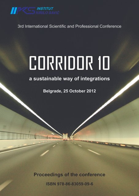
3rd International Scientific and Professional Conference<br />
CORRIDOR <strong>10</strong><br />
a sustainable way of integrations<br />
Belgrade, 25 October 2012<br />
Proceedings of the conference<br />
ISBN 978-86-83059-09-6
3rd International Scientific and Professional Conference<br />
CORRIDOR <strong>10</strong> - a sustainable way of integrations<br />
3 rd International Scientific and Professional Conference<br />
”Corridor <strong>10</strong> - a sustainable way of integrations”<br />
Belgrade, 25 October 2012<br />
Belgrade Chamber of Commerce<br />
Proceedings of the conference<br />
Organized by<br />
R&D Institute “<strong>Kirilo</strong> Savić” a.d. Belgrade<br />
and<br />
Association of Transport and Telecommunications of the Belgrade Chamber of<br />
Commerce<br />
in cooperation with the<br />
Faculty of Transport and Traffic Engineering, University of Belgrade<br />
and<br />
Institute of Traffic and Transport Ljubljana I.I.c.<br />
Supported by<br />
Ministry of Transport<br />
and<br />
Ministry of Education, Science and Technological Development<br />
of the Republic of Serbia<br />
Belgrade, 2012<br />
I
3rd International Scientific and Professional Conference<br />
CORRIDOR <strong>10</strong> - a sustainable way of integrations<br />
Urednik/Editor:<br />
ZBORNIK RADOVA/PROCCEDINGS<br />
3. međunarodna naučno-stručna konferencija<br />
»<strong>Koridor</strong> <strong>10</strong> - održivi put integracija »<br />
Beograd, 20.<strong>10</strong>.2011.<br />
The 3rd International Scientific and Professional Conference<br />
»Corridor <strong>10</strong> - a sustainable way of<br />
integrations«<br />
dr Tomislav JOVANOVIĆ, Institut »<strong>Kirilo</strong> Savić« a.d.<br />
Recenzenti/ Reviewers:<br />
dr Tomislav JOVANOVIĆ, Institut »<strong>Kirilo</strong> Savić« a.d.<br />
dr Predrag PETROVIĆ, Institut »<strong>Kirilo</strong> Savić« a.d.<br />
dr Vesna PAVELKIĆ, Institut »<strong>Kirilo</strong> Savić« a.d.<br />
dr Olivera ERIĆ, Institut »<strong>Kirilo</strong> Savić« a.d.<br />
dr Ivana ATANASOVSKA, Institut »<strong>Kirilo</strong> Savić« a.d.<br />
dr Mirjana Puharić, Institut »<strong>Kirilo</strong> Savić« a.d.<br />
dr Milan Janić, Delft University of Technology, Delft, The NETHERLANDS<br />
Uređivački odbor/Editorial Board:<br />
Prof. dr Snežana KOMATINA-PETROVIĆ, IZIIS Skopje, FYROM<br />
dr Vesna PAVELKIĆ, Institut »<strong>Kirilo</strong> Savić« a.d.<br />
dr Ivana ATANASOVSKA, Institut »<strong>Kirilo</strong> Savić« a.d.<br />
mr Dragan STEFANOVIĆ, Privredna komora Beograda – Udruženje saobraćaja i<br />
Telekomunikacija<br />
dr Mirjana Puharić, Institut »<strong>Kirilo</strong> Savić« a.d.<br />
Izdavač/Publisher:<br />
Institut ”<strong>Kirilo</strong> Savić” a.d., Beograd<br />
Tiraž: 200 primeraka<br />
ISBN: 978-86-83059-09-6<br />
Svi radovi u zborniku su recenzirani/ All papers in Proceedings are reviewed<br />
Copyright © Institut ”<strong>Kirilo</strong> Savić”a.d., 2012.<br />
Organizatori/Organizers:<br />
Institut »<strong>Kirilo</strong> Savic« a.d.<br />
Privredna komora Beograda - udruženje saobraćaja i telekomunikacija<br />
Belgrade, 2012<br />
II
3rd International Scientific and Professional Conference<br />
CORRIDOR <strong>10</strong> - a sustainable way of integrations<br />
Organizing Committee<br />
Tomislav JOVANOVIĆ, »<strong>Kirilo</strong> Savić« Institute a.d. Belgrade, President of the Conference<br />
Organizing Committee<br />
Dragoljub STEFANOVIĆ, Association of Transport and Telecommunications of the Belgrade<br />
Chamber of Commerce, Conference Coordinator, Vice-President of the<br />
Conference Organizing Committee<br />
Branko BOJOVIĆ, Magazine of the Association of Civil Engineers, Geotechnical Engineers,<br />
Architects and Town Planers »IZGRADNJA«, Editor in Chief, member<br />
Nebojša BOJOVIĆ, University of Belgrade, Faculty of Transport and Traffic Engineering,<br />
member<br />
Slavko VESKOVIĆ, University of Belgrade, Faculty of Transport and Traffic Engineering,<br />
member<br />
Miloš JELIĆ,<br />
»<strong>Kirilo</strong> Savić« Institute a.d. Belgrade, member<br />
Predrag PETROVIĆ, »<strong>Kirilo</strong> Savić« Institute a.d. Belgrade, member<br />
Vesna PAVELKIĆ, »<strong>Kirilo</strong> Savić« Institute a.d. Belgrade, member<br />
Ivana ATANASOVSKA, »<strong>Kirilo</strong> Savić« Institute a.d. Belgrade, member<br />
Dušan MIJUCA, »<strong>Kirilo</strong> Savić« Institute a.d. Belgrade, member<br />
Suzana GRAOVAC, »<strong>Kirilo</strong> Savić« Institute a.d. Belgrade, member<br />
Milan ŽIVANOVIĆ, »<strong>Kirilo</strong> Savić« Institute a.d. Belgrade, member<br />
Scientific Committee<br />
Miloš IVIĆ,<br />
University of Belgrade, Faculty of Transport and Traffic Engineering,<br />
President of the Conference Scientific Committee<br />
Miroljub JEVTIĆ, »<strong>Kirilo</strong> Savić« Institute a.d. Belgrade, Vice-President of the Conference<br />
Scientific Committee<br />
Branimir STANIĆ, University of Belgrade, Faculty of Transport and Traffic Engineering, Dean,<br />
member<br />
Slobodan GVOZDENOVIĆ, University of Belgrade, Faculty of Transport and Traffic Engineering,<br />
member<br />
Borislav STOJKOV, Republic Agency for Spatial Planning of the Rebublic of Serbia, member<br />
Dragomir MANDIĆ, University of Belgrade, Faculty of Transport and Traffic Engineering,<br />
member<br />
Milan MARKOVIĆ, University of Belgrade, Faculty of Transport and Traffic Engineering,<br />
member<br />
Milan VUJANIĆ, University of Belgrade, Faculty of Transport and Traffic Engineering,<br />
member<br />
Katarina VUKADINOVIĆ, University of Belgrade, Faculty of Transport and Traffic Engineering,<br />
member<br />
Gojko RIKALOVIĆ, University of Belgrade, Faculty of Economics, member<br />
Zdenka J. POPOVIĆ, University of Belgrade, Faculty of Civil Engineering, member<br />
Miloš JELIĆ,<br />
»<strong>Kirilo</strong> Savić« Institute a.d. Belgrade, member<br />
Olivera ERIĆ,<br />
»<strong>Kirilo</strong> Savić« Institute a.d. Belgrade, member<br />
Vesna ZLATANOVIĆ-TOMAŠEVIĆ, Engineers Association of Belgrade, member<br />
Tomislav JOVANOVIĆ, »<strong>Kirilo</strong> Savić« Institute a.d. Belgrade, member<br />
Mirjana PUHARIĆ, »<strong>Kirilo</strong> Savić« Institute a.d. Belgrade, member<br />
Belgrade, 2012<br />
III
3rd International Scientific and Professional Conference<br />
CORRIDOR <strong>10</strong> - a sustainable way of integrations<br />
Dušan TEODOROVIĆ, Professor Emeritus, Virginia Polytechnic Institute and State University, USA,<br />
member<br />
Milan JANIĆ,<br />
Senior Researcher, OTB Research Institute for the Built Environment, Delft<br />
University of Technology, Delft, The NETHERLANDS, member<br />
Vaska ATANASOVA, University «St. Kliment Ohridski«-Bitola, Faculty of Technical Sciences,<br />
FYROM, member<br />
Peter VERLIČ, Institute of Traffic and Transport Ljubljana I.I.c., SLOVENIA, member<br />
Momčilo ŠARENAC, Institute of Traffic and Transport Ljubljana I.I.c., SLOVENIA, member<br />
Peter MÁRTON, University of Žilina, Faculty of Management Science&Informatics,<br />
Department of Transport Networks, SLOVAKIA, member<br />
Stjepan LAKUŠIĆ, University of Zagreb, Faculty of Civil Engineering, CROATIA, member<br />
Snežana KOMATINA-PETROVIĆ, Visiting Professor, IZIIS Skopje, FYROM, member<br />
Primož KRANJEC, Institute of Traffic and Transport Ljubljana I.I.c, SLOVENIA, member<br />
Perica GOJKOVIĆ, University of East Sarajevo, Faculty of Transport and Traffic Engineering<br />
Doboj, REPUBLIC OF SRPSKA, member<br />
Ratko ĐURIČIĆ, University of East Sarajevo, Faculty of Transport and Traffic Engineering<br />
Doboj, REPUBLIC OF SRPSKA, member<br />
Branimir BOŠKOVIĆ, Directorate for Railways, Republic of Serbia, member<br />
Poster Presentation:<br />
Vesna PAVELKIĆ,<br />
Institut »<strong>Kirilo</strong> Savić« Belgrade, Chairman of the Poster Presentation<br />
Belgrade, 2012<br />
IV
3rd International Scientific and Professional Conference<br />
CORRIDOR <strong>10</strong> - a sustainable way of integrations<br />
CIP - Каталогизација у публикацији<br />
Народна библиотека Србије, Београд<br />
625(082)(0.034.2)<br />
502.131.1:656(082)(0.034.2)<br />
625.711.1(4)(082)(0.034.2)<br />
МЕЂУНАРОДНА научно-стручна конференција<br />
Коридор <strong>10</strong> - одрживи пут интеграција (3 ;<br />
2012 ; Београд)<br />
Proceedings of the Conference<br />
[Elektronski izvor] = [<strong>Zbornik</strong> <strong>radova</strong>] / 3rd<br />
International Scientific and Professional<br />
Conference Corridor <strong>10</strong> - a Sustainable Way of<br />
Integrations, Belgrade, 25 October 2012 = [3.<br />
međunarodna naučno-stručna konferencija<br />
<strong>Koridor</strong> <strong>10</strong> - održivi put integracija,<br />
Beograd, 25.<strong>10</strong>.2012.] ; [organized by]<br />
Institut "<strong>Kirilo</strong> Savić" ... [et al.] ;<br />
[urednik, editor Tomislav Jovanović]. -<br />
Beograd : Institut "<strong>Kirilo</strong> Savić", 2012<br />
(Beograd : Institut "<strong>Kirilo</strong> Savić"). - 1<br />
elektronski optički disk (CD-ROM) ; 12 cm<br />
Sistemski zahtevi: Nisu navedeni. - Nasl. sa<br />
naslovnog ekrana. - Radovi na srp. i engl.<br />
jeziku. - Tiraž 200. - Bibliografija uz svaki<br />
rad. - Napomene i bibliografske reference uz<br />
tekst. - Abstracts.<br />
ISBN 978-86-83059-09-6<br />
1. Институт "Кирило Савић" (Београд)<br />
a) Саобраћај - Одрживи развој - Зборници<br />
b) Саобраћајне мреже - Коридор <strong>10</strong> - Зборници<br />
COBISS.SR-ID 196039180<br />
Belgrade, 2012<br />
V
3rd International Scientific and Professional Conference<br />
CORRIDOR <strong>10</strong> - a sustainable way of integrations<br />
TABLE OF CONTENTS<br />
GEO-STRATEŠKI IZAZOVI PROSTORA KORIDORA <strong>10</strong> - ISTORIJSKA, SAOBRAĆAJNA,<br />
EKONOMSKA I KULTURNA GEOGRAFIJA PROSTORA 1<br />
ODRŽIVI RAZVOJ SAOBRAĆAJNOG SISTEMA U FUNKCIJI RAZVOJA PRIVREDE 23<br />
THE IMPORTANCE OF REGIONAL RAILWAY LINES REVITALIZATION FOR CORRIDOR<br />
X IN THE REPUBLIC OF SERBIA 29<br />
THE METHODOLOGY FOR CALCULATING ELIGIBILITY OF INVESTMENT IN PUBLIC<br />
RAILWAY INFRASTRUCTURE IN REPUBLIC OF SLOVENIA 36<br />
PLANNING A COMPLETION OF CORIDORS AS A STRATEGIC PRIORITY 44<br />
HARMONIZATION OF TECHNICAL REGULATIONS IN THE AREA OF RAILWAY TRACK<br />
MAINTENANCE 50<br />
FINANCIAL ANALYSIS OF RAIL INFRASTRUCTURE PROJECTS 61<br />
RAILWAY TRAFFIC AND THE MODERN TRANSPORT TECHNOLOGIES-BASIS FOR<br />
DEVELOPMENT OF TRANSPORT SYSTEM OF CORRIDOR X 69<br />
MARSHALLING YARDS ALONG THE PANEUROPEAN RAILWAY CORRIDORS 73<br />
THE CURRENT STATUS OF PREPARATION AND REALIZATION OF TRANS-<br />
EUROPEAN RAILWAY LINES PASSING THROUGH THE TERRITORY OF THE SLOVAK<br />
REPUBLIC 80<br />
CHANGES OF FLOWS IN ECONOMY SUPPLY CHAINS OF BIH: INFLUENCES ON<br />
INVESTMENT PRIORITIES ON CORRIDORS X AND VII 90<br />
OPPORTUNITIES OF THE REPUBLIC OF SLOVENIA AND THE REGION IN THE<br />
FRAMEWORK OF THE EUROPEAN RAILWAY NETWORK 96<br />
A COMPARATIVE ANALYSIS OF CORRIDOR <strong>10</strong> WITH CORRIDOR 4 <strong>10</strong>6<br />
ANALYSIS STATE OF THE RAILWAY LINE ON CORRIDOR <strong>10</strong> , WHICH PASS<br />
THROUGH SERBIA, IN TERMS OF THE MAXIMUM TECHNICAL SPEED 116<br />
THE IMPORTANCE OF THE CORRIDOR <strong>10</strong> OF ECONOMIC DEVELOPMENT OF<br />
SERBIAN 124<br />
Belgrade, 2012
3rd International Scientific and Professional Conference<br />
CORRIDOR <strong>10</strong> - a sustainable way of integrations<br />
FACILITATING SPECIFIC TRANSPORT SERVICES ALONG THE CORRIDOR X IN<br />
ORDER TO ATTRACT TRAFFIC FLOWS 138<br />
RAILWAY SIDINGS IN SLOVENIA- PROBLEMS AND MEASURES TO INCREASE THEIR<br />
ATTRACTIVENESS 151<br />
INTERMODAL INFRASTRUCTURE PLANNING IN LJUBLJANA: FIELD SURVEY AS A<br />
METHOD FOR PUBLIC PARTICIPATION 159<br />
MODERN RAILROAD TERMINALS AS RELATED TO URBAN MATRIX DEVELOPMENT<br />
165<br />
PROVIDING CO-MODALITY OF PUBLIC PASSENGER TRANSPORT THROUGH A<br />
STANDARDIZED UNIFIED ELECTRONIC TICKETING SYSTEM IN SLOVENIA 173<br />
COST ANALYSIS FOR INTRODUCTION OF NEW INTERMODAL TRANSPORT<br />
SERVICES IN ALPINE REGION 186<br />
COMPUTER AIDED SUPPORT FOR MODELLING OF RAILWAY CAPACITY CONTAINED<br />
IN UIC 406 LEAFLET 198<br />
CONCEPTION OF TRAIN OPERATION TECHNOLOGY ON LJUBLJANA RAILWAY<br />
STATION DURING EXECUTION OF CONSTRUCTION WORKS SUPPORTED BY<br />
RAILSYS ENGINEERING SOFTWARE 209<br />
RESEARCH SOME AERODYNAMICS PHENOMENON OF HIGH-SPEED TRAINS IN<br />
LOW-SPEED WIND TUNNEL 220<br />
ROLLING CONTACT FATIGUE OF RAILS 227<br />
RAIL INSPECTION BY EDDY CURRENT METHOD 238<br />
NOISE REDUCTION IN RAILWAY INFRASTRUCTURE 252<br />
ELECTROMAGNETIC FIELD UNDER THE ELECTRIC OVERHEAD SYSTEM 25 KV, 50<br />
HZ OF SERBIAN RAILWAYS 265<br />
DISMANTLING OF VESSELS AS A SUSTAINABLE PROCESS 281<br />
REVIEW OF THE TRACK CHARACTERISTICS ON THE CORRIDOR <strong>10</strong> TRACKLINE<br />
SEGMENT 290<br />
Belgrade, 2012
3rd International Scientific and Professional Conference<br />
CORRIDOR <strong>10</strong> - a sustainable way of integrations<br />
NUMERICAL SIMULATION OF SPREADING CO2 AND SO2 EMITTED FROM STACK<br />
KOSTOLAC B ABOVE THE MUSEUM VIMINACIJUM 300<br />
ECOTRACK - NEW TYPE OF BALLASTLESS TRACK SYSTEM 3<strong>10</strong><br />
TRANSPORTATION DEMANDS OF OIL AND OIL DERIVATES ALONG THE CORRIDOR<br />
X ON TERRITORY OF THE REPUBLIC OF SERBIA 311<br />
POSTER PREZENTACIJE 312<br />
Belgrade, 2012
3rd International Scientific and Professional Conference<br />
CORRIDOR <strong>10</strong> - a sustainable way of integrations<br />
GEO-STRATEŠKI IZAZOVI PROSTORA KORIDORA <strong>10</strong> - istorijska,<br />
saobraćajna, ekonomska i kulturna geografija prostora<br />
Branko BOJOVIĆ, dipl. ing. arh., glavni urednik časopisa „Izgradnja“, Beograd,<br />
Srbija<br />
Apstrakt<br />
U prvom delu referata autor konstatuje postojanje i trajanje geopolitičkih limese na dodirima<br />
uticajnih sfera svetskih centara moći. Posebno se osvrće na Balkan kao geopolitički limes koji traje<br />
više od dve hiljade godina i koji je od vremena imperijalizma pa do danas predmet imperijalnog<br />
inženjeringa raznih vrsta. Stvaranje novih naroda, država i drugih političkih teritorija traje i danas uz<br />
sve veću zavisnost tih naroda i političkih teritorija od današnjih centara političke moći.<br />
U drugom delu teksta autor ističe stav da su balkanske zemlje pa i Srbija u procesu tranzicije<br />
zahvaćene temeljnom deindustrijalizacijom i to najboljeg i najvažnijeg dela privrede, čime su<br />
pretvorene u poljoprivredne i sirovinske zemlje i tržište za zemlje – nosioce političke moći. Sve manje<br />
političke teritorije sve više se zadužuju radi izgradnje velikih saobraćajnih infrastruktura. U ovim<br />
poduhvatima treba biti oprezan, jer iskustvo Srbije pokazuje da Srbija nije ozbiljno valorizovala svoju<br />
poziciju na moravsko-vardarskom železničkom i autoputskom koridoru.<br />
U zaključku autor iznosi da su velike infrastrukture uzrok, ali i posledica razvoja, ali da izgradnja<br />
visokokapacitetnih infrastruktura uz nedovoljno razvijenu, pre svega prerađivačku privredu izaziva<br />
dalje zaostajanje sekunadrnog sektora, što ima trajne posledice po privredni razvoj.<br />
Ključne reči: geopolitika, uticijane sfere, koridori, razvoj.<br />
Belgrade, 2012 1
3rd International Scientific and Professional Conference<br />
CORRIDOR <strong>10</strong> - a sustainable way of integrations<br />
Rat je nastavak politike drugim sredstvima<br />
Karl Fon Klauzevic<br />
Politika je nastavak rata drugim sredstvima<br />
Branko od Bojovića<br />
1. UVOD<br />
Od strane organizatora pozvan sam da dam skroman doprinos ovom skupu. Poziv sam prihvatio<br />
uprkos brojnim obavezama i ograničenjima. Kao čovek koji se već 50 godina bavi prostornim i<br />
urbanističkim planiranjem, trudio sam se da razumem geopolitičke pojave i procese, koje su bitne za<br />
promišljanje razvoja političkih entiteta odnosno teritorija. Ozbiljno planiranje prostora i naselja nije<br />
moguće bez ozbiljnog razumevanja geopolitike. Pod geopolitkom u ovom slučaju podrazumevam i<br />
klasično shvaćenu geopolitiku tj. i klasićno shvaćene geopolitičke interese država i naroda, ali i<br />
geopolitičke odnose unutar pojedinih geopolitičkih teritorija jer je svaki oblik teritorijalnog<br />
organizovanja istovremeno i oblik internih geopolitičkih odnosa unutar neke političke teritorije.<br />
Mislim da je važno da kažem da sve što je izloženo u ovom tekstu predstavlja isključivo moj lični stav,<br />
odnosno moju istinu o problemu o kome je reč.<br />
U pripremi video-prezentacije pomogao mi je gospodin Dragoljub Štrbac, geograf, istraživač u<br />
Geografskom institutu „Jovan Cvijić“ Srpske akademije nauke i umetnosti.<br />
2. OPŠTE NAPOMENE<br />
Na dodirima velikih (ali često i malih) naroda, religija, imperija i ideologija formiraju se rubna područja,<br />
neka vrsta geopolitičkih limesa. To su područja gde se iscrpljju uticaji nosilaca geopolitičke moći, to su<br />
političke teritorije u današnjem svetu u kojima se dodiruju, sudaraju ili sukobljavaju interesne sfere<br />
nosilaca geopolitičke moći. Granice uticajnih sfera menjaju se ratnim, ali i tzv. mirnodopskim<br />
sredstvima, u koja se ubrajaju ekonomski ratovi, javni i prikriveni, ratovi verski, demografski,<br />
kulturološki, etnički, propagandni i dr. Smene ratnih i mirnodopskih dejstava izazivaju stalno talasanje<br />
u rubnim prostorima odnosno geopolitičkim limesima, a stalne promene koje se u tim graničnim<br />
područjima dešavaju izazivaju trajnu nestabilnost naroda i država.<br />
Kroz istoriju čovečanstva i svetsku filozofiju već hiljadama godina se traga za suštinom čoveka. Čovek<br />
je definisan kao homo sapiens, homo erektus, homo secsualis, homo ludens, homo oekonomikus,<br />
homo politikus, kao biće prakse i na mnoge druge načine. Hiljadama godina zaboravlja se da je čovek<br />
pre svega biće prostora i to, koliko je meni poznato, prvi dobro i jasno uočava Špengler u „Propasti<br />
Zapada“. Čovek je biće prostora najmanje na tri načina.<br />
Najpre, čovek je prirodno determinisan tako da može da živi isključivo na vasionskom modulu koji se<br />
zove Zemlja. Istina prilagođen različitosti zemaljskih prostora. Zatim, čovek kao najpre instinktivni, a<br />
kasnije kao svesni graditelj stalno prilagođava prirodni prostor svojim potrebama, čovek prostor gradi i<br />
uređuje, odnosno antropogenizuje. Konačno, ljudi se kao pojedinci, porodice, plemena, narodi,<br />
države, kao predstavnici ideologija i sl., takođe bore za prostor. Ovladavanje resursima, ali i prostorom<br />
Belgrade, 2012 2
3rd International Scientific and Professional Conference<br />
CORRIDOR <strong>10</strong> - a sustainable way of integrations<br />
koji je sam po sebi resurs, kao i drugim ljudima je večiti cilj politike. U tom smislu homo politikus je,<br />
istovremeno i neizbežno, i čovek prostora.<br />
Borba za prostor je bitan elemenat politike oduvek, sama suština politike koja traje kroz celu istoriju<br />
čoveka kao biološkog i socialnog bića, ta borba se ispoljava u svim oblicima socijalne organizacije.<br />
Mislim da je apsolutno tačan aforizam jednog beogradskog aforističara koji je napisao: „Istorija Sve je<br />
to samo borba za geografiju“.<br />
Cela današnja zemljina kugla pokrivena je starim i novim geopolitičkim limesima kao što se može<br />
videti na slici 1.<br />
Slika 1. Karta sa starim i novim geopolitičkim limesima<br />
Spisak geopolitičkih limesa u svetu (osim Afrike) dat je u prilogu ovog rada.<br />
Belgrade, 2012 3
3rd International Scientific and Professional Conference<br />
CORRIDOR <strong>10</strong> - a sustainable way of integrations<br />
3. BALKAN KAO GEOPOLITIČKI LIMES<br />
Prostor Balkana je geopolitički limes već hiljadama godina. Istorijski, ali i materijalni dokaz toga je<br />
izgradnja rimskog limesa na Dunavu i Raniji u 1.veku n.e. Da bi se pristupilo izgradnji, za ono vreme<br />
kolosalnog sistema fortifikacija unutar ovog limesa, problem je morao postojati bar nekoliko stotina<br />
godina pre toga. Na teritoriji Balkana razgraničavale su se administrativne jedinice Rimskog carstva u<br />
vreme tetrarhije, preko Balkana su se razgraničili istočno i zapadno Rimsko carstvo, pravoslavlje i<br />
katolicizam itd.<br />
U dve hiljade godina, Balkanom su vladale četiri imperije – Rim, Vizantija, Osmanska Turska i Austrija,<br />
a aspiracije na prostor Blkana iskazivale su i na njemu se privremeno bazirale Rusija i Sovjetski<br />
Savez, Britanja, Francuska, Nemačka, SAD, pa čak i Kina u vreme razlaza Albanije i SSSR-a.<br />
Istovremeno sa vlašću velikih imperija na Blakanu su se formirale mnoge države i razne druge<br />
političke teritorije, u raznim statusima u odnosu na četiri imperije koje su vladale prostorom Balkana i<br />
imperija koje su imale aspiracije na prostor Balkana.<br />
Narodi Balkana su izmešani rasno, kulturološki, verski, jezički i na mnoge druge načine.<br />
Razgraničenje među balkanskim narodima su od najmanje dve vrste. Nekom vrstom funkcionalnih<br />
razgraničenja mogli bi da nazovemo etnička, jezička i verska razgraničenja. Nekom vrstom interesnih<br />
razgraničenja mogli bi da nazovemo razgraničenja koja se dešavaju uglavnom pod uticajem spoljnih<br />
faktora, jer stvaranje država i nacija na Balkanu ni danas nije završeno. Balkan je u poslednjih oko tri<br />
stotine godina mesto imperijalnog i etničkog inženjeringa koji traje i danas. Ovde iznosim samo jedan<br />
primer.<br />
U Maloj enciklopediji Prosvete odrednica o rumunskom jeziku sadrži dva fragmenta koja navodim:<br />
„Rumunski jezik je po poreklu romanski, strukturi i rečniku, jedini direktni potomak govornog latinskog<br />
koji se sačuvao u balkanskim provincijama Rimske Imperije. U procesu formiranja asimilirao je<br />
slovenske i druge leksičke elemente. Slovenski uticaj prisutan je u toponimici i jednom delu<br />
poljoprivredne i crkvene terminologije.“<br />
„U pisanoj književnosti, crkvenoslovenski jezik, pored toga što se upotrebljavao u crkvi, bio je i<br />
književni jezik do 18. veka. Ćirilsko pismo održalo se sve do 1860., kad je umesto njega uvedena<br />
latinica; najstariji pisani spomenik je iz XV v. Štamparsku veštinu doneo je srpski štampar kaluđer<br />
Makarije, koji je posle gubitka nezavisnosti Crne Gore i prestanka rada štamparije na Obodu, odn.<br />
Cetinju, otišao u Rumuniju. U XVI v. Štampane su crkvene knjige.“<br />
Ova dva citata otvaraju mnogo pitanja – navodim samo dva - tri. Kakav je to direktan potomak<br />
govornog latinskgo jezika koji je asmimilirao slovenske leksičke elementa, a pisao se ćirilicom. Zar nije<br />
logičnije predpostaviti da se na prostoru današnje Rumunije govorila neka varijanta staroslovenskog<br />
jezika sa puno romanizama. Kako je moguće da je crkveno-slovenski jezik potisnuo sasvim izvesno<br />
superioran latinski jezik i njegovog direktnog ptomka rumunski jezik, itd. Očito, radi se o kolonijalnom i<br />
imperijalnom inženjeringu iz druge polovineXIX veka, kada je formirana izmišljena rumunska nacija i<br />
kada je uveden očigledno izmišljeni rumunski jezik. Da je tako potvrđuje jedna bitna činjenica iz istorije<br />
Srbije. Naime, bliske veze Obrenovića i rumunskog plemstva, sve negde do Berlinskog kongresa,<br />
očigledno su se zasnivale ne samo na materijalnim interesima, već i na lakoj jezičkoj komunikaciji.<br />
Ono što je izneto napred potvrđuje i bezbroj drugih činjenica. Veliki rumunski teniser Cirijak, čovek koji<br />
je doživeo veliku međunarodnu reputaciju i čovek koji je omogućio uspon svom prijatelju našem Bobi<br />
Živonijoviću, stvarno se sa starinom prezivao Kirijakos.<br />
Cilj ovakvog etničkog inženjeringa ostvaren je. Velika slovenska masa od Vladivostoka do Jadrana,<br />
prekinuta je stvaranjem rumunske nacije i države, a tvorci tog imperijalnog inženjeringa time su u<br />
stvari dobili odrešene ruke u odnosu na slovenski elemenat na Balkanu, pre svega slovenski elemenat<br />
pravoslavne vere.<br />
Belgrade, 2012 4
3rd International Scientific and Professional Conference<br />
CORRIDOR <strong>10</strong> - a sustainable way of integrations<br />
Balkan dolazi u centar svetske političke pažnje posle poraza Osmanske Turske pod Bečom 1683.<br />
godine. Tada se otvara tzv. Istočno pitanje koje do dana današnjeg nije doživelo svoje konačno<br />
rešenje.<br />
Samo tri godine posle odbrane Beča, godine 1686. Pjer Kopen radi kartu deobe Balkana između sila<br />
pobednica. U podeli Balkana učestvuju Venecija, Austrija, Poljska, Francuska, Engleska, Španija,<br />
Portugalija, Sveta Stolica, Modena i Parma i na kraju Malteški vitezovi. Prostor Balkana se deli kao<br />
pustolina, kao ničija zemlja (slika 2).<br />
Slika 2 Karta podele Balkana iz 1686. godine<br />
Godine 1772. Kara radi drugu podelu Balkana u kojoj učestvuju Austrija, Pruska, Francuska i Venecija<br />
(slika 3).<br />
Slika 3 Karta podele Balkana iz 1772. godine<br />
Belgrade, 2012 5
3rd International Scientific and Professional Conference<br />
CORRIDOR <strong>10</strong> - a sustainable way of integrations<br />
Ruska carica Katarina II i Austrijski car Jozef II, iste te 1772. godine započinju pregovore o deobi<br />
uticajnih sfera na Balkanu, pregovore nastavljaju 1782. godine, a 1787. godine u Jalti potpisuju<br />
sporazum. Balkan treba da pripadne trima carevinama – Rusiji, Austriji i Turskoj. Razgraničenje Ruske<br />
i Austirjske interesne sfere je na Staroj Planini, kako se vidi iz priložene karte (slika 4).<br />
Ova karta u određenom smislu važi i<br />
danas – njom se definiše pojam<br />
Zapadnog Balkana koji je u čestoj<br />
upotrebi od raspada druge Jugoslavije.<br />
Da je ovaj ugovor u određenom smislu<br />
živ, vidi se iz činjenice da u rešavanju<br />
problema Zapadnog Balkana u<br />
poslednjih dvadesetak godina<br />
učestvuju, pored ostalih, Jirži Dinstbir,<br />
Medlin Oldbrajt, Rihard Holbruk,<br />
Volgang Petrič, Miroslav Lajčak,<br />
František Lipka, Štefan File i mnogi<br />
drugi političari sa teritorije nekadašnje<br />
Austrijske carevine, odnosno<br />
Austrougarske.<br />
Slika 4 Karta podele Balkana iz 1777. godine<br />
U želji da trajno potisne Tursku sa Balkana, ruski imperator Aleksandar I 1808. godine, predviđa<br />
podelu Balkana između Rusije, Austrije i Francuske. (slika 5).<br />
Slika 5 Karta podele Balkana iz 1808. godine<br />
Belgrade, 2012 6
3rd International Scientific and Professional Conference<br />
CORRIDOR <strong>10</strong> - a sustainable way of integrations<br />
Dvadeset godina kasnije, 1828. godine Joanis Kapodistrija daje jedan revolucionaran predlog. On<br />
takođe predviđa potiskivanje Turske sa Balkana, ali predviđa da Balkan pripadne balkanskim<br />
narodima, tako da predlaže stvaranje država Dačije (Rumunije), Srbije, Makedonije, Epira i Grčke, dok<br />
bi Konstantinopolj (Carigrad) ostao slobodan grad (slika 6).<br />
Slika 6 Karta podele Balkana iz 1828. godine<br />
Belgrade, 2012 7
3rd International Scientific and Professional Conference<br />
CORRIDOR <strong>10</strong> - a sustainable way of integrations<br />
Karta Evrope iz 1830. godine (slika 7) pokazuju da velike sile koje su vladale Evropom nisu imale<br />
razumevanja za ideju Kapodistrije. Na prostoru Jugoistočne Evrope dodiruju se Austrija, Osmanska<br />
Turska i Rusija, ali se unutar evropskog dela Osmanske Turske naziru počeci nezavisnosti balkanskih<br />
naroda i država – Grčke, Srbije i Rumunije.<br />
Slika 7 Karta Evrope iz 1830. godine<br />
Belgrade, 2012 8
3rd International Scientific and Professional Conference<br />
CORRIDOR <strong>10</strong> - a sustainable way of integrations<br />
Karta iz 1914. godine pokazuje pojavu velikog broja malih država na teritoriji Balkana koje su<br />
naslednici evropskog dela Osmanskog carstva. (slika 8).<br />
Slika 8 Karta Evrope iz 1914. godine<br />
Belgrade, 2012 9
3rd International Scientific and Professional Conference<br />
CORRIDOR <strong>10</strong> - a sustainable way of integrations<br />
Pred Drugi svetski rat na prostoru Balkana vidi se malo ukrupnjavanje političkih teritorija, jer su<br />
stvorene prva Jugoslavija i Rumunija. Može se uzeti da je ovo kratkotrajno ukrupnjavanje neka vrsta<br />
istorijskog ekcesa, bar kada se radi o prostoru Jugoslavije. (slika 9)<br />
Slika 9 Karta Evrope u periodu 1918 - 1938. godine<br />
Drugi svetski rat završen je tektonskim poremećajima na evropskom tlu, jer je Sovjetski Savez<br />
potisnuo zemlje Centralne i Zapadne Evrope na zapad, pre svega Poljsku i Nemačku. (slika <strong>10</strong>)<br />
Belgrade, 2012 <strong>10</strong>
3rd International Scientific and Professional Conference<br />
CORRIDOR <strong>10</strong> - a sustainable way of integrations<br />
Slika <strong>10</strong> Karta Evrope nakon 1945. godine<br />
Konačno, karta Evrope iz oko 1990. godine, posle raspada Sovjetskog Saveza (slika 11), pokazuje da<br />
je ceo evropski prostor od Baltičkog do Jadranskog i Egejskog mora pokriven malim državama,<br />
odnosno malim političkim teritorijama, koje sve skupa čine neku vrstu geopolitičkog limesa između<br />
Rusije i Evrope.<br />
Slika 11 Karta Evrope nakon 1990. godine<br />
Usitnjavanje prostora Osmanskog i Austrijskog carstva, odnosno Austrougarske, posledica je kako<br />
dejstva velikih sila tako i lokalnih nacionalizama. U procesu raspada imperija i nastanka velikog broja<br />
Belgrade, 2012 11
3rd International Scientific and Professional Conference<br />
CORRIDOR <strong>10</strong> - a sustainable way of integrations<br />
malih nacionalnih država, dolazi do<br />
pojave velikog broja sukoba između tih<br />
država, koje se zavađaju i međusobno<br />
ratuju, vekovima i decenijama. Kao<br />
primer navodim kartu koja prikazuje<br />
aspiracije Bugarske prema tajnom<br />
ugovoru iz 1915. godine koje se tiču<br />
teritorije ondašnje Srbije. Tajni sporazum<br />
sklopljen je između Bugarske i Centralnih<br />
sila (slika 12). Kao kuorizitet navodim da<br />
je u procesu raspada druge Jugoslavije,<br />
jedan od vodećih hrvatskih frankovaca,<br />
sa sličnom kartom putovao u Bugarsku.<br />
Želja je bila da Hrvatska i Bugarska<br />
uspostave zajedničku granicu na Velikoj i<br />
Južnoj Moravi. Naime, priložena karta je<br />
unekoliko korigovana.<br />
Slika 12 Plan podele teritorije Kraljevine<br />
Srbije između Bugarske i Centralnih sila<br />
iz 1915. godine<br />
Međusobna omraženost balkanskih naroda je dugotrajna, kako se vidi iz karte genocida (slika 13).<br />
Karta prikazuje zone genocida nad srpskim narodom, koje su učinili fašisti iz redova Hrvata, Mađara,<br />
Nemaca, Albanaca, Italijana i Bugara. Karta nije potpuna, jer je u Rumuniji posle 1948. godine<br />
izvršeno masovno preseljavanje Srba iz Rumunskog Banata u Baragan - pustaru u delti Dunava.<br />
Druga Jugoslavija i Srbija to pitanje nikada nisu postavile javno, imajući u vidu svoje „prijateljstvo“ sa<br />
Rumunima, ali Rumuni danas, u vezi sa vlaškim pitanjem, u Istočnoj Srbiji, spremni su na svaku vrstu<br />
političke ucene kada se radi o ulasku Srbije u Evropsku Uniju. Isto tako, od 1919. godine pa do<br />
današnjeg dana u Mađarskoj se vrši prislina mađarizacija Srba, jer se svaka Zlata rođena kao Srpkinja<br />
u mađarske matične knjige upisuje kao Aranka, ali obratno, nijedna Aranka u Srbiji se ne upisuje kao<br />
Zlata. Nekada se govorilo da je Jugoslavija okružena brigama (Bugarska, Rumunija, Italija, Grčka,<br />
Albanija, Mađarska, Austrija). Izgleda da tek nailazi vreme da se govori o tome da su srpski narod i<br />
Srbija izloženi genocidu još od prve polovine 14. veka pa do naših dana.<br />
Belgrade, 2012 12
3rd International Scientific and Professional Conference<br />
CORRIDOR <strong>10</strong> - a sustainable way of integrations<br />
Slika 13 Karta genocida na području SFR Jugoslavije<br />
4. O KORIDORIMA I POVODOM KORIDORA<br />
Pojam infrastrukture pojavljuje se u vreme Napoleonovih ratova, kao zbirni pojam za teritorijalne<br />
instalacije koje treba da obezbede funkcionisanje teritorija u vezi sa planiranim ratnim dejstvima.<br />
Infrastrukturni sistemi otvaraju prostor za svaku vrstu razvoja, ekonomskog, socijalnog i drugog, jer su<br />
ti sistemi i uzrok i posledica razvoja. Međutim, u dijalektici života i politike infrastrukturni sistemi i<br />
pojedinačne infrastrukture mogu da vrše i funkciju spajanja i funkciju razvdvajanja političkih teritorija,<br />
naroda i država. Tipičan primer te vrste je Dunavski koridor koji prolazeći kroz Vojvodinu, koja je sa<br />
obe strane Dunava naseljena istim stanovništvom ima integrativni karakter, dok je Dunav hiljadama<br />
godina bio elemenat razgraničenja Rumunije i Bugarski i političkih teritorija koje su im prethodile.<br />
Pošto je težište našeg skupa na koridorima 7 i <strong>10</strong>, a pre svega na koridoru <strong>10</strong>, nalazim da je umesno<br />
da iznesem nekoliko opštih napomena o infrastrukturnim sistemima, Balkanu, Zapadnom Balkanu i<br />
Srbiji.<br />
Karta rimskih puteva (slika 14) pokazuje istorijske putne pravce na prostoru Balkana u rimsko vreme.<br />
U prilozima 16 i 17, prikazane su putna i železnička infrastruktura prema evropskim dokumentima iz<br />
Belgrade, 2012 13
3rd International Scientific and Professional Conference<br />
CORRIDOR <strong>10</strong> - a sustainable way of integrations<br />
oko 2000. godine (slika 15a i slika 15b). Treba obratiti pažnju na znatno manju gustinu putne i<br />
železničke mreže u Jugositičnoj Evropi u odnosu Centralnu i Zapadnu Evropu. Konačno, nedavno<br />
usvojen plan Republike Srbije, prikazuje položaj Srbije u odnosu na evropske koridore (slika 16).<br />
Slika 14 Karta rimskih puteva<br />
a) b)<br />
Slika 15 Puta i železnička mreža iz perioda oko 2000. godine<br />
Belgrade, 2012 14
3rd International Scientific and Professional Conference<br />
CORRIDOR <strong>10</strong> - a sustainable way of integrations<br />
Slika 16 Položaj Srbije u odnosu na panevropske <strong>Koridor</strong>e<br />
Posle sloma svetskog socijalističkog pokreta, koji je vođen na način Sovjetskog Saveza, tj. od<br />
devedesetih godina prošlog veka, na prostoru druge Jugoslavije i Srbije nastaje ko zna koji po redu<br />
proces tranzicije, odnosno nastaje novi prelazni period.<br />
Tranzicija u Srbiji podrazumeva uvođenje kapitalizma kroz proces privatizacije, temeljnu<br />
deindustrijalizaciju, naročito onih proizvodnji koje su tehnološki bile najvrednije, gašenje i potpun<br />
nestanak velikih preduzeća, pojavu velikog broja firmi u oblasti male privrede, sa vrlo ustinjenom<br />
akumulacijom, nemogućnost tehnološkog i ekonomskog razvoja, zbog gašenja proizvodnje i usitnjene<br />
akumulacije, pojava komercijalnih banaka, koje su orijentisane samo na sticanje profita i potpuno<br />
odsustvo razvojnih banaka koje bi mogle da pospeše ekonomski, tehnološki i svaki drugi razvoj. Srbija<br />
je pretvorena u sirovinsko područje, došlo je do urušavanja čitavog niza institucija, urušavanja<br />
celokupnog vrednosnog sistema naroda, redukovano je učešće države u podeli rada među državama i<br />
smanjeno je učešće države u svetskom bogatstvu.<br />
Belgrade, 2012 15
3rd International Scientific and Professional Conference<br />
CORRIDOR <strong>10</strong> - a sustainable way of integrations<br />
Kao ilustraciju za ove tvrdnje navodim da je tokom napada NATO na Srbiju potpuno uništena fabrika<br />
automobila Zastava, dok fabrika oružja Zastava uopšte nije bombardovana. Rezultat tranzicionih<br />
promena i rata je potpuno opustošenje Srbije čiji je društveni proizvod danas samo 40% društvenog<br />
proizvoda iz 1989. godine. Došlo je do masovnog osiromašenja i nezaposlenosti, vodeće nacionalne<br />
institucije kao što su Narodni muzej, Muzej savremene umetnosti, Narodna biblioteka i druge,<br />
godinama ne rade. Došlo je do potpune marginalizacije i provincijalizacije svih država Zapadnog<br />
Balkana, pa i Srbije.<br />
U procesu raspada Jugoslavije nastale su nove tzv. nezavisne države koje imaju skoro sve osim<br />
nezavisnosti, čemu pre svega doprinose poslušničke političke elite na vlasti. Te zemlje su stvarno<br />
objekti, a ne subjekti politike. Te zemlje sa malim političkim teritorijama, malim demografskim<br />
kapacitetom, ekonomski onemoćale, razjedinjene i suprotstavljene, preuzimaju sve veće i veće<br />
obaveze u izgradnji transevropskih saobraćajnica. Te države imaju suverinitet samo onda kada se<br />
zadužuju, u svim ostalim slučajevima one su predmet manipulacija svetskih centara političke moći.<br />
Istina, od izgradnje velikih infrastrukturnih sistema, odnosno koridora ima nekih koristi u sferi usluga,<br />
ali je svo to zapošljavanje bez tehnologije i bez objektivnog, stvarnog ekonomskog razvoja.<br />
Na primeru Srbije i njenog razvoja posle Berilnskog kongresa 1878. godine, trebalo bi se ozbiljno<br />
zamisliti. Srbija je završila prugu prema Solunu i Carigradu 1884. godine, ali ako pogledate srednje<br />
gradove na moravskom železničkom koridoru, primetićete da oni nisu ništa bolji nego gradovi iste<br />
veličine u Bugarskoj. Ako pogledate koridor autoputa od Beograda do Niša, osim Ćuprije, Jagodine i<br />
Paraćina, autoput nije bio generator nikakvog stvarnog ekonomskog i drugog razvoja. Dunav prolazi<br />
kroz Srbiju u dužini od 400 km, a Srbija nema relevantnu rečnu flotu, donedavno nije bilo ni jedne<br />
marine na Dunavu i praktično ni jedne benzinske stanice na kojoj bi jahtmeni mogli svoje brodove da<br />
snabdeju gorivom. Srbija nije valorizovala svoje pozicije na postojećim rečnim, železničkim i putnim<br />
koridorima, koji u stvari službe primarno interesima tranzita. Meni lično, pretnje da će putni i drugi<br />
koridori zaobići Srbiju ne izgledaju ni malo tragično. <strong>Koridor</strong>i kroz Srbiju, Srbiji kao državi i narodu u<br />
Srbiji doneli su surove nasrtaje u dva svetska rata, odnosno velike štete i objektivno i male koristi.<br />
Ako su male države Evrope suverene kada se zadužuju za izgradnju velikih infrastrukturnih sistema,<br />
one se objektivno nalaze u statusu ograničenog suveriniteta, u svim drugim stvarima - one su vrlo<br />
zavisne u domenu politike, ekonomije, finansija, vojnom domenu i dr.<br />
Veliki geopolitički igrači, odnosno centri geopolitičke i imperijalne moći investicije i razvoj uslovljavaju<br />
izgradnjom infrastrukturnih koridora, pružajući malim zemljama nadu u kakav takav ekonomski razvoj.<br />
Stvarno, centri moći zainteresovani su za tržište, za jeftinu radnu snagu, odnosno ljudske resurse, za<br />
prirodne resurse, za vojno baziranje i sl. Da se radi o surovim imperijalnim interesima pokazuje npr.<br />
autoput i železnički koridor od Beograda do Zagreba gde osim Sremske Mitrovice i Slavonskog Broda<br />
nema značajnijih naselja ni ozbiljnijeg ekonomskog razvoja, isti je slučaj u železničkom i autoputskom<br />
koridoru od Beograda do Niša itd. Jednostavno, koridori velike propusne moći, putni i železnički nisu<br />
garant da će do ozbiljnog i opšteg razvoja malih država uopšte doći. Otuda je zaduživanje i<br />
prezaduživanje malih država rizičan i pomalo samoubilački posao. To se vidi na primeru Grčke, kojoj<br />
je omogućeno da se prezaduži, a kada je došlo do dužničke krize, iz centara geopolitičke moći, kao<br />
slučajno i pomalo uzgred, Grčkoj je savetovano da proda ostrva ne bi li se razdužila, Samo toliko.<br />
Sve te male države nemaju praktično ništa za izvoz – ni po kvalitetu, ni po količini. Sve te zemlje su<br />
samo tranzitni prostor u službi centara geopolitičke moći. Te centre interesuju koridori unutar ograda,<br />
prostor izvan žice za njih je od sekundarnog interesa. <strong>Koridor</strong>i povezuju velike geopolitičke igrače, oni<br />
su samo manjim delom značajni za sistem lokalnih potreba i pružaju nadu da će jednog dana neki<br />
investitori doći, a možda i neće doći.<br />
Karakteristično je da zbog velikih finansijskih napora male države zapostavljaju izgradnju i<br />
modernizaciju kapilarne putne mreže, a to znači i regionalni razvoj, što znači dalje zaostajanje u<br />
Belgrade, 2012 16
3rd International Scientific and Professional Conference<br />
CORRIDOR <strong>10</strong> - a sustainable way of integrations<br />
razvoju prostora izvan koridora. To izaziva negativne demografske procese, kao što je napuštanje<br />
brdsko-planinskog prostora i naseljavanje stanovništva u malom broju g<strong>radova</strong> i duž koridora, što<br />
dovodi do pražnjenja teritorija koje imaju potencijala za razvoj, preopterećenje g<strong>radova</strong> koji nemaju<br />
kapaciteta za zapošljavanje nove radne snage itd.<br />
Postavlja se pitanje gde je izlaz iz ovakve situacije.<br />
Teorijski model je veoma jednostavan i mogao bi da bude produktivan. On bi podrazumevao<br />
ujedinjavanje malih zemalja i malih naroda oko zajedničkih interesa što bi dovelo do njihovog<br />
zajedničkog ekonomskog jačanja na sektoru finansija, tehnološkog razvoja, industrijske i<br />
poljoprivredne proizvodnje, vojnog jačanja i dr. To bi značilo izlazak tih zemalja iz statusa država<br />
drugog reda u kome se one danas nalaze, a taj njihov status potvrđuju i dva priloga navedena u<br />
prethodnom delu teksta koji prikazuju gustinu železničke i putne mreže (slika 15 a i b).<br />
Posmatrano prekseološki ovakav scenario je nemoguć. Mali narodi i države koji su koliko juče huškani<br />
jedne na druge i naoružavani za međusobna ratna dejstva, ne mogu ući u ozbiljne kooperativne<br />
odnose čak i onda kada je to njihov interes. Posledice višestrukih ratovanja, stalnog suprotstavljanja<br />
interesa ne mogu se prevazići dekretima koja donose centri političke moći. Potrebno je da prođu<br />
generacije da se takve stvari zaborave.<br />
Kada se o Srbiji radi to se veoma dobro vidi. Pred Prvi svetski rat, Austrougarska je držala Vojvodinu i<br />
Bosnu i Hercegovinu, a u Bugarskoj je bila na vlasti nemačka dinastija Koburga. Srbija je bila sa tri<br />
strane okružena zemlja, čime je njena sudbina trebalo da bude trajno rešena. Po cenu ogromnih<br />
ljudskih i materijalnih žrtava, Srbija je izbegla sudbinu koja joj je bila namenjena. U Drugom svetskom<br />
ratu Jugoslavija je napadnuta bukvalno sa svih strana. U današnjem vremenu, prevremenim prijemom<br />
Rumunije i Bugarske u Evropsku Uniju, Srbija je uvedena ponovo u jedan oblik „prijateljske“<br />
geopolitičke blokade, jer je sa svih strana okružena zemljama Evropske Unije i NATO saveza, itd. Sve<br />
su ovo okolnosti od bitnog značaja za pitanje izgradnje i infrastrukturnih koridora kroz Srbiju. Vekovna<br />
i višedecenijska neprijateljstva i otvoreni problemi koji postoje između malih država, ne rešavaju se<br />
već se ignorišu od centara geopolitičke moći, ali oni su klica budućih sukoba koji će se ispoljiti kad-tad.<br />
Srbija ima loša iskustva sa susedima. Balkanski savez s početka prošlog veka doveo je do ratova<br />
među saveznicima. Prva i druga Jugoslavija su bili sa aspekta Srba i srpskih interesa vrlo loše<br />
političko iskustvo, jer su uspostavljlene mnoge asimetrije na štetu Srba i Srbije, od kojih neke i dalje<br />
traju. Takav je npr. proces privatizacije u Srbiji u kome su Slovenija, Hrvatska i Bugarska kupile mnoge<br />
fabrike u Srbiji i to bez reciprociteta, jer srpska privreda u tim država nije mogla da kupi ništa.<br />
Racionalni scenario razvoja za Srbiju je, koncentracija na svoj nacionalni i državni interes kao<br />
apsolutni prioritet. To podrazumeva uvođenje u vlast nacionalno rasvešćene političke elite, ubrzan<br />
ekonomski razvoj, ubrzan razvoj obrazovanja, ubrazan tehnološki razvoj, finansijsko osamostaljenje,<br />
vojno jačanje, valorizacija i kapitalizacija ljudskih i prirodnih resursa, saradnja sa svim zemljama i<br />
narodima bez ksenofobija, ideoloških i političkih predrasuda, sa primarnim osloncem na prijateljske<br />
zemlje itd. Imam utisak da je vreme za ovakav odnos prema problemima u Srbiji otpočelo. Polazeći od<br />
ovakvih pretpostavki mislim da treba preispitati sve razvojne politike u Srbiji, pa i izgradnju<br />
infrastrukturnih koridora.<br />
Belgrade, 2012 17
3rd International Scientific and Professional Conference<br />
CORRIDOR <strong>10</strong> - a sustainable way of integrations<br />
5. ZAKLJUČAK<br />
Veliki infrastrukturni, a pre svega saobraćajni sistemi su i uzrok i posledica razvoja. Primarne<br />
saobraćajne infrastrukture otvaraju prostor za privredni i svaki drugi razvoj, a posle toga treba da<br />
povećavaju svoje kapacitete shodno ostvarenom pre svega privrednom razvoju.<br />
U uslovima uništene najvrednije privredne proizvodnje izgradnja velikih tj. visokokapacitetnih<br />
saobraćajnih infrastruktura je u stvari opredeljenje za status zemlje koja je poljoprivredno i sirovinsko<br />
područje po karakteru proizvodnje, a tranzitno područje po karakteru saobraćaja. Zadužavanje za<br />
izgradnju velikih saobraćajnih infrastruktura bez stvarnih garancija za razvoj privrede izaziva sumnju u<br />
opravdanost ovakvo postavljenih investicionih prioriteta, jer malolitražna privreda sve to može da<br />
izgradi samo po cenu ozbiljne redukcije razvoja proizvodnih delova privrede. Zato izgradnji velikih<br />
infrastrukturnih sistema treba pristupiti oprezno i bez euforije.<br />
Belgrade, 2012 18
3rd International Scientific and Professional Conference<br />
CORRIDOR <strong>10</strong> - a sustainable way of integrations<br />
LITEATURA<br />
[1] Vasilj Popović: Istočno pitanje, Službeni list SRJ i Balkanaloški institut SANU, Beograd,<br />
1996.god.<br />
[2] Jugoslovenski geoprostor, Centar za marksizam Univerziteta u Beogradu, 1989. god.<br />
[3] Aleksandar Aleksandrovič Zinovjev: Slom ruskog komunizma, BIGZ, Beograd, 2003.god.<br />
[4] Roj Medvedev: Putin, Novosti, Beograd, 2007. god.<br />
[5] Osvald Špengler: Propast Zapada, Književne novine, Beograd, 1990. god.<br />
[6] Bartelemi Kurmon i Darko Ribnikar: Asimetrični ratovi, NIC Vojska, Beograd, 2003.god.<br />
[7] Vladimir Dedijer: Interesne sfere, Prosveta, Beograd, 1980. god.<br />
[8] N.N.golovin: Čemu teži Velika Britanija, Geca Kon, Beograd, 1938. god.<br />
[9] Miodrag Vujošević, Slavka Zeković, Tamara Maričić: Postsocijalistička tranzicija u Srbiji i<br />
teritorijalni kapital Srbije, Institut za arhitekturu i urbanizam Srbije, 20<strong>10</strong>.god.<br />
[<strong>10</strong>] Branko Bojović: Marginalije na temu „Imperija i limes“, Ekonomika, broj 8-9/1996.god.<br />
[11] Stevan K.Pavlović: Istorija Balkana 1804-1945, Klio, Beograd, 2004. god.<br />
[12] Dragomir Arnautović: Istorija srpskih železnica 1850-1918, Beograd, 1934. god.<br />
[13] Petar Milenković: Istorija građenja železnica i železnička politika kod nas (1850-1935),<br />
Beograd, 1936. god.<br />
[14] Đurađ Mrđenović: Gvozdeni put Srbije, Beograd, 1974. god.<br />
[15] Vladimir Nikolić: Istorija železnica Srbije, Vojvodine, Crne Gore i Kosova, Beograd,<br />
1980.god.<br />
[16] Sećanje na budućnost – od prvog gvozdenog puta do moderne železnice u SRJ – 1850-<br />
1995, Beograd, 1995.god.<br />
[17] Nikolaj Jakovljević Danilevski: Rusija i Evropa, Službeni list SRJ, Beograd, 1994.hgod.<br />
[18] Bora Glišić: Nušić njim samim, Vuk Karadžić, Beograd, 1966-god.<br />
[19] Henri Kisindžer: Memoari 1 i 2, Mladost, Zagreb, 1981.god.<br />
[20] Noam Čomski: Šta to hoće Amerika, Čigoja, 1999.god.<br />
[21] Atlas svih vojišta II svetskog rata, Štamparija Drag Gregorića, Beograd, 1942.god.<br />
[22] Školski geografski atlasi, raznih godina , Zavod za izdravanje udžbenika, Beograd<br />
[23] Školski istorijski atlasi, raznih godina Zavod za izdavanje udžbenika, Beograd<br />
[24] Jean Touscoz: Atlas geopolitique, Larousse, Paris, 1988.god.<br />
[25] Georges Duby: Atlas historiques, Larousse, Paris, 1987.god.<br />
Belgrade, 2012 19
3rd International Scientific and Professional Conference<br />
CORRIDOR <strong>10</strong> - a sustainable way of integrations<br />
PRILOG<br />
Spisak geopolitičkih limesa u svetu (osim Afrike)<br />
• Pacifički region<br />
– Vanuatu (Novi Hebridi)<br />
– Kiribati (Gilbertova, Feniksova i Ostrva Lajn)<br />
– Maršalska Ostrva<br />
– Mikronezija (Karolinska Ostrva)<br />
– Nauru<br />
– Papua - Nova Gvineja<br />
– Solomonska Ostrva<br />
– Tonga<br />
– Tuvalu (Elisova Ostrva)<br />
– Fidži<br />
– Novi Zeland<br />
• Daleki istok ( dodir Kina - Japan)<br />
– Južna Koreja<br />
– Severna Koreja<br />
– Tajvan (Formoza)<br />
• Daleki istok ( dodir Rusija - Kina)<br />
– Mongolija<br />
– Mandžurija (Kina)<br />
• Indonezija – kopneni i ostrvaski deo<br />
– Vijetnam<br />
– Kampučija (Kambodža)<br />
– Laos<br />
– Mijanmar (Burma)<br />
– Tajland<br />
– Bangladeš<br />
– Brunej<br />
– Indonezija<br />
– Maldivi<br />
– Malezija<br />
– Singapur<br />
– Filipini<br />
– Šri Lanka (Cejlon)<br />
Belgrade, 2012 20
3rd International Scientific and Professional Conference<br />
CORRIDOR <strong>10</strong> - a sustainable way of integrations<br />
• Himalaji<br />
– Butan<br />
– Nepal<br />
– Kašmir (Indija)<br />
– Tibet (Kina)<br />
• Srednja Azija<br />
– Kazahstan<br />
– Kirgizija<br />
– Tadžikistan<br />
– Turkmenistan<br />
– Uzbekistan<br />
• Kavkaz<br />
– Abhazija<br />
– Azerbejdžan<br />
– Gruzija<br />
– Jermenija<br />
– Južna Osetija<br />
• Bliski istok<br />
– Izrael<br />
– Jordan<br />
– Liban<br />
– Sirija<br />
• Male države Evrope - stare<br />
– Andora<br />
– Vatikan<br />
– Lihtenštajn<br />
– Luksemburg<br />
– Monako<br />
– San Marino<br />
• Pribaltik<br />
– Estonija<br />
– Letonija<br />
– Litvanija<br />
Belgrade, 2012 21
3rd International Scientific and Professional Conference<br />
CORRIDOR <strong>10</strong> - a sustainable way of integrations<br />
• Zapadna Evropa – romansko–germanski kompromis<br />
– Belgija<br />
– Luksemburg<br />
– Holandija<br />
• Srednja Amerika<br />
– Antigva i Barbuda<br />
– Barbados<br />
– Bahami<br />
– Belize<br />
– Gvajana<br />
– Gvatemala<br />
– Grenada<br />
– Dominikana<br />
– Dominikanska Republika<br />
– El Salvador<br />
– Jamajka<br />
– Kostarika<br />
– Kuba<br />
– Nikaragva<br />
– Panama<br />
– Portoriko (SAD)<br />
– Sv. Vinsent i Genadini<br />
– Sv. Kristofer (Kits) i Nevis<br />
– Sv. Lucija<br />
– Trinidad i Tobago<br />
– Haiti<br />
– Honduras<br />
• Južna Amerika – Severni deo<br />
– Gvajana<br />
– Surinam<br />
Belgrade, 2012 22
3rd International Scientific and Professional Conference<br />
CORRIDOR <strong>10</strong> - a sustainable way of integrations<br />
ODRŽIVI RAZVOJ SAOBRAĆAJNOG SISTEMA U FUNKCIJI<br />
RAZVOJA PRIVREDE<br />
mr Dragan Stefanović, Privredna komora Beograda, Srbija<br />
Slavica Petrović, Privredna komora Beograda, Srbija<br />
1. MAKROSAOBRAĆAJNE TENDENCIIJE<br />
Na prostoru Republike Srbije tranzicioni procesi i skroman razvoj tržišta sa ekonomskom krizom, utiču<br />
na sve privredne aktivnosti. Sveukupne promene na međunarodnom i nacionalnom prostoru zahtevaju<br />
da se za postojeće i planirane povoljnije uslove sprovedu određene aktivnosti i konzistentne strategije<br />
razvoja saobraćajnog sistema. U okiru ukupnog razvoja privrede i društva, značajna uloga saobraćaja<br />
prostorno integriše i stimuliše razvoj mnogih delatnosti, a direktno i indirektno razvija i povezuje<br />
prostore. U Srbiji su zastupljeni svi vidovi saobraćaja, ali ne prezentiraju dovoljno svoju kompleksnu<br />
ulogu i značaj za privredu i društvo. Veći potencijal resursa nije iskorišćen, te u pojedinim granama<br />
zaostajemo za zemljama u svetu.<br />
Integracioni procesi, trendovi, globalizacija tržišta i porast značaja saobraćaja uslovili su potrebu za<br />
poboljšanje efikasnosti, ekonomičnosti, zaštite životne sredine i bezbednosti. Prioritet Republike Srbije<br />
je poboljšanje ekonomske situacije sa razvojem privrednih odnosa sa inostranstvom, većeg plasmana<br />
proizvoda i usluga, jačanju investicione atraktivnosti na planiranju i izgradnji saobraćajne<br />
infrastrukture.<br />
U procesu konstatnih priprema i transformacija za evropske integracije uključene su reforme, odluke i<br />
posledice.Nova multipolarna ekonomija se ubrzano razvija, a povećavaju su globalni izazovi koji utiču<br />
na saobraćajne sisteme zemalja i regiona. Saobraćajna politika zasniva se na zahtevima za<br />
promenama postojećih tendencija, redefinisanja ciljeva i filozofije razvoja.<br />
Republika Srbija je posvećena razvoju saradnje i evropskim integracijama kao odredište i garancija za<br />
dugotrajnu stabilnost i napredak saobraćajnog sistema. Uspostavljena je partnerska i institucionalna<br />
saradnja i povezivanje značajnih učesnika transportnog sektora, a razmatraju se razvojne mogućnosti,<br />
potencijali i rešenja za izgradnju <strong>Koridor</strong>a i organizovanje intermodalnog transporta na prostoru<br />
regiona i zemalja EU. U planiranju, sistemski se sprovode aktivnosti za postizanje utvrđenih poslovnih<br />
ciljeva kroz analize, evolucije i selekcije.<br />
Saobraćajni koridori kao infrastrukturne ose Evrope treba da podstaknu razvoj privrede i društva na<br />
prostoru zemalja i regiona.<br />
Za razvojni put neophodno je da se obezbede povoljni poslovni ambijent za privlačenje većeg nivoa<br />
investicija, poboljša ekonomska privlačnost, pravna regulativa i efikasnost, poveća konkurentnost kroz<br />
restruktuiranje privrede i uspostavi novo tržište. Svetski trendovi i procesi sa makroekonomskim i<br />
privrednim stanjem „pritisli“ su razvoj „intermodalizma“ i ako se nalazi na osloncima potencijala i<br />
institucionalnoj mreži.<br />
Belgrade, 2012 23
3rd International Scientific and Professional Conference<br />
CORRIDOR <strong>10</strong> - a sustainable way of integrations<br />
STANJE, PROMENE I TENDENCIJE<br />
Ekonomska i<br />
finansijska kriza<br />
Državni javni dug<br />
i deficit<br />
Tranzicija<br />
Pad ekonomskih<br />
privrednih<br />
aktivnosti<br />
Investicije<br />
Poslovna etika<br />
Siva ekonomija<br />
Nezaposlenost<br />
Siromaštvo ..<br />
...<br />
ODRŽIVI<br />
Dileme!<br />
Štednja ili<br />
potrošnja<br />
Evrointegracije<br />
Stabilnost po.ek<br />
Harmonizacija p.<br />
Liberalizacija t.<br />
Konkurentnost<br />
Razvojna<br />
politika<br />
Investicioni<br />
razvoj<br />
Izvoz – podst.<br />
Razvoj<br />
infrastrukture<br />
Energetika<br />
Informacione<br />
tehnologije<br />
...<br />
RAZVOJ<br />
Suštinske<br />
razvojne<br />
promene<br />
Strateški<br />
projekti<br />
Stanje uslova<br />
Regionalna<br />
saradnja<br />
Podizanje opšte<br />
konkurentnosti i<br />
kvaliteta<br />
Ekonomska<br />
Jacanje<br />
investicione<br />
potrošnje<br />
Kombinacija<br />
mera<br />
eko.slalom<br />
DRUŠTVO I PRIVREDA<br />
Slika 1: Aktuelne tendencije razvoja saobraćaja u funkciji privrede<br />
Definisano plansko uređenje infrastrukture sistema Panevropskih koridora dovodi do racionalnosti,<br />
povećanja ukupne efikasnosti i bezbednosti povezivanja najbitnijih osobina saobraćjnog sistema i<br />
smanjenja negativnog delovanja na životnu sredinu. Procesi strateške kompozicije sistema „Tri I“<br />
principa (Three I) i razvoj strategije za veću upotrebu Panevropskog sistema saobraćajne<br />
infrastrukture već odavno traju. Nastavljena je operativna primena planiranog sistema uz određena<br />
prilagođavanja po pitanju održivosti transportnog sistema i realnom razvoju i n t e r m o d a l i z m a.<br />
Strategije i projekti razvoja, zakonska regulativa, sprovođenje direktiva sporazuma, konvencija i<br />
standarda postavili su nove ciljeve, predloge mera i aktivnosti u svim oblastima saobraćajnog sistema<br />
Republike Srbije i na prostorima Jugoistočnog dela Evrope. Novi koncepti regionalizacije na prostoru<br />
Evrope stvaraju nove izazove i potencijale razvoja i saradnje. U konglomeratu dimenzija saobraćajnog<br />
sistema nastaju nove tendencije razvoja.<br />
Belgrade, 2012 24
3rd International Scientific and Professional Conference<br />
CORRIDOR <strong>10</strong> - a sustainable way of integrations<br />
KONGLOMERAT DIMENZIJA SAOBRAĆAJNOG SISTEMA<br />
Povećanje<br />
efikasnosti i<br />
funkcionalnosti<br />
Ekonomičnost/<br />
racionalnost<br />
Bezbednost/<br />
pouzdanost<br />
Konkurentnost /<br />
kvalitet<br />
Održivi razvoj sa primenom<br />
saobraćajnih i informacionih<br />
tehnologija<br />
Primena programskih podrški<br />
veštačke integracije<br />
Primena programskih podrški<br />
veštačke integracije<br />
Primena sistemskih projekata<br />
sa integralnim rešenjima<br />
problema<br />
Izrada modela i prenošenje u<br />
realno stanje<br />
Poštovanje zakonskih i bankarskih<br />
obaveza i organizacije<br />
Zaštita životne<br />
sredine<br />
Razvoj infrastrukture, opreme i<br />
agregata<br />
Razvoj Intermodalizma<br />
Primena novog planiranja,<br />
upravljanja i organizacije prevoza i<br />
infrastrukture<br />
Primena vrednosnih kriterijuma<br />
društveno ekonomske opravdanosti<br />
Valorizovanje vrednosti po<br />
evropskim modelima<br />
Poslovna etika<br />
Informisanje i edukacije<br />
T<br />
E<br />
N<br />
D<br />
E<br />
N<br />
C<br />
I<br />
J<br />
E<br />
R<br />
A<br />
Z<br />
V<br />
O<br />
J<br />
A<br />
Slika 2: Dimenzije saobraćajno sistema<br />
2. ZNAČAJNE PERFORMANSE RAZVOJA SAOBRAĆAJNOG SISTEMA<br />
U značajnije performanse saobraćajnog sistema, ubrajaju se:<br />
Povezanost sa ekonomsko-društvenim uslovima<br />
Harmonizacija propisa i liberalozacija tržišta-konkurentnost<br />
Novi impulsi u globalnim i regionalnim programima i projektima<br />
Rezultati bilansa multidisciplinarnih naučno-stručnih aktivnosti<br />
Neprekidna tehničko-tehnološka unapređenja infrastrukture, prevoznih sredstava i opreme<br />
Primena novih metodologija za kompleksno planiranje i projektovanje<br />
Odgovarajući izbor rešenja i optimalno dimenzionisanje organizacije i procesa<br />
Utvrđivanje optimalnih planova upravljanja eksploatacijom<br />
Održivi razvoj sistema - intermodalizma<br />
Pojedinačne i integralne optimizacije po funkcijama i višeznačnim kriterijumima<br />
Jačanje infrastrukture i kvaliteta usluga<br />
Stručni kadrovi i neprekidno usavršavanje<br />
Inovacije<br />
Dobra raspodela odgovornosti i upravljanje rizikom<br />
Motivacija kod zaposlenih<br />
.............<br />
3. ZNAČAJ I ULOGA INSTITUCIJA<br />
Kompleksnost niza pitanje razvoja saobraćaja zahteva mnoga rešenja i aktivnosti upravnih i stručnih<br />
institucija, korisnika i neprekidno zahtevaju usaglašavanje sa nacionalnim i svetskim trendovima.<br />
Privredna društva/preduzeća se nalaze u procesima koji karakterišu rekonstrukcije, modernizacije i<br />
realizacije programa mera i aktivnosti za osposobljavanje prevoznih sredstava, poboljšanju<br />
performansi infrastrukture, ali i u potrebi za ekonomičnije i efikasnije poslovanje.<br />
Belgrade, 2012 25
3rd International Scientific and Professional Conference<br />
CORRIDOR <strong>10</strong> - a sustainable way of integrations<br />
U razvoju infrastrukturnih pravaca učestvuju zainteresovani subjekti koji su objedinjeni zajedničkim<br />
principima i interesima. Institucionalna mreža sastavljena je od nadležnih ministarstava Republike<br />
Srbije, naučnih institucija, sistema privrednih komora, ... Svaka institucionalna mreža ima svoj značaj i<br />
ulogu, a posebno na prostoru <strong>Koridor</strong>a.<br />
Slika 3: Značajne aktivnosti Privredne komore Beograda<br />
ZNAČAJNE AKTIVNOSTI PRIVREDNE KOMORE BEOGRADA<br />
Mere ekonomske politike Razvoj privrede Saradnja<br />
Učešće u reševanju stanja i promena<br />
Procesi razvojnih promena<br />
Dinamiziranje privrednih aktivnosti<br />
Inoviranje i realizacija strateških pravaca i projekata razvoja<br />
Stvaranje konkurentnosti –uslova održivog razvoja<br />
Novi oblici regionalne saradnje sa partnerima<br />
Intenziviranje saradnje sa subjektima<br />
Kontinuirana edukacija i inoviranje znanja<br />
Razvoj poslovne etike<br />
Kontinuirano usavršavanje organizacije, sadržaja i metoda rada<br />
Izrada komercijalnih programa sa d.e.opravdanosti<br />
..............................<br />
Novi privredni ambijent<br />
i optimalna struktura prema<br />
tržištu<br />
Značajne aktivnosti saradnje grada Beograda i Privredne komore Beograda/Udruženja saobraćaja i<br />
telekomunikacija diferencirane su i u određenim oblastima.<br />
1. Javni gradski saobraćaj<br />
‣ Velika uloga i značaj za privredu i građane<br />
‣ Poboljšanje efikasnosti, bezbednsoti, ekonomičnosti,<br />
zaštite životne sredine,...<br />
‣ Razvoj mreže, organizacije i kvaliteta<br />
‣ Uvođenje novih tehničko-tehnoloških rešenja<br />
‣ Razvoj i uvođennje novih integrisanih kapacitetaželeznice<br />
i lakošinskog sistema<br />
‣ Poboljšanje saobraćajno-tehničke regulative<br />
‣ Inovacija postojeće ili izrada nove Strategije saobraćaja<br />
Grada sa realnim prioritetima razvoja<br />
2. Beogradski železnički čvor<br />
‣ Velika nezavršena investicija<br />
‣ Neiskorišćeni saobraćajni i prostorni kapaciteti<br />
‣ Inovacija postojećih koncepcija i prostornih rešenja<br />
‣ Koncepiranje modela fazne realizacije<br />
‣ Novi značaj i saobraćajno-komercijalne primene<br />
‣ Nova saobraćajna rešenja mreže<br />
‣ Definisanje prostora za razvoj privrednih zona<br />
‣ Ostvarenje društveno-ekonomske opravdanosti<br />
Belgrade, 2012 26
3rd International Scientific and Professional Conference<br />
CORRIDOR <strong>10</strong> - a sustainable way of integrations<br />
3. Robni transport<br />
‣ Neusklađen sa postojećim potrebama i mogućnostima<br />
‣ Dugoročna planska rešenja zaostaju u razvoju<br />
‣ Promene strukture delatnosti i aktivnosti u Gradu<br />
‣ Novi ekonomsko-društveni uslovi i trendovi razvoja<br />
‣ Razvoj novih tehničko-tehnoloških prevoznih sredstava i opreme<br />
‣ Razvoj Intermodalizma-Intermodalnog transporta<br />
‣ Nastavak Institucionalne saradnje<br />
‣ Razvoj i aktivnosti Intermodalnog Centra Privredne komore Beograda<br />
SRBIJA – KAPIJA EVROPE<br />
Potencijali održivog Intermodalnog transporta na prostoru regiona Evrope<br />
Intermodalni razvojni centar IRC<br />
Prednosti i mogućnosti za strateške pravce razvoja-analizirane i potvrđene<br />
Slika 4: Potencijali intermodalnog transporta<br />
4. Vodni saobraćaj<br />
‣ Postojeće stanje i uslovima nepovoljni<br />
‣ Strateški i planski ne sagledani potencijali<br />
‣ Luke, pristani, plovila, i oprema neodgovorajući<br />
‣ Ne postoji multimodalni-kontejnerski transport<br />
‣ Postoji Dunavska Strategija razvoja<br />
‣ Postoje određeni projekti za Akcioni Plan Dunavske Strategije<br />
‣ Razvoj i primena informaciono-upravljačkih sistema<br />
‣ Privredna komora Beograda uključena u deo privrednih aktivnosti<br />
5. Bezbednost saobraćaja<br />
‣ Usvojen Zakon o bezbednosti saobraćaja na putevima sa jednim brojem Pravilnika<br />
‣ Primena Zakona i Pravilnika nije potpuna<br />
‣ Stručni Saveti za bezbednsot na lokalnom nivou delom aktivni<br />
‣ Lokalne planove za poboljšanje bezbednosti saobraćaja treba dopuniti<br />
‣ Koordinaciono Republičko telo postoji<br />
‣ Udruženje saobraćaja i telekomunikacija organizovalo više stručno privrednih skupova<br />
Belgrade, 2012 27
3rd International Scientific and Professional Conference<br />
CORRIDOR <strong>10</strong> - a sustainable way of integrations<br />
‣ Agencija za bezbednost saobraćaja i Privredne komora Beograda potpisali Protokol o<br />
saradnji<br />
‣ Formiran Stručni Radni tim za primenu Zakona<br />
4. ZAKLJUČAK<br />
Sa planiranim značajnijim aktivnostima na razvoju <strong>Koridor</strong>a, odnosno saobraćajnih osa Reegiona,<br />
stvaraju se novi uslovi i potencijali za saradnju i poboljšanje društveno - privrednih odnosa na prostoru<br />
Evrope.<br />
Postojeće makroekonomsko stanje, uslovi i trendovi značajno utiču na razvoj <strong>Koridor</strong>a i intermodalnog<br />
transporta na prostoru Evrope. Geografsko - transportne prednosti i određena rešenja u razvoju<br />
infrastrukture su samo deo potencijala za ocene i opredeljenost koja zavisi od mnogo resursa i<br />
investiranja, veće potrebe države da se uključi u privredne i saobraćajne aktivnosti.<br />
Realna primena utvrđene strateške kompozicije multimodalog saobraćajnog sistema definiše se<br />
opravdano daleko, ali i dovoljno blizu kako bi se ostvarili zajednički ciljevi društveno - ekonomskog<br />
razvoa i saradnje na prostoru Evrope i Regiona.<br />
Belgrade, 2012 28
3rd International Scientific and Professional Conference<br />
CORRIDOR <strong>10</strong> - a sustainable way of integrations<br />
THE IMPORTANCE OF REGIONAL RAILWAY LINES<br />
REVITALIZATION FOR CORRIDOR X IN THE REPUBLIC OF SERBIA<br />
Slavko Vesković, University of Belgrade, Faculty of Transport and Traffic Engineering, Belgrade, Serbia<br />
Ivan Belošević, University of Belgrade, Faculty of Transport and Traffic Engineering, Belgrade, Serbia<br />
Sanjin Milinković, University of Belgrade, Faculty of Transport and Traffic Engineering, Belgrade, Serbia<br />
Norbert Pavlović, University of Belgrade, Faculty of Transport and Traffic Engineering, Belgrade, Serbia<br />
Marko Vasiljević, University of East Sarajevo, Faculty of Transport and Traffic Engineering Doboj,<br />
Doboj, Republic of Srpska<br />
Abstract:<br />
To take full advantages of two Corridors and to set up them for the servicing of the Serbian economy,<br />
it is needed to create transport and infrastructure linkages as single logistic system. The network of<br />
regional and local railroads and roads should connect the ports (port terminals) on the Danube and<br />
industrial centers (zones) as major freight flow sources and destinations with railway nodes (rail road<br />
terminals) on Corridor X. The current state of regional railroads does not provide quality linkages for<br />
number of industrial centers with Corridor X and the most Danube ports (except for Novi Sad and<br />
Belgrade).<br />
Key words: railway, regional lines, revitalization<br />
1. INTRODUCTION<br />
To take full advantage of Corridor VII and Corridor X (Pan-European Corridors that are passing<br />
through the Republic of Serbia) and to set up them for the servicing of the Serbian economy, it is<br />
needed to create transport and infrastructure linkages as single logistic system. The network of<br />
regional and local railroads and roads should connect the ports on the Danube and industrial zones as<br />
major freight flow sources and destinations with railway nodes (rail road terminals) on Corridor X. Also,<br />
it is necessary to connect to the other port - rail - road terminal on the Danube (Corridor VII). The<br />
current state of regional railroads does not provide quality linkages for number of industrial centers<br />
with Corridor X and the most Danube ports, except for Novi Sad and Belgrade (Figure 1).<br />
Figure 1 Intersecting points of Corridor VII and Corridor X (Belgrade and Novi Sad)<br />
Belgrade, 2012 29
3rd International Scientific and Professional Conference<br />
CORRIDOR <strong>10</strong> - a sustainable way of integrations<br />
2. ADVENTAGES OF RAILWAYS<br />
The question is Why railroads and railways The answer is simple and lies in the basic characteristics<br />
of the railway as a transport system. The hub function of ports is impossible without the railroads and<br />
railways. Specifically, a barge <strong>10</strong>00 to 5000 tons (small and medium capacity) are serviced from one<br />
to five trains (possibly less), or 50 to 250 trucks, which means <strong>10</strong>0 to 500 trucks driving at an<br />
appropriate route (no less), which is best shown in Figure 2 and in Table 1.<br />
Figure 2. Ratio between barge, train and truck<br />
Usage of only road transport for port terminals linkage with hinterland would produce traffic and<br />
environmental collapse in populated areas around port. It is quite clear that the Pan-European<br />
Corridors VII and X are one of the greatest development opportunities not only for transport and<br />
logistics in Serbia, but also its economy as a whole. Their development and modernization, as well as<br />
the rehabilitation and modernization of regional railroads by defining and implementing a logistics<br />
concept of Republic of Serbia will make a faster, simpler and administratively cheaper access for<br />
products from Serbia to the European Union [2].<br />
Table 1. Equivalent of road to the rail and inland waterway transport<br />
Means of transport Capacity Equivalent in trucks<br />
barge 1500 tons 57<br />
wagon 50 tons 2<br />
train <strong>10</strong>00 tons 36<br />
truck 26 tons 1<br />
Belgrade, 2012 30
3rd International Scientific and Professional Conference<br />
CORRIDOR <strong>10</strong> - a sustainable way of integrations<br />
3. ACTIVITIES TO ACHIEVE THE FULL FEATURES OF CORRIDOR VII AND CORRIDOR X<br />
Any closing of a local railroad may create problems for the population and economy of given region.<br />
The decision to close the railroad, after the initial pseudo economic benefits, in long term typically<br />
leads to deterioration of all socio-economic indicators. In addition, it should be mentioned that the<br />
accessibility of the region, its economic power and possible development are as important as the<br />
profitability of the local railroad. Therefore, it is an urgent need to carry out feasibility study and to<br />
define model for revitalization of railroads and railways on regional and local bands in the regions in<br />
Serbia and to offer both volume and quality of the best solution in the current socio-economic times.<br />
Financial outgoings caused by local and regional railroads in short or even medium term can not be<br />
reduced with their closing. After their removal stops theoretical possibility that the traffic in the region<br />
switches from roads to railroads. Because of all these arguments, political decisions based on<br />
economic indicators are necessary for regions and their regional railroads. It should be noted that so<br />
far there was no competent methodology for profitability of regional railways and all studies for their<br />
effectiveness assessment were without professional background [5].<br />
Regional and local railways have huge significance for the Serbian economy as a whole. It is known<br />
that about 2/3 of the most significant freight sources (or the final destinations) are outside the two main<br />
Corridors and are connected with them mostly by regional and local railroads and roads. The question<br />
is how to set Corridor VII and Corridor X in service of the Serbian economy, not just transit transport<br />
First of all it is necessary to define the research methodology for feasibility study of regional railroads<br />
revitalization. Outputs of this methodology should serve as a tool for strategic decision making [4].<br />
Based on such research it is possible to make an action plan to revitalize and modernize regional<br />
railroads according to the real capabilities of the state, but with the active participation of local<br />
governments (municipalities, regions, provinces). In addition, there is a need to clearly define and<br />
determine the status of regional railroads.<br />
4. ANALYSIS OF REGIONAL RAILROADS AND TERMINALS IN SERBIA<br />
Favoring of railroads that connect major port terminals and rail nodes on the Corridor X is recognized<br />
as high interest in the action plan for revitalization of regional and local railroads. In this section we will<br />
try to mention these railroads and terminals [6].<br />
Ports of Belgrade and Novi Sad as intersection points of Corridor VII and Corridor X are at preferable<br />
geographical positions. Modernization of the transport infrastructure of Corridor X will mostly solve the<br />
problem about infrastructural linkages (Figure. 3). However, some studies have shown [3] a dilemma.<br />
The dilemma is whether to build a second track on the existing railroad Novi Sad - Subotica or new<br />
railroad Novi Sad - Bečej - Senta - Horgoš. Farther solution has many advantages (for example<br />
shorter and faster connections with Budapest).<br />
Belgrade, 2012 31
3rd International Scientific and Professional Conference<br />
CORRIDOR <strong>10</strong> - a sustainable way of integrations<br />
Figure 3. Positions of Belgrade and Novi Sad ports<br />
Apatin is new port under construction with great potential and ambitions. Following stages are<br />
necessary to crate port and logistic centre functionality:<br />
Phase I: rehabilitation of railroad: Apatin factory - Sonta - 12 km.<br />
Phase II: rehabilitation of railroad: Apatin factory - Sombor - 25 km.<br />
Transportation route Timisoara - Kikinda - Subotica - Apatin – Bogojevo is very important for full functioning<br />
of port and intermodal terminal. To perform its function, it is necessary to rehabilitate railroads: Kikinda -<br />
Senta - Subotica, Sombor - Vrbas and Bogojevo - Odžaci - Novi Sad (Figure 4).<br />
Figure 4. Positions of Apatin port<br />
Another port in this region is Danube port in Bogojevo. This port is for bulk cargo, which operates on<br />
the 3P principle (Private - Public - Partnership). It should be noted that this port has a stable<br />
development. The limiting factor is the lack of a rail link station Bogojevo. To achieve this the railroad<br />
Bogojevo - Danube coast should revitalized in length of I 2.7 km. Of course, for the good functioning of<br />
the port and to realize the full potential it is needed to revitalize the railway Bogojevo - Odžaci - Novi<br />
Sad in a length of 55 km (Figure 5).<br />
Belgrade, 2012 32
3rd International Scientific and Professional Conference<br />
CORRIDOR <strong>10</strong> - a sustainable way of integrations<br />
Figure 5. Positions of Danube port in Bogojevo<br />
The port Bačka Palanka is a port for bulk cargo but with a lot of related unknowns. The limiting factor<br />
is poor connection with the railroad Bogojevo - Odžaci - Novi Sad. It is necessary to revitalize the<br />
railroad Bačka Palanka - Karavukovo in a length of 17 km and the railroad Bogojevo - Odžaci - Novi<br />
Sad (Figure 6).<br />
Figure 6. Position of Bačka Palanka port<br />
Next port is Pančevo, one of the most important ports in Serbia. It is a mixed port, but predominantly<br />
for general cargo. Project documentation for the intermodal terminal and RoRo terminal are being<br />
prepared. The limiting factors for the development of the port are poor state of the railroads to<br />
Zrenjanin and Vršac and unsuitable link with Belgrade (Figure 7).<br />
For port Pančevo and its connection with Corridor X and industrial centers in Serbia, it is necessary to<br />
do the following:<br />
Revitalization of railroad Pančevo - Zrenjanin - Kikinda in a length of 80 km.<br />
Modernization of railroad Pančevo – Vršac in the length of 90 km.<br />
Construction of a bridge over the Danube at Vinča and new railroad Pančevo - Belgrade.<br />
Also, we sugest considering of railway bridge across the Danube upstream from Belgrade as a basis<br />
for the planning of a new railroad Pančevo - Batajnica on left bank of the Danube [1] .<br />
Downstream the Danube the next port is Smederevo. It is a port to service the needs of Smederevo<br />
Steel Plant. It should be noted that the railroad to Mala Krsna is in good condition (Figure 8). The next<br />
port in the planning documents is Kovin. The port has a very good geographic position. Unfortunately,<br />
there is no railway connection. It is necessary to revitalize the old railroad Kovin - Bavanište and to<br />
construct a new railroad Bavanište - Starčevo - Pančevo (Figure 9). It should be noted that in<br />
professional circles is still a dilemma to replace a bridge at Vinča with a new railway bridge near Kovin.<br />
It should be resolved professionally and strategically choose.<br />
Belgrade, 2012 33
3rd International Scientific and Professional Conference<br />
CORRIDOR <strong>10</strong> - a sustainable way of integrations<br />
Figure 7. Position of Pančevo port<br />
Figure 8. Position of Smederevo port<br />
Figure 9. Position of Kovin port<br />
Port Prahovo was very important port with more than 3 million tons work on an annual level. It still has<br />
very significant flows of goods for Macedonia and Greece. To achieve an approximate volume of work<br />
as twenty years ago, it is necessary to revitalize the lines that are in poor condition Pozarevac - Pine -<br />
Vražogrnac a length of 80 km and Prahovo - Zajecar - Niš a length of 90 km.<br />
Figure <strong>10</strong>. Position of Prahovo port<br />
For the economy and residents of central and western Serbia it is very important to continue the<br />
revitalization of the railroad Požega - Kraljevo - Stalać (Figure 11).<br />
Belgrade, 2012 34
3rd International Scientific and Professional Conference<br />
CORRIDOR <strong>10</strong> - a sustainable way of integrations<br />
5. CONCLUSIONS<br />
Figure 11. Railroad Požega – Kraljevo – Stalac<br />
Based on the above analysis it can be seen strong need to perform research for revitalization of a<br />
number of regional and local railroads. This research is in context to offer both volume and quality of<br />
the best solution in the current social - economic time for freight and passenger transport. Therefore, it<br />
is necessary to develop and define the methodology of research for feasibility study of regional<br />
railroad revitalization. Output as well as proposals for the organization of regional models of<br />
passenger and freight transpport should serve as a tool for strategic decisions to be taken by Serbian<br />
Railways, Ministry of Infrastructure Republic of Serbia and local governments. The output of these<br />
activities resultes in an action plan to revitalize regional and local railroads in Serbia. It should be<br />
noted that the Executive Council of AP Vojvodina and the Municipality of four regions (West Backa<br />
District, North Backa District, South Banat District and Central Banat District) funded this study of the<br />
railroad revitalization and rail freight and passenger traffic on the lines in these regions.<br />
ACKNOWLEDGMENTS<br />
This paper is realized and supported in a frame of Serbian-Slovak science and technology cooperation<br />
within the research project “Reconstruction and revitalization of railway infrastructure in<br />
accordance with regional development” (No. 680-00-140/2012-09/<strong>10</strong> in Serbia and No. SK-SRB-0050-<br />
11 in Slovakia).<br />
REFERENCES<br />
[1] Group of authors: A study of railway's integration in the Belgrade public transit system, ITTE and JUGINUS, Belgrade,<br />
2006.<br />
[2] Group of authors: Research of the effect of modernization of railways to create a unique modern transportation system of<br />
Serbia and effective environmental protection, ITTE, Belgrade, 2008-2011.<br />
[3] Group of authors: Revitalization of railways and railway passenger and freight traffic in Zapadnobački County, ITTE, Belgrade,<br />
2007.<br />
[4] Jovanović V. and other: A simulation model for determining the parameters of the railway modernization and feasibility<br />
assessment, YUINFO Information Society of Serbia, Kopaonik, Serbia, 20<strong>10</strong>.<br />
[5] Stojić, G.: Model Development for Evaluation the Management of Railway Infrastructure (PhD<br />
dissertation). Faculty of Technical Sciences, Novi Sad, Serbia, 20<strong>10</strong>.<br />
[6] Vesković S, Milinković S: Program and the Importance of Regional Railroads Revitalization, II<br />
Conference: "Danube Corridor: elements for a strategy of infrastructure development, transport,<br />
logistics and tourism", Municipality Apatin, Vojvodina Chamber of Commerce Committee on<br />
Transportation and Communications, Pančevo , Serbia, 20<strong>10</strong>.<br />
Belgrade, 2012 35
3rd International Scientific and Professional Conference<br />
CORRIDOR <strong>10</strong> - a sustainable way of integrations<br />
THE METHODOLOGY FOR CALCULATING ELIGIBILITY OF<br />
INVESTMENT IN PUBLIC RAILWAY INFRASTRUCTURE IN<br />
REPUBLIC OF SLOVENIA<br />
Mira Žagar, Prometniinstitut Ljubljana d.o.o., Ljubljana, Slovenia<br />
Aleksandar Dobrijević, Prometniinstitut Ljubljana d.o.o., Ljubljana, Slovenia<br />
Adnan Genjac, Prometniinstitut Ljubljana d.o.o., Ljubljana, Slovenia<br />
Vida Bolha, Prometniinstitut Ljubljana d.o.o., Ljubljana, Slovenia<br />
Abstract<br />
The article deals with the methodological approach in determining the financial and economic analysis<br />
of the profitability of investments in public railway infrastructure in Republic of Slovenia. Cost-benefit<br />
analysis (as a comparison the scenario "with" and the scenario "without" the project) is used as a<br />
method, which is consistent with the recommendations of the European Commission and with national<br />
legislation in Republic of Slovenia.<br />
The financial and economic analyses are performed, which requires treatment from different aspects,<br />
the financial analysis is made from the perspective of the investor and economic analysis is made from<br />
the perspective of national benefits.<br />
Basic starting points which are usually taken into account within the financial and economic analysis<br />
and expert basis which are necessary for financial and economic analysis are shown.<br />
The central part of the article describes the methodology for calculation of profitability indicators which<br />
were calculated for the investments that were considered within the Study »Public railway<br />
infrastructure development needs in Slovenia«, where the main economic benefits are: increasing of<br />
line capacity, increasing of traffic safety, optimizing management of public railway infrastructure,<br />
savings of train exploitation costs, savings of travelling time, prevented outflow of cargo and<br />
passengers from the railways to roads and savings of energy consumption. Since the study deals with<br />
the investment measures on the strategic level, a catalogue of risk with the risk and sensitivity analysis<br />
was made.<br />
In conclusion, the article presents which projects are suitable for co-financing by the Cohesion fund of<br />
European Union and the methodology of calculation the co-financing rate.<br />
Key words: public railway infrastructure, investment, eligibility, line capacity, cost benefit analysis<br />
1. INTRODUCTION<br />
Cost-benefit analysis is used as a method for determining the financial and economic analysis of the<br />
profitability of investments in public railway infrastructure in Republic of Slovenia, which is consistent<br />
with the national legislation in Republic of Slovenia and with the recommendations of the European<br />
Commission.<br />
Uniform methodology for preparation and evaluation of investments in public railway infrastructure in<br />
Republic in Slovenia is determined by:<br />
- Decree on the uniform methodology for the preparation and treatment of investment<br />
documentation in the field of public finance,<br />
- Decree on the uniform methodology for the preparation and treatment of investment<br />
documentation in the field of public railway infrastructure.<br />
For projects, which are co-financed with the EU funds, the methodology must be consistent with:<br />
- Guide to Cost-Benefit Analysis of Investment Projects (2008),<br />
- Working Document No. 4: Guidance on the Methodology for carrying out Cost-Benefit<br />
Analysis (2006).<br />
Belgrade, 2012 36
3rd International Scientific and Professional Conference<br />
CORRIDOR <strong>10</strong> - a sustainable way of integrations<br />
Usually, the projects are considered from two perspectives:<br />
- Financial analysis, which is made from the perspective of the investor and must answer the<br />
question: Will the estimated income at current prices exceed the estimated costs It is<br />
necessary to use the project cash flow forecast to calculate suitable net return indicators and<br />
profitability of investments.<br />
- Economic analysis, which is made from the perspective of the whole society and appraises<br />
the project`s contribution to the economic welfare of a region or country and must answer the<br />
question: Will the total benefits, that will be generated by new infrastructure, exceed the costs<br />
which are necessary for its construction and operation<br />
We move from financial to economic analysis in three steps (Cost-Benefit Analysis of Investment<br />
Projects, 2004):<br />
- Elimination of taxes and subsidies and other non-market transfers,<br />
- Corrections due to the external factors (externalities),<br />
- Conversion of market to accounting prices and inclusion of additional effects in society<br />
(determination of conversion factors).<br />
Determination of eligibility of investments should base on cross-checking of results of both analyses.<br />
The most common example of investments in public railway infrastructure is that the indicators of<br />
economic analysis are positive, so the constructions brings economic welfare for society, but the<br />
indicators of financial analysis are negative and therefore the investors will not recover the value of<br />
investment in capital. These projects are eligible for co-financing by EU funds.<br />
2. METHODOLOGICAL ASSUMPTIONS<br />
To preform financial and economic analysis correctly it is necessary:<br />
- To determine needs with the analysis of the existing and future demand;<br />
- Clear identification of the project as a self-sufficient unit of analysis, determination of the<br />
objectives and measures, that will enable to achieve set goals;<br />
- To study and estimate alternative options and determine which option is the optimal to achieve<br />
set goals.<br />
Calculation of project profitability indicators is made by using cost benefit analysis. Differential<br />
method is used (incremental approach), which means that investment appraisal aims to compare two<br />
situations – “with the project” and “without the project” 1 . Situation “without the project” is the base<br />
starting point for the project analysis and usually represents implementation of the do-minimum option<br />
(alternative). Do-minimum option enables that the existing condition of the public railway infrastructure<br />
is preserved and that the condition is not deteriorating. Situation “with the project” represents<br />
implementation of the best alternative option.<br />
It is necessary to determine time horizon (observation period) for which the effects of the project are<br />
observed/calculated. According to European Union recommendation observation period for investment<br />
in railway infrastructure is 30 years.<br />
All calculations in the analysis are carried out at constant prices, usually at prices, that are valid at<br />
time of working out document.<br />
Costs and benefits occurring in different times must be discounted with discount rate 2 . In Slovenia<br />
the discount rate is set at country level with the Decree on the uniform methodology for the<br />
preparation and treatment of investment documentation in the field of public finance in the amount of 7<br />
%.<br />
1 Determination of the project cash flows are based on the differences in the costs and benefits between the scenario“with the<br />
project” and “without the project”.<br />
2 Discount rate is annual rate at which future values are discounted to the present – multiplying the future value by a coefficient<br />
that decreases with time.<br />
Belgrade, 2012 37
3rd International Scientific and Professional Conference<br />
CORRIDOR <strong>10</strong> - a sustainable way of integrations<br />
If actual economically useful life of the project exceeds the chosen time horizon, at the end of the<br />
observed period the residual value is considered in the calculation. The residual value is calculated<br />
by considering the residual market value of fixed assets (as if it were sold at the end of the considered<br />
time horizon) or by computing with standard accounting economic depreciation formula.<br />
When we perform financial analysis we usually consider next costs: investment costs of the project,<br />
maintenance costs of public railway (routine and major) and traffic management costs, as benefits we<br />
consider inflows from the charging of user fee for the use of public railway infrastructure and residual<br />
value.<br />
Basic for determining investment costs are pro forma invoices from design documentation. The<br />
grounds for determining maintenance and traffic management costs are data of infrastructure<br />
manager, the basic for defininga user fee is the Network statement of the Republic of Slovenia.<br />
When preparing economic analysis we consider the same costs as within financial analysis, converted<br />
in economic values by applying conversion factors. As benefits, that single project bring about, we<br />
usually consider prevented exploitation costs, time savings for freight and passengers, prevented<br />
costs of exceptional events (costs of economic losses due to premature death or injuries and other<br />
material costs) prevented external costs and residual value. We also describe benefits that cannot be<br />
monetised.<br />
For evaluation of economic benefits we use data from the following documents:<br />
- The basis for determination of savings in exploitation costs of traction vehicle/unit are data of<br />
transport operator;<br />
- The description of the benefits from the improved traffic safety and prevention of exceptional<br />
events is based on Reports on exceptional events, that are annually prepared by public<br />
railway infrastructure manager in Republic of Slovenia;<br />
- The external costs are adopted from documents External costs of transport, update study<br />
(2004)and Handbook on estimation of external costs in the transport sector (IWW, University<br />
of Gdansk, INFRAS, ISI, February 2008);<br />
- To determine the values of travel time savings and economic losses due to premature death<br />
or personal injury are data from the document HEATCO: Developing Harmonised European<br />
Approaches for Transport Costing and Project Assessment; Proposal for Harmonised<br />
Guidelines (2006).<br />
Sensitivity testing of evaluation elements and assumptions is performed with sensitivity and risk<br />
analyses. Sensitivity analysis allows the determination of the critical variables or parameters of the<br />
model. Such variables are those whose variations, positive or negative, have the greatest impact on a<br />
project’s financial and/or economic performance. A risk assessment consists of studying the<br />
probability that a project will achieve satisfactory performance/benefits.<br />
3. CALCULATION OF PROFITABILITY OF INVESTMENTS, THAT WERE TREATED IN THE<br />
STUDY “PUBLIC RAILWAY INFRASTRUCTURE DEVELOPMENT NEEDS IN SLOVENIA”<br />
In 2011 Institute of Traffic and Transport Ljubljanadraw up a study“Public railway infrastructure<br />
development needs in Slovenia”. The study examines the possibility of rail transport subsystem<br />
upgrades and gives the basis for long-term plan for the development of public railway infrastructure in<br />
the next 20 year period. That development plan will, on the basis of railway transport subsystem<br />
optimisation and strengthening of its efficiency, enable and encourage further balanced and<br />
sustainable development of transport subsystem as a whole as well as further strengthening of<br />
Slovenian economy competitiveness.<br />
As part of the study we also prepared financial and economic analysis that shows profitability of<br />
planned investments in public railway infrastructure in Republic of Slovenia on lines that are part of<br />
Pan-European corridors V. and X.Financial and economic analyses were made on the basis of<br />
estimation of future traffic flows in Slovenia and its neighborhood and on that ground proposed<br />
investment measures in the upgrading and new-construction of the main corridor railway lines in<br />
Slovenia. Considering capacity of public railway infrastructure and term of saturation of lines,<br />
investment measures were defined, proposed and evaluated within the study, as follows:<br />
Belgrade, 2012 38
3rd International Scientific and Professional Conference<br />
CORRIDOR <strong>10</strong> - a sustainable way of integrations<br />
- Condition “0”represents all the renewals on the main lines of public railway infrastructure that<br />
enables to achieve category D4;<br />
- Condition »Z1« represents all measures that according to estimation of future traffic flows<br />
enable sufficient railway capacity until the year 2020;<br />
- Condition »Z2« represents all measures that according to estimation of future traffic flows<br />
enable sufficient railway capacity until the year 2030.<br />
In the first step we made calculation of profitability indicators for investments on each single main line<br />
and in the next step we performed common calculation of profitability indicators for all investments in<br />
lines on corridors V. and X. We considered next railway lines: s.b.-Dobova-Zidani Most, Zidani Most-<br />
Ljubljana, Ljubljana-Jesenice-s.b., Zidani Most-Pragersko, Pragersko-Šentilj-s.b., Pragersko-Hodošs.b.,<br />
Ljubljana-Sežana-s.b., Divača-Koper.<br />
The main effects that were considered in calculations of profitability indicators for conditions<br />
“Z1”and“Z2”are: increase of line capacity, increase of traffic safety, optimisation of traffic management<br />
of public railway infrastructure, savings in exploitation costs of traction vehicle/unit, savings in travel<br />
time, prevention of outflow of freight and passengers from railway transport to road transport, savings<br />
in energy consumption.<br />
Investments also bring effects/benefits that were not monetised due to short time for elaboration and<br />
strategic level of the study. Those effects should be considered in further more detailed cost benefit<br />
analyses of proposed investments, because those benefits will contribute to a higher economic<br />
efficiency of investment measures. It refers mainly to improved level of technical equipment of the<br />
public railway infrastructure, reduction of specific energy consumption for traction with additive effects<br />
due to electric energy recuperation, reduced road congestion, prevented costs for construction of<br />
additional highway lines, road user’s benefits, value of used material, etc.<br />
As a profitability criteria the following indicators were used: internal rate of return 3 (IRR), net present<br />
value 4 (NPV) of the investment, benefit cost ratio 5 (B/C) and relative net present value 6 (RNPV) of the<br />
investment, taking into account the 7 % discount rate.<br />
We calculated profitability indicators for an observation period of 41 years, namely from the year 20<strong>10</strong><br />
to 2050. All calculations were carried out at constant prices of 20<strong>10</strong>.<br />
Financial analysis was carried out from the point of view of the infrastructure owner. Among costs we<br />
considered investment costs, public railway maintenance costs (routine and major), traffic<br />
management costs and among benefits we considered inflows from the charging of user fee for the<br />
use of public railway infrastructure and residual value (only for the new-construction of the public<br />
railway infrastructure in condition“Z2”).<br />
In economic analysis we considered also costs and benefits in terms of the overall national benefits<br />
and are not necessary expressed in cash flows and were therefore not included in financial analysis.<br />
Costs that were converted form financial values in economic values (using conversion factors) were:<br />
investment costs, maintenance costs of public railway infrastructure and traffic management costs. On<br />
the benefit side we considered residual value of the investments (for new-construction), savings in<br />
exploitation costs of trains, travel time savings, prevented costs of exceptional events, prevented<br />
external costs, energy savings and road user’s benefits.<br />
A conservative approach has been used in the calculations, so that the input elements were<br />
considered more realistic and also examined in the context of sensitivity analysis.<br />
Calculated financial profitability indicators of investments were negative or less than 1, which for major<br />
infrastructure investment is not unusual. Investments in infrastructure generally have negative effect<br />
for the investor himself and they do not turn a profit, but they are very important in social terms, as<br />
shown by the economic profitability indicators.<br />
3 Internal rate of return is the discount rate at which a stream of costs and benefits has a net present value of zero. Internal rate<br />
of return is compared with discount rate, in order to evaluate the performance of the proposed project.<br />
4 Net present value is the sum that results when the discounted value of the expected costs of an investment are deducted from<br />
the discounted value of the expected revenues.<br />
5 Benefit cost ratio is the net present value of project benefits divided by the net present value of project costs.<br />
6 Relative net present value is the ratio between net present value of the project and discounted investment costs.<br />
Belgrade, 2012 39
3rd International Scientific and Professional Conference<br />
CORRIDOR <strong>10</strong> - a sustainable way of integrations<br />
When using the 7 % discount rate the economic net present value was negative, but nevertheless the<br />
results are acceptable, as it would have a positive NPV when using 4.5 % discount rate.<br />
In the frame of financial and economic analysis we also made a sensitivity analysis of the calculated<br />
indicators for changes in the valuation of individual input elements. We have calculated the following<br />
changes: increase and decrease of investment costs by 20 %, increase and decrease of the overall<br />
effects of investment by 20 %, increase of investment costs by 20 % and at the same time reduction of<br />
the economic effects by 20 %, decrease of investment costs by 20 %, and an increase of the<br />
economic effects of 20 % and the consideration of 3,5 % discount rate.<br />
Table 1: Economic profitability indicators<br />
Change in valuation elements<br />
Conditions "Z1"<br />
NPV<br />
IRR (in<br />
milionEUR)<br />
Conditions "Z2"<br />
NPV<br />
IRR (in million<br />
EUR)<br />
- Increase of investment costs by 20 % 2,71 % -1.300,35 2,96 % -2.089,92<br />
- Decrease of investment costs by 20 % 7,48 % 89,64 6,81 % -62,84<br />
- Increase of the overall effects of investment by 20 % 5,79 % -315,19 5,75 % -566,81<br />
- Decrease of the overall effects of investment by 20 % 3,15 % -895,53 3,11 % -1.585,95<br />
- Increase of investment costs by 20% and at the same<br />
time decrease of the impacts by 20 %, 1,42 % -1.590,52 1,69 % -2.599,49<br />
- Decreaseof investment costs by 20% and at the same<br />
time increase of the impacts by 20 % 8,95 % 379,80 8,27 % 446,73<br />
- Consideration of 3,5 % discount rate 4,55 % 439,84 4,51 % 820,49<br />
Basic calculation 4,55 % -605,36 4,51 % -1.076,38<br />
The results showed that the calculation of the profitability indicators is more sensitiveon the change in<br />
investment value then on the change in effects. Past experience shows that the investment value is<br />
actually one of the most critical components of investment projects, because any changes in the<br />
realization of projects (longer execution of the project, changes in technology performance, ...) reflect<br />
to the change in investment value.<br />
We have also simulated the best and worst case scenarios. In the best case scenario, we considered<br />
a reduction of investment costs and at the same time increasing effects of investments by 20 %, which<br />
showed that in this case all the economic indicators would be positive.<br />
In the worst case scenario, we considered an increase of investment costs and at the same time<br />
reducing effects of investment by 20 %, which showed that in this case IRR is higher than 0 while the<br />
NPV, using a discount rate of 7 %, was negative.<br />
Given that the European Commission has recommended the use of lower discount rates than those<br />
prescribed in the Republic of Slovenia, we performed the calculation of the profitability indicators using<br />
3,5 % discount rate. Also in these calculations profitability indicators in both conditions "Z1" and "Z2"<br />
were positive.<br />
We have made qualitative and quantitative risk analysis, namely for those risks whose existence is<br />
most likely to arise, based on previous experience in the implementation of transport infrastructure<br />
projects. Qualitative risk analysis has been made so, that risks were divided into five segments, which<br />
dealt with the issue in the context of strategic documents and legislation, elaboration of documentation<br />
and land acquisition, financing investment projects and macroeconomic effects. To each risk we gave<br />
an assessment of the likelihood to occur, its impact on the project and risk management measures.<br />
Quantitative risk analysis was made for the changes in investment costs of the project, as the<br />
investment costs of the projects has proven to be one of the most critical in the sensitivity analysis. We<br />
made it on the basis of Monte-Carlo method using the software @ Risk.<br />
Belgrade, 2012 40
3rd International Scientific and Professional Conference<br />
CORRIDOR <strong>10</strong> - a sustainable way of integrations<br />
4. CO-FINANCING PROJECTS FROM EU COHESION FUNDS<br />
In order to reduce the existing differences and ensure a steady and sustainable development of all<br />
States of the European Union, and in particular of all its regions, the EU has developed its regional<br />
policy. Structural and Cohesion Funds are also part of regional policy. Regional Policy of the<br />
European Union, along with structural and cohesion funds is a major instrument of solidarity in the EU,<br />
through which the EU contribute to more balanced development of the whole territory of the EU and<br />
overcome development gaps between regions.<br />
Slovenia is also eligible for funding from the Cohesion Fund in financial perspective 2007-2013.<br />
The project is suitable for co-financing from the Cohesion Fund, if the financial NPV is negative and<br />
economic NPV positive. The project should contribute to the economic development of the region or<br />
country, and must be included in the Operational Programme of Environmental and Transport<br />
Infrastructure Development for 2007-2013.<br />
It has to be noted that all countries for these projects have to provide part of the funds themselves and<br />
thus close the financial construction of the project.<br />
For financial perspective 2007-2013, Institute of Traffic and Transport Ljubljana prepared the CBA for<br />
the following railway infrastructure projects, which were or will be financed from the Cohesion Fund:<br />
- Modernization of existing railway line Divača-Koper,<br />
- Reconstruction, electrification and upgrade of the Pragersko-Hodoš railway line for 160 km/h<br />
and modernization of level crossings and implementation of subways at stations,<br />
- Implementation of digital radio system (GSM-R) on Slovenian railway network.<br />
In the calculations, we took into account all the guidelines of the European Commission to make CBA<br />
and we also calculated the corresponding share of EU co-financing. The calculations have been<br />
checked and verified by the technical assistance JASPERS (Joint Assistance to Support Projects in<br />
European Regions), which operates within the framework of the European Commission.<br />
The basis for the calculation of the corresponding share of co-financing from EU funds is the financial<br />
analysis of the project and identification of eligible project costs.<br />
The level of assistance is based on the "funding gap” of the project, which is the proportion of<br />
discounted costs of initial investment, which is not covered by the discounted net revenue of the<br />
project. The calculation of the funding gap is produced by the method shown in the tables below.<br />
Belgrade, 2012 41
3rd International Scientific and Professional Conference<br />
CORRIDOR <strong>10</strong> - a sustainable way of integrations<br />
Table 2:<br />
The calculation of the funding gap<br />
Main elements and parameters<br />
Value not<br />
discounted<br />
Value discounted<br />
(net present value)<br />
1 Reference period (years)<br />
The analysis is made for the<br />
construction phase and<br />
operational phase in period of<br />
30 years<br />
2 Financial discount rate of 7%<br />
3 Total investment cost (in euro, not discounted)<br />
4 Total investment cost (in euro, discounted)<br />
5 Residual value (in euro, not discounted)<br />
6 Residual value (in euro, discounted)<br />
7 Revenues (in euro, discounted)<br />
8 Operating costs (in euro, discounted)<br />
9<br />
<strong>10</strong><br />
11<br />
Net revenue = revenues - operating costs + residual value<br />
(in euro, discounted) = (7) - (8) + (6)<br />
Eligible expenditure (Article 55 (2)) = investment cost - net<br />
revenue (in euro, discounted) = (4) - (9)<br />
Funding gap rate (%) = (<strong>10</strong>)<br />
/ (4)<br />
Table 3:<br />
Community contribution calculation<br />
Value<br />
1. Eligible cost (in euro, not discounted)<br />
2. Funding gap rate (%)<br />
3.<br />
Decision amount, "The amount to which the cofinancing<br />
rate for the priority axis applies" (Article 41 (2))<br />
= (1) * (2) (taking into account the maximum public<br />
contribution according to state aid rules)<br />
4. Co-financing rate for the priority axis (%) 7 85<br />
5. Community contribution (EUR) = (3) * (4)<br />
After calculating the Community contribution the calculation of the project financial eligibility is made<br />
again, taking into account that Community contribution is among the revenues. Community<br />
contribution should be adjusted so, that the financial NPV is still not higher than 0, which prevents the<br />
granting of ineligible benefits for recipient, like over-financing of the project.<br />
7 Themaximumco-financingratefortheCohesion Fund is 85%.<br />
Belgrade, 2012 42
3rd International Scientific and Professional Conference<br />
CORRIDOR <strong>10</strong> - a sustainable way of integrations<br />
5. CONCLUSION<br />
In determining the financial and economic eligibility of investments in public railway infrastructure in<br />
Republic of Slovenia, the method of cost-benefit analysis is used (as comparison of conditions "with"<br />
and "without" investment), which is consistent with the recommendations of the European Commission<br />
as to the applicable law in the Republic of Slovenia. The financial eligibility is determined from the<br />
investor’s point of view while economic eligibility is determined from the point of national benefits.<br />
In order to produce proper Cost-benefit analysis it is necessary to:<br />
- determine the needs with the existing and future demand analysis<br />
- clearly define the project as an independent unit of analysis, with defined objectives and<br />
measures to help achieve these goals<br />
- analyze and evaluate the different alternative options and determine which option meets the<br />
objectives optimal<br />
Generally, investments in public railway infrastructure for the investor himself have negative effect and<br />
do not turn profit but they are very important from the social point of view, which show economic<br />
profitability indicators. The main effects of investments that are considered in calculating the economic<br />
profitability indicators are increasing line capacity, increasing the level of traffic safety, optimizing the<br />
management of the public railway infrastructure, savings in train exploitation costs, intravel time<br />
savings, preventing outflow of freight and passengers from rail to road, savings in energy<br />
consumption.<br />
Projects in the field of development of the railway infrastructure are usually suitable for co-financing by<br />
EU grants. Project is in fact suitable for co-financing from the Cohesion Fund, if the financial NPV is<br />
negative and economic NPV is positive. The project should contribute to the economic development of<br />
the region or country, and must be included in the Operational Programme of Environmental and<br />
Transport Infrastructure.<br />
It has to be noted that all countries for these projects have to provide part of the funds themselves and<br />
thus close the financial construction of the project.<br />
6. LITERATURE AN SOURCES<br />
[1] Decree on the uniform methodology for the preparation and treatment of investment<br />
documentation in the field of public finance. Official Journal of RS, No. 60/06 and 54/<strong>10</strong>.<br />
[2] Decree on the uniform methodology for the preparation and treatment of investment<br />
documentation in the field of public railway infrastructure.Official Journal of RS, No. 06/08.<br />
[3] European Commission, Directorate General Regional Policy (2008). Guide to cost-benefit<br />
analysis of investment projects, Structural Funds, Cohesion Fund and Instrument for Pre-<br />
Accession. 257 p.<br />
[4] European Commission, Directorate General Regional Policy (2006). The New Programming<br />
Period 2007-2013, Guidance on the Methodology for carrying out Cost-Benefit Analysis, Working<br />
Document No. 4.23 p.<br />
[5] Matajič, M. et al. (2011): Strokovno-razvojnanaloga “Analizamožnosti in potreb razvoja javne<br />
železniške infrastrukture v RepublikiSloveniji”, Prometniinstitut Ljubljana d.o.o., 732 p.<br />
Belgrade, 2012 43
3rd International Scientific and Professional Conference<br />
CORRIDOR <strong>10</strong> - a sustainable way of integrations<br />
PLANNING A COMPLETION OF CORIDORS AS A STRATEGIC<br />
PRIORITY<br />
Vaska Atanasova, Ph. D, University “St. Kliment Ohridski”, Bitola, Faculty of Technical Sciences,<br />
Department for Transport and Traffic Engineering, Macedonia<br />
Ile Cvetanovski, Ph. D, University “St. Kliment Ohridski”, Bitola, Faculty of Technical Sciences,<br />
Department for Transport and Traffic Engineering, Macedonia<br />
Abstract<br />
Traffic network in the Republic of Macedonia is characterize with two transport corridors in direction<br />
North – South (corridor X) and East – West (corridor VIII), which are mutually crossed and represent<br />
strategy and economic priority in the Republic of Macedonia.<br />
In this article we are going to emphasize the importance of rehabilitation of railway corridor X,<br />
upgrading of road corridor X and unequal development of kinds of traffic.<br />
Key words: corridor X, planning, traffic<br />
1. INTRODUCTION<br />
Republic of Macedonia with its favorable geographical position has always been a country at a<br />
crossroads. Roads and transport corridors that pass through its territory have a long tradition dating<br />
back to ancient times. Through it passed roads that connected the East and West, Europe and the<br />
Orient. This region passed the famous Via Egnatia, which connected the Adriatic Sea to<br />
Constantinople. Also, the Vardar valley, with its strategic position, was a key communication corridor<br />
for the Balkan and beyond Southern Europe. Current road corridors VIII (east-west) and X (northsouth),<br />
which connected the region with Europe and Asia, lead roots of ancient roads "Via Militaris"<br />
(north-south) and "Via Egnatia" (east-west).<br />
Right here in the seventies of the nineteenth century was built the first railway line in the region, from<br />
Skopje to Thessaloniki. So, it used to be. And how is it today Unfortunately, as we do not know to<br />
recognize this potential that has our country. Potential to links. Therefore in extended texts will be<br />
shown the importance of the rehabilitation of the railway corridor X and upgrading of the road corridor<br />
X, as well as the reasons for the eradication of unequal development of kinds of traffic.<br />
2. UNEQUAL DEVELOPMENT OF KINDS OF TRAFFIC IN REPUBLIC OF MACEDONIA<br />
Roads and rail infrastructure and its continuous development and renewal represent an indicator for<br />
the development of countries they own.<br />
In the past 50 years in the traffic system of the Republic of Macedonia was extremely inconsistent<br />
development in separate traffic branches, unfavorable particularly expressed between road and rail<br />
transport. As a comparison of the two transport systems (road and rail), road traffic from about 8<br />
percent in the 50’s, today has risen to about 92 percent in passenger and 89 percent in cargo traffic.<br />
It is obvious that the implement of rail projects have been neglected at the expense of road transport<br />
within the existing Trans – European network.<br />
Major changes occurred in the development and modal distribution of transport between rail and road<br />
transport in favor of road as consequence of the rapid development of the industry for production of<br />
motor road vehicles, unequal economic conditions of these two transport systems and increasing the<br />
flexibility of road traffic adjustment in emerging economic conditions, that is mostly due to the<br />
possibility of transport of “door to door” and smaller transportation costs for low traffic volume,<br />
Belgrade, 2012 44
3rd International Scientific and Professional Conference<br />
CORRIDOR <strong>10</strong> - a sustainable way of integrations<br />
especially at short distances. However, this unfavorable ratio in the use of the railways, in some extent<br />
influenced and traffic policy which was practiced in the Republic of Macedonia.<br />
On the development of the road and rail infrastructure in the Republic of Macedonia should not be<br />
viewed partially, only in local frames, because the development of road and rail infrastructure in our<br />
country is in interaction with the infrastructure of our neighboring countries, which contributes and<br />
force the integration of the Republic of Macedonia in the region and the European Union.<br />
Taking into account some specific comparative advantages of rail transport in terms of road, and<br />
railway may be of interest for a massive transport of passengers and goods, national strategy must be<br />
ensured equitable treatment and create conditions for sustainable development of the railway. It<br />
should establish fairer competition between rail and road traffic, i.e. to determine the external costs<br />
caused by road transport and focus transport policy toward their coverage by road users themselves.<br />
This can affect overall transportation costs and the choice of transport vehicle to realize the carry<br />
shipping. This approach in the transport costs analysis usually is in favor of rail transport because the<br />
same impact less negatively to the environment compared to road transport as well as in terms of<br />
traffic safety and reliability and energy savings.<br />
On unequal development of kinds of traffic in the Republic of Macedonia indicate and the data that in<br />
the period from 2001 to 2011, the shares of road cargo transport average is 90 %, while rail transport<br />
contributes only <strong>10</strong> %.<br />
Improved transport system will foster economic growth, improve citizens’ personal mobility, will reduce<br />
transaction costs for business and will make the state more competitive and more attractive for foreign<br />
investment. But, success in the economic growth of a country is the direct coupling and direct<br />
dependence on the advancement or modernization of existing transportation systems and capacity,<br />
and mutual harmonization of individual traffic branches, as well as the compliance of transport facilities<br />
and traffic infrastructure.<br />
3. IMPORTANCE OF THE UPGRADING OF THE ROAD CORRIDOR X<br />
Good infrastructure is the basis for rapid economic growth and development, improved<br />
competitiveness of the economy, faster flow of people, goods and passengers. Given the fact that the<br />
Republic of Macedonia is on the main corridor east – west (corridor VIII) and north – south (corridor<br />
X), it is important to realize the capital infrastructure projects that will contribute to increase the<br />
competitiveness of the national economy, higher economic growth and balanced regional<br />
development.<br />
Figure 1: Road corridors VIII and X in the Republic of Macedonia<br />
Belgrade, 2012 45
3rd International Scientific and Professional Conference<br />
CORRIDOR <strong>10</strong> - a sustainable way of integrations<br />
The Republic of Macedonia with its extremely favorable central position in the Balkan Peninsula is a<br />
road junction, but with the current lack of development, especially in the direction east – west, it has<br />
not been valorized. In view of construction of roads in the Republic of Macedonia appears imminent<br />
and inevitable need of completing two international road corridors (corridor VIII and corridor X) with a<br />
comparison of competing corridors in our environment and the need of their completion, would<br />
rejected danger for their marginalization and avoid the possibility of becoming the Republic of<br />
Macedonia etc. “appendicitis” on the international road map.<br />
Corridor VIII (east – west), which is on our territory starts from Deve Bair (border with Bulgaria) to<br />
Kafasan (border with Albania) with total length through Republic of Macedonia of 304 km, as part of<br />
the road corridor which passes through Bulgaria – Macedonia – ends in Albania (Durres) and further<br />
by sea through Palermo (Italy) to Tunis and Algiers. On the territory of the Republic of Macedonia from<br />
total 304 km, 27,6 % are built on level of highway, and 8,7% are under construction.<br />
Corridor X (north – south), which on our territory starts from Tabanovce (border with Serbia) to<br />
Bogorodica (border with Greece) with total length through Republic of Macedonia of 176 km, which<br />
from northern Europe through Serbia, Macedonia goes to Africa and Asia. From a total of 172 km, 132<br />
km are build on level of motorway. Recent built sections are: section Negotino – Demir Kapija (16 km)<br />
and section Smokvica – Gevgelija (11,3 km). Also, within the road corridor X is the sub – section d,<br />
Veles – Medzitlija, passing and linking Veles, Prilep and Bitola with Greece, with total length of 127,1<br />
km.<br />
Figure 2: Length of the road corridors VIII and X on the territory of Republic of Macedonia<br />
Corridor X is the most important element of the central transport network that connects Greece with<br />
Austria. Its length is 1 451 km. The current average annual daily traffic on corridor X linking Salzburg<br />
and Thessaloniki through Ljubljana, Zagreb, Belgrade and Skopje is 15 000 vehicle per day and is<br />
expected to increase by 6 % per year, or 40 000 vehicles per day, to 2020.<br />
In most of the territory of the Republic of Macedonia this road corridor is built as a motorway, left just a<br />
section Demir Kapija – Smokvica with length of 28,18 km, in line with European standards, which will<br />
complete the main axis of corridor X which pass trough Republic of Macedonia. With the construction<br />
of the section Demir Kapija – Smokvica, will be fully completed construction of corridor X on highway<br />
level. With the completion of this section, corridor X will become a modern section in accordance with<br />
European standards. The main goal of construction is to reduce travel cost and travel time, faster flow<br />
of vehicle which will positively impact on increase in the transit of persons and goods and raising the<br />
level of trade between the countries.<br />
Belgrade, 2012 46
3rd International Scientific and Professional Conference<br />
CORRIDOR <strong>10</strong> - a sustainable way of integrations<br />
On road corridor X passing through Republic of Macedonia, there is a competitive road corridor, and<br />
that is the corridor IV, which passes through Romania, Bulgaria to Greece. In addition, we should now<br />
the advantages and disadvantages of the two corridors. Corridor X has a significantly higher<br />
proportion of construction of the highway level of competitive corridor, shorter length of the road to the<br />
EU, shorter travel time, more natural traffic flow, while corridor IV has advantage that travels through<br />
EU and NATO member countries, without borders, with all the advantages arising from it. It is<br />
extremely important to emphasize that the ultimate interest of the Republic of Macedonia is not<br />
allowed to marginalize corridor X, because in that case would become the so – called “Appendicitis”<br />
international road map and we can lose the status crossroads and become a mere blind alley.<br />
Upgrade corridor X will allow:<br />
To facilitate international and transit movements of people and goods in the EU and<br />
neighboring countries, through the modernization and construction of Pan – European corridor<br />
X and the main regional network;<br />
To facilitate international and transit flow of people and goods in EU and its regional<br />
neighbors, through the completion of the national components of the Pan – European corridor<br />
X on highway level;<br />
To facilitate the efficient flow of people and goods, in support of a better standards of living<br />
and socio – economic conditions in the regions, through the completion of the national<br />
components of the Pan – European corridors X;<br />
To promote sustainable development, especially through minimizing the negative effects of<br />
the transport sector on the environment, as well as improve road safety;<br />
Increase the basis operational vehicle speeds, which will significantly reduce the time of<br />
movement, compared to the current time movement of vehicles;<br />
Reduce of operating costs of the vehicles. The benefits of reducing of operation costs of<br />
vehicle are results on: saving fuel and saving due the fact that vehicles will spend more<br />
kilometers of road network in a shorter time;<br />
Reduce accidents by improving the traffic flow;<br />
Better level of service.<br />
In general, the investment in the road network of the Republic of Macedonia will receive the<br />
following benefits:<br />
For state as the Republic of Macedonia, perhaps the most important political issue and<br />
maintenance of geo-strategic central position in the Balkan Peninsula;<br />
Safer traffic;<br />
Reduced fuel consumption and reduced transportation costs;<br />
Increasing international transit traffic through the Republic of Macedonia, due to the higher<br />
level of service provided on our roads;<br />
Will reduce vehicle maintenance due to damage from bad roads;<br />
Taking care to improve the protection of the environment, because vehicles are one of the<br />
biggest factors in environmental pollution;<br />
Will increase the attractiveness and availability of our resorts for foreign tourists;<br />
Construction of new roads will contribute to the development of the construction industry as<br />
one of the main industries;<br />
The construction of new and modernization of existing roads, increasing the attractiveness of<br />
our country to foreign investment and others.<br />
4. THE IMPORTANCE OF REHABILITATION OF RAILWAY CORRIDOR X<br />
In the Republic of Macedonia in the last 40 years was not invested in the reconstruction of the railway,<br />
not built the planned sections that Macedonian railways will be linked with railways of Bulgaria and<br />
Albania. The Republic of Macedonia in comparison with European countries, except Greece and<br />
Albania, which were compared with the Republic of Macedonia have and sea traffic, significantly<br />
lagging behind the development and modernization of the railway network. Railroads, except<br />
Tabanovce - Gevgelija (section of the Pan-European Corridor X) and Skopje - Volkovo end up as blind<br />
sidings railroads. Railway Bitola - Kremenica (section of the Pan-European Corridor X-d) while<br />
continuing to Greece, due to the current state of the gauge practical and it ends as a blind track.<br />
Belgrade, 2012 47
3rd International Scientific and Professional Conference<br />
CORRIDOR <strong>10</strong> - a sustainable way of integrations<br />
Railway corridor X in Republic of Macedonia, which is an essential element of the central transport<br />
network, starting north of the border crossing Tabanovce and ends in the southern border near<br />
Gevgelija, Bogorodica.the sub – section X-d of corridor X starts and ends at the border crossing<br />
Kremenica near Bitola. The total length of the route of corridor X, Tabanovce - Skopje - Veles -<br />
Gevgelija is 215,7 km, while the total length of the route of corridor X-d Veles - Bitola - Kremenica is<br />
145,3 km.<br />
Figure 3: Railway corridor X in the Republic of Macedonia<br />
Most of the railway infrastructure in the Republic of Macedonia has not been renovated in the last 30<br />
years. Eight percent were rehabilitated in the past <strong>10</strong> years. 20 years ago through the Macedonian<br />
railways transported <strong>10</strong> million tons of goods per year, and 3 to 4 million tons today.<br />
The rehabilitation of corridor X on the territory of the Republic of Macedonia has become a priority of<br />
the Ministry of Transport. Connection on the state with the railways of the countries in the<br />
neighborhood is of primary strategic importance to economic development and the development of<br />
bilateral and multilateral exchange of goods and people. From a strategic point of view the state would<br />
have a huge benefit because Republic of Macedonia has no outlet to the sea and there is a need for<br />
rail connectivity to ports in neighboring countries. Rail transport in terms of the same would have<br />
greater competitive ability when the country's railways are connected to another network of railways<br />
neighboring country.<br />
Revitalization of the railways under the regional development especially that of the neighboring<br />
countries and taking into account the geographical transit benefits will significantly contribute to the<br />
intensification of freight transport through the Republic of Macedonia. There is a general need for:<br />
Reducing operating and administrative delays at rail crossings;<br />
Restructuring, commercialization and sharing of infrastructure and operational activities under<br />
EU norms;<br />
Determination of commonly needed services and establishment of mechanisms for obtaining<br />
subsidies, and<br />
Overcoming the problem of railway finances and the need for ranking future activities to<br />
eliminate or greatly reduce the current deficit, and at the same time provide equipping railways<br />
for its key role in the long-term plan of the Macedonian and transport policy of European<br />
Union.<br />
With the rehabilitation of the railway infrastructure in the Republic of Macedonia as a strategic<br />
transport point in the region to boost ties with neighboring countries, but also and the flow of goods<br />
from and to Republic of Macedonia. Will increase the capacity of the corridor X, will increase the<br />
Belgrade, 2012 48
3rd International Scientific and Professional Conference<br />
CORRIDOR <strong>10</strong> - a sustainable way of integrations<br />
speed of movement, will be reduced negative effects on the environment, will be enhanced security,<br />
will increase the flow of international trade, freight transport, and will contribute to increasing the<br />
competitiveness of corridor X in terms of corridor IV. Corridor X is important for Republic of Macedonia<br />
because over 90 % of trade is conducted through it. With international rail corridors on our territory<br />
should have primary and maximum in general to improve the functionality of the railway network in the<br />
Republic of Macedonia, and it will increase the interest and ability to transport passengers and goods<br />
and will create conditions for the profitable management of the railways.<br />
Republic of Macedonia, not to become a bottleneck or not to be surrounded in international transport,<br />
in development programs must inject as a priority the development of infrastructure of international rail<br />
corridors that pass through our country. The development of the railway infrastructure will bring<br />
numerous benefits to the country as the Republic of Macedonia. However rail has numerous<br />
advantages compared to road transport. The emissions of harmful gases in transport by rail are lower<br />
than the road and about nine times in the road and about thirty times in freight transport. Safety in rail<br />
traffic is about thirty times better than in road traffic. Energy consumption for equal work performed in<br />
shipping by rail is less than in road transport and about 3,5 times in passenger and about nine times in<br />
freight transport. Regarding the deployment of land space for the same rank of a road, for railway in<br />
terms of time takes less area about 1,5 times (one track and single-lane road) to three times (for two<br />
track and highway). At the same time, rail transport is significantly less dependent on the adverse<br />
weather conditions in relation to the road.<br />
5. CONCLUTION<br />
Road infrastructure is very important for economic development, labor mobility, and competitiveness<br />
within the international distribution of traffic operations. It is one of the key factors that greatly affect<br />
the economic development and spatial structure of the country / regions.<br />
The main regional network is considered to be one of the most important policies for the provision of<br />
long-term peace, stability and economic prosperity of South East Europe.<br />
Construction and completion of the Pan-European Corridor X to level of highway, will contribute to<br />
strengthening ties with neighboring countries, improving the flow of international trade, as well as<br />
improving connectivity with its remote areas. Improved infrastructure along the Pan-European corridor<br />
X, open up opportunities to increase traffic by connecting Central Europe with the port of Thessaloniki,<br />
Greece.<br />
Corridors VIII and X (road and rail) represented strategic economic priorities which will make Republic<br />
of Macedonia to grow by only geographically, in real traffic crossroads in the Balkan. The strategic<br />
importance of these Trans – national axes is that it will contribute to faster and safer shared<br />
communication and transportation of passengers and goods, leading to economic security and<br />
stability.<br />
Mutual alignment of individual traffic branches, as well as the compliance of transport facilities and<br />
transport infrastructure will contribute to reduce of travel costs, travel time and faster traffic flow that<br />
will positively affect on the increase of the transit of persons and goods, and raising the level of trade<br />
between the countries.<br />
REFERENCES<br />
[1] Republic of Macedonia, State statistical office<br />
[2] Railway Pro – The railway business magazine<br />
[3] Evaluation of the impact on the environment and social issues, Construction of a new highway<br />
section Demir Kapija – Smokvica as a part of the Pan – European corridor <strong>10</strong>, Technical<br />
summary, November, 20<strong>10</strong><br />
[4] Aleksandar Vuchevski, Corridors that lead nowhere, Macedonian sun 714 / 7.03.2008<br />
[5] Joint Transport Committee, Republic of Macedonia, European Community, Road Transport<br />
Infrastructure, May, 2007<br />
[6] http://www.roads.org.mk/tek_sostojba.html<br />
Belgrade, 2012 49
3rd International Scientific and Professional Conference<br />
CORRIDOR <strong>10</strong> - a sustainable way of integrations<br />
HARMONIZATION OF TECHNICAL REGULATIONS IN THE AREA OF<br />
RAILWAY TRACK MAINTENANCE<br />
Zdenka Popović, University of Belgrade, Faculty of Civil Engineering, Belgrade, Republic of Serbia<br />
Leposava Milosavljević, University of Belgrade, Faculty of Civil Engineering, Belgrade, Republic of<br />
Serbia<br />
Luka Lazarević, University of Belgrade, Faculty of Civil Engineering, Belgrade, Republic of Serbia<br />
Abstract<br />
The European Union has enacted various legislative measures aimed at achieving the opening up,<br />
integration and harmonization of national railways to form a European railway network. One of the<br />
essential preconditions for the integration of the Serbian Railways with those of the European Union is<br />
to approximate Serbia’s railway regulations and standards to those of the EU. Harmonization of the<br />
technical regulation in the area of railway infrastructure in the Republic of Serbia and the adoption of<br />
the European standards in sector "Railway applications" are in progress. European Committee for<br />
Standardization has created a group of standards EN 13848-Railway applications – Track – Track<br />
geometry quality, which consists of six parts. The objective of creation of this group of standards is<br />
defining a unique approach for the evaluation of track geometry quality of various European railway<br />
infrastructures. The Institute for Standardization of Serbia has adopted and published four out of six<br />
parts of this group of standards. On the other hand, the existing Serbian railway regulations and<br />
logistics concerning track inspection, quality evaluation and correction of track geometry are in<br />
collision with those of the European Union. Solving this problem, which represents the essential<br />
barrier for integrations of the Serbian Railways to the European railway network, requires adoption of<br />
legal and technical frameworks for the application of European standards. Only after solving the given<br />
legal and technical limitations, harmonization of technical regulations in the area of maintenance can<br />
be achieved. On the contrary, harmonized regulations could not be applicable in practice.<br />
Keywords: Railway, track geometry, maintenance, harmonization, technical regulations.<br />
1. INTRODUCTION<br />
The European Union has brought series of regulations and standards in the area of railway<br />
infrastructure. The aim of such activities is to achieve opening, integration and harmonization of<br />
national railway networks with European network [14].<br />
All railway administrations whose lines are a part of the Pan-European Corridor have an interest to<br />
bring their capacity to a higher technical and technological level and to ensure reliable operation of<br />
infrastructure facilities by all European operators. Given the fact that the territory of the Republic of<br />
Serbia is an important part of the railway corridor X (30.89%), it is necessary to harmonize the<br />
parameters of Serbian railway main lines with parameters of European railway network, using modern<br />
technical regulations for the design and maintenance of infrastructure.<br />
In that sense, one of the essential preconditions for the integration of the Serbian Railways with those<br />
of the European Union is to harmonize Serbia’s railway regulations with Directives, Technical<br />
Specifications for Interoperability and applicable technical standards.<br />
Figure 1 shows the current status of harmonization of subordinate Acts for railway infrastructure<br />
maintenance in Serbia.<br />
Belgrade, 2012 50
3rd International Scientific and Professional Conference<br />
CORRIDOR <strong>10</strong> - a sustainable way of integrations<br />
Fig. 1 The harmonization procedure for technical regulations for railway infrastructure<br />
maintenance in the Republic of Serbia [9]<br />
This paper analyses European technical regulations in the area of railway track maintenance, shows<br />
the current level of harmonization of Serbian regulations with EU technical regulations and gives<br />
directions for solving this task.<br />
2. TECHNICAL REGULATIONS IN THE AREA OF RAILWAY TRACK MAINTENANCE IN EU<br />
2.1. Technical Specification of Interoperability and the conventional railway system<br />
maintenance<br />
The Technical Specification of Interoperability relating to the trans-European conventional rail system -<br />
Subsystem Infrastructure covers the conventional railway system maintenance from the aspect of<br />
safety, reliability and availability, health, environmental protection and technical compatibility of the<br />
maintenance installations for conventional rolling stock [6]. The technical installations and the<br />
procedures used during the maintenance must ensure the safe operation of the infrastructure<br />
subsystem and not constitute a danger to health and safety. Also, the influence of the technical<br />
installations and the procedures must not exceed the permissible levels of nuisance with regard to the<br />
surrounding environment.<br />
According to [6] the Infrastructure Manager has to define, for each conventional rail line, a<br />
maintenance plan. The plan defines types of inspection and testing and their frequency, professional<br />
competences of staff, measuring methods and necessary procedures. Therefore the maintenance<br />
plan shall contain at least [6]:<br />
• a set of limit values,<br />
• a statement about the methods, professional competences of staff and personal<br />
protective safety equipment necessary to be used,<br />
• the rules to be applied for the protection of people working on or near the track,<br />
• the means used to check the respect of in-service values, and<br />
• the measures taken (speed restriction, repair time) when prescribed values are exceeded.<br />
Belgrade, 2012 51
3rd International Scientific and Professional Conference<br />
CORRIDOR <strong>10</strong> - a sustainable way of integrations<br />
Maintenance plan is related to the following elements:<br />
• requirements for equivalent conicity in service,<br />
• in service geometry of switches and crossings,<br />
• track geometric quality and limits on isolated defects,<br />
• platform edge as required by the "People with reduced mobility" TSI,<br />
• inspection of tunnels condition as required by the "Safety in Railway Tunnels" TSI, and<br />
• professional competences for maintenance staff.<br />
Figure 2 shows the concept development for creation of the maintenance plan.<br />
Fig. 2 Concept development for creation of the maintenance plan<br />
The basis for creation of the maintenance plan is measurement data from the railway network. In that<br />
way, the data collected from the network using track recording vehicles gain great importance. During<br />
measurements, exceeding of the regulated limit values is registered and if necessary appropriate<br />
measures for traffic safety insurance can be taken. After the recording run, quality data with further<br />
instructions regarding registered defects are uploaded on the intranet network and become available<br />
to all the operators.<br />
2.2. European standards concerning track geometry quality<br />
European Committee for Standardization (CEN) has created a group of standards EN 13848 "Railway<br />
applications – Track – Track geometry quality" which consists of six parts. The sixth part of this<br />
standard is currently under development and the draft has been submitted to CEN members for voting<br />
[12].<br />
The objective of creation of this group of standards is defining a unique approach for the evaluation of<br />
track geometry quality of various European railway infrastructures. This group of standards is a basis<br />
for creation of the railway infrastructure maintenance plan.<br />
The first part of this European standard "Characterisation of track geometry" specifies the<br />
requirements for the homologation of track geometry quality as measured by various measuring<br />
devices fitted on track recording vehicles [1]. It defines each parameter and specifies the requirements<br />
for measurement, the analysis method and the presentation of results.<br />
The part 2 "Measuring systems - Track recording vehicles" defines the specification for measurement<br />
Belgrade, 2012 52
3rd International Scientific and Professional Conference<br />
CORRIDOR <strong>10</strong> - a sustainable way of integrations<br />
systems to ensure that all track-recording vehicles produce comparable results when measuring the<br />
same track [2]. In order to achieve this, it is essential to ensure that the methods of measurement are<br />
equivalent, the transfer functions of the filters are identical and the outputs and data storage formats<br />
are comparable.<br />
The part 3 "Measuring systems - Track construction and maintenance machines" [3] and the part 4<br />
"Measuring systems - Manual and lightweight devices" [4] specifies the minimum requirements that<br />
shall be met by measuring systems fitted on track construction and maintenance machines, or on track<br />
geometry measuring trolleys and manually operated devices, to give an evaluation of track geometry<br />
quality when measuring one or more parameters.<br />
The fifth part of this European standard "Geometric quality levels" defines the minimum requirements<br />
for the quality levels of track geometry and specifies the safety related limits for each parameter [5].<br />
The sixth part "Characterisation of track geometry quality", which is still under approval, characterizes<br />
the quality of track geometry based on parameters defined in the first part and specifies the different<br />
track geometry classes which have to be considered. It covers the following topics:<br />
• description of track geometry quality;<br />
• classification of track quality according to track geometry parameters;<br />
• considerations on how this classification can be used.<br />
A detailed analysis of the first and the fifth part of EN 13848 is provided in this paper.<br />
2.2.1. Characterisation of track geometry<br />
The European standard EN 13848-1 applies to all track geometry parameters including:<br />
• Track gauge (Figure 4),<br />
• Longitudinal level (Figure 5),<br />
• Cross level (Figure 6),<br />
• Alignment (Figure 7), and<br />
• Twist (Figure 8).<br />
All these parameters are determined by the current coordinates of the corresponding points of the left<br />
and right rail relative to a fixed rectangular XYZ co-ordinate system (Figure 3) [1]. The relative coordinate<br />
system is centred to the track with clockwise rotation and X-axis represents an extension of<br />
the track towards the direction of running, Y-axis is parallel to the running surface, and Z-axis is<br />
perpendicular to the running surface and points downwards.<br />
1 running direction<br />
2 running surface<br />
3 track co-ordinate system<br />
Fig. 3. Relationship between the axes of the track co-ordinate system [1]<br />
Track gauge, G, is defined as the smallest distance between lines perpendicular to the running<br />
surface intersecting each rail profile at points P 1 i P 2 in a range from z p =0 mm to z p =14 mm below the<br />
running surface (Figure 4) [1]:<br />
1.1.1<br />
G x y x y x , (1)<br />
G '<br />
p ' 2 p 1<br />
Belgrade, 2012 53
3rd International Scientific and Professional Conference<br />
CORRIDOR <strong>10</strong> - a sustainable way of integrations<br />
Fig. 4. Measurement of track gauge G in accordance with EN 13848-1<br />
Deviation z p’ in z-direction of consecutive running table levels on any rail, expressed as an excursion<br />
from the mean vertical position (reference line) and calculated from successive measurements is<br />
longitudinal level (Figure 5) [1].<br />
Longitudinal level of track is defined as follows:<br />
z ' x z ' x<br />
p1<br />
p<br />
z x<br />
2<br />
'<br />
p<br />
2<br />
, (2)<br />
where:<br />
z , z – longitudinal levels of left and right rail.<br />
' '<br />
p 1 p 2<br />
1 running table<br />
2 reference line<br />
Fig. 5. Longitudinal level z p’ in accordance with EN 13848-1<br />
Cross level, h, is defined as the difference in height of adjacent running tables computed from the<br />
angle between the running surface and a horizontal reference plane. It is expressed as the height of<br />
the vertical leg of the right-angled triangle having a hypotenuse, s 1 , that relates to the nominal track<br />
gauge plus the width of the rail head, rounded to the nearest <strong>10</strong> mm (Figure 6) [1].<br />
Belgrade, 2012 54
3rd International Scientific and Professional Conference<br />
CORRIDOR <strong>10</strong> - a sustainable way of integrations<br />
Fig. 6. Cross level in accordance with EN 13848-1<br />
Alignment is a deviation y p’ in y-direction of consecutive positions of point P on any rail expressed as<br />
an excursion from the mean horizontal position (reference line) and calculated from successive<br />
measurements is longitudinal level (Figure 7) [1].<br />
Alignment of track is defined as follows:<br />
y ' x y ' x<br />
p1<br />
p<br />
y x<br />
2<br />
'<br />
, (<br />
p<br />
2<br />
' 0, y<br />
p ' 1 p 2<br />
0 ) (3)<br />
where:<br />
y , y – alignments of left and right rail.<br />
' '<br />
p 1 p 2<br />
1 running surface<br />
2 reference line<br />
Fig. 7. Alignment in accordance with EN 13848-1<br />
Twist is the algebraic difference between two cross levels taken at a defined distance apart (usually at<br />
the distance equivalent to the wheel-base) (Figure 8) [1]. It is expressed as a gradient between two<br />
points of measurement:<br />
Belgrade, 2012 55
3rd International Scientific and Professional Conference<br />
CORRIDOR <strong>10</strong> - a sustainable way of integrations<br />
v<br />
v x<br />
h<br />
2<br />
x<br />
h<br />
a<br />
1<br />
x<br />
[mm/m or ‰] , (4)<br />
where:<br />
v – twist [mm/m or ‰],<br />
a – length of a measuring base [m],<br />
h 1 , h 2 – cross levels measured at the beginning and end of the measuring base [mm].<br />
Fig. 8. Twist in the area of a transition curve [7]<br />
2.2.2. Geometric quality levels<br />
According to [1] track geometry quality is defined as assessment of excursions from the mean or<br />
designed geometrical characteristics of specified parameters in the vertical and lateral planes which<br />
give rise to safety concerns or have a correlation with ride quality.<br />
Defining the geometric quality levels can be significant in [5]:<br />
• optimization of track geometry maintenance works;<br />
• optimization of vehicle ride quality and dynamic loading of the track;<br />
• harmonizing vehicle acceptance procedures.<br />
Three indicators can describe the track geometric quality:<br />
• extreme values of isolated defects;<br />
• standard deviation over a defined length, typically 200 m;<br />
• mean value.<br />
Belgrade, 2012 56
3rd International Scientific and Professional Conference<br />
CORRIDOR <strong>10</strong> - a sustainable way of integrations<br />
Three main geometric quality levels are defined in the European Standard EN 13848-5 [5].<br />
The first level is Immediate Action Limit (IAL). It refers to the value which, if exceeded, requires taking<br />
measures to reduce the risk of derailment to an acceptable level. This can be done either by closing<br />
the line, reducing speed or by correction of track geometry.<br />
The second level is Intervention Limit (IL). It refers to the value which, if exceeded, requires corrective<br />
maintenance in order that the immediate action limit shall not be reached before the next inspection.<br />
The third level is Alert Limit (AL). It refers to the value which, if exceeded, requires that the track<br />
geometry condition is analyzed and considered in the regularly planned maintenance operations.<br />
Table 1 gives the overview of the main geometric quality levels of the track geometry parameters.<br />
Tab.1. Quality levels of the track geometry parameters according to EN 13848-5 [9]<br />
Nominal to peak Nominal to mean<br />
Zero* to peak value Standard deviation<br />
value<br />
value<br />
IAL IL AL IAL IL AL IAL IL AL IAL IL AL<br />
Track gauge + + + + + +<br />
Longitudinal<br />
level<br />
+ + + +<br />
Alignment + + + +<br />
Twist + + +<br />
* According to [5], mean to peak values are defined for longitudinal level and alignment. In practice the<br />
mean will be close to zero and therefore zero to peak values may be used.<br />
The immediate action limit values are derived from experience and from theoretical considerations of<br />
the wheel-rail interaction.<br />
For the track gauge, the standard provides limit values for isolated defects (minimum and maximum<br />
nominal track gauge to peak value) and for mean track gauge (nominal track gauge to mean track<br />
gauge over <strong>10</strong>0 m section).<br />
For the longitudinal level and alignment mean to peak values are defined. The mean values are<br />
calculated over a length of at least twice the higher wavelength in the D1 range: 3 m < λ ≤ 25 m or D2<br />
range: 25 m < λ ≤ 70 m.<br />
The immediate action limit for the track twist as the isolated defect is given as zero to peak value.<br />
The standard gives no immediate action limit values for cross level because the risk of derailment<br />
associated with a cross level defect is tied to twist and cant deficiency. Cant deficiency limits depend<br />
on the track alignment design and construction rules, and the characteristics of the traffic, on each<br />
network.<br />
The immediate action limit for the track gauge is given as a function of maximum speed of vehicles<br />
running on the line, while the immediate action limits for the longitudinal level and alignment are given<br />
also as a function of wavelengths D1 and D2. The wavelength range D3: 70 m < λ ≤ 200 m (generally<br />
this range should only be considered for line speeds greater than 250 km/h) is not taken into account,<br />
as it is not directly linked with safety, but more with vehicle ride quality. The immediate action limit for<br />
the twist is a function of the measurement base-length applied.<br />
The intervention and alert limits are mainly linked with maintenance policy. Maintenance policy may be<br />
directed either at upholding safety alone or at achieving good ride quality, lower life cycle costs or<br />
more attractive (higher speed) services in addition to safety. The alert limits and intervention limits set<br />
by the European infrastructure managers will be set at least to ensure safety and can be tightened to<br />
achieve a given level of ride quality [5].<br />
Belgrade, 2012 57
3rd International Scientific and Professional Conference<br />
CORRIDOR <strong>10</strong> - a sustainable way of integrations<br />
The track geometry limits given in EN 13848-5 differ from the three vehicle acceptance levels QN1,<br />
QN2 and QN3 used in UIC Code 518 [11] and in EN 14363 – Railway applications – Testing for the<br />
acceptance of running characteristics of railway vehicles – Testing of running behaviour and stationary<br />
tests. Quality levels QN1, QN2 and QN3 are connected with testing and approval of railway vehicles<br />
from the point of view of their dynamic behaviour. More particularly QN3 is quite different from IAL.<br />
QN3 refers to the value which, if exceeded, leads to the track section being excluded from the analysis<br />
because the track geometric quality encountered is not representative of usual quality standards.<br />
Unlike IAL, level QN3 still allows regular train operations.<br />
3. TECHNICAL REGULATIONS IN THE AREA OF RAILWAY TRACK MAINTENANCE IN THE<br />
REPUBLIC OF SERBIA<br />
Evaluation of the geometry condition of the lines of Serbian Railways network is performed according<br />
to the Instruction 339 on unique criteria for track condition control [15]. All track geometry defects are<br />
divided into three groups:<br />
A – values up to which it is not necessary to plan and perform corrective maintenance operations,<br />
B – defects which require planning of corrective maintenance operations, and<br />
C – defects which are above exploitation limits and which must be immediately removed because<br />
they jeopardize the traffic safety.<br />
Limit values of the track geometry parameters for all three groups are referring to deviation tolerance<br />
of maximum parameter values from the zero line. They are given as a function of category of line, i.e.<br />
maximum speed of vehicles running on the line.<br />
At first glance, the three groups of defects match the quality levels defined in the EN 13848-5.<br />
However, unlike the European standard, where beside isolated defects, deviations of mean values<br />
and standard deviations of certain parameters are also being considered, only isolated defects, i.e.<br />
deviations of maximum parameter values from the zero line are being considered here, as stated<br />
(Table 2).<br />
Apart from that, there is a difference in definition of principal track geometric parameters. According to<br />
EN 13848-1, longitudinal level and alignment present deviation from the “ideal”, i.e. designed rail<br />
position in the vertical and horizontal plane. According to the Instruction 339 these parameters are<br />
defined according to the mutual position of the rails, i.e. their relative position in the space [8].<br />
Tab.2. Quality levels of the track geometry parameters according to [15]<br />
Track gauge + + +<br />
Longitudinal<br />
level<br />
Nominal to Zero to peak<br />
peak value value<br />
A B C A B C<br />
+ + +<br />
Alignment + + +<br />
Cross level + + +<br />
Twist + + +<br />
Evaluation of the condition of the track is performed based on the total length of defects in groups B<br />
and C over the distance of 1 kilometre. The condition of one kilometre of the line can be very good,<br />
good, satisfactory or unsatisfactory. The limit value of total length of defects in groups B and C is<br />
Belgrade, 2012 58
3rd International Scientific and Professional Conference<br />
CORRIDOR <strong>10</strong> - a sustainable way of integrations<br />
defined. If it’s exceeded, it requires performing works right after the track recording run.<br />
The Institute for Standardization of Serbia has adopted and published four out of six parts of this group<br />
of standards [13].<br />
Professional work of the Institute in the field of standardization, "Railway Applications" is conducted<br />
within the Technical Committee P256. Considering the complexity of the field, "Railway Applications",<br />
the Technical Committee has two sub committees: for civil engineering and for mechanical<br />
engineering part. The Technical Committee P256 brings together representatives of the University (the<br />
Faculty of Civil Engineering and the Faculty of Mechanical Engineering in Belgrade), the Railway<br />
Directorate, designers, contractors and industry in the field of railways. This structure corresponds to<br />
the standardization committee structure in the field of railways, according to the experience of the<br />
European Union [<strong>10</strong>].<br />
However, practical application of adopted standards EN 13848 on Serbian Railways will be possible<br />
only after linking them with technical regulations.<br />
4. CONCLUSION<br />
Undisturbed and efficient traffic on the European railway network requires harmonized characteristics<br />
of the infrastructure and rolling stock, as well as the efficient interconnection of information and<br />
communication systems of different railway administrations and operators.<br />
The incompatibility of the existing technical regulations in the area of railway infrastructure<br />
maintenance in the Republic of Serbia with the EU regulations is obvious. Existing Serbian railway<br />
regulations and logistics concerning track inspection, quality evaluation and correction of track<br />
geometry are in collision with those of the European Union. Solving this problem, which represents the<br />
essential barrier for integrations of the Serbian Railways to the European railway network, requires<br />
adoption of legal and technical frameworks for the application of European standards.<br />
Although the Railway Act (Official Gazette RS, No.18/2005) coincides with the corresponding<br />
European Union Directives, its decrees are still not applied in practice in the area of maintenance.<br />
According to this Act, railway infrastructure must be maintained in a condition which ensures safe and<br />
unobstructed railway traffic, as well as quality and regular transport. In this purpose, constant<br />
supervision and occasional inspections must be performed, as well as correction of determined<br />
defects. Creation of an annual maintenance plan is performed according to the existing technical<br />
regulations for the area of maintenance, which is adjusted to the application of track recording vehicle<br />
EM 80L. The mentioned track recording vehicle cannot measure parameters defined according to [1].<br />
Quantifications of the track geometry quality based on the locally defined parameters in the Instruction<br />
339 essentially disable the access and usage of the public railway infrastructure to all interested<br />
railway operators.<br />
Technical limitations for the application of the European standards in the area of maintenance<br />
planning are: lack of database on the reference track geometry on the existing Serbian Railways<br />
network, the lack of strategy and material means for filling in the base, incompetence in the level of<br />
expertise of the personnel for work on modern track recording vehicles, lack of knowledge in the area<br />
of management and maintenance of railway infrastructure, not following Directives, Technical<br />
Specifications of Interoperability and technical standards in this area.<br />
Only after solving the given legal and technical limitations, can the Directorate for Railways possibly<br />
achieve harmonization of technical regulations in the area of maintenance. On the contrary,<br />
harmonized regulations could not be applicable in practice.<br />
Belgrade, 2012 59
3rd International Scientific and Professional Conference<br />
CORRIDOR <strong>10</strong> - a sustainable way of integrations<br />
ACKNOWLEDGMENTS<br />
This work was supported by the Ministry of Education and Science of the Republic of Serbia through<br />
the research projects “Research of technical-technological, staff and organisational capacity of<br />
Serbian Railways, from the viewpoint of current and future European Union requirements” (No. 36012)<br />
and “Reconstruction and revitalization of railway infrastructure in accordance with regional<br />
development” (No. 680-00-140/2012-09/<strong>10</strong>).<br />
REFERENCES<br />
[1] CEN: EN 13848-1:2003+A1:2008 - Railway applications - Track - Track geometry quality – Part 1:<br />
Characterisation of track geometry<br />
[2] CEN: EN 13848-2:2006 - Railway applications - Track - Track geometry quality – Part 2:<br />
Measuring systems - Track recording vehicles<br />
[3] CEN: EN 13848-3:2009 - Railway applications - Track - Track geometry quality - Part 3:<br />
Measuring systems - Track construction and maintenance machines<br />
[4] CEN: EN 13848-4:2011 - Railway applications - Track - Track geometry quality - Part 4:<br />
Measuring systems - Manual and lightweight devices<br />
[5] CEN: EN 13848-5:2008+A1:20<strong>10</strong> - Railway applications - Track - Track geometry quality - Part 5:<br />
Geometric quality levels<br />
[6] ERA - Europäische Eisenbahnagentur: Referat Interoperabilität, Transeuropäisches<br />
konventionelles Eisenbahnsystem, Technische Spezifikation für die Interoperabilität - Teilsystem<br />
Infrastruktur, S. 1-<strong>10</strong>6, 2008<br />
[7] L. Puzavac: Modelling of track geometry deterioration, MSc Thesis, University of Belgrade,<br />
Faculty of Civil Engineering, Belgrade, Republic of Serbia, 2009<br />
[8] L. Puzavac, Popovic Z., Lazarevic L.: European standards for track geometry quality, Conference<br />
Proceedings, Zlatibor, may 2011, pp. 509 – 514<br />
[9] L. Puzavac, Popovic Z., Lazarevic L., Ivic M., Kosijer M.: The maintenance planning of Serbian<br />
railway infrastructure in accordance with European standards, 19th International Symposium<br />
EURO-ŽEL 2011 "Recent Challenges for European Railways", Žilina, 8th-9th June 2011,<br />
Proceedings, pp.393-400M. Walter: Interoperabilität und technische Normung der<br />
Eisenbahninfrastruktur in Österreich, ETR, S. 312-315, Mai 2006<br />
[<strong>10</strong>] UIC Code 518: Testing and approval of railway vehicles from the point of view of their dynamic<br />
behaviour – Safety – Track fatigue – Ride quality, 3rd edition, October 2005.<br />
[11] http://www.cen.eu/cen/Products/EN/Pages/default.aspx (September 2012)<br />
[12] http://www.iss.rs/tc/national_committee_id=399 (September 2012)<br />
[13] Z. Popovic: Interoperability and standardization of railway infrastructure of Serbian railways,<br />
Railway Technical Review, Hamburg, ISSUE 4/2007, Volume 47, pp. 6-9<br />
[14] Zajednica Jugoslovenskih železnica: Uputstvo (339) o jedinstvenim kriterijumima za kontrolu<br />
stanja pruga na mreži JŽ (Instruction 339 on unique criteria for track condition control), Belgrade,<br />
2002<br />
Belgrade, 2012 60
3rd International Scientific and Professional Conference<br />
CORRIDOR <strong>10</strong> - a sustainable way of integrations<br />
FINANCIAL ANALYSIS OF RAIL INFRASTRUCTURE PROJECTS<br />
Luka Lazarević, University of Belgrade, Faculty of Civil Engineering, Belgrade, Republic of Serbia<br />
Zdenka Popović, University of Belgrade, Faculty of Civil Engineering, Belgrade, Republic of Serbia<br />
Cesar Queiroz University of Belgrade, Faculty of Civil Engineering, Belgrade, Republic of Serbia<br />
Goran Mladenović, Consultant, Roads and Transport Infrastructure, Former World Bank Highways<br />
Adviser, Washington, DC USA<br />
Abstract:<br />
There are two European rail corridors that pass through Serbia: the Danube Corridor VII and the<br />
Corridor X. If it is considered that almost 50% of rail freight traffic in Serbia is transit, according to the<br />
World Bank study, one can conclude that Serbian railways have very favorable position in European<br />
rail network. This is necessary, but not sufficient precondition for successful economic functioning of<br />
rail transport. There are a lot of challenges that Serbian railways must address in order to achieve<br />
good financial performance and operational efficiency. This paper presents the key indicators that<br />
should be considered in financial analysis, and also their application. Also, this paper presents<br />
financial models for infrastructure projects developed by the World Bank.<br />
Key words: railways, financial analysis, financial models, World Bank<br />
1. INTRODUCTION<br />
The European Union (EU) defined a common transportation policy in its document entitled White<br />
Paper "Roadmap to a Single European Transport Area – Towards a competitive and resource efficient<br />
transport system". This policy defines ten goals for reaching a competitive and resource efficient<br />
transport system. Four of these ten goals are directed towards the use of rail transport:<br />
- to shift 30% of road freight over 300 km to rail or waterborne transport by 2030, and more than 50%<br />
by 2050,<br />
- to complete European high-speed rail network by 2050, triple the length of the existing high-speed<br />
rail network by 2030 and maintain a dense railway network in all European Member States,<br />
- to complete a fully functional and EU-wide multimodal Trans-European Traffic Network (TEN-T) by<br />
2030, with a high quality and capacity network by 2050 and a corresponding set of information<br />
services,<br />
- to connect by 2050 all network airports to the rail network, preferably high-speed, and to ensure that<br />
all seaports are sufficiently connected to the rail freight and, where possible, inland waterway system<br />
[1].<br />
Therefore, European Comission recognize rail transport as a one of the priorities, and it defines<br />
primary objective as development of an interoperable railway network and reinforcement of the role of<br />
rail as an essential component in integrated European transport system. So, modern railways should<br />
represent most important segment in future multimodal transportation chain [2].<br />
Current problem with fulfilling the traffic policy from [1] is unequal development of the infrastructure in<br />
the eastern and western part of Europe, which needs to be unified. In the Southeast Europe railways<br />
have low performance, especially in the Western Balkan countries [3]. It implies Serbian railway<br />
network.<br />
2. CHALLENGES FOR SERBIAN RAILWAYS<br />
As it was defined at the Helsinki conference in 1997, two out of ten traffic corridors in the European<br />
territory pass through Serbia: The Danube waterway Corridor VII and the road-railway Corridor X<br />
(Figure 1).<br />
Belgrade, 2012 61
3rd International Scientific and Professional Conference<br />
CORRIDOR <strong>10</strong> - a sustainable way of integrations<br />
Figure 1. European railway corridors in the Western Balkan [4]<br />
Due to favorable position in European railway network, Serbian Railway Company was restructured in<br />
2004. in order to comply with acquis communautaire of the EU. Rail infrastructure was separated from<br />
rail operations, and open access regimes for the rail infrastructure took place. The most important task<br />
for infrastructure owner is to improve infrastructure productivity and pricing and to invest selectively [3].<br />
For the last couple of years, rail provided about <strong>10</strong>% of public passenger transport in Serbia. This<br />
value was 8.2% in 2011 [5]. Although rail rates in Serbia are about 30% lower than bus fares, bus is<br />
generally preferred because of its reliability and frequency of service. Also, ticket price was not<br />
recognized as a decision criterion for the choice of travel mode in the survey [6]. On the other hand,<br />
rail provided 49.8% [5] of goods transport in Serbia in 2011.<br />
Regarding the previous, one could conclude that the only challenge for Serbian railways is stimulation<br />
and increase of passenger transport. But real problem is that Serbian railways were designed to carry<br />
much more of both, passenger and freight traffic. Figure 2 shows trend of carried p-km, t-km and their<br />
sum (rail traffic units or rtu) from 1990 to 2011.<br />
Figure 2. Trend of rail traffic units over the period 1990 to 2011<br />
Belgrade, 2012 62
3rd International Scientific and Professional Conference<br />
CORRIDOR <strong>10</strong> - a sustainable way of integrations<br />
Figure 2 shows that in 1990 rail network used to carry almost three times higher traffic volume than<br />
today. From 2000, t-km was increasing, with abrupt decrease in 2009 due to global recession. Current<br />
freight traffic is about two times smaller than in 1990. Passenger traffic is in almost constant decrease<br />
since 2000, so current p-km value is about eight times lower than in 1990.<br />
The most important challenge for Serbian railways is to achieve higher productivity and therefore to<br />
reduce operating subsidy from government i.e. to reduce the strain on the National budget. The overall<br />
challenge is to produce a financially viable rail sector.<br />
3. WORLD BANK TOOLKIT FOR FINANCIAL ANALYSIS OF THE RAIL SECTOR<br />
In 2011, the World Bank (WB) published "Railway Reform: Toolkit for Improving Rail Sector<br />
Performance" [7]. The financial model in the toolkit demonstrates some key assumptions in<br />
development of financial modeling for railway operations. This toolkit is harmonized with the EU<br />
“acquis communautaire”, so it provides separated financial analysis of freight, passenger and<br />
infrastructure operations. Therefore, users of the toolkit can be public and private railway operators,<br />
government agencies, international organizations or similar. As there are railway operators that cover<br />
different tasks, the toolkit also provides integrated analysis. The financial model structure included in<br />
the toolkit, which consists of six modules, is shown in Figure 3.<br />
Figure 3. Financial model structure in the World Bank Toolkit [7]<br />
The first module is actually input for the financial model. It includes all necessary assumptions<br />
regarding economic context, rail network and all revenues and costs. The second module deals with<br />
the calculations for each entity.<br />
Next two modules present results of calculations numerically and graphically, respectively, in<br />
separated and consolidated form. Financial statements and charts show key operational and financial<br />
results. The fifth module provides summaries of assumptions and outputs and a list of key operating<br />
and financial ratios. The sixth module provides scenario analysis for sensitivity testing of key variables<br />
and model calibration [7]. It is possible to do a consolidated scenario analysis, or separated for freight,<br />
passenger and infrastructure entities.<br />
The Toolkit can be used for analysis of different scenarios, one of which may be the analysis of<br />
operating subsidies. Key variables that can be changed in this analysis are: multiplier and growth rate<br />
for either freight tariff, or passenger fare or track access charge (depending on entity), multiplier and<br />
growth rate for traffic, staff multiplier and capital expenditure multiplier. Influence of changes in key<br />
variables is traced through cash flow and operating profit. Figure 4 shows interface for scenario<br />
analysis of freight.<br />
Belgrade, 2012 63
3rd International Scientific and Professional Conference<br />
CORRIDOR <strong>10</strong> - a sustainable way of integrations<br />
Figure 4. Example of interface for scenario analysis in the World Bank Toolkit<br />
Important note is that the Toolkit is much more suitable for financial analysis in the field of<br />
management of infrastructure, freight and passenger transport. The model can be used for a new rail<br />
project only if estimated future parameters are available.<br />
4. FINANCIAL ANALYSIS OF RAIL INFRASTRUCTURE PROJECTS<br />
Every rail infrastructure project must be subjected to financial analysis in order to examine its cost<br />
effectiveness. Project ratios that are usually considered for project financial feasibility include: financial<br />
internal rate of return (IRR), return on equity (ROE) and annual debt service cover ratio (ADSCR).<br />
IRR shows the yield of the project regardless of the financing structure. The minimum required IRR<br />
depends on country and project characteristics and is usually expected to be 8% or more (commonly<br />
above 12% in developing or transition economies). Calculation of IRR is itterative and is given with<br />
Equation (1):<br />
i<br />
end of<br />
period<br />
first year of construction<br />
(1<br />
( OCFBF ) i<br />
PROJECT . IRR)<br />
i<br />
0<br />
(1)<br />
where OCFBF is operating cash flow before financing.<br />
ROE shows yield of the project for the shareholders through the remuneration of their investment with<br />
dividends. The minimum expected ROE rate is usually <strong>10</strong>% or more. ROE can be calculated<br />
according to Equation (2).<br />
Net income<br />
Shareholder equity<br />
ROE (2)<br />
ADSCR shows the ability of the investment company to repay the debt. Project estimated viable for<br />
the lenders when the ADSCR is greater than 1 for every year of the project life. Generally, the<br />
minimum ADSCR should be greater than 1.2. ADSCR can be calculated according to Equation (3).<br />
ADSCR<br />
n<br />
n<br />
i 1<br />
( CAFDS )<br />
Debt<br />
n<br />
service<br />
i<br />
(3)<br />
Debt service Principal Interest<br />
(4)<br />
i<br />
i<br />
i<br />
Belgrade, 2012 64
3rd International Scientific and Professional Conference<br />
CORRIDOR <strong>10</strong> - a sustainable way of integrations<br />
For the purpose of the highway Public Private Partnership (PPP) projects, World Bank developed<br />
toolkit for financial simulation. This toolkit includes two financial models: graphical and numerical. The<br />
graphical model is simplified model that allows users to visualize real time impact of changes in key<br />
project assumptions. The numerical model is far more detailed and it could be used by the public<br />
authority for an initial project analysis of possible PPP options at pre-feasibility level, to assess<br />
possible toll rates and subsidy levels [8].<br />
Although developed for the road sector, a review of the above financial models indicated that they can<br />
also be adapted for other sectors, including railways. In this study several modifications were made to<br />
the graphical financial model in order to accommodate rail projects. The changes included primarily<br />
parameters that are used to calculate revenues. The graphical model was chosen because it is<br />
simpler to use and considers fewer parameters than the numerical model.<br />
Graphical model discerns five types of project assumptions: source of funds, construction costs,<br />
operation costs, traffic and tariff, and economic context (as shown in Figure 5). The sources of funds<br />
include: government’s construction subsidy, investor’s equity and credit. The user inputs the<br />
percentage of subsidy and equity in the total construction cost, and debt percentage is calculated<br />
accordingly. The model provides two debt repayment options, one with constant annuity value and<br />
other with constant principal value.<br />
Figure 5. Example of main assumptions for financial analysis of rail projects<br />
using the adapted graphical model<br />
While unit costs of railway and road construction show a wide variation, the former are usually higher<br />
than the latter. For example, railway construction costs between 5 million €/km and 20 million €/km,<br />
and 4-lane road construction costs between 6 million €/km and 8 million €/km, have been reported [9].<br />
Railway operation costs are characterized by high fixed costs and relatively low variable costs [3].<br />
Maintenance costs for a high speed rail line in many European countries range from 30,000 €/km per<br />
year (17) to 44,300 €/km and 56,500 €/km which was reported for France and Netherlands,<br />
respectively [<strong>10</strong>].<br />
The graphical model for highways calculates revenue according to the average number of vehicles per<br />
day and toll rate, which were replaced with the following demand indicators for railways: rail traffic<br />
units per year and price per traffic unit, both of which are used for rail revenue calculations. It should<br />
be noted that traffic growth rate for railways can vary a lot depending on country. For the entire EU,<br />
rail traffic growth rate was about 1.1% in 20<strong>10</strong>.<br />
Belgrade, 2012 65
3rd International Scientific and Professional Conference<br />
CORRIDOR <strong>10</strong> - a sustainable way of integrations<br />
The adapted model outputs (similarly to the original model) are cash flow graph, debt repayment<br />
graph and dividend graph. The user can test the sensitivity of the model by changing 14 key project<br />
assumptions that are shown in Figure 7. For each set of assumptions, the model displays key project<br />
financial indicators.<br />
Figure 6. Example of key project assumptions that can be used for sensitivity testing<br />
The adapted financial model was tested for a rail project with length of <strong>10</strong>0 km, total construction cost<br />
of $600 million ($6 million per km), annual operation cost of $6 million, initial traffic of 300 million rtu<br />
per year, and traffic growth of 2% per year. The initial traffic was estimated according to the typical<br />
productivity of EU rail traffic. Other assumptions are as shown in Figure 6. The values adopted for<br />
inflation rate, corporate tax rate, and value added tax (VAT) rate represent the economic context in<br />
Serbia.<br />
Since rail system is, in general, loss making and dependent from government operating subsidy, the<br />
goal in the model testing was to find minimum tariff, so that the project is still considered feasible. It<br />
was performed analysis by changing initial traffic and tariff in order to keep IRR the same. Results of<br />
the analyses are shown in Figure 7. The impact of the operation costs was found to be relatively small<br />
compared to the construction cost and therefore they were kept constant at $6 million per year.<br />
As shown in Figure 7, the financial feasibility of rail projects is highly dependent on the expected initial<br />
traffic and construction cost. The acceptable tariff depends on the economic context of the country.<br />
Table 1 shows, passenger fare and freight tariff, as well as tariff per rtu for different countries.<br />
Figure 7. Example of minimum required tariffs for a railway project to yield IRR of 8% and 12%<br />
using the adapted financial model<br />
Belgrade, 2012 66
3rd International Scientific and Professional Conference<br />
CORRIDOR <strong>10</strong> - a sustainable way of integrations<br />
Country<br />
Passenger fare Freight tariff Tariff per rtu<br />
China 0.043 0.023<br />
Russia 0.046 0.022<br />
Czech 0.063 0.071<br />
Poland 0.065 0.061<br />
Germany 0.<strong>10</strong>7 0.033<br />
France 0.121 0.036<br />
Canada 0.128 0.018<br />
USA 0.336 0.015<br />
[€ cent]<br />
0.033<br />
0.035<br />
0.067<br />
0.063<br />
0.070<br />
0.079<br />
0.073<br />
0.176<br />
Table 1. Passenger fare, freight tariff and tariff per rtu for different countries<br />
The horizontal line in Figure 7 was drawn assuming an acceptable tariff of <strong>10</strong> US$ cents per rail traffic<br />
unit, which can be considered high regarding values in Table 1. This being the case, any project falling<br />
above the line would require government subsidies. As an example, for the assumptions made, if the<br />
construction cost is $6 million/km and the required IRR is 8%, only projects with an initial traffic above<br />
650 million rtu per year would not require government subsidies. Such threshold increases if an IRR of<br />
8% is considered satisfactory. In any case, such traffic levels are well above what can be expected on<br />
the Serbian railways. Consequently, for the success of rail projects, relatively high construction (and/or<br />
operation) subsidies by governments would be required.<br />
The analysis described above, using the graphical financial model adapted for railways, was carried<br />
out using assumptions for a hypothetical rail project. However, the results do illustrate the main<br />
problems with railway projects.<br />
5. DISCUSSION AND CONCLUSIONS<br />
Although rail systems are generally considered as a loss making, the transfer of traffic from road to rail<br />
is a declared goal of both the European Union and many individual governments. This transfer is<br />
mainly motivated by increased ecological awareness, so the race for sustainable transport became a<br />
global phenomenon. Modern European railways operate under the conditions of regulated competition<br />
and connection with other modes of transportation via development of Trans-European Traffic<br />
Network.<br />
Since Serbian railways are part of this network, it is necessary to prepare strategic development plan<br />
and to prepare implementation of the projects within the network. But, Serbian Railway Company is<br />
also facing other problems, such as need to increase rail productivity and financial viability.<br />
This paper presented recently developed World Bank toolkit for financial improvements in rail sector. It<br />
can be used for detailed analysis of all financial aspects that can face all, infrastructure, freight and<br />
passenger entity. Also, this toolkit allows prediction of future scenarios.<br />
This paper examined financial model for new rail projects. The financial analysis is performed on<br />
modified toolkit for Public Private Partnership in highways, also developed by the World Bank. The<br />
modified model was then used to run an example of sensitivity analysis of tariffs to factors such as the<br />
required project internal rate of return, level of government subsidies, construction costs, and initial<br />
traffic. Results confirm high dependency of rail system from government subsidy and that it should<br />
only be pursued rail investments on which is expected high traffic density.<br />
Belgrade, 2012 67
3rd International Scientific and Professional Conference<br />
CORRIDOR <strong>10</strong> - a sustainable way of integrations<br />
ACKNOWLEDGEMENT<br />
This work was supported by the Ministry of Science and Technological Development of the Republic<br />
of Serbia through the research projects “Research of technical-technological, staff and organisational<br />
capacity of Serbian Railways, from the viewpoint of current and future European Union requirements”<br />
(No. 36012) and “Reconstruction and revitalization of railway infrastructure in accordance with regional<br />
development” (No. 680-00-140/2012-09/<strong>10</strong>).<br />
REFERENCES<br />
[1] European Commission. White Paper - Roadmap to a single European transport area –<br />
Towards a competitive and resource efficient transport system. Brussels, 2011.<br />
[2] Popovic Z., Puzavac L. and Lazarevic L. Improving the accessibility of passenger railways in<br />
the Republic of Serbia. Rail Technology Review, Vol. 65, Issue 02/2012, Hamburg, Germany,<br />
2012.<br />
[3] World Bank, Transport Unit, Infrastructure Department, Europe and Central Asia Region.<br />
Railway reform in the Western Balkans. 2005.<br />
[4] Center for Strategic & International studies and Hellenic Centre for European Studies. Relinking<br />
the Western Balkans - The transportation dimension. Athens, 20<strong>10</strong>.<br />
[5] Statistical Office of the Republic of Serbia. Review of transport of passengers and goods in<br />
20<strong>10</strong> and 2011. Belgrade, 2012.<br />
[6] Popovic Z., L. Lazarevic, and L. Puzavac. The Potential of Passenger Rail Transportation in<br />
the Republic of Serbia. CD-ROM. "The First International Conference on Railway Technology:<br />
Research, Development and Maintenance", Civil-Comp Press, Stirlingshire, UK, Paper 168,<br />
2012.<br />
[7] Annex 1: Financial Model - Guidance for Users. World Bank. 2011.<br />
[8] Financial models. World Bank.<br />
http://www.ppiaf.org/sites/ppiaf.org/files/documents/toolkits/highwaystoolkit/6/financial_models<br />
/index.html<br />
[9] International Navigation Association. Economic aspects of inland waterways. Brussels, 2005.<br />
[<strong>10</strong>] Quiroga L.M. Ganzheitliche Optimierung des Instandhaltungsprozesses der Gleisgeometrie.<br />
PhD thesis, Fakultat für Maschinenbau der Technischen Universitat Carolo-Wilhelmina.<br />
Braunschweig, 2011.<br />
Belgrade, 2012 68
3rd International Scientific and Professional Conference<br />
CORRIDOR <strong>10</strong> - a sustainable way of integrations<br />
RAILWAY TRAFFIC AND THE MODERN TRANSPORT<br />
TECHNOLOGIES-BASIS FOR DEVELOPMENT OF TRANSPORT<br />
SYSTEM OF CORRIDOR X<br />
Ile Cvetanovski, Faculty of technical sciences- Bitola-traffic department, Bitola, Macedonia<br />
Vaska Atanasova, Faculty of technical sciences- Bitola-traffic department, Bitola, Macedonia<br />
Abstract<br />
Multimodal transport systems have not been developed sufficiently in the Republic of Macedonia. The<br />
introduction RO-LA of combined transport into the traffic system of the Republic of Macedonia would<br />
redirect a considerable portion of freight transport from the road to the railway,considering the<br />
advantages that the railway transportation mode has, when compared with other modes. The roads<br />
would be free of lorries and trailer – trucks, which would make travelling by passenger cars safer. This<br />
paper presents RO-LA transport technologies, expected to be achieved in Macedonia.<br />
Key words: combined transport, RO-LA and MODALOHR transport technologies,<br />
1. INTRODUCTION<br />
Traffic from theoretical and practical point of view, is an important factor in the social development of<br />
one country.Continuous improvement and modernization of the traffic, including adequate education<br />
and training of all participants, should always be the first place in all countries that seek improvement<br />
in their social and economic development.<br />
Multimodal transport using modern transport technologies aims to enable the connection of two or<br />
more traffic branches in continuous logistic transport chain. With this logistic transport chain the<br />
comparative advantages of each car one branch to another are highlighted, thereby each car gets it’s<br />
right place in thecountry transport system. Multimodal transport allows diversion of commodity flows<br />
from road transport to railway transport. The railway thus becomes an important factor in the<br />
development of the overall traffic system.<br />
In accordance with previous findings, using low-floor RO-LA wagons (ROLLENDE LANDSTRASSEN -<br />
moving time) is the essential need for modernization of the railways. When purchased , these wagons<br />
and vehicles must be taken into consideration the EU regulations, UIC, TE and RIV directives.<br />
With the construction of transport corridors and affirmation of modern transport technologies, social<br />
development and competitiveness of the country in the area of transit traffic is increased. By learning<br />
about the advantages and disadvantages of modern transport technologies, the selection of the<br />
optimal combination of vehicles during the implementation of the transport task is provided.<br />
2. MODERN TRANSPORT TECHNOLOGY- ROLLENDE LANDSTRASSEN<br />
Transport trucks by rail provides an array of advantages. New RO-LA systems commonly travel in<br />
night conditions, which enables the use of transport capacity even under conditions of road traffic ban<br />
for driving at night. One of the significant advantages that transportation is provided by this system is<br />
the rational use of driver rest period, which enables integration into the legal norms for the rest of the<br />
drivers, yet the vehicle is in motion. Besides this RO-LA systems reduce travel expenses, such as:<br />
cost of oil, fuel, tires, etc. Furthermore, users of these systems have the right to return the tax on<br />
Belgrade, 2012 69
3rd International Scientific and Professional Conference<br />
CORRIDOR <strong>10</strong> - a sustainable way of integrations<br />
motor vehicles. The advantages provided by this advanced transport technology are important for<br />
people and for the environment, because using this technology environmental pollution from vehicle<br />
exhaust is significantly reduced.<br />
Figure 1. Semi-trailer truck on RO-LA low-wagon http://www.t-e.nu.- 08.08.2011<br />
3. RO – LA WAGONS IN RAILWAY TRAFFIC<br />
Eight spindle low wagon is a vehicle that is equipped with two four-axle moving seats and it serves to<br />
transport trucks, trucks with trailers and semi-trailers, only trailers or semi-trailers and trucks. These<br />
wagons are designed for transporting EU trucks weighing 45 tons. Wagons are loaded with vehicles<br />
by a horizontal path at the end of the coupling composition, during the opening of the front bumper of<br />
the car. Through the set input pad can be loaded trucks with a total width of 2.6 m. and a total height<br />
of 4.0 m. Wagon insurance is done by setting the V-saucer under the wheels. Due to the asymmetry of<br />
the load, each of these cars are equipped with automatic brakes, or perform automatic regulation of<br />
the braking force depending on load.<br />
Figure 2. Low RO-LA wagon with set input pаd http://www.t-e.nu.- 08.08.2011<br />
Belgrade, 2012 70
3rd International Scientific and Professional Conference<br />
CORRIDOR <strong>10</strong> - a sustainable way of integrations<br />
The most important advantages for optimal RO-LA technology are:<br />
- In Ro - La technology, the risk of obsolescence low-floor cars is avoided, mainly as a result of<br />
resizing the road trucks, because rail low-floor wagons accept all types of trailers and semi-trailers<br />
without any difficulty,<br />
- Ro - La composition can be incorporated into any rail tracks without difficulty,<br />
- Optimal operation of the integrated information system in multimodal transportation<br />
- Application of a single peak in the multimodal transport<br />
- Reducing the cost of fuel, tires, maintenance, etc. in road motor vehicles,<br />
- Rational allocation of driving time and rest periods for drivers, without affecting the transport<br />
process,<br />
- Avoiding toll costs<br />
- No waiting for standstill - traffic jam<br />
- Avoid night driving ban.<br />
4. MODERN TRANSPORT TECHNOLOGY – MODALOHR<br />
In Europe Modalohr transport technology organized and carried by specialized national companies or<br />
companies for transport of road vehicles by rail. Modalohr transport technology, is also called mobile<br />
technology highway. Vehicle drivers during the vehicle transport rest or sleep in appropriate wagons<br />
for this purpose that are an integral part of the railway track. Key assumptions for the optimal<br />
functioning of this modern transport technology:<br />
- Modalohr rail composition has 40% less dead weight, in terms of classical composition wagon –<br />
trailer<br />
- Optimal operation of the integrated information system in multimodal transportation<br />
- Modalohr composition can without difficulty be incorporated into any rail tracks,<br />
- Application of a single peak in the multimodal transport<br />
- In Modalohr technology the risk of obsolescence is avoided in the low-floor cars , mainly as a result<br />
of resizing in the road trucks, because rail low-floor wagons accept all types of trailers and semitrailers<br />
without difficulty.<br />
Figure 3. Modalohr railway wagon - www.bombardier.com.- 06.08.2011<br />
Belgrade, 2012 71
3rd International Scientific and Professional Conference<br />
CORRIDOR <strong>10</strong> - a sustainable way of integrations<br />
5. MOST IMPORTANT GOALS IN MODALOHR-TRANSPORT TECHNOLOGY<br />
Modalohr transport terminals have to be built on intersection points of the pan-European corridors. In<br />
these terminals would be united the functions of road and rail traffic. The basic goals in Modalohr<br />
transport technology are:<br />
- Linking road and rail traffic on fast, reliable and rational way, no transshipment of goods from road to<br />
railway transport capacity and vice versa,<br />
- Optimization of the effects of the rail and road infrastructure<br />
- Accelerate the manipulation and transport of goods in the combined road-rail traffic<br />
- Qualitative and quantitative maximization of technical, technological, organizational and economic<br />
effects in the production and transport of goods,<br />
- Maximizing the effects of the work of creative and functional managers.<br />
These terminals should be managed by the state or the public sector. Prerequisite for the construction<br />
of such terminals is the location where this terminal is provided,must dispose with access roads, as<br />
well as anything else that covers the public sector. Construction of such terminals can attract private<br />
investors.<br />
Encouragement measures for RO-LA and MODALOHR transport technology Development<br />
Measures that the state can undertake for the development of these types of modern transport<br />
technologies, according to the experiences of Western European countries, comprise the following:<br />
- Reduction of tax when purchasing means of transport for this type of transport technologies<br />
- Application of appropriate policy in the allocation of truck transport permits<br />
- Ensuring favorable loans for the purchase of transport vehicles within these modern transport<br />
technologies,<br />
- Funding for the construction of the necessary infrastructure and appropriate terminals for this type of<br />
combined transport.<br />
6. CONCLUSION<br />
Taking into account the flexibility of the modern railway transport technologies mentioned above,are<br />
supposed to perceive the advantages of the introduction of these technologies. RO-LA technology has<br />
particular advantages in the areas where are no major distribution containers. In the Balkan countries<br />
shipping container of goods is not on a high level, compared to the countries of the European Union,<br />
and existing container terminals could be used as terminals for RO-LA and MODALOHR transport<br />
technologies. Combined transport is a significant factor in reducing traffic jams and saturated traffic<br />
routes in the countries of the European Union. If you are seeking to join the European Union, then you<br />
have to accept its norms in all segments, even in the area of traffic transport and transport of goods,<br />
which has great importance for the overall social and economic development of every country.<br />
LITERATURE<br />
[1] Marković, I,: Integral transport and traffic flows, Faculty of technical sciences, Zagreb, 1990.<br />
[2] Hauger G., Hörl B., „Verkehrsträger im alpinen Raum - Technische Lösungen zur Bewältigung<br />
der Verkehrsströme“, Wien, 2004.<br />
[3] http://www.bombardier.com.- 06.08.2011<br />
[4] http://www.t-e.nu.- 08.08.2011<br />
Belgrade, 2012 72
3rd International Scientific and Professional Conference<br />
CORRIDOR <strong>10</strong> - a sustainable way of integrations<br />
MARSHALLING YARDS ALONG THE PANEUROPEAN RAILWAY<br />
CORRIDORS<br />
Peter Marton, Faculty of Management Science & Informatics, University of Žilina, Žilina, Slovakia<br />
Ivan Belošević, Faculty of Transport and Traffic Engineering, University of Belgrade, Belgrade,<br />
Serbia<br />
Abstract<br />
Long-term effort of the European Commission is to enable rail to compete effectively and take a<br />
significantly greater proportion of medium and long distance freight. European Union needs especially<br />
the freight corridors that enable to rail freight to optimize energy consumption that are attractive for<br />
their reliability, limited congestion and low operating and administrative costs. Marshalling yards are<br />
integral part of pan European corridors for rail freight.<br />
Key words: railway, marshalling yards, technical specifications and recommendation<br />
1. INTRODUCTION<br />
European railway operators offer a wide range of products in frame of freight railway transportation.<br />
Single wagonload (SWL) belongs to one of basic products offered freight railway transportation. Other<br />
traditional products are intermodal transport and block (full) trains. SWL accounts for approximately<br />
50% of Europe’s total rail market [9]. We focus on marshalling yards in this paper. Existence of<br />
marshalling yards and their services are very important for quality of SWL.<br />
2. ROLE OF THE MARSHALLING YARDS IN THE RAILWAY NETWORK<br />
Movement of the railway vehicles can be realized by two ways on the railway infrastructure – as<br />
a shunting movement or as a train movement. Shunting movements could be understood as<br />
subsidiary to the train movements. Shunting movements are in passenger transportation used to bring<br />
wagons to the platform or pick up them from platform. It is similarly by intermodal transport and block<br />
trains in freight transportation. Shunting movements are used only to relocate wagons from one track<br />
to another one. Completely different is it by SWL. SWL system is comparable with a „hub and spoke<br />
system“. It is a network system which consists of customers’ sidings, stations and marshalling yards.<br />
Single wagons or wagon groups are transported by several trains. First, wagons are added to local<br />
freight trains (feeder service) in customer sidings or stations to transport it to marshalling yards. Then,<br />
generally, wagons are transported from one marshalling yard to another one by direct long-distance<br />
trains. Finally, wagons are distributed by local freight trains from marshalling yards to customer sidings<br />
or stations in catchment area of marshalling yard. It means that several wagon „transfers“ from one<br />
train to another one are necessary. Wagon „transfers“ are called as train formation and are realized in<br />
marshalling yards. Wagons’ sorting is important part of train formation. Marshalling yards are the<br />
biggest workplaces of railway transportation. They occupy large areas, mostly on edge of large railway<br />
junctions. Shunting movements prevail train movements in marshalling yards.<br />
3. MARSHALLING YARDS IN DOCUMENTS OF EUROPEAN UNION AND UNITED NATIONS<br />
Marshalling yards are used not only for domestic SWL. Some marshalling yards in Europe are<br />
connected by direct long-distance trains several times per week. Alliance Xrail is the most know<br />
initiative in international SWL in last years [<strong>10</strong>]. Importance of marshalling yards for international<br />
Belgrade, 2012 73
3rd International Scientific and Professional Conference<br />
CORRIDOR <strong>10</strong> - a sustainable way of integrations<br />
railway transportation is proven by several references in documents of European Union and United<br />
Nations.<br />
3.1. Technical Specifications for Interoperability (TSI)<br />
The TSI are specifications drafted by the European Railway Agency and adopted in a Decision by the<br />
European Commission, to ensure the interoperability of the trans-European rail system. The first set of<br />
TSI was adopted in 2002 for the trans-European high speed rail system. TSIs related to freight<br />
wagons, telematics applications for freight, control-command and signaling, noise emitted by rolling<br />
stock and traffic operation and management were adopted in late 2004 and mid-2005. The revision of<br />
the TSI related to freight wagons was started with the aim of finalizing it by early 2011. As an<br />
intermediate step, amendments of the conventional freight wagon and operation TSIs, facilitating the<br />
traffic across borders under the so-called „cross-authorization“ of the freight wagons, were adopted in<br />
2009 [5].<br />
Marshalling yards are explicitly mentioned in TSI TAF, TSI WAG and TSI CCS. For example, under<br />
TSI TAF, for the reporting of the movement of a wagon, specific data must be stored and electronically<br />
accessible – Wagon Yard Arrival, Wagon Yard Departure [3]. These messages are mentioned in same<br />
document as relevant for measurement of quality. TSI WAG defines conditions for wagon construction<br />
concerning passing over vertical transition curves in marshalling yard humps and over braking,<br />
shunting or stopping devices [2]. The aim of ERMTS European Deployment Plan mentioned in TSI<br />
CCS is to ensure that locomotive, wagons and other railway vehicles equipped with ERMTS can<br />
gradually have access to an increasing number of lines, ports, terminals and marshalling yards without<br />
needing national equipment in addition to ERTMS. List of main European ports, marshalling yards,<br />
freight terminals and freight transport area is defined by TSI CCS. The ports, marshalling yards, freight<br />
terminals and freight transport areas listed in this list shall be linked to at least one of the six corridors<br />
specified in TSI CCS. The date and the conditions of it are specified in this document too [1].<br />
3.2. European Agreement of Main International Railway Lines (AGC)<br />
AGC provides the legal and technical framework for the development of a coherent international rail<br />
network in Europe. The AGC identifies the rail lines of major international importance, the E-rail<br />
network and defines the infrastructure parameters to which they should conform. It defines<br />
infrastructure parameters for two categories of lines: those are already existing and those to be newly<br />
constructed. The latter are again divided into lines for freight and passenger traffic and others for<br />
passenger traffic only [11]. This document has undergone several revisions in frame of sessions of<br />
Inland Transport Committee of United Nations Economic Commission for Europe. Working Party of<br />
Rail Transport issued Recommendation concerning the system of marshalling yards of major<br />
European importance by its resolution No. 66 on July 31st 2000 [6]. Concentration of international<br />
traffic in a limited number of marshalling yards is recommended in this document. Marshalling yards<br />
should under this recommendation:<br />
make up freight trains for foreign destinations or receive freight trains from other countries<br />
be situated on lines within the European railway network or near and with good connections to<br />
the domestic network,<br />
correspond to these parameters:<br />
o yard has two or three subyards (reception and classification/departure or reception,<br />
classification and departure yard),<br />
o working length of track in yards is no less than 750 meters,<br />
o wagon sorting is realized using mechanization and automation equipment in the<br />
hump,<br />
o operation is managed using automated control system.<br />
Belgrade, 2012 74
3rd International Scientific and Professional Conference<br />
CORRIDOR <strong>10</strong> - a sustainable way of integrations<br />
3.3. Rail Net Europe (RNE)<br />
RNE was created in January 2004 on the initiative of a number of European railway Infrastructure<br />
Managers and Allocation Bodies, who wished to establish a common, Europe-wide organization.<br />
Together, the current 37 members of RNE are promoting a business approach and harmonizing the<br />
use of rail infrastructure for the benefit of the entire rail industry across Europe [4]. RNE strives to<br />
simplify, harmonize and optimize international rail processes [8] such as:<br />
Europe-wide timetabling,<br />
common marketing & sales approaches,<br />
co-operation between Infrastructure Managers in field of operations,<br />
train information exchange in real time across borders,<br />
after-sales services.<br />
Eleven Pan-European Corridors are defined in frame of RNE. List of these corridors is in Table 1.<br />
C01<br />
C02<br />
C03<br />
C04<br />
C05<br />
C06<br />
C07<br />
C08<br />
C09<br />
C<strong>10</strong><br />
C11<br />
Table 1. RNE Corridors<br />
Oslo/Turku – Malmö – Padborg/Rostock – Hamburg<br />
Antwerpen/Rotterdam – Köln – Mannheim – Basel – Genova<br />
Rotterdam/Antwerpen – Ruhr Area – Warszawa/Katowice<br />
Hamburg/Bremerhaven – Würzburg – München/Passau – Wien/Salzburg – Verona<br />
Rotterdam/Antwerpen – Luxembourg/Paris – Lyon/Basel<br />
Mannheim/Gremberg – Nîmes – Perpignan – Barcelona – Valencia/Paris – Madrid – Lisboa<br />
Gdynia – Ponętów/Warszawa – Katowice – Wien/Bratislava – Trieste/Koper<br />
Lyon/Dijon – Torino – Ljubljana/Koper – Budapest<br />
Wien – Budapest – Bucureşti – Constanţa/Kulata/Svilengrad/Varna/Burgas<br />
Hamburg – Dresden – Praha – Bratislava – Budapest<br />
München – Salzburg – Ljubljana – Zagreb – Beograd – Sofia - Istanbul<br />
Data source: www.rne.eu<br />
Information flyer is available for each corridor. Flyers include information about distances among<br />
important terminals (sections), limits of train length, weight and speed on corridor sections and other<br />
detailed information. Characteristic of terminals are available too. Pictograms show nature of<br />
terminals, e.g. Bi Modal Terminal, Tri Modal Terminal, and Shunting Yard.<br />
4. OVERVIEW OF IMPORTANT MARSHALLING YARDS ON RNE CORRIDORS<br />
We have prepared a table based on information flyers about RNE Corridors (see Table 2). This table<br />
contains list of important marshalling yards on RNE Corridors. We used characteristic „Shunting Yard“<br />
to identify marshalling yard on these corridors. Further we asked Infrastructure Managers for<br />
cooperation to complete list of shunting yards that are in operation and where hump is used for<br />
wagons sorting. Some interesting information was founded during compilation of this table:<br />
most shunting yards due to country area are in Czech Republic – all are equipped by hump,<br />
most shunting yards overall are in Germany,<br />
some large states have few shunting yards equipped by hump – e.g. France, Italy.<br />
Country<br />
Table 2. List of important marshalling yard on RNE corridors<br />
Total<br />
With hump Yard location<br />
number<br />
Austria 8 8<br />
Bruck a.d. Mur, Graz, Hall in Tirol, Linz,<br />
Salzburg, Villach, Wels, Wien<br />
Belgium 9 1 Antwerpen<br />
Croatia 2 1 Zagreb<br />
Belgrade, 2012 75
3rd International Scientific and Professional Conference<br />
CORRIDOR <strong>10</strong> - a sustainable way of integrations<br />
Czech<br />
Republic<br />
13 13<br />
Bohumin, Breclav, Brno, Ceska Trebova,<br />
Decin, Havlickuv Brod, Kolin, Kralupy n/V,<br />
Nymburk, Ostrava, Pardubice, Praha, Prerov<br />
Denmark 4 0 -<br />
France 15 3 Le Bourget, Sibelin, Woippy<br />
Germany 28 15<br />
Berlin, Bremen, Bremerhaven, Hamburg,<br />
Hannover, Kassel, Köln, Leipzig, Mainz,<br />
Mannheim, München, Nürnberg,<br />
Oberhausen, Osnabrück, Rostock<br />
Hungary 4 1 Budapest<br />
Italy 16 2 Bologna, Cervignano<br />
Luxemburg 1 1 Bettembourg<br />
Netherlands 1 1 Rotterdam<br />
Norway 1 1 Oslo<br />
Poland 6 6<br />
Gdansk, Gdynia, Poznan, Warszawa,<br />
Wroclaw, Zabrzeg Czarnolesie<br />
Romania 5 5 Brasov, Bucuresti, Craiova, Ploiesti, Simeria<br />
Serbia 3 1 Beograd<br />
Slovakia <strong>10</strong> 5<br />
Bratislava, Cierna nad Tisou, Kosice,<br />
Sturovo, Zilina<br />
Slovenia 6 1 Ljubljana<br />
Sweden 3 3 Götteborg, Hallsberg, Malmö<br />
Switzerland 1 1 Zürich<br />
Data Sources: RNE, IM, authors<br />
5. MARSHALLING YARDS ON PAN-EUROPEAN CORRIDOR X<br />
The Corridor X has been adopted during the third Pan-European Transport Conference held in<br />
Helsinki in 1997. The strategic objective of the Corridor was to connect Greece with other member<br />
states (especially Austria) as well as to provide quality transport route from Germany to South-East<br />
Europe and the Middle East. Also this Corridor provided an opportunity to modernize the<br />
transportation network and even the revival of the overall investment activities in the countries through<br />
which it passes. The importance and significance of this transport route was confirmed by including<br />
mainly part of Corridor X in the RNE network as Corridor 11.<br />
Total length of the railway corridor is 2 528 km and passes through Salzburg – Villach –<br />
Rosenbach/Jesenice – Ljubljana – Zidani Most – Dobova/Savski Marof – Zagreb – Tovarnik/Šid –<br />
Beograd – Niš – Preševo/Tabanovce – Skopje – Gevgelija/Idomeni – Thessaloniki. The main axis has<br />
four branches:<br />
Branch A: Graz – Spielfeld/Šentilj – Maribor – Zidani Most,<br />
Branch B: Budapest – Kelebia – Subotica – Novi Sad –Beograd,<br />
Branch C: Niš – Dimitrovgrad/Kalotina – Sofia,<br />
Branch D: Veles – Kremenica/Mesonision– Florina.<br />
Eight hump yards and seven flat yards execute almost all freight train formation on the Corridor.<br />
Average catchment area of each marshalling yard is around 170 km. These marshalling yards can be<br />
divided in groups: bound yards, main yards and satellite yards.<br />
Bound yards' task is to sort wagon flows for further railway routes that are linked with Corridor X.<br />
Bound yards on this Corridor are: Salzburg Gnigl and Thessaloniki Dialogi (main axis), Graz (branch<br />
A), Budapest Ferencváros (branch B), Sofia Poduene (branch C). Main marshalling yards are situated<br />
Belgrade, 2012 76
3rd International Scientific and Professional Conference<br />
CORRIDOR <strong>10</strong> - a sustainable way of integrations<br />
on the Corridor's axis and they create direct single or multigroup trains to other main marshalling yards<br />
on the Corridor. Villach Süd (Austria) and core marshalling yards of former Yugoslav Railway<br />
(Ljubljana Zalog, Zagreb RK, Beograd Ranžirna, Skopje Trubarevo) present main marshalling yards<br />
on Corridor X. All these main marshalling yards are designed as hump yards with high capacity for<br />
wagon classification. Each yard has a hump equipped with two tracks for wagons rolling in a<br />
classification bowl. It should be emphasized that on the corridor main axis is located and marshalling<br />
yard Vinkovci. Vinkovci yard is a multiple yard with two separate yards for up and down direction.<br />
Vinkovci was the busiest marshalling yard of the former Yugoslavia and one of the largest in Central<br />
and Southeastern Europe. In last decades number of trains for formation in this yard has been<br />
decreased drastically. For that reason Vinkovci lost it’s place in the region marshalling network and is<br />
currently out of service.<br />
Satellite yard works additional distribution and arrangement of wagons for main yard's catchment area.<br />
On this Corridor five flat yards have the role of satellite yards.<br />
Figure 12. Marshalling yards on Pan European Corridor X<br />
Salzburg Gnigl presents a strategic node for Corridor X because it is situated on TEN-T Priority Axis<br />
17 [7] . This priority railway axis will provide a continuous rail axis for both passengers and freight from<br />
Paris to Bratislava. Benefit of this connection is in the fact that today over half of the rail-freight traffic,<br />
on several sections of the Axis, is between Member States, and volumes will grow further following<br />
enlargement. Also Salzburg is situated on RNE Corridor 4. This node will improve access to and from<br />
the many conurbations along TEN-T Axis and RNE Corridor to Corridor X. Villach Süd, Graz and<br />
Ljubljana Zalog, are proposed for terminals on RNE Corridor 7. Villach Süd marshalling yard has the<br />
highest potential in view of position within the intersection of important railway axes. This yard could<br />
evolve in a huge hub and a link to international transport systems. Also and other bound yards are<br />
promoted for nodes on RNE Network. Ferencváros, Poduene and Dialogi are backbone marshalling<br />
yards on RNE Corridor 9. This Corridor allows connections between the Baltic Sea, the Aegean Sea<br />
and the Black Sea.<br />
Belgrade, 2012 77
3rd International Scientific and Professional Conference<br />
CORRIDOR <strong>10</strong> - a sustainable way of integrations<br />
Name<br />
Table 3. List of Marshalling Yards on Pan European Corridor X<br />
Position on<br />
Role of yard<br />
Type of yard<br />
Corridor<br />
on Corridor<br />
Salzburg Gnigl Main axis Bound yard Hump yard<br />
Villach Süd Main axis Main yard Hump yard<br />
Ljubljana Zalog Main axis Main yard Hump yard<br />
Graz Branch A Bound yard Flat yard<br />
Maribor Branch A Satellite yard Flat yard<br />
Zagreb RK Main axis Main yard Hump yard<br />
Beograd Ranžirna Main axis Main yard Hump yard<br />
Budapest Ferencváros Branch B Bound yard Hump yard<br />
Subotica Branch B Satellite yard Flat yard<br />
Novi Sad Branch B Satellite yard Flat yard<br />
Lapovo Main axis Satellite yard Flat yard<br />
Niš Main axis Satellite yard Flat yard<br />
Sofia Poduene Branch C Bound yard Hump yard<br />
Skopje Trubarevo Main axis Main yard Hump yard<br />
Tessaloniki Dialogi Main axis Bound yard Flat yard<br />
6. CONCLUSIONS<br />
High costs of shunting and too long wagon circulation in the railway network are clear disadvantages<br />
of the single wagonload transport. Concerning these disadvantages volume of the wagonload<br />
transport decreases every year. Nevertheless, customers are still interested in using this kind of the<br />
freight railway transport. European Commission declared interest of re-design of this service. It is<br />
necessary to make the train formation more efficient because it has an impact on a possibility to<br />
perform the single wagonload transport in the future.<br />
ACKNOWLEDGMENTS<br />
This paper is realized and supported in a frame of Serbian-Slovak science and technology cooperation<br />
within the research project “Reconstruction and revitalization of railway infrastructure in<br />
accordance with regional development” (No. 680-00-140/2012-09/<strong>10</strong> in Serbia and No. SK-SRB-0050-<br />
11 in Slovakia).<br />
Belgrade, 2012 78
3rd International Scientific and Professional Conference<br />
CORRIDOR <strong>10</strong> - a sustainable way of integrations<br />
REFERENCES<br />
[1] Commission Decision concerning the technical specification of interoperability relating to the<br />
control-command and signalling subsystems of the trans-European rail system, Official<br />
Journal of the European Union – L 51/1, 23. 2. 2012.<br />
[2] Commission Decision concerning the technical specification of interoperability relating to the<br />
subsystem ‚rolling stock – freight wagons‘ of the trans-European convential rail system,<br />
Official Journal of the European Union – L 344/1, 8. 12. 2006.<br />
[3] Commission Regulation (EC) No 62/2006 concerning the technical specification for<br />
interoperability relating to the telematic applications for freight subsystem of the trans-<br />
European conventional rail system, Official Journal of the European Union – L 13/1, 18. 1.<br />
2006.<br />
[4] Corridor Rotterdam – Genoa. Corridor A. Online in Internet.<br />
[Cited 2012-07-29]<br />
[5] Drafting and revising TSIs. European Railway Agency. Online in Internet<br />
[Cited 2012-08-23]<br />
[6] Recommendation concerning the system of marshalling yards of major European<br />
importance, TRANS/SC.2/165/Rev.2. Working Party on Rail Transport. Inland Transport<br />
Committee. Economic and Social Council. Economic Commission for Europe. United<br />
Nations. Online in Internet<br />
[Cited<br />
2012-07-15]<br />
[7] Priority Projects 20<strong>10</strong> A Detailed Analysis, DG MOVE and TEN-T EA, European<br />
Commission, Brussels, December 20<strong>10</strong>.<br />
[8] RailNetEurope. RNE. Online in Internet. [Cited 2012-08-<br />
12]<br />
[9] Single wagon load [online]. International Union of Railways UIC. Online in Internet<br />
[Cited 2012-08-22]<br />
[<strong>10</strong>] The transparent quality network – Xrail. Xrail. Online in Internet [Cited<br />
2012-08-22]<br />
[11] Transport Infrastructure Development. United Nations Economic Commission for Europe<br />
UNECE. Online in Internet<br />
[Cited 2012-08-23]<br />
Belgrade, 2012 79
3rd International Scientific and Professional Conference<br />
CORRIDOR <strong>10</strong> - a sustainable way of integrations<br />
THE CURRENT STATUS OF PREPARATION AND REALIZATION OF<br />
TRANS-EUROPEAN RAILWAY LINES PASSING THROUGH THE<br />
TERRITORY OF THE SLOVAK REPUBLIC<br />
Prof. Eng. Libor Ižvolt, Ph.D. Department of Railway Engineering and Track Management, Faculty of<br />
Civil Engineering, University of Žilina Univerzitná, Žilina, Slovakia<br />
Abstract<br />
This paper presents the current status and overview of ongoing and planned modernization of railway<br />
infrastructure in Slovakia in relation to the trans-European corridors passing through the territory of the<br />
Slovak Republic. Following the technical requirements resulting from the international agreements<br />
AGC and AGTC and the interoperability requirements; the current and future trends in design of<br />
modernization of the main rail corridors for the operation of train sets at the speed of 160 km.h -1 and<br />
for the train sets with tilting units up to 200 km.h -1 are characterized there.<br />
1. INTRODUCTION<br />
The political goal of the common transport policy of the European Union is to ensure the territorial and<br />
economical cohesion of European regions. The unsatisfactory accessibility to any area in the<br />
European territory is a serious obstacle that limits the development of regions, the influx of foreign<br />
and domestic capital and the workforce mobility. Due to this the transport policy of the E.U, presented<br />
by the White Paper, and the subsequent legislative activities focus on the support of railway transport<br />
and the increase of its competitiveness against other means of transport. This is understandable as<br />
railway transport is one of the safest and most environment-friendly transport systems. Reinforcing the<br />
safety of railway transport alongside with the railway interoperability are the pillars of the forming<br />
European integrated railway area.<br />
The modernisation of railway infrastructure in the area of SR aligns with and relates to the E.U.<br />
transport policy, attempting to benefit from its relatively favourable geographical position and includes<br />
its main rail tracks into the defined European railway corridors. The European project of Trans-<br />
European transport corridors was started in 1991 in a Prague conference. In the 2. Pan-European<br />
transportation conference in March 1994 in Crete 9 corridors were defined. They represent the main<br />
transport axes among the E.U and the states of Central and Eastern Europe. The proceedings of this<br />
conference were revised and sup-plemented in the 3. Conference in Helsinki in 1997. That is why<br />
these corridors are sometimes referred to as „Crete corridors“ or „Helsinki corridors“ regardless of their<br />
real location. Thanks to ceasing the conflict among the states of the former Yugoslavia the tenth and<br />
subsequently the eleventh corridors were designed. The eleventh corridor stretches from Romania<br />
through Serbia and Montenegro to Italy. This network of corridors connects Europe from the Atlantic to<br />
the Urals and from Scandinavia to the Mediterranean, while the main reason for its existence is<br />
improving the transport infrastructure internationally. In 2004, due to the decision of EP and EC<br />
884/2004/ES, the number of corridors increased to 30, while their realization is assumed by 2020.<br />
These corridors are different from the Trans-European transport network. The Trans-European<br />
transport network was the E.U. project that stated all the main routes in the European union but at<br />
present there are some proposal of connecting these two systems. This is also supported by the fact<br />
that the majority of participating countries are the E.U. members now.<br />
The TEN-T network comprises:<br />
75200 km of roads<br />
78000 km of railway tracks<br />
330 airports<br />
270 sea ports<br />
2<strong>10</strong> river ports<br />
and is shown in Fig. 1.<br />
The Slovak railway network is a part of several important European corridors (corridors AGC, AGTC,<br />
TEN-T), and these are (Fig.2):<br />
Belgrade, 2012 80
3rd International Scientific and Professional Conference<br />
CORRIDOR <strong>10</strong> - a sustainable way of integrations<br />
Corridor No. IV – Dresden - Praha - Bratislava/Wien - Budapest - Arad (+ branches) (including the<br />
track Komárno - Nové Zámky, as a part of the freight corridor E),<br />
Corridor No. V – Venezia - Trieste/Koper - Ljublana - Budapest - Čop - Ľvov; with the branch Va,<br />
passing through the Slovak territory with the section Bratislava - Žilina - Košice - Čierna nad Tisou –<br />
Čop as a corridor Va,<br />
Corridor No.VI – Gdańsk - Warszawa - Katowice - Zwardoń/Čadca - Žilina (branches Bielsko Biała -<br />
Ostrava - Břeclav),<br />
TEN-T No. 17 – Paris - Strassbourg - Stuttgart - Wien - Bratislava, (ŽSR part ÖBB<br />
Kittsee/Bratislava-Petržalka - node Bratislava, ÖBB Marcheg/ŽSR Devínska Nová Ves),<br />
TEN-T No. 23 – Gdańsk - Warszawa - Brno/Bratislava (Zwardoń PKP/ŽSR Skalité - Čadca - Žilina -<br />
Nové Mesto nad Váhom), Corridor E - Dresden - Prague - Wien/Bratislava - Budapest.<br />
Fig. 1 Trans-European corridors TEN-T [4]<br />
Fig. 2 Corridors passing through the area of the Slovak republic [7]<br />
Belgrade, 2012 81
3rd International Scientific and Professional Conference<br />
CORRIDOR <strong>10</strong> - a sustainable way of integrations<br />
2. REQUIREMENTS FOR MODERNISATION OF RAILWAY LINES IN SR<br />
In the area of the Slovak republic, that has been the E.U. member since 1.5.2004, the preparation of<br />
its outdated railway network modernisation started in the beginning of 1990s (practically immediatelly<br />
after the establishment of the Slovak republic in 1993). The priority of the Slovak republic is to meet<br />
the obligations concerning the TEN-T network development and the defined E.U. priority projects.<br />
From the point of view of railway infrastructure it is the interest of the Slovak republic to modernise the<br />
tracks included in the pan-European corridors no. IV, Va and VI that are the parts of the trans-<br />
European network TEN-T as fast as possible and with the highest investment priority. Due to this<br />
reason, it is a priority to realize the so called priority projects of European importance – priority project<br />
No. 17, railway axis Paris - Strassbourg - Stuttgart - Wien - Bratislava and the priority project No. 23,<br />
railway axis Gdańsk - Warszawa - Brno/Bratislava (Zwardoń PKP/ŽSR Skalité - Čadca - Žilina - Nové<br />
Mesto nad Váhom).<br />
The aim of the modernisation of railway lines in the Slovak territory is not only to reach their required<br />
technical level, characteristic for the European railways of the 21.century but also to enable a better<br />
accessibility to the trans-European transport network and the transport networks of the neighbouring<br />
states. However, the comfort, stricter requirements for the geometric position of rails, planned<br />
reconstructions of station buildings, construction of platforms of sufficient length with a barrier-free<br />
access, employment of modern train sets, etc. and operational safety (removal of level crossings,<br />
modernisation of safety equipment) have to be enhanced as well. Moreover, it is expected that the<br />
modernisation of railway infrastructure will bring a reduction of operating costs for ŽSR (Railway of<br />
Slovak republic) safety equipment that manages the traffic does not require so many staff to operate it<br />
and the modern technology significantly decreases the maintenance costs. The proposal of railway<br />
line modernisation has to respect the technical requirements in accordance with the international<br />
agreements AGC and AGTC and after realisation of this modernisation these lines have to meet the<br />
requirements for ensuring the interoperability of the European Rail Traffic Management System in<br />
order to provide the mobility of train sets and efficient use of the single European space.<br />
The modernisation of ŽSR railway lines is realized according to [2] and includes:<br />
complex reconstruction of railway substructure and superstructure including all the bridges and<br />
culverts,<br />
incorporation of platforms on all the railway stations and stops on the modernised line sections; the<br />
platforms of the railway stations are always placed in a way that the platform edge is at the first<br />
passing rail, so the platform edge is located at the height of 550 mm above the rail surface. They<br />
are in the stations where the express trains of the length of 400 m may stop and at stops where the<br />
passenger trains of the length 250 m may stop. The construction of level access to platforms is also<br />
planned.<br />
increase of the turnout layout penetrability by installing the slim turnouts; at the turnout layouts of<br />
a modernised station there is always at least one „fast“ rail crossover located between the main<br />
rails, while the turnouts in the rail crossovers and the connected turnouts for the branch rails in the<br />
common turnout layout are designed for the same speed in the diverging branch, at least 80 km.h -1 ,<br />
completely new safety equipment and communication equipment, reconstruction of power supply<br />
stations, switching stations and TV,<br />
in order to increase the safety of railway operation the rail crossings are being replaced with grade<br />
separated crossings,<br />
in the places where the noise levels do not meet the given limits, the noise walls are being built.<br />
As a result of increasing the speeds to 160 km.h -1 (200 km.h -1 ), high standards are set to the<br />
geometric position of rails (direction and height ratios, track layout) of the modernised lines. The<br />
present rail lines do not often meet these requirements and the routes are often led on new track beds<br />
and only in partial sections they follow the original track axis. The crossings with roads are solved<br />
almost exclusively by grade separated crossings (some exceptions can be found in the sections<br />
designed for speeds lower than 160 km.h -1 ). In many cases it is necessary to relocate the existing<br />
roads or watercourses. Considering the geographical conditions of Slovakia, tunnel routing and the<br />
construction of new tunnels is not unusual. The latest tunnel of ŽSR lines was built in 1966.<br />
The modernisation of corridor tracks also involves complex reconstruction of catenaries – the change<br />
of power supply system from DC (3 kV) to AC (25 kV). The concerned heavy current distributions and<br />
Belgrade, 2012 82
3rd International Scientific and Professional Conference<br />
CORRIDOR <strong>10</strong> - a sustainable way of integrations<br />
electric lighting are also being reconstructed, electric turnout heating is being installed. Naturally, the<br />
modernised lines are also equipped with modern telecommunication technology – new telecommunication<br />
systems for data transmission and digitization of all the railway communication network.<br />
An important feature of modernised ŽSR lines are noise related measures. To eliminate the negative<br />
effects of noise on people and the line surrounding, the noise maps are already constructed in the<br />
stage of project preparation. In case of unsatisfactory noise levels of equivalent noise level ΔL Ae antinoise<br />
measures are proposed, most frequently noise walls (PHS).<br />
3. OVERVIEW OF COMPLETED STRUCTURES OF ŽSR RAILWAY INFRASTRUCTURE<br />
MODERNISATION<br />
The modernisation of ŽSR corridors is not a short-time project and requires a very good project<br />
preparation and particularly, considerable amount of funding. Despite the fact that the modernisation<br />
plan of railway infrastructure was based on the documents approved by several Slovak governments,<br />
especially due to constantly changing priorities in the area of Slovak transport policy, long-term lack of<br />
funds for railway infrastructure as well current global economic crisis; it is difficult to estimate the<br />
relevancy of individual deadlines and the exact time horizon of modernisation completion in the Slovak<br />
territory. When we assess the present state of the ŽSR railway modernisation, it is necessary to point<br />
out that that the progress of railway infrastructure modernisation shows a considerable time lag. This<br />
can be demonstrated by the fact that the initial plan of works at the ŽSR corridor line modernisation<br />
stated the work completion in 20<strong>10</strong>. Meanwhile, the modernisation plan has had to be updated and<br />
adapted several times due to various, primarily financial reasons.<br />
Until the end of 2011 in the Slovak territory, 92 km of railway lines on the corridor Va (Bratislava-Rača<br />
– Nové Mesto nad Váhom), 18,9 km on the corridor no.VI (Žilina - Krásno nad Kysucou) were<br />
modernised, including all the stations and stops on these lines. The platformization in the railway<br />
stations Poprad and Prešov and the revitalization of the marshalling yard Žilina-Teplička were also<br />
completed.<br />
The first structure of the railway infrastructure modernisation in the ŽSR network was the<br />
modernisation of the double rail line Bratislava-Rača – Trnava, located on the corridor Va, that was<br />
realized from 2006 to 2007. The preparation and project works started in 1994. The beginnings were<br />
relatively difficult as it was the first structure and the designers and the investor needed to gain a lot of<br />
experience. The most discussed issues were the line speed, (the change from 140 km.h -1 to 160<br />
km.h -1 ), the number of variants, axial distances not only in stations but also e.g. on bridges, the<br />
employment of electronic safety equipment (ESE), as well as the way of commissioning of the<br />
structure. The structure consisted of 3 interstational sections, namely:<br />
Bratislava-Rača – Šenkvice (19.460 km), completed in 2006,<br />
Šenkvice – Cífer (11.280 km),completed in 2007 and<br />
Cífer – Trnava ( 9.9<strong>10</strong> km), completed in 2007.<br />
Five railway stations (here on after referred to as RS) - Svätý Jur, Pezinok, Šenkvice, Cífer, Trnava<br />
and 2 railway stops (Báhoň, Pezinok) were modernised. Furthermore, 3 new railway bridges, 1 road<br />
bridge were built, 2 railway bridge objects and 1 road bridge were reconstructed on this section. There<br />
was also built a passenger underpass. Ten crossings with different safety levels were rebuilt to grade<br />
separated crossings.<br />
The most important structure was so called railway flyover Šenkvice – Fig. 3. The Šenkvice relocation<br />
that included this flyover is located on the line section RS Pezinok – RS Šenkvice. The concerned line<br />
section is led on the track relocation that is largely formed by rail embankment, up to 8 m high, and the<br />
Belgrade, 2012 83
3rd International Scientific and Professional Conference<br />
CORRIDOR <strong>10</strong> - a sustainable way of integrations<br />
substantial part of relocation is formed by railway flyover that is, 753 m long. The bridge structure from<br />
pre-stressed concrete, 753 m long, is a unique structure on Slovak railway lines.<br />
To summarize the time interval of this construction – the beginning of project preparation was in 1994,<br />
the completion in 2007. From the present point of view 14 years is a too long period to be considered<br />
acceptable for an investor, especially in case of 50 km- long section. But these were the beginnings of<br />
modernisation…. .<br />
Fig. 3 Relocation Šenkvice<br />
The modernisation of the line Trnava – Nové Mesto nad Váhom in the section RS Trnava – RS<br />
Piešťany started in 2004 and was completed in 2008. It was divided into track sections:<br />
Trnava – Piešťany (32.950 km) and<br />
Piešťany – Nové Mesto nad Váhom (19.980 km).<br />
The modernisation of the track section Trnava – Piešťany consisted of the reconstruction of RS<br />
Leopoldov and RS Veľké Kostoľany, 3 railway stops (Brestovany, Madunice, Drahovce) and 4 interstational<br />
sections. The modernisation works also included construction of 5 new railway bridges,<br />
reconstruction of 7 existing railway bridges, construction of 5 road bridge objects, 8 underpasses,<br />
1 luggage tunnel and a railway footbridge. The most complicated part of the construction was the<br />
reconstruction of RS Leopoldov, that is an important railway node in the region (Fig. 4).<br />
Fig. 4 Modernised RS Leopoldov [5]<br />
The modernisation of the track section Piešťany – Nové Mesto nad Váhom was divided into 5 parts,<br />
two of them were RS Piešťany and RS Nové Mesto nad Váhom (Fig. 5) and the other 2 were<br />
interstational sections. The modernisation comprised the construction and renovation of the railway<br />
Belgrade, 2012 84
3rd International Scientific and Professional Conference<br />
CORRIDOR <strong>10</strong> - a sustainable way of integrations<br />
stops Horná Streda, Brunovce and Považany, realization of 2 new railway bridges over roads,<br />
reconstruction of 2 existing railway bridges and 6 road flyovers including the bridge over river Dubová,<br />
creation of 6 new railway underpasses for passengers and public in the railway stops and stations as<br />
well as 2 underpasses as luggage tunnels.<br />
Fig. 5 Modernised RS Nové Mesto nad Váhom in the direction from Bratislava [5]<br />
In 2007 the construction of platforms at RS Prešov and RS Poprad-Tatry was completed and from<br />
2008 to 2011 a part of the corridor no. VI in the section Žilina – Krásno nad Kysucou (11.326 km) was<br />
modernised. This line was divided into 4 sections, 2 of them were the railway stations Kysucké Nové<br />
Mesto and Krásno nad Kysucou and 2 interstational sections on the line, railway stops Brodno,<br />
Rudina, Ochodnica and Dunajov. The rebuilding and reconstruction included 9 bridge objects, 2 road<br />
objects and 1 new railway bridge, underpasses for passengers in the railway stations and 2 footbridges.<br />
Within the modernisation 12 crossings altogether were reconstructed (in the sections where<br />
the designed speed is < 160 km.h -1 ).<br />
A present, in relation to the Program of Modernisation and Development of Railway Infrastructure for<br />
2011 to 2014, that was approved by the Slovak government in <strong>10</strong>/20<strong>10</strong>, the preparation or realization<br />
of several structures within the modernisation of Slovak railway infrastructure is in progress. On the<br />
basis of this plan, in 2011 - 2014 another 56.800 km of lines will be built and in 2015 another 30.200<br />
km. The steps of the modernisation of the corridor no. Va, no. VI and TEN-T 17, including the financial<br />
costs for their realization are given by Fig. 6.<br />
Fig. 6 Plan of modernisation of the corridors no. Va and no.VI [1]<br />
The track section of the corridor no. Va between RS Nové Mesto nad Váhom and RS Púchov is<br />
supposed to be completed by 2014. The construction is divided into 6 stages:<br />
Nové Mesto nad Váhom - Zlatovce – 1.and 2. stage,<br />
Zlatovce - Trenčianska Teplá – 3. stage,<br />
Trenčianska Teplá - Beluša – 4 and 5. stage,<br />
Beluša - Púchov – 6.stage.<br />
The section Nové Mesto nad Váhom - Zlatovce will undergo the modernisation of 17.475 km of railway<br />
line. The construction works started on 29.9.2009 and the work completion is planned for May 2013.<br />
Belgrade, 2012 85
3rd International Scientific and Professional Conference<br />
CORRIDOR <strong>10</strong> - a sustainable way of integrations<br />
The works are divided into 2 stages. The first stage is formed by the section Nové Mesto nad Váhom -<br />
Trenčianske Bohuslavice, that consists of the modernisation of the RS Trenčianske Bohuslavice,<br />
where on the turnout layout of Žilina direction the first crossover from turnouts of 1:26,5-2500 on ŽSR<br />
lines is fitted, and there is also a dual rail tunnel under Turecký vrch mountain and the construction of<br />
first ever section with the solid track on ŽSR lines- in the tunnel and on its glacis. Within the<br />
modernisation, 1 new railway bridge, 1 new road bridge, and 1 281m of noise walls will be built.<br />
4 existing railway bridge objects will be reconstructed.<br />
The plans for construction of the tunnel Turecký vrch, which overall length in the axis is 1775 m,<br />
started 45 years ago. The excavated part of the tunnel is 1 740 m long, the remaining 35 m (25 m on<br />
the southern and <strong>10</strong> m on the northern pillar) are realized in the open building pit and later on<br />
imbanked in a way that the terrain over the tunnel would return to its original level as much<br />
as possible. The direction ratios of the track in the tunnel are designed for the speed 200 km.h -1 and<br />
are formed by 2 opposing arches of the radius 2 000 m with a straight interline that is 573 m long.<br />
The designed track gradient in the tunnel is roof-shaped with the gradients +4.887 ‰ and -3.500 ‰,<br />
with regard to the tunnel drainage. In all the length (including the portal sections) there is a uniform<br />
cross-section of the dual rail tunnel with the light radius of the tunnel tube 6.<strong>10</strong> and with the axial<br />
distance of the rails 4.20 m. In the overall tunnel length on both sides the rescue niches are located in<br />
the mutual distances of 20 m. Due to the decrease of the mining works area and also due to durability<br />
and fixed position of the rail or its minimal maintenance in operation, the solid track of type RHEDA<br />
2000 was chosen as a railway superstructure. It is also placed in the parts of the track in front of the<br />
both portals (Fig 7). Out of the overall length 2 280.145 m, besides the tunnel (1 775 m), 34.770 m of<br />
the solid track on is placed on bridges, 425.000 m on earthwork and 45.175 m is formed by the<br />
transition area. The indisputable advantage of this structure is the permanent geometric rail position<br />
and the durability, that is stated by the producers as minimally 60 years. Especially in the tunnels,<br />
where every track closure activity is rather problematic, these properties are invaluable.<br />
Fig. 7 The tunnel Turecký vrch (the northern porta)l under construction with the view<br />
of the solid railroad RHEDA 2000 being built<br />
The second stage consists of the modernisation of the railway stations Trenčianske Bohuslavice and<br />
Melčice, of 2 interstational sections Trenčianske Bohuslavice – Melčice and Melčice – Zlatovce and<br />
railway stop Kostolná-Záriečie (Fig. 8). Within the modernisation 1 new railway bridge, 5 new road<br />
bridges, 3 underpasses in the railway stations for the passengers and 3 underpasses for public as well<br />
as 1 281 m of noise walls will be built. 6 existing railway bridge objects will be reconstructed.<br />
.<br />
Fig. 8 Railway stop Kostolná-Záriečie<br />
The section Zlatovce – Trenčianska Teplá (3. stage) involves modernisation of 11.952 km of railway<br />
track. In the respective section 2 railway stations are located, namely Zlatovce and Trenčín. After<br />
modernisation they will merge into RS Trenčín with the districts Trenčín and Zlatovce. The<br />
interstational section between Zlatovce and Trenčin is formed by the new ferroconcrete railway bridge<br />
over the river Váh, 360 m long, that was designed to reach the required speed 140 km.h -1 . Within this<br />
Belgrade, 2012 86
3rd International Scientific and Professional Conference<br />
CORRIDOR <strong>10</strong> - a sustainable way of integrations<br />
modernisation of railway stop Opatová nad Váhom, 9 new underpasses for passengers, 1 new<br />
luggage tunnel, 4 new road bridges, 8 new railway bridges and 7 452 m of noise walls will be built.<br />
2 railway bridges will be reconstructed. The representation of the track routing in the vicinity of RS<br />
Trenčín and the visualization of the most important structures realized in this track section, are<br />
demonstrated by Fig. 9.<br />
Fig. 9 Roting of the modernised section in the vicinity of the future railway station Trenčín,<br />
visualisation of the bridge object over the river Váh and the future railway station Trenčín<br />
The section Trenčianska Teplá – Beluša (4. and 5. stage) involves the modernisation of 20.409 km of<br />
railway line, including the railway stations Trenčianska Teplá, Dubnica, Ilava and Ladce. Within the<br />
modernisation 6 new road bridges will be built and the same number of them will be reconstructed.<br />
4 new railway bridges will be built as well as 7 underpasses in the railway stations for the passengers<br />
and public and there are designed 6 349 m of noise walls. <strong>10</strong> existing railway bridge objects will be<br />
reconstructed.<br />
The section Beluša – Púchov (6. stage) involves the modernisation of 7.000 km of railway line,<br />
including RS Beluša, RS Púchov and the railway stop Dolné Kočkovce. Within the modernisation<br />
4 new railway bridges, 6 new road bridges, 4 underpasses in the railway stations for the passengers<br />
and public will be built and 7 existing railway bridge objects reconstructed. There are also proposed<br />
3 857 m of noise walls along the modernised track.<br />
The modernisation of the railway line in the section Púchov – Žilina is divided into 2 stages. The<br />
section Púchov – Považská Teplá (1. stage) involves the modernisation of 15.800 km of railway line,<br />
including RS Považská Bystrica, reconstruction of the railway stop Nosice and the conversion of RS<br />
Považská Teplá to the railway stop. The section Považská Teplá – Žilina (2. stage) involves the<br />
modernisation of 22.700 km of railway line, including RS Bytča and RS Dolný Hričov and the railway<br />
stops Plevník-Drieňové, Predmier and Horný Hričov. With regard to rather demanding direction ratios<br />
in the stretch Púchov – Považská Bystrica, the change of track routing is necessary – Fig. <strong>10</strong>. In this<br />
track section it will be necessary to span the Nosice canal and the bed of river Váh, to construct a<br />
traverse behind spa Nimnica through the tunnel as well as a subsequent overpass of the rail track<br />
over Nosice dam to the original route. In this section the construction of two tunnels of the overall<br />
length 2,360 km is supposed. The completion of construction works is assumed for 06.2015.<br />
Belgrade, 2012 87
3rd International Scientific and Professional Conference<br />
CORRIDOR <strong>10</strong> - a sustainable way of integrations<br />
Fig. <strong>10</strong> Modernisation design of the section Púchov – Považská Teplá<br />
The modernisation of the VI.corridor in the section Čadca state border – Čadca – Krásno nad Kysucou<br />
(the station itself does not fall into the modernisation plan) is at present in the stage of project<br />
preparation and with its length 17.<strong>10</strong>0 km it connects to the already modernised section Žilina –<br />
Krásno nad Kysucou, that was completed in 2011. The project preparation includes the preparation of<br />
implementation of ETCS L2 system in the section Žilina – Čadca state border and GSM-R system in<br />
the section Bratislava – Žilina – Čadca state border.<br />
Other sections of the Va.corridor are also being prepared as well as some other modernisation<br />
investments into railway infrastructure in the area of Slovakia. The issue of many expert discussions is<br />
the section of the corridor no. Va Žilina – Košice, that is basically led through a very demanding<br />
geomorphology and with regard to the present track parameters it only enables the maximum track<br />
speed of 80 – <strong>10</strong>0 km.h -1 . The experts have different opinions on the designed track speed to which<br />
this important track section is going to be modernised. After the TEN-T corridor revision, this section is<br />
not the E.U. priority. The increase of the track speed to 160 km.h -1 causes that the track designed in<br />
this way largely gets off its original earthwork, it requires construction of extensive bridge and tunnel<br />
structures, that significantly increases the investment costs for its modernisation. Concerning the<br />
section of the corridor line Va Žilina – Košice, at present only the project documentation<br />
„Modernisation of the line Liptovský Mikuláš – Košice“ is being prepared. The works were divided<br />
into 4 following sections:<br />
Liptovský Mikuláš – Poprad (59.<strong>10</strong>0 km, while approx. 67 % off its original axis),<br />
Poprad – Krompachy (54.363 km, while approx. 62 % of the route off its original axis),<br />
Krompachy – Kysak (45.441 km, or 28,961 km, while 62 % off its original axis) and<br />
Kysak – Košice (15.262 km, while 36 % off its original axis).<br />
Concerning the corridor no. IV, that is a common project with the Czech republic, we can state that<br />
due to the lack of finances this project named „Modernisation of the line of IV. corridor State border<br />
SR/CR – Kúty“, including the new border bridge over the river Moravia, 6.900 km long, is at present<br />
not even in the stage of project documentation preparation.<br />
„Electrification of the line Marchegg – Devínska Nová Ves“, which is the priority project of TEN-T no.<br />
17, is another important investment that should contribute to the modernisation of the railway<br />
infrastructure in the Slovak territory. It is supposed to electrify 3.600 km of railway line until the state<br />
border with Austria. This project is related to the project „Interconnection of the TEN-T railway<br />
corridors and inclusion of M. R. Štefánik Airport to the railway network in Bratislava“. The realization<br />
of this project could complete the existing transport network of the transport infrastructure of the<br />
Slovak capital city in the near future. It is also supposed to integrate the Slovak capital into European<br />
railway network after the construction of high speed arterial railway Paris-Strassbourg-Wien-<br />
Bratislava/Budapest.<br />
4. CONCLUSION<br />
Regarding its geographical position, the Slovak republic plays an important role in ensuring the<br />
mobility of the E.U. citizens. Providing efficient and reliable services of railway infrastructure by ŽSR<br />
depends on the existence of a powerful and interoperable railway network. However, it is possible to<br />
Belgrade, 2012 88
3rd International Scientific and Professional Conference<br />
CORRIDOR <strong>10</strong> - a sustainable way of integrations<br />
use this network only if its main parts that are the corridor Trans-European lines will be modernised at<br />
the same time.<br />
The primary and the most important effect of modernisation of the corridor lines passing through the<br />
area of the Slovak republic will be the improvement of the transport accessiblity of Slovak regions and<br />
the improvement of the connection of the Slovak railway infrastructure to the European railway<br />
network. In this way the developmental perspectives from the point of view of economy and tourism<br />
will be boosted and the interest of foreign investors and free movement of labour and goods within the<br />
European economic area will be enhanced. Thus the Slovak economic growth as well as overall E.U.<br />
competitiveness will be strengthened. The modernisation of the railway corridors means reaching the<br />
standards defined by the AGC and AGTC agreements, reaching the railway track speeds up to<br />
160 (200) km.h -1 , achieving interoperability, improving the barrier-free access for travellers and<br />
reaching the operational safety. This will result in increasing the competitiveness of railway transport<br />
and its share of overall transport and transport performance not only in the Slovak territory but within<br />
all the European community.<br />
This contribution is the result of the project of Slovak-Serbian cooperation named „Reconstruction and<br />
Revitalization of railway infrastructure in accordance with regional development“ (SK-SRB-0050-11)<br />
supported by Slovak Research and Development Agency (APVV).<br />
Literature<br />
[1] Maruniak, D, Šišolák, P.: Stratégia ŽSR. Moderná infraštruktúra. Prezentácia na Sympózium pri<br />
príležitosti <strong>10</strong>. výročia vzniku Spoločnosti PSKD, Double Tree by Hilton Hotel Bratislava, 6.1.2011<br />
[2] Predpis Ž11 Všeobecné zásady a technické požiadavky na modernizované trate ŽSR rozchodu<br />
1435 mm. GR ŽSR, 02/2001<br />
[3] Ižvolt, L., Gocálová, Z., Šestáková, J.: Súčasný stav a plány modernizácie železničnej<br />
infraštruktúry na území Slovenskej republiky. Sborník přednášek Železniční dopravní cesta 2012.<br />
Děčín 29.02.-01.03.2012, ISBN 978-80-260-1282-5<br />
[4] http://sk.wikipedia.org/wiki/Paneur%C3%B3pske_dopravn%C3%A9_koridory<br />
[5] http//www.doprastav.sk. Doprastav – Modernizácia železničných tratí 20<strong>10</strong>. Odbor mediálnej<br />
komunikácie, 5/20<strong>10</strong><br />
[6] http://www.vlaky.net/zeleznice/spravy/002329-Koncepcia-technickeho-riesenia-tunela-Tureckyvrch/.<br />
Nižňan, J., Podolec, O.: Koncepcia technického riešenia tunela Turecký vrch<br />
[7] http://www.zsr.sk<br />
Belgrade, 2012 89
3rd International Scientific and Professional Conference<br />
CORRIDOR <strong>10</strong> - a sustainable way of integrations<br />
CHANGES OF FLOWS IN ECONOMY SUPPLY CHAINS OF BIH:<br />
INFLUENCES ON INVESTMENT PRIORITIES ON CORRIDORS X AND<br />
VII<br />
dr Ratko Đuričić, Saobraćajni fakultet Doboj, Republika Srpska<br />
dr Branislav Bošković, Direkcija za železnice, Beograd, Srbija<br />
Abstract:<br />
The construction of the corridor Vc itself is not enough to enable the integration of Bosnia and<br />
Herzegovina in the European transport network and it will not give the expected results. The concept<br />
of integration of transport flows of BiH in international supply chains, which are nowadays being<br />
developed by freight forwarders and transport companies, brings changes to initial plans of flows<br />
established while defining the corridors. The paper presents a discussion on those changes and their<br />
consequences concerning the priorities for investment in infrastructure projects on corridors X and VII.<br />
Moreover, it defines potential multimodal supply chains for the economy of BiH which rely on Pan-<br />
European corridors Vc, X and VII.<br />
Key words: corridors, supply chains, multimodal transport<br />
PROMJENA TOKOVA U LANCIMA SNABDIJEVANJA PRIVREDE BiH: UTICAJI NA PRIORITETE<br />
INVESTIRANJA NA KORIDORIMA X i VII<br />
Rezime:<br />
Razmišljanje da će se samo izgradnjom koridora Vc Bosna i Hercegovina integrisati u transportnu<br />
mrežu Evrope nije dovoljno i neće dati očekivane efekte. Koncept integracije transportnih tokova BiH u<br />
međunarodne lance snabdijevanja koje danas razvijaju špediteri i transportne kompanije donosi<br />
promjene u odnosu na prvobitne planove tokova kada su definisani koridori. U radu se diskutuje o tim<br />
promjenama i njihovim posledicama na prioritete u investiranju infrastrukturnih projekata koridora X i<br />
VII. Takođe, definisani su potencijalni multimodalni lanci snabdijevanja za privredu BiH koji se<br />
oslanjaju na Panevropske koridore Vc, X i VII.<br />
Ključne riječi: koridori, lanci snabdijevanja, multimodalni transport<br />
1. UVOD<br />
Tradicionalne granske ponude na transportnom tržištu (samo željeznički transport, samo drumski<br />
transport, samo riječni transport) više ne daju odgovore na savremene zahtjeve korisnika a naročito<br />
na dužim relacijama. Osim toga, ne stimulišu se od strane EU jer nisu u skladu sa Evropskom<br />
transportnom politikom pošto ne mogu u tom smislu povećati udio željezničkog i riječnog transporta<br />
kao nosioce održivog razvoja i transporta na transportnoj mreži Evrope.<br />
Tokovi robe na otvorenom tržištu i transportni zahtjevi korisnika i njihovih špeditera se mjenjaju tokom<br />
vremena. Danas se više potenciraju karakteristike usluga kao što su garancija poštovanja rokova,<br />
neprekidna raspoloživost transportnih sredstava, standardan kvalitet usluge, postojanje odgovarajuće<br />
opreme za kontejnere, stalno raspoložive informacije o robi i njihovoj lokaciji u transportnom procesu,<br />
itd. Usluga treba da obuhvati odgovornost za prevoz na cijelom putu a referentni kvalitet usluge treba<br />
mjeriti u odnosu na kamionski transport, barem kada je Evropa u pitanju.<br />
Belgrade, 2012 90
3rd International Scientific and Professional Conference<br />
CORRIDOR <strong>10</strong> - a sustainable way of integrations<br />
Na osnovu podataka iz dosadašnjih transportnih studija i informacija o aktuelnim tokovima robe za<br />
privredu Bosne i Hercegovine (BiH) u ovome radu je difinisano nekoliko (potencijalnih) multimodalnih<br />
pravaca koji se oslanjaju na koridore VII, X i Vc. S obzirom da u industriji multimodalnog transporta<br />
postoji tendencija koncentrisanja na transportne tokove (posebno kontejnerski transport) na glavnim<br />
pravcima koji povezuju glavne centre, definisanje potencijalnih lanaca je obuhvatio veliki dio<br />
postojećih i budućih transportnih tokova ITU-a u BiH. Na slici 1 su prikazani glavni intermodalni centri i<br />
glavne riječne i morske luke u regiji, kao i riječne luke u BiH koje su dio jednog ili više definisanih<br />
lanaca snabdijevanja.<br />
U nastavku rada će se posmatrati nastale promjene u tokovima robe za i iz BiH i posledice koje iste<br />
mogu imati na prioritete u investiranju na definisanim koridorima a posebno koridora X.<br />
Wien<br />
W<br />
Trst Koper Rijeka<br />
Zagreb<br />
Bratisla<br />
va<br />
Banja Luka<br />
Budimpešta<br />
va<br />
Vukovar<br />
Šamac<br />
Brčko<br />
Tuzla<br />
Sarajevo<br />
Beograd<br />
Konstanza<br />
Ploče<br />
Bar<br />
Slika1. Glavni intermodalni centri od značaja za BiH<br />
2. DEFINISANJE MULTIMODALNIH KORIDORA ZA BiH I PROMJENE KOJE DONOSE<br />
Uspostavljanjem transportnih koridora integrišu se transportne mreže država u jedinstvenu mrežu<br />
Evropske transportne infrastrukture, poboljšavaju se veze između zemalja, regiona i kontinenata,<br />
eliminišu uska grla i podiže nivo kvaliteta prevoza.<br />
Multimodalni koridori se mogu posmatrati i kao skup suštinski paralelnih transportnih kapaciteta koji<br />
nude alternative pri izboru mjesta. 8 Drugim riječima, koridori međusobno postaju konkurentni na<br />
jedinstvenoj mreži gdje se takmiče operatori sa svojim transportnim modelima. Transportni koridori se<br />
ponekada upoređuju sa glavnim arterijama (npr. aorta) ljudskog kardiovaskularnog sistema preko kojih<br />
se krv prenosi do znatno manjih arteriola (“sporedne i povezujuće” linije sistema) i do kapilara (“mjesta<br />
pretovara” sistema), gdje se događaju sve važne promjene u sistemu cirkulacije.<br />
Koncept transporta “od vrata do vrata” sve više prelazi u koncept nabavnih lanaca za koje je zadužen<br />
jedan ponuđač usluge koji je svo vrijeme transporta od vrata do vrata pravno odgovoran. Transport<br />
robe se povjerava preduzećima koja pružaju sve neophodne logističke usluge, takozvanim<br />
multimodalnim transportnim operatorima (MTO).<br />
8 DB International GmbH, Vienna Consult: Studija intermodalnog transporta u Bosni i Hercegovini,<br />
Berlin-Viena, 2006<br />
Belgrade, 2012 91
3rd International Scientific and Professional Conference<br />
CORRIDOR <strong>10</strong> - a sustainable way of integrations<br />
Na slici 2 su prikazani koridori u regionu koji se koriste u lancima snabdijevanja privrede BiH tako da<br />
su i koridori X i VII dio nabavnih lanaca. Postavlja se pitanje kakvi transportni lanci se na njima danas<br />
uspostavljaju i da li to zahtijeva preispitivanje prioriteta u investiranju infrastrukturnih projekata na istim<br />
koridorima.<br />
Wien<br />
W<br />
Bratisla<br />
va<br />
Budimpešta<br />
va<br />
Vukovar<br />
Konstanza<br />
Trst Koper<br />
Zagreb Šamac<br />
Brčko Beograd<br />
Rijeka<br />
Tuzla<br />
Banja Luka Sarajevo<br />
Ploče<br />
Bar<br />
Slika 2. Multimodalni koridori robnih tokova za/iz BiH<br />
2.1. Multimodalni lanac na relaciji Beč - BiH<br />
Beč je dio veoma značajnog industrijskog trougla Beč-Bratislava-Györ sa modernom lukom na<br />
Dunavu velikih kapaciteta. On je danas polazna tačka većine međunarodnih transportnih tokova za<br />
BiH (slika 3). Kako ti tokovi dolaze do BiH Tri su multimodalna lanca koja se danas uspostavljaju od<br />
ovog grada prema BiH. Jedan se oslanja na koridor X a druga dva na Dunav odnosno koridor VII.<br />
Bratisla<br />
va<br />
Wien<br />
W<br />
Budimpešta<br />
va<br />
Vukovar<br />
Zagreb<br />
Šamac<br />
Brčko<br />
Beograd<br />
Banja Luka<br />
Tuzla<br />
Sarajevo<br />
Ploče<br />
Slika 3. Multimodalni lanci na relaciji Beč-BiH<br />
Belgrade, 2012 92
3rd International Scientific and Professional Conference<br />
CORRIDOR <strong>10</strong> - a sustainable way of integrations<br />
Prvi pravca se formira na pravcu Beč-Beograd-BiH. Nosilac transporta ovog lanca je Dunav<br />
(koridor VII) na pravcu Beč-Beograd. Transport se dalje može odvijati koristeći 2 pravca ka<br />
BiH: rijekom Savom ili železničkim/drumskim sredstvima. U prvom slučaju transport se odvija<br />
sredstvima riječnog saobraćaja od Beča do Beograda, a zatim se nastavlja rijekom Savom do<br />
luka u BiH. Veza sa koridorom Vc se ostvaruje preko luke Šamac. Iz ove luke ili luke Brčko se<br />
drumskim i željezničkim sredstvima roba transportuje do odredišnih destinacija. U drugom<br />
slučaju roba se transportuje Dunavom do luke Beograd a zatim koridorom X (željeznicom ili<br />
drumom u zavisnosti od količine robe i konkurentnosti ova dva vida transporta u odnosu na<br />
određenu robu) do transportne mreže BiH i krajnje destinacije.<br />
Drugi pravac se formira na relaciji Beč-Vukovar-BiH. Ovaj lanac se takođe u početnoj fazi<br />
oslanja na transport robe rijekom Dunav ali do Vukovara 9 a zatim željezničkim ili drumskim<br />
transportom do destinacija u BiH. Luka Vukovar je najbliža dunavska luka BiH. Danas je jedna<br />
od najvećih dunavskih luka kada je u pitanju komercijalni obalni pretovar. Oko 80%<br />
pretovarenog tereta u vukovarskoj luci ide u/iz BiH. Luka je sa BiH povezana željeznicom<br />
preko Vinkovaca (15 km od Vukovara). Osposobljena i za kontejnerski saobraćaj. U ovom<br />
momentu je još rano ali treba spomenuti planove izgradnje dunavsko-savskog kanala<br />
(Vukovar-Šamac) i regulaciju rijeke Save kojim bi se konkurentnost ovog lanca višestruko<br />
uvećala. Ukoliko se izgradnja kanala realizuje, sadašnji lokalitet luke bi bio napušten uz<br />
izgradnju nove luke u zaleđu.<br />
Treći pravac, Beč-Zagreb-BiH, se oslanja na koridor X i drumski odnosno železnički transport.<br />
Nosilac transporta treba da bude željeznica. Veza sa transportnom mrežom BiH se može<br />
realizovati preko Šamca (koridor Vc) ili preko Novog i željezničke pruge Novi-Doboj. Ovaj<br />
pravac potencira željeznički saobraćaj dok drumski treba da ima ulogu distribucije od najbližeg<br />
pretovarnog terminala do krajnjeg korisnika.<br />
2.2. Multimodalni lanac na relaciji Konstanca-BiH<br />
Alternativni transportni lanac snabdijevanja privrede BiH, Konstanca-Beograd-BiH, u ovom trenutku<br />
nema realnu konkurentnost spomenutim multimodalnim lancima niti se trenutno na ovom pravcu<br />
realizuju transporti za BiH. Međutim, ovaj pravac može dobiti na značaju sa razvojem Podunavskog<br />
regiona kao jednog od najvećih projekata u Evropi. Nosilac lanca treba da bude riječni transport i<br />
rijeka Dunav a zatim Sava do već spomenutih luka u Brčkom i Šamcu.<br />
Vukovar<br />
Konstanza<br />
Šamac<br />
Brčko Beograd<br />
Banja Luka<br />
Tuzla<br />
Sarajevo<br />
9 Na Dunavu postoji još nekoliko luka na ovom potezu koje bi se mogle koristiti kao alternativne<br />
Beogradu i Vukovaru kao što su luke Osijek i Novi Sad. No, u ovom momentu se ne vidi njihova<br />
konkurentnost iz više razloga.<br />
Belgrade, 2012 93
3rd International Scientific and Professional Conference<br />
CORRIDOR <strong>10</strong> - a sustainable way of integrations<br />
Slika 4. Multimodalni lanac Konstanca-BiH<br />
Luka Konastanca je luka sa privatnim terminalskim operatorima. Glavna karakteristika luke je da je ne<br />
samo evropski već i bliskoistočni (arapski) kapital ulagan u nju. Radi se o savremenoj luci sa velikim<br />
kapacitetima i perspektivom. Nedavno je stavljen u funkciju i novi kontejnerski terminal u južnom dijelu<br />
ove luke, koji je projektovan tako da može da primi Post-Panamax kontejnerske brodove, i da ima<br />
godišnji kapacitet od 325.000 TEU u prvoj fazi, i do 1.000.000 TEU u finalnoj fazi. Luka Konstanca<br />
povezana je sa željezničko/drumskim koridorom IV sa ostalim dijelovima Evrope.<br />
3. KONKURENTNOST I PREDNOSTI DEFINISANIH LANACA<br />
Definisani transportni lanci treba u budućnosti, uz podršku transportne politike EU zasnovane na<br />
očuvanju životne sredine i održivog razvoja, da budu modeli transporta robe za/iz BiH. Realizacijom<br />
ovih lanaca bi se, uz tokove drugih država i njihovih privreda, koncentrisali tokovi robe za BiH što u<br />
krajnjem vodi povećanju kvaliteta i smanjenju troškova transporta. Glavni dijelovi lanaca, i nosioci<br />
transporta, su riječni i željeznički transport odnosno infrastruktura. Koristili bi se, dakle, energetski<br />
efikasniji a ekološki prihvatljiviji vidovi transporta za veći dio transportnog puta robe.<br />
Ove prednosti transportnih lanaca, gdje su nosioci rijeka ili/i željeznica, mogu doći do izražaja samo<br />
ako iste dominiraju u odnosu na mane multimodalnog transporta i lanaca kao što su povećanje<br />
pretovarnih procesa i troškova, rizika usled toga, dužeg vremena transporta, povećanog broja<br />
učesnika u transportnom lancu itd. Međutim, osnovna pretpostavka za uspješnost multimodalnih<br />
lanaca je koncentracija tokova na uspostavljenoj mreži terminala, logističkih centara, centara za<br />
konsolidaciju i drugih vrsta terminala koji mogu ponuditi usluge sakupljanja i isporuke robe u<br />
kombinaciji sa uslugama popravke i održavanja sredstava koja učestvuju u transportu.<br />
Rast međunarodne robne razmjene povratno ima efekat uvećanja privrednog rasta, ali i do porasta<br />
logističkih troškova te je neophodno primjenjivati nove strategije transporta gdje ovako definisani lanci<br />
snabdijevanja sa svim svojim alternativnim pravcima dolaze do izražaja. Koncept upravljanja lancima<br />
snabdijevanja, modernih terminala, efikasnih transportnih sredstava, informacionih sistema za<br />
planiranje, upravljanje prevozom i skladištenje mora da bude integrisan u zajednički cilj učesnika u<br />
transportu: luka, riječne plovidbe, željeznice, logističkih provajdera i druma.<br />
Danas, međutim, još uvijek ne postoje pretpostavke za efikasan multimodalni transport. Prije svega,<br />
potrebno je lance snabdijevanja podržati odgovarajućim zakonodavstvom a zatim i deregulacijom<br />
kojom će se ukinuti sve barijere vezane za multimodalnost i interoperabilnost.<br />
Integracija mreže plovnih puteva moguća je ako se modernizuju nautičko-tehnički uslovi, pogotovo oni<br />
koji se odnose na dubinu gaza i vrijeme plovnosti. Vodni transport je veliki, za sada neiskorišteni,<br />
potencijal koji koristi prirodnu mrežu puteva. Poznato je da je Dunav kao značajna resurs Evropske<br />
saobraćajne infrastrukture (trans-evropska transportna mreža (TEN-T)) iskorišćen sa <strong>10</strong>%<br />
sveukupnog svog kapaciteta.<br />
Rijeka Sava predstavljala je veoma važan unutrašnji plovni put u regionu a plovidba je bila razvijena<br />
do 1990. godine. Komercijalni plovni put se protezao na skoro 600 kilometara i povezivao je Beograd i<br />
Sisak (na oko 50 km od Zagreba). Od ušća Save do Brčkog koje se nalazi na rkm 225, plovnost je po<br />
AGN-u bila klase IV, a od Brčkog do Siska klase III. Generalno posmatrano, plovni putevi klase IV i<br />
iznad se smatraju za puteve međunarodnog značaja. Danas je plovnost rijeke znatno smanjena i to do<br />
mjere da praktično i ne postoji (izuzev na nekoliko lokalnih dionica). Neophodno je ponovo stvoriti<br />
uslove povratka na staro stanje plovnosti u skladu sa standardima plovidbe i zaštite okoline.<br />
Belgrade, 2012 94
3rd International Scientific and Professional Conference<br />
CORRIDOR <strong>10</strong> - a sustainable way of integrations<br />
Potrebno je rekonstruisati luke Brčko i Šamac u smislu čišćenja korita, ugradnje sistema signalizacije i<br />
obavještavanja itd. Pristup luci Šamac je nedovoljan i iznosi oko 180 dana godišnje pri gazu od 180<br />
cm i opterećenju od <strong>10</strong>00 tona. Luka je dobro povezana sa mrežom lokalnih i glavnih puteva i<br />
željeznicom, a u luci se nalaze i interni kolosijeci. Sve to je čini podesnom za potencijalno pružanje<br />
visoko kvalitetnih trimodalnih usluga budućim korisnicima, ali opšte stanje postrojenja zahtijeva<br />
značajna ulaganja. Luka takođe nudi mogućnost za carinjenje robe pristigle rijekom ili kopnom.<br />
Oprema za pretovar je na veoma niskom nivou i znatno ograničava kapacitete i kvalitet pretovarnih<br />
procesa. Potrebna su znatna ulaganja.<br />
Luka Brčko je udaljena 220 km od Dunava. Pristup luci Brčko je dostupan 266 dana godišnje za<br />
potisnice gaza 180 cm i opterećenja oko <strong>10</strong>00 tona. Glavni kvalitet ove luke je u njenim trimodalnim<br />
potencijalima, carinskom terminalu i skoro idealnom položaju u slivnom području teške industrije u<br />
BiH. Luka raspolaže solidnim željezničkim vezama a putevima je dobro povezana sa koridorima X i<br />
Vc. Opremljenost luke je na niskom nivou i potrebna su značajnija ulaganja.<br />
4. UMJESTO ZAKLJUČKA: ŠTA DALJE<br />
Sa trendom liberalizacije tržišta u svijetu transportni operatori ili kompanije koje pružaju logističke<br />
usluge treba da prošire svoje aktivnosti van okvira običnog fizičkog transporta roba, tako da<br />
konkurencija nije između postojećih vidova transporta već između lanaca snabdijevanja. Klasični<br />
standardi saradnje između transportnih operatora preko međunarodnih tarifa, redovnih konferencija i<br />
slično ne može više osigurati operatorima opstanak na transportnom tržištu. Upravo ovako definisani<br />
multimodalni koridori treba da budu investiciono podržani kako bi se poboljšao željeznički i riječni<br />
transport na glavnim koridorima. U tome je prioritet formiranje logističkih centara koji bi bili dostupni<br />
svim vrstama transportnih sredstava (drumski, željeznički, riječni).<br />
U eri globalizacije i povećanja propusne moći državnih granica za robu, ljude i kapital gotovo do nivoa<br />
njihovog brisanja promjene tokova istih su neprekidne. Od vremena formiranja koridora transportni<br />
tokovi su značajno promijenili pa je potrebno izvršiti sagledavanje nivoa promjena sa trendovima. U<br />
radu su apostrofirane promjene strukture privrede BiH i posledice u smislu promjene tokova robe i<br />
njenih zahtjeva kao i mogući multimodalni lanci snabdijevanja sa aspekta koridora X i VII ukazujući na<br />
njihov mogući uticaj na planove prioriteta u finansiranju infrastrukture na ovim koridorima.<br />
LITERATURA<br />
[1] Alling P., Wolfe E., Brow S.: Supply-Chain Tehnology,<br />
www.xterprise.com/releases/2004/bstearns_tech_rfid_0<strong>10</strong>4.pdf, 2004.<br />
[2] DB International GmbH, Vienna Consult: Studija intermodalnog transporta u Bosni i Hercegovini,<br />
Berlin-Viena, 2006.<br />
[3] DB International GmbH, Vienna Consult; Studija TER-kompatibilnosti željezničkog <strong>Koridor</strong>a Vc u<br />
Bosni i Hercego, Berlin-Viena, 2006.<br />
[4] DB International GmbH, Vienna Consult; Studija potražnje i tržišta za transport riječnom<br />
plovidbom, Berlin-Viena, 2006.<br />
[5] Lieb R., Lieb K,; Execuitive Summary And Regional Comparerisons 20<strong>10</strong> 3PL CEO Surveys,<br />
Penske Logistics, 20<strong>10</strong>.<br />
[6] http://www.panalpina.com/www/global/en/home.html, posjećeno 20.08.2012. u 18:09h.<br />
[7] http://www.metrogrup.de. posjećeno 24.08.2012. u 15:23h.<br />
[8] http://www.eyefortransport.com/europe3pl, posjećeno 24.08.2012. u 22:00.<br />
Belgrade, 2012 95
3rd International Scientific and Professional Conference<br />
CORRIDOR <strong>10</strong> - a sustainable way of integrations<br />
OPPORTUNITIES OF THE REPUBLIC OF SLOVENIA AND THE<br />
REGION IN THE FRAMEWORK OF THE EUROPEAN RAILWAY<br />
NETWORK<br />
mag. Franc Zemljič, Prometni institut Ljubljana d.o.o, Ljubljana, Slovenia<br />
Damijan Žagavec, Slovenske železnice d.o.o., Ljubljana, Slovenia<br />
Klemen Ponikvar, Prometni institut Ljubljana d.o.o, Ljubljana, Slovenia<br />
Abstract:<br />
The geostrategic geographical position of Slovenia, the integration in the European land transport<br />
network and the exit to the open sea with a well-developed port, present advantages for the<br />
opportunities of railways, in the frame of the European network, that need to be exploited.<br />
The article describes some of the most important railway connections through the Republic of<br />
Slovenia: »E« railway lines, Paneuropean corridors, priority projects, ETCS corridor project, RNE<br />
corridors, TEN-T network. Introduced is a common display of different railway connections (lines,<br />
corridors, priority projects) in Europe.<br />
According to the awaited entrance of the Republic of Croatia to the European Union and expected<br />
expansion of the EU to the Balkans, there are some foundations for the incorporation of the whole X th<br />
Corridor into the TEN-T network.<br />
The opportunities of the X th Corridor, that originate from the unification and harmonization of the<br />
transport system activities and from the possibilities to use European funds, were also analyzed.<br />
Key words: transport, railway traffic, corridors, advantages, priority projects, corridor X.<br />
PRILOŽNOSTI REPUBLIKE SLOVENIJE IN NJENE ŠIRŠE REGIJE V OKVIRU EVROPSKE<br />
ŽELEZNIŠKE MREŽE<br />
Povzetek:<br />
Geostrateška-geografska lega Slovenije, vpetost v evropsko kopensko transportno mrežo in izhod na<br />
odprto morje z razvitim pristaniščem, predstavljajo le prednosti za priložnosti železnic v okviru<br />
evropske mreže, ki jih je potrebno izkoristiti.<br />
V članku so opisane pomembnejše železniške povezave, ki potekajo skozi Republiko Slovenijo: „E“<br />
proge, panevropski koridorji, prednostni projekti, ETCS koridor-projekt, RNE koridorji, TEN-T omrežje.<br />
Podan je skupen prikaz različnih železniških povezav (proge, koridorji, prednosti projekti) v Evropi.<br />
Glede na predviden vstop Republike Hrvaške v Evropsko unijo in pričakovano širjenje le-te na<br />
področje Balkana obstajajo osnove za vključitev koridorja X v celoti v TEN–T omrežje.<br />
Analizirane so priložnosti koridorja X, ki izhajajo iz poenotenja in harmonizacije delovanja prometnih<br />
sistemov in možnosti črpanja evropskih sredstev.<br />
Ključne besede: promet, železniški promet, koridorji, prednosti projekti, koridor X<br />
Belgrade, 2012 96
3rd International Scientific and Professional Conference<br />
CORRIDOR <strong>10</strong> - a sustainable way of integrations<br />
1. INTRODUCTION<br />
For a successful performance of transport services, in the frame of rail transport, are together with the<br />
geostrategic position of the country, its integration in the European land transport network and its exit<br />
to the open sea, also important other factors, that are described in this article..<br />
Europe is intertwined with many corridors or rail links, which compete for the major share of<br />
transported goods and also passengers. Each of the corridors has its own potential that can be utilized<br />
only with the relevant infrastructure, commercial and “legal” measures. Activities for the revival of the<br />
corridor must be carefully planned and must have the support of majority of the countries, through<br />
which the corridor runs.<br />
2. THE SITUATION IN SLOVENIA<br />
The geostrategic geographical position of Slovenia, the integration in the European land transport<br />
network and the exit to the open sea with a well-developed port, present advantages for the<br />
opportunities of railways, in the frame of the European network, that should be exploit. The Republic of<br />
Slovenia is situated on the crossroad of the X th and V th Paneuropean Corridor. In accordance with this<br />
fact there are many important rail lines running through Slovenia, that are described later in this article.<br />
The following figure shows the important railway network, including the »E lines« and the course of the<br />
V th and the X th Paneuropean Corridor, through the Republic of Slovenia.<br />
Figure 1: The course of the V th and the X th Paneuropean Corridor through the Republic of Slovenia.<br />
From the figure above it is evident, that the majority of “E lines” in the Republic of Slovenia run through<br />
the V th and X th Paneuropean Corridor.<br />
The Republic of Slovenia is situated on the crossroad of regions, in particular, the regions of Central<br />
Europe and the Balkan region, which is shown on the figure below.<br />
Belgrade, 2012 97
3rd International Scientific and Professional Conference<br />
CORRIDOR <strong>10</strong> - a sustainable way of integrations<br />
Figure 2: Gravitation areas of Slovenian Railways<br />
Area A – Region of Central Europe<br />
No regulatory or technical barriers for<br />
operations<br />
The business area of one of the biggest<br />
competitors of SŽ (RCA)<br />
Area B- Balkan region<br />
Local carriers are protected, because<br />
countries are not yet a part of the EU and<br />
the liberalised market<br />
In the history very important X th corridor,<br />
that looses the quantity of transport after<br />
the breakup of former Yugoslavia and after<br />
the formation of new borders<br />
Because of the common history SŽ have<br />
good ties and knowledge about the<br />
infrastructure of the former common state.<br />
SŽ actively develop new services of transport of cargo with added value. Therefore SŽ introduced the<br />
logistical service Yana, in 20<strong>10</strong>, which is intended for the transport of goods from France and Slovenia<br />
to Bulgaria, and the logistical service Zahony, intended for the transport of goods from France, Italy<br />
and Slovenia to Ukraine and Russia.<br />
Figure 3: The transport route of the logistics service Yana<br />
YANA: with the logistic platform Rail Port in Sofia, Bulgaria, connects Lyon (FRA) – Bologna (ITA) –<br />
Milano (ITA) – Verona (ITA) – Padova (ITA) – Sežana (SLO). The product offers a complete logistics<br />
in classic and combined mode of transport: additional services at the terminal (e. g. handling, storage,<br />
customs) and the distribution of packages to Bulgaria, to transit countries across the Black Sea<br />
(Georgia, Azerbaijan), to Turkey and Greece.<br />
2.1 Advantages and oportunities of the Republic of Slovenia considering the performance of<br />
railway transport<br />
Advantages of the Republic of Slovenia are:<br />
- geographical position<br />
- the integration in the European land transport network<br />
- the exit to the open sea with a well-developed port,<br />
Belgrade, 2012 98
3rd International Scientific and Professional Conference<br />
CORRIDOR <strong>10</strong> - a sustainable way of integrations<br />
- a high share of revenues of freight transport operators on the European market<br />
- transportation tradition<br />
Opportunities of the Republic of Slovenia to improve railway transportation that should be exploit:<br />
- unification and harmonization of transport systems operations,<br />
- development of new transport technologies<br />
- a further specialization of the industrial production (to increase freight transport)<br />
- moving the production of less complex products into East Asia; Northern Adriatic gains on<br />
influence<br />
- unification of existing infrastructure operations; Slovenian service providers would provide<br />
comprehensive services and not partial logistics services<br />
- further stabilization of the Balkans and the integration of Turkey in the European union will<br />
enable the expansion of transport flows, especially transit on railways<br />
- the development of modern, rapid rail lines on corridors, running through Slovenia<br />
- - increasing of the use of capacity at international airports in Slovenia, capacities of individual<br />
objects within the infrastructure units and intermodal systems (airport-railway-road)<br />
- the use of European funds.<br />
2.2 Financing<br />
The European Commission proposes 31,7 billion Euros, of which <strong>10</strong> billion Euros of the cohesion<br />
funds, which are available only to those countries that are eligible to the cohesion funds. Among them<br />
is also Slovenia. Regardless to the fact, on how much European money and from which headings, the<br />
member states will agree upon; their governments will have to provide their own share from the<br />
national budget, for each project using European money.<br />
The Republic of Slovenia would need:<br />
- approximately 3 billion EUR between the years 2014 and 2020<br />
- approximately 9 billion EUR by 2030.<br />
3. THE EUROPEAN RAILWAY NETWORK<br />
This section of the article describes the following important railway connections/corridors, running<br />
across Europe:<br />
- Transeuropean and Paneuropean network of lines – PANEUROPEAN CORRIDORS<br />
- Priority Projects<br />
- ERMTS Corridors<br />
- International railway corridors for competitive freight transport<br />
- RNE Corridors<br />
- TEN-T Network<br />
3.1 Transeuropean and Paneuropean network of lines<br />
The Transeuropean network of lines was defined at the Paneuropean conferences (Prague 1991,<br />
Crete 1994, Helsinki 1997), with the aim to improve and modernize transport links of the existing EU<br />
member states and member states that joined the EU in 2004.<br />
Belgrade, 2012 99
3rd International Scientific and Professional Conference<br />
CORRIDOR <strong>10</strong> - a sustainable way of integrations<br />
The Transeuropean and Paneuropean network consist of <strong>10</strong> major routes, which are shown in the<br />
figure below.<br />
Figure 4: Traneuropean and Paneuropean network of lines<br />
The main purpose of Transeuropean corridors is connecting geographical regions of Europe.<br />
3.2 Prednostni projekti (Priority Projects)<br />
Under the term priority projects we understand a set of projects for the development of railway<br />
infrastructure that are defined in the following documents:<br />
- Decision No 1692/96 of 23 July 1996, (including 14 priority projects, excluding Slovenia)<br />
- Decision No 1692/96/EC of the European Parliament and of the Council of 23 July 1996 on<br />
Community guidelines for the development of the trans-European transport network<br />
- Decision No 884/2004/EC of the European Parliament and of the Council of 29 April 2004 (the<br />
scope of priority projects extends from 14 to 30 and also includes Slovenia)<br />
- Decision No 661/20<strong>10</strong>/EU of the European Parliament and of the Council of 7 July 20<strong>10</strong>,<br />
Predicted, all together, are 30 priority projects.<br />
For the progress of Slovenia the sixth priority project titled Railway line: Lyon – Trieste – Divača/Koper<br />
– Divača – Ljubljana – Budapest – Ukrainian border is of highest importance. Parts of this rail line<br />
coincide with the V th Paneuropean corridor.<br />
3.3 ERTMS koridorji (ERTMS Corridors)<br />
ERTMS Corridors are regulated through:<br />
Belgrade, 2012 <strong>10</strong>0
3rd International Scientific and Professional Conference<br />
CORRIDOR <strong>10</strong> - a sustainable way of integrations<br />
- Commission Decision of 28 March 2006 concerning the technical specification for<br />
interoperability relating to the control-command and signalling subsystem of the trans-<br />
European conventional rail system (notified under document number C(2006) 964)<br />
- Commission decision of 25.1.2012 on the technical specification for interoperability relating to<br />
the control-command and signalling subsystems of the trans-European rail system C(2012)<br />
172)<br />
The ERTMS Network is shown on the figure below.<br />
Figure 5: European Deployment Plan for ERTMS<br />
The main aim of ERTMS Corridors is to assure interoperability of the European railway network.<br />
The ERTMS Corridor, running through Slovenia coincides with the V th Paneuropean corridor.<br />
3.4 International railway corridors for competitive freight transport<br />
International railway corridors for competitive freight transport are defined in the Regulation (EU) No<br />
913/20<strong>10</strong> of the European Parliament and of the Council of 22 September 20<strong>10</strong>.<br />
In the named documentation, 9 corridors for competitive freight transport in Europe, are predicted.<br />
2 corridors run through the Republic of Slovenia:<br />
- The 5 th corridor: Gdynia-Katowice-Ostrava/Žilina-Bratislava/Wien/Klagenfurt-Udine-<br />
Venezia/Trieste/Bologna/Ravena Graz-Maribor-Ljubljana-Koper/Trieste (the deadline to<br />
establish the corridor is <strong>10</strong>. November 2015),<br />
Belgrade, 2012 <strong>10</strong>1
3rd International Scientific and Professional Conference<br />
CORRIDOR <strong>10</strong> - a sustainable way of integrations<br />
- The 6 th corridor: Almeria-Valencia/Madrid-Zaragoza/Barcelona-Marseille-Lyon-Torino-Milano-<br />
Verona-Padova/Venezia-Trieste/Koper-Ljubljana-Hodoš-Budapest-Zahony (Hungary-<br />
Ukrainian border) (The deadline to establish the corridor is <strong>10</strong>. November 2013).<br />
Both corridors, listed above, correspond the course of the V th Paneuropean corridor.<br />
The main aim of the corridors, for a competitive railway transport, is the expansion, renovation or<br />
progress in railway infrastructure and equipment and introducing interoperability systems to the<br />
European railway network.<br />
3.5 RNE Corridors<br />
European railway Infrastructure Managers and Allocation Bodies established RailNetEurope (RNE) in<br />
June 2004. RNE defined 11 Corridors. The legal basis for defining RNE Corridors:<br />
- Council Directive 91/440/EEC of July 1991 on the development of the Community’s railways.<br />
- Directive 2001/14/EC of the European Parliament and of the Council of 26 February 2001 on<br />
the allocation of railway infrastructure capacity and the levying of charges for the use of<br />
railway infrastructure and safety certification<br />
- Resolutions of Infrastructure manager<br />
Figure 6: The RNE Corridor network<br />
Belgrade, 2012 <strong>10</strong>2
3rd International Scientific and Professional Conference<br />
CORRIDOR <strong>10</strong> - a sustainable way of integrations<br />
For the Republic of Slovenia there are three RNE Corridors that are of highest importance, namely:<br />
- 07: Gdynia - Ponetów/Warszawa - Katowice - Wien/Bratislava - Trieste/Koper<br />
- 08: Lyon/Dijon - Torino - Ljubljana/Koper – Budapest<br />
- 11: München - Salzburg - Ljubljana - Zagreb - Beograd - Sofia – Istanbul<br />
The objectives of RNE Corridors are:<br />
- the harmonization of the procedure for the creation of timetables and allocation of railways<br />
- to ensure the liberalization of the market<br />
- the use of information technology tools<br />
- manufacture of joint coordinated programmes of networks<br />
- -organization of the legal proceedings, CER, UIC, UNIFE<br />
3.6 The TEN-T network<br />
The TEN-T network is composed of 2 timely separate projects. The first project is aimed at the central<br />
or core network, which will be completed by 2030. The construction of this network will facilitate the<br />
use of an approach that is based on ten existing corridors, which will provide the basis for a<br />
coordinated development of infrastructure within the TEN-T network. The second project is an<br />
extensive power network, which will be completed by 2050 and will provide complete coverage of the<br />
European Union and access to all regions.<br />
The new network will assure safer transport, the elimination of bottlenecks and smoother and faster<br />
traveling. Therefore, the European Union will help with financing the central network in the next<br />
financial perspective 2014-2020, since the original costs were approximately 250 billion Euros. The<br />
European union will support the performance of the network with several financial instruments, inter<br />
alia, with funds from the Cohesion Fund, the European Regional Development Fund and loans from<br />
the European Investment Bank and credit guarantees.<br />
Slovenia is, in the proposal for a regulation of guidelines for the development of the TEN-T network,<br />
included in the so-called Mediterranean corridor, which route runs from Algeciras through Madrid,<br />
Barcelona, Lyon, and Turin to Milan. The corridor crosses the Slovenian border in Koper and<br />
continues through Ljubljana and Maribor to Budapest and to the Ukrainian border. The Mediterranean<br />
corridor almost completely corresponds the route of the current V th Paneuropean corridor and for now,<br />
Slovenia is included in this corridor, but since there are plans for infrastructure modernization, is the<br />
actual inclusion of Slovenia questionable. Hereby I have in mind the rail line between Trieste and<br />
Divača, second track Koper – Divača and the rail line between Ljubljana and Ljubljana Jože Pučnik<br />
Airport.<br />
4. THE X TH PANEUROPEAN CORRIDOR AND ALTERNATIVE ROUTES<br />
The X th Paneuropean Corridor runs through Salzburg – Jesenice – Ljubljana – Dobova – Zagreb –<br />
Beograd – Skopje – Thessaloniki/Solun. Its route was placed in the network of transport corridor as in<br />
1997, as a result of wars in the southeastern Balkan.<br />
Belgrade, 2012 <strong>10</strong>3
3rd International Scientific and Professional Conference<br />
CORRIDOR <strong>10</strong> - a sustainable way of integrations<br />
Figure 7: The X th Paneuropean Corridor<br />
The X th Paneuropean corridor includes the following routes:<br />
a) Graz – Maribor – Zidani Most<br />
b) Budapest – Novi Sad – Beograd<br />
c) Niš – Sofija<br />
d) Veles – Bitola – Florina through Egnatie<br />
4.1 Alternative routes of the X th Paneuropean Corridor<br />
For each corridor, also for the X th corridor, there exist alternative routes, to which the transport flows,<br />
which were originally intended for the main corridor, can be redirected.<br />
After gaining its independence the Republic of Slovenia noticed a significant decrease in the amount<br />
of transport, for more than 80%; especially on the route Ljubljana – Jesenice. Some cargo was<br />
redirected from the X th Corridor to the V th Paneuropean Corridor.<br />
The alternatives to the route of the X th Corridor are shown on the following figure.<br />
Belgrade, 2012 <strong>10</strong>4
3rd International Scientific and Professional Conference<br />
CORRIDOR <strong>10</strong> - a sustainable way of integrations<br />
Figure 8: Balkan X th corridor and its potential alternatives<br />
From the figure above it is clear that the X th Corridor has 2 competitive routes. In the conclusion of this<br />
article the main findings of the X th Paneuroepan Corridor and competitive routes are listed.<br />
5. CONCLUSION<br />
The X th Paneuropean Corridor, which is running through Salzburg-Jesenice-Ljubljana-Dobova-Zagreb-<br />
Tovarnik-Beograd-Skopje-Thessaloniki/Solun:<br />
- is for approximately <strong>10</strong>0km shorter than the competitive corridor<br />
- has shorten the traveling time for approximately 12%<br />
- attracts approximately 12% more goods transport, in case of modernization even 50% more<br />
goods<br />
- uses approximately 12% less energy and reduces the CO 2 emissions for approximately 12%.<br />
Through the stabilization of the political situation in the Balkans and by entering of the eastern part of<br />
the Balkans into the European Community the railway market will be liberalized also in this part of<br />
Europe. This will enable easier performance of interoperability, which is a precondition for ensuring<br />
competitiveness of the X th Corridor.<br />
6. LITERATURE<br />
[1] Analiza možnosti in potreb razvoja javne železniške infrastrukture v Republiki Sloveniji; končno<br />
poročilo; Prometni institut Ljubljana d.o.o., APPIA d.o.o., Univerza v Ljubljani - Fakulteta za<br />
pomorstvo in promet in Univerza v Mariboru - Fakulteta za logistiko; Ljubljana, marec 2011<br />
Belgrade, 2012 <strong>10</strong>5
3rd International Scientific and Professional Conference<br />
CORRIDOR <strong>10</strong> - a sustainable way of integrations<br />
A COMPARATIVE ANALYSIS OF CORRIDOR <strong>10</strong> WITH CORRIDOR 4<br />
Suzana Graovac, <strong>Kirilo</strong> Savic Institute, Belgrade, Serbia<br />
dr Miroljub Jevtić, <strong>Kirilo</strong> Savic Institute, Belgrade, Serbia<br />
Milan Živanović, <strong>Kirilo</strong> Savic Institute, Belgrade, Serbia<br />
Abstract:<br />
In this study addresses two pan-European corridors, Corridor X and IV. Their importance is reflected in<br />
the quality and attractiveness of the roads that connect people and markets in Central Europe to<br />
Southeast Europe and Asia. Corridor IV, which passes through Bulgaria and Romania, but has the<br />
advantage of Europe gave him the status of the trans-European road and the degree is more<br />
important than the Corridor X, which is a transnational corridor. The entry of Bulgaria and Romania<br />
into the European Union, the main road traffic flows have started to bypass our country, although the<br />
Corridor X quickest and best route that connects the Middle East and Western Europe. Drivers have<br />
moved on Corridor IV, which connects Hungary with Romania and Bulgaria. Stopped at the border<br />
because of customs procedures has made it unattractive Corridor X, but is way better and shorter,<br />
with well-equipped gas stations and stops.<br />
Keywords: pan-european transport corridors, corridor X, corridor IV<br />
KOMPARATIVNA ANALIZA KORIDORA X SA KORIDOROM IV<br />
Rezime:<br />
U okviru ovog rada analiziraju se dva pan-evropska koridora, <strong>Koridor</strong> X i IV. Njihova značajnost se<br />
ogleda u poboljšanju atraktivnosti i kvalitetu saobraćajnica koje povezuju ljude i tržišta iz Centralne<br />
Evrope sa jugoistočnom Evropom i Azijskim kontinentom. <strong>Koridor</strong> IV, koji prolazi kroz Bugarsku i<br />
Rumuniju, već je u prednosti jer mu je Evropa dala status transevropskog puta i za stepen je važniji od<br />
<strong>Koridor</strong>a X, koji je transnacionalni koridor. Ulaskom Bugarske i Rumunije u Evropsku uniju, glavni<br />
drumski saobraćajni tokovi su počeli da zaobilaze našu zemlju, iako je <strong>Koridor</strong> X najbrži i najbolji<br />
pravac koji povezuje Bliski istok i Zapadnu Evropu. Vozači su se preselili na <strong>Koridor</strong> IV, koji povezuje<br />
Mađarsku sa Rumunijom i Bugarskom. Zadržavanje na graničnim prelazima zbog carinske procedure<br />
učinilo je neprivlačnim <strong>Koridor</strong> X, iako je put bolji i kraći, sa dobro opremljenim benzinskim pumpama i<br />
stajalištima.<br />
Ključne reči: panevropski transportni koridori, koridor X, koridor IV<br />
1. UVOD<br />
Panevropski saobraćajni koridori su saobraćajni koridori koji povezuju zemlje Centralne Evrope, sa<br />
zemljama Istočne i Jugoistočne Evrope. Pošto je Turska primarni izvor i odredište tranzitno<br />
međunarodnih intermodalnih usluga, jasno je da se ogroman procenat trenutnog obima transporta vrši<br />
na koridoru IV i X, vezama sa zapadnom Evropom. Sa Sofijom kao primarnim poreklom i destinacijom<br />
dalji značajni obim izvodi se na koridoru IV, veza sa Solunom.<br />
Evropski projekat Panevropskih saobraćajnih koridora otpočet je 1991. na konferenciji u Pragu, usled<br />
potrebe za integrisanjem postojeće Transevropske transportne mreže (TEN-T) sa transportnim<br />
mrežama zemalja van tadašnje Evropske Unije. Na drugoj Panevropskoj konferenciji o saobraćaju<br />
održanoj u martu 1994. godine na Kritu, definisano je tada devet koridora, kao glavne saobraćajne<br />
trase između ondašnje Evropske Unije i država u njenom okruženju - u centralnoj, istočnoj i<br />
jugoistočnoj Evropi, sa idejom njihovog prioritetnog finansiranja tokom sledećih <strong>10</strong>-15 godina.<br />
Belgrade, 2012 <strong>10</strong>6
3rd International Scientific and Professional Conference<br />
CORRIDOR <strong>10</strong> - a sustainable way of integrations<br />
Zaključci ove konferencije precizirani su i dopunjeni na trećoj konferenciju u Helsinkiju, u mrežu<br />
Panevropskih koridora dodat i deseti koridor (Panevropski <strong>Koridor</strong> X), koji prolazi kroz većinu bivših<br />
jugoslovenskih republika.<br />
Devet koridora su železnički i drumski, a deseti (<strong>Koridor</strong> VII - "Dunavski koridor") je vodeni koridor –<br />
tok Dunava.<br />
Njihova značajnost se ogleda u poboljšanju atraktivnosti i kvalitetu saobraćajnica koje povezuju ljude i<br />
tržišta iz Centralne Evrope sa jugoistočnom Evropom i Azijskim kontinentom.<br />
2. OPŠTE KARAKTERISTIKE KORIDORA X<br />
<strong>Koridor</strong> X je jedan od pan-evropskih saobraćajnih koridora. Ova multimodalna transportna veza ide od<br />
severozapada ka jugoistoku i obuhvata:<br />
2300 km puta,<br />
2528 km pruge,<br />
12 aerodroma i<br />
4 rečne i morske luke<br />
Sastoji se od glavnog kraka koji se prostire od Salzburga do Soluna: Salzburg (Austrija) - Ljubljana<br />
(Slovenija) - Zagreb (Hrvatska) - Beograd (Srbija) - Niš (Srbija) - Skoplje (Makedonija) - Veles<br />
(Makedonija) - Solun (Grčka), a pored njega postoje još i 4 kraka:<br />
Krak A: Grac (Austrija) - Maribor (Slovenija) - Zagreb (Hrvatska)<br />
Krak B: Budimpešta (Mađarska) - Novi Sad (Srbija) - Beograd (Srbija)<br />
Krak C: Niš (Srbija) - Dimitrovgrad (Srbija) - Sofija (Bugarska) - Istanbul (Turska) - preko<br />
<strong>Koridor</strong>a IV<br />
Krak D: Veles (Makedonija) - Prilep (Makedonija) - Bitolj (Makedonija) - Florina (Grčka) -<br />
Igumenica (Grčka)<br />
<strong>Koridor</strong> X je značajan i za Evropu strateški važan putni, železnički i vodni pravac zbog veoma velikih<br />
ušteda u troškovima transportna.<br />
2.1 Tehničke karakteristike <strong>Koridor</strong>a X<br />
Zemlje kroz koje prolazi<br />
Vidovi prevoza<br />
Približna dužina <strong>Koridor</strong>a<br />
Glavni krak<br />
Austrija, Slovenija, Hrvatska ,Srbija, Makedonija, Grčka<br />
železnički, drumski, vazdušni, vodni<br />
železnička pruga<br />
2,528 km<br />
put<br />
2,300 km<br />
broj aerodroma 12<br />
broj morskih i rečnih luka 4<br />
Salzburg - Ljubljana - Zagreb - Beograd - Niš (Srbija) - Skoplje -<br />
Veles - Solun<br />
Salzburg - Filah - Rozenbah / Jesenice - Ljubljana -<br />
Zidani Most - Dobova / Savski Marof - Zagreb -<br />
železnica<br />
Tovarnik - Beograd - Niš - Preševo / Tabanovce -<br />
Skoplje - Veles - Gevgelija / Idomeni - Solun<br />
Salzburg - Filah - Karavanke - Ljubljana - Višnja Gora /<br />
Obrežje - Zagreb - Lipovac / Tovarnik - Beograd - Niš -<br />
drum<br />
Sopot / Tabanovce - Skoplje - Gradsko - Bogorodica /<br />
Idomeni - Solun<br />
Belgrade, 2012 <strong>10</strong>7
3rd International Scientific and Professional Conference<br />
CORRIDOR <strong>10</strong> - a sustainable way of integrations<br />
Krak iz Graca (Krak A)<br />
Krak iz Budimpešte (Krak B)<br />
Krak za Sofiju (Krak C)<br />
Krak za Florinu (Krak D)<br />
železnica<br />
drum<br />
železnica<br />
drum<br />
železnica<br />
drum<br />
železnica<br />
drum<br />
Grac - Spielfeld / Šentilj - Maribor - Zidani Most<br />
Grac - Spielfeld / Šentilj - Gruškovje - Zagreb<br />
Budimpešta - Kelebija - Subotica - Novi Sad - Beograd<br />
Budimpešta - Kečkemet - Segedin - Reske - Subotica -<br />
Novi Sad - Beograd<br />
Niš - Dimitrovgrad / Kalotina - Sofija<br />
Niš - Dimitrovgrad / Kalotina - Sofija<br />
Veles - Kremenica / Mesonision - Florina<br />
Gradsko - Medžitlija / Mesonision - Florina<br />
Na Grafikonu 1. i 2. dati su troškovi za infrastrukturne investicije duž železničkog i drumskog <strong>Koridor</strong>a<br />
X. Troškovi su procenjeni korišćenjem rezultata TINA završnog izveštaja, rezultata Izveštaja o<br />
"Statusu Pan-evropskih saobraćajnih koridora i transportnih oblasti" i informacije iz Evropske komisije<br />
(ISPA - predlozi projekata prihvaćenih od strane Upravnog odbora, TACIS - projekat iz nacionalnog<br />
programa i iz CBC-programa).<br />
Grafikon 1. Troškovi za infrastrukturne investicije duž železničkog <strong>Koridor</strong>a X<br />
Grafikon 2. Troškovi za infrastrukturne investicije duž drumskog <strong>Koridor</strong>a X<br />
Belgrade, 2012 <strong>10</strong>8
3rd International Scientific and Professional Conference<br />
CORRIDOR <strong>10</strong> - a sustainable way of integrations<br />
U sledećoj tabeli su date procene investicija potrebne za rehabilitaciju problematičnih drumskih<br />
deonica.<br />
Tabela 1. Procene investicija za rehabilitaciju problematičnih drumskih deonica [4]<br />
Zemlja Dužina (km) Troškovi (milion €)<br />
Bugarska 49 160<br />
Hrvatska 48,8 150<br />
Mađarska 60 180<br />
Makedonija (bez Kraka D) 51,5 135,5<br />
Slovenija 114,3 370<br />
Srbija 445,6 1295<br />
Ukupno 769,2 2290,5<br />
Delovi železničkog <strong>Koridor</strong>a X kroz Srbiju se razlikuju u delovima glavne ose, delova Krakova B i C.<br />
Ukupnu dužina koridora je 867 km. Postojeća pruga je 88% elektrificirana i dvokolosečna u dužini od<br />
251 km.<br />
Deo glavnog <strong>Koridor</strong>a X je Tovarnik (hrvatsko-srpska granica) - Šid - Beograd - Niš - Preševo (srpskomakedonska<br />
granica), od 613 km dužine, sa <strong>10</strong>0% elektrificirane i 40,3% dvokolosečne pruge od<br />
njene ukupne dužine.<br />
Deo Kraka B je Subotica (mađarsko/srpska granica) - Novi Sad - Beograd, od 150 km dužine, sa<br />
<strong>10</strong>0% elektrificirane i 97,6% jednokolosečne pruge od njene ukupne dužine.<br />
Deo Kraka C je Niš - Dimitrovgrad (bugarsko/srpska granica), <strong>10</strong>4 km dužine, sa dizel vučom na<br />
jedokolosečnoj pruzi po celoj dužini.<br />
Bugarski delovi <strong>Koridor</strong>a X su delovi kraka C sa ukupnom dužinom 57 km. Postojeća pruga je 74,1%<br />
elektrificirana i 86% jednokolosečna od ukupne dužine. Gradovi koje povezuje železnički koridor su:<br />
Kalotina (bugarsko/srpska granica) - Dragoman - Sofija. Generalno, stanje železničke infrastrukture u<br />
Bugarskoj se smatra siromašnom sa srednjim nivoom održavanja. Dužina drumskog Kraka C je 83<br />
km. Postojeća infrastruktura se sastoji od autoputeva (39,6%) i glavnih puteva (60,4%). Sledeće<br />
gradovi su povezani: Kalotina (bugarsko/srpska granica) - Dragoman - Sofija.<br />
3. OPŠTE KARAKTERISTIKE KORIDORA IV<br />
Multi-modalni Pan-evropski transportni <strong>Koridor</strong> IV povezuje Nemačku, Češku, Austriju, Slovačku,<br />
Mađarsku, Rumuniju, Bugarsku, Grčku i Tursku, sa više od:<br />
4.340 km železničke pruge,<br />
3.640 km puta,<br />
<strong>10</strong> aerodroma i<br />
8 rečnih i morskih luka.<br />
<strong>Koridor</strong> IV je multi-modalna severozapadno - jugoistočna transportna veza koja ide od Drezdena /<br />
Nirnberg (Nemačka), preko Praga (Češka), Beča (Austrija) / Bratislave (Slovačka), Budimpešte<br />
(Mađarska) za Rumuniju. U Rumuniji koridor se deli na dve grane. Severni krak ide od Arada preko<br />
Bukurešta do Konstance na Crnom moru, a južni krak od Arada, preko Krajove do Sofije (Bugarska) i<br />
opet se deli, sa jednom granom prema Solunu (Grčka) i drugom prema Istanbulu (Turska).<br />
Belgrade, 2012 <strong>10</strong>9
3rd International Scientific and Professional Conference<br />
CORRIDOR <strong>10</strong> - a sustainable way of integrations<br />
Delove koridora kroz Bugarsku:<br />
Sofija – Granica Pumunije<br />
Sofija – Plovdiv – Dimitrovgrad – Svilengrad – Granica Turske<br />
Sofija – Radomir – Dupnica – Granica Grčke<br />
Železnički koridor od Bugarsko/Rumunske granice (Vidin) do Mezdra - Sofija ima dužinu od 264 km.<br />
Brzina kojom se vozovi kreću po ovom delu iznosi 60-80 km/h. U Sofiji linija se deli na dve grane,<br />
jedna ide u Istanbul a druga za Solun.<br />
Veza sa Turskom preko Plovdiva, Dimitrovgrada i Svilengrada do granice na Kaptain Andreevo ima<br />
dužinu od 320 km. Po projektu ovaj deo pruge treba da se poboljšana i elektrifikacije 142 kilometara<br />
jednokolosečne pruge Plovdiva - Krumovo - Dimitrovgrad - Svilengrad - Grčko/Turska granica od 160<br />
km/h i 22,5 tona osovinskog opterećenja.<br />
Veza sa Grčkom iz Sofije preko Radomira, Dupnitza do granice na Kulati ima dužinu od 2<strong>10</strong> km. Linija<br />
će biti rekonstruisana i elektrificirana.<br />
3.1 Tehničke karakteristike <strong>Koridor</strong>a IV<br />
Zemlje kroz koje prolazi<br />
Vidovi prevoza<br />
Približna dužina<br />
<strong>Koridor</strong>a<br />
Glavni krak<br />
Krak iz Nirnberga<br />
Austrija, Bugarska, Češka, Nemačka, Grčka, Mađarska, Rumunija,<br />
Slovačka, Turska<br />
železnički, drumski, vazdušni, vodni<br />
železnička pruga<br />
put<br />
broj aerodroma <strong>10</strong><br />
broj morskih i rečnih luka 8<br />
4.340 km<br />
3.640 km<br />
Drezden - Prag - Bratislava / Beč - Budimpešta – Arad<br />
železnica<br />
drum<br />
Železnice<br />
Drum<br />
Drezden - Bad Schandau / Decin - Prag - Ceska<br />
Trebova - Brno - Breclav / Kuti - Bratislava -<br />
Rajka / Hegieshalom – Đer<br />
Breclav / Hohenau - Beč<br />
Bratislava – Beč<br />
Beč - Nickelsdorf / Hegieshalom - Đer -<br />
Budimpešta (druga trasa: Bratislava - Sturovo /<br />
Szob - Budimpešta) - Solnok - Lokoshaza /<br />
Curtici – Arad<br />
Drezden - Zinnvald / Cinovec - Prag - Brno -<br />
Lanžhot / Brodske - Bratislava - Čunovo / Rajka -<br />
Hegieshalom - Đer<br />
Brno - Mikulov / Drasenhofen - Beč<br />
Bratislava - Beč<br />
Beč - Nickelsdorf / Hegieshalom - Đer -<br />
Budimpešta - Kečkemet - Segedin - Nagilak /<br />
Nadlac - Temišvar<br />
Nirnberg - Schirnding / Heb - Plzen - Prag<br />
Nirnberg - Vaidhaus / Rozvadov - Plzen - Prag<br />
Belgrade, 2012 1<strong>10</strong>
3rd International Scientific and Professional Conference<br />
CORRIDOR <strong>10</strong> - a sustainable way of integrations<br />
Krak za Konstancu<br />
Krak za Istanbul<br />
Krak za Solun<br />
Železničke<br />
Drum<br />
Železnica<br />
Drum<br />
Železnica<br />
Drum<br />
Arad - Alba Iulia - Brašov - Ploiesti - Bukurešt -<br />
Konstanca<br />
Temišvar - Sibiu - Pitešti - Bukurešt - Konstanca<br />
Arad - Temišvar - Krajova - Kalafat / Vidin - Sofija -<br />
Plovdiv - Svilengrad / Kap. Andreevo - Jedrene -<br />
Istanbul<br />
Temišvar - Krajova - Kalafat / Vidin - Sofija - Plovdiv<br />
- Svilengrad / Kap. Andreevo - Jedrene - Istanbul<br />
Sofija - Kulata / Promahonas - Solun<br />
Sofija - Kulata / Promahonas – Solun<br />
Značaj <strong>Koridor</strong>a IV je jasno vidljiv i u investicionom smislu. To je najskuplji koridor sa predviđenim<br />
iznosom investicija oko 16,8 milijardi evra.<br />
Za Bugarsku ove cifre su sledeće:<br />
801 km železničke linije,<br />
714 km puta,<br />
2 aerodroma i<br />
2 kombinovana transportna terminala<br />
sa predviđenim iznosom investicija od oko 2056,4 miliona evra.<br />
Troškovi za infrastrukturne investicije duž železničkog i drumskog <strong>Koridor</strong>a IV su procenjeni<br />
korišćenjem rezultata TINA završnog izveštaja, rezultata Izveštaja o "Statusu Pan-evropskih<br />
saobraćajnih koridora i transportnih oblasti" i informacije iz Evropske komisije (ISPA - predlozi<br />
projekata prihvaćenih od strane Upravnog odbora, TACIS - projekat iz nacionalnog programa i iz<br />
CBC-programa).<br />
Na Grafikonu 3. su dati troškovi za infrastrukturne investicije duž železničkog <strong>Koridor</strong>a IV.<br />
Grafikon 3. Troškovi za infrastrukturne investicije duž železničkog <strong>Koridor</strong>a IV<br />
Belgrade, 2012 111
3rd International Scientific and Professional Conference<br />
CORRIDOR <strong>10</strong> - a sustainable way of integrations<br />
Projekat za izgradnju drugog mosta preko Dunava između Bugarske i Rumunije duž trase<br />
Panevropskog transportnog <strong>Koridor</strong>a IV u Vidin-Kalafat je značajan planirani transportni događaj.<br />
Dužina putnog koridora od Bugarsko / Rumunska granice (Vidin) do Sofije je 235 km. To je put sa dve<br />
trake, čija je rehabilitacija završena 2005. godine. Dužina deonice od Sofije do Bugarsko / Rumunske<br />
granice (Kapitan Andreevo) je 278 km. Krak do bugarske / grčki granice se deli u Sofiji i ima dužinu od<br />
201 km.<br />
Na Grafikonu 2. su dati troškovi za infrastrukturne investicije duž drumskog <strong>Koridor</strong>a IV.<br />
Grafikon 4. Troškovi za infrastrukturne investicije duž drumskog <strong>Koridor</strong>a IV<br />
4. KORIDOR X U ODNOSU NA KORIDOR IV<br />
Značajnost Pan-evropskih <strong>Koridor</strong>a IV i X se ogleda u poboljšanju atraktivnosti i kvalitetu<br />
saobraćajnica koje povezuju ljude i tržišta iz Centralne Evrope sa jugoistočnom Evropom i Azijskim<br />
kontinentom.<br />
Nacionalnim auto-putem od Ruse preko Velikog Trnova i Svilengrada ka Istanbulu, Bugarska znatno<br />
popravlja sliku svoje putne mreže. Tako da čak dva putna pravca kroz ovu susednu zemlju navode<br />
vozače ka najvećem gradu u Turskoj. Jedan od njih je već ozbiljna konkurencija našem <strong>Koridor</strong>u X. To<br />
je <strong>Koridor</strong> IV, koji Nemačku preko Mađarske, Rumunije i Bugarske jednim krakom povezuje sa<br />
Istanbulom drugim sa Solunom. Kada se uz još jedan auto-put doda i činjenica da su ovi pravci<br />
"oslobođeni" carinskih i graničnih procedura, Srbija bi mogla da ima ozbiljan problem.<br />
Iako je <strong>Koridor</strong> X najbrži i najbolji pravac koji povezuje Bliski istok i Zapadnu Evropu, prevoznici nas<br />
zaobilaze. Ulaskom Bugarske i Rumunije u Evropsku uniju, vozači koji iz Turske kreću na zapad<br />
prolaze samo jednu graničnu proveru, dok na <strong>Koridor</strong>u <strong>10</strong> ima čak šest graničnih kontrola, koje su<br />
komplikovane i dugo traju. Troškovi tranzita, koji su znatno veći nego na <strong>Koridor</strong>u X, za prevoznike su<br />
dodatan problem.<br />
Belgrade, 2012 112
3rd International Scientific and Professional Conference<br />
CORRIDOR <strong>10</strong> - a sustainable way of integrations<br />
<strong>Koridor</strong> IV, koji prolazi kroz Bugarsku i Rumuniju, već je u prednosti jer mu je Evropa dala status<br />
transevropskog puta i za stepen je važniji od <strong>Koridor</strong>a X, koji je transnacionalni koridor.<br />
Ulaskom Bugarske i Rumunije u Evropsku uniju, glavni drumski saobraćajni tokovi su počeli da<br />
zaobilaze našu zemlju. Vozači su se preselili na <strong>Koridor</strong> IV, koji povezuje Mađarsku sa Rumunijom i<br />
Bugarskom. Zadržavanje na graničnim prelazima zbog carinske procedure učinilo je neprivlačnim<br />
<strong>Koridor</strong> X, iako je put bolji i kraći, sa dobro opremljenim benzinskim pumpama i stajalištima.<br />
Granični prelazi su „vrata“ za <strong>Koridor</strong> X. Kapaciteti i procedure moraju maksimalno da se prilagode što<br />
većoj prohodnosti, jer u protivnom planirano investiranje u <strong>Koridor</strong> X gubi svaki smisao. Mora da se<br />
urade za svaki granični prelaz projekti povećanja prohodnosti vozila, roba i putnika. Svi granični<br />
prelazi koji se nalaze na <strong>Koridor</strong>u X podležu pravilima Evropske unije. Oni spadaju u tzv. grupu “A”,<br />
koja podrazumeva posebna pravila koja se odnose na policiju, carinu i inspekciju. Osim što se<br />
podrazumeva da su vlasništvo države, ovi prelazi treba da ispune i određene visoke normative u<br />
pogledu ulazno-izlaznih saobraćajnih traka, putanja za putnička i teretna vozila, kamionski terminal,<br />
parkinge i prilazne rampe, sanitarne čvorove i restorane, lokaciju i objekte za policiju i carinu, prostor<br />
za špeditere, itd. Kada se analiziraju granični prelazi, neophodno je analizirati vizni režim koji<br />
Republika Srbija ima prema susednim i ostalim državama u okruženju, kao i politiku koje te države<br />
imaju prema Republici Srbiji (skoro da smo jedina zemlja u Evropi za koju je potrebna viza). Jedan od<br />
osnovnih uzroka što danas na <strong>Koridor</strong>u X imamo četiri puta manji saobraćaj od realno mogućeg je<br />
vizni režim.<br />
<strong>Koridor</strong> X, međunarodni autoput koji povezuje Zapadnu Evropu sa Bliskim istokom i koji u dužini od<br />
800 kilometara prolazi kroz Srbiju u opasnosti je da padne u saobraćajni zapećak. Naime, iako<br />
predstavlja najkraću drumsku vezu od Austrije do Turske, otkada su Bugarska i Rumunija ušle u<br />
Evropsku uniju, na <strong>Koridor</strong>u X je zabeležen pad prometa od čak 20%. Glavni razlog je to što sada<br />
vozači koji iz Turske kreću na zapad, imaju samo jednu graničnu proveru na prelazu u Bugarsku, u<br />
kojoj su već u EU i odakle <strong>Koridor</strong>om IV, preko Rumunije, imaju slobodan prolaz do krajnje destinacije.<br />
S druge strane, ako odaberu <strong>Koridor</strong> X, iz Bugarske će na granici sa Srbijom imati drugu proveru, pa<br />
na granici sa Hrvatskom treću i tek tada ponovo ulaze u EU u Sloveniji (Tabela 2.)<br />
Tabela 2. Broj graničnih prelaza na koridorima [7]<br />
Ruta Preko <strong>Koridor</strong> Broj graničnih prelaza<br />
EU-EU<br />
EU-ne EU +<br />
ne EU-EU<br />
ne EU-<br />
ne EU<br />
Ukupno<br />
Austrija –<br />
Turska<br />
HU-RO-BG IV 3 1 0 3 + 1 = 4<br />
HU-SRB-BG Xb 1 3 0 1 + 3 = 4<br />
SLO-HR-SRB-BG X 1 3 1 1 + 4 = 5<br />
HU-RO-BG IV 4 0 0 4<br />
Austrija –<br />
Grčka<br />
HU-SRB-BG Xb 2 2 0 2 + 2 = 4<br />
SLO-HR-SRB-BG X 2 2 1 2 + 3 = 5<br />
SLO-HR-SRB-MK X 1 2 2 1 + 4 = 5<br />
Belgrade, 2012 113
3rd International Scientific and Professional Conference<br />
CORRIDOR <strong>10</strong> - a sustainable way of integrations<br />
Glavna prepreka za <strong>Koridor</strong> IV do sada je bio nedostatak mosta na Dunavu na granici Bugarske i<br />
Rumunije, kod mesta Vidin. Međutim, ta prepreka je eliminisana krajem septembra 2012. godine.<br />
Prevozniku koji putuje za Grčku isplati se da zaobiđe kvalitetniju infrastrukturu i kraći pravac preko<br />
Srbije i Makedonije, pa da preko Bugarske stigne na odredište. Skraćenjem vremena provedenog na<br />
granici, on pokriva trošak nešto dužeg puta.<br />
<strong>Koridor</strong> <strong>10</strong> gubi trku i zbog skupe putarine. Uprkos povoljnom geografskom položaju Srbije i prilično<br />
razvijenoj mreži saobraćajnica, ona nije dovoljno iskorišćena. Železnica, recimo, zauzima samo 7%<br />
ukupnog udela u transportu. Tek obnovom pruga i ostale infrastrukture ona može da privuče više<br />
robe. Plovni put, naš veliki resurs, zbog nedostatka informacionih tehnologija i starih plovila, takođe je<br />
zanemaren, a njegov udeo u transportu je zanemarljiv – samo 1%.<br />
Statistika je već zabeležila minus na našim drumovima. Broj teretnih vozila u tranzitu kroz Srbiju prošle<br />
godine je u odnosu na prethodnu smanjen za 22%, a prevezeno je i za 21,3 % manje robe. Zbog<br />
ekonomske krize tokom prošle godine preko graničnih prelaza Srbije izašlo je 21% manje teretnih<br />
vozila, kojima je izvezeno za 25,3% manje tona robe. Iz zemlje je ukupno izašlo 325.791 drumskih<br />
teretnih vozila, kojima je izvezeno 4,25 miliona tona robe. Broj teretnih vozila kojima je roba uvezena<br />
na područje Srbije manji je za 20,5 odsto. Statistika kaže i da vozila sa bugarskom i turskom<br />
registracijom čine 59,7 odsto svih šlepera u tranzitu kroz Srbiju.<br />
Na Slici 1. su prikazani teretni vozovi duž <strong>Koridor</strong>a X od Austrije, preko Slovenije i duž <strong>Koridor</strong>a IV iz<br />
Austrije preko Mađarske [7].<br />
Slika 1. Teretni vozovi duž <strong>Koridor</strong>a X od (→) A → SLO (→) i duž <strong>Koridor</strong>a IV iz (→) A → HU (→)<br />
Direktni teretni vozovi iz Nemačke do Turske trenutno saobraćaju samo duž <strong>Koridor</strong>a IV i Xb.<br />
5. MERE ZA POVEĆANJE ALTERNATIVE KORIDORA X U ODNOSU NA KORIDOR IV<br />
Optimalne granične procedure zasnovane na najkraće mogućim zaustavljanjem su ključni uslov za<br />
konkurentnost <strong>Koridor</strong>a X.<br />
Neke od mera za smanjenje zaustavlja na granicama su:<br />
Belgrade, 2012 114
3rd International Scientific and Professional Conference<br />
CORRIDOR <strong>10</strong> - a sustainable way of integrations<br />
Optimizacija graničnih procedura;<br />
Intenzivirano korišćenje IT-softverska rešenja;<br />
Tehnička i konstrukciona modernizacija;<br />
Obezbeđivanje lokomotiva na vreme;<br />
Potpisivanje sporazuma poverenja;<br />
Poboljšan pristup kada je u pitanju nestali tovar;<br />
Trans-nacionalno raspoređivanje lokomotiva;<br />
Carine i granične kontrole u toku saobraćanja voza (prevoz putnika).<br />
Granični prelazi su mesta gde se troši puno vremena na postojeće procedure. Ogromne uštede<br />
vremena se mogu postići dobrom organizacijom i tehnologijom rada, a dodatno smanjenje vremena<br />
ostvaruje se pararelnim radom službi dve države<br />
Nedostaci <strong>Koridor</strong>a IV u dužim putevima vožnje za 240 km prema Turskoj i 340 km prema Grčkoj,<br />
mogu se otkloniti kvalitetom infrastrukture i skraćenjem vremena putovanja, na čemu Rumunija i<br />
Bugarska vode aktivnosti (160 km/h).<br />
6. ZAKLJUČAK<br />
Dva železnička koridora, <strong>Koridor</strong> IV i <strong>Koridor</strong> X, bore se za primat i još nije izvesno koji će brže<br />
napredovati. Ako se dovoljan broj vozila "prelije" na <strong>Koridor</strong> IV, Srbija će izgubiti ne samo zaradu od<br />
teretnog transporta, već i novac iz fondova Evropske unije, koji će se usmeriti na važniji pravac.<br />
Za obe su potrebne masivne investicije, kako bi teret sigurno i brzo dospeo sa severa Evrope na<br />
jugoistok do Grčke i Turske, i obratno. Naša prednost u odnosu na koridore istočnih suseda je znatno<br />
kraća trasa i ipak bolja saobraćajnica.<br />
<strong>Koridor</strong> X će zadržati svoje prirodne tradicionalne prednosti u odnosu na <strong>Koridor</strong> IV samo ako<br />
modernizacijom infrastrukture značajno skrati vreme putovanja i podigne nivo usluge.<br />
ACKNOWLEDGEMENT<br />
This work was supported by the Ministry of Science and Technological Development of the Republic<br />
of Serbia through the research projects “Research of technical-technological, staff and organisational<br />
capacity of Serbian Railways, from the viewpoint of current and future European Union requirements”<br />
(No. 36012) and “Reconstruction and revitalization of railway infrastructure in accordance with regional<br />
development” (No. 680-00-140/2012-09/<strong>10</strong>).<br />
Literatura<br />
[1] ETF Publication, DIOMIS - Bulgaria Evolution of intermodal rail/road traffic in Central and Eastern<br />
European Countries by 2020, 2009., ISBN 978-2-7461-1797-6<br />
[2] Project CODE-TEN, Corridor X, Februar 1999.<br />
[3] Pan-European Corridor X: State of Play and Perspectives, Member of the Technical Secretariat<br />
of the Steering Committee for Pan-European Corridor X, Thessaloniki, 2009.<br />
[4] Tina Vienna Transport Strategie, “Status of the pan-european transport corridors and transport<br />
areas”, Paris, 2003.<br />
[5] www.mi.gov.rs<br />
[6] www.mt.government.bg<br />
[7] www.koridor<strong>10</strong>.rs<br />
[8] www.kx-plus.com<br />
Belgrade, 2012 115
3rd International Scientific and Professional Conference<br />
CORRIDOR <strong>10</strong> - a sustainable way of integrations<br />
ANALYSIS STATE OF THE RAILWAY LINE ON CORRIDOR <strong>10</strong> ,<br />
WHICH PASS THROUGH SERBIA, IN TERMS OF THE MAXIMUM<br />
TECHNICAL SPEED<br />
Milan Živanović, <strong>Kirilo</strong> Savic Institute, Belgrade, Serbia<br />
dr Miroljub Jevtić, <strong>Kirilo</strong> Savic Institute, Belgrade, Serbia<br />
Suzana Graovac, <strong>Kirilo</strong> Savic Institute, Belgrade, Serbia<br />
Tomislav Jovanović, <strong>Kirilo</strong> Savic Institute, Belgrade, Serbia<br />
Abstract:<br />
Corridor <strong>10</strong> is one of the major routes for the region of South-East Europe, and as such it is necessary<br />
to have an adequate infrastructure, so as to ensure a quality transportation. Technical review of the<br />
velocity Corridor <strong>10</strong> in Serbia, it is possible to get an adequate picture of the state of infrastructure.<br />
This paper shows the disparities that exist on the lines of Corridor <strong>10</strong>, which pass through Serbia, and<br />
is left for further analysis of the detailed analysis of the solving of the problem.<br />
Key words: Corridor X, railways, technical speed<br />
ANALZA STANJA PRUGE NA KORIDORU <strong>10</strong> KROZ SRBIJU SA ASPEKTA TEHNČKE BRZINE<br />
Rezime:<br />
<strong>Koridor</strong> <strong>10</strong> je jedan od značajnijih pravaca za region jugoistočne Evrope i kao takav je neophodan da<br />
poseduje odgovarajuću infrastrukturu, kako bi se obezbedio uredan i kvalitetan prevoz. Pregledom<br />
tehničkih brzina na <strong>Koridor</strong>u <strong>10</strong> kroz Srbiju moguće je dobiti adekvatnu sliku stanja železničke<br />
infrastrukture. Ovim radom su prikazane neravnomernosti koje postoje na prugama <strong>Koridor</strong>a <strong>10</strong>, koje<br />
prolaze kroz Srbiju, dok je za dalju analizu ostavljena detaljnija analiza o rešavanju datog problema.<br />
Ključne reči: <strong>Koridor</strong> <strong>10</strong>, železnica, tehnička brzina<br />
1. UVOD<br />
Železnički saobraćaj u Srbiji se sastoji od nekoliko magistralnih pravaca i manjih lokalnih pruga koje ih<br />
povezuju. Najznačajniji deo železničke infrastructure u Srbiji predstavljaju deonice <strong>Koridor</strong>a <strong>10</strong>. Pored<br />
njih tu je još nekoliko značajnih pravaca kao što je pruga ka Crnoj Gori, ka Rumuniji i regionalna<br />
pruga, preko Kraljeva, koja povezuje <strong>Koridor</strong> <strong>10</strong> sa prugom ka Crnoj Gori.<br />
Ovim radom je pokazana opšta analiza stanja pruge, tj. problem neravnomernih maksimalnih<br />
dozvoljenih brzina koja ovde postoje. Ovaj rad je zamišljen kao osnova za dalje analize postojeće<br />
železničke infrastrukture u Srbiji, na osnovu kojih bi se došlo do preporuka za dalji razvoj iste. Pojam<br />
maksimalnih dozvoljenih brzina bi predstavljao tehničke brzine koje je moguće ostvariti na osnovu<br />
stanja pruge, ali ovo predstavlja samo jedan od elemenata koji je moguće analizirati. Ostali aspekti<br />
kvaliteta su namenjeni za dalja istraživanja.<br />
Belgrade, 2012 116
3rd International Scientific and Professional Conference<br />
CORRIDOR <strong>10</strong> - a sustainable way of integrations<br />
2. KARAKTERISTIKE KORIDORA <strong>10</strong> KROZ SRBIJU<br />
<strong>Koridor</strong> <strong>10</strong> je jedan od panevropskih saobraćajnih koridora. Prostire se od Austrije do Grčke.<br />
Obuhvata kako železnički, dužine 2528 km, tako i drumski koridor, 2300 km.<br />
Slika 1 – Panevropski koridori<br />
Slika 2 – <strong>Koridor</strong> X (drumski i železnički)<br />
<strong>Koridor</strong> <strong>10</strong> se sastoji od glavnog kraka koji se prostire od Salzburga do Soluna:<br />
Salzburg (A) - Ljubljana (SLO) - Zagreb (HR) - Beograd (SRB) - Niš (SRB) - Skoplje (MK) - Veles<br />
(MK) - Solun (GR)<br />
a pored njega postoje još i 4 kraka:<br />
* Krak A: Grac (A) - Maribor (SLO) - Zagreb (HR)<br />
* Krak B: Budimpešta (SRB) - Novi Sad (SRB) - Beograd (SRB)<br />
* Krak C: Niš (SRB) - Dimitrovgrad (SRB) - Sofija (BG) - Istambul (TR) - preko koridora 4<br />
* Krak D: Veles (MK) - Prilep (MK) - Bitolj (MK) - Florina (GR) - Igumenica (GR)<br />
Slika 3 – Šematski prikaz <strong>Koridor</strong>a <strong>10</strong> kroz Srbiju<br />
Ukupna planirana dužina železničke pruge na <strong>Koridor</strong>u <strong>10</strong>, koja prolazi kroz Srbiju iznosi 871,3 km. To<br />
je deonica pruge Šid – Beograd – Niš – Preševo. Pored ovog pravca tu su još delovi (kraci) koridora<br />
<strong>10</strong> i to su deonice (Budimpešta) Subotica – Beograd kao i krak Niš – Dimitrovgrad (Sofija) koji se dalje<br />
nastavlja na <strong>Koridor</strong> 4.<br />
Belgrade, 2012 117
3rd International Scientific and Professional Conference<br />
CORRIDOR <strong>10</strong> - a sustainable way of integrations<br />
3. ANALIZA STANJA<br />
Korišćenjem dijagrama put-brzina prikazano je postojeće stanje železničke infrastrukture na <strong>Koridor</strong>u<br />
<strong>10</strong> kroz Srbiju sa aspekta tehničke brzine. Kako bismo pojednostavili prikaz rezultata, <strong>Koridor</strong> <strong>10</strong> smo<br />
podelili na deonice koje su posmatrane u oba pravca. Deonice su sledeće:<br />
1. Šid – Beograd<br />
2. Beograd – Niš<br />
3. Subotica –Beograd<br />
4. Niš – Preševo<br />
5. Dimitrovgrad – Niš<br />
Deonica Šid – Beograd<br />
140<br />
120<br />
<strong>10</strong>0<br />
80<br />
60<br />
40<br />
20<br />
0<br />
140<br />
120<br />
<strong>10</strong>0<br />
80<br />
60<br />
40<br />
20<br />
0<br />
Slika 4 –Dijagram brzine na deonici<br />
Beograd - Šid<br />
Slika 5 –Dijagram brzine na deonici<br />
Šid - Beograd<br />
Na Slici 4 se može se videti dijagram promene brzine na deonici od stanice N.Beograd do Šida.<br />
Maksimalna dozvoljena brzina od N.Beograda do Zemuna iznosi 60 km/h, da bi zatim bila povećana<br />
na 70 km/h na deonici od 4,0 km. Na sledeće dve deonice, čija je dužina ukupno 13,6 km maksimalna<br />
dozvoljena brzina iznosi <strong>10</strong>0 km/h. Naredna deonica u dužini od 23,8 km ima maksimalnu dozvoljenu<br />
brzinu od 120 km/h sve do službenog mesta Putinci, kada je usled stanja pruge neophodno brzinu<br />
smanjiti na propisanih maksimalnih 30 km/h. Dužina deonice na kojoj je maksimalna brzina 30 km/h<br />
iznosi 8,0 km. Nakon toga je brzinu moguće podići za 20 km/h, tako da je maksimalna dozvoljena<br />
brzina 50 km/h, sa izuzetkom deonice od službenog mesta Voganj do Sremske Mitrovice čija je dužina<br />
8,3 km, a na kojoj je maksimalna dozvoljena brzina 70 km/h. Ukupna džina deonice od 50 km/h iznosi<br />
54,2 km, što predstavlja skoro polovinu deonice od Beograda do Šida. Na ovom dijagramu se mogu<br />
primetiti nagle razlike u brzini, što može imati različite posledice prilikom eksploatacije pruge, a samim<br />
tim i na efikasno i kvalitetno korišćenje ovog resursa.<br />
Na Slici 5 možemo videti da najveći deo pruge od Šida do Beograda, tačnije deonica od Šida do<br />
Batajnice dužine 87,6 km, ima maksimalnu dozvoljenu brzinu od 120 km/h. Nakon toga brzina opada<br />
na <strong>10</strong>0 km/h na naredne dve deonice čija je ukupna dužina 13,6 km , da bi se nakon toga spustila na<br />
70 km/h na dužini od 4,0 km i na kraju na 60 km/h do stanice N.Beograd. Za razliku od iste deonice u<br />
suprotnom pravcu, ovde postoje neke nejednakosti u brzini, ali one neće značajno uticati na efikasno i<br />
kvalitetno korišćenje ove deonice pruge.<br />
Belgrade, 2012 118
3rd International Scientific and Professional Conference<br />
CORRIDOR <strong>10</strong> - a sustainable way of integrations<br />
Deonica Beograd – Niš (preko Mladenovca)<br />
120<br />
<strong>10</strong>0<br />
80<br />
60<br />
40<br />
20<br />
0<br />
Slika 6 –Dijagram brzine na deonici Beograd – Niš (preko Mladenovca)<br />
Kao što se može videti na Slici 6 maksimalne dozvoljene brzine na deonici Beograd – Niš se kreću od<br />
65 do <strong>10</strong>0 km/h. Prvih 36,4 km , do Ralje, brzina je konstantna i iznosi 70 km/h. Nakon toga<br />
maksimalna dozvoljena brzina je podignuta na <strong>10</strong>0 km/h i to u dužini od 134,8 km sa izuzetkom<br />
deonice pruge oko službenog mesta Ćuprija most gde je u dužini od 2 km brzina spuštena na 80<br />
km/h. Narednih <strong>10</strong>,2 km brzina je ograničena na 65 km/h. Deonicom od službenog mesta Braljina do<br />
službenog mesta Đunis, čija je dužina 5,8 km, brzina je ograničena na maksimalnih 85 km/h. Kao što<br />
se i na grafiku može videti nakon toga u narednih 40 km maksimalna brzina je ograničena na <strong>10</strong>0<br />
km/h.<br />
120<br />
<strong>10</strong>0<br />
80<br />
60<br />
40<br />
20<br />
0<br />
Slika 7 –Dijagram brzine na deonici Niš – Beograd (preko Mladenovca)<br />
Ova deonica, kao što se može i videti na Slici 7 je poprilično ujednačena. Iako joj je maksimalna<br />
brzina ograničena na 80 km/h na najvećem delu postoje izuzeci. Od Niša do Ralje, čija je ukupna<br />
dužina oko 200 km brzina iznosi gore navedenih 80 km/h, sa izuzetkom dve spojene deonice od<br />
Braljine do Stalaća, gde je brzina spuštena na 65 km/h.<br />
Narednih 28,5 km brzina je ograničena na 70 km/h. U ovom trenutku ulazimo u beogradski čvor, što<br />
značajno usporava saobraćaj, odnosno brzina biva spuštena na 60 km/h i niže.<br />
Belgrade, 2012 119
3rd International Scientific and Professional Conference<br />
CORRIDOR <strong>10</strong> - a sustainable way of integrations<br />
Deonica Beograd – Niš (preko Male Krsne)<br />
120<br />
<strong>10</strong>0<br />
80<br />
60<br />
40<br />
20<br />
0<br />
Slika 8 –Dijagram brzine na deonici Beograd – Niš (preko Male Krsne)<br />
Za razliku od prethodne deonice od Beograda do Niša, ova je značajno neravnomernija u pogledu<br />
dozvoljenih maksimalnih brzina. Kao što se može i videti prvih 3,5 km brzina je ograničena na 60<br />
km/h, zatim je u narednih 2 km skok na 80 km/h, da bi se narednih 7 km opet bila dozvoljena<br />
maksimalna brzina od 60 km/h. Zatim od Jajinaca pa do Male Ivanče maksimalna dozvoljena brzina<br />
iznosi 65 km/h. U narednih 3,4 km maksimalna dozvoljena brzina je podignuta na 80 km/h. Od<br />
službenog mesta Mali Požarevac do Stalaća brzina se ograničava na <strong>10</strong>0 km/h, sa izuzecima<br />
deonice od Male Krsne do Lozovika i deonice 2 km oko Ćuprije gde je brzina ograničena na 80 km/h.<br />
Deonicom od službenog mesta Braljina do službenog mesta Đunis, čija je dužina 5,8 km, brzina je<br />
ograničena na maksimalnih 85 km/h. Kao što se i na grafiku može videti nakon toga u narednih 40 km<br />
maksimalna brzina je ograničena na <strong>10</strong>0 km/h.<br />
120<br />
<strong>10</strong>0<br />
80<br />
60<br />
40<br />
20<br />
0<br />
Slika 9 –Dijagram brzine na deonici Niš – Beograd (preko Male Krsne)<br />
Za razliku od suprotnog smera na istoj pruzi, ovde je maksimalna dozvoljena brzina ujednačenija, ali<br />
je i niža i ona iznosi 80km/h i to na deonici od Niša do Male Ivanče, sa izuzetkomdeonice od <strong>10</strong>,2 km<br />
između Braljine i Stalaća gde je spuštena na 65 km/h. Nakon toga u dužini od 27,6 km brzina je<br />
ograničena na 65 km/h, dok brzina u beogradskom čvoru varira između 60 i 70 km/h.<br />
Belgrade, 2012 120
3rd International Scientific and Professional Conference<br />
CORRIDOR <strong>10</strong> - a sustainable way of integrations<br />
Deonica Subotica – Beograd<br />
140<br />
120<br />
<strong>10</strong>0<br />
80<br />
60<br />
40<br />
20<br />
0<br />
140<br />
120<br />
<strong>10</strong>0<br />
80<br />
60<br />
40<br />
20<br />
0<br />
Slika <strong>10</strong> –Dijagram brzine na deonici<br />
Beograd - Subotica<br />
Slika 11 –Dijagram brzine na deonici<br />
Subotica - Beograd<br />
Na slikama <strong>10</strong> i 11 može se videti da su simetrični. Stoga će biti analizirana samo Slika <strong>10</strong>, a sve<br />
primećeno na njoj važiće i za deonicu u suprotnom smeru. Kao što se može videti, neravnomernosi<br />
maksimalne dozvoljene brzine su relativno velike. One se nalaze u opsegu od 40 km/h pa do 120<br />
km/h. A sve to na deonici dugoj 171,5 km. Prva 4,0 km na deonici do Zemuna maksimalna brzina je<br />
ograničena na 60 km/h. Od Zemuna do Nove Pazove na dužini od 17,6 km brzina je ograničena na<br />
70 km/h. Svega 7,7 km maksimalna dozvoljena brzina iznosi 120 km/h, da bi nakon toga narednih 7,9<br />
km bila ograničena na <strong>10</strong>0 km/h. Od Inđije do Beške maksimalna brzina iznosi 80 km/h, a u narednih<br />
9,3 km je spuštena za još <strong>10</strong> km/h. Od Sremskih Karlovaca pa narednih 41,5 km maksimalna<br />
dozvoljena brzina iznosi 85 km/h, da bi u službhenom mestu Zmajevo bila spuštena na 60 km/h i ta<br />
brzina je maksimalna u dužini od 13,2 km. Nakon toga je 11,4 km maksimalna dozvoljena brzina 80<br />
km/h, ali usled lošeg stanja pruge nakon toga brzina se ograničava na brzinu koja nije veća od 50<br />
km/h u narednih 48,5 km.<br />
Deonica Niš – Preševo<br />
120<br />
<strong>10</strong>0<br />
80<br />
60<br />
40<br />
20<br />
0<br />
120<br />
<strong>10</strong>0<br />
80<br />
60<br />
40<br />
20<br />
0<br />
Slika 12 –Dijagram brzine na deonici<br />
Niš - Preševo<br />
Slika 13 –Dijagram brzine na deonici<br />
Preševo - Niš<br />
Belgrade, 2012 121
3rd International Scientific and Professional Conference<br />
CORRIDOR <strong>10</strong> - a sustainable way of integrations<br />
Kao što je bio slučaj i na prethodnoj deonici i ovde su brzine iste za određene deonice pruge u oba<br />
pravca. Pa smo iz tog razloga obradili samo smer Niš - Preševo, a shodnbo prethodno navedenom to<br />
važi i za suprotan smer.<br />
Prvi deo deonice u dužini od 32,5 km je ograničen maksimalnom brzinom od <strong>10</strong>0 km/h. Nakon toga je<br />
na dužini od 13,9 km brzina ograničena na 50 km/h, da bi nakon toga, u dužini od 38,3 km, do<br />
Vladičinog Hana brzina bila ograničena na 65 km/h. Zatim na odvojenim deonicama od 13,9 km, od<br />
8,0 km i od 11,7 km brzina ograničena na 75 km/h, dok se između njih nalaze deonice ove pruge<br />
dužine 17,7km i 8,0 km, čija je brzina ograničena na 50 km/h. Ove poslednje oscilacije značajno utiču<br />
na smanjenje kvaliteta pruge i nivoa usluge.<br />
Deonica Dimtrovgrad – Niš<br />
120<br />
<strong>10</strong>0<br />
80<br />
60<br />
40<br />
20<br />
0<br />
120<br />
<strong>10</strong>0<br />
80<br />
60<br />
40<br />
20<br />
0<br />
Slika 14 –Dijagram brzine na deonici<br />
Dimitrovgrad - Niš<br />
Slika 15 –Dijagram brzine na deonici<br />
Niš - Dimitrovgrad<br />
U železničkom čvoru Niš možemo videti da je brzina niža nego na ostalim delovima pruge. Tu je<br />
brzina 30 km/h u dužini od oko 1 km. Nakon toga maksimalna ograničena brzina je konstantna<br />
narednih 71 km i iznosi 50 km/h. Od Pirota do državne granice brzina je značajno povećana i iznosi<br />
<strong>10</strong>0 km/h. Dužina deonice kojom vozovi mogu da idu ovom brzinom iznosi 24,5 km. Ovo je ujedno i<br />
najsporija deonica pruge na <strong>Koridor</strong>u <strong>10</strong> kroz Srbiju.<br />
4. SUMIRANJE REZULTATA<br />
Na osnovu prethodno analiziranih podataka dobijeni<br />
su određeni rezultati. Prosečna maksimalna<br />
dozvoljena brzina na prugama <strong>Koridor</strong>a <strong>10</strong> iznosi<br />
78,9 km/h.<br />
Međutim, veći je problem što ta brzina oscilira u<br />
zavisnosi od smera i deonice.<br />
<strong>10</strong>0<br />
90<br />
80<br />
70<br />
94.66<br />
83.14<br />
71.46 71.18<br />
Brzina<br />
[km/h]<br />
63.96<br />
60<br />
Slika 16 – Grafik prosečnih maksimalnih<br />
brzina po deonicama na <strong>Koridor</strong>u <strong>10</strong><br />
50<br />
Deonica<br />
Beograd -<br />
Šid<br />
Deonica<br />
Beograd -<br />
Niš<br />
Deonica<br />
Beograd -<br />
Subotica<br />
Deonica Deonica<br />
Međurovo - Dimitrovgrad<br />
Preševo - Niš<br />
Belgrade, 2012 122
3rd International Scientific and Professional Conference<br />
CORRIDOR <strong>10</strong> - a sustainable way of integrations<br />
Kako bismo što bolje prikazali rezultate dobijene u ovom radu, na Slici 17 se može videti grafička<br />
raspodela prosečnih maksimalnih dozvoljenih brzina na prugama <strong>Koridor</strong>a <strong>10</strong>.<br />
Slika 17 – Graf raspodela<br />
prosečnih maksimalnih<br />
dozvoljenih brzina na<br />
<strong>Koridor</strong>u <strong>10</strong> kroz Srbiju<br />
izražen u km/h<br />
U ovom radu se vidi da su jedino deonice od Šida do Beograda (smer od Šida ka Beogradu 115,7<br />
km/h) i od Beograda do Niša (smer od Beograda ka Nišu – 91,1 km/h) iznad proseka (78.9 km/h), dok<br />
su ostale deonice u svim pravcima za <strong>10</strong>-20% ispod proseka. Deonica na kojoj je maksimalna<br />
dozvoljena brzina najmanja je i ujedno jedina deonica pruge koja nije elektrificirana, odnosno to je<br />
deonica od Niša do Dimitrovgrada u oba smera (prosečna maksimalna brzina je oko 64 km/h)<br />
5. ZAKLJUČAK<br />
U ovom radu je moguće videti da su oscilacije velike, ne samo na deonicama već i između njih. Ovo<br />
za posledicu može imati veoma komplikovaniju izradu reda vožnje, što za posledicu ima neadekvatno<br />
upravljanje vučnih i vučenih sredstava. Samim tim ni železnica ne može biti efikasna, a takođe ni<br />
konkurentna na tržištu. Ovo predstavlja problem jer je neravnomernost velika, što dovodi do zaključka<br />
da ni stanje pruge nije na odgovarajućem nivou, koji propisuje UIC, za panevropske koridore.<br />
ACKNOWLEDGEMENT<br />
This work was supported by the Ministry of Science and Technological Development of the Republic<br />
of Serbia through the research projects “Research of technical-technological, staff and organisational<br />
capacity of Serbian Railways, from the viewpoint of current and future European Union requirements”<br />
(No. 36012) and “Reconstruction and revitalization of railway infrastructure in accordance with regional<br />
development” (No. 680-00-140/2012-09/<strong>10</strong>).<br />
REFERENCE<br />
[1] M. Živanović, S. Vukmirović, S. Graovac , VREME PUTOVANJA I STRUKTURA VREMENA<br />
PUTOVANJA TRANZITNIH VOZOVA KROZ SRBIJU NA TRASAMA KORIDORA <strong>10</strong>, Naučnostručna<br />
konferencije »KORIDOR <strong>10</strong>-održivi put integracija«, (57 – 74), Beograd 20<strong>10</strong>.<br />
[2] dr Stevo Eror „Organizacija i tehnologija železničkog saobraćaja ” II izdanje, Beograd, 2003.<br />
[3] M.Čičak, S.Vesković „Organizacija železničkog saobraćaja II ” , Beograd, 2003.<br />
[4] JP Železnice Srbije - Red vožnje, Beograd, 2008<br />
[5] http://www.zeleznicesrbije.com<br />
[6] http://www.mi.gov.rs/zeleznica.htm<br />
Belgrade, 2012 123
3rd International Scientific and Professional Conference<br />
CORRIDOR <strong>10</strong> - a sustainable way of integrations<br />
THE IMPORTANCE OF THE CORRIDOR <strong>10</strong> OF ECONOMIC<br />
DEVELOPMENT OF SERBIAN<br />
Marija Petrović, <strong>Kirilo</strong> Savic Institute, Belgrade, Serbia<br />
dr Predrag Petrović, <strong>Kirilo</strong> Savic Institute, Belgrade, Serbia<br />
Summary<br />
Corridor <strong>10</strong> by linking eight countries, connecting the most developed and largest centers in Serbia,<br />
with the arms of Budapest, Zagreb, Sofia, Istanbul and Thessaloniki, and is an important area for<br />
economic development, tourism, transport and other activities that are very important for sustainable<br />
the development. Therefore, in terms of importance, it is necessary to a speedy completion of all road<br />
branches, and the rehabilitation and modernization of rail transport, the aim of developing multi-modal<br />
transport connectivity with the river traffic on the Danube and Sava rivers. The establishment features<br />
Corridor <strong>10</strong>, made to approach, especially Turkey and other Middle Eastern countries, as well as<br />
access to the Aegean and Black Sea, Corridor 7. An even greater importance of Corridor <strong>10</strong>, will be<br />
crossing with Corridor 4, through Romania and Bulgaria, Corridor 5, through Bosnia and Herzegovina<br />
and future motorway Corridor-11, Belgrade southern Adriatic.<br />
This paper presents a brief overview of the state construction of Corridor <strong>10</strong> construction plans and<br />
other motorways in Serbia and display actual and planned investment in the economic zone of the<br />
Corridor <strong>10</strong>.<br />
Keywords: Corridor <strong>10</strong>, Economy, Investment, Transport, Infrastructure<br />
ZNAČAJ KORIDORA <strong>10</strong> NA PRIVREDNI RAZVOJ SRBIJE<br />
Rezime<br />
<strong>Koridor</strong> <strong>10</strong> pored povezivanja osam država, povezuje i najrazvijenije i najveće centre u Srbiji, sa<br />
kracima prema Budimpešti, Zagrebu, Sofiji, Instanbulu i Solunu i predstavlja značajnu zonu za razvoj<br />
privrede, turizma, saobraćaja i drugih delatnosti koje su veoma značajne za održivi razvoj. Zbog toga,<br />
sa aspekta značaja, neophodan je što brži završetak svih putnih krakova, kao i rehabilitacija i<br />
modernizacija železničkog saobraćaja, sve u cilju razvoja multimodalnog transporta povezivanjem sa<br />
rečnim saobraćajem na Dunavu i Savi. Uspostavljanjem funkcije koridora <strong>10</strong>, ostvario bi se prilaz, pre<br />
svega Turskoj, i drugim zemljama Bliskog istoka, kao i izlaz na Egejsko i Crno more, <strong>Koridor</strong>om 7. Još<br />
veći značaj <strong>Koridor</strong>a <strong>10</strong>, biće ukrštanjem sa <strong>Koridor</strong>om 4, kroz Rumuniju i Bugarsku, <strong>Koridor</strong>om 5,<br />
kroz Bosnu i Hercegovinu i budućim autoputem-<strong>Koridor</strong>om 11, Beograd južni Jadran.<br />
U ovom radu je dat kraći prikaz stanja izgradnje <strong>Koridor</strong>a <strong>10</strong> i planova izgradnje drugih autoputeva u<br />
Srbiji i prikaz ostvarenih i planiranih privrednih investicija u zoni <strong>Koridor</strong>a <strong>10</strong>.<br />
Ključne reči: <strong>Koridor</strong> <strong>10</strong>, privreda, investicije, saobraćaj, infrastructura<br />
Belgrade, 2012 124
3rd International Scientific and Professional Conference<br />
CORRIDOR <strong>10</strong> - a sustainable way of integrations<br />
1. UVOD<br />
Kao što je pomenuto, <strong>Koridor</strong> <strong>10</strong> povezuje osam država i najrazvijenije i najveće centre u Srbiji-<br />
Subotica, Novi Sad, Beograd, Niš, Pirot, Leskovac i Vranje. Geografski položaj <strong>Koridor</strong>a <strong>10</strong>, gravitira i<br />
vodotokovima i obradivim površinama u centralnom i južnom delu Srbije, a posebno u Vojvodini,<br />
pogodnim za poljoprivrednu proizvodnju. Vekovno naseljavanje stanovništva u tim zonama, stvorilo je<br />
najgušću demografsku sliku u Srbiji, kao što se može videti na slici 1, kao i nekoliko karakterističnih<br />
demografsko-geografskih podataka koji se odnose na Srbiju.[1,6]<br />
Broj stanovnika Srbije (2002.)- 7.498.001.<br />
Broj stanovnika Srbije (2011.)- 7.120.666<br />
Broj umrlih/<strong>10</strong>00 stanovnika – 14,2<br />
Broj rođenih/<strong>10</strong>00 na stanovnika - 9,0<br />
Manje stanovnika/godišnje-37.030<br />
2011/2002=0,949 (377.335 stanovnika<br />
manje)<br />
Površina Srbije- 88.361 km 2<br />
Broj stanovnika na<strong>10</strong>00km 2 - 80,58<br />
Površina Kosova i Metohije-<strong>10</strong>.939 km 2<br />
(12,4%)<br />
Poljoprivredno zemljište- 5.051.000 ha<br />
Obradivo poljoprivredno zemljište –<br />
4.216.000ha<br />
Pod rekama (0,13%) - 11.486 ha<br />
Pod autoputem (0,027%) – 2.4<strong>10</strong> ha<br />
Dužina većih reka:Dunav-588 km; Drina-220<br />
km; Timok -202 km; Sava -206 km; Ibar -272<br />
km; Tisa-168 km, Zapadna, Južna, Velika<br />
Morava:308+295+185=788km<br />
Slika 1. Demografski razmeštaj stanovništva na teritoriji Srbije,<br />
sa osvrtom na zonu <strong>Koridor</strong>a <strong>10</strong>.[6]<br />
Nezaposlenost u Srbiji je u poslednje četiri godine rekordno porasla, kao nikada u vekovnoj, modernoj<br />
istoriji. Objašnjenje, da je svetska ekonomska kriza uzrok za sve, samo su delimičan alibi, čak za<br />
Srbiju nikakav, jer je ona delovala i na druge zemlje, a Srbija je zbog decenijske loše<br />
privredne,tranzicione, vlasničke transformacije, loše strategije i drugih mnogobrojnih faktora i loših<br />
procena, dospela među prve tri zemlje u Evropi po stopi nezaposlenosti. Ako se ostvare predviđanja<br />
međunarodnog monetarnog fonda, Srbija će u poređenju sa <strong>10</strong>2 zemlje do 2016., biti među pet<br />
zemalja u svetu s najvećom stopom nezaposlenosti, posle Makedonije, Bosne i Hercegovine,<br />
Južnoafričke Republike i Grčke.[1]<br />
Vlast ukazuje da se mora reagovati buđžetskim sredstvima u regionu, gde je nezaposlenost izražena,<br />
a u drugoj se ukazuje na potrebu potsticaja radi bržeg zapošljavanja u zanatskim radnjama i malim i<br />
srednjim preduzećima.Ne postoji dilema da li je izvoz privrede Srbije najefikasniji, možda i jedini način<br />
za borbu protiv ekonomsko-finansijske krize i težnje za stabilnošću valute. Tim ciljevima, treba da se<br />
identifikuju komparativne delatnosti i realna tržišta i da sepodsticajnim merama Vlade usmereka<br />
privrednom razvoju. Takav pristup bi znatno podigao nivo izvoza i smanjio spoljnotrgovinski deficit,<br />
Belgrade, 2012 125
3rd International Scientific and Professional Conference<br />
CORRIDOR <strong>10</strong> - a sustainable way of integrations<br />
bez obzira što to nije univerzalni recept, jer svaka ekonomija ima svoje specifičnosti u pogledu<br />
privredne strukture, nivoa spoljne i unutrašnje zaduženosti, opšte likvidnosti, nezaposlenosti, socijalne<br />
sigurnosti, efikasnosti državne administracije i sudstva i dr.<br />
Na žalost, danas je u Srbiji, svaka četvrta osoba bez posla, a zna se da nema uspešnog održivog<br />
razvoja bez stabilne profitabilne privrede i otvaranja novih radnih mesta. Otklanjanje nezaposlenosti<br />
novim investicijama i tehnološkim savremenim kapacitetima čiji će proizvodi naći kupce na inostranom<br />
tržištu, je uslov, svih uslova, za stabilnost u svakom smislu: ekonomskom, političkom, socijalnom ...<br />
Sociolozi tvrde da su ljudi bez posla, osobe bez budućnosti, ako je tako, šta je onda budućnost Srbije.<br />
2. STANJE IZGRADNJE KORIDORA <strong>10</strong> I PLANOVI ZA KORIDOR11<br />
I pоrеd brојnih teškoća, data je politička podrška završetku <strong>Koridor</strong>a <strong>10</strong> i izgradnji <strong>Koridor</strong>a 11, kao<br />
veoma bitnim strateškim razvojnim kracima kојi pоvеzuјu Srbiјu sаЕvrоpоm i оkо kојih sеоdviја i<br />
оdviјаćе sе u budućnosti,nајintеnzivniјi privredni i drugi rаzvој. Uоpštе gоvоrеći<br />
infrаstrukturајеоcеnjеnа kаојеdаn оd оsnоvnih instrumеnаtа zаоstvаrivаnjејеdnоg оd pеt оsnоvnih<br />
cilјеvа rаzvојаЕvrоpе, kојa sеоdnоsi nа prоstоrnu intеgrаciјu Srbiје sаеvrоpskim оkružеnjеm, аli i<br />
drugоg kојi sеоdnоsi nајаčаnjе tеritоriјаlnе kоnkurеntnоsti i kоhеziје Rеpublikе. Pаnеvrоpski Kоridоr<br />
<strong>10</strong>, kојi оbuhvаtа žеlеzničku i putnu mrеžu, duž kоgа sе plаnirа izgrаdnjа gаsоvоdnе infrаstrukturе,<br />
mrеžеоptičkih kаblоvа, uz multifunkciоnаlnih ulоgа rеkа Save, Dunava (<strong>Koridor</strong>7),Tise, Drine, Vеlikе i<br />
ЈužnеМоrаvе, Timoka i dr., prеstаvlјајеdnu оd rаzvојnih šаnsi zа privrеdu Srbiје.<br />
Kоridоr <strong>10</strong>, kојi pоvеzuјеоsаm, а sа krаcimајоš nеkоlikо, držаvа, krоz Srbiјu sе prоtеžе dužinоm оd<br />
874 km (37% ukupne dužinekоridоrа). Uzimajući u obzir, po završetku kompltetnog autoputa na<br />
koridoru <strong>10</strong> koji će se prostirati kroz Srbiju, sa uobičajnom širinom od 27,5m, autoput će okvirno (pod<br />
asfaltom) zauzimati površinu oko 2.4<strong>10</strong> ha (0,027% ukupne površine Srbije), a uzimajući u obzir<br />
zaštitnu zelenu zonu (u okviru zaštitne ograde) i rastojanje između traka autoputa, ukupna površina,<br />
po proceni bi bila oko 5.000 ha. Treba imati u vidu da se ne radi o potpuno novoj površini zemljišta<br />
(poljoprivredno zemljište, pašnjaci, šume i dr.), s obzirom da je na trasi <strong>Koridor</strong>a <strong>10</strong>, već postojala<br />
mreža magistralnih puteva, na kojima su u većem obimu izgrađene pojedine trase autoputa.<br />
Kоridоr pоrеd trаnspоrtnе, imа i еnеrgеtsku i privrеdnu funkciјu оd izuzеtnоg znаčаја zа Srbiјu,<br />
privlаčеći stаnоvništvо i privrеdnеаktivnоsti. Ovа kоncеntrаciја trаnspоrtа, еnеrgiје (gаs), lјudi i<br />
еkоnоmiје,оtvаrаоzbilјnо pitаnjе zаštitе i urеđenjа prоstоrа oko koridora, ali nikako ne podrazumeva<br />
zapostavljanje razvoja i drugih regiona u Srbiji.<br />
Šematski prikaz stanja, pojedinih faza izgradnje i planova budućih autoputeva u sklopu <strong>Koridor</strong>a <strong>10</strong> i<br />
11, prikazan je na slikama 2 i 3, a u tabeli 1, stanje na deonicama, koje su u toku izgradnje.<br />
Međutim, Srbija ne može da se pohvali dinamikom izgradnje deonica na <strong>Koridor</strong>u <strong>10</strong>, jer u periodu<br />
2001.-2012., urađeno je samo 36,5km autoputa punog profila i 260km., poluautoputa, dok je u<br />
Hrvatskoj u istom periodu izrađeno 581,4km autoputa punog profila, zašta je utrošeno oko 3 milijarde<br />
evra. Inače u Srbiji je 498km autoputeva i 136km poluautoputeva pod naplatom putarine, dok je u<br />
Hrvatskoj pod naplatom 1250,7 km, autoputeva i poluautoputeva.[3]<br />
Gustinom mreže autoputeva od 4,8 km/<strong>10</strong>00 km 2 , Srbija se može uporediti sa gustinommreže u<br />
državama poput Bugarske, Češke, Slovačke ili Mađarske.Gustina železničke mreže u Srbiji od 49,2<br />
km/<strong>10</strong>00 km 2 , može seuporediti sa prosekom članica Evropske unije, kao i sa gustinom u Francuskoj.<br />
Što je daleko povoljnije u odnosu na mrežu autoputeva.<br />
Belgrade, 2012 126
3rd International Scientific and Professional Conference<br />
CORRIDOR <strong>10</strong> - a sustainable way of integrations<br />
Na slici 3, prikazana je detaljnija karta „<strong>Koridor</strong>a Srbije“, na kojoj se vidi presek stanja izvršenih i<br />
planiranih aktivnosti na izgradnji punog i poluprofila autoputeva, kao i drugih objekata koji su<br />
neminovni pri izgradnji ovako kapitalnih objekata (tuneli, mostovi, viadukti i sl.). Takođe, dati su rokovi<br />
završetka pojedinih deonica i način finansiranja izgradnje: „Autoput E75: Sever“; „Autoput E-763-<br />
Sektor 1:Beograd-Ljig;Sektor 2:Ljig –Požega;„Autoput E-70 i E-75: Obilaznica oko<br />
Beograda;„AutoputE-75: Niš-granica sa Makedonijom; „Autoput E-80: Niš-Dimitrovgrad“.<br />
Uzimajući u obzir činjenicu kašnjenja izgradnje <strong>Koridor</strong>a <strong>10</strong> kroz Srbiju, razmatra se mogućnost<br />
naplate penala za kašnjenje na deonicama koje su u toku: Pirot-Sukovo, Sukovo –Dimitrovgrad, kao i<br />
na predviđenim mostovima. Radovi na obilaznici oko Dimitrovgrada su započeti 14. aprila 20<strong>10</strong>. i<br />
trebalisu da se završe za 720dana. Deonica koja je započeta 24. novembra 20<strong>10</strong>., od Pirota do<br />
Dimitrovgrada trebala je da se završi za 540 dana. U Srbiji se uvek nađu razlozi neispunjavanja<br />
postavljenih i ugovorenih obaveza, pa u ovom slučaju navodi se jedan od razloga, eksproprijacija<br />
zemljišta zbog problema sa lokalnim stanovništvom kojenije bilo zadovoljno ponuđenim rešenjem od<br />
strane države, a drugi uzrok je arheološko otkriće rimskog puta Vija militaris.<br />
U sklopu obilaznice oko Dimitrovgrada nalaze se dva tunela (PržojnaPadinai Progon), koji su<br />
ugovoreni sa grčkom firmom „Ternom“<br />
Slika 2.Stanje i planovi izgradnje <strong>Koridor</strong>a <strong>10</strong> i 11 u Srbiji<br />
Belgrade, 2012 127
3rd International Scientific and Professional Conference<br />
CORRIDOR <strong>10</strong> - a sustainable way of integrations<br />
Tabela 1. Stanje deonica na <strong>Koridor</strong>u <strong>10</strong>, čija je izgradnja u toku.<br />
Deonice Dužina (km) Godina<br />
Istočni krak K<strong>10</strong>, E80<br />
Prosek-Crvena reka 22,5 2012.<br />
Crvena reka-Čiflik 12,7 2012.<br />
Pirot(istok)-Dimitrovgrad 14,3 2011/2012.<br />
Obilaznica oko Dimitrovgrada 7 20<strong>10</strong>/2012.<br />
Tuneli Progon i Pržojna padina 1,7<br />
Severni krak K<strong>10</strong>-“ Y krak”<br />
GP Kelebija-Subotica 22,3 2012.<br />
Južni krak K<strong>10</strong>, E75<br />
Grabovnica- Grdelica 5,6 2012.<br />
Vladičin Han-D.Ne<strong>radova</strong>c 26,3 2012.<br />
D.Ne<strong>radova</strong>c-Srpska kuća 8 2011/2012.<br />
Autoput E763 Beograd–Južni<br />
Jadran<br />
Ub-Lajkovac 12,5 20<strong>10</strong>/2012.<br />
Ljig-Preljina 40,36 2012.<br />
Belgrade, 2012 128
3rd International Scientific and Professional Conference<br />
CORRIDOR <strong>10</strong> - a sustainable way of integrations<br />
Slika 3.Detaljniji presek stanja i planovi izgradnje pojedinih deonica na <strong>Koridor</strong>ima <strong>10</strong> i 11<br />
Republike Srbije.<br />
2.1. Okvirni pregled troškova izgradnje autoputeva u Srbiji<br />
Prema informacijama zvaničnih institucija Republike Srbije u tabeli 2, dat je pregled troškova izgradnje<br />
autoputeva na <strong>Koridor</strong>u <strong>10</strong>.<br />
Belgrade, 2012 129
3rd International Scientific and Professional Conference<br />
CORRIDOR <strong>10</strong> - a sustainable way of integrations<br />
Tabela 2. Troškovi izgranje pojedinih deonica autoputeva u Srbiji<br />
Godina Deonica Dužina(km) Ukupni troškovi<br />
(mil. evra)<br />
Troškovi po km<br />
(evra/km)<br />
2004. Beška-Novi Sad 19,2 11,743 611.000<br />
2009 Novi Sad-Horgoš 1<strong>10</strong> <strong>10</strong>0 1.<strong>10</strong>0.000<br />
2009 Levosoje-Makedonska granica 20,55 17,7 809.523<br />
2011 Donji Ne<strong>radova</strong>c-Srpska kuća 7,95 21,850 2.700.000<br />
2011. Grabovica-Grdelica 5,6 23,8 4.200.000<br />
2012. Obilaznica oko Beograda <strong>10</strong> 65 6.500.000<br />
3. DOSADAŠNJI PRILIV INVESTICIJA U PRIVREDNI RAZVOJ SRBIJE<br />
Prema nekim podacima, za investiranje u gradove koji gravitiraju <strong>Koridor</strong>u <strong>10</strong> ili su u njegovoj<br />
neposrednoj blizini, je uloženo oko 2,2 milijarde evra, što je odprilike šestina ukupnih ulaganja u Srbiji.<br />
Zahvaljujući ovim investicijama gradovi uz <strong>Koridor</strong> <strong>10</strong>, postali su mesta u kojima je standard nešto veći<br />
nego u mestima koja se nalaze zapadno i istočno od koridora, a u čijim pogonima je otvoreno više od<br />
20.000 novih radnih mesta. Očigledno da investitori biraju mesta uz koridor jer im to smanjuje troškove<br />
i vreme transporta, a to stanovništvu ovih g<strong>radova</strong>svakako odgovara, jer je polako počeo da im raste<br />
standard i u nekoj meri i lokalna uprava je počela da ulaže u druge vidove privrede i infrastrukturu.<br />
Podaci koji su dostupni javnosti po pitanju investiranja u Srbiji, a time i u zonama <strong>Koridor</strong>a <strong>10</strong>, su<br />
veoma različiti, a često i kontradiktorni. Jedan vid dostupnosti podataka investiranih u Srbiju, od strane<br />
12 evropskih zemalja sa najvećim investicijama, za period 2005-20<strong>10</strong>., prikazan je u tabeli 3, a u tabeli<br />
4, ukupan nivo investicija u Srbiji u periodu 2002.-2011. [1]<br />
Tabela 3. Strane investicije (12 zemalja Evrope) u Srbiji u periodu 2005-20<strong>10</strong>. (000 €)<br />
Zemlja 2005 2006 2007 2008 2009 20<strong>10</strong> Ukupno<br />
Austrija 168.864 409.815 848.627 330.567 234.149 145.850 2.137.872<br />
Norveška 24 1.296.061 2.326 4.025 -526 1.567 1.303.477<br />
Grčka 183.137 672.0<strong>10</strong> 237.<strong>10</strong>8 33.338 46.724 24.450 1.196.766<br />
Nemačka 154.868 645.370 50.516 59.572 40.<strong>10</strong>1 32,921 983.348<br />
Italija 14.759 49.087 111.504 333.665 167.386 42.296 718.697<br />
Holandija 80.387 -176.560 -24.199 336.711 172.267 200.<strong>10</strong>0 588.707<br />
Slovenija 149.854 154.529 64.033 70.659 34.290 80.859 554.224<br />
Rusija 11.722 12.713 1.700 7.903 419.751 6.993 460.782<br />
Luksemburg 88.331 4.839 185.226 48.576 6.002 6.739 339.713<br />
Švajcarska 45.922 4.223 70.458 82.319 62.883 50.643 308.001<br />
Mađarska 24.613 179.260 22.901 21.891 17.787 15.488 281.941<br />
Francuska 34.816 79.087 61.458 53.8<strong>10</strong> 7.150 17.089 253.4<strong>10</strong><br />
Ukupno: 9.126.938 €<br />
<strong>10</strong>.933.311 $<br />
Belgrade, 2012 130
3rd International Scientific and Professional Conference<br />
CORRIDOR <strong>10</strong> - a sustainable way of integrations<br />
Tabela 4.Ukupan nivo investicija u Srbiji (2002.-2011.)<br />
God. 2002 2003 2004 2005 2006 2007 2008 2009 20<strong>10</strong> 2011+<br />
$(mil.) 326,4 1.071,4 796,4 1.440,7 4.286,3 2.004,2 2.362,5 1.771,3 1.5<strong>10</strong> 1.746,2<br />
4. INVESTICIJE U GRADOVIMA KOJI GRAVITIRAJU KORIDORU <strong>10</strong><br />
4.1. Pogodnosti investiranja u Srbiji i zoni <strong>Koridor</strong>a <strong>10</strong><br />
Razvojem i izgradnjom sabraćajne infrastrukture, uključujući i obilaznicu oko Beograda, sa novim<br />
budućim mostom na Dunavu, omogućiće se brži napredak privrede i formiranje nove industrijske<br />
zone, u kojoj se očekuje veliki broj investicija. Opravdanost ulaganja u Srbiji i u zoni <strong>Koridor</strong>a <strong>10</strong>, može<br />
se sagledati kroz geografsku povoljnost i podsticajne mere koje daje Vlada Srbije. Neke od tih mera<br />
su:<br />
Povoljan geo-strateški položaj i blizina, kako istočnih, tako i zapadnih zemalja jugoistočne<br />
Evrope,<br />
Dobra pogodnost formiranja industrijske zone za „greenfield” investicije,<br />
Dostupnost kvalitetnih ljudskih resursa sa konkurentnom cenom rada,<br />
Tradicija i bogato iskustvo u industrijskoj proizvodnji,<br />
Razvijena poljoprivredno-prehrambena i prerađivačka delatnost,<br />
Postojanje rečnih luka, javnih skladišta, carine i sl.,<br />
Registrovane kvalitetne industrijske lokacije i objekti za “brownfield” investicije,<br />
Pojednostavljeni propisi o spoljnoj trgovini i stranim ulaganjima,<br />
Niska stopa poreza na dobit preduzeća,<br />
Pojednostavljeni propisi o spoljnoj trgovini i stranim ulaganjima,<br />
Skraćena procedura za osnivanje preduzeća - 15 dana,<br />
Dodatne poreske olakšice u Srbiji,<br />
Za investicije preko 7,5 miliona USD i na <strong>10</strong>0 dodatno zapošljenih radnika, preduzeća ne<br />
plaćaju porez na dobit u periodu od <strong>10</strong> godina,<br />
Omogćava poreski kredit od 40%, od investicione vrednosti, za investicije u osnovna<br />
sredstva,<br />
Oslobađanje od poreza na dobit,na prihode od koncesije u periodu od 5 godina.<br />
Oslobađaju se od poreza na dobit oni investitori, koji ulažu u profesionalno osposobljavanje,<br />
rehabilitaciju i zapošljavanje invalida. [1]<br />
4.2. Investicije i planovi privrednog razvoja u zoni <strong>Koridor</strong>a <strong>10</strong>.<br />
U Beogradu, Inđiji, Subotici Novom Sadu, Svilajncu, Jagodini, Nišu, Leskovcu i drugim gradovima u<br />
zoni <strong>Koridor</strong>a <strong>10</strong>, standard stanovništva je viši, nego u mnogim drugim mestima u Srbiji. Od ukupno<br />
nekih 17 milijardi dolara stranih investicija u ovim mestima je plasirana skoro šestina. Strani kapital, se<br />
odlučuju na taj korak pre svega kako bi smanjili troškove transporta, a poslovima koje pokreću, uposlili<br />
lokalno stanovništvo, povećali tražnju u tim mestima i podstakli ekonomski rast. Toj logici, znatno su<br />
doprinele podsticajne mere države Srbije, u vidu sufinansiranja svakog radnog mesta, povlastica<br />
davanja zemljišnig poseda, oslobađanja na određeno vreme za zaposlene plaćanja poreza i doprinosa<br />
i mnoge druge. U izgradnji tih pogona, značajni doprinos su dala naša preduzeća, koja su svojom<br />
mehanizacijom, opremom, korišćenjem domaćih građevinskih materijala i relativno jeftinom radnom<br />
snagom, učestvovala u izgradnji infrastrukture industrijskih kompleksa.<br />
Belgrade, 2012 131
3rd International Scientific and Professional Conference<br />
CORRIDOR <strong>10</strong> - a sustainable way of integrations<br />
Opštine koje gravitiraju <strong>Koridor</strong>u <strong>10</strong>, mogu da očekuju izvestan rast proizvodnje, u odnosu na druge, a<br />
njih je oko 80%, kod kojih će bruto domaći proizvod prema očekivanjima da se smanjuje. U buđžetu<br />
Srbije, odvojeno je 22 milijarde dinara za kapitalne investicije, a samo u buđžetu grada Beograda je<br />
predviđeno preko 30 milijardi dinara za takve investicije, što u osnovi sagledava neravnomerni razvoj<br />
celokupne teritorije Srbije, a potvrđuju se iskazi, baš tih lokalnih uprava da je na snazi tzv.<br />
beogradizacija. Beograd, Novi Sad i koridorski deo Vojvodine su već odvojeni od ostatka Srbije, a<br />
razlike se samo još više produbljuju. Beograd učestvuje sa 22% u ukupnom stanovništvu Srbije, a<br />
80% sa ukupnim kapitalom Srbije, što je u 2011., iznosilo oko <strong>10</strong>0 milijardi dinara. Beograd je za<br />
investicije, zaključno sa 2011., od strane Ministarstva ekonomije i SIEPA dobio u vidu subvencija 46<br />
miliona evra, za <strong>10</strong> kompanija koje se nalaze na teritoriji grada.<br />
Kako su tekle neke značajnije investicije, uz otvaranje novih radnih mesta u drugim gradovima koji<br />
gravitiraju <strong>Koridor</strong>u <strong>10</strong>, prikazane su na slici 4.<br />
U Inđiji je do sada bilo prilično investicija, a u ovom trenutku ima sedam velikih, koje se pozitivno<br />
odražavaju i na standard stanovništva. Ukupan nivo stranih investicija u ovom gradu od 2002. prelazi<br />
pola miliona evra, u više od 40 grinfild investicija. Prema podacima zvaničnika za njih je 2011. bila<br />
bolja od 2008. i 2009. Sam koridor, pored drugih povlastica koje daje, utiče na opredeljenje ulagača u<br />
ovaj grad, čak i do 20%.Infrastruktura je veoma važna, ne manje je važna i ozbilja administracija koja<br />
može da ponudi čitav uslužni paket, da smanji administraciju, korupciju, da brine o investitoru i<br />
podsticajnim merama, povoljne cene zemljišta.<br />
Najveća privredna investicija u zoni <strong>Koridor</strong>a <strong>10</strong>, je ulaganje i formiranje nove fabrike FIAT u<br />
Kragujevcu. Planirano je ukupno ulaganje od 1.600 milionaevra sa otvaranjem 2.500 novih radnih<br />
mesta. Ono što je zanimljivo (24.<strong>10</strong>.2012., Dnevni list Politika objavljuje članak pod nazivom „Srpski<br />
proizvođači daleko od Fijata“ ). U takstu stoji da se u zemlji tranutno pravi 67% delova za novi model<br />
„500L“, ali samo jedna domaća firma, kragujevačka„Promotor IRVA“, ispunjava sve uslove za<br />
direktnu saradnju sa italijanskim proizvođačem automobila. Ta firma će proizvoditi za prvu ugradnju<br />
dizalice i inbus ključ koji će biti u rezervnom alatu. Očekuje se dobijanje certifikata firme „Goma lajn“<br />
za proizvodnju gumenih creva.<br />
Prema FAS (Fabrika automobila Srbija) u ovom trenutku u Srbiji je registrovano 11 multi-nacionalnih<br />
kompanija koje će proizvoditi delove za FIAT. To su: „Manjeti Mareli“, „Đžonson kontrol“, PCMA,<br />
HTL,“ Siđit“, „Promo Manjeti“, „Mekaplast“, Drakselmajer“, „Bešiz“, A.D. Plastik, „Elmet“. U<br />
tim fabrikama danas se izrađuju: izduvni sistemi, sistemioslanjanja, obloge za vrata, instrument table i<br />
centralne konzole, kompletna sedišta, nosači motora, plastične posude, delovi od bitumena i gume,<br />
elektronski sistemi, kablovski setovi i druga oprema.<br />
Pred uslovza saradnju sa FAS-om, je posedovanje standarda ISO 9001 i ISO 2000 i dostignuti<br />
međunarodni sistem kvaliteta ISO TS 16 949.<br />
Belgrade, 2012 132
3rd International Scientific and Professional Conference<br />
CORRIDOR <strong>10</strong> - a sustainable way of integrations<br />
Slika 4. Investicije i broj novih radnih mesta u gradovima koji gravitiraju <strong>Koridor</strong>u <strong>10</strong>.<br />
Početkom ove godine u Inđiji je postavljen kamen temeljac za izgradnju fabrike cirkularnih pumpi<br />
„Grundfos Srbija“, koja sa još 80 svojih fabrika, drži 50% svetskog tržišta industrijskih pumpi. Nova<br />
fabrika gradiće se u severno-zapadnoj industrijskoj zoni na placu od 15ha koja može zaposliti<br />
350+150 radnika. Prostiraće se na površini od oko 25.000 m 2 ,a biće uloženo 50,6 miliona evra i<br />
zapošljavaće u prvoj fazi koja se očekuje krajem ove godine oko 350 radnika, a kasnije uz mogućnost,<br />
u zavisnosti od obima proizvodnje i potrebe tržišta još do 150 radnika. Cirkulacione pumpe koje bi se<br />
proizvodile u ovom pogonu biće namenjene tržištu Rusije i Mađarske, kao i drugim zemljama.[7]<br />
Indijska „Embasi grup“, započela je ove godine izgradnju IT-centra. U prvoj fazi ovog projekta posao<br />
će dobiti oko 2.500 radnika i biće završena do kraja sledeće godine.<br />
Belgijska kompanija „Elektrovinds“, je uložila 21 milion dolara za gradnju fabrike „Energo zelena“,<br />
za preradu klaničnog otpada. Fabrika će godišnje prerađivati 150.000tona animalnog otpada, a<br />
zapošljavaće oko <strong>10</strong>0 radnika.<br />
Belgrade, 2012 133
3rd International Scientific and Professional Conference<br />
CORRIDOR <strong>10</strong> - a sustainable way of integrations<br />
Drugi pogon koji bi trebalo da počne da se gradi je nemački „String metal“, koji će proizvoditi deo<br />
komponenti za Simensove tramvaje, a po planu je zaposlenje oko <strong>10</strong>0 radnika.<br />
Niš je jedan od g<strong>radova</strong> koji je 2011., možda i najviše profitirao zbog blizine <strong>Koridor</strong>a <strong>10</strong>, u njemu su<br />
otvorene fabrike „JURA“, i JURA Šinvon“ u kojima radi 2.300 ljudi. Italijanski modni gigant<br />
„Beneton“, kupio je „Nitex“i planira da zaposli 2.700 ljudi. Očekuje se realizacija i projekta sa<br />
„Dajtekom“, Sažemom“,zatim izgradnja akvaparka vrednog <strong>10</strong>0 miliona evra i stambeno-poslovnog<br />
prostora u kasarni „Bubanjski heroji“. Otvaranjem tih pogona, stvorena je potreba za uvođenjem<br />
nove linije gradskog prevoza do radne zone Donje Međurovo, koju koristi veliki broj radnika. Deo<br />
ostvarenih prihoda sliva se u gradski buđžet uz ispunjavanje zahteva po pitanju poreza i doprinosa.<br />
U gradskoj stambenoj agenciji očekuje se dolazak novih investitora i značajnije uposli niška<br />
građevinska operativa, pa se predviđa da će samo za izgradnju stambeno-poslovnog kompleksa u<br />
kasarni „Bubanjski heroji“ biti uposleno oko <strong>10</strong>00 građevinskih radnika.Dolazak novih investitora,<br />
šansa je za preduzetnike iz drugih privrednih grana da prošire proizvodne delatnosti. Naprimer, u<br />
niškoj pekari „Branković“ povećana je proizvodnja peciva nakon otvaranja novih fabrika za oko 15%.<br />
Slovenačke kompanije za proizvodnju auto delova „Grah automotiv“, su u Batočini, otvorili novu<br />
dodatnu proizvodnu halu sa opremom visoke tehnologije, površine 4.500m 2 , uz posedovanje<br />
postojeće od 2.500m 2 . Do kraja godine zaposliće 400 radnika, a kao podsticaj zapošljavanju, ova<br />
kompanija je od srpske Vlade dobila 1,6 miliona evra, kroz program podrške direktnim investicijama.<br />
Inače, investicija slovenačke firme iznosi 11,2 miliona evra, a najveći deo proizvodnje, izvozi<br />
uglavnom u države EU, za poznate proizvođače, među kojima su i “Audi”, “Mercedes” i “Ford”.<br />
U Leskovcu je nemačka kompanija za proizvodnju čarapa „Falke“, započela izgradnju fabrike u<br />
novembru 20<strong>10</strong>., ali se sa završetkom i zapošljavanjem novih radnika ozbiljno kasni.<br />
U Subotici je samo u poslednje tri godine otvoreno 3.200 radnih mesta, a očekuje se do kraja godine<br />
još najmanje 600.Na ovaj način broj nezaposlenih ljudi smanjen je za trećinu. U rekordnom roku<br />
obezbeđene su velike površine građevinskog zemljišta, pre svega u industrijskoj zoni u malom<br />
Bajmoku,a sva neophodna dokumentacija za gradnju pogona dobija se u najkraćem mogućem roku.<br />
Ono što nadležni u Subotici navode kao veoma bitan faktor, pored činjenice da je za trećinu smanjen<br />
broj nezaposlenih i da je kvalitet života na višem nivou nego ranije, jeste i to što svi investitori spadaju<br />
u tzv. „Belu industriju„, gde nema bojazni od zagađenja.<br />
Austrijska kompanija unikatnog nakita„Svarovski“ podići će novu fabriku u Subotici, ulažući 21 milion<br />
evra i zaposliće oko 550 radnika.<br />
Svilajnac je privukao četiri jaka investitora, među kojima su najpoznatiji austrijski „POOR“, japanski<br />
„Panasonik“, nemački „Reum“.<br />
Panasonik je, posle razmatranja više lokacija u Srbiji, odlučio da svoju prvu proizvodnju smesti u<br />
Svilajnac, gde trenutno posluje u iznajmljenim halama, proizvodi elemente LED rasvete i zapošljava<br />
oko 50 radnika, ali uskoro znatno proširuje proizvodnju.Za dva meseca ovde će biti instalirana<br />
najnovija tehnološka linija, a do kraja godine posao će dobiti još <strong>10</strong>0 radnika. Svilajnac je uspeo da<br />
privuče investitore, nakon obezbeđenja vrlo povoljnih beneficija, kao što je besplatno zemljište na 99<br />
godina, oslobađanje od lokalne takse u roku od tri godine i maksimalno skraćen rok za izdavanje<br />
dozvola za početak gradnje, koji je smanjen na samo mesec dana.<br />
Zapošljeno je dosta mladih ljudi, a očekuje se dolazak novih investitora i novih kompanija iz Austrije,<br />
što je šansa za nova radna mesta. Grad je izmenio svoj izgled, bolji su putevi, mostovi, ulice sređen je<br />
gradski trg,obnavlja se centar za kulturu i dr.<br />
Južnokorejska kompanija „MECEN IPC“, počeće u martu 2012., svoj prvi posao u Srbiji u okviru<br />
preduzeća „Mecen Evropa tex“, koje će u Novoj Pazovi proizvoditi izolacione materijale visokog<br />
Belgrade, 2012 134
3rd International Scientific and Professional Conference<br />
CORRIDOR <strong>10</strong> - a sustainable way of integrations<br />
kvaliteta za domaće i strano tržište. Fabrika izolacionog materijala pod nazivom „IZOMET“, je plod<br />
zajedničkog ulaganja partnera iz Seula i domaće firme u Novim Banovcima, čime se i praktično<br />
ostvaruje projekat vredan ukupno 4 milionaevra. Zahvaljujući Ministarstvu ekonomije i Agenciji za<br />
strana ulaganja i promociju izvoza Srbije (SIEPA), koji su taj projekat subvencionirali sa 4.000 evra po<br />
zaposlenom, a posao će u naredne dve godine u toj fabrici dobiti 60 radnika. [7]<br />
Engleska kompanija „Albon“, gradiće u Rumi fabriku za proizvodnju rezervnih delova za vozila<br />
„Ford motor“, kompanije na površini od 6.500 m 2 , uz ulaganje od 7,5 milionaevra, a zapošljavaće<br />
200 radnika. Prema planu investitora proizvodnja će početi u januaru 2013.<br />
Takođe u Rumi, Hrvatska kompanija „Adrijana teks“, članica italijanske „Kalcedonije“podnela je na<br />
odobrenje elaborat za izgradnju pogona na 5.000m 2 za proizvodnju kupaćih kostima. Vrednost<br />
ulaganja iznosi 7,2 miliona evra, sa zaposlenjem oko 71 radnika, a do kraja 2014.,još 193 radnika.<br />
Prema urađenom elaboratu, ukupan godišnji prihod iznosiće oko 2.232 miliona evra.<br />
Značajna investicija je i firme „Insert“ iz Beograda, proizvođač cipela i gornjih delova za modnu<br />
obuću.Insert radi za renomirane kupce-Šanel, Kristian Dior, Valentino, Prada, Serđo Rosi i dr. Pored,<br />
danas iznajmljenog poslovnog prostora, vlasnik ima nameru da izgradnjom novog objekta od<br />
4.000m 2 ,i investiciju od 1,5 milionaevra, pored sadašnjih <strong>10</strong>0 zaposlenih, do kraja ove godine zaposli<br />
90 novih radnika.<br />
U Pećincima je postavljen kamen temeljac za izgradnju nove fabrike Nemačke firme „Bosch“, za<br />
proizvodnju sistema brisača za automobile, proizvodnih kapaciteta od oko 22.000m 2 .U izgradnju će<br />
biti uloženo oko 70 miliona evra u narednih sedam godina, a zaposliće 620 radnika.<br />
Ruska federacija je kupila za 300 milionadolara „Beopetrol“, započela gradnja magistralnog<br />
gasovoda Niš-Leskovac u vrednosti od 24 miliona dolara, i uložila u beogradsku turističku agenciju<br />
„Putnik“, oko 65 miliona dolara.Rusi su kupili fabriku bakarnih cevi u Majdanpeku za oko 35 miliona<br />
dolara, fabriku pumpi „Jastrebac“ u Nišu, u koju su uložili 3,2 miliona dolara.<br />
U Srbiji je otvorena i Moskovska banka sa kapitalom od 17 milionadolara. Ruska osiguravajuća<br />
kompanija„SOGAS“ je krajem prošle godine dobila od strane NBS dozvolu za rad, a plan je da u<br />
narednih nekoliko godina uloži oko 8 miliona dolara.<br />
Najveća ruska banka „Sberbanka“, koja je odnedavno vlasnik Folksbanke, van Austrije, uskoro bi<br />
mogla u Srbiju da unese bankarski kapital, što bi doprinelo poboljšanju načina kreditiranja privrede i<br />
građana. Na predstavljanju planova banke u Budimpešti, ove godine su planirana izdvajanje 200<br />
miliona evra za kredite namenjene malim i srednjim preduzećima, poljoprivredi i projektima za<br />
energetsku efikasnost. Plan je da deo tog novca bude na raspolaganju i u Srbiji, kojim bi se finansirao<br />
izvoz robe na rusko tržište.<br />
U najavi je ugovor o dodeli buđžetskih sredstava za podsticaj italijanskoj kompaniji za otvaranje<br />
fabrike obuće „GEOKS“ u Vranju u koju će se uložiti 15,8 miliona evra uz zaposlenje 1.250 radnika.<br />
Planirano je da fabrika proizvodi godišnje 1.250.000 pari obuće, a za svako radno mesto „Geoks“ će<br />
dobiti stimulativnih 9.000 evra.<br />
Takođe u najavi je i potpisivanje ugovora sa američkom korporacijom „Kuper standard“ o otvaranju<br />
fabrike auto-kedera u Sremskoj Mitrovici, uz ulaganje od 20 miliona evra, u kojoj će posao dobiti 500<br />
radnika, uz podsticaj Vlade Srbije sa 8.000 evra po zaposlenom radniku. U planu je zauzimanje 7ha<br />
građevinskog zemljišta za planiranu izgradnju nove fabrike sa <strong>10</strong>.000 m 2 poslovnog prostora.<br />
Međutim, u Srbiji postoje i drugi problemi, a to je manjak parcela za industrijska ulaganja, posebno u<br />
Novom Sad i Aleksincu, pa iz tih raloga i ne mogu da se pohvale nekim značajnijim investicijama. Novi<br />
Belgrade, 2012 135
3rd International Scientific and Professional Conference<br />
CORRIDOR <strong>10</strong> - a sustainable way of integrations<br />
Sad raspolaže jednom jedinom parcelom uz sam <strong>Koridor</strong> <strong>10</strong>, a i ona je pod sudskim sporom.<br />
Započeta je investicija na Rimskim šančevima na 4ha, za novu industrijsku zonu i tu će sledeće<br />
godine biti na raspolaganju 50.000 m 2 poslovnih prostora.<br />
U planu je aktiviranje dodatnih 60 ha zemljišta kraj pumpe „Minut“, koje bi se uz pomoć Republičke<br />
direkcije moglo pripojiti gradu i ponuditi investitorima.Ipak, Novi Sad nije bez investicija, u poslednje tri<br />
godine su iznosile preko 130 miliona evra.<br />
5. ZAKLJUČAK<br />
Posleg dužeg perioda, Srbija se suočava sa pitanjem budućnosti, kako sprovesti neminovni<br />
ekonomski oporavak unapređenjem privredne strukture i zaposliti radno sposobne generacije i time<br />
povećati socijalnu sigurnost. To je veoma teško ili praktično nemoguće sprovesti bez stvaranja novih<br />
vrednosti u industriji, poljoprivredi i drugim privrednim granama. Jedan vid ka ostvarenju takvih ciljeva<br />
je neophodna reindustrijalizacija koja mora biti u funkciji razvoja, ekonomskog rasta i otvaranjem novih<br />
radnih mesta. Pri tome treba biti izuzetno stručan i racionalan u smislu koje grane su vitalne i koje se<br />
mogu brzo pokrenuti, naprimer, saobraćaj i komunalne infrastrukture, građevinarstvo, elektroprivreda i<br />
pre svega poljoprivreda. To su oblasti u kojima Srbija ima komparativne prednosti i predispozicije ka<br />
izvozu. Danas su, polazne osnove poslovnog okruženja veoma kompleksne, jer srpska privreda ne<br />
može da postigne značajniji rast, održi nisku inflaciju, smanji spoljnotrgovinski deficit na održivom<br />
nivou, poveća izvoz roba, poveća broj novih radnih mesta i dr.<br />
U kontekstu pokušaja rešavanja realnih problema, tadašnje Ministarstvo za infrastrukturu i energetiku<br />
uložilo je veliki napor u realizaciji zakonske regulative i infrastrukturnih projekata, pre svega završetka<br />
započetih i pokretanjem izgradnje novih autoputeva, što će predstavljati neophodan preduslov za<br />
efikasno funkcionisanje kompletnog saobraćajno-transportnog sistema u Srbiji.U takvim uslovima<br />
privrednog razvoja znatno bi se smanjili troškovi transporta, uposlilo bi se lokalno stanovništvo,<br />
doprinelo razvoju lokalnih kapaciteta i same uprave, podsticajnim merama države Srbije u vidu<br />
sufinansiranja svakog radnog mesta,izdavanja zemljišnog poseda pod beneficiranim uslovima,<br />
oslobađanjem na određeno vreme plaćanje poreza i doprinosa i druge olakšice daće značajan<br />
doprinos ka ostvarenju tih ciljeva. Svim tim značajnim koracima progresa privrednog razvoja Srbije,<br />
imaće i konačni završetak <strong>Koridor</strong>a <strong>10</strong>, kao i intenzitet izgradnje novog <strong>Koridor</strong>a 11, ali ništa manjeg<br />
značaja i revitalizacija sadašnjih magistralnih i lokalnih puteva.<br />
Privredni razvoj Srbije, ne može da se bazira samo na razvoju privrede u zoni <strong>Koridor</strong>a <strong>10</strong>, već mora<br />
donošenjem kratkoročnih mera da unapredi ravnomerno poslovanje privrede na celoj njenoj teritoriji,<br />
kroz stvaranje povoljnog ambijenta poslovanja, dobijanjem povoljnijihbankarskih kredita, iznalaženja<br />
novih tržišta, većim ulaganjem u nauku i drugih relevantnih parametara, što bi doprinelo povećanju<br />
produktivnosti, a time i likvidnosti preduzeća.<br />
LITERATURA<br />
[1] www.koridor<strong>10</strong>.rs/<br />
[2] Petrović P., Petrović Marija:“Kvantifikacija interakcije čovek-vozilo u saobraćajnim nezgodama<br />
i opštoj bezbednosti saobraćaja u Srbiji“,(Časopis „Put i saobraćaj“, br.2, 2011, Srpsko društvo<br />
za puteve Via-Vita, str.11-18).<br />
[3] Petrović P., Petrović Marija:„Predikcijaznaĉaja „<strong>Koridor</strong>a <strong>10</strong>“ u bezbednosti drumskog<br />
saobraćaja u Srbiji”, (II-ga Konferencija „<strong>Koridor</strong> <strong>10</strong>“–održivi put integracija”, Beograd, Institut<br />
„<strong>Kirilo</strong> Savić“, PKB, 2011.,str.8-12, CD).<br />
Belgrade, 2012 136
3rd International Scientific and Professional Conference<br />
CORRIDOR <strong>10</strong> - a sustainable way of integrations<br />
[4] Petrović P., Mirović R., Maravić B.: “Ekološki aspekt buke i vibracija u zoni izgradnje<br />
novogbeogradskog mosta preko reke Save”,(22 rd Nacionalna konferencija „Buka i vibracije“,<br />
Niš, 20<strong>10</strong>., Fakultet zaštite na radu, str.29-34).<br />
[5] Petrović P., Jovanović T., Petrović Marija, Mirović R., Tomić R.:„Predikcija buke saobraćaja,<br />
sa osvrtom na novi savski most i mogućnosti zaštite naseljenih mesta postavljanjem<br />
akustičkih panela”,(I -va Konferencija„ <strong>Koridor</strong> <strong>10</strong>“-održivi put integracija, 20<strong>10</strong>., Beograd, PKB,<br />
Institut „<strong>Kirilo</strong> Savić“, str. 144-163 CD).<br />
[6] Statistički godišnjak Republike Srbije, 2011.<br />
Belgrade, 2012 137
3rd International Scientific and Professional Conference<br />
CORRIDOR <strong>10</strong> - a sustainable way of integrations<br />
FACILITATING SPECIFIC TRANSPORT SERVICES ALONG THE<br />
CORRIDOR X IN ORDER TO ATTRACT TRAFFIC FLOWS<br />
Dragan Kostić, Free zone Pirot, Serbia<br />
Aleksandar Simonović, Free zone Pirot, Serbia<br />
Vladan Stojanović, Free zone Pirot, Serbia<br />
Abstract:<br />
In the process of establishment of an integrated European transport system, Serbia joined by the<br />
development of the Master Plan for Transport in Serbia. The first steps of the implementation of the<br />
Master Plan are made, project of intermodal terminal in Belgrade and Pirot are in progress while<br />
planned integration of the terminal will be achieved through a variety of projects and initiatives,<br />
developing multimodal network in Southeast Europe and Serbia. In addition to primary objectives of<br />
the Master Plan it is good to follow current changes in the transport market because the chances of a<br />
further impetus for the development of intermodality in Serbia can be found in these changes.<br />
OMOGUĆAVANJE SPECIFIČNIH TRANSPORTNIH USLUGA NA KORIDORU X U CILJU<br />
PRIVLAČENJA TRANSPORTNIH TOKOVA<br />
Apstrakt:<br />
U procesu formiranja evropskog integralnog sistema transporta, Srbija se uključila izradom Master<br />
Transport Plana Srbije. Prvi koraci realizacije Master plana su naprvaljeni, izrada projekata<br />
inetrmodalnih terminala u Beogradu i Pirotu su u toku, dok će integracija predviđenih terminala biti<br />
ostvarena kroz različite projekte i inicijative razvoja multimodalne mreže Jugoistočne Evrope i Srbije.<br />
Pored osnovnog cilja Master plana potrebno je pratiti i trenutne promene na tržištu transporta jer se<br />
šanse za dalji podstrek razvoja intermodalnosti u Srbiji mogu pronaći baš u tom delu.<br />
1. UVOD:<br />
Ovaj rad se oslanja, pre svega, na rezultate predstudije izvodljivosti „Izgradnje Intermodalnog<br />
Logističkog Centra Pirot“ koja razmatra pored potreba samog logističkog centra Pirot i transportne<br />
tokove koje prolaze kroz Srbiju i Balkan i to kako trenutne tako i buduće scenarije transportnih tokova.<br />
Drugi dokument na koji se oslanja ovaj rad je projekat „Adriatic Danube Black sea multimodal<br />
platform“ koji se bavi unapređenjem intermodalnog transporta u Jugoistočnoj Evropi iz kog je uzet<br />
dinamčki plan razvoja intermodalnog transporta kao model i predlog za razvoj intermodalnog<br />
transporta u Srbiji.<br />
Centralnu deo u ovom dokumentu predstavlja činjenica da su cene RoRo transporta povećane i da se<br />
Turski kamioneri sve više opredeljuju za drumski transport od Turske do Zapadne Evrope koji je u<br />
ovom trenutku isplatljiviji nego li RoRo transport i gde naša zemlja može videti šansu u cilju privlačenja<br />
transportnih tokova kroz našu zemlju.<br />
2. KORIDOR XC – TRENUTNI PROTOK ROBE<br />
U okviru pred-studije izvodljivosti izgradnje „Intermodalnog Logističkog Centra Pirot“, urađene u<br />
Novembru 20<strong>10</strong> godine, detaljno su istraženi zahtevi za transportom u odnosu na Balkan i Republiku<br />
Belgrade, 2012 138
3rd International Scientific and Professional Conference<br />
CORRIDOR <strong>10</strong> - a sustainable way of integrations<br />
Srbiju. Glavne karakteristike trgovinskih tokova preko Evrope i Balkana prikazani su vidu mreže<br />
transportnih tokova prikazane u nastavku.<br />
Detaljnije, trenutna situacija trgovinskih tokova je opisana PUTEM o-d matrica (Origine/Poreklo –<br />
Destination/Odredište) kroz pregled baze podataka EUROSTAT COMTEXT i UNCTAD COMTRADE<br />
koja je poslužila za dobijanje trenutne osnovne matrice za 2007 <strong>10</strong> . Značajan napor je upotrebljen u<br />
dobijanju osnovnih matrica koje se tiču količina (tona/godišnje). Kao rezultat, Tabela 2 i Tabela 3,<br />
prikazuju nam godišnji protok količine robe od/prema odabranim Balkanskim zemaljama i zemljama<br />
Evro-Mediteranskog basena. Sirova nafta, struja i prirodni gas nisu uzeti u proračun zato što se način<br />
transportovanja obavlja u okviru specifičnih transportnih lanaca (putem cevi i kablova) koji ne<br />
predstavljaju deo koji je razmatran u pred-studiji izvodljivosti.<br />
Rezultati zadatka matrice trenutnog zahteva prema trenutnoj mreži snabdevanja, prikazani su ispod<br />
(Tabela 1), pretpostavljajući uklanjanje svih barijera koje otežavaju tranzitnu trgovinu kroz Srbiju.<br />
<strong>Koridor</strong> X je na glavnoj osi trgovine koja spaja Sever-Jug kroz Balkan, sa strateškim značajem u<br />
prihvatanju i podršci trgovini prema/od Istočne Grčke i Turske.<br />
Trenutni tokovi<br />
Tona / godišnje<br />
Tabela 1 – Godišnji tokovi (izraženi u tonama) u trenutnom scenariju zahteva za transportom pod<br />
hipotezom efektivnosti koridora X<br />
Tabela 1 – Godišnji tokovi (izraženi u tonama) u trenutnom scenariju zahteva za transportom pod<br />
hipotezom efektivnosti koridora X<br />
<strong>10</strong> Matrice za 2008 i 2009 (zasnovane kasnije na privremenim vrednostima) takođe su trebale da uđu u proračun, ali nisu ušle<br />
zbog efekta globalne ekonomske krize.<br />
Belgrade, 2012 139
3rd International Scientific and Professional Conference<br />
CORRIDOR <strong>10</strong> - a sustainable way of integrations<br />
destination country<br />
origin country<br />
Albania Bosnia Herc Bulgaria Croatia Greece Macedonia Montenegro Romania Serbia Turkey<br />
Albania 4,652 33,074 129,566 59,660 1,198,467 169,681 14,097 20,504 352,924 554,961<br />
Algeria 3 3,632 131,252 6,618 184,181 207 - <strong>10</strong>5,928 19,442 647,991<br />
Austria 906 396,638 160,160 509,440 <strong>10</strong>9,034 15,120 805 460,684 288,470 342,596<br />
Belarus 9 15 4,555 1,581 6,876 7,017 - 4,994 6,803 <strong>10</strong>0,659<br />
Belgium 1,187 23,209 181,139 22,360 296,591 30,126 25 215,782 <strong>10</strong>5,797 1,209,594<br />
Bosnia Hercegovina 8,683 - 81,887 2,143,147 20,218 115,495 11,647 94,862 1,284,693 <strong>10</strong>4,565<br />
Bulgaria 14,188 125,852 - 202,193 1,344,164 607,042 654 1,289,919 489,494 1,387,664<br />
Croatia 1,283 5,777,657 66,160 - 92,730 194,503 4,720 31,497 457,582 143,990<br />
Cyprus 149 178 89,557 16,370 575,7<strong>10</strong> 4,3<strong>10</strong> - 59,822 <strong>10</strong>8,540 821,575<br />
Czech Republic 548 334,199 64,217 93,238 96,855 11,775 4,530 201,292 <strong>10</strong>9,770 177,865<br />
Denmark 197 3,331 16,900 <strong>10</strong>,140 49,382 1,181 162 32,287 5,479 133,984<br />
Egypt 2,058 12,512 58,839 164,350 149,073 1,625 2 440,465 21,698 632,864<br />
Estonia - 175 738 321 6,871 187 0 3,959 1,209 29,993<br />
Finland <strong>10</strong> 492 21,416 8,422 76,826 65 0 36,809 4,914 153,924<br />
France 12,468 27,267 174,661 75,821 1,190,056 16,719 272 656,825 205,411 1,267,764<br />
Georgia 0 2 14,<strong>10</strong>9 2,899 15,767 28 - <strong>10</strong>,353 1,175 825,901<br />
Germany 8,119 159,311 528,171 337,120 1,351,290 <strong>10</strong>3,460 3,684 995,003 728,295 2,769,622<br />
Greece 257,911 <strong>10</strong>,688 1,943,081 23,485 - 530,568 24,056 651,714 192,349 1,720,304<br />
Hungary 62 250,765 98,825 696,663 129,314 13,887 43,841 1,504,650 377,196 234,901<br />
Ireland 12 523 5,885 4,867 27,582 7 136 9,481 15,450 355,113<br />
Israel 2 227 91,935 6,019 265,018 261 - 153,912 12,034 1,482,408<br />
Italy 456,879 659,980 741,820 7,260,771 1,879,135 144,248 331,049 2,171,693 803,591 5,784,764<br />
Jordan 23 395 7,600 387 21,037 33 - 76,549 4,088 286,565<br />
Latvia 44 14 4,128 3,0<strong>10</strong> 7,680 1,208 - 4,150 3,186 38,455<br />
Lebanon 4 27 18,491 489 86,236 29 - 91,689 3,597 348,515<br />
Libya 3 1,993 520 1,602 30,620 81 - 6,939 245 446,726<br />
Lithuania - 193 9,355 3,206 14,5<strong>10</strong> 673 87 12,251 2,130 59,294<br />
Luxembourg 17 5,353 341 3,987 955 1 - 1,149 1,818 18,175<br />
Macedonia 5<strong>10</strong>,580 50,419 538,794 63,452 6<strong>10</strong>,380 - 838 23,607 616,078 172,361<br />
Malta 0 0 60,455 200 23,175 3,056 - 64,116 9,995 22,980<br />
Moldova 23 30 18,701 911 12,370 198 - 284,707 3,789 98,750<br />
Montenegro 30,156 194,849 4,471 309,277 87,696 26,268 - 50,296 1,088,941 6,754<br />
Morocco 12 <strong>10</strong>8 50,168 11,252 54,650 402 - 53,908 28,367 709,734<br />
Netherlands 155 16,354 113,750 52,635 380,629 12,032 879 299,003 70,822 1,014,904<br />
Norway 27 2,382 7,205 3,586 32,123 836 33 21,665 2,041 54,175<br />
Poland 253 420,196 175,663 88,163 241,012 9,384 179 332,223 113,830 532,214<br />
Portugal 0 828 29,714 3,988 63,235 21,085 0 34,044 57,206 617,220<br />
Romania 2,825 649,838 1,551,084 206,431 857,857 30,931 90 - 1,282,018 2,036,475<br />
Russia 15,428 4,<strong>10</strong>9 182,092 14,772 306,952 17,642 57 199,299 173,273 3,622,672<br />
San Marino - - 18 287 760 - - 2,074 20 45<br />
Serbia 141,927 1,225,004 360,635 576,421 132,365 1,295,165 185,956 372,411 - 208,517<br />
Slovakia 83 11,550 62,560 48,976 129,457 6,916 165 149,504 <strong>10</strong>3,625 112,005<br />
Slovenia 623 569,762 147,785 2,361,413 458,189 61,537 14,093 66,177 309,002 99,764<br />
Spain 20,823 11,683 423,688 96,175 829,260 172,977 1,004 603,731 94,492 4,029,391<br />
Sweden 85,337 12,474 30,263 26,974 331,024 3,868 7 63,714 18,890 248,044<br />
Switzerland 336 25,908 30,400 25,525 29,687 3,679 180 37,448 66,197 <strong>10</strong>6,397<br />
Syria 0 323 29,891 2,577 72,050 15 - 223,737 1,361 1,977,988<br />
Tunisia 335 26 118,193 1,025 <strong>10</strong>0,094 0 - 72,142 3,013 482,019<br />
Turkey 43,690 52,206 3,066,961 157,911 680,453 59,457 <strong>10</strong>6 4,136,898 63,474 -<br />
Ukraine 18 1,412 <strong>10</strong>7,484 11,354 201,235 2,886 - 301,<strong>10</strong>5 75,188 1,385,906<br />
United Kingdom 25,145 4,538 170,947 43,246 921,095 23,353 205 256,243 92,272 2,292,153<br />
Tabela 2 – Trenutna o-d matrica (tona/godišnje): trgovinski tokovi do balkanskih zemalja (ne<br />
računajući sirovu naftu, struju i prirodni gas)<br />
destination country<br />
origin country<br />
Albania Bosnia Herc Bulgaria Croatia Greece Macedonia Montenegro Romania Serbia Turkey<br />
Albania 4,652 8,683 14,188 1,283 257,911 5<strong>10</strong>,580 30,156 2,825 141,927 43,690<br />
Algeria 15,256 2,344 0 9,316 2,958 - - 2,599 1 1,588,009<br />
Austria 32,499 190,198 326,212 882,150 364,427 38,990 17,318 869,250 307,397 585,115<br />
Belarus 534 755 14,575 167,404 3,427 1<strong>10</strong> 0 38,706 41,840 119,397<br />
Belgium 4,536 26,604 207,915 65,757 827,951 6,677 739 276,227 55,817 2,244,026<br />
Bosnia Hercegovina 33,074 - 125,852 5,777,657 <strong>10</strong>,688 50,419 194,849 649,838 1,225,004 52,206<br />
Bulgaria 129,566 81,887 - 66,160 1,943,081 538,794 4,471 1,551,084 360,635 3,066,961<br />
Croatia 59,660 2,143,147 202,193 - 23,485 63,452 309,277 206,431 576,421 157,911<br />
Cyprus 6,059 465 139,551 3,235 611,493 452 2 123,473 1,832 239,551<br />
Czech Republic 14,208 265,273 196,455 351,019 161,753 22,772 14,753 652,197 160,326 140,860<br />
Denmark 1,268 5,947 35,148 39,320 173,693 4,430 144 68,803 <strong>10</strong>,875 415,897<br />
Egypt 70,013 29,744 83,319 32,166 706,356 22,594 36 113,863 21,593 1,917,531<br />
Estonia 0 2,050 4,993 1,716 <strong>10</strong>,082 <strong>10</strong>6 11 6,457 2,076 468,034<br />
Finland 1,283 2,847 37,734 22,193 320,015 1,601 6 48,382 21,172 537,508<br />
France <strong>10</strong>,904 34,264 135,821 <strong>10</strong>7,620 1,815,213 9,155 1,771 735,593 113,192 1,509,076<br />
Georgia <strong>10</strong>,639 4 57,391 26 26,381 5 - 487 2,002 715,258<br />
Germany 81,476 240,399 655,539 664,770 2,166,005 66,121 12,604 1,734,992 456,404 3,134,367<br />
Greece 1,198,467 20,218 1,344,164 92,730 - 6<strong>10</strong>,380 87,696 857,857 132,365 680,453<br />
Hungary 20,078 437,657 359,563 758,134 741,955 48,287 9,415 3,926,534 606,903 413,861<br />
Ireland 753 2,<strong>10</strong>2 7,088 3,182 27,472 1,038 30 17,744 4,398 51,799<br />
Israel 1,532 957 26,053 7,097 134,548 1,957 - 45,331 9,199 768,598<br />
Italy 1,648,582 341,480 639,970 1,824,719 3,883,416 56,372 <strong>10</strong>0,308 1,821,002 418,661 1,972,098<br />
Jordan 286 90 2,506 29 4,763 240 - 4,714 642 19,120<br />
Latvia 24 64 1,611 975 14,751 21 1 4,677 119 9,073<br />
Lebanon 15,451 61 1,262 237 116,784 45 - 2,463 49 362,463<br />
Libya - 525 460 2,119 136,276 357 - 34,446 1,326 592,825<br />
Lithuania 8 290 9,159 9,176 25,051 227 36 31,174 2,243 373,496<br />
Luxembourg 2,237 2,174 4,765 3,892 228,246 278 4 42,492 2,331 95,318<br />
Macedonia 169,681 115,495 607,042 194,503 530,568 - 26,268 30,931 1,295,165 59,457<br />
Malta 5 1 336 257 847 0 - 23,271 14 21,907<br />
Moldova 12,549 580 49,859 825 55,182 94 0 314,570 16,<strong>10</strong>9 96,247<br />
Montenegro 14,097 11,647 654 4,720 24,056 838 - 90 185,956 <strong>10</strong>6<br />
Morocco 317 425 271,381 328,342 68,477 143 - 191,606 7,392 512,849<br />
Netherlands <strong>10</strong>,712 38,292 146,686 133,837 1,078,807 18,553 6,711 445,666 86,020 1,969,628<br />
Norway 669 766 6,537 <strong>10</strong>,020 115,332 2,346 8 29,594 7,632 415,144<br />
Poland 53,494 49,975 257,337 243,894 398,546 262,534 <strong>10</strong>,747 2,299,777 214,270 321,264<br />
Portugal 5,253 2,744 9,206 9,686 68,566 465 4 26,649 1,812 145,246<br />
Romania 20,504 94,862 1,289,919 31,497 651,714 23,607 50,296 - 372,411 4,136,898<br />
Russia 361,177 139,352 2,536,798 504,733 1,499,475 35,<strong>10</strong>4 76,807 4,405,884 1,558,963 25,587,299<br />
San Marino 149 - <strong>10</strong>0 34 1,405 - - 2,341 31 15<br />
Serbia 352,924 1,284,693 489,494 457,582 192,349 616,078 1,088,941 1,282,018 - 63,474<br />
Slovakia 4,189 67,438 67,816 163,479 114,189 16,371 596 728,730 484,833 358,584<br />
Slovenia 9,533 282,981 62,980 908,237 45,019 56,8<strong>10</strong> 30,484 121,519 294,801 74,095<br />
Spain 12,115 23,557 177,963 148,848 829,445 9,075 3,112 257,264 53,693 1,230,909<br />
Sweden 1,912 11,151 33,163 40,652 209,905 3,375 926 86,473 67,097 2,262,415<br />
Switzerland 19,469 256,716 114,714 39,814 29,004 12,478 2,698 76,935 59,813 145,031<br />
Syria 1,496 2,260 214,048 951 254,579 41 - 72,322 <strong>10</strong>3,766 883,222<br />
Tunisia 4,633 427 56,265 53,363 64,827 <strong>10</strong>4 - 26,016 332 495,622<br />
Turkey 554,961 <strong>10</strong>4,565 1,387,664 143,990 1,720,304 172,361 6,754 2,036,475 208,517 -<br />
Ukraine 188,778 <strong>10</strong>2,<strong>10</strong>0 4,549,074 150,492 474,132 174,474 - 2,577,696 1,901,514 11,258,7<strong>10</strong><br />
United Kingdom 9,611 5,772 188,377 32,413 652,584 4,397 1,756 221,339 25,032 3,118,275<br />
Tabela 3 – Trenutna o-d matrica (tona/godišnje): trgovinski tokovi od balkanskih zemalja (ne<br />
računajući sirovu naftu, struju i prirodni gas)<br />
Belgrade, 2012 140
3rd International Scientific and Professional Conference<br />
CORRIDOR <strong>10</strong> - a sustainable way of integrations<br />
3 MODEL PREDVIĐANJA TRGOVINSKIH TOKOVA U BUDUĆNOSTI<br />
U cilju podrške pred studije izvodljivosti, analiza potražnje je izvršena u odgovarajućim budućim<br />
scenarijima, koji se odnose na završetak koridora IV, VIII i X i proširenju trgovinskih sporazuma<br />
šengenskog tipa u korist Turske i drugih Severnih afričkih zemalja: za ovaj cilj, primenjen je sistem<br />
matematičkih modela u samoj analizi, a rezultati su dati u nastavku.<br />
3.1 Završetak odgovarajućih Pan-Evropskih koridora<br />
Prvo, na osnovu modela gravitacije prikazanog u pred-studiji izvodljivosti, prikazane su o/d matrice<br />
budućih zahteva (Tabela 4 i Tabela 5) u odnosu na izvoznu i uvoznu trgovinu. Matrice su postavljene<br />
pod pretpostavkom scenariju završetka <strong>Koridor</strong>a IV, VIII i X. Zatim su vrednosti iz matrica uzeti za<br />
simulaciju predstavljenu ispod (Tabela 6) u smislu željenih linija. Glavni dokaz je značajan porast<br />
tokova tranzitne trgovine na Balkanu, na primer, kod Turske tranzitne trgovine u drumskom<br />
saobraćaju očekuje se povećanje od 1,74 miliona tona godišnje prema Severu i 2,21 miliona tona<br />
godišnje prema Jugu, što će rezultirati povećanjem tranzita Srpske trgovine.<br />
Rezultati iz pred-studije izvodljivosti pokazuju da neophodan uslov smanjenja konkurentnosti koridora<br />
IV a povćanje efektivnosti koridora X predstavljaju smanje kamionske vozarine koje se primenjuju u<br />
Republici Srbiji ali i povećanje efektivnosti i ubrzanje carinskih procedura.<br />
destination country<br />
origin country<br />
Albania Bosnia Herc Bulgaria Croatia Greece Macedonia Montenegro Romania Serbia Turkey<br />
Albania 5,671 33,930 218,393 65,857 1,362,708 294,238 14,569 30,425 433,321 642,568<br />
Algeria 3 3,632 132,173 6,618 184,186 236 - 1<strong>10</strong>,<strong>10</strong>5 19,858 647,991<br />
Austria 982 434,952 295,995 567,449 149,148 18,674 947 684,201 331,266 427,186<br />
Belarus 11 16 4,950 1,792 8,342 9,621 - 5,709 7,883 <strong>10</strong>2,565<br />
Belgium 1,291 23,988 276,713 23,488 350,491 32,836 25 287,045 <strong>10</strong>9,445 1,434,925<br />
Bosnia Hercegovina 9,011 - 118,814 2,145,144 23,372 128,393 11,647 121,813 1,352,529 113,6<strong>10</strong><br />
Bulgaria 22,042 147,500 - 267,702 1,717,034 963,395 979 1,790,166 666,880 1,539,344<br />
Croatia 1,497 5,783,139 <strong>10</strong>0,805 - <strong>10</strong>7,131 224,502 4,720 43,697 469,998 158,468<br />
Cyprus 149 179 90,450 16,395 576,723 4,366 - 64,371 117,890 821,575<br />
Czech Republic 714 356,944 <strong>10</strong>4,400 <strong>10</strong>6,878 138,321 14,486 4,703 301,378 128,969 229,383<br />
Denmark 226 3,416 22,326 <strong>10</strong>,682 61,535 1,364 166 40,687 6,258 154,532<br />
Egypt 2,058 12,512 59,764 164,350 149,331 1,650 2 483,701 23,148 632,864<br />
Estonia - 189 1,076 330 7,776 199 0 4,534 1,255 34,506<br />
Finland 11 517 28,151 8,545 87,439 75 0 41,989 5,<strong>10</strong>5 159,409<br />
France 12,786 28,719 226,503 80,772 1,372,799 19,426 273 798,086 220,248 1,431,822<br />
Georgia 0 3 14,339 4,281 17,674 34 - 11,171 1,365 825,901<br />
Germany 8,919 169,259 896,981 358,031 1,724,891 119,045 3,807 1,489,647 814,483 3,281,628<br />
Greece 293,123 11,955 2,516,205 26,391 - 615,402 26,224 878,278 246,297 2,172,949<br />
Hungary 81 257,513 148,755 706,237 184,013 16,817 47,367 2,357,534 468,607 315,139<br />
Ireland 12 523 6,909 4,902 27,582 7 136 11,378 15,657 355,113<br />
Israel 2 227 93,<strong>10</strong>8 6,019 265,980 265 - 160,898 12,947 1,615,554<br />
Italy 473,521 699,188 1,229,808 7,996,769 2,172,916 170,528 331,111 2,966,802 926,021 6,420,942<br />
Jordan 23 404 7,660 409 22,404 34 - 84,449 4,473 286,565<br />
Latvia 47 14 4,962 3,072 9,945 1,648 - 4,347 3,367 43,373<br />
Lebanon 5 28 18,664 533 97,601 31 - 99,696 4,044 348,515<br />
Libya 3 1,993 528 1,602 30,639 93 - 7,341 256 446,726<br />
Lithuania - 200 <strong>10</strong>,704 4,133 17,345 865 89 15,3<strong>10</strong> 2,343 69,244<br />
Luxembourg 18 5,523 567 4,231 1,197 2 - 1,644 1,901 22,258<br />
Macedonia 897,876 54,879 852,537 72,112 697,369 - 1,028 39,985 753,188 191,970<br />
Malta 0 0 64,959 200 23,177 3,160 - 66,788 <strong>10</strong>,538 22,980<br />
Moldova 37 36 19,677 1,172 14,067 323 - 362,311 4,740 99,131<br />
Montenegro 31,262 194,849 6,655 309,277 95,922 32,141 - 73,658 1,175,078 7,184<br />
Morocco 12 112 54,772 11,407 56,077 451 - 58,250 29,623 746,038<br />
Netherlands 174 16,7<strong>10</strong> 172,270 55,799 443,126 12,940 892 409,959 77,149 1,209,887<br />
Norway 30 2,448 <strong>10</strong>,985 3,702 37,814 901 33 27,042 2,191 60,981<br />
Poland 298 438,449 231,173 92,253 317,579 11,292 183 415,023 131,264 643,607<br />
Portugal 0 834 32,863 4,157 67,491 23,011 0 38,201 60,328 654,054<br />
Romania 4,123 870,689 2,218,705 295,720 1,207,047 52,731 144 - 1,872,315 2,423,823<br />
Russia 18,334 4,364 187,419 16,886 329,906 22,375 75 221,049 193,706 3,641,293<br />
San Marino - - 30 295 876 - - 2,909 24 49<br />
Serbia 167,348 1,271,051 490,068 590,779 168,680 1,580,513 200,360 535,600 - 249,496<br />
Slovakia 113 11,706 123,028 52,818 194,385 <strong>10</strong>,074 191 263,380 142,487 166,458<br />
Slovenia 642 633,331 247,779 2,758,570 555,023 80,660 15,297 92,114 352,783 114,221<br />
Spain 21,062 12,004 493,024 99,111 895,325 186,246 1,004 687,564 <strong>10</strong>1,934 4,314,538<br />
Sweden 96,228 13,300 45,241 28,460 380,337 4,565 7 77,576 20,457 283,298<br />
Switzerland 344 28,143 54,766 26,538 36,068 4,487 180 50,<strong>10</strong>0 72,779 124,307<br />
Syria 0 335 30,347 2,758 82,183 16 - 245,021 1,5<strong>10</strong> 1,977,988<br />
Tunisia 337 26 119,270 1,025 <strong>10</strong>0,095 0 - 75,691 3,111 482,019<br />
Turkey 50,960 57,037 3,388,356 174,987 854,620 66,461 114 4,995,117 76,968 -<br />
Ukraine 24 1,605 1<strong>10</strong>,332 14,259 219,072 4,446 - 373,812 92,766 1,391,867<br />
United Kingdom 26,597 4,625 239,686 48,222 1,043,534 24,717 206 328,971 98,532 2,575,752<br />
Tabela 4 – Buduće o-d matrice (izražene u tona/godina): trgovinski tokovi iz Balkanskih zemalja u<br />
scenariju završetka koridora 4, 8 i <strong>10</strong><br />
Belgrade, 2012 141
3rd International Scientific and Professional Conference<br />
CORRIDOR <strong>10</strong> - a sustainable way of integrations<br />
origin country<br />
destination country<br />
Albania Bosnia Herc Bulgaria Croatia Greece Macedonia Montenegro Romania Serbia Turkey<br />
Albania 5,671 9,011 22,042 1,497 293,123 897,876 31,262 4,123 167,348 50,960<br />
Algeria 15,307 2,344 0 9,316 2,958 - - 2,609 1 1,588,009<br />
Austria 35,384 208,901 594,616 972,619 503,893 46,764 20,<strong>10</strong>7 1,295,349 349,330 720,320<br />
Belarus 632 821 16,168 198,503 4,053 141 0 45,533 48,698 121,678<br />
Belgium 4,900 28,056 305,486 69,869 956,928 7,189 740 368,508 57,349 2,680,499<br />
Bosnia Hercegovina 33,930 - 147,500 5,783,139 11,955 54,879 194,849 870,689 1,271,051 57,037<br />
Bulgaria 218,393 118,814 - <strong>10</strong>0,805 2,516,205 852,537 6,655 2,218,705 490,068 3,388,356<br />
Croatia 65,857 2,145,144 267,702 - 26,391 72,112 309,277 295,720 590,779 174,987<br />
Cyprus 6,059 469 141,194 3,269 613,916 458 2 129,955 1,982 239,551<br />
Czech Republic 18,171 281,387 311,982 400,326 226,263 27,316 15,374 985,149 183,499 180,382<br />
Denmark 1,581 6,147 47,064 42,009 213,312 5,155 148 93,659 12,388 493,795<br />
Egypt 70,013 29,744 84,295 32,166 708,223 22,996 36 127,768 23,304 1,917,531<br />
Estonia 0 2,167 6,342 1,774 11,432 113 12 7,361 2,149 543,332<br />
Finland 1,330 3,005 53,350 22,521 354,645 1,702 6 53,748 21,898 552,840<br />
France 11,180 35,927 173,811 115,742 2,075,858 <strong>10</strong>,514 1,774 872,718 119,778 1,715,481<br />
Georgia 13,112 4 59,004 39 28,375 6 - 525 2,284 715,258<br />
Germany 88,974 255,202 1,084,718 706,826 2,788,554 74,953 12,988 2,628,438 498,502 3,734,250<br />
Greece 1,362,708 23,372 1,717,034 <strong>10</strong>7,131 - 697,369 95,922 1,207,047 168,680 854,620<br />
Hungary 26,448 441,471 547,173 770,556 1,067,621 57,941 <strong>10</strong>,176 6,309,341 7<strong>10</strong>,802 568,015<br />
Ireland 754 2,<strong>10</strong>2 7,891 3,203 27,472 1,072 30 21,517 4,443 51,799<br />
Israel 1,532 957 26,473 7,097 134,948 1,986 - 48,575 <strong>10</strong>,121 838,459<br />
Italy 1,709,540 362,675 1,015,770 2,007,790 4,388,941 65,489 <strong>10</strong>0,324 2,488,056 470,<strong>10</strong>9 2,165,978<br />
Jordan 301 93 2,530 31 5,091 246 - 5,246 706 19,120<br />
Latvia 26 67 1,902 1,008 18,117 29 1 4,986 125 <strong>10</strong>,255<br />
Lebanon 15,686 63 1,280 266 145,566 48 - 2,832 56 362,463<br />
Libya - 525 465 2,119 136,383 406 - 37,304 1,386 592,825<br />
Lithuania <strong>10</strong> 316 <strong>10</strong>,414 11,829 27,916 290 37 41,185 2,454 440,650<br />
Luxembourg 2,339 2,261 7,485 4,151 296,243 328 4 63,784 2,428 115,685<br />
Macedonia 294,238 128,393 963,395 224,502 615,402 - 32,141 52,731 1,580,513 66,461<br />
Malta 5 1 341 257 847 0 - 23,815 15 21,907<br />
Moldova 20,457 685 53,760 1,<strong>10</strong>1 62,355 143 0 398,825 20,290 96,679<br />
Montenegro 14,569 11,647 979 4,720 26,224 1,028 - 144 200,360 114<br />
Morocco 331 431 279,951 331,033 69,920 156 - 214,444 7,691 528,127<br />
Netherlands 11,953 39,239 223,050 144,154 1,248,084 20,014 6,813 630,531 92,476 2,359,595<br />
Norway 743 783 <strong>10</strong>,255 <strong>10</strong>,395 134,867 2,590 9 37,615 8,322 440,929<br />
Poland 62,728 51,824 333,559 255,314 475,016 306,388 11,035 2,757,951 234,435 388,661<br />
Portugal 5,289 2,767 9,927 <strong>10</strong>,081 72,217 495 4 29,812 1,881 153,345<br />
Romania 30,425 121,813 1,790,166 43,697 878,278 39,985 73,658 - 535,600 4,995,117<br />
Russia 424,047 152,175 2,633,612 590,441 1,721,770 44,697 <strong>10</strong>1,269 4,864,609 1,749,851 25,720,208<br />
San Marino 159 - 168 36 1,565 - - 3,027 35 16<br />
Serbia 433,321 1,352,529 666,880 469,998 246,297 753,188 1,175,078 1,872,315 - 76,968<br />
Slovakia 5,079 68,345 123,911 173,948 167,387 23,961 681 1,320,398 662,150 547,494<br />
Slovenia 9,829 315,752 <strong>10</strong>1,535 1,063,404 57,188 73,393 32,942 175,221 334,631 83,932<br />
Spain 12,250 24,238 204,544 153,832 892,420 9,877 3,112 294,157 57,780 1,317,904<br />
Sweden 2,083 11,832 49,257 42,922 236,128 3,818 994 <strong>10</strong>6,6<strong>10</strong> 71,947 2,603,435<br />
Switzerland 19,945 282,725 192,689 41,003 34,451 14,571 2,698 <strong>10</strong>4,232 63,462 166,605<br />
Syria 1,525 2,352 214,905 1,006 290,917 43 - 77,726 115,895 883,222<br />
Tunisia 4,662 427 56,648 53,363 64,829 128 - 28,031 342 495,622<br />
Turkey 642,568 113,6<strong>10</strong> 1,539,344 158,468 2,172,949 191,970 7,184 2,423,823 249,496 -<br />
Ukraine 236,520 118,026 4,683,189 190,541 548,281 250,004 - 3,191,540 2,324,259 11,309,373<br />
United Kingdom <strong>10</strong>,177 5,891 285,415 35,529 735,225 4,645 1,757 288,357 26,425 3,549,380<br />
Tabela 5 – Buduće o-d matrice (izražene u tona/godina): trgovinski tokovi prema Balkanskim<br />
zemaljama u scenariju završetka koridora 4, 8 i <strong>10</strong><br />
Tabela 6 – Trgovinski tokovi između odabranih zemalja na osnovu o-d matrica Tabela 4 i Tabela 5<br />
Belgrade, 2012 142
3rd International Scientific and Professional Conference<br />
CORRIDOR <strong>10</strong> - a sustainable way of integrations<br />
4. UVOĐENJE EVRO-MEDITERANSKIH UGOVORA O SLOBODNOJ TRGOVINI<br />
Efekti uvođenja ugovora o slobodnoj trgovini koji se odnose na osnivanje Mediteranske Unije su uzeti<br />
u obzir u ovoj analizi, ponovo koristeći model gravitacije opisane u pred-studiji izvodljivosti. Ovaj<br />
rezultat usmerava ka razumevanju trendova povećanja zahteva i u tertnom transport na srednje/duge<br />
staze karakterisane stalnim smanjenjem tarifa i obaveza u okviru Mediternaskog basena, kao i<br />
smanjenjem vremena putovanja na osnovu poboljšanja pomorskih veza.<br />
Scenario “Mediteranska unija” se planira, u smislu sklapanja ugovora o slobodnoj trgovini. između 27<br />
članica EU, Balkanskih zemalja, Turske i svih Severnih Afričkih zemalja, u cilju eliminisanja carine i<br />
barijera koje nastaju zbog tarifa sa istom prirodom i efektima šengenskog tipa.<br />
Detaljnije, Tabela 7 i Tabela 8 prikazuju procentualni porast, podjednako u uvozu i izvozu, za svaku<br />
zemlju u Evro-Mediteranskom basenu pod punim formiranjem Unije. Tamnija boja znači veći uticaj na<br />
međunarodnu trgovinu te zemlje. Posebno, u tom smislu očekivani uticaj na region Balkana je veći u<br />
odnosu na srednju vrednost regiona. Detaljnije, međunarodna trgovina proizvedene robe iz Srbije<br />
beleži povećanje od 28,56% u izvozu i <strong>10</strong>,63 % u uvozu prema/iz Mediteranskog basena.<br />
Tabela 7 – % promena u uvozu, podaci iz wrt 2007,<br />
pod pretpostavkom potpunog usvajanja ugovora o<br />
slobodnoj trgovini<br />
Tabela 8 – % promena u izvozu, podaci iz wrt<br />
2007, pod pretpostavkom potpunog usvajanja<br />
ugovora o slobodnoj trgovini<br />
5. TRANZIT TURSKIH KAMIONERA KROZ SRBIJU<br />
Veoma značajna za našu zemlju je ukupna trgovina Turske sa razmatranih 57 zemalja Euro-<br />
Mediterana koja iznosi oko 42 miliona tona/godišnje u izvozu i 75 miliona tona/godišnje u uvozu. Što<br />
se tiče ove ukupne sume, tranzitna trgovina koja je potencijalno privlačna Srbiji je predstavljena preko<br />
robnih tokova prema/iz zemalja Centralne Evrope (npr Francuska, Nemačka) i iznose približno 14,66<br />
miliona tona/godišnje, podeljenih na 8,37 miliona tona/godišnje prema Severu i 6,29 prema Jugu.<br />
Pomenuti robni tokovi trebaju biti prvo razvrstani na morske i drumske vidove transporta, a zatim<br />
Belgrade, 2012 143
3rd International Scientific and Professional Conference<br />
CORRIDOR <strong>10</strong> - a sustainable way of integrations<br />
drumski transport treba podeliti na tokove koji prolaze kroz Srbiju i tokove koji prolaze kroz ostale<br />
zemlje (npr. Bugarska): pregled svih situacija je predstavljen ispod (Tabela 9). 11<br />
Prosečno polovina drumskog tranzita prolazi kroz Srbiju na putu prema Severu. Model procene govori<br />
da će ukupna trgovina duž grane M1, krak između Pirota i Niša, biti oko 6,85 miliona tona/godišnje<br />
(4,11 prema severu i 2,74 prema jugu), tako da je količina Turske trgovine preko Pirota oko 40%<br />
prema severu i 50% prema jugu.<br />
Posebno, u interpretaciji rezultata treba uzeti u obzir budući porast efikasnosti koridora IV, u smislu da<br />
odgovarajuća “politika privlačenja” prema evropskom koridoru X treba biti podržana od strane Vlade<br />
Republike Srbije da bi napravili put još atraktivnijim (npr. ukidanje tranzitnih taksi).<br />
Završetak <strong>Koridor</strong>a X je stvarni prioritet Vlada Republike Srbije i Republike Bugarske, o tome svedoči<br />
ugovor potpisan 24. aprila 20<strong>10</strong>. godine između premijera Republike Bugarske Bojka Borisova i<br />
bivšeg premijera Republike Srbije Mirka Cvetkovića 12 . Na ovaj način, <strong>Koridor</strong> X, postižući veći protok<br />
saobraćaja stiče i veću važnost kako od Severnih tako i od Južnih delova Evrope.<br />
Trgovinski tokovi prema/iz turske (tona/godišnje)<br />
Pravac<br />
Prema severu Prema jugu<br />
Ukupno 8374246 6289727<br />
Morski transport 4938204 2986133<br />
RoRo Jadransko more (Luka Trst) 2706430 1656998<br />
RoRo Francuska 2231774 1329135<br />
Drumski transport 3436042 3303594<br />
Kroz Srbiju (Dimitrovgrad) 1659928 1396312<br />
Kroz ostale Zemlje (Uglavnom Bugarska) 1776114 1907282<br />
Udeo u transportu kroz Srbiju 48% 42%<br />
Tabela 9 – Tranzit Turske kao potencijal razvoja pirotske okoline u trenutnom scenariju<br />
Ovaj aspekt može biti veoma jasan kada pogledamo rastojanja. Na primer, roba između Istanbula i<br />
Minhena bi putovala:<br />
2154 km <strong>Koridor</strong>om IV,<br />
2016 km <strong>Koridor</strong>om X, pravac Srbija-Mađarska ili<br />
1928 km <strong>Koridor</strong>om X, pravac Srbija-Hrvatska.<br />
Posebno, zadnja opcija znači dostizanje u praksi <strong>10</strong>,5% uštede za svaku pošiljku, uzimajući u obzir da<br />
je dnevni transport na graničnom prelazu Gradina oko 900 kamiona, to vodi do uštede od 41 miliona<br />
tona/km dnevno.<br />
6. INTERMODALNI TRANSPORT U SRBIJI<br />
Jasno je da mreža terminala i strateški planovi za intermodalni transport nisu još uvek realizovani. U<br />
Srbiji je delimično razvijena infrastruktura, na železnici i u lukama unutrašnjih plovnih puteva (luka<br />
Novi Sad, Beograd i Pančevo) za kontenerski pretovar. Kod postojećih terminala postoji značajno<br />
ograničenje vezano za postojeće lokacije, stara oprema i dostupnost investicija za razvoj. Intermodalni<br />
transport u Srbiji se bazira na uvozu prekomorskih kontenera i vraćanje praznih kontenera u morske<br />
luke. Kontenerski pretovar u Srbiji vrši se u lukama Beograd i ŽIT terminal (Železnički Integralni<br />
11 Napomena: podaci vezani za granični prelaz kod Dimitrovgrada potvrđeni su od strane domaće ‘Republičkog zavoda za<br />
statistiku’ za Srbiju. Pravci prema severu i jugu pripadaju trgovini od Turske prema EU i iz EU prema turskoj.<br />
12 Izvor podataka: http://www.poslovnimagazin.biz/vesti/bugarska-i-srbija-potpisale-sporazum-o-policiji-i-carini-1-5473<br />
Belgrade, 2012 144
3rd International Scientific and Professional Conference<br />
CORRIDOR <strong>10</strong> - a sustainable way of integrations<br />
transportni Terminal u Beogradu) gde intermodalni transport u Srbiji učestvuje u ukupnom transportu<br />
sa 0,5%, a u EU zemljama sa 6-9%.<br />
Podrška će biti obezbeđena racionalnom i ciljanom razvoju intermodalnog transporta na<br />
međunarodnim koridorima da bi omogućili da intermodalni transport, unutrašnjim plovnim i kopnenim<br />
putevima u Srbiji, bude bezbedan, efektivan, fleksibilan i jednostavan za njegove korisnike. U skladu<br />
sa transportnim politikama EU i strategijama održivog razvoja transporta, glavni prioriteti<br />
komplementarne transportne politike do 2014. u Srbiji biće:<br />
• Omogućavanje tehničke osnove za primenu tehnologije intermodalnog transporta,<br />
konstrukcijom i rekonstrukcijom slobodnog UIC-C profila tunela i mostova i<br />
• Omogućavanje tehničke baze za primenu tehnologija intermodalnog transporta, razvoja<br />
terminala za intermodalni transport.<br />
Još uvek nisu striktno definisane lokacije intermodalnih čvorova. Defininisana su područja gde trebaju<br />
da budu smešteni intermodalni čvorovi, a realna potreba za postavljanjem predviđenih intermodalnih<br />
terminala biće definisana studijom izvodljivosti koja će biti urađena za svaku lokaciju posebno.<br />
Projekat „Olakšavanje intermodalnog transporta u Srbiji“ ima za cilj, pored već pomenute 3 glavne<br />
lokacije intermodalnih čvorova (Novi Sad, Beograd, Niš), da precizno definiše lokacije ostalih<br />
intermodalnih čvorova i terminala u okviru intermodalne transportne mreže Srbije.<br />
Usvojeni prostorni plan Republike Srbije (Sl. gl. 88/<strong>10</strong>) od 20<strong>10</strong>. do 2020. Godine definiše Slobodne<br />
zone kao generatore razvoja pojedinih regiona u Srbiji i predlaže sledeće lokacije za razvoj<br />
intermodalnih terminala: Subotica, Senta, Šabac, Sombor, Smederevo, Pančevo, Prahovo, Jagodina,<br />
Valjevo, Užice, Čačak, Kragujevac, Kraljevo, Niš, Dimitrovgrad-Pirot, Priština, Preševo.<br />
Planirana ulaganja u razvoj intermodalnog transporta po TMP su u minimalnom scenariju 26 miliona €<br />
dok planirana ulaganja u razvojnom scenariju dostižu vrednost od 136 miliona €.<br />
Vlada Republike Srbije je, na osnovu Master plana transporta, definisala kao prioritetne aktivnosti<br />
izgradnju koridora X u cilju integracije domaćih transportnih puteva u evropsku transportnu mrežu.<br />
Razvoj terminala u Pirotu vezan je za razvoj, kako mreže intermodalnih terminala Srbije tako i razvoj<br />
intermodalnosti Republike Bugarske. Time transportni terminal u Pirotu postaje čvorište logističkih<br />
operacija između Istoka i Zapada.<br />
7. INTERMODALNI LOGISTIČKI CENTAR PIROT<br />
Cilj izgradnje Intermodalnog Logističkog Centra Pirot je da se, pružanjem usluga iz oblasti transporta,<br />
izađe u susret transporterima koji već koriste usluge u Slobodnoj zoni Pirot ali i transporterima čiji<br />
kamioni i vagoni prolaze krakom koridora Xc i predstavljaju potencijal za pružanje transportnih usluga<br />
od strane Intermodalnog Logističkog Centra Pirot. Kroz formiranje „Zelenog koridora“ koji će doprineti<br />
smanjenju negativnog uticaja tranasporta na okolinu i kroz nastojanja Slobodne zone Pirot ILC Pirot<br />
će postati deo intermodalne transportne mreže zemalja Zapadnog Balkana i Evropske Unije.<br />
Što se tiče kvantitativne procene, trenutne potrebe za izgranjom Intermodalnog Logističkog Centra<br />
proizilaze pre svega od korisnika Industrijske Zone Pirot, među kojima značajnu ulogu zauzima gigant<br />
u proizvodnji auto-guma „Tigar Tyres“, deo Michelin grupe, kao i značajan broj transportnih jedinica<br />
koje prolaze koridorom Xc . Značajno povećanje broja kamiona i vozova se očekuje nakon završetka<br />
<strong>Koridor</strong>a X gde Slobodna zona Pirot vidi mogućnost privlačenja pomenutih transportera pružanjem<br />
različitih transportno-logističkih usluga.<br />
Belgrade, 2012 145
3rd International Scientific and Professional Conference<br />
CORRIDOR <strong>10</strong> - a sustainable way of integrations<br />
Pozicija budućeg transportnog terminala još uvek nije ispitana do detalja, dati su samo nacrti (skica<br />
ispod) i pozicioniran je tako da može da se nesmetano širi usled povećanja kapaciteta. Detaljnije,<br />
kapacitet terminala, saobraćajna infrastruktura, potrebna oprema za terminal i skladišni prostor biće<br />
određeni nakon studije izvodljivosti.<br />
Ilustracija 1 Nacrt Intermodalnog<br />
logističkog Centra – jedan od tri<br />
nacrta koji će ući u razmatranje u<br />
studiji izvodljivosti koju će raditi<br />
„Municipal Infrastructure Support<br />
Programme 2008“.<br />
Završetak studije izvodljivosti očekuje se do kraja novembra 2012. godine gde ćemo saznati<br />
pojedinosti budućeg terminala. Nakon studije izvodljivosti nastavlja se sa daljom izradom projektne<br />
dokumentacije.<br />
Planirani zavrešetak Intermodalnog Logističkog centra Pirot predviđen je do kraja 2016. godine, a<br />
površina predviđena planom detaljne regulacije za ILC je u ovom trenutku oko 30ha.<br />
8. RAZVOJ MULTIMODALNE MREŽE JUGOISTOČNE EVROPE 13<br />
Na razvoju Evropske intermodalne transportne mreže i pronalaženju najboljih transportnih rešenja na<br />
ovom području, pored ostalog intenzivno se radi kroz različite programe Evropske Komisije za<br />
unapređenje transporta. Neki od programa koji su aktuelni kod nas su „South East Europe<br />
Transnational Cooperation Program“, zatim „FP7 (Seventh framework Program)“ koji se u okviru svojih<br />
podprograma bave zahtevima unapređenja transporta na teritoriji EU i zemalja kandidata za članstvo<br />
u EU.<br />
Trenutno aktuelan projekat značajan za našu zemlju iz programa „South East Europe Transnational<br />
Cooperation Program“ čije su aktivnosti usmerene na razvoju transportne mreže Jugoistočne Evrope<br />
je projeakt „Adriatic Danube Black see Multimodal platform“ u kome učestvuju u ulozi IPA partnera<br />
Opština Pirot, i kao pridruženi partneri - posmatrači „Ministarstvo Infrastrukture i Energetike Srbije“ i<br />
„Privredna komora Beograd“.<br />
Cilj pomenutog projekta je da analizira i prikaže kako unaprediti multimodalni transport između luka i<br />
kontinetalnih zemalja u Jugoistočnoj Evropi. Za ovaj cilj projekat predviđeno je uspostavljanje<br />
"Multimodalne transportne razvojne platforme", koji integriše različite regione i aktera iz oblasti<br />
transporta u jedinstvenu mrežu.<br />
U projektu učestvuju 43 partnera iz programskog dela Evrope. Predviđeni bužet za projekat je oko 5,5<br />
miliona Evra, a trajanje projekta je 30 meseci. Projekat uključuje Regione, Univerzitete, Institute,<br />
Lučke Uprave, Privredne komore, Uprave carina, Uprave železnica, Ministarstva transporta,<br />
transportne asocijacije i klastere i ostale aktere u transportu...<br />
13 Podaci uzeti iz radnog plana projekta u okviru programa SEE trnsnational cooperation „ADB Mulimodalna platforma“ koji je<br />
trenutno u fazi implementacije<br />
Belgrade, 2012 146
3rd International Scientific and Professional Conference<br />
CORRIDOR <strong>10</strong> - a sustainable way of integrations<br />
Ovako formiran konzorcijum ostvariće cilj projekat kroz sledeće aktivnosti:<br />
1. Analiza intermodalnih čvorova na koridorima Jugoistočne Evrope kroz širu analizu relevantnih<br />
izvora uzimajući u obzir trenutne transportne zahteve kao i projektovano stanje 2015, 2025, 2035.<br />
godine u zemljama Jugoistočne Evrope. Istraživanja nemaju za cilj stvaranje novog simulacionog<br />
modela projektovanog stanja na temu zahteva transporta, zato što su rezultati dostignuti u<br />
prošlosti veoma značajni i ostvareni kroz projekte koju su implemenirani do sada i koji su fazi<br />
implementacije (SONORA, BATCO, CREAM, Freightvision...). Pod-aktivnosti u okviru ove<br />
aktivnosti obuhvataju sledeće:<br />
a. Analiza potencijalnog zahteva transporta i infrastrukturnih potreba (Gap analiza)<br />
b. Proučavanje kvaliteta i performansi postojećih terminala na području koje zahvata<br />
projekat<br />
c. Proučavanje institucionalnih okvira, standarda i procedura<br />
d. Osnivanje kvalitetne transportne mreže na transportnim koridorima<br />
2. Drugi radni paket u okviru pomenutog projekta obuhvata istraživanje postojećih alata za<br />
informacije o organizaciji intermodalnog transporta, praćenje železničkog transporta, informacije o<br />
carinskim uslugama, informacije o transportu na Dunavu u cilju: osavremenjivanja i usklađivanja<br />
informacija. Ciljevi ovog poglavlje biće ostvareni kroz sledeće podaktivnosti:<br />
a. Pregled postojećih alata za praćenje i pronalaženje železničkog transporta<br />
b. Analiza rečnih informacionih sistema u cilju osavremenjivanja<br />
c. Harmonizacija carinskih procedura<br />
d. Implementacija Pilot projekat Informaciono komunikacionih tehnologija<br />
e. Harmonizacija alata za izbor moda transporta<br />
3. Multimodalni razvojni centri<br />
Cilj ovog radnog paketa je da se obezbedi efikasna promocija "rešenja po meri" za multimodalne<br />
korisnike, uključujući i rešenja za poboljšanje kvaliteta u drumskom saobraćaju, kao poslednju<br />
etapu u multimodalnom transportnom lancu. To će biti ostvareno kroz razvijanje inovativnog<br />
modela promocije intermodalnog transporta pod nazivom "Multimodalni Centar za razvoj - MDC".<br />
Ciljevi ovog radnog paketa biće ostvaren putem:.<br />
a. Analiza lekcija naučenih od trenutnih aktivnosti promocije intermodalnog transporta<br />
b. Definisanje smisla, potreba i targeta multimodalnih razvojnih centara<br />
c. Stvaranje ADB modela za MDC<br />
d. Otvaranje lokalnih agencija za međunarodne MDC<br />
4. Zeleni transport u ADB regionu<br />
Implementacijom "ADB sporazuma o zelenom transportu", istaknuće se posvećenost<br />
transnacionalnih institucionalnih aktera prema primeni mera za internalizaciju eksternih troškova<br />
zelenog transporta. Ovi ciljevi biće postignuti sledećim aktivnostima: Izračunavanjem spoljnih<br />
troškova prevoza u ADB oblasti i troškova na izabranim pravcima; naučene lekcije od prethodnih<br />
modela za proračunavanje troškova; Razvoj zajedničkih mera za internalizaciju eksternih<br />
troškova; ADB sporazum o zelenom transportu: interesne grupe, cilj, obim; Uticaj na životnu<br />
sredinu ADB projekta zelenog transporta: procena ADB akcije; Uključivanje ADB rezultata u<br />
obrazovanje: razvoja zajedničkog programa obuke u oblasti saobraćaja ekonomije i teritorijalni<br />
uticaj transporta na životnu sredinu, obraćanje studentima i praktikantima.<br />
a. Eksterni troškovi u ADB regionu – analiza naučenih lekcija<br />
b. Razvoj mera za internacionalizaciju eksternih troškova zelenog transporta<br />
c. Formiranje transportnih ugovora o zelenim koridorima: zainteresovane strane, targeti,<br />
ciljevi<br />
d. Uticaj ADB projekta na zeleni transport: evaluacija ADB aktivnosti<br />
e. Uključivanje ADB istraživanja u obrazovanje: razvoj sličnih trening programskih obuka<br />
5. Implementacija pilot projekta – provera ICT modela<br />
Ovaj Radni Paket je konačan rezultat ADB projekta, čiji je cilj da pokaže efikasnost radnih paketa<br />
ADB Multimodalne platforme u postizanju opšteg cilja poboljšanja kvaliteta i održivosti ovakvog<br />
transporta robe. IKT (Informaciono Komunikacione Alatke), CKN (Kvalitetna mreža koridora) i<br />
MDC (Multimodalni Razvoji Centri), dizajniran i razvijen u prethodnim radnim paketima, kao ovde<br />
Belgrade, 2012 147
3rd International Scientific and Professional Conference<br />
CORRIDOR <strong>10</strong> - a sustainable way of integrations<br />
međuzavisna sredstva postavljena da dostignu ciljeve novih usluga intermodalnog transporta robe<br />
za nesmetan protok robe kroz multimodalne čvorove. Predviđena su četiri pilot projekti:<br />
a. Protok robe od Crnog mora do kontinentalnih zemalja (GR/BG/RO i "<strong>Koridor</strong> Xc");<br />
b. Protok robe od severnog Jadrana do kontinentalnih zemalja (AT/SK/SB/ HU),<br />
uključujući i komplementarne linkovima na istočna i zapadna tržišta;<br />
c. <strong>Koridor</strong> VIII i povezivanje regionalnog i lokalnog ICT sistema;<br />
d. Protok robe Dunavom od Slovačke do Crnog mora.<br />
Ovakav pristup razvoju transporta primenjen u našoj zemlji značajno bi poboljšao trenutno stanje<br />
intermodalnog i kombinovanog transporta u Srbiji i omogućio integraciju u evropske tokove<br />
intermodalnog i kombinovanog transporata.<br />
Veoma je značajno iskoristiti šansu povećanja cena Ro-Ro transporta za Turske kamionere koje voze<br />
robu do zapadne evrope zbog čega se sve više koristi drumski transport. Organizacijom Ro-La<br />
transporta kroz našu zemlju znatno bi privukli transport na relaciji Turska, Zapadna Evropa.<br />
9. ROLA KROZ SRBIJU 14<br />
Dokaz o tome da je međunarodni "Ro-La" transport moguć kroz Srbiju govori članak objavljen na sajtu<br />
Železnica Srbije o pilot projektu Ro-La voza koji je prošao kroz Srbiju septembra 2006 godine.<br />
"Ro-La" voz za prevoz kamiona železnicom, je 23. septembra 2006. godine je po prvi put saobraćao<br />
prugama Srbije. Voz je krenuo iz turskog grada Halkali do austrijskog grada Velsa preko: Kapikule–<br />
Svilengrad/Dragoman–Dimitrovgrad/Sid-Tovarnik/M-Savski/Marof-Dobova/Jesenice-Wels.<br />
Železnice Srbije prevezle su kompoziciju dugu više stotina metara, sastavljenu od 20 specijalnih<br />
vagona, koja je prevozila isto toliko kamiona-šlepera.<br />
Kompozicija je od Turske do Austrije prevalila rastojanje od skoro 2.000 km, a vožnja je trajala oko<br />
sedamdeset sati.<br />
Pored značajnog deviznog prihoda koji će ovi vozovi doneti srpskim železnicama i promotivnih efekata<br />
u robnom saobraćaju, "Ro-La" vozovi predstavljaju zajedničku poslovnu aktivnost evropskih<br />
železničkih uprava radi ostvarivanja što bolje pozicije na tržištu transportnih usluga, posebno u odnosu<br />
na drumske prevoznike.<br />
Slika br. 1 R-La voz kroz Srbiju – pilot projekat<br />
14<br />
Tekst i slike preuzete sa sajta Železnice Srbije http://www.zeleznicesrbije.com/active/srlatin/home/glavna_navigacija/prezentacije/RoLa_vozovi.html<br />
Belgrade, 2012 148
3rd International Scientific and Professional Conference<br />
CORRIDOR <strong>10</strong> - a sustainable way of integrations<br />
Projekat je imao promotivni period od septembra do novembra 2006, kada je šest promotivnih vozova<br />
prevezlo 84 kamiona.Transport je tada otkazan zbog organizacionih i komercijalnih problema. Kako<br />
interesovanje za takvom vrstom transporta postoji na pomenutom pravcu, oživljavanje ovakvog oblika<br />
prevozne usluge zavisiće pre svega od mogućnosti definisanja komercijalnih uslova prihvatljivih za<br />
tržište. 15<br />
<strong>10</strong>. OMOGUĆAVANJE ROLA TRANSPORTA KROZ SRBIJU<br />
Kako bi iskoristili mogućnost koja nam se u trenutku pruža kroz veći protok saobraćaja kroz Srbiju pre<br />
svega Turskih kamionera potrebno je preduzeti određene korake u cilju što bržeg pronalaženja<br />
rešenja kako bi se privukli transportni tokovi. Obzirom da su cene Ro-Ro transporta znatno povećane i<br />
da se turski kamioneri sve više opredeljuju za drumski transport, jedno od rešenja je pružanje Ro-La<br />
usluga kroz Srbiju.<br />
Kako bi što pre došli do rešenja ove sitacije potrebno je preduzeti niz korka počevši od analize<br />
postojećih podataka vezanih za Ro-La transport (analiza onoga što je do sad urađeno na tom polju –<br />
studije, domaći i strani projekti), proučavanja infrastrukture i regulativa vezanih za Ro-La transport,<br />
formiranja ruta i umrežavanja sa susednim zemljama u cilju harmonizacije regulativa.<br />
Veoma bitna stavka je formiranje informacionog sistema vezanog za Ro-La transport, kako internog<br />
tako i eksternog u cilju što boljeg upravljanja Ro-La transportom kroz Srbiju, kao i formiranje razvojnih<br />
centara koji će omogućiti komunikaciji sa ostalim Ro-La centrima u cilju daljeg razvoja i unapređenja<br />
Ro-La transporta.<br />
Takođe je veoma važno uzeti u obzir smanjenje zagađenja okoline, kao veoma bitne stavke,<br />
korišćenjem ovakvog vida transporta i iskoristiti činjenicu i podatke postojećeg pilot projekta Ro-La<br />
voza koji je prošao kroz Srbiju septembra 2006. godine u cilju uštede vremena pri simulaciji Ro-La<br />
transporta.<br />
Ro-La termionali su dostupni do same granice tj do Segedina na Severu, dok na Jugoistoku Bugari<br />
spremno dočekuju Ro-La transport sa izgrađenim dva termianala: jedan u Dragomanu na samoj<br />
granici sa Srbijom dok je drugi u Svilengradu na Granici sa Turskom.<br />
Ilustracija 2 - ROLA transportne usluge koji pruža kompanija ÖKOMBI Gmbh in Austria 16 .<br />
15 UTICAJ KOMBINOVANOG KOPNENOG TRANSPORTA NA ZAŠTITU ŽIVOTNE SREDINE, dr Zoran Bundalo, rad za 4.<br />
Nacionalnu konferenciju o kvalitetu života, Kragujevac, Maj 2009<br />
16 Slika preuzeta sa sajta http://www.oekombi.at/<br />
Belgrade, 2012 149
3rd International Scientific and Professional Conference<br />
CORRIDOR <strong>10</strong> - a sustainable way of integrations<br />
LITERATURA:<br />
[1.] LOGICA, Napulj Italija, Opština Pirot, SZP, PREDSTUDIJA IZVODLJIVOSTI IZGRADNJE<br />
INTERMODALNOG LOISTIČKOG CENTRA PIROT, Autori: U ime agencije LOGICA Scarl:<br />
Vittorio Marzano,Lucia Ciciarelli, Sergio Bologna, Barbara Trincone; u ime Slobodne zone<br />
Pirot: Dr. Dragan Kostić, Zoran Petrović, Aleksandar Simonović, Aleksandar Panić, Maja<br />
Vasić, Vladan Stojanović, Novembar 20<strong>10</strong><br />
[2.] Projekat „ADB Mulimodalna platforma“ u okviru trećeg poziva programa SEE transnational<br />
cooperation koji je ternutno u fazi implementacije.<br />
[3.] UTICAJ KOMBINOVANOG KOPNENOG TRANSPORTA NA ZAŠTITU ŽIVOTNE SREDINE,<br />
dr Zoran Bundalo, rad za 4. Nacionalnu konferenciju o kvalitetu života, Kragujevac, Maj 2009<br />
[4.] Dr. Francesca Trampus PhD in Transport Law University of Trieste (Italy)<br />
USING EPZs TO BUILD TRADE CAPACITY: CHANGING INTERNATIONAL LEGAL<br />
ENVIRONMENT WEPZA 2003 ISTANBUL CONFERENCE<br />
[5.] Dr Dragan Č. Kostić, RAVNOMERNI REGIONALNI RAZVOJ KROZ SINERGIJU SLOBODNIH<br />
ZONA, INDUSTRIJSKIH PARKOVA I LOGISTIČKIH CENTARA<br />
[6.] STRATEGIJA REGIONALNOG RAZVOJA REPUBLIKE SRBIJE ZA PERIOD OD 2007. DO<br />
2012. GOD, Vlada RS „Službeni glasnik RS”, br. 55/05 i 71/05 – ispravka.<br />
[7.] EFEKTI RAZVOJA INTERMODALNIH TERMINALA U SRBIJI, Izveštaj faze 3, IMOD-X<br />
Intermodalna rešenja i konkurentnost u transportnom sektoru Srbije, REPUBLIKA SRBIJA<br />
MINISTARSTVO ZA KAPITALNE INVESTICIJE BEOGRAD, SRBIJA; SAOBRAĆAJNI<br />
FAKULTETUNIVERZITETA U BEOGRADU; SINTEF TEHNOLOGIJE I DRUŠTVO<br />
TRONDHEIM, NORVEŠKA<br />
Belgrade, 2012 150
3rd International Scientific and Professional Conference<br />
CORRIDOR <strong>10</strong> - a sustainable way of integrations<br />
RAILWAY SIDINGS IN SLOVENIA- PROBLEMS AND MEASURES TO<br />
INCREASE THEIR ATTRACTIVENESS<br />
Klara Zrimc, Prometni Institut Ljubljana d.o.o., Ljubljana, Slovenia<br />
Mihaela Fridrih Praznik, Prometni Institut Ljubljana d.o.o., Ljubljana, Slovenia<br />
Mateja Hočevar, Prometni Institut Ljubljana d.o.o., Ljubljana, Slovenia<br />
Mateja Matajič, Prometni Institut Ljubljana d.o.o., Ljubljana, Slovenia<br />
1. INTRODUCTION<br />
The construction and use of private sidings was relatively common in Slovenia in the period before<br />
gaining independence, but after that there was a decline trend in interest in using the sidings in<br />
Slovenia and elsewhere in Europe. According to the Slovenian Railways there were 243 sidings in<br />
Slovenia in 1993, in 2002 there were only 199 left, in 2011 the number of registered sidings reduced to<br />
the overall of 175. Foremost is this due to the development of efficient and optimized logistics<br />
distribution chains, and more cost-effective and more flexible organizational delivery of goods by road.<br />
In this paper we analysed the ”state of the art” and problems of private sidings from the owners point<br />
of view, in the end we made proposals for measures to increase the attractiveness of the use of<br />
private sidings in Slovenia.The analyse was based on a survey made by the Institute of Traffic and<br />
Transport Ljubljana for the needs of the study "Analysis of opportunities and development needs of<br />
private sidings in Slovenia”.<br />
In the scope of the analysis of the existing situation of private sidings there were 155 sidings<br />
analyzed which are served from 67 stations. As can be seen from the picture below, from the<br />
total of 155 analyzed sidings in Slovenia, there are 78 % active sidings classified where traffic<br />
is carried, while 13 % of private sidings are defined as inactive, which means that in the last<br />
two years there was no traffic. 9 % of the sidings are closed.<br />
Picture 0-1: Review of the railway sidings and their status along the supply stations<br />
Source: Institute of Traffic and Transport Ljubljana, 2012.<br />
Belgrade, 2012 151
3rd International Scientific and Professional Conference<br />
CORRIDOR <strong>10</strong> - a sustainable way of integrations<br />
The analysis of private siding owners showed that some owners own several sidings at the same or at<br />
different locations. For the study of private sidings there were a total of 117 owners recorded, while the<br />
18 owners own more siding on the same or different locations.<br />
Analysis of the traffic dynamics on private sidings in Slovenia showed that over 20 % of all owners of<br />
private sidings carried out 90 % of freight wagons and transported tonnage in 20<strong>10</strong>. The largest<br />
owners by number of wagons or carried tonnes in 20<strong>10</strong> were Instalacija l.l.c. with 30 %, Petrol l.l.c.<br />
with 19.0 % and Acroni l.l.c. by 5 %.<br />
Private sidings of Luka Koper and Slovenian Railways were not considered in the analysis, since the<br />
purpose of the study was to show the general situation of private sidings in Slovenia, which means<br />
that the basic activity of presented owners is not related to the actual transport, but their sidings<br />
represent an additional activity and easier transfer of goods to the end users. Transport on private<br />
sidings of Luka Koper represent 80 % more traffic in the number of transported consignments as was<br />
the traffic in 20<strong>10</strong> on all private sidings in Slovenia.<br />
2. THE SURVEY<br />
Transport and Traffic Institute Ljubljana l.l.c. conducted a survey during the period between 9.9.2011<br />
and 18.11.2011 with private sidings owners for the need of the study "Analysis of opportunities and<br />
development needs for private sidings in Slovenia". The aim was to obtain information on current state<br />
of private sidings, on mode and extent of private sidings use, information about the reasons for nonuse<br />
or partial use of sidings and information on the advantages and disadvantages of rail transport<br />
from the user's perspective. The questionnaire was sent to 117 owners of private sidings by email. 44<br />
owners of private sidings responded (38 % of who received the survey questionnaire), of which 36<br />
sidings owners returned the completed questionnaire (31 % of who received the survey<br />
questionnaire), which is almost a third of all, which was sent a questionnaire.<br />
Between the owners of private sidings, who completed a questionnaire and gave some information on<br />
private sidings there are some owners who have owned several sidings on the same or different<br />
locations, so the response to the survey was slightly larger in terms of private sidings.<br />
The survey was quite broad and was largely based on the basis of previously proposed answers.<br />
Questions offered a choice of responses, that the owners of sidings mostly completed. More<br />
difficulties in completing the survey questionnaire was in part related to the volume of traffic, where it<br />
was necessary by the sidings owners to enter the transportation volume for the past several years and<br />
planned growth or decline in transport volumes. Questions about the transport segment were thus only<br />
partially fulfilled, but their responses were meaningfully used in further analysis.<br />
From a total of 117 questionnaires sent to the owners of private sidings a survey was completed by 36<br />
owners or 31% of the total, which is a reasonably good basis for the preparation of the analysis.<br />
Questionnaire was completed by important railway transport users as well as users who rarely use<br />
railway transport or those who by a variety of reasons currently not use the railway transport.<br />
Owners of sidings that submitted a survey questionnaire were classified into each group from largest<br />
to smallest user or owner of the sidings (rank), keeping in mind the amount of traffic of those sidings<br />
owners that didn’t submit the questionnaires (in the analyzes and calculations Luka Koper, Slovenian<br />
Railways and its subsidiaries are not taken into account).<br />
From a total of 36 sidings owners who completed a questionnaire, in the viewpoint of transport work<br />
done in 20<strong>10</strong>, a questionnaire was answered by 15 major users, 14 medium users and 7 smaller users<br />
or non-users of private sidings. In each group, we classified the following sidings owners who<br />
completed questionnaires:<br />
Group 1: Big users 17<br />
In the group of Big users who responded to the questionnaire, we classified Acroni from Jesenice, with<br />
the largest share (8.82 %) of shipments in 20<strong>10</strong>, followed by Instalacija with 7.81 % share of<br />
shipments and by far the largest share of cargo transported (29, 89 %), and Petrol with 4.23 % share<br />
17 Big usees carried more than 1 % of shipments in 20<strong>10</strong> and transported more than 0,5 % of cargo, such as Acroni, Instalacija<br />
in Petrol.<br />
Belgrade, 2012 152
3rd International Scientific and Professional Conference<br />
CORRIDOR <strong>10</strong> - a sustainable way of integrations<br />
of shipments and 11.91 % of freight carried.<br />
Important users are also Store Steel, Lesonit, Nafta Petrochem, GG Novo mesto, Butan plin, VIPAP<br />
Videm, Istrabenz plini, Kamnolom Verd and Ursa Slovenia. In the group of Big users we also ranked 3<br />
sidings owners (Talum, IAK and Salonit Anhovo), which had less than 1 % share of shipments in<br />
20<strong>10</strong>, but carried more than 0.5 % of the cargo.<br />
Group 2: Medium users 18<br />
Among Medium users we classified sidings owners, which transport work in 20<strong>10</strong> ranged between<br />
0.07 and 0.7 % of shipments and between 0.01 and 0.31 % of freight carried, namely: Paloma, Zavod<br />
RS za blagovne rezerve, Kovinatrade, GG Bled, Lafarge Cement, SILGAN Ljubljana, Alpos,<br />
Radenska, Container, KZ Ptuj, Tanin Sevnica, Trimo and Color.<br />
Among Medium users we classified the owner of private sidings Jata Emona, which had less than 0.07<br />
% of the shipments in 20<strong>10</strong>, and therefore a little more cargo carried as Trimo, Tanin Sevnica and<br />
Color.<br />
Group 3: Small users 19<br />
Among Small users of private sidings, which did not exceed 0.03% of shipments and 0.02% of cargo<br />
in 20<strong>10</strong>, we classified following private sidings owners: Etra 33, Železarna Ravne Monter, Pivovarna<br />
Union, Kovinar from Jesenice, Hoja and private siding owners Ikebana Brinc and Pivovarna Laško,<br />
which didn’t use the private sidings in 20<strong>10</strong> but completed the survey anyway.<br />
3. ANALYZES OF REASONS FOR NOT USING OR PARTIAL USE OF PRIVATE SIDINGS<br />
Within the questionnaire, which was sent to the owners of private sidings, we also asked about the<br />
problems, the advantages and disadvantages of railway transport and the conditions that would<br />
contribute to an increase in the use of private sidings and railway transport.<br />
Analyzed answers of the respondents were based on a selection in the advanced proposed answers,<br />
with the possibility of additional references and own answers.<br />
3.1 Existing problems of individual private sidings from the perspective of the owners<br />
Analysis of existing problems of private sidings showed that the greatest dissatisfaction for sidings<br />
owners is with the organization of deliveries. With the poor organization of deliveries agrees almost<br />
half of big users because they use rail transport more often and are more dependent on it and less<br />
than a quarter of medium and some smaller users. Few owners believe that the sidings are poorly<br />
maintained and have insufficient axle load, few more indicates wear of tracks as the existing problem.<br />
Under category “Other” owners mentioned the high costs of maintenance of private sidings, rigid<br />
organization of deliveries, insufficient number of transported wagons and high price of transport.<br />
3.2 Benefits of railway transport from the perspective of the owners<br />
Analysis of the benefits of private sidings from the perspective of sidings owners showed that the<br />
majority of owners that responded to the survey are well aware that railway transport is becoming<br />
increasingly important, as it is the most environmentally friendly form of transportation and a very<br />
important factor in sustainable development. Depending on the answers of the respondents the big<br />
advantage of railway transport is also the possibility of increasing the quantity of transported cargo<br />
and transport of heavy loads. Less than half of the private siding owners recognize the advantage of<br />
railway transport in higher utilization of wagons, higher efficiency due to fewer staff, lower price of<br />
railway transport compared to road transport, less transport manipulations and reliability of transport.<br />
That the railway transport can carry more cargo volume is very important for big and medium users,<br />
which is also reflected in the responses of most which completed the survey. Almost half of big users<br />
agree that railway transport is efficient and therefore require less staff, but this fact preferred not to be<br />
identified by smaller users. Smaller users do not indicate reliable railway transport, higher utilization of<br />
transport wagons and less manipulation as an advantage. Nearly half of small users, some medium<br />
users and one third of big users agree that railway transport is cheaper over road transport.<br />
18 M edium users carried less than 1 % of shipments and less than 0,4 % o , such as Paloma, Zavod RS za blagovne rezerve,<br />
f total cargo in 20<strong>10</strong><br />
Kovinatrade.<br />
19 S mall users and non-users of private siding s carried less than 0,04 % o f shipments and less than 0,03 % o f total cargo in 20<strong>10</strong> or they didnt<br />
, such as Etra 33, Železarna Ravne Monter, Pivovarna Union.<br />
use the private sidings in 20<strong>10</strong><br />
Belgrade, 2012 153
3rd International Scientific and Professional Conference<br />
CORRIDOR <strong>10</strong> - a sustainable way of integrations<br />
3.3 Weaknesses of railway transport from the perspective of the owners<br />
Analysis of weaknesses of private sidings from the owner’s perspective showed that half of the<br />
owners, who responded to the survey indicate lower average speeds and poor railway links as<br />
weaknesses of railway transport, influenced mainly from the lack of investment in railway infrastructure<br />
in previous years and overpriced railway transport. Also, almost half of owners think that additional<br />
cargo handling vehicle-wagon and vice versa, carrier delays in delivery and removal of cargo<br />
are weakness in railway transport. A smaller proportion, 8% believe that the weakness of rail transport<br />
is in low utilization of the wagons, 11% have problems with limiting the loading of wagons due to lack<br />
of axle loads. In a comparison between groups of owners, most disadvantages of railway transport<br />
indicate big users, more than half of them are the opinion that the price of railway transport is too high<br />
and the average speed is lower than on the road. They are dissatisfied with carrier delays in delivery<br />
and removal of cargo and poor rail links. Half of bigger customers agree that the price of maintenaning<br />
the private siding is too high.<br />
3.4 The possibilities of increased use of private sidings<br />
Analysis of the conditions, under which the siding use could be increased shows that if current<br />
railway fares would be reduced from <strong>10</strong> to 50% more than half of sidings users would used it on a<br />
larger scale, almost half of respondents were convinced that railway transport would be more<br />
frequently used in the event of more accurate delivery, or if there are less delays in<br />
transportation. In particular smaller users would use private sidings to a greater extent if the railway<br />
transport was less time consuming and didn’t need as much administration, and if their customers<br />
would choose for such a service. Amongs “Other” the owners indicated that the use of the sidings is<br />
dependent on the current situation on the market and on suppliers and customers, and that sidings<br />
would be used to a greater extent if specific recipients and senders had available sidings.<br />
4. MEASURES<br />
Following the above presented problems of private sidings in Slovenia we present three groups of<br />
measures that could be used by the Government to increase the interest of the private sector to invest<br />
in the development of private sidings and, consequently, also to increase their use. These are namely<br />
measures to improve the technical condition of the private sidings, measures to improve competitive<br />
conditions for railway transport with the use of private sidings and measures to improve the availability<br />
of public railway infrastructure.<br />
4.1 Measures to improve the technical condition of private sidings<br />
Maintenance of private sidings should be done in a manner that its frequency and scope is dependent<br />
on several factors, especially on the volume and type of traffic that is carried out on private siding.<br />
Measure 1: Adoption of a statutory instrument concerning the standards for railway<br />
sidings maintenance.<br />
In order to relieve the costs of mandatory maintenance of sidings for the owners of sidings, the costs<br />
could be taken over by the Government, in whole or partially, which would mean a good financial<br />
incentive to increase interest of owners for the use of private sidings and consequently the use of<br />
railway transport services.<br />
Measure 2: The takeover (partially or fully) of the costs of mandatory maintenance of<br />
railway sidings within the framework of maintaining of public railway infrastructure.<br />
Given into account that the siding owners highlighted the high cost of sidings maintenance as a<br />
weakness it makes sense that in the context of state aid in Slovenia, like in Austria, the refund or tax<br />
credit for part of the cost of sidings maintenance is also allowed. As a criterion for determining the<br />
remuneration of maintenance costs the actual managed volume of maintained sidings per kilometer<br />
could be used.<br />
Measure 3: The introduction of a state aid system for the maintenance, renewal or<br />
extension of existing railway siding and their construction.<br />
Belgrade, 2012 154
3rd International Scientific and Professional Conference<br />
CORRIDOR <strong>10</strong> - a sustainable way of integrations<br />
As part of government incentives for the development of private sidings it is reasonable to allow the<br />
access to these resources also to other interested subjects, specially carriers which would have,<br />
together with the owners or users of sidings, the interest to finance the construction of new or<br />
renovation or expansion of existing sidings, where to identify its long-term economic benefit.<br />
Measure 4: Encourage of carriers investments in the development of railway sidings<br />
which can have long-term economic benefit.<br />
To achieve a balanced development of the private sidings network, logistics and distribution centers<br />
with private sidings it is very important that a strategy in the form of stand-alone document or as part of<br />
a national program for the development of public infrastructure is carried out at the national level.<br />
Measure 5: Development Strategy of railway sidings.<br />
The European Regional Development Fund (ERDF) has available resources for joint financing of<br />
projects for the development of infrastructure and industrial projects, which promote economic and<br />
social development and cohesion in the less developed parts of the European Union. These funds<br />
could be used for the development of private sidings, but the potential beneficiaries of these funds<br />
operating in the less developed regions of Slovenia are often not aware that the funds are available or<br />
are not familiar with the procedures to be carried out, that such funds can benefit from, so it would<br />
make sense that they are the most informed about the programs and opportunities that draw on these<br />
funds.<br />
Measure 6: Raising railway sidings owners’ awareness of the possibility of obtaining<br />
grants of the European Union.<br />
In accordance with the law, which regulates rail safety, it is necessary that the conditions and<br />
relationships for the maintenance of sidings are regulated by the contracts between the infrastructure<br />
manager and the owners of the sidings.<br />
Existing agreements on mutual relations, which govern the relationship of private sidings, have<br />
become obsolete, as they are largely concluded before 2005, and they often no longer reflect the<br />
actual state of ownership, since the owner changed or ceased to exist or they legally and<br />
organizationally transformed or changed the company name under which they operate. The Cargo<br />
transportation company lead such contracts and is also responsible for updating these contracts.<br />
Given that these contractual arrangements relates to the use of infrastructure and the maintenance of<br />
proper technical condition of sidings for safe railway traffic, which is in line with the reorganization of<br />
the company Slovenian Railways Ltd. into system of a Holding the activity was transferred to<br />
Slovenian Railways - Infrastructure Ltd., it is necessary that Slovenian Railways - Infrastructure l.l.c.<br />
enter into this contractual relationship or edit a new standardized contracts.<br />
Measure 7: The introduction of standardized contracts for the arrangements of mutual<br />
relations regarding railway sidings use by public railway infrastructure manager.<br />
Such axle load should be provided on private sidings, which is equal to the line feeding the private<br />
siding. This would allow easier technological work processes to optimize the utilization of wagons and<br />
tractors. For sidings, which are powered by the main line, axle load is 22,5 tonnes per axle, for sidings<br />
on regional lines there is a minimum axle load of 20 tonnes per axle or 22,5 tonnes per axle.<br />
Measure 8: Ensure of appropriate axle load of railway sidings.<br />
With the electrification of private sidings on electrified lines simpler technological work processes and<br />
better use of locomotives would be enabled. Emissions to the environment would reduce (noise,<br />
exhaust), burden on locomotives would increase and the travel time would reduce.<br />
Measure 9: Electrification of railway sidings.<br />
With increasing railway safety by upgrading the interlocked switch to private sidings setting times<br />
would shorten and traffic safety would increase.<br />
Measure <strong>10</strong>: Interlocked switch to private siding.<br />
4.2 Measures to improve competitive conditions for the use of private sidings<br />
The existing system of state aids for part of the transport costs, which in accordance with the<br />
applicable law on railway traffic, carriers of goods can benefit from, it would make sense to expand<br />
Belgrade, 2012 155
3rd International Scientific and Professional Conference<br />
CORRIDOR <strong>10</strong> - a sustainable way of integrations<br />
and provide compensation of transportation expenses for consignors and owners of private sidings<br />
which use sidings to transport their goods. For these entities financial incentives could be provided in<br />
the form of compensation or part of the cost of transport in the form of a tax deduction on the tax<br />
return. As a criterion of the scope, the extent of sidings use per kilometre or volume of tonnage /<br />
wagons at the sidings could be used.<br />
Measure 11: The introduction of a state aid system for partial refund of transport costs<br />
for users of railway sidings.<br />
Existing system of financial incentives, governed by the law of the railway traffic, granted to carriers in<br />
railway traffic, may be worth exploring in terms of efficiency and by upgrading and complementing the<br />
system of state aid, which is in line with the Community guidelines on State aid for railway<br />
undertakings.<br />
A balanced and well-designed program of incentives for railway traffic carriers would also contribute to<br />
a more competitive rail transport (more efficient deliveries, greater flexibility, lower rail fares, ...), and<br />
this would consequently reached a higher interest of owners and other potential users of sidings for<br />
rail transport services.<br />
Measure 12: Introduce of incentives to improve the quality and competitiveness of<br />
railway transport carrier.<br />
An appropriate spatial planning of business centers and industrial plants in the local spatial planning<br />
documents can significantly contribute to the improvement of the use of sidings and, consequently, to<br />
greater use of rail transport. For this purpose, it is reasonable to establish the criteria under which it<br />
will allow the construction or development of such facilities only in the immediate vicinity of the railway<br />
infrastructure, if under these facilities, business that can service the transport network will be held.<br />
Measure 13: Promote the development of commercial centers and industrial plants in<br />
the immediate vicinity of the public railway infrastructure.<br />
To improve the use of private sidings it is very important that in conjunction with other measures also<br />
support measures for transport, environmental and other policies are implemented, which will improve<br />
the conditions of rail transport compared with other modes of transport, especially road transport, and<br />
will encourage relief of road infrastructure by shifting freight from road to rail.<br />
Such measures include in particular: the internalisation of transport costs with the introduction of fees<br />
for heavy road freight vehicles, the mark-up to the tolls on sections where there is severe congestion,<br />
and for road vehicles, causing significant environmental damage; the introduction or upgrading of<br />
existing systems of state aid that promote the development of terminals and intermodal transport;<br />
introduction of stricter time limits in the transport of goods by road.<br />
Measure 14: Increase the competitiveness of rail transport and promote the freight shift<br />
from road to rail with supportive measures.<br />
By creating the conditions and by encouragement of conclusion of long-term contractual relationships<br />
between the owners and users of private sidings, operators and carriers, the reduction in risks would<br />
be reached that otherwise owners of sidings assume when investing their capital in the development<br />
of sidings and by their application.<br />
Measure 15: Promote long-term cooperation between the users of railway sidings,<br />
carriers and operators of public railway infrastructure.<br />
The big problem with the use of private sidings highlighted by owners of sidings is the communication<br />
between the key players involved in the realization of the railway transport, between the state as<br />
owner of public railway infrastructure, carriers and users of private sidings.<br />
Country as a carrier for the promotion and development of transport by rail could therefore be active<br />
and as promoter or initiator in the involvement in the design of open dialogue between the owners and<br />
operators (eg, the creation of an informal network of interested parties, information portal for<br />
monitoring the development and use of sidings) and thereby promote the development of a unified<br />
strategic planning.<br />
Measure 16: Unifying strategic planning and create open dialogue between users of<br />
railway sidings, carriers and country.<br />
Belgrade, 2012 156
3rd International Scientific and Professional Conference<br />
CORRIDOR <strong>10</strong> - a sustainable way of integrations<br />
4.3 Measures to improve the availability of public railway infrastructure<br />
Measures to relieve bottlenecks on the lines of the railway infrastructure in Slovenia are defined in the<br />
National Programme of the Slovenian Railway Infrastructure (NPRSZI) and other strategic projects,<br />
mainly related to an increase in capacity of the existing single-track trails: Ljubljana-Jesenice-state<br />
border; Divača-Koper, Maribor-Šentilj section and Pragersko-Ormož section and track Ormož-Murska<br />
Sobota-Hodoš-state border. By balancing bottlenecks, especially with the two-tier upgrade, to avoid<br />
the implementation of train crossings, in order to significantly reduce journey times, which affects the<br />
quality of rail services and, consequently, also on better terms with the use of sidings.<br />
To ensure the appropriate axle load on public railway infrastructure (axle load category D4 (22,5 t /<br />
axle and 8 t / m)) on the lines of V. and X. Pan-European corridor, which is also defined in the<br />
agreements AGC and AGTC. This allows higher utilization of wagons and locomotives.<br />
Ensure of loading gauge UIC-C1 on the main lines for the purpose of implementation of piggy-back in<br />
the way to meet the loading gauge UIC-C1. This profile is also defined in the AGTC Agreement.<br />
Overhaul of tracks, carrier and fixing material and thresholds on the lines of the public railway<br />
infrastructure, which will increase the speed (elimination of slow runs) and improve the technical<br />
characteristics of lines and the resulting increased utilization of separate rail sections.<br />
Measure 17: Improve the technical characteristics of existing public railway<br />
infrastructure.<br />
With the optimization of technological processes of work in the railway traffic between carriers and<br />
operators of public railway infrastructure, the efficiency of rail transport, in order to ensure a higher<br />
quality, can be improved. Train routes that enpower the sidings, would be required to coordinate with<br />
other ongoing train timetable, because of the specifics of the flow of cargo on the sidings over long<br />
period of time this is not possible. In addition, freight trains serving the sidings are usually at a<br />
disadvantage because of lower ranking of the trains.<br />
In the context of optimization it is necessary to simplify the procedures for procurement of wagons and<br />
ensure the timely delivery of these sidings due to their unavailability or unforeseen extension of freight<br />
wagons, which the carrier did not include.<br />
The vast majority of cargo transfers to trains in shunting yards. There are still reserves to reduce the<br />
time of technological processes of shunting trains for the needs of empowering the sidings. By<br />
reducing the time, delivery times on private sidings can be shorten, which increases the<br />
competitiveness of rail transport.<br />
Measure 18: Optimization of technological processes on the relation carrier-public<br />
railway infrastructure manager.<br />
5. CONCLUSION<br />
As demonstrated by the survey results, the majority of private siding owners are of the opinion that<br />
railway transport is environmentally friendly form of transportation and allow the movement of large<br />
amounts of cargo and heavier loads, which is definitely an advantage of rail transport compared to<br />
road transport. Among respondents there is also to indicate strong dissatisfaction with railway<br />
transport due to lower average speed of railway transport, poor rail connections and transport<br />
delays in delivery and removal, which is certainly impact on the poor state of infrastructure and<br />
diversification compared to road infrastructure. More than half of respondents believe that the price of<br />
railway transport is too high, and that the railway transport would be more frequently used in the<br />
event of price reductions of <strong>10</strong>-50 %. Railway transport would be more frequently used also in the<br />
case of a more accurate delivery of carriers and by receiving government benefits. The state may<br />
contribute to the increased interest of private sector to invest in the development of private sidings<br />
and, consequently, also to increase their use.<br />
Belgrade, 2012 157
3rd International Scientific and Professional Conference<br />
CORRIDOR <strong>10</strong> - a sustainable way of integrations<br />
BIBLIOGRAPHY<br />
[1] Information from Slovenian Railways – Infrastructure;<br />
[2] Information from Slovenian Railways – Cargo transportation company;<br />
[3] Information from Slovenian Railways – Section for railway tracks maintenance;<br />
[4] Contracts on mutual relations between owners of private sidings and Slovenian Railways for<br />
each private siding;<br />
[5] Station operating systems of railway stations;<br />
[6] Business directory Bizi.si (2011).<br />
Belgrade, 2012 158
3rd International Scientific and Professional Conference<br />
CORRIDOR <strong>10</strong> - a sustainable way of integrations<br />
INTERMODAL INFRASTRUCTURE PLANNING IN LJUBLJANA:<br />
FIELD SURVEY AS A METHOD FOR PUBLIC PARTICIPATION<br />
Klemen Gostič, Institute of Traffic and Transport Ljubljana, Ljubljana, Slovenija<br />
Summary<br />
From the year 2008 Municipality of Ljubljana was included in the international Civitas ELAN project.<br />
With the aim to achieve better living environment in the European cities, project activities included<br />
sustainable transport measures from 37 project partners in five European countries. One of the project<br />
activities was to include public into discussions for future development of intermodal passenger<br />
infrastructure. With conducting 617 surveys data about current use and expectations towards<br />
intermodal infrastructure in Ljubljana were collected. Survey was carried out on 17 locations including<br />
city centre of Ljubljana, main train station, city bus stations and Park and Ride facilities on the<br />
outskirts. Within the questionnaires respondents were invited to present their own perspective on the<br />
measures that should implemented in order to achieve more user friendly and functional intermodal<br />
passenger infrastructure in Ljubljana. Article presents the importance of public participation in the<br />
processes of transport infrastructure planning and includes methodology, main results and outcomes<br />
of conducted field surveys in Ljubljana.<br />
Key words: passenger intermodal infrastructure, transport planning, participatory planning, public<br />
participation, methodology, user’s satisfaction, service quality perception<br />
1. INTRODUCTION<br />
Favorable geo-strategic position, location on the crossing of V. and X. pan-European transport corridor<br />
and centrality of service, economic and production activities, are just some of the factors for the<br />
importance of Ljubljana urban region (LUR) in Slovenia. During the years 1991 and 2002 LUR<br />
recorded 5.3 % growth of population thus twice exceeding the national average. By increasing the rate<br />
of motorization (524 cars per 1,000 inhabitants at the end of 2011) and the daily migration flows<br />
between city and the outskirts to 120.000-140.000 daily immigrants, the importance of effective urban<br />
and transport planning became an important issue in public discussions.<br />
Currently available data indicate that two thirds of the whole trips in the city of Ljubljana is done by car<br />
transport, which is fallowed by 13 % of public transport users and 20 % by walking or using a bicycle<br />
(Guzelj in Trošt, 2011). Considering the current situation transport plans for the city of Ljubljana are<br />
addressing the issues of lowering demand for car use thus improving the conditions for effective use<br />
of public and bicycle transport. With the aim to allocate user’s needs and perspectives for the future<br />
transport planning process a survey on usage and perspectives of intermodal infrastructure in<br />
Ljubljana was done within CIVITAS Elan project.<br />
2. INTERMODAL TRANSPORT INFRASTRUCTURE<br />
When discussing passenger transport we are usually referring also on integration of transport systems<br />
or intermodality. In reality, each passenger trip is always conducted of at least two transport modes<br />
which can include walking, cycling, public transport or car use. Intermodality represents the use of<br />
several transport modes in one trip when all used modes are combined or integrated. Integration of<br />
different public modes is usually possible thanks to adequate intermodal infrastructure or to intermodal<br />
agreements concluded by transport operators. In the best option these agreements allow a common<br />
reservation for the whole trip, coordinated timetables, a common checking, the certainty to travel to the<br />
final destination despite delays faced by one or several transport modes during the trip, etc (Rodrigue,<br />
Comtois, Slack, 2009). The change of the transport modes is taking place on the intermodal<br />
passenger infrastructure or intermodal hubs. When distinguishing intermodal hubs we mostly<br />
Belgrade, 2012 159
3rd International Scientific and Professional Conference<br />
CORRIDOR <strong>10</strong> - a sustainable way of integrations<br />
concentrate on bus and train interchanges, Park and Ride (P+R) systems, cycling stands on<br />
intermodal interchanges (Bike and Ride, B&R systems) and others. Besides infrastructural elements<br />
intermodality of passenger transport is also related to integration of time tables and quality of services,<br />
which additionally improve level of service and benefits of intermodal passenger transport. Main<br />
benefits of intermodal transport are:<br />
improvement of accessibility of different transport modes;<br />
provision of connections between different modes of transport;<br />
reduction of travel time and distances between different points of interest;<br />
improving quality and precision of given information between transport modes;<br />
better accessibility to different transport hubs.<br />
3. PASSENGER PERSPECTIVE AND QUALITY OF PUBLIC TRANSPORT SERVICES<br />
The integration of different transport modes represents one of the ways to improve quality of a system<br />
as a whole, thus targeting the user’s interests to receive expected level of quality service. Looking<br />
more closely at the issue of user’s interests, it becomes apparent that these cannot be reduced to the<br />
quality alone, but to meet the user’s needs of mobility in general (Schiefelbusch, 2009). The best<br />
solution to overcome the barriers of dissatisfied public transport users is their involvement in<br />
preplanning and also implementation activities. To successfully implement intermodal transport<br />
services or facility, a certain degree of public involvement should be achieved within:<br />
political level: the framework for public transport and intermodality is a set up and the strategic<br />
decisions on the level of service are made;<br />
planning level: concepts for the service are developed and planned in detail including the<br />
preparation of operation and operators and the level of capacity provided;<br />
provision level: planned concepts are implemented, bearing in mind that the deviations from<br />
the pre-planned pattern of intermodality links or transport in general are kept at the minimum;<br />
practical level: practical problems and users expectations have to be solved with applicable<br />
solutions to arising problems (Schiefelbusch, 2009).<br />
After the planned activities are being put into operation, users state their personal sadisfaction with<br />
implemented services. The practices of quality management measurement of satisfaction can be<br />
performed as mystery shopping surveys (MSS), direct performance measurements (DPM) or customer<br />
satisfaction surveys (CSS) (Meier, Neugebauer, 2005). CSS surveys with proposals of further<br />
transport implementations are also to be used in practices when public is to be questioned on their<br />
proposals for further needed implementations in the field of transport operation services. Usually there<br />
is a clear disconnection between realized and perceived level of transport and intermodal<br />
infrastructure services (EN 13816), which can be defined as:<br />
difference between sought and targeted service quality (provides costumer orientation);<br />
difference between targeted and delievered service quality (measure of entrepreneurial<br />
performance);<br />
difference of delivered and perceived performance quality (indicator of the importance of<br />
personal experiences, options and also prejudices);<br />
difference between perceived and sought service quality (customer satisfaction). (Meier, 2005)<br />
User’s perspectives concerning public transport and also performance of all the means of public<br />
transport within intermodal chain, are to be included in the preparation of transport plans in the local or<br />
regional level. Public participation in the phases of strategic transport planning are usually<br />
implemented during the broad preparation of the transport concepts or when some activities have<br />
already took place and the public is to be asked about the satisfaction with services and proposals for<br />
further implementations. If the communication with wider public during the planning processes is<br />
conducted in the right way, implementations also receive some degree of agreement within the public.<br />
Surveying activities represent only one of the options on which public point of view can be<br />
emphasised, as there are also possibilities to conduct round tables or focus groups with different<br />
stakeholders e.g. The general proposals from the public are to be further analysed and in the<br />
reasonable scale implemented in the overall transport strategy (SUMP, 2011).<br />
Belgrade, 2012 160
3rd International Scientific and Professional Conference<br />
CORRIDOR <strong>10</strong> - a sustainable way of integrations<br />
4. SURVEYING METHODOLOGY<br />
Same as in other Civitas ELAN partner cities also in Ljubljana the survey on intermodality and<br />
intermodal infrastructure planning was prepared. Although the Civitas ELAN cities can’t be indefinitely<br />
compared by its urban structure, demographic status, usage of transport modes e.g., comparisons<br />
between cities in terms of usage and intermodal infrastructure operation can be exposed. The survey<br />
within Ljubljana was prepared with the aim to gain additional data about satisfaction with intermodal<br />
infrastructure, usage of intermodal interchanges and satisfaction with functioning of intermodal<br />
interchanges. Survey was carried out on various locations around Ljubljana Civitas ELAN test corridor<br />
on Dunajska, Slovenska and Barjanska streets and on Park and Ride facilities on the city outskirts. In<br />
the survey correspondents also proposed their view on intermodal infrastructure in the future. During<br />
the surveying period, before the summer vacations in the July 2011, altogether 617 surveys on<br />
intermodality in Ljubljana were assessed.<br />
In order to reach respondents that are using intermodal infrastructure and also other respondents that<br />
are less likely to use intermodal junction points the structure of surveying locations was split into two<br />
categories. In the first category surveying took place on intermodal interchanges where there was<br />
more likely to survey more or less regular users of intermodal infrastructure. At the intermodal<br />
interchanges 303 surveys were completed. Second category of surveying location remained neutral,<br />
because in the main city squares, before shopping malls and on other interested locations the<br />
possibility to survey a person which is regularly using intermodal interchanges is lower.<br />
Surveying on intermodal interchanges included main Ljubljana railway station (located on the X. pan-<br />
European corridor) with the nearest car and bicycle parking places, main Ljubljana bus station, city<br />
public transport stations Bavarski dvor (both ways), Konzorcij, Pošta and Drama (all one way) and<br />
Park and Ride system Dolgi most, P+R Stožice and P+R Rudnik. Both genders were equally<br />
distributed and also the surveying sample resembled to demographic structure of Ljubljana.<br />
5. USER’S PERCEPTION OF CURRENT INTERMODAL INFRASTRUCTURE IN LJUBLJANA<br />
In the questionnaire there was a sequence of questions referring to the perception of the intermodal<br />
infrastructure planning processes in Ljubljana. In order to understand the results of the survey better<br />
the current situation on intermodality in Ljubljana that could have an effect on the answers was also<br />
considered. Those influences were introducing of BicikeLJ public bicycle rental system in May 2011<br />
and implementation of 25 electronic timetables displays on frequent bus stations in Ljubljana within<br />
Civitas ELAN project in September 20<strong>10</strong>.<br />
Municipality of Ljubljana (MOL) in May 12 th 2011 introduced the public bicycle rental system BicikeLj<br />
with 300 bicycles on 30 parking places. The renting system was well accepted since in just two<br />
months after activation almost 17.000 users have logged to the system and 130.000 bicycle rentals<br />
have been made. Further on until September 2012 almost 900.000 rentals have been made from<br />
more than 37.700 long-therm users. For busting the usage of new rental service many promotion<br />
activities took place. Survey showed that many respondents felt familiar with the intermodal<br />
infrastructure planning from the promotions of BicikeLj renting system. Since implementation of the<br />
public bikes renting systems presented new travel option for the residents, the implemented innovation<br />
also improved the status of intermodality in the city.<br />
Also many respondents felt that the electronic displays on the city bus stops are the right way to<br />
promote intermodal infrastructure in Ljubljana, since additional information about accurate bus arrivals<br />
encourages use city bus services. Although the timetable displays are proven to be innovative and<br />
important for the users of public transport services, some users share same opinion that electronic<br />
timetable should be located on almost every bus station in the city. Some of the respondents have<br />
also some bad experiences with inconsistency of displays with actual bus timetables as busses<br />
sometimes arrive later than it is shown on display which is quite disturbing from the user’s perspective.<br />
Consequently, some respondents proposed better functioning of time schedules and real time<br />
information systems.<br />
The main results of the field survey indicated that citizens in overall feel informed about intermodal<br />
infrastructure planning processes and are rather satisfied with the information they receive. When<br />
questioning the awareness about the on-going process of intermodal infrastructure planning 65 % of<br />
respondents answered affirmatively that they are familiar with transport planning processes taking<br />
Belgrade, 2012 161
3rd International Scientific and Professional Conference<br />
CORRIDOR <strong>10</strong> - a sustainable way of integrations<br />
place in the city. Survey showed that more than one third (37 %) of the respondents felt familiar with<br />
the planning processes in Ljubljana from the implementations in site or they have heard it from a<br />
friends/relatives. Some (21 %) heard about the intermodal infrastructure planning from municipal<br />
newspapers and 17 % from regional or national television. From transport company web pages<br />
(Ljubljana City Public Transport, Slovenian Railways) 11 % of respondents heard from the transport<br />
infrastructure planning and other from meeting from representative of the city or from municipal<br />
webpage (5 %). Analysis thus shows that the practical implementations of the intermodal infrastructure<br />
have a significant importance on the feeling of acceptance from the wider public. Long-term planning,<br />
public involvement and real implementations have an effect on the perception of the offer and the<br />
quality of intermodal public transport services within the public.<br />
In the questionnaire we also wanted to analyse the main issues of satisfaction or dissatisfaction on the<br />
passenger intermodal infrastructure. Public transport users are in general satisfied with the level of<br />
security at interchanges, received information and the offer of services (vending machines, shops) at<br />
the interchanges etc. Field survey indicated that citizens are less satisfied with car and bicycle parking<br />
facilities near intermodal interchanges (train station, main bus station), and also with frequencies of<br />
the city buses and regional trains. The respondents would like to see more electronic timetable<br />
displays on the main interchanges and a further spread of interchanges where integrated public<br />
transport card (Urbana) could be used and filled. Users also proposed further improvement of public or<br />
intermodal infrastructure in Ljubljana.<br />
Picture 1: Surveying on the city bus stations with<br />
electronic timetable displays<br />
Picture 2: BicikeLj, public bicycle rental system in<br />
Ljubljana. Rental station near main train station.<br />
6. PROPOSALS ON THE PUBLIC ON INTERMODAL INFRASTRUCTURE IN LJUBLJANA<br />
With the aim to receive some more or less innovative ideas and follow the criteria of participatory<br />
intermodal infrastructure planning, the respondents were invited to describe their recommendations for<br />
improvements of intermodal interchanges. Proposals were collected in the open case answers, so the<br />
respondents could freely state their opinion and propose improvement on intermodality in Ljubljana.<br />
One thirth of the respondents choose to recommend some additional ideas on improvement of<br />
intermodal infrastructure and by grouping the stated answers main proposed ideas were specified.<br />
Overall, user’s proposals towards better function and connections of transport in Ljubljana were not<br />
directly focused on intermodal infrastructure, but were more connected to activities for improvement of<br />
public or personal transport operation. Users of intermodal interchanges would prefer more frequent<br />
connections of city busses as they perceive that the quality of intermodal transport terminals also<br />
reflects in quality of its services. Some users were negatively oriented towards current bus timetables<br />
(lack of 24-h service) and its frequency outside the rush hours. Question arose if timetable<br />
optimization could suffice to achieve more frequent bus transport or there should be some additional<br />
investments made in order to maximize public transport operation in general (e.g. increasing the<br />
number of operating busses, optimizing the routes e.g.). Considering the improvement of public<br />
transport system operation, users highlighted better connection of rail public transport with other<br />
motorised or non-motorised means of transport. If rail public transport users would have had better<br />
connections with public transport from the main or peripheral train stations to their daily destination,<br />
they would have used it more regularly. In that field some progress has already been done. With the<br />
Belgrade, 2012 162
3rd International Scientific and Professional Conference<br />
CORRIDOR <strong>10</strong> - a sustainable way of integrations<br />
aim to improve access to the rail passenger transport, in the year 2009 study of revitalization of<br />
existing railway stations in the suburban area of Ljubljana was carried out (Institute of Traffic and<br />
Transport Ljubljana, Slovenian Railways, 2009). On the basis of settlement density and traffic analysis<br />
the study examined the possibility of establishing 16 new locations of rail passenger stops within the<br />
wider area of Ljubljana urban region. With additional connections of bus or P+R system in the region,<br />
the proposed locations for new smaller rail stations could represent useful intermodal passenger<br />
terminals in the city and also in the wider region.<br />
Also there were proposals to improve transport infrastructure on the interchanges. Users propose that<br />
every bus stop (even outside the city centre) should be well protected against the weather conditions<br />
and have other necessaries (timetables, seats ...) that are depending on the importance of the bus<br />
stop. There were also proposals for better connection of main bus station with city public transport,<br />
which should be resolved by construction of Emonika transport junction point on the place of current<br />
main railway station. Proposals are also aiming at the infrastructural and informational improvements<br />
on bus interchanges and to spread the locations of digital timetable displays that were put into<br />
operation at the end of the year 20<strong>10</strong>.<br />
As mentioned surveying also took place in the P+R facilities near the ring-road around the city of<br />
Ljubljana. P+R systems allow affective connection of personal motorized and public transport since<br />
users can park their cars outside the city and continue their travel to the city centre of by public<br />
transport. From the users perspective the attention towards the increase the number of parking places<br />
was brought. In the morning rush hour parking places on the P+R system Dolgi most (217 parking<br />
places) is filled quickly, while the newly build P+R system at the Stožice arena (1,200 parking places)<br />
is almost fully free due to unfriendly location to means of public transport. The users also perceive the<br />
timetable intervals rather low, especially during the summer time when frequency of the bus<br />
connections from P+R to the city centre is decreased. Users also propose the additional guarding<br />
procedures on P+R Dolgi most, since in the past some cases of vandalism have occurred.<br />
To achieve appropriate level of the intermodality there is an importance also to combine public<br />
transport and non-motorised personal transport. With combining bicycle trips and public transport one<br />
can further reduce the negative impacts of transport on the environment and space in the city. While in<br />
Ljubljana there are about 8,000 bicycle racks, their quality and capacity near public transport stations<br />
and P+R systems are rather low, which was also stated from the users. Some proposals were<br />
referring to additional implementation of bicycle racks at the main train and bus station in Ljubljana, so<br />
they could use their bikes to continue the daily commute to the desired destination.<br />
Picture 3: One of the few bicycle racks near main<br />
train station in Ljubljana<br />
Picture 4: In the morning hours car parking<br />
places at P+R system Dolgi most are already<br />
fully occupied<br />
In the terms of improving overall transport condition in Ljubljana, some respondents would like to see<br />
the reintroduction of city tram line. Also there were proposes for additional prolonging of some city bus<br />
routes to the neighbouring cities and good connection of the busses to the newly build P+R facilities in<br />
the region. Results of the survey on intermodal infrastructure planning arose some new options to<br />
further develop intermodal infrastructure in Ljubljana. The impression came into notice that the<br />
respondents were in most cases very satisfied to be questioned on their proposals for the future<br />
development of intermodality and transport in general in their city.<br />
Belgrade, 2012 163
3rd International Scientific and Professional Conference<br />
CORRIDOR <strong>10</strong> - a sustainable way of integrations<br />
7. CONCLUSION<br />
The intermodal infrastructure planning survey gave us some new information about usage and<br />
perspective on intermodality in Ljubljana. We can conclude that in general people feel informed about<br />
intermodal infrastructure and are rather satisfied with the information they get but they would still like<br />
to be more included in preparational and organizational processes for intermodal infrastructure<br />
planning. Many of respondents are regularly using intermodal junction points and are in general also<br />
rather satisfied with its functioning. User of public transport are satisfied with security in interchanges,<br />
offer of services (vending machines, shops ...) and also with information they get on interchanges, but<br />
are less satisfied with car and bicycle parking places near interchanges and also with sequences of<br />
the buses. Also some new ideas for the improvement on intermodal junction points were received and<br />
present the potential for future improvements.<br />
The next step for further improvements on intermodal interchanges planning and functioning would be<br />
to get specific and more accurate data about usage of transport modes in and outside the city centre<br />
of Ljubljana. It is rather important to get to know other commuting habits from users of personal car<br />
transportation in order to get to know which “soft and hard” measures are to be used for increasing the<br />
rate of more sustainable passenger transport modes or the combination of personal and public<br />
transport (P+R, car sharing, ...) in Ljubljana. Surveying of the city inhabitants of their transport vision is<br />
just one of the steps to achieve more user’s friendly and effective public or personal transport in the<br />
city of Ljubljana and also in the wither region.<br />
BIBLIOGRAPHY<br />
[1] Guzelj, T., Trošt, D., 2011. Makro in mezoskopska preveritev koncepta trajnostnega prometa v<br />
Ljubljani. PNZ, OUP MOL.<br />
[2] Institute of Traffic and Transport Ljubljana, 2011. Participatory intermodal infrastructure<br />
planning in municipality of Ljubljana. Final report of Civitas ELAN measure<br />
[3] Institute of Traffic and Transport Ljubljana, Slovenian Railways, 2009. Revitalizacija obstoječih<br />
železniških postaj in postajališč v primestnem območju Ljubljane. Končno poročilo.<br />
[4] Meier, H., Neugebauer, N., 2005. Costumer perspective in Quality management. Edited by: M.<br />
Schifelbsch, D. Hans-liudger. Public transport and its users. The Passenger’s perspective in<br />
planning and Costum Care, 299 p.<br />
[5] Rodrigue J.-P., Comtois C., Slack B., 2009, The Geography of transport systems. 352 p.<br />
[6] Schiefelbusch, M., 2009. Passenger interest in Public Transport. p. 5-18. Edited by: M.<br />
Schifelbsch, D. Hans-liudger. Public transport and its users. The Passenger’s perspective in<br />
planning and Costum Care, 299 p.<br />
[7] Sustainable urban mobility plans (SUMP), 2011. 12 p.<br />
Belgrade, 2012 164
3rd International Scientific and Professional Conference<br />
CORRIDOR <strong>10</strong> - a sustainable way of integrations<br />
MODERN RAILROAD TERMINALS AS RELATED TO URBAN<br />
MATRIX DEVELOPMENT<br />
Ksenija Stevanović, Faculty of Architecture, Belgrade, Serbia<br />
Zdenka Popović, Faculty of Civil Engineering, Belgrade, Serbia<br />
Milica Pajkić, Faculty of Architecture, Belgrade, Serbia<br />
Abstract:<br />
In the era of integration of all means of transportation, as well as expansion of railway networks for<br />
high speed trains, there is a revived interest in railway transport. The renaissance of railway, led to a<br />
great production of exclusive new generation terminals, multimodal traffic interchanges. These points<br />
are formed on airport terminals, on intersections of important regional and main traffic lines and in big<br />
cities.<br />
In this paper, attention was dedicated to terminals in major cities, where space and resources are<br />
inevitably limited and the rule of the planers is to reach the best compromise. We list a number of<br />
demands that terminals have to fulfil regarding efficiency and environmental protection. Since the<br />
adoption of pass-through type terminals is of crucial importance, we recognise their advantages used<br />
to exploit the concept of vertical content development. This superposition of content provides for easy<br />
transition from one method of transportation to another, as well as independent surfaces for<br />
movement for individual transportation systems, reduces the occupancy of city property and easily fits<br />
into a unique architectural form.<br />
Finally, the paper also notes the importance of architectural prevalence as part of the ambiance and<br />
the city as a whole.<br />
The goal of this paper is to identify the importance of modern railway passenger terminals as related<br />
to city transformation. New city terminals consider several design and urban integration challenges<br />
including:<br />
- integration with different transport, making multimodal interchange;<br />
- functional advantages of the pass-trough type of station towards urban matrix;<br />
- energy efficient solutions for these mega city hubs;<br />
- commercial developments into new city centres;<br />
- site responsive design<br />
Key words: Railway terminals, multi-modal traffic interchange, pass-through terminal concept,<br />
coexistence with the urban matrix, morphogenesis<br />
1. INTRODUCTION<br />
The time of huge and fast global changes results in great architectural production in all areas, due to<br />
new technologies and possibilities, as well as the flow of capital. Traffic buildings, as a part of the<br />
traffic infrastructure, are also being improved by new architectural solutions and reconstructions all<br />
Belgrade, 2012 165
3rd International Scientific and Professional Conference<br />
CORRIDOR <strong>10</strong> - a sustainable way of integrations<br />
around the world. The general reorganization of traffic is leading towards the integration of all types of<br />
transport into a unified system. Ease of transfer between different modes of public transport is a great<br />
contribution to mobility which can be made by the transport industries. In this way, the advantages of<br />
different methods of transport are becoming more prominent, while the flaws are reduced (1). In<br />
accordance with these tendencies, a revival of railroad passenger traffic took place, followed by a reactualization<br />
of city terminals as key spots on the railroad network.<br />
The end of the 20 th century and the beginning of the new millennium is a period of the renaissance of<br />
railroad terminals, which are in the function of the concept of integrated traffic, and a period of<br />
improved railroad networks, achieved by the introduction of high-speed trains.<br />
Railroad terminal buildings have undergone changes both in function and in appearance. Thus today,<br />
general functional demands these terminals have to satisfy in order to service the increasingly<br />
demanding customers can already be recognized even without the necessary time distance.<br />
Sustainable growth philosophy in transport sector has a key role in battle for environmental protection.<br />
Railway transport is considered relatively clean and energy efficient using electricity instead of nonrenewable<br />
energy resources.<br />
Constant expansion of railway networks for high-speed trains, as well as comfortable and fast travel<br />
they offer, reduced the use of cars and are also taking over passengers who travel on relations<br />
between 500 and 1400 km from airlines.<br />
2. MODERN TERMINALS AS MULTIMODAL TRANSPORT INTERCHANGES<br />
The aboveementioned phenomena and facts also caused an extremely fast construction of modern<br />
railway terminals. With their functional concepts and shape solutions, they represent the paradigm of<br />
new railway station facilities. They are straightforward, materialized examples of the idea and<br />
imperative of merging all traffic systems in order to achieve more efficient and healthier functioning as<br />
related to the environment. In this regard, new-generation terminals are multi-model traffic<br />
interchanges, places where people switch modes of transportation, resulting in use of adequate<br />
transportation both on the regional level and the metropolitan level (Figure 1). These landmarks within<br />
the traffic network make it possible to emphasize the advantages of a certain traffic system, as well as<br />
to reduce its flaws, and reduce traffic jams and pollution by providing better propulsiveness.<br />
These points are formed on airport terminals, on intersections of important regional and main traffic<br />
lines in big cities.<br />
Urban multimodal interchanges can only benefit the community by making public transport more<br />
atractive by opening up comercial and social opportunities. The station can be more vital and<br />
synergetic public facility. In thr proces of creating station to a product that:<br />
- improove public transport, accessible to all and attractive to all,<br />
- becomes a thriving public space,<br />
- is quality urban design,<br />
all have a part to play, transport operators, local and central authorities, developers, investors and<br />
designers, but it is a vision of designers which will act as a catalist in that proces.<br />
Belgrade, 2012 166
3rd International Scientific and Professional Conference<br />
CORRIDOR <strong>10</strong> - a sustainable way of integrations<br />
Figure 1. Complexity of Lerter station in Berlin, traffic intersection: Stadtbahn above, regional rail<br />
below, and the multifunctional hall in between<br />
In this paper, special attention is dedicated to terminals in major cities, since they are the most<br />
complex – encompassing both systems of non-urban traffic and city transportation. On the other hand,<br />
these mega city structures have their specific features in cooperation with the urban matrix, unlike the<br />
incompatible old ones (Figure 2), which makes them even more important to the development of<br />
healthier cities.<br />
Figure 2. Frankfurt historical station, conflicts with urban matrix<br />
3. ADVENTAGES OF PASS-TROUGH TERMINAL CONCEPT<br />
For 25 years, in major European cities, new railway terminals are being constructed and old, historical<br />
ones are being improved. Modern station facilities are adapted to the continual railroad network, as<br />
well as other forms of public transport, thus creating the traffic interchange.<br />
Modern railway terminals have to fulfill a number of demands regarding efficiency and environmental<br />
protection.<br />
By determining the phenomenon that railway station poses by it presence in the city and by their<br />
analysis we are able to recognise what are the conflicts that it is posing, but also which are the<br />
Belgrade, 2012 167
3rd International Scientific and Professional Conference<br />
CORRIDOR <strong>10</strong> - a sustainable way of integrations<br />
advantages for the town. New railway terminals give the experience for the interaction, mutual<br />
progress of the station and the city (4).<br />
The urban aspect of terminals is viewed from the standpoint of the needs of a metropolis, as well as<br />
spatial potentials. In order to be able to use their main advantage, accessibility in central city zones,<br />
railroad terminals in big cities, due to a lack of building land, have to search for compromise solutions,<br />
such as trenching of the route, vertical approach, etc (3).<br />
The adoption of pass-through type terminals is of crucial importance, not only because of their<br />
advantages in comparison to oldones, but in using the methods to exploit the concept of vertical<br />
content development (Figure 3). This type is more suitable for city giving large abilities for smooth and<br />
easy interchanges, offering the possibility of vertical connection of different methods of transport,<br />
without impeding the city network (5).<br />
Figure 3,Pass-trough type of railway station concept; longitudinal and cross section showing vertical<br />
content superposition<br />
Different modalities of this station type offer different possibilities of shaping – from the design of the<br />
entrance zone to an underground station only, to the formation of a single arch over an over ground<br />
railroad terminal building<br />
Among the list of pass-trough type terminal advantages we recognise the most important ones:<br />
- Vertical superposition of content provides easy transition from one method of transportation to<br />
another, as well as independent surfaces for movement for individual transportation systems;<br />
- Avoidance of conflicts with urban matrix<br />
- Reduces the occupancy of city property and easily fits into a unique architectural form.<br />
- The accessibility from different sides and levels makes better propulsiveness for great number of<br />
users;<br />
Time and exploitation have selected high-quality, functional schemes of station premises, rejecting<br />
outdated terminus station type, developing subtypes of pass-through stations. Improved concepts of<br />
these stations do not use pedestrian bridge-access and under halls anymore, but multipurpose halls<br />
and vestibules instead.<br />
4. FUNCTIONAL AND SHAPE CRITERIA TO BE APPLIED<br />
Today, railroad terminals are a part of integrated city structure, so that the basic constitutive elements<br />
of the station, the station square, the main hall, the platform space, are sometimes the infrastructure<br />
on which new objects are built. Thus, the station square, station building and platform areas are not<br />
Belgrade, 2012 168
3rd International Scientific and Professional Conference<br />
CORRIDOR <strong>10</strong> - a sustainable way of integrations<br />
the only parts of railroad stations any more. The often new constitutive elements are commercial and<br />
business contents or other public spaces created within the station, which give the final imprint on the<br />
station with their size and expression. Thus, the station merges with the urban mechanism, not only<br />
with its infrastructure, but with its suprastructuree, as well (Figure 4).<br />
Figure 4. Tiburtina station in Rome, 2001, „bridge“ station as city boulevard with shopping mol<br />
connecting two separated parts of town<br />
The quantity of traffic within a station is also defined mostly depending on its place and importance<br />
within the railroad network system. The chosen or, in many cases, imposed location of the station is<br />
related to the city, the city suburbs, new commercial centers, intersections of regional routes, or airport<br />
terminals. All these locations have their determining factors, which are, more or less, spaces that are<br />
already built and thus dictate the search for compromise solution. Furthermore, demands for the<br />
shaping of stations within a city, an airport terminal, or a commercial centers etc. are different.<br />
Although we classify stations from a few aspects: according to their importance and purpose in the<br />
system of the railroad network, according to the type of traffic within them, according to their size, it is<br />
possible to establish the factors that determine the architecture of all of them.<br />
The analysis of these fresh, modern solutions reveals radical ideas in design approach, thus opening<br />
new fields of research. Special attention is given to the platform area, as it is the most distinctive<br />
characteristic of a station building, thus presenting a challenge to architects-constructors. Wide span<br />
platform constructions, as representatives of revolutionary spirit of the most inventive century of<br />
modern times, attracted the best engineers of the time to a competition in using new materials to<br />
create the most dramatic and impressive spans of pure arches, which are very impressive . Solutions<br />
range from modified and sophisticated use of the traditional platform arch, to complete disappearance<br />
of the station building architecture, when it simply becomes a part of city infrastructure (6).<br />
It is possible to distinguish certain common determinants and new experiences as well as some<br />
practice criteria that new terminals should offer :<br />
- The design should emphasize the interchange`s role as a portal into different transport modes,<br />
provide a welcoming environment for the traveler and create interest by emphasis of the arrival and<br />
departure points.<br />
- The architectural expression of the terminal should reflect the culture of the century and the<br />
technology of contemporary travel.<br />
- The architecture, technology and facilities should work together to provide a coherent whole.<br />
Belgrade, 2012 169
3rd International Scientific and Professional Conference<br />
CORRIDOR <strong>10</strong> - a sustainable way of integrations<br />
- Design should be `timeless` yet of its time. Robust design should give the terminal a sense of<br />
permanence. High –quality construction should ensure that railway stations are desirable places to<br />
visit for a long time.<br />
- Modern stations prioritize technology, movement and speed, thus making these characteristics a<br />
visible and active part of modern urban life. This stage is a constitutive, sometimes basic architectural<br />
motive, observable through different layers. The dynamics of station premises, the train design, station<br />
and platform commotion are present and visible in the life of a city (7). The importance of architectural<br />
prevalence as part of the ambiance and the city as a whole, makes movement and speed active part<br />
of modern urban life.<br />
- Specific features regarding the quality and comfort of terminals concerning good orientation, the<br />
presence of natural light, climate conditions of big voluminous spaces…<br />
An interchange should be designed with good sight lines.<br />
Spaciousness is important, especially since many people are prejudiced against enclosed and<br />
underground stations because these spaces have been cramper in the past.<br />
- Unlike the first railroad terminals, which were in the service of the needs of large train formations,<br />
new sophisticated concepts are entirely in the service of a great number of customers. Special<br />
attention is given to proper orientation, shortest possible routes, as well as pleasant stay and<br />
movement through a space full of different views. Fluxes of great numbers of people were studied,<br />
entrances were cleared, parking spaces provided along with easy access from different methods of<br />
transportation.<br />
- From the aspect of ecology and environment protection, the effects stations have on their immediate<br />
surrounding, as well as microclimatic conditions within the station itself, are especially analyzed today<br />
(8). The pressure is on to make public transport attractive, with the long term effect of improving<br />
quality and mobility and saving depleting energy resources.<br />
- Removal of barriers for customers, abundance of daylight, a space filled with views, easy orientation<br />
and safe passage through space are only some of the stated imperatives.<br />
Figure 5. New Waterloo Station in London, platform movements as active part of urban life, being<br />
memorable landmark of the city<br />
Belgrade, 2012 170
3rd International Scientific and Professional Conference<br />
CORRIDOR <strong>10</strong> - a sustainable way of integrations<br />
- The abundance of natural light is characteristic of all new railroad station examples. Natural daylight<br />
creates a sense of well-being and reduces a sense of enclosure. Even in cases of trenched routes,<br />
designers find solutions to provide a deep penetration of daylight (Figure 6). This imperative of proper<br />
lighting further contributed to the possibilities of grandiose modern arches, light constructions, mostly<br />
steel, with special covering and multilayered structure.<br />
Figure 6. Stuttgart New station, pedestrian city square above tracks with lantern day lighting<br />
platforms;<br />
As before, big investments and different expert organization are mobilized, the most eminent experts<br />
are taking part in the construction of these systems of traffic infrastructure, which are visual and vital<br />
landmarks of cities, new centers offering various contents, and which will only in time be fully affirmed<br />
and perceived in the context of an entire period of society and architecture.<br />
5. CONCLUSION<br />
Global outstanding architectural production appears as consequence of fast comprehensive<br />
technological and economical improvement.<br />
Traffic infrastructures also run out the transition and rationalization all over the world. The all kind of<br />
traffic is going to be integrated in unique system improving all their advantages, minimizing their<br />
drawback. According to those tendentious becomes revival of railway traffic as well as importance of<br />
city railway terminals, the key check points in whole railway network.<br />
Modern station facilities are adopted to the continual railroad network, as well as other forms of public<br />
transport, thus creating the traffic interchange. These interchanges make traveling more efficient,<br />
more comfortable, offering various services to users.<br />
Contemporary railway terminals use pass-through station concept exploiting vertical content<br />
superposition. This concept allows continuity of urban matrix, reduces the occupancy of city property<br />
thus leaving possibilities for more suitable land-use (9). These terminals provide better accessibility as<br />
well as great propulsivness through station itself.<br />
Stations of a newer date fulfill the aspect of sustainable development and environmental protection<br />
reducing pollution and noise and making new city centers.<br />
New city terminals consider several design and urban integration challenges including:<br />
- integration with different transport, making multi-modal interchange;<br />
Belgrade, 2012 171
3rd International Scientific and Professional Conference<br />
CORRIDOR <strong>10</strong> - a sustainable way of integrations<br />
- functional advantages of the pass-trough type of station towards urban matrix;<br />
- energy efficient solutions for these mega city hubs;<br />
- commercial developments into new city centers;<br />
- site responsive design<br />
Finally the renaissance of railway terminals offer certain specific features regarding the quality and<br />
comfort concerning good orientation, the presence of natural light, climate conditions of big<br />
voluminous spaces…<br />
These modern terminals are opening a glorious new chapter in the history of railroad terminal<br />
architecture.<br />
Great demands and funds which are being invested into these buildings, gathered the most prominent<br />
architects and constructors, offering a display of modern terminals, which combine the static and<br />
dynamic character of the building into a unified whole, celebrating new technologies and speed and<br />
opening a new glorious chapter in the history of railroad terminal architecture.<br />
REFERENCES<br />
[1] Blow Christopher, Transport Terminals and Modal Interchanges, Architectural Press, Oxford,<br />
2005.<br />
[2] Maletin Mihailo, Gradske saobracajnice, Gradjevinski fakultet u Beogradu, 1996.<br />
[3] Ross Julian, Railway Stations-Planning, Design & Management, Architectural Press,<br />
[4] Oxford 2000.<br />
[5] 4 Ventura Paolo, Citta e Stazione Ferroviaria, Firenze University Press-EDIFIR, 2004<br />
[6] Stevanovic Ksenija, Renesansa zeleznickih terminala, Zaduzbina Andrejevic, Beograd,<br />
[7] 2008.<br />
[8] Binney Marcus, Architecture of rail, Academy Edition, London 1995.<br />
[9] Ferrarini Alesssia, Railway Stations, Electa architecture, 2005<br />
[<strong>10</strong>] 8 Richards Brian, Future transport in cities, Spon Press, London 2001<br />
[11] 9. Stevanović Ksenija , Renesansa terminala na prelasku dva veka, “Arhitektura i<br />
[12] <strong>10</strong>. Renaissance of Railway Stations, Bund Deutcher Architekten, Deutche Bahn, Deutches<br />
Arc 11. 11, Edwards Brian, The Modern terminals, Spoon, London,<br />
Belgrade, 2012 172
3rd International Scientific and Professional Conference<br />
CORRIDOR <strong>10</strong> - a sustainable way of integrations<br />
PROVIDING CO-MODALITY OF PUBLIC PASSENGER TRANSPORT<br />
THROUGH A STANDARDIZED UNIFIED ELECTRONIC TICKETING<br />
SYSTEM IN SLOVENIA<br />
Primož Kranjec, Prometni institut Ljubljana,Ljubljana, Slovenia<br />
Dušan Fajfar, IGEA, Ljubljana, Slovenia<br />
Aleksander Đurić, Logiteh, Maribor, Slovenia<br />
Marko Samec, Dinocolor,Vojnik, Slovenia<br />
Vladimir Tkalec, CENT.SI, Celje, Slovenia<br />
Abstract<br />
In 2007 Ministry of infrastructure and spatial planning launched a framework project on integrated<br />
public transport in Slovenia aiming at establishment of an integrated public transport service based on<br />
co-modality of railway, regional and city bus transit. This paper gives an overview of implemented<br />
subprojects within the framework casting focus on the results of the “Elaboration of standard for<br />
unified electronic ticket in Slovenia” subproject that was completed at the end of 2011. Electronic<br />
ticketing systems and solutions are presented in the scope of public transport in Slovenia where<br />
several custom-designed electronic ticketing systems already exist and operate. Currently applied and<br />
state-of-the-art technologies and conceptions of card-based electronic ticketing systems world-wide<br />
are given, with special attention to contactless cards, NFC mobile phones and bank cards and other<br />
RFID technologies. Provided technology and economic analyses of different ticketing technologies<br />
and concepts an open CI system based on MIFARE DesFIRE contactless card technology has been<br />
proposed to be adopted as a nation-wide Slovenian standard of unified electronic ticket. Possibilities<br />
of supporting technologies like the novel NFC and bank card ticketing have been studied to make the<br />
system user friendly and all-encompassing. A proposal of Slovenian standard based on ISO 1545 and<br />
ISO 15320 international standards is depicted in terms of preferences and weaknesses still to be<br />
solved. The new ticketing system is also estimated in terms of implementation and up-keeping costs of<br />
SW and HW and system organisation.<br />
Key words: integrated public transport, co-modality, electronic ticketing system, contactless cards,<br />
MIFARE, NFC, bank cards, ISO 1545, ISO 15320, cost analysis<br />
Belgrade, 2012 173
3rd International Scientific and Professional Conference<br />
CORRIDOR <strong>10</strong> - a sustainable way of integrations<br />
1. INTRODUCTION<br />
This paper gives overview of the results of the project “Elaboration of Slovenian standard for unified<br />
electronic ticket [1]” that was realized in 2011 and is part of umbrella project of integrated public<br />
transport in Slovenia started in 2007 by Ministry of transport. The goal of the integrated public<br />
transport project is to establish unified electronic ticket and harmonized time-table for bus and railway<br />
traffic.<br />
In Slovenia electronic ticketing systems are in use by almost all public transport operators. The<br />
problem is that the implemented ticketing systems are not interoperable in terms of technology, data<br />
models, product definitions, validation rules, missing business agreements, etc. With the elaboration of<br />
Slovenian standard for electronic ticketing the goal was to set up general conditions for interoperability<br />
of different electronic ticketing systems. The given project covers many aspects of electronic ticketing<br />
systems starting from technology of contactless smart cards overview, including a survey of different<br />
implementations of electronic ticketing systems for public transport in the Europe and worldwide,<br />
analysis of systems’ implementation at Slovenian transport operators and electronic ticketing system<br />
technology providers, research of possibilities to use new technologies like NFC and bank cards,<br />
analysis of technological and data model standards with detailed description of SIST EN 15320:2011<br />
and finally to different SWOT analyses and implementation cost estimations of interoperable electronic<br />
ticketing system.<br />
The project was primarily technologically oriented and results give a proposal for a unified technology<br />
platform and a unified data model as basis for a Slovene national standard for electronic ticketing<br />
systems implementation. The project did not deal with problems regarding unique tariff model, zone<br />
model vs. distance model, check in vs. check-in/check-out system, product definition, validation rules,<br />
business and clearing model, data exchange between different systems, organization, business<br />
agreements, etc.<br />
2. TECHNOLOGY OF ELECTRONIC TICKETING SYSTEMS<br />
Electronic ticketing technologies are generally classified according to the way they are used. The<br />
closer the card is to the terminal, the more reliable the transaction is, but the more constraining it is for<br />
the user.<br />
Contact-based technologies that are generally not used in public transportation are mainly based on a<br />
standardized communication between user devices (only memory or smart cards) and access systems<br />
compliant to the ISO 7816 standard [2].<br />
Contactless cards operate on the principle of inductive loops and data are transferred by means of<br />
alternating magnetic fields generated by the reader. Basically there are 3 available contactless smart<br />
cards standards [3]: ISO/IEC <strong>10</strong>536 (Close-coupling), ISO/IEC 15693 (Vicinity-coupling) and ISO/IEC<br />
14443 – Type A/B (Proximity-coupling). The most widely used standard in public transportation is<br />
ISO/IEC 14443 [4] which in general describes how contactless cards and terminals should work to<br />
ensure industry-wide compatibility. Beside public transport sector this standard is also used in identity,<br />
security, payment and access control applications. Avery standard ensuing from ISO/IEC 14443 is<br />
also NFC (Near Field Communication) standard. Actually NFC is a set of standards where<br />
communication protocols and data exchange formats are based on ISO/IEC 14443.<br />
Public transportation is one of the most suitable sectors for use of contactless technology. The<br />
reasons lie primarily in the ease of use for the passenger, speed of the transactions and controlled<br />
payment services. The most important technology implementations that we encounter in the world are<br />
as follows:<br />
CALYPSO [5] is a standard for electronic public transport ticket, which was developed by a group of<br />
European partners in the following cities: Brussels, Lisbon, Konstanz, Paris and Venice.<br />
A Calypso portable device was historically a microprocessor smart card, but as technology moves on,<br />
new devices like JAVA contactless cards, NFC mobile phones, USB key with a contactless<br />
communication interface are also supported. Calypso is an open technology, free from any<br />
manufacturing monopoly making it both economical and adaptable to evolving future technology<br />
changes.<br />
Belgrade, 2012 174
3rd International Scientific and Professional Conference<br />
CORRIDOR <strong>10</strong> - a sustainable way of integrations<br />
With more than 52 million Calypso cards and 260.000 readers at the beginning of 20<strong>10</strong>, Calypso is the<br />
largest microprocessor based smart card technology ticketing system. The number of Calypso users is<br />
constantly increasing all over the world. Calypso is currently presented in Belgium, Canada, China,<br />
France, Israel, Italy, Portugal, United Kingdom, etc.<br />
FELICA [6] is a contactless smart card by Sony, which was originally intended to pay fares for public<br />
transport in Hong Kong. Due to its functionality and ease of use is now being extended for payment of<br />
products in all kinds of shops and vending machines. There was an attempt to specify FeliCa as "ISO<br />
14443 Type C", but this initiative did not end up in the final standard.<br />
FELICA is “the facto” standard in Japan and it is used in many industry areas. FeliCa is used in<br />
transportation tickets for railways and buses in Japan and many other countries in Asia [6].<br />
MIFARE [7] is a registered trademark of NXP semiconductors for a series of chips in contactless smart<br />
cards. It is the most widely used technology in the world (according to some estimates MIFARE cards<br />
account for 80% of the market of public transport - more than one billion cards issued since 1994).<br />
MIFARE covers different kinds of contactless cards whereby in public transportation are mostly used<br />
MIFARE Classic (memory card), MIFARE Plus (security upgrade to MIFARE Classic), MIFARE<br />
Ultralight (inexpensive memory card) and MIFARE DESFire (microprocessor smart card).<br />
MIFARE technology is used in many industry areas while in public transportation this technology is<br />
applied in more than 650 cities all over the world. Currently more than 50 countries adopted MIFARE<br />
technology. MIFARE technology is also the only technology used in the electronic ticketing systems in<br />
Slovenian public transport.<br />
3. NEW TECHNOLOGIES IN PUBLIC TRANSPORT<br />
Throughout the world, public transportation is "smart," and getting smarter. Transit authorities want to<br />
go away from proprietary-based systems and into new, open standards and open fare payment<br />
technologies. By using open standards, transit authorities can procure fare collection equipment from<br />
multiple vendors and rely on it to work together seamlessly. Open payment systems allow use of smart<br />
cards and similar devices that passengers already have, rather than requiring them to use a card<br />
dedicated to a specific transit authority. In an open payment system, riders can use the existing<br />
contactless credit and debit cards (like MasterCard PayPass and Visa PayWave) to pay their fare<br />
directly, by tapping the card on a fare-gate or bus fare-box. Other contactless smart cards, such as<br />
university, government, and corporate IDs, and mobile phones (NFC), can also be used in open<br />
payment systems, as well, allowing transit users to pay their fare using cards and devices they already<br />
dispose of.<br />
NFC and contactless payment cards are already available and very promising for use with transport<br />
applications.<br />
Near Field Communication (NFC) [8] is a standards-based, short-range wireless connectivity<br />
technology that enables simple and intuitive two-way interactions between electronic devices. With<br />
NFC technology, consumers can perform contactless transactions, access digital content and connect<br />
NFC-enabled devices with a single touch. NFC simplifies setup of some longer-range wireless<br />
technologies, such as Bluetooth and Wi-Fi. It is also compliant with the global contactless standards<br />
(ISO 14443 and/or ISO 18092), which means transport agencies that have already deployed<br />
contactless programs enjoy a built-in advantage, as their equipment may readily interact with NFCenabled<br />
mobile devices and provide richer services.<br />
The NFC Forum has identified three basic use cases for NFC: connection, access, and transactions.<br />
All three have application in public transport. For example, an NFC-enabled phone can connect with<br />
an NFC-enabled kiosk to download a ticket, or the ticket can be sent directly to an NFC-enabled<br />
phone over the air (OTA). The phone can then tap a reader to redeem that ticket and gain access.<br />
Belgrade, 2012 175
3rd International Scientific and Professional Conference<br />
CORRIDOR <strong>10</strong> - a sustainable way of integrations<br />
Figure 1: Public transport ticketing with NFC phones [8]<br />
There are three options for storing the ticket securely on the phone, each of which may have a<br />
different provider:<br />
A handset manufacturer can provide NFC-enabled phones with embedded secure elements<br />
SIM manufacturers can provide the SIM cards, via the mobile network operators, needed to store<br />
ticket applications<br />
Secure Digital card manufacturers can offer SD cards, when the ticket is stored in a pop-out card<br />
There are many players who need to be involved in developing an NFC transport system. In most<br />
cases, the requirements will be driven by the transport operator, who will be looking to integrate NFC<br />
applications into an existing structure for travel and customer service, ticketing, access control, and<br />
payment. This may or may not already include contactless acceptance capability.<br />
Contactless payment cards are very suitable to be used in public transport, too. The transit and bank<br />
card payment industries have historically taken different approaches to processing payments and<br />
managing risk. However, as bank card issuers offer contactless credit, debit and prepaid cards and<br />
institute new programs for low-value transactions, transit agencies can take advantage of these<br />
programs to directly accept contactless bank cards for fare payment at the point of entry where the<br />
fare media is ordinarily presented. This can yield significant benefits for transit fare collection vs. other<br />
non-cash approaches.<br />
MasterCard PayPass [9] and Visa PayWave [<strong>10</strong>] use contactless technology based on ISO 14443 and<br />
are designed for low-value payments well suited for use in trafficked areas (café, kiosks, vending<br />
machines and transport). There are many pilot projects where payment card is used as fare media<br />
(ticketing application added on payment card) or as payment method (single journey payment) for<br />
public transport. There are also live mass roll out project (Slovakia, Turkey, London…) where public<br />
transport operators and financial institutions find the suitable business model for all parties involved.<br />
The new technology are developing very quickly and in the near future the NFC technology will be<br />
integrated in almost all mobile phones and we will have contactless payments cards in the pocket (or<br />
even on mobile phones), so the technology will not be a problem. The challenge is to develop right<br />
business model and agreements between public transport operators, public transport authorities,<br />
financial institutions, telecommunication operators, etc. They all need to work together to ensure that<br />
any ticket can be bought with payment card or NFC mobile phone and also stored within this media<br />
and used in every public transport anywhere.<br />
Belgrade, 2012 176
3rd International Scientific and Professional Conference<br />
CORRIDOR <strong>10</strong> - a sustainable way of integrations<br />
4. ORGANISATION OF PUBLIC TRANSPORT IN SLOVENIA<br />
Public passenger transport in Slovenia is characterised by transported passenger volume not<br />
exceeding one in a big metropolitan agglomeration on one hand, while on the other scattered<br />
population in numerous smaller settlements can’t bear a true comparison to a city passenger transit.<br />
Two modes of public transport – bus and train score together app. 65 million vehicle kilometres and<br />
nearly 90 million passenger journeys on a yearly basis. Only few population centres in the country<br />
make a proportion of 1.200 vehicles in regional bus and train services vs. 300 in city transport far in<br />
favour of long-distance or inter-urban transport.<br />
Organization of public transport can be analysed through entities and processes playing role in<br />
management, planning, financing and determining of the price of public transportation products.<br />
Unification of a ticketing system implies also unification of entities and processes in the overall system.<br />
In Slovenia today city public transport is entirely covered by bus lines and managed by municipalities.<br />
Currently, city transport services are organized in 11 municipalities, operated by several transport<br />
operators (concessionaires). With one exception these operators also provide regional bus services.<br />
The regional bus public transport is managed by the Ministry of Transportation and operated by 39<br />
transport operators (concessionaires). Passenger rail transport is managed by the Public Agency of<br />
the Republic of Slovenia for Railway Transport, entrusted for publishing of "network statement" and<br />
train paths allocation. Passenger rail transport services are operated by Slovenian Railways as a<br />
single service provider.<br />
Figure 2: The management of public transport in the Republic of Slovenia [1]<br />
Involvement of different managing authorities in public passenger transport entails diversification of<br />
public transport funding and subsidizing and thereby diversification of implementation of planning and<br />
provision of services as well as development policies among ministry, state and municipality bodies as<br />
well as operators.<br />
Planning of city public transport is done exclusively by municipalities imposing the plans to the bus<br />
operators. In regional bus service, on the contrary, planning is done by concessionaires trying to<br />
answer and balance the needs of municipalities, passengers and private sector, thus letting the<br />
Ministry of transport only the minor role. Planning initiative in railway transport is born by Slovenian<br />
Railways being also entrusted for compliance with international timetables. The Agency of the<br />
Republic of Slovenia for Railway Transport only endorses the timetables.<br />
Belgrade, 2012 177
3rd International Scientific and Professional Conference<br />
CORRIDOR <strong>10</strong> - a sustainable way of integrations<br />
Figure 3: Planning of public transport in Slovenia [1]<br />
Tariff policy follows similarly diversified scheme as planning. Here Slovenian Government pops up as<br />
an additional player to adopt the tariffs proposed by the railway company. Municipalities dictate the<br />
tariffs in city services while Ministry of transport imposes fares and discounts for single bus tickets in<br />
regional bus transport. Other products (tickets) in regional bus service or in railway transport are<br />
entirely in the domain of respective operator.<br />
This diversification of entities and processes calls for system unification.<br />
5. ELECTRONIC TICKETING IN SLOVENIAN TRANSPORT<br />
In Slovenia the electronic ticketing system is already used by almost all of the public transport<br />
companies. 3 different systems are implemented: Margento company [11] with URBANA [12] card<br />
covers city bus transport in Ljubljana, Princ company [13] covers Veolia transport and MARPROM<br />
transport operators and company Četrta pot [14] with product e-karta [15] covers Slovenian railways<br />
and all other bus operators.<br />
Electronic ticketing systems are mostly used for regular passengers with monthly tickets, except in<br />
capital of Ljubljana, where electronic ticketing system is part of city card system and is also used for<br />
single journeys.<br />
The existing electronic ticketing systems in Slovenia are not interoperable. They are all based on the<br />
same technology MIFARE, so the used equipment is compatible except in the small part where older<br />
generation of MIFARE Classic cards and appropriate equipment is used.<br />
Company<br />
num. of validators and<br />
mobile terminals<br />
num. of sales<br />
points<br />
Četrta pot 1550 130 180.000<br />
Margento 440 270 600 000<br />
Princ 330 19 75.000<br />
SUM 2320 419 855.000<br />
num. of contactless<br />
card<br />
Table 1: Dimension of implementation of electronic ticketing systems in Slovenia [1]<br />
Company MIFARE Classic MIFARE Plus DESFIRE EV1 SUM<br />
Četrta pot <strong>10</strong>0.000 30.000 50.000 180.000<br />
Margento / / 600 000 600.000<br />
Princ 75.000 / / 75.000<br />
SUM 175.000 30.000 650.000 855.000<br />
Belgrade, 2012 178
3rd International Scientific and Professional Conference<br />
CORRIDOR <strong>10</strong> - a sustainable way of integrations<br />
Table 2: Number of electronic tickets of different types [1]<br />
Company / Card<br />
type<br />
Četrta pot Margento Princ SUM<br />
MIFARE Classic 560 / / 560<br />
MIFARE Plus / / / /<br />
DESFIRE EV1 1120 7<strong>10</strong> 350 2180<br />
SUM 1680 7<strong>10</strong> 350 2740<br />
Table 3: Number of terminal equipment of different types (validators, mobile terminals, sales points)<br />
[1]<br />
The upper numbers show that Mifare DesFire card is used in more than 75% and almost 80% of<br />
terminal equipment is compatible with this technology. Regarding this and directions from general<br />
overview of electronic ticketing technology the Mifare DesFire technology is proposed to be used for<br />
implementation of integrated ticketing system in Slovenia. Existing differences in equipment can be<br />
easily overtaken by replacing some older terminal equipment and contactless cards.<br />
Also we analyzed compatibility of existing equipment with the new technologies. Only small part of<br />
equipment supports NFC technology for using NFC mobile phones for electronic ticketing and there is<br />
no support for EMV standard that enables using standard bank cards for electronic ticketing. While<br />
these are technologies of the near future the proposal is that the new terminal equipment that will<br />
replace the exploited one should support these technologies. In this way in few next years the<br />
equipment in Slovenia will be prepared for oncoming technologies.<br />
Special attention was put to consider possibility of using bank cards for electronic ticketing. Beside<br />
analyze of word developments and implementations of bank cards in public transport the meetings<br />
with Slovenian banks were done. The first limitation found was that at the moment there are no<br />
contactless bank cards in mass use, just a few pilot projects. With participation of banks in public<br />
transport system there will be new players and consequently new organization and business models<br />
should be prepared. While all this cannot be solved in short time, the suggestion is, that the electronic<br />
ticketing system in Slovenia in the first phase should be implemented without bank cards, but the<br />
equipment should be step by step prepared to be capable to include bank cards in the system. For<br />
that time we also expect that world standards for using bank cards in public transport will be<br />
developed by word players in this field like MasterCard and Visa.<br />
6. DATA MODEL OF INTEGRATED PUBLIC TRANSPORT<br />
A problem to achieve interoperability of existing systems is principally not a matter of different HW<br />
technology (card and terminal equipment technology) but rather of divergent data models underlying<br />
terminal and back-office applications at ticketing system providers. Not a single data model used in<br />
existing Slovenian ticketing systems complies with the international or national standards; actually<br />
they are custom designed and developed from the scratch in consideration of particular transport<br />
operators’ needs. As a consequence, all technology providers consider their data model and its<br />
implementations a business secret and are not willing to share their model with each other.<br />
Overview of the world standards on ticketing systems’ interoperability additionally supports the above<br />
conclusion for data models being the core problem [16]. Since interoperability is a problem in all<br />
systems a variety of standards was developed focusing on data models. Low level is dealt with in EN<br />
1545 standard [17] dated in 2005 which defines elementary data types, code lists and data elements.<br />
This standard is accepted worldwide but it only defines data elements without reference to data model<br />
itself. The most recognized public transport interoperability standards are ITSO [18] in United<br />
Kingdom, Calypso [5] in France and Belgium, SDOA [19] in Netherlands, VDV Kernaplikation [20] in<br />
Germany and APTA [21] in USA. All these standards put the data model in focus and all of them<br />
support compatibility with EN 1545.<br />
Europe wide interoperability is subject of Interoperable Fare Management Project (IFM) [22] that<br />
started in 2008 where the majority of European organizations involved in national standards for public<br />
Belgrade, 2012 179
3rd International Scientific and Professional Conference<br />
CORRIDOR <strong>10</strong> - a sustainable way of integrations<br />
transport development were engaged. The objective of the IFM Project is to provide passengers with<br />
shared types of contactless media throughout Europe. These can be used to hold multiple transport<br />
products (“tickets”) in different geographic areas and for sustainable modal switching, such as the use<br />
of “Park and Ride”. Short term (priority lane) goals of the IFM project are to use multi-application<br />
platform, provide a portal to load remote multiple IFM applications onto a single locally-issued media<br />
and update existing EU IFM standards. But the final goals are to develop a common EU-IFM<br />
application, develop a common product template and develop common fare collection processes.<br />
Proposal of common Slovenian data model for interoperable public transport, which was developed in<br />
the late 2011 is based on EN 15320:2007 standard: Interoperable Public Transport Applications –<br />
Framework [1],[23]. This EN standard defines a technology neutral environment for an Interoperable<br />
Public Transport Application within the confines of the definition of identification card systems.<br />
Figure 4: Overview of standards for electronic ticket media in public transport [24]<br />
This European standard (EN 15320:2007) describes the minimum requirements for an interoperable<br />
transport application that may exist on a Machine Readable Card, either alone or together with other<br />
applications, and is therefore a description of datasets and formats at the logical level. The standard<br />
doesn’t describe the actual format of the data held on the card. This format may be derived from a<br />
mapping of the data to the card using an ASN.1 encoding rule. Mapping on a card may take many<br />
forms dependent upon the card architecture and encoding: memory cards, processor cards; MIFARE,<br />
CALYPSO…<br />
This standard doesn’t provide rules for physical implementation in terms of different technologies but<br />
forms a foundation for interchange of details concerning how this standard has been physically<br />
implemented.<br />
This standard makes the basis for interoperable tickets to be used across the public transport network<br />
in Europe:<br />
- different operators within one network: multioperator and multimodal system,<br />
- different networks in one country,<br />
- different countries<br />
in order not to inhibit commercial competition.<br />
Belgrade, 2012 180
3rd International Scientific and Professional Conference<br />
CORRIDOR <strong>10</strong> - a sustainable way of integrations<br />
Figure 5: Interoperable Fare Management System [23]<br />
Figure 5 shows components and relations of an interoperable fare management system. The EN<br />
standard describes the components of the application necessary to support an interoperable<br />
environment:<br />
- accessing the Interoperable Public Transport Application,<br />
- data structure and presentation,<br />
- sizing and enumeration of data,<br />
- data access methodology,<br />
- security and access considerations and<br />
- dealing with legacy systems.<br />
The standard specifies sets of data in a structured form as well as the rules for dealing with those data<br />
to enable products such as tickets to be written and used on Machine Readable Card in a manner to<br />
minimize the amount of data to be held on a card.<br />
Associated with the data is the set of processes which applies to the data within the application. The<br />
inclusion of process provides for similar data to be treated in a similar way by all external services and<br />
terminals leading to true interoperability.<br />
Standard EN 15320 builds data model from data elements primarily originated in EN 1545. Data<br />
elements are grouped together in data structures of different types: mandatory (always presented),<br />
additional (data written at creation of product) and logging (changing data and log data). Data<br />
structures are combined to create 5 different types of data group: application environment, products,<br />
holder, event log and wrapper (intended specifically for migration of legacy systems). Using these 5<br />
data groups with 4 fundamental products (Stored travel rights, Charge to account, Customer<br />
entitlement, Ticket) all functionality of ticketing in public transport can be covered.<br />
The proposed common data model is very extensive and use of optional data elements and data<br />
structures in the processes define typical implementation of a ticketing system. While the EN 15320<br />
represents just a frame the final data model for the implementation can only be prepared after the<br />
common products and pertaining rules and processes have been defined by the public transport<br />
network manager.<br />
Using EN 15320 we must be aware that despite standardization of data elements, data structures and<br />
data groups the standard still allows partially different implementations due to optional data groups<br />
and data elements ensuing from its wide conception.<br />
At the moment there is no commercial implementation based on the EN 15320 standard but there is a<br />
long term commitment for the existing ticketing systems in Europe to migrate to EN 15320. For all<br />
these reasons we propose that Slovenia should apply the EN 15320 standard as a basis for<br />
interoperable ticketing system in public transport.<br />
Belgrade, 2012 181
3rd International Scientific and Professional Conference<br />
CORRIDOR <strong>10</strong> - a sustainable way of integrations<br />
7. IMPLEMENTATION ANALYSIS OF TICKETING SYSTEM<br />
Before analysis of country wide use of an interoperable electronic ticket other implementations of<br />
country ticketing system were considered. Scattered population settlement with small urban centres<br />
and many isolated hilly regions don’t allow implementation of a mass transit ticketing conception. To<br />
solve an imposing problem of sporadic passengers from remote areas with usually weak technology<br />
skills, also parallel use of paper-based or ultra-light tickets was examined.<br />
Use of parallel systems makes an impact to the overall ticketing costs. Use of ultra-light tickets (chippaper<br />
ticket like MIFARE Ultralight) allows good integration of sporadic passengers in the system.<br />
Ultra-light tickets permit transaction monitoring on the account of additional costs induced by<br />
maintenance of parallel systems and keeping selling post and ticket stock at the driver in the vehicle.<br />
Introduction of ultra-light tickets seems irrational also in terms of upcoming technologies like NFC and<br />
debit/credit cards that should cover single journey passengers.<br />
The logical solution is to keep the existing paper tickets to provide a soft transition and serve for the<br />
sporadic passengers without a plastic card. This system partially loses integration of transaction<br />
management but with incentives on chip card use the amount of paper ticket users is expected to be<br />
negligible low. Good attitude of users towards chip card was additionally proved in a public survey.<br />
Coming back to the standard electronic ticket, we are faced by two feasible options bearing quick and<br />
country-wide implementation. The first option is to extend one of the existing ticketing systems now<br />
scoping on a city use and footing on a custom designed solution. The second option refers to a<br />
completely new system that needs to be developed from the scratch, based on a national standard.<br />
An option with bank cards was ruled out as a single one since it excludes a population share without<br />
their own bank account (e.g. children). It is only regarded as a supporting solution in the future.<br />
Adoption of the existing ticketing system by one provider and its extension to the whole country is<br />
favourable for its quicker implementation but on the other hand entails a dependency on a single<br />
provider imposing its own standard and development pace. It also brings big problems (and costs) in<br />
integration of new ticketing systems with existing back-office systems of transport operators. Such a<br />
closed solution may result in long-term costs rise due to exercising of a monopoly status.<br />
Standardized electronic ticketing makes an optimal solution allowing competency of all providers on<br />
the market and thereby easier integration of new technologies, better control of operation,<br />
maintenance and development costs and impact on system adaptation. This solution induces higher<br />
costs in the implementation phase for more implementation steps to be made, but the aforementioned<br />
facts make it long-term highly sustainable in long-term phases of maintenance, adaptation and HW<br />
and SW development.<br />
Ticketing system implementation costs for a transition from the existing paper based ticketing to<br />
electronic ticketing are broken down in a table 4.<br />
SW/HW/certification Option 1 Option 2<br />
HW terminal equipment & electronic cards 1.651.600 1.651.600<br />
Terminals and back-office SW for transport operators 3.070.000 3.120.000<br />
Central transactions and clearing information system 900.000 900.000<br />
Implementation of a certification centre / 500.000<br />
Total 5.621.600 6.171.600<br />
Table 4: Breakdown of ticketing system implementation costs (in EUR) [1]<br />
The costs are based on assumption that the electronic ticketing technology adopted by public<br />
transport management is based on MIFARE DESFIRE card. The costs of HW terminal equipment<br />
(validation, purchase, mobile terminals, SAM modules) and electronic cards are the same in both<br />
options [25]. Operators’ back-office software needs to be upgraded and connected to the central<br />
Belgrade, 2012 182
3rd International Scientific and Professional Conference<br />
CORRIDOR <strong>10</strong> - a sustainable way of integrations<br />
transaction and clearing system. The standardized solution (Option 2) also requires an implementation<br />
of a certification centre.<br />
As evident from the table 4 the total implementation cost of Option 2 is app. <strong>10</strong>% higher than of Option<br />
1. Provided equal cost basis an analysis of operating and maintenance costs was also conducted. The<br />
discrepancy of costs is not substantial. Difference in costs in favour of Option 1 is relatively small in<br />
consideration of the long-term advantages positive cost impact it entails.<br />
8. CONCLUSIONS<br />
The project gave an answer to the question about the proposed technology: unified platform is based<br />
on MIFARE DesFire technology while applied common data model of interoperable public transport<br />
system in Slovenia should be compliant with the EN 15320 standard. Only having a unified technology<br />
doesn’t itself guarantee to achieve ticketing interoperability. In the figure 6 a general scheme of<br />
necessary components for interoperability of public transport in Europe are depicted. The same<br />
scheme also applies for Slovenia.<br />
Figure 6: Interoperability in public transport [24]<br />
The unification of technology is a qualifying condition but it doesn’t make the actual problem since it is<br />
covered by the standards. The core problem to be addressed are system organization and business<br />
agreements that should include issues of unique tariff model, zone model vs. distance model, check in<br />
vs. check-in/check-out system, product definition, validation rules, business and clearing model, data<br />
exchange between different systems, organization, etc. These agreements should involve all entities<br />
and stakeholders referred to in the previous topics (public bodies, operators...).<br />
Speaking about interoperability the first step is decision how deep the integration of public transport in<br />
Slovenia penetrates. There are two opposite implementation possibilities:<br />
- multi-application environment: partners are obligated to use a unified technology while products,<br />
tariff system, etc. remain in exclusive competence of each partner,<br />
- integrated public transport: Along with the unified technology partners also define a unique tariff<br />
system, common products, clearing, etc.<br />
In the first case the user only benefits to use the same electronic card for all public transport. The card<br />
is able to hold many tickets, but ticket in use is valid just for specific operator operating the purchased<br />
service. Implementation of this system is primarily a technological project and can be realized in<br />
relatively short time. The advantage of this approach is step by step implementation: generally less<br />
problematic technological unification is implemented first while further integration depends on the<br />
Belgrade, 2012 183
3rd International Scientific and Professional Conference<br />
CORRIDOR <strong>10</strong> - a sustainable way of integrations<br />
interests of partners and business agreements between them. A weak point of this approach is small<br />
progress steps: the only advantage the passengers get is a single card. Additionally, the final<br />
implementation costs are expected to be higher comparing to the second case (possibility).<br />
In the second case the user can use his ticket on all buses and trains at any operator. Implementation<br />
of this system is primarily matter of a management and organization project that requests longer<br />
implementation time. An indispensable precondition for implementation is a concluded business<br />
agreement between all the subjects in the public transport (managing organizations, operators, local<br />
communities, government, etc.) regarding unique tariff system, common products, clearing, etc. This<br />
process can be very hard and time consuming on account of presumably many iterations. It is<br />
important to point out a risk of the whole interoperable ticketing system project failure in case the<br />
business agreement cannot be achieved.<br />
The question is: what is the best way to take in Slovenia with respect to the current situation. If the<br />
integrated public transport is long term goal it should undergo step by step implementation. The most<br />
feasible solution is to take the first step in unification by migration to MIFARE DesFire technology on<br />
regional bus service integration. The Ministry of Transportation as a managing authority for 39<br />
operators should lay down a unique tariff system, common products and processes in life cycle of<br />
each product and clearing. While at the moment just two technology providers provide ticketing<br />
systems to regional bus operators only this two systems must be adapted to the new model based on<br />
EN 15320 standard. This partial approach is the simplest and can be regarded as learning process for<br />
the future steps when other modes and operators are to be involved.<br />
Integration of regional bus service should be followed by integration of public railway transport where a<br />
single manager, single operator and one technology provider (already involved in support of regional<br />
bus service) don’t make a substantial problem.<br />
City transport is proposed to further remain independent in the framework of municipality<br />
management. A care should be taken with implementation of unified ticketing system on a regional<br />
level in order for the common Slovenian products to be operable also on city buses. Normally this<br />
requires new business agreements regarding clearing and needed upgrade of existing city ticketing<br />
systems to accept common products. The agreements of the state with city transport seem to be a<br />
challenging work to do in the future.<br />
Belgrade, 2012 184
3rd International Scientific and Professional Conference<br />
CORRIDOR <strong>10</strong> - a sustainable way of integrations<br />
REFERENCES<br />
[1] IGEA, Prometni institut Ljubljana, Logiteh, Oblikovanje standarda za enotno elektronsko<br />
vozovnico (Elaboration of standard for unified electronic ticket), final report, Ministry of transport,<br />
Ljubljana 2011,<br />
[2] ISO/IEC 7816 Standard<br />
[3] Klaus Finkenzeller, RFID Handbook, 20<strong>10</strong><br />
[4] ISO/IEC 14443 standard<br />
[5] Calypso Networks Association, http://www.calypsonet-asso.org/<br />
[6] Sony, www.sony.net/Products/felica/<br />
[7] NXP, http://www.nxp.com<br />
[8] NFC Forum: NFC in Public Transport, January 2011, http://www.nfc-forum.org<br />
[9] Mastercard, http://www.mastercard.com<br />
[<strong>10</strong>] Visa, http://www.visa.com<br />
[11] Margento, http://www.margento.com/<br />
[12] Urbana, http://www.jhl.si/holding/urbana<br />
[13] Princ, http://www.princ-card.com/<br />
[14] Četrta pot, http://www.cetrtapot.si/<br />
[15] e-karta, http://www.e-karta.si/about_e-karta/<br />
[16] Recommendations for a standardisation of intermodal information and ticketing services, KITE,<br />
Deliverable D17, 6 th Framework Programme, April 2009<br />
[17] SIST EN 1545-1:2005 and SIST EN 1545-2:2005 Standards<br />
[18] ITSO, www.itso.org.uk<br />
[19] Translink, http://www.translink.nl<br />
[20] VDV, www.vdv.de<br />
[21] APTA, www.apta.com<br />
[22] IFM, http://www.ifm-project.eu<br />
[23] SIST EN 15320:2011 Standard<br />
[24] Klaus PHILIPP, Electronic Fare Management, Europe and Interoperability, presentation,<br />
Elektronicke platby v doprave Conference, Praga, 21.2.2008<br />
[25] Tender documentation “Nakup infrastrukture za delovanje sistema enotne mestne kartice (EMK)<br />
mestne občine Ljubljana in izvajanja storitev centra za upravljanje”, Portal javnih naročil, Uradni<br />
list RS št. objave: JN4087/2008 z dne 23.05.2008, vir:<br />
www.enaročanje.si/Dokumentacija/2008/5/4698-<br />
73968777031584/Razpisna_dokumentacija_EMK(JN_02-2008-OP).zip<br />
Belgrade, 2012 185
3rd International Scientific and Professional Conference<br />
CORRIDOR <strong>10</strong> - a sustainable way of integrations<br />
COST ANALYSIS FOR INTRODUCTION OF NEW INTERMODAL<br />
TRANSPORT SERVICES IN ALPINE REGION<br />
Mojca Tomšič, Prometni institut Ljubljana d.o.o., Ljubljana, Slovenija,<br />
mag. Blaž Jemenšek, Prometni institut Ljubljana d.o.o., Ljubljana, Slovenija,<br />
Summary :<br />
At the beginning the article contains a short presentation of issues related to the area of the Alps, in<br />
particularly, the environmental sensitivity of tight valleys, which are more and more burdened through<br />
the increasing volume of transport. A short presentation of technologies of intermodal transport of<br />
goods, suitable for the transport through the area of the Alps, follows.<br />
Further the identification and analysis of cost elements of road and rail transport follow, together with<br />
the identification of costs in case of introduction of new products of intermodal transport in the Alpine<br />
region; in particular, accompanied and unaccompanied mode of intermodal transport. Costs are<br />
analyzed according to categories and types of intermodal transport modes; in addition, the comparison<br />
between individual modes of transport and the comparison between transport only by road and only by<br />
rail, is also prepared. Mutual comparisons of costs show that accompanied intermodal transport<br />
(RoLa) is not economically feasible without specific stimulation measures of the state, while<br />
unaccompanied intermodal transport is cheaper than the alternative road transport.<br />
Key words: Alps, intermodal transport, rail, road, costs<br />
ANALIZA STROŠKOV UVEDBE NOVIH INTERMODALNIH PREVOZOV NA OBMOČJU ALP<br />
Povzetek:<br />
V članku je uvodoma kratko predstavljena problematika območja Alp, in sicer okoljska občutljivost<br />
ozkih Alpskih dolin, ki so s povečanjem obsega prevozov blaga vedno bolj obremenjene. Sledi kratka<br />
predstavitev tehnologij intermodalnega prevoza blaga, primernih za prevoz preko območja Alp.<br />
V nadaljevanju so identificirani in analizirani elementi stroškov cestnega in železniškega prevoza nato<br />
pa so identificirani stroški uvedbe novih produktov intermodalnega prevoza na območju Alp, in sicer<br />
spremljenega in nespremljanega načina intermodalnega prevoza. Stroški so analizirani po kategorijah<br />
in po vrstah intermodalnih načinov prevoza, poleg tega je pripravljena tudi primerjava med<br />
posameznimi načini prevoza ter primerjava med prevozom samo po cesti in samo po železnici.<br />
Medsebojne primerjave stroškov kažejo, da spremljani intermodalni prevoz (RoLa) brez posebnih<br />
stimulativnih ukrepov države ni ekonomsko vzdržen, medtem ko je nespremljani intermodalni prevoz<br />
cenejši od alternativnega cestnega prevoza.<br />
Ključne besede: Alpe, intermodalni prevoz, cesta, železnica, stroški<br />
1. INTRODUCTION - CHARACTERISTICS OF ALPINE SPACE<br />
The Alps are one of the greatest natural and geographical spaces in Europe where approximately 14<br />
million people live. In accordance with a delimitation which has been determined within the framework<br />
of the Alpine convention, the Alps cover an area of 190.959 km² which measures 1,200 km in length<br />
and 300 kilometres in width. The Alpine arc extends across eight European countries of which 3.6% of<br />
the entire surface of the Alps stretches across the border of Slovenia. The greatest shares of the<br />
Alpine area are located in Austria (28.7%), Italy (27.2%) and France (21.4%), followed by Switzerland<br />
(13.2%), Germany (5.8%), etc.<br />
The accelerated economic development within and outside the region of the Alps, in the past decades<br />
has given rise to issues and questions in the fields of settlement and transport which cannot be solved<br />
only by means of common endeavours of the Member States of the Alpine Convention. The problem<br />
particularly refers to a high level of growth of passenger and freight transport, the orientation towards<br />
Belgrade, 2012 186
3rd International Scientific and Professional Conference<br />
CORRIDOR <strong>10</strong> - a sustainable way of integrations<br />
urbanisation of numerous Alpine valleys and increasingly greater disagreements regarding limited<br />
natural surfaces within the Alpine region. Owing to limited trends of development, the requirements for<br />
the protection of the nature have been strengthened which also include the regulation of traffic flows<br />
and mobility inside and outside the region of the Alps (The Permanent Secretariat of the Alpine<br />
Convention, 2011).<br />
Increased traffic volume in Alpine space should not endanger nature and to the detriment of the<br />
population of the Alpine areas. Intermodal transport is environmentally friendlier and thus the<br />
instruments for its development in the Alpine region should make intermodal transport more<br />
competitive.<br />
Through the Alps also Pan-European Corridor X. is running. One of the important intermodal freight<br />
generators for the area of the Alps and Central and Eastern Europe is the Port of Koper, connecting<br />
different destinations throughout Europe. The study is dealing with costs analysis among two<br />
intermodal types of freight transport (technologies “A” and “C”, railway part) comparing to costs with<br />
road transport, taking into account also external costs which are much more higher in road transport<br />
and are not paid yet by the operator.<br />
2. TECHNOLOGIES OF INTERMODAL TRANSPORT<br />
When discussing the technologies of intermodal transport across the Alps, it is necessary to focus on<br />
three types of technologies representing a connection between road and rail transport: the so-called A<br />
technology, B technology and C technology. They are distinguished with regard to which part of a<br />
goods road motor vehicle is carried by rail. One of the main differences between these technologies is<br />
the relationship achieved between the weight of a vehicle and the weight of a wagon against the net<br />
weight of the useful load. This relationship determines the productivity of the method of transport and<br />
the following table shows relationships for different technologies.<br />
Table 2-1: Relation between the weight of a vehicle and the weight of a wagon and the net<br />
weight of the useful load according to the individual type of technology<br />
Relation between the weight of a vehicle and<br />
Type of technology<br />
the weight of a wagon and the net weight of<br />
the useful load<br />
A technology 74:26<br />
B technology 38:42<br />
C technology 12:88<br />
Source: Zelenika, 2001.<br />
2.1 TECHNOLOGY “A”<br />
The technology A is also called the Piggy-back, “Ro-La transport” or “rolling motorway”. It presents the<br />
carriage of trucks by rail as whole, i.e. articulated vehicles with semi-trailers and trucks with trailers. In<br />
this case we also talk about accompanied transport since the drivers drive the vehicles over the<br />
loading ramp onto the wagons and then accompany them on the same train in a special passenger<br />
car. Vehicles are loaded on wagons according to the “first in – first out” system which means that the<br />
vehicle which has driven onto the wagon first, also drives off it first.<br />
The floor of wagons for the transport of trucks is lowered and the wagons are connected between<br />
each other in a manner that enables the driving of the trucks along the wagons during their loading or<br />
unloading. The height of road vehicles may, depending on the type of the railway tracks, amount to 3.6<br />
to 4 m. Trucks with trailers may be up to 4 m high which is harmonised with the road traffic regulations.<br />
The gross weight of a train is approximately 1.000 tonnes and its greatest speed is limited to 120<br />
km/h.<br />
Belgrade, 2012 187
3rd International Scientific and Professional Conference<br />
CORRIDOR <strong>10</strong> - a sustainable way of integrations<br />
Figure 2-1: An example of the technology “A” (unloading)<br />
Source: Hungarokombi, 2012<br />
2.2 TECHNOLOGY “B”<br />
Intermodal transport of the B technology presents the carriage of trailers and semi trailers by rail<br />
without the articulated vehicle and drivers of trucks.<br />
Loading and unloading of wagons can be carried out in two ways (Zelenika, 2001):<br />
horizontally (by means of a special articulated vehicle, semi trailers and trailers are driven<br />
in reverse over the loading ramp onto intermodal spine wagons) and<br />
vertically (by means of a container grappler lift with a special gripper bar onto special<br />
pocket wagons).<br />
The vertical system of handling is more often used as it has certain advantages over the horizontal<br />
technique, which are the following:<br />
it is not necessary to equip wagons with additional devices;<br />
the dead load of a train is lower;<br />
handling is faster (horizontal handling of a semi trailer: <strong>10</strong> minutes; vertical: 4 minutes);<br />
independence between the delivery and conveyance and loading on wagons – shorter<br />
waiting time for the articulated vehicles, and<br />
minimum tyre wear in the case of vertical handling.<br />
The abovementioned advantages of the vertical handling are most noticeable when using uniform<br />
pocket wagons with a dead load which is for 8 tonnes lower than the one of the intermodal spine<br />
wagons. In addition to trailers and semi-trailers they also enable the carriage of swap bodies and<br />
containers. The undisturbed transport of trailers and semi-trailers by rail depends on track gauge and<br />
types of wagons. Intermodal spine wagons for horizontal loading are slightly higher than pocket<br />
wagons for vertical loading. So, the “piggy-back” semi-trailers may be higher by 8 to <strong>10</strong> cm when<br />
carried by pocket wagons on the same track gauge than when carried with spine wagons.<br />
Belgrade, 2012 188
3rd International Scientific and Professional Conference<br />
CORRIDOR <strong>10</strong> - a sustainable way of integrations<br />
Figure 2-2: Loading of a semi-trailer (B technology) onto a railway wagon (vertically technique)<br />
Source: Hungarokombi, 2012<br />
2.3 TECHNOLOGY “C”<br />
In the case of systems of the C technology, swap bodies (upper structures of trailers or semi-trailers<br />
without the under body (chassis)) and containers are carried and handled. The swap container is a<br />
loading unit adjusted to the dimensions of a road vehicle and fitted with struts underneath to change or<br />
“swap” between the road and railway transport mode. It is typical for the combined transport of C<br />
technology that the system “lift and drop” by means of mobile cranes is used for loading and<br />
unloading. Wagons for the transport of swap bodies and containers may be special pocket wagons,<br />
spine wagons or flat wagons of a standard construction. These wagons are mostly without sides or<br />
these are very low; they have a flat floor which can bear high loads. Because it is possible to carry<br />
higher consignments the floor of wagons is as close to the upper edge of the track as possible. Air<br />
bags must be fitted into the road cargo vehicles so that swap containers may be discharged on<br />
specially incorporated struts/legs and the user loads or unloads goods as he wishes. The length of<br />
swap bodies is between 6.35 m and 13.5 m, but the most frequent length is 7.15 m with a constant<br />
width of 2.5 m and height of 2.6 m. The four-axle flat wagon with a loading length of 14.6 metres and a<br />
load bearing capacity of 45 tonnes is the most suitable for the transport of swap bodies. Its loading<br />
length enables the transport of two swap bodies with a length of 7.15 m with the full utilisation of the<br />
loading length. This wagon also enables the carriage of a combination of swap containers, swap<br />
bodies and containers.<br />
Figure 2-3: An example of the technology “C” (a swap body - tank container loaded on a wagon)<br />
Source: Hungarokombi, 2012<br />
Belgrade, 2012 189
3rd International Scientific and Professional Conference<br />
CORRIDOR <strong>10</strong> - a sustainable way of integrations<br />
3 ANALYSIS AND PRESENTATION OF COSTS<br />
In the intermodal mode of transportation costs arise from several modes of transport used. In the<br />
present case, these are transport by road and by rail.<br />
The costs 20 can be divided into costs that are independent of the path length (e.g. purchase of road<br />
vehicles, the rental of railway wagons, wagon maintenance, cleaning passenger coach for intermodal<br />
road-rail transport, ....) and the costs, which depend on the path length (fare , toll, ...). At the end all<br />
costs can be converted or calculated on the level of the unit, which may be the path length (in<br />
kilometres), tonne of transported goods (per tonne), or whole transported truck, container or wagon<br />
(the transport unit).<br />
These transport costs are, on the other hand, the revenues of the operator together with addition of<br />
the reasonable profit, from these reason incomes are not treated as a separate category. For<br />
unaccompanied transport, rail transport is cheaper than road transport alternative thus we estimate<br />
that there is a real possibility of creating new services. When accompanied intermodal transport costs<br />
are compared with alternative road transport are quite high, we estimate that under current market<br />
conditions there is less (no) chances of setting it up without additional transport policy measures. In<br />
addition to the analysis of direct costs or. price of new intermodal services we also indicate below the<br />
social benefits from the creation of new intermodal services for the country, which is reflected in the<br />
amount of lower external costs and provide an incentive for the state to take steps to transport policy<br />
strengthens and supports such new services.<br />
3.1 COST ANALYSIS OF ROAD TRANSPORT<br />
In road transport costs can be divided into the following categories:<br />
- The cost of purchase of the vehicle,<br />
- Insurance,<br />
- Taxation of vehicles,<br />
- Tire wear,<br />
- Cost of fuel (diesel),<br />
- Maintenance of vehicles,<br />
- Tolls,<br />
- Labour costs (driver).<br />
For higher utility value all costs of road transport were recalculated per kilometre, i.e. we used 40-ton<br />
truck costs. Costs were recalculated based on the following assumptions:<br />
- The price of purchase of the vehicle - 40 ton truck (semi-tractor) is 130,000 EUR, the<br />
prescribed annual depreciation rate is 14.3% (depreciation period of seven years);<br />
- Insurance - included are damages caused to third parties, truck insurance (damage on the<br />
truck) and damage to cargo caused by driver behaviour;<br />
- Tire wear: 6 x 2 tires were considered and the price of EUR 500 per tire, it was considered<br />
that the truck tires lasts 250.000 kilometres and 350.000 kilometres on the trailer;<br />
- Fuel price: it was taken into account that the fuel consumption is 35 litres per <strong>10</strong>0 km, the<br />
price for a litre of diesel fuel is 1,344 EUR (April 2012), it was also taken into account the<br />
statutory reimbursement of excise duty to carriers;<br />
- Toll: for the Slovenian toll road it was taken into account amount of 0,27 EUR / km, that in<br />
average 80% of the journey is made by toll roads (taking into account day and night rates, and<br />
the average EURO standard vehicles), it was taken into account also the annual fee for road<br />
use that is payable upon registration of the vehicle;<br />
- Vehicle maintenance: costs estimated in the amount of half of the depreciation costs;<br />
- Labour costs: estimated labour costs on the annual level are assessed in the amount of<br />
22.800 EUR (2nd gross wage inclusive of employer's contributions and paid absences, such<br />
as annual leave and sick leave).<br />
20 In the calculations we took into account the prices applied in Slovenia; costs that are independent of the path<br />
length were recalculated using the relation between the length of certain part of journey to the whole journey.<br />
Belgrade, 2012 190
3rd International Scientific and Professional Conference<br />
CORRIDOR <strong>10</strong> - a sustainable way of integrations<br />
Table 0-1:<br />
Costs of road transport per kilometre in EUR<br />
Cost categories<br />
Costs per km in EUR<br />
for year 2012<br />
1. Cost of purchase of the vehicle 0,186<br />
2. Insurance 0,<strong>10</strong>0<br />
3. Tire wear 0,036<br />
4. Cost of fuel (diesel) 0,459<br />
5. Vehicle maintenance 0,093<br />
6. Tolls 0,215<br />
7. Labour costs 0,228<br />
Total costs per kilometre 1,317<br />
3.2 COSTS ANALYSIS OF RAIL TRANSPORT<br />
Similar costs categories as in road transport appear also in rail transport, only it is more difficult to<br />
estimate the level of individual categories. Problems come from the method of recording and<br />
displaying the costs of railway companies. Therefore, we focused on use of available data. The data<br />
was obtained from the transport operators and Slovenian Railways.<br />
On the basis of the available data following cost categories that incurred in transport by rail were<br />
identified:<br />
- Rental costs for freight wagons for accompanied combined transport, according to operators<br />
information are between 50 and 65 EUR / day, the lease agreement is usually concluded for<br />
one year, the wagons in Europe are owned by Ökombi;<br />
- Rental costs for freight wagons for unaccompanied combined transport are 26 EUR / day, the<br />
lease agreement is concluded for one year;<br />
- Rental costs of hiring passenger coaches for accompanied combined transport as estimated<br />
by operators are between 300 and 350 EUR / day, lease is usually for one year;<br />
- Current maintenance of freight wagons (capital maintenance is already covered under the<br />
lease and is not paid separately), according to the relevant technical services of Slovenian<br />
Railways costs are between 530 and 639 EUR per year and per wagon;<br />
- Current maintenance of passenger coaches (capital maintenance is already covered under<br />
the lease and is not paid separately), according to the relevant technical services of Slovenian<br />
Railways costs are 350 EUR per coach per day or 12.665 EUR/ month;<br />
- Cleaning of passenger coaches;<br />
- Transport fare:<br />
- fare for unaccompanied transport for Slovenian course is 420 EUR per wagon;<br />
- average fare for accompanied transport for Slovenian course in international traffic is about<br />
20 EUR per train kilometre;<br />
- Handling (loading / unloading at terminals), price manipulation in Slovenia (terminals of<br />
Slovenian Railways) is 24 EUR per transport unit.<br />
The costs of the rail transport, which are independent of the path length (e.g. rental of wagons, ..),<br />
were recalculated using the relation between the length of certain part of journey (Slovenian) to the<br />
whole journey.<br />
3.3 ANALYSIS AND COSTS ESTIMATION<br />
3.3.1 Unaccompanied intermodal transport<br />
Costs for unaccompanied intermodal transport on the destination Koper Luka – Ljubljana – Jesenice –<br />
München (Bavaria)/ Stuttgart (Baden Wuerttemberg) arise just from railway transport. Total length of<br />
journey is 840 km of which the Slovenian part is 226 km.<br />
Belgrade, 2012 191
3rd International Scientific and Professional Conference<br />
CORRIDOR <strong>10</strong> - a sustainable way of integrations<br />
In costs estimation the following assumptions were considered:<br />
- To carry out such a transport one train (one set) with 19 wagons would be needed, namely 18<br />
for the realization of transport and one for a reserve (due to maintenance);<br />
- The number of trips in one year would be 250;<br />
- It was considered that in one trip it would be transported 18 20' and 18 40', a total of 36<br />
containers or 54 TEUs. On one car, it is possible to load different combinations of containers<br />
(e.g. 3x 20 ', 1x 20' and 1x 40 '),<br />
- 20' container is loaded on average with 16 tons and 40' with 26 tons of cargo, all together 756<br />
tons of goods per train.<br />
Transport costs can be divided into the following categories:<br />
- Rental costs for freight wagons for the transport of containers (26 EUR /wagon / day);<br />
- Current maintenance of wagons (639 EUR/wagon/month);<br />
- Transport fare for Slovenian course (420 EUR/wagon/trip);<br />
- Costs of handling (loading/unloading) on terminals (24 EUR/operation).<br />
On the basis of above mentioned presumptions the following costs were calculated for Slovenian<br />
course.<br />
Table 0-2: Unaccompanied combined transport costs for destination Koper Luka – Ljubljana CT -<br />
Jesenice state border.<br />
Cost categories in EUR per year in EUR per trip<br />
Rental costs of freight wagons (18+1) 48.511,98 194,05<br />
Current maintenance of freight wagons 2.063,06 8,25<br />
Handling on terminals 216.000,00 864,00<br />
Transport fare 1.890.000,00 7.560,00<br />
Total 2.156.575,03 8.626,30<br />
Based on this calculation, and data on the costs of road transport, we calculated the cost per unit and<br />
comparison between road and rail. In addition, we recalculated the rail equivalent transport by road,<br />
namely, we considered that the trucks are loaded 26 tons (due to limitations on the total weight of 40<br />
tons), the transport would take 36 trucks. The results are shown in the following table.<br />
Table 0-3: Comparison of transport costs for the destination Koper Luka – Ljubljana CT -<br />
Jesenice state border:<br />
Average per TEU in<br />
EUR<br />
Average per ton of<br />
goods in EUR<br />
Rail transport 159,75 11,41 38,17<br />
Road transport 297,64 11,91 1,317<br />
Rail equivalent transport<br />
by road<br />
Average per km in<br />
EUR<br />
239,62 11,41 1,06<br />
All costs of transport by road (36 trucks) for one run on this route amounted to <strong>10</strong>.715,11 EUR, which<br />
is 2.088,81 EUR more than by rail. Rail transport is cheaper, even if we look at the costs per TEU or<br />
per tonne of goods it is significantly higher only if we look at the cost per kilometre.<br />
In the case of unaccompanied intermodal transport on this route it can be concluded that the rail<br />
transport is cheaper than transport by road and the operators can add their reasonable profit<br />
(revenue).<br />
Freight transportation by rail as an alternative to road transport also means lower external costs from<br />
the social point of view. External costs include negative impacts of transport on the environment and<br />
society that are not paid by user of transport services but by the society. The main categories of<br />
external costs of transport in the Alps are noise, traffic accidents, air pollution as well as traffic<br />
congestion. Cost comparison of unaccompanied intermodal transport and road transport, taking into<br />
account the external costs is shown in section 3.4.<br />
Belgrade, 2012 192
3rd International Scientific and Professional Conference<br />
CORRIDOR <strong>10</strong> - a sustainable way of integrations<br />
3.3.2 Accompanied combined transport<br />
Costs for introduction of accompanied combined transport on the route Cervignano – Maribor Tezno<br />
arise from road and rail transport. Total length of the route is 318 km, from that 44 km on Italian and<br />
274 km on Slovenian side. According to intermodal operators opinion the total length of the route is on<br />
the border of acceptability for accompanied combined transport.<br />
In assessing costs the following assumptions were considered:<br />
- To carry out such transport one train (one set) with 21 wagons would be needed, namely 20<br />
for the realization of transport and one for a reserve (due to maintenance);<br />
- Passenger coach is needed for accompanied combined transport for accommodation of truck<br />
drivers;<br />
- The number of trips in one year would be 250;<br />
- It was considered that in one trip it would be transported 20 trucks. It is possible to load only<br />
one truck on one wagon, overall length is limited by the maximum allowed length of the train;<br />
- Each truck is loaded with 25 ton of goods.<br />
Rail transport costs can be divided into the following categories:<br />
- Rental costs of freight wagons for piggyback transport (60 EUR/wagon/day),<br />
- Current maintenance of freight wagons (530 EUR/wagon/month),<br />
- Rental costs of passenger coach (330 EUR/coach/day),<br />
- Current maintenance of passenger coach ( 350 EUR/coach/day),<br />
- Cleaning costs for passenger coach (<strong>10</strong>0 EUR/trip),<br />
- Transport fare on Slovenian course (20 EUR/train kilometre),<br />
- Handling costs on terminals (24 EUR/operation).<br />
On the basis of above mentioned presumptions the following costs were calculated for Slovenian<br />
course.<br />
Table 0-4: Transport costs of accompanied combined transport for course Sežana state border –<br />
Maribor Tezno<br />
Cost categories in EUR per year in EUR per trip<br />
Rental costs of freight wagons 20+1 459.900,0 1.839,6<br />
Current maintenance of freight wagons 11.130,0 44,5<br />
Rental costs of passenger coach 120.450,0 481,8<br />
Current maintenance of passenger coach 127.750,0 511,0<br />
Cleaning of passenger coach 25.000,0 <strong>10</strong>0,0<br />
Transport fare 1.370.000,0 5.480,0<br />
Total 2.114.230,0 8.456,9<br />
Transport fare by rail for Slovenian part of the trip (without handling costs on terminals) is 422,85 EUR<br />
for truck, or 446,85 EUR per truck if handling costs are included.<br />
Transport fare by rail for Slovenian part of the trip is 1,63 EUR per truck per kilometre, 11,17 EUR<br />
per ton (whole truck 40 ton) or 17,87 EUR per ton of goods (if just weight of goods is considered).<br />
Despite the fact that the combined transport service is performed by rail also costs associated to road<br />
transport incurred, namely:<br />
Belgrade, 2012 193
3rd International Scientific and Professional Conference<br />
CORRIDOR <strong>10</strong> - a sustainable way of integrations<br />
Table 0-5:<br />
Categories of costs of road transport in the piggyback transport in EUR per kilometre<br />
Costs per km in EUR<br />
Cost categories<br />
For year 2012<br />
1. Cost of purchase of vehicle 0,186<br />
2. Insurance 0,<strong>10</strong>0<br />
3. Maintenance of vehicle 0,093<br />
4. Labour costs 0,228<br />
All costs per kilometre 0,607<br />
Table 0-6: Estimated costs of accompanied combined transport on course Sežana state border –<br />
Maribor Tezno<br />
Par truck in<br />
EUR<br />
Per truck per<br />
km in EUR<br />
Per ton of<br />
goods in EUR<br />
Rail transport costs 446,85 1,63 17,87<br />
Road transport costs 115,35 0,42 3,85<br />
Total 562,20 2,05 21,72<br />
Table 0-7:<br />
Estimated transport costs just by road on course Sežana state border – Maribor<br />
Tezno<br />
Par truck in<br />
EUR<br />
Per truck per<br />
km in EUR<br />
Per ton of<br />
goods in EUR<br />
Road transport costs 360,89 1,32 14,44<br />
On the basis of the calculated estimated costs can be concluded that the transport of intermodal<br />
accompanied transport on the route is 115,35 EUR per truck or 26 % more expensive comparing to<br />
road transport. The costs per truck per kilometre also differ by 55% (also in favour of road transport).<br />
The cost per net tonne are also lower in road transport for 7,28 EUR, or almost 50%.<br />
Based on calculations of costs estimates on this route it can be argued that the transport of rolling<br />
motorway service is in such conditions (without subsidies) not feasible because the costs are too high.<br />
It should be noted that these are just the transportation costs and costs of operators and theirs<br />
reasonable profit should be added.<br />
3.4 COST COMPARISON OF INTERMODAL AND ROAD TRANSPORT WITH EXTERNAL<br />
COSTS INCLUDED<br />
Costs of road and intermodal transport, discussed in the previous sections, were recalculated to the<br />
unit of <strong>10</strong>00 tonne-kilometres, to facilitate comparison with external costs. To the aforementioned<br />
costs also external costs were added, which include costs of accidents, emissions, noise pollution,<br />
impacts of climate change, congestion, etc.. that carriers of transport services do not pay, but they are<br />
paid by the society or state (Table 3-8).<br />
Belgrade, 2012 194
3rd International Scientific and Professional Conference<br />
CORRIDOR <strong>10</strong> - a sustainable way of integrations<br />
Table 3-8:<br />
Costs comparison of road and intermodal freight transport including external costs<br />
Cost category<br />
Road<br />
transport<br />
Intermodal transport<br />
Accompanied<br />
rail transport<br />
(RoLa)<br />
Unaccompanied<br />
rail transport<br />
Costs per <strong>10</strong>00 tonne km (EUR) 56,0 87,3 50,5<br />
External costs per <strong>10</strong>00 tonne km<br />
(EUR) (CE Delft, Infras, Fraunhofer ISI) 21 52,0 6,6 6,6<br />
Total per <strong>10</strong>00 tonne km (EUR) <strong>10</strong>8,0 93,9 57,1<br />
In the case of adding external costs of transport to rail piggyback transport and to road transport costs<br />
(52 EUR/<strong>10</strong>00 tkm for heavy-duty road vehicles and 6,6 EUR/<strong>10</strong>00 tkm for rail freight), the price of<br />
piggy-back transport including external costs would be cheaper than the alternative road transport, the<br />
total cost on the studied route would amounted to about 94 EUR/<strong>10</strong>00 tkm and <strong>10</strong>8 EUR/<strong>10</strong>00 tkm for<br />
road.<br />
Unaccompanied intermodal transport (rail part) compared to the road is in already cheaper, but if<br />
adding external costs to both the unaccompanied (container) transport would be almost half cheaper<br />
and would amount to around 57 EUR/<strong>10</strong>00 tkm on studied course.<br />
4 CONCLUSION<br />
Efficient and environmentally friendly transport system is one of the most important elements and<br />
factors for the successful operation and development of the economy. This is especially important in<br />
space and environmentally sensitive areas, which include the Alpine area. Alps occupy a significant<br />
proportion of our country, so we have much greater obligation to promote transport systems and<br />
technologies that follow the precepts of sustainable development.<br />
Intermodal transportation modes certainly are among the transport systems and technologies that<br />
follow the guidelines of sustainable development. The world and especially Europe have seen a large<br />
increase in the use of these modes, which are also found in this study. We have also found that there<br />
is the potential for even greater volume of these modes of transport<br />
Slovenian public railway infrastructure is currently at least on major routes suitable for intermodal<br />
transport of all three techniques, problems or restrictions for such modes represent the maximum<br />
permissible length and weight of trains. Bottleneck on the public rail network represents a single-track<br />
railway line Divača - Koper, which currently reduces the potential for the greatest Slovenian generator<br />
of intermodal transport (Luka Koper) for greater throughput of cargo to rail transport system. As we<br />
have seen in other studies it is necessary to pay attention to the dual-track single-tube tunnel<br />
Karavanke to improve direct links over Alps. The tunnel present specified technical barrier to the<br />
transport of intermodal transport units, as in the tunnel at the same time cannot meet certain type of<br />
passenger and freight trains. In addition to these measures, it is necessary for the development of rail<br />
transport in general, as well as the further development of intermodal transport, the double-track lines<br />
to ensure mutual trains, tracks equipped with signalling devices, which will allow train running in<br />
harness, electrification of non-electrified lines, increasing line speed of existing lines , upgrade traffic<br />
and provide remote control of train traffic.<br />
In the cost analysis, we found that the accompanied combined transportation is significantly more<br />
expensive than road transport and therefore little used. It is spread primarily in connection with the<br />
Republic of Austria due to the limitations of transport by road and because of the large financial<br />
incentives from the state. As market category of interest is only product of short-rail trains in the<br />
21 European average, CE Delft, Infras, Fraunhofer ISI, 2011. Congestion costs included, in rail transport electric<br />
traction was taken into consideration.<br />
Belgrade, 2012 195
3rd International Scientific and Professional Conference<br />
CORRIDOR <strong>10</strong> - a sustainable way of integrations<br />
Brenner pass between Italy and Austria. These trains are always fully booked because it is much<br />
shorter route of transport, drivers avoid bad weather, but it is also affordable. In road transport, the<br />
route mentioned means large fuel consumption and tire wear - high altitude, steep road that must be<br />
overcome trucks, consequently, longer transport time.<br />
If we take into account transport costs together with external costs of transport (the average in the EU<br />
amounted to 52 EUR/<strong>10</strong>00 tkm to HGVs and 6,6 EUR/<strong>10</strong>00 tkm 22 for rail freight transport (electric<br />
traction) the accompanied combined transport would be cheaper from the road, the same applies to<br />
unaccompanied, which is cheaper in the first place, i.e. without taking into account external costs.<br />
Cost analysis for unaccompanied intermodal transport (transport of containers) found out that rail is<br />
cheaper. The obstacles are mainly in infrastructure quality and frequency of service.<br />
It was found out that the development of intermodal transport is emphasized by the development<br />
documents, both on the national as international level, but the existing measures offered by the<br />
applicable national law, proved to be insufficient. To improve the attractiveness of this form of<br />
transport would be required to introduce at the implementation level new and innovative measures that<br />
have already proven as a form of good practice.<br />
The government should, from our point of view, at least in the early stages until the product is fully<br />
enforced, financially encourage such modes. By shifting trucks from road to rail reduction of traffic (at<br />
the Corridor V the density of traffic, especially trucks is very large) and thus the number of accidents<br />
would be achieved. This would likely also reduce the costs of maintenance of roads, that are mostly<br />
just destroyed by trucks. In addition, the reduction of pollution would be achieved also.<br />
If we conclude in short:<br />
- Advantages of intermodal transport:<br />
- - Less trucks on roads<br />
- - Lower density of traffic,<br />
- - Increased safety on the roads<br />
- - Less pollution<br />
- Disadvantages of intermodal transport:<br />
- - Poor availability of wagons for piggyback transport (in Europe are owned by Ökombi)<br />
- - The necessary co-financing by the State<br />
- Options / opportunities for intermodal transport:<br />
- - Future changes in behavior in the freight sector,<br />
- - The improvement of regional and local infrastructure,<br />
- - New jobs<br />
- Risks for intermodal transport:<br />
- - The availability of financial sources,<br />
- - Inadequate railway network,<br />
- - Difficulties in the maintenance of rail networks and<br />
- - Cost of services (high).<br />
Proposals for state measures to encourage intermodal transport mode:<br />
- Financial encouragements, such as:<br />
- Modernization of terminals,<br />
- Construction of new terminals,<br />
- Direct financial encouragement for each shifted truck,<br />
- Cross financing.<br />
- Changes in the regulation of road transport, in particular towards the internalization of external<br />
costs, such as<br />
- - The increase in tolls for heavy goods vehicles<br />
- - The introduction of parking fees for heavy trucks on highways<br />
- - Restrictions on road traffic in sensitive areas - shift the transport of dangerous<br />
- goods on the train.<br />
22 CE Delft, Infras, Fraunhofer ISI, 2011.<br />
Belgrade, 2012 196
3rd International Scientific and Professional Conference<br />
CORRIDOR <strong>10</strong> - a sustainable way of integrations<br />
Most important findings are:<br />
- Restrictions from the infrastructure point of view are especially in the railway infrastructure;<br />
- Great obstacle or restriction for accompanied combined are transport costs;<br />
- Without financial incentives, and changes in the regulation of road transport changes will<br />
not occur.<br />
REFERENCES<br />
[1] AMZS, Fuel prices. Found online at: http://www.amzs.si/default.aspx.<br />
[2] DARS, Tolls. Found online at http://www.dars.si/Vsebina/Cestnine.aspxid_menu=44.<br />
[3] Direkcija RS za ceste. Traffic counting (20<strong>10</strong>). Found online at: http://www.dc.gov.si/si/promet/.<br />
[4] CE Delft, Infras, Fraunhofer ISI, External Costs of Transport in Europe, Update study for 2008,<br />
Final report, Delft, 2011.<br />
[5] International Union of combined Road-Rail transport companies. (20<strong>10</strong>). Annual Report.<br />
[6] International Union of combined Road-Rail transport companies. (20<strong>10</strong>). Statistics.<br />
[7] Internal sources Adria Kombi. (2012).<br />
[8] Luka Koper, Terminali in tovor. Kontejnerski in ro-ro terminal. Found online on 23.4.2012 at<br />
http://www.luka-kp.si/slo/terminali-in-tovor/kontejnerski-in-ro-ro-terminal.<br />
[9] Ministry of finance, Customs office RS. Refund of excise duty for commercial purpose. Found<br />
online<br />
at:<br />
http://www.carina.gov.si/si/ostale_dajatve/trosarine/vracilo_trosarine/vracilo_trosarine_za_kome<br />
rcialni_namen/.<br />
[<strong>10</strong>] NAPA North Adriatic Ports Association. Found online at: http://www.portsofnapa.com/aboutnapa.<br />
[11] Data of Slovenian Railways, Unit Cargo Transport (2012). Combined transport SŽ.<br />
[12] Adria Transport data, 2012.<br />
[13] Adria Terminali data, 2012.<br />
[14] »Study on development of piggy-back transport in the Republic of Slovenia«; Final report,<br />
Ljubljana, Prometni institut Ljubljana d.o.o., July 20<strong>10</strong>.<br />
[15] »A study on the possibilities of improving intermodal transport through the Alps for the project<br />
TRANSITECTS«, Final report, Ljubljana, Prometni institut Ljubljana d.o.o., October 2011<br />
[16] »Analysis of options and the development needs of public infrastructure in the Republic of<br />
Slovenia «, Final report, Ljubljana, Prometni institut Ljubljana d.o.o., March 2011.<br />
[17] UIC. (2009). DIOMIS: Evolution of intermodal rail/road traffic in Central and Eastern European<br />
Countries by 2020 (Slovenia).<br />
[18] Zelenika, R. (2001). Prometni sustavi, Tehnologija – organizacija – ekonomika – logistika –<br />
Menadžment. Rijeka: Ekonomski fakultet u Rijeci.<br />
Belgrade, 2012 197
3rd International Scientific and Professional Conference<br />
CORRIDOR <strong>10</strong> - a sustainable way of integrations<br />
COMPUTER AIDED SUPPORT FOR MODELLING OF RAILWAY<br />
CAPACITY CONTAINED IN UIC 406 LEAFLET<br />
Damijan Žagavec, Prometni institut Ljubljana d.o.o, Ljubljana, Slovenia<br />
Klemen Ponikvar,Prometni institut Ljubljana d.o.o, Ljubljana, Slovenia<br />
Abstract:<br />
UIC – international union of railways published a new UIC leaflet 406 in the year 2004, which explains<br />
the methodology for the calculation of railway tracks capacity. The paper deals with the development<br />
of a methodology for determination of railway line capacity. The methodology was adapted to suit the<br />
Slovenian railway infrastructure and traffic operations. The methodology is based on a new UIC 406<br />
method.<br />
A paper describes a mathematical model for estimation of track occupation and calculation of train<br />
reclassifying capacity as well as for rail line. The model includes a definition of all time-based items<br />
needed for description of a holdover time of a rail vehicle on a track and gives a calculation of maximal<br />
capacity in trains (number of trains) in a given time period. The model has been verified and evaluated<br />
for the selected rail line on a Slovene railway network.<br />
The above mentioned methodology of the calculation for railway line capacity of the chosen railway is<br />
implemented in the program tool RailSys. The article contains an accurate description of the computer<br />
based model for the calculation of railway line capacity.<br />
Conclusion of the article includes results of railway line capacity of the chosen railway, calculated with<br />
the program tool RailSys.<br />
Keywords: transport, railway transport, line capacity, railway line, RailSys<br />
RAČUNALNIŠKO PODPRT MODEL ZA OCENO PREPUSTNE ZMOGLJIVOSTI ŽELEZNIŠKIH<br />
PROG V SKLADU Z ZAHTEVAMI OBJAVE UIC 406<br />
Povzetek:<br />
Mednarodna železniška unija (v nadaljevanju UIC) je leta 2004 izdala objavo št. 406, s katero želi<br />
poenotiti metodologijo za izračun izkoriščenosti železniških prog. V članku so predstavljeni povzetki<br />
omenjene metode, predvsem njihove prednosti, ter njihova uporaba na Avstrijskih (OEBB) in Nemških<br />
(DB) železnicah.<br />
V prispevku je opisan predlog metodologije, ki zadostuje zahtevam objave UIC 406 hkrati pa je<br />
prilagojena slovenski železniški infrastrukturi in odvijanju prometa na njej. Poudarek je na določitvi<br />
elementov, ki predstavljajo vhodne parametre za omenjen izračun zmogljivosti prog, ter upoštevajo<br />
obstoječe stanje železniške infrastrukture in voznega parka tirnih vozil v Republiki Sloveniji.<br />
Omenjena metodologija izračuna prepustne zmogljivosti je implementirana v programskem orodju<br />
RailSys. Tako je v članku natančno opisan računalniško podprt model za izračun prepustne<br />
zmogljivosti železniškega omrežja<br />
V zaključku prispevka so predstavljeni rezultati prepustne zmogljivosti izbrane proge, izračunani s<br />
podporo programskega orodja RailSys<br />
Ključne besede: promet, železniški promet; zmogljivost, proga, postaja, vozni red, vozni čas. RailSys<br />
Belgrade, 2012 198
3rd International Scientific and Professional Conference<br />
CORRIDOR <strong>10</strong> - a sustainable way of integrations<br />
1. INTRODUCTION<br />
This paper describes the relatively new UIC 406 method for calculating capacity consumption on<br />
railway lines. The UIC 406 method is an easy and effective way of calculating the capacity<br />
consumption, but it is possible to expound the UIC 406 method in different ways which can lead to<br />
different capacity consumptions. This paper describes the UIC 406 method and how it is expounded in<br />
Slovenian.<br />
The UIC 406 leaflet from year 2004 [1] describes a simple, but fast and effective way to evaluate the<br />
capacity utilization of railway lines. The capacity analyses carried out during the last years using the<br />
UIC 406 method have been presented in a number of papers (e.g. [3], [5] and [7]). However, it is<br />
possible to expound the UIC 406 method in different ways which can lead to different results. In spite<br />
of that fact, hardly any analyses of the differences have been carried out.<br />
Any railway-infrastructure evaluation, in order to be generally valid, must be underpinned by a<br />
common definition of capacity among railway infrastructure managers (IM). Due to the different<br />
concepts and procedures concerning capacity and the resulting calculations applied by IMs, a<br />
comparison is not feasible and general conclusions are not possible, which means that a unique<br />
procedure must be developed.<br />
2. DEFINITIONS<br />
This paper uses terminology usually used in the railway literature. However, since the terminology<br />
differs from country to country, an overview of the terminology used in this paper is provided in table 1.<br />
Table 1: Short description of terminology [5]<br />
term<br />
explanation<br />
block occupation<br />
time<br />
buffer time<br />
headway<br />
distance<br />
headway time<br />
running time<br />
supplement<br />
secondary delay<br />
line<br />
nodes<br />
stations<br />
junctions<br />
line sections<br />
The time a block section (the length of track between two block<br />
signals, cab signals or both) is occupied by a train<br />
The time difference between actual headway and minimum allowable<br />
headway<br />
The distance between the front ends of two consecutive trains<br />
moving along the same track in the same direction. The minimum<br />
headway distance is the shortest possible distance at a certain travel<br />
speed allowed by the signalling and/or safety system<br />
The time interval between two trains or the (time) spacing of trains or<br />
the time interval between the passing of the front ends of two<br />
consecutive (vehicles or) trains moving along the same (lane or) track<br />
in the same direction<br />
The difference between the planned running time and the minimum<br />
running time<br />
A delay caused by a delay or cancellation of one or more other trains<br />
A link between two large nodes and usually the sum of more than<br />
one line section<br />
Points of a network in which at least two lines converge. Nodes can<br />
be stations or junctions.<br />
Points of a network where overtaking, crossing or direction reversals<br />
are possible, including marshalling yards<br />
Point of a network in which at least two lines converge and neither<br />
overtaking, crossing nor direction reversals are possible<br />
The part of a line, in which the number of trains and the infrastructure<br />
and signaling conditions do not change fundamentally.<br />
Belgrade, 2012 199
3rd International Scientific and Professional Conference<br />
CORRIDOR <strong>10</strong> - a sustainable way of integrations<br />
The block occupation time is presented in the following figure.<br />
Figure 1: Elementary occupation time [1]<br />
3. RAILWAY CAPACITY<br />
The capacity of any railway infrastructure is the total number of possible paths in a defined time<br />
window, considering the actual path mix or known developments respectively and the IM's own<br />
assumptions.<br />
Railway capacity is relatively easy to determine the capacity on roads – the capacity is normally just<br />
determined as vehicles per hour. Capacity on railways is, however, more difficult to determine since<br />
the capacity depends on both the infrastructure and the timetable.<br />
The reason that it is difficult to define railway capacity is that there are several parameters that can be<br />
measured. The parameters seen in figure 2 (Number of trains, stability, heterogeneity and average<br />
speed) are dependent of each other.<br />
Figure 2: The balance of railway capacity [1]<br />
Figure 2 shows that capacity is a balanced mix of the number of trains, the stability of the timetable,<br />
the high average speed achieved and the heterogeneity of the train system. It is for instance possible<br />
to achieve a high average speed on a railway network by having a high heterogeneity – a mix of fast<br />
and slower trains serving all stations. However, the cost of having high average speed with a high<br />
heterogeneity is that it is not possible to run as many trains with a high stability (punctuality) than if all<br />
trains ran with the same speed. If it is wanted to run more trains it is necessary to run with less mixed<br />
traffic and thereby have a lower average speed as it is known from e.g. the suburban railway network<br />
in metro systems.<br />
Belgrade, 2012 200
3rd International Scientific and Professional Conference<br />
CORRIDOR <strong>10</strong> - a sustainable way of integrations<br />
In this qualitative model (figure 2), an axis for each parameter is drawn from a unique origin. A<br />
chord links the points on the axes, corresponding to the value of each parameter. The length of the<br />
chord represents the capacity. Capacity utilisation is defined by the positions of the chord on the four<br />
axes. Increasing capacity means increasing the length of the chord.<br />
3.1 Number of trains<br />
If the capacity is measured as the number of trains per hour, the capacity in a cross section can be<br />
calculated as [3]:<br />
q n<br />
K<br />
max<br />
where:<br />
K – the capacity;<br />
q max – the maximum traffic intensity [trains/h];<br />
n – the number of train paths.<br />
When running many trains per hour it is not always possible to combine trains stopping at all<br />
stations and faster through going trains. This is due to the fact that the faster trains will catch up with<br />
the slower trains, which causes conflicts. Hence fast trains catch up with slower trains all trains will<br />
have the same stopping pattern when close to the maximum capacity – the timetable will be<br />
homogeneous.<br />
3.2 Heterogeneity<br />
A timetable is heterogeneous (or not homogeneous) when a train catches up another train. The<br />
result of a heterogeneous timetable is that it is not possible to run as many trains as if the timetable<br />
was homogeneous – all trains running at the same speed and having the same stopping pattern.<br />
SSHR - Sum of Shortest Headway time Reciprocals – describes both the heterogeneity of the<br />
trains and the spread of trains over the hour [3]:<br />
SSHR<br />
N<br />
1<br />
h<br />
i 1 t , i<br />
where:<br />
h t,I – the shortest headway time observed between two trains;<br />
N – the number of trains in the cycle observed.<br />
Since fast trains can be caught behind a slower train it is important to have enough headway time<br />
at the arrival at the end of the line section to avoid secondary delays.<br />
The SAHR – Sum of Arrival Headway time Reciprocals – describes the spread of trains over the<br />
hour at the arrival station [3]:<br />
SAHR<br />
N<br />
1<br />
A<br />
i 1<br />
h t , i<br />
where:<br />
h A t,i – the headway time observed between two trains at the end of the line seciton;<br />
N – the number of trains in the cycle observed<br />
SAHR will always be smaller than or equal to the SSHR. The SAHR is only equal to SSHR in case<br />
of a homogeneous timetable and the difference will increase the more heterogeneous the timetable is.<br />
A measurement of the homogeneity can therefore be found by combining SSHR and SAHR [3]:<br />
Homogeneity<br />
SAHR<br />
SSHR<br />
N<br />
1<br />
A<br />
i 1<br />
ht<br />
, i<br />
N<br />
1<br />
h<br />
i 1 t,<br />
i<br />
The homogeneity is then equal to 1 when the timetable is completely homogeneous and opposes 0<br />
when the heterogeneity increases.<br />
Belgrade, 2012 201
3rd International Scientific and Professional Conference<br />
CORRIDOR <strong>10</strong> - a sustainable way of integrations<br />
3.3 Average speed<br />
A train consumes a different amount of capacity at different speeds. When a train stands still, the<br />
train consumes all the capacity since it occupies the block section for an infinite amount of time. When<br />
the train speeds up the train occupies the block section for shorter time whereas more trains can pass<br />
the same block section – more capacity is gained. However, when increasing the speed also the<br />
braking distance is increased which means that the headway distance – and headway time – is<br />
increased whereas capacity is lost.<br />
When both fast and slower local trains are running on the same railway line it is possible to achieve<br />
a high average speed. However, if the railway line has lack of capacity it might not be possible for the<br />
fast trains to run at the maximum speed.<br />
3.4 Stability<br />
When discussing railway capacity it is important to look at the stability of the railway system too.<br />
The stability of the railway system is difficult to work out as such. The punctuality of the trains is,<br />
however, derived from the stability.<br />
It is difficult to evaluate the stability – or punctuality – of a planned timetable not yet put in<br />
operation. Experienced planners might, however, have an idea of how changes in a timetable or the<br />
infrastructure might affect the punctuality. It is only possible to estimate the punctuality of smaller<br />
changes in the timetable or infrastructure using the experience. If the punctuality of larger changes in<br />
the infrastructure and/or timetable have to be estimated it is necessary to use simulation tools. Even<br />
though it is difficult to predict the future punctuality a general rule of thumb is that the punctuality will<br />
drop when the capacity utilization increases.<br />
Even though it is possible to achieve higher capacity utilization on a railway line it is often said that<br />
there is no more capacity if the punctuality drops below a certain limit. Changing the timetable for the<br />
railway line examined may increase the punctuality so that it is possible to have higher capacity<br />
utilization before dropping below the punctuality level where it is said that there is no more capacity.<br />
4. DETERMINATION OF CAPACITY ACCORDING TO THE UIC 406 METHOD<br />
Capacity consumption on railway lines depends on both the infrastructure and the timetable.<br />
Therefore, the capacity calculation according to the UIC 406 method is based on an actual timetable.<br />
The capacity calculation is based on the compression of timetable graphs on a defined line or line<br />
section. All single train paths are pushed together to the minimum headway time, so that no buffer<br />
times are left. The compression of the timetable graph has to be done with respect to the train order<br />
and the running times. This means that neither the running times, running time supplement, dwell<br />
times or block occupation times are allowed to be changed. Furthermore, only scheduled overtakings<br />
and scheduled crossings are allowed!!<br />
To evaluate the capacity utilization it is necessary to know both the infrastructure and the timetable.<br />
Therefore, the first steps of evaluating the railway capacity are to build up the infrastructure and<br />
create/reproduce the timetable. To evaluate the railway capacity according to the UIC 406 method, the<br />
railway network has to be divided into line sections. For each line section the timetable has to be<br />
compressed so that the minimum headway time between the trains is achieved.<br />
When the timetable has been compressed it is possible to work out the capacity consumption of the<br />
timetable by comparing the cycle times. The workflow of the capacity evaluation can be seen in figure<br />
3.<br />
Figure 3: Workflow of the UIC 406 method<br />
Belgrade, 2012 202
3rd International Scientific and Professional Conference<br />
CORRIDOR <strong>10</strong> - a sustainable way of integrations<br />
5. RAILSYS – COMPUTER AIDED SUPPORT FOR CALCULATION OF RAILWAY CAPACITY<br />
5.1 About RailSys software<br />
RailSys software is integrated management of timetable paths and infrastructure data for the entire<br />
planning and operations process. RailSys software has the following system components:<br />
- Infrastructure data management<br />
- Timetable construction/slot management<br />
- Track possession planning “run and construct”<br />
- Simulation<br />
- Print, evaluation and documentation<br />
Timetable design and construction: Complete train patterns for entire days are easily created with the<br />
Timetable Manager. The train routes are interactively specified within a network graph. RailSys<br />
automatically calculates and evaluates the running times, block occupation and conflicts with other<br />
trains networkwide as soon as a train is entered or edited.<br />
Assessment of the operational quality: The timetable works in theory No day is like another one in<br />
real life. Small and large perturbations cause delays. The Simulation Manager simulates a variety of<br />
operational days with realistic and individual delay characteristics. The Evaluation Manager supports<br />
the assessment of the simulation results. Various statistics provide dependable information about<br />
delays, resulting punctuality, or the quality of connections within the network, lines or stations.<br />
Infrastructure planning: The Infrastructure Manager is designed for accurately capturing, editing and<br />
managing all infrastructures of any size. Infrastructure can be entered as a draft. The comfortable<br />
editing functions allow for easy updates. Changing infrastructure designs are captured in multiple<br />
variants. The variants are used for timetable construction, possession planning, simulation and<br />
operational comparison of different planning stages with the Timetable and Simulation Manager.<br />
Belgrade, 2012 203
3rd International Scientific and Professional Conference<br />
CORRIDOR <strong>10</strong> - a sustainable way of integrations<br />
Operational planning for track work: Building new or maintaining existing infrastructure often causes<br />
deteriorated conditions for train operation. The Timetable Manager evaluates and precisely locates the<br />
resulting conflicts. The user can interactively alter the train schedule in accordance with the track work,<br />
or reroute trains within the network. Any time penalties as well as the remaining train path options are<br />
displayed in tabular or graphical form for trouble-free operations planning during track work.<br />
5.2 Capacity Management (UIC code 406)<br />
Capacity Management (UIC) enables you to calculate capacities in accordance with UIC code. For a<br />
given timetable, a line section is chosen for which a compression of train paths should be performed.<br />
The compression of the train paths within a line section is undertaken for a specified time period. Both<br />
the line section and the time period are user definable. RailSys automatically compresses the utilised<br />
train paths with consideration of the minimum headways. The result is the infrastructure occupation<br />
time within the specified time period. Additional buffer time can be added for specifying a requested<br />
operational quality. The occupation time and the buffer time add up to the over all time requirement<br />
within the specified period. The quotient of the over all time requirement and the investigation period is<br />
the relative capacity consumption. The capacity consumption represents the utilisation level of the<br />
infrastructure and provides an indication of capacity constraints.<br />
The remaining useable capacity of the line section can be identified by adding additional paths until<br />
the specified time period is saturated with train paths and buffer times.<br />
Capacity management for long time planning: The capacity calculation in accordance with the UIC<br />
leaflet 406 is based on a timetable. However, most of the time the infrastructure providers can only<br />
estimate the future traffic volume based on vague prognostic information. This information might be<br />
insufficient for the creation of a timetable.<br />
5.3 The compression of the train paths<br />
The compression of the train paths within a line section is undertaken for a specified time period. Both<br />
the line section and the time period are user definable. RailSys automatically compresses the utilised<br />
train paths with consideration of the minimum headways.<br />
By the "Method for train selection" it is possible to choose between the so-called DBmethod and the<br />
ÖBB-method for the calculation of the interlinked level of occupation.<br />
DB-method (see figure 4):<br />
Start of the interlinked level of occupation:<br />
- The train which entering time of the calculation step coincides as minimum with the<br />
starting time of the defined calculation period is the first train. The timetable graph inside<br />
of the calculation step must be completely within the calculation period (see in figure train<br />
number 3).<br />
- In the process of compression the first train (train number 3) is changed to the starting<br />
time when entering the calculation step.<br />
End of calculation period:<br />
- The last train entering the section before the calculation period is over. The remaining<br />
timetable graph may be outside of the calculation period (see fig. train number 4).<br />
- The first train which is relevant for the calculation is copied and set behind the last train as<br />
"Dummy train" (see in figure train D)<br />
- When the process of compression has finished the occupation time is the result of the<br />
difference between the starting time of the calculation period and the time beginning of the<br />
first block section occupation of the "Dummy train".<br />
Belgrade, 2012 204
3rd International Scientific and Professional Conference<br />
CORRIDOR <strong>10</strong> - a sustainable way of integrations<br />
ÖBB-Method (see figure 4):<br />
Start of the interlinked level of occupation:<br />
- All trains which timetable graphs, also partially, extend into the defined calculation period<br />
(see fig. train 1-3).<br />
- The trains entering the calculation step before the starting time are not changed in the<br />
process of compression (see at train number 1 and 2).<br />
- In the process of compression the first train entering the calculation step after the starting<br />
time (train number 3) is pushed to the train ahead until the first block section occupation is<br />
equal to the starting time.<br />
End of the calculation period:<br />
- The last train entering the section before the calculation period is over. The remaining<br />
timetable graph may be outside of the calculation period (see fig. train number 4).<br />
- When the process of compression has been finished the occupation time comes to the<br />
result of the difference between the starting time of the calculation period and the finishing<br />
time of the first block section occupation belonging to the last train.<br />
Figure 4: DB- and ÖBB-method for calculation of the interlinked level of occupation [8]<br />
After the program determines which train passes are to be compressed, the timetable compression<br />
begins with<br />
the first train that travels the entire calculation step in the calculation period (2.a.) (ÖBB- and<br />
DB-method) or<br />
the first train that starts in the calculation step after the calculation period has begun and<br />
passes a portion of the line (2.b.) (ÖBB- and DB-method) or<br />
Belgrade, 2012 205
3rd International Scientific and Professional Conference<br />
CORRIDOR <strong>10</strong> - a sustainable way of integrations<br />
the train that starts before the calculation period begins, but then proceeds to pass part or all<br />
of the calculation step in the calculation period (2.c.) (only in ÖBBmethod, in DB-method this<br />
train is discarded).<br />
Figure 5: Path compression [8]<br />
In cases 2.a. and 2.b., the start of the block section occupation in the first block section of the<br />
calculation step is moved to the start of the calculation period. In example 2.c., the train path remains<br />
in the same position. When condensing the timetable the following train is pushed to the block section<br />
occupation of train ahead, but the starting time of this train inside of the calculation step is maximum<br />
adjusted up to the start of the calculation period, so that gaps between the block section occupations<br />
may occur. Compression always begins at the start of the calculation period. Timetable compression<br />
stops upon reaching the train whose first occupation is fully within the calculation period and is<br />
performed until its final occupation inside of the calculation step.<br />
5.4 The resulting infrastructure occupation (line Pragersko-Ormož)<br />
The resulting infrastructure occupation time is measured at the beginning of the calculation step. The<br />
infrastructure occupation time is defined as the time from the start of the calculation period to:<br />
the end of the first occupation of the final train in the ÖBB-method,<br />
the beginning of first block section occupation of the "Dummy-train" in the DBmethod<br />
The results of the compressed paths for line Pragersko-Ormož are displayed in the figure below.<br />
Figure 6: Calculating the infrastructure occupation<br />
Belgrade, 2012 206
3rd International Scientific and Professional Conference<br />
CORRIDOR <strong>10</strong> - a sustainable way of integrations<br />
Results of analysis of capacity of the line Pragersko-Ormož:<br />
•Capacity utilization time:<br />
•Average headway:<br />
•Capacity:<br />
Tog*=1.111 min<br />
tsm* = 17,6 minutes for each train;<br />
82 trains per day<br />
6. CONCLUSIONS<br />
The paper has described the capacity theory for railway lines and how the capacity consumption can<br />
be evaluated for railway lines. Furthermore, quantitative methods to evaluate (and compare) capacity<br />
consumptions on railway lines in a fast and easy way have to be developed.<br />
When there is a quadruple track available, it has been decided that the track occupations of the actual<br />
timetable should be used. If there is no actual timetable the timetable with the minimum number of<br />
conflicts should be examined instead. It is furthermore only allowed to move a train from one track to<br />
another if there is an unequal utilization of the tracks.<br />
Even though the capacity analysis shows that it is possible to run more trains in the section analyzed,<br />
it is not always possible. The analysed line section can be too short to see that it is not possible to run<br />
more trains (e.g. due to capacity restrictions outside the analysis area) – the so-called network effects.<br />
Using the UIC 406 capacity method it is easy to make annual capacity statements on maps showing<br />
the capacity utilization on the railway network. Using the UIC 406 capacity method to make capacity<br />
statements it is important to use the same line sections each year to avoid the paradox that an extra<br />
train or an unwanted overtaking results in less capacity utilization.<br />
The software RailSys includes the compression of sequential timetable train paths within one<br />
calculation step. This produces the interlinked level of occupation for the section under review. To use<br />
the UIC capacity approach, it will require a timetable that includes either the entire network or at least<br />
several lines. After the train paths are compressed, more paths can be added to the timetable as a<br />
means of determining the remaining infrastructure capacity.<br />
The capacity utilization on railway lines is very responsive to the network examined. Therefore, the<br />
capacity utilization should only be compared relatively.<br />
Belgrade, 2012 207
3rd International Scientific and Professional Conference<br />
CORRIDOR <strong>10</strong> - a sustainable way of integrations<br />
REFERENCES<br />
[1] International Union of Railways: UIC Code 406: Capacity; 1st edition; September 2004 [A<br />
reference to the UIC]<br />
[2] Landex, A et al; The UIC 406 capacity method used on single track sections, Centre for Traffic<br />
and Transport ATKINS, Denmark, 2007, pp. 2-<strong>10</strong>.<br />
[3] Klahn, V.: Rail Delft, Implementation of the UIC 406 Capacity Calculation at Austrian<br />
Railways; 2006; pp. 4-7<br />
[4] Žagavec, D. et al: Določitev metodologije za izračun prepustne zmogljivosti železniških prog,<br />
Prometni institut Ljubljana d.o.o., Ljubljana, 2007, pp. 19-51<br />
[5] Anders H. Kaas et al: Evaluation of railway capacity, Centre for Traffic and Transport,<br />
Denmark, 2007; pp. 5<br />
[6] Kokot V.: Uskladitev parametrov železniške proge z dinamiko vožnje vlaka, doktorska<br />
disertacija, Fakulteta za gradbeništvo in geodezijo Univerze v Ljubljani, Ljubljana, 2002,<br />
pp.<strong>10</strong>4-156<br />
[7] Wahlborg, M., Banverket experience of capacity calculations according to the UIC capacity<br />
leaflet. Proc. of the 9th International conference on Computers in railways, eds. C.A.- J. Allan,<br />
C.A. Brebbia, R.J. Hill, G. Sciutto & S. Sone, pp. 665-673, 2004<br />
[8] RailSys: User Manual, May 2012, pp. 366-378<br />
Belgrade, 2012 208
3rd International Scientific and Professional Conference<br />
CORRIDOR <strong>10</strong> - a sustainable way of integrations<br />
CONCEPTION OF TRAIN OPERATION TECHNOLOGY ON<br />
LJUBLJANA RAILWAY STATION DURING EXECUTION OF<br />
CONSTRUCTION WORKS SUPPORTED BY RAILSYS ENGINEERING<br />
SOFTWARE<br />
Damijan Žagavec, Prometni institut Ljubljana d.o.o, Ljubljana, Slovenia<br />
Primož Kranjec, Prometni institut Ljubljana d.o.o, Ljubljana, Slovenia<br />
Klemen Ponikvar,Prometni institut Ljubljana d.o.o, Ljubljana, Slovenia<br />
Abstract:<br />
The planned construction activities at the Ljubljana station will bring about traffic disruption (e.g. train<br />
delays) on the entire railway network. A well-selected and planned construction technology and<br />
according traffic operation technology conception during the construction works at the Ljubljana station<br />
is essential for control and limitation of traffic disruption. Major construction works are planned at the<br />
Ljubljana station, which will increase station and traffic flow capacities and allow implementation of<br />
supplementary passenger services at the station area (shopping mall). The works will be phase-run,<br />
each putting some restriction of exploitation of available station transport infrastructure; therefore it is<br />
necessary to conceive a train operation phase-wise.<br />
The paper presents a methodological approach to the train operation conception and its<br />
implementation on a selected case phase. Methodology describes spatial and technical limitations to<br />
be considered as well as procedure for elaboration of train operation microsimulations implemented in<br />
Railsys engineering software. The results show resolving of delays, conflicts between the train paths<br />
and track occupancy during the construction works.<br />
Key words: transport, railway traffic, train operation technology during construction works, traffic<br />
technology, railway station, RailSys, simulation, resolving of conflicts<br />
ZASNOVA TEHNOLOGIJE ODVIJANJA PROMETA NA ŽELEZNIŠKI POSTAJI LJUBLJANA V<br />
ČASU IZVAJANJA GRADBENIH DEL S PODPORO PROGRAMSKEGA ORODJA RAILSYS<br />
Povzetek:<br />
Načrtovani gradbeni posegi na postaji Ljubljana bodo povzročali motnje v prometu in širitev motenj<br />
(npr. zamude vlakov) na celotno železniško omrežje. Dobro načrtovana in izbrana gradbena<br />
tehnologija in ustrezna zasnova tehnologije odvijanja prometa vlakov v času gradbenih del na postaji<br />
Ljubljana je ključnega pomena za nadzor in omejevanje motenj v prometu. Na postaji Ljubljana se<br />
načrtujejo večja gradbena dela, s katerimi se bodo povečale postajne kapacitete ter pretočnost<br />
postaje, hkrati pa se bodo na postajnem območju uvedle dodatne dejavnosti za potnike (večji<br />
nakupovalni center). Predvidena dela bodo potekala v več fazah, ki bodo različno omejevale postajno<br />
prometno infrastrukturo, zato je potrebno zasnovati odvijanje prometa vlakov za vsako posamezno<br />
fazo.<br />
V članku je predstavljen metodološki pristop k zasnovi odvijanja prometa vlakov za izbrano fazo<br />
nadgradnje postaje Ljubljana, pri čemer so opisane prostorsko-tehnične omejitve, ki jih je potrebno<br />
upoštevati, ter postopek za izdelavo mikrosimulacije odvijanja prometa vlakov, ki je izdelan s<br />
programskim orodjem RailSys. Predstavljeni rezultati mikrosimuacije kažejo reševanje zamud,<br />
konfliktnih situacij med voznimi potmi in tirno zasedenost v času gradbenih del.<br />
Ključne besede: promet, železniški promet, tehnologija prometa v času izvajanja del, železniška<br />
postaja, RailSys, simulacija, razreševanje konfliktnih situacij.<br />
Belgrade, 2012 209
3rd International Scientific and Professional Conference<br />
CORRIDOR <strong>10</strong> - a sustainable way of integrations<br />
1. INTRODUCTION<br />
Ljubljana railway station is located at the crossing of X. and V. Pan-European corridors passing<br />
through the territory of the Republic of Slovenia. All railway lines linking North, South, East and West<br />
of Slovenia pass through the Ljubljana station. Disruptions of traffic ensuing from a construction work<br />
at the Ljubljana station have impact on traffic flow on the entire Slovenian railway network and beyond.<br />
Additionally, disruptions affect the capacity of corridors meeting at the node (station). The planned<br />
construction activities at the Ljubljana station will bring about traffic disruption (e.g. train delays) on the<br />
entire railway network. A well-selected and planned construction technology and according traffic<br />
operation technology conception during the construction works at the Ljubljana station is essential for<br />
control and limitation of traffic disruption. Major construction works are planned at the Ljubljana<br />
station, which will increase station and traffic flow capacities and allow implementation of<br />
supplementary passenger services at the station area (shopping mall). The works will be phase-run,<br />
each putting some restriction of exploitation of available station transport infrastructure; therefore it is<br />
necessary to conceive a train operation phase-wise.<br />
Conception of train operations during the infrastructure possessions or planned slow runs is generally<br />
supported by several software tools. RailSys is one of them that excelled in several notable transport<br />
studies. The tool is comprised of several modules and functions. A micro-simulation module that we<br />
will discuss in the paper allows design and simulation-tests of train operation during restrictions<br />
entailed by planned possessions or downtime in specific infrastructure elements in order to provide<br />
optimal train operations in terms of set criteria. The results show level of resolving of delays and<br />
conflicts between the train paths as well as optimal track occupancy during the construction works.<br />
2. ELABORATE ON RAILWAY TRAFFIC OPERATIONS DURING CONSTRUCTION WORKS<br />
Construction works on railway infrastructure under operation impacts change of regular trains’<br />
operation. Design of trains’ operation is elaborated in the “Elaborate on railway traffic operations<br />
during constructions works” Contents of this elaborate are governed by Slovenian legislation:<br />
- technical and organisational measures,<br />
- costs induced by delays of passenger and freight trains,<br />
- costs of alternative transportation,<br />
- costs of organisation of infrastructure possessions,<br />
- costs of additional man-power requirements,<br />
- other costs.<br />
All indicated and required information can very effectively and precisely be produced using RailSys<br />
simulation software as described in the following.<br />
“Elaborate on railway traffic operations during constructions works” is an integral part of design and<br />
technical documentation that is required for acquisition of building permit.<br />
3. RAILSYS – TRAIN OPERATION SIMULATION SOFTWARE TOOL<br />
3.1 About RailSys software<br />
RailSys software provides integrated management of timetable paths and infrastructure data for the<br />
entire planning and operations process. RailSys software has the following system components:<br />
Belgrade, 2012 2<strong>10</strong>
3rd International Scientific and Professional Conference<br />
CORRIDOR <strong>10</strong> - a sustainable way of integrations<br />
- Infrastructure data management<br />
- Timetable construction/slot management<br />
- Track possession planning “run and construct”<br />
- Simulation<br />
- Print, evaluation and documentation<br />
Timetable design and construction; Complete train patterns for entire days are easily created with the<br />
Timetable Manager. The train routes are interactively specified within a network graph. Automatic<br />
calculation and evaluation of running times, block occupation and resolution of conflicts with other<br />
trains network-wide is provided as soon as a train is entered or edited.<br />
Assessment of the operational quality; Does the timetable work in theory No day is like another one<br />
in real life. Small and large perturbations cause delays. The Simulation Manager simulates a variety of<br />
operational days with realistic and individual delay characteristics. The Evaluation Manager supports<br />
the assessment of the simulation results. Various statistics provide dependable information about<br />
delays, resulting punctuality, or the quality of connections within the network, lines or stations.<br />
Infrastructure planning: The Infrastructure Manager is designed for accurately capturing, editing and<br />
managing of all infrastructures of any size. Infrastructure can be entered as a draft. The comfortable<br />
editing functions allow easy updating. Changing of infrastructure designs are captured in multiple<br />
variants. The variants are used for timetable construction, possession planning, simulation and<br />
operational comparison of different planning stages with the Timetable and Simulation Manager.<br />
Operational planning for track work: Building new or maintaining existing infrastructure often causes<br />
deteriorated conditions for train operation. The Timetable Manager evaluates and precisely locates the<br />
resulting conflicts. The user can interactively alter the train schedule in accordance with the track work,<br />
or reroute trains within the network. Any time penalties as well as the remaining train path options are<br />
displayed in tabular or graphical form for trouble-free operations planning during track work.<br />
Optimisation of train operations due to track possessions in terms of blockage or downtime can be<br />
planned by using two RailSys modules “Possession planning” and “Alternative tracks” – giving the<br />
information of alternative paths in case of track blocking or downtime.<br />
3.2 Possession planning by software RailSys<br />
There is an increasingly common need for performing maintenance and/or retrofitting and installing<br />
extensions 'on the fly', that is, during ongoing operations. The costs for alternative transportation or<br />
downtimes must be kept at an absolute minimum. The purpose of possession planning is to determine<br />
how to best ensure a timetable free of conflicts. Questions such as "When will trains be running<br />
according to schedule again if a switch is down for several hours", or "Is it worth implementing<br />
additional infrastructure, because in the case of a locomotive failure the remaining traffic cannot flow<br />
smoothly", can be answered by putting in the rail sections that will be blocked for a specific period<br />
into the RailSys software. [1]<br />
We can create:<br />
- speed restriction or<br />
- track blocking.<br />
Belgrade, 2012 211
3rd International Scientific and Professional Conference<br />
CORRIDOR <strong>10</strong> - a sustainable way of integrations<br />
Figure 1: Dialogue box Create temporary speed restriction – Calendar [1]<br />
First, a name for the new temporary speed restriction or the new track blocking should be entered then<br />
defined a time period. We must also define a maximum speed for the temporary speed restriction and<br />
complete the information by specifying the relevance for the scheduled timetable and/or the simulation<br />
as the reduction of speed directly affects the running time calculation.<br />
3.3 Alternative tracks<br />
Alternative tracks can be specified in RailSys in order to run multiple simulations. This means if the<br />
scheduled track is occupied, the train can then switch over to a free adjacent track during the<br />
simulation.<br />
Alternative tracks are determined graphically by using the existing track layout (initial layout without<br />
specified possessions). The tracks are defined in terms of train types and in terms of specified origin<br />
(previous) and destination (next) stations – directions. The alternative tracks are used for train<br />
dispatching in simulation process.<br />
Figure 2: RailSys - Dialogue box “Edit alternative tracks for dispatching [1]<br />
Belgrade, 2012 212
3rd International Scientific and Professional Conference<br />
CORRIDOR <strong>10</strong> - a sustainable way of integrations<br />
4. SIMULATION OF TRAIN OPERATIONS ON LJUBLJANA STATION DURING EXECUTION OF<br />
CONSTRUCTION WORKS<br />
4.1 Input of infrastructure elements to RailSys tool<br />
Exact definition of station infrastructure and valid time-table are two pre-conditions for simulation of<br />
train operations. Infrastructure parameters are entered via “Infrastructure Manager” module, already<br />
described above (division. 3.1).<br />
Station infrastructure must be defined very precisely via several data:<br />
- length,<br />
- track speed (up to <strong>10</strong> profiles),<br />
- gradient,<br />
- radius,<br />
- electrification,<br />
- loads per axle,<br />
- mileage,<br />
- super elevation,<br />
- tunnel cross section,<br />
- M/P-Signalling system with PZB 90 and overlaps,<br />
- automatic Train Control (ATC),<br />
- multiple aspect signalling,<br />
- moving block (absolute breaking distance).<br />
The figure below depicts Ljubljana railway station area layout as produced in “Infrastructure Manager”<br />
module.<br />
Figure 3: Microscopic network of Ljubljana station [2]<br />
All feasible station routes (block sections) leading to/from or through the station for all origin and<br />
destination stations need to be defined. The next figure shows optional station routes for selected exit<br />
signal (destination).<br />
Belgrade, 2012 213
3rd International Scientific and Professional Conference<br />
CORRIDOR <strong>10</strong> - a sustainable way of integrations<br />
Figure 3: Block sections for the selected signal [2]<br />
4.2 Construction (input) of timetable<br />
Apart from having infrastructure data before running track possession simulation the timetable in force<br />
(valid) need to be entered. RailSys uses “Timetable Manager” module for creation of the valid<br />
timetable.<br />
The first step is to define locomotives, railcars and train compositions in terms of tracking force<br />
diagrams, resistance curves, train length, weight etc.<br />
Based on a station route and regime a timetable train path is calculated for each train by the program<br />
producing results in tabular and graphical view.<br />
Train path needs to be defined for all trains in existing timetable. This is shown in the figure below.<br />
Figure 3: Selected train route [2]<br />
Belgrade, 2012 214
3rd International Scientific and Professional Conference<br />
CORRIDOR <strong>10</strong> - a sustainable way of integrations<br />
Figure 5: Timeble of a selected train (the observed and neighbouring stations) [2]<br />
The column “Platform in the figure above lists the station tracks occupied by the respective train.<br />
Graphical presentation of timetable of trains operating in the selected time frame is given in the next<br />
Figure.<br />
Figure 3: Timetable graph between 8a.m. and <strong>10</strong> a.m. [2]<br />
Frames encompassing train paths depict time occupation of block sections (block occupation). In case<br />
the frames have overlapped a conflict among train path occurs implying the timetable is not feasible<br />
and should be changed.<br />
4.3 Simulation of current train operations at the station<br />
After having entered the required data to the »Infrastructure Manager« and »Timetable Manager«<br />
modules a train operation simulation process can be started. Simulation is run in »Simulation view«<br />
module where intermediate and final simulation results are monitored. Trains’ operation results can be<br />
examined at predefined points on the station track layout given in »Infrastructure Manager« module.<br />
Belgrade, 2012 215
3rd International Scientific and Professional Conference<br />
CORRIDOR <strong>10</strong> - a sustainable way of integrations<br />
Each simulated train can be examined in terms of its position and current speed as depicted in the<br />
figure below.<br />
Figure 4: Simulation view – section of Ljubljana station [2]<br />
4.4 Definition of station track possession<br />
Infrastructure possession can be defined for a single station track or even track segment or linking<br />
track (between two switches). Definition of track possession in “Infrastructure Manager” module has<br />
been described in division 3.2 of the paper.<br />
Figure 5: Definition of time period of track possession<br />
Track possession should be defined exactly in terms of time the possession as well as location that<br />
has been blocked (define tracks and track segments). This action is graphically supported; the user<br />
just marks the possessed tracks.<br />
Belgrade, 2012 216
3rd International Scientific and Professional Conference<br />
CORRIDOR <strong>10</strong> - a sustainable way of integrations<br />
Figure 6: Possession of Track 5 on Ljubljana station [2]<br />
The alternative routes that have been defined at timetable construction are also assigned priorities. In<br />
case of track possession the tool takes the alternative based on the priority list. The priorities are<br />
assigned respectively for different types of trains as well as train directions (O-D). To give an example:<br />
priority of station routes is set differently for passenger train arriving from Kranj (origin) to Ljubljana<br />
station (destination) to the same passenger train type arriving to Ljubljana from Postojna direction –<br />
we have different origins.<br />
4.5 Simulation of station track possession<br />
Intention of the user is to simulate train operations at the stations in case of track possessions. The<br />
user needs to find alternative station routes to bring the train to the station where some tracks are<br />
closed. Simulation can start after track possessions as well as alternative routes’ priorities have been<br />
defined.<br />
Track possession simulation can be analysed in graphs and tables:<br />
- track occupation diagram,<br />
- timetable chart showing delays of train paths,<br />
- tabular timetable showing calculated delays<br />
- inspection of train delays propagated on track layout<br />
- delay analysis of train types<br />
- calculation of total propulsion energy before and after track possession.<br />
In the following some interesting results of track 5 possession simulation at Ljubljana station will be<br />
shown.<br />
Belgrade, 2012 217
3rd International Scientific and Professional Conference<br />
CORRIDOR <strong>10</strong> - a sustainable way of integrations<br />
Figure 6: Simulation view after track close and delay of the selected train [2]<br />
The chart above reveals impact of station track possession to train 38022 having 15 min and train<br />
2402 having 17 sec of delay, respectively.<br />
The table below gives comparison of actual valid timetable and the timetable resulted due to track<br />
possession.<br />
Figure 7: Timetables before and after travck possession including – delays and stopovers<br />
The second line in the table above gives run times and simulated delays at Ljubljana station showing<br />
that stopover time should be shorter in order for the train to be dispatched from the train in time<br />
(13:55).<br />
Belgrade, 2012 218
3rd International Scientific and Professional Conference<br />
CORRIDOR <strong>10</strong> - a sustainable way of integrations<br />
Figure 8: Comparison of train paths before and after track possession (timetable chart)<br />
The bold line in the figure depicts train path (time) before the application of track possession while the<br />
thin one the train path after the track has been closed. The figure shows train 3112 arriving delayed to<br />
the Ljubljana station.<br />
5. CONCLUSIONS<br />
Analysis of impacts traffic disruptions caused by track possessions or downtime is very important for<br />
efficient train operation concept in order to limit unnecessary propagation of negative effects to train<br />
schedule. The train operation concept must be developed in the “Elaborate on railway traffic<br />
operations during constructions works”.<br />
Correct and precise planning of railway traffic operations during track possessions or planned slow run<br />
can be performed aided by engineering software tools that are capable of calculation transport<br />
production parameters, as delay, line capacity, run-time etc., underlying calculation of costs resulting<br />
from traffic disruptions.<br />
Delays, required alternative transportations, additional operation staff that ensue from software tool<br />
analyses make trustworthy and reliable basis to produce a sound planning and evaluation of railway<br />
infrastructure investments.<br />
6. REFERENCES<br />
[1] RailSys: User Manual, May 2012, pp. 366-378<br />
[2] Tehnologija odvijanja prometa na postaji Ljubljana v času izvajanja del v okviru projekta<br />
Emonika, Prometni institut Ljubljana d.o.o, Ljubljana, 2012<br />
Belgrade, 2012 219
3rd International Scientific and Professional Conference<br />
CORRIDOR <strong>10</strong> - a sustainable way of integrations<br />
RESEARCH SOME AERODYNAMICS PHENOMENON OF HIGH-<br />
SPEED TRAINS IN LOW-SPEED WIND TUNNEL<br />
Mirjana Puharić, Ph.D, Institute <strong>Kirilo</strong> Savić, , Belgrade, Serbia<br />
Vojkan Lučanin, M.Sc., Faculty of mechanical engineering, Belgrade University, Serbia<br />
Suzana Linić, B.Sc, Institute GOŠA, Belgrade, Serbia<br />
Dušan Matić, B.Sc, Institute GOŠA, Belgrade, Serbia<br />
ABSTRACT<br />
This paper describes the use of low-speed aerodynamic tunnel testing of phenomena that occur<br />
during movement of trains.<br />
The first part of the study include experimental research of model trains, carried out in low speed wind<br />
tunnel. Model train, which was made in scale 1:20, was tested. The aerodynamic pressure on the train<br />
model, which is generated by the movement of the train, was measured. Velocity of the train has been<br />
180 km/h. Research contains measurement of the pressure distribution on the train model using holes<br />
for measuring pressure and pressure sensors. Pressure sensors are connected with multiplexer<br />
pressure type Scanivalve using plastic pneumatic tubes.<br />
The second part of this study includes numerical calculation using methods CFD - Computational Fluid<br />
Dynamics - Fluent. The numerical calculation is based on the finite volume technique. Fluent was<br />
used to predict the parameters of the flow field of high-speed train.<br />
The results of the experiment and pressures predicted by CFD for the same conditions were<br />
compared.<br />
Keywords: high-speed train, aerodynamic, wind tunnel, Fluent, pressure scanning system, differential<br />
pressure gauge, sensors for measuring pressure<br />
ISTRAŽIVANJE NEKIH AERODINAMIČKIH FENOMENA VOZOVA VELIKIH BRZINA U<br />
AERODINAMIČKOM TUNELU MALIH BRZINA<br />
U ovom radu opisana je primena aerodinamičkih tunela malih brzina u ispitivanjima fenomena koji se<br />
javljaju pri kretanju vozova.<br />
Prvi deo studije obuhvata eksperimentalna istraživanja modela voza, koja su izvršena u<br />
aerodinamičkom tunelu malih brzina. Ispitivan je model voza, izrađen u razmeri 1:20. Na modelu voza<br />
je meren aerodinamički pritisak nastao prolaskom voza. Brzina voza je 180 km/h. Istraživanja<br />
obuhvataju merenje raspodela pritisaka na modelu voza, pomoću rupica za merenje pritisaka i davača<br />
pritiska. Davači pritiska su pneumatskim cevčicama povezani sa multiplekserom pritisaka tipa<br />
Scanivalve.<br />
Drugi deo ovog ispitivanja obuhvata numerički proračun pomoću CFD metode, kompjuterska dinamika<br />
fluida – Fluent. Numerički proračun je zasnovan na tehnici konačnih zapremina. Fluent je korišćen za<br />
određivanje parametara strujnog polja kod voza velikih brzina.<br />
Rezultati eksperimenta su poređeni sa pritiscima dobijenim CFD metodom za iste uslove.<br />
Ključne reči: vozovi velikih brzina, aerodinamika, aerotunel, Fluent, sistem za merenje pritisaka,<br />
diferencijalni davač pritiska, senzori za merenje pritisaka<br />
Belgrade, 2012 220
3rd International Scientific and Professional Conference<br />
CORRIDOR <strong>10</strong> - a sustainable way of integrations<br />
1. INTRODUCTION<br />
The aerodynamic resistance becomes ultimate with the increase of the train speed, because it is<br />
changed with the speed square. Aerodynamics engineers, engaged with cars, and especially with<br />
airplanes, found themselves in an unusual situation. The first reason has been the large length of the<br />
vehicle. The length of the car (automobile) is 2.5 to 2.7 times larger than the width. As for the railway<br />
cars, the length and width ratio is 6 or 7, whereas with regard to longer trains, it is 50, <strong>10</strong>0, or more.<br />
The aerodynamic drag coefficient is given based on the cross-section area of the cars or airplanes,<br />
which would be unnatural for trains. As for the trains, this coefficient is given based on the length or<br />
number of the cars. The trains have to move equally in both directions, which is not required for the<br />
airplane, whereas the aerodynamic quality is not required for cars when moving in reverse direction.<br />
The conditions are different for the aerodynamics engineers, studying the airplanes, because the train<br />
is moving constantly in the presence of the ground, adjacent installation and persons as well as<br />
through the tunnels.<br />
a) b)<br />
Figure 1: Various train models for testing in wind tunnels [5]<br />
One of the significant problems, which emerged with the increase of speed, is non-stationary<br />
phenomenon related to the air pressure effect, i.e. pressure waves occurring in passing other trains on<br />
open track and when passing through the tunnel, with or without passing by other trains. The pressure<br />
alteration in such cases causes fatigue of window and door glass, as well as additional structural<br />
loading. Passing trains with each other in the tunnel cause such pressure alterations, which are also<br />
conveyed to the passenger’s eardrum, causing unpleasant feeling. Special types of the tunnels may<br />
reduce the pressure wave power, created by the train, and therefore improve the passenger’s comfort.<br />
As a result from the initial studies, nose shape replacement and development of the sealed vehicles<br />
have occurred, as well as the development of fitting elements providing additional sealing for existing<br />
passenger railroad cars. Entrance tunnel portals, adjacent installations and bodies of small<br />
dimensions, being in the vicinity of the railway are subject to pressure wave resulting from movement<br />
of high-speed trains [1, 2, 3, 4].<br />
Experimental studies are used for explanation of the aerodynamic phenomenon, occurring in highspeed<br />
trains movement and verify its theoretical calculations. Figure 1 illustrates two train models,<br />
positioned on the on the platform for ground simulation. Figure 1a) illustrates the model positioned on<br />
the base, simulating the embankment [5].<br />
2. EXPERIMENTAL RESEARCHES IN AERODYNAMICS OF HIGH-SPEED TRAINS<br />
CONDUCTED LOW SPEED WIND TUNNEL T-35 IN MILITARY TECHNICAL INSTITUTE -<br />
MTI<br />
Testing of train models were performed in low speed wind tunnel T-35. T-35 is continuous, closed<br />
circuit wind tunnel with three closed test section of octagonal cross-sections, width 4.4 m, height 3.2 m<br />
and area of 11.92 m 2 . The test section length is 9 meters, 6m with constant cross section shape.<br />
Belgrade, 2012 221
3rd International Scientific and Professional Conference<br />
CORRIDOR <strong>10</strong> - a sustainable way of integrations<br />
Mach number range is 0.1 to 0.6 with running only by fan, and 0.6 to 0.8 with fan and injector included.<br />
Reynolds number is up to 2.3 million/m, and stagnation pressure is in range from 1.0 to 1.52 bar. Run<br />
time is unlimited with fan power only, and up to 120s with injector system included.<br />
The wind tunnel is equipped with: six-component external TEM balance, Multi-component internal<br />
strain gauge balances of VTI, FFA and ABLE production, Pressure scanning system: five S3 or D9<br />
Scanivalves (230 pressure taps), Dynamic stability derivatives rigs for pitch/yaw/roll, Air intake testing<br />
rig, data acquisition system, Data acquisition computer, Control computer, Data reduction computer.<br />
Main goal of testing runs is to determine the pressure distribution on the high-speed train model in the<br />
configuration of single drive on open track.<br />
2.1 Model description<br />
The train model, illustrated on Figure 2, has been designed and manufactured for special purpose test<br />
runs by means of heaving two mutually back connected locomotives. Model construction was made of<br />
dural in 1:20 scale. Gross geometry measures are, in order: total model length 2.056m, width of 0.15m<br />
and height 0.18m.<br />
The holes for measurement of pressure distribution on the model should be small, with possibility to<br />
be connected with a pressure-regulating device. The edges of the holes should be sharp, and the hole<br />
axis should be normal to the local tangent overlay surface. Typical diameters of the holes for pressure<br />
distribution range from 0.35 mm to 1.5 mm, and their position should be in accordance with size and<br />
particular requirements of a given model. These requirements are most easily met using metal plugs,<br />
as shown in Fig. 2c). They should be put into the hole that has already been bored on the model<br />
surface, and subsequently glued with two-component glues. On cap support, metal tube should be<br />
glued, wtubes other end is connected with a plastic pneumatic tubes connecting measuring point with<br />
a sensor for pressure measurement. Cap-metal insert hole on surfaces should be bored vertically to<br />
tangent line at that point.<br />
In the train-model body, measurement points are connected with two devices for multiplexing of<br />
pressures of Scanivalve type, at active side of a differential pressure-indicator [4].<br />
The train model has been positioned on the support, enabling the alteration of slip angle , i.e.<br />
simulation of speed direction alteration, at height of 40 mm from the platform, simulating the trainrelated<br />
ground effect. Two gaps (slots) have been made on the platform, perpendicular to the flow<br />
direction, for boundary layer exhaust.<br />
Holes for measuring pressure<br />
distribution<br />
a)<br />
Belgrade, 2012 222
3rd International Scientific and Professional Conference<br />
CORRIDOR <strong>10</strong> - a sustainable way of integrations<br />
b) c)<br />
Figure 2: Model with holes for measuring pressure distribution a), coordinate system, position of<br />
measuring sections and measuring points on the train model b), c) shape of the holes for measuring<br />
pressure distribution<br />
2.2 Testing procedure<br />
Measurement of the pressure distribution on the train model has been done by two<br />
scanivalves, located within the train body. The differential pressure gauges are located within them (of<br />
Druck type), for measuring the pressure difference from active and reference side. The static pressure<br />
from Pitot tube, fitted on the platform, was a reference pressure. Static pressure from model surface<br />
holes is applied to the active side. Scanivalve is connected with the holes on the model using plastic<br />
pneumatic tubes [8, 9, <strong>10</strong>].<br />
Testing has been made for speeds of 30, 50 and 70 m/s, for angles of slip β = -<strong>10</strong> 0 up to <strong>10</strong> 0<br />
with decrement of Δβ = 2 0 .<br />
2.3. Measuring results of train model pressure distribution<br />
Figure 3 gives the pressure distribution around front locomotive section within the horizontal<br />
plane on the largest locomotive width. Non-dimensional pressure coefficient Cp is directly<br />
proportionate to pressure deference p – p 0 [6]:<br />
C p<br />
p<br />
p<br />
1 2 v<br />
0<br />
2<br />
0<br />
(1)<br />
Figure 3. Pressure distribution around front locomotive section within the horizontal plane<br />
on the largest locomotive width<br />
Belgrade, 2012 223
3rd International Scientific and Professional Conference<br />
CORRIDOR <strong>10</strong> - a sustainable way of integrations<br />
Figures 4 and 5 give the pressure distribution along train length, for cross-section 1 and pressure<br />
distribution in the train’s plane of symmetry for the speed of 50 m/s.<br />
As it can be seen from the obtained results, pressure distribution on the train cross-section is<br />
symmetric related to the train’s plane of symmetry by slip angle of =0 o .<br />
Figure 5 represents the pressure distribution for the points of the front train section and top, in the<br />
train’s plane of symmetry and slip angles of = -<strong>10</strong> o , 0 o and <strong>10</strong> o . The figures illustrate that the<br />
stagnation point in the plane of symmetry is on the spot where Cp has maximum positive value. Flow<br />
separation occurs in the spots where the curve moves away from abscissa. The figure illustrates that<br />
this is behind the stagnation point and behind the section 6 (figure 2b) [7,8,9,<strong>10</strong>].<br />
Figure 4: Pressure distribution along train’s cross-section 1<br />
The stagnation point is moved from the train’s plane of symmetry to the windy lateral side, whereas<br />
the flow speed of front top edge and front lateral edge on the windy side is increased. The curve<br />
distance from abscissa in the zone of points 4, 5 and 6 is increased by increasing the slip angle .<br />
That dimension represents the pressure fall on the top surface. The flow separation occurs near point<br />
7, resulting in repeated flow approaching after that.<br />
a)<br />
b)<br />
Figure 5: Pressure distribution in the train’s plane of symmetry a), and along train length b)<br />
Belgrade, 2012 224
3rd International Scientific and Professional Conference<br />
CORRIDOR <strong>10</strong> - a sustainable way of integrations<br />
3. FLOW SIMULATIONS BY FLUENT<br />
Flow simulations were made by use of ANSYS Fluent 12.1 software, for half-model train. Flow space<br />
around the half-model was discredited by the tetrahedral mesh. Boundary conditions were defined<br />
over the boundaries of the numerical flow model. In the near space all over the train body, the<br />
appropriate mesh elements were placed in the zone of the boundary layer. Largeness of the boundary<br />
layer mesh element was defined upon the condition of y + = 30 for the first mesh element row close to<br />
the train body, with adequate 20% mesh element scale increment for every other mesh element row.<br />
Number of mesh elements for the train was 5 millions. Numerical flow simulations were performed for<br />
train velocities of 180 km/h. Boundary conditions at the flow space input and output, in which<br />
simulations were done, were defined by pressures at those actual positions. All other boundary<br />
conditions were defined by the flow symmetry.<br />
Flow around the train was simulated as steady-state flow of the viscous incompressible fluid. The k – ε<br />
Realizable model of turbulence was applied with standard wall functions. The average number of<br />
iterations, needed for reaching of the result convergence was about 300 [<strong>10</strong>,11].<br />
3.1. Results derived by numerical simulation<br />
Figures 6 give the pressure distribution on the train half-model for velocity 50m/s (180km/h). The<br />
maximum value of pressure is at the front of the train nose, near the stagnation point. Afterwards<br />
stagnation point, the streamlines are accelerating and thus velocity appreciation caused pressure<br />
drop. On the left side of the figure 6, on a scale is showing that maximum value of pressure is 1520<br />
Pa.<br />
Figure 6: Pressure distribution on the train half-model obtained using Fluent<br />
for the speed v=50 m/s<br />
Measurements in wind tunnel was obtained non-dimensional pressure coefficient Cp=0,55,<br />
which corresponds to the pressure 1680 Pa. The figures show good agreement of the results.<br />
4. CONCLUSIONS<br />
Testing of train models in low speed wind tunnel are giving the pressure distribution on the train model<br />
and the pressure distribution around the train model in the configuration of single drive on open track.<br />
The diagrams of pressure distribution for the points of the front train section and top, in the train’s<br />
plane of symmetry and slip angles of = -<strong>10</strong> o , 0 o and <strong>10</strong> o , illustrate that the stagnation point in the<br />
Belgrade, 2012 225
3rd International Scientific and Professional Conference<br />
CORRIDOR <strong>10</strong> - a sustainable way of integrations<br />
plane of symmetry is on the spot where Cp has maximum positive value. Flow separation occurs in the<br />
spots where the curve of pressure distribution moves away from the abscissa.<br />
Measurement results are compared with the results obtained by numerical simulation. The results<br />
obtained by flow simulation of the train for velocity 50m/s (180 km/h) using Fluent, show good<br />
correspondence with experimental one for scale 1:20. Fluent is advisable for use in aerodynamical<br />
research of trains, because of its ability to decrease research costs. At the very beginning of design<br />
process, model manufacturing costs are decreased, aerodynamical laboratory costs and human<br />
resources costs are decreased as well as research times.<br />
Acknowledgments<br />
The authors would like to thank the Ministry of Science and Technological Development of Serbia for<br />
financial support under the project number TR 35045. Scientific-technological support to enhancing<br />
the safety of special road and rail vehicles, 2011-2014.<br />
REFERENCES<br />
[1] MartyP., AutruffeH., Etudes aerodynamiques instationnaires liees a la circulation des trains a<br />
grande vitesse, Revue generale des chemins de fer, 1993.<br />
[2] Arth P., Ergebnisbericht zur Untersuchung des sonic boom phanomens auf HGV-strecken,<br />
Munchen, 1997.<br />
[3] Anderson, J. D., FUNDAMENTALS OF AERODYNAMICS, McGraw-Hill, Inc, 1996.<br />
[4] Puharić M., Adamović Ž., ISPITIVANJE BRZIH VLAKOVA U PODZVUČNOM AEROTUNELU,<br />
Strojarstvo, ZX470/1339-1343, broj 3., Vol. 50, str 151-160, svibanj-lipanj 2008.<br />
[5] LOW SPEED WIND TUNNEL TESTING, Internal edition, Military Technical Institute of Yugoslav<br />
Army, September, 1997.<br />
[6] Pope, A. WIND-TUNNEL TESTING, John Wiley & Sons, Inc., New York, 1954.<br />
[7] Puharić M., Theoretical and experimental research of aerodynamics problems for high-speed<br />
trains, M.A. paper, Mechanical Faculty, Belgrade, 2000.<br />
[8] Mirjana Puharić, Suzana Linić, Dušan Matić, Vojkan Lučanin, DETERMINATION OF BRAKING<br />
FORCE OF AERODYNAMIC BRAKES FOR HIGH SPEED TRAINS, Transaction of Famena,<br />
ISSN 1333-1124, UDC 629.4.56, UDC 629.4.077, oktobar 2011.,<br />
[9] Holmes S., Schroeder M., "Aerodynamic Effects of High-Speed Passenger Trains on Other<br />
Trains", DOT/FRA/ORD-01/12, April 2002. Puharić M., Application of aerodynamic tunnels in<br />
testing of high-speed trains, cum. Science Technical Inform., 2002.<br />
[<strong>10</strong>] H.K.Veersteg, W. Malalasekera: An Introduction to computational fluid dynamics – The finite<br />
volume method, Longman, 1995.<br />
[11] J. Blazek: Computational Fluid Dynamics – Principles and Applications, Elsevier, 2001.<br />
Belgrade, 2012 226
3rd International Scientific and Professional Conference<br />
CORRIDOR <strong>10</strong> - a sustainable way of integrations<br />
ROLLING CONTACT FATIGUE OF RAILS<br />
Zdenka Popović, Faculty of Civil Engineering in Belgrade, Belgrade, Serbia<br />
Vlatko Radović, Faculty of Civil Engineering in Podgorica, Podgorica, Montenegro<br />
Abstract:<br />
Rolling Contact Fatigue is a serious hazard to rail traffic and a major problem for railway infrastructure<br />
managers across the world. Increased traffic density, axle loads and speed as well as lubrication of<br />
rails are contributors to this problem. In contrast to this, correct track geometry, correct wheel/rail<br />
contact patch geometry, improved maintenance (appropriate inspection, rail grinding) can reduce<br />
problems due to rolling contact fatigue. This paper presents maintenance problems due to the<br />
appearance of rail defects known as: head check, squat and belgrospi. Unfortunately, the mentioned<br />
rail defects are not covered by Directive 339 on common criteria for control of the state line on JŽ<br />
network, which is still in official use in the Republic of Serbia and Montenegro. The aim of this paper is<br />
to improve maintenance of rails and to implement the conclusions in the new technical regulations for<br />
the railway infrastructure maintenance in the Republic of Serbia and the Republic of Montenegro.<br />
Key words : Railway infrastructure, rolling contact fatigue, head checking, squat, belgrospi.<br />
ZAMOR ŠINSKOG ČELIKA U DODIRU SA TOČKOM<br />
Rezime:<br />
Širom sveta, zamor čelika u dodiru točak/šina ugrožava bezbednost železničkog saobraćaja i<br />
predstavlja veliki problem upravljačima infrastrukture. Stvaranju ovog problema doprinose rastuće<br />
saobraćajno i osovinsko opterećenje, porast brzina, kao i podmazivanje šina. Suprotno tome, korektna<br />
geometrija koloseka i geometrija dodira točak/šina, zajedno sa odgovarajućim održavanjem mogu da<br />
doprinesu redukovanju ovog problema. Ovaj rad prikazuje probleme održavanja izazvane šinskim<br />
defektima koji su poznatim pod nazivima: head check, squat i belgrospi. Nažalost, pomenuti defekti<br />
nisu obuhvaćeni Uputstvom 339 o o jedinstvenim kriterijumima za kontrolu stanja pruga na mreži JŽ,<br />
koje je još uvek u zvaničnoj upotrebi u Srbiji i Crnoj Gori.Cilj rada je unapređenje održavanja šina i<br />
primena zaključaka u novoj tehničkoj regulativi za održavanje železničke infrastrukture u Srbiji i Crnoj<br />
Gori.<br />
Ključne reči: Železnička infrastruktura, zamor šinskog čelika, head checking, squat, belgrospi.<br />
Belgrade, 2012 227
3rd International Scientific and Professional Conference<br />
CORRIDOR <strong>10</strong> - a sustainable way of integrations<br />
1. INTRODUCTION<br />
The rail rolling contact fatigue (RCF) phenomenon threatens the traffic safety and increases the cost<br />
of rails maintenance across the world. This serious problem can lead to expensive rail grinding,<br />
premature removal of rails and complete rail failure. Experience indicates that the standard life cycle of<br />
rails can be reduced to only 2-3 years due to RCF, if the adequate effective maintenance is not taken<br />
at the time [1, 2].<br />
The major occurrence of the RCF rail defects are: "head checkings" (HC) and "squats", as well as<br />
"belgrospi". Unfortunately, all three types of RCF defects can be observed on the Serbian Railways<br />
and the Railways of Montenegro. Nevertheless, the Serbian Railways and the Railways of Montenegro<br />
have no management strategy against RCF rail defects and technical regulations for the infrastructure<br />
maintenance do not include the aforementioned rail defects.<br />
The Railways of Serbia and the Montenegro railways are part of the European railway network. Two<br />
European traffic corridors pass through the Republic of Serbia: The Danube waterway Corridor VII and<br />
the road-railway Corridor X, as well as three European routes: the Route 4, the Route <strong>10</strong> and the<br />
Route 11 (Figure 1). Also, the Route 4 and the Route 2 pass through the Republic of Montenegro<br />
(Figure 1).<br />
FIGURE 1. European corridors and routes in the Republic of Serbia and the Republic of<br />
Montenegro [3]<br />
Realization of interoperability of European railway system demands for infrastructure managers in<br />
Serbia and Montenegro to have maintenance plans for the infrastructure subsystem for each<br />
conventional railway line [4]. Also, this plan should include inspection and strategy against head<br />
checking. Maintenance strategy should provide extension of rail service life, reduce in overall rail<br />
maintenance costs and improve safety of railway traffic. This paper figures out the importance of<br />
grinding strategy against head checking rail defect. It also points on necessity of preventive activities<br />
(such as rail care), removal of more or less severe defects (corrective activities) and cyclical<br />
(controlled) activities during the rail service life. Every infrastructure manager needs to adjust<br />
maintenance strategy to local conditions in order to achieve improvement in traffic safety.<br />
2. DEFECTS DUE TO ROLLING CONTACT FATIGUE<br />
The term rolling contact fatigue is generic in nature and used to describe a range of defects that are<br />
due, basically, to the development of excessive shear stresses at the wheel/rail contact interface.<br />
Rolling contact fatigue is a process of gradual destruction due to the creation and development of an<br />
Belgrade, 2012 228
3rd International Scientific and Professional Conference<br />
CORRIDOR <strong>10</strong> - a sustainable way of integrations<br />
initial crack, until the rail breaks under the influence of variable traffic load, which is transferred to the<br />
rail via a small wheel/rail contact surface.<br />
Generally, a fracture surface due to rolling contact fatigue has a characteristic figure. Two visually<br />
different surfaces can be distinguished: fatigue area and rail break area (Figure 2).<br />
FIGURE 2. Characteristic look of a steel surface after break caused by rolling contact fatigue<br />
Rolling contact fatigue cracks on the rail can be classified into those that are subsurface-initiated and<br />
surface-initiated. Subsurface-initiated cracks are normally a consequence of high vertical loading in<br />
combination with material imperfections. The subsurface-initiated cracks occurred more frequently in<br />
the past. The development of steel making technology has reduced rolling contact fatigue defects<br />
associated with material imperfections (Figure 3).<br />
FIGURE 3. Example of cracked oxide/silicate inclusion which can act as an<br />
initiation site for shelling and transverse defects [5]<br />
On the other hand, most surface initiated cracks are the result of wheel/rail interaction (Figure 4) and a<br />
high load transfer over the small wheel/rail contact patch (Figure 5). The contact patch is elliptical in<br />
Belgrade, 2012 229
3rd International Scientific and Professional Conference<br />
CORRIDOR <strong>10</strong> - a sustainable way of integrations<br />
shape and relatively small: the longer longitudinal axis may be <strong>10</strong>-12 mm, while the shorter transverse<br />
axis may be 5 - 8 mm. This small patch supports the whole wheel load.<br />
FIGURE 4. Rolling contact fatigue for wheel and rail [6]<br />
FIGURE 5. High wheel/rail contact stress (left) and the structure of the contact patch (right) [5, 7]<br />
The major occurrence of the surface-initiated RCF rail defects are: "head checkings" (Figure 6),<br />
"squats" (Figure 7), "belgrospis" (Figure 8) as well as shelling (Figure 9).<br />
FIGURE 6. Typical head checkings pattern on gauge corner (railway line Beograd - Zemun, the<br />
right track, the outer rail in a curve)<br />
Belgrade, 2012 230
3rd International Scientific and Professional Conference<br />
CORRIDOR <strong>10</strong> - a sustainable way of integrations<br />
FIGURE 7. Typical appearance (left) and severe stage of squat (right) development on running<br />
surface (railway line Podgorica - Bar, 2012)<br />
FIGURE 8. Typical belgrospi pattern on running surface (railway line Podgorica - Bar, 2012)<br />
FIGURE 9. Severe stage of shell development<br />
Rolling contact fatigue cracks are initiated by the high shear stresses that can develop at the wheel/rail<br />
contact region when such stresses exceed the allowable limits for the rail steel. A number of factors<br />
can influence the high shear stresses, including:<br />
The nominal, dynamic and impact wheel loadings (Figure <strong>10</strong>), and the factors that influence<br />
wheel loadings (rail cant, track geometry, rail and wheel vertical irregularities, bogie<br />
characteristics, etc.<br />
The radii of the wheels and rails at their contact area (Figure 11).<br />
The radius of the wheels (smaller radius results in higher stress).<br />
The traction/creep forces: as the traction level increases, the maximum stress also increases<br />
and its location moves closer to the wheel/rail contact surface (Figure 12).<br />
It is evident that at the lower values of traction coefficient (T/N up to about 0.2) the maximum shear<br />
stresses are obtained at some depth from the rail contact surface, which corresponds to the region in<br />
which shelling develops (Figure 12). Higher axle loads increase the normal forces N and may reduce<br />
the T/N values, which in turn would enhance sub-surface crack initiation (Figure 9).<br />
Belgrade, 2012 231
3rd International Scientific and Professional Conference<br />
CORRIDOR <strong>10</strong> - a sustainable way of integrations<br />
In contrast to this, the higher values of traction coefficient which are obtained in relatively sharp<br />
curves, or relatively shallow curves and tangent track (due to adverse vehicle dynamics, such as<br />
hunting) or at lower axle loads, lead to considerable increases in the resultant maximum shear stress<br />
and also a shift in the location of the maximum shear stress closer to the rail surface, where the<br />
checking cracks initiate (Figure 12).<br />
There are differences in the general growth characteristics of the checking and shelling cracks. The<br />
main reason for the difference is the work hardening of the rail steel which occurs due to the plastic<br />
deformation of the rail material, particularly at the higher axle loads (Figure 13).<br />
FIGURE <strong>10</strong>. Influence of wheel load on contact shear stresses [5]<br />
FIGURE 11. Influence of rail crown radius on contact shear stress [5]<br />
Belgrade, 2012 232
3rd International Scientific and Professional Conference<br />
CORRIDOR <strong>10</strong> - a sustainable way of integrations<br />
FIGURE 12. Influence of traction on the contact shear stress [5]<br />
(Note: T/N is the traction coefficient or the ratio of tangential to normal forces)<br />
Figure 13 shows that the work hardened layer can be up to 8-<strong>10</strong> mm in depth from the rail contact<br />
surface. The plastically deformed steel in the work hardened layer exhibits high compressive residual<br />
stresses. Such stresses inhibit fatigue crack growth, and prevent the growth of the much shallower<br />
checking cracks (up to 8-<strong>10</strong> mm) into the rail head. On the contrary, the deeper shelling cracks may be<br />
able to penetrate through the compressive work hardened layer and continue growing on a transverse<br />
plane. The shelling cracks can being developed into transverse defects by the action of other stress<br />
environments, including rail bending, thermal stresses, and residual stresses due to rail manufacture.<br />
FIGURE 13. Hardness distributions in standard carbon rails<br />
in tangent track at 30 to 35 tones axle loads [5]<br />
Also, it is possible that the checking cracks may be able to advance into the rail head. This<br />
phenomenon occasionally leads to the unexpected rail failures under lower axle load, high speed<br />
passenger track, since such conditions would lead to a very limited (if any) work hardened<br />
Belgrade, 2012 233
3rd International Scientific and Professional Conference<br />
CORRIDOR <strong>10</strong> - a sustainable way of integrations<br />
compressive layer, especially in new or newer rails that are exposed to adverse wheel/rail contact<br />
conditions by poor track geometry, wheel geometry irregularities, bogie characteristics, etc.<br />
It is especially important to note that under poor wheel/rail contact conditions (due to excessive shear<br />
stresses), new higher strength rails may be more susceptible to the growth of checking cracks into the<br />
rail head. The new higher strength rails are more resistant to plastic flow and hence work hardening<br />
and the development of a deep compressive residual stress layer. This must be taken into account<br />
when using the new higher strength rails.<br />
Unfortunately, the very effective lubrication of the outer rail in curves (used on railways in order to<br />
decrease lateral rail wear of the outer rail and wheel flange wear) stimulates a growth of head<br />
checking rail defect. Lubricant penetrates in to the fissures (together with impurities and atmospheric<br />
water) and the pressure from the wheel on fissure walls lead to faster advancement and dilatation of<br />
fissures (Figure 14). For example, the visual inspection on Serbian railways shows a progressive<br />
development of HC defects due to the penetration of lubricant mixed with impurities and water in the<br />
fissures on gauge corner. Also, lubricants have a negative influence on visual inspection, especially in<br />
tunnels because of reduced visibility and disable the use of penetrates.<br />
FIGURE 14. Fissure propagation due to lubricant penetration<br />
It is of particular importance to note that some controlled rail wear is preferable to having no wear.<br />
Consequently, the factors that reduce rail wear (reduced track curvature, very effective lubrication, -<br />
higher hardness/strength steel, wheel and rail profiles designed to reduce wear) contribute to the<br />
growth of the fatigue cracks.<br />
3. TREATMENT OF DEFECTS DUE TO ROLLING CONTACT FATIGUE<br />
The rail infrastructure managers have to correctly choose the quality of rail steel. A key parameter in<br />
this selection of rail steel grades is the procurement and maintenance cost of the rails. It is important<br />
to consider whether the higher capital costs of 350 HT, 350 LHT and 320 Cr grades are offset by<br />
longer service life and/or lower maintenance outlay [8]. Figure 15 shows the recommendations for use<br />
of normal and hard steel grade rails in accordance with [8].<br />
Belgrade, 2012 234
annual tonnage in MT<br />
3rd International Scientific and Professional Conference<br />
CORRIDOR <strong>10</strong> - a sustainable way of integrations<br />
Hard rails<br />
Normal or<br />
hard rails<br />
Normal<br />
rails<br />
curve radius in m<br />
FIGURE 15. Recommendations for use of steel grade in accordance with [8]<br />
Maintenance policy (rail lubrication and grinding) has a significant impact on the service life of rails. It<br />
is important to note that local parameters influence the development of wear and rolling contact fatigue<br />
defects. Consequently, the rail infrastructure managers should adjust the maintenance policy to the<br />
railway local parameters, including: curve radius, tonnage carried (daily or annual mega gross tonnage<br />
- mgt) in the zone under consideration, the impact of falling and rising gradients, speed, cant on<br />
curves, axle load and type of rolling stock.<br />
Lubrication and grinding help combat the wear and rolling contact fatigue phenomena and applying<br />
these maintenance methods appropriately can reduce costs maintenance.<br />
Regularity and precision of application of a lubricant are of paramount importance. Account must be<br />
taken of the influence of weather conditions (e.g. temperature, humidity) on the results of lubrication.<br />
Use of a harder steel grade does not resolve the problem of lateral rail wear if the rail is not lubricated.<br />
At best, the use of a harder steel grade may delay the lateral rail wear. In addition, the fact that<br />
damaged metal is removed less rapidly may cause rolling contact fatigue to develop more quickly.<br />
It is very important to detect rail defects in a track as early as possible. The defects due to rolling<br />
contact fatigue can mask the ultrasonic signal during routine inspection and hence prevent the<br />
detection of larger and deeper defects that may be present within the rail head, including any such<br />
defects that may have developed from the shallower initial cracks. In praxis, it is important to combine<br />
several detection methods in order to increase possibility of early detection of the defect: visual<br />
inspection, optical testing method, ultrasound testing and eddy current testing.<br />
The removal of severe defects in rail gauge corner and running surface entails extensive and<br />
expensive rail maintenance (grinding). The appropriate grinding may prolongs rail service life by<br />
preventing the emergence of defects or by delaying their development. Therefore, it is important to<br />
apply the grinding strategies against HC defects as follows: preventive activities ("rail care"), corrective<br />
activities (the removal of more or less severe defects), and cyclical (controlled) activities during the<br />
whole rail service life.<br />
Belgrade, 2012 235
3rd International Scientific and Professional Conference<br />
CORRIDOR <strong>10</strong> - a sustainable way of integrations<br />
Preventive grinding is designed to improve the quality of the running surface of newly-laid rails.<br />
Unfortunately, in Serbia and in Montenegro the rail grinding is still not applied after the laying of new<br />
rails in track before work acceptance, although the experience of others points on necessity of this<br />
measure and confirms its cost effectiveness through extension of rail service life. Besides that, more<br />
often is in use head-hardened rail whose consequence is longer adjustment of rail to the geometry of<br />
wheel. Aim of preventive grinding is to provide optimal conditions in wheel-rail contact at the beginning<br />
of exploitation, and also to remove usual irregularities that appeared during the track laying (for<br />
example, fine unevenness on rail welds).<br />
However, the effect of grinding is not permanent. After a while fissures due to rolling contact fatigue<br />
occurs again and new cycle of rail grinding is necessary. Corrective grinding is designed to remove rail<br />
defects that have already developed by reprofiling the rail to optimize wheel/rail contact.<br />
4. CONCLUSIONS<br />
Rolling Contact Fatigue is a serious hazard to rail traffic across the world and a major problem for<br />
railway infrastructure managers. That hazard is more distinct on railways without adequate<br />
maintenance strategy. Increased traffic density, axle loads and speed as well as lubrication of rails are<br />
contributors to this problem. In contrast to this, correct track geometry, correct wheel/rail contact patch<br />
geometry, improved maintenance (appropriate inspection and rail grinding strategy) can reduce<br />
problems due to rolling contact fatigue.<br />
Appropriate maintenance strategy should provide extra rail service life and should reduce overall rail<br />
maintenance costs. Unfortunately, a visual inspections that are conducted on the Serbian Railway and<br />
the Montenegro Railways present examples of sporadically conducted maintenance and its negative<br />
consequence. Realization of interoperability of European railway network demands from infrastructure<br />
managers in Serbia and Montenegro to have for each conventional line an appropriate maintenance<br />
plan for the infrastructure subsystem in accordance with European technical regulation. Additionally,<br />
the infrastructure managers have to adjust maintenance strategy to local conditions in order to<br />
improve traffic safety. It is clear that this maintenance plan has to include inspection and strategy<br />
against rail defects due to rolling contact fatigue.<br />
This paper emphasizes the importance of grinding strategies against RCF rail defects. It also points on<br />
the importance of preventive activities ("rail care"), removal of more or less severe defects (corrective<br />
activities) and cyclical (controlled) activities during the whole rail service life.<br />
Anyway, the authors recommend combining several non-destructive testing methods for efficient rail<br />
testing: visual inspection, optical inspection by camera, ultrasound testing and eddy current testing.<br />
Realization of the conclusions of this paper requires an urgent harmonization of technical regulations<br />
in the field of railway infrastructure maintenance.<br />
5. ACKNOWLEDGEMENT<br />
This work was supported by the Ministry of Education and Science of the Republic of Serbia through<br />
the research project No. 36012: “Research of technical-technological, staff and organisational capacity<br />
of Serbian Railways, from the viewpoint of current and future European Union requirements”.<br />
Belgrade, 2012 236
3rd International Scientific and Professional Conference<br />
CORRIDOR <strong>10</strong> - a sustainable way of integrations<br />
REFERENCES<br />
[1] Popović, Z., Brajović, Lj., Lazarević, L., Puzavac, L.: Rail Defects Head Checking –<br />
Phenomenon and Treatment, Proceedings EURO – ZEL, University of Žilina in collaboration<br />
with CETRA - Centre for Transport Research, Žilina SK, 2012.<br />
[2] Grohmann, H.D.: Beschädigungsarten an der Schiene verursacht durch den Betrieb,<br />
Internationales Symposium Schienenfehler, Interdisziplinärer Forschungsverbund<br />
Bahntechnik Fachhochschule Brandenburg Technische Universität Berlin, Brandenburg,<br />
2000.Railway applications – Electromagnetic compatibility - Part 3-1: Rolling stock - Train and<br />
complete vehicle EN 50121-3-1:2006<br />
[3] Center for Strategic & International studies and Hellenic Centre for European Studies. Relinking<br />
the Western Balkans - The transportation dimension. Athens, 20<strong>10</strong>.<br />
[4] European Commission: Technical Specification for Interoperability – Subsystem Infrastructure,<br />
Official Journal of the European Communities, 2011, p.68.Railway applications –<br />
Electromagnetic compatibility - Part 4: Emission and immunity of the signalling and<br />
telecommunications apparatus EN 50121-4:2006<br />
[5] Australian Rail Track Corporation: Rail Defects Handbook, Engineering Practices Manual Civil<br />
Engineering, 2006.<br />
[6] European Commission: Final report on Root Causes of Problem Conditions and Priorities for<br />
Innovation, Project no. TIP5-CT-2006-031415 INNOTRACK, 2009.<br />
[7] Dollevoet, R.P.B.J.: Design of an Anti Head checking profile based on stress relief, PhD<br />
Thesis, University of Twente, 20<strong>10</strong>.<br />
[8] UIC - International Union of Railways: Recommendations for the use of rail steel grades – UIC<br />
Code 721, Paris, 2005.<br />
Belgrade, 2012 237
3rd International Scientific and Professional Conference<br />
CORRIDOR <strong>10</strong> - a sustainable way of integrations<br />
RAIL INSPECTION BY EDDY CURRENT METHOD<br />
Popovic Zdenka, Faculty of Civil Engineering of the University in Belgrade, Belgrade, Serbia<br />
Brajović Ljiljana, Faculty of Civil Engineering of the University in Belgrade, Belgrade, Serbia<br />
Lazarević Luka, Faculty of Civil Engineering of the University in Belgrade, Belgrade, Serbia<br />
Abstract<br />
Management of rail defects includes appropriate methods for their detection and monitoring their<br />
growth under conditions of undisturbed traffic flow.<br />
This paper points out the importance of early detection of the rail defects for the effective rail defects<br />
management. Early detection of rail defects can minimize track maintenance cost and improve rail<br />
traffic safety. The extensive research and development in highly sensitive eddy current sensors and<br />
instruments over the last sixty years indicates that eddy current testing is currently a widely used<br />
inspection technique. This paper presents the possibility of applying the eddy current testing for the<br />
detection of subsurface rail cracks (which are not observed by visual inspection), surface cracks and<br />
rail roughness (which is not visually observed). In conclusion, the authors recommend combining<br />
several non-destructive testing methods for efficient rail testing: visual inspection, ultrasound testing<br />
and eddy current testing.<br />
Key words : Railway, rails, rail defects, inspection, eddy current testing, maintenance.<br />
INSPEKCIJA ŠINA METODOM VRTLOŽNIH STRUJA<br />
Apstrakt<br />
Upravljanje šinskim defektima uključuje odgovarajuće metode za njihovu detekciju i praćenje<br />
napredovanja u uslovima neometanog odvijanja železničkog saobraćaja. Ovaj rad ukazuje na značaj<br />
ranog otkrivanja defekata za efikasno upravljanje njihovim razvojem. Rano detektovanje šinskih<br />
defekata smanjuje troškove održavanja i unapređuje bezbednost železničkog saobraćaja. Obimna<br />
istaživanja, razvoj osetljivih senzora i uređaja za ispitivanje pomoću vrtložnih struja tokom poslednjih<br />
šest decenija omogućila su praktičnu primenu metode ispitivanja pomoću vrtložnih struja. Ovaj rad<br />
prikazuje mogućnosti primene metode ispitivanja šinskog čelika pomoću vrtložnih struja u detekciji<br />
površinskih šinskih defekata. Za efikasno upravljenje šinskim defektima, u zaključku rada autori<br />
preporučuju kombinovanje više nedestruktivnih metoda: vizuelnu inspekciju, ispitivanje ultrazvukom i<br />
vrtložnim strujama.<br />
Ključne reči : Železnica, šine, šinski defekti, inspekcija, vrtložne struje, održavanje.<br />
1. UVOD<br />
Šine su neizostavan i skup element konstrukcije koloseka. Njihova uloga je višestruka. One<br />
obezbeđuju površ po kojoj se kotrljaju točkovi železničkog vozila, vode i usmeravaju točkove,<br />
prihvataju i prenose opterećenja od točkova, prenose sile kočenja i pokretanja vozila, kao i podužne<br />
sile od temperaturnih promena, provode povratne i signalne struje.<br />
Porast brzina, osovinskog i saobraćajnog opterećenja na prugama doprinosi skraćenju životnog veka<br />
šine u koloseku. Jedan od najčešćih uzroka skraćenja životnog veka šina je zamor šinskog čelika.<br />
Nepravilno održavanje šina u uslovima izraženog zamora šinskog čelika može da skrati životni vek na<br />
Belgrade, 2012 238
3rd International Scientific and Professional Conference<br />
CORRIDOR <strong>10</strong> - a sustainable way of integrations<br />
samo 2 godine u odnosu na normalno očekivani vek (<strong>10</strong>-15 godina, tj. 300-<strong>10</strong>00 miliona bruto tona<br />
[9]). Ovo dugoročno drastično povećava troškove odžavanja, naročito u uslovima neadekvatne<br />
primene skupog brušenja, prerane zamene šina ili ugrožene bezbednosti saobraćaja [<strong>10</strong>].<br />
Važan preduslov za efikasno upravljanje održavanjem šina je rano otkrivanje šinskih defekata i<br />
praćenje njihovog razvoja između uzastopnih ciklusa održavanja. Ovo ukazuje na značaj odabira<br />
pogodne metode za detekciju šinskih defekata. Nažalost, za sada ne postoji jedinstvena metoda<br />
nedestruktivnog ispitivanja šina u koloseku koja daje egzaktne podatke o tipu i lokaciji šinskog<br />
defekta. Zbog toga se preporučuje kombinovanje više metoda detekcije. UIC Kod [11] preporučuje<br />
metod inspekcije šina pomoću vrtložnih struja kao dopunu inspekcije pomoću ultrazvuka, nakon<br />
obavljene vizuelne inspekcije u skladu sa [12].<br />
U ovom radu se predstavljaju osnovne postavke metode ispitivanja šinskog čelika pomoću vrtložnih<br />
struja. Ukazuje se na moguću oblast primene i ograničenja ove metode u defektoskopiji šina u<br />
koloseku pod saobraćajem i kontroli brušenja glave šine. Cilj rada je stvaranje osnove za<br />
harmonizaciju domaćih podzakonskih akata za oblast održavanja šina i koloseka i uvođenje metode<br />
vrtložnih struja u održavanje šina na Železnicama Srbije u skladu sa [11, 12].<br />
2. OSNOVNI POJMOVI O METODI ISPITIVANJA ČELIKA VRTLOŽNIM STRUJAMA<br />
Kada se probni kalem kroz koji protiče naizmenična struja približi ili dodirne površinu metalnog<br />
materijala (šinski čelik), menja se fluks magnetnog polja kroz površinu materijala u toku vremena i<br />
samim tim prema zakonu elektromagnetske indukcije u materijalu se stvaraju zatvoreni tokovi<br />
naelektrisanja, tj. električne struje koje teku po različitim zatvorenim putanjama unutar materijala i one<br />
se nazivaju vrtložne struje. Kao posledica toka vrtložnih struja nastaje njihovo magnetno polje, koje je<br />
suprotnog smera od polja probnog kalema i koje povratno indukuje struju u probnom kalemu. Ova<br />
povratno indukovana struja menja induktivnost probnog kalema. Intenzitet i prostorni raspored<br />
vrtložnih struja zavisi jako od osobina metalnog materijala, pa dobijena promena induktivnosti probnog<br />
kalema može da se koristi za ispitivanje tog materijala.<br />
Blok šema koja prikazuje osnovnu strukturu aparature koja se primenjuje kod metode vrtložnih struja<br />
je prikazana na slici 1. Ona se sastoji od probnog kalema ili sonde, izvora vremenski promenljivog<br />
napona i indikatora koji prikazuje promenu induktivnosti probnog kalema na neki način.<br />
u ~<br />
vrtložne<br />
struje<br />
I<br />
smer vekt. mag.<br />
polja probnog<br />
kalema<br />
smer vekt. mag.<br />
polja vrtložnih<br />
struja<br />
Slika 1. Osnovna struktura aparature koja se primenjuje kod metode vrtloznih struja<br />
Kada je sonda kroz koju protiče naizmenična struja daleko od provodnog materijala ona ima<br />
induktivnost L 0 koja zavisi od broja navoja, prečnika i dužine kalema, kao i od toga da li su navoji<br />
namotani oko feromagnetnog ili neferomagnetnog jezgra. Kada se ista sonda nalazi u blizini<br />
provodnog materijala usled pojave vrtložnih struja, njena induktivnost se menja i ima neku novu<br />
Belgrade, 2012 239
3rd International Scientific and Professional Conference<br />
CORRIDOR <strong>10</strong> - a sustainable way of integrations<br />
vrednost L. Kako je sonda u obliku kalema načinjenog od metalne žice, ona pored induktivnosti ima i<br />
svoju otpornost R koja zavisi od dužine, prečnika i specifične otpornosti namotane žice. Tako da se<br />
sonda električno predstavlja rednom vezom kalema induktivnosti L i otpornika otpornosti R, i određuje<br />
se njena impedansa Z koja je jednaka<br />
2<br />
2 2 2 2 2<br />
Z R ( 2 f L)<br />
R ( L)<br />
R ( X L )<br />
(1)<br />
gde je: f - frekvencija naizmenične struje kroz kalem,<br />
otpornost ili reaktansa kalema, tj. ove sonde.<br />
- kružna frekvencija te struje, a X L - induktivna<br />
Trenutne vrednosti naizmeničnih napona na ovom kalemu L i otporniku R su međusobno fazno<br />
pomerene za /2 rad kada kroz njih protiče naizmenična struja, pri čemu je napon na otporniku R u<br />
fazi sa strujom, a napon na kalemu joj prednjači. Zato se javlja fazna razlika između ukupnog<br />
napona na sondi U i struje I koja kroz nju protiče. Efektivna vrednost napona na sondi je srazmerna<br />
efektivnoj vrednosti struje I i jednaka<br />
U Z I<br />
(2)<br />
U oblasti naizmeničnih struja naponi, struje i impedanse električnih kola se predstavljaju vektorskim ili<br />
fazorskim dijagramima, pa se impedansa sonde predstavlja dijagramom na slici 2. Na vertikalnoj osi<br />
se prikazuje vektor koji odgovara reaktansi X L , a na horizontalnoj osi se prikazuje vektor koji odgovara<br />
otpornosti sonde R, a rastojanje od koordinatnog početka je jednako dužini vektora, koji odgovara<br />
impedansi sonde Z. Ugao , koji zaklapaju vektor koji predstavlja impedansu i horizontalna osa,<br />
predstavlja faznu razliku ukupnog napona i struje na sondi i određuje se kao<br />
X<br />
arctan L<br />
(3)<br />
R<br />
A<br />
X L<br />
Z<br />
Slika 2. Vektorsko predstavljanje impedanse sonde<br />
Na osnovu dijagrama se zaključuje da se pri promeni induktivnosti sonde usled vrtložnih struja<br />
menjaju i njena impedansa Z i fazna razlika .<br />
R<br />
Magnetno polje koje se stvara kada se kroz idealni kalem propušta naizmenična struja je najviše<br />
skoncentrisano unutar kalema i ima pravac ose kalema, a znatno je slabije izvan kalema, (na sl.1<br />
zelene isprekidane linije predstavljaju linije magnetnog polja kalema). Jačina vektora magnetnog polja<br />
Hz, duž ose kalema (z-osa) na rastojanju z od centra kalema može se predstaviti izrazom<br />
Belgrade, 2012 240
3rd International Scientific and Professional Conference<br />
CORRIDOR <strong>10</strong> - a sustainable way of integrations<br />
N<br />
I<br />
H z (4)<br />
2 2 3 / 2<br />
2 ( r z<br />
r<br />
)<br />
gde su : r -poluprečnik kalema, N - broj navoja, I -jačina propuštene naizmenične struje kroz kalem i f -<br />
frekvencija struje. Prema izrazu (4) jačina magnetnog polje znatno opada sa rastojanjem z, i jako<br />
zavisi od dimenzija kalema. Fluks ovako nastalog magnetnog polja sonde kroz neku zamišljenu<br />
konturu od provodnog materijala je promenljiv u vremenu i dovodi do indukovanja struje u toj konturi.<br />
Za komad metala možemo smatrati da se sastoji od velikog broja takvih provodnih kontura, pa se u<br />
njemu javljaju vrtložne struje, čiji su tokovi predstavljeni crvenim krugovima na sl.1. Gustina ovih<br />
struja, u slučaju kalema čija je osa normalna na površinu, je najveća ispod namotaja kalema, a opada<br />
prema oblasti ispod centra kalema i izvan površine navoja. Takodje, vrtložne struje su najgušće na<br />
površini i neposredno ispod površine provodnog materijala, pa je samo u tim oblastima moguća<br />
njihova primena za ispitivanje materijala. Naime, gustina vrtložnih struja po dubini materijala zavisi od<br />
frekvencije pobudne struje f, kao i od specifične otpornosti i permeabilnosti ispitivanog materijala.<br />
Ako je frekvencija veća, dubina na kojoj se prostiru vrtložne struje je manja. Ova pojava je poznata<br />
kao skin, ili površinski efekat. Standardna dubina prodiranja, tj. dubina na kojoj je gustina vrtložnih<br />
struja opala na 1/e ili na 36,8% u odnosu na njihovu površinsku gustinu je data izrazom<br />
f<br />
(5)<br />
i služi za određivanje optimalne frekvencije pri merenju.<br />
Za detekciju defekata u materijalu pomoću vrtložnih struja je idealno da njihov tok pri ispitivanju bude<br />
normalan na pravac prostiranja defekta, tj. da defekti presecaju (prekidaju) tok vrložnih struja i menjaju<br />
oblik njihovih putanja. Na slici 3 a) prikazana su tri karakteristična položaja defekta. Ako je kraća<br />
pukotina direktno ispod centra navoja sonde, ona ne remeti tok vrtložnih struja, a i ako je pukotina<br />
približno paralelna toku vrtložnih struja, ona ih neznatno remeti, pa se ovi defekti praktično ne mogu<br />
detektovati. U slučaju da je pukotina normalna na pravac prostiranja vrtložnih struja, ona znatno<br />
remeti njihov tok i slabi ih i tada je osetljivost detekcije značajna. Kako površina navoja sonde<br />
određuje i površinu na kojoj se javljaju vrtložne struje ispod nje, na osetljivost detekcije značajno utiče<br />
i odnos dužine defekta i površine navoja sonde. Na slici 3 b) je prikazano da ako je defekt po<br />
dimenzijama približan prečniku sonde, tada je osetljivost detekcije mnogo veća, nego u slučaju da je<br />
znatno manja od njega.<br />
Slika 3. Uticaj: a) orijentacije i položaja pukotine na osetljivost detekcije,<br />
b) dužine defekta i dimenzija sonde na osetljivost detekcije<br />
Belgrade, 2012 241
3rd International Scientific and Professional Conference<br />
CORRIDOR <strong>10</strong> - a sustainable way of integrations<br />
Indukovane vrtložne struje stvaraju magnetno polje po pravcu normalno na ravan njihovog prostiranja,<br />
čija jačina zavisi od gustine i oblika putanja vrtložnih struja, kao i od permeabilnosti ispitivanog<br />
materijala. Smer ovog polja je supotan smeru prvobitnog polja sonde, što menja ukupni magnetni fluks<br />
kroz sondu i menja njenu induktivnost i impedansu. Kod feromagnetnih materijala (čelik) zbog njihove<br />
visoke permeabilnosti fluks magnetske indukcije vrtložnih struja je veći od početnog fluksa sonde, pa<br />
dolazi do povećanja induktivnosti sonde kada se približi feromagnetnom materijalu, dok je kod<br />
neferomagnetnih obrnuto.<br />
Na prostiranje vrtložnih struja u materijalu i na njihovu detekciju utiče veliki broj faktora: provodnost i<br />
permeabilnost materijala koji se ispituje, frekvencija naizmenične pobudne struje, rastojanje probne<br />
sonde od površine materijala, geometrija sonde i ispitivanog materijala, rukovanje sondom i vrsta i<br />
raspored defekata u materijalu.<br />
Da bi se ovaj metod koristio za detekciju defekata potrebno je da se prvih šest faktora ne menjaju ili<br />
da se neznatno i po mogućstvu kontrolisano menjaju.<br />
Uređaji za ispitivanje materijala na bazi vrtložnih struja vrše detekciju promene induktivnosti sonde na<br />
neki način i to prikazuju u obliku koji je pogodan za tumačenje rezultata. Jednostavno određivanje<br />
promene impedanse sonde merenjem promene njenog napona (izraz 2) nije dovoljno osetljivo, već se<br />
sonda mora vezivati u merni most tipa naizmeničnog Vitstonovog mosta čija je jedna varijanta<br />
prikazana na slici 4.<br />
Z 1 (R 1 )<br />
Z 2 (R 2 )<br />
U<br />
I R 5<br />
~ A B<br />
Z<br />
3(R 3 )<br />
merna sonda<br />
impedanse Z<br />
C<br />
R<br />
L<br />
Slika 4. Merni most za određivanje promene induktivnosti sonde<br />
Sonda koja ima impedansu Z se vezuje u jednu granu mosta koji se napaja naizmeničnim naponom<br />
efektivne vrednosti U. U ostalim granama nalaze se električne komponente koje imaju impedanse Z1,<br />
Z2 i Z3 i koje mogu da se sastoje od kalemova, kondenzatora i otpornika u opštem slučaju. Njihove<br />
impedanse mogu da se menjaju najčešće promenom otpornosti u granama, ali i drugih elemenata u<br />
zavisnosti od složenosti mosta. Pre početka merenja sonda se postavi na površinu, ili na malo<br />
rastojanje iznad materijala koji se ispituje, ali na mesto koje nema defekte i promenom impedansi u<br />
granama mosta, on se dovede u ravnotežu, tj. podesi se da napon u dijagonali mosta (grana AB na<br />
slici 4) bude jednak nuli 0. Tada su impedanse u pojedinim granama povezane izrazom<br />
Z<br />
Z<br />
Z<br />
2<br />
3 Z1<br />
(5)<br />
Belgrade, 2012 242
3rd International Scientific and Professional Conference<br />
CORRIDOR <strong>10</strong> - a sustainable way of integrations<br />
pri čemu se ova jednakost ostvaruje izjednačavanjem i otpornih i reaktivnih delova impedansi grana.<br />
Na ovaj način se pre merenja eliminišu parametri koji utiču na impedansu sonde, a koji se ne menjaju<br />
tokom merenja kao što je provodnost i permeabilnost materijala, rastojanje sonde od podloge i slično.<br />
Kada se posle uravnoteženja mosta sonda koristi za detekciju defekata, dolazi do pojave napona u<br />
dijagonali mosta kao posledice promene induktivnosti sonde usled nailaska na defekt. Kako bi se<br />
povećala osetljivost detekcije, sonda je nekad povezana sa kondenzatorom promenljive kapacitivnosti<br />
C, čija je uloga da se most podesi da radi na rezonantnoj učestanosti i da je izuzetno osetljiv na<br />
promenu induktivnosti.<br />
Amplituda dobijenog napona u dijagonali mosta, njegovo fazno kašnjenje u odnosu na struju i u<br />
odnosu na napon napajanja mosta zavise od karakteristika defekta. Ovako dobijeni napon se dodatno<br />
pojačava i obrađuje kako bi bio pogodno prikazan na izlazu mernog uređaja, a radi što bolje<br />
identifikacije defekta.<br />
Kod ručne i pojedinačne identifikacije defekata koristi se impedansni način prikazivanja izlaznog<br />
signala, a kod automatizovanog merenja najčešće se neke od ovako dobijenih komponenti napona<br />
prate u vremenu, vrši se njihova akvizicija i naknadna obrada.<br />
2.1 Impedansni metod prikazivanja promene induktivnosti sonde<br />
Na ekranu uređaja se u ovom slučaju prikazuju naponi srazmerni reaktansi i otpornosti sonde u obliku<br />
vektorskog dijagrama sa slike 2, tj. na y-osi se predstavlja vrednost reaktanse sonde, a na x-osi<br />
otpornost sonde. Kada se sonda nalazi u vazduhu, daleko od površine ispitivanog materijala, ona ima<br />
reaktansu L 0 i neku otpornost R i na dijagramu se to predstavlja tačkom A, kako je prikazano na slici<br />
5 levo. Položaj ove tačke ne zavisi od osobina materijala već samo od karakteristika kalema i<br />
frekvencije napona napajanja, pa tačka A predstavlja referentnu tačku za dati kalem. Kada se isti<br />
kalem približava površini feromagnetnog provodnog materijala, tačka na dijagramu se pomera po liniji<br />
A-B (na slici 5 levo) i tačka B odgovara postavljanju sonde na površinu tog feromagnetnog materijala<br />
kada on nema defekata. Položaj tačke B kao i oblik putanje A-B zavise od provodnosti materijala,<br />
njegove permeabilnosti i frekvencije napona napajanja, kao i od dimenzija i debljine uzorka od tog<br />
materijala.<br />
X L<br />
C<br />
pukotina<br />
X L<br />
A<br />
B<br />
približavanje<br />
površini<br />
materijala<br />
R<br />
A<br />
B<br />
C 1<br />
C 2<br />
R<br />
Slika 5. Karakteristične krive na ekranu pri impedansnom načinu predstavljanja<br />
Na slici 5 (levo) kriva AB predstavlja približavanje sonde materijalu, a BC nailazak na pukotinu kod<br />
feromagnetnih materijala. Na slici 5 (desno) predstavljen je isti dijagram kome su ose normalizovane i<br />
zarotirane da bi kriva AB bila približno horizontalna.<br />
Putanja A-B pokazuje kako bi se menjala induktivnost sonde, kao i fazno kašnjenje , ako se sonda<br />
odiže od površine, ili joj se približava i vidi se da je ovaj uticaj na promenu induktivnosti (eng. lift-off)<br />
vrlo značajan i neophodno je da se pri ispitivanju sonda drži na konstantnom rastojanju od površine<br />
uzorka. Ako se ista sonda koja je na površini uzorka pomera i naiđe na pukotinu, tačka na djagramu bi<br />
se u zavisnosti od veličine i položaja pukotine kretala po nekoj putanji tipa B-C. Izmedju krivih AB i BC<br />
Belgrade, 2012 243
3rd International Scientific and Professional Conference<br />
CORRIDOR <strong>10</strong> - a sustainable way of integrations<br />
postoji fazni ugao i on zavisi od veličine i dubine defekta. Da bi se na dijagramu što osetljivije prikazale<br />
promene u materijalu, ovaj dijagram se pri praktičnom prikazivanju rotira i normira tako da kriva AB<br />
bude približno paralelna x-osi i predstavlja referentnu krivu, kako je prikazano na slici 5 desno. Krive<br />
BC1 i BC2 na slici 5 desno kvalitativno predstavljaju kretanja tačke na dijagramu pri nailasku na<br />
pukotinu manje i veće dubine.<br />
Postupak pri ovakvom načinu prikazivanja i karakterizacije defekata je da se prvo podizanjem i<br />
približavanjem sonde ispitivanom materijalu formira putanja AB, referentna za neoštećeni materijal i<br />
sondu i podesi se njen željeni položaj na ekranu. Da bi se kvantitativno odredila dubina defekta,<br />
njegova dužina, nagib i sl. potrebno je ispitivanje vršiti prvo na standardu od istog materijala na kome<br />
su napravljeni defekti poznatih dubina, nagiba, dužina i sl. i na osnovu toga podesiti pojačanje u<br />
mostu, da bi se dobila što bolja rezolucija i utvrdili kakva promena impedanse i ugla odgovara kojoj<br />
vrsti defekta. Na slici 6 je prikazan dijagram koji se dobija kada se sonda kreće na standardnom<br />
čeličnom uzorku koji ima tri vertikalne pukotine različite dubine.<br />
Slika 6. Merenje na standardnom čeličnom uzorku: urezani uski žlebovi naznačenih dubina (levo),<br />
prikaz na ekranu mernog uređaja (desno)<br />
Krive koje se dobijaju prevlačenjem sonde preko defekata imaju različite visine što je posledica i<br />
dužine i dubine defekta, ali i različite nagibe, koji su vezani za različite dubine defekata. Naime, uticaj<br />
vrtložnih struja sa neke dubine ispod površine materijala se javlja sa vremenskim zakašnjenjem u<br />
odnosu na uticaj onih koje su na površini (eng. phase lag), pa se ovo javlja kao dodatna promena faze<br />
između struje i napona na sondi i koristi za procenu dubine defekta. U slučaju da se mali defekt nalazi<br />
na dubini od jedne standardne dubine na ekranu bi kriva zaklapala ugao od 114 0 u odnosu na istu<br />
krivu koja bi se dobila za isti defekt na površini materijala. Ako se pukotina prostire od površine do<br />
neke dubine uticaji presečenih vrtložnih struja nisu istovremeni pa to utiče na nagib krive na<br />
dijagramu, ali ne sa podjednakom težinom jer je gustina vrtložnih struja ispod površine manja.<br />
Poseban problem predstavljaju pukotine koje su pod nekim nagibom manjim od 90 0 stepeni u odnosu<br />
na površinu uzorka pa one presecaju vrtložne struje na različitim mestima i različitim dubinama, i čak<br />
se dobijaju različite putanje na dijagramu ako se ide u smeru povećavanja dubine ili smanjenja dubine.<br />
Zato procena dubine defekta preko nagiba nije previše precizna, ali može da posluži kao relativni<br />
pokazatelj pri poređenju više defekata.<br />
Ovaj metod prikazivanja i tumačenja defekata, uz korišćenje odgovarajućih standarda za ispitivani<br />
materijal i uvežbanost i veliko iskustvo osobe koja vrši ispitivanje omogućava dobru karakterizaciju<br />
defekta. Promenom frekvencije pobudnog napona i dimenzija sonde može se postići optimalan<br />
kompromis između osetljivosti, rezolucije merenja i dubine prodiranja vrtložnih struja.<br />
Na isti način rade uređaji na dve frekvencije kod kojih se sonda pobuđuje istovremeno na dve<br />
frekvencije i na ekranu se istovremeno prikazuju dva dijagrama za isti defekt i zahvaljujući tome on se<br />
preciznije karakteriše.<br />
Belgrade, 2012 244
3rd International Scientific and Professional Conference<br />
CORRIDOR <strong>10</strong> - a sustainable way of integrations<br />
2.2 Sistemi za automatsko snimanje vremenske zavisnosti signala i njihovu obradu<br />
U slučaju ispitivanja predmeta velikih dimenzija, kao što su šine, manuelan način ispitivanja je veoma<br />
dugotrajan, pa se sonda najčešće montira na neki nosač koji se pomera poznatom brzinom po<br />
površini ispitivanog materijala. Pri tome se prate promene napona u dijagonali mernog mosta u koji je<br />
povezana sonda u toku vremena, kao i fazno kašnjenje signala u odnosu na napon napajanja. Tokom<br />
merenja vrši se analogno-digitalna (A/D) konverzija signala, njegova akvizicija i dodatna obrada.<br />
Dobijeni signali imaju određeno kašnjenje u odnosu na nailazak sonde na defekt, zbog konačnog<br />
vremena prelaska sonde preko njega, pa frekvencija odabiranja mora biti dovoljno velika da se<br />
detektuju svi defeki, ali ne i prevelika, jer bi to zahtevalo ogromnu memoriju uređaja. Ova pojava<br />
ograničava i brzinu kretanja sonde tj. vozila koje je nosi. U daljoj obradi signala veoma važnu ulogu<br />
ima njegovo filtriranje. Pošto se parametri koji utiču na vrtložne struje stalno lokalno menjaju, signal sa<br />
sonde koja se kreće konstantnom brzinom po površini bez defekata ima fluktuacije, jer se lokalno<br />
menja provodnost i permeabilnost materijala usled naprezanja i temperature, jer se menja rastojanje<br />
sonde od površine zbog neravnina površine i vibracija sonde na nosaču, jer dolazi do indukovanje<br />
struja u sondi koje su drugog porekla, itd. Sve ove promene imaju neku karakterističnu vremensku, ili<br />
prostornu periodičnost, tj. karakteristične frekvente opsege i daju lažne skokove ili padove signala koji<br />
se prati. Zbog toga se signali filtriraju nisko i visoko frekventnim filtrima, kako bi se ove komponente<br />
eliminisale. Radi lakšeg eliminisanja ovih neželjenih fluktuacija, sonde se često napajaju naponima<br />
impulsnog umesto prostoperiodičnog oblika.<br />
Softver za obradu signala, naročito sa više postavljenih sondi koje se snimaju simultano je veoma<br />
bitan i zahteva složeno povezivanje intenziteta, faznog kašnjenja, vremena odziva sonde, lociranja<br />
mesta defekta i sl. Zbog mnogostrukih uticaja parametara materijala i sondi na pojavu i promenu<br />
gustine i rasporeda vrtložnih struja ova metoda pokazuje različitu osetljivost detekicije u zavisnosti od<br />
vrste defekata.<br />
Ovakav sistem pored detekcije vrši i dalje procesiranje signala da bi se pamtila mesta i procena<br />
veličine defekta i upoređivala sa prethodnim stanjem materijala.<br />
3. PRIMENA METODE VRTLOŽNIH STRUJA U ODRŽAVANJU ŠINA<br />
Metod vrtložnih strula primenjuje se u inspekciji šina prema [11] i kontroli rada brusnih vozova. Za<br />
detekciju površinskih šinskih defekata primenom vrtložnih struja koriste se različite vrste šinskih<br />
inspekcijskih vozila (slika 7, levo) i ručnih uređaja za ispitivanje (slika 7, desno) [13-15]. Pored toga,<br />
uređaj za inspekciju šina vrtložnim strujama integriše se u brusne vozove (slika 7, sredina) kao<br />
kontrolni uređaj kojim se na probnoj deonici utvrđuje očekivani broj prolaza brusnog voza i kojim se<br />
nakon svakog prolaza dokazuje učinak izvršenog brušenja.<br />
Šinska inspekcijska vozila su opremljena osmokanalnim uređajima za ispitivanje šina u koloseku<br />
pomoću vrtložnih struja. To znači da se u istom poprečnom preseku pomoću četiri sonde na levoj i<br />
četiri sonde na desnoj šini (slika 8) vrši defektoskopija pomoću vrtložnih struja u zoni očekivane pojave<br />
defekata usled zamora šinskog čelika, koja se nalazi na 25-35 mm u odnosu na osu simetrije<br />
poprečnog preseka spoljašnje nadvišene šine, odnosno na -5 mm do +<strong>10</strong> mm u odnosu na osu<br />
simetrije poprečnog preseka unutrašnje šine.<br />
Sonde ne dodiruju hrapavu površ glave šine, već se nalaze na bezbednoj udaljenosti. Slika <strong>10</strong><br />
prikazuje nemačko rešenje vođenja sonde na konstantnom rastojanju 0,5 mm od vozne ivice šine<br />
kako bi se sačuvala sonda od oštećenja [15]. Držač sonde se pneumatski podiže u zonama skretnica<br />
gde postoji opasnost oštećenja sonde.<br />
Belgrade, 2012 245
3rd International Scientific and Professional Conference<br />
CORRIDOR <strong>10</strong> - a sustainable way of integrations<br />
Slika 7. Inspekcijsko vozilo (levo), brusni voz (sredina), ručni WPG uređaj sa integrisanim<br />
uređajem za ispitivanje vrtložnim strujama (desno)<br />
Slika 8 . Raspored sondi na glavi šine i dijagrami odgovarajućih signala [13]<br />
Slika 9. Zona zamora materijala na glavi šine u koloseku<br />
Slika <strong>10</strong>. Princip vođenja sonde na konstantnom odstojanju u odnosu na voznu ivicu šine<br />
4. KLASIFIKACIJA ŠINSKIH DEFEKATA POMOĆU METODE VRTLOŽNIH STRUJA<br />
Analiza oblika izlaznih signala četiri sonde za ispitivanje vrtložnim strujama, koje su postavljene prema<br />
rasporedu prikazanom na slici 8, može da ukaže na tip defekta na površini glave šine.<br />
4.1 Karakteristike signala za detektovanje šinskog defekta tipa head checking<br />
Head checking (HC) je vodeći tip defekta u svetu, koji nastaje usled zamora šinskog čelika i ugrožava<br />
bezbednost saobraćaja, ukoliko se njime ne upravlja na adekvatan način. Ovaj defekt se javlja na<br />
spoljašnjoj šini u krivinama radijusa do 3000 m, a najčešće pri radijusima krivina do 1500 m, isključivo<br />
na kolosecima sa definisanim smerom vožnje. Defekat ima kodnu oznaku 2223 prema [12].<br />
Belgrade, 2012 246
3rd International Scientific and Professional Conference<br />
CORRIDOR <strong>10</strong> - a sustainable way of integrations<br />
Vizuelna inspekcija, koja je obavljena tokom jeseni 2011. godine na magistralnim prugama<br />
Beogradskog čvora ukazala je, nažalost, na obimnu pojavu ovog defekta. Inače, defekt HC nije<br />
obuhvaćen klasifikacijom defekata koja se primenjuje na ŽS i ne postoji strategija upravljanja razvojem<br />
ovog opasnog defekta.<br />
Na slici 11 prikazan je karakteristični izgled HC na voznoj ivici i u poprečnom preseku, kao i oblik<br />
signala pri ispitivanju vrtložnim strujama prema [13]. Prema očekivanjima, signali na sondi 3 i 4 su<br />
gotovo ravni. Signali na sondama 1 i 2 imaju fino raspoređene amplitude sa neravnomernim<br />
"pikovima". Analizom signala moguće je odrediti mesto i broj HC prslina i proceniti dubinu defekta.<br />
Slika 11. Karakteristična pojava i oblik izlaznih signala za defekt head checking<br />
4.2 Karakteristike signala za detektovanje defekta tipa squat<br />
Na slici 12 prikazan je karakteristični izgled defekta tipa squat, kao i oblik signala pri ispitivanju<br />
vrtložnim strujama prema [13]. Prema očekivanjima, signal na voznoj ivici na sondi 1 je gotovo ravan.<br />
Signali na sondama 2 i 3 imaju diskretno raspoređene amplitude sa karakterističnim višestrukim blisko<br />
postavljenim "pikovima". Analizom signala moguće je odrediti mesto i broj squat defekata.<br />
Slika 12. Karakteristična pojava i oblik izlaznih signala za defekt squat<br />
Belgrade, 2012 247
3rd International Scientific and Professional Conference<br />
CORRIDOR <strong>10</strong> - a sustainable way of integrations<br />
Ovaj defekt je vidljiv na glavi šine kao proširenje i kao lokalna depresija, praćen je tamnom mrljom<br />
usled korozije i lučnom prslinom ili prslinom u obliku slova „v“. Prslina se javlja u glavi šine u početku<br />
pod malim uglom. Kad dostigne dubinu od 3 mm do 5 mm povija se u poprečnom pravcu i može da<br />
dovede do loma šine. Defekt ima kodnu oznaku 227 prema [12]. Ovi defekti se višestruko uočavaju na<br />
prugama Železnice Srbije.<br />
4.3 Karakteristike signala za detektovanje defekta usled utiskivanja stranih tela<br />
Oštećenja vozne površi na glavi šine mogu da nastanu usled utiskivanja stranih tela pod točkom vozila<br />
(kodna oznaka 301). Česta su oštećenja usled utiskivanja zrna tucanika ili metalnih delova. Ukoliko se<br />
strano telo koje se utiskuje u šinu nalazi na točku, onda se oštećenja vozne površi šine raspoređuju<br />
periodično na dužini obima točka.<br />
Na slici 13 prikazan je karakteristični izgled defekta usled utiskivanja stranog tela u voznu površ šine,<br />
kao i oblik signala pri ispitivanju vrtložnim strujama prema [13].<br />
Slika 13. Karakteristična pojava i oblik izlaznih signala za defekt usled utiskivanja stranog tela<br />
Analizom signala moguće je odrediti mesto i broj defekta. Ukoliko se na dijagramu uočava<br />
periodičnost, onda se radi o utiskivanju stranog tela koje se nalazi na točku vozila.<br />
Na mestima defekata usled utiskivanja stranog tela u voznu površ šine signal ima lokalni vrh, koji<br />
može biti usmeren nagore ili nadole, što zavisi od provodljivosti utisnutog stranog tela. Ukoliko je u<br />
voznu površ šine utisnuto telo sa većom provodljivošću, onda je vrh signala okrenut nadole na mestu<br />
defekta, kao što to prikazuje dijagram na slici 13.<br />
4.4 Karakteristike signala za detektovanje talasastog habanja unutrašnje šine u krivini<br />
Izgled defekta i oblik signala prikazuje slika 14.<br />
Belgrade, 2012 248
3rd International Scientific and Professional Conference<br />
CORRIDOR <strong>10</strong> - a sustainable way of integrations<br />
Slika 14. Izgled defekta i oblik signala za detektovanje talasastog habanja unutrašnje šine u krivini<br />
Ovaj defekt nosi kodnu oznaku 2202 i ispoljava se na voznoj površini unutrašnje šine u krivinama<br />
malog radijusa usled proklizavanja unutrašnjih točkova osovinskih sklopova. Defekt predstavlja<br />
naboranost dugačkih talasa, dužina talasa varira od 8-30 cm. Kod ove vrste naboranosti ne postoji<br />
razlika u izgledu ispupčenja i ulegnuća. Defekt doprinosi uvećanju dinamičkog opterećenja i emisije<br />
buke, kao i smanjenju komfora vožnje.<br />
Oblik signala koji se u ovom slučaju očitava na kanalima 2-4 je razvučen sa malim amplitudama koje<br />
pokazuju izvesnu periodičnost. Na osnovu signala moguće je utvrditi mesto i broj vršnih mesta<br />
naboranosti (tzv. grbine). Na osnovu oblika signala nije moguće utvrditi obim oštećenja.<br />
4.5 Karakteristike signala za detektovanje naboranosti kratkih talasa na površi glave šine<br />
Naboranost kratkih talasa se odlikuje gotovo pravilno naizmenično raspoređenim sjajnim ispupčenjima<br />
i tamnim ulegnućima na gornjoj površini glave šine. Dužina talasa u opštem slučaju iznosi između 3 i 8<br />
cm. Ovakva naboranost se može uočiti na šinama u pravcu i krivinama velikog radijusa. Smatra se da<br />
usled oscilacija točka i šine nastaju promene u strukturi čelika, tako da se na tvrđim mestima formiraju<br />
sjajna ispupčenja. Ova pojava utiče na povećanje buke i do <strong>10</strong> dB(A) i povećava dinamičko<br />
opterećenje koloseka<br />
Slika 15 pokazuje karakterističan pravilan signal na sondi 4. Amplitude su male. Signal ima izrazitu<br />
periodičnost. Vrhovi (pikovi) signala odgovaraju pojavi sjajnih ispupčenja na voznoj površi. Analizom<br />
signala utvrđuje se mesto, broj i periodičnost talasa naboranosti na glavi šine.<br />
Slika 15. Karakteristična pojava i oblik izlaznih signala za naboranost kratkih talasa<br />
Belgrade, 2012 249
3rd International Scientific and Professional Conference<br />
CORRIDOR <strong>10</strong> - a sustainable way of integrations<br />
4.6 Karakteristike signala za detektovanje šinskih defekata na mestima kočenja i ubrzavanja<br />
vozila<br />
Na mestima kočenja, pokretanja i ubrzavanja dolazi do povećanog angažovanja pogonskih osovina<br />
vučnih vozila. Ovo pored ostalog ima za posledicu otvrdnjavanje, pomeranje materijala u gornjem<br />
sloju vozne površine i ugibanje. Kao posledica se javljaju defekti na voznoj površini. Napredovanje<br />
defekta može da dovede do loma šine. Slika 16 prikazuje izgled defekta i signala.<br />
Ovaj defekt se uvek javlja na obe šine u koloseku, tako da je oblik signala za levu i desnu šinu uvek<br />
sličan. Karakterističan signal se javlja sa sonde 4. Signal ima široki "breg" sa nizom malih vrhova.<br />
Analizom oblika signala utvrđuje se mesto pojave i dužina ovog defekta, ali ne može se utvrditi dubina<br />
oštećenja.<br />
Slika 16. Karakteristična pojava i oblik izlaznih signala za defekt na mestima pokretanja,<br />
ubrzavanja i kočenja vozila<br />
5. ZAKLJUČAK<br />
Cena šine u odnosu na cenu gornjeg stroja sa kolosekom u zastoru od tucanika iznosi oko 30%,<br />
odnosno oko 20% u odnosu na cenu koloseka na čvstoj podlozi. Pored toga, troškovi održavanja šina<br />
čine dobar deo troškova održavanja železničkih pruga.<br />
Životni vek šine u koloseku nekada je bio ograničen vertikalnim i bočnim habanjem. Današnja<br />
osovinska i saobraćajna opterećenja, kao i brzine na prugama čine da je uzrok zamene šine zamor<br />
šinskog čelika. Zamor šinskog čelika može da ograniči vek šine na samo par godina. Jedan od načina<br />
da se produži životni vek šine u koloseku je rana detekcija defekata usled zamora šinskog čelika.<br />
U radu je prikazana mogućnost primene metode vrtložnih struja za detekciju površinskih defekata<br />
usled zamora. Ovaj metod detekcije najbolje rezultate daje u otkrivanju defekata tipa head checking.<br />
Na osnovu oblika signala sa četiri sonde može se odrediti mesto i broj defekata HC i proceniti dubina<br />
defekta.<br />
Pomoću metode vrtložnih struja mogu se utvrditi sa velikom verovatnoćom defekti tipa squat, defekti<br />
usled utiskivanja stranih tela, naboranost kratkih talasa i defekti na mestima pokretanja, ubrzanja i<br />
kočenja pogonskih vozila. Kod nabrojanih defekata ne može se metodom vrtložnih struja odrediti<br />
dubina oštećenja.<br />
Belgrade, 2012 250
3rd International Scientific and Professional Conference<br />
CORRIDOR <strong>10</strong> - a sustainable way of integrations<br />
Defekt belgrospi se ne detektuje ovom metodom. Takođe, defekt dugačke naboranosti unutarnje šine<br />
u krivinama malog radijusa se teže detektuje ovom metodom.<br />
Za efikasno upravljenje šinskim defektima na ŽS, autori ovog rada preporučuju kombinovanje više<br />
nedestruktivnih metoda: vizuelnu inspekciju, ispitivanje ultrazvukom i vrtložnim strujama. U tom smislu,<br />
neophodna je hitna dopuna podzakonskih akata i edukacija stručnog kadra u oblasti održavanja<br />
železničke infrastrukture.<br />
ZAHVALNICA<br />
Ovaj rad je rezultat istraživanja na Tehnološkom projektu br. 36012 "Istraživanje tehničko-tehnološke,<br />
kadrovske i organizacione osposobljenosti Železnice Srbije sa aspekta sadašnjih i budućih zahteva<br />
Evropske unije", koje je finansirano od strane Ministarstva za prosvetu i nauku Republike Srbije.<br />
LITERATURA<br />
[1] Schöch, W.: Entwicklung von Schleifstrategien gegen Rollkontaktermüdung - Ein internationaler<br />
Überblick, ZEVrail Glasers Annalen. 132, (2008), S. 2-<strong>10</strong>.<br />
[2] Popović, Z., Puzavac, L., Lazarević, L.: Rail Defects due to Rolling Contact Fatigue, Building<br />
Materials and Structures. 54, 2(2011), pp. 17-30,<br />
[3] Grassie, S., Nilsson, P., Bjurstrom, K., Frick, A., Hansson, L. G.: Alleviation of rolling contact<br />
fatigue on Sweden’s heavy haul railway, Wear. 253 (2002), pp. 42-53.<br />
[4] Cannon, D.F., Pradier, H.: Rail rolling contact fatigue Research by the European Rail Research<br />
Institute, Wear. 191 (1996), pp. 1-13.<br />
[5] Heyder, R., Girsch, G.: Testing of HSH rails in high-speed tracks to minimise rail damage,<br />
Wear. 258 (2005), pp. <strong>10</strong>14-<strong>10</strong>21<br />
[6] Vitez, I., Oruč, M., Krumes, D., Kladarić, I.: Damage to Railway Rails Caused by Exploitation,<br />
Metalurgija. 46 (2) (2007), pp. 123-128.<br />
[7] Stock, R., Pippan, R.: RCF and wear in theory and practice – The influence of rail grade on<br />
wear and RCF, Wear. 271 (2011), pp. 125 -133.<br />
[8] Donzella, G., Faccoli, M., Ghidini, A., Mazzu, A., Roberti, R.: The competitive role of wear and<br />
RCF in a rail steel. // Engineering Fracture Mechanics. 72 (2005), pp. 287-308.<br />
[9] Lichtberger, B.: Das System Gleis und seine Instandhaltung, EI – Eisenbahningenieur (58)<br />
1/2007, S. <strong>10</strong>-19.<br />
[<strong>10</strong>] Popović, Z., Lazarević, L., Brajović, LJ., Puzavac, L.: Rail Defects Head Checking –<br />
Phenomenon and Treatment, 20th International Symposium EURO – ZEL 2012, 5th – 6th June<br />
2012, Žilina SK, 2012, pp. 202-209.<br />
[11] UIC International Union of Railways: UIC Code 725 Treatment of rail defects, Paris, 2007.<br />
[12] UIC International Union of Railways: UIC Code 712 Rail Defects, Paris, 2002.<br />
[13] DEY, A., CASPERSON, R., POHL, R., THOMAS, H. M.: Die Klassifizierung von<br />
Oberflächenfehlern in Schienen mit der Wirbelstromprüfung, DGZfP-Jahrestagung, Münster,<br />
2009, S. 9<br />
[14] Pohl, R., Krull, R.: A new Eddy Current Instrument in a Grinding Train, ECNDT 2006, Poster<br />
178, Genf, Switzerland, 2006.<br />
[15] Krull, R., Hintze, H., Thomas, H.: Moderne Methoden der zerstörungsfreien Werkstoffprüfung im<br />
Oberbau, Internationales Symposium Schienenfehler, Brandenburg, Brandenburg, 2000, S.39-<br />
54.<br />
Belgrade, 2012 251
3rd International Scientific and Professional Conference<br />
CORRIDOR <strong>10</strong> - a sustainable way of integrations<br />
NOISE REDUCTION IN RAILWAY INFRASTRUCTURE<br />
Zdenka Popović, University of Belgrade, Faculty of Civil Engineering, Belgrade, Serbia<br />
Leposava Milosavljević, University of Belgrade, Faculty of Civil Engineering, Belgrade, Serbia<br />
Luka Lazarević, University of Belgrade, Faculty of Civil Engineering, Belgrade, Serbia<br />
Abstract:<br />
The tendency of applying urban rail systems for passenger transport grows in the urban environment,<br />
due to their advantage regarding direct and indirect ecological effects in comparison to other modes of<br />
transport. In this sense, the increase of railway transport will affect on reduction of air pollution, but at<br />
the same time it will increase noise level. This paper analyzes and suggests necessary measures for<br />
managing railway noise in planning, design, construction and maintenance of the railway<br />
infrastructure. It emphasizes the influence of separation of passenger and freight transport<br />
subsystems in the railway junction, rail routing with respect to terrain, track alignment design<br />
parameters and superstructure and substructure design. It is pointed out that efficient solution of the<br />
noise problem requires joint strategy of managing noise from vehicles and infrastructure. Efficient<br />
noise control is based on clearly defined legal regulations and technical standards.<br />
Key words: Serbian Railways, noise, infrastructure, environment, legislation<br />
ULOGA INFRASTRUKTURE U REDUKCIJI BUKE OD ŽELEZNIČKOG SAOBRAĆAJA<br />
Apstract:<br />
U urbanom okruženju raste tendencija primene šinskih sistema za prevoz putnika, zbog njihove<br />
prednosti u pogledu direktnih i indirektnih efekata u odnosu na druge vidove prevoza. U skladu sa<br />
time, očekivano povećanje obima železničkog saobraćaja uticaće na smanjenje zagađenja vazduha,<br />
ali u isto vreme i na povećanje nivoa buke. Ovaj rad analizira i predlaže potrebne mere za upravljanje<br />
bukom od železničkog saobraćaja na nivou planiranja, projektovanja, građenja i održavanja železničke<br />
infrastrukture. On ukazuje na značaj razdvajanja pitničkog i terenog saobraćajnog podzistema u<br />
železničkom čvoru, vođenja trasa železničke pruge u odnosu na teren, izbora elemenata situacionog<br />
plana, kao i konstrukcije gornjeg i donjeg stroja na smanjenje emisije buke. U radu se ističe da<br />
efikasno rešenje problema buke zahteva zajedničku strategiju upravljanja bukom od vozila i<br />
infrastrukture. Efikasna kontrola buke se zasniva na jasno definisanim zakonskim propisima i<br />
tehničkim standardima.<br />
Ključne reči: Železnice Srbije, buka, infrastruktura, životna sredina, regulativa<br />
1. INTRODUCTION<br />
The countries that were signatories of the Protocol adopted in Kyoto on December 12th, 1997<br />
committed to reduce the emission of harmful gases. Achieving the target of the reduction of emission<br />
of harmful gases requires the reduction of the influence of transport on the environment and reestablishing<br />
the balance between different modes of transport. Thus the relative competitiveness of<br />
railway transport compared to other modes of transport becomes quite significant (European<br />
Commission, 2011).<br />
European traffic policy expects a tripling of freight transport on rail by 2020, which will affect on<br />
reduction of air pollution and increase of road traffic safety (European Commission, 2011). By the<br />
assessments, consequences of this policy will be increase of noise from railway traffic by 5 dB(A).<br />
Control of railway noise has very significant part in the traffic policy of the EU. Considering an<br />
organization policy of railway traffic in Europe, main cause of night-time noise is traffic of freight trains.<br />
Daily noise level of railway traffic is determined by high speed trains traffic, conventional speed trains<br />
traffic and urban rail transit.<br />
This increase of noise will significantly reduce the quality of life of citizens. Enhanced noise firstly<br />
causes uneasiness, then irritability, tendency towards depression, insomnia, digestive problems, even<br />
Belgrade, 2012 252
3rd International Scientific and Professional Conference<br />
CORRIDOR <strong>10</strong> - a sustainable way of integrations<br />
cardio-vascular disease and deafness. That’s why utilizing methodical measures for noise reduction is<br />
expected from the railway.<br />
Unfortunately, noise control is often incorrectly implemented only in the maintenance phase. This<br />
paper points out that noise control begins already in the phase of planning and design and continues<br />
in the phase of construction and maintenance of the railway infrastructure. It means that application of<br />
indirect measures for noise protection (screening with conventional or low sound barriers next to track,<br />
installing the soundproof windows on nearby buildings) only have sense after applying all possible<br />
measures in railway planning and design.<br />
The paper analyzes concrete measures in planning, design, construction and maintenance of the<br />
railway infrastructure which influence the level of the railway noise.<br />
2. STRUCTURE OF RAILWAY NOISE<br />
Railway noise is an unwanted, unpleasant and disturbing sound, which emerges as a time variable<br />
mechanical deformation in the elastic environment. During sound transmission, oscillating change of<br />
pressure over time, p(t), appears in the air, and the human ear registers it.<br />
The source of exterior force which is causing mechanical deformations by taking small parts of the<br />
matter out of balance and stimulating them to move around their position of equilibrium is considered<br />
to be the source of noise. The main sources of the railway noise are engine of vehicles, wheels rolling<br />
on the rail and air resistance (Hecht, 2003).<br />
Definitions of measurands that are used in measurement of noise emitted by rail bound vehicles are<br />
given in the EN standard : EN ISO 3095:2005 Railway applications – Acoustics – Measurement of<br />
noise emitted by rail bound vehicles (ISO 3095:2005). The methodology of measurement of noise<br />
inside rail bound vehicles is given in the EN standard: EN ISO 3381:2005 Railway applications –<br />
Acoustics – Measurement of noise inside rail bound vehicles (ISO 3095:2005). Test method and limit<br />
values are prescribed by the TSI (European Commission, 2006). TSI application is obligatory for all<br />
member countries of the EU, while EN standards are obligatory only in the case of bringing<br />
subordinate acts to a certain standard.<br />
By analyzing the structure of noise emission, it is determined that noise in the wheel/rail contact point<br />
is the major problem in the widest domain of velocities (Figure 1). In the domain of small velocities, the<br />
authoritative noise is coming from vehicle engine and auxiliary devices (locomotive engine, air<br />
conditioning devices, breaks and similar). In the domain of high velocities the railway noise largely<br />
depends on acoustic noise caused by turbulent airflow over the surface of a train body.<br />
FIG. 1. Level and sources of railway noise depending on the vehicle speed<br />
The dominant influence of noise generated at the wheel/rail contact point, confirms the importance of<br />
maintenance of both vehicles and track geometry.<br />
Belgrade, 2012 253
3rd International Scientific and Professional Conference<br />
CORRIDOR <strong>10</strong> - a sustainable way of integrations<br />
Masses of small parts of the matter which oscillate and interior forces which tend to restore them to<br />
the state of equilibrium are major contributors of unwanted noise during the rolling of wheels on the rail<br />
(Figure 2). The rolling of wheels on the rail causes noise due to the following:<br />
- geometrical shape of the wheel and surface of the rail head in the area of their contact,<br />
- abrupt changes of stiffness in track with discrete rail support,<br />
- influence of rail joints (mechanical with fishplates, isolated, welded)<br />
- bumping and friction of flange of the outer wheel on the inner side of the head of the outer rail<br />
in the curve.<br />
FIG. 2. The oscillation principle of the "wheel-rail-rail bed" system<br />
(Hohnecker, 2004)<br />
Noise control in the wheel/rail contact point requires application of corresponding measures in design<br />
and maintenance of the vehicle, track and track bed.<br />
3. NOISE CONTROL IN THE PHASES OF PLANNING, DESIGN, CONSTRUCTION AND<br />
MAINTENANCE OF THE RAILWAY INFRASTRUCTURE<br />
The policy of modern European railway development assumes control of the possible harmful<br />
influences on the environment in the phases of planning, design, construction and maintenance of the<br />
railway infrastructure.<br />
Relocation of freight transport subsystem (railways and stations for freight traffic) outside of urban area<br />
of the railway junction gives the greatest contribution to reducing the negative impact of railway noise<br />
on the population.<br />
The tendency of applying urban rail systems (trams, light rail systems, metro, urban and suburban<br />
railway) for passenger transportation grows in the urban environment, due to their advantage<br />
regarding direct and indirect ecological effects in comparison to other modes of transport.<br />
It can be concluded that the environmental impact of rail systems in the urban environment, from the<br />
standpoint of infrastructure, is primarily defined by:<br />
- separation of passenger and freight transport subsystem in the area of traffic junction,<br />
- rail routing with respect to terrain,<br />
- track alignment design parameters (spatial track macro-geometry),<br />
- choice of the railway superstructure and substructure,<br />
Belgrade, 2012 254
3rd International Scientific and Professional Conference<br />
CORRIDOR <strong>10</strong> - a sustainable way of integrations<br />
- choice of construction technology and organization (only during construction in an urban<br />
environment),<br />
- concept of maintaining the railway infrastructure (track micro-geometry).<br />
Introduction of modern railway terminals in the central zones of the city requires minimizing ecological<br />
influences from the railway traffic to the urban environment. The difference between noise emission of<br />
freight car and modern bi-level rail car of Intercity train is about 20 dB(A) (which is same as the<br />
difference between noise from rock concert and from chamber concert. It is therefore necessary to<br />
plan and design railway junctions with a clear separation of passenger and freight transport subsystem<br />
in the area of traffic junction. Figure 3 shows the current reconstruction of the Belgrade railroad<br />
junction, which should enable separation of the passenger and freight transportation, as well as the<br />
relocation of the main passenger rail station.<br />
FIG. 3. Passenger and freight subsystem of the Belgrade railroad junction<br />
In the general, the following positions of railway route with respect to terrain are possible: below<br />
ground surface (deep or shallow laid tunnel, cut), on the surface, above the ground (embankment,<br />
bridge). The principle of railway noise transmission to the surrounding objects is shown in Figure 4.<br />
FIG. 4. The principle of railway noise transmission to the surrounding objects<br />
Belgrade, 2012 255
3rd International Scientific and Professional Conference<br />
CORRIDOR <strong>10</strong> - a sustainable way of integrations<br />
By choosing the elements of geometry in the layout plan (radii of horizontal circular curves, shape and<br />
length of transition curves, the length of tangent sections) and longitudinal profile (gradient slope, the<br />
shape of the superelevation ramps, the position of gradient change point, radii of vertical curves) the<br />
expected scope and types of activities, as well as maintenance costs during exploitation are defined.<br />
This is important because each irregularity of track micro-geometry increases the emission of noise<br />
during the passage of rail vehicles.<br />
After determining the spatial position and track alignment design parameters, the design of<br />
superstructure and substructure defines the level of ecological influence on the environment.<br />
The expected calculated railway noise level emitted in the environment must be in accordance with<br />
legal guidelines. Otherwise, the design determines additional noise protection measures such as low<br />
and high noise protection walls, embankments, plantings, installation of special windows in nearby<br />
buildings and other appropriate measures, in order to harmonize the expected noise levels with the<br />
statutory provisions.<br />
FIG. 5. Noise and vibrations control during planning, design, construction and exploitation<br />
The expected calculated railway noise level emitted in the environment must be in accordance with<br />
legal guidelines. Otherwise, the design determines additional noise protection measures such as low<br />
and high noise protection walls, embankments, plantings, installation of special windows in nearby<br />
buildings and other appropriate measures, in order to harmonize the expected noise levels with the<br />
statutory provisions.<br />
During the track exploitation, vibrations and noise level emitted into the environment must be<br />
maintained according to calculated guidelines. In order to achieve that, the track maintenance and<br />
noise level monitoring are mandatory. Modern maintenance compulsorily includes rail care, inspection,<br />
regular and corrective maintenance of track elements and geometry (Figure 5).<br />
4. INFLUENCE OF THE SUPERSTRUCTURE DESIGN ON THE NOISE EMISSION<br />
Design of the superstructure generally must fulfil the usual requests of the convenient transmission of<br />
the static and dynamic load based on the principle of stress reduction, starting from the rail towards<br />
Belgrade, 2012 256
3rd International Scientific and Professional Conference<br />
CORRIDOR <strong>10</strong> - a sustainable way of integrations<br />
the substructure, as well as requests for safe guidance and directing of the rail vehicle. Also,<br />
superstructure design must fulfil the request for comfort for the passengers who sit or stand in the<br />
vehicle, with minimum disturbance, and if possible, improvement of ecological relations in the<br />
environment.<br />
In urban environment, the influence of superstructure design on the noise and vibrations emission is of<br />
particular importance. In addition, these structures must meet the esthetical requirements, accessibility<br />
requirements, as well as specific conditions for construction and maintenance in urban environment.<br />
4.1 Specificity of use of ballasted track in an urban environment<br />
Generally, good sides of the classical superstructure solution with ballast are :<br />
- better acoustic properties in comparison to a solution without ballast,<br />
- developed domestic production of the majority of the structure elements,<br />
- application of the usual technology and mechanization for construction and maintenance,<br />
- available qualified and competent domestic staff,<br />
- acceptable price for the meter of the track.<br />
Bad sides of this solution are also very well known:<br />
- inevitable change of track geometry (longitudinal level and alignment) during exploitation,<br />
expressed as deviation from designed geometry, which leads to reduction of drive comfort and<br />
increase of emission of noise and vibration,<br />
- necessity of track geometry correction,<br />
- inevitable pollution of ballast by crushing grains, sand, dust and plant seeds deposited by<br />
wind, which requires regular vegetation control, cleaning and adding of ballast material (noisy<br />
machine cleaning with addition of new ballast material),<br />
- deposition of solid and liquid waste on ballast, which creates a hygienic and esthetical<br />
problem,<br />
- ballast creates favourable environment for rodents (especially in the tunnels) and reptiles.<br />
Generally, correcting the stated defects requires free access of mechanization at the place of<br />
intervention, necessary space for storage and maintenance of mechanization, as well as the space for<br />
residence of personnel, necessary regular pauses in the timetable for rail-care and current<br />
maintenance, alternative transport solutions in case of inevitable closure of the track, ensuring<br />
sufficient track length where some of the corrective maintenance measures should be performed in<br />
order to make the maintenance possible, safe, efficient and economical.<br />
The application of mechanization in ballasted track maintenance is favourable because of its efficiency<br />
and extremely unfavourable because of the noise. It is extremely difficult to implement the conditions<br />
for mechanization work during the heavy traffic, insufficient work space (tracks between platforms,<br />
high cable density, equipment and devices built into the track). The consequence is frequent inability<br />
to apply mechanized track maintenance and to engage unreliable, long-term and inhumane manual<br />
work.<br />
Ballast track maintenance works become a real problem during the heavy daily traffic. The solution is<br />
mainly sought in applying maintenance activities during the night. This often creates the problem of<br />
insufficient time for maintenance activities when the noise level is limited during the night (according to<br />
the national legal regulations).<br />
Reduced emission of noise and vibration is achieved by applying elastic rail fastening systems (CEN,<br />
2006), reducing the distance between sleepers (not over 60 cm), installation of elastic elements<br />
beneath the concrete sleepers (under sleeper pads) and elastic mats beneath the ballast (ballast<br />
mats) (Figure 6).<br />
Belgrade, 2012 257
3rd International Scientific and Professional Conference<br />
CORRIDOR <strong>10</strong> - a sustainable way of integrations<br />
FIG. 6. Possible positions of the elastic elements in the ballasted track<br />
4.2 Specificity of use of ballastless track in an urban environment<br />
Generally, the level of noise emitted while the vehicle is passing through on the ballastless track<br />
(without additional noise protection measures) is greater than 5 dB(A) relative to ballasted track<br />
(Buchman, 2006). In spite of that, minimal maintenance expenses, which were reduced to rail-care<br />
and inspection, as well as long service life, give this solution an advantage in urban environment<br />
(Darr, 2006).<br />
What principally secludes ballastless track with respect to ballasted track is long service life and stable<br />
track geometry with minimum activity and maintenance expenses during at least 60 years. One of the<br />
prerequisites for fulfilment of this request is quality track geometry, according to the design, while<br />
respecting set tolerances for track geometry accuracy.<br />
Ballastless track geometry corrections are limited to interventions within elastic fastening system<br />
capacities (CEN, 2002; Darr, 2006). Thus, the track is laid out only on the stable multilayered solid<br />
bed.<br />
Leaving ballast out requires the application of appropriately dimensioned elastic elements in<br />
ballastless track. Elastic elements are most frequently placed within the fastening system, but they can<br />
be found within or beneath sleepers, as well as beneath concrete slabs (Figure 7).<br />
FIG. 7. Possible positions of the elastic elements in the ballastless track<br />
Belgrade, 2012 258
3rd International Scientific and Professional Conference<br />
CORRIDOR <strong>10</strong> - a sustainable way of integrations<br />
Ballastless tracks with continually elastically supported rails have relatively less noise emission<br />
compared to tracks with discretely elastically supported rails.<br />
Ballast spreading over the ballastless track, implantation of prefabricated noise absorption elements<br />
(Figure 8) or grass cladding is applied in addition to standard noise protection measures (Figure 9).<br />
FIG. 8. Ballast spreading over the asphalt slab (middle) and built-in noise-absorbing elements (right) in<br />
the track type FFBS ATS SATO (left) on the railway between stations Mannheim and Karlsruhe in<br />
1996 (Mailänder Ingenieur Consult, 1996)<br />
FIG. 9. Track type "Rasengleis" for long-distance traffic on the test section between stations<br />
Mannheim and Karlsruhe before (left) and after installation of noise protection elements (right)<br />
(Mailänder Ingenieur Consult, 1996)<br />
5. WHEEL/RAIL NOISE CONTROL MEASURES<br />
By analyzing equation (1) for calculating noise level according to (Die Deutsche Bundesbahn, 2006), it<br />
can be concluded that wheel/rail noise control must include strategy and measures in design and<br />
maintenance of both vehicles and track, as well as measures in the organization of transport.<br />
L<br />
mE<br />
0.1(51 DFz DD D1<br />
DV )<br />
<strong>10</strong> lg <strong>10</strong><br />
DFb<br />
DBr<br />
DBue<br />
DRa<br />
(1)<br />
where:<br />
51 dB is the basic value of noise emission level,<br />
DFz is the influence of vehicle type,<br />
DD is the influence of brake type,<br />
D1 is the influence of vehicle length,<br />
DV is the influence of vehicle speed,<br />
D Fb is the influence of track type and state,<br />
D Br is the influence of bridges,<br />
D Bue is the influence of level crossings,<br />
and D Ra is the influence of track curvature.<br />
Belgrade, 2012 259
3rd International Scientific and Professional Conference<br />
CORRIDOR <strong>10</strong> - a sustainable way of integrations<br />
5.1 Maintenance of the upper part of the rail head<br />
Corrugation of the upper part of the rail head is the common cause of the roughness of the rail head<br />
running surface (Figure <strong>10</strong>). The phenomenon is observed as a periodical sequence of bright ridges<br />
and dark hollows on the running surface (International Union of Railways, 2002).<br />
Constructive measures for corrugation reduction are continual rail support or decrease of space<br />
between discrete rail supports (space between sleepers 60 cm, which increases rail bending<br />
stiffness) and decrease of direct fastening system stiffness (recommended value of static stiffness of<br />
rail pads is up to 200 kN/cm). Experience showed that corrugation doesn’t occur in the case of<br />
continually supported rails, or it occurs with time delay with respect to discretely supported rails.<br />
FIG. <strong>10</strong>. Rail head slip waves - code number 2202 (photos taken on the New Belgrade – Zemun<br />
section, 28 July 2004)<br />
To eliminate rail head corrugation, grinding is applied (International Union of Railways, 2007). Today,<br />
grinding (along with lubrication of outer rail in curve) is a part of the routine rail-care. Timely grinding of<br />
surface roughness prevents its further development. The grinding effect is not permanent. After some<br />
time, corrugation reoccurs.<br />
It is considered that the noise decrease potential, based on the rail-care, is from 15 to 20 dB(A) with<br />
respect to the track condition without rail-care (Schöch, 2008).<br />
The objective of grinding strategy is rail life extension, reduction of total track and vehicle maintenance<br />
costs, and reduction of railway traffic vibration and noise level. Preventive, corrective and cyclic<br />
activities make the grinding strategy.<br />
Preventive activities are undertaken before the defects are noted in the zones where their occurrence<br />
is empirically expected. Preventive grinding is applied after laying new rails on the track before<br />
acceptance of works. If the rail has to be replaced on the existing track, new rails can be grinded right<br />
away or a few weeks after the assembly.<br />
The target of corrective grinding is re-establishing regular longitudinal rail profile by removing<br />
corrugation. Different railway managements set different limit values of corrugation depth for<br />
application of corrective grinding. In spite of diversity of corrugation grinding strategies, it is generally<br />
accepted in Europe that removing corrugation is essential and worthwhile.<br />
Depending on the depth of the rail head damage, material is removed from the surface of the head in<br />
order to allow the wheels to roll on the undamaged steel surface. By removing the material by<br />
grinding, rail cross profile has to be maintained, so that the wheel/rail contact stresses are maintained<br />
within acceptable limits and a stable ride quality is provided.<br />
Sometimes corrugation appears combined with squats (Figure 11, right) mainly on straight lines and<br />
curves of radius R ≥ 3000 m with high shear stresses, especially zones where accelerations and<br />
breaking occurs (Schöch, 2008). If the defect is noticed in the initial stadium, it can be removed by<br />
grinding and thus the rail replacement can be deferred. Only in some cases welding can repair this<br />
defect. Rail replacement most frequently solves the problem, though.<br />
Belgrade, 2012 260
3rd International Scientific and Professional Conference<br />
CORRIDOR <strong>10</strong> - a sustainable way of integrations<br />
FIG. 11. Head checking (left) and squat rail defect (right) caused by rolling contact fatigue (photos<br />
taken on the Belgrade Centre – New Belgrade section)<br />
Special attention during maintenance should be paid to the condition of rail joints, tracks in the curve<br />
(Dollevoet, 20<strong>10</strong>), as well as the tracks in the turnout zone, crossings and expansion devices. Every<br />
noise increase on such sections points to irregularity of the track geometry, including the occurrence<br />
of rail defects.<br />
5.2 Maintenance of the wheel/rail contact surface<br />
Testing shows that finer treatment of the wheel rolling surfaces can reduce noise emission in the<br />
environment for 3 dB(A).<br />
A frequent cause of unevenness on the wheel rims are damages occurring due to influence of the<br />
brakes on the wheel. The level of damage is directly connected to the brake design, which is covered<br />
by the expression (1). Disc brakes don’t damage the wheel rim, and thus they contribute to noise level<br />
decrease of up to 11 dB(A) compared to the cast iron brake shoe. By discarding the additional shoe<br />
brake, which was the cause of roughness of the wheel rim, TGV-Atlantic reduced noise in the<br />
environment for 6 dB(A) with respect to TGV Sud-Est (Chiaramella, 1995). Similarly, but in respect to<br />
freight cars, Swiss Railway expects to reduce the environmental noise pollution by 5 to 8 dB by<br />
replacing shoe brakes affecting the wheel.<br />
FIG. 13. Wheel tread surface condition: cast iron block brake (left), composite block<br />
brake (center), disc brake (right)<br />
5.3 Relation of the wheel and rail maintenance strategies<br />
At even rail and wheel noise emission levels, total noise from both elements increases for <strong>10</strong>log2=3.01<br />
dB. Also, if noise induced by wheel and rail are the same, then reduction of noise emission on either<br />
wheel or rail by <strong>10</strong> dB(A) will decrease total wheel/rail noise by only 2.6 dB(A) (Figure 12).<br />
Belgrade, 2012 261
3rd International Scientific and Professional Conference<br />
CORRIDOR <strong>10</strong> - a sustainable way of integrations<br />
To simplify the calculus, decrease or increase of rail or wheel noise influence for <strong>10</strong> dB is used in the<br />
numerical example. Still, in practical terms, it corresponds to an increase or decrease of noise at<br />
emphasized corrugation or roughness of the wheel rim.<br />
FIG. 12. Total noise level in case of various noises induced by wheel and rail<br />
If the noise that one of the elements is creating is greater, then greater effects in total noise reduction<br />
are achieved by intervention on the element that is greater source of noise. This can be illustrated with<br />
a simple numerical example. Let’s suppose that one of the elements (wheel or rail) emits the noise of<br />
the level “A” expressed in dB, and another of the level “B”. If the intervention reduces the noise level of<br />
one element by, for example, <strong>10</strong> dB, simple mathematical analysis (2) can prove that total noise level<br />
is less if noise reduction measures are applied precisely on the element which emits greater noise:<br />
<strong>10</strong><br />
log(<strong>10</strong><br />
A <strong>10</strong><br />
<strong>10</strong><br />
<strong>10</strong><br />
B<br />
<strong>10</strong><br />
)<br />
<strong>10</strong><br />
log(<strong>10</strong><br />
A<br />
<strong>10</strong><br />
<strong>10</strong><br />
B <strong>10</strong><br />
<strong>10</strong><br />
)<br />
<strong>10</strong><br />
A<br />
<strong>10</strong><br />
<strong>10</strong><br />
A B<br />
<strong>10</strong> <strong>10</strong><br />
A B<br />
B<br />
<strong>10</strong><br />
(2)<br />
This proves that efficient noise control must contain design and maintenance measures of both<br />
elements, so it can be intervened in time on the element which emits greater levels of noise.<br />
6. CONCLUSION<br />
Railway infrastructure investments have to be planned in a way that maximises positive impact on<br />
economic growth and minimises negative impact on the environment.<br />
The efficient solution for noise emission requires the cooperation and common maintenance strategy<br />
of both, vehicle and infrastructure owners. This is a serious task because of possible negative effects<br />
of noise on human health, life quality and productivity. This problem cannot be solved by appealing to<br />
conscience and responsibility of infrastructure owners and vehicle owners. The way to solve this<br />
problem is to define legal and technical regulations in the field of railway noise control.<br />
In this sense, it is necessary to harmonize national legal and technical regulations with EU regulations<br />
in the area "Railway applications". Harmonization of regulations is a process that must include<br />
education of professionals for railway infrastructure and rolling stock in the area of actual application of<br />
regulations on railway. This is a necessary condition for the realization of the idea of interoperability of<br />
railway systems across Europe and beyond.<br />
Belgrade, 2012 262
3rd International Scientific and Professional Conference<br />
CORRIDOR <strong>10</strong> - a sustainable way of integrations<br />
The Technical Specification of Interoperability relating to the trans-European conventional rail system -<br />
Subsystem Infrastructure covers the conventional railway system maintenance from the aspect of<br />
safety, reliability and availability, health, environmental protection and technical compatibility of the<br />
maintenance installations for conventional rolling stock (European Commission, 2011).<br />
The Infrastructure Manager has to define, for each conventional rail line, a maintenance plan<br />
according to (European Commission, 2011). The plan defines types of inspection and testing and their<br />
frequency, professional competences of staff, measuring methods and necessary procedures.<br />
It should be emphasized that from the railway infrastructure aspect, the railway noise control is not<br />
realized only in the area of maintenance. Noise control begins already in the phase of planning and<br />
design of the railway and continues in the phase of construction and maintenance of the railway<br />
infrastructure.<br />
Since the rolling of the wheel on the rail is the primary source of noise in the widest range of velocities<br />
on the conventional railway network, special attention must be directed to the design and maintenance<br />
of the track and vehicles.<br />
Application of indirect measures for noise protection only have sense after applying all possible<br />
measures in railway planning and design, as well as measures in design and maintenance of vehicles<br />
and track. Decision on the application of passive measures of protection must be based on the<br />
corresponding calculations which justify their application.<br />
Railway noise and vibration control lasts throughout the entire service life of the track by coordinating<br />
and performing railway infrastructure and vehicle maintenance activities.<br />
ACKNOWLEDGEMENT<br />
This work was supported by the Ministry of Education and Science of the Republic of Serbia through<br />
the research project No. 36012: “Research of technical-technological, staff and organisational capacity<br />
of Serbian Railways, from the viewpoint of current and future European Union requirements” and joint<br />
Slovak - Serbian project “Reconstruction and revitalization of railway infrastructure in accordance with<br />
regional development” (No. 680-00-140/2012-09/<strong>10</strong>).<br />
REFERENCES<br />
[1] BUCHMAN, A. (2006), 'Feste Fahrbahn und Lärm - Gibt es hier Lösungen' (lecture), Institut<br />
für Straßen- und Eisenbahnwesen, Universität Karlsruhe (TH)<br />
http://www.dlr.de/fs/Portaldata/16/Resources/dokumente/vk/Vortrag_Buchmann_05<strong>10</strong>06.pdf<br />
(accessed 25 January 2012).<br />
[2] CEN (European Committee for Standardization) (2006), EN 13481-2/A1:2006 Railway<br />
applications - Track - Performance requirements for fastening systems - Part 2: Fastening<br />
systems for concrete sleepers.<br />
[3] CEN (European Committee for Standardization) (2002), EN 13481-5:2002 Railway<br />
applications - Track - Performance requirements for fastening systems - Part 5: Fastening<br />
systems for slab track.<br />
[4] CHIARAMELLA G. (1995), 'La SNCF soigne son environnment sonore', La Vie du Rail, 2518,<br />
12-13.<br />
[5] DARR, E. and FIEBIG W. (2006), Feste Fahrbahn: Konstruktion und Bauarten für Eisenbahn<br />
ud Strassenbahn, Eurailpress.<br />
[6] DIE DEUTSCHE BUNDESBAHN (2006), Schall 03, Richtlinie zur Berechnung der<br />
Schallimmissionen von Schienenwegen.<br />
[7] DOLLEVOET, R.P.B.J. (20<strong>10</strong>), Design of an Anti Head Check profile based on stress relief,<br />
PhD Thesis, University of Twente.<br />
[8] EUROPEAN COMMISSION (2011), Technical specification for interoperability relating to the<br />
‘infrastructure’ subsystem of the trans-European conventional rail system, Brussels.<br />
[9] EUROPEAN COMMISSION (2006), TSI Subsystem ‘rolling stock - noise’ of the trans-<br />
European conventional rail, Official Journal of the European Union.<br />
Belgrade, 2012 263
3rd International Scientific and Professional Conference<br />
CORRIDOR <strong>10</strong> - a sustainable way of integrations<br />
[<strong>10</strong>] EUROPEAN COMMISSION (2011), White Paper, Roadmap to a Single European Transport<br />
Area - Towards a competitive and resource efficient transport system, Brussels.<br />
[11] HECHT, M. (2003), 'Lärmbelastung durch Schienengüterverkehr' (lecture), TU Berlin,<br />
http://www.laermorama.ch/m5_krachmacher/pdf/schienengueterverkehr.pdf (accessed <strong>10</strong><br />
February 2012).<br />
[12] HOHNECKER, E. (2004), 'Schienenfahrweg für das 21 Jahrhundert - Teil I Lärmreduktion<br />
beim Fahren auf kontinuierlich gelagerter Schiene System INFUNDO' (final report), Karlsruhe.<br />
[13] UIC (International Union of Railways) (2002), UIC Code 712 Rail Defects.<br />
[14] UIC (International Union of Railways) (2007), UIC Code 725 Treatment of rail defects.<br />
[15] MAILÄNDER INGENIEUR CONSULT (1996), Optimierte Feste Fahrbahn, Einbau von sieben<br />
verschiedenen neuen Bauerten zwischen Mannheim und Karlsruhe, Movie Klip.<br />
[16] SCHÖCH, W. (2008), 'Entwicklung von Schleifstrategien gegen Rollkontaktermüdung - Ein<br />
internationaler Überblick', ZEVrail Glasers Annalen 132, 2-<strong>10</strong>.<br />
Belgrade, 2012 264
3rd International Scientific and Professional Conference<br />
CORRIDOR <strong>10</strong> - a sustainable way of integrations<br />
ELECTROMAGNETIC FIELD UNDER THE ELECTRIC OVERHEAD<br />
SYSTEM 25 KV, 50 HZ OF SERBIAN RAILWAYS<br />
Gavrilovic S. Branislav, Railway College of Vocational Studies Belgrade, Serbia<br />
Popovic Zdenka, Faculty of Civil Engineering in Belgrade, Serbia<br />
Bundalo Zoran, Railway College of Vocational Studies Belgrade, Serbia<br />
Abstract<br />
Basic design of railway overhead system is represented with overall geometry and the results are<br />
obtained by three-dimensional analysis. Results of analysis are compared with the values in<br />
regulation to assess the impact of electric and magnetic fields to environment.<br />
Railway network section switchgear and rolling conductors of overhead system as an element of<br />
railway traction system 25 kV, 50 Hz, are a stationary source of electromagnetic fields for which<br />
legislation provides mandatory control of field's level. Function of railway network section<br />
switchgears is partition of railway network in sections which are loaded from different traction<br />
substation.<br />
In this paper, protective legislation is described including marginal levels of electric and magnetic<br />
field in vicinity of electro energetic facilities. In order to estimate if the values of fields in the<br />
environment exceed the prescribed limits of Regulation, it is necessary to calculate the value of the<br />
field. For that purpose software EFC-400 Release V5.3 is used.<br />
Basic design of railway overhead system is represented with overall geometry and the results are<br />
obtained by three-dimensional analysis. Results of analysis are compared with the values in<br />
regulation to assess the impact of electric and magnetic fields to environment<br />
Key words: Serbian Railways, electric overhead traction system, electromagnetic field, environment,<br />
legislation<br />
ELEKTROMAGNETNO POLJE U PROSTORU OKO VOZNIH VODOVA I POSTROJENJA ZA<br />
SEKCIONISANJE KONTAKTNE MREŽE 25 kV, 50 Hz “ŽELEZNICE SRBIJE”<br />
Rezime - U radu je definisano električno i magnetno polja u prostoru oko stabilnih postrojenja<br />
električne vuče “Železnice Srbije”. Navedene su propisane granične vrednosti polja u ovom prostoru.<br />
Uopšteno je opisan elektrovučni sistem 25 kV, 50 Hz “Železnice Srbije” sa svim bitnim delovima:<br />
elektrovučnim podstanicama, kontaktnom mrežom, postrojenjima za sekcionisanje i železničkim<br />
šinama kao povratnim vodom kontaktne mreže. Prezentovan je model za proračun električnog i<br />
magnetnog polja na jednokolosiječnoj otvorenoj pruzi i u neposrednoj blizini stabilnih postrojenja<br />
električne vuče. Iz tog modela su dobijene vrednosti jačine polja u karakterističnim tačkama i<br />
upoređene su sa dozvoljenim vrednostima. Uporednom analizom dobijenih rezultata ustanovljeno je<br />
da su maksimalne moguće vrednosti intenziteta električnog polja i intenziteta magnetne indukcije u<br />
prostoru oko voznih vodova postrojenja za sekcionisanje kontaktne mreže manje od referentnih nivoa<br />
prema ICNIRP preporukama. Kako još uvek nisu istraženi svi biološki mehanizmi uticaja<br />
elektromagnetnog polja na povećanje rizika od nastanka obolenja ljudskog organizma, važno je da<br />
buduća istraživanja ograniče dozvoljenu dužinu vremena izloženosti železničkih radnika ovim poljima.<br />
Ključne reči - Elektovučni sistem “Železnice Srbije”, elektromagnetno polje, životna sredina.<br />
Belgrade, 2012 265
3rd International Scientific and Professional Conference<br />
CORRIDOR <strong>10</strong> - a sustainable way of integrations<br />
1. UVOD<br />
U ovom radu je analiziran elektrovučni sistem 25 kV, 50 Hz “Železnice Srbije” kao izvor<br />
elektromagnetnog polja. Cilj rada je uspostavljanje matematičkog modela za izračunavanje nivoa<br />
elektromagnetnog polja u karakterističnim tačkama sistema, kako bi se sračunate vrednosti uporedile<br />
sa dozvoljenim, kao i sa već postojećim izmerenim vrednostima. Cilj rada proističe iz činjenice da se<br />
mogući nivoi elektromagnetnog polja u razmatranom elektrovučnom sistemu nisu mogli izmeriti zbog<br />
složenosti problema. Takođe, neka dosadašnja merenja su ukazivala na nedozvoljeno visoke<br />
vrednosti elektromagnetnog polja propisane u Republici Srbiji i prostoru EU [1, 2, 3, 4, 5, 6].<br />
2. OSNOVNI POJMOVI O ELEKTROMAGNETNOM POLJU<br />
Uobičajeno je da se elektromagnetno polje definiše preko svoje posledice, tj. sile kojom deluje na<br />
naelektrisanja. Dakle, u nekom prostoru postoji elektromagnetno polje, ako na malu naelektrisanu<br />
česticu, naelektrisanja ΔQ , koja se u tom prostoru kreće brzinom v deluje tzv. Lorencova sila:<br />
F Q E Q v B<br />
(1)<br />
Naelektrisanje ΔQ u ovom slučaju, ne mora da postoji da bi postojalo polje. Ono služi samo za<br />
detekciju polja. Polje, prouzrokovano nekim drugim izvorom, postoji nezavisno od tog naelektrisanja.<br />
Izraz (1) je istovremeno i osnovni izraz za silu kojom elektromagnetno polje deluje na neko<br />
naelektrisanje. Iz izraza (1) se vidi da električno polje deluje i na nepokretna i na pokretna<br />
naelektrisanja, dok magnetno polje deluje samo na pokretna naelektrisanja. Vidi se i da je sila kojom<br />
električno polje deluje na česticu u smeru vektora E , što znači da električno polje dodaje<br />
naelektrisanju kinetičku energiju, ubrzava ga. Magnetna sila je normalna na vektor B , tako da ne<br />
može da ubrzava naelektrisanje, već samo teži da promeni pravac njegovog kretanja.<br />
Vektor jačine električnog polja E [V/m] i vektor magnetne indukcije B [T] su osnovni vektori koji<br />
kvantitativno opisuju bilo koje elektromagnetsko polje.<br />
Da li postoji samo električno polje, definisano vektorom jačine električnog polja E , ili samo magnetno<br />
polje, definisano vektorom magnetske indukcije B ili oba, zavisi od izvora koji stvaraju to polje.<br />
Ako su poznati izvori elektromagnetnog polja, zapreminska gustina naelektrisanja, ρ i vektor gustine<br />
struje, J , sa oznakama kao na slici 1, vektor jačine električnog polja i vektor magnetne indukcije, u<br />
vakuumu, dati su sledećim izrazima:<br />
E<br />
E<br />
r,<br />
t<br />
R<br />
c0<br />
4<br />
1<br />
0 V '<br />
r',<br />
t<br />
R<br />
c0<br />
3<br />
R<br />
r<br />
r'<br />
dv'<br />
0<br />
t 4<br />
V '<br />
J<br />
r',<br />
t<br />
R<br />
R<br />
c0<br />
dv'<br />
(2)<br />
Belgrade, 2012 266
3rd International Scientific and Professional Conference<br />
CORRIDOR <strong>10</strong> - a sustainable way of integrations<br />
B<br />
r,<br />
t<br />
R<br />
c0<br />
0<br />
4<br />
V '<br />
J<br />
r',<br />
t<br />
R<br />
c0<br />
3<br />
R<br />
r<br />
r'<br />
dv'<br />
(3)<br />
U izrazima (2) i (3) korišćene su sledeće oznakeje:<br />
0 permitivnost (dielektrična konstanta) vakuuma, koja iznosi:<br />
12 F<br />
0 8 ,85419 0,00002 <strong>10</strong> ,<br />
m<br />
0 permeabilnost vakuuma, koja iznosi:<br />
7 H<br />
0 4 <strong>10</strong> ,<br />
m<br />
c 0 brzina prostiranja svetlosti u vakuumu, koja iznosi:<br />
1<br />
8<br />
c0 2,997924 0,000003 <strong>10</strong><br />
0 0<br />
m<br />
s<br />
.<br />
Slika 1: Položaj izvora i položaj tačke u kojoj se određuje elektromagnetno polje<br />
Iz izraza (2) i (3) može da se uoči još jedna, vrlo značajna pojava, koja se naziva efekat kašnjenja.<br />
Zbog konačne brzine uspostavljanja elektromagnetnog polja, iz prethodnih izraza se vidi da su vektori<br />
polja definisani u tački P, u nekom trenutku t, prouzrokovani delovanjem izvora u tački P’ ne u tom<br />
R<br />
trenutku, već u nekom ranijem trenutku, t .<br />
c 0<br />
Kao i ostale pojave u prirodi, elektromagnetna polja mogu da budu vremenski konstantna, ili<br />
vremenski promenljiva. Proučavanje jednih i drugih se bitno razlikuje.<br />
Ako se izvori koji stvaraju elektromagnetno polje ne menjaju u vremenu, govorimo o vremenski<br />
konstantnim poljima. Karakteristično za sva vremenski konstantna elektromagnetna polja je da, u svim<br />
slučajevima, može posebno da se posmatra električno, a posebno magnetno polje. U slučaju kada se<br />
makroskopska naelektrisanja ne kreću, ona stvaraju elektrostatičko polje, pri čemu magnetno polje ne<br />
postoji. Kada se makroskopska naelektrisanja uniformno kreću, formirajući vremenski konstantnu<br />
struju, na osnovu prirodnih konstanti može da se pokaže da je uticaj magnetnog polja (drugi sabirak<br />
Belgrade, 2012 267
3rd International Scientific and Professional Conference<br />
CORRIDOR <strong>10</strong> - a sustainable way of integrations<br />
Lorencove sile) mnogo manji od uticaja električnog polja (prvi sabirak Lorencove sile), na osnovu čega<br />
može da se zanemari uticaj vremenski konstanog magnetnog polja na raspodelu vremenski<br />
konstantne struje. Iz toga sledi da i u tom slučaju električno polje može da se posmatra nezavisno od<br />
magnetnog polja. Vremenski konstanto električno polje je uvek konzervativno, potencijalno, odnosno:<br />
C<br />
E dl 0<br />
(4)<br />
Sasvim druga situacija je kada se izvori menjaju u vremenu. Zbog pojave elektromagnetske indukcije,<br />
vektor E dobija i vrtložnu komponentu, prouzrokovanu vremenski promenljivim magnetnim poljem, a<br />
i magnetno polje može da nastane kao posledica vremenski promenljivog električnog polja. Zbog toga<br />
električno i magnetno polje ne mogu da se posmatraju nezavisno jedno od drugog i predstavljaju<br />
samo komponentne jedinstvenog elektromagnetskog polja. Kaže se da je vremenski promenljivo<br />
električno polje uvek praćeno vremenski promenljivim magnetnim polje i obrnuto.<br />
Uobičajeno je da se vremenski promenljivo elektromagnetsko polje deli na dve podgrupe, u zavisnosti<br />
od toga da li već pomenuto kašnjenje elektromagnetnog polja može, ili ne može da se zanemari. Ako<br />
kašnjenje može da se zanemari, govori se o sporopromenljivom elektromagnetnom polju,<br />
kvazistatičnom ili kvazistacionarnom elektromagnetskom polju, dok se u drugom slučaju definiše<br />
brzopromenljivo elektromagnetsko polje, odnosno, elektromagnetski talasi.<br />
Elektromagnetna polja u elektrovučnom sistemu 25 kV, 50 Hz se mogu smatrati da su<br />
kvazistacionarna elektromagnetna polja, odnosno kvazistacionarni talasi koji se nalaze u<br />
megametarskom talasnom opsegu (50 do 300 Hz). Ova konstatacija posledica je činjenica što su<br />
izvori elektromagnetnog polja zapravo struje u elektro vučnom sistemu (struja vuče) koje su po pravilu<br />
složeno periodične veličine. Složeno periodična struja vuče u elektrovučnom sistemu "Železnice<br />
Srbije” sa elektrovučnim vozilima (ŽS 441, ŽS 444, ŽS 461, I EMV ŽS 412/416) pored osnovnog<br />
harmonika (50 Hz) sadrži i više uticajne harmonike koji ne prelaze navedeni frekventni opseg [7].<br />
Zbog mogućnosti zanemarenja efekta kašnjenja u generisanju elektromagnetnog polja u<br />
elektrovučnom sistemu 25 kV, 50 Hz “Železnice Srbije” u daljem tekstu analiziraće se električno i<br />
magnetno polje nezavisno jedno od drugog.<br />
2.1. Električno polje<br />
Električno se polje kroz strujne provodnike se često računa kao negativni gradijent skalarnog<br />
potencijala x , y,<br />
z [8]:<br />
E r r<br />
(5)<br />
gde je:<br />
x<br />
y<br />
(6)<br />
z<br />
Belgrade, 2012 268
3rd International Scientific and Professional Conference<br />
CORRIDOR <strong>10</strong> - a sustainable way of integrations<br />
Tako na primer, potencijal u proizvoljnoj tački P xP, yP,<br />
zP<br />
koji potiče od ukupnog linijskog<br />
naelektrisanja Q i smešten na dužini provodnika L i duž x-ose može se odrediti iz sledećeg izraza:<br />
gde je:<br />
2 2 2<br />
Q<br />
xP<br />
xP<br />
yP<br />
z<br />
i<br />
p<br />
x P , yP, zP<br />
, t<br />
ln<br />
(7)<br />
4 0<br />
2 2 2<br />
xP<br />
Li<br />
xP<br />
Li<br />
yP<br />
zP<br />
Qi<br />
- ukupna količina naelektrisanja na posmatranoj dužini provodnika,<br />
Li<br />
- dužina provodnika,<br />
0 - dielektrična konstanta vakuuma.<br />
Definisanjem potencijala u svim tačkama prostora oko strujnog provodnika na osnovu izraza (7),<br />
električno polje se se lako određuje primenom izraza (5).<br />
Na osnovu opisanog matematičkog modela pristupilo se proračunu električnog polja na<br />
jednokolosečnoj pruzi u prostoru oko voznog voda u četri raspona kontaktne mreže BzII (slika 2) i u<br />
neposrednoj blizini postrojenja za sekcionisanje sa neutralnim vodom – PSN košutnjak (slika 3).<br />
Slika 2: Poprečni presek u prostoru oko voznog voda jednokolosečne otvorene pruge<br />
Belgrade, 2012 269
3rd International Scientific and Professional Conference<br />
CORRIDOR <strong>10</strong> - a sustainable way of integrations<br />
Slika 3: Postrojenje za sekcionisanje sa neutralnim vodom (PSN) Košutnjak,<br />
a) izgled, b) principijelna šema, c) 3D prikaz d) 2D prikaz spojnih vodova<br />
Kako bi se sproveo proračun električnog polja u analiziranom prostoru bilo je nužno utrvrditi naponske<br />
i strujne prilike voznog voda kontaktne mreže prema geometriskom rasporedu kao na slici 2, kao i<br />
prilike spojnih vodova za konkretnu konfiguraciju postrojenja za sekcionisanje (PSN). U ovom radu<br />
analizirana je konfiguracija terena i raspored spojnih vodova PSN Košutnjak koji, se nalazi u<br />
Beogradskom železničkom čvoru. Na slici 3 vidi se da u postrojenje PSN Košutnjak ulazi šest spojnih<br />
vodova. Koordinate početaka i završetaka spojnih vodova kod ovog PSN date su u tabeli 1.<br />
Tabela1: Položaj spojnih vodova u PSN Košutnjak m<br />
vod<br />
x p y p<br />
z p x k<br />
y k<br />
z k<br />
1 -<strong>10</strong> 4,5 7 -3 4,5 6<br />
2 -<strong>10</strong> 3,5 7 -3 3,7 6<br />
3 -<strong>10</strong> 2,5 7 -3 1,3 6<br />
4 -<strong>10</strong> 0,5 7 -3 0,5 6<br />
5 3 4.5 6 <strong>10</strong> 4,5 7<br />
6 3 3,7 6 <strong>10</strong> 3,5 7<br />
Naponske prilike na voznom vodu kontaktne mreže i spojnih vodova EVP su relativno stabilne. Naime,<br />
za kretanje elektrovučnih vozila potrebno je osigurati napajanje naponom koji neće znatno odstupati<br />
od nazivne vrednosti. U elektrovučnom sistemu 25 kV, 50 Hz dopušteni pogonski napon je 19 kV, dok<br />
napon ni u jednom trenutku ne sme pasti ispod 17.5 kV [9] Sa druge strane, kako bi se osigurale što<br />
bolje naponske prilike, odnosno smanjio uticaj pada napona na kontaktnom vodu, napon na<br />
sabirnicama u elektrovučnim podstanicama je nešto viši od nazivnog. U cilju dobijanja mogućih<br />
ekstremnih vrednosti električnog polja u analiziranom prostoru, u ovome radu pretpostavljen je napon<br />
voznog voda od U=26,5 kV.<br />
Belgrade, 2012 270
3rd International Scientific and Professional Conference<br />
CORRIDOR <strong>10</strong> - a sustainable way of integrations<br />
Električna struja kroz vozni vod kontaktne mreže i spojnih vodova EVP nije stalna. Čak šta više,<br />
njezina vrednost se menja iz trenutka u trenutak u zavisnosti od broja i trenutnog položaja vozova u<br />
odnosu na elektrovučnu podstanicu. Pri izračunavanju ekstremnih vrednosti električnog polja od<br />
posebnog interesa je bilo odrediti maksimalnu vrednost struje vuče kroz vozni vod kontaktne mreže. S<br />
obzirom da je vozni vod kontaktne mreže obrazovan od bakarnog kontaktnog provodnika (preseka<br />
<strong>10</strong>0 mm 2 ) i nosivog užeta (preseka 65,8 mm 2 ), a na osnovu njihovih poznatih impedansi pristupilo se<br />
definisanju maksimalnih vrednosti kroz ove provodnike. Naime, na osnovu poznatih impedansi<br />
kontaktnog provodnika i nosivog užeta proizlazi da 60 % struje prolazi kroz kontaktni provodnik, a 40%<br />
kroz nosivo uže. Budući da je za bakarne provodnike voznog voda kod maksimalne radne<br />
temperature od 80 °C dopušteno strujno opterećenje 4 A/mm 2 , usvojene su za proračun u ovom radu<br />
nazivne struje kontaktnog provodnika i nosivog užeta od 400 A odnosno 260 A respektivno [<strong>10</strong>]. Treba<br />
napomenuti da iako su moguće ovako velike vrednosti struje kroz vozni vod iste se jako retko postižu.<br />
Na osnovu opisanog matematičkog modela i uz primenu programskog paketa EFC-400 Releaze V5.3.<br />
dobijena je raspodela električnog polja u prostoru oko voznog voda kontaktne mreže na<br />
jednokolosečnoj pruzi kao na slici 4 [11]. Sa slike 4 se može uočiti da najviša vrijednost električnog<br />
polja u blizini voznog voda ne prelazi vrednost 2 kV/m. Na visini 1.5 m iznad ravni gornje ivice šina<br />
električno polje ne prelazi vrednost 1.5 kV/m, a kritičnu vjednost od 2 kV/m dostiže na visini 4.35 m.<br />
Slika 4: Raspodela električnog polja oko voznog voda na jednokolosečnoj pruzi<br />
Električno polje u prostoru oko PSN Košutnjak izračunato je na visini 1 m i 2 m iznad ravni gornje ivice<br />
šina. Prva visina je odabrana kao standardna za proračune ovog tipa, dok je druga odabrana kao<br />
predpostavka najveće visine gde bi mogli boraviti ljudi. Rezultati su predstavljeni na slici 5.<br />
Najveća proračunata vrednost električnog polja 1 m iznad ravni gornje ivice šina je oko 0,9 kV/m i<br />
postiže se u prostoru na krajevima konzole i nosača konzole. Ono je rezultat međudelovanja metalnih<br />
masa i linija sila električnog polja. Međutim ovo područije je prostorno veoma ograničeno i nalazi se<br />
uz same železničke šine. Jačina električnog polja 2m iznad površine zemlje dostiže vrednost 1,2 kV/m<br />
i javlja se na uskom prostoru oko nosećeg stuba preko čijih konzola su kontaktni vodovi povezani sa<br />
postrojenjem za sekcionisanje. Kako je zgrada PSN Košutnjak obložena metalom u njoj nema<br />
delovanja električnog polja.<br />
Belgrade, 2012 271
3rd International Scientific and Professional Conference<br />
CORRIDOR <strong>10</strong> - a sustainable way of integrations<br />
Na visini 1 m iznad ravni gornje ivice šina<br />
Na visini 2 m iznad ravni gornje ivice šina<br />
Slika 5: Jačina električnog polja iznad ravni gornje ivice šina kod PSN Košutnjak<br />
2.2. Magnetno polje<br />
Magnetno polje u prostoru oko voznog i povratnog voda kontaktne mreže kroz koje protiče struja vuče<br />
može se izračunati na osnovu Bio - Savarovog zakona i metode superpozicije doprinosa svih delova<br />
na koji su podeljeni posmatrani vodovi (slika 6). Svaki infinitezimalni deo doprinosi ukupnom polju u<br />
proizvoljnoj tački P prema izrazu:<br />
d B<br />
4<br />
0<br />
I t<br />
r<br />
3<br />
dl<br />
r<br />
(8)<br />
gde je:<br />
I (t) struja koja prolazi kroz kroz elementarnu dužinu provodnika,<br />
dl vektor dužine elementarne dužine provodnika,<br />
r vektor položaja posmatrane tačke P.<br />
Ako se predpostavi da je pravoliniski provodnik dužine<br />
doprinos magnetnom polju u tački<br />
P x ,<br />
P, yP<br />
zP<br />
:<br />
L i u pravcu i smeru x-ose, tada je njegov<br />
0 I t Li<br />
xP<br />
x<br />
B t<br />
P<br />
i (9)<br />
4<br />
2 2 2 2<br />
Li<br />
xP<br />
r xP<br />
r<br />
Sa komponetama:<br />
Belgrade, 2012 272
3rd International Scientific and Professional Conference<br />
CORRIDOR <strong>10</strong> - a sustainable way of integrations<br />
B<br />
xi<br />
t<br />
0 zP<br />
yP<br />
Byi<br />
t<br />
Bi<br />
t Bzi<br />
t<br />
Bi<br />
t<br />
2 2<br />
2 2<br />
y z<br />
y z<br />
(<strong>10</strong>)<br />
P<br />
P<br />
P<br />
P<br />
Слика 6: Мagnetna indukcija u prostoru oko strujnog provodnika<br />
Na osnovu izraza (9) i (<strong>10</strong>) može se zapaziti da je zavisnost od veličine struje vuče, koja se stalno<br />
menja, čini proračun magnetne indukcije složenijim od proračuna električnog polja. Na slici 7<br />
prikazana je raspodela magnetne indukcije u okolini kontaktne mreže na otvorenoj jednokolosečnoj<br />
pruzi za struju vuče od 600 A. Ta vrednosti struja vuče izabrana je kao maksimalno dozvoljena<br />
vrednost struje u voznom vodu. Na visini 1.5 m iznad ravni gornje ivice šina u osi koloseka vrednost<br />
magnetne indukcije iznosi 59.96 μT.<br />
Slika 7: Raspodela magnetne indukcije oko voznog voda kontaktne mreže na jednokolosečnoj pruzi<br />
pri struji vuče od 600 A<br />
Promena magnetne indukcija za različite vrednosti struja vuče na visini 1.5 m iznad ravni gornje ivice<br />
šina u pružnom pojasu do 6 m od ose koloseka grafički je prikazana na slici 8. Na slici 8 se može<br />
uočiti da je vrednost magnetne indukcije direktno proporcionalna jačini struje vuče i da opada sa<br />
udaljenošću od ose koloseka. Kada voznim vodom teče struja od 600 A na udaljenosti manjoj od 2 m<br />
od ose koloseka, postiže se vrednost magnetne indukcije od 40 μT.<br />
Belgrade, 2012 273
3rd International Scientific and Professional Conference<br />
CORRIDOR <strong>10</strong> - a sustainable way of integrations<br />
Slika 8: Promena magnetne indukcije na visini 1.5 m iznad ravni gornje ivice šina u pružnom pojasu<br />
do 6 m od ose koloseka<br />
Kada je reč o magnetnom polju u prostoru oko PSN Lastra, treba istaći da u redovnom pogonu kroz<br />
spojne vodove ne teče struja, pa prema tome nema ni magnetnog polja. Ipak, u spojnim vodovima<br />
može teći struja i ako se računa da je ona 600 A, prostorna raspodela magnetne indukcije na visini<br />
iznad ravni gornje ivice šina od 1 m i 2 m prikazana je na slici <strong>10</strong>.<br />
Na osnovu rezultata sa slike 9 uočava se da je magnetno polje na visini 1.5 m iznad ravni gornje ivice<br />
šina u pružnom pojasu do 6 m od ose koloseka manje od 75 μT, a da se ova vrednost kreće u vrlo<br />
uskom područiju u kome ne borave ljudi. Vrednosti magnetne indukcije od <strong>10</strong>0 μT na 2 m iznad ravni<br />
gornje ivice šina postižu se za struje od 800 A u svim spojnim vodovima. Ovako velika struja se po<br />
pravilu ne pojavljuje, pogotovo ne u svim spojnim vodovima.<br />
Raspodela magnetne indukcije na visini 1m<br />
iznad ravni gornje ivice šina<br />
Raspodela magnetne indukcije na visini 2m<br />
iznad ravni gornje ivice šina<br />
Slika 9: Raspodela magnetne indukcije oko EVP Lastra pri struji vuče od 600 A<br />
2.3. Provera dobijenih rezultata<br />
Na elektrificiranim prugama ŽS do sada nisu izvršena odgovarajuća merenja električnog i magnetnog<br />
polja na jednokolosečnim prugama. Međutim, “Hrvatske železnice” na svojim elektrificiranim prugama<br />
su obavila neka merenja [12]. Kako se radi o istoj konfiguraciji i tehničkim karakteristikama kontaktne<br />
mreže (slika 2), merenja električnog i magnetnog polja koja su izvršena na mestima prikazanim na<br />
Belgrade, 2012 274
3rd International Scientific and Professional Conference<br />
CORRIDOR <strong>10</strong> - a sustainable way of integrations<br />
slici <strong>10</strong> prema IEC 61786 standardu (tačke A,B,C, D i E), mogu služiti i za donošenje zaključaka i za<br />
izračunate elektromagnetne prilike na jednokolosečnim prugama ŽS.<br />
U tabeli 2 dati su rezultati merenja električnog i magnetnog polja koji su izvšeni u tačkama A,B,C, D i<br />
E kontaktne mreže na jednokolosečnoj pruzi kao na sl.11 [12].<br />
Upoređujući vrednosti izmerenog električnog polja iz tabele 2 sa slikom 4, možemo zaključiti da se<br />
izmerene i proračunate vrednosti električnog polja u posmatranim tačkama podudaraju.<br />
Da bi se uporedile vrednosti magnetnog polja, potrebno je izračunati vrednosti magnetne indukcije za<br />
svaku od struja iz tabele 1. Rezultati izmerenih i izračunatih vrednosti magnetnog polja za ove struje<br />
date su u tabeli 3.<br />
Slika <strong>10</strong>: Položaj mernih tačaka električnog i magnetnog polja<br />
Analizirajući vrednosti iz tabele 2, može se uočiti da se izmerene i izračunate vrednosti u tri slučaja<br />
gotovo potpuno podudaraju, dok se dve vrijednosti nešto razlikuju (u tačkama C i D). Razlika je<br />
posljedica nepreciznosti merenja struje vuče i činjenice da su ove struje složeno periodična funkcija<br />
vremena, pa je izmerena magnetna indukcija sastavljena i od komponenata višeg reda, dok se<br />
proračunom dobija samo magnetna indukcija osnovne frekvencije [7]. Može se smatrati da rezultati<br />
opisanog proračuna daju zadovoljavajuću tačnost.<br />
Tabela 2: Električno i magnetno polje na jednokolosečnoj elektrificiranoj pruzi 25 kV, 50 Hz<br />
Tačka Nazivni napon [kV] Električno polje [kV/m] Struja vuče [A] Magnetna indukcija [ T]<br />
A 25 1,27 200 12,0<br />
B 25 1,55 60 5,9<br />
C 25 1,70 95 6,3<br />
D 25 0,80 <strong>10</strong>0 5,1<br />
E 25 1,02 220 7,2<br />
Belgrade, 2012 275
3rd International Scientific and Professional Conference<br />
CORRIDOR <strong>10</strong> - a sustainable way of integrations<br />
Tabela 3: Izmjerene i izračunate vrijednosti magnetske indukcije<br />
Tačka I [A] B [ T]- izmereno - B [ T]- izračunato<br />
A 200 12,0 13,2<br />
B 60 5,9 6,3<br />
C 95 6,3 9,5<br />
D <strong>10</strong>0 5,1 5,0<br />
E 220 7,2 11,5<br />
2.4. Granične vrednosti električnog i magnetnog polja<br />
Kako bi se izbegli eventualni negativni efekti pri izlaganju živih bića poljima u elektrovučnom sistemu,<br />
na nivou Evropske unije donešena je preporuka 1999/519/EC o graničnim vrednostima<br />
elektromagnetnog polja (0 Hz -300 Hz). Granične vrednosti su preporučene po frekvencijskim<br />
opsezima. U tabeli 3 prikazan je izvod iz preporuka za frekvencije do 0.8 kHz [13,14].<br />
Tabela 4: Izvod iz tablice graničnih vrijednosti [13,14]<br />
Frekvencijski opseg Električno polje [kV/m] Jačina magnetnog polja [A/m] Magnetna indukcija [ T]<br />
0-1 Hz - 3,2 <strong>10</strong> 4 4 <strong>10</strong> 4<br />
1-8 Hz <strong>10</strong>000 3,2 <strong>10</strong> 4 /f 2<br />
8-25 Hz <strong>10</strong>000<br />
0,025-0,8 KHz 250/f 4/f 5/f<br />
Iz tabele 4 se može uočiti da su za pogonsku frekvencija f=50 Hz preporučene granične vrednosti: E =<br />
5 kV /m , H = 80 A/ m i B = <strong>10</strong>0 μT .<br />
Međunarodna Komisija za zaštitu od nejonizujućeg zračenja (ICNIRP) definiše dva područija<br />
izloženosti elektromagnetnim poljima: područije profesionalne izloženosti poljima pogonske frekvencije<br />
od 50 Hz i tzv. područje povećane osjetljivosti [15]. Za područje profesionalne izloženosti poljima<br />
pogonske frekvencije od 50 Hz granične vrednosti su: E = 5 kV / m , H = 80 A/ m te B = <strong>10</strong>0 μT ,<br />
odnosno E = 2 kV /m, H = 32 A / m te B = 40 μT za područje povećane osjetljivosti. Nacrtom zakona o<br />
zaštiti od nejonizujućih zračenja, Ministarstvo nauke i zaštite životne sredine R. Srbije, u novembru<br />
2005. Godine, je prihvatilo navedene vrednosti kao granično dozvoljene [16].<br />
Analizom dobijenih rezultata u tačkama 2.1 i 2.2 ovog rada o jačini električnog i magnetnog polja u<br />
prostoru oko voznih vodova kontaktne mreže i prostoru u neposrednoj blizini PSN može se<br />
konstatovati da su sve izračunate i izmerene vrednosti jačine električnog i magnetnog polja niže od<br />
gore nevedenih vrednosti iz tabele 4 i da nema štetnog uticaja na žive organizme.<br />
Međutim, i pored svega navedenog, savremena istraživanja danas beleže brojne primere štetnog<br />
uticaja elektromagnetnog polja na železničke radnike [17, 18]. Zbog toga je potrebno pored graničnih<br />
vrednosti jačine električnog i magnetnog polja sagledati i druge uticajne parametre.<br />
Belgrade, 2012 276
3rd International Scientific and Professional Conference<br />
CORRIDOR <strong>10</strong> - a sustainable way of integrations<br />
Da bi se svi uticajni parametri što bolje sagledali obično se polazi od modela po kome se živi<br />
organizam u električnom polju predstavlja kao provodno telo određenog oblika, najčešče kao obrtni<br />
elipsoid (telo nastalo obrtanjem elipse oko duže ose koja je postavljena vertikalno u odnosu na<br />
horizontalnu ravnu površ zemlje).<br />
a)<br />
b)<br />
c)<br />
Slika 11: a) Model čovekovog tela u električnom polju<br />
b) Ekvivalentna šema za objašnjenje uzroka proticanja struje kroz organizam<br />
c) Tumačenje nastanka indukovane struje u organizmu usled delovanja magnetnog polja<br />
Unošenjem provodnog tela u električno polje dolazi do indukovanja električnih opterećenja na površi<br />
tela što dovodi do izobličenja spoljašnjeg električnog polja. U trenutku unošenja provodnog tela u<br />
električno polje dolazi do proticanja struje kroz telo. Ukoliko je električno polje promenljivo u vremenu,<br />
dolazi do stalnog proticanja struje kroz provodno telo. Pri delovanju naizmeničnog elektrinog polja kroz<br />
provodno telo protiče indukovana naizmenična struja, čiji se nastanak može objasniti prema slici 11b.<br />
U slučaju organizma, proticanje struje kroz telo zbog uticaja električnog polja se može objasniti<br />
kretanjem pozitivnih i negativnih jona u elektrolitu unutar tela.<br />
Za proračun gustine struje kroz ljusko telo koje se nalazi u uniformnom električnom polju poznate<br />
vrednosti E inc često se koristi sledeći aproksimativan izraz [15]:<br />
6<br />
d 0,275 <strong>10</strong> 1, E inc<br />
J 73<br />
(11)<br />
gde je: 1,73<br />
0,275<br />
<strong>10</strong><br />
6 A<br />
2<br />
m<br />
dozvoljena gustina struje po 1<br />
m<br />
V na 50 Hz.<br />
Za<br />
V<br />
E 1700 (koliko iznosi maksimalno električno polje u osi koloseka ispod voznog voda<br />
m<br />
kontaktne mreže), maksimalna gustina struje kroz ljusko telo iznosi:<br />
Belgrade, 2012 277
3rd International Scientific and Professional Conference<br />
CORRIDOR <strong>10</strong> - a sustainable way of integrations<br />
6<br />
mA<br />
J d 0,275 <strong>10</strong> 1,73 1700 0,809<br />
(12)<br />
2<br />
m<br />
U prostoru oko EVP Lastra maksimalna vrednost jačine električnog polja 2m iznad ravni gornje ivice<br />
šina iznosi 1,2 kV/m. Moguća maksimalna vrednosti struje kroz ljudsko telo je još manja i iznosi:<br />
6<br />
mA<br />
J d 0,275 <strong>10</strong> 1,73 1200 0,571<br />
(13)<br />
2<br />
m<br />
Vrednosti gustine struje, date izrazima (11) i (12), takođe su znatno niže od dozvoljenih vrednosti koje<br />
su propisane s obzirom na centralni nervni sistem živih bića. Naime, dozvoljena vrednost gustine<br />
struje za područije profesionalne izloženosti je <strong>10</strong> mA/m 2 , a za područje povećane osjetljivosti 2mA/m 2<br />
[15, 16].<br />
Magnetna indukcija, koja je posledica proticanja struje kroz vozne vodove kontaktne mreže i spojne<br />
vodove kod PSN, takođe izaziva pojavu struja u organizmu (slika 11 c).<br />
Može se uočiti da kao posledica dejstva magnetnog polja usled naizmenične struje kroz vozni vod<br />
kontaktne mreže i spojne vodove PSN dolazi do pojave indukovanih elektromotornih sila u organizmu<br />
koje prouzrokuju struje, što je prikazano na pravougaonoj konturi unutar elipsoida na slici 14. Na<br />
osnovu Faradejevog zakona gustina indukovane struje kroz provodni obrtni ellipsoid kojim je<br />
predstavljeno čovečije telo je:<br />
1<br />
J ind<br />
2<br />
r<br />
dB<br />
dt<br />
(13)<br />
Za sinusoidalnu promenu magnetnog polja:<br />
J ind r f B ind<br />
(14)<br />
gde je:<br />
r radijus krivine obrtnog elipsoida,<br />
S električna provodnost tela (obrtnog elipsoida),<br />
Bind<br />
- magnetna indukcija kroz obrtni ellipsoid<br />
f - frekvencija struja kroz nadzemne vodove kontaktne mreže.<br />
Belgrade, 2012 278
3rd International Scientific and Professional Conference<br />
CORRIDOR <strong>10</strong> - a sustainable way of integrations<br />
Ako se uzmu preporučene vrednosti iz literature [15] za gore navedene parametre tj.:<br />
r 0 , 2 m ,<br />
S<br />
S 0 , 2 , f 50 Hz za maksimalnu vrednost magnetne indukcije od 59.96 μT koja se postiže<br />
m<br />
na visini 1.5 m iznad šine i u osi koloseka ispod voznog voda kontaktne mreže dobija se:<br />
mA<br />
J ind max<br />
0,2 0,2 50 59,96 0,376<br />
(12)<br />
2<br />
m<br />
I ova vrednosti gustine struje je niža od 2mA/m 2 , koliko se dozvoljava s obzirom na centralni nervni<br />
sistem živih bića i za područje povećane osjetljivosti [15, 16].<br />
Dakle, pojedinačno posmatrane indukovane struje usled elektičnog i magnetnog uticaja vodova<br />
kontaktne mreže imaju male efektivne vrednosti i to daleko manje od dozvoljenih vrednosti i praga<br />
nadražaja mišićnih i nervnih ćelija (čak za nekoliko redova veličina). Zbog toga boravak u prostoru u<br />
kome deluju električno i magnetno polje nema nikakvo dejstvo koje bi čovek mogao da oseti svojim<br />
čulima.<br />
Problem, međutim, predstavlja činjenica što do sada nisu u potpunosti poznati efekti dugotrajnog<br />
proticanja gore navedenih indukovanih struja kroz organizam. Zbog toga se danas vrše istraživanja u<br />
laboratorijama i na terenu u cilju dolaženja do saznanja da li postoje i koji efekti na organizam usled<br />
dugotrajnog boravka u prostoru u kome postoje električna i magnetna polja frekvencije 50 Hz. S<br />
obzirom na to da do sada nije bio poznat biološki mehanizam po kome elektromagnetno polje utiče na<br />
povećanje rizika od nastanka obolenja i negativnih zdravstvenih efekata, ne može se definisati ni<br />
jedna relevanta veličina koja karakteriše izloženost osobe. Ako bi takva veličina bila poznata, to bi<br />
značilo da su bitni aspekti mehanizma delovanja poznati i da štetni efekat postoji. Takođe, nije<br />
poznata ni dužina vremena izloženosti koja bi se mogla smatrati potencijalno opasnom. Trenutno je u<br />
svetu malo istraživanja na ovu temu.<br />
3. ZAKLJUČAK<br />
Nacrt Zakona o zaštiti od nejonizujućih zračenja [16] u Republici Srbiji predviđa korišćenje peporuka<br />
Saveta Evrope [13]. U preporuci [13] su navedeni dozvoljeni bezbedni referentni nivoi za intenzitete<br />
električnog i magnetnog polja, odnosno magnetne indukcije kako za područije profesionalne<br />
izloženosti, tako i za područije povećane osjetljivosti. Za područje profesionalne izloženosti poljima<br />
pogonske frekvencije od 50 Hz granične vrednosti su: E = 5 kV / m, H = 80 A/ m te B = <strong>10</strong>0 μT ,<br />
odnosno E = 2 kV /m, H = 32 A / m te B = 40 μT za područje povećane osjetljivosti. Date vrednosti se<br />
slažu sa vrednostima predstavljenim u [17].<br />
Uporednom analizom, proračunom i odgovarajućim merenjima dobijenih rezultata može se zaključiti<br />
da su maksimalne moguće vrednosti intenziteta električnog polja i intenziteta magnetne indukcije u<br />
prostoru oko voznog voda i postrojenja za sekcionisanje kontaktne mreže manje od referentnih nivoa<br />
prema ICNIRP preporukama.<br />
Bez obzira na prethodni zaključak, a s obzirom na činjenicu da do sada nisu dovoljno istraženi svi<br />
biološki mehanizmi uticaja elektromagnetnog polja na zdravlje železničkih radnika, potrebno je iste<br />
ispitati i definisati. Od izuzetog značaja je definisati i zakonski propisati dužinu vremena izloženosti<br />
Belgrade, 2012 279
3rd International Scientific and Professional Conference<br />
CORRIDOR <strong>10</strong> - a sustainable way of integrations<br />
železničkih radnika uočenim intenzitetom elektromagnetnog polja, koja bi se smatrala potencijalno<br />
opasnom po njihovo zdravlje.<br />
LITERATURA<br />
[1] Railway applications – Electromagnetic compatibility - Part 1: General EN 50121-1:2006<br />
[2] Railway applications – Electromagnetic compatibility - Part 2: Emission of the whole railway<br />
system to the outside world EN 50121-2:2006<br />
[3] Railway applications – Electromagnetic compatibility - Part 3-1: Rolling stock - Train and<br />
complete vehicle EN 50121-3-1:2006<br />
[4] Railway applications – Electromagnetic compatibility - Part 3-2: Rolling stock - Apparatus EN<br />
50121-3-2:2006<br />
[5] Railway applications – Electromagnetic compatibility - Part 4: Emission and immunity of the<br />
signalling and telecommunications apparatus EN 50121-4:2006<br />
[6] Railway applications – Electromagnetic compatibility - Part 5: Emission and immunity of fixed<br />
power supply installations and apparatus EN 50121-5:2006<br />
[7] Gavrilovic S.Branislav: „Modelling the Harmonic Components of Voltage and Current in<br />
Electric Traction Supply System of the “Serbian Railways”, Journal of Electrical and<br />
Electronics Engineering, Academy of Romanian Scientists University of Oradea, Faculty of<br />
Electrical Engineering and Information Technology, pp 77-83, Volume 3, Number 1, ISSN<br />
18446035,http://electroinf.uoradea.ro/reviste%20EEE/volumes/JEEE_Vol_3_No_1_May_20<strong>10</strong><br />
.pdf), 20<strong>10</strong>, Romania.<br />
[8] Z. Haznadar, Ž. Štih, Elektromagnetizam I i II, Školska knjiga, Zagreb, 1997.<br />
[9] IEC 60850 Railway applications - Supply voltages of traction systems, 2007.<br />
[<strong>10</strong>] D. Jergović, Raspodjela struja izmenu kontaktnog vodiča i nosivog užeta, stručni članak,<br />
1992.<br />
[11] EFC-400 uputstvo za korišćenje, Narda, Berlin, 2004.<br />
[12] HŽ: “Izveštaj sa izvršenog merenja električnog i magnetnog polja sprovedena na deonici<br />
pruge Dugo Selo-Križevci na stajaližtu Repnice prema IEC 61786”, jul, 2000. g., Zagreb.<br />
[13] 1999/519/EC, Council recomandation on the limitation of exposure of the general public to<br />
electromagnetic fields (0 Hz to 300 GHz), Officle Journal of the European Union, 1999.<br />
[14] Directive 2004/40/EC of the European Parlament and of the Council on minimum health and<br />
safety requirements regarding the exposure of workers to the risks arising from physical<br />
agents (electromagnetic fields), Officle Journal of the European Union, 2004.<br />
[15] ICNIRP Review of Static and Low Frequency EMF and Health (0-<strong>10</strong>0 kHz), ISBN 3-934994-<br />
03-2<br />
[16] Nacrt Zakona o zaštiti od nejonizujućih zračenja, Ministarstvo nauke i zaštite životne sredine<br />
Republike Srbije, novembar 2005.<br />
[17] NHMRC (National Health and Medical Research Council, Australia) Interim guidelines on<br />
limits of exposure to 50/60 Hz electric and magnetic fields (1989), ARPANSA Radiation health<br />
series No.30.<br />
[18] David A. Savitz: “Electromagnetic Fields and Cancer in Railway Workers “ , American Journal<br />
of Epidemiology, Copyright © 2001 by The Johns Hopkins University School of Hygiene and<br />
Public Health, All rights reserved, Vol. 153, No. 9, Printed in U.S.A.<br />
[19] B. Milošević, A. Pavić, I. Periša, D. Hrkec: “Postrojenje za sekcionisanje Željezničke 25 kV, 50<br />
Hz mreže kao izvor elektromagnetskih polja, Hrvatski ogranak međunarodne<br />
elektrodistribucijske konferencije, SO1-28 2.(8.) savetovanje, Umag, 16.-19. Svibanj. 20<strong>10</strong>.<br />
Belgrade, 2012 280
3rd International Scientific and Professional Conference<br />
CORRIDOR <strong>10</strong> - a sustainable way of integrations<br />
DISMANTLING OF VESSELS AS A SUSTAINABLE PROCESS<br />
Vladanka Presburger Ulniković, Faculty of Ecology and Environmental Protection, University "Union<br />
- Nikola Tesla", Belgrade, Serbia<br />
Abstract:<br />
The Danube as the largest and most important waterway in Serbia, also represents the waterway<br />
corridor VII, which is the only waterway from the ten pan-European corridors. Bearing in mind the<br />
international importance of the European waterway, modernization and renewal of vessels navigating<br />
the Danube are necessary. This necessarily entails dismantling a number of vessels. Dismantling of<br />
vessels considered as a sustainable process can be a significant source of recyclable waste, as a<br />
base for the renewal material resources. This is very important for a developing country such as<br />
Serbia, from economic aspects, particularly from the aspect of environmental protection. The benefits<br />
of dismantling of vessels are numerous: with very small investment it brings a monetary profit from<br />
recycling material and employment of local population as an additional benefit, while from the<br />
standpoint of environmental protection it contributes to the renewal of material resources and prevents<br />
environmental pollution, especially territorial waters, which further contributes to protection of human<br />
health and flora and fauna. Furthermore, the process of dismantling of vessels must be approached as<br />
a sustainable process in compliance with local legal regulations, and also with European Union laws.<br />
Key words: dismantling, vessel, sustainable process, corridor VII, recycling, waste, environmental<br />
protection<br />
Demontaža plovnih objekata kao održiv proces<br />
Apstrakt<br />
Dunav kao najveći i najznačajniji plovni put u Srbiji, ujedno predstavlja i plovni koridor VII, koji je jedini<br />
plovni put od svih deset panevropskih koridora. Imajući u vidu međunarodni značaj ovog evropskog<br />
plovnog puta, neophodna je modernizacija i obnavljanje plovnih objekata koji plove Dunavom. To<br />
neminovno za sobom povlači demontažu većeg broja plovnih objekata. Demontaža plovnih objekata<br />
posmatrana kao održiv proces, može da predstavlja bitan izvor reciklabilnog otpada, kao baze za<br />
obnovu materijalnih resursa. Ovo je jako značajno za zemlju u razvoju kakva je Srbija, sa ekonomskog<br />
aspekta i naročito sa aspekta zaštite životne sredine. Koristi od demontaže plovnih objekata su<br />
višestruke: donosi novčanu dobit od materijalne reciklaže, uz veoma male investicije i zapošljavanje<br />
lokalnog stanovništva kao dodatnu korist, dok sa stanovišta zaštite životne sredine doprinosi obnovi<br />
materijalnih resursa i sprečava zagađenje životne sredine, pre svega akvatorije, čime dalje doprinosi<br />
zaštiti zdravlja ljudi i biljnog i životinjskog sveta. Sem toga, procesu demontaže plovnih objekata<br />
neophodno je pristupiti kao održivom procesu i u smislu poštovanja, kako domaće zakonske<br />
regulative, tako i zakona Evropske unije.<br />
Ključne reči: demontaža, plovni objekat, održiv proces, koridor VII, reciklaža, otpad, zaštita životne<br />
sredine<br />
Belgrade, 2012 281
3rd International Scientific and Professional Conference<br />
CORRIDOR <strong>10</strong> - a sustainable way of integrations<br />
1. INTRODUCTION<br />
The Danube as the largest and most important waterway in Serbia, also represents the waterway<br />
corridor VII, which is the only waterway from the ten pan-European corridors. Bearing in mind the<br />
international importance of the European waterway, modernization and renewal of vessels navigating<br />
the Danube is necessary. This necessarily entails dismantling a number of vessels. Dismantling of<br />
vessels considered as a sustainable process can be a significant source of recyclable waste, as a<br />
base for the renewal material resources. This is very important for a developing country such as<br />
Serbia, from economic aspects, particularly from the aspect of environmental protection.<br />
Dismantling of vessels through the shipbreaking industry, from the point of ship owners, should<br />
provide a cash flow for the renewal of fleet, by dispensing aged or irreparably damaged ships or<br />
vessels that cannot be used further due to the changing international legislation. From the point of<br />
view of world’s environment, re-use of scrap iron and steel, which is the main output of the<br />
shipbreaking industry, is an environment-friendly activity since it reduces the need for mining and<br />
production of raw metal, mainly, pig iron, which is the main input of steel industry. When looked on the<br />
micro-scale, scrapping of old vessels is a serious challenge for the local environment and sometimes a<br />
challenge for the health of workers. [1]<br />
Until 1970s, shipbreaking was a common industrial activity both in the United States of America and in<br />
Europe. Specialized salvage docks, equipped with cranes and other heavy equipment, were used to<br />
scrap the ships, providing material for the steel industry. Obtained scrap metal was sold in countries<br />
with few natural metal resources, at a high profit [2].<br />
In the western world, shipbreaking is an area that is viewed with suspicion due to the high level of<br />
environmental awareness. The same environmental awareness has been reflected to both national<br />
and international authorities who adopted preventative measures against the unsafe, primitive<br />
conditions of scrapping yards in developing countries in order to maintain the industry at a sustainable<br />
level.<br />
Within the 1992-1999 period, between 2% and 4% of the world fleet was scrapped annually. The<br />
world’s demand for shipbreaking is predicted in a report prepared by Baltic and International Maritime<br />
Council (BIMCO): a scenario predicts that in 2016, the annual amount of ships that will be<br />
decommissioned (vessels greater than 2000 gross tonnes) will range from 6 to 8 million light<br />
displacement tonnes (LDT) [3].<br />
The shipbreaking industry is important for a number of groups: vessel owners who are in need of<br />
converting their aged or non-usable vessels into money for the maintenance of their fleets, developing<br />
countries where shipbreaking is an important industry for the country’s economy and steel industry<br />
who are dependent on this vast source of raw material. These groups have the tendency to ignore<br />
negative environmental effects, conditions related to labour safety and occupational health issues.<br />
Apart from steel, other scrap metals and alloys such as copper, bronze, brass and aluminium are also<br />
obtained, as well as certain outfit and machinery from vessels that are re-used by the maritime<br />
industry.<br />
Vessel may be inspected for a hazardous waste inventory and as much equipment and loose outfit are<br />
removed from superstructures. This also allows the yard owners to minimize the time the vessel<br />
spends in the shipbreaking yard.<br />
Legislation<br />
In Serbia there is no specific legislation dealing with waste from dismantling of vessels, not even the<br />
waste from vessels at all. For these reasons it can not be given a summary of the current shipbreaking<br />
regulations, existing legislation and rules related to shipbreaking in Serbia. For these reasons<br />
following regulations can be considered relevant:<br />
Rulebook on the content of documents to be submitted with the application for a license to<br />
import, export and transit of waste ("RS Official Gazette", No. 60/09 and <strong>10</strong>1/<strong>10</strong>), this is<br />
instead of old federal regulations ("RS Official Gazette", No. 69/99)<br />
Law on Waste Management ("RS Official Gazette", No. 36/09 and 88/<strong>10</strong>)<br />
Belgrade, 2012 282
3rd International Scientific and Professional Conference<br />
CORRIDOR <strong>10</strong> - a sustainable way of integrations<br />
The Waste Catalogue, Republic of Serbia, Ministry of Environment and Physical Planning, the<br />
Agency for Environmental Protection, Belgrade, 20<strong>10</strong><br />
The National Environmental Action Plan (NEAP) as an objective in the transport sector have<br />
reduce pollution from vessels in navigable waters<br />
Rulebook on conditions and classification, packaging and storage of raw materials ("RS<br />
Official Gazette", No. 55/01)<br />
Rulebook on Hazardous Substances in Water ("RS Official Gazette", No. 31/82 )<br />
Rulebook on categories, testing and classification of waste ("RS Official Gazette", No. 56/<strong>10</strong>)<br />
Rulebook on the form of the issuance of permits for the storage, treatment and disposal ("RS<br />
Official Gazette", No. 72/09)<br />
Rulebook on form of documents on the movement of hazardous wastes and instructions for its<br />
completion ("RS Official Gazette", No. 72/09)<br />
Rulebook on the Handling of Waste with Hazardous Substances ("RS Official Gazette", No.<br />
12/95)<br />
Regulation lists the transboundary movements of waste ("RS Official Gazette", No. 60/09);<br />
(The Basel Convention is automatically taken from the former SRJ, as well as other<br />
regulations. Now, these regulations are valid)<br />
Rulebook on the content of documents to be submitted with the application for a license to<br />
import, export and transit of waste ("RS Official Gazette", No. 60/09 and <strong>10</strong>1/<strong>10</strong>).<br />
All mentioned, a number of regulations of Serbia may be relevant to the field of waste management<br />
and waste oil from vessels, including the vessels’ waste generated due to dismantling in shipbreaking<br />
industry. At the same time bearing in mind the general rules in the field of environmental protection as<br />
a basis for a general framework for the regulation of specific issues of waste oils, and certain special<br />
rules governing the field of waste management [4].<br />
Strategic and other documents relevant to the management of waste oils are mostly made in the past<br />
5 years [4]:<br />
Rulebook on the conditions, manner and procedure of waste oils;<br />
Waste Management Strategy for the period 20<strong>10</strong>-2019. The;<br />
Law on Ratification of the Basel Convention on the Control of Transboundary Movements of<br />
Hazardous Wastes and their Disposal;<br />
National Environment Protection Program;<br />
A report on the environmental situation in the Republic of Serbia for 2007. year.<br />
Wastes from vessels dismantling<br />
Waste from dismantling of vessels, i.e. a list of hazardous waste and materials that are obtained in the<br />
process of vessels’ dismantling, included the Basel Convention on the transboundary movement of<br />
hazardous waste and its disposition [5]. This Convention also provided provisions for the proper<br />
removal and disposal of hazardous substances, and for the collection, sorting and recycling of waste<br />
in an environmentally friendly way (the list of hazardous wastes and materials, health and safety of<br />
workers, steel re-rolling, partial disassembly; scope of the guidelines; contingency plan).<br />
Recommendation for cleaner dismantling of vessels<br />
Some impact to the environment is unavoidable as long as the vessel under recycling is not separated<br />
from the waterbody. The ultimate solution is dry docking as proposed in the Basel Convention document<br />
[5].<br />
‘‘Green’’ shipbreaking may soon become a priority, conventional single-hull tankers, which are prone<br />
to spilling their cargo at collisions, will not be able to sail at international waters after 2016 and shall be<br />
scrapped. This is expected to become a main activity for ship breakers worldwide. A decision taken on<br />
the meeting of the Basel Convention on 29th October 2004, in Geneve, Switzerland has declared that<br />
old ships should be considered as toxic wastes. Therefore, it is resolved that ships are required to be<br />
cleaned from their toxic contents. This decision, if properly applied, is considered to be a very<br />
important step towards having cleaner seas and coastlines. It requires a control system around the<br />
sea and land borders of shipbreaking yards. Apart from the shipbreaking, the yards should also have<br />
certified personnel to be specifically employed for firefighting, removal of insulating layer, cutting and<br />
Belgrade, 2012 283
3rd International Scientific and Professional Conference<br />
CORRIDOR <strong>10</strong> - a sustainable way of integrations<br />
welding, crane operation and material handling. OSHA [6] has been insisting on mandatory training for<br />
safer working environments, with regards to the following:<br />
provision of adequate worker training;<br />
use of proper personnel protective equipment;<br />
obedience to fire protection measures; and<br />
arrangements for appropriate emergency action teams such as firefighting, rescue, first aid,<br />
pollution prevention and other services.<br />
The combustible wastes obtained from scrapped vessels are regarded as an alternative fuel, and can<br />
be used as a fuel by proper gasification or incineration with proper pollution protective measures. The<br />
energy obtained can be used for power generation.<br />
2. DISMANTLING STAGES<br />
Decommissioning for disposal is a step by step process (illustrated in Scheme 1):<br />
Decommissioning and sale<br />
Inventory of onboard<br />
hazardous/ polluting wastes<br />
• (Removal/ cleaning – liquids,<br />
including fuels and oils)<br />
• Securing<br />
(Removal of equipment)<br />
The dismantling process<br />
(Inventory of onboard<br />
hazardous/ polluting wastes)<br />
• Removal/ cleaning– liquids,<br />
including fuels and oils<br />
• Securing<br />
Removal of equipment<br />
Removal of<br />
hazardous/polluting<br />
substances<br />
Dismantling<br />
Sorting for reuse,<br />
recycling and disposal<br />
Storage, recycling and<br />
disposal<br />
Storage, recycling and<br />
disposal<br />
Scheme 1. Block diagram of decommissioning and dismantling stages<br />
Basic rules and labor safety and occupational health during dismantling of vessels<br />
Shipbreaking is one of the most hazardous activities of shipping industry. This is due to the structural<br />
complexity of the ships and due to the possible exposures to asbestos, polychlorinated biphenyls<br />
(PCBs), lead, hazardous materials and chemicals, as well as excess noise and fire and explosions. A<br />
report prepared by the U.S. Department of Labor Occupational Safety and Health Administration for a<br />
national program on reduction of workplace hazards for shipbreaking operations, hazardous activities<br />
related to shipbreaking are listed as follows [6]:<br />
Entry into confined, enclosed and other dangerous atmospheres<br />
Paint removal<br />
Metal cutting and disposing<br />
Powered industrial truck operations<br />
Working on elevated surfaces<br />
Bilge and ballast water removal<br />
Oil and fuel removal and tank cleaning<br />
Removal and disposal of ship’s machinery<br />
Operations involving cranes, gear, and material handling equipment<br />
Cutting and welding operations and use of compressed gas and<br />
Activities involving scaffolds, ladders and working services.<br />
Belgrade, 2012 284
3rd International Scientific and Professional Conference<br />
CORRIDOR <strong>10</strong> - a sustainable way of integrations<br />
There is more activities to be undertaken during dismantling of ships, in order to environmental<br />
protection:<br />
Physical identification and labeling of hazardous materials on board<br />
Adequate transfer operations facilities<br />
Impermeable floors wherever hazardous materials and wastes are handled<br />
Spill containment boom. Adequate draining and pumping equipment<br />
Use solvents to dissolve heavyweight sludge so that most oil and sludge can be pumped out<br />
Minimize use of manual labour inside the tanks for removal operations (use of pumps)<br />
Provide adequate treatment/disposal facilities for different hazardous materials<br />
Ventilate compartments/tanks continuously<br />
Provide adequate storm water discharge facilities, to avoid contamination of storm water<br />
runoff<br />
Spill cleanup equipment<br />
Introduce a hot work certification system<br />
Create an enclosed chamber in the ship where asbestos has been identified. Limit access.<br />
Filter air emissions<br />
Create a separate area for paint removal operations, with impermeable floor. Cover and install<br />
air filtration<br />
Test compartments for presence of flammable vapors before hot work<br />
Create dedicated area for asbestos removal. Limit access<br />
Create a dedicated area for segregation of hazardous materials (e.g. PCBs)<br />
Provide adequate storage facilities for hazardous wastes<br />
Collect and contain all wastes resulting from asbestos removal processes. Pack asbestos in<br />
approved packaging system. Decontaminate workers when leaving the asbestos removal area<br />
Complete containment/impermeable floors<br />
Test compartments for presence of toxins, corrosives, irritants before entrance (manual<br />
cleaning)<br />
Identify and remove toxic or flammable paint prior to metal cutting<br />
Collect and contain all wastes resulting from paint removal processes<br />
Collected wastes have been contained in sewage wells.<br />
Contamination between wastes and the soil<br />
Spill cleanup and notification procedures<br />
Always wear rigid helmets, hard-toed shoes and gloves, as well as personnel protective<br />
equipment for eyes, face and skin<br />
Use appropriate protective equipment against respiratory hazards<br />
Keep fire extinguishing equipment immediately available<br />
Implement appropriate asbestos management procedures in accordance with ILO code of<br />
practice<br />
Work with asbestos should be carried out by trained personnel only<br />
Determine pollutant concentrations prior to the removal of bilge and ballast water.<br />
Removal and disposal of PCB-containing material in a controlled manner [7].<br />
Solid wastes<br />
Solid wastes produced by shipbreaking can be subclassified into 16 groups according to their<br />
composition: paper, metals, glass and ceramics, plastics, leather, textiles, wood, rubber, food waste,<br />
chemicals, ash, paint scrap, thermocol, oiled sponge, oily solid waste, miscellaneous combustibles<br />
and noncombustibles [8].<br />
In some cases vessels still carry residual cargo in their holds or tanks, and those cargoes are usually<br />
not well identified, and sometimes can even be expired chemicals. Especially, obsolete vessels from<br />
some Eastern European countries are suspected of carrying more hazardous materials than other<br />
vessels and also command lower prices in comparison with average world prices.<br />
Today, procedures are available that allow asbestos to be identified and removed from vessels by a<br />
specialised team and disposed in a licensed hazardous waste facility. Asbestos is a material that is a<br />
serious health threat to workers and its usage was reduced since 1970s [1]. However, asbestos is still<br />
found on many vessels, in particular on old ships and fishing vessels. Removed asbestos should be<br />
Belgrade, 2012 285
3rd International Scientific and Professional Conference<br />
CORRIDOR <strong>10</strong> - a sustainable way of integrations<br />
periodically taken by a specialised waste-treatment team and disposed. Glass fibres and styrophore<br />
material that are used for insulation purposes can be recycled by removing them safely and reselling<br />
them to various users. Others such as chemicals, paints and oil-mixed sludges are collected by the by<br />
authorized organizations’ hazardous waste management unit and stored in a specialised storage area.<br />
Liquid wastes<br />
Liquid wastes are generally bilge and ballast waters contaminated by oil and various chemicals. Bilgewater<br />
in engine rooms can be further mixed with fuel and oil. They belong to the category of oily<br />
waste, often contaminated with oil and cargo residues together with other pollutants, such as -<br />
inorganic salts, metals, such as arsenic, copper, chromium, lead and mercury [9-11]. The composition<br />
of the water can be very different, depending on the type of vessel from which comes. Occasionally,<br />
oily waste is spilled into the aquatic environment during the scrapping process and the water around<br />
the yards may be polluted.<br />
The collected oily wastes are carried to certificated reprocessing companies or to a specialised facility<br />
for disposal and the domestic wastes of the vessels are collected in the cesspools of the shipbreaking<br />
yards, and later are transported to the sewage treatment plants.<br />
Atmospheric pollutants<br />
The most important atmospheric pollutant of shipbreaking activities is the asbestos. If not properly<br />
disposed, it can form a cancerogenic powder. The usual way is to disassemble asbestos linings by<br />
wetting and removing them in bulk. Present asbestos removal facility and team for the removal of this<br />
material have greatly reduced the risk of this mode of pollution. Disassembling of air conditioning and<br />
refrigeration systems can also result in the release of refrigerant chloro-fluoro carbon series chemicals<br />
that are hazardous to the ozone layer. Some shipboard fire extinguishing systems can also be the<br />
source of such gases. The availability of licensed companies for this activity implies an improved<br />
capacity for this hazardous waste in the local area. Another source of atmospheric pollutants is the<br />
practice of stripping the electrical cables off their insulation by burning: plastic material used for<br />
insulation is a source of highly toxic gases such as dioxins, polychromatic hydrocarbons, etc. [12].<br />
Apart from the atmospheric pollution, flammable gases from fuel or oil tank residues become highly<br />
explosive if mixed with air in certain proportions. Therefore, proper gas freeing and gas monitoring<br />
procedures have to be followed before a ship is broken. Greenpeace has reported several fatal<br />
accidents in the past [12].<br />
Heavy metal pollution of water area<br />
Data from various sources show a high concentration of heavy metals at the site of vessels'<br />
dismantling. For example, a study has also been carried out at a similar shipbreaking location at<br />
Alang, India. It has been reported that at a near shore station near Alang, concentrations of Fe, Mn,<br />
Co, Cu, Zn, Pb, Cd, Ni and Hg are 25-15, 500% higher when compared to another control station at<br />
the surroundings [13].<br />
The group of marine ecologists and chemists from the Dokuz Eylul University Institute of Marine<br />
Sciences and Technology in Turkey conducted a study by taking samples from the location close to<br />
the shipbreaking yards. Results of this study showed that Al and Fe are above their normal levels due<br />
to the existence of shipbreaking and steel industry ashore. Also Cd, Ni and Zn at the surface water<br />
were found to be higher than the normal levels [14].<br />
3. DISPOSAL AND RECYCLING<br />
The waste/material stream following demolition is distributed and transported out of the dismantling<br />
site to local enterprises for re-sale, re-manufacturing or recycling. These enterprises are usually<br />
located within the vicinity of the dismantling facility and are often under the same or related ownership.<br />
Re-sale:<br />
The trade of recovered usable items may be found in the vicinity of the scrapping facilities or items<br />
may be transported to central areas (main cities) for re-sale. The individual trade facilities tend to<br />
Belgrade, 2012 286
3rd International Scientific and Professional Conference<br />
CORRIDOR <strong>10</strong> - a sustainable way of integrations<br />
specialize according to item type. The following is a listing of item-groups typically offered for direct resale<br />
(no reprocessing/ re-manufacturing) [5]:<br />
Pumps, valves, motors, machines, navigational equipment, life-saving equipment (rafts,<br />
lifebuoys, life-vests, survival suits, etc);<br />
Personal protective equipment (helmets, workboots, gloves, goggles, overalls, etc.)<br />
Chemicals and paints<br />
Steel components (anchors, chains, ventilation components, pipework, etc.)<br />
Sanitary equipment (toilets, sinks, bath tubs, and so on)<br />
Furniture<br />
Electrical cabling (intact) and batteries<br />
Insulation material<br />
Oil products (to manufacturing industries).<br />
Re-manufacturing/ re-processing:<br />
A comprehensive proportion of the waste stream is re-processed or re-manufactured rather than<br />
recycled prior to sale. The following illustrate this [5]:<br />
Steel re-manufacturing: Not all extracted steelwork is characterised as scrap. “Undamaged”<br />
plating is re-manufactured by cutting, grinding and hot-work. Anchors, chains, engine<br />
structures, and so on may also be re-manufactured by undergoing similar treatments.<br />
Oil re-manufacturing: Used (dirty) oils (lubricating oils) are re-processed and offered for sale.<br />
Mineral re-processing: Insulation material (asbestos) is in some facilities reprocessed by<br />
manual crushing and sold to manufacturing industries.<br />
Copper reclaim: Damaged cabling or non-saleable cabling is stripped for insulation either by<br />
burning or by mechanical stripping (sometimes also carried out at the scrapping site).<br />
Recycling:<br />
Real recycling in the sense of waste being used as a raw material in the production chain is first and<br />
foremost represented by scrap steel. This is the raw material for steel works and for cold-rolling<br />
facilities [5]. The quality of the end product is a function of the quality of the available scrap, the<br />
sorting and the recycling process.<br />
Recommendation for cleaner dismantling of vessels<br />
Some impact to the environment is unavoidable as long as the vessel under recycling is not separated<br />
from the waterbody. The ultimate solution is dry docking as proposed in the Basel Convention document<br />
[5].<br />
‘‘Green’’ shipbreaking may soon become a priority, conventional single-hull tankers, which are prone<br />
to spilling their cargo at collisions, will not be able to sail at international waters after 2016 and shall be<br />
scrapped. This is expected to become a main activity for vessel breakers worldwide. A decision taken<br />
on the meeting of the Basel Convention on 29th October 2004, in Geneve, Switzerland has declared<br />
that old vessels should be considered as toxic wastes. Therefore, it is resolved that vessels are<br />
required to be cleaned from their toxic contents. This decision, if properly applied, is considered to be<br />
a very important step towards having cleaner seas and coastlines. It requires a control system around<br />
the sea and land borders of shipbreaking yards. Apart from the shipbreaking, the yards should also<br />
have certified personnel to be specifically employed for firefighting, removal of insulating layer, cutting<br />
and welding, crane operation and material handling. OSHA [6] has been insisting on mandatory<br />
training for safer working environments, with regards to the following:<br />
Provision of adequate worker training<br />
Use of proper personnel protective equipment<br />
Undertaken of fire protection measures and<br />
Arrangements for appropriate emergency action teams such as firefighting, rescue, first aid,<br />
pollution prevention and other services.<br />
The combustible wastes obtained from scrapped ships are regarded as an alternative fuel, and can be<br />
used as a fuel by proper gasification or incineration with proper pollution protective measures. The<br />
energy obtained can be used for power generation [15].<br />
Belgrade, 2012 287
3rd International Scientific and Professional Conference<br />
CORRIDOR <strong>10</strong> - a sustainable way of integrations<br />
Fundamental Principles of dismantling of vessels<br />
Fundamental Principles of dismantling of ships through the ‘‘Green’’ shipbreaking comprise first of all:<br />
1. Life-cycle approach: Safe and environmentally sound ship recycling requires appropriate<br />
infrastructure not only within, but also beyond the yard.<br />
2. Inclusion: Inclusion of ship recycling in national development, and poverty reduction,<br />
strategies is essential to the creation of sustainable ship recycling industries.<br />
3. Collaboration: Collaboration with a variety of stakeholders, including representatives of<br />
governments, ship recycling associations, workers and non-governmental organizations<br />
(NGO) of the ship recycling countries, donors.<br />
4. Continuity: Building upon work already done, and putting in place processes and procedures<br />
for the long-term [7].<br />
4. CONCLUSIONS<br />
Dismantling of vessels is sustainable process since it reduces the need for the highly polluting mining,<br />
mine-enrichment and pig iron production industries. Dismantling of vessels provides raw material for<br />
the steel and other metallurgical industries from the used production equipment of the transport sector.<br />
Due to the nature of the vessels and highly polluting materials they carry, it may harm not only<br />
worker’s health but also the coastal zone environment if preventive measures are not taken.<br />
However, the contribution of ship recycling is more comprehensive and is reflected in the following:<br />
Provides tremendous amount of steel<br />
Provides employment to workers<br />
Provides high annual revenue<br />
Forest conservation<br />
Efficient use of recovered materials reduces environmental pollution<br />
Reuse of empty equipment such as transformers, engines, batteries etc.<br />
Reuse of different rubber material.<br />
ACKNOWLEDGMENTS<br />
The authors are grateful to the Ministry of Education, Science and Technological Development of the<br />
Republic of Serbia, for the financial support (project TR 36012).<br />
REFERENCES<br />
[1] Neser, G., Unsalan, D., Tekogul, N., Stuer-Lauridsen, F. (2008) The shipbreaking industry in<br />
Turkey: environmental, safety and health issues, Journal of Cleaner Production, 16, 350-358<br />
[2] Langewiesche, W. The shipbreakers. Atlantic Monthly 2000; August, 34-49<br />
[3] Neser, G. (1998) Present situation of the shipbreaking industry in Turkey and some proposals for<br />
its improvement. In: Ozhan E, editor. Proceedings of the second national conference on the<br />
coastal and marine zones of Turkey, Ankara, Turkey, p. 439-446<br />
[4] Presburger Ulniković, V., (2012) Integrated model of vessel-produced waste material<br />
management in regular and emergency situations, Doctoral Dissertation, University of Belgrade,<br />
Belgrade<br />
[5] United Nations Environment Programme (2002) Consideration of the implementation of the Basel<br />
convention – Technical guidelines for the environmentally sound management of the full and<br />
partial dismantling of ships, Conference of the parties to the Basel convention on the control of<br />
transboundary movements of hazardous wastes and their disposal, Sixth meeting,<br />
UNEP/CHW.6/23, Geneva<br />
[6] U.S. Department of Labor Occupational Safety and Health Administration (2002) Reducing<br />
shipbreaking hazard. Job Safety and Health Quarterly, 13(3)<br />
[7] Rugarabamu, D. (2008) Secretariat of the Basel Convention (UNEP), Inaugural Discussions on<br />
the Global Programme on Sustainable Ship Recycling, Dhaka, Bangladesh<br />
[http://archive.basel.int/ships/gpssr/index.html]<br />
[8] Reddy, M.S., Basha, S., Kumar, V.G.S., Joshi, H.V., Ghosh, P.K. (2003) Quantification and<br />
classification of ship scraping waste at Alange-Sosiya, India. Marine Pollution Bulletin, 46, 1609-<br />
1614<br />
Belgrade, 2012 288
3rd International Scientific and Professional Conference<br />
CORRIDOR <strong>10</strong> - a sustainable way of integrations<br />
[9] Presburger Ulniković, V. (20<strong>10</strong>) Savremeni postupci tretmana kaljužnih voda (zauljenih drenažnih<br />
otpadnih voda) sa brodova, Bilten Srpskog društva za zaštitu voda No 155-156 Vol.XLIII, s. 13-20<br />
[<strong>10</strong>] Presburger Ulniković, V. (20<strong>10</strong>) Biodisperzijа kаo sаvremeno rešenje tretmаnа kаljužnih vodа sа<br />
brodovа, <strong>Zbornik</strong> rаdovа “Otpаdne vode, komunаlni čvrsti otpаd i opаsаn otpаd”, Suboticа, s.<br />
132-136<br />
[11] Guidelines for oil spill waste minimization and management (2004) Internat. Petroleum Industry<br />
Environmental Conservation Association, Vol. 12<br />
[12] Ships for scrap - steel and toxic wastes for Asia e Greenpeace report on environmental, health<br />
and safety conditions in Aliaga shipbreakingyards (2005) Izmir, Turkey<br />
[13] Tewari, A, Joshi, H.V., Tirvedi, R.H., Sravankumar, V.G., Raghunathan, C., Khambhaty Y. et al.<br />
(2001) The effect of ship scrapping industry and its associated wastes on the biomass production<br />
and biodiversity of biota in situ condition at Alang. Marine Pollution Bulletin, 1(6) 462-469<br />
[14] The analysis of seawater using in the cooling system of a power plant in the industrial zone of<br />
Aliaga (2000) Report DBTE-127. DEU Institute of Marine Sciences and Technology<br />
[15] Reddy, M.S., Basha, S., Kumar, V.G.S., Joshi, H.V., Ramachandraiah, G. (2004) Distribution,<br />
enrichment and accumulation of heavy metals in costal sediments of Alange-Sosiya ship<br />
scrapping yard, India. Marine Pollution Bulletin, 48, <strong>10</strong>55-<strong>10</strong>59<br />
Belgrade, 2012 289
3rd International Scientific and Professional Conference<br />
CORRIDOR <strong>10</strong> - a sustainable way of integrations<br />
REVIEW OF THE TRACK CHARACTERISTICS ON THE CORRIDOR<br />
<strong>10</strong> TRACKLINE SEGMENT<br />
Milutin Krivokapić, <strong>Kirilo</strong> Savic Institute, Belgrade, Serbia<br />
Marija Vukšić Popović, <strong>Kirilo</strong> Savic Institute, Belgrade, Serbia<br />
Saša Radulović, <strong>Kirilo</strong> Savic Institute, Belgrade, Serbia<br />
Borisav Bogdanović, <strong>Kirilo</strong> Savic Institute, Belgrade, Serbia<br />
Abstract<br />
In this paper the suitability of serbian tracklines on selected section of the corridor <strong>10</strong> for dynamic<br />
testing of railway vehicles was analysed. As most adequate section for this purpose, the section<br />
Vrtište – Vitkovac on the railway: Trupale (near city of Niš) – Djunis, was chosen. The analysis was<br />
carried out in relation to the requirements of the standard: EN 14363 as to leaflet UIC 518 as well as to<br />
methods, that is used by Serbian Railways (ŽS). Particular emphasis was given to the track geometry<br />
quality comparative analysis, considering testing of running safety and dynamic behaviour of railway<br />
vehicles.<br />
Key words : corridor <strong>10</strong>, track geometry quality, testing of running safety of railway vehicles<br />
PRIKAZ KARAKTERISTIKA KOLOSEKA NA SEGMENTU PRUGE KORIDORA <strong>10</strong><br />
Rezime:<br />
U ovom radu je analizirana podobnost srpskih pruga na izabranoj deonici koridora X za dinamička<br />
ispitivanja železničkih vozila. Kao najprikladnija za tu svrhu je izabrana donica Vrtište – Vitkovac na<br />
pruzi Trupale (kod Niša) – Đunis. Analiza je sprovedena u odnosu na zahteve standarda: EN 14363<br />
odnosno objave UIC 518 kao i metode, koje koriste Železnice Srbije (ŽS). Poseban naglasak je<br />
stavljen na uporednu analizu geometrijskog kvaliteta koloska s obzirom na ispitivanje bezbednosti<br />
vožnje i dinamičkog ponašanja železničkih vozila.<br />
Ključne reči – koridor <strong>10</strong>, geometrijski kvalitet koloseka, ispitivanje bezbednosti trčanja železničkih<br />
vozila.<br />
1. UVOD<br />
Institut ''<strong>Kirilo</strong> Savić'' iz Beograda, je izvršio analizu dela pruge koridora <strong>10</strong> sa stanovišta njegove<br />
podobnosti za vozno tehnička ispitivanja železničkih vozila. Da bi neki segment pruge bio odabran za<br />
ispitivanje bezbednosti vožnje i dinamičkog ponašanja železničkih vozila, on treba da zadovolji<br />
nekoliko kriterijuma. Ti kriterijumi su: odgovarajući sastava koloseka, geometrijski kvalitet koloseka i<br />
nedostatak nadvišenja. Geometrijski kvalitet koloseka se prema propisima Železnica Srbije – ŽS [1],<br />
ocenjuje na osnovu nekoloko parametara, kao što su: stabilnost leve i desne šine, smer leve i desne<br />
šine, otstupanje širine koloseka, nadvišenje spoljašnje šine u krivini i izvitoperenje koloseka na<br />
dužinskoj bazi od 3,5m. Dobar geometrijski kvalitet koloseka je bitan kako prvenstveno zbog<br />
bezbednosti i kvaliteta odvijanja železničkog saobraćaja, tako i zbog ispitivanja vozno tehničkih<br />
karakteristika železničkih vozila.<br />
Prema standardu EN 14363 [2] i objavi UIC 518 [3], geometrijski kvalitet koloseka se ocenjuje na<br />
osnovu dva parametra: neravnine profila šina u vertikalnoj ravni i odstupanja po pravcu u horizontalnoj<br />
ravni. Analiza je sprovedena na deonici: Vrtište – Vitkovac na levom koloseku pruge Trupale (kod<br />
Niša) – Đunis, kao delu pruge na koridoru H sa najboljim geometrijskim kvalitetom.<br />
Belgrade, 2012 290
3rd International Scientific and Professional Conference<br />
CORRIDOR <strong>10</strong> - a sustainable way of integrations<br />
2 PARAMETRI KVALITETA KOLOSEKA<br />
2.1 OCENA GEOMETRIJSKOG KVALITETA KOLOSEKA PREMA DOMAĆIM PROPISIMA<br />
Ocena geometrijskog kvaliteta koloseka se daje da osnovu poređenja snimljenih parametatra<br />
koloseka sa graničnim vrednostima. Ovi parametri se snimaju pomoću mernih kola. Železnice Srbije<br />
(ŽS) za premeravanje kvaliteta koloseka, koriste merna kola austrijske proizvodnje: Plasser & Theurer<br />
tipa EM – 80 L. Parametri od značaja za ocenu geometrijskog kvaliteta koloseka prema Uputstvu 339<br />
[1] su sledeći: Stabilnost koloseka, koja se definiše kao stanje sastava leve i desne šine za mernu<br />
bazu od 5 m i meri se kao odstupanja od nulte linije u razmeri 1:1 u prenosnom sistemu gore<br />
navedenih mernih kola. Smer leve i desne šine se definiše kao odstupanje od nulte linije u<br />
horizontalnoj ravni i meri se u razmeri 1:4 za mernu bazu (tetivu) od <strong>10</strong> m. Širina koloseka se<br />
registruje kao odstupanje od normalne širine 1435 mm u smislu proširenja ili suženja i meri se kao<br />
odstupanje od nulte linije u razmeri 1:1. Nadvišenje koloseka registruje visinski odnos šina u razmeri<br />
1:5, a veličine se mere od nulte linije. Izvitoperenje koloseka registruje se za mernu bazu od 3,50 m u<br />
razmeri 1:1, a mere se kao odstupanja od nulte linije.<br />
Premeravanje pruga na koridoru <strong>10</strong>, vrši se dva puta godišnje s jeseni i s proleća. Kao rezultat<br />
premeravanja mernim kolima, nastaju pojedinačni i zbirni izveštaji. Zbirni izveštaj prikazuje dužinu<br />
koloseka u okviru posmatranog odseka pruge određene dužine (1 km) na kojoj su prekoračene<br />
granične vrednosti jednog ili više parametara za zadatu kategoriju pruge.<br />
Na kraju izveštaja sumarno su prikazani broj grešaka i dužine na kojima se javljaju po parametrima,<br />
kao i ukupan broj grešaka i dužina pruge s greškama za sve parametre po klasama A, B i C za celu<br />
mernu deonicu.<br />
Geometrijski kvalitet koloseka sa stanovišta kriterijuma održavanja je na infrastrukturi Železnica Srbije,<br />
definisan u tri nivoa kvaliteta ili klasa:<br />
A<br />
Vrednost po parametrima do kojih nije potrebno planirati i izvoditi radove.<br />
B<br />
Greške zbog kojih treba planirati radove za njihovo otklanjanje.<br />
C<br />
Greške koje su iznad eksploatacionih granica i koje zahtevaju hitno otklanjanje ili<br />
smanjenje brzina.<br />
Stanje koloseka ocenjuje se na osnovu ukupne dužine grešaka u grupama V i S na dužini od jednog<br />
kilometra.<br />
Ocena geometrijskog kvaliteta koloseka prema Uputstvu 339, vrši se tako što se uzima u obzir ukupna<br />
dužina svih grešaka u dve klase kvaliteta: B i C na dužini od 1 km. Postoje ukupno 4 ocene<br />
geometrijskog kvaliteta koloseka: vlo dobro, dobro, zadovoljavajuće i nezadovoljavajuće u zavisnosti<br />
od ukupne dužine grešaka u metrima. U tabeli 1 dat je prikaz kriterijuma za ocenu kvaliteta koloseka<br />
prema Uputstvu 339 [1].<br />
Belgrade, 2012 291
3rd International Scientific and Professional Conference<br />
CORRIDOR <strong>10</strong> - a sustainable way of integrations<br />
Tabela 1. Kriterijumi za ocenu kvaliteta koloseka prema Uputstvu 339<br />
Ukupan broj grešaka<br />
Ocena<br />
u klasama<br />
B/C<br />
Vrlo dobro ≤ <strong>10</strong>/0<br />
Dobro ≤ 50/<strong>10</strong><br />
Zadovoljavajuće ≤ 250/25<br />
Nezadovoljavajuće > 250/25<br />
2.2 OCENA GEOMETRIJSKOG KVALITETA KOLOSEKA PREMA EVROPSKIM PROPISIMA<br />
Za potrebe vozno tehničkih ispitivanja bezbednosti trčanja, opterećenja koloseka na smicanje i<br />
dinamičkog ponašanja železničkih vozila pri maksimalnoj brzini na određenim delovima pruge, ocena<br />
geometrijskog kvalitetea koloseka, kao ispitne deonice, definisana je standardom: EN 14363 [2] i<br />
objavom: UIC 518 [3]. Prema ovim propisima parametri: neravnine po profilu i odstupanja po pravcu<br />
su dovoljni za ocenu geometrijskog kvaliteta koloseka radi ove vrste ispitivanja. Neravnine po profilu<br />
predstavlja grešku geometrije koloseka u vertikalnoj ravni, izražena kao rastojanje između tačke na<br />
kotrljajućoj površini šine i podužne ose idealnog profila. Odstupanje po pravcu je greška geometrije<br />
koloseka u horizonalnom poprečnom pravcu, izražena kao rastojanje između jedne tačke na<br />
kotrljajućoj površini šine, na visini od 15 mm ispod gornje ivice šine (GIŠ) i ose idealne trase u ravni.<br />
Geometrijski kvalitet koloseka sa stanovišta kriterijuma održavanja je prema popisima [2] i [3] takođe<br />
okarakterisan pomoću tri nivoa: QN1, QN2 i QN3. Ovi nivoi kvaliteta su definisani na sledeći način:<br />
QN 1<br />
Vrednost, koja proizilazi iz nadzora koloseka ili iz mera održavanja u okviru normalnog<br />
planiranja poslova održavanja koloseka.<br />
QN 2<br />
Vrednost, koja proizilazi iz kratkoročnih mera održavanja koloseka.<br />
QN 3<br />
Vrednost, pri čijem prekoračenju se posmatrani odsečak isključuje iz ispitivanja, jer<br />
geometrijski kvalitet koloseka nije više tipičan za uobičajeni kvalitet koloseka. Ova<br />
vrednost još uvek ne odgovara najnepovoljnijem stanju, ali je još uvek dozvoljena sa<br />
aspekta održavanja.<br />
U ovim evropskim propisima [2] i [3] se koriste standardna odstupanja ova dva parametra, koja<br />
odgovaraju stabilnosti i smeru po domaćem propisu [1], dok se maksimalne pojedinačne vrednosti<br />
prikazuju samo informativno.<br />
3 ODNOSI PARAMETRI KVALITETA KOLOSEKA PREMA RAZLIČITIM REFERENTNIM<br />
SISTEMIMA<br />
U domaćem propisu: Uputstvu 339 [1], geometrijski kvalitet koloseka se ocenjuje na osnovu grešaka<br />
parametara koloseka, koje su izražene kao maksimalna odstupanja od nominalne vrednosti. U<br />
evropskim propisima [2] i [3], geometrijski kvalitet koloseka se ocenjuje na osnovu standardnih<br />
Belgrade, 2012 292
3rd International Scientific and Professional Conference<br />
CORRIDOR <strong>10</strong> - a sustainable way of integrations<br />
odstupanja neravnina po profilu i odstupanja po pravcu, dok se maksimalne pojedinačne vrednosti<br />
prikazuju samo informativno. U referentnom sistemu [1] parametar stabilnost (STAB) odgovara<br />
parametru neravnina po profilu po [2] i [3], dok parametar smer (SMER) po [1] odgovara parametru<br />
odstupanja po pravcu prema [2] i [3]. Granične vrednosti neravnina za ocenu kvaliteta koloseka zavise<br />
od maksimalne konstruktivne brzine ispitivanog vozila V max . Na pravcu i u krivinama velikog<br />
poluprečnika je za ocenu kvaliteta koloseka merodavna brzina V max + <strong>10</strong> km/h. U krivinama malog<br />
poluprečnika (R≤600m), merodavna je brzina 80 km/h < V ≤ 120 km/h. U tabeli 2 dat je uporedni<br />
prikaz graničnih vrednosti maksimalnih vrednosti dva relevantna parametra za kategorije pruga po EN<br />
14363 i brzinskih kategorije pruga I i II na infrastrukturi ŽS.<br />
Parametri koloseka<br />
po EN 14363 i UIC 518<br />
Najveće pojedinačno<br />
odstupanje po profilu,<br />
neravnine: Z max<br />
Najveće pojedinačno<br />
Tabela 2. Uporedni prikaz kriterijuma EN 14363 i ŽS<br />
Granice za kvalitet<br />
koloseka u krivinama<br />
malog radijusa<br />
80 < V ≤ 120 km/h<br />
QN1<br />
[mm]<br />
QN2<br />
[mm]<br />
QN3<br />
[mm]<br />
Granice za kvalitet<br />
koloseka u krivinama<br />
velikog radijusa i na<br />
pravcu<br />
120 < V ≤ 160 km/h<br />
QN1<br />
[mm]<br />
QN2<br />
[mm]<br />
QN3<br />
[mm]<br />
8,0 12,0 15,6 6,0 <strong>10</strong> 13,0<br />
odstupanje po pravcu: Y max 8,0 <strong>10</strong>,0 13,0 6,0 8,0 <strong>10</strong>,4<br />
Parametri koloseka<br />
Kategorija pruge II<br />
80 < V ≤ <strong>10</strong>0 km/h<br />
Kategorija pruge I<br />
V > <strong>10</strong>0 km/h<br />
na ŽS<br />
A<br />
[mm]<br />
B<br />
[mm]<br />
C<br />
[mm]<br />
A<br />
[mm]<br />
B<br />
[mm]<br />
Stabilnost (STAB) 4 8 15 2 5 <strong>10</strong><br />
Smer (SMER) 5 <strong>10</strong> 20 2 5 <strong>10</strong><br />
C<br />
[mm]<br />
Odnos dva kriterijuma je sledeći: kod neravnina kriterijum po Uputstvu 339 ŽS je stroži od kriterijuma u<br />
propisima EN 14363/UIC 518, kod odstupanja po pravcu samo je za klasu ''C'' kriterijum blaži nego u<br />
propisima EN 14363/UIC 518 za kategoriju pruge II, dok je za kategoriju pruge I kriterijum stroži od<br />
kriterijuma u propisima EN 14363/ UIC 518. Ovi nivoi geometrijskog kvaliteta koloseka stoje u<br />
sledećim odnosima:<br />
Za odstupanja po profilu (STAB):<br />
A < QN1; B < QN2 i C < QN3<br />
Za odstupanja po pravcu (SMER):<br />
A < QN1; B ≤ QN2 i C ≥ QN3<br />
4 ZAHTEVI KVALITETA KOLOSEKA U POGLEDU ISPITIVANJA ŽELEZNIČKIH VOZILA<br />
Da bi neke deonice koloseka bile odabrane kao ispitni koloseci za ispitivanje vozno tehničkih<br />
svojstava železničkih vozila, traba da ispune nekoliko kriterijuma. To su kriterijum sastava koloseka,<br />
kriterijum geometrijskog kvaliteta koloseka i kriterijum nedovoljnog nadvišenja.<br />
Kriterijum sastava koloseka se odnosi na određen procenat i dužine deonica sa: pravcima i krivinama<br />
veoma velikog poluprečnika sa R > 2500 m, deonice sa krivinama sa velikim poluprečnikom 600 m <<br />
R ≤ 2500 m, deonice sa krivinama sa malim poluprečnikom 400 m ≤ R ≤ 600 m i deonice sa<br />
krivinama sa veoma malim poluprečnikom 250 m ≤ R < 400 m.<br />
Belgrade, 2012 293
3rd International Scientific and Professional Conference<br />
CORRIDOR <strong>10</strong> - a sustainable way of integrations<br />
Kriterijum nedovoljnog nadvišenja određuje se na osnovu referentnog nedostatka nadvišenja – Nn, doz ,<br />
koji zavisi od vrste voza i/ili vozila i brzina vožnje kroz krivine. U tabeli 3, prikazan je referentni<br />
nedostatak nadvišenja.<br />
Tabela 3. Referentne vrednosti nedostatka nadvišenja<br />
Vrsta voza<br />
V<br />
[km/h]<br />
Nn doz<br />
[mm]<br />
Ia – Teretni voz (vagoni klasične gradnje) V ≤ 120 130<br />
Ib – Teretni voz (vagoni prilagođene gradnje) 120 < V ≤ 140 130<br />
Ic – Teretna kola (vagoni prilagođene gradnje) i dozvoljeni<br />
140 < V ≤ 160 150<br />
za korišćenje trase putničkog voza<br />
II – Klasični putnički vozovi V ≤ 230 150<br />
III – Motorni vozovi i motorna kola bez<br />
Postojeće<br />
0 < V ≤ 160 165<br />
naginjanja kolskog sanduka sa<br />
deonice<br />
160 < V ≤ 230 150<br />
naročitim karakteristikama (npr.<br />
nisko težište malo osovinsko<br />
Deonice velikih 200 < V ≤ 250 150<br />
opterećenje...)<br />
brzina<br />
250 < V ≤ 300 130<br />
IV – Motorni vozovi ili vozila sa naginjanjem<br />
kolskog sanduka<br />
0 < V ≤ 300 X<br />
Na osnovu ovog referentnog nedostaka nadvišenja određuje se dijapazon nedostatka nadvišenja, koji<br />
treba da bude postignut tokom vožnje kroz krivine ispitnog koloseka, na sledeći način:<br />
0,75xNn, doz ≤ Nn ≤ 1,<strong>10</strong>xNn, doz (1)<br />
Nedostatak nadvišenja predstavlja razliku između idealnog, teretskog, nadvišenja spoljašnje šine u<br />
krivini, koje je neophodno za potpunu kompenzaciju centrifugalnog ubrzanja i izvedenog,<br />
projektovanog nadvišenja [5]. Nedostatak nadvišenja se određuje iz veze sa neponištenim bočnim<br />
ubrzanjem prema [6]:<br />
Nn<br />
a<br />
n<br />
2b<br />
g<br />
0<br />
[mm] (2)<br />
gde su:<br />
a n – neponišteno bočno ubrzanje<br />
2b 0 – nominalno rastojanje krugova kotrljanja osoviskog sklopa. Za osovinske sklopove za<br />
normalni kolosek ova vrednost iznosi 1500 mm.<br />
g – ubrzanje sile zemljine teže<br />
Neponišteno bočno ubrzanje, u ravni paralelnoj ravni GIŠ-a, predstavlja ubrzanje nekompenzovano<br />
nadvišenjem spoljašnje šine, odnosno odgovarajućom komponentom ubrzanja zemljine teže pri<br />
prolasku vozila kroz krivinu i određuje se iz sledećeg izraza prema [5]:<br />
Belgrade, 2012 294
3rd International Scientific and Professional Conference<br />
CORRIDOR <strong>10</strong> - a sustainable way of integrations<br />
2<br />
V h<br />
a n g<br />
[m/s 2 ] (3)<br />
R 2b<br />
0<br />
gde su: V – brzina vožnje kroz krivinu<br />
R – poluprečnik krivine<br />
h – nadvišenje spoljašnje šine u krivini<br />
U pogledu geometrijskog kvaliteta koloseka, prema EN14363 i UIC 518, kvalitet koloseka za<br />
ispitivanje se ocenjuje preko standardnog odstupanja neravnina leve i desne šine po profilu (vertikalna<br />
odstupanja – σ z ) i odstupanja po pravcu (bočna odstupanja – σ y ). Da bi se dobijo statistički uzorak,<br />
celokupna pruga za ispitivanje se deli na elementarne otsečke dužine: 250, <strong>10</strong>0 ili 70 m, zavisno od<br />
toga da li je u pitanju pravac ili određena kategorija krivina [4].<br />
Preporuka je po EN14363 i UIC 518, da ispitni kolosek obuhvata sledeći sastav u pogledu kvaliteta:<br />
- 50% odsečaka kvaliteta boljeg ili jednakog QN1, što uslovno odgovara oceni: vrlo dobro po<br />
kriterijumu na ŽS<br />
- 40% odsečaka kvaliteta između QN1 i QN2, što uslovno odgovara oceni: dobro<br />
- <strong>10</strong>% odsečaka kvaliteta između QN2 i QN3, što uslovno odgovara oceni: zadovoljavajuće<br />
Otsečci u kojima se prekorače maksimalna pojedinačna odstupanja koja odgovaraju granici kvaliteta<br />
QN3, ne uzimaju se u obzir pri oceni rezultata. Kao granica QN3 se uzima vrednost 1,3h QN2, što<br />
uslovno odgovara oceni nezadovoljavajuće prema [1]. Dato je uslovno poređenje sa sistemom za<br />
ocenu prema domaćem propisu, jer nije moguće uspostaviti direktnu korelaciju sa metodom ocene,<br />
koju predviđa standard EN 14363 odnosno UIC 518 iz izveštaja o snimanju koloseka mernim kolima,<br />
koje koriste srpske železnice.<br />
5 SEGMENTI ISPITNOG KOLOSEKA NA KORIDORU <strong>10</strong><br />
Na koridoru <strong>10</strong> postoje pojedini segmenti, koji se mogu iskoristiti kao ispitni koloseci za vozno tehničko<br />
ispitivanje bezbednosti trčanja i dinamičkog ponašanja železničkih vozila. Pošto su zahtevi za odabir<br />
ispitnih segmenata i odsečaka dosta rigorozni, kako u pogledu sastava, tako i u pogledu<br />
geometrijskog kvaliteta koloseka i nedostatka nadvišenja. Kao ilustracija podobnosti pojedinih<br />
segmenata koridora <strong>10</strong> za dinamičkog ponašanja šinskih vozila prikazan je segment na deonici:<br />
Vrtište – Vitkovac, koji leži između stanica Trupale kod Niša i Đunisa. Ovaj segment pruge na levom<br />
koloseku je odabran jer sadrži i pravce i krivine velikog poluprečnika, a i geometrijski kvalitet koloseka<br />
je prilično dobar, što će se u daljem tekstu podrobnije analizirati.<br />
5.1 KARAKTERISTIKE ISPITNOG SEGMENATA U POGLEDU SASTAVA<br />
Segment obuhvata odabranu deonicu: Vrtište – Vitkovac na pruzi Trupale – Đunis, levi kolosek od<br />
232.286 km do 199.005 km. Na ovoj deonici preovlađuje ispitno područje 2 prema [2] tj. krivine velikog<br />
radijusa: 600 m < R ≤ 2500 m. Takođe zastupljeno je i u značajnoj meri ispitno područje 1 odnosno<br />
prave deonice. Ukupna dužina deonice je 33. 281 km.<br />
5.2 KARAKTERISTIKE ISPITNOG SEGMENATA U POGLEDU NEDOSTATKA<br />
NADVIŠENJA<br />
Na ovom segmentu dominiraju krivine velikog poluprečnika, tako da se može analizirati kriterijum<br />
nedostatka nadvišenja. Prilikom ispitivanja vozno tehničkih karakteristika novog Dizelmotornog voza<br />
ŽS serije 711 na ovoj deonici, dobijena je raspodela brzina po odsečcima, koja je prikazana na slici 1.<br />
Belgrade, 2012 295
R [m]<br />
V [km/h]<br />
n n [mm]<br />
3rd International Scientific and Professional Conference<br />
CORRIDOR <strong>10</strong> - a sustainable way of integrations<br />
120<br />
1<strong>10</strong><br />
<strong>10</strong>0<br />
90<br />
80<br />
70<br />
60<br />
50<br />
40<br />
30<br />
20<br />
<strong>10</strong><br />
0<br />
1 3 5 7 9 11 13 15 17 19 21 23 25 27 29 31 33 35 37 39 41 43 45 47 49 51 53<br />
N<br />
Slika 1. Histogram raspodele brzine na segmentu Vrtište – Vitkovac<br />
Maksimalno postignuta brzina na segmentu pruge je V max = <strong>10</strong>1,2 km/h, dok je srednja brzina na<br />
segmentu V sr = 99,3 km/h. Na slici 2 prikazan je histogram raspodele poluprečnika krivine po ispitnim<br />
odsečcima, a na slici 3 raspodela nedovoljnog nadvišenja na ovom segmentu.<br />
2500<br />
200<br />
180<br />
2000<br />
160<br />
140<br />
1500<br />
120<br />
<strong>10</strong>0<br />
<strong>10</strong>00<br />
80<br />
60<br />
500<br />
40<br />
20<br />
0<br />
1 3 5 7 9 11 13 15 17 19 21 23 25 27 29 31 33 35 37 39 41 43 45 47 49 51 53<br />
N<br />
0<br />
1 3 5 7 9 11 13 15 17 19 21 23 25 27 29 31 33 35 37 39 41 43 45 47 49 51 53<br />
N<br />
Slika 2. Histogram raspodele poluprečnika krivine<br />
Slika 3. Histogram raspodele nedostatka nadvišenja<br />
Poluprečnici krivine se kreće u dijapazonu od R min = 700 m do R max = 2000 m, srednji poluprečnik<br />
krivine je R sr = 1300 m. Iznos nedovoljnog nadvišenja se kreće u dijapazonu: Nn ,min = 12 mm do<br />
Nn, max = 80 mm. Referentni nedostatak nadvišenja za dizelmotorni voz za brzine V ≤ 160 km/h je 165<br />
mm. Dijapazon potrebnog nedostatka nadvišenja se kreće prema (1):<br />
123,75 ≤ Nn ≤ 181,5 mm.<br />
Ovaj dijapzon nedostatka nadvišenja nije mogao da bude postignut, zbog poštovanja maksimalno<br />
dozvoljene brzine iz reda vožnje na prugama ŽS na ovom segmentu ispitnog koloseka.<br />
Belgrade, 2012 296
3rd International Scientific and Professional Conference<br />
CORRIDOR <strong>10</strong> - a sustainable way of integrations<br />
5.3 KARAKTERISTIKE ISPITNOG SEGMENATA U POGLEDU GEOMETRIJSKOG<br />
KVALITETA KOLOSEKA<br />
U tabeli 4, dat je prikaz geometrijskog kvaliteta koloseka za ispitnu deonicu: Vrtište – Vitkovac, za<br />
najnovija snimanja mernih kola, koja su obavljena u aprilu 2011.<br />
Tabela 4. Ocena kvaliteta koloseka na segmentu: Vitkovac – Vrtište, levi kolosek (199.0 – 233.0) km<br />
Broj<br />
Km.<br />
Stacionaža<br />
Stanice<br />
Stanje<br />
(B/C)<br />
Granične<br />
vrdnosti<br />
(B/C) lim<br />
Ocena po<br />
Uputstvu<br />
339<br />
Uslovna ocena po<br />
evropskim<br />
propisima<br />
[km/m]<br />
1 199.0 – 200.0 Vitkovac 172/7 ≤250/25 zadovoljavajuće QN2 ≤ QNx ≤ QN3<br />
2 200.0 – 201.0 Donji Ljubeš 244/24 ≤250/25 zadovoljavajuće QN2 ≤ QNx ≤ QN3<br />
3 201.0 – 202.0 63/0 ≤250/25 zadovoljavajuće QN2 ≤ QNx ≤ QN3<br />
4 202.0 – 203.0 347/8 >250/25 nezadovoljavajuće QNx ≥ QN3<br />
5 203.0 – 204.0 Gornji Ljubeš 182/12 ≤250/25 zadovoljavajuće QN2 ≤ QNx ≤ QN3<br />
6 204.0 – 205.0 53/0 ≤250/25 zadovoljavajuće QN2 ≤ QNx ≤ QN3<br />
7 205.0 – 206.0 Korman 75/0 ≤250/25 zadovoljavajuće QN2 ≤ QNx ≤ QN3<br />
8 206.0 – 207.0 59/3 ≤250/25 zadovoljavajuće QN2 ≤ QNx ≤ QN3<br />
9 207.0 – 208.0 37/4 ≤50/<strong>10</strong> dobro QN1 ≤ QNx ≤ QN2<br />
<strong>10</strong> 208.0 – 209.0 Trnjani 32/0 ≤50/<strong>10</strong> dobro QN1 ≤ QNx ≤ QN2<br />
11 211.0 – 212.0 Adrovac <strong>10</strong>/0 ≤<strong>10</strong>/0 vrlo dobro QNx ≤ QN1<br />
12 212.0 – 213.0 15/0 ≤50/<strong>10</strong> dobro QN1 ≤ QNx ≤ QN2<br />
13 213.0 – 214.0 42/3 ≤50/<strong>10</strong> dobro QN1 ≤ QNx ≤ QN2<br />
14 214.0 – 215.0 Aleksinac 84/0 ≤250/25 zadovoljavajuće QN2 ≤ QNx ≤ QN3<br />
15 215.0 – 216.0 9/0 ≤<strong>10</strong>/0 vrlo dobro QNx ≤ QN1<br />
16 216.0 – 217.0 12/0 ≤50/<strong>10</strong> dobro QN1 ≤ QNx ≤ QN2<br />
17 217.0 – 218.0 Nozrina 20/0 ≤50/<strong>10</strong> dobro QN1 ≤ QNx ≤ QN2<br />
18 218.0 – 219.0 Lužine 8/0 ≤<strong>10</strong>/0 vrlo dobro QNx ≤ QN1<br />
19 219.0 – 220.0 17/0 ≤50/<strong>10</strong> dobro QN1 ≤ QNx ≤ QN2<br />
20 220.0 – 221.0 22/0 ≤50/<strong>10</strong> dobro QN1 ≤ QNx ≤ QN2<br />
21 221.0 – 222.0 Tešica 52/8 ≤250/25 zadovoljavajuće QN2 ≤ QNx ≤ QN3<br />
22 222.0 – 223.0 13/0 ≤50/<strong>10</strong> dobro QN1 ≤ QNx ≤ QN2<br />
23 223.0 – 224.0 7/0 ≤<strong>10</strong>/0 vrlo dobro QNx ≤ QN1<br />
24 224.0 – 225.0 Grejač 50/0 ≤50/<strong>10</strong> dobro QN1 ≤ QNx ≤ QN2<br />
25 225.0 – 226.0 37/2 ≤50/<strong>10</strong> dobro QN1 ≤ QNx ≤ QN2<br />
26 226.0 – 227.0 19/0 ≤50/<strong>10</strong> dobro QN1 ≤ QNx ≤ QN2<br />
27 227.0 – 228.0 64/5 ≤250/25 zadovoljavajuće QN2 ≤ QNx ≤ QN3<br />
28 228.0 – 229.0 Supov. Most 42/2 ≤50/<strong>10</strong> dobro QN1 ≤ QNx ≤ QN2<br />
29 229.0 – 230.0 Mezgraja 33/0 ≤50/<strong>10</strong> dobro QN1 ≤ QNx ≤ QN2<br />
30 230.0 – 231.0 21/0 ≤50/<strong>10</strong> dobro QN1 ≤ QNx ≤ QN2<br />
31 231.0 – 232.0 7/0 ≤<strong>10</strong>/0 vrlo dobro QNx ≤ QN1<br />
32 232.0 – 233.0 Vrtište 45/0 ≤50/<strong>10</strong> dobro QN1 ≤ QNx ≤ QN2<br />
Na najvećem broju segmenata preovlađuje srednji geometrijski kvalitet: zadovoljavajuće i dobro.<br />
Najbolji geometrijski kvalitet je od 211 do 232 km gde ima i segmenata sa vrlo dobrim kvalitetom. Na<br />
segmentu br. 4 u dužini od <strong>10</strong>00 m od 202 do 203 km je nezadovoljavajući kvalitet koloseka. Udeo<br />
uslovnih nivoa kvaliteta po međunarodnim normama [2] i [3], prikazan je na dijagramu na slikama 4 i<br />
5.<br />
Belgrade, 2012 297
QNx [%]<br />
QNx [%]<br />
3rd International Scientific and Professional Conference<br />
CORRIDOR <strong>10</strong> - a sustainable way of integrations<br />
Sastav koloseka po geometrijskom kvalitetu<br />
Preporuka standarda u pogledu kvaliteta ispitnog koloseka<br />
60<br />
60<br />
50<br />
50<br />
50<br />
50<br />
40<br />
30<br />
31.25<br />
40<br />
30<br />
40<br />
20<br />
15.63<br />
20<br />
<strong>10</strong><br />
3.13<br />
<strong>10</strong><br />
<strong>10</strong><br />
0<br />
1<br />
Nivoi kvaliteta<br />
QNx≤QN1 QN1≤QNx≤QN2 QN2≤QNx≤QN3 QNx≥QN3<br />
0<br />
0<br />
1<br />
Nivoi kvaliteta<br />
QNx≤QN1 QN1≤QNx≤QN2 QN2≤QNx≤QN3 QNx≥QN3<br />
Slika 4. Sastav deonice Vitkovac – Vrtište<br />
u pogledu geometrijskog kvaliteta<br />
Slika 5. Preporučeni sastav ispitne deonice po<br />
međunarodnim standardima<br />
Iz gore navedenog može se zaključiti da, sastav ispitnog koloseka u pogledu geometrijskog kvaliteta,<br />
ne odgovara preporuci standarda EN 14363, iako se radi o deonici sa najboljim geometrijskim<br />
kvalitetom na koridoru <strong>10</strong> za preovlađujuće ispitno područje sa krivinama velikog poluprečnika.<br />
6 ZAKLJUČAK<br />
Podaci, koji su dobijeni od ''Železnica Srbije'' nisu bili u formi, koja omogućava obradu i ocenu prema<br />
metodologiji iz EN 14363 [2] i UIC 518 [3]. Kvalitet analizirane deonice koridora <strong>10</strong> ne odgovara<br />
preporuci iz propisa [2] i [3], tako da su uslovi ispitivanja u pogledu geometrijskog kvaliteta koloseka<br />
prilikom ispitivanja novog DMV serije 711 bili oštriji od preporučenih [4]. Kriterijum nedostatka<br />
nadvišenja pri vožnji kroz krivine različitih kategorija nije mogao da se ispuni, osim na ispitnom<br />
području 1 na pravcima i krivinama veoma velikog poluprečnika, kako zbog stanja gornjeg stroja, tako i<br />
zbog pridržavanja maksimalne brzine iz reda vožnje ŽS pri ispitivanju bezbednosti vožnje i dinamičkog<br />
ponašanja DMV serije 711.<br />
Iz sprovedene analize, nameće se zaključak da na domaćim prugama, pa i na koridoru <strong>10</strong> mogu da se<br />
obavljaju samo voznotehnička ispitivanja za vozila, koja su predviđena samo za domaći saobraćaj. Da<br />
bi se ispitivanja bezbednosti vožnje i dinamičkog ponašanja vozila u punoj brzini, namenjenih za<br />
međunarodni i/ili regionalni saobraćaj na našim prugama mogla obavljati, potrebno je:<br />
1) Podići i održavati geometrijski kvalitet koloseka naših pruga na što višem nivu prema<br />
međunarodnim propisima [2] i [3].<br />
2) Etalonirati merna kola ŽS prema mernim kolima holandskih železnica (NS) kao etalona, da bi<br />
se odredio popravni faktor - K prenosne funkcije mernog sistema kola.<br />
3) Obrađivati i prikazivati izveštaje mernih kola u formi, koja omogućuje analizu prema zahtevima<br />
evropskih propisa [2] i [3], kako bi izveštaji o premeravanju pruga bili uporedivi sa evropskim.<br />
4) Prilikom rekonstrukcija pruga, gornji stroj tako projektovati da se omoguće veće brzine kroz<br />
krivine sa srednjim i malim poluprečnicima, kako bi se ostvario i kriterijum nedovoljnog<br />
nadvišenja.<br />
Belgrade, 2012 298
3rd International Scientific and Professional Conference<br />
CORRIDOR <strong>10</strong> - a sustainable way of integrations<br />
LITERATURA<br />
[1] UPUTSTVO 339 o jedinstvenim kriterijumima za kontrolu stanja pruga na mreži JŽ Zajednica<br />
jugoslovenskih železnica, Beograd<br />
[2] EN 14363 “Railway applications-Testing for the acceptance of running characteristics of railway<br />
vehicles-Testing of running behaviour and stationary tests”, CEN, June 2005<br />
[3] UIC 518 “Testing and approval of railway vehicles from the point of view of their dynamic<br />
behaviour – Safety – Track fatigue – Ride quality” UIC, Paris, October 2005<br />
[4] ELABORAT O ISPITIVANJU dizelmotornog voza, serije 711. Deo 3 – Ispitivanje bezbednosti<br />
trčanja i kvaliteta vožnje prema EN 14363, M. Krivokapić, M. Vukšić-Popović, B. Bogdanović, Z.<br />
Starčević, S. Radulović, D. Mijuca, Institut ''<strong>Kirilo</strong> Savić'', Beograd, 2011<br />
[5] UREĐENJE KOLOSEKA U KRIVINI ZA NOVE PRUGE I REKONSTRUKCIJE, L. Puzavac, Z.<br />
Popović, <strong>Zbornik</strong> <strong>radova</strong> XIII Naučno-stručne konferencije o železnici ŽELKON '08, Niš, 2008.<br />
[6] KARAKTERISTIKE PRUGE ZA ISPITIVANJE DINAMIČKOG PONAŠANJA ŽELEZNIČKIH<br />
VOZILA, G. Simić, <strong>Zbornik</strong> <strong>radova</strong> XI Naučno-stručne konferencije o železnici ŽELKON '04, Niš,<br />
2004.<br />
Belgrade, 2012 299
3rd International Scientific and Professional Conference<br />
CORRIDOR <strong>10</strong> - a sustainable way of integrations<br />
NUMERICAL SIMULATION OF SPREADING CO2 AND SO2 EMITTED<br />
FROM STACK KOSTOLAC B ABOVE THE MUSEUM VIMINACIJUM<br />
Kozić Mirko, VTI, Belgrade, Serbia<br />
Puharić Mirjana, Institut <strong>Kirilo</strong> Savić, Belgrade, Serbia<br />
Ristić Slavica, Institut Goša d.o.o, Belgrade, Serbia<br />
Suzana Polić Radovanović, Centralni institut za konzervaciju, Belgrade, Serbia<br />
ABSTRACT<br />
Air pollution in recent times become important, so that the need for protection from air pollution,<br />
ensuring the quality of life in rural areas and industrial centers, and the preservation of the ecological<br />
potential of the natural environment, it becomes one of the imperatives of development. The major<br />
sources of atmospheric pollution are combustion of fossil fuels in industry and power generation, as<br />
well as in internal combustion engines.<br />
Scientific approach to solving this problem uses different experimental, theoretical and numerical<br />
methods. This paper presents the results of simulations of pollution emitted from the stack Kostolac B,<br />
CFD method above Viminacijum museums. This archaeological site was selected because of its<br />
excellence. Used the software package Fluent for flow simulation. Wind direction was chosen to wind<br />
rose, which was obtained from the Meteorological Department. Application of CFD numerical<br />
simulation method is intended to demonstrate the advantages of the method presented in solving the<br />
acute problems of environmental pollution in the fastest, most efficient and most economical way,<br />
whether pollution comes from point sources, diffuse and mobile sources.<br />
Keywords: simulation, CFD methods, pollution,<br />
NUMERIČKA SIMULACIJA ŠIRENJA CO 2 I SO 2 EMITOVANIH IZ DIMNJAKA TERMOELEKTRANE<br />
KOSTOLAC B IZNAD MUZEJA VIMINACIJUM<br />
Zagađenje vazduha u novije vreme poprima značajne razmere, tako da potreba zaštite vazduha od<br />
zagađenja, obezbeđenje kvaliteta života u naseljima i industrijskim centrima i očuvanje ekološkog<br />
potencijala prirodne sredine, postaje jedan od imperativa razvoja. Najveći izvori zagađenja atmosfere<br />
su sagorevanje fosilnih goriva u industriji i u proizvodnji električne energije, kao i u motorima sa<br />
unutrašnjim sagorevanjem.<br />
Naučni pristup rešavanja ovog problema koristi različite eksperimentalne, teoretske i numeričke<br />
metode. U ovom radu predstavljeni su rezultati simulacije širenja zagađenja emitovanih iz dimnjaka<br />
termoelektrane Kostolac B, CFD metodom, iznad muzeja Viminacijum. Ovo arheološko nalazište je<br />
izabrano zbog svoje izuzetnosti. Za simulaciju strujanja korišćen je softverski paket Fluent. Smer<br />
vetra je izabran prema ruži vetrova, koja je dobijena od meteorološke službe. Primena CFD metoda<br />
numeričke simulacije strujanja ima za cilj da demonstrira prednosti koje ove metode daju u rešavanju<br />
akutnih problema zagađenja životne sredine na najbrži, najefikasniji i najekonomičniji način, bilo da<br />
zagađenje potiče iz tačkastih, difuznih ili pokretnih izvora.<br />
Ključne reči: simulacija, CFD metoda, zagađenje,<br />
Belgrade, 2012 300
3rd International Scientific and Professional Conference<br />
CORRIDOR <strong>10</strong> - a sustainable way of integrations<br />
1. UVOD<br />
Čist vazduh je osnova za zdravlje i život ljudi i čitavog ekosistema. Vazduh je smeša gasova koja se<br />
sastoji od približno 4/5 azota, 1/5 kiseonika i vrlo malih količina plemenitih gasova, ugljen dioksida,<br />
vodonika, ozona, vodene pare i raznih nečistoća. Problem nastaje kada se ovaj odnos poremeti.<br />
Glavni zagađivači vazduha su sumporni spojevi nastali sagorevanjem fosilnih goriva, ugljenmonoksid<br />
(CO), azotni oksidi (NOx), ugljikovodonici, mikročestice čađi, a specifični olovo, kadmijum, mangan,<br />
arsen, nikl, hrom, cink i drugi teški metali i organski spojevi.<br />
Jedan od važnijih veštačkih izvora zagađenja je industrija, koja prema fizičkim i prostornim<br />
karakteristikama, spada u tačkasti izvor zagađenja. Primarne emisije SO 2 u industriji potiču iz procesa<br />
sagorevanja fosilnih goriva iz motornih vozila i postrojenja za proizvodnju energije, gde posebno<br />
mesto zauzimaju termoelektrane. Za industrijske centre su karakteristične sezonske promene<br />
koncentracije SO 2 , a najviše vrednosti se javljaju tokom zimskih meseci. Oksidna jedinjenja sumpora<br />
su na vodećoj poziciji među zagađivačima vazduha i imaju veoma štetne efekte na biološke sisteme,<br />
pa se koncentracija SO 2 u vazduhu uzima kao referentni parametar za procenu kvaliteta, odnosno<br />
stepena zagađenosti vazduha. Osnovni naučni dokazi pokazuju da ugljen dioksid CO 2 igra značajnu<br />
ulogu kada je u pitanju efekat staklene bašte. Zbog pojasa ugljen-dioksida i drugih otrovnih gasova u<br />
atmosferi infracrveni zraci ne mogu da se probiju u kosmos, već ostaju pod slojem gasova i Zemlja ih<br />
ponovo apsorbuje što rezultuje efektom zagrevanja atmosfere. Za značajne količine ugljen dioksida i<br />
drugih gasova koji izazivaju efekat staklenika, odgovorni su upravo antropogeni izvori.<br />
Upravo iz ovih razloga, CFD metodom je simulirano širenje gasovitih polutanata iz termoelektrane<br />
Kostolac B, a praćena je masena koncentracija sumpor dioksida i ugljen dioksida. Istraživanja vezana<br />
za zagađenje vazduha iz termoelektrane Kostolac B sprovedena su na arheološkom nalazištu<br />
Viminacijum. Ostaci ovog rimskog grada i vojnog logora predstavljaju dragulj kulturne baštine naše<br />
zemlje. U Viminacijumu se izuzetno bogatstvo krije već u površinskom, oraničnom sloju. Jedan od<br />
značajnih objekata je muzej Viminacijum, veoma atraktivan za posetioce, u čijim depoima je smešteno<br />
više od 40.000 vrednih eksponata pronađenih na lokalitetu. Imajući u vidu izuzetnost ovog<br />
arheološkog nalazišta, sprovedena su istraživanja, koja obuhvataju uticaj zagađenja iz termoelektrane<br />
Kostolac B. Odbor za nacionalne starine je vršio procenu sadržaja koji mogu da oštete osetljive<br />
artefakte, više od prirodnog raspadanja. Nivo tih sadržaja je znatno niži nego propisane granične<br />
vrednosti za zdravlje [13,14].<br />
Industrijsko zagađenje, pored negativnog uticaja na kulturnu baštinu, izaziva i zagađenje<br />
agrosistema, koje postaje veoma ozbiljan problem. Termoeletrane i proizvodnja cementa, takođe<br />
zagađuju obradive površine u njihovoj blizini i snažni su izvori prašine i pepela. Industrija kontaminira<br />
zemljište neposredno toksičnim supstancama i posredno taloženjem polutanata iz vazduha, jer<br />
aerozagađenje pre ili kasnije pada na zemljište, gde dolazi do hemijskih reakcija koje menjaju sastav<br />
zemljišta i negativno utiču na njegovu plodnost.<br />
Jednako značajan izvor zagađenja životne sredine, pored industrije je i saobraćaj, kako u gradovima<br />
tako i na velikim saobraćajnicama. Vozila koja koriste dizel gorivo proizvode veoma fine<br />
suspendovane čestice, koje su izuzetno opasne za ljudsko zdravlje. Zbog toga je neophodno u izradi<br />
inicijalnih studija putnih koridora napraviti studiju izvodljivosti zajedno sa pripadajućom procenom<br />
uticaja na životnu sredinu. Puteve treba graditi tako da mogu zadovoljiti strožije zahteve za<br />
bezbednost i zaštitu životne sredine [13].<br />
U tabeli 1. dat je procenat štetnih gasova po vrstama saobraćaja. Očigledno je da drumski saobraćaj<br />
ima najveći udeo emisije štetnih sastojaka u atmosferu. Većina zagađujućih supstanci, ne ostaje dugo<br />
u atmosferi, već se u neizmenjenom ili izmenjenom obliku vraća na površinu zemlje. Gasovi i čestice<br />
se spuštaju pod delovanjem sile gravitacije, difuzijom i turbulentnim transportom. Deo njih apsorbuje<br />
vegetacija, ali se najvećim delom vraćaju na zemljinu površinu.<br />
Belgrade, 2012 301
3rd International Scientific and Professional Conference<br />
CORRIDOR <strong>10</strong> - a sustainable way of integrations<br />
Tabela 1: Procenat štetnih gasova po vrstama saobraćaja [12]<br />
Udeo emisije po<br />
saobraćajnim granama<br />
(%)<br />
Ugljen<br />
monoksid<br />
(CO)<br />
Azotni<br />
oksid<br />
(NOx)<br />
Štetni sastojak<br />
Ugljen<br />
vodonik<br />
(CH)<br />
Ugljen<br />
dioksid<br />
(CO 2 )<br />
Sumpor<br />
dioksid<br />
(SO 2 )<br />
Železnički saobraćaj 1 4 1 4 <strong>10</strong> 5<br />
Drumski saobraćaj 98 90,5 95 80 74 85<br />
Vazdušni saobraćaj 0,3 0,5 1 11 2 3<br />
Vodeni saobraćaj 0,7 5 3 5 14 7<br />
Čvrste<br />
čestice<br />
Teški metali se pretežno zadržavaju u površinskom sloju zemljišta, koji je izuzetno značajan za<br />
produktivnost ekosistema. Stepen toksičnosti teških metala u zemljištu zavisi od više faktora: kiselosti,<br />
količine i svojstava organskih materija u pogledu kapaciteta sposobnosti metala da stupi u interakcije<br />
sa glinom i drugim neorganskim materijama. U uslovima zagađenja zemljišta teškim metalima,<br />
menjaju se bitni parametri za rast, gustinu populacije, efikasnost metabolizma, što rezultuje zastojima<br />
bioloških transformacija. Imajući u vidu ove činjenice, ovoj problematici treba posvetiti posebnu<br />
pažnju, naročito kada su u pitanju nove saobraćajnice i njihov uticaj na agro i ekosisteme.<br />
Takođe, na osnovu informacija o kulturnoj imovini Zavoda za zaštitu spomenika kulture, treba vršiti<br />
trasiranje kako bi se zaobišla zakonom zaštićena područja i kulturni spomenici i da se uticaji na<br />
životnu sredinu i socijalni poremećaji svedu na minimum. U toku izrade pojedinih faza projekta<br />
saobraćajnica, potrebno je evidentirati koji lokaliteti zahtevaju dalja istraživanja, kako bi se utvrdilo da<br />
li su ugroženi projektom [15].<br />
Simulacija strujanja CFD metodom je lako primenljiva i na istraživanja vezana za zagađenja štetnim<br />
jedinjenjima, kao što su olovo, benzen, suspendovane čestice i benzopiren, koje su značajno<br />
povišene usled emisija iz saobraćaja.<br />
2. PRIMENA CFD METODA<br />
Zagađenje, pre svega zavisi od jačine izvora zagađenja, a njegovo širenje, razblaživanje i taloženje<br />
polutanata na okolinu zavisi od visine zagađivača (visina dimnjaka), brzine padanja čestica,<br />
turbulencije i razmene vazdušnih masa, pravca i brzine vetra, oblika zemljišta i okolnih objekata.<br />
Osnovni parametar koji utiče na zagađenje atmosfere je vetar, njegova brzina, pravac i vertikalni<br />
odnosno horizontalni gradijent temperature.<br />
U ovom radu prikazan je primer primene CFD metoda na određivanje raspodele koncentracije štetnih<br />
materija u bližem i daljem okruženju termoelektrane Kostolac B, pod uticajem dejstva vetrova. Za<br />
određivanje putanja i promene koncentracija gasovitih štetnih materija u vazduhu od njihovog izvora i<br />
njihovo širenje u okolinu, korišćen je softver ANSYS-FLUENT, koji uzima u obzir sve bitne detalje<br />
geometrije i lokalne uslove okruženja [1]. Simulacija je urađena na osnovu poznatih vrednosti<br />
koncentracija štetnih materija na izlasku iz dimnjaka. Dimni gasovi sastavljeni od ugljendioksida,<br />
kiseonika, azota, vodene pare i polutanata, ispuštaju se u atmosferu kroz dimnjak. Na osnovu<br />
ukupnog zapreminskog protoka vlažnog dimnog gasa i površine poprečnog preseka izlaznog preseka<br />
dimnjaka, dobija se brzina dimnih gasova na izlasku iz dimnjaka. Ovaj softver rešava jednačine<br />
održanja mase, količine kretanja, energije i masene koncentracije mešavine više gasova, kojima su<br />
opisane konvekcija, difuzija i eventualno izvori (mase, energije) usled različitih reakcija, za svaki od<br />
gasova čija koncentracija se izračunava u numeričkom domenu.<br />
Na slici 1, data je mapa terena oko termoelektrane Kostolac B. Ovo područje odlikuje se umereno<br />
kontinentalnom klimom u kojoj su naglašeni stepsko–kontinentalni klimatski uticaji susednog Banata.<br />
Zime su hladnije, a leta toplija. Relativna blizina ulaza u Đerdapsku klisuru utiče da košava, čija brzina<br />
ponekad prelazi 90 km/h, ima znatno dejstvo na klimu. Srednja godišnja temperatura je oko <strong>10</strong>,9 °C, a<br />
srednja godišnja amplituda kolebanja temperature iznosi 21,3 °C. Na području rudarsko-energetskog<br />
Belgrade, 2012 302
3rd International Scientific and Professional Conference<br />
CORRIDOR <strong>10</strong> - a sustainable way of integrations<br />
bazena dominantan pravac vetra je jug-jugoistok i jugoistok, a zatim vetrovi zapadnog i zapadnoseverozapadnog<br />
pravca.<br />
Ulazni podaci za numeričku simulaciju, definisani su na osnovu ruže vetrova i merenja njihovih<br />
intenziteta, koja je izvršio Hidrometerološki zavod Srbije u Beogradu u periodu od 2000. do 2009.<br />
godine [2]. Zbog položaja dimnjaka termoelektrane i mogući uticaj zagađenja na muzej Viminacijum,<br />
za numeričke simulacije je odabran zapadni vetar, brzine 4 m/s, i severozapadni maksimalne brzine 9<br />
m/s i za uslove umereno stabilne atmosfere [2].<br />
Slika 1. Mapa terena oko termoelektrane Kostolac B sa objektima: dimnjak termoelektrane i muzej<br />
Viminacijum, pogled odozgo [Google mapa]<br />
Brzina i temperatura dimnih gasova na izlazu, izračunati su na osnovu merenja prikazanih u ref.<br />
[3,4,6], i iznose je 19,1 m/s i 443 K. Analizirane su masene koncentracije svih konstituenata, koji se<br />
nalaze u sastavu dimnih gasova, ali će u ovom radu biti razmatrane samo masene koncentracije<br />
sumpordioksida i ugljendioksida. Putanje i brzina različitih zagađujućih tvari su identični, jedina razlika<br />
je vrednost njihovih masenih koncentracija.<br />
3. POSTUPAK NUMERIČKOG MODELIRANJA<br />
Prvi korak u numeričkom modeliranju strujanja obuhvata generisanje geometrije i generisanje mreže.<br />
Zatim se definišu parametri potrebni za numeričku simulaciju:<br />
- definisanje modela transporta višekomponentne mešavine;<br />
- definisanje modela turbulencije;<br />
- definisanje graničnih uslova;<br />
- izbor reda tačnosti numeričke diskretizacije;<br />
- inicijalizaciju strujnog polja;<br />
- praćenje konvergencije rešenja;<br />
- postprocesiranje i analizu dobijenih rezultata.<br />
Generisanje geometrije počinje sa izborom domena. Razmatrani domen ima dužinu 6000 m u pravcu<br />
istok-zapad i 5000 m u pravcu sever-jug. Visina domena je <strong>10</strong>00 m. Geometrija tla je generisana na<br />
osnovu rasterske karte i digitalnog modela terena, za područje oko termoelektrane Kostolac B,<br />
Belgrade, 2012 303
3rd International Scientific and Professional Conference<br />
CORRIDOR <strong>10</strong> - a sustainable way of integrations<br />
površine 30 km 2 [1]. Visina dimnjaka je 250 m, sa izlaznim prečnikom 9.8 m. Numerička simulacija<br />
širenja aerozagađenja iz termoelektrane Kostolac B je izvedena na objektu Viminacijum-muzej 60 x 60<br />
x 2 m, slika 1.<br />
3.1 Definisanje modela transporta višekomponentne mešavine<br />
Za numeričku simulaciju širenja dimnog gasa i štetnih materija iz dimnjaka termoelektrane, korišćena<br />
je opcija kojom se modelira transport višekomponentne mešavine gasovitih elemenata i jedinjenja. S<br />
obzirom da se razmatra strujanje i promena koncentracije gasova nakon izlaska iz dimnjaka, problem<br />
je pojednostavljen jer nema hemijskih reakcija i njihove interakcije sa turbulencijom.<br />
Veoma je važno da se definišu fizička svojstva mešavine pre nego se definišu svojstva konstituivnih<br />
sastojaka, jer mogu zavisiti od metode koja je korišćena pri definisanju osobina mešavine. Fizičke<br />
osobine mešavine koje se definišu su: gustina preko zakona promene stanja ili kao funkcija sastava,<br />
viskoznost kao funkcija sastava, specifična toplota i termička provodljivost kao funkcije sastava,<br />
koeficijent difuzije mase i Šmitov broj od kojih zavisi difuzioni fluks mase. Za svaku komponentu<br />
mešavine moraju se definisati: molarna masa, entalpija formiranja, viskoznost ako je viskoznost<br />
mešavine definisana kao funkcija sastava, specifična toplota i termička provodljivost ako su ove<br />
osobine mešavine definisane kao funkcije sastava [8].<br />
3.2 Definisanje modela turbulencije<br />
Za opisivanje efekata turbulentnih fluktuacija brzine i skalarnih veličina, korišćen je standardni k-ε<br />
model, u kome se turbulentna viskoznost određuje preko kinetičke energije i disipacije turbulentnih<br />
fluktuacija. Na osnovu ovako izračunate turbulentne viskoznosti izračunavaju se turbulentni naponi,<br />
uvodeći pretpostavku Busineska, da je izraz za turbulentne napone sličan onom za napone u<br />
laminarnom strujanju, a da umesto dinamičke viskoznosti stoji turbulentna viskoznost. Turbulentni<br />
naponi se dalje koriste u jednačinama promene količine kretanja i energije.<br />
3.3 Definisanje graničnih uslova<br />
Na ulazu u numerički domen definisana je brzina vetra. Korišćen je logaritamski profil brzine vetra, koji<br />
uzima u obzir uticaj graničnog sloja usled prisustva tla. Kod log profila kinetička energija i disipacija<br />
turbulencije se menjaju sa visinom. Na izlazu iz dimnjaka, specificiraju se masene koncentracije svih<br />
sastojaka višekomponentne mešavine, njena brzina i temperatura.<br />
Na izlaznoj granici numeričkog domena definisana je vrednost statičkog pritiska, koji je jednak pritisku<br />
okoline. Na ovoj granici definišu se i vrednosti masenih koncentracija sastojaka mešavine za slučaj da<br />
se javi povratno strujanje u početnoj fazi numeričke simulacije.<br />
Na čvrstim površinama (zidovima) za globalno strujanje, definišu se brzina i termalni granični uslovi.<br />
Za brzinu se standardno uzima da nema klizanja, odnosno da je relativna brzina između zidova i<br />
fluidnih delića u kontaktu sa njima, jednaka nuli. U razmatranom modelu sve čvrste površine (tlo,<br />
dimnjak i druge građevine) su nepokretne, pa je apsolutna brzina fluidnih delića na njima jednaka nuli.<br />
Za sve sastojke mešavine uzima se da je gradijent koncentracije u pravcu normale na čvrstu površinu<br />
jednak nuli, odnosno taj uslov znači da je fluks svih sastojaka mešavine kroz čvrstu površinu jednak<br />
nuli.<br />
Za termalne granične uslove na čvrstim površinama uzeti su adijabatski uslovi, odnosno da nema<br />
razmene toplote između zida i fluida, što je dovoljno tačno za razmatrano strujanje [5,7,9,<strong>10</strong>,11].<br />
Belgrade, 2012 304
3rd International Scientific and Professional Conference<br />
CORRIDOR <strong>10</strong> - a sustainable way of integrations<br />
4. REZULTATI NUMERIČKE SIMULACIJE<br />
Na slici 2. dati su vektori brzine dimnih gasova na izlazu iz dimnjaka i brzine okolnog vazduha usled<br />
dejstva vetra. Zbog velike brzine, dimni gasovi na izlasku iz dimnjaka znatno menjaju lokalno strujanje<br />
koje nastaje usled dejstva vetra.<br />
Slika 2. Vektori brzine dimnih gasova na izlazu iz dimnjaka i okolnog vazduha<br />
usled dejstva vetra<br />
Na slici 3. prikazana je masena koncentracija štetnih gasova SO 2 i CO 2 na samom izlasku iz dimnjaka.<br />
Masene koncentracije gasovitih polutanata se zadaju kao granični uslov i predstavljaju srednju<br />
vrednost merenih veličina. Na skali levo mogu se očitati njihove vrednosti. Očigledno su vrednosti<br />
masenih koncentracija sumpordioksida, na izlazu iz dimnjaka termoelektrane, veće od masene<br />
koncentracije ugljendioksida.<br />
Na slici 4. (a, b i c), prikazana je masena koncentracija sumpordioksida, odnosno njegovo širenje u<br />
vertikalnoj ravni koja je postavljena kroz Viminacijum – muzej. Prikaz je dat u obliku izolinija i punog<br />
profila. Može se primetiti da je uticaj, pod normalnim atmosferskim uslovima, zanemarljiv. Masene<br />
koncentracije i svih ostalih gasovitih polutanata ponašaju na kvalitativno isti način. Jedina razlika je<br />
samo u vrednostima masenih koncentracija. Iz tog razloga prikazano je širenje samo sumpordioksida<br />
pod delovanjem zapadnog vetra.<br />
a) b)<br />
Slika 3. Masena koncentracija gasovitih polutanata na samom izlasku<br />
iz dimnjaka a) sumpordioksid, b) ugljendioksid<br />
Belgrade, 2012 305
3rd International Scientific and Professional Conference<br />
CORRIDOR <strong>10</strong> - a sustainable way of integrations<br />
Na slici 5. prikazana je masena koncentracija sumpordioksida istovremeno u dve vertikalne ravni, koje<br />
su upravne na pravac strujanja zapadnog vetra. Prednja ravan je postavljena tačno iznad<br />
Viminacijum-muzeja, a zadnja na udaljenosti ... m od nje, iznad Viminacijum – arheološkog lokaliteta.<br />
Strujna slika širenja polutanata u ravnima upravnim na pravac strujanja zapadnog vetra, pokazuje<br />
značajan pad masene koncentracije SO 2 na udaljenosti oko <strong>10</strong>00 m.<br />
(a)<br />
(b)<br />
(c)<br />
Slika 4. Masena koncentracija sumpordioksida u vertikalnoj ravni koja prolazi<br />
kroz Viminacijum – muzej u pravcu strujanja zapadnog vetra<br />
Belgrade, 2012 306
3rd International Scientific and Professional Conference<br />
CORRIDOR <strong>10</strong> - a sustainable way of integrations<br />
Simulacija širenja zagađenja je rađena i za severo-zapadni vetar, brzine 9 m/s. Na slici 6. je<br />
prikazana masena koncentracija CO 2 u vertikalnoj ravni postavljenoj kroz Viminacijum-muzej u pravcu<br />
sever-jug. Može se zaključiti da postoji znatna razlika u koncentraciji gasova u odnosu na raspodelu<br />
koja je dobijena za zapadni vetar. Razlog za to je znatno većoa brzina severozapadnog vetra.<br />
Simulacija širenja zagađenja je rađena i za severo-zapadni vetar, brzine 9 m/s. Na slici 6. je<br />
prikazana masena koncentracija CO 2 u vertikalnoj ravni postavljenoj kroz Viminacijum-muzej u pravcu<br />
sever-jug. Može se zaključiti da postoji znatna razlika u koncentraciji gasova u odnosu na raspodelu<br />
koja je dobijena za zapadni vetar. Razlog za to je znatno veća brzina severozapadnog vetra.<br />
(a)<br />
(b)<br />
Slika 5. Masena koncentracija sumpordioksida u dve vertikalne ravni<br />
upravne na pravac zapadnog vetra na udaljenosti oko <strong>10</strong>00 m jedna od druge<br />
Belgrade, 2012 307
3rd International Scientific and Professional Conference<br />
CORRIDOR <strong>10</strong> - a sustainable way of integrations<br />
(a)<br />
(b)<br />
Slika 6. Masena koncentracija ugljendioksida u vertikalnoj ravni postavljenoj<br />
u pravcu sever- jug, kroz Viminacijum – muzej, pod delovanjem severo-zapadnog vetra<br />
5. ZAKLJUČAK<br />
Numeričke simulacije širenja dimnog gasa sa gasovitim polutantima iz dimnjaka termoelektrane<br />
Kostolac B ka Viminacijum muzeju, izvedene su pri normalnim atmosferskim uslovima, za slučajeve<br />
zapadnog i severozapadnog vetra, pri čemu su uzete u obzir maksimalne merene brzine vetrova.<br />
Masene koncentracije gasovitih polutanata na muzeju su za nekoliko redova veličine manje od onih na<br />
izlasku iz dimnjaka, odnosno nemaju uticaja na njegovo zagađenje.<br />
Ne sme se zanemariti činjenica da bi se, pri nepovoljnim atmosferskim uslovima, kao što su jake<br />
padavine (kiša, sneg), gusta magla i nizak pritisak, višestruko povećalo moguće zagađenje muzeja<br />
Viminacijum gasovitim polutantima. U zimskim mesecima usled niskih temperatura okolnog vazduha,<br />
dolazi do bržeg hlađenja dimnih gasova nakon njihovog izlaska iz dimnjaka. Rezultat toga je da oni<br />
brže gube silu potiska, tj. brže padaju na tlo. Na širenje dimnih gasova zanemarljiv uticaj ima reljef oko<br />
termoelektrane. Ovo je posledica velike visinske razlike između dimnjaka i najviših kota na okolnom<br />
reljefu.<br />
Primer praćenja zagađenja iz termoelektrane Kostolac B, pokazuje velike mogućnosti primene<br />
numeričkih simulacija korišćenjem CFD metoda na istraživanja zagađenja životne sredine, kako od<br />
Belgrade, 2012 308
3rd International Scientific and Professional Conference<br />
CORRIDOR <strong>10</strong> - a sustainable way of integrations<br />
industrijskih izvora zagađenja, tako i zagađenja od saobraćaja. Drumski saobraćaj je uzrok više od<br />
polovine emisija NOx i 35% emisija isparljivih organskih jedinjenja.<br />
Poseban problem u zagađivanju zemljišta čini emisija velike količine CO 2 , sumpor–anhidrida, različitih<br />
metala, ugljene kiseline. Industrijski objekti i saobraćajnice u degradaciji zemljišta učestvuju sa oko<br />
25%.<br />
CFD metode simulacije širenja zagađenja su koristan i neophodan alat u planiranju i projektovanju<br />
velikih industrijskih postrojenja i velikih saobraćajnica, koje mogu da budu uzrok zagađenja vazduha i<br />
degradacije plodnog zemljišta u njihovoj okolini.<br />
Zahvalnost:<br />
Zahvaljujemo se Ministarstvu za prosvetu i nauku Republike Srbije i PD TE - KO Kostolac, za<br />
finansijsku podršku u okviru projekta TR-34028.<br />
LITERATURA<br />
[1] Izveštaj, Rasterska karta 1 : 25000, Br. 431 – 3 – 2 i digitalni modela terena – grid, za<br />
područje oko termoelektrane Kostolac B (površine 30 km 2 ) u formatu DXF, Vojnogeografski<br />
institut VS, Beograd<br />
[2] Izveštaj, Ruža vetrova za područje Kostolca, period 2000. do 2009. god., Veliko Gradište,<br />
Hidrometerološki zavod Srbije, Beograd<br />
[3] Izveštaj o merenju emisija br. E-15/09, Rudarski institut-Beograd, Laboratorija za zaštitu<br />
sredine, Zemun, 2009.<br />
[4] Izveštaj o merenju emisija br. E-16/09, Rudarski institut-Beograd, Laboratorija za zaštitu<br />
sredine, Zemun, 2009<br />
[5] M.Kozić, S.Ristić, M.Puharić, B.Katavić, Comparison of Euler-Euler and Euler-Lagrange<br />
approach in numerical simulation of multiphase flow in ventilation mill, Third Serbian 28 th Yu)<br />
Congress on Theoretical and Applied Mechanics, Vlasina lake, Serbia, 5-8 july 2011.<br />
[6] D.Stojiljković, A.Jovović, V.Jovanović, N.Manić, Đ.Milovanović, S.Petrović, L.Rubov, M.Gavrić,<br />
Z.Žbogar, "Izbor optimalnog tehničkog rešenja postrojenja za odsumporavanje dimnih gasova<br />
na TE Kostolac B", Termotehnika br. 2, vol. XXXV, 177-195, 2009.<br />
[7] Kozić M., Puharić M., Ristić S., Katavić B., Numerička simulacija strujanja u ventilacijskom<br />
mlinu i kanalu aerosmeše termoelektrane na lignit Kostolac B, Strojarstvo 53, 2, 2011, 83-90<br />
[8] ANSYS FLUENT 12.0 User's Gude<br />
[9] Kozic Mirko S., Ristic Slavica S., Puharic Mirjana A., Katavic Boris T., Numerical simulation of<br />
multiphase flow in ventilation mill and channel with louvers and centrifugal separator, Thermal<br />
Science, Vol. 15, No.3, pp.677-689, 2011,<br />
[<strong>10</strong>] M.Kozić, S.Ristić, M.Puharić, B.Katavić, Comparison of Euler-Euler and Euler-Lagrange<br />
approach in numerical simulation of multiphase flow in ventilation mill, Third Serbian 28 th Yu)<br />
Congress on Theoretical and Applied Mechanics, Vlasina lake, Serbia, 5-8 july 2011.<br />
[11] Kozić M., Puharić M., Ristić S., Katavić B., Numerička simulacija strujanja u ventilacijskom<br />
mlinu i kanalu aerosmeše termoelektrane na lignit Kostolac B, Strojarstvo 53, 2, 2011, 83-90<br />
[12] Bundalo Z., Uticaj kombinovanog kopnenog transporta na zaštitu životne sredine, 4.<br />
Nacionalne konferencije o kvalitetu života, 21. 05. 2009., Mašinski fakultet u Kragujevcu<br />
[13] STRATEŠKO PLANIRANJE U SEKTORU PUTEVA, Deo 3: Preporuka o izradi plana zaštite<br />
životne sredine i bezbednosti na putevima, Izdavač JAVNO PREDUZEĆE „PUTEVI SRBIJE“<br />
Beograd, 2009.<br />
[14] Preserving our heritage, improving our environment, Volume I, 20 years of EU research into<br />
cultural heritage, edited by Michel Chapuis Directorate-General for Research 2009.<br />
Environment<br />
[15] <strong>Koridor</strong> X Idejni projekat autoputa E-80 NIŠ – DIMITROVGRAD, deonica: Prosek – granica<br />
Bugarske, IZVEŠTAJ O ZAŠTITI ŽIVOTNE SREDINE, Maj 2009.<br />
Belgrade, 2012 309
3rd International Scientific and Professional Conference<br />
CORRIDOR <strong>10</strong> - a sustainable way of integrations<br />
ECOTRACK - NEW TYPE OF BALLASTLESS TRACK SYSTEM<br />
Prof.dr.sc. Stjepan Lakušić Građevinski fakultet Sveučilišta u Zagrebu, Croatia<br />
Abstract<br />
Modern ballastless railway structures find ever wider use on conventional railway lines as well as<br />
urban tracks. In order to achieve better mechanical and durability properties of the ballastless railway<br />
structure and to preserve the environment through better waste management, on Faculty of Civil<br />
Engineering University of Zagreb was developed innovative concrete ballastless track prototype called<br />
ECOTRACK. In its nutshell, ECOTRACK is a concrete based solution that incorporates waste<br />
materials obtained during mechanical recycling of waste tyres. Application of recycled rubber assures<br />
this innovative type of track alignment with all relevant EU Directives in the field of waste management<br />
on one side, and on the other produce of the high performance concrete with enhanced resistance to<br />
impact loads, toughness, but also present degradation mechanisms.<br />
keywords: ballastless track, high performance concrete, tyre recycling, waste management,<br />
ECOTRACK – novi tip kolosijeka na betonskoj podlozi<br />
Sažetak<br />
Moderne kolosiječne konstrukcije na betonskoj podlozi bez zastora nalaze sve veću primjenu kako na<br />
konvencionalnim željezničkim trasama tako i na urbanim kolosijecima. U cilju poboljšanja mehaničkih i<br />
trajnosnih svojstava kolosiječne konstrukcije na čvrstoj podlozi te očuvanja okoliša poboljšanjem<br />
gospodarenja otpadom, na Građevinskom fakultetu Sveučilišta u Zagrebu razvijen je inovativni tip<br />
kolosijeka na betonskoj podlozi pod nazivom ECOTRACK. Kolosijek tipa ECOTRACK je betonska<br />
konstrukcija zasnovana na ideji korištenja produkata reciklaže automobilskih guma. Primjena<br />
reciklirane gume osigurava ovom inovativnom tipu kolosijeka usklađivanje sa svim relevantnim<br />
direktivama EU u području gospodarenja otpadom te dobivanja betona visokih uporabnih svojstava s<br />
poboljšanom otpornošću na udarna opterećenja, žilavost, ali i prisutne mehanizme degradacije.<br />
Ključne riječi: kolosijek na betonskoj podlozi, beton visokih uporabnih svojstava, reciklirana guma,<br />
gospodarenje otpadom<br />
Belgrade, 2012 3<strong>10</strong>
3rd International Scientific and Professional Conference<br />
CORRIDOR <strong>10</strong> - a sustainable way of integrations<br />
TRANSPORTATION DEMANDS OF OIL AND OIL DERIVATES<br />
ALONG THE CORRIDOR X ON TERRITORY OF THE REPUBLIC OF<br />
SERBIA<br />
dr Branko Milovanović, dipl.inž. Saobraćajni fakultet Univerziteta u Beogradu, Srbija<br />
Prof. dr Vojkan D. Jovanović, dipl. inž.Saobraćajni fakultet Univerziteta u Beogradu, Srbija<br />
Abstract<br />
In this paper, the transportation demands of oil and oil derivatives along the corridor X is presented.<br />
For the whole service area, the modal split and the total volume of transported oil and oil derivates for<br />
each of the modes of transport, ie road, rail and water transportation is defined. Based on the total<br />
amount of petroleum products that each refinery and oil installations attracted and produces, in order<br />
to assess the risk and potential contamination of the environment, is burdened by the entire route of<br />
the Corridor X flows of goods, the flow of oil and oil derivates. At the end of the paper is the proposal<br />
of measures to reduce the likelihood of incident situations and consequence size along the Corridor X<br />
on the basis of risk assessment in all sections of Corridor X.<br />
Key words: corridor X, incident situation, oil derivates, risk.<br />
VELIČINA TRANSPORTNIH ZAHTEVA NAFTE I NAFTNIH DERIVATA DUŽ KORIDORA X NA<br />
TERITORIJI REPUBLIKE SRBIJE<br />
Apstrakt<br />
U okviru rada dat je prikaz veličine transportnih zahteva nafte i naftnih derivata duž koridora X. Za<br />
celokupno područje opsluge, definisan je i modal split ukupnih količina transportovane nafte i naftnih<br />
derivata po svakom od vida prevoza, odnosno za drumski, železnički i vodni vid prevoza. Na osnovu<br />
ukupnih količina naftnih derivata koje svaka od rafinerija i instalacija nafte atrakuje i produkuje, u cilju<br />
procene rizika i potencijalnog zagađenja zivotne sredine, opterećena je celokupna trasa drumskog<br />
koridora X tokovima robe, odnosno tokovima nafte i naftnih derivata. Na kraju rada dat je i predlog<br />
mera u cilju smanjenja verovatnoće nastanka incidentih situacija i veličine posledica duž drumskog<br />
koridora X na osnovu procene rizika po svim deonicama koridora X.<br />
Ključne reči: koridor X, incidentna situacija, naftni derivati, rizik.<br />
Belgrade, 2012 311
3rd International Scientific and Professional Conference<br />
CORRIDOR <strong>10</strong> - a sustainable way of integrations<br />
POSTER PREZENTACIJE<br />
Belgrade, 2012 312
3rd International Scientific and Professional Conference<br />
CORRIDOR <strong>10</strong> - a sustainable way of integrations<br />
Belgrade, 2012 313
3rd International Scientific and Professional Conference<br />
CORRIDOR <strong>10</strong> - a sustainable way of integrations<br />
Belgrade, 2012 314
3rd International Scientific and Professional Conference<br />
CORRIDOR <strong>10</strong> - a sustainable way of integrations<br />
Belgrade, 2012 315
3rd International Scientific and Professional Conference<br />
CORRIDOR <strong>10</strong> - a sustainable way of integrations<br />
ACKNOWLEDGEMENTS<br />
We express our gratitude to the collective of Transportšped eminent shareholding<br />
company for international and domestic freight forwarding and its leader,<br />
Mr. Branislav Baćović, for their support in organizing this conference.<br />
Conference organizers<br />
This conference is one of the results of the project TR 36012 financed by the Ministry<br />
of Education, Science and Technological Development of the Republic of Serbia in<br />
the period of 20<strong>10</strong>-2014.<br />
Belgrade, 2012 316