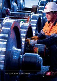
North Coast Line South Information Pack - Queensland Rail
North Coast Line South Information Pack - Queensland Rail
North Coast Line South Information Pack - Queensland Rail

Create successful ePaper yourself
Turn your PDF publications into a flip-book with our unique Google optimized e-Paper software.
Axle Loadings<br />
Maximum axle loads used throughout this document have been determined by either the<br />
track configuration or the railway structures below rail. <strong>Rail</strong>way structures were designed<br />
for axle loads, axle spacings and vehicle lengths that produce bending moments roughly<br />
equivalent to the moments for metric Cooper’s loadings as follows :-<br />
Maximum axle load<br />
Metric Cooper’s Loading<br />
26 tal M 220<br />
20 tal M 160<br />
15.75 tal M 130<br />
For rollingstock of different configuration, e.g. in respect of axle spacing and vehicle<br />
lengths, lesser axle loads and/or speed restrictions may be required before rollingstock<br />
may be authorised to operate.<br />
Basic Track Configuration<br />
Basic track configuration is detailed on APPENDIX B - SCHEMATIC LAYOUTS.<br />
Nambour to Bundaberg<br />
Nambour (elevation 16 m) defines the northern extent of the Metropolitan System. From<br />
Nambour the <strong>North</strong> <strong>Coast</strong> <strong>Line</strong> heads north along the coastal plain to Cooroy (elevation<br />
110 m), north west to Theebine (elevation 61 m and junction for the Kingaroy Branch),<br />
north to Mungar (elevation 22 m and junction for the Monto Branch), continuing on<br />
through Maryborough West (junction for Maryborough Branch), Colton (elevation 39<br />
m and junction for the Takura Branch) before heading north north west to Bundaberg<br />
(elevation 11 m).<br />
There are thirty-one passing loops on this section namely Yandina, <strong>North</strong> Arm, Sunrise,<br />
Cooroy, Pomona, Cooran, Traveston, Woondum, Glanmire, Gympie <strong>North</strong>, Tamaree,<br />
Harvey’s Siding, Curra, Theebine, Paterson, Gundiah, Netherby, Tiaro, Owanyilla,<br />
Mungar, Yengarie, Maryborough West, Colton, Torbanlea, Howard, Wokka, Isis Junction,<br />
Goodwood, Kinkuna, Elliott and Bundaberg.<br />
Track structure is a mix of nominal 47, 50, 53 and 60 kg/m rail on steel and concrete<br />
sleepers.<br />
The maximum allowable axle load is 20 tal.<br />
The maximum allowable speed for locomotive hauled stock is 100 km/h, Intercity Express<br />
trains is 120 km/h and Tilt trains 160 km/h.<br />
The maximum grade (not compensated for horizontal alignment) that a northbound<br />
(Down) train will encounter is 1 in 44 near Gundiah whilst for an southbound (Up) train<br />
the maximum grade is 1 in 44 near Theebine.<br />
Existing minimum nominal horizontal curve radii are as follows :-<br />
running line<br />
161 m<br />
NORTH COAST LINE SYSTEM - SOUTH - INFORMATION PACK<br />
(Nambour - Gladstone and Rocklands to Rockhampton)<br />
ISSUE 2 - JUNE 2007 - 10