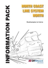
North Coast Line South Information Pack - Queensland Rail
North Coast Line South Information Pack - Queensland Rail
North Coast Line South Information Pack - Queensland Rail

Create successful ePaper yourself
Turn your PDF publications into a flip-book with our unique Google optimized e-Paper software.
The <strong>North</strong> <strong>Coast</strong> <strong>Line</strong> System (<strong>South</strong>) incorporates two other systems, the Blackwater<br />
System (between Rocklands and Gladstone) and the Brisbane Metropolitan System<br />
(between Roma Street and Nambour). The Maryborough System straddles the <strong>North</strong><br />
<strong>Coast</strong> System and picks all branch lines in that vicinity.<br />
The scope of this <strong>Information</strong> <strong>Pack</strong> will cover Nambour to Gladstone, Rocklands to<br />
Rockhampton and branch lines.<br />
The system, overall, caters for all traffic tasks from heavy haul block trains to high speed<br />
tilt train and commuter services.<br />
This single line section of track (425 km in length) provides the strategic link between<br />
<strong>North</strong> and <strong>South</strong> and sees an annual tonnage in excess of 8 million tonnes hauled over<br />
the corridor.<br />
The entire length between Roma Street and Rockhampton is electrified with the section<br />
Caboolture to Rocklands electrified by an autotransformer system with the overhead line<br />
equipment operating at 25,000 volts, 50 Hertz, alternating supply (25 kV, 50 Hz, ac).<br />
The section Caboolture to Roma Street is electrified by a booster transformer system<br />
energised with 25 kV AC (alternating current) power.<br />
Included in the System are Branch <strong>Line</strong>s that have been catergorised as “Non-<strong>Rail</strong><br />
and Non-Operational Corridor Land” and will not be considered further, namely Bunda<br />
Street Branch (Bundaberg) and Colton to Takura.<br />
Descriptive distances within this document (unless otherwise stated) are based on<br />
physical kilometre posts in the field and are to be used only as location descriptors<br />
ie they do not compensate for equalities resulting from deviations. Access charges<br />
and performance statistics are generated using actual through distances derived from<br />
relevant Working Plan and Sections and reflected on <strong>Line</strong> Code Diagrams. Generally<br />
distances originate from the junction of the branch and commence at 0 km.<br />
GENERAL CLIMATE<br />
The system is generally in a warm to hot temperature climate.<br />
The following sub-sections specify general climatic parameters. For latest and more<br />
specific information potential railway operators should consult The Australian Bureau<br />
of Meteorology at it’s Internet Website:<br />
Cyclones<br />
http://www.bom.gov.au/climate<br />
Tropical lows, which develop from November to April, occasionally deepen to cause<br />
tropical cyclones. Tropical cyclones show great variation in behaviour. They foster high<br />
winds, heavy, flood-producing rainfall (especially when a cyclone moves over high<br />
ground), and coastal storm surges.<br />
The high wind risk does not usually extend further inland than 50 km. Inland movement<br />
reduces the inflow of moisture and cyclone intensity declines, often within a few<br />
hours.<br />
NORTH COAST LINE SYSTEM - SOUTH - INFORMATION PACK<br />
(Nambour - Gladstone and Rocklands to Rockhampton)<br />
ISSUE 2 - JUNE 2007 -