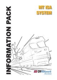
North Coast Line South Information Pack - Queensland Rail
North Coast Line South Information Pack - Queensland Rail
North Coast Line South Information Pack - Queensland Rail
You also want an ePaper? Increase the reach of your titles
YUMPU automatically turns print PDFs into web optimized ePapers that Google loves.
Cyclones may impact on this System, generally to a lesser extent than the tropics north<br />
of Rockhampton.<br />
Not all cyclones are severe.<br />
Humidity<br />
This region could experience prolonged periods of high humidity and potential railway<br />
operators should consider this when planning / designing rollingstock and machinery<br />
to operate on this rail system.<br />
Rainfall<br />
The wettest places in <strong>Queensland</strong> are located on the tropical coast between Innisfail<br />
and Cairns.<br />
Highest rainfall occurs on the seaward side of the Great Divide.<br />
However, at times in summer the inland extension of low-level moist airflow, in<br />
combination with intense surface heating, produces significant thunderstorm activity.<br />
Rainfall is mostly confined to summer months in the northern tropics, where in excess<br />
of 90% of the annual total is recorded between November and April.<br />
In the north, rain is mostly associated with monsoonal troughs.<br />
The wet season in <strong>Queensland</strong> is predominantly from January to April when monthly<br />
rain falls of 400 mm or more can occur.<br />
Flooding of low lying areas is likely to occur as a direct result of cyclones and heavy<br />
coastal rains. In these instances, floodwaters can affect this System on average closing<br />
the line for one day every year.<br />
Temperatures<br />
The average annual values of the daytime maximum of the hottest (January) and nighttime<br />
minimum of the coldest (July) months are indicated on the climatic maps.<br />
During the period of peak temperature, it may be an operational requirement that <strong>Line</strong><br />
Speed be reduced to minimise the risk of incident (refer Operational Constraints).<br />
DESCRIPTION OF THE RAILWAY<br />
The track (1067 mm gauge) on the <strong>North</strong> <strong>Coast</strong> System main line is a mix of nominal<br />
41, 47, 50, 53 and 60 kg/m rail on timber, steel and concrete sleepers.<br />
<strong>Information</strong> on track, rollingstock, train operations, container operations and special train<br />
operations for the safe operation of trains on this System are contained in STD/0071/<br />
SWK - Operational Route Manual, issued by the Chief Risk Officer.<br />
NORTH COAST LINE SYSTEM - SOUTH - INFORMATION PACK<br />
(Nambour - Gladstone and Rocklands to Rockhampton)<br />
ISSUE 2 - JUNE 2007 -


