Intelligent Transportation Systems - City of Oakland
Intelligent Transportation Systems - City of Oakland
Intelligent Transportation Systems - City of Oakland

Create successful ePaper yourself
Turn your PDF publications into a flip-book with our unique Google optimized e-Paper software.
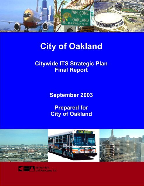
<strong>City</strong>wide ITS Strategic Plan<br />
Final Report<br />
September 2003<br />
Prepared for<br />
<strong>City</strong> <strong>of</strong> <strong>Oakland</strong><br />
Kimley-Horn<br />
and Associates, Inc.
<strong>City</strong> <strong>of</strong> <strong>Oakland</strong><br />
<strong>City</strong>wide ITS Strategic Plan<br />
Final Report<br />
Prepared for:<br />
<strong>City</strong> <strong>of</strong> <strong>Oakland</strong><br />
September 2003<br />
i
CITY OF OAKLAND CITYWIDE ITS STRATEGIC PLAN<br />
TABLE OF CONTENTS<br />
SECTION 1 Introduction ................................................................................................................................................................. 1<br />
1.1 PURPOSE ................................................................................................................................................. 1<br />
1.2 STAKEHOLDERS ....................................................................................................................................... 2<br />
1.3 PROGRAM GOALS AND OBJECTIVES ........................................................................................................ 2<br />
1.4 ACRONYMS .............................................................................................................................................. 3<br />
1.5 ORGANIZATION OF STRATEGIC PLAN ....................................................................................................... 5<br />
SECTION 2 Existing System ......................................................................................................................................................... 6<br />
2.1 TRANSPORTATION SYSTEM CHARACTERISTICS ....................................................................................... 6<br />
2.1.1 Showcase Districts ........................................................................................................................ 6<br />
2.1.2 <strong>City</strong> Corridors ................................................................................................................................. 6<br />
2.1.3 Activity Centers .............................................................................................................................. 7<br />
2.1.4 Transit-Oriented Districts .............................................................................................................. 7<br />
2.2 TRANSPORTATION OPERATIONS, EQUIPMENT AND INFRASTRUCTURE ..................................................... 8<br />
2.2.1 Central Signal Control System ...................................................................................................... 8<br />
2.2.2 Traffic Signal Controllers ............................................................................................................... 9<br />
2.2.3 Communications Infrastructure ................................................................................................... 11<br />
2.2.4 <strong>Transportation</strong> Management Center........................................................................................... 11<br />
2.3 ON-GOING REGIONAL PROJECTS ........................................................................................................... 12<br />
2.3.1 East Bay SMART Corridor Project ............................................................................................. 12<br />
2.3.2 Bay Area Regional ITS Architecture and Strategic Plan Project .............................................. 13<br />
2.3.3 Caltrans District 4 TMC ............................................................................................................... 13<br />
2.3.4 511/TravInfo® .............................................................................................................................. 13<br />
2.3.5 Freeway Concept <strong>of</strong> Operations and Interim Center-to-Center ................................................ 14<br />
2.3.6 Transit Agencies .......................................................................................................................... 14<br />
2.3.7 Other Neighboring Agencies ....................................................................................................... 15<br />
2.4 ON-GOING CITY OF OAKLAND PROJECTS .............................................................................................. 16<br />
2.4.1 Signal Interconnect Projects ....................................................................................................... 16<br />
2.4.2 Other <strong>Oakland</strong> Plans ................................................................................................................... 17<br />
SECTION 3 Signal System .......................................................................................................................................................... 21<br />
3.1 TRAFFIC CONTROL STRATEGIES ............................................................................................................ 21<br />
3.2 SIGNAL SYSTEM FUNCTIONAL REQUIREMENTS ...................................................................................... 22<br />
3.3 HIGH PRIORITY CORRIDORS .................................................................................................................. 24<br />
3.4 SIGNAL SYSTEM ALTERNATIVES ............................................................................................................ 25<br />
3.4.1 Signal System Analysis ............................................................................................................... 26<br />
3.4.2 Signal System Alternatives for <strong>Oakland</strong> ..................................................................................... 32<br />
3.5 SIGNAL SYSTEM RECOMMENDATIONS ................................................................................................... 33<br />
SECTION 4 ITS Program Areas................................................................................................................................................ 34<br />
4.1 ITS GOALS, OBJECTIVES AND REQUIREMENTS ....................................................................................... 34<br />
4.1.1 Arterial Management Requirements .......................................................................................... 34<br />
4.1.2 Traveler Information Requirements ............................................................................................ 35<br />
4.1.3 Transit Management Requirements ........................................................................................... 35<br />
4.1.4 Emergency Management Requirements .................................................................................... 35<br />
i<br />
<strong>City</strong> <strong>of</strong> <strong>Oakland</strong> ITS Strategic Plan<br />
September, 2003
4.1.5 Event and Incident Management <strong>Systems</strong> ................................................................................ 35<br />
4.2 ARTERIAL MANAGEMENT SYSTEMS ....................................................................................................... 36<br />
4.2.1 Closed Circuit Television (CCTV) Cameras ............................................................................... 36<br />
4.2.2 Vehicle Detection <strong>Systems</strong> (VDS) .............................................................................................. 37<br />
4.2.3 Dynamic Message Signs (DMS)................................................................................................. 39<br />
4.2.4 Trailblazer Signs (TBS) ............................................................................................................... 41<br />
4.2.5 Highway Advisory Radio ............................................................................................................. 42<br />
4.2.6 Parking Guidance <strong>Systems</strong> (PGS) ............................................................................................. 42<br />
4.2.7 Advanced Railroad Crossings..................................................................................................... 44<br />
4.3 TRAVELER INFORMATION SYSTEMS ....................................................................................................... 46<br />
4.3.1 Traveler Advisory Telephone (511) ............................................................................................ 47<br />
4.3.2 Kiosks ........................................................................................................................................... 48<br />
4.3.3 Internet Access ............................................................................................................................ 49<br />
4.3.4 Cable Television .......................................................................................................................... 49<br />
4.4 TRANSIT MANAGEMENT SYSTEMS ......................................................................................................... 50<br />
4.4.1 Transit Signal Priority (TSP) ....................................................................................................... 50<br />
4.4.2 Automated Vehicle Location (AVL) and Arrival Sign Information ............................................. 51<br />
4.5 EMERGENCY MANAGEMENT SYSTEMS ................................................................................................... 52<br />
4.5.1 Emergency Vehicle Preemption (EVP) ...................................................................................... 52<br />
4.5.2 AVL for Emergency Vehicles ...................................................................................................... 53<br />
4.6 EVENT AND INCIDENT MANAGEMENT ..................................................................................................... 53<br />
SECTION 5 High-Level System Architecture ................................................................................................................. 55<br />
5.1 NATIONAL ITS ARCHITECTURE .............................................................................................................. 55<br />
5.2 ITS USER SERVICES, SUBSYSTEMS AND MARKET PACKAGES............................................................... 56<br />
5.3 HIGH-LEVEL CENTER-TO-CENTER ARCHITECTURE ................................................................................ 58<br />
5.4 ARCHITECTURE RECOMMENDATIONS..................................................................................................... 61<br />
5.4.1 ITS Standards .............................................................................................................................. 61<br />
5.4.2 Architecture Development Process ............................................................................................ 62<br />
SECTION 6 Communications Network .............................................................................................................................. 65<br />
6.1 COMMUNICATIONS NETWORK OVERVIEW .............................................................................................. 65<br />
6.2 EXISTING COMMUNICATIONS INFRASTRUCTURE .................................................................................... 65<br />
6.2.1 Traffic Signal Interconnect .......................................................................................................... 65<br />
6.2.2 Existing Fiber Optic Network ....................................................................................................... 66<br />
6.2.3 Other Communications Infrastructure ........................................................................................ 66<br />
6.3 COMMUNICATIONS NETWORK EVALUATION ........................................................................................... 66<br />
6.4 COMMUNICATIONS BACKBONE ALTERNATIVES ...................................................................................... 67<br />
6.4.1 Communications Backbone Technology .................................................................................... 67<br />
6.4.2 Communications Topology.......................................................................................................... 68<br />
6.5 FIELD DISTRIBUTION NETWORK ALTERNATIVES ..................................................................................... 71<br />
6.5.1 Agency-Owned Infrastructure ..................................................................................................... 71<br />
6.5.2 Leased Infrastructure................................................................................................................... 72<br />
6.5.3 Virtual Private Network ................................................................................................................ 75<br />
6.5.4 FDN Considerations .................................................................................................................... 76<br />
6.6 FIELD DEVICE REQUIREMENTS .............................................................................................................. 76<br />
6.6.1 Low Bandwidth Devices .............................................................................................................. 76<br />
6.6.2 High Bandwidth Devices ............................................................................................................. 77<br />
6.7 COMMUNICATIONS NETWORK RECOMMENDATIONS ............................................................................... 77<br />
6.7.1 Short-Term Communications Plan (0 to 5 years) ...................................................................... 77<br />
6.7.2 Medium-Term Communications Plan (5 to 10 years) ................................................................ 80<br />
ii<br />
<strong>City</strong> <strong>of</strong> <strong>Oakland</strong> ITS Strategic Plan<br />
September, 2003
6.7.3 Long-Term Communications Plan (10 to 20 years) ................................................................... 82<br />
SECTION 7 <strong>Transportation</strong> Management Center ....................................................................................................... 84<br />
7.1 OPERATING CONCEPTS ......................................................................................................................... 84<br />
7.1.1 Operational Needs and Requirements ....................................................................................... 84<br />
7.1.2 Physical Environment .................................................................................................................. 85<br />
7.1.3 Communications Infrastructure ................................................................................................... 87<br />
7.1.4 Security ........................................................................................................................................ 87<br />
7.2 TMC REQUIREMENTS ............................................................................................................................ 87<br />
7.3 TMC CONCEPTUAL DESIGN ................................................................................................................... 88<br />
7.3.1 Control Room ............................................................................................................................... 89<br />
7.3.2 Equipment Room ......................................................................................................................... 91<br />
7.4 CONCEPTUAL TMC FLOOR PLAN............................................................................................................ 92<br />
SECTION 8 Deployment Plan ................................................................................................................................................... 96<br />
8.1 NEAR-TERM PROJECTS ......................................................................................................................... 96<br />
8.1.1 Communications System Projects .............................................................................................. 96<br />
8.1.2 Signal System Projects ............................................................................................................... 97<br />
8.1.3 Arterial Management System Projects ....................................................................................... 98<br />
8.1.4 Traveler Information System Projects ........................................................................................ 98<br />
8.1.5 Transit Management System Projects ....................................................................................... 98<br />
8.1.6 Emergency Management System Projects ................................................................................ 98<br />
8.1.7 Integration Projects ...................................................................................................................... 99<br />
8.2 MEDIUM-TERM PROJECTS ...................................................................................................................101<br />
8.2.1 Communications System Projects ............................................................................................101<br />
8.2.2 Signal System Projects .............................................................................................................101<br />
8.2.3 Arterial Management System Projects .....................................................................................102<br />
8.2.4 Traveler Information System Projects ......................................................................................102<br />
8.2.5 Transit Management System Projects .....................................................................................102<br />
8.2.6 Emergency Management System Projects ..............................................................................102<br />
8.2.7 Integration Projects ....................................................................................................................103<br />
8.3 LONG-TERM PROJECTS .......................................................................................................................105<br />
8.3.1 Communications System Projects ............................................................................................105<br />
8.3.2 Signal System Projects .............................................................................................................105<br />
8.3.3 Arterial Management System Projects .....................................................................................105<br />
8.3.4 Traveler Information System Projects ......................................................................................105<br />
8.3.5 Transit Management System Projects .....................................................................................106<br />
8.3.6 Emergency Management System Projects ..............................................................................106<br />
8.3.7 Integration Projects ....................................................................................................................106<br />
8.4 SUMMARY OF PROJECT COSTS ...........................................................................................................108<br />
SECTION 9 Operations and Management Plan ........................................................................................................... 111<br />
9.1 O&M POLICIES ....................................................................................................................................111<br />
9.2 PERFORMANCE MEASURES .................................................................................................................112<br />
9.3 STAFFING, TRAINING AND RESOURCES................................................................................................114<br />
9.3.1 Staffing Requirements ...............................................................................................................114<br />
9.3.2 Training Requirements ..............................................................................................................116<br />
9.3.3 Maintenance Equipment............................................................................................................116<br />
9.4 CONFIGURATION MANAGEMENT ...........................................................................................................117<br />
9.5 O&M FUNDING.....................................................................................................................................118<br />
9.6 RECOMMENDATIONS ............................................................................................................................119<br />
iii<br />
<strong>City</strong> <strong>of</strong> <strong>Oakland</strong> ITS Strategic Plan<br />
September, 2003
9.6.1 Develop a Staffing, Training and Resources Plan ...................................................................119<br />
9.6.2 Develop an O&M Plan ...............................................................................................................120<br />
9.6.3 Develop a Configuration Management Plan ............................................................................120<br />
9.6.4 Develop an O&M Funding Strategy ..........................................................................................120<br />
9.7 O&M COSTS ........................................................................................................................................121<br />
SECTION 10 Funding Alternatives ................................................................................................................................... 122<br />
10.1 TRADITIONAL OPPORTUNITIES FOR FEDERAL FUNDING .......................................................................122<br />
10.2 OPPORTUNITIES FOR STATE, REGIONAL AND LOCAL FUNDING ............................................................124<br />
10.3 OTHER RESOURCES OF FUNDING ........................................................................................................125<br />
10.4 SUMMARY ............................................................................................................................................126<br />
APPENDIX A: CITY STRUCTURE AND TRANSPORTATION DIAGRAMS<br />
APPENDIX B: CITY OF OAKLAD TRAFFIC SIGNAL DATABASE<br />
APPENDIX C: CITY OF OAKLAND DOWNTOWN FIBER ROUTING<br />
iv<br />
<strong>City</strong> <strong>of</strong> <strong>Oakland</strong> ITS Strategic Plan<br />
September, 2003
SECTION 1<br />
Introduction<br />
1.1 PURPOSE<br />
The <strong>City</strong> <strong>of</strong> <strong>Oakland</strong> has determined the need for a comprehensive and consistent plan<br />
for <strong>Intelligent</strong> <strong>Transportation</strong> <strong>Systems</strong> (ITS) throughout the <strong>City</strong>. <strong>Oakland</strong> is a rapidly<br />
growing urban center <strong>of</strong> prime importance in trade, business, the arts, and recreation. In<br />
carrying out its many activities, the <strong>City</strong> uses every mode <strong>of</strong> transportation, including<br />
highway, transit, air, train, subway, bus, bicycle, or walking. Three major interstate<br />
routes (I-880, I-980, and I-580) and two state routes (Route 13 and Route 24) traverse<br />
the <strong>City</strong>. <strong>Oakland</strong> International Airport is one <strong>of</strong> the fastest growing airports in the<br />
country, and serves over 12 million passengers and transports over 1.4 billion pounds <strong>of</strong><br />
cargo per year, while the Port <strong>of</strong> <strong>Oakland</strong> is the fourth largest port in the country based<br />
on annual freight tonnage 1 . Amtrak has a major passenger rail station located in<br />
downtown <strong>Oakland</strong>, and another station planned for the <strong>Oakland</strong> Coliseum area. The<br />
<strong>Oakland</strong> Convention Center, the <strong>Oakland</strong> Coliseum, and Jack London Square are<br />
popular destinations and high traffic generators.<br />
Because <strong>of</strong> the regional importance <strong>of</strong> the city, it will be important to accommodate or<br />
address the increased traffic impacts <strong>of</strong> ongoing regional projects, such as the<br />
expansions at <strong>Oakland</strong> Airport and the Port <strong>of</strong> <strong>Oakland</strong>, and the addition <strong>of</strong> an Amtrak<br />
station in the <strong>Oakland</strong> Coliseum area. ITS is the application <strong>of</strong> technologies and<br />
management strategies - in an integrated manner - to increase the safety and efficiency<br />
<strong>of</strong> the transportation system and to promote effective management <strong>of</strong> transportation<br />
system by agency staff. ITS thus provides tools and solutions for addressing a broad set<br />
<strong>of</strong> transportation needs. Furthermore, different user perspectives must be incorporated<br />
into any transportation plan in <strong>Oakland</strong>; technology must help not only motorists’<br />
mobility, but the mobility <strong>of</strong> <strong>Oakland</strong> residents who do not own cars. Through a citywide<br />
strategic plan, the <strong>City</strong> <strong>of</strong> <strong>Oakland</strong> intends to effectively and creatively address the<br />
diverse and complex transportation needs and problems throughout the <strong>City</strong>.<br />
This high-level citywide ITS Strategic Plan has been developed to outline five, ten and<br />
twenty-year plans for ITS deployment in the <strong>City</strong> <strong>of</strong> <strong>Oakland</strong>. <strong>Systems</strong> integration with<br />
ongoing regional and citywide projects, and with neighboring agencies, are emphasized.<br />
The plan documents functional requirements for different ITS elements based on<br />
stakeholder input regarding existing and new technologies and systems. Alternatives<br />
and recommendations are presented for the citywide signal system, communications<br />
network and planned <strong>Transportation</strong> Management Center (TMC). <strong>Oakland</strong> has the<br />
opportunity to serve as a traffic technology showcase with the effective and thoughtful<br />
deployment <strong>of</strong> ITS throughout the <strong>City</strong>.<br />
This Strategic Plan has been prepared in accordance with the systems engineering<br />
process outlined in Federal Rule Part 940 2 . This Rule stipulates that the final design be<br />
selected from a number <strong>of</strong> alternatives. The Rule specifies that the systems engineering<br />
analysis shall include applicable portions <strong>of</strong> the regional or National ITS Architecture,<br />
1 Port <strong>of</strong> <strong>Oakland</strong> Website: http://www.port<strong>of</strong>oakland.com .<br />
2 US DOT, FHWA, Office <strong>of</strong> Operations, “ITS Architecture and Standards; Proposed Rule” (available on<br />
FHWA website: http://ops.fhwa.dot.gov/Docs/940may25.htm ).<br />
<strong>City</strong> <strong>of</strong> <strong>Oakland</strong> ITS Strategic Plan<br />
1 September, 2003
identification <strong>of</strong> participating agencies and their roles, definition <strong>of</strong> functional<br />
requirements, and procurement options. These steps are adhered to in the following<br />
sections.<br />
This plan has also been prepared in accordance with the vision articulated in “Envision<br />
<strong>Oakland</strong>”, the <strong>City</strong> <strong>of</strong> <strong>Oakland</strong> General Plan Land Use and <strong>Transportation</strong> Element<br />
adopted in March 1998. <strong>City</strong> <strong>of</strong>ficials encourage transportation and planning projects to<br />
adhere to the policies and guidelines developed in this document. Further details are<br />
included in Section 2.1 <strong>of</strong> this report.<br />
1.2 STAKEHOLDERS<br />
The <strong>City</strong>wide ITS Strategic Plan incorporates input from the following stakeholders in the<br />
<strong>City</strong> <strong>of</strong> <strong>Oakland</strong> and the Port <strong>of</strong> <strong>Oakland</strong>:<br />
• <strong>City</strong> <strong>of</strong> <strong>Oakland</strong>, Public Works Agency, <strong>Transportation</strong> Services Division<br />
• <strong>City</strong> <strong>of</strong> <strong>Oakland</strong>, Public Works Agency, Electrical Services Division<br />
• <strong>City</strong> <strong>of</strong> <strong>Oakland</strong>, Public Works Agency, Engineering Design Division<br />
• <strong>City</strong> <strong>of</strong> <strong>Oakland</strong> Office Information Technology<br />
• <strong>City</strong> <strong>of</strong> <strong>Oakland</strong> Fire Department<br />
• <strong>City</strong> <strong>of</strong> <strong>Oakland</strong> Police Department<br />
• Port <strong>of</strong> <strong>Oakland</strong>, Aviation Administration<br />
• Port <strong>of</strong> <strong>Oakland</strong>, Airport Operations<br />
Other agencies, while not directly involved in the formulation <strong>of</strong> the ITS Strategic Plan in<br />
its initial stages, will affect and be affected by the deployment <strong>of</strong> ITS throughout<br />
<strong>Oakland</strong>. These agencies include:<br />
• Caltrans<br />
• <strong>City</strong> <strong>of</strong> Berkeley<br />
• <strong>City</strong> <strong>of</strong> Emeryville<br />
• <strong>City</strong> <strong>of</strong> San Leandro<br />
• <strong>City</strong> <strong>of</strong> Alameda<br />
• Amtrak<br />
• Bay Area Rapid Transit (BART)<br />
• Alameda Contra Costa Transit (AC Transit)<br />
• Alameda County<br />
• Alameda County Congestion Management Agency (CMA)<br />
• California Highway Patrol<br />
1.3 PROGRAM GOALS AND OBJECTIVES<br />
Kimley-Horn reviewed the <strong>City</strong>’s Land Use and <strong>Transportation</strong> <strong>of</strong> the General Plan, the<br />
Bay Area Regional ITS Plan Project, State <strong>of</strong> ITS in the San Francisco Bay Area, and<br />
held an ITS Needs Assessment Workshop with <strong>City</strong> <strong>of</strong> <strong>Oakland</strong> staff to discuss goals<br />
and objectives for ITS implementation throughout the <strong>City</strong>. In attendance at the<br />
workshop were <strong>City</strong> staff from different departments including <strong>Transportation</strong> Services,<br />
Street Design, Electrical, and Emergency Services. Based on the results <strong>of</strong> the review<br />
<strong>of</strong> existing plans and the workshop, a “vision” was developed for the <strong>City</strong> <strong>of</strong> <strong>Oakland</strong>’s<br />
ITS Program.<br />
<strong>City</strong> <strong>of</strong> <strong>Oakland</strong> ITS Strategic Plan<br />
2 September, 2003
The vision <strong>of</strong> the <strong>City</strong>wide ITS Strategic Plan is to “maximize the efficiency and safety <strong>of</strong><br />
the <strong>City</strong>’s transportation system crosscutting all modes <strong>of</strong> travel under normal and<br />
emergency situations by implementing multifunctional, effective and creative<br />
technologies and strategies”. The following goals and objectives have been defined by<br />
the <strong>City</strong> to help achieve this vision. These goals and objectives are consistent with the<br />
applicable goals and objectives in the <strong>City</strong>’s General Plan and the Bay Area Regional<br />
ITS Plan Project.<br />
Table 1.1: <strong>City</strong> <strong>of</strong> <strong>Oakland</strong> ITS Vision – Goals and Objectives<br />
Goals<br />
Reduce congestion and improve traffic flow<br />
by developing an integrated road roadway<br />
and traffic demand management system<br />
that provides an appropriate mix <strong>of</strong> mobility<br />
and accessibility throughout the <strong>City</strong>.<br />
Improve the environment by reducing fuel<br />
consumption and air pollutants caused by<br />
vehicles.<br />
Promote alternative transportation options;<br />
reduce dependency on the automobile by<br />
providing facilities that support use <strong>of</strong> all<br />
transportation modes.<br />
Objectives<br />
• Improve vehicle travel times in<br />
congested corridors by coordinating<br />
traffic signals and responding to<br />
changing traffic conditions.<br />
• Provide travelers with good<br />
information to enable trip-making<br />
decisions.<br />
• Coordinate transportation operations<br />
with other major transportation<br />
agencies in the <strong>Oakland</strong> area,<br />
including Port <strong>of</strong> <strong>Oakland</strong>, SMART<br />
Corridors and Caltrans.<br />
• Expedite movement <strong>of</strong> transit vehicles<br />
on transit corridors.<br />
• Coordinate transportation operations<br />
with major transit providers in the<br />
<strong>Oakland</strong> area, including BART and AC<br />
Transit.<br />
Provide safe streets. • Improve safety and security <strong>of</strong><br />
motorists, transit users, bicyclists and<br />
pedestrians.<br />
• Coordinate transportation operations<br />
with emergency service providers in<br />
response to incidents and<br />
emergencies.<br />
1.4 ACRONYMS<br />
The following is a list <strong>of</strong> acronyms frequently used in the <strong>City</strong>wide ITS Strategic Plan.<br />
AC Transit<br />
AGT<br />
APTS<br />
ATC<br />
ATIS<br />
ATM<br />
ATMS<br />
AVL<br />
Alameda Contra Costa Transit District<br />
Automated Guideway Transit<br />
Advanced Public <strong>Transportation</strong> System<br />
Advanced Traffic Controller<br />
Advanced Traveler Information System<br />
Asynchronous Transfer Mode<br />
Advanced Traffic Management System<br />
Automated Vehicle Location<br />
<strong>City</strong> <strong>of</strong> <strong>Oakland</strong> ITS Strategic Plan<br />
3 September, 2003
BART<br />
BIU<br />
BRT<br />
BPS<br />
C2C<br />
CAD<br />
CBD<br />
CCTA<br />
CCTV<br />
CDPD<br />
CEDA<br />
CHP<br />
CMA<br />
CMAQ<br />
DEN<br />
DMS<br />
DS1<br />
DSL<br />
EMS<br />
EOC<br />
EVP<br />
FCC<br />
FDN<br />
FHWA<br />
FSP<br />
GigE<br />
GPS<br />
HAR<br />
HES<br />
IEEE<br />
IP<br />
ISDN<br />
ITS<br />
JPO<br />
LED<br />
MSY<br />
MTC<br />
MVDS<br />
NEMA<br />
NTCIP<br />
NTSC<br />
OAC<br />
O&M<br />
OTDR<br />
PAB<br />
PGS<br />
POTS<br />
PS&E<br />
PTZ<br />
PVEA<br />
SCOOT<br />
Bay Area Rapid Transit<br />
Bus Interface Unit<br />
Bus Rapid Transit<br />
Bits per Second<br />
Center-To-Center<br />
Computer Aided Dispatch<br />
Central Business District<br />
Contra Costa Transit Authority<br />
Closed Circuit Television<br />
Cellular Digital Packet Data<br />
Community and Economic Development Agency<br />
California Highway Patrol<br />
Congestion Management Agency<br />
Congestion Mitigation and Air Quality Improvement Program<br />
Data Exchange Network<br />
Dynamic Message Sign<br />
Digital Signal Level 1 (1.544 Mbps)<br />
Digital Subscriber Line<br />
Emergency Management Services<br />
Emergency Operations Center<br />
Emergency Vehicle Pre-emption<br />
Federal Communications Commission<br />
Field Distribution Network<br />
Federal Highway Administration<br />
Freeway Service Patrol<br />
Gigabit Ethernet<br />
Global Positioning System<br />
Highway Advisory Radio<br />
Hazard Elimination Safety Program<br />
Institute <strong>of</strong> Electrical and Electronics Engineers<br />
Internet Protocol<br />
Integrated Services Digital Network<br />
<strong>Intelligent</strong> <strong>Transportation</strong> System<br />
Joint Programs Office<br />
Light Emitting Diode<br />
Municipal Service Yard<br />
Metropolitan <strong>Transportation</strong> Commission<br />
Microwave Vehicle Detection System<br />
National Electrical Manufacturers Association<br />
National <strong>Transportation</strong> Communications for ITS Protocol<br />
National Television Standards Committee<br />
<strong>Oakland</strong> Airport Connector<br />
Operations and Maintenance<br />
Optical Time Domain Reflectrometer<br />
Police Administrators Building<br />
Parking Guidance System<br />
Plain Old Telephone Service<br />
Plans, Specifications, and Estimates<br />
Pan/Tilt/Zoom<br />
Petroleum Violation Escrow Account<br />
Split Cycle Offset Optimization Technique<br />
<strong>City</strong> <strong>of</strong> <strong>Oakland</strong> ITS Strategic Plan<br />
4 September, 2003
SIC<br />
SMFO<br />
SONET<br />
SR2S<br />
STP<br />
TAT<br />
TBS<br />
TCT<br />
TFCA<br />
TMC<br />
TOD<br />
TSP<br />
TWP<br />
USDOT<br />
VID<br />
VIDS<br />
VOTR<br />
VPN<br />
WAN<br />
Signal Interconnect Cable<br />
Single Mode Fiber Optic<br />
Synchronous Optical Network<br />
Safe Routes To School<br />
Surface <strong>Transportation</strong> Program<br />
Traveler Advisory Telephone<br />
Trailblazer signs<br />
Traffic Control Technologies<br />
<strong>Transportation</strong> Funds for Clean Air<br />
<strong>Transportation</strong> Management Center<br />
Transit-Oriented District<br />
Transit Signal Priority<br />
Twisted Wire Pair<br />
United States Department <strong>of</strong> <strong>Transportation</strong><br />
Video Image Detection<br />
Video Image Detection Sensors<br />
Video Optical Transceivers<br />
Virtual Private Networking<br />
Wide Area Network<br />
1.5 ORGANIZATION OF STRATEGIC PLAN<br />
The remainder <strong>of</strong> this Strategic Plan is organized as follows.<br />
• Section 2 describes the existing signal system and traffic control infrastructure in the<br />
<strong>City</strong> <strong>of</strong> <strong>Oakland</strong>.<br />
The following sections, from Section 3 to Section 7, describe requirements, alternatives,<br />
and recommendations to the <strong>City</strong> pertaining to the main elements <strong>of</strong> the <strong>Oakland</strong><br />
transportation system.<br />
• Section 3 describes the signal system, including high priority corridors for signal<br />
implementation.<br />
• Section 4 outlines state-<strong>of</strong>-the-art <strong>Intelligent</strong> <strong>Transportation</strong> System technologies and<br />
their capabilities, along with possible applications in <strong>Oakland</strong>.<br />
• Section 5 details the high-level system architecture along with considerations<br />
pertaining to standards and integration, as determined through discussions with the<br />
<strong>City</strong>.<br />
• Section 6 serves as a primer on communications infrastructure and describes the<br />
communications network possibilities in <strong>Oakland</strong>.<br />
• Section 7 illustrates a conceptual plan for the proposed <strong>Oakland</strong> TMC.<br />
The descriptions in the above sections culminate in the following plans and project<br />
management recommendations.<br />
• Section 8 outlines the recommended citywide ITS deployment plan for the next five,<br />
ten and twenty years.<br />
• Section 9 highlights operations and maintenance requirements and considerations.<br />
• Section 10 outlines possible funding programs and mechanisms.<br />
<strong>City</strong> <strong>of</strong> <strong>Oakland</strong> ITS Strategic Plan<br />
5 September, 2003
SECTION 2<br />
Existing System<br />
2.1 TRANSPORTATION SYSTEM CHARACTERISTICS<br />
The transportation system in <strong>Oakland</strong> is diverse, encompassing all major transportation<br />
modes and various levels <strong>of</strong> local and regional activity. The structure <strong>of</strong> this diverse<br />
transportation system is described in detail in the Land Use <strong>Transportation</strong> Element <strong>of</strong><br />
the <strong>City</strong> <strong>of</strong> <strong>Oakland</strong> General Plan. The General Plan, entitled “Envision <strong>Oakland</strong>”, was<br />
adopted in March 1998. Envision <strong>Oakland</strong> provides a policy framework and<br />
implementation plan which is reflected in, and actively adhered to throughout, this<br />
<strong>City</strong>wide ITS Strategic Plan.<br />
The <strong>Oakland</strong> transportation system is defined in the General Plan through principal<br />
physical features <strong>of</strong> the <strong>City</strong> such as showcase districts, transportation corridors,<br />
neighborhood and activity centers, and transit-oriented districts, all <strong>of</strong> which are intended<br />
to portray a conceptual map or “big picture” <strong>of</strong> <strong>Oakland</strong> and how the <strong>City</strong> functions as a<br />
whole. These physical feature categories are elaborated upon below. For reference,<br />
the <strong>City</strong> Structure Diagram which illustrates these physical features has been extracted<br />
from the General Plan and is included in Appendix A.<br />
2.1.1 Showcase Districts<br />
Five centers in <strong>Oakland</strong> are considered as regional economic generators, and are<br />
expected to be “centers <strong>of</strong> transformation” in the coming years. These showcase<br />
districts will be centers <strong>of</strong> cultural, recreational and commercial growth, and are:<br />
• The Seaport<br />
• Downtown<br />
• The Mixed Use Waterfront<br />
• The <strong>Oakland</strong> Coliseum Area<br />
• The <strong>Oakland</strong> Airport/Gateway (The Hegenberger Road Gateway leading to the<br />
<strong>Oakland</strong> Airport)<br />
These districts are illustrated in Appendix A. The deployment <strong>of</strong> ITS strategies in this<br />
citywide strategic plan will enhance mobility within and through these showcase districts,<br />
especially through downtown, the <strong>Oakland</strong> Coliseum Area, and the <strong>Oakland</strong><br />
Airport/Gateway.<br />
2.1.2 <strong>City</strong> Corridors<br />
Many corridors throughout <strong>Oakland</strong> have been designated for revival and increased<br />
investment. These corridors serve as major arterials throughout the <strong>City</strong> and between<br />
key areas while serving as alternate routes for the freeways which traverse the <strong>City</strong>.<br />
Over time the corridors have been neglected and undeveloped. This <strong>City</strong>wide ITS<br />
Strategic Plan echoes the General Plan’s intentions <strong>of</strong> reviving these important corridors<br />
<strong>City</strong> <strong>of</strong> <strong>Oakland</strong> ITS Strategic Plan<br />
6 September, 2003
through the thoughtful and effective deployment <strong>of</strong> new transportation technologies. The<br />
corridors shown in the General Plan include:<br />
• Broadway<br />
• Telegraph Avenue<br />
• Martin Luther King Jr. Way<br />
• San Pablo Avenue<br />
• West Grand Avenue<br />
• MacArthur Boulevard/West MacArthur Boulevard<br />
• Foothill Boulevard<br />
• Bancr<strong>of</strong>t Avenue<br />
• International Boulevard/Route 185<br />
• Hegenberger Expressway/73 rd Avenue<br />
• 98 th Avenue<br />
As will be shown in Section 3 <strong>of</strong> this plan, the Needs Assessment Workshop pinpointed<br />
a similar list for high-priority corridors for advanced signal system deployment. The<br />
centralized and real-time signal management described in this Plan would optimize<br />
traffic operations by minimizing delays and easing congestion, improving the travel<br />
experience for motorists, transit passengers, cyclists and pedestrians. Good traffic<br />
conditions would facilitate commercial and business activity alongside corridors and<br />
promote a safe atmosphere for nearby residents. By implementing advanced signal<br />
system capabilities along the corridors listed in Section 3 as high-priority, this <strong>City</strong>wide<br />
ITS Strategic Plan will thus also advance the objective <strong>of</strong> reviving the <strong>City</strong> Corridors<br />
presented in the General Plan.<br />
2.1.3 Activity Centers<br />
Neighborhood activity centers are meant to be the focal points <strong>of</strong> <strong>Oakland</strong>’s many<br />
diverse communities. The General Plan shows that these activity centers are mainly<br />
along <strong>City</strong> corridors, especially along International Boulevard, Foothill Boulevard,<br />
Bancr<strong>of</strong>t Avenue, MacArthur Boulevard, Broadway, Telegraph Avenue, San Pablo<br />
Avenue and West Grand Avenue. These centers feature or plan to feature varied<br />
commercial and social activities surrounded by housing areas and pedestrian amenities,<br />
with easy access to public transit.<br />
The <strong>City</strong>wide ITS Strategic Plan adheres to the concept <strong>of</strong> neighborhood activity centers<br />
by enabling all modes <strong>of</strong> transportation, including non-motorized travel such as<br />
pedestrian and bicycle transport. Technologies such as video detection (which can be<br />
used for bicycle movements), advanced signal systems (including transit priority), and<br />
devices for railway intersections all increase the safety and mobility <strong>of</strong> pedestrians.<br />
Traffic devices such as Dynamic Message Signs (DMS) and Trailblazer Signs (TBS),<br />
and Highway Advisory Radio (HAR) or 511 Traveler Information, serve to decrease<br />
congestion on roadways, thus also benefiting pedestrians and cyclists by decreasing<br />
their conflicts with motorized vehicles.<br />
2.1.4 Transit-Oriented Districts<br />
As an extension <strong>of</strong> the activity center concept, transit-oriented districts (TODs) are<br />
defined in the General Plan as areas designated to take advantage <strong>of</strong> the opportunities<br />
surrounding <strong>Oakland</strong>’s eight BART stations and <strong>Oakland</strong>’s one location (the Eastmont<br />
<strong>City</strong> <strong>of</strong> <strong>Oakland</strong> ITS Strategic Plan<br />
7 September, 2003
Town Center) served by multiple AC Transit lines. The main goal <strong>of</strong> a TOD is to link<br />
transit with high density housing, thus simultaneously encouraging smart land<br />
development and increased transit usage. A TOD <strong>of</strong>fers opportunities for <strong>of</strong>fice space,<br />
retail and other services, community services and housing. A prime example <strong>of</strong> a<br />
successful TOD in <strong>Oakland</strong> is the Fruitvale Transit Village Project, detailed in Section<br />
2.6.9.<br />
As explained for the Activity Centers, this <strong>City</strong>wide ITS Strategic Plan facilitates all<br />
modes <strong>of</strong> transportation. TODs would benefit from the pedestrian and bicycle-friendly<br />
Advanced Traffic Management System (ATMS) technologies recommended in the<br />
deployment plan. Both the technologies and the recommended deployment plans are<br />
detailed later in this report. Furthermore, the process involved in conceptualizing and<br />
designing an effective TOD necessitates close cooperation between different <strong>City</strong> and<br />
transportation agencies, along with the willingness to leverage creative funding<br />
mechanisms. Such interagency cooperation, as well as informed and creative funding<br />
strategies, will also be necessary in the successful deployment <strong>of</strong> citywide ITS in<br />
<strong>Oakland</strong>.<br />
2.2 TRANSPORTATION OPERATIONS, EQUIPMENT AND INFRASTRUCTURE<br />
Section 2.1 provided an overview <strong>of</strong> the citywide transportation system. Currently, the<br />
main ITS components <strong>of</strong> this system are the traffic signals and their controls. This<br />
section will discuss a central signal control system for <strong>Oakland</strong>, the existing signal and<br />
controller inventory throughout <strong>Oakland</strong>, the communications infrastructure and the<br />
<strong>Transportation</strong> Management Center.<br />
2.2.1 Central Signal Control System<br />
Centralized signal control systems allow traffic staff to monitor traffic signal operations<br />
on a computer (or group <strong>of</strong> computers) at a central location, where changes and updates<br />
can be implemented in real-time and from the convenience <strong>of</strong> one location, thus leading<br />
to more effective traffic network operations. The <strong>City</strong> <strong>of</strong> <strong>Oakland</strong> does not currently have<br />
a centralized signal control system. This past year as part <strong>of</strong> the Alameda County<br />
SMART Corridors project, the <strong>City</strong> took a first step towards centralized control by<br />
implementing a BI Tran system with QuicNet s<strong>of</strong>tware along San Pablo Avenue. These<br />
signals along San Pablo Avenue will be controlled from a central computer, and not just<br />
by individual controllers. The limited implementation showcases the effectiveness <strong>of</strong><br />
emerging signal technologies. For example, in conjunction with other ITS technologies<br />
such as Emergency Vehicle Preemption (EVP) and closed-circuit television (CCTV)<br />
cameras, the system could invoke signal priority for emergency vehicles, by triggering<br />
and holding green phases to create an access or evacuation corridor for emergency<br />
vehicles.<br />
Other signal projects in progress or recently completed include the North Central<br />
Business District (CBD) and Hegenberger Road/73 rd Avenue Controller and Signal<br />
Interconnect Upgrade Project and the Broadway Transit Priority Project. Details <strong>of</strong> these<br />
projects are discussed in Section 2.4.1. These projects are not currently connected to a<br />
central control system.<br />
The <strong>City</strong> <strong>of</strong> <strong>Oakland</strong> has approximately 700 traffic signals. Except for the signals on San<br />
Pablo Avenue, these signals operate independently. Any coordination (for example, in<br />
<strong>City</strong> <strong>of</strong> <strong>Oakland</strong> ITS Strategic Plan<br />
8 September, 2003
the downtown area) is time-based. Due to this lack <strong>of</strong> centralized control, it is necessary<br />
to go into the field to assess signal problems when they occur instead <strong>of</strong> having the<br />
advantage <strong>of</strong> instantly obtaining timing information on a central computer. Then, after<br />
traffic engineers optimize signal timings in the <strong>of</strong>fice it is necessary for personnel to go<br />
back into the field and upload the timings manually. To address these inefficiencies the<br />
<strong>City</strong> <strong>of</strong> <strong>Oakland</strong> has long expressed interest in a centralized, real-time signal control<br />
system which will allow traffic staff to both respond to events immediately, and to<br />
constantly monitor the system.<br />
The emergency operations center (EOC) in downtown <strong>Oakland</strong> is not currently<br />
integrated with any <strong>of</strong> the signals, but the need to integrate the EOC with a central signal<br />
control system was expressed by <strong>City</strong> staff. The EOC already has automatic vehicle<br />
location (AVL) capabilities with its emergency vehicles, and plans to implement<br />
computer aided dispatch (CAD) capabilities within 18 months <strong>of</strong> this report.<br />
In 1994 DKS Associates assisted <strong>Oakland</strong> in studying a central computerized traffic<br />
control system, initially to manage 21 signals in the downtown area (referred to as the<br />
North CBD) plus 16 signals in the Hegenberger/73 rd Avenue corridor. The report<br />
distinguishes between distributed control systems (which store and implement signal<br />
timing plans in traffic signal controllers) and central control systems (which store and<br />
implement signal timing plans from a central computer).<br />
Based on the results <strong>of</strong> that evaluation, it was determined that central control signal<br />
systems would be good candidates for the <strong>City</strong> <strong>of</strong> <strong>Oakland</strong>. The systems studied<br />
(namely MIST, Series 2000, MONARC, TMS, UTCS and IVMS) were scalable and<br />
would give <strong>Oakland</strong> the capability to operate large and eventually citywide coordinated<br />
systems. It was emphasized that all controllers should be standardized to the same type<br />
to facilitate coordination, allow interchangeability, and avoid extra training and parts<br />
replacement. At the time <strong>of</strong> that report (1994) it was recommended that the <strong>City</strong><br />
purchase a central master computer traffic control system, the MIST traffic signal<br />
system, in order to retain the <strong>City</strong>’s existing controllers without modifications. Because<br />
no central signal control system was implemented at that time, these previous<br />
recommendations to the <strong>City</strong> will be revisited as part <strong>of</strong> this citywide ITS Strategic Plan.<br />
Changes in the ITS industry (pertaining to technologies and costs), new <strong>City</strong> projects,<br />
and changes in the <strong>City</strong>’s growth and traffic operations will necessitate more up-to-date<br />
recommendations.<br />
2.2.2 Traffic Signal Controllers<br />
As described in Section 2.2, the <strong>City</strong> has approximately 700 signals. These signals are<br />
illustrated in Figure 2.1. The current signal inventory was obtained from Metropolitan<br />
<strong>Transportation</strong> Commission’s (MTC’s) Signals Database as well as from discussions<br />
with <strong>City</strong> staff, and is listed for reference in Appendix B. As shown in Figure 2.1, most<br />
<strong>of</strong> the signals are concentrated along the high-priority corridors described in Section<br />
2.1.2, reflecting the <strong>City</strong> corridors pinpointed in <strong>Oakland</strong>’s General Plan.<br />
<strong>City</strong> <strong>of</strong> <strong>Oakland</strong> ITS Strategic Plan<br />
9 September, 2003
73rd Ave<br />
Maritime Street<br />
7th St.<br />
Airport Dr.<br />
INT ER ST ATE<br />
AME<br />
Hegenberger Rd.<br />
Grand Ave.<br />
EOC<br />
International<br />
Blvd.<br />
Foothill Blvd.<br />
INT ER ST ATE<br />
San Pablo Ave.<br />
MacArthur Blvd.<br />
San Leandro St.<br />
Fruitvale Ave.<br />
High St.<br />
Broadway<br />
E. 14th St.<br />
98th Ave.<br />
Telegraph Ave.<br />
Foothill Blvd.<br />
Bancr<strong>of</strong>t Ave.<br />
MacArthur<br />
Bancr<strong>of</strong>t Ave.<br />
INT ER ST ATE<br />
BAR<br />
MSY<br />
35th Ave.<br />
Alcatraz<br />
BAR<br />
BAR<br />
BAR<br />
CAL<br />
BAR<br />
BAR<br />
DAL<br />
PAB<br />
BAR<br />
BAR<br />
N<br />
Scale 1:4300<br />
Blvd.<br />
MacArthur Blvd.<br />
August 2003 <strong>City</strong> <strong>of</strong> <strong>Oakland</strong> ITS Strategic Plan<br />
EOC<br />
PAB<br />
CAL CALTRANS TMC<br />
DAL<br />
MSY<br />
BAR<br />
CITY OF OAKLAND<br />
EMERGENCY OPERATIONS<br />
CENTER (EOC)<br />
POLICE ADMINISTRATION<br />
BUILDING<br />
CITY OF OAKLAND<br />
DALZIEL BUILDING<br />
CITY OF OAKLAND<br />
MUNICIPAL SERVICE YARD<br />
BART STATION<br />
AME EXISTING AMTRAK STATION<br />
TRAFFIC SIGNAL<br />
EXISTING ATMS ELEMENTS<br />
CCTV CAMERA (ACCMA)<br />
MVDS (ACCMA)<br />
VID CORRIDOR<br />
COMMUNICATIONS TRUNK<br />
(EXISTING OR PLANNED FIBER OPTIC<br />
CABLE)<br />
COMMUNICATIONS TRUNK<br />
(EXISTING OR PLANNED<br />
TWISTED-WIRE PAIR)<br />
NOTE: ALL PLANNED FIBER AND TWP<br />
COMMUNICATIONS SHOWN REPRESENT<br />
CURRENTLY PROGRAMMED PROJECTS.<br />
EXISTING TRAFFIC SIGNALS, ATMS ELEMENTS, AND COMMUNICATIONS INFRASTRUCTURE FIGURE 2.1
Most <strong>of</strong> the controllers throughout the <strong>City</strong> are Traffic Control Technologies’ (TCT) solid<br />
state controllers, which are National Electrical Manufacturers Association (NEMA) TS1<br />
controllers, but the <strong>City</strong> has recently been implementing Type 170 controllers. In the<br />
downtown area the signals are mostly pre-timed, and on arterial roadways signals are<br />
mostly actuated. Downtown and arterial signals are coordinated with time-based<br />
coordination. Detection is mainly achieved through inductive loop detectors, with the<br />
<strong>City</strong> moving towards video detection at newly signalized intersections. Video detection<br />
is currently being implemented along San Pablo Avenue as part <strong>of</strong> the SMART Corridor<br />
project.<br />
The <strong>City</strong> has expressed interest in moving towards Type 170 controllers. As part <strong>of</strong> the<br />
North CBD and Hegenberger Road/73 rd Avenue Controller and Signal Interconnect<br />
Upgrade Project, Broadway Transit Priority Project, San Pablo Signal Interconnect<br />
Project, and SMART Corridor Project about 55 Type 170 controllers have been or will be<br />
implemented in the <strong>City</strong> <strong>of</strong> <strong>Oakland</strong>.<br />
2.2.3 Communications Infrastructure<br />
The <strong>City</strong> <strong>of</strong> <strong>Oakland</strong>’s current ITS communications system is mostly limited to some<br />
twisted-wire pair (TWP) signal interconnect along a few corridors. Currently, the only<br />
signals that are connected to the <strong>City</strong> <strong>of</strong> <strong>Oakland</strong>’s proposed TMC building are the<br />
signals on San Pablo Avenue. The <strong>City</strong> <strong>of</strong> <strong>Oakland</strong> also has existing multi-mode 12-<br />
strand fiber optics installed in downtown <strong>Oakland</strong> connecting the major <strong>City</strong> <strong>of</strong> <strong>Oakland</strong><br />
facilities such as the <strong>City</strong> <strong>of</strong> <strong>Oakland</strong> Dalzial Building at 250 Frank H. Ogawa Plaza, <strong>City</strong><br />
Hall, the EOC, the police administration building (PAB) and the Main <strong>Oakland</strong> Library.<br />
The existing 12-strand fiber cable is not yet terminated in the Dalzial Building (site <strong>of</strong><br />
future TMC). In addition, the <strong>City</strong> <strong>of</strong> <strong>Oakland</strong> is currently in negotiations with Comcast to<br />
obtain access to their planned citywide fiber optics network. The existing<br />
communications system is discussed in greater detail in Section 6.<br />
2.2.4 <strong>Transportation</strong> Management Center<br />
The <strong>City</strong> <strong>of</strong> <strong>Oakland</strong> does not currently have a TMC. A TMC is a central location where<br />
different traffic devices (such as a centralized signal system) and ITS devices (such as<br />
CCTV cameras, DMS, and vehicle detectors) can be managed. Traffic data can be<br />
collected at a TMC, and also disseminated from a TMC.<br />
The BI Tran central signal system, which controls signals along San Pablo Avenue as<br />
discussed in Section 2.2, is currently managed from a cubicle in the <strong>Transportation</strong><br />
Services Division at 250 Frank H. Ogawa Plaza. This same cubicle also houses the<br />
East Bay SMART Corridor server and workstation, which allows the <strong>City</strong> to exchange<br />
signal coordination data with other partner agencies in the SMART Corridor Program.<br />
The Bi Tran server is connected to the Municipal Service Yard (MSY) at 7101 Edgewater<br />
Drive via a dial-up modem.<br />
The <strong>City</strong> has plans to locate a new TMC in the Jack London Conference Room, which is<br />
adjacent to the existing cubicle housing the Bi Tran and SMART Corridors equipment, at<br />
250 Frank H. Ogawa Plaza. The <strong>City</strong>’s new TMC will be connected to the MSY on<br />
Edgewater Drive (located near projects on Hegenberger Road and the projects<br />
<strong>City</strong> <strong>of</strong> <strong>Oakland</strong> ITS Strategic Plan<br />
11 September, 2003
surrounding the Airport and Coliseum). The TMC conceptual design is discussed in<br />
greater detail in Section 7.<br />
2.3 ON-GOING REGIONAL PROJECTS<br />
2.3.1 East Bay SMART Corridor Project<br />
The SMART Corridors program is a cooperative effort by the Alameda County CMA,<br />
Contra Costa County <strong>Transportation</strong> Authority (CCTA), and twenty-four other agencies<br />
to plan and implement a multi-modal advanced transportation management system<br />
along the I-880 corridor, which includes International Boulevard, East 14 th Street, San<br />
Leandro Street, Hesperian Boulevard, and Union <strong>City</strong> Boulevard; and the San Pablo<br />
Avenue (I-80) corridor.<br />
The goal <strong>of</strong> the SMART Corridors program is to allow local agencies to better manage<br />
congestion and improve transportation safety, mobility and efficiency along regional<br />
arterial routes. SMART Corridors permit efficient operation and management <strong>of</strong> existing<br />
roadway and transit resources through the integration and use <strong>of</strong> currently available<br />
technologies combined with strengthened institutional ties and inter-jurisdictional<br />
coordination.<br />
SMART Corridors use a variety <strong>of</strong> technologies to improve the performance <strong>of</strong><br />
transportation systems, by promoting efficient use <strong>of</strong> the existing highway and transit<br />
systems, and reducing environmental costs to the public. The technologies being<br />
deployed on the noted arterials include CCTV, video image detection (VID) systems,<br />
EVP, transit priority and microwave vehicle detection system (MVDS).<br />
The SMART Corridors program has evolved into a multi-year, multi-phase program,<br />
which started through cooperative efforts <strong>of</strong> the local agencies in the San Pablo Avenue<br />
and I-880 corridors. The project is divided into four phases:<br />
• Phase I – Strategic Plan (<strong>Systems</strong> Engineering Study);<br />
• Phase II – Design and Preparation <strong>of</strong> Plans, Specifications and Estimates;<br />
• Phase III – Construction; and<br />
• Phase IV – Integration, Testing and <strong>Systems</strong> Acceptance.<br />
Phase I and Phase II <strong>of</strong> the project have been completed. The SMART Corridors project<br />
is currently in the construction phase scheduled to be completed in November 2003.<br />
The project is relevant to the <strong>Oakland</strong> ITS program because it will put into place<br />
equipment and infrastructure which can be used by the <strong>City</strong>wide ITS. The <strong>Oakland</strong> ITS<br />
program should also be interoperable with the SMART Corridors elements to achieve<br />
cross-jurisdictional cooperation and data-sharing. Interoperability will be achieved<br />
through compliance with national ITS standards, and through direct agency cooperation.<br />
The corridors in <strong>Oakland</strong> that will be receiving ITS equipment as part <strong>of</strong> the SMART<br />
Corridors project are San Pablo Avenue, San Leandro Street and East 14 th<br />
Street/International Boulevard.<br />
<strong>City</strong> <strong>of</strong> <strong>Oakland</strong> ITS Strategic Plan<br />
12 September, 2003
2.3.2 Bay Area Regional ITS Architecture and Strategic Plan Project<br />
The Metropolitan <strong>Transportation</strong> Commission (MTC) is in the process <strong>of</strong> developing a<br />
regional ITS architecture for the San Francisco Bay Area to fulfill federal requirements.<br />
They have recently completed Phase 1 <strong>of</strong> the project which involved developing a<br />
complete inventory <strong>of</strong> existing and planned ITS systems in the Bay Area. The inventory<br />
is the result <strong>of</strong> numerous stakeholder meetings and workshops over the past year and a<br />
half.<br />
Phase 2 <strong>of</strong> the project will develop the regional ITS architecture database. In addition,<br />
MTC will be developing an ITS Strategic Plan for the Bay Area as part <strong>of</strong> Phase 2.<br />
Phase 2 is expected to be completed in 2004. The Bay Area Regional ITS Architecture<br />
will be the blue print for future ITS deployment in the region. In addition, it will enable<br />
interoperability <strong>of</strong> ITS infrastructure throughout the entire Bay Area. The <strong>City</strong> <strong>of</strong><br />
<strong>Oakland</strong>’s ITS program must follow this blue print in order to be eligible for future federal<br />
funding and to ensure interoperability with other regional ITS systems. As with the<br />
SMART Corridors project, interoperability will be achieved through compliance with<br />
national ITS standards, and through direct agency cooperation.<br />
2.3.3 Caltrans District 4 TMC<br />
Caltrans District 4 operates numerous ITS devices on Bay Area freeways including<br />
CCTV, DMS, vehicle detectors, ramp meters and main line meters. These devices are<br />
used to help manage freeway traffic from a state-<strong>of</strong>-the-art TMC located at 111 Grand<br />
Avenue in Downtown <strong>Oakland</strong>. The California Highway Patrol (CHP), MTC’s freeway<br />
service patrol (FSP) and the 511/TravInfo® system are all collocated in the Caltrans<br />
District 4 TMC. Caltrans is in the process <strong>of</strong> developing standard TMC s<strong>of</strong>tware for<br />
managing ITS devices that will be implemented at all Caltrans TMCs statewide.<br />
The Caltrans TMC is important to <strong>Oakland</strong>’s <strong>City</strong>wide ITS program because traffic data<br />
pertaining to Caltrans-operated freeways within <strong>Oakland</strong>’s boundaries can be shared<br />
with the <strong>City</strong> <strong>of</strong> <strong>Oakland</strong> TMC. Access to this data will help the <strong>City</strong> better manage traffic<br />
on their <strong>City</strong> streets.<br />
2.3.4 511/TravInfo®<br />
TravInfo® is the 511 traveler information phone service for the Bay Area, launched in<br />
December 2002 by MTC. The service hopes to provide comprehensive, accurate,<br />
reliable, and useful on-demand traveler information to Bay Area travelers. By dialing<br />
511, motorists can obtain information regarding traffic conditions, public transportation<br />
conditions, and details about carpools, vanpools, and bicycle routes. TravInfo® is<br />
relevant to the <strong>Oakland</strong> ITS program because traffic conditions throughout <strong>Oakland</strong> are<br />
covered by the service, including conditions on the main freeways traversing <strong>Oakland</strong> (I-<br />
880, I-980, I-580, Route 13 and Route 24), AC Transit, the Alameda/<strong>Oakland</strong> Ferry, and<br />
conditions at <strong>Oakland</strong>’s eight BART stations. TravInfo® is free and operates via voice<br />
recognition. Traffic data sources include CHP, Caltrans sensors on area freeways, and<br />
radio and TV reports. The system is also accessible to hearing and vision-impaired<br />
travelers through the phone-based California Relay Service which translates the<br />
information into accessible formats. A corresponding web-based 511 service is under<br />
development and is expected to be online later this year.<br />
<strong>City</strong> <strong>of</strong> <strong>Oakland</strong> ITS Strategic Plan<br />
13 September, 2003
2.3.5 Freeway Concept <strong>of</strong> Operations and Interim Center-to-Center<br />
The goal <strong>of</strong> the San Francisco Bay Area’s Interim Center-to-Center (C2C) System<br />
project is to implement a system that enables the real-time exchange <strong>of</strong> data and video<br />
between the Bay Area Smart Corridors Programs (East Bay, Silicon Valley, San<br />
Francisco, etc.) and the Regional TMC, which includes Caltrans TMC and TravInfo®.<br />
This Interim C2C project is relevant to the <strong>City</strong> <strong>of</strong> <strong>Oakland</strong> ITS Program since the <strong>City</strong> is<br />
part <strong>of</strong> the East Bay SMART Corridors Program, and it could access the Regional TMC<br />
data through this C2C project. Conversely, data collected through the <strong>City</strong> <strong>of</strong> <strong>Oakland</strong><br />
ITS Program could be shared with the SMART Corridors Program and thus with the<br />
Regional TMC.<br />
The Interim C2C System is expected to be a short-term solution to the Bay Area’s<br />
existing need for real-time exchange <strong>of</strong> data and video, and will be upgraded or replaced<br />
as Caltrans develops statewide TMC s<strong>of</strong>tware. New s<strong>of</strong>tware will be developed in the<br />
next few years for use at all Caltrans District TMCs. Once Caltrans District 4 transitions<br />
to that new system, the Interim C2C System may be upgraded or replaced.<br />
In order to maintain real-time communications with the Regional TMC as it migrates to<br />
the future statewide s<strong>of</strong>tware, the Interim C2C System will rely on TravInfo® to maintain<br />
a stable, two-way interface with Caltrans’ TMC. The existing TravInfo® interface with<br />
the Caltrans TMC is limited in scope and will need to be expanded to include video<br />
exchange and other functions defined as essential for the Interim C2C System. This<br />
approach will allow the participating agencies, including the <strong>City</strong> <strong>of</strong> <strong>Oakland</strong> through the<br />
SMART Corridors Program, to exchange real-time data and video during the period<br />
when new s<strong>of</strong>tware is being developed for Caltrans.<br />
2.3.6 Transit Agencies<br />
<strong>Oakland</strong> transit agencies such as BART and AC Transit have ongoing projects which<br />
must be considered in a <strong>City</strong>wide ITS Strategic Plan.<br />
BART will be constructing an Airport Connector from the Coliseum BART station directly<br />
to <strong>Oakland</strong> Airport. The connector will use Automated Guideway Transit (AGT)<br />
technology to carry passengers the 3.2 miles to and from the BART station to the airport.<br />
The connector will impact traffic operations throughout <strong>Oakland</strong> as the project is<br />
expected to eliminate approximately 3 million vehicle trips annually along the<br />
Hegenberger and I-880 corridors. The project is a partnership between BART, the <strong>City</strong><br />
<strong>of</strong> <strong>Oakland</strong>, and the Port <strong>of</strong> <strong>Oakland</strong>. Construction <strong>of</strong> the project is expected to begin in<br />
2004 and be completed by 2006.<br />
AC Transit has developed plans for “Enhanced Bus” services and “Bus Rapid Transit”<br />
(BRT) services throughout <strong>Oakland</strong>. Enhanced Bus services “are designed around<br />
street level improvements that reduce travel times, improve passenger comfort and<br />
increase operational efficiently. Such improvements may be the ultimate improvement in<br />
a particular corridor, or they may represent a first step towards the implementation <strong>of</strong><br />
BRT” 3 . Heavily used routes, which are the focus for these Enhanced Bus services in the<br />
coming years, are as follows:<br />
3 AC Transit, “Strategic Vision 2001-2010”, August 2002.<br />
<strong>City</strong> <strong>of</strong> <strong>Oakland</strong> ITS Strategic Plan<br />
14 September, 2003
• San Pablo Avenue<br />
• Telegraph Avenue/International Boulevard (East 14 th Street)<br />
• Foothill Boulevard/MacArthur Boulevard<br />
• MacArthur Boulevard/<strong>Oakland</strong> Airport<br />
• Shattuck Avenue<br />
• College Avenue/University Avenue<br />
• Hesperian Boulevard<br />
• 6 th Street/Hollis Street<br />
• Sacramento Street/Market Street<br />
• Mission Boulevard/Outer East 14 th Street<br />
BRT “involves more extensive improvements, including bus-only travel lanes,<br />
sophisticated station stops, and a coordinated effort to minimize travel time while<br />
maximizing passenger comfort and convenience” 4 . BRT is proposed on the following<br />
four busiest routes through <strong>Oakland</strong>:<br />
• Telegraph Avenue/East 14 th Street<br />
• Foothill Boulevard/MacArthur Boulevard<br />
• Shattuck Avenue<br />
• MacArthur Boulevard/<strong>Oakland</strong> Airport<br />
The <strong>City</strong> <strong>of</strong> <strong>Oakland</strong> has voiced support for these projects, and AC Transit has<br />
expressed the desire to provide funding for these projects. These applications will affect<br />
citywide implementation <strong>of</strong> ITS technologies such as transit signal priority (TSP)<br />
systems.<br />
2.3.7 Other Neighboring Agencies<br />
For optimal effectiveness <strong>of</strong> this <strong>City</strong>wide ITS Strategic Plan, the <strong>City</strong> <strong>of</strong> <strong>Oakland</strong> should<br />
coordinate with the following neighboring agencies:<br />
• <strong>City</strong> <strong>of</strong> Berkeley<br />
• <strong>City</strong> <strong>of</strong> Emeryville<br />
• <strong>City</strong> <strong>of</strong> San Leandro<br />
• <strong>City</strong> <strong>of</strong> Alameda<br />
• Alameda County<br />
• Alameda County CMA<br />
• Caltrans<br />
• Port <strong>of</strong> <strong>Oakland</strong><br />
As part <strong>of</strong> the ongoing SMART Corridors project, several <strong>of</strong> these agencies are already<br />
cooperating to facilitate traffic data collection and monitoring, and signal coordination<br />
across agency jurisdictional boundaries. The <strong>City</strong> <strong>of</strong> <strong>Oakland</strong> will soon be able to link to<br />
the SMART Corridor server and receive traffic signal coordination data from signal<br />
systems belonging to these other agencies as well as CCTV images in these<br />
neighboring jurisdictions.<br />
4 AC Transit, “Strategic Vision 2001-2010”, August 2002.<br />
<strong>City</strong> <strong>of</strong> <strong>Oakland</strong> ITS Strategic Plan<br />
15 September, 2003
2.4 ON-GOING CITY OF OAKLAND PROJECTS<br />
2.4.1 Signal Interconnect Projects<br />
Signal interconnect has been or is currently being installed in various locations in<br />
<strong>Oakland</strong>. The following table summarizes these projects.<br />
Table 2.1: Signal Interconnect Projects in <strong>Oakland</strong><br />
Location <strong>of</strong> Signal Interconnect Installation<br />
San Pablo Avenue Project<br />
• between 14 th Street and Alcatraz Avenue<br />
• also connects into the <strong>City</strong> <strong>of</strong> <strong>Oakland</strong> Building<br />
at 250 Frank H. Ogawa Plaza where a TMC is<br />
planned to be located<br />
The North CBD Controller and Hegenberger<br />
Road/73 rd Avenue and Signal Interconnect<br />
Upgrade Project<br />
• along West Grand Avenue and Grand Avenue,<br />
between San Pablo Avenue and Harrison<br />
Street, along Broadway, between West Grand<br />
Avenue and 20 th Street<br />
• along Hegenberger Road/73 rd Avenue between<br />
Pardee Drive and Office Complex Driveway<br />
Broadway Transit Priority Project<br />
• along Broadway from 3 rd Street to 20 th Street,<br />
and along 20 th Street between Broadway and<br />
Telegraph Avenue<br />
42 nd Avenue/High Street Access Improvement<br />
Project<br />
• three intersections on High Street and three<br />
intersections on 42 nd Avenue near I-880<br />
Hegenberger Gateway Project<br />
• along Hegenberger Road between Doolittle<br />
Drive and Edgewater Drive<br />
Port <strong>of</strong> <strong>Oakland</strong>’s 98 th Avenue Project<br />
• from Doolittle to I-880 along 98 th Avenue<br />
Fruitvale BART Transit Village Project<br />
• from E. 12 th Street to San Leandro Street and<br />
on San Leandro Street from Fruitvale Avenue<br />
to 37 th Avenue<br />
Description<br />
• Signal controllers and cabinets were replaced<br />
as part <strong>of</strong> this project.<br />
• The North CBD interconnect ties into the San<br />
Pablo interconnect, which ties into the planned<br />
TMC. Sixteen Type 170E controllers, ten Type<br />
336 cabinets and six Type 332 cabinets were<br />
installed in this North CBD area. Construction<br />
<strong>of</strong> this project has just been completed.<br />
• The <strong>City</strong> <strong>of</strong> <strong>Oakland</strong> installed six new Model<br />
170 controllers and Type 332 cabinets on<br />
Hegenberger Road. Construction <strong>of</strong> this<br />
project has just been completed.<br />
• Provides for future tie-in to the planned TMC.<br />
• 16 Model 170 controller assemblies with Model<br />
332 cabinets will be installed.<br />
• EVP devices will also be installed for transit<br />
priority.<br />
• Signals along the corridor will be retimed for<br />
the new installations.<br />
• The project design is 100 percent complete.<br />
• new signal interconnect conduit to be installed<br />
• widening <strong>of</strong> High Street and extension <strong>of</strong> 42 nd<br />
Avenue<br />
• realignment <strong>of</strong> Howard Street and Oakport<br />
Street<br />
• joint project between Port <strong>of</strong> <strong>Oakland</strong> and <strong>City</strong><br />
<strong>of</strong> <strong>Oakland</strong><br />
• installed a 2-inch signal interconnect conduit<br />
with twisted wire pairs along Hegenberger<br />
• the signal interconnect cable (SIC) has not yet<br />
been terminated in the controller cabinets<br />
• traffic signals are not yet coordinated<br />
• included design <strong>of</strong> additional conduit for fiber<br />
but because <strong>of</strong> budget limitations this work was<br />
not selected for construction<br />
• three Model 170 controllers and interconnect<br />
conduit were installed<br />
• In addition, 98 th Avenue has recently been<br />
widened to six lanes and it now crosses under<br />
Doolitle Drive reducing the number <strong>of</strong> traffic<br />
signals on 98 th Avenue<br />
• Fiber optic signal interconnect was installed<br />
• Five Type 170E Controllers with Model 332<br />
Cabinets were installed.<br />
<strong>City</strong> <strong>of</strong> <strong>Oakland</strong> ITS Strategic Plan<br />
16 September, 2003
2.4.2 Other <strong>Oakland</strong> Plans<br />
The planned improvements for the <strong>City</strong>’s transportation system required to fulfill the<br />
vision <strong>of</strong> the General Plan are depicted in the <strong>City</strong> <strong>Transportation</strong> Diagram which is<br />
included for reference in Appendix A. Many <strong>of</strong> these planned improvements will affect,<br />
and be affected by, the citywide deployment <strong>of</strong> ITS. The projects are summarized in<br />
Table 2.2 below and categorized according to three levels <strong>of</strong> scope: Local Access,<br />
Regional Access, and Worldwide Access. Representative <strong>City</strong> projects which will benefit<br />
from citywide ITS deployment include the Fruitvale BART Transit Village and the Safe<br />
Routes to School Program (Local Access), the Coliseum AMTRAK Intercity Rail Station<br />
(Regional Access) and the Port <strong>of</strong> <strong>Oakland</strong> Airport Expansion (Worldwide Access).<br />
Table 2.2:<br />
Summary <strong>of</strong> <strong>City</strong>wide <strong>Transportation</strong> Improvement Projects<br />
(as identified in the General Plan’s <strong>Transportation</strong> Diagram)<br />
Local Access (Representative Projects: Fruitvale BART Transit Village Project, Safe Routes to School)<br />
<strong>City</strong>wide Roadway Improvements<br />
Local Transit Streets<br />
Transit Centers<br />
Shuttle Services<br />
Bike and Pedestrian Facilities<br />
Water <strong>Transportation</strong><br />
Regional Access<br />
Regional Access (Representative Projects: Coliseum AMTRAK Intercity Rail Station, Port <strong>of</strong> <strong>Oakland</strong><br />
Airport Roadway Project)<br />
Regional Transit Streets<br />
I-880 Improvement Corridors<br />
BART Intermodal Connections (Jack London Square AMTRAK Intermodal<br />
Shuttle, Coliseum AMTRAK Intercity Rail Station, BART <strong>Oakland</strong> Airport<br />
Connector)<br />
73 rd Avenue Improvement Corridor<br />
<strong>Oakland</strong>/Alameda Improvement Corridor<br />
Worldwide Access (Representative Project: Port <strong>of</strong> <strong>Oakland</strong> Vision 2000)<br />
Port <strong>of</strong> <strong>Oakland</strong> Joint Intermodal Rail Terminal<br />
Port <strong>of</strong> <strong>Oakland</strong> Middle Harbor Road/7 th Street<br />
Port <strong>of</strong> <strong>Oakland</strong> Airport Expansion<br />
Fruitvale BART Transit Village Project (Example <strong>of</strong> LOCAL ACCESS)<br />
The Fruitvale BART Transit Village Project was constructed in 1999 as a $100 million<br />
mixed-use development adjacent to the Fruitvale Bay Area Rapid Transit District (BART)<br />
station at San Leandro Street and 35 th Avenue. It consists <strong>of</strong> retail shops, restaurants,<br />
<strong>of</strong>fices, a health-care clinic, a library, <strong>of</strong>fices, and various types <strong>of</strong> housing.<br />
The project was innovative and unusual for several reasons. It utilized new and effective<br />
partnerships between the community (represented by the Unity Council, a community<br />
development group formed in 1964), the <strong>City</strong> <strong>of</strong> <strong>Oakland</strong>, and BART; for example, a land<br />
swap was negotiated between the community and BART, giving the community<br />
proprietary rights over the Fruitvale Transit Village site, while BART maintained the value<br />
<strong>of</strong> its assets near the station. The <strong>City</strong> <strong>of</strong> <strong>Oakland</strong> also capped parking surrounding the<br />
<strong>City</strong> <strong>of</strong> <strong>Oakland</strong> ITS Strategic Plan<br />
17 September, 2003
development, and relinquished a portion <strong>of</strong> its right-<strong>of</strong>-way alongside the project.<br />
Creative financing was tapped throughout the project; for example, since the Unity<br />
Council was ineligible for Federal Transit Administration grants for the child-care center,<br />
BART accepted the funds and allocated them to the Unity Council. The sustained public<br />
involvement in the project, led by the Unity Council, was creative and effective.<br />
Furthermore, transit-oriented development was shown to successfully stimulate<br />
economic development and promote environmental justice in a low-income urban<br />
community.<br />
As the <strong>City</strong> <strong>of</strong> <strong>Oakland</strong> develops its <strong>City</strong>wide ITS Strategic Plan, the current traffic<br />
impacts <strong>of</strong> the Fruitvale Transit Village itself should be considered, as should the<br />
important lessons from the project process, articulated above.<br />
Safe Routes to School Program (Example <strong>of</strong> LOCAL ACCESS)<br />
California’s Safe Routes to Schools (SR2S) Program allocates $25 million per year <strong>of</strong><br />
funding to safety-related transportation improvements in several categories, such as<br />
sidewalk improvements, traffic calming and speed reduction, pedestrian and bicycle<br />
crossing improvements, and traffic diversion improvements. The projects are intended<br />
to reduce childhood injuries and fatalities, to reduce childhood obesity, to reduce risk <strong>of</strong><br />
later cardiovascular disease and respiratory illnesses, and to connect children with their<br />
communities and natural environment.<br />
The <strong>City</strong> <strong>of</strong> <strong>Oakland</strong> was awarded a SR2S grant for $459,000 in 1999, for modifying and<br />
installing traffic signals, installing crosswalk lights, and constructing bulb-outs at 20<br />
<strong>Oakland</strong> schools. The <strong>City</strong> was also awarded a SR2S grant for $449,500 in 2000 to<br />
continue the program for 14 more <strong>Oakland</strong> schools. The <strong>City</strong>wide ITS Strategic Plan<br />
could provide more opportunities for continuing the SR2S initiative. For example, bicycle<br />
detection technologies, such as video detection, have recently been evaluated in the<br />
Bay Area. Video detection for bicycles provides bicyclists, especially left-turning cyclists,<br />
a safe and protected method for crossing busy intersections. Signal timings can be<br />
adjusted accordingly to accommodate the cyclists during school beginning and dismissal<br />
times. The <strong>City</strong> is implementing video detection for vehicles at newly installed signals<br />
citywide; thus, incorporating bicycles into the video detection would be cost-effective.<br />
Other ITS technologies, such as mobile DMS discussed later in Section 4, safely reroute<br />
vehicles around or away from schools during incidents or emergencies.<br />
Coliseum AMTRAK Intercity Rail Station (Example <strong>of</strong> REGIONAL ACCESS)<br />
A new Amtrak train station is being proposed for the <strong>Oakland</strong> Coliseum area across from<br />
the Coliseum BART station on San Leandro Street. The station will be served by<br />
Amtrak’s Capitol Corridor trains. The station will be multimodal, facilitating transfers<br />
between Amtrak, BART, AC Transit, and eventually the BART connector to <strong>Oakland</strong><br />
Airport. A pedestrian ramp will connect to the existing elevated walkway between the<br />
Coliseum BART station and the Coliseum.<br />
The <strong>City</strong>’s ITS deployment surrounding the Coliseum area should take the presence <strong>of</strong><br />
this new Amtrak station into account. For example, pick-up and drop-<strong>of</strong>f activity can be<br />
facilitated by various ITS applications such as DMS during incidents or Coliseum events.<br />
Traveler information kiosks can provide instant information regarding Airport travel and<br />
incidents on the adjacent roadways.<br />
<strong>City</strong> <strong>of</strong> <strong>Oakland</strong> ITS Strategic Plan<br />
18 September, 2003
Port <strong>of</strong> <strong>Oakland</strong> Airport Roadway Project and other ITS Projects (Example <strong>of</strong><br />
REGIONAL ACCESS)<br />
The Port <strong>of</strong> <strong>Oakland</strong> Airport Roadway Project started in 2001 and consisted <strong>of</strong> building<br />
an arterial roadway from the I-880/98 th Avenue interchange to the <strong>Oakland</strong> Airport, then<br />
through the Airport to Bay Farm Island in the <strong>City</strong> <strong>of</strong> Alameda. The Airport Roadway is<br />
meant to serve as an alternate route for regional traffic generated by the Airport and by<br />
the <strong>City</strong> <strong>of</strong> Alameda. The Airport Roadway will also accommodate projected traffic<br />
growth at the Air Cargo Center, the Airport Passenger Terminals, and the Harbor Bay<br />
Business Park.<br />
The project consisted <strong>of</strong> the following three components:<br />
• Contract A -- Improvements to Harbor Bay Parkway, Air Cargo Road, Airport Drive,<br />
and Construction <strong>of</strong> Taxiway B Bridge<br />
• Contract B -- Construction <strong>of</strong> Doolittle Drive and Airport Drive Interchange<br />
• Contract C -- Widening <strong>of</strong> 98th Avenue West <strong>of</strong> I-880<br />
The importance <strong>of</strong> this roadway will be reflected throughout the <strong>City</strong>wide ITS Strategic<br />
Plan.<br />
Other Port <strong>of</strong> <strong>Oakland</strong> Projects, concentrated in the high traffic area surrounding the<br />
<strong>Oakland</strong> Airport and the <strong>Oakland</strong> Coliseum, are detailed in the <strong>Oakland</strong> Airport –<br />
Coliseum Area ITS Implementation Plan, and include:<br />
• Port <strong>of</strong> <strong>Oakland</strong> HAR<br />
• Port <strong>of</strong> <strong>Oakland</strong> DMS Deployment<br />
• Airport Transit <strong>Systems</strong><br />
• Terminal Expansion Program<br />
• CCTV installation<br />
Port <strong>of</strong> <strong>Oakland</strong> Vision 2000 (Example <strong>of</strong> WORLDWIDE ACCESS)<br />
The Port <strong>of</strong> <strong>Oakland</strong> Vision 2000 outlines the policies, infrastructure improvements and<br />
public outreach involved in the expansion <strong>of</strong> the Port <strong>of</strong> <strong>Oakland</strong>. The Port will more<br />
than double in size with the implementation <strong>of</strong> several projects including the following:<br />
• Cargo will be moved more efficiently with the additional 5400 feet <strong>of</strong> facilities and<br />
storage, including 250 acres <strong>of</strong> new marine terminals and container yards.<br />
• A new 150-acre Joint Intermodal Rail Terminal will provide direct mainline access for<br />
the Union Pacific and Burlington Northern-Santa Fe Railroads.<br />
• The Port will address community concerns by spending $9 million to retr<strong>of</strong>it buses,<br />
equipment, trucks, tugboats and factories to produce lower emissions.<br />
• The Middle Harbor Shoreline Park, a new 30-acre shoreline park, provides the<br />
community with a new educational center, beach, and recreational areas, while<br />
providing a new ecological habitat for various plants and animal species.<br />
<strong>City</strong> <strong>of</strong> <strong>Oakland</strong> ITS Strategic Plan<br />
19 September, 2003
New roadways will be built, or existing roadways will be redesigned, to accommodate<br />
heavy truck traffic throughout the Port area and to and from adjacent <strong>Oakland</strong> freeways.<br />
As the <strong>City</strong>wide ITS Strategic Plan is developed, several elements <strong>of</strong> the Plan can be<br />
integrated with projects enumerated in the Port <strong>of</strong> <strong>Oakland</strong> Vision 2000.<br />
<strong>City</strong> <strong>of</strong> <strong>Oakland</strong> ITS Strategic Plan<br />
20 September, 2003
SECTION 3<br />
Signal System<br />
As part <strong>of</strong> the <strong>City</strong>wide ITS Strategic Plan the <strong>City</strong> plans to upgrade its signal control<br />
system. As described in Section 2, the <strong>City</strong> currently operates approximately 700<br />
signals and does not currently have a signal control system to monitor these signals and<br />
to implement timing changes from a centralized location. In order to more effectively<br />
manage traffic throughout the <strong>City</strong> <strong>of</strong> <strong>Oakland</strong>, it would be advantageous for the <strong>City</strong> to<br />
implement a centralized signal control system. This section reviews various traffic<br />
control strategies available to the <strong>City</strong>, presents the functional requirements for the new<br />
signal system, outlines the high priority corridors throughout <strong>Oakland</strong> for this new signal<br />
implementation, details possible signal system alternatives, and concludes with specific<br />
recommendations.<br />
3.1 TRAFFIC CONTROL STRATEGIES<br />
There are four main types <strong>of</strong> signal control: pretimed, actuated, responsive and adaptive.<br />
Pretimed signals have fixed, pre-programmed timings based on historical or projected<br />
traffic volumes at the intersection. Actuated, responsive and adaptive control all make<br />
use <strong>of</strong> vehicle detectors, which are described in Section 4.2.2. With actuated control,<br />
signal timings are modified according to certain pre-specified limits or thresholds, when<br />
the detectors sense vehicles continuing to approach the intersection (thereby<br />
lengthening the appropriate signal phase), or when the detectors no longer sense<br />
vehicle presence on an approach (thereby changing to the following signal phase).<br />
Signal timing adjustments may be governed by certain minimum and maximum<br />
green/yellow/red times for each movement. Similarly, traffic responsive signal timing<br />
uses current volumes and occupancy data to adjust signal timing. With traffic<br />
responsive timing, appropriate signal timing plans are selected based on predetermined<br />
thresholds or by using pattern-matching techniques. Thus if an incident occurs, a new<br />
traffic signal timing plan is automatically selected for the affected corridor. With adaptive<br />
control, prediction algorithms are used to forecast traffic volumes in real-time based on<br />
current traffic activity. Thus, while actuated and responsive control respond to the<br />
current traffic conditions, adaptive control takes the signal logic one step further and<br />
attempts to optimize intersection operations.<br />
Design and location <strong>of</strong> the detectors are an important aspect <strong>of</strong> actuated, responsive<br />
and adaptive traffic control. In conjunction with the traffic signal controller, the detectors<br />
play a key role in achieving the following goals:<br />
• Reducing vehicle delays during peak hours;<br />
• Reducing vehicle delays on cross streets;<br />
• Reducing aggregate delay in the traffic network and improving travel times,<br />
consistent with the posted speed limit;<br />
• Balancing level <strong>of</strong> saturation among intersections;<br />
• Improving travel conditions for bicyclists and pedestrians including longer green<br />
times for crossing; and<br />
• Accommodating railroad pre-emption and optimizing flows.<br />
<strong>City</strong> <strong>of</strong> <strong>Oakland</strong> ITS Strategic Plan<br />
21 September, 2003
It is recommended that the <strong>City</strong> <strong>of</strong> <strong>Oakland</strong> continue to use pre-timed and actuated<br />
signal control and explore opportunities for traffic responsive signal control. Adaptive<br />
traffic signal control is not recommended in the near term for the <strong>City</strong> <strong>of</strong> <strong>Oakland</strong> until<br />
traffic adaptive systems have become more mature in the Bay Area. Thus, pre-timed,<br />
actuated, and traffic responsive signal control shall all be covered in the signal system<br />
functional requirements.<br />
3.2 SIGNAL SYSTEM FUNCTIONAL REQUIREMENTS<br />
The following high-level requirements for the users <strong>of</strong> a new signal system were<br />
identified by the <strong>City</strong>:<br />
• <strong>Transportation</strong> Services and Electrical Services shall have the ability to monitor and<br />
control the <strong>City</strong>’s traffic signals from a central location on a real-time basis.<br />
• <strong>Transportation</strong> Services, in coordination with the Fire Department, shall have the<br />
ability to adjust signal timing in response to incidents and emergencies on a real-time<br />
basis.<br />
These high-level requirements address the <strong>City</strong> <strong>of</strong> <strong>Oakland</strong> ITS Program Goals and<br />
Objectives described in Section 1, as shown in Table 3.1 below.<br />
Table 3.1: <strong>City</strong> <strong>of</strong> <strong>Oakland</strong> ITS Goals and Objectives Mapped to<br />
High-Level Signal System Requirements<br />
Goals Objectives High-Level<br />
Requirements<br />
• Improve vehicle travel times in <strong>Transportation</strong> Services<br />
congested corridors by and Electrical Services<br />
coordinating traffic signals shall have the ability to<br />
and responding to changing monitor and control the<br />
traffic conditions.<br />
<strong>City</strong>’s traffic signals from<br />
• Provide travelers with good a central location on a<br />
information to enable tripmaking<br />
real-time basis.<br />
decisions.<br />
• Coordinate transportation<br />
operations with other major<br />
transportation agencies in the<br />
<strong>Oakland</strong> area, including Port<br />
<strong>of</strong> <strong>Oakland</strong>, SMART Corridors<br />
and Caltrans.<br />
Reduce congestion and<br />
improve traffic flow by<br />
developing an integrated<br />
roadway and traffic demand<br />
management system that<br />
provides an appropriate mix <strong>of</strong><br />
mobility and accessibility<br />
throughout the <strong>City</strong>.<br />
Improve the environment by<br />
reducing fuel consumption and<br />
air pollutants caused by<br />
vehicles.<br />
Provide safe streets. • Improve safety and security <strong>of</strong><br />
motorists, transit users,<br />
bicyclists and pedestrians.<br />
• Coordinate transportation<br />
operations with emergency<br />
service providers in response<br />
to incidents and emergencies.<br />
<strong>Transportation</strong> Services,<br />
in coordination with the<br />
Fire Department, shall<br />
have the ability to adjust<br />
signal timing in response<br />
to incidents and<br />
emergencies on a realtime<br />
basis.<br />
<strong>City</strong> <strong>of</strong> <strong>Oakland</strong> ITS Strategic Plan<br />
22 September, 2003
In the Needs Assessment workshop, several functional requirements for the central<br />
signal system were discussed to help achieve each <strong>of</strong> the above high-level<br />
requirements. These requirements are described below.<br />
High-Level Requirement: <strong>Transportation</strong> Services and Electrical Services shall have<br />
the ability to monitor and control the <strong>City</strong>’s traffic signals from a central location on a<br />
real-time basis.<br />
Functional Requirements:<br />
• The central signal system shall provide real-time map display <strong>of</strong> traffic signal<br />
controller status on a citywide and corridor basis.<br />
• The central signal system shall perform the following modes <strong>of</strong> operation: time <strong>of</strong><br />
day, actuated, traffic responsive and free operation.<br />
• The central signal system shall provide real-time alarms and reports <strong>of</strong> malfunctions,<br />
with the capability to automatically or manually institute maintenance functions.<br />
• The central signal system shall provide a database management system with upload<br />
and download capabilities <strong>of</strong> complete controller databases.<br />
• The central signal system shall graphically display intersection layouts.<br />
• The central signal system shall provide security options.<br />
• The central signal system shall provide for remote access interface options. Access<br />
to the central system will be possible not only from the TMC, but from staff<br />
workstations elsewhere in the building, the MSY or directly from the field.<br />
• The central signal system shall be able to collect, report and store traffic volume,<br />
occupancy and speed data from vehicle detection systems.<br />
• The central signal system shall interface with other s<strong>of</strong>tware and systems. At a<br />
minimum, it shall have the capability for data transfer between s<strong>of</strong>tware such as<br />
Synchro, Traffix, HCM, and traffic count database management programs, as well as<br />
GIS and CAD s<strong>of</strong>tware such as ArcView and AutoCAD.<br />
High-Level Requirement: <strong>Transportation</strong> Services, in coordination with the Fire<br />
Department, shall have the ability to adjust signal timing in response to incidents and<br />
emergencies on a real-time basis.<br />
Functional Requirements:<br />
• The central signal system shall have the capability for communicating with<br />
neighboring agencies, such as the following capabilities and features:<br />
• Incident Management and Detection to allow staff to have a semi-automated<br />
or an automated means to detect incident and to take appropriate action.<br />
• Caltrans inter-tie to allow data and video sharing with Caltrans.<br />
• CHP inter-tie to allow data and video sharing with CHP.<br />
• MTC’s TravInfo® inter-tie to allow data sharing with the regional traveler<br />
information system.<br />
• AC Transit and BART Inter-ties to allow data sharing between the <strong>City</strong> <strong>of</strong><br />
<strong>Oakland</strong> and the transit agencies operating in the region.<br />
• The central signal system shall interface with ATMS elements such as CCTV,<br />
trailblazer signs and DMS to improve incident management capabilities.<br />
• The central signal system shall have the ability to implement incident management<br />
plans, such as an “Evacuation Plan” for large-scale emergencies.<br />
<strong>City</strong> <strong>of</strong> <strong>Oakland</strong> ITS Strategic Plan<br />
23 September, 2003
• The central signal system shall comply with national standards, especially National<br />
<strong>Transportation</strong> Communications for ITS Protocol (NTCIP) standards. Such<br />
standardization will facilitate use <strong>of</strong> the technologies and data by different systems or<br />
users.<br />
• The central signal system shall be integrated with the SMART Corridor ATMS<br />
Server.<br />
• The central signal system shall be linked to the EOC on Martin Luther King, Jr. Way,<br />
and the <strong>Oakland</strong> Airport TMC. At a minimum, traffic data should be accessible from<br />
these locations.<br />
• The central signal systems shall provide Global Positioning System (GPS) options to<br />
interface with advanced vehicle tracking systems, already in use by <strong>Oakland</strong><br />
emergency service agencies such as the Police Department.<br />
3.3 HIGH PRIORITY CORRIDORS<br />
The <strong>City</strong> identified and then prioritized corridors throughout the <strong>City</strong> for signal system<br />
implementation based on high levels <strong>of</strong> congestion, regional importance, and<br />
commercial activity. Those corridors will be candidates for major signal system<br />
upgrades and for installation <strong>of</strong> ITS technologies. During the ITS Needs Assessment<br />
Workshop conducted with different departments from the <strong>City</strong>, corridors were listed and<br />
prioritized by both transportation services personnel and by emergency services<br />
personnel. The two resultant lists <strong>of</strong> high priority corridors were different, but several<br />
corridors were common on both lists. Although all corridors discussed were considered<br />
to be important, they were further ranked into two levels: “High” priority and “Medium”<br />
priority.<br />
Furthermore, the <strong>City</strong> <strong>of</strong> <strong>Oakland</strong> General Plan completed in 1998 highlighted several<br />
corridors citywide which were candidates for general “revival” using thoughtful<br />
deployment <strong>of</strong> new transportation technologies. Some <strong>of</strong> the corridors identified in the<br />
“Traffic” and “Emergency” needs assessments have also been addressed separately in<br />
the General Plan.<br />
<strong>City</strong>wide priority corridors are listed in Table 3.2 below along with their category or<br />
categories (Traffic, Emergency, and/or Revival) and ranking (High or Medium).<br />
<strong>City</strong> <strong>of</strong> <strong>Oakland</strong> ITS Strategic Plan<br />
24 September, 2003
Table 3.2 - High Priority Corridors<br />
Corridor<br />
Category<br />
Ranking<br />
Traffic Emergency Revival HIGH MEDIUM<br />
5 th Ave. <br />
7 th St. <br />
16 th <br />
23 rd Ave. <br />
29 th Ave. <br />
35 th Ave. <br />
66 th Ave. <br />
98 th Ave. <br />
Adeline St. <br />
Bancr<strong>of</strong>t Ave. <br />
Broadway <br />
E 14 th St. /International Blvd. <br />
Foothill Blvd. <br />
Fruitvale Ave. <br />
Hegenberger Expressway/73 rd Avenue <br />
High St. <br />
International Boulevard/Route 185 <br />
Lincoln Ave. <br />
MacArthur Blvd./W MacArthur Blvd. <br />
Mandela Pkwy <br />
Maritime St. <br />
Martin Luther King Jr. Way <br />
Moraga Ave./Mountain Blvd. <br />
Oak St. <br />
Park Blvd. <br />
San Leandro St. <br />
San Pablo Ave. <br />
Telegraph Ave. <br />
West Grand Avenue <br />
When funding becomes available, corridors ranked “High” should be studied further to<br />
determine detailed design requirements.<br />
It can be seen that many corridors on the above list were independently selected for<br />
signal system upgrades by the workshop attendees, emphasizing the importance <strong>of</strong><br />
those corridors. Those corridors are illustrated in Appendix A, the <strong>City</strong> Structure<br />
diagram, excerpted from the General Plan. It is noted that San Pablo Avenue is being<br />
upgraded as part <strong>of</strong> the SMART Corridors program. The prioritization <strong>of</strong> <strong>City</strong> corridors<br />
as part <strong>of</strong> the ITS Strategic Plan thus continues the spirit <strong>of</strong> the <strong>City</strong>’s General Plan.<br />
3.4 SIGNAL SYSTEM ALTERNATIVES<br />
The <strong>City</strong> currently uses a BI Tran central signal system, deployed along a limited stretch<br />
<strong>of</strong> the San Pablo Avenue corridor only. Because the <strong>City</strong> wishes to now implement a<br />
citywide centralized signal system as part <strong>of</strong> this ITS Strategic Plan, the <strong>City</strong> can select<br />
from among three practical alternatives:<br />
• Alternative 1: Expand the BI Tran System citywide.<br />
<strong>City</strong> <strong>of</strong> <strong>Oakland</strong> ITS Strategic Plan<br />
25 September, 2003
• Alternative 2: Select an entirely new system, thus replacing the BI Tran System. The<br />
existing San Pablo, North CBD/Hegenberger Road, planned Broadway and other<br />
Type 170 controllers would need to be integrated into the new system.<br />
• Alternative 3: Implement a hybrid system which would allow the <strong>City</strong> to retain the BI<br />
Tran System for its existing locations along San Pablo, Hegenberger, and Broadway<br />
while applying a new signal system elsewhere.<br />
In order to better understand these alternatives, the remainder <strong>of</strong> Section 3.3 is<br />
organized as follows. First, state-<strong>of</strong>-the-art signal systems and corresponding controller<br />
options in use today and feasible for citywide application in <strong>Oakland</strong> will be discussed<br />
and compared. Next, the three alternatives outlined above will be discussed in greater<br />
detail.<br />
3.4.1 Signal System Analysis<br />
The following signal systems are in common use today and should be investigated for<br />
possible selection as <strong>Oakland</strong>’s citywide signal system:<br />
• BI Tran <strong>Systems</strong> – QuicNet 4<br />
• Eagle Control System – Actra<br />
• Econolite - Aries<br />
• Econolite/Eagle/Gardner <strong>Systems</strong> – Icons<br />
• Econolite - Pyramid<br />
• Natzec – Streetwise<br />
These systems all meet the basic <strong>City</strong> requirements for traffic monitoring, operation and<br />
control. The systems also meet the majority <strong>of</strong> functional requirements articulated in<br />
Section 3.1 above. The different systems are compared in terms <strong>of</strong> controller types, ITS<br />
functions, main strengths and weaknesses, standards compliance and costs below in<br />
Table 3.3. This comparison is based on subjective analysis <strong>of</strong> the controller history,<br />
performance and references.<br />
Before comparing the standards compliance <strong>of</strong> the different signal systems, one should<br />
understand NTCIP standards. NTCIP is the family <strong>of</strong> standards which defines “open,<br />
consensus-based data communications standards” 5 for transmitting messages, data and<br />
video among ITS devices. These common standards and protocols allow interoperability<br />
(communication between different agencies using different devices) and<br />
interchangeability (combining products from different manufacturers and s<strong>of</strong>tware<br />
developers). Interoperability and interchangeability allow for future expansion <strong>of</strong> the<br />
system, and for future technologies to be incorporated into the <strong>City</strong>’s latest system.<br />
Currently, NTCIP only addresses:<br />
• Center-to-field (C2F) communications, such as between the planned central signal<br />
system in <strong>Oakland</strong> and the various traffic signal controllers at particular<br />
intersections, or between the planned <strong>Oakland</strong> TMC and the various ITS devices<br />
such as CCTV cameras and DMS; and<br />
• Center-to-center (C2C) communications, such as between the planned <strong>Oakland</strong><br />
TMC and the EOC, or between the planned <strong>Oakland</strong> TMC and other local transit<br />
5 AASHTO/ITE/EMA, “NTCIP Guide”, 2002. (Available from NTCIP website, http://www.ntcip.org ).<br />
<strong>City</strong> <strong>of</strong> <strong>Oakland</strong> ITS Strategic Plan<br />
26 September, 2003
agencies such as AC Transit and BART, or between the planned <strong>Oakland</strong> TMC and<br />
neighboring jurisdictions such as <strong>City</strong> <strong>of</strong> San Leandro.<br />
Standards addressing other categories <strong>of</strong> communications (such as vehicle-to vehicle<br />
communications) already exist or are being developed by other organizations.<br />
It is important to understand that NTCIP standards are still under development, and thus<br />
there is no formal testing procedure possible to ensure compliance. A system or device<br />
can conform to the latest NTCIP standards, but as other systems and devices are<br />
developed, and as standards are updated, compliance levels can also change.<br />
FHWA requires that agencies comply with the “latest available” standards. Thus,<br />
when developing technical specifications for the ITS program, the <strong>City</strong> <strong>of</strong> <strong>Oakland</strong> can<br />
require a vendor or manufacturer to comply with the latest NTCIP standards at the end<br />
<strong>of</strong> a project. The specifications can also require that the system(s) comply with NTCIP<br />
standards when those standards become formally available. Furthermore, as part <strong>of</strong> any<br />
project deliverables in the ITS program, the <strong>City</strong> <strong>of</strong> <strong>Oakland</strong> should require:<br />
• NTCIP awareness training for those involved with the ITS program and its elements<br />
• An NTCIP manual for the particular project (for example, for the centralized signal<br />
system, or for the TMC, or for each particular ITS device) documenting the NTCIP<br />
features <strong>of</strong> the system, and specific standards used<br />
Table 3.3 categorizes the “maturity” level <strong>of</strong> NTCIP compliance for the various signal<br />
systems as being “low”, “medium”, or “high”. Again, since system development is<br />
ongoing, these categories could change.<br />
The <strong>City</strong> and vendors are encouraged to research the latest NTCIP standards as the<br />
various elements <strong>of</strong> the ITS program draw near the stages <strong>of</strong> design, procurement and<br />
implementation. The USDOT ITS standards web site http://www.its-standards.net/ is a<br />
good source <strong>of</strong> current information on the status <strong>of</strong> each standard and how they can be<br />
obtained. The NTCIP website http://www.ntcip.org/ is also an up to date source <strong>of</strong><br />
standards information.<br />
System costs will vary depending on the number <strong>of</strong> intersections, complexity <strong>of</strong> s<strong>of</strong>tware<br />
options and other ATMS functionality.<br />
<strong>City</strong> <strong>of</strong> <strong>Oakland</strong> ITS Strategic Plan<br />
27 September, 2003
SIGNAL<br />
SYSTEM<br />
COSTS<br />
(Order <strong>of</strong> Magnitude<br />
only; depends on<br />
desired features)<br />
CONTROLLER TYPES<br />
(Base options – existing<br />
integrated controllers)<br />
TABLE 3.3 - SIGNAL SYSTEM EVALUATION<br />
ITS FUNCTIONS<br />
STRENGTHS<br />
INSTALLATION<br />
HISTORY<br />
NTCIP COMPLIANCE<br />
(Maturity Level)<br />
BI Tran<br />
QuicNet<br />
(McCain)<br />
$15,000 (server)<br />
$150,000 for Base<br />
System<br />
• Type 170<br />
• Type 2070<br />
• McCain Vector (NEMA)<br />
• Capability for ATMS functional<br />
integration<br />
• Traffic adaptive<br />
• DMS/CCTV integration capability<br />
• Mature system<br />
• Extensive deployment history<br />
• Capable <strong>of</strong> interfacing with 170/2070<br />
and McCain NEMA controllers<br />
• Currently used on<br />
San Pablo Avenue<br />
as part <strong>of</strong> SMART<br />
Corridors Program<br />
• Medium<br />
Eagle<br />
Actra<br />
$25,000 (server)<br />
$100,000 for Base<br />
System<br />
• Eagle EPAC300<br />
(NEMA)<br />
• Eagle EPIC140<br />
(NEMA)<br />
• 2070 with EPAC<br />
firmware<br />
• Capability for ATMS functional<br />
integration<br />
• Traffic adaptive<br />
• DMS/CCTV integration capability<br />
• Backed by Siemens and Eagle<br />
• Long history <strong>of</strong> traffic control system<br />
• Traffic adaptive SCOOT (Split Cycle<br />
Offset Optimization Technique)<br />
interface<br />
• Limited systems in<br />
Bay Area • Medium<br />
Econolite<br />
Aries<br />
$10,000 (server)<br />
$25,000 for Base<br />
System<br />
• Econolite ASC/2<br />
(NEMA)<br />
• Limited • Inexpensive<br />
• Simple to use<br />
• Limited in<br />
expandability<br />
• Not an open<br />
architecture<br />
• Low<br />
Econolite/<br />
Siemens/<br />
Gardner<br />
<strong>Systems</strong><br />
Icons<br />
$15,000 (server)<br />
$150,000 for Base<br />
System<br />
• Econolite ASC/2<br />
(NEMA)<br />
• Type 2070 with Next<br />
Phase firmware<br />
• Traconex<br />
• Capability for ATMS functional<br />
integration<br />
• Traffic adaptive<br />
• DMS/CCTV integration capability<br />
• Traffic adaptive Rhodes interface<br />
• Limited systems in<br />
place<br />
• High<br />
Econolite<br />
Pyramids<br />
$15,000 (server)<br />
$150,000 for Base<br />
System<br />
• Type 170 with Wapiti<br />
firmware<br />
• Type 2070 with Oasis<br />
firmware<br />
• Capability for ATMS functional<br />
integration<br />
• CCTV integration capability<br />
• Incident Management module<br />
• Modular architecture allows features<br />
and functions to be added as desired<br />
• Limited systems in<br />
use<br />
• Medium<br />
Naztec<br />
Streetwise<br />
$15,000 (server)<br />
$150,000 for Base<br />
System<br />
• Naztec 980, 981<br />
(NEMA)<br />
• Type 2070 with Naztec<br />
Firmware<br />
• Naztec 970 (NEMA for<br />
332/336 cabinet)<br />
• Capability for ATMS functional<br />
integration<br />
• Traffic adaptive under development<br />
• DMS/CCTV integration capability<br />
• Mature system<br />
• Over 10 deployments in the Bay<br />
Area<br />
• More NTCIP features developed<br />
• Currently works with<br />
Naztec firmware or<br />
controllers only<br />
• High<br />
<strong>City</strong> <strong>of</strong> <strong>Oakland</strong> ITS Strategic Plan<br />
28 September, 2003
In addition to selecting a signal system, the <strong>City</strong> can also consider options for<br />
replacement <strong>of</strong> signal controllers. In the Needs Assessment workshop, it was<br />
determined that the <strong>City</strong> is moving towards implementation <strong>of</strong> Type 170 controllers.<br />
Type 170 controllers are based on the State <strong>of</strong> California’s traffic controller specification,<br />
and are already in use with existing BI Tran firmware along San Pablo Avenue and<br />
Hegenberger and planned for Broadway. Firmware is simply the vendor-specific<br />
s<strong>of</strong>tware that is installed on a signal controller.<br />
To provide additional alternatives for controller selection, the following traffic controllers<br />
and s<strong>of</strong>tware were evaluated:<br />
• Type 170 Controller<br />
• Type 2070 Controller<br />
• Eagle EPAC 300 (NEMA TS2)<br />
• McCain Vector (NEMA TS2)<br />
• Econolite ASC2 (NEMA TS2)<br />
• Naztec 981 and 970 (NEMA TS2)<br />
These controllers meet nearly all <strong>of</strong> the functional requirements developed in Section<br />
3.1. The Type 170 controller is a mature, standardized controller that was initially<br />
developed for Caltrans. Type 170 controllers will operate with firmware from many<br />
vendors as long as that firmware is compatible with the central signal system. The main<br />
disadvantage <strong>of</strong> the Type 170 controller is that it is not NTCIP compliant. The Type<br />
2070 controller is the newer advanced transportation management controller developed<br />
by the State <strong>of</strong> California, which is currently being adopted at the national level as<br />
Advanced Traffic Controller (ATC). A number <strong>of</strong> different vendors can provide 2070<br />
controllers and these controllers will work with most signal systems. The 2070 controller<br />
is NTCIP compliant. The Eagle, McCain, Econolite and Naztec controllers listed above<br />
are NEMA type controllers. NEMA controllers come as either TS1 or TS2 standards.<br />
These options are discussed in more detail below. Any <strong>of</strong> these controllers would be<br />
viable for citywide implementation in <strong>Oakland</strong>, provided that the signal controllers can<br />
communicate with the central signal system.<br />
The different systems are compared in terms <strong>of</strong> controller types, ITS functions, main<br />
strengths and weaknesses, NTCIP compliance and costs below in Table 3.4. This<br />
comparison is based on subjective analysis <strong>of</strong> the controller history, performance and<br />
references and other information that identified the performance and capabilities <strong>of</strong> the<br />
controller type.<br />
<strong>City</strong> <strong>of</strong> <strong>Oakland</strong> ITS Strategic Plan<br />
29 September, 2003
TABLE 3.4 - CONTROLLER REPLACEMENT OPTIONS<br />
CONTROLLER OPTIONS COSTS CABINET OPTIONS ITS FUNCTIONS STRENGTHS WEAKNESSES NTCIP COMPLIANCE<br />
Type 170/179 $1,500 • Model 332<br />
• Model 336<br />
• Signal priority<br />
• Traffic responsive<br />
• Emergency priority<br />
• Standard Caltrans Controllers<br />
• Many choices in s<strong>of</strong>tware<br />
• Inexpensive<br />
• Multiple vendors for hardware<br />
and s<strong>of</strong>tware<br />
• Currently used by Caltrans<br />
• Older Technology • Not compliant<br />
Type 2070<br />
$5,000 • Model 332<br />
• Model 336<br />
• NEMA with adapter<br />
• Signal priority<br />
• Traffic responsive<br />
• Traffic adaptive<br />
• Emergency priority<br />
• Modular and Expandable<br />
• In line with Caltrans and national<br />
trends<br />
• ATMS capabilities<br />
• Multiple vendors for hardware<br />
and s<strong>of</strong>tware<br />
• Comes with less expensive<br />
options (LITE and ULTRA LITE)<br />
• Expensive<br />
• Specifications may be<br />
modified in the future<br />
• NTCIP compliant<br />
Eagle<br />
EPAC 300<br />
(NEMA)<br />
$3,500 • NEMA<br />
• Signal priority<br />
• Traffic responsive<br />
• Traffic Adaptive with<br />
SCOOT module<br />
• Emergency priority<br />
• Long History <strong>of</strong> Deployment<br />
• SCOOT traffic adaptive built-in<br />
• Currently used by Fremont<br />
• SCOOT option is<br />
expensive<br />
• In development<br />
McCain<br />
Vector<br />
(NEMA)<br />
$3,000 • NEMA • Signal priority<br />
• Traffic responsive<br />
• Emergency priority<br />
• Can be modified to fit smaller<br />
cabinet<br />
• Powerful Advanced Traffic<br />
Control logic<br />
• Currently used by Santa Clara<br />
Valley <strong>Transportation</strong> Authority<br />
• Limited number in use • In development<br />
Econolite<br />
ASC/2<br />
(NEMA)<br />
$3,500 • NEMA • Signal priority<br />
• Traffic responsive<br />
• Emergency priority<br />
• Many good features<br />
• Currently used by Hayward and<br />
San Leandro<br />
• NTCIP compliant<br />
Naztec<br />
981 and 970<br />
(NEMA)<br />
$3,500 • NEMA for the 981<br />
• Model 332 and 336 for the<br />
970<br />
• Signal priority<br />
• Traffic responsive<br />
• Traffic adaptive in<br />
development<br />
• Emergency priority<br />
• Many good features<br />
• 981 currently used in Alameda<br />
and Santa Clara County<br />
• 970 currently used in Cupertino<br />
• Unproven traffic adaptive<br />
function<br />
• NTCIP compliant<br />
<strong>City</strong> <strong>of</strong> <strong>Oakland</strong> ITS Strategic Plan<br />
30 September, 2003
TS-1 and TS-2 Options<br />
In addition to the controller types described above, the National Electrical Manufacturing<br />
Association (NEMA) has new standards for controller and cabinet options. The current<br />
standard is TS1, which is mostly proprietary and provides hardwired connection to the<br />
controller. Two new standards have been adopted by NEMA, TS-2 Type 1, and TS-2<br />
Type 2.<br />
TS1 standard has set minimum requirements for safe and effective controllers, conflict<br />
monitors, loop detectors, load switches, flashers and terminals and facilities for a NEMA<br />
based system. These requirements encompass environmental and AC power<br />
specifications, functions specifications and for the actuated controller option and<br />
connections to the controllers, through A, B, C and D connectors. TS1, however, does<br />
not have auxiliary functional specifications, such as coordination, preemption, time base<br />
control, automatic flash, diagnostics and telemetry. These functions have been<br />
implemented and available in a TS-1 standard in different ways by different<br />
manufacturers using a proprietary D connector and a telemetry connector, resulting in<br />
lack <strong>of</strong> interchangeability <strong>of</strong> the equipment between manufacturers. TS1 also does not<br />
specify the user interface, diagnostics or event logging. Currently, most <strong>of</strong> the <strong>City</strong> <strong>of</strong><br />
<strong>Oakland</strong> traffic signal controllers and cabinets are NEMA TS1 controllers.<br />
NEMA approved the TS-2 standards in 1992. TS-2 specifies controllers and cabinet by<br />
covering auxiliary functions such as coordination, preemption, time base control, and<br />
automatic flash. The TS-2 advantage is that there is no longer a proprietary item based<br />
on a manufacturer specific D connection. System level communications with devices<br />
outside <strong>of</strong> the traffic cabinet can be fully specified by the NTCIP protocols.<br />
The higher level <strong>of</strong> standardization provided by the TS-2 makes it easier for the multiplesource<br />
controllers and cabinets to upgrade from one model to another, and to<br />
interconnect cabinets from different manufacturers on the system via standardized<br />
telemetry.<br />
The TS-2 Type 1 is the pure TS-2 cabinet and controller. The standard A, B, C, D<br />
cables are replaced by a SDLC serial data bus, which provides two-way communication<br />
between all cabinet components. The serial bus interfaces it connector to the detectors<br />
and load switch via Bus Interface Units (BIUs). The TS-2 Type 1 <strong>of</strong>fers standardized<br />
interface. The bus interfaces also allows cabinet level diagnostics.<br />
The TS-2 Type 2 is a hybrid cabinet and controller, which retains some <strong>of</strong> the TS-1<br />
features. The cabinet provides both the SDLC serial interface <strong>of</strong> TS2 and the A, B, and<br />
C connectors <strong>of</strong> TS-1. As a minimum, the serial data bus is used to interconnect the<br />
controller and the conflict monitor (called Malfunction Management Unit – MMU in the<br />
TS-2 standard). The serial bus can be connected to the detector units as well. The A, B<br />
and C connectors are continued to be used to interface the controller to detectors, load<br />
switch and auxiliary equipment.<br />
The disadvantage <strong>of</strong> a TS-2 cabinet is potential maintenance costs. A typical TS-2<br />
cabinet will require an oscilloscope for diagnostics and maintenance functions. These<br />
features will result in an increase in the initial training requirement by <strong>City</strong> staff and<br />
familiarity with the TS-2 standard. However, a TS-1 cabinet can still provide similar<br />
functional capabilities as the TS-2 controller/cabinets.<br />
<strong>City</strong> <strong>of</strong> <strong>Oakland</strong> ITS Strategic Plan<br />
31 September, 2003
3.4.2 Signal System Alternatives for <strong>Oakland</strong><br />
The above analyses provide preliminary comparisons <strong>of</strong> possible centralized signal<br />
systems and controller types for deployment in <strong>Oakland</strong>. With this background, once<br />
funding is secured, the <strong>City</strong> should conduct detailed studies and cost analyses for the<br />
three alternatives below.<br />
The three most logical alternatives for the <strong>City</strong> <strong>of</strong> <strong>Oakland</strong>’s signal system are described<br />
below. The main advantages and disadvantages <strong>of</strong> each alternative are discussed and<br />
then summarized in Table 3.5. Detailed costs are dependent on vendor selection and<br />
the range <strong>of</strong> citywide deployment desired. More detailed cost analyses can be<br />
conducted by the <strong>City</strong> in the future, as more funding becomes available for citywide ITS<br />
implementation.<br />
Alternative 1: Expand Existing BI Tran System<br />
The existing BI Tran System being used for the signals along San Pablo Avenue can be<br />
retained and expanded to serve as the citywide system. The <strong>City</strong> would work with the<br />
vendor to design customized s<strong>of</strong>tware for citywide deployment for the 700-1000 signals<br />
expected to be managed by the system. Customization is typical for the centralized<br />
signal system, and not always necessary at the intersection level. The firmware at the<br />
intersection level can be customized with different desired features, if desired. For<br />
example, a transit patch to neighboring transit agencies was developed as part <strong>of</strong> the<br />
SMART Corridors program.<br />
If they choose Alternative 1, the <strong>City</strong> would receive a return on their investment into<br />
designing and installing the existing Bi Tran system since the system would be deployed<br />
for its entire useful life. The BI Tran system could work with existing or expanded Type<br />
170 controllers with BI Tran 233 firmware, Type 2070 controller with BI Tran firmware, or<br />
McCain Vector NEMA controllers. The <strong>City</strong> can negotiate enhancements to the system,<br />
based on functional requirements and <strong>City</strong> needs. The <strong>City</strong> can make any portion <strong>of</strong> the<br />
citywide system NTCIP compliant; however, this will require upgrading to 2070 or NEMA<br />
TS2 controllers at the intersections.<br />
If the <strong>City</strong> chooses this option <strong>of</strong> retaining and expanding the existing BI Tran system,<br />
the process <strong>of</strong> issuing a “Public Interest Finding” to Caltrans could allow the <strong>City</strong> to<br />
qualify for federal funding for the signal system. If approved, the <strong>City</strong> would be allowed<br />
to negotiate directly with Bi Tran instead <strong>of</strong> issuing a Request for Proposal (RFP). Upon<br />
negotiating, the <strong>City</strong> should discuss their NTCIP requirements with McCain/Bi Tran to<br />
determine a logical migration path.<br />
Alternative 2: Select New Vendor/Upgrade <strong>City</strong>wide System<br />
The <strong>City</strong> can start with an entirely new and cohesive system. The BI Tran System could<br />
be replaced with a new system, so this new system could be deployed citywide while<br />
being implemented in and customized for the new <strong>Oakland</strong> TMC. This alternative would<br />
require issuing an RFP, preparing functional specifications, going through a formal<br />
bidding process for a new vendor and arranging vendor demonstrations <strong>of</strong> the system<br />
and s<strong>of</strong>tware. However, if they choose this alternative, the <strong>City</strong> can be sure that it is<br />
taking advantage <strong>of</strong> the latest s<strong>of</strong>tware and technologies and features.<br />
<strong>City</strong> <strong>of</strong> <strong>Oakland</strong> ITS Strategic Plan<br />
32 September, 2003
Alternative 3: Hybrid System<br />
A third possible alternative for the citywide signal system would be a hybrid system. The<br />
BI Tran system can be retained for the existing corridors (San Pablo, Hegenberger,<br />
Broadway, etc.), but a new vendor can be selected for other systems. While such a<br />
hybrid system would allow the <strong>City</strong> to recoup the initial investment in the existing BI Tran<br />
System, this approach would have the disadvantage <strong>of</strong> needing to maintain two<br />
disparate systems (possibly needing the use <strong>of</strong> two separate s<strong>of</strong>tware implementations)<br />
and needing to deal with two separate vendors.<br />
Table 3.5 - Comparison <strong>of</strong> Signal System Deployment Alternatives<br />
OPTIONS ADVANTAGES DISADVANTAGES<br />
Option 1:<br />
Expand Existing BI<br />
Tran System<br />
Option 2:<br />
Upgrade Entire Signal<br />
System<br />
Option 3:<br />
Hybrid System<br />
• <strong>City</strong> retains initial BI<br />
Tran System<br />
• Does not require formal<br />
procurement process<br />
• <strong>City</strong> would obtain<br />
completely customized<br />
s<strong>of</strong>tware for citywide<br />
deployment<br />
• <strong>City</strong> may choose from<br />
multiple vendors<br />
• <strong>City</strong> benefits from latest<br />
technologies and<br />
features<br />
• <strong>City</strong> retains initial BI<br />
Tran System<br />
• <strong>City</strong> benefits from latest<br />
technologies and<br />
features<br />
• May not benefit from latest<br />
technologies and features<br />
• Only one vendor to choose<br />
from<br />
• Would lose investment<br />
value in BI Tran system<br />
• Requires formal<br />
procurement process<br />
• Maintenance difficult for two<br />
disparate systems<br />
• Operators would have to be<br />
familiar with two s<strong>of</strong>tware<br />
programs<br />
• Requires formal<br />
procurement process<br />
3.5 SIGNAL SYSTEM RECOMMENDATIONS<br />
Based on the analyses above, it is recommended that the <strong>City</strong> <strong>of</strong> <strong>Oakland</strong> pursue Option<br />
1 or 2. The <strong>City</strong> should wait to evaluate BI Tran QuicNet system after full deployment as<br />
a part <strong>of</strong> the East Bay SMART Corridors. Since the system is not fully functional yet,<br />
<strong>City</strong> staff has not fully utilized this system to evaluate its capability fully. Once the<br />
system is fully installed and used by <strong>City</strong> staff, staff should evaluate if the system is<br />
providing the capabilities desired by the <strong>City</strong>. If so, the <strong>City</strong> should negotiate with BI Tran<br />
for enhancement and full deployment <strong>of</strong> the system, based on multiple controller<br />
configurations (Type 170, 2070, and Vector NEMA controllers). Upon negotiating with Bi<br />
Tran, the <strong>City</strong> should discuss their NTCIP requirements to determine a logical migration<br />
path.<br />
<strong>City</strong> <strong>of</strong> <strong>Oakland</strong> ITS Strategic Plan<br />
33 September, 2003
SECTION 4<br />
ITS Program Areas<br />
This section first identifies the ITS requirements for the <strong>City</strong> <strong>of</strong> <strong>Oakland</strong> and then<br />
describes a number <strong>of</strong> ITS alternatives that can be implemented to meet the <strong>City</strong>’s<br />
requirements. The ITS alternatives have been grouped into the following program areas<br />
identified by the Federal Highway Administration (FHWA) Report <strong>Intelligent</strong><br />
<strong>Transportation</strong> <strong>Systems</strong> Benefits and Costs: 2003 Update:<br />
• Arterial Management <strong>Systems</strong>;<br />
• Traveler Information <strong>Systems</strong>;<br />
• Transit Management <strong>Systems</strong>;<br />
• Emergency Management <strong>Systems</strong>; and<br />
• Event and Incident Management <strong>Systems</strong>.<br />
4.1 ITS GOALS, OBJECTIVES AND REQUIREMENTS<br />
In the citywide workshop, <strong>City</strong> <strong>of</strong> <strong>Oakland</strong> stakeholders expressed a need to have<br />
enhanced transportation management capabilities along with their signal system. There<br />
are a number <strong>of</strong> ITS technologies and strategies that can provide the <strong>City</strong> with this<br />
capability. This section documents the operational requirements for the users <strong>of</strong> the <strong>City</strong><br />
<strong>of</strong> <strong>Oakland</strong>’s ITS system.<br />
4.1.1 Arterial Management Requirements<br />
Arterial management systems build on the central signal system functionality discussed<br />
in Section 3 by adding enhanced capabilities such as video monitoring and the ability to<br />
disseminate real-time traveler information to motorists via filed equipment. The following<br />
arterial management requirements were identified at the <strong>City</strong> workshop:<br />
• <strong>Transportation</strong> Services and Electrical Services shall have the ability to monitor and<br />
control the <strong>City</strong>’s traffic signals and other field equipment from a central location.<br />
• <strong>Transportation</strong> Services shall have the ability to video monitor real-time traffic<br />
conditions at intersections <strong>of</strong> key corridors via field equipment.<br />
• <strong>Transportation</strong> Services shall have the ability to monitor, collect, and report real-time<br />
traffic volume, occupancy and speed data along key corridors via field equipment<br />
and probe vehicles.<br />
• <strong>Transportation</strong> Services shall have the ability to disseminate real-time information<br />
regarding traffic conditions along key corridors to travelers via field equipment.<br />
• <strong>Transportation</strong> Services hall have the ability to disseminate real-time information<br />
regarding parking availability garages and surface lots to travelers in Showcase<br />
Districts via field equipment.<br />
• <strong>Transportation</strong> Services shall have the ability to monitor at-grade railroad crossing<br />
along key corridors.<br />
• <strong>Transportation</strong> Services shall have the ability to exchange traffic data and video<br />
among traffic management centers, including Port <strong>of</strong> <strong>Oakland</strong>, Caltrans District 4<br />
TMC and the East Bay SMART Corridors TMC, to support a regional control<br />
strategy.<br />
<strong>City</strong> <strong>of</strong> <strong>Oakland</strong> ITS Strategic Plan<br />
34 September, 2003
4.1.2 Traveler Information Requirements<br />
The following traveler information needs were identified at the <strong>City</strong> workshop:<br />
• Travelers shall have the ability to obtain real-time, pre-trip arterial and transit<br />
information from public-accessible Internet sites located at high-pedestrian locations<br />
in the Showcase Districts and TODs (Transit-Oriented Districts).<br />
• Travelers shall have the ability to obtain real-time, pre-trip arterial and transit<br />
information from personal information access, such as Internet, telephone and cable<br />
TV.<br />
• <strong>Transportation</strong> Services shall integrate broadcast information dissemination via the<br />
Internet and telephone with MTC’s 511/TravInfo®, the regional traveler information<br />
system.<br />
4.1.3 Transit Management Requirements<br />
The following transit management needs were identified at the <strong>City</strong> workshop:<br />
• <strong>Transportation</strong> Services shall provide access to real-time video images to AC Transit<br />
to help improve on-time performance <strong>of</strong> the transit system.<br />
• Traffic signals shall provide transit priority for AC Transit’s Enhanced Bus and Bus<br />
Rapid Transit (BRT) Services along transit streets identified in the General Plan.<br />
4.1.4 Emergency Management Requirements<br />
The following emergency management needs were identified at the <strong>City</strong> workshop:<br />
• Traffic signals shall provide preemption and priority to emergency vehicles along key<br />
corridors and evacuation routes.<br />
• Emergency vehicles shall have automatic vehicle tracking to help track and route<br />
vehicles to incident locations.<br />
4.1.5 Event and Incident Management <strong>Systems</strong><br />
The following event and incident management needs were identified at the <strong>City</strong><br />
workshop:<br />
• <strong>Transportation</strong> Services shall have the ability to detect and verify incidents by<br />
monitoring key corridors from a central location.<br />
• <strong>Transportation</strong> Services shall have the ability to respond to incidents by adjusting<br />
signal timing and activating other field equipment to disseminate information along<br />
key corridors.<br />
• <strong>Transportation</strong> Services and Police Department shall have the ability to manage<br />
planned events by scheduling signal timing adjustments and other field equipment<br />
activation to disseminate information along key corridors.<br />
• <strong>Transportation</strong> Services and Police Department shall have the ability to respond to<br />
incidents by adjusting signal timing and activating other field equipment to<br />
disseminate information along key corridors.<br />
<strong>City</strong> <strong>of</strong> <strong>Oakland</strong> ITS Strategic Plan<br />
35 September, 2003
• <strong>Transportation</strong> Services and Fire Department shall have the ability to exchange realtime<br />
traffic data and video with each other’s management center to respond to<br />
incidents and emergencies using coordinated traffic control strategies, including predetermined<br />
evacuation routes.<br />
• <strong>Transportation</strong> Services shall have the ability to exchange real-time traffic data and<br />
video among traffic management centers, including Port <strong>of</strong> <strong>Oakland</strong> TMC, Caltrans<br />
District 4 TMC and the East Bay SMART Corridors TMC, to respond to incidents and<br />
emergencies using coordinated traffic control strategies.<br />
4.2 ARTERIAL MANAGEMENT SYSTEMS<br />
The application <strong>of</strong> Arterial Management <strong>Systems</strong>, also known as Advanced Traffic<br />
Management <strong>Systems</strong> (ATMS), is generally considered to be one <strong>of</strong> the most critical<br />
components <strong>of</strong> ITS deployment. ATMS includes a number <strong>of</strong> ITS components such as<br />
CCTV, vehicle detection systems, DMS, TBS, HAR, parking guidance systems (PGS)<br />
and advanced railroad crossings. The purpose <strong>of</strong> ATMS is to enhance the <strong>City</strong>’s basic<br />
traffic management capabilities beyond typical traffic signal control. The ATMS<br />
technology alternatives for the requirements identified by the <strong>City</strong> <strong>of</strong> <strong>Oakland</strong> are<br />
described below.<br />
4.2.1 Closed Circuit Television (CCTV) Cameras<br />
The purpose <strong>of</strong> CCTV cameras for the project area is to<br />
be able to monitor the traffic flow at selected locations<br />
along the key corridors. By being able to see the traffic<br />
flow through the entire corridor, effective decisions can<br />
then be made as to how to best deal with the situation.<br />
To this end, cameras located at major intersections will<br />
afford the <strong>City</strong> and other agencies with access to the<br />
video the ability to effectively monitor the traffic at the<br />
usual congestion points around the <strong>City</strong>.<br />
The use <strong>of</strong> CCTV cameras is generally limited to two<br />
different system installation types, fixed or dynamic. The<br />
use <strong>of</strong> fixed cameras typically requires several cameras to<br />
cover the same viewing area as a single dynamic camera<br />
that has Pan/Tilt/Zoom (PTZ) capabilities. Fixed cameras<br />
are typically mounted on street light mast arms with one camera for each direction <strong>of</strong> the<br />
main street. If desired, additional cameras can be installed for each direction on the side<br />
street.<br />
The use <strong>of</strong> CCTV cameras with PTZ will require the following considerations:<br />
• The use <strong>of</strong> CCTV cameras will require special equipment to permit video signals to<br />
be carried on the <strong>City</strong>’s existing twisted pair network or high bandwidth<br />
communications technology such as fiber optic cable or microwave to support video<br />
transmission.<br />
• Dynamic cameras will require a communication data link from a central control<br />
station to the camera to operate the PTZ functions.<br />
• The use <strong>of</strong> dynamic cameras to see all <strong>of</strong> the required viewing area will require<br />
manual camera operation, hence an operator in the TMC.<br />
<strong>City</strong> <strong>of</strong> <strong>Oakland</strong> ITS Strategic Plan<br />
36 September, 2003
• Cameras mounted with a pan-tilt unit can either be pole top mounted or mounted on<br />
a small arm, depending on the location. Those cameras mounted on arms should be<br />
dome models.<br />
CCTV Recommendations - Based on the requirements set during the project<br />
workshop, cameras with PTZ functions should be installed at major intersections<br />
throughout the <strong>City</strong> with a focus on the priority corridors. PTZ capability will reduce the<br />
number <strong>of</strong> cameras required to view a corridor and provide the <strong>City</strong>’s operators more<br />
capabilities and control when monitoring traffic.<br />
4.2.2 Vehicle Detection <strong>Systems</strong> (VDS)<br />
A primary purpose <strong>of</strong> the VDS is to detect an unforeseen reduction in arterial capacity or<br />
an inefficient use <strong>of</strong> signal time allocation. The detectors provide input to a process that<br />
initiates the appropriate procedures to restore the arterial streets to full capacity. Speed<br />
and volume data will be collected at mid-block, ramp, and cross street locations, as well<br />
as some strategic intersections. Recent advances in non-intrusive detection equipment<br />
have resulted in technically sound and financially viable alternatives to conventional<br />
methods <strong>of</strong> detection. Because <strong>of</strong> this, non-intrusive detection technology is <strong>of</strong>ten used<br />
for applications where inductive loop detectors are not as feasible.<br />
Detection <strong>of</strong> presence, volume and speed most commonly has been accomplished by<br />
using in-pavement inductive loops. In recent years there has been considerable testing<br />
<strong>of</strong> non-intrusive (overhead and sidefire) mounted detectors. Several detector<br />
technologies have emerged from these projects as being good candidates for detection<br />
at both intersections and freeway implementations. These technologies include Radar<br />
Detection, Laser Detection, Video Image Detection Sensors (VIDS), and microwave<br />
sensors.<br />
Inductive Loops - Inductive loop detector technology has changed very little in recent<br />
years. In-pavement inductive loops are used in both freeway and intersection<br />
installations. At an intersection, multiple loops are placed in each lane to detect the<br />
presence <strong>of</strong> a vehicle. Although implementation methods vary (e.g., circular, square,<br />
diamond), it requires that wire be embedded into the roadway at the detection location.<br />
This process is expensive, causes the need to implement traffic control measures for<br />
lane closure during installation and can lead to premature roadway surface failure.<br />
Inductive loops are combined with field located controllers in order to compute presence.<br />
Loops provide the contact closure information to the controller to make this calculation.<br />
This technology is considered the most proven and appears to be the benchmark <strong>of</strong><br />
performance that non-intrusive detectors use for comparison. More sophisticated<br />
inductive loops use higher frequencies to not only compute vehicle presence but also to<br />
identify specific metal sections <strong>of</strong> the vehicle and thus determine vehicle classifications.<br />
Inductive loops can also be installed at mid-block locations to act as system detectors.<br />
System detectors are used to calculate volume, occupancy and speed. The detectors<br />
are typically located 500 feet downstream from a signalized intersection. One loop is<br />
placed in each lane to count volume and occupancy, and to estimate speed. The loop<br />
detector data is then run back to the upstream controller cabinet.<br />
Radar Detection - Radar traffic sensors possess wide area detection capabilities in<br />
addition to traditional traffic counting and presence detection. A single sensor can be<br />
<strong>City</strong> <strong>of</strong> <strong>Oakland</strong> ITS Strategic Plan<br />
37 September, 2003
utilized to collect speed and count data over several travel lanes when mounted in an<br />
overhead configuration to limit occlusion. Radar sensors are particularly good at<br />
measuring relative motion (speed) and operating in inclement weather. However, radar<br />
sensors may be susceptible to radar jamming/altering systems on automobiles, and<br />
have questionable ability to provide occupancy and presence data. Due to radar’s<br />
inability to reliably detect presence it is generally not applied to intersection detection.<br />
Laser Detection - Laser traffic sensors are point measurement devices. In order to<br />
detect a wide area detection pattern, sensors must be set up in an array. This type <strong>of</strong><br />
sensor is extremely accurate at measuring speed and <strong>of</strong>ten is used in conjunction with<br />
CCTV cameras for speed enforcement. Vehicle classification is a strong capability <strong>of</strong><br />
laser technology that has been found very effective in toll management systems. Similar<br />
to radar, it is questionable whether laser detectors are able to provide reliable occupancy<br />
and presence data. Only recently has this technology evolved to provide multi-lane<br />
capability. Even so, laser detectors must be mounted to an overhead structure<br />
(downward looking) and can only cover two lanes each. Laser detectors are susceptible<br />
to degradation during inclement weather.<br />
Video Image Detection - Video Image<br />
Detectors (VID) have been installed and<br />
successfully implemented at a number <strong>of</strong><br />
locations across the country at both<br />
intersections and along major urban<br />
freeways and roadways. VIDs are capable<br />
<strong>of</strong> supplying presence, speed, volume, and<br />
occupancy data per lane to a controller.<br />
Traditionally they have been used to help<br />
manage traffic incidents, congestion on<br />
roadways, vehicle identification,<br />
intersection monitoring, and signal<br />
actuation.<br />
Video is first collected with closed-circuit<br />
cameras, which are generally mounted on<br />
the vertical member <strong>of</strong> a traffic signal pole to reduce vibration. VIDs are capable <strong>of</strong><br />
covering multiple lanes and depending on the location <strong>of</strong> the camera, several hundred<br />
feet (approximately 500) in length from an overhead mount (forward or rear looking<br />
configuration). Image processing equipment digitizes the images and extracts relevant<br />
information from the video camera and evaluates the various data collected. Vehicles<br />
are detected by analyzing the digitized images and observing changes in the pixel<br />
imagery between successive frames. More sophisticated VID systems can track a<br />
particular vehicle or platoon over time by searching for unique connected groups <strong>of</strong><br />
pixels. These pixel groups are then tracked over several frames to extract trajectory<br />
data for that vehicle or group <strong>of</strong> vehicles. Processing equipment can either be located at<br />
a centralized traffic operations center or in the field, adjacent to the cameras.<br />
Microwave Sensors - Microwave detectors have been successfully installed at several<br />
locations around the country mostly on freeway installations but have been used at<br />
some locations for intersection detection. Microwave detectors provide speed,<br />
occupancy, and volume with a high level <strong>of</strong> accuracy.<br />
<strong>City</strong> <strong>of</strong> <strong>Oakland</strong> ITS Strategic Plan<br />
38 September, 2003
These detectors can be installed in both an overhead (forward looking) and in a side-fire<br />
mode. However, each comes with a trade<strong>of</strong>f. In a sidefire configuration, multiple lanes<br />
(up to eight) can be detected, but the detector must be mounted at least 10 feet away<br />
from the nearest detection zone. In an overhead “forward-looking” configuration the<br />
highest accuracy is achieved, but each sensor can only detect one lane. Signal bending<br />
around objects (e.g., trucks) has been claimed but not proven.<br />
Vehicle Detection Recommendations - For the <strong>City</strong> <strong>of</strong> <strong>Oakland</strong>, it is recommended<br />
that VID systems be implemented to gradually replace loop detectors at signalized<br />
intersections. This will ease the maintenance burden associated with loop detectors.<br />
In addition, it is recommended that the <strong>City</strong> <strong>of</strong> <strong>Oakland</strong> implement vehicle detectors at<br />
mid-block locations on key corridors to collect real time speed, volume and occupancy<br />
data. VID systems could be used for this purpose as they have proven to be very<br />
effective performing this function. However, for detecting vehicles at mid block locations,<br />
microwave sensors are another good alternative that should be considered. These<br />
sensors are also referred to as microwave vehicle detection systems (MVDS).<br />
MVDS are recommended for mid block vehicle detection since they have proven to be<br />
reliable and accurate and since they are being implemented on San Pablo Avenue, San<br />
Leandro Boulevard and International Boulevard as part <strong>of</strong> the SMART Corridors<br />
Program. Since the <strong>City</strong> <strong>of</strong> <strong>Oakland</strong> is already operating the s<strong>of</strong>tware that is required to<br />
access MVDS data through SMART Corridors ATMS, additional MVDS locations could<br />
be integrated into the existing SMART Corridors ATMS at a minimal cost. There is no<br />
need for the <strong>City</strong> to purchase additional computer hardware or s<strong>of</strong>tware to access mid<br />
block vehicle detectors. In addition, it may be more efficient for <strong>City</strong> <strong>of</strong> <strong>Oakland</strong> staff to<br />
have just one s<strong>of</strong>tware program to access mid block speed, volume and occupancy<br />
data. Finally, if additional MVDS locations are integrated into the SMART Corridor<br />
ATMS, the <strong>City</strong> <strong>of</strong> <strong>Oakland</strong> will be benefiting traffic management on a regional level as<br />
well since other SMART Corridor partner agencies will have access to these new MVDS<br />
locations.<br />
The Port <strong>of</strong> <strong>Oakland</strong> has expressed as desire to access real time speed, volume, and<br />
occupancy data from the <strong>City</strong> <strong>of</strong> <strong>Oakland</strong>’s MVDS, specifically for sensors on<br />
Hegenberger Road, 98 th Avenue, and Doolittle Drive. This could be accomplished by<br />
either providing the Port <strong>of</strong> <strong>Oakland</strong> with a SMART Corridor workstation or by<br />
establishing a C2C connection between the <strong>City</strong> <strong>of</strong> <strong>Oakland</strong> TMC and the Port <strong>of</strong><br />
<strong>Oakland</strong>.<br />
4.2.3 Dynamic Message Signs (DMS)<br />
DMS can be used to convey real time messages to motorists on freeways or on city<br />
streets. DMS installed on freeways tend to be much larger than those installed on city<br />
streets. All DMS are usually controlled by an operator located in a TMC.<br />
DMS installed on city streets can be used to provide advanced information to drivers on<br />
current traffic conditions or to communicate other community information such as special<br />
events at the Coliseum. DMS can provide dynamic information to motorists regarding a<br />
variety <strong>of</strong> conditions, including:<br />
<strong>City</strong> <strong>of</strong> <strong>Oakland</strong> ITS Strategic Plan<br />
39 September, 2003
• Congestion – DMS can be used to warn<br />
motorists <strong>of</strong> congestion that lies ahead as a<br />
result <strong>of</strong> an incident, bottleneck, or special<br />
event. The DMS also can be used to provide<br />
warnings when unexpected queuing occurs in<br />
areas <strong>of</strong> restricted sight distance such as<br />
around a curve or over a road crest.<br />
• Diversion – DMS can be used to inform<br />
motorists <strong>of</strong> available or required alternate<br />
routes.<br />
• General Guidance Information – DMS can be<br />
used to provide directions and information on<br />
ways to obtain additional information through<br />
other means (e.g., radio).<br />
• Maintenance and Construction Work Sites –<br />
DMS can be used to warn motorists <strong>of</strong> lane<br />
closures in order to avoid abrupt weaving. End<br />
<strong>of</strong> queue warnings and alternate route<br />
information can also be provided to motorists<br />
approaching work sites.<br />
• Roadway Status – DMS are used extensively to provide information regarding the<br />
status <strong>of</strong> road conditions.<br />
There are several sign technologies available for use in DMS. These technologies, and<br />
characteristics <strong>of</strong> each, are summarized below:<br />
• Light-Bulb Matrix – A light bulb matrix is a very basic DMS that uses light bulbs to<br />
create text or graphic messages. Light bulb matrix signs are becoming obsolete to<br />
other DMS technologies. Light bulb technology has higher maintenance<br />
requirements, high energy usage, degradation in visibility, and limitations on<br />
messages that can be displayed.<br />
• Reflective Flip-Disk – A Reflective flip-disk sign consists <strong>of</strong> magnetized pivoted<br />
disks that are attached by a pair <strong>of</strong> pivoting points along the central axis <strong>of</strong> the disk.<br />
Flip disks are either open or closed depending on the characters that are displayed.<br />
A short current pulse controls the flip disk. The disk is typically matte black on one<br />
side and a yellow/green on the other side when viewed by motorists. Legibility <strong>of</strong> the<br />
sign is generally good during daylight conditions but can be difficult to see after dark,<br />
even with internal sign illumination. Flip disks are prone to occasional sticking and<br />
require more frequent maintenance.<br />
• LED – Clusters <strong>of</strong> light emitting diodes (LEDs) make up each pixel on an LED sign.<br />
Characters are formed using a matrix <strong>of</strong> pixels, each <strong>of</strong> which can be turned on or<br />
<strong>of</strong>f. Sign legibility is generally good, except when the sun shines directly on the front<br />
<strong>of</strong> or behind the sign. When the sun is at that angle to the sign, LED characters can<br />
become “washed out” and harder to see. However, LED pixel brightness can be<br />
very intense. Because the LED displays don’t have any moving parts, maintenance<br />
is generally low. The life <strong>of</strong> an LED sign can be extended if the inside <strong>of</strong> the sign is<br />
ventilated.<br />
<strong>City</strong> <strong>of</strong> <strong>Oakland</strong> ITS Strategic Plan<br />
40 September, 2003
• LED Hybrid – LED hybrid signs join the technologies <strong>of</strong> LED with conventional flipdisk<br />
signs. Each reflective disk has a small hole in the center. When the colored<br />
side <strong>of</strong> the disk is displayed, it opens up the pixel <strong>of</strong> the LED which provides internal<br />
illumination <strong>of</strong> the message. LED hybrid signs are typically more visible than<br />
conventional flip-disk signs and <strong>of</strong>fer good day and night visibility. Flip disks are<br />
prone to occasional sticking.<br />
• Fiber Optic – Fiber optic signs use a cluster <strong>of</strong> light emitting fibers attached to a light<br />
guide. The fibers from one or more light guides are used to make a pixel that is<br />
illuminated by a halogen lamp. The light guide passes the light from the lamp to all<br />
its fibers. To make a particular character, selected lamps or small rotating shutters<br />
are energized to create the character pattern. Brightness <strong>of</strong> pixels may be partially<br />
controlled by adjusting the number <strong>of</strong> fibers per pixel. A standby lamp is used when<br />
extra brightness is needed and as backup to the halogen lamps. The text or<br />
graphics are displayed in pure white light. Colored displays are obtained by sending<br />
the white light through colored filters to achieve the desired color.<br />
• Fiber Optic Hybrid – A fiber optic hybrid sign joins the technologies <strong>of</strong> optical fiber<br />
display with conventional flip-disk signs. Each reflective disk has a small hole in the<br />
center. When the colored side <strong>of</strong> the disk is displayed, it opens up the pixel <strong>of</strong> the<br />
illuminated fiber which provides illumination <strong>of</strong> the message. Fiber optic hybrid signs<br />
are typically more visible than conventional flip-disk signs and <strong>of</strong>fer good day and<br />
night visibility. Flip disks are prone to occasional sticking.<br />
DMS Recommendations - Based on the currently available technologies, LED Hybrid is<br />
recommended as the preferred option for DMS displays in the <strong>City</strong> <strong>of</strong> <strong>Oakland</strong> since it<br />
combines the attributes <strong>of</strong> LED and reflective flip-disk displays to <strong>of</strong>fer good day and<br />
night visibility. DMS should be located on major routes near heavily traveled areas such<br />
as the Airport, Coliseum, Convention Center and Jack London Square in advance <strong>of</strong><br />
major decision points. Signs should be placed such that the motorist can read the<br />
message, make a decision, and perform the required traffic movements safely.<br />
4.2.4 Trailblazer Signs (TBS)<br />
TBS are essentially limited-message capability DMS. They<br />
provide immediate information to a high volume <strong>of</strong> traffic at<br />
major decision points, enabling drivers to make quick route<br />
selections. TBS are generally deployed in urban areas at<br />
freeway ramps and on parallel surface routes, and on smart<br />
corridors to suggest alternate surface routes for motorists to<br />
use during an incident. TBS are typically left blank, and when<br />
the need arises, a message indicating the alternate freeway or<br />
roadway, along with text and an arrow signifying the direction<br />
<strong>of</strong> traffic on the freeway, are displayed.<br />
The <strong>City</strong> <strong>of</strong> <strong>Oakland</strong> and the <strong>Oakland</strong> Fire Department<br />
expressed the desire for TBS in the immediate areas<br />
surrounding the <strong>Oakland</strong> Airport and the <strong>Oakland</strong> Coliseum<br />
and along predetermined evacuation routes throughout the<br />
<strong>City</strong>. The TBS could quickly reroute traffic after special<br />
<strong>City</strong> <strong>of</strong> <strong>Oakland</strong> ITS Strategic Plan<br />
41 September, 2003
events, or during unforeseen incidents, or along evacuation routes during siren<br />
emergencies.<br />
TBS Recommendations - Based on the stakeholder input, TBS could be an effective<br />
traffic control device around the Coliseum area, along detour routes during major<br />
incidents or along predetermined evacuation routes during emergencies. During<br />
incidents on the freeway, TBS could be used to guide motorists along a detour route and<br />
direct them back to the freeway downstream <strong>of</strong> the incident. TBS could be implemented<br />
as a low cost alternative to DMS or could be used in conjunction with DMS.<br />
4.2.5 Highway Advisory Radio<br />
HAR systems are usually located at roadside stations and communicate locally relevant<br />
traveler information to all vehicles in the vicinity <strong>of</strong> the station. They are commonly<br />
"broadcast only" (infrastructure to vehicle) systems using the conventional AM broadcast<br />
band radio in the vehicle; however, FM broadcasts are becoming more prevalent. HAR<br />
can provide travelers with information regarding construction activities, special events,<br />
road closures or hazards, inclement weather, traffic congestion, incidents, alternate<br />
route guidance, and traveler information concerning local attractions. The transmission<br />
range <strong>of</strong> traditional HAR systems is limited to a few kilometers.<br />
The Federal Communications Commission (FCC), initially authorized traveler information<br />
stations (TIS) which include HAR, for use in the United States in 1977. These systems<br />
also are used by airports, train and bus stations, national, state and regional parks,<br />
counties and local municipalities, sports arenas, convention centers, and other<br />
entertainment venues, for disseminating traveler information. HAR uses AM or FM radio<br />
frequency spectrum. Until approximately two years ago, the AM broadcast band<br />
encompassed 530 kHz to 1610 kHz. Many automobile AM radios operate only within this<br />
range. Manufacturers are now modifying their equipment and most radio models sold in<br />
the last two years tune from 510 to 1710 kHz which are the new limits <strong>of</strong> the AM<br />
broadcast band since an FCC ruling in April 1992. All 1993 and later new vehicle radios<br />
will tune from 510 to 1710 kHz.<br />
HAR Recommendations - HAR has already been implemented on 1700 AM by the<br />
<strong>Oakland</strong> International Airport to provide parking information and information on<br />
construction conditions. The Port <strong>of</strong> <strong>Oakland</strong> has indicated that it would not be feasible<br />
to share this HAR station for other traffic information purposes. HAR has also been<br />
implemented for Coliseum events on 1530 AM to help guide motorists into and out <strong>of</strong> the<br />
Coliseum area at the beginning and end <strong>of</strong> special events. It is not recommended that<br />
the <strong>City</strong> <strong>of</strong> <strong>Oakland</strong> to implement any more HAR stations at this time.<br />
4.2.6 Parking Guidance <strong>Systems</strong> (PGS)<br />
Results <strong>of</strong> the <strong>City</strong> workshop identified the need for a PGS for the <strong>Oakland</strong> International<br />
Airport and possibly the downtown Convention Center parking garage. The Airport has<br />
a main garage near the Airport Terminals and a large remote lot that are ideal<br />
candidates for PGS.<br />
PGS have been used in Europe and Asia for nearly fifteen years but are relatively new to<br />
the United States but they are gaining in popularity. In fact, the <strong>City</strong> <strong>of</strong> San Jose has<br />
<strong>City</strong> <strong>of</strong> <strong>Oakland</strong> ITS Strategic Plan<br />
42 September, 2003
ecently completed the design <strong>of</strong> a PGS for their downtown area but its implementation<br />
is pending further funding.<br />
Through advanced computer technology and electronic signs, a PGS informs motorists<br />
in real-time <strong>of</strong> the availability <strong>of</strong> parking. A PGS is comprised <strong>of</strong> three major elements:<br />
• Central Computer<br />
• Garage Electronics<br />
• Parking Guidance Signs<br />
Central Computer System<br />
The operation <strong>of</strong> the PGS occurs at a central computer system typically located at city<br />
<strong>of</strong>fices. The central computer system communicates with computers in parking facilities<br />
and electronic signs located along major streets. A typical central computer system<br />
includes a server, modems, workstation, graphics terminal, printer, and s<strong>of</strong>tware that<br />
allow for central control and management <strong>of</strong> the system.<br />
Garage Electronics<br />
Each parking facility has a computer that tracks the number <strong>of</strong> vehicles in the facility and<br />
then sends the information to the central computer system. Occupancy data can be<br />
collected using inductive loops, electrical impulses from barrier gates, or direct<br />
connection to the revenue control system in the facility. Operators at the parking facility<br />
can access a user interface to reset or update the occupancy data if needed.<br />
Parking Guidance Signs<br />
Parking guidance signs provide the real-time<br />
parking information about spaces available and<br />
direct drivers to the parking facility. Signage and<br />
graphics are located where they can provide the<br />
driver with sufficient advance notice that a<br />
decision point is approaching.<br />
Parking guidance signs are a combination <strong>of</strong><br />
conventional static signing with a small<br />
electronic sign insert, similar to DMS used in<br />
Europe (see figure to right). The size <strong>of</strong> each<br />
sign panel is commonly about 60” long, 18” tall,<br />
and 6” deep. The electronic part <strong>of</strong> the sign<br />
uses technology similar to large freeway<br />
message signs, except on a much smaller scale.<br />
Small parking guidance signs are also commonly placed at the entrances to the parking<br />
facilities to confirm to drivers the number <strong>of</strong> available spaces.<br />
PGS Recommendations - The Port <strong>of</strong> <strong>Oakland</strong> already has plans to implement a PGS<br />
in their new parking structure. The <strong>City</strong> <strong>of</strong> <strong>Oakland</strong> should also consider implementing a<br />
PGS for their downtown Convention Center or possibly at the <strong>Oakland</strong> Coliseum.<br />
<strong>City</strong> <strong>of</strong> <strong>Oakland</strong> ITS Strategic Plan<br />
43 September, 2003
4.2.7 Advanced Railroad Crossings<br />
The Assessment Needs Workshop highlighted safety concerns regarding the highwayrailroad<br />
intersections in <strong>Oakland</strong>. Both passenger-related and freight-related railroad<br />
activity take place throughout <strong>Oakland</strong>, especially surrounding the following railroad<br />
facilities:<br />
• Amtrak - the existing train station at Jack London Square<br />
• Amtrak - the planned train station in the <strong>Oakland</strong> Coliseum area<br />
• Union Pacific and Burlington Northern-Santa Fe Railroads - the Joint Intermodal Rail<br />
Terminal at the Port <strong>of</strong> <strong>Oakland</strong><br />
ITS technologies can provide benefits at highway-railroad intersections or along<br />
segments where trains operate in the center <strong>of</strong> city roadways (referred to as “street<br />
running” operation). Different ITS elements and applications can improve vehicle and<br />
pedestrian safety at grade crossings, while enhancing railway operations and decreasing<br />
delays for street traffic. Where crossings are protected with standard railroad warning<br />
devices, the following are examples <strong>of</strong> the hazards that could exist where additional<br />
mitigating design treatments or warning devices, including ITS elements, need to be<br />
considered:<br />
• Inadequate sight distances as a result <strong>of</strong> the track alignment or obstructions which<br />
limit the view for motorists and pedestrians <strong>of</strong> approaching trains in the vicinity <strong>of</strong> the<br />
crossing;<br />
• Varying advance warning times, an important factor for railway lines where there is<br />
mixed passenger and freight train traffic;<br />
• Complex intersection geometric configurations, especially where there are streets<br />
running parallel to the tracks on one or both sides <strong>of</strong> the tracks or where streets<br />
intersect the tracks at oblique angles;<br />
• Inadequate or confusing traffic signal coordination such as where turning movements<br />
made into and out <strong>of</strong> the track area are not handled as separate phases, where there<br />
are multiple traffic signal heads and railroad warning devices arrayed together, or<br />
where traffic may back up into the track area from nearby traffic signals or stop signs;<br />
and<br />
• Two trains at the same time, especially where there are not constant warning times<br />
for approaching trains or where visibility for the approaching trains and waiting<br />
motorists is limited.<br />
Various ITS applications provide audio and visual alerts to motorists, as well as physical<br />
barriers to stop or slow access to the track area. Design treatments and warning<br />
devices which have been successfully applied at highway-railroad crossings are listed<br />
below. It is important to note that coordination between <strong>Oakland</strong> traffic staff and railroad<br />
<strong>of</strong>ficials is needed in order to maximize public safety at highway-railroad intersections,<br />
and this is <strong>of</strong>ten more difficult to achieve than might be expected. Some <strong>of</strong> the various<br />
ITS applications for railroad crossings are discussed below.<br />
<strong>City</strong> <strong>of</strong> <strong>Oakland</strong> ITS Strategic Plan<br />
44 September, 2003
• Full closure or four quadrant<br />
railroad crossing gate systems<br />
with track area vehicle detection,<br />
such as the system in place at the<br />
Metro Blue Line/Union Pacific<br />
Railroad Wilmington Branch 124th<br />
Street crossing in Los Angeles.<br />
This system has been in operation<br />
for over two years to date and for<br />
nearly 180,000 gate closure calls.<br />
The system provides four gates to<br />
block vehicles from entering the<br />
track area while the system is<br />
activated. Vehicle detectors are<br />
installed in the track area to keep<br />
the gates up until all vehicles have<br />
cleared the danger area. Inductive loop detectors or VID can be used for track area<br />
vehicle detection. The <strong>City</strong> <strong>of</strong> <strong>Oakland</strong> may prefer the use <strong>of</strong> video-based detection<br />
systems for highway-railroad crossings, such as those currently being tested at five<br />
grade crossings in the <strong>City</strong> <strong>of</strong> Pomona as part <strong>of</strong> the Alameda Corridor East Safety<br />
Improvement Program in Southern California.<br />
• 35mm film and digital photo enforcement systems, such as in Los Angeles<br />
where an impressive 92 per cent reduction in the number <strong>of</strong> traffic violations at grade<br />
crossings where photo enforcement cameras are installed has been measured.<br />
Reductions in red light running violations have also been measured by several cities<br />
in California and elsewhere through the use <strong>of</strong> photo enforcement cameras.<br />
• Traffic signal control system enhancements to maximize coordination. These<br />
include protected left turn phases for motorists making left turns from streets running<br />
parallel to the tracks so that the turning movements can be completed left without<br />
having to stop and wait on the tracks to complete the left turn. Adaptive advance<br />
traffic signal preemption strategies, such as being developed for railway operations<br />
in Salt Lake <strong>City</strong> and for the Pasadena Blue Line Extension, also can be used<br />
effectively at complex intersections where there is railroad preemption.<br />
• Long train advance warning systems, perhaps more applicable for at grade<br />
crossings where the crossings may be blocked for extended times due to long freight<br />
trains, can provide for changeable message signs and other means to inform<br />
motorists <strong>of</strong> alternative routes to avoid long delays. These are being tested in<br />
Houston and are under development in the Pomona, California downtown area by<br />
the Alameda Corridor East Construction Agency.<br />
• Adaptive traffic signal control systems, employing algorithms designed to<br />
minimize motorist delay times based on the real-time determination <strong>of</strong> queue lengths<br />
and traffic volumes, can be used to minimize traffic delays at highway-railroad<br />
intersections, clear out in advance traffic movements that will be impacted by train<br />
operations, and effectively clear out queued traffic after the train has passed through<br />
the intersection.<br />
<strong>City</strong> <strong>of</strong> <strong>Oakland</strong> ITS Strategic Plan<br />
45 September, 2003
• Station platform and web-based train arrival information, based on the<br />
application <strong>of</strong> Global Positioning System – (GPS) based train location systems. This<br />
is currently being implemented by commuter rail operators in Southern California and<br />
Florida. Similar applications, for bus operations are being implemented in San<br />
Francisco and other California cities.<br />
• In-vehicle advisory and emergency warnings, especially for school buses,<br />
emergency vehicles, and trucks carrying hazardous materials.<br />
• Real-time health monitoring <strong>of</strong> traffic signal and crossing protection<br />
equipment. Currently, health monitoring is done independently for each system, if at<br />
all, yet safe operation <strong>of</strong> the crossing is dependent on both systems functioning<br />
together in a coordinated manner. Tragic accidents resulting from a breakdown in the<br />
coordination between the systems could be prevented by improved health monitoring<br />
capabilities.<br />
• Train-actuated active warning signs,<br />
including "no left turn", "no right turn",<br />
"second train", and "train direction" signs.<br />
Signs conveying additional train warning<br />
information for motorists and pedestrians<br />
may require train advance warning<br />
systems which provide more information<br />
concerning train location than can be<br />
obtained from track circuits.<br />
Advanced Rail Crossing Recommendations - The <strong>City</strong> <strong>of</strong> <strong>Oakland</strong> expressed safety<br />
concerns regarding the highway-railroad intersections in <strong>Oakland</strong>. There are a number<br />
<strong>of</strong> ITS applications that can improve safety and traffic flow near highway-railroad<br />
intersections. Therefore, it is recommended that the <strong>City</strong> <strong>of</strong> <strong>Oakland</strong> consider<br />
implementing some <strong>of</strong> the advance railroad applications discussed in this section at<br />
railroad crossing in areas surrounding the following railroad facilities:<br />
• Amtrak - the existing train station at Jack London Square<br />
• Amtrak - the planned train station in the <strong>Oakland</strong> Coliseum area<br />
• Union Pacific and Burlington Northern-Santa Fe Railroads - the Joint Intermodal Rail<br />
Terminal at the Port <strong>of</strong> <strong>Oakland</strong><br />
The actual choice <strong>of</strong> technology to be used and the exact crossings where these<br />
systems should be installed will need to be determined on a case-by-case basis.<br />
4.3 TRAVELER INFORMATION SYSTEMS<br />
Traveler information systems, also referred to as advanced traveler information systems<br />
(ATIS), disseminate transportation-related information to the traveling public. This is<br />
typically done in one <strong>of</strong> two ways: either prior to the beginning <strong>of</strong> a trip or while the<br />
traveler is en-route. Pre-trip information can be disseminated through the use <strong>of</strong> media<br />
outlets such as television or radio, or through telephone services or the Internet. En-<br />
<strong>City</strong> <strong>of</strong> <strong>Oakland</strong> ITS Strategic Plan<br />
46 September, 2003
oute information is typically disseminated through roadside elements such as DMS,<br />
TBS or HAR or through in-vehicle devices such as the radio or cell phones.<br />
Most <strong>of</strong> the en-route methods <strong>of</strong> disseminating traveler information were discussed in<br />
Section 4.2 above since these methods also fall under the arterial management systems<br />
program area. Pre-trip dissemination methods for traveler information via the telephone,<br />
kiosks, Internet, and cable television are described below in greater detail.<br />
4.3.1 Traveler Advisory Telephone (511)<br />
Traveler Advisory Telephone (TAT) can provide up-to-the-minute traffic information in<br />
the form <strong>of</strong> voice messages delivered to motorists before or during a trip. TAT functions<br />
include the ability to provide traffic conditions, real-time traffic information for trip<br />
planning, public transit information (i.e., transit fares and schedules), and operational<br />
information (i.e., roadway construction and ramp closures). Users <strong>of</strong> TAT can access<br />
information simply by dialing a telephone number either from their home, <strong>of</strong>fice, or<br />
automobile. Upon calling a TAT system, the user is guided through voice menus<br />
enabling them to access the desired information.<br />
TAT is the ITS implementation <strong>of</strong> a telephone call-in information service. Telephone callin<br />
information service has proven to be a very cost-effective means <strong>of</strong> information<br />
dissemination, because telephone access is very convenient, no special equipment is<br />
required by the public to access the information, there is little or no cost to the public for<br />
use <strong>of</strong> the service, and there is no need for live operators to provide the service. Due to<br />
the decreasing cost <strong>of</strong> computer processing, and the increasing availability <strong>of</strong> devices<br />
such as voice synthesizers and touch-tone decoders, TAT systems are becoming less<br />
expensive and increasingly feasible for various applications.<br />
The FCC recently dedicated 511 as a national traveler information number. The MTC<br />
has recently launched 511 service in the Bay Area in conjunction with their TravInfo®<br />
project. This system now provides travelers with relevant local information about traffic<br />
conditions, closures, special events, multi-modal information, etc., from one centralized<br />
number. Starting this fall, the system will provide callers with estimated travel times<br />
between user selected origins and destinations based on real time traffic information.<br />
The 511 call-in system uses voice-recognition and a series <strong>of</strong> phone trees that direct the<br />
caller to the information he or she is seeking. The information provided by 511 is<br />
obtained from a number <strong>of</strong> sources including Caltrans, CHP and transit agencies such<br />
as BART, AC Transit and MUNI.<br />
TAT Recommendations - It is recommended that the existing 511/TravInfo® system be<br />
used to transmit traveler information to the public via telephone. Since MTC is the lead<br />
agency responsible for this service, the <strong>City</strong> <strong>of</strong> <strong>Oakland</strong> should coordinate with MTC if<br />
there are any major events or incidents that they would like to be included in the system.<br />
For instance, if there were a major event at the Coliseum or a new store opening (such<br />
as IKEA) that would impact regional traffic, the <strong>City</strong> should contact MTC to arrange to<br />
have this information available on 511. This information could be provided as either a<br />
floodgate (where all callers requesting traffic information receive the message) or an<br />
incident (where only the callers requesting information on a specific route or location<br />
receive the message) depending on the judgment <strong>of</strong> MTC. The MTC contacts for<br />
coordinating with 511/TravInfo® are Michael Berman (510-817-3281) and Jim McCrae<br />
(510-817-3214).<br />
<strong>City</strong> <strong>of</strong> <strong>Oakland</strong> ITS Strategic Plan<br />
47 September, 2003
4.3.2 Kiosks<br />
Kiosks are becoming an important traveler information communication device and have<br />
been adopted by many transportation agencies. Kiosks can allow travelers to access<br />
current data on road and weather conditions, directions to destinations specified, and<br />
current news regarding local events.<br />
An automated kiosk is a stand-alone unit most commonly containing a computer terminal<br />
and some form <strong>of</strong> user interface (e.g., keyboard, touch screen). The Port <strong>of</strong> <strong>Oakland</strong><br />
has expressed a desire to install a kiosk in one <strong>of</strong> their Airport terminals. Kiosks also<br />
could be installed at major transit centers near the Coliseum. Although a kiosk could be<br />
installed in a completely stand-alone facility it is unlikely that a traveler would stop just to<br />
use the kiosk, for both convenience and safety reasons.<br />
A kiosk consists <strong>of</strong> four primary components: interactive presentation s<strong>of</strong>tware; a<br />
personal computer; user interfaces such as the display, keyboard, touch screen and<br />
telephone; and the physical enclosure. Because the public has physical access to the<br />
kiosk and is able to interact with a remote system, topics not always associated with<br />
information systems must be addressed. Some <strong>of</strong> these topics are physical security,<br />
data security, identification <strong>of</strong> the user, use by untrained operators, and compliance with<br />
the Americans with Disabilities Act.<br />
These last two topics present opportunities for state-<strong>of</strong>-the-art technology to aid the user<br />
community. Hearing-impaired persons can use standard touch screens. For the visually<br />
impaired, a telephone can be provided that uses audio prompts to activate kiosk<br />
commands via a Braille-like telephone keypad. Additional Braille-like menus can be<br />
mounted on the kiosk surface to aid in the communication. All users, whether physically<br />
impaired or not, desire a positive feedback to know that they have successfully engaged<br />
an interactive button or other input device; therefore, the kiosk must react with positive<br />
visual and audio responses to all input by the user. Moreover, effective use <strong>of</strong> graphics<br />
and sound provides an engaging presentation that makes the kiosk experience not only<br />
informative but also entertaining.<br />
Given the potentially high costs <strong>of</strong> implementing and maintaining kiosks, careful<br />
consideration should go into their planning. It is anticipated that optimal benefits <strong>of</strong><br />
kiosks will be derived by those travelers with limited accessibility to traveler information<br />
(e.g., travelers without Internet access).<br />
Kiosk Recommendations – It is recommended that traveler information kiosks be<br />
considered for medium- or long-term deployment in the <strong>City</strong> <strong>of</strong> <strong>Oakland</strong>. Unfortunately,<br />
MTC has discontinued their TravInfo® kiosk initiative so there are currently no<br />
opportunities to share in regional efforts to develop kiosks. However, the <strong>City</strong> should still<br />
consider developing kiosks that would be based on a <strong>City</strong> traveler information web site<br />
(see next section). The kiosks could be linked to the web site and provide the same<br />
information including traffic maps, incident updates, traffic images and transit<br />
information. The kiosks could also have a link to other regional traveler information<br />
systems such as East Bay SMART Corridors and 511/TravInfo®. Kiosks should be<br />
deployed at locations where many people are likely to pass them while traveling such as<br />
<strong>Oakland</strong> Airport terminals, major transit hubs and the Downtown Convention Center.<br />
<strong>City</strong> <strong>of</strong> <strong>Oakland</strong> ITS Strategic Plan<br />
48 September, 2003
4.3.3 Internet Access<br />
The Internet is fast becoming a popular method for travelers to access pre-trip<br />
information about road conditions, traffic, transit options or incidents. Many people,<br />
especially in the Bay Area, now have access to the Internet via computers both from<br />
home and at work. There are a number <strong>of</strong> web sites or Information Service Providers<br />
(ISP) that provide traveler information to the Bay Area such as www.SFGate.com,<br />
www.Bayinsider.com, www.KPIX.com, and www.ETAKtraffic.com.<br />
In addition, MTC is scheduled to launch their web-based version <strong>of</strong> 511/TravInfo®<br />
service in the Bay Area this fall. This system will provide the same type <strong>of</strong> information<br />
as the 511/TravInfo® telephone system described above. The information will be<br />
accessed through the following website: www.511.org.<br />
Also, the East Bay SMART Corridors Program will be developing a public web site that<br />
will provide travelers with real time information about traffic conditions on the project<br />
corridors including San Pablo Avenue, San Leandro Street and East 14 th<br />
Street/International Avenue. The traffic information will be based on the real-time speed<br />
data captured by the project’s 43 MVDS sensor locations. The information will be<br />
available through the following website: www.SMARTCorridors.com.<br />
Internet Access Recommendations – In the near term, it is recommended that the<br />
existing 511/TravInfo® system and the planned SMART Corridors web site be used to<br />
transmit traveler information to the public via the Internet. Since MTC is the lead agency<br />
responsible for the 511/TravInfo® service, the <strong>City</strong> <strong>of</strong> <strong>Oakland</strong> should coordinate with<br />
MTC if there are any major events or incidents that they would like to be included in the<br />
system. As with the TAT system, the MTC contacts for coordinating with 511/TravInfo®<br />
regarding the web site are Michael Berman (510-817-3281) and Jim McCrae (510-817-<br />
3214). For traffic information, the <strong>City</strong> <strong>of</strong> <strong>Oakland</strong> can disseminate information to the<br />
public via the SMART Corridors web site which will broadcast travel speeds captured at<br />
all MVDS locations along its project corridors. The contact for coordinating with the<br />
SMART Corridors Program and its web site is Cyrus Mino<strong>of</strong>ar <strong>of</strong> Alameda County CMA<br />
(510-836-2560).<br />
For the medium or long term, the <strong>City</strong> should consider developing a <strong>City</strong> <strong>of</strong> <strong>Oakland</strong><br />
traffic web site, which would have a direct interface with the <strong>City</strong> <strong>of</strong> <strong>Oakland</strong> ATMS. The<br />
web site could provide traffic maps, incident updates, traffic images and transit<br />
information. The web site could also have a link to other regional traveler information<br />
web sites such as East Bay SMART Corridors and 511/TravInfo®.<br />
4.3.4 Cable Television<br />
The television can aid in disseminating traveler information through community access<br />
or cable television (CATV) channels. CATV can transmit graphical, textual, and audible<br />
information during specific time periods or 24 hours per day if allotted a dedicated<br />
channel. This form <strong>of</strong> traveler information requires a cooperative effort between the<br />
transportation agency distributing the information and the local cable television<br />
franchise. In areas where penetration <strong>of</strong> cable in the market is high, CATV can be an<br />
extremely cost-effective way to disseminate information. For example, the Arizona<br />
Department <strong>of</strong> <strong>Transportation</strong> (ADOT) has made arrangements with a local CATV<br />
channel in the Phoenix metropolitan area to broadcast a tour <strong>of</strong> traffic cameras deployed<br />
<strong>City</strong> <strong>of</strong> <strong>Oakland</strong> ITS Strategic Plan<br />
49 September, 2003
throughout the <strong>City</strong>. This is enabled through a direct video feed between the ADOT<br />
TMC in Phoenix and the cable television station.<br />
KTOP Cable Channel 10 is a community access television program that is currently<br />
broadcasting in the <strong>City</strong> <strong>of</strong> <strong>Oakland</strong>. KTOP’s mission is to “provide quality programming<br />
that seeks to mobilize the <strong>Oakland</strong> community toward civic participation, promotes civic<br />
pride and showcases the cultural diversity that makes our city a unique and exciting<br />
place to live and work.” Most current programming consists <strong>of</strong> coverage <strong>of</strong> <strong>City</strong> Council,<br />
Council Committee, and other <strong>City</strong> Agency meetings but other stated KTOP priorities<br />
include providing emergency information and serving the public information<br />
dissemination needs <strong>of</strong> <strong>City</strong> Departments and city sponsored public agencies.<br />
Cable Television Recommendations:<br />
It is recommended that the <strong>City</strong> <strong>of</strong> <strong>Oakland</strong> pursue an arrangement with KTOP to<br />
broadcast local traveler information to <strong>Oakland</strong> residents. This could involve<br />
establishing a morning time slot on the channel dedicated traveler information for<br />
<strong>Oakland</strong> commuters. The traveler information could be provided through a direct link<br />
with the <strong>Oakland</strong> TMC and may include a tour <strong>of</strong> <strong>City</strong> traffic cameras at key locations or<br />
display <strong>of</strong> a citywide traffic map similar to one that would be displayed on a web site.<br />
The CATV agreement would most likely be a medium- or long-term initiative since it<br />
would require first having an operational TMC and ATMS.<br />
4.4 TRANSIT MANAGEMENT SYSTEMS<br />
Accommodating multiple modes <strong>of</strong> travel in the <strong>City</strong> <strong>of</strong> <strong>Oakland</strong> is important to the<br />
overall project objectives. There are a number <strong>of</strong> ITS applications that can enhance the<br />
efficiency <strong>of</strong> public transportation systems and improve the flow <strong>of</strong> transit information to<br />
riders. The following discussion identifies methods or applications that can help<br />
maintain and enhance the transit services within the <strong>City</strong> <strong>of</strong> <strong>Oakland</strong>.<br />
4.4.1 Transit Signal Priority (TSP)<br />
TSP is an operational strategy that facilitates the movement <strong>of</strong> buses through trafficsignal<br />
controlled intersections. TSP can reduce transit delay and travel time by reducing<br />
the time transit vehicles spend at intersections. This also improves transit service<br />
reliability which increases the transit system’s quality <strong>of</strong> service.<br />
TSP modifies the normal signal operation process without significantly impacting other<br />
traffic. There are several possible signal treatments to provide priority to the transit<br />
vehicles. This includes, but not limited to “early green” which shortens the green time <strong>of</strong><br />
a preceding phase to return to a green phase where the transit vehicle has been<br />
detected. Another strategy is to have a “green extension” which increases the green<br />
time for the phase where a transit vehicle has been detected. Both <strong>of</strong> these strategies<br />
have been effectively applied throughout Bay Area communities.<br />
TSP works at the local intersection by detecting the approaching transit vehicle<br />
upstream <strong>of</strong> the signalized intersection and sending a call to the traffic signal controller.<br />
Depending on when the transit vehicle is detected in relation to the controllers cycle it<br />
may or may not trigger a signal priority event. The signal controller would then decide to<br />
use an “early green” strategy, “green extension” or stay on the current cycle plan.<br />
<strong>City</strong> <strong>of</strong> <strong>Oakland</strong> ITS Strategic Plan<br />
50 September, 2003
A more sophisticated approach operates by using AVL to determine if the transit vehicle<br />
is behind schedule. The transit vehicle would then only make a call if it is behind<br />
schedule by some predetermined amount. AVL is discussed in more detail in the<br />
following section.<br />
Transit Priority Recommendations – AC Transit is implementing a rapid bus program<br />
on a number <strong>of</strong> key <strong>City</strong> corridors and they have expressed a desire to implement transit<br />
priority on these routes. They have recently implemented transit priority on the San<br />
Pablo Avenue corridor as part <strong>of</strong> the SMART Corridors project. TSP will greatly<br />
enhance the operations <strong>of</strong> the rapid buses by allowing them to stay on schedule and<br />
experience less delay at traffic signals.<br />
TSP is recommended for the <strong>City</strong> <strong>of</strong> <strong>Oakland</strong> on the priority corridors identified by AC<br />
Transit. While AC Transit should contribute significantly to the funding <strong>of</strong> TSP projects,<br />
the <strong>City</strong> will need to oversee the design and construction <strong>of</strong> these projects and contribute<br />
to project funding as well since many <strong>of</strong> the improvements will be to <strong>City</strong> owned<br />
infrastructure. Another alternative is for the <strong>City</strong> to partner with ACCMA on TSP projects<br />
that are planned for corridors that are a part <strong>of</strong> the SMART Corridors Program.<br />
4.4.2 Automated Vehicle Location (AVL) and Arrival Sign Information<br />
AVL is a system that utilizes GPS satellite technology, wireless communication and<br />
advanced computer modeling to locate transit vehicles. This allows transit system<br />
operators to gain more control over their fleet <strong>of</strong> vehicles. Current systems use proven<br />
technologies, public data networks and the internet to convey information from the buses<br />
to central computers.<br />
Tracking is accomplished through the use <strong>of</strong> GPS receivers. These receivers are<br />
located on the transit vehicles. The transit vehicle utilizes Cellular Digital Packet Data<br />
(CDPD) to transmit the location (provided by the GPS receiver), vehicle ID, current route<br />
assignment and other data to the tracking system. The tracking system will then use this<br />
information to estimate the vehicle arrival to the future transit stops.<br />
After compiling all this information the systems can relay this information to a host <strong>of</strong><br />
products including bus shelter information displays and transit information kiosks. The<br />
shelter information displays can get the real-time transit information from the AVL tracker<br />
by CDPD.<br />
This information can provide useful information to transit riders to help plan their trips. It<br />
provides transit riders with a higher level <strong>of</strong> confidence in the transit system. This is<br />
especially important for people taking trips to the Airport where there is the time pressure<br />
<strong>of</strong> a connecting flight awaiting them.<br />
NextBus Information Services (or similar) is a provider <strong>of</strong> these systems. They provide<br />
the equipment such as the GPS receivers, communication systems, transit tracker<br />
system and shelter signs. They also provide operational service on a monthly usage<br />
fee.<br />
AC Transit has begun installing AVL in their buses and is in the process <strong>of</strong> deploying<br />
NextBus information displays at 14 bus stop shelters in the <strong>City</strong> <strong>of</strong> <strong>Oakland</strong> on San<br />
<strong>City</strong> <strong>of</strong> <strong>Oakland</strong> ITS Strategic Plan<br />
51 September, 2003
Pablo Avenue and Broadway. AC Transit has verified the accuracy <strong>of</strong> the AVL data and<br />
the 14 displays are scheduled for construction in September 2003.<br />
AVL and Arrival Sign Information Recommendations – AVL will help AC Transit<br />
better manage their fleet and NextBus displays will enhance transit service from the<br />
riders’ perspective. Therefore, it is recommended that AVL be installed in all new AC<br />
Transit vehicles and NextBus displays be installed at all AC Transit bus shelters on its<br />
priority corridors.<br />
AC Transit will be the lead agency responsible for deployment <strong>of</strong> AVL in their fleets and<br />
construction <strong>of</strong> NextBus displays at bus stops. The <strong>City</strong> <strong>of</strong> <strong>Oakland</strong>’s main role should<br />
be in coordinating with AC Transit on construction issues and facilitating the permit<br />
process required for NextBus Display installation. Since the <strong>City</strong> <strong>of</strong> <strong>Oakland</strong> is not<br />
responsible for transit operations, it will not be necessary for the <strong>City</strong> to have access to<br />
the AVL information; however, the information could be fed to a traveler information<br />
system such as a <strong>City</strong> web page, kiosk or TravInfo®. This will require coordination<br />
between the <strong>City</strong> and AC Transit regarding the sharing <strong>of</strong> the information. In addition,<br />
AC Transit should be given access to traffic images on priority corridors to complement<br />
their AVL and help them manage their fleet better. This will be facilitated through the<br />
SMART Corridor ATMS since AC Transit will have a SMART Corridor ATMS<br />
workstation.<br />
4.5 EMERGENCY MANAGEMENT SYSTEMS<br />
More than half <strong>of</strong> highway travel delay is caused by traffic incidents – anything from a flat<br />
tire to a multi-vehicle crash. To clear the road more quickly, transportation and public<br />
safety <strong>of</strong>ficials need to work together more efficiently. Partnerships between<br />
transportation agencies and public safety agencies such as law enforcement, fire<br />
departments and towing services will serve the public every day by relieving traffic delay,<br />
while improving community preparedness should a major disaster strike.<br />
Advanced information and communications technologies, such as EVP and AVL<br />
technologies <strong>of</strong>fer opportunities <strong>of</strong> real-time coordination <strong>of</strong> transportation operations<br />
and emergency response operations. This equipment will help shorten incident<br />
detection, verification and notification times and improve public safety agencies’ ability to<br />
respond to emergencies faster. This equipment is described in greater detail in the<br />
following section.<br />
4.5.1 Emergency Vehicle Preemption (EVP)<br />
The goal <strong>of</strong> an EVP system is to allow the<br />
emergency service providers (fire departments<br />
and ambulances) to respond faster to incidents,<br />
saving lives and minimizing congestion. An EVP<br />
system includes the transmitter and detection<br />
units on emergency response vehicles and<br />
traffic signals to request and authorize priority<br />
treatment for emergency vehicles. The traffic<br />
signal will provide a priority in the direction <strong>of</strong> the<br />
emergency vehicle when a request has been<br />
validated.<br />
<strong>City</strong> <strong>of</strong> <strong>Oakland</strong> ITS Strategic Plan<br />
52 September, 2003
EVP Recommendations – The <strong>Oakland</strong> Fire Department and <strong>City</strong> <strong>of</strong> <strong>Oakland</strong><br />
expressed the need for EVP on major emergency routes. EVP is recommended for<br />
intersections and corridors that are in direct proximity to fire stations, police departments<br />
or major hospitals to facilitate safe emergency egress for fire personnel from the station<br />
and to improve safety and emergency response time <strong>of</strong> emergency vehicles.<br />
4.5.2 AVL for Emergency Vehicles<br />
As stated in Section 4.4.2, AVL systems use GPS to pinpoint the precise location <strong>of</strong><br />
vehicles. This satellite based technology provides real-time location, latitude and<br />
longitude coordinates, and direction <strong>of</strong> traveling vehicles. Combining AVL with<br />
technologies for displaying information, automatic routing, and communicating between<br />
dispatch and vehicles, can provide many benefits to public safety agencies.<br />
For instance, AVL systems can relay the positions <strong>of</strong> emergency vehicles to a central<br />
location, allowing dispatchers to:<br />
Quickly find the closest available unit to respond to the call;<br />
View all vehicles as they travel emergency routes and evaluate the routes<br />
efficiency; and<br />
Adjust directions to accommodate real time traffic conditions.<br />
Depending on presently available resources, installing a working AVL system can be as<br />
sophisticated as installing a complete CAD system with geographical information system<br />
(GIS) s<strong>of</strong>tware. It can also be as basic as purchasing individual transponders for each<br />
vehicle, which can then be used as components to an existing system, possibly owned<br />
by other public agencies.<br />
AVL Recommendations – The <strong>Oakland</strong> Fire Department has indicated that they are<br />
currently using an AVL system along with a CAD system for managing their vehicle fleet.<br />
The <strong>City</strong> <strong>of</strong> <strong>Oakland</strong> Fire Department should also consider integrating their AVL and<br />
CAD systems with similar systems in neighboring jurisdictions such as Emeryville and<br />
Berkeley to facilitate coordinated emergency response, if needed. This initiative is being<br />
headed by the East Bay SMART Corridors Program and the specifics are being worked<br />
out in the Program’s Incident Management Subcommittee. The <strong>City</strong> <strong>of</strong> <strong>Oakland</strong> should<br />
participate in this subcommittee to pursue coordination with other fire departments in the<br />
East Bay.<br />
4.6 EVENT AND INCIDENT MANAGEMENT<br />
This program area is closely related to the Arterial Management <strong>Systems</strong> and<br />
Emergency Management <strong>Systems</strong>. It is related to Arterial Management <strong>Systems</strong><br />
because managing an event or incident involves the process <strong>of</strong> using information<br />
collected by CCTV cameras and system detectors to identify impacts to the typical traffic<br />
flow. Information about the incidents can be then used to determine what actions need<br />
to be taken to respond to and manage an incident, as well as manage the congestion<br />
that results from the incident.<br />
Signal coordination is another traffic management technique that can be used during<br />
incidents. For instance, a <strong>City</strong> can monitor traffic during events or incidents from the<br />
<strong>City</strong> <strong>of</strong> <strong>Oakland</strong> ITS Strategic Plan<br />
53 September, 2003
TMC and then select an appropriate signal-timing plan to improve the flow <strong>of</strong> traffic along<br />
a corridor. Signal timing along a corridor can be coordinated between agencies across<br />
jurisdictions. This can be especially useful during an event at the Coliseum or to<br />
manage holiday traffic near the airport. It is also important when a major incident on the<br />
freeway diverts traffic onto local arterials.<br />
Additionally, if DMS have been implemented throughout the <strong>City</strong>, messages could be<br />
transmitted to motorists to help them navigate around incidents or to help them enter or<br />
leave the Coliseum during special events.<br />
Incident and event management is related to Emergency Management <strong>Systems</strong><br />
because it requires coordination between the <strong>City</strong> <strong>of</strong> <strong>Oakland</strong> <strong>Transportation</strong> Services<br />
Division and public safety agencies such as <strong>Oakland</strong> Police Department, <strong>Oakland</strong> Fire<br />
Department, and CHP whenever an incident requires emergency response or<br />
emergency assistance. This is usually the case if there is an injury crash, fire or spill on<br />
the <strong>City</strong> streets. In addition, coordination with <strong>City</strong> <strong>of</strong> <strong>Oakland</strong> police is usually required<br />
during special events with respect to on site traffic control.<br />
Event and Incident Management Recommendations – It is recommended that the<br />
<strong>City</strong> <strong>of</strong> <strong>Oakland</strong> use the CCTV cameras and system detectors proactively to help identify<br />
incidents in the project area, especially during Coliseum events, holidays, and peak<br />
periods. If incidents are detected, the <strong>City</strong> should respond to these incidents by taking<br />
appropriate measures such as adjusting signal coordination plans as needed and<br />
coordinating with appropriate agencies responsible for incident management. The <strong>City</strong><br />
should also use DMS as required to help inform motorists <strong>of</strong> unusually traffic conditions<br />
in the project area.<br />
The <strong>City</strong> <strong>of</strong> <strong>Oakland</strong> should coordinate with public safety agencies such as police and<br />
fire departments during incidents or planned events. This coordination could be<br />
facilitated through an integrated TMC/EOC center or at least by having a direct link<br />
between the two centers. Additionally, representatives from either the <strong>Oakland</strong> Police<br />
Department or Fire Department could be temporarily located in the <strong>Oakland</strong> TMC to<br />
assist with management <strong>of</strong> major events or incidents.<br />
<strong>City</strong> <strong>of</strong> <strong>Oakland</strong> ITS Strategic Plan<br />
54 September, 2003
SECTION 5<br />
High-Level System Architecture<br />
The <strong>City</strong> <strong>of</strong> <strong>Oakland</strong> ITS system will be managed by the <strong>City</strong> <strong>of</strong> <strong>Oakland</strong> as part <strong>of</strong> their<br />
overall traffic management operations. A number <strong>of</strong> other agencies will also be an<br />
integral part <strong>of</strong> making this system successful. Much <strong>of</strong> the success depends on<br />
interfaces with other existing and planned transportation systems in the area to provide<br />
an integrated, seamless network <strong>of</strong> transportation management between the <strong>City</strong> <strong>of</strong><br />
<strong>Oakland</strong>, <strong>Oakland</strong> Police and Fire Departments, Port <strong>of</strong> <strong>Oakland</strong>, Caltrans, and other<br />
adjacent cities.<br />
A number <strong>of</strong> agencies are involved in various aspects <strong>of</strong> transportation management and<br />
provision <strong>of</strong> transportation services in the <strong>City</strong> <strong>of</strong> <strong>Oakland</strong>. To promote the overall<br />
mobility in the area and make this project a success, the <strong>City</strong> <strong>of</strong> <strong>Oakland</strong> will need to<br />
coordinate with the following agencies:<br />
• BART;<br />
• AC Transit;<br />
• Alameda County CMA (for East Bay SMART Corridors);<br />
• Port <strong>of</strong> <strong>Oakland</strong>;<br />
• Caltrans District 4 TMC;<br />
• <strong>Oakland</strong> Police and Fire Departments;<br />
• Adjacent jurisdictions such as <strong>City</strong> <strong>of</strong> Alameda, <strong>City</strong> <strong>of</strong> San Leandro, <strong>City</strong> <strong>of</strong><br />
Emeryville, <strong>City</strong> <strong>of</strong> Berkeley and Alameda County;<br />
• CHP who is responsible for incident management on freeways; and<br />
• Local media and ISPs that provide traveler information services to the public via the<br />
Internet and television and radio broadcasts. This includes coordination with MTC<br />
regarding their 511/TravInfo® system.<br />
The <strong>City</strong> <strong>of</strong> <strong>Oakland</strong>’s plan for ITS deployment in the <strong>City</strong> needs to consider how the<br />
<strong>City</strong>’s system will be integrated into the regional ITS architecture. MTC’s regional ITS<br />
architecture initiative was discussed in Section 2. The <strong>Oakland</strong> area is relatively new to<br />
ITS deployment but its local and regional partner agencies have a number <strong>of</strong> ITS<br />
technologies and systems already deployed throughout the Bay Area as discussed in<br />
Section 2. It will be important for the <strong>City</strong> <strong>of</strong> <strong>Oakland</strong> to deploy an ITS system that can<br />
be integrated with the various regional systems to provide more comprehensive services<br />
to the public and to complement previous ITS efforts in the Bay Area.<br />
A series <strong>of</strong> stakeholder meetings and interviews have been conducted through MTC’s<br />
regional architecture project and this project and a regional consensus has begun to<br />
take shape. This section outlines the general elements <strong>of</strong> the <strong>City</strong> <strong>of</strong> <strong>Oakland</strong>’s ITS<br />
Architecture and recommends the steps needed to ensure that the <strong>City</strong> <strong>of</strong> <strong>Oakland</strong>’s<br />
architecture is consistent with the Bay Area Regional ITS Architecture.<br />
5.1 NATIONAL ITS ARCHITECTURE<br />
In June <strong>of</strong> 1996, the FHWA and Joint Program Office (JPO) completed the development<br />
<strong>of</strong> the National Architecture for ITS. It defines the framework around which different<br />
<strong>City</strong> <strong>of</strong> <strong>Oakland</strong> ITS Strategic Plan<br />
55 September, 2003
design approaches can be developed while maintaining the benefits <strong>of</strong> a common<br />
architecture. The National ITS Architecture provides a standard vocabulary, a<br />
description <strong>of</strong> options to consider for local and regional ITS functions and activities, and<br />
a general set <strong>of</strong> tools to assist with systems integration. In addition, it identifies and<br />
specifies the requirements for the standards needed to support national and regional<br />
interoperability, as well as product standards needed to support economy <strong>of</strong> scale<br />
considerations in deployment. An architecture is not a design. Several different system<br />
designs or implementations can fit within the same architecture. An architecture defines<br />
the framework and functionality, while a design defines the specific plans for<br />
implementation.<br />
The National Architecture for ITS is essentially a tool to assist in the development <strong>of</strong><br />
specific architectures. The use <strong>of</strong> the National ITS Architecture reduces the time and<br />
costs required to develop architectures by providing a framework and process to follow.<br />
It allows for developing architectures in which future expansion, information exchange,<br />
and integration <strong>of</strong> systems (both existing and future) are inherent.<br />
There are two levels <strong>of</strong> architecture in the National ITS architecture model: regional<br />
architecture and project-level architecture. The Architecture Conformity Final Rule<br />
requires project-level architectures be developed for all ITS projects receiving federal<br />
funding and the project architectures must be consistent with a regional architecture. As<br />
mentioned in Section 2, MTC is currently in the process <strong>of</strong> developing the regional<br />
architecture for the San Francisco Bay Area. Hence, all future <strong>City</strong> <strong>of</strong> <strong>Oakland</strong> ITS<br />
projects should include a project architecture in the design documentation. Also, the<br />
project architecture should be based on the existing regional architecture (if one exists)<br />
and be provided to MTC so that the regional architecture can be updated to reflect the<br />
new <strong>City</strong> <strong>of</strong> <strong>Oakland</strong> ITS project.<br />
5.2 ITS USER SERVICES, SUBSYSTEMS AND MARKET PACKAGES<br />
One function <strong>of</strong> the National ITS Architecture documentation is to provide a common<br />
vocabulary for the development <strong>of</strong> individual system architectures around the nation.<br />
The basic building blocks <strong>of</strong> this architecture are user services, subsystems and market<br />
packages.<br />
User services document what ITS should do from the user's perspective. A broad range<br />
<strong>of</strong> users are considered, including the traveling public as well as many different types <strong>of</strong><br />
system operators. Thirty-one user services formed the basis for the National ITS<br />
Architecture development effort.<br />
Based on the results <strong>of</strong> the <strong>City</strong> workshop, the <strong>City</strong> <strong>of</strong> <strong>Oakland</strong>’s architecture will consist<br />
<strong>of</strong> the following seven user services as detailed in the National Architecture:<br />
• Pre-Trip Travel Information<br />
• Traffic Control<br />
• Incident Management<br />
• Highway-rail Intersection<br />
• Public <strong>Transportation</strong> Management<br />
• En-Route Transit Information<br />
• Emergency Vehicle Management<br />
<strong>City</strong> <strong>of</strong> <strong>Oakland</strong> ITS Strategic Plan<br />
56 September, 2003
These seven user services can be expanded to develop physical and logical<br />
architectures. An ITS architecture consists <strong>of</strong> two portions, the logical architecture and<br />
the physical architecture. The logical architecture defines what has to be done to support<br />
the ITS User Services. It defines the processes that perform ITS functions and the<br />
information or data flows that are shared between these processes. The physical<br />
architecture defines "how" information is transferred between transportation systems<br />
(Communication Layer), what transportation systems transfer what information<br />
(<strong>Transportation</strong> Layer), and the supporting institutional structure, policy and strategies<br />
(Institutional Layer) so that the desired user services are implemented. Most<br />
transportation agencies focus on the physical architecture when presenting their project<br />
or regional architecture since it tends to be more intuitive and easier to communicate.<br />
Subsystems, comprised <strong>of</strong> market packages and equipment packages, are the<br />
foundation <strong>of</strong> the physical architecture. Equipment packages implement transportation<br />
services and architecture flows allowing the exchange <strong>of</strong> information between the<br />
subsystems and terminators within the <strong>Oakland</strong> area. A related element <strong>of</strong> the<br />
architecture is market packages. A market package is a collection <strong>of</strong> equipment<br />
packages and architecture flows grouped together to implement a transportation service.<br />
The complete architecture for the region will be developed for the Bay Area in a future<br />
project by MTC. Future <strong>City</strong> <strong>of</strong> <strong>Oakland</strong> ITS projects should include a project-level<br />
physical architecture consistent with the regional architecture. The logical architecture is<br />
not required to be developed as part <strong>of</strong> the ITS Architecture Conformity process as<br />
outlined in the final rule issued by the United States Department <strong>of</strong> <strong>Transportation</strong><br />
(USDOT).<br />
The stakeholder process conducted as part <strong>of</strong> this project has identified several<br />
subsystems that will be included in the <strong>City</strong> <strong>of</strong> <strong>Oakland</strong> ITS program. These subsystems<br />
are shown as the solid-lined elements in Figure 5.1. The interconnect diagram in<br />
Figure 5.1 is <strong>of</strong>ten referred to as the “sausage” diagram, which is included in the ITS<br />
National Architecture. All three layers (transportation, communications, and institutional)<br />
are inherent in this view <strong>of</strong> the architecture. The subsystems correspond to the<br />
transportation layer. The agencies and other regional components correspond to the<br />
institutional layer. The connections joining each subsystem form a top-level version <strong>of</strong><br />
the communication layer. The <strong>City</strong> <strong>of</strong> <strong>Oakland</strong>’s proposed communications network is<br />
discussed in greater detail in Section 6.<br />
<strong>City</strong> <strong>of</strong> <strong>Oakland</strong> ITS Strategic Plan<br />
57 September, 2003
Figure 5.1 – Subsystems and Communications for the <strong>Oakland</strong> ITS Architecture<br />
Travelers<br />
Personnel<br />
Information<br />
Access<br />
Remote<br />
Traveler<br />
Support<br />
Centers<br />
Information Service Provider<br />
Traffic Management<br />
Emergency Management<br />
Transit Management<br />
Parking Management<br />
Emissions Administration<br />
Fleet and Freight Mgt.<br />
Commercial Vehicle Admin.<br />
Toll Management<br />
Planning<br />
Wide Area<br />
Wireless Communications<br />
Wireline Communications<br />
Vehicle to Vehicle<br />
Communications<br />
Vehicle<br />
Transit<br />
Emergency<br />
Commercial<br />
Vehicles<br />
Dedicated Short<br />
Range Comm<br />
Roadway<br />
Parking Mgt.<br />
Toll Collection<br />
Commercial Vehicle Check<br />
Roadside<br />
5.3 HIGH-LEVEL CENTER-TO-CENTER ARCHITECTURE<br />
The stakeholder process identified a number <strong>of</strong> centers and agencies that need to be<br />
included in the <strong>City</strong> <strong>of</strong> <strong>Oakland</strong> high-level architecture. Figure 5.2 shows a “high-level”<br />
center-to-center architecture diagram for the <strong>City</strong> <strong>of</strong> <strong>Oakland</strong> ITS program. This figure<br />
expands on Figure 5.1 by showing the relationship between the five center subsystems<br />
(ISP, Traffic Management, etc.) and their respective owning agencies. This figure is not<br />
intended to depict a physical representation <strong>of</strong> the architecture but merely to show how<br />
all the different agencies fit into the architecture from a conceptual perspective.<br />
The major partners in the <strong>City</strong> <strong>of</strong> <strong>Oakland</strong> ITS program are the neighboring cities such<br />
as Berkeley, Alameda, Emeryville and San Leandro, Alameda County, AC Transit,<br />
emergency responders such as <strong>City</strong> <strong>of</strong> <strong>Oakland</strong> Fire and Police and CHP, Caltrans, and<br />
regional agencies such as MTC. These partners may have multiple roles. The roles <strong>of</strong><br />
these partners are generally described in the following paragraphs.<br />
<strong>City</strong> <strong>of</strong> <strong>Oakland</strong> ITS Strategic Plan<br />
58 September, 2003
Figure 5.2 – High-Level Center-to-Center Architecture<br />
<strong>City</strong> <strong>of</strong> <strong>Oakland</strong><br />
Other Agencies<br />
Traffic<br />
Management<br />
ATMS<br />
Emergency<br />
Management<br />
<strong>City</strong> 911<br />
Traffic<br />
Management<br />
Berkeley<br />
Signals<br />
Emergency<br />
Management<br />
Central Signal<br />
System<br />
<strong>City</strong> Police<br />
San Leandro<br />
Signals<br />
<strong>City</strong> 911<br />
Smart Corridors<br />
Program<br />
<strong>City</strong> Fire<br />
Emeryville<br />
Signals<br />
<strong>City</strong> Police<br />
<strong>City</strong> Police<br />
Parking<br />
Management<br />
<strong>City</strong> Parking<br />
Guidance<br />
System<br />
Information<br />
Service<br />
Provider<br />
<strong>City</strong> Web Site<br />
Data<br />
Exchange<br />
Network<br />
Port <strong>of</strong> <strong>Oakland</strong><br />
Operations<br />
Alameda County<br />
Signals<br />
<strong>City</strong> <strong>of</strong> Alameda<br />
Signals<br />
Transit<br />
Management<br />
AC Transit<br />
<strong>City</strong> Fire<br />
State <strong>of</strong> California<br />
Traffic<br />
Emergency<br />
Management<br />
Management<br />
Caltrans<br />
District 4 TOS<br />
CHP<br />
Planning &<br />
Research<br />
Partners<br />
Planning<br />
Universities<br />
Regional Agencies<br />
Information<br />
Transit<br />
Service<br />
Management<br />
Provider<br />
511/TravInfo<br />
BART<br />
Various<br />
Media<br />
PATH<br />
The <strong>City</strong> <strong>of</strong> <strong>Oakland</strong> has the role <strong>of</strong> the lead agency for ITS development in <strong>Oakland</strong>.<br />
The <strong>City</strong>’s <strong>Transportation</strong> Services Division is responsible for traffic management and its<br />
related subsystems. There are several subsystems that will be operated from the <strong>City</strong>’s<br />
TMC as part <strong>of</strong> the traffic management function. These include the central signal<br />
system, SMART Corridor workstation and the <strong>City</strong>’s ATMS elements. The SMART<br />
Corridor system will enable real-time data sharing and exchange among all participating<br />
partners. The ATMS elements were defined in Section 4 and include CCTV, VDS, DMS,<br />
and other ITS elements. In addition, the <strong>City</strong> <strong>of</strong> <strong>Oakland</strong> Police Department will be part<br />
<strong>of</strong> the traffic management subsystem.<br />
In addition to traffic management subsystems, the <strong>City</strong> <strong>of</strong> <strong>Oakland</strong> will also have a<br />
number <strong>of</strong> emergency management subsystems operated by the police and fire<br />
departments. The <strong>City</strong>’s EOC will have a direct communications link with the <strong>City</strong> <strong>of</strong><br />
<strong>Oakland</strong> TMC. There could also be a dispatch station in the TMC in the future if space<br />
allows. The TMC will have a direct line <strong>of</strong> communications to the <strong>City</strong> Police, Fire, and<br />
the 911 dispatch center. The traffic operations staff and the emergency operations staff<br />
could be collocated during major incidents in the TMC to better facilitate communications<br />
and cooperation.<br />
<strong>City</strong> <strong>of</strong> <strong>Oakland</strong> ITS Strategic Plan<br />
59 September, 2003
In addition to the traffic management and emergency management subsystems, the <strong>City</strong><br />
<strong>of</strong> <strong>Oakland</strong> could also develop parking management and ISP subsystems. These two<br />
efforts, if implemented, would most likely be managed by the <strong>City</strong>’s <strong>Transportation</strong><br />
Services Division and would tie into the <strong>City</strong>’s ATMS.<br />
Two California State agencies, Caltrans District 4 and CHP are an important part <strong>of</strong> the<br />
high-level architecture. Although it is not currently planned, representatives from these<br />
agencies could be located in the <strong>Oakland</strong> TMC during planned events and major<br />
incidents. Since Caltrans District 4 operates the freeway system in the <strong>City</strong> <strong>of</strong> <strong>Oakland</strong>,<br />
it will be important to have a link to Caltrans. This will be accomplished through the<br />
SMART Corridors Program, which will have a direct connection and workstation located<br />
in the Caltrans District 4 TMC. This will allow the <strong>City</strong> <strong>of</strong> <strong>Oakland</strong> to share data with<br />
Caltrans through the SMART Corridors ATMS.<br />
There are other Cities and agencies that should be part <strong>of</strong> the <strong>City</strong> <strong>of</strong> <strong>Oakland</strong>’s ITS data<br />
exchange network. A number <strong>of</strong> agencies will already be connected to the <strong>City</strong> <strong>of</strong><br />
<strong>Oakland</strong> via the East Bay SMART Corridors Program. The neighboring agencies that<br />
will be connected to the SMART Corridor system include <strong>City</strong> <strong>of</strong> San Leandro, <strong>City</strong> <strong>of</strong><br />
Emeryville, <strong>City</strong> <strong>of</strong> Berkeley, Alameda County, AC Transit and Caltrans. The Port <strong>of</strong><br />
<strong>Oakland</strong> has also expressed an interest in sharing information related to traffic<br />
management around the Airport so they should also be part <strong>of</strong> the <strong>City</strong>’s data exchange<br />
network (DEN). In addition, other Cities’ emergency management subsystems could be<br />
coordinated with the <strong>City</strong> <strong>of</strong> <strong>Oakland</strong>’s emergency management subsystems to facilitate<br />
better sharing <strong>of</strong> information during joint incident response. Also, AC Transit, which<br />
serves the transit management function for the <strong>Oakland</strong> area, is an important part <strong>of</strong> the<br />
high-level architecture since AC Transit will need real-time traffic data from the <strong>City</strong> to<br />
better manage their fleet.<br />
There are also regional agencies that are part <strong>of</strong> high-level architecture. The <strong>City</strong> <strong>of</strong><br />
<strong>Oakland</strong> ITS program should coordinate with the MTC 511/TravInfo ® program on major<br />
events or incidents as discussed in Section 4. The 511/TravInfo ® system is the San<br />
Francisco Bay regional ISP managed by the MTC. The 511/TravInfo ® system will<br />
assimilate data gathered from the SMART Corridor (and several other sources<br />
throughout the Bay Area) and disseminate traveler information through a variety <strong>of</strong><br />
media such as a web site, telephone services, cable television, and potentially in-vehicle<br />
devices. Information obtained from other centers in the Bay Area that could affect<br />
operations in the East Bay can be accessed through either the 511/TravInfo ® phone line<br />
or web site. MetroNetworks and other private ISPs also could obtain the travel<br />
information and repackage it for distribution through various outlets that they may <strong>of</strong>fer.<br />
BART is another regional agency that would be included in the <strong>City</strong>’s DEN if the <strong>City</strong><br />
decides to develop its own web site. BART information including schedule changes or<br />
delays would be accessible through a link to the 511/TravInfo ® system.<br />
Finally, one subsystem that wasn’t addressed in the workshop but should be considered<br />
for the <strong>City</strong>’s high-level architecture is the planning subsystem. The <strong>City</strong> <strong>of</strong> <strong>Oakland</strong>’s<br />
ITS data could be made available to the California PATH program in Berkeley or other<br />
universities in the area. PATH and these other universities could conduct research<br />
using the real-time data form the <strong>Oakland</strong> system.<br />
<strong>City</strong> <strong>of</strong> <strong>Oakland</strong> ITS Strategic Plan<br />
60 September, 2003
5.4 ARCHITECTURE RECOMMENDATIONS<br />
As mentioned previously, MTC is taking the lead in developing a regional ITS<br />
architecture for the Bay Area. This process requires considerable stakeholder<br />
involvement so the <strong>City</strong> <strong>of</strong> <strong>Oakland</strong> is encouraged to continue their cooperation with this<br />
effort by attending stakeholder meetings and keeping MTC informed <strong>of</strong> the <strong>City</strong>’s ITS<br />
deployment plans as they are developed.<br />
In addition, the ITS Architecture Conformity final rule also lists requirements for project<br />
implementation as individual projects are identified and programmed in the<br />
<strong>Transportation</strong> Improvements Program (TIP). The final rule regarding project<br />
implementation states that all ITS projects funded with highway trust funds shall be<br />
based on a systems engineering analysis on a scale commensurate with the project<br />
scope. Therefore, it is recommended that all major ITS projects for the <strong>City</strong> <strong>of</strong> <strong>Oakland</strong><br />
are based on a systems engineering analysis. This strategic plan is the first step in<br />
following an overall systems engineering process.<br />
In addition, the final rule requires that the final design <strong>of</strong> all ITS projects funded with<br />
Highway Trust Funds (HTF) accommodate the interface requirements and information<br />
exchanges as specified in the regional ITS architecture. However, since the Bay Area<br />
regional ITS architecture has not been completed yet, the federal rule only requires all<br />
major ITS projects include a project-level ITS architecture that is coordinated with the<br />
development <strong>of</strong> the regional ITS architecture. Therefore, it is recommended that the <strong>City</strong><br />
<strong>of</strong> <strong>Oakland</strong> complete a project architecture for all major ITS projects where federal funds<br />
are used and coordinate this architecture effort with the regional ITS architecture effort.<br />
Finally, the final rule states that all ITS projects funded with HTFs shall use applicable<br />
ITS standards and interoperability tests that have been <strong>of</strong>ficially adopted through<br />
rulemaking by the DOT. For the <strong>City</strong> <strong>of</strong> <strong>Oakland</strong>, this rule will be most applicable when<br />
they begin to procure their citywide signal system and other ITS equipment. It will be<br />
important for the <strong>City</strong> to ensure that the specifications written for the procurement <strong>of</strong><br />
these systems include provisions for applicable ITS standards such as NTCIP and<br />
federally adopted testing procedures.<br />
5.4.1 ITS Standards<br />
ITS standards define how system components interconnect and work within the overall<br />
framework <strong>of</strong> the National ITS Architecture. Standards allow for different components,<br />
technologies, and infrastructure to interact together to support a seamless transportation<br />
system. The National ITS Architecture is, essentially, a “standard” framework and<br />
foundation for ITS interoperability.<br />
Several national and international standards organizations are working toward<br />
developing ITS standards for communications, field infrastructure, messages and data<br />
dictionaries, and other areas. The organizations developing standards most applicable to<br />
ITS include:<br />
• American Association <strong>of</strong> State Highway and <strong>Transportation</strong> Officials (AASHTO);<br />
• American National Standards Institute (ANSI);<br />
• American Society for Testing and Materials (ASTM);<br />
<strong>City</strong> <strong>of</strong> <strong>Oakland</strong> ITS Strategic Plan<br />
61 September, 2003
• Institute <strong>of</strong> Electrical and Electronics Engineers (IEEE);<br />
• Institute <strong>of</strong> <strong>Transportation</strong> Engineers (ITE);<br />
• National Electrical Manufacturers Association (NEMA);<br />
• National <strong>Transportation</strong> Communications for ITS Protocol Joint Committee (NTCIP);<br />
and<br />
• Society <strong>of</strong> Automotive Engineers (SAE).<br />
Within the National Architecture, specific national standards developed by these<br />
organizations are associated with each data flow. As specific project architectures are<br />
developed for each <strong>City</strong> ITS project, it is important that the <strong>City</strong> document all <strong>of</strong> the<br />
relevant ITS standards for that project so that they can be considered during the project<br />
design.<br />
The national ITS standards are in various stages <strong>of</strong> development, testing, and<br />
formalization. As appropriate standards are finalized and published, these standards<br />
should be incorporated into <strong>City</strong> <strong>of</strong> <strong>Oakland</strong> ITS projects to the extent possible. To be<br />
eligible for federal funding for ITS projects, conformance with the National ITS<br />
Architecture as well as use <strong>of</strong> USDOT adopted ITS standards (where applicable) are<br />
required. The USDOT ITS standards web site (www.ITS-Standards.net) is a good<br />
source <strong>of</strong> current information on the status <strong>of</strong> each standard and how they can be<br />
obtained.<br />
5.4.2 Architecture Development Process<br />
As the <strong>City</strong> <strong>of</strong> <strong>Oakland</strong> moves forward with future ITS projects, they will be expected to<br />
develop project architectures for all ITS projects that receive federal funding. One tool<br />
that can assist with the development <strong>of</strong> project architectures is Turbo Architecture.<br />
Turbo Architecture is a “high level, interactive s<strong>of</strong>tware program that aids transportation<br />
planners and system integrators, both in the public and private sectors, in the<br />
development <strong>of</strong> a Regional and/or Project Architecture.” The resulting architecture is in<br />
a Micros<strong>of</strong>t Access database-compatible file that can be easily utilized in the future to<br />
further enhance and modify this first version.<br />
The architecture development process used in Turbo Architecture basically involves four<br />
major steps:<br />
• Project Inventory<br />
• Market Packages<br />
• Interconnects<br />
• Standards<br />
The first step is to develop a project inventory. The inventory consists <strong>of</strong> the physical<br />
entities, including agencies, vehicles, systems and field elements that are involved in the<br />
project. The inventory includes both existing and planned components.<br />
The next step is to determine the applicable market packages for the project. A market<br />
package is a group <strong>of</strong> technologies and data flows based on functionality. Each market<br />
package represents a function that can be deployed as an integrated capability. Many<br />
market packages can be deployed incrementally so advanced packages can be<br />
efficiently implemented based on earlier deployments. The market package selection<br />
process is typically performed after an inventory has been created. National ITS<br />
<strong>City</strong> <strong>of</strong> <strong>Oakland</strong> ITS Strategic Plan<br />
62 September, 2003
Architecture Version 3.0 includes 63 Market Packages, which are listed in Table 5-1.<br />
From this list, relevant market packages are selected to ensure that the architecture<br />
meets the all <strong>of</strong> the project requirements.<br />
Table 5-1 – National ITS Architecture Market Packages<br />
Market Package<br />
ad1<br />
ad2<br />
ad3<br />
apts1<br />
apts2<br />
apts3<br />
apts4<br />
apts5<br />
apts6<br />
apts7<br />
apts8<br />
atis1<br />
atis2<br />
atis3<br />
atis4<br />
atis5<br />
atis6<br />
atis7<br />
atis8<br />
atis9<br />
atms01<br />
atms02<br />
atms03<br />
atms04<br />
atms05<br />
atms06<br />
atms07<br />
atms08<br />
atms09<br />
atms10<br />
atms11<br />
atms12<br />
atms13<br />
atms14<br />
atms15<br />
atms16<br />
atms17<br />
atms18<br />
atms19<br />
avss01<br />
avss02<br />
avss03<br />
avss04<br />
avss05<br />
Market Package Name<br />
ITS Data Mart<br />
ITS Data Warehouse<br />
ITS Virtual Data Warehouse<br />
Transit Vehicle Tracking<br />
Transit Fixed-Route Operations<br />
Demand Response Transit Operations<br />
Transit Passenger and Fare Management<br />
Transit Security<br />
Transit Maintenance<br />
Multi-modal Coordination<br />
Transit Traveler Information<br />
Broadcast Traveler Information<br />
Interactive Traveler Information<br />
Autonomous Route Guidance<br />
Dynamic Route Guidance<br />
ISP Based Route Guidance<br />
Integrated <strong>Transportation</strong> Management/Route Guidance<br />
Yellow Pages and Reservation<br />
Dynamic Ridesharing<br />
In Vehicle Signing<br />
Network Surveillance<br />
Probe Surveillance<br />
Surface Street Control<br />
Freeway Control<br />
HOV Lane Management<br />
Traffic Information Dissemination<br />
Regional Traffic Control<br />
Incident Management System<br />
Traffic Forecast and Demand Management<br />
Electronic Toll Collection<br />
Emissions Monitoring and Management<br />
Virtual TMC and Smart Probe Data<br />
Standard Railroad Grade Crossing<br />
Advanced Railroad Grade Crossing<br />
Railroad Operations Coordination<br />
Parking Facility Management<br />
Reversible Lane Management<br />
Road Weather Information System<br />
Regional Parking Management<br />
Vehicle Safety Monitoring<br />
Driver Safety Monitoring<br />
Longitudinal Safety Warning<br />
Lateral Safety Warning<br />
Intersection Safety Warning<br />
<strong>City</strong> <strong>of</strong> <strong>Oakland</strong> ITS Strategic Plan<br />
63 September, 2003
avss06<br />
avss07<br />
avss08<br />
avss09<br />
avss10<br />
avss11<br />
cvo01<br />
cvo02<br />
cvo03<br />
cvo04<br />
cvo05<br />
cvo06<br />
cvo07<br />
cvo08<br />
cvo09<br />
cvo10<br />
em1<br />
em2<br />
em3<br />
Pre-Crash Restraint Deployment<br />
Driver Visibility Improvement<br />
Advanced Vehicle Longitudinal Control<br />
Advanced Vehicle Lateral Control<br />
Intersection Collision Avoidance<br />
Automated Highway System<br />
Fleet Administration<br />
Freight Administration<br />
Electronic Clearance<br />
CV Administrative Processes<br />
International Border Electronic Clearance<br />
Weigh-In-Motion<br />
Roadside CVO Safety<br />
On-board CVO Safety<br />
CVO Fleet Maintenance<br />
HAZMAT Management<br />
Emergency Response<br />
Emergency Routing<br />
Mayday Support<br />
The third step in the process is to draw the interconnect diagram. Turbo Architecture<br />
maps all <strong>of</strong> the interconnections identified for the project. The interconnections establish<br />
the relationships between system elements and identify which elements will exchange<br />
data. The interconnections do not establish the direction <strong>of</strong> data flow, only that there is a<br />
connection between two elements. Interconnections are either identified as “existing” or<br />
“planned”.<br />
The final step in the process is to identify the relevant ITS standards for the project.<br />
Turbo Architecture has an automated tool that does this for each project architecture<br />
based on the market packages and interconnects selected. Once this automated list<br />
has been generated by Turbo, an important final step is to check the status <strong>of</strong> the<br />
relevant standards (as discussed in Section 5.4.1) and document those standards and<br />
their status so that they can be used in the design process.<br />
<strong>City</strong> <strong>of</strong> <strong>Oakland</strong> ITS Strategic Plan<br />
64 September, 2003
SECTION 6<br />
Communications Network<br />
6.1 COMMUNICATIONS NETWORK OVERVIEW<br />
The <strong>City</strong> <strong>of</strong> <strong>Oakland</strong> is an important and strategically located community in the heart <strong>of</strong><br />
the East Bay. Major traffic generators such as the <strong>Oakland</strong> Airport, Coliseum, Port <strong>of</strong><br />
<strong>Oakland</strong> and the CBD are located in the <strong>City</strong> and are growing or are being redeveloped.<br />
Traffic management is the key to the successful growth <strong>of</strong> <strong>Oakland</strong> and has a direct<br />
impact on the quality <strong>of</strong> life <strong>of</strong> East Bay residents and the success and efficiency <strong>of</strong><br />
businesses operating in the <strong>City</strong>.<br />
One <strong>of</strong> the key elements <strong>of</strong> a successful traffic management system is the<br />
communication capability and interconnectivity <strong>of</strong> the citywide ITS system. The traffic<br />
management system requires communication infrastructure to control and communicate<br />
with the ITS field elements and to share data and communicate with other agencies in<br />
the Bay Area.<br />
In the following sections <strong>of</strong> this document, the citywide communication alternatives will<br />
be presented and recommendations will be provided. The objective <strong>of</strong> this section is to<br />
ensure that the <strong>City</strong> <strong>of</strong> <strong>Oakland</strong> has a reliable and expandable communications<br />
infrastructure for its citywide ITS system and that compatibility exists between the<br />
various communications networks within the <strong>City</strong>.<br />
6.2 EXISTING COMMUNICATIONS INFRASTRUCTURE<br />
The use <strong>of</strong> existing communications infrastructure ensures cost efficiency and allows for<br />
major gains in the deployment <strong>of</strong> the citywide communications infrastructure. The<br />
following existing communication infrastructure has been identified and could be utilized<br />
if the conduit is found to be in satisfactory condition. This information is based on<br />
existing reports and is not meant to be a complete inventory <strong>of</strong> all existing infrastructure.<br />
A more detailed study <strong>of</strong> the existing communications infrastructure and their condition is<br />
required before major network architecture decisions are made.<br />
6.2.1 Traffic Signal Interconnect<br />
Traffic signal interconnect conduit accounts for the majority <strong>of</strong> existing transportationrelated<br />
infrastructure. This conduit typically has copper TWP or fiber optic interconnect<br />
and could be reused or replaced to facilitate network requirements. The existing and<br />
planned <strong>City</strong> <strong>of</strong> <strong>Oakland</strong> traffic signal interconnect projects discussed in Section 2.7.1<br />
are an important part <strong>of</strong> the <strong>City</strong>’s communications infrastructure. They are summarized<br />
again below with a focus on their connectivity to the TMC.<br />
• Downtown Signal Interconnect - On San Pablo Avenue, TWP interconnect exists<br />
between 14 th Street and Alcatraz and to the <strong>City</strong> <strong>of</strong> <strong>Oakland</strong> Building located at 250<br />
Frank H. Ogawa Plaza, which will house the planned TMC. On the north side <strong>of</strong> the<br />
CBD, there is existing or planned TWP interconnect on West Grand/Grand Avenue<br />
<strong>City</strong> <strong>of</strong> <strong>Oakland</strong> ITS Strategic Plan<br />
65 September, 2003
from San Pablo Avenue to Harrison Street; Broadway Avenue from Grand Avenue to<br />
3 rd Street; and 20 th Street from Broadway Avenue to Telegraph Avenue. All <strong>of</strong> the<br />
downtown conduit will tie directly into the planned TMC in the <strong>City</strong> <strong>of</strong> <strong>Oakland</strong><br />
Building.<br />
• South <strong>Oakland</strong> Signal Interconnect - On Hegenberger Road/73 rd Street,<br />
interconnect conduit exists from Doolittle Drive to Coliseum Way but the TWP<br />
interconnect cable has not yet been connected to the controllers. There is also<br />
interconnect conduit on 98 th Street between Airport Drive and I-880. Additionally, on<br />
E. 14 th Street/International Boulevard, there is intermittent interconnect conduit with<br />
TWP. Finally, fiber optic interconnect exists on two corridor segments: San Leandro<br />
Boulevard between 37 th Avenue and Fruitvale Avenue and Fruitvale Avenue<br />
between East 12 th Street and San Leandro Street. None <strong>of</strong> this conduit is tied into a<br />
central facility.<br />
6.2.2 Existing Fiber Optic Network<br />
The <strong>City</strong> also has an existing fiber network that spans radially from the planned TMC.<br />
Appendix C shows the fiber routing through the downtown network connecting the<br />
following facilities:<br />
• <strong>City</strong> Hall (One Frank H. Ogawa Plaza)<br />
• Main <strong>Oakland</strong> Library (125 14 th St.)<br />
• Fire Alarm Building (310 Oak St.)<br />
• PAB (455 7 th St.)<br />
• EOC (1605 Martin Luther King Way)<br />
• Dalzial Building (250 Frank H. Ogawa Plaza)<br />
The <strong>City</strong> plans to upgrade the existing downtown fiber cable from a 12-strand multimode<br />
fiber optics cable to a new 24-strand single-mode fiber optics cable. The<br />
<strong>Transportation</strong> Services Division will be allocated two fibers from this new cable for<br />
traffic management purposes.<br />
The <strong>City</strong> is also currently in negotiations with Comcast for a fiber sharing agreement<br />
between the <strong>City</strong> and Comcast. Comcast is planning to connect all major <strong>City</strong> <strong>of</strong><br />
<strong>Oakland</strong> facilities with a fiber optic network over the next five years.<br />
6.2.3 Other Communications Infrastructure<br />
The <strong>City</strong> also has existing connections between their facilities on Edgewater Drive and<br />
their facilities downtown. There is an existing DS-3 leased line between the <strong>City</strong>’s 911<br />
Call Center at 8201 Edgewater and the Dalzial Building. There is also a T-1 leased line<br />
connection between the MSY at 7101 Edgewater and the Dalzial Building. Finally, there<br />
is an existing 10 MB microwave link between 8201 Edgewater and the PAB downtown.<br />
There is no existing hardwire link between 7101 Edgewater and 8201 Edgewater.<br />
6.3 COMMUNICATIONS NETWORK EVALUATION<br />
There are a number <strong>of</strong> different alternatives to choose from within the basic<br />
communication components, and in most cases an alternative selected in one group will<br />
<strong>City</strong> <strong>of</strong> <strong>Oakland</strong> ITS Strategic Plan<br />
66 September, 2003
have an effect on the alternatives available in the other basic components. In most<br />
cases, there is not a single alternative within either <strong>of</strong> the basic categories that will fit all<br />
the needs <strong>of</strong> a network that covers the entire <strong>City</strong> <strong>of</strong> <strong>Oakland</strong>. For this reason, a wide<br />
area communication system may employ the use <strong>of</strong> multiple technologies and topologies<br />
to best meet the requirements <strong>of</strong> the entire system. Fortunately, with current technology<br />
and maturing communication standards, a “hybrid” system that utilizes the best<br />
alternatives available can be feasibly built. For this reason, it is recommended that all<br />
communication links within the network be evaluated on a case-by-case basis for the<br />
best alternative available. This dynamic must be balanced by maintaining a certain level<br />
<strong>of</strong> consistency to avoid designing and building a system so diverse that it becomes<br />
unmanageable.<br />
In an effort to develop a reasonable level <strong>of</strong> consistency within the <strong>Oakland</strong> citywide<br />
communications network, this section will provide a discussion on what the practical<br />
communication alternatives are for both the communications backbone and the field<br />
distribution network (FDN).<br />
6.4 COMMUNICATIONS BACKBONE ALTERNATIVES<br />
The communications backbone is defined as the high-speed communications for C2C<br />
data, and the high-speed communication linking the TMCs with field hubs that are used<br />
to collect and multiplex data from the FDN. Three communication backbone alternatives<br />
are presented below for the <strong>Oakland</strong> citywide TMC network.<br />
• Agency-owned Fiber Optic Backbone - A fully agency-owned fiber optic backbone<br />
is a cost effective and appropriate solution to link the <strong>Oakland</strong> TMC to the field hubs<br />
and Airport/Coliseum area.<br />
• Agency-owned Microwave Backbone - A microwave alternative can be considered<br />
a cost effective solution compared to the costs <strong>of</strong> installing an underground<br />
infrastructure. However, for the <strong>City</strong> <strong>of</strong> <strong>Oakland</strong>, this alternative is less desirable due<br />
to line <strong>of</strong> sight restrictions, distance limitations, potential interference, and concerns<br />
about its ability to function in the event <strong>of</strong> an earthquake.<br />
• Fully Leased Backbone - A network that is completely comprised <strong>of</strong> leased<br />
communications is a quick solution and is initially relatively inexpensive and easy to<br />
implement. However, as a long-term solution, this alternative quickly gets expensive<br />
as the recurring costs continue to accrue.<br />
6.4.1 Communications Backbone Technology<br />
The two emerging candidates for the backbone technologies are: SONET (Synchronous<br />
Optical Network) and Gigabit Ethernet (GigE). The <strong>City</strong> <strong>of</strong> <strong>Oakland</strong> currently has the<br />
beginnings <strong>of</strong> a SONET standard plan. This fact will be taken into consideration in the<br />
final technology recommendations. This section briefly describes the two technologies.<br />
6.4.1.1 SONET<br />
SONET is an open standard for communicating digitally over fiber optics. It was<br />
developed in the 1980s and enhanced in the 1990s by the telephone industry to provide<br />
high bandwidth communications with a high quality <strong>of</strong> service, along with the added<br />
<strong>City</strong> <strong>of</strong> <strong>Oakland</strong> ITS Strategic Plan<br />
67 September, 2003
enefit <strong>of</strong> worldwide standards to standardize the equipment. SONET provides both a<br />
usable standard for ITS and a recent example <strong>of</strong> a successful standards process.<br />
SONET currently provides standards for a number <strong>of</strong> line rates approaching 20 Gbps.<br />
SONET is considered to be the foundation for the physical layer <strong>of</strong> the broadband<br />
Integrated Services Digital Network (ISDN)..<br />
Asynchronous Transfer Mode (ATM) runs as a layer on top <strong>of</strong> the SONET transport for<br />
communicating over a fiber optic medium, so some <strong>of</strong> the SONET bandwidth can be<br />
used for interconnecting ATM nodes together and the remaining SONET bandwidth can<br />
be used for high quality video node equipment.<br />
6.4.1.2 Gigabit Ethernet (GigE)<br />
Although 100Base-T has captured the market for servers and PCs within the LANs, it<br />
does not provide enough bandwidth for today’s typical backbone or wide area network<br />
(WAN) needs. In order to rectify this problem, the 1000Base-T (Gigabit Ethernet)<br />
standard (802.3z) was ratified by the IEEE 802.3 Committee in 1998. This latest 1000<br />
Mbps Ethernet standard is gaining momentum as the backbone technology <strong>of</strong> choice<br />
due to the lower cost associated with Ethernet and the availability <strong>of</strong> products that<br />
support distances in excess <strong>of</strong> 50 km (~30 miles) via Single Mode Fiber Optic (SMFO)<br />
cable. As 1000/100/10 auto-sensing products become widely available, it is anticipated<br />
that GigE will move down to the server and PC side <strong>of</strong> the LAN in the same manner as<br />
the 100Base-T (FAST Ethernet) migration path <strong>of</strong> existing 10Base-T LANs.<br />
6.4.2 Communications Topology<br />
When dealing with the agency-owned alternative (fiber or wireless) communication<br />
infrastructure, there are three primary communication topologies to consider: point-topoint<br />
(star), daisy-chain, and ring. Point-to-point topologies dedicate a communication<br />
path between two points (in this case the field device and the hub). A daisy-chain link<br />
has multiple field devices sharing the communication medium with a single path back to<br />
the node. The ring topology also shares the communication medium with several<br />
devices but has two communication paths to the hub, reducing the effects <strong>of</strong> a single<br />
communication failure. The ring topology is more robust (fault-tolerant) relative to pointto-point<br />
and daisy-chain topologies.<br />
A diagram <strong>of</strong> each topology is shown in Figure 6.1.<br />
<strong>City</strong> <strong>of</strong> <strong>Oakland</strong> ITS Strategic Plan<br />
68 September, 2003
Figure 6.1 – Communications Topologies<br />
Field<br />
Device<br />
POINT-to-POINT<br />
NODE<br />
Field<br />
Device<br />
DAISY-CHAIN<br />
NODE<br />
Field<br />
Device<br />
Field<br />
Device<br />
Field<br />
Device<br />
RING<br />
NODE<br />
Field<br />
Device<br />
Field<br />
Device<br />
Field<br />
Device<br />
6.4.2.1 Star Topology (Point-to-Point)<br />
The star topology is comprised <strong>of</strong> a main hub point with many point-to-point<br />
communication links extending from it. The point-to-point communication links provide<br />
quick response times due to a dedicated channel between each point; however this<br />
presents a reliability problem such that if the medium/connection is cut, the channel has<br />
no other path to maintain the connection. Most microwave communication technologies<br />
(and leased services) use point-to-point topology. In the case <strong>of</strong> fiber optics, point-topoint<br />
topology requires more fibers than daisy-chain or ring topologies because one or<br />
more fibers are dedicated to each field device. In the case <strong>of</strong> microwave, separate pairs<br />
<strong>of</strong> microwave antennas are required for each path.<br />
If the field devices were connected in a star topology, the hub would serve as the central<br />
collection point, through which all communication would be routed. The advantage <strong>of</strong> a<br />
star topology is the simplicity <strong>of</strong> design and configuration.<br />
The disadvantages <strong>of</strong> the star topology include:<br />
<strong>City</strong> <strong>of</strong> <strong>Oakland</strong> ITS Strategic Plan<br />
69 September, 2003
• Lack <strong>of</strong> fault tolerance; in the event <strong>of</strong> a link failure (i.e., a cut fiber), communication<br />
would be disrupted;<br />
• Inefficient use <strong>of</strong> the fiber optic cable, requiring high fiber counts to service the<br />
system; and<br />
• More equipment to maintain and higher total equipment cost due to the fact that each<br />
field element would get transceivers at each end <strong>of</strong> the link, as opposed to a single<br />
master transceiver for an entire circuit <strong>of</strong> several devices.<br />
6.4.2.2 Daisy-Chain Topology<br />
The daisy-chain topology is comprised <strong>of</strong> a main hub point with a single communication<br />
path to the first field device on a circuit. Several other field devices are then connected<br />
to the circuit in series, with each device communicating through all the other devices that<br />
precede it on the communication circuit. The daisy-chain provides for a more efficient<br />
use <strong>of</strong> the fiber optic cable although a potential reliability problem still exists. If the<br />
communication path is interrupted anywhere on the daisy-chain (i.e., cable break or<br />
failed optical component), all data from devices connected downstream <strong>of</strong> the<br />
interruption is lost.<br />
The advantages <strong>of</strong> the daisy-chain topology include simplicity <strong>of</strong> design and<br />
configuration and minimized use <strong>of</strong> fiber (only 2 fibers are required). The disadvantage<br />
<strong>of</strong> a daisy-chain topology is the lack <strong>of</strong> fault tolerance.<br />
6.4.2.3 Ring Topology<br />
The ring topology was created primarily to increase system reliability and can be used<br />
with either a fiber optic or a microwave/wireless network. A wireless ring through the<br />
use <strong>of</strong> several microwave antennas/towers/transceivers is feasible, but it is generally an<br />
expensive proposition. The overall intent is to provide fault tolerance for individual<br />
equipment failures and cable cut protection. Two fibers in the forward and return paths<br />
are generally used to create a ring. The self-healing nature <strong>of</strong> the ring is provided by<br />
equipment that is able to select the best communication path (particularly in the case <strong>of</strong><br />
a fiber or transceiver/switch failure).<br />
A folded ring consists <strong>of</strong> one single cable routed along a single path that uses several<br />
fibers to create a ring. Generally, two fibers are used for the forward path and two are<br />
used for the return path. Because the forward and return fibers share the same physical<br />
cable, it is not as effective in safeguarding against a cable cut as a physical ring,<br />
although it does allow for protection against a mid-ring device failure, which in a daisychain<br />
configuration would have ceased communication to elements downstream <strong>of</strong> the<br />
failure.<br />
A physical ring comprises separate cable paths (also known as path diversity) from end<br />
to end. This affords a highly reliable fiber-based topology by protecting against both<br />
equipment and fiber failures. In comparison to a folded ring, two fibers could be routed<br />
around the two separate paths instead <strong>of</strong> four fibers along one path, thereby reducing<br />
overall fiber requirements in each cable route.<br />
The advantages <strong>of</strong> the ring topology include:<br />
<strong>City</strong> <strong>of</strong> <strong>Oakland</strong> ITS Strategic Plan<br />
70 September, 2003
• Fault tolerance. If a communication device were to fail, all other devices would be<br />
able to communicate with each other (but not with the failed device). If a link fails in<br />
a non-folded portion <strong>of</strong> the ring, the communication equipment would instantly route<br />
data around the fault with no loss <strong>of</strong> functionality. A cable break on the folded<br />
portion <strong>of</strong> the ring would result in loss <strong>of</strong> communication to the devices at the end <strong>of</strong><br />
the folded segment.<br />
• Minimize fiber usage. Full ring functionality could be provided with only two fibers in<br />
some areas (true ring), and four fibers (folded ring) in others.<br />
The disadvantage <strong>of</strong> the ring topology is that it is most expensive <strong>of</strong> the options due to<br />
the expense <strong>of</strong> the equipment involved and the required communications media for the<br />
path redundancy.<br />
6.5 FIELD DISTRIBUTION NETWORK ALTERNATIVES<br />
The following basic communication infrastructure alternatives are presented for the FDN<br />
in this section:<br />
• Agency-owned infrastructure;<br />
• Leased infrastructure; and<br />
• Virtual private network (Internet).<br />
6.5.1 Agency-Owned Infrastructure<br />
6.5.1.1 Fiber Infrastructure<br />
Fiber optics provides the capability <strong>of</strong> transmitting large amounts <strong>of</strong> voice, data, and<br />
video over extremely long distances. Two types <strong>of</strong> fiber optic cables are available for<br />
use: single-mode fiber optics (SMFO) and multi-mode fiber optics (MMFO). SMFO is<br />
considerably less expensive than MMFO (2–5 times less), and is more popular, but<br />
requires more expensive terminal equipment due to the smaller optical core and precise<br />
lasers needed. Despite the higher equipment costs for SMFO, it is recommended over<br />
MMFO due to its lower attenuation and ability to transmit data over much greater<br />
distances, negating the higher equipment cost.<br />
Loose tube cable construction is recommended because loose tube cables have a high<br />
propensity to withstand contraction/expansion cycles that result from changes in outdoor<br />
temperatures. This is because the optical fiber actually floats within the tube. Ribbon<br />
fiber is not recommended due to the problems <strong>of</strong> servicing a single fiber. Fusion splicing<br />
is recommended for high-quality, low-attenuation connections.<br />
6.5.1.2 Twisted-Wire Pair Infrastructure<br />
Copper TWP is the most common method used to establish communications for traffic<br />
signals and other low speed ITS field elements. The cost <strong>of</strong> the TWP is reasonable, and<br />
its universal application makes this medium the standard by which other<br />
communications methods are judged. The TWP bandwidth is generally between 1200<br />
and 2400 bps for copper-based signal systems and ITS infrastructures, as is the case<br />
with existing <strong>City</strong> <strong>of</strong> <strong>Oakland</strong> controllers, but the trend is moving toward the 19.2 Kbps in<br />
support <strong>of</strong> NTCIP requirements. Additional bandwidth can be achieved on TWP by<br />
<strong>City</strong> <strong>of</strong> <strong>Oakland</strong> ITS Strategic Plan<br />
71 September, 2003
upgrading the modems to 19.2 Kbps or higher but this is not generally necessary for<br />
typical traffic signal communication.<br />
TWP can be used for interconnect <strong>of</strong> traffic controller cabinets and to connect to hub<br />
nodes on the communications backbone. The TWP bandwidth is more than sufficient to<br />
meet the traffic controller’s system requirements.<br />
6.5.1.3 Wireless Infrastructure<br />
The two methods <strong>of</strong> wireless infrastructure applications are microwave and spread<br />
spectrum radio.<br />
Point-to-point traffic applications have used microwave links primarily as a<br />
communications trunk between <strong>of</strong>fices and/or remote work centers (i.e., maintenance<br />
building) to carry video, voice and data. Microwave links can be used to communicate<br />
with field device controllers or transmit data and video information in CCTV applications.<br />
Microwave signals radiate through the atmosphere along a line-<strong>of</strong>-sight path between<br />
transmitting and receiving antennas. Both technical and frequency utilization<br />
requirements dictate highly directional microwave frequency antennas. Because<br />
microwave radio uses simplex transmission (transmission in only one direction), a<br />
frequency pair allows transmission in both directions at the same time. The FCC makes<br />
several frequencies available for Private Operational Fixed Microwave Service (POFMS)<br />
ranging from 928 MHz to 40 GHz. Frequencies that have been the most prevalent<br />
include 18, 23, 28 and 31. The recent re-allocation/auction <strong>of</strong> frequencies in the 28 and<br />
31 GHz bands to new services, such as Local Multipoint Distribution Services (LMDS),<br />
means some ITS users will be faced with changing their communication links. Point-topoint<br />
microwave in the 5.7 GHz frequency range is becoming a popular communications<br />
technology for reasonable quality video applications and operates within a frequency<br />
range that does not require FCC licensing on a per site basis.<br />
Spread spectrum radio (SSR) is a common technique used with radio transmission to<br />
reduce interference during communication. A SSR transmitter uses a code that spreads<br />
a signal over a wide range <strong>of</strong> frequencies; the same code is used in the receiver that<br />
works synchronous to the transmitter to condense the received signal so that the original<br />
data sequence may be recovered. Because SSR frequencies lie in an unprotected<br />
channel space, FCC approval is not required in the 902-928 MHZ, the 2400-2483.5<br />
MHz, and the 5725-5850 MHz frequency bands. Although microwave adheres to line-<strong>of</strong>sight<br />
restrictions, some level <strong>of</strong> bending around obstacles is possible in the 902-928<br />
MHz frequency range.<br />
6.5.2 Leased Infrastructure<br />
Many telecommunication service providers in the area can provide a broad range <strong>of</strong><br />
communication links. The desired connectivity level and bandwidth needed depends on<br />
the specific application <strong>of</strong> the communication link. The use <strong>of</strong> telecommunication service<br />
providers translates to lower up-front costs, but there is typically a substantial per-month<br />
charge for each service point that needs to be factored into the operating budget for the<br />
network. Table 6.1 gives an approximation <strong>of</strong> how much data/video can be transported<br />
using the most common types <strong>of</strong> telecommunication services. A description <strong>of</strong> these<br />
types <strong>of</strong> services is provided following the table.<br />
<strong>City</strong> <strong>of</strong> <strong>Oakland</strong> ITS Strategic Plan<br />
72 September, 2003
Table 6.1 – Bandwidth Comparison<br />
D L V L D L &V L D L &2 V L D H &V H D H &2 V H D H &4 V H<br />
CDPD X<br />
POTS X – – – – – –<br />
ISDN X X X – – – –<br />
DSL X X X X – – –<br />
T1 (DS-1) X X X X – – –<br />
Dual T1 X X X X X – –<br />
Quad T1 X X X X X X –<br />
D L :<br />
D H :<br />
V L :<br />
V H :<br />
Low speed data, data transfer at 19.2 kbps;<br />
High speed data, data transfer at 1.544 Mbps;<br />
Low quality video, digital video and CCTV control compressed to 128 kbps;<br />
High quality video, digital video and CCTV control compressed to 1.544 Mbps.<br />
6.5.2.1 Cellular Digital Packet Data (CDPD) and other Wireless Services<br />
Wireless networks have two primary clients, “Voice” users and “Data” users. The <strong>City</strong> <strong>of</strong><br />
<strong>Oakland</strong> would be considered a Data user with regard to ITS applications. CDPD is the<br />
current industry standard for data transmission over wireless networks. It uses the<br />
Advanced Mobile Phones Service (AMPS) networks already in place in the United<br />
States. CDPD provides two-way data communications for users <strong>of</strong> devices such as<br />
notebook computers and personal digital assistants. AMPS has been modified to allow<br />
digital information to be transmitted in packet form on a “not to interfere” basis with<br />
voice. Digital data packets fill the time slots where voice is not transmitted and this<br />
service can support transmission rates up to 19.2 kbps (AMPS only supports up to 9,600<br />
bps). This capability is available in selected urban areas; however, the amount <strong>of</strong> data<br />
transfer to occur and the corresponding operational cost <strong>of</strong> service may become an<br />
issue.<br />
CDPD can be an effective medium for semi-urban data communication distribution links<br />
by using several low-cost remote radio modems to connect controller cabinets to a<br />
slightly higher cost master modem at a communication hub or at the TMC. The data<br />
throughput for CDPD is enough to support data communications for NTCIP, but it cannot<br />
provide an acceptable level <strong>of</strong> quality for video demands.<br />
The telecommunication industry is currently going through major changes in wireless<br />
network technology to achieve the goal <strong>of</strong> providing faster and more reliable wireless<br />
connectivity. The CDPD networks that are provided by major wireless operators such as<br />
Alltel, AT&T Wireless, Cingular, and Verizon are being phased out by end <strong>of</strong> 2004 and<br />
early 2005. The new and emerging wireless standards are General Packet Radio<br />
Service (GPRS) <strong>of</strong> the Global System for Mobile communications (GSM) family and<br />
Code Division Multiple Access (CDMA). The GPRS/GSM standard is provided by AT&T<br />
Wireless, Cingular and T-Mobile. The CDMA standard is provided by Verizon and Sprint.<br />
These new wireless networks have a higher bandwidth than CDPD allowing data to<br />
transfer faster. The cost and availability <strong>of</strong> these new standards is an ongoing issue with<br />
prices coming down as the number <strong>of</strong> users and competition increases.<br />
Since both CDPD and the newer wireless standards utilize the TCP/IP protocol for<br />
communications, migration from CDPD to the new technology is only a matter <strong>of</strong><br />
<strong>City</strong> <strong>of</strong> <strong>Oakland</strong> ITS Strategic Plan<br />
73 September, 2003
upgrading equipment and changing the service plan. Current CDPD contracts in the<br />
Bay Area are based on AT&T government rates and services. AT&T is currently <strong>of</strong>fering<br />
attractive migration plans from CDPD to GPRS/GSM that include free equipment<br />
exchange. It is also important to note that the cost <strong>of</strong> wireless modems is under $500.<br />
Further, TCP/IP is a standard protocol that works with all the new wireless technologies;<br />
therefore limiting the risk <strong>of</strong> this technology.<br />
6.5.2.2 Plain Old Telephone Service (POTS)<br />
POTS has capabilities similar to TWP connections that are common in many traffic<br />
signal systems, except that the connections are provided by the telephone company<br />
instead <strong>of</strong> by the operating agency. In most cases, the type <strong>of</strong> modem that is deployed<br />
to interface the POTS is not directly compatible with private copper networks. POTS<br />
links are dial-up connections; the communication channel is normally <strong>of</strong>f (“on hook,” as<br />
with an in-home telephone) and requires time to dial and make a connection. Lowcapacity<br />
leased lines that are always connected also are available, but cost considerably<br />
more because dedicated bandwidth for point-to-point connection must be continually<br />
maintained by the telephone company.<br />
6.5.2.3 Integrated Services Digital Network (ISDN)<br />
ISDN lines provide relatively low-cost voice and moderate-speed data pathways to the<br />
ITS market. ISDN combines phone service with some basic equipment to create three<br />
separate digital channels (two B channels at 56/64 kbps and one D channel at 16 kbps).<br />
Basic rate interface ISDN (ISDN BRI) outperforms today's POTS technology by enabling<br />
simultaneous voice, data, video, and fax communications with data transmission speeds<br />
up to 128 kbps, and throughput exceeding 500 kbps using compression techniques.<br />
With primary rate ISDN, speeds <strong>of</strong> 1.54 Mbps can be achieved and are selectable in<br />
increments <strong>of</strong> 64 kbps with the dialable wideband service feature.<br />
ISDN is available in most metropolitan areas across North America, and is deployed in<br />
over 30 different countries. ISDN forms the foundation for an array <strong>of</strong> low-cost solutions,<br />
such as video conferencing, image processing, network-to-network connectivity, and<br />
private branch exchange connectivity to the public network.<br />
6.5.2.4 Digital Subscriber Line (DSL)<br />
DSL was developed for the telephone industry to deliver high-bandwidth digital<br />
communication to homes and businesses over the phone companies’ existing copper<br />
networks. It is capable <strong>of</strong> speeds in excess <strong>of</strong> 1 Mbps; however, the actual guaranteed<br />
data rate may be significantly lower depending on the service provider in the area. DSL<br />
technology is a transport technology like SONET, and a variety <strong>of</strong> different network<br />
standards (such as Ethernet and ATM) can be transported between two or more points<br />
using DSL links from a communication service provider.<br />
It is important to note that some DSL technologies are not fully standardized. By not<br />
being fully standardized it is possible that DSL equipment purchased for use with one<br />
telecommunications service provider might not work with a DSL link being provided by<br />
another telecommunications service provider. This might also be the case within the<br />
same telecommunications service provider’s coverage area, but at different locations<br />
within that area.<br />
<strong>City</strong> <strong>of</strong> <strong>Oakland</strong> ITS Strategic Plan<br />
74 September, 2003
There are three different types <strong>of</strong> DSL technology. The first is Asymmetric DSL, which is<br />
most cost-effective in point-to-point CCTV applications where the bandwidth intensive<br />
CCTV video goes in one direction and the non-intensive CCTV control data goes in the<br />
other direction. The second is Symmetric DSL, which provides symmetric (equal)<br />
bandwidth availability on both the upstream (transmit) and downstream (receive) paths.<br />
The third is High Bit Rate DSL, which is one <strong>of</strong> the most common DSL technologies<br />
deployed within a telecommunication service providers’ infrastructure; since it provides a<br />
fixed bandwidth <strong>of</strong> 1.544 Mbps (T1 bandwidth equivalent) at distances greater then the<br />
standard T1 service.<br />
6.4.2.5 T1 (based on North American Digital Hierarchy, DS-#)<br />
The North American Digital Signal Hierarchy is comprised <strong>of</strong> a series <strong>of</strong> circuits that are<br />
commonly referred to by the number <strong>of</strong> voice channels that they can support and the<br />
total bandwidth <strong>of</strong> the circuit. The circuit naming convention used is the Digital Signal<br />
Level (DS-#), where DS stands for Digital Signal and the value <strong>of</strong> the number identifies<br />
the type <strong>of</strong> circuit. DS-1 (T1) is the most commonly used digital signal line in the United<br />
States, Canada, and Japan. A T1 circuit can provide 1.544 Mbps <strong>of</strong> data communication<br />
bandwidth and is commonly used in the ITS world for carrying compressed video signals<br />
at a relatively high quality. T1 circuits work well over fiber or copper circuits.<br />
6.5.3 Virtual Private Network<br />
Virtual Private Networking (VPN) uses the Internet in lieu <strong>of</strong> agency-owned or leased<br />
lines for communications. The C2C communication can be accomplished via agencyowned<br />
fiber, therefore VPN is not the recommended alternative. In certain situations,<br />
VPN can be effectively utilized for C2C communications.<br />
With VPN, interagency data are encrypted and sent over the Internet. The following<br />
measures are taken to keep the data secure:<br />
• Authentication – Prior to opening a virtual connection over the Internet, the data<br />
source is verified to make sure the access is legitimate.<br />
• Encapsulation – The private network’s data (whether it is TCP/IP, AppleTalk, Novell,<br />
NetBEUI, or other format) is placed in a “wrapper” and transported over the Internet.<br />
At the other end, the wrapper is removed, leaving the data intact in its original format.<br />
• Encryption – The data inside the wrapper is always encrypted, or scrambled, to keep<br />
unauthorized people from discerning the contents.<br />
VPN-based connections provide real-time (second-by-second) communication much as<br />
an agency-owned system would. The latency (or lag time) <strong>of</strong> a VPN connection would<br />
be dictated by the ISPs system, but this latency is generally measured in the millisecond<br />
range.<br />
The advantages <strong>of</strong> using VPN, as compared to leased lines, would be significant for the<br />
following reasons:<br />
• Most agencies in the Bay Area already have a high-bandwidth Internet connection<br />
that could be utilized for providing the interjurisdictional interface at no additional<br />
cost. This would save the cost <strong>of</strong> a leased line for each agency. (It is important to<br />
<strong>City</strong> <strong>of</strong> <strong>Oakland</strong> ITS Strategic Plan<br />
75 September, 2003
note that if an agency does not have an existing Internet connection and one needs<br />
to be added, VPN would not be as cost-effective as leased lines, because the<br />
connection would need to be at both ends.)<br />
• The <strong>Oakland</strong> TMC would be able to interface with all VPN sites with one Internet<br />
connection, rather than paying for and interfacing with the second end <strong>of</strong> all the<br />
leased lines from each agency.<br />
The disadvantage <strong>of</strong> using VPN is that the network is based on open standards that are<br />
still emerging. The market leader today is Micros<strong>of</strong>t, which has implemented a protocol<br />
called PPTP (Point-to-Point Tunneling Protocol). PPTP is a proprietary protocol;<br />
meaning if implemented for the <strong>Oakland</strong> citywide network, only Micros<strong>of</strong>t-compatible<br />
products could be specified. One open standard for VPN, called IPSec (or “IP<br />
Security”), has recently been developed, and products supporting it are now being<br />
shipped. Unlike PPTP, IPSec <strong>of</strong>fers the benefits <strong>of</strong> an open standard that is highly<br />
desirable for most public agencies.<br />
6.5.4 FDN Considerations<br />
Using a conduit and TWP/fiber infrastructure, if readily available, can carry tremendous<br />
amounts <strong>of</strong> data at a fraction <strong>of</strong> the operational cost <strong>of</strong> leased services, even if<br />
maintenance services are contracted on an on-call basis. The cost <strong>of</strong> installing fiber<br />
optics or twisted pairs, if conduit is not readily available, can be prohibitively expensive;<br />
therefore, the communication alternative selection process assumes that fiber or twisted<br />
pair will be used wherever conduit is pre-existing. Where conduit is not pre-existing, an<br />
evaluation needs to be performed to decide whether or not to install new conduit and/or<br />
fiber optics, build a wireless link, or make use <strong>of</strong> leased telecommunication services.<br />
6.6 FIELD DEVICE REQUIREMENTS<br />
The ITS field elements require different bandwidths for communications. Most ITS<br />
elements such as VDS and DMS require lower bandwidth. CCTV cameras are the most<br />
demanding and require high bandwidth. This section presents a discussion on relevant<br />
ITS elements that would be deployed in the <strong>City</strong> <strong>of</strong> <strong>Oakland</strong>.<br />
6.6.1 Low Bandwidth Devices<br />
Low bandwidth devices require lower speed connections and can generally utilize TWP,<br />
or low bandwidth wireless communications such as CDPD or dial up to transit data from<br />
a field cabinet to a hub. Fiber optics can also be used to transmit data to and from low<br />
bandwidth devices, if available, but it is not required. Some <strong>of</strong> the low bandwidth<br />
devices being recommended in this Strategic Plan are traffic signal controllers, VDS,<br />
DMS and TBS.<br />
When using TWP or fiber optics to connect to traffic signals, two twisted wire pairs or<br />
fiber strands are required from the backbone (one to transmit data and one to receive<br />
data). Numerous traffic signal controllers can be connected in a daisy chain or ring<br />
configuration (see Figure 6-1) with the same two twisted wire pairs or fiber strands.<br />
Generally, no more than six or eight controllers are interconnected on same circuit. Two<br />
twisted wire pairs or fibers enter each controller cabinet and two twisted wire pairs or<br />
fibers leave each controller cabinet except for the controller on the end <strong>of</strong> the chain.<br />
<strong>City</strong> <strong>of</strong> <strong>Oakland</strong> ITS Strategic Plan<br />
76 September, 2003
This same hardwire configuration can be used for other low bandwidth devices such as<br />
DMS, TBS and VDS, if desired.<br />
6.6.2 High Bandwidth Devices<br />
High bandwidth devices require a higher speed connection and can generally utilize fiber<br />
optics, microwave or leased lines such as DSL, T1-T3. The two high bandwidth devices<br />
being recommended in this Strategic Plan are CCTV cameras and kiosks.<br />
When using fiber for CCTV communication, one fiber strand is required from the<br />
backbone to connect to each CCTV camera. This single fiber strand is used to transmit<br />
video in one direction and PTZ data in both directions. However, due to the high<br />
bandwidth requirements <strong>of</strong> CCTV, the devices must be configured in a point-to-point<br />
topology (see Figure 6-1). In this configuration, one fiber strand is dedicated to each<br />
CCTV camera.<br />
6.7 COMMUNICATIONS NETWORK RECOMMENDATIONS<br />
This section introduces short-, medium-, and long-term communications to deliver the<br />
needs <strong>of</strong> the <strong>City</strong> into the 21 st century. The main considerations for communications are<br />
derived from the need for low and high-speed connections. High bandwidth ITS<br />
elements such as CCTV will utilize fiber optics. Some <strong>of</strong> the low bandwidth ITS<br />
elements will utilize existing conduit and TWP when it is more cost effective than<br />
upgrading to fiber. TWP can be tied directly into the TMC or into field communications<br />
hubs where it is connected to the <strong>City</strong>’s fiber backbone. Conduit and fiber infrastructure<br />
should be built on the priority corridors mentioned in Section 2. The fiber cable should<br />
be sized to accommodate future communications needs. At a minimum, a 96-strand<br />
fiber cable is recommended on each priority corridor. In the remote areas <strong>of</strong> <strong>Oakland</strong>,<br />
where building conduit infrastructure may be costly, CDPD wireless modems or 2.5 GHz<br />
Spread Spectrum (802.11 A/B) would be cost effective solutions to transmit data back to<br />
the TMC. A top-level phased approach to the communications requirements is provided<br />
below.<br />
6.7.1 Short-Term Communications Plan (0 to 5 years)<br />
In the short-term plan the focus should be on the Airport/Coliseum area and some <strong>of</strong> the<br />
high priority corridors (see Section 8 for specifics). The high priority corridors near<br />
downtown such as Broadway and Telegraph should be tied directly into the TMC. The<br />
high priority corridors near the Airport/Coliseum area should be connected to the MSY<br />
communications hub. From the MSY, a leased T-1 line should be utilized to provide a<br />
high-speed connection to the TMC for the near term. This T-1 line should be dedicated<br />
to the <strong>Transportation</strong> Services Division and be used for traffic management purposes<br />
only.<br />
CCTV cameras should utilize a fiber network installed in existing or new conduits.<br />
Traffic signals should utilize existing TWP interconnect, if available. If no TWP<br />
interconnect exists, fiber could be used to interconnect signals and transmit CCTV<br />
images. All other low speed ITS elements such as DMS and VDS should utilize wireless<br />
connections or phone drops. Based on the actual deployment and commissioning<br />
schedule <strong>of</strong> the <strong>City</strong>’s ITS projects, the best wireless network and service plan should be<br />
<strong>City</strong> <strong>of</strong> <strong>Oakland</strong> ITS Strategic Plan<br />
77 September, 2003
selected for that time frame. As the new wireless networks are deployed, prices will<br />
come down and more competitive service plans will be <strong>of</strong>fered.<br />
The <strong>City</strong> should connect its TMC to downtown the fiber loop in the near term. The <strong>City</strong>’s<br />
<strong>Transportation</strong> Services Division should explore options for how to best utilize its two<br />
allocated fibers on the existing downtown fiber loop. This will require performing a more<br />
detailed Communications Study that builds on the recommendations in this Strategic<br />
Plan. In order to optimize the use <strong>of</strong> its two fibers, the <strong>City</strong> will need to implement one <strong>of</strong><br />
the backbone technologies discussed in Section 6.4.1. Alternatively, <strong>Transportation</strong><br />
Services could install a larger SMFO cable in the same conduit and use that as its<br />
backbone.<br />
Utilizing the existing downtown fiber loop, a C2C connection should be established<br />
between <strong>Oakland</strong> TMC and EOC in the near term. A new fiber connection between<br />
<strong>Oakland</strong> TMC and Caltrans District 4 TMC should also be evaluated for a potential C2C<br />
connection. Since the <strong>City</strong> <strong>of</strong> <strong>Oakland</strong> will already be connected to Caltrans via the<br />
SMART Corridors Program, this C2C connection is not a priority but should still be<br />
evaluated since it would facilitate more extensive data and video sharing between<br />
<strong>Oakland</strong> and Caltrans.<br />
The <strong>City</strong> <strong>of</strong> <strong>Oakland</strong> should explore opportunities to connect to the regional C2C system<br />
being developed by MTC. This will most likely occur through the East Bay SMART<br />
Corridors system via a tie-in to the TravInfo® system.<br />
A schematic diagram <strong>of</strong> the near-term proposed communications network is depicted in<br />
Figure 6.2.<br />
<strong>City</strong> <strong>of</strong> <strong>Oakland</strong> ITS Strategic Plan<br />
78 September, 2003
August 2003 <strong>City</strong> <strong>of</strong> <strong>Oakland</strong> ITS Strategic Plan<br />
COMMUNICATIONS NETWORK<br />
SHORT TERM PROJECTS<br />
FIGURE 6.2
6.7.2 Medium-Term Communications Plan (5 to 10 years)<br />
In the medium term, a ring topology backbone should be developed around the <strong>Oakland</strong><br />
CBD connecting all major downtown facilities such as the EOC, TMC and PAB. This<br />
C2C backbone, which may build on the existing downtown fiber loop, will create a highspeed<br />
connection to all <strong>City</strong> agencies and also creates an opportunity for field<br />
communication hubs to connect to remote locations that reach the hubs through TWP<br />
and other low-bandwidth mediums. The backbone will be developed based on the<br />
recommendations <strong>of</strong> the detailed Communications Study performed in the near-term<br />
phase.<br />
The T-1 leased line between the MSY field hub and the <strong>Oakland</strong> TMC should be<br />
discontinued and replaced by a permanent <strong>City</strong>-owned connection. The new connection<br />
will utilize the existing microwave link between 8201 Edgewater and the PAB downtown.<br />
This link will need to be upgraded to a higher bandwidth microwave link and a new fiber<br />
connection will need to be established between the MSY and the 8201 Edgewater<br />
building. From the PAB building, the existing fiber connection to the TMC could be<br />
utilized. However, since the <strong>Transportation</strong> Services Division will only be allocated two<br />
fibers from this connection, the <strong>City</strong> will need to either invest in one <strong>of</strong> the<br />
communications backbone technologies discussed in Section 6.4.1 or install a larger<br />
fiber cable in the existing conduit to complete the TMC to MSY connection.<br />
In addition, a C2C link should be established between the <strong>Oakland</strong> TMC and the Port <strong>of</strong><br />
<strong>Oakland</strong> to enable sharing <strong>of</strong> data and video images. This could be accomplished by<br />
extended the fiber along Hegenberger to the Port <strong>of</strong> <strong>Oakland</strong> TMC located at the<br />
<strong>Oakland</strong> Airport.<br />
Other medium-term projects should include an extension <strong>of</strong> conduits along the major<br />
corridors and installation <strong>of</strong> fiber instead <strong>of</strong> TWP whenever possible.<br />
Public/Private partnerships should be utilized to build additional infrastructure on the<br />
citywide network. An example <strong>of</strong> this type <strong>of</strong> partnership is the agreement currently<br />
being discussed between the <strong>City</strong> <strong>of</strong> <strong>Oakland</strong> and Comcast.<br />
Medium-term projects should also include wireless interconnect to remote locations <strong>of</strong><br />
traffic signal controller cabinets. This wireless connection could utilize SSR or a leased<br />
wireless service.<br />
A schematic diagram <strong>of</strong> the medium-term proposed communications network is depicted<br />
in Figure 6.3.<br />
<strong>City</strong> <strong>of</strong> <strong>Oakland</strong> ITS Strategic Plan<br />
80 September, 2003
August 2003 <strong>City</strong> <strong>of</strong> <strong>Oakland</strong> ITS Strategic Plan<br />
COMMUNICATIONS NETWORK<br />
MEDIUM TERM PROJECTS<br />
FIGURE 6.3
6.7.3 Long-Term Communications Plan (10 to 20 years)<br />
In the long term, the complete installation <strong>of</strong> fiber along all <strong>of</strong> the major corridors and<br />
their connection to the backbone will provide full connectivity throughout the <strong>City</strong>. With<br />
<strong>City</strong>wide fiber deployed on all major corridors and a high-speed microwave connection<br />
between the MSY and the PAB, the <strong>City</strong> will have a redundant communications<br />
backbone that traverses the entire <strong>City</strong>.<br />
All signalized intersections should be interconnected to the TMC. Remote intersections<br />
should be interconnected via SSR or leased wireless service.<br />
The <strong>Oakland</strong> TMC should monitor and control traffic and CCTV cameras throughout the<br />
<strong>City</strong>, as well as coordinate with other TMCs. The TMC will be expanded to<br />
accommodate the expansion <strong>of</strong> field devices and additional equipment.<br />
A schematic diagram <strong>of</strong> the ultimate proposed communications network is depicted in<br />
Figure 6.4.<br />
<strong>City</strong> <strong>of</strong> <strong>Oakland</strong> ITS Strategic Plan<br />
82 September, 2003
August 2003 <strong>City</strong> <strong>of</strong> <strong>Oakland</strong> ITS Strategic Plan<br />
COMMUNICATIONS NETWORK<br />
LONG TERM PROJECTS<br />
FIGURE 6.4
SECTION 7<br />
<strong>Transportation</strong> Management Center<br />
The <strong>City</strong> <strong>of</strong> <strong>Oakland</strong> is planning to deploy a TMC for a traffic engineering interface to the<br />
<strong>City</strong>’s traffic signal system, CCTV cameras, DMS devices, SMART Corridor ATMS<br />
server, related peripherals, and other future equipment via its existing TWP signal<br />
interconnect and proposed fiber optic and wireless communication systems. The<br />
<strong>Transportation</strong> Services Division expects to use the Jack London Conference Room on<br />
the 4 th floor <strong>of</strong> 250 Frank H. Ogawa Plaza. It is envisioned that the new TMC will enable<br />
effective and proactive management <strong>of</strong> the <strong>Oakland</strong> transportation system.<br />
This document describes the basic requirements and operating concepts for a typical<br />
TMC and addresses the operational characteristics <strong>of</strong> the <strong>City</strong> <strong>of</strong> <strong>Oakland</strong> TMC<br />
workspace. Based on the <strong>City</strong>’s long-range needs and operational strategy, a<br />
conceptual TMC floor plan is also provided. The conceptual floor plan layout provides a<br />
preliminary plan for the building remodeling/reuse design. It does not contain building<br />
construction details (heating, ventilation, air-conditioning, electrical, wall surface<br />
materials, etc.), but does include furniture and equipment needs, suggested lighting<br />
types and levels, and requirements for external system interfaces. The construction<br />
details will need to be developed as part <strong>of</strong> a detailed TMC design project.<br />
7.1 OPERATING CONCEPTS<br />
The TMC operating concepts define how a TMC should operate in accordance to its<br />
operational needs and requirements. Other components which include the physical<br />
environment, communications infrastructure, and security system are important<br />
operating components which should also be considered in designing a TMC. These<br />
considerations will be factored into the TMC design to provide the optimum system<br />
physical configuration and an optimum working environment while fully supporting the<br />
complex and sophisticated technology and equipment. An understanding <strong>of</strong> the<br />
operating concepts will allow for the realization <strong>of</strong> the <strong>City</strong>’s goal with a truly practical<br />
solution.<br />
7.1.1 Operational Needs and Requirements<br />
The <strong>Oakland</strong> TMC should be designed in such a manner that it satisfies the immediate<br />
operational needs and requirements <strong>of</strong> the <strong>City</strong> and allows for future expansion to<br />
include the <strong>City</strong>’s needs relative to future deployment strategies. The key functions <strong>of</strong><br />
the <strong>Oakland</strong> TMC are to provide traffic management staff with the capability to interface<br />
with the traffic signal system, monitor traffic information, and be able to manage traffic<br />
incidents in real time from the TMC. The traffic monitoring task will be performed using<br />
video monitors which will be installed in the TMC.<br />
The TMC will also provide the capability to disseminate and share traffic information with<br />
other nearby agencies and the public. The operator console must be designed to<br />
accommodate the duties and coordination activities performed by the traffic<br />
management staff. The <strong>City</strong> also intends to deploy CCTV cameras for traffic<br />
<strong>City</strong> <strong>of</strong> <strong>Oakland</strong> ITS Strategic Plan<br />
84 September, 2003
surveillance purposes in the near future at critical locations, which accounts for the<br />
addition <strong>of</strong> future video equipment in the TMC.<br />
7.1.2 Physical Environment<br />
The TMC’s physical environment consists <strong>of</strong> design elements presented below that allow<br />
the system, both human and machine components, to function efficiently and effectively.<br />
These elements include:<br />
• lighting and power – primary and supplementary lighting;<br />
• acoustic – background noise and interior acoustical properties;<br />
• environmental – heating, ventilation, and air-conditioning;<br />
• workspace layout – dimensions, access, and fixtures.<br />
Some features <strong>of</strong> the physical environment are mandated by public law (e.g., access for<br />
the disabled). Other features are based on established design practice (e.g., lighting<br />
standards for designated work areas). The intent <strong>of</strong> this section is to provide ideal<br />
characteristics for a TMC environment. The specific requirements for the proposed TMC<br />
should be determined during the TMC design phase.<br />
Lighting and Power – Lighting in the TMC workspace can include both natural and<br />
artificial light. Artificial light is provided to illuminate the TMC. In general, the overall<br />
lighting should be kept low to provide optimum viewing <strong>of</strong> the video and computer<br />
monitors. Exterior natural light sources from corridors, exterior windows and adjacent<br />
rooms should be avoided to minimize their impact on TMC operations. Interior windows,<br />
if provided, should be treated for glare. The ambient light should be indirect with<br />
recessed incandescent ceiling lighting or task lights provided at the operator console.<br />
The selection <strong>of</strong> the type <strong>of</strong> fixture and its corresponding location should be such that<br />
there is no glare or interference with other display facilities. All interior finishes should<br />
be in medium-to-dark colors. Separate lighting controls should be provided for the TMC.<br />
Dimmable or phased controls are desired.<br />
An associated element <strong>of</strong> lighting is the overall electrical service for the TMC. Separate<br />
circuits should be provided for lighting (approximately two) so that more control <strong>of</strong><br />
lighting levels can be achieved, if desired. Separate circuits should also be provided for<br />
video monitors (one or two circuits) and equipment racks (one or two circuits per rack). If<br />
video monitors are on the same circuits as general lighting, there is a risk that the<br />
monitors can be affected as lights are turned on or <strong>of</strong>f.<br />
These electrical requirements should be reviewed during the detailed TMC design as the<br />
Jack London Conference Room may need additional electrical circuits to accommodate<br />
the proposed design. If more circuits are needed, they can be added as part <strong>of</strong> the TMC<br />
build out.<br />
Acoustics – A stand-alone air conditioning system, which frequently generates<br />
significant operating noise, is generally not recommended for TMC application.<br />
Consideration should be given to incorporate as much acoustic treatment into the TMC<br />
as possible to aid in absorbing incidental noise. High quality ceiling treatments and antistatic<br />
computer room carpet tile are recommended.<br />
<strong>City</strong> <strong>of</strong> <strong>Oakland</strong> ITS Strategic Plan<br />
85 September, 2003
The Jack London Conference Room does not operate on a stand alone air conditioning<br />
system so noise is not a problem. It is not envisioned that the Jack London Conference<br />
Room will require any <strong>of</strong> these acoustical enhancements.<br />
Environmental – This includes the consideration <strong>of</strong> both ventilation and fire protection<br />
requirements. Ventilation is an essential operating concern in a TMC environment for<br />
the protection <strong>of</strong> equipment and for providing a comfortable working environment for<br />
traffic management staff. Air conditioning must be provided to the area that houses<br />
computers and equipment. Typically, all building air conditioning systems do not operate<br />
24 hours per day, 7 days per week and some communication equipment may be<br />
susceptible to damage if it becomes too hot. For this reason, it is usually recommended<br />
to have a smaller dedicated HVAC system or segregate the larger building system to<br />
accommodate special needs <strong>of</strong> the TMC. The TMC temperature and humidity controls<br />
should also be connected to an Uninterruptible Power Supply (UPS) system. To ensure<br />
that the working environment for traffic management staff is optimal, fresh air intake is<br />
preferred to recycled air.<br />
A fire protection system is an important operating concern especially in areas where<br />
equipment and computers are located. Depending on the sensitivity <strong>of</strong> equipment, a<br />
sprinkler system could be used as a fire protection system. Although some equipment<br />
may need to be replaced should the sprinkler system be activated, it is more important to<br />
suppress the fire and curtail further damage.<br />
The proposed equipment room and control room for the <strong>City</strong> <strong>of</strong> <strong>Oakland</strong> TMC meet<br />
these environmental requirements.<br />
Workspace Layout – Based on the requirements provided at the <strong>City</strong> workshop, the<br />
TMC should provide space for at least two workstations and be large enough to house<br />
all <strong>of</strong> the necessary computers and video display equipment. Supplemental space<br />
should also be provided for the supervisor and visitors.<br />
The following equipment will reside in the TMC control room:<br />
• Two workstation computers (with monitors and keyboards) connected to the central<br />
signal system, each with full ATMS functionality<br />
• Two PTZ control keypads for CCTV system<br />
• A video wall display with one large screen and possibly four smaller video monitors<br />
• One conference table with chairs<br />
• One small table or desk to house an area for signal controller testing and training<br />
• Bookcases and filing cabinets as desired by the <strong>City</strong><br />
The Jack London Conference Room, which is approximately 26’ by 14’, should provide<br />
adequate space for this workspace layout.<br />
In addition, consideration should be given to accessibility for persons with disabilities.<br />
To provide for accessibility clearance, doorways should be a minimum <strong>of</strong> 36 inches wide<br />
by 6 feet 8 inches high. Doors should be hinged inward and solid to provide security and<br />
resistance to fire.<br />
<strong>City</strong> <strong>of</strong> <strong>Oakland</strong> ITS Strategic Plan<br />
86 September, 2003
7.1.3 Communications Infrastructure<br />
Telephone service should be supplied throughout the TMC. Telephone jacks should be<br />
provided in both the control room and the equipment room. One data port and one<br />
duplex electrical outlet (two plugs) should be provided for every networked device in the<br />
TMC. Data ports should include 10/100 Mbps compatible cabling and RJ-45 jacks.<br />
These infrastructure requirements should be reviewed during the detailed TMC design to<br />
ensure that there are enough outlets and data ports available in the proposed TMC<br />
room. If more outlets or data ports are needed, they can be added as part <strong>of</strong> the TMC<br />
build out.<br />
7.1.4 Security<br />
Security measures should be provided for the TMC to avoid unauthorized access to<br />
equipment and data. The entrance to the TMC should be equipped with a door lock with<br />
self-locking features. The TMC and its associated equipment room should not be<br />
shared with other building functions, if possible.<br />
The <strong>City</strong> <strong>of</strong> <strong>Oakland</strong>’s proposed TMC equipment room will share space with other <strong>City</strong><br />
equipment. However, since it is the primary function <strong>of</strong> this room to store <strong>City</strong><br />
equipment, it is locked at all times and only authorized personnel are allowed access to<br />
the room. Nevertheless, the <strong>City</strong> should establish a policy that would prohibit anybody<br />
from touching the TMC equipment without a representative <strong>of</strong> the <strong>Transportation</strong><br />
Services Division being present.<br />
The proposed TMC control room will initially be a joint-use TMC and meeting room.<br />
While this is not an ideal arrangement, it is a <strong>City</strong> requirement until the <strong>City</strong> finds suitable<br />
meeting space elsewhere. The <strong>City</strong> will need ensure that a <strong>City</strong> employee is present at<br />
all times when unauthorized persons are using the meeting room adjacent to the TMC.<br />
7.2 TMC REQUIREMENTS<br />
This section builds on the operating concepts discussed in the previous section to define<br />
the basic requirements for the <strong>City</strong> <strong>of</strong> <strong>Oakland</strong> TMC. More detailed requirements will<br />
need to be developed during the TMC design phase.<br />
The <strong>City</strong>’s current traffic management <strong>of</strong>fice area is generally inadequate to provide an<br />
efficient and comfortable work area for managing and monitoring the <strong>City</strong>’s traffic signal<br />
system. The <strong>City</strong>’s new TMC should be large enough to house the following:<br />
• Console area that will accommodate two or three persons (with room to grow);<br />
• Small conference table with chairs;<br />
• Small desk or table for controller testing area;<br />
• Equipment racks (up to four);<br />
• Video wall display and monitors;<br />
• System control equipment; and<br />
• Communications equipment.<br />
<strong>City</strong> <strong>of</strong> <strong>Oakland</strong> ITS Strategic Plan<br />
87 September, 2003
The TMC will include two separate rooms: a control room for the operators and an<br />
equipment room to house the servers and communications equipment. The <strong>City</strong> would<br />
like to have their TMC viewable to the public so they require a window that will allow<br />
visitors a view <strong>of</strong> the inside <strong>of</strong> the control room. It is also desirable that the TMC be<br />
expandable by remodeling to allow for additional space in the future.<br />
The TMC will be connected to the MSY on Edgewater Drive to provide a link to ITS<br />
devices deployed in the <strong>Oakland</strong> Airport/Coliseum Area as described in the <strong>Oakland</strong><br />
Airport-Coliseum Area Implementation Plan. In the future, the TMC may have<br />
connections to other area centers, such as the Caltrans TMC, <strong>Oakland</strong> EOC, <strong>Oakland</strong><br />
Airport TMC or TMCs <strong>of</strong> neighboring agencies.<br />
7.3 TMC CONCEPTUAL DESIGN<br />
The TMC will be located as close to the <strong>City</strong>’s communication trunk lines as possible to<br />
minimize cable routing. From outside the building, the trunk line cables will enter the<br />
termination room in the basement <strong>of</strong> 250 Frank H. Ogawa Plaza. Typically, several 3” or<br />
4” conduits are installed for the trunk connection between the termination room (located<br />
in the basement) and the field devices. From the termination room, existing building<br />
conduit will be used to route the communications cables to the equipment room located<br />
on the fourth floor. From the equipment room, the cables will enter the control room on<br />
the same floor through either a suspended ceiling or an access floor.<br />
If the ceiling system is used, metal conduit, raceways, and/or flexible conduit cable<br />
assemblies will be used to distribute power and data/communications wiring in the<br />
ceiling plenum, or the space between a finished dropped or hung ceiling and the ro<strong>of</strong>. If<br />
the ceiling is an air-plenum ceiling, cable must be routed through conduit or must be firerated.<br />
If the access floor system is used, cable raceways or conduit cable assemblies will be<br />
used to distribute power and data/communications wiring through the floor.<br />
Based on the operating concepts, it is recommended that the TMC be divided into a<br />
control room and an equipment room for the following reasons:<br />
• The TMC equipment will generate heat and noise continuously. A separate<br />
equipment room will provide a more comfortable working environment for traffic<br />
management staff.<br />
• The installation <strong>of</strong> future additional equipment in the TMC can be done more easily in<br />
a separate equipment room.<br />
.A list <strong>of</strong> the equipment that will reside in the TMC control room and equipment room is<br />
summarized in Table 7.1.<br />
<strong>City</strong> <strong>of</strong> <strong>Oakland</strong> ITS Strategic Plan<br />
88 September, 2003
Table 7.1 – TMC Equipment List<br />
Control Room<br />
Equipment Room<br />
Description Quantity Description Quantity<br />
Large Screen Display 1 19” Equipment Racks 4<br />
Video Monitors 4 Central Signal System Server 1<br />
Integrated Computer<br />
2 SMART Corridor Server 1<br />
Workstation (w/ 21” monitor)<br />
PTZ Control Keypad to control 2 CCTV Server/Video Matrix 1<br />
CCTV cameras<br />
Switch<br />
“L” Shaped Operator Console 2 DMS/TBS Server 1<br />
(modular)<br />
Conference Table (w/ chairs) 1 Shared 15” monitor and<br />
1<br />
keyboard for diagnostics on all<br />
servers<br />
Controller Testing Area<br />
1 Communications Equipment various<br />
(desk/table and small test box)<br />
(modems, multiplexers, etc.)<br />
Bookcase 2 Cables and Cable Raceways various<br />
File Cabinet 1 or 2<br />
Details <strong>of</strong> the control room and equipment room for the <strong>Oakland</strong> TMC are discussed in<br />
the following paragraphs.<br />
7.3.1 Control Room<br />
The control room refers to the area where the operator carries out his traffic monitoring<br />
tasks and other day-to-day duties. As the <strong>City</strong> desires, the primary function <strong>of</strong> the room<br />
will be the TMC control room, but it should also function as a conference room. There<br />
will be a window at one end <strong>of</strong> the control room to allow for public viewing <strong>of</strong> the TMC.<br />
There will also be a small controller testing area which will allow a signal controller to be<br />
connected to a workstation for testing and training purposes. The amount <strong>of</strong> floor space<br />
(26’ x 14’) provided in the proposed control room will provide for two consoles as well as<br />
the supplemental space for the supervisor and visitors. The amount <strong>of</strong> floor space will<br />
also be adequate for the conference room.<br />
Within the TMC control room, there are a number <strong>of</strong> physical items which need to<br />
function together in order to form the basis <strong>of</strong> the TMC. These items are described<br />
below.<br />
Video Display – The <strong>City</strong> will have a video wall display system. A video wall display<br />
system utilizes a large video screen and smaller monitors to display traffic information<br />
and video images. Initially, the video display system for the <strong>Oakland</strong> TMC will include a<br />
large screen display surrounded by four smaller monitors (two on each side) for video<br />
monitoring. The video display should be visible to the supervisor and visitors. The video<br />
display will be controlled from the operator consoles via a PTZ control keypad for the<br />
CCTV system.<br />
A video wall may require an additional 3 to 6 feet <strong>of</strong> room depth, depending on the<br />
technology deployed. Currently the two major large screen display technologies are the<br />
<strong>City</strong> <strong>of</strong> <strong>Oakland</strong> ITS Strategic Plan<br />
89 September, 2003
projector technology and the flat screen display technology. Projector technology<br />
involves the use <strong>of</strong> a projector (front or rear) to reflect an image from a mirror onto a<br />
large screen. The most common rear screen projectors are the Liquid Crystal Display<br />
(LCD) type and the Digital Light Processing (DLP) type. Typically, flat screen system<br />
utilizes gas plasma screens to display images. However, gas plasma screens are more<br />
susceptible to “screen burn” from common images being displayed on a continuous<br />
basis.<br />
When CCTV surveillance cameras are installed in the future, the camera images can be<br />
configured to be displayed on the large screen display to provide a focal point for the<br />
TMC.<br />
Operator Consoles – The operator console is where the TMC management staff will<br />
perform the majority <strong>of</strong> their duties and should provide enough work space to<br />
accommodate for both on-line and <strong>of</strong>f-line activities and responsibilities. Therefore, when<br />
an operator is not working with the traffic control system (typically non-peak hours)<br />
he/she may perform other assigned day-to-day activities such as traffic analyses and<br />
report writing. There will be one operator working at each console.<br />
The consoles should be designed to support the video display systems and computer<br />
monitors as well as to provide desk space and an area for a keyboard. The consoles<br />
should be placed side-by-side, each in an “L” shaped configuration to facilitate<br />
interaction between the operators. The console hosting the computer can have<br />
keyboard trays and should have cable guides. A minimum <strong>of</strong> 3 feet by 3 feet <strong>of</strong><br />
horizontal table space for each computer monitor is recommended. The 3-foot minimum<br />
depth will provide the operator with adequate tabletop space for other materials, and<br />
allows for the monitors to be placed the appropriate distance away from the operator. It<br />
is desirable to provide room for under-console CPU storage on a retractable shelf for<br />
easy access. The keyboard trays should raise and lower so wheelchairs can get under<br />
the trays.<br />
A 27” vertical knee clearance should be provided at the console. The use <strong>of</strong> a<br />
"submerged monitor" computer desk should be avoided since it limits legroom, has a<br />
significantly higher cost, and places the monitor at too low a position for long-term<br />
continuous use by an operator.<br />
The console furniture should be modular to allow the accommodation <strong>of</strong> future<br />
technology upgrades and be ergonomically adjustable to fit individual operator size and<br />
preferences.<br />
Other Furniture – A small table or desk will be provided on one side <strong>of</strong> the room to<br />
house a controller testing area. The testing area will allow a signal controller to be<br />
connected to one <strong>of</strong> the workstations for testing and training purposes. A supplementary<br />
desk can be provided at the operator console area to supply additional workspace for<br />
the operator. Book shelves and file cabinets can be used to provide storage for manuals<br />
and reference materials. Additional chairs should be provided for visitors and the<br />
supervisor. Since the <strong>City</strong> <strong>of</strong> <strong>Oakland</strong> intends to use the TMC room as a conference<br />
room on occasion, a conference table and chairs should be provided in the back <strong>of</strong> the<br />
control room as well.<br />
<strong>City</strong> <strong>of</strong> <strong>Oakland</strong> ITS Strategic Plan<br />
90 September, 2003
7.3.2 Equipment Room<br />
The equipment room is the area which houses the different devices needed to operate<br />
the TMC. These devices are usually housed in equipment racks or cabinets. Up to four<br />
equipment racks/cabinets may be needed in the equipment room for the full build-out <strong>of</strong><br />
the <strong>Oakland</strong> TMC. Backbone cables from outside the building will be terminated in a<br />
separate room in the basement and then routed to the equipment room. Cables are<br />
connected in the equipment room to establish continuous electrical/communication paths<br />
from the communications equipment to the equipment in the control room. The<br />
proposed equipment room has been located as close as possible to the control room for<br />
maintenance and wiring purposes. The amount <strong>of</strong> floor space (16’ x 8’) in the proposed<br />
equipment room allows for both immediate and future needs.<br />
The equipment room should not be shared with any other use such as storage, janitorial<br />
equipment or other electrical or mechanical installations. There should not be any<br />
plumbing fixtures in the room and pipes should not pass through, or above, the room<br />
that could cause flooding or require continuous repair or replacement. The floor must be<br />
free <strong>of</strong> dust and static electricity, thus it should be tiled instead <strong>of</strong> carpeted. If the floor is<br />
left uncovered, it must be sealed and should be painted.<br />
The doorway must be sized to provide adequate room for equipment and racks to move<br />
in and out. Access to the equipment room could be through either the TMC control room<br />
or another exterior door outside the TMC. If such a secondary door is provided, it should<br />
be secured with door locks and an auto closing and locking mechanism.<br />
The following paragraphs describe some <strong>of</strong> the essential components in the equipment<br />
room.<br />
Equipment Racks – The actual TMC equipment is housed within racks which have both<br />
front and rear access with doors and exhaust fans for air movement in and between<br />
equipment pieces for heat dissipation. The fiber optic cable will be terminated in a rackmounted<br />
Fiber Distribution Unit (FDU) in the termination room in the basement. The<br />
selection <strong>of</strong> the specific FDU type will be dependent on the total number <strong>of</strong> terminations<br />
which are needed. This will be determined once the <strong>City</strong> prepares the master<br />
communications plan for its signal system.<br />
Equipment racks should be organized into logical groupings. For instance one rack may<br />
house CCTV equipment, another rack may house the signal system equipment and<br />
another rack may house the communications equipment. Up to four racks may be<br />
needed in the equipment room for the full build-out <strong>of</strong> the <strong>Oakland</strong> TMC. Floor space in<br />
front and behind equipment racks and cabinets should provide sufficient clearance for<br />
service and maintenance and the Americans with Disabilities Act (ADA) requirements. If<br />
cable raceways are used, the raceway should be located under the access floor and<br />
should be connected to the equipment on the same side as the equipment connection.<br />
Equipment racks should be bolted to the access flooring, (if the access flooring is<br />
anchored to the floor slab), to prevent any movement <strong>of</strong> the equipment.<br />
Cables and Cable Raceways – The organization <strong>of</strong> cables in associated cable<br />
raceways facilitates maintenance and future renovation <strong>of</strong> the facility. A simple guideline<br />
to follow is to run power cables in separate cable raceways from communication cables.<br />
An ideal raceway layout is alternating power and communication raceways. All vertical<br />
<strong>City</strong> <strong>of</strong> <strong>Oakland</strong> ITS Strategic Plan<br />
91 September, 2003
and horizontal cable distribution should emphasize carefully planned cable management<br />
to allow easy installation and identification <strong>of</strong> cables. All new cables provided in the<br />
TMC should be specified as plenum rated. This type <strong>of</strong> cable coating resists burning<br />
and smoke and does not generate harmful fumes.<br />
If communication cables enter from the ceiling, “cable ladders” should be used to<br />
support the cables and aid in cable management.<br />
Signal System Server – The equipment room also houses the signal system server.<br />
The server would be mounted in one <strong>of</strong> the equipment racks. Communication cables will<br />
be connected from the server to the associated communications equipment (modems) in<br />
the equipment rack and to the integrated workstations in the TMC room. An additional<br />
rack will be required for signal system communications equipment as more intersections<br />
are brought on line with future projects.<br />
SMART Corridor Server – The equipment room also houses the SMART Corridors<br />
server. The server would be mounted in one <strong>of</strong> the equipment racks. Communication<br />
cables will be connected from this server to the associated communications equipment<br />
in the equipment rack and to the integrated workstations in the TMC room.<br />
CCTV System – The equipment room also houses the CCTV CPU and video matrix<br />
switch which will be located in the equipment rack. Communication cables will be<br />
connected from the CCTV system to the associated communications equipment (video<br />
optical receivers) in the equipment rack and to the video displays and PTZ control<br />
keypads in the TMC room. An additional rack may be required for CCTV<br />
communications equipment as more cameras are brought on line with future projects.<br />
DMS/TBS Server – The equipment room also houses the DMS/TBS server, which<br />
would be mounted in one <strong>of</strong> the equipment racks. Communication cables will be<br />
connected from this server to the associated CDPD modems in the equipment rack and<br />
to the integrated workstations in the TMC room.<br />
Monitor and Keyboard – Finally, the equipment room will need a 15” computer monitor<br />
and keyboard to perform diagnostics on each <strong>of</strong> the above mentioned servers. This<br />
monitor could be connected to each <strong>of</strong> the servers through a monitor switch to eliminate<br />
the need for multiple monitors. The monitor, keyboard and monitor switch would be<br />
mounted in the equipment rack.<br />
7.4 CONCEPTUAL TMC FLOOR PLAN<br />
A conceptual floor plan has been developed for the <strong>Oakland</strong> TMC. The proposed<br />
layouts for the control room and equipment room are provided in Figure 7.1 and Figure<br />
7.2, respectively. These layouts incorporate the minimal required elements for the TMC.<br />
In this floor plan, the equipment room and control room are nearby each other on the<br />
same floor. As shown in the drawings, the equipment room has enough space to house<br />
at least three additional equipment racks and the control room is adequate to house the<br />
necessary control equipment and TMC furniture.<br />
The space for the control room layout is designed to accommodate two operators. Two<br />
“L” shaped console systems are designed. Each console shall be modular and no more<br />
<strong>City</strong> <strong>of</strong> <strong>Oakland</strong> ITS Strategic Plan<br />
92 September, 2003
than 5’6” wide by 7’ long. The consoles will provide space for one 21” computer monitor<br />
and additional work space for the operator. An additional 21” monitor could be added to<br />
either workstation to provide the operator the ability to view two different applications at<br />
the same time. The consoles will house the CPUs and keyboards as well. The CPUs<br />
would be mounted under the work area and the keyboards would be mounted on a pullout<br />
tray.<br />
One video wall display system is designed. A video wall may require up to an additional<br />
three feet <strong>of</strong> room depth, depending on the technology deployed. The video wall display<br />
will include one large screen display surrounded by four smaller monitors (two on each<br />
side). The operators will have the ability to switch video images or computer displays to<br />
any <strong>of</strong> the five possible displays. This will allow operators to view up to five images at<br />
one time.<br />
A standard 15” inch wide 4-drawer file cabinet will be placed behind each console. Two<br />
standard 3’ high bookshelves will be placed against one <strong>of</strong> the walls for storage <strong>of</strong><br />
manuals and reference materials. In addition, a 2’6” by 3’6” table will be placed against<br />
the wall opposite the bookshelves to house a controller testing area. The amount <strong>of</strong><br />
floor space (26’x14’) for the TMC room will provide adequate room for a conference<br />
table and chairs.<br />
The layout for the equipment room has been designed for up to three and half<br />
equipment racks for <strong>Transportation</strong> Services - one and a half for immediate needs and<br />
two for future addition. One <strong>of</strong> the racks will be shared with existing city network<br />
equipment. A 3-foot clearance should be provided between the back <strong>of</strong> the rack and the<br />
back wall to comply with ADA requirements as well as to provide room for maintenance.<br />
A 6-inch clearance should be provided between each rack for maintenance purposes.<br />
All servers and communications equipment to be installed in the equipment room will be<br />
mounted in the equipment racks. The associated 15” monitors will also be mounted in<br />
the racks. The keyboards will be put in retractable trays attached to the racks.<br />
<strong>City</strong> <strong>of</strong> <strong>Oakland</strong> ITS Strategic Plan<br />
93 September, 2003
August 2003 <strong>City</strong> <strong>of</strong> <strong>Oakland</strong> ITS Strategic Plan<br />
CONCEPTUAL TMC PLAN FIGURE 7.1
September 2003 <strong>City</strong> <strong>of</strong> <strong>Oakland</strong> ITS Strategic Plan<br />
EQUIPMENT ROOM PLAN FIGURE 7.2
SECTION 8<br />
Deployment Plan<br />
In order to develop a logical and fundable deployment plan, based on the<br />
recommendations contained in this report, a deployment plan has been developed for 5-,<br />
10- and 20-year time frames. The deployment plans provide a means for the <strong>City</strong> to<br />
replace groups <strong>of</strong> the traffic signal controllers, communications, and install new ITS<br />
features, in a logical and fundable manner in order to reach full build out.<br />
It is anticipated that the full deployment <strong>of</strong> the signal system will take up to 20 years to<br />
accomplish. During at least some <strong>of</strong> this time period, it is anticipated that the <strong>City</strong> may<br />
have to maintain more than one signal system until full build out has been reached. The<br />
timing <strong>of</strong> the communications infrastructure build out will drive the schedule <strong>of</strong> ITS<br />
deployment in various parts <strong>of</strong> the <strong>City</strong> since operation <strong>of</strong> the devices will require the<br />
communications infrastructure to be in place. The actual ITS components can be<br />
deployed in increments as budget allows. The deployment plan is flexible and can be<br />
implemented over a longer period <strong>of</strong> time if necessary.<br />
8.1 NEAR-TERM PROJECTS<br />
This section represents near-term projects that should be considered for implementation<br />
in the first five years <strong>of</strong> deployment. The intent <strong>of</strong> the near term projects is two-fold.<br />
First, it is to build out the necessary communication network to allow for information to<br />
be controlled remotely at the <strong>City</strong> <strong>of</strong> <strong>Oakland</strong> TMC. Second, it is to deploy devices in<br />
critical areas or on priority corridors that my quickly benefit from the use <strong>of</strong> intelligent<br />
transportation system deployment. Special consideration was used in the phasing <strong>of</strong><br />
these projects to take into account the user needs and planned projects in the area. The<br />
focus <strong>of</strong> the near-term projects is on corridor management, specifically the priority<br />
corridors. Though each <strong>of</strong> these projects can be constructed as a stand-alone project<br />
and each would benefit the traveler and the <strong>City</strong>, the full benefit <strong>of</strong> the system will not be<br />
seen until the completion <strong>of</strong> the full implementation plan. The corridors <strong>of</strong> focus for nearterm<br />
projects are shown in Figure 8.1.<br />
Near-term projects are separated into communications system projects, signal system<br />
projects, arterial management system projects, traveler information system projects,<br />
transit management system projects, emergency management system projects and<br />
integration projects.<br />
8.1.1 Communications System Projects<br />
• Establish a leased line WAN (T1) connection between the downtown TMC and the<br />
MSY on Edgewater Drive.<br />
• Interconnect the traffic signals and CCTV locations on the following priority corridors<br />
to the MSY via fiber optics:<br />
o Hegenberger/73 rd Avenue<br />
o 98 th Avenue<br />
o East 14 th Street/International<br />
o San Leandro Street<br />
<strong>City</strong> <strong>of</strong> <strong>Oakland</strong> ITS Strategic Plan<br />
96 September, 2003
o High Street<br />
o MacArthur Boulevard – 35 th Avenue to 98 th Avenue<br />
• Interconnect the traffic signals and CCTV locations on the following priority corridors<br />
to the TMC via fiber optics:<br />
o Telegraph Avenue<br />
o Broadway – Grand Ave to Route 24<br />
• Establish CDPD or other wireless connection from TMC to DMS, TBS and MVDS<br />
devices as necessary.<br />
• Develop a detailed Telecommunications Master Plan for the <strong>City</strong> <strong>of</strong> <strong>Oakland</strong> ITS<br />
network that builds on the recommendations in this Plan.<br />
• Connect the <strong>Oakland</strong> TMC to the existing downtown fiber loop. This will involve<br />
terminating the two fibers allocated to the <strong>Transportation</strong> Services Division in the<br />
TMC.<br />
• Establish a direct connection between the <strong>Oakland</strong> TMC and the <strong>Oakland</strong> EOC<br />
utilizing the downtown fiber. This will need to be high speed C2C connection.<br />
• Explore opportunities for a direct connection between the <strong>Oakland</strong> TMC and the<br />
Caltrans TMC.<br />
8.1.2 Signal System Projects<br />
• Select and implement a new central signal system. If a system other than Bi Tran is<br />
selected, maintain the Bi Tran system for the San Pablo, North CBD, 98 th Street,<br />
Hegenberger and Broadway controllers until the complete transition to the new<br />
central system is completed.<br />
• Implement interconnected San Pablo, Broadway, North CBD, 98 th Street and<br />
Hegenberger controllers on the new central signal system. These controllers will not<br />
need to be replaced since they are Type 170 controllers. Firmware in these<br />
controllers will not need to be updated assuming the <strong>City</strong> continues to use the<br />
existing Bitrans s<strong>of</strong>tware.<br />
• Replace all the NEMA TS1 controllers and some NEMA cabinets (as necessary) with<br />
new controllers and cabinets and implement them on the new central signal system<br />
on the following corridors:<br />
o Broadway – Grand Avenue to Route 24<br />
o Hegenberger – Office Complex to International Boulevard<br />
o 73 rd Avenue – International Boulevard to MacArthur Boulevard<br />
o 98 th Avenue – I-880 to I-580<br />
o East 14 th Street/International Boulevard – entire corridor (keep existing Type<br />
170E controllers at some intersections)<br />
o San Leandro Street – High to 98 th Avenue (Type 170E controllers and Type<br />
332 cabinets exist between 73 rd Avenue and 98 th Avenue)<br />
o Telegraph Avenue – Grand to Alcatraz<br />
o High – I-880 to I-580<br />
o MacArthur - High Street to 98 th Avenue<br />
• Develop and implement signal timing coordination plans on the priority corridors<br />
listed above.<br />
• Implement VID systems at all traffic signals on the priority corridors listed above.<br />
Note that VID already exists on some <strong>of</strong> San Pablo Avenue and Hegenberger.<br />
<strong>City</strong> <strong>of</strong> <strong>Oakland</strong> ITS Strategic Plan<br />
97 September, 2003
8.1.3 Arterial Management System Projects<br />
• Design, build and operate a TMC in the Jack London Conference Room at 250<br />
Ogawa Plaza in Downtown <strong>Oakland</strong>. Initial TMC design should accommodate 2-3<br />
staff.<br />
• Implement CCTV cameras at major intersections on priority corridors listed in<br />
Section 8.1.2. Note that some CCTV already exists on San Pablo, San Leandro and<br />
East 14 th Street/International as part <strong>of</strong> the SMART Corridors Program (see Figure<br />
2.1).<br />
• Implement MVDS or VID systems at mid block locations along priority corridors listed<br />
in Section 8.1.2. Note that some MVDS already exists on San Pablo, San Leandro<br />
and East 14 th Street/International as part <strong>of</strong> the SMART Corridors Program (see<br />
Figure 2.1).<br />
• Implement DMS at major decision points near the Airport/Coliseum area and<br />
downtown near the Convention Center and Jack London Square.<br />
• Research various railroad crossing technologies and deploy different systems at a<br />
few critical at-grade crossing locations. Perform before-after evaluation at these<br />
locations to document benefits <strong>of</strong> different systems.<br />
• Begin planning for a Parking Guidance System for the downtown Convention Center.<br />
8.1.4 Traveler Information System Projects<br />
• Coordinate with MTC to establish a procedure for including <strong>City</strong> <strong>of</strong> <strong>Oakland</strong> major<br />
incidents and planned events in the 511/TravInfo® system. This procedure will most<br />
likely be a manual one in the near term.<br />
• Implement traveler information kiosks at major transit hubs and tourist centers such<br />
as the <strong>Oakland</strong> Airport, <strong>Oakland</strong> Coliseum, Coliseum BART/Amtrak Station,<br />
Convention Center and Jack London Square.<br />
8.1.5 Transit Management System Projects<br />
• Team with AC Transit to monitor and evaluate existing transit signal priority system<br />
on San Pablo and East 14 th Street/International and make operational improvements<br />
as necessary.<br />
• Team with AC Transit to extend limits <strong>of</strong> transit signal priority on East 14 th<br />
Street/International to cover entire corridor. As part <strong>of</strong> the SMART Corridors<br />
Program a small section <strong>of</strong> East 14 th Street/International is proposed to be<br />
implemented.<br />
• Team with AC Transit to implement transit signal priority on MacArthur Boulevard<br />
and Telegraph Avenue.<br />
• Oversee the design and construction <strong>of</strong> NextBus sign installation projects by AC<br />
Transit.<br />
8.1.6 Emergency Management System Projects<br />
• Implement EVP at major intersections on priority corridors listed in Section 8.1.2.<br />
Note that EVP already exists on San Pablo, San Leandro and East 14 th<br />
Street/International as part <strong>of</strong> the SMART Corridors Program. Additionally EVP is<br />
scheduled to be installed on Broadway.<br />
<strong>City</strong> <strong>of</strong> <strong>Oakland</strong> ITS Strategic Plan<br />
98 September, 2003
• The <strong>City</strong> <strong>of</strong> <strong>Oakland</strong> Fire Department should explore opportunities to integrate their<br />
existing AVL and CAD system with similar systems owned by neighboring<br />
jurisdictions to facilitate coordinated emergency response when needed.<br />
8.1.7 Integration Projects<br />
• Integrate new ITS devices with East Bay SMART Corridors Project where applicable.<br />
For example new MVDS devices near Coliseum should be integrated with the<br />
existing SMART Corridors system.<br />
• Link <strong>City</strong> <strong>of</strong> <strong>Oakland</strong> TMC with <strong>City</strong> <strong>of</strong> <strong>Oakland</strong> EOC and consider opportunities to<br />
have emergency response staff present in TMC during major events or emergencies.<br />
• Link <strong>Oakland</strong> TMC with Caltrans TMC to enable data and video sharing.<br />
• Provide AC Transit with ability to view <strong>City</strong> <strong>of</strong> <strong>Oakland</strong> CCTV images. This function<br />
will most likely be provided through the SMART Corridor ATMS.<br />
• Connect the <strong>Oakland</strong> TMC to the Port <strong>of</strong> <strong>Oakland</strong>’s Airport TMC.<br />
<strong>City</strong> <strong>of</strong> <strong>Oakland</strong> ITS Strategic Plan<br />
99 September, 2003
73rd Ave<br />
August 2003<br />
TMC<br />
CITY OF OAKLAND<br />
DOWNTOWN<br />
TRANSPORTATION<br />
MANAGEMENT CENTER (TMC)<br />
EOC<br />
CITY OF OAKLAND<br />
EMERGENCY OPERATIONS<br />
CENTER (EOC)<br />
PAB<br />
POLICE ADMINISTRATION<br />
BUILDING<br />
CAL CALTRANS TMC<br />
MSY<br />
CITY OF OAKLAND<br />
MUNICIPAL SERVICE YARD<br />
CB<br />
COLISEUM BART STATION<br />
AME EXISTING AMTRAK STATION<br />
AMF FUTURE AMTRAK STATION<br />
TRAFFIC SIGNAL<br />
COMMUNICATIONS TRUNK<br />
(RECOMMENDED FIBER OPTIC CABLE)<br />
COMMUNICATIONS TRUNK<br />
(RECOMMENDED MICROWAVE LINK)<br />
COMMUNICATIONS TRUNK<br />
(PREVIOUSLY COMPLETED FIBER<br />
OPTIC CABLE)<br />
COMMUNICATIONS TRUNK<br />
(PREVIOUSLY COMPLETED<br />
TWISTED-WIRE PAIR)<br />
San Pablo Ave.<br />
Maritime Street<br />
7th St.<br />
CAL<br />
TMC<br />
EOC<br />
INT ER ST ATE<br />
PAB<br />
AME<br />
Grand Ave.<br />
International<br />
Blvd.<br />
Foothill Blvd.<br />
MacArthur Blvd.<br />
Fruitvale Ave.<br />
Broadway<br />
E. 14th St.<br />
Telegraph Ave.<br />
35th Ave.<br />
Foothill Blvd.<br />
Bancr<strong>of</strong>t Ave.<br />
Alcatraz<br />
MacArthur<br />
INT ER ST ATE<br />
INT ER ST ATE<br />
CB<br />
AMF<br />
MSY<br />
NEAR-TERM (0-5 YEARS) ITS AND COMMUNICATIONS INFRASTRUCTURE DEPLOYMENT BY CORRIDOR<br />
High St.<br />
Blvd.<br />
FIGURE 8.1<br />
Airport Dr.<br />
Hegenberger Rd.<br />
San Leandro St.<br />
98th Ave.<br />
Bancr<strong>of</strong>t Ave.<br />
MacArthur Blvd.
8.2 MEDIUM-TERM PROJECTS<br />
This section represents medium-term projects that should be considered for<br />
implementation in the five to ten year time frame <strong>of</strong> deployment. The medium-term<br />
projects will build on the ITS infrastructure developed in the first five years <strong>of</strong><br />
deployment. During this time frame, the <strong>City</strong> <strong>of</strong> <strong>Oakland</strong> should transition from a leased<br />
WAN between the TMC and the MSY to a point-to-point fiber connection owned by the<br />
<strong>City</strong>. Also, the <strong>City</strong> will implement the remaining priority corridors on the central signal<br />
system and deploy more ITS devices in critical areas or on priority corridors where there<br />
is a benefit. The main corridors where projects will be deployed by the end <strong>of</strong> the<br />
medium-term time frame are shown in Figure 8.2.<br />
Medium-term projects are separated into communications system projects, signal<br />
system projects, arterial management system projects, traveler information system<br />
projects, transit management system projects, emergency management system projects<br />
and integration projects.<br />
8.2.1 Communications System Projects<br />
• Convert from leased line WAN to <strong>City</strong> owned WAN between the TMC and MSY on<br />
Edgewater Drive. This WAN would be comprised <strong>of</strong> a new fiber connection from the<br />
MSY to the 911 Center at 8201 Edgewater Drive. From the 911 Center, it would<br />
utilize the existing (or upgraded) microwave communication to the PAB downtown.<br />
From there, two fibers <strong>of</strong> the existing 24-strand cable that runs between PAB and the<br />
TMC could be used to complete the connection to the TMC. This existing fiber optic<br />
cable could be upgraded to either a 96 or 144 fiber cable to accommodate any<br />
additional communication capacity required.<br />
• Interconnect the traffic signals and CCTV locations on the following priority corridors<br />
to the MSY via fiber optics:<br />
o Fruitvale Avenue<br />
o Bancr<strong>of</strong>t Avenue<br />
o Foothill Boulevard<br />
o MacArthur Avenue – 35 th Avenue to Fruitvale Avenue<br />
• Interconnect the traffic signals and CCTV locations on the following priority corridors<br />
to the TMC via fiber optics:<br />
o Maritime Street<br />
o 7 th Street<br />
o MacArthur Avenue – San Pablo Avenue to Broadway<br />
o Remaining CBD intersections<br />
• Establish CDPD or other wireless connection from TMC to DMS, TBS and MVDS<br />
devices as necessary.<br />
• Begin to interconnect remote locations <strong>of</strong> traffic signal controller cabinets through<br />
wireless medium such as spread spectrum radio.<br />
8.2.2 Signal System Projects<br />
• Replace all the NEMA TS1 controllers and some NEMA cabinets (as necessary) with<br />
new controllers and cabinets and implement them on the new central signal system<br />
on the following corridors:<br />
<strong>City</strong> <strong>of</strong> <strong>Oakland</strong> ITS Strategic Plan<br />
101 September, 2003
o Fruitvale<br />
o Bancr<strong>of</strong>t<br />
o Foothill<br />
o MacArthur – San Pablo Avenue to Broadway and 35 th Avenue to Fruitvale<br />
o Maritime<br />
o 7 th Street<br />
o Remaining CBD intersections<br />
• Develop and implement signal timing coordination plans on the priority corridors<br />
listed above.<br />
• Implement VID systems at all traffic signals on the priority corridors listed above.<br />
8.2.3 Arterial Management System Projects<br />
• Make improvements or upgrades to the TMC as necessary. Consider expansion <strong>of</strong><br />
TMC into neighboring room.<br />
• Implement CCTV cameras at major intersections on priority corridors listed in<br />
Section 8.2.2.<br />
• Implement MVDS or VID systems at mid block locations along priority corridors listed<br />
in Section 8.2.2.<br />
• Enhance early DMS deployment by implementing more DMS at major decision<br />
points throughout the <strong>City</strong>.<br />
• Consider implementing trailblazer signs on detour routes or evacuation routes.<br />
• Implement ITS at more railroad crossings based on the results <strong>of</strong> field tests<br />
performed in near-term projects.<br />
• Implement a Parking Guidance System for the downtown Convention Center.<br />
8.2.4 Traveler Information System Projects<br />
• Continue coordination efforts with MTC to establish a procedure (possibly<br />
automated) for including <strong>City</strong> <strong>of</strong> <strong>Oakland</strong> major incidents and planned events in the<br />
511/TravInfo® system.<br />
• Enhance early kiosk deployment by implementing more kiosks at major transit hubs<br />
and tourist centers throughout the <strong>City</strong>.<br />
• Partner with KTOP to broadcast traveler information. Information would be provided<br />
by a direct link from the <strong>Oakland</strong> TMC.<br />
• Explore opportunities to develop a citywide traffic web page using a link to the <strong>City</strong>’s<br />
ATMS elements.<br />
8.2.5 Transit Management System Projects<br />
• Team with AC Transit to monitor and evaluate existing transit signal priority systems<br />
and make operational improvements as necessary.<br />
• Team with AC Transit to implement transit signal priority on new corridors as<br />
needed.<br />
• Oversee the design and construction <strong>of</strong> NextBus sign installation projects by AC<br />
Transit.<br />
8.2.6 Emergency Management System Projects<br />
• Implement EVP at major intersections on priority corridors listed in Section 8.2.2.<br />
<strong>City</strong> <strong>of</strong> <strong>Oakland</strong> ITS Strategic Plan<br />
102 September, 2003
• The <strong>City</strong>’s Fire Department should continue its AVL and CAD integration efforts with<br />
other jurisdictions.<br />
8.2.7 Integration Projects<br />
• Integrate new ITS devices with East Bay SMART Corridors Project where applicable.<br />
• Continue to explore opportunities to have emergency response staff present in TMC<br />
during major events or emergencies.<br />
<strong>City</strong> <strong>of</strong> <strong>Oakland</strong> ITS Strategic Plan<br />
103 September, 2003
73rd Ave<br />
Maritime Street<br />
7th St.<br />
Airport Dr.<br />
Grand Ave.<br />
San Pablo Ave.<br />
MacArthur Blvd.<br />
Broadway<br />
Telegraph Ave.<br />
Interconnect select isolated signals to<br />
the TMC. Branch cable may be used to<br />
connect nearby signals to the<br />
communications trunk. Remote<br />
locations may need to be connected via<br />
a wireless link.<br />
EOC<br />
CAL<br />
TMC<br />
PAB<br />
AME<br />
Hegenberger Rd.<br />
INT ER ST ATE<br />
International<br />
Blvd.<br />
Foothill Blvd.<br />
CB<br />
AMF<br />
MSY<br />
Fruitvale Ave.<br />
35th Ave.<br />
Alcatraz<br />
MacArthur<br />
Blvd.<br />
San Leandro St.<br />
High St.<br />
E. 14th St.<br />
98th Ave.<br />
Foothill Blvd.<br />
Bancr<strong>of</strong>t Ave.<br />
Bancr<strong>of</strong>t Ave.<br />
INT ER ST ATE<br />
INT ER ST ATE<br />
N<br />
Scale 1:4300<br />
MacArthur Blvd.<br />
August 2003 <strong>City</strong> <strong>of</strong> <strong>Oakland</strong> ITS Strategic Plan<br />
TMC<br />
EOC<br />
PAB<br />
CAL CALTRANS TMC<br />
MSY<br />
CB<br />
CITY OF OAKLAND<br />
DOWNTOWN<br />
TRANSPORTATION<br />
MANAGEMENT CENTER (TMC)<br />
CITY OF OAKLAND<br />
EMERGENCY OPERATIONS<br />
CENTER (EOC)<br />
POLICE ADMINISTRATION<br />
BUILDING<br />
CITY OF OAKLAND<br />
MUNICIPAL SERVICE YARD<br />
COLISEUM BART STATION<br />
AME EXISTING AMTRAK STATION<br />
AMF FUTURE AMTRAK STATION<br />
TRAFFIC SIGNAL<br />
COMMUNICATIONS TRUNK<br />
(RECOMMENDED FIBER OPTIC CABLE)<br />
COMMUNICATIONS TRUNK<br />
(RECOMMENDED MICROWAVE LINK)<br />
COMMUNICATIONS TRUNK<br />
(PREVIOUSLY COMPLETED FIBER<br />
OPTIC CABLE)<br />
COMMUNICATIONS TRUNK<br />
(PREVIOUSLY COMPLETED<br />
TWISTED-WIRE PAIR)<br />
MEDIUM-TERM PROJECTS SHOULD BE<br />
CONSIDERED FOR THE CORRIDORS ABOVE.<br />
PROJECTS ARE DETAILED IN SECTION 8.2<br />
AND COVER COMMUNICATIONS, SIGNAL<br />
SYSTEMS, TRAVELER INFORMATION,<br />
TRANSIT MANAGEMENT, EMERGENCY<br />
MANAGEMENT AND INTEGRATION.<br />
MEDIUM-TERM (5-10 YEARS) ITS AND COMMUNICATIONS INFRASTRUCTURE DEPLOYMENT BY CORRIDOR<br />
FIGURE 8.2
8.3 LONG-TERM PROJECTS<br />
This section represents long-term projects that should be considered for implementation<br />
in the 10 to 20 year time frame <strong>of</strong> deployment. The long-term projects will build on the<br />
ITS infrastructure developed in the first ten years <strong>of</strong> deployment. During this time frame,<br />
the <strong>City</strong> <strong>of</strong> <strong>Oakland</strong> should implement their remaining isolated traffic signals on the<br />
central signal system and deploy more ITS devices in critical areas or on priority<br />
corridors where there is a benefit. The main corridors where projects will be deployed by<br />
the end <strong>of</strong> the long-term time frame are shown in Figure 8.3.<br />
Long-term projects are separated into communications system projects, signal system<br />
projects, ATMS projects, ATIS projects, emergency vehicle and railroad crossing<br />
projects, transit projects, parking guidance projects, and integration projects.<br />
8.3.1 Communications System Projects<br />
• Interconnect the remaining isolated traffic signals and CCTV locations to the TMC.<br />
Remote locations may need to be connected via a wireless link.<br />
• Establish CDPD or other wireless connection from TMC to DMS, TBS and MVDS<br />
devices as necessary.<br />
• Interconnect the traffic signals and CCTV locations on the following priority corridors<br />
to the TMC via fiber optics:<br />
o MacArthur Avenue – Broadway to 35 th Avenue<br />
8.3.2 Signal System Projects<br />
• Replace all the remaining NEMA TS1 controllers and some NEMA cabinets (as<br />
necessary) with new controllers and cabinets and implement them on the new<br />
central signal system.<br />
• Implement VID systems at new traffic signals where applicable.<br />
8.3.3 Arterial Management System Projects<br />
• Make improvements or upgrades to the TMC as necessary. Consider expansion <strong>of</strong><br />
TMC into neighboring room.<br />
• Implement CCTV cameras at major intersections on priority corridors as necessary.<br />
• Implement MVDS or VID systems at mid block locations along priority corridors as<br />
necessary.<br />
• Implement additional DMS at major decision points throughout the <strong>City</strong>.<br />
• Implement additional trailblazer signs on detour routes or evacuation routes.<br />
• Implement ITS at more railroad crossings as necessary.<br />
• Consider opportunities for implementing new parking guidance systems.<br />
8.3.4 Traveler Information System Projects<br />
• Continue coordination efforts with MTC on procedures for including <strong>City</strong> <strong>of</strong> <strong>Oakland</strong><br />
major incidents and planned events in the 511/TravInfo® system.<br />
• Implement more kiosks at major transit hubs and tourist centers throughout the <strong>City</strong>.<br />
<strong>City</strong> <strong>of</strong> <strong>Oakland</strong> ITS Strategic Plan<br />
105 September, 2003
8.3.5 Transit Management System Projects<br />
• Work with AC Transit to monitor and evaluate existing transit signal priority systems<br />
and make operational improvements as necessary.<br />
• Work with AC Transit to implement transit signal priority on new corridors as needed.<br />
• Oversee the design and construction <strong>of</strong> NextBus sign installation projects by AC<br />
Transit.<br />
8.3.6 Emergency Management System Projects<br />
• Implement EVP at major intersections on priority corridors as necessary.<br />
• The <strong>City</strong>’s Fire Department should continue its AVL and CAD integration efforts with<br />
other jurisdictions.<br />
8.3.7 Integration Projects<br />
• Integrate new ITS devices with East Bay SMART Corridors Project where applicable.<br />
• Continue to explore opportunities to have emergency response staff present in TMC<br />
during major events or emergencies.<br />
• Explore new opportunities for integration with other agencies’ TMCs.<br />
<strong>City</strong> <strong>of</strong> <strong>Oakland</strong> ITS Strategic Plan<br />
106 September, 2003
73rd Ave<br />
Maritime Street<br />
7th St.<br />
Airport Dr.<br />
Hegenberger Rd.<br />
International<br />
Blvd.<br />
Foothill Blvd.<br />
San Pablo Ave.<br />
MacArthur Blvd.<br />
San Leandro St.<br />
Fruitvale Ave.<br />
High St.<br />
Broadway<br />
E. 14th St.<br />
98th Ave.<br />
Telegraph Ave.<br />
MacArthur<br />
Foothill Blvd.<br />
Bancr<strong>of</strong>t Ave.<br />
Bancr<strong>of</strong>t Ave.<br />
Interconnect remaining isolated signals<br />
to the TMC. Branch cable may be used<br />
to connect nearby signals to the<br />
communications trunk. Remote<br />
locations may need to be connected via<br />
a wireless link.<br />
EOC<br />
INT ER ST ATE<br />
CB<br />
AMF<br />
MSY<br />
AME<br />
Grand Ave.<br />
CAL<br />
TMC<br />
PAB<br />
35th Ave.<br />
Alcatraz<br />
INT ER ST ATE<br />
INT ER ST ATE<br />
N<br />
Scale 1:4300<br />
Blvd.<br />
MacArthur Blvd.<br />
August 2003 <strong>City</strong> <strong>of</strong> <strong>Oakland</strong> ITS Strategic Plan<br />
TMC<br />
EOC<br />
PAB<br />
CAL CALTRANS TMC<br />
MSY<br />
CB<br />
CITY OF OAKLAND<br />
DOWNTOWN<br />
TRANSPORTATION<br />
MANAGEMENT CENTER (TMC)<br />
CITY OF OAKLAND<br />
EMERGENCY OPERATIONS<br />
CENTER (EOC)<br />
POLICE ADMINISTRATION<br />
BUILDING<br />
CITY OF OAKLAND<br />
MUNICIPAL SERVICE YARD<br />
COLISEUM BART STATION<br />
AME EXISTING AMTRAK STATION<br />
AMF FUTURE AMTRAK STATION<br />
TRAFFIC SIGNAL<br />
COMMUNICATIONS TRUNK<br />
(RECOMMENDED FIBER OPTIC CABLE)<br />
COMMUNICATIONS TRUNK<br />
(PREVIOUSLY COMPLETED<br />
MICROWAVE LINK)<br />
COMMUNICATIONS TRUNK<br />
(PREVIOUSLY COMPLETED FIBER<br />
OPTIC CABLE)<br />
COMMUNICATIONS TRUNK<br />
(PREVIOUSLY COMPLETED<br />
TWISTED-WIRE PAIR)<br />
LONG-TERM PROJECTS SHOULD BE<br />
CONSIDERED FOR THE CORRIDORS ABOVE.<br />
PROJECTS ARE DETAILED IN SECTION 8.3<br />
AND COVER COMMUNICATIONS, SIGNAL<br />
SYSTEMS, TRAVELER INFORMATION,<br />
TRANSIT MANAGEMENT, EMERGENCY<br />
MANAGEMENT AND INTEGRATION.<br />
LONG-TERM (10-20 YEARS) ITS AND COMMUNICATIONS INFRASTRUCTURE DEPLOYMENT BY CORRIDOR<br />
FIGURE 8.3
8.4 SUMMARY OF PROJECT COSTS<br />
The tables in this section summarize the near-term, medium-term, and long-term<br />
projects and estimates <strong>of</strong> their associated costs. For signal controller upgrades, it was<br />
assumed that all NEMA Type TS1 controllers would need to be upgraded with a new<br />
controller (either Type 170, 2070 or NEMA TS2) and two-thirds <strong>of</strong> these controllers<br />
would require a new cabinet. All new controllers will require a modem. Existing conduit<br />
infrastructure and TWP interconnect are used wherever possible. For non-CBD<br />
corridors with no existing infrastructure, fiber optics is utilized for signal interconnect and<br />
CCTV communications. This eliminates the need to install both fiber and TWP. All<br />
quantities are approximate and all costs are for budgeting purposes only. An inflationary<br />
factor <strong>of</strong> 5% per year was applied for years 1 to 5 for the medium-term projects since<br />
those projects would not start until the end <strong>of</strong> year five. Similarly, a 5% inflationary factor<br />
was applied for years 1 to 10 for the long-term projects since those projects would not<br />
start until the end <strong>of</strong> year 10.<br />
Table 8.1 – Near-Term Deployment Plan - Estimate <strong>of</strong> Probable Costs<br />
Item Quantity Unit Unit Price Total<br />
Modify Cabinet and Install New Controller 110 EA $6,000 $660,000<br />
Install New Cabinet 70 EA $10,000 $700,000<br />
Modems 110 EA $500 $55,000<br />
Central Signal System Hardware 2 EA $5,000 $10,000<br />
Central Signal System License and S<strong>of</strong>tware 1 LS $350,000 $350,000<br />
Corporate Service Yard Comm Equipment 1 LS $60,000 $60,000<br />
TMC Central Equipment 1 LS $100,000 $100,000<br />
TMC Modifications, Furniture, etc. 1 LS $25,000 $25,000<br />
Signal Timing Improvements 110 EA $2,000 $220,000<br />
Conduit and pull boxes (3" Conduit & 500' PB Spacing) 177200 LF $35 $6,202,000<br />
Fiber Optic Branch Cable (12 Strand) 17720 LF $2.50 $44,300<br />
Fiber Optic Trunk Cable (144 Strand) 177200 LF $4.00 $708,800<br />
EVP 110 EA $10,000 $1,100,000<br />
VID Implementation (per intersection) 110 EA $20,000 $2,200,000<br />
CCTV 30 EA $25,000 $750,000<br />
DMS 10 EA $40,000 $400,000<br />
VDS (microwave or video) 30 EA $15,000 $450,000<br />
Traveler Information Kiosks 8 EA $5,000 $40,000<br />
Sub-Total $14,075,100<br />
Contingencies at 30% $4,222,530<br />
Sub-Total $18,297,630<br />
Engineering and Construction Admin at 35% $6,404,171<br />
Additional Planning (Detailed Telecommunications Master Plan) $150,000<br />
Total (rounded) $25,000,000<br />
<strong>City</strong> <strong>of</strong> <strong>Oakland</strong> ITS Strategic Plan<br />
108 September, 2003
Table 8.2 – Medium-Term Deployment Plan - Estimate <strong>of</strong> Probable Costs<br />
(Adjusted for Inflation)<br />
Item Quantity Unit Unit Price Total<br />
Modify Cabinet and Install New Controller 190 EA $6,000 $1,140,000<br />
Install New Cabinet 130 EA $10,000 $1,300,000<br />
Modems 190 EA $500 $95,000<br />
Central System Hardware (upgrades) 2 EA $5,000 $10,000<br />
Central System License and S<strong>of</strong>tware (upgrades) 1 LS $100,000 $100,000<br />
Corporate Service Yard Comm Equipment 1 LS $30,000 $30,000<br />
TMC Central Equipment 1 EA $60,000 $60,000<br />
Signal Timing Improvements 190 EA $2,000 $380,000<br />
Conduit and pull boxes 106800 LF $35 $3,738,000<br />
Fiber 50000 LF $4.00 $200,000<br />
Fiber Optic Branch Cable (12 Strand) 10680 LF $2.50 $26,700<br />
Fiber Optic Trunk Cable (144 Strand) 106800 LF $4.00 $427,200<br />
TMC Expansion and Remodel 1 LS $25,000 $25,000<br />
EVP 190 EA $10,000 $1,900,000<br />
VID Implementation (per intersection) 190 EA $20,000 $3,800,000<br />
CCTV 50 EA $25,000 $1,250,000<br />
DMS 20 EA $40,000 $800,000<br />
MVDS 30 EA $15,000 $450,000<br />
Traveler Information Kiosks 4 EA $5,000 $20,000<br />
Parking Guidance System w/ DMS 1 EA $400,000 $400,000<br />
Sub-Total $16,151,900<br />
Contingencies at 30% $4,845,570<br />
Sub-Total $20,997,470<br />
Engineering and Construction Admin at 35% $7,349,115<br />
Inflation (5% per year) $6,108,866<br />
Additional Planning (update to Strategic Plan) $200,000<br />
Total (rounded) $35,000,000<br />
<strong>City</strong> <strong>of</strong> <strong>Oakland</strong> ITS Strategic Plan<br />
109 September, 2003
Table 8.3 – Long-Term Deployment Plan - Estimate <strong>of</strong> Probable Costs<br />
(Adjusted for Inflation)<br />
Item Quantity Unit Unit Price Total<br />
Modify Cabinet and Install New Controller 340 EA $6,000 $2,040,000<br />
Install New Cabinet 230 EA $10,000 $2,300,000<br />
Modems 340 EA $500 $170,000<br />
Central Signal System Hardware (upgrades) 2 EA $5,000 $10,000<br />
Central Signal System License and S<strong>of</strong>tware (upgrades) 1 LS $100,000 $100,000<br />
Corporate Service Yard Comm Equipment 1 LS $20,000 $20,000<br />
TMC Central Equipment 1 EA $80,000 $80,000<br />
Signal Timing Improvements 340 EA $2,000 $680,000<br />
Conduit and pull boxes (to remaining signals) 65050 LF $35 $2,276,750<br />
Fiber 25000 LF $4.00 $100,000<br />
Fiber Optic Branch Cable (12 Strand) 25000 LF $2.50 $62,500<br />
Fiber Optic Trunk Cable (144 Strand) 15050 LF $4.00 $60,200<br />
TMC Expansion and Remodel 1 LS $50,000 $50,000<br />
EVP 100 EA $10,000 $1,000,000<br />
VID Implementation (per intersection) 100 EA $20,000 $2,000,000<br />
CCTV 50 EA $25,000 $1,250,000<br />
DMS 10 EA $40,000 $400,000<br />
MVDS 30 EA $15,000 $450,000<br />
Traveler Information Kiosks 4 EA $5,000 $20,000<br />
Parking Guidance System w/ DMS 1 EA $400,000 $400,000<br />
Sub-Total $13,469,450<br />
Contingencies at 30% $4,040,835<br />
Sub-Total $17,510,285<br />
Engineering and Construction Admin at 35% $6,128,600<br />
Inflation (5% per year) $13,032,784<br />
Additional Planning (updates to Strategic Plan) $400,000<br />
Total (rounded) $37,000,000<br />
Table 8.4 – <strong>Oakland</strong> ITS Deployment – Summary <strong>of</strong> Estimated Costs<br />
Project Grouping<br />
Cost Estimate<br />
Near-term Projects (0-5 years) $25M<br />
Medium-term Projects (5-10 years)<br />
Long-term Projects (10-20 years)<br />
Total Cost<br />
$35M*<br />
$37M*<br />
$97M*<br />
* Takes into account 5% annual adjustment for inflation<br />
<strong>City</strong> <strong>of</strong> <strong>Oakland</strong> ITS Strategic Plan<br />
110 September, 2003
SECTION 9<br />
Operations and Management Plan<br />
The effectiveness <strong>of</strong> the <strong>City</strong> <strong>of</strong> <strong>Oakland</strong> ITS program, as with any ITS system, relies on<br />
the quality <strong>of</strong> its operations and management (O&M) program. An O&M program<br />
includes day-to-day operational tasks such as adjusting signal timing, routine<br />
maintenance tasks such as cleaning CCTV camera lenses, emergency maintenance<br />
tasks such as repairing fiber breaks and overall management tasks such as<br />
configuration management.<br />
There are five critical elements <strong>of</strong> an effective O&M program:<br />
• O&M Policies;<br />
• Performance Measures;<br />
• Staffing and Training;<br />
• Configuration Management; and<br />
• O&M Funding.<br />
Each <strong>of</strong> these elements is discussed below and then recommendations are provided to<br />
help guide the <strong>City</strong> <strong>of</strong> <strong>Oakland</strong> with regard to managing their expected O&M needs.<br />
9.1 O&M POLICIES<br />
The <strong>City</strong> <strong>of</strong> <strong>Oakland</strong> has already identified some basic policies for operations and<br />
management <strong>of</strong> their ITS Program. For instance, the <strong>City</strong> <strong>of</strong> <strong>Oakland</strong> plans to operate<br />
and maintain all <strong>of</strong> the CCTV cameras, traffic signals, DMS, vehicle detectors and<br />
related communications infrastructure installed along the project corridors. Also, it is<br />
envisioned that the <strong>Oakland</strong> TMC will be operational 24 hours a day and seven days per<br />
week; however, it will only be staffed on an as needed basis. In other words, there will<br />
not be full time operators in the TMC. These are basic operational policies for the <strong>City</strong>’s<br />
ITS program.<br />
In addition, it will be important for the <strong>City</strong> to ensure that all elements <strong>of</strong> their ITS system<br />
are functioning properly at all times to ensure effective local and regional traffic<br />
management. Since the <strong>City</strong> <strong>of</strong> <strong>Oakland</strong>’s ITS system will have maintenance needs<br />
after the project is constructed, system maintenance should be an on-going budget item.<br />
This shall include both preventative maintenance and emergency maintenance <strong>of</strong> all<br />
system components.<br />
Preventive maintenance, or routine maintenance as it is sometimes referred, is defined<br />
as a set <strong>of</strong> checks and procedures to be performed at regularly scheduled intervals to<br />
ensure that equipment properly functions. It includes checking, testing, inspecting,<br />
record keeping, cleaning, and replacing based on the function and rated service life <strong>of</strong><br />
the device and its components.<br />
Emergency maintenance, or response maintenance, is defined as the repair <strong>of</strong> failed<br />
equipment and its restoration to safe, normal operation. It requires action based on the<br />
priority <strong>of</strong> the subsystem that has failed and takes precedence over preventive<br />
maintenance activities for the duration <strong>of</strong> the emergency.<br />
<strong>City</strong> <strong>of</strong> <strong>Oakland</strong> ITS Strategic Plan<br />
111 September, 2003
An O&M Procedures Manual should be developed by the <strong>City</strong> to document the<br />
requirements for operations and management <strong>of</strong> their ITS system. The O&M<br />
Procedures Manual should cover procedures for day-to-day operations, routine<br />
maintenance, emergency maintenance and overall management. The O&M Procedures<br />
Manual could also cover procedures for incident and emergency management or a<br />
separate Incident Management Manual can be developed.<br />
Finally, the <strong>City</strong>’s O&M Policies should cover interagency and institutional agreements<br />
that have been arranged for the ITS Program. One such agreement that is already in<br />
place is the SMART Corridors O&M Agreement, which has been approved by all <strong>of</strong> the<br />
SMART Corridors partner agencies including <strong>Oakland</strong>. This agreement makes the<br />
agencies responsible for O&M <strong>of</strong> the equipment that has been installed in their<br />
respective jurisdictions.<br />
9.2 PERFORMANCE MEASURES<br />
An effective way to focus on the needs <strong>of</strong> O&M is through defining a comprehensive set<br />
<strong>of</strong> performance measures. Measuring performance <strong>of</strong> the ITS program will increase the<br />
visibility <strong>of</strong> the importance <strong>of</strong> maintaining and operating the investments already made<br />
and help to raise the funding priority.<br />
The FHWA report titled <strong>Intelligent</strong> <strong>Transportation</strong> System Benefits and Costs: 2003<br />
Update reports a number <strong>of</strong> typical benefits that have realized across the United States<br />
from deployment <strong>of</strong> ITS technologies. The benefits are reported by ITS program area<br />
and ITS benefit goal area. A sample <strong>of</strong> these benefits is provided in Table 9.1.<br />
Table 9.1 – Typical ITS Benefits<br />
ITS Program Area Goal Area Example Benefit<br />
Arterial Management <strong>Systems</strong> Mobility Implementation <strong>of</strong> signal coordination along 76<br />
corridors in California cities reduced vehicle delay<br />
when traveling the corridors by 25%.<br />
Traveler Information <strong>Systems</strong><br />
Customer<br />
Satisfaction<br />
In San Francisco, 45% <strong>of</strong> travelers receiving<br />
information from the Travel Advisory Telephone<br />
System changed their travel plans and 81% <strong>of</strong><br />
travelers receiving specific route information from<br />
the TravInfo Internet site changed their travel<br />
behavior. This compared to 25% <strong>of</strong> travelers<br />
altering their plans based on television or radio<br />
broadcasts.<br />
Transit Management <strong>Systems</strong> Productivity After an extended analysis <strong>of</strong> travel times, Kansas<br />
<strong>City</strong>, Missouri, used an AVL/CAD system to reduce<br />
up to 10% <strong>of</strong> the vehicles required for some bus<br />
routes with no reduction in customer service.<br />
Emergency Management <strong>Systems</strong><br />
Customer<br />
Satisfaction<br />
The LifeLink project in San Antonio, Texas,<br />
enabled emergency room doctors to communicate<br />
with emergency medical technicians (EMTs) using<br />
2-way video, audio, and data communications.<br />
EMTs and doctors had mixed opinions about the<br />
system; however, it was expected that this<br />
technology would have more positive impacts in<br />
rural areas.<br />
<strong>City</strong> <strong>of</strong> <strong>Oakland</strong> ITS Strategic Plan<br />
112 September, 2003
Incident Management <strong>Systems</strong> Safety In San Antonio, Texas, combined incident<br />
management and freeway management systems<br />
along the Medical Center corridor reduced crashes<br />
2.8%.<br />
Source: FHWA, <strong>Intelligent</strong> <strong>Transportation</strong> System Benefits and Costs: 2003 Update<br />
As indicated in the table, there a number <strong>of</strong> different areas where ITS can produce<br />
tangible benefits. These types <strong>of</strong> benefits should be documented as ITS systems are<br />
deployed in the <strong>City</strong> <strong>of</strong> <strong>Oakland</strong>. Tracking such benefits will require first establishing a<br />
good set <strong>of</strong> performance measures. Some typical performance measures used for ITS<br />
Programs are provided in Table 9.2. Many <strong>of</strong> these performance measures can be<br />
traced back to the goals and objectives that were presented in Section 1.<br />
Table 9.2 – Typical Performance Measures<br />
ITS Program Area Goal Area Performance Measures<br />
Arterial Management <strong>Systems</strong><br />
Traveler Information <strong>Systems</strong><br />
Transit Management <strong>Systems</strong><br />
Emergency Management <strong>Systems</strong><br />
Incident Management <strong>Systems</strong><br />
Safety<br />
Mobility<br />
Capacity/Throughput<br />
Customer Satisfaction<br />
Productivity<br />
Energy/Environment<br />
Safety<br />
Mobility<br />
Customer Satisfaction<br />
Productivity<br />
Energy/Environment<br />
Safety<br />
Mobility<br />
Capacity/Throughput<br />
Customer Satisfaction<br />
Productivity<br />
Energy/Environment<br />
Safety<br />
Mobility<br />
Customer Satisfaction<br />
Productivity<br />
Safety<br />
Mobility<br />
Customer Satisfaction<br />
Productivity<br />
Energy/Environment<br />
• Crash rate; fatality rate<br />
• System Delay; travel time predictability<br />
• vehicles/hour; vehicles/day<br />
• Customer service rating; compliant volume<br />
• Cost savings; operational efficiencies<br />
• Emissions levels, fuel use<br />
• Crash rate; fatality rate<br />
• System Delay; travel time predictability<br />
• Customer service rating; compliant volume<br />
• Cost savings; operational efficiencies<br />
• Emissions levels, fuel use<br />
• Crash rate; fatality rate<br />
• System Delay; travel time predictability<br />
• vehicles/hour; vehicles/day<br />
• Customer service rating; compliant volume<br />
• Cost savings; operational efficiencies<br />
• Emissions levels, fuel use<br />
• Crash rate; fatality rate<br />
• System Delay; travel time predictability<br />
• Customer service rating; compliant volume<br />
• Cost savings; operational efficiencies<br />
• Crash rate; fatality rate<br />
• System Delay; travel time predictability<br />
• Customer service rating; compliant volume<br />
• Cost savings; operational efficiencies<br />
• Emissions levels, fuel use<br />
<strong>City</strong> <strong>of</strong> <strong>Oakland</strong> ITS Strategic Plan<br />
113 September, 2003
Performance measures such as these should be established for the <strong>City</strong> <strong>of</strong> <strong>Oakland</strong>’s<br />
ITS program and used to track and quantify benefits resulting from ITS projects after<br />
they are deployed. Such performance measures can assist the <strong>City</strong> in evaluating<br />
progress and making decisions in the future regarding costs versus benefits <strong>of</strong> the<br />
<strong>City</strong>wide ITS Program.<br />
9.3 STAFFING, TRAINING AND RESOURCES<br />
Another important aspect <strong>of</strong> the <strong>City</strong>’s O&M Program is ensuring that the <strong>City</strong> has the<br />
necessary resources required for operations and management <strong>of</strong> their ITS Program.<br />
These resources, which include staff, training and equipment, are described in more<br />
detail below.<br />
9.3.1 Staffing Requirements<br />
Qualified and experienced staff is required for both operating and managing the <strong>City</strong> <strong>of</strong><br />
<strong>Oakland</strong> ITS. The installation <strong>of</strong> new technology such as CCTV, DMS, MVDS and fiber<br />
optics will increase the knowledge requirements and burden on existing staff within the<br />
<strong>City</strong> <strong>of</strong> <strong>Oakland</strong>. The <strong>City</strong> has the option to either outsource the operations and<br />
maintenance <strong>of</strong> the system to a private company, have their staff trained to perform<br />
these duties or arrange for some combination <strong>of</strong> the two. If the <strong>City</strong> chooses to perform<br />
any <strong>of</strong> the O&M responsibilities, training <strong>of</strong> existing staff will be required.<br />
The <strong>Transportation</strong> Services Division <strong>of</strong> the Public Works Agency is responsible for<br />
traffic signal operations and design. The following staff members are involved with these<br />
activities, equaling one and a half (1.50) full-time equivalents (FTE):<br />
• Supervising <strong>Transportation</strong> Engineer – 0.25 FTE<br />
• <strong>Transportation</strong> Engineer – 0.50 FTE<br />
• Assistant <strong>Transportation</strong> Engineer – 0.50 FTE<br />
• Engineering Technician – 0.25 FTE”<br />
Effective operation <strong>of</strong> the ITS and traffic signal system also requires more emphasis on<br />
proactive management than responding to problems. Traffic signals and signal systems<br />
should be routinely re-timed to keep the entire network operating efficiently. It is<br />
recommended that one supervising engineer be responsible solely for ITS and traffic<br />
operations in the <strong>City</strong>. This would not include responding to public complaints and<br />
inquiries. It is recommended that two associate engineers work with the supervising<br />
engineer: one responsible for ITS planning and operations and the other for traffic signal<br />
timing. Finally, it is recommended that there should be two technicians or operators: one<br />
for ITS devices and one for traffic signal timing. This results in a total <strong>of</strong> 5 FTEs for<br />
operations, an increase <strong>of</strong> 3.5 FTEs over the current traffic operations staff.<br />
Aside from Operations staff, the <strong>City</strong> also needs to consider adding to their Maintenance<br />
staff. The <strong>City</strong>’s timing plans are currently uploaded to traffic signal controllers in the<br />
field by the <strong>City</strong>’s Electrical Services Division. The Electrical Services Division <strong>of</strong> the<br />
Public Works Agency is responsible for signal controller programming, testing and<br />
installation as well as general traffic signal maintenance. The following staff is involved<br />
with these duties, totaling 6.0 FTEs:<br />
• Electrical Supervisor - 0.5 FTE<br />
<strong>City</strong> <strong>of</strong> <strong>Oakland</strong> ITS Strategic Plan<br />
114 September, 2003
• Signal Technicians - 5.5 FTE<br />
With an expected increase in the inventory <strong>of</strong> ITS equipment, the emphasis may tend to<br />
shift to responding to malfunctions and failures rather than activities to prevent<br />
malfunctions and failures. To adequately provide preventative and response<br />
maintenance functions, the <strong>City</strong>’s traffic signal maintenance staff will need to be<br />
increased. The <strong>City</strong>’s existing staff feels that an additional 2 FTEs should be adequate<br />
to maintain the anticipated ITS devices and traffic signals. However, based on<br />
experience in other agencies, it is recommended that the <strong>City</strong> ultimately have at least 14<br />
FTEs dedicated to maintenance <strong>of</strong> ITS and traffic signals. This is an increase <strong>of</strong> 8<br />
FTEs over the <strong>City</strong>’s current staffing level. For the near term though, until more ITS<br />
devices and infrastructure are deployed, an additional two FTEs for maintenance should<br />
be adequate.<br />
These staffing recommendations are based on current staffing levels at similar sized<br />
Cities in the Bay Area. For instance, the <strong>City</strong> <strong>of</strong> San Jose, which operates about 800<br />
traffic signals and two dozen CCTV cameras, plus other ITS equipment, has 6 FTEs for<br />
Operations and 17 FTEs for Maintenance. Furthermore, the <strong>City</strong> <strong>of</strong> Menlo Park<br />
recommends one traffic signal technician for every 50 traffic signals and one traffic<br />
signal engineer for every 100 traffic signals to ensure adequate O&M <strong>of</strong> their traffic<br />
signal system. This is a common rule <strong>of</strong> thumb in the traffic industry for determining<br />
O&M staffing requirements. This translates to approximately 14 technicians and 7 traffic<br />
engineers for the <strong>City</strong> <strong>of</strong> <strong>Oakland</strong>’s 700 traffic signals, which is fairly consistent with the<br />
previous recommendations.<br />
For most <strong>of</strong> the ITS elements, the <strong>City</strong> should continue to staff their maintenance and<br />
operations activities with in-house staff. This may require hiring new staff to meet the<br />
recommended staffing levels or shifting <strong>City</strong> staff from other duties. If the <strong>City</strong> has<br />
available maintenance staff but they are in need <strong>of</strong> training before assuming the role <strong>of</strong><br />
system maintenance, the contractor to be awarded the system deployment contract can<br />
be required to provide operational support and training to <strong>City</strong> personnel for a specified<br />
period <strong>of</strong> time. At the end <strong>of</strong> the operational support period, the <strong>City</strong> would assume full<br />
responsibility for the maintenance <strong>of</strong> system. If the <strong>City</strong> does not possess the necessary<br />
resources and is not in a position to commit to long term maintenance <strong>of</strong> the corridors,<br />
contracting <strong>of</strong> maintenance operations is a viable option.<br />
Table 9.3 illustrates some benefits and risks resulting from outsourcing O&M<br />
responsibilities.<br />
Table 9.3 – Outsourcing Benefits and Risks<br />
Outsourcing Benefits<br />
Risks<br />
Clear separation between agency and<br />
contractor responsibilities.<br />
Agency can decide what tasks it wishes<br />
for the contractor to perform with its<br />
own forces.<br />
Little flexibility to get services outside<br />
the specific scope without extensive<br />
administration and additional cost.<br />
Little incentive for the contractor to<br />
exceed performance standards <strong>of</strong><br />
accomplishment criteria.<br />
<strong>City</strong> <strong>of</strong> <strong>Oakland</strong> ITS Strategic Plan<br />
115 September, 2003
9.3.2 Training Requirements<br />
Effective O&M requires an on-going commitment to training, especially in a rapidly<br />
changing field <strong>of</strong> technology like ITS. The <strong>City</strong> <strong>of</strong> <strong>Oakland</strong> should develop and maintain<br />
an on-going training program to provide a well-trained and cross-trained staff for both<br />
operating and maintaining systems.<br />
The first step in determining the training needs and whether staff is adequately trained is<br />
to define the knowledge, skills, and abilities that are needed for each staff position within<br />
an organization. A training plan or program should then be developed to identify training<br />
opportunities to provide employees with the needed knowledge, skills, and abilities. The<br />
program or plan should focus on gaps between minimum requirements for the position<br />
and the requirements to perform in the position at an optimal level. Individual staff<br />
members should know the optimal knowledge, skills, and abilities for his or her position.<br />
Supervisors should include a review <strong>of</strong> optimal knowledge, skills, and abilities with the<br />
employee during periodic performance reviews and identify areas where training is<br />
needed to bring the employee up to the optimal level.<br />
Since maintenance <strong>of</strong> fiber optics requires more specialized training, an on-call contract<br />
should be considered to provide support in maintaining and enhancing the <strong>City</strong>’s fiber<br />
optic network, specifically for installing new fiber and splicing fiber. If the <strong>City</strong> decides to<br />
maintain their own fiber network, they will need to purchase special equipment such as<br />
power meters, fusion splicers and splice cleavers, and attend an outside training course<br />
to train staff.<br />
9.3.3 Maintenance Equipment<br />
Diagnostic and testing systems can improve system maintenance and enhance the<br />
operation <strong>of</strong> the system. <strong>City</strong> maintenance staff currently has good diagnostic and<br />
testing equipment for traffic signals and some equipment for diagnosing communication<br />
problems. Most <strong>of</strong> the diagnostic and testing equipment required for maintaining traffic<br />
signals is already owned by the <strong>City</strong>. This includes:<br />
• Cabinet tester<br />
• Controller tester<br />
• Conflict monitor testers<br />
• Detector tester<br />
• Load switch tester<br />
• Flasher tester<br />
• LED tester<br />
• Oscilloscopes<br />
• Multimeters<br />
• Bench-built simulators<br />
• Computers used for database inventories and equipment diagnostics<br />
Additional diagnostic systems and s<strong>of</strong>tware should be considered for CCTV cameras,<br />
DMS and communications. As the <strong>City</strong> installs new fiber optic cable, new optical<br />
transmission equipment with built in diagnostic features should be procured if the <strong>City</strong><br />
plans to maintain the system. This will include:<br />
<strong>City</strong> <strong>of</strong> <strong>Oakland</strong> ITS Strategic Plan<br />
116 September, 2003
• Optical Time Domain Reflectometer (OTDR) - For testing, detecting and locating<br />
faults or breakage in the fiber.<br />
• Fiber Optic Power Meter - used to generate power on one end <strong>of</strong> the fiber and<br />
test the end-to-end power attenuation at the other end.<br />
• Fiber Optic Fusion Splice and Termination Kit – A fiber optic slice kit which<br />
includes fusion splicer, thermal stripper, high-precision fiber cleaver, connector<br />
termination tools etc., and heavy-duty transit case.<br />
Table 9.4 summarizes the estimated costs for this equipment.<br />
Table 9.4 – Estimated Costs for Fiber Maintenance Equipment<br />
Description Item<br />
Cost<br />
Fiber Optic Fusion Splice and Termination Kit $1,500 – $3,000<br />
OTDR $ 10,000 – $15,000<br />
Fiber Optic Power Meter $ 500 – $1,000<br />
9.4 CONFIGURATION MANAGEMENT<br />
Configuration management is the process <strong>of</strong> formally tracking the replacement, repairs<br />
and upgrades <strong>of</strong> ITS equipment and components on a citywide level. This type <strong>of</strong> a<br />
structured, formalized maintenance program can reduce the costs <strong>of</strong> equipment<br />
replacement. One tool to help with this is an integrated maintenance management<br />
system, also referred to as an asset management system. The Electrical Services<br />
Division is currently using a maintenance database for their traffic signals. This is a<br />
good tool that should be built upon and enhanced to include ITS elements and<br />
communications infrastructure. The existing database should be upgraded to a more<br />
sophisticated, integrated s<strong>of</strong>tware program as funds become available. A new<br />
maintenance management system will enable <strong>City</strong> maintenance staff to better track<br />
equipment failures and resource allocation. The integrated maintenance management<br />
system could also be used to help the <strong>City</strong> staff better manage the communications<br />
network as it grows.<br />
By providing a comprehensive inventory <strong>of</strong> ITS elements, the maintenance management<br />
system will help the <strong>City</strong> <strong>of</strong> <strong>Oakland</strong> to better manage their existing ITS infrastructure<br />
and serve as an excellent tool to help plan future deployments. Many asset<br />
management s<strong>of</strong>tware programs use a GIS database to show visually all ITS<br />
infrastructure elements in the region. These elements could be displayed on a map,<br />
showing locations <strong>of</strong> all infrastructures, and then tied to a relational database to allow for<br />
more information about the specific ITS element. Information to be listed for these<br />
regional ITS elements could include specific location and jurisdiction owner, type <strong>of</strong><br />
equipment, manufacturer, cost, date installed, condition <strong>of</strong> infrastructure, maintenance<br />
requirements or schedule, etc.<br />
There are several programs to choose from for the <strong>City</strong> to employ an integrated<br />
maintenance management system. Relational databases are quite commonplace, and<br />
the format and level <strong>of</strong> detail will depend entirely upon the needs and computer platform<br />
in use. The <strong>City</strong> should coordinate with the IT department for appropriate s<strong>of</strong>tware<br />
programs and database s<strong>of</strong>tware.<br />
<strong>City</strong> <strong>of</strong> <strong>Oakland</strong> ITS Strategic Plan<br />
117 September, 2003
The <strong>City</strong> <strong>of</strong> <strong>Oakland</strong> should use the integrated maintenance management system to plan<br />
for ITS maintenance needs. An effective equipment replacement program, based on<br />
expected equipment life-cycles, can reduce response maintenance costs. A planned<br />
cycle <strong>of</strong> equipment replacement for each type <strong>of</strong> equipment in the inventory will be<br />
recommended by the maintenance management system and these recommendations<br />
should be followed by the <strong>City</strong>. Most equipment will need to be replaced in 10 to 20 year<br />
cycles.<br />
MTC is taking the lead on developing regional databases <strong>of</strong> ITS projects and traffic<br />
signals. They are developing the Regional ITS Architecture, which will include an<br />
inventory <strong>of</strong> ITS elements, and maintaining a regional traffic signal database for the Bay<br />
Area. It will be important to keep both <strong>of</strong> these inventories updated; therefore, the <strong>City</strong> <strong>of</strong><br />
<strong>Oakland</strong> should coordinate regularly with MTC to ensure that the relevant <strong>City</strong> <strong>of</strong><br />
<strong>Oakland</strong> information is kept current in both databases.<br />
Ready availability <strong>of</strong> spare parts is also critical to effectively maintaining ITS and traffic<br />
signal systems; however, too large an inventory <strong>of</strong> spare parts is not cost effective.<br />
Agencies <strong>of</strong>ten keep spares in a ready state in the shop or in the maintenance<br />
technician’s truck so that they can be used to replace a failed device in the field. This<br />
provides a means to affect a full and rapid repair in the field and permit the failed device<br />
to be completely repaired in the shop where comprehensive diagnostic tools are<br />
available and weather elements can be avoided. Spare components suitable to the<br />
maintenance demand should be kept on hand for repairs to equipment.<br />
The best way to determine appropriate numbers <strong>of</strong> spare parts is to track failures,<br />
calculate mean time between failure (MTBF) and mean time to repair (MTTR), and use<br />
these statistics along with established maintenance practices to determine the number <strong>of</strong><br />
spare parts needed. However, until a track record is established, the <strong>City</strong> <strong>of</strong> <strong>Oakland</strong> will<br />
have to determine their spare parts inventory based on experience from other agencies.<br />
The spare parts inventory should be related to number <strong>of</strong> devices in the field.<br />
Traditionally, a 10 percent figure has been recommended for inventory <strong>of</strong> ITS spare<br />
parts; however, that figure is generally too high for traffic signal controllers. For<br />
controllers, 2% is a better number to use.<br />
Based on these percentages and the near-term recommendations for <strong>City</strong> <strong>of</strong> <strong>Oakland</strong><br />
ITS deployment (see Section 8), it is recommended that <strong>Oakland</strong> maintain a spare parts<br />
inventory that initially includes:<br />
• 14 spare traffic signal controllers<br />
• 3 spare CCTV cameras<br />
• 3 spare MVDS<br />
• 1 spare DMS<br />
This should be sufficient for the next five years until the near term projects are built out.<br />
As more ITS elements are added to the system in future years, the size <strong>of</strong> the spare<br />
parts inventory will need to increase proportionally.<br />
9.5 O&M FUNDING<br />
The recommendations presented to this point cannot be effective without the proper<br />
funding level. Funding is required to provide the appropriate staffing levels, purchase<br />
<strong>City</strong> <strong>of</strong> <strong>Oakland</strong> ITS Strategic Plan<br />
118 September, 2003
diagnostic equipment, maintain an adequate spare parts inventory, and pursue an<br />
effective equipment replacement strategy.<br />
A major challenge for transportation agencies <strong>of</strong> all sizes is adequately funding O&M.<br />
Additional performance measures for O&M activities could be added to the overall<br />
Program performance measures to help provide the needed focus on O&M funding.<br />
Measuring performance <strong>of</strong> O&M activities will increase the visibility <strong>of</strong> the importance <strong>of</strong><br />
maintaining and operating the investments already made and will help to raise the<br />
funding priority. Specifically measuring the performance <strong>of</strong> management and operations<br />
activities will also provide quantitative needs when budgets are prepared.<br />
Some specific measures that can be used for O&M performance are:<br />
• Mean-time-to respond;<br />
• Mean-time-to-repair;<br />
• Percent <strong>of</strong> devices meeting visibility and operational guidelines;<br />
• Percent <strong>of</strong> devices that have had preventive maintenance tasks performed within<br />
the prescribed time frame;<br />
• Percent <strong>of</strong> arterials with traffic flows at optimum efficiency;<br />
• Percent <strong>of</strong> transportation system with appropriate traffic controls installed;<br />
• Percent traffic signals installed within 12 months <strong>of</strong> funding approval;<br />
• Percentage <strong>of</strong> signals that are re-timed at appropriate intervals;<br />
• Percent signs and markings installed within 21 days <strong>of</strong> initial study request; and<br />
• Core service cost to budget ratio.<br />
Another way to help establish and demonstrate the need for O&M funding is by<br />
establishing a life cycle cost model for replacing existing system elements and<br />
components. This model could be part <strong>of</strong> the integrated maintenance management<br />
system. The results <strong>of</strong> the model should be used to establish a capital improvement<br />
program budget for system preservation.<br />
The Federal government continues to recognize the need to provide O&M funding for<br />
ITS investments and is continuing to commit to making Federal funds available. They<br />
alone, however, are not likely to <strong>of</strong>fset the full amount <strong>of</strong> funds required to implement a<br />
comprehensive operations and maintenance plan. Funding opportunities for O&M are<br />
discussed in greater detail in Section 10.<br />
9.6 RECOMMENDATIONS<br />
The following recommendations are for the <strong>City</strong> <strong>of</strong> <strong>Oakland</strong> to consider with respect to<br />
operations and management <strong>of</strong> their citywide ITS system.<br />
9.6.1 Develop a Staffing, Training and Resources Plan<br />
The <strong>City</strong> <strong>of</strong> <strong>Oakland</strong> should develop and adopt a staffing plan that provides for sufficient,<br />
qualified, and experienced staff for both operating and maintaining systems. This task<br />
includes the following sub tasks:<br />
• Maintenance Staffing – Hire 2 FTEs for the <strong>City</strong> <strong>of</strong> <strong>Oakland</strong> Electrical Services<br />
Division for the near term and then another 6 FTEs as the system expands. This<br />
may involve hiring new <strong>City</strong> employees or shifting duties among available staff to<br />
ensure more time is dedicated to ITS and traffic signal maintenance.<br />
<strong>City</strong> <strong>of</strong> <strong>Oakland</strong> ITS Strategic Plan<br />
119 September, 2003
• Operations Staffing – Hire 3.5 FTEs for the <strong>Transportation</strong> Services Division.<br />
This would result in a total <strong>of</strong> 5 FTEs dedicated to traffic and ITS operations. This<br />
may involve hiring new <strong>City</strong> employees or shifting duties among available staff to<br />
ensure more time is dedicated to ITS and traffic signal operations.<br />
• Hardware Maintenance Contracts – Obtain an annual maintenance contract on<br />
all computers and other hardware that is not easily supported by agency<br />
maintenance staff.<br />
• Training Needs – Incorporate and plan for training requirements for all personnel<br />
when preparing plans and budgets.<br />
• Diagnostic Equipment for Telecommunications. – Procure additional<br />
equipment to diagnose telecommunication system failures.<br />
9.6.2 Develop an O&M Plan<br />
The <strong>City</strong> <strong>of</strong> <strong>Oakland</strong> should develop and adopt a realistic plan for operating and<br />
managing their <strong>City</strong>wide ITS system. This task includes the following sub tasks:<br />
• Develop an O&M Manual – Develop a manual that documents operations and<br />
maintenance functions and activities required for the <strong>City</strong> <strong>of</strong> <strong>Oakland</strong> ITS system.<br />
This manual could use the East Bay SMART Corridors O&M Manual as a model.<br />
• Performance Measures – Develop ITS program performance measures and<br />
additional performance measures that focus on O&M.<br />
• O&M Cost Database – Document all ITS O&M costs, by component, and develop a<br />
process to reliably estimate the cost <strong>of</strong> providing response maintenance for use and<br />
support in obtaining adequate funds to carry out maintenance responsibilities.<br />
9.6.3 Develop a Configuration Management Plan<br />
The <strong>City</strong> <strong>of</strong> <strong>Oakland</strong> should develop and adopt a configuration management plan that<br />
provides a process <strong>of</strong> formally tracking the replacement, repairs and upgrades <strong>of</strong> ITS<br />
equipment and components. This task includes the following sub tasks:<br />
• Integrated Maintenance Management System – Select and procure a new<br />
integrated maintenance management system using the existing traffic signal<br />
maintenance database as a starting point. The integrated maintenance<br />
management system should also include a database <strong>of</strong> all the <strong>City</strong>’s ITS equipment<br />
and keep records on when maintenance was last performed and recommend<br />
preventative maintenance cycles.<br />
• Maintain Adequate Spare Parts – Maintain an adequate spare parts inventory to<br />
support proper and pr<strong>of</strong>essional in-house response maintenance activities.<br />
9.6.4 Develop an O&M Funding Strategy<br />
The <strong>City</strong> <strong>of</strong> <strong>Oakland</strong> should develop a <strong>City</strong>wide O&M funding strategy using tangible<br />
performance measures and life cycle costs as inputs. Ensuring adequate O&M funding<br />
will be crucial to the success <strong>of</strong> the <strong>City</strong>’s ITS Program. Funding strategies are<br />
discussed in more detail in Section 10.<br />
<strong>City</strong> <strong>of</strong> <strong>Oakland</strong> ITS Strategic Plan<br />
120 September, 2003
9.7 O&M COSTS<br />
This section provides a high-level estimate <strong>of</strong> the anticipated costs that the <strong>City</strong> <strong>of</strong><br />
<strong>Oakland</strong> is likely to incur for the operations and management their ITS system over the<br />
next twenty years. Some <strong>of</strong> the costs will be recurring costs and some <strong>of</strong> the costs will<br />
be one time costs. An estimate <strong>of</strong> these costs is provided in Table 9.5. The total cost<br />
provided at the bottom <strong>of</strong> the table represents the estimated cost for operating and<br />
managing the ITS system for 20 years. The proportion <strong>of</strong> this cost will become greater<br />
in later years as more equipment is added to the citywide network. All costs are in 2003<br />
dollars.<br />
Table 9.5 – Estimated O&M Costs<br />
Description Item<br />
# <strong>of</strong><br />
years<br />
Annual<br />
Cost<br />
Total Cost<br />
Staffing<br />
14 FTEs for Maintenance 20 $1,400,000 $28,000,000<br />
5 FTEs for Operations 20 $600,000 $12,000,000<br />
Training 20 $15,000 $300,000<br />
Annual component replacement costs<br />
Near term 5 $150,000 $750,000<br />
Medium term 5 $250,000 $1,250,000<br />
Long term 10 $400,000 $4,000,000<br />
Fiber maintenance contract (if desired) 20 $50,000 $1,000,000<br />
One Time Costs<br />
Further Planning (O&M Manual, Performance Measures, etc.) 1 $150,000 $150,000<br />
Integrated Maintenance Management System 1 $250,000 $250,000<br />
Fiber Optic Fusion Splice and Termination Kit 1 $3,000 $3,000<br />
OTDR 1 $15,000 $15,000<br />
Fiber Optic Power Meter 1 $1,000 $1,000<br />
Initial Spare Parts Inventory 1 $150,000 $150,000<br />
TOTAL (20 years) $48M<br />
<strong>City</strong> <strong>of</strong> <strong>Oakland</strong> ITS Strategic Plan<br />
121 September, 2003
SECTION 10<br />
Funding Alternatives<br />
Accurately forecasting and securing stable funding for ITS programs has proved difficult<br />
in many regions. A recent survey <strong>of</strong> transportation agencies by ITE revealed an average<br />
20 percent shortfall in funding and resources for traffic control activities by those<br />
agencies. As these ITS activities are expanded, the need for deployment and<br />
operations funding becomes even more critical. Long-term funding <strong>of</strong> O&M activities is<br />
<strong>of</strong> particular concern.<br />
Focusing increased efforts on planning and budgeting O&M costs to accurately predict<br />
these costs over the life cycle <strong>of</strong> proposed deployments is perhaps the best strategy<br />
related to the funding <strong>of</strong> ITS. When the full life-cycle costs <strong>of</strong> ITS are properly planned<br />
and accurately anticipated, the task <strong>of</strong> finding available funding sources for financing the<br />
implementation and operation <strong>of</strong> the deployment is made simpler.<br />
The following sections provide information on typical nationwide funding sources.<br />
10.1 TRADITIONAL OPPORTUNITIES FOR FEDERAL FUNDING<br />
The requirements for many federal funding opportunities require that ITS is planned<br />
consistent with the guidelines provided in the National ITS Architecture. The<br />
<strong>Transportation</strong> Equity Act for the 21st Century (TEA-21) legislation continues eligibility<br />
for funding <strong>of</strong> operating costs for traffic monitoring, management, and control. While<br />
continuing to permit annually apportioned Federal-aid funds to be eligible for traffic<br />
systems operations and management activities, TEA-21 does not currently provide<br />
separate funding exclusively for system management and operations. Currently<br />
available and applicable general funding programs include:<br />
Surface <strong>Transportation</strong> Program (STP) – Provides for capital and operating costs for<br />
traffic monitoring, management, and control facilities and programs. Funds provided on<br />
an 80/20 percent federal/local match basis within the initial project scope.<br />
Congestion Mitigation and Air Quality Improvement Program (CMAQ) – Provides<br />
funds for the establishment or operation <strong>of</strong> traffic monitoring, management, and control<br />
facility or program in non-attainment areas. Explicitly includes, as an eligible condition<br />
for funding, programs or projects that improve traffic flow. Funds provided for O&M on<br />
an 80/20 percent federal/local match basis for 3 years, or longer if the project<br />
demonstrates air quality improvement benefits on a continuing basis.<br />
TEA-21 also authorized several additional Federal funding mechanisms which are<br />
available specifically to aid in the deployment and operation <strong>of</strong> ITS.<br />
ITS Integration – This component <strong>of</strong> the ITS Deployment Program provides funding for<br />
activities necessary to integrate ITS infrastructure components that are either deployed<br />
(existing) or will be deployed with other sources <strong>of</strong> funds. This may include the<br />
integration <strong>of</strong> different ITS systems or sub-systems (e.g., freeway management, arterial<br />
<strong>City</strong> <strong>of</strong> <strong>Oakland</strong> ITS Strategic Plan<br />
122 September, 2003
management, etc.) or the integration <strong>of</strong> like ITS components across jurisdictions.<br />
Eligible activities include the system design and integration, creation <strong>of</strong> data<br />
sharing/archiving capabilities, deployment <strong>of</strong> components that support integration with<br />
systems outside <strong>of</strong> metropolitan areas, and the development <strong>of</strong> regional or statewide ITS<br />
architectures but not for capital improvements. The ITS Integration Program can fund up<br />
to 50 percent <strong>of</strong> an integration project's costs with a minimum <strong>of</strong> 20 percent <strong>of</strong> the local<br />
match to come from non-federally derived sources.<br />
Hazard Elimination Safety Program (HES) – The HES grants are available for safety<br />
projects on public roads and highways, including signals, median barriers, guardrail,<br />
surfacing, ITS implementation and other. Grant applications are due annually and<br />
distributed through Caltrans.<br />
Railroad/Highway Grade Crossing Protection Program (Title 23, Section 130, U.S.<br />
Code). The Railroad/Highway Grade Crossing program is discretionary funds for<br />
rail/highway grade crossing improvements, including signalization and ITS<br />
implementations.<br />
The Federal government continues to recognize the need to provide O&M funding for<br />
ITS investments and is continuing to commit to making Federal funds available. This<br />
source alone, however, is not likely to <strong>of</strong>fset the full amount <strong>of</strong> funds required to<br />
implement a comprehensive operations and maintenance plan.<br />
Table 10.1 summarizes the opportunity to use Federal funds to support ITS activities.<br />
Table 10.1 – Summary <strong>of</strong> Potential Federal ITS Funding Sources<br />
Type <strong>of</strong> Fund Capital O&M<br />
2003 TEA 21 reauthorization SIGNIFICANT SIGNIFICANT<br />
Surface <strong>Transportation</strong> Program<br />
SOME<br />
SOME<br />
OPPORTUNITY OPPORTUNITY<br />
ITS Integration<br />
SOME<br />
NO<br />
OPPORTUNITY OPPORTUNITY<br />
Congestion Management and Air Quality<br />
LITTLE OR NO LITTLE OR NO<br />
OPPORTUNITY OPPORTUNITY<br />
Hazard Safety Elimination<br />
SOME<br />
NO<br />
OPPORTUNITY OPPORTUNITY<br />
Railroad/Highway Grade Crossing<br />
SOME<br />
NO<br />
OPPORTUNITY OPPORTUNITY<br />
The reauthorization <strong>of</strong> TEA 21 that may include funds dedicated to O&M has significant<br />
opportunities for Federal funding. STP funds in California are programmed at the<br />
regional level. The <strong>City</strong> <strong>of</strong> <strong>Oakland</strong> could submit funding requests during the call for<br />
projects from Caltrans. CMAQ funds can be used for operations, but the use is limited<br />
to three years per project for operations only. CMAQ funds are programmed at the<br />
regional level.<br />
<strong>City</strong> <strong>of</strong> <strong>Oakland</strong> ITS Strategic Plan<br />
123 September, 2003
10.2 OPPORTUNITIES FOR STATE, REGIONAL AND LOCAL FUNDING<br />
State <strong>Transportation</strong> Improvement Program (STIP), Gas Tax, <strong>Transportation</strong> Funds for<br />
Clean Air (TFCA), Petroleum Violation Escrow Account (PVEA), SB 916, Assessment<br />
Districts/Bond Measures, and Traffic Impact Fees are all potential sources <strong>of</strong> state,<br />
regional and local funding. Descriptions <strong>of</strong> these funding sources are provided below.<br />
State <strong>Transportation</strong> Improvement Program (STIP) - STIP is a multi-year capital<br />
improvement program <strong>of</strong> transportation projects on and <strong>of</strong>f the State Highway System,<br />
funded with revenues from the State Highway Account and other funding sources. The<br />
county share funds from this program could be used to fund <strong>City</strong> <strong>of</strong> <strong>Oakland</strong> ITS<br />
projects. The 2001 Alameda County Countywide <strong>Transportation</strong> Plan Investment<br />
Program (Table 6.3) includes $47 million for “Corridor Management Programs” over the<br />
next 25 years. <strong>City</strong> <strong>of</strong> <strong>Oakland</strong> should apply for a portion <strong>of</strong> these funds.<br />
Gas Tax – Cities and Counties receive a portion <strong>of</strong> gas tax that is typically used for local<br />
street maintenance and rehabilitation. Gas Tax is a good source <strong>of</strong> the O&M funds.<br />
Effective July 1, 2008, existing revenues resulting from state sales and use taxes can<br />
only be used for public transit and mass transportation; city and county street and road<br />
repairs and improvements; and state highway improvements.<br />
<strong>Transportation</strong> Funds for Clean Air (TFCA) – TFCA funds are part <strong>of</strong> the vehicle<br />
registration fee. A portion <strong>of</strong> the TCFA funds (40%) is guaranteed and is distributed by<br />
the population to the local agencies by the Alameda County Congestion Management<br />
Agency (ACCMA). The non-guaranteed portion is available through annual grant<br />
application for the Bay Area Air Quality Management District. In a typical year, <strong>Oakland</strong><br />
receives $300,000-$325,000 from this source.<br />
Petroleum Violation Escrow Account (PVEA) – These funds are discretionary and<br />
part <strong>of</strong> the overcharges on the oil prices. Availability <strong>of</strong> these funds is very skeptical in<br />
the future.<br />
Congestion Relief Program (Senate Bill 916) – SB 916 is a proposed Proposition to<br />
increase the Bridge Tolls in the Bay Area to $3. The generated funds, estimated to be<br />
$125 million per year, will be used for transportation enhancement projects. The bill is<br />
sponsored by Don Perata. Included in the expenditure plan is $65 million for the AC<br />
Transit Enhanced Bus Program, which includes signal prioritization along the<br />
International/Telegraph corridor with priority for improved AC Transit connections to<br />
BART. The <strong>City</strong> <strong>of</strong> <strong>Oakland</strong> could potentially fund part <strong>of</strong> their ITS Program through this<br />
bill, if it passes.<br />
Assessment Districts/Bonds – Assessment Districts are special fees levied by public<br />
agencies in order to provide and maintain the improvements. A special assessment is a<br />
tax that is levied on real property to pay for benefits which that property has received<br />
from public facility improvements constructed through Assessment District proceedings.<br />
Only a special benefit conferred on a particular property will justify an assessment, not<br />
merely general benefits, which are enjoyed by the public as a whole. A special<br />
assessment creates a lien on benefited property that permits the <strong>City</strong> to sell<br />
improvement bonds to raise the money necessary to design and construct the public<br />
improvements plus the costs <strong>of</strong> preparing and underwriting the bonds and forming and<br />
administering the district. The districts could be formed based on Landscape and<br />
<strong>City</strong> <strong>of</strong> <strong>Oakland</strong> ITS Strategic Plan<br />
124 September, 2003
Lighting Act <strong>of</strong> 1972, Part 2 <strong>of</strong> Division 15 <strong>of</strong> the California Streets and Highways Code<br />
(the 1972 Act), and would require a citywide voter approval.<br />
Traffic Impact Fees – Traffic Impact Fees are fees levied by cities and counties on new<br />
development to pay for traffic improvements. The <strong>City</strong> <strong>of</strong> <strong>Oakland</strong> does not currently<br />
have a Traffic Impact Fee program. Development <strong>of</strong> such as program could include the<br />
cost for ITS and other traffic improvements in the <strong>City</strong> and create the financing<br />
mechanism for the both the Capital and Operation and Management <strong>of</strong> the program. The<br />
Traffic Impact Fees, however, would a nexus between the fees and the development<br />
impacts under the AB 1600.<br />
Table 10.2 – Summary <strong>of</strong> Potential State and Local Funding Sources<br />
Type <strong>of</strong> Fund Capital O&M<br />
STIP<br />
SOME<br />
SOME<br />
OPPORTUNITY OPPORTUNITY<br />
Gas Tax<br />
EXCELLENT EXCELLENT<br />
OPPORTUNITY OPPORTUNITY<br />
TFCA<br />
SOME<br />
GOOD<br />
OPPORTUNITY OPPORTUNITY<br />
PVEA<br />
NO<br />
NO<br />
OPPORTUNITY OPPORTUNITY<br />
SB 916<br />
GOOD<br />
LIMITED<br />
OPPORTUNITY OPPORTUNITY<br />
Assessment Districts/Bond Measures<br />
GOOD<br />
GOOD<br />
OPPORTUNITY OPPORTUNITY<br />
Traffic Impact Fees<br />
EXCELLENT NO<br />
OPPORTUNITY OPPORTUNITY<br />
10.3 OTHER RESOURCES OF FUNDING<br />
Beyond federal and local funding opportunities there are a number <strong>of</strong> additional funding<br />
sources available for some ITS deployments. These include<br />
Public-Private Partnerships<br />
Public-Public Partnerships<br />
Public Private Partnerships - Partnering with the private sector can provide financial<br />
resources to deploy, operate, and maintain ITS infrastructure to support a regional ITS<br />
program. In the myriad <strong>of</strong> available ITS services and technologies, there are some that<br />
lend themselves well to full private deployment (such as route guidance, in-vehicle<br />
technologies, etc.), and others are better suited for public/private partnerships, such as<br />
traveler information, emergency response, or commercial vehicle operations. Functions<br />
such as traffic and incident management, surface street, and freeway control, or regional<br />
traffic control are better suited for full public deployment and operations.<br />
A traveler information-related partnership is one way to partner with the private sector.<br />
MetroNetworks/ETAK is already in the Bay area, and currently provides peak-hour traffic<br />
<strong>City</strong> <strong>of</strong> <strong>Oakland</strong> ITS Strategic Plan<br />
125 September, 2003
information to local television and radio stations for broadcast. Metro’s established<br />
relationships with national ISPs (such as Mapquest and Yahoo) could help to enhance<br />
the region’s current traveler information system.<br />
Shared resources to provide telecommunications infrastructure is a more traditional<br />
public/private partnership. Construction <strong>of</strong> high-speed communications networks is the<br />
backbone for ITS infrastructure. The high tech and high cost <strong>of</strong> fiber optic installations<br />
make them prime candidates for private sector aid in its deployment. Therefore, the joint<br />
development and cost sharing <strong>of</strong> fiber optic communications may be valuable.<br />
Arrangements could be made for private communications entities to construct fiber optic<br />
networks within rights-<strong>of</strong>-way for ITS purposes in exchange for private use <strong>of</strong> surplus<br />
space on that network.<br />
Public-Public Partnerships – Partnerships with other public agencies could also<br />
provide additional benefits and funds to the <strong>City</strong> <strong>of</strong> <strong>Oakland</strong>. Currently, the <strong>City</strong> <strong>of</strong><br />
<strong>Oakland</strong> is a part <strong>of</strong> the East Bay SMART Corridors program. This type <strong>of</strong> partnership<br />
has allowed investments in ITS infrastructure by the ACCMA for the <strong>City</strong> <strong>of</strong> <strong>Oakland</strong>.<br />
Currently, the <strong>City</strong> <strong>of</strong> <strong>Oakland</strong> is working with AC Transit to implement the transit priority<br />
program along the Broadway Corridor, from 20 th Street to 3 rd Street. Most <strong>of</strong> the funding<br />
for this program is provided through Federal Transit grants provided by AC Transit. AC<br />
Transit is also interested in development <strong>of</strong> transit priority applications along other major<br />
corridors, including the entire length <strong>of</strong> Broadway, MacArthur Blvd, Telegraph Avenue,<br />
East 14th/International, and College Avenue. The <strong>City</strong> <strong>of</strong> <strong>Oakland</strong> can work with AC<br />
Transit to develop these corridor for a mutually beneficially program. In addition, AC<br />
Transit has shown an interest to apply jointly with the <strong>City</strong> <strong>of</strong> <strong>Oakland</strong> for Federal ITS<br />
Earmark funds.<br />
The Port <strong>of</strong> <strong>Oakland</strong> is also another good public partner for ITS applications in the<br />
<strong>Oakland</strong> Airport area.<br />
10.4 SUMMARY<br />
Table 10.3 – Summary <strong>of</strong> Potential Other ITS Funding Sources<br />
Type <strong>of</strong> Fund Capital O&M<br />
Public Private Partnerships<br />
SOME<br />
SOME<br />
OPPORTUNITY OPPORTUNITY<br />
Public-Public Partnerships<br />
GOOD LIMITED<br />
OPPORTUNITY OPPORTUNITY<br />
The <strong>City</strong> <strong>of</strong> <strong>Oakland</strong> should pursue every opportunity to develop meaningful capital and<br />
O&M funds for the ITS program for the <strong>City</strong>. The first step in developing the funding plan<br />
for the <strong>City</strong> is to develop a strategic plan and obtain buy-in for implementation <strong>of</strong> the plan<br />
from the political decision-makers. Once the decision-makers see the benefits in<br />
developing a full transportation management program for the <strong>City</strong>, developing <strong>of</strong> funding<br />
options can be achieved easier.<br />
It is recommended that the <strong>City</strong> <strong>of</strong> <strong>Oakland</strong> focus on the following elements to develop<br />
future funding for both the Capital and O&M Program:<br />
<strong>City</strong> <strong>of</strong> <strong>Oakland</strong> ITS Strategic Plan<br />
126 September, 2003
• TEA 21 Funds<br />
• ITS Earmark Funds<br />
• Gas Tax Funds<br />
• TFCA Funds<br />
• Traffic Impact Fees<br />
• Public/Private Partnerships<br />
• Public/Public Partnerships<br />
<strong>City</strong> <strong>of</strong> <strong>Oakland</strong> ITS Strategic Plan<br />
127 September, 2003