eogrÄfiski raksti folia geographica xii - Ä¢eogrÄfijas un Zemes zinÄtņu ...
eogrÄfiski raksti folia geographica xii - Ä¢eogrÄfijas un Zemes zinÄtņu ...
eogrÄfiski raksti folia geographica xii - Ä¢eogrÄfijas un Zemes zinÄtņu ...

Create successful ePaper yourself
Turn your PDF publications into a flip-book with our unique Google optimized e-Paper software.
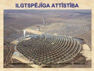
MAN AND ENVIRONMENT<br />
The structure of land use has not experienced major changes. As it used to be earlier,<br />
arable land, natural meadows and pasture land dominate (Table 1). Changes in these landscape<br />
elements determine the design of the landscape. It is also an important factor for the existence of<br />
plant and animal species diversity. The prevalence of agricultural lands in Gudenieki parish in<br />
the 30’s of the 20 th century was determined by relatively fertile soils, network of good roads,<br />
and a high density of detached farmsteads.<br />
Structure of land use in the territory of Gudenieki parish in 1935 and 2004<br />
Land use type<br />
60<br />
Area in hectares<br />
1935 2004<br />
Arable lands 4443 4896<br />
Meadows 2666<br />
Pasture land 2501<br />
1572<br />
Forests 1086 3286<br />
Fens 372 370<br />
Other land use 702 1106<br />
Total 117 70 112 30<br />
Table 1<br />
The population in the parish shrank drastically after deportations which followed the<br />
occupation (215 people were deported in 1941 and 1949) and as a result of World War II<br />
(Figure 4). The first radical changes in the structure of land use appeared after World War II.<br />
The flat Western area with moist natural meadows and pasture land had turned into an<br />
overgrown area with patches of woodland, while the <strong>un</strong>dulating Eastern part, with patches of<br />
new forests, formed a mosaic-type of landscape (Figure 3b). Between 1950 and 1960 large<br />
territories of agricultural lands were fallowed and they became overgrown with bush. During<br />
this period primary landscape succession biotopes characteristic of Latvia began to appear on<br />
the Apriķi Plain, which is situated on a layer of glaciolimnic clay. The predominant biotopes<br />
include the pine-tree (Pinus sylvestris), the birch (Betula pendula), the j<strong>un</strong>iper (J<strong>un</strong>iperus<br />
comm<strong>un</strong>is), and the heather (Call<strong>un</strong>a vulgaris). During subsequent years j<strong>un</strong>ipers spread over<br />
the meadows, forming biotopes where Call<strong>un</strong>a vulgaris, Carex pilulifera, and Nordus stricta<br />
predominate. In 1994 territories with the above-mentioned species of flora were made into<br />
restricted zones. After World War II a vast tract of forest developed in Piemare Plain. The<br />
above-mentioned tendencies in land use have continued (Figure 3c, Figure 7).<br />
number of population<br />
3000<br />
2500<br />
2000<br />
1500<br />
1000<br />
500<br />
0<br />
2455<br />
2551<br />
2444<br />
1775<br />
1574<br />
1300<br />
1017 995 955 919 902 882<br />
1930. 1935. 1939. 1949. 1959. 1965. 1978. 1990. 2000. 2002. 2003. 2004.<br />
Figure 4. Changes in the population numbers in Gudenieki parish during the 20th-21st centuries<br />
As a result of settlement centralisation during the Soviet period five villages have<br />
appeared in the territory of the parish, namely Ludženieki (with 61 inhabitants – data of 1989),