Summermagazin 2015 Kronplatz Pustertal Dolomites
Image-calalog for the Holiday-Region Kronplatz | Pusteria Valley | Dolomites
Image-calalog for the Holiday-Region
Kronplatz | Pusteria Valley | Dolomites

Create successful ePaper yourself
Turn your PDF publications into a flip-book with our unique Google optimized e-Paper software.
HOT<br />
SPOT<br />
Hints!<br />
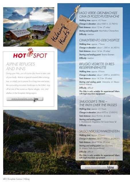
Hiking<br />
LAGO VERDE-GRÜNBACHSEE<br />
CIMA DI POZZO-PUTZENHÖHE<br />
Walking time: approx. 4.5 hours<br />
Change in elevation: about 840 m. (2,760 ft.)<br />
Total distance: about 12 km. (7 miles)<br />
Starting and ending point: Masi-Hofern/Chienes-Kiens<br />
Difficulty: medium<br />
CIMA DI TERENTO-EIDECHSSPITZE<br />
Walking time: approx. 7 hours<br />
Change in elevation: about 1,300 m. (4,300 ft.)<br />
Total distance: about 14 km. (9 miles)<br />
Starting and ending point: Terento-Terenten<br />
Difficulty: medium<br />
ALPINE REFUGES<br />
AND INNS<br />
During your hike, you of course also have to take care<br />
of your body. And as a special reward after a taxing<br />
tour, or simply just to pause for a long time and enjoy<br />
the surrounding mountain landscape to the fullest: stop<br />
off at one of the numerous Alpine refuges, inns, and<br />
shelters in the <strong>Kronplatz</strong> hiking region.<br />
www.kronplatz.com/inns<br />
RIFUGIO VEDRETTE DI RIES-<br />
RIESERFERNERHÜTTE<br />
Walking time: approx. 8 hours<br />
Change in elevation: about 1,400 m. (4,600 ft.)<br />
Total distance: about 14.5 km. (9 miles)<br />
Starting and ending point: Anterselva di Mezzo-<br />
Antholz Mittertal<br />
Difficulty: difficult<br />
This hike is only suitable for experienced hikers<br />
with high-mountain equipment!<br />
SMUGGLER’S TRAIL –<br />
THE PATH OVER THE PASSES<br />
Walking time: approx. 4.5 hours<br />
Change in elevation: about 870 m. (2,850 ft.)<br />
Total distance: about 9.6 km. (6 miles)<br />
Starting and ending point:<br />
S. Maddalena-St. Magdalena/Val Casies-Gsieser Tal<br />
Difficulty: easy<br />
SASSO NERO-SCHWARZENSTEIN<br />
Walking time: approx. 9 hours<br />
Change in elevation: about 1,900 m. (6,200 ft.)<br />
Total distance: about 14 km. (9 miles)<br />
Starting and ending point: San Giovanni<br />
St. Johann/Valle Aurina-Ahrntal<br />
Difficulty: difficult<br />
This hike is only suitable for experienced hikers<br />
with high-mountain equipment!<br />
www.kronplatz.com/hiking<br />
40 | <strong>Kronplatz</strong> Summer | Hiking