State Route 58 Widening Project - Bakersfield Freeways
State Route 58 Widening Project - Bakersfield Freeways
State Route 58 Widening Project - Bakersfield Freeways

Create successful ePaper yourself
Turn your PDF publications into a flip-book with our unique Google optimized e-Paper software.
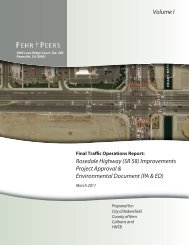
Chapter 1 Introduction<br />
• Minor changes, such as restriping approach lanes to provide an additional turn lane<br />
on the side-street approaches to SR- <strong>58</strong>, would be constructed at the cross streets<br />
because SR- <strong>58</strong> would be wider.<br />
• Utilities and drainage facilities would be relocated because of the wider roadway,<br />
including above-ground utilities such as power poles, and storm drain inlets.<br />
• Existing landscaping1 and irrigation would be replaced in the median along the<br />
proposed project alignment if it is damaged by construction.<br />
The depth of construction for the SR-<strong>58</strong> widening is expected to be five feet or less in<br />
all locations except where new bridge columns are required (at the west crossing of<br />
the Calloway Canal and at the proposed overcrossing). In these locations, the<br />
maximum depth of ground disturbance is expected to be about 45 feet from pile<br />
driving (no major excavation).<br />
San Joaquin Valley Railroad Grade Separation<br />
The project proposes a grade separation over the San Joaquin Valley Railroad (rail line<br />
between Mohawk Street and Landco Drive). The proposed grade separation would be<br />
built on the current alignment for SR- <strong>58</strong>. A temporary route on the north side of the<br />
roadway would be provided during construction to maintain roadway function. In this<br />
location, additional ROW would be required. Borrow material would be required for<br />
the grade separation and would be environmentally cleared by the contractor.<br />
No Build Alternative<br />
The No Build Alternative would not provide any improvements to SR-<strong>58</strong>. Without the<br />
proposed widening, the No Build Alternative does not address congestion and traffic<br />
delays that could be expected as traffic volumes increase. Improvements that are<br />
planned for other roadways as part of separate projects would still be built.<br />
Figures 2A–2C show the footprint for the proposed project. All borrow, disposal,<br />
staging, access, and utility relocations would be within the footprint identified in these<br />
figures, or within nearby developed areas. Figures 2A–2C also show potential kit fox<br />
dens and other observations near the project area. Dust-, erosion-, and<br />
sediment-control measures will be developed at a later project design phase, but will<br />
follow standard Best Management Practices (BMPs). Specific construction equipment<br />
will also be determined at a later project design phase, but will follow standard<br />
construction techniques.<br />
1<br />
Due to concerns regarding San Joaquin kit fox crossing the road, any landscaping planted will be<br />
low-level (i.e., less than six inches) that does not require mowing.<br />
<strong>State</strong> <strong>Route</strong> <strong>58</strong> <strong>Widening</strong> <strong>Project</strong> Biological Assessment 3