State Route 58 Widening Project - Bakersfield Freeways
State Route 58 Widening Project - Bakersfield Freeways
State Route 58 Widening Project - Bakersfield Freeways

Create successful ePaper yourself
Turn your PDF publications into a flip-book with our unique Google optimized e-Paper software.
Summary of Findings, Conclusions and Determinations<br />
Summary of Findings, Conclusions and Determinations<br />
The California Department of Transportation (Caltrans), in cooperation with the City<br />
of <strong>Bakersfield</strong> and the County of Kern, proposes to improve an approximate 5.6-mile<br />
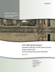
segment of <strong>State</strong> <strong>Route</strong> (SR) <strong>58</strong>, locally known as Rosedale Highway. The project area<br />
is located within unincorporated Kern County and the City of <strong>Bakersfield</strong>; the limits<br />
extend from west of Allen Road to <strong>State</strong> <strong>Route</strong> (SR) 99.<br />
The proposed project would construct two new lanes between Allen Road and SR 99;<br />
this would result in a six lane roadway throughout the project limits (post mile [PM]<br />
46.1 to PM 51.7). Improvements would also include a grade separated rail crossing that<br />
would be constructed between Mohawk Street and Landco Drive. The bridge over<br />
Calloway Canal would be widened; however, the bridge over the Friant-Kern Canal<br />
would not be widened.<br />
The purpose of the proposed project is to improve east-west traffic flow on the local<br />
and regional transportation systems and to improve traffic operations within the<br />
corridor to accommodate planned growth.<br />
The proposed project is part of the Thomas Roads Improvement Program (TRIP),<br />
which includes 10 projects: six road improvement projects in the planning and<br />
environmental review phases, three road projects currently under construction<br />
(Westside Parkway, SR-178 at Fairfax Interchange and 7 th Standard Road) and one<br />
route adoption (West Beltway).<br />
The Biological Study Area (BSA) for the proposed project includes a 5.6-mile-long<br />
section of Rosedale Highway plus a 500-foot buffer area north and south of the<br />
roadway’s centerline.<br />
A list of special-status plant and animal species that have the potential to occur within<br />
a ten-mile query radius of the BSA was established by conducting a literature review<br />
of the United <strong>State</strong>s Fish and Wildlife Service (USFWS) online special-status species<br />
list, the California Department of Fish and Game (CDFG) California Natural Diversity<br />
Database (CNDDB) and the California Native Plant Society (CNPS) species list.<br />
Fourteen federally listed species have been evaluated for their potential to occur in the<br />
BSA. Of these species, the federally listed endangered San Joaquin kit fox (Vulpes<br />
macrotis mutica) has potential to occur in the BSA. The remaining thirteen species are<br />
not expected to occur in the BSA due to the lack of suitable habitat, because they were<br />
not observed during surveys, or because they are not known to occur in the immediate<br />
project vicinity.<br />
<strong>State</strong> <strong>Route</strong> <strong>58</strong> <strong>Widening</strong> <strong>Project</strong> Biological Assessment S-1