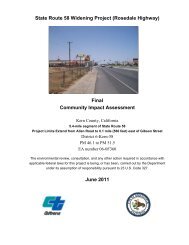
State Route 58 Widening Project - Bakersfield Freeways
State Route 58 Widening Project - Bakersfield Freeways
State Route 58 Widening Project - Bakersfield Freeways

You also want an ePaper? Increase the reach of your titles
YUMPU automatically turns print PDFs into web optimized ePapers that Google loves.
Chapter 2 Study Methods<br />
2.2. Studies Required<br />
2.2.1. Literature Review<br />
The BSA includes the current SR-<strong>58</strong> ROW and areas located 500 feet north and south<br />
of its centerline.<br />
Prior to conducting field surveys, a list of special-status plant and animal species that<br />
have potential to occur within a ten-mile query radius of the BSA was established by<br />
conducting a literature review. Literature reviewed included the CNPS’ Inventory of<br />
Rare and Endangered Vascular Plants of California (CNPS 2008), the CDFG’s<br />
CNDDB (CDFG 2008), and the USFWS List of Proposed, Threatened, and<br />
Endangered Species (USFWS 2008) for the U.S. Geologic Survey (USGS) 7.5-minute<br />
quadrangles of Famoso, Lamont, North of Oildale, Oil Center, Oildale, Rosedale, Rio<br />
Bravo, Tupman, Stevens, Gosford, and Wasco. The database searches were updated<br />
(CNPS 2010, CDFG 2010) when the NES was updated in 2010. The USFWS list was<br />
updated in March 2011 (USFWS 2011). The Western Rosedale Specific Plan (Kern<br />
County 1994), the Metropolitan <strong>Bakersfield</strong> General Plan (MBGP) (<strong>Bakersfield</strong> and<br />
Kern County 2002), the MBHCP, support documents (Thomas Reid Associates 1994,<br />
1991, and 1990), and the USFWS’s Recovery Plan for Upland Species of the San<br />
Joaquin Valley, California (USFWS 1998) were also reviewed.<br />
Other documentation that included information on biological resources in the BSA and<br />
in the general project vicinity were reviewed including: the 7 th Standard Road<br />
<strong>Widening</strong> Environmental Assessment/Initial Study with Proposed Mitigated Negative<br />
Declaration (Caltrans 2006), the Tier 2 Environmental Assessment/Final<br />
Environmental Impact Report for Westside Parkway (<strong>Bakersfield</strong> et al. 2006), the<br />
Kern County Waste Facilities Habitat Conservation Plan (Kern County Waste<br />
Management Department 1997), and the Kern Water Bank Authority Habitat<br />
Conservation Plan (Kern Water Bank Authority 1997).<br />
2.2.2. Vegetation Mapping<br />
Vegetation mapping was conducted on March 21, 2007 by walking the BSA, to<br />
describe the vegetation present in the BSA. All plant species observed were recorded<br />
in field notes. A list of species observed is included in Appendix A.<br />
<strong>State</strong> <strong>Route</strong> <strong>58</strong> <strong>Widening</strong> <strong>Project</strong> Biological Assessment 13