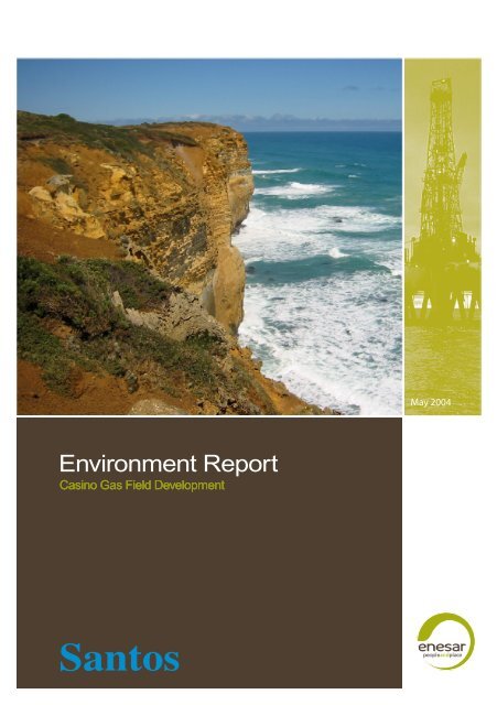
Environment Report - Santos
Environment Report - Santos
Environment Report - Santos

You also want an ePaper? Increase the reach of your titles
YUMPU automatically turns print PDFs into web optimized ePapers that Google loves.
<strong>Environment</strong> <strong>Report</strong><br />
Casino Gas Field Development<br />
May 2004
Casino Gas Field Development<br />
<strong>Environment</strong> <strong>Report</strong><br />
May 2004<br />
CR 1086_ 7_v2<br />
Prepared by: Enesar Consulting Pty Ltd<br />
124 Camberwell Road Hawthorn East Victoria Australia 3123<br />
p 61-3-9882 3555 f 61-3-9882 3533<br />
e office@enesar.com.au www enesar.com.au
Preface<br />
The Casino Gas Field Development requires approval under the Commonwealth Petroleum (Submerged Lands) Act<br />
1967, the Victorian Petroleum (Submerged Lands) Act 1982 and the Victorian Pipelines Act 1967. This <strong>Environment</strong><br />
<strong>Report</strong> (ER) has been lodged in support of an application for a Pipeline Permit under the Victorian Pipelines Act 1967.<br />
Public Display and Availability of the ER<br />
Copies of the ER will be on display and available during the exhibition period for public review at the following locations:<br />
Department of Sustainability and <strong>Environment</strong>, Customer Information Centre<br />
Nauru House, 80 Collins Street, MELBOURNE, Victoria 3000<br />
Department of Primary Industries, Minerals and Petroleum Reference Centre<br />
Level 8, 240 Victoria Parade, EAST MELBOURNE, Victoria 3002<br />
Port Campbell Visitor Information Centre<br />
26 Morris Street, PORT CAMPBELL, Victoria 3269<br />
Corangamite Shire Civic Centre<br />
181 Manifold Street, CAMPERDOWN, Victoria 3260<br />
Department of Sustainability and <strong>Environment</strong><br />
78 Henna Street, WARRNAMBOOL, Victoria 3280<br />
Department of Sustainability and <strong>Environment</strong><br />
83 Gellibrand Street, COLAC, Victoria 3250<br />
Electronic copies may be downloaded from the <strong>Santos</strong> website at: http//:www.santos.com.au.<br />
Queries and requests for hard copies or electronic copies on CD should be directed to:<br />
Catriona McTaggart, Casino <strong>Environment</strong>al Adviser<br />
<strong>Santos</strong> Ltd, GPO Box 2319, ADELAIDE, South Australia 5001. Telephone: 08-8224 7894<br />
Opportunity for Public Comment on the ER<br />
The ER provides a basis for the public to comment on the proposal, the environmental impacts and proposed mitigation<br />
measures.<br />
Public submissions will be considered by the Department of Primary Industries (DPI) in accordance with the Victorian<br />
Pipelines Act 1967.<br />
Lodging a Submission<br />
In your submission, you will need to:<br />
• Identify the proposal on which you are commenting and provide your name and address.<br />
• Where relevant, identify any special interest you have in the proposal.<br />
• If you are commenting on specific text within the ER, mention the section number and heading used in the ER.<br />
Written submissions should be sent to:<br />
Phil Roberts, Director, Minerals and Petroleum Victoria<br />
Department of Primary Industries, PO Box 500, EAST MELBOURNE, Victoria 3002<br />
Deadline for Lodging a Submission<br />
Written submissions must be received by close of business 30 days after the date of the pipeline permit application<br />
public notice.<br />
Further Information<br />
Further information regarding the Casino Gas Field Development can be obtained by contacting Catriona McTaggart<br />
(details above).
Executive Summary<br />
Executive Summary<br />
1. Introduction<br />
Project and Proponent<br />
<strong>Santos</strong> Ltd (<strong>Santos</strong>) proposes to develop<br />
the Casino gas field approximately 30<br />
km offshore from Port Campbell on Victoria’s<br />
southwest coast. The Casino Gas<br />
Field Development is a AUD$200 million<br />
project and comprises subsea installations<br />
and pipeline development that will<br />
carry gas from offshore wells to an existing<br />
TXU gas processing facility near Port<br />
Campbell.<br />
Joint venture partners in the Casino Gas<br />
Field Development with <strong>Santos</strong> (50% interest),<br />
include Peedamullah Petroleum<br />
Pty Ltd (Australian Worldwide Exploration<br />
Limited) (25% interest) and Mitwell<br />
Energy Resources Pty Limited (Mitsui &<br />
Co. (Australia) Ltd) (25% interest).<br />
Project Justification<br />
The demand for natural gas is increasing<br />
steadily. <strong>Santos</strong>, as operator of the<br />
Commonwealth exploration permit area<br />
Vic/P44, is obliged to explore for petroleum<br />
resources and, if feasible, develop<br />
any discovered resources to meet consumer<br />
demand.<br />
Gas from the Casino gas field is earmarked<br />
for use by Victorian consumers<br />
during 2006 as a supplement to existing<br />
Victorian gas reserves catering for the<br />
predicted increase in demand. In the<br />
medium-term and longer-term, the gas<br />
will be available for distribution into the<br />
Victorian and South Australian gas markets<br />
but the gas may also be temporarily<br />
stored in depleted underground gas reservoirs,<br />
awaiting withdrawal during periods<br />
of peak demand.<br />
Other potential benefits of the project<br />
include:<br />
• Employment opportunities.<br />
• Direct and indirect commercial benefits.<br />
• Provision of an alternative independent<br />
supply of gas to supplement existing<br />
gas reserves and further<br />
improve security of supply and reliability.<br />
• Increasing inter-basin competition<br />
between gas producers.<br />
• Increased use of the TXU gas<br />
processing and storage facility.<br />
• Potential for reduction in greenhouse<br />
gas emissions (compared to the use<br />
of alternative fossil fuels).<br />
Regulatory Framework<br />
The proposed Casino Gas Field Development<br />
falls within three jurisdictions including<br />
Commonwealth and Victorian<br />
waters and onshore Victoria. Consequently,<br />
permits and licences are required<br />
respectively under the<br />
Commonwealth Petroleum (Submerged<br />
Lands) Act 1967, the Victorian Petroleum<br />
(Submerged Lands) Act 1982 and<br />
the Victorian Pipelines Act 1967.<br />
The Minister for Planning has determined<br />
that the magnitude and significance of<br />
potential impacts would not necessitate<br />
the preparation of an environment effects<br />
statement. Accordingly, this <strong>Environment</strong><br />
<strong>Report</strong> has been prepared in<br />
support of the pipeline permit application<br />
under the Pipelines Act 1967 and is available<br />
for public review and comment.<br />
In December 2003, the project was determined<br />
to be a controlled action under<br />
the <strong>Environment</strong> Protection and Biodiversity<br />
Conservation Act 1999 (EPBC<br />
Act) based on the lack of certainty in<br />
construction timing and pipeline alignments<br />
and therefore potential impacts<br />
upon blue whales, and to a lesser degree,<br />
listed terrestrial flora and fauna.<br />
The subsequent Commonwealth environmental<br />
assessment under the EPBC Act<br />
has been undertaken through separate<br />
documentation, i.e., Preliminary Documentation.<br />
Stakeholder Consultation<br />
<strong>Santos</strong> has been consulting with relevant<br />
stakeholders on an ongoing basis since<br />
2000 when they commenced exploration<br />
and production activities in southwest<br />
Victoria. With the proposed Casino Gas<br />
Field Development, <strong>Santos</strong> embarked on<br />
a consultation program that focused on<br />
stakeholders potentially affected by the<br />
project, in particular landowners and<br />
commercial fishers, but also local interest<br />
groups. Information from stakeholders<br />
has been used to enhance the design<br />
and operation of the project.<br />
Stakeholder consultation will continue<br />
through the approvals process and the<br />
detailed design, construction, operation<br />
and decommissioning phases of the<br />
project.<br />
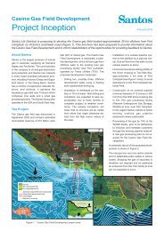
2. The Project<br />
Overview<br />
The Casino gas field was discovered in<br />
September 2002. It contains estimated<br />
recoverable reserves of 211 billion cubic<br />
feet (bcf) of natural gas and has an expected<br />
field life of up to 12 years. The<br />
Casino Gas Field Development comprises<br />
the offshore production of gas and<br />
its transportation to shore in a dedicated<br />
pipeline to the existing TXU Western<br />
Underground Gas Storage (WUGS) facility<br />
at Iona near Port Campbell for<br />
processing (Figure 1). Specifically, the<br />
development comprises:<br />
• Drilling two offshore development<br />
wells.<br />
• Installation of wellheads on the seafloor.<br />
No structures will be visible from<br />
shore.<br />
• Installation of a subsea pipeline and<br />
control umbilical (each approximately<br />
36.7 km long) on the sea floor to<br />
transfer gas from the wells to shore.<br />
• Horizontal directional drilling (HDD)<br />
of the shore crossing from farmland<br />
outside the Port Campbell National<br />
Park.<br />
• Construction of a buried onshore<br />
pipeline (11.5 km in length) from the<br />
HDD shore crossing to the TXU<br />
Casino Gas Field Development<br />
v
Executive Summary<br />
TXU WUGS<br />
facility<br />
Raw gas pipeline<br />
HDD pipeline section<br />
Optic fibre cable<br />
MEG pipeline<br />
Umbilical line<br />
Mainline valve site<br />
Onshore pipeline<br />
(11.5 km)<br />
HDD shore crossing<br />
(1.6 km)<br />
Casino 5<br />
Casino 4<br />
Subsea pipeline and control umbilical<br />
(36.7 km)<br />
2 subsea wells<br />
Figure 1<br />
Casino Gas Field Development schematic<br />
WUGS facility. A mainline valve site<br />
will be located in farmland near the<br />
coast.<br />
• Processing of the gas by TXU at the<br />
WUGS facility prior to distribution to<br />
Victorian and interstate customers<br />
through the existing pipeline network.<br />
The raw gas has very low carbon dioxide<br />
content (less than 1%) and no detectable<br />
sulfur oxides or nitrous oxides, and<br />
is therefore within sales gas specifications.<br />
Small quantities of liquids, including water<br />
and condensate may be transported<br />
to shore with the gas and these will be<br />
removed at the TXU WUGS facility. Condensate<br />
will be transported to an existing<br />
refinery by road tanker (estimated at<br />
two or three trucks per week for the first<br />
two years, then delcining to about one<br />
per week thereafter).<br />
Pipeline Route Selection<br />
<strong>Santos</strong> has implemented a pipeline route<br />
selection process that considered social,<br />
environmental, engineering and financial<br />
criteria. Foremost in this process was<br />
the desire to find a pipeline alignment<br />
that is acceptable to local landowners.<br />
The key phases in the route selection<br />
process were:<br />
• Shore crossing site.<br />
• Offshore pipeline alignment.<br />
• Onshore pipeline alignment.<br />
Shore Crossing. The selection of the<br />
preferred option for the shore crossing<br />
was the primary determinant in the overall<br />
alignment of the pipeline from the<br />
Casino gas field to the TXU WUGS facility.<br />
Following preliminary engineering and<br />
environmental assessments and consultation<br />
with key stakeholders, <strong>Santos</strong> identified<br />
Two Mile Bay as the preferred shore<br />
crossing location (Figure 2). Key benefits<br />
of this location are:<br />
• The consolidation of shore crossings<br />
for the Minerva, Otway and Casino<br />
gas fields to one area.<br />
• From the HDD site, it is possible to<br />
locate the offshore pipeline route in<br />
predominantly sandy seabed, thereby<br />
avoiding nearshore reef habitat and<br />
minimising impacts on offshore reefs<br />
and commercial fishing grounds.<br />
<strong>Santos</strong> proposes to locate the HDD site<br />
outside of the Port Campbell National<br />
Park to the west of BHP Billiton’s Minerva<br />
Project HDD site. The drill will then extend<br />
beneath the surface of the Port<br />
Campbell National Park (but through the<br />
park, as tenure extends to the centre of<br />
the earth) to exit approximately 1,225 m<br />
offshore, beyond the surf zone and<br />
nearshore reef habitat, at approximately<br />
the 15 to 16 m water depth. The total drill<br />
length would be 1,573 m.<br />
Offshore Pipeline. Having selected Two<br />
Mile Bay as the preferred shore crossing<br />
site, it was necessary to verify that the<br />
offshore seabed conditions were suitable<br />
for a pipeline. Preliminary bathymetric<br />
data obtained from <strong>Santos</strong>’ earlier<br />
seismic exploration survey and published<br />
seabed mapping identified several areas<br />
of potentially problematic seafloor<br />
features. Commercial fishers later confirmed<br />
the existence of these features.<br />
<strong>Santos</strong> consequently selected an align-<br />
vi<br />
Casino Gas Field Development
Executive Summary<br />
640 000 650 000 660 000 670 000<br />
AUSTRALIA<br />
VICTORIA<br />
Flaxman's Hill<br />
North Paaratte<br />
Gas Plant<br />
Heytesbury<br />
Gas Plant<br />
Proposed<br />
Otway Gas<br />
Project Plant<br />
Lovers Nook<br />
Campbells Creek<br />
Curdies<br />
Inlet<br />
Peterborough<br />
N<br />
VICTORIA<br />
Melbourne<br />
N<br />
NEW SOUTH WALES<br />
Tasman<br />
Sea<br />
Minerva Gas<br />
Plant<br />
10m<br />
20m<br />
30m<br />
Bass Strait<br />
0 km<br />
100<br />
Port Campbell<br />
40m<br />
Newfield Bay<br />
HDD shore<br />
crossing site<br />
50m<br />
Two Mile Bay<br />
TXU WUGS<br />
Facility<br />
60m<br />
Minerva Pipeline<br />
N<br />
0 km 5<br />
70m<br />
Map projection: AMG, ADG 66 Zone 54<br />
Minerva<br />
Gas<br />
Well<br />
Proposed Otway gas pipeline<br />
Bay of Islands Coastal Park<br />
Peterborough Coastal Reserve<br />
Port Campbell National Park<br />
Preferred Casino pipeline alignment<br />
HDD section<br />
Existing gas pipeline<br />
Proposed Otway Gas pipeline<br />
Casino gas reservoir<br />
Gas well<br />
Bathymetry<br />
Casino 5 Casino 6<br />
Casino 4<br />
Figure 2 Casino Gas Field Development pipeline alignment<br />
5 710 000 5 720 000 5 730 000<br />
Casino Gas Field Development<br />
vii
Executive Summary<br />
ment from the Casino gas field to the<br />
preferred shore crossing location that<br />
would traverse predominantly sandy seabed,<br />
thereby avoiding nearshore reef<br />
habitat and minimising impacts on offshore<br />
reefs and commercial fishing<br />
grounds.<br />
<strong>Santos</strong> then commissioned a bathymetry<br />
survey so that these features could<br />
be characterised and precisely located<br />
and a subsea pipeline route could be<br />
selected that avoids these features,<br />
where practicable (Figure 3).<br />
Onshore Pipeline. <strong>Santos</strong> investigated<br />
several potential onshore pipeline route<br />
options aimed at identifying an alignment<br />
that met environmental, social and technical<br />
criteria.<br />
The preferred onshore pipeline alignment<br />
was selected to traverse farmland and<br />
avoid remnant native vegetation, minimise<br />
impacts to farm operations and future<br />
land development, avoid highly<br />
unstable terrain in the Campbells Creek<br />
valley and cross Campbells Creek adjacent<br />
to existing pipeline easements. Following<br />
minor realignment to follow<br />
fencelines, the preferred alignment received<br />
in-principle agreement from<br />
landholders, subject to the negotiation of<br />
easement agreements. The preferred<br />
onshore pipeline alignment follows existing<br />
easements or fence lines for approximately<br />
90% of its 11.5 km length.<br />
Figure 4 shows the route traversed by<br />
the preferred onshore pipeline alignment<br />
and illustrates the typical land uses along<br />
the preferred pipeline route.<br />
Construction<br />
Construction is scheduled to commence<br />
in January 2005 to enable commercial<br />
operation and first gas by January 2006.<br />
Offshore drilling and completion of the<br />
two wells will take approximately two to<br />
three months. Mobilisation of the drill rig<br />
is scheduled for January 2005 to enable<br />
commencement of drilling in late January/early<br />
February 2005.<br />
The offshore pipeline will be installed by<br />
either pipelay barge or pipe reel-lay vessel<br />
and is scheduled to commence in<br />
November 2005 and take approximately<br />
20 days, subject to weather conditions.<br />
The installation of the shore crossing is<br />
expected to take about seven months,<br />
and is scheduled to take place between<br />
January and July 2005. This incorporates<br />
setting up the HDD site, mobilising<br />
equipment to the site, drilling and reaming<br />
the two holes (gas pipeline and umbilical<br />
lines), installation of the pipe and umbilical,<br />
grouting and demobilisation. The end<br />
of the pipeline will be rigged up with a<br />
‘pullhead’ ready for pick up by the pipelay<br />
vessel and connection to the offshore<br />
pipeline.<br />
Onshore pipeline installation is undertaken<br />
as a production line, with multiple<br />
specialist crews, that progresses along<br />
a cleared and graded 24-m construction<br />
right-of-way (ROW), and involves pipe<br />
stringing, trenching, bending, welding,<br />
installation, backfilling and rehabilitation<br />
of the ROW on completion. The duration<br />
of onshore construction at any one location<br />
is expected to take approximately<br />
eight weeks from clear and grade to<br />
trench backfill. The ROW is then<br />
revegetated with appropriate seed mixes.<br />
Total onshore pipeline construction is<br />
expected to take about six months including<br />
mainline valve (MLV) installation<br />
and easement reinstatement. The legal<br />
easement for Casino pipeline operations<br />
is 15 m.<br />
3. Project Setting and Issues<br />
Project Setting<br />
The offshore portion of the project area<br />
extends from the Casino gas field to the<br />
pipeline shore crossing at Two Mile Bay.<br />
The characteristics of the marine environment<br />
and coastline of this region include<br />
very steep to moderate offshore<br />
gradients, high wave energy and cold<br />
temperature waters.<br />
Migratory marine birds and whale species<br />
occur in the project area, several of<br />
which are listed as threatened under the<br />
EPBC Act. A variety of marine species<br />
including reef-dependent and deep-water<br />
species are commercially harvested<br />
in the vicinity of the proposed development.<br />
A component of the onshore project areas<br />
lies within the Port Campbell National<br />
Park (in that the HDD will extend<br />
through, but beneath the surface of the<br />
Park), which is listed by the Register of<br />
National Estate (RNE) as an area of national<br />
significance and is the only conservation<br />
reserve within the onshore<br />
project area. The area is mostly undulating<br />
terrain, the main geomorphological<br />
features of which include steeply-sloping<br />
valleys, undulating terrain, gorges,<br />
tall limestone cliffs, coastal embayments<br />
and coastal sand dunes.<br />
The region surrounding Port Campbell<br />
and Peterborough supports 14 ecological<br />
vegetation classes (EVCs) but is<br />
dominated by cleared land and its predominantly<br />
introduced vegetation. Many<br />
of these EVCs exist as linear native vegetation<br />
remnants on public land along<br />
roadsides and watercourses that vary in<br />
condition from good to poor. Campbells<br />
Creek is the only watercourse traversed<br />
by the onshore pipeline.<br />
The onshore section of the proposed<br />
pipeline is located in the southern part of<br />
the Corangamite Shire. Towns within the<br />
shire have experienced varying changes,<br />
i.e, decline or growth, in population over<br />
the past two census periods.<br />
Land use in the onshore project area is<br />
primarily farmland, of high agricultural<br />
quality, which is used predominantly for<br />
grazing dairy cattle. The non-farmland<br />
areas (excluding remnant vegetation) are<br />
those covered by the Port Campbell National<br />
Park, which comprises unique<br />
coastal features (e.g., the Twelve Apostles<br />
rock formations) and is the focus for<br />
the region’s significant tourism industry.<br />
The Otway region is considered prospective<br />
for gas reserves and is increasingly<br />
becoming a secondary hub of gas supply<br />
to Victoria and interstate. Consequently,<br />
there are a number of existing<br />
and proposed gas production and<br />
processing infrastructure projects within<br />
the Casino Gas Field Development<br />
project area.<br />
Issues<br />
The significant environmental and social<br />
issues associated with the proposed Casino<br />
Gas Field Development are:<br />
• Drilling activities and discharges associated<br />
with the project may affect<br />
sea water quality and aquatic habitats.<br />
• Construction of subsea wellheads<br />
and offshore pipeline installation will<br />
disturb the sea bed.<br />
• Offshore construction activities will<br />
require temporary 500-m radius exclusion<br />
zones and during operations<br />
500-m radius exclusion zones will be<br />
in-place around the wellhead. These<br />
access constraints may affect commercial<br />
fisheries.<br />
• Noise generated by the drilling rig,<br />
pipelay vessels and support craft (including<br />
helicopters) may impact on<br />
marine mammals.<br />
viii<br />
Casino Gas Field Development
Executive Summary<br />
• Construction of the shore crossing<br />
site and installation of the onshore<br />
pipeline will unavoidably require vegetation<br />
clearing and land disturbance<br />
that may result in erosion and downstream<br />
sedimentation. Consequent<br />
issues include impacts on biodiversity<br />
and conservation resources, surface<br />
water quality and flow<br />
characteristics, land use and amenity,<br />
and Aboriginal and historical heritage<br />
sites.<br />
• The development will have the potential<br />
to impact on visual amenity if<br />
inappropriately designed and implemented.<br />
• Construction of the onshore components<br />
of the project will generate dust<br />
and noise. The consequent issues<br />
focus primarily on potential effects<br />
on local air quality (including greenhouse<br />
gas emissions), public amenity<br />
and safety.<br />
• Existing roads that will provide access<br />
to the project are used by multiple<br />
users including the local<br />
community, school buses and tourists.<br />
The proposed project will temporarily<br />
increase traffic on these<br />
roads. The consequent issues focus<br />
on traffic delays, amenity and public<br />
safety.<br />
• The proposed Casino Gas Field Development<br />
will create jobs which will<br />
result in a temporary increase in the<br />
local population. There are a range<br />
of positive and negative consequent<br />
issues that concern increasing pressure<br />
on community facilities, services<br />
and infrastructure, increasing<br />
social tensions and increasing expenditure<br />
locally.<br />
4. Impact Assessment<br />
A number of specialist studies were undertaken<br />
as part of the approval process<br />
to examine the existing environmental<br />
and social condition and determine the<br />
potential impacts of the Casino Gas Field<br />
Development. The key findings are summarised<br />
below.<br />
Bathymetry and Oceanography<br />
The Casino gas field is located on the<br />
continental shelf within Bass Strait. Factors<br />
influencing current flow through Bass<br />
Strait are tidal forcing, waves, winds and<br />
large-scale ocean circulation. The maximum<br />
water depth is 70 m at the proposed<br />
well sites and the seabed includes<br />
shallow valley and ‘spur’ features. The<br />
presence of the pipeline and associated<br />
equipment on the seabed is expected to<br />
have only a very localised effect on bottom<br />
currents that may lead to the localised,<br />
but negligible, redistribution of sea<br />
floor sediment.<br />
Marine Ecology<br />
Four marine habitats are expected to<br />
occur between the well sites and the<br />
shore and include intertidal, shallow, middepth<br />
and deep environments. Within<br />
these habitats there are 17 threatened<br />
marine bird species (most of which are<br />
migratory), 3 threatened whale species<br />
(blue whale, southern right whale and<br />
humpback whale) and a number of fish<br />
listed species (e.g., pipefishes,<br />
seahorses and seadragons) that may<br />
occur.<br />
The offshore pipeline traverses mainly<br />
sandy seabed and occassional patchy<br />
sponge gardens of varying density cover,<br />
and avoids significant raised relief reef<br />
habitat.<br />
Mitigation of effects on the marine environment<br />
is largely achieved by appropriate<br />
offshore pipeline route selection.<br />
Other mitigation and management measures<br />
in relation to drilling and well completion,<br />
pipeline construction and HDD<br />
shore crossing will be implemented such<br />
that biological, e.g., increased concentrations<br />
of heavy metals, and physical,<br />
e.g., turbid plumes and smothering, effects<br />
are expected to be minor, localised<br />
and temporary.<br />
Noise derived from offshore drilling and<br />
construction activities has the potential<br />
to impact on marine animals. The principal<br />
sources of ambient ocean noise in<br />
the project area are from air-ocean interaction<br />
and other oceanic processes,<br />
naturally occurring and biogenic background<br />
noise and noise from shipping<br />
activities. The reaction of marine animals<br />
to project-generated noise from drilling<br />
rigs and ships, supply vessels and<br />
helicopters will vary between species and<br />
individuals, but is predicted to range from<br />
localised avoidance to no reaction at all.<br />
Marine Commercial Fisheries<br />
The region supports a number of commercial<br />
fisheries. Localised and temporary<br />
disturbance may occur to target<br />
species from turbidity associated with<br />
construction activities. Safety exclusion<br />
zones (500-m radius) around the wells<br />
and pipelay vessel during construction,<br />
and around the wells during operations,<br />
will reduce the available fishing area,<br />
however this will not significantly impact<br />
the total fishing grounds available as the<br />
wells and pipeline do not impact on key<br />
fishing grounds. Various measures will<br />
be implemented to minimise the risk for<br />
trawling gear to interfere with the pipeline.<br />
Landform and Soils<br />
The Port Campbell National Park contains<br />
many sites of geological and<br />
geomorphological interest. Two Mile Bay<br />
(the site of the shore crossing) is rated<br />
as being of regional, and possibly state,<br />
significance. Measures will be implemented<br />
to minimise erosion and sedimentation,<br />
slope instability, soil inversion,<br />
compaction and subsidence along the<br />
pipeline alignment. Appropriate pipeline<br />
route selection, implementation of these<br />
measures and HDD of the shore crossing<br />
will provide long-term protection of<br />
the geological and geomorphological<br />
sites.<br />
Hydrology and Hydrogeology<br />
The ephemeral Campbells Creek is the<br />
only watercourse crossing along the onshore<br />
pipeline alignment, and it is classified<br />
as a regional drain and used for<br />
domestic, stock and irrigation purposes.<br />
The onshore pipeline will be placed below<br />
ground and where the pipeline<br />
crosses Campbells Creek below the bed<br />
of the waterway. Open trenching will be<br />
used to cross Campbells Creek and instream<br />
activity is not expected to take<br />
more than one day. Pipeline installation<br />
will be timed to occur during nil to low<br />
flow thereby minimising impacts to the<br />
hydrological regime of the creek. Erosion<br />
and sediment control measures will<br />
be put in place to control transport of<br />
sediment from construction areas and<br />
potentially impacting surface water quality.<br />
Two main aquifers occur in the project<br />
area: Port Campbell Limestone Aquifer<br />
and Dilwyn Formation Aquifer. No effects<br />
on groundwater are likely.<br />
Terrestrial Ecology<br />
The extent of remnant native vegetation<br />
within the project area is limited to the<br />
Port Campbell National Park, fragments<br />
within road corridors and scattered<br />
patches on private land. The remaining<br />
areas have been substantially modified<br />
through clearing of vegetation for agricultural<br />
land use. The majority of fauna<br />
species known to occur in the area were<br />
recorded from the Port Campbell National<br />
Park.<br />
Casino Gas Field Development<br />
ix
Executive Summary<br />
9<br />
8<br />
N<br />
Casino offshore pipeline route<br />
alignment<br />
Proposed gas wellhead location<br />
ROV footage location<br />
8<br />
7<br />
4 5 6<br />
Habitat description<br />
Subcropping/outcropping low relief<br />
hummocky calcisiltite/calcarenite<br />
interspersed with a patchy veneer of shelly<br />
calcareous course sand/fine gravel<br />
Fine to medium sand<br />
Fine to coarse gravel with patches of<br />
subcropping cemented sediments<br />
Course sand/fine gravel<br />
3<br />
Casino 4<br />
2<br />
Water<br />
depth<br />
(m)<br />
0<br />
10<br />
40<br />
50<br />
60<br />
70<br />
1<br />
Casino 5<br />
x<br />
Casino Gas Field Development
Executive Summary<br />
ROV location 3<br />
Sponges, hydrozoans, bryozoans and algae. Several demersal<br />
fish species<br />
ROV location 6<br />
Little or no epifaunal communities. Biological component<br />
principally infaunal and pelagic<br />
ROV location 9<br />
Little or no epifaunal communities. Biological component<br />
principally infaunal and pelagic<br />
ROV location 2<br />
Sponges, hydrozoans, bryozoans and algae. Several demersal<br />
fish species<br />
ROV location 5<br />
Sponges, hydrozoans, bryozoans and algae. Several demersal<br />
fish species<br />
ROV location 8<br />
Little or no epifaunal communities. Biological component<br />
principally infaunal and pelagic<br />
Figure 3 Seabed habitat classification of the Casino pipeline route<br />
ROV location 1<br />
Sponges, hydrozoans, bryozoans and algae. Several demersal<br />
fish species<br />
ROV location 4<br />
Little or no epifaunal communities. Biological component<br />
principally infaunal and pelagic<br />
ROV location 7<br />
Little or no epifaunal communities. Biological component<br />
principally infaunal and pelagic<br />
Casino Gas Field Development<br />
xi
Executive Summary<br />
668 000 670 000 672 000 674 000 676 000 678 000<br />
North–South Road<br />
Timboon–Peterborough Road<br />
Creek<br />
Camerons<br />
Hill Road<br />
North Paaratte<br />
Gas Plant<br />
Heytesbury<br />
Gas Plant<br />
Boundary Road<br />
Cheynes South Road<br />
Photo 5<br />
Photo 7<br />
Photo 6 Photo 8<br />
Proposed<br />
Otway Gas<br />
Project Plant<br />
Tregea Road<br />
Creek<br />
Waarre Road<br />
Wallaby<br />
TXU<br />
WUGS<br />
Facility<br />
Eastern Creek<br />
Road<br />
Smokey Point Road<br />
Road<br />
Curdie Vale–Port Campbell Road<br />
EasternCreekRoad<br />
Campbell Road<br />
Campbells Creek<br />
Langleys<br />
Brumbys Road<br />
Minerva<br />
Gas Plant<br />
Pascoe<br />
Photo 3<br />
Photo 4<br />
Photo 9<br />
Cobden–Port<br />
Rounds Road<br />
Currells Road<br />
HDD<br />
shore<br />
crossing<br />
site<br />
N<br />
0 km 1<br />
Map projection: AMG, ADG 66 Zone 54<br />
Sharps Road<br />
Photo 2<br />
Photo 1<br />
Port Campbell<br />
Casino pipeline route alignment<br />
HDD section<br />
Existing gas pipeline<br />
Proposed Otway Gas pipeline<br />
Road<br />
Creek<br />
Great Ocean Road<br />
Spring<br />
Jarvis Road<br />
5 724 000 5 726 000 5 728 000 5 730 000<br />
xii<br />
Casino Gas Field Development
Executive Summary<br />
Photo 2<br />
Proposed location of the HDD site, located in background in<br />
pasture behind dense roadside vegetation on the northern<br />
side of the Great Ocean Road<br />
Photo 6<br />
Site of the proposed Campbells Creek open trench crossing,<br />
adjacent to the recently constructed SEAgas pipeline<br />
Photo 9<br />
The TXU WUGS facility at Iona. Tie-in point for the Casino<br />
pipeline<br />
Photo 4<br />
View south of the Smokey Point Road proposed crossing<br />
location<br />
Photo 5<br />
View south of the Cheynes South Road proposed crossing<br />
location<br />
Photo 8<br />
Proposed site of the Cobden - Port Campbell Road HDD<br />
crossing<br />
Figure 4 Casino Gas Field Development onshore pipeline route travelogue<br />
Photo 1<br />
Two Mile Bay and Port Campbell National Park.<br />
HDD shore crossing will drill under this location.<br />
Photo 3<br />
East side of the Curdie Vale–Port Campbell Road proposed<br />
HDD road crossing<br />
Photo 7<br />
Campbells Creek Valley, showing the recently constructed<br />
and restored SEAgas pipeline easement<br />
Casino Gas Field Development<br />
xiii
Executive Summary<br />
Alignment of the proposed pipeline to<br />
avoid significant stands of native vegetation<br />
(habitat areas) is the most important<br />
mitigation measure employed for<br />
minimising impacts to terrestrial flora and<br />
fauna.<br />
Vegetation loss and fragmentation, and<br />
consequent fauna habitat and species<br />
loss, will also be minimised by the HDD<br />
shore crossing which will drill under and<br />
not disturb coastal vegetation in the Port<br />
Campbell National Park. A temporary 6-<br />
m wide access track will be required to<br />
the HDD site through native vegetation<br />
in the Great Ocean Road verge. The<br />
location of the access track will be selected<br />
based on a detailed botanical assessment<br />
during spring and the track<br />
will be fully revegetated following construction<br />
with local indigenous species.<br />
Permanent access to the MLV site during<br />
the operations phase will be via an<br />
existing track, which will require clearing<br />
of regrowth.<br />
Pipeline construction will require the removal<br />
of a limited number of trees (2 to<br />
3) and shrubs, at two road crossings<br />
(Smokey Point Road and Cheynes Road<br />
South), however vegetation at these locations<br />
is significantly degraded. Mitigation<br />
and management measures, such<br />
as narrowing the right-of-way from 24 m<br />
down to 5 m at these roadsides, will<br />
minimise impacts to native vegetation.<br />
Similarly, the Curdie Vale to Port<br />
Campbell Road will be drilled to avoid<br />
impacting significant roadside native vegetation.<br />
Consequentially, the onshore pipeline is<br />
not expected to impact significantly on<br />
terrestrial flora and fauna.<br />
Aboriginal and Historical Heritage<br />
Two broad zones of archaeological sensitivity<br />
were identified during the field<br />
survey: a moderate sensitivity zone located<br />
on the margin and valley slopes of<br />
Campbells Creek and a low to moderate<br />
sensitivity zone covering a wider area<br />
impacted by land clearing and pastoral<br />
land use activities.<br />
It is expected that the implementation of<br />
suitable management measures such as<br />
further pre-construction surveys and engagement<br />
of Aboriginal community representatives<br />
to monitor vegetation<br />
clearing and initial earthworks activities<br />
(within the framework of a heritage management<br />
agreement), will prevent adverse<br />
impacts occurring.<br />
No zones of historic archaeological sensitivity<br />
have been identified therefore impacts<br />
to known historic heritage sites<br />
are unlikely to occur. The offshore pipeline<br />
route avoids all known shipwrecks<br />
by several kilometres, the nearest being<br />
the Napier, 3 km away from the pipeline<br />
alignment.<br />
The greatest potential for impact relates<br />
to disturbing previously unrecorded heritage<br />
sites. Mitigation and management<br />
measures will include training project personnel<br />
in the identification of potential<br />
artefacts and developing protocols to<br />
manage heritage material identified during<br />
construction.<br />
Land Use and Infrastructure<br />
The pipeline traverses land that is used<br />
for agriculture. With the exception of the<br />
MLV site and marker signs, there will be<br />
no above ground infrastructure and all<br />
land will be reinstated to its previous<br />
land use. Therefore, only some shortterm<br />
impacts to agricultural land use are<br />
expected to arise during construction and<br />
installation of the pipeline from the HDD<br />
shore crossing location to the TXU<br />
WUGS facility.<br />
Potential impacts to infrastructure have<br />
been mitigated to the greatest extent<br />
practicable by aligning the pipeline to<br />
accommodate landholder and asset<br />
owner requirements. Residual impacts<br />
will be managed through ongoing consultation<br />
with landholders and asset owners<br />
to address property specific issues<br />
and agree measures to mitigate or compensate<br />
any potential disruption or<br />
losses. Consequently, long-term detrimental<br />
impacts are not likely to result.<br />
Socio-economics<br />
Construction of the onshore components<br />
of the Casino Gas Field Development<br />
will require a small workforce of up to 45<br />
personnel resulting in a short-term increase<br />
in the local population. Given the<br />
small size of the onshore construction<br />
workforce, it is not expected to place<br />
significant pressure on community infrastructure,<br />
accommodation facilities and<br />
services such as medical facilities. It is<br />
possible that a construction camp will be<br />
established to avoid impacting on local<br />
facilities as construction will coincide with<br />
the summer tourist period. The offshore<br />
construction workforce of about 250 personnel<br />
will be accommodated on the drilling<br />
rig and pipelay vessel.<br />
Development of the Casino gas field is<br />
expected to generate employment opportunities<br />
and a requirement for support<br />
services. Although some positions<br />
will require specialist skills, there will be<br />
a requirement for positions to be filled<br />
locally and for the provision of local goods<br />
and services. This will have a positive<br />
economic impact through increased local<br />
expenditure.<br />
Visual Amenity<br />
Impacts to visual amenity during construction<br />
will be temporary, and are<br />
largely able to be avoided through the<br />
application of appropriate planning, design<br />
and construction strategies. Longerterm<br />
impacts have been mitigated by<br />
electing to install subsea wellheads, constructing<br />
the shore crossing by HDD from<br />
farmland and by screening the MLV site<br />
behind remnant native vegetation at the<br />
Great Ocean Road. Visual impacts of<br />
the onshore pipeline corridor will be limited<br />
to the construction phase after which<br />
the easement will be rehabilitated.<br />
Consequently, significant long-term impacts<br />
to the visual amenity of the region<br />
are unlikely to result from construction<br />
and operation of the Casino Gas Field<br />
Development.<br />
Noise<br />
Onshore noise emissions are associated<br />
with pipeline construction activities and<br />
HDD of the shore crossing and will be<br />
mitigated by locating the pipeline and<br />
shore crossing at a sufficient distance<br />
from sensitive receptors. The HDD operation<br />
will potentially result in noise nuisance<br />
at the nearest residence (300 m<br />
from the HDD site) and so further mitigation<br />
measures are being considered in<br />
consultation with the relevant landholder<br />
to achieve EPA requirements. No significant<br />
noise emissions are expected during<br />
normal pipeline operations.<br />
Air Quality<br />
The composition of the Casino gas is<br />
such that additional emissions from its<br />
processing at the TXU WUGS facility will<br />
not occur.<br />
The project has the potential to generate<br />
dust (resulting from soil disturbance) or<br />
exhaust emissions (associated with vehicles<br />
and heavy machinery). Mitigation<br />
and management measures will be implemented<br />
to manage these emissions.<br />
Given the short period of onshore pipeline<br />
construction and the application of<br />
xiv<br />
Casino Gas Field Development
Executive Summary<br />
appropriate mitigation and management<br />
measures, impacts to air quality are unlikely<br />
to occur as a result of the construction<br />
or operation of the Casino Gas Field<br />
Development.<br />
Greenhouse Gas<br />
Greenhouse gas emissions will vary over<br />
the life of the Casino Gas Field Development.<br />
The project will generate minor<br />
greenhouse gas emissions during the<br />
construction and installation stages, primarily<br />
from vehicle exhaust emissions,<br />
however, these emissions are short-term<br />
and not significant contributors to Victoria’s<br />
or Australia’s total emissions. Emissions<br />
during operation of the pipeline will<br />
be minimal comprising potential fugitive<br />
emissions and minor quantities of vehicle<br />
emissions. As a signatory to the<br />
APPEA Greenhouse Challenge, <strong>Santos</strong><br />
will continue to address reduction management<br />
of greenhouse gas emissions.<br />
Traffic<br />
The roads within the project area are<br />
multi-user roads. The potential impacts<br />
associated with construction traffic include<br />
road safety and potential interruption<br />
to traffic movements. A construction<br />
traffic management plan will be developed<br />
in consultation with relevant regulatory<br />
authorities and implemented as<br />
appropriate. It is expected that impacts<br />
resulting from construction traffic can be<br />
mitigated with the implementation of this<br />
plan.<br />
Condensate will be transported from the<br />
TXU WUGS facility to a refinery by single<br />
road tankers, resulting in 2 to 3 trucks<br />
per week. The volume of condensate<br />
and therefore trucks is expected to decline<br />
to about one per week after the first<br />
two years of field production. Based on<br />
this low and declining volume of condensate<br />
transport road traffic, and the application<br />
of the existing road safety<br />
management requirements for current<br />
traffic from the TXU WUGS facility, this<br />
minor increase in volume is not expected<br />
to significantly impact local traffic conditions.<br />
Hazard and Risk<br />
The Pipelines Act 1967 requires that a<br />
detailed risk assessment be undertaken<br />
in accordance with the requirements of<br />
the Australian standard for high-pressure<br />
gas pipelines, AS2885.1. Consequently,<br />
the Casino Gas Field Development is<br />
designed and operated to achieve hazard<br />
and risk levels that are as low as<br />
reasonably possible. Prior to the granting<br />
of the Pipeline Licence <strong>Santos</strong> will<br />
undertake such a risk assessment the<br />
results of which will be incorporated into<br />
final project planning and design as required.<br />
5. <strong>Environment</strong>al<br />
Management<br />
<strong>Santos</strong> has developed an environment,<br />
health and safety management system<br />
(EHSMS) which consists of two sets of<br />
standards: management standards and<br />
hazard standards. A project-specific environment<br />
plan (EP), for offshore components,<br />
and environmental<br />
management plan (EMP), for onshore<br />
components, will be prepared for the<br />
Casino Gas Field Development within<br />
the framework of the EHSMS.<br />
Pipeline alignment is the most effective<br />
mitigation measure for minimising impacts.<br />
Residual impacts are then mitigated<br />
and managed through the<br />
implementation of appropriate measures<br />
and procedures. Table 1 summarises the<br />
impacts associated with the project, together<br />
with the mitigation and management<br />
measures, additional to pipeline<br />
alignment that will form the basis of the<br />
EP and EMP.<br />
Casino Gas Field Development<br />
xv
Executive Summary<br />
Table 1<br />
<strong>Environment</strong>al mitigation and management measures<br />
Element Potential Issue/Impact Proposed Mitigation and Management Measure<br />
Bathymetry and<br />
oceanography<br />
Marine ecology<br />
Commercial<br />
fisheries<br />
Landform and<br />
Soils<br />
Pipeline stability on the seabed<br />
Spanning of pipeline<br />
Effect on sea water quality and<br />
aquatic habitats<br />
Impacts of project-generated<br />
noise on marine animals<br />
Effects on fishery operations<br />
Wind and water erosion<br />
Pipeline will be weighted (concrete coating or thicker wall steel pipe) to provide onbottom<br />
stability<br />
Pipeline route was selected to avoid significant spans<br />
Grout-filled bladders will fill minor spans to support pipeline<br />
Pipeline will be surveyed and retrospective maintenance as necessary to address<br />
pipeline spanning<br />
Offshore pipeline is aligned to avoid key reef habitats and predominantly traverse<br />
sandy seabed<br />
HDD will be employed for the shore crossing to avoid impacts to nearshore reef and<br />
coastal habitat<br />
Oil spill contingency response plan implemented for exploration drilling will be<br />
expanded to include all field development and operation activities<br />
Strict vessel refuelling procedures will be employed to prevent spillage at sea<br />
A waste management strategy will be developed for all marine activities based on<br />
Australian and international standards<br />
Vessels will comply with standard requirements for the prevention of the introduction<br />
of pests<br />
Low toxicity, water-based drilling fluid additives will be used<br />
HDD fluid discharge to the marine environment will be minimised<br />
Hydrostatic test water will be low-toxicity and discharged from the Casino 5 wellhead<br />
over a four-day period to ensure further dilution and dispersion<br />
Protocols will be developed in accordance with EPBC regulations to minimise<br />
interaction with whales during construction and drilling<br />
Construction will minimise or avoid the types of vessel and aircraft movements that<br />
are known to elicit disturbance reactions<br />
Aerial observations will be undertaken to monitor whale activity during the period<br />
leading up to and during the drilling program, where it coincides with whale migration<br />
or presence<br />
Helicopters will be flown at a minimum altitude of 1,000 m over ocean<br />
Watch will be maintained for whales in the vicinity of vessel activities during<br />
pipelaying such that responses including reduction of speed, minimisation of sonar<br />
use, and instructions to helicopter pilots/ancillary vessels to avoid whales can be<br />
implemented<br />
Offshore pipeline is aligned to avoid key fishing areas<br />
HDD will be employed for the shore crossing to avoid impacts to nearshore lobster<br />
and abalone habitat<br />
500-m radius exclusions zones will be implemented during construction (well sites<br />
and pipelay vessel) and operation (wellheads only) to minimise collision risk and<br />
gear loss<br />
Digital information on position of wellheads and subsea pipeline will be provided to<br />
commercial fishers<br />
Location, timing and duration of construction activities will be communicated with<br />
commercial fishers<br />
A gear retrieval or replacement policy will be implemented where it becomes<br />
snagged on project infrastructure<br />
Construction is scheduled for the drier months of the year and activity will be limited<br />
during heavy rain<br />
Maximum coverage of vegetation will be retained and rehabilitated expeditiously<br />
A special crossing crew will construct the Campbells Creek crossing and will retain a<br />
vegetation buffer on the banks and approach slopes, reinstate immediately following<br />
pipelay using appropriate stabilisation measures and undertake additional<br />
revegetation to enhance the riparian corridor<br />
Erosion and sediment control measures will be installed and maintained during<br />
construction and operations<br />
The pipeline easement will be monitored for erosion, sedimentation and stability<br />
xvi<br />
Casino Gas Field Development
Executive Summary<br />
Table 1<br />
<strong>Environment</strong>al mitigation and management measures (cont’d)<br />
Element Potential Issue/Impact Proposed Mitigation and Management Measure<br />
Landform and<br />
Soils (cont’d)<br />
Hydrology and<br />
hydrogeology<br />
Terrestrial<br />
ecology<br />
Slope instability<br />
Soil inversion, compaction and<br />
subsidence<br />
Soil contamination<br />
Disturbance to significant<br />
features<br />
Water quality<br />
Disruption to water flow regimes<br />
Clearing of remnant native<br />
vegetation and loss of significant<br />
flora and fauna with consequent<br />
biodiversity and conservation<br />
impacts<br />
Onshore pipeline alignment was selected to avoid areas of significant slope<br />
instability and slumping<br />
Topsoil will be stripped and stockpiled separately to trench spoil<br />
Soils will be reinstated in the reverse order of excavation to avoid inversion of soil<br />
profiles<br />
Construction ROW access during or immediately after heavy rain will be limited<br />
Trench backfill will be compacted and if necessary a raised crown will be installed<br />
(less than 20 cm) over the trench to mitigate subsidence<br />
Soils will be scarified to relieve compaction, where necessary<br />
Temporary and permanent storage of fuels, lube oils and other hazardous chemicals<br />
will be within areas or facilities designed to contain spills<br />
Appropriate hazardous chemical handling procedures will be implemented<br />
Appropriate measures to prevent third party rupture of the MEG pipeline will be<br />
implemented including pipeline marker signs, in-trench marker tape and appropriate<br />
depth of burial<br />
A spill contingency response plan will be developed and implemented<br />
HDD will be employed for the shore crossing to avoid surface impacts to coastal<br />
landforms<br />
Construction is scheduled for the driest months of the year<br />
The Campbells Creek crossing will be constructed during period of nil to low flow,<br />
where practicable or employ stream flow diversion measures (flume or dam and<br />
pump) to minimise sediment release<br />
The pipeline will be buried at a greater depth at the Campbells Creek crossing to<br />
minimise risk of scour<br />
Stockpiles will be placed more than 10 m from the top-of-bank at Campbells Creek<br />
Temporary and permanent storage of fuels, lubes and other hazardous chemicals<br />
will be within areas or facilities designed to contain spills<br />
Appropriate hazardous chemical handling procedures will be implemented (e.g., no<br />
refuelling of machinery and equipment within 20 m of Campbells Creek)<br />
A spill contingency response plan will be developed and implemented<br />
A raised crown will be installed over the trench to compensate for subsidence and<br />
crown breaks created every 30 m to prevent impedance of surface flows<br />
The Campbells Creek crossing will be constructed during nil to low flow, where<br />
practicable or stream flow diversion measures employed (flume or dam and pump) to<br />
maintain flow<br />
Positive HDD fluid pressure will be maintained during drilling and the drill hole cased<br />
to prevent preferential flow of groundwater along the drill hole<br />
HDD shore crossing will drill under the surface of Port Campbell National Park and<br />
Great Ocean Road avoiding native vegetation clearance<br />
Temporary access to the HDD site will be selected based on a targeted search for<br />
rare or endangered species to avoid any that may be present, where practicable.<br />
The access will be revegetated with local native species following construction to<br />
reflect the existing ecological vegetation class (EVC)<br />
The pipeline route is aligned through open farmland and traverses native vegetation<br />
at two minor road crossings only where it is aligned through degraded native<br />
vegetation. The ROW will be narrowed from 24-m down to 5-m at these road<br />
crossings<br />
Impacts to native vegetation within the Port Campbell National Park to enable<br />
temporary surface placement of the HDD sensing cable will be kept to an absolute<br />
minimum, involve hand trimming only, include restoration of any disturbed areas and<br />
be undertaken in consultation with Parks Victoria.<br />
Casino Gas Field Development<br />
xvii
Executive Summary<br />
Table 1<br />
<strong>Environment</strong>al mitigation and management measures (cont’d)<br />
Element Potential Issue/Impact Proposed Mitigation and Management Measure<br />
Terrestrial<br />
ecology (cont’d)<br />
Aboriginal and<br />
historic heritage<br />
Land use and<br />
infrastructure<br />
Socio-economic<br />
Visual amenity<br />
Potential for disturbance to<br />
Aboriginal and historic heritage<br />
sites<br />
Construction and operation of<br />
the pipeline may effect current<br />
land use activities<br />
Interference with the operation<br />
of existing infrastructure<br />
Creation of jobs and requirement<br />
for supporting goods and<br />
services<br />
Short-term additional demand<br />
for services, facilities and<br />
infrastructure, potential to create<br />
social tensions<br />
Alteration to the visual<br />
landscape associated with<br />
vegetation clearing and the<br />
introduction of project<br />
infrastructure<br />
Campbells Creek crossing is aligned to avoid clearance of significant riparian<br />
vegetation<br />
Cleared native vegetation will be retained on site and respread over the easement<br />
during rehabilitation<br />
The period and length of time the trench remains open will be minimised and the<br />
open trench will be monitored for fauna<br />
Weed and pathogen hygiene measures will be implemented for the project,<br />
particularly in relation to access to the Port Campbell National Park<br />
Any areas of native vegetation impacted by the project shall be revegetated with<br />
indigenous species to reflect the original EVC in line with the principles of net gain<br />
Disturbed areas will be revegetated as soon as practicable following construction<br />
Permanent access to the MLV site will be via an existing narrow track, which will<br />
require minor clearing of native regrowth and weed species.<br />
An Aboriginal heritage management plan will be implemented in consultation with the<br />
relevant Aboriginal communities<br />
Additional sub-surface Aboriginal heritage surveys will be undertaken in the<br />
Campbells Creek valley prior to construction in consultation with the relevant<br />
Aboriginal communities<br />
Representatives from the relevant Aboriginal communities will be engaged to monitor<br />
clearing and initial earthworks for previously undetected heritage artefacts<br />
Appropriate site management will be implemented in consultation with relevant<br />
Aboriginal heritage communities and regulatory authorities<br />
A protocol for the management of any new potential Aboriginal or historic heritage<br />
sites uncovered during construction will be implemented within the heritage<br />
management plan framework<br />
The pipeline has been aligned through properties in consultation with landholders to<br />
minimise impacts to farm operations (e.g., follow existing easements and fence<br />
lines), where practicable<br />
A weed and pathogen management plan will be implemented, including appropriate<br />
hygiene measures to prevent the introduction and spread of weeds and pathogens<br />
Liaison with landholders will be undertaken to determine the most appropriate<br />
measures to minimise impacts to farm operations<br />
The easement and farm infrastructure will be reinstated in a manner that minimises<br />
disruption and losses to landholders<br />
<strong>Santos</strong> will continue to liaise with Woodside Energy Ltd with regard to minimising<br />
impacts where pipeline construction for the Casino Gas Field Development and the<br />
Otway Gas Project is within the same property<br />
Crossing of the Curdie Vale to Port Campbell Road and Cobden to Port Campbell<br />
Road will be by HDD<br />
Utility infrastructure asset owners will be consulted regarding potential impacts to<br />
utilities associated with pipeline route selection, construction and operation activities<br />
Where possible, employees and goods and services will be sourced locally<br />
The field interaction protocol will continue to be implemented to guide personnel on<br />
appropriate standards of conduct during field activities<br />
<strong>Santos</strong> and the construction contractor will consult with local authorities and service<br />
providers regarding resourcing issues<br />
Installation of subsea wellheads will avoid offshore visual impacts<br />
Well locations will be identified on marine charts and coordinates provided to<br />
commercial fishers to negate the need for marker buoys to mark well locations<br />
The shore crossing will be constructed by HDD<br />
xviii<br />
Casino Gas Field Development
Executive Summary<br />
Table 1<br />
<strong>Environment</strong>al mitigation and management measures (cont’d)<br />
Element Potential Issue/Impact Proposed Mitigation and Management Measure<br />
Visual amenity<br />
(cont’d)<br />
Noise<br />
Air quality<br />
Potential noise nuisance to<br />
adjacent residents during<br />
construction and operation<br />
Generation of dust and exhaust<br />
emissions<br />
The pipeline alignment selected minimises vegetation clearance<br />
The onshore pipeline will be buried<br />
The HDD and MLV site will be screened behind dense roadside vegetation at the<br />
Great Ocean Road<br />
The location of the construction camp, if required, will be in an area of previous<br />
disturbance and established and operated in a manner that minimises visual<br />
intrusion<br />
Noisy activities will be scheduled for during the day to coincide with higher ambient<br />
noise, where practicable<br />
Measures will be undertaken to attenuate noise from the HDD, if necessary, e.g.,<br />
noise barriers, or alternatively arrangements will be implemented with the affected<br />
residents to avoid noise nuisance<br />
Potentially affected residents will be informed of the status of construction activities<br />
The extent of clearing and earthworks will be limited and the period surfaces are<br />
exposed minimised<br />
Vehicle speeds will be restricted on unsealed tracks and the pipeline easement<br />
Appropriate means to stabilise soils in dusty conditions will be used, e.g., water<br />
trucks<br />
Vehicles and plant will be appropriately maintained<br />
The pipeline and associated appurtenances will be appropriately maintained to<br />
minimise fugitive emissions during operations<br />
Planned venting operations, if undertaken, will be during appropriate weather<br />
conditions to facilitate rapid dispersion<br />
Greenhouse gas Emissions of greenhouse gases The pipeline and associated appurtenances will be appropriately maintained to<br />
minimise fugitive emissions during operations<br />
Traffic<br />
Hazard and Risk<br />
Alteration to existing traffic<br />
conditions, e.g., increased road<br />
use<br />
Risk of rupture of the gas or<br />
MEG pipelines, or impacts to<br />
wellhead facilities<br />
Bushfire resulting from<br />
construction activities<br />
Vehicles and other internal combustion equipment will be appropriately maintained<br />
Quantities of vented natural gas during commissioning and operations will be<br />
minimised<br />
A traffic management plan for the construction and operations phases will be<br />
developed and implemented in consultation with VicRoads and the Corangamite<br />
Shire<br />
The pipeline and associated appurtenances will be located to minimise risk of<br />
interference<br />
Design and construction of wellhead facilities, the pipeline and associated<br />
appurtenances will be in accordance with Australian standard AS2885 and<br />
consequently, the project risk assessment study<br />
Bushfire prevention and response procedures will be developed in consultation with<br />
relevant regulatory authorities for incorporation into the Safety Management Plan<br />
Casino Gas Field Development<br />
xix
Executive Summary<br />
xx<br />
Casino Gas Field Development
Contents<br />
Contents<br />
Executive Summary<br />
v<br />
1. Introduction 1<br />
1.1 Project Outline 1<br />
1.2 Project Proponent 1<br />
1.2.1 <strong>Santos</strong> Ltd 1<br />
1.2.2 Australian Worldwide Exploration Limited 3<br />
1.2.3 Mitsui & Co. (Australia) Ltd 3<br />
1.3 Project Justification 3<br />
1.4 About This Document 4<br />
1.5 EIA Study Team 4<br />
2. Regulatory Framework 5<br />
2.1 Approval Process Overview 5<br />
2.2 Planning and <strong>Environment</strong>al Approvals 5<br />
2.2.1 EPBC Act 1999 5<br />
2.2.2 <strong>Environment</strong> Effects Act 1978 6<br />
2.2.3 Planning and <strong>Environment</strong> Act 1987 7<br />
2.2.4 Coastal Management Act 1995 7<br />
2.2.5 Native Title 7<br />
2.2.6 Net Gain Policy 8<br />
2.3 Well Development Approvals 8<br />
2.3.1 Commonwealth Petroleum (Submerged Lands) Act 1967 8<br />
2.4 Pipeline Approvals 8<br />
2.4.1 Commonwealth Petroleum (Submerged Lands) Act 1967 8<br />
2.4.2 Victorian Petroleum (Submerged Lands) Act 1982 8<br />
2.4.3 Pipelines Act 1967 8<br />
2.4.4 Easement Acquisition 8<br />
2.5 Subsequent Approvals 9<br />
3. Stakeholder Consultation 11<br />
3.1 Relevant Stakeholders 11<br />
3.2 Stakeholder Consultation Program 11<br />
3.3 Consultation Records 13<br />
4. Project Rationale 15<br />
4.1 Australia’s Gas Industry 15<br />
4.2 Rationale for Development 15<br />
4.3 Benefits of the Proposal 15<br />
4.3.1 Supplementation of Existing Gas Reserves 15<br />
4.3.2 Security of Supply 15<br />
4.3.3 Increased Gas Supply Competition 16<br />
Casino Gas Field Development xxi
Contents<br />
4.3.4 Commercial Benefits 16<br />
4.3.5 Potential Greenhouse Benefits 16<br />
4.4 Project Alternatives 17<br />
4.4.1 The ‘Do Nothing’ Scenario 17<br />
4.4.2 Alternative Gas Supplies 17<br />
4.4.3 Alternative Energy Sources 17<br />
4.4.4 Alternative Development Scenarios 18<br />
5. Project Description 19<br />
5.1 Reservoir and Gas Specifications 20<br />
5.2 Project Design Specifications 20<br />
5.3 Pipeline Route Selection 20<br />
5.3.1 Shore Crossing 21<br />
5.3.2 Offshore Pipeline 21<br />
5.3.3 Onshore Pipeline 21<br />
5.4 Description of Construction Activities 25<br />
5.4.1 Drilling and Wellhead Installation 25<br />
5.4.2 Offshore Pipeline and Umbilical Installation 30<br />
5.4.3 Shore Crossing 30<br />
5.4.4 Onshore Pipeline 32<br />
5.4.5 Ancillary Facilities 42<br />
5.5 Commissioning 43<br />
5.6 Operations 43<br />
5.7 Decommissioning 43<br />
5.8 Project Life 44<br />
5.9 Project Development Schedule 44<br />
6. Impact Assessment 45<br />
6.1 Climate 45<br />
6.2 Bathymetry and Oceanography 45<br />
6.2.1 Sources of Information 45<br />
6.2.2 Existing <strong>Environment</strong> 45<br />
6.2.3 Potential Impacts 46<br />
6.2.4 Mitigation and Management Measures 46<br />
6.2.5 Residual Impacts 47<br />
6.3 Marine Ecology 47<br />
6.3.1 Survey Methodology 47<br />
6.3.2 Existing <strong>Environment</strong> 47<br />
6.3.3 Potential Impacts 51<br />
6.3.4 Impact Assessment 51<br />
6.3.5 Mitigation and Management Measures 54<br />
6.4 Marine Acoustics 54<br />
6.4.1 Existing <strong>Environment</strong> 54<br />
6.4.2 Construction Related Noise 56<br />
6.4.3 Potential Impacts to Whales 57<br />
6.4.4 Mitigation and Management Measures 60<br />
6.5 Marine Commercial Fisheries 61<br />
6.5.1 Existing <strong>Environment</strong> 61<br />
xxii<br />
Casino Gas Field Development
Contents<br />
6.5.2 Potential Impacts 63<br />
6.5.3 Mitigation and Management Measures and Residual Impacts 63<br />
6.6 Landform and Soils 64<br />
6.6.1 Existing <strong>Environment</strong> 64<br />
6.6.2 Potential Impacts 67<br />
6.6.3 Mitigation and Management Measures and Residual Impacts 67<br />
6.7 Hydrology and Hydrogeology 69<br />
6.7.1 Existing <strong>Environment</strong> 69<br />
6.7.2 Potential Impacts 69<br />
6.7.3 Mitigation and Management Measures and Residual Impacts 69<br />
6.8 Terrestrial Ecology 70<br />
6.8.1 Survey Methodology 70<br />
6.8.2 Existing <strong>Environment</strong> 71<br />
6.8.3 Potential Impacts 79<br />
6.8.4 Mitigation and Management Measures and Residual Impacts 79<br />
6.9 Aboriginal Heritage 84<br />
6.9.1 Survey Methodology 84<br />
6.9.2 Existing <strong>Environment</strong> 85<br />
6.9.3 Potential Impacts 87<br />
6.9.4 Mitigation and Management Measures 87<br />
6.9.5 Residual Impacts 88<br />
6.10 Historical Heritage 88<br />
6.10.1 Methodology 88<br />
6.10.2 Existing <strong>Environment</strong> 88<br />
6.10.3 Potential Impacts 88<br />
6.10.4 Mitigation and Management Measures and Residual Impacts 88<br />
6.10.5 Residual Impacts 89<br />
6.11 Land Use and Infrastructure 89<br />
6.11.1 Existing <strong>Environment</strong> 89<br />
6.11.2 Potential Impacts 92<br />
6.11.3 Impact Assessment, Mitigation and Management Measures 93<br />
6.11.4 Residual Impacts 95<br />
6.12 Socio-economic 96<br />
6.12.1 Existing <strong>Environment</strong> 96<br />
6.12.2 Impact Assessment 97<br />
6.12.3 Mitigation and Management Measures 98<br />
6.13 Visual Amenity 99<br />
6.13.1 Existing <strong>Environment</strong> 99<br />
6.13.2 Potential Impacts 100<br />
6.13.3 Impact Assessment 100<br />
6.13.4 Mitigation and Management Measures 102<br />
6.14 Noise 103<br />
6.14.1 Existing <strong>Environment</strong> 103<br />
6.14.2 Impact Assessment 103<br />
6.14.3 Mitigation and Management Measures 106<br />
6.15 Air Quality 106<br />
Casino Gas Field Development xxiii
Contents<br />
6.15.1 Existing <strong>Environment</strong> 106<br />
6.15.2 Potential Impacts 106<br />
6.15.3 Mitigation and Management Measures 107<br />
6.15.4 Residual Impacts 107<br />
6.16 Greenhouse Gas 107<br />
6.16.1 Background 107<br />
6.16.2 Sources of Greenhouse Gases 107<br />
6.16.3 Mitigation and Management Measures 107<br />
6.17 Traffic 108<br />
6.17.1 Existing <strong>Environment</strong> 108<br />
6.17.2 Potential Impacts 108<br />
6.17.3 Mitigation and Management Measures 108<br />
6.17.4 Residual Impacts 109<br />
6.18 Hazard and Risk 109<br />
7. <strong>Environment</strong>al Management Framework 111<br />
7.1 <strong>Environment</strong>, Health and Safety Management System 111<br />
7.1.1 Policy 112<br />
7.1.2 Plan 112<br />
7.1.3 Implement 113<br />
7.1.4 Monitor and Evaluate 116<br />
7.1.5 Review 116<br />
8. References 117<br />
9. Glossary 121<br />
Figures<br />
1.1 Casino Gas Field Development pipeline alignment 2<br />
1.2 Casino Gas Field Development schematic 3<br />
2.1 Casino Gas Field Development lead environmental approvals process flow chart 6<br />
4.1 Total natural gas consumption in Australia, 1979-2001 15<br />
4.2 Australia’s primary energy consumption by fuel type, 1980-81 and 2000-01 16<br />
4.3 Australia’s natural gas consumption by state, 2001 16<br />
4.4 Australia’s gas pipelines and gas fields 17<br />
5.1 Casino Gas Field Development schematic 19<br />
5.2 Casino Gas Field Development HDD shore crossing options 22<br />
5.3 Casino Gas Field Development onshore pipeline route sub-options 24<br />
5.4 Casino Gas Field Development onshore pipeline route 27<br />
5.5 Casino Gas Field Development onshore pipeline route travelogue 29<br />
5.6 Typical subsea wellhead configuration 30<br />
5.7 Offshore pipeline cross section (umbilical shown strapped to pipeline, but may be laid separately<br />
adjacent to pipeline) 32<br />
5.8 Typical offshore pipeline spanning stabilisation treatment 32<br />
5.9 HDD shore crossing - site location and construction site layout 33<br />
5.10 HDD shore crossing profile 34<br />
xxiv<br />
Casino Gas Field Development
Contents<br />
5.11 Typical mainline construction ROW cross section 35<br />
5.12 Onshore pipeline construction ROW 36<br />
5.13 Onshore pipeline and trench cross-section 39<br />
5.14 Typical open trench isolation crossing (dam and pump method) 40<br />
5.15 Typical open trench isolation crossing (flume pipe method) 41<br />
5.16 Typical MLV site layout 42<br />
5.17 Project development timeline 44<br />
6.1 Sea surface temperature satellite image, showing cold water upwelling off the Bonney Coastline<br />
in March 1995 46<br />
6.2 Seabed habitat classification of the Casino pipeline route 48<br />
6.3 Blue whale sightings between February 1998 - May 2002 50<br />
6.4 Geology of the Port Campbell area 65<br />
6.5 Idealised geological profile of the HDD shore crossing 68<br />
6.6A Vegetation units 72<br />
6.6B Vegetation units (Great Ocean Road to Curdie Vale to Port Campbell Road) 73<br />
6.6C Vegetation units (Curdie Vale to Port Campbell Road to Campbells Creek) 74<br />
6.6D Vegetation units (Campbells Creek to the TXU WUGS facility) 75<br />
6.7 Ecological Vegetation Classes of the Port Campbell area 76<br />
6.8 HDD shore crossing site 81<br />
6.9 Curdie Vale to Port Campbell Road HDD crossing 82<br />
6.10 Smokey Point Road open trenched crossing 82<br />
6.11 Cheynes Road South open trenched crossing 83<br />
6.12 Campbells Creek open trenched crossing 83<br />
6.13 Cobden to Port Campbell Road HDD crossing 84<br />
6.14 Landuse and infrastructure 90<br />
6.15 Corangamite Shire planning schemes and overlays 91<br />
6.16 Residences within 500m of the proposed Casino pipeline 105<br />
7.1 <strong>Santos</strong>’ <strong>Environment</strong>, Health and Safety Management System 111<br />
Tables<br />
1.1 Casino Gas Field Development EIA Project Team 4<br />
2.1 Summary of key regulatory approvals 5<br />
2.2 Subsequent approvals 9<br />
3.1 Key stakeholders 12<br />
3.2 Casino Gas Field Development consultation summary 13<br />
5.1 Pipeline and well design specifications 20<br />
5.2 Preliminary assessment of shore crossing options 23<br />
5.3 Assessment of onshore route options 26<br />
5.4 Length of preferred onshore pipeline route following new, existing or proposed easements 30<br />
5.5 Depths of cover along the proposed pipeline route 39<br />
5.6 Proposed road crossing methods 41<br />
6.1 Climatic averages for southwest Victoria 45<br />
6.2 Average rainfall and raindays in Port Campbell (1885 to 1993) 45<br />
Casino Gas Field Development xxv
Contents<br />
6.3 Locations of commercial fisheries in the study area 63<br />
6.4 Geology of the project area 66<br />
6.5 Summary of vegetation types and EVCs along the proposed Casino pipeline route 77<br />
6.6 Habitat quality 78<br />
6.7 Fauna conservation significance 80<br />
6.8 Summary of proposed mitigation measures and residual impacts on native vegetation 85<br />
6.9 Potential impacts to flora and fauna habitat and actions for avoidance and minimisation 86<br />
6.10 Previous historical research undertaken in the vicinity of the study area 88<br />
6.11 Shipwrecks within 15 km of the proposed offshore pipeline route 89<br />
6.12 Existing and proposed gas infrastructure in the project area 92<br />
6.13 Corangamite Shire population data 96<br />
6.14 Location of population within Corangamite Shire 96<br />
6.15 Corangamite Shire employment by industry 97<br />
6.16 Typical background noise levels within the project area 103<br />
6.17 EPA (N3/89) maximum noise limit guidelines 103<br />
6.18 EPA (TG 302/92) noise control guidelines 104<br />
6.19 Maximum predicted noise levels, LA 10<br />
dB(A) 104<br />
6.20 Predicted noise levels at residences within 500 m of the pipeline route 104<br />
7.1 <strong>Santos</strong> EHSMS management standards 112<br />
7.2 Casino Gas Field Development environmental responsibilities 114<br />
Plates<br />
5.1 Well testing by semi-submersible rig during drilling of Casino 3 well 30<br />
5.2 Typical subsea wellhead similar to that proposed for the Casino Gas Field Development 31<br />
5.3 The “Semac 1” pipelay barge 31<br />
5.4 The “Apache” pipe reel-lay vessel 31<br />
5.5 A typical HDD rig used for road and river crossing operations 34<br />
5.6 Raised rock creek causeway 37<br />
5.7 A cleared and graded ROW in preparation for trenching 37<br />
5.8 Trench excavation using a bucket-wheel ditcher 37<br />
5.9 Stringing of pipe lengths along the ROW 37<br />
5.10 Field bending of pipe 37<br />
5.11 Pipe welding 37<br />
5.12 Coating of welded pipe joints 38<br />
5.13 Lowering in of pipeline 38<br />
5.14 Backfilling the trench 38<br />
5.15 Soil ripping to alleviate heavily compacted soils 38<br />
5.16 Revegetation, showing pasture restoration shortly after sowing 38<br />
5.17 Typical pipeline marker post and cathodic protection test point 43<br />
6.1 Panoramic view of Two Mile Bay , showing the intertidal environment 49<br />
6.2 Coastal cliff formations typical of the Port Campbell National Park 66<br />
6.3 West side of the Curdie Vale to Port Campbell Road HDD road crossing location 82<br />
xxvi<br />
Casino Gas Field Development
Contents<br />
6.4 East side of the Curdie Vale to Port Campbell Road HDD road crossing location 82<br />
6.5 North side of the Smokey Point Road crossing location. Note the predominantly weedy<br />
roadside vegetation 82<br />
6.6 South side of the Smokey Point Road road crossing location, heavily infested with blackberries 82<br />
6.7 South side of the Cheynes Road South road crossing location. Little, if any, of this native vegetation<br />
will be cleared to accommodate the ROW 83<br />
6.8 North side of the Cheynes Road South road crossing location. Note the predominantly weedy<br />
vegetation and sparse native overstorey 83<br />
6.9 Campbells Creek crossing location, adjacent to the recently constructed SEAgas pipeline 83<br />
6.10 The Twelve Apostles, 21 km west of the Casino Gas Field Development shore crossing 99<br />
6.11 Casino 3 drilling rig (circled) in operation as seen from the shore near Port Campbell, barely visible<br />
on the horizon 100<br />
Boxes<br />
7.1 <strong>Santos</strong>’ environmental vision, commitment and policy 112<br />
Appendices<br />
1 Terrestrial Flora and Fauna Species Lists<br />
2 <strong>Santos</strong> <strong>Environment</strong>, Health and Safety Management System<br />
Casino Gas Field Development xxvii
Contents<br />
xxviii<br />
Casino Gas Field Development
1. Introduction<br />
1. Introduction<br />
<strong>Santos</strong> Ltd (<strong>Santos</strong>) is proposing the<br />
Casino Gas Field Development located<br />
approximately 30-km offshore from Port<br />
Campbell on Victoria’s southwest coast.<br />
This <strong>Environment</strong> <strong>Report</strong> has been prepared<br />
in support of applications for statutory<br />
approval.<br />
1.1 Project Outline<br />
The Casino gas field was discovered in<br />
September 2002 and contains estimated<br />
recoverable reserves of 211 billion cubic<br />
feet (bcf) of natural gas. The Casino Gas<br />
Field Development comprises a subsea<br />
completion and a pipeline development,<br />
which will carry gas from offshore wells<br />
to an existing gas processing facility near<br />
Port Campbell, operated by Texas Utilities<br />
(TXU) (Figure 1.1). Specifically, the<br />
proposed development comprises:<br />
• Drilling of two offshore development<br />
wells using a floating semi-submersible<br />
drilling rig.<br />
• Installation of subsea wellheads on<br />
the seafloor in approximately 70 m of<br />
water.<br />
• Installation of a subsea pipeline (approximately<br />
36.7-km long) on the seafloor<br />
using a pipe-lay vessel. Gas will<br />
flow from the wells via the subsea<br />
pipeline to shore.<br />
• Horizontal directional drilling (HDD)<br />
of the shore crossing from cleared<br />
farmland on the northern side of the<br />
Great Ocean Road at Two Mile Bay,<br />
approximately 2-km west of Port<br />
Campbell, to avoid disturbance to the<br />
surface of Port Campbell National<br />
Park and coastal marine habitat. Two<br />
drill holes, each approximately 1,570<br />
m in length, will be required to accommodate<br />
the gas pipeline and a<br />
control umbilical cable bundle.<br />
• Construction of an onshore pipeline<br />
(with nominal diameter of 300 mm<br />
and approximate length of 11.5 km)<br />
from the HDD shore crossing site to<br />
TXU’s Western Underground Gas<br />
Storage (WUGS) facility at Iona, near<br />
Port Campbell. A mainline valve<br />
(MLV) compound will be constructed<br />
at the HDD site and over the pipeline<br />
easement after the completion of the<br />
shore crossing.<br />
• Processing of the gas by TXU at the<br />
TXU WUGS facility, prior to its distribution<br />
to Victorian and interstate customers<br />
through the existing pipeline<br />
network. A new gas processing plant<br />
is not required for the Casino Gas<br />
Field Development.<br />
A schematic layout of the proposed development<br />
is shown in Figure 1.2.<br />
Reservoir testing has shown that the raw<br />
gas has very low carbon dioxide content<br />
and no detectable sulfur oxides or nitrous<br />
oxides. Stripping of impurities from<br />
the gas is therefore not required and<br />
hence no additional air emissions from<br />
the TXU WUGS facility are expected.<br />
Small quantities of liquids, including water<br />
and condensate (a light petroleum<br />
liquid), may naturally occur in the gas<br />
and will be removed at the TXU WUGS<br />
facility.<br />
The water will be disposed through TXU’s<br />
existing water treatment facility. The condensate<br />
will be stored at the TXU WUGS<br />
facility and then transported to a refinery<br />
by a single road tanker approximately<br />
two to three times a week. Condensate<br />
production from the Casino gas field is<br />
expected to decline significantly after one<br />
to two years of operation to the equivalent<br />
of about one tanker per week.<br />
1.2 Project Proponent<br />
The proponent for the Casino Gas Field<br />
Development is <strong>Santos</strong> (50% interest),<br />
which operates exploration permit VIC/<br />
P44 on behalf of its joint venture partners,<br />
Peedamullah Petroleum Pty Ltd<br />
(Australian Worldwide Exploration Limited)<br />
(25% interest) and Mitwell Energy<br />
Resources Pty Limited (Mitsui & Co.<br />
(Australia) Ltd) (25% interest).<br />
1.2.1 <strong>Santos</strong> Ltd<br />
<strong>Santos</strong> was formed in South Australia in<br />
1954 and is now a major Australian energy<br />
company. The core business of the<br />
company is oil and gas exploration and<br />
production with interests in every major<br />
Australian petroleum province. <strong>Santos</strong> is<br />
the largest producer of natural gas for<br />
the Australian market supplying all mainland<br />
states and territories. <strong>Santos</strong>’ head<br />
office is located in Adelaide with offices<br />
also located in Brisbane and Perth.<br />
The core gas operations for <strong>Santos</strong> are<br />
in the Cooper Basin with gas being distributed<br />
to customers in South Australia,<br />
New South Wales, Queensland and the<br />
Australian Capital Territory. <strong>Santos</strong> also<br />
operates gas fields in the Northern Territory,<br />
Western Australia and Victoria, has<br />
exploration and production interests in<br />
the United States of America and exploration<br />
acreage in Indonesia and Papua<br />
New Guinea.<br />
In the Otway Basin, Victoria, <strong>Santos</strong> holds<br />
interests in three exploration permits onshore<br />
and three exploration permits and<br />
two retention licences offshore. <strong>Santos</strong>’<br />
offshore interests include a 10% share<br />
in the retention leases that contain the<br />
Minerva and La Bella gas fields operated<br />
by BHP Billiton Petroleum Pty Ltd.<br />
<strong>Santos</strong> has been the operator of the Vic/<br />
P44 exploration permit (<strong>Santos</strong> interest<br />
50%) since 2001 and in August 2002<br />
was awarded exploration permits VIC/<br />
P51 (<strong>Santos</strong> interest 80%) and VIC/P52<br />
(<strong>Santos</strong> interest 33.3%). <strong>Santos</strong>, on behalf<br />
of its joint venture partners, also<br />
operates four recently awarded Commonwealth<br />
exploration permits in the adjacent<br />
Sorrell Basin. Since becoming<br />
operator of these permit areas, <strong>Santos</strong><br />
has undertaken exploration including<br />
seismic surveys and drilling.<br />
Casino Gas Field Development 1
1. Introduction<br />
640 000 650 000 660 000 670 000<br />
AUSTRALIA<br />
VICTORIA<br />
Flaxman's Hill<br />
North Paaratte<br />
Gas Plant<br />
Heytesbury<br />
Gas Plant<br />
Proposed<br />
Otway Gas<br />
Project Plant<br />
Lovers Nook<br />
Campbells Creek<br />
Curdies<br />
Inlet<br />
N<br />
NEW SOUTH WALES<br />
VICTORIA<br />
Melbourne<br />
Tasman<br />
Sea<br />
N<br />
Peterborough<br />
Minerva Gas<br />
Plant<br />
10m<br />
20m<br />
30m<br />
Bass Strait<br />
0 km<br />
100<br />
Port Campbell<br />
40m<br />
Newfield Bay<br />
HDD shore<br />
crossing site<br />
50m<br />
Two Mile Bay<br />
TXU WUGS<br />
Facility<br />
60m<br />
Minerva Pipeline<br />
N<br />
0 km 5<br />
70m<br />
Map projection: AMG, ADG 66 Zone 54<br />
Minerva<br />
Gas<br />
Well<br />
Proposed Otway gas pipeline<br />
Bay of Islands Coastal Park<br />
Peterborough Coastal Reserve<br />
Port Campbell National Park<br />
Preferred Casino pipeline alignment<br />
HDD section<br />
Existing gas pipeline<br />
Proposed Otway Gas pipeline<br />
Casino gas reservoir<br />
Gas well<br />
Bathymetry<br />
Casino 5 Casino 6<br />
Casino 4<br />
Figure 1.1 Casino Gas Field Development pipeline alignment<br />
5 710 000 5 720 000 5 730 000<br />
2 Casino Gas Field Development
1. Introduction<br />
Existing TXU WUGS<br />
facility<br />
Port Campbell<br />
National Park<br />
Sales gas<br />
30 km (16 nm)<br />
Nearshore<br />
rocky reef<br />
Two subsea wellheads<br />
Horizontal directional drill<br />
shore crossing under<br />
Port Campbell National Park<br />
Gathering manifold<br />
70 m<br />
water depth<br />
Subsea pipeline to shore and<br />
control umbilicals<br />
Reservoir depth<br />
up to 2,000 m<br />
below sea level<br />
Development wells<br />
drilled by jakck-up rig<br />
Not to scale<br />
Casino<br />
Gas Reservoir<br />
Figure 1.2<br />
Casino Gas Field Development schematic<br />
1.2.2 Australian Worldwide<br />
Exploration Limited<br />
Australian Worldwide Exploration Limited<br />
(AWE) is an Australian oil and gas<br />
exploration and production company<br />
listed on the Australian Stock Exchange<br />
(ASX). AWE was founded in Australia in<br />
1997. Its assets include interests in the<br />
Kipper, Basker and Manta gas and oil<br />
fields in the Gippsland Basin (interests<br />
sold in 1999), the Pillantoqui light gas<br />
field in Argentina and exploration acreage<br />
in the Taranaki Basin of New Zealand.<br />
In late 1999, AWE acquired a 96% controlling<br />
interest in Omega Oil NL and this<br />
became a wholly-owned subsidiary in<br />
September 2002. In January 2000, AWE<br />
acquired all of the Australian assets of<br />
Premier Oil plc, including a 33% share of<br />
the producing Beharra Springs gas field<br />
located in the Perth Basin, Western Australia.<br />
AWE also has a 30% interest in<br />
the Yolla gas field in Bass Strait that is<br />
currently being developed.<br />
During 2001, AWE commenced development<br />
of the Las Bases and Estancia<br />
el Colorado gas fields in Argentina and<br />
the Beharra Springs North onshore gas<br />
field in Western Australia. In mid 2003,<br />
AWE acquired a 25% interest in VIC/<br />
P44, containing the Casino gas field.<br />
1.2.3 Mitsui & Co. (Australia) Ltd<br />
Mitsui & Co. (Australia) Ltd (Mitsui) is<br />
100% owned by its parent company,<br />
Mitsui & Co., Ltd of Japan, which has<br />
offices in 210 cities spanning 93 countries.<br />
Mitsui opened its first Australian office in<br />
Sydney in 1909, followed by a Melbourne<br />
office in 1917. Since the 1960’s, Mitsui’s<br />
activities have expanded to include working<br />
with the public and private sectors in<br />
Australia. Mitsui is active in the development<br />
of minerals, energy and agricultural<br />
exports, investment and, more<br />
recently, promoting new areas, including<br />
telecommunications and forestry.<br />
Australian petroleum joint ventures include<br />
the Northwest Shelf LNG project,<br />
Timor Sea exploration and 25% of VIC/<br />
P44 which contains the Casino gas field.<br />
1.3 Project Justification<br />
Gas from the Casino gas field is earmarked<br />
for use by Victorian consumers<br />
during 2006 as a supplement to existing<br />
Victorian gas reserves, catering for the<br />
predicted increase in demand. The<br />
project development schedule aims to<br />
have the gas available to consumers to<br />
meet the winter peak gas use period.<br />
Other potential benefits of the Casino<br />
Gas Field Development include:<br />
• Employment, particularly during construction.<br />
• Direct and indirect commercial benefits<br />
during construction and operation<br />
through the provision of support<br />
services to the project.<br />
Casino Gas Field Development 3
1. Introduction<br />
• Provision of an alternative independent<br />
gas supply, further improving security<br />
of supply and reliability in the<br />
Victorian gas market.<br />
• Supplementing existing available gas<br />
reserves.<br />
• Increasing inter-basin competition<br />
between gas producers.<br />
• Increased utilisation of the TXU<br />
WUGS facility.<br />
• Potential for reduction in greenhouse<br />
gas emissions compared to the use<br />
of alternative fossil fuels.<br />
1.4 About This Document<br />
This <strong>Environment</strong> <strong>Report</strong> has been prepared<br />
in support of an application for a<br />
Pipeline Permit by <strong>Santos</strong> under the provisions<br />
of the Victorian Pipelines Act<br />
1967. It assesses the environmental, social<br />
and economic impacts of the construction<br />
and operation of all aspects of<br />
the Casino Gas Field Development and<br />
identifies <strong>Santos</strong>’ intentions for the avoidance,<br />
mitigation and management of the<br />
residual impacts.<br />
This document has been prepared following<br />
consultation with a range of stakeholders<br />
throughout the planning and<br />
impact assessment process.<br />
The <strong>Environment</strong> <strong>Report</strong> enables the<br />
public, determining authorities, assessment<br />
agencies and referral agencies to<br />
understand the environmental consequences<br />
of the Casino Gas Field Development<br />
and provides a basis on which<br />
comment can be made on the proposal.<br />
Specifically, this <strong>Environment</strong> <strong>Report</strong> provides:<br />
• For interested bodies and persons, a<br />
basis for understanding the proposal,<br />
alternatives and preferred solutions,<br />
the existing environment, and the<br />
potential change to that environment<br />
that may occur if the proposal is implemented.<br />
• For groups or persons with rights or<br />
interests in land, an outline of the<br />
effects of the proposal on that land,<br />
including information on access, acquisition<br />
and easements, and how<br />
those effects will be managed.<br />
• For government decision-makers, information<br />
for assessing the impacts<br />
of the proposed project and associated<br />
development, having regard to<br />
the legislative and policy provisions<br />
of their jurisdictions.<br />
• For the proponent, a definitive statement<br />
of measures or actions taken to<br />
avoid, manage or mitigate any po-<br />
Company<br />
<strong>Santos</strong> Ltd<br />
Table 1.1<br />
Enesar Consulting Pty Ltd<br />
Centre for Marine Science and<br />
Technology, Curtin University<br />
Worley<br />
Ian A. Gordon<br />
Brett Lane & Associates<br />
Framlingham Aboriginal Trust<br />
Andrew Long & Associates<br />
Weather News International (WNI)<br />
Fugro-TGS<br />
tential adverse impacts during and<br />
following the implementation of the<br />
proposal.<br />
1.5 EIA Study Team<br />
<strong>Santos</strong> has appointed Enesar Consulting<br />
Pty Ltd to coordinate a detailed investigation<br />
of the potential environmental<br />
impacts from the proposed Casino Gas<br />
Field Development. The impact assessment<br />
has been undertaken by a team of<br />
specialists from a range of disciplines<br />
(Table 1.1). The contributions of team<br />
members are gratefully acknowledged.<br />
Casino Gas Field Development EIA Project Team<br />
Project management<br />
Role<br />
EIA project management<br />
Planning and environmental approvals<br />
Marine ecology<br />
Socio-economic (visual, traffic, land and marine uses)<br />
Emissions (air and noise)<br />
GIS<br />
Underwater acoustic recording and analysis<br />
Engineering concept study<br />
Front-end Engineering and Design (FEED)<br />
Lands and easements<br />
Terrestrial and stream ecology<br />
Aboriginal heritage study coordination<br />
Aboriginal site surveys<br />
Aboriginal, historic and maritime heritage<br />
Oceanography<br />
Offshore pipeline route survey<br />
4 Casino Gas Field Development
2. Regulatory Framework<br />
2. Regulatory Framework<br />
2.1 Approval Process<br />
Overview<br />
The proposed Casino Gas Field Development<br />
will impact on three jurisdictions<br />
including Commonwealth waters, Victorian<br />
State waters and onshore Victoria.<br />
Consequently, the project will require<br />
permits and licences under the Commonwealth<br />
Petroleum (Submerged<br />
Lands) Act 1967, the Victorian Petroleum<br />
(Submerged Lands) Act 1982 and<br />
the Victorian Pipelines Act 1967, respectively.<br />
Where a project displays the potential to<br />
significantly impact upon matters of national<br />
environmental significance, as defined<br />
under the Commonwealth<br />
<strong>Environment</strong> Protection and Biodiversity<br />
Conservation Act 1999 (EPBC Act) (Section<br />
2.2.1), an assessment under the<br />
EPBC Act may be required. Similarly,<br />
where a project displays a potential for<br />
significant environmental impacts or community<br />
concern, the provisions of the<br />
Victorian <strong>Environment</strong> Effects Act 1978<br />
may also be triggered.<br />
In November 2003, <strong>Santos</strong> sought<br />
determinations from the Commonwealth<br />
<strong>Environment</strong> and Heritage Minister and<br />
the Victorian Minister for Planning regarding<br />
the required level of environmental<br />
assessment under the respective<br />
acts. <strong>Santos</strong> was subsequently advised<br />
that Commonwealth environmental assessment<br />
under the EPBC Act will be<br />
undertaken through Preliminary Documentation<br />
and that the Victorian environmental<br />
assessment will require the<br />
preparation of an <strong>Environment</strong> <strong>Report</strong><br />
under the Pipelines Act 1967. Both the<br />
Preliminary Documentation and the <strong>Environment</strong><br />
<strong>Report</strong> (this document) are<br />
required to be available for public review<br />
and comment.<br />
Figure 2.1 provides a flow chart of the<br />
approval processes applied to the Casino<br />
Gas Field Development.<br />
In addition, a number of technical approvals<br />
are required under a range of<br />
Commonwealth and State legislature.<br />
These are summarised in Table 2.1 and<br />
discussed in detail in the following sections.<br />
2.2 Planning and<br />
<strong>Environment</strong>al Approvals<br />
2.2.1 EPBC Act 1999<br />
The EPBC Act enables the Commonwealth<br />
to join with the States and Territories<br />
in a national approach to<br />
environment protection and biodiversity<br />
conservation. Under the EPBC Act, actions<br />
that are likely to have a significant<br />
Table 2.1<br />
impact on a matter of national environmental<br />
significance will trigger Commonwealth<br />
assessment.<br />
Matters defined as nationally significant<br />
include the presence of:<br />
• A World Heritage property.<br />
• A Ramsar wetland of international<br />
importance.<br />
• Nationally threatened animal and<br />
plant species and ecological communities.<br />
• Internationally protected migratory<br />
species.<br />
Summary of key regulatory approvals<br />
Element Legislation Approval<br />
Offshore well<br />
drilling<br />
Completion of<br />
offshore<br />
production wells<br />
Offshore<br />
pipeline<br />
HDD shore<br />
crossing<br />
Onshore<br />
pipeline<br />
(includes HDD)<br />
Commonwealth Petroleum<br />
(Submerged Lands) Act 1967<br />
Commonwealth Petroleum<br />
(Submerged Lands) Act 1967<br />
Victorian Petroleum<br />
(Submerged Lands) Act 1982<br />
Victorian Coastal Management<br />
Act 1995<br />
Commonwealth Petroleum<br />
(Submerged Lands) Act 1967<br />
Victorian Coastal Management<br />
Act 1995<br />
Victorian National Parks Act<br />
1975<br />
Victorian Land Act 1958<br />
Victorian Pipelines Act 1967<br />
Victorian Land Act 1958<br />
Approval to drill<br />
<strong>Environment</strong> plan acceptance<br />
Drilling rig safety case<br />
Production licence<br />
Consent to construct and install a<br />
facility<br />
Consent to use a facility<br />
Pipeline licence<br />
Consent to construct a pipeline<br />
Consent to operate a pipeline<br />
Consent for the use or development of<br />
coastal crown land<br />
Pipeline licence<br />
Consent to construct a pipeline<br />
Consent to operate a pipeline<br />
Consent for the use or development of<br />
coastal crown land<br />
Consent to enter a National Park<br />
Authority to cross crown land<br />
Pipeline permit to own and use<br />
pipeline<br />
Pipeline licence to construct and<br />
operate a pipeline<br />
Authority to cross crown land<br />
Casino Gas Field Development 5
2. Regulatory Framework<br />
• Commonwealth land and marine<br />
area(s).<br />
• Nuclear action(s).<br />
A referral and assessment process determines<br />
the application of the EPBC<br />
Act, which involves:<br />
1. The proponent submitting a referral<br />
detailing project information, and the<br />
proponent’s assessment of the<br />
project’s implications on the abovelisted<br />
criteria.<br />
2. The referral is posted on the Commonwealth<br />
Department of <strong>Environment</strong><br />
and Heritage (DEH) website<br />
(www.deh.gov.au) and public comment<br />
is invited over a ten-day period.<br />
3. The Federal Minister for <strong>Environment</strong><br />
and Heritage makes a determination<br />
on whether the project is deemed to<br />
be a controlled action (i.e., potential<br />
for significant impacts on a matter of<br />
national significance) 20 days after<br />
lodgement of the referral. If a controlled<br />
action, then Commonwealth assessment<br />
of the project under the<br />
EPBC Act is required.<br />
Assessment under the EPBC Act may<br />
take one of four paths:<br />
1. Preliminary Documentation.<br />
2. Accreditation of State assessment<br />
process.<br />
3. Public <strong>Environment</strong> <strong>Report</strong>.<br />
4. <strong>Environment</strong>al Impact Statement.<br />
In December 2003, the Casino Gas Field<br />
development was determined to be a<br />
controlled action under the EPBC Act<br />
based on the lack of certainty in construction<br />
timing and pipeline alignments<br />
and therefore the potential for the proposed<br />
development to impact upon blue<br />
whales, and to a lesser degree, listed<br />
terrestrial flora and fauna. Subsequently,<br />
DEH have advised that assessment will<br />
be by Preliminary Documentation, which<br />
includes public exhibition of the Preliminary<br />
Documentation for 20 business days<br />
and invitation to lodge submissions.<br />
<strong>Santos</strong> is required to address any submissions<br />
raised in a supplementary report<br />
to DEH, which together with the<br />
Preliminary Documentation, will enable<br />
the Federal Minister for <strong>Environment</strong> and<br />
Heritage to assess the project.<br />
2.2.2 <strong>Environment</strong> Effects Act 1978<br />
Under the Victorian <strong>Environment</strong> Effects<br />
Act 1978, the Minister for Planning may<br />
require that a proponent prepares an<br />
Figure 2.1<br />
Victoria<br />
Seek Planning Minister's<br />
determination<br />
Minister advises EES<br />
is not required<br />
Prepare <strong>Environment</strong> <strong>Report</strong><br />
under Pipelines Act 1967<br />
Pipeline Permit application<br />
lodged, supported by<br />
<strong>Environment</strong> <strong>Report</strong><br />
(public notice)<br />
DPI and DSE assessments<br />
Pipeline Permit granted<br />
Submit safety case – Onshore<br />
<strong>Environment</strong>al Management<br />
Plan & offshore <strong>Environment</strong><br />
Plan (Vic waters)<br />
Onshore and Victorian offshore<br />
Pipeline Licences granted<br />
Final project approvals<br />
(granted sequentially):<br />
• Consent to Construct<br />
• Consent to Operate<br />
DEH<br />
DPI<br />
DSE<br />
EES<br />
EPBC<br />
Commonwealth<br />
NO<br />
Department of <strong>Environment</strong> & Heritage<br />
Department of Primary Industries<br />
Lodge EPBC Act Referral<br />
(20 day public review)<br />
Is it a "controlled action"?<br />
YES<br />
Submit Preliminary<br />
Documentation (20 day public<br />
notice and review)<br />
DEH EPBC Act assessment<br />
Submit offshore <strong>Environment</strong> Plan<br />
for drilling and offshore pipeline<br />
(Commonwealth waters)<br />
Approved to drill<br />
Commonwealth Pipeline Licence<br />
and Production Licence granted<br />
Department of Sustainability & <strong>Environment</strong><br />
<strong>Environment</strong> Effects Statement<br />
<strong>Environment</strong> Protection & Biodiversity Conservation<br />
Casino Gas Field Development lead environmental approvals process<br />
flow chart<br />
6 Casino Gas Field Development
2. Regulatory Framework<br />
<strong>Environment</strong> Effects Statement for a development<br />
proposal. In determining the<br />
application of the <strong>Environment</strong> Effects<br />
Act 1978 to a development proposal, the<br />
Minister for Planning must take into account:<br />
• The character of the receiving environment.<br />
• Any potential impacts of the proposal.<br />
• The resilience of the environment to<br />
cope with change.<br />
• The level of confidence in impact prediction.<br />
• The presence of planning or policy<br />
framework.<br />
• Statutory decision-making processes.<br />
• The degree of public interest.<br />
The Minister for Planning has determined<br />
that the magnitude and significance of<br />
potential impacts would not necessitate<br />
the preparation of an EES on the basis<br />
that:<br />
• The coastal crossing is adjacent to<br />
that of the Minerva Project, using similar<br />
horizontal directional drill (HDD)<br />
techniques including drilling from outside<br />
the Port Campbell National Park.<br />
• Construction of the onshore pipeline<br />
is adjacent to, or within, existing gas<br />
pipeline easements 1 .<br />
• The existing TXU gas plant is used<br />
for processing of the Casino field gas.<br />
• An <strong>Environment</strong> <strong>Report</strong> describing<br />
the potential impacts of the pipeline<br />
development and proposed environment<br />
management measures is to<br />
be prepared by <strong>Santos</strong> to the satisfaction<br />
of the Department of<br />
Sustainability and <strong>Environment</strong> (DSE)<br />
and the Department of Primary Industries<br />
(DPI), and then exhibited for<br />
public comment in conjunction with<br />
the pipeline permit application.<br />
• A report on the environmental outcomes<br />
of the project to the post-construction<br />
stage is to be provided to<br />
DSE (and DPI) by <strong>Santos</strong>.<br />
Accordingly, this <strong>Environment</strong> <strong>Report</strong> has<br />
been prepared in support of the pipeline<br />
permit application under the Pipelines<br />
Act 1967, which will only be granted following<br />
advice on the project from the<br />
Minister for Planning and the Minister for<br />
<strong>Environment</strong> and Conservation.<br />
2.2.3 Planning and <strong>Environment</strong><br />
Act 1987<br />
In Victoria, planning approvals are governed<br />
by the Planning and <strong>Environment</strong><br />
Act 1987. This Act regulates the use and<br />
development of land through planning<br />
schemes and the granting of planning<br />
permits.<br />
The onshore part of the pipeline for the<br />
Casino Gas Field Development is located<br />
within the Corangamite Shire and<br />
traverses land zoned as environmental<br />
rural zone (ERZ), rural use zone (RUZ)<br />
and special use zone (SUZ) 2 . By definition,<br />
a pipeline development in these<br />
zones would require a planning permit<br />
as a utility installation. However, by virtue<br />
of Section 12(h) of the Pipelines Act<br />
1967, separate planning approvals are<br />
not required as land use is taken into<br />
account when approving the pipeline<br />
route.<br />
Under the Pipelines Act 1967, ancillary<br />
facilities such as valve stations are<br />
deemed to be appurtenances to the pipeline<br />
and are not gas processing facilities<br />
as such, and do not require separate<br />
planning approval.<br />
2.2.4 Coastal Management Act 1995<br />
Installation of the pipeline on the seabed<br />
within Victorian waters (out to the 3-nm<br />
limit) and by horizontal directional drilling<br />
beneath the surface of the Port<br />
Campbell National Park (i.e., coastal<br />
Crown Land) will require consent for the<br />
use and development of coastal Crown<br />
Land. An application will be lodged with<br />
the Department of Sustainability and <strong>Environment</strong><br />
under Part 4, Sections 37 and<br />
38 of the Coastal Management Act 1985.<br />
2.2.5 Native Title<br />
The Commonwealth Native Title Act 1993<br />
applies indigenous Native Title rights,<br />
unless extinguished by freehold title or<br />
the validation of certain acts. The Act<br />
also sets out procedural requirements<br />
and potential entitlements to compensation<br />
when an action may impact on native<br />
title rights. The Pipeline Permit<br />
cannot be granted by the minister until<br />
DPI are satisfied that a relevant procedure<br />
under the Commonwealth Native<br />
Title Act 1993 has been followed.<br />
<strong>Santos</strong> has sought advice from the DSE<br />
Crown Land Management on an appropriate<br />
process who advised that a notification<br />
and acquisition process should<br />
be pursued under Section 24KA of the<br />
Native Title Act 1993. This involves:<br />
1. Notification of intentions to seek<br />
easements over land that may be subject<br />
to native title and invitation to<br />
make a submission on the proposed<br />
activity in relation to their native title<br />
rights and interests.<br />
2. If there are no registered native title<br />
claimants, Native Title Services Victoria,<br />
an indigenous community native<br />
title representative body, has 28<br />
days to make a submission on behalf<br />
of any other person or party that they<br />
certify as having a relevant native title<br />
interest in the area concerned.<br />
3. <strong>Santos</strong> Ltd must address all submissions<br />
that are received within the 28-<br />
day period, and attempt to resolve<br />
any relevant issues that have been<br />
raised.<br />
4. Victorian Government policy allows a<br />
period of up to 6-months, from the<br />
date of the notice, for resolution of<br />
issues.<br />
5. The Manager of the Indigenous Land<br />
and Resource Management Policy<br />
Unit of DSE will accept that submissions<br />
have been resolved where there<br />
is evidence that native title parties<br />
agree to the future act. Alternatively,<br />
where a resolution can not be reached<br />
<strong>Santos</strong> must provide evidence that<br />
negotiations have been conducted in<br />
good faith.<br />
There are currently no native title claims<br />
over any areas affected by the Casino<br />
Gas Field Development.<br />
Additional to the requirements of the Native<br />
Title Act, the preservation and protection<br />
of Aboriginal areas, sites or<br />
objects is afforded under the provisions<br />
of the Aboriginal and Torres Strait Islander<br />
Heritage Protection Act 1984. This<br />
Commonwealth Act supplements the<br />
state heritage protection legislation,<br />
namely the Victorian Archaeological and<br />
Aboriginal Relics Preservation Act 1988.<br />
The provisions of these acts with regard<br />
to heritage approvals are applied during<br />
the environmental assessment of route<br />
investigations and impacts prior to the<br />
granting of project approvals.<br />
1 In its submission to DPI <strong>Santos</strong> committed to<br />
following existing easements, where practicable.<br />
Where technical or landuse considerations prevent<br />
the use of existing easements the pipeline alignment<br />
has been selected in consultation with relevant<br />
landholders and regulatory authorities.<br />
2 Shire of Corangamite Planning Scheme.<br />
Casino Gas Field Development 7
2. Regulatory Framework<br />
<strong>Santos</strong> has formed an excellent working<br />
relationship with the Framlingham Aboriginal<br />
Trust as a result of previous development<br />
projects in the region and is<br />
committed to establishing appropriate<br />
heritage management agreements.<br />
2.2.6 Net Gain Policy<br />
The principle of net gain is embodied in<br />
the Victorian Government’s Native Vegetation<br />
Management Framework (DNRE,<br />
2002a). The framework sets out goals<br />
for native vegetation management. The<br />
primary goal is a reversal, across the<br />
entire landscape, of the long-term decline<br />
in the extent and quality of native<br />
vegetation, leading to a Net Gain.<br />
Net gain is where losses of native vegetation<br />
and habitat are first minimised<br />
and then more than offset by commensurate<br />
gains in habitat hectares. A habitat<br />
hectare is an equivalence measure of<br />
the quality and quantity of native vegetation<br />
that can be applied across the state.<br />
While net gain recognises that natural is<br />
best, it is possible to recover both the<br />
extent and quality of native vegetation<br />
through management. Impacts to native<br />
vegetation have been minimised through<br />
appropriate route selection. Further impact<br />
reductions can be achieved by minimising<br />
the extent of significant vegetation<br />
removal at sensitive sites such as<br />
roadsides and creek crossings, by applying<br />
appropriate management measures<br />
such as narrowing the right-of-way<br />
(ROW) clearing and maintaining canopy<br />
trees (see Section 6.8).<br />
The application of net gain to the Casino<br />
Gas Field Development is subject to discussion<br />
with the DSE. While it is recognised<br />
that buried pipelines have potential<br />
environmental impacts that are largely<br />
temporary in nature, net gain is intended<br />
to offset significant vegetation losses arising<br />
from developments with permanent<br />
environmental effects (such as those requiring<br />
a permanently cleared easement<br />
through forest). <strong>Santos</strong> will work with<br />
DSE to develop an appropriate strategy<br />
that reflects the minor and temporary<br />
impacts associated with the Casino Gas<br />
Field Development.<br />
2.3 Well Development<br />
Approvals<br />
2.3.1 Commonwealth Petroleum<br />
(Submerged Lands) Act 1967<br />
The development and operation of the<br />
offshore production wells within Commonwealth<br />
waters will require a range of<br />
approvals under the provisions of the<br />
Commonwealth Petroleum (Submerged<br />
Lands) Act 1967. Approvals include a<br />
production licence, approvals to drill and<br />
test wells, approval to construct and install<br />
facilities and consent to use facilities.<br />
The Commonwealth Department of Industry,<br />
Tourism and Resources (DITR)<br />
grants the production licence. Day-today<br />
administration of petroleum resources<br />
in Commonwealth waters<br />
offshore from Victoria is delegated to the<br />
Victorian DPI as the designated authority,<br />
and so approvals to drill, construct<br />
and install wells are issued by DPI. Licences<br />
and approvals will only be granted<br />
following EPBC Act approval.<br />
2.4 Pipeline Approvals<br />
2.4.1 Commonwealth Petroleum<br />
(Submerged Lands) Act 1967<br />
The offshore section of pipeline from the<br />
well field to the 3-nm Victorian State limit<br />
occurs in Commonwealth waters and will<br />
require a pipeline licence under the provisions<br />
of the Commonwealth Petroleum<br />
(Submerged Lands) Act 1967.<br />
The pipeline licence application requires<br />
a risk-based <strong>Environment</strong> Plan to be submitted<br />
to DPI. A pipeline licence application<br />
will be made once approval has been<br />
received under the EPBC Act.<br />
2.4.2 Victorian Petroleum<br />
(Submerged Lands) Act 1982<br />
The offshore pipeline in Victorian waters,<br />
from the 3-nm limit to the mean low<br />
water mark, will require licensing under<br />
the Victorian Petroleum (Submerged<br />
Lands) Act 1982. Whilst not specified in<br />
the Act, a risk-based <strong>Environment</strong> Plan<br />
will be submitted to DPI with the pipeline<br />
licence application.<br />
It is anticipated that a single <strong>Environment</strong><br />
Plan will be prepared for all offshore<br />
development activities.<br />
2.4.3 Pipelines Act 1967<br />
In Victoria, onshore natural gas pipelines<br />
with an operating pressure above<br />
1,050 kPa require licensing under the<br />
Pipelines Act 1967. <strong>Santos</strong> expects operating<br />
pressures in the Casino pipeline<br />
to be greater than 1,050 kPa. Pipeline<br />
approvals are a two stage process: the<br />
first being an application for a pipeline<br />
permit to own and use the pipeline; the<br />
second being an application for a pipeline<br />
licence to construct and operate the<br />
pipeline. Section 20 of the Pipelines Act<br />
1967 authorises pipeline construction and<br />
operation through or over Crown land.<br />
The Pipelines Act 1967 is administered<br />
by Minerals and Petroleum Victoria<br />
(MPV), and relates to the onshore pipeline<br />
from the low water mark at the coast<br />
to the TXU WUGS facility, and therefore<br />
includes the horizontal directional drill<br />
shore crossing.<br />
This Act requires that an assessment of<br />
potential environmental effects and proposed<br />
mitigation measures be submitted<br />
in support of the permit application.<br />
This application is exhibited for public<br />
comment. The proponent is then required<br />
to submit an environmental management<br />
plan in support of a licence application.<br />
Key steps in the granting of approvals<br />
under the Pipelines Act 1967 include:<br />
1. An application for a pipeline permit<br />
(to own and use) supported by an<br />
<strong>Environment</strong> <strong>Report</strong> (i.e., this document).<br />
The permit application is advertised<br />
for at least 30 days for public<br />
comment.<br />
2. An application for a pipeline licence<br />
(to construct and operate) supported<br />
by a safety case document.<br />
3. Proponent submissions leading to the<br />
granting of final project approvals,<br />
which are issued in sequence as compliance<br />
is verified, including:<br />
– Consent to construct.<br />
– Consent to operate (supported by<br />
operations safety and environment<br />
management plan).<br />
2.4.4 Easement Acquisition<br />
The granting of an easement over land<br />
through which the pipeline is to be constructed<br />
provides present and future protection<br />
of the asset by identifying it on<br />
titles and property plans. The easement<br />
prevents inappropriate development over<br />
the pipeline, whilst providing for the continuation<br />
of existing land uses, where<br />
they are not inconsistent with the construction<br />
and operation of a pipeline.<br />
<strong>Santos</strong> has committed to following existing<br />
easements for the onshore pipeline,<br />
where practicable, to consolidate encumbrances<br />
on properties with developed<br />
corridors. Where this is not practicable,<br />
new easements will be sought.<br />
The following section outlines, step-bystep,<br />
the process <strong>Santos</strong> is following for<br />
gaining land access for the onshore pipeline.<br />
8 Casino Gas Field Development
2. Regulatory Framework<br />
1. Title searches: <strong>Santos</strong> has identified<br />
potential pipeline corridors within a<br />
broad study area, and completed title<br />
searches of all land parcels to<br />
establish the status and ownership<br />
of the land.<br />
2. Consent to survey: <strong>Santos</strong> approached<br />
each landholder and occupier<br />
in person to seek written<br />
voluntary consent to enter private<br />
property for the purpose of conducting<br />
engineering and environmental<br />
surveys. The landowners and occupiers<br />
were informed of the proposed<br />
project with the aim of establishing<br />
access arrangements. Details of title<br />
and landowner/occupier information<br />
and any issues that could affect the<br />
pipeline route were identified. Voluntary<br />
consent was provided for all properties<br />
along the preferred pipeline<br />
corridor.<br />
3. Pipeline Permit application: <strong>Santos</strong><br />
will lodge a pipeline permit application<br />
under the provisions of the Pipelines<br />
Act 1967. The permit application<br />
will be advertised to enable public<br />
comment and affected landholders<br />
will be advised in writing. The permit<br />
application will identify all lands affected<br />
by the proposed pipeline and<br />
will be supported by this document.<br />
4. Easement agreements: <strong>Santos</strong> will<br />
seek to negotiate easement agreements<br />
with affected landholders. The<br />
easements (once agreed) will be registered<br />
on the relevant titles. Compensation<br />
will be paid for the impact<br />
of the easement on the property,<br />
based on assessments obtained from<br />
a registered independent valuer.<br />
Plans for each easement to be acquired<br />
will be provided to the valuer<br />
for assessment. The valuer will make<br />
contact with landowners to establish<br />
any pertinent information and to inspect<br />
the land. Information from the<br />
centreline and cadastral survey will<br />
be used to produce the easement<br />
plans required for valuations. Every<br />
reasonable effort will be made to acquire<br />
easements through voluntary<br />
agreement. Where this can not be<br />
achieved, <strong>Santos</strong> may seek to compulsorily<br />
acquire easements. Compensation<br />
for compulsory acquisition<br />
will be paid in the same manner as<br />
for voluntary easement agreements.<br />
2.5 Subsequent Approvals<br />
In addition to the key planning and environmental<br />
approvals, a range of additional<br />
approvals is required to facilitate<br />
the implementation of the project. These<br />
approvals shall be sought following the<br />
granting of the pipeline and production<br />
licences and generally relate to construction<br />
activities. Construction approvals<br />
shall be sought by either the proponent<br />
or the construction contractor, depending<br />
on the activity, once the pipeline licences<br />
have been granted. The<br />
subsequent approvals are identified in<br />
Table 2.2.<br />
Table 2.2<br />
Subsequent approvals<br />
Activity Legislation Approval Authority<br />
Removal of native vegetation Pipelines Act 1967 Considered under Pipelines Act<br />
1967 approvals<br />
Impacts to listed flora or fauna<br />
species or habitat<br />
Construction works on or<br />
beneath waterway<br />
Construction across or beneath<br />
roads<br />
Drilling of a water well or drawing<br />
from existing water sources for<br />
construction (e.g., HDD, dust<br />
suppression, hydrotesting)<br />
Operation of construction<br />
equipment in the open air during<br />
a Total fire ban<br />
Disturbance to known Aboriginal<br />
heritage sites<br />
Disturbance to known Register of<br />
the National Estate (RNE) sites<br />
Disturbance to known historic<br />
heritage sites<br />
Flora and Fauna Guarantee Act<br />
1988<br />
Victorian rare or threatened<br />
species (VROTS) permit<br />
Water Act 1989 Works on waterway permit Corangamite Catchment<br />
Management Authority<br />
Local Government Act 1989 Works permit Corangamite Shire, VicRoads<br />
Water Act 1989 Licence to drill and/or draw water Southern Rural Water<br />
Country Fire Authority Act 1958<br />
Archaeological and Aboriginal<br />
Relics Preservation Act 1972<br />
Commonwealth Australian<br />
Heritage Commission Act 1975<br />
Permit under Section 40 to ‘Use<br />
fire in the open air’<br />
Consent to destroy<br />
Approval to disturb<br />
DPI<br />
DSE<br />
Country Fire Authority (CFA)<br />
Framlingham Aboriginal Trust,<br />
Aboriginal Affairs Victoria<br />
Australian Heritage Commission<br />
Victorian Heritage Act 1995 Approval to disturb Heritage Victoria<br />
Casino Gas Field Development 9
2. Regulatory Framework<br />
10 Casino Gas Field Development
3. Stakeholder Consultation<br />
3. Stakeholder Consultation<br />
Stakeholder 1 consultation is a requirement<br />
of the project permitting process.<br />
<strong>Santos</strong> sees it as an effective mechanism<br />
for establishing relationships with<br />
key individuals and organisations with<br />
an interest in the project. It also builds<br />
on those relationships in a way that both<br />
encourages stakeholders to express their<br />
views in a receptive and constructive<br />
atmosphere whilst at the same time providing<br />
opportunity for the delivery of accurate<br />
information about the project in a<br />
timely fashion. The overall goal is a situation<br />
where stakeholder concerns are<br />
actively sought, considered and acted<br />
upon, as appropriate, during the planning<br />
and design phase of the project.<br />
In November 2003, <strong>Santos</strong> prepared a<br />
stakeholder consultation plan to guide<br />
the Casino Gas Field Development<br />
project team in the implementation of an<br />
effective consultation program.<br />
The principal objectives of stakeholder<br />
consultation for the project are to:<br />
• Identify relevant stakeholders.<br />
• Provide appropriate opportunities for<br />
involving and communicating with relevant<br />
stakeholders.<br />
• Provide a process in which project<br />
planning can take account of issues<br />
raised by stakeholders at the earliest<br />
possible stage.<br />
• Provide a means for recording all initiatives<br />
in which consultation is undertaken,<br />
issues are raised and<br />
responses to these issues are provided<br />
to stakeholders.<br />
Specifically, the stakeholder consultation<br />
process will:<br />
• Provide accurate information about<br />
the project to stakeholders in a timely<br />
fashion, thereby reducing the potential<br />
for stakeholder disaffection which<br />
can result from a misunderstanding<br />
of the project and, particularly for local<br />
communities, either a real or perceived<br />
exclusion from the environmental<br />
assessment and approvals<br />
process.<br />
• Ensure that local communities and<br />
government are properly informed<br />
about the project and that there are<br />
adequate and timely opportunities for<br />
these stakeholders to provide input<br />
into the environmental assessment<br />
and approvals process and express<br />
any relevant problems, difficulties or<br />
concerns, they may have.<br />
• Minimise the risk of delays to project<br />
permitting so as to deliver approvals<br />
as scheduled. Ensuring that issues<br />
or concerns are dealt with during the<br />
environmental assessment and approvals<br />
process rather than after<br />
submission of the required documentation.<br />
• Ensuring that the relevant regulatory<br />
requirements are being met with regard<br />
to appropriate stakeholder input<br />
to the process.<br />
• Provide the groundwork for final<br />
presentation of the environmental<br />
assessment findings and ongoing<br />
consultation through construction,<br />
operation and (eventually)<br />
decommissioning.<br />
3.1 Relevant Stakeholders<br />
A diverse range of stakeholders has been<br />
identified as having an interest in the<br />
proposed Casino Gas Field Development.<br />
Table 3.1 identifies the stakeholders<br />
and groups them into broad<br />
categories reflecting their differing interests.<br />
It also identifies the key issues<br />
raised by various parties during consultation<br />
undertaken to date.<br />
3.2 Stakeholder Consultation<br />
Program<br />
<strong>Santos</strong> has been undertaking petroleum<br />
exploration and production activities in<br />
southwest Victoria since 2000, and has<br />
consequently been undertaking consultation<br />
with relevant stakeholders on an<br />
ongoing basis since. With the proposed<br />
Casino Gas Field Development, <strong>Santos</strong><br />
has embarked on a program of consultation<br />
that has focused specifically on those<br />
stakeholders potentially affected by this<br />
proposal.<br />
The Casino Gas Field Development<br />
stakeholder consultation process has utilised<br />
a number of mechanisms, both formal<br />
(e.g., scheduled presentations and<br />
meetings) and informal (e.g., visits to<br />
landholders and telephone conversations),<br />
to communicate with stakeholders.<br />
These mechanisms are listed below.<br />
• Project briefings – project briefings<br />
have been held with key stakeholders<br />
at key project milestone points<br />
(e.g., project inception, environmental<br />
assessment scoping, study findings<br />
and mitigation planning).<br />
• One-on-one technical discussions –<br />
one-on-one meetings with stakeholders<br />
for information dissemination and<br />
obtaining stakeholder input to technical<br />
issues.<br />
• Lands and easement meetings – held<br />
with landholders and occupiers, land<br />
managers and Aboriginal communities<br />
in relation to land access and<br />
easement negotiations.<br />
• Information releases – dissemination<br />
of information to the wider community,<br />
including:<br />
– Media releases.<br />
– Public notices advising of invitations<br />
to comment on project information<br />
and permit applications.<br />
– Information mail-outs (e.g., project<br />
brochures and notifications).<br />
1 A stakeholder is defined as any group or individual<br />
that has an interest in the project or may be<br />
affected in any way by the project.<br />
Casino Gas Field Development 11
3. Stakeholder Consultation<br />
Table 3.1<br />
Key stakeholders<br />
Stakeholder<br />
Category<br />
Organisation/Agency/Role<br />
Key Issues Raised<br />
Landholders Private landholders along the onshore pipeline route options Impact to existing and future farm operations<br />
Construction duration and timing<br />
Pipeline alignment location<br />
Compensation<br />
Impacts of previous gas facility and pipeline<br />
developments<br />
Commercial fishers Apollo Bay Professional Fishermen’s Association<br />
Port Campbell Professional Fishermen’s Association<br />
Port Fairy Professional Fishermen’s Association<br />
Warrnambool Professional Fishermen’s Association<br />
Well-field exclusion zones<br />
Pipeline alignment location<br />
Interaction during construction<br />
Compensation for lost catch<br />
Portland Professional Fishermen’s Association<br />
Victorian Abalone Divers Association<br />
Seafood Industry Victoria<br />
Indigenous groups Framlingham Aboriginal Trust Heritage assessment process<br />
Heritage management during construction<br />
Interest groups Port Campbell <strong>Environment</strong> Group<br />
Shipwreck Coast Regional Tourist Authority<br />
Shipwreck Coast Tourism<br />
Pipeline alignment location<br />
Additional shore crossings<br />
Potential for impacts to significant marine habitat<br />
Port Campbell Recreational Fishers Association<br />
Port Campbell Progress Association<br />
Victorian Farmers Federation (VFF)<br />
Construction traffic<br />
Condensate transport<br />
Adverse impacts to local community<br />
Gas infrastructure rationalisation<br />
Minimising new easements<br />
Campbells Creek crossing water quality<br />
Recreation and tourism<br />
Politicians<br />
Victorian State Premier<br />
Victorian Minister for Energy and Resources<br />
Victorian Minister for Innovation, Industry and Regional<br />
Development<br />
Victorian Minister for Planning<br />
Corangamite Shire Councillors<br />
Local State and Federal MPs<br />
Regulatory approvals<br />
Capital expenditure<br />
Regional development<br />
Landholder liaison<br />
Potential environmental impacts<br />
Gas infrastructure rationalisation<br />
Government revenue<br />
Lead regulatory<br />
authorities<br />
Government<br />
technical<br />
advisory/land<br />
management<br />
agencies<br />
Victorian Department of Primary Industry (DPI), Minerals and<br />
Petroleum<br />
Victorian Department of Sustainability and <strong>Environment</strong> (DSE)<br />
Commonwealth Department of <strong>Environment</strong> and Heritage<br />
(DEH)<br />
Commonwealth Department of Industry, Tourism and<br />
Resources (DITR)<br />
DPI Fisheries<br />
<strong>Environment</strong> Protection Agency (EPA)<br />
DSE, Flora and Fauna<br />
Parks Victoria<br />
Corangamite Catchment Management Authority (CCMA)<br />
Glenelg-Hopkins Catchment Management Authority (GHCMA)<br />
Corangamite Shire Council<br />
Regulatory approvals<br />
Potential for impacts in the Port Campbell National<br />
Park<br />
Landholder liaison<br />
Potential impacts to whales<br />
Potential environmental impacts<br />
Condensate transport<br />
Gas infrastructure rationalisation<br />
TXU WUGS facility upgrades<br />
Regulatory approvals process<br />
Campbells Creek crossing<br />
Potential impacts to whales<br />
Impacts on terrestrial habitat<br />
Impacts on terrestrial flora and fauna<br />
Impacts on marine habitat<br />
Recreation and tourism<br />
12 Casino Gas Field Development
3. Stakeholder Consultation<br />
Table 3.1<br />
Key stakeholders (cont’d)<br />
Stakeholder<br />
Category<br />
Government<br />
technical<br />
advisory/land<br />
management<br />
agencies (cont’d)<br />
Infrastructure and<br />
utilities<br />
Moyne Shire Council<br />
Western Coastal Board<br />
Department of Human Services<br />
Organisation/Agency/Role<br />
Department of Victorian Communities - Aboriginal Affairs<br />
Victoria<br />
Department of Industry Innovation and Regional Development<br />
WorkSafe<br />
Country Fire Authority<br />
BHP Billiton<br />
TXU<br />
Woodside Energy Limited<br />
Corangamite Shire Council<br />
GasNet<br />
Optus<br />
Southern Rural Water<br />
Telstra<br />
Key Issues Raised<br />
Construction traffic<br />
Condensate transport<br />
TXU WUGS facility upgrades<br />
HDD water resources<br />
Impacts on archaeological sites<br />
VicRoads<br />
Media Cobden Times General interest<br />
Warrnambool Standard<br />
Camperdown Herald<br />
Colac Herald<br />
Proximity to existing infrastructure<br />
Construction timing (potential for simultaneous<br />
construction of pipelines and shore crossing with<br />
Woodside)<br />
Reinstatement<br />
Table 3.2<br />
Communication<br />
Activity<br />
Casino Gas Field Development consultation summary<br />
Subject<br />
Date<br />
Media release Casino gas sales agreement with TXU September 2003<br />
Media release Casino 3 appraisal drilling successful November 2003<br />
Invitation for public<br />
comment<br />
Stakeholder briefings<br />
Mail-out<br />
Landholder liaison<br />
EPBC referral lodged on DEH website<br />
for public comment<br />
Project development inception<br />
briefings to key stakeholders<br />
Notification to commercial fishers of<br />
timing of planned bathymetry survey<br />
Initial briefings to landholders – access<br />
consent requested<br />
November 2003<br />
December 2003<br />
December 2003<br />
January 2004<br />
Landholder liaison Pipeline route options February 2004<br />
Media release<br />
Invitation for public<br />
comment<br />
Media briefings<br />
Casino front-end engineering and<br />
design contract awarded<br />
EPBC Preliminary Document lodged<br />
on DEH website and advertised for<br />
public comment<br />
Project briefings to regional Victoria<br />
media<br />
February 2004<br />
March 2004<br />
March 2004<br />
Landholder liaison Pipeline route survey April 2004<br />
Landholder liaison Easement compensation negotiations May 2004<br />
Mail-out<br />
Invitation for public<br />
comment<br />
Notification to landholders of Pipeline<br />
Permit application<br />
Pipeline Permit application and<br />
<strong>Environment</strong> <strong>Report</strong> (this document)<br />
May 2004<br />
May–June 2004<br />
– Project information displays at regional<br />
and metropolitan centres.<br />
• Project information telephone number<br />
– to provide the opportunity for stakeholder<br />
input.<br />
Site inspections of the project area were<br />
conducted as required to support an increased<br />
understanding of the development<br />
proposal and the on-ground<br />
technical issues.<br />
Table 3.2 lists the communication activities<br />
undertaken specifically in relation to<br />
the development of the Casino gas field<br />
at the time of preparing this <strong>Environment</strong><br />
<strong>Report</strong>. Further consultation is planned<br />
for the detailed design, construction and<br />
operation phases, including the timely<br />
dissemination of project information (e.g.,<br />
brochures) to stakeholders.<br />
3.3 Consultation Records<br />
A project specific stakeholder database<br />
has been established for the Casino Gas<br />
Field Development to record the contact<br />
details of relevant stakeholders and to<br />
document consultation undertaken and<br />
the relevant outcomes, such as commitments<br />
and requirements for the construction<br />
phase.<br />
Casino Gas Field Development 13
3. Stakeholder Consultation<br />
This record of consultation will also serve<br />
due process requirements for regulatory<br />
approvals and easement acquisition, and<br />
also enable generation of the property<br />
line list 2 for construction and operation<br />
purposes.<br />
2 The property line list is a standard pipeline construction<br />
document that identifies, in sequential order,<br />
property tenure information as well as property<br />
specific requirements for route planning and construction<br />
activities. Following construction, the stakeholder<br />
database can be carried over for use in the<br />
operations phase.<br />
14 Casino Gas Field Development
4. Project Rationale<br />
4. Project Rationale<br />
4.1 Australia’s Gas Industry<br />
Use of natural gas in Australia for primary<br />
energy generation has risen from<br />
almost zero in 1970 to nearly 20% in<br />
2001 (Figures 4.1 and 4.2). Approximately<br />
3.5 million natural gas users exist<br />
Australia-wide, of which 3.4 million are<br />
domestic users and 105,000 are from<br />
the commercial and industrial sectors<br />
(AGA, 2004).<br />
During 2001, Victoria represented 25%<br />
of Australia’s natural gas consumption<br />
(Figure 4.3) with approximately 1.48 million<br />
domestic natural gas users. Commercial<br />
and industrial users accounted<br />
for 46.8% of the total consumption of the<br />
176 PJ of natural gas in Victoria during<br />
this period (AGA, 2004).<br />
The Australian gas industry has historically<br />
been characterised by geographically<br />
separate markets where a single<br />
basin supplied the gas to the major markets<br />
via a single transmission pipeline.<br />
However, the Australian gas market has<br />
been gradually moving towards an integrated<br />
market, where gas is traded<br />
across state boundaries and between<br />
markets via a network of transmission<br />
pipelines (Figure 4.4).<br />
4.2 Rationale for Development<br />
The demand for natural gas is increasing<br />
steadily and is the driver for the development<br />
of the Casino gas field.<br />
<strong>Santos</strong>, as operator of the Commonwealth<br />
exploration permit area Vic/P44,<br />
is obliged to explore for petroleum resources<br />
and, if feasible, develop any discovered<br />
resources to meet consumer<br />
demand.<br />
The Casino Gas Field Development is<br />
scheduled to come on line in early 2006<br />
and is expected to operate for some 12<br />
years at an initial production rate of approximately<br />
106 terajoules per day<br />
(TJ/d). <strong>Santos</strong> has negotiated a sales<br />
agreement with TXU for gas from the<br />
Casino Gas Field Development to be<br />
piped to the TXU WUGS facility for<br />
processing and distribution. In the shortterm,<br />
gas from the Casino Gas Field<br />
Development is expected to fill increasing<br />
consumer demand in Victoria during<br />
the winter of 2006.<br />
In the medium-term and longer-term, the<br />
gas will be available for distribution into<br />
the Victorian and South Australian gas<br />
markets via a network of existing transmission<br />
pipelines (see Figure 4.4). The<br />
gas may be temporarily stored in depleted<br />
underground gas reservoirs at the<br />
existing TXU WUGS facility at Iona,<br />
awaiting withdrawal during periods of<br />
peak demand.<br />
4.3 Benefits of the Proposal<br />
In addition to the immediate and shortterm<br />
gas requirements of TXU, the Casino<br />
Gas Field Development will<br />
potentially provide significant benefits to<br />
Victoria and Australia. These are discussed<br />
below.<br />
Petajoules (PJ)<br />
1,200<br />
1,000<br />
800<br />
600<br />
400<br />
200<br />
4.3.1 Supplementation of Existing<br />
Gas Reserves<br />
The Casino Gas Field Development has<br />
an estimated 300 bcf of gas-in-place<br />
(GIP), of which approximately 211 bcf<br />
are expected to be recoverable for sale<br />
to consumers. To put this is into perspective,<br />
between June 2002 and July<br />
2003 Victorian gas fields produced approximately<br />
174 bcf of natural gas 1 .<br />
Therefore, the gas reserves in the Casino<br />
Gas Field Development represent<br />
about one and a half years of additional<br />
gas supply for Victoria.<br />
4.3.2 Security of Supply<br />
Approximately 90% of Victoria’s current<br />
gas supplies come from Esso/BHP-operated<br />
gas fields in the Gippsland Basin<br />
in eastern Victoria, whilst the vast majority<br />
of South Australia’s gas consumers<br />
are supplied by the <strong>Santos</strong>-operated gas<br />
fields of the Cooper and Eromanga basins<br />
in Central Australia (AGA, 2004).<br />
Gas fields in the Otway Basin largely<br />
supply the balance, or peak demand, in<br />
both states.<br />
Recent gas shortages due to plant failure<br />
in Victoria (Longford in 1998) and<br />
South Australia (Moomba in 2004) have<br />
highlighted the need for alternative gas<br />
supplies. The Casino Gas Field Development<br />
provides an alternative independent<br />
gas supply, improving security of<br />
supply and reliability in the Victorian and<br />
South Australian gas markets.<br />
The Casino Gas Field Development will<br />
lead to a greater security of supply for<br />
south eastern Australia and this security<br />
of supply is further enhanced by TXU’s<br />
0<br />
1979 1982 1985 1988 1991 1994 1997 2000<br />
Year<br />
Source: AGA, 2004<br />
Figure 4.1 Total natural gas consumption in Australia, 1979-2001<br />
Casino Gas Field Development 15
4. Project Rationale<br />
ability to store processed Casino gas in<br />
depleted gas reservoirs at the TXU<br />
WUGS facility at Iona for later withdrawal<br />
to meet peak demand.<br />
4.3.3 Increased Gas Supply<br />
Competition<br />
Victorian gas fields in the Otway Basin<br />
are already linked to the South Australian<br />
and Victorian gas markets by the<br />
recently completed SEAgas Pipeline and<br />
GasNet’s existing Southwest Pipeline,<br />
respectively, and therefore present additional<br />
gas reserves to both these markets.<br />
This generates competition between<br />
gas producers ‘at the wellhead’.<br />
4.3.4 Commercial Benefits<br />
Gas exploration and production in the<br />
Otway Basin has generated significant<br />
10.2%<br />
27.1%<br />
13.1%<br />
27.5%<br />
Source: AGA (2004).<br />
6.3%<br />
11.6%<br />
1980-81<br />
5.3%<br />
2000-01<br />
Oil<br />
19.7%<br />
Black coal<br />
Renewables<br />
Natural gas<br />
Brown coal<br />
44.8%<br />
34.4%<br />
Figure 4.2 Australia’s primary energy<br />
consumption by fuel type, 1980-81 and<br />
2000-01<br />
economic activity at the local, regional,<br />
state and national levels. Whilst relatively<br />
modest in size, the Casino Gas<br />
Field Development will contribute significantly<br />
to economic activity with a total<br />
capital expenditure of approximately<br />
A$200 million for the project.<br />
The project’s total construction workforce<br />
is estimated to be 320 personnel comprising<br />
250 for the offshore pipe lay<br />
(mostly Australian workers), 25 for offshore<br />
drilling and 45 for onshore pipeline<br />
construction and HDD operations as<br />
well as additional project management<br />
and other technical support services.<br />
Where practicable, <strong>Santos</strong> and its contractors<br />
will seek to provide opportunities<br />
for local contractors and individuals<br />
to be engaged on the project.<br />
A significant proportion of the total capital<br />
expenditure will be directed to pipe<br />
and wellhead infrastructure manufacture<br />
and construction. Australian manufacturers<br />
will be invited to bid on the supply of<br />
pipe and pipe coating. Similarly, Australian<br />
construction firms will be invited to<br />
bid on the onshore pipeline construction<br />
and HDD. Offshore drilling and pipeline<br />
construction is limited to a small number<br />
of international companies with the specified<br />
capabilities, however, Australian<br />
companies will be invited to bid for offshore<br />
construction logistical support activities,<br />
such as helicopter transport and<br />
supply and tender vessels.<br />
During construction, local economic opportunities<br />
will be provided through the<br />
provision of support services, which may<br />
include:<br />
• Labour supply (both skilled and semiskilled).<br />
• Construction services, such as<br />
earthmoving, concrete batching, road<br />
making, fencing and minor metal fabrication.<br />
• Support services for construction activities,<br />
such as equipment hire, motor<br />
vehicle hire, short-term<br />
accommodation, food and beverage<br />
supply, fuel supply and security patrols.<br />
During operations, the gas field and pipeline<br />
are likely to be operated under contract<br />
by personnel at the TXU WUGS<br />
facility, whilst technical support services<br />
will be provided by specialist contractors<br />
as required. <strong>Santos</strong> envisages that no<br />
dedicated field workforce will be required.<br />
25%<br />
Source: AGA (2004).<br />
14%<br />
8%<br />
2%<br />
14%<br />
37%<br />
Northern Territory<br />
South Australia<br />
Western Australia<br />
Queensland<br />
Victoria<br />
NSW/ACT<br />
Figure 4.3 Australia’s natural gas<br />
consumption by state, 2001<br />
When gas is produced from the Casino<br />
Gas Field Development, the Commonwealth<br />
government will receive revenue<br />
through the payment of resource rent<br />
tax and corporate tax and revenue will<br />
be received by the Victorian government<br />
through the redistribution of the goods<br />
and services tax (GST) from the Commonwealth.<br />
4.3.5 Potential Greenhouse Benefits<br />
Natural gas is recognised as having significantly<br />
less greenhouse gas emissions<br />
than alternate fossil fuels, particularly<br />
coal. A significant potential greenhouse<br />
benefit will arise where gas-fired electricity<br />
or gas water heating is selected<br />
over electricity derived from coal-fired<br />
power stations.<br />
4.4 Project Alternatives<br />
The development of the Casino gas field<br />
has required consideration of a range of<br />
alternatives that influence the commercial<br />
viability and feasibility of the project.<br />
1 Calculation based on Australian Petroleum Production<br />
and Exploration Association (APPEA) estimate<br />
of Victoria producing 15% of Australia’s total<br />
gas production for 2002–2003 (1156.7bcf) (APPEA,<br />
2004).<br />
16 Casino Gas Field Development
4. Project Rationale<br />
Greater Sunrise<br />
from Papua New Guinea<br />
Bayu Undan<br />
Browse<br />
Basin<br />
21.4%<br />
Bonaparte Basin<br />
17.2%<br />
Darwin<br />
Gove<br />
Katherine<br />
Mataranka<br />
Daly Waters<br />
McArthur River<br />
Weipa<br />
0<br />
N<br />
km<br />
500<br />
Perth Basin<br />
0.6%<br />
Carnarvon<br />
Basin<br />
51.9%<br />
Onslow<br />
Carnarvon<br />
Geraldton<br />
Bunbury<br />
Dampier<br />
Mt Magnet<br />
Perth<br />
Port Hedland<br />
Windimurra<br />
Worsley<br />
Wiluna<br />
Newman<br />
WESTERN AUSTRALIA<br />
Leonora<br />
Broome<br />
Kalgoorlie<br />
Telfer<br />
Jundee<br />
Existing natural gas pipelines<br />
Natural gas pipelines under construction<br />
Proposed natural gas pipelines<br />
Mt Margaret<br />
Murrin Murrin<br />
Kambalda<br />
Esperance<br />
Reserves are shown as a percentage of total reserves.<br />
Estimated Australian gas reserves as at 1 January 2001<br />
157, 343 PJ (Geoscience Australia, 2002).<br />
Source: AGA (2004) and Encom Petroleum Information (2004).<br />
Figure 4.4<br />
NORTHERN TERRITORY<br />
Mereenie<br />
Tennant Creek<br />
Alice Springs<br />
Amadeus Basin<br />
0.2%<br />
Australia’s gas pipelines and gas fields<br />
Eromanga<br />
Basin<br />
Cooper/Eromanga<br />
Ballera<br />
Basins<br />
2.8% Moomba Cooper Basin<br />
SOUTH AUSTRALIA<br />
Beverley<br />
Otway Basin<br />
0.3%<br />
Mt Isa<br />
Cannington<br />
Noranside<br />
QUEENSLAND<br />
Gilmore (Field)<br />
Bunya<br />
Barcaldine<br />
NEW SOUTH WALES<br />
Tamworth<br />
Adavale Basin<br />
4. Project Rationale<br />
mary energy sources of coal currently<br />
utilised in Victoria and South Australia.<br />
Renewable energy technology, such as<br />
wind farms and solar panels, involve<br />
higher energy costs and are unlikely to<br />
be able to meet the total, near-term energy<br />
demands in Victoria and South Australia.<br />
4.4.4 Alternative Development<br />
Scenarios<br />
During feasibility assessments, concept<br />
development studies examined several<br />
options for development of the Casino<br />
gas field before settling on the proposed<br />
option. These included:<br />
• Tie-in to the Minerva gas field or offshore<br />
pipeline.<br />
• Tie-in to the Woodside Otway Gas<br />
Project offshore pipeline.<br />
• Utilising the existing TXU onshore<br />
pipeline from the Heytesbury gas<br />
plant to the TXU WUGS facility.<br />
The first two options of tie-in to either the<br />
Minerva gas field or offshore pipeline or<br />
the Woodside offshore pipeline were discounted<br />
on technical and commercial<br />
grounds. Casino gas is much drier (i.e.,<br />
contains less condensate) than that from<br />
the nearby fields, has very low levels of<br />
carbon dioxide and contains no nitrous<br />
oxides or sulphur oxides making commercial<br />
arrangements very complex and<br />
impossible to effectively monitor. There<br />
are also gas pressure differential factors<br />
that require an exclusive pipeline to transport<br />
Casino gas to the TXU WUGS facility.<br />
The Minerva option would also limit<br />
the market available for Casino gas to<br />
South Australian consumers via the<br />
SEAgas pipeline.<br />
Utilising the existing TXU onshore pipeline<br />
from the Heytesbury gas plant to the<br />
TXU WUGS facility was considered as<br />
an option to limit further pipeline development,<br />
particularly across the<br />
Campbells Creek valley. Whilst this option<br />
may be technically feasible, it was<br />
discounted based on future planned use<br />
of the pipeline by TXU.<br />
The Casino Gas Field Development utilises<br />
the existing TXU WUGS facility and<br />
consequently, the need for additional<br />
processing (albeit minor) and gas compression<br />
for transportation are avoided.<br />
18 Casino Gas Field Development
5. Project Description<br />
5. Project Description<br />
The Casino Gas Field Development comprises<br />
the offshore production of gas and<br />
its transportation to shore in a dedicated<br />
pipeline to the existing TXU WUGS facility<br />
at Iona near Port Campbell for<br />
processing (Figure 5.1). The proposed<br />
development comprises the following<br />
components:<br />
• Drilling two offshore development<br />
wells using a floating semi-submersible<br />
drilling rig.<br />
• Installation of subsea wellheads on<br />
the seafloor in 70 m of water by a<br />
floating semi-submersible drilling rig.<br />
• Installation of a subsea pipeline (approximately<br />
36.7 km long and 300<br />
mm nominal diameter) on the seafloor<br />
by a pipe-lay vessel. Gas will<br />
flow from the wells via the subsea<br />
pipeline to shore.<br />
• Horizontal directional drilling (HDD)<br />
of the shore crossing from cleared<br />
farmland on the northern side of the<br />
Great Ocean Road at Two Mile Bay,<br />
approximately 2 km west of Port<br />
Campbell, to avoid disturbance to the<br />
surface of Port Campbell National<br />
Park and shoreline habitat. Two drill<br />
holes, each 1,573 m in length, will be<br />
required, one for the gas pipeline and<br />
the other for the control umbilical cable<br />
bundle.<br />
• Construction of an 11.5 km long onshore<br />
pipeline (300 mm nominal diameter)<br />
from the HDD shore crossing<br />
drill site to the TXU WUGS facility. A<br />
MLV compound will be constructed<br />
at the HDD site and over the pipeline<br />
easement after the completion of the<br />
shore crossing.<br />
• Processing of the gas by TXU at the<br />
TXU WUGS facility, prior to its distribution<br />
to Victorian and interstate customers<br />
through the existing pipeline<br />
TXU WUGS<br />
facility<br />
Raw gas pipeline<br />
HDD pipeline section<br />
Optic fibre cable<br />
MEG pipeline<br />
Umbilical line<br />
Mainline valve site<br />
Onshore pipeline<br />
(11.5 km)<br />
HDD shore crossing<br />
(1.6 km)<br />
Casino 5<br />
Casino 4<br />
Subsea pipeline and control umbilical<br />
(36.7 km)<br />
2 subsea wells<br />
Figure 5.1<br />
Casino Gas Field Development schematic<br />
Casino Gas Field Development 19
5. Project Description<br />
network. A new gas processing plant<br />
is not required for the Casino Gas<br />
Field Development.<br />
This chapter provides a description of<br />
the Casino Gas Field Development detailing<br />
technical specifications, the pipeline<br />
route selection process, and the<br />
construction, operations and<br />
decommissioning stages for the onshore<br />
and offshore components.<br />
5.1 Reservoir and Gas<br />
Specifications<br />
The Casino gas field is located about<br />
30-km southwest of Port Campbell at a<br />
depth of approximately 1,700 to 2,000 m<br />
below the seabed. The gas field is situated<br />
in the Waarre Formation, a geologic<br />
unit with two distinct lenses. The<br />
field is estimated to contain a total of<br />
about 300 bcf of gas, of which 211 bcf<br />
are estimated as recoverable reserves.<br />
The raw gas has very low carbon dioxide<br />
content (less than 1%) and no detectable<br />
sulfur oxides or nitrous oxides, and<br />
is therefore within sales gas specifications.<br />
Small quantities of liquids, including water<br />
and condensate may be transported<br />
to shore with the gas and these will be<br />
removed at the TXU WUGS facility.<br />
5.2 Project Design<br />
Specifications<br />
The Casino Gas Field Development onshore<br />
pipeline will be buried for its entire<br />
length, emerging from ground only at the<br />
mainline valve site (near the coast) and<br />
at the entry point to the TXU WUGS<br />
facility. Offshore, the pipeline will be laid<br />
on the seafloor and is expected to bury<br />
itself over time where bottom conditions<br />
allow.<br />
The onshore pipeline will be designed to<br />
comply with the Australian pipeline standard<br />
AS2885.1 Pipelines - Gas and Liquid<br />
Petroleum. The offshore pipeline will be<br />
designed to comply with the DNV Offshore<br />
Pipeline Code.<br />
Design specifications may be subject to<br />
variation based on the finalisation of commercial<br />
negotiations and detailed design.<br />
Table 5.1 summarises the proposed pipeline<br />
design specifications.<br />
5.3 Pipeline Route Selection<br />
<strong>Santos</strong> has implemented a pipeline route<br />
selection process that considered social,<br />
environmental, engineering and financial<br />
criteria. Foremost in this process was<br />
the desire to find a pipeline alignment<br />
that is acceptable to local landowners.<br />
As for all linear infrastructure, route selection<br />
is the single most effective means<br />
of minimising social and environmental<br />
impacts, minimising costs and maximising<br />
engineering efficiency of a gas transmission<br />
pipeline. To this end, the<br />
alignment for the Casino Gas Field Development<br />
was chosen on the basis of<br />
extensive stakeholder consultation and<br />
detailed engineering and environmental<br />
field investigations. The primary objec-<br />
Feature<br />
Well Sites<br />
Table 5.1<br />
Pipeline and well design specifications<br />
Number of wells Two (Casino 4 and 5)<br />
Separation between Casino 4 and 5 wells<br />
Wellhead dimensions<br />
Exclusion zone for vessels in the vicinity<br />
Offshore pipeline<br />
Pipeline length (Casino 5 to HDD exit hole)<br />
Pipeline internal diameter<br />
External coating<br />
Onshore pipeline<br />
Pipeline length (HDD entry hole to the TXU WUGS facility), Option 4<br />
(Otway) with sub-option 4A, see Section 5.2.<br />
Standard construction ROW width<br />
Easement width<br />
HDD drill length<br />
6.5 km<br />
Specification<br />
1.8 m diameter by 2.4 m height above sea floor<br />
500 m radius<br />
36.7 km<br />
300 mm<br />
Fusion Bonded Epoxy (FBE), plus concrete coating ranging from<br />
40 mm to 80 mm thick or thick walled pipe for stabilisation<br />
11.5 km (excludes HDD section of 1.57 km)<br />
24 m<br />
15 m<br />
1.57 km<br />
HDD exit point 15 to 16 m water depth, Kilometre Point 36.715<br />
Pipeline internal diameter (raw gas line)<br />
Pipeline wall thickness (raw gas line)<br />
Monoethylene glycol umbilical internal diameter<br />
Monoethylene glycol umbilical wall thickness<br />
Pipe steel grade<br />
Maximum allowable operating pressure<br />
External corrosion coating – raw gas line<br />
External corrosion coating – MEG line<br />
Valve sites (incorporating pigging facility)<br />
Burial depth (average)<br />
Cathodic protection<br />
300 mm<br />
9.7 mm<br />
50 mm<br />
5.5 mm<br />
X70<br />
15,300 kPa<br />
Fusion Bonded Epoxy (FBE), 550 µm thickness<br />
HDPE<br />
One<br />
900 mm<br />
Impressed current<br />
20 Casino Gas Field Development
5. Project Description<br />
tives were to minimise impacts on agricultural<br />
land and to avoid known constraints;<br />
the secondary objective was to<br />
fully understand constrained areas that<br />
cannot be avoided so that the impacts of<br />
pipeline installation can be planned for<br />
and properly managed through these areas.<br />
The key phases in the route selection<br />
process for the Casino Gas Field Development<br />
included:<br />
• Shore crossing site selection – the<br />
identification and assessment of four<br />
shore crossing options and the determination<br />
of a preferred shore<br />
crossing site.<br />
• Offshore pipeline alignment – a series<br />
of marine environmental and engineering<br />
investigations contributed<br />
to the assessment of offshore pipeline<br />
alignment options, leading to selection<br />
of the preferred option for the<br />
offshore pipeline alignment.<br />
• Onshore pipeline alignment – a progressive<br />
and iterative assessment of<br />
onshore pipeline alignment options<br />
from the preferred shore crossing to<br />
the TXU WUGS facility involving<br />
stakeholder consultation, environmental,<br />
engineering and construction<br />
assessments leading to the selection<br />
of a preferred onshore pipeline alignment.<br />
• Detailed Design – recording of the<br />
preferred onshore pipeline alignment<br />
with centreline survey and preparation<br />
of detailed design drawings of<br />
the alignment.<br />
These phases are discussed in detail in<br />
the following sections.<br />
5.3.1 Shore Crossing<br />
The selection of the preferred option for<br />
the shore crossing was the primary determinant<br />
in the overall alignment of the<br />
pipeline from the Casino gas field to the<br />
TXU WUGS facility. During the concept<br />
development stage, <strong>Santos</strong> committed<br />
to using HDD technology for the pipeline<br />
shore crossing to drill from sites outside<br />
of the Port Campbell and Bay of Islands<br />
National Parks to pre-empt impacts on<br />
the parks and shoreline habitats.<br />
In selecting the shore crossing options,<br />
the following key criteria were considered:<br />
• Horizontal directional drill length –<br />
HDD is limited by the length of the<br />
required drill (relative to the diameter<br />
of the drill hole). Current known length<br />
capability for a HDD of the required<br />
diameter for the Casino pipeline is<br />
approximately 1,600 m. As <strong>Santos</strong><br />
had previously committed to locating<br />
the drill site outside of the Port<br />
Campbell National Park and Bay of<br />
Islands National Park, the distance<br />
between the park boundary and a<br />
point offshore where the water depth<br />
was at least 15 m (deep enough to<br />
enable access by the pipe lay vessel)<br />
needed to be less than 1,600 m<br />
in length.<br />
• Avoidance of significant environmental<br />
features – the HDD site was required<br />
to avoid significant natural<br />
vegetation and geological features.<br />
• Avoidance of nearshore reefs and<br />
minimisation of impacts on offshore<br />
reefs – in particular, the seaward terminus<br />
of the HDD needed to be located<br />
in an area devoid of nearshore<br />
reef outcrops. It was realised that,<br />
further offshore, crossing of some reef<br />
areas would be unavoidable. In those<br />
offshore areas, it was the intention of<br />
<strong>Santos</strong> to minimise the length of<br />
subsea pipeline that traversed reef<br />
areas.<br />
• Proximity to existing onshore gas<br />
pipeline easements – early in the<br />
project planning stage <strong>Santos</strong> committed<br />
to following existing onshore<br />
easements, where practicable, to<br />
minimise land use and ecological impacts.<br />
Subsequently, four potential shore crossing<br />
locations were identified for further<br />
investigation (Figure 5.2). They included:<br />
• Option 1: Flaxman’s Hill – south<br />
west of Nirranda South.<br />
• Option 2: Lover’s Nook – west of the<br />
Bay of Islands.<br />
• Option 3: Newfield Bay – east of the<br />
Timboon to Peterborough Road.<br />
• Option 4: Two Mile Bay – west of<br />
Port Campbell.<br />
Following preliminary engineering and<br />
environmental assessments and consultation<br />
with key stakeholders, <strong>Santos</strong> identified<br />
Option 4: Two Mile Bay as the<br />
preferred shore crossing location (see<br />
Figure 5.2). Table 5.2 highlights the detailed<br />
assessment undertaken of the<br />
shore crossing options.<br />
<strong>Santos</strong> proposes to locate the HDD site<br />
outside of the Port Campbell National<br />
Park to the west of BHP Billiton’s Minerva<br />
Project HDD site. The drill will then extend<br />
beneath the surface of Port<br />
Campbell National Park (but still through<br />
the park as tenure extends to the centre<br />
of the earth) to exit approximately 1,225<br />
m offshore, beyond the surf zone and<br />
nearshore reef habitat, at approximately<br />
the 15 to 16 m water depth. The total drill<br />
length would be 1,573 m.<br />
Key benefits of this location are:<br />
• The consolidation of shore crossings<br />
for the Minerva, Otway and Casino<br />
gas fields to one area.<br />
• From the HDD site, it is possible to<br />
locate the offshore pipeline route in<br />
predominantly sandy seabed, thereby<br />
avoiding nearshore reef habitat and<br />
minimising impacts on offshore reefs<br />
and commercial fishing grounds.<br />
5.3.2 Offshore Pipeline<br />
Having selected Option 4: Two Mile Bay<br />
as the preferred shore crossing site, it<br />
was necessary to verify that the offshore<br />
seabed conditions were suitable for a<br />
pipeline. Preliminary bathymetric data<br />
obtained from <strong>Santos</strong>’ earlier seismic<br />
exploration survey and published seabed<br />
mapping identified several areas of<br />
potentially problematic seafloor features.<br />
Commercial fishers later confirmed the<br />
existence of potentially problematic seafloor<br />
features. <strong>Santos</strong> then decided to<br />
commission a bathymetry survey so that<br />
these features could be characterised<br />
and precisely located and a subsea pipeline<br />
route could be selected that avoids<br />
these features, where practicable.<br />
In January 2004, <strong>Santos</strong> engaged Fugro<br />
TGS to undertake a survey of the seabed<br />
bathymetry along a potential offshore<br />
pipeline route (see Figure 5.2). The<br />
bathymetry survey was conducted using<br />
a side scan sonar and a remotely-operated<br />
vehicle (ROV) to gather video footage<br />
of the seafloor, observe the objects<br />
identified by the bathymetry and sidescan<br />
sonar recordings. The survey also<br />
provided information on seabed habitats<br />
that was used in the marine ecology assessment<br />
(see Section 6.2).<br />
Based on the results of the bathymetry<br />
survey (see Section 6.2), the preferred<br />
option for the subsea pipeline alignment<br />
was confirmed, as shown in Figure 5.2.<br />
5.3.3 Onshore Pipeline<br />
Identification of Route Options<br />
The onshore pipeline will extend from<br />
the preferred HDD shore crossing site at<br />
Two Mile Bay (Option 4) to the existing<br />
TXU WUGS facility. Based on the objective<br />
of co-locating the pipeline to be within<br />
Casino Gas Field Development 21
5. Project Description<br />
640 000 650 000 660 000 670 000<br />
Flaxman's Hill<br />
North Paaratte<br />
Gas Plant<br />
Heytesbury<br />
Gas Plant<br />
Proposed<br />
Otway Gas<br />
Project Plant<br />
Option 1<br />
Lovers Nook<br />
Campbells Creek<br />
Option 2<br />
10m<br />
20m<br />
30m<br />
N<br />
40m<br />
0 km 5<br />
Option 3<br />
Curdies<br />
Inlet<br />
Peterborough<br />
Newfield Bay<br />
50m<br />
Map projection: AMG, ADG 66 Zone 54<br />
Preferred HDD shore crossing location<br />
Alternative HDD shore crossing location<br />
Preferred Casino pipeline alignment<br />
Minerva Gas<br />
Plant<br />
Option 4<br />
Port Campbell<br />
Two Mile Bay<br />
TXU WUGS<br />
Facility<br />
60m<br />
Minerva Pipeline<br />
Existing gas pipeline<br />
Proposed Otway Gas pipeline<br />
Casino gas reservoir<br />
Gas well<br />
Bathymetry<br />
Minerva<br />
Gas<br />
Well<br />
Proposed Otway gas pipeline<br />
Casino 5 Casino 6<br />
Casino 4<br />
Figure 5.2 Casino Gas Field Development HDD shore crossing options<br />
70m<br />
5 710 000 5 720 000 5 730 000<br />
22 Casino Gas Field Development
5. Project Description<br />
Table 5.2<br />
Preliminary assessment of shore crossing options<br />
Criteria Option 1<br />
Flaxman’s Hill<br />
Option 2<br />
Lover’s Nook<br />
Option 3<br />
Newfield Bay<br />
Option 4<br />
Two Mile Bay<br />
#1 Horizontal<br />
directional drill<br />
Unknown geotechnical<br />
conditions.<br />
Unknown geotechnical<br />
conditions.<br />
Unknown geotechnical<br />
conditions.<br />
Required drill length (to 15-m<br />
water depth) from outside<br />
Port Campbell National Park<br />
exceeds the current technical<br />
limit for HDD. Therefore, this<br />
option carries significant<br />
technical risk.<br />
Co-located with Minerva and<br />
Otway Gas Project shore<br />
crossings. Known<br />
geotechnical conditions<br />
(Minerva HDD geological<br />
profile has been made<br />
available to <strong>Santos</strong> (<strong>Santos</strong><br />
is a joint venture partner in<br />
the Minerva Project). Key<br />
stakeholders indicated<br />
support for concept of colocation<br />
of shore crossing<br />
site. Required drill length<br />
within technical limits.<br />
#2 Offshore<br />
<strong>Environment</strong><br />
Bathymetry indicates<br />
significant reef outcrops<br />
and rocky seafloor<br />
conditions between gas<br />
field and shore. Confirmed<br />
by commercial fishers<br />
during consultation and<br />
offshore bathymetry<br />
survey.<br />
Bathymetry indicates<br />
significant reef outcrops and<br />
rocky seafloor conditions<br />
between gas field and shore.<br />
Confirmed by commercial<br />
fishers during consultation<br />
and offshore bathymetry<br />
survey.<br />
Bathymetry indicates<br />
significant reef outcrops and<br />
rocky seafloor conditions<br />
between gas field and shore.<br />
Confirmed by commercial<br />
fishers during consultation<br />
and offshore bathymetry<br />
survey.<br />
Bathymetry east of Casino<br />
gas field and near Minerva<br />
indicates significant areas of<br />
sandy seafloor. Confirmed by<br />
commercial fishers during<br />
consultation and offshore<br />
bathymetry survey.<br />
#3<br />
Commercial<br />
Fisheries<br />
Offshore pipeline would<br />
traverse good lobster<br />
fishing grounds.<br />
Creates new pipeline<br />
corridor.<br />
Offshore pipeline would<br />
traverse good lobster fishing<br />
grounds.<br />
Creates new pipeline<br />
corridor.<br />
Offshore pipeline would<br />
traverse good lobster fishing<br />
grounds.<br />
Creates new pipeline<br />
corridor.<br />
Offshore pipeline can avoid<br />
main lobster grounds.<br />
Co-location with Minerva and<br />
Otway Gas Project pipeline<br />
and therefore limits snagging<br />
hazards to one corridor.<br />
Commercial fishers indicated<br />
preference for this option<br />
over others.<br />
#4 Onshore<br />
<strong>Environment</strong><br />
Requires crossing of<br />
Curdies River and<br />
Campbells Creek (both<br />
using existing easements).<br />
Greenfield shore crossing.<br />
Potential for approximately<br />
90% of onshore pipeline<br />
route to follow existing<br />
easements.<br />
Requires crossing of Curdie<br />
River and Campbells Creek<br />
(both using existing<br />
easement). Greenfield shore<br />
crossing. Potential<br />
approximately 90% of<br />
onshore pipeline route to<br />
follow existing easements.<br />
Requires crossing of<br />
Campbells Creek (using<br />
existing easement).<br />
Greenfield shore crossing.<br />
Potential for approximately<br />
80% of onshore pipeline<br />
route to follow existing<br />
easements.<br />
Requires crossing of<br />
Campbells Creek (using<br />
existing easement). Shore<br />
crossing consolidated with<br />
Minerva and Woodside<br />
Otway Gas projects.<br />
Potential to follow existing<br />
easement for 90% of<br />
onshore pipeline route.<br />
or adjacent to existing easements, where<br />
practicable, two options are available<br />
from the HDD site to Smokey Point Road<br />
and three sub-options are then available<br />
from here to the TXU WUGS facility.<br />
Note that the naming protocol for the<br />
various onshore pipeline route options<br />
uses ‘Option 4’ followed by either the<br />
word ‘Minerva’ or ‘Otway’ (depending on<br />
which alignment it follows) and the suboptions<br />
are identified as ‘4A, B or C’.<br />
Between the preferred HDD shore crossing<br />
site at Two Mile Bay (Option 4) and<br />
Smokey Point Road, there are two options<br />
(Figure 5.3):<br />
• Option 4 (Minerva) – follows the existing<br />
Minerva pipeline easement to<br />
the Minerva gas plant and then the<br />
SEAgas pipeline to Smokey Point<br />
Road.<br />
• Option 4 (Otway) – follows the proposed<br />
Woodside Otway Gas Project<br />
alignment to Smokey Point Road.<br />
Between the Smokey Point Road and<br />
the existing TXU WUGS facility, there<br />
are three sub-options (see Figure 5.3):<br />
• 4A – Crosses north over Smokey<br />
Point Road and Cheynes Road South<br />
and follows the existing GasNet Iona<br />
to Portland pipeline into the TXU<br />
WUGS facility.<br />
• 4B – Follows the SEAgas pipeline<br />
from Smokey Point Road into the TXU<br />
WUGS facility.<br />
• 4C – Follows the proposed Woodside<br />
Otway gas pipeline from Smokey<br />
Point Road into the TXU WUGS facility.<br />
Selection of the Preferred Onshore<br />
Pipeline Alignment<br />
The selection and assessment process<br />
for the route alignment was based on:<br />
• <strong>Environment</strong>al impact assessment –<br />
studies of the various alignments<br />
have been conducted by specialist<br />
consultants, based on desktop and<br />
field investigations. The field studies<br />
were undertaken at the end of summer<br />
2004 and included investigations<br />
of:<br />
– Ecology (flora, fauna and stream<br />
ecology).<br />
Casino Gas Field Development 23
5. Project Description<br />
Proposed<br />
Otway Gas<br />
Project Plant<br />
TXU<br />
WUGS<br />
Facility<br />
Rounds Road<br />
0 0.5<br />
Kilomet<br />
Map projection: AMG,<br />
Legend<br />
Road<br />
Creek<br />
Existing gas pi<br />
Proposed Otw<br />
Casino pipelin<br />
E astern C reek<br />
Eastern Creek Road<br />
Currells Road<br />
C amerons Hill Road<br />
North -South R<br />
North Paaratte<br />
Gas Plant<br />
Heytesbury<br />
Gas Plant<br />
4A<br />
4B<br />
Cheynes South Road<br />
Tregea<br />
Road<br />
C r e e k<br />
W alla b y<br />
4C<br />
Smokey Point<br />
Road<br />
Curdie Vale-Port Campbell Road<br />
Cobden-Port<br />
Campbell Road<br />
r e e k<br />
Pascoe Road<br />
Langleys Road<br />
Brumbys Road<br />
C<br />
am pbells<br />
C<br />
Option 4(Minerva)<br />
Option 4(Otway)<br />
Sharps Road<br />
Port Campbell<br />
Figure 5.3 Casino Gas Field Development onshore pipeline route sub-options<br />
Timboon-Peterborough<br />
Minerva<br />
Gas<br />
Plant<br />
Great Ocean Road<br />
Boundary Road<br />
g C<br />
24 Casino Gas Field Development
5. Project Description<br />
– Aboriginal cultural heritage.<br />
– Historical heritage.<br />
• Stakeholder consultation – since all<br />
of the options and sub-options are<br />
located almost entirely within farmland,<br />
consultation with stakeholders,<br />
particularly landholders, has been pivotal<br />
in determining the most appropriate<br />
alignment. Stakeholders<br />
consulted included private<br />
landholders, Aboriginal communities,<br />
regulatory authorities, land management<br />
agencies and interest groups.<br />
• Engineering survey – engineering<br />
considerations included terrain, land<br />
stability and side slope, watercourse<br />
crossings, presence of rock and potentially<br />
problematic soil types,<br />
groundwater issues, public amenity<br />
and safety.<br />
Table 5.3 summarises the assessment<br />
of key criteria on the onshore pipeline<br />
route options and sub-options.<br />
Based on the findings summarised in<br />
Table 5.3, the preferred onshore pipeline<br />
alignment is Option 4 (Otway) to<br />
Smokey Point Road and then sub-option<br />
4A from Smokey Point Road to the TXU<br />
WUGS facility (Figure 5.4). The principal<br />
driver for selection of this alignment was<br />
that it avoids unstable terrain in the<br />
Campbells Creek valley and it crosses<br />
Campbells Creek adjacent to existing<br />
easements. Following minor realignment<br />
to follow fencelines, the preferred alignment<br />
received in-principle agreement<br />
from all landholders, subject to the negotiation<br />
of easement agreements. The<br />
preferred onshore pipeline alignment follows<br />
existing easements or fencelines<br />
for approximately 90% of its 11.5 km<br />
length (Table 5.4).<br />
Onshore Route Travelogue<br />
The following section provides a description<br />
of the route traversed by the preferred<br />
onshore pipeline alignment, Option<br />
4 (Otway) and sub-option 4A, otherwise<br />
known as a travelogue. Figure 5.5 illustrates<br />
the typical land uses along the<br />
preferred pipeline route.<br />
From the HDD site on the northern side<br />
of the Great Ocean Road, the preferred<br />
pipeline route heads directly north, adjacent<br />
to a fenceline for a distance of about<br />
2.1 km, traversing open pasture and<br />
crossing the BHP Minerva gas pipeline.<br />
At the northern end of the fenceline, it<br />
deviates northeast for about 650 m until<br />
it reaches the Curdie Vale to Port<br />
Campbell Road where it joins the proposed<br />
Woodside Otway Gas Project<br />
pipeline. Both pipelines run parallel along<br />
the western side of the Curdie Vale to<br />
Port Campbell Road for about 350 m<br />
before crossing it (by HDD for the Casino<br />
Gas Field Development pipeline),<br />
then paralleling the eastern side of the<br />
road for a further 500 m. Both pipelines<br />
then head northeast along a fenceline<br />
for about 1,250 m through open pasture.<br />
The Casino Gas Field Development pipeline<br />
route then deviates away from the<br />
proposed Woodside Otway Gas Project<br />
pipeline avoiding a stand of remnant vegetation<br />
on the south side of Smokey Point<br />
Road, and runs north for about 2 km.<br />
The pipeline then crosses the unsealed<br />
Smokey Point Road by open trenching,<br />
and continues north along a fenceline. It<br />
then crosses the unsealed Cheynes<br />
Road South by open trenching, and continues<br />
to follow a fenceline northward<br />
until joining GasNet’s Iona to Portland<br />
gas pipeline easement. From this point,<br />
the pipeline route runs east and parallel<br />
to the GasNet gas pipeline easement on<br />
its northern side for about 5 km, through<br />
open pasture, to the TXU WUGS facility.<br />
Along this easterly traverse, the pipeline<br />
crosses Campbells Creek and its valley<br />
in one of only a few locations that are not<br />
prone to instability and where native vegetation<br />
is of degraded quality or has been<br />
previously cleared. The pipeline will then<br />
cross the Cobden to Port Campbell Road<br />
by HDD and continue to follow the Gas-<br />
Net Iona to Portland gas pipeline easement<br />
east to the TXU WUGS facility.<br />
5.4 Description of<br />
Construction Activities<br />
This section describes the proposed construction<br />
methods for the Casino Gas<br />
Field Development, including:<br />
• Offshore drilling and well completion.<br />
• Offshore pipeline and umbilical installation.<br />
• HDD shore crossing.<br />
• Onshore pipeline and ancillary facility<br />
installation.<br />
Construction of these components will<br />
be carried out simultaneously, under the<br />
schedule presented in Section 5.9.<br />
5.4.1 Drilling and Wellhead<br />
Installation<br />
<strong>Santos</strong> has drilled three exploration and<br />
appraisal wells into the Casino gas field.<br />
Casino 1 and 2 were drilled during September<br />
and October 2002 and Casino 3<br />
was drilled during October 2003. These<br />
wells were plugged and abandoned, as<br />
they were not optimally located for gas<br />
field development. Consequently, field<br />
development will require drilling of two<br />
new wells (Casino 4 and 5) using a semisubmersible<br />
drilling rig (Plate 5.1). Another<br />
well (Casino 6) is proposed as a<br />
contingency should production during<br />
field life indicate that it is necessary to<br />
meet the required production rates and<br />
may be drilled at a later date. The impact<br />
assessment for the Casino Gas Field<br />
Development has considered two wells<br />
(Casino 4 and 5) being drilled and developed.<br />
Drilling will be undertaken using waterbased<br />
drilling muds, consisting of seawater,<br />
bentonite clay and freshwater.<br />
Some non-water-based (and non-oilbased)<br />
drilling muds may need to be<br />
used. The latter two components of the<br />
drilling muds will assist in removing drill<br />
cuttings from the hole. Based on the<br />
appraisal drilling of the Casino 1, 2 and 3<br />
wells, it is estimated that the volume of<br />
drill cuttings per well will be about 350<br />
m 3 , with a total fluid discharge of about<br />
2,000 m 3 per well. Drill cuttings and water-based<br />
drilling muds will be disposed<br />
of to sea, while any non-water-based<br />
drilling muds will be recovered for return<br />
to shore where they will be treated for<br />
reuse or otherwise disposed of appropriately.<br />
Early in project planning, <strong>Santos</strong> identified<br />
that use of subsea facilities would<br />
be a technically and commercially feasible<br />
option. As a result, the Casino Gas<br />
Field Development will not require an<br />
offshore production platform and there<br />
will be no permanent visual impact in the<br />
offshore zone.<br />
The Casino Gas Field Development will<br />
comprise two subsea wellhead completions<br />
(Casino 4 and 5) with 150-mm (6-<br />
inch) flowline jumpers connecting to a<br />
300-mm (12-inch) offshore pipeline (Figure<br />
5.6). Each wellhead is about 5.2 m<br />
wide x 5.2 m deep x 5.2 m high (basal<br />
area of approximately 27 m 2 ) (Plate 5.2),<br />
and will be installed by the semi-submersible<br />
drilling rig. The wells will be<br />
spaced 6.5 km apart and provision will<br />
be made to tie-in the third well (Casino<br />
6) midway between Casino 4 and 5, by<br />
installing an inline-T and an additional<br />
umbilical termination assembly (UTA).<br />
A diver support vessel (DSV) will install<br />
the well flowline jumpers and electrical<br />
Casino Gas Field Development 25
5. Project Description<br />
Table 5.3 Assessment of onshore route options<br />
Criteria Route Options<br />
(Two Mile Bay to Smokey Point Road)<br />
Route Sub-options<br />
(Smokey Point Road to TXU WUGS Facility)<br />
Option 4 (Minerva) Option 4 (Otway) Sub-option 4A Sub-option 4B Sub-option 4C<br />
Landholder issues Landholder preference to follow<br />
fencelines.<br />
Landholder preference to follow<br />
fencelines.<br />
Mole drain network adjacent<br />
to Campbells Creek will<br />
require restoration.<br />
No significant constraints. Restricted easement<br />
imposed by landholder.<br />
Property development<br />
restrictions (close to potential<br />
house site).<br />
Terrain, landform and<br />
soils<br />
No significant constraints. No significant constraints. Avoids areas of known<br />
instability in Campbells Creek<br />
valley.<br />
Scour potential for about 500<br />
m where alignment runs<br />
parallel to Campbells Creek<br />
(from future flood events).<br />
Alignment traverses<br />
significant areas of side slope<br />
requiring cut and fill.<br />
Traverses areas of known<br />
instability in Campbells Creek<br />
valley.<br />
Restricted area at Cobden to<br />
Port Campbell Road<br />
crossing.<br />
Native vegetation and<br />
habitat<br />
Co-locating with SEAgas<br />
easement at Curdie Vale to<br />
Port Campbell Road needed to<br />
avoid impacts on significant<br />
vegetation.<br />
HDD needed at Curdie Vale to<br />
Port Campbell Road to avoid<br />
impacts on significant<br />
vegetation.<br />
Requires minor clearing of<br />
degraded vegetation<br />
community at Smokey Point<br />
and Cheynes Road South.<br />
No significant issues. Requires some native<br />
vegetation clearing at<br />
Campbells Creek crossing.<br />
Heritage No known sites. No known sites. Single artefact located on<br />
SEAgas easement on north<br />
bank of Campbells Creek<br />
(low sensitivity due to prior<br />
pipeline construction<br />
disturbance).<br />
Alignment runs parallel to<br />
Campbells Creek for some<br />
distance and then crosses it<br />
– an area of moderate<br />
Aboriginal heritage<br />
sensitivity.<br />
Alignment crosses<br />
Campbells Creek in area of<br />
moderate Aboriginal heritage<br />
sensitivity.<br />
Alignment crosses<br />
Campbells Creek in area of<br />
potentially moderate<br />
Aboriginal heritage<br />
sensitivity.<br />
Section length (km) 7.3 4.8 6.9 6.4 5.3<br />
Road crossings 4 1 3 3 2<br />
Waterway crossings None None Campbells Creek - adjacent<br />
to existing easements.<br />
Campbells Creek - adjacent<br />
to existing easements.<br />
Campbells Creek - new<br />
easement.<br />
26 Casino Gas Field Development
5. Project Description<br />
668000 670000 672000 674000 676000 678000<br />
Co<br />
C amerons Hill Road<br />
North - South Road<br />
North Paaratte<br />
Gas Plant<br />
Heytesbury<br />
Gas Plant<br />
Timboon-Peterborough Road<br />
Cheynes South Road<br />
Waarre Road<br />
Proposed<br />
Otway Gas<br />
Project Plant<br />
Tregea<br />
Road<br />
W allab y C r e ek<br />
TXU<br />
WUGS<br />
Facility<br />
Smokey Point<br />
Road<br />
E astern C reek<br />
Curdie Vale-Port Campbell Road<br />
Eastern Creek Road<br />
Cobden-Port<br />
Campbell Road<br />
r e ek<br />
Pascoe Road<br />
Langleys Road<br />
Brumbys Road<br />
Minerva<br />
Gas<br />
Plant<br />
a m p bells C<br />
C<br />
Rounds Road<br />
Currells Road<br />
Sharps Road<br />
0 0.5 1<br />
Kilometres<br />
Map projection: AMG, ADG 66 Zone 54<br />
Port Campbell<br />
Legend<br />
Road<br />
Creek<br />
Existing gas pipeline<br />
Proposed Otway Gas pipeline<br />
Great Ocean Road<br />
Casino pipeline route alignment<br />
HDD section<br />
HDD shore crossing site<br />
Figure 5.4 Casino Gas Field Development onshore pipeline route<br />
r ee k<br />
Boundary Road<br />
S pring C<br />
Jarvis Road<br />
5724000 5726000 5728000 5730000<br />
Casino Gas Field Development 27
5. Project Description<br />
668 000 670 000 672 000 674 000 676 000 678 000<br />
North–South Road<br />
Timboon–Peterborough Road<br />
Creek<br />
Camerons<br />
Hill Road<br />
North Paaratte<br />
Gas Plant<br />
Heytesbury<br />
Gas Plant<br />
Boundary Road<br />
Cheynes South Road<br />
Photo 5<br />
Photo 7<br />
Photo 6 Photo 8<br />
Proposed<br />
Otway Gas<br />
Project Plant<br />
Tregea Road<br />
Creek<br />
Waarre Road<br />
Wallaby<br />
TXU<br />
WUGS<br />
Facility<br />
Eastern Creek<br />
Road<br />
Smokey Point Road<br />
Road<br />
Curdie Vale–Port Campbell Road<br />
EasternCreekRoad<br />
Campbell Road<br />
Campbells Creek<br />
Langleys<br />
Brumbys Road<br />
Minerva<br />
Gas Plant<br />
Pascoe<br />
Photo 3<br />
Photo 4<br />
Photo 9<br />
Cobden–Port<br />
Rounds Road<br />
Currells Road<br />
HDD<br />
shore<br />
crossing<br />
site<br />
N<br />
0 km 1<br />
Map projection: AMG, ADG 66 Zone 54<br />
Sharps Road<br />
Photo 2<br />
Photo 1<br />
Port Campbell<br />
Casino pipeline route alignment<br />
HDD section<br />
Existing gas pipeline<br />
Proposed Otway Gas pipeline<br />
Road<br />
Creek<br />
Great Ocean Road<br />
Spring<br />
Jarvis Road<br />
5 724 000 5 726 000 5 728 000 5 730 000<br />
28 Casino Gas Field Development
5. Project Description<br />
Photo 2<br />
Proposed location of the HDD site, located in background in<br />
pasture behind dense roadside vegetation on the northern<br />
side of the Great Ocean Road<br />
Photo 6<br />
Site of the proposed Campbells Creek open trench crossing,<br />
adjacent to the recently constructed SEAgas pipeline<br />
Photo 9<br />
The TXU WUGS facility at Iona. Tie-in point for the Casino<br />
pipeline<br />
Photo 4<br />
View south of the Smokey Point Road proposed crossing<br />
location<br />
Photo 5<br />
View south of the Cheynes South Road proposed crossing<br />
location<br />
Photo 8<br />
Proposed site of the Cobden - Port Campbell Road HDD<br />
crossing<br />
Figure 5.5 Casino Gas Field Development onshore pipeline route travelogue<br />
Photo 1<br />
Two Mile Bay and Port Campbell National Park.<br />
HDD shore crossing will drill under this location.<br />
Photo 3<br />
East side of the Curdie Vale–Port Campbell Road proposed<br />
HDD road crossing<br />
Photo 7<br />
Campbells Creek Valley, showing the recently constructed<br />
and restored SEAgas pipeline easement<br />
Casino Gas Field Development 29
5. Project Description<br />
and hydraulic cable jumpers, assisted<br />
by a remote operated vehicle (ROV).<br />
Drilling and well completion will take approximately<br />
two months subject to<br />
weather conditions, with each well taking<br />
in the order of 35 days to drill and<br />
complete. Mobilisation of the drill rig is<br />
scheduled for January 2005 to enable<br />
commencement of drilling in late January/early<br />
February 2005.<br />
Marker buoys will not be installed as the<br />
risk of interference from commercial vessels<br />
is extremely low, the wellheads are<br />
designed to withstand moderate interference<br />
and their location will be identified<br />
on marine charts.<br />
5.4.2 Offshore Pipeline and<br />
Umbilical Installation<br />
The offshore pipeline is a 300-mm (12-<br />
inch) internal diameter steel pipe with a<br />
fusion-bonded epoxy (FBE) coating (0.5<br />
mm thick). The pipeline will not be internally<br />
coated.<br />
The pipeline can be installed by either<br />
pipelay barge or pipe reel-lay vessel<br />
(Plates 5.3 and 5.4), which are either<br />
anchored or Dynamically Positioned (DP)<br />
vessels, respectively. The pipeline installation<br />
is scheduled to start in November<br />
2005 and will take approximately 20<br />
days, subject to favourable weather conditions.<br />
In the event of an anchored pipelay barge<br />
(e.g., “SEMAC 1”, see Plate 5.3), two<br />
anchor handling tugs will be used to shift<br />
the anchors as the pipelay barge<br />
progresses along the offshore pipeline<br />
route. If a pipelay barge is used the pipeline<br />
will be weighted with a concrete coat<br />
Table 5.4<br />
Type of Easement Length of Easement – km (%)<br />
Proposed (Otway Gas Project) 2.0 (18%)<br />
Existing (GasNet Iona to Portland pipeline) 5.3 (45%)<br />
Fencelines 3.1 (27%)<br />
None (does not follow existing or proposed<br />
easements or existing fencelines)<br />
Total<br />
Length of preferred onshore pipeline route following new, existing or<br />
proposed easements<br />
1.1 (10%)<br />
11.5 km<br />
(ranging from 40 mm to 80 mm thick). If<br />
a pipe reel-lay vessel is used, thicker<br />
wall pipe is used instead of concrete<br />
weight coating to stabilise the pipeline<br />
on the seafloor (Figure 5.7).<br />
Continuous injection of two chemicals<br />
will be required at the Casino wellheads:<br />
a hydrate inhibitor (monoethylene glycol<br />
(MEG)) and a corrosion inhibitor (amine<br />
compound), which will flow through 25<br />
mm (1 inch) diameter lines in the control<br />
umbilical. Chemical injection will be metered<br />
individually to each wellhead, with<br />
the injection pumps and meters located<br />
at the TXU WUGS facility. The subsea<br />
control system is an electro-hydraulic<br />
system and skid mounted hydraulic<br />
power unit (HPU), which will be located<br />
at the mainline valve site (see Section<br />
5.4.5). This will supply hydraulic power<br />
to the subsea well controls through the<br />
control umbilical, which will also be controlled<br />
and monitored from the TXU<br />
WUGS facility control room. The umbilical<br />
will be either strapped to the pipeline<br />
during the laying of the pipe or will be<br />
laid separately using the DSV. Installation<br />
of the umbilical and jumpers between<br />
the pipeline and the subsea wellhead<br />
will take approximately 25 days.<br />
The offshore pipeline will rest on the<br />
seafloor. In sandy sections, which accounts<br />
for most of the seabed to be traversed<br />
by the offshore route, the pipeline<br />
is expected to become buried through<br />
the combined action of waves, currents<br />
and localised sediment movement.<br />
Where the pipeline spans across depressions<br />
in hard substrate areas it may be<br />
necessary to place supports beneath the<br />
pipeline so that it is not suspended. Canvas<br />
groutbags will be placed under the<br />
pipeline and then filled with cement slurry<br />
grouting so that the freespan is supported<br />
as the groutbag inflates (Figure 5.8). It is<br />
envisaged that 90 freespan supports may<br />
have to be installed and this number will<br />
be verified during the post pipelay survey.<br />
This freespan correction work will<br />
be conducted by the DSV. The DSV allocated<br />
work will take approximately 25<br />
days, subject to weather conditions.<br />
5.4.3 Shore Crossing<br />
The shore crossing for the Casino Gas<br />
Field Development will be horizontally<br />
directionally drilled (HDD) in order to<br />
Subsea wellhead<br />
Flowline<br />
jumper<br />
In-line tee<br />
Umbilical<br />
Courtesy of <strong>Santos</strong><br />
Plate 5.1<br />
Well testing by semi-submersible rig during drilling<br />
of Casino-3 well<br />
Courtesy of <strong>Santos</strong><br />
Figure 5.6<br />
Trawl guard<br />
Raw gas pipeline<br />
Typical subsea wellhead configuration<br />
30 Casino Gas Field Development
5. Project Description<br />
avoid impacting the coastal zone, in particular<br />
the surface of the Port Campbell<br />
National Park, shoreline habitat and<br />
nearshore reef habitat. The boundary of<br />
the Port Campbell National Park is from<br />
the freehold boundary to the low water<br />
mark and goes to the centre of the earth.<br />
Therefore, although the HDD will occur<br />
below the surface of the park, this activity<br />
is still within the park.<br />
The HDD site is proposed to be located<br />
on private property on the northern side<br />
of the Great Ocean Road, about 250 m<br />
west of the Minerva Project HDD site.<br />
The dimensions of the HDD site will be<br />
100 m by 100 m, with a temporary<br />
hardstand area (crushed rock or similar)<br />
required at the site to provide all weather<br />
access for heavy vehicles. Figure 5.9<br />
shows a plan view of the proposed HDD<br />
site. Due to safety concerns (proximity<br />
to a bend in the Great Ocean Road and<br />
farm operations traffic), the existing access<br />
west of the HDD site will not be<br />
used and a new 6 m wide access road<br />
will be constructed off the Great Ocean<br />
Road. The exact location of the access<br />
will be determined following a botanical<br />
assessment as it will impact native roadside<br />
vegetation.<br />
The HDD site and access road will be<br />
stripped of topsoil, which will be stockpiled<br />
in an adjacent area away from construction<br />
activities. Sediment control<br />
measures, including diversion berms, a<br />
settling basin and sediment fences will<br />
be employed, as appropriate, to manage<br />
site run-off.<br />
Two HDD holes will be drilled from this<br />
site (located 700 m inland from the<br />
coastal cliffs); i.e., one hole for the gas<br />
pipeline (26 to 30 inch diameter hole)<br />
and one for the umbilical (12 to 22 inch<br />
Courtesy of Worley<br />
Plate 5.2 Typical subsea wellhead<br />
similar to that proposed for the Casino<br />
Gas Field Development<br />
hole diameter). The holes will be cased<br />
with HDPE or steel. A distance of 15 m<br />
will horizontally separate these holes and<br />
drill profiles. A profile of the HDD operation<br />
is shown in Figure 5.10. The HDD<br />
exit hole is 1,573 m from the entry hole<br />
(via the drill section), in a sandy substrate<br />
under 15 to 16 m of water. There is no<br />
nearshore reef in the vicinity of the proposed<br />
exit hole.<br />
A specialised HDD rig will be used for<br />
the shore crossing (Plate 5.5). For each<br />
of the two holes, a pilot hole will be<br />
drilled which will then be reamed out to<br />
the required diameter.<br />
To ensure the accurate positioning of<br />
the HDD drill string a “Tru-Trak” or similar<br />
survey system will be used in conjunction<br />
with downhole survey tools. This<br />
system utilizes loops of wire laid on the<br />
ground surface that are energised by a<br />
portable generator to create a magnetic<br />
field by which the position of the drill bit<br />
may be calculated. One or two such loops<br />
will be required within the Port Campbell<br />
National Park above the path of the HDD.<br />
The wire loops will be laid out by foot<br />
and surveyed in by a land surveyor. Minor<br />
trimming of vegetation may be necessary<br />
to ensure that this system is setout<br />
at ground level and functions correctly.<br />
The portable generator will be located<br />
on a drip tray or in a small bunded area<br />
and, depending on the required location<br />
of the coils, may be located on the side<br />
of the fishing track or in the fishing track<br />
carpark in the National Park.<br />
At the completion of the work, all wires<br />
and any survey pegs which may be required<br />
will be removed from the park and<br />
any disturbed areas will be restored in<br />
consultation with Parks Victoria.<br />
Bentonite clay (a naturally occurring, nontoxic<br />
clay) is mixed with freshwater and<br />
used as the drilling fluid. The drilling fluid<br />
keeps the drill hole open, lubricates the<br />
drill bit and string, and removes cuttings<br />
from the drillhole. Drill cuttings will be<br />
separated from the drilling fluid at the<br />
surface using vibrating screens, and directed<br />
to a settling tank, while the drilling<br />
fluid will be recirculated to the drillhole<br />
with additional bentonite added as required.<br />
Excess liquids from the drill fluid,<br />
if any, will be carted away by tanker to<br />
an approved disposal site.<br />
While the HDD holes are being drilled,<br />
about 2 km of pipeline will be strung out<br />
along the onshore pipeline easement as<br />
it extends north from the HDD site,<br />
welded into a continuous length and<br />
hydrotested (Section 5.4.4). The pipeline<br />
will then be pushed through the HDD<br />
hole from land using a hydraulic thruster.<br />
The end of the pipeline will be rigged up<br />
Courtesy of Worley<br />
Courtesy of Worley<br />
Plate 5.3 The “Semac 1” pipelay barge Plate 5.4 The “Apache” pipe reel-lay vessel<br />
Casino Gas Field Development 31
5. Project Description<br />
with a ‘pullhead’ ready for pick up by the<br />
pipelay vessel. Once the pipeline has<br />
been pushed through the HDD hole, the<br />
offshore pipeline and seaward section of<br />
the HDD pipe will be lifted up to the<br />
pipelay vessel and welded, that is, tiedin.<br />
A pull line will be installed in the HDD<br />
liner ready for pick up by the pipelay<br />
vessel for connection to the umbilical<br />
pullhead on the pipelay vessel. The umbilical<br />
will then be pulled from the pipelay<br />
vessel through the HDD liner to the HDD<br />
entry using a winch on the HDD site.<br />
The HDD process is expected to take<br />
about seven months, and is scheduled<br />
to take place between January and July<br />
2005. This time incorporates setting up<br />
the HDD site, mobilising equipment to<br />
the site, drilling and reaming the two<br />
holes, installation of the pipe and umbilical,<br />
grouting and demobilisation. Drilling<br />
is likely to be undertaken continuously,<br />
24 hours a day, 7 days a week for three<br />
months, as any significant shut-down<br />
may lead to drill hole collapse and the<br />
drill string becoming stuck down hole.<br />
The HDD site will be artificially lit at night<br />
during drilling operations (about three<br />
months).<br />
At the completion of the HDD operations,<br />
the site will be restored with the<br />
exception of a 20 m x 30 m chain-mesh<br />
fenced (painted or coated black to reduce<br />
visual impact) compound around<br />
the MLV (see Section 5.4.5 ‘Ancillary<br />
Facilities’).<br />
5.4.4 Onshore Pipeline<br />
This section describes the activities associated<br />
with the construction of the onshore<br />
pipeline and ancillary facilities of<br />
the Casino Gas Field Development.<br />
Construction<br />
A construction right-of-way (ROW) of 24-<br />
m will be required, incorporating a 15-m<br />
wide permanent easement and an additional<br />
temporary 9-m wide workspace<br />
adjoining the easement. The ROW accommodates<br />
construction equipment and<br />
vehicle travel, along with the storage of<br />
trench spoil and topsoil, as shown in<br />
Figure 5.11. The width of the ROW also<br />
ensures that construction activities can<br />
be safely performed with minimum risk<br />
of accident or injury to construction personnel.<br />
The width of the ROW is a balance<br />
of considerations, including safety,<br />
timing, environmental and cost criteria.<br />
A wider easement means greater costs<br />
for construction earthworks, rehabilita-<br />
Between 15 m and 70 m water depth to pipe<br />
Umbilical<br />
Metal<br />
fastening<br />
strap<br />
Figure 5.7<br />
DETAIL OF UMBILICAL<br />
100 mm<br />
300 mm<br />
Concrete coating<br />
(40–80 mm thick)<br />
FBE coating<br />
(0.5 mm thick)<br />
Carbon steel pipe<br />
(13–22 mm wall<br />
thickness)<br />
Offshore pipeline cross section (umbilical shown strapped to pipeline, but<br />
may be laid separately adjacent to pipeline)<br />
Sandy seabed<br />
Figure 5.8<br />
Outer casing<br />
Inner<br />
polypropylene<br />
rovings<br />
Hydraulic control<br />
fluid (12.5 mm)<br />
Electrical quad<br />
(4 mm 2 )<br />
Chemical injection<br />
(25 mm)<br />
Spanned<br />
depression<br />
Rocky seabed<br />
Protective steel<br />
armour wire<br />
Rope fillers<br />
Umbilical<br />
Metal fastening strap<br />
String<br />
fillers<br />
Typical offshore pipeline spanning stabilisation treatment<br />
Raw gas pipe<br />
Cement-filled bladder<br />
32 Casino Gas Field Development
5. Project Description<br />
0 100 200 300 400 500<br />
Meters<br />
0 10 20 30 40 50<br />
Meters<br />
Inset<br />
Pipe HDD<br />
entry<br />
HDD contractor<br />
access<br />
See inset<br />
Great<br />
Ocean<br />
Road<br />
KP 38.3<br />
Equipment and<br />
materials storage<br />
13<br />
Proposed<br />
access road<br />
HDD<br />
drilling site<br />
Port Campbell National Park<br />
Umbilical<br />
entry<br />
Fishing<br />
Track<br />
HDD site<br />
temporary<br />
access<br />
5<br />
6<br />
4<br />
3<br />
3<br />
11<br />
8<br />
7<br />
12<br />
10<br />
9<br />
16 17 18 19 15 14<br />
1<br />
2<br />
Proposed permanent<br />
operations access<br />
track to MLV site<br />
5<br />
Great Ocean Road<br />
10<br />
15<br />
20<br />
25<br />
30<br />
Pipe HDD exit<br />
KP 36.7<br />
23<br />
24<br />
26<br />
27<br />
28<br />
29<br />
20<br />
21<br />
22<br />
30<br />
25<br />
12<br />
18<br />
14<br />
16<br />
11<br />
13<br />
15<br />
17<br />
19<br />
20<br />
21<br />
22<br />
23<br />
24<br />
25<br />
26<br />
27<br />
28<br />
29<br />
30<br />
Umbilical exit<br />
Property boundary<br />
Bathymetry<br />
Casino pipeline route alignment<br />
HDD section<br />
1 Pipeline HDD inlet pit<br />
2 Umbilical HDD inlet pit<br />
3 Anchor block<br />
4 Rig unit<br />
5 Drill pipe storage<br />
6 Crane<br />
7 Rig control room<br />
8 Rig power unit<br />
9 Bentonite storage<br />
10 Slurry mixing tank<br />
N<br />
11 Slurry pump<br />
12 Cuttings separator<br />
13 To cuttings settling pond<br />
(location t.b.c.)<br />
14 Generators<br />
15 Spares shed<br />
16 Engineer's office<br />
17 Contractor's office<br />
18 Amenities<br />
19 Mess room<br />
Figure 5.9<br />
HDD shore crossing - site location and construction site layout<br />
Casino Gas Field Development 33
5. Project Description<br />
HDD Profile<br />
KP 36.7 KP 38.3<br />
+100<br />
0<br />
-60<br />
HDD exit point 15 m<br />
below sea level<br />
HDD entry at<br />
ground level<br />
Enhanced HDD profile<br />
1:5 vertical exaggeration<br />
HDD exit point 15 m<br />
below sea level<br />
HDD entry at<br />
ground level<br />
+90<br />
+80<br />
+70<br />
+60<br />
+50<br />
+40<br />
+30<br />
+20<br />
+10<br />
0<br />
-10<br />
-20<br />
-30<br />
-40<br />
-50<br />
203 m 52 m 655 m 103 m 548 m<br />
1,561 m horizontal distance – 1,571 m pipe length HDD<br />
Figure 5.10<br />
HDD shore crossing profile<br />
tion and compensation, but ensures there<br />
is efficient use of space for workplace<br />
safety and management of topsoil for<br />
successful reinstatement of the easement.<br />
Due to the short length of the onshore<br />
pipeline, construction will progress on<br />
one front, with multiple specialised crews,<br />
and is likely to progress from the HDD<br />
Enesar<br />
Plate 5.5<br />
shore crossing site to the TXU WUGS<br />
facility. The direction of construction may<br />
be reversed to accommodate schedule<br />
changes.<br />
Trenching progress is expected to be in<br />
the order of three to four km per day<br />
depending upon conditions (e.g., terrain,<br />
rock and weather), with relatively minor<br />
disruption to land use. In most areas, the<br />
A typical HDD rig used for road and river crossing operations<br />
pipeline will be laid and backfilled in about<br />
28 to 42 days (i.e., from clear and grade<br />
to reinstatement), dependant on weather<br />
and site conditions. In areas with difficult<br />
terrain and other infrastructure, construction<br />
will be slower. Overall, onshore pipeline<br />
construction is expected to be<br />
completed within about eight weeks and<br />
is scheduled for the summer months to<br />
avoid wet weather and boggy ground<br />
conditions.<br />
The mainline crew will undertake the<br />
majority of construction. Tie-in crews will<br />
be responsible for linking the mainline<br />
construction sections with special crossings,<br />
such as roads and waterways, and<br />
pipe bend sections.<br />
Specifically, construction involves:<br />
• Access.<br />
• Pre-construction surveying.<br />
• Clear and grade.<br />
• Pipe stringing.<br />
• Trenching.<br />
• Bending.<br />
• Welding and joint coating.<br />
• Lowering-in.<br />
• Backfilling.<br />
• Hydrostatic testing.<br />
• Clean-up and restoration.<br />
34 Casino Gas Field Development
5. Project Description<br />
Right of Way 24 m<br />
Easement 15 m<br />
Workspace 9 m<br />
Sideboom tractors<br />
(staggered distance from<br />
trench during lowering-in)<br />
Access for general<br />
construction traffic<br />
Topsoil<br />
Trench spoil<br />
Pipe<br />
Boxing<br />
Trench<br />
6 m 9 m<br />
Figure 5.11<br />
Typical mainline construction ROW cross section<br />
These construction activities are discussed<br />
below. A diagrammatic representation<br />
of a typical onshore pipeline<br />
construction spread is shown in Figure<br />
5.12. A photographic representation<br />
of pipeline construction activities is presented<br />
in Plates 5.6 to 5.16.<br />
Access. To facilitate access along the<br />
construction ROW, temporary strainer<br />
assemblies and gateways are installed<br />
at every fence line. This provides continued<br />
security for cattle, sheep and other<br />
farm stock while construction progresses<br />
along the ROW. Access to the ROW and<br />
construction sites will generally be via<br />
existing tracks and roads, where practicable.<br />
However, a new access road to<br />
the HDD site will be required through the<br />
roadside verge and farmland, and it is<br />
likely that some existing tracks may require<br />
upgrading and ongoing maintenance<br />
to accommodate construction<br />
vehicles.<br />
Access across Campbells Creek will run<br />
parallel to the existing GasNet Iona to<br />
Portland pipeline and SEAgas pipeline<br />
crossings. The timing of construction is<br />
scheduled to coincide with the watercourse<br />
being either dry or in low summer<br />
flow. A temporary causeway will be constructed<br />
across the creek if required.<br />
Where a hard-base substrate is required<br />
to be added, it will consist of clean stone<br />
or rock that does not impede water flow.<br />
If a raised rock causeway is required<br />
due to moderate water flows then pipe<br />
culverts adequate to accommodate a 1<br />
in 10 annual rainfall index (ARI) storm<br />
event will be installed.<br />
Pre-construction Surveying. The pipeline<br />
centreline was surveyed in April<br />
2004. This involved surveying the limits<br />
of the ROW, any additional work areas<br />
and the centreline of the pipeline. Limits<br />
have been marked using 1.5-m long<br />
stakes at 200-m intervals, and these will<br />
be retained until easement restoration.<br />
These will be periodically replaced as<br />
the centreline survey pegs are disturbed<br />
during construction.<br />
Fences to be cut have been marked by<br />
the surveyors. The edge of the easement<br />
has been marked with ranging poles<br />
to ensure clearing occurs within the designated<br />
ROW. Special features not to be<br />
disturbed have also been marked.<br />
During construction, an as-built survey<br />
will be conducted to record the actual<br />
pipeline depth (ground surface to top of<br />
pipe in ground) and location of the pipe<br />
along the entire pipeline route. The asbuilt<br />
survey will also record the sequence<br />
of each pipe-by-pipe number, the sequence<br />
of each weld-by-weld number,<br />
the location of each ancillary facility,<br />
drawings of all crossings (roads, pipelines,<br />
watercourses) and the profile of<br />
the HDD installations.<br />
Clear and Grade. Clear and grade will<br />
involve the removal of vegetation and<br />
surface debris (e.g., fallen timber) and<br />
the grading of topsoil to a depth of about<br />
150-mm to 200-mm from the ROW, depending<br />
on soil profile. The topsoil will<br />
be stockpiled along the edge of the easement<br />
to permit safe and practical construction<br />
access whilst preserving the<br />
topsoil for later reinstatement (see Figure<br />
5.11). Topsoil from the mainline ROW<br />
will not be stockpiled for any greater than<br />
two to three months. The period of stockpiling<br />
topsoil from the HDD site and shore<br />
crossing pipeline fabrication area will be<br />
about six to seven months due to the<br />
duration of these activities.<br />
Appropriate route selection has largely<br />
avoided the need for the removal of native<br />
vegetation, with about 1% of the<br />
pipeline route traversing areas of native<br />
vegetation of varying quality. Wherever<br />
practicable, vegetation clearing from the<br />
ROW will be further minimised by HDD<br />
crossings of sealed roads, reducing the<br />
easement width at unsealed roads to be<br />
trenched to 5 m, working around trees<br />
and significant species, or by trimming<br />
overhanging branches. At the Campbells<br />
Creek crossing, clear and grade will not<br />
be undertaken within 10 m of the stream<br />
channel top-of-bank until construction is<br />
imminent. Clearing of tree species is unlikely<br />
to be required at Campbells Creek,<br />
Casino Gas Field Development 35
5. Project Description<br />
Restoration<br />
of existing<br />
fences etc<br />
Replacement<br />
of topsoil<br />
Backfilling Pipeline laying Pipeline construction Trench excavation Clearing and topsoil<br />
stripping<br />
Pipe welding<br />
Disturbance<br />
corridor (ROW)<br />
Restored<br />
existing<br />
fences<br />
PLAN VIEW<br />
Excavated trench<br />
Spoil stockpile<br />
Topsoil stockpile<br />
Dozer Sideboom tractors Pipe welding Transport truck Trench excavator Dozer<br />
ELEVATION VIEW<br />
Excavated trench<br />
(Not to scale)<br />
Figure 5.12<br />
Onshore pipeline construction ROW<br />
but if so, will be limited to the trench-side<br />
only.<br />
A further cut (between 50 to 150 mm) of<br />
topsoil (known as boxing, see Figure<br />
5.11) will be made over the trench line<br />
area and this material will be stockpiled<br />
for later reinstatement. Boxing out over<br />
the trench will be undertaken to reduce<br />
the potential for soil inversion, resulting<br />
from trenching through different soil horizons.<br />
<strong>Santos</strong> will ensure that the vegetation<br />
and boxing material is stockpiled separately<br />
from the excavated trench material<br />
to ensure for successful reinstatement<br />
of the easement following construction.<br />
Cleared vegetation will be stockpiled and<br />
preserved for use during easement restoration.<br />
Side slope areas are normally benched<br />
(cut and filled) to provide a level surface<br />
for the trenching machines to operate<br />
on. However, the requirement for any<br />
significant side slope has been avoided<br />
through appropriate route selection, i.e.,<br />
aligning the pipeline easement at right<br />
angles to contours in undulating terrain,<br />
avoiding slope instability upon reinstatement.<br />
Pipe Stringing. Stringing involves the<br />
delivery of pipe to the easement by semitrailer.<br />
The pipe will be laid end-to-end<br />
alongside the trench on raised timber<br />
skids that protect the pipe from damage<br />
and enable to it be welded into continuous<br />
lengths or ‘strings.’ Sufficient gaps<br />
will be provided for public and private<br />
access including the movement of vehicles,<br />
farm equipment and livestock.<br />
Each length of onshore section of raw<br />
gas pipe is 18 m long, with one standard<br />
semi-trailer able to carry approximately<br />
13 pipe lengths. Approximately 740 pipe<br />
lengths are required based on an onshore<br />
pipeline length of 11.5 km and<br />
HDD section of 2 km, therefore approximately<br />
57 semi-trailer return trips will be<br />
required to deliver the onshore and HDD<br />
raw gas pipe to the easement. In addition,<br />
each length of MEG pipe is 12 m<br />
long, with one standard semi-trailer able<br />
to carry approximately 232 pipe lengths,<br />
therefore requiring four semi-trailer return<br />
trips to deliver MEG pipe to the<br />
easement.<br />
The construction contractor will develop<br />
a traffic management plan in consultation<br />
with the Corangamite Shire and<br />
VicRoads, as appropriate, prior to the<br />
commencement of construction.<br />
Trenching. The trench will be excavated<br />
using a range of specialised equipment<br />
including wheel ditchers, excavators and<br />
rock saws, to a depth that provides an<br />
appropriate cover over the pipe commensurate<br />
with the terrain and land use<br />
characteristics. Trenching can typically<br />
occur at a rate of three to four km per<br />
day depending upon terrain, rock and<br />
soil conditions. The period of time the<br />
trench will be open will be kept minimal,<br />
typically ranging from 14 to 21 days at<br />
any location along the mainline section.<br />
Depth of soil cover will be increased at<br />
road and river crossings as appropriate,<br />
as outlined in Table 5.5. Trench spoil will<br />
be stockpiled separately on the trench<br />
side of the easement and returned to the<br />
trench during the backfilling stage. As a<br />
general rule, the minimum cover over<br />
the pipeline will be 900 mm, except as<br />
outlined in Table 5.5. A typical crosssection<br />
of the Casino pipeline and trench<br />
is shown in Figure 5.13.<br />
Bending. Bending will be undertaken to<br />
enable the pipe to conform to land contours<br />
or facilitate changes in pipeline<br />
route direction. Pipe may either be ‘cold<br />
bent’ in the field, or roped (using the<br />
natural flexibility of the pipe) or by applying<br />
heat in a factory to produce hotformed<br />
bends. Pipe diameter, length and<br />
wall thickness are variables that may<br />
limit the radius of curvature of a cold<br />
field bend (reducing the angle that may<br />
be pulled from a pipe length). Factory<br />
bends can achieve much tighter radii<br />
and will be used where cold bends are<br />
not sufficient.<br />
36 Casino Gas Field Development
5. Project Description<br />
Enesar<br />
Enesar<br />
Plate 5.6 Raised rock creek causeway Plate 5.7 A cleared and graded ROW in preparation for trenching<br />
Enesar<br />
Courtesy of GasNet (Operations) Australia Pty Ltd<br />
Plate 5.8 Trench excavation using a bucket-wheel ditcher Plate 5.9 Stringing of pipe lengths along the ROW<br />
Enesar<br />
Enesar<br />
Plate 5.10 Field bending of pipe Plate 5.11 Pipe welding<br />
Casino Gas Field Development 37
5. Project Description<br />
Enesar<br />
Courtesy of GasNet (Operations) Australia Pty Ltd<br />
Plate 5.12 Coating of welded pipe joints Plate 5.13 Lowering in of pipeline<br />
Courtesy of GasNet (Operations) Australia Pty Ltd<br />
Plate 5.15<br />
Soil ripping to alleviate heavily compacted soils<br />
Enesar<br />
Plate 5.14<br />
Backfilling the trench<br />
Enesar<br />
Plate 5.16<br />
Revegetation, showing pasture restoration shortly<br />
after sowing<br />
38 Casino Gas Field Development
Welding and Joint Coating. The pipe<br />
segments will be welded into continuous<br />
lengths or ‘strings’, with gaps for roads,<br />
fences and stock crossings. Pipe strings<br />
will be a maximum length of 1,200 m or<br />
as agreed with landholders to accommodate<br />
stock crossings and farm operations.<br />
The welded joints will be 100%<br />
X-rayed before sand blasting removes<br />
surface scale and rust, and then coated<br />
with a fusion bonded epoxy (FBE) to<br />
provide a continuous external coating,<br />
with a minimum thickness of 550 µm.<br />
FBE coated pipe for HDD crossings will<br />
be overcoated with an abrasion resistant<br />
coating (Nap Rock) with a minimum thickness<br />
of 1,000 µm.<br />
The MEG line will be externally coated<br />
with two layer extruded high-density<br />
polyethylene (HDPE) to a minimum thickness<br />
of 900 µm.<br />
Lowering-in. Lowering-in refers to the<br />
placement of the pipe strings into the<br />
900 mm average depth to pipe<br />
Figure 5.13<br />
Carbon steel pipe<br />
(13 mm wall thickness)<br />
FBE coating<br />
(0.5 mm thick)<br />
Location<br />
Marker tape<br />
Table 5.5<br />
MEG/chemical<br />
injection lines<br />
Topsoil<br />
Backfill (spoil)<br />
Padding (fine spoil)<br />
150 mm 300 mm 300 mm<br />
150 mm<br />
50 mm<br />
Onshore pipeline and trench cross-section<br />
Depths of cover along the proposed pipeline route<br />
Outer<br />
casing<br />
Fibre optic<br />
cable<br />
5. Project Description<br />
Minimum Depth of Cover (mm)<br />
Open farmland 900<br />
Campbells Creek 1,200<br />
Roads 1,200<br />
trench by side-boom tractors as they<br />
gradually move along the easement lowering<br />
in the pipe string. The side booms<br />
require enough distance from the<br />
trenchline to place the pipeline into the<br />
ditch without touching the trench wall<br />
(which could damage the pipe coating).<br />
Prior to lowering-in the pipe, it may be<br />
necessary to de-water the trench (e.g.,<br />
in areas of high water table or after rain).<br />
Any such water will be discharged to<br />
land through artificial or natural sediment<br />
filters and energy dissipaters to prevent<br />
sediment and erosion, and only in accordance<br />
with regulatory requirements.<br />
Immediately prior to lowering-in, all coating<br />
will be visually inspected and using a<br />
high-voltage holiday detector to detect<br />
any coating defects, which will then be<br />
repaired.<br />
In areas where subsurface ground conditions<br />
are rocky and may damage the<br />
pipe coating, either bedding or padding<br />
materials may be required to protect the<br />
coating. A specialised padding machine,<br />
such as the ‘Ozzie Padder’, may be used<br />
to sort fine material from the trench spoil<br />
for placement around the pipe, or alternatively,<br />
quarried sand may be used.<br />
Sand-filled hessian bags or foam pillows<br />
may be placed at intervals of 5-m along<br />
the bottom of the trench to allow bedding<br />
and padding (fine soil or sand) material<br />
to be placed in one operation.<br />
Backfilling. Once laid, the pipe will be<br />
covered with marker tape denoting “Buried<br />
High Pressure Gas Pipeline”. Stockpiled<br />
trench spoil excavated during<br />
trenching will then be backfilled and compacted.<br />
Topsoil removed during grading<br />
will be respread over the ROW and contours<br />
reinstated. Special care will be<br />
taken to ensure that excavated spoil and<br />
soil profiles are re-established to avoid<br />
soil inversion. Excess spoil may be removed<br />
from site and transported to approved<br />
landfill sites. Where complete<br />
backfilling cannot be done on the same<br />
day as lowering-in, the pipe will be required<br />
to be covered by not less than<br />
150 mm of padding over and around the<br />
pipe.<br />
Where subsidence may occur, a trench<br />
crown may be centred over the trench. It<br />
will not exceed 200 mm in height, be no<br />
less than 2 m in width, and breaks in this<br />
crown will be spaced at intervals no<br />
greater than 30 m.<br />
Hydrostatic Testing. The entire pipeline<br />
(onshore and offshore sections) will<br />
be hydrostatically tested (i.e., leak tested<br />
by pressurising with water), in accordance<br />
with the Australian pipeline standard<br />
(AS2885), to verify the integrity of<br />
the pipeline. Prior to hydrostatic testing,<br />
the pipeline will be pre-cleaned to re-<br />
Casino Gas Field Development 39
5. Project Description<br />
move weld debris, dust and surface<br />
scale. The pipeline will be tested in sections.<br />
The onshore section will be tested<br />
first and then the water will be transferred<br />
into the offshore section, with additional<br />
water added to the longer<br />
offshore section. The exception to this is<br />
the HDD pipe section, which will be tested<br />
separately prior to installation. Water from<br />
the HDD pipe hydrostatic testing will be<br />
disposed of to land in accordance with<br />
EPA requirements. Once full of water,<br />
the pipeline will be pressurised for a 3-<br />
hour period. The pressure is then lowered<br />
and held for a period of 24 hours<br />
and monitored for pressure drops.<br />
Water will be sourced from local bores or<br />
town water supply in consultation with<br />
landholders or South West Water, as<br />
appropriate, and appropriate approvals<br />
and agreements put in place. Chemical<br />
inhibitors will be added to prevent corrosion.<br />
The hydrotest water will be discharged<br />
from the pipe to sea at the<br />
wellhead in accordance with relevant<br />
regulatory requirements and approvals.<br />
Once the water is removed from the pipe,<br />
drying pigs (dense foam ‘bullets’), will be<br />
inserted into the pipe and pushed through<br />
to remove all water residues. After the<br />
displacement pigs arrive in the temporary<br />
offshore pig receiver, the pipeline<br />
end termination valves will be closed and<br />
the temporary pig receiver removed.<br />
Clean-up and Restoration. Following<br />
backfill and compaction of the pipe<br />
trench, clean-up will be undertaken by<br />
removing all temporary infrastructure and<br />
machinery, re-establishing contours and<br />
respreading of stockpiled topsoil. Cleanup<br />
and restoration will be undertaken<br />
progressively so as not to lag behind<br />
completed backfill by more than 6 km.<br />
The construction sites and equipment<br />
lay-down areas will be ripped to relieve<br />
compaction if necessary. Erosion and<br />
sediment controls, such as diversion<br />
berms and sediment traps, will be put in<br />
place as appropriate to protect water<br />
quality, e.g., at Campbells Creek and<br />
roadside table drains, and divert run-off<br />
away from potentially unstable rehabilitation<br />
areas.<br />
Revegetation of the ROW and the HDD<br />
site will be undertaken by broadcasting<br />
appropriate seed and fertiliser. Seed<br />
mixes, and the use of fertilisers, will be<br />
based on specialist advice and consultation<br />
with landholders. The success of<br />
restoration will continue to be monitored<br />
until the easement is stable.<br />
Once reseeding has been completed,<br />
the temporary gates will be removed and<br />
the fences reinstated to their original design<br />
using new materials. A permanent<br />
security fence and gates will be installed<br />
at the MLV site.<br />
A revegetation plan will be developed for<br />
native vegetation areas (HDD access<br />
track, Smokey Point Road and Cheynes<br />
Road South) for approval by DSE in line<br />
with Net Gain principles.<br />
Special Crossings and Tie-ins<br />
Watercourse Crossings. Campbells<br />
Creek is the only watercourse crossing<br />
on the preferred onshore pipeline alignment.<br />
As construction is scheduled for<br />
summer and therefore during periods of<br />
nil to low flow, the Campbells Creek<br />
crossing will be by standard trenching as<br />
has been successfully applied on three<br />
previous pipeline crossings of this creek<br />
in the same location. The selection of<br />
the crossing location is based on minimising<br />
potential impacts and achieving<br />
long-term site stability. The proposed<br />
method involves surface excavation<br />
across the watercourse. Sediment and<br />
water quality control measures, such as<br />
silt curtains, or construction isolation<br />
methods using dam and pump (Figure<br />
5.14) or flume pipe (Figure 5.15),<br />
may be applied dependent upon sitespecific<br />
sensitivities.<br />
Flow diversion pump<br />
and pipework<br />
Stream<br />
flow<br />
Upstream<br />
sandbagging<br />
or bund wall<br />
Figure 5.14<br />
Pipeline<br />
Spoil pile<br />
Stream bed<br />
trench spoil<br />
ROW<br />
Trench<br />
breaker<br />
However, isolation methods would generally<br />
only be applied where significant<br />
environmental sensitivities are present<br />
and significant sediment loads are expected<br />
based on stream substrate conditions.<br />
These conditions are not<br />
expected to occur. In-stream activity using<br />
the standard open trenching method,<br />
without isolation techniques, can be completed<br />
within one day, assuming hard<br />
rock is not present. Isolation methods<br />
generally increase the period of in-stream<br />
activity to three days, so risk increases<br />
(e.g., flood potential); however, sediment<br />
loads may decrease. It is unlikely that<br />
the use of isolation methods will be warranted<br />
as the crossing is scheduled for a<br />
period of nil to low flow.<br />
Appropriate measures to restore and stabilise<br />
the open-trenched watercourse<br />
crossing will be undertaken using methods<br />
such as rock rip-rap, geotextile fabric<br />
and stream bank revegetation as<br />
necessary.<br />
Verification of crossing techniques is subject<br />
to the completion of engineering investigations,<br />
together with continued<br />
consultation with relevant authorities (i.e.,<br />
CCMA and DSE), prior to finalising the<br />
creek crossing techniques and gaining<br />
creek crossing approvals.<br />
Trench<br />
Vehicle crossing<br />
Downstream<br />
sandbagging<br />
or bund wall<br />
Topsoil<br />
Rock<br />
rip-rap<br />
Clean<br />
pretrenching<br />
water<br />
Trench<br />
breaker<br />
Post-trenching<br />
worksite<br />
dewatering<br />
Not to scale<br />
Typical open trench isolation crossing (dam and pump method)<br />
Flow<br />
40 Casino Gas Field Development
Road Crossings. The crossing of public<br />
roads is subject to approval from the<br />
relevant Victorian authority, being either<br />
the Corangamite Shire Council or<br />
VicRoads. Private road and track crossings<br />
are subject to the conditions of negotiated<br />
easement agreements with<br />
landholders.<br />
Sealed bitumen roads will be horizontally<br />
directionally drilled to minimise disruption<br />
to traffic movements, prevent any<br />
degradation of road surface integrity and<br />
avoid significant native vegetation. Unsealed<br />
roads and tracks will be open<br />
trenched and compacted during<br />
backfilling to required standards, and is<br />
typically completed in one day. All roads<br />
will have a minimum depth of cover over<br />
the pipe of 1,200 mm. Table 5.6 identifies<br />
the proposed crossing methods for<br />
specific roads.<br />
Roadsides are generally noted as areas<br />
of potentially significant native vegetation.<br />
The pipeline route selection process<br />
(and subsequent survey) has avoided<br />
or minimised impacts to native vegetation<br />
at roadsides by targeting gaps wherever<br />
present. Residual impacts will be<br />
further mitigated by undertaking HDD<br />
under sealed roads (thereby avoiding<br />
remnant native roadside vegetation),<br />
hand clearing vegetation at some locations<br />
where preferrable, trimming overhanging<br />
vegetation rather than clearing,<br />
and narrowing the cleared area (from 24<br />
m to 5 m) on open trench crossings.<br />
Service Crossings. Crossings of pipelines<br />
and other services requires approval<br />
from the relevant asset management<br />
authority. Pipeline crossings will be ‘hand<br />
dug’ with representatives of the third party<br />
pipeline asset present during construction,<br />
as required. Hand digging involves<br />
the use of an excavator in the vicinity of<br />
the pipeline and then the use of shovels<br />
closer to the pipeline. The minimum separation<br />
at crossings between the existing<br />
pipeline, or other buried services, and<br />
the new pipeline is 300 mm.<br />
Road<br />
Great Ocean Road<br />
Table 5.6<br />
Curdie Vale to Port Campbell<br />
Smokey Point Road<br />
Cheynes Road South<br />
Cobden to Port Campbell Road<br />
Spoil pile<br />
Stream bed<br />
trench spoil<br />
Stream<br />
flow<br />
Upstream<br />
sandbagging<br />
or bund wall<br />
Figure 5.15<br />
Pipeline<br />
Flume (steel<br />
Construction Facilities<br />
A range of temporary construction<br />
worksites may be required, including:<br />
• Construction depot and site office.<br />
• Equipment lay-down areas.<br />
• Temporary pipe storage.<br />
• HDD pipe string fabrication.<br />
• Construction camp.<br />
While it is likely that some of these<br />
worksites will be consolidated on the<br />
same site, this is dependent upon construction<br />
logistics, which will be determined<br />
by the selected construction<br />
contractor during detailed design and<br />
construction planning.<br />
The key principles when selecting<br />
worksites will be to avoid or minimise<br />
impacts to:<br />
Proposed road crossing methods<br />
Crossing Method<br />
HDD<br />
HDD<br />
Trenched (narrow ROW)<br />
Trenched (narrow ROW)<br />
HDD<br />
ROW<br />
Trench<br />
breaker<br />
pipe)<br />
Trench<br />
breaker<br />
Trench<br />
5. Project Description<br />
Vehicle crossing<br />
Topsoil<br />
Stream<br />
flow<br />
Downstream<br />
sandbagging<br />
or bund wall<br />
Not to scale<br />
Typical open trench isolation crossing (flume pipe method)<br />
• Native vegetation.<br />
• Aboriginal cultural heritage.<br />
• Historic heritage.<br />
• Water resources.<br />
• Soils.<br />
• Socio-economic aspects (such as<br />
farm operations, recreation, tourism<br />
and traffic).<br />
Where practicable, areas of previous disturbance,<br />
such as sections of the <strong>Santos</strong><br />
Heytesbury gas facility, the TXU WUGS<br />
facility or hard stand area within the HDD<br />
site will be selected to accommodate<br />
such facilities. The HDD pipe string will<br />
be fabricated in an area 35-m wide and<br />
2,000-m long extending north from the<br />
HDD site (incorporating the 24-m wide<br />
onshore pipeline ROW). Negotiations are<br />
currently underway to lease this land from<br />
the landholder.<br />
Construction is expected to require a<br />
workforce of up to approximately 45 personnel,<br />
comprising specialist technical<br />
expertise and general labour. The<br />
workforce will be accommodated in motels<br />
and other rental accommodation in<br />
Port Campbell and surrounding towns<br />
such as Peterborough, Cobden and<br />
Curdie Vale or alternatively the construc-<br />
Casino Gas Field Development 41
5. Project Description<br />
tion contractor may establish a construction<br />
camp. If required, the construction<br />
camp will be located in an area of prior<br />
disturbance (preferably an area previously<br />
used for a construction camp) and<br />
the site determined in consultation with<br />
DPI and the Corangamite Shire.<br />
5.4.5 Ancillary Facilities<br />
The ancillary facilities required for pipeline<br />
operation, monitoring and maintenance<br />
purposes include:<br />
• One mainline valve (incorporating future<br />
pig launching/receiving facility,<br />
Hydraulic Power Unit and Electrical<br />
Power Unit).<br />
• Metering facilities.<br />
• Cathodic protection test-points.<br />
• Pipeline marker posts.<br />
These are described below.<br />
Mainline Valve<br />
One MLV (Figure 5.16) is required for<br />
the Casino Gas Field Development to<br />
enable emergency shut down and isolation<br />
of sections of the pipeline or routine<br />
pipeline maintenance. The MLV compound<br />
will measure about 30-m by 20-<br />
m, have a compacted gravel surface and<br />
be surrounded by a 2.8-m high cyclone<br />
security fence (painted or coated black<br />
to reduce visual impact). The compound<br />
will be located at the HDD site and over<br />
the pipeline easement, screened from<br />
the Great Ocean Road by roadside vegetation<br />
and landscaping around its perimeter.<br />
The mainline valve will be<br />
prefabricated at a factory and transported<br />
to site for installation. Construction of<br />
the mainline valve compound essentially<br />
involves civil and pipe work installation.<br />
Access to the MLV during operations by<br />
small four-wheel drive vehicles will be<br />
accommodated by the construction of a<br />
permanent 3-m wide access track off the<br />
Great Ocean Road.<br />
The MLV compound will also accommodate<br />
a hydraulic power unit (HPU). The<br />
HPU is a skid mounted unit (total dimensions<br />
being 2.5 m high, 4 m wide and 6<br />
m long), incorporating a pump and<br />
painted stainless steel tank that will store<br />
6,000 litres of hydraulic control fluid<br />
(Castrol® Transaqua HT or McDermid®<br />
HW540). This fluid is a non-toxic waterbased<br />
fluid that is used in the umbilical<br />
line to control the operation of the offshore<br />
wells. The chemical injection lines<br />
will connect to the onshore umbilical termination<br />
assembly (OUTA). A methanol<br />
trap (a small volume vessel) may be installed<br />
at this assembly, but should remain<br />
empty for the life of the gas field.<br />
The HPU will be fitted with an internal<br />
bund that is part of the skid frame to<br />
contain any potential spills. An electrical<br />
power unit (EPU) will be installed within<br />
an electrical equipment room at the MLV<br />
site to power the umbilical.<br />
Pig launching and receiving facilities permit<br />
the insertion and retrieval of in-line<br />
30 m<br />
Fence<br />
Double gates<br />
Vehicle access<br />
and<br />
tooling area<br />
Future receiver<br />
Future pig signal<br />
Vehicle access<br />
and<br />
tooling area<br />
Anchor block<br />
MCS-EPU<br />
Barred tee<br />
Junction box<br />
MIJ<br />
cleaning and inspection tools (commonly<br />
referred to as ‘pigs’) through the pipeline.<br />
The Casino pipeline will not be fitted<br />
with permanent pigging facilities.<br />
Instead, provision will be made to allow<br />
for the attachment of temporary pigging<br />
facilities at the mainline valve compound<br />
to pig the onshore and offshore pipelines<br />
separately.<br />
20 m<br />
OUTA<br />
SITE PLAN<br />
MIJ<br />
Offshore umbilical<br />
Personnel gate<br />
Anchor block<br />
Fibre optic cable<br />
3 x G/CI lines<br />
Removable bypass<br />
to be installed for<br />
pressure balancing<br />
across main line valve<br />
Support<br />
Future launcher<br />
HPU<br />
Figure 5.16<br />
Typical MLV site layout<br />
42 Casino Gas Field Development
5. Project Description<br />
Metering Facilities<br />
Metering will be provided by TXU at the<br />
gas transfer point within the TXU WUGS<br />
facility site to measure the gas volume<br />
as it enters the TXU system.<br />
Cathodic Protection Test Points<br />
Cathodic protection applies an impressed<br />
current, generated from an impressed<br />
current system with an external power<br />
source, onto the pipeline. This protects<br />
the gas pipeline and MEG pipeline from<br />
corrosion (and therefore leaks) provided<br />
that sufficient electric potential is maintained<br />
on the pipeline. In Victoria, the<br />
operation of impressed current systems<br />
requires the approval of the Victorian<br />
Electrolysis Committee. The spacing and<br />
location of impressed current units will<br />
be determined following further engineering<br />
investigation. Cathodic protection test<br />
points (Plate 5.17) will be installed at<br />
intervals of about one to two km along<br />
the pipe to enable systems operation to<br />
be monitored.<br />
Pipeline Marker Signs<br />
The location of the buried pipeline will be<br />
identified by permanent marker signs<br />
(see Plate 5.17). The Australian pipeline<br />
code (AS2885) specifies that marker<br />
signs are to be designed to a particular<br />
specification (size and height) and located<br />
so that each marker post can be<br />
clearly seen by line of sight from adjacent<br />
marker signs (as a minimum), and<br />
recommended for:<br />
• Infrastructure and utility crossings<br />
(such as roads, water and power services).<br />
• Watercourse crossings.<br />
• Horizontal change in direction.<br />
• Ancillary facility locations.<br />
• Property boundary fencelines.<br />
No pipeline marker signs will be located<br />
above the path of the HDD section within<br />
the Port Campbell National Park.<br />
5.5 Commissioning<br />
The pipeline will be commissioned at the<br />
completion of construction and testing.<br />
Commissioning involves completely purging<br />
the pipeline of air to ensure safe<br />
operation and ensure the achievement<br />
of market specifications for gas quality.<br />
5.6 Operations<br />
TXU personnel will operate the Casino<br />
pipeline facilities and wells, on behalf of<br />
Enesar<br />
Plate 5.17<br />
<strong>Santos</strong>, from the TXU WUGS facility control<br />
room. Minimal operator intervention<br />
is expected during normal operation, with<br />
the main involvement occurring during<br />
restart of the Casino wells after a shutdown.<br />
The small quantities of liquids produced<br />
from the reservoir with the gas, including<br />
water and condensate will be removed<br />
from the gas at the TXU facility. Any<br />
produced water will be disposed through<br />
TXU’s existing water treatment facility.<br />
The condensate will be stored at the<br />
TXU WUGS facility and then transported<br />
by a single road tanker to a refinery approximately<br />
two to three times a week.<br />
Condensate production from the Casino<br />
gas field is expected to decline after one<br />
to two years of operation to the equivalent<br />
of about one tanker per week. Condensate<br />
transport is expected to replace<br />
that which is currently being transported<br />
from <strong>Santos</strong>’ Heytesbury Gas Plant near<br />
Timboon, where condensate production<br />
is in decline.<br />
Once the pipeline is installed and restoration<br />
work has been completed, little<br />
evidence of the buried pipeline will remain,<br />
except for pipeline marker signs at<br />
various intervals along the onshore route.<br />
Routine ground patrols will be undertaken<br />
to monitor the onshore pipeline<br />
easement for operation and maintenance<br />
issues. Particular attention will be paid<br />
to easement stability, revegetation and<br />
weed invasion, watercourse crossings<br />
and any third party activities on the ease-<br />
Typical pipeline marker sign and cathodic protection test point<br />
ment. <strong>Santos</strong> will conduct ongoing consultation<br />
with affected landholders, commercial<br />
fishers and regulatory authorities<br />
with regard to the maintenance and operation<br />
of the pipeline and wells.<br />
The offshore pipeline will be inspected<br />
using a remotely operated vehicle immediately<br />
following construction, 12<br />
months after commissioning and then at<br />
regular intervals thereafter to check for<br />
pipeline integrity and stability. Both the<br />
onshore and offshore pipelines will be<br />
designed and constructed so that in-line<br />
inspection tools (pigs) can be passed<br />
through the pipelines to inspect their integrity<br />
if required.<br />
5.7 Decommissioning<br />
The Casino gas field has an expected<br />
life of 12 years, however, the proposed<br />
development infrastructure could have a<br />
significantly longer physical life should it<br />
prove useful for other gas field developments<br />
in the area. <strong>Santos</strong> is continuing<br />
to explore for petroleum reserves in the<br />
area and has designed the infrastructure<br />
to accommodate the tie-in of other gas<br />
fields, thereby potentially minimising the<br />
need for further shore crossings and pipelines.<br />
Any such future developments<br />
would be subject to separate assessment<br />
and approvals.<br />
If future use is viable then the pipeline<br />
will be preserved or ‘mothballed’, by filling<br />
it with inert gas (e.g., nitrogen) and<br />
Casino Gas Field Development 43
5. Project Description<br />
corrosion inhibitor, and maintaining cathodic<br />
protection. Warning signs will remain<br />
in-place.<br />
In the event that the pipeline infrastructure<br />
is decommissioned, it will be undertaken<br />
in accordance with the regulatory<br />
requirements of the day. The current<br />
strategy for decommissioning is to abandon<br />
the pipeline in place by pigging it,<br />
capping it, removing onshore above<br />
ground facilities (except marker signs)<br />
and allowing the pipeline to deteriorate<br />
over time.<br />
The production wells will be plugged and<br />
abandoned. All casing strings will be cut<br />
off below the seabed and subsea wellheads,<br />
manifolds and other well control<br />
infrastructure removed.<br />
5.8 Project Life<br />
Commissioning and first gas from the<br />
Casino Gas Field Development is scheduled<br />
to commence in January 2006. It is<br />
expected that gas from the Casino gas<br />
field will continue to be produced until at<br />
least 2017. Peak gas flow is expected to<br />
occur at the start of reservoir life and is<br />
expected to be in the order of 106 TJ/d.<br />
Thereafter it is expected to gradually decline.<br />
At the commencement of operations, the<br />
maximum annual quantity of gas expected<br />
to be delivered to the TXU WUGS<br />
facility is 35 PJ/a. This is expected to<br />
remain steady for several years, and<br />
gradually decline over the life of the<br />
project to about 14.5 PJ/a in 2017. However,<br />
gas production may continue as<br />
other <strong>Santos</strong> gas fields in the region are<br />
developed and brought on line.<br />
5.9 Project Development<br />
Schedule<br />
The environmental impact assessment<br />
process began in October 2003 and is<br />
expected to be completed, with all approvals<br />
in place by December 2004. Construction<br />
is scheduled to commence in<br />
January 2005 to enable commissioning<br />
to start by December 2005, and commercial<br />
operation and first gas by January<br />
2006. Figure 5.17 identifies the<br />
detailed project timeframe and key milestones.<br />
Activity<br />
Pre-feasibility study<br />
Contract signed with TXU<br />
Preliminary engineering (FEED)<br />
<strong>Environment</strong>al Impact Assessment<br />
Government approvals<br />
Easement acquisition<br />
Construction<br />
Well drilling and construction<br />
Offshore pipeline & umbilical<br />
HDD shore crossing<br />
Onshore pipeline*<br />
Commissioning<br />
First gas<br />
2003 2004<br />
2005<br />
2006<br />
J A S O N D J F M A M J J A S O N D J F M A M J J A S O N D J F M A M J<br />
*January to March: includes pipeline construction. April to June: includes TXU tie-in and MLV construction.<br />
Figure 5.17<br />
Project development timeline<br />
44 Casino Gas Field Development
6. Impact Assessment<br />
6. Impact Assessment<br />
6.1 Climate<br />
The Koeppen climate classification describes<br />
the southwest region of Victoria<br />
as having a temperate climate, with no<br />
dry season (warm summer) (BoM, 2004).<br />
The climatic averages for the region are<br />
outlined in Table 6.1.<br />
The closest Bureau of Meteorology (BoM)<br />
synoptic station is at Warrnambool, about<br />
60 km to the west of the project area.<br />
Rainfall data has been collected in Port<br />
Campbell for 106 years, between 1885<br />
and 1993, and is reported to have an<br />
average annual rainfall of 914 mm, with<br />
an average of 170 rain days (Enviromet,<br />
1998). Monthly average data is presented<br />
in Table 6.2. This indicates that December<br />
to March are the driest months with<br />
the least number of rain days, with May<br />
to September being the wettest months<br />
and having the most number of rain days.<br />
However, the highest daily rainfall totals<br />
mostly occur between November to<br />
March (Enviromet, 1998).<br />
The average wind speed at Port<br />
Campbell is 6.5 m/s. Wind direction is<br />
predominantly from the northwest between<br />
May and August, and from the<br />
southern half of the compass between<br />
November and March (Enviromet, 1998).<br />
6.2 Bathymetry and<br />
Oceanography<br />
6.2.1 Sources of Information<br />
The meteorologic and oceanographic<br />
environment of the study area was described<br />
by WNI Oceanographers and<br />
Meteorologists (WNI, 2003) during<br />
project conceptualisation and included<br />
site-specific data and regional published<br />
information.<br />
Table 6.1<br />
Climatic Characteristic<br />
Temperature and humidity<br />
A detailed bathymetric survey along the<br />
proposed pipeline route was carried out<br />
during January 2004 (Fugro, 2004). Both<br />
single-beam and multi-beam soundings<br />
were collected. All soundings were reduced<br />
to the lowest astronomical tide.<br />
The velocity of sound in seawater was<br />
determined by probe numerous times<br />
during the survey.<br />
6.2.2 Existing <strong>Environment</strong><br />
Bioregion<br />
The offshore portion of the project area<br />
lies within the Otway meso-scale region<br />
as defined by the Interim Marine and<br />
Coastal Regionalisation for Australia<br />
(IMCRA, 1998). The characteristics of<br />
the coastline and marine environment of<br />
this region include very steep to moderate<br />
offshore gradients, high wave energy<br />
and cold-temperature waters, and<br />
the area is subject to upwelling events<br />
(IMCRA, 1998).<br />
Climatic averages for southwest Victoria<br />
Range<br />
Average annual temperature range 12 to 15°C<br />
Average minimum temperature 9 to 12°C<br />
Average maximum temperature 15 to 18°C<br />
Average daily 3pm relative humidity 60 to 70%<br />
Average daily 9am relative humidity 70 to 80%<br />
Rainfall and evaporation<br />
Average annual rainfall<br />
Average rainfall (January)<br />
Average rainfall (June)<br />
Average annual evapo-transpiration<br />
Average annual evaporation<br />
BoM, 2004. Based on climate data 1961-1990.<br />
800 to 1,000 mm<br />
25 to 50 mm<br />
50 to 100 mm<br />
500 to 600 mm<br />
1,000 to 1,200 mm<br />
Oceanography<br />
The Casino Gas Field Development is<br />
located on the western fringe of Bass<br />
Strait. Factors influencing the current flow<br />
through the strait are tidal forcing, waves,<br />
winds and large-scale ocean circulation.<br />
Winds in western Bass Strait are generally<br />
strong, exceeding 13 knots (more<br />
than 23.4 km/h) for 50% of the time, and<br />
are predominantly from the southwest.<br />
Winds contribute to the generally high<br />
wave-energy environment of western<br />
Bass Strait and at Port Campbell. Winds<br />
are predominantly southwesterly to northwesterly,<br />
with September being the windiest<br />
month with speeds averaging 8.08<br />
m/sec (WNI, 2003). Waves, therefore,<br />
are also predominantly southwesterly to<br />
westerly and the largest waves occur<br />
during winter months with mean wave<br />
heights ranging from 3.1 to 3.7 m and<br />
maximum wave heights between 7.6 and<br />
Table 6.2 Average rainfall and raindays in Port Campbell (1885 to 1993)<br />
J F M A M J J A S O N D<br />
Mean rainfall (mm) 42 39 53 77 94 99 109 110 92 84 62 54<br />
Mean raindays 9 8 11 14 17 17 19 19 18 16 12 11<br />
Casino Gas Field Development 45
6. Impact Assessment<br />
10.3 m (WNI, 2003). Wave heights in the<br />
summer months average between 2.5<br />
and 3.0 m, with maximum wave heights<br />
between 5.6 and 7.7 m (WNI, 2003). In<br />
the area of the Minerva Project, in-situ<br />
wave measurements have been collected.<br />
This data revealed that 2 to 3.5-<br />
m waves occur for 50% of the time and<br />
waves over 7.6 m in height occur during<br />
winter (BHP–<strong>Santos</strong>, 1999). Close to<br />
shore, waves are estimated to break at<br />
the 7-m depth contour about 50% of the<br />
time.<br />
Winds are also the primary factor driving<br />
currents in western Bass Strait, which<br />
are predominantly from west to east.<br />
Bottom currents can exceed 0.5 m/s in<br />
nearshore areas during storms (BHP–<br />
<strong>Santos</strong>, 1999). Current velocities through<br />
Bass Strait are highly correlated with local<br />
wind stress (Butler et al., 2002a). In<br />
the Port Campbell area, the predominant<br />
southwesterly swell direction means<br />
that there are minimal longshore currents<br />
as most waves reach the shore<br />
parallel to the coast. Therefore, in waters<br />
less than 10 m deep, water movements<br />
are influenced mainly by orbital<br />
motion waves and localised wave-generated<br />
currents (BHP–<strong>Santos</strong>, 1999).<br />
Tidal currents in western Bass Strait also<br />
flow predominantly from east to west at<br />
a speed of approximately 0.1 m/s (BHP–<br />
<strong>Santos</strong>, 1999). The maximum range of<br />
(˚N)<br />
-33<br />
-34<br />
-35<br />
-36<br />
-37<br />
-38<br />
-39<br />
-40<br />
Temperature (˚C)<br />
13 14 15 16 17 18 19 20 21 22 23 24 25<br />
spring tides in western Bass Strait is<br />
approximately 1.2 m. Tides are predominantly<br />
semi-diurnal with two tide cycles<br />
every day, but can shift to become diurnal<br />
with one cycle each day (BHP–<br />
<strong>Santos</strong>, 1999). Sea level variation in the<br />
area can arise from storm surges and<br />
wave set up.<br />
The temperature of surface waters in<br />
western Bass Strait ranges from approximately<br />
10 to 18˚C over the year. A seasonal<br />
thermocline is evident at<br />
approximately 30-m water depth in early<br />
December. This thermocline migrates<br />
deeper to reach approximately 100-m<br />
depth in May, when it dissipates through<br />
mixing. When the thermocline is established,<br />
temperatures in surface waters<br />
can be up to 4˚C higher than waters<br />
below the thermocline (BHP–<strong>Santos</strong>,<br />
1999).<br />
The coastal area of western Bass Strait<br />
is known to be an upwelling area and the<br />
seasonal phenomenon is named the<br />
Bonney 1 Upwelling (Butler et al., 2002a).<br />
Upwelling occurs when steady wind<br />
stress and the earth’s rotational forces<br />
cause a net transport of surface water<br />
offshore 2 . The water displaced offshore<br />
is replaced by deeper and colder water<br />
moving inshore and up-slope. The<br />
upwelling water is nutrient rich and the<br />
Bonney Upwelling corresponds with increases<br />
in the abundance of zooplankton<br />
(including krill, Nyctiphanes australis)<br />
which attract baleen whales, and other<br />
species, that feed on the plankton<br />
swarms (Butler et al., 2002a) (see below).<br />
Figure 6.1 shows a satellite image of<br />
sea surface temperatures of the region<br />
and cooler water upwelling offshore of<br />
the Bonney Coast.<br />
Bathymetry<br />
Bass Strait consists of a broad shallow<br />
region, bordered on the eastern and<br />
south western sides by very deep waters<br />
of the continental slope. The Casino gas<br />
field is located on the continental shelf,<br />
with the proposed well sites in water<br />
depths of approximately 70 m. The detailed<br />
bathymetry of the project area is<br />
shown in Figure 1.1.<br />
Along the proposed pipeline route, from<br />
the Casino gas field towards the shore,<br />
the seabed rises from 70 m to 50 m<br />
water depth over a distance of some 20<br />
km. Shoreward of the 50 m depth contour,<br />
the proposed pipeline route<br />
traverses through a shallow valley feature<br />
on the seafloor, but avoids a ‘spur’<br />
feature on the seabed between 50 and<br />
70 m water depth by deviating east of<br />
the feature.<br />
6.2.3 Potential Impacts<br />
Potential impacts associated with marine<br />
bathymetry and oceanography include:<br />
• Pipeline stability on the seabed.<br />
• Pipeline spanning.<br />
6.2.4 Mitigation and Management<br />
Measures<br />
The following mitigation and management<br />
measures are proposed to minimise<br />
impacts on the marine environment:<br />
• Concrete weight coating or heavy wall<br />
pipe will be used to ensure that the<br />
pipeline remains on the seafloor under<br />
all operational and oceanographic<br />
conditions. The heavier pipe is ex-<br />
-41<br />
-42<br />
-43<br />
-44<br />
-45<br />
135 136 137 138 139 140 141 142 143 144 145 146 147 148 149 150 151 152 153 154 155<br />
Adapted from Butler et al. (2002a).<br />
(˚E)<br />
Figure 6.1<br />
Sea surface temperature satellite image, showing cold water upwelling off the<br />
Bonney Coastline in March 1995<br />
1 Bonney Coast stretches from Robe in South Australia<br />
to Portland in Victoria.<br />
2 In the Southern Hemisphere, whenever a wind<br />
blows persistently along a coastline, water is drawn<br />
to the left of the wind. Along the Bonney Coast, it is<br />
the southeasterly winds (which are common from<br />
November to March) which cause nearshore waters<br />
to flow away from the coast. It is the combination of<br />
persistent southeasterly winds and the geometry of<br />
the coastline that causes upwelling to occur during<br />
the warmer months of the year.<br />
46 Casino Gas Field Development
6. Impact Assessment<br />
pected to become buried wherever<br />
the substrate is predominantly sandy.<br />
• <strong>Santos</strong> will undertake remote operated<br />
video surveys (by underwater<br />
video camera) of the pipeline to visually<br />
inspect the condition of the pipeline<br />
on the seafloor (where visible)<br />
and to search for any lengths of the<br />
pipeline where spanning 3 has occurred.<br />
• If survey identifies significant spanning<br />
of the pipeline, retrospective<br />
maintenance work may be required<br />
such as the placement of artificial infill<br />
(grout bags placed beneath the<br />
spanned section of pipe then filled<br />
with concrete slurry) to fill the void to<br />
support the spanned sections of pipe.<br />
6.2.5 Residual Impacts<br />
The presence of the subsea wellheads<br />
and associated equipment on the seabed<br />
at the Casino gas field and the pipeline<br />
to shore will have highly localised<br />
effects on bottom currents. This may lead<br />
to the localised redistribution of seafloor<br />
sediment, such as the build-up of sand<br />
on the lee-side of the wellheads and<br />
other equipment as well as the self-burial<br />
of the pipeline where conditions permit.<br />
6.3 Marine Ecology<br />
6.3.1 Survey Methodology<br />
Seabed Classification<br />
The textural characteristics and reflective<br />
strengths of the seafloor were investigated<br />
during January 2004 using dual<br />
frequency side scan sonar transducers<br />
mounted in a tow-body and a sonar transceiver<br />
(Fugro, 2004). Side scan sonar<br />
data quality was good and not significantly<br />
affected by weather conditions<br />
experienced during the survey.<br />
Underwater Video Footage<br />
At the time of the acoustic survey, video<br />
footage of the seabed was obtained at<br />
seven sites along the proposed subsea<br />
pipeline route using a digital video camera<br />
housed in a remotely operated vehicle<br />
(ROV) (Figure 6.2). The ROV was<br />
deployed from the survey vessel whilst<br />
stationary and the operator controlled<br />
the ROV with a joystick while viewing a<br />
video monitor on deck. The video footage<br />
was recorded to classify the seabed<br />
habitats and ground-truth the acoustic<br />
seabed classification survey results.<br />
Video footage was transferred to DVD<br />
and digital images extracted from each<br />
of the seven deployments to show representative<br />
habitat type. Video footage from<br />
an additional two sites near the Casino 4<br />
and Casino 5 well sites was obtained in<br />
2002 during exploration drilling. Frame<br />
grabs from these two sites were also<br />
extracted to show representative habitat<br />
types in the well sites areas that were<br />
not covered in the later video survey.<br />
Seabed Sampling<br />
At each of the seven ROV deployment<br />
sites, a sample of the seabed sediment<br />
was collected. Samples were used for<br />
visual classification of sediment grain size<br />
and to ground-truth seabed classification<br />
results from the side scan sonar<br />
survey.<br />
6.3.2 Existing <strong>Environment</strong><br />
Regional Western Bass Strait<br />
Review of previous studies in the Port<br />
Campbell area (BHP–<strong>Santos</strong>, 1999) indicate<br />
that the following habitats can be<br />
expected to occur between the shore<br />
and the well sites:<br />
• Intertidal environment (0 to 2 m):<br />
– Rock platform.<br />
– Cliff face.<br />
– Sandy beach.<br />
• Shallow environment (2 to 8 m):<br />
– Contiguous kelp reefs.<br />
– Patch sandy reefs.<br />
– Sand.<br />
• Mid-depth environment (8 to 20 m):<br />
– Eklonia reef.<br />
– Sand.<br />
• Deep environment (20 to 70 m):<br />
– Sponge-dominated reef.<br />
– Sand.<br />
Intertidal <strong>Environment</strong>. The intertidal<br />
environment at Two Mile Bay comprises<br />
a small sandy cove with rock platforms<br />
on either side (BHP–<strong>Santos</strong>, 1999). The<br />
rock platforms are relatively uniform, low<br />
gradient benches that are tidally submerged<br />
or wetted by waves or wave<br />
spray (Plate 6.1) and are dominated by<br />
brown, red and green algae. As is typical<br />
for rock platforms on the Victorian coastline,<br />
there is horizontal zonation of algal<br />
types and the edge of the platform is an<br />
abrupt, steep ledge. Invertebrates colonising<br />
the rock platform include gastropods,<br />
polychaetes and bivalves.<br />
Shallow <strong>Environment</strong>. Extending from<br />
the intertidal rock platforms are areas of<br />
contiguous kelp reef consisting of large<br />
areas of hard substrate dominated by<br />
large brown algae (bubble weed,<br />
Phyllospora comosa and bull kelp,<br />
Durvillaea potatorum). In some areas,<br />
kelp reef rises close to the surface and<br />
waves may break on these features.<br />
Epifauna such as sponges, ascidians and<br />
molluscs, including abalone, are also<br />
associated with this habitat (BHP–<br />
<strong>Santos</strong>, 1999). Fishes such as wrasse,<br />
leatherjacket, scalyfin and morwong are<br />
also likely to inhabit contiguous kelp reef.<br />
Small patches of non-contiguous reef<br />
dominated by large brown algae (bubble<br />
weed, Phyllospora comosa and bull kelp,<br />
Durvillaea potatorum) or a turf of red and<br />
brown algae interspersed with the green<br />
algae Caulerpa sp. and Codium sp. also<br />
occur in the shallow environment. Tracts<br />
of open sand separate these small patch<br />
reefs and similar species of epifauna and<br />
fish to those occurring on contiguous<br />
reef are likely to occur here.<br />
Shallow reefs give way to open sand<br />
further offshore. The sand areas in the<br />
shallow environment are characteristically<br />
devoid of significant epifauna but<br />
may contain significant infaunal communities<br />
including bivalves, crustaceans and<br />
polychaetes. The infauna provides food<br />
resources for some foraging fish such as<br />
bream and flounder and cephalopods<br />
such as octopus that may inhabit these<br />
areas. Shallow sand areas typically have<br />
coarse-grained sand forming sand waves<br />
caused by wave action.<br />
Mid-depth <strong>Environment</strong>. The mid-depth<br />
environment is the most extensive and<br />
is relatively uniform, dominated by sand.<br />
Open sand in this environment comprises<br />
a range of grain sizes although sand is<br />
usually finer and sand waves of lower<br />
crest height and inter-crest distance than<br />
in the shallower environment. BHP–<br />
<strong>Santos</strong> (1999) identified intermittent<br />
patch reefs dominated by the brown alga,<br />
Ecklonia sp. Red algae and coralline algae<br />
were also identified on these reefs,<br />
in addition to epifauna including<br />
echinoderms, ascidians, bryozoans and<br />
sponges. These isolated reefs probably<br />
represent centres of high species diversity<br />
and abundance of epifauna and fish<br />
compared to the open sand.<br />
Deep <strong>Environment</strong>. Large tracts of open<br />
sand, with little or no epifauna, charac-<br />
3 Spanning can occur in predominantly sandy seafloor<br />
areas. Storms can result in movement and<br />
redistribution of seafloor sediment and, if severe,<br />
can cause sand waves to form. Wherever sand<br />
waves form, the pipeline may not be resting on the<br />
seafloor in the gap between individual sand waves<br />
i.e., the swales. The spanning length depends on<br />
the inter-crest distance between successive sand<br />
waves.<br />
Casino Gas Field Development 47
6. Impact Assessment<br />
9<br />
8<br />
Flaxman's Hill<br />
5 730 000 N<br />
Casino 5<br />
1<br />
Casino 6<br />
Biological Description<br />
Sponges, hydrozoans, bryozoans and algae dominate<br />
epifauna. Several demersal fish species<br />
Little or no epifaunal communities.<br />
Biological component principally infaunal and pelagic<br />
Little or no epifaunal communities.<br />
Biological component principally infaunal and pelagic<br />
Little or no epifaunal communities.<br />
Biological component principally infaunal and pelagic<br />
Definitions:<br />
Epifauna: organisms living in and anchored to the surface of<br />
the substrate.<br />
Infauna: organisms (macro-and micro-scopic) living within<br />
the sediment to a depth of about 20 cm.<br />
Demersal: organisms inhabiting the bottom layers of the water<br />
column and closely associated with the substrate.<br />
Pelagic: organisms inhabiting the surface layers of the water<br />
column with little or no association with the<br />
Physical Description<br />
Subcropping/outcropping low relief<br />
hummocky calcisiltite/calcarenite<br />
interspersed with a patchy veneer of shelly<br />
calcareous course sand/fine gravel<br />
Fine to medium sand<br />
3 nm limit<br />
40m<br />
5 720 000 N<br />
Fine to coarse gravel with patches of<br />
subcropping cemented sediments<br />
50m<br />
Course sand/fine gravel<br />
60m<br />
5 710 000 N<br />
Lovers Nook<br />
Peterborough<br />
Curdies Inlet<br />
Newfield Bay<br />
5 730 000 N<br />
Port Campbell<br />
5 720 000 N<br />
Two Mile<br />
Bay<br />
5 710 000 N<br />
N<br />
650 000 E<br />
660 000 E<br />
670 000 E<br />
650 000 E<br />
660 000 E<br />
670 000 E<br />
Casino offshore pipeline survey corridor<br />
Casino offshore pipeline route alignment<br />
Bathymetry (2 m intervals)<br />
Casino<br />
Gas Reservoir<br />
Casino 5 Casino 6<br />
Casino 4<br />
0 km 5<br />
2<br />
Casino 4<br />
7<br />
3 4 5 9<br />
6<br />
8<br />
Casino offshore pipeline route alignment<br />
Proposed gas well-head location<br />
ROV footage location<br />
8<br />
1 2 3 4 5 6 7<br />
Figure 6.2 Seabed habitat classification of the Casino pipeline route<br />
48 Casino Gas Field Development
6. Impact Assessment<br />
Enesar<br />
Plate 6.1<br />
Panoramic view of Two Mile Bay , showing the intertidal environment<br />
terise the deep environment in the project<br />
area. Infaunal communities of bivalves,<br />
polychaetes and crustaceans probably<br />
dominate the biological component in the<br />
open sand habitat. However, areas of<br />
reef, dominated by sponges, have also<br />
been observed in the deep environment.<br />
Other epifauna occurring in this habitat<br />
includes hydrozoans, bryozoans, algae,<br />
echinoderms and molluscs. Fishes such<br />
as wrasse, gurnard and perch inhabit<br />
these reefs. Abalone and lobster are also<br />
likely to occur.<br />
Sponge ‘gardens’ in Bass Strait have<br />
received scientific attention recently and<br />
very high sponge diversity and abundance<br />
in central Bass Strait has conservation<br />
significance for the region (Butler<br />
et al., 2002b). While no information is<br />
available for western Bass Strait, O’Hara<br />
(2002) noted that sponges were collected<br />
south of Cape Otway. Sponge reefs in<br />
the deep environment are more likely to<br />
be centres of higher species diversity<br />
and abundance than the open sand habitats<br />
and have some conservation significance<br />
as a consequence. The sponge<br />
reefs are also of conservation significance<br />
from a ‘scientific interest’ point of<br />
view.<br />
Sponge ‘gardens’ in central Bass Strait,<br />
which are particularly abundant in the 65<br />
to 75 m depth contour, are considered<br />
‘special areas’ as defined by the Australian<br />
and New Zealand <strong>Environment</strong> and<br />
Conservation Council (ANZECC) Task<br />
Force on Marine Protected Areas<br />
(TFMPA, 1999; Butler et al., 2002b).<br />
However, the sponge ‘gardens’ of central<br />
Bass Strait are not selected as part<br />
of the Comprehensive, Adequate and<br />
Representative (CAR) system of Marine<br />
Protected Areas (MPAs) for Australia,<br />
although Butler et al. (2002b) believe<br />
that creation of an MPA in central Bass<br />
Strait would increase the representativeness<br />
of the habitat.<br />
The sponge ‘gardens’ in central Bass<br />
Strait are likely to be representative (although<br />
probably more diverse and abundant)<br />
of those in western Bass Strait.<br />
Therefore, the sponge reefs in western<br />
Bass Strait are not expected to warrant<br />
separate MPA classification.<br />
Threatened Species. Fauna of national<br />
significance that may be encountered<br />
within the project area are provided in<br />
the EPBC referral for the project (Ref:<br />
EPBC 2003/1295). There are 17 species<br />
of marine birds listed, most of which are<br />
migratory (and protected by international<br />
agreements such as CAMBA and<br />
JAMBA), and may overfly the project<br />
area. Among these are thirteen species<br />
of albatross (three are endangered and<br />
eight are vulnerable) and four species of<br />
petrel (one endangered, two vulnerable).<br />
Bird species are highly unlikely to be<br />
impacted by the proposed activities for<br />
the Casino Gas Field Development due<br />
to the lack of suitable habitat and roosting<br />
sites and the avoidance of impacts to<br />
shoreline habitat. There are also a<br />
number of listed fish species (pipefishes,<br />
seahorses and seadragons) that may<br />
occur in the area. However, their known<br />
habitat comprises the kelp reefs that are<br />
located predominantly close to shore and<br />
in much shallower water than that of the<br />
proposed drilling location, which is 30 km<br />
offshore of the coastline in 70 m water<br />
depth. The proposed offshore pipeline<br />
route has been specifically selected so<br />
that it minimises effects on reef habitats.<br />
There are seven whale species that may<br />
occur in the project area; three of these<br />
(blue whale, southern right whale and<br />
humpback whale) are listed as threatened<br />
under the EPBC Act.<br />
Blue whales have widespread migratory<br />
paths. Sightings of blue whales have<br />
been recorded during the summer<br />
months from November through to May<br />
(with more whales sighted in March and<br />
April than other months) on the continental<br />
shelf at water depths of less than<br />
200 m between longitudes 139°18’E to<br />
143°03’E (Gill, 2002). The exact time<br />
and location of the blue whale appearance<br />
is difficult to predict (Gill, pers. com.,<br />
2003), however, it has been suggested<br />
that their appearance is related to<br />
aggregations of the krill species,<br />
Nyctiphanes australis, which are common<br />
along the Bonney Coast upwelling<br />
region (Gill, 2002). Observations suggest<br />
that western Victoria and southeast<br />
South Australia are primarily used for<br />
feeding grounds by the blue whales in<br />
summer and early autumn (Gill, 2002).<br />
The blue whales congregate mainly along<br />
the 100 m isobath (Gill, 2002), which is<br />
about 24 km south of the Casino gas<br />
field, although sightings extend both inshore<br />
and offshore of this contour and<br />
encompass the project area (Figure 6.3).<br />
Southern right whales migrate each year<br />
from the Antarctic summer feeding areas<br />
to warmer waters along the western<br />
and eastern coasts of Australia, where<br />
they calve and mate. Migration along the<br />
eastern coastline is expected to occur<br />
between mid-May and September (<strong>Environment</strong><br />
Australia, 2001), and they pass<br />
through the latitude of the Casino gas<br />
field to reach inshore areas.<br />
Warrnambool is an important calving and<br />
nursery area, with the majority of<br />
sightings occurring just outside the surfbreak<br />
in water depths of approximately 5<br />
to 6 m. They are believed to have a<br />
breeding cycle of three years (<strong>Environment</strong><br />
Conservation Council, 2000) and<br />
females with calves are present every<br />
year off Warrnambool.<br />
Humpback whales can be found off the<br />
coast in winter and spring. However, Victorian<br />
coastal waters are not a key location<br />
for this whale species (Bannister et<br />
al., 1996). A discrete population of humpback<br />
whales migrates annually along the<br />
east coast of Australia between summer<br />
feeding grounds in the Antarctic and winter<br />
breeding and calving grounds in the<br />
tropics. Most pass to the east of Tasmania<br />
but some pass to the west and<br />
through Bass Strait. In recent years, an<br />
increased number of sightings have been<br />
Casino Gas Field Development 49
6. Impact Assessment<br />
640 000 650 000 660 000 670 000<br />
Flaxman's Hill<br />
North Paaratte<br />
Gas Plant<br />
Curdies<br />
Heytesbury<br />
Gas Plant<br />
Proposed<br />
Otway Gas<br />
Project Plant<br />
Spring Creek<br />
River<br />
Creek<br />
Wallaby<br />
Lovers Nook<br />
Curdies<br />
Inlet<br />
Peterborough<br />
10m<br />
20m<br />
30m<br />
Port Campbell<br />
40m<br />
Newfield Bay<br />
50m<br />
Two Mile Bay<br />
TXU WUGS<br />
Facility<br />
Eastern<br />
Campbells Creek<br />
Minerva Gas<br />
Plant<br />
Creek<br />
N<br />
0 km 5<br />
Map projection: AMG, ADG 66 Zone 54<br />
HDD shore<br />
crossing site<br />
60m<br />
Proposed Otway gas pipeline<br />
Minerva Pipeline<br />
Blue whale sighting<br />
Preferred Casino pipeline alignment<br />
HDD section<br />
Existing gas pipeline<br />
Proposed Otway Gas pipeline<br />
Casino gas reservoir<br />
Gas well<br />
Bathymetry<br />
70m<br />
Minerva<br />
Gas<br />
Well<br />
VICTORIA<br />
Warrnambool<br />
Casino 5 Casino 6<br />
Port Campbell<br />
Casino 4<br />
N<br />
0 km 50<br />
Adapted from Gill (2002).<br />
Figure 6.3 Blue whale sightings between February 1998 - May 2002<br />
5 710 000 5 720 000 5 730 000<br />
50 Casino Gas Field Development
made along the Victorian coastline from<br />
May to early August and also November<br />
and December (Gill, pers. com., 2003).<br />
During the autumn period, there have<br />
been sightings from the shore of humpback<br />
whales heading east off Portland<br />
and Warrnambool (Woodside, 2003).<br />
Proposed Pipeline Route<br />
Seabed habitat classification determined<br />
from the acoustic survey is shown in<br />
Figure 6.2. Physical descriptions of the<br />
seabed along the proposed pipeline route<br />
are based on side scan sonar data and<br />
biological descriptions from the remote<br />
operated video footage and visual inspection<br />
of seabed samples.<br />
Much of the seabed traversed by the<br />
proposed pipeline from the directional<br />
drilling exit point to approximately 60 m<br />
water depth is classified as sand or fine<br />
gravel. No epifauna were observed in<br />
these large tracts of sand and the biological<br />
component of this habitat is likely<br />
to be primarily infaunal or pelagic.<br />
Beyond 60 m water depth, extending out<br />
to the well sites, the seabed is characterised<br />
by concreted outcroppings with<br />
very low relief and structural complexity<br />
separated by gullies of sand or fine<br />
gravel. Video footage from one location<br />
in 2003, Kilometre Point (KP) 15.70, and<br />
two locations surveyed in 2002 in the<br />
vicinity of the proposed well sites (ROV<br />
Locations 1 and 2 in Figure 6.2) indicates<br />
that this broad, flat area has a<br />
sparse cover of filter-feeding epifauna<br />
dominated by sponges and also probably<br />
including hydrozoans, bryozoans<br />
and algae. Some small fish species were<br />
observed at the well sites but were unable<br />
to be identified to species level in<br />
the video footage.<br />
This large area of sparse epifauna cover<br />
is differentiated from a more abundant<br />
and diverse sponge reef feature identified<br />
at KP 19.50. This site is located on<br />
the northern side of a ridge that is traversed<br />
by the proposed pipeline route<br />
(see Figure 6.2). The landward slope of<br />
this ridge is steep and the acoustic physical<br />
characterisation of the top and edge<br />
of the ridge is the same as that for the<br />
broad float area further offshore. However,<br />
the biological classification of the<br />
seabed at KP 19.50 is sponge reef habitat<br />
with diverse and abundant epifauna<br />
consisting of sponges, hydrozoans,<br />
bryozoans and algae. Fish species identified<br />
in video footage at this location<br />
(KP 19.50) are magpie morwong<br />
(Cheilodactylus nigripes), blue-throated<br />
wrasse (Notolabrus tetricus), gurnard<br />
(Neosebastes scorpaenoides), goatfish<br />
(probably Upeneichthys vlamingii), butterfly<br />
perch (Caesioperca lepidoptera)<br />
and another wrasse species that could<br />
not be identified. These species are typical<br />
of temperate sub-tidal reefs and, while<br />
not identified in the video footage, various<br />
other epibenthic organisms such as<br />
crustaceans and molluscs are likely to<br />
be associated with this habitat. This<br />
sponge reef habitat also represents the<br />
only potential abalone and rock lobster<br />
habitat along the pipeline route, although<br />
vertical profile normally associated with<br />
such reef is largely absent.<br />
Therefore, while it is confirmed that<br />
sponge reef habitat occurs on the edge<br />
of the ridge at KP 19.50, sponges and<br />
other epifauna may also occur, albeit in<br />
reduced density and diversity, intermittently<br />
along the proposed pipeline route<br />
between the ridge and the well sites<br />
where the seabed was acoustically classified<br />
as having the same physical characteristics<br />
as the ridge (see Figure 6.2).<br />
Video footage from KP 19.60, just 100 m<br />
further down slope from KP 19.50, shows<br />
sand habitat, as does footage from KP<br />
17.30 on the seaward side of the ridge.<br />
Hence the sponge reef habitat at KP<br />
19.50 is localised and isolated and does<br />
not cover a large area.<br />
Kelp-dominated reef, that is known to<br />
occur in the region, does not appear to<br />
feature along the proposed pipeline route<br />
in the depths covered by the acoustic<br />
survey. However, the acoustic seabed<br />
survey did not extend into the shallow<br />
areas immediately offshore from the intertidal<br />
zone in Two Mile Bay, where<br />
kelp reefs are known to occur (see<br />
above). The proposed pipeline will not<br />
impact this habitat, as it will be<br />
directionally drilled beneath the substrate<br />
to a distance of some 800-m offshore,<br />
exiting in sand habitat. The route between<br />
the HDD exit point and KP 3.20<br />
was recommended by commercial fishers<br />
specifically to avoid the known offshore<br />
areas of kelp-dominated reef.<br />
6.3.3 Potential Impacts<br />
The following potential impacts to the<br />
marine environment are associated with<br />
the development of the Casino gas field:<br />
• Physical effects to marine flora and<br />
fauna and marine habitat.<br />
• Chemical effects from discharges<br />
during the construction and operation<br />
phases.<br />
6. Impact Assessment<br />
The following section addresses the assessment<br />
of these potential impacts.<br />
Marine noise is assessed in Section 6.4.<br />
6.3.4 Impact Assessment<br />
Construction<br />
The construction phase of the offshore<br />
component of the Casino Gas Field Development<br />
will involve:<br />
• Drilling at the two well sites:<br />
– Drilling will be carried out from an<br />
anchored semi-submersible rig, to<br />
a depth of approximately 2,000 m<br />
below the seabed. Drilling will be<br />
carried out over a period of about<br />
2 months (i.e., 35 days per well).<br />
• Placement of wellheads at the well<br />
sites:<br />
– Two wellheads, with dimensions<br />
of 5.2 m wide x 5.2 m depth x 5.2<br />
m high (approximately 27 m 2 basal<br />
area), will be placed on the<br />
seabed at the well sites (see Plate<br />
5.2).<br />
• Laying of an offshore pipeline from<br />
the well sites to the HDD exit point:<br />
– The offshore gas pipeline will be<br />
300 mm in diameter, running for<br />
a total distance of 36.7 km. As<br />
there will be no excavated burial<br />
of the pipeline, stabilisation will<br />
be achieved through concrete<br />
coating or thicker wall pipe, weighing<br />
the pipeline down. Laying of<br />
the pipeline will be by pipelay<br />
barge or pipe reel-lay vessel (see<br />
Plates 5.3 and 5.4).<br />
• Horizontal directional drilling under<br />
the shoreline:<br />
– The HDD exit point will be located<br />
approximately 800 m from the<br />
shore, in a water depth of approximately<br />
15 to 16 m.<br />
• Hydrostatic Testing:<br />
– Once completed, the offshore<br />
pipeline will be tested for leaks by<br />
hydrostatic means by filling with<br />
potable water and pressurising,<br />
requiring approximately 2,660 m 3<br />
of water. Hydrotest water will contain<br />
chemical additives of biocide<br />
and an oxygen scavenger to prevent<br />
corrosion. A suitable dye may<br />
also be used in the offshore pipeline<br />
fill water to aid in the detection<br />
of any leaks during the<br />
offshore hydrostatic test.<br />
Casino Gas Field Development 51
6. Impact Assessment<br />
Drill Fluid and Cutting Disposal at the<br />
Well Sites. Drill cuttings are ground-up<br />
rock fragments generated by the drill bit<br />
as it penetrates the geological formations<br />
below the seafloor. These sediments<br />
vary from very fine to coarse<br />
particles. Total expected volume of drill<br />
cuttings is approximately 350 m 3 per well.<br />
Drill cuttings are returned directly to the<br />
seafloor for the shallower sections, but<br />
from the deeper sections are returned to<br />
the rig in a closed system that allows<br />
recycling of the drill fluid. The cuttings<br />
and fluids are then passed over a shale<br />
shaker that separates the cuttings from<br />
the fluids, and the cuttings are then disposed<br />
to sea via a chute. Most of the<br />
fluid is recycled (i.e., returned as drilling<br />
mud to the well) and only that adhering<br />
to the surfaces of the cuttings is discharged<br />
to sea. Discharge of spent fluid<br />
(estimated up to 2,000 m 3 ) at the end of<br />
drilling will be undertaken as is normal<br />
procedure in offshore drilling operations.<br />
The Casino drilling program will use only<br />
low toxicity, water-based drilling additives,<br />
comprising 40 to 70% seawater.<br />
Barium is used as a weighting agent to<br />
increase the density of the drilling fluid.<br />
The biological effects from the discharge<br />
of cuttings and drilling fluids are expected<br />
to be localised and confined to within<br />
about 100 to 250 m of the drill site and<br />
short lived (less than 24 months). Concentrations<br />
of heavy metals or hydrocarbons,<br />
due to the discharge of cuttings<br />
are not expected to be detectable beyond<br />
1,000 m (Hinwood et al., 1994;<br />
APPEA, 1998).<br />
Cuttings disposed from the rig are expected<br />
to form a turbid plume, within<br />
which the larger particles (90 to 95%)<br />
should quickly settle on the seabed (usually<br />
within a radius of 200 m from the<br />
rig), and the remainder dispersed by<br />
ocean currents (Currie, 1995). Disposal<br />
of cuttings and adhered fluid will create<br />
turbid plumes below and down current of<br />
the point of discharge. Tidal currents and<br />
the interaction of waves are expected to<br />
facilitate the rapid dispersion and dilution<br />
of the turbid plumes so that their<br />
effects are localised.<br />
As most of the cuttings are expected to<br />
settle on the seafloor, the main impact to<br />
the seabed will be localised smothering<br />
of epibenthic fauna and infauna and minor<br />
substrate modification, typically within<br />
a 200 m radius of the well (Currie, 1995).<br />
The habitat in the general area of the<br />
wells is classified as ‘subcropping/lowrelief<br />
outcropping separated by sand gullies’.<br />
Potentially impacted epibenthic<br />
communities on hard sediments near the<br />
wells are dominated by sponges, hydrozoans,<br />
bryozoans and algae. Other<br />
epifauna, such as gastropod molluscs,<br />
some species of crustacean and<br />
echinoderms that may occur in low abundance<br />
in this habitat type would also be<br />
exposed to impacts of smothering due to<br />
their limited mobility. There is little or no<br />
epifauna on unconsolidated sand and<br />
macro- and microscopic infauna such as<br />
polychaete worms, bivalve molluscs and<br />
crustaceans, are likely to dominate the<br />
communities in the sand gullies that will<br />
be affected. Fish and other mobile fauna<br />
(e.g., crabs, octopus) in the area of disturbance<br />
are expected to physically avoid<br />
unsuitable areas and as such will not be<br />
directly impacted.<br />
<strong>Environment</strong>al studies undertaken in the<br />
offshore Gippsland and Otway basins<br />
showed that localised effects were generally<br />
short-lived, with most benthic organisms<br />
recovering within four months<br />
(BHP–<strong>Santos</strong>, 1999; Terrens et al.,<br />
1998). The latter study was conducted in<br />
70-m depth in eastern Bass Strait, and<br />
showed that impact to benthic organisms<br />
was restricted to within 100 m of<br />
the platform, with recovery evident after<br />
four months. In addition, no elevated concentrations<br />
of trace element indicators<br />
were detected when water-based fluids<br />
alone were used.<br />
Wellhead Installation. Installation of the<br />
wellhead on the seafloor will be undertaken<br />
by the drilling rig and is expected<br />
to cause minimal impact to epifaunal<br />
communities. The wellheads will be<br />
placed on the seabed, on a substrate<br />
that would have already been modified<br />
by the discharge of drill cuttings (see<br />
above). The hard surfaces of the wellheads,<br />
along with the deposited drill<br />
cuttings, are likely to be colonised by<br />
epifauna. Anchoring of the drill rig during<br />
drilling and placement of the wellheads<br />
is expected to cause localised physical<br />
damage to epibenthic organisms.<br />
Pipeline Installation. Physical effects<br />
are expected to arise from the settling of<br />
the pipe on epifaunal organisms directly<br />
beneath the pipe and from anchors used<br />
to position the pipelay barge. Anchors<br />
would be deployed as the vessel moves<br />
along the pipeline route. The setting and<br />
possible dragging of these anchors may<br />
physically disturb epifauna. Much of the<br />
36.7 km pipeline route is sand with little<br />
or no epifauna. In these areas, there is<br />
expected to be passive burial of the pipe<br />
in the sandy seafloor.<br />
Potential impacts to epifauna will be restricted<br />
to the sponge-reef habitat on the<br />
ridge feature about half way along the<br />
pipeline route and epifauna associated<br />
with the low relief outcropping between<br />
the wells and the ridge (see Figure 6.2).<br />
However, the extent of the impact is limited<br />
to that directly underneath the pipeline,<br />
and underneath anchors during the<br />
pipe lay. There is likely to be colonisation<br />
of exposed hard surfaces of the pipe<br />
by epifauna such as sponges, hydrozoans,<br />
bryozoans and algae both in the<br />
sand habitat and in the sponge-reef/<br />
outcropping habitat.<br />
Pipe laying will take approximately<br />
20 days and so the potential impacts of<br />
physical damage to epibenthos along the<br />
pipeline corridor will be both localised<br />
and short-lived. Fish and other mobile<br />
fauna are expected to avoid areas of<br />
physical disturbance, although there is<br />
some anecdotal evidence of fishes being<br />
attracted to activity that physically<br />
disturbs the seabed because food items<br />
are agitated from the sediments and<br />
therefore made available for fish. There<br />
is expected to be no direct impact to fish<br />
and, although there may be a short-term<br />
loss of some habitat and food resources<br />
due to the physical damage to epifauna,<br />
fish and other predators would be expected<br />
to move back into the impacted<br />
areas shortly after the pipe laying. As<br />
there will be no active burial of the pipeline,<br />
sediment and turbidity issues are<br />
not expected to be significant.<br />
Horizontal Directional Drilling. Circulating<br />
drilling mud will be used to clean<br />
cuttings out of the drill hole. Immediately<br />
prior to break through, the drill string<br />
may be flushed with fresh water to minimise<br />
the amount of drilling fluid that is<br />
released to the ocean. Despite this precaution,<br />
the seabed exit point, which is<br />
located in sand habitat in approximately<br />
15 to 16 m water depth, will discharge<br />
about 200 m 3 of water and some sediment<br />
to the nearshore environment. This<br />
is expected to cause a temporary increase<br />
in turbidity in the immediate vicinity<br />
of the exit point. Currents will rapidly<br />
disperse the turbid water.<br />
Hydrostatic Pressure Testing. Small<br />
quantities of corrosion prevention additives<br />
will be used during hydrostatic testing.<br />
These include biocide (Bacton<br />
B1150) at approximately 190 ppm and<br />
oxygen scavenger (OS2) at approximately<br />
250 ppm. The quantities and type<br />
of additives may vary depending on the<br />
duration of the pipeline testing. A suit-<br />
52 Casino Gas Field Development
6. Impact Assessment<br />
able dye may also be used to aid the<br />
detection of leaks in the offshore pipeline.<br />
Hydrotest water will be discharged<br />
in a continuous manner in the vicinity of<br />
the wellhead over a period of four days.<br />
Upon discharge, the active component<br />
of the additives are expected to be rapidly<br />
diluted and transported by currents<br />
so that no adverse impacts to marine<br />
ecology are expected from the discharge<br />
of hydrotest water.<br />
Other Discharges. Apart from the well<br />
drill cuttings, the offshore drilling and construction<br />
activities will produce very little<br />
waste. An appropriate waste management<br />
plan, compliant with MARPOL requirements,<br />
will be in place. Discharge<br />
of sewage will result in very localised<br />
enriched nutrient levels, which may also<br />
stimulate microbial growth. However, as<br />
the permit area is in 70-m water and<br />
30 km distant from the coast, adverse<br />
consequences are not expected as it will<br />
rapidly disperse.<br />
Very low volumes of produced formation<br />
water are expected to occur within the<br />
gas stream but no disposal at sea will<br />
occur. Any produced formation water will<br />
be disposed to TXU’s existing water treatment<br />
facility onshore at the TXU WUGS<br />
facility.<br />
Accidental Hydrocarbon Spills. Risks<br />
of major spills from drilling in Australian<br />
waters are low, estimated at 4.4 x 10 -3<br />
per annum (WA EPA, 1997).<br />
<strong>Santos</strong> maintains an approved oil spill<br />
contingency response plan for its operations<br />
in the Otway Basin, including trajectory<br />
modelling which was undertaken<br />
for the Casino 1 and 2 exploration drilling<br />
program in 2002 (APASA, 2002) and<br />
updated for the Casino 3 appraisal drilling<br />
program in October 2003 (APASA,<br />
2003). The oil spill contingency response<br />
plan will be amended to incorporate field<br />
development and operation activities in<br />
accordance with permitting approvals.<br />
The main source of a potential ‘worst<br />
case’ spill during the drilling program are:<br />
• Highly volatile gas condensate associated<br />
with a blowout.<br />
• Diesel fuel associate with a shipping<br />
accident at the drilling rig.<br />
• Spill of lubricants and drilling fluid<br />
additives.<br />
Oil spill modelling examined a worst-case<br />
spill (443 m 3 ) for the Casino exploratory<br />
drilling program and modelled 100 hypothetical<br />
spill simulations using OILMAP<br />
spill model and regional metocean data<br />
for the past three years.<br />
The results from worst case spills in terms<br />
of volumes and time of spill indicated a<br />
97% probability of condensate reaching<br />
the Victorian coastline within 20 hours.<br />
However, because of the high volatility<br />
of gas condensate, complete evaporation<br />
would occur (less than 0.3% remaining)<br />
after 14 days. By the time any (of<br />
the worst case volume) did reach the<br />
shoreline, it would be visible only as a<br />
thin and patchy film and would continue<br />
to evaporate over time. The gas is known<br />
to be predominantly dry with very low<br />
condensate content, hence risks of landfall<br />
from any spill are low. This conclusion<br />
does not account for the application<br />
of response measures such as containment<br />
booms and dispersion, to prevent<br />
a spill from grounding at the coastline.<br />
All hydrocarbon-contaminated drainage<br />
from the drilling deck will be retained<br />
and either treated in the rigs oily waste<br />
treatment facility prior to disposal or periodically<br />
taken to shore for appropriate<br />
disposal.<br />
Strict refuelling and operations procedures<br />
mitigate potential diesel spills during<br />
drilling operations. Impacts<br />
associated with potential diesel spills are<br />
generally less likely, as diesel is a light<br />
petroleum product, which would spread<br />
rapidly after spillage to form a thin sheen.<br />
Diesel will also evaporate and disperse<br />
relatively rapidly under typical conditions<br />
(i.e., 95% of initial spill volume would be<br />
lost by weathering during the first five<br />
days (GEMS, 2001). Given that the drilling<br />
rig will be located some 30 km offshore,<br />
a small diesel spill during refuelling<br />
is considered unlikely to pose a significant<br />
threat to the near-shore or coastal<br />
environment.<br />
Introduction of Exotic Species. The<br />
drill rig and support vessels will not take<br />
on or discharge ballast water and so any<br />
risk of introducing exotic marine pests is<br />
from attachment to vessel hulls. Standard<br />
procedures for minimising the introduction<br />
or translocation of exotic pest<br />
species into waters of the Otway Basin<br />
include the treatment of the rig and vessels<br />
with anti-fouling paints. Verification<br />
of anti-fouling of the hull, in particular,<br />
the date and location of its latest application<br />
(in equivalent or dissimilar latitudes),<br />
and general hull hygiene<br />
maintenance will be provided to regulatory<br />
authorities, once the identity of all<br />
vessels is known. It is possible that<br />
<strong>Santos</strong> may take over the rig and pipelay<br />
vessel on completion of a contract in an<br />
adjacent lease area, in which case, the<br />
risks would be minor as the rig and vessels<br />
will already be based in the Otway<br />
Basin.<br />
Operations<br />
During the operations phase of the<br />
project, there is minimal potential for ongoing<br />
adverse impacts. After the completion<br />
of drilling and commissioning of<br />
the pipeline, infaunal and epifaunal communities<br />
will begin to re-colonise areas<br />
that were smothered by drill cuttings during<br />
the construction phase. The pipeline<br />
is expected to become colonised by various<br />
epifauna and any sponge-reef habitat<br />
physically damaged will begin to<br />
recover, attracting fish and other mobile<br />
fauna. Studies at exploratory drilling sites<br />
at the Minerva gas field indicated that a<br />
decline in infauna abundance at the drill<br />
sites was significant after drilling, but confined<br />
to an area less than 200 m from the<br />
disturbance (Currie, 1995). Infaunal communities<br />
appeared to recover after just<br />
four months.<br />
During operations, a small amount (less<br />
than 1 litre) of hydraulic fluid is discharged<br />
from the wellhead each time a valve or<br />
choke is activated remotely via the umbilical<br />
control. This is normal for subsea<br />
gas production facilities throughout the<br />
world. It is expected that the average<br />
volume would be 184 litres per annum<br />
for the first five years and approximately<br />
115 litres per annum after that. The hydraulic<br />
fluid is classified as non-toxic.<br />
Being less dense than seawater, the<br />
small releases of hydraulic fluid will be<br />
buoyant and will tend to rise from the<br />
seafloor and are not expected to have<br />
any impact on benthic communities.<br />
Rapid dilution, evaporation and dispersal<br />
of the small quantities of vented fluid<br />
is expected to occur and no measurable<br />
effects on planktonic organisms are likely<br />
to occur. Fishes are expected to sense<br />
and avoid the small plumes of dilute hydraulic<br />
fluid. Each plume is expected to<br />
be substantially diluted and dispersed<br />
before or upon reaching the surface, were<br />
any residue would rapidly evaporate and<br />
weather, and as such is not expected to<br />
cause adverse impacts to seabirds or<br />
cetaceans.<br />
The offshore gas pipeline and umbilical<br />
line will be designed based on the risk<br />
assessment and therefore able withstand<br />
snagging and potential rupture. The offshore<br />
pipeline will be either concrete<br />
Casino Gas Field Development 53
6. Impact Assessment<br />
coated or thick wall pipe for negative<br />
buoyancy, and similary, the umbilical will<br />
be armoured within a steel casing with<br />
rope reinforcers. The risk of rupture and<br />
consequent spillage is therefore very remote.<br />
Intermittent maintenance and inspection<br />
of the pipeline and wellheads by vessel<br />
are not likely to significantly impact marine<br />
communities.<br />
Decommissioning<br />
At the end of well life, the wells will be<br />
cut and sealed below seabed level and<br />
the wellhead structures removed. There<br />
are not expected to be any impacts to<br />
marine ecology from decommissioning<br />
activities. The need for removal of the<br />
pipeline will be dependent on the extent<br />
of its burial at the time of<br />
decommissioning and agreement with<br />
the authorities at the time.<br />
6.3.5 Mitigation and Management<br />
Measures<br />
Mitigation in the marine environment is<br />
largely achieved by appropriate route<br />
selection. Other mitigation and management<br />
measures are described below.<br />
General<br />
• Vessels will be subjected to standard<br />
requirements for the prevention of<br />
the introduction of exotic pests including<br />
verification of anti-fouling and<br />
general hull hygiene maintenance.<br />
• <strong>Santos</strong>’ oil spill contingency response<br />
plan for the Casino 3 drilling program<br />
will be updated to incorporate all field<br />
development and operation activities.<br />
• Strict refuelling and operations procedures<br />
will be in place to mitigate<br />
potential diesel spills during construction.<br />
• An appropriate waste management<br />
strategy will be developed for all marine<br />
activities to avoid adverse effects<br />
to the marine environment.<br />
Hazardous solid and liquid wastes<br />
will be containerised and transported<br />
to shore for appropriate disposal during<br />
the drilling and construction<br />
phases. Discharges of putrescible<br />
solids and sewage and grey water<br />
will follow primary maceration, in compliance<br />
with MARPOL requirements.<br />
• A marine monitoring program will be<br />
developed to verify predicted marine<br />
environment impacts.<br />
• A protocol to minimise adverse interaction<br />
with whales during construction<br />
and drilling (e.g. support vessel<br />
movements) based on DEH guidelines<br />
(<strong>Environment</strong> Australia, 2001).<br />
Drilling and Well Completion<br />
• The Casino drilling program will use<br />
only low toxicity, water-based drilling<br />
additives, comprising 40 to 70% seawater.<br />
• All hydrocarbon-contaminated drainage<br />
from the drilling deck will be retained<br />
and either treated in the rig’s<br />
oily waste treatment facility prior to<br />
disposal or periodically taken to shore<br />
for appropriate disposal.<br />
Pipeline Construction<br />
• The low ridge feature at KP 19.5 will<br />
be protected to the maximum extent<br />
practicable to minimise the risk of<br />
damage. Anchoring by the pipe lay<br />
and support vessels will be avoided<br />
if possible in this area.<br />
Horizontal Directional Drilled Shore<br />
Crossing<br />
• The HDD drilling program will use<br />
low toxicity, water-based drilling additives<br />
only.<br />
• Prior to break-through of the drill bit<br />
into the marine environment, drilling<br />
will pause to allow the HDD rig to<br />
flush cuttings from the drilling fluid,<br />
thereby significantly reducing the potential<br />
quantity of sediment discharge<br />
at the time of break through.<br />
Potential impacts associated with marine<br />
acoustics are addressed in Section<br />
6.4.<br />
6.4 Marine Acoustics<br />
This section deals with underwater noise<br />
derived from offshore drilling and construction<br />
activities and its potential impact<br />
on marine animals. It focuses on<br />
the construction phase, there being little<br />
noise of consequence during project operations,<br />
and mainly considers impacts<br />
to cetaceans because of the likely occurrence<br />
of drilling operations at a time<br />
when blue whales may be expected in<br />
the vicinity. Other species of whales are<br />
less likely to be encountered in the area<br />
or are known to be less sensitive than<br />
blue whales to drilling noise levels and<br />
frequencies.<br />
The primary issue associated with the<br />
proposed drilling and construction is the<br />
additional noise over ambient noise levels<br />
and above that of regular commercial<br />
(shipping and fishing) traffic, and<br />
whether the noise extends into the blue<br />
whale feeding habitat along the Bonney<br />
Coast at levels sufficient to cause significant<br />
impacts.<br />
6.4.1 Existing <strong>Environment</strong><br />
The principal sources of ambient ocean<br />
noise in the project area are from airocean<br />
interaction and other oceanic processes,<br />
naturally occurring and biogenic<br />
background noise and noise from shipping<br />
activities.<br />
Natural Physical Sources<br />
The dominant source of naturally occurring<br />
noise across the band frequencies<br />
from 1-100 Hz is associated with ocean<br />
surface waves generated by wind. Below<br />
5-10 Hz, the dominant ambient<br />
source is non-linear interaction of oppositely<br />
propagating ocean surface waves<br />
(called microseisms). Above 100 Hz,<br />
thermal noise caused by the pressure<br />
fluctuations associated with thermal agitation<br />
of the ocean is the dominant contributor.<br />
Across the remainder of the<br />
band, the main sources are bubbles oscillating<br />
individually or collectively in the<br />
water column (NRC, 2003). The impact<br />
of raindrops on the sea surface can increase<br />
the naturally occurring ambient<br />
noise levels by up to 35 dB across a<br />
broad range of frequencies extending<br />
from several hundred Hz to more than<br />
20,000 Hz. Thunder and lightening is an<br />
atmospheric source of noise, and spectra<br />
peaks between 50 to 250 Hz up to<br />
15 dB above ambient have been recorded<br />
5 to 10 km away (NRC, 2003).<br />
Seismic energy from geological and tectonic<br />
sources can travel over great distances,<br />
extending to frequencies higher<br />
than 100Hz with sharp onset and variable<br />
duration. However, in the project<br />
area, wind action on surface waves is<br />
expected to be the dominant background<br />
source.<br />
Information on the time-averaged ambient<br />
acoustic climate of the project area<br />
can be inferred from noise measurements<br />
undertaken during similar drilling activities<br />
in the nearby Thylacine gas field<br />
permit area (T/30P) in 2001 (Woodside,<br />
2003), and from recent noise measurements<br />
of appraisal drilling at the Casino<br />
gas field by <strong>Santos</strong> during 2003.<br />
Woodside’s Thylacine monitoring used<br />
two acoustic loggers, one positioned 5.1<br />
km southwest of the drilling location and<br />
the other in a shipping lane, approximately<br />
15 km to the south. The Thylacine<br />
drilling area is approximately 50 km south<br />
of the proposed Casino gas field, in<br />
100 m water depth. Baseline broadband<br />
underwater noise over the monitoring pe-<br />
54 Casino Gas Field Development
6. Impact Assessment<br />
riod was of the order of 93 to 97 decibels<br />
re one micro Pascal (dB re 1 µPa). This<br />
mostly reflects wind and wave noise, typical<br />
of rough sea conditions in exposed<br />
ocean. This is consistent with other published<br />
estimates. Richardson et al. (1990)<br />
determined average ambient noise levels<br />
of 98 dB in the range of 20 to 1,000 Hz<br />
in the Canadian Beaufort Sea.<br />
An acoustic monitoring program commissioned<br />
by <strong>Santos</strong> was conducted during<br />
exploratory drilling of the Casino 3<br />
well between 20 October and 11 November<br />
2003 (McCauley, 2004). Five<br />
bottom-mounted noise recorders with 1<br />
to 200 Hz bandwidth were set at doubling<br />
distance increments from the Casino<br />
3 exploratory drilling site, of which<br />
four were successfully recovered at distances<br />
of 1.88, 4.05, 7.97 and 28.03 km<br />
from the drill site. The furthest sensor<br />
(28.03 km) recorded no drilling noise and<br />
only ambient noise that ranged between<br />
90 and 110 dB re 1 µPa. Preliminary<br />
data analysis suggests that distant shipping<br />
noise contributed to the ambient<br />
noise at this location but the 120 dB re 1<br />
µPa level was exceeded only 0.04% of<br />
the time (McCauley, 2004). These results<br />
are consistent with ambient measurements<br />
at the Thylacine gas field and<br />
other published data for exposed ocean<br />
(Woodside, 2003).<br />
Commercial Shipping<br />
Commercial shipping traffic is a major<br />
contributor to noise, especially at low<br />
frequencies between 5 and 500 Hz (NRC,<br />
2003). Low frequency ship noise sources<br />
include propeller noise, cavitation, blade<br />
frequency, blade passage forces), engines<br />
and other machinery, and hydrodynamic<br />
hull flow. The noise of merchant<br />
shipping falls into two categories. First is<br />
the noise of distant traffic that is not<br />
really audible as a ship but contributes<br />
to elevated sea noise levels across a<br />
defined frequency range affecting large<br />
geographic areas. Second is from nearby<br />
traffic that is identifiable as such. Sound<br />
levels and frequency characteristics are<br />
roughly related to ship size and speed,<br />
but vessel signatures can be specific.<br />
Generally, the more distant the source,<br />
the more indiscernible are the characteristics.<br />
Richardson et al. (1995) reports<br />
data from commercial vessels from literature<br />
sources. Noise levels are highest<br />
(more than 180 dB (re 1 µPa-m) 2 /Hz)<br />
at the lowest frequencies (20 Hz) measured<br />
for the larger classes of vessels<br />
such as supertankers.<br />
The southernmost Southern Ocean main<br />
shipping channel passes through the<br />
Bonney upwelling area, to the south of<br />
the Casino project area. About five to six<br />
large ships per day were detected passing<br />
through this area during Woodside’s<br />
monitoring (Woodside, 2003). These<br />
were sufficiently close for the noise to be<br />
discernible as regular, short duration<br />
spikes up to 125 dB re 1 µPa, mostly in<br />
the 10 to 100 Hz band. Noise with higher<br />
frequency energy (more than 100 Hz) is<br />
thought to be from higher levels of cavitation<br />
from the propellers and tonals, and<br />
related to the propeller rates and characteristics.<br />
In the shipping lane, ships<br />
raised the average noise level above<br />
100 dB re 1 µPa (close to rough sea<br />
background) 13% of the deployment time,<br />
above 105 dB re 1 µPa 6% of the time,<br />
and above 120 dB re 1 µPa 0.23% of the<br />
time. At passage speeds in excess of 20<br />
knots, there may be little noise ahead of<br />
fast-moving large ships but a dramatic<br />
rise as it passes, giving rise to concerns<br />
about risks of collision with whales (Gill<br />
and Morrice, 2003).<br />
Woodside (2003) recorded an average<br />
of 5.4 ships per day on a logger deployed<br />
close to the shipping lane, 60 km<br />
due south of Port Fairy (about 40 km to<br />
the west of the Casino 3 well) between<br />
28 November 2001 and 5 March 2002.<br />
Here, shipping noise levels exceeded<br />
100, 110 and 120 dB re 1 µPa for about<br />
13%, 2% and 0.2% of the time, respectively.<br />
Data from the array of noise loggers deployed<br />
by <strong>Santos</strong> near to the Casino 3<br />
appraisal drilling location in October/November<br />
2003, showed that shipping noise<br />
was equal to that of noise of exploratory<br />
drilling at the recorder located 7.97 km<br />
from the Casino 3 well. The array of five<br />
loggers straddled the shipping lane. At<br />
the outer-most recorder located 28 km<br />
from the Casino 3 well, noise was principally<br />
related to distant shipping and was<br />
considered ‘ambient’. The passage of<br />
three ships was recorded by the logger<br />
array, where the signal was strongest<br />
and the vessel transit closest, at the logger<br />
deployed approximately 4 km from<br />
the Casino 3 well. The maximum noise<br />
level recorded during the passage of<br />
these ships was approximately 128 dB<br />
re 1 µPa (McCauley, 2004).<br />
Biological Sources<br />
Marine mammal vocalisations cover a<br />
wide range of frequencies. Odontocetes<br />
(dolphins and toothed whales) produce<br />
broadband clicks that can be characterized<br />
by species, covering a wide energy<br />
range from less than 10 Hz to higher<br />
than 200 kHz (NRC, 2003). Vocalisations<br />
of mysticetes (baleen whales) are significantly<br />
lower in frequency than those<br />
of odondocetes, and are broadly categorized<br />
as low-frequency moans. Peaks<br />
around 20 Hz, created by calls of large<br />
baleen whales are often present in deep<br />
ocean noise spectra. However, there are<br />
a wide variation of calls and songs, potentially<br />
used in long-distance communication<br />
and topological echolocation<br />
(NRC, 2003).<br />
Source levels for cetacean vocalisations<br />
have been reported as high as 228 dB re<br />
1 µPa at 1 m for echolocation of false<br />
killer whales (Thomas and Turl, 1990,<br />
cited in NRC, 2003) and bottle-nosed<br />
dolphins echolocating in the presence of<br />
noise (Au 1993, cited in NRC, 2003).<br />
The highest levels are calculated at 232<br />
dB re 1 µPa at 1 m for adult male sperm<br />
whales (Mohl et al., 2000, cited in NRC,<br />
2003). Such high source levels are required<br />
for acoustic imaging of the environment<br />
using return echoes from objects<br />
with low target strength. The short duration<br />
of the echolocating clicks (50 to 200<br />
µs) means that the energy content integrated<br />
over time is low, even though the<br />
source levels are high (Au 1993, cited in<br />
NRC, 2003). Baleen whale vocalisations<br />
have the potential to be detected over<br />
long distances because of their low frequencies.<br />
Blue whales and fin whales<br />
produce low frequency (10 to 25 Hz)<br />
moans with estimated source levels up<br />
to 190 dB re1 µPa at 1 m (NRC, 2003).<br />
Blue whales produce the lowest frequency<br />
sounds of any cetacean – as low<br />
as 9 Hz, but their most common call<br />
frequencies are in the energy range 15<br />
to 20 Hz in the North Atlantic and 10 to<br />
30 Hz off Western Australia (Gill and<br />
Morrice, 2003). Vocalisations below<br />
1 kHz and source levels above 180 dB<br />
re1 µPa at 1m have also been recorded<br />
for other large baleen whales such as<br />
bowhead, southern right and humpback<br />
whales (Richardson et al., 1995).<br />
Biological sources make contributions at<br />
certain seasons or times of day. Seasonal<br />
choruses of whales can add up to<br />
20 dB to ambient noise (NRC, 2003).<br />
Humpback whales can significantly increase<br />
background noise during their<br />
breeding season. Time-averaged peak<br />
levels recorded 2.5 km offshore (Hawaii)<br />
reached 125 dB re1 µPa (Au and Green,<br />
2000, cited in NRC, 2003). Other marine<br />
Casino Gas Field Development 55
6. Impact Assessment<br />
mammals such as seals can contribute<br />
locally to noise, but it is the baleen whales<br />
that can be detected over the longest<br />
distances.<br />
Many species of marine fish and invertebrates<br />
produce sound and use it for communication.<br />
Fish produce sounds by<br />
means such as striking bony structures<br />
against one another, or by muscle movement<br />
amplified by the gas-filled swim<br />
bladder (NRC, 2003). Most fish sounds<br />
are pulsed, with energy below 1 kHz.<br />
Many species participate in chorusing<br />
behaviour (when a large number of individuals<br />
call simultaneously), often at<br />
dawn or sunset, which can increase ambient<br />
noise at these times.<br />
A number of biological sources of noise<br />
were recorded in the Thylacine area including<br />
whale calling and fish choruses<br />
(Woodside, 2003). Blue whale vocalising<br />
was in the frequency range 15-28 Hz,<br />
with some harmonics up to 100 Hz. At<br />
the shipping lane monitoring site, Blue<br />
whales were heard at close range, first<br />
on 29 November 2001, then after 31<br />
December 2001. The Thylacine acoustic<br />
logger recorded blue whales less frequently<br />
and usually at long range. Most<br />
of the whales were travelling and did not<br />
linger at any particular place.<br />
Fish choruses were another regular<br />
source of biological noise. These were<br />
characterised by morning and evening<br />
peaks at levels of 74-85 dB re 1 µPa 2 /Hz<br />
(Woodside, 2003). The fish choruses<br />
were more evident at the shipping lane<br />
than at the Thylacine monitoring site.<br />
Preliminary analysis of data collected<br />
from the October–November 2003 deployment<br />
of loggers by <strong>Santos</strong> in the<br />
vicinity of the Casino 3 well during exploratory<br />
drilling, indicates acoustic<br />
events that are consistent with blue whale<br />
calls (McCauley, 2004). Further analysis<br />
is currently being undertaken to confirm<br />
this. However, the straight-line arrangement<br />
of the logger array, designed primarily<br />
to examine drilling noise<br />
attenuation, may preclude the determination<br />
of direction and distance of the<br />
whale calls.<br />
An additional logger array, arranged in a<br />
crucifix-shaped configuration, was deployed<br />
from November to December<br />
2003 specifically to detect the presence,<br />
direction and distance of blue whale<br />
vocalizations. These loggers were located<br />
approximately 100 km to the eastnortheast<br />
of the earlier deployment, in<br />
the vicinity of a different drilling exploration<br />
program (Hill 1), conducted by<br />
<strong>Santos</strong>.<br />
6.4.2 Construction Related Noise<br />
Drilling Rigs and Ships<br />
Noises associated with drilling activities<br />
are from the drilling vessels, support vessels<br />
and helicopter support movements,<br />
and post-drilling pipe laying.<br />
The noise emitted from drill vessels consists<br />
of a combination of drill pipe operation<br />
and onboard machinery, and typically<br />
produces low intensity but continuous<br />
sound. Semi-submersible drilling rigs are<br />
generally less noisy than drillships<br />
(Richardson et al., 1995), as they lack<br />
large hull areas, and the machinery is<br />
mounted on decks raised above the sea<br />
on risers supported by submerged flotation<br />
chambers. In contrast, the drillship<br />
hull contains the rig, the generators and<br />
other machinery and is well coupled to<br />
the water.<br />
Measurements from the Sedco 708 semisubmersible<br />
rig operating in water 114 m<br />
deep in the Bering Sea (API, 1986;<br />
Richardson et al., 1995) showed that<br />
some tonal components were detectable<br />
at 10 nautical miles (18.5 km), but sound<br />
at most frequencies became indistinguishable<br />
from background at 0.5 nm<br />
(approximately 0.9 km).<br />
In the Otway Basin, Woodside (2003)<br />
measured ocean noise levels at a distance<br />
of approximately 5.1 km from the<br />
Thylacine drill rig over a period of 32<br />
days. After an initial 7-day (pre-drilling)<br />
period, during which ambient noise and<br />
the passage of ships was evident, drill<br />
rig and rig tender noise was readily discernible.<br />
Drilling noise was dominated<br />
by sharp tones less than 100 Hz, with<br />
little high frequency noise, while the rig<br />
tender noise had higher levels of high<br />
frequency noise probably produced by<br />
cavitation from bow thrusters.<br />
Similarly, noise recorded at the Casino 3<br />
exploration drilling site was dominated<br />
by that of the drilling rig support vessel<br />
moving slowly around the site of holding<br />
position (McCauley, 2004). Drilling and<br />
support vessel noise was recorded primarily<br />
in the 10 to 60 Hz frequency range,<br />
and noise was greatest at a logger deployed<br />
approximately 2 km from the drilling<br />
site. Noise was detectable to 8 km<br />
distance but not at the receiver located<br />
28 km from the drilling site (McCauley,<br />
2004). At the 2 km recorder, noise levels<br />
were above 100, 105, 110, 115 and<br />
120 dB re 1 µPa for 80, 60, 36, 8 and 2%<br />
of the time respectively. These proportions<br />
dropped accordingly at the loggers<br />
located at increasing distance from the<br />
drilling rig and were not detected at<br />
28 km. The proportions of exceedence<br />
at 4 km (McCauley, 2004) were in very<br />
close agreement with a similar set of<br />
values recorded 5 km from exploration<br />
drilling at the nearby Thylacine site<br />
(Woodside, 2003).<br />
In the Timor Sea, McCauley (1998)<br />
measured underwater noise source emitted<br />
from a semi-submersible drilling rig<br />
and found that broadband noise was approximately<br />
146 dB re 1µPa when not<br />
actively drilling and 169dB re 1 µPa when<br />
drilling. A range of source level<br />
broadband values (59-185 dB re 1 µPa)<br />
are quoted for various drillships and jackup<br />
drilling rigs (WDCS, 2003) and Greene<br />
(1987) estimated noise source levels of<br />
154 dB re 1 µPa for drilling rigs for the<br />
frequency band 10 to 500 Hz. Noise<br />
measurements in the Timor Sea also<br />
recorded drilling noise up to 30 km from<br />
the rig, indicating greater sound attenuation<br />
in the shallow area of the Otway<br />
Basin, where drilling noise became<br />
undetectable at some distance between<br />
8 and 28 km from the drilling rig.<br />
Supply Vessels<br />
During drilling, <strong>Santos</strong> estimates a requirement<br />
for about one to two support<br />
vessel trips per week to the drill rigs/<br />
ships, with one support vessel ‘on station’<br />
close to the drill rig/ship for safety<br />
purposes. McCauley (1998) observed<br />
that the noisiest action of the Timor Sea<br />
drilling program was at a broadband level<br />
of approximately 182 dB re 1 µPa, caused<br />
by the support vessel using bow thrusters<br />
to maintain station at the drilling rig.<br />
The acoustic signal of the support vessel<br />
depends on its size, hull construction,<br />
speed, mode of operation and state<br />
of maintenance. The expected source<br />
level of noise from the rig supply vessels<br />
and tenders is in the broadband range<br />
167 to 185 dB re 1 µPa (Richardson et<br />
al., 1995; Woodside, 2003). There is<br />
great variation in noise levels between<br />
vessels and even for the same vessel,<br />
depending on the nature of the activity<br />
conducted.<br />
Woodside (2003) found that most of the<br />
noise at the acoustic monitoring site<br />
5.1 km from the Thylacine drilling rig was<br />
from the supply tenders. Rig tender noise<br />
was evident either at a low but persistent<br />
level for days or in short bursts of high<br />
level noise for several hours associated<br />
with manoeuvring and use of bow thrusters,<br />
and evident as broader tones around<br />
56 Casino Gas Field Development
15 and 30 Hz, but occasionally above<br />
100 Hz.<br />
The maximum broadband noise level recorded<br />
during the time the drilling rig<br />
and tender were on site was 145 dB re<br />
1 µPa. Noise levels exceeded thresholds<br />
of 100 dB re 1 µPa and 120 dB re 1<br />
µPa for 70.55% and 0.69% of the time<br />
respectively for the duration of drilling<br />
operations (Woodside, 2003).<br />
Helicopters<br />
An estimated three to five helicopter trips<br />
per week will be required to ferry personnel<br />
and equipment during drilling operations.<br />
This will contribute to the noise<br />
associated with the drilling operation.<br />
The main acoustic source is the impulsive<br />
noise from the main rotor, which<br />
consists of blade-vortex interaction noise<br />
in descent or level flight at low and medium<br />
velocities and high-speed impulsive<br />
noise related to trans-sonic effects<br />
on the advancing blade. The rotating<br />
blades of helicopters produce tones with<br />
fundamental frequencies proportional to<br />
the rotation rate and number of blades.<br />
Dominant tones in noise spectra from<br />
helicopters and fixed wing aircraft are<br />
generally below 500 Hz (Richardson et<br />
al., 1995). Other tones associated with<br />
the main and tail rotors and other engine<br />
noise can result in a larger number of<br />
tones at various frequencies.<br />
Sound travelling from a source in the air<br />
(e.g., helicopter) to a receiver underwater<br />
is affected by both in-air and underwater<br />
propagation processes, which are<br />
further complicated by processes occurring<br />
at the air-seawater interface. The<br />
level received underwater depends in a<br />
complex way on source altitude and lateral<br />
distance, receiver depth, water<br />
depth, and other variables. The angle at<br />
which the line from the aircraft and receiver<br />
intersects the water surface is important.<br />
In calm conditions, at angles<br />
greater than 13° from the vertical much<br />
of the sound is reflected and does not<br />
penetrate into the water (Richardson et<br />
al., 1995; NRC, 2003). Therefore, strong<br />
underwater sounds are detectable for a<br />
period roughly corresponding to the time<br />
the helicopter is within a 26° cone above<br />
the receiver. The zone of ensonification<br />
can be enlarged in rough seas. It can<br />
also be enlarged in shallow waters, where<br />
the bottom is reflective and lateral propagation<br />
is increased (Richardson et al.,<br />
1995), though shallowness is not defined<br />
to any specific depth.<br />
Most aircraft traffic supporting offshore<br />
installations involves turbine helicopters<br />
flying along straight lines. Underwater<br />
sounds from helicopters are transient<br />
events. Usually, a helicopter can be heard<br />
in air well before and after the brief period<br />
it passes overhead and is heard<br />
underwater. Sound pressure in the water<br />
directly below a helicopter is greatest<br />
at the surface and diminishes with increasing<br />
receiver depth. The peak-received<br />
level diminishes with increasing<br />
helicopter altitude, but the duration of<br />
audibility often increases with altitude.<br />
Richardson et al. (1995) reports that a<br />
Bell 214 helicopter (stated to be one of<br />
the noisiest) was audible in air for four<br />
minutes before it passed over underwater<br />
hydrophones but detectable underwater<br />
for only 38 seconds at 3 m depth,<br />
and for 11 seconds at 18 m depth.<br />
Helicopter and fixed wing aircraft traffic<br />
in the Port Campbell area associated<br />
with tourism adds to the background helicopter<br />
noise in the coastal and nearshore<br />
area and may result in habituation of<br />
marine animals to helicopter noise.<br />
Pipelaying<br />
There is sparse information in the literature<br />
about underwater noise from pipe<br />
laying. Most noise is expected from the<br />
pipelay vessel and other attendant vessels,<br />
for which characteristics would be<br />
expected within the range of vessels described<br />
above.<br />
6.4.3 Potential Impacts to Whales<br />
Thresholds of Audibility and<br />
Response<br />
The reaction of cetaceans to underwater<br />
noise varies between species and individuals<br />
within species and there are numerous<br />
confounding factors such as<br />
activity at the time, phases of life cycle,<br />
gender and reproductive cycles.<br />
The main issues with regard to impacts<br />
of drilling noise on whales, particularly<br />
baleen whales are the ranges of audibility<br />
of these noise sources, and the distance<br />
within which behavioural response<br />
is observed. Richardson et al. (1995)<br />
described the criteria for defining the radius<br />
or zone of influence of underwater<br />
noise:<br />
• The zone of audibility, within which<br />
the whales might detect the sound,<br />
generally where the received sound<br />
signal equals the level of background<br />
noise in the same band.<br />
6. Impact Assessment<br />
• The zone of responsiveness, within<br />
which the whales react behaviourally<br />
or physiologically, e.g., by avoidance,<br />
duration of surfacing, and dives and<br />
numbers of blows. Response may<br />
depend on sound level, or on a signal<br />
to noise ratio, and will vary with<br />
different species and individuals of<br />
species.<br />
• The zone of masking, where noise<br />
might be strong enough to interfere<br />
with detection of other sounds. Theoretically,<br />
this could extend to the distance<br />
of audibility but varies in part<br />
with distances, directions, relative<br />
strengths of masking noise and to a<br />
large extent with the animals’ ability<br />
for directional detection, and ability<br />
to adapt call intensity and frequency<br />
in response to the masking noise.<br />
• The zone of hearing loss, discomfort<br />
and injury. Typically considered as<br />
temporary, or permanent threshold<br />
shifts, depending mainly on the duration<br />
and intensity of exposure, most<br />
quantitative understanding comes<br />
from humans with application to marine<br />
mammals inferred only from observed<br />
behavioural responses.<br />
Zones of audibility and responsiveness<br />
are more amenable to observation and<br />
measurement, e.g., from experiments<br />
involving playback of recorded noises<br />
typical of drilling and associated noises<br />
(Richardson et al., 1985; 1990; 1995),<br />
than are zones of masking and hearing<br />
impairment, and consequently, more is<br />
known of the former. Information on the<br />
various sources of background and<br />
project-related noise are summarised<br />
below in relation to likely ranges of audibility<br />
and responses. It excludes noise<br />
from seismic activity, which is not proposed<br />
as part of this project.<br />
A continuous industrial sound level of<br />
120 dB re 1 µPa has been put forward as<br />
the level at which avoidance or significant<br />
behavioural changes are triggered<br />
in marine mammals (Richardson et al.,<br />
1995).<br />
Drilling Noise<br />
Richardson et al. (1995) estimated radii<br />
of noise detection from drillships in<br />
nearshore and offshore waters of California<br />
to be 25 km and 100 km respectively,<br />
there being greater attenuation in<br />
shallower water (inshore of the shelf<br />
break). Several studies of the responses<br />
of the migrating grey whales exposed to<br />
underwater playbacks of various drilling<br />
Casino Gas Field Development 57
6. Impact Assessment<br />
noise were reduced swimming speeds<br />
and diversions away from the sound<br />
source (Richardson et al., 1995), with<br />
50% avoiding drillships when sounds<br />
exceeded 117 dB re 1 µPa. Sounds were<br />
estimated to diminish below these levels<br />
3 km distant from the drilling in nearshore<br />
waters, where grey whales occurred, and<br />
6 km away at the shelf break. The distances<br />
at which responses occur would<br />
be expected to vary between the noisier<br />
drillships and the quieter platforms and<br />
semi-submersibles.<br />
Richardson et al. (1990) determined the<br />
potential range of audibility of drillship<br />
activities to be between 21 and 29 km in<br />
the Beaufort Sea (Arctic Ocean). Received<br />
broadband levels were expected<br />
to equal the average ambient noise level<br />
(98dB re 1 µPa) 18 km from the drillship.<br />
McCauley (1998) found that under quiet<br />
conditions (with rig tenders shut down)<br />
drilling rig noise was not audible beyond<br />
11 km in the Timor Sea.<br />
Bowhead whales have been observed to<br />
approach within a few kilometres or less<br />
(0.2 to 5 km) of operating drillships, within<br />
ensonified zones, and to remain for several<br />
hours (Richardson et al., 1985). At<br />
other times (for example during some<br />
autumn migrations) most whales remained<br />
at least 10 km from drilling operations.<br />
Some bowhead whales around<br />
drillships demonstrated avoidance when<br />
exposed to underwater playback of drilling<br />
noise, even at levels equivalent to<br />
those already tolerated. These different<br />
reactions suggest prior habituation, individual<br />
variation in tolerance and responsiveness,<br />
or possibly the confusing<br />
element of the sudden introduction of<br />
sound playback without the evident mechanical<br />
source. Most did not react to<br />
drillship noise unless levels were 20 to<br />
30 dB above ambient, suggesting that<br />
the signal to noise ratio, rather than the<br />
absolute received level may be the criterion<br />
of response. Richardson et al. (1995)<br />
calculated that bowhead whales would<br />
be exposed to these noise levels if they<br />
were within 4 to 10 km of the drillship.<br />
Correlating noise and radii of responsiveness<br />
by whales is an imprecise science<br />
and application to drilling in the<br />
Otway Basin requires observational validation.<br />
The proposed Casino development<br />
drilling area is located<br />
approximately 24 km or more inshore of<br />
the 100 m isobath where the majority of<br />
blue whale sightings have been made<br />
(Gill and Morrice, 2003). At this location,<br />
some blue whales would be expected to<br />
be within the zone of detection, but not<br />
necessarily the zone of responsiveness,<br />
even allowing for greater sensitivity than<br />
for bowhead whales. Gill and Morrice<br />
(2003) observed that blue whales can<br />
tolerate airgun sounds at a range of<br />
20 km, hence risks of eliciting adverse<br />
responses from drilling activities are expected<br />
to be low and manageable due to<br />
the nature of the activity and through the<br />
use of the proposed mitigation measures<br />
(see Section 6.4.4).<br />
Blue whale calls in the Otway Basin were<br />
measured by Woodside Energy to be in<br />
the frequency range 18 to 26 Hz with<br />
overtones of up to 100 Hz (Woodside,<br />
2003). The frequencies of blue whale<br />
calls closely overlap those produced by<br />
drilling and Gill and Morrice (2003) consider<br />
it possible that blue whales might<br />
be sensitive to masking of communication<br />
by sounds in the range produced by<br />
drilling. Effects can be reduced by adaptations<br />
such as changes in call intensity<br />
and frequencies in response to background<br />
noise, directional hearing capabilities<br />
and variations in received levels<br />
(and distances) of noise. Many species<br />
of toothed and baleen whales frequently<br />
emit extended low frequency sound of<br />
greater or equal intensity of that produced<br />
by man made activities and therefore<br />
signal to noise ratio may be the key<br />
criterion, as suggested by Richardson et<br />
al. (1990). Where behavioural responses<br />
might be observed during proposed monitoring,<br />
some may in part, be adaptive to<br />
masking but, this would remain speculative.<br />
Using the 120 dB re 1 µPa value as a<br />
sound level at which significant behavioural<br />
responses of marine mammals<br />
may be expected, significant effects of<br />
the Casino 3 drilling were confined to<br />
within a 3-km radius of the drilling source.<br />
Based on highest levels and distances<br />
recorded during drilling at Casino 3<br />
(McCauley, 2004), preliminary analyses<br />
shows that this disturbance will occur for<br />
1.4% of the time that a rig is on station.<br />
Noise levels during construction are not<br />
expected to exceed those of the exploratory<br />
drilling, with the possible exception<br />
of additional noise due to pipelaying. The<br />
construction drilling period for the Casino<br />
Gas Field Development is estimated<br />
to be approximately 70 days, resulting in<br />
a total of 0.98 days of threshold<br />
exceedence within 3 km, for approximately<br />
five minutes per exceedence<br />
event (McCauley, 2004).<br />
Support Vessel Noise<br />
Support vessel noise is likely to be a<br />
significant component of noise from the<br />
drilling operations. Depending on activity,<br />
vessels may be audible only as far as<br />
500 m from the rig, or up to 30 km away<br />
(Woodside, 2003). McCauley (1998)<br />
(cited in Woodside, 2003), reported that<br />
periodic cavitation noise from support<br />
vessels holding station at a drilling rig in<br />
the Timor Sea was evident 30 km distant.<br />
Otherwise, reactions to support vessel<br />
activities may be gauged from<br />
responses to vessels generally. Casino<br />
3 acoustic monitoring indicated that drilling<br />
operation was not audible at 30 km<br />
distant from the rig.<br />
The generalised response of migrating<br />
humpback whales to seismic vessels was<br />
to take some avoidance reaction at more<br />
than 4 km and to allow the vessel to<br />
pass no closer than 3 km. Pods with cow<br />
and calf pairs involved in resting behaviour<br />
can provide the most sensitive indications<br />
of response to an approaching<br />
vessel (McCauley et al., 2003). However,<br />
observations of responses to seismic<br />
vessels may be confounded by<br />
vessel and/or seismic noise source. Much<br />
of the information is also anecdotal. Some<br />
species react strongly, some react weakly<br />
or inconsistently, and some do not react<br />
at all (Richardson et al., 1995). Most<br />
reactions are assumed to be attributed<br />
to the noise created by moving ships<br />
and boats, but the direction of movements<br />
of the vessels also affects responses.<br />
Single baleen whales that were resting<br />
quietly seemed more likely to be disturbed<br />
than were groups of whales engaged<br />
in active feeding, social<br />
interactions, or mating (Richardson et<br />
al., 1995). Since the predominant activity<br />
of blue whales along and inshore of<br />
the 100 m isobath is feeding on krill in<br />
the upwelling waters, the amount of disturbance<br />
from passing rig supply vessels<br />
and those on station may be<br />
reduced.<br />
The continued presence of various whale<br />
species in areas such as the offshore<br />
Otway Basin, trafficked by commercial<br />
shipping indicates some degree of tolerance/habituation<br />
to ship noise. <strong>Santos</strong><br />
supply vessel traffic would be an intermittent<br />
and temporary addition. Blue<br />
whales would be expected to swim away<br />
from vessels that approach them rapidly<br />
and directly, or move erratically. Avoidance<br />
in baleen whales usually begins<br />
58 Casino Gas Field Development
6. Impact Assessment<br />
when a boat is 1 to 4 km away depending<br />
on boat speed and direction. Fleeing<br />
from vessels generally stops within minutes<br />
after the vessel has passed, but<br />
some scattering may persist for a longer<br />
period (Richardson et al., 1985). In general,<br />
whales are more tolerant of vessels<br />
that move slowly or in directions other<br />
than towards them.<br />
Some inference on the tolerance of blue<br />
whales to vessel noise can be drawn<br />
from recent observations of blue whales<br />
near seismic operations. In October and<br />
November 2003, <strong>Santos</strong> conducted a 2D<br />
seismic survey in inshore waters of VIC/<br />
P51 (about 60 km north west of the Casino<br />
gas field), in an area known to be<br />
critical feeding habitat for blue whales.<br />
The period was chosen so that work<br />
would be completed prior to the start of<br />
what was thought to be the blue whale<br />
feeding season, (around the 1 st of December,<br />
2003). However, from 13th November<br />
2003, blue whales were seen<br />
from aerial survey, often in association<br />
with krill swarms as close as 11 km from<br />
the actively surveying vessel. A number<br />
were observed around 20 km away moving<br />
slowly, in various directions including<br />
towards the seismic source.<br />
The unexpected presence of blue whales<br />
during these November surveys challenges<br />
the ‘official start’ of the blue whale<br />
feeding season as 1 December. However,<br />
this situation presented a unique,<br />
adaptive opportunity to observe the behaviour<br />
of blue whales exposed to airgun<br />
sounds during a seismic survey. Whales<br />
actively feeding or purposefully moving<br />
appeared to show less avoidance and<br />
greater tolerance than those resting or<br />
moving slowly. <strong>Santos</strong>’ observations during<br />
November 2003 indicated that the<br />
range of total avoidance for these species<br />
(to seismic survey noise) was considerably<br />
less than the 60 km previously<br />
considered, and potentially less than<br />
20 km. During a 2D seismic survey conducted<br />
by <strong>Santos</strong> west of Kangaroo Island<br />
(in permit area EPP32) a shut-down<br />
procedure was initiated when a blue<br />
whale moved within the 3-km zone of the<br />
operating seismic vessel. Other species<br />
including fin, sei and pilot whales and<br />
dolphins were also observed in the area<br />
during the November 2003 survey.<br />
The observations suggest that the summer<br />
feeding migration is more robust to<br />
offshore exploration and production activities<br />
than first thought and that management<br />
of whale interactions is<br />
therefore better achieved through an improved<br />
understanding of radii of response.<br />
As mentioned earlier, support vessel<br />
noise contributed significantly to the total<br />
noise generated during the Casino 3<br />
drilling program while holding tender at<br />
the drilling rig and this will likely be the<br />
case during the drilling and construction<br />
of the Casino Gas Field Development.<br />
Recent acoustic monitoring undertaken<br />
during the drilling of the Casino 3 appraisal<br />
well indicated that the majority of<br />
noise above the threshold that is likely to<br />
result in avoidance by cetaceans is confined<br />
within a 3 km radius. No behavioural<br />
observations of blue whales or<br />
other baleen whale species were made<br />
during the drilling program and therefore<br />
no correlation between noise levels and<br />
avoidance behaviour can be made at<br />
this stage.<br />
Aircraft Noise<br />
Information on reactions of whales to<br />
aircraft are mostly anecdotal. Reactions<br />
of baleen whales to circling aircraft (fixed<br />
wing or helicopter) are sometimes conspicuous<br />
if the aircraft is below an altitude<br />
of 300 m (1,000 ft), uncommon at<br />
460 m (1,500 ft) and generally<br />
undetectable at 600 m (2,000 ft)<br />
(Richardson et al., 1995; NMFS, 2001).<br />
No specific information on the reaction<br />
of blue whales to helicopter noise is available.<br />
Baleen whales sometimes dive or<br />
turn away during overflights, but sensitivity<br />
seems to vary depending on the<br />
activity of the animals. The effects on<br />
whales are transient, and occasional<br />
overflights are unlikely to have any longterm<br />
consequences on cetaceans<br />
(NMFS, 2001). The relative roles of sound<br />
and vision in eliciting responses to aircraft<br />
are potentially confounding.<br />
Richardson et al. (1985) reported conspicuous<br />
reactions of bowhead whales<br />
to fixed wing aircraft that approached or<br />
circled at, or below, 305 m above average<br />
sea levels but infrequent reactions<br />
at heights above 450 m. Most reactions<br />
were hasty dives and tail slaps. Bowhead<br />
whales engaged in mating or feeding<br />
were less sensitive to aircraft.<br />
Noise from helicopters would generally<br />
be higher than the fixed wing aircraft, but<br />
audible for only a brief period (tens of<br />
seconds) (Richardson et al., 1985). At<br />
flight heights below 150 m, whales may<br />
react by diving in response to helicopter<br />
noise, but resume normal feeding activity<br />
within minutes. Leatherwood et al.<br />
(1982) observed that minke whales responded<br />
to helicopters at an altitude of<br />
230 m by changing course or slowly diving.<br />
Observations by Richardson and<br />
Malme (1993) indicate that, for bowhead<br />
whales, most individuals are unlikely to<br />
react significantly to occasional single<br />
helicopter passes by low-flying helicopters<br />
ferrying personnel and equipment to<br />
offshore operations at altitudes above<br />
150 m (500 feet).<br />
In addition, helicopters following a direct<br />
course (straight-flight path) also minimize<br />
audible noise to only a few tens of seconds<br />
directly over whales, which have<br />
been observed to resume their pre-disturbance<br />
activity within a few minutes<br />
(Richardson and Malme, 1993).<br />
The frequent helicopter traffic in the Port<br />
Campbell area associated with tourism<br />
is likely to provide some conditioning and<br />
habituation by seabirds and mammals to<br />
the visual and noise-related aspects of<br />
helicopters.<br />
Indirect Effects<br />
Indirect effects on whales could be<br />
caused by the disturbance or dissipation<br />
of krill aggregations, which provide the<br />
main food supply for blue whales. There<br />
is little information on the effects of noise<br />
on krill. Crustacea possess statocyst organs<br />
which are capable of responding to<br />
the particle motion component of sound<br />
waves but it is not certain if this applies<br />
to krill. It is generally considered however,<br />
that crustacea (including their planktonic<br />
larvae) are not adversely affected<br />
by noise. Experimentally observed effects<br />
on varieties of crustaceans (and<br />
fish) of various ages and sizes have been<br />
continued within 1 to 5 m (Pearson et al.<br />
1994). For example, survival and development<br />
of dungeness crab larvae was<br />
not significantly affected by exposure to<br />
seismic energy release as close as 1 m<br />
from a 13.8 litre array of seven air-guns,<br />
nor from mean squared sound pressure<br />
of 231 dB re 1 µPA, (considered the<br />
maximum likely to be experienced by<br />
planktonic crab larvae during a seismic<br />
survey). The aerial observations made<br />
by <strong>Santos</strong> in November 2003 of abundant<br />
krill surface swarms within 5 km of<br />
the 2 dimensional (2D) seismic survey in<br />
VIC/P51 does not suggest large scale<br />
noise-related impacts to krill. Habituation<br />
to commercial vessel noise in the<br />
region may also reduce the likelihood of<br />
adverse responses of krill to drilling and<br />
support vessels.<br />
Casino Gas Field Development 59
6. Impact Assessment<br />
Physiological Effects<br />
A single incidence of disturbance-induced<br />
interruption to feeding, or triggered rapid<br />
swimming, is expected to have little impact<br />
on the energetic status of a marine<br />
mammal, however, repeated periods of<br />
this type of disturbance-induced behaviour<br />
probably have negative effects on<br />
the health of the exposed individuals<br />
(Richardson et al., 1995). Little is known<br />
about the physiological effects of repeated<br />
stress induced swimming and diving.<br />
Variables such as abundance and<br />
distribution of food in an area have an<br />
effect on the consequences of energy<br />
usage in response to disturbance. The<br />
reproductive status of an animal is another<br />
important variable. Lactating or<br />
pregnant females would be most severely<br />
affected by extra energy demands<br />
(Richardson et al., 1995).<br />
Many mammals exhibit a common physiological<br />
response to stress in the form of<br />
activation of the pituitary-adrenal axis<br />
(Richardson et al. 1995) and release of<br />
adrenal corticoid hormones, which are<br />
often found in stressed mammals. Thomas<br />
et al. (1990) (cited in Richardson et<br />
al., 1995) investigated the physiological<br />
effects of captive beluga (toothed) whales<br />
in response to playbacks of semi-submersible<br />
drill-rig noise. No increase in<br />
catecholamine levels in the blood after<br />
the playback of drill-rig noise was observed.<br />
The applicability of this finding to<br />
baleen whales is not known and probably<br />
extremely difficult to research effectively,<br />
either in terms of blood hormone<br />
measurements or interpretation of significance.<br />
Hence the need to avoid actions<br />
causing rapid and repeated<br />
swimming or diving.<br />
Summary of Acoustic Impacts to<br />
Whales<br />
While there is wide variation in underwater<br />
noise propagation and the responses<br />
of whale species and individuals in different<br />
situations, general thresholds of<br />
tolerance of drilling activities are expected<br />
to be as follows.<br />
• A behavioural response radius of approximately<br />
3 km is expected based<br />
on reported observations of other species<br />
and underwater noise recordings<br />
of drilling in the Otway Basin.<br />
• Within this distance, the threshold<br />
level of 120 dB re 1 µPa may be<br />
exceeded about 1.4% of the time that<br />
the drilling rig is operating on site.<br />
• Beyond 3 km distance, noise levels<br />
would be below ambient for the majority<br />
of the time.<br />
• Whales may show behavioural response<br />
within or outside 3 km to sudden<br />
changes in activities such as<br />
bow-thruster noise levels, or sudden<br />
changes in vessel/ helicopter direction.<br />
• Individual whales may avoid or show<br />
tolerance or habituation to activities<br />
within 3 km distance from the rig.<br />
• Habituation to the stationary rig is<br />
expected for resident fauna.<br />
• Some individual whales are likely to<br />
be more tolerant, and others more<br />
sensitive to drilling activities.<br />
• Responses may also depend on behaviour<br />
at the time of interaction; resting<br />
animals being generally more<br />
sensitive than those engaged in feeding,<br />
mating or migration.<br />
6.4.4 Mitigation and Management<br />
Measures<br />
Offshore Mitigation<br />
From the above assessment, closure<br />
periods (or ‘black-out’ periods) for drilling<br />
activities are considered unnecessary<br />
and are not proposed. <strong>Santos</strong><br />
proposes management and mitigation<br />
measures along two lines.<br />
Firstly, procedures will be put in place to<br />
minimise or avoid the types of vessel<br />
and aircraft movements (speed, sudden<br />
change in direction of travel or height)<br />
that are known to elicit disturbance reactions<br />
in accordance with EPBC Regulations.<br />
Secondly, aerial observations to<br />
monitor blue whale activity in the area<br />
during the period leading up to and during<br />
the drilling program will be undertaken,<br />
preferably in conjunction with the<br />
Deakin University Blue Whale Study.<br />
Recording of observations will include<br />
factors such as date, time, numbers, distance,<br />
behaviour (resting/feeding etc.),<br />
directions of movement, presence of krill<br />
swarms which may subsequently be related<br />
to acoustic levels measured underwater.<br />
Vessel Noise Mitigation<br />
Vessel operations will be undertaken in<br />
accordance with the relevant sections of<br />
Part 8, Division 8.1 of the EPBC Regulations<br />
(Interacting with Cetaceans). The<br />
direction of movement of any whales (particularly<br />
blue, southern right and humpback)<br />
observed from the supply vessel<br />
will be noted and a vessel speed reduction<br />
and/or detour will be taken around<br />
the area of the whales to remove as far<br />
as is possible, the potential for disruption<br />
of whale behaviour or collision.<br />
This will minimise the general disturbance<br />
of blue whales in their known feeding<br />
habitat. The low vessel movement frequency<br />
(one to two trips per week) in<br />
relation to normal commercial shipping,<br />
and the transient nature of passing rig<br />
supply vessels mitigates against any prolonged<br />
disturbance to blue whales from<br />
supply vessel activities.<br />
Aircraft Noise Mitigation<br />
<strong>Santos</strong> proposes to control and mitigate<br />
potentially adverse impacts from helicopter<br />
noise by flying its helicopters at a<br />
minimum altitude of 1,000 m (in accordance<br />
with Regulation 8.08 of the EPBC<br />
Regulations), except for takeoffs, landings<br />
and adverse weather conditions<br />
(e.g., cloudy weather with low ceilings).<br />
Hence, turbo-shaft noise will be negligible.<br />
Sound levels will also be minimised,<br />
where possible, by pilots maintaining a<br />
straight flight path and avoiding sharp<br />
deviations, which increases rotor bladevortex<br />
interaction noise.<br />
Based on the above information, <strong>Santos</strong><br />
does not expect its low frequency helicopter<br />
traffic flying at high altitude<br />
(1,000 m) to affect blue whale behaviour<br />
to any significant extent within their feeding<br />
habitat near the Victorian coastline.<br />
The proposed mitigation measures will<br />
decrease the probability of noise exposure<br />
and act significantly to reduce the<br />
interaction of helicopter traffic and blue<br />
whales.<br />
Pipelaying Mitigation<br />
During pipelaying, responsibility for whale<br />
observation will be allocated to appropriate<br />
personnel on the pipe lay vessel during<br />
all shifts to maintain watch for whales<br />
in the vicinity of vessel activities. Vessel<br />
movement is expected to be very slow,<br />
hence risks of adverse impact are low.<br />
Sighting observations will be recorded<br />
on appropriate sighting forms. Responses<br />
in the event of approach within<br />
a proposed caution zone (1.5 km) or risk<br />
zone (300 m) include reduction of speed,<br />
minimisation of use of sonar, and instructions<br />
to helicopter pilots/ancillary<br />
vessels not to approach whales and<br />
maintain separation.<br />
60 Casino Gas Field Development
6.5 Marine Commercial<br />
Fisheries<br />
This section describes the commercial<br />
fisheries within the offshore permit area,<br />
the proposed mitigation and management<br />
measures and the residual impacts.<br />
The socio-economic implications of the<br />
residual impacts on fisheries are addressed<br />
in Section 6.12.<br />
6.5.1 Existing <strong>Environment</strong><br />
The region supports a number of commercial<br />
fisheries. Major commercial fisheries<br />
occurring within or in proximity to<br />
the Casino Gas Field Development include:<br />
• Gillnet, Hook and Trap Fishery.<br />
• South East Trawl Fishery.<br />
• Southern Rock Lobster Fishery.<br />
• Southern Squid Jig Fishery.<br />
• Abalone Fishery.<br />
These fisheries are discussed in detail<br />
below.<br />
The fisheries industry bodies relevant to<br />
the project area include:<br />
• Seafood Industry Victoria (SIV). This<br />
is the peak industry body and has<br />
individual fishery representatives and<br />
regional representatives.<br />
• Fisheries Co-Management Council –<br />
Commercial Rock Lobster and Giant<br />
Crab Fishery Council (CRLGCFC).<br />
• Victorian Abalone Divers Association<br />
(VADA).<br />
• Australian Fisheries Management<br />
Authority (AFMA).<br />
• Port Campbell Professional Fishermen’s<br />
Association.<br />
• Warrnambool Professional Fishermen’s<br />
Association.<br />
• Port Fairy Professional Fishermen’s<br />
Association.<br />
• Portland Professional Fishermen’s<br />
Association.<br />
• Apollo Bay Professional Fishermen’s<br />
Association.<br />
Gillnet, Hook and Trap Fishery<br />
The Gillnet, Hook and Trap Fishery was<br />
previously two separate fisheries; the<br />
Southern Shark Fishery and the South<br />
East Fishery (SEF) Non-trawl Fishery.<br />
These fisheries were merged at the start<br />
of 2003 (AFMA, 2003a).<br />
Location. The Gillnet, Hook and Trap<br />
Fishery (GHTF) extends from the southern<br />
most part of the Queensland coast<br />
around to the South Australia–Western<br />
Australia border, and encompassing Tasmania,<br />
but excluding Victorian state waters.<br />
In Victorian waters, the fishery is<br />
broken down into the scalefish hook,<br />
shark hook and gillnet sectors (AFMA,<br />
2003a). The GHTF extends from the<br />
3-nm mark out past the continental shelf<br />
to great depths. Discussions with shark<br />
fishers has indicated that there are at<br />
least three fishers based at Warrnambool<br />
and Port Fairy, who periodically set nets<br />
in the vicinity of the proposed Casino<br />
wells and offshore section of the pipeline.<br />
Otherwise, netting and long lining<br />
activities are not affected by the location<br />
of the development.<br />
Target Species. About 21 species are<br />
subject to quota arrangements in this<br />
fishery (AFMA, 2003a). It predominantly<br />
targets gummy sharks, saw sharks and<br />
school sharks, with gummy sharks accounting<br />
for more than 60% of the total<br />
catch from the fishery in the area. The<br />
remaining target species include blue eye<br />
trevalla, blue warehou, blue grenadier,<br />
flathead, John dory, ocean perch, silver<br />
trevally and redfish, many of which are<br />
caught in the waters at the edge of the<br />
continental shelf (AFMA, 2003a).<br />
Fishing Method. Sharks are fished using<br />
predominantly demersal gillnets<br />
(Walker et al., 2001; AFMA, 2003a), with<br />
a small percentage caught by demersal<br />
longlines. Gillnets are set on the seabed<br />
with a surface marker buoy. Vessels usually<br />
sit at anchor overnight before retrieving<br />
the nets. Consultation with<br />
professional fishermen’s associations indicates<br />
that gummy shark catches are<br />
highest in January, but relatively constant<br />
throughout the rest of the year.<br />
School shark catches are highest between<br />
November to February (Walker et<br />
al., 2002). However, discussions with<br />
shark fishers suggest that the seasonality<br />
and locations of shark movements are<br />
not always predictable from year to year.<br />
Fishing for scalefish uses one of four<br />
demersal hook methods; longline,<br />
dropline, trotline and handline, with no<br />
limits on the number of hooks which can<br />
be attached to each of these lines for<br />
operators fishing outside 3 nm (except<br />
for longlines) (AFMA, 2003a).<br />
Licences and Management. In 2001,<br />
the number of vessels with Commonwealth<br />
shark permits was 53 net permits<br />
and 15 hook permits. At the same time,<br />
there were 115 gill net and 25 long line<br />
Victorian licences. The Southern Shark<br />
6. Impact Assessment<br />
Fishery component of this new Gillnet,<br />
Hook and Trap Fishery is the oldest<br />
registered commercial shark fishery<br />
in the world. It is worth about $14<br />
million a year to Victoria (AFFA,<br />
2003a; SIV, 2003).<br />
Consultation with the various professional<br />
fishermen’s associations in the<br />
region indicates that one shark fisher<br />
operates out of Apollo Bay, while<br />
three operate from the ports of<br />
Warrnambool and Port Fairy. Shark<br />
vessels from other ports may also<br />
fish occasionally in the project area.<br />
Fishing in the project area is seasonal,<br />
depending on migrations of<br />
sharks, although these movements<br />
are not predictable.<br />
South East Trawl Fishery (SEF)<br />
Location. The South East Trawl Fishery<br />
(SEF) extends from Cape Jervis<br />
in South Australia to the mid-NSW<br />
coast, encompassing Victoria and<br />
Tasmania (Bureau of Resource Sciences,<br />
1994).<br />
The Casino gas field is in the western<br />
management zone of the southwestern<br />
sector (extends from Cape Jervis<br />
in South Australia to Wilsons Promontory).<br />
Mean annual trawl effort from<br />
1995 to 1999 indicates most trawling<br />
occurs on shelf break and slope<br />
grounds (between 200 and 1,000 m<br />
water depth), well south of the Casino<br />
Gas Field Development project<br />
area (Larcombe et al., 2001). High<br />
trawling activity occurs southwest of<br />
Portland. The SEF is an extremely<br />
complex fishery with many sub-fisheries.<br />
The SEF targets a large range of<br />
species from depths of 10 m to over<br />
1,200 m but catch results indicate<br />
that it is predominantly comprised of<br />
species found in water depths greater<br />
than 200 m. Local fishers have advised<br />
that the area around the Casino<br />
gas field is too rough and the<br />
seafloor too uneven for trawling or<br />
Danish seining.<br />
Target Species. The SEF fishes<br />
more than 100 species, but 21 species<br />
provide the bulk (more than 80%)<br />
of trawl landings and are subject to<br />
quota management (SIV, 2003). Such<br />
species include the orange roughy,<br />
gemfish, flathead, blue grenadier,<br />
redfish, school whiting, warehou and<br />
jackass morwong (Bureau of Resource<br />
Sciences, 1994; AFFA, 2003b,<br />
Casino Gas Field Development 61
6. Impact Assessment<br />
SIV, 2003). Key targeted species south<br />
of the project area include blue grenadier,<br />
king dory, orange roughy, spotted<br />
warehou, ling and spikey oreo (all deepwater<br />
trawl species). There is little information<br />
on the seasonality of the SEF,<br />
however it can be fished year-round, dependent<br />
on availability, market price and<br />
progress with quotas. Blue grenadier contributes<br />
the highest volume of fish, while<br />
orange roughy is the highest valued trawl<br />
fish (SIV, 2003).<br />
Fishing Methods. The trawl sector includes<br />
otter-board trawl and Danish seine<br />
(SIV, 2003; Larcombe et al., 2001; Bureau<br />
of Rural Sciences, 1998). Otterboard<br />
trawlers are large, generally<br />
greater than 20 m long, while Danish<br />
seiners are smaller boats and operate in<br />
inshore shelf areas. Typical demersal<br />
trawl gear comprises the trawl net itself,<br />
with a head rope length of 40 to 55 m<br />
and sweeps of 180 to 280 m in length,<br />
leading to the otter boards. The net, head<br />
rope and footrope are strongly constructed<br />
and kept open by the otter<br />
boards while being towed over the seabed.<br />
The Danish seine is set in a large<br />
arc and sweeps an area as it is retrieved.<br />
It is much lighter than otter-board trawl<br />
gear, having no otter-boards. Fish are<br />
herded into the net by the spread of the<br />
ropes. It is not towed over a long distance<br />
and can be used in more restricted<br />
areas unsuitable for otter-board trawlers.<br />
Little if any Danish seining or otterboard<br />
trawling occurs in the project area.<br />
Trawling off Port Campbell is generally<br />
in water depths deeper than 350 m<br />
(Woodside, 2003). The Western Management<br />
Zone is not the most heavily<br />
fished region of the SEF.<br />
Licences and Management. The SEF<br />
is Australia’s most important trawl fishery<br />
for scalefish. In 1999, between 5 and<br />
14 vessels operated in the broader region<br />
(Grieve and Richardson, 2001). The<br />
Otway Basin makes up only a small proportion<br />
of the total kilometres trawled in<br />
the SEF. Trawling intensity in and around<br />
the project area is low and a very large<br />
decrease in trawling in the Otway Basin<br />
occurred between 1989 to 1998.<br />
Southern Rock Lobster Fishery<br />
Location. The Southern Rock Lobster<br />
Fishery operates in coastal waters and<br />
out to the shelf break (approximately 80-<br />
100 km from shore). Southern rock lobsters<br />
are abundant from the shoreline to<br />
depths of 200 m (DPI, 2003), but are<br />
generally fished from rocky reefs in shallower<br />
waters up to 150 m deep (and<br />
more normally less than 20 m deep).<br />
The project area is within the ‘Western<br />
Zone’ (Apollo Bay to the South Australian<br />
border) of the fishery.<br />
Discussions with rock lobster fishers have<br />
confirmed that the pipeline route alignment<br />
avoids all their known inshore reef<br />
areas where they set their pots and that<br />
the offshore sections of the pipeline<br />
traverses ground that is not productive<br />
for pot-fishing. The rock lobster fishers<br />
(inter alia) assisted in the HDD and marine<br />
pipeline route alignment selection,<br />
particularly the siting of the shore crossing<br />
and subsea pipeline in sandy seafloor<br />
areas thereby avoiding the reef<br />
areas.<br />
Target Species. Southern rock lobster<br />
(Jasus edwardsii) is the only target species<br />
of this fishery.<br />
Fishing Method. Lobsters are trapped<br />
in commercial pots (shaped like beehives),<br />
normally set on reef habitat. Pot<br />
numbers and dimensions are restricted<br />
(pot and escape gap size) to ensure sustainable<br />
harvests. Pots are generally set<br />
and retrieved each day, with a surface<br />
buoy marking its location. Recreational<br />
fishers use SCUBA and hook netting to<br />
fish for lobster. Lobster fishers operate<br />
out of Apollo Bay, Port Campbell,<br />
Warrnambool, Port Fairy and Portland,<br />
with the latter being the main port for the<br />
western zone (SIV, 2003).<br />
Licences and Management. The Southern<br />
Rock Lobster Fishery is Victoria’s<br />
second most valuable fishery, worth<br />
$21.3 million in 2000/01 (DPI, 2003; DSE,<br />
2003a). Catches are managed on an<br />
annual quota per zone, divided into individual<br />
transferable quota units per licence.<br />
There were 85 rock lobster fishery<br />
access licences in the Western Zone in<br />
2002 (DPI, 2003), with 5,388 licensed<br />
pots over 2000/01 (Hobday and Smith,<br />
2001). The fishing season is closed during<br />
the following months (DPI, 2003;<br />
DSE, 2003a):<br />
• Females (during spawning): 1 June<br />
to 15 November.<br />
• Males (during moulting): 1 September<br />
to 15 November.<br />
Southern Squid Jig Fishery<br />
Location. The Southern Squid Jig Fishery<br />
operates in waters ranging from 50 m<br />
to 200 m depth and generally does not<br />
occur in the vicinity of the Casino Gas<br />
Field Development. The main squid jigging<br />
areas in Victoria are around the<br />
Port Phillip Bay heads, and in Commonwealth<br />
waters over the continental shelf<br />
and slope between Portland and<br />
Warrnambool (SIV, 2003; Bureau of Rural<br />
Sciences, 1998).<br />
Target Species. Arrow squid<br />
(Nototodarus gouldi) comprise the bulk<br />
of the catch in this fishery.<br />
Fishing Method. Squid jigging at night<br />
time is the most common method of fishing<br />
for squid, with boats using bright<br />
lamps strung above the deck that attract<br />
small fish. The squid tend to group in the<br />
boat’s shadow and then dart into the<br />
light to feed on the fish. Automatic jigging<br />
machines wind a line with jigs<br />
(barbless hooks) attached up and down<br />
over an oval spool creating a jigging motion.<br />
Squid are held on the hook by the<br />
pressure of the line and when this is<br />
released, squid are flicked onto a wire<br />
mesh tray landing on the boat deck (SIV,<br />
2003). Parachute sea anchors (parachutes<br />
deployed on a short line on the<br />
windward side of a boat that remain just<br />
below the sea surface) are sometimes<br />
set from the boat to reduce the pitch and<br />
roll of the vessel to produce a more stable<br />
working platform, while reducing drift,<br />
allowing the vessel to stay fishing over a<br />
congregation for a longer period.<br />
No gear is in contact with the seabed<br />
during squid fishing and therefore no interference<br />
will occur due to the Casino<br />
Gas Field Development.<br />
Licences and Management. The fishing<br />
season for arrow squid starts in February<br />
and ends in June, with most activity<br />
in the project area occurring towards the<br />
latter part of the season, following the<br />
squid migration route east to west (SIV,<br />
2003). Most fishing in western Victoria<br />
occurs in April and May (Bureau of Rural<br />
Sciences, 1998). The Southern Squid<br />
Fisheries Management Advisory Committee<br />
(SquidMAC) was established in<br />
1998. As at August 2002, there were 84<br />
Commonwealth squid jig entitlements,<br />
though the number of entitlements for<br />
the project area is not known. The catch<br />
for the 2000/01 season was valued at<br />
$2.8 million (AFMA, 2003b).<br />
Abalone Fishery<br />
Location. Abalone are present along the<br />
entire Victorian coastline, occurring on<br />
rocky reefs from low tide down to a depth<br />
of 20 m (McShane et al., 1986; Garnham,<br />
pers. com., 2003), but are mainly fished<br />
from depths shallower than 15 m (Gorfine<br />
and Walker, 1997). This generally correlates<br />
to within about 2 km (1.1 nm) of the<br />
shore. The Casino Gas Field Development<br />
area occurs within the ‘Central<br />
Zone’ Abalone licence area (that is, from<br />
62 Casino Gas Field Development
6. Impact Assessment<br />
the Hopkins River mouth to Lakes Entrance)<br />
of the fishery (DNRE, 2002b).<br />
Target Species. The target species in<br />
this fishery are the blacklip abalone<br />
(Haliotus rubra) which accounts for 99%<br />
of the catch, and greenlip abalone<br />
(Haliotus laevigata) (DNRE, 2002b).<br />
Fishing Methods. SCUBA and hookah<br />
(on-board compressor and air-line) diving<br />
are the only methods of fishing for<br />
abalone (SIV, 2003), sub-tidally to 20 m<br />
depth.<br />
Licences and Management. Fishing for<br />
blacklip abalone is managed by quota<br />
year-round, while fishing for greenlip is<br />
presently banned due to depletion of<br />
stock. The fishery is closed to commercial<br />
and recreational operators at night<br />
time (DNRE, 2002b). There are currently<br />
71 Abalone Fishery Access Licences<br />
(AFAL) in total, 34 for the Central Zone.<br />
It is the most valuable Victorian fishery,<br />
worth about $70 million a year (DNRE,<br />
2002b). Not all abalone fishers are represented<br />
by the Victorian Abalone Divers<br />
Association (VADA). Discussions with<br />
VADA indicate that one or two divers<br />
periodically operate from Port Campbell.<br />
However, the proposed seabed exit point<br />
from the HDD shore crossing reaches<br />
beyond any shoreline reefs and the pipeline<br />
route is located in a sandy corridor<br />
and therefore will not affect reef areas<br />
that are prospective for abalone. Therefore,<br />
minimal, if any, interference with<br />
the abalone diving operations is anticipated<br />
during construction or operation.<br />
Summary<br />
Table 6.3 summarises the locations of<br />
the various commercial fisheries in relation<br />
to the Casino gas field and offshore<br />
pipeline.<br />
6.5.2 Potential Impacts<br />
The potential impacts of offshore pipeline<br />
construction to commercial (and to a<br />
lesser extent, recreational) fisheries in<br />
and around the Casino Gas Field Development<br />
project area are:<br />
• Temporary exclusion from fishing<br />
grounds during drilling and pipe laying.<br />
• Safety risk to fishing vessels during<br />
pipe laying.<br />
• Localised disturbance to habitat for<br />
target commercial species.<br />
The potential impacts of pipeline operation<br />
to commercial (and to a lesser extent,<br />
recreational) fisheries in and around<br />
the Casino Gas Field Development<br />
project area are:<br />
• Interference with demersal trawl gear.<br />
• Reduction in fishing grounds by the<br />
safety exclusion zone around subsea<br />
wellheads.<br />
These potential impacts and the proposed<br />
mitigation and management measures<br />
are discussed below.<br />
6.5.3 Mitigation and Management<br />
Measures and Residual<br />
Impacts<br />
Construction Impacts<br />
Interference to Fishing Grounds from<br />
Drilling. During drilling operations (which<br />
are expected to take up to 35 days per<br />
well, or about two months in total), a<br />
500-m radius safety exclusion zone will<br />
be established around the rig. Once drilling<br />
is completed, the same exclusion<br />
zone will apply around each wellhead for<br />
the life of the project.<br />
Table 6.3 Locations of commercial fisheries in the study area<br />
Fishery Location Fishing Method In Project Area<br />
Gillnet, Hook and<br />
Trap<br />
South East Trawl<br />
Southern Rock<br />
Lobster<br />
Southern Squid Jig<br />
Abalone<br />
Out to continental<br />
shelf break, depth to<br />
2,000 m.<br />
Out to continental<br />
shelf break, depth to<br />
200 m (generally).<br />
Out to continental<br />
shelf break, depth to<br />
150 m.<br />
Out to continental<br />
shelf break, depth to<br />
200 m.<br />
Out to 2 km, depth to<br />
20 m.<br />
Demersal gill nets,<br />
demersal hook and<br />
long lines.<br />
Otter-board trawl and<br />
Danish Seine.<br />
Lobster pots and<br />
SCUBA diving.<br />
Pelagic jig (barbless<br />
hooks) line.<br />
SCUBA diving.<br />
Yes.<br />
No.<br />
Yes. Reef.<br />
Likely.<br />
Yes. Nearshore<br />
reef.<br />
Artificial lighting on the drill rig and support<br />
vessels at night (used as a safety<br />
measure for passing ships) may attract<br />
squid away from fishing vessels, but the<br />
lighting on the drill rig and support vessels<br />
will be of a lower intensity than that<br />
used on squid jigging boats. However,<br />
the main squid jigging grounds are located<br />
west of the project area.<br />
Given the short duration of drilling at<br />
each well site, the impact of this will be a<br />
localised temporary exclusion. The location,<br />
timing and duration of drilling will be<br />
communicated to commercial fishers and<br />
mariners through the provision of notices<br />
to the appropriate fisheries associations<br />
and Australian Maritime Safety<br />
Authority (AMSA). The location of the<br />
subsea wellheads will be provided on<br />
mariners charts and to AMSA once completed.<br />
Safety Risk to Fishing Vessels and<br />
Fisheries during Pipe Laying. During<br />
installation of the offshore pipeline, movements<br />
of pipe lay and support vessels<br />
(and their anchoring systems) may provide<br />
an obstacle to the movement of<br />
commercial fishing boats. As a result, a<br />
temporary 500-m exclusion zone will be<br />
established around the pipe lay vessel.<br />
As offshore pipe lay will only take in the<br />
order of 20 days, moving at a rate of 2-<br />
3 km per day, potential interference with<br />
fishing vessels will be temporary and<br />
short term. When the pipe lay vessel is<br />
close to shore for tie in at the HDD location,<br />
southern rock lobster fishers (including<br />
recreational divers) may be<br />
temporarily restricted from accessing<br />
nearby reef areas as a result of this exclusion<br />
zone (for a period of about seven<br />
days).<br />
The planned movements of the pipe laying<br />
and support vessels will be communicated<br />
to fishers and AMSA as described<br />
above.<br />
Disturbance to Target Fish Species.<br />
Disturbance to target fish species may<br />
arise from localised turbidity caused by<br />
drill cuttings, wastes (inert, hazardous or<br />
putrescible) discharged from drill rig and<br />
support vessels, smothering of habitat<br />
and the effects of underwater noise. However,<br />
these effects are expected to be<br />
localised and temporary. A chase boat<br />
will operate to ensure divers remain clear<br />
of the exclusion zone.<br />
Physical Disturbance to Reef Habitat.<br />
Disturbance to reef habitat has the potential<br />
to affect the habitat requirements<br />
of the southern rock lobster. However,<br />
Casino Gas Field Development 63
6. Impact Assessment<br />
the proposed subsea pipeline and route<br />
and HDD shore crossing avoid reef areas<br />
that are fished by commercial lobster<br />
fishermen. In the area where the<br />
proposed pipeline unavoidably crosses<br />
a low-profile reef area, a narrow section<br />
of reef is encountered at KP 19.5 (approximately<br />
60 m water depth), rock lobster<br />
fishers have indicated that this is not<br />
an area where pots are normally set.<br />
The stated preference by professional<br />
lobster fishers for a shore crossing at<br />
Two Mile Bay to avoid key lobster fishing<br />
grounds has been built into the project<br />
design, and this avoidance of key habitat<br />
is the main mitigation measure.<br />
Operational Impacts<br />
Interference with Demersal Fishing<br />
Gear. Fishing gear such as otter-board<br />
or Danish seine trawl nets and shark<br />
gillnets would have the most potential<br />
for snagging. However, the risks are low<br />
as the pipeline alignment does not pass<br />
through any significant trawling grounds<br />
and the shark fishers have indicated the<br />
few operators would set gillnets away<br />
from the structures. As discussed above,<br />
squid fishing involves no contact of gear<br />
with the seabed and therefore squid jigging<br />
is unlikely to be affected. A permanent<br />
500-m exclusion zone will be<br />
established around each of the wellheads,<br />
as is standard practice in offshore<br />
gas fields, to protect the<br />
infrastructure from damage, likely to be<br />
due to gillnet fishing or anchoring.<br />
Exclusion zones for fishing around pipelines<br />
have generally not been favoured.<br />
They are extremely difficult to enforce,<br />
particularly where applied to long, narrow<br />
corridors. Furthermore, as offshore<br />
production facilities increase in a newly<br />
developing basin, the network of pipelines<br />
that develops over time is difficult<br />
to predict, and would result in a very<br />
complex maze of exclusion corridors if<br />
these were to be imposed. In the Gippsland<br />
Basin, for example, there are now<br />
over 800 km of subsea pipelines linking<br />
production facilities and transferring oil<br />
and gas to shore.<br />
The fishers have reported no trawling<br />
occurs over the Casino gas field area,<br />
but periodic shark netting does occur<br />
when sharks are migrating through this<br />
region. This will give rise to minor inconvenience<br />
to fishing, having to set nets to<br />
avoid the exclusion zone, but little or no<br />
overall impact on the commercial fisheries<br />
of the region. Once the positions of<br />
the structures are known the fishers indicate<br />
that they can set nets accordingly<br />
and anchor so as to avoid risks of hookup.<br />
Digital information of the subsea wellhead<br />
positions will be provided to<br />
commercial fishers in a format compatible<br />
with fishing vessel navigational equipment.<br />
This will ensure that fishers from<br />
as far as Port McDonnell (to the west)<br />
and San Remo (to the east) who may be<br />
less aware of the project due to their<br />
infrequent fishing trips in the region would<br />
still be aware of the subsea structure.<br />
Local fishers suggested that the provision<br />
of digital information is most practical,<br />
as they do not necessarily hold the<br />
most updated charts.<br />
Port Campbell fishers have advised<br />
<strong>Santos</strong> that they have recently had to<br />
adapt to marine park restrictions and gas<br />
developments in the Otway Basin. They<br />
are concerned about the incremental effects<br />
of gas field and pipeline development<br />
and the consequences of this on<br />
access to fishing grounds (i.e., exclusion<br />
zones). There will be no exclusion zone<br />
over the offshore pipeline, and only a<br />
500-m radius exclusion zone around the<br />
subsea wellheads. The wellhead is outside<br />
the area fished by Port Campbell<br />
fishers and so no permanent restrictions<br />
to their operations are likely to result<br />
from this project.<br />
Much of the offshore pipeline route is<br />
located over sandy seabed, where, over<br />
time these sections of pipeline are likely<br />
to become partially buried by natural bed<br />
sediment transport (sand movements),<br />
especially during storm events. This in<br />
itself will decrease the likelihood of interference<br />
with gillnet or trawl gear.<br />
Means to reduce or avoid the potential<br />
for hook-up of fishing gear include:<br />
• Initiating and maintaining consultation<br />
with commercial fishing groups<br />
regarding pipeline locations.<br />
• Provision of digital information to fishers<br />
on pipeline and wellhead positions.<br />
• Selection of the pipeline alignment to<br />
avoid or minimise traversing any important<br />
fishing grounds as far as<br />
practical.<br />
• Ensuring locations are known in advance<br />
to all fishermen by provision of<br />
notices to mariners.<br />
• Following construction, removing all<br />
equipment (such as slings used to<br />
support the pipe and equipment during<br />
laying or tie-in) will be removed to<br />
reduce the risk of entanglement with<br />
fishing gear.<br />
• Establishing a temporary 500-m exclusion<br />
zone around the pipelay vessel<br />
during construction.<br />
• Establishing a permanent 500-m exclusion<br />
zone around the wellheads<br />
and marking their location on marine<br />
charts.<br />
• Designing pipelines to withstand impacts<br />
of trawl gear and to minimise<br />
or eliminate features (e.g., weights)<br />
upon which trawl gear could become<br />
caught.<br />
• Having a gear replacement policy in<br />
the event that a vessel’s gear is<br />
snagged, or the skipper has reason<br />
to believe that the gear is snagged<br />
on project infrastructure 4 .<br />
Operation and maintenance of all offshore<br />
pipelines will be conducted in accordance<br />
with the Australian Standard<br />
AS2885.4, and consequently, the international<br />
offshore pipeline code (DnV-OS-<br />
F101). Regular underwater surveys will<br />
be conducted to monitor the external condition<br />
of the pipelines and their corrosion<br />
control systems. The external surveys<br />
can also be used to observe and recover<br />
any fishing gear that has been lost or<br />
discarded following hook-up. Internal corrosion<br />
surveys may be conducted on the<br />
offshore pipeline utilising ‘smart’ or<br />
instrumented pigs at intervals approved<br />
by the Victorian DPI.<br />
6.6 Landform and Soils<br />
6.6.1 Existing <strong>Environment</strong><br />
Information about the existing geology,<br />
landforms and soils has been sourced<br />
from recent environmental assessments<br />
undertaken in the project area, including<br />
Woodside (2003), BHP–<strong>Santos</strong> (1999),<br />
NSR (2002) and associated public technical<br />
reports.<br />
Geology<br />
Figure 6.4 illustrates the geology of the<br />
Port Campbell area. From oldest to<br />
youngest, the geological formations<br />
present in the project area are described<br />
in Table 6.4.<br />
Geomorphology<br />
The project area is covered by one<br />
geomorphic region, the Port Campbell<br />
Coastal Plain (LCC, 1981). The Port<br />
4 Esso operates such a system around its offshore<br />
facilities in the Gippsland Basin, eastern Bass Strait.<br />
64 Casino Gas Field Development
6. Impact Assessment<br />
668000 670000 672000 674000 676000 678000<br />
C amerons Hill Road<br />
North - South Road<br />
North Paaratte<br />
Gas Plant<br />
Heytesbury<br />
Gas Plant<br />
Timboon-Peterborough Road<br />
Cheynes South Road<br />
Waarre Road<br />
Proposed<br />
Otway Gas<br />
Project Plant<br />
Tregea<br />
Road<br />
W allab y C r e ek<br />
TXU<br />
WUGS<br />
Facility<br />
Smokey Point Road<br />
Ea stern C ree k<br />
Cobden- Port Campbell Road<br />
Curdie Vale-Port Campbell Road<br />
Eastern Creek Road<br />
Pascoe Road<br />
Langleys Road<br />
Brumbys Road<br />
Minerva<br />
Gas<br />
Plant<br />
r e ek<br />
am pbells C<br />
Currells Road<br />
C<br />
Sharps Road<br />
Rounds Road<br />
Port Campbell<br />
Legend<br />
Geology<br />
0 0.5 1<br />
Kilometres<br />
Map projection: AMG, ADG 66 Zone 54<br />
Road<br />
Creek<br />
Existing gas pipeline<br />
Proposed Otway Gas pipeline<br />
Casino pipeline route alignment<br />
HDD section<br />
HDD shore crossing site<br />
Alluvium, colluvium, lagoon and swamp deposits:<br />
gravel, sand, silt, clay<br />
Great Ocean Road<br />
Fluvial and marginal marine deposits:<br />
gravel, sand, calcarenite, silt, clay. Includes Parilla Sand<br />
Gellibrand Marl and equivalents, Clifton Formation:<br />
marine marl, silt, calcarenite, basalt<br />
Port Campbell Limestone: marine calcarenite, marl<br />
Figure 6.4 Geology of the Port Campbell area<br />
r ee k<br />
Boundary Road<br />
Spring C<br />
Jarvis Road<br />
5724000 5726000 5728000 5730000<br />
Casino Gas Field Development 65
6. Impact Assessment<br />
Table 6.4<br />
Geology of the project area<br />
Geological<br />
Unit<br />
Tbp<br />
Tmc<br />
Nmn<br />
Formation Age Details<br />
Hanson<br />
Plains Sand<br />
Port<br />
Campbell<br />
Limestone<br />
Gellibrand<br />
Marl<br />
Tertiary<br />
Tertiary<br />
(Heytesbury<br />
Group)<br />
Tertiary<br />
(Heytesbury<br />
Group)<br />
Location: Covers an extensive area west of Campbells Creek, but not reaching the coast.<br />
Geological regime: Deposited as a terrestrial sheet (generally less than 10 m thick) over<br />
the uplifted and eroded older Tertiary marine sediments.<br />
Characteristics: Fine to coarse-grained quartz sands, with minor gravel and<br />
carbonaceous clay that overlies the Port Campbell Limestone and Gellibrand Marl<br />
formations. Often ferruginous (iron-rich) in outcrop.<br />
Location: Forms coastal cliffs and dissected tablelands, forming much of the terrain west<br />
of Campbells Creek. The karst terrain and the Twelve Apostles Formation are part of this<br />
formation.<br />
Geological regime: Deposited in a moderate energy, continental shelf environment.<br />
Characteristics: Moderately well bedded, with bedding planes often marked by calcareous<br />
concretions that are laterally continuous for several kilometres. Mainly grey to yellow,<br />
weakly cemented calcarenite with minor calcilutite.<br />
Location: Extensive outcropping in the east of the project area, dipping gently to the<br />
southwest, where the outcrop area is the Campbells Creek valley.<br />
Geological regime: Thick marine deposit outcropping extensively in coastal area.<br />
Characteristics: Massive to moderately well bedded, consisting of grey calcareous silty<br />
clay to clayey silt, with minor fine to coarse-grained calcarenite beds and locally abundant<br />
glauconite pellets.<br />
Qra Quaternary Location: Valleys of Campbells Creek and Curdies River and tributaries.<br />
Geological regime: Sediments deposited by waterways, generally less than 6 m in<br />
thickness, overlying the Tertiary sedimentary terrain.<br />
Characteristics: Floodplain and stream alluvium consisting of poorly consolidated and<br />
moderately sorted silt, sand and gravel of Pleistocene to Holocene age.<br />
Source: Woodside (2003), GHD (2003), HLA-Envirosciences (2002a).<br />
Campbell Coastal Plain is a generally<br />
flat to undulating plain, extending from<br />
the coast up to 50-km inland and bounded<br />
in the north by basalt plains (the Western<br />
Victorian Basalt Plains geomorphic<br />
region). Relief ranges from less than<br />
100 m above sea level (asl) in the west<br />
to over 200 m at Fergusson’s Hill.<br />
In the east, the plain is dissected by<br />
steeply incised valleys that have formed<br />
in Gellibrand Marl. This material has low<br />
shear strength and evidence of slumping<br />
is common on slopes (GHD, 2003).<br />
In the west, a relatively flat plain occurs<br />
and this is underlain by Port Campbell<br />
Limestone (GHD, 2003). Karst topography<br />
has formed in some places but the<br />
sinkholes and depressions are generally<br />
restricted to the west of Curdies River<br />
(GHD, 2003).<br />
Drainage generally flows from the northeast<br />
to the southwest. Some of the drainage<br />
lines are deeply incised such as<br />
Campbells Creek which flows along the<br />
Paaratte geological fault line (Goodwin,<br />
1995).<br />
Coastal Geomorphology. The region’s<br />
spectacular coastline is characterised by<br />
near-vertical cliffs up to 60 m high exposing<br />
Port Campbell Limestone and<br />
numerous coastal rock stacks, arches<br />
and islands (GHD, 2003) (Plate 6.2). The<br />
cliffs are actively eroding and rate of<br />
coastal retreat is estimated to be 0.2 m a<br />
year, although this is dominated by episodic<br />
cliff face collapses (Goodwin,<br />
1995).<br />
Enesar<br />
Plate 6.2<br />
Coastal cliff formations typical of the Port Campbell National Park<br />
The coastline at Two Mile Bay is atypical<br />
(see Plate 6.1) as a ‘stranded coastal<br />
landform’ (Goodwin, 1995), where the<br />
coastal plateau ends about 250 m from<br />
the coastline giving way to a 30° and 40°<br />
scarp sloping towards the sea. The scarp<br />
is thought to be an old landslip. A depression<br />
at the base of the scarp supports<br />
a wetland. A long, narrow sand<br />
ridge with a crest rising over 20 m in<br />
height occurs on the seaward side of the<br />
66 Casino Gas Field Development
6. Impact Assessment<br />
depression. A raised rocky shore platform<br />
lies seaward of the sand ridge, extending<br />
over 400 m to water depths of 12<br />
m (Parks Victoria, 1998).<br />
Sites of Geological and<br />
Geomorphological Significance. Numerous<br />
sites of geological and<br />
geomorphological exist to the east and<br />
west of the project area, concentrated<br />
mainly along the coastline. The description<br />
of significant sites in this section<br />
focuses on those within the Casino Gas<br />
Field Development project area.<br />
The Port Campbell National Park was<br />
first registered under the Register of the<br />
National Estate (RNE) in 1980 for its<br />
national natural significance (ID: 3,778 &<br />
103,709). The geological exposures and<br />
landforms are of national significance<br />
(Parks Victoria, 1998). Two Mile Bay (described<br />
in the section above) was rated<br />
as regionally significant by the Land Conservation<br />
Council in 1993. However, in<br />
addition to the site being of regional significance,<br />
the assessment of the area for<br />
the Minerva Project by Goodwin (1995)<br />
classifies the site as being of possible<br />
state significance.<br />
Parks Victoria (1998) has classified Two<br />
Mile Bay as a Special Protection Area,<br />
based on its geology, wetlands, Aboriginal<br />
heritage and faunal diversity.<br />
Soils<br />
In the Digital Atlas of Australian Soils<br />
(using the Northcote (1979) scheme),<br />
the project area is classified as having<br />
hard acidic yellow mottled duplex soils.<br />
Jenkin et al (1991) classifies soils in the<br />
area as consisting of sandy topsoils with<br />
poor nutrient levels and ironstone concretions<br />
that are loose but occasionally<br />
cemented.<br />
6.6.2 Potential Impacts<br />
The construction and operation of the<br />
proposed onshore gas pipeline may<br />
cause the following potential impacts to<br />
landforms and soils:<br />
• Erosion and sedimentation.<br />
• Slope instability.<br />
• Soil inversion, compaction and subsidence.<br />
• Soil contamination.<br />
• Disturbance to significant features.<br />
Excess rock and acid sulfate soils are<br />
not expected to be encountered along<br />
the proposed pipeline route and are consequently<br />
not discussed below.<br />
6.6.3 Mitigation and Management<br />
Measures and Residual<br />
Impacts<br />
Erosion and Sedimentation<br />
Specific zones of erosion and sedimentation<br />
hazard along the pipeline alignment<br />
are:<br />
• The Hanson Plain Sands occurring<br />
on top of the Port Campbell Limestone<br />
is an area of potential susceptibility<br />
for moderate wind erosion<br />
(HLA-Envirosciences, 2002a).<br />
• The Quaternary Alluvium in the Port<br />
Campbell Coastal Plain together with<br />
moderate relief would classify the<br />
project area as having moderate susceptibility<br />
to gully and tunnel erosion,<br />
with high susceptibility in silty alluvium<br />
(HLA-Envirosciences, 2002a).<br />
Dispersive soils ‘slake’ when wetted i.e.,<br />
are readily eroded and can rill and gully<br />
rapidly, even on low-angle slopes. Dispersive<br />
soils when dry tend to form a<br />
surficial crust that can impede moisture<br />
infiltration and root penetration for revegetation<br />
works. Some of the soils traversed<br />
by the proposed pipeline route are classified<br />
as ‘sodic (sodosols) and potentially<br />
dispersive’ (HLA-Envirosciences,<br />
2002a).<br />
Measures to be implemented to minimise<br />
erosion and sedimentation impacts<br />
include:<br />
• Pipeline construction will be scheduled<br />
to commence and be completed<br />
during the summer months.<br />
• Priority will be given to retaining maximum<br />
coverage of vegetation (including<br />
pasture grasses) on steep slopes<br />
for as long as possible before disturbance.<br />
• A buffer zone will be established to<br />
protect the riparian zone of Campbells<br />
Creek, (nominally 20 m from top-ofbank).<br />
• Appropriate placement and construction<br />
of diversion berms and erosion<br />
and sediment control structures so<br />
that they are stable and drain to the<br />
downstream side of the ROW. In principle,<br />
structures will be installed to<br />
minimise sediment entering waterways<br />
or waterbodies (e.g., Campbells<br />
Creek, drainage lines, table drains<br />
and dams) such as sediment fences<br />
and/or weed-free straw bales down<br />
slope of exposed soil and stockpiles.<br />
Greater controls will be applied in<br />
areas of dispersive soils.<br />
• Expeditiously complete construction<br />
across Campbells Creek and its valley<br />
by special crossing crew, not as a<br />
mainline construction activity, thereby<br />
limiting bank and in-stream activity to<br />
a one to two day period. Campbells<br />
Creek will be constructed by opentrench<br />
method during nil to low flow,<br />
if practicable, as has been successfully<br />
applied on three previous pipeline<br />
crossings at this location.<br />
Isolation techniques such as dam and<br />
pump or flume pipe (see Figures 5.14<br />
and 5.15) will be applied were there<br />
is a risk of significant impacts to water<br />
quality. The pipe will be buried at<br />
least 1.2 m under the invert of the<br />
Campbells Creek (and out to a lateral<br />
distance of approximately 5 m<br />
from the edge of the banks) to minimise<br />
the potential for scouring to expose<br />
the pipeline.<br />
• Campbells Creek, including the banks<br />
and approach slopes, will be reinstated<br />
using appropriate stabilisation<br />
measures, such as rock rip-rap, diversion<br />
berms, sediment fences, jute<br />
matting and immediate reseeding and<br />
plantings.<br />
• The time between clearing and grading<br />
of the mainline ROW and<br />
trenching and backfilling will be minimised<br />
to limit the time of exposure to<br />
the elements of the cleared ROW.<br />
• Dispersive soils will be treated with<br />
gypsum or lime (where they occur in<br />
agricultural land).<br />
• Every attempt will be made to reestablish<br />
vegetation as soon as practicable<br />
after reinstatement earthworks<br />
to stabilise the exposed soils.<br />
• The pipeline easement will be monitored<br />
during operations for erosion<br />
and sedimentation.<br />
Slope Instability<br />
Evidence of mass movement in the soils<br />
of the project area exist in the steep<br />
slopes of the Campbells Creek valley.<br />
Existing gas pipelines running east from<br />
the TXU WUGS facility at Iona are not<br />
known to have experienced any slope<br />
instability problems.<br />
Mitigation and management measures<br />
to address impacts associated with slope<br />
instability include:<br />
Casino Gas Field Development 67
6. Impact Assessment<br />
• Route planning to avoid areas of<br />
sever slope instability and slumping.<br />
• Installation of trench breakers on<br />
steep slopes to slow water flow along<br />
the pipe trench and minimise soil erosion.<br />
• Monitoring ground stability by survey<br />
marker, as appropriate.<br />
Soil Inversion, Compaction and<br />
Subsidence<br />
Mitigation and management measures<br />
to address impacts associated with soil<br />
inversion, compaction and subsidence<br />
include:<br />
• Topsoil will be stripped and stockpiled<br />
separately to trench spoil (see<br />
Figure 5.11).<br />
• Avoid construction during or immediately<br />
after prolonged or heavy rain<br />
events.<br />
• Subsoil will be reinstated first followed<br />
by the topsoil to minimise the chance<br />
of inversion.<br />
• During rehabilitation, where the soil<br />
surface has been excessively compacted<br />
due to construction traffic,<br />
lightly scarify or rip the soils to aid<br />
water infiltration.<br />
• Compact trench backfill and if necessary<br />
install a raised crown (less than<br />
20 cm) over the trench to mitigate<br />
subsidence.<br />
Soil Contamination<br />
During operations, up to 6,000 L of hydraulic<br />
oil will be stored in the HPU at the<br />
MLV site near the Great Ocean Road.<br />
The risk of soil contamination from a spill<br />
will be minimised as the HPU will be<br />
fitted with an internal bund that is part of<br />
the skid frame (see Section 5.4.5). The<br />
hydraulic oil will be periodically replenished<br />
and so a filling protocol will be<br />
developed to minimise the risk of spillage.<br />
Potential also exists for the MEG supply<br />
pipeline, which parallels the gas pipeline,<br />
to be ruptured during operations<br />
and this could result in a spill. Marker<br />
posts will be placed along the easement<br />
and marker tape placed in the backfilled<br />
trench to warn of buried services should<br />
unauthorised excavation be undertaken<br />
(Section 6.18).<br />
Disturbance to Significant Features<br />
HDD of the shore crossing will pre-empt<br />
impacts to the regionally significant 5<br />
5 In addition to the site being of regional significance,<br />
the assessment of the area for the Minerva<br />
Project by Goodwin (1995) classifies the site as<br />
being of possible state significance.<br />
HDD entry<br />
+90 m<br />
+80 m<br />
+70 m<br />
+60 m<br />
+50 m<br />
+40 m<br />
+30 m<br />
+20 m<br />
HDD exit<br />
+10 m<br />
0 m<br />
-10 m<br />
-20 m<br />
-30 m<br />
-40 m<br />
-50 m<br />
1,500 m 1,000 m<br />
500 m<br />
0 m<br />
1:10 vertical exaggeration<br />
Soil (average 4 m thick) Limestone (yellow/white) Port Campbell limestone Marl (depth unknown)<br />
Sand (estimated thickness) Talus Unknown<br />
Figure 6.5<br />
Idealised geological profile of the HDD shore crossing<br />
68 Casino Gas Field Development
6. Impact Assessment<br />
coastal features (Section 6.6.1) by drilling<br />
beneath them. Figure 6.5 shows the<br />
geological profile of the HDD shore crossing.<br />
6.7 Hydrology and<br />
Hydrogeology<br />
This section reviews the hydrology (surface<br />
water) and hydrogeology (groundwater)<br />
of the Casino Gas Field<br />
Development project area. It is based on<br />
recent EIAs undertaken in the project<br />
area and associated technical reports.<br />
6.7.1 Existing <strong>Environment</strong><br />
Hydrology<br />
The proposed onshore pipeline route will<br />
cross Campbells Creek (sometimes referred<br />
to as Port Campbell Creek) (see<br />
Figure 6.5). Other creeks present in the<br />
project area, but not impacted by the<br />
Casino Gas Field Development include<br />
Wallaby Creek and its tributaries (west<br />
of North South Road) and Eastern Creek<br />
(east of Cobden to Port Campbell Road),<br />
and a tributary of Campbells Creek.<br />
Campbells Creek catchment covers an<br />
area of 74.4 km 2 (Woodside, 2003) and<br />
is about 10 km in length. Its valley is<br />
located along the Paaratte geological<br />
fault line (Goodwin, 1995). The creek is<br />
generally no wider than 2 m. Remnant<br />
riparian vegetation is sparse and generally<br />
in poor condition (see Section 6.8).<br />
Campbells Creek is classified as a regional<br />
drain; its management is the responsibility<br />
of the CCMA. Water from<br />
the creek is used for domestic, stock<br />
and irrigation purposes. The creek<br />
traverses agricultural land (mainly dairy<br />
grazing) and is known to have elevated<br />
nutrient levels (e.g., nitrogen and phosphorous),<br />
resulting in high levels of weed<br />
and algae growth (Woodside, 2003).<br />
Hydrogeology<br />
Two main aquifers occur in the project<br />
area:<br />
• Port Campbell Limestone Aquifer<br />
(shallow regional aquifer).<br />
• Dilwyn Formation Aquifer.<br />
Port Campbell Limestone Aquifer. The<br />
Port Campbell Limestone underlies the<br />
entire proposed onshore pipeline route.<br />
This aquifer has variable water quality<br />
and yield and, where available, is utilised<br />
for stock watering and irrigation<br />
(Woodside, 2003). Regionally, it is also<br />
used to supply potable water for domestic<br />
and industrial consumption to towns<br />
including Koroit, Casterton, Sandford and<br />
Lismore (all to the west of the project<br />
area) (HLA-Envirosciences, 2002b).<br />
Based on the Victorian Groundwater Beneficial<br />
Use Map Series, Woodside (2003)<br />
reported that the salinity of the Port<br />
Campbell Limestone Aquifer varies between<br />
1,001 to 3,500 mg/L.<br />
This aquifer system also discharges to,<br />
and is recharged by (either directly or<br />
indirectly via other formations), the many<br />
local creek, river and wetland systems.<br />
This aquifer is also expected to discharge<br />
to the Southern Ocean. Recharge is expected<br />
to occur largely from direct rainfall<br />
infiltration and leakage from overlying<br />
formations and, to a lesser extent, underlying<br />
formations. The water table<br />
within this aquifer can be above ground<br />
surface (i.e., forming springs where<br />
unconfined) to tens of metres below surface<br />
along the pipeline route.<br />
Dilwyn Formation Aquifer. The Dilwyn<br />
Formation Aquifer is separated from the<br />
shallower Port Campbell Limestone Aquifer<br />
by more than 300 m of low permeability<br />
calcareous clays belonging to the<br />
Gellibrand and Narrawatuk Marls (SKM,<br />
1999). These marls act as aquitards, confining<br />
significant aquifers in underlying<br />
formations. This aquifer provides town<br />
water for Port Campbell and Peterborough<br />
and several towns further west of<br />
the project area (HLA-Envirosciences,<br />
2002b) and is accessed from bores sunk<br />
to a depth of approximately 500 m.<br />
6.7.2 Potential Impacts<br />
The potential hydrological and<br />
hydrogeological impacts associated with<br />
the construction and operation of the<br />
Casino Gas Field Development include:<br />
• Impacts to water quality.<br />
• Disruption to water flow regimes.<br />
These potential impacts and the proposed<br />
mitigation and management measures<br />
are discussed below.<br />
6.7.3 Mitigation and Management<br />
Measures and Residual<br />
Impacts<br />
Potential impacts of the Casino Gas Field<br />
Development to and from the local hydrological<br />
and hydrogeological environment<br />
have been assessed for the<br />
construction, operation and<br />
decommissioning stages of the development.<br />
This following section identifies<br />
proposed mitigation and management<br />
measures and residual impacts.<br />
Water Quality<br />
Sediment Release. Erosion of the exposed<br />
soils and therefore sedimentation<br />
on the cleared ROW could occur if heavy<br />
rain falls during the construction period.<br />
Construction of the onshore component<br />
of the Casino Gas Field Development is<br />
scheduled to commence in January 2005<br />
and continue through to March 2005.<br />
Rainfall data from the closest weather<br />
station at Warrnambool (60 km to the<br />
west of the project area) indicate that<br />
January through to March are the driest<br />
months (with the least number of rain<br />
days) in the region (see Section 6.1).<br />
Therefore, scheduling construction during<br />
the driest time of year should assist<br />
in minimising the potential for erosion on<br />
the easement.<br />
Excavation of the pipeline trench in undulating<br />
terrain will include temporary<br />
trench plugs that will remain in place<br />
until immediately before the pipe is laid<br />
to minimise the risk of erosion if heavy<br />
rainfall should occur. Sensitive areas,<br />
such as remnant vegetation and waterways<br />
will be protected by constructing<br />
and maintaining sediment containment<br />
measures downstream of the ROW (e.g.,<br />
straw bales and/or fine shade cloth).<br />
Trench spoil and topsoil stockpiles will<br />
not be placed closer than 10 m from the<br />
top-of-bank at Campbells Creek and will<br />
be placed so that they do not impede<br />
drainage.<br />
The location of erosion-prone soils, shallow<br />
ground water and recharge areas<br />
will be identified on alignment sheets for<br />
recognition by construction crews and<br />
cross-referenced to management measures<br />
in the <strong>Environment</strong>al Management<br />
Plan (EMP), as required.<br />
Spills. A spill contingency response plan<br />
will be developed for the construction<br />
and operations phases addressing fuels,<br />
lubricants and chemicals. Spill response<br />
equipment will be located at the<br />
HDD site and at the waterway crossing<br />
during construction. In the event of a<br />
spill, HDD will be shut down and the spill<br />
response will be activited (as outlined in<br />
the HDD environmental management<br />
plan). Measures will be put in place to<br />
prevent reoccurrences. Pipeline construction<br />
machinery and equipment will<br />
not be refuelled within 20 m of Campbells<br />
Creek. In addition, site specific procedures<br />
for HDD set-up, operation and<br />
decommissioning will be developed and<br />
implemented in the HDD environmental<br />
management plan.<br />
Drilling fluids used for HDD will be bentonite-based<br />
(a naturally occurring nontoxic<br />
clay). Drilling fluids will be monitored<br />
for potential sub-surface losses. As a<br />
joint venture partner of the Minerva<br />
Casino Gas Field Development 69
6. Impact Assessment<br />
Project, <strong>Santos</strong> has access to drilling<br />
logs of the HDD shore crossing for that<br />
project which will assist in the planning<br />
and management of the HDD for the<br />
Casino Gas Field Development.<br />
The HPU will be located within a bund to<br />
contain any potential spills. During construction,<br />
other hazardous chemicals will<br />
be stored in accordance with EPA guidelines.<br />
Visual observation for ‘frac-out’ at the<br />
coast (loss of drilling fluids into rock fractures<br />
and fissures) and appropriate remedial<br />
action in consultation with<br />
regulatory authorities will take place, as<br />
appropriate.<br />
Water Scouring. To minimise the risk of<br />
scour, the pipeline will be buried at<br />
greater depth at the Campbells Creek<br />
crossing.<br />
Disruption to Water Flow Regimes<br />
Campbells Creek. Open trenching<br />
across Campbells Creek is not likely to<br />
take longer than one day for actual instream<br />
activity. This will be timed to occur<br />
during a period of nil to low flow,<br />
where practicable, thereby minimising<br />
impacts on the hydrological regime of<br />
the creek. Alternatively, isolation techniques<br />
may be applied to prevent impeded<br />
water flow (see Figures 5.14 and<br />
5.15).<br />
Impacts on freshwater aquatic fauna and<br />
flora habitat are discussed in Section 6.8.<br />
Surface Water. Once pipeline construction<br />
is complete and the pipe trench is<br />
backfilled and compacted, there is a period<br />
of time whereby subsidence along<br />
the trench line can occur as the backfill<br />
material settles. The risk of this happening<br />
depends on soil type, soil moisture<br />
and level of backfill compaction. Given<br />
that trench subsidence is evident on other<br />
gas pipelines within the project area,<br />
there is a chance it may also happen on<br />
the Casino Gas Field Development. The<br />
impact of trench subsidence is such that<br />
it can divert surface water flows along<br />
the trench and lead to erosion, it can<br />
effect ROW revegetation by influencing<br />
regrowth and it can create a crossing<br />
hazard for stock and vehicles.<br />
The trench backfill will be compacted<br />
and a raised crown or windrow (up to<br />
200 mm in height) will be installed over<br />
the trench to compensate for settling of<br />
trench backfill and avoid subsidence.<br />
Crown breaks (gaps in the trench crown)<br />
will be created at least every 30 m and at<br />
drainage lines to permit continued surface<br />
water flows and prevent scouring<br />
along the trench or ponding on the easement.<br />
Groundwater. Positive pressure caused<br />
by drilling fluids during HDD of the shore<br />
crossing will prevent any disruption to<br />
near-surface groundwater. The drill holes<br />
will be cased to prevent any preferential<br />
flows of groundwater along the drill hole.<br />
The location of any nearby groundwater<br />
bores will be mapped during the detailed<br />
pipeline design phase and the pipeline<br />
route will avoid these bores.<br />
6.8 Terrestrial Ecology<br />
Brett Lane & Associates have undertaken<br />
the flora and fauna assessment which is<br />
summarised below (BLA, 2004). Appendix<br />
1 contains the flora and fauna species<br />
list for the project area.<br />
6.8.1 Survey Methodology<br />
Flora<br />
Flora records were obtained from a<br />
search of the Flora Information System<br />
(FIS) database maintained by DSE. This<br />
listed all plant species, including rare<br />
and threatened plants, found in a search<br />
area within approximately 10 km of the<br />
study area.<br />
Information on the Ecological Vegetation<br />
Classes (EVCs) in the area and the<br />
region was obtained from:<br />
• State-wide EVC mapping at<br />
1:100,000 scale.<br />
• Southwest region EVC mapping carried<br />
out as part of Regional Forest<br />
Agreement Comprehensive Regional<br />
Assessments for Midlands and Otway<br />
regions.<br />
• Port Campbell and Princetown<br />
1:100,000 biomaps with EVC and<br />
threatened species data overlays.<br />
• Relevant EVC benchmarks for the<br />
Warrnambool Plain bioregion.<br />
A flora survey was conducted in late<br />
February 2004 and reviewed all onshore<br />
pipeline route options (and sub-options)<br />
as 100 m wide corridors. During the<br />
course of the survey, there was a minor<br />
re-alignment of Option 4A at the request<br />
of a landholder. Both variations to<br />
Option 4A were surveyed and are reflected<br />
in Figure 6.6. All areas identified<br />
as vegetation parcels from the aerial photography<br />
were inspected on foot. Cleared<br />
agricultural land dominated by exotic pasture<br />
was reconnoitred. The specialist<br />
ecologists advised that timing of the flora<br />
survey was considered sufficient to detect<br />
the majority of life forms present or<br />
likely to be present in areas of native<br />
vegetation within the project area (BLA,<br />
2004).<br />
Plant species within the specified study<br />
area were recorded (i.e., 50 m either<br />
side of proposed pipeline route<br />
centreline) in areas of native vegetation<br />
(public and private land), on roadsides<br />
and creek crossings. No detailed plant<br />
species lists were compiled for pipeline<br />
route options that traverse cleared agricultural<br />
land dominated by exotic pasture.<br />
For remnant native vegetation, two general<br />
categories can be recognised. These<br />
categories are defined for the purpose of<br />
this report and are based on the general<br />
rules of ‘intactness’ as contained in Victoria’s<br />
Native Vegetation Management<br />
Framework (NVMF) (DNRE, 2002a).<br />
Clearly definable EVCs were assessed<br />
in the field using the methodology for<br />
assessing vegetation and habitat quality<br />
developed as part of the NVMF, known<br />
as ‘habitat hectare scoring’. The habitat<br />
hectare methodology provides a quantitative<br />
measure of vegetation quality,<br />
which ultimately assists in defining the<br />
values of remnant vegetation and offsets<br />
if native vegetation is to be unavoidably<br />
cleared. At present the finalised<br />
‘operational’ guidelines for the implementation<br />
of this methodology have not been<br />
publicly released and all work carried<br />
out for this assessment has been done<br />
according to draft and interim guidelines.<br />
Vegetation categories include:<br />
• Category 1 vegetation - patches of<br />
remnant native vegetation composed<br />
of indigenous plant species that are<br />
considered to be part of a clearly<br />
definable EVC. This vegetation category<br />
was assessed in the field using<br />
NVMF.<br />
• Category 2 vegetation – all ‘other’<br />
native vegetation including individual<br />
remnant specimens or populations of<br />
native plants that are highly modified<br />
and are not considered part of a<br />
clearly definable EVC. Examples of<br />
such vegetation include stands of<br />
remnant vegetation with less than<br />
10% cover of indigenous understorey<br />
species or where overstorey density<br />
has been significantly reduced.<br />
Such vegetation is considered to be<br />
of poor quality and no formal quality<br />
assessment was therefore under-<br />
70 Casino Gas Field Development
6. Impact Assessment<br />
taken. Where appropriate, the conservation<br />
significance of Category 2<br />
vegetation has been assessed as part<br />
of this investigation (e.g., presence<br />
of hollow-bearing trees or significant<br />
plant species).<br />
The habitat hectare methodology has<br />
been applied to 10 vegetation units as<br />
part of the botanical assessment.<br />
Fauna<br />
The fauna field survey was undertaken<br />
in conjunction with the flora survey. A<br />
number of techniques were used to identify<br />
fauna species inhabiting the study<br />
area. These comprised:<br />
• Desktop searches of the Atlas of Victorian<br />
Wildlife (AVW) and EPBC<br />
databases.<br />
• Searches for mammal scats, tracks<br />
and signs.<br />
• Spotlighting.<br />
• Bird observation.<br />
• Searches for reptiles.<br />
6.8.2 Existing <strong>Environment</strong><br />
Flora<br />
Plant Species. A total of 131 plant species<br />
were recorded during the field survey<br />
(see Appendix 1). Of the species<br />
recorded, 76 (58%) were indigenous and<br />
55 (42%) were exotic.<br />
Vegetation Types and Ecological Vegetation<br />
Classes (EVCs). The extent of<br />
existing native vegetation, including vegetation<br />
type and EVC classification intersected<br />
by the project is shown in Figure<br />
6.6, while Figure 6.7 shows the extent of<br />
EVCs within the project area. Each vegetation<br />
type observed during the field<br />
survey was given a unique identifier,<br />
which includes the EVC and vegetation<br />
category. Vegetation units were also defined<br />
for the purpose of assessment, as<br />
discrete patches of a similar type and<br />
quality of vegetation. Vegetation types<br />
recorded are briefly summarised in Table<br />
6.5 and include:<br />
• Vegetation type 1 – Damp Heath<br />
Scrub (EVC 165), Category One.<br />
• Vegetation type 2 – Damp Heathy<br />
Woodland (EVC 793), Category One.<br />
• Vegetation type 3 – Lowland Forest<br />
(EVC 16), Category One.<br />
• Vegetation type 4 – Heathy Woodland<br />
(EVC 48), Category One.<br />
• Vegetation type 5 – Degraded native<br />
vegetation (EVC indeterminate), Category<br />
Two.<br />
• Vegetation type 6 – Exotic grassland/<br />
pasture and shelterbelts (no EVC),<br />
exotic vegetation.<br />
EVCs present above the path of the HDD<br />
and within the Port Campbell National<br />
Park, but not present elsewhere along<br />
the alignment (and not described in Table<br />
6.5), include Coastal Headland Scrub<br />
(EVC 161) and Coast Gully Thicket (EVC<br />
181). Both EVCs are considered Category<br />
1 vegetation. Figure 6.7 illustrates<br />
their distribution above the path of the<br />
HDD.<br />
Coastal Headland Scrub occurs as exposed<br />
wind-pruned shrubland on the<br />
limestone cliffs around Port Campbell.<br />
This vegetation is mostly treeless, other<br />
than occasional stunted messmate (Eucalyptus<br />
obliqua). The closed heathland<br />
is dominated by manuka (Leptospermum<br />
scoparium), silver banksia (Banksia<br />
marginata) and prickly tea-tree<br />
(Leptospermum continentale). The lower<br />
heath layer is composed of species including<br />
coast beard-heath (Leucopogon<br />
parviflorus), honey-pots (Acrotriche<br />
serrulata) and cranberry heath<br />
(Astroloma humifusum) with sedges including<br />
common bog-sedge (Schoenus<br />
apogon) and coast saw-sedge (Gahnia<br />
trifida).<br />
Coast Gully Thicket occurs along drainage<br />
lines close to the coast and within<br />
the Port Campbell National Park. The<br />
dominant trees are short, wind-pruned<br />
swamp gum (Eucalyptus ovata) and<br />
messmate (Eucalyptus obliqua). A dense<br />
cover of rough guinea-flower (Hibbertia<br />
aspera), manuka (Leptospermum<br />
scoparium) and bracken (Pteridium<br />
esculentum) dominate the thicket. Species<br />
including spiny-headed mat-rush<br />
(Lomandra longifolia), black-anther flaxlily<br />
(Dianella revoluta) and coast saw<br />
sedge (Gahnia trifida) occupy the ground<br />
layer.<br />
Fauna Habitats<br />
Terrestrial Habitats. The habitat type<br />
and quality for each of the identified units<br />
of native vegetation (see Figure 6.6) traversed<br />
by all of the route options and<br />
sub-options identified in Section 5 is described<br />
below in Table 6.6. The impact<br />
assessment and mitigation measures focus<br />
on the selected preferred route alignment<br />
(Option 4 (Otway) and sub-option<br />
4A).<br />
Aquatic Habitats. Campbells Creek is<br />
the only waterway to be traversed by the<br />
proposed pipeline. The proposed eastwest<br />
crossing point is near Camerons<br />
Hill Road. Campbells Creek is a freshwater<br />
ephemeral creek and was not flowing<br />
at the time of the field survey.<br />
Fauna Species Distribution and<br />
Conservation Significance<br />
This section describes the faunal habitat<br />
features of the study area and the fauna<br />
recorded or likely to occur in the area,<br />
based on database records.<br />
The study area is known to, or likely to,<br />
support 150 species of fauna, including:<br />
• 23 mammal species (five introduced).<br />
• 110 bird species (seven introduced).<br />
• 9 reptile species.<br />
• 8 frog species.<br />
In addition to the terrestrial fauna listed<br />
above, there were four native fish species<br />
recorded during previous studies in<br />
Campbells Creek. All fauna species are<br />
listed in Appendix 1.<br />
Mammals observed during the current<br />
survey include the common ringtail possum,<br />
the eastern grey kangaroo and the<br />
introduced red fox. Other mammal species<br />
that have been recorded in the AVW<br />
that are of State significance (but were<br />
not detected during the survey) are described<br />
below:<br />
• White-footed dunnart: previously recorded<br />
in the Port Campbell National<br />
Park and cemetery at Loch Ard<br />
Gorge. This species has a ‘vulnerable’<br />
status in Victoria. It occurs in a<br />
variety of habitats but all have in common<br />
a heathy under- or mid-storey. It<br />
is likely to be found in the Port<br />
Campbell National Park but not in<br />
remnant roadside vegetation.<br />
• Southern brown bandicoot: previously<br />
recorded in the Port Campbell National<br />
Park, Loch Ard Gorge and the<br />
Port Campbell rifle range area. This<br />
species is listed as ‘lower risk near<br />
threatened ‘ in Victoria and classified<br />
as ‘endangered’ under the Commonwealth<br />
EPBC Act 1999. It inhabits<br />
heath, shrubland and heathy forests<br />
and woodlands usually on welldrained<br />
soils. No bandicoot diggings<br />
were observed during the field survey.<br />
• Swamp antechinus: previously recorded<br />
in the Port Campbell National<br />
Casino Gas Field Development 71
6. Impact Assessment<br />
668000 670000 672000 674000 676000 678000<br />
Co<br />
C amerons Hill Road<br />
North -South Road<br />
North Paaratte<br />
Gas Plant<br />
Heytesbury<br />
Gas Plant<br />
Timboon-Peterborough Road<br />
Unit J<br />
Unit K<br />
4B<br />
Cheynes South Road<br />
Tregea<br />
Road<br />
C r e ek<br />
W allab y<br />
Waarre Road<br />
Smokey Point<br />
Road<br />
E astern C reek<br />
Curdie Vale-Port Campbell Road<br />
Eas tern Creek Road<br />
Cobden-Port<br />
Campbell Road<br />
r e ek<br />
Pascoe Road<br />
Langleys Road<br />
Brumbys Road<br />
C<br />
Minerva<br />
Gas<br />
Plant<br />
Proposed<br />
Otway Gas<br />
ProjectPlant<br />
TXU<br />
WUGS<br />
Facility<br />
am pbells<br />
Unit C<br />
C<br />
Unit B<br />
Rounds Road<br />
Currells Road<br />
Sharps Road<br />
Unit A<br />
Unit E<br />
Unit F<br />
Unit Q<br />
Unit G<br />
Unit L<br />
Unit I<br />
4A<br />
Unit D<br />
Unit P<br />
Unit H<br />
Unit M<br />
Unit N<br />
Unit O<br />
4C<br />
Option 4 (Minerva)<br />
Option 4(Otway)<br />
Port Campbell<br />
Legend<br />
0 0.5 1<br />
Kilometres<br />
Map projection: AMG, ADG 66 Zone 54<br />
Road<br />
Creek<br />
Existing gas pipeline<br />
Proposed Otway Gas pipeline<br />
Alternative Casino pipeline route option<br />
Casino pipeline route alignment<br />
HDD section<br />
Great Ocean Road<br />
HDD shore crossing site<br />
Vegetation unit<br />
Figure 6.6A Vegetation units<br />
C r eek<br />
Boundary Road<br />
S prin g<br />
Jarvis Road<br />
5724000 5726000 5728000 5730000<br />
72 Casino Gas Field Development
6. Impact Assessment<br />
668000 670000 672000<br />
Langleys<br />
Road<br />
Minerva<br />
Gas<br />
Plant<br />
Unit C<br />
Unit F<br />
Curdie Vale -<br />
Unit B<br />
Port Campbell Road<br />
Option 4(Otway)<br />
Sharps Road<br />
Unit A<br />
Legend<br />
Road<br />
Creek<br />
0 0.5 1<br />
Kilometres<br />
Map projection: AMG, ADG 66 Zone 54<br />
Great Ocean Road<br />
Existing Pipeline<br />
Proposed Otway<br />
Gas pipeline<br />
Alternative Casino<br />
pipeline route option<br />
Casino pipeline<br />
route alignment<br />
HDD section<br />
HDD shore<br />
crossing site<br />
Vegetation type 1<br />
Damp Heath Scrub EVC (165)<br />
Vegetation type 2<br />
Damp Heathy Woodland EVC (793)<br />
Vegetation type 3<br />
Lowland Forest EVC (16) / Exotic Vegetation<br />
Vegetation type 4<br />
Heathy Woodland EVC (48)<br />
Vegetation type 4<br />
Heathy Woodland EVC (48) / Exotic Vegetation<br />
Vegetation type 5<br />
Degraded Native Vegetation<br />
EVC Indeterminate<br />
Vegetation type 5<br />
Degraded Native Vegetation<br />
EVC Indeterminate / Exotic Vegetation<br />
Vegetation type 6<br />
Exotic Vegetation<br />
Figure 6.6B Vegetation units (Great Ocean Road to Curdie Vale to Port Campbell Road)<br />
5724000 5726000<br />
Casino Gas Field Development 73
6. Impact Assessment<br />
670000 672000 674000<br />
Unit J<br />
4B<br />
Cheynes South Road<br />
Tregea<br />
Road<br />
Unit Q<br />
Unit I<br />
North - South<br />
Road<br />
Wallaby Creek<br />
4A<br />
4C<br />
Unit P<br />
Unit D<br />
Unit E<br />
Unit H<br />
Smokey Point Road<br />
Unit N<br />
Unit G<br />
Curdie Vale-Port Campbell Road<br />
b<br />
Pascoe Road<br />
Langleys Road<br />
Brumbys Road<br />
Port Cam<br />
pbells C reek<br />
Unit F<br />
Unit L<br />
Unit M<br />
Legend<br />
Road<br />
0 0.5 1<br />
Creek<br />
Proposed Otway<br />
Gas pipeline<br />
Existing Pipeline<br />
Alternative Casino<br />
pipeline route option<br />
Casino pipeline<br />
route alignment<br />
Kilometres<br />
Map projection: AMG, ADG 66 Zone 54<br />
Vegetation type 1<br />
Damp Heath Scrub EVC (165)<br />
Vegetation type 2<br />
Damp Heathy Woodland EVC (793)<br />
Vegetation type 3<br />
Lowland Forest EVC (16) / Exotic Vegetation<br />
Vegetation type 4<br />
Heathy Woodland EVC (48)<br />
Vegetation type 4<br />
Heathy Woodland EVC (48) / Exotic Vegetation<br />
Vegetation type 5<br />
Degraded Native Vegetation<br />
EVC Indeterminate<br />
Vegetation type 5<br />
Degraded Native Vegetation<br />
EVC Indeterminate / Exotic Vegetation<br />
Vegetation type 6<br />
Exotic Vegetation<br />
Figure 6.6C Vegetation units (Curdie Vale to Port Campbell Road to Campbells Creek)<br />
boon-P<br />
Minerva<br />
Gas<br />
Plant<br />
5728000 5730000<br />
74 Casino Gas Field Development
6. Impact Assessment<br />
674000 676000 678000<br />
Unit J<br />
Unit K<br />
4B<br />
Proposed<br />
Otway Gas<br />
Project Plant<br />
Tregea Road<br />
Waarre Road<br />
Unit O<br />
TXU<br />
WUGS<br />
Facility<br />
4C<br />
Unit N<br />
Unit M<br />
Legend<br />
0 0.5 1<br />
Kilometres<br />
Map projection: AMG, ADG 66 Zone 54<br />
Eastern Creek<br />
Road<br />
Vegetation type 1<br />
Damp Heath Scrub EVC (165)<br />
Cobden-Port<br />
Campbell Road<br />
Campbells Creek<br />
Creek<br />
Proposed Otway<br />
Gas pipeline<br />
Existing Pipeline<br />
Alternative Casino<br />
pipeline route option<br />
Casino pipeline<br />
route alignment<br />
Vegetation type 2<br />
Damp Heathy Woodland EVC (793)<br />
Vegetation type 3<br />
Lowland Forest EVC (16) / Exotic Vegetation<br />
Vegetation type 4<br />
Heathy Woodland EVC (48)<br />
Vegetation type 4<br />
Heathy Woodland EVC (48) / Exotic Vegetation<br />
Vegetation type 5<br />
Degraded Native Vegetation<br />
EVC Indeterminate<br />
Vegetation type 5<br />
Degraded Native Vegetation<br />
EVC Indeterminate / Exotic Vegetation<br />
Vegetation type 6<br />
Exotic Vegetation<br />
Eastern Creek Road<br />
Figure 6.6D Vegetation units (Campbells Creek to the TXU WUGS facility)<br />
A<br />
5728000 5730000<br />
Casino Gas Field Development 75
6. Impact Assessment<br />
668000 670000 672000 674000 676000 678000<br />
C amerons Hill Road<br />
North -South Road<br />
North Paaratte<br />
Gas Plant<br />
Heytesbury<br />
Gas Plant<br />
Timboon-Peterborough Road<br />
Cheynes South Road<br />
Waarre Road<br />
Proposed<br />
Otway Gas<br />
ProjectPlant<br />
Tregea<br />
Road<br />
C r e ek<br />
W allab y<br />
TXU<br />
WUGS<br />
Facility<br />
Smokey Point Road<br />
Ea stern C ree k<br />
Curdie Vale-Port Campbell Road<br />
Eastern Creek Road<br />
Cobden-<br />
Port Campbell Road<br />
r e e k<br />
Pascoe Road<br />
Langleys Road<br />
Brumbys Road<br />
C<br />
Minerva<br />
Gas<br />
Plant<br />
am pbells<br />
C<br />
Currells Road<br />
Sharps Road<br />
Rounds Road<br />
Port Campbell<br />
Legend<br />
0 0.5 1<br />
Kilometres<br />
Map projection: AMG, ADG 66 Zone 54<br />
Road<br />
Creek<br />
Existing gas pipeline<br />
Proposed Otway Gas pipeline<br />
Casino pipeline route alignment<br />
HDD section<br />
HDD shore crossing site<br />
Ecological Vegetation Class and Number<br />
Cleared/Severely Disturbed (58)<br />
Coast Gully Thicket (181)<br />
Coastal Dune Scrub Mosaic (1)<br />
Coastal Headland Scrub (161)<br />
Coastal Tussock Grassland (163)<br />
Damp Heath Scrub (165)<br />
Estuarine Wetland (10)<br />
Great Ocean Road<br />
Herb-rich Foothill Forest (23)<br />
Lowland Forest (16)<br />
Private Land - No Tree Cover (997)<br />
Swamp Scrub (53)<br />
Figure 6.7 Ecological Vegetation Classes of the Port Campbell area<br />
C r ee k<br />
Boundary Road<br />
Spring<br />
Jarvis Road<br />
5724000 5726000 5728000 5730000<br />
76 Casino Gas Field Development
6. Impact Assessment<br />
Table 6.5 Summary of vegetation types and EVCs along the proposed Casino pipeline route<br />
Vegetation Type EVC EVC Description Distribution in Study Area Category<br />
1 Damp<br />
Heath<br />
Scrub<br />
(EVC 165)<br />
2 Damp<br />
Heathy<br />
Woodland<br />
(EVC 793)<br />
3 Lowland<br />
Forest<br />
(EVC 16)<br />
4 Heathy<br />
Woodland<br />
(EVC 48)<br />
5 EVC<br />
indeterminate<br />
6 Exotic<br />
vegetation<br />
Generally form closed heathland 3 m to 4 m tall with scattered emergent<br />
eucalypts.<br />
Dominant species include tea-trees (Leptospermum spp.), silver banksia (Banksia<br />
marginata), scrub she-oak (Allocasuarina paludosa), myrtle wattle (Acacia<br />
myrtifolia). Other dominant lifeforms include sedges and graminoids such as saw<br />
sedges (Gahnia spp.) and grass-trees (Xanthorrhoea spp.). Perennial herbs are<br />
limited in this vegetation type.<br />
Open to closed woodland with a low overstorey 10 m-15 m tall. Dominant canopy<br />
species include Jimmy’s shining peppermint (Eucalyptus willisii), swamp gum (E.<br />
ovata). The understorey is composed of ericoid shrubs such as tea-trees<br />
(Leptospermum spp.), silver banksia (Banksia marginata), honey-pots (Acrotriche<br />
serrulata), creeping bossiaea (Bossiaea prostata). Graminoids also common<br />
include saw-sedges (Gahnia spp.), sword-sedges (Lepidosperma spp.) and grasstrees<br />
(Xanthorrhoea spp.). Herb diversity is quite depauperate in this EVC, tends<br />
to occur on soils that are seasonally waterlogged.<br />
Structure is commonly an open forest to 25 m tall with a dominant overstorey of<br />
messmate (Eucalyptus obliqua). Understorey species include shrubs such as<br />
blackwood (Acacia melanoxylon), tree everlasting (Ozothamnus ferrugineus),<br />
silver banksia (Banksia marginata), tea-trees (Leptospermum spp.), kangaroo<br />
apple (Solanum laciniatum), large-leaf bush-pea (Pultenaea daphnoides), hop<br />
wattle (Acacia stricta). Herbaceous and graminoid life-forms include pennywort<br />
(Hydrocotlye sp.), ivy-leaf violet (Viola hederacea), Senecio spp., common appleberry<br />
(Billardiera scandens), forest wire grass (Tetrarrhena spp.), sword-sedges<br />
(Lepidosperma spp.), spiny-headed mat-rush (Lomandra longifolia). Austral<br />
bracken (Pteridium esculentum) is also a common element.<br />
The overstorey is low to about 10 m tall with dominant canopy species including<br />
Jimmy’s shinning peppermint (Eucalyptus willisii) and to lesser extent messmate<br />
(Eucalyptus obliqua) and brown stringybark (Eucalyptus baxteri). The understorey<br />
is dominated by ericoid shrubs such as tea-trees (Leptospermum spp.), silver<br />
banksia (Banksia marginata) and honey-pots (Acrotriche serrulata).<br />
Degraded native vegetation from various indeterminate EVCs. The vegetation<br />
associated with this type is not attributable to an EVC due to its degraded nature<br />
and lack of character species and life forms. Generally composed of hardy or<br />
resilient indigenous species that are subject to disturbances such as grazing,<br />
slashing, weed invasion and ploughing.<br />
Dominated by exotic vegetation such as exotic pasture, planted exotic shelterbelts<br />
and dense shrublands of woody weeds. The exotic shelterbelts that have been<br />
planted on grazing land generally include cypress (Cupressus spp.) and pines<br />
(Pinus spp.), more recent plantings of native and indigenous species have also<br />
taken place. The dense stands of woody weeds found on roadsides and along<br />
streams and drainage lines are mostly dominated by blackberry (Rubus spp.),<br />
hawthorn (Crataegus sp.) and sweet pittosporum (Pittosporum undulatum).<br />
Found adjacent to the HDD site in the northern road<br />
reserve of the Great Ocean Road and on the<br />
southern road reserve of Brumby’s Road (Option<br />
4(Minerva)). Also a dominant EVC within the Port<br />
Campbell National Park. The vegetation on<br />
Brumby’s Road has been disturbed in the past,<br />
lacks, diversity and structure apparent in other<br />
examples of this vegetation around Port Campbell.<br />
Occurrences of this EVC within the study area are<br />
associated with buckshot soils along the Curdie<br />
Vale to Port Campbell Rd, such soils are indicative<br />
of seasonally waterlogged conditions.<br />
Found on moderately fertile well-drained soils in<br />
study area. Lowland Forest grades into Heathy<br />
Woodland in several places as soils become<br />
sandier and less fertile. In some places wide<br />
ecotonal bands between these two EVCs are<br />
apparent and the understorey of these formations<br />
supports a mix of ericoid and herbaceous elements<br />
with a forest or woodland overstorey.<br />
Found on unconsolidated sandy soils in the<br />
elevated parts of the study area. The rare species,<br />
Port Campbell guinea-flower (Hibbertia truncata),<br />
was observed in association with this vegetation<br />
type on the Smokey Point Road and Cheynes Road<br />
South reserves. The examples of this EVC in the<br />
study area were generally disturbed and had a high<br />
cover of woody weeds such as blackberry.<br />
Along Campbells Creek this vegetation is composed<br />
of scattered remnant trees. In other situations<br />
Vegetation type 5 included native regrowth on<br />
roadsides mixed with exotic species.<br />
Exotic pasture is the most common and extensive<br />
vegetation type in the study area and is generally<br />
composed of a range of annual and perennial<br />
pasture species and common agricultural and<br />
environmental weeds (see Appendix 1).<br />
Vegetation type 1 is<br />
considered Category One<br />
vegetation as it retains a<br />
greater than 10% cover of<br />
indigenous species.<br />
Vegetation type 2 is<br />
considered Category One<br />
vegetation as it retains a<br />
greater than 10% cover of<br />
indigenous species.<br />
Vegetation type 3 is<br />
considered Category One<br />
vegetation as it retains a<br />
greater than 10% cover of<br />
indigenous species. Major<br />
weeds of this EVC include<br />
exotic pasture grasses and<br />
blackberry.<br />
Vegetation type 4 is<br />
considered Category One<br />
vegetation as it retains a<br />
greater than 10% cover of<br />
indigenous species.<br />
This vegetation type is<br />
considered Category Two<br />
due to the generally less<br />
than 10% cover of<br />
indigenous species.<br />
This vegetation type is<br />
considered Category Two<br />
due to the generally less<br />
than 10% cover of<br />
indigenous species.<br />
Casino Gas Field Development 77
6. Impact Assessment<br />
Park and Loch Ard Gorge. The species<br />
has a ‘lower risk near threatened’<br />
status in Victoria. It inhabits<br />
near coastal areas comprising dense<br />
wet heath, tussock grassland or<br />
sedgeland.<br />
During the field assessment, 26 bird species<br />
were observed. Bird species that<br />
have been recorded in the project area<br />
according to AVW records and are of<br />
state conservation significance (but were<br />
not recorded during the current survey)<br />
are described below:<br />
• Rufous bristlebird: Has been recorded<br />
from Port Campbell National Park and<br />
roadsides in the area (Curdie Vale to<br />
Port Campbell Road). The species is<br />
considered to be ‘lower risk near<br />
threatened’ in Victoria and is listed<br />
under the Flora and Fauna Guarantee<br />
Act 1988. This bird species occurs<br />
mainly in dense shrubland and<br />
heathland on coastal dunes and cliffs,<br />
while it inhabits the dense undergrowth<br />
of forests further inland. It uses<br />
connected areas of remnant vegetation<br />
such as roadside remnants as<br />
movement corridors.<br />
• Grey goshawk: Has been recorded<br />
in the Timboon area as well as<br />
Smokey Point Road in Port Campbell.<br />
The species is listed as ‘vulnerable’<br />
in Victoria. It typically inhabits wooded<br />
and forested lands where rainfall exceeds<br />
750 mm per annum.<br />
• Chestnut-rumped heathwren: A single<br />
record of this species from the<br />
Port Campbell Coastal Plain occurs.<br />
The species is listed as ‘vulnerable’<br />
in Victoria. It occurs in dense<br />
heathland or dense heathy understorey<br />
of sclerophyll forests and woodlands.<br />
This species may occur along<br />
Table 6.6<br />
Habitat quality<br />
Unit Option Location Habitat Quality Description<br />
A 4 (Minerva and Otway) Great Ocean Road<br />
adjacent to HDD site<br />
High<br />
Most habitat elements of this vegetation type are intact.<br />
Same habitat and quality as that within the Port<br />
Campbell National Park on the south side of the Great<br />
Ocean Road<br />
B 4 (Minerva) Sharps Road Low Dominated by exotic vegetation with some native sheoaks<br />
C 4 (Minerva) Brumby’s Road Low South side of road has dense stand of tea-tree while<br />
northern side is exotic pines<br />
D 4 (Minerva) Curdie Vale to Port<br />
Campbell Road<br />
Moderate –<br />
High<br />
Relatively intact heathy woodland but with sweet<br />
pittosporum invading<br />
E 4 (Minerva) North South Road Low Heavily disturbed, dominated by exotic grasses with<br />
some native shrubs<br />
F 4 (Otway) Curdie Vale to Port<br />
Campbell Road<br />
G 4 (Otway) Remnant patch on private<br />
land south of Smokey<br />
Point Rd<br />
Moderate –<br />
High<br />
Moderate<br />
Reasonably intact with some large trees but with sweet<br />
pittosporum invading<br />
Lack of large trees, lots of fallen timber from tree<br />
felling, high cover of blackberry in areas<br />
H Sub-Option 4A Smokey Point Road Low Route crosses road in a cleared section approximately<br />
50 m in width. High cover of blackberry. Outside 50 m<br />
cleared area canopy reasonably intact but lots of<br />
blackberry in understorey.<br />
I Sub-Option 4A Cheynes Road South Low Crosses an area highly disturbed with some scattered<br />
trees.<br />
J Sub-Option 4A & B Campbells Creek Low Creek side has been highly disturbed, riparian<br />
vegetation consists of scattered blackwoods and<br />
sedges.<br />
K Sub-Option 4A & B Disused road reserve<br />
east of Cobden to Port<br />
Campbell Road<br />
Low<br />
Area of trees in paddock with pasture grasses forming<br />
understorey. Trees showing signs of stress.<br />
L Sub-Option 4B & C Smokey Point Road Moderate Reasonably intact canopy with some blackberry in the<br />
understorey, few hollow bearing trees.<br />
M Sub-Option 4B & C Link of revegetation<br />
between patches on<br />
private property<br />
Low<br />
Linear patch of revegetation approximately 15 years<br />
old. No mature trees, few weeds.<br />
N Sub-Option 4C Campbells Creek Low Riparian vegetation contains scattered eucalypts and<br />
blackwoods with high cover of blackberries in areas.<br />
O Sub-Option 4C Cobden to Port Campbell<br />
Road<br />
Low<br />
Some scattered blackwoods with exotic trees, shrubs<br />
and pasture grasses.<br />
P Sub-Option 4A Smokey Point Road Moderate Reasonably intact canopy and understorey, few hollowbearing<br />
trees.<br />
Q Sub-Option 4A Cheynes Road South Moderate Reasonably intact canopy with dense blackberry<br />
understorey and few hollow-bearing trees.<br />
78 Casino Gas Field Development
6. Impact Assessment<br />
the Curdie Vale to Port Campbell<br />
Road where heathy vegetation is<br />
present.<br />
• Australasian shoveler, hardhead and<br />
great egret (aquatic birds): may be<br />
found in farm dams in the vicinity of<br />
the project area. These species are<br />
listed as ‘vulnerable’ in Victoria.<br />
Reptiles were also surveyed in the study<br />
area. Only the common blue-tongued lizard<br />
was observed. One reptile species<br />
has been recorded in the AVW within the<br />
project area that is of state significance<br />
(but was not recorded during the current<br />
survey):<br />
• Swamp skink: Recorded from Port<br />
Campbell National Park and listed as<br />
‘vulnerable’ in Victoria. This species<br />
is known to occur in the margins of<br />
low-lying areas with sedges and<br />
stands of melaleucas.<br />
During the survey, no frog callings were<br />
heard whilst spotlighting. One frog species<br />
recorded in the AVW from within the<br />
project area that is of state conservation<br />
significance is:<br />
• Southern toadlet: most records are<br />
from the Loch Ard Gorge area, however<br />
there are also records from<br />
Curdie Vale to Timboon Road. The<br />
species is listed as ‘vulnerable’ in<br />
Victoria and is known to occur in<br />
damp areas of sclerophyll forests,<br />
woodlands, heathlands and<br />
grasslands.<br />
Aquatic fauna previously recorded in<br />
Campbells Creek (Yugovic et al., 2003<br />
cited in BLA, 2004) include:<br />
• Short-finned eel (Anguilla australis).<br />
• Common galaxias (Galaxias<br />
maculatus).<br />
• Spotted galaxias (Galaxias truttaceus).<br />
• Southern pygmy perch (Nannoperca<br />
australis).<br />
Of the four native species known to occur<br />
in the freshwater environments of<br />
the project area, none are considered<br />
threatened at the State or Commonwealth<br />
level. No platypus, freshwater<br />
crayfish or tortoises are known in the<br />
project area.<br />
There were no exotic fish species captured<br />
in Campbells Creek in the Yugovic<br />
et al. (2003) study (cited in BLA, 2004).<br />
Other nearby creeks; Eastern, Squirrel,<br />
Wallaby and Spring creeks, were found<br />
to have a similar fish fauna to that of<br />
Campbells Creek (Yugovic et al., 2003,<br />
cited in BLA, 2004).<br />
The project area has been substantially<br />
modified from its pre-European condition<br />
through clearing of most of the vegetation<br />
for agricultural land use. Native<br />
vegetation within the study area is now<br />
largely confined to the Port Campbell<br />
National Park, roadsides and scattered<br />
patches on private land.<br />
The fauna conservation significance of<br />
each of the identified units (see Figure<br />
6.6) of native vegetation intersected by<br />
all of the route options and sub-options<br />
identified in Section 5 is outlined below<br />
in Table 6.7. The impact assessment<br />
and mitigation measures focus on the<br />
selected preferred route alignment (Option<br />
4 (Otway) and Sub-option 4A).<br />
6.8.3 Potential Impacts<br />
The potential impacts to vegetation and<br />
flora species as a result of the onshore<br />
pipeline construction and operation include:<br />
• Vegetation loss and fragmentation.<br />
• Weed invasion.<br />
• Loss of significant species.<br />
• Disturbance to ecologically sensitive<br />
sites.<br />
The potential impacts to fauna as a result<br />
of the onshore pipeline construction<br />
and operation include:<br />
• Habitat loss.<br />
• Disturbance to species of conservation<br />
significance.<br />
• Species disturbance, injury and/or<br />
mortality.<br />
• Sedimentation of watercourses.<br />
These potential impacts and the proposed<br />
mitigation and management measures<br />
are discussed below.<br />
6.8.4 Mitigation and Management<br />
Measures and Residual<br />
Impacts<br />
Alignment selection of the proposed pipeline<br />
was the single most important mitigation<br />
measure employed by the project<br />
in minimising impacts to flora and fauna.<br />
A preferred alignment was selected following<br />
an assessment of the route options<br />
(see Section 5.5.3). This section<br />
details the assessment of potential ecological<br />
impacts on the preferred alignment<br />
(Option 4 (Otway) and Sub-option<br />
4A) and describes proposed mitigation<br />
and management measures.<br />
Table 6.8 outlines the potential impacts<br />
and mitigation measures that will be employed<br />
to minimise impacts. Figures 6.8<br />
to 6.13 and Plates 6.3 to 6.9 provide<br />
details of site conditions and mitigation<br />
measures.<br />
Flora<br />
Vegetation Loss and Fragmentation.<br />
Because the HDD shore crossing will<br />
drill below the surface of Port Campbell<br />
National Park, the only native vegetation<br />
that will be cleared by the proposed<br />
project is limited to remnant roadside<br />
vegetation. Minor trimming (no clearing)<br />
of vegetation within the park may be<br />
required for setting out the “Tru-Trak”<br />
survey system (see Section 5.4.3). Careful<br />
selection of the pipeline alignment<br />
has made it possible to avoid significant<br />
stands of native vegetation. Table 6.9<br />
provides a summary of the likely residual<br />
impacts of pipeline construction to vegetation<br />
units identified along the proposed<br />
route.<br />
Preliminary habitat hectare scores (see<br />
Section 6.8.1) of each vegetation unit<br />
have been calculated (BLA, 2004) and<br />
are presented in Table 6.8. These scores<br />
are preliminary and will be finalised following<br />
on-site review of the project alignment<br />
by DSE representatives and<br />
subsequent completion of detailed design.<br />
Habitat hectare scores are only calculated<br />
on Category 1 vegetation, and<br />
are reported as a score out of one (0.1<br />
representing a low habitat hectare score<br />
[vegetation in poor condition] and 0.9<br />
representing a high habitat hectare score<br />
[vegetation in very good condition]).<br />
ROW construction will require the clearance<br />
of some trees and shrubs to maintain<br />
a clear ROW for safe construction<br />
access and working conditions. Any<br />
cleared vegetation will be retained on<br />
site and respread over the ROW during<br />
rehabilitation, subject to agreement with<br />
the landholder.<br />
Proposed impact mitigation and management<br />
measures include:<br />
• Where possible, align the pipeline<br />
route through existing breaks in roadside<br />
vegetation.<br />
• Align the pipeline route through<br />
roadsides at points of disturbed or<br />
low quality vegetation. Where road-<br />
Casino Gas Field Development 79
6. Impact Assessment<br />
side native vegetation is to be removed,<br />
the width of the construction<br />
ROW will be narrowed from 24 m to<br />
5 m (see Figures 6.10 and 6.11).<br />
• Determine a method for laying the<br />
“Tru-Trak” sensing cable and minimising<br />
vegetation trampling within<br />
Port Campbell National Park in consultation<br />
with Parks Victoria.<br />
• Where it is necessary to cross<br />
roadsides that support higher quality<br />
native vegetation (e.g., Category 1<br />
vegetation), then these crossings will<br />
be drilled by HDD, such as at the<br />
proposed crossing of the Curdie Vale<br />
to Port Campbell Road (see Figure<br />
6.9).<br />
• Avoid areas of vegetation and tree<br />
clusters in farm paddocks.<br />
• Clearing of native vegetation at<br />
Campbells Creek will be restricted to<br />
those individuals directly over the<br />
trench, where practicable (see Figure<br />
6.12).<br />
Table 6.7 Fauna conservation significance<br />
Unit<br />
No.<br />
A<br />
4 (Minerva and<br />
Otway)<br />
Option Description Fauna<br />
Conservation<br />
Significance<br />
Comments<br />
Great Ocean Road National Southern brown bandicoot and rufous bristlebird recorded in<br />
Port Campbell National Park. Potential occurrence of<br />
chestnut-rumped heathwren and white-footed dunnart within<br />
and adjacent to the park. These species may potentially<br />
occur in habitat on this roadside.<br />
B 4 (Minerva) Sharps Road Local Unlikely to support species of higher than local conservation<br />
significance.<br />
C 4 (Minerva) Brumby’s Road Local Unlikely to support species of higher than local conservation<br />
significance.<br />
D 4 (Minerva) Curdie Vale to Port<br />
Campbell Road<br />
State<br />
Known to support rufous bristlebird<br />
E 4 (Minerva) North South Road Local Unlikely to support species of higher than local conservation<br />
significance.<br />
F 4 (Otway) Curdie Vale to Port<br />
Campbell Road<br />
G 4 (Otway) Remnant patch on<br />
private land south of<br />
Smokey Point Rd<br />
State<br />
Local<br />
Known to support rufous bristlebird, previous studies<br />
identified likely southern brown bandicoot habitat<br />
Unlikely to support species of higher than local conservation<br />
significance.<br />
H Sub-Option 4A Smokey Point Road Local Unlikely to support species of higher than local conservation<br />
significance. No direct vegetated link to Port Campbell<br />
National Park.<br />
I Sub-Option 4A Cheynes Road South Local Unlikely to support species of higher than local conservation<br />
significance. No direct vegetated link to Port Campbell<br />
National Park.<br />
J Sub-Option 4A & B Campbells Creek Local Unlikely to support species of higher than local conservation<br />
significance.<br />
K Sub-Option 4A & B Disused road reserve<br />
east of Cobden to Port<br />
Campbell Road<br />
Local<br />
Unlikely to support species of higher than local conservation<br />
significance.<br />
L Sub-Option 4B & C Smokey Point Road Local Unlikely to support species of higher than local conservation<br />
significance. No direct vegetated link to Port Campbell<br />
National Park.<br />
M Sub-Option 4B & C Link of revegetation<br />
between patches on<br />
private property<br />
Local<br />
Unlikely to support species of higher than local conservation<br />
significance.<br />
N Sub-Option 4C Campbells Creek Local Unlikely to support species of higher than local conservation<br />
significance.<br />
O Sub-Option 4C Cobden to Port<br />
Campbell Road<br />
Local<br />
Unlikely to support species of higher than local conservation<br />
significance.<br />
P Sub-Option 4A Smokey Point Road Local Unlikely to support species of higher than local conservation<br />
significance. No direct vegetated link to Port Campbell<br />
National Park.<br />
Q Sub-Option 4A Cheynes Road South Local Unlikely to support species of higher than local conservation<br />
significance. No direct vegetated link to Port Campbell<br />
National Park.<br />
80 Casino Gas Field Development
6. Impact Assessment<br />
• Development of a rehabilitation plan<br />
for areas of native vegetation, in consultation<br />
with DSE (and Parks Victoria<br />
in the case of revegetation in the<br />
Port Campbell National Park, should<br />
it be required).<br />
• Revegetating disturbed areas of native<br />
vegetation with a mix of indigenous<br />
species that reflect the original<br />
EVC of the site as soon as possible<br />
following construction.<br />
• Revegetated areas will be monitored<br />
for success and additional works undertaken<br />
as required.<br />
Weed Invasion. <strong>Environment</strong>al weeds<br />
identified in the project area include<br />
dense stands of woody weeds found on<br />
roadsides and along streams and drainage<br />
lines mostly dominated by blackberry<br />
(Rubus spp.), hawthorn (Crataegus<br />
sp.) and sweet pittosporum (Pittosporum<br />
undulatum).<br />
Although most of the project area is<br />
cleared and is therefore dominated by<br />
introduced grasses and other plants,<br />
there is still the potential for the spread<br />
of weeds into areas of native vegetation<br />
during construction activities. This can<br />
be caused by earth moving equipment<br />
and other vehicles.<br />
Mitigation measures for the avoidance<br />
of weed invasion include:<br />
• Washing down of all construction<br />
machinery prior to initially entering<br />
the project construction zone and at<br />
regular intervals (as required) to prevent<br />
the introduction and spread of<br />
weeds and soil pathogens.<br />
• Revegetating disturbed areas as soon<br />
as practicable after construction to<br />
provide vegetation that will out-compete<br />
weed growth.<br />
• Post-construction weed monitoring<br />
and control (for up to five years) to<br />
minimise noxious weeds colonising<br />
disturbed areas (e.g., spraying fruiting<br />
blackberries at roadsides) and<br />
maximise survival of revegetated areas.<br />
Detailed hygiene procedures (including<br />
those for access to Port Campbell National<br />
Park) will be outlined in the environmental<br />
management plan (see also<br />
Section 6.11.3).<br />
Loss of Significant Species. There is<br />
potential, albeit minor, for some disturbance<br />
to the Port Campbell guinea flower<br />
(Hibbertia truncata) at the Great Ocean<br />
Great Ocean Road<br />
Port Campbell<br />
National Park<br />
Coast gully thicket<br />
and damp heath<br />
scrub vegetation<br />
Property boundary<br />
Existing gas pipeline<br />
Casino pipeline route alignment<br />
HDD crossing<br />
Figure 6.8<br />
35m wide ROW<br />
(shared HDD pipe<br />
laydown and mainline<br />
pipeline ROW)<br />
Temporary HDD<br />
site access<br />
Umbilical<br />
Pipeline<br />
Road (creation of temporary HDD and<br />
permanent MLV access tracks), and at<br />
the trenched road crossings at Smokey<br />
Point Road and Cheynes Road South.<br />
Whilst reductions of this population are<br />
not likely to be significant (because the<br />
species is well represented in the Port<br />
Campbell National Park), prior to construction,<br />
a spring search for the presence<br />
of threatened species (that were<br />
not detectable during the late-summer<br />
survey), and in particular the the Port<br />
Campbell guinea flower, will be undertaken<br />
in vegetation to be cleared for the<br />
project. Appropriate mitigation measures<br />
will then be implemented in consultation<br />
with DSE to avoid or minimise impacts to<br />
these species. Road crossings at<br />
Smokey Point Road and Cheynes Road<br />
South will be reduced from 24 m to 5 m<br />
in width to avoid impacting roadside habitat.<br />
The temporary HDD access track<br />
HDD shore<br />
crossing site<br />
MLV site<br />
access<br />
HDD shore crossing site<br />
Fishing<br />
Track<br />
Road<br />
reserve<br />
Park boundary<br />
Map projection: AMG, ADG 66 Zone 54<br />
0 100 200<br />
Meters<br />
will be revegetated with indigenous species<br />
following construction.<br />
Disturbance to Ecologically Sensitive<br />
Vegetation. Key areas of sensitivity identified<br />
along the proposed pipeline route<br />
include:<br />
• Curdie Vale to Port Campbell Road,<br />
containing remnant vegetation.<br />
• Remnant patch of forest vegetation<br />
on private land south of Smokey Point<br />
Road.<br />
• Cheynes Road South , containing native<br />
vegetation.<br />
Fauna<br />
Mitigation measures for impacts to fauna<br />
are arrived at through appropriate pipeline<br />
route selection to avoid significant<br />
habitat areas. Additional to this, the following<br />
mitigation measures can be employed<br />
to further reduce impacts.<br />
N<br />
Casino Gas Field Development 81
6. Impact Assessment<br />
Curdie Vale – Port CampbellRoad<br />
Langleys Road<br />
Courtesy of Ian A. Gordon<br />
Plate 6.3 West side of the Curdie Vale to Port<br />
Campbell Road HDD road crossing location<br />
Remnant damp<br />
heathy woodland<br />
roadside vegetation<br />
Property boundary<br />
Existing gas pipeline<br />
Casino pipeline route alignment<br />
HDD crossing<br />
Figure 6.9<br />
Map projection: AMG, ADG 66 Zone 54<br />
0 100 200<br />
Meters<br />
Curdie Vale to Port Campbell Road HDD crossing<br />
N<br />
Courtesy of Ian A. Gordon<br />
Plate 6.4 East side of the Curdie Vale to Port<br />
Campbell Road HDD road crossing location<br />
Remnant heathy<br />
woodland roadside<br />
vegetation<br />
Farm dam<br />
Smokey Point Road<br />
Remnant stands<br />
of lowland forest<br />
avoided by the<br />
pipeline route<br />
alignment<br />
Courtesy of Ian A. Gordon<br />
Plate 6.5 North side of the Smokey Point Road<br />
crossing location. Note the predominantly weedy<br />
roadside vegetation<br />
Property boundary<br />
Existing gas pipeline<br />
Casino pipeline route alignment<br />
Proposed Otway gas pipeline<br />
Figure 6.10<br />
Map projection: AMG, ADG 66 Zone 54<br />
0 100 200<br />
Meters<br />
Smokey Point Road open trenched crossing<br />
N<br />
Courtesy of Ian A. Gordon<br />
Plate 6.6 South side of the Smokey Point Road road<br />
crossing location, heavily infested with blackberries<br />
82 Casino Gas Field Development
6. Impact Assessment<br />
Degraded lowland<br />
forest and exotic<br />
roadside vegetation<br />
Cheynes South Road<br />
Courtesy of Ian A. Gordon<br />
Plate 6.7 South side of the Cheynes Road South road<br />
crossing location. Little, if any, of this native vegetation<br />
will be cleared to accommodate the ROW<br />
Remnant lowland<br />
forest<br />
Property boundary<br />
Existing gas pipeline<br />
Casino pipeline route alignment<br />
Figure 6.11<br />
Map projection: AMG, ADG 66 Zone 54<br />
0 100 200<br />
Meters<br />
Cheynes Road South open trenched crossing<br />
N<br />
Courtesy of Ian A. Gordon<br />
Plate 6.8 North side of the Cheynes Road South road<br />
crossing location. Note the predominantly weedy<br />
vegetation and sparse native overstorey<br />
Camerons Hill Road<br />
Campbells<br />
Degraded native<br />
and exotic riparian<br />
vegetation<br />
Creek<br />
Courtesy of <strong>Santos</strong><br />
Plate 6.9 Campbells Creek crossing location, adjacent<br />
to the recently constructed SEAgas pipeline<br />
Tregea Road<br />
Map projection: AMG, ADG 66 Zone 54<br />
Property boundary<br />
Existing gas pipeline<br />
Casino pipeline route alignment<br />
Creek<br />
0 100 200<br />
Meters<br />
N<br />
Figure 6.12<br />
Campbells Creek open trenched crossing<br />
Casino Gas Field Development 83
6. Impact Assessment<br />
Habitat Loss.<br />
• Parallel existing easements where<br />
practicable to minimise habitat loss.<br />
• Select gaps along roadside remnant<br />
vegetation through which to align the<br />
pipeline to reduce habitat disturbance.<br />
• Select temporary HDD and permanent<br />
MLV access tracks to minimise<br />
clearing of structural habitat elements<br />
in the roadside vegetation (e.g., trees)<br />
and revegetation of the HDD access<br />
track with a mix of indigenous species<br />
representative of the original<br />
habitat type.<br />
• Minimise construction traffic through<br />
sensitive areas.<br />
• The Campbells Creek crossing will<br />
be constructed at a time of low flow<br />
so that it does not significantly impede<br />
water or fish movement.<br />
Species of Conservation Significance.<br />
As a result of the temporary nature of<br />
pipeline construction (about 2 months)<br />
and by avoiding remnant native vegetation<br />
on private land (where practicable),<br />
potential effects on species of conservation<br />
significance are expected to be minimised.<br />
Mitigation measures to be<br />
employed to reduce the impacts to fauna<br />
species of conservation significance are<br />
based on avoiding or minimising habitat<br />
loss (see Tables 6.7, 6.8 and 6.9).<br />
Species Disturbance, Injury and/or<br />
Mortality. Mitigation options to minimise<br />
faunal injury or mortality include:<br />
Cobden – Port Campbell Road<br />
Property boundary<br />
Existing gas pipeline<br />
Casino pipeline route alignment<br />
HDD crossing<br />
Figure 6.13<br />
Remnant lowland forest<br />
Unused road reserve<br />
Map projection: AMG, ADG 66 Zone 54<br />
0 100 200<br />
Meters<br />
Cobden to Port Campbell Road HDD crossing<br />
N<br />
• Minimising the period and length of<br />
time that the trench remains open,<br />
particularly in areas where sensitive<br />
habitat has been identified nearby.<br />
• Daily monitoring of open sections of<br />
trench at regular intervals for trapped<br />
animals such as reptiles and small<br />
ground-dwelling mammals, particularly<br />
in areas where sensitive habitat<br />
has been identified.<br />
• Keeping trench plugs in place to allow<br />
the movement of fauna across<br />
the open trench.<br />
• Constructing trench plugs with slopes<br />
no greater than 50% at regular intervals<br />
along the pipeline trench to provide<br />
ramps for fauna exit.<br />
• Restrict traffic along the temporary<br />
HDD access track to essential vehicles<br />
only and adopt a safe speed<br />
limit to minimise the potential for collision<br />
with fauna moving through the<br />
roadside vegetation.<br />
• <strong>Report</strong> injured or dead wildlife within<br />
construction sites to regional DSE<br />
personnel.<br />
• Helicopter flights to the pipelay vessel<br />
will be infrequent (two to three<br />
times per week) during pipelay, will<br />
take higher altitude flight paths (minimum<br />
altitude of 1,000 m) than existing<br />
tourism helicopter services<br />
operating out of Port Campbell, and<br />
are highly unlikely to impact terrestrial<br />
or marine avifauna in the project<br />
area that may be habituated to helicopter<br />
noise.<br />
• Night time lighting at the HDD site is<br />
not expected to significantly impact<br />
fauna as it will be short-term (about<br />
three months) and buffered from key<br />
habitat within the Port Campbell National<br />
Park by the Great Ocean Road.<br />
Sedimentation of Watercourses. Mitigation<br />
measures to minimise or eliminate<br />
impacts to water quality, and<br />
therefore to freshwater fauna, are discussed<br />
previously in Sections 6.6 and<br />
6.7.<br />
6.9 Aboriginal Heritage<br />
The Framlingham Aboriginal Trust was<br />
engaged by <strong>Santos</strong> to project manage<br />
the Aboriginal cultural heritage assessment<br />
who in-turn engaged consulting archaeologists,<br />
Andrew Long and<br />
Associates (ALA) to conduct the study<br />
(ALA, 2004). The following is a summary<br />
of findings from the study.<br />
6.9.1 Survey Methodology<br />
The area surveyed during the study was<br />
limited by the need to systematically survey<br />
the range of landforms present and<br />
to survey areas with high surface visibil-<br />
84 Casino Gas Field Development
6. Impact Assessment<br />
Table 6.8<br />
Summary of proposed mitigation measures and residual impacts on native vegetation<br />
Vegetation<br />
Unit<br />
Location<br />
Vegetation<br />
Type (1-6)<br />
Habitat<br />
Hectare<br />
Score #<br />
Mitigation Measures and Residual Impact<br />
A Great Ocean Road 1 N/A^ Temporary HDD access track will be a maximum of 6 m wide<br />
and permanent MLV access track will a maximum width of 3 m<br />
(Figure 6.8). MLV access track will be located on area of<br />
previous disturbance (former track) where practicable.<br />
Revegetation of temporary HDD access track with indigenous<br />
species.<br />
F<br />
G<br />
Curdie Vale to Port<br />
Campbell Road<br />
Remnant patch on<br />
private land south of<br />
Smokey Point Road<br />
2 0.44 Removal of heathy woodland vegetation will be avoided using<br />
HDD/boring techniques. No fragmentation of continuous<br />
roadside vegetation expected (Figure 6.9 and Plates 6.3 and<br />
6.4).<br />
3 and 6 0.47 Possible loss of forest vegetation, however, pipeline route was<br />
realigned to avoid remnant vegetation.<br />
P Smokey Point Road 4 0.41 Cleared exotic areas exist in road reserve but some native<br />
vegetation may require removal (1 to 2 small trees) (Figure 6.10<br />
and Plates 6.5 and 6.6).<br />
Q Cheynes Road South 3 and 6 0.34 Minor potential impact on native vegetation. Some areas of<br />
exotic vegetation also exist (Figure 6.11 and Plates 6.7 and 6.8).<br />
J Campbells Creek 5 and 6 N/A* Highly degraded area adjacent to existing pipeline. Potential for<br />
minor unavoidable loss of native plant species (1 to 2 small<br />
trees) (Figure 6.12 and Plate 6.9).<br />
K<br />
Disused road reserve<br />
east of Cobden to Port<br />
Campbell Road<br />
5 and 6 N/A* Well-established direct seeded vegetation and small, scattered<br />
trees may require removal.<br />
* Vegetation units J and K are Category 2 vegetation types and cannot be assessed for habitat hectares.<br />
#<br />
These habitat hectare calculations were based on averaging the habitat quality of each vegetation unit (50 m either side of the pipeline route options) and<br />
are therefore likely to be considerably higher scoring than the actual vegetation to be cleared. The vegetation to be intersected at the Smokey Point Road<br />
and Cheynes South Road crossings and Campbells Creek are of lower quality than surrounding vegetation and road crossing vegetation clearance will be<br />
reduced to a 5 m ROW where significant vegetation is present. A quantification of potential losses and Net Gain offset requirements will be recalculated, if<br />
necessary, in a subsequent Net Gain assessment for the specific vegetation parcels required to be cleared.<br />
^ The habitat hectare score for vegetation unit A will be calculated when the sites of the temporary HDD access track and permanent MLV access track are<br />
decided by <strong>Santos</strong> in consultation with DSE.<br />
ity. Pasture grasses cover most of the<br />
study area and this affected ground surface<br />
visibility and decreased the effectiveness<br />
of the survey accordingly.<br />
However, parts of the eastern section of<br />
the study area had high ground surface<br />
visibility due to the recent installation of<br />
the SEAgas pipeline and that easement<br />
was almost all clear of vegetation and<br />
grass cover. The Aboriginal heritage survey<br />
was carried out in conjunction with<br />
the historical heritage survey (Section<br />
6.10).<br />
6.9.2 Existing <strong>Environment</strong><br />
Historical Background<br />
At the time of European contact, regional<br />
Aboriginal populations were organised<br />
into small bands that were associated by<br />
language into larger tribe-like groups, with<br />
land boundaries generally defined by<br />
drainage basins.<br />
The Port Campbell area is thought to<br />
have been occupied by clans from the<br />
Girai Wurrung language group. They occupied<br />
the area between the Gellibrand<br />
River and the Hopkins River, extending<br />
inland as far as Hamilton. Closest to the<br />
study area were the Ngaragurd Gundidj<br />
clan who occupied land to the east of<br />
Curdies River.<br />
There is a lack of documented information<br />
relating to the Girai Wurrung people;<br />
however, it is thought that their lifestyle<br />
was one of hunting and gathering, moving<br />
from one location to the next to make<br />
use of seasonal resources, and trading<br />
opportunities and meeting ritual and kinship<br />
obligations.<br />
European settlement changed the local<br />
Aboriginal population and subsistence<br />
patterns dramatically. The permanent<br />
settlement by European colonialists<br />
brought about a decline in the Aboriginal<br />
population in the Port Campbell and<br />
Western Plains region. The Aboriginal<br />
people began to live in the fringes of<br />
towns such as Warrnambool, in search<br />
of food and other basic food items. They<br />
were later moved to Framlingham Aboriginal<br />
Mission, in western Victoria, when<br />
it opened in 1865.<br />
Survey Results<br />
Eleven Aboriginal Affairs Victoria registered<br />
sites occur within 4 km of the project<br />
area comprising stone artefacts (surface<br />
scatters and isolated stone artefacts)<br />
which occur on disturbed surfaces (such<br />
as dam walls, tracks etc.) or during the<br />
monitoring of construction works. Most<br />
of these sites have been recorded as<br />
part of archaeological assessments of<br />
proposed developments in the region.<br />
The sites were identified in a range of<br />
landforms within the Port Campbell Plain<br />
Casino Gas Field Development 85
6. Impact Assessment<br />
Table 6.9 Potential impacts to flora and fauna habitat and actions for avoidance and minimisation<br />
Vegetation<br />
Type (1 -6)<br />
Potential Impact Actions to Avoid and Minimise<br />
Impacts<br />
Mitigation Measures<br />
1 Removal of damp heath scrub<br />
vegetation for temporary HDD and<br />
permanent MLV access tracks,<br />
fragmenting roadside vegetation.<br />
Maximum clearing width for temporary<br />
HDD access track will be 6 m and 3 m<br />
for permanent MLV access track (see<br />
Figure 6.8).<br />
Spring search for Port Campbell guinea flower<br />
(Hibbertia truncata) and impact avoidance<br />
measures put in place in consultation with DSE.<br />
Revegetation of the temporary HDD access track<br />
with indigenous species. Locate permanent MLV<br />
access track on area of previous disturbance<br />
(former track), where practicable.<br />
2 Removal of heathy woodland vegetation<br />
will be avoided through using HDD<br />
techniques. No fragmentation of<br />
continuous roadside vegetation likely.<br />
All works should be conducted from<br />
exotic pasture on adjoining private land<br />
or road verge areas void of native<br />
vegetation (see Figure 6.9).<br />
Ensure HDD depth is sufficient to avoid substantial<br />
impact to root zone of vegetation.<br />
3 and 6 Possible loss of several trees within<br />
forest vegetation.<br />
Align pipeline route to west of this patch<br />
of forest. Minimise width of disturbance if<br />
necessary.<br />
Pipeline re-aligned to avoid vegetation patch.<br />
4 Cleared exotic areas exist in road<br />
reserve but some native vegetation may<br />
require removal. No loss of habitat for<br />
significant fauna species.<br />
Align pipeline through exotic vegetation<br />
(see Figure 6.10).<br />
Minimise width of disturbance. Spring search for<br />
Port Campbell guinea flower (Hibbertia truncata)<br />
and impact avoidance measures put in place in<br />
consultation with DSE.<br />
3 and 6 Potential impact on native vegetation.<br />
Some areas of exotic vegetation also<br />
exist. No loss of habitat for significant<br />
fauna species.<br />
Align pipeline through exotic vegetation<br />
(see Figure 6.11).<br />
Minimise width of disturbance. Spring search for<br />
Port Campbell guinea flower (Hibbertia truncata)<br />
and impact avoidance measures put in place in<br />
consultation with DSE.<br />
5 and 6 Highly degraded area adjacent to<br />
existing pipeline. Some impacts on<br />
scattered native plant species possible.<br />
Avoid remnant and regrowth trees where<br />
possible (see Figure 6.12).<br />
Minimise width and duration of disturbance during<br />
open trenching.<br />
5 and 6 Well-established direct seeded<br />
vegetation and small scattered trees<br />
may require removal.<br />
Minimise width of disturbance. Minimise width of disturbance.<br />
Vegetation<br />
Unit<br />
Description/L<br />
ocation<br />
A Great Ocean<br />
Road<br />
F Curdie Vale to<br />
Port Campbell<br />
Road<br />
G Remnant<br />
patch on<br />
private land<br />
(Loft) south of<br />
Smokey Point<br />
Rd<br />
P Smokey Point<br />
Road<br />
Q Cheynes Road<br />
South<br />
J Campbells<br />
Creek<br />
K Disused road<br />
reserve east of<br />
Cobden to<br />
Port Campbell<br />
Road<br />
86 Casino Gas Field Development
6. Impact Assessment<br />
including flat land, hill slopes, valleys<br />
and creek banks. Sites in the Port<br />
Campbell region, away from the coast,<br />
tend to contain isolated stone artefacts<br />
or diffuse scatters of stone artefacts located<br />
either on or within shallow subsurface<br />
deposits (i.e., less than 10 cm).<br />
Most of the stone artefacts are made<br />
from flint and quartz, although other raw<br />
materials have been identified.<br />
One Aboriginal site (AAV 7520-174) was<br />
identified in the area studied by ALA<br />
(2004). It contains a single silcrete flaked<br />
stone artefact located on a steep valley<br />
slope, 300 m east of Campbells Creek.<br />
This artefact was found due to its visibility<br />
on the easement of the recently constructed<br />
SEAgas pipeline. No other<br />
cultural material was found in the area<br />
making it difficult to interpret the significance<br />
of this artefact.<br />
Two broad zones of archaeological sensitivity<br />
were identified during the field<br />
survey and these are described below:<br />
Zone 1–Moderate Sensitivity. This zone<br />
is located on the margin and valley slopes<br />
of Campbells Creek. Sites of Aboriginal<br />
significance in the area are likely to have<br />
been disturbed by land use practices in<br />
the area, however there is potential for<br />
some sites to be in good condition. This<br />
is particularly true for sites adjacent to<br />
Campbells Creek where alluvial deposits<br />
have been generally less impacted.<br />
Zone 2–Low to Moderate Sensitivity.<br />
This zone covers the remaining study<br />
area and has been impacted by land<br />
clearing and pastoral land use activities<br />
as well as other gas easements. While<br />
no Aboriginal sites were identified in this<br />
zone, sites have previously been identified<br />
within similar landforms in the wider<br />
Port Campbell Coastal Plain area. However,<br />
all sites in this area are likely to<br />
have been disturbed by past land use<br />
practices and there is little potential for<br />
intact sites in this zone.<br />
6.9.3 Potential Impacts<br />
Potential impacts to Aboriginal sites of<br />
importance may include:<br />
• Construction of the onshore pipeline<br />
poses the greatest potential risk to<br />
impacting Aboriginal sites of importance.<br />
Clearing and grading the pipeline<br />
easement has the potential to<br />
impact on both known and unknown<br />
Aboriginal cultural heritage material.<br />
• Additional construction related vehicle<br />
movement outside of the easement<br />
or in the area of the newly<br />
recorded site (AAV 7520-174) may<br />
also impact on Aboriginal sites of importance.<br />
• Stockpiling of soil during the excavation<br />
of the easement may bury uncovered<br />
artefacts.<br />
6.9.4 Mitigation and Management<br />
Measures<br />
Measures to minimise the impact of pipeline<br />
construction on Aboriginal archaeological<br />
sites will include:<br />
• Formulation of a cultural heritage protocol<br />
in consultation with the<br />
Framlingham Aboriginal Trust to manage<br />
aboriginal heritage sites during<br />
the construction phase. The protocol<br />
is expected to include:<br />
– Conduct of further surveys prior<br />
to construction, as required, to<br />
identify culturally significant sites<br />
in previously unsurveyed areas<br />
(i.e., route changes) and in archaeologically<br />
sensitive areas<br />
where conditions of ground surface<br />
visibility or exposure prevented<br />
the detection of sites<br />
during this assessment. This may<br />
involve subsurface testing. All survey<br />
work will be conducted in consultation<br />
with, and will include<br />
on-site representation by,<br />
Framlingham Aboriginal Trust.<br />
– Establishment of an appropriate<br />
buffer zone around the one recorded<br />
site (AAV 7520-174) and<br />
any new cultural heritage sites<br />
identified to reduce the risk of impact<br />
in co-operation with<br />
Framlingham Aboriginal Trust. If<br />
impacts to Aboriginal sites of importance<br />
cannot be avoided,<br />
<strong>Santos</strong> will apply for consent to<br />
disturb.<br />
– Engagement of Framlingham<br />
Aboriginal Trust representatives<br />
during construction to monitor initial<br />
clearing and grading activities<br />
for the presence of sub-surface<br />
artefacts and to assist in implementing<br />
and reviewing Aboriginal<br />
heritage site management measures.<br />
– In the event of cultural material<br />
being uncovered during construction,<br />
the following actions will be<br />
followed:<br />
– Framlingham Aboriginal Trust representatives<br />
will immediately notify<br />
the machinery operator(s) who<br />
shall immediately stop work at that<br />
location.<br />
– Machinery will be moved an appropriate<br />
distance from that site<br />
(a minimum distance of 60 m)<br />
where it may recommence work<br />
with Framlingham Aboriginal Trust<br />
representatives in attendance.<br />
– An archaeologist will assess the<br />
site and work with the<br />
Framlingham Aboriginal Trust and<br />
<strong>Santos</strong> to establish appropriate<br />
management strategies.<br />
• Protect registered sites through careful<br />
selection of locations for off-easement<br />
activities such as equipment<br />
laydown areas. Exclusion areas will<br />
protect known sites.<br />
• Restrict and monitor construction activities<br />
in areas that have moderate<br />
archaeological potential, where cultural<br />
heritage material may be exposed<br />
during construction (e.g.,<br />
Campbells Creek).<br />
• Consultation with Aboriginal Affairs<br />
Victoria, before and during construction,<br />
regarding the protection of cultural<br />
heritage values and to advise<br />
on the discovery of any new sites<br />
during construction.<br />
• An archaeologist will be on call if<br />
cultural heritage material is detected.<br />
The archaeologist will assist the<br />
Framlingham Aboriginal Trust representatives<br />
to record any uncovered<br />
cultural material, in accordance with<br />
Aboriginal wishes and Aboriginal Affairs<br />
Victoria requirements. They will<br />
also be able to provide management<br />
advice and if necessary, make arrangements<br />
for consent to disturb the<br />
site.<br />
• Training of all project personnel<br />
(<strong>Santos</strong> and contractors) to ensure<br />
they are aware of their responsibilities<br />
and procedures for managing<br />
Aboriginal cultural heritage. In particular,<br />
all project personnel (<strong>Santos</strong><br />
and contractors) will be advised of<br />
the general location of Aboriginal sites<br />
and areas of archaeological sensitivity<br />
so as to reduce the likelihood of<br />
damage to sites/sensitive areas.<br />
Casino Gas Field Development 87
6. Impact Assessment<br />
6.9.5 Residual Impacts<br />
The landscape traversed by the onshore<br />
pipeline alignment is highly modified and<br />
consequently lacks intact Aboriginal heritage<br />
sites. It is highly unlikely that construction<br />
or operation of the Casino Gas<br />
Field Development will impact significantly<br />
upon Aboriginal heritage sites.<br />
6.10 Historical Heritage<br />
Andrew Long and Associates Pty Ltd<br />
(ALA) were also engaged by <strong>Santos</strong> to<br />
undertake an assessment of potential<br />
impacts of the project on matters of historical<br />
heritage significance (ALA, 2004).<br />
The following is a summary of findings<br />
from their study.<br />
6.10.1 Methodology<br />
Field surveys detailing the historical archaeological<br />
aspects of European settlement<br />
in the Port Campbell region were<br />
conducted over two days along the proposed<br />
pipeline alignments. These were<br />
conducted in conjunction with Aboriginal<br />
cultural heritage field surveys. The information<br />
presented is derived from the field<br />
observations and a desktop study. The<br />
desktop study included searches of the<br />
Victorian Heritage Inventory, the Victorian<br />
Heritage Register, the Register of<br />
the National Estate and the Register of<br />
the National Trust to determine locations<br />
Table 6.10<br />
Development<br />
Works<br />
Minerva Project<br />
Minerva gas<br />
treatment plant<br />
South Western<br />
Natural Gas<br />
Pipeline Project<br />
Southern Gas<br />
Pipeline<br />
Otway Gas<br />
Project<br />
SEAgas<br />
Natural Gas<br />
Pipeline<br />
of historical sites in the vicinity of the<br />
study area.<br />
6.10.2 Existing <strong>Environment</strong><br />
Historical Background<br />
The identified phases of non-indigenous<br />
exploration and settlement history include<br />
the following:<br />
• Exploration.<br />
• Sealing and whaling.<br />
• Squatting.<br />
• Land selection.<br />
• Development of local industries.<br />
• Maritime history.<br />
Sites relating to activities associated with<br />
the settlement patterns and agricultural<br />
practices in the area are the most common<br />
site types encountered in the area.<br />
Previous Survey Results<br />
Numerous historical archaeological studies<br />
have been undertaken in the study<br />
area as part of heritage assessments of<br />
major development works, predominantly<br />
other gas pipelines, which partially share<br />
alignments with the proposed Casino Gas<br />
Field Development. Table 6.10 below<br />
provides a brief summary of their findings:<br />
Current Survey Results and<br />
Conclusions<br />
Historical Heritage. There are no previously<br />
registered historical sites within the<br />
Previous historical research undertaken in the vicinity of the study<br />
area<br />
Survey<br />
Location<br />
Port<br />
Campbell<br />
coastline and<br />
6.5 km inland<br />
Refined<br />
corridor<br />
Iona to Port<br />
Campbell<br />
section<br />
Victorian<br />
section<br />
Pipeline<br />
route in Port<br />
Campbell<br />
area (Curdie<br />
Vale to Port<br />
Campbell<br />
Road)<br />
Iona Gas<br />
Plant to<br />
Macarthur<br />
Historical Sites Significance Author<br />
H 7420-1: Port<br />
Campbell<br />
Racecourse/Rifle<br />
Range<br />
Low<br />
Brown, 1996a<br />
cited in ALA<br />
2004<br />
None recorded None Brown, 1996b<br />
cited in ALA<br />
2004<br />
None recorded Low Lane, 1996<br />
cited in ALA<br />
2004<br />
None recorded<br />
H 7420-4:<br />
Thatchleigh Park;<br />
H 7420-3:<br />
Wiggins Bridge<br />
H 7321-22: series<br />
of stone<br />
foundations found<br />
on Moyne River<br />
Low to<br />
moderate<br />
Moderate<br />
scientific and<br />
local heritage<br />
HCA, 2001<br />
cited in ALA<br />
2004<br />
Nicolson et al.,<br />
2003 cited in<br />
ALA 2004<br />
Not stated Wood 2003<br />
cited in ALA<br />
2004<br />
study area and none were located during<br />
the field survey of ALA (2004). No<br />
zones of historic archaeological sensitivity<br />
have been identified.<br />
The study area is believed to have primarily<br />
been used for pastoral and agricultural<br />
purposes since c.1840s. These<br />
activities are unlikely to have involved<br />
the construction of many significant historical<br />
features.<br />
Maritime Historical Heritage. The Victorian<br />
Heritage Inventory, Victorian Heritage<br />
Register, Register of the National<br />
Estate and Register of the National Trust<br />
were examined to determine locations of<br />
registered shipwrecks along the coast<br />
within a 15 km radius of the notional<br />
offshore pipeline route. There were six<br />
shipwrecks listed however these were<br />
all some distance from the proposed pipeline<br />
route. Table 6.11 lists the shipwrecks<br />
sites in the vicinity of the offshore pipeline.<br />
6.10.3 Potential Impacts<br />
Potential impacts to historical heritage<br />
sites may potentially originate from onshore<br />
construction activities (such as<br />
clearing and grading, trenching, horizontal<br />
directional drilling, ancillary facilities<br />
and access tracks) or installation of the<br />
offshore pipeline.<br />
The greatest potential for impact relates<br />
to disturbing previously unrecorded heritage<br />
sites. Historical archaeological features<br />
often include subsurface deposits<br />
and occupation sites, many of which cannot<br />
be detected until ground clearing and/<br />
or excavation has occurred. Albeit a lowrisk,<br />
the potential exists for historic sites<br />
or artefacts to be uncovered during construction<br />
earthworks.<br />
6.10.4 Mitigation and Management<br />
Measures and Residual<br />
Impacts<br />
No sites of historical significance were<br />
identified on land in the vicinity of the<br />
study area and the closest shipwreck to<br />
the offshore pipeline, the Napier, is located<br />
3 km away from the proposed offshore<br />
pipeline alignment.<br />
Impacts to known historic heritage sites<br />
are unlikely to occur. The following mitigation<br />
measures will be implemented to<br />
minimise the potential impacts to previously<br />
unrecorded heritage sites:<br />
• Training shall be undertaken for all<br />
project personnel (<strong>Santos</strong> and contractor)<br />
to assist in the identification<br />
of potential historic artefacts during<br />
88 Casino Gas Field Development
6. Impact Assessment<br />
Register<br />
VHR S417<br />
RNE PLACE ID<br />
3780<br />
Table 6.11 Shipwrecks within 15 km of the proposed offshore pipeline route<br />
Shipwreck<br />
Name<br />
Date Lost<br />
Distance from Proposed<br />
Pipeline Route<br />
Location<br />
Loch Ard 1/6/1878 9 km Off Mutton Bird Island, south east of Port Campbell<br />
RNE Place ID 3933 Schomberg 6/1/1856 7 km 1 km south east of Peterborough<br />
VHR S483 Napier 19/9/1878 3 km West side of the cove on the east bluff of Port<br />
Campbell<br />
VHR S34 Antares Nov 1914 13 km Bay of Islands<br />
VHR S488 Newfield 29/8/1892 6 km 1.5 km east of Curdies Inlet<br />
VHR S255 Falls of Halladale 14/11/1908 10 km Massacre Bay<br />
construction and to ensure they are<br />
aware of their responsibilities and procedures<br />
for managing such finds.<br />
• Protocols to manage historic heritage<br />
material identified during construction<br />
shall be established. In the<br />
event of cultural material being uncovered,<br />
work will cease at that location<br />
and an appropriate buffer will be<br />
established to protect the site. An<br />
archaeologist will assess the site, and<br />
work with <strong>Santos</strong> and Heritage Victoria<br />
to establish an appropriate management<br />
strategy for the site.<br />
6.10.5 Residual Impacts<br />
Impacts to known historic heritage sites<br />
are unlikely to occur.<br />
6.11 Land Use and<br />
Infrastructure<br />
This section describes the existing onshore<br />
land use and infrastructure setting<br />
of the Casino Gas Field Development<br />
project area, with a focus on areas along<br />
the proposed pipeline route. The potential<br />
impacts to land use and infrastructure<br />
are assessed and mitigation and<br />
management measures for the impacts<br />
are described.<br />
6.11.1 Existing <strong>Environment</strong><br />
Land Use<br />
The onshore project area is comprised<br />
predominantly of agricultural land. The<br />
other main land uses in the study area<br />
are the Port Campbell National Park, the<br />
Port Campbell township, and petroleum<br />
exploration, production and processing.<br />
At a regional level, agriculture remains<br />
the dominant land use, accounting for<br />
66% (851,507 ha) of the land in the<br />
Corangamite region. The main agriculture<br />
in the region is dairy, cropping and<br />
beef and veal cattle, which accounted<br />
for 44%, 21% and 15% respectively of<br />
Corangamite’s total value of agricultural<br />
commodity production in 1998/99<br />
(CCMA, 2003).<br />
Land Use Travelogue. The pipeline<br />
alignment extends from offshore, under<br />
the Port Campbell National Park at Two<br />
Mile Bay by HDD, then exits on private<br />
farmland on the northern side of the Great<br />
Ocean Road, about 2 km west of Port<br />
Campbell. The Port Campbell National<br />
Park is State-owned Crown Land which<br />
is licensed to the Commonwealth.<br />
From the HDD site to the TXU WUGS<br />
facility, the pipeline will be installed underground<br />
by trenching. This section of<br />
the pipeline passes through private freehold<br />
land, which is used for dairying and<br />
grazing. Five areas of remnant native<br />
vegetation, varying in quality (see Figure<br />
6.6 and Section 6.8 for further detail),<br />
will be intersected by the pipeline route;<br />
these occur at Curdie Vale to Port<br />
Campbell Road, Smokey Point Road,<br />
Cheynes Road South, Cobden to Port<br />
Campbell Road and Campbells Creek.<br />
Planning Scheme Zones and Overlays.<br />
The pipeline route is located entirely<br />
within the Corangamite Shire and is subject<br />
to the following planning scheme<br />
zones and overlays, as shown in Figure<br />
6.14:<br />
• <strong>Environment</strong>al Rural Zone (ERZ) –<br />
Extends from the boundary of Port<br />
Campbell National Park inland approximately<br />
3 km.<br />
• Rural Zone (RUZ) – Extends from<br />
the boundary of the ERZ inland.<br />
• Road Zone 1 (RDZ1) and Road Zone<br />
2 (RDZ2) – Occurs on roads the pipe<br />
route intersects.<br />
• Vegetation Protection Overlay Schedule<br />
2 (VPO2) – Occurs on roadsides<br />
that the pipeline route will intersect.<br />
• Public Conservation and Resource<br />
Zone (PCRZ) – Occurs over the Port<br />
Campbell National Park, which the<br />
HDD will pass under.<br />
The majority of the Casino Gas field Development<br />
onshore pipeline will be located<br />
within land zoned as Rural Zone<br />
(RUZ) under the Corangamite Planning<br />
Scheme. This zone places no restrictions<br />
on the development of gas pipelines,<br />
therefore any changes to planning<br />
scheme zones or overlays will not be<br />
required to accommodate the Casino Gas<br />
Field Development.<br />
Infrastructure<br />
Existing infrastructure and services within<br />
the project area and the wider region<br />
(Figure 6.15) are described below.<br />
Roads. A network of sealed and unsealed<br />
roads, which vary in standard and<br />
purpose, service the project area. The<br />
major roads in the region are the Princes<br />
Highway, which passes through Colac,<br />
Camperdown, Terang and Warrnambool,<br />
and the Great Ocean Road, which passes<br />
through Port Campbell and Peterborough<br />
before connecting to the Princes Highway<br />
on the outskirts of Warrnambool.<br />
The pipeline route will intersect four<br />
roads; Curdie Vale to Port Campbell<br />
Road (sealed), Smokey Point Road (unsealed),<br />
Cheynes Road South (unsealed)<br />
and Cobden to Port Campbell Road<br />
(sealed). Roads that will be utilised by<br />
the project for transport are discussed in<br />
the traffic section (Section 6.17).<br />
Rail. The nearest rail line to the project<br />
is the Geelong to Warrnambool line,<br />
which connects the region to Melbourne.<br />
The closest railway station to the project<br />
area is in Camperdown, approximately<br />
50 km by road from Port Campbell.<br />
Casino Gas Field Development 89
o<br />
6. Impact Assessment<br />
630000 650000 670000 690000<br />
y<br />
a<br />
P rin c e s H ig h w<br />
R o a d<br />
b d e n<br />
ry sdale Creek<br />
iv er<br />
Merri R<br />
D<br />
ra n g<br />
-T e<br />
n<br />
n -C<br />
C o b d e<br />
R<br />
C a m p e r d o w<br />
o a d<br />
a y<br />
h w<br />
H ig<br />
Hopkins Highway<br />
P r i n c e s<br />
Hopkin s River<br />
R ussell Creek<br />
L a v e<br />
r s<br />
D eep Creek<br />
H i<br />
C urdies River<br />
Mount Emu Creek<br />
Bruc k nell Creek<br />
ll - C<br />
G<br />
o b d e n R<br />
Cobden-Warrnambool Road<br />
re a t<br />
o a d<br />
O c<br />
Ayresford Road<br />
R<br />
e a n<br />
o a d<br />
Timboon-Colac Road<br />
Legend<br />
Pow er Creek<br />
R o a d<br />
r e<br />
a r<br />
ll a w<br />
o n - N u<br />
o<br />
T im b<br />
Ross Creek<br />
Cobden-<br />
Port Campbell Road<br />
reek<br />
C<br />
Fenton<br />
Land use areas<br />
Highway<br />
Road<br />
River/Creek - Major<br />
-Minor<br />
Existing gas pipeline<br />
Warrnambool<br />
Proposed Otway Gas pipeline<br />
Casino pipeline route alignment<br />
HDD section<br />
HDD shore crossing site<br />
Forestry - Private softwood<br />
Spri ng Creek<br />
Forestry - Public softwood<br />
Broad acre cropping and crop pasture<br />
S herbrook R<br />
Curdies<br />
Inlet<br />
Terang<br />
Timboon<br />
Cobden<br />
Camperdown<br />
iver<br />
Little Cooriem ungle Creek<br />
Horticulture<br />
Remnant native vegetation<br />
C ampbells Cre ek<br />
Unspecified private land<br />
Unspecified non-public terrestrial land<br />
Non-farmland (excluding remnant veg)<br />
Other private land (non-farmland)<br />
Pasture - Dryland<br />
No data available<br />
0 5 10<br />
Kilometres<br />
Map projection: AMG, ADG 66 Zone 54<br />
Peterborough<br />
Port Campbell<br />
Figure 6.14 Landuse and infrastructure<br />
5740000 5760000<br />
90 Casino Gas Field Development
6. Impact Assessment<br />
Waarr<br />
666000 668000 670000 672000 674000 676000 678000<br />
North -South Road<br />
North Paaratte<br />
Gas Plant<br />
Timboon-Peterborough Road<br />
C r ee k<br />
C amerons Hill Road<br />
S pring<br />
SUZ2<br />
Heytesbury<br />
Gas Plant<br />
Boundary Road<br />
Cheynes South Road<br />
RUZ<br />
SUZ4<br />
Proposed<br />
Otway Gas<br />
ProjectPlant<br />
Tregea<br />
Road<br />
C r e ek<br />
W allab y<br />
Smokey Point Road<br />
E astern C ree k<br />
Curdie Vale-Port Campbell Road<br />
Legend<br />
0 0.5 1<br />
Kilometres<br />
Map projection: AMG, ADG 66 Zone 54<br />
TXU<br />
WUGS<br />
Facility<br />
Eastern Creek Road<br />
Cobden-<br />
Port Campbell Road<br />
r e e k<br />
Pascoe Road<br />
Langleys Road<br />
Brumbys Road<br />
C<br />
Minerva<br />
Gas<br />
Plant<br />
lls<br />
RUZ<br />
am pbe<br />
C<br />
Jarvis Road<br />
Planning Schemes<br />
SUZ3<br />
Currells Road<br />
Sharps Road<br />
ERZ<br />
ERZ<br />
Rounds Road<br />
RDZ1<br />
PCRZ<br />
LDRZ<br />
Great Ocean Road<br />
ERZ<br />
PCRZ<br />
SUZ1<br />
RDZ2<br />
B1Z<br />
ERZ<br />
LDRZ<br />
PCRZ<br />
PPRZ<br />
PUZ5<br />
PUZ7<br />
R1Z<br />
RDZ1<br />
RDZ2<br />
RUZ<br />
SUZ1<br />
SUZ2<br />
SUZ3<br />
SUZ4<br />
Overlays<br />
VPO2<br />
Road<br />
Creek<br />
Existing gas pipeline<br />
Proposed Otway Gas pipeline<br />
Casino pipeline route alignment<br />
HDD section<br />
HDD shore crossing site<br />
Business 1 Zone<br />
<strong>Environment</strong>al Rural Zone<br />
Low Density Residental Zone<br />
Public Conservation and Resource Zone<br />
Public Park and Recreation Zone<br />
Public Use Zone -Cemetary/Crematorium<br />
Public Use Zone - Other Public Use<br />
Residental 1 Zone<br />
Road Zone - Category 1<br />
Road Zone - Category 2<br />
Rural Zone<br />
Special Use Zone 1<br />
Special Use Zone 2<br />
Special Use Zone 3<br />
Special Use Zone 4<br />
Corangamite Vegetation Protection Overlay<br />
B1Z<br />
LDRZ<br />
PUZ7<br />
R1Z<br />
PUZ5<br />
Port Campbell<br />
PPRZ<br />
SLO3<br />
Significant Landscape Overlay - Schedule 3<br />
Figure 6.15 Corangamite Shire planning schemes and overlays<br />
5724000 5726000 5728000 5730000<br />
Casino Gas Field Development 91
6. Impact Assessment<br />
Electricity. Powercor Australia distributes<br />
electricity to the project area predominantly<br />
via overhead lines, however<br />
some low voltage underground cables<br />
are also used.<br />
Petroleum Production and Processing.<br />
The Otway region is considered prospective<br />
for gas reserves and is<br />
increasingly becoming a secondary hub<br />
of gas supply to Victoria and interstate.<br />
Existing and proposed gas production<br />
and processing infrastructure within the<br />
Casino Gas Field Development project<br />
area is listed in Table 6.12 and shown in<br />
Figure 5.4.<br />
Communication Lines. Underground fibre-optic<br />
telecommunication cables exist<br />
throughout the project area. The<br />
Casino Gas Field Development onshore<br />
pipeline intersects an underground telecommunications<br />
cable at the Curdie<br />
Vale to Port Campbell Road and possibly<br />
other road crossings. These will be<br />
verified by the survey.<br />
Water, Wastewater and Irrigation. Water<br />
main pipelines and private water irrigation<br />
pipelines and irrigation channels<br />
run through farmland and public land.<br />
The main South West Water supply pipeline<br />
servicing Port Campbell is intersected<br />
by the Casino Gas Field<br />
Development pipeline at the Curdie Vale<br />
to Port Campbell Road. Private water<br />
irrigation pipelines have been identified<br />
during the consultation process with individual<br />
landholders affected by the proposed<br />
alignment and survey and then<br />
noted in the landholder database and on<br />
survey drawings.<br />
Domestic water supplies in the project<br />
area are sourced from a single production<br />
bore which taps the Dilwyn formation<br />
(SWWA, 2004) and is supplied to<br />
customers by South West Water. The<br />
water from this bore is treated at the Port<br />
Campbell Water Treatment Plant and distributed<br />
to Port Campbell, Timboon and<br />
Peterborough.<br />
Port Campbell and Timboon townships<br />
have sewage treatment plants, also operated<br />
by South West Water. The township<br />
of Peterborough and rural properties<br />
in the region utilise septic systems. There<br />
are no wastewater pipelines intersected<br />
by the proposed Casino Gas Field Development<br />
pipeline alignment.<br />
Ports. The Port of Portland (about<br />
130 km west of the project area) is the<br />
major import and export facility of southwest<br />
Victoria. Closer to the project area<br />
the smaller regional ports at Port<br />
Campbell, Warrnambool and Port Fairy<br />
support a professional fishing industry<br />
and recreational fishing and boating.<br />
The nearest airfield to the project area is<br />
located in Warrnambool (60 km west of<br />
the project area).<br />
Community Infrastructure. Warrnambool<br />
is the major regional service centre for the<br />
project area offering a full range of facilities<br />
and services. Colac also offers a<br />
wide range of facilities and services but<br />
not to the same extent as Warrnambool.<br />
Closer to the project area the township<br />
of Timboon acts as a service centre for<br />
Port Campbell and surrounding rural areas.<br />
Timboon’s facilities and services include<br />
a combined primary and secondary<br />
school, district health care service, police<br />
station, library, post office, two banks,<br />
swimming pool, chemist, supermarket,<br />
cafes, hardware store, bakery, newsagents,<br />
hotel and hairdresser. Port<br />
Campbell is a smaller town with a strong<br />
focus on tourism, therefore it has a<br />
greater number of accommodation facilities<br />
and a small shopping strip, but no<br />
banks, library, or school.<br />
Other Infrastructure. Key industrial facilities<br />
in the region are outlined in Section<br />
6.12.1, and aside from the three<br />
Utility<br />
Owner/Operator<br />
BHP Billiton<br />
GasNet<br />
<strong>Santos</strong><br />
SEAgas<br />
TXU<br />
Table 6.12<br />
Woodside<br />
Gas Pipeline<br />
Minerva offshore and onshore<br />
pipeline, with shore crossing in<br />
farmland 200 m east of proposed<br />
Casino shore crossing completed<br />
Iona (TXU WUGS facility) to<br />
Portland pipeline<br />
Southwest Pipeline (TXU WUGS<br />
facility to Lara)<br />
Short length flowlines (production<br />
pipelines) between onshore<br />
production wells (9) and gas<br />
facility<br />
existing gas facilities identified in Table<br />
6.12 there are no other industrial facilities<br />
within the project area.<br />
Infrastructure on private property includes<br />
houses, sheds and agricultural facilities<br />
such as milking sheds, hay barns, irrigation<br />
pipes, fences and gates.<br />
6.11.2 Potential Impacts<br />
The potential impacts to agricultural land<br />
use that may arise as a result of construction<br />
and operation of the pipeline<br />
include:<br />
• Spread of weeds and pathogens<br />
(plant and animal diseases).<br />
• Farm production impacts:<br />
– Stress to dairy cows and consequential<br />
decrease in milk production.<br />
– Temporary loss of grazing pasture<br />
during, and for the season<br />
immediately following, construction.<br />
– Temporary loss of agricultural produce<br />
and profits.<br />
– Stock movement, access and<br />
safety.<br />
– Soil erosion and compaction and<br />
disruption of soil profile<br />
– Altered lateral water flow regime.<br />
Existing and proposed gas infrastructure in the project area<br />
Pipeline from TXU WUGS facility<br />
to Adelaide, via Minerva gas plant<br />
Pipeline from <strong>Santos</strong> Heytesbury<br />
gas plant to TXU WUGS facility.<br />
Minor well field gathering flowlines<br />
Proposed Otway Gas offshore and<br />
onshore pipeline, with shore<br />
crossing at the Rifle Range<br />
(1.3 km east of proposed Casino<br />
shore crossing)<br />
Gas Plant<br />
Minerva gas processing plant<br />
under construction<br />
N/A.<br />
Heytesbury Gas Facility<br />
N/A.<br />
TXU WUGS facility<br />
North Paaratte (mothballed)<br />
Proposed gas plant adjacent to<br />
TXU WUGS facility<br />
92 Casino Gas Field Development
6. Impact Assessment<br />
– Interference with mole drainage.<br />
– Constraints on future farming activities.<br />
– Impeded property access, internal<br />
and external.<br />
The potential impacts to infrastructure<br />
that may arise as a result of construction<br />
and operation of the pipeline include:<br />
• Temporary damage to unsealed<br />
roads and general wear and tear on<br />
roads through the project area.<br />
• Contact between construction equipment<br />
and overhead electrical transmission<br />
lines.<br />
• Damage to existing gas pipelines paralleled<br />
or crossed by the Casino gas<br />
pipeline.<br />
• Damage to existing buried infrastructure<br />
(communication lines and water,<br />
sewage and irrigation pipelines).<br />
These potential impacts are assessed<br />
and the proposed mitigation and management<br />
measures are discussed below.<br />
6.11.3 Impact Assessment,<br />
Mitigation and Management<br />
Measures<br />
Land Use<br />
Agriculture is the only land use crossed<br />
by the pipeline apart from small areas of<br />
native vegetation along roadsides that<br />
are discussed in Section 6.8.<br />
Construction will directly impact an area<br />
of about 30.8 ha, comprising:<br />
• 27.6 ha of pipeline construction ROW<br />
(11.5 km long, 24-m wide).<br />
• 3.2 ha at the HDD site (100 m x 100<br />
m) and HDD pipeline fabrication<br />
laydown (2 km long, 35-m wide –<br />
however this overlaps with the 24-m<br />
pipeline ROW, therefore only 11-m<br />
additional width).<br />
The pipeline will be buried to an average<br />
depth of 900 mm. The only above ground<br />
infrastructure that will remain after construction<br />
will be the MLV and HPU site at<br />
the shore crossing location, an area of<br />
20 m x 30 m. All other land will be reinstated<br />
to its previous land use.<br />
The potential impacts to agricultural land<br />
use that may arise as a result of the<br />
various phases of pipeline construction<br />
include the spread of weeds and pathogens<br />
(plant and animal diseases) and<br />
impacts to farm production.<br />
Weeds and Pathogens. Biosecurity, as<br />
it is now often referred to, relates to the<br />
prevention and management of agricultural<br />
weeds and pathogens. Construction<br />
projects by their very nature (i.e.,<br />
transporting equipment from outside the<br />
region and earthmoving) have a significant<br />
potential to introduce weeds and<br />
pathogens. Being primarily agricultural<br />
lands a moderate level of existing common<br />
weed infestation is present in the<br />
lands traversed. In addition, blackberry<br />
(a significant noxious weed) has been<br />
recorded in virtually all roadsides along<br />
the proposed pipeline alignment.<br />
The risk of weed outbreak is therefore<br />
related to their spread from roadside<br />
clearing and also introduction from an<br />
external source (e.g., construction equipment<br />
brought to site). Standard hygiene<br />
practices employed during construction<br />
have proved effective in preventing significant<br />
long-term impacts from weeds.<br />
Such procedures, including washdown<br />
(prior to arriving at site and then as required<br />
during construction), will be strictly<br />
applied during construction. In addition,<br />
spraying blackberries at roadsides will<br />
be considered prior to vegetation clearing<br />
to minimise the risk of spread, particularly<br />
as construction will coincide with<br />
fruiting.<br />
The risk of transfer of pathogens (i.e.,<br />
animal and plant diseases) is negligible<br />
with no recorded pathogen occurrences<br />
along the proposed pipeline alignment.<br />
The hygiene measures applied for weed<br />
control will serve as a precaution to the<br />
introduction and spread of pathogens.<br />
During pipeline operations similar hygiene<br />
procedures will be applied.<br />
Specific mitigation measures to minimise<br />
the introduction and spread of weeds<br />
and pathogens (plant and animal) include:<br />
• Decontamination by washdown of all<br />
equipment and machinery and certification<br />
prior to accessing project<br />
sites.<br />
• Regular inspection of, and if necessary,<br />
washdown of machinery and<br />
vehicles that contain excess mud or<br />
plant matter on tyres and<br />
undercarriages.<br />
• Minimising the extent and duration of<br />
soils exposure to minimise the risk of<br />
weed invasion.<br />
• Minimise construction in boggy areas<br />
to reduce transfer of mud and<br />
potentially weed seeds.<br />
• Pre-clearing herbicide spraying of<br />
blackberries along the easement if<br />
fruiting at the time of construction.<br />
• Timely reinstatement of the easement<br />
and ongoing monitoring for weed invasion.<br />
• Operations weed control to control<br />
construction induced weed introductions.<br />
Mitigation and management measures<br />
for weeds and pathogens are also discussed<br />
in Section 6.8.<br />
Farm Operations. The primary impact<br />
mitigation tool in pipeline development is<br />
the selection of an appropriate alignment.<br />
<strong>Santos</strong>, assisted by a specialist Lands<br />
Advisor, has selected an alignment based<br />
on the direct advice of the landholders<br />
whose properties are affected. As a consequence<br />
the pipeline follows existing<br />
easements and fencelines for about 90%<br />
of its onshore route, in an effort to minimise<br />
disruption to farm operations.<br />
Once the alignment is selected, any residual<br />
impacts to farm operations can be<br />
managed, such that, the impact of pipeline<br />
construction on agricultural land and<br />
farm operations is short-term once the<br />
construction phase is completed and the<br />
ROW rehabilitated. After which, cropping<br />
and grazing over the pipeline easement<br />
can continue.<br />
Pipeline construction, including HDD of<br />
the shore crossing, is scheduled to commence<br />
in the summer of 2005 to avoid<br />
land access issues during wetter months.<br />
Pipeline construction, from clear and<br />
grade to reinstatement, is expected to<br />
take about 28 to 42 days at any one<br />
location (see Section 5.5.4), followed by<br />
tie-ins, ROW rehabilitation, installation<br />
of marker signs and fencing. Overall,<br />
pipeline construction along the entire<br />
onshore alignment is scheduled to take<br />
about 3 months to complete. <strong>Santos</strong> is<br />
working with landholders to identify property-specific<br />
measures to ensure impacts<br />
are mitigated.<br />
The HDD shore crossing will take about<br />
6 to 7 months to complete. The drilling<br />
will be confined to a location on the southern<br />
boundary of the property measuring<br />
approximately 100 m x 100 m for this<br />
period. A pipe stringing lay down area,<br />
measuring up to 2 km long x 30 m wide,<br />
Casino Gas Field Development 93
6. Impact Assessment<br />
will be required for fabrication of the HDD<br />
pipeline section. This will overlap the onshore<br />
pipeline ROW through the property<br />
and therefore the effective width of<br />
disturbance will be 35 m in total. The<br />
HDD pipeline laydown will be in place for<br />
about 4 months. <strong>Santos</strong> is currently working<br />
with the relevant landholder to identify<br />
access and site specific mitigation<br />
requirements.<br />
The temporary loss of pasture as a result<br />
of the clearing and grading along the<br />
ROW may immediately impact on the<br />
quantity of pasture available for stock<br />
grazing. In most circumstances, there<br />
will be sufficient pasture available on<br />
each affected property to allow grazing<br />
to continue, although some changes to<br />
farm management may be required. In<br />
some cases, where paddock rotation is<br />
disrupted or where access to sections of<br />
the property is temporarily blocked by<br />
construction, external supplementary<br />
feed may be either supplied or paid for<br />
by agreement on a case-by-case basis.<br />
Stockpiling trench spoil and top soil as<br />
separate windrows along the ROW preserves<br />
the topsoil, enabling the original<br />
soil profile to be reinstated (avoiding soil<br />
inversion) and the pasture to be successfully<br />
re-established. During the rehabilitation<br />
stage, a recommended seed<br />
mix (developed in consultation with individual<br />
landholders) will be sown over the<br />
reinstated topsoil and fertilised where<br />
appropriate.<br />
The construction spread may interfere<br />
with the usual movement of stock between<br />
paddocks, to watering points and<br />
in the case of dairy cattle, to milking<br />
sheds twice daily. Landholders will be<br />
consulted about how to minimise these<br />
inconveniences and disruptions on each<br />
individual property.<br />
The Woodside Otway Gas Project onshore<br />
pipeline is scheduled to be constructed<br />
at about the same time as the<br />
Casino Gas Field Development onshore<br />
pipeline. This being the case <strong>Santos</strong> is<br />
endeavouring to work with Woodside to<br />
coordinate construction activities through<br />
those properties traversed by both pipelines<br />
to minimise disruption to<br />
landholders. This only occurs for a short<br />
section (about 900 m) immediately east<br />
and west of the Curdie Vale to Port<br />
Campbell Road where the pipelines are<br />
adjacent to each other.<br />
During operations regular inspections of<br />
the pipeline will occur, but this will generally<br />
not require regular vehicular access<br />
along the easement.<br />
Issue specific mitigation measures are<br />
discussed in the following.<br />
• Early identification of landholder issues<br />
during initial survey consent consultation<br />
to influence route selection.<br />
• Liaison with relevant landholders to<br />
determine the most appropriate<br />
measures to minimise impacts to farm<br />
operations. Measures may include<br />
alteration to paddock rotation, provision<br />
of supplementary feed and temporary<br />
water troughs and temporary<br />
electric fencing or coordinating construction<br />
to accommodate the immediate<br />
farming activities.<br />
• Any losses (including income and<br />
farming amenity) resulting from pipeline<br />
construction activities will be investigated<br />
and where necessary,<br />
compensation paid upon agreement.<br />
• Hard trench plugs shall be left in place<br />
to allow stock movement across the<br />
trench for access to watering points,<br />
fresh pasture, holding yards or milking<br />
sheds.<br />
• In some cases, farm tracks may be<br />
treated as special crossings and excavated<br />
and backfilled in less than a<br />
day. In all instances, access will be<br />
accommodated where required by the<br />
landholder.<br />
• During construction access to, and<br />
within, properties for farm operations<br />
shall be accommodated as required<br />
by the landholder.<br />
• Paddocks will remain secure for stock<br />
whilst accommodating the movement<br />
of construction equipment and vehicles<br />
along the ROW through the use<br />
of temporary gates.<br />
• Reinstating all effected infrastructure<br />
and property (such as fences, tracks,<br />
cattle grids, etc.) to their prior condition<br />
as a minimum in consultation<br />
with landholders.<br />
• Final sign-off on ROW restoration by<br />
landholders and asset managers.<br />
Soils Management and Reinstatement.<br />
Trench spoil and topsoil will be stockpiled<br />
as separate windrows along the<br />
ROW during the grading and trenching<br />
process. Trench spoil is less fertile than<br />
topsoil and may contain rock and other<br />
material that is unsuitable for pasture<br />
establishment and growth. The separation<br />
of trench spoil and topsoil avoids<br />
soil inversion (where subsoil remains at<br />
the surface following ROW restoration).<br />
Areas of significant soil compaction shall<br />
be ripped (to promote soil aeration and<br />
water penetration) to allow pasture reestablishment.<br />
Trench backfill shall be compacted to<br />
minimise the risk of soil subsidence over<br />
the trench (see also Section 6.7). A raised<br />
crown (less than 20 cm) will be left over<br />
the trench during reinstatement to compensate<br />
for trench subsidence.<br />
The potential for loss of soil through wind<br />
and/or water erosion from agricultural<br />
lands during construction and rehabilitation<br />
is high because of the exposed nature<br />
of the stockpiled trench spoil and<br />
topsoil in windrows, which can be spread<br />
by strong winds or heavy rainfall. Erosion<br />
and scouring of the trench itself can<br />
also occur.<br />
The relevant construction personnel will<br />
monitor weather forecasts for heavy<br />
rains, upstream flooding or high winds<br />
and take preventative action. Keeping<br />
the length of spread to a workable minimum<br />
(i.e., the time between clearing and<br />
grading to backfilling and restoration) will<br />
also minimise the time that soil is exposed<br />
to the elements. Soil erosion will<br />
be mitigated through the use of appropriate<br />
erosion and sediment control<br />
measures to control site run-on, such as<br />
diversion banks to divert water away from<br />
the trench and windrows and trench<br />
breakers to slow the flow of water in the<br />
trench (thus minimising trench scour) and<br />
trap sediment. Replanting the ROW with<br />
the appropriate pasture mix as soon as<br />
possible after construction further minimises<br />
erosion risk.<br />
Trench excavation and the creation of<br />
soil windrows will only temporarily alter<br />
surface hydrology. Water flow regimes<br />
are expected to return to pre-existing<br />
conditions following backfill and<br />
compaction of the trench and ROW rehabilitation.<br />
The cost of land rehabilitation, pasture<br />
reinstatement and remedial works will<br />
be borne by <strong>Santos</strong>.<br />
Mole Drainage. In the steeper terrain<br />
along the pipeline route either side of<br />
Campbells Creek, a grazier has installed<br />
mole drains on his property, which minimise<br />
winter waterlogging and increases<br />
pasture production over the winter period<br />
because of a free-draining root zone<br />
(Phillips Agribusiness, 2004). The proposed<br />
pipeline route traverses this property<br />
and will impact the sub-surface<br />
drainage system. Phillips Agribusiness<br />
(2004) has assessed that 10 ha of this<br />
94 Casino Gas Field Development
6. Impact Assessment<br />
property would require re-moling, eight<br />
collector drains would need replacing and<br />
two water pipelines would need relocation<br />
or replacing after pipe laying.<br />
Constraints on Future Agricultural<br />
Activities. The main constraints imposed<br />
by the pipeline easement are:<br />
• Deep-rooted woody plants may not<br />
be planted within the easement without<br />
prior written approval of <strong>Santos</strong>.<br />
• Structures such as houses, hay sheds<br />
and milking sheds must not be<br />
erected on the easement without prior<br />
written approval from <strong>Santos</strong>.<br />
• Excavation or ripping to a depth<br />
greater than 300 mm is not permitted<br />
without prior written approval from<br />
<strong>Santos</strong>.<br />
The renovation of pastures and planting<br />
of crops are activities generally not affected<br />
by the easement. Landholders are<br />
compensated for the creation of the easement<br />
on their property.<br />
Infrastructure<br />
Roads. Construction is likely to result in<br />
additional wear and tear to road surfaces,<br />
and in the case of the two road<br />
crossings (Smokey Point Road and<br />
Cheynes Road South) the unsealed surface<br />
will be trenched. Impacts are only<br />
likely to occur during the construction<br />
phase and will be temporary. Disruption<br />
to traffic is discussed in Section 6.17.2.<br />
Prior to construction <strong>Santos</strong> will be required<br />
to seek road crossing permits,<br />
which will include agreement with the<br />
Corangamite Shire as the relevant road<br />
authority on construction and reinstatement<br />
requirements. In addition, the construction<br />
contractor will be required to<br />
maintain roads to appropriate standards<br />
and reinstate all road surfaces damaged<br />
due to construction traffic to pre-construction<br />
conditions or as agreed with<br />
the Corangamite Shire.<br />
Measures to mitigate traffic impacts are<br />
outlined in Section 6.17.3. Measures to<br />
mitigate the potential impacts to road<br />
infrastructure includes:<br />
• HDD of the Curdie Vale to Port<br />
Campbell Road and Cobden to Port<br />
Campbell Road to minimise damage<br />
to road integrity.<br />
• Road crossings will be undertaken in<br />
consultation with, and in accordance<br />
with permits issued by the relevant<br />
authorities (Corangamite Shire and<br />
VicRoads).<br />
• Trenching of the two unsealed roads<br />
intersected by the pipeline (Smokey<br />
Point Road and Cheynes Road<br />
South) will typically be completed in<br />
the minimum time practicable (generally<br />
within a day) by a special crossing<br />
crew. Continual traffic access will<br />
be accommodated.<br />
• All road surfaces will be maintained<br />
during construction and reinstated to<br />
pre-construction conditions or as<br />
agreed with the Corangamite Shire.<br />
Electricity Transmission Lines. When<br />
aligning gas pipelines near overhead<br />
electrical transmission lines potential interactions<br />
such as inductive coupling and<br />
earth potential rise may occur, which can<br />
damage infrastructure and pose safety<br />
risks. During construction there is also<br />
potential for construction equipment to<br />
directly contact electricity transmission<br />
lines (and the associated safety risks for<br />
construction workers) and risk of interruption<br />
of supply for electricity consumers.<br />
The onshore pipeline route avoids<br />
paralleling transmission easements and<br />
so induction potential is not significant.<br />
The pipeline will cross under overhead<br />
power lines in several locations and so<br />
appropriate safety precautions will be<br />
implemented during construction.<br />
Mitigation measures to minimise potential<br />
impacts associated with the close<br />
proximity of power transmission lines and<br />
steel pipelines may include:<br />
• Identifying locations of transmission<br />
lines.<br />
• Locating the pipeline a safe distance<br />
from transmission lines.<br />
• Crossing high voltage transmission<br />
lines at 90° angles to avoid induction<br />
potential.<br />
• Adhering to industry standards (AS<br />
2885 Pipelines – Gas and Liquid Petroleum<br />
and AS2832.1 Guide to Cathodic<br />
Protection of Metals) on the<br />
location of these infrastructure in<br />
close proximity to one another.<br />
• Flagging and temporarily installing<br />
overhead covers (‘tiger tape’) on overhead<br />
lines for clear visibility and<br />
avoidance by construction equipment.<br />
• Installing a cathodic protection system<br />
to prevent corrosion.<br />
Gas. The proposed alignment parallels<br />
existing gas pipeline easements for about<br />
7.3 km, and crosses the Minerva Project<br />
pipeline, the proposed Woodside Otway<br />
Gas Project pipeline twice, the SEAgas<br />
pipeline and the TXU and GasNet pipelines<br />
at a fourth location.<br />
Potential impacts arising from locating<br />
gas pipelines in close proximity to each<br />
other are related to safety of an existing<br />
pipeline and are addressed through risk<br />
assessment and pipeline design and operation<br />
standards (see Section 6.18).<br />
Construction over an existing pipeline<br />
can cause soil compaction over the pipeline,<br />
leading to possible damage of the<br />
pipeline coating through rock movement<br />
in the trench or by shear pressure caused<br />
by the equipment therefore the easement<br />
is adjacent to existing pipeline<br />
easements to avoid any interaction.<br />
Measures to mitigate against impacts to<br />
gas infrastructure include:<br />
• Design and operation of the pipeline<br />
to comply with Australian Standards<br />
(AS2885) based on a hazard and<br />
safety risk (see Section 6.18).<br />
• Construction over an existing pipeline<br />
will be avoided to minimise the<br />
risk of potential damage to the coating<br />
of the buried pipeline from heavy<br />
equipment.<br />
• As existing pipelines and other assets<br />
are generally still operating they<br />
are crossed by trenching beneath by<br />
careful excavation and hand-digging<br />
to expose the asset. This will be done<br />
in consultation with the asset operator.<br />
Communication, Water, Waste Water<br />
and Irrigation Infrastructure. The precise<br />
location of surface and underground<br />
communication, water, waste water and<br />
irrigation infrastructure is identified during<br />
the detailed alignment survey. This<br />
infrastructure is marked on alignment<br />
drawings and in the field for the construction<br />
crew to avoid the potential for<br />
infrastructure damage. A mains water<br />
pipeline crosses the Curdie Vale to Port<br />
Campbell Road close to the proposed<br />
HDD pipeline road crossing in this location<br />
and so will not be effected by construction<br />
activities.<br />
Appropriate construction management to<br />
avoid damage, in consultation with the<br />
asset owner will be implemented.<br />
6.11.4 Residual Impacts<br />
Potential impacts to land use and infrastructure<br />
have been mitigated to the<br />
greatest extent practicable by aligning<br />
the pipeline to accommodate landholder<br />
Casino Gas Field Development 95
6. Impact Assessment<br />
requirements. Residual impacts will be<br />
managed through consultation with<br />
landholders to address property specific<br />
issues and agree measures to mitigate<br />
any potential disruption or losses. Consequently,<br />
long-term detrimental impacts<br />
to land use and infrastructure are not<br />
likely to result.<br />
Table 6.13 Corangamite Shire population data<br />
Corangamite Shire Population 1996 2001<br />
Corangamite North 9,443 9,094<br />
Corangamite South 7,520 7,581<br />
Total 16,963 16,675<br />
Source: ABS 1996 as cited in CSC, 2004a; CDATA, 2001 as cited in CSC, 2004a.<br />
6.12 Socio-economic<br />
6.12.1 Existing <strong>Environment</strong><br />
The onshore section of the proposed<br />
pipeline is located in the southern part of<br />
the Corangamite local government area<br />
(LGA), in the statistical local area of<br />
Corangamite South. The next nearest<br />
government municipalities to the project<br />
area are the Moyne Shire and<br />
Warrnambool City local government authorities.<br />
Table 6.14<br />
Demographics<br />
The 2001 population of Corangamite<br />
Shire was 16,675 persons (Table 6.13),<br />
comprising 8,347 males (50.1%) and<br />
8,328 females (49.9%) (CDATA, 2001<br />
as cited in CSC, 2004a). Between 1996<br />
and 2001 the population of Corangamite<br />
decreased by 288 persons representing<br />
0.3% decline per year (CSC, 2004a).<br />
However, during this same period the<br />
population of Corangamite South slightly<br />
increased. This increase may be a reflection<br />
of a general trend in the state of<br />
drifts toward urban and coastal areas.<br />
Within the Corangamite Shire the townships<br />
experienced varying changes in<br />
population over the past two census periods<br />
(Table 6.14). Camperdown,<br />
Derrinallum, Lismore and Terang all declined<br />
during the period 1996 to 2001,<br />
Skipton remained stable, while Cobden<br />
and Noorat marginally increased in population.<br />
The two towns closest to the<br />
project area, Timboon and Port Campbell<br />
have experienced the greatest population<br />
growth. The population of Port<br />
Campbell in 2001 was 459 people, nearly<br />
double the 1991 count of 234.<br />
Local Communities<br />
Local landholders, and the communities<br />
of Timboon and Port Campbell are the<br />
most likely to be influenced by the project,<br />
therefore the characteristics of these<br />
communities are described in further detail.<br />
Timboon acts as a service centre for<br />
Port Campbell and surrounds and offers<br />
a range of services and facilities, including<br />
a school for years prep to 12. Timboon<br />
is a dairying community and the township<br />
itself is picturesque, set among natural<br />
bushlands, rolling hills and lush<br />
pastures (CSC, 2004d).<br />
Port Campbell is a seaside township located<br />
along the Great Ocean Road. The<br />
town is a popular tourist destination and<br />
the facilities of the town reflect this. Port<br />
Campbell offers a relaxed seaside atmosphere,<br />
safe swimming, surfing, scuba<br />
diving at nearby wrecks, excellent fishing<br />
and great food and wine (CSC,<br />
2004d).<br />
Perceived benefits and negatives of living<br />
in the region were examined in the<br />
EES/EIS for the Otway Gas Project which<br />
found the following (Woodside, 2003):<br />
• Perceived benefits: dependable<br />
weather (particularly reliable rainfall),<br />
sense of community (sporting, cultural<br />
and community groups and helping<br />
attitudes), environmental features<br />
Location of population within Corangamite Shire<br />
Population 1991 1996 2001<br />
Camperdown 3,315 3,153 3,130<br />
Cobden 1,477 1,408 1,420<br />
Derrinallum 280 265 261<br />
Lismore 325 323 267<br />
Noorat 250 249 268<br />
Port Campbell 234 281 459<br />
Simpson 158 148 128<br />
Skipton 462 453 454<br />
Terang 1,973 1,867 1,862<br />
Timboon 735 690 792<br />
Source: Towns in Time as cited in CSC, 2004a.<br />
(coastline, national parks, walking<br />
tracks, fishing spots) and community<br />
facilities (mainly in Timboon).<br />
• Perceived negatives: conditions of<br />
roads and increased traffic (particularly<br />
trucks and tourist traffic), lack of<br />
diverse local employment opportunities<br />
(mainly problem for Timboon),<br />
lack of consistency in planning across<br />
shire (in particular council promotion<br />
of new industries such as gas development,<br />
tourism and wind farms instead<br />
of supporting existing<br />
industries).<br />
Economy<br />
Employment. In 2001 the Corangamite<br />
Shire had a labour force of 7,703 people<br />
representing a workforce participation<br />
rate of 61.3% and an unemployment of<br />
4.3% (CSC, 2004b). The rural area of<br />
the Shire had the greatest participation<br />
rate at 75.4% and Port Campbell had the<br />
highest participation rate for a township<br />
(70.7%) (CSC, 2004b). Both Port<br />
Campbell and the rural area also experienced<br />
the lowest unemployment rates<br />
for the shire of 1.7% and 2.5% respectively<br />
(CSC, 2004b).<br />
The agriculture, forestry and fishing industries<br />
employed the largest number of<br />
people in Corangamite in 2001 (Table<br />
6.15). Other major employers were<br />
the retail trade, manufacturing and health<br />
and community service industries (see<br />
Table 6.15).<br />
Industries. Major industries in the<br />
Corangamite Shire include agriculture,<br />
fishing, manufacture and construction<br />
and tourism. The agricultural sector is<br />
the greatest economic contributor and is<br />
worth approximately $237 million per<br />
annum, comprising (CSC, 2004c):<br />
• Milk—$158.3 million.<br />
• Livestock—$43.1 million.<br />
• Pasture—$20.4 million.<br />
• Wool—$14.9 million.<br />
Growth industries for the shire include<br />
the dairy sector, increasing by around<br />
7% per annum (FSS DBA Dairy Web<br />
<strong>Report</strong>, 2002 as cited in CSC, 2004c)<br />
96 Casino Gas Field Development
6. Impact Assessment<br />
and tourism, which is increasing by an<br />
estimated 10% per annum (CSC, 2004c).<br />
There has also been considerable shortterm<br />
growth in the construction industries<br />
as a result of activities such as the<br />
TXU and Minerva gas projects, as well<br />
as some ongoing employment (CSC,<br />
2004c).<br />
Key industrial developments throughout<br />
the region include (CSC, 2004c):<br />
• Milk manufacturers Dairy Farmers<br />
(Simpson), Bonlac (Cobden) which<br />
are supplied by local milk. Milk produced<br />
in Corangamite is also used in<br />
other regions including Murray<br />
Goulburn (Koroit) and the<br />
Warrnambool Cheese and Butter<br />
Factory (Allansford).<br />
• Small food manufacturers including<br />
Timboon Fine Ice Cream, Timboon<br />
Farmhouse Cheeses, Heytesbury<br />
Ridge Wines, Mount Emu Creek<br />
Sheep Milk Cheese, and various<br />
smoked eel producers and exporters.<br />
• Manufacturers of stockfeed pellets,<br />
including CopRice (Cobden), Ridley<br />
Agriproducts (Terang) and<br />
Heytesbury Stockfeeds.<br />
• Timber processing operations, including<br />
McVilly Treated Timber in<br />
Timboon and Terang.<br />
• Bushman Poly Products in Terang.<br />
• Gas facilities, including the BHP<br />
Minerva Gas Plant, <strong>Santos</strong><br />
Heytesbury gas processing facility,<br />
TXU WUGS facility, and the proposed<br />
Woodside gas processing plant.<br />
• Tourism facilities and services, particularly<br />
in Port Campbell.<br />
Table 6.15<br />
Employment by Industry North South Total %<br />
Agriculture, forestry and fishing 1,042 1,630 2,672 36.2<br />
Retail trade 514 275 789 10.7<br />
Manufacturing 363 358 721 9.8<br />
Health and community services 422 211 633 8.6<br />
Education 268 164 432 5.8<br />
Construction 204 178 382 5.2<br />
Accommodation, cafes, restaurants 135 140 275 3.7<br />
Wholesale trade 152 122 274 3.7<br />
Transport and storage 133 95 228 3.1<br />
Property and business services 128 97 225 3.0<br />
Non-classifiable and not stated 98 93 191 2.6<br />
Personal and other services 109 45 154 2.1<br />
Government admin. and defence 94 39 133 1.8<br />
Cultural and recreational services 54 28 82 1.1<br />
Communication services 43 25 68 0.9<br />
Finance and insurance 43 22 65 0.9<br />
Electricity, gas and water supply 29 4 33 0.4<br />
Mining 3 29 32 0.4<br />
Total 3,834 3,555 7,389<br />
Source: CDATA, 2001 as cited in CSC, 2004a.<br />
Tourism and Recreation<br />
The proposed development is within the<br />
area defined by Tourism Victoria as the<br />
Great Ocean Road tourist region. The<br />
region covers the coastal area from the<br />
beginning of the Great Ocean Road at<br />
Torquay through to the South Australian<br />
border. The Great Ocean Road Region<br />
Strategy (DSE, 2003b) defines the Great<br />
Ocean Road Region as a 6,000 km 2 area<br />
extending east-west from Torquay to<br />
Warrnambool and northward to the<br />
Princes Highway.<br />
The Great Ocean Road tourist region is<br />
noted for its spectacular coastlines,<br />
strong maritime and shipwreck heritage,<br />
national parks and scenic hinterland. The<br />
region offers visitors an array of adventure<br />
style activities such as scuba diving<br />
and surfing through to general leisure<br />
activities including site seeing, fishing,<br />
walking and camping.<br />
Some of the region’s main attractions<br />
include the Twelve Apostles, Port<br />
Campbell National Park, Otway Ranges,<br />
Cape Bridgewater, Cape Nelson, Discovery<br />
Bay Coastal Park and Tower Hill<br />
Game Reserve. Townships in the<br />
Corangamite Shire also offer tourism and<br />
recreation activities, Port Campbell and<br />
Timboon are popular tourist destinations.<br />
Visitor numbers to Port Campbell are<br />
expected to increase to 3.5 million by<br />
the year 2009 (Parks Victoria, 2002 as<br />
cited in CSC, 2004c).<br />
6.12.2 Impact Assessment<br />
The following section assesses the potential<br />
impacts to the project area’s social<br />
and economic environment.<br />
Impacts on Communities<br />
The following section addresses potential<br />
impacts of the Casino Gas Field Development<br />
on the broader community.<br />
Impacts to individual landholders directly<br />
affected by the onshore pipeline are discussed<br />
in detailed in Section 6.11 whilst<br />
the intermittent and temporary impacts<br />
to public amenity including visual, noise,<br />
air quality and traffic are discussed in<br />
Corangamite Shire employment by industry<br />
Sections 6.13, 6.14, 6.15 and 6.17, respectively.<br />
During the onshore construction period<br />
there will be a short-term increase in the<br />
local population (6 to 7 months for pipeline<br />
construction, with a peak of approximately<br />
45 people). This may place<br />
pressure on community infrastructure, accommodation<br />
facilities and services such<br />
as medical facilities, however the impact<br />
is likely to be minimal given the small<br />
size of the construction workforce.<br />
Construction workforces are often of a<br />
different demographic to the communities<br />
they work in—they are typically male,<br />
under the age of 50 and have high proportions<br />
of singles. The introduction of<br />
construction workforces into local communities<br />
can sometimes create social<br />
tension. This is unlikely to be a significant<br />
issue for this project given the size<br />
of the workforce and short duration of<br />
construction, particular in a region with<br />
significant fluctuations in population numbers<br />
due to tourism.<br />
<strong>Santos</strong> has implemented a Field Interaction<br />
Protocol to guide all <strong>Santos</strong> and<br />
contractor personnel on appropriate<br />
standards of conduct during field activities<br />
to avoid adverse impacts on the local<br />
community. The Field Interaction<br />
Protocol will remain in place for the life<br />
Casino Gas Field Development 97
6. Impact Assessment<br />
of the project, and will be amended as<br />
appropriate to reflect any changes in<br />
policy.<br />
Economic and Employment<br />
Potential impacts of the project on the<br />
local commercial fishing and agricultural<br />
industries are discussed in Sections 6.5<br />
and 6.11, respectively.<br />
The total capital expenditure for the Casino<br />
Gas Field Development is approximately<br />
AUD$200 million. A significant<br />
proportion of this amount is accounted<br />
for in materials manufacturing for which<br />
Australian companies are being invited<br />
to bid.<br />
At the local level the key potential benefits<br />
relate to employment directly by the<br />
project or in support services, although<br />
the majority of positions will require specialised<br />
skills. Construction workforce<br />
employment resulting from the project<br />
will comprise approximately:<br />
• 25 people for drilling and subsea installation<br />
(2 to 3 months).<br />
• 200 to 250 people for offshore pipeline<br />
installation (up to 4 to 5 months).<br />
• 45 people (at its peak) for onshore<br />
pipeline installation and HDD construction<br />
and installation (up to 6 to 7<br />
months).<br />
In addition, a team of design and project<br />
management personnel, and other technical<br />
support services will be maintained<br />
during the planning, detailed design, construction<br />
and commissioning phases.<br />
The majority of these positions require<br />
specialised personnel and contract service<br />
companies, who are experienced in<br />
pipeline construction and gas field development<br />
projects. Therefore, local employment<br />
opportunities are limited.<br />
Potential for local employment does exist<br />
however in areas such as ROW rehabilitation<br />
and fencing. There will also be<br />
indirect employment opportunities associated<br />
with the project such as the supply<br />
of goods and services.<br />
During operations the processing and<br />
export of the gas will be undertaken by<br />
TXU within the existing operations at the<br />
TXU WUGS facility. Additional contractor<br />
services will be engaged to undertake<br />
pipeline and well-field maintenance<br />
as required. No additional jobs are anticipated<br />
at the TXU WUGS facility as a<br />
result of the project. The Casino Gas<br />
Field Development may however extend<br />
the operating life of the plant.<br />
Impacts on Tourism and Recreation<br />
The tourism and recreation activities most<br />
likely to interact with the project are siteseeing<br />
from the many vantage points<br />
east and west of Port Campbell, surfing<br />
at Two Mile Bay and recreational boating<br />
(predominantly fishing) along the proposed<br />
offshore pipeline alignment.<br />
During construction the pipelay vessel<br />
and, to a far lesser degree, the drilling<br />
rig will be visible from site seeing vantage<br />
points along the coast (see Section<br />
6.13.3). The activities of greatest visibility<br />
potential are offshore pipeline construction<br />
in shallow water and the HDD<br />
at the coast. The short duration of construction<br />
and the screening of the HDD<br />
rig behind roadside native vegetation limit<br />
the potential for impacts and is unlikely<br />
to have adverse effects upon tourism<br />
and recreation. Visual impacts are discussed<br />
in greater detail in Section 6.13.3.<br />
The presence of such unique construction<br />
equipment has in fact got the potential<br />
to generate interest and therefore<br />
visitors, albeit a minor overall contribution.<br />
Both the pipeline and shore crossing construction<br />
workforces will be accommodated<br />
in existing tourist accommodation<br />
facilities in nearby towns, most likely Port<br />
Campbell and Timboon, subject to agreement<br />
with the accommodation facility<br />
owners. The offshore construction<br />
workforces will be accommodated on the<br />
drilling rig and pipelay vessel and flown<br />
in and out of site via Essendon airport.<br />
The onshore construction workforce will<br />
place additional demand on accommodation<br />
facilities, particularly over the peak<br />
tourist period in summer, however the<br />
low numbers of construction personnel<br />
are unlikely to significantly impact upon<br />
tourism activity in the area. Alternatively,<br />
the construction contractor may elect to<br />
establish a temporary camp to accommodate<br />
the construction workforce. This<br />
would be done in accordance with state<br />
and local government regulatory requirements,<br />
and in consultation with DPI and<br />
the Corangamite Shire. The camp, if required,<br />
would be established at a location<br />
of previous disturbance. <strong>Santos</strong> has<br />
a pre-existing camp site near the<br />
Heytesbury Gas Facility which could be<br />
used for this purpose.<br />
Impacts to recreation activities, in particular<br />
surfing at Two Mile Bay and boating,<br />
are unlikely to be significant. The<br />
nearest surfing occurs between 650 m to<br />
1400 m from the HDD exit point at the 15<br />
to 16 m water depth and so is outside of<br />
the pipelay vessel’s 500-m construction<br />
exclusion zone. During offshore construction<br />
activities radio communications will<br />
be maintained with commercial recreation<br />
operators, e.g., fishing and dive charters,<br />
and chase boats will maintain the<br />
pipelay vessel exclusion zone. As the<br />
duration of offshore construction is short<br />
(2 to 3 months) it is unlikely that recreational<br />
boating will be significantly impacted.<br />
Similarly, the offshore<br />
construction avoids reef habitat areas<br />
and shipwrecks and so will not impact<br />
upon favoured recreational diving sites.<br />
In the long-term, the project is unlikely to<br />
effect tourism or recreational pursuits in<br />
the area.<br />
On balance the Casino Gas Field Development<br />
will have a positive economic<br />
impact on the broader local community,<br />
and the State in general, through local<br />
expenditure and employment. Negative<br />
socio-economic impacts of the project<br />
may potentially occur during the construction<br />
period, but these are generally<br />
minor and temporary in nature, and will<br />
be managed by appropriate mitigation<br />
measures.<br />
6.12.3 Mitigation and Management<br />
Measures<br />
The potential negative socio-economic<br />
impacts resulting from the Casino Gas<br />
Field Development will be mitigated and<br />
managed as follows:<br />
• <strong>Santos</strong> will maintain the Field Interaction<br />
Protocol for the life of the<br />
project, to guide all <strong>Santos</strong> and contractor<br />
personnel on appropriate<br />
standards of conduct during field activities.<br />
The protocol will be amended<br />
as appropriate to reflect any changes<br />
in policy.<br />
• Throughout project development and<br />
operation, <strong>Santos</strong> shall continue to<br />
liaise with relevant stakeholders and<br />
provide project updates to the wider<br />
community through appropriate communication<br />
forum.<br />
• Where practicable, <strong>Santos</strong> shall employ<br />
locally and will require the construction<br />
contractor to do likewise.<br />
• <strong>Santos</strong>, and the construction contractor,<br />
will liaise with various accommodation<br />
providers to find appropriate<br />
accommodation for the construction<br />
workforce, taking into consideration<br />
that construction will coincide with<br />
the peak summer tourist period. It is<br />
possible that the construction con-<br />
98 Casino Gas Field Development
6. Impact Assessment<br />
tractor may elect to establish a construction<br />
camp, in which case it would<br />
be established in accordance with<br />
regulatory requirements.<br />
• During offshore construction activities<br />
radio communications will be<br />
maintained with commercial recreation<br />
operators, e.g., fishing and dive<br />
charters, to advise of construction<br />
vessel operations.<br />
• During offshore construction activities<br />
chase boats will maintain the 500-<br />
m pipelay vessel exclusion zone.<br />
6.13 Visual Amenity<br />
An assessment of visual amenity incorporates<br />
three key factors: views (areas<br />
that can be seen), distance from views<br />
and landscape (the context of a view,<br />
such as its physical setting taking into<br />
account topography, land cover and land<br />
use). The assessment of visual amenity<br />
is essentially a subjective one, in that<br />
each person has a different perspective<br />
on what is or is not visually appealing.<br />
6.13.1 Existing <strong>Environment</strong><br />
Landscape<br />
The existing landscape of the project<br />
area can be divided into the following<br />
units:<br />
• Coastal cliffs.<br />
• Heathy coastal shrubland.<br />
• Undulating farmland.<br />
These landscape units are described<br />
below.<br />
Coastal Cliffs. In 1875, the coastal zone<br />
of this region became the first scenic<br />
area in Victoria to be afforded public<br />
protection (AHC, 2004). The sheer<br />
coastal limestone cliffs (up to 70 m in<br />
height) contribute greatly to the visual<br />
amenity of the region, and it is widely<br />
recognised as one of the most scenic<br />
sections of coastline in Australia (see<br />
cover photo), easily accessible along the<br />
Great Ocean Road. Coastal rock stacks<br />
and arches visible from the coastline add<br />
to the aesthetic appeal of this section of<br />
coast. This area is considered sensitive<br />
to visual disturbance given its significance<br />
as a tourist attraction.<br />
Moving east to west from Princetown (25<br />
km east of the project area) to Peterborough<br />
(20 km west of the project area),<br />
coastal formations of visual interest attracting<br />
high visitor numbers include:<br />
• The Twelve Apostles (Plate 6.10).<br />
• The Island Archway.<br />
Courtesy of Ian A. Gordon<br />
Plate 6.10<br />
The Twelve Apostles, 21 km west of the Casino Gas Field Development<br />
shore crossing<br />
• Loch Ard Gorge.<br />
• The Blowhole.<br />
• Two Mile Bay (see Plate 6.2).<br />
• The Arch.<br />
• Point Hesse.<br />
• London Bridge.<br />
• The Grotto.<br />
Heathy Coastal Shrubland. Port<br />
Campbell National Park and the Bay of<br />
Islands Coastal Park contain most of the<br />
remaining remnants of coastal heath vegetation<br />
in the region. This vegetation generally<br />
grows up to about 2 m in height,<br />
with a diverse range of species making<br />
up the various strata of these vegetation<br />
communities, growing on flat cliff tops.<br />
Views of this vegetation can be seen<br />
while driving along the Great Ocean Road<br />
(mainly on the southern side of the road,<br />
but some vegetation in very narrow remnants<br />
on the north side of the road), and<br />
from vantage points and lookouts along<br />
the coast used predominantly to view<br />
the coastal features (outlined above).<br />
Undulating Farmland. The landscape<br />
of the Casino Gas Field Development<br />
project area is a mainly undulating agricultural<br />
landscape that has necessitated<br />
the need for broad-scale vegetation clearance.<br />
This provides a typically ‘rural’<br />
visual setting largely void of vegetation<br />
except for some remnant roadside vegetation<br />
and coastal parks. The Campbells<br />
Creek valley is more moderately to<br />
steeply undulating than the remainder of<br />
the project area.<br />
The perception of the existing visual<br />
amenity of the region can thus vary from<br />
low (i.e., not visually appealing due to<br />
loss of ‘naturalness’) or high (i.e., visually<br />
appealing because of the idealic rural<br />
setting) depending on one’s values<br />
and perspective. For local communities,<br />
these views are from rural residences<br />
and local roads. For visitors and tourists,<br />
views are seen mainly from the Great<br />
Ocean Road, Cobden to Port Campbell<br />
Road and Curdie Vale to Port Campbell<br />
Road.<br />
Infrastructure<br />
A number of existing buried gas pipelines<br />
are present within the project area<br />
(see Section 6.11), although they are<br />
not often obvious, despite the presence<br />
of marker signs. As such, this infrastructure<br />
does not detract from the visual<br />
amenity of the area.<br />
Casino Gas Field Development 99
6. Impact Assessment<br />
6.13.2 Potential Impacts<br />
Assessment of visual impacts is extremely<br />
subjective as what appears to<br />
be incongruous with the surrounding<br />
landscape to some may not be to others.<br />
This section provides an assessment of<br />
the potential visual impacts of the Casino<br />
Gas Field Development based on<br />
the current known socio-economic values<br />
of the area (see Section 6.12.1),<br />
namely a rugged natural coastline in a<br />
rural setting.<br />
Drilling rig<br />
In broad terms the key potential visual<br />
impacts relate to:<br />
• Offshore well and pipeline construction<br />
activities.<br />
• Construction of the shore crossing<br />
by HDD adjacent to the Great Ocean<br />
Road.<br />
• Onshore pipeline construction.<br />
• Installation of the MLV site in farmland<br />
adjacent to the Great Ocean<br />
Road.<br />
6.13.3 Impact Assessment<br />
The following provides a visual impact<br />
assessment of the Casino Gas Field Development.<br />
Well Drilling and Completion<br />
Drilling of the offshore wells and their<br />
completion with the use of a semi-submersible<br />
rig will take place 30 km offshore,<br />
and take about 35 days per well<br />
(about two months). At this distance the<br />
rig will be very difficult to see, as indicated<br />
in Plate 6.11 which is a photograph<br />
of the semi-submersible rig during<br />
drilling of Casino 3 (dated 22 October<br />
2003). Whilst visibility would be improved<br />
when viewed with the naked eye and<br />
under clearer conditions, it clearly indicates<br />
that vessels at this distance from<br />
the coast are not visually intrusive. Impacts<br />
to visual amenity from the drilling<br />
rig, and from the pipelay vessel for more<br />
than 50% of the offshore pipeline alignment,<br />
will not occur.<br />
Offshore Pipelay<br />
As the pipelay vessel moves from the<br />
Casino wells to the coast, it will become<br />
more visible from the coast. Based on<br />
the photographic image of the drilling rig<br />
(see Plate 6.11) and visual assessments<br />
conducted for the Minerva project and<br />
during actual offshore construction, the<br />
pipelay vessel will not be clearly discernible<br />
until it is within about 15 km of the<br />
coast. The vessel can lay pipe at the rate<br />
of about 2-3 km per day, with offshore<br />
pipelay expected to take about 20 days.<br />
Enesar<br />
Plate 6.11<br />
Casino 3 drilling rig (circled) in operation as seen from the shore near Port<br />
Campbell, barely visible on the horizon<br />
When connecting the subsea pipeline to<br />
the terrestrial pipeline at the HDD exit<br />
point (i.e., HDD tie-in at about the 15 to<br />
16 m water depth, approximately 800 m<br />
from the coast), the vessel is expected<br />
to remain at this location for about 2 or 3<br />
days. While at this location the vessel<br />
will be a prominent feature of the coastal<br />
environment, but only for a very short<br />
time and from limited locations. The steep<br />
coastal cliffs and dense heath vegetation<br />
along the coast will prevent views of<br />
the vessel from the Great Ocean Road<br />
while it is completing the HDD tie-in and<br />
for much of the pipeline construction activity.<br />
The HDD exit point at Two Mile Bay is<br />
located the following approximate distances<br />
from tourist viewing areas:<br />
• 21 km west of the Twelve Apostles<br />
lookout.<br />
• 15 km west of the Broken Head lookout.<br />
• 7 km east of the London Bridge lookout.<br />
• 5 km east of The Arch lookout.<br />
• 3 km west of the Port Campbell township<br />
lookout.<br />
Impacts to views from these locations<br />
follow:<br />
• The HDD exit location at Two Mile<br />
Bay is not visible from the main viewing<br />
platform at the Twelve Apostles<br />
lookout as the cliffs at Loch Ard Gorge<br />
and Broken Head to the west obstruct<br />
views. The pipelay vessel will<br />
be visible from the Twelve Apostles<br />
lookout as it progressively installs the<br />
offshore pipeline, however, it will only<br />
be present in the camera field of view<br />
of the Twelve Apostles for about 2-3<br />
days (whilst it is within about 8 km of<br />
the coast) (see Plate 6.10).<br />
• The main focus of views from Broken<br />
Head are looking inland along the<br />
coast past Sherbrooke River. Views<br />
of the ocean, and therefore the<br />
pipelay vessel, are limited from this<br />
vantage point.<br />
• Views of Two Mile Bay are not possible<br />
from the London Bridge lookout.<br />
The main focus from the lookout is<br />
London Bridge itself, looking southwest.<br />
The horizon over the ocean is<br />
dominant in photographs from this<br />
location. The drilling rig will be in the<br />
field of view but barely visible as a<br />
very small object on the horizon (see<br />
Plate 6.11). The pipelay vessel will<br />
be in the background of the field of<br />
view and will become more discernible<br />
between about 15 km to 3 km<br />
from the coast as it progresses along<br />
the offshore pipeline alignment (approximately<br />
10 days). It is unlikely<br />
that the presence of this vessel will<br />
significantly impact the visual amenity<br />
of the area due to the short duration<br />
of visibility.<br />
• Photographs of The Arch from the<br />
viewing platform have little ocean or<br />
100 Casino Gas Field Development
6. Impact Assessment<br />
horizon in the background, as the<br />
view is looking down from the platform<br />
to the rock structure. The pipelay<br />
vessel may be visible briefly (less<br />
than 5 days) as a small object from<br />
this location as it travels towards Two<br />
Mile Bay in a west–east direction.<br />
• Expansive views of the Southern<br />
Ocean are afforded from the Port<br />
Campbell township lookout, however,<br />
the main focus of the lookout is looking<br />
back north over the town. The<br />
pipelay vessel will be in the background<br />
of the field of view and will<br />
become more discernible from about<br />
15 km from the coast as it progresses<br />
along the offshore pipeline alignment<br />
(approximately 10 days), but will be<br />
obscured by coastal cliffs (from about<br />
2 km offshore) during HDD tie-in at<br />
Two Mile Bay. Close views of the<br />
pipelay vessel will be possible from<br />
this lookout when it is within about 2<br />
to 5 km of the coast. Beyond that and<br />
the vessel will become progressively<br />
smaller and harder to define.<br />
Rather than being a distraction to coastal<br />
views however, it is possible that the<br />
pipelay vessel may in fact be a temporary<br />
attraction. BHP-<strong>Santos</strong> (1999) report<br />
that the drilling rig used for the<br />
Minerva exploration drilling 10 km<br />
(5.5-nm) offshore was an attraction, particularly<br />
for local residents. At this distance,<br />
it indicates that tourists and locals<br />
actively sought out views of the rig (with<br />
the aid of binoculars).<br />
Pipeline<br />
The very nature of underground pipelines<br />
means that disruption to the visual<br />
amenity of the rural landscape is largely<br />
limited to the construction phase. Because<br />
the proposed pipeline route<br />
traverses open farmland with a low and<br />
interspersed human population, the<br />
visual sensitivity of the proposed pipeline<br />
is considered to be low, as the pipeline<br />
and restored ROW will not be obvious<br />
or contrast with the existing landscape.<br />
This takes into account pre-existing disturbance<br />
of the natural landscape, and<br />
the measures being applied to minimise<br />
environmental impacts (e.g., HDD of the<br />
Port Campbell National Park, Great<br />
Ocean Road and Cobden-Port Campbell<br />
Road, and subsea wellheads).<br />
Potential visual impacts associated with<br />
the proposed onshore pipeline component<br />
of the Casino Gas Field Development<br />
include:<br />
• Visual presence of large construction<br />
equipment in the project area,<br />
including the HDD rig near the Great<br />
Ocean Road.<br />
• Construction ROW across an open<br />
rural landscape for about three<br />
months (from clear and grade to<br />
backfill) and up to six months until<br />
ROW restoration is complete.<br />
• Some narrow gaps in roadside vegetation<br />
(about 5 m) resulting from<br />
selective clearing, though areas<br />
largely limited to weedy understorey.<br />
• Due to their very nature and intent,<br />
flagging tape, ‘tiger tape’ and signage<br />
used for construction safety purposes<br />
will be visible from a distance.<br />
• Temporary establishment of work<br />
sites.<br />
Many of these impacts will be temporary<br />
in nature and minor in extent.<br />
The HDD of the shore crossing adjacent<br />
to the Great Ocean Road has the greatest<br />
potential for visual impact during onshore<br />
pipeline construction. This activity<br />
will, however, be largely screened from<br />
view by the roadside vegetation. It will<br />
be possible to occasionally view construction<br />
equipment, such as cranes,<br />
above the vegetation canopy however<br />
this will be limited to short periods whilst<br />
the shore crossing pipeline and other<br />
equipment is installed.<br />
The HDD site will be lit at night during<br />
drilling operations. Whilst largely obscured<br />
from view from the Great Ocean<br />
Road by vegetation, light will emanate<br />
from the site. This impact is temporary<br />
(about three months during actual drilling)<br />
and therefore not likely to detract<br />
significantly from the visual aesthetics of<br />
the area.<br />
A HDD site access track (6 m wide) will<br />
be constructed across the road verge<br />
from the Great Ocean Road to the HDD<br />
site (see Figure 5.9). Vegetation will be<br />
cleared and so views through to farmland<br />
and the HDD site would be possible<br />
depending upon the final location of the<br />
track. However, the length of the access<br />
track and the perpendicular orientation<br />
to the track to the Great Ocean Road<br />
limits direct views along the track to brief<br />
glimpses, and so would not lead to imposing<br />
visual impacts from the HDD site<br />
for passing traffic. The construction site<br />
will be screened from view from the road<br />
by shade cloth, as necessary, attached<br />
to the security gate.<br />
The “Tru-Trak” sensing cable will be laid<br />
through the Port Campbell National Park<br />
down to within a few metres of the<br />
waterline, but will not significantly impact<br />
on visual amenity as it will largely be<br />
obscured by vegetation.<br />
During operations the HDD site access<br />
track will be restored and revegetated<br />
using indigenous plant species in consultation<br />
with DSE. Permanent access<br />
to the MLV site (an area of 20 m x 30 m<br />
to be installed within the HDD site and<br />
over the pipeline easement, following<br />
shore crossing construction) is discussed<br />
under ‘Ancillary Facilities’ below.<br />
Construction of the pipeline will be most<br />
visible at and near roadside crossing locations,<br />
though the road crossings themselves<br />
will be completed within a day<br />
where they are open trenched (unsealed<br />
roads), and within about 20 days for<br />
sealed roads (where HDD will take place).<br />
Pipeline construction will largely be<br />
screened from all roads by dense roadside<br />
vegetation and the two unsealed<br />
roads to be trenched (Smokey Point<br />
Road and Cheynes Road South) are low<br />
traffic back roads. Construction will be<br />
visible where the pipeline traverses the<br />
Campbells Creek valley and Cobden to<br />
Port Campbell Road but is limited by<br />
HDD of the road crossing and the short<br />
duration of construction for this section<br />
(about 2 to 3 months). Views of pipeline<br />
construction from the Great Ocean Road<br />
will be screened by existing roadside<br />
vegetation and will therefore not impact<br />
upon the visual amenity.<br />
Ancillary Facilities<br />
Permanent ancillary facilities (i.e., appurtenances)<br />
will be located along the<br />
proposed pipeline, including:<br />
• One MLV site located at the HDD<br />
site (incorporating the HPU and EPU).<br />
• Pipeline marker signs located at regular,<br />
short-span intervals along the<br />
alignment.<br />
• Cathodic protection test points (located<br />
beside pipeline markers).<br />
MLV Site. The MLV site will be located<br />
at the HDD site, over the pipeline easement,<br />
in farmland on the north side of<br />
the Great Ocean Road. This site will be<br />
about 20 m by 30 m in size and will<br />
contain the MLV, HPU and EPU (see<br />
Figure 5.16 and Section 5.4.5), however<br />
the tallest feature will be the perimeter<br />
black wire mesh cyclone fencing, at 2.8 m<br />
high. Following construction the HDD site<br />
Casino Gas Field Development 101
6. Impact Assessment<br />
will be contracted back from 100 m x<br />
100 m to the 20 m x 30 m area. The<br />
remainder of the HDD site will be restored<br />
to grazing land. The temporary<br />
HDD access track will be revegetated<br />
using indigenous species.<br />
Access to the MLV site will be via an<br />
existing, overgrown, access track located<br />
west of the temporary HDD access track<br />
(see Figure 6.8). Shared HDD access<br />
and MLV access is not viable due to the<br />
need to balance safety concerns associated<br />
with heavy equipment accessing<br />
the HDD site and landholder requirements<br />
for minimising long-term pasture<br />
loss. The permanent access track will be<br />
about 3 m wide and will extend from the<br />
Great Ocean Road through the road<br />
verge to the south east corner of the<br />
MLV site.<br />
The general arrangement of the MLV<br />
site is shown in Figure 5.16. The site<br />
itself will be undetectable to vehicles travelling<br />
along the Great Ocean Road (in<br />
both directions), and the top 50 cm or so<br />
of the perimeter fencing would only be<br />
visible when standing on the southern<br />
side of the Great Ocean Road. As this is<br />
not a site where tourists would have<br />
cause to stop for site seeing the MLV<br />
site (and perimeter fence) would largely<br />
go unnoticed. The 3-m wide access track<br />
is narrow and obvious views along the<br />
track of MLV infrastructure will not be<br />
possible for traffic travelling on the Great<br />
Ocean Road. Facility signage will be<br />
placed at the fenceline and not at the<br />
roadside. Additional native vegetation will<br />
be planted, if necessary, at the end of<br />
the access track to screen views through<br />
to open farmland.<br />
The MLV site will not be directly visible<br />
from the private residence on the property,<br />
which is located approximately<br />
250 m to its west. Private residences<br />
along the proposed pipeline route, and<br />
those nearby, will also be temporarily<br />
impacted by a loss of visual amenity<br />
during construction and early rehabilitation.<br />
Pipeline Marker Signs and Cathodic<br />
Protection Test Points. Pipeline marker<br />
signs are required to be installed in accordance<br />
with the specifications of the<br />
Australian Standard for high-pressure<br />
pipelines (AS2885) to advise of the buried<br />
utility. Signs are required to be placed<br />
at property boundaries, pipeline bends<br />
and line-of-sight. In the rural landscape,<br />
pipeline markers are common place<br />
along roadsides, however, the Casino<br />
Gas Field Development pipeline is largely<br />
located away from roads as so marker<br />
signs will not be commonly seen. Unless<br />
one is looking out for marker signs, they<br />
generally go unnoticed in the landscape<br />
and are therefore unlikely to pose anything<br />
other than a low visual impact.<br />
Cathodic Protection Test Points. The<br />
pipeline will be protected from corrosion<br />
by applying an impressed current onto<br />
the pipeline to maintain a negative charge<br />
in a process known as cathodic protection<br />
(see Section 5.5.5). Cathodic protection<br />
test points (see Plate 5.17) are<br />
installed at intervals along the pipeline,<br />
generally at roadsides for easy access,<br />
to enable systems operation to be verified.<br />
The above ground component of<br />
the test point consists of a 1.5 m post.<br />
The test points are not intrusive and<br />
therefore will not impact on visual amenity.<br />
A test point will not be visible from<br />
the Great Ocean Road as it will be located<br />
within the MLV compound.<br />
6.13.4 Mitigation and Management<br />
Measures<br />
Appropriate pipeline route selection and<br />
facility planning is the foremost means<br />
of achieving minimal impacts on the<br />
visual amenity of this visually sensitive<br />
area. Measures to mitigate potential impacts<br />
to visual amenity include:<br />
• Subsea wellhead completion to avoid<br />
any potential impacts to visual amenity<br />
from the shore that might otherwise<br />
detract from the high scenic<br />
values of the area.<br />
• Onshore, the pipeline will be buried<br />
below ground, and traverses open<br />
farmland for over 99% of its length<br />
(resulting in very little vegetation<br />
clearance).<br />
• HDD of the shore crossing prevents<br />
visual intrusion of a cleared ROW<br />
through the Port Campbell National<br />
Park.<br />
• Minimising vegetation trimming in the<br />
Port Campbell National Park when<br />
installing the “Tru-Trak” HDD survey<br />
system.<br />
• Locating the HDD rig in farmland obscured<br />
by vegetation largely avoids<br />
visual impacts to tourists on the Great<br />
Ocean Road.<br />
• Aligning the pipeline to minimise vegetation<br />
clearance, particularly at<br />
roadsides. Where clearing native vegetation<br />
is required (i.e., the permanent<br />
MLV access track and the<br />
unsealed roads Smokey Point Road<br />
and Cheynes Road South), tree canopies<br />
will be left intact and continuous<br />
where practicable, and over hanging<br />
branches trimmed rather than whole<br />
trees removed, and the ROW narrowed<br />
from 24 m to 5 m.<br />
• Drilling (HDD) of sealed roads (i.e.,<br />
Curdie Vale to Port Campbell Road<br />
and Cobden to Port Campbell Road)<br />
avoids vegetation clearance and road<br />
disruption, and therefore impacts to<br />
visual amenity.<br />
• The temporary HDD site access track<br />
will be removed and revegetated with<br />
local native species following construction<br />
and an existing narrow track<br />
further east will be cleared to 3 m<br />
wide for use as permanent access to<br />
the MLV site.<br />
• The MLV site will be located and<br />
configured to be screened by existing<br />
dense vegetation to minimise its<br />
visual presence on the landscape.<br />
The security fence will be painted or<br />
coated black and shade cloth will be<br />
attached, if necessary, to reduce<br />
visual impact.<br />
• Construction worksites will be located<br />
in existing disturbed areas where<br />
practicable, and away from populated<br />
areas and main roads. They will be<br />
structured and maintained in accordance<br />
with good industry housekeeping<br />
practices and site restoration<br />
undertaken post-construction.<br />
• All construction sites, including the<br />
pipeline ROW, will be maintained in<br />
an orderly manner and free of litter.<br />
• Construction equipment and infrastructure<br />
will be demobilised from site<br />
as soon as practicable and all unnecessary<br />
project environmental and<br />
safety flagging and signage will be<br />
removed and disposed of at the completion<br />
of construction.<br />
• Expeditious and appropriate ROW<br />
restoration (e.g., restoration of original<br />
contours and pasture planting)<br />
will minimise the time of bare-earth<br />
exposure and result in little visual<br />
evidence of the pipeline after several<br />
months (dependent on climatic conditions).<br />
• Native vegetation will be permitted to<br />
regenerate over the easement (excluding<br />
deep rooted vegetation directly<br />
over the pipeline) in areas<br />
where it is appropriate, for example,<br />
Campbells Creek and roadsides. Additional<br />
plantings of local native species<br />
shall be established where native<br />
102 Casino Gas Field Development
6. Impact Assessment<br />
vegetation has been cleared at<br />
roadsides and Campbells Creek.<br />
6.14 Noise<br />
This section deals with onshore noise<br />
describing existing conditions, potential<br />
impacts, and mitigation and management<br />
measures. Due to the complexity of underwater<br />
noise interactions with marine<br />
life, offshore noise impacts are addressed<br />
separately in Section 6.4.<br />
6.14.1 Existing <strong>Environment</strong><br />
The proposed pipeline route traverses<br />
sparsely populated rural areas and is<br />
located a significant distance from highly<br />
populated areas (Port Campbell is located<br />
3 km east to the nearest point of<br />
the pipeline route and the HDD site).<br />
Background noise in the area is dominated<br />
by fauna (especially birds, frogs<br />
and insects such as crickets), wind (interaction<br />
with trees), ocean waves, rain,<br />
road traffic and agricultural sources such<br />
as farm machinery and general residential<br />
activities. All these noises vary in<br />
intensity and duration based on numerous<br />
factors, including meteorological and<br />
seasonal factors (Watson Moss<br />
Growcott, 1998).<br />
Noise levels are generally higher during<br />
the day than during the night, corresponding<br />
to higher levels of human activity<br />
during daylight hours (Watson Moss<br />
Growcott, 1998). Noise near the coast is<br />
dominated by the sound of waves, wind,<br />
birds and car traffic (Great Ocean Road),<br />
while in farmland, noise is dominated by<br />
fauna, wind, agricultural activity and occasional<br />
road traffic.<br />
Background noise measurements using<br />
continuous unattended logging and spotcheck<br />
attended logging in the project<br />
area have been undertaken by Watson<br />
Moss Growcott (1998, 2003) for the<br />
Minerva Project and Otway Gas Development<br />
respectively. As there are no<br />
permanent or continuous noise sources<br />
associated with the Casino Gas Field<br />
Development this information was relied<br />
on for this assessment.<br />
These noise measurements are provided<br />
in Table 6.16 and indicate the high variability<br />
in background noise levels within<br />
the project area.<br />
Noise Regulations<br />
The Interim Guidelines for Control of<br />
Noise from Industry in Country Victoria<br />
(EPA, 1989) are the most relevant noise<br />
guidelines for the Casino Gas Field Development<br />
and have been used in the<br />
Table 6.16<br />
Area<br />
Background Noise Level<br />
Comments<br />
dB(A) L A90<br />
Shore crossing 30 Calm conditions<br />
35 Light breeze, intermittent<br />
traffic<br />
50 Windy, breezes greater than<br />
4 m/second<br />
60 Light breeze conditions at<br />
Flaxman Hill<br />
Vicinity of Minerva Gas Plant<br />
site (pre-construction)<br />
Farmland north of Great<br />
Ocean Road<br />
Delaney property, Curdie<br />
Vale to Port Campbell Road<br />
WUGS site prior to<br />
construction<br />
Northeast corner of WUGS<br />
site during operation<br />
Source: Watson Moss Growcott (1998; 2003).<br />
design of existing and proposed gas facilities<br />
in the project area. These guidelines<br />
place limits on industrial noise<br />
during the day, evening and night (Table<br />
6.17). During construction, the background<br />
daytime noise limit can be raised<br />
by 10 dB(A), with an upper limit of 68<br />
dB(A).<br />
The EPA publication Noise Control<br />
Guidelines TG 302/92 (EPA, 1992) contradicts<br />
N3/89 in so far as it places no<br />
limit on noise created during the day, but<br />
places a limit on noise during the evening<br />
and requires that noise be inaudible during<br />
the night within a habitable room of<br />
any residential premises (Table 6.18).<br />
The Casino Gas Field Development will<br />
aim to meet the requirements of TG 302/<br />
92.<br />
6.14.2 Impact Assessment<br />
The onshore noise emissions associated<br />
with pipeline construction activities and<br />
HDD of the shore crossing are discussed<br />
below.<br />
Table 6.17<br />
Typical background noise levels within the project area<br />
21-27 Calm conditions<br />
30-36 Predominantly natural<br />
sources<br />
25-45 Insect and frog activity<br />
50-60 Windy conditions<br />
25-30 Slightly west of project area,<br />
but indicative of background<br />
rural noise<br />
25-30 Often below 25 dB(A) L A90<br />
during the day<br />
32-57 Higher levels correlating to<br />
higher wind speed rather<br />
than variations in plant noise<br />
output<br />
Onshore Pipeline Construction<br />
Noise emissions will result from all aspects<br />
of pipeline construction, primarily<br />
from diesel-powered, earth-moving<br />
equipment. The intensity of the noise<br />
generated by the construction activity will<br />
vary according to the equipment in operation<br />
at any one time. A list of construction<br />
activities and their associated<br />
typical noise levels are provided in Table<br />
6.19.<br />
This sequence of construction events is<br />
expected to take up to eight weeks at<br />
any one location but it is not constant,<br />
generally limited to two to three days at<br />
a time with intermittent breaks, as crews<br />
progress along the construction ROW.<br />
There are 10 residences located within<br />
500 m of the proposed pipeline route,<br />
three residences within 200 m and one<br />
residence within 100 m. Table 6.20 identifies<br />
residences within a 500 m radius of<br />
the proposed pipeline route and the pre-<br />
Period Day Evening Night<br />
dB(A) measured at residential<br />
premises<br />
EPA (N3/89) maximum noise limit guidelines<br />
45 37 32<br />
Day: 0700 - 1800 Monday to Friday, 0700 - 1300 Saturdays.<br />
Evening: 1800 - 2200 Monday to Friday, 1300 - 2200 Saturdays, 0700 - 2200 Sundays and public holidays.<br />
Night: 2200 - 0700 Monday to Sunday.<br />
Casino Gas Field Development 103
6. Impact Assessment<br />
dicted noise levels from pipeline construction<br />
that could potentially occur at<br />
each property. Figure 6.16 shows the<br />
locations of these residences.<br />
Potential noise levels from pipeline construction<br />
at residences F (100 m), and<br />
residences B, C and H (each 200 m)<br />
could be as high as 69 L A10<br />
dB(A) and 58<br />
dB(A)L A10<br />
, respectively. The higher predicted<br />
level (69 dB(A)L A10<br />
) is equivalent<br />
to the noise associated with being inside<br />
a moving vehicle (Woodside, 2003) and<br />
only marginally higher than times of moderate<br />
winds (see Table 6.16). These predicted<br />
noise levels are not continuous<br />
and are estimated to occur for approximately<br />
10% of the time and during daylight<br />
hours only. As pipeline construction<br />
activities will progress along the ROW at<br />
a rate of between 3-5 kms per day per<br />
activity over an 8-week period, significant<br />
noise nuisance is not likely to occur.<br />
HDD Shore Crossing<br />
The only dwelling located within 500 m<br />
of the HDD onshore shore crossing site<br />
is residence A, being 300 m to the northwest.<br />
Construction of the shore crossing<br />
is expected to take approximately 6 to 7<br />
months to complete, with actual drilling,<br />
the noisiest activity likely to take about<br />
30 days for each of the two drill holes<br />
depending upon geotechnical conditions.<br />
Drilling may be undertaken continuously,<br />
24 hours a day, 7 days a week for three<br />
months, as any significant shut-down<br />
may lead to drill hole collapse and the<br />
drill string becoming stuck down hole.<br />
A maximum noise level of 75 dB(A) at a<br />
distance of 50 m from unattenuated HDD<br />
rigs has been recorded during site testing<br />
studies for the Woodside Otway Gas<br />
Project (Watson Moss Growcott, 2003).<br />
Based on this, and the construction noise<br />
levels quoted in Table 6.19, maximum<br />
noise levels at residence A would be in<br />
the order of the 50 to 55 dB(A) during<br />
drilling. Background noise levels at the<br />
shore crossing site were recorded at between<br />
30 to 60 dB(A)L A90<br />
(Watson Moss<br />
Growcott, 2003) and so it can be concluded<br />
that noise levels are unlikely to<br />
exceed the EPA guidelines of 10 dB(A)<br />
above background levels (Table 6.16)<br />
for any significant period during the day.<br />
However, night time noise level requirements<br />
are more onerous in that they<br />
must not be audible within any room of<br />
the residence. To achieve this additional<br />
attenuation may be employed, such as<br />
mobile noise attenuation barriers, or alternatively<br />
arrangements made with the<br />
Table 6.18<br />
Table 6.19<br />
EPA (TG 302/92) noise control guidelines<br />
Schedule Monday - Friday Saturday Sunday/Public<br />
Holiday<br />
Normal working<br />
hours<br />
07 00 - 18 00 07 00 - 13 00 N/A<br />
Noise level at any<br />
residential premises<br />
not to exceed<br />
background by (i)<br />
10 dB(A) or more<br />
for up to 18 months<br />
after project<br />
commencement, (ii)<br />
5 dB(A) or more<br />
after 18 months<br />
Noise inaudible<br />
within a habitable<br />
room of any<br />
residential premises<br />
Maximum predicted noise levels, L A10<br />
dB(A)<br />
Activity<br />
Receptor Location in Relation to Activity<br />
100 m 200 m 300 m<br />
Clearing 68 56 47<br />
Grading 61 51 42<br />
Trenching 66 56 50<br />
Stringing 59 49 43<br />
Bending 58 49 42<br />
Welding 61 52 46<br />
Joint coating 59 50 44<br />
Lowering-in and backfill 66 56 50<br />
Fabrications 60 50 44<br />
Tie-ins 66 56 50<br />
Clean-up 61 52 45<br />
Road crossings 65 55 49<br />
Hydrotesting 69 58 49<br />
Source: Watson Moss Growcott (2003).<br />
Table 6.20<br />
Residence<br />
06 00 - 22 00 13 00 - 22 00 07 00 - 22 00<br />
22 00 - 07 00 22 00 - 07 00 22 00 - 07 00<br />
Predicted noise levels at residences within 500 m of the pipeline route<br />
Distance to Pipeline<br />
(m)<br />
Predicted Highest<br />
Noise<br />
(dB(A)L A10 ) *<br />
A 300 (to HDD site) 50 Quiet street<br />
Comparable Common<br />
Sound Levels<br />
(dB(A)) #<br />
B 200 58 Normal conversation<br />
C 200 58 Normal conversation<br />
D 350
6. Impact Assessment<br />
668000 670000 672000 674000 676000 678000<br />
Co<br />
C amerons Hill Road<br />
North -SouthRoad<br />
North Paaratte<br />
Gas Plant<br />
Heytesbury<br />
Gas Plant<br />
Timboon-Peterborough Road<br />
F<br />
G<br />
H<br />
I<br />
Cheynes South Road<br />
J<br />
Tregea<br />
Road<br />
Waarre Road<br />
Proposed<br />
Otway Gas<br />
ProjectPlant<br />
C r e ek<br />
W allab y<br />
TXU<br />
WUGS<br />
Facility<br />
Smokey Point Road<br />
E astern C reek<br />
Curdie Vale-Port Campbell Road<br />
Eastern Creek Road<br />
Cobden-Port<br />
Campbell Road<br />
Pascoe Road<br />
Langleys<br />
Road<br />
r e ek<br />
Brumbys Road<br />
C<br />
Minerva<br />
Gas<br />
Plant<br />
C<br />
B<br />
D E<br />
am pbells<br />
C<br />
Sharps Road<br />
0 0.5 1<br />
Currells Road<br />
Rounds Road<br />
A<br />
Port Campbell<br />
Legend<br />
Kilometres<br />
Map projection: AMG, ADG 66 Zone 54<br />
Road<br />
Creek<br />
Existing gas pipeline<br />
Proposed Otway Gas Pipeline<br />
Casino pipeline route alignment<br />
HDD section<br />
HDD shore crossing site<br />
Great Ocean Road<br />
Casino pipeline route alignment - 500m buffer<br />
House<br />
Figure 6.16 Residences within 500m of the proposed Casino pipeline<br />
C r eek<br />
Boundary Road<br />
S prin g<br />
Jarvis Road<br />
5724000 5726000 5728000 5730000<br />
Casino Gas Field Development 105
6. Impact Assessment<br />
occupants of Residence A to ensure<br />
noise nuisance does not result from the<br />
drilling activity. <strong>Santos</strong> has commenced<br />
discussions with the potentially effected<br />
landholder.<br />
Operations<br />
The TXU WUGS facility will provide compression<br />
facilities for the withdrawal and<br />
transport of gas from the Casino Gas<br />
Field Development. As operation and licensing<br />
of the TXU WUGS facility is the<br />
responsibility of TXU any potential noise<br />
issues associated with the processing of<br />
gas from the Casino Gas Field Development<br />
are required to be considered under<br />
the current EPA licence for the facility.<br />
Whilst it is unlikely that the processing of<br />
gas from the Casino Gas Field Development<br />
will in itself result in increased noise<br />
emissions from the TXU WUGS facility,<br />
this assessment can only be made by<br />
TXU.<br />
There are no noise impacts associated<br />
with the operation of the pipeline, with<br />
the exception of an emergency gas release<br />
(this would take place either at the<br />
offshore well site, the TXU WUGS facility,<br />
or at the mainline valve site, in order<br />
of preference). The occurrence of emergency<br />
venting would be extremely infrequent,<br />
if at all, and would only be required<br />
in response to a significant emergency.<br />
6.14.3 Mitigation and Management<br />
Measures<br />
The following mitigation measures will<br />
be adopted to reduce the potential for<br />
noise impacts:<br />
• Schedule pipeline construction in accordance<br />
with relevant EPA guidelines,<br />
TG 302/92 (EPA, 1992). Given<br />
the existing background noise of the<br />
project area, and the low number of<br />
houses within 100 m of the proposed<br />
pipeline route, the EPA guidelines<br />
are not likely to be exceeded.<br />
• Schedule noisy activities associated<br />
with the HDD for the day period,<br />
where practicable (0700 - 1800 Monday<br />
to Friday, 0700 - 1300 Saturdays).<br />
• To achieve this additional attenuation<br />
may be employed, such as mobile<br />
noise attenuation barriers.<br />
• Undertake measures to attenuate<br />
noise at the HDD site to limit noise<br />
impacts to Residence A, as appropriate.<br />
Alternatively implement arrangements<br />
with the occupants of<br />
Residence A to ensure noise nuisance<br />
does not result from the drilling<br />
activity.<br />
• Keep local residents informed about<br />
the progress of construction activities,<br />
the duration of works and noise<br />
that may be expected, particularly,<br />
when unavoidable out-of-hours work<br />
is required, especially at the HDD<br />
site.<br />
• All motorised earthmoving equipment<br />
will be fitted with suitable mufflers<br />
and be maintained in good condition.<br />
• Construction access shall be located<br />
away from houses, where practicable.<br />
• Complaints of excess noise from local<br />
residents will be promptly investigated<br />
and appropriately addressed.<br />
A register of any such complaints<br />
shall be maintained.<br />
6.15 Air Quality<br />
This section outlines the existing air quality<br />
in the study area, and describes the<br />
potential impacts associated with the proposed<br />
Casino Gas Field Development,<br />
and mitigation and management measures.<br />
6.15.1 Existing <strong>Environment</strong><br />
Climatic conditions of the project area<br />
are described in Sections 6.1 and 6.2.<br />
Wind is one of the more important climatic<br />
parameters when considering air<br />
quality, as it can transport emissions to<br />
and from an area. The most frequent<br />
wind directions around Port Campbell<br />
are southwesterly, westerly, northeasterly<br />
and northerly, with an average speed<br />
of 6.5 m/s. Wind is predominantly from<br />
the northwest between May and August,<br />
and from the southern half of the compass<br />
between November and March<br />
(Enviromet, 1998).<br />
Quantitative data on regional ambient<br />
air quality was acquired for the environmental<br />
assessment of the Minerva, TXU<br />
WUGS and Otway Gas projects. Air emissions<br />
from sources within the project area<br />
generally result from road traffic, agricultural<br />
practices (e.g., stock) and emissions<br />
from the three operational gas<br />
facilities. Air emissions from the gas facilities<br />
predominantly includes nitrogen<br />
dioxide, sulphur dioxide and carbon monoxide<br />
(ERM, 2003). Emissions from these<br />
gas facilities are required to meet EPA<br />
nominated criteria for air quality at the<br />
gas plant boundaries.<br />
Outside, but near to the project area<br />
(i.e., Timboon, Cobden, Allansford) are<br />
numerous fixed emission sources, including<br />
dairy product manufacturing, mineral,<br />
metal and chemical wholesaling and sewage<br />
and drainage services which emit<br />
particulate matter, nitrogen dioxide, carbon<br />
monoxide and volatile organic compounds<br />
(ERM, 2003).<br />
In general, the concentration of these<br />
pollutants is very low (within accepted<br />
air quality targets) and are rapidly diffused<br />
and dispersed by prevailing winds.<br />
Therefore, the project area and surrounds<br />
can be characterised as having good air<br />
quality.<br />
6.15.2 Potential Impacts<br />
Well testing undertaken during the drilling<br />
of Casino 1, 2 and 3 indicates that<br />
the raw gas has a very low carbon dioxide<br />
content (less than 1%) and no detectable<br />
sulfur oxides or nitrous oxides,<br />
and is therefore within sales gas specifications.<br />
Similarly, gas compression will<br />
be provided by existing infrastructure at<br />
the TXU WUGS facility. Consequently,<br />
the receipt and processing of natural gas<br />
from the Casino Gas Field Development<br />
is not expected to contribute to emissions<br />
from the TXU WUGS facility.<br />
Potential air quality impacts associated<br />
with the Casino Gas Field Development<br />
are limited to construction activities that<br />
may generate dust or exhaust emissions,<br />
including:<br />
• Vegetation and topsoil removal.<br />
• Movement (exhaust emissions and<br />
generation of dust on unsealed roads,<br />
construction sites and the ROW) and<br />
operation of vehicles and heavy machinery.<br />
• Wind erosion from exposed soil surfaces<br />
and spoil stockpiles.<br />
Sensitive receptors for nuisance or hazard<br />
dust include road users and individual<br />
residences located near the<br />
pipeline. The 10 residences within 500 m<br />
of the pipeline (see Figure 6.16) could<br />
potentially experience temporary nuisance<br />
dust during onshore construction,<br />
for the scheduled three-month construction<br />
period.<br />
During construction dust emissions will<br />
be controlled by limiting the extent of<br />
disturbed soils, applying slow traffic<br />
speeds on unsealed roads and the construction<br />
ROW, applying water to stabilise<br />
exposed soils and avoiding<br />
earthworks adjacent to sensitive<br />
106 Casino Gas Field Development
eceptors during periods of high winds<br />
where dust nuisance may result.<br />
No dust will be generated once the pipeline<br />
is installed and the ROW is<br />
revegetated.<br />
6.15.3 Mitigation and Management<br />
Measures<br />
The following measures will be implemented<br />
to mitigate potential impacts to<br />
air quality:<br />
• Limiting the extent of clearing and<br />
earthworks.<br />
• Minimising vehicle access to the<br />
ROW where it is adjacent to residences<br />
and poses a risk of dust nuisance.<br />
• Monitoring for dust generation during<br />
construction and undertaking water<br />
stabilisation (using water trucks) as<br />
appropriate.<br />
• Restricting vehicle speeds on unsealed<br />
tracks, the construction ROW<br />
and all work sites. Vehicle speeds<br />
will be restricted further during windy<br />
conditions.<br />
• Clearing and grading (and all other<br />
earthworks) will be avoided in windy<br />
conditions where there is risk of dust<br />
nuisance or loss of soil through wind<br />
erosion.<br />
• Complying with vehicle and equipment<br />
exhaust emission standards<br />
(<strong>Environment</strong> Protection (Vehicle<br />
Emission) Regulations, 1992) and<br />
ensuring that vehicles and plant are<br />
mechanically sound, appropriately<br />
maintained and fitted with appropriate<br />
emission control equipment.<br />
• Covering truck loads (for example,<br />
for transportation of sand for pipeline<br />
bedding, or additional topsoil for ROW<br />
restoration) where they are higher<br />
than the top of the tray.<br />
• Minimising the period surfaces are<br />
exposed, and promptly rehabilitating<br />
and reseeding the construction ROW<br />
and worksites at the completion of<br />
construction.<br />
6.15.4 Residual Impacts<br />
Given the short period of onshore pipeline<br />
construction and the application of<br />
the aforementioned mitigation measures,<br />
impacts to air quality are unlikely to occur<br />
as a result of the construction or<br />
operation of the Casino Gas Field Development.<br />
6.16 Greenhouse Gas<br />
6.16.1 Background<br />
The ‘greenhouse effect’ is the phenomenon<br />
by which global temperature rise<br />
occurs due to the trapping of heat by<br />
layers of gas in the earth’s atmosphere.<br />
Gases that contribute to this effect are<br />
termed ‘greenhouse gases’.<br />
The Kyoto Protocol to the United Nations<br />
Framework Convention on Climate<br />
Change sets out obligations of specified<br />
parties to reduce their anthropogenic<br />
emissions of greenhouse gases with a<br />
target of 5% below 1990 levels in the<br />
period 2008 to 2012.<br />
Almost 99% of emissions from the combustion<br />
of fossil fuels are the greenhouse<br />
gas, carbon dioxide (CO 2<br />
). The other<br />
major greenhouse gases associated with<br />
fuel combustion include methane and nitrous<br />
oxide. Different greenhouse gases<br />
have different global warming potential.<br />
To enable direct comparisons between<br />
the effects of different gases, the global<br />
warming potential gases are expressed<br />
relative to CO 2<br />
over a set time horizon (a<br />
100-year horizon is generally used in<br />
policy analyses) and are referred to as<br />
CO 2<br />
-equivalents (CO 2<br />
-e) 6 . The global<br />
warming potentials applied by the Australian<br />
Greenhouse Office are: 1 for CO 2<br />
,<br />
21 for methane and 310 for nitrous oxide.<br />
6.16.2 Sources of Greenhouse Gases<br />
Greenhouse gas emissions vary over the<br />
life of the project. During the construction<br />
stages the direct sources of greenhouse<br />
gas emissions associated with the<br />
project include:<br />
• Combustion emissions from onshore<br />
vehicles, offshore vessels, plant and<br />
equipment (e.g., generators).<br />
• Flaring natural gas during well testing<br />
(limited to less than 24 hours per<br />
well).<br />
• Venting natural gas during pipeline<br />
purging on commissioning (limited to<br />
minor amounts for economic reasons).<br />
During the operation stage of the project<br />
there will be minimal emissions including:<br />
• Minor emissions associated with pipeline<br />
maintenance and condensate<br />
transport vehicles.<br />
• Low-level fugitive emissions from the<br />
gas pipeline facilities (e.g., seals,<br />
flanges and valves).<br />
6. Impact Assessment<br />
• Planned maintenance or emergency<br />
venting of natural gas.<br />
The Casino Gas Field Development will<br />
generate minor greenhouse gas emissions<br />
during the construction and installation<br />
stages. These emissions are<br />
short-term and not significant contributors<br />
to Victoria’s or Australia’s total emissions.<br />
Emissions during operation of the pipeline<br />
will be minimal comprising fugitive<br />
emissions and minor vehicular emissions.<br />
The end use of the gas is the other stage<br />
in the product life (rather than project<br />
life) where greenhouse gas emissions<br />
occur. It is not known what the exact end<br />
use of gas from the processing facility<br />
will be, however, it will almost definitely<br />
be used to produce energy. Natural gas<br />
emits less carbon dioxide equivalents<br />
per unit of energy than the combustion<br />
of any other fossil fuel. Therefore, assuming<br />
the gas replaces the use of some<br />
other fossil fuel there will be an overall<br />
reduction in greenhouse gas emissions<br />
at the consumer end.<br />
6.16.3 Mitigation and Management<br />
Measures<br />
<strong>Santos</strong> recognises the importance of pursuing<br />
strategies to address greenhouse<br />
gas emissions associated with its operations<br />
and are a voluntary signatory to the<br />
APPEA Greenhouse Challenge. <strong>Santos</strong><br />
has developed an environment, health<br />
and safety standard which addresses the<br />
quantification and reporting of greenhouse<br />
gas emissions and their reduction<br />
management from all <strong>Santos</strong> operated<br />
facilities.<br />
Within this policy framework <strong>Santos</strong> will<br />
work to minimise potential emissions by:<br />
• Ensuring that company owned/operated<br />
vehicles, as well as those operated<br />
by construction contractors and<br />
operations contractors (e.g., condensate<br />
transporters) are well maintained<br />
to maximise their fuel efficiency and<br />
minimise emissions.<br />
• Implementing an operations maintenance<br />
program which aims to minimise<br />
fugitive emissions from the<br />
system.<br />
6 This is calculated by multiplying the actual mass<br />
of emissions by the appropriate Global Warming<br />
Potential factor published by the Intergovernmental<br />
Panel on Climate Change (IPCC, 1995 as cited in<br />
AGO, 1998).<br />
Casino Gas Field Development 107
6. Impact Assessment<br />
• Minimising quantities of vented natural<br />
gas during commissioning and<br />
operations.<br />
• Design and operation of the Casino<br />
Gas Field Development to achieve<br />
as low as reasonably possible<br />
(ALARP) risk of an event which may<br />
lead to a gas rupture and/or an emergency<br />
release of gas (Section 6.18).<br />
6.17 Traffic<br />
This section outlines existing traffic conditions<br />
in the study area, and describes<br />
potential impacts of traffic associated with<br />
the onshore aspects of the proposed<br />
Casino Gas Field Development and impact<br />
mitigation and management measures.<br />
Issues relating to impacts to road<br />
infrastructure are addressed in Section<br />
6.11.<br />
6.17.1 Existing <strong>Environment</strong><br />
Road Types and Conditions<br />
A summary of the conditions of the roads<br />
intersected by the pipeline are presented<br />
in Table 6.21. Roads are listed in order<br />
of crossing, from the coast to the TXU<br />
WUGS facility. Figure 5.4 shows the locations<br />
of these and nearby roads in the<br />
project area in relation to the proposed<br />
pipeline route.<br />
Traffic Types and Volumes<br />
The trafficked roads in the project area<br />
are the Great Ocean Road and Cobden<br />
to Port Campbell Road. Estimated traffic<br />
levels in 2002 indicate daily total traffic<br />
movements (2-way, 24-hr) on these<br />
roads at about 1,400 and 660 vehicles<br />
respectively (Maunsell, 2003).<br />
Common vehicles, such as passenger<br />
cars, light trucks and certain categories<br />
of prime mover and semi-trailer combinations<br />
and mini B-doubles (up to 50<br />
tonnes) can travel on the Victorian network<br />
of roads without the need for a<br />
permit (Maunsell, 2003). Some other vehicle<br />
types, however, require permits to<br />
travel on the road network along approved<br />
routes only. These include B-<br />
doubles in the 50 to 68 tonne category<br />
(Woodside, 2003). The only road in the<br />
project area approved for B-double use<br />
is the Cobden to Port Campbell Road<br />
(south of the Timboon to Colac Road).<br />
Most roads within the project area are<br />
school bus routes. Port Campbell and<br />
Peterborough are not serviced by school<br />
buses (as there are no schools in these<br />
towns), however, 14 school buses service<br />
the nearby towns of Timboon and 10<br />
service Cobden. Hours of operation generally<br />
coincide with morning pick-ups<br />
(7.30 am to 9 am) and afternoon drop<br />
offs (3 pm to 5 pm).<br />
Tourist coaches operate year-round in<br />
the region, predominantly along the Great<br />
Ocean Road, where access to natural<br />
features such as The Twelve Apostles is<br />
made easy. Milk tankers commonly travel<br />
the local roads servicing the numerous<br />
local dairies.<br />
Heavy traffic and passenger vehicle traffic<br />
from the areas gas plants predominantly<br />
use the sealed road network that<br />
can accommodate heavy and frequent<br />
traffic loads.<br />
6.17.2 Potential Impacts<br />
Potential impacts from project traffic relate<br />
to access to project areas by construction<br />
vehicles and the transportation<br />
of condensate during project operation.<br />
Construction Traffic<br />
The highest traffic numbers will occur<br />
during construction with the transport of<br />
equipment, plant, materials and personnel<br />
to and from, and within the project<br />
area.<br />
The following equipment and materials<br />
will be transported to the project area:<br />
• Raw gas line pipe delivered by semitrailer.<br />
• MEG line pipe delivered by semitrailer.<br />
• Plant, equipment and material (including<br />
MLV, HPU and EPU) delivered<br />
by semi-trailer.<br />
• HDD rig and support equipment (e.g.,<br />
crane, pumps, generators, portable<br />
offices, storage sheds) delivered by<br />
semi-trailers.<br />
• Clearers, graders, bucket-wheel<br />
ditcher, pipe-bending machinery,<br />
side-boom tractors delivered by lowloader<br />
semi-trailer.<br />
Pipeline construction equipment will be<br />
delivered to the pipeline ROW. HDD plant<br />
and equipment will be delivered to the<br />
HDD site at the Great Ocean Road and<br />
the MLV site plant will be delivered to the<br />
MLV site (within the HDD site) following<br />
shore crossing construction. Pipeline<br />
lengths will be delivered directly to the<br />
appropriate section of the construction<br />
ROW for welding.<br />
Each length of raw gas pipe is 18 m<br />
long, with one standard semi-trailer able<br />
to carry approximately 13 pipe lengths.<br />
Approximately 633 pipe lengths are required<br />
based on a pipeline length of<br />
11.5 km, therefore approximately 48<br />
semi-trailer return trips will be required<br />
to deliver raw gas pipe to the ROW. In<br />
addition, each length of MEG pipe is<br />
12 m long, with one standard semi-trailer<br />
able to carry approximately 232 pipe<br />
lengths, resulting in 4 semi-trailer return<br />
trips required to deliver the 942 MEG<br />
pipes to the ROW.<br />
A construction workforce of between 25<br />
to 45 personnel (at its peak) will be used<br />
for the onshore component of the project<br />
and will be required to access the project<br />
areas between the TXU WUGS facility<br />
and the shore crossing, as well as travel<br />
to and from the region. In addition, <strong>Santos</strong><br />
project management and other support<br />
services personnel will travel to the<br />
project area on a less frequent basis. As<br />
the workforce will be accommodated in<br />
local motels or a construction camp, vehicle<br />
sharing will be maximised to reduce<br />
the number of project-related<br />
vehicles.<br />
Operations Traffic<br />
During operations the Casino gas field<br />
will produce minor amounts of condensate<br />
liquid which will be removed from<br />
the gas stream at the TXU WUGS facility<br />
and transported by <strong>Santos</strong> to a refinery<br />
as petroleum feedstock. Condensate production<br />
is expected to be low, about<br />
0.01 m 3 /h per MMscfd (million standard<br />
cubic feet per day). This equates to two<br />
to three single (not B-double) condensate<br />
truck movements per week, declining<br />
to about one truck per week after the<br />
first two years of production, for the remaining<br />
of field life (about 10 years). As<br />
<strong>Santos</strong>’ Heytesbury gas plant is nearing<br />
the end of production, the condensate<br />
truck traffic from the Casino Gas Field<br />
Development will replace the condensate<br />
traffic from the Heytesbury gas plant,<br />
effectively resulting in no net increase in<br />
condensate traffic.<br />
Other operational traffic will be limited to<br />
infrequent inspections of the pipeline by<br />
4WD-passenger vehicle generally from<br />
roadsides and by foot, as vehicles will<br />
not frequently travel over the easement<br />
except during maintenance activities.<br />
6.17.3 Mitigation and Management<br />
Measures<br />
Mitigation of traffic impacts relates primarily<br />
to the planning and management<br />
of construction access, and the subsequent<br />
implementation of a traffic management<br />
plan. This will be developed in<br />
consultation with VicRoads and the<br />
Corangamite Shire.<br />
108 Casino Gas Field Development
6. Impact Assessment<br />
The construction traffic management plan<br />
would identify:<br />
• Project safety requirements—e.g.,<br />
identifying project area speed limits<br />
and other protocols.<br />
• Approved project transport routes and<br />
procedures—e.g., avoiding heavy,<br />
oversized vehicle transport on single-lane<br />
country roads or other highrisk<br />
routes, and convoys of trucks<br />
and heavy vehicles will be avoided to<br />
minimise traffic delays.<br />
• Periods of controlled access—e.g.,<br />
avoiding heavy vehicle transport on<br />
school bus routes during school bus<br />
schedules.<br />
• Protocols for notification to road users<br />
of impending construction activities—e.g.,<br />
notifications through local<br />
media and road signage in accordance<br />
with VicRoads and Corangamite<br />
Shire requirements.<br />
Procedures for access and traffic management<br />
during construction will be<br />
agreed with relevant landholders,<br />
VicRoads and Corangamite Shire, as<br />
appropriate, and documented in operations<br />
procedures. In particular, condensate<br />
traffic shall follow those routes<br />
already identified for such traffic from<br />
the TXU WUGS facility.<br />
6.17.4 Residual Impacts<br />
The potential impacts associated with<br />
pipeline construction traffic include road<br />
safety and potential interruption to traffic<br />
movements. Road safety is recognised<br />
as a significant issue for the project to<br />
manage, particularly when other road<br />
user types are considered (e.g., tourists<br />
unfamiliar with road conditions, school<br />
buses, farm machinery, and milk and<br />
condensate transporters).<br />
A detailed construction traffic management<br />
plan will be developed and implemented<br />
in consultation with the<br />
Corangamite Shire, Parks Victoria,<br />
VicRoads and landholders, as appropriate.<br />
The plan will comply with the Road<br />
Safety Act 1986 and relevant Australian<br />
Standards and will consider the principles<br />
of the draft Great Ocean Road Region<br />
Land Use and Transport Strategy<br />
(DSE, 2003b).<br />
6.18 Hazard and Risk<br />
This chapter addresses safety hazard<br />
and risk associated with the onshore and<br />
offshore pipeline and ancillary facilities.<br />
<strong>Environment</strong>al risks are addressed in previous<br />
sections of Chapter 6.<br />
Due to statutory safety regulations and<br />
the petroleum pipeline industry’s diligence<br />
in risk assessment and management,<br />
pipelines are a significantly low<br />
risk means of gas transportation.<br />
Gas pipeline safety in Victoria is regulated<br />
under the Pipelines Act 1967 and<br />
the Gas Safety Act 1997, administered<br />
by Minerals and Petroleum Victoria and<br />
the Office of Gas Safety, respectively. In<br />
January 2005, responsibility for offshore<br />
petroleum safety regulation in Commonwealth<br />
and state waters will be transferred<br />
to the new National Offshore<br />
Petroleum Safety Authority (NOPSA).<br />
Mitigation planning will be implemented<br />
under the new regulatory framework.<br />
The Pipelines Act 1967 requires that a<br />
detailed risk assessment be undertaken<br />
in accordance with the requirements of<br />
the Australian standard for high pressure<br />
gas pipelines, AS2885.1 prior to<br />
the granting of a Pipeline Licence.<br />
The key steps in the risk assessment<br />
process include:<br />
• Risk identification.<br />
• Risk assessment.<br />
• Risk management.<br />
A safety case study is also required for<br />
the pipeline and offshore production facilities<br />
and is submitted in support of<br />
applications for the relevant pipeline and<br />
production licences.<br />
The pipeline alignment has been selected<br />
based on risk criteria identified under<br />
Australian standard AS2885. Pipeline<br />
design will be finalised during the detailed<br />
phase based on the outcome of<br />
the detailed risk assessment and safety<br />
case.<br />
A qualitative risk assessment has also<br />
been conducted for the offshore pipeline<br />
and wellhead production facilities, and<br />
considers risks associated with potential<br />
snagging by commercial fishing and shipping<br />
activities.<br />
The key safety features in the design<br />
and management of the Casino Gas Field<br />
Development are:<br />
• Undertaking a route selection process<br />
that has resulted in the minimisation<br />
of potential risks, based on<br />
the criteria identified in AS2885.<br />
• Design, operation and maintenance<br />
of the pipeline and production wells<br />
to ensure risk level is As Low As<br />
Reasonably Practicable (ALARP).<br />
• Design measures include:<br />
– Burial of the onshore pipeline with<br />
appropriate depths of cover, commensurate<br />
with potential risk.<br />
– Selection of appropriate pipe wall<br />
thickness commensurate with<br />
level of risk (e.g., pipe wall thickness<br />
is increased for the offshore<br />
section to add weight and at roads<br />
and creeks for increased<br />
strength).<br />
–A mainline valve near the coast<br />
to permit isolation and venting of<br />
sections of the pipeline in the<br />
event of an emergency.<br />
– Pipeline warning signs erected<br />
over the pipeline easement to<br />
identify the buried utility.<br />
– Buried marker tape placed above<br />
the pipe in the trench backfill to<br />
alert third parties to the presence<br />
and location of the pipe during<br />
excavation over the pipe.<br />
– Marking of well exclusion zones<br />
on maritime charts and provision<br />
of offshore pipeline and well coordinates<br />
for commercial fishers<br />
navigation systems.<br />
– Security fencing to prevent unauthorised<br />
access to the mainline<br />
valve site.<br />
– External barrier protection in highrisk<br />
areas to protect the pipe from<br />
collision (e.g., bollards to prevent<br />
work vehicle collision with aboveground<br />
structures at mainline<br />
valve site).<br />
- Trawl and anchor-proof offshore<br />
well and umbilical termination assembly<br />
infrastructure.<br />
• Management measures include:<br />
– Continued liaison by operations<br />
personnel with all relevant<br />
landholders, asset/utility managers<br />
and commercial fishers regarding<br />
pipeline and well<br />
operations and maintenance activities.<br />
– <strong>Santos</strong> personnel present during<br />
any third party excavations near<br />
the pipeline.<br />
Casino Gas Field Development 109
6. Impact Assessment<br />
– Pipeline monitoring by experienced<br />
operations personnel who<br />
will conduct ground patrols over<br />
the entire easement for the life of<br />
the pipeline.<br />
– Implementation of the <strong>Santos</strong><br />
Construction Safety Management<br />
System during pipeline construction,<br />
incorporating a project specific<br />
Safety Management Plan.<br />
– Incorporation of the Casino Gas<br />
Field Development into the<br />
<strong>Santos</strong> Safety Management System<br />
including the development of<br />
a project specific Safety Plan,<br />
Emergency Response Plan and<br />
Oil Spill Response Contingency<br />
Plan for the construction and operations<br />
phases.<br />
– Incorporation of the Casino Gas<br />
Field Development into the<br />
<strong>Santos</strong> Operations and Maintenance<br />
Program.<br />
– Project specific safety and emergency<br />
response training for operations<br />
personnel, but also<br />
emergency services organisations.<br />
–One-call public information hotline<br />
(phone: 1100). <strong>Santos</strong> subscribes<br />
to the Dial before you Dig program,<br />
which is a national database<br />
providing information on the<br />
location of underground services<br />
upon request, and a pipeline incident<br />
reporting system.<br />
Bushfires<br />
Bushfires are a common occurrence in<br />
Australia, although rainfall in the project<br />
area is relatively high the risk of bushfire<br />
cannot be overlooked, particularly as construction<br />
will be during the summer.<br />
Characterisation of the Issue. Although<br />
considered low, bushfire risk associated<br />
with the Casino Gas Field Development<br />
is based on two primary issues; the first<br />
is the potential for construction of the<br />
pipeline to generate a bushfire; and the<br />
second and lesser risk is the potential<br />
for bushfires to impact on the project.<br />
Construction of the pipeline involves a<br />
range of activities that present potential<br />
ignition sources and therefore fire risk.<br />
Of particular concern are the ‘hot work’<br />
activities of grinding and welding the steel<br />
pipe. Construction is proposed for the<br />
drier months of the year, in particular<br />
summer, a time that presents the best<br />
ground conditions for construction, but<br />
highest potential fire risk. Other potential<br />
ignition sources include the hot engines<br />
of construction vehicles, particularly<br />
where vegetation debris can be lodged<br />
between the belly plates and engine or<br />
gearbox of vehicles and machinery.<br />
Chainsaws used in vegetation clearing<br />
can also generate sparks or hot exhausts.<br />
The risk of fire resulting from pipeline<br />
construction activities is largely reduced<br />
by the absence of significant tracts of<br />
forest and woodland along the alignment.<br />
Pipeline construction is also undertaken<br />
within a 24 m-wide ROW that is generally<br />
cleared of all fuel sources, such as<br />
vegetation, and the topsoil graded and<br />
stockpiled, which greatly reduces the risk<br />
of fire.<br />
Residual risk is managed through additional<br />
fire prevention measures, applied<br />
in accordance with the APIA Code of<br />
<strong>Environment</strong>al Practice (APIA, 1998),<br />
through the development of project specific<br />
guidelines created in consultation<br />
with relevant fire authorities.<br />
Bushfire Prevention and Response.<br />
Project specific fire prevention and response<br />
procedures shall be developed,<br />
within the project Safety Management<br />
Plan, in consultation with Victorian fire<br />
authorities (i.e., CFA, DSE and Shire<br />
Councils). The procedures shall include:<br />
• Equipping construction vehicles (particularly<br />
welding and vegetation clearing<br />
crews) with appropriate fire<br />
fighting equipment (e.g., knapsacks,<br />
rakehoes).<br />
• Ensuring that a water tanker with fire<br />
hose and power pump is in the project<br />
area during ‘hot work’ on days of<br />
elevated fire risk. The water tanker<br />
would also serve to control dust.<br />
• Training construction crews in the prevention<br />
and response to bushfires,<br />
including bushfire survival and evacuation<br />
procedures.<br />
• Undertaking continual consultation<br />
with fire authorities throughout the<br />
fire danger period, with regard to<br />
project progress and fire risk.<br />
• Complying with all relevant fire protection<br />
legislation, in particular, obtaining<br />
necessary permits for<br />
undertaking construction activities<br />
during days of Total Fire Ban.<br />
• Ensuring spark guards are fitted to<br />
chainsaws.<br />
• Erecting canvas shields, or similar,<br />
adjacent to welding or grinding activities<br />
during high fire risk periods to<br />
shield spark emissions.<br />
• Using diesel-fuelled vehicles only, to<br />
minimise spark risk.<br />
• Containing the generator for the Port<br />
Campbell National Park section of<br />
the “Tru-Trak” sensing cable within<br />
an area free of any fire hazards.<br />
• Ensuring survey or front-end construction<br />
crew vehicles are not parked<br />
over vegetation (e.g., long grass), and<br />
that vegetation debris is cleared from<br />
the belly plates of all vehicles regularly.<br />
• Prohibiting the lighting of open campfires<br />
on the easement or at work sites.<br />
During pipeline operations the risk of resultant<br />
bushfires is negligible, however,<br />
fire prevention and response measures<br />
will be incorporated into the project specific<br />
Safety Management Plan, based on<br />
those identified for the construction phase<br />
above.<br />
110 Casino Gas Field Development
7. <strong>Environment</strong>al Management Framework<br />
7. <strong>Environment</strong>al Management Framework<br />
This chapter describes the environmental<br />
management framework that will be<br />
applied to the Casino Gas Field Development.<br />
It describes the management<br />
system elements that will aim to achieve<br />
the project environmental objectives and<br />
targets, through the application of mitigation<br />
measures described throughout<br />
Chapter 6. Prescriptive environmental<br />
management planning will be undertaken,<br />
subject to the granting of environmental<br />
approvals and completion of the<br />
detailed design, in consultation with relevant<br />
stakeholders, in particular, commercial<br />
fisheries, landholders and<br />
regulatory authorities.<br />
7.1 <strong>Environment</strong>, Health and<br />
Safety Management<br />
System<br />
<strong>Santos</strong> has developed an environment,<br />
health and safety management system<br />
(EHSMS) based on international standards<br />
and industry best practice for application<br />
to all <strong>Santos</strong> operations<br />
(Figure 7.1). An overview of the <strong>Santos</strong><br />
EHSMS is included as Appendix 2.<br />
The <strong>Santos</strong> EHSMS has been developed<br />
to be in accordance with the requirements<br />
of AS 4801:2000<br />
Occupational Health and Safety Management<br />
Systems and AS/NZS ISO<br />
14001:1996 <strong>Environment</strong>al Management<br />
Systems and is applicable to all existing<br />
and proposed <strong>Santos</strong> sites.<br />
The <strong>Santos</strong> EHSMS consists of two sets<br />
of standards: management standards<br />
and hazard standards.<br />
Management standards are documents<br />
that define the requirements necessary<br />
to ensure that environmental, health and<br />
safety risks are systematically managed.<br />
The management standards are grouped<br />
into five categories, as listed in Table 7.1.<br />
Hazard standards are documents which<br />
detail the specific controls required to<br />
manage the risks of specific hazards to<br />
acceptable levels.<br />
Policy<br />
EHS Standards<br />
System standards-management<br />
and hazard standards<br />
Assessment<br />
Common Group Processes<br />
Business Unit & Department<br />
Processes and Procedures<br />
IMS & Incident <strong>Report</strong>ing<br />
<strong>Santos</strong> Incident Management Plan<br />
Safety Leadership Training<br />
Developed to address unique<br />
features relating to the<br />
Business Unit or Department<br />
<strong>Environment</strong> and Safety Tools & Programs<br />
(common where possible)<br />
Figure 7.1<br />
<strong>Santos</strong>’ <strong>Environment</strong>, Health and Safety Management System<br />
Casino Gas Field Development 111
7. <strong>Environment</strong>al Management Framework<br />
For each standard, an assessment guide<br />
and auditor guide has or will be developed.<br />
The assessment guide is used to<br />
evaluate the status of implementation of<br />
the standard while the auditor guide is<br />
used to determine the level of conformance<br />
to the standard. The auditor guide<br />
provides additional detail as to the requirements<br />
for practical implementation.<br />
Within the framework of the <strong>Santos</strong><br />
EHSMS, a project-specific environment<br />
plan (EP), for offshore components, and<br />
environmental management plan (EMP)<br />
for onshore components, will be prepared<br />
for the Casino Gas Field Development.<br />
The following sections provide a description<br />
of the important components of the<br />
<strong>Santos</strong> EHSMS management standards.<br />
7.1.1 Policy<br />
<strong>Santos</strong> is committed to conducting its<br />
operations in a manner that minimises<br />
the environmental footprint of their operations<br />
and protects employees and<br />
contractors. <strong>Santos</strong>’ environmental vision,<br />
commitment and policy statement<br />
(EHSMS 01) is outlined in Box 7.1. This<br />
policy outlines the company’s environmental<br />
goals and provides guidance for<br />
the EHSMS.<br />
7.1.2 Plan<br />
Legal and Other Obligations<br />
(EHSMS 02)<br />
Understanding legal and other obligations<br />
allows management to ensure the<br />
activities of <strong>Santos</strong> and contractors comply<br />
with environment, health and safety<br />
legal requirements.<br />
At the project level, the identification and<br />
review of relevant legislation, regulations,<br />
policies, industry standards and<br />
protocols, and the determination of implications<br />
for environmental management,<br />
commenced during the feasibility<br />
stage of the project and will continue<br />
through to decommissioning.<br />
Chapter 2 identifies key legislation and<br />
approvals applicable to the Casino Gas<br />
Field Development. An environmental<br />
compliance register will be established<br />
upon the receipt of project approvals to<br />
track legislation, procedural requirements<br />
and compliance.<br />
Objectives and Targets (EHSMS 03)<br />
Objectives and targets provide benchmarks<br />
upon which performance against<br />
the <strong>Environment</strong>, Health and Safety<br />
(EHS) Policies can be measured. Corporate<br />
environmental objectives and targets<br />
are set under <strong>Santos</strong>’ EHSMS.<br />
Category<br />
Policy<br />
Plan<br />
Implement<br />
Monitor and Evaluate<br />
Review<br />
Box 7.1<br />
Table 7.1<br />
<strong>Santos</strong> EHSMS management standards<br />
Management Standards<br />
EHSMS 01—<strong>Environment</strong>, Health and Safety Policies<br />
EHSMS 02—Legal and Other Obligations<br />
EHSMS 03—Objectives and Targets<br />
EHSMS 04—<strong>Environment</strong>, Health and Safety Improvement Plans<br />
EHSMS 05—Responsibility and Accountability<br />
EHSMS 06—Training and Competency<br />
EHSMS 07—Consultation and Communication<br />
EHSMS 08—Document and Records Management<br />
EHSMS 09—Hazard Identification, Risk Assessment and Control<br />
EHSMS 10—Contractor and Supplier Management<br />
EHSMS 11—<strong>Santos</strong> Operations<br />
EHSMS 12—Management of Change<br />
EHSMS 13—Emergency Preparedness<br />
EHSMS 14—Monitoring, Measurement and <strong>Report</strong>ing<br />
EHSMS 15—Incident and Non-conformance Investigation,<br />
Corrective and Preventative Action<br />
EHSMS 16—Management System Audit and Assessment<br />
EHSMS 17—Management Review<br />
<strong>Santos</strong>’ environmental vision, commitment and policy<br />
As <strong>Santos</strong>’ Managing Director, I am personally committed to working with our <strong>Environment</strong>al<br />
Committee of the Board, management and supervisors to ensure that the staff and<br />
contractors working for the Company have the knowledge and tools to act with high levels<br />
of environmental responsibility and achieve a standard of excellence in this field.<br />
At <strong>Santos</strong>, the term ‘<strong>Environment</strong>’ encompasses not only nature and the physical environment<br />
in which we work, but includes people, their work and the things they value. We<br />
believe that people are part of the environment - part of the problems, but also very much<br />
a part of innovative solutions.<br />
We intend to shrink and lighten the environmental footprint of our operations. We will build<br />
on past successes and continue to learn from past mistakes. This requires us to work<br />
together, strengthen the partnerships with our stakeholders and admit our dissatisfaction<br />
with the status quo.<br />
As with safety, environmental stewardship is the responsibility of all <strong>Santos</strong> employees<br />
and contractors. <strong>Environment</strong>al and cultural heritage induction and training will continue<br />
to receive high priority and will be supplemented with a renewed focus on our Companywide<br />
goal of meeting our corporate responsibilities in full.<br />
New ideas and new ways of avoiding or minimising our environmental impacts will be<br />
encouraged and rewarded. Our prime objective of growing <strong>Santos</strong> will be nurtured not at<br />
the expense of, but on the basis of, ethical behaviour, safe operations, partnerships with<br />
the community and an environmental objective of continuous improvement.<br />
We intend to be a leader in the petroleum industry. Excellence in environmental performance,<br />
safety and community partnerships will be a fundamental component of this goal.<br />
J. Ellice-Flint<br />
Managing Director<br />
November 2001<br />
<strong>Santos</strong> Ltd<br />
112 Casino Gas Field Development
7. <strong>Environment</strong>al Management Framework<br />
Project-specific, measurable environmental<br />
objectives and targets will be detailed<br />
in the EMP and EP for the Casino<br />
Gas Field Development.<br />
<strong>Environment</strong>, Health and Safety<br />
Improvement Plans (EHSMS 04)<br />
<strong>Environment</strong>, Health and Safety (EHS)<br />
improvement plans set out the specific<br />
initiatives, actions and milestones for<br />
achieving the EHS performance objectives<br />
and targets. Improvement plans are<br />
internal strategic planning documents<br />
rather than prescriptive environmental<br />
management procedures for mitigation<br />
of specific impacts. Prescriptive procedures<br />
will be provided in the EMP and<br />
EP prepared for the Casino Gas Field<br />
Development under EHSMS management<br />
standard 09.<br />
7.1.3 Implement<br />
The key aspects to the implementation<br />
of <strong>Santos</strong>’s EHSMS are outlined in management<br />
standards EHSMS 05 to<br />
EHSMS 13 (see Table 7.1). Preliminary<br />
information regarding implementation<br />
procedures and definition of responsibilities<br />
is outlined below. This will be further<br />
expanded following detailed design<br />
and the awarding of construction contracts,<br />
and will then be detailed in the<br />
EMP and EP.<br />
Responsibility and Accountability<br />
(EHSMS 05)<br />
Assignment of roles, responsibility and<br />
accountability ensures resources are<br />
appropriately used to implement, maintain<br />
and improve the EHSMS. <strong>Environment</strong>,<br />
health and safety outcomes are a<br />
line management responsibility. Line<br />
management is defined as:<br />
Management with direct responsibility<br />
and accountability for all aspects,<br />
operations, products and services, including<br />
environment, health and<br />
safety.<br />
In practice, line-management puts responsibility<br />
on the individual to ensure<br />
that they comply with all relevant EHS<br />
requirements as advised by <strong>Santos</strong>.<br />
Specific environmental responsibilities<br />
and accountabilities for the project will<br />
be assigned to <strong>Santos</strong> personnel and<br />
construction contractors. Table 7.2 provides<br />
a summary of the responsibilities<br />
of the key personnel who will oversee<br />
environmental management of construction<br />
and operation of the project.<br />
The construction contractors will be<br />
bound by their contracts with <strong>Santos</strong>,<br />
but are bound by all laws irrespective of<br />
their obligations to the proponent. The<br />
environmental obligations placed on<br />
<strong>Santos</strong> will also be placed on the construction<br />
contractor through the contract<br />
arrangements.<br />
The Casino Gas Field Development<br />
project will be regularly audited to ensure<br />
compliance with requirements of<br />
<strong>Santos</strong>’ EHSMS. Compliance with the<br />
terms of the environmental approvals,<br />
and specifically the EMP and EP, will be<br />
constantly reviewed and assessed by internal<br />
inspectors and external auditors.<br />
Any breach of the terms of the environmental<br />
approvals will require rectification<br />
to the satisfaction of the proponent.<br />
Training and Competency<br />
(EHSMS 06)<br />
An environmental training program will<br />
be conducted to raise awareness, provide<br />
information and enable construction<br />
personnel to fulfil their environmental<br />
management responsibilities.<br />
Field personnel involved in the construction<br />
and operation of the project, regardless<br />
of company, position or work duties,<br />
will attend an environmental induction<br />
session, designed to raise awareness of<br />
the project environmental management<br />
and legal requirements.<br />
<strong>Environment</strong>al inductions will include<br />
such topics as:<br />
• EHSMS requirements.<br />
• <strong>Environment</strong>al sensitivities.<br />
• Construction site access.<br />
• Waste management.<br />
• Aboriginal and historic heritage site<br />
management.<br />
• Weed and pathogen control.<br />
• Bushfire prevention.<br />
• Emergency response.<br />
• Incident reporting.<br />
Job-specific environmental training will<br />
also be conducted for personnel whose<br />
duties have significant potential to cause<br />
environmental impacts (e.g., earthworks<br />
crews) or where specialised environmental<br />
controls are required (e.g., construction<br />
of erosion and sediment control<br />
devices). In addition, job-specific environmental<br />
training will be provided for<br />
personnel whose duties involve the inspection<br />
and monitoring of construction<br />
activities (e.g., construction supervisors<br />
and field inspection personnel).<br />
The success of the environmental induction<br />
and training programs will be assessed<br />
through the monitoring and<br />
auditing programs, and training will be<br />
modified as necessary.<br />
During construction, environmental matters<br />
will be raised at the daily tool box<br />
sessions and EHS committee meetings,<br />
as required, for example, where a particular<br />
issue warrants discussion or modifications<br />
to work practices are necessary.<br />
Consultation and Communication<br />
(EHSMS 07)<br />
Stakeholder consultation has been an<br />
integral component of the environmental<br />
assessment process and it has facilitated<br />
stakeholder input into the planning<br />
of the Casino Gas Field Development. A<br />
range of consultation initiatives has been<br />
undertaken and will be continued<br />
throughout the life of the project (see<br />
Chapter 3). The proponent will undertake<br />
appropriate action in response to<br />
any issues raised during the construction<br />
or operations phases.<br />
Internal communication is facilitated by<br />
the <strong>Santos</strong> Board and Business Unit environment<br />
committees, as well as EHS<br />
site committees. <strong>Environment</strong>al matters<br />
are also communicated on a daily basis,<br />
as necessary, in the normal course of<br />
operations.<br />
<strong>Santos</strong> also undertakes reporting and<br />
notification of EHS incidents to relevant<br />
government agencies, as required by<br />
statute. Public reporting of EHS matters<br />
is included in the <strong>Santos</strong> annual report.<br />
Document and Records Management<br />
(EHSMS 08)<br />
Efficient information storage and retrieval<br />
is an essential aspect of project management,<br />
particularly to achieve issue<br />
resolution and continuous improvement.<br />
<strong>Santos</strong> has established an electronic<br />
document management system. Key to<br />
this system is the allocation of custodial<br />
responsibility to nominated individuals for<br />
all EHSMS documents.<br />
Hazard Identification, Risk<br />
Assessment and Control (EHSMS 09)<br />
Processes are necessary to systematically<br />
identify hazards, assess their risk<br />
and adopt control strategies to reduce<br />
risk to as low as reasonably possible<br />
(ALARP).<br />
The potential environmental impacts of<br />
the Casino Gas Field Development have<br />
been identified through a comprehen-<br />
Casino Gas Field Development 113
7. <strong>Environment</strong>al Management Framework<br />
Table 7.2<br />
Casino Gas Field Development environmental responsibilities<br />
Role<br />
<strong>Santos</strong> Project<br />
Manager<br />
<strong>Santos</strong> Offshore<br />
Engineering and<br />
Construction<br />
Manager<br />
<strong>Santos</strong> Offshore<br />
Drilling Manager<br />
<strong>Santos</strong> Onshore<br />
Engineering<br />
Coordinator<br />
<strong>Santos</strong> Onshore<br />
Construction<br />
Manager<br />
<strong>Santos</strong> Chief<br />
<strong>Environment</strong>al<br />
Adviser<br />
<strong>Santos</strong><br />
<strong>Environment</strong>al<br />
Adviser<br />
Responsibility<br />
• <strong>Report</strong>s directly to <strong>Santos</strong> executive management<br />
• Responsible for ensuring overall implementation of the <strong>Santos</strong> EHSMS at the project level<br />
• Establishes appropriate resources to ensure the <strong>Santos</strong> EHSMS is implemented<br />
• <strong>Report</strong>s to the Project Manager on environmental matters<br />
• Ensures the design and construction of the offshore pipeline and wellhead facilities is in accordance with <strong>Santos</strong><br />
EHSMS requirements<br />
• Assesses compliance with the <strong>Santos</strong> EHSMS, EMP, EP and work procedures through regular inspection<br />
• <strong>Report</strong>s to the Project Manager on environmental matters<br />
• Ensures the drilling and completion of the wells is in accordance with <strong>Santos</strong> EHSMS requirements<br />
• Assesses compliance with the <strong>Santos</strong> EHSMS, EMP, EP and work procedures through regular inspection<br />
• <strong>Report</strong>s to the Project Manager on environmental matters<br />
• Ensures the design of the onshore pipeline and ancillary facilities is in accordance with the <strong>Santos</strong> EHSMS<br />
requirements<br />
• Assesses compliance with the <strong>Santos</strong> EHSMS, EMP, EP and work procedures through regular inspection<br />
• <strong>Report</strong>s to the Project Manager on environmental matters<br />
• Ensures the construction of the onshore pipeline and ancillary facilities is in accordance with the <strong>Santos</strong> EHSMS<br />
requirements<br />
• Assesses compliance with the <strong>Santos</strong> EHSMS, EMP, EP and work procedures through regular inspection<br />
• <strong>Report</strong>s to <strong>Santos</strong> executive management on environmental matters<br />
• Oversees the implementation and review of, and assesses compliance with the <strong>Santos</strong> EHSMS<br />
• Oversees the duties of the <strong>Santos</strong> <strong>Environment</strong>al Adviser<br />
• <strong>Report</strong>s to the <strong>Santos</strong> Chief <strong>Environment</strong>al Adviser and Project Manager on environment matters<br />
• Coordinates development and implementation of project specific aspects of the <strong>Santos</strong> EHSMS for the planning,<br />
construction and operations phases<br />
• Oversees the development and implementation of the EMP and EP for the operation phase<br />
• Reviews and assesses the environmental aspect of written work procedures and method statements prepared by<br />
the contractor prior to their implementation<br />
• Coordinates stakeholder consultation for the project on lands and environmental matters<br />
• Monitors the activities of the construction contractors and assesses compliance with the <strong>Santos</strong> EHSMS, and<br />
specifically the EMP and EP, and other relevant environmental procedures, policies, guidelines and legislation<br />
• Coordinates the Aboriginal heritage monitors<br />
• Engages and oversees the work of additional environmental and lands personnel or specialists, as required<br />
Lands Adviser • <strong>Report</strong>s to the <strong>Santos</strong> <strong>Environment</strong>al Adviser and Project Manager on lands and environmental matters<br />
• Responsible for advising and responding to landowner related matters<br />
<strong>Environment</strong>al<br />
Specialists<br />
Construction<br />
Contractors<br />
• <strong>Environment</strong>al auditors will conduct compliance audits against the requirements of the <strong>Santos</strong> EHSMS including<br />
environmental procedures, relevant legislation, licence and permit conditions and industry standards. The auditors<br />
will report to <strong>Santos</strong> Project Manager through the <strong>Santos</strong> <strong>Environment</strong>al Adviser<br />
• Specialist environmental consultants may be engaged by <strong>Santos</strong> or the construction contractor on an ‘as needed’<br />
basis to provide specialist technical advice during construction and operation of the project. Issues that may be<br />
addressed by specialist consultants include construction environmental management, heritage, terrestrial and<br />
marine ecology, soil conservation, rehabilitation and weed management<br />
• Undertakes work in a manner that complies with contractual requirements, and in particular, the <strong>Santos</strong> EHSMS,<br />
relevant environmental procedures and legislative requirements<br />
Heritage Monitors • Represent the interests of the relevant Aboriginal community<br />
• <strong>Report</strong>s to the <strong>Santos</strong> <strong>Environment</strong>al Adviser<br />
• Monitors for new Aboriginal cultural heritage material during initial clear and grade, and trenching activities<br />
• Consults with relevant Aboriginal community representatives with regard to construction progress and Aboriginal<br />
cultural heritage site management<br />
• Advises on and monitors the management of Aboriginal cultural heritage sites<br />
114 Casino Gas Field Development
7. <strong>Environment</strong>al Management Framework<br />
sive and systematic review and assessment<br />
process, culminating with their<br />
documentation in this report. The steps<br />
in this process included:<br />
• Preliminary feasibility assessment<br />
identifying broad potential development<br />
concepts and potential risks.<br />
• Consultation with key stakeholders<br />
to identify risks and scope the environmental<br />
impact assessment. This<br />
will continue throughout project planning,<br />
construction and operation.<br />
• Preliminary environmental advice to<br />
the Victorian Minister for Planning<br />
identifying the proposed development<br />
concept, potential environmental impacts<br />
and strategies for their investigation<br />
and management.<br />
• Preliminary assessment of potential<br />
impacts on matters of national environmental<br />
significance documented<br />
in the EPBC Act referral to the Commonwealth<br />
Minister for <strong>Environment</strong><br />
and Heritage. Public comment was<br />
invited on the EPBC Act referral.<br />
• <strong>Environment</strong>al investigations and impact<br />
assessment involving a team of<br />
multi-disciplinary specialists.<br />
• Submission of preliminary documentation<br />
under the EPBC Act 1999 providing<br />
further clarification and<br />
assessment on project development<br />
and impact assessment in relation to<br />
matters of national environmental significance.<br />
Public comment was invited<br />
on the EPBC Act preliminary<br />
documentation.<br />
• Submission of this <strong>Environment</strong> <strong>Report</strong><br />
in support of the pipeline permit<br />
application to document the wholeof-project<br />
impact assessment and<br />
mitigation measures to be implemented.<br />
<strong>Environment</strong>al Management Plan (Onshore)<br />
and <strong>Environment</strong> Plan (Commonwealth<br />
offshore). A risk based EMP<br />
and EP will be submitted for regulatory<br />
approval. The primary purpose of the<br />
EMP and EP is to:<br />
• Document project commitments and<br />
impact mitigation requirements.<br />
• Document conditions of approval resulting<br />
from the planning review and<br />
environmental approval process.<br />
• Provide the basis for the development<br />
of prescriptive environmental<br />
guidelines and work procedures to<br />
be prepared by the construction contractor.<br />
The EMP and EP will be based on the inprinciple<br />
guidelines outlined as mitigation<br />
measures in Chapter 6 of this report<br />
and the following key industry standards:<br />
• Australian Petroleum Production and<br />
Exploration Association, Code of <strong>Environment</strong>al<br />
Practice (APPEA, 2000).<br />
• Australian Pipeline Industry Association,<br />
Code of <strong>Environment</strong>al Practice<br />
(APIA, 1998).<br />
• <strong>Environment</strong>al guidelines for major<br />
construction sites (Victorian EPA<br />
Publication 480, 1996) (EPA, 1996).<br />
• Guidelines on the application of the<br />
<strong>Environment</strong> Protection and Biodiversity<br />
Conservation Act to interaction<br />
between offshore seismic operations<br />
and larger cetaceans. Department of<br />
<strong>Environment</strong> and Heritage, October<br />
2001 (<strong>Environment</strong> Australia, 2001).<br />
During the construction and operation<br />
phases, the review and assessment of<br />
impact predictions will continue through<br />
the environmental monitoring and auditing<br />
programs and environmental management<br />
procedures amended<br />
accordingly.<br />
Alignment Drawings. Alignment drawings<br />
are technical drawings displaying<br />
the survey and cadastral data for the<br />
entire pipeline alignment at a scale of<br />
approximately 1:10,000. Ortho-rectified<br />
(geographically referenced) photos<br />
based on strip aerial photography of the<br />
alignment are also incorporated into the<br />
drawings, providing a combined visual<br />
and cadastral interpretation of the pipeline<br />
route.<br />
<strong>Environment</strong>al sensitivities are identified<br />
on the alignment drawings, with crossreferencing<br />
to site-specific management<br />
requirements.<br />
Technical Drawings. The technical<br />
drawing series will provide a visual interpretation<br />
of the engineering specifications,<br />
work procedures or method<br />
statements for the Casino Gas Field Development.<br />
They will include environmental<br />
considerations in the technical notes<br />
or appendices, as appropriate, and may<br />
cover a range of design aspects. For<br />
example, they may address typical construction<br />
situations, which are common<br />
to a number of areas or situations (such<br />
as sediment fence installation), or they<br />
may address site-specific construction<br />
issues (e.g., open trenching of the<br />
Campbells Creek).<br />
Property Line List. The property line<br />
list is derived from the project stakeholder<br />
database, which will be used to<br />
record and advise construction and operations<br />
personnel of stakeholder details.<br />
The database was established at the<br />
time of property title searches and subsequent<br />
easement investigations. The<br />
database records landholder contact and<br />
notification details for each property or<br />
utility intersected along the route in sequential<br />
order. It also records information<br />
relating to safety, engineering,<br />
environment and agriculture practices<br />
(e.g., access points, stock management,<br />
pasture protection and weed issues).<br />
The list is constantly updated to reflect<br />
new information as it comes to hand and<br />
serves as a record of landholder consultation.<br />
Contractor and Supplier<br />
Management (EHSMS 10)<br />
Specialist construction contractors, who<br />
in turn will engage additional specialist<br />
construction firms and service companies<br />
as necessary, will construct the Casino<br />
Gas Field Development. The<br />
environmental performance of the construction<br />
contractors bidding for the<br />
project will be assessed within the tender<br />
evaluation process.<br />
Third parties working on behalf of <strong>Santos</strong><br />
are required to have appropriate systems<br />
in place to ensure their activities<br />
are consistent with <strong>Santos</strong>’ policies and<br />
business objectives.<br />
<strong>Santos</strong> Operations (EHSMS 11)<br />
Operations are required to be conducted<br />
within established parameters and regulations.<br />
This requires effective procedures,<br />
inspection and maintenance<br />
systems, reliable safety and control facilities<br />
and qualified personnel who consistently<br />
execute these procedures and<br />
practices.<br />
Management of Change (EHSMS 12)<br />
Processes are required to ensure that<br />
changes in organisational structure, operations,<br />
procedures, standards, facilities<br />
or personnel, are evaluated and<br />
managed so that EHS risks arising from<br />
these changes remain at an acceptable<br />
level.<br />
Casino Gas Field Development 115
7. <strong>Environment</strong>al Management Framework<br />
Emergency Preparedness<br />
(EHSMS 13)<br />
Processes are required to ensure any<br />
foreseeable emergencies are able to be<br />
managed, so as to minimise any adverse<br />
impacts to the safety or health of<br />
people or the environment.<br />
The <strong>Santos</strong> incident management plan<br />
(SIMP) is the overarching emergency<br />
response document for all of <strong>Santos</strong>’ activities<br />
and details high-level responses<br />
to emergencies that may occur. In accordance<br />
with the SIMP, project specific<br />
emergency response plans (ERPs) will<br />
be prepared for the construction and operation<br />
phases.<br />
A marine oil spill contingency response<br />
plan (OSCRP) was developed for drilling<br />
of the Casino exploration wells during<br />
October 2003. This will be revised to<br />
incorporate drilling and completion of the<br />
proposed Casino development wells and<br />
offshore pipelay activities. Spill prevention<br />
and response during operations will<br />
also be detailed in the SIMP and ERP.<br />
7.1.4 Monitor and Evaluate<br />
Monitoring, Measurement and<br />
<strong>Report</strong>ing (EHSMS 14)<br />
Collection, analysis and reporting of EHS<br />
performance data is necessary to establish<br />
whether risks associated with <strong>Santos</strong>’<br />
operations are being managed, minimised<br />
and, where reasonably practicable,<br />
eliminated.<br />
<strong>Environment</strong>al monitoring programs will<br />
be established for the construction and<br />
operation phases of the project in consultation<br />
with DSE and DPI. During construction,<br />
monitoring will be undertaken<br />
to gauge the success of the EHSMS in<br />
achieving the environmental management<br />
objectives, and to identify any required<br />
on-site remedial action or<br />
modifications to procedures.<br />
During operation inspections of the easement<br />
will be conducted on a regular basis.<br />
The easement and associated<br />
facilities will be inspected for a number<br />
of issues including land stability, weed<br />
infestation and revegetation progress. In<br />
the event that problems are identified,<br />
remedial work will be carried out as necessary<br />
by appropriately qualified and experienced<br />
personnel. Monitoring<br />
methods and records will vary depending<br />
on the environmental issues. Records<br />
will be logged into a database for analysis.<br />
In accordance with the determination by<br />
the Minister for Planning (dated 10 February<br />
2004) on the requirements for environmental<br />
approvals, a report on the<br />
environmental outcomes of the project<br />
to the post-construction stage will be submitted<br />
to DSE and DPI.<br />
Incident and Non-conformance<br />
Investigation, Corrective and<br />
Preventative Action (EHSMS 15)<br />
The purpose of an EHSMS is to systematically<br />
identify and manage environmental<br />
risks and impacts; the key principle of<br />
environmental management being to prevent<br />
significant environmental effects.<br />
This is realised through the implementation<br />
of the various EHSMS management<br />
standards. In the event of unforeseen<br />
events or system failures, the EHSMS<br />
also provides guidance to promptly identify<br />
and respond to such events to minimise<br />
impacts and prevent recurrence.<br />
At a practical level, the supervision and<br />
monitoring aspects of environmental<br />
quality control include formal processes<br />
for environmental improvement and rectification.<br />
These are:<br />
• Non-compliance reports (NCR) – issued<br />
when potential policy breaches<br />
are noted and investigation is required.<br />
• Corrective action request (CAR) –<br />
specifies the required rectification<br />
action.<br />
Where monitoring results indicate a potential<br />
excursion or abnormality from the<br />
performance criteria established under<br />
the statutory conditions, appropriate action<br />
will be undertaken to prevent and<br />
minimise the potential for environmental<br />
impacts in accordance with the <strong>Santos</strong><br />
incident management system (SIMS) for<br />
the site. Investigation procedures will be<br />
initiated and appropriate rectification and<br />
improvement undertaken to minimise<br />
impacts and prevent a recurrence.<br />
The reporting of environmental performance<br />
and incidents will be undertaken<br />
internally in accordance with SIMS procedures,<br />
and externally in accordance<br />
with relevant regulatory requirements.<br />
Management System Audit and<br />
Assessment (EHSMS 16)<br />
The auditing of environmental performance<br />
will be undertaken regularly through<br />
informal and formal auditing processes.<br />
<strong>Santos</strong> personnel and construction contractor<br />
inspectors will monitor the environmental<br />
performance of the project<br />
against pre-determined performance criteria<br />
as a standard daily workplace procedure.<br />
In addition, a suitably qualified environmental<br />
auditor will undertake formal performance<br />
measurements.<br />
An environmental audit program will be<br />
developed comprising the audit protocol<br />
and schedule. A compliance register will<br />
be established to track and report on<br />
compliance with statutory requirements,<br />
such as licence conditions.<br />
The indicative audit schedule is as follows:<br />
• Construction — the first environmental<br />
audit will be conducted prior to<br />
commencing construction to ensure<br />
systems and procedures are in place<br />
in readiness for construction. Thereafter,<br />
environmental audits will be<br />
undertaken every three months up to<br />
commissioning.<br />
• Operations — the first environmental<br />
audit will be conducted within six<br />
months of commissioning. Thereafter,<br />
audits will be undertaken dependent<br />
upon rehabilitation success and<br />
due diligence requirements.<br />
The results of formal environmental audits<br />
will be reported to government and<br />
statutory authorities in accordance with<br />
relevant statutory requirements. Inspections<br />
and audits will also be conducted<br />
by regulatory authorities to assess project<br />
performance.<br />
7.1.5 Review<br />
Management Review (EHSMS 17)<br />
Periodic reviews of the overall effectiveness<br />
of the EHSMS will be undertaken<br />
by senior management to ensure continual<br />
improvement, sustainability and<br />
effectiveness.<br />
116 Casino Gas Field Development
8. References<br />
8. References<br />
AFFA. 2003a. Southern Shark Fishery.<br />
A WWW publication accessed in September<br />
2003 at http://<br />
www.affa.gov.au. Department of Agriculture,<br />
Fisheries and Forestry.<br />
AFFA. 2003b. South East Fishery –<br />
Trawl and Non-Trawl Sectors. A<br />
WWW publication accessed in September<br />
2003 at http://<br />
www.affa.gov.au. Department of Agriculture,<br />
Fisheries and Forestry.<br />
AFMA. 2003a. Commonwealth Fisheries:<br />
Gillnet, Hook and Trap Fishery.<br />
A WWW publication accessed in September<br />
2003 at http://<br />
www.afma.gov.au. Australian Fisheries<br />
Management Authority.<br />
AFMA. 2003b. Commonwealth Fisheries:<br />
Southern Squid Jig Fishery. A<br />
WWW publication accessed in September<br />
2003 at http://<br />
www.afma.gov.au. Australian Fisheries<br />
Management Authority.<br />
AGO. 1998. The National Greenhouse<br />
Strategy: Strategic Framework for<br />
Advancing Australia’s Greenhouse<br />
Response. Australian Greenhouse<br />
Office. Pirie Printers. Canberra.<br />
AGA, 2004. Australian Gas Association<br />
website. Gas in Victoria. A WWW<br />
publication accessed in April 2004 at<br />
http://www.gas.asn.au/<br />
factsandfigures.<br />
AHC. 2004. A WWW publication<br />
accessed on 6 February 2004 at http:/<br />
/www.ahc.gov.au. Australian Heritage<br />
Commission, Canberra.<br />
ALA. 2004. Casino Gas Field Development.<br />
Cultural Heritage Assessment.<br />
<strong>Report</strong> prepared by Andrew Long &<br />
Associates for Framlingham Aboriginal<br />
Trust.<br />
APASA. 2002. An assessment of the<br />
risk of exposure to surrounding locations<br />
from hypothetical oil spills at<br />
the Casino-1 and Casino-2 exploration<br />
wells. Unpublished report prepared<br />
for <strong>Santos</strong> by Asia-Pacific Applied<br />
Science Associates.<br />
APASA. 2003. Quantitative assessment<br />
of the seasonal risk of exposure from<br />
hypothetical oil spills from the Amrit<br />
field. Unpublished report prepared for<br />
<strong>Santos</strong> by Asia-Pacific Applied Science<br />
Associates.<br />
API. 1986. Underwater drilling - measurement<br />
of sound levels and their<br />
effects on Belukha whales. Health<br />
and <strong>Environment</strong>al Sciences Dept<br />
Publication No 4438. American Petroleum<br />
Institute.<br />
APIA. 1998. Code of <strong>Environment</strong>al<br />
Practice. Australian Pipeline Industry<br />
Association. Canberra.<br />
APPEA. 1998. Framework for the <strong>Environment</strong>al<br />
Management of Offshore<br />
Discharge of Drill Fluid on Cuttings in<br />
Australia. Issues Paper. Prepared for<br />
Australian Petroleum Production and<br />
Exploration Association Limited, Canberra.<br />
APPEA. 2000. Code of <strong>Environment</strong>al<br />
Practice. Australian Petroleum Production<br />
and Exploration Association,<br />
Canberra.<br />
APPEA. 2004. A WWW publication<br />
accessed in April 2004 at<br />
www.appea.com.au. Australian Petroleum<br />
Production and Exploration<br />
Association, Canberra.<br />
Bannister, J.L., Kemper, C.M. and<br />
Warneke, R.M. 1996. The Action Plan<br />
for Australian Cetaceans. <strong>Report</strong> prepared<br />
by <strong>Environment</strong> Australia.<br />
BHP–<strong>Santos</strong>, 1999. <strong>Environment</strong> Effects<br />
Statement/Draft <strong>Environment</strong>al<br />
Impact Statement: Minerva Gas Field<br />
Development. BHP Petroleum and<br />
<strong>Santos</strong> (BOL) Ltd.<br />
BLA. 2004. Flora and Fauna Assessment,<br />
Casino Gas Pipeline, Port<br />
Campbell. Brett Lane & Associates<br />
Pty. Ltd. Ecological Research and<br />
Management. Melbourne.<br />
BoM. 2004. A WWW publication<br />
accessed on 12 February, 2004 at<br />
http://www.bom.gov.au.<br />
Bureau of Resource Sciences. 1994.<br />
The South East Fishery. A scientific<br />
review with particular reference to<br />
quota management. Bureau of Resource<br />
Sciences, Canberra.<br />
Bureau of Rural Sciences. 1998. Fishery<br />
Status <strong>Report</strong>s. Resource Assessments<br />
of Australian<br />
Commonwealth Fisheries. Bureau of<br />
Rural Sciences, Canberra.<br />
Butler, A, Althaus, F, Furlani, D. and<br />
Ridgway, K. 2002a. Assessment of<br />
the conservation values of the<br />
Bonney Upwelling Area: component<br />
of the Commonwealth Marine Conservation<br />
Assessment Program<br />
2002–2004: report to <strong>Environment</strong><br />
Australia. <strong>Report</strong> prepared for CSIRO<br />
Marine Research.<br />
Butler, A., Althaus, F., Furlani, D. and<br />
Ridgway, K. 2002b. Assessment of<br />
the conservation values of the Bass<br />
Strait sponge beds area: component<br />
of the Commonwealth Marine Conservation<br />
Assessment Program<br />
2002–2004: report to <strong>Environment</strong><br />
Australia. <strong>Report</strong> prepared for CSIRO<br />
Marine Research.<br />
CCMA. 2003. Corangamite Regional<br />
Catchment Strategy 2003-2008.<br />
Corangamite Catchment Management<br />
Authority, Colac, Victoria.<br />
CSC. 2004a. A Profile of Corangamite<br />
2001. Corangamite Shire Council.<br />
Camperdown, Victoria.<br />
CSC. 2004b. Labour Force Profile. A<br />
WWW publication accessed on 12<br />
March 2004 at<br />
www.corangamite.vic.gov.au.<br />
Corangamite Shire Council,<br />
Camperdown, Victoria.<br />
Casino Gas Field Development 117
8. References<br />
CSC. 2004c. Industry. A WWW publication<br />
accessed on 12 March 2004<br />
at www.corangamite.vic.gov.au.<br />
Corangamite Shire Council,<br />
Camperdown, Victoria.<br />
CSC. 2004d. Attractions. A WWW publication<br />
accessed on 12 March 2004<br />
at www.corangamite.vic.gov.au.<br />
Corangamite Shire Council,<br />
Camperdown, Victoria.<br />
Currie, D.R. 1995. Impact of exploratory<br />
offshore drilling on benthic communities<br />
in the Minerva Gas Field,<br />
port Campbell, Victoria. <strong>Report</strong> prepared<br />
by Victorian Institute of Marine<br />
Science for BHP Petroleum.<br />
DNRE, 2002a. Victoria’s Native Vegetation<br />
Management: A Framework<br />
for Action. Department of Natural<br />
Resources and <strong>Environment</strong>. Melbourne.<br />
DNRE. 2002b. Victorian Abalone Fishery<br />
Management Plan. <strong>Report</strong> prepared<br />
by Department of Natural<br />
Resources and <strong>Environment</strong>, East<br />
Melbourne.<br />
DPI. 2003. Rock Lobster Fishery Management<br />
Plan, 2003. Prepared by the<br />
Rock Lobster and Giant Crab Fishery<br />
Management Plan Steering Committee<br />
for Fisheries Victoria<br />
Management <strong>Report</strong> Series, No. 1.<br />
Department of Primary Industries,<br />
East Melbourne.<br />
DSE. 2003a. The Victorian Rock Lobster<br />
Fishery. A WWW publication<br />
accessed in July 2003 at http://<br />
www.dse.vic.gov.au. Department of<br />
Sustainability and <strong>Environment</strong>.<br />
DSE. 2003b. Great Ocean Road Region<br />
- Towards a vision for the future:<br />
A land use and transport strategy.<br />
Draft strategy, October 2003. Department<br />
of Sustainability and <strong>Environment</strong>,<br />
Melbourne.<br />
<strong>Environment</strong> Australia. 2001. Guidelines<br />
on the Application of the <strong>Environment</strong><br />
Protection and Biodiversity<br />
Conservation Act to Interactions Between<br />
Offshore Seismic Operations<br />
and Larger Cetaceans. <strong>Report</strong> prepared<br />
by <strong>Environment</strong> Australia.<br />
<strong>Environment</strong> Conservation Council.<br />
2000. Marine Coastal and Estuarine<br />
Investigation: Final <strong>Report</strong>. <strong>Report</strong><br />
prepared by <strong>Environment</strong> Conservation<br />
Council, East Melbourne, Victoria.<br />
Enviromet. 1998. Air Quality. Minerva<br />
Gas Plant. Technical study for<br />
Minerva Gas Field Development EIS/<br />
EES (1999). Prepared by <strong>Environment</strong><br />
Meteorological Consultants for<br />
BHP Petroleum, Melbourne, Victoria.<br />
EPA. 1989. Interim guidelines for the<br />
control of noise from industry in country<br />
Victoria. EPA Information Bulletin<br />
- Publication N3/89. Victorian <strong>Environment</strong><br />
Protection Authority. Melbourne.<br />
EPA. 1992. Noise Control Guidelines,<br />
EPA Publication TG 302/92. Victorian<br />
<strong>Environment</strong> Protection Authority,<br />
Melbourne, Victoria.<br />
EPA. 1996. <strong>Environment</strong>al Guidelines<br />
for Major Construction Sites. Best<br />
Practice <strong>Environment</strong>al Management<br />
Series – Publication 480. Victorian<br />
<strong>Environment</strong> Protection Authority.<br />
Melbourne.<br />
ERM. 2003. Otway Gas Project. Visual<br />
Assessment <strong>Report</strong> for <strong>Environment</strong>al<br />
Effects Statement. Technical report<br />
prepared for BHP-<strong>Santos</strong> for the<br />
Otway Gas Project by ERM Australia.<br />
Fugro. 2004. Casino pipeline route survey.<br />
Fugro survey report no.:3666C1.<br />
<strong>Report</strong> prepared by Fugro for <strong>Santos</strong><br />
Offshore Pty Ltd.<br />
Garnham, J. Personal Communication.<br />
Department of Primary Industries,<br />
Fisheries Division, Melbourne - Melbourne<br />
Policy and Business Development.<br />
Meeting 3 July 2003.<br />
GEMS. 2001. Quantitative Assessment<br />
of the Risk of Exposure from Hypothetical<br />
Oil Spills at the Harpy #1<br />
Exploration Well on the North West<br />
Shelf Unpublished report prepared<br />
for <strong>Santos</strong> prepared by Global <strong>Environment</strong>al<br />
Modelling Systems<br />
(GEMS).<br />
GHD. 2003. Otway Development. Geological,<br />
Geomorphological and<br />
hydrogeological Issues Study. Technical<br />
report prepared for Woodside<br />
Energy Ltd, Perth.<br />
Gill, P. 2002. A Blue Whale<br />
(Balaenoptera musculus) feeding<br />
ground in a southern Australia coastal<br />
upwelling zone. Journal of Cetacean<br />
Research and Management 4:179-<br />
184.<br />
Gill, P. Personal communication, Peter<br />
Gill. Blue whale researcher. Deakin<br />
University, Warrnambool. Meeting. 28<br />
July 2003.<br />
Gill, P.C. and Morrice, M.G., 2003. Blue<br />
Whale research in the Bonney<br />
Upwelling, South-east Australia - current<br />
information. Technical paper<br />
2001/1. <strong>Report</strong> prepared by Deakin<br />
University, School of Ecology and<br />
<strong>Environment</strong>, Warrnambool.<br />
Goodwin, I.D. 1995. Minerva Gas Field<br />
Development EIA: Natural <strong>Environment</strong><br />
Study (Phase 1). Coastal<br />
Geomorphology. Reconnaissance<br />
Survey and Sensitivity Analysis of the<br />
Port Campbell Coastline. Technical<br />
report prepared for Sinclair Knight<br />
Merz and BHP Petroleum for the<br />
Minerva Gas Field Development.<br />
Gorfine, H.K. and Walker, T.I. (eds).<br />
1997. Abalone 1996. Victorian Fisheries<br />
Assessment <strong>Report</strong>. <strong>Report</strong> prepared<br />
by the Abalone Stock<br />
Assessment Group for Marine and<br />
Freshwater Resources Institute,<br />
Queenscliff.<br />
Greene, C.R. 1987. Characteristics of<br />
oil industry dredge and drilling sounds<br />
in the Beaufort Sea. J. Acoust. Soc.<br />
Am. 82(4):1315-1324.<br />
Grieve, C. and Richardson, G. 2001.<br />
Recent history of Australia’s South<br />
East Fishery; a manager’s perspective.<br />
Marine and Freshwater Research.<br />
52:377-386.<br />
Hinwood, J.B., Potts, A.E., Dennis, L.R.,<br />
Carey, J.M., Houridis, H., Bell, R.J.,<br />
Thomson, J.R., Boudreau, P. and<br />
Ayling, A.M. 1994. ‘Drilling Activities.’<br />
In The <strong>Environment</strong>al Implications of<br />
Offshore Oil and Gas Development<br />
in Australia — the Findings of an<br />
Independent Scientific Review. Edited<br />
by Swan, J,M., Neff, J.M. and<br />
Young, P.C. <strong>Report</strong> prepared for Australian<br />
Petroleum Exploration Association.<br />
HLA-Envirosciences. 2002a. Landforms,<br />
Soils and Geomorphology Assessment.<br />
Victorian Section.<br />
Southern Gas Pipeline Project. <strong>Report</strong><br />
prepared by HLA-Envirosciences<br />
for NSR <strong>Environment</strong>al Consultants<br />
Pty Ltd.<br />
HLA-Envirosciences. 2002b. Southern<br />
Gas Pipeline. Surface Water and<br />
Groundwater. Victorian Section. <strong>Report</strong><br />
prepared by HLA-Envirosciences<br />
for NSR <strong>Environment</strong>al Consultants<br />
Pty Ltd.<br />
Hobday, D. and Smith, D.C. 2001. Fisheries<br />
Victoria Assessment <strong>Report</strong><br />
Series. Rock Lobster 2001. <strong>Report</strong><br />
118 Casino Gas Field Development
No. 44. <strong>Report</strong> prepared by Hobday,<br />
D. and Smith, D.C. for Department of<br />
Natural Resources and <strong>Environment</strong>,<br />
East Melbourne.<br />
IMCRA. 1998. Interim Marine and<br />
Coastal Regionalisation for Australia:<br />
an ecosystem-based classification for<br />
marine and coastal environments.<br />
Prepared by <strong>Environment</strong> Australia,<br />
Commonwealth Department of <strong>Environment</strong>,<br />
Canberra.<br />
Isbell, R.F. 1996. The Australian Soil<br />
Classification. CSIRO Publishing.<br />
Melbourne.<br />
Jenkin, J.J., Rowan, J.N., Webb, J.A.,<br />
Leonard J.G., Dahlhaus, P.G. 1991.<br />
Introducing Victorian Geology. Geological<br />
Society of Australia (Victorian<br />
division). Melbourne.<br />
LCC. 1981. <strong>Report</strong> on the South-western<br />
area: District 1 Review. Land Conservation<br />
Council of Melbourne.<br />
Melbourne.<br />
Larcombe, J.W.P., McLoughlin, K.J. and<br />
Tilzey, R.D.J. 2001. Trawl operations<br />
in the South East Fishery, Australia:<br />
spatial distribution and intensity. Marine<br />
and Freshwater Research.<br />
52:419-430.<br />
Lawson and Treloar. 2003. Otway Gas<br />
Development Project Surface-water<br />
Impact Assessment. <strong>Report</strong> prepared<br />
for Maunsell Australia Pty Ltd.<br />
Leatherwood, S., Awbrey, F.T., and<br />
Thomas, J.A. 1982. Minke whale response<br />
to a transiting survey vessel.<br />
Rep. Intl. Whale Comm. 32: 795-802<br />
Maunsell Australia. 2003. Otway Gas<br />
Project. Transport and Infrastructure<br />
Impact Assessment. Technical report<br />
prepared for Woodside Energy for<br />
the Otway Gas Project.<br />
McCauley, R.D. 1998. Radiated underwater<br />
noise measured from the drilling<br />
rig Ocean General, rig tenders<br />
Pacific Ariki and Pacific Frontier, fishing<br />
vessel Reef Venture and natural<br />
sources in the Timor Sea, Northern<br />
Australia. <strong>Report</strong> prepared for Shell<br />
Australia.<br />
McCauley, R.D. 2004. Underwater sea<br />
noise in the Otway Basin–drilling,<br />
seismic and blue whales. Oct–Dec<br />
2003. Draft report prepared by Centre<br />
for Marine Science and Technology,<br />
Curtin University from <strong>Santos</strong><br />
Ltd.<br />
McCauley, R.D., Fewtrell, J., Duncan,<br />
A.J., Jenner, C., Jenner, M.N.,<br />
Penrose, J.D., Prince, R.I.T., Adhitya,<br />
A., Murdoch, J., and McCabe, K.<br />
2003. Marine Seismic Surveys:<br />
Analysis and propagation of air-gun<br />
signals; and effects of air-gun exposure<br />
on humpback whales, sea turtles,<br />
fish and squid. In APPEA<br />
<strong>Environment</strong>al implications of offshore<br />
oil and gas development in<br />
Australia: further research. (Organisation,<br />
Country)<br />
McShane, P.E., Beinssen, K.H.H. and<br />
Foley, S. 1986. Abalone reefs in Victoria<br />
- a resource atlas. Marine Science<br />
Laboratories. Technical <strong>Report</strong><br />
47. <strong>Report</strong> for Department of Conservation,<br />
Forests and Lands, Fisheries<br />
and Wildlife Service.<br />
NMFS. 2001. Biological Opinion on the<br />
Endangered Species Act 1973 - Section<br />
7 Consultation relating to the minerals<br />
management Service’s (MMS)<br />
proposed approval of a development<br />
and production plan for the construction<br />
and operation of the Liberty<br />
project in the Beaufort Sea, Alaska.<br />
Consultation No. F/AKR/2001/00889.<br />
National Marine Fisheries Service,<br />
Alaska region, Office of protected resources.<br />
Parks Victoria. Undated.<br />
Twelve Apostles Marine National<br />
Park. A WWW publication accessed<br />
at http://www.parkweb.vic.gov.au in<br />
July 2003.<br />
NRC. 2003. National Research Council<br />
of the National Academy of Sciences,<br />
Ocean Noise and Marine Mammals.<br />
Accessed in February 2004 at http://<br />
www.nap.edu./openbook0309085365.<br />
The National Academic Press, Washington,<br />
D.C.<br />
NSR. 2002. Southern Gas Pipeline<br />
Project <strong>Environment</strong> <strong>Report</strong> (Victoria).<br />
<strong>Report</strong> prepared for GasNet Australia<br />
and Duke Energy International<br />
by NSR <strong>Environment</strong>al Consultants<br />
Pty Ltd, Melbourne.<br />
O’Hara, T.D. 2002. Benthic assemblages<br />
of Bass Strait. Museum Victoria.<br />
Parks Victoria. 1998. Port Campbell<br />
National Park and Bay of Islands<br />
Coastal Park Management Plan.<br />
Parks Victoria, Melbourne.<br />
Pearson, W.H., Skalski, J.R., Sulkin,<br />
S.D. and Malme, C.I. 1994. Effects of<br />
seismic energy releases on the sur-<br />
8. References<br />
vival and development of zoeal larvae<br />
of Dungeness crab (Cancer magister)<br />
Marine <strong>Environment</strong>al Research<br />
38:93-113.<br />
Phillips Agribusiness. 2004. Impact of<br />
easement construction on farming<br />
activities. <strong>Report</strong> prepared for Ian<br />
Gordon, Lands and Right-of-Way<br />
consultant. Rutherglen, Victoria.<br />
Richardson W.J., Fraker, M.A.,<br />
Wursig,B. and Wills, R.S. 1985. Behaviour<br />
of bowhead whales (Balaena<br />
mysticetus), summering in the Beaufort<br />
Sea: Reactions to industrial activities.<br />
Biological Conservation<br />
32:195-230.<br />
Richardson W.J., Greene Jnr. C.R.,<br />
Malme C.I. and Thomson D.H. 1995.<br />
Marine Mammals and Noise. Academic<br />
Press, California.<br />
Richardson W.J., Wursig,B. and Greene<br />
C.R Jnr.1990. Reactions of bowhead<br />
whales (Balaena mysticetus), to drilling<br />
and dredging noise in the Canadian<br />
Beaufort Sea. Marine<br />
<strong>Environment</strong>al Research 29:135-160.<br />
Richardson, W.J. and Malme, C.I. 1993.<br />
Man-made noise and behavioural responses.<br />
In: The Bowhead Whales<br />
Book, Special publication of The Society<br />
for Marine Mammology 2, (Eds.<br />
D. Wartzok and K.S. Lawrence). The<br />
Society for Marine Mammology,<br />
pp.631-700.<br />
SIV. 2003 Fishing Profiles. A WWW<br />
publication accessed in November<br />
2003 at http://www.siv.com.au. Seafood<br />
Industry of Victoria.<br />
SKM. 1999. Minerva Gas Field Development.<br />
Assessment of Surface Water<br />
and Groundwater Impacts. <strong>Report</strong><br />
prepared by SKM for BHP Petroleum.<br />
SWWA. 2004. Water Harvesting. South<br />
West Water Authority. A WWW publication<br />
accessed on 19 March 2004<br />
at www.southwestwater.com.au/water/harvesting.php.<br />
Terrens, G.W., Gwyther, D., and<br />
Keough, M.I. 1998. <strong>Environment</strong>al<br />
assessment of synthetic-based drilling<br />
mud discharges to Bass Strait,<br />
Australia. APPEA Journal. pp610-<br />
624.<br />
TFMPA 1999. Understanding and applying<br />
the principles of comprehensiveness,<br />
adequacy and<br />
representativeness for the NRSMPA,<br />
Version 3.1. <strong>Report</strong> prepared by the<br />
Action Team for the ANZECC Task<br />
Casino Gas Field Development 119
8. References<br />
Force on Marine Protected Areas.<br />
Marine Group, <strong>Environment</strong> Australia,<br />
Canberra.<br />
VicRoads. 2004. VicRoads Drivers<br />
guide to Rural Victoria. A WWW publication<br />
accessed in April 2004 at<br />
http://www.vicroads.vic.gov.au/.<br />
VicRoads, Australia.<br />
WA EPA. 1997. Wonnich Gas Development,<br />
South-west of the Montebello<br />
Islands, Apache Energy Limited. <strong>Report</strong><br />
and Recommendations of the<br />
<strong>Environment</strong>al Protection Authority,<br />
Bulletin 856, Perth, Western Australia<br />
WA EPA (1997). EPA Bulletin 856.<br />
http://www.environ.wa.gov.au/publications.<br />
Walker, T.I., Taylor, B.L., and Hudson,<br />
R.J. 2001. Southern Shark Catch and<br />
Effort 1970–2000. <strong>Report</strong> prepared<br />
for Australian Fisheries Management<br />
Authority. July 2001. Marine and<br />
Freshwater Resources Institute.<br />
Walker, T.I., Taylor, B.L. and Hudson,<br />
R.J. 2002. Southern Shark Catch and<br />
Effort 1970-2001. <strong>Report</strong> prepared<br />
for Australian Fisheries Management<br />
Authority. Marine and Freshwater<br />
Resources Institute, Victoria.<br />
Watson Moss Growcott. 1998. <strong>Environment</strong>al<br />
Effects Statement. Assessment<br />
of Likely <strong>Environment</strong>al Noise<br />
Effects. Technical report prepared for<br />
Sinclair Knight Merz for the Minerva<br />
Gas Field Development.<br />
Watson Moss Growcott. 2003. Otway<br />
Gas Development Project. Noise Impact<br />
Assessment. Technical report<br />
prepared for Woodside Energy Ltd<br />
for the Otway Gas Project.<br />
WDCS. 2003. Whale and Dolphin Conservation<br />
Society, Oceans of Noise.<br />
A WWW publication accessed in October<br />
2003 at http://www.wdcs.org.<br />
WNI. 2003. Casino Project, conceptual<br />
development metocean study (Permit<br />
VIC-P44, Otway Basin) offshore<br />
Port Campbell Victoria. <strong>Report</strong> prepared<br />
by WNI Oceanographers and<br />
Meteorologists for Worley Oil and Gas<br />
Limited.<br />
Woodside Energy. 2003. Otway Gas<br />
Project <strong>Environment</strong> Effects Statement/<strong>Environment</strong>al<br />
Impact Statement.<br />
Main <strong>Report</strong>, Volume 1.<br />
Woodside Energy Ltd, Perth.<br />
120 Casino Gas Field Development
9. Glossary<br />
9. Glossary<br />
The following terms and abbreviations<br />
are defined in the context in which they<br />
are used in this report.<br />
AAV abbr: Aboriginal Affairs Victoria.<br />
AC abbr: Alternating Current.<br />
AGA abbr: Australian Gas Association.<br />
AGO abbr: Australian Greenhouse Office.<br />
ALARP abbr: As Low as Reasonably<br />
Possible.<br />
ancillary facilities: facilities associated<br />
with a gas pipeline, such as metering<br />
facilities, valves and marker signs.<br />
ANZECC abbr: Australian and New<br />
Zealand <strong>Environment</strong> Conservation<br />
Council.<br />
API abbr: American Petroleum Institute.<br />
APIA abbr: Australian Pipeline Industry<br />
Association.<br />
AS abbr: Australian Standard.<br />
AVW abbr: Atlas of Victorian Wildlife.<br />
bathymetry: the science of measuring<br />
ocean depths in order to determine<br />
the sea floor topography.<br />
bcf abbr: billion cubic feet.<br />
bedding: imported material (typically<br />
sand) placed around the pipe to protect<br />
the coating from rocks in the<br />
trench spoil.<br />
bending: involves the bending of pipe,<br />
where necessary, to conform with<br />
land contours and changes in the<br />
pipeline route direction.<br />
bentonite: a type of naturally occurring<br />
non-toxic clay added to drilling mud.<br />
biota: living components of the ecosystem,<br />
such as plants, animals and<br />
microorganisms.<br />
BS abbr: British Standard.<br />
CAMBA abbr: China-Australia Migratory<br />
Bird Agreement.<br />
CAR abbr: Corrective Action Request.<br />
CFA abbr: Country Fire Authority.<br />
CMA abbr: Catchment Management<br />
Authority.<br />
compressor station: facilities which<br />
are often required to pump gas along<br />
the pipeline.<br />
CO 2<br />
abbr: Carbon dioxide.<br />
DEH abbr: Commonwealth Department<br />
of <strong>Environment</strong> and Heritage.<br />
DPI abbr: Department of Primary Industries.<br />
DSE abbr: Department of Sustainability<br />
and <strong>Environment</strong>.<br />
DSV abbr: Diver Support Vessel.<br />
easement: the legal property encumbrance<br />
within which the pipeline is<br />
placed.<br />
EIA abbr: <strong>Environment</strong>al Impact Assessment.<br />
EMP abbr: <strong>Environment</strong>al Management<br />
Plan.<br />
EMS abbr: <strong>Environment</strong>al Management<br />
System.<br />
EP abbr: <strong>Environment</strong> Plan.<br />
EPA abbr: <strong>Environment</strong> Protection Authority.<br />
EPBC Act abbr: <strong>Environment</strong>al Protection<br />
and Biodiversity Conservation<br />
Act 1999 (Cwlth).<br />
ephemeral: temporary in nature, such<br />
as creeks that flow only after rainfall.<br />
EPU abbr: Electrical Power Unit.<br />
ER abbr: <strong>Environment</strong> <strong>Report</strong>.<br />
EVC abbr: Ecological Vegetation Class.<br />
extant: existing, alive.<br />
FBE abbr: Fusion Bonded Epoxy.<br />
FIS abbr: Flora Information System.<br />
gas: a compressible fluid that completely<br />
fills any container in which it<br />
is confined.<br />
geotechnical: a term employed to describe<br />
the fields of soil and rock mechanics<br />
and engineering geology.<br />
GIS abbr: Geographic Information System.<br />
ha abbr: hectares. 1 ha equals 10,000<br />
square metres.<br />
HDD abbr: Horizontal directional drilling.<br />
HPU abbr: Hydraulic Power Unit.<br />
HSE abbr: Health, Safety and <strong>Environment</strong>.<br />
hydrotest: or hydrostatic testing is pressure<br />
testing of pipelines (for pipe and<br />
weld integrity) or other pressure-containing<br />
equipment using water as the<br />
pressure-test medium.<br />
ISO abbr: International Standards Organisation.<br />
JAMBA abbr: Japan-Australia Migratory<br />
Bird Agreement.<br />
km abbr: kilometre.<br />
KP abbr: kilometre point. An approximate<br />
measure of the horizontal distance<br />
along the proposed alignment.<br />
Kt abbr: Kilotonne (1,000 tonnes).<br />
landholder: a general term used to refer<br />
to the legal owner or manager of<br />
a parcel of land, be it a private<br />
landholder, government or private utility,<br />
or a government agency responsible<br />
for the management of a<br />
particular area of land (e.g., National<br />
Parks).<br />
Casino Gas Field Development 121
9. Glossary<br />
laydown area: sites at which pipe and<br />
other equipment and supplies may<br />
be stored prior to delivery to the right<br />
of way or the construction camp.<br />
LGA abbr: Local Government Area.<br />
limestone: sedimentary rock that consists<br />
mainly of carbonate (CaCO 3<br />
),<br />
typically formed from the skeletal remains<br />
of marine or freshwater organisms.<br />
m abbr: metre.<br />
mainline valve: a valve used to control<br />
flow along a pipeline.<br />
mainline: alternate term for the open<br />
country sections of the pipeline.<br />
MEG abbr: Mono ethylene glycol. An<br />
anti-freeze chemical added to the gas<br />
stream to prevent hydrates (liquids)<br />
from forming in the pipeline.<br />
metering: measurement of gas flow<br />
volume.<br />
mm abbr: millimetre(s)<br />
MSDS abbr: Material Safety Data Sheet.<br />
Mt abbr: Megatonne (1,000 tonnes)<br />
MW abbr: Megawatt.<br />
natural gas: a highly compressible,<br />
highly expansible mixture of hydrocarbons<br />
having a low specific gravity<br />
and occurring naturally in gaseous<br />
form. Besides hydrocarbons gases,<br />
natural gas may contain appreciable<br />
quantities of nitrogen, helium, carbon<br />
dioxide, hydrogen sulfide, and<br />
water vapour. Although gaseous at<br />
normal temperatures and pressures,<br />
the gases comprising the mixture that<br />
is natural gas are variable in form<br />
and may be found either as gases or<br />
as liquids under suitable conditions<br />
of temperature and pressure.<br />
NB abbr: Nominal Bore.<br />
NCR abbr: Non-compliance <strong>Report</strong>.<br />
NZS abbr: New Zealand Standards.<br />
odourant injection: the injection of<br />
mercaptans, a chemical used to give<br />
the naturally odourless natural gas,<br />
an odour to enable detection during<br />
leaks.<br />
oil: a simple or complex liquid mixture<br />
of hydrocarbons, which can be refined<br />
to yield gasoline, kerosene, diesel<br />
fuel and various other products.<br />
padding: trench material suitable for<br />
backfilling the trench around the<br />
newly laid pipeline.<br />
petajoule: a derived SI unit of energy:<br />
one thousand trillion (10 15 ) joules (unit<br />
of work or energy).<br />
petroleum: a substance occurring naturally<br />
in the earth and composed<br />
mainly of mixtures of chemical compounds<br />
of carbon and hydrogen, with<br />
or without other non-metallic elements<br />
such as sulfur, oxygen and<br />
nitrogen. The compounds that compose<br />
it may be in the gaseous, liquid<br />
or solid state, depending on their nature<br />
and on the existent conditions of<br />
temperature and pressure.<br />
pig: a tool which is inserted into a pipeline<br />
and propelled along by the gas<br />
flow to internally clean and inspect<br />
the pipe.<br />
PJ abbr: Petajoule.<br />
planning scheme: a set of controls,<br />
comprising a set of maps and ordinance<br />
used to regulate the use and<br />
development of land, usually developed<br />
on a local council or shire basis.<br />
PSI abbr: Pounds per Square Inch.<br />
rehabilitation: the active restoration of<br />
a landscape, especially the vegetation,<br />
following its disturbance.<br />
riparian: pertaining to, or situated on,<br />
the bank of a river or stream.<br />
ripping: to rake soil with tynes or shallow<br />
ploughing to relieve compaction<br />
and aerate soils.<br />
ROW abbr: Right-of-way; the 24-m wide<br />
construction area.<br />
scraper station: an above ground facility<br />
used to launch and receive inline<br />
tools (pigs) which are inserted<br />
into the pipeline system.<br />
semi-submersible drilling rig: a floating,<br />
offshore drilling rig that has hulls<br />
submerged in the water but not resting<br />
on the sea floor.<br />
special crossing: roads and watercourses<br />
etc. along the pipeline which<br />
are constructed by small specialised<br />
crews.<br />
stringing: the delivery of pipe to the<br />
easement which is then laid end-toend<br />
alongside the trench.<br />
tie-in: to join two sections of a pipeline,<br />
such as between mainline and special<br />
crossing sections.<br />
TJ abbr: Terajoule.<br />
trench breaker: an engineering structure<br />
used to intercept the flow of water<br />
along a pipeline in a trench after<br />
the trench has been back-filled.<br />
trench spoil: material excavated from<br />
the trench.<br />
umbilical: controlling cable extending<br />
from onshore facilities to well heads<br />
used to control well operation.<br />
UNFCCC abbr: United Nations Framework<br />
Convention on Climate Change.<br />
VFD abbr: Victorian Fauna Database.<br />
wetland: a low-lying area regularly inundated<br />
or permanently covered by<br />
shallow water. Usually important areas<br />
for birds and other wildlife.<br />
WUGS abbr: Western Underground<br />
Gas Storage (gas plant at Iona) operated<br />
by TXU.<br />
x-ray inspection: a method of nondestructively<br />
testing weld joint integrity.<br />
122 Casino Gas Field Development
Appendix 1<br />
Terrestrial Flora and Fauna Species Lists
Appendix 1<br />
Appendix 1 – Terrestrial Flora and Fauna Species Lists<br />
Flora Species List<br />
Vascular plant species were recorded along the proposed Casino Gas Field Development pipeline alignments as part of a flora and<br />
fauna survey undertaken by Brett Lane and Associates between the 24 th and the 26 th of February 2004. Taxonomy follows DSE/DPI<br />
(2003) with reference to Ross and Walsh (2003). Conservation status follows DSE (2003) and Ross and Walsh (2003).<br />
Status of species is designated as follows:<br />
X (national)<br />
E (national)<br />
e (state)<br />
V (national)<br />
v (state)<br />
R (national)<br />
r (state)<br />
K (national)<br />
k (state)<br />
Extinct<br />
Endangered<br />
Endangered<br />
Vulnerable<br />
Vulnerable<br />
Rare<br />
Rare<br />
Poorly Known<br />
Poorly Known<br />
Vegetation unit locations:<br />
Veg Unit No.<br />
A<br />
B<br />
C<br />
D<br />
E<br />
F<br />
G<br />
H<br />
I<br />
J<br />
K<br />
L<br />
M<br />
N<br />
O<br />
P<br />
Q<br />
Description/Location<br />
Port Campbell National Park adjacent to HDD site<br />
Sharps Road<br />
Brumby’s Road<br />
Curdie Vale to Port Campbell Road<br />
North to South Road<br />
Curdie Vale to Port Campbell Road<br />
Remnant patch on private land (Loft) south of Smokey Pt Rd<br />
Smokey Point Road<br />
Cheynes South Road<br />
Port Campbell Creek (north crossing)<br />
Disused road reserve east of Cobden-Port Campbell Road<br />
Smokey Point Road<br />
Link of revegetation b/n patches on Tregea and McCue properties<br />
Port Campbell Creek (south crossing)<br />
Cobden to Port Campbell Road<br />
Smokey Point Road (west crossing)<br />
Cheynes Road South (west crossing)<br />
Notes:<br />
∗ exotic species.<br />
# native species away from its natural range.<br />
Casino Gas Field Development 1
Appendix 1<br />
Status<br />
List of flora species that occur or are likely to occur in the study area<br />
Vegetation Units<br />
Species Name Common Name<br />
D &<br />
F<br />
G<br />
L &<br />
H<br />
N M J E K O C B I<br />
Origin<br />
# Acacia longifolia ssp. longifolia Sallow Wattle x<br />
# Acacia longifolia ssp. sophorae Coast Wattle x<br />
Acacia melanoxylon Blackwood x x x x x x<br />
Acacia myrtifolia Myrtle Wattle x x x<br />
Acacia stricta Hop Wattle x x x x<br />
Acacia verticillata Prickly Moses x x x<br />
Acaena novae-zelandiae Bidgee-widgee x x x x x x x<br />
* Acetosella vulgaris Sheep Sorrel x<br />
Acrotriche serrulata Honey-pots x<br />
* Agrostis capillaris s.l. Brown-top Bent x x x x x x<br />
Allocasuarina paludosa Scrub Sheoak x x x x x<br />
Amperea xiphoclada var. xiphoclada Broom Spurge x<br />
* Anagallis arvensis Pimpernel x x x x x x<br />
* Anthoxanthum odoratum Sweet Vernal-grass x x x x x x x<br />
Arctotheca calandula Cape Weed x<br />
* Aster subulatus Aster-weed x<br />
Austrodanthonia pilosa Velvet Wallaby-grass x x<br />
Austrodanthonia sp. Wallaby Grass x x x x x<br />
Banksia marginata Silver Banksia x x x x<br />
Billardiera scandens Common Apple-berry x x<br />
Bossiaea prostrata Creeping Bossiaea x<br />
Bursaria spinosa ssp. spinosa Sweet Bursaria x<br />
Carex addressa Tall Sedge x<br />
Cassytha melantha Coarse Dodder-laurel x<br />
* Centaurium erythraea Common Centaury x x x x x x<br />
* Chenopodium album Fat Hen x x x<br />
* Cirsium vulgare Spear Thistle x x x x x x x x x<br />
Clematis aristata Mountain Clematis x<br />
* Conyza bonariensis Flaxleaf Fleabane x<br />
* Conyza sp. Fleabane x<br />
Coprosma quadrifida Prickly Currant-bush x<br />
* Cortaderia selloana Pampas Grass x x<br />
* Cotoneaster sp. Cotoneaster x<br />
2 Casino Gas Field Development
Appendix 1<br />
List of flora species that occur or are likely to occur in the study area (cont’d)<br />
Vegetation Units<br />
Origin<br />
Status<br />
Species Name Common Name<br />
D &<br />
F<br />
G<br />
L &<br />
H<br />
N M J E K O C B I<br />
* Cretaegus monogyna Hawthorn x x x<br />
* Cupressus macrocarpa Monterey Cypress x<br />
* Cynodon dactylon Couch x x x<br />
* Dactylis glomerata Cocksfoot x x x x x x x x x<br />
Eleocharis acuta Common Spike-sedge x<br />
Epilobium billardierianum Variable Willow-herb x<br />
Eucalyptus kitsoniana Bog Gum x x<br />
Eucalyptus baxteri s.l. Brown Stringybark x<br />
Eucalyptus obliqua Messmate Stringybark x x x x<br />
Eucalyptus ovata Swamp Gum x x x x<br />
Eucalyptus viminalis Manna Gum x x<br />
Eucalyptus willisii Peppermint x x x x x<br />
Euchiton collinus s.l.<br />
Clustered/Creeping<br />
Cudweed<br />
x x<br />
Gahnia clarkei Tall Saw-sedge x x x x<br />
Gahnia radula Thatch Saw-sedge x x x x x<br />
* Galium murale Small Goosegrass x<br />
Gonocarpus micranthus ssp. micranthus Creeping Raspwort x x<br />
Gynatrix pulchella s.l. Hemp Bush x<br />
* Helminthotheca echioides Ox-tongue x x x x x x x<br />
Hemarthria uncinata var. uncinata Mat Grass x x<br />
Hibbertia truncata Port Campbell Guinea-flower R, r<br />
* Holcus lanatus Yorkshire Fog x x<br />
Hydrocotyle sp. Pennywort x<br />
* Hypochoeris glabra Smooth Cat's-ear x x x x x<br />
* Hypochoeris radicata Cat's Ear x x x x x x<br />
Hypolaena fastigiata Tassel Rope-rush x<br />
* Juncus articulatus Jointed Rush x<br />
Juncus bufonius Toad Rush x x x<br />
Juncus procerus Tall Rush x x x x x x<br />
Juncus spp. Rush x x x x<br />
Lachnagrostis filiformis Common Blown-grass x x<br />
Casino Gas Field Development 3
Appendix 1<br />
Status<br />
List of flora species that occur or are likely to occur in the study area (cont’d)<br />
Vegetation Units<br />
Species Name Common Name<br />
D &<br />
F<br />
G<br />
L &<br />
H<br />
N M J E K O C B I<br />
Origin<br />
Lemna sp. Duckweed x<br />
Lepidosperma filiforme Common Rapier-sedge x<br />
Lepidosperma laterale Variable Sword-sedge x x x x<br />
Leptospermum continentale Prickly Tea-tree x x x x x x<br />
Leptospermum scoparium Manuka x x x x x x x x<br />
Leucopogon australis Spike Beard-heath x x<br />
Leucopogon parviflorus Coast Beard-heath x<br />
Linum marginale Native Flax x x x<br />
Lobelia anceps Angled Lobelia x<br />
* Lolium sp. Rye-grass x x x x x<br />
Lomandra longifolia ssp. longifolia Spiny-headed Mat-rush x x x x<br />
Lythrum hyssopifolia Small Loosestrife x x x x x x<br />
# Melaleuca decussata Totem-poles x<br />
Melaleuca squarrosa Scented Paperbark x x<br />
* Melilotus indicus Sweet Melilot x x x x x<br />
* Modiola caroliniana Red-flower Mallow x<br />
Olearia ramulosa Twiggy Daisy-bush x<br />
Oxalis corniculata s.l. Yellow Wood-sorrel x<br />
Ozothamnus ferrugineus Tree Everlasting x x x x x x<br />
* Paspalum dilatatum Paspalum x x x<br />
* Pennistetum clandestinum Kikuyu Grass x x<br />
Persicaria decipiens Slender Knotweed x x<br />
* Phalaris spp. Canary Grass x x x x x x x x x x<br />
* Pinus radiata Radiata Pine x x x<br />
# Pittosporum undulatum Sweet Pittosporum x x<br />
* Plantago coronopus Buck's-horn Plantain x x<br />
* Plantago lanceolata Ribwort x x x X x<br />
Poa labillardierei Common Tussock-grass x<br />
Poa sieberiana Grey Tussock-grass x<br />
Poa sp. Tussock-grass x<br />
* Polygonum aviculare Prostrate Knot-weed x x<br />
* Polypogon monspeliensis Annual Beard-grass x<br />
Pomaderris aspera Hazel Pomaderris x x<br />
* Populus sp. Poplar x<br />
4 Casino Gas Field Development
Appendix 1<br />
Status<br />
List of flora species that occur or are likely to occur in the study area (cont’d)<br />
Vegetation Units<br />
Species Name Common Name<br />
D &<br />
F<br />
G<br />
L &<br />
H<br />
N M J E K O C B I<br />
Origin<br />
* Prunella vulgaris Self-heal x x x x<br />
Pteridium esculentum Austral Bracken x x x x x<br />
Pultenaea daphnoides Large-leaf Bush-pea x<br />
Ranunculus sp. Buttercup x x<br />
* Rorippa nasturtium-aquaticum Watercress x<br />
* Rosa rubigonosa Sweet Briar x<br />
* Rubus fruticosus spp. agg. Blackberry x x x x x x x x<br />
Rubus parvifolius Small-leaf Bramble x<br />
* Rubus sp. ? laciniatus Blackberry x<br />
* Rumex crispus Curled Dock x x x x<br />
* Salix sp. Willow x x x<br />
Sedge sp x<br />
Senecio minimus Shrubby Fireweed x x x x x x<br />
Senecio spp. Groundsel x x<br />
* Sisyrinchium iridifolium Blue Pigroot x x<br />
Solanum laciniatum Large Kangaroo Apple x x x x x<br />
* Solanum nigrum sensu Willis (1972) Black Nightshade x x x x<br />
* Sonchus oleraceus Common Sow-thistle x<br />
* Sporobolus africanus Rat-tail Grass x x x<br />
* Stenotaphrum secundatum Buffalo Grass x<br />
* Taraxacum officinale spp. agg. Garden Dandelion x<br />
Tetragonia implexicoma Bower Spinach x<br />
Tetrarrhena distichophylla Hairy Rice-grass x x x<br />
Tetrarrhena juncea Forest Wire-grass x x x x<br />
Themeda triandra Kangaroo Grass x<br />
* Trifolium spp. Clover x x x x x x x x x x<br />
Triglochin procerum s.l. Water Ribbons x<br />
Typha domingensis Norrow-leaf Cumbungi x<br />
* Urtica urens Small Nettle x<br />
* Vicia sativa Common Vetch x<br />
Viola hederacea sensu Entwisle (1996) Ivy-leaf Violet x<br />
* Watsonia meriana var. bulbillifera Bulbil Watsonia x<br />
Xanthorrhoea minor ssp. lutea Small Grass-tree x x<br />
Casino Gas Field Development 5
Appendix 1<br />
Fauna Species List<br />
The study area has been substantially modified from its pre-European condition through clearing of vegetation for agricultural land<br />
use. Native vegetation within the study area is now largely confined to the Port Campbell National Park, roadsides and scattered<br />
patches on private land. The following list of fauna species are records from within the study area taken from the DSE Atlas of<br />
Victoria Wildlife (AVW).<br />
Status of species is designated as follows:<br />
DSE<br />
Status from DSE (2003b)<br />
EPBC<br />
Status under EPBC Act<br />
FFG<br />
Listed under FFG Act<br />
X (national)<br />
Extinct<br />
E (national)<br />
Endangered<br />
e (state)<br />
Endangered<br />
V (national)<br />
Vulnerable<br />
v (state)<br />
Vulnerable<br />
R (national)<br />
Rare<br />
r (state)<br />
Rare<br />
K (national)<br />
Poorly Known<br />
k (state)<br />
Poorly Known<br />
LR<br />
Lower risk near threatened<br />
Cmp<br />
Comprising several taxa<br />
L Listed as threatened under Flora & Fauna Guarantee Act 1988<br />
T Listed as threatening proces under Flora & Fauna Guarantee Act 1988<br />
Notes:<br />
* species.<br />
X = confirmed to occur during field survey.<br />
6 Casino Gas Field Development
Appendix 1<br />
List of fauna species that occur or are likely to occur in the study area<br />
Common Name Scientific Name Recorded EPBC DSE FFG<br />
Stubble Quail<br />
Coturnix pectoralis<br />
Common Bronzewing<br />
Phaps chalcoptera<br />
Brush Bronzewing<br />
Phaps elegans<br />
Whiskered Tern Chlidonias hybridus LR<br />
Silver Gull<br />
Larus novaehollandiae<br />
Masked Lapwing<br />
Vanellus miles<br />
Black-fronted Dotterel<br />
Elseyornis melanops<br />
Australian White Ibis<br />
Threskiornis molucca<br />
Straw-necked Ibis<br />
Threskiornis spinicollis<br />
Yellow-billed Spoonbill<br />
Platalea flavipes<br />
Great Egret Ardea alba Vul L<br />
White-faced Heron<br />
Egretta novaehollandiae<br />
White-necked Heron<br />
Ardea pacifica<br />
Australian Wood Duck<br />
Chenonetta jubata<br />
Black Swan<br />
Cygnus atratus<br />
Australian Shelduck<br />
Tadorna tadornoides<br />
Pacific Black Duck<br />
Anas superciliosa<br />
Chestnut Teal<br />
Anas castanea<br />
Grey Teal<br />
Anas gracilis<br />
Australasian Shoveler Anas rhynchotis Vul<br />
Hardhead Aythya australis Vul<br />
Swamp Harrier<br />
Circus approximans<br />
Grey Goshawk Accipiter novaehollandiae Vul<br />
Brown Goshawk<br />
Accipiter fasciatus<br />
Wedge-tailed Eagle<br />
Aquila audax<br />
Little Eagle<br />
Hieraaetus morphnoides<br />
Whistling Kite<br />
Haliastur sphenurus<br />
Black-shouldered Kite<br />
Elanus axillaris<br />
Australian Hobby<br />
Falco longipennis<br />
Peregrine Falcon<br />
Falco peregrinus<br />
Brown Falcon<br />
Falco berigora<br />
Nankeen Kestrel<br />
Falco cenchroides<br />
Southern Boobook Ninox novaeseelandiae X<br />
Purple-crowned Lorikeet<br />
Glossopsitta porphyrocephala<br />
Yellow-tailed Black-Cockatoo Calyptorhynchus funereus X<br />
Gang-gang Cockatoo<br />
Callocephalon fimbriatum<br />
Sulphur-crested Cockatoo<br />
Cacatua galerita<br />
Long-billed Corella<br />
Cacatua tenuirostris<br />
Galah<br />
Cacatua roseicapilla<br />
Crimson Rosella Platycercus elegans X<br />
Eastern Rosella<br />
Platycercus eximius<br />
Blue-winged Parrot<br />
Neophema chrysostoma<br />
Laughing Kookaburra<br />
Dacelo novaeguineae<br />
White-throated Needletail Hirundapus caudacutus X<br />
Fork-tailed Swift<br />
Apus pacificus<br />
Pallid Cuckoo<br />
Cuculus pallidus<br />
Fan-tailed Cuckoo<br />
Cacomantis flabelliformis<br />
Casino Gas Field Development 7
Appendix 1<br />
List of fauna species that occur or are likely to occur in the study area (cont’d)<br />
Common Name Scientific Name Recorded EPBC DSE FFG<br />
Horsfield's Bronze-Cuckoo<br />
Chrysococcyx basalis<br />
Shining Bronze-Cuckoo<br />
Chrysococcyx lucidus<br />
Welcome Swallow Hirundo neoxena X<br />
Fairy Martin<br />
Hirundo ariel<br />
Grey Fantail Rhipidura fuliginosa X<br />
Willie Wagtail Rhipidura leucophrys X<br />
Satin Flycatcher<br />
Myiagra cyanoleuca<br />
Flame Robin<br />
Petroica phoenicea<br />
Eastern Yellow Robin<br />
Eopsaltria australis<br />
Golden Whistler<br />
Pachycephala pectoralis<br />
Grey Shrike-thrush Colluricincla harmonica X<br />
Magpie-lark Grallina cyanoleuca X<br />
Crested Shrike-tit<br />
Falcunculus frontatus<br />
Black-faced Cuckoo-shrike<br />
Coracina novaehollandiae<br />
White-fronted Chat<br />
Epthianura albifrons<br />
Striated Thornbill<br />
Acanthiza lineata<br />
Brown Thornbill Acanthiza pusilla X<br />
Buff-rumped Thornbill<br />
Acanthiza reguloides<br />
Yellow-rumped Thornbill<br />
Acanthiza chrysorrhoa<br />
White-browed Scrubwren Sericornis frontalis X<br />
Chestnut-rumped Heathwren Hylacola pyrrhopygia Vul<br />
Striated Fieldwren<br />
Calamanthus fuliginosus<br />
Rufous Bristlebird Dasyornis broadbenti LR L<br />
Golden-headed Cisticola<br />
Cisticola exilis<br />
Southern Emu-wren<br />
Stipiturus malachurus<br />
Superb Fairy-wren Malurus cyaneus X<br />
Varied Sittella<br />
Daphoenositta chrysoptera<br />
White-throated Treecreeper<br />
Cormobates leucophaeus<br />
Spotted Pardalote<br />
Pardalotus punctatus<br />
Silvereye Zosterops lateralis X<br />
White-naped Honeyeater Melithreptus lunatus X<br />
Brown-headed Honeyeater<br />
Melithreptus brevirostris<br />
Eastern Spinebill<br />
Acanthorhynchus tenuirostris<br />
Tawny-crowned Honeyeater Phylidonyris melanops<br />
Singing Honeyeater<br />
Lichenostomus virescens<br />
Yellow-faced Honeyeater Lichenostomus chrysops X<br />
White-eared Honeyeater Lichenostomus leucotis X<br />
White-plumed Honeyeater<br />
Lichenostomus penicillatus<br />
Crescent Honeyeater<br />
Phylidonyris pyrrhoptera<br />
New Holland Honeyeater Phylidonyris novaehollandiae X<br />
Noisy Miner<br />
Manorina melanocephala<br />
Little Wattlebird<br />
Anthochaera chrysoptera<br />
Red Wattlebird Anthochaera carunculata X<br />
Richard's Pipit<br />
Anthus novaeseelandiae<br />
Beautiful Firetail<br />
Stagonopleura bella<br />
8 Casino Gas Field Development
Appendix 1<br />
List of fauna species that occur or are likely to occur in the study area (cont’d)<br />
Common Name Scientific Name Recorded EPBC DSE FFG<br />
Red-browed Finch Neochmia temporalis X<br />
Pied Currawong<br />
Strepera graculina<br />
Grey Currawong Strepera versicolor X<br />
Grey Butcherbird<br />
Cracticus torquatus<br />
Australian Magpie Gymnorhina tibicen X<br />
Forest Raven<br />
Corvus tasmanicus<br />
Australian Raven Corvus coronoides X<br />
Little Raven<br />
Corvus mellori<br />
* Rock Dove Columba livia<br />
Striated Pardalote<br />
Pardalotus striatus<br />
Cattle Egret<br />
Ardea ibis<br />
* Common Blackbird Turdus merula X<br />
* Skylark Alauda arvensis<br />
* House Sparrow Passer domesticus X<br />
* European Goldfinch Carduelis carduelis X<br />
* European Greenfinch Carduelis chloris<br />
* Common Starling Sturnus vulgaris X<br />
Short-beaked Echidna<br />
Tachyglossus aculeatus<br />
Agile Antechinus<br />
Antechinus agilis<br />
Dusky Antechinus<br />
Antechinus swainsonii<br />
White-footed Dunnart Sminthopsis leucopus Vul<br />
Southern Brown Bandicoot Isoodon obesulus obesulus End LR<br />
Common Ringtail Possum Pseudocheirus peregrinus X<br />
Sugar Glider<br />
Petaurus breviceps<br />
Koala<br />
Phascolarctos cinereus<br />
Common Wombat<br />
Vombatus ursinus<br />
Black Wallaby<br />
Wallabia bicolor<br />
Eastern Grey Kangaroo Macropus giganteus X<br />
Gould's Wattled Bat<br />
Chalinolobus gouldii<br />
Eastern False Pipistrelle<br />
Falsistrellus tasmaniensis<br />
Southern Forest Bat<br />
Vespadelus regulus<br />
Large Forest Bat<br />
Vespadelus darlingtoni<br />
Bush Rat<br />
Rattus fuscipes<br />
Swamp Rat<br />
Rattus lutreolus<br />
* House Mouse Mus musculus<br />
* European Rabbit Oryctolagus cuniculus X<br />
* Brown Hare Lepus capensis<br />
Dingo/Dog (feral) Canis familiaris Cmp<br />
* Red Fox Canis vulpes X T<br />
* Cat (feral) Felis catus<br />
White's Skink Egernia whitii Cmp<br />
Garden Skink<br />
Lampropholis guichenoti<br />
Blotched Blue-tongued Lizard Tiliqua nigrolutea<br />
Common Blue-tongued Lizard Tiliqua scincoides X<br />
White-lipped Snake<br />
Drysdalia coronoides<br />
Casino Gas Field Development 9
Appendix 1<br />
List of fauna species that occur or are likely to occur in the study area (cont’d)<br />
Common Name Scientific Name Recorded EPBC DSE FFG<br />
Eastern Three-lined Skink<br />
Bassiana duperreyi<br />
Southern Water Skink<br />
Eulamprus tympanum tympanum<br />
Lowland Copperhead<br />
Austrelaps superbus<br />
Southern Grass Skink<br />
Pseudemoia entrecasteauxii<br />
Southern Smooth Froglet<br />
Geocrinia laevis<br />
Striped Marsh Frog<br />
Limnodynastes peronii<br />
Spotted Marsh Frog<br />
Limnodynastes tasmaniensis<br />
Common Spadefoot Toad<br />
Neobatrachus sudelli<br />
Southern Toadlet Pseudophryne semimarmorata Vul<br />
Common Froglet<br />
Crinia signifera<br />
Southern Brown Tree Frog<br />
Litoria ewingii<br />
Hybrid Geocrinia Geocrinia laevis X victoriana Cmp<br />
10 Casino Gas Field Development
Appendix 2<br />
<strong>Santos</strong> <strong>Environment</strong>, Health and<br />
Safety Management System
<strong>Environment</strong>,<br />
Health and Safety<br />
Management System <strong>Santos</strong><br />
Version 1.0 October 2003
INTRODUCTION<br />
Introduction<br />
Message from the Managing Director<br />
<strong>Santos</strong> continually strives to be among the world’s best exploration and production companies.<br />
As a best practice organisation, we are committed to conducting our business activities in a<br />
manner that ensures we lighten the environmental footprint and that all employees and<br />
contractors go home from work without injury or illness.<br />
The <strong>Santos</strong> <strong>Environment</strong>, Health and Safety Management System (EHSMS) outlines the structured<br />
approach necessary to ensure our worldwide operations are conducted in a consistent and<br />
systematic manner. The <strong>Santos</strong> EHSMS is the backbone of our EHS approach that will enable us<br />
to achieve our EHS objectives in our continual drive for excellence.<br />
I encourage all employees and contractors working with <strong>Santos</strong> operations to continually strive<br />
to improve our company’s EHS performance.<br />
Cover photograph:<br />
Paul Appleby, OH&S Advisor, monitoring safety activity during maintenance shutdown, Big Lake Satellite, Cooper Basin.<br />
Inside photographs:<br />
Left panel: John Kidman, Consulting Geologist, liaising with contractor during offshore drilling operations, Exeter oil field,<br />
Carnarvon Basin, Western Australia. Right panel: Landscape at Challum 7, South-West Queensland.<br />
<strong>Santos</strong> Ltd ABN 80 007 550 923<br />
EHSMS Introduction
EHSMS Introduction<br />
About this document<br />
What is the <strong>Santos</strong> EHSMS?<br />
The <strong>Environment</strong>, Health and Safety Management System<br />
(EHSMS) is a company-wide system that describes the<br />
requirements for effective environmental and safety practice<br />
across all of <strong>Santos</strong>’ activities and operations.<br />
The EHSMS can be broken down into three simple areas:<br />
management standards, hazard standards and assessment/audit.<br />
The standards provide a common framework and describe<br />
requirements such as organisation structure, planning<br />
activities, responsibilities, resources, practices, procedures and<br />
processes for meeting the objectives of <strong>Santos</strong>’ <strong>Environment</strong><br />
and Health and Safety policies.<br />
Why do we have it?<br />
To provide a clear set of environment, health and safety (EHS)<br />
expectations so that there is a consistent, efficient approach<br />
across all business units.<br />
What should I do?<br />
All <strong>Santos</strong> employee and contractors are responsible for<br />
contributing to a safe and environmentally responsible<br />
workplace. This means conducting our day-to-day activities<br />
according to the standards and procedures specified in the<br />
EHSMS and by continually identifying hazards and implementing<br />
effective management strategies.<br />
Everyone is encouraged to suggest ways <strong>Santos</strong> can improve its<br />
safety and environmental performance via toolbox meetings and<br />
EHS Committee Meetings or by contacting their Supervisor,<br />
their Health and Safety Representative or <strong>Santos</strong>’ Corporate EHS<br />
Department (see back cover).<br />
What’s inside?<br />
EHSMS Framework > p2<br />
Overview of the multiple layers<br />
that make up the EHSMS.<br />
Management Standards<br />
Minimum expectations that <strong>Santos</strong> applies across<br />
its entire operations in the management of EHS.<br />
Summary > p3<br />
Listing > p4<br />
Hazard Standards > p22<br />
Specific processes to manage hazards that<br />
underpin the EHS Management Standards.<br />
Glossary > p23<br />
Definitions of key terms and abbreviations<br />
used throughout this document.<br />
> INTRODUCTION 1
2<br />
> FRAMEWORK<br />
EHSMS Framework<br />
The <strong>Santos</strong> <strong>Environment</strong>, Health and Safety Management System applies to all <strong>Santos</strong> operations.<br />
The framework has been developed to ensure that <strong>Santos</strong>’ system is compliant with Australian Standard 4801 2000 Occupational health and<br />
safety management systems – Specification with guidance for use, and AS/NZS ISO 14001:1996 <strong>Environment</strong>al management systems –<br />
Specification with guidance for use.<br />
The EHSMS framework consists of multiple layers, the key components being management and hazard standards as shown below in Figure 1.<br />
Policy<br />
EHS<br />
Standards<br />
Management & Hazard Standards<br />
Assessment<br />
Common<br />
Group Processes<br />
Incident Management System (IMS) & Incident <strong>Report</strong>ing<br />
Emergency Response Plans<br />
Safety Leadership Training<br />
Business Unit & Department<br />
Processes & Procedures<br />
Developed to address unique features<br />
relating to the Business Unit or Department<br />
<strong>Environment</strong> & Safety Tools & Programs<br />
(common where possible)<br />
Figure 1: EHSMS framework.<br />
EHSMS Framework
EHSMS Standards<br />
Management Standards<br />
> go to > go to<br />
EHSMS 01 <strong>Environment</strong>, Health and Safety Policies > p4<br />
Plan<br />
EHSMS 02 Legal and Other Obligations > p4<br />
EHSMS 03 Objectives and Targets > p5<br />
EHSMS 04 <strong>Environment</strong>, Health and Safety > p5<br />
Improvement Plans<br />
Implement<br />
EHSMS 05 Responsibility and Accountability > p6<br />
EHSMS 06 Training and Competency > p7<br />
EHSMS 07 Consultation and Communication > p7<br />
11.2 Design and Handover of Operating<br />
Facilities and Decommissioning<br />
and Abandonment<br />
11.3 Pipeline Management<br />
EHSMS 12 Management of Change > p14<br />
12.1 Piping and Instrument Diagram (P&ID)<br />
and Control System Change<br />
12.2 Change Management for Operating and<br />
Maintenance Procedures<br />
12.3 Disablement of Protective Devices<br />
(Bridging)<br />
12.4 Substitution of Materials and Equipment<br />
Components<br />
EHSMS 08 Document and Records Management > p9<br />
12.5 Acquisition and Divestment of Assets<br />
EHSMS 09 Hazard Identification, Risk Assessment > p9<br />
and Control<br />
09.1 Job Hazard Analysis (JHA) and<br />
Stepback<br />
09.2 Hazard Studies<br />
09.3 Workplace Inspections<br />
09.4 Behavioural Improvement<br />
09.5 <strong>Environment</strong>al Impact Assessment<br />
and Approvals<br />
EHSMS 10 Contractor and Supplier Management > p12<br />
EHSMS 11 <strong>Santos</strong> Operations > p13<br />
11.1 Operated by Others<br />
EHSMS 13 Emergency Preparedness > p17<br />
13.1 First-Aid and Medical Facilities<br />
Monitor and Evaluate<br />
EHSMS 14 Monitoring, Measurement and <strong>Report</strong>ing > p18<br />
EHSMS 15 Incident and Non-Conformance > p19<br />
Investigation, Corrective and<br />
Preventative Action<br />
15.1 Injury Management<br />
EHSMS 16 Management System Audit and Assessment > p20<br />
Review<br />
EHSMS 17 Management Review > p21<br />
> MANAGEMENT STANDARDS 3
4<br />
> MANAGEMENT STANDARDS<br />
EHSMS 01 | EHSMS 02<br />
Management Standards<br />
EHSMS 01<br />
<strong>Environment</strong>, Health and Safety Policies<br />
Purpose<br />
The EHS policies outline overall <strong>Environment</strong>, Health and Safety<br />
(EHS) objectives and demonstrates <strong>Santos</strong>’ commitment to<br />
improving EHS performance.<br />
Implementation Requirements<br />
> <strong>Santos</strong> shall develop EHS policies in accordance with industry<br />
best practice.<br />
> All activities conducted by <strong>Santos</strong> shall conform with the EHS<br />
policies.<br />
> All activities conducted by contractors or by other companies<br />
on <strong>Santos</strong>’ behalf are to be carried out in accordance with<br />
policies that are equivalent in intent to the EHS policies and<br />
the EHSMS.<br />
> EHS policies shall be communicated to all employees and all<br />
contractors.<br />
> A review of the EHS policies shall be conducted on an annual<br />
basis.<br />
EHSMS 02<br />
Legal and Other Obligations<br />
Purpose<br />
Understanding legal and other obligations allows management to<br />
ensure the activities of <strong>Santos</strong> and contractors comply with EHS<br />
legal requirements.<br />
Implementation Requirements<br />
> EHS Compliance Manual/s summarising EHS laws relevant to<br />
<strong>Santos</strong>’ operations shall be developed and maintained at<br />
Corporate level:<br />
>> contain references to EHS licenses/permits and other<br />
obligations<br />
>> contain references to EHS industry codes, commitments<br />
and other obligations<br />
>> be readily available to all employees.<br />
> Legislative compliance audits shall be conducted in<br />
accordance with requirements outlined in EHSMS14<br />
Monitoring, Measurement and <strong>Report</strong>ing.<br />
> The Executive Committee (Excom) and the Board shall be<br />
informed of any material change in EHS legal requirements<br />
and of any significant non-compliances within the business.<br />
> Company EHS standards shall take into consideration<br />
legislative requirements, relevant industry codes, practices<br />
and agreements.<br />
EHSMS Standards
5EHSMS Standards<br />
Management Standards<br />
EHSMS 03<br />
<strong>Environment</strong>, Health and Safety<br />
Objectives and Targets<br />
Purpose<br />
Objectives and targets help achieve the requirements of the<br />
<strong>Santos</strong> EHS Policies.<br />
Implementation Requirements<br />
> Corporate EHS objectives and targets shall be set in July for<br />
the following calendar year by Group EHS in consultation<br />
with the Business Units.<br />
> Department or site objectives and targets shall be<br />
established to measure performance and drive improvement<br />
in line with the Corporate objectives and targets.<br />
> Objectives and targets should be:<br />
>> Specific: Set at an appropriate level and not too<br />
broad or too detailed<br />
>> Measurable: Assessable either quantitatively or<br />
qualitatively<br />
>> Achievable: Realistic based on resources and<br />
competencies<br />
>> Relevant: Effectively achieves desired result<br />
>> Timely: Realistic time to achieve the change.<br />
> Targets shall be set for a number of EHS measures including<br />
both proactive (lead) and reactive (lag) measures.<br />
EHSMS 04<br />
<strong>Environment</strong>, Health and Safety<br />
Improvement Plans<br />
Purpose<br />
EHS plans set out the specific initiatives, actions and milestones<br />
for achieving the EHS performance objectives and targets.<br />
Implementation Requirements<br />
> A Strategic EHS Improvement Plan endorsed by the Business<br />
Units shall be developed, issued and maintained by the<br />
Corporate EHS Department.<br />
> The EHS Strategic Plan shall include the critical EHS issues<br />
(eg plant integrity, implementation of EHSMS Standards,<br />
leadership and behaviour) and provide a broad framework for<br />
achievement of the corporate EHS objectives and targets. The<br />
plan shall detail the following:<br />
>> a statement of the current status and desired long-term<br />
objective<br />
>> annual major milestones to be achieved<br />
>> responsibility for the completion of each milestone.<br />
> EHS Improvement Plans shall be developed annually on<br />
a calendar year basis for functional areas as determined by<br />
the Business Units.<br />
> Improvement Plans shall detail the actions that will be<br />
undertaken to achieve the EHS Strategic Plan and Business<br />
Unit EHS objectives and targets.<br />
> MANAGEMENT STANDARDS<br />
EHSMS 03 | EHSMS 04
6<br />
> MANAGEMENT STANDARDS<br />
EHSMS 05<br />
Management Standards<br />
> The Improvement Plan shall detail the key actions,<br />
responsibilities and timeframes to meet the Strategic EHS<br />
Improvement Plan and Business Unit/Shared Business<br />
Services/Department EHS objectives, targets and actions<br />
arising from assessments, audits and incidents.<br />
> EHS Improvement Plans shall be monitored by line<br />
management at least every two months to ensure that<br />
appropriate progress is being achieved and variances are<br />
addressed.<br />
EHSMS 05<br />
Responsibility and Accountability<br />
Purpose<br />
Assignment of roles, responsibility and accountability ensures<br />
resources, including human, technical and financial, are<br />
appropriately used to implement, maintain and improve the<br />
EHSMS.<br />
Implementation Requirements<br />
> EHS outcomes are a line management responsibility<br />
supported by EHS personnel and EHS committees.<br />
> Organisational structures and position descriptions shall be<br />
documented to outline the hierarchy of EHS responsibilities,<br />
accountabilities and reporting channels.<br />
> Personal EHS objectives shall be set as a component of the<br />
performance review process.<br />
> EHS committees shall be established within each Business<br />
Unit to help management oversee the implementation,<br />
monitoring and review of the <strong>Santos</strong> EHSMS.<br />
> Sufficient resources shall be provided by management to:<br />
>> implement EHS improvement plans to achieve EHS<br />
objectives and targets<br />
>> develop, implement and maintain the operation’s EHSMS<br />
>> ensure compliance with EHS legal and other<br />
commitments.<br />
Tony Dean, Instrument/Electrical Technician, and Peter ODowd,<br />
Production Operator, installing solar powered air compressor,<br />
Tirrawarra, South Australia.<br />
EHSMS<br />
Standards
7EHSMS Standards<br />
Management Standards<br />
EHSMS 06<br />
Training and Competency<br />
Purpose<br />
Focused training ensures that everyone with responsibilities<br />
allocated under the EHSMS understands how to fulfil the<br />
responsibilities and has the necessary skills.<br />
Implementation Requirements<br />
> Training programs shall be established, maintained and<br />
periodically reviewed for employees and contractors.<br />
> Systems shall be developed, maintained and reviewed to<br />
identify, prioritise and deliver training.<br />
> Employees have an obligation to pursue the attainment of<br />
competencies identified for their position.<br />
> Training programs shall be designed and delivered to ensure<br />
that employees and contractors are made aware of the<br />
relevant:<br />
>> requirements of the EHSMS and their roles and<br />
responsibilities<br />
>> potential EHS impacts associated with their activities,<br />
including consequences of not complying with the EHSMS.<br />
> Employees and contractors shall attend an induction program<br />
that covers relevant EHS risks and their required<br />
management, followed by refresher sessions where appropriate.<br />
> Managers and Supervisors shall undergo leadership training.<br />
> Line management shall ensure appropriate training sessions<br />
are conducted for their workgroup on the relevant EHSMS<br />
Standards.<br />
> Line managers shall ensure that EHS awareness sessions are<br />
conducted for personnel under their responsibility for specific<br />
hazards relating to the workgroup’s needs.<br />
> Personnel training records of internal and external training<br />
shall be kept for 30 years.<br />
EHSMS 07<br />
Consultation and Communication<br />
Purpose<br />
Appropriate communication and consultation mechanisms to<br />
ensure that <strong>Santos</strong> employees and contractors understand, have<br />
ownership of and are willing to comply with the EHSMS.<br />
Implementation Requirements<br />
> Consultative arrangements shall be in place to provide<br />
employees, contractors and external stakeholders with an<br />
opportunity to contribute to EHS decision-making.<br />
> Consultation with employees shall be via <strong>Environment</strong><br />
Committees, Health and Safety Committees and Health and<br />
Safety Representatives.<br />
> Operations that have a significant impact on the local<br />
community shall establish consultation mechanisms for<br />
affected groups.<br />
> Consultation with government agencies, authorities and<br />
> MANAGEMENT STANDARDS<br />
EHSMS 06 | EHSMS 07
8<br />
> MANAGEMENT STANDARDS<br />
EHSMS 07<br />
Management Standards<br />
other organisations shall be maintained in order to<br />
contribute to the development of public policy, relevant<br />
legislation, improved industry performance and educational<br />
initiatives.<br />
<strong>Santos</strong> worked in close consultation with more than 700 landowners in<br />
Victoria’s Otway Basin community.<br />
> The <strong>Santos</strong> EHS Policies, EHSMS Standards, and relevant EHS<br />
issues and performance shall be communicated to employees<br />
and contractors. Where required, EHS information shall be<br />
provided in appropriate languages for non-English speaking<br />
personnel. Methods of communication include:<br />
>> <strong>Environment</strong> Committees and Health and Safety Committees<br />
>> toolbox meetings<br />
>> <strong>Santos</strong> Incident Management System (IMS)<br />
>> presentation of EHS KPIs (eg on the intranet, ”The Well”)<br />
>> EHS training<br />
>> EHS notice boards, bulletins and alerts<br />
>> management visits<br />
>> awareness programs and initiatives.<br />
> Monthly workgroup meetings shall be held including<br />
communication and discussion of EHS matters at all <strong>Santos</strong><br />
sites.<br />
> <strong>Santos</strong> sites shall have <strong>Environment</strong> and Health and Safety<br />
Committees to monitor the implementation of the<br />
<strong>Environment</strong> and Health and Safety Management, discuss<br />
EHS matters and recommend to management the means to<br />
resolve issues.<br />
> Business Units shall hold regular EHS Management meetings<br />
to monitor the implementation of the EHS Management<br />
System. The purpose of the EHS Management Committee is to<br />
provide a linkage between the sites and the Corporate EHS<br />
objectives and targets.<br />
> Meetings, where appropriate, should start with a discussion<br />
of relevant EHS issues.<br />
> Daily toolbox meetings shall be held for workgroups<br />
including the relevant Supervisor, employees and relevant<br />
contract personnel.<br />
> Communication with external stakeholders on EHS matters<br />
shall be maintained, both proactively and upon request.<br />
EHSMS<br />
Standards
9EHSMS<br />
Standards<br />
Management Standards<br />
> Regular reporting and notification of EHS incidents, where<br />
required by statute, shall be reported to the appropriate<br />
government agency.<br />
> EHS reporting shall be included in the <strong>Santos</strong> Annual <strong>Report</strong><br />
and the <strong>Santos</strong> internet site, www.santos.com.<br />
EHSMS 08<br />
Document and Record Management<br />
Purpose<br />
Personnel need easy access at all times to current, up-to-date<br />
versions of all EHSMS documents to perform their work. Records<br />
also demonstrate compliance with EHS Policy, Standards and<br />
attainment of objectives.<br />
Implementation Requirements<br />
> All EHSMS documents shall have an individual nominated<br />
custodian responsible for the management of the document.<br />
> All EHSMS documents shall be entered in the electronic<br />
document management system located in “The Well”.<br />
> Paper based versions of EHSMS documents shall be marked as<br />
“uncontrolled copy” and the user of a printed document is<br />
responsible to ensure that it is the latest version.<br />
> Documents shall be issued in appropriate languages to ensure<br />
personnel who require access to the information are able to<br />
read them.<br />
> Where applicable, work instructions and signs should be in<br />
the form of pictures, drawings, colours and other visual<br />
means, rather than text.<br />
> Documents shall be reviewed by the custodian at a minimum<br />
of every three years or when triggers for change occur.<br />
> Custodians shall ensure that links to external documents eg<br />
acts, regulations, industry codes, standards and guidelines,<br />
referenced in EHSMS documents are current.<br />
> Line managers shall ensure that EHSMS documents are<br />
readily accessible.<br />
> Records shall be kept to demonstrate conformance with<br />
requirements of the EHSMS.<br />
> The person responsible for the operating site shall ensure a<br />
Plant Dossier is prepared and maintained. Plant Dossier<br />
documentation shall be accessible to potential users.<br />
EHSMS 09<br />
Hazard Identification, Risk Assessment and<br />
Control<br />
Purpose<br />
Processes are necessary to systematically identify hazards, assess<br />
their risk and adopt control strategies to reduce risk to as low as<br />
reasonably practicable (ALARP).<br />
Implementation Requirements<br />
> The overall risk management approach used by <strong>Santos</strong> shall,<br />
> MANAGEMENT STANDARDS<br />
EHSMS 08 | EHSMS 09
unless otherwise stated, be based on Australian Standard<br />
AS4360 “Risk Management”.<br />
> EHS hazards shall be managed using the risk management<br />
process outlined in Figure 2.<br />
> The <strong>Santos</strong> Incident Management System (IMS) shall be used<br />
to record and manage EHS hazards.<br />
Establish the Content<br />
Identify Risks<br />
Analyse Risks<br />
Evaluate Risks<br />
Treat Risks<br />
Figure 2: Risk management process.<br />
> Major Hazards (as defined) shall be managed in accordance<br />
with the requirements of relevant Major Hazard Facility<br />
(MHF) legislation for onshore facilities and with the relevant<br />
“Safety Case” legislative requirements for offshore activities.<br />
> Competent personnel at all organisational levels should be<br />
appropriately involved in the identification of hazards and<br />
their effects.<br />
> Processes shall be put in place to identify pre-existing<br />
hazards using one or more of the following tools:<br />
>> Job Hazard Analysis (JHA) and Stepback<br />
>> inspections and audits<br />
>> incident, near miss, hazard and non-conformance<br />
investigation and follow up activities<br />
>> communication sessions, eg toolbox meetings<br />
>> systematic hazard identification processes<br />
>> work permits.<br />
> Hazards introduced by projects or changes to operations<br />
facilities shall be identified through an appropriate Hazard<br />
Study.<br />
> Risk assessment techniques that should be used for the<br />
stated applications in <strong>Santos</strong> are as follows:<br />
Communicate and Consult<br />
Monitor and Review<br />
10<br />
> MANAGEMENT STANDARDS<br />
EHSMS 09<br />
Management Standards<br />
Assess Risks<br />
EHSMS<br />
Standards
EHSMS<br />
Standards<br />
Management Standards<br />
Application Risk Assessment Technique<br />
Assessment of major hazards Semi-quantitative or<br />
quantitative<br />
Assessment of EHS hazards, Qualitative – Risk Score<br />
near misses and incidents Calculator<br />
Assessment of Qualitative – <strong>Santos</strong> Risk<br />
contractors’ scope of work Assessment Tool (AS4360)<br />
for prequalification<br />
Assessment of project or Qualitative – <strong>Santos</strong> Risk<br />
technical EHS hazards Assessment Tool (AS4360)<br />
> In assessing risk controls, consideration shall be given to<br />
both preventive controls (to prevent a breakdown event<br />
occurring) and mitigation controls (to minimise the<br />
consequences should the breakdown event occur).<br />
> Risk control measures shall be assessed using the “Hierarchy<br />
of Control” approach. Elimination shall be the first (and<br />
preferred) control method to be considered. A number of<br />
control options may be considered and applied either<br />
individually or in combination.<br />
> A plan for the implementation of risk controls (including any<br />
risk control studies or interim controls) shall be prepared<br />
within a defined period of time. Actions shall be recorded<br />
and managed using IMS.<br />
> Risk controls implemented shall be reviewed to ensure that<br />
that they have been effective, they have not introduced any<br />
new unintended hazards, and that the risk has been reduced<br />
to an acceptable level.<br />
> An EHS Hazard Register shall be developed and maintained<br />
at each <strong>Santos</strong>-defined site and shall include all hazards with<br />
an initial risk score of moderate or higher.<br />
> All hazards in the Site Hazard Register shall be reviewed on a<br />
periodic basis to ensure that the risk controls have achieved,<br />
and are continuing to achieve, the intended risk reduction.<br />
> The Hazard Register shall be used in the induction of new<br />
employees and contractors to make them aware of the<br />
hazards and controls that are in place to manage their risk.<br />
> A generic Office Hazard Register has been developed and is<br />
available on “The Well” (Office Hazard Register).<br />
> EHSMS 09.1<br />
Job Hazard Analysis (JHA) and Stepback<br />
Purpose<br />
To define the requirements for identifying, assessing and<br />
controlling personal risks associated with work activities.<br />
> EHSMS 09.2<br />
Hazard Studies<br />
Purpose<br />
To detail the requirements for the identification and risk<br />
management of EHS hazards during project development.<br />
> MANAGEMENT STANDARDS<br />
EHSMS 09<br />
11
12<br />
> MANAGEMENT STANDARDS<br />
EHSMS 10<br />
Management Standards<br />
> EHSMS 09.3<br />
Workplace Inspections<br />
Purpose<br />
To ensure that all workplaces are inspected on a regular basis<br />
to ensure hazards are identified and controls are implemented<br />
to manage their risk.<br />
> EHSMS 09.4<br />
Behavioural Improvement<br />
Purpose<br />
To define the requirements for managing the behavioural<br />
aspects of EHS performance improvement.<br />
> EHSMS 09.5<br />
<strong>Environment</strong>al Impact Assessment and Approvals<br />
Purpose<br />
To ensure that processes are in place to systematically identify<br />
and manage potential environmental and social impacts<br />
associated with development activities and to obtain all<br />
relevant statutory approvals.<br />
EHSMS 10<br />
Contractor and Supplier Management<br />
Purpose<br />
Third parties doing work on <strong>Santos</strong>’ behalf are required to have<br />
appropriate systems in place to ensure their activities are<br />
consistent with <strong>Santos</strong>’ policies and business objectives.<br />
Implementation Requirements<br />
> An approved catalogue of equipment and material suppliers<br />
and offsite service providers that have a potential for<br />
significant business risk shall be maintained to ensure that<br />
appropriate, quality equipment, materials and services are<br />
purchased.<br />
> An inspection regime shall be specified for each item on the<br />
approved catalogue.<br />
Wellhead platform construction, Bayu-Undan liquids project, Timor Sea.<br />
Photograph courtesy of ConocoPhillips Australia Pty Ltd.<br />
EHSMS Standards
EHSMS Standards<br />
Management Standards<br />
> Equipment or materials found to be non-conforming with<br />
specified requirements shall be managed as a nonconformance<br />
in the <strong>Santos</strong> Incident Management System.<br />
> Contractors shall be assessed before being offered or invited<br />
to tender for <strong>Santos</strong> work. Prequalification shall be<br />
conducted for potential contractors of major contracts.<br />
Capability Assurance shall be conducted for potential<br />
contractors for minor contracts.<br />
> Prior to work being awarded to a contractor, the <strong>Santos</strong><br />
Representative shall assess the potential EHS risk associated<br />
with the work. Where the service involves work that has a<br />
moderate or higher risk to environment, health or safety, an<br />
EHS Management Plan shall be provided by the contractor.<br />
> Prior to commencement of work, the contractor shall undergo<br />
the appropriate <strong>Santos</strong> induction (Level 1 Generic and Level<br />
2 Site Specific). The contractor shall provide to their<br />
employees and subcontractors a task-specific induction<br />
(Level 3) relevant to the scope of work including a review of<br />
the contractor's EHS Management or Work Plan.<br />
> It is the contractor’s responsibility to ensure that all<br />
equipment to be used on a <strong>Santos</strong> site meets relevant<br />
standards, is maintained and tested in accordance with the<br />
manufacturers’ and applicable statutory requirements. The<br />
contractor shall ensure all equipment is inspected prior to<br />
use and be able to demonstrate that the equipment is fit for<br />
purpose (including the status of safety and emergency<br />
equipment).<br />
> Where required, work permits must be obtained by<br />
contractors and sub-contractors before commencing work.<br />
> Contractors shall report and investigate environment, health<br />
and safety incidents and near misses.<br />
> Contractors shall ensure that the requirements of EHS<br />
Management or Work Plans are complied with.<br />
> Regular review shall be conducted with contractors to review<br />
their EHS performance.<br />
> On completion of major contracts, an evaluation of the<br />
contractor’s performance shall be completed and included on<br />
the contractor's file.<br />
> Opportunities for improvement arising from the evaluation<br />
shall be communicated for action.<br />
EHSMS 11<br />
<strong>Santos</strong> Operations<br />
Purpose<br />
Operations are to be conducted within established parameters<br />
and regulations. This requires effective procedures, inspection<br />
and maintenance systems, reliable safety and control facilities<br />
and qualified personnel who consistently execute these<br />
procedures and practices.<br />
Implementation Requirements<br />
> Processes shall be in place to plan and discuss operational<br />
> MANAGEMENT STANDARDS<br />
EHSMS 11<br />
13
14<br />
> MANAGEMENT STANDARDS<br />
EHSMS 12<br />
Management Standards<br />
activities to ensure EHS risks are managed (eg Job Hazard<br />
Analysis, toolbox meetings and Stepback).<br />
> Procedures shall be developed, implemented and maintained<br />
by a nominated custodian for routine tasks.<br />
> Procedures are classified as critical, standard or work aid,<br />
determined by the risk and complexity of the task.<br />
> Critical procedures shall undergo a relevant technical and<br />
management review before being approved.<br />
> Personnel shall be trained in the procedures and follow the<br />
requirements of the procedure.<br />
> A handover process shall be in place to enable the effective<br />
handover of ongoing operations.<br />
> A Work Permit System shall be developed and maintained for<br />
the planning, coordination, authorisation and control of<br />
specified work activity to ensure that the work is conducted<br />
safely and efficiently and that personnel, the environment<br />
and facilities are protected.<br />
> A system shall be developed and maintained to manage the<br />
integrity of critical protection systems. Critical protection<br />
systems include alarms, trips, interlocks, shutdown systems,<br />
electric power protection and standby control systems. They<br />
may use electric, electronic, programmable electronic,<br />
pneumatic, hydraulic, mechanical or other equipment.<br />
> A system shall be developed and maintained to ensure the<br />
integrity of pressure equipment.<br />
> EHSMS 11.1<br />
Operated by Others<br />
Purpose<br />
To outline the <strong>Santos</strong> requirements for stewarding EHS<br />
performance of Joint Venture activities operated by others.<br />
> EHSMS 11.2<br />
Design and Handover of Operating Facilities and<br />
Decommissioning and Abandonment<br />
Purpose<br />
To ensure that EHS risks associated with the design,<br />
commissioning and handover of operating facilities and the<br />
decommissioning and abandonment of plant and equipment<br />
are effectively managed.<br />
> EHSMS 11.3<br />
Pipeline Management<br />
Purpose<br />
Pipelines are consistently designed, operated and maintained<br />
in a manner which reduces EHS risks to as low as reasonably<br />
practicable.<br />
EHSMS 12<br />
Management of Change<br />
Purpose<br />
Processes are required to ensure that changes in organisational<br />
structure, operations, procedures, standards, facilities or<br />
personnel, are evaluated and managed so that EHS risks arising<br />
from these changes remain at an acceptable level.<br />
EHSMS Standards
EHSMS Standards<br />
Management Standards<br />
Implementation Requirements<br />
> A structured process using Change Request (CR) forms shall<br />
be used to make changes to:<br />
>> control systems<br />
>> piping and instrumentation diagrams<br />
>> operating and maintenance procedures<br />
>> temporarily disable protective devices<br />
>> materials or equipment components.<br />
Construction activities, Phase 3 Ballera Gas Plant development, South-<br />
West Queensland.<br />
> The initiator of a CR form shall provide sufficient details to<br />
enable the change to be assessed.<br />
> Proposed changes shall be assessed by the relevant<br />
Supervisor or Superintendent to ensure that the proposal is<br />
merited, funds are allocated and an appropriate response is<br />
developed.<br />
> An appropriate technical review of detailed aspects of the<br />
proposal shall be undertaken.<br />
> The developer of the change shall undertake the required<br />
definition and design to allow implementation of the<br />
proposed change, including cost estimation, and coordinate<br />
the appropriate hazard and technical reviews eg Hazard<br />
Studies.<br />
> Endorsed and developed CRs shall be forwarded to the<br />
change coordinator, who will:<br />
>> check the completeness of the change documentation<br />
provided<br />
>> allocate a unique CR Number<br />
>> register the CR in the Change Register<br />
>> complete the distribution section of the CR and circulate<br />
>> file a copy of the endorsed CR for reference.<br />
> Approval levels shall relate to the classification of the CR<br />
and the residual risk of the change, taking into account the<br />
controls to be implemented.<br />
> The change shall be implemented and documentation<br />
updates completed by a nominated implementer.<br />
> MANAGEMENT STANDARDS<br />
EHSMS 12<br />
15
16<br />
> MANAGEMENT STANDARDS<br />
EHSMS 12<br />
Management Standards<br />
> The implementer shall conduct pre-commissioning checks of<br />
the change and ensure that the change has been completed<br />
and is safe to bring into service.<br />
> A review of the change (Completion Review) shall be<br />
completed by the completion auditor within 3 months of<br />
implementation. The objective of the Completion Review<br />
is to:<br />
>> check and record if the intentions of the change have<br />
been achieved after a period of operation<br />
>> confirm that all planned actions/changes have been<br />
completed<br />
>> confirm that no unplanned action/changes have been<br />
made that would warrant a new CR number<br />
>> ensure that all affected documentation has been updated<br />
to “as built”.<br />
> EHSMS 12.1<br />
Piping and Instrument Diagram (P&ID)<br />
and Control System Change<br />
Purpose<br />
To describe the requirement for the control and authorisation<br />
of changes to existing P&IDs and control systems.<br />
> EHSMS 12.2<br />
Change Management for Operating and<br />
Maintenance Procedures<br />
Purpose<br />
To ensure there is a process to adequately address any risks<br />
associated with changes to operating and maintenance<br />
procedures.<br />
> EHSMS 12.3<br />
Disablement of Protective Devices (Bridging)<br />
Purpose<br />
To ensure the risks associated with temporarily disabling<br />
protective devices (bridging) are adequately managed such as<br />
the ongoing safety of personnel, environmental impact and<br />
the integrity of plant and equipment.<br />
> EHSMS 12.4<br />
Substitution of Materials and Equipment<br />
Components<br />
Purpose<br />
To ensure the risks associated with the substitution of<br />
materials or components in plant and equipment are<br />
adequately managed and the changes meet or exceed the<br />
performance criteria of the original plant and equipment.<br />
> EHSMS 12.5<br />
Acquisition and Divestment of Assets<br />
Purpose<br />
To ensure that EHS aspects of proposed acquisitions and<br />
divestments are fully understood before making a decision to<br />
acquire or divest land or assets being companies or other<br />
entities.<br />
EHSMS Standards
EHSMS Standards<br />
Management Standards<br />
EHSMS 13<br />
Emergency Preparedness<br />
Purpose<br />
Process are required to ensure any foreseeable emergencies and<br />
are able to managed, so as to minimise any adverse impact on<br />
the safety or health of people or the environment.<br />
Implementation Requirements<br />
> A document-controlled <strong>Santos</strong> Incident Management Plan<br />
(SIMP) shall be prepared, distributed and maintained by<br />
Manager EHS that shall detail the requirements for site/field/<br />
area based Emergency Response Plans (ERPs) and Emergency<br />
Scenario procedures.<br />
> ERPs shall be developed and maintained in accordance with<br />
SIMP requirements for all sites/fields/areas.<br />
> All Business Units and relevant Corporate departments shall<br />
prepare and maintain documents and facilities in accordance<br />
with SIMP requirements.<br />
> At sites which are classified as a Major Hazard Facility, the<br />
ERP shall incorporate, in addition to the SIMP requirements,<br />
all the specific requirements as defined in Section 9 of the<br />
National Standard Emergency Equipment Locations.<br />
> A hazard identification process shall be conducted to identify<br />
locations where emergency equipment may be required.<br />
> Emergency equipment shall be located in easily accessible<br />
locations and within a reasonable distance from the hazard.<br />
> Such locations shall be sign-posted, including directions from<br />
areas where the emergency equipment cannot be seen.<br />
> Warning devices such as lights, sirens and bells shall be<br />
installed in all locations where personnel need to be warned<br />
of a hazard or an emergency (eg over pressure, release of<br />
toxic gasses, etc).<br />
> Emergency evacuation lighting shall be installed and<br />
regularly inspected and maintained.<br />
Joanne Bay, Graduate Engineer, Moomba<br />
> Emergency power supply (independent of the normal mains<br />
supply) shall be provided for all plant and equipment which<br />
> MANAGEMENT STANDARDS<br />
EHSMS 13<br />
17
18<br />
> MANAGEMENT STANDARDS<br />
EHSMS 14<br />
Management Standards<br />
may present a significant EHS risk in the event of an<br />
interruption to normal power supply.<br />
> Emergency equipment shall be regularly inspected and<br />
maintained to ensure it is in proper working order and a<br />
state of readiness.<br />
> Site management shall conduct a review at least once a year<br />
to ensure emergency equipment is of sufficient quantities<br />
and of the correct type for foreseeable emergencies.<br />
> Workplaces shall have appropriate first aid facilities readily<br />
available for use. The choice of first aid facilities at a<br />
workplace shall be based on a risk assessment taking<br />
into consideration:<br />
>> nature of the work<br />
>> size and layout of the workplace<br />
>> location of the workplace<br />
>> number and distribution of workers.<br />
> Relevant staff shall be trained and competent to use<br />
emergency equipment at their site/field/area. Training shall<br />
be refreshed annually.<br />
> Emergency and Incident Management Plans shall be regularly<br />
tested using a simulated approach.<br />
> Records of the emergency exercises conducted shall be kept.<br />
> EHSMS 13.1<br />
First-Aid and Medical Facilities<br />
Purpose<br />
To define the requirements for first aid, the provision of first<br />
aid facilities and the availability of qualified first aid<br />
personnel to ensure effective treatment to employees, visitors<br />
and contractors.<br />
EHSMS 14<br />
Monitoring, Measurement and <strong>Report</strong>ing<br />
Purpose<br />
Collection, analysis and reporting of EHS performance data is<br />
necessary to establish whether risks associated with <strong>Santos</strong>’<br />
operations are being managed, minimised and, where reasonably<br />
practicable, eliminated.<br />
Implementation Requirements<br />
> EHS monitoring programs shall be established and<br />
maintained to regularly measure key aspects of <strong>Santos</strong>’<br />
activities that can have a significant EHS impact.<br />
> Monitoring programs shall include both direct monitoring of<br />
EHS impacts from business activity and monitoring of the<br />
EHS management system.<br />
> Personal health monitoring shall be conducted and records<br />
kept where appropriate (eg when identified by a risk<br />
assessment or when required by legislation).<br />
EHSMS Standards
EHSMS Standards<br />
Management Standards<br />
> EHS monitoring equipment shall be regularly calibrated and<br />
maintained to manufacturer’s specifications and records<br />
retained for five years.<br />
> Each month EHS data relating to key performance indicators<br />
shall be collected and collated for each business unit/area/<br />
work activity and consolidated for the whole Company.<br />
Seismic acquisition, onshore Otway Basin, Victoria.<br />
> To ensure appropriate stakeholders are adequately informed<br />
of relevant EHS performance a range of EHS reports shall be<br />
prepared including:<br />
>> Board reports<br />
>> management reports<br />
>> industry (eg APPEA) reports<br />
>> statutory reports<br />
>> annual public report.<br />
> EHS data shall be analysed at least annually to identify<br />
issues and areas requiring improvement.<br />
> The Manager EHS shall ensure that EHS reports are readily<br />
accessible on “The Well”.<br />
EHSMS 15<br />
Incident and Non-Conformance Investigation,<br />
Corrective and Preventative Action<br />
Purpose<br />
<strong>Report</strong>ing, investigation and management of corrective actions<br />
associated with incidents is required to identify the underlying<br />
system failures and implement appropriate corrective actions to<br />
prevent a recurrence.<br />
Implementation Requirements<br />
> EHS incidents, hazards, near misses, property damage,<br />
significant process incidents, non-conformance events and<br />
third party complaints shall be managed by using the <strong>Santos</strong><br />
Incident Management System (IMS).<br />
> The normal sequence of events following an incident shall be<br />
as follows:<br />
>> immediate control of any hazards and impacts (eg<br />
injuries)<br />
> MANAGEMENT STANDARDS<br />
EHSMS 15<br />
19
20<br />
> MANAGEMENT STANDARDS<br />
EHSMS 16<br />
Management Standards<br />
On-site training and inspection.<br />
>> report the incident to line management<br />
>> report the incident to authorities (where required)<br />
>> notify other personnel using an IMS notification<br />
>> conduct a risk assessment of the incident<br />
>> conduct an investigation (for significant incidents a<br />
TapRooT® investigation or equivalent shall be conducted)<br />
>> assign recommended actions using IMS<br />
>> ensure agreed actions are completed and update IMS<br />
>> ensure the risk has been reduced to an acceptable level<br />
>> share relevant learnings arising from the incident with<br />
others.<br />
> Employees shall be trained in the use of IMS.<br />
> EHSMS 15.1<br />
Injury Management<br />
Purpose<br />
To ensure that there is an effective and equitable injury<br />
management system in place for employees who sustain a<br />
work related injury or illness.<br />
EHSMS 16<br />
Management System Audit and Assessment<br />
Purpose<br />
Audit and assessment ensures that EHSMS Standards have been<br />
effectively implemented and are being complied with and that<br />
the system meets legislative requirements and defined EHS<br />
objectives and targets.<br />
Implementation Requirements<br />
> <strong>Santos</strong> Business Units shall participate in the EHS<br />
audit/assessment program which includes:<br />
>> Assessments of EHSMS implementation.<br />
>>> An annual assessment shall be conducted at defined<br />
<strong>Santos</strong> sites to determine the implementation status<br />
of EHSMS Standards.<br />
>>> An assessment report shall be prepared and provided<br />
to each site and the responsible line manager.<br />
EHSMS Standards
EHSMS Standards<br />
Management Standards<br />
>>> The site assessment reports shall be used when<br />
developing the following year’s EHS Improvement<br />
Plan.<br />
>> Internal EHSMS audits.<br />
>>> An internal EHSMS audit plan prioritised on risk shall<br />
be developed and administered by Corporate EHS to<br />
provide verification of conformance with the EHSMS<br />
Standards.<br />
>>> Audits should be conducted by independent internal<br />
auditors.<br />
>> Statutory compliance audits.<br />
>> EHSMS self-audits.<br />
>>> Business Units are encouraged to self audit their<br />
conformance with the EHSMS using a risk-based<br />
approach.<br />
>> EHSMS audits of contractors and non-operated joint<br />
ventures.<br />
>> Other specialised audits eg issue-specific audits.<br />
>>> In the event of a serious incident, non-compliance or<br />
other valid reason an unscheduled audit may be<br />
initiated.<br />
> All audits and assessments shall be scheduled, recorded and<br />
managed using the <strong>Santos</strong> Audit and Inspection Manager<br />
(AIM).<br />
> Appropriate personnel shall be trained in the use of AIM.<br />
EHSMS 17<br />
Management Review<br />
Purpose<br />
Periodic reviews of the overall effectiveness of the EHSMS by<br />
senior management ensure continual improvement, suitability<br />
and effectiveness.<br />
Implementation Requirements<br />
> Personnel shall advise the Manager EHS, either directly or<br />
through their Supervisor, of any suggestions to improve the<br />
system. Feedback shall be provided to personnel making<br />
suggestions.<br />
> An informal review of the effectiveness of the EHSMS shall be<br />
conducted at Management Safety or <strong>Environment</strong> Committee<br />
meetings.<br />
> A formal review of the EHSMS shall be conducted annually by<br />
the <strong>Santos</strong> EHSMS Management Review Group.<br />
> The formal annual review shall be documented including<br />
observations, conclusions, recommendations, actions and<br />
follow-up requirements. An action register shall be used to<br />
manage the effective close-out of actions.<br />
> MANAGEMENT STANDARDS<br />
EHSMS 17<br />
21
22<br />
> HAZARD STANDARDS<br />
Hazard Standards<br />
Hazard Standards that have been completed are available on the <strong>Santos</strong> intranet,“The Well”,<br />
at Home > Support Services > Health & Safety > EHSMS.<br />
HSHS 01 Fire Control Management<br />
HSHS 16 Lifting Equipment<br />
HSHS 02 Land Transportation<br />
HSHS 17 Personal Protective Equipment<br />
HSHS 03 Air Transportation<br />
HSHS 18 Working in Confined Space<br />
HSHS 04 Fitness for Work<br />
HSHS 19 Excavations<br />
HSHS 05 Working in Hot <strong>Environment</strong>s<br />
HSHS 06 Electrical Safety<br />
EHS 01 Land Disturbance<br />
HSHS 07 Working at Heights<br />
01.1 Earthworks<br />
HSHS 08 Chemical Management and Dangerous Goods<br />
01.2 Biodiversity<br />
08.1 Asbestos<br />
01.3 Land Disturbance Inventory<br />
08.2 Synthetic Mineral Fibre<br />
EHS 02 Management of Onshore Hydrocarbon Storage<br />
08.3 Carcinogenic Substances<br />
EHS 03 Produced Water Management<br />
08.4 Mercury<br />
EHS 04 Waste Management<br />
08.5 Vanadium<br />
EHS 05 Air Emissions<br />
08.6 Nitrogen<br />
EHS 06 Greenhouse Gas Management<br />
08.7 Hydrogen Sulphide<br />
EHS 07 Energy Conservation<br />
HSHS 09 Radiation<br />
EHS 08 Contaminated Land Management<br />
HSHS 10 Food Safety<br />
EHS 09 Weed and Pest Animal Control<br />
HSHS 11 Manual Handling and Ergonomics<br />
EHS 10 Water Resource Management<br />
HSHS 12 Occupational Noise<br />
EHS 11 Cultural Heritage<br />
HSHS 13 Working in Remote Locations<br />
EHS 12 Noise Emissions<br />
HSHS 14 Occupational Health<br />
12.1 Marine Noise Emissions<br />
HSHS 15 Personal Security<br />
EHSMS Standards
EHSMS Glossary<br />
Glossary<br />
This glossary defines the key terms and abbreviations used throughout this summary of the <strong>Santos</strong><br />
<strong>Environment</strong>, Health and Safety Management System.<br />
Accountability Answerable for the outcomes and therefore takes the credit or consequences. Accountability cannot be delegated.<br />
Assessment Process of collecting evidence and making judgements on whether competency has been achieved.<br />
Competency Demonstration and reliable application of knowledge and skills to the standard required in the workplace.<br />
Contractor An individual, company or other legal entity contracted to carry out work for, and on behalf of, <strong>Santos</strong> including<br />
self-employed persons and sub-contractors.<br />
Control Measures Actions taken to reduce the chance of a hazard occurring or to reduce the effect of the hazard if it does occur.<br />
EHS <strong>Environment</strong>, health and safety.<br />
EHS Improvement A document used to detail and monitor actions required to achieve defined EHS objectives and targets.<br />
Plan<br />
EHS Objective Overall environment, health and safety goal, arising from the environment, health and safety policy, that an organisation<br />
sets itself to achieve and which is quantified where practicable.<br />
EHS Policies Written statements by the organisation of its commitment, intentions and principles in relation to its overall EHS<br />
performance which provide a framework for the setting and execution of its EHS objectives.<br />
EHS Targets A quantified EHS outcome.<br />
EHSMS <strong>Environment</strong>, Health and Safety Management System.<br />
EHSMS Audit A systematic and documented verification process of objectively obtaining and evaluating evidence to determine whether<br />
an organisation’s EHSMS conforms to the EHSMS audit criteria set by the organisation, and for communication of the<br />
results of this process to management.<br />
EHSMS Management A senior management review group with representation drawn from all <strong>Santos</strong> Business Units with responsibility for<br />
Review Group detailed review of EHSMS management and hazard standards. Membership of the group includes operational managers from<br />
Business Units.<br />
> GLOSSARY 23
24<br />
> GLOSSARY<br />
Glossary<br />
EHSMS Performance Measurable results of the EHSMS, related to an organisation’s control of its EHS aspects, based on its EHS policy and<br />
objectives and targets.<br />
Emergency Response Actions taken at the site of a major incident to preserve lives, the environment and property.<br />
Hazard A source of potential harm or a situation with a potential to cause loss.<br />
Health Monitoring The monitoring (including biological monitoring and health assessment) of a person to identify changes in the<br />
person’s health because of exposure to a hazard.<br />
Incident Any unplanned event resulting in or having a potential for injury, ill-health, environmental damage or other form of loss.<br />
Interested Parties Individual or group concerned with or affected by the safety or environmental performance of <strong>Santos</strong> operations.<br />
Job Hazard Analysis A process used to identify hazards and control their workplace risks during task planning, execution and review of work<br />
(JHA) activities. It involves the workgroup who will be doing the work, breaking the job down into steps, identifying the hazards<br />
associated with each step and deciding what actions are necessary to mitigate the hazards. The workgroup may choose<br />
to use the risk score calculator to help them assess and quantify the level of risk associated with each hazard.<br />
Legal Requirements All laws, regulations, conditions of permits, licences, approvals and rules of conduct established by national, state or local<br />
government authorities.<br />
Line Management Management with direct responsibility and accountability for all aspects of activities, operations, products and services,<br />
including <strong>Environment</strong>, Health and Safety.<br />
Lost Time Injury Work-related injury resulting in one or more complete shift away from work.<br />
Major Hazard A source of potential harm or a situation with a potential to cause two or more fatalities.<br />
Medical Treatment Work-related injury requiring specified treatment from a medical practitioner.<br />
Injury<br />
Near Miss An unplanned event that did not result in injury or property damage but which, when formally assessed, had the<br />
potential to have done so.<br />
EHSMS Glossary
EHSMS Glossary<br />
Glossary<br />
Property Damage The actual damage or loss of property or other resources during the normal activities associated with the operation of a<br />
<strong>Santos</strong> site, including damage/loss sustained to property owned or operated by third parties such as contractors, subcontractors<br />
or visitors, etc.<br />
Record A health and safety record is a record of “evidence”, that cannot be changed or up-dated and does not need to be held<br />
under a document control system.<br />
Responsibility An undertaking to see that activities are carried out. Responsibilities can be delegated.<br />
Risk The chance of something happening that will have an impact upon <strong>Environment</strong>, Health and Safety. It is measured in<br />
terms of consequences and likelihood.<br />
Risk Assessment The process used to determine risk management priorities by evaluating and comparing the level of risk against<br />
predetermined standards, target risk levels or other criteria.<br />
Risk Management The systematic application of management policies, procedures and practices to the tasks of identifying, analysing,<br />
assessing, treating and monitoring risk.<br />
Shall A mandatory (compulsory) instruction.<br />
Should A recommended instruction.<br />
Stepback An informal (non-documented) process of thinking about and mentally planning the steps involved and managing the<br />
hazards that may be faced in doing a job by “engaging the mind before the hands”.<br />
Strategic EHS A strategic document used to detail critical EHS issues that <strong>Santos</strong> is planning to achieve within a three to five year<br />
Improvement Plan period.<br />
Target Detailed performance requirement, quantified where practicable, applicable to the organisation, that arises from the<br />
EHS objectives and that needs to be set and met in order to achieve those objectives.<br />
Work Permit Sets out the work to be done, the precautions to be taken, and specifies all work conditions.<br />
Workplace Assessor Person holding a current recognised certificate of competency to conduct workplace competency assessments.<br />
> GLOSSARY 25
<strong>Santos</strong><br />
Head Office<br />
<strong>Santos</strong> House<br />
91 King William Street<br />
Adelaide South Australia 5000<br />
Telephone 08 8218 5111<br />
Facsimile 08 8218 5274<br />
www.santos.com<br />
Further Information<br />
Contact the EHS department.<br />
Telephone 08 8218 5557 or 08 8224 7956<br />
Facsimile 08 8218 5549<br />
Visit the EHSMS section of The Well.<br />
Home > Support Services > Health & Safety > EHSMS<br />
ENVHS P001<br />
<strong>Santos</strong><br />
WOOD FIBRE FROM<br />
SUSTAINABLE FOREST<br />
ECF<br />
ELEMENTAL<br />
CHLORINE FREE RECYCLED<br />
Printed on recycled paper<br />
Printed in Australia on paper containing 50% recycled fibre (15% post-consumer and 35% pre-consumer waste)<br />
and 50% virgin fibre from sustainable plantation forests. The manufacture of this paper uses processes that do<br />
not involve chlorine gas (elemental chlorine-free) and is externally certified to the ISO 14000/01 <strong>Environment</strong>al<br />
<strong>Santos</strong><br />
Management System, complying with International Standards. Water is mostly recycled through manufacturing<br />
and waste is treated to strict local standards. The paper has long-life properties externally certified to ISO 9072,<br />
and is recyclable and biodegradable.