bull river farm house, chiddingly, east sussex - Archaeology South ...
bull river farm house, chiddingly, east sussex - Archaeology South ...
bull river farm house, chiddingly, east sussex - Archaeology South ...

Create successful ePaper yourself
Turn your PDF publications into a flip-book with our unique Google optimized e-Paper software.
<strong>Archaeology</strong> <strong>South</strong>-East<br />
ASE<br />
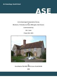
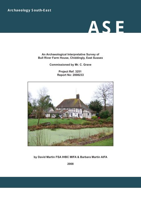
An Archaeological Interpretative Survey of<br />
Bull River Farm House, Chiddingly, East Sussex<br />
Commissioned by Mr. C. Grave<br />
Project Ref. 3251<br />
Report No: 2008233<br />
by David Martin FSA IHBC MIFA & Barbara Martin AIFA<br />
2008
AN ARCHAEOLOGICAL<br />
INTERPRETATIVE SURVEY<br />
OF<br />
BULL RIVER FARM HOUSE, CHIDDINGLY,<br />
EAST SUSSEX<br />
Commissioned by<br />
MR. C. GRAVE<br />
PROJECT REF. 3251<br />
by<br />
David Martin FSA IHBC MIFA<br />
&<br />
Barbara Martin AIFA<br />
<strong>Archaeology</strong> <strong>South</strong>-East<br />
Institute of <strong>Archaeology</strong><br />
University College London<br />
2008
STANDING BUILDINGS<br />
ARCHAEOLOGICAL INTERPRETATIVE SURVEYS<br />
AN INTRODUCTORY NOTE<br />
ABOUT THESE SURVEYS<br />
The intended purpose of an Archaeological Interpretative Survey is to give an overview of the date,<br />
sequence of construction, and principal architectural features of a building. As such, they should not<br />
be regarded as a detailed archaeological record, nor should they be taken as definitive. Further<br />
research, particularly that undertaken during building works, is likely to refine and extend the<br />
archaeological record.<br />
These reports are aimed at three groups of user, namely those owners who wish to know more<br />
about their property, those persons (architects and planners) who are charged with the responsibility<br />
for both conserving the buildings and ensuring that they are carefully adapted to the needs of the<br />
future, and finally the academic carrying out wider historical or archaeological research,. A secure<br />
use for the future is, in our opinion, the only way of ensuring the long-term survival of any historical<br />
building.<br />
INVESTIGATIVE TECHNIQUE<br />
Unless noted to the contrary, the assessments involve a visual inspection of the fabric, both<br />
internally and externally, including any accessible roof voids and basement areas. Except where<br />
building works are being carried out, intrusive techniques are inappropriate. Interpretation of the<br />
fabric and fittings therefore relies principally upon inspection of the visible evidence. As part of the<br />
interpretative procedure, a measured outline survey of every property is undertaken.<br />
THE WRITTEN REPORT<br />
For ease of reference the written reports are divided into sections under a series of headings and<br />
sub-headings. The typical sequence of headings is as follows:-<br />
1 Location of the building.<br />
2 Sequence of development.<br />
3 Detailed architectural description, arranged period-by-period.<br />
THE DRAWINGS<br />
A set of drawings produced from an measured outline survey is included within the body of each<br />
report. The purpose of these drawings is to identify the features included within the written text and<br />
to illustrate, as far as is known, the form of the structure during its various stages of development.<br />
For clarity the drawings have been prepared in the form of scale 'sketches', rather than detailed<br />
archaeological record drawings. For reasons of economy, the making of detailed archaeological<br />
drawings is restricted to stripped-out or exceptionally important buildings.<br />
The symbols as used in the drawings attached to this report are as follows:<br />
?<br />
Surviving Timber-Framed Wall<br />
Surviving Brick or Stone Wall<br />
Features evidenced but destroyed<br />
or masked from view<br />
Beam or feature immediately overhead<br />
Conjectural or very approximate<br />
Structural timber<br />
Details unknown or doubtful<br />
OTHER CONVENTIONS USED -<br />
1 Doors are shown in plan only where known:<br />
hence rooms may appear to have no obvious<br />
means of access.<br />
2 With the exception of rafters, wallplates, and<br />
some chimneys and roof-lines, sections show<br />
features cut by or immediately adjacent to the<br />
cutting line only.
Windbrace<br />
Crosswing<br />
Truss<br />
Side Purlin<br />
Collar<br />
Principal<br />
Rafter<br />
Truss<br />
Queen Studs<br />
Raking Strut<br />
Small Panel Framing<br />
Footbrace or<br />
Downward<br />
Brace<br />
Common Rafter<br />
Collar<br />
Tiebeam<br />
Wallplate<br />
Midrail<br />
Collar Purlin<br />
Crownpost<br />
Jetty<br />
Stud<br />
Headbrace or<br />
Upward Brace<br />
Joist<br />
Tiebeam<br />
Jowl<br />
Wallplate<br />
Arch<br />
Brace<br />
Jetty Bracket<br />
Large Panel<br />
Framing<br />
Window<br />
Mullions<br />
Close<br />
Studding<br />
Bay<br />
Side Girt or<br />
Bressummer<br />
Crossbeam<br />
Central Girder<br />
or Axial Beam<br />
Lean-to<br />
Principal<br />
Post<br />
Soleplate<br />
High-Set Collar<br />
Gable<br />
Hip<br />
Ridge<br />
Hip Rafter<br />
Eaves<br />
Half Hip<br />
Common Rafters<br />
Jack Rafters<br />
Central<br />
Jack Rafter<br />
Component Timbers of a Hip<br />
Roof Terminals<br />
GLOSSARY OF PRINCIPAL TERMS
<strong>Archaeology</strong> <strong>South</strong>-East<br />
Bull River Farm House, Chiddingly, East Sussex<br />
Archive Ref. ESRO HBR1/1678. Site Ref P60/09<br />
Interpretative Historic Building Survey Rev 00 / Jan 08<br />
REPORT NO. 1678<br />
CHIDDINGLY - BULL RIVER FARM HOUSE<br />
NGR TQ 5584 1484<br />
LOCATION<br />
Bull River Farm House, 1 mile to the ENE of Chiddingly Church, stands at a height of<br />
just under 30 metres O.D. on the south-<strong>east</strong>ern side of Scrapers Hill Lane and is<br />
aligned upon a NNE-SSW axis (hereafter assumed N-S) being built parallel to the road<br />
with its principal elevation facing WNW (hereafter assumed W) towards the highway. In<br />
the garden a little distance to the NE is a man-made pond and to the SW the remnant of<br />
a timber-framed barn, the latter truncated at its northern end, detaching it from a once<br />
attached <strong>farm</strong> out<strong>house</strong>. The ground slopes gently down from the <strong>house</strong> towards the<br />
barn. A little beyond the barn is Bull Bridge which carries the lane across a steam<br />
flowing down from the parish of Waldron to the north.<br />
LISTED STATUS OF THE BUILDING<br />
Bull River Farm<strong>house</strong>, Scrapers Hill, was listed grade II on 12th August 1981, its listed<br />
building reference being TQ 51 SE 12/596. The description in the list entry is purely for<br />
the purpose of recognition and is normally, therefore, primarily based on external<br />
appearance. The date is given as C17 or earlier. [Source: English Heritage, Images of<br />
England - website]. The description must not be treated as a comprehensive schedule<br />
of those elements which are legally protected as, no matter what the grade, the<br />
legislative cover not only relates to both the interior and exterior, but also extends to any<br />
building within the curtilage which predates the 1st July 1948.<br />
OVERVIEW OF THE HOUSE [Drawing Nos. 1678/1-2]<br />
The earliest part of the <strong>house</strong> dates from 1590 +/- 25 years [Period A] and in its initial<br />
form comprised a two-bay timber-framed structure with an in-built chimney at the<br />
northern end, heating the hall. The area to the south of the hall <strong>house</strong>d a service room<br />
and on the first floor were two chambers, both fitted with ceilings from the outset. At the<br />
chimney end the roof was gabled, whereas the opposite end was hipped. At this date<br />
there was a thatched covering. Beyond the hipped southern end stood a lean-to<br />
outshut which is presumed to have either <strong>house</strong>d extra service accommodation or,<br />
alternatively, an externally accessed out<strong>house</strong>. The outshut has since been totally<br />
- 1 -
<strong>Archaeology</strong> <strong>South</strong>-East<br />
Bull River Farm House, Chiddingly, East Sussex<br />
Archive Ref. ESRO HBR1/1678. Site Ref P60/09<br />
Interpretative Historic Building Survey Rev 00 / Jan 08<br />
rebuilt, but the lack of weathering on the ‘external’ face of the main frame at this point<br />
suggests that it was either built as part of the initial <strong>house</strong> or was added very soon<br />
afterwards. Because of the doubts as to the outshut’s date, the initial phase of the main<br />
building has been attributed to Period A1 and the outshut to Period A2: both are<br />
described together in the period-by-period description.<br />
Subsequently [Period B] another lean-to outshut was added at the northern end,<br />
beyond the chimney. This northern lean-to was either totally rebuilt in c1700 [Period C]<br />
so as to provide an additional first-floor chamber, or alternatively was modified by<br />
raising the first-floor side walls and replacing its roof. The available evidence favours<br />
the former of these two possibilities. The rebuilt/remodelled outshut uses traditional<br />
exposed timber framing in its construction.<br />
In the early 19th century the period-A2 lean-to outshut at the southern end was rebuilt<br />
as a two-storeyed brick addition. Given that the ground-floor walls of the addition are<br />
thicker than those on the first floor, it is possible that by the early 19th century the<br />
ground-floor walls had already been rebuilt, replacing the timber-framed walls of the<br />
period-A2 outshut. If so, the early 19th-century work involved removing the period-A2<br />
roof and adding an extra storey over the retained ground-floor room in order to form an<br />
extra bedroom. The first-floor walls of the extension are only half-brick thick, packed<br />
out on the internal face so as to give a dry wall finish. The roof over the extension has a<br />
hipped terminal and is of side-purlin construction. Only the principal timbers are sawn:<br />
all common rafters are of pole type and retain their bark — only the top surfaces (which<br />
support the battens of the roof covering) are squared off. The new section of roof<br />
incorporates a ridge board and extends northwards over part of the period-A1 <strong>house</strong>,<br />
replacing the original hipped end. At about the same date a minor modification was<br />
made to the northern end of the earlier roof. Here the seriously deteriorated upper parts<br />
of the period-A principal rafters were truncated to the level of the northern outshut’s<br />
roof, and the slope of this roof was extended up to the chimney, thereby converting this<br />
end too into a hip. Many of the rafters used within this modification are likewise of pole<br />
type, reinforcing the notion that the two alterations were carried out as part of a single<br />
phase of modification.<br />
To judge from the style of the brickwork, it was at a later date that the ground-floor<br />
external walls of the earliest part of the <strong>house</strong> were underbuilt in brickwork and the firstfloor<br />
framing within the front elevation was clad in render: this work may have been<br />
carried out as late as the 20th century, which is the date of the present window frames.<br />
Certainly belonging to the 20th century are the single-storeyed additions shown in<br />
Drawing No. 1678/1 — none of these existed when the 1908 revision was made to the<br />
1:2500 O.S. plan of the area. These modern additions include a partial-length, shallowpitched<br />
rear lean-to outshut which extends beyond the southern end of the <strong>house</strong> and<br />
now forms an entrance hall/porch. Also at this southern end, wrapping partly around<br />
the south-western corner and extending a short distance along the front wall, is a leanto<br />
extension forming a widening to the kitchen. The other 20th-century lean-to<br />
extension was added at the northern end and now provides a small study area and<br />
ground-floor bathroom. Internally the partition between hall and service room was<br />
- 2 -
<strong>Archaeology</strong> <strong>South</strong>-East<br />
Bull River Farm House, Chiddingly, East Sussex<br />
Archive Ref. ESRO HBR1/1678. Site Ref P60/09<br />
Interpretative Historic Building Survey Rev 00 / Jan 08<br />
removed and a new (second) stair inserted against the southern wall, at the western<br />
end of the former service room. On the first floor the <strong>east</strong>ern half of the<br />
hall chamber/service chamber partition has been removed so as to enlarge the principal<br />
bedroom, and ‘mock antique’ partitions have been added to form a small bathroom<br />
within the service chamber, with a landing area to its west. The ceilings within both<br />
chambers have been raised and refixed in order to improve headroom: it was<br />
presumably at this time that every other joist within the western part of the ceiling within<br />
the service chamber was removed.<br />
All work carried out since period C is excluded from the more detailed architectural<br />
description which follows the overview of the barn given below.<br />
OVERVIEW OF THE BARN [see Drawing No. 1678/1]<br />
Approximately eight metres to the south west of the <strong>house</strong>, occupying lower ground,<br />
stands a detached building which is now converted to ancillary domestic use but was<br />
built initially as a detached agricultural building — most likely a barn. The building is<br />
constructed upon the same approximate alignment as the <strong>house</strong> and stands slightly<br />
forward of it, being positioned more closely to the lane: indeed in its 20th-century<br />
extended form an added front lean-to outshut abuts the lane. To the rear (<strong>east</strong>) is a<br />
20th-century conservatory and to the north a small 20th-century porch.<br />
The earlier part of the structure is of two bays, both open to one another and open to<br />
the lower part of the roof. The northern is the earlier (probably 17th century) and is of<br />
timber-framed construction measuring 3.35 metres (11’0”) long by 5.10 metres (16’8”)<br />
wide overall the principal posts. The principal posts and tiebeam in the northern wall<br />
represent the remains of a former arch-braced open truss (braces evidenced by peg<br />
holes) but is now infilled with reused timbers to mimic wall framing. Mortices in the<br />
north face of the principal posts indicate that the building formerly extended northwards,<br />
and this point is confirmed both by the 1839 tithe map of the parish and the 1st edition<br />
1:2500 O.S. plan published in 1875 (Plates 1 and 2). The date at which the northern<br />
part was demolished is uncertain, but it is shown still extant in the 1908 version of the<br />
1:2500 O.S. plan. Although only the main components of the frame within the extant<br />
bay now remain, sufficient detail can be seen to indicate that the side walls were of<br />
large-panel type, footbraced at the principal posts, with daub-infilled panels at the upper<br />
level and weatherboarded infill at the lower level. No doubt this design was repeated in<br />
the old southern end wall, but this was removed when the building was extended at this<br />
end in the early/mid 19th century. All that can now be told is that the wall was<br />
footbraced to the corner principal posts and incorporated a crossbeam at mid height.<br />
The southern bay of the structure represents an early/mid 19th-century addition built in<br />
neat ‘Sussex-bonded’ brickwork incorporating burnt headers. The three windows (two<br />
in the north wall and one in the <strong>east</strong>) represent 20th-century intrusions. Of the same<br />
early/mid 19th-century date is the present roof over both bays, the roof of the timber-<br />
- 3 -
<strong>Archaeology</strong> <strong>South</strong>-East<br />
Bull River Farm House, Chiddingly, East Sussex<br />
Archive Ref. ESRO HBR1/1678. Site Ref P60/09<br />
Interpretative Historic Building Survey Rev 00 / Jan 08<br />
Plate 1<br />
Enlarged extract from 1839 Chiddingly Tithe Map<br />
[East Sussex Record Office TDE 105]<br />
Plate 2<br />
Enlarged extract from 1st Edition 1:2500 O.S. plan, surveyed 1875<br />
[Ordnance Survey Sussex Sheet 55.04]<br />
- 4 -
<strong>Archaeology</strong> <strong>South</strong>-East<br />
Bull River Farm House, Chiddingly, East Sussex<br />
Archive Ref. ESRO HBR1/1678. Site Ref P60/09<br />
Interpretative Historic Building Survey Rev 00 / Jan 08<br />
framed ‘barn’ having been rebuilt to a more shallow pitch at the same date as the<br />
southern bay was added. This 19th-century roof is of clasped-side-purlin construction<br />
with the purlins supported at intervals by collars. Most rafters are reused from the<br />
earlier phase. There is a ridgeboard and the southern terminal is half hipped. There<br />
was doubtless a similar half hip to the north, but when the building was truncated at this<br />
end the remnant was fitted with a gable. The result of this truncation has been to rob<br />
the building of much of its traditional external proportions and appearance.<br />
Immediately to the north-<strong>east</strong> of the ‘barn’, projecting <strong>east</strong>wards at right-angles to it, is a<br />
single-storeyed agricultural out<strong>house</strong>. The tithe map and 1st edition 1:2500 O.S. plans<br />
indicate that, prior to the demolition of the ‘barn’s’ northern end, this out<strong>house</strong> (or<br />
perhaps its predecessor) was attached to that building and formed part of the <strong>farm</strong>yard<br />
complex.<br />
The early phase of the ‘barn’ is today too fragmentary to warrant a detailed architectural<br />
description.<br />
DETAILED ARCHITECTURAL DESCRIPTION OF THE HOUSE<br />
PERIOD A (1590 +/- 25 years) [Drawing Nos. 1678/3-4]<br />
NOTE<br />
The original ‘Period-A’ main range of the <strong>house</strong> comprised two bays with an in-built<br />
chimney set against the northern end wall. Attached to the southern end of the range<br />
was a lean-to outshut extending the full width of the building. This former lean-to<br />
outshut is now only evidenced by an absence (or perhaps a virtual absence) of<br />
weathering on the southern face of the main range’s southern wall and by a pegged<br />
mortice in the southern face of the rear principal post of truss C-C for a former tiebeam.<br />
Bearing in mind that the lean-to was rebuilt in the early 19th century as a two-storeyed<br />
extension, its age is now impossible to judge: it may have formed part of the original<br />
construction of the cottage or it may have been built a short time afterwards. Whether<br />
added or not, outshuts in this location — beyond a service bay — are rare, though<br />
another example is known at Furnace Farm House, Waldron, a very similar building of<br />
about the same age just two miles to the north (see East Sussex Record Office<br />
HBR 1/1564).<br />
For the reasons given above, in the drawings which accompany this report the two<br />
elements are separately identified as Periods A1 and A2, but are here described<br />
together.<br />
- 5 -
<strong>Archaeology</strong> <strong>South</strong>-East<br />
Bull River Farm House, Chiddingly, East Sussex<br />
Archive Ref. ESRO HBR1/1678. Site Ref P60/09<br />
Interpretative Historic Building Survey Rev 00 / Jan 08<br />
LAYOUT<br />
The period A1 cottage comprised two bays in length and measured 7.40 metres (24’3”)<br />
x 5.60 metres (18’4”) overall, whilst (to judge from its successor) the period-A2 southern<br />
end lean-to was approximately 2.35 metres (7’8”) wide: this would have given an overall<br />
length for the period-A1/A2 cottage of 9.75 metres (31’11”). Due to later underbuilding<br />
of the frame, the location of the front and rear doorways leading into the <strong>house</strong> are<br />
currently uncertain. There are at present no doorways in the street elevation, but it may<br />
be relevant that the 1st edition 1:2500 O.S. plan of 1875 shows a path leading to a<br />
doorway immediately to the south of the chimney area, entering directly into the hall —<br />
this could reflect the original location.<br />
On the ground floor the cottage comprised a heated hall in the northern bay with, to its<br />
south, a service room. Beyond this, within the lean-to outshut, was either a further<br />
service area or perhaps an externally-accessed out<strong>house</strong>, the former internal layout of<br />
which is unknown. The stairs to the first floor rose against the western side of the<br />
chimney and gave direct access to the northern of the two chambers — a heated<br />
chamber over the hall — with beyond it an un-heated inner chamber over the service<br />
room. Both were ceiled over from the outset, the storey height at this level being<br />
approximately 2.05 metres (6’9”) from floor to underside of attic floorboards (prior to<br />
modern adjustment): the first-floor side walls are 1.70 metres (5’7”) from floor to top of<br />
wallplate. Being unlit, the attic area was probably utilized for storage.<br />
WALL DESIGN<br />
The <strong>house</strong> is well carpentered using normal assembly at the junction of the wallplates,<br />
tiebeams and principal posts, but the timbers themselves are of second-rate quality and<br />
are slightly too small to achieve a good finish: as a result, following loss of sapwood<br />
they are now rather waney and knotty. When the sapwood was still in situ the finish<br />
was better than it now appears, the exposed edges of the principal timbers being<br />
chamfered and stopped.<br />
On the ground floor the external wall framing has been rebuilt, but at first-floor level<br />
most of the framing remains exposed internally and, in the case of the <strong>east</strong> elevation,<br />
on the exterior also. As indicated in Drawing Nos 1678/3-4, all visible framing<br />
comprises small panels, the midrails of which are continuous over either two or three<br />
panels with the 125 mm wide secondary studs jointed into the 125-160 mm deep<br />
midrails. The full-height primary studs which support the midrails and/or formed door<br />
jambs are of slightly heavier section at 140 mm wide. All walls were infilled with daub,<br />
the daub having been support by staves fixed into round-ended stave holes at their<br />
heads.<br />
At first-floor level the southern (‘external’) face of the main frame’s southern end wall is<br />
exposed to view within the added 19th-century bedroom. The timbers show distinct<br />
- 6 -
<strong>Archaeology</strong> <strong>South</strong>-East<br />
Bull River Farm House, Chiddingly, East Sussex<br />
Archive Ref. ESRO HBR1/1678. Site Ref P60/09<br />
Interpretative Historic Building Survey Rev 00 / Jan 08<br />
saw marks and, although very shallow, the carpenter’s setting-out lines and assembly<br />
marks are still clearly visible, indicating that either the wall has never been exposed to<br />
the weather or it was exposed for only a very short time. This suggests that the (now<br />
rebuilt) southern lean-to outshut was either built as part of the initial construction or was<br />
erected soon after. There is insufficient fabric visible within the wall at ground-floor level<br />
to ascertain whether there was an interconnecting doorway between the south bay and<br />
the outshut. The present floor levels suggest that the outshut’s floor was always<br />
located below that of the main part of the <strong>house</strong>, the level of which has in any case<br />
been lowered in modern times. This same difference in floor levels was recognized at<br />
Furnace Farm House, Waldron, mentioned above.<br />
The ground-floor dividing partition between the hall and the service room is now only<br />
evidenced by mortices for the former studs and by stave holes for daub infill. As there<br />
was a doorway at the <strong>east</strong>ern end and the front (western) principal post has been cut<br />
away on the ground floor, it is impossible to tell whether this partition originally<br />
incorporated midrails, but, given there are midrails within the same partition on the first<br />
floor, the likelihood must be that there were.<br />
WINDOWS<br />
The positions of only three windows are current visible: all are at first-floor level, two in<br />
the hall chamber (one in the front wall, the other in the rear wall) with a third in the<br />
service chamber at the southern end of the front wall. This latter window retains its<br />
central — 34 mm square — diamond-section mullion and shows mortices for two similar<br />
mullions, now removed. The design shows that the opening was initially of unglazed<br />
type but was later adapted to take glass, at which date only the central mullion was<br />
retained. There is no evidence for any form of shutter to close this window during its unglazed<br />
phase.<br />
The two windows which formerly lit the hall chamber are now only evidenced by wear<br />
on the top faces of the projecting midrails, which doubled as ledges for sliding shutters.<br />
Thus, whereas the window in the service chamber shows no evidence for former<br />
shutters, those in the more important heated hall chamber had them fitted.<br />
DOORWAYS<br />
As mentioned under ‘Layout’ above, the locations of the external doorways are currently<br />
uncertain. Internally the doorway between the hall and service room (truss B-B) is<br />
evidenced by a lack of stave holes in the underside of the crossbeam: it was sited<br />
against the rear wall, at the extreme <strong>east</strong>ern end of the partition. At first-floor level of<br />
the same truss the doorway was sited to the west of the central stud (see Drawing<br />
No. 1678/3, section B-B).<br />
The doorway leading to the stairs (sited between the front wall and the fireplace jamb)<br />
- 7 -
<strong>Archaeology</strong> <strong>South</strong>-East<br />
Bull River Farm House, Chiddingly, East Sussex<br />
Archive Ref. ESRO HBR1/1678. Site Ref P60/09<br />
Interpretative Historic Building Survey Rev 00 / Jan 08<br />
was blocked when the stairs were reversed during period B, but still shows a rebate in<br />
the southern face of its jamb, indicating that the doorway opened out into the hall. This<br />
was necessary because the foot of the stairs were located hard against the opening. It<br />
is uncertain whether at this period there was a doorway at the head of the stairs, giving<br />
access into the hall chamber, but the available evidence suggests that there was not. If<br />
this was the case, the stair well would have been protected by a handrail attached to<br />
the newel post. At the <strong>east</strong>ern end of the same partition is a narrow doorway leading<br />
into a closet. Its jambs are notched into position, so it is possible that the doorway was<br />
added later, but this type of fixing is encountered on trusses incorporating fireplaces<br />
and there is a similar, but redundant fixing notch to the west of the fireplace, which<br />
notch must predate the present doorway in this location, added during period C.<br />
FLOORS AND CEILINGS<br />
All the ceilings within the cottage are of central-girder construction with the joists<br />
mortice-and-tenoned into the girders and, on the ground floor, also into the side girts of<br />
the side walls. Because the chimney is in-built within the northern end of the hall bay,<br />
an intermediate crossbeam and tiebeam were included above the hall and hall chamber<br />
fireplaces respectively, carrying the northern end of the girders within this bay.<br />
Although raised in height subsequently, the girders on the first floor were originally fully<br />
jointed into the tiebeams, proving the ceilings to be an original feature — this despite<br />
the use of cambered tiebeams. Over the side walls the joists were lodged over nailedon<br />
cleats at the rafters.<br />
Within the hall ceiling the joists measure 100 mm x 110 mm and have blunted lower<br />
leading edges, whereas within the service room the joists are 100 mm x 125 mm and<br />
have sharp edges, reflecting the lesser status of this room. The joists in the upper<br />
chambers are of lesser scantling, measuring 70-75 mm x 100-125 mm: they have<br />
blunted lower leading edges.<br />
STAIRS<br />
The half-turn central newel stair which gave access to the first floor rose from a<br />
doorway adjacent to the western fireplace jamb. It issued directly into the hall chamber<br />
at a point adjacent to the western jamb of that chamber’s fireplace. The present stairs<br />
are located in roughly the same location, but were rebuilt during period C so as to be<br />
accessed from the added period-B/C extension.<br />
CHIMNEYS<br />
The two-flue chimney is in-built against the northern end wall of the cottage. On the<br />
ground floor the hall was served by a 2.14 metre wide inglenook fireplace with brick<br />
jambs and a timber lintel. It is interesting to note that the lintel was designed to be<br />
- 8 -
<strong>Archaeology</strong> <strong>South</strong>-East<br />
Bull River Farm House, Chiddingly, East Sussex<br />
Archive Ref. ESRO HBR1/1678. Site Ref P60/09<br />
Interpretative Historic Building Survey Rev 00 / Jan 08<br />
located over a slightly narrower fireplace, but it is impossible to tell whether the lintel<br />
was secondhand when first used or whether the fireplace was constructed slightly wider<br />
than originally envisaged. Formerly within the western jamb of the fireplace was a<br />
recessed seat, whilst the <strong>east</strong>ern jamb incorporates a course of header bricks,<br />
indicating the location of a former bread oven. Projecting from the rear wall of the<br />
fireplace at its <strong>east</strong>ern end are broken bricks, no doubt patched when the oven was<br />
removed.<br />
At first-floor level the 1.08 metre wide fireplace heating the hall chamber likewise has a<br />
timber lintel and brick jambs. The chimney cap is of rebated type and has high-set<br />
projecting brick courses indicating that the roof covering was formerly thatched — a<br />
point confirmed by rope stains visible on the rafters.<br />
ROOF<br />
The roof is of clasped-side-purlin construction with the purlins supported at truss B-B by<br />
raking struts which rise/rose from the tiebeam to the side purlins. The principal rafters<br />
are notched to accommodate the purlins. There are no windbraces. The northern roof<br />
terminal was formerly gabled, with the southern terminal being of hipped type.<br />
Within the northern gable the side purlins project considerably beyond the end of the<br />
building and are heavily weathered. At purlin level is a 250 mm deep collar, beneath<br />
which were three studs. The whole gable was infilled with daub with the timbers<br />
exposed to view externally. Like the purlins, the upper part of the gable is heavily<br />
weathered. At the southern (formerly hipped) end the purlins are supported by a collar<br />
set on the last full-height pair of rafters, beneath the head of the removed hip. Almost<br />
certainly there is a small collar located towards the head of these rafters so as to<br />
support the central jack rafter of the hip, but this detail is currently hidden from view.<br />
However, it is known that the hip possessed a central jack rafter, for its angle-bored<br />
pegged fixing is visible in the southern tiebeam.<br />
Rope stains on some of the later rafters show that the roof formerly had a thatched<br />
covering, a point confirmed by the high position of the projecting weathering courses on<br />
the brick chimney.<br />
PERIOD B (After 1590 but before c.1700) [see Drawing No. 1678/1]<br />
To judge from the degree of weathering on the lower part of the northern gable, it was<br />
some considerable time after period A that a lean-to outshut was constructed at the<br />
northern end of the cottage. The point where this outshut’s roof leant against the<br />
northern gable is clearly indicated by a distinct line of weathering crossing the gable a<br />
little below collar level — below this point the weathering is less obvious than the<br />
heavily-weathered upper part of the truss. What is not clear is whether the present<br />
- 9 -
<strong>Archaeology</strong> <strong>South</strong>-East<br />
Bull River Farm House, Chiddingly, East Sussex<br />
Archive Ref. ESRO HBR1/1678. Site Ref P60/09<br />
Interpretative Historic Building Survey Rev 00 / Jan 08<br />
timber-framed extension at this end represents a heightening of the earlier lean-to, or<br />
whether it represents a total rebuild of the earlier addition — the latter seems the most<br />
likely. Another doubt concerns whether the period-B lean-to was accessible from the<br />
interior of the cottage or separately, via an external doorway. For details of the present<br />
lean-to outshut see period C below.<br />
PERIOD C (c.1700) [Drawing Nos. 1678/5-6]<br />
LAYOUT<br />
Around 1700 the period-B northern end lean-to outshut was either entirely rebuilt or,<br />
less likely, its roof was removed, the <strong>east</strong> and west walls heightened by about 350 mm,<br />
and a new roof constructed to a steeper pitch. Probably as part of this modification the<br />
bread oven was removed from the <strong>east</strong>ern jamb of the fireplace so as to allow internal<br />
communication into the northern lean-to, though this may have occurred as part of the<br />
period-B work. What seems certain is that the oven was not removed subsequently, as<br />
the winders at the bottom of the stairs were now reversed so as to be accessed from<br />
the northern lean-to — thus, without removing the oven there would have been no<br />
internal access to the stairs from the ground floor of the <strong>house</strong>. The newly formed<br />
‘chamber’ set partially within the roof of the lean-to outshut was reached from an angleset<br />
step at the head of the stairs, via a first-floor doorway cut through the period-A end<br />
wall. Similarly, an intruded doorway in the old northern end gable allowed access to a<br />
tiny storage loft in the upper part of the lean-to roof.<br />
Cut-in stave holes in the soffit of the central girder within the southern service room<br />
indicate that an axial partition was at some date added, dividing the room into two. The<br />
notched-in stave holes are not closely datable and thus cannot be ascribed to a period:<br />
the partition is included here as a matter of convenience. No other alterations to the<br />
layout of the period-A part are recognisable from this date.<br />
WALL DESIGN<br />
The walls of the northern end lean-to utilize large-panel framing infilled using<br />
traditionally fixed daub (now mostly replaced in brick). Likewise, the main timbers of the<br />
frame use traditional methods of construction, whilst the jowls at the heads of the<br />
principal posts have distinctive rounded bowls.<br />
Both the western and <strong>east</strong>ern walls of the lean-to have tiebeams which are cranked<br />
downwards at their northern ends so as to tie the north end wall of the outshut back to<br />
the period-A frame. A little above these are extension pieces to the period-A wallplates,<br />
laid over the ends of the period-A timbers and abutted against the tiebeam of truss A-A.<br />
The cranked tiebeams and upper wallplates are connected at mid span by a short stud<br />
fixed into both by means of pegged mortice-and-tenon joints. It is possible that the<br />
wallplate extension pieces and the studs beneath date from period C, whilst the lower<br />
- 10 -
<strong>Archaeology</strong> <strong>South</strong>-East<br />
Bull River Farm House, Chiddingly, East Sussex<br />
Archive Ref. ESRO HBR1/1678. Site Ref P60/09<br />
Interpretative Historic Building Survey Rev 00 / Jan 08<br />
part of the frame belongs to period B, though the likelihood is that both parts belong to<br />
period C and replace the earlier period-B addition on the site. Unfortunately, under<br />
present conditions is it not possible to prove the point either way.<br />
WINDOWS<br />
On the ground floor, within the north elevation, is mortice evidence for a four-light<br />
unglazed diamond-mullioned window fitted with slender mullions typical of the period.<br />
This use of an unglazed (as opposed to a glazed) window lighting the ground-floor<br />
space is consistent with the room having been used for service activities. In contrast,<br />
the chamber above was lit by two two-pane glazed windows — one in the west wall and<br />
one in the <strong>east</strong> — both positioned centrally. They are similar to each other in their<br />
detailing in that they have a pegged-in central mullion, whilst small mortices in the<br />
centre of each pane indicate the former positions of thin diamond-section bars for tying<br />
the lead glazing in position. Internally the jambs and mullions are chamfered, whilst<br />
externally the frames and mullions are rebated to <strong>house</strong> flush glazing. These details<br />
are typical of work of c.1700.<br />
DOORWAYS<br />
Access into the northern end lean-to appears to have been via a doorway cut through<br />
the period-A northern end wall, to the <strong>east</strong> of the chimney. This entailed removing the<br />
bread oven which served the inglenook fireplace. On the opposite side of the chimney<br />
a new opening was cut through the period-A wall to allow access to the remodelled<br />
stairs. The northern chamber was accessed via a doorway at the head of the stairs,<br />
with a similar intruded doorway leading into the attic area above (see Drawing No.<br />
1658/5, Truss A-A). Associated with the remodelling of the stairs, a doorway was now<br />
inserted to the west of the hall chamber fireplace, allowing this chamber to be isolated<br />
from the staircase. Its jambs are angle-spiked onto the intermediate crossbeam and<br />
tiebeam which delineate the period-A chimney area.<br />
FLOORS AND CEILINGS<br />
The lean-to incorporates a ground-floor ceiling of 90 mm wide joists which are<br />
secondhand material: many have nail holes in their side faces. They are laid over a<br />
cleat against the chimney at the southern end and run north-south.<br />
Within the northern face of tiebeam A-A in the chamber above are a series of uneven<br />
sized cut-in mortices indicating that a floor existed at this level too; a point confirmed by<br />
the cut-in doorway within the period-A gable above. The ceiling within this chamber has<br />
been raised and replaced by modern joists.<br />
- 11 -
<strong>Archaeology</strong> <strong>South</strong>-East<br />
Bull River Farm House, Chiddingly, East Sussex<br />
Archive Ref. ESRO HBR1/1678. Site Ref P60/09<br />
Interpretative Historic Building Survey Rev 00 / Jan 08<br />
STAIRS<br />
The present stairs to the west of the chimney essentially date from this time, having<br />
been reversed at the base and rebuilt so as to give improved access to the upper floor,<br />
including the new northern service chamber. There has been some repair in<br />
subsequent years.<br />
CHIMNEYS<br />
Apart from the (assumed) removal of the oven, no alterations are recognizable to the<br />
period-A chimney.<br />
ROOF<br />
The lean-to roof over the northern extension is supported at its head by a nailed-on<br />
collar located above that of the period-A gable, allowing the formation of a two-storeyed<br />
lean-to of acceptable width and height. Despite subsequent modification to its apex, the<br />
period-A gabled terminal was retained at this date. The roof over the lean-to is of sidepurlin<br />
construction with collars supporting the purlin in the northern slope. There are<br />
rope stains on the rafters, so the roof was evidently still thatched at this period.<br />
- 12 -
<strong>Archaeology</strong> <strong>South</strong>-East<br />
Bull River Farm, Chiddingly, East Sussex<br />
Archive Ref. ESRO HBR1/1678. Site Ref P60/09<br />
Interpretative Historic Building Survey Rev 00 / Jan 08<br />
POND<br />
5 0<br />
5<br />
10<br />
SCALE METRES<br />
N<br />
WELL<br />
20th C, SINGLE STOREYED<br />
A B C<br />
D Y<br />
20th C,<br />
SINGLE<br />
STOREYED<br />
PERIOD A1<br />
A B C<br />
D Y<br />
20th C,<br />
SINGLE STOREYED<br />
HIGHWAY<br />
BULL RIVER FARM, CHIDDINGLY, EAST SUSSEX<br />
OUTLINE PLAN SHOWING SEQUENCE OF DEVELOPMENT<br />
Drawn By Revision No Date of<br />
Date of<br />
J Clubb - original survey 2008 2008<br />
this revision<br />
Site Ref<br />
Drawing No.<br />
P60/09<br />
OUTLINE OF BUILDINGS EXTANT IN 1875<br />
BOUNDARIES SHOWN IN 1875<br />
PATHS SHOWN IN 1875<br />
OUTLINE OF BUILDINGS AS IN 2008<br />
19th C<br />
OUTBUILDING<br />
20th C,<br />
SINGLE STOREYED<br />
19th C<br />
ADDITION<br />
OUTBUILDING<br />
(Demolished)<br />
PERIOD B,<br />
REBUILT<br />
OR<br />
RE-ROOFED<br />
PERIOD C<br />
PERIOD A2<br />
OUTSHUT,<br />
REBUILT<br />
WITH<br />
UPPER<br />
STOREY<br />
E 19th C<br />
1678/1<br />
DEMOLISHED<br />
PART OF<br />
BARN<br />
EXTANT BAY<br />
OF<br />
TIMBER-FRAMED<br />
BARN<br />
20th C<br />
20th C,<br />
SINGLE STOREYED<br />
HIGHWAY<br />
- 13 -
<strong>Archaeology</strong> <strong>South</strong>-East<br />
Bull River Farm, Chiddingly, East Sussex<br />
Archive Ref. ESRO HBR1/1678. Site Ref P60/09<br />
Interpretative Historic Building Survey Rev 00 / Jan 08<br />
Based upon plans supplied by Nigel Braden, Architectural Designs and Consultancy.<br />
N<br />
D<br />
A Y<br />
B C<br />
D<br />
A Y<br />
B C<br />
GROUND FLOOR PLAN<br />
D<br />
A Y<br />
B C<br />
D<br />
A Y<br />
B C<br />
FIRST FLOOR PLAN<br />
5 0<br />
SCALE<br />
5<br />
10<br />
METRES<br />
BULL RIVER FARM, CHIDDINGLY, EAST SUSSEX<br />
PLANS OF BUILDING AS EXISTING, 2008<br />
Drawn By Revision No Date of<br />
Date of<br />
J Clubb - original survey 2008 2008<br />
this revision<br />
Site Ref<br />
Drawing No.<br />
P60/09<br />
1678/2<br />
- 14 -
<strong>Archaeology</strong> <strong>South</strong>-East<br />
Bull River Farm, Chiddingly, East Sussex<br />
Archive Ref. ESRO HBR1/1678. Site Ref P60/09<br />
Interpretative Historic Building Survey Rev 00 / Jan 08<br />
A Y<br />
B C<br />
Site of<br />
Oven<br />
N<br />
X<br />
HALL<br />
SERVICE<br />
PERIOD-A2<br />
LEAN-TO<br />
OUTSHUT<br />
(rebuilt)<br />
X<br />
STAIR<br />
A Y<br />
B C<br />
GROUND FLOOR PLAN<br />
?<br />
TRUSS A-A<br />
A Y<br />
B C<br />
X<br />
HALL<br />
CHAMBER<br />
SERVICE<br />
CHAMBER<br />
X<br />
STAIR<br />
? open<br />
Dr<br />
A Y<br />
B C<br />
FIRST FLOOR PLAN<br />
Dr<br />
CROSS SECTION Y-Y<br />
Period-A2 lean-to<br />
outshut (rebuilt)<br />
Dr<br />
Dr<br />
A Y<br />
B C<br />
LONGITUDINAL SECTION X-X<br />
5 0<br />
SCALE<br />
5<br />
TRUSS B-B<br />
10<br />
METRES<br />
BULL RIVER FARM, CHIDDINGLY, EAST SUSSEX<br />
PERIOD-A1 AND -A2 RECONSTRUCTION DRAWINGS<br />
Drawn By Revision No Date of<br />
Date of<br />
J Clubb - original survey 2008 2008<br />
this revision<br />
Site Ref<br />
Drawing No.<br />
P60/09<br />
1678/3<br />
- 15 -
<strong>Archaeology</strong> <strong>South</strong>-East<br />
Bull River Farm, Chiddingly, East Sussex<br />
Archive Ref. ESRO HBR1/1678. Site Ref P60/09<br />
Interpretative Historic Building Survey Rev 00 / Jan 08<br />
Period A2 lean-to outshut<br />
(demolished)<br />
W<br />
?<br />
?<br />
?<br />
? ?<br />
?<br />
A Y<br />
B C<br />
FRONT ELEVATION<br />
TRUSS C-C<br />
Period A2 lean-to outshut<br />
(demolished)<br />
W<br />
?<br />
?<br />
?<br />
?<br />
?<br />
C<br />
B<br />
Y A<br />
REAR ELEVATION<br />
5 0<br />
SCALE<br />
5<br />
10<br />
METRES<br />
BULL RIVER FARM, CHIDDINGLY, EAST SUSSEX<br />
PERIOD-A1 AND -A2 RECONSTRUCTION DRAWINGS<br />
Drawn By Revision No Date of<br />
Date of<br />
J Clubb - original survey 2008 2008<br />
this revision<br />
Site Ref<br />
Drawing No.<br />
P60/09<br />
1678/4<br />
- 16 -
<strong>Archaeology</strong> <strong>South</strong>-East<br />
Bull River Farm, Chiddingly, East Sussex<br />
Archive Ref. ESRO HBR1/1678. Site Ref P60/09<br />
Interpretative Historic Building Survey Rev 00 / Jan 08<br />
D<br />
A Y<br />
B C<br />
N<br />
SERVICE<br />
X<br />
SERVICE<br />
OUTSHUT<br />
HALL<br />
? age<br />
PERIOD-A2<br />
LEAN-TO<br />
OUTSHUT<br />
(rebuilt)<br />
X<br />
Dr<br />
SERVICE<br />
Dr<br />
?<br />
D<br />
A Y<br />
B C<br />
Dr<br />
STAIR<br />
GROUND FLOOR PLAN<br />
TRUSS A-A<br />
D<br />
A Y<br />
B C<br />
X<br />
SERVICE<br />
CHAMBER<br />
HALL<br />
CHAMBER<br />
SERVICE<br />
CHAMBER<br />
X<br />
Dr<br />
Dr<br />
D<br />
A Y<br />
B C<br />
FIRST FLOOR PLAN<br />
Dr<br />
CROSS SECTION Y-Y<br />
Period-A2 lean-to outshut<br />
(rebuilt)<br />
Dr<br />
Dr<br />
D<br />
A Y<br />
B C<br />
LONGITUDINAL SECTION X-X<br />
TRUSS B-B<br />
5 0<br />
SCALE<br />
5<br />
10<br />
METRES<br />
BULL RIVER FARM, CHIDDINGLY, EAST SUSSEX<br />
PERIOD-C RECONSTRUCTION DRAWINGS<br />
Drawn By Revision No Date of<br />
Date of<br />
J Clubb - original survey 2008 2008<br />
this revision<br />
Site Ref<br />
Drawing No.<br />
P60/09<br />
1678/5<br />
- 17 -
<strong>Archaeology</strong> <strong>South</strong>-East<br />
Bull River Farm, Chiddingly, East Sussex<br />
Archive Ref. ESRO HBR1/1678. Site Ref P60/09<br />
Interpretative Historic Building Survey Rev 00 / Jan 08<br />
Period A2 lean-to<br />
outshut (rebuilt)<br />
W<br />
?<br />
?<br />
?<br />
?<br />
?<br />
? ?<br />
D<br />
A Y<br />
B C<br />
FRONT ELEVATION<br />
TRUSS C-C<br />
Period A2 lean-to<br />
outshut (rebuilt)<br />
W<br />
?<br />
?<br />
?<br />
?<br />
?<br />
?<br />
?<br />
C B<br />
Y A<br />
D<br />
REAR ELEVATION<br />
NORTH ELEVATION<br />
5 0<br />
SCALE<br />
5<br />
10<br />
METRES<br />
BULL RIVER FARM, CHIDDINGLY, EAST SUSSEX<br />
PERIOD-C RECONSTRUCTION DRAWINGS<br />
Drawn By Revision No Date of<br />
Date of<br />
J Clubb - original survey 2008 2008<br />
this revision<br />
Site Ref<br />
Drawing No.<br />
P60/09<br />
1678/6<br />
- 18 -
Head Office<br />
Units 1 & 2<br />
2 Chapel Place<br />
Portslade<br />
East Sussex BN41 1DR<br />
Tel: +44(0)1273 426830 Fax:+44(0)1273 420866<br />
email: fau@ucl.ac.uk<br />
Web: www.archaeologyse.co.uk<br />
London Office<br />
Centre for Applied <strong>Archaeology</strong><br />
Institute of <strong>Archaeology</strong><br />
University College London<br />
31-34 Gordon Square, London, WC1 0PY<br />
Tel: +44(0)20 7679 4778 Fax:+44(0)20 7383 2572<br />
Web: www.ucl.ac.uk/caa<br />
The contracts division of the Centre for Applied <strong>Archaeology</strong>, University College London<br />
c <strong>Archaeology</strong> <strong>South</strong>-East