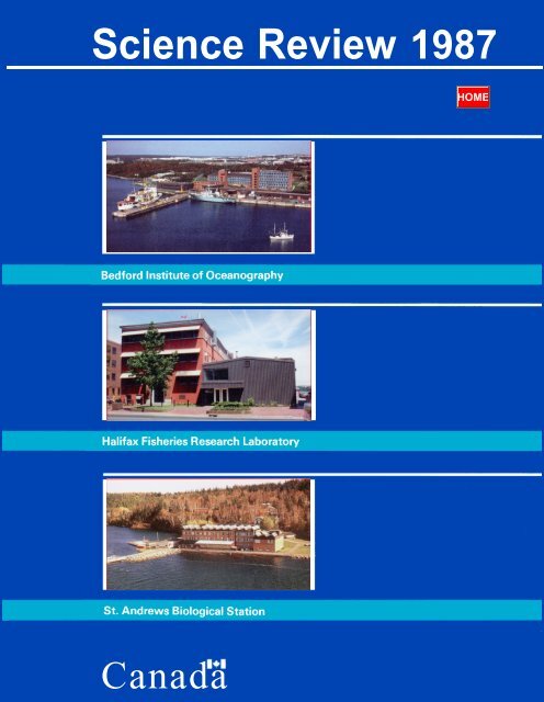
SCIENCE REVIEW 1987 - Bedford Institute of Oceanography
SCIENCE REVIEW 1987 - Bedford Institute of Oceanography
SCIENCE REVIEW 1987 - Bedford Institute of Oceanography

You also want an ePaper? Increase the reach of your titles
YUMPU automatically turns print PDFs into web optimized ePapers that Google loves.
Science Review <strong>1987</strong><br />
Canada
(This Page Blank in the Original)
Preface<br />
THE Science Review describes the federal marine science and fisheries research programs that are carried out<br />
at the <strong>Bedford</strong> <strong>Institute</strong> <strong>of</strong> <strong>Oceanography</strong>, Dartmouth, Nova Scotia; at the Halifax Fisheries Research<br />
Laboratory, Halifax, Nova Scotia; and at the St. Andrews Biological Station, St. Andrews, New Brunswick.<br />
The Science Review supercedes the BIO Review, which reported annually on research activities at the<br />
<strong>Bedford</strong> <strong>Institute</strong> <strong>of</strong> <strong>Oceanography</strong> (BIO) undertaken by the Department <strong>of</strong> Fisheries and Oceans (DFO), the<br />
Department <strong>of</strong> Energy, Mines and Resources (DEMR) and the Department <strong>of</strong> the Environment (DOE). The<br />
new Science Review reflects the 1986 integration <strong>of</strong> the science programs <strong>of</strong> the Department <strong>of</strong> Fisheries and<br />
Oceans in the Scotia-Fundy Region. The Science Review continues to report on the marine geoscience<br />
programs <strong>of</strong> the Atlantic Geoscience Centre <strong>of</strong> DEMR at BIO, as well as on the activities <strong>of</strong> the Seabird<br />
Research Unit <strong>of</strong> DOE.<br />
The last issue <strong>of</strong> BIO Review presented information on charts and publications produced and ships’ voyages<br />
undertaken during 1985; the corresponding parts <strong>of</strong> this issue <strong>of</strong> Science Review contain material for both<br />
1986 and <strong>1987</strong>.<br />
1
2<br />
(This Page BLANK in the Original)
Contents<br />
PREFACE . . . . . . . . . . . . . . . . . . . . . . . . . . . . . . . . . . . . . . . . . . . . . . . . . . . . . . . . 1 Science Review is published by<br />
RESEARCH<br />
The science program <strong>of</strong> Scotia-Fundy Region by S.B. MacPhee,<br />
J.A. Elliott, M.M. Sinclair and T.B. Smith . . . . . . . . . . . . . . . . . . . . . . . . . 4<br />
the Scotia-Fundy Region <strong>of</strong> the<br />
Department <strong>of</strong> Fisheries and<br />
Oceans. Change <strong>of</strong> address notices<br />
and other correspondence regarding<br />
this publication should be<br />
The Geological Survey <strong>of</strong> Canada Frontier Geoscience Program<br />
sent to:<br />
<strong>of</strong>fshore eastern Canada by D.I. Ross . . . . . . . . . . . . . . . . . . . . . . . . . . . . . 9<br />
Marine Assessment and Liaison<br />
Georges Bank: A crossroads for seabirds by R.G.B. Brown . . . . . . . . 13<br />
Division<br />
Fisheries and Oceans<br />
<strong>Bedford</strong> <strong>Institute</strong> <strong>of</strong><br />
Georges Bank - Research behind the management <strong>of</strong> habitat <strong>Oceanography</strong><br />
and commercial resources by D. C. Gordon, J.D. Neilson and PO. Box 1006<br />
G. Robert . . . . . . . . . . . . . . . . . . . . . . . . . . . . . . . . . . . . . . . . . . . 14 Dartmouth, Nova Scotia<br />
Canada B2Y 4A2<br />
Lobster research - Back to the basics by J.D. Pringle and A.<br />
Campbell . . . . . . . . . . . . . . . . , , . . . . , . . . . . . . . . . . . . . . . . . . . . . . . . . . . . . 18<br />
A history <strong>of</strong> chemical oceanographic research in the Gulf <strong>of</strong> St.<br />
Lawrence by P.M. Strain . . . . . . . . . . . . . . . . . . . . . . . . . . . . . . . . . . . . . . . . 22<br />
The Canadian Atlantic Storms Program (CASP) by C. Anderson 25<br />
Cat. no. Fs 75- 104 / <strong>1987</strong>E<br />
ISBN 0-662-16944-1<br />
La version française est<br />
disponible.<br />
Long term changes in the Labrador Current by J.R.N. Lazier . . . . . 29 @Minister <strong>of</strong> Supply and Services<br />
Canada 1988<br />
Global change and the coastline <strong>of</strong> Canada by J. Shaw . . . . . . . . . . 32<br />
Ocean mapping at the Atlantic Geoscience Centre by R. MacNab<br />
and D.J.W. Piper . . . . . . . . . . . . . . . . . . . . . . . . . . . . . . . . . . . . . . . . . . . . . . . . . 35<br />
Vertical acoustic sweep systems - A new capability for the<br />
Canadian Hydrographic Service by R.G. Burke . . . . . . . . . . . . . . . . . . 4 1<br />
Electronic chart developments by S.T. Grant . . . . . . . . . . . . . . . . . . . . . 45<br />
Biological instrumentation for under-ice studies in the Arctic by<br />
A.W. Herman . . . . . . . . . . . . . . . . . . . . . . . . . . . . . . . . . . . . . . . . . . . . . . . . . . . . . 49<br />
CHARTS AND PUBLICATIONS . . . . . . . . . . . . . . . . . . . . . . . . . . . . . . . . . . . 54<br />
VOYAGES . . . . . . . . . . . . . . . . . . . . . . . . . . . . . . . . . . . . . . . . . . . . . . . . . . . . . . . . . . . . 89 Science Review ‘87<br />
ORGANIZATION . . . . . . . . . . . . . . . . . . . . . . . . . . . . . . . . . . . . . . . . . . . . . . . . . . . 104<br />
Editor - Bert Bennett<br />
Production Co-ordinator -<br />
PROJECTS . . . . . . . . . . . . . . . . . . . . . . . . . . . . . . . . . . . . . . . . . . . . . . . . . . . . . . . . . . 106<br />
Norwood Whynot<br />
Production - McCurdy Printing<br />
& Typesetting Limited, Halifax,<br />
EXCERPTS FROM THE LOG . . . . . . . . . . . . . . . . . . . . . . . . . . . . . . . . . . . . . 111 Nova Scotia<br />
3
Research<br />
The Science Program <strong>of</strong> Scotia-Fundy Region<br />
S.B. MacPhee, J.A. Elliott, M.M. Sinclair, and T.B. Smith<br />
S.B. MacPhee J.A. Elliott<br />
Introduction<br />
T HE federal government is responsible<br />
for much <strong>of</strong> the Canadian scientific<br />
investigations <strong>of</strong> the oceans and their<br />
resources, and the largest marine effort is<br />
conducted by the Department <strong>of</strong> Fisheries<br />
and Oceans (DFO).The scientific research<br />
is organized to facilitate the departmental<br />
mission with respect to ocean and freshwater<br />
fsheries, hydrography and marine<br />
sciences, and the coordination <strong>of</strong> the<br />
policies and programs <strong>of</strong> the Government<br />
<strong>of</strong> Canada respecting oceans.<br />
The Assistant Deputy Minister, Science,<br />
is responsible for the Department’s science<br />
mandate and provides science policy as<br />
well as program and administrative guidance<br />
to each <strong>of</strong> the six regions that were<br />
formed in 1986 to deliver the DFO<br />
programs (the six regions resulted from the<br />
consolidation <strong>of</strong> seven Fisheries Management<br />
Regions and four Ocean Science and<br />
Surveys Regions). The purpose <strong>of</strong> this<br />
essay is to describe the structure, goals and<br />
thrusts <strong>of</strong> the science program for Scotia-<br />
Fundy Region.<br />
The science program <strong>of</strong> Scotia-Fundy<br />
Region is carried out from the following<br />
locations:<br />
- <strong>Bedford</strong> <strong>Institute</strong> <strong>of</strong> <strong>Oceanography</strong>,<br />
Dartmouth, Nova Scotia. The Departments<br />
<strong>of</strong> Energy Mines and Resources<br />
and Environment also have laboratories<br />
at the <strong>Institute</strong>.<br />
- Halifax Fisheries Research Laboratory,<br />
Halifax, N.S.<br />
- Saint Andrews Biological Station, Saint<br />
Andrews, New Brunswick.<br />
4<br />
T.B. Smith<br />
- Hatchery facilities at Saint John and<br />
Mactaquac in New Brunswick and in<br />
Nova Scotia, at Yarmouth, Coldbrook,<br />
Mersey and Cobequid.<br />
Objectives <strong>of</strong> the Program<br />
The main objectives <strong>of</strong> the program, in<br />
support <strong>of</strong> the overall departmental mission,<br />
are:<br />
- to provide and communicate a reliable<br />
scientific basis for the management <strong>of</strong><br />
fish and fish habitat and for aquaculture;<br />
- to perform fundamental and applied<br />
research on the impact <strong>of</strong> deleterious<br />
substances on fish, fish habitat and<br />
aquatic ecosystems;<br />
- to describe and understand the climate<br />
<strong>of</strong> the oceans, its coupling with the<br />
atmosphere and its influence on fish<br />
stocks and the development <strong>of</strong> nonliving<br />
resources in the <strong>of</strong>fshore;<br />
- to chart the waters in an area extending<br />
from the Gulf Of Maine to the high<br />
Arctic in order to facilitate commercial<br />
navigation, fishing activities and to assist<br />
<strong>of</strong>fshore development; and<br />
- to develop and refine methodology and<br />
technology necessary to carry out the<br />
Department’s scientific role and to<br />
M.M. Sinclair<br />
transfer relevant technology to Canadian<br />
industry as well as to provide<br />
research vessel support to universities.<br />
An organization chart for the Science<br />
Sector in Scotia-Fundy Region is shown in<br />
Figure 1. The science program is headed by<br />
Regional Director Science<br />
� Biological Sciences Branch<br />
� Marine Fish Division<br />
� Invertebrates, Marine Plants and<br />
Environmental Ecology Division<br />
� Biological <strong>Oceanography</strong> Division<br />
� Enhancement, Culture and<br />
Anadromous Fish Division<br />
� Fish Aquaculture and Applied<br />
Physiology Division<br />
� Physical and Chemical Sciences Branch<br />
� Marine Chemistry Division<br />
� Coastal <strong>Oceanography</strong> Division<br />
� Metrology Division<br />
� Ocean Circulation Division<br />
� Hydrography Branch<br />
� Field Surveys Division<br />
� Chart Production<br />
� Hydrographic Development<br />
� Navigation Group<br />
� Data Management and Planning<br />
� Tidal Section<br />
� Marine Assessment and Liaison<br />
Division<br />
Fig. 1. Components <strong>of</strong> the Science Sector <strong>of</strong> the<br />
Department <strong>of</strong> Fisheries and Oceans’ Scotia-<br />
Fundy Region
the Regional Director, Science, and reports<br />
to the Regional Director General who is<br />
responsible for the delivery <strong>of</strong> all departmental<br />
programs in the Region. The<br />
program is organized along disciplinary<br />
lines (Branches) in the fields <strong>of</strong> Biological<br />
Sciences, Physical and Chemical Sciences<br />
and Hydrography. Brief program descriptions<br />
for the three Branches, together with<br />
achievements for <strong>1987</strong> and goals for 1988<br />
are given below.<br />
While the program is organized along<br />
disciplinary lines, efforts are made as<br />
necessary to carry out interdisciplinary<br />
research involving scientists from different<br />
Branches working together, and with<br />
scientists from the private sector, from the<br />
universities, from other regions and from<br />
other countries.<br />
Resource Summary<br />
A Resource Summary for the <strong>1987</strong>-88<br />
fiscal year (funds expressed in thousands <strong>of</strong><br />
dollars) is shown below.<br />
The resource figures shown include<br />
commissioned research from other government<br />
departments (DEMR, DOE, DPW,<br />
DND, and DOT) and the departmental<br />
contributions to unsolicited proposals<br />
submitted to the Department <strong>of</strong> Supply<br />
and Services and supported by DFO. The<br />
figures do not include purchase and<br />
amortization costs for major capital acquisitions<br />
such as vessels and accomodations.<br />
PY. Sal. O&M Cap. G&C Total<br />
Regional<br />
Director*<br />
Biological<br />
21.9 268.3 972.7 38.6 1,889.6<br />
Sciences<br />
Physical and<br />
Chemical<br />
271.1 10,838.2 4726.7 440.7 304.5 16,310.l<br />
Sciences 134.3 5538.7 2,434.6 616.1 - 8,589.4<br />
Hydrography<br />
Marine Electronic<br />
71.7 2,677.4 1,411.9 234.5 4,323.8<br />
Support 21.8 938.8 185.3 33.9 1,158.0<br />
Vessel support 164.8 7,026.0 8,661.0 435.6 - 16,122.6<br />
TOTAL 685.6 27,887.4 18,402.2 1,799.4 304.5 48,393.5<br />
*includes Marine Assessment and Liaison Division, Scientific Computing, and CAFSAC<br />
(Canadian Atlantic Fisheries Scientific Advisory Committee)<br />
Too big for the trap! Only the smaller “canner”<br />
lobsters are selected by traps set in Morrisey's<br />
Cove, Prince Edward Island leaving the more<br />
fertile larger lobsters to sustain the population<br />
Biological Sciences Branch<br />
The Biological Sciences Branch through an<br />
extensive resource assessment and related<br />
research program, provides the scientific<br />
basis for the management <strong>of</strong> the fishery<br />
resource. This includes stock assessments<br />
for all major exploited species <strong>of</strong> finfsh,<br />
invertebrates marine mammals and marine<br />
plants, as well as research on assessment<br />
methodology, abundance estimates and the<br />
biology, ecology and dynamics <strong>of</strong> exploited<br />
species to conserve the resources and<br />
improve the scientific knowledge base. The<br />
Branch also carries out a program <strong>of</strong><br />
research in aquaculture for marine finfsh<br />
and invertebrates in support <strong>of</strong> the aquaculture<br />
industry. The fresh water and anadramous<br />
fish research activities provide<br />
biological advice for the management <strong>of</strong><br />
these species, as well as a supply <strong>of</strong> Atlantic<br />
salmon and speckled trout from the<br />
hatchery network for the enhancement<br />
program and the aquaculture industry. In<br />
addition, research is carried out in biological<br />
oceanography to study the dynamics <strong>of</strong><br />
marine ecosystems in coastal, shelf and<br />
deep-ocean waters with special emphasis<br />
on the interdependence <strong>of</strong> biological<br />
communities, their temporal and spatial<br />
variability and their relationship with the<br />
physical and chemical conditions <strong>of</strong> the<br />
marine environment.<br />
A sampling <strong>of</strong> the accomplishments for<br />
<strong>1987</strong> follows:<br />
- Stock assessments were provided on all<br />
major exploited stocks <strong>of</strong> fish, invertebrates,<br />
marine mammals and marine<br />
plants;<br />
- Fish health certification was provided<br />
for stocks transferred between watersheds;<br />
- A field survey <strong>of</strong> Georges Bank was<br />
carried out to assess the recovery <strong>of</strong> the<br />
herring stock in this geographic area;<br />
- Maximum production levels were maintained<br />
at all hatcheries and in addition<br />
to supplying 250,000 smolts for river<br />
recovery, 200,000 were supplied for the<br />
local aquaculture industry;<br />
- Regional staff participated in solving the<br />
molluscan toxin problem in Atlantic<br />
Canada, playing a part in identifying the<br />
toxins and the source <strong>of</strong> the toxic<br />
materials;<br />
- In cooperation with Physical and<br />
Chemical Sciences Branch, a general<br />
scientific evaluation <strong>of</strong> the likely environmental<br />
impacts <strong>of</strong> exploratory drilling<br />
on Georges Bank was completed<br />
for the Gulf <strong>of</strong> Maine Advisory<br />
Committee;<br />
- A quantitative evaluation <strong>of</strong> the impact<br />
<strong>of</strong> acid rain on Atlantic salmon populations<br />
in Nova Scotia was carried out;<br />
- Algorithms were developed to more<br />
effectively utilize satellite data to<br />
estimate global productivity <strong>of</strong> the<br />
oceans;<br />
5
Research<br />
The Salmon Demonstration and Development Farm transfers technology to the growing salmon<br />
aquaculture industry in the Bay <strong>of</strong> Fundy.<br />
- A synthesis was prepared on recent<br />
advances in biological oceanography <strong>of</strong><br />
Arctic waters using the results <strong>of</strong> eight<br />
cruises and forty-five publications from<br />
recent research at BIO; and<br />
- Regional staff organized the course<br />
material and participated in an innovative<br />
stock assessment course in Dakar,<br />
Senegal for francophone West Africa<br />
(an ICOD project).<br />
Some <strong>of</strong> the goals for 1988 are:<br />
- Improve communications between<br />
regional scientists and client groups to<br />
ensure that science programs correspond<br />
to client needs;<br />
- Increase client input, particularly fishermens’,<br />
into the stock assessment<br />
process;<br />
- Initiate a research program, in collaboration<br />
with the fishing industry and<br />
universities, to provide a sound scientific<br />
basis for managing the increasing grey<br />
seal populations and for evaluation <strong>of</strong><br />
alternate management strategies<br />
through inter alia birth control and the<br />
use <strong>of</strong> vermicides;<br />
- Provide stock assessment for all major<br />
exploited species and fish health certification<br />
for all stocks being transferred<br />
between watersheds,<br />
- Provide a new synthesis <strong>of</strong> the mechanisms<br />
supporting the high level <strong>of</strong><br />
primary production on Georges Bank<br />
6<br />
and its relationship with the fisheries<br />
production;<br />
- Provide first basin-scale estimates <strong>of</strong><br />
primary production for the North<br />
Atlantic and its impact on the global<br />
CO, system, in support <strong>of</strong> the Climate<br />
Research Program;<br />
- Synthesize the accumulated results on<br />
the population biology <strong>of</strong> Browns Bank<br />
haddock, including an analysis <strong>of</strong> the<br />
oceanographic factors responsible for<br />
recruitment variability (year to year<br />
variability in the number <strong>of</strong> fish added<br />
to the stock);<br />
- Develop an integrated five year plan for<br />
aquaculture research in Scotia-Fundy<br />
Region;<br />
- Conjointly with other Atlantic Zone<br />
Regions <strong>of</strong> DFO, initiate an integrated<br />
research program on phytotoxins in<br />
relation to molluscan aquaculture; and<br />
- Provide enhanced facilities for the<br />
rearing <strong>of</strong> marine fish, in particular<br />
Atlantic halibut, for aquaculture<br />
research.<br />
Physical and Chemical Sciences Branch<br />
In the Physical and Chemical Sciences<br />
Branch the main research efforts are<br />
devoted to:<br />
- Ocean Climate hindcasting and forecasting<br />
to provide a description <strong>of</strong> those<br />
processes that govern the annual and<br />
-<br />
-<br />
-<br />
-<br />
-<br />
-<br />
long term ocean and shelf circulation,<br />
verifying how the “Greenhouse” gases<br />
might affect the ocean so that climate<br />
trends can be accurately forecast and, in<br />
collaboration with the Biological Sciences<br />
Branch, determining the effects <strong>of</strong><br />
climate variation on commercial fisheries,<br />
transportation and pollution issues;<br />
Marine Developments consisting <strong>of</strong><br />
oceanographic studies that provide<br />
guidance to the safe and economic<br />
management <strong>of</strong> specific engineering<br />
developments relating to safe and<br />
efficient exploration and production <strong>of</strong><br />
<strong>of</strong>fshore energy resources, and the<br />
protection <strong>of</strong> human health;<br />
Living Resources consisting <strong>of</strong> oceanographic<br />
studies designed to further the<br />
understanding <strong>of</strong> the relationship between<br />
the environment and living<br />
resources and including interdisciplinary<br />
research with Biological Sciences<br />
Branch;<br />
Biogeochemistry consisting <strong>of</strong> studies <strong>of</strong><br />
the processes that govern the distribution,<br />
fluxes and properties <strong>of</strong> chemical<br />
parameters including the behavior <strong>of</strong><br />
both naturally-occurring and anthropogenic<br />
compounds in the marine<br />
environment;<br />
Toxicology, Contaminants and Habitat<br />
Research to identify potential marine<br />
contaminants and provide information<br />
on known marine contaminants, their<br />
pathways and effects to facilitate informed<br />
decision making and the<br />
establishment <strong>of</strong> regulations and policies,<br />
as required for the protection <strong>of</strong><br />
marine resources and human health;<br />
Cooperative research programs with the<br />
private sector to further ocean industry<br />
development in Canada by making sure<br />
that the private sector has access to<br />
research and development technologies<br />
that are designed and prototyped “in<br />
house”.<br />
A sampling <strong>of</strong> the accomplishments <strong>of</strong><br />
the Physical and Chemical Sciences<br />
Branch in <strong>1987</strong> follows:<br />
A study was carried out to establish<br />
present levels <strong>of</strong> natural and anthropogenic<br />
chemicals in the Canadian sector<br />
<strong>of</strong> Georges Bank;<br />
A field study was completed <strong>of</strong> the<br />
mixing and dynamics in the Newfoundland<br />
Basin where the Gulf Stream and<br />
the Labrador current systems interact
and influence the large-scale climate <strong>of</strong><br />
this region;<br />
- Developments <strong>of</strong> underice sampling<br />
systems for biological studies in the<br />
Arctic and use on field programs<br />
continued;<br />
- Current meters were moored and field<br />
surveys completed to monitor the water<br />
exchange between Baffin Bay and the<br />
Northwest Atlantic as part <strong>of</strong> a regional<br />
ice modelling experiment;<br />
- For the third year, ice beacons were<br />
placed on the Labrador ice sheet to<br />
track the southward advection as part <strong>of</strong><br />
the sea ice climatology and modelling<br />
for the Hibernia area;<br />
- A CODE (Centre Of Disciplinary<br />
Expertise) in marine contaminants and<br />
toxicology was established to deal with<br />
sensitive habitat issues resulting from<br />
adverse chemical changes;<br />
- Work continued on the the development<br />
<strong>of</strong> a Climate Research Strategy for<br />
the Department to include various<br />
major international programs, departmental<br />
interests and collaboration<br />
throughout the scientific community;<br />
- Studies were completed on the influence<br />
<strong>of</strong> mean circulation and horizontal<br />
dispersion on the survival and recruitment<br />
success <strong>of</strong> the Browns Bank<br />
gadoid stocks in collaboration with<br />
Biological Sciences Branch;<br />
- The Branch participated in the development<br />
<strong>of</strong> a shipboard handling, refueling,<br />
and recovery system for the DOLPHIN<br />
semisubmersible, remotely operated<br />
vehicle, in collaboration with the<br />
Hydrography Branch;<br />
- Studies were undertaken through the<br />
use <strong>of</strong> MFO induction measurements to<br />
observe the effects <strong>of</strong> petroleum hydrocarbons<br />
on flounder fish as a sample<br />
species;<br />
- Stable carbon isotope analysis was<br />
applied to the study <strong>of</strong> growth rates in<br />
various marine organisms as part <strong>of</strong><br />
stock management data in conjunction<br />
with Biological Sciences Branch;<br />
- The assessment <strong>of</strong> the general oceanography<br />
<strong>of</strong> the Arctic Ocean continued<br />
based upon carbon and nutrient budgets<br />
and participation in an international<br />
cruise in the Arctic Ocean; and<br />
- Studies continued on the effects <strong>of</strong> acid<br />
rain on salmon stocks in Nova Scotia<br />
rivers and the possible mitigating effects<br />
Computer monitor displav <strong>of</strong> sea ice extent and movement <strong>of</strong>f Newfoundland Ice cover (white) is<br />
determined from a satellite image. Ice movement is estimated by comparing the positions <strong>of</strong> ice-field<br />
features during successive satellite overpasses (open arrows), and by monitoring positions <strong>of</strong> satellitereporting<br />
beacons that were plced on the ice by helicopter (closed arrows).<br />
<strong>of</strong> adding lime to the streams were - Improve communications between<br />
explored. research scientists and client groups to<br />
Some <strong>of</strong> the goals for 1988 are: ensure that the science program re-<br />
- Continue research in support <strong>of</strong> the sponds to client needs,<br />
Canadian Climate Program to study the - Increase interdisciplinary research inannual<br />
and interannual variability <strong>of</strong> volving the private sector, universities,<br />
environmental properties and fluxes on and other Branches and/or Regions;<br />
the Continental Shelf and adjacent - Establish stronger links between biogeowaters<br />
in order to contribute to an chemistry research and habitat issues<br />
improved description and understand- that are focussed on the interface<br />
ing <strong>of</strong> the climatology <strong>of</strong> the region; between marine chemistry and biology;<br />
- Initiate a program to provide improved - Review strategic plans for measuring<br />
real-time information for the forecasting and monitoring <strong>of</strong> contaminants that<br />
<strong>of</strong> waves, currents, storm surges, ice and affect aquatic biota, especially those for<br />
icebergs; which there are departmental manage-<br />
- Prepare for an oceanographic program ment responsibilities;<br />
in the Greenland Sea to measure the - Continue an active program to transfer<br />
volume <strong>of</strong> deep cold water formed technology to the private sector from<br />
annually, as part <strong>of</strong> the assessment <strong>of</strong> the the activities in biological sampling,<br />
effects <strong>of</strong> polar oceans on global ocean acoustics, Arctic sensor development<br />
dynamics; and computer s<strong>of</strong>tware systems;<br />
7
Research<br />
- Undertake to develop an enhanced<br />
program <strong>of</strong> interdisciplinary research<br />
with the biological science programs in<br />
the Atlantic Zone Regions;<br />
- Develop a strategy for maintaining<br />
climate data sets such as the long-term<br />
temperature monitoring program, for<br />
incorporating these data into archives<br />
and for distributing products to client<br />
groups; and<br />
- Maintain an active program <strong>of</strong> consultation<br />
and interaction with client groups<br />
for projects funded under the Panel on<br />
Energy Research and Development<br />
(PERD).<br />
Fishing Zone charts are produced under<br />
the hydrographic program. Under a cooperative<br />
program with the Atlantic Geoscience<br />
Centre (DEMR) data are gathered<br />
to produce <strong>of</strong>fshore maps depicting the<br />
gravitational and magnetic fields as an<br />
<strong>of</strong>fshore extension <strong>of</strong> the terrestrial mapping<br />
program. The Branch also carries out<br />
an extensive research and development<br />
program aimed at accelerating the survey<br />
and chart production program.<br />
A sampling <strong>of</strong> the accomplishments <strong>of</strong><br />
the Hydrography Branch in <strong>1987</strong> follows:<br />
- One hydrographic survey party, consisting<br />
<strong>of</strong> six hydrographers and one Sailing<br />
C.S.L. Puffin is a new hydrographic survey launch; constructed <strong>of</strong> fibreglass, the semi-displacement,<br />
round bilge hull is capable <strong>of</strong> 20 knots full speed<br />
Hydrography Branch<br />
The Hydrography Branch is charged with<br />
carrying out hydrographic surveys and<br />
providing navigation charts for commercial<br />
navigation and fishing and for recreational<br />
boating. The area for which the Region is<br />
responsible extends from the Canada/USA<br />
border in the Gulf <strong>of</strong> Maine to the high<br />
Arctic and from the shoreline to the 200<br />
mile limit or farther where the natural<br />
prolongation <strong>of</strong> the landmass extends<br />
beyond 200 miles.<br />
In addition to navigation charts and<br />
other publications such as Tide and<br />
Current Tables, Sailing Directions and<br />
Small Craft Guides and similar publications<br />
for the mariner, Territorial Sea and<br />
8<br />
Directions writer, was transferred to<br />
Newfoundland Region to survey from<br />
CSS Maxwell - also transferred to<br />
Newfoundland Region;<br />
- A survey <strong>of</strong> Norwegian Bay, N.W.T.<br />
was carried out, with exceptionally<br />
favorable ice conditions permitting<br />
rapid progress on the survey;<br />
- Surveys were conducted on the Scotian<br />
Shelf to upgrade survey data for the<br />
production <strong>of</strong> New Charts to meet the<br />
demands <strong>of</strong> the fishing industry and<br />
<strong>of</strong>fshore oil and gas companies;<br />
- The survey <strong>of</strong> the boundary waters <strong>of</strong><br />
Passamaquoddy Bay and Grand Mannan<br />
Island, New Brunswick was com-<br />
pleted, as a cooperative program with<br />
The National Ocean Survey (USA);<br />
- Eighteen ports in Atlantic Canada were<br />
electronically swept utilizing the sweep<br />
vessel FCG Smith;<br />
- A large number <strong>of</strong> inshore and coastal<br />
surveys were carried out from survey<br />
launches and other small vessels in the<br />
waters <strong>of</strong> Prince Edward Island, New<br />
Brunswick, Nova Scotia and<br />
Newfoundland;<br />
- Through commercial contract, thirtyeight<br />
field sheets were digitized as part<br />
<strong>of</strong> the preparation <strong>of</strong> a digital data base<br />
for the Region;<br />
- Ten New Navigation Charts, twelve<br />
New Editions, eleven chart patches and<br />
eighty-four Notices to Mariners were<br />
produced;<br />
- The permanent Tide Gauge Network in<br />
the Region was maintained and two<br />
gauges were converted to “Dial A Tide”<br />
operation.<br />
Some <strong>of</strong> the goals for 1988 are:<br />
- To ensure that corrected up-to-date<br />
charts, Sailing Directions and Small<br />
Craft Guides, Tide and Current Tables<br />
and related publications are available<br />
for vessels operating in eastern Canadian<br />
waters;<br />
- To carry out revisory surveys to investigate<br />
reported dangers to navigation and<br />
to resurvey areas in need <strong>of</strong> resurvey<br />
because <strong>of</strong> cultural changes, siltation<br />
and changes in traffic patterns;<br />
- In cooperation with the Atlantic Geoscience<br />
Centre <strong>of</strong> DEMR, to carry out<br />
multiparameter surveys in the <strong>of</strong>fshore<br />
to address resource potential, particularly<br />
in areas <strong>of</strong> importance in terms <strong>of</strong><br />
sovereignty and maritime delimitation;<br />
- To carry out a mission-oriented hydrographic<br />
research and development<br />
program aimed at accelerating the<br />
survey program and the production <strong>of</strong><br />
navigation charts. Areas <strong>of</strong> research<br />
include the implementation <strong>of</strong> computer<br />
assisted data collection and chart production,<br />
the preparation <strong>of</strong> digital data<br />
bases for hydrographic data, electronic<br />
chart development and the evaluation <strong>of</strong><br />
deep-water multi-beam survey systems;<br />
and<br />
- To supervise hydrographic surveys <strong>of</strong><br />
six sites along the Labrador coast and<br />
eastern Arctic in preparation for radar<br />
installations.
Summary<br />
The foregoing paragraphs do not describe<br />
all the work <strong>of</strong> the Science Sector, but are<br />
intended to indicate the diversity <strong>of</strong> the<br />
science program <strong>of</strong> Scotia-Fundy Region.<br />
The program ranges from mission oriented<br />
fundamental or basic research, to targetted<br />
basic research, to applied research, to the<br />
application <strong>of</strong> engineering and technology<br />
principles. The science program is intended<br />
to fulfill the research mandate <strong>of</strong> the<br />
Department and it’s client base within the<br />
regional areas <strong>of</strong> interest, as well as to<br />
enhance ocean science knowledge on a<br />
global scale.<br />
The Geological Survey <strong>of</strong> Canada Frontier Geoscience Program<br />
<strong>of</strong>fshore eastern Canada<br />
D.I. Ross<br />
Introduction<br />
D.I. Ross<br />
THE Frontier Geoscience Program was<br />
established in June 1984 as part <strong>of</strong> the<br />
Geological Survey <strong>of</strong> Canada’s program in<br />
the oil and gas frontier regions <strong>of</strong> Canada.<br />
The program is designed to substantially<br />
expand our knowledge <strong>of</strong> the earth in the<br />
frontier areas, i.e. the Arctic and <strong>of</strong>fshore<br />
regions <strong>of</strong> Canada, from the base <strong>of</strong> the<br />
crustal layer through to the sediment/water<br />
interface. The emphasis is on gaining new<br />
knowledge to stimulate petroleum exploration<br />
and assist government regulatory<br />
bodies in policing these operations. The<br />
span <strong>of</strong> activities is wide, ranging from the<br />
design <strong>of</strong> new scientific projects, through<br />
new data collection to publication <strong>of</strong><br />
results. The activities fully complement and<br />
build on other national geoscience programs.<br />
For example; the Lithoprobe<br />
Project, a national collaborative geoscientific<br />
research program to investigate<br />
fundamental questions concerning the<br />
nature and evolution <strong>of</strong> the lithosphere in<br />
Canada; the energy research and development<br />
projects, particularly Task 6 with its<br />
objective <strong>of</strong> improving the understanding<br />
<strong>of</strong> petroleum reservoirs and geological<br />
hazards faced in hydrocarbon developments;<br />
and <strong>of</strong> course the activities <strong>of</strong> the<br />
petroleum industry itself.<br />
The program is divided into five tasks -<br />
an Arctic logistics task and four regional<br />
tasks: East Coast; West Coast; Arctic<br />
Islands; and Western Arctic. The regional<br />
tasks are sub-divided into components<br />
reflecting the major sedimentary basins.<br />
This paper summarizes the scientific studies<br />
being carried out by staff <strong>of</strong> the Atlantic<br />
Geoscience Centre, a Division <strong>of</strong> the<br />
Geological Survey <strong>of</strong> Canada at the<br />
<strong>Bedford</strong> <strong>Institute</strong> <strong>of</strong> <strong>Oceanography</strong>, under<br />
the East Coast Task and highlights the<br />
main scientific results obtained in the four<br />
years from 1984 to the end <strong>of</strong> <strong>1987</strong>.<br />
Scientific Extent <strong>of</strong> the East Coast Task<br />
The East Coast Task is divided into six<br />
regional components, viz. Scotian Shelf<br />
and Margin, Grand Banks and Margins,<br />
Labrador Sea, Baffin Bay, Gulf <strong>of</strong> St.<br />
Lawrence, and Hudson Bay (Figure 1).<br />
The planning and scheduling <strong>of</strong> specific<br />
studies in these six regions is developed on<br />
the basis <strong>of</strong> the scientific questions that<br />
must be solved if we are to understand the<br />
history and evolution <strong>of</strong> the east coast<br />
region as a whole, as well as the potential<br />
for oil and gas discoveries. Program<br />
managers, guided by a Technical Advisory<br />
Committee representing industry, university<br />
and government bodies across Canada,<br />
have been particularly aware <strong>of</strong> the need to<br />
look at the framework <strong>of</strong> the sedimentary<br />
basins - the earth processes outside the<br />
basins themselves - in attempting to<br />
decipher the history <strong>of</strong> these basins. Thus<br />
the program looks at the frontier basins in<br />
the context <strong>of</strong> the continental lithosphere<br />
on the one hand, and the bounding ocean<br />
basins on the other, so that a complete<br />
synthesis will emerge. In this way the<br />
program builds on the detailed exploration<br />
studies <strong>of</strong> the petroleum industry, providing<br />
a framework within which industry’s<br />
future exploration efforts can be focussed.<br />
In each <strong>of</strong> the six regions, projects<br />
address three major scientific issues:<br />
1. The deep structural controls which<br />
have played an important role in the<br />
development <strong>of</strong> the sedimentary<br />
basins;<br />
2. The internal geology and evolution <strong>of</strong><br />
the basins, and the process <strong>of</strong> generation,<br />
accumulation and preservation <strong>of</strong><br />
hydrocarbons; and,<br />
3. The physical properties <strong>of</strong> the seafloor<br />
and their potential effect on development<br />
<strong>of</strong> resources.<br />
Deep Controls on the Development <strong>of</strong><br />
the Sedimentary Basins<br />
Deep seismic reflection and refraction<br />
studies, supplemented with potential field<br />
studies where appropriate, are used to<br />
decipher the deep structure <strong>of</strong> the boundary<br />
between the east coast continental<br />
landmass and the adjacent ocean basin.<br />
These studies have provided the controls<br />
for developing theoretical models <strong>of</strong> the<br />
sedimentary basins formed along this east<br />
coast continental margin. In the first three<br />
years <strong>of</strong> the program the emphasis has been<br />
on the Grand Banks and margins <strong>of</strong>fshore<br />
Newfoundland, including the Gulf <strong>of</strong> St.<br />
Lawrence, for the following reasons:<br />
9
Research<br />
Fig. 1 Sedimentary basins <strong>of</strong> eastern Canada Separate Mesozoic - Cenozoic basins in the <strong>of</strong>fshore<br />
are not identified<br />
10<br />
The Grand Banks <strong>of</strong> Newfoundland<br />
are bounded by a variety <strong>of</strong> types <strong>of</strong><br />
margins formed through different<br />
geological processes - normally<br />
rifted, transform, and substantially<br />
stretched, as examples.<br />
The eastern margin <strong>of</strong> the Banks has<br />
been separated from a substantial<br />
source <strong>of</strong> sediment, so that the nature<br />
<strong>of</strong> the ocean-continent transition can<br />
be studied without the hindrance <strong>of</strong><br />
thick sediments.<br />
The potential for hydrocarbons in<br />
several deep marginal sedimentary<br />
basins on the Banks is significant.<br />
Newfoundland and the adjacent <strong>of</strong>fshore,<br />
is the primary location <strong>of</strong> the<br />
Lithoprobe East studies. This is an<br />
important component <strong>of</strong> the National<br />
Lithoprobe Program sponsored by the<br />
National Scientific and Engineering<br />
Research Council and the Department<br />
<strong>of</strong> Energy, Mines and Resources, with<br />
participants from industry, university<br />
and government laboratories.<br />
In addition, the Gulf <strong>of</strong> St. Lawrence<br />
provides a water-covered window from<br />
which to study the Paleozoic basins <strong>of</strong> the<br />
Gulf <strong>of</strong> St. Lawrence and the tectonic<br />
development <strong>of</strong> the Appalachian system<br />
formed during an earlier closing <strong>of</strong> the<br />
Atlantic Ocean. These Paleozoic basins can<br />
then be compared with the Mesozoic-<br />
Cenozoic basins <strong>of</strong> the present passive<br />
margin formed during the early phases <strong>of</strong><br />
seafloor spreading in the present Atlantic<br />
Ocean 100-200 million years ago.<br />
A total <strong>of</strong> 4200 kms <strong>of</strong> deep seismic<br />
reflection data (20 second two-way travel<br />
time) has been obtained so far across the<br />
Appalachian terrains, the sedimentary<br />
basins <strong>of</strong> the Grand Banks, the Gulf <strong>of</strong> St.<br />
Lawrence, and the ocean margin <strong>of</strong> the<br />
eastern Grand Banks (Figure 2). While<br />
conventional exploration seismic data<br />
provides information on typically the<br />
upper 10-12 kilometres <strong>of</strong> the earth’s crust,<br />
these data have imaged the crust all the<br />
way to the Moho, the boundary between<br />
the Earth’s crust and mantle, 30 km and<br />
more below the surface <strong>of</strong> the earth. The<br />
results have provided important new<br />
insights into the deeper structure <strong>of</strong> the<br />
sedimentary basins which in turn has led to<br />
new models for the processes <strong>of</strong> development<br />
and the tectonic history <strong>of</strong> these<br />
basins and the potential for hydrocarbon<br />
resources that they may contain.<br />
The Frontier Geoscience Program also<br />
provided an opportunity to develop and<br />
build ocean bottom seismometers (OBS).<br />
The OBS are deployed on the seafloor and<br />
record seismic events for refraction studies,<br />
providing information on the bulk nature<br />
<strong>of</strong> crustal layers and so complementing the<br />
reflection studies which map the depth and<br />
variations <strong>of</strong> interfaces between layers. The<br />
development, construction and maintenance<br />
<strong>of</strong> these OBS has been an excellent<br />
example <strong>of</strong> technology transfer between a<br />
government laboratory and the private<br />
sector. Originally designed by AGC staff,<br />
these units have been further developed by<br />
industry and are now maintained and<br />
operated very successfully for users in<br />
Canada and the United States, by a Halifax<br />
engineering company, Seastar Instruments<br />
Ltd.<br />
Fig. 2 Deep seismic reflection lines and<br />
aeromagnetic coverage <strong>of</strong> the Grand Banks and<br />
margins collected under the Frontier Geoscience<br />
Program.
The refraction data obtained with the<br />
OBS provide important information on<br />
acoustic velocity within the crustal layers<br />
not obtained from reflection work where<br />
the reflectors are deep.<br />
The refraction data are used to confirm<br />
variations in structure on the deep layers <strong>of</strong><br />
the crust and upper mantle, providing<br />
additional control for predicting appropriate<br />
geodynamic models. The successful<br />
use <strong>of</strong> the OBS <strong>of</strong>f the east coast <strong>of</strong> Canada<br />
has resulted in considerable interest by the<br />
oil and gas industry in other parts <strong>of</strong> the<br />
world, providing the Atlantic Geoscience<br />
Centre with opportunities for joint projects<br />
in other sedimentary basin regions, and<br />
Seastar Instruments with an opportunity to<br />
market their services in a broader<br />
marketplace.<br />
Potential field surveys (gravity and<br />
magnetic) provide the geophysicist with an<br />
opportunity to map changes in crustal<br />
structure over a broad area, starting from<br />
known geology onshore, well information<br />
or seismic information. Over the ocean<br />
basins, magnetic field data provide us with<br />
a chronology for the formation <strong>of</strong> the<br />
ocean crust. Airborne magnetic surveys<br />
provide coverage and a precision in data,<br />
not available with conventional shipborne<br />
surveys because <strong>of</strong> the difficulty in removing<br />
temporal variations in the earth’s<br />
magnetic field which can be confused with<br />
crustal anomalies obtained from shipborne<br />
measurements. Three major aeromagnetic<br />
surveys <strong>of</strong> the Grand Banks and margins<br />
have been completed as part <strong>of</strong> the Frontier<br />
Geoscience Program. Together with earlier<br />
work in the region <strong>of</strong> St. Pierre Bank and<br />
the Laurentian Channel, these surveys<br />
complete the aeromagnetic coverage <strong>of</strong> the<br />
Grand Banks and margin (Figure 2). They<br />
are a superb data set. They provide<br />
accurate correlation <strong>of</strong> seafloor spreading<br />
anomalies and thus the timing <strong>of</strong> formaion<br />
<strong>of</strong> the ocean basins themselves, and so the<br />
basis for relating oceanic events to the<br />
development <strong>of</strong> the sedimentary basins.<br />
The data constrain the age and location <strong>of</strong><br />
the ocean-continent boundary. They provide<br />
a correlation <strong>of</strong> geological structures<br />
between Nova Scotia and Newfoundland<br />
across the Cabot Strait. Work is continuing<br />
on the integrated interpretation <strong>of</strong> this<br />
aeromagnetic data with available seismic<br />
and gravity data across the major <strong>of</strong>fshore<br />
sedimentary basins.<br />
Fig. 3 An example <strong>of</strong> two <strong>of</strong> the paleo-environment maps produced for the Labrador Basin Atlas.<br />
Internal Geology <strong>of</strong> Basins<br />
Study <strong>of</strong> the internal geology, and generation<br />
and maturation <strong>of</strong> hydrocarbons in the<br />
sedimentary basins, is carried out primarily<br />
using industry seismic data and well<br />
information available to the Geological<br />
Survey through the <strong>of</strong>fices <strong>of</strong> Canada Oil<br />
and Gas Lands Administration or the<br />
Offshore Petroleum Boards <strong>of</strong> Newfoundland<br />
and Nova Scotia. New work has<br />
concentrated on synthesizing data from the<br />
Grand Banks and Scotian Shelf. However,<br />
the first published synthesis which will<br />
appear will be <strong>of</strong> the Labrador Sea, in the<br />
form <strong>of</strong> an Atlas in early 1989. This atlas<br />
will consist <strong>of</strong> some 60 compiled maps and<br />
charts providing a composite <strong>of</strong> geophysical<br />
and geological knowledge <strong>of</strong> the<br />
Labrador shelf, margin and ocean basin<br />
(Figure 3). The Atlas will include a<br />
descriptive text for each map describing the<br />
data sources used and the basis for the<br />
interpretations included. A comprehensive<br />
bibliography will be included as a reference<br />
source to the subject content <strong>of</strong> each map<br />
and the atlas as a whole. Similar atlases for<br />
the Grand Banks and Scotian shelf and<br />
margins will be published late in 1989 with<br />
atlases for Hudson Bay and Gulf <strong>of</strong> St.<br />
Lawrence scheduled for late in 1990 and<br />
1991 respectively.<br />
A primary emphasis in the basin studies<br />
in all areas <strong>of</strong> the East Coast has been to<br />
complete the biostratigraphic and lithostratigraphic<br />
analyses <strong>of</strong> all key wells in the<br />
region, to tie these analyses to the seismic<br />
sections and establish a consistent stratigraphy<br />
for the region. (Stratigraphy is the<br />
study <strong>of</strong> the nature, distribution and<br />
relations <strong>of</strong> the stratified rocks <strong>of</strong> the earth’s<br />
crust. Biosfratigraphy uses the correlation<br />
<strong>of</strong> fossils and lithostratigraphy uses the<br />
correlation <strong>of</strong> sedimentary sequences.)<br />
Organic geochemistry and maturation<br />
studies are being carried out on well<br />
samples and integrated with the other<br />
geological information. These studies<br />
provide key information on the nature and<br />
origin <strong>of</strong> source rocks as well as the<br />
potential total hydrocarbon generation.<br />
Combining this information with studies <strong>of</strong><br />
the sedimentary sequences and their<br />
porosity to understand the migration <strong>of</strong><br />
fluids in the rock sequences provides key<br />
information on accumulation and preservation<br />
<strong>of</strong> oil in the basin.<br />
11
Research<br />
The occurence <strong>of</strong> overpressures, i.e.<br />
pressures at depth in the sediments that<br />
exceed the normal hydrostatic pressure,<br />
represent a potential hazard in exploration<br />
<strong>of</strong> an oil and gas field, sometimes resulting<br />
in an uncontrollable blowout. Understanding<br />
the cause <strong>of</strong> overpressures in a field also<br />
provides valuable information on reservoir<br />
characteristics and fluid flow at depth.<br />
Studies into the physical properties <strong>of</strong><br />
overpressure in the area <strong>of</strong> the Venture field<br />
are being carried out as a complementary<br />
project sponsored by the Panel for Energy<br />
Research and Development. They are<br />
providing new insights into reservoir<br />
geology, fluid flow and the accumulation<br />
<strong>of</strong> hydrocarbons. This work is being<br />
extended away from the Venture Field<br />
throughout the Scotian Basin as part <strong>of</strong> the<br />
Frontier Geoscience Program and the<br />
results will be applied to studies on the<br />
Grand Banks.<br />
Physical Properties <strong>of</strong> Seafloor<br />
Sediments<br />
Studies <strong>of</strong> the physical properties <strong>of</strong><br />
seafloor sediments and the potential effect<br />
they may have on the development <strong>of</strong> oil<br />
and gas resources are an important component<br />
<strong>of</strong> the program. Major site specific<br />
engineering studies must <strong>of</strong> course be<br />
undertaken by industry, and so the program<br />
stresses the importance <strong>of</strong> developing<br />
a well-founded regional framework for the<br />
understanding <strong>of</strong> processes affecting the<br />
properties <strong>of</strong> the seafloor sediments. Within<br />
this framework, the site specific studies<br />
essential for proper development <strong>of</strong> the<br />
resources can be assessed. In this respect<br />
the program echoes the recommendations<br />
<strong>of</strong> the Foundation Standards Committee, a<br />
joint committee <strong>of</strong> the Canadian Standards<br />
Association and the Canadian Petroleum<br />
Association, in emphasizing the requirement<br />
to establish both adequate site<br />
specific and regional geotechnical<br />
knowledge.<br />
There are two main thrusts to this part <strong>of</strong><br />
the program: a program <strong>of</strong> regional mapping<br />
<strong>of</strong> the unconsolidated sediments in the<br />
upper 100 metres below the seafloor using<br />
high resolution seismic and acoustic<br />
mapping systems and seabed sampling, and<br />
12<br />
a program <strong>of</strong> core sampling using sophisticated<br />
coring and borehole drilling systems,<br />
supplemented where possible with in-situ<br />
geotechnical measurement techniques.<br />
Samples obtained from the coring program<br />
are carefully analyzed in a special physical<br />
properties research laboratory to study the<br />
properties and history <strong>of</strong> the sediments<br />
under varying geological conditions. Emphasis<br />
is placed on studies in areas <strong>of</strong><br />
potential future production, specifically the<br />
Grand Banks and Scotian Shelf. However,<br />
we take the opportunity to collect high<br />
resolution seismic and acoustic data for<br />
surficial geological mapping whenever<br />
possible on field projects in other areas. As<br />
an example, the acquisition <strong>of</strong> additional<br />
seismic data in Hudson Bay to develop an<br />
improved understanding <strong>of</strong> the bedrock<br />
geology, provided an excellent opportunity<br />
to obtain at the same time, information on<br />
the glacial history and surficial sediments <strong>of</strong><br />
the Bay.<br />
Dissemination <strong>of</strong> Results from the<br />
Program<br />
We believe that the results from the<br />
program are, and will be important. As one<br />
example, the deep crustal studies have<br />
already led to new ideas on the development<br />
<strong>of</strong> the marginal basins and the<br />
tectonic development <strong>of</strong> eastern Canada.<br />
The biostratigraphic studies completed<br />
under contract are tying the sedimentary<br />
history <strong>of</strong> much <strong>of</strong> the region together. We<br />
want to see that the customers, the potential<br />
users everywhere, get results as soon as<br />
possible - raw data immediately, and<br />
interpreted data and syntheses as soon as<br />
they have been completed.<br />
As a result, we are publishing in a<br />
variety <strong>of</strong> ways. Raw data is being released<br />
in the GSC Open File system. Interpreted<br />
data are being released as Basin Atlases.<br />
Concepts are coming out in the scientific<br />
literature and orally in conferences and<br />
meetings.<br />
Basin Atlases (Figure 3) are an important<br />
product <strong>of</strong> the program. These atlases<br />
will provide a synthesis <strong>of</strong> existing knowledge<br />
for each region in the form <strong>of</strong> working<br />
maps that can be updated as new information<br />
becomes available. This is a new<br />
concept <strong>of</strong> publication for the Geological<br />
Survey <strong>of</strong> Canada, and is aimed at providing<br />
a product that can be used by a wide<br />
audience <strong>of</strong> geoscience users for many<br />
purposes - from planning tools for<br />
exploration geologists to teaching tools in<br />
the universities. Maps within each Atlas<br />
will generally be at a scale <strong>of</strong> 1:2,000,000,<br />
but both larger and smaller scales will be<br />
used as appropriate to portray specific<br />
basin features or regional interpretations.<br />
Each map will be supplemented by a<br />
descriptive text summarizing the database<br />
used, the basis <strong>of</strong> interpretation and any<br />
inconsistencies or special features that<br />
require highlighting.<br />
Conclusion<br />
In its first four years, the Frontier Geoscience<br />
Program has already led to new<br />
understanding <strong>of</strong> the nature and timing <strong>of</strong><br />
development <strong>of</strong> the sedimentary basins<br />
<strong>of</strong>fshore eastern Canada. Compilation and<br />
syntheses <strong>of</strong> data are providing new<br />
insights into the geology and thermal<br />
history <strong>of</strong> the basins and will provide an<br />
updated regional framework for the evaluation<br />
<strong>of</strong> potential oil and gas resources.<br />
Quantitative studies <strong>of</strong> the geology and<br />
physical properties <strong>of</strong> the seafloor sediments<br />
are providing a basis for assessing<br />
appropriate production systems and will<br />
establish the regional basis for the site<br />
specific investigations required for designing<br />
environmentally safe production facilities.<br />
The Frontier Geoscience Program will<br />
continue to be the most important component<br />
<strong>of</strong> the Atlantic Geoscience Centre’s<br />
scientific program for the next few years.
Georges Bank: A crossroads for seabirds<br />
R.G.B.Brown<br />
R.G.B. Brown<br />
THE physical oceanography <strong>of</strong> Georges<br />
Bank is complicated. The shoal lies at the<br />
meeting place <strong>of</strong> two very different waterbodies.<br />
The cold, relatively fresh Nova<br />
Scotia Current, ultimately <strong>of</strong> Arctic origin,<br />
flows into the Gulf <strong>of</strong> Maine from the<br />
north, while the warm, salty Gulf Stream<br />
flows up from the south-west, along the<br />
outer edge <strong>of</strong> the Continental Shelf. The<br />
biological oceanography <strong>of</strong> the Bank<br />
reflects this combination <strong>of</strong> cold and<br />
warmth, through the mixture <strong>of</strong> subarctic<br />
and subtropical species in the zooplankton<br />
- small shrimp, young fish and other<br />
animals - up to fish, squid and seabirds.<br />
This is particularly true <strong>of</strong> the seabirds.<br />
None <strong>of</strong> them breed on Georges Bank, <strong>of</strong><br />
course - there’s no land for them to nest<br />
on - but large numbers <strong>of</strong> non-breeders<br />
migrate here to feed. So many, that the<br />
Bank is an ornithological crossroads: a<br />
feeding ground for birds from the whole <strong>of</strong><br />
the Atlantic Ocean, and the Arctic and<br />
Antarctic as well. The commonest seabirds<br />
in winter are Fulmars, miniature albatrosses<br />
from Europe and Greenland. In<br />
summer they are Greater Shearwaters, also<br />
albatross relatives, escaping from the<br />
rigours <strong>of</strong> the Subantarctic winter. Only<br />
the Great Black-backed Gulls are local<br />
birds. Table 1 lists these, and some <strong>of</strong> the<br />
other visitors to the Bank.<br />
These seabirds are not randomly distributed.<br />
As you might expect, migrants prefer<br />
parts <strong>of</strong> the Bank with oceanographic<br />
characteristics broadly similar to those in<br />
their home seas. Audubon’s Shearwaters,<br />
from the Caribbean, are commonest on the<br />
southern edge <strong>of</strong> Georges, where the warm<br />
Table 1. The Seabirds <strong>of</strong> Georges Bank.<br />
Species: Scientific Name: Origin: Season:<br />
Northern Fulmar<br />
Gory’s Shearwater<br />
Greater Shearwater<br />
Sooty Shearwater Puffinus griseus<br />
Manx Shearwater<br />
Audubon’s Shearwater<br />
Leach’s Storm-Petrel<br />
Wilson’s Storm-Petrel<br />
Northern Gannet<br />
Red Phalarope<br />
Great Skua<br />
South Polar Skua<br />
Black-legged Kittiwake<br />
Puffinus puffinus<br />
Puffinus lherminieri<br />
Oceanodroma leucorhoa<br />
Oceanites oceanicus<br />
Sula bassana<br />
Phalaropus fulicarius<br />
Catharacta skua<br />
Catharacta muccormicki<br />
Rissa tridactyla<br />
Great Black-backed Gull Lanus marinus<br />
Iceland Gull<br />
Razorbill<br />
Common Murre<br />
Thick-billed Murre<br />
Dovekie<br />
Fulmarus glacialis<br />
Calonectris diomedea<br />
Puffinus gravis<br />
Larus glaucoides<br />
Alca torda<br />
Uria aalge<br />
Uria lomvia<br />
Alle alle<br />
Europe, Greenland WI, SP.<br />
Azores SU.<br />
Tristan da Cunha SU, FA.<br />
(Subantarctic)<br />
Falkland Islands,<br />
Cape Horn SU.<br />
Britain SU.<br />
Caribbean SU.<br />
Atlantic Canada SU.<br />
Antarctica, Cape Horn SP, SU.<br />
Atlantic Canada SP, FA.<br />
Arctic Canada, Greenland SP.<br />
Europe AY.<br />
Antarctica SP, SU.<br />
Europe, Arctic, Atlantic<br />
Canada WI, SP<br />
Atlantic Canada,<br />
New England AY.<br />
Arctic Canada, Greenland WI, SP.<br />
Atlantic Canada WI, SP.<br />
Atlantic Canada WI, SP.<br />
Arctic Canada, Greenland WI, SP.<br />
Greenland WI, SP<br />
Note: “Season” is the period when the species is most abundant on Georges Bank: SP = Spring; SU = Summer;<br />
FA = Fall; WI = Winter; AY = All Year.<br />
Gulf Stream has a strong influence. Their<br />
preference is probably for the warm-water<br />
fish and zooplankton on which they feed,<br />
rather than for temperature as such.<br />
Greater Shearwaters, on the other hand,<br />
are usually commonest on the northern and<br />
eastern parts <strong>of</strong> the Bank, where the cool<br />
Nova Scotia Current is dominant. While<br />
they are up here, Greaters are also abundant<br />
in other productive, cool areas, such<br />
as the fishing banks <strong>of</strong>f Newfoundland and<br />
West Greenland. When they move south<br />
again in September, they go directly,<br />
probably non-stop, across the tropics to<br />
their colony islands in the comparable cool<br />
zone in the South Atlantic Ocean. They fly<br />
from 45°N to 40°S over 9,000 km,<br />
without really changing their preferred<br />
feeding habitat.<br />
Red Phalaropes show another kind <strong>of</strong><br />
selectivity. They are unusual birds: swimming<br />
shorebirds, in which the females are<br />
the larger, brighter, and dominant sex.<br />
They spend their summers in the Arctic,<br />
and winter <strong>of</strong>f west Africa; we see them on<br />
Georges as they migrate north in the spring.<br />
They feed by picking at individual items <strong>of</strong><br />
prey, close to the surface - mosquito<br />
larvae in tundra pools, and zooplankton<br />
out at sea. If this technique is to work<br />
efficiently, the phalaropes have to seek out<br />
patches where the zooplankton is 10-100<br />
times more abundant than the average<br />
density. These patches form at the boundaries<br />
between different water-bodies:<br />
specifically, where the cold Nova Scotia<br />
Current sinks beneath the warm Gulf<br />
Stream. Zooplankton is relatively buoyant<br />
and so, instead <strong>of</strong> sinking, it is trapped at<br />
the surface. The boundary between these<br />
currents, along the southern edge <strong>of</strong><br />
Georges Bank, is marked by a long line <strong>of</strong><br />
zooplankton - and, in spring, by enormous<br />
flocks <strong>of</strong> feeding phalaropes as well.<br />
The other influence on the distribution<br />
<strong>of</strong> seabirds is, <strong>of</strong> course, ourselves. We<br />
13
Research<br />
weren’t always benevolent. A century ago,<br />
at the peak <strong>of</strong> the handline fishery, the<br />
fishermen on Georges and other fishing<br />
banks regularly caught shearwaters as bait<br />
- and to get a taste <strong>of</strong> fresh meat.<br />
(Discriminating gourmets preferred Sooties<br />
to Greaters.) But things are very different<br />
today. Instead, we provide a gargantuan<br />
feast <strong>of</strong> trash fish, scraps and <strong>of</strong>fal, spilling<br />
from the factory trawlers that work over<br />
the Bank. Some seabirds - Red Phalaropes,<br />
Razorbills - are too specialised in<br />
their feeding habits to exploit this bonanza.<br />
But the blizzard <strong>of</strong> Fulmars, Greater<br />
Shearwaters, Gannets, Kittiwakes and<br />
Great Black-backed Gulls behind every<br />
dragger is pro<strong>of</strong> that the specialists are in<br />
the minority.<br />
This exploitation has several long-term<br />
implications. It undoubtedly increases<br />
seabirds’ chances <strong>of</strong> surviving through the<br />
winter, when food is scarcest; this is<br />
particularly true for juvenile birds. But do<br />
we really need more large gulls? Their<br />
population explosion in the last 40 years<br />
has already turned them into a menace to<br />
the other seabirds that breed along the<br />
coasts <strong>of</strong> New England and Atlantic<br />
Canada. And what will happen if, to feed<br />
our own expanding species, we overexploit<br />
the fishery? This is becoming more and<br />
more <strong>of</strong> a possibility, as we shift our aim<br />
from traditional food species such as cod<br />
and haddock, to an industrial fishery for<br />
smelt and other small fish that can be<br />
ground down into fish-meal to feed our<br />
cattle and chickens. The next stage may<br />
well be a fishery for the larger zooplankton.<br />
The difficulty is that these small-fry are at<br />
the base <strong>of</strong> the food-web <strong>of</strong> all the higher<br />
marine predators on Georges Bank. Zooplankton<br />
feed small fish, which feed larger<br />
fish, which feed seabirds and whales. If we<br />
take away too much <strong>of</strong> the zooplankton<br />
and small-fry at the bottom, the whole<br />
marine community may collapse - and<br />
Georges Bank, now so rich, will become a<br />
desert. We had better be very careful.<br />
Further Reading.<br />
BACKUS, R.H. (ed.) <strong>1987</strong>. Georges Bank. MIT<br />
Press: Cambridge, MA, and London, U.K. 593 p.<br />
BROWN, R.G.B. 1986. Revised Atlas <strong>of</strong> eastern<br />
Canadian Seabirds. I. Shipboard Surveys. Environment<br />
Canada, Canadian Wildlife Service: Ottawa.<br />
111 p.<br />
BROWN, R.G.B. 1988. The influence <strong>of</strong> oceanographic<br />
anomalies on the distributions <strong>of</strong> storm-petrels<br />
Hydrobatidae in Nova Scotian waters. Colonial<br />
Waterbirds 11: 1-8.<br />
BROWN, R.G.B. and GASKIN, D.E. 1988. The<br />
pelagic ecology <strong>of</strong> the Grey and Red-necked<br />
Phalaropes Phalaropus fulicarius and P. lobatus in the<br />
Bay <strong>of</strong> Fundy, eastern Canada. Ibis 130. 234-250.<br />
POWERS, K.D. and BACKUS, E.H. <strong>1987</strong>. Energy<br />
transfer to seabirds. Pp. 372-373. in Backus, R.H.<br />
(ed.) Georges Bank. MIT Press: Cambridge, MA, and<br />
London, U.K.<br />
POWERS, K.D. and BROWN, R.G.B. <strong>1987</strong>.<br />
Seabirds. Pp. 359-371 in Backus, R.H. (ed.) Georges<br />
Bank. MIT Press: Cambridge, MA, and London, U.K.<br />
Georges Bank - Research behind the management <strong>of</strong> habitat<br />
and commercial resources<br />
D.C. Gordon Jr., J.D. Neilson, and G. Robert<br />
Introduction<br />
D. C. Gordon<br />
FISH stocks and their habitat are managed<br />
with the long term goal <strong>of</strong> maintaining<br />
their health and abundance. This article<br />
briefly summarizes some <strong>of</strong> the research<br />
currently underway in the Scotia-Fundy<br />
Region in support <strong>of</strong> resource and habitat<br />
management on Georges Bank. Georges<br />
Bank is a large and shallow submarine<br />
bank located on the outer continental shelf<br />
along the southern side <strong>of</strong> the Gulf <strong>of</strong><br />
Maine (Figure 1). Its rich fishery resources<br />
have long been exploited by Canadian and<br />
American fishermen. The October 1984<br />
International Court <strong>of</strong> Justice (ICJ)<br />
decision granted the northeast portion to<br />
Canada. However, while Canada won<br />
14<br />
J.D. Neilson G. Robert<br />
exclusive rights to significant fishery<br />
resources, the transboundary nature <strong>of</strong><br />
many <strong>of</strong> these stocks remain which gives<br />
rise to special problems concerning both<br />
research and management.<br />
Primary production by phytoplankton<br />
on Georges Bank is very high because <strong>of</strong><br />
near optimum conditions <strong>of</strong> light and<br />
nutrients. It is one <strong>of</strong> the most productive<br />
fishing banks in the North Atlantic<br />
(O’Reilly and Busch, 1984) and supports a<br />
diverse food web which includes both<br />
planktonic and benthic organisms and<br />
culminates in abundant finfish (cod,<br />
haddock, herring, etc.) and invertebrate<br />
(scallop, lobster, etc.) fishery resources. The<br />
landed value <strong>of</strong> Canadian fisheries from<br />
Georges Bank in 1986 was $63 million.<br />
Apart from the special circumstances<br />
surrounding the IJC decision, the environment<br />
<strong>of</strong> Georges Bank is rather unique. Its<br />
physical features are dominated by very<br />
strong currents which are generated by<br />
large volumes <strong>of</strong> water moving into and<br />
out <strong>of</strong> the Gulf <strong>of</strong> Maine and the Bay <strong>of</strong><br />
Fundy in response to the tidal forces. These<br />
currents promote vertical mixing <strong>of</strong> the<br />
water. During the winter, most <strong>of</strong> the water<br />
over the Bank is well-mixed from top to<br />
bottom, while during the summer solar<br />
heating produces stratification in water<br />
deeper than about 60 m. The boundary<br />
between the well-mixed and stratified areas<br />
is marked by a seasonal tidal front. The<br />
strong currents also help generate a<br />
clockwise rotation or gyre over the Bank
which takes approximately 40-90 days to<br />
complete one revolution (Figure 1). However,<br />
this gyre is not a closed system and<br />
water is continually added to and lost from<br />
the Bank by radial exchange processes all<br />
times <strong>of</strong> the year. Because <strong>of</strong> strong tidal<br />
currents and storm-generated waves,<br />
sediments on the Bank tend to be coarse,<br />
primarily sand and gravel. Georges Bank<br />
has not always been a marine environment.<br />
During the last glacial period when sea<br />
level was about 100 m lower, most <strong>of</strong> it<br />
was exposed and populated by terrestrial<br />
organisms.<br />
Management Issues<br />
As Georges Bank includes waters under the<br />
jurisdiction <strong>of</strong> both Canada and the United<br />
States, the transboundary fish stocks<br />
located there are exploited by both nations,<br />
thus complicating their management.<br />
Finfish stocks <strong>of</strong> major significance to<br />
Canada with historical landings in excess <strong>of</strong><br />
1000 tonnes per year include Atlantic cod<br />
(Gadus morhua), haddock (Melanogrammus<br />
aeglefinus), pollock (Pollachius<br />
virens) and herring (Clupea harengus).<br />
Recent nominal landings are shown in<br />
Figure 2. The exact causes for the fluctuations<br />
observed are not understood but both<br />
physical and biological factors are thought<br />
Fig. 2. Nominal Canadian landings <strong>of</strong> major finfish<br />
resources from Georges Bank between 1968 and<br />
<strong>1987</strong>.<br />
to be important. Other fisheries include<br />
yellowtail flounder (Limanda ferruginea),<br />
cusk (Brosme frosme) and Atlantic halibut<br />
(Hippoglossus hippoglossus).<br />
Overfishing is the central management<br />
issue. For example, recent stock abundance<br />
Fig. 1. Map <strong>of</strong> Georges Bank showing bathymetry, the Canadian-US international boundary and major physical<br />
oceanographic features during summer. Arrows indicate the approximate direction <strong>of</strong> average residual currents.<br />
estimates for Georges Bank haddock are<br />
amongst the lowest observed since 1963<br />
(Gavaris, <strong>1987</strong>). In recent years, the<br />
haddock stock has been exploited at about<br />
twice the level recommended by scientists<br />
and recruitment has been variable, but<br />
generally poor. For Atlantic cod, abundance<br />
has shown a steady decline from<br />
95,000 tonnes in 1978 to 34,000 tonnes in<br />
1986. The current recommended exploitation<br />
level is less than 15,000 tonnes per<br />
year (Hunt, <strong>1987</strong>). In the case <strong>of</strong> haddock<br />
and probably cod, limitation <strong>of</strong> fishing<br />
mortalities to acceptable levels will require<br />
joint management by both Canadian and<br />
US authorities.<br />
A multinational fishery for herring on<br />
Georges Bank began in 1961 and yielded<br />
2.7 million tonnes before crashing in 1977<br />
after a classic “boom and bust” pattern<br />
brought about by overfishing. For several<br />
years, there was virtually no sign <strong>of</strong> a<br />
population that had once been estimated at<br />
1.14 million tonnes in total biomass. The<br />
loss was felt not only in the collapse <strong>of</strong> the<br />
large fishery on adults but also in the<br />
decrease <strong>of</strong> the coastal weir fihery for<br />
juvenile herring (sardines) in Maine and<br />
New Brunswick which is assumed to have<br />
been partially dependent on emigrants<br />
from Georges Bank. Recently there have<br />
been signs <strong>of</strong> recovery <strong>of</strong> Georges Bank<br />
herring, including the occurrence <strong>of</strong> spawning<br />
and <strong>of</strong> larvae in both 1986 and <strong>1987</strong><br />
(Stephenson et al., <strong>1987</strong>). Management<br />
issues regarding this stock again focus on<br />
the need for consistent regulatory measures<br />
on both sides <strong>of</strong> the international boundary<br />
and improved understanding <strong>of</strong> the relationship<br />
between herring populations on<br />
the Bank and along the coast.<br />
The most valuable invertebrate fishery<br />
on Georges Bank is the sea scallop<br />
(Placopecten magellanicus). A management<br />
plan, developed in consultation with<br />
the fishing industry, ensures the conservation<br />
and prudent management <strong>of</strong> this<br />
resource while providing reasonable access<br />
for fishermen. In <strong>1987</strong>, over 55,000 tonnes<br />
were caught with a landed value <strong>of</strong><br />
approximately $60 million. As a management<br />
measure meat counts, which regulate<br />
the size <strong>of</strong> scallops harvested, have not only<br />
proven to be a useful conservation measure<br />
but they have also allowed better use <strong>of</strong><br />
different age groups <strong>of</strong> scallops. The<br />
industry has endorsed a Total Allowable<br />
Catch (TAC) Enterprise Allocation (EA)<br />
15
Research<br />
regime to promote some stability in landing<br />
patterns. Both measures are contributing to<br />
a gradual restocking <strong>of</strong> the scallop beds.<br />
Under this regime, not only is there an<br />
upper limit to the quantities fished, but the<br />
allocation <strong>of</strong> allowable catches to the<br />
fishing enterprises involved assures them <strong>of</strong><br />
a certain level <strong>of</strong> landings and removes the<br />
competition element (e.g. too many boats<br />
chasing too few scallops). Some fluctuations<br />
in TAC’s will occur because <strong>of</strong> the<br />
great variability in the abundance <strong>of</strong> the<br />
scallop age groups available to the fishery<br />
in any one year. Biological advice on the<br />
health <strong>of</strong> the fish stocks is a key element in<br />
assisting industry in its efforts to achieve<br />
the optimal use <strong>of</strong> annual yields and<br />
available age groups. The EA program also<br />
provides the incentive to reduce the<br />
harvesting capacity through fleet streamlining<br />
by downsizing and lessening <strong>of</strong> over<br />
capitalization to improve economic<br />
stability.<br />
Another valuable invertebrate resource<br />
exploited on Georges Bank is the lobster<br />
(Homarus americanus), although at a<br />
smaller scale. Once again, the ultimate<br />
goals <strong>of</strong> resource management are conservation<br />
and increased economic benefits to<br />
the lobster industry. Since 1985, this stock<br />
has also been managed by a TAC divided<br />
into EA’s. A major management issue<br />
which remains unresolved is the<br />
relationship between inshore and <strong>of</strong>fshore<br />
lobster stocks.<br />
Now that the ownership question is<br />
settled, a new management issue to arise on<br />
the Canadian sector <strong>of</strong> Georges Bank is<br />
hydrocarbon exploration and potential<br />
development. Texaco Canada Resources<br />
Ltd. proposes to drill two exploratory wells<br />
in Canadian territory near the northeast<br />
peak (ref. to Figure 1). Other wells could<br />
follow.<br />
The management <strong>of</strong> hydrocarbon activities<br />
<strong>of</strong>f Nova Scotia will be the responsibility<br />
<strong>of</strong> a joint federal-provincial board<br />
established under the new Canada-Nova<br />
Scotia Accord but DFO will continue to<br />
supply advice and information. Many<br />
studies <strong>of</strong> the environmental impacts <strong>of</strong><br />
<strong>of</strong>fshore hydrocarbon exploration and<br />
development have been conducted around<br />
the world. The results available so far<br />
suggest that in most instances the impacts<br />
are restricted to a relatively small zone<br />
around a rig. Less is known about recovery<br />
16<br />
after sites are abandoned. DFO has<br />
recommended that further studies specific<br />
to Georges Bank be undertaken to help<br />
resolve present uncertainties regarding<br />
hydrocarbon activities in this important<br />
fishing area. Eight exploratory wells were<br />
recently drilled on the US sector <strong>of</strong><br />
Georges Bank without known environmental<br />
impact. The potential environmental<br />
impacts <strong>of</strong> a production platform,<br />
however, are greater. While not objecting<br />
to hydrocarbon activities in other continental<br />
shelf regions <strong>of</strong>f eastern Canada, the<br />
fishing industry has strongly opposed<br />
exploratory drilling on Georges Bank, as it<br />
also has in the US. This issue has temporarily<br />
been set aside with the announcement<br />
<strong>of</strong> a 12 year ban on drilling. Nevertheless,<br />
the need for information to help resolve<br />
this issue at a technical level remains. Some<br />
environmental impacts could be<br />
transboundary depending on the exact<br />
location <strong>of</strong> drill sites and therefore, as with<br />
fisheries, joint management programs<br />
between Canada and the US are needed.<br />
Research Programs<br />
A large number <strong>of</strong> applied and basic<br />
research programs in support <strong>of</strong> resource<br />
management have been conducted or are<br />
currently underway on Georges Bank by<br />
DFO. While Georges Bank is relatively<br />
well known compared to other <strong>of</strong>fshore<br />
areas, there remain important information<br />
gaps.<br />
For example, more detailed studies <strong>of</strong><br />
water mixing and turbulence are being<br />
made across the seasonal tidal front along<br />
the northern edge <strong>of</strong> the Bank. It is not yet<br />
clear whether this front serves as a<br />
boundary or allows the net transport <strong>of</strong><br />
water and associated plankton (including<br />
larvae) <strong>of</strong>f the Bank. Whether this front is<br />
an area <strong>of</strong> convergence or divergence for<br />
water and associated organisms, which is<br />
important in predicting the fate <strong>of</strong> contaminants,<br />
is also not known.<br />
Studies <strong>of</strong> phytoplankton productivity<br />
are designed to determine why Georges<br />
Bank is so productive. The reasons appear<br />
to be closely linked to physical processes,<br />
especially in the vicinity <strong>of</strong> tidal fronts.<br />
Feeding studies, particularly with scallops,<br />
are aimed at obtaining a greater understanding<br />
<strong>of</strong> the relationship between<br />
phytoplankton productivity and potential<br />
fish harvest. Chemical studies have estab-<br />
lished the background levels <strong>of</strong> hydrocarbons<br />
on Georges Bank. Surprisingly high<br />
concentrations <strong>of</strong> low molecular weight<br />
hydrocarbons in surficial sediments suggest<br />
that natural seepage is common.<br />
Research on Georges Bank fishery<br />
stocks, both vertebrate and invertebrate,<br />
has included all stages <strong>of</strong> life history.<br />
Research in support <strong>of</strong> stock assessment<br />
typically deals with adults and includes<br />
annual surveys <strong>of</strong> abundance and distribution<br />
using DFO vessels. Sampling is<br />
conducted on a depth-stratified random<br />
basis to allow unbiased estimates <strong>of</strong> stock<br />
abundance. Estimates are then compared<br />
with other indices <strong>of</strong> abundance such as<br />
catch-per-unit effort statistics from the<br />
commercial fishery during the stock<br />
assessment process.<br />
One particularly interesting aspect <strong>of</strong><br />
fisheries ecology has been the discovery <strong>of</strong><br />
a higher growth rate for cod and haddock<br />
on Georges Bank compared with neighbouring<br />
stocks, such as those on Browns<br />
Bank. By age 3, haddock from Georges<br />
Bank are 1.3 kg on average whereas those<br />
from Browns Bank average less than 0.9<br />
kg. For cod, the difference is even more<br />
pronounced with respective values <strong>of</strong> 2.8<br />
and 1.4 kg. A program under planning will<br />
examine whether such differences are<br />
caused by environmental or genetic factors.<br />
The mechanisms causing the variation in<br />
growth rate have significant implications<br />
for both the management <strong>of</strong> wild stocks<br />
and aquaculture.<br />
Research programs are also evaluating<br />
the factors that influence the survival <strong>of</strong> the<br />
larval and juvenile stages <strong>of</strong> gadids. A<br />
multidisciplinary program currently underway<br />
will examine the implications <strong>of</strong> the<br />
seasonal tidal front on Georges Bank on the<br />
growth and distribution <strong>of</strong> fish larvae. One<br />
<strong>of</strong> the objectives is to determine the<br />
physiological condition <strong>of</strong> larvae across the<br />
front with respect to the distribution <strong>of</strong><br />
their food supply. It has been hypothesized<br />
that high concentrations <strong>of</strong> plankton in the<br />
frontal area, upon which larvae feed, will<br />
produce healthier larvae more likely to<br />
survive than in mixed or stratified waters<br />
on either side <strong>of</strong> the front.<br />
It has been surmised that most mortality<br />
affecting year-class strength occurs before<br />
larvae metamorphosize into juveniles. It<br />
remains unresolved whether surveys <strong>of</strong><br />
abundance <strong>of</strong> pelagic post-metamorphosis
juveniles or those conducted later in the<br />
year when juveniles have adopted a<br />
demersal life give more accurate indicators<br />
<strong>of</strong> year-class size. Research has examined<br />
the pelagic stage <strong>of</strong> life and factors which<br />
influence the position <strong>of</strong> fish in the water<br />
column. In a study <strong>of</strong> diel vertical distributions<br />
and trophic interactions <strong>of</strong> juvenile<br />
cod and haddock in mixed and stratified<br />
waters on Georges Bank, Perry and Neilson<br />
(in press) found substantial differences<br />
in the average position <strong>of</strong> haddock and cod<br />
in the water column. At a well-mixed site<br />
where food organisms were plentiful, the<br />
vertical distributions overlapped. However,<br />
at a stratified site where food organisms<br />
were relatively scarce, the distributions<br />
were more discrete (Figure 3). This<br />
suggests that the position <strong>of</strong> juvenile gadids<br />
in the water column is influenced by the<br />
interaction <strong>of</strong> several environmental factors<br />
including temperature, food supply and<br />
currents.<br />
Fig. 3. Mean depth <strong>of</strong> occurrence <strong>of</strong> age-0 cod and<br />
haddock at mixed and stratified waters on Georges<br />
Bank during June 1985.<br />
Research on Georges Bank herring has<br />
focused on the question <strong>of</strong> whether the<br />
recent resurgence is based on a remnant <strong>of</strong><br />
the original stock or colonization by a<br />
neighbouring population. A comparison <strong>of</strong><br />
racial attributes including morphometric,<br />
meristic, parasite, enzyme, and mt-DNA<br />
features has been completed (Stephenson<br />
and Kornfield, in press). The results<br />
indicate that the recovery is due to a<br />
Fig. 4. Patchy distribution <strong>of</strong> a scallop year class <strong>of</strong> commercial size as identified during the <strong>1987</strong> Georges Bank<br />
stock survey. The increasing levels <strong>of</strong> shading correspond to the density <strong>of</strong> scallops as number <strong>of</strong> animals per<br />
standard toW. The dashed line is the ICJ boundary. The smooth line represents the 100 m isobath.<br />
resurgence <strong>of</strong> the remnant stock and not<br />
colonization by a neighbouring population.<br />
Conventional fishery research models<br />
developed for finfish management do not<br />
always apply directly to invertebrate<br />
stocks. The deep-sea scallop is non-mobile<br />
at commercial sizes and has a fast growth<br />
rate for the ages fished. Important variations<br />
occur in the annual recruitment and<br />
the stock distribution is patchy (hence the<br />
name scallop beds) (Figure 4). The fishery<br />
is targeting specific scallop beds to enhance<br />
catch rates and achieve blending <strong>of</strong> quantities<br />
<strong>of</strong> small scallop meats with fewer large<br />
meats.<br />
To derive stock abundance estimates,<br />
improved methodologies <strong>of</strong> research survey<br />
design and analytical assessment are<br />
being investigated (Robert and Jamieson,<br />
1986; Mohn, 1986). In addition, biological<br />
characteristics <strong>of</strong> the stock such as growth,<br />
natural mortality, and meat yield are<br />
studied to contribute to the basic understanding<br />
<strong>of</strong> the stock dynamics.<br />
Biological investigations <strong>of</strong> larval scallop<br />
distribution on Georges Bank are in<br />
progress to establish larval geographic<br />
patterns, abundance, and variability.<br />
Preliminary results based on larval scallop<br />
length frequency data indicate that there is<br />
no substantial exchange between Georges<br />
Bank and the Scotian Shelf.<br />
To understand the lobster population<br />
structure in the Browns Bank/Georges<br />
Bank area, extensive tagging studies are<br />
being conducted. The movement <strong>of</strong> tagged<br />
lobsters shows patterns <strong>of</strong> seasonal migrations<br />
between relatively shallow banks and<br />
the deeper water <strong>of</strong> basins and canyons<br />
(Pezzack and Duggan, 1986). Growth rate<br />
is another variable estimated from the<br />
tagging studies.<br />
17
Research<br />
An on-going long-term project is looking<br />
at the relationship between inshore and<br />
<strong>of</strong>fshore lobster stocks in Southwest Nova<br />
Scotia. The study focuses on the recruitment<br />
processes <strong>of</strong> the lobster stocks and<br />
obtaining a better understanding <strong>of</strong> the<br />
lobster larval ecology in the highly dynamic<br />
Georges Bank ecosystem.<br />
References<br />
GAVARIS, S. <strong>1987</strong>. Assessment <strong>of</strong> haddock in<br />
NAFO Division 5Z. CAFSAC Res. Doc. 87/101.<br />
36 p.<br />
HUNT, J.J. <strong>1987</strong>. Status <strong>of</strong> the Atlantic Cod Stock on<br />
Georges Bank, NAFO Division 5Z and Subarea 6, in<br />
1986. CAFSAC Res. Doc. 87/94. 53 p.<br />
MOHN, R.K. 1986. Generalizations and recent<br />
usages <strong>of</strong> yield per recruit analysis, p. 318-325. In G.S.<br />
Jamieson and N. Bourne (eds.) North Pacific<br />
Workshop on stock assessment and management <strong>of</strong><br />
invertebrates. Can. Spec. Publ. Fish. Aquat. Sci. 92.<br />
O’REILLY, J.E. and D.A. BUSCH. 1984. Phytoplankton<br />
primary production on the northwestern<br />
Atlantic shelf. Rapports et Proces-Verbaux des<br />
Reunion, Conseil International pour l’Exploration de<br />
la Mer. 183: 255-268.<br />
PERRY, R.I. and J.D. NEILSON. Vertical distributions<br />
and trophic interactions <strong>of</strong> age-0 cod and<br />
haddock in mixed and stratified waters <strong>of</strong> Georges<br />
Bank. Marine Ecology-Progress Series. (In Press)<br />
PEZZACK, D.S. and R.D. DUGGAN. 1986.<br />
Evidence <strong>of</strong> migration and homing <strong>of</strong> lobsters<br />
(Homarus americanus) on the Scotian Shelf. Can. J.<br />
Fish. Aquat. Sci. 43: 2206-2211.<br />
Lobster research - Back to the basics<br />
J.D. Pringle and A. Campbell<br />
J.D. Pringle<br />
THE American lobster (Homarus americanus)<br />
fishery is one <strong>of</strong> the most valuable<br />
<strong>of</strong> the many fisheries in the northwestern<br />
Atlantic (Cooper and Uzmann 1980). The<br />
<strong>1987</strong>/88 Scotia-Fundy Region (Figure 1)<br />
yield was worth $140 million to 3,000<br />
licensed vessels. A decade ago however, a<br />
number <strong>of</strong> the Maritime lobster stocks<br />
were deemed collapsed (annual yields were<br />
about 5% <strong>of</strong> peak yields), including those in<br />
Scotia-Fundy Region’s Lobster Fishery<br />
Areas (LFA) 29-33 (Figure 1) (Robinson<br />
1979). A detailed review <strong>of</strong> the American<br />
lobster fishery concluded that the reduced<br />
catch rates were due to growth (less than<br />
optimum yield per animal harvested) and<br />
recruitment (insufficient reproductive<br />
females) overharvesting (Dow 1980) - a<br />
conclusion reached by Robinson (1979)<br />
for a portion <strong>of</strong> the Canadian fishery. Dow<br />
(1980) noted, however, that inadequate<br />
biological knowledge existed to permit<br />
sound resource management.<br />
18<br />
Pringle (1986a) suggested that the<br />
structure <strong>of</strong> resource management agencies<br />
can influence the quality <strong>of</strong> the resource<br />
management carried out. An example is<br />
the Department <strong>of</strong> Fisheries and Oceans’<br />
science and resource management structure,<br />
pre-1980, which consisted <strong>of</strong> rather<br />
disparate groups, each with their own<br />
advice on any particular topic. The response<br />
from these groups that followed the<br />
collapse <strong>of</strong> the eastern Nova Scotia lobster<br />
fishery is illustrative <strong>of</strong> the effect <strong>of</strong><br />
organizational structure.<br />
Four somewhat different hypotheses by<br />
four individual Departmental scientists<br />
from four separate groups attempted to<br />
explain the collapse. Neither the fishery<br />
manager, nor the industry knew who to<br />
listen to. Dadswell (1979) suggested that<br />
the Canso Causeway interrupted larval<br />
movement to eastern Nova Scotia from the<br />
southern Gulf <strong>of</strong> St. Lawrence. Harding et<br />
al. (1983) supported this interpretation, but<br />
went on to suggest that oceanic temperatures<br />
<strong>of</strong> the Scotian Shelf were generally<br />
too cold to permit significant larval<br />
maturation except, possibly, during warmwater<br />
years. Anomalous warm-water years<br />
was suggested as the cause <strong>of</strong> the periodic<br />
peaks in lobster abundance. Robinson<br />
(1979), in contrast, felt that recruitment<br />
overharvesting (too few female lobsters,<br />
hence too few eggs) was responsible for this<br />
lobster catch decline. Earlier, Mann and<br />
Breen (1972) had suggested overfishing,<br />
ROBERT, G. and G.S. JAMIESON. 1986. Commercial<br />
fishery data isopleths and their use in <strong>of</strong>fshore sea<br />
scallop (Placopecten magellanicus) stock evaluations,<br />
p. 76-82. In G.S. Jamieon and N. Boume (eds.)<br />
North Pacific Workshop on stock assessment and<br />
management <strong>of</strong> invertebrates. Can. Spec. Publ. Fish.<br />
Aquat. Sci. 92.<br />
STEPHENSON, R.L., D.C. GORDON, and M.J.<br />
POWER. <strong>1987</strong>. Herring <strong>of</strong> the outer Scotian Shelf<br />
and Georges Bank: history <strong>of</strong> the fisheries, recent<br />
developments and management considerations.<br />
CAFSAC Res. Doc. 87/76. 23 p.<br />
STEPHENSON, R.L. and I. KORNFIELD. Reappearance<br />
<strong>of</strong> spawning herring on Georges Bank:<br />
population resurgence not recolonization. (In Press)<br />
A. Campbell<br />
but concluded that the long term reduction<br />
in lobster densities was due to habitat<br />
degradation.<br />
A similar number <strong>of</strong> hypotheses had<br />
been constructed by both government and<br />
non-government scientists to explain the<br />
relationship between inshore and <strong>of</strong>fshore<br />
lobster stocks in the Gulf <strong>of</strong> Maine.<br />
Industry puzzled at the lack <strong>of</strong> coherence<br />
between scientists. Their consternation and<br />
frustration was particularly evident in<br />
1982/83 during an attempt to implement<br />
Canadian Atlantic Fisheries Scientific<br />
Advisory Committee advice, which advocated<br />
an increase in the minimum legal size<br />
<strong>of</strong> lobsters in LFAs 34, 37, and 38<br />
(Figure 1). Fishermen were shocked at our<br />
lack <strong>of</strong> understanding <strong>of</strong> basic lobster<br />
ecology. They refused to advocate minimum<br />
legal lobster length changes until we<br />
could answer certain basic questions,<br />
including adult movement and stock<br />
interactions.
The direction for future lobster research<br />
over the next few years was obvious<br />
(Pringle et al. 1983). No management<br />
action could take place without a better<br />
understanding <strong>of</strong> at least the natural history<br />
and population biology <strong>of</strong> lobster. Given<br />
the value <strong>of</strong> the lobster fishery, Larkin’s<br />
(1980) advice should be heeded: understand<br />
well, the biology <strong>of</strong> the commercially<br />
important species.<br />
Lobster Larvae<br />
Female lobster size at reproductive maturity<br />
(size at which successful mating can take<br />
place) varies with water temperature. Once<br />
a lobster attains this size it molts (sheds its<br />
shell and increases in size), mates, and<br />
develops a new shell. The eggs are retained,<br />
first inside the female (about one year) and<br />
then outside (site <strong>of</strong> incubation - about<br />
ten months). The eggs hatch and release<br />
larvae (tiny lobsters which initially do not<br />
resemble the adult lobster) in late spring/<br />
early summer.<br />
The larvae are planktonic (live in the<br />
water column not on the ocean bottom)<br />
and must molt three times prior to settling<br />
on the ocean bottom. They undergo<br />
marked changes in appearance between<br />
Stages I and IV (stage IV animals are<br />
identical in appearance to the adult). It was<br />
believed for a century that lobster larvae<br />
remained in the extreme surface waters<br />
(neuston upper few cm <strong>of</strong> water) and thus<br />
were strongly influenced by wind and<br />
surface currents. Hence Huntsman (1923)<br />
suggested, “. . . that the planktonic larval<br />
stage is the limiting factor (that stage which<br />
dictates future lobster numbers) for successful<br />
lobster recruitment [survival] in<br />
cooler waters . . .” Templeman (1936)<br />
supported this hypothesis when he discovered<br />
in culture that at 12°C, larvae molt<br />
after approximately 10 days to Stage II,<br />
approximately 21 days to Stage III,<br />
approximately 38 days to Stage IV, and<br />
after 56 days to Stage “V”. Harding et al.<br />
(1983) hypothesized for the Scotian Shelf<br />
that the summer surface water temperatures<br />
are too cool and the zooplankton<br />
(animals that are carried by the currents)<br />
too large to allow large survivorship <strong>of</strong><br />
larvae. They speculated that the warm bays<br />
<strong>of</strong> eastern Nova Scotia play a significant<br />
role in egg hatching and larval survival.<br />
A lobster larval ecology study <strong>of</strong> St.<br />
Margarets Bay and its approaches was<br />
Fig. 1. Lobster fishing areas in Scotia-Fundy Region.<br />
initiated in 1982, and replicated for 1983<br />
and 1984. Sampling <strong>of</strong> the larvae, the<br />
planktonic community, and physical (eg.<br />
currents) and chemical (eg. salt concentration)<br />
oceanographic factors were carried<br />
out weekly from mid-June through September.<br />
Stage I larvae were most abundant<br />
in June (approximately 2,300 per square<br />
kilometer) and least abundant in September<br />
(approximately 100 per square<br />
kilometer). Stage IV larvae were not<br />
observed in June; they peaked in abundance<br />
in September (approximately 300<br />
per square kilometer). Few Stages II and<br />
III larvae were captured. There appears to<br />
be somewhat more larvae inside the Bay<br />
(approximately 1,200 per square kilometer)<br />
than outside the Bay (approximately<br />
900 per square kilometer), but Stage IVs<br />
appear more abundant outside.<br />
Harding et al. (1983) hypothesized that<br />
the bulk <strong>of</strong> the larvae that occur in the cool<br />
waters <strong>of</strong> the Bay <strong>of</strong> Fundy and southwestern<br />
Nova Scotia, are produced on the<br />
northeastern face <strong>of</strong> Georges Bank. A mid-<br />
July (1983) cruise was carried out to:<br />
1) assess the distribution <strong>of</strong> larvae in the<br />
Gulf <strong>of</strong> Maine by sampling a grid <strong>of</strong><br />
stations between southwestern Nova Scotia<br />
middle grounds and Georges Bank, and 2)<br />
to assess the relationship between oceanic<br />
discontinuities (where patches <strong>of</strong> water are<br />
separated by currents <strong>of</strong> various types) and<br />
larval abundances. Few larvae were discovered<br />
on the northern half <strong>of</strong> the grid.<br />
Larvae were more abundant at the northwestern<br />
edge (heavily mixed waters) <strong>of</strong><br />
Georges Bank and appeared to demonstrate<br />
a diurnal periodicity (they occurred<br />
in the neuston at night only) in stratified<br />
waters westward <strong>of</strong> Georges Bank.<br />
A modified Tucker trawl (Figure 2) was<br />
designed and constructed by Biologist W.P.<br />
Vass, which permitted towing at depth.<br />
Cruises on Georges and Browns Banks in<br />
1984, 1986, and <strong>1987</strong> have supported our<br />
hypothesis that the larvae are not neustonic.<br />
We have shown a stage-specific,<br />
Fig. 2. Tucker trawl net, designed to capture<br />
lobster larvae.<br />
19
Research<br />
daily vertical distribution (Harding et al.<br />
<strong>1987</strong>). We now know for the first time<br />
where to capture each stage and have, for<br />
the first time, adequate techniques to<br />
capture them in large numbers.<br />
The larval field studies are being<br />
supported with laboratory studies by<br />
Research Scientist R.W. Elner. A complex<br />
apparatus necessary to study larval behavior<br />
was designed and constructed. Studies<br />
on movement in relation to light and<br />
locomotor rhythm are underway. Graduate<br />
student B. MacKenzie (1988) assessed the<br />
influence <strong>of</strong> temperature 10°C to 22°C)<br />
on development rates and stage-specific<br />
mortalities <strong>of</strong> larvae from females raised in<br />
cold (Bay <strong>of</strong> Fundy) and warm (Northumberland<br />
Strait) summer waters. Growth<br />
rates peaked at 15°C and 18°C respectively.<br />
Temperature had little affect on<br />
stage-specific survival <strong>of</strong> larval Stages I and<br />
II, but survival <strong>of</strong> Stages III and IV was<br />
significantly reduced among lobsters reared<br />
at 10°C versus those raised at higher<br />
temperatures.<br />
Juvenile Lobsters<br />
There is a need to improve our understanding<br />
<strong>of</strong> the biology and ecology <strong>of</strong> juvenile<br />
lobsters, and learn how abiotic and biotic<br />
factors influence prerecruit (animals<br />
smaller than the minimum legal size)<br />
abundance. The long-term goal is to<br />
forecast future lobster abundance (recruitment)<br />
in the lobster fishery in support <strong>of</strong><br />
resource management. Surprisingly little<br />
information is available on juvenile lobster<br />
biology, perhaps because they are cryptic,<br />
hiding under rocks and in mud tunnels.<br />
Small juveniles do not normally enter<br />
commercial traps; and although larger<br />
juveniles (50-80 mm CL) do, many can<br />
escape between the lathe spaces designed to<br />
retain recruit-sized lobsters (greater than or<br />
equal to 81 mm CL). Recent field experiments<br />
have been directed at developing<br />
sampling methodology for juveniles. Visual<br />
searching using SCUBA diving along<br />
transects, and within corrals, was used to<br />
estimate population densities. Data on<br />
growth and movement <strong>of</strong> juveniles were<br />
accumulated using a newly developed<br />
miniaturized sphyrion tag (Bernstein and<br />
Campbell 1983). A trap was recently<br />
developed to retain juveniles (40-80 mm<br />
CL) and exclude larger lobsters (Figure 3).<br />
It should be a useful and practical tool in<br />
20<br />
Fig. 3. Population densities <strong>of</strong> juvenile lobsters<br />
(too small for fishery) are estimated by SCUBA<br />
divers or by use <strong>of</strong> this recently developed trap.<br />
making standardized prerecruit lobster<br />
abundance indices a routine procedure.<br />
The diet <strong>of</strong> juvenile lobsters was shown to<br />
be reduced in the winter compared to the<br />
summer months (Elner and Campbell<br />
<strong>1987</strong>). Juveniles were found to be active,<br />
foraging for food at night, within or close<br />
to their shelters (Lawton <strong>1987</strong>).<br />
Adult Migration<br />
Recent tagging studies indicate that mature<br />
lobsters move considerably farther than<br />
immature ones, and that long-distance<br />
movement (greater than 100 km) allows<br />
some interchange <strong>of</strong> lobsters between the<br />
Bay <strong>of</strong> Fundy, Gulf <strong>of</strong> Maine, and the<br />
adjoining continental shelf (Campbell and<br />
Stasko 1985; 1986; Campbell 1986).<br />
Many mature lobsters also make seasonal<br />
migrations into shallow, warm water<br />
during summer-fall, and into deeper water<br />
during winter-spring. Many return to the<br />
location <strong>of</strong> tagging, which may involve an<br />
annual round-trip movement <strong>of</strong> 10-<br />
400 km, depending on bottom topography<br />
(Campbell and Stasko 1986; Campbell<br />
1986; Pezzack and Duggan 1986). These<br />
apparently temperature-dependent seasonal<br />
migrations can explain some <strong>of</strong> the<br />
long- and short-distance movements <strong>of</strong><br />
lobsters that have been recorded (Campbell<br />
and Stasko 1986). Although some lobsters<br />
may return to the same location year after<br />
year, about 10-20% <strong>of</strong> tagged mature<br />
lobsters move to other areas. Over many<br />
years, there is probably a mixing <strong>of</strong> mature<br />
lobsters throughout the continental shelf<br />
area.<br />
For H. americanus, seasonal depth<br />
migrations are correlated with highest local<br />
ambient temperatures. Higher temperatures<br />
give the lobster the overall temperature<br />
requirement necessary (degree-days) for<br />
molting, growth, gonad development, egg<br />
extrusion (Cooper and Uzmann 1980), and<br />
egg development (Campbell 1986). Berried<br />
females hatching eggs in relatively warm,<br />
shallow coastal or bank waters may confer<br />
a survival advantage on the larvae by<br />
decreasing development time to attain the<br />
benthic stage (bottom dwelling stage)<br />
(Huntsman 1923; Caddy 1979).<br />
Seasonal migrations by mature lobsters<br />
have several implications for lobster fishery<br />
management in this area. The movements<br />
complicate both our ability to discern the<br />
location <strong>of</strong> brood stock and estimate its<br />
size. The movement <strong>of</strong> mature lobsters to<br />
shallow water during summer, when the<br />
fishing season is closed, protects these<br />
lobsters from exploitation. However, as<br />
mature females tend to move to deeper<br />
water earlier in the fall than do mature<br />
males, the males are more vulnerable to the<br />
early fall fishery in the Bay <strong>of</strong> Fundy<br />
(Campbell and Stasko 1986).<br />
Lobster Habitat<br />
Little is known about marine community<br />
and ecosystem ecology. With regard to<br />
lobsters, we do not know its total physical<br />
habitat requirements, nor the flora and<br />
fauna necessary for healthy stocks. K.H.<br />
Mann (then Senior Scientist, Marine<br />
Ecology Laboratory) undertook in the mid<br />
1960’s, a most necessary study <strong>of</strong> the food<br />
chain leading to the lobster. The work was<br />
begun in St. Margarets Bay, Halifax<br />
County, in the mid-1960’s. Seaweed<br />
biomass was high, and an early prognostication<br />
suggested ample food for lobster<br />
(Miller and Mann 1973). Nevertheless,<br />
Mann and Breen (1972) felt that there was<br />
sufficient evidence to hypothesize lobsters<br />
as the major predator <strong>of</strong> sea urchins. Dr.<br />
Mann warned fishery managers that<br />
ecosystems can take only so much abuse.<br />
He inferred that the transformation <strong>of</strong>
eastern Nova Scotia’s near shore waters,<br />
from a lush seaweed association to “barren<br />
grounds” (in essence, bare rock and sea<br />
urchins), was due to a decline in lobster<br />
densities. He noted that this was a noncyclic<br />
phenomenon (Mann 1977); urchin<br />
densities would remain sufficiently high to<br />
prevent seaweed recolonization. He then<br />
speculated that lobsters require seaweeds.<br />
The overall conclusion was that we were<br />
dealing with a non-cyclic phenomenon.<br />
Seaweed would not increase in abundance<br />
until urchin densities (no. per unit area <strong>of</strong><br />
bottom) declined dramatically, the latter<br />
would not happen unless lobster numbers<br />
increased; given the fishing pressure, it was<br />
unlikely that lobster densities would<br />
increase.<br />
R.J. Miller designed an experimental<br />
field study which would assess the value <strong>of</strong><br />
seaweed to commercially important, nearshore<br />
species such as lobster (Miller 1985).<br />
He recorded in the course <strong>of</strong> this study, the<br />
death, by disease, <strong>of</strong> large numbers <strong>of</strong><br />
urchins along the Halifax County coastline<br />
in 1981 (Miller and Colodey 1983). The<br />
disease could infect and kill the host in 10<br />
days. By 1983, urchins along most <strong>of</strong> Nova<br />
Scotia’s eastern and southern shores had<br />
succumbed to the disease. Approximately<br />
300,000 t <strong>of</strong> sea urchins died. Seaweed<br />
recolonized the barren grounds (Miller<br />
1985). Urchins, however, are making a<br />
comeback. It should be noted that lobster<br />
densities have increased, but this phenomenon<br />
is not completely coincidental with<br />
the increase in seaweed abundance and the<br />
demise <strong>of</strong> the sea urchins. Modelling<br />
techniques have been employed to describe<br />
the system (Mohn and Miller <strong>1987</strong>). We<br />
have concluded that this disease is sufficient<br />
to control sea urchin densities and<br />
that a large environmental factor, such as<br />
Gulf <strong>of</strong> St. Lawrence discharge, may be<br />
responsible for the instability <strong>of</strong> the<br />
lobster/kelp community along eastern<br />
Nova Scotia (Pringle 1986b).<br />
R.J. Miller has surveyed the entire<br />
coastline using transects and “spot dive”<br />
techniques (Moore et al. 1986). The<br />
seaweed recovery and the attendant faunal<br />
assemblages are being monitored.<br />
It is obvious that further study <strong>of</strong> the<br />
lobster and its habitat is required before we<br />
will understand the major causes <strong>of</strong><br />
interannual fluctuations in lobster densities.<br />
As in the past few years, the research team<br />
will require not only lobster biologists, but<br />
those skilled in biological and physical<br />
oceanographic techniques. Good science,<br />
however, does not always translate into<br />
good resource management (Pringle 1985).<br />
It is imperative, in Canada’s resource<br />
management system, that the Department<br />
<strong>of</strong> Fisheries and Oceans strive for credibility<br />
with the primary and secondary sectors<br />
<strong>of</strong> the industry. Only then can good science<br />
become good resource management.<br />
References<br />
BERNSTEIN, B.B. and A. CAMPBELL. 1983.<br />
Contribution to the development <strong>of</strong> methodology for<br />
sampling and tagging small juvenile lobsters Homarus<br />
americanus. Can. MS Rep. Fish. Aquat. Sci. 1741:<br />
34 p.<br />
CADDY, J.E 1979. The influence <strong>of</strong> variations in the<br />
seasonal temperature regime on survival <strong>of</strong> larval<br />
stages <strong>of</strong> the American lobster (Homarus americanus)<br />
in the southern Gulf <strong>of</strong> St. Lawrence. Rapp. P.-V.<br />
Reun. Cons. Int. Explor. Mer 1975: 204-216.<br />
CAMPBELL, A. 1986. Migratory movements <strong>of</strong><br />
ovigerous lobsters, Homarus americanus, tagged <strong>of</strong>f<br />
Grand Manan, eastern Canada. Can. J. Fish. Aquat.<br />
Sci. 43: 2197-2205.<br />
CAMPBELL, A. and A.B. STASKO. 1985. Movements<br />
<strong>of</strong> tagged American lobsters, Homarus<br />
americanus, <strong>of</strong>f southwestern Nova Scotia. Can. J.<br />
Fish. Aquat. Sci. 42: 229-238.<br />
1986. Movements <strong>of</strong> lobsters (Homarus<br />
americanus) tagged in the Bay <strong>of</strong> Fundy, Canada.<br />
Mar. Biol. 92: 393-404.<br />
COOPER, R.A. and J.R. UZMANN. 1980. Ecology<br />
<strong>of</strong> juvenile and adult Homarus. In J.S. Cobb and B.F.<br />
Phillips (ed.) Biology and management <strong>of</strong> lobsters.<br />
Vol. 2. Academic Press (New York).<br />
DADSWELL, M.J. 1979. A review <strong>of</strong> the decline in<br />
lobster (Homarus americanus) landings in Chedabucto<br />
Bay between 1956 and 1977 with an hypothesis<br />
for a possible effect by the Canso Causeway on the<br />
recruitment mechanism <strong>of</strong> eastern Nova Scotia lobster<br />
stocks. Fish. Mar. Serv. Tech. Rep. 834: 114-144.<br />
DOW, R.L. 1980. The clawed lobster fisheries. In J.S.<br />
Cobb and B.F. Phillips (ed.), The Biology and<br />
Management <strong>of</strong> Lobsters. Vol. II. Ecology and<br />
Management. Academic Press (Toronto): 390 p.<br />
ELNER, R.W. and A. CAMPBELL. <strong>1987</strong>. Natural<br />
diets <strong>of</strong> lobster Homarus americanus from barren<br />
ground and macroalgal habitats <strong>of</strong>f southwestern<br />
Nova Scotia. Canada. Mar. Ecol. Prog. Ser. 37: 131-<br />
HARDING, G.C., K.F DRINKWATER, and W.P.<br />
VASS. 1983. Factors influencing the sizes <strong>of</strong> lobster<br />
stocks along the Atlantic coast <strong>of</strong> Nova Scotia, Gulf <strong>of</strong><br />
St. Lawrence, and Gulf <strong>of</strong> Maine: A new synthesis.<br />
Can. J. Fish. Aquat. Sci. 40: 168-184.<br />
HARDING, G.C., J.D. PRINGLE, W.P. VASS, S.<br />
PEARRE, Jr., and S.J. SMITH. <strong>1987</strong>. Vertical<br />
distribution and daily movements <strong>of</strong> larval Homarus<br />
americanus over Browns Bank, Nova Scotia. Mar.<br />
Ecol. Prog. Ser. 41: 29-41.<br />
HUNTSMAN, A.G.V. 1923. Natural lobster breeding.<br />
Biol. Bull. Board Can. 5: l- 11.<br />
LARKIN, P.A. 1980. Objectives in management. In<br />
R.T. Lackey and L.A. NEILSEN (ed.), Fisheries<br />
Management, Halstead Press (Toronto): 422 p.<br />
LAWTON, P. <strong>1987</strong>. Die1 activity and foraging<br />
behavior <strong>of</strong> juvenile American lobsters, Homarus<br />
americanus. Can. J. Fish. Aquat. Sci. 44: 1195-1205.<br />
MACKENZIE, B.R. 1988. Assessment <strong>of</strong> temperature<br />
effects on interrelationships between stage<br />
durations, mortality and growth in laboratory reared<br />
Homarur americanus Milne Edwards larvae. J. Exp.<br />
Mar. Biol. Ecol. 116: 87-98.<br />
MANN, K.H. 1977. Destruction <strong>of</strong> kelp beds by sea<br />
urchins: A cyclical phenomenon or irreversible<br />
degradation. Helgol. wiss. Meeres. 30: 455-467.<br />
MILLER, R.J. 1985. Seaweeds, sea urchins and<br />
lobsters: A reappraisal. Can. J. Fish. Aquat. Sci. 42:<br />
2061-2072.<br />
MILLER, R.J. and A.G. COLODEY. 1983. Widespread<br />
mass mortalities <strong>of</strong> the green sea urchin in<br />
Nova Scotia, Canada. Mar. Biol. 73: 263-267.<br />
MILLER, R.J. and K.H. MANN. 1973. Ecological<br />
energetics <strong>of</strong> the seaweed zone in a marine bay on the<br />
Atlantic coast <strong>of</strong> Canada. III. Energy transformations<br />
by sea urchins. Mar. Biol. 18: 99- 114.<br />
MOHN, R.K. and R.J. MILLER. <strong>1987</strong>. A rationbased<br />
model <strong>of</strong> a seaweed-sea urchin community.<br />
Ecol. Model. 37: 249-267.<br />
MOORE, D.S., R.J. MILLER, and L.D. MEADE.<br />
1986. Survey <strong>of</strong> shallow benthic habitat: Eastern<br />
shore and Cape Breton. Nova Scotia. Can. Tech. Rep.<br />
Fish. Aquat. Sci. 1546: 49 p.<br />
PEZZACK, D.S. and D.R. DUGGAN. 1986.<br />
Evidence <strong>of</strong> migration and homing <strong>of</strong> lobsters<br />
(Homarus americanus) on the Scotian Shelf. Can. J.<br />
Fish. Aquat. Sci. 43: 2206-2211.<br />
PRINGLE. J.D. 1985. The human factor in fishery<br />
resource management, Can. J. Fish. Aquat. Sci. 42:<br />
389-392.<br />
PRINGLE, J.D. 1986a. Structure <strong>of</strong> certain North<br />
American government fishery agencies and effective<br />
resource management. Ocean Management 10: 11-20.<br />
1986b. A review <strong>of</strong> urchin/macro-algal<br />
associations, with a new synthesis for near-shore,<br />
eastern Canadian waters. Monogr. Biol. 4: 19l-218.<br />
PRINGLE, J.D., D.G. ROBINSON, G.P. ENNIS,<br />
and P. DUBÉ. 1983. An overview <strong>of</strong> the management<br />
<strong>of</strong> the lobster fishery in Atlantic Canada. Can. MS<br />
Rep. Fish. Aquat. Sci. 1701: 103 p.<br />
ROBINSON, D.G. 1979. Consideration <strong>of</strong> the lobster<br />
(Homarus americanus) recruitment overfishing<br />
hypothesis, with special reference to the Canso<br />
Causeway. Fish. Mar. Serv. Tech. Rep. 834: 77-99.<br />
TEMPLEMAN, W. 1936. The influence <strong>of</strong> temperature,<br />
salinity, light and food conditions on the survival<br />
and growth <strong>of</strong> the larvae <strong>of</strong> the lobster (Homarus<br />
americanus). J. Biol. Board Can. 2: 485-497.<br />
21
Research<br />
A history <strong>of</strong> chemical oceanographic research in the<br />
Gulf <strong>of</strong> St. Lawrence<br />
P.M. Strain<br />
P.M. Strain<br />
THIS article will outline a few aspects <strong>of</strong><br />
the history <strong>of</strong> chemical oceanography in<br />
the Gulf <strong>of</strong> St. Lawrence, the St. Lawrence<br />
Estuary, and the Saguenay Fjord (Figure<br />
l), showing how advances in several<br />
different areas <strong>of</strong> science have led to an<br />
improved understanding <strong>of</strong> the behaviour<br />
<strong>of</strong> chemicals in the Gulf <strong>of</strong> St. Lawrence<br />
system. These advances have included the<br />
improvement <strong>of</strong> analytical chemical<br />
methods, developments in oceanographic<br />
sampling techniques, and the improved<br />
design <strong>of</strong> field programs that concentrated<br />
sampling effort on the locations most<br />
important to the behaviour <strong>of</strong> each chemical.<br />
At the same time, physical oceanographers<br />
have provided estimates <strong>of</strong> water<br />
flows into and out <strong>of</strong> the Gulf <strong>of</strong> St.<br />
Lawrence that have been used to calculate<br />
the amounts <strong>of</strong> chemicals moving through<br />
the Gulf.<br />
Organic Matter Geochemistry<br />
Organic matter, which is composed mostly<br />
<strong>of</strong> carbon, is the material that makes up the<br />
s<strong>of</strong>t tissues <strong>of</strong> plants and animals. It is an<br />
important chemical component in both<br />
fresh and salt water. As organic matter<br />
decomposes, dissolved oxygen is consumed<br />
and acid is produced - these chemical<br />
reactions cause important changes in the<br />
chemical conditions experienced by other<br />
chemicals. In addition, chemicals such as<br />
some toxic metals are adsorbed by organic<br />
matter and will be deposited in bottom<br />
sediments at the same locations. Organic<br />
matter exists as particles suspended in the<br />
water, dissolved in the water, and incorporated<br />
in bottom sediments.<br />
Fig. I Map <strong>of</strong> the Gulf <strong>of</strong> St. Lawrence, the St, Lawrence Estuary and the Saguenay Fjord<br />
22<br />
The carbon isotope study <strong>of</strong> organic<br />
matter provides a good example <strong>of</strong> how<br />
advances in oceanography require advances<br />
in chemical methods. Carbon, like most<br />
elements, has more than one naturally<br />
occurring non-radioactive isotope -<br />
carbon-12 and carbon-13. There are very<br />
small, but measurable differences in the<br />
13 C/12 C ratio in carbon from different<br />
sources - e.g. the amount <strong>of</strong> 13 C in land<br />
plants is less than that in phytoplankton<br />
growing in the St. Lawrence Estuary. A<br />
technique for the measurement <strong>of</strong> carbon<br />
isotope ratios in the organic matter in<br />
sediments was developed for use at BIO. A<br />
study <strong>of</strong> carbon isotopes in surface sediments<br />
<strong>of</strong> the St. Lawrence Estuary and the<br />
Gulf has shown that the organic matter that<br />
comes into the Gulf in the St. Lawrence<br />
River discharge at Quebec City is found in<br />
sediments only in the St. Lawrence Estuary.<br />
The results <strong>of</strong> this study, while<br />
interesting, were limited. They made it<br />
obvious that an improved understanding <strong>of</strong><br />
organic matter behaviour in the Gulf<br />
would be possible only if isotope measurements<br />
were available on additional types <strong>of</strong><br />
organic matter. Accordingly, the analytical<br />
methods were improved so that the much<br />
smaller samples available for suspended<br />
particulate matter and the organic matter<br />
sampled by plankton tows could also be<br />
analyzed. These developments made it<br />
possible to conduct an integrated field<br />
program to examine the behaviour <strong>of</strong><br />
organic matter in much more detail. At the<br />
same time, other evidence was increasingly<br />
showing that many important chemical<br />
changes occur in estuaries, where the most<br />
active mixing <strong>of</strong> fresh and salt water<br />
occurs. Therefore, field work was focussed<br />
on the St. Lawrence Estuary.<br />
The study <strong>of</strong> organic matter also illustrates<br />
how an increasing understanding <strong>of</strong><br />
both these estuarine processes and <strong>of</strong> the<br />
physical dynamics <strong>of</strong> the system led to<br />
further advances in the geochemistry. The<br />
isotope study <strong>of</strong> sedimentary carbon had
concluded that essentially all <strong>of</strong> the organic<br />
matter in upper St. Lawrence Estuary<br />
sediments was from terrestrial sources.<br />
Another study, which measured the concentrations<br />
<strong>of</strong> organic matter and the ratios<br />
<strong>of</strong> carbon to nitrogen in the organic matter,<br />
challenged this conclusion on the basis <strong>of</strong><br />
the sedimentary carbon/nitrogen ratios.<br />
These researchers calculated that terrestrial<br />
material accounted only for 3-50% <strong>of</strong> the<br />
organic material.<br />
The resolution <strong>of</strong> this controversy<br />
became one <strong>of</strong> the goals <strong>of</strong> a project<br />
designed to monitor the organic carbon in<br />
the St. Lawrence River discharge. Twice<br />
monthly samples were collected from the<br />
River for more than four years. The results<br />
<strong>of</strong> this combined study, which measured<br />
both carbon isotope and carbon/nitrogen<br />
ratios, showed that there are pronounced<br />
seasonal variations in both sources and<br />
quantity <strong>of</strong> the organic matter in the River.<br />
Through most <strong>of</strong> the year, terrestrial matter<br />
dominates the river input, but there are<br />
important contributions from organic<br />
matter produced in the river at some times<br />
<strong>of</strong> year. The organic matter in upper<br />
Estuary sediments is mostly terrestrial<br />
material. These results made an important<br />
contribution to an understanding <strong>of</strong> the<br />
fluxes <strong>of</strong> organic carbon into the Gulf. The<br />
design <strong>of</strong> this program reflected an increasing<br />
awareness that careful measurements <strong>of</strong><br />
the chemical inputs to estuaries is essential<br />
to the understanding <strong>of</strong> geochemical cycles<br />
in nearshore waters.<br />
Trace Metal Geochemistry<br />
The study <strong>of</strong> trace metals in estuaries has<br />
undergone radical changes in the last 20<br />
years. These changes include advances in<br />
analytical methods for measuring trace<br />
metals in both dissolved and particulate<br />
phases and the development <strong>of</strong> sample<br />
collection, storage and preservation techniques<br />
necessary to avoid the contamination<br />
<strong>of</strong> samples. Because the concentrations<br />
<strong>of</strong> many trace metals are very low in<br />
seawater, it is difficult to collect a sample<br />
whose metal concentrations have not been<br />
significantly changed by airborne metal<br />
particles from the research ship, by exposure<br />
to metal components <strong>of</strong> the sampling<br />
equipment or even by exposure to plastics<br />
whose manufacture requires the use <strong>of</strong><br />
metal compounds.<br />
Trace metal geochemists at BIO were<br />
among the first to recognize the importance<br />
<strong>of</strong> estuarine processes in controlling fluxes<br />
<strong>of</strong> trace metals across the continental<br />
shelves to the deep ocean. As in the organic<br />
carbon studies, this recognition led to a<br />
concentration <strong>of</strong> effort on the St. Lawrence<br />
Estuary and the Saguenay Fjord and to the<br />
detailed description <strong>of</strong> river inputs and<br />
their seasonal cycles. Furthermore, these<br />
workers realized that the Gulf system, with<br />
its restricted connections with the Atlantic<br />
and the large distances between its principal<br />
inlets and outlets, could serve as an<br />
excellent setting in which to measure the<br />
transports <strong>of</strong> materials through the coastal<br />
zone into the open ocean. At about the<br />
same time, calculations <strong>of</strong> water fluxes<br />
through Cabot Strait became available.<br />
Chemical oceanographers combined this<br />
physical oceanographic information with<br />
their chemical expertise to construct a<br />
global model predicting the residence times<br />
<strong>of</strong> trace metals in the world’s oceans.<br />
Similar approaches have also been used in<br />
the construction <strong>of</strong> budgets for organic<br />
matter, nutrients, and suspended matter for<br />
the Gulf <strong>of</strong> St. Lawrence. Geochemical<br />
budgets compare the inputs <strong>of</strong> a chemical<br />
to an area like the Gulf <strong>of</strong> St. Lawrence<br />
with its outputs. If the inputs to an area<br />
exceed the outputs, there must be processes<br />
active within the region that cause the loss;<br />
conversely, if outputs exceed inputs,<br />
processes with the region must be producing<br />
the chemical.<br />
Mercury Pollution in the Saguenay<br />
Fjord<br />
The history <strong>of</strong> studies on mercury pollution<br />
in the Saguenay Fjord provides both an<br />
example <strong>of</strong> how basic research is important<br />
in the resolution <strong>of</strong> environmental problems<br />
and an illustration <strong>of</strong> how advances in<br />
a number <strong>of</strong> fields may be required to<br />
reach correct answers. As part <strong>of</strong> a study<br />
on the trace metals in the sediments <strong>of</strong> the<br />
Gulf system, abnormally high levels <strong>of</strong><br />
mercury in the sediments <strong>of</strong> the Saguenay<br />
Fjord were discovered. An examination <strong>of</strong><br />
the distribution <strong>of</strong> mercury in the region<br />
suggested that a chlor-alkali plant on the<br />
Saguenay River was the source <strong>of</strong> most <strong>of</strong><br />
this pollution.<br />
An increasing awareness that a number<br />
<strong>of</strong> Canadian water bodies were contaminated<br />
with mercury led to government<br />
regulations on discharges from chlor-alkali<br />
plants in 1971. Post-regulation concerns<br />
included questions <strong>of</strong> whether industry was<br />
complying with the discharge regulations<br />
and how quickly and to what extent<br />
affected water systems might recover. A<br />
budget was developed for mercury inputs<br />
which predicted that the water in the<br />
Saguenay system would recover from the<br />
mercury pollution in as short a period as<br />
two years, whereas Saguenay sediments<br />
would require much longer periods to be<br />
free <strong>of</strong> contamination. The balancing <strong>of</strong><br />
this budget required a surprisingly large<br />
flux <strong>of</strong> mercury through the Saguenay in<br />
1973, two years after the regulations were<br />
imposed. This result suggested either that<br />
industry had not complied with the discharge<br />
limits or that mercury was being rereleased<br />
from sediments contaminated<br />
prior to 1971.<br />
Concurrent with this work, another<br />
group at BIO was actively investigating the<br />
history <strong>of</strong> sediment deposition in the<br />
Saguenay Fjord. Once again analytical<br />
method development was an important<br />
part <strong>of</strong> this program. Lead-210 is a<br />
naturally occurring radioactive isotope <strong>of</strong><br />
lead that is produced in the atmosphere,<br />
from which it is scavenged and transported<br />
into freshwater and coastal sediments. It<br />
was first realized in the early 1970’s that<br />
lead-210 could be used to date sediment<br />
cores from some coastal environments. It<br />
was further realized that the sediments at<br />
the head <strong>of</strong> the Saguenay Fjord were ideal<br />
for this technique. Simultaneous determination<br />
<strong>of</strong> the age <strong>of</strong> sediments and the<br />
mercury concentration in sediment cores<br />
showed that the mercury contamination<br />
began at the same time as the start-up <strong>of</strong><br />
the chlor-alkali plant, and that mercury<br />
inputs to the sediments decreased dramatically<br />
at the depth in the cores deposited in<br />
1971. These results were consistent with<br />
industry complying with government<br />
regulations. This and later work showed<br />
that the high mercury fluxes in the budget<br />
for 1973 were due to remobilization <strong>of</strong><br />
mercury from sediments in the Saguenay<br />
River that had been accumulated prior to<br />
1971.<br />
Petroleum Hydrocarbon Geochemistry<br />
A number <strong>of</strong> major oil spills which<br />
occurred in the late 1960’s and early<br />
1970’s, including the grounding <strong>of</strong> the<br />
23
Research<br />
Arrow in Chedabucto Bay, N.S., showed<br />
the necessity <strong>of</strong> having information available<br />
on the background concentrations <strong>of</strong><br />
oil in the environment to properly assess<br />
the impact <strong>of</strong> such accidents. Unlike almost<br />
every other measurement carried out by<br />
the Chemical <strong>Oceanography</strong> Division at<br />
BIO, the methods for determining the<br />
concentration <strong>of</strong> the dissolved/dispersed<br />
fraction <strong>of</strong> petroleum in seawater have<br />
remained the same since the first Gulf<br />
survey was carried out in 1970. Therefore,<br />
the oil measurements made in the Gulf<br />
over the period 1970-1979 represent the<br />
only direct measurements on the history <strong>of</strong><br />
pollution inputs to the Gulf.<br />
Analysis <strong>of</strong> this data (Levy 1985) has<br />
shown that the most important source <strong>of</strong><br />
petroleum for the Gulf <strong>of</strong> St. Lawrence is<br />
the open Atlantic (large amounts <strong>of</strong> water<br />
flow through Cabot Strait into the Gulf<br />
from the Atlantic Ocean). Background<br />
concentrations in the Gulf declined through<br />
the 1970’s, presumably due to regulations<br />
restricting discharges <strong>of</strong> oil from ships on<br />
the high seas. These conclusions, however,<br />
are reached at the limit <strong>of</strong> the precision <strong>of</strong><br />
the data. Further advances in understanding<br />
might have to wait for new developments<br />
in analytical methods.<br />
Where to from Here?<br />
Does this analysis <strong>of</strong> the relationships<br />
between sampling and analytical methods,<br />
geochemical expertise, and physical oceanography<br />
say anything about the way future<br />
efforts should be directed in chemical<br />
oceanography in the Gulf <strong>of</strong> St. Lawrence?<br />
A consideration <strong>of</strong> recent developments in<br />
these fields might indicate where advances<br />
in chemical oceanography in the Gulf <strong>of</strong> St.<br />
Lawrence might come next, although the<br />
problems most ripe for solution may not be<br />
the ones <strong>of</strong> highest priority.<br />
A number <strong>of</strong> analytical methods have<br />
either been significantly improved or made<br />
available for the first time since the BIO<br />
field work in the Gulf was conducted.<br />
Advances in gas chromatography, for<br />
example, have led to much greater reliability<br />
and lower detection limits in the<br />
determination <strong>of</strong> chlorinated environmental<br />
pollutants such as DDT and the PCB's.<br />
New studies on these compounds would<br />
have a better chance at understanding their<br />
fate in the marine environment than earlier<br />
studies which could only detect these<br />
24<br />
materials at a few contaminated sites.<br />
Other chlorinated organic compounds (e.g.<br />
camphenes and dioxins) have become <strong>of</strong><br />
environmental concern in recent years.<br />
Analytical methods for their determination<br />
may be sufficiently well developed to allow<br />
examination <strong>of</strong> selected samples in potentially<br />
contaminated locales.<br />
Just as the growth <strong>of</strong> agricultural crops is<br />
limited by the availability <strong>of</strong> nutrients such<br />
as nitrogen and phosphorus in soil, plankton<br />
growth in the sea is limited by the<br />
availability <strong>of</strong> nutrients. In the Gulf, the<br />
availability <strong>of</strong> nitrogen (most <strong>of</strong>ten found<br />
in the form <strong>of</strong> the nitrogen compound,<br />
nitrate) is thought to be the limiting factor.<br />
It is now apparent that a full understanding<br />
<strong>of</strong> the marine cycling <strong>of</strong> nitrogen must<br />
include consideration <strong>of</strong> ammonia as well<br />
as simple nitrogen-containing organic<br />
compounds such as urea. Methods for<br />
ammonia, albeit painstaking ones, have<br />
been available for some time, but have yet<br />
to be applied to the Gulf in a large scale<br />
program. Reliable analytical methods for<br />
organic nitrogen compounds require<br />
further work.<br />
Recent evidence suggests that colloids<br />
may be important in the geochemistry <strong>of</strong><br />
both trace organic and trace inorganic<br />
constituents. Colloids are very small<br />
particles that cannot be trapped by normal<br />
filters and which do not settle to the<br />
bottom. Some studies <strong>of</strong> metal-organic<br />
interactions in colloids are available, but<br />
both better methods and more field-based<br />
research is required to understand the<br />
importance <strong>of</strong> this phase in areas like the<br />
St. Lawrence Estuary. Sampling colloids is<br />
technically very difficult, but the recent<br />
application <strong>of</strong> high volume filtration<br />
techniques developed in medical research<br />
to the separation <strong>of</strong> the colloidal phase in<br />
seawater shows promise.<br />
It is also now recognized that further<br />
advances in understanding the geochemistry<br />
<strong>of</strong> both natural and man-made organic<br />
materials requires the study <strong>of</strong> individual<br />
classes or individual organic compounds.<br />
Selecting the important compound types<br />
from the bewildering suite <strong>of</strong> organic<br />
chemicals that make up marine organic<br />
matter will not be simple, but may be the<br />
only way to gain additional insights into<br />
important geochemical processes.<br />
Understanding the nature <strong>of</strong> the variability<br />
<strong>of</strong> chemical concentrations in coastal<br />
environments would be an important<br />
advance in the chemical oceanography <strong>of</strong><br />
regions like the Gulf <strong>of</strong> St. Lawrence.<br />
Current chemical models <strong>of</strong> the Gulf<br />
consider seasonal variability in a very<br />
simple way - data may not even be<br />
available for all seasons. Almost no<br />
information is available on other scales <strong>of</strong><br />
variability in the Gulf. Are there important<br />
multi-year cycles or long term trends? Are<br />
there very rapid changes associated with<br />
daily or tidal cycles that could significantly<br />
alter our view <strong>of</strong> the important processes<br />
controlling chemical distributions? The<br />
answers to such questions would have<br />
important practical applications. For<br />
example, it would be necessary to know<br />
the natural variability <strong>of</strong> a trace metal<br />
distribution in order to determine whether<br />
concentrations were being altered by an<br />
industrial discharge - i.e. is an increase in<br />
concentration due to natural variability or<br />
indicative <strong>of</strong> increasing pollution?<br />
Another direction that new work should<br />
take results from recent physical oceanographic<br />
studies <strong>of</strong> the Gulf. They suggest<br />
that the dynamics <strong>of</strong> the Gulf are potentially<br />
quite different from the descriptions<br />
that have been used as bases for chemical<br />
models in the past. Water flows into the<br />
Gulf through the Strait <strong>of</strong> Belle Isle may be<br />
much larger than previously believed. Such<br />
flows could transport chemicals into the<br />
Gulf. They also may make it necessary to<br />
re-determine the water flows through<br />
Cabot Strait, which were calculated<br />
assuming that no water exchange occurs<br />
through the Strait <strong>of</strong> Belle Isle. Previous<br />
chemical oceanographic models on the<br />
Gulf should be reexamined in view <strong>of</strong> these<br />
recent developments in physical oceanography.<br />
Existing data may not be adequate<br />
to evaluate the importance <strong>of</strong> the area near<br />
the Strait <strong>of</strong> Belle Isle to the chemical<br />
oceanography <strong>of</strong> the entire Gulf system.<br />
Due to previous ideas on its importance, its<br />
relative isolation and its long period <strong>of</strong> ice<br />
cover, it has received comparatively little<br />
attention on chemical oceanographic<br />
cruises. Additional sampling in the Strait <strong>of</strong><br />
Belle Isle, and along the north shore <strong>of</strong> the<br />
Gulf where inflow would be most intense,<br />
may be required. Cooperative work with<br />
physical oceanographers may be required<br />
to develop improved chemical models for<br />
the Gulf <strong>of</strong> St. Lawrence.
The Canadian Atlantic Storms Program (CASP)<br />
C. Anderson<br />
C. Anderson<br />
The origin <strong>of</strong> winter storms.<br />
THE winter weather most Canadians<br />
experience living halfway between the<br />
equator and the North Pole is due largely<br />
to the interaction between two air masses<br />
- the cold polar air mass, and the warmer<br />
subtropical air mass. The irregular boundary<br />
between these two air masses, called<br />
the polar front, circles the earth between 30<br />
and 60 degrees north latitude (Figure 1).<br />
Our stormy weather is caused by atmos-<br />
Fig. 1 The irregular boundary between the cold north<br />
polar air mass and the warmer subtropical air mass,<br />
called the polar front, circles the earth between 30 and<br />
60 degrees north latitude. Atmospheric disturbances<br />
develop on the front and move from west to east.<br />
pheric disturbances that develop and move<br />
from west to east along the front. These<br />
storms are characterized by low atmospheric<br />
pressure, a counter-clockwise wind<br />
pattern, and precipitation.<br />
Fig. 2 (a) As a subtropical cyclone develops, a wedge <strong>of</strong> warm subtropical air (the warm sector)<br />
gradual& penetrates poleward into the colder polar air mass. As the storm develops, low air pressure<br />
develops at its centre, and the wind increases in intensity. The wind circulates around the developing<br />
low pressure zone in a roughly circular pattern (b) Precipitation occurs along the warm and cold<br />
fronts bounding the warm sector, as warm moist air is forced upward over colder, drier air. Behind<br />
the warm front, warm air rises gradual&, producing steady, light to moderate precipitation At the cold<br />
front, moist air is forced rapidly al<strong>of</strong>t, resulting in heavier precipitation <strong>of</strong> shorter duration.<br />
The first complete description <strong>of</strong> the<br />
formation and growth <strong>of</strong> storms outside the<br />
tropical latitudes was given in the early<br />
1920’s by Norwegian meteorologists.<br />
Using surface observations <strong>of</strong> atmospheric<br />
pressure, air temperature, clouds, and<br />
precipitation, they described the growth <strong>of</strong><br />
small atmospheric disturbances in which a<br />
wedge <strong>of</strong> warm subtropical air gradually<br />
penetrates poleward into the colder polar<br />
air mass (Figure 2). As the storm develops,<br />
the air pressure at its centre drops, and the<br />
winds increase in intensity. The wind<br />
circulates around the developing low<br />
pressure zone in a roughly circular pattern,<br />
giving these storms their name - “extratropical<br />
cyclonic storms.”<br />
The water vapor carried by the warm air<br />
is the source <strong>of</strong> the rain or snow that<br />
accompanies storms. Precipitation occurs<br />
along the warm and cold fronts bounding<br />
the warm sector, as warm moist air is<br />
forced upward over colder, drier air.<br />
Behind the warm front, warm air rises<br />
gradually, producing steady, light to<br />
moderate precipitation. At the cold front,<br />
moist air is forced rapidly al<strong>of</strong>t, resulting in<br />
heavier precipitation <strong>of</strong> shorter duration.<br />
The precipitation begins high above the<br />
ground as ice crystals, but it reaches the<br />
25
Research<br />
earth as rain, freezing rain, hail, or snow<br />
depending on the temperature <strong>of</strong> the air<br />
through which it falls.<br />
The Norwegian model <strong>of</strong> extra-tropical<br />
cyclonic storms, formulated more than half<br />
a century ago, is still used by meteorologists<br />
to describe the large-scale features <strong>of</strong><br />
storms. The weather maps carried by<br />
North American newspapers and television<br />
show them as low pressure systems,<br />
typically 1000 km in size, with their warm<br />
fronts, cold fronts, and precipitation zones,<br />
much as originally described by the<br />
Norwegian meteorologists.<br />
More recent research has shown that<br />
small-scale features also exist within<br />
storms. These features were not described<br />
by earlier investigators who relied on<br />
widely-spaced weather observers on the<br />
ground. Modern research tools, such as<br />
weather radar and sensitive instruments<br />
carried into the atmosphere by balloons<br />
and aircraft, have revealed that within<br />
storms there are cells and bands <strong>of</strong> intense<br />
precipitation only 10-50 km wide. The<br />
wind patterns, when viewed in detail, are<br />
much more complex than implied by the<br />
large-scale Norwegian model. Narrow<br />
zones <strong>of</strong> high winds are found along the<br />
warm and cold fronts. These small-scale<br />
storm features may have devastating effects<br />
in terms <strong>of</strong> property damage and loss <strong>of</strong><br />
life, but cannot be predicted using presentday<br />
weather observing and forecasting<br />
methods.<br />
The effects <strong>of</strong> storms on the ocean.<br />
The ocean responds readily to atmospheric<br />
conditions at its surface (Figure 3). Wind<br />
blowing over the sea generates waves on its<br />
surface, from ripples less than a centimeter<br />
high, to storm-driven waves that can reach<br />
more than 15 m in height. The force <strong>of</strong> the<br />
wind also causes motion in the water<br />
below the sea surface. The large-scale<br />
general circulation <strong>of</strong> the oceans is maintained<br />
by the long-term average pattern <strong>of</strong><br />
wind over the whole globe. Storm winds,<br />
however, generate locally-intense currents<br />
which may be several times stronger than<br />
the average wind-driven current.<br />
Fluctuations in sea level are also caused<br />
by the surface wind, and by atmospheric<br />
pressure over the ocean. Near coasts,<br />
storm-driven currents may transport water<br />
either toward or away from the land,<br />
Fig. 3 The ocean responds readily to atmospheric conditions at its surface. (a) Wind blowing over the<br />
sea generates surface waves, which grow in proportion to the wind speed and the time and distance<br />
over which it blows. (b) The force <strong>of</strong> the wind also causes complex motions in the water below the sea<br />
surface. (c) Near coasts, storm-driven currents can transport water toward the land causing sea level<br />
to rise during and after the storm (storm surge). The low atmospheric pressure (L) at the centre <strong>of</strong><br />
storms allows water to be forced in from the surrounding region <strong>of</strong> high air pressure (H), contributing<br />
to storm surge.<br />
26<br />
causing extraordinary sea level changes<br />
during and after storms. The low atmospheric<br />
pressure at the centre <strong>of</strong> storms<br />
allows water to be forced in from the<br />
surrounding region <strong>of</strong> higher air pressure,<br />
producing a rise in sea level. The sea<br />
surface movement associated with storms,<br />
known as “storm surge,” each year causes<br />
thousands <strong>of</strong> deaths around the world as<br />
surges flood low-lying coastal areas.<br />
The importance <strong>of</strong> storm forecasting.<br />
A thorough understanding <strong>of</strong> storms and<br />
their effects on the ocean is <strong>of</strong> value for<br />
several reasons. Accurate weather forecasting<br />
obviously benefits everyone whose<br />
activities are affected or controlled by the<br />
weather. In addition to the general public,<br />
this includes, for example, those involved<br />
with public safety, agriculture, transportation<br />
and construction. On Canada’s coasts,<br />
reliable forecasts <strong>of</strong> the weather and sea<br />
conditions are important to the safety <strong>of</strong><br />
thousands <strong>of</strong> fishermen and workers on<br />
<strong>of</strong>fshore drilling rigs.<br />
Extremes in the weather and the associated<br />
sea conditions also determine the<br />
design <strong>of</strong> marine structures such as<br />
wharves, breakwaters, ships, and drill rigs.<br />
Civil engineers and naval architects therefore<br />
need to know the levels <strong>of</strong> extreme<br />
weather that are likely to occur, and the<br />
surface waves, currents, and sea levels that<br />
would result from those extremes. Studies<br />
<strong>of</strong> the what would have occured under a<br />
given set <strong>of</strong> circumstances are known as<br />
“hindcasts.”<br />
Computer models <strong>of</strong> the atmosphere and<br />
ocean are used to make forecasts and<br />
hindcasts. A computer model is a set <strong>of</strong><br />
mathematical statements <strong>of</strong> the physical<br />
laws that govern the motion and heating <strong>of</strong><br />
the atmosphere and ocean, and, in the case<br />
<strong>of</strong> the atmosphere, the formation <strong>of</strong> clouds<br />
and precipitation. The computer applies<br />
the laws to a known starting state (defined<br />
by observations) and predicts the state for a<br />
short time later. This process is repeated for<br />
a large collection <strong>of</strong> points in the atmosphere<br />
or ocean, and for a large number <strong>of</strong><br />
time steps totalling up to several days. The<br />
accuracy <strong>of</strong> such computer models is<br />
limited because the governing laws are not<br />
fully understood, and by the speed and size<br />
<strong>of</strong> available computers. Advances in<br />
understanding the laws <strong>of</strong> physics and in<br />
computer technology are being made
continually, but much remains to be<br />
accomplished.<br />
The Canadian Atlantic Storms Program.<br />
In 1984, Canadian meteorologists and<br />
oceanographers began a co-operative<br />
research program to learn more about<br />
winter storms over the Maritime provinces,<br />
and their effects on the adjacent ocean. The<br />
program, known as the Canadian Atlantic<br />
Storms Program (CASP), called for making<br />
intensive measurements in the atmosphere<br />
and ocean during a four-month<br />
period in the winter <strong>of</strong> 1985-86. The<br />
measurements would then be analysed and<br />
used to improve theoretical and computer<br />
models <strong>of</strong> storms and the storm response <strong>of</strong><br />
the ocean.<br />
Meteorologists from the Atmospheric<br />
Environment Service (AES) <strong>of</strong> Environment<br />
Canada, and oceanographers from<br />
the <strong>Bedford</strong> <strong>Institute</strong> <strong>of</strong> <strong>Oceanography</strong><br />
(BIO) in the Department <strong>of</strong> Fisheries and<br />
Oceans have combined their efforts to<br />
obtain a detailed description <strong>of</strong> east coast<br />
Canadian winter storms and their effects on<br />
the ocean. One <strong>of</strong> the goals <strong>of</strong> the meteorologists<br />
is to improve the accuracy <strong>of</strong> their<br />
winter storm forecasts, particularly <strong>of</strong> the<br />
small-scale extremes <strong>of</strong> precipitation and<br />
wind within the storms.<br />
The BIO oceanographers are also interested<br />
in forecasting. They are developing<br />
computer models that use wind forecasts<br />
produced by AES to predict the ocean<br />
waves, currents, and sea levels that result<br />
from storms. Present-day computer models<br />
<strong>of</strong> the ocean surface predict the height and<br />
length <strong>of</strong> surface waves (the “sea state”)<br />
over large areas <strong>of</strong> the ocean up to several<br />
days in advance. However, as in short-term<br />
weather forecasting, much can be done to<br />
improve the accuracy <strong>of</strong> these forecasts. In<br />
the future, similar forecasts <strong>of</strong> ocean<br />
currents and storm surges are expected to<br />
be possible for important regions <strong>of</strong><br />
Canada’s coastal oceans.<br />
The CASP field program<br />
To observe the details <strong>of</strong> storms, the CASP<br />
meteorologists used a network <strong>of</strong> observers<br />
and automatic instruments on land and at<br />
sea in the Maritimes and Newfoundland to<br />
record surface pressure, temperature, wind,<br />
and precipitation. Balloons were sent al<strong>of</strong>t<br />
at frequent intervals from land and ship<br />
stations to record how temperature, humid-<br />
Fig. 4 CASP meteorologists used a variety <strong>of</strong> methods to observe storms. Balloons were sent al<strong>of</strong>t at<br />
frequent intervals from land and ship stations (A and B) to record how temperature, humidity,<br />
pressure, and wind varied with height above the surface. Weather radars (C) and satellites (D) were<br />
used to observe precipitation and cloud patterns. Research aircraft (E) were flown through the storms<br />
to make closely-spaced measurements <strong>of</strong> wind, temperature, humidity, pressure, and precipitation at<br />
different altitudes. Hourly weather observations are made routinely at airports in the region (F).<br />
ity, pressure, and wind varied with with<br />
height above the surface. (See Figure 4.)<br />
Weather radars and satellites were used to<br />
observe precipitation and cloud patterns.<br />
Research aircraft were flown through the<br />
storms as they moved through the Maritimes<br />
to make closely-spaced measurements<br />
<strong>of</strong> wind, temperature, humidity,<br />
pressure, and precipitation at different<br />
altitudes.<br />
The BIO oceanographers directed their<br />
attention to the Scotian Shelf, the shallow<br />
(up to 200 m deep) continental shelf region<br />
lying between the Nova Scotia mainland<br />
and the deep Atlantic Ocean. Working in a<br />
100 by 120 km area to the east <strong>of</strong> Halifax<br />
(Figure 5), they made measurements <strong>of</strong><br />
ocean currents, waves, and water properties<br />
(salinity and temperature) every half<br />
hour for four months. Currents and water<br />
properties were measured by current<br />
meters suspended at various depths below<br />
the surface, and the observations stored on<br />
magnetic tape inside the instruments for<br />
later analysis. Surface waves were measured<br />
by instrumented buoys which rode<br />
the waves and continuously reported wave<br />
measurements to shore via radio. Sea level<br />
gauges were installed at strategic points<br />
along Nova Scotia’s 700 km coastline to<br />
record fluctuations in sea level. At the<br />
beginning and end <strong>of</strong> the field program,<br />
surveys were made by ship <strong>of</strong> the temperature<br />
and salinity <strong>of</strong> the water overlying the<br />
shelf.<br />
Conducting a major storm study in<br />
winter presented the CASP scientists with<br />
many challenges. Based on a study <strong>of</strong><br />
historical weather records, nine winter<br />
storms were expected to pass through the<br />
southern Maritimes between January 15<br />
and March 15 with gale force winds (winds<br />
exceeding 60 km per hour). In 1986, 16<br />
such storms were observed during that 60<br />
day period, each with the power to damage<br />
or destroy the scientific instruments intended<br />
to monitor them. Hundreds <strong>of</strong><br />
instruments were employed, and they had<br />
to withstand storm winds, snow, rain, and<br />
freezing rain, ocean waves, and freezing<br />
spray.<br />
Flying research aircraft through the<br />
storms, and going to sea to maintain the<br />
network <strong>of</strong> CASP buoys also posed risks to<br />
27
Research<br />
Fig. 5 The CASP oceanographers used current meters (A) to record currents and water properties<br />
every half hour for four months. Surface waves were measured by instrumented buoys (B). Sea level<br />
gauges (C) were installed along the Nova Scotia coast to record sea level fluctuations. Research vessels<br />
(D) made surveys <strong>of</strong> the temperature and salinity <strong>of</strong> the water overlying the shelf: Anemometer towers<br />
(E) recorded wind speed and direction every ten minutes.<br />
equipment, and to the researchers themselves.<br />
Nevertheless, as a result <strong>of</strong> careful<br />
planning, and a run <strong>of</strong> good luck, the<br />
CASP winter field program was very<br />
successful. Despite the expected loss <strong>of</strong> some<br />
data, the CASP atmospheric and oceanographic<br />
observations contain a wealth <strong>of</strong><br />
information about winter storms that will<br />
take several years to analyse.<br />
Results <strong>of</strong> the program.<br />
The oceanic and atmospheric observations<br />
collected during the CASP field program<br />
can be used to test our understanding <strong>of</strong><br />
many aspects <strong>of</strong> the ocean’s response to<br />
storms. Most oceanographic studies <strong>of</strong><br />
wind-driven currents and waves do not<br />
have the benefit <strong>of</strong> simultaneous measurements<br />
from large meteorological networks,<br />
making it more difficult to correctly<br />
interpret their results. By working with<br />
AES, the BIO oceanographers obtained an<br />
especially detailed description <strong>of</strong> the storm<br />
winds that affected the Scotian Shelf during<br />
the CASP field program. For example,<br />
detailed wind measurements made on the<br />
Nova Scotia mainland during CASP gave<br />
28<br />
BIO oceanographers good estimates <strong>of</strong> the<br />
movements <strong>of</strong> warm and cold fronts, an<br />
important element in explaining the generation<br />
<strong>of</strong> the observed wind-driven currents.<br />
Ocean currents<br />
Under the influence <strong>of</strong> the earth’s rotation,<br />
large-scale patterns <strong>of</strong> storm-driven currents<br />
and sea level fluctuations, known as<br />
“shelf waves,” are established on continental<br />
shelves and migrate slowly along the<br />
coast over periods <strong>of</strong> several days. The<br />
currents and sea level fluctuations associated<br />
with these waves are generally<br />
strongest adjacent to the coast, but unlike<br />
ocean surface waves, shelf wave motions<br />
are not visible to the eye. Studies <strong>of</strong> the<br />
CASP sea level data have shown a direct<br />
relationship between shelf waves detected<br />
on the Scotian Shelf and the wind over the<br />
shelf. They also showed that shelf waves<br />
generated by winds over the Grand Banks<br />
<strong>of</strong> Newfoundland travel to the Scotian<br />
Shelf, arriving one or two days after the<br />
passage <strong>of</strong> a storm. The significance <strong>of</strong><br />
these findings is that in order to predict<br />
storm-driven currents and sea levels in a<br />
given coastal area, it is necessary to take<br />
into account not only the local wind, but<br />
the effects <strong>of</strong> storms in remote areas as<br />
well.<br />
The most immediate oceanic response to<br />
storms is the generation <strong>of</strong> horizontal<br />
currents known as “inertial currents.” The<br />
CASP current and wind measurements<br />
clearly showed the generation <strong>of</strong> inertial<br />
currents by the rapid increase in wind<br />
speed at the onset <strong>of</strong> storms, and by the<br />
abrupt changes in wind direction that<br />
accompany the passage <strong>of</strong> storm fronts.<br />
Inertial currents are stronger than the<br />
currents associated with shelf waves, and<br />
reached speeds <strong>of</strong> up to 1 km/hr during the<br />
largest storms in CASP They are weak<br />
near the coast, however, where the effects<br />
<strong>of</strong> shelf waves tend to be strongest.<br />
Therefore, ocean forecasting models will<br />
have to accurately predict both the shelf<br />
wave and inertial motions. The models will<br />
also require information about the passage<br />
<strong>of</strong> storm fronts in order to correctly<br />
forecast the inertial currents.<br />
Surface waves<br />
The CASP surface wave measurements are<br />
one <strong>of</strong> the largest and most complete sets <strong>of</strong><br />
wave data ever gathered. The wave buoys<br />
were anchored in water <strong>of</strong> varying depth<br />
near the coast, and therefore are useful in<br />
describing the alteration <strong>of</strong> wind-driven<br />
surface waves as they approach the coast<br />
and enter shallow water. Such information<br />
is required to test future wave forecasting<br />
systems that attempt to predict wave<br />
heights near coasts. The data also provide<br />
information about the rate <strong>of</strong> growth <strong>of</strong><br />
waves due to the wind in the early stages <strong>of</strong><br />
their development, for example shortly<br />
after the onset <strong>of</strong> a storm.<br />
Conclusions.<br />
The Canadian Atlantic Storms Program is<br />
contributing to a more complete understanding<br />
<strong>of</strong> winter storms on Canada’s east<br />
coast and <strong>of</strong> the response <strong>of</strong> the ocean to<br />
storms. Cooperation between oceanographers<br />
and meteorologists has produced an<br />
especially useful set <strong>of</strong> storm data for the<br />
eastern Canadian coastal region. Oceanographic<br />
measurements made in CASP are<br />
guiding the development <strong>of</strong> ocean forecasting<br />
models, and can be used to test the skill<br />
<strong>of</strong> the resulting models.
Long term changes in the Labrador Current<br />
J.R.N. Lazier<br />
Summary<br />
J.R.N. Lazier<br />
FISH catches in the waters east <strong>of</strong><br />
Newfoundland vary from year to year but<br />
so do the temperature, salinity and speed <strong>of</strong><br />
the water. We are trying to find connections<br />
between the abundance <strong>of</strong> fish and<br />
the changing environment.<br />
Introduction<br />
The Labrador Current flowing down the<br />
east coast <strong>of</strong> Canada is famous for ice and<br />
cold water, the biggest cod fishery in the<br />
world, the birds, whales and seals that feed<br />
in it and the natural gas and oil that lie<br />
beneath it (Figure 1). Humans have<br />
exploited the living resources for eighty<br />
centuries, but not always wisely. Many bird<br />
species for instance are gone to supply the<br />
needs <strong>of</strong> bygone fashions and overfishing in<br />
the 1960’s severely depleted some fish<br />
stocks.<br />
To protect these resources Canada<br />
declared, in 1977, a 200 mile limit. This<br />
meant the country would manage all the<br />
resources in and under the ocean up to 200<br />
nautical miles (370 km) from the land. The<br />
new boundary includes most <strong>of</strong> the Labrador<br />
Current.<br />
Good management needs accurate information.<br />
Back at the time <strong>of</strong> the 200 mile<br />
declaration we knew as much about the<br />
Labrador Current as any other part <strong>of</strong> the<br />
ocean around Canada. This knowledge<br />
came from observations collected in the<br />
late 1920’s and early 1930’s following the<br />
loss <strong>of</strong> the Titanic to a Labrador Current<br />
iceberg. Since 1977 however, Canada has<br />
become the world’s largest exporter <strong>of</strong> fish<br />
Figure 1 Ocean currents east <strong>of</strong> Canada: the<br />
Labrador Current arises from the Baffin Island<br />
and Greenland currents, plus the outflow from<br />
Hudson Bay.<br />
and fish products and the sixty year old<br />
oceanographic knowledge is not adequate<br />
for managing these precious resources<br />
which are coming under even more pressure<br />
as the demand for Canada’s fish<br />
increases.<br />
One thing we eventually must understand<br />
about the fish is why there is so much<br />
variation from one year to the next in the<br />
number that grow up to be adults. Is it<br />
because one year is colder than another or<br />
because the wind blew from the wrong<br />
direction at the wrong time or because too<br />
many fish were caught? There are many<br />
possible reasons but before answers can be<br />
found we must have a thorough understanding<br />
<strong>of</strong> why the environment varies<br />
from year to year. These long term changes<br />
are well known to be large in and near the<br />
Labrador Current. The whalers, over one<br />
hundred years ago, knew how the weather<br />
<strong>of</strong>f west Greenland could be bitterly cold<br />
Figure 2 Temperature measured in July 1985 in<br />
a section across the continental shelf and slope<br />
at Hamilton Bank. Note the cold layer over the<br />
shelf compared to the warmer water in the deep<br />
ocean. The main part <strong>of</strong> the Labrador Current<br />
lies over the upper part <strong>of</strong> the slope, where the<br />
temperature changes rapidly from -1.5°C to<br />
3.0° C at 100m depth.<br />
one year and relatively mild the next. The<br />
amount <strong>of</strong> ice <strong>of</strong>f Newfoundland varies<br />
greatly from winter to winter and has been,<br />
for years, an indicator <strong>of</strong> the severity <strong>of</strong> the<br />
winter. The iceberg that sank the Titanic in<br />
1912 at 42°N was much further south than<br />
icebergs normally get because that was an<br />
unusually severe year for ice.<br />
Measuring the Current<br />
The only way we are going to get the data<br />
we require is to go and start measuring the<br />
temperature, salinity and speed <strong>of</strong> the<br />
current in some key locations (Figure 2).<br />
The temperature and salinity data are<br />
important because the fish avoid water that<br />
is too cold or too salty. The data are also<br />
used to calculate the current’s speed in<br />
regions where we can’t afford to put the<br />
instruments that measure the speed directly<br />
and to find the relationships between the<br />
changing weather in the atmosphere and<br />
the changing environment in the sea.<br />
Continuous records <strong>of</strong> the speed <strong>of</strong> the<br />
current are compared with wind over the<br />
ocean and run<strong>of</strong>f from the land to determine<br />
the main forces that determine the<br />
strength <strong>of</strong> the current and the variations<br />
over seasons and longer.<br />
We began this measuring program in<br />
1978 by placing four continuously recording<br />
current meters at important locations in<br />
the current near Hamilton Bank on the<br />
29
Research<br />
Labrador shelf. When these instruments<br />
are replaced, once or twice a year, maps <strong>of</strong><br />
the temperature and salinity near each<br />
instrument are made using data obtained<br />
from sensors lowered through the water<br />
from the ship. The original idea was to<br />
obtain records <strong>of</strong> temperature, salinity and<br />
current flow at as many sites as we could<br />
afford for at least ten years. These data<br />
would provide a start in understanding the<br />
current’s variations through the seasons<br />
and between the years. But the Labrador<br />
Current is like no other current on earth.<br />
Most <strong>of</strong> the winter it is covered with ice<br />
and in the spring it is infested with icebergs<br />
that can be big enough to scrape the<br />
bottom 300 metres below the surface. If the<br />
iceberg hits the measuring equipment<br />
suspended between the surface and the<br />
bottom, we usually don’t see the equipment<br />
again. A different and unexpected problem<br />
was the high rate at which our stainless<br />
steel mooring wires corroded in the cold<br />
current. Before we overcame this problem<br />
with plastic lines, four or five instruments<br />
were lost. Two <strong>of</strong> these were later recovered<br />
after floating across the ocean. One to<br />
the Azores and one to Ireland, both with<br />
perfect records. Both had broken free just<br />
two weeks before we arrived to pick them<br />
up. In spite <strong>of</strong> all the problems, some<br />
excellent multiyear records have been<br />
collected. A summary <strong>of</strong> the variations or<br />
fluctuations in the current speed at one<br />
location is shown in Figure 3. This is a<br />
spectrum. The mean or average current is<br />
removed and energy <strong>of</strong> the variations is<br />
plotted against the frequency <strong>of</strong> the<br />
variations. If this presentation is new to<br />
you, think <strong>of</strong> music. The axis along the<br />
bottom gives the frequency or pitch <strong>of</strong> the<br />
music. High notes to the right, low notes to<br />
the left. The axis up the side gives the<br />
energy or loudness for each frequency. In<br />
our plot the twice daily oscillation due to<br />
the tide is a high note. It is normally a<br />
prominant feature at the high frequency<br />
(short period) end <strong>of</strong> current spectra.<br />
Figure 3 also shows us that most <strong>of</strong> the<br />
energy in the current’s oscillations is found<br />
at periods between five and fifty days with<br />
a peak at ten days. These are the variations<br />
which are driven by the varying winds and<br />
pressures associated with the parade <strong>of</strong><br />
storms across the Labrador Sea, especially<br />
in winter. The curve also shows that<br />
30<br />
Figure 3 Energy <strong>of</strong> the variations in the<br />
Labrador Current versus the period <strong>of</strong> the<br />
variations.<br />
changes with periods <strong>of</strong> years and longer,<br />
that is, the changes that are <strong>of</strong> primary<br />
interest in our study, have very little energy<br />
compared with the energetic short period<br />
variations. Returning to the music analogy;<br />
the tides are a single and loud high<br />
frequency note. The storms generate a lot<br />
<strong>of</strong> loud notes with the loudest at a period <strong>of</strong><br />
ten days but the notes made by the annual<br />
and inter annual changes are, in comparison<br />
with the others, very quiet even though<br />
they may be the most important in our<br />
study <strong>of</strong> long term changes.<br />
To study the long term changes, we want<br />
to get rid <strong>of</strong> the fluctuations due to the tides<br />
and the storms. They are so big they hide<br />
the weak low frequency oscillations. We<br />
want to turn down the treble and turn up<br />
the base. This is easily done on the<br />
computer and when all the higher frequency<br />
oscillations have been removed the<br />
longer and smaller oscillations become<br />
visible as shown in Figure 4. This tangled<br />
picture includes all the smoothed velocity<br />
records we have obtained at 400 metres<br />
depth close to the strongest part <strong>of</strong> the<br />
Current. Each line represents the speed <strong>of</strong><br />
the current, without tide or storm fluctuations,<br />
over a period <strong>of</strong> eighteen months.<br />
Although the pattern varies a lot from one<br />
year to the next the speed <strong>of</strong> the current<br />
clearly changes through the year. The<br />
minimum is in February, March or April<br />
with a value between 0.0 and 0.1 metres<br />
per second (m s -1 ), while the maximum<br />
occurs in the autumn or winter between<br />
September and February with a value <strong>of</strong><br />
~= 0.2m s -l .<br />
The Annual Cycle in Current Speed<br />
The first question we want to answer is<br />
why the speed <strong>of</strong> the Labrador Current<br />
changes through the year as it clearly<br />
appears to in Figure 4. The obvious<br />
explanation is that the current stays the<br />
Figure 4 Smoothed records <strong>of</strong> downstream velocity measured between 1980 and <strong>1987</strong> at 400m depth<br />
in 1000m <strong>of</strong> water near the centre <strong>of</strong> the Labrador Current. The 18-month overlapping blocks <strong>of</strong> data<br />
accentuate the annual variation. A mark on each curve indicates where the flow drops below 0.1 m s -1<br />
in winter.
same all year but moves close to then away<br />
from our instrument bringing faster then<br />
slower regions <strong>of</strong> the current to the<br />
instrument. We know this is probably not<br />
the reason because <strong>of</strong> an interesting fact.<br />
Sea level changes from one side <strong>of</strong> an<br />
ocean current to the other. This fact is<br />
similar to the phenomenon reported daily<br />
in the weather forecasts which tell us how<br />
the atmospheric pressure is changing as the<br />
currents <strong>of</strong> air pass over our heads. The sea<br />
level change associated with the pressure<br />
change across a current <strong>of</strong> water is small<br />
but measurable. Across the strongest<br />
currents in the ocean such as the Gulf<br />
Stream the sea level changes by about one<br />
metre. Across the Labrador Current the<br />
change is only about 15 centimetres, but<br />
that is enough to be calculated using sea<br />
level observations at the shore and temperature<br />
and salinity measurements from the<br />
other side <strong>of</strong> the current in the middle <strong>of</strong><br />
the Labrador Sea. Temperature affects sea<br />
level in the middle <strong>of</strong> the ocean because,<br />
like most other substances, it expands with<br />
heating. The salinity <strong>of</strong> the water also<br />
affects the height <strong>of</strong> sea level. Higher<br />
salinity like cooling makes the water denser<br />
which reduces the sea level.<br />
By doing these calculations we find that<br />
the sea level goes up and down with the<br />
seasons at the shore and in the middle <strong>of</strong><br />
the Labrador Sea but that it goes up and<br />
down more at the shore than in the middle<br />
<strong>of</strong> the sea. From this we conclude that the<br />
sea level, or pressure, drop across the<br />
Current varies throughout the year. This<br />
indicates that the speed <strong>of</strong> the current must<br />
be changing with the seasons just as the<br />
current meter observations in Figure 4<br />
indicated. We therefore conclude that the<br />
strength <strong>of</strong> the current really does change<br />
through the year but what makes it<br />
change?<br />
One reason is found in our observation<br />
that the sea level goes up and down more<br />
near the shore than in the open ocean. Our<br />
measurements <strong>of</strong> temperature and salinity<br />
from these areas show that the sea level<br />
goes up in summer partly because the<br />
water is warmer but this effect is about the<br />
same on both sides <strong>of</strong> the current. Sea level<br />
also goes up in summer because <strong>of</strong> the<br />
increased amount <strong>of</strong> fresh water being<br />
mixed into the seawater. The fresh water is<br />
from the spring melting on land and sea<br />
and is carried to the Labrador Current by<br />
the rivers emptying along the the Labrador<br />
coast and into Hudson Bay, Foxe Basin,<br />
Baffin Bay. Much <strong>of</strong> the fresh water comes<br />
from the Arctic Ocean via the currents<br />
around Greenland but this flow probably<br />
takes more than a year. Unlike the temperature<br />
effect the sea level rise due to the<br />
fresh water is much greater over the<br />
continental shelf than over the open ocean<br />
because it tends to be confined there by the<br />
current. This uneven rise and fall between<br />
the waters over the shelf and open ocean<br />
gives rise to the annual variation in sea<br />
level across the current. We tentatively<br />
conclude, therefore, that the annual variation<br />
in the speed <strong>of</strong> the current is mainly<br />
due to the annual cycle in fresh water flow.<br />
The fact that the maximum flow occurs<br />
late in the year is because the fresh water<br />
has to come a long way and only moves at<br />
about 20 cm s -l .<br />
Another thing we would like to know<br />
about the annual cycle is how constant it is<br />
difference between the minimum and the<br />
maximum current over the year, is about<br />
the same from year to year. The timing <strong>of</strong><br />
the winter decrease, however, changes<br />
dramatically from year to year.<br />
Every year, for example, the speed goes<br />
from its highest values to its lowest values<br />
in winter, but in one year the drop occurs<br />
around Christmas and in another it occurs<br />
three months later at the end <strong>of</strong> March.<br />
This seems like a large change from one<br />
year to the next but so far we don’t know<br />
what causes it or what the consequences<br />
are. Maybe the drop in the current speed in<br />
the winter has something to do with freezeup<br />
in the north and the shift from one year<br />
to the next occurs because freeze-up comes<br />
at different times. This, <strong>of</strong> course, is just<br />
speculation but continued study in the<br />
years ahead will help us to understand how<br />
these changes are connected with climatic<br />
changes in other parts <strong>of</strong> the world and<br />
with the changes in the local fishery.<br />
Figure 5 Monthly temperature at 200m depth west <strong>of</strong> Hamilton Bank, showing that from late 1982<br />
through 1985 temperature was about 1°C colder than during the rest <strong>of</strong> the record<br />
from year to year. Does the current, for<br />
example, always have the same maximum<br />
and is it always reached on the same date?<br />
The curves in Figure 4 show the speed <strong>of</strong><br />
the current in summer to vary somewhat<br />
but to be more or less the same from year<br />
to year. In winter the current is seldom the<br />
same. In February for instance the curves<br />
show the smoothed current as low as 5<br />
centimetres per second (cm s -l ) and as high<br />
as 25 cm s -l , but in July the range is only<br />
about 5 cm s -1 . This difference from<br />
summer to winter in the year to year<br />
variation on a particular date has more to<br />
do with the phase or timing <strong>of</strong> the cycle<br />
than with its amplitude. The amplitude, or<br />
Temperature Changes<br />
Over the years we have also been lucky to<br />
observe a large shift in the temperature <strong>of</strong><br />
the water over the Labrador shelf. This was<br />
measured close to the bottom in 200<br />
metres <strong>of</strong> water on the western side <strong>of</strong><br />
Hamilton Bank. These data are shown in<br />
Figure 5 as a series <strong>of</strong> monthly anomalies.<br />
The point for January 1980 is the monthly<br />
mean for that month subtracted from the<br />
mean <strong>of</strong> all the Januarys in the record. This<br />
presentation emphasizes long term departures<br />
from the average. The temperature<br />
clearly was much higher, relative to the<br />
average, during the first two years than in<br />
the period between the autumns <strong>of</strong> 1982<br />
31
Research<br />
and 1985. Then in 1986 the water warmed<br />
back up to the previous values.<br />
We are still not sure why the temperature<br />
changed so radically over the years.<br />
Preliminary studies suggest that the cold<br />
conditions are abnormal and occur when<br />
the weather patterns shift and cause larger<br />
than normal amounts <strong>of</strong> cold arctic air to<br />
blow over northern Labrador Sea. The<br />
cold air takes the heat out <strong>of</strong> the water but<br />
the amount <strong>of</strong> the change seems much<br />
larger than is ever observed in the ocean<br />
close to Halifax and Dartmouth. Such large<br />
changes seem to be more common in the<br />
arctic.<br />
Even though our understanding <strong>of</strong> the<br />
causes <strong>of</strong> the abnormally cold water is a<br />
little shaky, we are certain that the cold<br />
water had a big influence on the movement<br />
<strong>of</strong> the cod fish <strong>of</strong>f Newfoundland. Cod fish<br />
avoid water that is below 0°C and when<br />
the water was colder than normal the fish<br />
tended to stay <strong>of</strong>fshore in the warm deep<br />
water rather than cross the cold water into<br />
the inshore areas where they normally go<br />
in the summer. The fishermen who work<br />
the inshore waters <strong>of</strong>f southern Labrador<br />
reported lower catches in the cold years<br />
and an abundance <strong>of</strong> “slub” in their nets,<br />
which is a slimy substance that thrives in<br />
the extra-cold water.<br />
Conclusions<br />
When this investigation began ten years<br />
ago we knew it would be a long struggle to<br />
gain the information and the understanding<br />
Global change and the coastline <strong>of</strong> Canada<br />
J. Shaw<br />
J. Shaw<br />
Introduction<br />
A significant number <strong>of</strong> scientists now<br />
believe that a global rise in sea level is now<br />
under way. One set <strong>of</strong> scenarios for the<br />
year 2075 suggests a maximum rise <strong>of</strong> 213<br />
cm, a minimum rise <strong>of</strong> 38 cm and a most<br />
likely rise in the range 91 to 137 cm<br />
(H<strong>of</strong>fman et al, 1983). The cause <strong>of</strong> the<br />
anticipated rise is well known. Human<br />
activities have now reached such an<br />
intensity that they are affecting global<br />
climate, supplementing the natural changes<br />
which were already under way. With rising<br />
levels <strong>of</strong> trace gases in the atmosphere<br />
(carbon dioxide, methane, and nitrous<br />
oxide), a global warming trend is anticipated.<br />
Glaciers will melt faster than at<br />
32<br />
present, adding water to the world oceans.<br />
The oceans will also expand in volume as<br />
they warm.<br />
Canadians should be concerned about<br />
this anticipated rise, given that we possess<br />
the longest coastline in the world under a<br />
single jurisdiction (250,000 km). The<br />
Canadian coastline extends across several<br />
climatic zones, includes a wide variety <strong>of</strong><br />
coastal types, and encompasses areas which<br />
have a range <strong>of</strong> human activities. There is<br />
now an awareness that this extensive and<br />
varied coastline may be sensitive to globalscale<br />
environmental changes.<br />
The effects <strong>of</strong> sea-level rise.<br />
How will the anticipated rise affect the<br />
coastline? There is no simple answer, as<br />
different parts <strong>of</strong> the coastline will be<br />
affected in different ways. This is because<br />
<strong>of</strong> the existing regional variations in<br />
relative sea-level change - a legacy <strong>of</strong> the<br />
melting <strong>of</strong> the vast ice sheets which covered<br />
most <strong>of</strong> Canada 18,000 years ago. (We use<br />
the term “relative sea-level” because a<br />
change in sea-level as measured in any<br />
particular area does not mean that the<br />
“global” sea-level has changed. An appar-<br />
we require to manage the resources and<br />
here we are ten years later only beginning.<br />
We have learned a lot about how to make<br />
the observations in one <strong>of</strong> the world’s most<br />
hostile environments and we have greatly<br />
improved the technology. We have also<br />
obtained some extremely valuable data but<br />
a full understanding <strong>of</strong> what drives the<br />
annual cycles and the inter-annual differences<br />
in those cycles is still beyond us but a<br />
good foundation is in place. Understanding<br />
the connections between the local year to<br />
year changes and other changes in the<br />
earth’s climate is also a fascinating and<br />
valuable pursuit but it is still a few years in<br />
the future.<br />
ent sea-level change could be caused by a<br />
local rise or fall in land.)<br />
Two examples illustrate how different<br />
regions <strong>of</strong> Canada have experienced<br />
different patterns <strong>of</strong> sea-level change. In<br />
northwestern Newfoundland, sea level has<br />
apparently fallen by about 20 m over the<br />
past 7,000 years. Formerly the land was<br />
depressed by the weight <strong>of</strong> glacier ice, and<br />
has been rebounding (Grant, 1980). By<br />
contrast, along the south coast <strong>of</strong> Nova<br />
Scotia, 1000 km from our first example,<br />
sea level has risen about 30 m in the same<br />
period <strong>of</strong> time (Piper et al, 1986). Here, a<br />
bulge in the earth’s crust formed on the<br />
periphery <strong>of</strong> the former ice sheet and has<br />
since been collapsing. At Halifax, Nova<br />
Scotia, the rise continues, at a rate <strong>of</strong> about<br />
40 cm per century (Grant, 1970).<br />
The Atlantic coast <strong>of</strong> Nova Scotia is a<br />
good example which we can use to<br />
illustrate some <strong>of</strong> the effects <strong>of</strong> global sealevel<br />
rise. Geologists have evolved models<br />
<strong>of</strong> how the coastal zone in this region<br />
responds to the rise in sea level that<br />
followed the melting <strong>of</strong> the ice sheets<br />
(Piper et al, 1986; Boyd et al, <strong>1987</strong>). The<br />
rising sea reworked the glacial sediments
which covered the landscape. The liner<br />
material, silt and clay, was carried <strong>of</strong>fshore<br />
into deep basins or moved into estuaries by<br />
tidal action. Sands and gravels were<br />
incorporated into beaches and as the sea<br />
level rose, beaches retreated landwards,<br />
<strong>of</strong>ten over-riding the muddy sediments<br />
deposited in estuaries and lagoons. Evidence<br />
<strong>of</strong> the sea-level rise can also be found<br />
<strong>of</strong>fshore. Scientists working a short distance<br />
<strong>of</strong>f the coast in late <strong>1987</strong> used<br />
geophysical methods to pinpoint the<br />
location <strong>of</strong> bodies <strong>of</strong> former estuarine<br />
deposits. Specific targets were identified for<br />
coring operations to obtain samples for<br />
studies <strong>of</strong> sea-level change and other<br />
aspects <strong>of</strong> seabed geology. One <strong>of</strong> the cores<br />
recovered on this cruise contained freshwater<br />
peat, 8800 years old, at a depth <strong>of</strong><br />
20 m below present sea-level. Estuarine<br />
sediment at a depth <strong>of</strong> 45 m was dated at<br />
just under 11,000 years before present, and<br />
contained pollen which showed a shrubtundra<br />
environment.<br />
It is expected that the additional global<br />
sea-level rise will accelerate rates <strong>of</strong> change<br />
at the coastline in this region. Coastal bluffs<br />
which now have average retreat rates <strong>of</strong><br />
1 m per year (Taylor et al, 1985) may<br />
erode faster. To keep pace with the<br />
anticipated rise, many beaches may expe-<br />
Fig. 1 This beach at Storey Head, on Nova Scotia’s Atlantic coast, is being monitored by coastal<br />
geologists based at the Atlantic Geoscience Centre. It has been moving landwards at an average rate<br />
<strong>of</strong> about 8 metres per year. Here the rise <strong>of</strong> sea level due to global change would add to the existing<br />
regional subsidence <strong>of</strong> 30 cm per century. Beaches such as this may be destroyed From Forbes et al<br />
(in review).<br />
rience rapid landward migration or may<br />
even be destroyed. Figure 1 shows the<br />
dramatic changes at Story Head, one <strong>of</strong> a<br />
number <strong>of</strong> beaches monitored by coastal<br />
geologists based at the <strong>Bedford</strong> <strong>Institute</strong> <strong>of</strong><br />
Fig, 2 The settlement <strong>of</strong> Neil’s Harbour on Cape Breton Island after a storm surge in October 1983.<br />
Total damage in the region was estimated to cost $2.7 million The projected sea-level rise would<br />
increase the incidence <strong>of</strong> such events. Photo courtesy <strong>of</strong> R. B. Taylor.<br />
<strong>Oceanography</strong>. It is possible that the rise<br />
may exceed the rate <strong>of</strong> vertical accretion <strong>of</strong><br />
the salt marshes which fringe the numerous<br />
estuaries in the region, eliminating this<br />
important habitat.<br />
Direct human impact<br />
What about the direct impact on human<br />
populations? Along the predominantly<br />
rural Nova Scotia coastline, property loss<br />
will continue and buildings will be threatened,<br />
but these have long been accepted<br />
hazards (Figure 2). Throughout the Maritimes<br />
there are examples <strong>of</strong> settlements<br />
which may be placed under increased risk.<br />
For example, in southern Newfoundland<br />
the town <strong>of</strong> Placentia (Figure 3), built on a<br />
gravel beach-ridge plain (Shaw and<br />
Forbes, <strong>1987</strong>), is already susceptible to<br />
flooding associated with extreme tides,<br />
storm surges and high rainfall. A future sealevel<br />
rise would increase the likelihood <strong>of</strong><br />
flooding (coastal protection structures are<br />
now under consideration for the town).<br />
The impact on human structures will be<br />
greatest in large coastal urban areas. Some<br />
studies have already been completed on the<br />
possible effects in such locations. For<br />
example, it has been concluded that a one<br />
metre sea-level rise at Saint John, New<br />
Brunswick, would cause an increase in the<br />
33
Research<br />
Fig. 3 The town <strong>of</strong> Placentia in Newfoundland is built on a low gravel beach-ridgeplain and is already<br />
susceptible to flooding. The plans for coastal protection structures may have to take into account the<br />
effects <strong>of</strong> the projected sea-level rise.<br />
height <strong>of</strong> coastal storm surges and more<br />
frequent flooding <strong>of</strong> the lower river<br />
(Martec Ltd., <strong>1987</strong>). There would be<br />
flooding <strong>of</strong> residential areas and industrial<br />
facilities, disruption <strong>of</strong> road and rail<br />
transportation systems, inundation <strong>of</strong><br />
sewage and industrial waste treatment<br />
lagoons, power plant and wharves. Also,<br />
along the Saint John River, increased<br />
flooding would threaten rich farmland and<br />
disrupt the TransCanada Highway.<br />
Change in the Arctic<br />
Beyond Atlantic Canada different sets <strong>of</strong><br />
problems will be encountered in regions <strong>of</strong><br />
different climate and with different existing<br />
backgrounds <strong>of</strong> sea-level change. The<br />
Arctic is a special case, highly sensitive to<br />
change and with a great length <strong>of</strong> varied<br />
coastline. More than one third <strong>of</strong> Canada’s<br />
coastline is on the Arctic islands alone.<br />
Higher sea-levels may flood low-lying<br />
coasts such as the Mackenzie Delta and<br />
parts <strong>of</strong> the Tuktoyaktuk Peninsula in the<br />
Beaufort Sea, the Arctic Coastal Plain and<br />
in the eastern Arctic, fiord-head deltas on<br />
the Baffin Island coast.<br />
We can anticipate increased coastal bluff<br />
erosion on the Beaufort Sea coast, where<br />
retreat rates <strong>of</strong> up to 13 m per year were<br />
reported by Forbes and Frobel (1985).<br />
Unlike on more southern coasts, the sands<br />
34<br />
and muds in these bluffs are <strong>of</strong>ten icebonded,<br />
and high retreat rates can be<br />
linked to thawing and slumping and<br />
erosion by sea ice, in addition to wave<br />
action. Here, and in other parts <strong>of</strong> the<br />
Arctic, the effects <strong>of</strong> warming climate will<br />
be felt directly at the coastline. Warmer sea<br />
temperatures may cause permafrost to<br />
degrade, allowing the ground to sink. This,<br />
combined with the sea-level rise, will<br />
increase erosion at the coast.<br />
Arctic beaches are ice-locked for most <strong>of</strong><br />
the year. Reduced amounts <strong>of</strong> sea ice could<br />
result in longer annual duration <strong>of</strong> open<br />
water conditions at many beaches. The<br />
consequent increases in fetch (the length <strong>of</strong><br />
open water over which winds may blow<br />
and generate waves) would result in<br />
increased wave activity (Figure 4) and<br />
increased erosion. Such changes not only<br />
poses problems for settlement sites such as<br />
Tuktoyaktuk, but will have implications<br />
for future development, such as projected<br />
pipelines.<br />
The Pacific Coast<br />
The west coast <strong>of</strong> Canada will have its own<br />
problems. Here, relative sea-level patterns<br />
have varied regionally during the past<br />
10,000 years and continue to show variation.<br />
Victoria is probably being uplifted at<br />
present while the Vancouver and Prince<br />
Rupert areas are subsiding at rates <strong>of</strong> 1 to<br />
2 mm per year (Clague and Bornhold,<br />
1980). Cliff and other shore erosion<br />
Fig. 4 A summer storm rages on a beach in the high Arctic. Most Arctic beaches are subject to open<br />
water conditions for short periods each year. Increased warming may lead to less ice, increased wave<br />
action and more erosion. Photo courtesy <strong>of</strong> R. B. Taylor.
problems in the Vancouver area may be<br />
exacerbated in the future, but more<br />
important will be the possible flooding <strong>of</strong><br />
the Fraser Delta. Costly modifications to<br />
the existing dyke system may be required<br />
to protect the very large real estate<br />
investment on the low-lying delta plain,<br />
primarily in the communities <strong>of</strong> Delta and<br />
Richmond.<br />
The British Columbia coast is in a<br />
tectonically active area (the Cascadia<br />
subduction zone lies west <strong>of</strong> Vancouver<br />
island). Atwater (<strong>1987</strong>) reported on<br />
evidence from adjacent Washington that<br />
six major catastrophic subsidence events<br />
and their associated tsunamis (tidal waves)<br />
have occurred during the last 7000 years,<br />
caused by major earthquakes. The hazards<br />
associated with such events may outweigh<br />
the slower effects <strong>of</strong> the postulated sea-level<br />
rise.<br />
Coastal research and global change<br />
The International Geosphere Biosphere<br />
Program is a broad initiative aimed at “a<br />
fuller understanding <strong>of</strong> the earth as an<br />
interconnected whole”. Canadian researchers<br />
are well equipped to participate<br />
in this international effort. We recognize<br />
that the history <strong>of</strong> the past 20,000 years is<br />
a record <strong>of</strong> change: the retreat and final<br />
dissipation <strong>of</strong> great ice sheets, the subse-<br />
quent northward migration <strong>of</strong> boreal and<br />
temperate forest zones, and <strong>of</strong> course, the<br />
rises and falls in relative sea-level as the<br />
crust and ocean respond to the new<br />
conditions. Now that we are aware <strong>of</strong> the<br />
strong possibility <strong>of</strong> a rapid sea-level rise,<br />
we will continue to gather information<br />
about past sea-levels, since even in Atlantic<br />
Canada there are large areas where the<br />
nature <strong>of</strong> past changes remains uncertain.<br />
Without this knowledge the local impact <strong>of</strong><br />
global trends cannot be predicted<br />
adequately.<br />
We will also continue with routine<br />
coastal surveys to detect changes in coastal<br />
configuration. New monitoring sites may<br />
be established in Arctic areas which, as has<br />
been suggested, may be especially susceptible<br />
to change.<br />
Finally <strong>of</strong> course, we shall continue to<br />
watch for signs <strong>of</strong> the predicted rise. If and<br />
when it happens, we should be prepared.<br />
References<br />
ATWATER, B.F. <strong>1987</strong> Evidence for great Holocene<br />
earthquakes along the outer coast <strong>of</strong> Washington<br />
State, Science, Vol. 236, 942-944.<br />
BOYD, R., BOWEN, A.J. and HALL, R.K. <strong>1987</strong> An<br />
evolutionary model for transgressive sedimentation on<br />
the eastern shore <strong>of</strong> Nova Scotia, in Fitzgerald, D.M.<br />
and Rosen, P.F. (eds.) Glaciated Coasts, Academic<br />
Press.<br />
CLAGUE, J.J. and BORNHOLD, B.D. 1980<br />
Morphology and littoral processes <strong>of</strong> the west coast <strong>of</strong><br />
Ocean Mapping at the Atlantic Geoscience Centre<br />
R. Macnab and D.J.W. Piper<br />
R. Macnab<br />
Introduction<br />
A significant portion <strong>of</strong> Canada’s resource<br />
heritage lies <strong>of</strong>f our three coasts. Fishing<br />
and mineral rights are now the nation’s<br />
exclusive property out to 200 nautical<br />
miles in the Atlantic, Arctic, and Pacific<br />
oceans. In the Atlantic and Arctic Oceans,<br />
there is an additional potential for controlling<br />
non-living resources over vast areas <strong>of</strong><br />
the sea bed beyond 200 miles: the terms <strong>of</strong><br />
this extended jurisdiction are defined in the<br />
1982 United Nations Convention on the<br />
Law <strong>of</strong> the Sea, and will be recognized<br />
when sixty nations have ratified the<br />
Convention (about half that number have<br />
ratified so far).<br />
Ultimately, Canada’s total marine resource<br />
area (Figure 1) could be half the size<br />
<strong>of</strong> the nation’s primary landmass; fully a<br />
Canada, in The coastline <strong>of</strong> Canada, Geological<br />
Survey <strong>of</strong> Canada, Paper 80-10, Ottawa.<br />
FORBES, D.L. and FROBEL, D. 1985 Coastal<br />
erosion and sedimentation in the Canadian Beaufort<br />
Sea, in Current Research, Part B, Geological Survey<br />
<strong>of</strong> Canada, Paper 85-lB, Ottawa, 69-80.<br />
FORBES, D.L., TAYLOR, R.B., ORFORD, J.D.,<br />
CARTER, R.W.G. and SHAW, J. 1988 Gravel<br />
barrier migration and overstepping, in review.<br />
GRANT, D.R. 1970 Recent coastal submergence <strong>of</strong><br />
the Maritime Provinces, Canada, Canadian Journal <strong>of</strong><br />
Earth Sciences, Vol. 7, 676-689.<br />
GRANT, D.R. 1980 Quaternary sea-level change in<br />
Atlantic Canada as an indication <strong>of</strong> crustal delevelling,<br />
in Earth Rheology, Isostasy and Eustasy, N.A.<br />
Momer (ed.) John Wiley and Sons, London, 201-<br />
214.<br />
HOFFMAN, J.S., KEYES, D. and TITUS, J.G. 1983<br />
Projecting future sea level rise, 2nd rev. edn.,<br />
Government Printing Office, Washington D.C.<br />
MARTEC LTD, <strong>1987</strong> Effects <strong>of</strong> a one metre rise in<br />
mean sea-level at Saint John, New Brunswick and the<br />
lower reaches <strong>of</strong> the Saint John River, Climate<br />
Change Digest CCD-87-04, Environment Canada,<br />
Ottawa.<br />
PIPER, J.W., MUDIE, P.J., LETSON, J.R.J.,<br />
BARNES, N.E. and LULIUCCI, R.J. 1986 The<br />
marine geology <strong>of</strong> the inner Scotian shelf <strong>of</strong>f the South<br />
Shore, Nova Scotia, Geological Survey <strong>of</strong> Canada,<br />
Paper 85-19, Ottawa.<br />
SHAW, J. and FORBES, D.L. <strong>1987</strong> Coastal barrier<br />
and beach-ridge sedimentation in Newfoundland, in<br />
Proceedings, Canadian Coastal Conference <strong>1987</strong><br />
(Quebec), National Research Council Canada, 437-<br />
454.<br />
TAYLOR, R.B., WITTMAN, S.L., MILNE, M.J. and<br />
KOBER, S.M. 1985 Beach morphology and coastal<br />
changes at selected sites, mainland Nova Scotia, Paper<br />
85-12, Geological Survey <strong>of</strong> Canada, Ottawa.<br />
D.J. W Piper<br />
third <strong>of</strong> that - equalling the combined<br />
areas <strong>of</strong> Manitoba, Saskatchewan, and<br />
Alberta - would lie beyond the 200 mile<br />
limit.<br />
35
Research<br />
Fig. 1. This map shows Canada’s 200 nautical mile limit and the possible outer limit <strong>of</strong> the juridical<br />
continental shelf as defined in the 1982 United Nations Convention on the Law <strong>of</strong> the Sea. It also<br />
shows those areas <strong>of</strong> Canadian jurisdiction on the continental margin that have been surveyed with<br />
modem swath mapping systems: SEA BEAM, SeaMARC I, and GLORIA. Included is the track <strong>of</strong> the<br />
Ice Island in the Arctic Ocean other than this track, sounding data on our far Arctic margin is<br />
restricted to spot soundings through the ice.<br />
This underwater frontier presents the<br />
same sorts <strong>of</strong> scientific and resource<br />
challenges as did the land frontier over the<br />
last two centuries. Two <strong>of</strong> the most<br />
fundamental challenges are to gather basic<br />
information about the shape and composition<br />
<strong>of</strong> the sea floor and its underlying<br />
structures, and to present that information<br />
in the form <strong>of</strong> detailed maps. Akin to<br />
topographic and geologic maps on dry<br />
land, these maps are essential prerequisites<br />
for many activities in the <strong>of</strong>fshore: navigation,<br />
fishing, scientific research, explora-<br />
36<br />
tion, drilling and mining, cable and<br />
pipeline routing, waste disposal, and the<br />
construction and emplacement <strong>of</strong> <strong>of</strong>fshore<br />
structures.<br />
Few areas <strong>of</strong> the continental shelf and<br />
beyond have been systematically surveyed<br />
to the modern standards required for<br />
increased management and utilization<br />
during the next fifty years. The topography<br />
<strong>of</strong> some parts <strong>of</strong> the shallow continental<br />
shelf has been mapped in detail. However,<br />
over large portions <strong>of</strong> the continental shelf<br />
and over most <strong>of</strong> the deeper regions <strong>of</strong> the<br />
Component Parts<br />
<strong>of</strong> the Continental<br />
Margin<br />
There’s more to a continent than the<br />
part that sticks out <strong>of</strong> the ocean: there is<br />
also a fringe that extends below sea<br />
level, creating a transition zone between<br />
dry land and the deep sea bottom. This<br />
zone is known as the continental<br />
margin, and generally consists <strong>of</strong> three<br />
parts: the shelf, the slope, and the rise.<br />
The width <strong>of</strong> the margin varies<br />
substantially in different parts <strong>of</strong> the<br />
world. For instance, it extends more<br />
than 500 kilometres across some parts<br />
<strong>of</strong> the Grand Banks <strong>of</strong> Newfoundland,<br />
while <strong>of</strong>f Vancouver Island, it measures<br />
only about 30 kilometres.<br />
The continental shelf is a shallow,<br />
gently sloping zone that extends from
the shore to a point where the bottom<br />
abruptly begins to steepen. Worldwide,<br />
here is considerable variability, but the<br />
greatest average depth <strong>of</strong> the shelf is<br />
usually <strong>of</strong> the order <strong>of</strong> 200 metres, with<br />
a gradient <strong>of</strong> 1 in 1000.<br />
The continental slope begins where<br />
he shelf ends, with a strong increase in<br />
bottom gradient - usually more than 1<br />
in 40. It is bounded at its outer limit by<br />
an abrupt decrease in gradient, in depths<br />
that may range from 1500 to 3500<br />
metres.<br />
The continental rise is the sea floor<br />
beyond the base <strong>of</strong> the continental<br />
slope, generally with a gradient between<br />
1 in 40 and 1 in 1000, and leading<br />
down to the flat abyssal plain.<br />
With the 1982 signing <strong>of</strong> the UN<br />
Convention on the Law <strong>of</strong> the Sea, a<br />
new definition <strong>of</strong> ‘continental shelf<br />
entered the lexicon: within the Treaty’s<br />
context, the term applies to the ‘natural<br />
prolongation’ <strong>of</strong> a coastal state’s land<br />
territory. This includes the continental<br />
slope and rise, in addition to the<br />
physiographic shelf described above.<br />
Where the outer edge <strong>of</strong> this legal or<br />
juridical continental shelf is located<br />
depends on the width <strong>of</strong> the continental<br />
margin. If the margin is narrow (as it is<br />
<strong>of</strong>f western Canada), the juridical shelf<br />
has a width <strong>of</strong> 200 nautical miles (about<br />
365 km); it matches the Exclusive<br />
Economic Zone, where the coastal state<br />
exercises jurisdiction over living and<br />
non living resources. If the margin is<br />
wide (as it is <strong>of</strong>f eastern and northern<br />
Canada), the juridical shelf depends on<br />
the topography <strong>of</strong> the sea floor and the<br />
subbottom, and may be up to 350<br />
nautical miles (about 640 km) wide. In<br />
this latter case, the coastal state exercises<br />
jurisdiction over non living resources <strong>of</strong><br />
the continental shelf beyond 200 nautical<br />
miles.<br />
With its potential for creating confusion,<br />
this new nomenclature seems to be<br />
an unfortunate amendment to the<br />
language. Nevertheless, the new meaning<br />
<strong>of</strong> ‘continental shelf is firmly<br />
embedded in the vocabulary <strong>of</strong> international<br />
law. In any given context, therefore,<br />
it is important to be explicit about<br />
the definition that applies.<br />
Fig. 2. Three different types <strong>of</strong> swath mapping systems are illustrated in this figure. SeaMARC I is a<br />
sidescan sonar that measures the acoustic reflectivity <strong>of</strong> the sea floor, giving marine geologists some<br />
idea <strong>of</strong> the physical composition <strong>of</strong> the seabed material; the system is towed near the bottom to achieve<br />
maximum detail over a relatively narrow swath, and does not measure depths. SEA BEAM is a<br />
hullmounted sounding system that measures sixteen water depths accurately and simultaneously by<br />
using a fan-shaped beam Se&ARC II is a combined sidescan sonar and sounding system that<br />
simultaneously measures water depth and acoustic reflectivity. SeaMARC II depth measurements are<br />
not as accurate as those made with SEA BEAM, nor are the acoustic reflectivity observations as<br />
detailed as those made with SeaMARC I; however the system has the advantages <strong>of</strong> rapid and<br />
simultaneous coverage, and is more economical for mapping large areas. (Figure courtesy Earl E.<br />
Davis, Pacific Geoscience Centre, Sidney, B.C.)<br />
continental slope and rise, we have so far<br />
only managed to resolve the major topographic<br />
features <strong>of</strong> the sea floor. As for<br />
structures beneath the sea floor, our<br />
knowledge in most areas is even more<br />
rudimentary, because it is based on cross<br />
sections <strong>of</strong> sediment and rock that are<br />
derived from widely-spaced seismic<br />
pr<strong>of</strong>iles.<br />
Mapping techniques<br />
We live in an era <strong>of</strong> high-resolution<br />
mapping from outer space, using an array<br />
<strong>of</strong> satellite-borne optical and microwave<br />
techniques to render crisp, detailed representations<br />
<strong>of</strong> the earth’s outer surface. It is<br />
ironic and frustrating that these methodologies<br />
cannot be applied to the task <strong>of</strong> sea<br />
floor mapping, and that we must continue<br />
to rely on a technological approach that<br />
was developed in the first years <strong>of</strong> this<br />
century: the echo sounder.<br />
The only effective and economical way<br />
<strong>of</strong> exploring the earth beneath the sea still<br />
entails the transmission <strong>of</strong> an acoustic pulse<br />
from a sound source at a known location,<br />
and the measurement <strong>of</strong> the arrival time <strong>of</strong><br />
that pulse as it is reflected back to a<br />
receiving array. Granted, recent years have<br />
brought many refinements to the methodology,<br />
resulting in substantial increases in<br />
accuracy and resolution, higher data rates,<br />
and improvements to the handling, display,<br />
and interpretation <strong>of</strong> the data.<br />
Detailed topographic surveys require<br />
advanced tools that are efficient at collecting<br />
and handling large quantities <strong>of</strong> data.<br />
Such a tool is the hull-mounted SEA<br />
BEAM system, which measures the depth<br />
<strong>of</strong> water along a narrow swath <strong>of</strong> sea floor<br />
37
Research<br />
Fig. 3. In one pass, a vessel equipped with SEA BEAM can map a swath <strong>of</strong> sea floor that is nearly<br />
as wide as the ocean is deep. Recorded in digital form, the observations are sufficiently dense and<br />
accurate to lend themselves to a variety <strong>of</strong> computer-based graphical display techniques, e.g. as<br />
detailed contour maps <strong>of</strong> the ocean bottom (top part <strong>of</strong> figure, with inset showing the same area as<br />
previously mapped with conventional equipment), or as perspective views that portray very effectively<br />
the texture and undulations <strong>of</strong> the sea bed (lower part <strong>of</strong> figure). (Figure prepared by John Hughes<br />
Clarke from data collected by the NECOR SEA BEAM system on ATLANTIS II Cruise 116, Senior<br />
Scientist A.N. Shor)<br />
by performing sixteen oblique soundings<br />
simultaneously and in a direction perpendicular<br />
to the axis <strong>of</strong> the ship (Figure 2). It<br />
provides detailed hydrographic information<br />
in areas where only generalized<br />
features were known from previous conventional<br />
sounding (Figure 3).<br />
Mapping <strong>of</strong> sediments at the sea floor,<br />
important for example in the selection <strong>of</strong><br />
38<br />
cable routes, requires similar swath mapping<br />
<strong>of</strong> acoustic backscatter in order to<br />
derive an idea <strong>of</strong> the physical composition<br />
<strong>of</strong> the ocean bottom i.e. is it hard or s<strong>of</strong>t?<br />
does it consist <strong>of</strong> line-grained sediment or<br />
coarse material? This work can be carried<br />
out by towed sidescan sonar systems<br />
similar to SeaMARC (Sea Mapping And<br />
Remote Characterization), which displays<br />
variations in returning acoustic pulses that<br />
are caused by changes in bottom relief and<br />
reflectivity (Figure 4).<br />
Mapping <strong>of</strong> the deeper geological structure<br />
requires a variety <strong>of</strong> complementary<br />
techniques: seismic reflection pr<strong>of</strong>iling,<br />
similar in principle to echo sounding, but<br />
with a much stronger acoustic pulse that<br />
penetrates the sea floor and bounces <strong>of</strong>f<br />
buried layers <strong>of</strong> rock (Figure 5); measurement<br />
<strong>of</strong> the earth’s gravity and magnetic<br />
fields, to detect changes in the density and<br />
magnetization <strong>of</strong> buried material; and<br />
drillholes to bring back actual rock samples<br />
from deep layers.<br />
In the Arctic Ocean and in the channels<br />
<strong>of</strong> the Arctic Archipelago, persistent ice<br />
cover presents a formidable barrier to<br />
conventional shipboard mapping operations.<br />
By the early 1990’s, the availability<br />
<strong>of</strong> Canada’s new Class 8 icebreaker should<br />
make it possible to contemplate certain<br />
types <strong>of</strong> underway measurements, such as<br />
swath mapping. However it will still be<br />
important to develop new mapping techniques<br />
in order to improve our rates <strong>of</strong> data<br />
collection, and to lift our knowledge <strong>of</strong><br />
these areas beyond that <strong>of</strong> an occasional<br />
measurement every hundred square kilometers;<br />
in all likelihood, these techniques<br />
will entail the use <strong>of</strong> alternative survey<br />
platforms such as manned and unmanned<br />
submersibles to deploy instruments beneath<br />
the ice, and aircraft to carry out<br />
appropriate observations (such as measurements<br />
<strong>of</strong> the earth’s magnetic and gravity<br />
fields) as they overfly the polar pack.<br />
Recent developments sponsored by the<br />
Canadian Hydrographic Service may<br />
increase our survey capabilities in ice<br />
covered waters: ARCS (Autonomous<br />
Remotely Controlled Submersible) consists<br />
<strong>of</strong> a robot vehicle that measures depth<br />
while executing a survey pattern beneath<br />
the pack ice; TIBS (Through Ice Bathymetry<br />
System) is based on the principle that<br />
sea water is a conductor whose thickness<br />
can be measured by an airborne electromagnetic<br />
sensor. Both technologies have<br />
been tested, with results that show promise<br />
under certain operating conditions.<br />
All <strong>of</strong> the above observations need to be<br />
complemented by an effective navigation<br />
system that yields accurately the position <strong>of</strong><br />
the survey platform. In waters <strong>of</strong>f the East<br />
and West coasts, this is most <strong>of</strong>ten accomplished<br />
by land-based radionavigation
systems like Loran C, complemented in<br />
certain applications by the US Navy<br />
Navigation Satellite System. Arctic operations<br />
usually require the establishment <strong>of</strong><br />
special navigation systems; these are costly,<br />
and pose severe logistical challenges. The<br />
Global Positioning System (GPS) <strong>of</strong>fers<br />
considerable promise for ocean mappers:<br />
by 1992, its network <strong>of</strong> 24 satellites should<br />
be in place, delivering continuous and<br />
accurate fixes worldwide to operators with<br />
relatively simple and inexpensive receivers.<br />
Recent experience<br />
Over the last five years, staff <strong>of</strong> the Atlantic<br />
Geoscience Centre, in collaboration with<br />
their colleagues in the Canadian Hydrographic<br />
Service (CHS), have been experimenting<br />
with a variety <strong>of</strong> techniques that may<br />
provide us with the means to map the<br />
ocean in the next decades.<br />
A series <strong>of</strong> cruises between 1982 and<br />
1984 with Lamont-Doherty Geological<br />
Observatory used the SeaMARC I 5-km<br />
swath deep water sonar system to map in<br />
detail several selected small areas <strong>of</strong> the<br />
continental slope <strong>of</strong>f Labrador, Newfoundland<br />
and Nova Scotia (Figure 1). These<br />
operations were directed mostly at the<br />
identification <strong>of</strong> submarine landslides. In<br />
conjunction with this work, scientists from<br />
the <strong>Oceanography</strong> Department <strong>of</strong> Dalhousie<br />
University developed the CHIRP<br />
sonar, which transmits a multi-frequency<br />
acoustic pulse to obtain improved imagery<br />
<strong>of</strong> sub-bottom features.<br />
GLORIA (Geological Long Range<br />
Inclined Asdic) is a towed sidescan sonar<br />
system that measures and records acoustic<br />
backscatter from sea floor swaths that are<br />
up to 60 km wide. In the 1970’s, the British<br />
<strong>Institute</strong> <strong>of</strong> Ocean Sciences imaged some<br />
selected strips <strong>of</strong> seafloor on the Scotian<br />
and Newfoundland Margins with GLO-<br />
RIA (Figure 1). The observations were not<br />
digital, so they were not amenable to<br />
enhancement with modern techniques for<br />
signal and image processing. In <strong>1987</strong>, there<br />
was an opportunity to map about 60,000<br />
square kilometres <strong>of</strong> the continental margin<br />
<strong>of</strong>f western Nova Scotia using a digital<br />
GLORIA system. This survey was carried<br />
out in collaboration with the US Geological<br />
Survey; for the first time, it revealed<br />
details on the topography and sediments <strong>of</strong><br />
the continental rise in this area.<br />
Fig. 4. The upper part <strong>of</strong> this figure B a sidescan record from the Laurentian Fan at a depth <strong>of</strong><br />
2500 m. It was obtained with SeaMARC I, which is towed near the seafloor to obtain high resolution<br />
images over narrow swaths. The lower part <strong>of</strong> the figure is a seismic reflection record obtained<br />
simultaneously to show what the shallow sediment structures look like (the artefact is produced by<br />
SeaMARC to indicate how high above bottom the towed body is 'flying'. The record show giant<br />
gravel waves on the seabed (left) overlain by a thin muddy debris flow (right). The gravel reflects<br />
acoustic energy well, and thus appears much darker than the mud, which is a poor reflector. Images<br />
such as these are an aid to selection <strong>of</strong> deer, sea cable routes. (From Piper et al, Geology, v. 13, p 538-<br />
541)<br />
In 1986, again in cooperation with U.S.<br />
agencies, SEA BEAM was used to acquire<br />
the first detailed deep-water bathymetric<br />
map on the eastern Canadian continental<br />
margin: about 4000 square kilometres were<br />
mapped on the Laurentian Fan, which is<br />
the major deposition area for continental<br />
material that is eroded from the region<br />
drained by the St. Lawrence River.<br />
To complement exploration work undertaken<br />
by the petroleum industry, the<br />
Frontier Geoscience Program <strong>of</strong> the Geological<br />
Survey <strong>of</strong> Canada has supported the<br />
use <strong>of</strong> other techniques for mapping deep<br />
<strong>of</strong>fshore geology. Seismic reflection and<br />
refraction have imaged structures down to<br />
60 km in the crust and upper mantle: both<br />
techniques use high pressure air to emit<br />
large impulses <strong>of</strong> acoustic energy from<br />
surface-towed airguns; the reflection<br />
method uses a hydrophone streamer, which<br />
is a listening device towed behind the<br />
vessel, to measure the time taken by an<br />
acoustic impulse to travel down to and<br />
back from reflective interfaces between<br />
buried sediment layers; in the refraction<br />
method, the listening device is temporarily<br />
implanted on the ocean bottom, and<br />
measures the time taken by an impulse to<br />
travel horizontally through the sediment<br />
layers (Figure 5).<br />
Detailed aeromagnetic surveys have<br />
been mobilized in a number <strong>of</strong> areas in<br />
order to extrapolate known land geology<br />
into the <strong>of</strong>fshore, to corroborate<br />
seismically-derived estimates <strong>of</strong> the depth<br />
and extent <strong>of</strong> sedimentary basins on the<br />
continental shelf (which are potential sites<br />
for concentrations <strong>of</strong> gas and oil), and to<br />
identify sea floor spreading anomalies for<br />
plate tectonic studies.<br />
Bathymetric mapping in the Arctic has<br />
been a staple <strong>of</strong> the CHS mandate for<br />
many years, relying on icebreakers or<br />
strengthened ships to carry out isolated<br />
track soundings or systematic surveys in<br />
many parts <strong>of</strong> the inter-island channels. On<br />
the polar ice, numerous spot measurements<br />
<strong>of</strong> water depth have been recorded, using<br />
through-ice sounding equipment transported<br />
by helicopter (an expensive and<br />
slow way <strong>of</strong> collecting data!). This work<br />
can be complemented to some extent by<br />
operations on the Ice Island (Figure l),<br />
which provides an <strong>of</strong>fshore base for<br />
helicopter missions, as well as a platform<br />
for deploying sounding and seismic equipment.<br />
In inter-island areas inaccessible to<br />
39
Research<br />
Fig. 5. Seismic reflection and refraction: complementary techniques. Both utilize a sound source to<br />
create acoustic waves that penetrate the seafloor. The reflection technique uses an array <strong>of</strong> listening<br />
devices towed near the surface, and measures the times taken by the acoustic waves to travel down to,<br />
and back from, the interfaces that separate buried sediment layers. The refraction technique uses a<br />
listening device on the sea floor, which picks up the sounds that have travelled along the sediment<br />
layers. These readings permit a seismologist to calculate sound velocities through the various<br />
sedimentary layers. The velocities can then be combined with the reflection observations to calculate<br />
the thickness <strong>of</strong> the layers.<br />
40<br />
large vessels, and where temporary open<br />
water leads permitted such work, AGC<br />
geologists have in recent years deployed<br />
small helicopter-portable craft on local<br />
expeditions to undertake mapping and<br />
sediment sampling.<br />
The future<br />
Mapping <strong>of</strong> Canada’s ocean floor over the<br />
next few decades will require the close<br />
cooperation <strong>of</strong> industry, government<br />
agencies and universities. Development <strong>of</strong><br />
new techniques for ocean mapping has<br />
historically begun in the academic community,<br />
and Canadian universities continue to<br />
be a source <strong>of</strong> innovation in ocean mapping.<br />
Government agencies have the<br />
experience <strong>of</strong> managing multi-purpose<br />
mapping programs, and <strong>of</strong> collaborating<br />
with universities in developing scientific<br />
and technical spin-<strong>of</strong>fs from such<br />
programs.<br />
There are opportunities for Canadian<br />
industry, with its existing reputation for<br />
petroleum-related surveys, to move into the<br />
new fields <strong>of</strong> resource and cable route<br />
mapping in overseas markets; these<br />
markets can be expected to grow as more<br />
coastal nations begin to appreciate the<br />
value <strong>of</strong> the new <strong>of</strong>fshore resources<br />
bestowed upon them by the UN Convention<br />
on the Law <strong>of</strong> the Sea.<br />
We anticipate that over the next two<br />
decades, all <strong>of</strong> the deep water areas<br />
adjacent to Canada’s east and west coasts<br />
will be mapped with swath mapping<br />
systems providing both bathymetry (such<br />
as obtained with SEA BEAM) and acoustic<br />
backscatter (such as obtained with<br />
SeaMARC). By then, polar mapping<br />
systems should have progressed to the<br />
point where we can routinely deploy a mix<br />
<strong>of</strong> surface and under-ice platforms for<br />
detailed measurements <strong>of</strong> water depth in<br />
permanently ice-covered waters.<br />
Within a similar time frame, the more<br />
detailed geophysical mapping <strong>of</strong> the<br />
<strong>of</strong>fshore should also be in hand. Aeromagnetic<br />
surveys will complement the extensive<br />
sets <strong>of</strong> shipboard data collected to date;<br />
given the promise <strong>of</strong> present techniques,<br />
airborne gravity mapping may also become<br />
a reality over permanently ice-covered<br />
waters. There will be a dense grid <strong>of</strong><br />
seismic reflection pr<strong>of</strong>iles, and good<br />
coverage <strong>of</strong> both deep seismic pr<strong>of</strong>iles and<br />
reconnaisance wells.
Complementing these field activities will new generations <strong>of</strong> powerful computers,<br />
be the development <strong>of</strong> facilities to handle scientists will be able to manipulate large,<br />
and display the vast quantities <strong>of</strong> digital complex data sets and to interpret them<br />
data arising from such a mapping program. with unprecedented ease. Only then will<br />
With these laboratory tools installed on our understanding <strong>of</strong> the geological resour-<br />
ces <strong>of</strong> the deep sea begin to approach the<br />
knowledge levels that we achieved on land<br />
several decades ago.<br />
Vertical acoustic sweep systems - A new capability for the<br />
Canadian Hydrographic Service<br />
R. G. Burke<br />
Iutroduction<br />
R. G. Burke<br />
THE legislated mandate <strong>of</strong> the Canadian<br />
Hydrographic Service (CHS) is to chart<br />
Canada’s navigable waters to ensure the<br />
safety and efficiency <strong>of</strong> marine transportation.<br />
The Canada Shipping Act, under the<br />
Charts and Publications Regulations,<br />
requires that every vessel over 100 tonnes<br />
operating in Canadian waters should have<br />
on board and use the latest editions and<br />
largest scale Canadian Hydrographic<br />
Service charts that apply to the area being<br />
navigated.<br />
The past few decades have seen the<br />
shipping industry undergo a dramatic<br />
evolution. Tankers, bulk carriers and<br />
general cargo vessels have steadily increased<br />
in draft and tonnage. Many new<br />
and unique vessels have been designed and<br />
built for diverse applications such as<br />
transporting oil rigs and deep ocean<br />
mining. State-<strong>of</strong>-the art navigation systems<br />
now allow the ship’s navigator to continually<br />
and accurately obtain the position and<br />
speed <strong>of</strong> his vessel at all times.<br />
In most instances basic economics<br />
dictate that ships be larger in order to make<br />
commercial operations pr<strong>of</strong>itable. Operations,<br />
in turn, must be geared to maximize<br />
cargoes and minimize time in port. These<br />
same economic pressures also come to bear<br />
directly on shipowners and masters to<br />
compromise the traditional underkeel<br />
safety margins. As these safety margins<br />
shrink, the mariner is forced to rely more<br />
and more on hydrodynamic engineers in<br />
their predictions <strong>of</strong> vessel motion under a<br />
wide variety <strong>of</strong> operating conditions and<br />
the competence <strong>of</strong> hydrographers and the<br />
accuracy <strong>of</strong> their measurements that are<br />
used in producing a chart.<br />
The Canadian Hydrographic Service<br />
(CHS) has always been actively aware <strong>of</strong><br />
the ever-changing demands as a result <strong>of</strong><br />
the developments in the marine community.<br />
In addition, the CHS has always<br />
utilized the most up-to-date and accurate<br />
survey systems available. From an international<br />
perspective, the CHS has gained a<br />
reputation as being one <strong>of</strong> the most<br />
competent and technologically advanced<br />
hydrographic organizations in the world. In<br />
order to keep abreast <strong>of</strong> requirements, the<br />
CHS has endeavoured to develop and<br />
implement new survey techniques that<br />
employ state-<strong>of</strong>-the-art technology.<br />
One <strong>of</strong> these technologies, the vertical<br />
acoustic sweep system, was first acquired<br />
by the Canadian Hydrographic Service in<br />
1983. The sweep system provides our<br />
Hydrographers with the capability to<br />
routinely carry out detailed 100 percent<br />
bottom coverage surveys <strong>of</strong> critical navigation<br />
areas such as dock sites, dredged<br />
channels and harbour approaches.<br />
An echo sounder consists <strong>of</strong> a transmitter,<br />
receiver, transducer, graphical recorder<br />
and timing device. An electrical pulse from<br />
the transmitter is converted to an acoustic<br />
pulse by the transducer. The pulse travels<br />
through the water at about 1500 m/s, is<br />
reflected by the sea bottom, received by the<br />
transducer, and converted back to an<br />
electrical signal before passing to the<br />
receiver. The timing circuit measures the<br />
time interval from the moment <strong>of</strong> transmission<br />
until the echo is received. This time is<br />
divided by two to determine the time for<br />
travelling one way. The transmit pulse,<br />
delay and echo are transferred to a graph<br />
calibrated directly in water depth.<br />
The vertical acoustic sweep system is a<br />
specialized sounding system that may<br />
consist <strong>of</strong> 4 to 96 transducers arranged in a<br />
linear array to give 100 percent bottom<br />
coverage in water depths from a few metres<br />
to 100 m. Most <strong>of</strong> the systems in use give 5<br />
to 30 m. <strong>of</strong> coverage. Depending upon the<br />
level <strong>of</strong> sophistication, the system may<br />
have a very complex computer-based<br />
logging and navigation system as is currently<br />
used in CHS’s newest sweep vessel,<br />
the FCG Smith or be very simple with a<br />
graphical output on a conventional<br />
echogram.<br />
Historical Background<br />
One <strong>of</strong> the first investigations into the use<br />
<strong>of</strong> sweep systems with the CHS com-<br />
41
Research<br />
Fig. I Experimental Sweep System utilizing standard ED0 9040 echo sounders.<br />
Fig. 2 Echograms from the experimental sweep system.<br />
42<br />
menced during the mid sixties. A prototype<br />
system was configured utilizing two survey<br />
launches and four conventional echosounders.<br />
One transducer was installed in<br />
the master launch with three transducerequipped<br />
floats being towed at evenly<br />
spaced intervals on a line kept tight by the<br />
slave launch (Figure 1). A hydrographer<br />
on the master launch operated the four<br />
echosounders. Extensive testing was carried<br />
out with the system; however, its<br />
operation was very demanding and it<br />
proved difficult to manoeuver the launches<br />
in restricted areas. Furthermore, the system<br />
was prone to a high degree <strong>of</strong> crosstalk<br />
between transducers which, in turn, made<br />
the accurate interpretation <strong>of</strong> the echograms<br />
very difficult (Figure 2). Crosstalk is<br />
a situation where acoustic pulses from one<br />
transducer are picked up by another. The<br />
resulting echo grams on the echo sounders<br />
receiving two or more signals can indicate<br />
false bottoms. (Figure 2).<br />
During the early seventies a Raytheon<br />
719 Channel Sweep System was acquired.<br />
In order to overcome the difficulties in<br />
deploying an array <strong>of</strong> transducers, a<br />
floating boom that could be used from a<br />
small vessel was developed (Figure 3).<br />
While this system was far more compact<br />
and much easier to deploy than its predecessor,<br />
it had a number <strong>of</strong> limitations that<br />
made it difficult to extract the pertinent<br />
depth information. Consequently the<br />
system was never operationally deployed.<br />
The First System<br />
No further investigation into vertical<br />
acoustic sweep systems occurred until<br />
1981. In the interim, manufacturers in both<br />
Europe and the United States had made<br />
significant improvements in sweep technology.<br />
During the fall <strong>of</strong> 1981 funds from the<br />
Ministry <strong>of</strong> Transport Research and Development<br />
Transportation Program were<br />
made available to acquire a sweep system<br />
for use in the Arctic. The acoustic sweep<br />
system was introduced in response to the<br />
TERMPOL Code that was prepared by the<br />
Departments <strong>of</strong> Transport and Environment.<br />
It was implemented to govern the<br />
conditions under which oil tanker berthing<br />
facilities could be operated, especially in<br />
the Arctic. It is a stringent set <strong>of</strong> regulations<br />
which, in part, dictate that all approaches,<br />
dock sites and turning basins be swept to<br />
ensure that no hazards are present.
In the fall <strong>of</strong> 1982 a contract was let to<br />
the Danish firm <strong>of</strong> Navitronic AS to supply<br />
the Canadian Hydrographic Service’s first<br />
vertical acoustic sweep system. After an<br />
extensive study <strong>of</strong> existing mechanisms for<br />
the deployment <strong>of</strong> transducers, it was<br />
decided to design and fabricate the boom<br />
structure at the <strong>Bedford</strong> <strong>Institute</strong> <strong>of</strong><br />
<strong>Oceanography</strong>. Navitronics supplied the<br />
remainder <strong>of</strong> the system including the<br />
sounding, data logging and post processing<br />
equipment and s<strong>of</strong>tware. The operational<br />
requirements <strong>of</strong> the arctic system dictated<br />
that it be deployable from a conventional<br />
vessel and that it be modular to the point<br />
where the largest single component could<br />
be transported in a small aircraft such as<br />
the Twin Otter.<br />
A boom was fabricated using standard<br />
three-metre sections <strong>of</strong> radio-mast and two<br />
Laser sailboat hulls (Figure 4). The structure<br />
was pulled by an A-Frame attached to<br />
the front <strong>of</strong> a survey vessel. Standard<br />
automative trailer hitches were used to<br />
attach the floats to the boom and boom to<br />
the A-frame. Guy wires were used to keep<br />
the structure perpendicular to the vessel.<br />
The 18 transducers were fitted with fairings<br />
to reduce water drag and attached to twometre<br />
long struts. An elastic cord and pivot<br />
block were used to attach each strut to the<br />
boom. This mechanism allowed for variable<br />
spacing <strong>of</strong> the transducers and “kick<br />
back” in the event the transducer or strut<br />
encountered a solid object.<br />
A transducer has a given measurement<br />
angle (i.e. beam width) that defines its foot<br />
print on bottom at a given depth. That<br />
footprint is directly proportional to water<br />
depth. To ensure 100% bottom coverage it<br />
is important that the transducer spacing be<br />
no greater than the width <strong>of</strong> the footprint in<br />
the shallowest depth to be encountered.<br />
Consequently, the operator could set the<br />
transducer spacing to ensure 100% bottom<br />
coverage in the survey area.<br />
The system was normally trucked to the<br />
survey site. Two men required 8 to 10<br />
hours to assemble or dismantle the boom<br />
mechanism. Once operational, the system<br />
surveyed a 30-m swath on each pass. The<br />
survey speed never exceeded four or five<br />
knots with the shallowest sounding from<br />
each <strong>of</strong> the 18 transducers being logged on<br />
magnetic tape every 5 m. In addition to the<br />
depths, time, boom orientation and position<br />
sensor data were also recorded.<br />
Fig. 3 Raytheon 719 Channel Sweep System using a boom system developed by the<br />
Canadian Hydrographic Service.<br />
Fig. 4 The CSL Tudlik with a 30 metre boom<br />
A portable HP9836 based processing<br />
system was normally carried to the site for<br />
“quick look” processing to ensure 100<br />
percent bottom coverage had been obtained<br />
and validate the collected data. Final<br />
and more detailed processing was always<br />
carried out at the <strong>Bedford</strong> <strong>Institute</strong> <strong>of</strong><br />
<strong>Oceanography</strong> using the larger and more<br />
powerful HP1000 computer system.<br />
The first operational deployment <strong>of</strong> the<br />
vertical acoustic sweep system came in<br />
September 1983. It was used to carry out a<br />
detailed survey <strong>of</strong> the 48 kilometre long<br />
channel <strong>of</strong> New Brunswick’s Miramichi<br />
43
Research<br />
River. On this survey it is estimated that<br />
over 100 million depth measurements were<br />
made, <strong>of</strong> which 1.5 million were logged for<br />
subsequent data processing!<br />
Before the first project was completed,<br />
the system’s capabilities were clearly<br />
demonstrated. Several large boulders in the<br />
dredged channel that had been missed by<br />
conventional survey techniques were<br />
detected by the sweep system. It has been<br />
successfully deployed on many projects in<br />
Nova Scotia and New Brunswick. In a<br />
demonstration <strong>of</strong> its arctic capabilities, the<br />
system was used to carry out a survey on<br />
the southern coast <strong>of</strong> Ellesmere Island near<br />
the community <strong>of</strong> Grise Fiord during the<br />
summer <strong>of</strong> 1984. In addition, the system<br />
was loaned to Public Works Canada along<br />
with training and support from the CHS<br />
for a number <strong>of</strong> their projects. They, in<br />
turn, have recently acquired a system for<br />
their own use.<br />
The FCG Smith<br />
The success <strong>of</strong> the “transportable”<br />
system provided a catalyst for a second and<br />
larger dedicated sweep vessel. The goal was<br />
to acquire the most modem, efficient and<br />
capable sweep system in the world. A<br />
contract for the construction <strong>of</strong> the FCG<br />
Smith was awarded to Georgetown Ship-<br />
Fig. 5 The CSS FCG Smith.<br />
44<br />
yards in Prince Edward Island during<br />
January 1984. A catamaran hull was<br />
selected to provide a high degree <strong>of</strong><br />
stability and manoeuverability. The principle<br />
particulars <strong>of</strong> the vessel are:<br />
Overall length 34.8 metres<br />
Beam 14 metres<br />
Draft 2.1 metres<br />
Gross Tonnage 429.7 tonnes<br />
Speed 10.5 knots<br />
Shaft Horsepower 2x400HP<br />
Swath Coverage 42 metres<br />
Crew 11<br />
The FCG Smith is the largest catamaran<br />
ever built in Canada.<br />
The vessel (Figure 5) is named after<br />
Frank Clifford Goulding Smith who served<br />
as the Dominion Hydrographer <strong>of</strong> the<br />
Canadian Hydrographic Service from 1952<br />
to 1957. A 33-channel Navitronic sweep<br />
system has been installed on the vessel. The<br />
sweep system’s computer is also interfaced<br />
to the auto-pilot and may be used to steer<br />
the vessel along predetermined survey<br />
lines. While a number <strong>of</strong> positioning<br />
systems have been used with the vessel, the<br />
Krupp Atlas Polarfix is utilized on most<br />
projects because <strong>of</strong> its high inherent<br />
accuracy.<br />
Polarfix is a range bearing laser positioning<br />
system. A specially designed prism<br />
is fixed to the vessel’s mast and a shorebased<br />
laser tracking unit measures the<br />
range and bearing to the prism. A telemetry<br />
link transmits the range and bearing data to<br />
the ship and the sweep system’s computer<br />
computes the position <strong>of</strong> the vessel and<br />
provides this information for steering along<br />
predetermined survey lines. Polarfix has an<br />
operational range <strong>of</strong> 5.0 km and an accuracy<br />
<strong>of</strong> ± 1.0 m.<br />
A self-contained computer center on the<br />
FCG Smith houses a MicroVax II computer<br />
and associated peripherals for on-site<br />
processing <strong>of</strong> data. The data processing<br />
s<strong>of</strong>tware has been written by Hydrographic<br />
staff at BIO. Some 300,000 to 500,000<br />
depth measurements are logged during a<br />
normal survey day. A comprehensive suite<br />
<strong>of</strong> programs allows the data processor to<br />
create survey track and swath coverage<br />
plots, select the critical shallow depths for<br />
the field sheet and interactively edit any<br />
erroneous data. The final field sheet, which<br />
is eventually used in the production <strong>of</strong> a<br />
nautical chart, is normally plotted at a scale<br />
from l/1,000 to l/5,000, and will only<br />
portray 0.5 to 2 percent <strong>of</strong> all the depth<br />
data that were initially gathered.<br />
Since the FCG Smith was commissioned<br />
in 1986 the vessel has undertaken<br />
numerous survey projects throughout the<br />
Atlantic Provinces. During the past two<br />
survey seasons it is estimated that the FCG<br />
Smith has logged and processed over 50<br />
million depth soundings from areas such as<br />
Yarmouth, Liverpool, Halifax, Sydney,<br />
Port-aux-Basques, Charlottetown and the<br />
Miramichi.<br />
With the introduction <strong>of</strong> the FCG<br />
Smith, the “transportable” system was<br />
transferred to the Central Region <strong>of</strong> the<br />
CHS, Burlington, Ontario, where it is used<br />
on a routine basis for sweeping harbour<br />
approaches, canals, basins and dock sites.<br />
Together, the two systems have greatly<br />
enhanced the capability <strong>of</strong> the CHS to fulfil<br />
its mandate <strong>of</strong> providing accuracy and upto-date<br />
charts <strong>of</strong> Canada’s navigable<br />
waters.<br />
References<br />
BURKE, R.G., “The Canadian Hydrographic Service<br />
(Atlantic) Sweep Program. A Status Report”.<br />
Lighthouse, Edition No. 27, April. pp. 25-30.<br />
BURKE, R.G. and FORBES, S.R. “Vertical Acoustic<br />
Sweep Systems: A ‘New Broom in the Closet’ for the<br />
Canadian Hydrographic Service”. Hydro ‘84, Rockville,<br />
M.D. pp. 50-58.
BURKE, R.G., FORBES, S.R. and STIRLING, C.H. BURKE, R.G., FORBES, S.R., VARMA, H. and<br />
“The Vertical Acoustic Sweep System. ‘An Acoustic WHITE, K.T “2,088,000 Depth Measurements Per<br />
Broom’ for Hydrographers”. Proceedings Colloquium Hour - A Formidable Data Processing Challenge for<br />
IV. Land, Sea and Space - Today’s Survey Chal- any Hydrographer”. <strong>1987</strong> Canadian Hydrographic<br />
lenge. Lake Louise, Alberta, April 21 - April 25, Conference proceedings, Burlington, Ontario, Febru-<br />
1986. pp. 77-85. ary <strong>1987</strong>.<br />
Electronic Chart Developments<br />
S. T. Grant<br />
Introduction<br />
S.T. Grant<br />
A nautical chart is a map that shows the<br />
positions <strong>of</strong> islands, shallow water areas,<br />
deep channels and the coastline and<br />
contains a wealth <strong>of</strong> other information. It is<br />
used by mariners to safely and efficiently<br />
navigate their vessels. The Electronic Chart<br />
(EC) uses the advances in computer and<br />
video display technology <strong>of</strong> the past decade<br />
(eg. video games) to present the information<br />
normally found on the paper nautical<br />
chart along with other useful information<br />
such as ship’s course and speed and radar<br />
on a high resolution video display located<br />
on the ship’s bridge. It <strong>of</strong>fers many<br />
advantages over the conventional paper<br />
chart but to achieve the full potential a<br />
number <strong>of</strong> major technical and administrative<br />
problems will have to be solved.<br />
The EC is the culmination <strong>of</strong> many years<br />
<strong>of</strong> efforts to centralise and clearly display in<br />
real time, all the information the mariner<br />
needs to know. In the early days, as devices<br />
such as logs (for measuring ship’s speed),<br />
gyro compasses, radars and electronic<br />
positioning systems (devices that use<br />
special radio waves to determine a ship’s<br />
position at sea) became available they were<br />
clustered on the bridge where they could be<br />
seen at a glance. However, the chart always<br />
remained as a separate item and there was<br />
always a delay between obtaining a<br />
position, plotting it on the chart and then<br />
extracting the necessary information (eg.<br />
water depth) for comparison with the<br />
appropriate device (eg. echo sounder). This<br />
took so long that while the mariner always<br />
knew where he had been, he never knew<br />
exactly where he was at that instant.<br />
During the seventies rapid advances in<br />
computer and video display technology<br />
resulted in displays that showed the vessel’s<br />
position relative to a simplified coastline.<br />
The high resolution colour displays <strong>of</strong> the<br />
eighties resulted in better prototype ECs<br />
that were starting to approach the quality<br />
<strong>of</strong> the nautical chart. Mariners who used<br />
these few rudimentary systems were<br />
generally impressed with the fact that for<br />
the first time they could continuously and<br />
in real time have a bird’s-eye-view <strong>of</strong> their<br />
ship in relation to nearby charted features<br />
(eg. coastlines). They also were able to see<br />
their past ship’s track plotted in far more<br />
detail than they could ever do manually.<br />
Electronic Charts are only as good as the<br />
navigation systems used to determine the<br />
ship’s position. Using this information the<br />
EC can accurately locate the ship’s symbol<br />
on the display relative to charted features.<br />
If the position is in error the symbol is in<br />
the wrong place and the mariner may think<br />
his vessel is safe when in fact it may be in<br />
danger <strong>of</strong> running aground. This problem<br />
will be solved to a large extent when the<br />
new U.S. Satellite positioning system -<br />
Navstar Global Positioning System (GPS)<br />
- becomes generally available in the early<br />
KERR, A.J., ADAMS, A.L. and BURKE, R.G. “CSS<br />
FCG Smith Hydrographic Acoustic Sweep Vessel”.<br />
International Hydrographic Review, Volume 64,<br />
No. 2, July <strong>1987</strong>. pp. 7-19.<br />
ROSS, W.M. “Sweep System from Start to Finish”.<br />
<strong>1987</strong> Canadian Hydrographic Conference Proceedings.<br />
Burlington, Ontario, February <strong>1987</strong>.<br />
nineties. It will provide world-wide continuous<br />
positioning accurate to between 10<br />
and 100 metres. The mariner has never had<br />
this capability in the past and an EC will be<br />
necessary to exploit its full potential.<br />
However, even with GPS, there will be<br />
times when the mariner will want to check<br />
the accuracy <strong>of</strong> his ship’s position. ECs are<br />
therefore being designed that combine the<br />
chart display with the radar image. If the<br />
radar image matches the charted shore line<br />
the mariner will have immediate conlirmation<br />
<strong>of</strong> the accuracy <strong>of</strong> his ship’s position.<br />
The fully developed EC will have a<br />
pr<strong>of</strong>ound impact on marine navigation in<br />
Canada and throughout the world. It will<br />
give seafarers the full benefit <strong>of</strong> the<br />
revolutionary positioning capabilities <strong>of</strong><br />
GPS. Indeed, the capabilities <strong>of</strong> GPS<br />
cannot be fully exploited without a continuously<br />
updated automatic display. The EC<br />
will be particularly important in congested<br />
harbors, in low visibility such as fog and<br />
snow or when ice has removed the buoys<br />
and markers. It will help large tankers to<br />
berth safely, will enable ferries to remain<br />
on schedule and will greatly simplify<br />
navigation for the growing number <strong>of</strong><br />
pleasure boaters.<br />
The EC will have a special role in the<br />
Arctic. By superimposing the ship’s radar<br />
image <strong>of</strong> the ice edge on a chart background,<br />
it will enable the mariner to see<br />
readily where the ice is blocking a navigation<br />
channel and to distinguish ice-edge<br />
echoes from coastline echoes. In addition,<br />
the EC provides a cost-effective means <strong>of</strong><br />
supplying chart data to the limited number<br />
<strong>of</strong> Arctic users without having to actually<br />
print the paper chart.<br />
45
Research<br />
The EC will enable shipping to move<br />
under conditions where at present it would<br />
remain tied up and to navigate more safely<br />
and to tighter schedules at all times. This<br />
will reduce shipping costs, and, once<br />
proved, will also reduce insurance premiums.<br />
It will minimize the risk <strong>of</strong> grounding<br />
leading to loss <strong>of</strong> life, property damage and<br />
pollution with its high clean-up costs.<br />
The heart <strong>of</strong> the EC is the digital data or<br />
EC Data Base (ECDB) it uses to draw the<br />
various chart features on the display. To<br />
date EC manufacturers and mariners have<br />
been digitizing nautical charts themselves<br />
for their systems. In the (near?) future,<br />
when GPS becomes available and the<br />
technology improves the demand for<br />
digital chart data will increase dramatically.<br />
Since Hydrographic Offices are<br />
responsible for producing the nautical<br />
charts the responsibility will naturally fall<br />
on them to supply this data. Most <strong>of</strong> the<br />
Hydrographic Offices around the world<br />
presently have very little <strong>of</strong> their nautical<br />
chart information in digital form. Experience<br />
with existing data bases tells us that<br />
long before the full ECDB is available the<br />
problem <strong>of</strong> keeping it up-to-date will far<br />
outweigh the task <strong>of</strong> getting old data into it.<br />
The problem is exacerbated by the fact<br />
that, unlike land based data bases where<br />
the users can have easy access via the<br />
phone lines, etc. the users <strong>of</strong> the ECDB will<br />
be at sea most <strong>of</strong> the time. Special<br />
internationally agreed upon data exchange<br />
techniques and data formats therefore may<br />
be needed for both the original data and<br />
updates.<br />
A number <strong>of</strong> activities that are presently<br />
taking place within Canada and internationally<br />
are described in the following<br />
pages.<br />
Precise Integrated Navigation System<br />
(PINS)<br />
With one notable exception most EC<br />
activity in Canada has been in the Canadian<br />
Hydrographic Service (CHS), Department<br />
<strong>of</strong> Fisheries and Oceans. The<br />
exception is the Precise Integrated Navigation<br />
System, an EC developed by Offshore<br />
Systems Ltd., North Vancouver, B.C. They<br />
first developed their EC to help ships<br />
navigate in the ice-covered Beaufort Sea<br />
during oil exploration. They began marketing<br />
it in 1986 and presently have systems<br />
operating on both coasts <strong>of</strong> North America<br />
46<br />
as well as on Coast Guard icebreakers in<br />
the St. Lawrence River. They are now<br />
working on a new EC system, the Shipboard<br />
Integrated Navigation and Display<br />
System (SINADS), which will integrate<br />
radar with all the existing features <strong>of</strong> PINS.<br />
The CHS Electronic Chart Testbed<br />
The CHS EC program was started in the<br />
late seventies and was coordinated by Mike<br />
Eaton, Head, B.I.O. Navigation Group<br />
until just recently when he retired. The<br />
CHS EC program can be broken down<br />
into the following interrelated projects:<br />
- the Electronic Chart Testbed and EC<br />
Specifications<br />
- Electronic Chart Data Base (ECDB)<br />
Studies<br />
- Display Design and Advanced Features<br />
- Data Exchange Techniques and<br />
Formats<br />
The EC Testbed development was started<br />
in 1984:<br />
“1. To develop specifications for the<br />
ECDB to be produced by the CHS<br />
and<br />
2. To investigate the effect <strong>of</strong> the EC on<br />
safe navigation.”<br />
(Eaton, <strong>1987</strong>)<br />
One main design requirement was that the<br />
Testbed should be flexible. Flexibility, that<br />
is, the ability to change the display,<br />
demonstrate different optional approaches<br />
to EC problems, etc. were, and still are,<br />
more important for the Testbed than speed,<br />
user friendliness and other characteristics <strong>of</strong><br />
operational systems. In order to achieve the<br />
necessary flexibility it was also decided<br />
to use the Universal Systems Ltd.<br />
(Fredericton, N.B.) Computer Aided<br />
Resource Information System (CARIS) as<br />
the basis for the Testbed because it had the<br />
geographic information management infrastructure<br />
necessary to manage the very<br />
complex EC features and also because<br />
CARIS was already widely used throughout<br />
the CHS. Digital charts had already<br />
been created using CARIS.<br />
At present the EC Testbed consists <strong>of</strong> a<br />
modified CARIS system and Radar and<br />
Positioning subsystems. The CARIS system<br />
consists <strong>of</strong> a Digital Equipment Corp.<br />
microvax II computer with 5 megabytes <strong>of</strong><br />
Fig. 1. Electronic Chart Testbed display <strong>of</strong> Halifax Harbour with radar. Ships symbol carries parallel<br />
index bars used to plot clear passage ahead The radar is <strong>of</strong>fset 30 m east from chart because ship<br />
is positioned by GPS NAVSTAR on new satellite datum whereas chart data was on old North<br />
American datum at that time.
memory, two 70 megabyte disks for system<br />
s<strong>of</strong>tware and chart data, Tektronix 4225<br />
and Digital Equipment Corp. GPX Graphics<br />
terminals and an alphanumeric<br />
terminal. The Radar subsystem consists <strong>of</strong><br />
a custom digitizer developed by McGill<br />
Radar Laboratory, McGill University,<br />
Montreal, using a Digital Equipment Corp.<br />
PDP 11/73 computer and a Racal/Decca<br />
model 970 3-cm radar. The positioning<br />
subsystem changes with the circumstances<br />
but has used Loran-C, GPS and Mini-<br />
Ranger.<br />
The EC Testbed has been tested and<br />
demonstrated in Halifax Harbour each year<br />
since the start <strong>of</strong> the project (See Figure 1.)<br />
and has yielded much useful information. It<br />
has taught us a lot about how different EC<br />
features can and cannot be displayed and<br />
how the data must be organized to deal<br />
with the variety <strong>of</strong> ways the mariner will<br />
have to use it. Feedback from the many<br />
mariners, cartographers, hydrographers,<br />
managers and others who have seen the<br />
demonstrations, both in real life and via the<br />
several video recordings that have been<br />
made, have also been very useful. Indeed,<br />
Mike Eaton, who managed the EC Testbed<br />
project, was also on the International<br />
Hydrographic Organization (IHO) Working<br />
Group responsible for producing the<br />
IHO EC Specifications (IHO, <strong>1987</strong>) and<br />
results from the EC Testbed tests and<br />
demonstrations therefore contributed<br />
significantly to the definition <strong>of</strong> those<br />
specifications. In recognition <strong>of</strong> the leading<br />
role <strong>of</strong> the CHS in EC generally and with<br />
the EC Testbed in particular, Canada was<br />
invited to participate in a major international<br />
test <strong>of</strong> electronic charts in the North<br />
Sea in October 1988.<br />
ECDB Studies<br />
The need for a CHS hydrographic digital<br />
data base and data base management<br />
system has been recognized for some time.<br />
A number <strong>of</strong> studies have been carried out<br />
and a pilot project is now underway to<br />
create a prototype data base management<br />
system for the CHS. It is generally believed<br />
that a separate paper chart data base will<br />
be derived from the verified hydrographic<br />
source data base. Indeed, digital chart files<br />
created interactively using CARIS already<br />
exist for over 100 CHS charts. The<br />
question that the EC program raises is: Will<br />
the ECDB be derived from the paper chart<br />
data base, will it exist in parallel and obtain<br />
its data directly from the hydrographic<br />
source data base or will the paper chart<br />
data base be derived from the ECDB?<br />
Another view is that the hydrographic<br />
source data base and its management<br />
system will be sophisticated enough to<br />
serve simultaneously as source data base,<br />
ECDB and paper chart data base. It is also<br />
unclear at this stage what structure the<br />
ECDB will have, how it will be integrated<br />
with the information in the Tide Tables and<br />
Sailing Directions and whether it will be<br />
created and kept up-to-data by the CHS or<br />
by a private company under licence.<br />
When the EC dam is transferred to a<br />
shipboard EC it will have to be reorganized<br />
to fit the manufacturers s<strong>of</strong>tware system.<br />
The onboard data base is called the<br />
Electronic Navigation Chart (ENC). Many<br />
mariners and hydrographers feel that<br />
electronic charts should always display a<br />
Minimum Data Set for Safe Navigation<br />
which can never be removed from the EC<br />
display. It would contain features such as:<br />
- ship’s symbol<br />
- ship’s danger contour (ie. contour <strong>of</strong><br />
depth equal to or slightly deeper than<br />
the ship’s draft)<br />
- coastline and low water line<br />
- buoys, lights, beacons, ranges, etc.<br />
- bridges, overhead cables, etc.<br />
- prohibited anchorage areas<br />
- some topography (eg. land contours)<br />
However, there are others who feel that<br />
this is far too much information for critical<br />
situations.<br />
Display Design and Advanced Features<br />
A small but interesting study was carried<br />
out under contract to study the effects <strong>of</strong><br />
colour and display clutter on the user’s<br />
ability to extract important information.<br />
The study concluded that different colours<br />
were needed for the EC compared to the<br />
paper chart (eg. light blue for deep water<br />
rather than white) and that an exact<br />
reproduction <strong>of</strong> the paper chart was far too<br />
cluttered for a video display. Text had to be<br />
about twice as large as on the paper chart<br />
(symbols were about 1.3 times larger) and<br />
it was more suitable to have the text<br />
suppressed and selectively displayed on<br />
demand (eg. buoy characteristics). Many<br />
symbols presently used on the paper chart<br />
were found to be unsuitable for the EC.<br />
Also, a number <strong>of</strong> exotic suggestions were<br />
found to be completely unacceptable. For<br />
example, buoys that flashed the same<br />
colour and rate as the real buoy were found<br />
to be too distracting.<br />
Work is also being done in other areas<br />
such as generalization and tide adjusted<br />
depths. Generalization is the process <strong>of</strong><br />
smoothing the wiggles along a coastline as<br />
the scale is decreased. The eye does this<br />
automatically as you step back from a<br />
chart. The problem <strong>of</strong> doing this automatically<br />
by computer processing is not trivial.<br />
A number <strong>of</strong> algorithms have been devised<br />
that will work reasonably well on idealized<br />
data sets but not so well in the real world.<br />
The problem is further complicated by the<br />
fact that text generally does not change<br />
scale and therefore may overlap other<br />
features as the scale is decreased. Also,<br />
some text is not wanted at very small<br />
scales. Similar problems arise with symbols<br />
such as buoys, current arrows, etc.<br />
In most sea ports the depth <strong>of</strong> water at<br />
any particular spot changes as the tide rises<br />
and falls. Nautical charts portray the depth<br />
<strong>of</strong> water at low tide. Studies are underway<br />
to determine how the depth being shown<br />
on the EC can be corrected to account for<br />
the height <strong>of</strong> tide.<br />
Other advanced topics such as Artificial<br />
Intelligence and Expert Systems are also<br />
being discussed in connection with the EC.<br />
Data Exchange Techniques and Formats<br />
These topics have been studied for some<br />
time by the CHS and other agencies<br />
desiring to transmit geographic information<br />
efficiently, accurately and quickly. In the<br />
recent past the main medium for exchanging<br />
data was magnetic tape and the data<br />
being transferred was relatively simple.<br />
However, with the advent <strong>of</strong> Geographic<br />
Information Systems, distributed data bases<br />
and the like, it has become necessary to<br />
transmit not just the data but the structure<br />
or topology <strong>of</strong> the data base as well as a<br />
plethora <strong>of</strong> other information. It is important<br />
for these systems to know the relationships<br />
among the various elements such as<br />
the fact that water is to the left <strong>of</strong> a line and<br />
land is to the right, etc.<br />
The media <strong>of</strong> dam exchange are also<br />
changing. Far more data is transmitted<br />
electronically via the telephone system and<br />
satellite links today than in the past and<br />
new high density devices such as compact<br />
disks are becomming more popular. These<br />
47
Research<br />
new media are also able to handle much<br />
larger volumes <strong>of</strong> data at much faster rates<br />
and with fewer errors.<br />
International Electronic Chart Activities<br />
The International Hydrographic Organization<br />
(IHO), Monaco, recognized the<br />
importance <strong>of</strong> Electronic Charts to the<br />
future <strong>of</strong> hydrography in 1986 when it<br />
established its Committee on Electronic<br />
Chart Display and Information Systems<br />
(COE). They felt that a COE was necessary<br />
because:<br />
1. Increasing emphasis by industry, and<br />
an increasing diversity <strong>of</strong> Electronic Chart<br />
Display and Information System (ECDIS)<br />
equipments are being made available to the<br />
mariner;<br />
2. Of recognition by the International<br />
Maritime Organization (IMO) <strong>of</strong> the<br />
potential for increased safety in navigation<br />
<strong>of</strong> an ECDIS conforming to appropriate<br />
standards, and in particular the establishment<br />
by the IMO Sub-Committee on<br />
Safety <strong>of</strong> Navigation <strong>of</strong> a small Study<br />
Group to consider certain ECDIS matters;<br />
3. The development by the IHO Committee<br />
on the Exchange <strong>of</strong> Digital Data <strong>of</strong><br />
a format suitable to “parent” an exchange<br />
format for ECDIS data; and<br />
4. The publication <strong>of</strong> a comprehensive<br />
study on ECDIS by the North Sea Hydrographic<br />
Commission which specifically<br />
recommended that an IHO Working<br />
Group on ECDIS be established.<br />
Two ad hoc Working Groups were<br />
formed for special projects.<br />
IHO-COE and Other ECDIS<br />
Specifications<br />
The first Working Group, under the<br />
Chairmanship <strong>of</strong> RAdm. van Opstal, R.<br />
Neth. N., who had been Chairman <strong>of</strong> the<br />
North Sea Hydrographic Commission’s<br />
study on ECDIS was asked to prepare a<br />
working paper on the content and characteristics<br />
<strong>of</strong> the ECDB. Canada was represented<br />
by M. Eaton on that group. He and<br />
the other 9 members have produced one <strong>of</strong><br />
the most comprehensive descriptions <strong>of</strong> an<br />
ECDIS available - the IHO “Second<br />
Draft Specifications for Electronic Chart<br />
Display and Information Systems”. They<br />
represent the Hydrographic Oflice view<br />
and are based on the assumption that the<br />
ECDIS should be the equivalent <strong>of</strong> the<br />
paper chart. A second smaller study with<br />
48<br />
representatives from Canada, U.S.A.,<br />
United Kingdom and the Federal Republic<br />
<strong>of</strong> Germany is now looking into the<br />
problems <strong>of</strong> updating the ENC.<br />
The U.S. Radio Technical Commission<br />
for Maritime Services (RTCM) has also<br />
produced a set <strong>of</strong> ECDIS specifications.<br />
While they are very similar to the IHO-<br />
COE specifications they tend to reflect the<br />
views <strong>of</strong> users and manufacturers and<br />
include one major addition. They define<br />
three different categories <strong>of</strong> ECDIS equipment<br />
ranging from large ocean-going<br />
vessels to smaller commercial vessels (eg.<br />
ferries and fishing vessels) to small pleasure<br />
craft (RTCM,1988).<br />
The North Sea Project <strong>1987</strong>-88<br />
The second Working Group was established<br />
to carry out a project designed to:<br />
- determine the type and level <strong>of</strong> cooperation<br />
necessary between HOs to produce<br />
an ECDB<br />
-test how different ECDIS equipment<br />
works on an ECDB according to IHO-<br />
COE specifications<br />
- test different methods <strong>of</strong> ENC updating<br />
- demonstrate the potential <strong>of</strong> the EC to<br />
shipping authorities, HOs and other<br />
marine interests<br />
- give IHO-COE information about<br />
costs/resources needed to establish<br />
regional ECDBs<br />
The group is jointly lead by Norway and<br />
Denmark. This project, called the North<br />
Sea Project <strong>1987</strong>-88, was started with a<br />
meeting in Copenhagen in June <strong>1987</strong>. The<br />
participants included Norway, Sweden,<br />
Denmark, Federal Republic <strong>of</strong> Germany,<br />
United Kingdom, Netherlands, France and<br />
Canada. Finland, Belgium and the U.S.A.<br />
were observers. Each <strong>of</strong> the participants<br />
were to digitize one <strong>of</strong> their harbors and<br />
send the data to the Norwegian Hydrographic<br />
Service where it would be entered into<br />
a specially designed ECDB. The data<br />
would later be sent to the 10 manufacturers<br />
who have been selected to take part in the<br />
month long sea test onboard the Norwegian<br />
Survey Ship Lance in October, 1988.<br />
International Activities in Data Exchange<br />
Techniques and Formats<br />
In the early eighties the IHO recognized the<br />
need for a common international data<br />
exchange format for the exchange <strong>of</strong> digital<br />
chart data when it created the Committee<br />
on the Exchange <strong>of</strong> Digital Data. They<br />
developed a preliminary standard based on<br />
magnetic tape being the transfer medium<br />
that was endorsed by the IHO member<br />
States at the International Hydrographic<br />
Conference, <strong>1987</strong>. Unfortunately no attempts<br />
to use it were made until the North<br />
Sea Project got underway. After considerable<br />
effort on the part <strong>of</strong> the organizers it<br />
was determined that the IHO approved<br />
format was not yet fully enough developed<br />
to handle the amounts and types <strong>of</strong> EC<br />
data that were being produced. Since there<br />
was insufficient time to upgrade the IHO<br />
approved format for the North Sea Project<br />
it was decided to use the internal Norwegian<br />
Hydrographic Service format instead.<br />
Meanwhile, a number <strong>of</strong> other data<br />
transfer formats were being developed<br />
around the world that took advantage <strong>of</strong><br />
and were consistent with the latest advances<br />
in digital telecommunications technology.<br />
The Canadian Map And Chart Data<br />
Interchange Format (MACDIF), being<br />
developed by IDON Corp., Ottawa, and<br />
being supported in part by the CHS, is one<br />
<strong>of</strong> the most advanced formats presently<br />
available anywhere.<br />
Conclusion<br />
The Electronic Chart is still in its infancy<br />
but it is growing up fast. Mariners who<br />
have used the rudimentary systems that<br />
presently exist are recognizing the improvements<br />
the EC brings to both the safety and<br />
economic aspects <strong>of</strong> ship operations and<br />
the word is spreading fast. As technology<br />
advances and the demand for these systems<br />
increases the demand for digital hydrographic<br />
chart data will also increase. Hydrographic<br />
Offices around the world have a<br />
very small percentage <strong>of</strong> their data in<br />
digital form and a tremendous effort is<br />
required, not just to digitize the charts, but<br />
also to design the data bases, develop the<br />
administrative and technical infrastructure<br />
(both nationally and internationally) to<br />
transfer the data to the Electronic Chart<br />
user and, perhaps even more important, to<br />
keep it up-to-date. Hydrographic Offices<br />
and the various international agencies<br />
involved with charting and shipping<br />
operations have started to look at these<br />
problems but they still have a long way to<br />
go. The problem is more difficult because<br />
changing technology makes the task<br />
somewhat like shooting at a moving target.
Fortunately, most workers in the field<br />
recognize the need to be flexible and to<br />
keep an open mind at this stage.<br />
References and Bibliography<br />
CANADIAN HYDROGRAPHIC SERVICE. 1988.<br />
MACDIF - Specification <strong>of</strong> the Map and Chart<br />
Data Interchange Format, Version 2, Dept. <strong>of</strong><br />
Fisheries and Oceans, Ottawa, Canada, March.<br />
EATON,R.M., S.E.MASRY and B.SHAW. 1986. An<br />
Electronic Chart Testbed, Proceedings, Hydro 86,<br />
Southampton, U.K., December.<br />
Biological instrumentation for underice studies in the Arctic<br />
A.W. Herman<br />
A. W Herman<br />
DURING the spring months <strong>of</strong> March-<br />
June, landfast ice in Lancaster Sound<br />
supports high levels <strong>of</strong> algal growth on the<br />
underice surface. The algae become a food<br />
source for zooplankton and provide the<br />
seed population for summer phytoplankton<br />
growth in the Sound following breakup.<br />
This underice growth starts rapidly in April<br />
during the onset <strong>of</strong> 24 hour daylight and is<br />
accompanied by large concentrations <strong>of</strong><br />
grazing zooplankton. Persistent low<br />
temperatures maintain a steady ice growth<br />
<strong>of</strong> about 2-3 cm simultaneous with algal<br />
growth and, as a result, a pr<strong>of</strong>ile <strong>of</strong> the ice<br />
layer shows algae distributed throughout<br />
the bottom few centimeters <strong>of</strong> the ice sheet.<br />
The most concentrated layer occurs at<br />
about 2 cm above the underice surface,<br />
corresponding to the late April bloom.<br />
Although growth continues into June,<br />
increases in air and ice temperatures result<br />
in ‘sloughing’ or falling <strong>of</strong>f <strong>of</strong> ice algal<br />
layers, thereby seeding the waters below.<br />
Measurements <strong>of</strong> the underice Arctic<br />
biology required unique instrumentation to<br />
EATON,R.M., S.E.MASRY and B.SHAW. <strong>1987</strong>.<br />
Progress With an Electronic Chart Testbed, Proceedings,<br />
C.H.A./C.H.S. Conference, Burlington,<br />
Ont.,Canada, February.<br />
GILL, Capt. E.W.S. <strong>1987</strong>. Using an Integrated<br />
Navigation System, Seaways, March.<br />
INTERNATIONAL HYDROGRAPHIC ORGANI-<br />
ZATION. <strong>1987</strong>. Second Draft Specifications for<br />
Electronic Chart Display and Information Systems<br />
(ECDIS), Monaco.<br />
RTCM. 1988. RTCM Recommended Standards for<br />
Electronic Chart Display and Information Systems,<br />
withstand the harsh Arctic environment. A<br />
program <strong>of</strong> instrument development and<br />
sampling <strong>of</strong> underice algae and zooplankton<br />
populations in Lancaster Sound, NWT,<br />
commenced in 1985 (see Figure 1) as a<br />
result <strong>of</strong> collaboration between the Metrology<br />
Division (Physical and Chemical<br />
Sciences Branch), Biological <strong>Oceanography</strong><br />
(Biological Sciences Branch) and<br />
Third Draft Report <strong>of</strong> Special Committee No. 109,<br />
P.O. Box 19087, Washington, DC 20036, March.<br />
RTCM. 1988. RTCM Recommended Glossary <strong>of</strong><br />
Terms Associated with Electronic Chart Display and<br />
Information Systems, Report <strong>of</strong> Special Committee<br />
No. 109, P.O. Box 19087, Washington, DC 20036,<br />
February.<br />
the University <strong>of</strong> Waterloo. Instrument<br />
development is the result <strong>of</strong> team effort;<br />
playing key roles were: Don Knox, head <strong>of</strong><br />
the Instrument Machine Shop and also<br />
John Conrad were heavily involved in the<br />
design, construction and testing <strong>of</strong> all our<br />
underice instruments; Ted Phillips (our<br />
electronics development technician) developed<br />
the necessary probe and deck elec-<br />
Fig. 1 Eastern Canadian Arctic with arrow indicating area <strong>of</strong> operations in Barrow Strait and<br />
Lancaster Sound<br />
49
Research<br />
tronics and data links; Michel Mitchell (our<br />
physical scientist) developed the data<br />
acquisition and computer interfacing while<br />
both he and Jeff Spry (our biologist)<br />
supervised the field logistics and<br />
experiments.<br />
Sampling <strong>of</strong> ice algae and zooplankton<br />
have been traditionally approached by<br />
using divers who sample the underice<br />
waters by removing ice samples, implanting<br />
chambers in the underice surface for the<br />
measurement <strong>of</strong> algal growth or deploying<br />
suction devices for capturing zooplankton.<br />
The major problem with diver sampling is<br />
the contamination <strong>of</strong> the underice surface<br />
by air bubbles and subsequent penetration<br />
<strong>of</strong> air into the porous ice thereby nullifying<br />
these measurements. Our approach to<br />
developing samplers has been to deploy<br />
instruments remotely from the ice surface<br />
through ice holes which could be augered<br />
in a relatively short time (~2 min). These<br />
holes would be relatively small in diameter,<br />
about 22-25 cm. The device would be<br />
deployed through the ice hole and then<br />
made to ‘reach out’ horizontally at some<br />
distance from the hole (~1 m) in order to<br />
sample an undisturbed region <strong>of</strong> the ice.<br />
Fig. 2 The underice pumping arm used for<br />
sampling zooplankton The operational zooplankton<br />
and chlorophyll were accomplished<br />
with a plankton counter and fluorometer on the<br />
ice surface.<br />
50<br />
The first device developed to accomplish<br />
this type <strong>of</strong> sampling was the underice<br />
pumping arm shown in Figure 2. The<br />
sampler arm mounted on a mast is deployed<br />
through the ice hole in a folded<br />
position. Once clear <strong>of</strong> the hole, the arm is<br />
released by a trip wire pulled from the<br />
surface. A tension spring located at the<br />
elbow provides the force necessary to<br />
rotate the arm which is then locked in the<br />
90° sampling position (shown in Figure 2).<br />
The arm can then be moved to the<br />
underice surface. When sampling is completed,<br />
the trip wire is again pulled,<br />
releasing the arm to the 180° position and<br />
allowing recovery through the ice hole.<br />
The underice arm now provides a vehicle<br />
for deploying and carrying various sensors<br />
and collecting samples.<br />
The first sampling problem approached<br />
was that <strong>of</strong> measuring zooplankton concentrations<br />
within a meter <strong>of</strong> the underice<br />
surface. The underice arm shown in Figure<br />
2 can be easily used as a pr<strong>of</strong>iler within a<br />
few meters <strong>of</strong> depth from the ice surface.<br />
Water, pumped to surface from a nozzle<br />
attached to end <strong>of</strong> the arm, was filtered in<br />
a cod end bucket for later analysis.<br />
The pumped outflow can also be transferred<br />
to an electronic zooplankton counter<br />
(Herman, 1988) measuring zooplankton<br />
concentrations and sizing all animals. A<br />
fraction <strong>of</strong> the outflow was also transferred<br />
to a Turner fluorometer measuring chlorophyll<br />
concentrations (the indicator <strong>of</strong> algal<br />
Fig. 3 The reflectance meter used to detect algal layers in the underice surface.<br />
biomass) in the near surface water. Both<br />
instruments were housed in an insulated<br />
box and powered by a portable generator.<br />
The entire system was portable and could<br />
be transported by snowmobile and sled.<br />
Initial data and results from the pumping<br />
arm revealed two startling facts. First, the<br />
Arctic copepod Pseudocalanus was highly<br />
aggregated in the first 10 cm under landfast<br />
ice (Conover, et al, 1986) during spring,<br />
reaching concentrations as high as 10 6 per<br />
cubic meter. Second, the lack <strong>of</strong> any<br />
significant algal concentrations in the<br />
immediate upper water layer suggested that<br />
these copepods were utilizing the ice algae<br />
directly.<br />
The second sampling problem was that<br />
<strong>of</strong> measuring the distribution <strong>of</strong> algae<br />
within the bottom ice layers. Fluorometric<br />
techniques usually employed in the oceans<br />
were ineffective since algal concentrations<br />
were too high and would ‘quench’ the light<br />
signals within the first millimeter <strong>of</strong> ice<br />
layer. Optical penetration <strong>of</strong> the algal<br />
layers with an intense light beam was<br />
necessary so that the degree <strong>of</strong> reflection <strong>of</strong><br />
light by these algal layers could be used as<br />
the measure <strong>of</strong> these concentrations. The<br />
instrument design is shown in Figure 3. An<br />
intensive infrared (IR) beam is focused into<br />
a thin slice with dimensions 2 mm thick<br />
and 2 cm deep (looking into the page,<br />
Figure 3) and directed into the ice at an<br />
angle <strong>of</strong> 45°. An algal layer (e.g. at 2 cm<br />
depth, Figure 3) will reflect light back into
a linear array photodiode receiver which is<br />
‘looking at’ various depth segments <strong>of</strong> the<br />
ice through a series <strong>of</strong> aperture slits. The<br />
reflection meter measures algal layers<br />
remotely and instantaneously while<br />
mounted on the underice arm. The device<br />
is light, portable and easily transported<br />
while providing rapid and wide areal<br />
coverage <strong>of</strong> frozen sea ice.<br />
Fig. 4 Algal layer pr<strong>of</strong>iles determined by direct<br />
chlorophyll assay and by reflectance measurement<br />
showing (a) a narrow layer at the surface<br />
and(b) a broad layer between 1-2 cm.<br />
Examples <strong>of</strong> algal layer measurements<br />
are shown in Figure 4 which illustrates<br />
cases <strong>of</strong> high and low algal concentrations<br />
and an intercomparison between the<br />
reflectance measurement and the corresponding<br />
algal layer concentrations determined<br />
from chlorophyll extraction. Figure<br />
4(b) shows a detected algal layer situated<br />
between 1-2 cm. The reflected signal<br />
contains both an algal component and<br />
Fig. 5 The underice incubator used for measunng in situ growth rates <strong>of</strong> the underice algal layers.<br />
scattered light background. The reflected<br />
signal can be calibrated against algal<br />
concentrations and the reflectance meter<br />
can be used in the field to display pr<strong>of</strong>iles<br />
in biomass units.<br />
The next sampling problem was that <strong>of</strong><br />
measuring in situ growth rates <strong>of</strong> algae in<br />
the ice. Previous sampling (Schrader, et al,<br />
1981) used divers to implant chambers by<br />
hammering them into the ice. The divers<br />
would then inject a C-14 tracer into the<br />
chamber which would be taken up by the<br />
algae (over a 1-2 hr. period) at a rate<br />
corresponding to their growth production<br />
rate. The s<strong>of</strong>t 2 cm layer was then removed<br />
by a scraper deployed by the divers and the<br />
algae sample returned to surface for<br />
analyses. However problems <strong>of</strong> air bubble<br />
contamination still persisted. The measurement<br />
depth was too shallow and there was<br />
no information on the algal production<br />
pr<strong>of</strong>ile throughout the ice; only the integrated<br />
total production was measured.<br />
The underice incubator shown in Figure<br />
5 was developed to overcome these<br />
problems. The chamber is deployed on the<br />
standard arm; however, it can be implanted<br />
into the ice to a depth <strong>of</strong> 5 cm. This is<br />
accomplished by using a heating coil<br />
mounted in the upper rim which allows<br />
penetration by melting. A small pump<br />
injects the C-14 tracer and mixes it<br />
uniformily in the chamber. Following an<br />
incubation period <strong>of</strong> about 2 hr, a<br />
U-shaped heater element ‘carves’ out a<br />
dome-shaped ice section (shown in Figure<br />
6) containing the incubated core. The<br />
entire sample is removed from the ice hole<br />
using the standard arm recovery. Rather<br />
than analyze the entire integrated sample,<br />
thin sections are sliced <strong>of</strong>f the face <strong>of</strong> the<br />
core and analyzed individually thereby<br />
resulting in a pr<strong>of</strong>ile <strong>of</strong> algal layer<br />
production.<br />
An example <strong>of</strong> production pr<strong>of</strong>iles<br />
sampled with the incubator during April<br />
and May <strong>1987</strong> in Resolute Bay, N.W.T. is<br />
presented in Figure 7. Most <strong>of</strong> the total<br />
carbon production is seen to occur in the<br />
first 2 cm from the underice surface. The<br />
pr<strong>of</strong>iles shown in Figure 7 are part <strong>of</strong> a<br />
three month time series <strong>of</strong> production<br />
measurements sampled during <strong>1987</strong> in<br />
Lancaster Sound using the incubator arm.<br />
Such rapid and synoptic measurements <strong>of</strong><br />
production under frozen sea ice will allow<br />
us to map the history <strong>of</strong> underice algal<br />
growth during the spring months, measure<br />
total production and abundance and allow<br />
us to determine the role underice algae in<br />
the ecological food chain.<br />
One <strong>of</strong> the most active feeders <strong>of</strong> ice<br />
algae are the indigenous amphipods <strong>of</strong> 1-3<br />
cm length which appear under the ice<br />
51
Research<br />
Fig. 6 An example <strong>of</strong> the operation <strong>of</strong> the underice incubator.<br />
surface during the spring months. Lab<br />
experiments with these animals are difficult<br />
since they are physically disturbed when<br />
removed from their habitat, partly due to<br />
the method <strong>of</strong> their removal. Figure 8<br />
shows the amphipod collector which was<br />
designed to entrap amphipods and to<br />
accomplish recovery in the most delicate<br />
manner possible. The collector net<br />
mounted on the arm is directed into the<br />
tidal current flow which results in animals<br />
52<br />
trapped in a transparent cod end bucket.<br />
As the arm is released in the recovery<br />
position, the neck <strong>of</strong> the collector net<br />
becomes pinched as the bucket falls to the<br />
vertical position thereby entrapping all the<br />
collected animals. The arm is then recovered<br />
through the ice hole with the animals<br />
still swimming in about one-half liter <strong>of</strong><br />
seawater in the bucket.<br />
Knowledge <strong>of</strong> current direction is<br />
required for the proper orientation <strong>of</strong> the<br />
Fig. 7 Production pr<strong>of</strong>iles measured (one month<br />
apart) with the underice incubator.<br />
amphipod collector net. A current meter<br />
deployable through an ice hole was<br />
designed for this purpose and is shown in<br />
Figure 9. The current vane aligns itself<br />
horizontally in the flow direction while<br />
folding in a vertical position for deployment<br />
and recovery. During operation, the<br />
rotational position <strong>of</strong> the vane is transferred<br />
to surface and displayed by a mechanical<br />
pointer or measured electronically with a<br />
potentiometer. Flow magnitude is also<br />
measured by mounting an electromagnetic<br />
flow sensor.<br />
Fig. 8 An amphipod collector net used to capture<br />
amphipods at the undersurface.
Fig. 9 An underice current meter capable <strong>of</strong><br />
being deployed through a 24 cm diameter ice<br />
hole.<br />
All the instruments described here and<br />
others were designed to survive the harsh<br />
Arctic environment and to be portable,<br />
allowing scientists to survey large areas <strong>of</strong><br />
frozen waterways. Generally each <strong>of</strong> these<br />
instruments has a single unique function<br />
and measures a single parameter relating to<br />
under-ice plankton and their environment.<br />
The data provided by these instruments<br />
is allowing us to probe the nature <strong>of</strong> our<br />
Arctic underice food chain and to respond<br />
quickly to future survey requirements <strong>of</strong><br />
our ecologically sensitive Arctic<br />
waterways.<br />
References<br />
CONOVER, R.J., HERMAN, A.W., PRINSEN-<br />
BERG, S.J., and HARRIS, L.R.. 1986. Distribuiton<br />
<strong>of</strong> and feeding by the copepod Psuedocalanus under<br />
fast ice during the Arctic spring. Science 232, 1245-<br />
1247.<br />
HERMAN, A.W. 1988. Simultaneous measurement<br />
<strong>of</strong> zooplankton and light attenuance with a new<br />
optical plankton counter. Continental Shelf Research,<br />
8, 205-221.<br />
SCHRADER, G.C., R. HORNER, R. and SMITH,<br />
G.F. 1981. An improved chamber for in situ<br />
measurement <strong>of</strong> primary productivity by sea ice algae.<br />
Canadian Journal <strong>of</strong> Fisheries and Aquatic Sciences,<br />
39, 522-524.<br />
53
Charts and Publications<br />
CHART PRODUCTION<br />
The Scotia-Fundy Region <strong>of</strong> the Canadian Hydrographic Service has a cartographic staff <strong>of</strong> 25 and responsibility for 420 nautical charts covering<br />
Canada’s east coast from Georges Bank to Prince <strong>of</strong> Wales Strait in the Arctic.<br />
The charts produced can be divided into three types. A New Chart is the first chart to show an area at that scale or to cover an area different from<br />
any existing chart. These charts are now constructed to the metric contour style in bilingual form using new formats. A New Edition is a new issue <strong>of</strong><br />
an existing chart showing new navigational information and including amendments previously issued in Notices to Mariners. A Reprint is a new print <strong>of</strong><br />
a current edition that incorporates amendments previously issued in Notices to Mariners.<br />
In addition to the New Charts and New Editions listed below, about eighty chart amendments and ten paste-on patches were issued through Notices<br />
to Mariners each year.<br />
1986<br />
New Charts<br />
4236 Taylors Head to Shut-in Island<br />
4243 Tusket Islands to Cape St. Marys<br />
4817 Bay Bulls to St. Mary’s Bay<br />
4831 Fortune Bay-Northern Portion<br />
5338 Rivière Koksoak<br />
New Charts (by Contract)<br />
4045<br />
4047<br />
4049<br />
7310<br />
7570<br />
7571<br />
7572<br />
7980<br />
Sable Island Bank to St. Pierre Bank<br />
St. Pierre Bank to Whale Bank<br />
Grand Bank, Northern Portion to Flemish<br />
Pass<br />
Jones Sound<br />
Barrow Strait and Viscount Melville Sound<br />
Viscount Melville Sound<br />
Viscount Melville Sound and M’Clure Strait<br />
Byam Martin Channel to Maclean Strait<br />
New Editions<br />
4245 Yarmouth Harbour and Approaches<br />
4313 Letang Harbour<br />
4319 Saint John Harbour and Approaches<br />
4376 Louisbourg Harbour<br />
4379 Liverpool Harbour<br />
4460 Charlottetown Harbour<br />
4544 Deer and St. Jones Harbours<br />
PUBLICATIONS<br />
4587 Mortier Bay<br />
4722 Terrington Basin<br />
5403 Pritzler Harbour to Maniitur Cape<br />
8010 Grand Bank, Southern Portion<br />
New Editions (Loran C) (by Contract)<br />
4012 Yarmouth to Halifax<br />
4013 Halifax to Sydney<br />
4015 Sydney to Sainte-Pierre<br />
4017 Cape Race to Cape Freels<br />
4017 (Decca)<br />
4021 Pointe Amour to Cape Whittle and Cape St.<br />
George<br />
4022 Cabot Strait and Approaches, Scatarie Island<br />
to Anticosti Island<br />
4023 Northumberland Strait<br />
4320 Egg Island to West Ironbound Island<br />
<strong>1987</strong><br />
New Charts<br />
M305 Hague Line<br />
4118 St. Mary’s Bay<br />
4234 Country Island to/a Barren Island<br />
4832 Fortune Bay-Southern Portion/Partie sud<br />
4848 Holyrood and/et Long Pond<br />
5048 Cape Harrigan to/aux Kidlit Islands<br />
7487 Fury and Hecla Strait<br />
New Editions<br />
4396 Annapolis Basin<br />
4498 Pugwash Harbour and Approaches<br />
4547 Bull Arm<br />
4885 Port Harmon and Approaches/et les<br />
Approches<br />
5138 Sandwich Bay<br />
New Edition Compilation<br />
4426 Restigouche River<br />
New Edition Drafting (Contract)<br />
4011 Approaches to/Approches à Bay <strong>of</strong> Fundy<br />
4016 Saint Pierre to St. John’s<br />
4426 Restigouche River<br />
4459 Summerside Harbour and Approaches/et les<br />
Approches<br />
8014 Grand Banc/Grand Bank, Partie nord-est/<br />
Northeast Portion<br />
8015 Funk Island and Approaches/et les<br />
Approches<br />
We present below alphabetical listings by author <strong>of</strong> publications produced in 1986 and <strong>1987</strong> by DFO, DOE and DEMR staffs at BIO and by DFO<br />
Science Staff at the Halifax Fisheries Research Laboratory and at the St. Andrews Biological Station. Articles published in scientific and hydrographic<br />
journals, books, conference proceedings and various series <strong>of</strong> technical reports are included. For further information on any publication listed here, please<br />
contact: Marine Assessment and Liaison Division, <strong>Bedford</strong> <strong>Institute</strong> <strong>of</strong> <strong>Oceanography</strong>, P.O. Box 1006, Dartmouth, Nova Scotia, Canada B2Y 4A2<br />
(Telephone 902-426-3559).<br />
OFFICE OF THE<br />
REGIONAL DIRECTOR,<br />
<strong>SCIENCE</strong><br />
1986-87<br />
DOUGLAS, G.R. and MACPHEE, S.B. 1986.<br />
Hydrography for the year 2000. International<br />
Hydrographic Review, Monaco, LX111 (1).<br />
HORNE, E.P.W. and MacPHEE, S.B. <strong>1987</strong>.<br />
Government Industry Interface in Technology<br />
Transfer. Workshop on Commercializing Ocean<br />
Technology - An International Perspective, Halifax,<br />
Canada, 30 September <strong>1987</strong>.<br />
KELLY, D., COTE, R., NICHOLLS, B. and<br />
RICKETIS, P. <strong>1987</strong>. Developing a Strategic<br />
54<br />
Assessment and Planning Framework for the Marine<br />
Environment. Journal <strong>of</strong> Environmental<br />
Management, 25, 219-230<br />
MacDOUGALL, J.R. and MacPHEE, S.B. <strong>1987</strong>. A<br />
Digital Data Base Management System for<br />
Hydrographic Data. In Proceedings <strong>of</strong> Conference <strong>of</strong><br />
Commonwealth Surveyors, Cambridge, U.K., August<br />
<strong>1987</strong>.<br />
MacPHEE, S.B. and O’SHEA, J. 1986. Charting <strong>of</strong><br />
Safe Deep Draught Shipping Routes in Canadian<br />
Arctic Waters. In Proceedings <strong>of</strong> International Polar<br />
Transportation Conference, Vancouver, Canada, 4-8<br />
May 1986: 820-839.<br />
MacPHEE, S.B. and SEIBERT, G.H. <strong>1987</strong>. The<br />
<strong>Bedford</strong> <strong>Institute</strong> <strong>of</strong> <strong>Oceanography</strong> - Linkages With<br />
Industry and Technology Transfer. Conference/<br />
Workshop on “Science and Technology - A Job<br />
Creator”, Halifax, Canada, 24-25 June <strong>1987</strong>.<br />
NICHOLLS, H.B. (Ed.) 1986. Environmental<br />
Advisory Committee on Arctic Marine<br />
Transportation: Review <strong>of</strong> Activities, 1981 through<br />
1985. Can. Tech. Rep. Fish. Aquat. Sci. No. 1486:<br />
v+37p.<br />
NICHOLLS, H.B. <strong>1987</strong>. Environmental Impacts <strong>of</strong><br />
Arctic Marine Transportation: Addressing the Issues<br />
through Research and the Provision <strong>of</strong> Advice.<br />
Coastal Zone ‘87, Proc. <strong>of</strong> Fifth Symposium on<br />
Coastal and Ocean Management, Amer. Soc. Civil<br />
Engineers, 1, 275-284.
HYDROGRAPHY BRANCH<br />
1986<br />
EATON,R.M., S.E. MASRY, B.W.SHAW. 1986.<br />
“An Electronic Chart Testbed”. Proceedings <strong>of</strong> Hydro<br />
86, Southampton, U.K., December.<br />
EATON, R.M., S.E. MASRY, B.W. SHAW. 1986.<br />
“Progress with an Electronic Chart Testbed’.<br />
Proceedings Canadian Hydrographic Conference,<br />
Burlington, Ontario, February.<br />
GRANT, S.T. and C.T. O’REILLY. 1986. “A New<br />
Look at Tidal Datum Transfer”. Proceedings <strong>of</strong> 18th<br />
International Congress <strong>of</strong> Surveyors, Toronto.<br />
GREISMAN, P., S.T. GRANT, A. BALSKOVICH<br />
and B. VANHARDENBURG. “Tidal Propagation<br />
Measurements in Baffin Bay, Lancaster Sound, and<br />
Nares Strait”, Canadian Contractor Report <strong>of</strong><br />
Hydrography and Ocean Sciences, No. 25 (1986),<br />
Dept. <strong>of</strong> Fisheries and Oceans, Ottawa.<br />
KERR, A.J. 1986. “The Influence <strong>of</strong> International<br />
Standards on the Training and Education <strong>of</strong><br />
Hydrographers”. International Hydrographic Review,<br />
Vol. LXII, No. 1, p. 191-198, January.<br />
KERR, A.J., R.M. EATON and N.M. ANDERSON.<br />
1986. “Electronic Chart - Present Status and Future<br />
Problems.” (1) Journal <strong>of</strong> Navigation, Vol. 39, No. 1,<br />
p. 24-31. (2) International Hydrographic Review,<br />
LX111 (2), July, p. 97-105.<br />
KERR, A.J. 1986. “Multi-purpose Research Vessel<br />
Design in Canada”. Presented by J. Brooke at<br />
Seminar on the Design <strong>of</strong> Research Vessels, March 13.<br />
Published in Journal “Underwater Technology”,<br />
Vol. 12, No. 2, Summer, p. 11-16.<br />
KERR, A.J. 1986. “International Organizations and<br />
the Pr<strong>of</strong>ession <strong>of</strong> Hydrography.” Published:<br />
Proceedings <strong>of</strong> FIG Congress 1986, Toronto, Ontario<br />
(June l-l 1).<br />
KERR, A.J. 1986. “Book Review on “Surveying and<br />
Charting <strong>of</strong> the Seas” (1984) (Admiral N. Langeraar).<br />
Published in the Journal <strong>of</strong> Navigation, Vol. 39,<br />
No. 3, September, p. 447.<br />
BIOLOGICAL <strong>SCIENCE</strong>S<br />
BRANCH<br />
Fisheries and Environmental<br />
Sciences Division<br />
1986<br />
Primary Publications<br />
AIKEN, D.E. and S.W. WADDY. 1986. Growth <strong>of</strong><br />
the vasa deferentia <strong>of</strong> mature Homanus americanus:<br />
conflicting results from field and laboratory studies.<br />
Can. J. Fish. Aquat. Sci. 43: 1453-1457.<br />
AIKEN, D.E. and S.W. WADDY. 1986. Oocyte maturation<br />
in spawning and wild American lobsters<br />
(Homanus americanus): lack <strong>of</strong> evidence for significant<br />
regulation by photoperiod. Can. J. Fish. Aquat.<br />
Sci. 43: 1451-1453.<br />
AIKEN, D.E. and S.W. WADDY. 1986. Environmental<br />
influence on recruitment <strong>of</strong> the American lobster,<br />
Homarus americanus: a perspective. Can. J. Fish.<br />
Aquat. Sci. 43: 2258-2270.<br />
KERR, A.J. 1986. “Implications for Hydrographers<br />
<strong>of</strong> a New Law <strong>of</strong> the Sea Treaty”. Published in<br />
Proceedings <strong>of</strong> Colloquium IV, Lake Louise, Alberta<br />
(April 21/25).<br />
KERR, A.J. and REAR ADMIRAL D.C.<br />
KAPOOR, 1986. A Guide to Maritime Boundary<br />
Delimitation, (Initially lecture notes for Malaysia<br />
Hydrographic Training Project, Kuala Lumpur -<br />
October 4-15, 1985). Published by Carswell Legal<br />
Publications: Toronto.<br />
LAMPLUGH, M.J.N. 1986. DOLPHIN - Her Next<br />
Big Step. Proceedings Colloquium IV, Lake Louise,<br />
Alberta, April 21-25.<br />
STIRLING, C.H., R.G. BURKE, and S.R. FORBES.<br />
1986. The Vertical Acoustic Sweep System - An<br />
“Acoustic Broom” for Hydrographers. Proceedings <strong>of</strong><br />
the Colloquium IV, Lake Louise, Alberta, April<br />
21-25.<br />
TAIT, B.J., S.T. GRANT, D. ST JACQUES and<br />
F. STEVENSON. 1986. “Canadian Arctic Tide<br />
Measurement Techniques and Results”. International<br />
Hydrographic Review, Vol. 63, No. 2, Monaco.<br />
<strong>1987</strong><br />
BURKE, R., S. FORBES., H. VARMA, and K.<br />
WHITE, <strong>1987</strong>. 2,088,000 Depth Measurements Per<br />
Hour - A Formidable Data Processing Challenge for<br />
any Hydrographer. In: Proceedings; <strong>1987</strong> Canadian<br />
Hydrographic Conference (<strong>1987</strong>: Burlington,<br />
Ontario). Burlington, Ontario: The Canadian<br />
Hydrographic Service and the Canadian<br />
Hydrographic Association.<br />
CASEY, M., R.M. EATON, P. KIELLAND,<br />
G.D. MacDONALD, and G. EATON, <strong>1987</strong>. The<br />
Canadian Hydrographic Service GPS R&D Program.<br />
In: Proceedings; <strong>1987</strong> Canadian Hydrographic<br />
Conference (<strong>1987</strong>: Burlington, Ontario). Burlington,<br />
Ontario: The Canadian Hydrographic Service and the<br />
Canadian Hydrographic Association.<br />
DINN, D.F, R.G. BURKE, G.D. STEEVES, and<br />
A.D. PARSONS. <strong>1987</strong>. Hydrographic<br />
ANDERSON, J.M. and R.L. SAUNDERS. 1986.<br />
Use <strong>of</strong> photoperiod manipulation to stimulate growth<br />
<strong>of</strong> salmon parr. Atl. Salmon Federation Res. Center,<br />
Salmon Genetics Res. Prog., Tech. Rep. 65: 21 p.<br />
BRATTEY, J. and A. CAMPBELL. 1986. A survey<br />
<strong>of</strong> parasites <strong>of</strong> the American lobster, Homarus americanus<br />
(Crustacea: Decapoda), from the Canadian<br />
Maritimes. Can. J. Zool. 64: 1998-2003.<br />
CAMPBELL, A. 1986. Implications <strong>of</strong> size and sex<br />
regulations for the lobster fishery <strong>of</strong> the Bay <strong>of</strong> Fundy<br />
and southwestern Nova Scotia, p. 126-132. In G.S.<br />
Jamieson and N. Boume [ed.] North Pacific Workshop<br />
on stock assessment and management <strong>of</strong> invertebrates.<br />
Can. Spec. Publ. Fish. Aquat. Sci. 92.<br />
CAMPBELL, A. and A.B. STASKO. 1986. Move-<br />
ments <strong>of</strong> lobsters (Homanrs americanus) tagged in the<br />
Bay <strong>of</strong> Fundy, Canada. Mar. Biol. 92: 393-404.<br />
CRAIG, W.E., J.C. ROFF, and D.J. WILDISH.<br />
1986. Pelagic-benthic energy coupling at the mouth <strong>of</strong><br />
the Bay <strong>of</strong> Fundy. Ophelia 26: 165-180.<br />
EAGLES, M.D., D.E. AIKEN, and S.L. WADDY.<br />
1986. Influence <strong>of</strong> light and food on larval American<br />
Instrumentation and S<strong>of</strong>tware for the Remotely<br />
Controlled Survey Vehicle ‘DOLPHIN’. In:<br />
Proceedings; Oceans ‘87 (<strong>1987</strong>: Halifax, Nova<br />
Scotia). Halifax, Nova Scotia: MTS IEEE Ocean<br />
Engineering Society.<br />
KERR, A.J. and H.P. VARMA. <strong>1987</strong>. Hydrography<br />
and the Digital Era. In: Proceedings; XIII<br />
International Hydrographic Conference<br />
(Hydrographic Symposium) (<strong>1987</strong>: Monaco).<br />
Monaco: International Hydrographic Bureau.<br />
KERR, A.J. <strong>1987</strong>. The Modem Chart Maker -<br />
Changing Roles and Future Challenges. In:<br />
Proceedings; <strong>1987</strong> Canadian Hydrographic<br />
Conference (<strong>1987</strong>: Burlington, Ontario). Burlington,<br />
Ontario: The Canadian Hydrographic Service and the<br />
Canadian Hydrographic Association.<br />
GRANT, S.T. and D.L. McKEOWN. <strong>1987</strong>. History<br />
<strong>of</strong> Navigation Research and Development at BIO. In:<br />
BIO Review ‘86, 25th Anniversary Issue (No. ISSN<br />
0229-8910), 58-62.<br />
EATON, R.M., S.E. MASRY, and B.W. SHAW.<br />
<strong>1987</strong>. Progress with an Electronic Chart Testbed. In:<br />
Proceedings; <strong>1987</strong> Canadian Hydrographic<br />
Conference (<strong>1987</strong>: Burlington, Ontario). Burlington,<br />
Ontario: The Canadian Hydrographic Service and the<br />
Canadian Hydrographic Association.<br />
KERR, A.J. <strong>1987</strong>. New Thrusts in Hydrographic<br />
Technology. In: BIO Review ‘86, 25th Anniversary<br />
Issue (No. ISSN 0229-8910). 24-27.<br />
KERR, A.J. and W.K. MacDONALD. <strong>1987</strong>.<br />
Cartography <strong>of</strong> the Undersea Arctic Region. In:<br />
Proceedings; 10th International Colloquy <strong>of</strong> the<br />
Centre D’Etudes Arctiques, North Pole 1983: History<br />
<strong>of</strong> its Conquest and Contemporary Problems <strong>of</strong><br />
Maritime and Air Transportation (1983: Paris). Paris:<br />
Editions du Centre National De La Recherche<br />
Scientifique, 101-112.<br />
KERR, A.J., A.L. ADAMS and R.G. BURKE. <strong>1987</strong>.<br />
CSS “FCG SMITH” Hydrographic Acoustic Sweep<br />
Vessel. In: The International Hydrographic Review,<br />
LXIV (2): 7-14.<br />
lobsters, Homarus americanus. Can. J. Fish. Aquat.<br />
Sci. 43: 2303-2310.<br />
ELNER, J.K. and S. RAY. 1986. pH pr<strong>of</strong>iles from diatom<br />
stratigraphics in sediment cores <strong>of</strong> selected lakes<br />
<strong>of</strong> New Brunswick and Nova Scotia, Canada. Water<br />
Air Soil Pollut. 32: 17-29.<br />
EMERSON, C.W., J.C. ROFF, and D.J. WILDISH.<br />
1986. Pelagic-benthic energy coupling at the mouth <strong>of</strong><br />
the Bay <strong>of</strong> Fundy. Ophelia 26: 165-180.<br />
FARRELL, A.P., R.L. SAUNDERS, H.C. FREE-<br />
MAN, and T.P. MOMMSEN. 1986. Arteriosclerosis<br />
in Atlantic salmon: effects <strong>of</strong> dietary cholesterol and<br />
maturation. Arteriosclerosis 6: 453-461.<br />
GLEBE, B.D. and R.L. SAUNDERS. 1986. Genetic<br />
factors in sexual maturity <strong>of</strong> cultured Atlantic salmon<br />
(Salmo salar) parr and adults reared in sea cages, p.<br />
24-29. In D.J. Meerburg [ed.] Salmonid age <strong>of</strong> maturity.<br />
Can. Spec. Publ. Fish. Aquat. Sci. 89.<br />
KORSGAARD, B., T.P. MOMMSEN, and R.L.<br />
SAUNDERS. 1986. The effect <strong>of</strong> temperature on the<br />
vitellogenic response in Atlantic salmon post-smelts<br />
(Salmo salar). Gen. Comp. Endocrinol. 62: 193-201.<br />
55
Charts and Publications<br />
McLEESE, D.W. and S. RAY. 1986. Toxicity <strong>of</strong><br />
CdCl 2, CdEDTA, CuCl 2 and CuEDTA to marine invertebrates.<br />
Bull. Environ. Contam. Toxicol. 36: 749-<br />
755.<br />
PETERSON, R.H. and D.J. MARTIN-<br />
ROBICHAUD. 1986. Growth and major inorganic<br />
cation budgets <strong>of</strong> Atlantic salmon alevins at three ambient<br />
acidities. Trans. Am. Fish. Soc. 115: 220-226.<br />
PETERSON, R.H. and D.J. MARTIN-<br />
ROBICHAUD. 1986. Perivitelline and vitelline potentials<br />
in teleost eggs as influenced by ambient ionic<br />
strength, natal salinity, and electrode electrolyte; and<br />
the influence <strong>of</strong> these potentials on cadmiun dynamics<br />
within the egg. Can. J. Fish. Aquat. Sci. 43: 1445-<br />
1450.<br />
SAUNDERS, R.L. 1986. The scientific and management<br />
implications <strong>of</strong> age and size at sexual maturity in<br />
Atlantic salmon (Salmo salar), p. 3-6. In: D.J. Meerburg<br />
[ed.] Salmonid age at maturity. Can. Spec. Publ.<br />
Fish. Aquat. Sci. 89.<br />
WADDY, S.L. and D.E. AIKEN. 1986. Multiple fertilization<br />
and consecutive spawning in large female<br />
lobsters, Homarus americanus. Can. J. Fish. Aquat.<br />
Sci. 43: 2291-2294.<br />
WADDY, S.L., D.E. AIKEN, and T.M. HATT. 1986.<br />
Intermolt insemination in the American lobster, Homarus<br />
americanus. Am. Zool. 26: 80A.<br />
WAIWOOD, B.A., V. ZITKO, K. HAYA, L.E. BUR-<br />
RIDGE, and D.W. McLEESE. 1986. Uptake and excretion<br />
<strong>of</strong> zinc by several tissues <strong>of</strong> the lobster<br />
(Homarus americanus). Environ. Toxicol. Chem. 6:<br />
27-32.<br />
WHITE, A.W. 1986. High toxin content in the din<strong>of</strong>lagellate<br />
Gonyaulax excavata in nature. Toxicon. 24:<br />
605-610.<br />
WILDISH, D.J., D.L. PEER, and D.A. GREEN-<br />
BERG. 1986. Benthic macr<strong>of</strong>aunal production in the<br />
Bay <strong>of</strong> Fundy and the possible effects <strong>of</strong> a tidal power<br />
barrage at Economy Point-Cape Tenney. Can. J. Fish.<br />
Aquat. Sci. 43: 2410-2417.<br />
Scientific and Technical Reports<br />
CAMPBELL, A. 1986. On the change in fishing season<br />
in Lobster District 1 . (36). CAFSAC Res. Doc.<br />
86/49: 27 p.<br />
LACROIX, G.L. and K.T. Kan. 1986. Speciation <strong>of</strong><br />
aluminum in acidic rivers <strong>of</strong> Nova Scotia supporting<br />
Atlantic salmon: a methodological evaluation. Can.<br />
Tech. Rep. Fish. Aquat. Sci. 1501: iii + 12 p.<br />
PETERSON, R.H. and D.J. MARTIN-<br />
ROBICHAUD. 1986. Aquatic insect histories and<br />
Atlantic salmon fry diets in the St. Croix River, New<br />
Brunswick, Canada. Can. Tech. Rep. Fish. Aquat. Sci.<br />
1485: iii + 27 p.<br />
PETERSON, R.H., D. TOWNSEND, and D.J.<br />
MARTIN-ROBICHAUD. 1986. Water chemistry <strong>of</strong><br />
145 New Brunswick and Nova Scotia headwater lakes.<br />
Can. Tech. Rep. Fish. Aquat. Sci. 1493: iii + 36 p.<br />
WILDISH, D.J. (Ed.) 1986. Fluxes <strong>of</strong> particulate<br />
matter across benthic boundaries: a workshop report.<br />
Can. Tech. Rep. Fish. Aquat. Sci. 1458: iv + 19 p.<br />
WILDISH, D.J., J.D. MARTIN, A.J. WILSON, and<br />
A.M. DeCOSTE. 1986. Hydrographic and sedimentary<br />
conditions in the L’Etang Inlet during 1985. Can.<br />
Tech. Rep. Fish. Aquat. Sci. 1473: iii + 14 p.<br />
YOUNG-LAI, W.W. and D.E. AIKEN. 1986. Biology<br />
and culture <strong>of</strong> the giant scallop (Placopecten magellanicus):<br />
a review. Can. Tech. Rep. Fish. Aquat.<br />
Sci. 1478: 21 p.<br />
ZITKO, V. 1986. Multicompartment models <strong>of</strong> uptake<br />
and excretion <strong>of</strong> chemicals. Can. Tech. Rep. Fish.<br />
Aquat. Sci. 1421: iii + 8 p + Appendix.<br />
56<br />
ZITKO, V. 1986. Multidimensional data display by<br />
nonlinear mapping. Can. Tech. Rep. Fish. Aquat. Sci.<br />
1428: iii + 10 p + Appendix.<br />
DADSWELL, M.J. 1986. The American shad. Underwater<br />
World, DFO Fact Sheet FS 41-33/49-<br />
1986E, 8 p.<br />
DADSWELL, M.J., R.A. RULIFSON, and G.R.<br />
DABORN. 1986. Potential impact <strong>of</strong> large-scale tidal<br />
power developments in the upper Bay <strong>of</strong> Fundy on<br />
fisheries resources <strong>of</strong> the northwest Atlantic. Fisheries<br />
(Bethesda) 11(4): 26-35.<br />
RULIFSON, R.A., M.J. DADSWELL, and G.K.<br />
MAHONEY. 1986. Draft American Fisheries Society<br />
policy on tidal power development and estuarine and<br />
marine environments. Fisheries (Bethesda) 11(4):<br />
36-39.<br />
Interpretive Publications<br />
AIKEN, D.E. 1986. Summary <strong>of</strong> session 7: factors affecting<br />
growth and reproduction. Can. J. Fish. Aquat.<br />
Sci. 43: 2391.<br />
CADDY, J.F and A. CAMPBELL. 1986. Summary<br />
<strong>of</strong> session 9: research recommendations. Can. J. Fish.<br />
Aquat. Sci. 43: 2394-2396.<br />
SAUNDERS, R.L. 1986. Prologue and acknowledgements,<br />
p. 1. In D.J. Meerburg [ed.] Salmonid age at<br />
maturity. Can. Spec. Publ. Fish. Aquat. Sci. 89.<br />
Popular and Miscellaneous Articles<br />
AIKEN, D.E. 1986. Answering the lobby question.<br />
Can. Aquacult. Mag., Spring 1986, p. 27.<br />
AIKEN, D.E. 1986. Chill waters test mettle <strong>of</strong> Fundy<br />
salmon farmers. Can. Aquacult. Mag., Fall 1986, p.<br />
27-29.<br />
AIKEN, D.E. 1986. The B.C. salmon culture industry.<br />
Bull. Aquacult. Assoc. Can. 86-3: 4-13.<br />
CAMPBELL, A. 1986. Studies on juvenile Homarus<br />
americanus in southwestern Nova Scotia, Canada.<br />
Workshop on Rock Lobster Ecology and Management<br />
(Perth, Australia, November 17-21, 1986).<br />
Abstract.<br />
Invertebrates and Marine Plants<br />
Division<br />
1986<br />
Primary:<br />
BENINGER, PG., L. CHIASSON, and R.W.<br />
ELNER. 1986. The utility <strong>of</strong> artificial collectors as a<br />
technique to study benthic settlement and early juvenile<br />
growth <strong>of</strong> the rock crab, Cancer irroratus. Fish.<br />
Res. 4: 317-329.<br />
CAMPBELL, A. and J. BRATTEY. 1986. Egg loss<br />
from the American lobster, Homarus americanus, in<br />
relation to nemertean, Pseudocarcinonemertes homari,<br />
infestation. Can. J. Fish. Aquat. Sci. 43(4): 772-<br />
780.<br />
CAMPBELL, A. and D.S. PEZZACK. 1986. Relative<br />
egg production and abundance <strong>of</strong> berried lobsters,<br />
Homarus americanus, in the Bay <strong>of</strong> Fundy and <strong>of</strong>f<br />
southwestern Nova Scotia. Can. J. Fish. Aquat. Sci.<br />
43(11): 2190-2196.<br />
CAMPBELL, A. 1986. Migratory movements <strong>of</strong><br />
ovigerous lobsters, Homarus americanus, tagged <strong>of</strong>f<br />
Grand Manan, eastern Canada. Can. J. Fish. Aquat.<br />
Sci. 43(11): 2197-2205.<br />
ELNER, R.W. and R.F.J. Bailey. 1986. Differential<br />
susceptibility <strong>of</strong> Atlantic snow crab, Chionoecetes opilio,<br />
stocks to management, pp. 335-346. In G.S.<br />
Jamieson and N.E Boume (ed.) North Pacific workshop<br />
on stock assessment and management <strong>of</strong> invertebrates.<br />
Can. J. Fish. Aquat. Sci. Spec. Publ. 92.<br />
HAWKINS, C.M. and R.B. ANGUS. 1986. Preliminary<br />
observations <strong>of</strong> predation on ocean quahogs,<br />
Arctica islandica, by Atlantic wolffish, Anarchiches<br />
lupus. Nautilus 100(4): 126-129.<br />
HAWKINS, C.M., J.D. CASTELL, and V.<br />
LEROYER. 1986. Patterns and rates <strong>of</strong> ammonia excretion<br />
by juvenile American lobsters, Homarus americanus,<br />
fed casein- and crab protein-based diets. Can.<br />
J. Fish. Aquat. Sci. 43(6): 1290-1294.<br />
MELVIN, G.D., M.J. DADSWELL, and J.D. MAR-<br />
TIN. 1986. Fidelity <strong>of</strong> American shad, Alosa sapidissima<br />
(Clupeidae), to its river <strong>of</strong> previous spawning.<br />
Can. J. Fish. Aquat. Sci. 43(3): 640-646.<br />
PEZZACK, D.S. and D.R. DUGGAN. 1986. Evidence<br />
<strong>of</strong> migration and homing <strong>of</strong> lobsters (Homarus<br />
americanus) on the Scotian Shelf. Can. J. Fish.<br />
Aquat. Sci. 43( 11): 2206-22 11.<br />
PRINGLE, J.D. 1986. California spiny lobster<br />
(Panulirus interrupts) larval retention and recruitment:<br />
A review and synthesis. Can. J. Fish. Aquat.<br />
Sci. 43(11): 2142-2152.<br />
PRINGLE, J.D. 1986. Swarmer release and distribution<br />
<strong>of</strong> life-cycle phases <strong>of</strong> Enteromorpha intestinalis<br />
(L.) (Chlorophyta) in relation to environmental factors.<br />
J. Exp. Mar. Biol. Ecol. 100: 97- 111.<br />
PRINGLE, J.D. 1986. A review <strong>of</strong> urchin/macroalgal<br />
associations with a new synthesis for nearshore,<br />
eastern Canadian waters. Monogr. Biol. 4: 191-218.<br />
PRINGLE, J.D. 1986. Structure <strong>of</strong> certain North<br />
American government fishery agencies and effective<br />
resource management. Ocean Man. 10: 11-20.<br />
PRINGLE, J.D., R.E. DUGGAN, and G.J. SHARP.<br />
1986. A cost evaluation <strong>of</strong> techniques designed to assess<br />
Canadian lobster fishing effort. Fish. Res. 4: 283-<br />
295.<br />
ROBERT, G. and G.S. JAMIESON. 1986. Commercial<br />
fishery data isopleths and their use in <strong>of</strong>fshore sea<br />
scallop (Placopecten magellanicus) stock evaluations,<br />
pp. 76-82. In G.S. Jamieson and N.E Bourne (ed.)<br />
North Pacific workshop on stock assessment and<br />
management <strong>of</strong> invertebrates. Can. Spec. Publ. Fish.<br />
Aquat. Sci. 92.<br />
ROWELL, T.W. and R.W. TRITES. 1985. Distribution<br />
<strong>of</strong> larval and juvenile short-finned Illex (Mollusca:<br />
Cephalopoda) in the Blake Plateau region<br />
(northwest Atlantic). Vie et Milieu 35(3/4): 149-161.<br />
SCHWINGHAMER, P., B.D. HARGRAVE, D.L.<br />
PEER. and C.M. HAWKINS. 1986. Partitioning <strong>of</strong><br />
production and respiration among size groups <strong>of</strong> organisms<br />
in an intertidal benthic community. Mar. Ecol.<br />
Prog. Ser. 31: 131-142.<br />
SHARP, G.J. 1986. A tagging technique for small<br />
macrophytes, Bot. Mar. 28: 549-551.<br />
SHARP, G.J., D.M. TREMBLAY, and D.L. ROD-<br />
DICK. 1986. Vulnerability <strong>of</strong> the southwestern Nova<br />
Scotia Chondrus crispus resource to handraking. Bot.<br />
Mar. 29: 449-453.<br />
SINCLAIR, M., G.L. BUGDEN, C.L. TANG, J.-C.<br />
THERRIAULT, and P.A. YEATS. 1986. Assessment<br />
<strong>of</strong> effects <strong>of</strong> freshwater run<strong>of</strong>f variability on fisheries<br />
production in coastal waters, pp. 139-160. In S. Skreslet,<br />
ed. The role <strong>of</strong> freshwater outflow in coastal marine<br />
ecosystems. Springer-Verlag. Berlin Heidelberg,<br />
NATO ASI Series, Vol. G7.<br />
VADAS, R.L., R.W. ELNER, P.E. GARWOOD, and<br />
LG. BABB. 1986. Experimental evaluation <strong>of</strong> aggregation<br />
behaviour in the sea urchin Strongylocentrotus<br />
droebachiensis: A reinterpretation. Mar. Biol. 90: 433-<br />
448.
Interpretive Scientific Reports:<br />
CADDY, J.E and A. CAMPBELL. 1986. Summary<br />
<strong>of</strong> Session 9: Research Recommendations. Proceedings<br />
<strong>of</strong> the International Workshop on Lobster Recruitment.<br />
Can. J. Fish. Aquat. Sci. 43( 11): 2394-<br />
2396.<br />
CAMPBELL, A. 1986. Introduction to the International<br />
Workshop on Lobster Recruitment. Can. J.<br />
Fish. Aquat. Sci. 43(11): 2064-2065.<br />
PRINGLE, J.D. and G.J. SHARP. 1986. Rationale<br />
for the path chosen in bringing assessment science to<br />
the eastern Canadian Irish moss (Chondrus crispus)<br />
fishery. Proceedings: Actas Segundo Congreso Nacional<br />
Sobre Algas Marinas Chilenas II: 75-90.<br />
PRINGLE, J.D. 1986. Summary <strong>of</strong> Session 2: Lobster<br />
fisheries and recruitment variability. Can. J. Fish.<br />
Aquat. Sci. 43( 11): 2378-2379.<br />
PRINGLE, J.D. and A.C. MATHIESON. 1986. Case<br />
study: Chondrus crispus Stackhouse. Food Agric.<br />
Org. United Nations Publ., Rome, Italy: 122 p.<br />
SHARP, G.J. 1986. Case Study. Ascophyllum nodosum<br />
harvesting in eastern Canada. Food Agric. Org.<br />
United Nations Publ., Rome, Italy: 43 p.<br />
Scientific and Technical Reports:<br />
AMARATUNGA, T. and T.W. ROWELL. 1986.<br />
New estimates <strong>of</strong> commercially harvestable biomass<br />
<strong>of</strong> Stimpson’s surf clam, Spisula polynyma, on the<br />
Scotian Shelf based on the January through April<br />
1986 test fishery and new age data. Can. Atl. Fish. Sci.<br />
Adv. Comm. Res. Doc. 86/112: 24 p.<br />
BLACK, R. and R.J. MILLER. 1986. Ascophyllum<br />
harvesting and the use <strong>of</strong> the intertidal by finfish. Can.<br />
Atl. Fish. Sci. Adv. Comm. Res. Doc. 86/84: 18 p.<br />
COELHO, L. 1986. Geographical variations in maturation,<br />
size patterns, and population structure <strong>of</strong> the<br />
squid Illex illecebrosus. Ph.D. Thesis, Dalhousie<br />
University.<br />
DADSWELL, M.J. 1986. Stock structure <strong>of</strong> American<br />
shad, Alosa Sapidissima, in the Gulf <strong>of</strong> Maine and<br />
Bay <strong>of</strong> Fundy. Can. Atl. Fish. Sci. Adv. Comm. Res.<br />
Doc. 86/97: 32 p.<br />
DADSWELL, M.J. and R.A. RULIFSON. 1986.<br />
Sea level change and ocean climate: its effect on fisheries<br />
resources in the Bay <strong>of</strong> Fundy and Gulf <strong>of</strong><br />
Maine. Acadia Centre for Estuarine Research Publ. 1:<br />
109-121.<br />
DUGGAN, R.E. 1985. Characteristics <strong>of</strong> the lobster<br />
fishery on the oceanic coast <strong>of</strong> Nova Scotia. Can. MS<br />
Rep. Fish. Aquat. Sci. 1883: v + 37 p.<br />
ELNER, R.W. 1986. Underwater techniques in sublittoral<br />
ecology, pp. 18-28. In Proceedings <strong>of</strong> the Second<br />
Annual Scientific Diving symposium: Diving for Science<br />
- 1985; Practical Aspects <strong>of</strong> Research. Spec.<br />
Publ. Victoria: Can. Assoc. Underwater Sci.<br />
ELNER, R.W. 1986. Consideration <strong>of</strong> management<br />
units for Jonah crab, Cancer borealis, Can. Atl. Fish.<br />
Sci. Adv. Comm. Res. Doc. 86/79: 9 p.<br />
ELNER, R.W. 1986. Overview <strong>of</strong> biology for deep<br />
sea red crab, Geryon quinquedens, in the northwest<br />
Atlantic. Can. Atl. Fish. Sci. Adv. Comm. Res. Doc.<br />
86/82: 17 p.<br />
ELNER, R.W. and D.A. ROBICHAUD. 1986. Assessment<br />
<strong>of</strong> the fishery for snow crab <strong>of</strong>f the Atlantic<br />
coast <strong>of</strong> Cape Breton Island in 1985. Can. Atl. Fish.<br />
Sci. Adv. Comm. Res. Doc. 86/10: 30 p.<br />
ETTER, M.L. and R.K. MOHN. 1986. Scotia-Fundy<br />
shrimp stock status - 1985. Can. Atl. Fish. Sci. Adv.<br />
Comm. Res. Doc. 86/14: 21 p.<br />
HALLIDAY, R.G., J. McGLADE, R.K. MOHN,<br />
R.N. O’BOYLE, and M. SINCLAIR. 1986. Resource<br />
and fishery distributions in the Gulf <strong>of</strong> Maine area in<br />
relation to the Subarea 4/5 boundary. Northw. Atl.<br />
Fish. Org. Sci. Coun. Studies 10: 67-92.<br />
HURLEY, G.V., M.J. TREMBLAY, and C. COU-<br />
TURIER. 1986. Daily growth increments in the shells<br />
<strong>of</strong> larval sea scallops (Placopecten magellanicus).<br />
Northw. Atl. Fish. Org. SCR Doc. 86/99, Ser. No.<br />
N1225: 11 p.<br />
MAYNARD, D.R. and D.A. ROBICHAUD. 1986.<br />
Short-term movement <strong>of</strong> snow crab (Chionoecetes<br />
opilio) in Bay <strong>of</strong> Islands, Newfoundland, as monitored<br />
by ultrasonic tracking. Can. Atl. Fish. Sci. Adv.<br />
Comm. Res. Doc. 86/50: 15 p.<br />
MOHN, R.K., G. ROBERT, and D.L. RODDICK.<br />
Georges Bank scallop assessment - 1985. Can. Atl.<br />
Fish. Sci. Adv. Comm. Res. Doc. 86/28: 25 p.<br />
MOORE, D.S., R.J. MILLER, and L.D. MEADE.<br />
1986. Survey <strong>of</strong> shallow benthic habitat: Eastern<br />
shore and Cape Breton, Nova Scotia. Can. Tech. Rep.<br />
Fish. Aquat. Sci. 1546:<br />
MULLIN, B. and P. WOO. 1985. The s<strong>of</strong>t-shell clam<br />
resource survey <strong>of</strong> Three Fathom Harbour and Clam<br />
Harbour, Nova Scotia - 1985. Can. MS Rep. Fish.<br />
Aquat. Sci. 1877: iv + 39 p.<br />
PEZZACK, D.S. and J.D. PRINGLE. 1986. Gulf <strong>of</strong><br />
Maine area lobster management areas, and suggestions<br />
on stock structure. Can. Atl. Fish. Sci. Adv.<br />
Comm. Res. Doc. 86/85: 17 p.<br />
PRINGLE, J.D. and R.E. DUGGAN. 1985. An estimate<br />
<strong>of</strong> yields for oceanic Nova Scotia lobster<br />
grounds. Can. Atl. Fish. Sci. Adv. Comm. Res. Doc.<br />
85/102: 16 p.<br />
ROBERT, G., M.A.E. BUTLER-CONNOLLY, and<br />
M.J. LUNDY. 1986. Bay <strong>of</strong> Fundy scallop stocks assessment,<br />
1985. Can. Atl. Fish. Sci. Adv. Comm. Res.<br />
Doc. 86/40: 25 p.<br />
ROBERT, G., M.J. LUNDY, and M.A.E. BUTLER-<br />
CONNOLLY. 1986. Scallop fihing grounds on the<br />
Scotian Shelf - 1985. Can. Atl. Fish. Sci. Adv.<br />
Comm. Res. Doc. 86/41: 43 p.<br />
ROBERT, G. and M.J. LUNDY. 1986. The Grand<br />
Manan area scallop stock assessment - 1985. Can.<br />
Atl. Fish. Sci. Adv. Comm. Res. Doc. 86/42: 27 p.<br />
ROBICHAUD, D.A., R.F.J. BAILEY, and R.W.<br />
ELNER. 1986. The predatory behaviour <strong>of</strong> cod<br />
(Gadus morhua) and skate (Raja radiata) on crab<br />
prey species (Chionoecetes opilio, Hyas araneus, and<br />
H. coarctatus). Int. Coun. Explor. Sea C.M. 1986/G:<br />
47: 32 p.<br />
ROWELL, T.W. 1986. Management units and the<br />
squid resources <strong>of</strong> the Gulf <strong>of</strong> Maine Illex illecebrosus<br />
and Loligo pealei Can. Atl. Fish. Sci. Adv. Comm.<br />
Res. Doc. 86/59: 20 p.<br />
ROWELL, T.W. and T. AMARATUNGA. 1986.<br />
Distribution, abundance, and preliminary estimates <strong>of</strong><br />
production potential for the ocean quahog ( Arctica islandica)<br />
and Stimpson’s surf clam (Spisula polynyma)<br />
on the Scotian Shelf. Can. Atl. Fish. Sci. Adv. Comm.<br />
Res. Doc. 86/56: 21 p.<br />
ROWELL, T.W. and F.G. SCATTOLON. 1986. The<br />
1985 fishery and biological characteristics <strong>of</strong> Illex illecebrosus<br />
in Subarea 4. Northw. Atl. Fish. Org. SCR<br />
Doc. 86/26, Ser. No. N1140: 12 p.<br />
ROWELL, T.W. and J.H. YOUNG. 1986. Biological<br />
characteristics and biomass estimates <strong>of</strong> the squid<br />
(Illex illecebrosus) on the Scotian Shelf (Div. 4VWX)<br />
in 1985. Northw. Atl. Fish. Org. SCR Doc. 52, Ser.<br />
No.N1169: 11 p.<br />
SHARP, G.J. and J.A. CARTER. 1986. Biomass and<br />
population structure <strong>of</strong> kelp (Luminaria spp.) in<br />
southwestern Nova Scotia. Can. MS Rep. Fish.<br />
Aquat. Sci. 1907: iv + 42 p.<br />
SINCLAIR, M., C.M. HAWKINS, R. MAHON, T.L.<br />
MARSHALL, R.N. O’BOYLE, J.E UTHE, and A.<br />
WHITE. 1986. Oceanographic research in relation to<br />
fisheries research. Can. Tech. Rep. Fish. Aquat. Sci.<br />
1443: 21 p,<br />
SINCLAIR, M. and T.D. ILES. 1986. Population<br />
richness <strong>of</strong> marine fish species. Int. Coun. Explor. Sea<br />
C.M. 1986/M: 22: 35 p.<br />
TREMBLAY, M.J. and M.M. SINCLAIR. 1986. The<br />
horizontal distribution <strong>of</strong> larval sea scallops<br />
(Placopecten magellunicus) in the Bay <strong>of</strong> Fundy, on<br />
the Scotian Shelf, and on Georges Bank. Northw. Atl.<br />
Fish. Org. SCR Doc. 86/98, Ser. No. N 1224: 15 p.<br />
YOUNG, J.H. 1986. Distribution and migration <strong>of</strong><br />
the short-finned squid, Illex illecebrosus: M.E.S. Thesis,<br />
Dalhousie University: ix + 107 p.<br />
Popular and Miscellaneous:<br />
BAILEY, R.F.J. and R.W. ELNER. 1986. La pêche<br />
au crabe des neiges dans le Golfe du Saint-Laurent:<br />
Problèmatique de recherche et gestion. Abstract <strong>of</strong><br />
paper presented (by R.F.J. Bailey) to the Joint Conference<br />
on Small-Scale Fisheries and Economic Development<br />
and Fisheries Development, Trade and<br />
Policies. Rimouski, Québec, August 10-15, 1986.<br />
DADSWELL, M.J. 1986. The American shad. Underwater<br />
World, DFO Fact Sheet FS 41-33/49-<br />
1986E: 8 p.<br />
DADSWELL, M.J., R.A. RULIFSON, and G.R.<br />
DABORN. 1986. Potential impact <strong>of</strong> large-scale tidal<br />
power developments in the upper Bay <strong>of</strong> Fundy on<br />
fisheries resources <strong>of</strong> the northwest Atlantic. Fisheries<br />
II: 26-35.<br />
ELNER, R.W. 1986. Paradigm and paradox: Snow<br />
crab, Chionoecetes opilio, in the Canadian Atlantic.<br />
Abstract <strong>of</strong> paper presented to the Benthic Ecology<br />
Meetings, Boston, Mass. March 21-23, 1986.<br />
ELNER, R.W., P.G. BENINGER, and T. FOYLE.<br />
1986. Strategié et processus reproducteurs chez le<br />
crabe des neiges, Chionoecetes opilio (O. Fabricius)<br />
(Decapoda, Brachyura). Abstract <strong>of</strong> paper presented<br />
to the IV International Symposium on Invertebrate<br />
Reproduction. Lille France, September 1-6, 1986.<br />
ENRIGHT,C.T., R.W. ELNER, A. GRISWOLD,<br />
M.L. SMITH, V. RAFUSE, and R. SMITH. 1986.<br />
Control <strong>of</strong> animal fouling in oyster aquaculture. Abstract<br />
<strong>of</strong> paper presented (by C.T. Enright) to the 17th<br />
Annual Meeting <strong>of</strong> the World Mariculture Society.<br />
Reno, Nevada,, January 19-23, 1986. (N.B.: Won<br />
“Best Paper Award” for session.)<br />
MILLER, R.J. 1986. Reply to comments by D.<br />
Keats. Can. J. Fish. Aquat. Sci. 43(8): 1676-1677.<br />
MILLER, R.J. 1986. Letter to the editor: Comments<br />
on paper by Brêthes et al. (1985). J. Northw. Atl.<br />
Fish. Sci. 6: 173-174.<br />
MOHN, R.K. 1986. Preliminary analysis <strong>of</strong> weightings<br />
for Full Program Model. (Analysis <strong>of</strong> the model<br />
used in the Doubleday Review.)<br />
MOHN, R.K. 1986. Discussion paper on the biological<br />
aspects <strong>of</strong> the management <strong>of</strong> Georges Bank scallops.<br />
(Presented to Fisheries Operations Branch as a<br />
basis for developing management strategies.)<br />
PRINGLE, J.D. 1986. Dedication: Dr. Martin W.<br />
Johnson. Can. J. Fish. Aquat. Sci. 43: 2070.<br />
PRINGLE, J.D. 1986. Problems in attaining unequivocal<br />
biological advice for common-property fishery<br />
resources. Abstract <strong>of</strong> paper presented at the IV International<br />
Congress <strong>of</strong> Ecology: 276.<br />
PRINGLE, J.D. 1986. Résumé <strong>of</strong> talk presented to<br />
the LFA 33 Advisory Committee on November 17,<br />
1986. Mimeographed: 8 p.<br />
PRINGLE, J.D. 1986. Brief résumé <strong>of</strong> biological advice<br />
given in early August to LFA 34 Working Group,<br />
57
Charts and Publications<br />
plus comments on Options 5 to 10. Mimeographed:<br />
20 p.<br />
PRINGLE, J.D. and R.E. Duggan. 1986. Impact assessment<br />
<strong>of</strong> a fall fishery in Statistical District 30<br />
(western end <strong>of</strong> LFA 32). Mimeographed 12 p.<br />
PRINGLE, J.D., D.J. JONES, and R.E. Semple.<br />
1986. Fishing and catch characteristics <strong>of</strong> an eastern<br />
Canadian Irish moss (Chondrus crispus) dragraker.<br />
Abstract <strong>of</strong> paper presented to the XII International<br />
Seaweed Symposium, Sao Paulo, Brazil.<br />
ROWELL, T.W. 1986. Squid. Underwater World<br />
Fact Sheet: 6 p.<br />
RULIFSON, R.A., M.J. DADSWELL, and G.K.<br />
MAHONEY. 1986. Draft American Fisheries Society<br />
Policy on tidal power development and estuarine and<br />
marine environments, Fisheries 11: 36-39.<br />
SINCLAIR, M. 1986. Letter to the editor: Imanishi<br />
and Halstead: Intraspecific Competition? Nature 320:<br />
580.<br />
Freshwater and<br />
Anadromous Division<br />
1986<br />
AMIRO, P.G., and A.J. McNEILL. 1986. Status <strong>of</strong><br />
juvenile Atlantic salmon in 1984 and 1985 and forecasts<br />
<strong>of</strong> recruits to fisheries in 1986 and <strong>1987</strong>. CAF-<br />
SAC Res. Doc. 86/32.40 p.<br />
DUNFIELD, R.W. 1986. Le saumon de l’Atlantique<br />
dans l’histoire de 1’Amerique du Nord. Publication<br />
speciale canadienne des sciences halicutiques et aquatiques<br />
80. 199 p.<br />
FARMER, G.J. 1986. Research summary, Freshwater<br />
and Anadromous Division, Canada Fisheries<br />
and Oceans, Scotia-Fundy Region. Pages 38-41 in<br />
Proceedings <strong>of</strong> the 1985 Northeast Atlantic Salmon<br />
Workshop, Moncton, N.B., April 22-24,1985. Atlantic<br />
Salmon Federation, Box 429, St. Andrews, N.B.<br />
FARMER, G.J. 1986. Some factors that influence the<br />
survival, age at maturity, and distribution <strong>of</strong> Atlantic<br />
salmon smolts. Pages 141-143 in Proceedings <strong>of</strong> the<br />
1985 Northeast Atlantic Salmon Workshop, Moncton,<br />
N.B. April 22-24. 1985. Atlantic Salmon Federation,<br />
Box 429, St. Andrews, N.B.<br />
FARMER, G.J. 1986. Salmon enhancement programs.<br />
Conservation 10: 9-10.<br />
JESSOP, B.M. 1986. Alewife and blueback herring in<br />
the Gulf <strong>of</strong> Maine area. CAFSAC Res. Doc. 86/87.<br />
7 p.<br />
JESSOP, B.M. 1986. Alewife. Underwater World series,<br />
DFO/2921, UW57.8 p. Communications Directorate,<br />
Department <strong>of</strong> Fisheries and Oceans, Ottawa,<br />
Ontario.<br />
JESSOP, B.M. 1986. Atlantic salmon (Salmo salar)<br />
<strong>of</strong> the Big Salmon River, New Brunswick. Can. Tech.<br />
Rep. Fish. Aquat. Sci. 1415. 50 p.<br />
JESSOP, B.M. Stock-recruitment relationships for<br />
alewives and blueback herring returning to the Mactaquac<br />
Dam, Saint John River, Nova Scotia. CAFSAC<br />
Res.Doc.86/11.2lp.<br />
MARSHALL, T.L. 1986. Estimated spawning requirements<br />
and indices <strong>of</strong> stock status <strong>of</strong> Atlantic salmon<br />
in the St. Mary’s River, Nova Scotia. CAFSAC<br />
Res. Doc. 86/22.19 p.<br />
O’NEIL, S.F., M. BERNARD and J. SINGER. 1986.<br />
1985 Atlantic salmon sport statistics, Maritime Provinces,<br />
Can. Data Rep. Fish. Aquat. Sci. No. 600. U +<br />
71 p.<br />
RITTER, J.A., G.J. FARMER, R.K. MISRA, T.R.<br />
GOFF, J.K. BAILEY and E.T. BAUM. 1986. Parental<br />
influences and smolt size and sex ratio effects on<br />
58<br />
sea age at first maturity <strong>of</strong> Atlantic salmon (Salmo salar).<br />
Pages 30-38 in D.J. Meerburg (ed.) Salmonid<br />
age at maturity. Can. Spec. Publ. Fish. Aquat. Sci. 89.<br />
MORANTZ, D.L., S.E. BARBOUR and R.K.<br />
SWEENEY. 1986. Source <strong>of</strong> error in water velocity<br />
measurement for aquatic studies. Can. J. Fish. Aquat<br />
Sci. 43(4): 893-896.<br />
WATT, WALTON D. 1986. The case for liming some<br />
Nova Scotia salmon rivers. Water, Air and Soil Pollution<br />
31:775-789.<br />
Marine Ecology Laboratory<br />
1986<br />
ADDISON, R., P. BRODIE, A. EDWARDS, and<br />
M.C. SADLER. 1986. Mixed function oxidase activity<br />
in the harbour seal (Phoca vitulina) from Sable lsland,<br />
N.S. Comp. Biochem. Physiol. Vol. 85C, No. 1,<br />
pp 121-124.<br />
BOUDREAU, P.R. and L.M. DICKIE. 1986. Comparison<br />
<strong>of</strong> acoustic counting and integration estimation<br />
<strong>of</strong> fish density. ICES, Fisheries Acoustic Science<br />
and Technology Working Group. Hull, England. May<br />
1986.<br />
BOUDREAU, P.R., L.M. DICKIE, and R.G.<br />
DOWD. 1986. Estimation <strong>of</strong> fish size and density using<br />
the ECOLOG acoustic system. Symposium on<br />
Applied Ocean Acoustics, Technical University <strong>of</strong><br />
Nova Scotia. Jan. 14-16, 1986.<br />
BOULDING, E.G. and T. PLATT. 1986. Variation in<br />
photosynthesis rates among cells <strong>of</strong> a marine din<strong>of</strong>lagellate.<br />
Mar. Ecol. Prog. Ser. 29: 199-203.<br />
CONOVER, R.J., R. DURVASULA, S. ROY, and<br />
R. WANG. 1986. Probable loss <strong>of</strong> chlorophyllderived<br />
pigments during passage through the gut <strong>of</strong><br />
zooplankton, and some <strong>of</strong> the consequences. Limnol.<br />
Oceanogr. 31: 878-887.<br />
CONOVER, R.J., A.W. HERMAN, S.J. PRINSEN-<br />
BERG, and L.R. HARRIS. 1986. Distribution <strong>of</strong> and<br />
feeding by the copepod Pseudocalanus under fast ice<br />
during the arctic spring. Science 232: 1245-1247.<br />
CONOVER, R.J. and S.A. POULET 1986. Physiological<br />
methods for determining copepod production.<br />
2nd International Conference on Copepoda, Aug. 13-<br />
17, 1984, Ottawa. National Museums <strong>of</strong> Canada, Syllogeus<br />
No. 58, pp. 85-99.<br />
DICKIE, L.M. and P.R. BOUDREAU. 1986. A simple<br />
model <strong>of</strong> the effects <strong>of</strong> perspective on fish target<br />
strength. ICES, Fisheries Acoustic Science and Technology<br />
Working Group. Hull, England. May 1986.<br />
DRINKWATER, K.F. 1986. Mean temperature and<br />
salinity conditions at the mouth <strong>of</strong> the Bay <strong>of</strong> Fundy,<br />
1951-80. NAFO SCR. Doc. 86/71.<br />
DRINKWATER, K.F. 1986. On the role <strong>of</strong> freshwater<br />
outflow on coastal marine ecosystems - a<br />
workshop summary. p. 429-438. In: S. Skeslet [ed.]<br />
The role <strong>of</strong> freshwater outflow in coastal marine ecosystems,<br />
proceeding <strong>of</strong> a NATO advanced research<br />
workshop. Bodo, Norway, May 21-25,1985.<br />
Springer-Verlag, Berlin.<br />
DRINKWATER, K.F. 1986. Physical <strong>Oceanography</strong><br />
<strong>of</strong> Hudson Strait and Ungava Bay. p. 237-264. In: I.P.<br />
Martini [ed.] Canadian Inland Seas, Elesevier, Amsterdam,<br />
The Netherlands.<br />
DRINKWATER, K.F. and R.W. TRITE S. 1986.<br />
Monthly means <strong>of</strong> temperature and salinity in the<br />
Grand Banks region. Can. Tech. Rept. Fish. Aquat.<br />
Sci. No. 1450, 111 pp.<br />
DRINKWATER, K.F. and R.W. TRITES. 1986.<br />
Overview <strong>of</strong> environmental conditions in the Northwest<br />
Atlantic in 1985. NAFO SCR Doc. 86/72.<br />
FRANK, K.T 1986. Ecological significance <strong>of</strong> the<br />
ctenophore Pleurobrachia pileus <strong>of</strong>f southwestern<br />
Nova Scotia. Can. J. Fish. Aquat. Sci. 43: 211-222.<br />
FRANK, K.T and W.C. LEGGETT. 1986. Effect <strong>of</strong><br />
prey abundance and size on the growth and survival<br />
<strong>of</strong> larval fish: an experimental study employing large<br />
volume enclosures. Mar. Ecol. Prog. Ser. 34: 11-22.<br />
FRIESEN, J.A., K.H. MANN, and J.A. NOVITSKY.<br />
1986. Mysis digest cellulose in the absence <strong>of</strong> a gut<br />
flora. Can. J. Zool. 64: 442-446.<br />
FRIESEN, J.A., K.H. MANN, and J.H.M. WILLI-<br />
SON. 1986. Gross anatomy and tine structure <strong>of</strong> the<br />
gut <strong>of</strong> the mysid shrimp Mysis stenolepis Smith. Can.<br />
J. Zool. 64: 431-441.<br />
Geider, R.J. and T. Platt. 1986. A mechanistic model<br />
<strong>of</strong> photoadaptation in microalgae. Mar. Ecol. Prog.<br />
Ser. 30: 85-92.<br />
GEIDER, R.J., T. PLATT, and J.A. RAVEN. 1986.<br />
Size dependence <strong>of</strong> growth and photosynthesis in diatoms:<br />
a review. Mar. Ecol. Prog. Ser. 30: 93-104.<br />
GORDON, D.C., JR. 1986. A brief review <strong>of</strong> primary<br />
production in the Gulf <strong>of</strong> Maine and Bay <strong>of</strong><br />
Fundy. Proceedings <strong>of</strong> Joint Fundy Environmental<br />
Studies Committee and New England Estuarine Research<br />
Society Meeting. Acadia Centre for Estuarine<br />
Research, Pub. No. l., pp 55-69.<br />
GORDON, D.C., JR., P.D. KEIZER, G.R.<br />
DABORN, P. SCHWINGHAMER, and W.L. SIL-<br />
VERT. 1986. Adventures in holistic ecosystem modelling:<br />
the Cumberland Basin Ecosystem Model. Neth.<br />
J. Sea Res. 20: 325-335.<br />
HARDING, G.C., W.P. VASS, B.T. HARGRAVE,<br />
and S. PEARRE. JR. 1986. Die1 vertical movements<br />
and feeding activity <strong>of</strong> zooplankton in St. Georges<br />
Bay, N.S., using net tows and a newly developed trap<br />
designed to passively collect mobile plankters. Can. J.<br />
Fish. Aquat. Sci. 43: 952-967.<br />
HARGRAVE, B.T. 1986. Transfer <strong>of</strong> Am-241 and<br />
Pu-237 from euphausiid moults to a carbonate-rich<br />
sediment. Internat. J. Mar. Radioact. 3: 125-143.<br />
HARGRAVE, B.T. 1986. Vertical export <strong>of</strong> particulate<br />
matter from the upper ocean and the relationship<br />
to organic carbon accumulation in sediments at different<br />
depths, pp. 121-123. In: R. U.S. GOFS Report<br />
No. 3, Woods Hole, Mass.<br />
HARGRAVE, B.T. and G.A. PHILLIPS. 1986. Dynamics<br />
<strong>of</strong> the benthic food web in St. Georges Bay,<br />
southern Gulf <strong>of</strong> St. Lawrence. Mar. Ecol. Prog. Ser.<br />
31: 277-294.<br />
HARRISON, W.G. 1986. Respiration and its sizedependence<br />
in microplankton populations from surface<br />
waters <strong>of</strong> the Canadian Arctic. Polar Biol. 6:<br />
145-152.<br />
HARRISON, W.G. and L.R. HARRIS. 1986. Isotope<br />
dilution and its effects on measurements <strong>of</strong> nitrogen<br />
and phosphorus uptake by oceanic microplankton<br />
Mar. Ecol. Prom. Ser. 27: 253-261.<br />
HARRISON, W.G. and T. PLATT 1986.<br />
Photosynthesis-irradiance relationships in polar and<br />
temperate phytoplankton populations Polar. Biol. 5:<br />
153-164.<br />
HEAD, E.J.H. 1986. Estimation <strong>of</strong> Arctic copepod<br />
grazing rates in vivo and in comparison with in vitro<br />
methods. Mar. Biol. 92: 371-379.<br />
HEAD, E.J.H., L.R. HARRIS, C. ABOU DEBS.<br />
1986. Long term grazing experiments with Arctic<br />
copepods. J. Exp. Mar. Biol. Ecol. 100: 271-286.<br />
HERMAN, A.W. and T. PLATT. 1986. Primary production<br />
pr<strong>of</strong>iles in the ocean: Estimation from a chlorophyll/light<br />
model. Ocean. Acta 9: 31-40.<br />
HICKMAN, C. and W. SILVERT. 1986. Sensitivity<br />
analysis <strong>of</strong> the Grand Banks ecosystem model. Phase
1: Biological variables, 1 year simulations. MEL Internal<br />
Report. p. 10.<br />
HICKMAN, C. and W. SILVERT. 1986. Sensitivity<br />
Analysis <strong>of</strong> the Grand Banks ecosystem model. Phase<br />
3: Multiple changes in heterotrophic rates, 1 and 5<br />
year simulations. MEL Internal Report. p. 12.<br />
HICKMAN, C. and W. SILVERT 1986. Sensitivity<br />
Analysis <strong>of</strong> the one-box model. Phase 4: Single and<br />
multiple parameter changes and comparison with the<br />
Grand Banks model. MEL Internal Report. p. 24.<br />
HICKMAN, C. and W. SILVERT. 1986. Sensitivity<br />
analysis <strong>of</strong> the one-box model Phase 5: Phytoplankton<br />
parameters. MEL Internal Report. p. 11.<br />
IRWIN, B., C. CAVERHILL, and T. PLATT. 1986.<br />
Primary production on the Grand Banks <strong>of</strong> Newfoundland<br />
in April 1984. Can. Data Rept. Fish.<br />
Aquat. Sci. No. 579: 49 p.<br />
IRWIN, B., C. CAVERHILL, P DICKIE, M.<br />
HODGSON, and T. PLATT. 1986. Primary productivity<br />
<strong>of</strong> the ice algae on the Labrador Shelf from<br />
March 16 to March 27, 1984. Can. Data Rept. Fish.<br />
Aquat. Sci. No. 559: 143 p.<br />
IRWIN, B., C. CAVERHILL, P. DICKIE, E.<br />
HORNE, and T. PLATT. 1986. Primary productivity<br />
on the Labrador Shelf during June and July, 1984.<br />
Can. Data Rept. Fish. Aquat. Sci. No. 577: 162 p.<br />
JOHNSON, C.R. and K.H. MANN. 1986. The crustose<br />
coralline alga Phymatolithon Foslie inhibits overgrowth<br />
<strong>of</strong> seaweeds without relying on herbivores. J.<br />
Exp. Mar. Biol. Ecol. 96: 127-146.<br />
JOHNSON, C.R. and K.H. MANN. 1986. The importance<br />
<strong>of</strong> a plant’s defence abilities to the structure<br />
<strong>of</strong> subtidal communities. The kelp Laminaria longicrucris<br />
survives grazing by the snail Lacuna vincta at<br />
high population densities. J. Exp. Mar. Biol. Ecol. 97:<br />
231-267.<br />
KEPKAY, P.E., P. SCHWINGHAMER, T. WILLAR,<br />
and A.J. BOWEN. 1986. Metabolism and metal<br />
binding by surface-colonizing bacteria: Results <strong>of</strong> microgradient<br />
measurements. Appl. Environ. Microbial.<br />
51(l): 163-170.<br />
KOSLOW, J.A., R.H. LOUCKS, K.R. THOMP-<br />
SON, and R.W. TRITES. 1986. Relationships <strong>of</strong> St.<br />
Lawrence River outflow with sea surface temperature<br />
and salinity in the Northwest Atlantic. p. 271-282. In<br />
S. Skreslet [ed.]. The role <strong>of</strong> freshwater outflow in<br />
coastal marine system, Proceedings <strong>of</strong> the NATO ASI<br />
Series, vol. G7, Springer-Verlag, Berlin.<br />
LEWIS, M.R., W.G. HARRISON, N.S. OAKEY, D.<br />
HEBERT, and T. PLATT 1986. Vertical nitrate fluxes<br />
in the oligotrophic ocean. Science 234: 870-873.<br />
LEWIS, M.R., R.E. WARNOCK, and T. PLATT<br />
1986. Photosynthetic response <strong>of</strong> marine picoplankton<br />
at low photon flux. In T. Platt [ed.], Photosynthetic<br />
Picoplankton. Can. Bull. Fish. Aquat. Sci.<br />
214: 583 p.<br />
LI, W.K.W. 1986. Experimental approaches to field<br />
measurements: methods and interpretation. In: T. Platt<br />
and W.K.W. Li [eds.]. Photosynthetic picoplankton.<br />
Can. Bull. Fish. Aquat. Sci. 214: 251-286.<br />
LI, W.K.W. and J.C. GOLDMAN. 1986. Exponential<br />
growth rates <strong>of</strong> phytoplankton calculated from<br />
14C uptake rates: a clarification. J. Plankton Res. 8:<br />
1177-1181.<br />
LONGHURST, A.R. 1986. Instar increments in copepod<br />
growth. Can. J. Fish. Aquat. Sci. 43: 1671-<br />
1674.<br />
LOUCKS, R.H., K.R. THOMPSON, and R.W.<br />
TRITES. 1986. Sea surface temperature in the<br />
Northwest Atlantic - space and time scales, spectra<br />
and spatially smoothed field. Can. Tech. Rep. Fish.<br />
Aquat. Sci. 1430: 80p.<br />
LOUGH, R.G. and R.W. TRITES. 1986. Chaetognaths<br />
and <strong>Oceanography</strong> on Georges Bank. NAFO<br />
SCR Doc. 86/100, 30.<br />
MALLET, A.L., K.R. FREEMAN, L.M. DICKIE.<br />
1986. The genetics <strong>of</strong> production characters in the<br />
blue mussels Mytilus edulis. I. A preliminary analysis.<br />
Aquaculture 57: 133-140.<br />
MALLET, A.L., E. ZUROS, K.E. GARTNER-<br />
KEPKAY, K.R. FREEMAN. 1986. Genetics <strong>of</strong><br />
growth in blue mussels: Family and enzymeheterozygosity<br />
effects. Mar. Biol. 92: 475-482.<br />
MANN, K.H. 1986. The role <strong>of</strong> detritus at the landsea<br />
boundary. In: P. Lasserre and J.M. Martin [eds.]<br />
Biogeochemical Processes at the Land-Sea Boundary.<br />
Elsevier, Amsterdam.<br />
MYERS, R.A. and K. DRINKWATER. 1986. The<br />
effects <strong>of</strong> entrainment <strong>of</strong> Shelf water by warm core<br />
rings on Northwest Atlantic fish recruitment, ICES<br />
CM 1986/C: 13: 9p.<br />
PARANJAPE, M.A. and R.E.H. SMITH. 1986. Microheterotrophic<br />
activity on the Grand Banks: The biological<br />
submodel. BIO Reviews 53-56.<br />
PEER, D.L., L.E. LINKLETTER, and P.W. HICK-<br />
LIN. 1986. Life history and reproductive biology <strong>of</strong><br />
corophium volutator (Crustacea: Amphipoda) and the<br />
influence <strong>of</strong> shorebird predation on population structure<br />
in Chignecto Bay, Bay <strong>of</strong> Fundy, Canada. Neth.<br />
J. Sea Res. 20: 359-373.<br />
PLAIT, T. 1986. Primary production <strong>of</strong> ocean water<br />
column as a function <strong>of</strong> surface light intensity: algorithms<br />
for remote sensing. Deep-Sea Res. 33:<br />
149-163.<br />
PLATT, T. and W.G. HARRISON. 1986. Reconciliation<br />
<strong>of</strong> carbon and oxygen fluxes in the upper ocean.<br />
Deep-Sea Res. 33: 273-276.<br />
PLATT, T. and W.K.W. LI [Ed.]. 1986. Photosynthetic<br />
picoplankton. Can. Bull. Fish. Aquat. Sci. 214:<br />
583 p.<br />
PLATT, T. and N. YAMAMURA. 1986. Prenatal<br />
mortality in a marine cladoceran, Evadne nordmanni<br />
Loven. Mar. Ecol. Prog. Ser. 29: 127-139.<br />
RASSOULZADEGAN, F. and R.W. SHELDON.<br />
1986. Predator-prey interactions <strong>of</strong> nanozooplankton<br />
and bacteria in an oligotrophic marine environment.<br />
Limnol. Oceanogr. 31: 1010-1021.<br />
ROWE, G.T., N. MERRETT, J. SHEPHERD, G.<br />
NEEDLER, B. HARGRAVE, and M. MARIETTA.<br />
1986. Estimates <strong>of</strong> direct biological transport <strong>of</strong> radioactive<br />
waste in the deep sea with special reference<br />
to organic carbon budget. Oceanol. Acta. 2: 199-208.<br />
ROWELL, T.W. and R.W. TRITES. 1985. Distribution<br />
<strong>of</strong> larval and juvenile Illex (Mollusca: Cephalopoda)<br />
in the Blake Plateau region (Northwest Atlantic).<br />
Vie Milieu, 35(3/4): 149-161.<br />
SAMEOTO, D. 1986. Influence <strong>of</strong> the biological and<br />
physical environment on the vertical distribution <strong>of</strong><br />
mesozooplankton and micronekton in the eastern<br />
tropical Pacific. Marine Biology 93: 263-279.<br />
SAMEOTO, D., A. HERMAN, and A. LONG-<br />
HURST. 1986. Relations between the thermocline<br />
meso and microzooplankton, chlorophyll a and primary<br />
production distributions in Lancaster Sound. Polar<br />
Biology 6: 53-61.<br />
SCHWINGHAMER, P., B.T. HARGRAVE, D.<br />
PEER, and C.M. HAWKINS. 1986. Partitioning <strong>of</strong><br />
production and respiration among size groups <strong>of</strong> organisms<br />
in an intertidal benthic community. Mar. Ecol.<br />
Prog. Ser. 31: 131-142.<br />
SHELDON, R.W., P. NIVAL, and F. RASSOUL-<br />
ZADEGAN. 1986. An experimental investigation <strong>of</strong><br />
a flagellate-ciliate-copepod food chain with some ob-<br />
servations relevant to the linear biomass hypothesis.<br />
Limnol. Oceanogr. 31: 184-188.<br />
SILVERT, W. 1986. Report on Grand Banks Modelling<br />
Project. MEL Internal Report. p. 40.<br />
SILVERT, W. 1986. Follow-up report on Grand<br />
Banks Workshop 22-24 April 1986. MEL Internal<br />
Report. p. 24.<br />
SMITH, R.E.H., W.G. HARRISON, B. IRWIN,and<br />
T. PLATT. 1986. Metabolism and carbon exchange in<br />
microplankton <strong>of</strong> the Grand Banks (Newfoundland).<br />
Mar. Ecol. Prog. Ser. 34: 171-183.<br />
STEPHENSON, R.L., F.C. TAN, and K.H. MANN.<br />
1986. Use <strong>of</strong> stable carbon isotope ratios to compare<br />
plant material and potential consumers in a seagrass<br />
bed and a kelp bed in Nova Scotia. Mar. Ecol. Prog.<br />
Ser. 30: 1-7.<br />
TOPLISS, B.J. AND T. PLATT. 1986. Passive fluorescence<br />
and photosynthesis in the ocean: implications<br />
for remote sensing. Deep-Sea Res. 33: 849-864.<br />
TRITES, R.W. and K.F. DRINKWATER. 1986.<br />
Overview <strong>of</strong> environmental conditions in the Northwest<br />
Atlantic in 1984. NAFO Sci. Coun. Studies. 10:<br />
21-34.<br />
WANG, R. and R.J. CONOVER. 1986. Dynamics <strong>of</strong><br />
gut pigment in the copepod Temora longicornis and<br />
the determination <strong>of</strong> in situ grazing rates. Limnol.<br />
Oceanogr. 31: 867-877.<br />
WATSON, N.H.F. 1986. Variability <strong>of</strong> diapause in copepods.<br />
Proc. 2nd Symposium on Copepoda Syllogeus<br />
(Nat. Mus. Nat. Sci. Ottawa) 58: 509-513.<br />
WILDISH, D.J., D.L. PEER, and D.A. GREEN-<br />
BERG. 1986. Benthic macr<strong>of</strong>aunal production in the<br />
Bay <strong>of</strong> Fundy and the possible effects <strong>of</strong> a tidal power<br />
barrage at Economy Point-Cape Tenny. Can. J. Fish.<br />
Aquat. Sci. 43: 2410-2417.<br />
Marine Fish Division<br />
1986<br />
Primary<br />
ALLEN, P.M. and J. McGLADE. 1986. Dynamics <strong>of</strong><br />
discovery and exploitation: the case <strong>of</strong> the Scotian<br />
Shelf groundfish fisheries. Can. J. Fish. Aquat. Sci. 43:<br />
1187-1200.<br />
ALLEN, P.M. and J. McGLADE. 1986. Modelling<br />
Complex Systems. A Fisheries Example. Eur. J. Op.<br />
Res. 42.<br />
HALLIDAY, R.G., J. McGLADE, R. MOHN, R.N.<br />
O’BOYLE, and M. SINCLAIR. 1986. Resource and<br />
fishery distributions in the Gulf <strong>of</strong> Maine Area in relation<br />
to the Subarea 4/5 boundary. NAFO Sci. Coun.<br />
Studies, 10: 67-92.<br />
HOGANS, W.E. and P.C.F. HURLEY. 1986. Variations<br />
in the morphology <strong>of</strong> Fistulicola plicaius Rudolphi<br />
(1802) (Cestoda: Pseudophyllidea) from the<br />
swordfish, Xiphias gladus L., in the northwest Atlantic<br />
Ocean. Fish. Bull. 84(3): 754-757.<br />
ILES, T.D. 1986. Defining darwinism. Nature (Lond.)<br />
Vol. 323, p. 576.<br />
KOELLER, PA., P.C.F. HURLEY, P PERLEY and<br />
J.D. NEILSON. 1986. Juvenile fish surveys on the<br />
Scotian Shelf: Implications for year class size assessments.<br />
J. Cons. int. Explor. Mer. 43: 59-76.<br />
McGLADE, J. 1986. Selected articles on fish genetics:<br />
Introduction. Can. J. Fish. Aquat. Sci. 43: 1027.<br />
McGLADE, J. and P ALLEN. 1986. Evolution <strong>of</strong><br />
multifunctionalism in enzymes: specialist versus generalist<br />
strategies. Can. J. Fish. Aquat. Sci. 43: 1052-<br />
1058.<br />
59
Charts and Publications<br />
NEILSON, J.D. and G.H. GEEN. 1986. First-year<br />
growth rate <strong>of</strong> Sixes River chinook salmon as inferred<br />
from otoliths effects on mortality and age at maturity.<br />
Trans. Am. Fish. Soc. 115: 28-33.<br />
NEILSON, J.D., R.I. PERRY, P. VALERIO and<br />
K.G. WAIWOOD. 1986. Condition <strong>of</strong> Atlantic cod<br />
Gadus morhua larvae after the transition to exogenous<br />
feeding: morphometrics, buoyancy and predator avoidance.<br />
Mar. Ecol. Prog. Ser. 32: 229-235.<br />
PETERSON, R.H., D.J. GORDON, and D.J.<br />
JOHNSON. 1985. Distribution <strong>of</strong> May-fly nymphs<br />
(Insecta: ephemeroptera) in some streams <strong>of</strong> eastern<br />
Canada as related to stream pH. Canadian Field Naturalist<br />
Vol. 99 (4): 490-493.<br />
PROWSE, T.D., and R.L. STEPHENSON. 1986.<br />
The relationship between winter lake cover, radiation<br />
receipts and the oxygen deficit in temperate lakes.<br />
Atmosphere-Ocean 24(4): 386-403.<br />
ROFF, D. and W.D. BOWEN. 1986. Further analysis<br />
<strong>of</strong> population trends in the northwest Atlantic harp<br />
seal (Phoca groelandica) from 1967 to 1985. Can. J.<br />
Fish. Aquat. Sci. 43: 553-564.<br />
ROFF, J.C., L.P. FANNING, and A.B. STASKO.<br />
1986. Distribution and association <strong>of</strong> larval crabs<br />
(Decapoda: Brachyura) on the Scotian Shelf. Can. J.<br />
Fish. Aquat. Sci. 43: 587-599.<br />
SMITH, S.J. and P.E.J. GREEN. 1986. Letter to the<br />
Editor (invited comments on a debate between R. Hilborn<br />
and D. Fournier). Can. J. Fish. Aquat. Sci. 43:<br />
1088-1092.<br />
STEPHENSON, R.L., EC. TAN and K.H. MANN.<br />
1986. Use <strong>of</strong> stable carbon isotope ratios to compare<br />
plant material and potential consumers in a seagrass<br />
bed and a kelp bed in Nova Scotia, Canada. Mar.<br />
Ecol. Prog. Ser. 30: 1-7.<br />
STRONG, M.B., J.D. NEILSON, and J.J. HUNT.<br />
1986. Aberrant crystallization <strong>of</strong> pollock (Pollachius<br />
virens) otoliths. Can. J. Fish. Aquat. Sci. 43: 1457-<br />
1463.<br />
Interpretive<br />
CARROTHERS, P.J.G. 1986. (Book Review): von<br />
Brandt, A. 1984. Fish catching methods <strong>of</strong> the world.<br />
3rd Edition. Fishing News Books, Farnham. In:<br />
Fisheries Research, (4) 2: 176-180.<br />
CARROTHERS, P.J.G. 1986. (Review): Klust, G.,<br />
Fibre ropes for fishing gear. Fishing News Books<br />
(FAO Fishing Manual). In: Fisheries Research, 4(l):<br />
85-93 (includes original contribution on toughness).<br />
PERRY, RI. and B.R. DILKE. 1986. The importance<br />
<strong>of</strong> bathymetry to seasonal plankton blooms in Hecate<br />
Strait, B.C. In: Bowman, M.J., C.M. Yentsch, and<br />
W.T. Patterson [ed.] 1. Tidal Mixing and Plankton<br />
Dynamics, p. 278-296. Springer-Verlag, N.Y.<br />
Scientific and Technical<br />
ANNAND, C. and D. BEANLANDS. 1986. A genetic<br />
stock structure study <strong>of</strong> dogfish in the Northwest<br />
Atlantic. NAFO SCR Doc. 86/102, Serial No.<br />
N1229, 5p.<br />
BUERKLE, U. 1986. Results <strong>of</strong> the 1985 winter<br />
acoustic survey <strong>of</strong> NAFO Div. 4WX herring stocks.<br />
CAFSAC Res. Doc. 86/47.<br />
BURKE, L. (Coordinator). 1986. Capacity management<br />
for the groundfish fishery. A study <strong>of</strong> the western<br />
Scotia-Fundy small vessel fleet. Confidential Report.<br />
Scotia-Fundy Region, DFO, Halifax, N.S., 159 p. +<br />
Annexes.<br />
CAMPANA, S. and J. SIMON. 1986. Assessment <strong>of</strong><br />
the 4X cod fishery in 1985. CAFSAC Res. Doc. 86/<br />
35.<br />
60<br />
COHEN, E.G., D.G. MOUNTAIN and R.N.<br />
O’BOYLE. 1986. The Absence <strong>of</strong> Large Scale Coherence<br />
in Cod and Haddock Recruitment in the<br />
Northwest Atlantic ICES C.M. 1986/G: 89.13 p.<br />
DALE, C.E. and R.G. HALLIDAY. 1986. Argentine<br />
in Div. 4VWX-1986 stock status update. CAFSAC<br />
Res. Doc. 86/30.<br />
FANNING, L.P. 1986. Correlations <strong>of</strong> Silver Hake<br />
Abundance Indices. NAFO SCR Doc. 86/89, Ser.<br />
No.N1214, 4p.<br />
GAVARIS, S. and K. WAIWOOD. 1986. Assessment<br />
<strong>of</strong> haddock in Division 52. CAFSAC Res. Doc.<br />
86/87.<br />
HALLIDAY, R.G. 1986. Review <strong>of</strong> management<br />
units in the gulf <strong>of</strong> Maine Area: Argentina silus (Ascanius).<br />
CAFSAC Res. Doc. 86/8.<br />
HALLIDAY, R.G. and A.F. SINCLAIR. 1986. Fishing<br />
grounds <strong>of</strong> groundfish longliners from the Cape<br />
Sable Island area (Southwestern Nova Scotia) in<br />
1982-84. NAFO SCR Doc. 86/16, Ser. No. N1128,<br />
7 P.<br />
HORNE, J. 1986. An evaluation <strong>of</strong> length-weight,<br />
meristic, morphometric, and electrophoretic techniques<br />
for stock discrimination <strong>of</strong> Atlantic Cod,<br />
Gadus morhua L. Laboratory Reference 86/1.<br />
HUNT, J.J. 1986. Results <strong>of</strong> Canada-USSR silver<br />
hake otolith exchange. NAFO SCR Doc. 86/18. Serial<br />
No. N1131, 3p.<br />
HUNT, J.J. and S. GAVARIS. 1986. Status <strong>of</strong> the<br />
Atlantic cod stock on Georges Bank, NAFO Division<br />
5Z and Subarea 6 in 1985. CAFSAC Res. Doc. 86/<br />
95. 49 p.<br />
HUNT, J.J., G. MARTIN, and G.A. CHOUINARD.<br />
1986. The effect <strong>of</strong> freezer storage on herring length<br />
and maturity stage determination. CAFSAC Res.<br />
Doc. 86/89.<br />
ILES, T.D. 1986. Interaction <strong>of</strong> external and internal<br />
factors in relation to recruitment. NAFO SCR Doc.<br />
86/119, Serial No. N1246, 24 p.<br />
KOELLER, P.A., P. PERLEY and J.D. NEILSON.<br />
1986. Canadian juvenile silver hake estimates from<br />
joint Cana&-USSR Surveys on the Scotian Shelf.<br />
NAFO SCR Doc. 86/54. Serial No. N1171, 11 p.<br />
MAHON, R. 1986. Attempts to integrate biology and<br />
socio-economics within CAFSAC. CAFSAC Res.<br />
Doc. 86/9.<br />
MAHON, R. 1986. Seasonal and interannual variability<br />
in abundance <strong>of</strong> flyingfish. 89-130 pp. In: R.<br />
Mahon, H. Oxenford, and W. Hunt [eds.] Development<br />
strategies for flyingfish fisheries <strong>of</strong> the eastern<br />
Caribbean. IDRC Manuscript Report MR128E. 148<br />
P.<br />
MAHON, R., H. OXENFORD, and W. HUNT [eds.]<br />
1986. Development strategies for flyingfish fisheries <strong>of</strong><br />
the eastern Caribbean. IDRC Manuscript Report<br />
MR128E. 148 p.<br />
McGLADE. J.. M.C. ANNAND, D. BEANLANDS,<br />
and A. SINCLAIR. 1986. Assessment <strong>of</strong> Divs.<br />
4VWX and SA 5 pollock (P. viens). CAFSAC Res.<br />
Doc.86/118.<br />
McGLADE, J. and M.C. ANNAND. Revision <strong>of</strong> the<br />
catch-at-age matrix <strong>of</strong> pollock (P. virens) in Divs.<br />
4VWX and Subarea 5. CAFSAC Res. Doc. 86/119.<br />
McGLADE, J. and E.G. BOULDI. 1986. The Truss:<br />
A geometric and statistical approach to the analysis <strong>of</strong><br />
form in fishes. Can. Tech. Rept. Fish. Aquat. Sci.<br />
1467.54 pp.<br />
McMILLAN, J. and R.N. O’BOYLE. 1986. The collection<br />
and processing <strong>of</strong> commercial catch/effort statistics<br />
in the Scotia-Fundy Region During 1967-82.<br />
Can. MS. Rept. <strong>of</strong> Fish. and Aquat. Sci. No. 1892.<br />
192 p.<br />
MYERS, R.A. and W.D. BOWEN. 1986. Analyses <strong>of</strong><br />
the 1983 aerial survey <strong>of</strong> harp seals at the front: Corrections<br />
for the birthing curve and counting error.<br />
CAFSAC Res. Doc. 86/7.<br />
NEILSON, J.D. and P. HURLEY. 1986. Stock structure<br />
<strong>of</strong> American plaice, witch and winter flounder in<br />
the Gulf <strong>of</strong> Maine area: implications for management.<br />
CAFSAC Res. Doc. 86/63.<br />
NEILSON, J.D., P. HURLEY, and R.I. PERRY.<br />
1986. Stock structure <strong>of</strong> yellowtail flounder in the<br />
Gulf <strong>of</strong> Maine area: implications for management.<br />
CAFSAC Res. Doc. 86/64.<br />
NEILSON, J.D. and P PERLEY, 1986. A review <strong>of</strong><br />
the status <strong>of</strong> the 4VWX flatfish stocks (exclusive <strong>of</strong><br />
the halibuts). CAFSAC Res. Doc. 86/48.<br />
O’BOYLE, R. and D. WALLACE. 1986. An evaluation<br />
<strong>of</strong> the population dynamics <strong>of</strong> 4X haddock during<br />
1962-85 with yield projected to <strong>1987</strong>. CAFSAC<br />
Res. Doc. 86/98. 71p.<br />
O’BOYLE, R. and D. WALLACE. 1986. Operating<br />
instructions and validation <strong>of</strong> Marine Fish Division,<br />
Scotia-Fundy Region’s Survey data Management System<br />
(SMS) and Delta Distribution Analysis Package<br />
(DAP). CAFSAC Res. Doc. 86/66.<br />
PERRY, R.I. and P.C.F. HURLEY. 1986. Circulation<br />
and potential ichthyoplankton dispersal in the Gulf <strong>of</strong><br />
Maine, Browns, and Georges Bank areas. CAFSAC<br />
Res. Doc. 86/37.<br />
POWER, M.J. and R.L. STEPHENSON. 1986. An<br />
analysis <strong>of</strong> logs from the 1985 4X summer purse seine<br />
fishery. CAFSAC Res. Doc. 86/44.<br />
RIVARD, D. and S. GAVARIS. 1986. A nonequilibrium<br />
production model for Divisions 4RST<br />
redfish. CAFSAC Res. Doc. 86/99.11 p.<br />
SCOTT, J.S. 1986. Program <strong>of</strong> research by Canada<br />
(Scotia-Fundy) in the NAFO area for 1986. NAFO<br />
Circ. Letter 86/36, 4 p.<br />
SCOTT, J.S. 1986. Canadian Research Report, 1985.<br />
Section II: Scotia-Fundy Region. NAFO SCR Doc.<br />
86/8, 5p.<br />
SHOWELL, M.A. and D.E. WALDRON. 1986. Investigations<br />
into the relationship between shelf bottom<br />
temperature and the silver hake catch rate on the Scotian<br />
Shelf, NAFO SCR Doc. 86/56. Serial No.<br />
N1173, 10p.<br />
SINCLAIR, A.F 1986. Longline otter trawl interaction<br />
in cod fisheries on the Scotian Shelf. Implications<br />
<strong>of</strong> differences in partial recruitment. CAFSAC Res.<br />
Doc. 86/94. 27 p.<br />
SINCLAIR, A. and C. ANNAND. 1986. Assessment<br />
<strong>of</strong> the 4VsW cod management unit following the<br />
1985 fishery. CAFSAC Res. Doc. 86/46.<br />
SINCLAIR, M. and T.D. ILES. 1986. Population<br />
richness <strong>of</strong> marine fish species. Int. Count. Explor.<br />
Sea. Comm. Meet. 1986/M22. 35 p.<br />
SMITH, S.J. and A.F. SINCLAIR. 1986. Subdivision<br />
4Vn cod (May-December). Status review for the 1985<br />
fishing year. CAFSAC Res. Doc. 86/39.<br />
STEPHENSON, R.L. and M.J. POWER. 1986. The<br />
1985-86 4Vn herring biological update. CAFSAC<br />
Res. Doc. 86/45.<br />
STEPHENSON, R.L., M.J. POWER, and T.D. ILES.<br />
1986. Assessment <strong>of</strong> the 1985 4WX herring fishery.<br />
CAFSAC Res. Doc. 86/43.<br />
WAIWOOD, K., J. PENTTILA, N. McFARLANE,<br />
N. MUNROE and S. GAVARIS. 1986. 1986 Canada/USA<br />
age comparisons for 5Z haddock. CAF-<br />
SAC Res. Doc. 86/86.<br />
WALDRON, D.E. and P. FANNING. 1986. Assessment<br />
<strong>of</strong> the Scotian Shelf silver hake population in<br />
1985. NAFO SCR Doc. 86/62, Serial No. N1187,<br />
27 p.
WALDRON, D.E. and P. FANNING. 1986. Calibration<br />
<strong>of</strong> Division 4VWX silver hake VPA including<br />
calculations <strong>of</strong> yield per recruit. NAFO SCR Doc.<br />
86/88. Serial No. N1213, 15 p.<br />
WALDRON, D.E., P. FANNING and J. PARNELL.<br />
1986. Standardization <strong>of</strong> 4VWX silver hake catch<br />
rates from the Scotian Shelf small meshed fishery.<br />
NAFO SCR Doc. 86/85, Serial No. N1207, 12 p.<br />
WALDRON, D.E. and J. PARNELL. 1986. Comparison<br />
<strong>of</strong> Divisions 4VWX silver hake catch rates<br />
from the Scotian Shelf small-meshed fishery. NAFO<br />
SCR Doc. 86/82. Serial No. N1204, 8 p.<br />
White, G.N. III. 1986. Calculation <strong>of</strong> mid-year estimates<br />
in SPA. CAFSAC Res. Doc. 86/75.<br />
WHITE, G.N., III. 1986. CAFSAC Assessment S<strong>of</strong>tware<br />
Catalogue,. CAFSAC Res. Doc. 86/96.<br />
WHITE, G.N., III, and B. FREEMAN. 1986. A guide<br />
to personal computers in MFD. Laboratory Reference<br />
86/02.<br />
ZWANENBURG, K. 1986. Redfish (Sebastes spp.)<br />
in Management Unit 4VWX: An assessment <strong>of</strong> present<br />
stock status. CAFSAC Res. Doc. 86/116. 31 p.<br />
ZWANENBURG, K., P. FANNING, R. MAHON,<br />
D. WALDRON, and P. SIMPSON. 1986. Haddock<br />
in Management Unit 4TVW: An assessment <strong>of</strong> present<br />
resource status - 1986. CAFSAC Res. Doc. 86/<br />
117.<br />
BIOLOGICAL <strong>SCIENCE</strong>S<br />
BRANCH<br />
Invertebrates, Marine Plants, and<br />
Environmental Ecology Division<br />
<strong>1987</strong><br />
Primary<br />
AMARATUNGA, T. <strong>1987</strong>. Population biology. pp.<br />
239-252. In: P.R. Boyle [cd.] Cephalopod Life Cycles.<br />
Vol. II. Comparative Reviews. Academic Press<br />
(London).<br />
BRATTEY, J., and A. CAMPBELL. 1986. A survey<br />
<strong>of</strong> parasites <strong>of</strong> the American lobster, Homarus americanus<br />
(Crustacea: Decapoda), from the Canadian<br />
Maritimes. Can. J. Zool. 64: 1998-2003.<br />
CAMPBELL, A., and A.B. STASKO. 1986. Movements<br />
<strong>of</strong> lobsters (Homarus americanus) tagged in the<br />
Bay <strong>of</strong> Fundy, Canada. Mar. Biol. 92: 393-404.<br />
COTA, G.F., S.J. PRINSENBERG, E.B. BENNETT,<br />
J.W. LODER, M.R. LEWIS. J.L. ANNING, N.H.F.<br />
WATSON, and L.R. HARRIS. <strong>1987</strong>. Nutrient fluxes<br />
during extended blooms <strong>of</strong> Arctic ice algae. J.<br />
Geophy. Res. 92(C2): 1951-1962.<br />
CRANFORD, P.J., P. SCHWINGHAMER, and<br />
D.C. GORDON, JR. <strong>1987</strong>. Identification <strong>of</strong> microdetritus<br />
derived from Spartina and its occurrence in the<br />
water column and intertidal sediments <strong>of</strong> Cumberland<br />
Basin, Bay <strong>of</strong> Fundy. Estuaries 10: 108-117.<br />
DADSWELL, M.J., G.D MELVIN, J. WILLIAMS,<br />
and D.E. THEMELIS. <strong>1987</strong>. Influence <strong>of</strong> origin, life<br />
history, and chance on the Atlantic coast migration <strong>of</strong><br />
American shad. Amer. Fish. Soc. Spec. Symp. 1:<br />
313-330.<br />
ELNER, R.W. and A. CAMPBELL. <strong>1987</strong>. Natural<br />
diets <strong>of</strong> lobster Homarus americanus from barren<br />
ground and macroalgal habitats <strong>of</strong>f southwestern<br />
Nova Scotia, Canada. Mar. Ecol. Prog. Ser. 37: 131-<br />
140.<br />
ELNER, R.W., S. KOSHIO, and G.V. HURLEY.<br />
<strong>1987</strong>. Mating behaviour <strong>of</strong> the deep-sea red crab.<br />
Geryon quinquedens Smith (Decapoda, Bachyura,<br />
Geryonidae). Crustaceana 52(2): 194-201.<br />
GAGNE, J.A., and K.H. MANN. <strong>1987</strong>. Evaluation <strong>of</strong><br />
four models used to estimate kelp productivity from<br />
growth measurements. Mar. Ecol. Prog. Ser. 37:<br />
35-44.<br />
GORDON, D.C., JR., PD. KEIZER, P.<br />
SCHWINGHAMER, and G.R. DABORN. <strong>1987</strong>.<br />
Ecological evaluation <strong>of</strong> the Cumberland Basin ecosystem<br />
model. Cont. Shelf Res. 7: 1477-1482.<br />
GRANT, J., and B.T HARGRAVE. <strong>1987</strong>. Benthic<br />
metabolism and the quality <strong>of</strong> sediment organic carbon.<br />
Biol. Oceanogr. 4: 243-264.<br />
HARDING, G.C., B.T. HARGRAVE, W.P. VASS,<br />
R.W. SHELDON, and S. PEARRE, JR. <strong>1987</strong>. Vertical<br />
flux <strong>of</strong> particulate matter by sedimentation and<br />
zooplankton movements in St. Georges Bay, the<br />
southern Gulf <strong>of</strong> St. Lawrence. Biol. Oceanogr. 4(3):<br />
323-357.<br />
HARDING, G.C., J.D. PRINGLE, W.P. VASS, S.<br />
PEARRE, JR., and S.J. SMITH. <strong>1987</strong>. Vertical distribution<br />
and daily movements <strong>of</strong> larval Homarus americanus<br />
over Browns Bank, Nova Scotia. Mar. Ecol.<br />
Prog. Ser. 41: 29-41.<br />
HAWKINS, C.M., and T.W. ROWELL. <strong>1987</strong>. The<br />
importance <strong>of</strong> cleansing in the calculation <strong>of</strong> condition<br />
index in the s<strong>of</strong>t-shell clam, Mya arenaria (L.). J.<br />
Shellfish Res. 6(2): 85-88.<br />
HURLEY, G.V., M.J. TREMBLAY, and C. COU-<br />
TURIER. <strong>1987</strong>. Age estimation <strong>of</strong> sea scallop larvae<br />
(Placopecten magellanicus) from daily growth lines<br />
on shells. J. Northw. Atl. Fish. Sci. 7: 123-129.<br />
JOHNS, P.M., and K.H. MANN. <strong>1987</strong>. An experimental<br />
investigation <strong>of</strong> juvenile lobster habitat preference<br />
and mortality among habitats <strong>of</strong> varying<br />
structural complexity. J. Exp. Mar. Biol. Ecol. 109:<br />
275-285.<br />
LAMBERT, T.C. <strong>1987</strong>. Duration and intensity <strong>of</strong><br />
spawning in herring Clupeu harengus as related to the<br />
age structure <strong>of</strong> the mature population. Mar. Ecol.<br />
Prog. Ser. 39: 209-220.<br />
LAWTON, P. <strong>1987</strong>. Die1 activity and foraging behavior<br />
<strong>of</strong> juvenile American lobsters, Homarus americanus.<br />
Can. J. Fish. Aquat. Sci. 44: 1195-1205.<br />
MACKENZIE, B. <strong>1987</strong>. Larval lobster (Homarus<br />
americanus Milne Edwards) development with Great<br />
Salt Lake, Utah, and Reference I strains <strong>of</strong> Artemia<br />
nauplii J. World Aquacult. Soc. 18: 6-10.<br />
MARGOSIAN, A., F.C. TAN, D. CAI, and K.H.<br />
MANN. <strong>1987</strong>. Seawater temperature records from<br />
stable isotopic pr<strong>of</strong>iles in the shell <strong>of</strong> Modiolus modiolus.<br />
Est. Coastal Shelf Sci. 25: 81-89.<br />
MILLER, R.J., and W. HUNTE. <strong>1987</strong>. Effective area<br />
fished by Antillean fish traps. Bull. Mar. Sci. 40(3):<br />
484-493.<br />
MOHN, R.K., and R.J. MILLER. <strong>1987</strong>. A rationbased<br />
model <strong>of</strong> a seaweed-sea urchin community.<br />
Ecol. Model. 37: 249-267.<br />
MOHN, R.K., and R.W. ELNER. <strong>1987</strong>. A simulation<br />
<strong>of</strong> the Cape Breton snow crab, Chionoecetes opilio,<br />
fishery for testing the robustness <strong>of</strong> the Leslie method.<br />
Can. J. Fish. Aquat. Sci. 44: 2002-2008.<br />
MOHN, R.K., G. ROBERT, and D.L. RODDICK.<br />
<strong>1987</strong>. Research sampling and survey design for sea<br />
scallops on Georges Bank. J. Northw. Fish. Sci. 7(2):<br />
117-121.<br />
MORANTZ, D.L., R.K. SWEENEY, C.S. SHIR-<br />
VELL, and D.A. LONGARD. <strong>1987</strong>. Selection <strong>of</strong> microhabitat<br />
in summer by juvenile Atlantic salmon<br />
(Salmo salar). Can. J. Fish. Aquat. Sci. 44: 120-129.<br />
MUSCHENHEIM, D.K. <strong>1987</strong>. The role <strong>of</strong> hydrodynamic<br />
sorting <strong>of</strong> seston in the nutrition <strong>of</strong> a benthic<br />
suspension feeder, Spio setosa (Polychaeta: Spionidae).<br />
Biol. Oceanogr. 4(3): 265-288.<br />
MUSCHENHEIM, D.K. <strong>1987</strong>. The dynamics <strong>of</strong><br />
near-bed seston flux and suspension-feeding benthos.<br />
J. Mar. Res. 45: 473-496.<br />
POCKLINGTON, P., and M.J. TREMBLAY. <strong>1987</strong>.<br />
Faunal zones in the northwestern Atlantic based on<br />
polychaete distribution. Can. J. Zool. 65: 391-402.<br />
PRINGLE, J.D., D.J. JONES, and R.E. SEMPLE.<br />
<strong>1987</strong>. Fishing and catch characteristics <strong>of</strong> an eastern<br />
Canadian Irish moss (Chondrus crispus Stackh.) dragraker.<br />
Hydrobiologia 151/152: 341-347.<br />
SAINTE-MARIE, B., and B.T. HARGRAVE. <strong>1987</strong>.<br />
Estimation <strong>of</strong> scavenger abundance and distance <strong>of</strong> attraction<br />
to bait. Mar. Bill. 94: 431-443.<br />
SHARP, G.J. <strong>1987</strong>. Growth and production in wild<br />
and cultured stocks <strong>of</strong> Chondrus crispus. Hydrobiologia<br />
151/152: 349-354.<br />
SHARP, G.J., A. LAVOIE, E. LAMBERT, and<br />
D. CLAVET. <strong>1987</strong>. Photo interpretation and numerized<br />
aerial photograph: Compared results for kelp<br />
evaluation (Canada). Photo Interpretation 87-1(3):<br />
17-20.<br />
TREMBLAY, M.J., L.D. MEADE, and G.V. HUR-<br />
LEY. <strong>1987</strong>. Identification <strong>of</strong> planktonic sea scallop<br />
larvae Placopecten magellanicus (Gmelin). Can. J.<br />
Fish. Aquat. Sci. 44(7): 1361-1366.<br />
WAIT, W.D. <strong>1987</strong>. A summary <strong>of</strong> the impact <strong>of</strong> acid<br />
rain on Atlantic salmon (Salmo salar) in Canada.<br />
Water, Air and Soil Poll. 35: 27-35.<br />
Interpretive Scientific:<br />
BLACK, G.A.P., T.W. ROWELL, and E.G. DAWE.<br />
<strong>1987</strong>. Atlas <strong>of</strong> the biology and distribution <strong>of</strong> the<br />
squids Illex illecebrosus and Loligo pealei in the<br />
northwest Atlantic. Can. Spec. Publ. Fish..Aquat. Sci.<br />
100: 62 p.<br />
HARDING, G.C., and R.F. ADDISON. <strong>1987</strong>. Accumulation<br />
and effects <strong>of</strong> PCBs in marine invertebrates<br />
and vertebrates. pp. 9-30. In: J.S. Waid [ed.]<br />
PCBs and the Environment. Vol. 2, Chap. 2. CRC<br />
Press, Inc. (Boca Raton, Florida).<br />
MANN, K.H. <strong>1987</strong>. Towards predictive models for<br />
coastal marine ecosystems. In: L.R. Pomeroy and J.J.<br />
Alberts [eds.] Essays in Ecosystem Research: A Comparative<br />
Review. Springer-Verlag (New York).<br />
PENTREATH, R.J., B.T. HARGRAVE, H.S.J. ROE,<br />
and M. SIBUET. <strong>1987</strong>. Feasibility <strong>of</strong> disposal <strong>of</strong> highlevel<br />
radioactive waste into the seabed: Deep-sea biology,<br />
biological processes, and radiobiology. NEA<br />
Tech. Suppl. Ser. 6.<br />
SHARP, G.J. <strong>1987</strong>. Remote sensing technique development<br />
for seaweeds. Geosciences 16(3): 11-14.<br />
Scientific and Technical:<br />
BAKKEN, E. <strong>1987</strong>. Growth, biomass, and production<br />
<strong>of</strong> a small unexploited plaice stock in St. Margaret’s<br />
Bay, Nova Scotia. Can. Tech. Rep. Fish.<br />
Aquat. Sci. 1555: vii + 51 p.<br />
CHOPIN, T, J.D. PRINGLE, and R.E. SEMPLE.<br />
<strong>1987</strong>. Impact <strong>of</strong> dragraking on the reproductive capacity<br />
<strong>of</strong> southern Gulf <strong>of</strong> St. Lawrence Irish moss<br />
(Chondrus crispus). Can. Atl. Fish. Sci. Adv. Comm.<br />
Res. Doc. 87/90: 28 p.<br />
ELNER, R.W., and D.A. ROBICHAUD. <strong>1987</strong>. Assessment<br />
<strong>of</strong> the 1986 fishery for snow crab, Chionoecetes<br />
opilio, <strong>of</strong>f the Atlantic coast <strong>of</strong> Cape Breton<br />
Island. Can. Atl. Fish. Sci. Adv. Comm. Res. Doc.<br />
87/86: 35 p.<br />
KEIZER, P.D., D.C. GORDON, JR.,<br />
P. SCHWINGHAMER, G.R. DABORN, and<br />
W. EBENHOEH. <strong>1987</strong>. Cumberland Basin ecosystem<br />
model: Structure, performance, and evaluation.<br />
Can. Tech. Rep. Fish. Aquat. Sci. 1547: xviii + 201 p.<br />
61
Charts and Publications<br />
MILLER, R.J., D.S. MOORE, and J.D. PRINGLE.<br />
<strong>1987</strong>. Overview <strong>of</strong> the inshore lobster resources in the<br />
Scotia-Fundy Region. Can. Atl. Fish. Sci. Adv.<br />
Comm. Res. Doc. 87/85: 20 p.<br />
MOHN, R.K., G. ROBERT, and D.L. RODDICK.<br />
<strong>1987</strong>. Georges Bank scallop stock assessment -<br />
1986. Can. Atl. Fish. Sci. Adv. Comm. Res. Doc. 87/<br />
9: 23 p.<br />
MOUCHOT, M.-C., G.J. SHARP, and E. LAM-<br />
BERT. 1986. Thematic cartography <strong>of</strong> submerged<br />
marine plants using the fluorescence line imagery, pp.<br />
1-29. In: H. Edel and H. Bianchi [ed.] Summary report<br />
<strong>of</strong> the Workshop on Remote Sensing <strong>of</strong> Fluorescence<br />
Signals.<br />
PEZZACK, D.S. <strong>1987</strong>. Lobster (Homarus americanus)<br />
stock structure in the Gulf <strong>of</strong> Maine. Int. Coun.<br />
Explor. Sea. C.M. <strong>1987</strong>:K:17: 18 p.<br />
PEZZACK, D.S. <strong>1987</strong>. Offshore lobster stocks in<br />
NAFO Subarea 4W: Potential for a new fishery. Can.<br />
Atl. Fish. Sci. Adv. Comm. Res. Doc. 87/78: 16 p.<br />
PEZZACK, D.S., and D.R. DUGGAN. <strong>1987</strong>. Canadian<br />
<strong>of</strong>fshore lobster fishery, 1985-86, and assessment<br />
<strong>of</strong> the potential for future increases in catch. Can. Atl.<br />
Fish. Sci. Adv. Comm. Res. Doc. 87/79: 25 p.<br />
PRINGLE, J.D., and R.E. SEMPLE. <strong>1987</strong>. Dragraking<br />
impact on Irish moss (Chondrus crispus) frond<br />
size structure. Can. Atl. Fish. Sci. Adv. Comm. Res.<br />
Doc. 87/91: 16 p.<br />
PROUSE, N.J., and B.T. HARGRAVE. <strong>1987</strong>. Organic<br />
enrichment <strong>of</strong> sediments in <strong>Bedford</strong> Basin and<br />
Halifax Harbour. Can. Tech. Rep. Fish. Aquat. Sci.<br />
1571: 36 p.<br />
ROBERT, G., and M.J. LUNDY. <strong>1987</strong>. The Grand<br />
Manan area scallop stock assessment- 1986. Can. Atl.<br />
Fish. Sci. Adv. Comm. Res. Doc. 87/20: 30 p.<br />
ROBERT, G., and M.J. LUNDY. <strong>1987</strong>. Shell heightmeat<br />
weight allometry <strong>of</strong> Georges Bank scallop<br />
(Placopecten magellanicus) stocks. Can. Atl. Fish.<br />
Sci. Adv. Comm. Res. Doc. 87/40: 39 p.<br />
ROBERT, G., M.A.E. BUTLER-CONNOLLY, and<br />
M.J. LUNDY. <strong>1987</strong>. Perspectives on the Bay <strong>of</strong><br />
Fundy scallop stock and its fishery. Can. Atl. Fish. Sci.<br />
Adv. Comm. Res. Doc. 87/27: 30 p.<br />
ROBERT, G., M.J. LUNDY, and M.A.E. BUTLER-<br />
CONNOLLY. <strong>1987</strong>. Scallop fishing grounds on the<br />
Scotian Shelf - 1986. Can. Atl. Fish. Sci. Adv.<br />
Comm. Res. Doc. 87/26: 38 p.<br />
ROBICHAUD, D.A., A.M. WILLIAMSON, and<br />
D.E. GRAHAM. <strong>1987</strong>. Characteristics <strong>of</strong> the St.<br />
Marys Bay lobster stock in relation to scallop gear impact.<br />
Can. MS Rep. Fish. Aquat. Sci. 1955: iv + 17 p.<br />
ROWELL, T.W. <strong>1987</strong>. Species summaries for the<br />
squids Illex illecebrosus and Loligo paelei pp. 34-35.<br />
In: W.D. Bowen [ed.] A review <strong>of</strong> stock structure in<br />
the Gulf <strong>of</strong> Maine Area: A workshop report. Can. Atl.<br />
Fish. Sci. Adv. Comm. Res. Doc. 87/21.<br />
SINCLAIR, M., and P. SOLEMDAL. <strong>1987</strong>. The development<br />
<strong>of</strong> “population thinking” in fisheries biology<br />
between 1878 and 1930. Int. Coun. Explor. Sea<br />
C.M.l987/L:11: 54 p.<br />
SINCLAIR, M., and T.D. ILES. <strong>1987</strong>. Population<br />
regulation and speciation in the oceans. Int. Coun. Explor.<br />
Sea C.M. <strong>1987</strong>/Mini No. 3: 22 p.<br />
SINCLAIR, M., J.W. LODER, D. GASCON, E.P.<br />
HORNE, I. PERRY, and E.J. SANDEMAN. <strong>1987</strong>.<br />
Fisheries needs for physical oceanographic information<br />
within the Atlantic Zone. Can. Tech. Rep. Fish.<br />
Aquat. Sci. 1568: viii + 166 p.<br />
SHARP, G.J., and J. CARTER. <strong>1987</strong>. Biomass and<br />
population structure <strong>of</strong> kelp (Laminaris spp.) in<br />
southwestern Nova Scotia. Can. MS Rep. Fish.<br />
Aquat. Sci. 1907: iv + 42 p.<br />
62<br />
Popular and Miscellaneous:<br />
CAMPBELL, A. <strong>1987</strong>. Size selection <strong>of</strong> molluscs by<br />
Panulirus cygnus. Australia Marine Science Association<br />
Meeting (Townsville, Australia, May <strong>1987</strong>).<br />
Abstract.<br />
CHOPIN, T., J.D. PRINGLE, and R.E. SEMPLE.<br />
<strong>1987</strong>. Impact <strong>of</strong> dragraking on the reproductive capacity<br />
<strong>of</strong> Chondrus crispus Stackhouse from the<br />
southern Gulf <strong>of</strong> St. Lawrence. Northeast Algal Symposium<br />
(Woods Hole, Mass.). Abstract.<br />
CHOPIN, T., J.D. PRINGLE, and R.E. SEMPLE.<br />
<strong>1987</strong>. Size frequency and reproductive capacity <strong>of</strong><br />
commercial beds <strong>of</strong> Chondrus crispus (Rhodophyceae,<br />
Gigartinales) from the southern Gulf <strong>of</strong> St. Lawrence.<br />
Phycological society <strong>of</strong> America Meeting<br />
(Columbus, Ohio, August 9-13, <strong>1987</strong>). Abstract.<br />
ELNER, R.W., P. LAWTON, and M.-A. R. JUINIO.<br />
<strong>1987</strong>. Foraging in brachyuran crabs: Intra-oceanic<br />
patterns in diet and chela function. Project synopsis<br />
and preliminary interpretation <strong>of</strong> research at the Bermuda<br />
Biological Station, Bermuda (July-August,<br />
<strong>1987</strong>): 18 p.<br />
FOYLE, T.P. <strong>1987</strong>. Metabolism and energetics in a<br />
cold-water crustacean: The snow crab, Chionoecetes<br />
opilio. M.Sc. thesis, Biology Department, Dalhousie<br />
Univ. (Halifax, N.S.): 79 p.<br />
HARGRAVE, B.T. <strong>1987</strong>. Tracking Arctic pollution<br />
from Canada’s Ice Island. Dept. Supply Serv., Res.<br />
and Dev. Bull. 176: 5-7.<br />
HILTZ, A.-M. <strong>1987</strong>. Assessing the intermolt tissue<br />
growth in male snow crab (Chionoecetes opilio).<br />
B.Sc. (Honors) thesis, Biology Department, Dalhousie<br />
Univ. (Halifax, N.S.): 33 p.<br />
MILLER, R.J. <strong>1987</strong>. Reply to comment by P.A.<br />
Breen. Can. J. Fish. Aquat. Sci. 44.<br />
O’HALLORAN, M.-J., R.K. O’DOR, and R.W.<br />
ELNER. <strong>1987</strong>. The molt cycle <strong>of</strong> male snow crab<br />
(Chionoecetes opilio) in captivity: Evidence for a terminal<br />
molt at maturity and the effects <strong>of</strong> starvation<br />
and eyestalk ablation. 79th Annual Meeting <strong>of</strong> the<br />
National Shellfisheries Association (Halifax. N.S.. August<br />
9-13,<strong>1987</strong>). Abstract.<br />
PEZZACK, D.S. <strong>1987</strong>. Growth rates <strong>of</strong> Homarus<br />
americanus from <strong>of</strong>fshore areas <strong>of</strong> the Scotian Shelf<br />
and the effect <strong>of</strong> the intermolt period on population<br />
size structure. 79th Annual Meeting <strong>of</strong> the National<br />
Shellfisheries Association (Halifax, N.S., August 9-13,<br />
<strong>1987</strong>). Abstract.<br />
PRINGLE, J.D., and R.E. SEMPLE. <strong>1987</strong>. Annual<br />
production declines in commercial stands <strong>of</strong> Canadian<br />
Chondrus crispus Stackh. Northeast Algal Symposium<br />
(Woods Hole, Mass.). Abstract.<br />
ROBERT, G. <strong>1987</strong>. Meat count and growthoverfishing<br />
in the Canadian Georges Bank scallop<br />
fishery. 6th Pectinid Workshop (Menai Bridge,<br />
Wales). Abstract.<br />
TREMBLAY, M.J., and M. SINCLAIR. <strong>1987</strong>. The<br />
vertical distribution <strong>of</strong> sea scallop (Placopecten magellanicus)<br />
larvae in the Bay <strong>of</strong> Fundy and on<br />
Georges Bank. 79th Annual Meeting <strong>of</strong> the National<br />
Shellfisheries Association (Halifax, N.S.). Abstract.<br />
VALLIS, A.D. <strong>1987</strong>. Fecundity and associated characteristics<br />
<strong>of</strong> snow crab, Chionoecetes opilio: A comparison<br />
<strong>of</strong> two N.W. Atlantic populations. B.Sc.<br />
(Honors) thesis, Biology Department, Univ. <strong>of</strong> New<br />
Brunswick (Saint John, N.B.): 50 p,<br />
Enhancement, Culture, and<br />
Anadromous Fisheries Division<br />
<strong>1987</strong><br />
Primary<br />
JESSOP, B.M. <strong>1987</strong>. Migrating American eels in<br />
Nova Scotia. Trans. Amer. Fish. Soc. 116: 161-170.<br />
MALLET, A., C.E.A. CARVER, S.S. COFFEN, and<br />
K.R. FREEMAN. <strong>1987</strong>. Winter growth <strong>of</strong> the blue<br />
mussel Mytilus edulis L.: importance <strong>of</strong> stock and site.<br />
J. Exp. Mar. Biol. Ecol., Vol. 108: 217-228.<br />
McCLELLAND, G. <strong>1987</strong>. Temporal and geographical<br />
variations in abundance <strong>of</strong> larval sealworm in the<br />
fillets <strong>of</strong> American plaice in eastern Canada; 1985-86<br />
survey. Can. Tech. Rep. Fish. Aquat. Sci. 1513.<br />
SHIEH, H.S. 1985. Protection <strong>of</strong> Atlantic<br />
salmon with rainbow trout antiserum to protease <strong>of</strong><br />
a virulent strain <strong>of</strong> Aeromonas salmonicida. Microbios<br />
Letters 30: 13-17.<br />
SHIEH, H.S. <strong>1987</strong>. Protection <strong>of</strong> Atlantic salmon<br />
against furunculosis with Aeromonas salmonicida intracellular<br />
antigens. Microbios Letteres 35: 137-140.<br />
SHIEH, H.S. <strong>1987</strong>. Protection <strong>of</strong> Atlantic salmon<br />
against furunculosis with Aeromonas salmonicida<br />
proteoid. Microbios Letters 36: 29-32.<br />
Interpretive Scientific:<br />
JESSOP, B.M. <strong>1987</strong>. The striped bass. Conservation<br />
11(l): 8-11.<br />
Scientific and Technical:<br />
Amiro, PG. MS <strong>1987</strong>. Similarities in annual recruitment<br />
<strong>of</strong> Atlantic salmon to sport fisheries <strong>of</strong> inner Bay<br />
<strong>of</strong> Fundy rivers and stock forecasts for <strong>1987</strong>. CAF-<br />
SAC Res. Doc. 87/58: 17 p.<br />
ASHFIELD, D., D.K. MacPHAIL, and G.J.<br />
FARMER. <strong>1987</strong>. Chemical characteristics <strong>of</strong> selected<br />
rivers in Cumberland and Colchester Counties, Nova<br />
Scotia, 1984. Can. Data Rep. Fish. Aquat. Sci. 646:<br />
v+ 18 p.<br />
CASTELL, J.D. <strong>1987</strong>. The Crustacean Nutrition<br />
Newsletter 4(1) pg. 96. Dec., <strong>1987</strong>.<br />
CUTTING, R.E., E.M. JEFFERSON, and S.F.<br />
O’NEIL. MS <strong>1987</strong>. Status <strong>of</strong> the Atlantic salmon <strong>of</strong><br />
the LaHave River, Nova Scotia, in 1986 and forecast<br />
<strong>of</strong> returns in <strong>1987</strong>. CAFSAC Res. Doc. 87/106: 18 p.<br />
FARMER, G.J. <strong>1987</strong>. Salmon enhancement program.<br />
Conservation 11: 6-7.<br />
LALL, S.P. <strong>1987</strong>. Fish silage as feed for salmon and<br />
trout. Proc. Fish Silage Workshop, Churchpoint, N.S.,<br />
June 17, <strong>1987</strong>.<br />
LALL, S.P., and J.A. HINES. <strong>1987</strong>. Iron and copper<br />
requirements <strong>of</strong> Atlantic salmon (Salmo salar). Proc.<br />
Int’1 Symp. Feeding and Nutrition in Fish, p. 48<br />
(Abs.).<br />
LALL, S.P, G. OLIVIER, J.A. HINES, and H.W.<br />
FERGUSON. <strong>1987</strong>. The role <strong>of</strong> Vitamin E in Atlantic<br />
salmon (Salmo salar) nutrition and immune response.<br />
Proc. Int’l. Symp. Feeding and Nutrition in<br />
Fish, p. 42 (Abs.).<br />
MacPHAIL, D.K. <strong>1987</strong>. Age <strong>of</strong> the salmon broodstock<br />
collected in the Scotia-Fundy Region during<br />
1986. Internal Document Series No. 87-01: 55 p.<br />
MacPHAIL, D.K., D. ASHFIELD, and G.J.<br />
FARMER. <strong>1987</strong>. Chemical characteristics <strong>of</strong> selected<br />
rivers in Guysborough County, Nova Scotia, 1984.<br />
Can. Data Rep. Fish. Aquat. Sci. 645: v + 13 p.<br />
MacPHAIL, D.K., D. ASHFIELD, and G.J.<br />
FARMER. <strong>1987</strong>. Chemical characteristics <strong>of</strong> selected<br />
Cape Breton rivers, 1985. Can. Data Rep. Fish.<br />
Aquat. Sci. 654: vii + 24 p.<br />
MARSHALL, T.L. <strong>1987</strong>. Assessment <strong>of</strong> Atlantic salmon<br />
<strong>of</strong> the Saint John River, N.B., 1986. CAFSAC<br />
Res. Doc. 87/55: vi + 16 p.<br />
MARSHALL, T.L. <strong>1987</strong>. Recapture <strong>of</strong> Canadiantagged<br />
Atlantic Salmon outside homewaters, 1980-<br />
1986. ICES Work. Doc.: 1 p.
MARSHALL, T.L., and D.K. MacPHAIL. MS <strong>1987</strong>.<br />
Black salmon fishery and repeat spawning salmon <strong>of</strong><br />
the Saint John River, N.B. CAFSAC Res. Doc. 87/<br />
100: 14 p.<br />
MARSHALL, T.L., and J.A. Ritter. <strong>1987</strong>. Number <strong>of</strong><br />
Canadian l-year smolts with the potential to contribute<br />
to Greenland fisheries. ICES Work. Doc.: 6 p.<br />
MCLEAN, E.J. <strong>1987</strong>. Evaluation <strong>of</strong> the quality <strong>of</strong><br />
hatchery-reared l+ Atlantic salmon (Salmo salar)<br />
smolts. Internal Document Series No. 87-06: 160 p.<br />
MCLEAN, E.J. <strong>1987</strong>. Evaluation <strong>of</strong> the quality <strong>of</strong><br />
hatchery-reared 2+ Atlantic salmon (Salmo salar)<br />
smolts. Internal Document Series No. 87-07: 48 p.<br />
O’NEIL, S.E, M. BERNARD, P. GALLOP and R.<br />
PICKARD. <strong>1987</strong>.1986 Atlantic salmon sportcatch<br />
statistics - Maritime Provinces. Can. Data Rep. <strong>of</strong><br />
Fish. Aquat. Sci. 663: 69 p.<br />
PENNEY, G.H. <strong>1987</strong>. Dissolved oxygen and nitrogen<br />
concentrations in Mactaquac area waters, 1968, 1969,<br />
and 1972. Can. MS. Rep. Fish. Aquat. Sci. No. 1906:<br />
vii + 22 p.<br />
RITTER, J.A., T.L. MARSHALL, and A.L. MEIS-<br />
TER. MS <strong>1987</strong>. Estimation <strong>of</strong> reporting rates for<br />
tagged Atlantic salmon recaptured in the Greenland<br />
fisheries. ICES Work. Doc.: 18 p.<br />
ROSENTHAL, H., J.E. STEWART, J.D. CASTELL<br />
and H. ACKEFORS. Glossary <strong>of</strong> Aquaculture Terminology<br />
ICES. C.M. 1986/F:34.<br />
SEMPLE, J.R. <strong>1987</strong>. A simple and effective method<br />
<strong>of</strong> cleaning the gravel <strong>of</strong> Atlantic salmon spawning<br />
habitat. Can. MS Rept. Fish. Aquat. Sci. 1933: 6 p.<br />
SEMPLE, J.R., and G. MERCER. <strong>1987</strong>. Point Wolfe<br />
River Atlantic salmon rehabilitation: Fall-fingerling<br />
stocking by helicopters, 1982-83. Can. MS Rept. Fish.<br />
Aquat. Sci. 1918: 7 p.<br />
Popular and Miscellaneous:<br />
Fisheries Fact Sheets -<br />
Mactaquac Fish Collection and Salmon Culture Facilities;<br />
The Saint John River Basin and its Fishery Resources;<br />
Mactaquac Fish Culture Program; Fisheries<br />
Science Background to Management <strong>of</strong> Atlantic<br />
Salmon on the Saint John River; and Life Cycle <strong>of</strong> the<br />
Saint John River Salmon.<br />
Fish Aquaculture and Applied<br />
Physiology Division<br />
<strong>1987</strong><br />
Primary:<br />
CHADWICK, E.M.P., R.R. CLAYTOR, C.E.<br />
LEGER, and R.L. SAUNDERS. <strong>1987</strong>. Inverse correlation<br />
between ovarian development <strong>of</strong> Atlantic<br />
salmon (Salmo salar) smolts and sea age. Can. J.<br />
Fish. Aquat. Sci. 44: 1320-1325.<br />
CHARMANTIER, G., and D.E. AIKEN. <strong>1987</strong>. Intermediate<br />
larval and postlarval stages <strong>of</strong> Homarus<br />
americanus H. Milne Edwards, 1837 (Crustacea Decapoda).<br />
J. Crust. Biol. 7: 525-535 p.<br />
CHARMANTIER, G., and D.E. AIKEN. <strong>1987</strong>. Osmotic<br />
regulation in late embryos and pre-larvae <strong>of</strong> the<br />
American lobster Homarus americanus H. Milne Edwards,<br />
1837 (Crustacea: Decapoda). J. Exper. Mar.<br />
Biol. Ecol. 109: 101-108.<br />
LACROIX, G.L. <strong>1987</strong>. Fish Community structure in<br />
relation to acidity in three Nova Scotia rivers. Can. J.<br />
Zool. 65: 2908-2915.<br />
LACROIX, G.L., and D.R. TOWNSEND. <strong>1987</strong>. Responses<br />
<strong>of</strong> juvenile Atlantic salmon (Salmo salar) to<br />
episodic increases in acidity <strong>of</strong> Nova Scotia rivers.<br />
Can. J. Aquat. Sci. 44: 1475-1484.<br />
MacDONALD, J.S., and K.G. WAIWOOD. <strong>1987</strong>.<br />
Feeding chronology and daily ration calculations for<br />
winter flounder (Pseudopleuronectes americanus),<br />
American plaice (Hippoglossoides platessoides), and<br />
ocean pout (Macrozoarces americanus) in Passamaquoddy<br />
Bay, New Brunswick. Can. J. Zool. 65:<br />
499-503.<br />
MCCORMICK, S.D., R.L. SAUNDERS, E.B.<br />
HENDERSON, and P.R. HARMON. <strong>1987</strong>. Photoperiod<br />
control <strong>of</strong> parr smolt transformation in<br />
Atlantic salmon (Salmo salar): Changes in salinity<br />
tolerance, gill Na+, K+-ATPase activity, and plasma<br />
thyroid hormones. Can. Fish. Aquat. Sci. 44:<br />
1462-1468.<br />
PETERSON, R.H., and D.J. MARTIN-<br />
ROBICHAUD. <strong>1987</strong>. The permeability <strong>of</strong> the isolated<br />
Atlantic salmon chorion to ions as estimated by<br />
diffusion potentials. Can. J. Fish. Aquat. Sci. 441<br />
1635-1639.<br />
PETERSON, R.H., and S. RAY. <strong>1987</strong>. Organochlorine<br />
residues in brook trout and yellow perch from<br />
New Brunswick and Nova Scotia (Canada) lakes.<br />
Water Pollut. Res. J. Canada 22: 352-364.<br />
WAIWOOD, K.G. <strong>1987</strong>. A transportable seawater<br />
holding facility for research vessels. Aquaculture Engineering<br />
7: 1-12.<br />
WlLDlSH,D.J., D.D. KRISTMANSON, R.L.<br />
HOAR, A.M. DeCOSTE, S.D. MCCORMICK, and<br />
A.W. WHITE. <strong>1987</strong>. Giant scallop feeding and<br />
growth responses to flow. J. Exp. Mar. Biol. Ecol.<br />
113: 207-220.<br />
Interpretive Scientific:<br />
LACROIX, G.L. <strong>1987</strong>. Model loss <strong>of</strong> Atlantic salmon<br />
stocks from acidic brown waters <strong>of</strong> Canada, pp. 516-<br />
521. In: R. Perry, R.M. Harrison, J.N.B. Bell, and J.N.<br />
Lester [eds.] Acid Rain: Scientific and Technical Advances.<br />
Selper Ltd., London.<br />
LACROIX, G.L., and D.R. TOWNSEND. <strong>1987</strong>. Responses<br />
<strong>of</strong>juvenile Atlantic salmon to episode increases<br />
in the acidity <strong>of</strong> some rivers <strong>of</strong> Nova Scotia,<br />
Canada, pp. 297-307. In: H. Witters and O. Vanderborght<br />
[eds.] Ecophysiology <strong>of</strong> Acid Stress in Aquatic<br />
Organisms. Annls Soc. r. zool. Belg. 117 - supplement<br />
I.<br />
MCCORMICK, S.D., and R.L. SAUNDERS. <strong>1987</strong>.<br />
Preparatory physiological adaptations for marine life<br />
<strong>of</strong> salmonids: Osmoregulation, growth and metabolism.<br />
Am. Fish. Soc. Sympos. 1: 211-229.<br />
PETERSON, R.H. <strong>1987</strong>. The influence <strong>of</strong> acidity on<br />
production <strong>of</strong>juvenile Atlantic salmon, with reference<br />
to acidic Nova Scotian stream systems. ICES Working<br />
Paper: 16 p. + Figs.<br />
SAUNDERS R.L. <strong>1987</strong>. Section 2: Transition to and<br />
from the marine environment. Am. Fish. Soc. Sympos.<br />
1: 137 p.<br />
STEWART, J.E., O. CHRISTENSON, K. FRIED-<br />
LAND, T. HAINES, T. HESTHAGEN, H. HULT-<br />
BERG, H. LEIVESTAD, D. MEERBURG, A.L.<br />
MEISTER, R. PETERSON, H. SPARHOLT, and W.<br />
WATT. <strong>1987</strong>. Report <strong>of</strong> the Acid Rain Study Group;<br />
Cairns, Australia, June, <strong>1987</strong>: 33 p.<br />
Scientific and Technical:<br />
AIKEN, D.E. <strong>1987</strong>. Farming the Fundy scallop. Canadian<br />
Aquaculture Magazine, Vol. 3(1): 23-24.<br />
AIKEN, D.E. <strong>1987</strong>. Island Blues, the Prince Edward<br />
Island mussel culture industry. Bull. Aquacult. Assoc.<br />
Canada 87-1: 10-20.<br />
AIKEN, D.E. <strong>1987</strong>. Status <strong>of</strong> aquaculture in Atlantic<br />
Canada. Bull. Aquacult. Assos. Canada 87-1: 22-34.<br />
AIKEN, D.E. <strong>1987</strong>. Ecuadorean shrimp farming:<br />
Some universal principles? Bull. Aquacult. Assoc.<br />
Canada 87-1: 40-42.<br />
AIKEN, D.E. <strong>1987</strong>. Australian aquaculture and the<br />
World Aquaculture Society. Proceedings <strong>of</strong> the 3rd<br />
Annual Meeting, Australian Mariculture Society,<br />
Cairns, Australia, June, <strong>1987</strong>.<br />
AIKEN, D.E. <strong>1987</strong>. AUSTRALCULTURE: An<br />
overview <strong>of</strong> aquaculture activity in Australia. The<br />
World Aquaculture Society Newsletter 18( 1): 2 p.<br />
AIKEN, D.E. [ed.] <strong>1987</strong>. The Editor’s Comer. Bull.<br />
Aquacult. Assoc. Canada 87-3: 2-4.<br />
AIKEN, D.E., and S.L. WADDY. <strong>1987</strong>. Molting in<br />
crayfish: A review. Can. Tech. Rep. Fish. Aquat. Sci.<br />
1587: 34 p.<br />
COOK, R.H. <strong>1987</strong>. Salmonid Demonstration Farm:<br />
Helping aquaculture in the Bay <strong>of</strong> Fundy. Bull. Aquacult.<br />
Assoc. Canada 87-3: 34-38.<br />
COOK, R.H., and C. FRANTSI. <strong>1987</strong>. Fish silage<br />
evaluation for salmonid diets, pp. 80-81. In: Proceedings,<br />
Fish Silage Workshop, Church Point, Nova Scotia,<br />
June 16-17, <strong>1987</strong>. Dept. <strong>of</strong> Fish. Oceans Canada,<br />
Gen. Ed. Ser. 7.<br />
COOK, R.H., F. SANDER, and R.E. DRINNAN.<br />
<strong>1987</strong>. Atlantic marine waters resources: Their utilization<br />
and potential for aquaculture. Thematic sessions,<br />
Aquaculture Association <strong>of</strong> Canada, 4th Annual<br />
Meeting, 59 p.<br />
PETERSON, R.H. <strong>1987</strong>. Influence <strong>of</strong> water pH on<br />
frequency <strong>of</strong> collection <strong>of</strong> certain invertebrates during<br />
lake and stream surveys in New Brunswick and Nova<br />
Scotia. Can. Tech. Rep. Fish. Aquat. Sci. 1523:<br />
iii + 7 p.<br />
PETERSON, R.H., L. VAN EECKHAUTE, and S.B.<br />
EDDY. <strong>1987</strong>. Benthic invertebrates <strong>of</strong> the Westfield<br />
River (Nova Scotia, Canada). Can. Tech. Rep. Fish.<br />
Aquat. Sci. 1561: iii + 12 p.<br />
PEUTZ, A.V.H.A., S.L. WADDY, D.E. AIKEN, and<br />
W.W. YOUNG-LAI. <strong>1987</strong>. Accelerated growth <strong>of</strong><br />
juvenile American lobsters induced by unilateral eyestalk<br />
ablation. Proc. Ann. Meet. Aquacult. Assoc.<br />
Canada 1: 44-45.<br />
SAUNDERS, R.L. <strong>1987</strong>. Winterkill! The reality <strong>of</strong><br />
lethal winter temperatures in east coast salmon farming.<br />
Bull. Aquat. Assoc. Can. 87-1: 36-40.<br />
SAUNDERS, R.L., E.B. HENDERSON, and P.R.<br />
HARMON. <strong>1987</strong>. Extended daylength during autumn<br />
enhances growth <strong>of</strong>juvenile Atlantic salmon.<br />
Proc, Ann. Meet. Aquacult. Assoc. Canada, 1: 32-33.<br />
SAUNDERS, R.L., E.M.P. CHADWICK, D.E.<br />
KNOX, and H.C. FREEMAN. <strong>1987</strong>. Rearing environment<br />
modifies age at sexual maturity in Atlantic<br />
salmon (Salmo salar). In: D.R. Idler, L.W. Crim, and<br />
J.M. Walsh [eds.] Proc. Third Internat. Sympos. Reprod.<br />
Physiol. Fish.<br />
WADDY, S.L., and D.E. AIKEN. <strong>1987</strong>. Potential <strong>of</strong><br />
intermolt mating in broodstock management for lobster<br />
culture. Proc. Ann. Meet. Aquacult. Assoc. Canada<br />
1: 30-31.<br />
WADDY, S.L., and D.E. AIKEN. <strong>1987</strong>. Interaction<br />
<strong>of</strong> temperature and photoperiod in the regulation <strong>of</strong><br />
spawning by American lobsters (Homarus americanus).<br />
Amer. Zool. 27: 942 p.<br />
WILDISH, D.J. <strong>1987</strong>. A recirculating flume for bivalve<br />
mollusc behavioural and growth experiments involving<br />
flow and suspended sediments. Proceedings <strong>of</strong><br />
4th Ocean Dumping Control Research Fund. Atlantic<br />
Region Workshop EP-5-AR-87-7: 82-89.<br />
63
Charts and Publications<br />
Biological <strong>Oceanography</strong><br />
Division<br />
<strong>1987</strong><br />
Primary:<br />
HARRISON, W.G., T. PLATT, and M.R. LEWIS.<br />
<strong>1987</strong>. F-ratio and its relationship to ambient nitrate<br />
concentration in coastal waters. J. Plankt. Res. 9:<br />
235-248.<br />
HARRISON, W.G., W.K.W. LI, J.C. SMITH, E.J.H.<br />
HEAD, and A.R. LONGHURST. <strong>1987</strong>. Depth pr<strong>of</strong>iles<br />
<strong>of</strong> plankton, particulate organic matter, and microbial<br />
activity in the Eastern Canadian Arctic during<br />
summer. Polar Biol. 7: 207-224.<br />
HEAD, E.J.H., and L.R. HARRIS. <strong>1987</strong>. Copepod<br />
feeding patterns before and during a spring bloom in<br />
<strong>Bedford</strong> Basin, Nova Scotia. Mar. Ecol. Prog. Ser. 40:<br />
221-230.<br />
KEPKAY, P.E., and K.H. NEALSON. <strong>1987</strong>. Growth<br />
<strong>of</strong> a manganese oxidizing Pseudomonas sp. in continuous<br />
culture. Arch. Microbial. 148: 63-67.<br />
LaROCHE, J., and W.G. HARRISON, <strong>1987</strong>. Compartmental<br />
models <strong>of</strong> nitrogen cycling in tropical and<br />
temperate marine environments. Mar. Ecol. Progr.<br />
Ser. 38: 137-149.<br />
LEWIS, M.R., and T. PLATT. <strong>1987</strong>. Remote observation<br />
<strong>of</strong> ocean colour for prediction <strong>of</strong> upper ocean<br />
heating rates. Adv. Space Res. 7: 127-130.<br />
LI, W.K.W., and P.M. DICKIE. <strong>1987</strong>. Temperature<br />
characteristics <strong>of</strong> photosynthetic and heterotrophic activities:<br />
Seasonal variations in temperate microbial<br />
plankton. Applied and Environmental Microbiology<br />
53: 2282-2295.<br />
LONGHURST, A.R., and D. PAULY. <strong>1987</strong>. Ecology<br />
<strong>of</strong> tropical oceans. Academic Press, London and<br />
Houston. 403 p.<br />
MAGAZZU, G., V. BRUNI, A., PICCIONE, T.<br />
PLATT, B. IRWIN, and D.V. SUBBA RAO. <strong>1987</strong>.<br />
Picoplankton contribution to phytoplankton production<br />
in the Strait <strong>of</strong> Messina. P.S.Z.N.I.: Marine Ecology<br />
8(l): 21-31.<br />
PLATT, T., and M. LEWIS. <strong>1987</strong>. Estimation <strong>of</strong> phytoplankton<br />
production by remote sensing. Adv. Space<br />
Res. 7: 131-135.<br />
PLATT, T., W.G. HARRISON, E.P.W. HORNE, and<br />
B. IRWIN. <strong>1987</strong>. Carbon fixation and oxygen evolution<br />
by phytoplankton in the Canadian High Arctic.<br />
Polar Biol. 8: 103-113.<br />
SAMEOTO, D. <strong>1987</strong>. Vertical distribution and ecological<br />
significance <strong>of</strong> Chaetognaths in the Arctic environment<br />
<strong>of</strong> Baffin Bay. Polar Biol. 7: 317-328.<br />
SAMEOTO, D., L. GUGLIELMO, and M.K.<br />
LEWIS. <strong>1987</strong>. Day/night vertical distribution <strong>of</strong> euphausiids<br />
in the eastern tropical Pacific. Mar. Biol. 96:<br />
235-245.<br />
SCHWINGHAMMER, P., and P.E. KEPKAY. <strong>1987</strong>.<br />
Effects <strong>of</strong> experimental enrichment with Spartina detrotus<br />
on sediment community biomass and metabolism.<br />
Biol. Oceanogr. 4: 289-322.<br />
SMITH, R.E.H., P. CLEMENT, G.F. COTA, and<br />
W.K.W. LI. <strong>1987</strong>. Intercellular photosynthate allocation<br />
and the control <strong>of</strong> arctic marine ice algal production.<br />
Journal <strong>of</strong> Phycology 23: 124-142.<br />
STEEVES, G., and D. SAMEOTO. <strong>1987</strong>. An automated<br />
real-time instrumentation system for biological<br />
research (BIONESS, LHPR-20). Oceans ‘87 Proceedings<br />
The Ocean: An International Workplace (sponsored<br />
by the IEEE) 1: 308-315.<br />
SUBBA RAO, D.V., and S.J. SMITH. <strong>1987</strong>. Temporal<br />
variation in size-fractionated primary produc-<br />
64<br />
tion in <strong>Bedford</strong> Basin during the spring bloom.<br />
Oceanogica Acta 10: 101-109.<br />
TOPLISS, B.J., and T. PLATT. <strong>1987</strong>. The role <strong>of</strong> passive<br />
ocean spectral fluorescence measurements in satellite<br />
determinations <strong>of</strong> marine primary production.<br />
Adv. Space Res. 7: 107-110.<br />
VÉZINA, A., and T. PLATT. <strong>1987</strong>. Small-scale variability<br />
<strong>of</strong> new production and particulate fluxes in the<br />
ocean. Can. J. Fish. Aquat. Sci. 44: 198-205.<br />
Interpretive Scientific:<br />
COCHRANE, N.A., and D.D. SAMEOTO. <strong>1987</strong>.<br />
Multichannel false colour echograms as a biological<br />
interpretative tool. pp. 129-135. In: H.M. Merklinger<br />
[ed.] Progress in Underwater Acoustics. Plenum Publishing<br />
Corporation.<br />
LI, W.K.W., and T. PLATT <strong>1987</strong>. Photosynthetic picoplankton<br />
in the ocean. Science Progress (Oxford)<br />
71: 117-132.<br />
LONGHURST, A.R., T. PLATT, W.G. HARRISON,<br />
E.J.H. HEAD, A.W. HERMAN, E. HORNE, R.J.<br />
CONOVER, W.K.W. LI, D.V. SUBBA RAO, D. SA-<br />
MEOTO, J.C. SMITH, and R.E.H. SMITH. <strong>1987</strong>.<br />
Biological oceanography in the Canadian High Arctic.<br />
ICES Symposium/Rec. C.<br />
PLATT, T., and W.K.W. LI. <strong>1987</strong>. Photosynthetic picoplankton:<br />
Creatures small and great. BIO Review<br />
‘86: 8-12.<br />
SMITH, R.E.H., R.J. GEIDER,andT. PLATT <strong>1987</strong>.<br />
Reply to Williams and Marra. Nature 325: 738-739.<br />
Scientific and Technical:<br />
IRWIN, B., C. CAVERHILL, J. ANNING, and<br />
T. PLATT <strong>1987</strong>. Primary production and related<br />
measurements at a fixed station in the Caribbean Sea<br />
in December, 1984. Can. Data Rep. Fish. Aquat. Sci.<br />
671: 161 p.<br />
IRWIN, B., E.P.W. HORNE, E. BOULDING, and<br />
T. PLATT. <strong>1987</strong>. Phytoplankton productivity in Jones<br />
Sound during August and September, 1984. Can.<br />
Data Rep. Fish. Aquat. Sci. 676: 160 p.<br />
IRWIN, B., C. CAVERHILL, J. ANNING, D.<br />
MOSSMAN, and T. PLATT. <strong>1987</strong>. Primary production<br />
on Georges Bank and in the Northern Sargasso<br />
Sea in July and August, 1985. Can. Data. Rep. Fish.<br />
Aquat. Sci. 670: 362 p.<br />
LEWIS, M., and D. SAMEOTO. <strong>1987</strong>. The vertical<br />
distribution <strong>of</strong> zooplankton and ichthyoplankton in<br />
Davis Strait and Baffin Bay, August 1983. Can. Data<br />
Rept. Fish. Aquat. Sci. 677: 92 p.<br />
SINCLAIR, M., J.W. LODER, D. GASCON, E.P.<br />
HORNE, I. PERRY, and E.J. SANDEMAN. <strong>1987</strong>.<br />
Fisheries needs for physical oceanographic information<br />
within the Atlantic zone. Can. Tech. Rept. Fish.<br />
Aquat. Sci. 1568.<br />
Marine Fish Division<br />
<strong>1987</strong><br />
Primary:<br />
ADDISON, R.F., and P.F. BRODIE. <strong>1987</strong>. Transfer<br />
<strong>of</strong> organochlorine residues from blubber through the<br />
circulatory system to milk in the lactating grey seal<br />
Halichoerus grypus. Can. Jour. Fish. Aquat. Sci.<br />
44(4): 782-786.<br />
ALLEN, P.M., and J.M. McGLADE. <strong>1987</strong>. Modelling<br />
complexity: The dynamics <strong>of</strong> discovery and exploitation<br />
in a fisheries example. Mondes en<br />
Developpement #54-55.<br />
ALLEN, P.M., and J.M. McGLADE. <strong>1987</strong>. Modelling<br />
complex human systems: A fisheries example. Eu-<br />
ropean Journal <strong>of</strong> Operational Research #30: 147-<br />
167.<br />
ALLEN, P.M., and J.M. McGLADE. <strong>1987</strong>. Optimality,<br />
adequacy, and evaluation <strong>of</strong> complexity. In: Modelling<br />
Non-Linear Systems. Manchester University<br />
Press.<br />
ALLEN, P.M., and J.M. McGLADE. <strong>1987</strong>. Evolutionary<br />
drive: The effect <strong>of</strong> microscopic diversity, error<br />
making, and noise. Foundations <strong>of</strong> Physics., Vol.<br />
17, No. 7, July.<br />
BLACK, G.A.P., T.W. ROWELL, and E.G. DAWE.<br />
<strong>1987</strong>. Atlas <strong>of</strong> the biology and distribution <strong>of</strong> the<br />
squids Illex illecebrosus and Loligo pealei in the<br />
Northwest Atlantic. Can. Spec. Pub. Fish. Aquat. Sci.<br />
100: 62 p.<br />
BOUDREAU, P.R., and L.M. DICKIE. <strong>1987</strong>. Acoustic<br />
measurement <strong>of</strong> mesoscale distribution <strong>of</strong> fish in relation<br />
to body size. Proc. Inter. Sym. Fish. Acoustics.,<br />
Seattle, <strong>1987</strong>.<br />
BOWEN, W.D., R.A. MYERS, and K. HAY. <strong>1987</strong>.<br />
Abundance estimation <strong>of</strong> a dispersed, dynamic population:<br />
Hooded seals (Cystophora cristata) in the<br />
Northwest Atlantic. Can. J. Fish. Aquat. Sci. 44: 282-<br />
295.<br />
CAMPANA, S.E. <strong>1987</strong>. Comparison <strong>of</strong> two lengthbased<br />
indices <strong>of</strong> abundance in adjacent haddock<br />
stocks (Melanogrammus aeglefinus) on the Scotian<br />
Shelf. J. Cons. Int. Explor. Mer. 44: 43-55.<br />
CAMPANA, S.E., J.A. GAGNÉ, and J. MUNRO.<br />
<strong>1987</strong>. Otolith microstructure <strong>of</strong> larval herring: image<br />
or reality? Can. J. Fish. Aquat. Sci. 44: 1922-1929.<br />
DICKIE, L.M., and P.R. BOUDREAU. <strong>1987</strong>. Acoustic<br />
size discrimination in fish. Proc. Inter. Sym. Fish.<br />
Acoustics., Seattle, <strong>1987</strong>.<br />
DICKIE, L.M., S.R. KERR, and P.R. BOUDREAU.<br />
<strong>1987</strong>. Size-dependent processes underlying regularities<br />
in ecosystem structure. Ecol. Monog. 57(3): 233-<br />
250.<br />
DICKIE, L.M., S.R. KERR, and P. SCHWINGHA-<br />
MER. <strong>1987</strong>. An ecological approach to fisheries assessment.<br />
Can. J. Fish. Aquat. Sci. 44 (Supplement II):<br />
68-74.<br />
GAVARIS, S., and S.J. SMITH. <strong>1987</strong>. Effect <strong>of</strong> allocation<br />
and stratification strategies on precision <strong>of</strong> survey<br />
abundance estimates for Atlantic cod (Gadus<br />
morhua) on the eastern Scotian Shelf. J. Northw. Atl.<br />
Fish. Sci. 7: 137-144.<br />
GOREN, A.D., P.F. BRODIE, S. SPOTTE, G.<br />
CARLETON RAY, H. KAUFMAN, A. GWIN-<br />
NETT, J. SCIUBBA, and J.D. BUCK. <strong>1987</strong>. Growth<br />
Layer Groups (GLGs) in the teeth <strong>of</strong> an adult Belukha<br />
<strong>of</strong> known age: Evidence for two annual layers. Marine<br />
Mammal Science 39( 1): 14-21.<br />
HALLIDAY, R.G. <strong>1987</strong>. Size and age at sexual maturity<br />
<strong>of</strong> Atlantic argentine, Argentina silus: A critique.<br />
Envir. Biol. <strong>of</strong> Fishes, 19: 139-147.<br />
HARDING, G.C., J.D. PRINGLE, W.P. VASS,<br />
S. PEARRE, JR., and S.J. SMITH. <strong>1987</strong>. Vertical<br />
distribution <strong>of</strong> larval lobsters Homarus americanus on<br />
Browns Bank. Mar. Ecol. Prog. Ser. 41: 19-41.<br />
KOSLOW, J.A., K.R. MANCHESTER, and W. SIL-<br />
VERT. <strong>1987</strong>. Recruitment to northwest Atlantic cod<br />
(Gadus morhua) and haddock (Melanogrammus<br />
aeglefinus) stocks: Influence <strong>of</strong> stock size and environment.<br />
Can. J. Fish. Aquat. Sci. 44(l): 26-39.<br />
LEACH, J.H., L.M. DICKIE, B.J. SHUTER,<br />
U. BORGMANN, J. HYMAN, and W. LYSACK.<br />
<strong>1987</strong>. A review <strong>of</strong> methods for prediction <strong>of</strong> potential<br />
fish production with application to the Great Lakes<br />
and Lake Winnipeg. Can. J. Fish. Aquat. Sci. 44(Sup<br />
plement II): 471-485.
MAHON, R., and J.D. NEILSON. <strong>1987</strong>. Diet<br />
changes in Scotian Shelf haddock during the pelagic<br />
and demersal phases <strong>of</strong> the first year <strong>of</strong> life. Marine<br />
Ecology-Progress Series 37: 123-130.<br />
MISRA, R.K., and J.E. CARSCADDEN. <strong>1987</strong>. A<br />
multivariate analysis <strong>of</strong> morphometrics to detect differences<br />
in populations <strong>of</strong> Capelin (Mallotus villosus).<br />
J. Cons. Int. Explor. Mer. 43: 99-106.<br />
MISRA, R.K., and J.F. UTHE. <strong>1987</strong>. Methods <strong>of</strong><br />
time trend analysis applied to contaminant levels in<br />
Canadian Atlantic cod (Gadus morhua). Can. J. Fish.<br />
Aquat. Sci. 44(4): 859-865.<br />
MOHN, R.K., D.L. RODDICK, and G. ROBERT.<br />
<strong>1987</strong>. Research sampling and survey design for sea<br />
scallops on Georges Bank. J. Northw. Atl. Fish. Sci. 7:<br />
117-121.<br />
NEILSON, J.D., R.I. PERRY, P. VALERIO, and J.S.<br />
SCOTT. <strong>1987</strong> Interactions <strong>of</strong> a caligid ectoparasite<br />
and juvenile gadids on Georges Bank. Marine Ecology<br />
-Progress Series 39: 221-232.<br />
ORTON, L.S., and P.F. BRODIE. <strong>1987</strong>. Engulfing<br />
mechanics <strong>of</strong> tin whales. Can. J. Zool. 65: 2898-2907.<br />
RADTKE, R.L., D.E WILLIAMS, and P.C.F. HUR-<br />
LEY. <strong>1987</strong>. The stable isotopic composition <strong>of</strong> bluefin<br />
tuna (Thunnus thynnus) otoliths: Evidence for physiological<br />
regulation. Comp. Biochem. Physiol. 87A:<br />
797-801.<br />
RUNGE, J.A., P. PEPIN, and W. SILVERT. <strong>1987</strong>.<br />
Feeding behaviour <strong>of</strong> Atlantic mackerel, Scomber<br />
scombris, on the hydromedusan Aglantha digitale.<br />
Marine Biology 94: 329-333.<br />
SCHWEIGERT, F.J., W.T. STOBO, and H.<br />
ZUCKER. <strong>1987</strong>. Ascorbic acid concentrations in serum<br />
and urine <strong>of</strong> the grey seal (Halichoerus grypus)<br />
on Sable Island. Int. J. Vit. Nutr. Res. (57): 233-234.<br />
SCHWEIGERT, F.J., W.T STOBO, and H.<br />
ZUCKER. <strong>1987</strong>. Vitamin A status in the grey seal<br />
(Halichoerus grypus) on Sable Island. Int. J. Vit.<br />
Nutr. Res. (57): 239-245.<br />
SCOTT, J.S. <strong>1987</strong>. Helminth parasites <strong>of</strong> the alimentary<br />
tract <strong>of</strong> the hakes (Merluccius, Urophycis, Phycis:<br />
Teleostei) <strong>of</strong> the Scotian Shelf. Can. J. Zool. 65: 304-<br />
311.<br />
SILVERT, W., and D. PAULY. <strong>1987</strong>. On the compatibility<br />
<strong>of</strong> a new expression for gross conversion efficiency<br />
with the von Bertalanffy growth equation. U.S.<br />
Fish. Bull. 85(l): 139-140.<br />
SUBBA RAO, D.V., and S.J. SMITH. <strong>1987</strong>. Temporal<br />
variation <strong>of</strong> size-fractionated primary productivity<br />
in <strong>Bedford</strong> Basin during the spring bloom.<br />
OceanologicaActa. 10: 101-109.<br />
Interpretive Scientific:<br />
HALLIDAY, R.G., and A.F. SINCLAIR. <strong>1987</strong>. Fishing<br />
grounds <strong>of</strong> groundfish longliners from the Cape<br />
Sable Island area, Southwestern Nova Scotia, in<br />
1982-84. NAFO Sci. Coun. Studies, 11: 75-80.<br />
SILVERT, W. <strong>1987</strong>. Sizedependence in ecology. in<br />
M. Singh [ed.]. Encyc. Systems and Control. Pergamon<br />
Press.<br />
SILVERT, W. <strong>1987</strong>. Parameter estimation in ecological<br />
modelling. in M. Singh [ed.]. Encyc. Systems and<br />
Control. Pergamon Press.<br />
SILVERT, W. <strong>1987</strong>. Perturbation models <strong>of</strong> ecosystems<br />
in M. Singh [ed.]. Encyc. Systems and Control.<br />
Pergamon Press.<br />
SILVERT, W. <strong>1987</strong>. Forecast evaluation. in M. Singh<br />
[ed.]. Encyc. Systems and Control. Pergamon Press.<br />
SILVERT, W. <strong>1987</strong>. Top-down modelling. in M.<br />
Singh [ed.]. Encyc. Systems and Control. Pergamon<br />
Press.<br />
STOBO, W.T <strong>1987</strong>. Codworm. In: New Scientist<br />
(Letters to the Editor): pg. 75.<br />
STOBO, W.T. <strong>1987</strong>. Atlantic herring (Clupea harengus)<br />
movement along the Scotian Shelf and management<br />
considerations. PP. 75-85. In: Forage Fishes <strong>of</strong><br />
the Southeastern Bering Sea: Conference-Proceedings.<br />
US Dept. Interior, OCS Study MMS 87-0017.<br />
Scientific and Technical:<br />
BAIRD, J.W., S.C. STEVENSON, and S. GAVARIS.<br />
<strong>1987</strong>. Examination <strong>of</strong> temporal and spatial variability<br />
<strong>of</strong> length compositions for the 1983 Division 3L cod<br />
trap fishery with reference to resulting age composition<br />
estimation. CAFSAC Res. Doc. 87/11.<br />
BOWEN, W.D. [ed.] <strong>1987</strong>. A review <strong>of</strong> stock structure<br />
in the Gulf <strong>of</strong> Maine area: A workshop report.<br />
CAFSAC Res. Doc. 87/21: 51 p.<br />
BRANTON, R.M., and A.F. CLAY. <strong>1987</strong>. Personal<br />
computers and shipboard scientific data acquisition: A<br />
technical overview <strong>of</strong> four related systems. Proceedings<br />
<strong>of</strong> Oceans ‘87.<br />
BUERKLE, U. <strong>1987</strong>. Results <strong>of</strong> the 1986 and <strong>1987</strong><br />
winter acoustic surveys <strong>of</strong> NAFO Divisions 4VWX<br />
herring stocks. CAFSAC Res. Doc. 87/36.<br />
CAMPANA, S.E. <strong>1987</strong>. Age determination <strong>of</strong> tropical<br />
fishes: a laboratory manual. Bellairs Laboratory<br />
Reference Series 87/l.<br />
CAMPANA, S.E. <strong>1987</strong>. Image analysis for<br />
microscope-based observations: an inexpensive configuration.<br />
Can. Tech. Rep. Fish. Aquat. Sci. 1569: iv<br />
+ 20 pp.<br />
CAMPANA, S., and J. SIMON. <strong>1987</strong>. Stock assessment<br />
for the 1986 cod population in 4X. CAFSAC<br />
Res. Doc. 87/30.<br />
DALE, C.E. and R.G. HALLIDAY. <strong>1987</strong>. Stock status<br />
<strong>of</strong> Atlantic argentine in Div. 4VWX. CAFSAC<br />
Res. Doc. 87/19 11 p.<br />
ETTER, M.L., and R.K. MOHN. <strong>1987</strong>. Scotia-Fundy<br />
shrimp stock status. CAFSAC Res. Doc. 87/10.<br />
FANNING. L.P., D.E. WALDRON, and C. BOUR-<br />
BONNAIS. <strong>1987</strong>. Scotian Shelf silver hake population<br />
size in 1986. NAFO SCR. Doc. 87/56.<br />
FANNING, L.P., K. ZWANENBURG, and M.A.<br />
SHOWELL. <strong>1987</strong>. Haddock nursery closed areas:<br />
Delineation and impact. CAFSAC Res. Doc. 87/59.<br />
FRANK, K.T., and J.E. CARSCADDEN. <strong>1987</strong>. Factors<br />
affecting recruitment variability <strong>of</strong> capelin<br />
(Mallotus villosus) in the northwest Atlantic. ICES<br />
C.M. <strong>1987</strong>/Mini No. 1: 31 p.<br />
GAVARIS, S. <strong>1987</strong>. An evaluation <strong>of</strong> the effect <strong>of</strong><br />
minimum fish size on yield per recruit for Georges<br />
Bank haddock. CAFSAC Res. Doc. 87/37.<br />
HALLIDAY, R.G. <strong>1987</strong>. Haddock spawning area closures<br />
in the Northwest Atlantic. 1970-87. NAFO<br />
SCR. Doc. 87/13, Serial No. N1291: 22 p.<br />
HALLIDAY, R.G., ED. McCRACKEN, A.W.H.<br />
NEEDLER, and R.W. TRITES. <strong>1987</strong>. A history <strong>of</strong><br />
Canadian fisheries research in the Georges Bank area<br />
<strong>of</strong> the Northwestern Atlantic. Can. Tech. Rep. Fish.<br />
Aquat. Sci. 1550: iv + 37 p.<br />
HUNT, J.J. <strong>1987</strong>. Herring sampling program in the<br />
Scotia-Fundy Region, 1975-85. Can. MS Rep. Fish<br />
Aquat. Sci. 1923: iii + 21 p.<br />
HUNT, J.J. <strong>1987</strong>. An analysis <strong>of</strong> inconsistencies in estimates<br />
<strong>of</strong> silver hake catch-at-age. NAFO SCR Doc.<br />
87/51, Serial #N1340.<br />
HUNT, J.J. <strong>1987</strong>. Results <strong>of</strong> the 1986 and <strong>1987</strong> Canada/USSR<br />
silver hake otolith exchange. NAFO SCR<br />
Doc. 87/52, Serial #N1341.<br />
McGLADE, J.M., and M.C. ANNAND. <strong>1987</strong>. A revision<br />
<strong>of</strong> the catch-at-age matrix for pollock<br />
(Pollachius virens) in Divisions 4VWX and Subarea<br />
5. CAFSAC Res. Doc. 86/119.<br />
McGLADE, J.M., M.C. ANNAND, D. BEAN-<br />
LANDS. and A. SINCLAIR. <strong>1987</strong>. Assessment <strong>of</strong><br />
Divisions 4VWX and Subarea 5 Pollock (Pollachius<br />
virens). CAFSAC Res. Doc. 86/118.<br />
MISRA, R.K. <strong>1987</strong>. Some implications <strong>of</strong> statistical<br />
analysis for time trend when data are pooled. ICES<br />
C.M. <strong>1987</strong>/E:24: 44-47.<br />
MISRA, R.K., and J.E. UTHE. <strong>1987</strong>. On the use <strong>of</strong><br />
multivariate analytical approaches to analyzing variations<br />
in contaminant levels <strong>of</strong> fish. ICES C.M. <strong>1987</strong>/<br />
E: 24: 40-41.<br />
MISRA, R.K., J. VAN DE MEER, and A. JENSEN.<br />
<strong>1987</strong>. Multispecies assessment <strong>of</strong> contamination based<br />
on the multivariate linear model. ICES CM./E:24:<br />
42-43.<br />
MOHN, R.K., G. ROBERT, and D.L. RODDICK.<br />
<strong>1987</strong>. Georges Bank scallop stock assessment. CAF-<br />
SAC Res. Doc. 87/9.<br />
NEILSON, J.D. (rapporteur). <strong>1987</strong>. Report <strong>of</strong> the<br />
Early Life History Working Group. ICES C.M. <strong>1987</strong>/<br />
L:28.<br />
NEILSON, J.D., and P. PERLEY. <strong>1987</strong>. A brief biological<br />
update on the 1986 Scotian Shelf flatfish<br />
fisheries. CAFSAC Res. Doc. 87/69: 15 p.<br />
NEILSON, J.D., W.R. BOWERING, and A.<br />
FRECHET. <strong>1987</strong>. Management concerns for Atlantic<br />
halibut (Hippoglossus hippoglossus) in the Canadian<br />
North Atlantic. CAFSAC Res. Doc. 87/73: 22 p.<br />
O’BOYLE, R., and D. WALLACE. <strong>1987</strong>. An evaluation<br />
<strong>of</strong> the population dynamics <strong>of</strong> 4X haddock during<br />
1962-87 with yield projected to 1988. CAFSAC<br />
Res. Doc. 87/97.<br />
PERRY, R.I. <strong>1987</strong>. Introduction, pp. 1-4. In: R.I.<br />
Perry and K.T. Frank [eds.] Environmental effects on<br />
recruitment to Canadian Atlantic fish stocks. Can.<br />
Tech. Rep. Fish. Aquat. Sci. 1556.<br />
PERRY, R.I. <strong>1987</strong>. Review <strong>of</strong> hydrographic procedures<br />
within Marine Fish Division (Biological Sciences<br />
Branch, Scotia-Fundy). Marine Fish Division,<br />
Laboratory Reference Document 87/01: 24 p.<br />
PERRY, R.I., and K.T. FRANK [eds.]. <strong>1987</strong>. Environmental<br />
effects on recruitment to Canadian Atlantic<br />
fish stocks. Can. Tech. Rep. Fish. Aquat. Sci. 1556:<br />
65 p.<br />
PERRY, R.I., and R.J. LOSIER. <strong>1987</strong>. Review <strong>of</strong> selected<br />
oceanographic conditions during 1985 in<br />
NAFO Division 4VWX. CAFSAC Res. Doc.<br />
87/7: 14 p.<br />
POTTER, D.C., R.G. LOUGH, R.I. PERRY, and<br />
J.D. Neilson. <strong>1987</strong>. Comparison <strong>of</strong> the MOCNESS<br />
and IYGPT pelagic samplers for the capture <strong>of</strong> Ogroup<br />
cod (Gadus morhua) on Georges Bank. ICES<br />
C.M. <strong>1987</strong>/L:37.<br />
POWER, M.J., and R.L. STEPHENSON. <strong>1987</strong>. An<br />
analysis <strong>of</strong> logs from the 1986 4X summer purse seine<br />
fishery. CAFSAC Res. Doc. 87/77.<br />
REID, J.G.G., P.C.E HURLEY and R.N. O’BOYLE.<br />
<strong>1987</strong>. Mininess: a self-trimming multiple opening and<br />
closing plankton net frame design. Proceedings <strong>of</strong><br />
Occans’87: 466-471.<br />
SCOTT, J.S. <strong>1987</strong>. Matrices <strong>of</strong> co-occurrences <strong>of</strong> fish<br />
species on the Scotian Shelf and in the Bay <strong>of</strong> Fundy.<br />
Can. Tech. Rep. Fish Aquat. Sci. 1581: iii + 54 p.<br />
SCOTT, J.S. <strong>1987</strong>. Trawl surveys for juvenile groundfish<br />
in the Sable Island area, Nova Scotia, 1981-85.<br />
Can. Tech. Rep. Fish. Aquat. Sci. 1532: iii + 16 p.<br />
SIMON, J.E., and S.E. CAMPANA. <strong>1987</strong>. Species<br />
composition and distribution in inshore waters <strong>of</strong><br />
southern Nova Scotia: results <strong>of</strong> exploratory trawl sur-<br />
65
Charts and Publications<br />
veys. Can. Tech. Rep. Fish. Aquat. Sci. 1582:<br />
vii + 53 pp.<br />
SINCLAIR, A., and S.J. SMITH. <strong>1987</strong>. Assessment<br />
<strong>of</strong> 4VsW cod. CAFSAC Res. Doc. 87/72: 62 p.<br />
SINCLAIR, M.M., J.W. LODER, D. GASCON,<br />
E.P. HORNE, I. PERRY, and E.J. SANDEMAN.<br />
<strong>1987</strong>. Fisheries needs for physical oceanographic information<br />
within the Atlantic Zone. Can. Tech. Rep.<br />
Fish. Aquat. Sci. 1568: 166 p.<br />
SMITH, S.J. <strong>1987</strong>. Subdivision 4Vn cod (May-<br />
December): Status review for the 1986 fishing year.<br />
CAFSAC Res. Doc. 87/39: 32 p.<br />
PHYSICAL AND CHEMICAL<br />
<strong>SCIENCE</strong>S BRANCH<br />
1986<br />
ADDISON, R.F. 1986. Elemental phosphorus. In<br />
The Handbook <strong>of</strong> Environmental Chemistry. Ed. O.<br />
Hutzinger, Springer, Berlin; Vol 3/Part D: 207-216.<br />
ADDISON, R.F, M.E. ZINCK, andT.G. SMITH.<br />
1986. PCBs have declined more than DDT-group<br />
residues in arctic ringed seals (Phoca hispida) between<br />
1972 and 1981. Environmental Science and<br />
Technology 20: 253-256.<br />
ALZIEU, C., J.M. BEWERS, and J.C. DUINKER.<br />
1986. Administrative summary report <strong>of</strong> the ICES<br />
fifth round intercalibration for trace metals in sea<br />
water. (5/TM/SW). In ICES Cooperative Research<br />
Report #136: 1-4.<br />
ANDERSON, L.G. and E.P. JONES. 1986. Water<br />
masses and their chemical constituents in the western<br />
Nansen Basin <strong>of</strong> the Arctic Ocean. Oceanologica Acta<br />
9(3): 277-283.<br />
ARMI, L., D. HEBERT, N.S. OAKEY, T. ROSSBY,<br />
and B. RUDDICK. 1986. A year in the life <strong>of</strong> a<br />
Mediterranean salt lens. Fall AGU, December 1986.<br />
EOS 67(44): 1061. Abstract only.<br />
BENNETT, A.S. and T. HUAIDE. 1986. CTD timeconstant<br />
correction. DeepSea Research 33(10):<br />
1425-1438.<br />
BENNETT, E.B. 1986. The nitrifying <strong>of</strong> Lake<br />
Superior. Ambio 15(5): 272-275.<br />
BERMAN, S.S., A.P. MYKYTIUK, P.A. YEATS,<br />
and J.M. BEWERS. 1986. Round-robin<br />
intercalibration for cadmium, copper, nickel, zinc,<br />
lead, iron, and manganese. ICES Cooperative<br />
Research Report #136: 27-51.<br />
BEWERS, J.M. and PA. YEATS. 1986. The nature<br />
and application <strong>of</strong> mass balances in the context <strong>of</strong> the<br />
GIPME programme. Paper prepared for IOC/<br />
GIPME.<br />
BEWERS, J.M., P.A. YEATS, S. WESTERLAND,<br />
B. MAGNUSSON, D. SCHMIDT, H. ZEHLE, S.S.<br />
BERMAN, A. MYKYTIUK, J.C. DUINDER, R.F.<br />
NOLTING, R.G. SMITH, and H.L. WINDOM.<br />
1986. Comparison <strong>of</strong> filtration procedures. In ICES<br />
Co-operative Research Report #136: 5-26.<br />
CAI, D.L., F.C. TAN, and J.M. EDMOND. 1986.<br />
Source and transport <strong>of</strong> organic carbon in the<br />
Amazon River - estuary system. Sixth International<br />
Conference on Geochronology, Cosmochronology<br />
and Isotope Geology, Cambridge, England, June 30<br />
- July 4. Terra Cognita Vol. 6: 215.<br />
CLARKE, R.A. 1986. The formation <strong>of</strong> Greenland<br />
Sea deep water. ICES C.M. 1986/C:2; 13 pp.<br />
66<br />
SMITH, S.J., and R.K. MOHN. <strong>1987</strong>. Considerations<br />
on the representation and analysis <strong>of</strong> a spatially aggregated<br />
resource: Georges Bank scallops. ICES<br />
C.M. <strong>1987</strong>/K:26: 18 p.<br />
STEPHENSON, R.L., and M.J. POWER. <strong>1987</strong>. The<br />
1986-87 4Vn herring biological update. CAFSAC<br />
Res. Doc. 87/74.<br />
STEPHENSON, R.L., D.J. GORDON, and M.J.<br />
POWER. <strong>1987</strong>. Herring <strong>of</strong> the outer Scotian Shelf<br />
and Georges Bank: History <strong>of</strong> the fisheries, recent developments<br />
and management considerations. CAF-<br />
SAC Res. Doc. 87/76.<br />
CLARKE, R.A., J.L. REID, and J.H. SWIFT. 1986.<br />
The Greenland Sea in winter. ICES C.M. 1986/C:32;<br />
18 PP.<br />
CONOVER, R.J., A.W. HERMAN, S.<br />
PRINSENBERG, and L. HARRIS. 1986.<br />
Distribution <strong>of</strong>, and apparent gorging by, the copepod<br />
Pseudocalanus under fast ice during the arctic spring.<br />
Science 232: 1245-1247.<br />
DRINKWATER, K.F. 1986. How the Labrador<br />
Current and the Hudson Bay run<strong>of</strong>f affect the ecology<br />
<strong>of</strong> the Grand Banks. BIO Review ‘85: Chapter 4, 46-<br />
49.<br />
DRINKWATER, K.F 1986. On the role <strong>of</strong><br />
freshwater outflow on coastal marine ecosystems - a<br />
workshop summary. In The Role <strong>of</strong> Freshwater<br />
Outflow in Coastal Marine Ecosystems. Proceedings<br />
<strong>of</strong> a NATO Advanced Research Workshop, Bodo,<br />
Norway, May 21-25, 1986; Ed. S. Skreslet, Springer-<br />
Verlag, Berlin: 429-438.<br />
DRINKWATER, K.F 1986. Physical oceanography<br />
<strong>of</strong> Hudson Strait and Ungava Bay. In Canadian<br />
Inland Seas; Ed. I.P. Martini, Elsevier, Amsterdam,<br />
the Netherlands: 237-264.<br />
DRINKWATER, K.F and R.W. TRITES. 1986.<br />
Monthly means <strong>of</strong> temperature and salinity in the<br />
Grand Banks region. Canadian Technical Report <strong>of</strong><br />
Fisheries and Aquatic Sciences 1450: 111 pp.<br />
DRINKWATER, K.F. and R.W. TRITES. 1986.<br />
Overview <strong>of</strong> environmental conditions in the<br />
northwest Atlantic during 1985. NAFO Scientific<br />
Council Research Document 86/42: 31 pp.<br />
FREDERKING, R., E. WESSELS, J.B.<br />
MAXWELL, S. PRINSENBERG, and M. SAYED.<br />
1986. Ice pressures and behaviour at Adams Island,<br />
winter 1983/84. Canadian Journal <strong>of</strong> Civil<br />
Engineering 13(2): 140-149.<br />
FREDERKING, R.M.W., J.B. MAXWELL, and S.<br />
PRINSENBERG. 1986. Overview <strong>of</strong> project to<br />
measure ice forces at Adams Island. Proceedings <strong>of</strong><br />
the Canadian East Coast Workshop on Sea Ice,<br />
January 1986. Canadian Technical Report <strong>of</strong><br />
Hydrography and Ocean Sciences 73: 651-663.<br />
FREEMAN, N.G. and S.J. PRINSENBERG. 1986.<br />
Exchange flows in the Adolphus Reach/North<br />
Channel, 27-39. In Project Quinte: Point Source<br />
Phosphorus Control and Ecosystem Response in the<br />
Bay <strong>of</strong> Quinte, Lake Ontario. Canadian Special<br />
Publication <strong>of</strong> Fisheries and Aquatic Sciences; Eds.<br />
C.K. Minns, D.A. Hurley, and K.H. Nicholls; 28:<br />
270-pp.<br />
GORDON, D.C. Jr., P.D. KEIZER, G.R. DABORN,<br />
P. SCHWINGHAMER, and W.L. SILVERT. 1986.<br />
Adventures in holistic ecosystem modelling: the<br />
Cumberland Basin ecosystem model. Netherlands<br />
Journal <strong>of</strong> Sea Research 20: 325-335.<br />
STEPHENSON, R.L., M.J. POWER, and T.D. ILES.<br />
<strong>1987</strong>. Assessment <strong>of</strong> the 1986 4WX herring fishery.<br />
CAFSAC Res. Doc. 87/75.<br />
ZWANENBURG, K., and P.C.F. HURLEY. <strong>1987</strong>.<br />
Redfish in management Unit 4VWX: An assessment<br />
<strong>of</strong> present stock status. CAFSAC Res. Doc. 87/35.<br />
ZWANENBURG, K., P. FANNING, R. MAHON,<br />
D. WALDRON, and P. SIMPSON. 1986. Haddock<br />
in management Unit 4TVW: An assessment <strong>of</strong> present<br />
resource status - 1986. CAFSAC Res. Doc. 86/117.<br />
GRANT, A.C., E.M. LEVY, K. LEE, and J.D.<br />
MOFFATI. 1986. PISCES IV research submersible<br />
finds oil on Baffin Shelf. Current Research, Part B.<br />
Geological Survey <strong>of</strong> Canada, Paper 86-1A: 65-69.<br />
GREENBERG, D.A. 1986. Time and space<br />
variations <strong>of</strong> water levels in the Bay <strong>of</strong> Fundy and<br />
Gulf <strong>of</strong> Maine. Proceedings <strong>of</strong> Joint Fundy<br />
Environmental Studies Committee/New England<br />
Estuarine Research Society (FESC/NEERS),<br />
October 1985. Ed: G. Daborn. Acadia Centre for<br />
Estuarine Research 1: 21-33.<br />
HAYASHI, T., D. GREENBERG, and C.<br />
GARRETT. 1986. A note on open boundary<br />
conditions for numerical models <strong>of</strong> shelf sea<br />
circulation. Continental Shelf Research 5(4): 487-497.<br />
HEBERT, D., B. RUDDICK, and N.S. OAKEY.<br />
1986. A detailed description <strong>of</strong> a Mediterranean eddy.<br />
Fall AGU, December 1986. EOS 67(44): 1061.<br />
Abstract only.<br />
HERMAN, A.W. and T. PLATT 1986. Primary<br />
production pr<strong>of</strong>iles in the ocean: estimation from a<br />
chlorophyll/light model. Oceanologica Acta 9( 1): 31-<br />
40.<br />
HOGG, N.G., R.S. PICKART, R.M. HENDRY, and<br />
W.J. SMETHIE, JR. 1986. The northern<br />
recirculation gyre <strong>of</strong> the Gulf Stream. DeepSea<br />
Research 33(9): 1139-1165.<br />
HUMPHREY, B. and J.H. VANDERMEULEN.<br />
1986. Characterization <strong>of</strong> fifteen year-old stranded oil.<br />
In Proceedings <strong>of</strong> 9th Arctic Marine Oilspill Program:<br />
29-38.<br />
IKEDA, M. 1986. A mixed-layer beneath melting sea<br />
ice in the marginal ice zone using a one-dimensional<br />
turbulent closure model. Journal <strong>of</strong> Geophysical<br />
Research 91(C4): 5054-5060.<br />
IKEDA, M. 1986. Density-driven general circulation<br />
in a closed basin using a two-level model. Journal <strong>of</strong><br />
Physical <strong>Oceanography</strong> 16(5): 902-918.<br />
JONES, E.P. 1986. The role <strong>of</strong> continental shelves in<br />
determining the chemical properties <strong>of</strong> the Arctic<br />
Ocean halocline. Workshop on Exchange Processes in<br />
Fram Strait, the Gateway to the Arctic Ocean.<br />
Deutsches Hydrographisches Institut, Hamburg, FRG,<br />
February 24-28, 1986.<br />
JONES, E.P and L.G. ANDERSON. 1986. On the<br />
origin <strong>of</strong> the chemical properties <strong>of</strong> the Arctic Ocean<br />
halocline. Journal <strong>of</strong> Geophysical Research 91(C9):<br />
10759-10767.<br />
KOSLOW, J.A., R.H. LOUCKS, K.R.<br />
THOMPSON, and R.W. TRITES. 1986.<br />
Relationships <strong>of</strong> St. Lawrence River outflow with sea<br />
temperatures and salinity in the northwest Atlantic. In<br />
The Role <strong>of</strong> Freshwater Outflow in Coastal Marine<br />
System. Proceedings <strong>of</strong> the NATO ASI Series, G7,<br />
Ed. S. Skreslet Springer-Verlag, Berlin: 271-282.
KRANCK, K. 1986. Generation <strong>of</strong> grain-size<br />
distributions <strong>of</strong> tine grained sediment. Conference<br />
Proceedings, 3rd International Symposium on River<br />
Sedimentation, Jackson, Mississippi. Ed. S.Y. Wang,<br />
H.W. Shem, and L.Z. Ding. River Sedimentation, III:<br />
1776-1784.<br />
KRANCK, K. 1986. Settling behaviour <strong>of</strong> cohesive<br />
sediment. In Estuarine Cohesive Sediment Dynamics,<br />
Springer-Verlag. Ed. A.J. Mehta: 473 pp.<br />
LAWRENCE, D.J. and P.C. SMITH. 1986.<br />
Evaluation <strong>of</strong> HF groundwave radar on the east coast<br />
<strong>of</strong> Canada. 1985 Radio Science Meeting, Vancouver,<br />
18-20 June, IEEE Journal <strong>of</strong> Oceanic Engineering;<br />
OE-11(2): 246-250.<br />
LAZIER, J.R.N. and J.R. HACKETT. 1986.<br />
Monthly mean values <strong>of</strong> potential temperature,<br />
salinity, and sigma-theta at ocean weather ships<br />
Bravo, Charlie, Delta, and Echo. Canadian Data<br />
Report <strong>of</strong> Hydrography and Ocean Sciences No. 44:<br />
iv + 22 pp.<br />
LAZIER, J.R.N., J.R. BUCKLEY, and J.R. HAC-<br />
KETT. 1986. Moored current meter data from Belle<br />
Isle Bank, June-October 1981. Canadian Data Report<br />
<strong>of</strong> Hydrography and Ocean Sciences No. 44: iv + 22<br />
pp.<br />
LEE, K. and E. LEVY. 1986. Biodegradation <strong>of</strong><br />
petroleum in the marine environment limiting factors<br />
and methods <strong>of</strong> enhancement. Canadian Technical<br />
Report <strong>of</strong> Fisheries & Aquatic Sciences 1442: 65 pp.<br />
LEVY, E.M. 1986. Background levels <strong>of</strong> petroleum<br />
residues in the Canadianarctic marine environment.<br />
Water Sciences Technology 18: 161-169.<br />
LEVY, E.M. 1986. Background levels <strong>of</strong> petroleum<br />
residues in the waters and surficial bottom sediments<br />
<strong>of</strong> the Labrador Shelf and Hudson Strait/Foxe Basin<br />
regions. Canadian Journal <strong>of</strong> Fisheries and Aquatic<br />
Sciences 43(3): 536-547.<br />
LEWIS, M.R., W.G. HARRISON, N.S. OAKEY, D.<br />
HEBERT, and T. PLATT. 1986. Vertical nitrate flux in<br />
the oligotrophic Ocean. Science 234: 870-873.<br />
LODER, J.W. 1986. The tides <strong>of</strong> the Bay <strong>of</strong> Fundy<br />
and Gulf <strong>of</strong> Maine. I. Why they are so large. Chinook<br />
8(2): 24-28.<br />
LODER, J.W. and D.A. GREENBERG. 1986.<br />
Predicted positions <strong>of</strong> tidal fronts in the Gulf <strong>of</strong><br />
Maine. Continental Shelf Research 6(3): 397-414.<br />
LORING, D.H. 1986. ICES intercalibration exercise<br />
for trace metals in marine sediments (1 /TM/MS) -<br />
an executive summary C.M. 1986/E:52/Ref C<br />
Marine Env. Qual. Comm. Ref. Hydrography<br />
Committee, ICES Statutory Meeting, Copenhagen,<br />
Denmark: 6 pp.<br />
LORING, D.H. 1986. ICES intercalibration exercise<br />
for trace metals in marine sediments (1 /TM/MS) -<br />
a draft final report. ICES Working Group on<br />
Sediments in Relation to Pollution. Helsinki,<br />
February 1986: 104 pp.<br />
LORING, D.H. and F. PROSI. 1986. Cadmium and<br />
lead cycling between water, sediments, biota, in an<br />
artifically-contaminated mud flat on Borkum (FRG).<br />
Journal <strong>of</strong> Water Science&Technology 18: 131-139.<br />
LOUCKS, R.H., K.R. THOMPSON, and R.W.<br />
TRITES. 1986. Sea surface temperature in the<br />
Northwest Atlantic - space and time scales, spectra<br />
and spatially smoothed fields. Canadian Technical<br />
Report <strong>of</strong> Fisheries and Aquatic Sciences 1430: 80 pp.<br />
LOUGH, R.G. and R.W. TRITES. 1986.<br />
Chaetognaths and oceanography on Georges Bank.<br />
NAFO Scientific Council Research Document 86/100<br />
30 pp.<br />
McLEESE, D.W. and L.E. BURRIDGE. 1986.<br />
Comparative accumulation <strong>of</strong> PAHs in four marine<br />
invertebrates. In Oceanic Processes in Marine<br />
Pollution. Vol 1: Biological Processes and Wastes in<br />
the Ocean. Chapter 11. Eds. Judith Capuzzo and<br />
Dana Kester: 109-117.<br />
MISRA, R.K. and J.F. UTHE. 1986. The analysis <strong>of</strong><br />
time trends in contaminant levels in Canadian cod<br />
(Gadus morhua). 4. Time Trends for Interactions <strong>of</strong><br />
Chemical Contaminants. ICES Statutory Meeting,<br />
C.M. 1986/E:30.<br />
MOORE, R.M. and J.N. SMITH. 1986. Disequilibria<br />
between Ra-226, Pb-210, and Po-210 in the Arctic<br />
Ocean and the implications for chemical modification<br />
<strong>of</strong> the Pacific water inflow. Earth and Planetary<br />
Science Letters 77: 285-292.<br />
MORRIS, A.W., A. BALE, R. HOWLAND, G.<br />
MILLWARD, D. ACKROYD, D.H. LORING, and<br />
R.T.T. RANTALA. 1986. Sediment Mobility and its<br />
contribution to trace metal cycling and retention in a<br />
macrotidal estuary. Water Science and Technology<br />
18: 111-119.<br />
MUSIAL, C.J. and J.F. UTHE. 1986. Rapid<br />
semimicro method for the determination <strong>of</strong> polycyclic<br />
aromatic hydrocarbons in shellfish by automated gel<br />
permeation/liquid chromatography. Journal <strong>of</strong> the<br />
Association <strong>of</strong> Official Analytical Chemists 69: 462-<br />
466.<br />
MYERS, R.A. and K. DRINKWATER. 1986. The<br />
effects <strong>of</strong> entrainment <strong>of</strong> shelf water by warm core<br />
rings on northwest Atlantic fish recruitment. ICES<br />
Document CM 1986/C:13: 18 pp.<br />
NELSON, R.W.P., ELLIS, K., and J.N. SMITH.<br />
1986. Environmental monitoring report for the Point<br />
Lepreau, N.B. Nuclear Generating Station - 1984.<br />
Canadian Technical Report <strong>of</strong> Hydrography and<br />
Ocean Sciences NO. 75: vi + 154 pp.<br />
PEARCE, J.B., B.I. DYBERN, J. PORTMAN, and<br />
J.F. UTHE. 1986. A review <strong>of</strong> the North Atlantic<br />
working group and its continuation <strong>of</strong> activities. ICES<br />
Statutory Meeting C.M. 1986/E:48.<br />
PERRIE, W. 1986. Integrating the Boltzman equation<br />
for nonlinear energy transfer in wind waves using selfsimilar<br />
geometry. Proceedings <strong>of</strong> a Mathematics and<br />
Statistics Workshop with Science, Government and<br />
Industry (APICS) Atlantic Provinces Council <strong>of</strong> the<br />
Sciences. Dalhousie University Math and Statistics<br />
Department April 1986: p. 5.<br />
PETRIE, B., S. AKENHEAD, J. LAZIER, and J.<br />
LODER. 1986. The oceanographic conditions in<br />
NAFO fishing areas 2J3KL for the period 1975-1986.<br />
CAFSAC Working Paper 86/206: 80 pp.<br />
PETRIE, B.D. 1986. Mean and variable currents on<br />
the Grand Banks. BIO Review ‘85: Chapter 3, 38-40.<br />
POCKLINGTON, R. 1986. Scientific authority for<br />
contract report “Feasibility study <strong>of</strong> a determination<br />
<strong>of</strong> total organohalogen” by SEATECH Investigation<br />
Services, Ltd., for Regional Ocean Dumping Research<br />
Fund (RODAC). February 1986.<br />
POCKLINGTON, R. 1986. The Gulf <strong>of</strong> St.<br />
Lawrence and the Baltic Sea: two different organic<br />
systems. Deutsche Hydrographische 39: 65-75.<br />
PRINSENBERG, S.D. 1986. The circulation pattern<br />
and current pattern and current structure <strong>of</strong> Hudson<br />
Bay. In Canadian Inland Seas; Ed. 1.P Martini,<br />
Elsevier, Amsterdam; Chapter 10: 187-204.<br />
PRINSENBERG, S.J. 1986. Effects <strong>of</strong> the annual ice<br />
cover on tidal currents and freshwater content <strong>of</strong><br />
Canadian inland waters. Proceedings <strong>of</strong> the Canadian<br />
East Coast Workshop on Sea Ice, January 7-9,1986.<br />
Canadian Technical Report <strong>of</strong> Hydrography and<br />
Ocean Sciences 73: 298-327.<br />
PRINSENBERG, S.J. 1986. On the physical oceanography<br />
<strong>of</strong> Foxe Basin. In Canadian Inland Seas; Ed.<br />
I.P. Martini, Elsevier, Amsterdam; Chapter 12: 217-<br />
236.<br />
PRINSENBERG, S.J. 1986. Salinity and temperature<br />
distributions <strong>of</strong> Hudson Bay. In Canadian Inland Seas;<br />
Ed. I.P Martini, Elsevier, Amsterdam; Chapter 9:<br />
163-186.<br />
PRINSENBERG, S.J. 1986. Seasonal variation in<br />
monthly volume and heat transports through the<br />
Northwest Passage <strong>of</strong> the Canadian Arctic. Conference<br />
on the Variability <strong>of</strong> the Atmosphere and the<br />
Oceans on Time Scales <strong>of</strong> a Month to Several Years.<br />
Royal Society, London. Poster only.<br />
PRINSENBERG, S.J. and N.G. FREEMAN. 1986.<br />
Tidal heights and currents in Hudson Bay. In<br />
Canadian Inland Seas; Ed. I.P. Martini, Elsevier,<br />
Amsterdam; Chapter 11: 205-2161<br />
PROUSE, N.J. 1986. Distribution and abundance <strong>of</strong><br />
mysids in the Cumberland Basin, Upper Bay <strong>of</strong><br />
Fundy. Proceedings <strong>of</strong> Nova Scotia <strong>Institute</strong> <strong>of</strong><br />
Science 36: 1-11.<br />
PROUSE, N.J. and D.E. MCALLISTER. 1986. The<br />
glacial eelpout, lycodes frigidus, from the Arctic<br />
Canadian Basin, new to the Canadian ichthyo-fauna.<br />
Canadian Field Naturalist 100(3): 325-329.<br />
QUON, C. 1986. Temporal development <strong>of</strong> spatial<br />
oscillations in a confined rotating fluid - a numerical<br />
study. Geophysical Astrophysical Fluid dynamics 36:<br />
207-228.<br />
ROCHEFORE-JOHNSON, S.M., D.E. WILLIS,<br />
and R.F. ADDISON. 1986. Disposition <strong>of</strong> 1-(14C)phenyl-1-(3,4-dimenthyl)<br />
phenylethane, a component<br />
<strong>of</strong> some PCB replacement materials, following<br />
intravenous administration to the thorny skate Raja<br />
radiata. Comparative Biochemistry & Physiology<br />
83C: 325-327.<br />
ROSENTHAL, H.H., M. McINERNEY<br />
NORTHCOTT, C.J. MUSIAL, and J.F. UTHE.<br />
1986. Variable hatch and organochlorine contaminant<br />
levels in gonads <strong>of</strong> fall spawning Atlantic herring from<br />
Grand Manan, Bay <strong>of</strong> Fundy, Canada. ICES<br />
Statutory Meeting, C.M. 1986/E:26.<br />
ROWELL, T.W. and R.W. TRITES. 1986.<br />
Distribution <strong>of</strong> larval and juvenile illex (Mollusca:<br />
Cephalopoda)<br />
in the Blake Plateau region (Northwest<br />
Atlantic) vie Millieu 35(314): 149-161.<br />
SANDSTROM, H. and J.A. ELLIOTT 1986. Atlas<br />
<strong>of</strong> physical oceanographic data for current surge<br />
studies on the Scotian Shelf 1980-82. Canadian<br />
Technical Report <strong>of</strong> Hydrography and Ocean<br />
Sciences 77: iii + 261 pp.<br />
SINCLAIR, M., G.L. BUGDEN, C.L. TANG, J.-C.<br />
THERRIAULT, and P.A. YEATS. 1986. Assessment<br />
<strong>of</strong> effects <strong>of</strong> freshwater run<strong>of</strong>f variability on fisheries<br />
production in coastal waters. NATO ASI Series, G7,<br />
The Role <strong>of</strong> Freshwater Outflow in Coastal Marine<br />
Ecosystems. Ed. S. Skrelet. Springer-Verlag, Berlin.<br />
SMITH, J.N., B. BOUDREAU, and V. NOSHKIN.<br />
1986. Plutonium and Pb-210 distributions in<br />
Northeast Atlantic sediments: subsurface anomalies<br />
caused by non-local mixing phenomena. Earth and<br />
Planetary Science Letters 81: 15-28.<br />
SMITH, J.N., B. BOUDREAU, and V. NOSHKIN.<br />
1986. Bioturbation in Atlantic Ocean sediments.<br />
Transactions <strong>of</strong> American Geophysical Union 66(46):<br />
021A-16.<br />
SMITH, S.D. 1986. Book Review: The bunker<br />
climate atlas <strong>of</strong> the North Atlantic Ocean, Volume 1,<br />
Springer-Verlag, Berlin, Heidelberg. Boundary-Layer<br />
Meteorology 37: 442-640.<br />
SMITH, S.D. 1986. Book Review: Turbulence in the<br />
ocean, by A.S. Monin and R.V. Ozmidov, Reidel<br />
67
Charts and Publications<br />
Publ. Co., Dordrecht, Holland. Boundary-Layer<br />
Meteorology 37: 421-458.<br />
SMITH, S.D. and E.P. JONES. 1986. Isotopic and<br />
micrometerological ocean CO2 fluxes: different time<br />
and space scales. Journal <strong>of</strong> Geophysical Research<br />
91(C9): 10529-10532.<br />
SNOW, J.W., B.E. PATON, and A.W. HERMAN.<br />
1986. A fibre optic remote sensing head for in situ<br />
chlorophyll a fluorescent measurement in<br />
phytoplankton. Society <strong>of</strong> Photo-Optical<br />
Instrumentation Engineers (SPIE) Conference<br />
Proceedings.<br />
SNOW, J.W., J.B. MACKAY, B.E. PATON, and<br />
A.W. HERMAN. 1986. Fibre optic remote sensing<br />
for in situ measurement <strong>of</strong> marine optical properties.<br />
Oceans ‘86, Washington.<br />
STEPHENSON, R.L., TAN, EC., and K.H. MANN.<br />
1986. Use <strong>of</strong> stable carbon isotope ratios to compare<br />
plant material and potential consumers in a seagrass<br />
bed and a kelp bed in Nova Scotia, Canada. Marine<br />
Ecology Progress Series 30: 1-7.<br />
STERNBERG, R.W., D.A. CACCHIONE, D.G.<br />
DRAKE, and K. KRANCK. 1986. Suspended<br />
sediment dynamics in an estuarine tidal current within<br />
San Francisco Bay, California. Marine Geology 71:<br />
237-258.<br />
TAN, F.C. 1986. Carbon isotope geochemistry <strong>of</strong><br />
Amazon River Estuary System. An invited Paper<br />
presented at Plenary Session, First Workshop on<br />
Transport <strong>of</strong> Carbon and Nutrients in Lakes and<br />
Estuaries. SCOPE/UNEP, Fairbanks, Alaska, August<br />
11-16, 1986.<br />
TANG, Y. and K.T. TEE. 1986. Effects <strong>of</strong> the tidal<br />
and residual current interaction on the tidally-induced<br />
residual current (I. Tidal Model). Journal <strong>of</strong><br />
<strong>Oceanography</strong> <strong>of</strong> Huangha and Bohai Seas 4(4): 1-9.<br />
(In Chinese)<br />
TEE, K.T., P.C. SMITH, and D. LEFAIVRE. 1986.<br />
Modelling and observation <strong>of</strong> the residual current <strong>of</strong>f<br />
southwest Nova Scotia. Proceedings <strong>of</strong> the 18th<br />
International Liege Colloquium on Ocean<br />
Hydrodynamics, Belgium, May 5-9, 1986.<br />
TEMPLETON, W.L. and J.M. BEWERS. 1986. The<br />
practice and assessment <strong>of</strong> sea dumping <strong>of</strong> radioactive<br />
waste. Proceedings <strong>of</strong> a NATO Advanced Research<br />
Workshop on the Scientific Basis. In The Role <strong>of</strong> the<br />
Oceans as a Waste Disposal Option; Ed: G.<br />
Kullenberg: 493-515.<br />
PHYSICAL AND CHEMICAL<br />
<strong>SCIENCE</strong>S BRANCH<br />
<strong>1987</strong><br />
NECIC, N., AARKROG, A., S. BOELSKIFIE, H.<br />
DAHLGAARD, S. DUNIEC, L. HALLSTADIUS,<br />
E. HOLM, and J.N. SMITH. <strong>1987</strong>. Technetium-99<br />
and cesium-134 as long distance tracers in arctic<br />
waters. Estuarine, Coastal and Shelf Science 24: 637-<br />
647.<br />
AARKROG, A., S. BOELSKIFIE, H.<br />
DAHLGAARD, S. DUNIEC, E. HOLM, and J.N.<br />
SMITH. <strong>1987</strong>. Studies <strong>of</strong> transuranics in an arctic<br />
marine environment. Journal <strong>of</strong> Radioanalytical<br />
Nuclear Chemistry 115: 39-50.<br />
ADDISON, R.F., M.C. SADLER and R.A. LUBET.<br />
<strong>1987</strong>. Absence <strong>of</strong> hepatic microsomal pentyl-or<br />
benzyl-resorufin 0-dealkylase induction in rainbow<br />
trout (Salmo gairdneri) treated with phenobarbitone.<br />
Biochemical Pharmacology 36(7): 1183-1184.<br />
68<br />
THOMPSON, K.R., J.R.N. LAZIER, and B.<br />
TAYLOR. 1986. Wind-forced changes in Labrador<br />
current transport. Journal <strong>of</strong> Geophysical Research<br />
91(C12): 14261-14268.<br />
THORPE, J.W., K. HELLENBRAND, and J.H.<br />
VANDERMEULEN. 1986. Degradation rates <strong>of</strong><br />
crude oil and petroleum products in experimental<br />
beach sand columns under differing temperature<br />
conditions. Proceedings <strong>of</strong> 9th Arctic Marine Oilspill<br />
Program: 119-130.<br />
TOPLISS, B.J. 1986. Spectral variations in upwelling.<br />
Radiant intensity in turbid coastal waters. Coastal<br />
Estuarine and Shelf Science 22: 395-414.<br />
TOPLISS, B.J., and T. PLATT 1986. Passive<br />
fluorescence and photosynthesis in the ocean. Deep<br />
Sea Research 33(7): 849-864.<br />
TRITES, R.W. and K.F. DRINKWATER. 1986.<br />
Overview <strong>of</strong> environmental conditions in the<br />
Northwest Atlantic during 1984. NAFO Scientific<br />
Council Studies 10: 21-34.<br />
TRITES, R.W., D.J. LAWRENCE, and J.H.<br />
VANDERMEULEN. 1986. Modelling oil<br />
movements from Kurdistan spill in Cabot Strait, Nova<br />
Scotia. Atmosphere - Ocean 24(3): 253-264.<br />
UTHE, J.E and C.J. MUSIAL. 1986. Report on the<br />
fifth intercomparative exercise on the determination <strong>of</strong><br />
organochlorine residues in fish oil. ICES Cooperative<br />
Research Report No 136: 81-90.<br />
UTHE, J.F. and C.J. MUSIAL. 1986. Polycyclic<br />
aromatic hydrocarbon contamination <strong>of</strong> American<br />
lobster in the proximity <strong>of</strong> a coalcoking plant. Bulletin<br />
<strong>of</strong> Environmental Contamination & Toxicology 37:<br />
730-738.<br />
UTHE, J.F. and C.L. CHOU. 1986. The effects <strong>of</strong><br />
prolonged starvation on concentrations and burdens<br />
<strong>of</strong> a number <strong>of</strong> divalent trace metals in mussels<br />
(Mytilus edulis). ICES Statutory Meeting, C.M.<br />
1986/E:28.<br />
UTHE, J.F., C.J. MUSIAL, and R.K. MISRA. 1986.<br />
Observations on training workshops and manuals<br />
associated with the implementation <strong>of</strong> the GIPME<br />
plan for global monitoring. Paper presented to the<br />
Intergovernmental Oceanographic Commission<br />
Symposium on Status and Trends in the Development<br />
<strong>of</strong> the GIPME Programme. Paris, September<br />
25-October 1, 1986: 17 pp.<br />
UTHE, J.F., C.L. CHOU, and D.P. SCOTT. 1986.<br />
Management <strong>of</strong> the cadmium-contaminated lobster<br />
ANDERSON, C. and R.W. SHAW. <strong>1987</strong>. The<br />
Canadian Atlantic Storms Program (CASP): An<br />
Overview. Proceedings <strong>of</strong> the International Workshop<br />
on Wave Hindcasting and Forecasting, Halifax, NS.,<br />
September 23-26, 1986. Environmental Studies<br />
Revolving Funds, Report Series No. 065, Ottawa,<br />
370 pp.<br />
ANDERSON, R.J. <strong>1987</strong>. Wind stress measurements<br />
over rough ice during the 1984 Marginal Ice Zone<br />
Experiment. Journal <strong>of</strong> Geophysical Research<br />
92(C7): 6933-6941.<br />
BEANLANDS, B., G.A. FOWLER, W.J.<br />
WHITEWAY, and J. DALZIEL. <strong>1987</strong>. The design<br />
and development <strong>of</strong> a particulate in-situ sampler.<br />
Oceans 87 Proceedings 1: 188-193, September 28 -<br />
October 1, <strong>1987</strong>, Halifax, N.S.<br />
BENNETT, A.S. <strong>1987</strong>. Shipboard data acquisition<br />
with a microvax: A pragmatic view. Oceans 87<br />
Proceedings 3: 1106, September 28 October 1, <strong>1987</strong>,<br />
Halifax. N.S.<br />
fishery at Belledune, New Brunswick, Canada. ICES<br />
Statutory Meeting, C.M. 1986/E:27.<br />
UTHE, J.F., C.L. CHOU, D.H. LORING, R.T.T.<br />
RANTALA, J.M. BEWERS, J.A. DALZIEL, P.A.<br />
YEATS, and R. LEVAQUE CHARRON. 1986.<br />
Effect <strong>of</strong> waste treatment at a lead smelter on<br />
cadmium levels in American lobster (Homarus<br />
americanus), sediments and seawater in the adjacent<br />
coastal zone. Marine Pollution Bulletin 17: 118-123.<br />
VANDERMEULEN, J.H., and J. JOTCHAM. 1986.<br />
Long-term persistence <strong>of</strong> bunker C fuel oil and<br />
revegetation <strong>of</strong> a north temperate saltmarsh: Miguasha<br />
Marsh 1974-1985. In Proceedings <strong>of</strong> 9th Arctic<br />
Marine Oilspill Program: 151-166.<br />
WILDISH, D.J., D.L. PEER, and D.A.<br />
GREENBERG. 1986. Benthic macr<strong>of</strong>aunal<br />
production in the Bay <strong>of</strong> Fundy and the possible<br />
effects <strong>of</strong> a tidal power barrage at Economy Point -<br />
Cape Tenny. Canadian Journal <strong>of</strong> Fisheries and<br />
Aquatic Sciences 43: 2410-2417.<br />
WRIGHT, D.G. 1986. On quasi-steady shelf<br />
circulation driven by along-shelf wind stress and<br />
open-ocean pressure gradients. Journal <strong>of</strong> Physical<br />
<strong>Oceanography</strong>, Notes and Correspondence 16( 10):<br />
1712-1714.<br />
WRIGHT, D.G., D.A. GREENBERG, J.W.<br />
LODER, and PC. SMITH. 1986. The steady-state<br />
barotropic response <strong>of</strong> the Gulf <strong>of</strong> Maine and adjacent<br />
regions to surface wind stress. Journal <strong>of</strong> Physical<br />
<strong>Oceanography</strong> 16(5): 947-966.<br />
WRIGHT, D.G., R.M. HENDRY, J.W. LODER, and<br />
F.W. DOBSON. 1986. Oceanic changes associated<br />
with global increases in atmospheric carbon dioxide: a<br />
preliminary report for the Atlantic coast <strong>of</strong> Canada.<br />
Canadian Technical Report <strong>of</strong> the Fisheries and<br />
Aquatic Sciences 1426: vii + 78 pp.<br />
ZITKO, V. 1986. Chemical contamination in<br />
aquaculture. Canadian Aquaculture 15: 9-10.<br />
ZITKO, V. 1986. Multicompartment models <strong>of</strong><br />
uptake and excretion <strong>of</strong> chemicals. Canadian<br />
Technical Report <strong>of</strong> Fisheries and Aquatic Sciences<br />
1421: iii + 8 pp. + Appendix.<br />
ZITKO, V. 1986. Multidimensional data display by<br />
nonlinear mapping. Canadian Technical Report <strong>of</strong><br />
Fisheries and Aquatic Sciences 1428: iii + 10 pp. +<br />
Appendix.<br />
ZITKO, V. 1986. Simplex optimization. ACCESS 5:<br />
6-17, September/October 1986.<br />
BEWERS, J.M. and C.J.R. GARRETT, <strong>1987</strong>.<br />
Analysis <strong>of</strong> the issues related to sea dumping <strong>of</strong><br />
radioactive wastes. Marine Policy 106-124.<br />
BEWERS, J.M., D.H. LORING, K. KRANCK, G.H.<br />
SEIBERT, R.L. CHARRON, J.F. UTHE, C.L.<br />
CHOU, and D.G. ROBINSON. <strong>1987</strong>. Cadmium<br />
pollution associated with a coastal lead-smelting plant.<br />
In Oceanic Processess in Marine Pollution, Vol 2.<br />
Physiochemical Processes and Wastes in the Ocean;<br />
Eds. T.P. O’Connor, W.V. Burt, and I.W. Duedall,<br />
Chapter 11: 117-132.<br />
BEWERS, J.M., P.J. BARRY, and D.J.<br />
MacGREGOR. <strong>1987</strong>. Distribution and cycling <strong>of</strong><br />
cadmium in the environment. In Cadmium in the<br />
Aquatic Environment; Eds. Jerome O. Nriagu and<br />
John B. Sprague. John Wiley & Sons, Int: 1-18.<br />
BUTMAN, B., J.W. LODER, and R.C.<br />
BEARDSLEY. <strong>1987</strong>. The seasonal mean circulation<br />
on Georges Bank: Observation and Theory. In<br />
Georges Bank: Eds. R.H. Backus MIT Press: 125-138.
CHOU, C.L., J.F. UTHE, J.D. CASTELL, and J.C.<br />
KEAN. <strong>1987</strong>. The effect <strong>of</strong> dietary cadmium on<br />
growth, survival, and tissue concentrations <strong>of</strong><br />
cadmium, zinc, copper, and silver in juvenile<br />
American lobster (Homarus americanus). Canadian<br />
Journal <strong>of</strong> Fisheries Aquatic Sciences 44: 1443-1450.<br />
CLARKE, R.A. and C.K. ROSS. <strong>1987</strong>. Arctic<br />
outflow and the oceanographic conditions <strong>of</strong> the<br />
Northwest Atlantic. NAFO SCR Document 87/80,<br />
Serial No. N1380: 12 pp.<br />
CLARKE, R.A. and F.W. DOBSON. <strong>1987</strong>. Ocean<br />
climate. BIO Review ‘86: 66- 70.<br />
CLARKE, R.A. and L.D. Talley. <strong>1987</strong>. WOCE<br />
CORE 1 - The global description. IUGG XIX<br />
General Assembly, Vancouver, Canada. Abstracts, 3:<br />
1028. Abstract only.<br />
COCHRANE, N.A. and J.W.E. WHITMAN. <strong>1987</strong>.<br />
Motion compensation for a shipboard doppler current<br />
pr<strong>of</strong>iler, considerations and implementation. Oceans<br />
87 Proceedings 1: 117-122, September 29 October 1,<br />
<strong>1987</strong>, Halifax, N.S.<br />
COCHRANE, N.A. and D. SAMEOTO, and A.W.<br />
HERMAN. <strong>1987</strong>. Multichannel false color echograms<br />
as a biological interpretative tool. In Progress in<br />
Underwater Acoustics; Ed. Harold M. Merklinger,<br />
Plenum Publishing Corporation; Proceedings <strong>of</strong> 12th<br />
ICA Associated Symposium on Underwater<br />
Acoustics, Halifax, N.S. July 1986: 129-135.<br />
COTA, G.F., S.J. PRINSENBERG, E.B. BENNETT,<br />
J.W. LODER, M.R. LEWIS, J.L. ANNING, N.H.F.<br />
WATSON, and L.R. HARRIS. <strong>1987</strong>. Nutrient fluxes<br />
during extended blooms <strong>of</strong> arctic ice algae. Journal <strong>of</strong><br />
Geophysical Research 92(C2): 1951-1962.<br />
DE YOUNG. B. and S. POND. <strong>1987</strong>. The internal<br />
tide and resonance in Indian Arm, British Columbia.<br />
Journal <strong>of</strong> Geophysical Research 92: 5191-5207.<br />
DE YOUNG, B. and C.L. TANG. <strong>1987</strong>. Current<br />
meter observations from the northern Grand Banks.<br />
21st Annual Congress <strong>of</strong> the Canadian Meteorological<br />
and Oceanographic Society, St. John’s, Nfld. June 16-<br />
19, <strong>1987</strong>.<br />
DE YOUNG, B. and A. HAY. <strong>1987</strong>. Density current<br />
flow into Fortune Bay, Newfoundland. Journal <strong>of</strong><br />
Physical <strong>Oceanography</strong> 17: 1066-1070.<br />
DEMPSEY, R.I. and D.J. LAWRENCE. <strong>1987</strong>.<br />
Ocean tracker performance during CASP Oceans 87<br />
Proceedings 1: 260-262, September<br />
28 October 1, <strong>1987</strong>, 1, Halifax, N.S.<br />
DESSUREAULT, J.-G. and D. BELLIVEAU. <strong>1987</strong>.<br />
A trawl-pro<strong>of</strong> housing for bottom-mounted<br />
instruments. Oceans 87 Proceedings 2: 658-660, September<br />
28 - October 1, <strong>1987</strong>, Halifax, N.S.<br />
DESSUREAULT, J.G. and R. VINE. <strong>1987</strong>. A system<br />
to launch, fuel, and recover a radio-controlled vehicle<br />
(DOLPHIN) from a vessel underway. Oceans 87<br />
Proceedings 2: 591-595, September 28 October 1,<br />
<strong>1987</strong>, Halifax, N.S.<br />
DEWEY, R.K., W.R. CRAWFORD, A.E.<br />
GARGETT, and N.S. OAKEY. <strong>1987</strong>. A<br />
microstructure instrument for pr<strong>of</strong>iling oceanic<br />
turbulence in coastal bottom boundary layers. Journal<br />
<strong>of</strong> Atmospheric and Oceanic Technology 4: 288-297.<br />
DEYOUNG, B. and C.L. TANG. <strong>1987</strong>. A comparison<br />
<strong>of</strong> observed and Beet numerical oceanographic center<br />
winds on the Grand Banks. Canadian Technical<br />
Report <strong>of</strong> Hydrography and Ocean Sciences No. 101:<br />
iv + 30 pp.<br />
DOBSON, F. <strong>1987</strong>. The use <strong>of</strong> WOTANs as wind<br />
sensors. Ocean 87 Proceedings 1: 167-171, September<br />
28 - October 1, <strong>1987</strong>, Halifax, N.S.<br />
DOBSON, F. and W. PERRIE. <strong>1987</strong>. Modelling the<br />
CASP wave data set. Proceedings <strong>of</strong> the International<br />
Workshop on Wave Hindcasting and Forecasting,<br />
Halifax, N.S., September 23-26, 1986. Environmental<br />
Studies Revolving Funds, Report Series 065, Ottawa.<br />
DOBSON, F., D. LEMON, and B. PETERS. <strong>1987</strong>.<br />
The CASP ESRF WOTAN evaluation. Proceedings<br />
<strong>of</strong> International Workshop on Wave Hindcasting and<br />
Forecasting, Halifax, N.S., September 23-26, 1986.<br />
Environmental Studies Revolving Funds, Report 065,<br />
Ottawa: 4-15.<br />
DRINKWATER, K.F. <strong>1987</strong>. Mean temperature and<br />
salinity conditions near the entrance to the Bay <strong>of</strong><br />
Fundv. 1951-80. NAFO Scientific Council Studies<br />
11: 71:73.<br />
DRINKWATER, K.F <strong>1987</strong>. “Sutcliffe Revisited”:<br />
previously published correlations between fish stocks<br />
and environmental indices and their recent<br />
performance. In Environmental Effects on<br />
Recruitment to Canadian Atlantic Fish Stocks; Eds.<br />
R.I. Perry and K.T. Frank. Canadian Technical<br />
Report Fisheries and Aquatic Sciences 1556: 41-61.<br />
DRINKWATER, K.F. <strong>1987</strong>. The response <strong>of</strong> an<br />
open, stratified bay to wind forcing. Ph.D. Thesis,<br />
Dalhousie University: 184 pp.<br />
DRINKWATER, K.F. and R.W. TRITES. <strong>1987</strong>.<br />
Monthly means <strong>of</strong> temperature and salinity in the<br />
Scotian Shelf region. Canadian Technical Report <strong>of</strong><br />
Fisheries and Aquatic Sciences 1539: 101 pp.<br />
DRINKWATER, K.F. and E.P. JONES. <strong>1987</strong>.<br />
Density stratification, nutrient and chlorophyll<br />
distributions in the Hudson Strait region during<br />
summer and their relation to tidal mixing. Continental<br />
Shelf Research 7(6): 599-607.<br />
DRINKWATER, K.F. and R.W. TRITES. <strong>1987</strong>.<br />
Overview <strong>of</strong> environmental conditions in the<br />
Northwest Atlantic in 1986. Northwest Atlantic<br />
Fisheries Organization Scientific Council Research<br />
Document 87/62: 23 pp.<br />
ELLIOTT, J.A. and H. SANDSTROM. <strong>1987</strong>. Recent<br />
applications <strong>of</strong> towed CTD systems to studies <strong>of</strong><br />
variability and mixing on Canadian east coast<br />
continental shelves. Presented at the ICES Statutory<br />
Meeting, Santander, Spain, October <strong>1987</strong>: CM <strong>1987</strong>/<br />
C15.<br />
ELLIS, K.M. and J.N. SMITH.<strong>1987</strong>. Dynamic model<br />
for radionuclide uptake in Lichen. Journal <strong>of</strong><br />
Environmental Radioactivity 5: 185-208.<br />
GORDON, D.C., JR., P.D. KEIZER, P.<br />
SCHWINGHAMER and G.R. DABORN. <strong>1987</strong>.<br />
Ecological evaluation <strong>of</strong> the Cumberland Basin<br />
ecosystem model. Continental Shelf Research 7:<br />
1477-1482.<br />
GRANT, S.T. and D.L. McKEOWN. <strong>1987</strong>. History<br />
<strong>of</strong> navigation research and development at BIO. BIO<br />
Review ‘86: 56-62.<br />
GREENBERG, D.A. and PC. SMITH. <strong>1987</strong>. Tidal<br />
fronts and tidal mixing. BIO Review ‘86: 62-65.<br />
GREENBERG, DAVID A. <strong>1987</strong>. Modeling tidal<br />
power. Scientific American 255(11): 128-131.<br />
GREIFENEDER, W.B. and N.S. OAKEY. <strong>1987</strong>. A<br />
multi-roller sheave block for use with kevlar<br />
oceanographic cables. Sea Technology 28: 14-15.<br />
HALLIDAY, R.G., ED. MCCRACKEN, A.W.H.<br />
NEEDLER, and R.W. TRITES. <strong>1987</strong>. A history <strong>of</strong><br />
Canadian fisheries research in the Georges Bank area<br />
<strong>of</strong> the Northwestern Atlantic. Canadian Technical<br />
Report <strong>of</strong> Fisheries and Aquatic Sciences 1550: 37 pp.<br />
HEBERT, D., B. RUDDICK, N.S. OAKEY, L.<br />
ARMI, P. RICHARDSON, and H.T. ROSSBY. <strong>1987</strong>.<br />
Decay <strong>of</strong> a Mediterranean salt lens. Paper OPS3-24,<br />
IUGG/IAPSO: 1038 (Abstract only).<br />
HENDRY, R.M. <strong>1987</strong>. The Gulf Stream and the<br />
climate machine. Chinook 9( 1): 4-7.<br />
HERMAN, A. and A. LONGHURST. <strong>1987</strong>.<br />
Biological sensors - the search for spatial pattern.<br />
BIO Review ‘86: 4-8.<br />
IKEDA, M. <strong>1987</strong>. Salt and heat balances in the<br />
Labrador Sea using a box model. Atmosphere &<br />
Oceans 25(2): 197-223.<br />
IKEDA, M. <strong>1987</strong>. Modelling interpretation <strong>of</strong><br />
mesoscale meanders <strong>of</strong> the ice edge <strong>of</strong>f the Labrador<br />
Coast observed in NOAA satellite imagery. Journal <strong>of</strong><br />
Physical <strong>Oceanography</strong> 17(9): 1468-1483.<br />
IKEDA, M. <strong>1987</strong>. Wind effects on buoyancy-driven<br />
general circulation in a closed basin using a two-level<br />
model. Journal <strong>of</strong> Physical <strong>Oceanography</strong> 17(10):<br />
1707-1723.<br />
KATSAROS, K.B., S.D. SMITH, and W.A. OOST.<br />
<strong>1987</strong>. HEXOS - humidity exchange over the sea. A<br />
program for research on water-vapor and droplet<br />
fluxes from the sea to air at moderate to high wind<br />
speeds. Bulletin <strong>of</strong> the American Meteorological<br />
Society 68(5): 466-476.<br />
KEIZER, PD., D.C. GORDON, JR., P.<br />
SCHWINGHAMER, G.R. DABORN, and W.<br />
EBENHOEH. <strong>1987</strong>. Cumberland Basin ecosystem<br />
model: structure, performance and evaluation.<br />
Canadian Technical Report <strong>of</strong> Fisheries and Aquatic<br />
Sciences 1547.<br />
KERR, A.J., K. MANCHESTER, R. REINIGER,<br />
and J. PARSONS. <strong>1987</strong>. Designing a multidisciplinary<br />
research vessel. Oceans ‘87 Proceedings 2:<br />
479-481, September 28 - October 1, <strong>1987</strong>, Halifax,<br />
N.S.<br />
LANE, P., J.H. VANDERMEULEN, M.J.<br />
CROWELL, and D.B. PATRIQUIN. <strong>1987</strong>. Impact <strong>of</strong><br />
Corexit 9527 on Marsh Vegetation in an<br />
Experimentally-Oiled Atlantic Salt Marsh.<br />
Proceedings <strong>of</strong> <strong>1987</strong> Oil Spill Conference, API/<br />
USCG/EPA. April 6-9.<br />
LAZIER, J.R.N. <strong>1987</strong>. Measurements from<br />
instruments moored in the Labrador Current 1978-<br />
<strong>1987</strong>. Intergovernmental Oceanographic<br />
Commission, Technical Series, Time Series <strong>of</strong> Ocean<br />
Measurements 4.<br />
LAZIER, J.R.N. <strong>1987</strong>. Renewal <strong>of</strong> deep water over<br />
the Labrador Shelf. 21st Annual Congress <strong>of</strong> the<br />
Canadian Meteorological and Oceanographic Society.<br />
Abstract only.<br />
LAZIER, J.R.N. <strong>1987</strong>. Near-bottom temperatures<br />
over the Labrador Shelf, the seasonal cycle. Northwest<br />
Atlantic Fisheries Organization SCR Doc: 87/73.<br />
LEE, K. and E.M. LEVY. <strong>1987</strong>. Oil contamination<br />
nearshore sediments <strong>of</strong> the Maritime Provinces.<br />
Proceedings 4th Ocean Dumping Control Research<br />
Fund Atlantic Region Workshop. 1985/86 and<br />
1986/87: 105-113.<br />
LEE, K. and E.M. LEVY. <strong>1987</strong>. Enhanced<br />
biodegradation <strong>of</strong> a light crude oil in sandy beaches.<br />
Proceedings <strong>of</strong> <strong>1987</strong> Oil Spill Conference<br />
(Prevention, Behavior, Control, Cleanup), API/<br />
USCG/EPA. April 6-9: 411-414.<br />
LEVY, D.M., PD. KEIZER, and J.H.<br />
VANDERMEULEN. <strong>1987</strong>. Marine oil<br />
contamination: from global pollutant to benthic food<br />
source. BIO Review ‘86: 32-36.<br />
LEVY, E.M., B. MACLEAN, D. KNOX, and G.<br />
CONNOLLY. <strong>1987</strong>. An in situ sampler for the<br />
collection <strong>of</strong> gas and water-immiscible liquids<br />
emanating from the sea floor. Deep-Sea Research 34:<br />
2037-2042.<br />
LEVY, E.M., K. LEE, K.S. SAUNDERS, and S.<br />
COBANLI. <strong>1987</strong>. The distribution <strong>of</strong> petroleum<br />
residues in near-shore sediments from Atlantic<br />
Canada. Report to Regional Ocean Dumping<br />
69
Charts and Publications<br />
Advisory Committee Research Project. DSS Contract<br />
No. 12SC.FP901-6-X502: 169 pp.<br />
LORING, D.H. <strong>1987</strong>. A final report on the ICES<br />
intercalibration for trace metals in marine sediments<br />
(1 /TM/MS). ICES Cooperative Research Report<br />
143: 134 pp.<br />
LORING, D.H. <strong>1987</strong>. Reliability <strong>of</strong> trace metal<br />
analyses <strong>of</strong> marine sediments, In Heavy Metals in the<br />
Environment 1: 352-356.<br />
MAHON, S., R.F. ADDISON, and D.E. WILLIS.<br />
<strong>1987</strong>. Effects <strong>of</strong> Scotian Shelf natural gas condensate<br />
on the Mummichog. Marine Pollution Bulletin 18(2):<br />
74-77.<br />
MARGOSIAN, A., F.C. TAN, D. CAL and K.H.<br />
MANN. <strong>1987</strong>. Seawater temperature records from<br />
stable isotopic pr<strong>of</strong>iles in the shell <strong>of</strong> modiolus<br />
modiolus. Estuarine, Coastal, and Shelf Science 25:<br />
81-89.<br />
MASON, C.S. <strong>1987</strong> A history <strong>of</strong> ocean moorings at<br />
BIO. BIO Review ‘86: 20-23.<br />
McKEOWN, D.L. <strong>1987</strong>. Bottom finding with pinger<br />
and transponder. Canadian Technical Report <strong>of</strong><br />
Hydrography and Ocean Sciences No. 83.<br />
MISRA, R.K. and J.F. UTHE. <strong>1987</strong>. Methods for<br />
time trend analysis applied to contaminant levels in<br />
Canadian Atlantic cod (Gadus morhua). Canadian<br />
Journal <strong>of</strong> Fisheries and Aquatic Sciences 44: 859-<br />
865.<br />
MISRA, R.K. and J.F. UTHE. <strong>1987</strong>. On the use <strong>of</strong><br />
multivariate analytical approaches to analyzing<br />
variations in contaminant levels in fish. Annex 4 to the<br />
Report <strong>of</strong> the Working Group on the Statistical<br />
Aspects <strong>of</strong> Trend Monitoring. ICES Statutory<br />
Meeting. Report C.M. <strong>1987</strong>/E:24,2 pp.<br />
MORRIS, A.W., A. BALE, R. HOWLAND, D.H.<br />
LORING, and R.T.T. RANTALA. <strong>1987</strong>. Controls <strong>of</strong><br />
the chemical composition <strong>of</strong> particle populations in a<br />
macrotidal estuary (Tamar Estuary, U.K.).<br />
Continental Shelf Research 7: 1351-1355.<br />
MURTY, T.S. and GREENBERG, D.A. <strong>1987</strong>.<br />
Numerical simulation <strong>of</strong> the storm surge <strong>of</strong> January<br />
1982 on the south coast <strong>of</strong> Newfoundland.<br />
Atmosphere- Ocean 25(l): 46-59.<br />
MYERS, R.A. and K. DRINKWATER. <strong>1987</strong>. The<br />
influence <strong>of</strong> warm core rings, the position <strong>of</strong> the shelfslope<br />
front, and the Gulf Stream on recruitment <strong>of</strong> fish<br />
from the Northwest Atlantic. ICES Document CM<br />
<strong>1987</strong>/C:16,13 pp.<br />
OAKEY, N.S. <strong>1987</strong>. Turbulent kinetic energy<br />
dissipation in a meddy. Paper OPS3-25, IUGG/<br />
IAPSO: 1038 (Abstract only).<br />
OAKEY, N.S. <strong>1987</strong>. EPSONDE, a deep ocean<br />
microstructure pr<strong>of</strong>iler. Proceedings <strong>of</strong> Oceans ‘87,<br />
(The Ocean - An International Work Place): 316-<br />
321.<br />
OAKEY, N.S. <strong>1987</strong>. Energy dissipation and advances<br />
in the study <strong>of</strong> microstructure in the ocean. BIO<br />
Review ‘86: 36-40.<br />
PELLETIER, E., C. BROCHU, and J.H.<br />
VANDERMEULEN. <strong>1987</strong>. Long-term oil<br />
weathering under sea ice in experimental mesoscale<br />
simulator. Proceedings <strong>of</strong> <strong>1987</strong> Oil Spill Conference.<br />
API/USCG/EPA. April 6-9.<br />
PERRIE, W. <strong>1987</strong>. The third-generation WAM<br />
models for wind-generated ocean waves. In Scaling,<br />
Fractals, and Nonlinear Variability in Geophysics.<br />
Proceedings <strong>of</strong> a workshop at McGill University,<br />
Sept. 1986. Ed. John Wiley & Sons Inc.<br />
PERRIE, W. <strong>1987</strong>. Making a second-generation<br />
shallow water wave model. Canadian Technical<br />
Report <strong>of</strong> Hydrography and Ocean Sciences 94: iv +<br />
51 pp.<br />
70<br />
PERRIE, W., B. TOULANY, and F. DOBSON.<br />
<strong>1987</strong>. Modelling the Canadian Atlantic storms<br />
program wave dataset. 21st Annual Congress <strong>of</strong> the<br />
Canadian Meteorological and Oceanographic Society,<br />
St. John’s, Newfoundland, June 16-19, <strong>1987</strong>.<br />
PERRIE, W., B. TOULANY, and F. DOBSON.<br />
<strong>1987</strong>. Third-generation modelling <strong>of</strong> wind-generated<br />
surface gravity waves. Oceans ‘87 Prcceedings 3: 889-<br />
893, September 28 - October 1, <strong>1987</strong>, Halifax,<br />
Nova Scotia.<br />
PERRIE, W., W. ROSENTHAL, and B. TOULANY.<br />
<strong>1987</strong>. A second-generation shallow water Resio wave<br />
model. Proceedings <strong>of</strong> the International Workshop on<br />
Wave Hindcasting and Forecasting, Halifax,<br />
September 23-26, 1986. Environmental Studies<br />
Revolving Funds, Report Series 065, Ottawa.<br />
PETRIE, B. <strong>1987</strong>. Undulations <strong>of</strong> the Nova Scotia<br />
current. Atmosphere-Ocean 25(l): 1-9.<br />
PETRIE, B., B. TOPLISS, and D. WRIGHT. <strong>1987</strong>.<br />
Coastal upwelling and eddy development <strong>of</strong>f Nova<br />
Scotia. Journal <strong>of</strong> Geophysical Research 29(C12):<br />
12979-12991.<br />
PETRIE, B., K. LANK, and S. DE MARGERIE.<br />
<strong>1987</strong>. Tides on the Newfoundland Grand Banks.<br />
Atmosphere-Ocean 25( 1): 10-21.<br />
PETRIE, B., S. AKENHEAD, J. LAZIER, and J.<br />
LODER. <strong>1987</strong>. The cold intermediate layer on the<br />
Labrador and northeast Newfoundland shelves, 1978-<br />
1986. NAFO Scientific Council Research Document<br />
87/68,12: 27 pp.<br />
PETRIE, B., S. AKENHEAD, J. LAZIER, and J.<br />
LODER. <strong>1987</strong>. The oceanographic conditions in<br />
NAFO fishing areas 2J3KL for the period 1978-1986.<br />
Canadian Atlantic Fisheries Scientific Advisory<br />
Committee, Research Document 87/29: 27 pp.<br />
POCKLINGTON, R. and F.C. TAN. <strong>1987</strong>. Seasonal<br />
and annual variations in the organic matter<br />
contributed by the St. Lawrence River to the Gulf <strong>of</strong><br />
St. Lawrence. Geochimica et Cosmochimica Acta 51:<br />
2579-2586.<br />
POCKLINGTON, R., J.D. LEONARD, and N.F.<br />
CREWE. <strong>1987</strong>. Le coprostanol comme indicateur de<br />
la contamination fecale dans l’eau de mer et les<br />
sediments marins. Oceanologica Acta 10: 83-89.<br />
PRINSENBERG, S.J. <strong>1987</strong>. Damping and phase<br />
advance <strong>of</strong> the tide in western Hudson Bay by the<br />
annual ice-cover. Poster paper. International Union <strong>of</strong><br />
Geodesy and Geophysics, XIX General Assembly,<br />
Vancouver, Canada.<br />
PRINSENBERG, S.J. <strong>1987</strong>. Seasonal variations in<br />
monthly volume and heat transports through the<br />
Northwest Passage. Poster paper. International Union<br />
<strong>of</strong> Geodesy and Geophysics, XIX General Assembly,<br />
Vancouver, Canada.<br />
PRINSENBERG, S.J. <strong>1987</strong>. Seasonal current<br />
variations observed in western Hudson Bay. Journal<br />
<strong>of</strong> Geophysical Research 92(ClO): 10756-10766.<br />
PRINSENBERG, S.J. and E.B. BENNETT. <strong>1987</strong>.<br />
Mixing and transports in Barrow Strait, the central<br />
part <strong>of</strong> the Northwest Passage. Continental Shelf<br />
Research 7(8): 913-935.<br />
PRINSENBERG, S.J., R.H. LOUCKS, R.E. SMITH,<br />
and R.W. TRITES. <strong>1987</strong>. Hudson Bay and Ungava<br />
Bay run<strong>of</strong>f cycles for the period 1963 to 1983.<br />
Canadian Technical Report <strong>of</strong> Hydrography and<br />
Ocean Sciences 92: viii + 71 pp.<br />
QUON, C. <strong>1987</strong>. Nonlinear response <strong>of</strong> a rotating<br />
fluid to differential heating from below. Journal <strong>of</strong><br />
Fluid Mechanics 181: 233-263.<br />
QUON, C. <strong>1987</strong>. Onset <strong>of</strong> spatial oscillations in a<br />
deep rotating fluid differentially-heated from below.<br />
The Physics <strong>of</strong> Fluids 30(3): 672-678.<br />
RANTALA, R.T.T. and D.H. LORING. <strong>1987</strong>.<br />
Cadmium in marine sediments: determination by<br />
graphite furnace absorption spectroscopy. Tech. Mar.<br />
Env. Sci. 3. International Council for the Exploration<br />
<strong>of</strong> the Sea 9 pp.<br />
RANTALA, R.T.T. and D.H. LORING. <strong>1987</strong>.<br />
Cadmium in marine sediments: Determination by<br />
graphite furnane atomic absorption spectroscopy.<br />
International Council for the Exploration <strong>of</strong> the Sea,<br />
Palaegade 2-4, DK-1261 Copenhagen K. Denmark,<br />
No. 3, ISSN 0903-2606.<br />
SANDSTROM, H., J.A. ELLIOTT, and N.J.<br />
COCHRANE. <strong>1987</strong>. Simultaneous observations <strong>of</strong><br />
large amplitude internal waves and turbulence with<br />
Batfish and Echosounder. Paper presented at the 19th<br />
International Liege Colloquium. Abstract only.<br />
SANGALANG, G.B. and H.C. FREEMAN. <strong>1987</strong>. A<br />
simple, rapid, and precise direct radioimmunoassay<br />
method for 17a,20b-Dihydroxy-4-pregnen-3-one in<br />
salmon plasma. General and Comparative<br />
Endocrinology 68: 230-234.<br />
SCHAFER, C.T. and J.N. SMITH. <strong>1987</strong>. Hypothesis<br />
for a submarine landslide and cohesionless sediment<br />
flows resulting from a 17th century earthquaketriggered<br />
landslide in Quebec, Canada. Geo-Marine<br />
Letters 7: 31-37.<br />
SCHAFER, C.T., D.L. McKEOWN, and K.S.<br />
MANCHESTER. <strong>1987</strong>. User evaluation <strong>of</strong> the new<br />
DFO/DEMR deep ocean ROV. Oceans 87<br />
Proceedings 3: 1267-1271, September 28 - October<br />
1, <strong>1987</strong>, Halifax, N.S.<br />
SCHOLTZ, M. TREVOR, DANIEL G.<br />
McGILLIVRAY, BORIS WEISMAN, and DAVID<br />
A. GREENBUERG. <strong>1987</strong>. Modelling <strong>of</strong><br />
meteorologically-forced currents on the Scotian Shelf.<br />
Oceans ‘87 Proceedings 3: 837-842, September 28 -<br />
October 1, <strong>1987</strong>, Halifax, N.S.<br />
SINCLAIR, M., J.W. LODER, D. GASCON, E.P.<br />
HORNE, I. PERRY, and E.J. SANDEMAN. <strong>1987</strong>.<br />
Fisheries needs for physical oceanographic<br />
information within the Atlantic zone. Canadian<br />
Technical Report <strong>of</strong> Fisheries and Aquatic Sciences<br />
1568: viii + 166 pp.<br />
SKEI, J.M., D.H. LORING, and R.T.T. RANTALA.<br />
<strong>1987</strong>. Partitioning and enrichment <strong>of</strong> trace metals in a<br />
sediment core from Framvaren, Norway. In Processes<br />
in Anoxic Basins with Special Reference to<br />
Framvaren, Norway. Elsevier Science Publishers,<br />
Amsterdam.<br />
SMITH, J.N. and C.T SCHAFER. <strong>1987</strong>. A 20th<br />
century record <strong>of</strong> climatologically-modulated<br />
sediment accumulation rates in a Canadian fjord.<br />
Quaternary Research 27: 232-247.<br />
SMITH, J.N., B.P. BOUDREAU, and V. NOSHKIN.<br />
<strong>1987</strong>. Plutonium and 210Pb distributions in northeast<br />
Atlantic sediments: subsurface anomalies caused by<br />
non-local mixing. Earth and Planetary Science Letters<br />
81: 15-28.<br />
SMITH, J.N., K.M. ELLIS, and D.M. NELSON.<br />
<strong>1987</strong>. Time-dependent modelling <strong>of</strong> fallout<br />
radionuclide transport in a drainage basin: significance<br />
<strong>of</strong> “slow” erosional and “fast” hydrological<br />
components. Chemical Geology 63: 157-180.<br />
SMITH, P.C. <strong>1987</strong>. The distribution <strong>of</strong> surface wind<br />
over the Scotian Shelf. Proceedings <strong>of</strong> International<br />
Workshop on Wave Hindcasting and Forecasting.<br />
Dartmouth, N.S., September 23-26, 1986.<br />
Environmental Studies Revolving Funds, Report<br />
Series 065, Ottawa: 25-36.<br />
SMITH, P.C. and H. SANDSTROM. <strong>1987</strong>. Shelf<br />
edge processes. BIO Review ‘86: 40-46.<br />
SMITH, P.C. and J.I. MacPHERSON. <strong>1987</strong>. Crossshore<br />
variations <strong>of</strong> near- surface wind velocity and
atmospheric turbulence at the land-sea boundary<br />
during CASP. Atmosphere-Ocean 25(3): 279-303.<br />
SMITH, S.D. and P.C.P. CHANDLER. <strong>1987</strong>. Spectra<br />
and gust factors for gale force marine winds.<br />
Boundary-Layer Meteorology 40(4): 393-406.<br />
SMITH, S.D. and N.R. DONALDSON. <strong>1987</strong>.<br />
Dynamic modelling <strong>of</strong> iceberg drift using current<br />
pr<strong>of</strong>iles. Canadian Technical Report <strong>of</strong> Hydrography<br />
and Ocean Sciences No. 91: viii + 125 pp.<br />
SMITH, S.D. and P.C. CHANDLER. <strong>1987</strong>. Spectra<br />
and gust factors for marine winds. Oceans ‘87<br />
Proceedings 3: 894-898, September 28 - October 1,<br />
<strong>1987</strong>, Halifax, N.S.<br />
SMITH, S.D. and N.R. DONALDSON. <strong>1987</strong>.<br />
Innovations in dynamic modelling <strong>of</strong> iceberg drift.<br />
Oceans ‘87 Proceedings 1: 5-10, September 28 -<br />
October 1, <strong>1987</strong>, Halifax, N.S.<br />
TAN, EC. <strong>1987</strong>. Stable isotopes in rivers and lakes,<br />
presented at plenary session. Second Workshop on<br />
“Transport <strong>of</strong> Carbon and Nutrients in lakes and<br />
estuaries.” SCOPE/UNEP, Texel, The Netherlands,<br />
Sept. 14-18.<br />
TAN, F.C. and G. VILKS. <strong>1987</strong>. Organic carbon<br />
isotope ratios and paleo- environmental implications<br />
for holocene sediments in Lake Melville, Southeastern<br />
Labrador. Canadian Journal <strong>of</strong> Earth Sciences 24:<br />
1994-2003.<br />
TAN, F.C.,D.L. CAI and J.M. EDMOND. <strong>1987</strong>.<br />
Carbon isotope geochemistry <strong>of</strong> Yangtze estuary,<br />
presented at the Geological Society <strong>of</strong> America<br />
Annual Meeting, Phoenix, Arizona, U.S.A. October<br />
26-30. Geological Society <strong>of</strong> America Annual<br />
Meeting Abstracts with program 19(7): 864.<br />
TANG, C.L. (editor) <strong>1987</strong>. Southern Labrador<br />
marginal ice zone study - a pilot field program <strong>of</strong><br />
LIMEX. Canadian Technical Report <strong>of</strong> Hydrography<br />
and Ocean Sciences No. 99: iv + 25 pp.<br />
TANG, C.L. <strong>1987</strong>. An air-ice-sea coupled<br />
thermodynamic model for ice melt. Presented at the<br />
ICES Symposium on Marine Science <strong>of</strong> the Arctic<br />
and Sub-Arctic Region, Santander, Spain, October<br />
<strong>1987</strong>.<br />
TANG, C.L. and J.D. WOODS. <strong>1987</strong>. Statistics <strong>of</strong><br />
upper ocean variables measured by depth-cycling<br />
instruments. Deep-Sea Research 34: 1579-1592.<br />
TANG, Y. and K.T. TEE. <strong>1987</strong>. Effects <strong>of</strong> tidal and<br />
residual current interaction on the tidally-induced<br />
residual current (Il. Application <strong>of</strong> the Model)<br />
Journal <strong>of</strong> <strong>Oceanography</strong> <strong>of</strong> Huanghai and Bohai<br />
Seas 5(l): 1-13 (In Chinese).<br />
TANG, Y. and K.T. TEE. <strong>1987</strong>. Effects <strong>of</strong> mean and<br />
tidal current interaction on the tidally-induced<br />
residual current. Journal <strong>of</strong> Physical <strong>Oceanography</strong><br />
17(2): 215-230.<br />
TEE, K.T., T.H. LIM. <strong>1987</strong>. The freshwater pulse-a<br />
numerical model with application to the St. Lawrence<br />
Estuary. Journal <strong>of</strong> Marine Research 45: 871-909.<br />
TEE, K.T. <strong>1987</strong>. Simple models to simulate threedimensional<br />
tidal and residual currents. In Three-<br />
Dimensional Coastal Ocean Model. AGU Geophysical<br />
Monography Series, Coastal and Estuarine<br />
Science. Ed. N.S. Heaps; 4: 125-147.<br />
TEE, K.T., P.C. SMITH, and D. LeFAIVRE. <strong>1987</strong>.<br />
Modelling and observation <strong>of</strong> the residual current <strong>of</strong>f<br />
southwest Nova Scotia. In Three-Dimensional<br />
Models <strong>of</strong> Marine and Estuarine Dynamics. Eds.<br />
J.C.J. Nihoul and B.M. Jamart, Elsevier Science<br />
Publishers, Amsterdam; 455-470. Proceedings <strong>of</strong> the<br />
18th International Liege Colloquium on Ocean<br />
Hydrodynamics, May 5-9,1986, Belgium.<br />
TOPLISS, B.J., and TREVOR C. PLATT. <strong>1987</strong>. The<br />
role <strong>of</strong> passive ocean spectral fluorescence<br />
measurements in satellite determinations <strong>of</strong> marine<br />
primary production. Advanced Space Research 7(2):<br />
107-110.<br />
TOULANY, B., B. PETRIE, and C.J. GARRETT.<br />
<strong>1987</strong>. The frequency-dependent structure and<br />
dynamics <strong>of</strong> flow fluctuations in the Strait <strong>of</strong> Belle<br />
Isle. Journal <strong>of</strong> Physical <strong>Oceanography</strong> 17(2): 177-<br />
184.<br />
UTHE, J.F. <strong>1987</strong>. Problems identified in the<br />
interpretation <strong>of</strong> the organochlorine (non-PCB)<br />
baseline data-1985. Annex 6 to the Report <strong>of</strong> the<br />
<strong>1987</strong> Meeting <strong>of</strong> the Working Group on<br />
Environmental Assessments and Monitoring<br />
Strategies. ICES Statutory Meeting Report C.M.<br />
<strong>1987</strong>/E:22, 3pp.<br />
UTHE, J.F. and C.L. CHOU. <strong>1987</strong>. Cadmium in sea<br />
scallop (Placopecten magellanicus) from clean and<br />
contaminated areas. Canadian Journal <strong>of</strong> Fisheries<br />
and Aquatic Sciences 44(l): 91-98.<br />
UTHE, J.F. and C.L. CHOU. <strong>1987</strong>. The use <strong>of</strong> pooled<br />
samples in measuring time trends in contaminant<br />
levels in marine biota - a commentary presented to<br />
the <strong>1987</strong> Meeting <strong>of</strong> the Working Group on the<br />
Statistical Aspects <strong>of</strong> Trend Monitoring. Annex 7 to<br />
the Report <strong>of</strong> the <strong>1987</strong> Meeting <strong>of</strong> the Working<br />
Group on the Statistical Aspects <strong>of</strong> Trend Monitoring.<br />
ICES Statutory Meeting C.M. <strong>1987</strong>/D:24,3 pp.<br />
UTHE, J.F. and C.J. MUSIAL. <strong>1987</strong>. Results <strong>of</strong> an<br />
intercomparative study on the determination <strong>of</strong><br />
polycyclic aromatic hydrocarbons in a marine biotic<br />
Matrix. Poster Paper presented at the 101st<br />
International Meeting <strong>of</strong> the Association <strong>of</strong> Official<br />
Analytical Chemistry. San Francisco, CA, September<br />
14-17, <strong>1987</strong>.<br />
UTHE, J.F., D.P. SCOTT, and C.L. CHOU. <strong>1987</strong>.<br />
Cadmium contamination in American lobster<br />
(Homarus americanus) near a coastal lead smelter: use<br />
<strong>of</strong> multiple linear regression for management. Bulletin<br />
<strong>of</strong> Environmental Contamination and Toxicology 38:<br />
687-694.<br />
UTHE, J.F., G.R. SIROTA, and C.J. MUSIAL. <strong>1987</strong>.<br />
Report on the intercomparative study 03/HC/BT on<br />
the determination <strong>of</strong> polycyclic aromatic<br />
hydrocarbons in biological tissue. ICES Cooperative<br />
Research Report 141: 76-85.<br />
WAIWOOD, B.A., V. ZITKO, K. HAYA, L.E.<br />
BURRIDGE, and D.W. McLEESE. <strong>1987</strong>. Uptake<br />
and excretion <strong>of</strong> zinc by several tissues <strong>of</strong> lobster<br />
Homarus Americanus. Environmental Toxicology<br />
and Chemistry 6: 27-32.<br />
WALKER, R.E., D. DOBSON and P. STEAD. <strong>1987</strong>.<br />
Long-term temperature monitoring program 1985:<br />
Scotia-Fundy, Gulf <strong>of</strong> St. Lawrence, and<br />
Newfoundland. Canadian Data Report <strong>of</strong><br />
Hydrography and Oceans Sciences 49: ix + 529 pp.<br />
WALLACE, D.W.R., R.M. MOORE and E.P.<br />
JONES. <strong>1987</strong>. Ventilation <strong>of</strong> the Arctic Ocean cold<br />
halocline: rates <strong>of</strong> diapycnal and isopycnal transport,<br />
oxygen utilization and primary production inferred<br />
using chlor<strong>of</strong>luoromethane distributions. Deep-Sea<br />
Research 34: 1957-1979.<br />
WHITMAN, J.W.E., N.A. COCHRANE, and D.<br />
BELLIVEAU. <strong>1987</strong>. A microcomputer system for a<br />
shipboard doppler current pr<strong>of</strong>iler: Oceans ‘87<br />
Proceedings 1: 104-109. September 28 - October 1.<br />
<strong>1987</strong>, Halifax, N.S.<br />
WRIGHT, D., D.A. GREENBERG, and F.G.<br />
MAJAES. <strong>1987</strong>. The influence <strong>of</strong> bays on adjusted<br />
sea-level over adjacent shelves with application to the<br />
Labrador Shelf. Journal <strong>of</strong> Geophysical Research<br />
92(C13): 14610-14620.<br />
WRIGHT, D.G. <strong>1987</strong>. Baroclinic instability: energy<br />
transfer and the role <strong>of</strong> potential vorticity<br />
conservation. Atmosphere-Ocean 25(3): 225-241.<br />
WRIGHT, D.G. <strong>1987</strong>. Comments on “Geostrophic<br />
Control <strong>of</strong> Fluctuating Barotropic Flow Through<br />
Straits”. Journal <strong>of</strong> Physical <strong>Oceanography</strong> 17( 12):<br />
2375-2377.<br />
WRIGHT, D.G. and J.W. LODER. <strong>1987</strong>. The<br />
influences <strong>of</strong> nonlinear friction in depth-independent<br />
and depth-dependent models <strong>of</strong> the topographic<br />
rectification <strong>of</strong> tidal currents. Canadian Technical<br />
Report <strong>of</strong> Fisheries and Aquatic Sciences 1577: v +<br />
41 pp.<br />
YEATS, P.A. <strong>1987</strong>. Trace metals in sea water:<br />
Sampling and storage methods. International Council<br />
for the Exploration <strong>of</strong> the Sea, Palaegade 2-4, DK-<br />
1261 Copenhagen K, Denmark, No. 2, ISSN 0903-<br />
2606.<br />
YEATS, PA. <strong>1987</strong>. Trace metals in eastern Canadian<br />
coastal waters. Canadian Technical Report <strong>of</strong><br />
Hydrography and Ocean Sciences 96: 53 pp.<br />
YEATS, PA. and J.A. DALZIEL. <strong>1987</strong>. ICES<br />
intercalibration for metals in suspended particulate<br />
matter. Journal du Conseil International pour<br />
l’Exploration de la Mer 43: 272-278.<br />
YEATS, P.A. and J.M. BEWERS. <strong>1987</strong>. Evidence for<br />
anthropogenic modification <strong>of</strong> global transport <strong>of</strong><br />
cadmium. In Cadmium in the Environment. Eds.<br />
Jerome O. Nriagu and John B. Sprague, John Wiley<br />
& Sons, Inc: 19-34.<br />
YEATS, P.A. and J.M. BEWERS. <strong>1987</strong>. Advances in<br />
marine trace metal geochemistry in the last 25 years.<br />
<strong>1987</strong>. BIO Review ‘86: 55-58.<br />
YEATS, P.A. and J.M. BEWERS. <strong>1987</strong>. Modelling <strong>of</strong><br />
geochemical processes in the coastal zone. ICES<br />
Statutory Meeting. Report C.M. <strong>1987</strong>/C:5, 15 pp.<br />
YOULE, G.D. and A.S. BENNETT <strong>1987</strong>. General<br />
purpose digitizer. Oceans ‘87 Proceedings 1: 287-289,<br />
September 28 - October 1, <strong>1987</strong>, Halifax, N.S.<br />
ZITKO, V. <strong>1987</strong>. Computer as a versatile research<br />
assistant. Journal <strong>of</strong> Chemical Information and<br />
Computer Sciences 27: 3-7 + Suppl. Mat. Append l-<br />
5340 pp.<br />
ZITKO, V. <strong>1987</strong>. A matrix calculator. Access 6(5): 4-<br />
13. PRIMARY PUBLICATIONS - <strong>1987</strong><br />
ZITKO, V. <strong>1987</strong>. Analytical chemistry solving<br />
problems in pollution and aquaculture. Oceans ‘87<br />
Proceedings. September 28 October 1, <strong>1987</strong>, Halifax,<br />
N.S.<br />
ZITKO, V. <strong>1987</strong>. Environmental impact <strong>of</strong> organic<br />
chemicals. Proceedings, International Conference <strong>of</strong><br />
Environmental Protection <strong>of</strong> the North Sea, London,<br />
England, March 24-27, <strong>1987</strong>.<br />
71
Charts and Publications<br />
SEABIRD RESEARCH UNIT<br />
(DOE)<br />
1985-87<br />
BIRKHEAD,T.R., GREENE, E., BIGGINS, J.D.<br />
and NETTLESHIP, D.N. 1985. Breeding site<br />
characteristics and breeding success in Thick-billed<br />
Murres. Can. J. Zool. 63: 1880-1884.<br />
BIRKHEAD, T.R., JOHNSON, S.D. and<br />
NETTLESHIP, D.N. 1985. Extra-pair matings,<br />
operational sex ratio and mate guarding in the<br />
Common Murre Uria aalge. Anim. Behav. 33:<br />
608-619.<br />
BIRKHEAD, T.R., JOHNSON, S.D. and<br />
NETTLESHIP, D.N. 1986. Field observations <strong>of</strong> a<br />
possible hybrid murre Uria aalge x Uria lomvia Can.<br />
Field-Nat. 100: 115-117.<br />
BIRKHEAD, T.R., KAY R. and NETTLESHIP, D.N.<br />
1985. A new method <strong>of</strong> estimating the survival rates<br />
<strong>of</strong> the Common Murre. J. Wildl. Mgmt. 49: 496-502.<br />
BIRKHEAD, T.R. and NETTLESHIP, D.N. 1985.<br />
Plumage variation in young Razorbills. J. Field Orn.<br />
56: 246-250.<br />
BIRKHEAD, T.R. and NETTLESHIP, D.N. 1985.<br />
Interspecific relationships between sympatric auks.<br />
Pp. 8-9 in Population and monitoring studies <strong>of</strong><br />
seabirds (M. Tasker, ed.) Proceedings <strong>of</strong> the Second<br />
International Conference <strong>of</strong> the Seabird Group.<br />
Nature Conservancy Council: Aberdeen.<br />
BIRKHEAD, T.R. and NETTLESHIP, D.N. <strong>1987</strong>.<br />
Ecological relationships between Common Murres,<br />
Uria aalge, and Thick-billed Murres, Uria lomvia, at<br />
the Gannet Islands, Labrador. 1. Morphometrics and<br />
timing <strong>of</strong>breeding. Can. J. Zool. 65: 1621-1629.<br />
BIRKHEAD, T.R. and NETTLESHIP, D.N. <strong>1987</strong>.<br />
Ecological relationships between Common Murres,<br />
Uria aalge, and Thick-billed Murres, Uria lomvia, at<br />
the Gannet Islands, Labrador. II. Breeding success and<br />
site characteristics. Can. J. Zool. 65: 1630-1637.<br />
BIRKHEAD, T.R. and NETTLESHIP, D.N. <strong>1987</strong>.<br />
Ecological relationships between Common Murres,<br />
Uria aalge, and Thick-billed Murres, Uria lomvia, at<br />
the Gannet Islands, Labrador. III. Feeding ecology <strong>of</strong><br />
the young. Can. J. Zool. 65: 1638-1649.<br />
BRADSTREET, M.S.W. and BROWN, R.G.B. 1985.<br />
Feeding ecology <strong>of</strong> the Atlantic Alcidae. Pp. 264-318<br />
in The Atlantic Alcidae (D.N. Nettleship and<br />
T.R. Birkhead, eds.) Academic Press: Orlando.<br />
BROWN, R.G.B. 1985. The Atlantic Alcidae at sea.<br />
PD. 384-427 in The Atlantic Alcidae (D.N. Nettleship<br />
and T.R. Birkhead, eds.) Academic Press: Orlando.<br />
BROWN, R.G.B. 1985. Avocet. Vol. 1:123 in The<br />
Canadian Encyclopedia. Hurtig Publishers:<br />
Edmonton.<br />
BROWN, R.G.B. 1985. FULMAR. Vol. 2: 701 in<br />
The Canadian Encyclopedia. Hurtig Publishers:<br />
Edmonton.<br />
BROWN, R.G.B. 1985. Seabird. Vol. 3: 1667-1668 in<br />
The Canadian Encyclopedia. Hurtig Publishers:<br />
Edmonton.<br />
BROWN, R.G.B. 1985. Shearwater. Vol. 3: 1686 in<br />
The Canadian Encyclopedia. Hurtig Publishers:<br />
Edmonton.<br />
BROWN, R.G.B. 1985. Impact on seabirds:<br />
preliminary notes. Pp. 115-122 in The Kurdistan oil<br />
spill <strong>of</strong> March 16-17.1979 (J.H. Vandermeulen and<br />
D.E. Buckley, eds.) Canadian Technical Report <strong>of</strong><br />
Hydrography and Ocean Sciences No. 35. Fisheries<br />
and Oceans Canada.<br />
72<br />
BROWN, R.G.B. 1986. Revised Atlas <strong>of</strong> Eastern<br />
Canadian Seabirds. I. Shipboard Surveys. Canadian<br />
Wildlife Service: Ottawa. 111 p.<br />
BROWN, R.G.B. 1986. Seabirds and the Grand<br />
Banks. BIO Review ‘85: 56-57.<br />
BROWN, R.G.B. 1986. Review <strong>of</strong> ‘The Puffin’ by<br />
M.P. Harris (T. & A.D. Poyser: Calton, U.K.) Can.<br />
Field-Nat. 100: 298.<br />
BROWN, R.G.B. <strong>1987</strong>. Oceangoing Animals.<br />
Review <strong>of</strong> ‘Seabirds. Feeding Ecology and Role in<br />
Marine Ecosystems’ (J.P Croxall, ed.) Symposium<br />
papers from the XVIII International Ornithological<br />
Congress, Moscow, 1982. Science 238: 222-223.<br />
CHAPDELAINE, G., LAPORTE, P. and<br />
NETTLESHIP, D.N. <strong>1987</strong>. Population, productivity,<br />
and DDT contamination trends <strong>of</strong> Northern Gannets<br />
at Bonaventure Island, Quebec 1967-1984. Can. J.<br />
Zool. 65: 2922-2926.<br />
CHARDINE, J.W. 1986. Interference <strong>of</strong> copulation<br />
in a colony <strong>of</strong> marked Black-legged Kittiwakes. Can.<br />
J. Zool. 64: 1416-1421.<br />
CHARDINE, J.W. 1986. Mass <strong>of</strong> weight: what is<br />
measured and what should be recorded? Auk<br />
103:832.<br />
CHARDINE, J.W. <strong>1987</strong>. Statistics on the Apple<br />
Macintosh: Systat. Can. J. Spectroscopy 32: 4A-5A.<br />
CHARDINE, J.W. <strong>1987</strong>. The influence <strong>of</strong> pair-status<br />
on the breeding behaviour <strong>of</strong> the Kittiwake Rissa<br />
tridiactyla before egg-laying. Ibis 129: 515-526.<br />
CHARDINE, J.W. <strong>1987</strong>. Brown Noddy vocal<br />
behaviour. Auk 104: 790.<br />
CHARDINE, J.W. and MORRIS, R.D. <strong>1987</strong>.<br />
Trapping and banding Brown Noddy and Bridled<br />
Tern adults at the breeding colony. Colonial<br />
Waterbirds 10:100-102.<br />
CHARDINE, J.W. and NETTLESHIP, D.N. <strong>1987</strong>.<br />
Preliminary specifications for a seabird colony<br />
database retrieval system. CWS ‘Studies on Northern<br />
Seabirds’ Report no, 220.15 pp.<br />
CHARDINE, J.W. and ROTHSTEIN, S.M. 1986. A<br />
comparison <strong>of</strong> three statistical packages for the<br />
Macintosh: Statfast, Number Cruncher and Statview.<br />
Can. J. Spectroscopy 31: 19.<br />
CROXALL, J.P. and NETTLESHIP, D.N. <strong>1987</strong>.<br />
International Ornithological Congress Standing<br />
Committee for the Coordination <strong>of</strong> Seabird Research.<br />
Cormorant 14: 85-92.<br />
DIAMOND, A.J., GASTON, A.J. and BROWN,<br />
R.G.B. 1986. Converting PIROP counts <strong>of</strong> seabirds at<br />
sea to absolute densities. Canadian Wildlife Service<br />
Progress Note no. 164.21 p.<br />
DIAMOND, A.J. and NETTLESHIP, D.N. 1986.<br />
Feeding and growth <strong>of</strong> captive Atlantic Puffin chicks.<br />
Egg Rock Update 86: 3.<br />
EVANS, P.G.H. and NETTLESHIP, D.N. 1985<br />
Conservation <strong>of</strong> the Atlantic Alcidae. Pp. 427-488 in<br />
The Atlantic Alcidae (D.N. Nettleship and T.R.<br />
Birkhead, eds.) Academic Press: Orlando.<br />
KIRKHAM, I. and NETTLESHIP, D.N. <strong>1987</strong>. The<br />
Status <strong>of</strong> the Roseate Tern in Canada, J. Field Orn.<br />
58: 505-515.<br />
LOCK, A.R. 1986. A census <strong>of</strong> Common Eiders<br />
breeding in Labrador and the Maritime Provinces.<br />
Pp. 30-38 in ‘Eider Ducks in Canada’ (A. Reed, ed.).<br />
Canadian Wildlife Service Report no. 47.<br />
LOCK, A.R. <strong>1987</strong>. Recent increases in the breeding<br />
population <strong>of</strong> Black-legged Kittiwakes, Rissa<br />
tridactyla, in Nova Scotia. Can. Field-Nat. 101: 331-<br />
333.<br />
LOCK, A.R. and ANDERKA, F.W. 1985. The use <strong>of</strong><br />
radioactive tags in monitoring the reproductive<br />
success <strong>of</strong> terns, J. Field Orn. 56: 388-393.<br />
MORRIS, R.D. and CHARDINE, J.W. 1985. The<br />
effects <strong>of</strong> ice cover over the colony site on<br />
reproductive activities <strong>of</strong> Herring Gulls. Can. J. Zool.<br />
63: 607-611.<br />
MORRIS, R.D. and CHARDINE, J.W. 1986. A<br />
device for measuring the volumes <strong>of</strong> eggs: description<br />
and field evaluation. Ibis 128: 278-282.<br />
NETTLESHIP, D.N. 1985 Auk. Vol. 1: 115 in The<br />
Canadian Encyclopedia. Hurtig Publishers:<br />
Edmonton.<br />
NETTLESHIP, D.N. 1985. Gannet. Vol. 1: 718 in<br />
The Canadian Encyclopedia. Hurtig Publishers:<br />
Edmonton.<br />
NETTLESHIP, D.N. 1985 Great Auk. Vol. 1: 718 in<br />
The Canadian Encyclopedia. Hurtig Publishers:<br />
Edmonton.<br />
NETTLESHIP, D.N. 1985 Murre. Vol. 2: 1179 in The<br />
Canadian Encyclopedia. Hurtig Publishers:<br />
Edmonton.<br />
NETTLESHIP, D.N. 1985. Puffin. Vol. 2: 1511 in<br />
The Canadian Encyclopedia. Hurtig Publishers:<br />
Edmonton.<br />
NETTLESHIP, D.N. 1985. Razorbill. Vol. 3: 1549 in<br />
The Canadian Encyclopedia. Hurtig Publishers:<br />
Edmonton.<br />
NETTLESHIP, D.N. <strong>1987</strong>. Arctic seabirds:<br />
differential responses in breeding to unusual<br />
environmental conditions. Arctish Centrum/<br />
Nederlandse Ornithologische Unie Proceedings<br />
‘Zeevogels van de Poolgebieden’ <strong>1987</strong>: 4-7.<br />
NETTLESHIP, D.N. <strong>1987</strong>. The myth <strong>of</strong> the Bald<br />
Raven or Sea Crow. Colonial Waterbird Society<br />
Newsletter 11: 24.<br />
NETTLESHIP, D.N. <strong>1987</strong>. Cormorants: scapegoats<br />
or fish-hogs? Pacific Seabird Group Bulletin 14: 35.<br />
NETTLESHIP, D.N. <strong>1987</strong>. Shetland skuas. Book<br />
review <strong>of</strong> ‘The Arctic Skua - a Study <strong>of</strong> the Ecology<br />
and Evolution <strong>of</strong> a Seabird’ by P O’Donald<br />
(Cambridge University Press). Ecology 68: 761-762.<br />
NETTLESHIP, D.N. and BIRKHEAD, T.R. (eds.)<br />
1985. The Atlantic Alcidae: Evolution, Distribution<br />
and Biology <strong>of</strong> the Auks inhabiting the Atlantic<br />
Ocean and adjacent Water Areas. Acadenic Press:<br />
Orlando. 574 p.<br />
NETTLESHIP, D.N., BIRKHEAD, T.R. and<br />
GASTON, A.J. 1985. Breeding <strong>of</strong> arctic seabirds in<br />
unusual ice years: the Thick-billed Murre Uria lomvia<br />
in 1978. BIO ‘84 Review: 35-38.<br />
NETTLESHIP, D.N. and BOYD, H. 1985. Surveys<br />
and assessments <strong>of</strong> marine birds in eastern Canada.<br />
Pp. 33-34 in Population and Monitoring Studies <strong>of</strong><br />
Seabirds (M. Tasker, ed.) Proceedings <strong>of</strong> the Second<br />
International Conference <strong>of</strong> the Seabird Group.<br />
Nature Conservancy Council: Aberdeen.<br />
NETTLESHIP, D.N. and CROXALL, J.P. <strong>1987</strong>.<br />
Report <strong>of</strong> the International Ornithological Congress<br />
Standing Committee for the Coordination <strong>of</strong> Seabird<br />
Research Meeting, Ottawa, Canada, 27 June 1986.<br />
Pacific Seabird Group Bulletin 14: 58-63.<br />
NETTLESHIP, D.N. and EVANS P.G.H. 1985.<br />
Distribution and status <strong>of</strong> the Atlantic Alcidae. Pp.<br />
53-154 in The Atlantic Alcidae (D.N. Nettleship and<br />
T.R. Birkhead, eds.) Academic Press: Orlando.<br />
NETTLESHIP, D.N. and PEAKALL, D.B. <strong>1987</strong>.<br />
Organochlorone residue levels in three High Arctic<br />
species <strong>of</strong> colonially-breeding seabirds from Prince<br />
Leopold Island. Mar. Poll. Bull. 18: 434-438.<br />
NETTLESHIP, D.N. and Zwicker, S. 1986. Northern<br />
Gannets - effects <strong>of</strong> contamination can be turned<br />
around. Environment Update 6: 2.<br />
PIATT, J.F. and NETTLESHIP, D.N. 1985. Diving<br />
depths <strong>of</strong> four alcids. Auk 102: 293-297.
PIATT, J.F. and NETTLESHIP, D.N. <strong>1987</strong>.<br />
Incidental catch <strong>of</strong> marine birds and mammals in<br />
fishing nets <strong>of</strong>f Newfoundland, Canada. Mar. Poll.<br />
Bull. 18: 344-349.<br />
ATLANTIC GEO<strong>SCIENCE</strong><br />
CENTRE (DEMR)<br />
1986<br />
AKSU, A.E., MACKO, S.A., MUDIE, P.J. 1986.<br />
PALEOCLIMATIC AND PALEOCEANOGRA-<br />
PHIC HISTORY OF THE LABRADOR SEA<br />
[ABSTRACT]. GEOLOGICAL SOCIETY OF<br />
AMERICA, ABSTRACTS WITH PROGRAMS<br />
18(6): 523.<br />
AKSU, A.E., MUDIE, P.J., MACKO, S. 1986.<br />
UPPER CENOZOIC PALEOCLIMATIC-<br />
OCEANOGRAPHIC HISTORY OF N. LABRA-<br />
DOR SEA, BAFFIN BAY AND THE ARCTIC<br />
OCEAN [ABSTRACT]. IN: INTERNATIONAL<br />
CONFERENCE ON PALEOCEANOGRAPHY<br />
(2ND : 1986 : WOODS HOLE, MASS.).<br />
AMOS, C.L. 1986. THE TRANSPORT AND<br />
DEPOSITION OF FINE-GRAINED SEDIMENTS<br />
IN CHIGNECTO BAY, BAY OF FUNDY [AB-<br />
STRACT]. IN: THE DYNAMICS OF TURBID<br />
COASTAL ENVIRONMENTS; ESTUARINE<br />
AND BRACKISH-WATER <strong>SCIENCE</strong>S ASSOCIA-<br />
TION SYMPOSIUM (16TH : 1986 : PLYMOUTH,<br />
UK); PROGRAMME AND ABSTRACTS. PLY-<br />
MOUTH: ESTUARINE AND BRACKISH-<br />
WATER <strong>SCIENCE</strong>S ASSOCIATION. P.l-2.<br />
AMOS, C.L., MORAN, K. 1986. SABLE ISLAND<br />
GEOLOGICAL/GEOTECHNICAL BOREHOLE<br />
SITE SELECTION. GEOLOGICAL SURVEY OF<br />
CANADA OPEN FILE 1341: 23P.<br />
ARTHUR, M., SRIVASTAVA, S.R, ODP LEG 105<br />
SHIPBOARD SCIENTIFIC PARTY, [ET AL]<br />
1986. OCEAN DRILLING PROGRAM: HIGH-<br />
LATITUDE PALAEOCEANOGRAPHY. NATURE<br />
320: 17-18.<br />
ARTHUR, M.A., SRIVASTAVA, S.P., ODP LEG<br />
105 SHIPBOARD SCIENTIFIC PARTY 1986.<br />
CENOZOIC HISTORY OF BOTTOM-CURRENT<br />
ACTIVITY AND DRIFT SEDIMENTATION IN<br />
THE LABRADOR SEA: RESULTS OF ODP LEG<br />
105 [ABSTRACT]. EOS; TRANSACTIONS,<br />
AMERICAN GEOPHYSICAL UNION 67(44):<br />
1044.<br />
AVERY, M.P. 1986. VITRINITE REFLECTANCE<br />
(RO) OF DISPERSED ORGANICS FORM<br />
MOBIL ET AL. BONANZA M-71. GEOLOGICAL<br />
SURVEY OF CANADA OPEN FILE 1346: 32P.<br />
POWERS, K.D. and BROWN, R.G.B. <strong>1987</strong>.<br />
Seabirds. Pp. 359-371 in ‘Georges Bank’ (R.H.<br />
Backus, ed.). MIT Press: Cambridge, MA and<br />
London, U.K.<br />
AVERY, M.P. 1986. VITRINITE REFLECTANCE<br />
(RO) ON COALY SAMPLES FROM THE RAW-<br />
DON HILLS AREA, NOVA SCOTIA. GEOLOGI-<br />
CAL SURVEY OF CANADA OPEN FILE 1347:<br />
32P.<br />
AVERY, M.R, BELL, J.S., MCALPINE, K.D. 1986.<br />
VITRINITE REFLECTANCE MEASUREMENTS<br />
AND THEIR IMPLICATIONS FOR OIL AND<br />
GAS EXPLORATION IN THE JEANNE D’ARC<br />
BASIN, GRAND BANKS, EASTERN CANADA.<br />
GEOLOGICAL SURVEY OF CANADA PAPER<br />
86-1A: 489-498.<br />
AVERY, M.P., MCALPINE, K.D., BELL, J.S. 1986.<br />
INDICATIONS OF SOURCE AREA FOR HIBER-<br />
NIA OIL FROM VITRINITE REFLECTANCE<br />
STUDIES, GRAND BANKS OF NEWFOUND-<br />
LAND [ABSTRACT]. IN: CURRENT RESEARCH<br />
IN THE ATLANTIC PROVINCES; ABSTRACTS,<br />
BARRIE, J.V., COLLINS, W.T., CLARK, J.I.,<br />
LEWIS, C.F.M.,PARROTT,D.R. 1986. SUBMERS-<br />
IBLE OBSERVATIONS AND ORIGIN OF AN<br />
ICEBERG PIT ON THE GRAND BANKS OF<br />
NEWFOUNDLAND. GEOLOGICAL SURVEY<br />
OF CANADA PAPER 86-1A: 251-258.<br />
BARRIE, J.V., COLLINS, W.T., PARROTT, D.R.<br />
1986. GRAND BANKS PITS: DESCRIPTION<br />
AND POSTULATED ORIGIN. IN: ICE SCOUR<br />
AND SEABED ENGINEERING : PROCEED-<br />
INGS OF A WORKSHOP ON ICE SCOUR<br />
RESEARCH, ED., C.F.M. LEWIS [ET AL.].<br />
OTTAWA: ENVIRONMENTAL STUDIES RE-<br />
VOLVING FUNDS. P.73-77. (ENVIRONMENTAL<br />
STUDIES REVOLVING FUNDS REPORT NO.<br />
049)<br />
BARRIE, J.V., COLLINS, W.T., [PARROT-I, R.]<br />
1986. PRELIMINARY RESULTS OF INVESTI-<br />
GATIONS INTO SEABED STABILITY IN THE<br />
HIBERNIA REGION OF THE GRAND BANKS,<br />
DURING OPERATIONS OF HMCS CORMOR-<br />
ANT AND SDL-l SUBMERSIBLE. GEOLOGI-<br />
CAL SURVEY OF CANADA OPEN FILE 1369:<br />
57P.<br />
BAYS, A., BLASCO, S. 1986. A NEW HIGH-<br />
RESOLUTION DIGITAL MARINE ACQUISI-<br />
TION SYSTEM. GEOPHYSICS, THE LEADING<br />
EDGE OF EXPLORATION 5(10): 51-54. (GEO-<br />
LOGICAL SURVEY OF CANADA CONTRIBU-<br />
TION 24886)<br />
AVERY, M.R 1986. VITRINITE REFLECTANCE BELL, J.S. 1986. GEOLOGICAL EVOLUTION OF<br />
(RO) OF DISPERSED ORGANICS FROM THE MEDITERRANEAN BASIN, EDITED BY<br />
SHELL MOBIL-TETCO EAGLE D-21. GEOLOG- D.J. STANLEY AND F.C. WEZEL [BOOK RE-<br />
ICAL SURVEY OF CANADA OPEN FILE 1348: VIEW]. BULLETIN OF CANADIAN PETRO-<br />
27P. LEUM GEOLOGY 34(2): 295.<br />
AVERY, M.P. 1986. VITRINITE REFLECTANCE<br />
(RO) OF DISPERSED ORGANICS FROM TEX-<br />
ACO SHELL ET AL. BLUE H-28. GEOLOGICAL<br />
SURVEY OF CANADA OPEN FILE 1345: 58P.<br />
BELL, J.S. 1986. PRINCIPLES OF SEDIMEN-<br />
TARY BASIN ANALYSIS, BY A.D.MIALL<br />
[BOOK <strong>REVIEW</strong>]. BULLETIN OF CANADIAN<br />
PETROLEUM GEOLOGY 34(l): 169-170.<br />
VERSPOOR, E., BIRKHEAD, T.R. and<br />
NETILESHIP, D.N. <strong>1987</strong>. Incubation and brooding<br />
shift duration in the Common Murre, Uria aalge. Can.<br />
J. Zool. 65: 247-252.<br />
BELL, J.S. 1986. REPLY [TO COMMENT ON<br />
“OFFSET BOREHOLES IN THE ROCKY<br />
MOUNTAINS OF ALBERTA, CANADA”]. GEOL-<br />
OGY 14(6): 543.<br />
BELL, J.S. 1986. THE CARIBBEAN-SOUTH<br />
AMERICAN PLATE BOUNDARY AND RE-<br />
GIONAL TECTONICS, ED. BY W.E. BONINI,<br />
R.B. HARGREAVES AND R. SHAGAM [BOOK<br />
<strong>REVIEW</strong>]. GEO<strong>SCIENCE</strong> CANADA 13(2): 124.<br />
BELL, J.S., BABCOCK, E.A. 1986. THE STRESS<br />
REGIME OF THE WESTERN CANADIAN<br />
BASIN AND IMPLICATIONS FOR HYDRO-<br />
CARBON PRODUCTION. BULLETIN OF CA-<br />
NADIAN PETROLEUM GEOLOGY 34(3): 364-<br />
378.<br />
BELL, J.S., PODROUZEK, A.J., ERVINE, W.B.<br />
1986. OFFSHORE IN-SITU STRESS REGIMES<br />
IN EASTERN CANADA [ABSTRACT]. IN: RE-<br />
SERVES CANADA 21; “CANADA’S HYDRO-<br />
CARBON RESERVES FOR THE 21ST<br />
CENTURY; C.S.P.G. 1986 CONVENTION; PRO-<br />
GRAM AND ABSTRACTS (1986 : CALGARY).<br />
p.26.<br />
BINDA, G.G., DAY, T.J., SYVITSKI, J.P.M. 1986.<br />
TERRESTRIAL SEDIMENT TRANSPORT INTO<br />
THE MARINE ENVIRONMENT OF CANADA:<br />
ANNOTATED BIBLIOGRAPHY AND DATA.<br />
[OTTAWA?]: ENVIRONMENT CANADA,<br />
INLAND WATERS DIRECTORATE, WATER<br />
RESOURCES BRANCH. 84P. (SEDIMENT SUR-<br />
VEY SECTION [REPORT] IWD-HQ-WRB-SS-86<br />
1)<br />
BLASCO, S.M. 1986. ICE SCOUR TERMINOL-<br />
OGY. IN: ICE SCOUR AND SEABED ENGI-<br />
NEERING : PROCEEDINGS OF A WORKSHOP<br />
ON ICE SCOUR RESEARCH, ED., C.F.M. LEWIS<br />
[ET AL.]. OTTAWA: ENVIRONMENTAL STU-<br />
DIES REVOLVING FUNDS. P. 170-171. (ENVIR-<br />
ONMENTAL STUDIES REVOLVING FUNDS<br />
REPORT NO. 049)<br />
BLASCO, S.M. 1986. REGIONAL ICE-SCOUR<br />
STUDIES AND DATA BASES: ISSUES AND<br />
CONCERNS. IN: ICE SCOUR AND SEABED<br />
ENGINEERING : PROCEEDINGS OF A WORK-<br />
SHOP ON ICE SCOUR RESEARCH, ED., C.F.M.<br />
LEWIS [ET AL.]. OTTAWA ENVIRONMENTAL<br />
STUDIES REVOLVING FUNDS. P.206-207. (EN-<br />
VIRONMENTAL STUDIES REVOLVING<br />
FUNDS REPORT NO. 049)<br />
BLASCO, S.M., MACLEAN, B. 1986. ENGINEER-<br />
ING GEOLOGY OF THE SVERDRUP BASIN<br />
AND BEAUFORT SEA [ABSTRACT]. IN: GEO-<br />
LOGICAL SURVEY OF CANADA FORUM;<br />
ACTIVITIES ON OIL AND GAS IN CANADA;<br />
PROGRAM AND ABSTRACTS OF TALKS<br />
(1986 : CALGARY). P.5.<br />
BLASCO, S.M., O’CONNOR, M.J. 1986. NATURE<br />
AND DISTRIBUTION OF SUBSEA PERMA-<br />
73
Charts and Publications<br />
FROST, CANADIAN BEAUFORT CONTINEN-<br />
TAL SHELF [ABSTRACT]. GEOLOGICAL<br />
ASSOCIATION’ OF CANADA/MINERALOGI-<br />
CAL ASSOCIATION OF CANADA/CANADIAN<br />
GEOPHYSICAL UNION 11: 46.<br />
BLASCO, S.M., WALKER, H.J. 1986. PERMA-<br />
FROST DELTAS AND SHELVES, IN: CONFER-<br />
ENCE REPORTS; ARCTIC LAND-SEA<br />
INTERACTIONS, BY J.P.M. SYVITSKI AND G.<br />
VILKS. GEO<strong>SCIENCE</strong> CANADA 13(4): 259.<br />
BONHAM-CARTER, G.F., GRADSTEIN, F.M.,<br />
D’IORIO, M.A. 1986. DISTRIBUTION OF CE-<br />
NOZOIC FORAMINIFERA FROM THE<br />
NORTHWESTERN ATLANTIC MARGIN ANA-<br />
LYZED BY CORRESPONDENCE ANALYSIS.<br />
COMPUTERS AND GEO<strong>SCIENCE</strong>S 12(4B): 621-<br />
635.<br />
BOUDREAU, B.P. 1986. MATHEMATICAL<br />
MODELS OF BIOLOGICALLY INDUCED SEDI-<br />
MENT MIXING [ABSTRACT]. IN: FLUXES OF<br />
PARTICULATE MATTER ACROSS BENTHIC<br />
BOUNDARIES: A WORKSHOP REPORT, ED.,<br />
D.J. WILDISH. CANADIAN TECHNICAL RE-<br />
PORT OF FISHERIES AND AQUATIC SCIEN-<br />
CES 1458: 2-3.<br />
BOUDREAU, B.P. 1986. MATHEMATICS OF<br />
TRACER MIXING IN SEDIMENTS. II. NONLO-<br />
CAL MIXING AND BIOLOGICAL CONVEYOR-<br />
BELT PHENOMENA. AMERICAN JOURNAL<br />
OF <strong>SCIENCE</strong> 286(3): 199-238.<br />
BOUDREAU, B.P. 1986. MATHEMATICS OF<br />
TRACER MIXING IN SEDIMENTS. I.<br />
SPATIALLY-DEPENDENT DIFFUSIVE MIXING.<br />
AMERICAN JOURNAL OF <strong>SCIENCE</strong> 286(3):<br />
161-198.<br />
BOWEN, A.J. 1986. L'ETUDE CANADIENNE<br />
DES SEDIMENTS LITTORAUX; RAPPORT<br />
FINAL DU COMITE D’ORIENTATION. OT-<br />
TAWA: DIVISION OF MECHANICAL ENGI-<br />
NEERING, NATIONAL RESEARCH COUNCIL<br />
OF CANADA. P.114P. (HYDRAULICS LABORA-<br />
TORY (NATIONAL RÈSEARCH COUNCIL OF<br />
CANADA). TECHNICAL REPORT TR-HY-013)<br />
BOYD, R., FORBES, D.L. 1986. WAVE FORMED<br />
RIPPLES ON THE SHOREFACE [ABSTRACT].<br />
IN: SEDIMENTS DOWN UNDER: INTERNA-<br />
TIONAL SEDIMENTOLOGICAL CONGRESS;<br />
ABSTRACTS (12TH : 1986 : CANBERRA).<br />
FYSHWICK, ACT HIGHLAND PRESS. p.39.<br />
CANADIAN COASTAL SEDIMENT STUDY<br />
STEERING COMMITTEE, PIPER, D.J.W. 1986.<br />
CANADIAN COASTAL SEDIMENT STUDY;<br />
FINAL REPORT OF THE STEERING COMMIT-<br />
TEE = L’ETUDE CANADIENNE DES SEDI-<br />
MENTS LITTORAUX; RAPPORT FINAL DU<br />
COMITE D’ORIENTATION. OTTAWA: DIV-<br />
ISION OF MECHANICAL ENGINEERING.<br />
NATIONAL RESEARCH COUNCIL OF CAN:<br />
ADA. P.100P. (HYDRAULICS LABORATORY<br />
(NATIONAL RESEARCH COUNCIL OF CAN-<br />
ADA). TECHNICAL REPORT TR-HY-013)<br />
CAPPS, J.E, ROSS, D.I. 1986. DEVELOPMENT<br />
AND TESTING OF A SUBSEA ELECTRIC<br />
AUGER DRILL (SEADRILL II). IN: CANADIAN<br />
CONFERENCE ON MARINE GEOTECHNICAL<br />
74<br />
ENGINEERING (3RD : 1986: ST JOHN’S,<br />
NFLD) = CONFERENCE CANADIENNE SUR<br />
LE GENIE GEOTECHNIQUE MARIN (3E:<br />
1986 : ST JOHN’S, T.-N.), [PREPRINTS]. V.2: 785-<br />
801.<br />
CHRISTIAN, H.A., MORGENSTERN, N.R. 1986.<br />
COMPRESSIBILITY AND STRESS HISTORY<br />
OF HOLOCENE SEDIMENTS IN THE CANA-<br />
DIAN BEAUFORT SEA. IN: CANADIAN CON-<br />
FERENCE ON MARINE GEOTECHNICAL<br />
ENGINEERING (3RD : 1986 : ST JOHN’S,<br />
NFLD) = CONFERENCE CANADIENNE SUR<br />
LE GENIE GEOTECHNIQUE MARIN (3E:<br />
1986 : ST JOHN’S, T.-N.), [PREPRINTS]. V. 1: .275-<br />
299. (GEOLOGICAL SURVEY OF CANADA<br />
CONTRIBUTION 11886)<br />
CLARK, P.U., JOSENHANS, H.W. 1986. LATE<br />
QUATERNARY LAND-SEA CORRELATIONS,<br />
NORTHERN LABRADOR AND LABRADOR<br />
SHELF GEOLOGICAL SURVEY OF CANADA<br />
PAPER 861B: 171-178.<br />
DABROS, M.J., MUDIE, P.J. 1986. AN AUTO-<br />
MATED MICROSCOPE SYSTEM FOR IMAGE<br />
ANALYSIS IN PALYNOLOGY AND MICROPA-<br />
LEONTOLOGY. GEOLOGICAL SURVEY OF<br />
CANADA PAPER 86-1A: 107-112.<br />
DAVIDSON, S., AMOS, C.L. 1986. A RE-<br />
EVALUATION OF SEDlD AND SED2D: SEDI-<br />
MENT TRANSPORT MODELS FOR THE CON-<br />
TINENTAL SHELF. GEOLOGICAL SURVEY OF<br />
CANADA OPEN FILE 1342: 89P.<br />
DEVOOGD, B., KEEN, C.E. 1986. DEEP SEISMIC<br />
REFLECTION PROFILING OF A CONTINEN-<br />
TAL MARGIN: LITHOPROBE-EAST 1985 SUR-<br />
VEYS [ABSTRACT]. EOS; TRANSACTIONS,<br />
AMERICAN GEOPHYSICAL UNION 67(44):<br />
1191.<br />
DODDS, D.J., FADER, G.B.J. 1986. A COM-<br />
BINED SEISMIC REFLECTION PROFILER<br />
AND SIDESCAN SONAR SYSTEM FOR DEEP<br />
OCEAN GEOLOGICAL SURVEYS [ABSTRACT].<br />
IN: PROGRESS IN UNDERWATER ACOUS-<br />
TICS; SYMPOSIUM ON UNDERWATER<br />
ACOUSTICS (1986 : HALIFAX, N.S.), ED., H.M.<br />
MERKLINGER. NEW YORK: PLENUM PRESS.<br />
P.169. (GEOLOGICAL SURVEY OF CANADA<br />
CONTRIBUTION 33686)<br />
DURLING, P.W., BELL, J.S., FADER, G.B. 1986.<br />
THE GEOLOGICAL STRUCTURE OF THE<br />
PALEOZOIC ROCKS ON THE AVALON PLAT-<br />
FORM, OFFSHORE NEWFOUNDLAND,<br />
CANADA [ABSTRACT]. IN: CURRENT RE-<br />
SEARCH IN THE ATLANTIC PROVINCES;<br />
ABSTRACTS. ATLANTIC GEO<strong>SCIENCE</strong> SOCI-<br />
ETY 1986 COLLOQUIUM. MARITIME SEDI-<br />
MENTS AND ATLANTIC GEOLOGY 22(2): 182.<br />
DURLING. P.W.. FADER. G.B. 1986. GEOLOGI-<br />
CAL ASSESSMENT OF SHALLOW FAULTS<br />
AND STRUCTURAL DISTURBANCES FROM<br />
THE EASTERN SCOTIAN SHELF AND LAUR-<br />
ENTIAN CHANNEL AREA. GEOLGICAL SUR-<br />
VEY OF CANADA OPEN FILE 1371. 27p & 2<br />
MAPS.<br />
D’APPOLONIA, S.J., LEWIS, C.F.M. 1986. NU-<br />
MERICAL MODEL FOR CALCULATING SPA-<br />
TIAL DISTRIBUTION AND MEAN<br />
FREQUENCY OF ICEBERG GROUNDING<br />
EVENTS. IN: ICE SCOUR AND SEABED ENGI-<br />
NEERING : PROCEEDINGS OF A WORKSHOP<br />
ON ICE SCOUR RESEARCH, ED., C.F.M. LE-<br />
WIS. OTTAWA: ENVIRONMENTAL STUDIES<br />
REVOLVING FUNDS. ENVIRONMENTAL STU-<br />
DIES REVOLVING FUNDS REPORT NO. 049:<br />
221-232.<br />
ELTAHAN, M., ELTAHAN, H., MORAN, K.<br />
1986. DOCUMENTATION OF ICEBERG<br />
GROUNDINGS. IN: ICE SCOUR AND SEABED<br />
ENGINEERING : PROCEEDINGS OF A WORK-<br />
SHOP ON ICE SCOUR RESEARCH, ED., C.F.M.<br />
LEWIS [ET AL.]. OTTAWA: ENVIRONMENTAL<br />
STUDIES REVOLVING FUNDS. P.194-199. (EN-<br />
VIRONMENTAL STUDIES REVOLVING<br />
FUNDS REPORT NO. 049)<br />
FADER, G.B.J. 1986. SURFICIAL AND BED-<br />
ROCK GEOLOGY OF THE GRAND BANKS.<br />
BIO <strong>REVIEW</strong> ‘85: 16-20.<br />
FADER, G.B.J., BARRIE, J.V., PARROT-I, D.R.,<br />
D’APOLLONIA, S. 1986. QUATERNARY GEOL-<br />
OGY OF THE HIBERNIA AREA OF NOR-<br />
THEAST GRAND BANK, MAP 14968QG.<br />
GEOLOGICAL SURVEY OF CANADA OPEN<br />
FILE 1222: 1 MAP<br />
FADER, G.B.J., MILLER, R.O. 1986. A RECON-<br />
NAISSANCE STUDY OF THE SURFICIAL AND<br />
SHALLOW BEDROCK GEOLOGY OF THE<br />
SOUTHEASTERN GRAND BANKS OF NEW-<br />
FOUNDLAND. GEOLOGICAL SURVEY OF<br />
CANADA PAPER 86-1B: 591-604.<br />
FADER, G.B.J., MILLER, R.O. 1986. REGIONAL<br />
GEOLOGICAL CONSTRAINTS TO RESOURCE<br />
DEVELOPMENT-GRAND BANKS OF NEW-<br />
FOUNDLAND. IN: CANADIAN CONFERENCE<br />
ON MARINE GEOTECHNICAL ENGINEERING<br />
(3RD : 1986 : ST JOHN’S, NFLD) = CONFER-<br />
ENCE CANADIENNE SUR LE GENIE GEO-<br />
TECHNIQUE MARIN (3E : 1986 : ST JOHN’S, T.-<br />
N.), [PREPRINTS]. V.l: 3-40.<br />
FADER. G.B.J.. MILLER, R.O., GEOMARINE<br />
ASSOCIATES LTD. 1986. SIDESCAN SURVEY<br />
REPORT-ST. PIERRE BANK. THE GRAND<br />
BANKS OF NEWFOUNDLAND. GEOLOGICAL<br />
SURVEY OF CANADA OPEN FILE 1340.22P. &<br />
3 MAPS.<br />
FORBES, D.L., FROBEL, D. 1986. CANADIAN<br />
COASTAL SEDIMENT STUDY, STANHOPE<br />
LANE, PRINCE EDWARD ISLAND: SHORE-<br />
FACE BOTTOM TYPES AND BEDFORMS.<br />
GEOLOGICAL SURVEY OF CANADA OPEN<br />
FILE 1366: 1 VIDEOTAPE & TRANSCR.<br />
FORBES, D.L., FROBEL, D. 1986. COASTAL<br />
VIDEO SURVEY: CANADIAN BEAUFORT SEA<br />
COAST. GEOLOGICAL SURVEY OF CANADA<br />
OPEN FILE 1256: 10 VIDEOCASSETTES.<br />
FORBES, D.L., FROBEL, D. 1986. COASTAL<br />
VIDEO SURVEY: WEST NEWFOUNDLAND<br />
(SHALLOW BAY TO TROUT RIVER,<br />
INCLUDING GROS MORNE NATIONAL<br />
PARK). GEOLOGICAL SURVEY OF CANADA<br />
OPEN FILE 1230: 2 VIDEOCASSETTES.
FORBES, D.L., FROBEL, D. 1986. SHOREFACE<br />
BOTTOM TYPES AND BEDFORMS OFF STAN-<br />
HOPE LANE, P.E.I. [ABSTRACT]. IN: CANA-<br />
DIAN COASTAL SEDIMENT STUDY OPEN<br />
WORKSHOP (2ND : 1985 : HALIFAX, N.S.).<br />
ASSOCIATE COMMITTEE FOR RESEARCH<br />
ON SHORELINE EROSION AND SEDIMENTA-<br />
TION, ACROSES BULLETIN 2(l): 4.<br />
FORBES, D.L., FROBEL, D., HEFFLER, D.E.,<br />
DICKIE, K., SHIELS, C. 1986. SURFICIAL<br />
GEOLOGY, SEDIMENT MOBILITY, AND<br />
TRANSPORT PROCESSES IN THE COASTAL<br />
ZONE AT TWO SITES IN THE SOUTHERN<br />
GULF OF ST LAWRENCE: PTE SAPIN (N.B.)<br />
AND STANHOPE LANE (P.E.I.). OTTAWA:<br />
NATIONAL RESEARCH COUNCIL CANADA.<br />
ASSOCIATE COMMITTEE FOR RESEARCH<br />
ON SHORELINE EROSION AND SEDIMENTA-<br />
TION. 27P. (CANADIAN COASTAL SEDIMENT<br />
STUDY C2S2 = ETUDE CANADIENNE DES<br />
SEDIMENTS LITTORAUX ECSL REPORT<br />
C2S2-20)<br />
FRICKER, A., MACMILLAN, W.C., WATT, J.A.,<br />
WILLIAMS, G.L. 1986. THE STRATIGRAPHIC<br />
NOMENCLATURE OF ATLANTIC CANADA<br />
[ABSTRACT]. IN: CURRENT RESEARCH IN<br />
THE ATLANTIC PROVINCES; ABSTRACTS,<br />
ATLANTIC GEO<strong>SCIENCE</strong> SOCIETY 1986 COL-<br />
LOQUIUM. MARITIME SEDIMENTS AND<br />
ATLANTIC GEOLOGY 22(2): 183.<br />
FRICKER, A., MACMILLAN, W.C., WILLIAMS,<br />
G.L.. FYFFE. L.R. 1986. THE STRATIGRAPHIC<br />
NOMENCLATURE OF ATLANTIC CANADA<br />
[ABSTRACT]. GEOLOGICAL ASSOCIATION<br />
OF CANADA/MINERALOGICAL ASSOCIA-<br />
TION OF CANADA/CANADIAN GEOPHYSI-<br />
CAL UNION 11: 70.<br />
FRICKER, A., SAMSON, A. 1986. BIBLIO-<br />
GRAPHY OF PUBLICATIONS BY STAFF OF<br />
THE ATLANTIC GEO<strong>SCIENCE</strong> CENTRE TO<br />
DECEMBER 1984. CANADIAN DATA REPORT<br />
OF HYDROGRAPHY AND OCEAN <strong>SCIENCE</strong>S<br />
48. 326P.<br />
GEOMARINE-ASSOCIATES-LTD. 1986. GEO-<br />
LOGICAL AND CRUISE REPORT ON THE<br />
BOTTOM SAMPLING PROGRAM AND OPER-<br />
ATION OF CSL TUDLIK ON THE CSS BAFFIN<br />
HYDROGRAPHIC CRUISE 84-015, JONES<br />
SOUND, DISTRICT OF FRANKLIN, N.W.T.,<br />
CANADA, AUGUST - SEPTEMBER 1984.<br />
GEOLOGICAL SURVEY OF CANADA OPEN<br />
FILE 1261. 188P. & 4 MAPS.<br />
GILBERT, G.R., BLASCO, S.M. 1986. OCEAN-<br />
BOTTOM SEA-ICE SCOUR: A COMPUTER-<br />
BASED DATA MANAGEMENT SYSTEM. IN:<br />
ICE SCOUR AND SEABED ENGINEERING :<br />
PROCEEDINGS OF A WORKSHOP ON ICE<br />
SCOUR RESEARCH, ED., C.F.M. LEWIS [ET<br />
AL.]. OTTAWA: ENVIRONMENTAL STUDIES<br />
REVOLVING FUNDS. P.157-164. (ENVIRON-<br />
MENTAL STUDIES REVOLVING FUNDS RE-<br />
PORT NO. 049)<br />
GILLIE, R.D. 1986. KING POINT COASTAL<br />
ZONE SEDIMENT TRANSPORT STUDY FIELD<br />
CONTRACTOR’S REPORT. GEOLOGICAL<br />
SURVEY OF CANADA OPEN FILE 1260. 1V<br />
GRADSTEIN, F.M. 1986. LITHOSTRATI-<br />
GRAPHY [OF THE LABRADOR SEA]. IN:<br />
GEOPHYSICAL MAPS AND GEOLOGICAL<br />
SECTIONS OF THE LABRADOR SEA, COMP,<br />
S.P. SRIVASTAVA. GEOLOGICAL SURVEY OF<br />
CANADA PAPER 85-16: 3-6, PLUS 1 CHART<br />
GRADSTEIN, F.M. 1986. NORTHWESTERN<br />
ATLANTIC MESOZOIC BIOSTRATIGRAPHY.<br />
IN: THE WESTERN NORTH ATLANTIC RE-<br />
GION. ED.. P.R. VOGT AND B.E. TUCHOLKE.<br />
BOULDER, CO: GEOLOGICAL SOCIETY OF<br />
AMERICA. P.507-526. (THE GEOLOGY OF<br />
NORTH AMERICA VOL. M) (DECADE OF<br />
NORTH AMERICAN GEOLOGY PROJECT)<br />
GRADSTEIN, FM. 1986. THE ROLE OF BIOCH-<br />
RONOLOGY IN SCALING IN TIME [AB-<br />
STRACT]. IN: INTERNATIONAL CON-<br />
FERENCE ON PALEOCEANOGRAPHY:<br />
ABSTRACTS WITH PROGRAM (2ND : 1986:<br />
WOODS HOLE, MASS). P.<br />
GRADSTEIN, F.M., BERGGREN, W.A.,<br />
KAMINSKI, M. 1986. MODELS OF CENOZOIC<br />
FORAMINIFERAL STRATIGRAPHY. CENTRAL<br />
NORTH SEA [ABSTRACT]. IN: INTERNA-<br />
TIONAL WORKSHOP ON AGGLUTINATED<br />
FORAMINIFERA; ABSTRACTS; PROGRAM<br />
AND EXCURSION GUIDE (2ND : 1986 :<br />
VIENNA), ED., E ROGL. VIENNA, AUSTRIA:<br />
INSTITUTE OF PALEONTOLOGY, UNIVER-<br />
SITY OF VIENNA. p.23.<br />
GRADSTEIN, F.M., STAM, B., LLOYD, P.,<br />
GILLIS, D., JACKSON, A. 1986. DEPOR AND<br />
BURSUB-TWO FORTRAN 77 COMPUTER<br />
PROGRAMS FOR POROSITY AND SUBSI-<br />
DENCE HISTORY. GEOLOGICAL SURVEY OF<br />
CANADA OPEN FILE 1283. 52E & 1 DISKETTE.<br />
GRANT, A.C. 1986. SACKVILLE SPUR-A CLAS-<br />
SIC SEDIMENTARY DRIFT. GEOS 15(l): 24-25.<br />
GRANT, A.C., LEVY, E.M., LEE, K., MOFFAT,<br />
J.D. 1986. PISCES IV RESEARCH SUBMERSI-<br />
BLE FINDS OIL ON BAFFIN SHELF. GEOLOG-<br />
ICAL SURVEY OF CANADA PAPER 861A: 65-<br />
69.<br />
GRANT A.C., MCALPINE, K.D., WADE, J.A.<br />
1986. EAST COAST HYDROCARBON<br />
DISCOVERIES-A REGIONAL OVERVIEW [AB-<br />
STRACT]. IN: GEOLOGICAL SURVEY OF<br />
CANADA FORUM; ACTIVITIES ON OIL AND<br />
GAS IN CANADA; PROGRAM AND AB-<br />
STRACTS OF TALKS (1986 : CALGARY). P.10.<br />
GRANT, A.C., MCALPINE, K.D., WADE, J.A.<br />
1986. OFFSHORE GEOLOGY AND PETRO-<br />
LEUM POTENTIAL OF EASTERN CANADA.<br />
ENERGY EXPLORATION & EXPLOITATION<br />
4(1): 5-52.<br />
GRANT A.C., MCALPINE, K.D., WADE, J.A.<br />
1986. THE CONTINENTAL MARGIN OF EAST-<br />
ERN CANADA: GEOLOGICAL FRAMEWORK<br />
AND PETROLEUM POTENTIAL. IN: FUTURE<br />
PETROLEUM PROVINCES OF THE WORLD,<br />
PROCEEDINGS OF THE WALLACE E. PRATT<br />
MEMORIAL CONFERENCE (1984 : PHOENIX),<br />
ED., M.T. HALBOUTY. TULSA, OKLA: AMERI-<br />
CAN ASSOCIATION OF PETROLEUM GEOLO-<br />
GISTS. P.177-205. (AMERICAN ASSOCIATION<br />
OF PETROLEUM GEOLOGISTS MEMOIR 40)<br />
HACKETT, D.W., SYVITSKI, J.P.M., PRIME, W.,<br />
SHERIN. A.G. 1986. SEDIMENT SIZE ANALYSIS<br />
SYSTEM USER GUIDE. GEOLOGICAL SUR-<br />
VEY OF CANADA OPEN FILE 1240: 25P.<br />
HACQUEBARD, P.A. 1986. THE GULF OF ST.<br />
LAWRENCE CARBONIFEROUS BASIN: THE<br />
LARGERST COALFIELD OF EASTERN CAN-<br />
ADA [ABSTRACT]. IN: CURRENT RESEARCH<br />
IN THE ATLANTIC PROVINCES; ABSTRACTS,<br />
ATLANTIC GEO<strong>SCIENCE</strong> SOCIETY 1986 COL-<br />
LOQUIUM. MARITIME SEDIMENTS AND<br />
ATLANTIC GEOLOGY 22(2): 188-189.<br />
HARDY, I.A., FISHER, L.E., HOLT, D.R., GILES,<br />
J.M. 1986. A LISTING OF SAMPLES COL-<br />
LECTED BY THE ATLANTIC GEO<strong>SCIENCE</strong><br />
CENTRE FOR 1985. GEOLOGICAL SURVEY<br />
OF CANADA OPEN FILE 1314. 101P.<br />
HARDY, I.A. (COME), FISHER, L.E. (COME),<br />
HOLT, D.R. (COME), LANGDON, D.R. (COME)<br />
1986. INDEX TO SAMPLES COLLECTED BY<br />
THE ATLANTIC GEO<strong>SCIENCE</strong> CENTRE. GEO-<br />
LOGICAL SURVEY OF CANADA OPEN FILE<br />
1198. 1V.<br />
HARDY, I.A., FISHER, L., MACGILLVARY, T.<br />
1986. A COMPILATION OF PLANKTONIC AND<br />
BENTHONIC FORAMINIFERAL SPECIES:<br />
CRUISE CSS HUDSON 82-034, SOUTHEAST<br />
BAFFIN SHELF. GEOLOGICAL SURVEY OF<br />
CANADA OPEN FILE 1333. 1V.<br />
HEFFLER, D. 1986. RALPHNET: AN UNDER-<br />
WATER LOCAL AREA NETWORK. IN: OCEA-<br />
NOLOGY: PROCEEDINGS OF AN<br />
INTERNATIONAL CONFERENCE (OCEANOL-<br />
OGY INTERNATIONAL ‘86) (1986 : BRIGHTON,<br />
UK). LONDON: GRAHAM & TROTMAN LTD..<br />
P.175-179. (ADVANCES IN UNDERWATER<br />
TECHNOLGOY AND OFFSHORE ENGINEER-<br />
ING 6)<br />
HILL, P.R. 1986. LATE QUATERNARY DEPOSI-<br />
TIONAL ENVIRONMENTS OF THE CANA-<br />
DIAN BEAUFORT SHELF [ABSTRACT]. IN:<br />
CURRENT RESEARCH IN THE ATLANTIC<br />
PROVINCES; ABSTRACTS, ATLANTIC GEOS-<br />
CIENCE SOCIETY 1986 COLLOQUIUM. MARI-<br />
TIME SEDIMENTS AND ATLANTIC GEOLOGY<br />
22(3): 330.<br />
HILL, P.R., FORBES, D.L., DALLIMORE, S.R.,<br />
MORGAN, P. 1986. SHOREFACE DEVELOP-<br />
MENT IN THE CANADIAN BEAUFORT SEA.<br />
IN: PROCEEDINGS: SYMPOSIUM ON COHE-<br />
SIVE SHORES = COMPTES RENDUS; SYMPO-<br />
SIUM SUR LES LITTORAUX COHESIFS, ED.,<br />
M.G. SKAFEL. OTTAWA: NATIONAL WATER<br />
RESEARCH INSTITUTE, ENVIRONMENT CAN-<br />
ADA. P.428-448. (GEOLOGICAL SURVEY OF<br />
CANADA CONTRIBUTION 15886)<br />
HILL, P.R., MORAN, K., KURFURST, P.J.,<br />
PULLAN, S. 1986. PHYSICAL AND SEDIMEN-<br />
TOLOGICAL PROPERTIES OF NEARSHORE<br />
SEDIMENTS IN THE SOUTHERN BEAUFORT<br />
SEA. IN: CANADIAN CONFERENCE ON MA-<br />
RINE GEOTECHNICAL ENGINEERING (3RD :<br />
75
Charts and Publications<br />
1986: ST JOHN’S, NFLD) = CONFERENCE<br />
CANADIENNE SIJR LE GENIE GEOTECH-<br />
NIQUE MARIN (3E : 1986 : ST JOHN’S, T.-N.),<br />
[PREPRINTS]. V.l: 301-327.<br />
HIVON, E. 1986. STRESS HISTORY IN THE<br />
BEAUFORT SEA: AN INITIAL STUDY. GEO-<br />
LOGICAL SURVEY OF CANADA OPEN FILE<br />
1365.50 P.<br />
HOWIE, R.D. 1986. WINDSOR GROUP SALT IN<br />
THE CUMBERLAND SUBBASIN OF NOVA<br />
SCOTIA. GEOLOGICAL SURVEY OF CANADA<br />
PAPER 85-11, 12P. & 1 MAP.<br />
HOWIE, R.D. 1986. WINDSOR GROUP SALT IN<br />
THE MINAS SUBBASIN OF NOVA SCOTIA.<br />
GEOLOGICAL SURVEY OF CANADA PAPER<br />
85-10. 29P.<br />
HUGHES CLARKE, J.E., MAYER, L.A., PIPER,<br />
D.J.W., SHOR, A.N. 1986. 1929 GRAND BANKS<br />
TURBIDITY CURRENT: CONSTRAINTS ON<br />
FLOW THICKNESS AND COMPETENCE<br />
FROM SUBMERSIBLE OBSERVATIONS [AB-<br />
STRACT]. EOS; TRANSACTIONS, AMERICAN<br />
GEOPHYSICAL UNION 67(44): 1020.<br />
JACKSON, A., SRIVASTAVA, S.P., MACLEAN, B.,<br />
GIROUARD, P. 1986. SEDIMENT THICKNESS<br />
IN THE LABRADOR SEA [MAP]. IN: GEOPHYS-<br />
ICAL MAPS AND GEOLOGICAL SECTIONS OF<br />
THE LABRADOR SEA, COMP., S.P. SRIVAS-<br />
TAVA. GEOLOGICAL SURVEY OF CANADA<br />
PAPER 85-16: FIG.7.<br />
JACKSON, H.R. 1986. ICE ISLAND LAB SHOWS<br />
PETROLEUM POTENTIAL. GEOS 15(2): 1-4.<br />
(GEOLOGICAL SURVEY OF CANADA CON-<br />
TRIBUTION NO.25186)<br />
JACKSON, H.R., FORSYTH, D.A., JOHNSON,<br />
G.L. 1986. OCEANIC AFFINITIES OF THE<br />
ALPHA RIDGE, ARCTIC OCEAN. MARINE<br />
GEOLOGY 73(3/4): 237-261.<br />
JACKSON, H.R., JOHNSON, G.L. 1986. SUM-<br />
MARY OF ARCTIC GEOPHYSICS. IN: POLAR<br />
GEOPHYSICS; PROCEEDINGS OF THE SYM-<br />
POSIUM POLAR GEOPHYSICS (1985 : TO-<br />
KYO). EDS.. G.L. JOHNSON AND K.<br />
KAMINUMA. JOURNAL OF GEODYNAMICS<br />
6: 245-262.<br />
JACKSON, H.R., KOPPEN, L. 1986. THE NARES<br />
STRAIT GRAVITY ANOMALY AND ITS IMPLI-<br />
CATIONS FOR CRUSTAL STRUCTURE: REPLY.<br />
CANADIAN JOURNAL OF EARTH <strong>SCIENCE</strong>S<br />
23: 2082.<br />
JACKSON, A.E. 1986. SEDIMENT THICKNESS<br />
MAP, OFFSHORE EASTERN CANADA. GEO-<br />
LOGICAL SURVEY OF CANADA OPEN FILE<br />
1177: 2 MAPS.<br />
JACQUES, MCCLELLEND GEO<strong>SCIENCE</strong>S<br />
INC., [LEWIS, C.F.M.] 1986. 1985 SABLE ISLAND<br />
BOREHOLE PROJECT (REPORT TO CENTRE<br />
FOR MARINE GEOLOGY. DALHOUSIE UNI-<br />
VERSITY AND THE ATLANTIC GEO<strong>SCIENCE</strong><br />
CENTRE). GEOLOGICAL SURVEY OF CAN-<br />
ADA OPEN FILE 1343: 28P.<br />
JACQUES, WHITFORD AND ASSOCIATES<br />
LTD., PARROTT, R. 1986. COMPILATION OF<br />
76<br />
SAMPLE TEST LOCATIONS FOR THE INITIA-<br />
TION OF A GEOTECHNICAL ZONATION ON<br />
THE EASTERN CONTINENTAL MARGIN.<br />
GEOLOGICAL SURVEY OF CANADA OPEN<br />
FILE 1344: 128P.<br />
JANSA, L.F. 1986. PALEOCEANOGRAPHY AND<br />
EVOLUTION OF THE NORTH ATLANTIC<br />
OCEAN BASIN DURING THE JURASSIC. IN:<br />
THE GEOLOGY OF NORTH AMERICA,<br />
VOLUME M, THE WESTERN NORTH ATLAN-<br />
TIC REGION, ED., P.R. VOGT AND B.E. TU-<br />
CHOLKE. BOULDER, CO: THE GEOLOGICAL<br />
SOCIETY OF AMERICA. P.603-616. (GEOLOGI-<br />
CAL SURVEY OF CANADA CONTRIBUTION<br />
39686)<br />
JANSA, L.F. 1986. PALEOCEANOGRAPHY AND<br />
EVOLUTION OF THE NORTH ATLANTIC<br />
OCEAN BASIN DURING THE JURASSIC. IN:<br />
THE WESTERN NORTH ATLANTIC REGION,<br />
ED., P.R. VOGT AND B.E. TUCHOLKE.<br />
BOULDER, CO: GEOLOGICAL SOCIETY OF<br />
AMERICA. P.603-616. (THE GEOLOGY OF<br />
NORTH AMERICA VOL. M) (DECADE OF<br />
NORTH AMERICAN GEOLOGY PROJECT)<br />
JANSA, L.F., PE-PIPER, G. 1986. GEOLOGY<br />
AND GEOCHEMISTRY OF MIDDLE JURASSIC<br />
AND EARLY CRETACEOUS IGNEOUS ROCKS<br />
ON THE EASTERN NORTH AMERICAN CON-<br />
TINENTAL SHELF. GEOLOGICAL SURVEY OF<br />
CANADA OPEN FILE 1351: 104P.<br />
JANSA, L.F. (COMP.), TUCHOLKE, B. (COMP)<br />
1986. PALEOGEOGRAPHY TRIASSIC TO LATE<br />
CRETACEOUS. IN: THE WESTERN NORTH<br />
ATLANTIC REGION, ED., P.R. VOGT AND B.E.<br />
TUCHOLKE. BOULDER, CO: GEOLOGICAL<br />
SOCIETY OF AMERICA. P.PLATE 9. (THE<br />
GEOLOGY OF NORTH AMERICA VOL. M)<br />
(DECADE OF NORTH AMERICAN GEOLOGY<br />
PROJECT)<br />
JANSA, L.F., WILLIAMSON, M.A. 1986. THE<br />
GRAND BANKS-GALICIA BANK CONNEC-<br />
TION, PRELIMINARY RESULTS OF ODP LEG<br />
103 [ABSTRACT]. GEOLOGICAL ASSOCIA-<br />
TION OF CANADA/MINERALOGICAL ASSO-<br />
CIATION OF CANADA/CANADIAN<br />
GEOPHYSICAL UNION, PROGRAM WITH<br />
ABSTRACTS 11: 85.<br />
JOSENHANS, H.W. 1986. REGIONAL GEOL-<br />
OGY AND SEABED DYNAMICS AT THE PRO-<br />
POSED ICEBERG SCOUR (DIGS)<br />
EXPERIMENT SITE. IN: ICE SCOUR AND<br />
SEABED ENGINEERING : PROCEEDINGS OF<br />
A WORKSHOP ON ICE SCOUR RESEARCH,<br />
ED., C.F.M. LEWIS. OTTAWA: ENVIRONMEN-<br />
TAL STUDIES REVOLVING FUNDS. P.132-135.<br />
(ENVIRONMENTAL STUDIES REVOLVING<br />
FUNDS REPORT NO. 049)<br />
JOSENHANS, H.W. 1986. THE QUATERNARY<br />
STRATIGRAPHY OF NACHVAK-FJORD AND<br />
THE ADJACENT CONTINENTAL SHELF [AB-<br />
STRACT]. IN: ARCTIC WORKSHOP (15TH :<br />
1986 : INSTITUTE OF ARCTIC AND ALPINE<br />
RESEARCH, BOULDER, CO). P33.<br />
JOSENHANS, H.W., ZEVENHUIZEN, J.,<br />
KLASSEN, R.A. 1986. THE QUATERNARY<br />
GEOLOGY OF THE LABRADOR SHELF. CA-<br />
NADIAN JOURNAL OF EARTH <strong>SCIENCE</strong>S<br />
23(8): 1190-1213.<br />
KAMINSKI, M.A., GRADSTEIN, F.M.,<br />
BERGGREN, W.A., GEROCH, S., BECKMANN,<br />
J.P. 1986. FLYSCH-TYPE AGGLUTINATED<br />
FORAMINIFERA FROM THE LIZARD<br />
SPRINGS AND GUAYAGUAYARE FORMA-<br />
TIONS OF TRINIDAD [ABSTRACT]. IN: INTER-<br />
NATIONAL WORKSHOP ON AGGLUTINATED<br />
FORAMINIFERA; ABSTRACTS; 1986 VIENNA,<br />
AUSTRIA: P.33.<br />
KAMINSKI, M.A., STEIN, R., GRADSTEIN, EM.,<br />
BERGGREN. W.A.. LEG 105 SHIPBOARD<br />
SCIENTIFIC PARTY’ 1986. FLYSCH-TYPE AG-<br />
GLUTINATED FORAMINIFERA FROM ODP<br />
LEG 105, BAFFIN BAY AND LABRADOR SEA<br />
[ABSTRACT]. IN: INTERNATIONAL WORK-<br />
SHOP ON AGGLUTINATED FORAMINIFERA;<br />
ABSTRACTS; 1986 : VIENNA, AUSTRIA: P.35.<br />
KEEN, C.E. 1986. BASIN MODELLING [AB-<br />
STRACT]. IN: GEOLOGICAL SURVEY OF<br />
CANADA; ACTIVITIES ON OIL AND GAS IN<br />
CANADA; PROGRAM AND ABSTRACTS OF<br />
TALKS (1986 : CALGARY). P.3.<br />
KEEN, C.E. [ET AL] 1986. DEEP SEISMIC<br />
REFLECTION PROFILE ACROSS THE NORTH-<br />
ERN APPALACHIANS. GEOLOGY 14: 141-145.<br />
KEEN, C.E. 1986. PASSIVE MARGINS: THE<br />
GRAND BANKS EXAMPLE. BIO <strong>REVIEW</strong> ‘85:<br />
13-16.<br />
KEEN, C.E., BOUTILIER, R., MUDFORD, B.<br />
1986. GEODYNAMIC MODELLING OF NAR-<br />
ROW EXTENSIONAL BASINS, CENTRAL AND<br />
NORTHERN GRAND BANKS, EASTERN CAN-<br />
ADA [ABSTRACT]. EOS; TRANSACTIONS,<br />
AMERICAN GEOPHYSICAL UNION 67(44):<br />
1101.<br />
KEEN, C., HAWORTH, R.T., WILLIAMS, H. 1986.<br />
CONTINENT-OCEAN TRANSECTS D1-4:<br />
NORTHERN APPALACIANS AND ATLANTIC<br />
MARGIN [ABSTRACT]. GEOLOGICAL SOCI-<br />
ETY OF AMERICA, ABSTRACTS WITH PRO-<br />
GRAMS 18(6): 653.<br />
KEEN, C.E., KAY, W. 1986. DEEP MARINE<br />
MULTICHANNEL SEISMIC DATA FROM THE<br />
NORTHEAST NEWFOUNDLAND CONTINEN-<br />
TAL MARGIN-LITHOPROBE EAST. GEOLOGI-<br />
CAL SURVEY OF CANADA OPEN FILE 1281.<br />
3V. & SEISMIC ROLLS.<br />
KEEN, C.E., KEEN, M.J., NICHOLS, B., REID, I.,<br />
STOCKMAL, G.S., COLMAN-SADD, S.P.,<br />
O’BRIEN, S.J., MILLER, H., QUINLAN, G.,<br />
WILLIAMS, H., WRIGHT, J. 1986. DEEP SEIS-<br />
MIC REFLECTION PROFILE ACROSS THE<br />
NORTHERN APPALACHIANS. GEOLOGY<br />
14(2): 141-145.<br />
KEEN, C.E., LITHOPROBE EAST GROUP 1986.<br />
LITHOPROBE EAST RESULTS FROM TRAN-<br />
SECTS OF THE CONTINENTAL MARGIN;<br />
GRAND BANKS REGION [ABSTRACT]. IN:<br />
BIRPS; SECOND INTERNATIONAL SYMPO-<br />
SIUM ON DEEP SEISMIC REFLECTION PRO-<br />
FILING OF THE CONTINENTAL<br />
LITHOSPHERE; ABSTRACTS OF LECTURES
AND POSTERS; INDEX; LIST OF PARTICI-<br />
PANTS (2ND : 1986 : CAMBRIDGE, UK). P.L38.<br />
KEEN, C.E., LITHOPROBE EAST GROUP 1986.<br />
LITHOPROBE EAST: RESULTS FROM A TRAN-<br />
SECT OF THE CONTINENTAL MARGIN NOR-<br />
THEAST OF NEWFOUNDLAND [ABSTRACT].<br />
GEOLOGICAL ASSOCIATION OF CANADA/<br />
MINERALOGICAL ASSOCIATION OF CAN-<br />
ADA/CANADIAN GEOPHYSICAL UNION,<br />
PROGRAM WITH ABSTRACTS 11: 88.<br />
KEEN, C.E., LITHOPROBE EAST GROUP 1986.<br />
MARINE DEEP SEISMIC REFLECTION RE-<br />
SULTS ACROSS THE NEWFOUNDLAND AP-<br />
PALACHIANS [ABSTRACT]. IN: BIRPS;<br />
SECOND INTERNATIONAL SYMPOSIUM ON<br />
DEEP SEISMIC REFLECTION PROFILING OF<br />
THE CONTINENTAL LITHOSPHERE; AB-<br />
STRACTS OF LECTURES AND POSTERS;<br />
INDEX, LIST OF PARTICIPANTS (2ND : 1986 :<br />
CAMBRIDGE, UK). P.P24.<br />
KEEN, C.E., MUDFORD, B., STOCKMAL, G.S.<br />
1986. DEEP STRUCTURE AND EVOLUTION<br />
OF RIFT BASINS ON THE GRAND BANKS:<br />
RESULTS FROM CRUSTAL SEISMIC REFLEC-<br />
TION STUDIES [ABSTRACT]. IN: RESERVES<br />
CANADA 21; “CANADA’S HYDROCARBON<br />
RESERVES FOR THE 21ST CENTURY”; C.S.P.G.<br />
1986 CONVENTION; PROGRAM AND AB-<br />
STRACTS.: 56.<br />
KEEN, C.E., MUDFORD, B., STOCKMAL, G.S.<br />
1986. EXTENSIONAL MODELS FOR THE<br />
GRAND BANKS BASIN: NEW INSIGHTS<br />
BASED ON DEEP SEISMIC REFLECTION<br />
RESULTS [ABSTRACT]. IN: BASINS OF EAST-<br />
ERN CANADA AND WORLDWIDE ANA-<br />
LOGUES; PROGRAMME WITH ABSTRACTS.<br />
HALIFAX, N.S.: ATLANTIC GEO<strong>SCIENCE</strong> SO-<br />
CIETY. P.60.<br />
KEEN, C.E., REID, I., WOODSIDE, J., NICHOLS,<br />
B.. LASE STUDY GROUP 1986. DEEP STRUC-<br />
TURE OF THE US EAST COAST PASSIVE<br />
MARGIN FROM LARGE APERTURE SEISMIC<br />
EXPERIMENTS (LASE). MARINE PETRO-<br />
LEUM GEOLOGY 3: 234-242.<br />
KEEN, M.J. 1986. LES BASSINS SEDIMEN-<br />
TAIRES DE LA MARGE PASSIVE DE L'EST DU<br />
CANADA. IN: REVUE 1986 DE L'IOB. HAL-<br />
IFAX, NOVA SCOTIA : INSTITUT OCEANO-<br />
GRAPHIQUE DE BEDFORD. P.51-59.<br />
KEEN, M.J. 1986. TWENTY-FIVE YEARS OF<br />
SEAFLOOR SPREADING. IN: BIO <strong>REVIEW</strong> ‘86.<br />
HALIFAX, NOVA SCOTIA : BEDFORD INSTI-<br />
TUTE OF OCEANOGRAPHY. P.27-31.<br />
KEEN, M.J. 1986. VINGT-CINQ ANS DE RE-<br />
CHERCHE SUR LES DORSALES. IN: REVUE<br />
1986 DE L'IOB. HALIFAX. NOVA SCOTIA :<br />
INSTITUT OCEANOGRAPHIQUE DE BED-<br />
FORD. P.30-34.<br />
KELLOGG, T., SCHAFER, C. 1986. CLIMATE-<br />
WATER CIRCULATION INTERACTIONS. IN:<br />
CONFERENCE REPORTS; ARCTIC LAND-SEA<br />
INTERACTIONS. BY J.P.M. SYVITSKI AND G.<br />
VILKS. GEO<strong>SCIENCE</strong> CANADA 13(4): 260.<br />
KENT, D.V., GRADSTEIN, F.M. 1986. A JURAS-<br />
SIC TO RECENT CHRONOLOGY. IN: THE<br />
WESTERN NORTH ATLANTIC REGION, ED.,<br />
P.R. VOGT AND B.E. TUCHOLKE. BOULDER,<br />
CO GEOLOGICAL SOCIETY OF AMERICA.<br />
P.45-50. (THE GEOLOGY OF NORTH AMERICA<br />
VOL. M) (DECADE OF NORTH AMERICAN<br />
GEOLOGY PROJECT)<br />
KING, L.H., FADER, G.B.J., JENKINS, W.A.M.,<br />
KING, E.L. 1986. OCCURRENCE AND RE-<br />
GIONAL GEOLOGICAL SETTING OF PALEOZ-<br />
OIC ROCKS ON THE GRAND BANKS OF<br />
NEWFOUNDLAND. CANADIAN JOURNAL<br />
OF EARTH <strong>SCIENCE</strong>S 23(4): 504-526.<br />
KLASSEN, R.A., MACLEAN, B. 1986. QUATER-<br />
NARY GEOLOGY AND STRATIGRAPHY OF<br />
HUDSON STRAIT IN: ARCTIC WORKSHOP<br />
(15TH : 1986 : INSTITUTE OF ARCTIC AND<br />
ALPINE RESEARCH, BOULDER, CO). P.1-2.<br />
KOPPEN, L. 1986. REPORT ON THE SURFI-<br />
CIAL GEOLOGY OF UPPER CHALEUR BAY<br />
MAPPED USING MS26B ECHOSOUNDER<br />
DATA FROM THE CANADIAN HYDROGRA-<br />
PHIC SERVICE. GEOLOGICAL SURVEY OF<br />
CANADA OPEN FILE 1327: 45P.<br />
KOVACS, L.C., SRIVASTAVA, S.P., JACKSON,<br />
H.R. 1986. RESULTS FORM AN AEROMAG-<br />
NETIC INVESTIGATION OF THE NARES<br />
STRAIT REGION. IN: POLAR GEOPHYSICS;<br />
PROCEEDINGS OF THE SYMPOSIUM POLAR<br />
GEOPHYSICS (1985 : TOKYO), EDS., G.L.<br />
JOHNSON AND K. KAMINUMA. JOURNAL OF<br />
GEODYNAMICS 6: 91-110.<br />
LANGILLE, A.B., BURDEN, E.T., SEARS, W.B.,<br />
HOLLOWAY, D.C. 1986. GEOLOGICAL INVES-<br />
TIGATION OF CRETACEOUS? STRATA BE-<br />
NEATH CAPE DYER BASALTS (PALEOCENE),<br />
BAFFIN ISLAND, DISTRICT OF FRANKLIN.<br />
GEOLOGICAL SURVEY OF CANADA PAPER<br />
86-1A: 483-488.<br />
LASE-STUDY-GROUP, KEEN, C., REID, I.,<br />
WOODSIDE. J.. NICHOLS. B.. EWING. J.I..<br />
PURDY, G.M:, SCHOUTEN, H., DIEBOLD; J.B.,<br />
BUHL, P., MUTTER, J.C., MITHAL, R., ALSOP, J.,<br />
STOFFA, P.L., PHILLIPS, J.D., STARK, T.,<br />
O’BRIEN, T. 1986. DEEP STRUCTURE OF THE<br />
US EAST COAST PASSIVE MARGIN FROM<br />
LARGE APERTURE SEISMIC EXPERIMENTS<br />
(LASE). MARINE AND PETROLEUM GEOL-<br />
OGY 3(3): 234-242.<br />
LEG-105 - SCIENTIFIC-PARTY, [SRIVASTAVA,<br />
S.P] 1986. END OF SPREADING & GLACIAL<br />
ONSET DATED [BAFFIN BAY AND LABRA-<br />
DOR SEA]. GEOTIMES 31(4): 11-14.<br />
LEWIS, C.F.M. 1986. DYNAMICS OF ICEBERG<br />
GROUNDING AND SCOURING (DIGS) EXPER-<br />
IMENT. IN: ICE SCOUR AND SEABED ENGI-<br />
NEERING : PROCEEDINGS OF A WORKSHOP<br />
ON ICE SCOUR RESEARCH, ED., C.F.M. LEWIS<br />
[ET AL.]. OTTAWA: ENVIRONMENTAL STU-<br />
DIES REVOLVING FUNDS. P.129-131. (ENVIR-<br />
ONMENTAL STUDIES REVOLVING FUNDS<br />
REPORT NO. 049)<br />
LEWIS, C.F.M., CAMERON, G.D.M., BARNETT,<br />
P.J., ANDERSON, T.W. 1986. ONSHORE-<br />
OFFSHORE CORRELATION OF LATE WIS-<br />
CONSINAN STRATA, CENTRAL LAKE ERIE,<br />
AND IMPLICATIONS FOR REGIONAL GEOL-<br />
OGY [ABSTRACT]. GEOLOGICAL ASSOCIA-<br />
TION OF CANADA/MINERALOGICAL<br />
ASSOCIATION OF CANADA/CANADIAN<br />
GEOPHYSICAL UNION, PROGRAM WITH<br />
ABSTRACTS 11: 95.<br />
LEWIS, C.F.M., PARROT-T, D.R., SIMPKIN, P.G.,<br />
BUCKLEY, J.T ((EDS.)) 1986. ICE SCOUR AND<br />
SEABED ENGINEERING : PROCEEDINGS OF<br />
A WORKSHOP ON ICE SCOUR RESEARCH.<br />
OTTAWA: ENVIRONMENTAL STUDIES RE-<br />
VOLVING FUNDS. P.322P. (ENVIRONMENTAL<br />
STUDIES REVOLVING FUNDS REPORT NO.<br />
049)<br />
LONCAREVIC, B.D. 1986. COMPUTER INTE-<br />
GRATED GEODATA ACQUISITION AND LOG-<br />
GING [ABSTRACT]. IN: WORKING<br />
SYMPOSIUM ON OCEANOGRAPHIC DATA<br />
SYSTEMS; PROCEEDINGS 1986, ED., D.<br />
STEIGER. LOS ANGELES, CA: IEEE COM-<br />
PUTER SOCIETY PRESS. P. 155.<br />
LONCAREVIC, B.D., COLDWELL, E.C.,<br />
MCKENNA, R.A., HACKETT, D. 1986. MINAV:<br />
MINI-RANGER III POSITION LOGGING SYS-<br />
TEM: INSTALLATION AND OPERATING<br />
GUIDE. GEOLOGICAL SURVEY OF CANADA<br />
OPEN FILE 1338: 64p<br />
LONCAREVIC, B.D., HUGHES, M.D.,<br />
HIMMLER, I. 1986. EVALUATION OF SEA<br />
GRAVIMETERS: COMPARISON OF BODEN-<br />
SEEWERK KSS30 AND KSS31 SYSTEMS. GEO-<br />
LOGICAL SURVEY OF CANADA PAPER 86-18:<br />
85-96.<br />
LONCAREVIC, B.D. 1986. FOUR YEARS EXPE-<br />
RIENCE WITH KSS30 SEAGRAVIMETER [AB-<br />
STRACT]. EOS; TRANSACTIONS, AMERICAN<br />
GEOPHYSICAL UNION 67( 16): 261.<br />
MACKO, S.A., AKSU, A.E., MUDIE, P.J. 1986.<br />
PALEOCLIMATIC HISTORY OF THE NANSEN<br />
SOUND AREA, ARCTIC OCEAN [ABSTRACT],<br />
GEOLOGICAL SOCIETY OF AMERICA, AB-<br />
STRACTS WITH PROGRAMS 18(6): 678.<br />
MACKO, S.J., SEGALL, M.P., PEREIRA, C.P.G.<br />
1986. GEOCHEMICAL AND MINERALOGICAL<br />
STUDIES OF SEABED SAMPLES FROM BYAM<br />
MARTIN CHANNEL AND DESBARAT STRAIT<br />
AREAS IN THE ARCTIC ARCHIPELAGO.<br />
GEOLOGICAL SURVEY OF CANADA OPEN<br />
FILE 1315.52P.<br />
MACLEAN, B. 1986. CRUISE REPORT: CSS<br />
HUDSON CRUISE 86-027. GEOLOGICAL SUR-<br />
VEY OF CANADA OPEN FILE 1501: 2P. (BED-<br />
FORD INSTITUTE OF OCEANOGRAPHY<br />
CRUISE REPORT 86-027)<br />
MACLEAN, B., JENNINGS, A., WILLIAMS, G.L.,<br />
BLAKENEY, C. 1986. QUATERNARY SEDI-<br />
MENTS AND BEDROCK UNDERLYING CUM-<br />
BERLAND SOUND, N.W.T. [ABSTRACT]. IN:<br />
ARCTIC WORKSHOP (15TH : 1986 : INSTI-<br />
TUTE OF ARCTIC AND ALPINE RESEARCH,<br />
BOULDER, CO). P.46-47.<br />
MACLEAN, B., POWELL, C. 1986. GEOLOGI-<br />
CAL RECONNAISSANCE OF SOUTHERN AND<br />
WESTERN APPROACHES TO BROUGHTON<br />
77
Charts and Publications<br />
ISLAND, N.W.T. GEOLOGICAL SURVEY OF<br />
CANADA OPEN FILE 1393. 6P. & 1 MAP.<br />
MACLEAN, B., VILKS, G. 1986. MARINE GEO-<br />
LOGICAL PROGRAM IN THE BYAM MARTIN<br />
CHANNEL-LOUGHEED ISLAND REGION, DIS-<br />
TRICT OF FRANKLIN. GEOLOGICAL SURVEY<br />
OF CANADA PAPER 86-1A: 169-714.<br />
MACLEAN, B., VILKS, G., SONNICHSEN, G.<br />
1986. GEOLOGICAL INVESTIGATIONS IN THE<br />
ARCTIC ISLAND CHANNELS [ABSTRACT]. IN:<br />
ARCTIC WORKSHOP (15TH : 1986 : INSTI-<br />
TUTE OF ARCTIC AND ALPINE RESEARCH,<br />
BOULDER, CO). p.44.<br />
MACLEAN, B., WILLIAMS, G.L., JENNINGS, A.,<br />
BLAKENEY, C. 1986. BEDROCK AND SURFI-<br />
CIAL GEOLOGY OF CUMBERLAND SOUND,<br />
N.W.T. GEOLOGICAL SURVEY OF CANADA<br />
PAPER 86-1B: 605-615.<br />
MACLEAN, B., WILLIAMS, G.L., SANFORD,<br />
B.V. 1986. REGIONAL GEOLOGY OF CUMBER-<br />
LAND SOUND AND HUDSON STRAIT [AB-<br />
STRACT]. IN: RESERVES CANADA 21;<br />
“CANADA’S HYDROCARBON RESERVES FOR<br />
THE 21ST CENTURY”; C.S.P.G. 1986 CONVEN-<br />
TION; PROGRAM AND ABSTRACTS (1986 :<br />
CALGARY). P.63.<br />
MACLEAN, B., WILLIAMS, G.L., SANFORD,<br />
B.V., KLASSEN, R.A., BLAKENEY, C., JEN-<br />
NINGS, A. 1986. A RECONNAISSANCE STUDY<br />
OF THE BEDROCK AND SURFICIAL GEOL-<br />
OGY OF HUDSON STRAIT, N.W.T. GEOLOGI-<br />
CAL SURVEY OF CANADA PAPER 86-1B: 617-<br />
635.<br />
MACLEAN, B., WILLIAMS, G.L., SANFORD,<br />
B.V., KLASSEN, R.A., BLAKENEY, C., JEN-<br />
NINGS, A. 1986. INVESTIGATIONS OF THE<br />
BEDROCK AND QUATERNARY GEOLOGY<br />
OF HUDSON STRAIT [ABSTRACT]. IN: ARC-<br />
TIC WORKSHOP (15TH- : 1986 : INSTITUTE OF<br />
ARCTIC AND ALPINE RESEARCH. BOULDER.<br />
CO). P.45<br />
MACLEAN, B., VILKS, G., SONNICHSEN, G.<br />
1986. STUDIES OF SURFICIAL SEDIMENTS IN<br />
INTER-ISLAND CHANNELS OF THE CANA-<br />
DIAN ARCTIC ARCHIPELAGO [ABSTRACT].<br />
IN: EXPLORATION OVERVIEW, MINING, EX-<br />
PLORATION AND GEOLOGICAL INVESTIGA-<br />
TIONS. NORTHWEST TERRITORIES 1986:<br />
PART 2 - GEOLOGICAL INVESTIGATIONS AND<br />
ABSTRACTS OF PAPERS; ANNUAL GEOS-<br />
CIENCE FORUM (14TH: 1986 : YELLOW-<br />
KNIFE, N.W.T.). YELLOWKNIFE, N.W.T.:<br />
GEOLOGY DIVISION, NORTHERN AFFAIRS<br />
PROGRAM. P.<br />
MACNAB, R., MUKHERJEE, P.K., BUXTON, R.<br />
1986. CANADA’S CONTINENTAL SHELF-AN<br />
OCEAN MAPPING CHALLENGE = LE PLA-<br />
TEAU CONTINENTAL DU CANADA-UN DEFI<br />
DE CARTOGRAPHIE MARINE [ABSTRACT].<br />
IN: COMPLETING THE PICTURE- THE<br />
SEARCH CONTINUES; CANADIAN HYDRO-<br />
GRAPHIC CONFERENCE = ETAT DES CON-<br />
NAISSANCES: LA RECHERCHE CONTINUE;<br />
CONFERENCE HYDROGRAPHIQUE DU CAN-<br />
ADA (<strong>1987</strong> : BURLINGTON, ONT).<br />
78<br />
MARILLIER, F., TOMASSINO, A. 1986. 3-D<br />
SEISMIC STRUCTURE OF THE CRUST OF THE<br />
AQUITAINE SHELF (BAY OF BISCAY) [AB-<br />
STRACT]. EOS; TRANSACTIONS, AMERICAN<br />
GEOPHYSICAL UNION: 1191.<br />
MATTHEWS, D., KEEN, C.E., [ET AL.], BIRPS<br />
CORE GROUP, LITHOPROBE EAST GROUP<br />
1986. A PROFILE ACROSS THE ATLANTIC<br />
RIFT [ABSTRACT]. IN: BIRPS; SECOND INTER-<br />
NATIONAL SYMPOSIUM ON DEEP SEISMIC<br />
REFLECTION PROFILING OF THE CONTIN-<br />
ENTAL LITHOSPHERE; ABSTRACTS OF LEC-<br />
TURES AND POSTERS; INDEX; LIST OF<br />
PARTICIPANTS (2ND : 1986 : CAMBRIDGE,<br />
UK). P.16.<br />
MCALPINE, K.D., GRANT, A.C. 1986. PETRO-<br />
LEUM GEOLOGY OF THE JEANNE D’ARC<br />
BASIN. OFFSHORE NEWFOUNDLAND [AB-<br />
STRACT]. IN: RESERVES CANADA 21; “CANA-<br />
DA’S HYDROCARBON RESERVES FOR THE<br />
21ST CENTURY”; C.S.P.G. 1986 CONVENTION<br />
(1986 : CALGARY). [CALGARY: THE CONVEN-<br />
TION]. P.64.<br />
MEDIOLI, ES., SCHAFER, C.T., SCOTT, D.B.<br />
1986. DISTRIBUTION OF RECENT BEN-<br />
THONIC FORAMINIFERA NEAR SABLE IS-<br />
LAND, NOVA SCOTIA. CANADIAN JOURNAL<br />
OF EARTH <strong>SCIENCE</strong>S 23(7): 985-1000.<br />
MORAN, K. 1986. GEOTECHNICAL ASPECTS<br />
OF THE DIGS EXPERIMENT. IN: ICE SCOUR<br />
AND SEABED ENGINEERING : PROCEED-<br />
INGS OF A WORKSHOP ON ICE SCOUR<br />
RESAEARCH, ED., C.F.M. LEWIS [ET AL.].<br />
OTTAWA: ENVIRONMENTAL STUDIES RE-<br />
VOLVING FUNDS. P.143-144. (ENVIRONMEN-<br />
TAL STUDIES REVOLVING FUNDS REPORT<br />
NO. 049)<br />
MORAN, K., HURLBUT, S. 1986. ANALYSIS OF<br />
POTENTIAL SLOPE INSTABILITY DUE TO<br />
WAVE LOADING ON THE SCOTIAN SHELF IN:<br />
CANADIAN CONFERENCE ON MARINE GEO-<br />
TECHNICAL ENGINEERING (3RD : 1986 :<br />
ST.JOHN’S, NFLD). [ST.JOHN’S: THE CONFER-<br />
ENCE]. P.503. (GEOLOGICAL SURVEY OF<br />
CANADA CONTRIBUTION 15986)<br />
MORGAN, P. 1986. SEDIMENT TRANSPORT<br />
STUDY AT KING POINT. YUKON TERRITORY.<br />
GEOLOGICAL SURVEY’ OF CANADA PAPER<br />
86-1B: 859-863.<br />
MOSHER, D.C., ASPREY, K.W. 1986. A TECH-<br />
NIQUE FOR SLABBING FINE-GRAINED SEDI-<br />
MENT IN PISTON CORES. JOURNAL OF<br />
SEDIMENTARY PETROLOGY 56(4): 565-567.<br />
MUDIE, P.J., STOFFYN-EGLI, P., VAN WAG-<br />
ONER, N.A. 1986. GEOLOGICAL CON-<br />
STRAINTS FOR TECTONIC MODELS OF THE<br />
ALPHA RIDGE. IN: POLAR GEOPHYSICS;<br />
PROCEEDINGS OF THE SYMPOSIUM POLAR<br />
GEOPHYSICS (1985 : TOKYO), EDS., G.L.<br />
JOHNSON AND K. KAMINUMA. JOURNAL OF<br />
GEODYNAMICS 6: 215-236.<br />
MUDIE, P.J., STOFFYN-EGLI, P., VAN WAG-<br />
ONER, N.A. 1986. GEOLOGICAL CON-<br />
STRAINTS FOR TECTONIC MODELS OF THE<br />
ALPHA RIDGE. JOURNAL OF GEODYNAM-<br />
ICS 6: 215-236.<br />
MUDIE.P.J. 1986. PALYNOLOGY AS A<br />
METHOD FOR DATING ICEBERG SCOURS. IN:<br />
ICE SCOUR AND SEABED ENGINEERING :<br />
PROCEEDINGS OF A WORKSHOP ON ICE<br />
SCOUR RESEARCH, ED., C.F.M. LEWIS [ET<br />
AL.]. OTTAWA: ENVIRONMENTAL STUDIES<br />
REVOLVING FUNDS. P.233-239. (ENVIRON-<br />
MENTAL STUDIES REVOLVING FUNDS RE-<br />
PORT NO. 049)<br />
OJO, S.B., JACKSON, H.R., DUCKWORTH, G.L.<br />
1986. SHEAR WAVE CONSTRAINTS ON CRUS-<br />
TAL STRUCTURE OF THE POLE ABYSSAL<br />
PLAIN. IN: POLAR GEOPHYSICS; PROCEED-<br />
INGS OF THE SYMPOSIUM POLAR GEOPHYS-<br />
ICS (1985 : TOKYO), EDS., G.L. JOHNSON AND<br />
K. KAMINUMA. JOURNAL OF GEODYNAM-<br />
ICS 6: 71-90.<br />
PATRIAT, I!, PINET, B., MARILLIER, F., TOMAS-<br />
SINO, A. 1986. EXPANDING SPREAD PRO-<br />
FILES ON THE AQUITAINE SHELF (ECORS<br />
LINE GS-84) [ABSTRACT]. EOS; TRANSAC-<br />
TIONS, AMERICAN GEOPHYSICAL UNION<br />
67(16): 376.<br />
PEREIRA, C.P.G., PIPER, D.J.W., MACKO, S.A.<br />
1986. MARINE GEOLOGY OF THE SOUTHERN<br />
FLEMISH PASS, EAST OF NEWFOUNDLAND.<br />
CANADA [ABSTRACT]. IN: SEDIMENTS<br />
DOWN UNDER: INTERNATIONAL SEDIMEN-<br />
TOLOGICAL CONGRESS; ABSTRACTS (12TH :<br />
1986 : CANBERRA). FYSHWICK, ACT HIGH-<br />
LAND PRESS. P.240.<br />
PE-PIPER, G., JANSA, L.F. 1986. GEOCHEMIS-<br />
TRY OF CRETACEOUS IGNEOUS ROCKS ON<br />
THE EASTERN NORTH AMERICAN MARGIN<br />
[ABSTRACT]. GEOLOGICAL ASSOCIATION<br />
OF CANADA/MINERALOGICAL ASSOCIA-<br />
TION OF CANADA/CANADIAN GEOPHYSI-<br />
CAL UNION, PROGRAM WITH ABSTRACTS<br />
11: 113.<br />
PE-PIPER, G., JANSA, L.F. 1986. TRIASSIC<br />
OLIVINE-NORMATIVE DIABASE FROM NOR-<br />
THUMBERLAND STRAIT, EASTERN CANADA:<br />
IMPLICATIONS FOR CONTINENTAL RIFTING.<br />
CANADIAN JOURNAL OF EARTH <strong>SCIENCE</strong>S<br />
23: 1013-1021.<br />
PE-PIPER, G., PIPER, D.J.W. 1986. DETAILED<br />
GEOLOGICAL MAPS OF THE WESTERN CO-<br />
BEQUID HILLS, CUMBERLAND COUNTY,<br />
NOVA SCOTIA. NOVA SCOTIA DEPARTMENT<br />
OF MINES AND ENERGY OPEN FILE 7. 32P. &<br />
9 MAPS.<br />
PE-PIPER, G., PIPER, D.J.W. 1986. HADRYNIAN<br />
AND LOWER PALAEOZOIC GEOLOGY OF<br />
THE WESTERN COBEQUID HILLS [AB-<br />
STRACT]. IN: CURRENT RESEARCH IN THE<br />
ATLANTIC PROVINCES; ABSTRACTS, ATLAN-<br />
TIC GEO<strong>SCIENCE</strong> SOCIETY 1986 COLLO-<br />
QUIUM. MARITIME SEDIMENTS AND<br />
ATLANTIC GEOLOGY 22(2): 197.<br />
PE-PIPER, G., PIPER, D.J.W. 1986. LARGE<br />
MAFIC INTRUSIONS IN DEVONO-<br />
CARBONIFEROUS GRANITES ALONG THE<br />
COBEQUID FAULT [ABSTRACT]. IN: CUR-<br />
RENT RESEARCH IN THE ATLANTIC PROV-
INCES; ABSTRACTS, ATLANTIC GEO<strong>SCIENCE</strong><br />
SOCIETY 1986 COLLOQUIUM. MARITIME<br />
SEDIMENTS AND ATLANTIC GEOLOGY 22(2):<br />
197-198.<br />
PINCHIN, B.M., NAIRN, R.B., PHILPOTT, K.L.<br />
1986. BEAUFORT SEA COASTAL SEDIMENT<br />
STUDY: NUMERICAL ESTIMATION OF SEDI-<br />
MENT TRANSPORT AND NEARSHORE PRO-<br />
FILE ADJUSTMENT AT COASTAL SITES IN<br />
THE CANADIAN BEAUFORT SEA. GEOLOGI-<br />
CAL SURVEY OF CANADA OPEN FILE 1259.<br />
2V.<br />
PINET, B., MONTADERT, L., ECORS SCIEN-<br />
TIFIC PARTY, MARILLIER, F., [ET AL.] 1986.<br />
ECORS MARINE EXPERIMENTS ALONG THE<br />
AQUITAINE SHELF (BAY OF BISCAY) [AB-<br />
STRACT]. EOS; TRANSACTIONS, AMERICAN<br />
GEOPHYSICAL UNION 67(16): 376.<br />
PIPER, D.J.W. 1986. EAST COAST QUATER-<br />
NARY GEOLOGY AND ITS IMPACT ON OIL<br />
INDUSTRY ACTIVITY [ABSTRACT]. IN: GEO-<br />
LOGICAL SURVEY OF CANADA FORUM;<br />
ACTIVITIES ON OIL AND GAS IN CANADA:<br />
PROGRAM AND ABSTRACTS OF TALKS<br />
(1986 : CALGARY). P.10.<br />
PIPER, D.J.W. 1986. ICE-MARGIN CONTINEN-<br />
TAL SLOPE PROCESSES OFF EASTERN CAN-<br />
ADA [ABSTRACT]. IN: SEDIMENTS DOWN<br />
UNDER; INTERNATIONAL SEDIMENTOLOGI-<br />
CAL CONGRESS; ABSTRACTS (12TH : 1986 :<br />
CANBERRA). FYSHWICK. ACT: HIGHLAND<br />
PRESS. p.240:<br />
PIPER, D.J.W. 1986. LATE QUATERNARY ICE<br />
SHEETS GROUNDED ON THE CONTINENTAL<br />
SLOPE AT 500 M WATER DEPTH OFF NOVA<br />
SCOTIA [ABSTRACT]. GEOLOGICAL ASSOCI-<br />
ATION OF CANADA/MINERALOGICAL AS-<br />
SOCIATION OF CANADA/CANADIAN<br />
GEOPHYSICAL UNION. PROGRAM WITH<br />
ABSTRACTS 11: 114.<br />
PIPER, D.J.W. 1986. SEABED STABILITY ON<br />
THE CONTINENTAL SLOPE ADJACENT TO<br />
THE GRAND BANKS. BIO <strong>REVIEW</strong> ‘85: 23-26.<br />
PIPER, D.J.W., MUDIE, P.J., LETSON, J.R.J.,<br />
BARNES. N.E., IULIUCCI, R.J. 1986. THE MA-<br />
RINE GEOLOGY OF THE INNER SCOTIAN<br />
SHELF OFF THE SOUTH SHORE. NOVA SCO-<br />
TIA. GEOLOGICAL SURVEY OF CANADA<br />
PAPER 85-19. 65P. & 1 MAP<br />
PIPER, D.J.W., SPARKES, R. 1986. SHALLOW<br />
SEDIMENT INSTABILITY IN THE CENTRAL<br />
PART OF FLEMISH PASS, EAST OF THE<br />
GRAND BANKS OF NEWFOUNDLAND. GEO-<br />
LOGICAL SURVEY OF CANADA OPEN FILE<br />
1368: 29p<br />
POTYONDY, S.M. 1986. GEOLOGICAL AND<br />
GEOTECHNICAL PROPERTIES OF SEDI-<br />
MENTS OFFSHORE RICHARDS ISLAND,<br />
BEAUFORT SEA. GEOLOGICAL SURVEY OF<br />
CANADA OPEN FILE 1370: 92P.<br />
PRAEG, D.B., MACLEAN, B., HARDY, I., MU-<br />
DIE, P.J. 1986. QUATERNARY GEOLOGY OF<br />
THE SOUTHEAST BAFFIN ISLAND CONTIN-<br />
ENTAL SHELF. GEOLOGICAL SURVEY OF<br />
CANADA PAPER 85-14. 38p & 1 MAP<br />
ROGERSON, R.J., JOSENHANS, H.W., BELL, T.<br />
1986. A 3.5 KHZ ACOUSTIC SURVEY OF<br />
NACHVAK FIORD, NORTHERN LABRADOR.<br />
GEOLOGICAL SURVEY OF CANADA PAPER<br />
861A: 221-228.<br />
ROSS, D.I., LEWIS, M. 1986. ICEBERG-SCOUR<br />
FEATURES ON THE GRAND BANKS. BIO<br />
<strong>REVIEW</strong> ‘85: 20-23.<br />
SCHAFER, C.T., CARTER, L. 1986. OCEAN-<br />
BOTTOM MAPPING IN THE 1980s. SEA<br />
FRONTIERS/SEA SECRETS 32(2): 122-130.<br />
SCHAFER, C.T.. COLE. FE. 1986. ENVIRON-<br />
MENTAL ASSOCIATIONS OF BAFFIN ISLAND<br />
FJORD AGGLUTINATED FORAMINIFERA<br />
ASSEMBLAGES [ABSTRACT]. IN: INTERNA-<br />
TIONAL WORKSHOP ON AGGLUTINATED<br />
FORAMINIFERA: ABSTRACTS: 1986 VIENNA.<br />
AUSTRIA: P.55. (GEOLOGICAL SURVEY OF<br />
CANADA CONTRIBUTION 39986)<br />
SCHAFER, C.T., COLE, F.E. 1986. ENVIRON-<br />
MENTAL ASSOCIATIONS OF BAFFIN ISLAND<br />
FJORD AGGLUTINATED FORAMINIFERA<br />
ASSEMBLAGES [ABSTRACT]. IN: ABSTRACTS,<br />
INTERNATIONAL WORKSHOP ON AGGLUTI-<br />
NATED FORAMINIFERA (2ND : 1986 :<br />
VIENNA) P.55.<br />
SCHAFER, C.T., COLE, F.E. 1986. RECONNAIS-<br />
SANCE SURVEY OF BENTHIC FORAMINIF-<br />
ERA FROM BAFFIN ISLAND FIORD<br />
ENVIRONMENTS. ARCTIC 39(3): 232-239.<br />
SCHAFER, C.T., SMITH, J.N. 1986. MARINE<br />
SEDIMENTARY EVIDENCE FOR AN 17TH<br />
CENTURY EARTHQUAKE-TRIGGERED<br />
LANDSLIDE IN THE SAGUENAY REGION<br />
[ABSTRACT]. IN: SYMPOSIUM INTERNA-<br />
TIONAL; PERILS ET CATASTROPHES, RE-<br />
SUMES = INTERNATIONAL SYMPOSIUM ON<br />
NATURAL AND MAN-MADE HAZARDS, AB-<br />
STRACTS (1986 : RIMOUSKI, PQ). P.162.<br />
SCHAFER, C.T., JOSENHANS, H., FROBEL, D.<br />
1986. SUBMERSIBLE INVESTIGATIONS: VI-<br />
DEOTAPE OF EAST COAST BAFFIN ISLAND<br />
FJORDS AND ALONG THE EDGE OF THE<br />
LABRADOR AND [SIC] CONTINENTAL SHELF<br />
GEOLOGICAL SURVEY OF CANADA OPEN<br />
FILE 1297: 1 VIDEOTAPE.<br />
SCHRODER, C.J. 1986. DEEP-WATER ARE-<br />
NACEOUS FORAMINIFERA IN THE<br />
NORTHWEST ATLANTIC OCEAN. CANADIAN<br />
TECHNICAL REPORT OF HYDROGRAPHY<br />
AND OCEAN <strong>SCIENCE</strong>S 71. 191P.<br />
SCOTT, D.B., BAKI, V., MACKINNON, K.,<br />
MUDIE. P.J., COLE, F. 1986. PLEISTOCENE<br />
TRENDS OF BENTHONIC FORAMINIFERA IN<br />
ARCTIC OCEAN CESAR CORES: COMPARI-<br />
SON WITH ISOTOPIC AND PALYNOLOGICAL<br />
RECORDS [ABSTRACT]. GEOLOGICAL ASSO-<br />
CIATION OF CANADA/MINERALOGICAL<br />
ASSOCIATION OF CANADA/CANADIAN<br />
GEOPHYSICAL UNION, PROGRAM WITH<br />
ABSTRACTS 11: 125.<br />
SHEARER, J., BLASCO, S.M. 1986. REGIONAL<br />
CORRELATION OF BEAUFORT SEA ICE<br />
SCOUR EXTREME DEPTH AND RELATIVE<br />
AGE WITH ENVIRONMENTAL FACTORS. IN:<br />
ICE SCOUR AND SEABED ENGINEERING :<br />
PROCEEDINGS OF A WORKSHOP ON ICE<br />
SCOUR RESEARCH, ED., C.F.M. LEWIS [ET<br />
AL.]. OTTAWA: ENVIRONMENTAL STUDIES<br />
REVOLVING FUNDS. P.167-169. (ENVIRON-<br />
MENTAL STUDIES REVOLVING FUNDS RE-<br />
PORT NO. 049)<br />
SHERIN, A.G. 1986. ACCESS TO INFORMA-<br />
TION AT THE ATLANTIC GEO<strong>SCIENCE</strong> CEN-<br />
TRE. (PREPARED FOR THE SEMINAR ON<br />
NORTHERN AND OFFSHORE INFORMATION,<br />
10 JANUARY 1986, BIO, DARTMOUTH N.S.).<br />
BIO UNPUBLISHED MANUSCRIPT. 7P. PLUS<br />
APPENDICES.<br />
SHIH. K.G., MACNAB, R. 1986. EFFICIENT<br />
ALGORITHMS FOR COMPUTING THE GRAVI-<br />
TATIONAL EFFECT OF RECTANGULAR<br />
PRISMS. GEOLOGICAL SURVEY OF CANADA<br />
PAPER 86-1A: 791-794.<br />
SILVA, A, DADEY, K., JOSENHANS, H., LAINE,<br />
E. 1986. GEOTECHNICAL ANALYSIS OF LAB-<br />
RADOR SHELF SEDIMENTS AND THE INFLU-<br />
ENCE OF ICE CONTACT PROCESSES.<br />
GEOLOGICAL SURVEY OF CANADA OPEN<br />
FILE 1395: 68P.<br />
SKIBO, D.N., AVERY, M.P., BELL, J.S. 1986.<br />
LEVEL OF ORGANIC MATURITY MEASURE-<br />
MENTS AND COMPUTED THERMAL GEOHIS-<br />
TORY MODELS FOR THE JEANNE D’ARC<br />
BASIN. OFFSHORE NEWFOUNDLAND [AB-<br />
STRACT]. IN: BASINS OF EASTERN CANADA<br />
AND WORLDWIDE ANALOGUES; PRO-<br />
GRAMME WITH ABSTRACTS (1986 : HAL-<br />
IFAX). ATLANTIC GEO<strong>SCIENCE</strong> SOCIETY.<br />
P.106.<br />
SRIVASTAVA, S.P. 1986. GEOPHYSICAL AND<br />
GEOLOGICAL SECTIONS OF THE LABRADOR<br />
SEA. GEOLOGICAL SURVEY OF CANADA<br />
PAPER 85-16. 12p & 9 CHARTS.<br />
SRIVASTAVA, S.P (COMP.) 1986. GEOPHYSI-<br />
CAL MAPS AND GEOLOGICAL SECTIONS OF<br />
THE LABRADOR SEA. GEOLOGICAL SURVEY<br />
OF CANADA PAPER 85-16. 11P. PLUS 9 MAPS.<br />
SRIVASTAVA, S.P. 1986. LABRADOR SEA:<br />
GRAVITY (BOUGUER ANOMALY) = MER DU<br />
LABRADOR: GRAVITE (ANOMALIE DE BOU-<br />
GUER) [MAP]. IN: GEOPHYSICAL MAPS AND<br />
GEOLOGICAL SECTIONS OF THE LABRADOR<br />
SEA, COMP., S.P SRIVASTAVA. GEOLOGICAL<br />
SURVEY OF CANADA PAPER 85-16: MAP-<br />
814D.<br />
SRIVASTAVA, S.P. 1986. LABRADOR SEA:<br />
GRAVITY (FREE AIR ANOMALY) = MER DU<br />
LABRADOR: GRAVITE (ANOMALIE A L’AIR<br />
LIBRE) [MAP]. IN: GEOPHYSICAL MAPS AND<br />
GEOLOGICAL SECTIONS OF THE LABRADOR<br />
SEA, COMP., S.P. SRIVASTAVA. GEOLOGICAL<br />
SURVEY OF CANADA PAPER 85-16: MAP-<br />
814B.<br />
SRIVASTAVA, S.P. 1986. LABRADOR SEA:<br />
MAGNETIC (MAGNETIC ANOMALY) = MER<br />
79
Charts and Publications<br />
DU LABRADOR MACNETIQUE (ANOMALIE<br />
MAGNETIOUE) [MAP]. IN: GEOPHYSICAL<br />
MAPS AND GEO:OGICAL SECTIONS OF THE<br />
LABRADOR SEA, COMP, S.P SRIVASTAVA.<br />
GEOLOGICAL SURVEY OF CANADA PAPER<br />
85-16: MAP-814E.<br />
SRIVASTAVA, S.P., ARTHUR, M.A. 1986. PALEO-<br />
CIRCULATION BETWEEN THE ARCTIC AND<br />
NORTH ATLANTIC OCEANS: RESULTS FROM<br />
LEG 105 IN THE LABRADOR SEA AND BAF-<br />
FIN BAY [ABSTRACT]. IN: RESERVES CAN-<br />
ADA 21; "CANADA’S HYDROCARBON<br />
RESERVES FOR THE 21ST CENTURY”; C.S.P.G.<br />
1986 CONVENTION (1986 : CALGARY). P.82.<br />
SRIVASTAVA, S.P., ARTHUR, M.A., ODP LEG<br />
105 SHIPBOARD SCIENTIFIC PARTY 1986.<br />
DRILLING RESULTS OF LEG 105 OF ODP IN<br />
THE LABRADOR SEA AND BAFFIN BAY<br />
[ABSTRACT]. GEOLOGICAL ASSOCIATION<br />
OF CANADA/MINERALOGICAL ASSOCIA-<br />
TION OF CANADA/CANADIAN GEOPHYSI-<br />
CAL UNION, PROGRAM WITH ABSTRACTS<br />
11: 130.<br />
SRIVASTAVA, S.P., MACLEAN, B., GIROUARD,<br />
P. 1986. DEPTH TO BASEMENT AND SEDI-<br />
MENT THICKNESS [LABRADOR SEA]. IN:<br />
GEOPHYSICAL MAPS AND GEOLOGICAL<br />
SECTIONS OF THE LABRADOR SEA, COMP.,<br />
S.P. SRIVASTAVA. GEOLOGICAL SURVEY OF<br />
CANADA PAPER 85-16: 9, PLUS 2 CHARTS.<br />
SRIVASTAVA, S.P., TAPSCOTT, C.R. 1986. PLATE<br />
KINEMATICS OF THE NORTH ATLANTIC. IN:<br />
THE WESTERN NORTH ATLANTIC REGION,<br />
ED.. P.R. VOGT AND B.E. TUCHOLKE.<br />
BOULDER, CO: GEOLOGICAL SOCIETY OF<br />
AMERICA. P.379-404. (THE GEOLOGY OF<br />
NORTH AMERICA VOL. M) (DECADE OF<br />
NORTH AMERICAN GEOLOGY PROJECT)<br />
STOCKMAL, G. 1986. REGIONAL TECTONIC<br />
IMPLICATIONS OF THE LITHOPROBE EAST<br />
MARINE DEEP SEISMIC REFLECTION LINE<br />
ACROSS THE NORTHERN CANADIAN AP-<br />
PALACHIANS. GEOLOGICAL SURVEY OF<br />
CANADA PAPER 86-8: 5.<br />
STOCKMAL, G., LITHOPROBE EAST GROUP<br />
1986. LITHOPROBE EAST RESULTS ACROSS<br />
THE NORTHERN CANADIAN<br />
APPALACHIANS-A PLATE TECTONIC INTER-<br />
PRETATION [ABSTRACT]. GEOLOGICAL AS-<br />
SOCIATION OF CANADA/MINERALOGICAL<br />
ASSOCIATION OF CANADA/CANADIAN<br />
GEOPHYSICAL UNION, PROGRAM WITH<br />
ABSTRACTS 11: 131.<br />
STOCKMAL, G., LITHOPROBE EAST GROUP<br />
1986. REGIONAL TECTONIC IMPLICATIONS<br />
OF THE LITHOPROBE EAST MARINE DEEP<br />
SEISMIC REFLECTION LINE ACROSS THE<br />
NORTHERN CANADIAN APPALACHIANS [AB-<br />
STRACT]. IN: CURRENT RESEARCH IN THE<br />
ATLANTIC PROVINCES; ABSTRACTS, ATLAN-<br />
TIC GEO<strong>SCIENCE</strong> SOCIETY 1986 COLLO-<br />
QUIUM. MARITIME SEDIMENTS AND<br />
ATLANTIC GEOLOGY 22(2): 207.<br />
STOCKMAL, G.S. 1986. GEODYNAMIC MOD-<br />
ELS OF CONVERGENT MARGIN TECTONICS:<br />
THE SWISS ALPS AND CANADIAN CORDIL-<br />
LERA [ABSTRACT]. IN: BASINS OF EASTERN<br />
80<br />
CANADA AND WORLDWIDE ANALOGUES;<br />
PROGRAMME WITH ABSTRACTS (1986 : HAL-<br />
IFAX). ATLANTIC GEO<strong>SCIENCE</strong> SOCIETY.<br />
P.112.<br />
STRAVERS, J.A., MILLER, G.H. 1986. LATE<br />
FOXE/WISCONSIN AND EARLY HOLOCENE<br />
CHRONOLOGY OF GLACIAL EVENTS IN THE<br />
SOUTHERN BAFFIN ISLAND REGION [AB-<br />
STRACT]. IN: ARCTIC WORKSHOP (15TH :<br />
1986 : INSTITUTE OF ARCTIC AND ALPINE<br />
RESEARCH, BOULDER, CO). P.65.<br />
SYVITSKI, J.P.M. 1986. DNAG #2: ESTUARIES,<br />
DELTAS AND FJORDS OF EASTERN CAN-<br />
ADA. GEO<strong>SCIENCE</strong> CANADA 13(2): 91-100.<br />
SYVITSKI, J.P.M. 1986. SEDIMENT DYNAMICS<br />
AND SEDIMENTATION HISTORY AT THE<br />
FRONT OF CORONATION GLACIER-A TIDE-<br />
WATER GLACIER IN THE CANADIAN ARCTIC<br />
[ABSTRACT]. IN: SEDIMENTS DOWN UNDER;<br />
INTERNATIONAL SEDIMENTOLOGICAL<br />
CONGRESS; ABSTRACTS (12TH : 1986 : CAN-<br />
BERRA). FYSHWICK, ACT HIGHLAND PRESS.<br />
P.296.<br />
SYVITSKI, J.P.M. 1986. SEDIMENTATION AND<br />
ACCUMULATION IN FLUVIALLY-<br />
DOMINATED FJORDS. IN: ARCTIC WORK-<br />
SHOP (15TH : 1986 : INSTITUTE OF ARCTIC<br />
AND ALPINE RESEARCH, BOULDER, co).<br />
P.68-70.<br />
SYVITSKI, J.P.M. 1986. SUBAQUEOUS SLOPE<br />
FAILURES: ADVANCES FROM THE FJORD<br />
ENVIRONMENT [ABSTRACT]. IN: SEDIMENTS<br />
DOWN UNDER; INTERNATIONAL SEDIMEN-<br />
TOLOGICAL CONGRESS; ABSTRACTS (12TH :<br />
1986 : CANBERRA). FYSHWICK, ACT: HIGH-<br />
LAND PRESS. P.295.<br />
SYVITSKI, J.P.M., MCCAVE, I.N. 1986. MODERN<br />
METHODS OF GRAIN SIZE ANALYSIS [AB-<br />
STRACT]. IN: SEDIMENTS DOWN UNDER;<br />
INTERNATIONAL SEDIMENTOLOGICAL<br />
CONGRESS; ABSTRACTS (12TH : 1986 : CAN-<br />
BERRA). FYSHWICK, ACT HIGHLAND PRESS.<br />
P.296.<br />
SYVITSKI, J.P.M., SCHAFER, C.T. 1986.<br />
MANNED SUBMERSIBLE OBSERVATIONS<br />
AND EXPERIMENTS WITHIN THE FJORDS<br />
OF BAFFIN ISLAND [ABSTRACT. IN: ARCTIC<br />
WORKSHOP (15TH : 1986 : INSTITUTE OF<br />
ARCTIC AND ALPINE RESEARCH, BOULDER,<br />
CO). P.71.<br />
SYVITSKI, J.P.M., SCHAFER, C.T., ASPREY,<br />
K.W., HEM, F.J., HODGE, G.D., GILBERT, R.<br />
1986. SEDIMENTOLOGY OF ARCTIC FJORDS<br />
EXPERIMENT: PA-85-062 EXPEDITION RE-<br />
PORT. GEOLOGICAL SURVEY OF CANADA<br />
OPEN FILE 1234. 79p<br />
SYVITSKI, J.P.M., VILKS, G. 1986. CONFER-<br />
ENCE REPORTS: ARCTIC LAND-SEA INTER-<br />
ACTIONS. GEO<strong>SCIENCE</strong> CANADA 13(4): 255-<br />
261.<br />
TAYLOR, R.B., CARTER, R.W.G., FORBES, D.L.,<br />
ORFORD, J.D. 1986. BEACH SEDIMENTATION<br />
IN IRELAND: CONTRASTS AND SIMILARI-<br />
TIES WITH ATLANTIC CANADA. GEOLOGI-<br />
CAL SURVEY OF CANADA PAPER 86-1A: 55-<br />
64.<br />
TAYLOR, R.B., FROBEL, D. 1986. AERIAL<br />
COASTAL VIDEO SURVEYS OF SELECTED<br />
CENTRAL ARCTIC ISLANDS, N.W.T. GEOLOG-<br />
ICAL SURVEY OF CANADA OPEN FILE 1298: 3<br />
VIDEOCASSETTES. CONTRACT TO DIAND-<br />
NOGAP PROGRAM<br />
TODD, B.J., REID, I., KEEN, C.E. 1986. PRELIMI-<br />
NARY SEISMIC REFRACTION AND REFLEC-<br />
TION RESULTS FORM THE SOUTHWEST<br />
NEWFOUNDLAND TRANSFORM MARGIN<br />
[ABSTRACT]. IN: CURRENT RESEARCH IN<br />
THE ATLANTIC PROVINCES; ABSTRACTS,<br />
ATLANTIC GEO<strong>SCIENCE</strong> SOCIETY 1986 COL-<br />
LOQUIUM. MARITIME SEDIMENTS AND<br />
ATLANTIC GEOLOGY 22(2): 208.<br />
TODD. B.J., REID, I., KEEN, C.E. 1986. SEISMIC<br />
REFRACTION AND REFLECTION RESULTS<br />
FROM THE SOUTHWEST NEWFOUNDLAND<br />
TRANSFORM MARGIN [ABSTRACT]. IN: BAS-<br />
INS OF EASTERN CANADA AND WORLD-<br />
WIDE ANALOGUES; PROGRAMME WITH<br />
ABSTRACTS (1986 : HALIFAX). ATLANTIC<br />
GEO<strong>SCIENCE</strong> SOCIETY. P.116.<br />
TOPLISS, B.J. 1986. SPECTRAL VARIATIONS IN<br />
UPWELLING RADIANT INTENSITY IN TUR-<br />
BID COASTAL WATERS. ESTUARINE, COAS-<br />
TAL AND SHELF <strong>SCIENCE</strong> 22: 395-414.<br />
VILKS, G. 1986. THE GEOLOGY OF THE<br />
ATLANTIC OCEAN, BY K.O. EMERY AND<br />
ELAZAR UCHUPI [BOOK <strong>REVIEW</strong>]. SEDIMEN-<br />
TOLOGY 33: 621-623.<br />
WILLIAMS, G.L. 1986. THE DEEP SEA DRIL-<br />
LING PROJECT A DECADE OF PROGRESS,<br />
EDITED BY J.E. WARME, R.G. DOUGLAS AND<br />
E.L. WINTERER [BOOK <strong>REVIEW</strong>]. BULLETIN<br />
OF CANADIAN PETROLEUM GEOLOGY 34(2):<br />
299-301.<br />
WILLIAMS, H., KEEN, C.E. 1986. CONTINENT-<br />
OCEANS TRANSECTS D1-4: DEEP STRUC-<br />
TURE OF THE NORTHEAST EXTREMITY OF<br />
THE APPALACHIAN OROGEN [ABSTRACT].<br />
IN: GEOLOGICAL SOCIETY OF AMERICA,<br />
ABSTRACTS WITH PROGRAMS 1986 (99TH :<br />
1986 : SAN ANTONIO).: 789.<br />
WILLIAMS, H., KEEN, C. 1986. CONTINENT-<br />
OCEANS TRANSECTS D1-4: DEEP STRUC-<br />
TURE OF THE NORTHEAST EXTREMITY OF<br />
THE APPALACHIAN OROGEN [ABSTRACT].<br />
GEOLOGICAL SOCIETY OF AMERICA, AB-<br />
STRACTS WITH PROGRAMS 18(6): 789.<br />
WILSON, E., PIPER, D.J.W. 1986. SEISMIC<br />
STRATIGRAPHY OF THE LAURENTIAN FAN.<br />
GEOLOGICAL SURVEY OF CANADA OPEN<br />
FILE 1231. 1V<br />
WINTERS, G.V., BUCKLEY, D.E. 1986. THE<br />
INFLUENCE OF DISSOLVED FESI303(OH)08<br />
ON CHEMICAL EQUILIBRIA IN PORE WA-<br />
TERS FROM DEEP SEA SEDIMENTS. GEO-<br />
CHIMICA ET COSMOCHIMICA ACTA 50(2):<br />
277-288.
WOODSIDE, J., MCCONNELL, K., LONCA-<br />
REVIC, B., RUPERT, J., COOPER, R. 1986.<br />
INTEGRATION OF ATLANTIC GEO<strong>SCIENCE</strong><br />
CENTRE MARINE GRAVITY DATA INTO THE<br />
NATIONAL GRAVITY DATA BASE. GEOLOGI-<br />
CAL SURVEY OF CANADA OPEN FILE 1232.<br />
1V. ALSO RELEASED AS CANADA. EARTH<br />
PHYSICS BRANCH OPEN FILE 85-32<br />
ZEVENHUIZEN, J. 1986. STRAIT OF BELLE<br />
ISLE-PISCES IV DIVES-AUGUST 1985<br />
MANNED SUBMERSIBLE OBSERVATIONS OF<br />
THE SUBMARINE CABLE TEST TRENCH IN<br />
THE STRAIT OF BELLE ISLE. GEOLOGICAL<br />
SURVEY OF CANADA OPEN FILE 1286. 19P. &<br />
1 VIDEOTAPE.<br />
<strong>1987</strong><br />
ADAMS, J., BELL, J.S. <strong>1987</strong>. CANADIAN CON-<br />
TRIBUTIONS TO THE WORLD STRESS MAP<br />
[ABSTRACT]. IN: INTERNATIONAL UNION OF<br />
GEODESY AND GEOPHYSICS GENERAL AS-<br />
SEMBLY (19TH : <strong>1987</strong> : VANCOUVER),<br />
ABSTRACTS, INTERNATIONAL UNION OF<br />
GEODESY AND GEOPHYSICS (IUGG). p.1117.<br />
ADAMS, J., BELL, J.S. <strong>1987</strong>. CANADIAN CRUS-<br />
TAL STRESSES-REGIONAL FIELDS AND LO-<br />
CAL ANOMALIES [ABSTRACT]. IN:<br />
INTERNATIONAL UNION OF GEODESY AND<br />
GEOPHYSICS GENERAL ASSEMBLY (19TH :<br />
<strong>1987</strong> : VANCOUVER), ABSTRACTS. INTERNA-<br />
TIONAL UNION OF GEODESY AND GEO-<br />
PHYSICS (IUGG). P.1113.<br />
AKSU, A.E., PIPER, D.J.W., KONUK, T. <strong>1987</strong>.<br />
LATE QUATERNARY TECTONIC AND SEDI-<br />
MENTARY HISTORY OF OUTER IZMIR AND<br />
CANDARLI BAYS, WESTERN TURKEY. MA-<br />
RINE GEOLOGY 76: 89-104. (GEOLOGICAL<br />
SURVEY OF CANADA CONTRIBUTION<br />
NO.11986)<br />
AKSU, A.E., PIPER, D.J.W. <strong>1987</strong>. LATE QUA-<br />
TERNARY SEDIMENTATION IN BAFFIN BAY.<br />
CANADIAN JOURNAL OF EARTH <strong>SCIENCE</strong>S<br />
24: 1833-1846.<br />
AKSU, A.E., PIPER, D.J.W., KONUK, T. <strong>1987</strong>.<br />
QUATERNARY GROWTH PATTERNS OF<br />
BUYUK MENDERES AND KUCUK MENDERES<br />
DELTAS, WESTERN TURKEY. SEDIMENTARY<br />
GEOLOGY 52: 227-250. (GEOLOGICAL SUR-<br />
VEY OF CANADA CONTRIBUTION N0.29486)<br />
AMOS, C.L. <strong>1987</strong>. COASTAL AND ESTUARINE<br />
SEDIMENT DYNAMICS, BY KEITH R. DYER<br />
[BOOK <strong>REVIEW</strong>]. SEDIMENTOLOGY 34(3):<br />
524-525.<br />
AMOS, C.L. <strong>1987</strong>. FINE-GRAINED SEDIMENT<br />
TRANSPORT IN CHIGNECTO BAY, BAY OF<br />
FUNDY, CANADA. IN: DYNAMICS OF TURBID<br />
COASTAL ENVIRONMENTS, UNCLES, R.J.<br />
(ED.). CONTINENTAL SHELF RESEARCH 7(11/<br />
12): 1295-1300. (GEOLOGICAL SURVEY OF<br />
CANADA CONTRIBUTION 30086)<br />
AMOS, C.L., KNOLL, R.G. <strong>1987</strong>. THE QUATER-<br />
NARY SEDIMENTS OF BANQUEREAU,<br />
SCOTIAN SHELF GEOLOGICAL SOCIETY OF<br />
AMERICA BULLETIN 99(2): 244-260. (GEOLOG-<br />
ICAL SURVEY OF CANADA CONTRIBUTION<br />
12086)<br />
AMOS, C.L., TAYLOR, B.B. <strong>1987</strong>. SEDIMENT<br />
STABILITY MONITORING - COHASSET SITE<br />
A-52. GEOLOGICAL SURVEY OF CANADA<br />
OPEN FILE 1423: 28P.<br />
AMOS, C.L., VAN WAGGONER, N.A., DABORN,<br />
G.C. <strong>1987</strong>. THE RELATIONSHIP BETWEEN<br />
BULK PROPERTIES OF FINE-GRAINED.<br />
LITTORAL SEDIMENT FROM MINAS BASIN;<br />
BAY OF FUNDY AND THEIR DISTRIBUTION.<br />
IN: CANADIAN COASTAL CONFERENCE<br />
(<strong>1987</strong> : QUEBEC), PROCEEDINGS, OUELLET, Y.<br />
(ED). NATIONAL RESEARCH COUNCIL ASSO-<br />
CIATE COMMITTEE FOR REASEARCH ON<br />
SHORELINE EROSION AND SEDIMENTATION<br />
(ACROSES) IN CO-OPERATION WITH LAVAL<br />
UNIVERSITY. P.65.<br />
ANDERSON, T.W., LEWIS, C.F.M., ANDERSON,<br />
T.W., LEWIS, C.F.M. <strong>1987</strong>. LATE-QUATERNARY<br />
OSCILLATIONS OF LAURENTIAN GREAT<br />
LAKES LEVELS. IN: INTERNATIONAL ASSO-<br />
CIATION FOR GREAT LAKES RESEARCH<br />
(30TH : <strong>1987</strong> : ANN ARBOR, MICHEGAN). P.A1.<br />
ANDREWS, J.T. <strong>1987</strong>. DOWNCORE VARIA-<br />
TIONS IN THE CARBON CONTENT OF FIORD<br />
PISTON CORES AND ASSOCIATION WITH<br />
SEDIMENTATION RATES. IN: SEDIMENTOL-<br />
OGY OF ARCTIC FJORDS EXPERIMENT:<br />
DATA REPORT(3RD : <strong>1987</strong>), SYVITSKI,<br />
J.P.M.(COMP), PRAEG, D.B.(COMP). CANA-<br />
DIAN DATA REPORT OF HYDROGRAPHY<br />
AND OCEAN <strong>SCIENCE</strong>S NO. 54. 19P. (GEO-<br />
LOGICAL SURVEY OF CANADA OPEN FILE<br />
REPORT NO. 1589)<br />
ARKANI-HAMED, J., STRANGWAY, D.W.,<br />
VERHOEF, J., MACNAB, R. <strong>1987</strong>. DIFFEREN-<br />
TIAL REDUCTION TO POLE AND GENERAL-<br />
IZED INVERSION OF MAGNETIC<br />
ANOMALIES [ABSTRACT]. IN: INTERNA-<br />
TIONAL UNION OF GEODESY AND GEO-<br />
PHYSICS GENERAL ASSEMBLY (19TH : <strong>1987</strong> :<br />
VANCOUVER), ABSTRACTS. INTERNA-<br />
TIONAL UNION OF GEODESY AND GEO-<br />
PHYSICS (IUGG). P.70.<br />
AVERY, M.P. <strong>1987</strong>. VITRINITE REFLECTANCE<br />
(RO) OF DISPERSED ORGANICS FORM<br />
PETRO-CANADA SHELL WENONAH J-75.<br />
GEOLOGICADL SURVEY OF CANADA OPEN<br />
FILE 1424: 31P.<br />
AVERY, M.R <strong>1987</strong>. VITRINITE REFLECTANCE<br />
(RO) OF DISPERSED ORGANICS FROM<br />
SHELL MIC MAC-86, SCOTIAN SHELF. GEO-<br />
LOGICAL SURVEY OF CANADA OPEN FILE<br />
1436: 36 P.<br />
BACKMAN, J., VILKS, G., ET AL <strong>1987</strong>. LEG 115<br />
TRACKS OOZES AND HOT SPOTS. GEOTIMES<br />
<strong>1987</strong>: 13-15.<br />
BARR, S.M., RAESIDE, R.P., LONCAREVIC, B.D.<br />
<strong>1987</strong>. GEOLOGICAL CORRELATIONS BE-<br />
TWEEN CAPE BRETON ISLAND AND NEW-<br />
FOUNDLAND [ABSTRACT]. GEOLOGICAL<br />
ASSOCIATION OF CANADA/MINEROLOGI-<br />
CAL ASSOCIATION OF CANADA ANNUAL<br />
MEETING, ABSTRACTS 12: 23.<br />
BARRIE, J.V., COLLINS, W.T., SEGALL, M.F.,<br />
LEWIS, C.F.M. <strong>1987</strong>. HOLOCENE DEVELOP-<br />
MENT VOL. 1: HOLOCENE DEVELOPMENT<br />
AND SEDIMENT TRANSPORT ON THE NORE-<br />
THEASTERN GRAND BANKS OF NEW-<br />
FOUNDLAND. GEOLOGICAL SURVEY OF<br />
CANADA OPEN FILE 1396: 168P.<br />
BARSS, M.S., LENTIN, J.K., WILLIAMS, G.L.<br />
<strong>1987</strong>. ALPHABETICAL LISTING OF FOSSIL<br />
DINOFLAGELLATE SPECIES. CANADIAN<br />
TECHNICAL REPORT OF HYDROGRAPHY<br />
AND OCEAN <strong>SCIENCE</strong>S NO.80. 49P.<br />
BEAUMONT, C., STOCKMAL, G.S., QUINLAN,<br />
G. <strong>1987</strong>. THE EVOLUTION OF THE WESTERN<br />
INTERIOR BASIN: CAUSES, CONSEQUENCES,<br />
AND UNSOLVED PROBLEMS. GEOLOGICAL<br />
ASSOCIATION OF CANADA/MINEROLOGI-<br />
CAL ASSOCIATION OF CANADA ANNUAL<br />
MEETING, ABSTRACTS 12: 24.<br />
BELL, J.S. <strong>1987</strong>. LITHOSPERIC STRESS IN THE<br />
BEAUFORT BASIN, NORTHERN CANADA;<br />
INFERENCES FROM OIL WELL DATA [AB-<br />
STRACT]. EOS; TRANSACTIONS, AMERICAN<br />
GEOPHYSICAL UNION 68(44): 1460.<br />
BELL, J.S. <strong>1987</strong>. THE GEOLOGICAL INTERPRE-<br />
TATION OF WELL LOGS, BY M.H. RIDER<br />
[BOOK <strong>REVIEW</strong>]. GEOLOGY 15(5): 481-482.<br />
BELL, J.S., PODROUZEK, A.J. <strong>1987</strong>. THE<br />
STRESS REGIME OF THE BEAUFORT SEA<br />
MACKENZIE DELTA AREA, NORTHERN CAN-<br />
ADA [ABSTRACT]. GEOLOGICAL ASSOCIA-<br />
TION OF CANADA/MINEROLOGICAL<br />
ASSOCIATION OF CANADA ANNUAL MEET-<br />
ING, ABSTRACTS 12: 24.<br />
BELL, J.S., PODROUZEK, A.J., BABCOCK, E.A.,<br />
ERVINE, W.B., ADAMS, J. <strong>1987</strong>. STRESS RE-<br />
GIMES OF CANADIAN SEDIMENTARY BAS-<br />
INS [ABSTRACT]. IN: INTERNATIONAL<br />
UNION OF GEODESY AND GEOPHYSICS<br />
GENERAL ASSEMBLY (19TH : <strong>1987</strong> : VAN-<br />
COUVER), ABSTRACTS. INTERNATIONAL<br />
UNION OF GEODESY AND GEOPHYSICS<br />
(IUGG). P.1113.<br />
BLASCO, S.M. <strong>1987</strong>. STRATIGRAPHY, ORIGIN<br />
AND QUATERNARY HISTORY OF THE<br />
MACKENZIE TROUGH, CANADIAN BEAU-<br />
FORT CONTINENTAL SHELF. IN: ARCTIC<br />
WORKSHOP (16TH : <strong>1987</strong> : EDMONTON),<br />
ABSTRACTS. EDMONTON, ALBERTA : BO-<br />
REAL INSTITUE FOR NORTHERN STUDIES,<br />
UNIVERSITY OF ALBERTA. P.8-10.<br />
BLASCO, S., JOHNSON, G.L., MAYER, L.,<br />
THIEDE, J. <strong>1987</strong>. DRILLING WILL REVEAL<br />
IMPORTANT CHANGES. GEOTIMES <strong>1987</strong>. P. 8-<br />
9.<br />
BRIGHAM-GRETTE, J., BLASCO, S.M., MILLER,<br />
G.H. <strong>1987</strong>. DISCREPANCIES IN THE AMINO<br />
ACID GEOCHRONOLOGY OF ARCTIC<br />
OCEAN CORES [ABSTRACT]. IN: INTERNA-<br />
TIONAL UNION FOR QUATERNARY RE-<br />
SEARCH INTERNATIONAL CONGRESS<br />
81
Charts and Publications<br />
(12TH : <strong>1987</strong> : OTTAWA) PROGRAMME AND<br />
ABSTRACTS. OTTAWA : NATIONAL RE-<br />
SEARCH COUNCIL OF CANADA. P.136.<br />
BUCKLEY, D.E. <strong>1987</strong>. DEEP OCEAN SEDIMENT<br />
TRANSPORT, ED. BY A.R.M. NOWELL AND<br />
C.D.HOLLISTER [BOOK <strong>REVIEW</strong>]. SEDIMEN-<br />
TOLOGY 34(3): 528-530.<br />
BUCKLEY, D.E. <strong>1987</strong>. FEASIBILITY OF HIGH<br />
LEVEL RADIOACTIVE WASTE DISPOSAL IN<br />
DEEP SEA SEDIMENTS: SITE ASSESSMENT<br />
AND SEDIMENT BARRIER CHARACTERIS-<br />
TICS. PROCEEDINGS, THE OCEANS-AN IN-<br />
TERNATIONAL WORKPLACE 5: 1624-1632.<br />
(GEOLOGICAL SURVEY OF CANADA CON-<br />
TRIBUTION 21187)<br />
BUJAK, J.P., DAVIES, E.H., WILLIAMS, G. L.<br />
<strong>1987</strong>. BIOSTRATIGRAPHY OF THE LABRA-<br />
DOR AND BAFFIN SHELVES; GEOLOGICAL<br />
IMPLICATIONS [ABSTRACT]. IN: THE AMERI-<br />
CAN ASSOCIATION OF STRATIGRAPHIC<br />
PALYNOLOGISTS ANNUAL MEETING (20TH :<br />
<strong>1987</strong> : HALIFAX), PROGRAMME AND AB-<br />
STRACT THE AMERICAN ASSOCIATION OF<br />
STRATIGRAPHIC PALYNOLOGISTS INC.. P. 28.<br />
CALABRESE, E.A., SYVITSKI, J.P.M. <strong>1987</strong>.<br />
MODELLING THE GROWTH OF A PROGRAD-<br />
ING DELTA; NUMERICS, SENSITIVITY,<br />
PROGRAM CODE AND USERS GUIDE. GEO-<br />
LOGICAL SURVEY OF CANADA OPEN FILE<br />
1624. 61 P.<br />
CARTER, R.W.G., ORFORD, J.D., FORBES, D.L.,<br />
TAYLOR, R.B. <strong>1987</strong>. GRAVEL BARRIERS,<br />
HEADLANDS AND LAGOONS: AN EVOLU-<br />
TIONARY MODEL., KRAUS, N.C. COASTAL<br />
SEDIMENTS ‘87, PROCEEDINGS, SPECIALTY<br />
CONFERENCE ON ADVANCES IN UNDER-<br />
STANDING OF COASTAL SEDIMENT PRO-<br />
CESSES 1: 1776-1792. (GEOLOGICAL SURVEY<br />
OF CANADA CONTRIBUTION 44086)<br />
CHANG, M., MARILLIER, F. <strong>1987</strong>. STRUCTURE<br />
DU MANTEAU SUPERIEUR SOUS LES DO-<br />
MAINES HERCYNIENS DE L’IRLANDE DU<br />
SUD, DU MASSIF ARMORICAIN ET DU MAS-<br />
SIF CENTRAL. ANNALES GEOPHYSICAE<br />
58(6): 613-622. (GEOLOGICAL SURVEY OF<br />
CANADA CONTRIBUTION 47386)<br />
CHRISTOU, N., KLEUSBERG, A., MANTHA, J.,<br />
PAGIATSAKIS, S. <strong>1987</strong>. SATELLITE ALTIME-<br />
TRY APPLICATIONS FOR MARINE GRAVITY.<br />
GEOLOGICAL SURVEY OF CANADA OPEN<br />
FILE 1623. 112P.<br />
COLLINS, E.S., SCHAFER, C.T. <strong>1987</strong>. ENVIRON-<br />
MENTAL IMPACTS ON THE FORAMINIFERA<br />
AND THE CAMOEBIANS OF THE UPPER SA-<br />
GUENAY FIORD, QUEBEC, CANADA [AB-<br />
STRACT]. GEOLOGICAL SOCIETY OF<br />
AMERICA ABSTRACTS WITH PROGRAMS<br />
19(7): 624.<br />
COLLINS, W.T., PARROTT, D.R., BARRIE, J.V.,<br />
IMBER. B. <strong>1987</strong>. OTC 5517. TOOLS AND<br />
TECHNIQUES FOR MANNED SUBMERSIBLE<br />
STUDIES OF SEDIMENT TRANSPORT AND<br />
ICE SCOUR ON THE EASTERN CANADIAN<br />
CONTINENTAL SHELF. PREPRINTS,<br />
82<br />
OFFSHORE TECHNOLOGY CONFERENCE 19:<br />
289-294. (GEOLOGICAL SURVEY OF CANADA<br />
CONTRIBUTION 49686)<br />
DAMASSA, S.P., GOODMAN, D.K., KIDSON,<br />
E.J., WILLIAMS, G.L. <strong>1987</strong>. DEEP SEA HYSTRI-<br />
CHOKOLPOMA PROJECT [ABSTRACT]. IN:<br />
THE AMERICAN ASSOCIATION OF STRATI-<br />
GRAPHIC PALYNOLOGISTS ANNUAL MEET-<br />
ING (20TH : <strong>1987</strong> : HALIFAX). PROGRAMME<br />
AND ‘ABSTRACTS. THE AMERICAN ASSOCIA-<br />
TION OF STRATIGRAPHIC PALYNOLOGISTS<br />
INC.. P.40.<br />
DE VERNAL, A., JETTE, H. <strong>1987</strong>. ANALYSES<br />
PALYNOLOGIQUES DE SEDIMENTS HOLO-<br />
CENE DU LAC BRAS D’OR (CAROTTE 85-036<br />
016P), ILE DU CAP-BRETON, NOUVELLE-<br />
ECOSSE. GEOLOGICAL SURVEY OF CANADA<br />
PAPER 87-1A: 11-15.<br />
DE VERNAL, A., MUDIE, P.J. <strong>1987</strong>. PLIOCENE<br />
TO HOLOCENE PALYNOSTRATIGRAPHY AT<br />
ODP SITE 645, BAFFIN BAY [ABSTRACT]. IN:<br />
THE AMERICAN ASSOCIATION OF STRATI-<br />
GRAPHIC PALYNOLOGISTS ANNUAL MEET-<br />
ING (20TH : <strong>1987</strong> : HALIFAX), PROGRAMME<br />
AND ABSTRACTS. THE AMERICAN ASSOCIA-<br />
TION OF STRATIGRAPHIC PALYNOLOGISTS<br />
INC.. P.44.<br />
DE VERNAL, A., MUDIE, P.J. <strong>1987</strong>. PLIOCENE<br />
TO RECENT PALYNOSTRATIGRAPHY AT ODP<br />
SITES 646 AND 647. EASTERN AND SOUTH-<br />
ERN LABRADOR SEA [ABSTRACT]. IN: THE<br />
AMERICAN ASSOCIATION OF STRATIGRA-<br />
PHIC PALYNOLOGISTS ANNUAL MEETING<br />
(20TH : <strong>1987</strong> : HALIFAX), PROGRAMME AND<br />
ABSTRACTS. HALIFAX : THE AMERICAN<br />
ASSOCIATION OF STRATIGRAPHIC PALY-<br />
NOLOGISTS INC.. P.42.<br />
DE VOOGD, B., KEEN, C.E. <strong>1987</strong>. LITHOPROBE<br />
EAST RESULTS FROM REFLECTION PROFIL-<br />
ING ON THE CONTINENTAL MARGIN:<br />
GRAND BANKS REGION. GEOPHYSICAL<br />
JOURNAL OF THE ROYAL ASTRONOMICAL<br />
SOCIETY 89: 195-200. (GEOLOGICAL SURVEY<br />
OF CANADA CONTRIBUTION N0.33586)<br />
DRAPEAU, G., FORBES, D.L., BOCZAR-<br />
KARAKIEWICZ. B. <strong>1987</strong>. NEAR-BED CUR-<br />
RENTS AND SEDIMENT TRANSPORT ON THE<br />
INNER SCOTIAN SHELF DURING CASP, PRO-<br />
CEEDINGS, THE OCEANS - AN INTERNA-<br />
TIONAL WORKPLACE 3: 981-986.<br />
(GEOLOGICAL SURVEY OF CANADA CON-<br />
TRIBUTION 18587)<br />
DURLING, P.W., BELL, J.S., FADER, G.B.J. <strong>1987</strong>.<br />
THE GEOLOGICAL STRUCTURE AND DISTRI-<br />
BUTION OF PALEOZOIC ROCKS ON THE<br />
AVALON PLATFORM, OFFSHORE NEW-<br />
FOUNDLAND. CANADIAN JOURNAL OF<br />
EARTH <strong>SCIENCE</strong>S 24(7): 1412-1420. (GEOLOG-<br />
ICAL SURVEY OF CANADA CONTRIBUTION<br />
31486)<br />
D’APOLLONIA, S.J. <strong>1987</strong>. ICEBERG GROUND-<br />
ING MODEL RESULTS FOR NORTHERN<br />
GRAND BANK, 1983-1986, AND SELECTED<br />
CONSOLIDATION AND RETRIEVAL OF ICE<br />
SCOUR DATABASE. GEOLOGICAL SURVEY<br />
OF CANADA OPEN FILE 1587. 109P.<br />
D’LORIO, M.A., AGTERBERG, F.P.,<br />
GRADSTEIN, F.M. <strong>1987</strong>. INTEGRATION OF<br />
PALYNOLOGICAL AND FORAMINIFERAL<br />
BIOSTRATIGRAPHY USING RANKING AND<br />
SCALING [ABSTRACT]. IN: THE AMERICAN<br />
ASSOCIATION OF STRATIGRAPHIC PALY-<br />
NOLOGISTS ANNUAL MEETING (20TH : <strong>1987</strong> :<br />
HALIFAX). PROGRAMME AND ABSTRACTS.<br />
THE AMERICAN ASSOCIATION OF STRATI-<br />
GRAPHIC PALYNOLOGISTS INC.. P.48.<br />
EARTH AND OCEAN RESEARCH LIMITED<br />
<strong>1987</strong>. ASSESSMENT OF ACOUSTIC TECHNOL-<br />
OGY FOR SEABED GEOPHYSICAL INVESTI-<br />
GATIONS IN ARCTIC REGIONS OF<br />
PERMANENT SEA ICE COVER. GEOLOGICAL<br />
SURVEY OF CANADA OPEN FILE 1517. 243 P.<br />
ERVINE, W.B., BELL, J.S. <strong>1987</strong>. SUBSURFACE IN<br />
SITU STRESS MAGNITUDES FROM OIL-WELL<br />
DRILLING RECORDS: ANEXAMPLE FROM<br />
THE VENTURE AREA. OFFSHORE EASTERN<br />
CANADA. CANADIAN JOURNAL OF EARTH<br />
<strong>SCIENCE</strong>S 24(9): 1748-1759. (GEOLOGICAL<br />
SURVEY OF CANADA CONTRIBUTION 30186)<br />
FADER, G.B.J. <strong>1987</strong>. QUATERNARY GEOLOGY<br />
OF THE SOUTHEASTERN CANADIAN OFF-<br />
SHORE [ABSTRACT]. IN: INTERNATIONAL<br />
UNION FOR QUATERNARY RESEARCH IN-<br />
TERNATIONAL CONGRESS (12TH : <strong>1987</strong> :<br />
OTTAWA) PROGRAMME AND ABSTRACTS.<br />
OTTAWA : NATIONAL RESEARCH COUNCIL<br />
OF CANADA. P.164.<br />
FENSOME, R.A. <strong>1987</strong>. TAXONOMY AND BIOS-<br />
TRATIGRAPHY OF SCHIZAEALEAN SPORES<br />
FROM THE JURASSIC-CRETACEOUS BOUN-<br />
DARY BEDS OF THE AKLAVIK RANGE,<br />
DISTRICT OF MACKENZIE. PALAEONTO-<br />
GRAPHICA CANADIANA NO.4. 49P. (GEO-<br />
LOGICAL SURVEY OF CANADA<br />
CONTRIBUTION 13886)<br />
FORBES, D.L. <strong>1987</strong>. SHOREFACE SEDIMENT<br />
DISTRIBUTION AND SAND SUPPLY AT C2S2<br />
SITES IN THE SOUTHERN GULF OF ST LAW-<br />
RENCE., KRAUS, N.C. COASTAL SEDIMENTS<br />
‘87. PROCEEDINGS. SPECIALTY CONFER-<br />
ENCE ON ADVANCES IN UNDERSTANDING<br />
OF COASTAL SEDIMENT PROCESSES 1: 694<br />
709. (GEOLOGICAL SURVEY OF CANADA<br />
CONTRIBUTION 44686)<br />
FORBES, D.L., BLASCO, S.M., HILL, P.R. <strong>1987</strong>.<br />
HOLOCENE SEDIMENTATION OF THE<br />
LOWER BABBAGE RIVERS AND HERSCHEL<br />
BASIN. NORTHERN YUKON [ABSTRACT]. IN:<br />
INTERNATIONAL UNION FOR QUATERNARY<br />
RESEARCH INTERNATIONAL CONGRESS<br />
(12TH : <strong>1987</strong> : OTTAWA) PROGRAMME AND<br />
ABSTRACTS. OTTAWA : NATIONAL RE-<br />
SEARCH COUNCIL OF CANADA. P.167.<br />
FORBES, D.L., BOYD, R. <strong>1987</strong>. GRAVEL RIP-<br />
PLES ON THE INNER SCOTIAN SHELF JOUR-<br />
NAL OF SEDIMENTARY PETROLOGY 57(1)<br />
46-54.<br />
FORBES, D.L., TAYLOR, R.B. <strong>1987</strong>. COARSE-<br />
GRAINED BEACH SEDIMENTATION UNDER<br />
PARAGLACIAL CONDITIONS, CANADIAN<br />
ATLANTIC COAST. IN: GLACIATED COASTS,
FITZGERALD, D.M. (ED), ROSEN, P.S. (ED).<br />
TORONTO : ACADEMIC PRESS, INC. P.51-86.<br />
FORBES, D.L., TAYLOR, R.B., FROBEL, D. <strong>1987</strong>.<br />
COASTAL STUDIES IN THE WESTERN ARC-<br />
TIC ARCHIPELAGO (MELVILLE, MACKENZIE<br />
KING, LOUGHEED AND NEARBY ISLANDS);<br />
CRUISE REPORT 86302. GEOLOGICAL SUR-<br />
VEY OF CANADA OPEN FILE 1409: 31P.<br />
FRICKER, A., AUST, G. <strong>1987</strong>. DISTRIBUTION<br />
OF LITHOLOGICAL COMPONENTS ON THE<br />
EASTERN SCOTIAN SHELF. GEOLOGICAL<br />
SURVEY OF CANADA OPEN FILE 1684. 90P.<br />
FROBEL, D., TAYLOR, R.B., FORBES, D.L. <strong>1987</strong>.<br />
VIDEO APPLICATIONS IN COASTAL RE-<br />
SEARCH. IN: PROCEEDINGS; CANADIAN<br />
COASTAL CONFERENCE (<strong>1987</strong>). THE CON-<br />
FERENCE. P.429-436.<br />
GEONAUTICS LIMITED <strong>1987</strong>. EXTENSION OF<br />
THE ICE SCOUR POPULATION MODEL TO<br />
ACCOMMODATE CROSSCUTTING; FINAL<br />
REPORT GEOLOGICAL SURVEY OF CANADA<br />
OPEN FILE 1588. 82P.<br />
GRADSTEIN, F.M. (EDITOR), ROGL, F. (EDI-<br />
TOR) <strong>1987</strong>. SECOND WORKSHOP ON AG-<br />
GLUTINATED FORAMINIFERA, VIENNA 1986;<br />
PROCEEDINGS. ABHANDLUNGEN DER GEO-<br />
LOGISCHEN BUNDESANSTALT 41. 384P.<br />
GRANT, A.C. <strong>1987</strong>. INVERSION TECTONICS<br />
ON THE CONTINENTAL MARGIN EAST OF<br />
NEWFOUNDLAND. GEOLOGY 15: 845-848.<br />
GRANT, A.C. <strong>1987</strong>. LISTRIC FAULTS IN SEDI-<br />
MENTARY BASINS [ABSTRACT]. EOS; TRAN-<br />
SACTIONS, AMERICAN GEOPHYSICAL<br />
UNION 44(16): 416.<br />
GUIGNE, J.Y. <strong>1987</strong>. CONCEPT, DESIGN AND<br />
EXPERIMENTAL EVALUATION OF AN<br />
ACOUSTIC SUB-SEABED INTERROGATOR.<br />
GEOLOGICAL SURVEY OF CANADA OPEN<br />
FILE 1518: 391P.<br />
HALL, J., QUINLAN, G., WRIGHT, J., KEEN, C.,<br />
MARILLIER, E <strong>1987</strong>. STYLES OF FAULTING<br />
OBSERVED ON DEEP SEISMIC REFLECTION<br />
PROFILES OF THE APPALACHIAN-<br />
CALEDONIDE SYSTEM [ABSTRACT]. IN: IN-<br />
TERNATIONAL UNION OF GEODESY AND<br />
GEOPHYSICS GENERAL ASSEMBLY (19TH :<br />
<strong>1987</strong> : VANCOUVER),ABSTRACTS. INTERNA-<br />
TIONAL UNION OF GEODESY AND GEO-<br />
PHYSICS (IUGG). P.68.<br />
HARDY, I.A., FISHER, L.E. <strong>1987</strong>. AN INDEX TO<br />
SAMPLES COLLECTED BY THE ATLANTIC<br />
GEO<strong>SCIENCE</strong> CENTRE FOR 1986. GEOLOGI-<br />
CAL SURVEY OF CANADA OPEN FILE 1413.<br />
67P.<br />
HARDY, I.A., HOWIE, R.D. <strong>1987</strong>. OSWELL<br />
INDEX OF SAMPLE CUTTINGS AND CORES<br />
AT THE ATLANTIC GEO<strong>SCIENCE</strong> CENTRE, OF<br />
BOREHOLES COMPLETED IN THE ONSHORE<br />
EASTERN CANADA. GEOLOGICAL SURVEY<br />
OF CANADA OPEN FILE 1414: 85P.<br />
HARDY, I.A., SHERIN, A.G. <strong>1987</strong>. WHAT VALUE<br />
OLD DATA?. PROCEEDINGS, THE OCEANS -<br />
AN INTERNATIONAL WORKPLACE 3: 1079-<br />
1084. (GEOLOGICAL SURVEY OF CANADA<br />
CONTRIBUTION 18487)<br />
HEAD, M.J., NORRIS, G., MUDIE, P.J., ET AL<br />
<strong>1987</strong>. MIOCENE PALYNOLOGY OF ODP SITE<br />
645, LEG 105, BAFFIN BAY [ABSTRACT]. IN:<br />
THE AMERICAN ASSOCIATION OF STRATI-<br />
GRAPHIC PALYNOLOGISTS ANNUAL MEET-<br />
ING (20TH : <strong>1987</strong> : HALIFAX), PROGRAMME<br />
AND ABSTRACTS. THE AMERICAN ASSOCIA-<br />
TION OF STRATIGRAPHIC PALYNOLOGISTS<br />
INC,. P.90.<br />
HEIN, F.J. <strong>1987</strong>. CORE LOGS FOR HU83-031<br />
AND HU83-028 PISTON CORES. IN: SEDIMEN-<br />
TOLOGY OF ARCTIC FJORDS EXPERIMENT :<br />
DATA REPORT (3RD: <strong>1987</strong>), SYVITSKI,<br />
J.P.M. (COMP), PRAEG, D.B. (COMP). CANA-<br />
DIAN DATA REPORT OF HYDROGRAPHY<br />
AND OCEAN <strong>SCIENCE</strong>S NO. 54. 44P. (GEO-<br />
LOGICAL SURVEY OF CANADA OPEN FILE<br />
REPORT NO. 1589)<br />
HEIN, F.J., MUDIE, P.J. <strong>1987</strong>. FACIES DESCRIP-<br />
TION AND SEDIMENTATION HISTORY,<br />
CANADIAN POLAR MARGIN, OFFSHORE<br />
AXEL HELBERG ISLAND [ABSTRACT]. IN:<br />
INTERNATIONAL UNION FOR QUATERNARY<br />
RESEARCH INTERNATIONAL CONGRESS<br />
(12TH: <strong>1987</strong>: OTTAWA) PROGRAMME AND<br />
ABSTRACTS. OTTAWA: NATIONAL RE-<br />
SEARCH COUNCIL OF CANADA. P.185.<br />
HEIN, F.J., SYVITSKI, J.P.M. <strong>1987</strong>. VARIATIONS<br />
IN LITHOFACIES BETWEEN TWO NEIGH-<br />
BOURING FJORDS; MCBETH AND ITIRBI-<br />
LUNG FJORDS, BAFFIN ISLAND, CANADA<br />
[ABSTRACT]. IN: INTERNATIONAL UNION<br />
FOR QUARTERNARY RESEARCH INTERNA-<br />
TIONAL CONGRESS (12TH: <strong>1987</strong>: OTTAWA)<br />
PROGRAMME AND ABSTRACTS. OTTAWA :<br />
NATIONAL RESEARCH COUNCIL OF CAN-<br />
ADA. P.184.<br />
HEIN, F.J., SYVITSKI, J.P.M. <strong>1987</strong>. SEDIMEN-<br />
TOLOGY OF ITIRBILUNG FIORD, BAFFIN<br />
ISLAND, CANADA. IN: ARCTIC WORKSHOP<br />
(16TH: <strong>1987</strong>: EDMONTON), ABSTRACTS,<br />
EDMONTON, ALBERTA: BOREAL INSTITUTE<br />
FOR NORTHERN STUDIES, UNIVERSITY OF<br />
ALBERTA. P.53-55.<br />
HENDERSON, P.J., JOSENHANS, H.W. <strong>1987</strong>.<br />
GLACIGENIC AND MARINE SEDIMENTA-<br />
TION IN HUDSON BAY, CANADA [AB-<br />
STRACT]. IN: INTERNATIONAL UNION FOR<br />
OUARTENARY RESEARCH INTERNATIONAL<br />
CONGRESS (12TH: <strong>1987</strong>: OTTAWA),<br />
PROGRAMME AND ABSTRACTS. OTTAWA :<br />
NATIONAL RESEARCH COUNCIL OF CAN-<br />
ADA. P.185.<br />
HILL, P.R. <strong>1987</strong>. CHALK SOLUTION STRUC-<br />
TURES IN CORES FROM DEEP SEA DRILLING<br />
PROJECT LEG 94. IN: INITIAL REPORTS OF<br />
THE DEEP SEA DRILLING PROJECT, [BY] W.F.<br />
RUDDIMAN. R.B. KIDD [ET AL]. WASHING-<br />
TON: U.S. GOVERNMENT PRINTING OFFICE.<br />
P. 1129-1143.<br />
HILL, P.R. <strong>1987</strong>. CHARACTERISTICS OF SEDI-<br />
MENTS FROM FENI AND GARDAR DRIFTS,<br />
SITE 610 AND 611, DEEP SEA DRILLING<br />
PROJECT LEG 94. IN: INITIAL REPORTS OF<br />
THE DEEP SEA DRILLING PROJECT, [BY] W.F.<br />
RUDDIMAN, R.B. KIDD [ET AL]. WASHING-<br />
TON: U.S. GOVERNMENT PRINTING OFFICE.<br />
P.1075-1082.<br />
HILL, P.R. <strong>1987</strong>. QUATERNARY GEOLOGY OF<br />
LAKE ZURICH: AN INTERDISCIPLINARY<br />
INVESTIGATION BY DEEP-LAKE DRILLING,<br />
ED. BY K.J.HSU AND K.R.KELTS [BOOK<br />
<strong>REVIEW</strong>]. SEDIMENTOLOGY 32(6): 914-915.<br />
HILL, P.R. <strong>1987</strong>. THE MACKENZIE DELTA AND<br />
ADJACENT COASTAL LOWLANDS,<br />
CANADIAN BEAUFORT SEA [ABSTRACT]. IN:<br />
SYMPOSIUM ON COASTAL LOWLANDS:<br />
GEOLOGY AND GEOTECHNOLOGY (<strong>1987</strong> :<br />
THE HAGUE, THE NETHERLANDS). P.39.<br />
HILLAIRE-MARCEL, C. <strong>1987</strong>. COMPOSITION<br />
ISOTOPIQUE DU CARBONE ORGANIQUE<br />
DES CAROTTES DU FORAGE 85-036-016<br />
DANS LE LAC BRAS D’OR, ILE DU CAP-<br />
BRETON. NOUVELLE-ECOSSE. GEOLOGICAL<br />
SURVEY OF CANADA PAPER 87-1A: 859-864.<br />
HUGHES CLARK, J.E., FROBEL, D.H, <strong>1987</strong>.<br />
PISCES IV SUBMERSIBLE OPERATIONS; THE<br />
EPICENTRAL REGION OF THE 1929 GRAND<br />
BANKS EARTHQUAKE [VIDEO]. GEOLOGI-<br />
CAL SURVEY OF CANADA OPEN FILE 1471:<br />
20 MIN.<br />
HUGHES CLARKE, J.E. <strong>1987</strong>. SURFICIAL<br />
MORPHOLOGY OF EASTERN VALLEY,<br />
LAURENTIAN FAN, GRAND BANKS OF NEW-<br />
FOUNDLAND. GEOLOGICAL SURVEY OF<br />
CANADA OPEN FILE 1425: 46P.<br />
JANSA, L.F <strong>1987</strong>. FIRST METEORITE IMPACT<br />
INTO OCEAN DISCOVERED [ABSTRACT].<br />
GEOLOGICAL ASSOCIATION OF CANADA/<br />
MINERALOGICAL ASSOCIATION OF CAN-<br />
ADA ANNUAL MEETING, ABSTRACTS 12: 58.<br />
JANSA, L.F, PE-PIPER, G., ROBERTSON, B.,<br />
FRIEDENREICH, O. <strong>1987</strong>. FIRST METEORITE<br />
IMPACT CRATER IN THE OCEAN DISCO-<br />
VERED [ABSTRACTS]. GEOLOGICAL SOCI-<br />
ETY OF AMERICA, ABSTRACTS WITH<br />
PROGRAMS 19(7): 716.<br />
JANSA, L F, PE-PIPER, G <strong>1987</strong>. IDENTIFICA-<br />
TION OF AN UNDERWATER EXTRATERRES-<br />
TRIAL IMPACT CRATER. NATURE (LONDON)<br />
327(6123): 612-614. (GEOLOGICAL SURVEY OF<br />
CANADA CONTRIBUTION 46786)<br />
JEFFERIES, M.G., CROOKS, J.H.A., BECKER,<br />
D.E., HILL, RR. <strong>1987</strong>. INDEPENDENCE OF<br />
GEOSTATIC STRESS FROM OVERCONSOLI-<br />
DATION IN SOME BEAUFORT SEA CLAYS.<br />
CANADIAN GEOTECHNICAL JOURNAL 24:<br />
342-356.<br />
JONGSMA, D., WOODSIDE, J.M., KING, G.C.P.,<br />
VAN HINTE, J.E. <strong>1987</strong>. THE MEDINA WRENCH<br />
A KEY TO THE KINEMATICS OF THE CEN-<br />
TRAL AND EASTERN MEDITERRANEAN<br />
OVER THE PAST 5 MA. EARTH AND PLANE-<br />
TARY <strong>SCIENCE</strong> LETTERS 82: 87-106. (GEO-<br />
LOGICAL SURVEY OF CANADA<br />
CONTRIBUTION NO.26386)<br />
83
Charts and Publications<br />
JOSENHANS, H., BALZER, S., HENDERSON, l?,<br />
NIELSON, E., ET AL <strong>1987</strong>. PRELIMINARY<br />
SEISMOSTRATIGRAPHIC AND GEOMORPHIC<br />
INTERPRETATIONS OF THE QUATERNARY<br />
SEDIMENTS OF THE HUDSON BAY. GEOLOG-<br />
ICAL SURVEY OF CANADA PAPER 88-1B: P<br />
271-286.<br />
JOSENHANS, H.W., BARRIE, J.V., KIELY, L.A.<br />
<strong>1987</strong>. MASS WASTING ALONG THE LABRA-<br />
DOR SHELF MARGIN: SUBMERSIBLE OBSER-<br />
VATIONS. GEO-MARINE LETTERS 7(4): 199-<br />
205. [GEOLOGICAL SURVEY OF CANADA<br />
CONTRIBUTION 49986)<br />
JOSENHANS, H.J., FADER, G.B.J. <strong>1987</strong>. GLA-<br />
CIAL AND GLACIOMARINE SEDIMENTS ON<br />
THE NORTHEASTERN NORTH AMERICAN<br />
SHELVES [ABSTRACT]. IN: INTERNATIONAL<br />
UNION FOR QUATERNARY RESEARCH IN-<br />
TERNATIONAL CONGRESS (12TH : <strong>1987</strong> :<br />
OTTAWA) PROGRAMME AND ABSTRACTS.<br />
OTTAWA’: NATIONAL RESEARCH COUNCIL<br />
OF CANADA. P.195.<br />
JUDGE, J.T., FORBES, D.L. <strong>1987</strong>. MEASURE-<br />
MENTS OF CURRENTS, BOTTOM SEDIMENTS<br />
AND SEAFLOOR DISTURBANCE DURING<br />
CASP. PROCEEDINGS, THE OCEAN-AN IN-<br />
TERNATIONAL WORKPLACE 3: 975-980.<br />
(GEOLOGICAL SURVEY OF CANADA CON-<br />
TRIBUTION 18687)<br />
KEEN, C.E. <strong>1987</strong>. DYNAMICAL EXTENSION<br />
OF THE LITHOSPHERE DURING RIFTING:<br />
SOME NUMERICAL MODEL RESULTS. IN:<br />
THE COMPOSITION. STRUCTURE AND DY-<br />
NAMICS OF THE LITHOSPERE ATMOSPHERE<br />
SYSTEM. WASHINGTON, DC: THE AMERICAN<br />
GEOPHYSICAL UNION. P.189-203. (AMERICAN<br />
GEOPHYSICAL UNION GEODYNAMICS SER-<br />
IES 16)<br />
KEEN, C.E. <strong>1987</strong>. REPLY [TO COMMENT ON<br />
“DEEP SEISMIC REFLECTION PROFILE<br />
ACROSS THE NORTHERN APPALACHIANS”].<br />
GEOLOGY 15(2): 182-183.<br />
KEEN, C.E. <strong>1987</strong>. SOME IMPORTANT CONSE-<br />
QUENCES OF LITHOSPHERIC EXTENSION.<br />
IN: CONTINENTAL EXTENSIONAL TECTON-<br />
ICS, EDS., M.P. COWARD, J.F. DEWEY AND P.L.<br />
HANCOCK. LONDON: BLACKWELL SCIEN-<br />
TIFIC PUB LTD. P.67-73. (GEOLOGICAL SOCI-<br />
ETY SPECIAL PUBLICATION NO.28)<br />
KEEN, C.E., BOUTILIER, R., DE VOOGD, B.,<br />
MUDFORD. B.. ENACHESCU. M.E. <strong>1987</strong>. CRUS-<br />
TAL GEOMETRY AND EXTENSIONAL MOD-<br />
ELS FOR THE GRAND BANKS, EASTERN<br />
CANADA: CONSTRAINTS FROM DEEP SEIS-<br />
MIC REFLECTION DATA. IN: SEDIMENTARY<br />
BASINS AND BASIN-FORMING MECHA-<br />
NISMS. BEAUMONT. C. (ED.) TANKARD. A.J.<br />
(ED.). CANADIAN SOCIETY OF PETROLEUM<br />
GEOLOGISTS, MEMOIR 12: 101-115. (GEO-<br />
LOGICAL SURVEY OF CANADA CONTRIBU-<br />
TION 42586)<br />
KEEN, C.E., DEVOOGD, B., BOUTILIER, R.,<br />
KAY, W. <strong>1987</strong>. THE DEVELOPMENT OF RIFT<br />
BASINS ON THE CONTINENTAL MARGIN OF<br />
EASTERN CANADA CONSTRAINTS FROM DEEP<br />
SEISMIC REFLECTION DATA. IN: INTERNA-<br />
84<br />
TIONAL UNION OF GEODESY AND GEO-<br />
PHYSICS GENERAL ASSEMBLY (IUGG)<br />
(19TH : <strong>1987</strong> : VANCOUVER), ABSTRACTS.<br />
INTERNATIONAL UNION OF GEODESY AND<br />
GEOPHYSICS (IUGG). P.188.<br />
KEEN, C.E., STOCKMAL, G.S., WELSINK, H.,<br />
QUINLAN, G., MUDFORD, B. <strong>1987</strong>. DEEP<br />
CRUSTAL STRUCTURE AND EVOLUTION OF<br />
THE RIFTED MARGIN NORTHEAST OF NEW-<br />
FOUNDLAND RESULTS FROM LITHOPROBE<br />
EAST. CANADIAN JOURNAL OF EARTH<br />
<strong>SCIENCE</strong>S 24: 1537-1549. (GEOLOGICAL SUR-<br />
VEY OF CANADA CONTRIBUTION 29786)<br />
KEEN, M.J. <strong>1987</strong>. SEDIMENTARY BASIN OF<br />
THE PASSIVE MARGIN OFF EASTERN CAN-<br />
ADA. IN: BIO <strong>REVIEW</strong> ‘86. HALIFAX, NOVA<br />
SCOTIA : BEDFORD INSTITUTE OF OCEANO-<br />
GRAPHY. P.47-54.<br />
KERR, A.J., MANCHESTER, K., REINIGER, R.,<br />
PARSONS. J. <strong>1987</strong>. DESIGNING A MULTI-<br />
DISCIPLINARY RESEARCH VESSEL. IN:<br />
OCEANS ‘87 (<strong>1987</strong> : HALIFAX, NOVA SCOTIA),<br />
PROCEEDINGS. NEW YORK : IEEE. P.479.<br />
KIDD, R.B., HILL, P.R. <strong>1987</strong>. SEDIMENTATION<br />
ON FENI AND GARDAR SEDIMENT DRIFTS.<br />
IN: INITIAL REPORTS OF THE DEEP SEA<br />
DRILLING PROJECT, [BY] W.F. RUDDIMAN,<br />
R.B. KIDD [ET AL.]. WASHINGTON: U.S. GOV-<br />
ERNMENT PRINTING OFFICE. P.l217-1244.<br />
KIDSON, E.J., AURISANO, R.W., HEDLUND,<br />
R.W., STEIN, J.A. <strong>1987</strong>. MORPHOLOGIC KEY<br />
TO FOSSIL DINOFLAGELLATE GENERIC<br />
GROUPS. IN: THE AMERICAN ASSOCIATION<br />
OF STRATIGRAPHIC PALYNOLOGISTS (20TH :<br />
<strong>1987</strong> : HALIFAX) [PROGRAMME AND AB-<br />
STRACTS]. THE AMERICAN ASSOCIATION<br />
OF STRATIGRAPHIC PALYNOLOGISTS INC.<br />
P.102.<br />
LENTIN, J.K., WILLIAMS, G.L. <strong>1987</strong>. STATUS<br />
OF THE FOSSIL DINOFLAGELLATE GENERA<br />
CERATIOPSIS VOZZHENNIKOVA 1963 AND<br />
CERODINIUM VOZZHENNIKOVA 1963<br />
EMEND. PALYNOLOGY 11: 113-116. (GEOLOG-<br />
ICAL SURVEY OF CANADA CONTRIBUTION<br />
23387)<br />
LENTIN, J.K., WILLIAMS, G.L., FENSOME, R.A.<br />
<strong>1987</strong>. SUMATRADINIUM, A STRATIGRAPHI-<br />
CALLY USEFUL DINOFLAGELLATE GENUS<br />
FROM THE NEOGENE SEDIMENTS OF OFF-<br />
SHORE EASTERN CANADA. IN: THE AMERI-<br />
CAN ASSOCIATION OF STRATIGRAPHIC<br />
PALYNOLOGISTS (20TH : <strong>1987</strong> : HALIFAX-<br />
[PROGRAMME AND ABSTRACTS]. THE<br />
AMERICAN ASSOCIATION OF STRATIGRA-<br />
PHIC PALYNOLOGISTS INC.. P.104.<br />
LEVY, E.M., MACLEAN, B., KNOX, D.,<br />
CONNOLLY. G. <strong>1987</strong>. AN IN SITU SAMPLER<br />
FOR THE COLLECTION OF GAS AND WATER-<br />
IMMISCIBLE LIQUIDS EMANATING FROM<br />
THE SEA FLOOR. IN: INSTRUMENTS AND<br />
METHODS. DEEP-SEA RESEARCH 34 (12):<br />
2037-2042.<br />
LEWIS, C.F.M., ANDERSON, T.W. <strong>1987</strong>. EARLY<br />
HOLOCENE OSCILLATION OF LAURENTIAN<br />
GREAT LAKES LEVELS [ABSTRACT]. IN:<br />
INTERNATIONAL UNION FOR QUATERNARY<br />
RESEARCH INTERNATIONAL CONGRESS<br />
(12: <strong>1987</strong>: OTTAWA) PROGRAMME AND<br />
ABSTRACT. OTTAWA: NATIONAL RE-<br />
SEARCH COUNCIL OF CANADA. P.210.<br />
LEWIS, C.F.M., DURLING, P. <strong>1987</strong>. SHALLOW<br />
TERTIARY SEISMOSTRATIGRAPHY AND EN-<br />
GINEERING GEOLOGY OF THE NORTHEAST-<br />
ERN GRAND BANKS OF NEWFOUNDLAND.<br />
GEOLOGICAL SURVEY OF CANADA OPEN<br />
FILE 1437: 55.<br />
LEWIS, C.F.M., FADER, G.B.J., JOSENHANS,<br />
H.W., MACLEAN, B., PIPER, D.J.W., PRAEG,<br />
D.B., WOODSWORTH-LYNAS, C.M.T. <strong>1987</strong>.<br />
PHASES OF ICEBERG SCOURING ON THE<br />
EASTERN CANADIAN CONTINENTAL MAR-<br />
GIN. IN: INTERNATIONAL UNION OF QUAR-<br />
TERNARY RESEARCH, 12TH<br />
INTERNATIONAL CONGRESS (12TH: <strong>1987</strong>:<br />
OTTAWA) [INQUA ‘87] [PROGRAMME AND<br />
ABSTRACTS]. OTTAWA: NATIONAL RE-<br />
SEARCH COUNCIL OF CANADA. p.210.<br />
LEWIS, C.F.M., MACPHERSON, J.B., SCOTT,<br />
D.B. <strong>1987</strong>. EARLY SEA LEVEL TRANSGRES-<br />
SION, EASTERN NEWFOUNDLAND [AB-<br />
STRACT]. IN: INTERNATIONAL UNION FOR<br />
QUATERNARY RESEARCH INTERNATIONAL<br />
CONGRESS (12TH : <strong>1987</strong> : OTTAWA) PRO-<br />
GRAMME AND ABSTRACTS. OTTAWA : NA-<br />
TIONAL RESEARCH COUNCIL OF CANADA.<br />
P.210.<br />
LEWIS, C.F.M., PARROTT. D.R. <strong>1987</strong>. ICEBERG<br />
SCOURING RATE STUDIES, GRAND BANKS<br />
OF NEWFOUNDLAND. GEOLOGICAL SUR-<br />
VEY OF CANADA PAPER 87-1A: 825-833.<br />
LONCAREVIC, B.D., COLDWELL, E. <strong>1987</strong>.<br />
COMPUTER BASED SHIPBOARD DATA AC-<br />
QUISITION AND LOGGING (PROJECT CI-<br />
GAL). PROCEEDINGS, THE OCEANS-AN<br />
INTERNATIONAL WORKPLACE 3: 1119-1124.<br />
(GEOLOGICAL SURVEY OF CANADA CON-<br />
TRIBUTION 21887)<br />
LORTIE, G. <strong>1987</strong>. DIATOMEES ET EVOLUTION<br />
HOLOCENE DU LAC BRAS D’OR. NOUVELLE-<br />
ECOSSE: RESULTATS PRELIMINAIRES. GEO-<br />
LOGICAL SURVEY OF CANADA PAPER 87-1A:<br />
889-896.<br />
MACKO, S.A., PULCHAN, K., IVANY, D.E. <strong>1987</strong>.<br />
ORGANIC GEOCHEMISTRY OF BAFFIN IS-<br />
LAND FJORDS. IN: SEDIMENTOLOGY OF<br />
ARCTIC FJORDS EXPERIMENT : DATA RE-<br />
PORT (3RD : <strong>1987</strong>) SYVITSKI, J.P.M.(COMP),<br />
PRAEG, D.B.(COMP). CANADIAN DATA RE-<br />
PORT OF HYDROGRAPHY AND OCEAN<br />
<strong>SCIENCE</strong>S NO. 54. 34P. (GEOLOGICAL SUR-<br />
VEY OF CANADA OPEN FILE REPORT NO.<br />
1589)<br />
MACLEAN, B., SONNICHSEN, G., VILKS, G.<br />
<strong>1987</strong>. LATE WISCONSINAN PALEOCEANO-<br />
GRAPHY; CANADIAN ARCTIC ARCHIPE-<br />
LAGO [ABSTRACT]. IN: INTERNATIONAL<br />
UNION FOR QUATERNARY RESEARCH IN-<br />
TERNATIONAL CONGRESS (12TH : <strong>1987</strong> :<br />
OTTAWA) PROGRAMME AND ABSTRACTS.<br />
OTTAWA : NATIONAL RESEARCH COUNCIL<br />
OF CANADA. P.217.
MACLEAN, B, SONNICHSEN, G., POWELL, C,<br />
ET AL <strong>1987</strong>. STUDIES OF THE QUATERNARY<br />
SEDIMENTS OF WELLINGTON, BYAM MAR-<br />
TIN AND ADJACENT CHANNELS, CANADIAN<br />
ARCTIC ARCHIPELAGO. IN: ARCTIC WORK-<br />
SHOP (16TH : <strong>1987</strong> : EDMONTON),<br />
ABSTRACTS. EDMONTON, ALBERTA : BO-<br />
REAL INSTITUTE FOR NORTHERN STUDIES,<br />
UNIVERSITY OF ALBERTA. P.93-95.<br />
MACNAB, R., VERHOEF, J., WOODSIDE, J.<br />
<strong>1987</strong>. TECHNIQUES FOR THE DISPLAY AND<br />
EDITING OF MARINE POTENTIAL FIELD<br />
DATA. GEOLOGICAL SURVEY OF CANADA<br />
PAPER 87-1A: 865-875.<br />
MACNAB, R, MUKHERJEE, P.K., BUXTON, R.<br />
<strong>1987</strong>. THE 1982 UN CONVENTION ON THE<br />
LAW OF THE SEA AND THE OUTER LIMIT OF<br />
THE CONTINENTAL SHELF: SOME PRACTI-<br />
CAL CONSIDERATIONS FOR WIDE-MARGIN<br />
STATES. PROCEEDINGS, THE OCEANS-AN<br />
INTERNATIONAL WORKPLACE 2: 698-704.<br />
(GEOLOGICAL SURVEY OF CANADA CON-<br />
TRIBUTION 20487)<br />
MARILLIER. F.. TOMASSINO, A., PATRIAT, P.H.,<br />
PINET, B. <strong>1987</strong>. DEEP STRUCTURE OF THE<br />
AQUITAINE SHELF: CONSTRAINTS FROM<br />
EXPANDING SPREAD PROFILES ON THE<br />
ECORS BAY OF BISCAY TRANSECT. MARINE<br />
PETROLEUM GEOLOGY VOL 5. P. 65-74.<br />
MARILLIER, F, STOCKMAL, G.S., KEEN, C.E.<br />
<strong>1987</strong>. CAN WE IDENTIFY THE TERRANES OF<br />
THE NORTHERN APPALACHIANS USING<br />
THEIR DEEP CRUSTAL SEISMIC CHARAC-<br />
TER? [ABSTRACT. IN: INTERNATIONAL UN-<br />
ION OF GEODESY AND GEOPHYSICS<br />
GENERAL ASSEMBLY (19TH : <strong>1987</strong> : VANCOU-<br />
VER) [ABSTRACTS]. INTERNATIONAL UNION<br />
OF GEODESY AND GEOPHYSICS (IUGG). P.6.<br />
MASCLE, A., MOORE, C., MORAN, K., ET AL<br />
<strong>1987</strong>. ACCRETIONARY COMPLEX PENE-<br />
TRATED, DEFINED. IN: THE LESSER AN-<br />
TILLES. GEOTIMES JAN <strong>1987</strong>: 13-16.<br />
MASSON, A, LOCAT, J. <strong>1987</strong>. DESCRIPTIONS<br />
ET ESSAIS GEOTECHNIQUES EFFECTUES<br />
SUR DES ECHANTILLONS PROVENANT DU<br />
FJORD DE CAMBRIDGE, TERREDE BAFFIN,<br />
CANADA. IN: SEDIMENTOLOGY OF ARCTIC<br />
FJORD EXPERIMENT : DATA REPORT (3RD :<br />
<strong>1987</strong>)<br />
MAYER, L., COURTNEY, R., MORAN, K. <strong>1987</strong>.<br />
NOVEL ACOUSTICS APPLICATIONS/SEA-<br />
FLOOR ENGINEERING [ABSTRACT]. IN:<br />
OCEANS ‘87 (<strong>1987</strong> : HALIFAX, NOVA SCOTIA),<br />
PROCEEDINGS.: 139.<br />
MAYER, L., MORAN, K., PIPER, D.J.,<br />
COURTNEY. R.C. <strong>1987</strong>. LONG CORES FROM<br />
EMERALD BASIN, NOVA SCOTIA, PHYSICAL<br />
AND ACOUSTIC PROPERTIES [ABSTRACT].<br />
EOS: TRANSACTIONS. AMERICAN GEOPHYS-<br />
ICAL UNION 68 (44): 1324.<br />
MCKENNA-NEUMAN, C., GILBERT, R. <strong>1987</strong>.<br />
GRAIN-SIZE CHARACTERISTICS OF AEO-<br />
LIAN SEDIMENTS FROM FIORD HEADS ON<br />
BAFFIN ISLAND. IN: SEDIMENTOLOGY OF<br />
ARCTIC FJORDS EXPERIMENT : DATA RE-<br />
PORT (3RD : <strong>1987</strong>), SYVITSKI, J.P.M.(COMP),<br />
PRAEG. D.B.(COMP). CANADIAN DATA RE-<br />
PORT OF HYDROGRAPHY AND OCEAN<br />
<strong>SCIENCE</strong>S NO. 54. 10P. (GEOLOGICAL SUR-<br />
VEY OF CANADA OPEN FILE REPORT NO.<br />
1589)<br />
MILLER, M.A., WILLIAMS, G.L. <strong>1987</strong>. THE<br />
ESSENTIAL ROLE OF PALYNOLOGY FOR<br />
BEDROCK MAPPING IN HUDSON STRAIT,<br />
N.W.T. [ABSTRACT]. IN: THE AMERICAN<br />
ASSOCIATION OF STRATIGRAPHIC PALY-<br />
NOLOGISTS ANNUAL MEETING (20TH : <strong>1987</strong> :<br />
HALIFAX), PROGRAMME AND ABSTRACTS.<br />
THE AMERICAN ASSOCIATION OF STRATI-<br />
GRAPHIC PALYNOLOGISTS INC. P.116.<br />
MOTHERSILL, J.S., TABREZ, A.R. <strong>1987</strong>. SEDI-<br />
MENTOLOGIC DATA FROM 82-031 S.A.F.E.<br />
CORES MC-l, MC-7, IT-1, TI-1A. IN: SEDIMEN-<br />
TOLOGY OF ARCTIC FJORDS EXPERIMENT :<br />
DATA REPORT (3RD: <strong>1987</strong>). SYVITSKI,<br />
J.P.M.(COMP), PRAEG, D.B.(COMP). CANA-<br />
DIAN DATA REPORT OF HYDROGRAPHY<br />
AND OCEAN <strong>SCIENCE</strong>S NO. 54.8P. (GEOLOG-<br />
ICAL SURVEY OF CANADA OPEN FILE RE-<br />
PORT NO. 1589)<br />
MUCCI, A., PAGE.P. <strong>1987</strong>. THE WATER CHEM-<br />
ISTRY OF CRUISE 85-036 ON BRAS D’OR<br />
LAKE, CAPE BRETON ISLAND, NOVA SCO-<br />
TIA. GEOLOGICAL SURVEY OF CANADA<br />
PAPER 87-1A: 17-24.<br />
MUDIE, P.J. <strong>1987</strong>. PALYNOLOGY AND DINO-<br />
CYST BIOSTRATIGRAPHY OF UPPER MIO-<br />
CENE TO PLEISTOCENE SEDIMENTS,<br />
NORWEGIAN SEA ODP SITES 642 TO 644<br />
[ABSTRACT]. IN: THE AMERICAN ASSOCIA-<br />
TION OF STRATIGRAPHIC PALYNOLOGISTS<br />
ANNUAL MEETING (20TH : <strong>1987</strong> : HALIFAX),<br />
PROGRAMME AND ABSTRACTS. THE AMER-<br />
ICAN ASSOCIATION OF STRATIGRAPHIC<br />
PALYNOLOGISTS INC. P.120.<br />
MUDIE, P.J. <strong>1987</strong>. PALYNOLOGY AND DINO-<br />
FLAGELLATE BIOSTRATIGRAPHY OF DEEP<br />
SEA DRILLING PROJECT LEG 94. SITES 607<br />
AND 611, NORTH ATLANTIC OCEAN. IN:<br />
INITIAL REPORTS OF THE DEEP SEA DRIL-<br />
LING PROJECT. [BY] W.F. RUDDIMAN. R.B.<br />
KIDD [ET AL]. WASHINGTON: U.S. GOVERN-<br />
MENT PRINTING OFFICE. P.785-812. (GEO-<br />
LOGICAL SURVEY OF CANADA<br />
CONTRIBUTION 18186)<br />
MUDIE, P.J., SAUNDERS, K., DABROS, M.J.<br />
<strong>1987</strong>. TAS; A VERSATILE COMPUTERIZED<br />
MICROSCOPE SYSTEM FOR AUTOMATED<br />
IMAGE ANALYSIS AND STATISTICAL STUDY<br />
OF PALYNOMORPHS [ABSTRACT]. IN: THE<br />
AMERICAN ASSOCIATION OF STRATIGRA-<br />
PHIC PALYNOLOGISTS ANNUAL REPORT<br />
(20TH : <strong>1987</strong> : HALIFAX), PROGRAMME AND<br />
ABSTRACTS. THE AMERICAN ASSOCIATION<br />
OF STRATIGRAPHIC PALYNOLOGISTS INC.<br />
P.122.<br />
PARROT-I, D.R., CAMPANELLA, R.G., IMBER,<br />
B. <strong>1987</strong>. SEACONE: A CONE PENETROMETER<br />
FOR USE WITH THE PISCES SUBMERSIBLE.<br />
PROCEEDINGS, THE OCEANS-AN INTERNA-<br />
TIONAL WORKPLACE 3: 1290-1294. (GEOLOG-<br />
ICAL SURVEY OF CANADA CONTRIBUTION<br />
22387)<br />
PEDDY, C., KEEN, C. <strong>1987</strong>. DEEP SEISMIC<br />
REFLECTION PROFILING: HOW FAR HAVE<br />
WE COME?. GEOPHYSICS, THE LEADING<br />
EDGE OF EXPLORATION 6(6): 22-24, 49.<br />
(GEOLOGICAL SURVEY OF CANADA CON-<br />
TRIBUTION 16187)<br />
PEREIRA, C.P.G., MACKO, S.A., PIPER, D.J.W.,<br />
ET AL <strong>1987</strong>. PRELIMINARY ORGANIC ISO-<br />
TOPIC GEOCHEMISTRY AND SEDIMENTO-<br />
LOGICAL RESULTS FROM ODP LEG 113<br />
CORES FROM THE WEDDELL SEA,<br />
ANTARCTICA [ABSTRACT]. GEOLOGICAL<br />
SOCIETY OF AMERICA, ABSTRACTS WITH<br />
PROGRAMS 19(7): 802.<br />
PE-PIPER, G., JANSA, L.F. <strong>1987</strong>. GEOCHEMIS-<br />
TRY OF LATE MIDDLE JURASSIC-EARLY<br />
CRETACEOUS IGNEOUS ROCKS ON THE<br />
EASTERN NORTH AMERICAN MARGIN. GEO-<br />
LOGICAL SOCIETY OF AMERICA BULLETIN<br />
99(6): 803-813. (GEOLOGICAL SURVEY OF<br />
CANADA CONTRIBUTION 31286)<br />
PE-PIPER, G., PIPER, D.J.W. <strong>1987</strong>. THE PRE-<br />
CARBONIFEROUS ROCKS OF THE WESTERN<br />
COBEQUID HILLS, AVALON ZONE, NOVA<br />
SCOTIA. MARITIME SEDIMENTS AND<br />
ATLANTIC GEOLOGY 23: 41-48. (GEOLOGI-<br />
CAL SURVEY OF CANADA CONTRIBUTION<br />
NO. 37986)<br />
PE-PIPER, G., PIPER, D.J.W. <strong>1987</strong>. THE PRE-<br />
CARBONIFEROUS ROCKS OF THE WESTERN<br />
COBEQUID HILLS, AVALON ZONE, NOVA<br />
SCOTIA. MARITIME SEDIMENTS AND<br />
ATLANTIC GEOLOGY 23: 41-48.<br />
PE-PIPER, G., TURNER, D.E., PIPER, D.J.W.<br />
<strong>1987</strong>. HADRYNIAN APPINITIC PLUTONS<br />
WITH PRIMARY ACTINOLITE ALONG THE<br />
COBEQUID FAULT ZONE, NOVA SCOTIA<br />
[ABSTRACT]. GEOLOGICAL ASSOCIATION<br />
OF CANADA/MINEROLOGICAL ASSOCIA-<br />
TION OF CANADA ANNUAL MEETING,<br />
ABSTRACTS 12: 79.<br />
PINET, B., MONTADERT, L., ECORS SCIEN-<br />
TIFIC PARTY, [MARILLIER, F.] <strong>1987</strong>. DEEP<br />
SEISMIC RELECTION AND REFRACTION<br />
PROFILING ALONG THE AQUITAINE SHELF<br />
(BAY OF BISCAY). GEOPHYSICAL JOURNAL<br />
OF THE ROYAL ASTRONOMICAL SOCIETY<br />
89: 305-312. (GEOLOGICAL SURVEY OF CAN-<br />
ADA CONTRIBUTION NO. 47286)<br />
PIPER, D.J.W. <strong>1987</strong>. SEISMIC REFLECTION<br />
PROFILES OF THE CENTRAL SCOTIAN<br />
SLOPE, EASTERN CANADA. GEOLOGICAL<br />
SURVEY OF CANADA OPEN FILE 1418: 16<br />
RECORDS; 1 TRACK C.<br />
PIPER, D.J.W., AKSU, A.E. <strong>1987</strong>. THE SOURCE<br />
AND ORIGIN OF THE 1929 GRAND BANKS<br />
TURBIDITY CURRENT INFERRED FROM<br />
SEDIMENT BUDGETS. GEO-MARINE LET-<br />
TERS 7(4): 177-182. (GEOLOGICAL SURVEY<br />
OF CANADA CONTRIBUTION 44986)<br />
PIPER, D.J.W., GIPP, M., MOSHER, D.C. <strong>1987</strong>.<br />
RADIOCARBON DATING OF PROGLACIAL<br />
SEDIMENTS ON THE SCOTIAN SHELF AND<br />
SLOPE [ABSTRACT]. ABSTRACTS WITH PRO-<br />
GRAMS 20(l): 62.<br />
85
Charts and Publications<br />
PIPER, D.J.W., NORMARK, W.R., SPARKES, R.<br />
<strong>1987</strong>. LATE CENOZOIC STRATIGRAPHY OF<br />
THE CENTRAL SCOTIAN SLOPE, EASTERN<br />
CANADA. BULLETIN OF CANADIAN PETRO-<br />
LEUM GEOLOGY 35(l): 1-11.<br />
PIPER, D.J.W., SHOR, A.N., HUGHES-CLARKE,<br />
J.E., MAYER, L.A. <strong>1987</strong>. A GIANT FLUTE-LIKE<br />
SCOUR FORMED BY THE 1929 GRAND<br />
BANKS TURBIDITY CURRENT. GEOLOGICAL<br />
ASSOCIATION OF CANADA/MINEROLOGI-<br />
CAL ASSOCIATION OF CANADA ANNUAL<br />
MEETING, ABSTRACTS 12: 81.<br />
PIPER, D.J.W., SPARKES, R. <strong>1987</strong>. PROGLA-<br />
CIAL SEDIMENT INSTABILITY FEATURES ON<br />
THE SCOTIAN SLOPE AT 63 DEGREES W.<br />
MARINE GEOLOGY 76: 15-31.<br />
PRAEG, D., MACLEAN, B., PIPER, D.J.W.,<br />
SHOR. A.N. <strong>1987</strong>. STUDY OF ICEBERG<br />
SCOURS ACROSS THE CONTINENTAL SHELF<br />
AND SLOPE OFF SOUTHEAST BAFFIN IS-<br />
LAND USING THE SEA MARC I MIDRANGE<br />
SIDESCAN SONAR. GEOLOGICAL SURVEY<br />
OF CANADA PAPER 87-1A: 847-857.<br />
PRAEG, D.B., SHOR, A.N., MACLEAN, B.,<br />
PIPER, D.J.W. <strong>1987</strong>. SEA MARC I SIDESCAN<br />
SONAR SURVEY LINE ACROSS THE SOU-<br />
THEAST BAFFIN SLOPE, NORTHWEST LAB-<br />
RADOR SEA. GEOLOGICAL SURVEY OF<br />
CANADA OPEN FILE 1254. 14P. & 9 PHOTOS.<br />
PRAEG, D.B., SYVITSKI, J.P.M., SCHAFER, C.T.,<br />
JOHNSTON, B.L., HACKETT, D.W. <strong>1987</strong>. CSS<br />
DAWSON 86-016 CRUISE REPORT OF THE<br />
BAIE-ST-PAUL, SAGUENAY RIVER AND BAIE<br />
DES CHAULEURS REGIONS. GEOLOGICAL<br />
SURVEY OF CANADA OPEN FILE 1412: 45 P.<br />
QUINLAN, G., KEEN, C.E., MARILLIER, F.,<br />
STOCKMAL, G.S., COLMAN-SADD, S.P.,<br />
O’BRIEN, S. <strong>1987</strong>. DEEP SEISMIC REFLECTION<br />
CONSTRAINTS ON SEDIMENTARY BASIN<br />
EVOLUTION WITHIN THE GULF OF ST. LAW-<br />
RENCE, EASTERN CANADA [ABSTRACT]. IN:<br />
INTERNATIONAL UNION OF GEODESY AND<br />
GEOPHYSICS GENERAL ASSEMBLY (19TH:<br />
<strong>1987</strong>: VANCOUVER), ABSTRACTS. INTERNA-<br />
TIONAL UNION OF GEODESY AND GEO-<br />
PHYSICS (IUGG). P.189.<br />
READSHAW, J.S., GLODOWSKI, C.W.,<br />
CHARTRAND, D.M., WILLIS, D.H., BOWEN,<br />
A.J., PIPER, D., THIBAULT, J. <strong>1987</strong>. A <strong>REVIEW</strong><br />
OF PROCEDURES TO PREDICT ALONG-<br />
SHORE SAND TRANSPORT., KRAUS, N.C.<br />
COASTAL SEDIMENTS ‘87, PROCEEDINGS,<br />
SPECIALTY CONFERENCE ON ADVANCES IN<br />
UNDERSTANDING OF COASTAL SEDIMENT<br />
PROCESSES 1: 738-755. (GEOLOGICAL SUR-<br />
VEY OF CANADA CONTRIBUTION 18387)<br />
REID, I. <strong>1987</strong>. CRUSTAL STRUCTURE OF THE<br />
NOVA SCOTIAN MARGIN IN THE LAUREN-<br />
TIAN CHANNEL REGION. CANADIAN JOUR-<br />
NAL OF EARTH <strong>SCIENCE</strong>S 24(9): 1859-1868.<br />
(GEOLOGICAL SURVEY OF CANADA CON-<br />
TRIBUTION 43986)<br />
REID, I, KEEN, C.E. <strong>1987</strong>. DEEP CRUSTAL<br />
STRUCTURE BENEATH EXTENSIONAL BAS-<br />
INS OF THE GRAND BANKS REGION [AB-<br />
86<br />
STRACT]. EOS; TRANSACTIONS, AMERICAN<br />
GEOPHYSICAL UNION 68(44): 1356.<br />
REID, I, TODD, B. <strong>1987</strong>. DEEP CRUSTAL<br />
STRUCTURE BENEATH THE GRAND BANKS<br />
[ABSTRACT]. IN: INTERNATIONAL UNION OF<br />
GEODESY AND GEOPHYSICS GENERAL AS-<br />
SEMBLY (19TH: <strong>1987</strong>: VANCOUVER),<br />
ABSTRACTS. INTERNATIONAL UNION OF<br />
GEODESY AND GEOPHYSICS (IUGG). P.69.<br />
SANTSCHI, P.H., BAJO, C., MANTOVANI, M.,<br />
ORCIUOLO, D., CRANSTON, R.E., BRUNO, J.<br />
<strong>1987</strong>. URANIUM IN PORE WATERS FROM<br />
NORTH ATLANTIC (GME AND SOUTHERN<br />
NARES ABYSSAL PLAIN) SEDIMENTS. NA-<br />
TURE 331: P 155-157.<br />
SCHAFER, C.T., MCKEOWN, D.L.,<br />
MANCHESTER, K.S. <strong>1987</strong>. USER EVALUATION<br />
OF THE NEW DFO/DEMR DEEP OCEAN ROV<br />
IN: OCEANS ‘87 (<strong>1987</strong> : HALIFAX, NOVA<br />
SCOTIA), PROCEEDINGS. NEW YORK : IEEE.<br />
P.l267-1271.<br />
SCHAFER, C.T., SMITH, J.N. <strong>1987</strong>. HYPOTHESIS<br />
FOR A SUBMARINE LANDSLIDE AND COHE-<br />
SIONLESS SEDIMENT FLOWS RESULTING<br />
FROM A 17TH CENTURY EARTHQUAKE-<br />
TRIGGERED LANDSLIDE IN QUEBEC,<br />
CANADA. GEO-MARINE LETTERS 7: 31-37.<br />
SCHAFER, C.T, SMITH, J.N., SEIBERT, G. <strong>1987</strong>.<br />
PROXY RECORD OF SAGUENAY RIVER<br />
SPRING FRESHET EVENTS SINCE ABOUT<br />
1800 A.D. [ABSTRACT]. IN: INTERNATIONAL<br />
UNION FOR QUATERNARY RESEARCH IN-<br />
TERNATIONAL CONGRESS (12TH: <strong>1987</strong>:<br />
OTTAWA) PROGRAMME AND ABSTRACTS.<br />
OTTAWA’: NATIONAL RESEARCH COUNCIL<br />
OF CANADA. P.259.<br />
SEGALL, M.R, BUCKLEY, D.E., LEWIS, C.F.M.<br />
<strong>1987</strong>. CLAY MINERAL INDICATORS OF GEO-<br />
LOGICAL AND GEOCHEMICAL SUBAERIAL<br />
MODIFICATION OF NEAR-SURFACE TER-<br />
TIARY SEDIMENTS ON THE NORTHEASTERN<br />
GRAND BANKS OF NEWFOUNDLAND. CA-<br />
NADIAN JOURNAL OF EARTH <strong>SCIENCE</strong>S<br />
24(11): 2172-2187. (GEOLOGICAL SURVEY OF<br />
CANADA CONTRIBUTION 40186)<br />
SEGALL, M.P., LEWIS, C.F.M., ET AL <strong>1987</strong>.<br />
GEOLOGICAL AND MINERALOGICAL INTER-<br />
PRETATION OF SHALLOW SEDIMENTS<br />
FROM THE NORTHEASTERN GRAND BANKS<br />
OF NEWFOUNDLAND. GEOLOGICAL SUR-<br />
VEY OF CANDA OPEN FILE 1439. 109P.<br />
SERPA, L., DE VOOGD, B. <strong>1987</strong>. DEEP SEISMIC<br />
REFLECTION EVIDENCE FOR THE ROLE OF<br />
EXTENSION IN THE EVOLUTION OF CON-<br />
TINENTAL CRUST GEOPHYSICAL JOURNAL<br />
OF THE ROYAL ASTRONOMICAL SOCIETY<br />
89: 55-60. (GEOLOGICAL SURVEY OF CAN-<br />
ADA CONTRIBUTION NO. 38086)<br />
SHAW, J., FORBES, D.L. <strong>1987</strong>. COASTAL BAR-<br />
RIER AND BEACH-RIDGE SEDIMENTATION<br />
IN NEWFOUNDLAND. IN: PROCEEDINGS;<br />
CANADIAN COASTAL CONFERENCE (<strong>1987</strong>). P.<br />
437-454.<br />
SHEPHARD, L.E., BUCKLEY, D.E., CRANSTON,<br />
R.E., SCHUTTENHELM, R.T E., ET AL <strong>1987</strong>.<br />
THE SUBSEABED DISPOSAL PROGRAM:<br />
QUALIFICATION GUIDELINES AND GEOS-<br />
CIENCE CHARACTERISTICS OF TWO NORTH<br />
ATLANTIC ABYSSAL PLAIN STUDY AREAS.<br />
IN: THE GEOLOGICAL DISPOSAL OF HIGH<br />
LEVEL RADIOACTIVE WASTES, BROOKINS,<br />
D. G. (ED). ATHENS : THE OPHRASTUS PUBLI-<br />
CATIONS, S.A. P.589-606. (GEOLOGICAL<br />
SURVEY OF CANADA CONTRIBUTION 12586)<br />
SHERIN, A.G., SAMSON, A., SUTHERLAND,<br />
J.E.. MERCHANT. S. <strong>1987</strong>. BIBLIOGRAPHY OF<br />
PUBLICATIONS BY STAFF OF THE ATLANTIC<br />
GEO<strong>SCIENCE</strong> CENTRE FOR THE CALENDAR<br />
YEAR 1985. GEOLOGICAL SURVEY OF CAN-<br />
ADA OPEN FILE 1443. 45P.<br />
SIMPKIN, P.J. <strong>1987</strong>. PROCEEDINGS OF THE<br />
ACOUSTIC-GEOTECHNICAL CORRELATION<br />
WORKSHOP, GEOLOGICAL SURVEY OF CAN-<br />
ADA OPEN FILE 1519. 250R<br />
SIMPKIN, P.G., PARROTT, D.R. <strong>1987</strong>. EFFECTS<br />
OF SMALL SCALE SEAFLOOR ROUGHNESS<br />
ON ACOUSTIC REFLECTIVITY MEASURE-<br />
MENTS ON THE NEWFOUNDLAND SHELF<br />
PROCEEDINGS, THE OCEANS-AN INTERNA-<br />
TIONAL WORKPLACE 3: 1181-1189. (GEOLOG-<br />
ICAL SURVEY OF CANADA CONTRIBUTION<br />
22287)<br />
SMITH, J.N., BOUDREAU, B.F!, NOSHKIN, V.<br />
<strong>1987</strong>. PLUTONIUM AND 210PB DISTRIBU-<br />
TIONS IN NORTHEAST ATLANTIC SEDI-<br />
MENTS: SUBSURFACE ANOMALIES CAUSED<br />
BY NON-LOCAL MIXING. EARTH AND<br />
PLANETARY <strong>SCIENCE</strong> LETTERS 81: 15-28.<br />
SMITH, J.N., SCHAFER, C.T. <strong>1987</strong>. A 20TH-<br />
CENTURY RECORD OF CLIMATOLOGICALLY<br />
MODULATED SEDIMENT ACCUMULATION<br />
RATES IN A CANADIAN FJORD. QUATER-<br />
NARY RESEARCH 27: 232-247.<br />
SONNICHSEN, G.V., FADER, G.B.J., MILLER,<br />
R.O. <strong>1987</strong>. COMPILATION OF SEABED SAM-<br />
PLE DATA FROM THE SCOTIAN SHELF, THE<br />
WESTERN BANKS OF NEWFOUNDLAND<br />
AND ADJACENT AREAS. GEOLOGICAL SUR-<br />
VEY OF CANADA OPEN FILE 1430: 328P.<br />
SONNICHSEN, G.V., VILKS, G <strong>1987</strong>. A SMALL<br />
BOAT SEISMIC REFLECTION SURVEY OF THE<br />
LOUGHEED ISLAND BASIN-CAMERON IS-<br />
LAND RISE - DESBARATS STRAIT REGION OF<br />
THE ARCTIC ISLAND CHANNELS USING<br />
OPEN WATER LEADS. GEOLOGICAL SURVEY<br />
OF CANADA PAPER 87-1A: 877-882.<br />
SRIVASTAVA, S.P., ARTHUR, M.A., CLEMENT,<br />
B., ET AL <strong>1987</strong>. PROCEEDINGS OF THE<br />
OCEAN DRILLING PROGRAM, PART A. IN-<br />
ITIAL REPORT; BAFFIN BAY AND LABRADOR<br />
SEA, VOL 105., LlTTLETON, R.M. (ED). OCEAN<br />
DRILLING PROGRAM, TEXAS A&M UNIVER-<br />
SITY. 917P.<br />
SRIVASTAVA, S.P., VERHOEF, J., MACNAB, R.<br />
<strong>1987</strong>. A DETAILED AEROMAGNETIC SURVEY<br />
ACROSS THE RIFTED MARGIN NORTHEAST<br />
OF NEWFOUNDLAND [ABSTRACT]. IN: IN-<br />
TERNATIONAL UNION OF GEODESY AND<br />
GEOPHYSICS GENERAL ASSEMBLY (19TH:
<strong>1987</strong> : VANCOUVER), ABSTRACTS. INTERNA-<br />
TIONAL UNION OF GEODESY AND GEO-<br />
PHYSICS (IUGG). P.471.<br />
STAAL, P. <strong>1987</strong>. SEDIMENT THICKNESS<br />
STUDY OF THE EASTERN CANADIAN CON-<br />
TINENTAL SHELF. GEOLOLGICAL SURVEY<br />
OF CANADA OPEN FILE 1427: 25P; 13<br />
CHARTS.<br />
STAM, B., GRADSTEIN, F.M., LLOYD, p.,<br />
GILLIS, D. <strong>1987</strong>. ALGORITHMS FOR POROS-<br />
ITY AND SUBSIDENCE HISTORY. COMPU-<br />
TERS AND GEO<strong>SCIENCE</strong>S 13(4): 317-349.<br />
STOCKMAL, G.S., BEAUMONT, C. <strong>1987</strong>. GEO-<br />
DYNAMIC MODELS OF CONVERGENT MAR-<br />
GIN TECTONICS; THE SOUTHERN<br />
CANADIAN CORDILLERA AND THE SWISS<br />
ALPS. IN: SEDIMENTARY BASINS AND BASIN-<br />
FORMING MECHANISMS, BEAUMONT, C.,<br />
TANKARD, A.J. HALIFAX : ATLANTIC GEOS-<br />
CIENCE SOCIETY; CALGARY : CANADIAN<br />
SOCIETY OF PETROLEUM GEOLOGISTS.<br />
P.393-411. (ATLANTIC GEO<strong>SCIENCE</strong> SOCIETY<br />
SPECIAL PUBLICATION 5) (CANADIAN SOCI-<br />
ETY OF PETROLEUM GEOLOGISTS MEMOIR<br />
12) (GEOLOGICAL SURVEY OF CANADA<br />
CONTRIBUTION 40086)<br />
STOCKMAL, G.S., COLMAN-SADD, S.P., KEEN,<br />
C.E., O’BRIEN, S.J., QUINLAN, G. <strong>1987</strong>. COLLI-<br />
SION ALONG AN IRREGULAR MARGIN: A<br />
REGIONAL PLATE TECTONIC INTERPRETA-<br />
TION OF THE CANADIAN APPALACHIANS.<br />
CANADIAN JOURNAL OF EARTH <strong>SCIENCE</strong>S<br />
24: 1098-1107. (GEOLOGICAL SURVEY OF<br />
CANADA CONTRIBUTION NO.24386)<br />
STOCKMAL, G.S., MARILLIER, F., KEEN, C.E.,<br />
QUINLAN, G., COLMAN-SADD, S.P., O’BRIEN,<br />
S.J. <strong>1987</strong>. DEEP CRUSTAL STRUCTURE AND<br />
PLATE EVOLUTION OF THE CANADIAN<br />
APPALACHIANS: IMPLICATIONS OF MARINE<br />
DEEP SEISMIC REFLECTION DATA. IN: IN-<br />
TERNATIONAL UNION OF GEODESY AND<br />
GEOPHYSICS (IUGG) (19TH: <strong>1987</strong>: VAN-<br />
COUVER) [ABSTRACTS]. INTERNATIONAL<br />
UNION OF GEODESY AND GEOPHYSICS<br />
(IUGG). P.112.<br />
STOFFYN-EGLI, P. <strong>1987</strong>. IRON AND MANGA-<br />
NESE MICRO-PRECIPITATES WITHIN A CRE-<br />
TACEOUS BIOSILICEOUS OOZE FROM THE<br />
ARCTIC OCEAN: POSSIBLE HYDROTHER-<br />
MAL SOURCE. GEO-MARINE LETTERS 7(4):<br />
223-231. (GEOLOGICAL SURVEY OF CANADA<br />
CONTRIBUTION 43886)<br />
STRAVERS, J.A. <strong>1987</strong>. LATEQUATERNARY<br />
GLACIALAND RAISED MARINE STRATI-<br />
GRAPHY OF NORTHERN BAFFIN ISLAND<br />
FJORDS. IN: SEDIMENTOLOGY OF ARCTIC<br />
FJORDS EXPERIMENT : DATA REPORT (3RD :<br />
<strong>1987</strong>), SYVITSKI, J.P.M.(COMP), PRAEG,<br />
D.B.(COMP). CANADIAN DATA REPORT OF<br />
HYDROGRAPHY AND OCEAN <strong>SCIENCE</strong>S NO.<br />
54. 57P. (GEOLOGICAL SURVEY OF CANADA<br />
OPEN FILE REPORT 1589)<br />
SUESS, E., HILL, P., ET AL <strong>1987</strong>. HISTOIRE<br />
GEOLOGIQUE DE LA MARGE CONTINEN-<br />
TALE DU PEROU. DEFORMATIONS TECTO-<br />
NIQUES LIEES A LA CONVERGENCE ET<br />
UPWELLINGS COTIERS: RESULTATS DE LA<br />
CAMPAGNE DU LEG 112 O.D.P. PARIS. PP 961-<br />
967. (COMPTES RENDUS DES <strong>SCIENCE</strong>S DE<br />
L'ACADEMIE DES <strong>SCIENCE</strong>S, SERIE II T. 305)<br />
SUESS, E., HILL, P., ET AL <strong>1987</strong>. LEG 112<br />
STUDIES CONTINENTAL MARGIN. GEO-<br />
TIMES <strong>1987</strong>: 10-12.<br />
SYVITSKI, J.P.M. <strong>1987</strong>. AIRPHOTO INTERPRE-<br />
TATION OF CHANGES TO THE TIDEWATER<br />
POSITION OF GLACIERS AND DELTAS<br />
ALONG THE NE BAFFIN COAST. IN: SEDI-<br />
MENTOLOGY OF ARCTIC FJORDS EXPERI-<br />
MENT : DATA REPORT (3RD : <strong>1987</strong>), SYVITSKI,<br />
J.P.M.(COMP), PRAEG, D.B.(COMP). CANA-<br />
DIAN DATA REPORT OF HYDROGRAPHY<br />
AND OCEAN <strong>SCIENCE</strong>S NO. 54. 11P. (GEO-<br />
LOGICAL SURVEY OF CANADA OPEN FILE<br />
REPORT NO. 1589)<br />
SYVITSKI, J.P.M. <strong>1987</strong>. OCEANIC CONTROLS<br />
ON THE DISTRIBUTION OF SEDIMENT<br />
WITHIN GLACIER-INFLUENCED FJORDS<br />
[ABSTRACT]. IN: INTERNATIONAL UNION<br />
FOR QUATERNARY RESEARCH INTERNA-<br />
TIONAL CONGRESS (12TH : <strong>1987</strong> : OTTAWA)<br />
PROGRAMME AND ABSTRACTS. OTTAWA:<br />
NATIONAL RESEARCH COUNCIL OF CAN-<br />
ADA. P.273.<br />
SYVITSKI, J.P.M. <strong>1987</strong>. PROXIMAL PRODELTA<br />
INVESTIGATIONS AT TWO ARCTIC DELTAS:<br />
ITIRBULUNG AND CAMBRIDGE FJORDS,<br />
BAFFIN ISLAND. IN: SEDIMENTOLOGY OF<br />
ARCTIC FJORDS EXPERIMENT (3RD : <strong>1987</strong>)<br />
SYVITSKI, J.P.M. (COMP), PRAEG, D.B. (COMP).<br />
CANADIAN DATA REPORT OF HYDRO-<br />
GRAPHY AND OCEAN <strong>SCIENCE</strong>S NO. 54. 16P.<br />
(GEOLOGICAL SURVEY OF CANADA OPEN<br />
FILE REPORT NO. 1589)<br />
SYVITSKI, J.P.M. <strong>1987</strong>. SUBMERSIBLE OBSER-<br />
VATIONS AND OTHER ANALYTICAL RE-<br />
SULTS FROM THE THIRD S.A.F.E. CRUISE. IN:<br />
SEDIMENTOLOGY OF ARCTIC FJORDS<br />
EXPERIMENT : DATA REPORT (3RD : <strong>1987</strong>),<br />
SYVITSKI, J.P.M. (COMP), PRAEG, D.B. (COMP).<br />
CANADIAN DATA REPORT OF HYDRO-<br />
GRAPHY AND OCEAN <strong>SCIENCE</strong>S NO. 54. 11P.<br />
(GEOLOGICAL SURVEY OF CANADA OPEN<br />
FILE REPORT NO. 1589)<br />
SYVITSKI, J.P.M., PRAEG, D.B. <strong>1987</strong>. INTRO-<br />
DUCTION. IN: SEDIMENTOLOGY OF ARCTIC<br />
FJORDS EXPERIMENT: DATA REPORT<br />
(3RD : <strong>1987</strong>), SYVITSKI, J.P.M. (COMP), PRAEG,<br />
D.B. (COMP). CANADIAN DATA REPORT OF<br />
HYDROGRAPHY AND OCEAN <strong>SCIENCE</strong>S NO.<br />
54. 15P. (GEOLOGICALS SURVEY OF CAN-<br />
ADA OPEN FILE REPORT NO. 1589)<br />
SYVITSKI, J.P.M. (COMP), PRAEG, D.B. (COMP)<br />
<strong>1987</strong>. SEDIMENTOLOGY OF ARCTIC FJORDS<br />
EXPERIMENT: DATA REPORT (3RD : <strong>1987</strong>).<br />
CANADIAN DATA REPORT OF HYDRO-<br />
GRAPHY AND OCEAN <strong>SCIENCE</strong>S NO. 54. 468<br />
P. (GEOLOGICAL SURVEY OF CANADA OPEN<br />
FILE REPORT NO. 1589)<br />
SYVITSKI, J.P.M., PRAEG, D.B.,<br />
CLATTENBURG, D.C. <strong>1987</strong>. SEDIMENTO-<br />
LOGIC STUDIES OF HU82-031 PISTON CORES.<br />
IN: SEDIMENTOLOGY OF ARCTIC FJORDS<br />
EXPERIMENT : DATA REPORT (3RD : <strong>1987</strong>),<br />
SYVITSKI, J.P.M. (COMP), PRAEG, D.B. (COMP).<br />
CANADIAN DATA REPORT OF HYDRO-<br />
GRAPHY AND OCEAN <strong>SCIENCE</strong>S NO. 54. 129<br />
P. (GEOLOGICAL SURVEY OF CANADA OPEN<br />
FILE REPORT NO. 1589)<br />
SYVITSKI, J.P.M., TAYLOR, R.B., STRAVERS, J.<br />
<strong>1987</strong>. SUSPENDED SEDIMENT LOADS ALONG<br />
THE COAST OF N.E. BAFFIN AND BYLOT<br />
ISLANDS, N.W.T. IN: SEDIMENTARY OF ARC-<br />
TIC FJORDS EXPERIMENT: DATA RE-<br />
PORT (3RD : <strong>1987</strong>), SYVITSKI, J.P.M. (COMP),<br />
PRAEG, D.B. (COMP). CANADIAN DATA RE-<br />
PORT OF HYDROGRAPHY AND OCEAN<br />
<strong>SCIENCE</strong>S NO. 54. 20P. (GEOLOGICAL SUR-<br />
VEY OF CANADA OPEN FILE REPORT 1589)<br />
TAN, F.C., VILKS, G. <strong>1987</strong>. ORGANIC CARBON<br />
ISOTOPE RATIOS AND PALEOENVIRONMEN-<br />
TAL IMPLICATIONS FOR HOLOCENE SEDI-<br />
MENTS IN LAKE MELVILLE, SOUTHEASTERN<br />
LABRADOR. CANADIAN JOURNAL OF<br />
EARTH <strong>SCIENCE</strong>S 24(10): 1994-2003. (GEO-<br />
LOGICAL SURVEY OF CANADA CONTRIBU-<br />
TION 29986)<br />
TAYLOR, F.J.R., SARJEANT, W.A.S., FENSOME,<br />
R.A., WILLIAMS, G.L. <strong>1987</strong>. STANDARDIZA-<br />
TION OF NOMENCLATURE IN FLAGELLATE<br />
GROUPS TREATED BY BOTH THE BOTANI-<br />
CAL AND ZOOLOGICAL CODES OF NOMEN-<br />
CLATURE. SYSTEMATIC ZOOLOGY 36(1): 79-<br />
85. (GEOLOGICAL SURVEY OF CANADA<br />
CONTRIBUTION NO.32086)<br />
TAYLOR, R.B. <strong>1987</strong>. COASTAL SURVEYS<br />
CRUISE REPORT 86027 OF THE CENTRAL<br />
QUEEN ELIZABETH ISLANDS, NORTHWEST<br />
TERRITORIES. GEOLOGICAL SURVEY OF<br />
CANADA OPEN FILE 1595. 48P.<br />
TAYLOR, R.B. <strong>1987</strong>. INTERACTION OF STEAM<br />
WAVES AND SEAICE IN THE COASTAL ZONE<br />
OF THE EASTERN CANADIAN ARCTIC. IN:<br />
COASTAL SEDIMENTS ‘87; PROCEEDINGS OF<br />
A SPECIALTY CONFERENCE ON ADVANCES<br />
IN UNDERSTANDING OF COASTAL SEDI-<br />
MENT PROCESSES (<strong>1987</strong> : NEW ORLEANS,<br />
LOUISIANA)., KRAUS, N.C. (ED). NEW YORK:<br />
AMERICAN SOCIETY OF CIVIL ENGINEERS.<br />
P.<br />
TAYLOR, R.B., FORBES, D.L. <strong>1987</strong>. ICE-<br />
DOMINATED SHORES OF LOUGHEED IS-<br />
LAND TYPE EXAMPLES FOR THE NORTHW-<br />
EST QUEEN ELIZABETH ISLANDS, ARCTIC<br />
CANADA. PROCEEDINGS. CANADIAN COAS-<br />
TAL CONFERENCE / COMPTES RENDU,<br />
CONFERENCE CANADIENNE SUR LE LIT-<br />
TORAL <strong>1987</strong>: 33-48. (GEOLOGICAL SURVEY<br />
OF CANADA CONTRIBUTION 12987)<br />
TAYLOR, R.B., PRAEG, D.B., SYVITSKI, J.P.M.<br />
<strong>1987</strong>. COASTAL MORPHOLOGY AND SEDI-<br />
MENTATION, EASTERN BAFFIN AND BYLOR<br />
ISLANDS. N.W.T. IN: SEDIMENTOLOGY OF<br />
ARCTIC FJORDS EXPERIMENT: DATA RE-<br />
PORT (3RD : <strong>1987</strong>). SYVITSKI. J.P.M. (COMP).<br />
PRAEG, D.B. (COMP). CANADIAN DATA RE:<br />
PORT OF HYDROGRAPHY AND OCEAN<br />
<strong>SCIENCE</strong>S NO. 54. 60P. (GEOLOGICAL SUR-<br />
VEY OF CANADA OPEN FILE REPORT NO.<br />
1589)<br />
THOMAS, E., MUDIE, P.J. <strong>1987</strong>. MAGNETOS-<br />
TRATIGRAPHIC AND BIOSTRATIGRAPHIC<br />
87
Charts and Publications<br />
SYNTHESIS, DEEP SEA DRILLING PROJECT,<br />
LEG 94. IN: INITIAL REPORTS OF THE DEEP<br />
SEA DRILLING PROJECT, BY W.F. RUDDI-<br />
MAN, W.F. KIDD [ET AL]. WASHINGTON: U.S.<br />
GOVERNMENT PRINTING OFFICE. P.1159-<br />
1205.<br />
THOMAS, F.C. <strong>1987</strong>. LOWER SCOTIAN SLOPE<br />
BENTHIC FORAMINIFERA-THEIR TAXON-<br />
OMY AND OCCURRENCES. CANADIAN<br />
TECHNICAL REPORT OF HYDROGRAPHY<br />
AND OCEAN <strong>SCIENCE</strong>S NO.81. 68P. (GEOLOG-<br />
ICAL SURVEY OF CANADA CONTRIBUTION<br />
NO. 38286)<br />
TODD, B.J., REID, I., KEEN, C.E. <strong>1987</strong>. THE<br />
OCEAN-CONTINENT TRANSITION ACROSS<br />
THE SOUTHWEST NEWFOUNDLAND<br />
TRANSFORM MARGIN [ABSTRACT]. IN: IN-<br />
TERNATIONAL UNION OF GEODESY AND<br />
GEOPHYSICS GENERAL ASSEMBLY (19TH :<br />
<strong>1987</strong> : VANCOUVER), ABSTRACTS. INTERNA-<br />
TIONAL UNION OF GEODESY AND GEO-<br />
PHYSICS (IUGG). P.69.<br />
VANICEK, P., ET AL <strong>1987</strong>. SATELLITE ALTIME-<br />
TRY APPLICATIONS FOR MARINE GRAVITY.<br />
GEOLOGICAL SURVEY OF CANADA OPEN<br />
FILE 1432. 170P.<br />
VERHOEF, J., MACNAB, R., WOODSIDE, J.<br />
<strong>1987</strong>. GEOPHYSICAL DATA BASES AT THE<br />
ATLANTIC GEO<strong>SCIENCE</strong> CENTRE. PROCEED-<br />
INGS, THE OCEANS-AN INTERNATIONAL<br />
88<br />
WORKPLACE 3: 1068-1073. (GEOLOGICAL<br />
SURVEY OF CANADA CONTRIBUTION 20387)<br />
VERHOEF, J., OAKEY, G., WOODSIDE, J.,<br />
MACNAB, R., MCCONNELL, K. <strong>1987</strong>. GEOLOG-<br />
ICAL FRAMEWORK OF EASTERN CANADA<br />
FROM POTENTIAL FIELD DATA [ABSTRACT].<br />
EOS; TRANSACTIONS, AMERICAN GEOPHYS-<br />
ICAL UNION 68(44): 1459.<br />
VILKS, G. <strong>1987</strong>. STABLE ISOTOPES IN THE<br />
BENTHIC FORAMINIFER CIBICIDES LOBATU-<br />
LUS RELATED TO OCEANOGRAPHIC CONDI-<br />
TIONS OF THE LABRADOR CURRENT IN:<br />
ARCTIC WORKSHOP (16TH : <strong>1987</strong> : EDMON-<br />
TON), ABSTRACTS. EDMONTON, ALBERTA.<br />
P.133-134.<br />
VILKS, G., DEONARINE, B., WINTERS, G. <strong>1987</strong>.<br />
LATE QUATERNARY MARINE GEOLOGY OF<br />
LAKE MELVILLE, LABRADOR. GEOLOGICAL<br />
SURVEY OF CANADA PAPER 87-22. 50P.<br />
VONK, A.M. <strong>1987</strong>. VITRINITE REFLECTANCE<br />
(RO MAX) OF COAL SAMPLES FROM IRVING-<br />
CHEVRON-TEXACO CABLEHEAD E-95. GEO-<br />
LOGICAL SURVEY OF CANADA OPEN FILE<br />
1620: 21P.<br />
VONK, A.M. <strong>1987</strong>. VITRINITE REFLECTANCE<br />
(RO MAX) OF COAL SAMPLES FROM SOQUIP<br />
ET AL. GEOLOGICAL SURVEY OF CANADA<br />
OPEN FILE 1619: 24P.<br />
VONK, A.M. <strong>1987</strong>. VITRINITE REFLECTANCE<br />
(RO MAX) OF COAL SAMPLES FROM SOQUIP<br />
ET AL. TYRONE NO. 1. GEOLOGICAL SURVEY<br />
OF CANADA OPEN FILE 1618: 20P.<br />
WILLAR, T., BUCKLEY, D., FITZGERALD, R.,<br />
ET AL <strong>1987</strong>. PRELIMINARY REPORT ON<br />
PALEO-CHEMISTRY OF BENTHIC FORAMI-<br />
NIFERAL TESTS FROM FOUR GEOGRAPHI-<br />
CAL AREAS; ARCTIC, LABRADOR SLOPE,<br />
SCOTIAN RISE, AND BERMUDA RISE. GEO-<br />
LOGICAL SURVEY OF CANADA OPEN FILE<br />
1568. 11P.<br />
WILLIAMSON, M.A. <strong>1987</strong>. A QUANTITATIVE<br />
FORAMINIFERAL BIOZONATION OF THE<br />
LATE JURASSIC AND EARLY CRETACEOUS<br />
OF THE EAST NEWFOUNDLAND BASIN.<br />
MICROPALEONTOLOGY 33(1): 37-65.<br />
WOODSIDE, J.M., VANICEK, P, KLEUSBERG,<br />
A. <strong>1987</strong>. SPATIAL DECOMPOSITION OF GEOI-<br />
DAL CONSTITUENTS [ABSTRACT]. IN: INTER-<br />
NATIONAL UNION OF GEODESY AND<br />
GEOPHYSICS GENERAL ASSEMBLY (19TH :<br />
<strong>1987</strong> : VANCOUVER), ABSTRACTS. INTERNA-<br />
TIONAL UNION OF GEODESY AND GEO-<br />
PHYSICS (IUGG). P.83.<br />
WOODSIDE, J., VERHOEF, J., MACNAB, R.<br />
<strong>1987</strong>. GRAVITY AND MAGNETIC MAPS COME<br />
OF AGE IN THE ELECTRONIC ERA. GEOS: 15-<br />
18.
Voyages<br />
C.S.S. BAFFIN<br />
� The C.S.S. Baffin is a diesel driven ship<br />
designed for hydrographic surveying but also<br />
used for general oceanography. The ship is<br />
owned by the federal Department <strong>of</strong> Fisheries<br />
and Oceans, and it is operated by DFO’s<br />
Scotia-Fundy Region.<br />
� Principal statistics - Lloyds Ice Class I hull<br />
. . . built in 1956 . . . length 86.9m . . .<br />
breadth 15.lm draft 5.7m . . . freeboard<br />
to working deck 3.3m . . . 4987 tonnes<br />
displacement . . . 3511 gross registered tons<br />
. . . 15.5 knot full speed . . . 10 knot service<br />
speed . . . 76 day endurance . . . 18,000 n.<br />
mile range at service speed . . . complement<br />
<strong>of</strong> 29 hydrographic staff drafting, plotting,<br />
and laboratory spaces provided<br />
MICRO VAX II computer . . . heliport and<br />
hangar twin screws and bow thruster for<br />
position holding . . . six survey launches.<br />
� 214 (187) days at sea and 16,498 (20,730) n.<br />
miles steamed in 1986 (<strong>1987</strong>)<br />
VOYAGE<br />
YEAR<br />
NUMBER<br />
86-007<br />
86-023<br />
VOYAGE<br />
DATES<br />
Apr. 28-Jul. 17<br />
Jul. 31-Oct. 1<br />
OFFICER<br />
IN<br />
CHARGE<br />
V. Gaudet, CHS<br />
M.G. Swim, CHS<br />
V. Gaudet, CHS<br />
AREA<br />
OF<br />
OPERATION<br />
Grand Manan Island<br />
Strait <strong>of</strong> Belle<br />
Isle, Labrador<br />
Coast Bylot Island, Singer Inlet<br />
(Ungava Bay)<br />
Grand Manan Island,<br />
N.B., Passamaquoddy<br />
Bay<br />
VOYAGE<br />
OBJECTIVES<br />
Standard navigational charting<br />
Standard navigational charting<br />
and sampling<br />
86-033 Oct. 7-Nov. 3 M.G. Swim, CHS Standard navigational charting<br />
and DOLPHIN trials<br />
87-001 Feb. 24-Mar. 13 A. Clarke, PCS Newfoundland Basin<br />
87-002 Mar. 15-29 C. Tang, PCS Northern Grand Banks<br />
87-010<br />
87-016<br />
87-020<br />
Apr. 9-May 15<br />
May 20-29<br />
Jun. 1-Aug. 12<br />
V. Gaudet, CHS<br />
R. Haedrick,<br />
Memorial<br />
V. Gaudet, CHS<br />
Scotian Shelf<br />
White and Notre Dame<br />
Bays, Newfoundland<br />
N.W. Coast <strong>of</strong> Newfoundland,<br />
Passamaquoddy Bay<br />
Batfish/CTD survey <strong>of</strong> Sub-Arctic<br />
front and convection study in the<br />
Newfoundland Basin Gyre<br />
Temperature and salinity and collection<br />
<strong>of</strong> ice data for remote sensing<br />
validation<br />
Standard navigational charting<br />
Biological and physical<br />
oceanography<br />
Standard navigational charting<br />
87-027 Aug. 17-Oct. 14<br />
M.G. Swim, CHS<br />
Norwegian Bay<br />
Standard navigational charting<br />
Viscount Melville<br />
Sound, Baffin Island<br />
(CHS) and AGC study on the<br />
seabed sediments in Norwegian<br />
Bay<br />
87-039 Oct. 30-Nov. 20 M.G. Swim, CHS Scotian Shelf Standard navigational charting<br />
89
Voyages<br />
VOYAGE<br />
YEAR<br />
NUMBER<br />
86-001<br />
86-005<br />
86-008<br />
86-011<br />
86-012<br />
86-015<br />
VOYAGE<br />
DATES<br />
Apr. 1-11<br />
Apr. 15-28<br />
May 1-6<br />
May 9-19<br />
OFFICER<br />
IN<br />
CHARGE<br />
C. Anderson, PCS<br />
C. Tang, PCS<br />
P. Wangersky,<br />
Dalhousie<br />
K. Frank, BSB<br />
May 22-31 D. McKeown, PCS<br />
Jun. 3-14 B. Loncarevic, AGC<br />
86-016 Jun. 16-Jul. 6 J. Syvitski, AGC<br />
86-022 Aug. 2-7 P. Wangersky,<br />
Dalhousie<br />
86-025 Aug. 11-14<br />
86-026 Aug. 19-Sep. 10<br />
N. Cochrane, PCS<br />
H. Miller/R.<br />
Haedrich,<br />
Memorial<br />
86-028 Sep. 12-20 K. Frank, BSB<br />
86-030 Sep. 24-Oct. 7 A. Herman, PCS<br />
86-031 Oct. 8-21 C. Ross, PCS<br />
90<br />
AREA<br />
OF<br />
OPERATION<br />
Scotian Shelf<br />
Southern & Eastern<br />
Grand Banks and<br />
Flemish Cap<br />
Scotian Shelf<br />
Brown’s Bank<br />
Bay <strong>of</strong> Fundy<br />
Scotian Shelf<br />
Gulf <strong>of</strong><br />
St. Lawrence <strong>of</strong>f<br />
Sept Isles Bay<br />
Central and Lower<br />
St. Lawrence Estuary,<br />
Saguenay<br />
Fiord, Gaspe Coast<br />
and Baie des<br />
Chaleurs<br />
Scotian Shelf<br />
Outer Scotian Shelf<br />
Northeast Coast <strong>of</strong><br />
Newfoundland<br />
Grand Banks<br />
Emerald Basin,<br />
Banquereau Bank<br />
Grand Banks<br />
C.S.S. DAWSON<br />
� The C.S.S. Dawson is a diesel driven ship<br />
designed and used for multidisciplinary<br />
oceanographic research, hydrographic surveying<br />
and handling <strong>of</strong> moorings in deep and<br />
shallow water. The ship is owned by the<br />
federal Department <strong>of</strong> Fisheries and Oceans,<br />
and it is operated by DFO’s Scotia-Fundy<br />
Region.<br />
� Principal statistics - built in 1967 . . . length<br />
64.5m . . . breadth 12.2m . . . draft 4.6m . . .<br />
freeboard to working deck 1.5m . . . 2007<br />
tonnes displacement . . . 1311 gross registered<br />
tons . . . 14 knot full speed . . . 10 knot<br />
service speed . . . 45 day endurance . . .<br />
11,000 n. mile range at service speed . . .<br />
scientific complement <strong>of</strong> 13 . . . 87.3 m 2 <strong>of</strong><br />
space in four laboratories . . . computer suite<br />
. . . twin screws and bow thruster for position<br />
holding . . . one survey launch.<br />
� 203 (202) days at sea and 25,985 (28,481) n.<br />
miles steamed in 1986 (<strong>1987</strong>).<br />
VOYAGE<br />
OBJECTIVES<br />
CM Moorings/Surface Buoys<br />
CM Moorings/Surface Buoys<br />
CM Moorings/Surface Buoys<br />
Ichthyoplankton dynamics<br />
Engineering Trials<br />
Survey a large positive<br />
gravity anomaly<br />
Study <strong>of</strong> the paleoenvironment<br />
to determine the stability <strong>of</strong><br />
seafloor sediments and document<br />
the Quaternary history<br />
<strong>of</strong> basin infilling processes;<br />
study organic compounds in<br />
sediments<br />
Seasonal distribution and<br />
composition <strong>of</strong> seasonal<br />
macroaggregates<br />
Acoustic Backscattering<br />
Underwater gravity, seismic<br />
and CTD surveys, collection<br />
<strong>of</strong> cores and biological<br />
samples<br />
Capelin recruitment processes<br />
Zooplankton/Chlorophyll<br />
Surveys<br />
CM Recovery/Batfish Tow/CTD<br />
cast
86-035<br />
86-036<br />
86-037<br />
86-039<br />
86-041<br />
87-005<br />
87-007<br />
87-012<br />
87-015<br />
87-018<br />
87-021<br />
87-023<br />
87-024<br />
87-026<br />
87-030<br />
87-032<br />
87-035<br />
87-036<br />
87-038<br />
87-041<br />
87-042<br />
87-043<br />
Oct. 23-Nov. 1<br />
Nov. 4-9<br />
Nov. 13-Nov. 23<br />
Jul. 8-15<br />
Nov. 24-30<br />
Apr. 8-14<br />
Apr. 21-26<br />
Apr. 29-May 15<br />
May 19-24<br />
May 27-Jun. 5<br />
Jun. 10-17<br />
Jun. 18-27<br />
Jun. 30-Jul. 11<br />
Jul. 20-Aug. 7<br />
Aug. 10-19<br />
Aug. 21-29<br />
Sep. 1-11<br />
Sep. 15-28<br />
Oct. 2-9<br />
Oct. 14-29<br />
Nov. 2-9<br />
Nov. 11-12<br />
Howell, NSRF<br />
Boyd, Dalhousie<br />
P. Wangersky,<br />
Dalhousie<br />
G. Bugden, PCS<br />
B. Long, INRS<br />
C. Amos, AGC<br />
E. Levy, PCS<br />
B. Johnson,<br />
Dalhousie<br />
C. Ross, PCS<br />
J.N. Smith, PCS<br />
J. McRuer, BSB<br />
B. Long, INRS,<br />
J. Syvitski, AGC<br />
D. McKeown,<br />
PCS<br />
J. Lazier, PCS<br />
A. Hay,<br />
Memorial<br />
A.E. Aksu,<br />
Memorial<br />
N. Oakey, PCS<br />
K. Frank, BSB<br />
K. Frank, PCS<br />
C. Ross, PCS<br />
D. Forbes, AGC<br />
B.D. Johnson,<br />
Dalhousie<br />
Sable Island,<br />
Scotian Slope<br />
Scotian Shelf<br />
Gulf <strong>of</strong> St.<br />
Lawrence<br />
Laurentian Channel,<br />
Natashguan, Magdalen<br />
Islands, Aspy Bay<br />
Venture Cohasset<br />
and Olympia well<br />
sites, Sable Island<br />
Bank, Scotian Shelf<br />
Scotian Shelf<br />
Emerald Basin<br />
Grand Banks<br />
Bay <strong>of</strong> Fundy<br />
Brown’s Bank<br />
Gulf <strong>of</strong> St.<br />
Lawrence<br />
Chaleur Bay<br />
Scotian Shelf<br />
Labrador Sea<br />
East Newfoundland<br />
West and South<br />
Newfoundland<br />
Scotian Shelf<br />
Grand Banks<br />
Bay <strong>of</strong> Fundy<br />
Grand Banks<br />
N.S. Eastern Shore<br />
Emerald Basin<br />
Quaternary seismic stratigraphy<br />
and sediment<br />
characteristics<br />
Seasonal distribution and<br />
composition <strong>of</strong> macroaggregates<br />
Ice forecast<br />
Geophysical survey<br />
Seismic survey <strong>of</strong> Cohasset<br />
borehole site and development<br />
<strong>of</strong> tracers at the Venture and<br />
Olympia sites<br />
Baseline measurements<br />
on hydrocarbons and effects <strong>of</strong><br />
oil on benthic organisms<br />
Study <strong>of</strong> nepheloid layer and<br />
inversions using CTD, camera<br />
and pumps<br />
Study <strong>of</strong> current structure and<br />
seasonal variation in<br />
stratification<br />
DFO environmental monitoring<br />
<strong>of</strong> Pt. Lepreau, New Brunswick,<br />
nuclear power plant<br />
Physical and biological<br />
influences on growth and<br />
distribution <strong>of</strong> haddock and<br />
cod larvae<br />
Study <strong>of</strong> the paleoenvironment<br />
<strong>of</strong> the Deltaic Fan <strong>of</strong> the<br />
Natashquaa River<br />
Study <strong>of</strong> Holocene sediment<br />
infill processes, development<br />
<strong>of</strong> Holocene stratigraphic and<br />
placer models<br />
Gear testing<br />
Long-term monitoring <strong>of</strong><br />
Labrador current<br />
Biological and physical<br />
oceanographic studies<br />
Seismic survey<br />
To map solitons and test<br />
equipment<br />
Measure production <strong>of</strong> larval<br />
capelin and determine effects<br />
<strong>of</strong> crude oil on capelin larvae<br />
Suspended particulate matter<br />
distribution and transport,<br />
and gear tests<br />
Current structure, mixed layer<br />
properties and seasonal<br />
variation in stratification<br />
Ground truthing <strong>of</strong> acoustic<br />
data for surficial geology<br />
mapping<br />
Distribution <strong>of</strong> trace<br />
substances<br />
91
Voyages<br />
87-044<br />
87-045<br />
87-050<br />
Nov. 17-27<br />
Nov. 28-Dec. 8<br />
Dec. 13-20<br />
LADY HAMMOND<br />
� The Lady Hammond, a converted fishing<br />
trawler, is owned by Northlakes Shipping<br />
Limited and is chartered by the Department<br />
<strong>of</strong> Fisheries and Oceans specifically for<br />
fisheries research. The vessel is operated by<br />
DFO’s Scotia-Fundy region: her main user is<br />
the Biological Sciences Branch, which has<br />
components at BIO, in Halifax, and in St.<br />
Andrews, N.B.<br />
� Principal statistics - built in 1972 . . . length<br />
57.9m . . . breadth 11.0m . . . draft 4.8m . . .<br />
freeboard to working deck 2.5m . . . 897<br />
gross registered tons . . . 15 knot full speed<br />
. . . 12.5 knot service speed . . . 30 day<br />
endurance . . . 8,000 n. mile range at service<br />
speed.<br />
� 221 (173) days at sea and 30,718 (24,580) n.<br />
miles steamed in 1986 (<strong>1987</strong>).<br />
VOYAGE<br />
YEAR<br />
NUMBER<br />
H148<br />
H149<br />
H150<br />
H151<br />
H152<br />
H153<br />
H154<br />
H155<br />
H156<br />
H157<br />
H158<br />
H159<br />
H160<br />
H161<br />
H164<br />
H165<br />
H166<br />
92<br />
VOYAGE<br />
DATES<br />
1986<br />
Jan. 6-10<br />
Jan. 14-25<br />
Jan. 27-31<br />
Feb. 3-9<br />
Apr. 14-18<br />
Apr. 21-May 2<br />
May 5-Jun. 9<br />
Jun. 16-27<br />
Jun. 30-Jul. 18<br />
Jul. 21-30<br />
Aug. 4-27<br />
Sep. 2-25<br />
Sep. 29-Oct. 14<br />
Oct. 15-17<br />
Oct. 20-30<br />
Nov. 13-27<br />
Dec. 4-9<br />
<strong>1987</strong><br />
K. Howells,<br />
NSRF<br />
G. Bugden, PCS<br />
B. Sullivan, W.<br />
King, Fisheries<br />
Officers<br />
OFFICER<br />
IN<br />
CHARGE<br />
J. McGlade, BSB<br />
F. Cahill<br />
P.. Vass, BSB<br />
J. McGlade<br />
P. Vass, BSB<br />
D. Duggan, BSB<br />
P. Ouellet, BSB<br />
I. Perry, BSB<br />
G. Harding, BSB<br />
K. Waiwood, BSB<br />
P. Rubec<br />
D. Clay, Gulf<br />
M. Tremblay, BSB<br />
P. Hurley, BSB<br />
J. Martell<br />
B. Hickey, BSB<br />
D. Clay, Gulf<br />
Chedabucto and<br />
St. Georges Bays<br />
Gulf <strong>of</strong> St.<br />
Lawrence<br />
Scotian Shelf<br />
AREA<br />
OF<br />
OPERATION<br />
NAFO 5Ze, 4VWX<br />
NAFO 3Ps<br />
NAFO 4X<br />
NAFO 4X<br />
<strong>Bedford</strong> Basin<br />
Browns/Georges<br />
Banks<br />
NAFO 4R and 4S<br />
Georges Bank<br />
SW. Nova Scotia<br />
Browns/Baccaro<br />
Banks<br />
Gulf <strong>of</strong> St.<br />
Lawrence<br />
NAFO 4T<br />
Georges Bank<br />
<strong>Bedford</strong> Basin<br />
NAFO 4W/Sable &<br />
Western Bank<br />
NAFO 4X<br />
NAFO 4T<br />
Geological bedrock structure,<br />
surficial sediment and glacial<br />
deposition<br />
Ice forecast and<br />
climatological studies<br />
Fisheries Patrol<br />
VOYAGE<br />
OBJECTIVES<br />
Pollock survey<br />
Scallop survival-deck exposure<br />
Plankton gear trials<br />
Pollock eggs/larvae<br />
Plankton gear trials<br />
Lobster survey<br />
Larval invertebrates<br />
Juvenile gadids<br />
Lobster larvae<br />
Live fish collections<br />
Redfish survey<br />
Groundfish abundance survey<br />
Scallop larvae<br />
CTD data acquisition trials<br />
Fish samples - sealworm<br />
abundance<br />
Sea trials - “Mermaid” RCV<br />
systems<br />
Biology <strong>of</strong> white hake
H167<br />
H168<br />
H169<br />
H170<br />
H172<br />
H173<br />
H174<br />
H175<br />
H176<br />
H177<br />
H178/179<br />
H180<br />
H181<br />
H182<br />
VOYAGE<br />
YEAR<br />
NUMBER<br />
Feb. 27-Mar. 4<br />
Mar. 6-18<br />
Mar. 23-Apr. 3<br />
Apr. 13-22<br />
May 18-26<br />
May 27-Jun. 13<br />
Jun. 17-23<br />
Jun. 25Jul. 9<br />
Jul. 13-31<br />
Aug. 4-Aug. 26<br />
Aug. 31-Sep. 24<br />
Sep. 28-Oct. 20<br />
Oct. 23-Nov. 12<br />
Nov. 18-Dec. 6<br />
VOYAGE<br />
DATES<br />
1986<br />
Jan. 17,21,<br />
28,31, Feb. 4-5,<br />
10, Mar. 3-6.<br />
K. Naidu,<br />
Newfoundland<br />
T. Collier,<br />
Newfoundland<br />
J. Neilson, BSB<br />
D.J. Martell, BSB<br />
D. Clay, Gulf<br />
G. Chouinard,<br />
Gulf<br />
D. Clay, Gulf<br />
K. Waiwood, BSB<br />
G. Harding, BSB<br />
E. Laberge,<br />
Quebec<br />
D. Clay, Gulf<br />
M. Tremblay, BSB<br />
Stephenson/<br />
Power, BSB<br />
J. Carscadden,<br />
Newfoundland<br />
OFFICER<br />
IN<br />
CHARGE<br />
M.J. Dadswell,<br />
BSB<br />
NAFO Div., 3Ps<br />
NAFO Div., 30/3N<br />
Tail Grand B.<br />
Georges/Browns<br />
Banks<br />
NAFO Div., 4VS-W,<br />
Scotian Shelf<br />
Southern Gulf <strong>of</strong><br />
St. Lawrence<br />
Southern Gulf <strong>of</strong><br />
St. Lawrence<br />
Southern Gulf<br />
Sable Island Gully<br />
Gulf <strong>of</strong> Maine<br />
Gulf <strong>of</strong> St.<br />
Lawrence<br />
Southern Gulf <strong>of</strong><br />
St. Lawrence<br />
Georges/Browns<br />
Banks<br />
SW Nova Scotia/<br />
Georges Bank<br />
NAFO Div., 3LNO,<br />
Grand Banks<br />
AREA<br />
OF<br />
OPERATION<br />
Bay <strong>of</strong> Fundy<br />
Scallop survey<br />
Groundfish survey<br />
Larval gadid survey<br />
Parasite collections<br />
(sealworm)<br />
4T Groundfish survey<br />
Juvenile gadid abundance<br />
4T Groundfish<br />
survey<br />
Juvenile/mature halibut<br />
survival experiments<br />
Lobster larvae<br />
Redfish abundance survey<br />
Groundfish abundance survey<br />
Larval scallop survey<br />
Herring larvae<br />
Larval capelin survey<br />
C.S.S. J.L. HART<br />
� The C.S.S. J.L. Hart is a steel stern trawler<br />
used for fisheries research, including light<br />
trawling operations (bottom and mid-water),<br />
ichthyoplankton surveys, oceanographic<br />
sampling and scientific gear testing. The ship<br />
is owned by the federal Department <strong>of</strong><br />
Fisheries and Oceans, and is operated by<br />
DFO’s Scotia-Fundy Region. It is stationed<br />
at the St. Andrews Biological Station, St.<br />
Andrews, N.B., and conducts most <strong>of</strong> its<br />
work locally in Passamaquoddy Bay and in<br />
the Bay <strong>of</strong> Fundy.<br />
� Principal statistics - built in 1974 . . . length<br />
19.8m . . . breadth 6.lm . . . draft 3.65m . . . 109<br />
tonnes displacement . . . 89.5 gross registered<br />
tons . . . 10 knot full speed . . . 8.5 knot service<br />
speed . . . 7.5 day endurance . . . 2,000 n. mile<br />
range at service speed scientific complement<br />
<strong>of</strong> 3.<br />
� 152 (125) days at sea and 9,368 (7,793) n.<br />
miles steamed in 1986 (<strong>1987</strong>).<br />
VOYAGE<br />
OBJECTIVES<br />
Scallop sampling<br />
93
Voyages<br />
J001<br />
J002<br />
J003<br />
J004<br />
J005<br />
J006<br />
J007<br />
J008<br />
J009<br />
J010<br />
J011<br />
J012<br />
J013<br />
J014<br />
J015<br />
J016<br />
J017<br />
J018<br />
J019<br />
J020<br />
J021<br />
J022<br />
J023<br />
J024<br />
J025<br />
J026<br />
J030<br />
J031<br />
J032<br />
J033<br />
J034<br />
J035<br />
94<br />
Apr. 1-2<br />
Jan. 22, 29-30,<br />
Feb. 11, Mar. 11<br />
Feb. 12-14,<br />
Mar. 12-14<br />
Feb. 18-21<br />
Apr. 8-9, 28-30,<br />
May 1-9<br />
Jun. 4-13<br />
Jun. 16-19<br />
Jun. 20-24, 26<br />
Jun. 25, 27,<br />
Oct. 16-17<br />
Jul. 7-11<br />
Jul. 14-15<br />
Jul. 16-18<br />
Jul. 22, 25<br />
Jul. 23-24<br />
Jul. 28-31<br />
Aug. 1-8<br />
Aug. 18-29<br />
Sep. 2-12<br />
Sep. 15-19<br />
Sep. 22-30<br />
Oct. 1-2<br />
Oct. 3-15<br />
Oct. 20-31<br />
Nov. 3-7<br />
Nov. 20-21<br />
Nov. 26<br />
<strong>1987</strong><br />
Jan. 1-5, 14,<br />
16, Feb. 9, 13,<br />
18-19, Mar. 17<br />
May 6<br />
May 11-12<br />
Jun. 15-17<br />
Jun. 22-30<br />
Jul. 1-3<br />
Jul. 6-10<br />
Jul. 13-18<br />
Jul. 27-31<br />
Jul. 1-3<br />
Aug. 17-19<br />
D. Aiken, BSB<br />
J. Hunt, BSB<br />
S. Campana,<br />
BSB<br />
M.J. Dadswell,<br />
BSB<br />
D. Wildish, BSB<br />
M.J. Dadswell,<br />
BSB<br />
D. Wildish, BSB<br />
D. Aiken, BSB<br />
D. Wildish, BSB<br />
M.J. Dadswell,<br />
BSB<br />
R. Stephenson,<br />
BSB<br />
A. White, BSB<br />
R. Stephenson,<br />
BSB<br />
D. Wildish, BSB<br />
M.J. Dadswell,<br />
BSB<br />
J. Campana, BSB<br />
R. Stephenson,<br />
BSB<br />
D. Wildish, BSB<br />
R. Stephenson,<br />
BSB<br />
M.J. Dadswell,<br />
BSB<br />
R. Stephenson,<br />
BSB<br />
M.J. Dadswell,<br />
BSB<br />
M.J. Dadswell,<br />
BSB<br />
M.J. Dadswell,<br />
BSB<br />
M.J. Dadswell,<br />
BSB<br />
D. Wildish, BSB<br />
K.G. Waiwood,<br />
BSB<br />
M.J. Dadswell<br />
BSB<br />
D. Wildish, BSB<br />
T. Amaratunga,<br />
BSB<br />
R. Stephenson,<br />
BSB<br />
D. Wildish/<br />
D. Graham, BSB<br />
Bay <strong>of</strong> Fundy<br />
Bay <strong>of</strong> Fundy<br />
Bay <strong>of</strong> Fundy<br />
Bay <strong>of</strong> Fundy<br />
Bay <strong>of</strong> Fundy<br />
Bay <strong>of</strong> Fundy<br />
Bay <strong>of</strong> Fundy<br />
Bay <strong>of</strong> Fundy<br />
Bay <strong>of</strong> Fundy<br />
Bay <strong>of</strong> Fundy<br />
Bay <strong>of</strong> Fundy<br />
Bay <strong>of</strong> Fundy<br />
Bay <strong>of</strong> Fundy<br />
Bay <strong>of</strong> Fundy<br />
Bay <strong>of</strong> Fundy<br />
Bay <strong>of</strong> Fundy<br />
Bay <strong>of</strong> Fundy<br />
Bay <strong>of</strong> Fundy<br />
Bay <strong>of</strong> Fundy<br />
Bay <strong>of</strong> Fundy<br />
Bay <strong>of</strong> Fundy<br />
Bay <strong>of</strong> Fundy<br />
Bay <strong>of</strong> Fundy<br />
Bay <strong>of</strong> Fundy<br />
Bay <strong>of</strong> Fundy<br />
Bay <strong>of</strong> Fundy<br />
Bay <strong>of</strong> Fundy<br />
Bay <strong>of</strong> Fundy<br />
Bay <strong>of</strong> Fundy<br />
Bay <strong>of</strong> Fundy<br />
Bay <strong>of</strong> Fundy<br />
Bay <strong>of</strong> Fundy<br />
Collection <strong>of</strong> fish and lobster<br />
food for experimental animals<br />
Fish tagging<br />
Juvenile cod survey<br />
Scallop sampling<br />
Benthic survey<br />
Scallop sampling<br />
Benthic survey<br />
Fish and lobster food<br />
Benthic survey<br />
Scallop sampling<br />
Juvenile herring survey<br />
Red tide sampling<br />
Juvenile herring survey<br />
Benthic survey<br />
Scallop sampling<br />
Juvenile cod survey<br />
Juvenile herring survey<br />
Benthic survey<br />
Larval herring survey<br />
Scallop survey<br />
Larval herring survey<br />
Scallop sampling<br />
Scallop sampling<br />
Scallop sampling<br />
Scallop survey<br />
Benthic survey<br />
Fish food collection<br />
Scallop survey<br />
Benthic Survey<br />
Clam survey<br />
Herring survey<br />
Benthic/scallop survey
J036<br />
J037<br />
J038<br />
J039<br />
J040<br />
J041<br />
J042<br />
J043<br />
J044<br />
J045<br />
J046<br />
J047<br />
J048<br />
VOYAGE<br />
YEAR<br />
NUMBER<br />
86-006<br />
86-013<br />
86-017<br />
Aug. 20<br />
Aug. 26-28<br />
Aug. 31-Sep. 4<br />
Sep. 8-9<br />
Sep. 10<br />
Sep. 14-Oct. 1<br />
Oct. 5-6<br />
Oct. 7, 13-2<br />
Oct. 22-30<br />
Nov. 23-26<br />
Nov. 27,<br />
Dec. 1-3<br />
Dec. 10-11, 23<br />
VOYAGE<br />
DATES<br />
Apr. 17-May 20<br />
May 27-Jun. 15<br />
Jun. 18-28<br />
R. Stephenson,<br />
BSB<br />
M.J. Dadswell,<br />
BSB<br />
R. Stephenson,<br />
BSB<br />
D. Wildish, BSB<br />
R. Chandler,<br />
BSB<br />
R. Stephenson,<br />
BSB<br />
D. Wildish, BSB<br />
R. Chandler,<br />
BSB<br />
R. Stephenson,<br />
BSB<br />
R. Chandler,<br />
BSB<br />
K. Waiwood,<br />
BSB<br />
R. Chandler/<br />
T.D. Iles, BSB<br />
OFFICER<br />
IN<br />
CHARGE<br />
A. Clarke, PCS<br />
I. Reid. AGC<br />
G. Fader, AGC<br />
Bay <strong>of</strong> Fundy<br />
Bay <strong>of</strong> Fundy<br />
Bay <strong>of</strong> Fundy<br />
Bay <strong>of</strong> Fundy<br />
Bay <strong>of</strong> Fundy<br />
Bay <strong>of</strong> Fundy<br />
Bay <strong>of</strong> Fundy<br />
Bay <strong>of</strong> Fundy<br />
Bay <strong>of</strong> Fundy<br />
Bay <strong>of</strong> Fundy<br />
Bay <strong>of</strong> Fundy<br />
Bay <strong>of</strong> Fundy<br />
AREA<br />
OF<br />
OPERATION<br />
Nfld. Basin,<br />
East <strong>of</strong> Grand Banks<br />
Laurentian Fan,<br />
Orphan Basin and<br />
Margin<br />
Whale Deep,<br />
Avalon Channel<br />
and Halibut<br />
Herring survey<br />
Scallop sampling<br />
Herring survey<br />
Herring survey<br />
Scallop survey<br />
Herring survey<br />
Benthic survey<br />
Scallop survey<br />
Herring survey<br />
Scallop survey<br />
Fish food<br />
Scallop and herring collection<br />
C.S.S. HUDSON<br />
� The C.S.S. Hudson is a diesel-electric driven<br />
ship designed and used for multidisciplinary<br />
marine science research. The ship is owned<br />
by the federal Department <strong>of</strong> Fisheries and<br />
Oceans, and is operated by DFO’s Scotia-<br />
Fundy Region. The Atlantic Geoscience<br />
Centre <strong>of</strong> the Department <strong>of</strong> Energy, Mines<br />
and Resources is a major user <strong>of</strong> this vessel.<br />
� Principal statistics - Lloyds Ice Class I hull<br />
. . . built in 1962 length 90.4m<br />
breadth 15.2m . . . draft 6.3m . . . freeboard<br />
to working deck 3.2m . . . 4847 tonnes<br />
displacement . . . 3721 gross registered tons<br />
. . . 17 knot full speed . . . 13 knot service<br />
speed . . . 80 day endurance . . . 23,000 n.<br />
mile range at service speed scientific<br />
complement <strong>of</strong> 31 . . . 205m 2 <strong>of</strong> space in four<br />
laboratories computer system heliport<br />
and hangar twin screws and bow<br />
thruster for position holding . . . four survey<br />
launches.<br />
� 190 (196) days at sea and 27,489 (30,613) n.<br />
miles steamed in 1986 (<strong>1987</strong>).<br />
VOYAGE<br />
OBJECTIVES<br />
Current Meter/CTD Array/Survey<br />
Investigation <strong>of</strong> deep crustal<br />
structure by seismic<br />
refraction<br />
Surficial and shallow bedrock<br />
geology for surficial mapping<br />
<strong>of</strong> proposed pipeline corridors<br />
95
Voyages<br />
86-018<br />
86-021<br />
86-021<br />
86-027<br />
86-029<br />
86-034<br />
86-040<br />
86-040<br />
87-003<br />
87-008<br />
87-014<br />
87-019<br />
87-022<br />
87-025<br />
87-028<br />
96<br />
Jul 2-14<br />
Jul. 24-Aug. 6<br />
Aug. 7-26<br />
Aug. 26-Sep. 25<br />
Nov. 4-16<br />
Oct. 5-20<br />
Oct. 21-31<br />
Apr. 3-14<br />
Apr. 21-May 6<br />
May 7-14<br />
May 16-Jun. 8<br />
Jun. 11-Jul. 7<br />
Jul. 16-Aug. 2<br />
Aug. 3-21<br />
R. Parrott, AGC<br />
J. Lazier, PCS<br />
C. Ross, PCS<br />
B. MacLean, AGC<br />
K. Drinkwater<br />
BSB<br />
D. Piper, AGC<br />
H. Josenhans,<br />
AGC<br />
H. Josenhans,<br />
AGC<br />
K. Manchester/<br />
L. Mayer, AGC<br />
D. Piper, AGC<br />
G. Fader, AGC<br />
C. Keen, AGC<br />
T. Platt, BSB<br />
K. Louden,<br />
Dalhousie<br />
H. Josenhans,<br />
AGC<br />
Channel, Haddock<br />
Channel, Green<br />
Bank, Grand Banks<br />
<strong>of</strong> Newfoundland<br />
Grand Banks<br />
Flemish Pass<br />
SW Labrador Sea/<br />
Shelf<br />
Nain Bank, Eastern<br />
Labrador Sea,<br />
Baffin Bay<br />
Wellington Channel<br />
Byam Martin<br />
Channel, Viscount<br />
Melville, Prince<br />
Regent, Barrow<br />
Strait areas,<br />
Arctic Islands<br />
Ungava Bay<br />
Hudson Strait<br />
Emerald Basin,<br />
Scotian Slope<br />
St. Pierre Slope<br />
and Laurentian<br />
Fan<br />
Hudson Bay<br />
Hamilton Bank,<br />
Labrador Shelf<br />
Emerald Basin,<br />
Laurentian Fan<br />
Flemish Pass<br />
Grand Banks<br />
Grand Banks<br />
North Atlantic<br />
Labrador Sea<br />
Hudson Bay<br />
Determination <strong>of</strong> geological<br />
control on seabed engineering<br />
properties and stability<br />
features<br />
Labrador Current studies<br />
Moorings/CTD/Batfish<br />
Collection <strong>of</strong> physical, geophysical,<br />
geotechnical,<br />
biological, physical oceanography<br />
and hydrographic data<br />
Physical oceanography<br />
Seismic survey and test <strong>of</strong><br />
long coring facility in the<br />
Grand Banks, Scotian Shelf<br />
and Emerald Bank areas to<br />
evaluate sediment stability<br />
Correlation <strong>of</strong> glacial stratigraphy<br />
and geomorphology, and<br />
deglaciation <strong>of</strong> the Laurentide<br />
Ice Sheet<br />
Study <strong>of</strong> the Western Boundary<br />
Undercurrent along the<br />
Labrador Slope by its effects<br />
on sediment and foraminiferal<br />
distributions through time<br />
Conduct seismic surveys and<br />
test new modified<br />
Study <strong>of</strong> global flux <strong>of</strong><br />
organic carbon to near surface<br />
abyssal sediments; long cores<br />
and seismic pr<strong>of</strong>iles <strong>of</strong> Grand<br />
Banks margin; study <strong>of</strong><br />
relationships between organic<br />
matter and geotechnical properties<br />
Bedrock study <strong>of</strong> the eastern<br />
Grand Banks<br />
Measurement <strong>of</strong> seismic<br />
reflection and refraction,<br />
gravity and magnetics along<br />
deep reflection lines<br />
Investigation <strong>of</strong> open ocean<br />
distribution <strong>of</strong> phytoplankton<br />
biomass in support <strong>of</strong> climate<br />
research<br />
Study effects <strong>of</strong> changing<br />
spreading rate on crustal<br />
structure, age at which<br />
spreading stopped, and nature<br />
<strong>of</strong> recent sediment deposition<br />
Vertical and lateral distribution<br />
<strong>of</strong> surficial and<br />
subsurface geological units,<br />
seafloor and paleosediment<br />
dynamics
87-031<br />
87-033<br />
87-037<br />
Aug. 23-Sep. 17<br />
Sep. 18-Oct. 6<br />
Oct. 9-Nov. 2<br />
C.S.S. MAXWELL<br />
� THE C.S.S. MAXWELL is a diesel-driven<br />
ship designed and used for inshore hydrographic<br />
surveying. The ship is owned by the<br />
federal Department <strong>of</strong> Fisheries and Oceans,<br />
and was operated by DFO’s Scotia-Fundy<br />
until <strong>1987</strong>, when it was transferred to DFO’s<br />
Newfoundland Region to be used for the<br />
same purposes.<br />
� Principal statistics - built in 1962 . . . length<br />
35.0m . . . breadth 7.6m . . . draft 2.4m . . .<br />
278 tonnes displacement . . . 262 gross<br />
registered tons . . . 12.2 knot full speed . . .<br />
10 knot service speed . . . 10 day endurance<br />
. . . 2,400 n. mile range at service speed<br />
scientific complement <strong>of</strong> 7 . . . drafting and<br />
plotting facilities . . . two survey launches.<br />
� 180 days at sea and 2,020 n. miles steamed in<br />
1986.<br />
VOYAGE<br />
YEAR<br />
NUMBER<br />
86-004<br />
86-010<br />
86-043<br />
VOYAGE<br />
DATES<br />
Apr. 14-May 2<br />
May 6-Oct. 30<br />
Nov. 5-21<br />
C. Ross, PCS<br />
G. Vilks, AGC<br />
R.A. Clarke,<br />
PCS<br />
OFFICER<br />
IN<br />
CHARGE<br />
R.M. Eaton, CHS<br />
J. Ferguson, CHS<br />
R.M. Eaton, CHS<br />
Hudson Strait,<br />
Baffin Bay<br />
Davis Strait,<br />
Baffin Bay<br />
Newfoundland<br />
Basin<br />
AREA<br />
OF<br />
OPERATION<br />
<strong>Bedford</strong> Basin<br />
Passamaquoddy Bay,<br />
Cobscook Bay,<br />
Maine, U.S.A.<br />
<strong>Bedford</strong> Basin<br />
Seismic survey, current meter<br />
deployment and recovery, CTD<br />
surveys<br />
Sedimentary history on Baffin<br />
Island shelf and quaternary<br />
stratigraphy in other areas<br />
Mooring recovery, CTD sections<br />
and Batfish mapping along edge <strong>of</strong><br />
N. Atlantic Current<br />
VOYAGE<br />
OBJECTIVES<br />
Electronic chart testing<br />
Standard navigational charting<br />
Electronic chart testing<br />
97
Voyages<br />
VOYAGE<br />
YEAR<br />
NUMBER<br />
86-003<br />
86-014<br />
86-014<br />
86-044<br />
87-006<br />
87-009<br />
87-017<br />
87-029<br />
87-047<br />
87-049<br />
VOYAGE<br />
DATES<br />
Apr. 7-May 30<br />
Jun. 3-Aug. 30<br />
Sep. l-Oct. 6<br />
Oct. 9-16<br />
Aug. 24-27<br />
Nov. 5-9<br />
Apr. 22-May 20<br />
Jun. 1-11,<br />
Aug. 31-Sep. 18<br />
Jun. 14-23<br />
Nov. 16-17<br />
OFFICER<br />
IN<br />
CHARGE<br />
J. McRuer/<br />
K. Frank, BSB<br />
T. Lambert, BSB<br />
T. Lambert, BSB<br />
J. Horne,<br />
Dalhousie<br />
A. Fraser, PCS<br />
J. McRuer<br />
D. Clay,<br />
Gulf<br />
T. Lambert, BSB<br />
R. Miller, AGC<br />
S. Poynton, BSB<br />
AREA<br />
OF<br />
OPERATION<br />
Southwest<br />
Nova Scotia<br />
Southern Gulf <strong>of</strong><br />
St. Lawrence<br />
Southern Gulf <strong>of</strong><br />
St. Lawrence<br />
Southwest<br />
Nova Scotia<br />
Sydney Harbour<br />
St. Mary’s Bay to<br />
Cape Sable Island<br />
Gulf <strong>of</strong> St.<br />
Lawrence<br />
Northumberland<br />
Strait<br />
East Coast <strong>of</strong> Cape<br />
Breton Island<br />
Chebucto Head<br />
C.S.S. NAVICULA<br />
� The C.S.S. Navicula is a wooden-hulled<br />
fishing vessel owned by the federal Department<br />
<strong>of</strong> Fisheries and Oceans. It is operated<br />
by DFO’s Scotia-Fundy Region and used for<br />
research in biological oceanography.<br />
� Principal statistics - built in 1968 . . . length<br />
19.8m . . . breadth 5.85m . . . draft 3.25m . . . 104<br />
tonnes displacement . . . 78 gross registered<br />
tons . . . 10 knot full speed . . . 9 knot service<br />
speed . . . 8 to 10 hours/day endurance . . .<br />
1,000 n. miles range at service speed.<br />
� 101 (116) days at sea and 5,259 (5,715) n.<br />
miles steamed in 1986.<br />
VOYAGE<br />
OBJECTIVES<br />
Determine nursery areas for<br />
juvenile fish<br />
Mackerel spawning and white<br />
hake juvenile/adult survey<br />
Herring spawning bed survey<br />
Juvenile fish distribution<br />
Baseline measurements <strong>of</strong><br />
hydrocarbons and effects <strong>of</strong><br />
oil on benthic organisms<br />
Juvenile cod and haddock<br />
survey<br />
Hake, flounder and American<br />
plaice surveys<br />
Herring spawning beds<br />
Near shore survey for sand,<br />
gravel and other non-fuel<br />
mineral resources<br />
Live fish collection
M. V. ALFRED NEEDLER<br />
� The M.V. Alfred Needler is a diesel-driven<br />
steam trawler owned by the federal Department<br />
<strong>of</strong> Fisheries and Oceans. It is operated<br />
by DFO’s Scotia-Fundy Region and used for<br />
resource surveys and other fisheries research<br />
including acoustics, juvenile fish ecology and<br />
recruitment studies.<br />
� Principal statistics - built in 1982 . . . length<br />
50.3m . . . breadth 11.0m . . . draft 4.9m . . .<br />
freeboard to working deck 2.5m . . . 877<br />
tonnes displacement . . . 925 gross registered<br />
tons . . . 13.5 knot full speed . . . 12.0 knot<br />
service speed . . . 30 day endurance . . .<br />
3,000 n. mile range at service speed . . .<br />
scientific complement <strong>of</strong> 10 . . . contemporary<br />
communications systems, electronics,<br />
navigational aids, research equipment and<br />
fishing gear.<br />
� 203 (214) days at sea and 29,671 (28,827) n.<br />
miles steamed in 1986 (<strong>1987</strong>).<br />
VOYAGE<br />
YEAR<br />
NUMBER<br />
N056<br />
N057<br />
N058<br />
N059<br />
N060<br />
N061<br />
N062<br />
N063<br />
N064<br />
N065<br />
N066<br />
N067<br />
N068<br />
N069<br />
N070<br />
N071<br />
N072<br />
N073<br />
N074<br />
N075<br />
VOYAGE<br />
DATES<br />
1986<br />
Jan. 8-28<br />
Feb. 10-20<br />
Feb. 24-28<br />
Mar. 3-13<br />
Mar. 17-26<br />
Apr. 30-May 5<br />
May 19-30<br />
Jun. 2-20<br />
Jun. 24-28<br />
Jul. 7-17<br />
Jul. 21-30<br />
Aug. 25-Sep. 5<br />
Sep. 16-23<br />
Sep. 29-Oct. 10<br />
Oct. 14-23<br />
Oct. 28-Nov. 5<br />
Nov. 13-Dec. 1<br />
<strong>1987</strong><br />
Jan. 5- 11<br />
Feb. 2-6<br />
Feb. 7-10<br />
OFFICER<br />
IN<br />
CHARGE<br />
T. Rowell, BSB<br />
C. Dale, BSB<br />
D. Waldron, BSB<br />
J.S. Scott, BSB<br />
J. Hunt, BSB<br />
P. Ouellet, BSB<br />
D. Beanlands, BSB<br />
L. Dickie, BSB<br />
L. Fourtier, Gulf<br />
P. Koeller, BSB<br />
S. Smith, BSB<br />
R. Halliday, BSB<br />
D. Duggan, BSB<br />
W. Smith, BSB<br />
J. Hunt, BSB<br />
M. Buzeta, BSB<br />
W. Legge,<br />
Newfoundland<br />
D. Clay, Gulf<br />
M. Showell, BSB<br />
D. Clay, Gulf<br />
AREA<br />
OF<br />
OPERATION<br />
Miami - Halifax<br />
Emerald Basin<br />
NAFO 4X<br />
Georges Bank<br />
Scotian Shelf<br />
NAFO 4R and 4s<br />
Gulf <strong>of</strong> St.<br />
Lawrence<br />
Gulf <strong>of</strong> St.<br />
Lawrence<br />
Scotian Shelf<br />
Scotian Shelf<br />
Georges Bank<br />
Browns Bank<br />
Continental shelf<br />
Scotian Shelf<br />
Georges Bank<br />
NAFO 3L<br />
Southern Gulf <strong>of</strong><br />
St. Lawrence<br />
Scotian Shelf<br />
Southern Gulf <strong>of</strong><br />
St. Lawrence<br />
VOYAGE<br />
OBJECTIVES<br />
Determine spawning areas <strong>of</strong><br />
squid<br />
Larval/juvenile squid and deep<br />
sea fish species<br />
IOP training<br />
Groundfish survey<br />
Groundfish survey<br />
Shrimp larvae<br />
Groundfish survey<br />
Cod/capelin acoustics<br />
Herring larvae<br />
Standard groundfish survey<br />
Standard groundfish survey<br />
Scotian Slope fishes<br />
Lobster bycatch<br />
Redftsh survey<br />
Groundfish survey<br />
Groundfish survey<br />
Groundfish survey<br />
4T Groundfish<br />
abundance survey<br />
International observer<br />
training<br />
4T Groundfish abundance survey<br />
99
Voyages<br />
N076<br />
N077<br />
N078<br />
N079<br />
N080<br />
N081<br />
N082<br />
N083<br />
N084<br />
N085/86<br />
N087<br />
Nil<br />
N088<br />
N089<br />
N090<br />
N091<br />
N092<br />
N093<br />
Feb. 18-Mar. 4<br />
Mar. 9-19<br />
Mar. 23-Apr. 1<br />
Apr. 6-15<br />
Apr. 27-May 21<br />
May 25-29<br />
Jun. 1-12<br />
Jun. 15-19<br />
Jun. 22-25<br />
Jun. 29-Jul. 22<br />
Jul. 27-Aug. 6<br />
Aug. 10-11<br />
Sep. 3-12<br />
Sep. 22-Oct. 1<br />
Oct. 13-15<br />
Oct. 19-29<br />
Nov. 1-27<br />
E.E. PRINCE<br />
� The E.E. Prince is a steel stern trawler used<br />
for fisheries research, including experimental<br />
and exploratory fishing and resource surveys.<br />
The ship is owned by the federal Department<br />
<strong>of</strong> Fisheries and Oceans and is operated by<br />
DFO’s Scotia-Fundy Region.<br />
� Principal statistics - built in 1966 . . . length<br />
39.6m . . . breadth 8.2m . . . draft 3.65m . . .<br />
freeboard to working deck 0.7m . . . 580<br />
tonnes displacement . . . 406 gross registered<br />
tons . . . 10.5 knot full speed . . . 10.0 knot<br />
service speed . . . 14 day endurance . . . 3,000 n.<br />
mile range at service speed.<br />
� 208 (180) days at sea and 22,290 (20,749) n.<br />
miles steamed in 1986 (<strong>1987</strong>).<br />
VOYAGE<br />
YEAR<br />
NUMBER<br />
P330<br />
P331<br />
P332<br />
P333<br />
P334<br />
100<br />
VOYAGE<br />
DATES<br />
1986<br />
Jan. 18-Feb. 2<br />
Feb. 17-21<br />
Mar. 17-24<br />
Apr. 17-28<br />
May 5-15<br />
E. Dawe,<br />
Newfoundland<br />
J.S. Scott, BSB<br />
S. Smith, BSB<br />
W. Smith, BSB<br />
P. Ouellet, BSB<br />
D.J. Martell, BSB<br />
C. Annand, BSB<br />
L. Dickie, BSB<br />
C. Morrison, BSB<br />
P. Koeller/<br />
S. Smith, BSB<br />
R. Losier, BSB<br />
P. Fanning, BSB<br />
T. Rowell, BSB<br />
R.G. Halliday,<br />
BSB<br />
S. Poynton, BSB<br />
W. Smith, BSB<br />
M. Chadwick, Gulf<br />
OFFICER<br />
IN<br />
CHARGE<br />
C.A. Dickson, BSB<br />
D. Sameoto, BSB<br />
L. Dickie, BSB<br />
R. Dufour, Quebec<br />
M. Ette, BSB<br />
Scotian Slope<br />
Georges Bank<br />
Scotian shelf<br />
NAFO Div. 4VsW<br />
NAFO Div. 4RS<br />
Scotian Shelf<br />
NAFO Div. 4Wk/4Wl<br />
Scotian Shelf<br />
NAFO Div. 4Wk/4Wl<br />
Scotian Shelf<br />
Georges/Browns<br />
Banks<br />
Chebucto Head<br />
Sable/Banquereau<br />
Slope/Coastal<br />
Water<br />
NAFO Div. 4Wk<br />
Banquereau Bank<br />
Southern Gulf <strong>of</strong><br />
Lawrence<br />
AREA<br />
OF<br />
OPERATION<br />
Chedabucto Bay<br />
Scotian Shelf<br />
Browns/LaHave Banks<br />
NAFO 4T<br />
Scotian Shelf<br />
Juvenile squid abundance and<br />
distribution in Gulf Stream<br />
water<br />
Groundfish survey<br />
Groundfish survey<br />
Haddock tagging<br />
Distribution <strong>of</strong> shrimp larvae<br />
Plaice survey (sealworm<br />
abundance)<br />
Live fish collections for<br />
parasite studies<br />
Ecolog acoustic tests<br />
Live fish collections for<br />
parasite studies<br />
Groundfish inventory<br />
Peglagic juvenile gadid abundance<br />
and distribution<br />
Collection <strong>of</strong> live fish<br />
Clam recovery<br />
Mesopelagic fishes<br />
Collection <strong>of</strong> live fish for<br />
parasite studies<br />
Redfish<br />
Herring acoustics<br />
VOYAGE<br />
OBJECTIVES<br />
Herring acoustics, abundance<br />
estimation<br />
Plankton collection<br />
Gear testing, Ecolog<br />
Crab tagging<br />
Shrimp survey
P335<br />
P336<br />
P337<br />
P338<br />
P339<br />
P340<br />
P341<br />
P342<br />
P343<br />
P344<br />
P345<br />
P346<br />
P347<br />
P348<br />
P349<br />
P350<br />
P351<br />
P352<br />
P353<br />
P354<br />
P355<br />
P356<br />
P357<br />
P358<br />
P359<br />
P360<br />
P361<br />
P362<br />
May 20-29<br />
Jun. 2-12<br />
Jun. 16-27<br />
Jun. 30-Jul. 8<br />
Jul. 9-17<br />
Jul. 21-Aug. 1<br />
Aug. 11-27<br />
Sep. 2-Oct. 6<br />
Oct. 15-24<br />
Oct. 27-Nov. 13<br />
Nov. 17-Dec. 11<br />
<strong>1987</strong><br />
Jan. 9-29<br />
Mar. 24-30<br />
Apr. 7-9<br />
Apr. 15-23<br />
May 4-11<br />
May 19-29<br />
Jun. 3-12<br />
Jun. 17-Jul. 2<br />
Jul. 3-8<br />
Jul. 13-23<br />
Jul. 28-30<br />
Aug. 4-27<br />
Aug. 31-Sep. 10<br />
Sep. 14-27<br />
Oct. 5-14<br />
Oct. 19-Nov. 13<br />
Nov. 16-27<br />
M. Lundy, BSB<br />
I. Suthers<br />
B. Mercille, Quebec<br />
B. Mercille, Quebec<br />
E. Laberge, Quebec<br />
R. Dufour, Quebec<br />
G. Robert, BSB<br />
Y. Lavergne, Quebec<br />
M. Etter, BSB<br />
M. Power, BSB<br />
R. Shotton, BSB<br />
C.A. Dickson,<br />
BSB<br />
L. Dickie, BSB<br />
C. Morrison, BSB<br />
P. Perley, BSB<br />
M. Etter, BSB<br />
M. Lundy, BSB<br />
R. Dufour,<br />
Quebec<br />
B. Mercille,<br />
Quebec<br />
Y. Lafontaine,<br />
Quebec<br />
J. Hunt, BSB<br />
M. Lewis, BSB<br />
G. Robert, BSB<br />
D. Pezzack, BSB<br />
B. Hickey, FDB<br />
M. Etter, BSB<br />
J. Sochasky/<br />
D. Gordon, BSB<br />
D. Cairns, Gulf<br />
Browns/Georges<br />
Banks<br />
Southwest Nova<br />
Scotia<br />
NAFO 4T-4Vn<br />
NAFO 4T<br />
NAFO 4T<br />
Gulf <strong>of</strong> St.<br />
Lawrence<br />
Georges Bank<br />
NAFO 4RST<br />
Scotian Shelf<br />
Bay <strong>of</strong> Fundy<br />
Gulf <strong>of</strong> St.<br />
Lawrence<br />
Chedabucto Bay<br />
Scotian shelf<br />
Chedabucto Head<br />
Georges/Browns<br />
Banks<br />
Scotian Shelf<br />
Georges/Browns<br />
Banks<br />
NAFO Div. 4S, Gulf<br />
<strong>of</strong> St. Lawrence<br />
NAFO Div. 4T-4Vn,<br />
Gulf <strong>of</strong> St.<br />
Lawrence<br />
NAFO Div. 4T, Gulf<br />
<strong>of</strong> St. Lawrence<br />
Georges Bank<br />
<strong>Bedford</strong> Basin<br />
Georges Bank<br />
NAFO Div. 4x, 5Ze<br />
NAFO Div. 4W,<br />
Scotian Shelf<br />
Scotian Shelf<br />
Bay <strong>of</strong> Fundy<br />
Bay <strong>of</strong> Chaleur<br />
Scallop survey<br />
Larval/juvenile cod<br />
distribution<br />
Mackerel eggs/larvae<br />
Mackerel eggs/larvae<br />
Mackerel larvae<br />
Crab prerecuit survey<br />
Scallop survey<br />
Shrimp survey<br />
Shrimp distribution<br />
Larval herring<br />
abundance<br />
Herring acoustics<br />
Herring acoustics<br />
Groundfish acoustics<br />
Parasite collections<br />
Larval gadid survey<br />
Shrimp distribution and<br />
abundance survey<br />
Scallop survey<br />
Crabs<br />
Mackerel egg survey<br />
Mackerel egg survey<br />
Cod/haddock distribution<br />
Gear Trials<br />
Scallop survey<br />
Lobster trawling<br />
Square/diamond mesh codend<br />
comparative fishing<br />
Shrimp distribution and<br />
abundance survey<br />
Larval herring abundance<br />
Herring acoustics<br />
101
Voyages<br />
C.S.S. F.C.G. SMITH<br />
� The maiden voyage <strong>of</strong> the catamaran C.S.S.<br />
F.C.G. Smith occurred in 1986. The ship is<br />
owned by the federal Department <strong>of</strong> Fisheries<br />
and Oceans and is operated by DFO’s<br />
Scotia-Fundy Region. The vessel is primarily<br />
used by the Canadian Hydrographic Service<br />
as an acoustic sweep vessel in the coastal<br />
areas <strong>of</strong> the maritime provinces.<br />
� Principal statistics - built in 1985 . . . length<br />
34.8m . . . breadth overall 14m . . . single hull<br />
breadth 4m . . . draft 2.1m . . . freeboard to<br />
working deck 1.3m . . . 370 tonnes displacement<br />
. . . 12 knot full speed . . . 10 knot<br />
service speed . . . 7 day endurance . . .<br />
scientific complement <strong>of</strong> 4 . . . integrated<br />
sweep transducers, auto-pilot and laserranging<br />
positioning system . . . onboard data<br />
processing up to 500,000 depth measurements<br />
logged daily.<br />
� 97 (102) sea days and 4,387 (4,869) n. miles<br />
steamed in 1986 (<strong>1987</strong>).<br />
VOYAGE<br />
YEAR<br />
NUMBER<br />
86-009<br />
86-024<br />
87-013<br />
87-004<br />
102<br />
VOYAGE<br />
DATES<br />
Jun. 6-Sep. 22<br />
Sep. 29-Oct. 31<br />
May 4-Oct. 23<br />
Oct. 26-Nov. 6<br />
OFFICER<br />
IN<br />
CHARGE<br />
A. Adams, CHS<br />
A. Adams, CHS<br />
G.W. Henderson,<br />
CHS<br />
R.M. Eaton, CHS<br />
AREA<br />
OF<br />
OPERATION<br />
13 ports - Gulf <strong>of</strong><br />
St. Lawrence/Cabot<br />
Strait<br />
Halifax Harbour,<br />
Lunenburg, Liverpool,<br />
Yarmouth, N.S.<br />
Bay <strong>of</strong> Fundy<br />
Cape Breton, P.E.I.,<br />
N.B., Gulf Shore<br />
Halifax Harbour and<br />
<strong>Bedford</strong> Basin<br />
VOYAGE<br />
OBJECTIVES<br />
Sweep surveys<br />
Sweep surveys<br />
Sweep surveys<br />
Gear tests
Participation in Other Research Cruises<br />
� During 1986, a number <strong>of</strong> Scotia-Fundy<br />
Science organizations participated in cruises<br />
on vessels not operated by DFO, including<br />
cooperative research with other countries.<br />
These cruises are listed below:<br />
VOYAGE<br />
YEAR<br />
NUMBER<br />
A116<br />
VOYAGE<br />
YEAR<br />
NUMBER<br />
VOYAGE<br />
YEAR<br />
NUMBER<br />
T01<br />
VOYAGE<br />
YEAR<br />
NUMBER<br />
AL IV 86-03<br />
VOYAGE<br />
YEAR<br />
NUMBER<br />
US. DSR/V “ATLANTIS II” RESEARCH SUBMERSIBLE ALVIN A116<br />
VOYAGE<br />
DATES<br />
Aug. 2-15<br />
VOYAGE<br />
DATES<br />
Sep. 4-12<br />
VOYAGE<br />
DATES<br />
Oct. 17-Nov. 20<br />
VOYAGE<br />
DATES<br />
Jun. 9-Ju13<br />
OFFICER AREA<br />
IN OF<br />
CHARGE OPERATION<br />
D. Piper, AGC Laurentian Fan,<br />
(Canada) Grand Banks<br />
COAST GUARD SHIP “NAHIDIK”<br />
OFFICER<br />
IN<br />
CHARGE<br />
P. Hill, AGC<br />
(Canada)<br />
AREA<br />
OF<br />
OPERATION<br />
Eastern Mackenzie<br />
Delta, Richards<br />
Island and<br />
Kugmallit Bay,<br />
Beaufort Sea<br />
U.S.S.R. RESEARCH VESSEL “TOROK”<br />
OFFICER<br />
IN<br />
CHARGE<br />
M. Showell<br />
(Canada)<br />
AREA<br />
OF<br />
OPERATION<br />
Scotian Shelf<br />
NOAA R/VALBATROSS IV<br />
OFFICER<br />
IN<br />
CHARGE<br />
J. Neilson<br />
(Canada)<br />
AREA<br />
OF<br />
OPERATION<br />
Georges Bank<br />
VOYAGE<br />
OBJECTIVES<br />
Define the manner in which the<br />
1929 submarine earthquake<br />
modified the ocean bottom and<br />
determine the extent <strong>of</strong> the<br />
damage<br />
VOYAGE<br />
OBJECTIVES<br />
Determine sedimentary processes<br />
and deposits in the<br />
nearshore and inner shelf<br />
zones and map the extent <strong>of</strong><br />
the late Wisconsinan and<br />
Holocene sediments<br />
VOYAGE<br />
OBJECTIVES<br />
Determine abundance <strong>of</strong><br />
juvenile silver hake<br />
VOYAGE<br />
OBJECTIVES<br />
Cooperative juvenile gadoid<br />
survey<br />
RV EDWIN LINK’S DSRV JOHNSON SEA LINK (SUBMERSIBLE)<br />
VOYAGE<br />
DATES<br />
Aug. 4-13<br />
OFFICER<br />
IN<br />
CHARGE<br />
J. Neilson<br />
(Canada)<br />
AREA<br />
OF<br />
OPERATION<br />
Georges Bank<br />
VOYAGE<br />
OBJECTIVES<br />
Cooperative juvenile gadroid<br />
survey<br />
103
Organization<br />
The <strong>Bedford</strong> <strong>Institute</strong> <strong>of</strong> <strong>Oceanography</strong> (BIO), the Halifax<br />
Fisheries Research Laboratory (HFRL) and the St. Andrews<br />
Biological Station (SABS) are research establishments <strong>of</strong> the<br />
Government <strong>of</strong> Canada operated by the Department <strong>of</strong><br />
Fisheries and Oceans (DFO), both on its own behalf and, in the<br />
case <strong>of</strong> BIO, for the other federal departments that maintain<br />
laboratories and groups at the <strong>Institute</strong>. There are two such<br />
departments: The Department <strong>of</strong> Energy, Mines and Resources<br />
(DEMR); and the Department <strong>of</strong> the Environment (DOE). The<br />
former maintains two units at BIO: the Atlantic Geoscience<br />
Centre <strong>of</strong> the Geological Survey <strong>of</strong> Canada; and the Canada Oil<br />
and Gas Lands Administration Laboratory. The Department <strong>of</strong><br />
the Environment also maintains two units at BIO: the Seabird<br />
Research Unit <strong>of</strong> the Canadian Wildlife Service; and the<br />
Regional Laboratory <strong>of</strong> the Atlantic Region’s Environmental<br />
Protection organization.<br />
DEPARTMENT OF FISHERIES AND<br />
OCEANS<br />
Scotia-Fundy Region<br />
Regional Director-General<br />
J.-E. Haché . . . . . . . . .<br />
Regional Director Science<br />
S.B. MacPhee . . . . . . . .<br />
Marine Assessment and<br />
Liaison Division<br />
H.B. Nicholls, Head . . . .<br />
Scientific Computing<br />
Services<br />
D. Porteous, Head . . . . . .<br />
Biological Sciences Branch<br />
M.M. Sinclair, Director . . . .<br />
Marine Fish Division<br />
W.D. Bowen, Chief . . . . . . .<br />
Invertebrates, Marine Plants<br />
and Environmental Ecology<br />
Division<br />
J.D. Pringle, A/Chief . . . . . .<br />
Biological <strong>Oceanography</strong><br />
Division<br />
T.C. Platt, Chief . . . . . . . . . . .<br />
Enhancement, Culture and<br />
Anadramous Fisheries<br />
Division<br />
N.E. MacEachern, Chief . . .<br />
Fish Aquaculture and<br />
Applied Physiology (and<br />
Director, St. Andrews<br />
Biological Station)<br />
R.H. Cook, Chief . . . . . . . . .<br />
104<br />
HB/2581<br />
BIO/3492<br />
BIO/3246<br />
BIO/2452<br />
HB/3130<br />
BIO/8390<br />
HFRL/6138<br />
BIO/3793<br />
HB/3573<br />
Hydrography Branch<br />
Canadian Hydrographic Service<br />
(Atlantic)<br />
T.B. Smith, A/Regional<br />
Director . . . . . . . . . . . . . . . . . . BIO/3497<br />
T.B. Smith, Assistant<br />
Director . . . . . . . . . . . . . . . . . BIO/2432<br />
Field Surveys Division<br />
T.B. Smith, Head . . . . . . . . . BIO/2432<br />
Chart Production<br />
S.L. Weston, Superintendent<br />
. . . . . . . . . . . . . . . . . . . . . . . . . BIO/7286<br />
Hydrographic Development<br />
R.G. Burke, Head . . . . . . . . . BIO/3657<br />
Navigation Group<br />
H. Boudreau . . . . . . . . . . . . . BIO/2572<br />
Data Management and<br />
Planning<br />
R.C. Lewis, Manager . . . . . . BIO/2411<br />
Tidal Section<br />
S.T. Grant, Head . . . . . . . . . BIO/3846<br />
SABS/ Management Services Branch<br />
(506) 529-8854 E.J. Maher, Director . . . . . . HB/7433<br />
BIO also houses the <strong>of</strong>fice <strong>of</strong> the Northwest Atlantic Fisheries<br />
Organization (Executive Secretary - Captain J.C.E. Cardoso).<br />
In leased accommodation at BIO are the following marinescience<br />
related private companies: ASA Consulting Ltd., Brooke<br />
Ocean Technology, Seakem <strong>Oceanography</strong>, Seastar Instruments<br />
Ltd., and Seimac Ltd.<br />
Presented below are the major groups and their managers as at<br />
March 1, 1988. In addition to the three research establishments,<br />
several staff are located in an <strong>of</strong>fice building in Halifax, the<br />
Hollis Building (HB). Telephone numbers are included: note<br />
that all BIO, Halifax Laboratory and Hollis Building numbers<br />
should be prefixed by (902) 426-<br />
Physical and Chemical Sciences Branch<br />
J.A. Elliott, Director . . . . . . BIO/8478<br />
Marine Services<br />
J.H. Parsons, Chief .<br />
Marine Chemistry Division<br />
J.M. Bewers, Head . . BIO/2371<br />
Engineering and Technical<br />
Services<br />
Coastal <strong>Oceanography</strong><br />
D.F. Dinn, Chief . . . . . . . . . .<br />
Division<br />
C.S. Mason, Head . . . . . BIO/3857<br />
Facilities Management<br />
A. Medynski, Chief . . . . . . .<br />
Metrology Division<br />
D.L. McKeown, Head . . . . BIO/3489<br />
Material Management<br />
G. Hewett, A/Chief . . . . . . . .<br />
Ocean Circulation Division<br />
R.A. Clarke, Head . . . . . . . . BIO/2502<br />
Information Systems<br />
C. Elson, Chief . . . . . . . . . . .<br />
BIO Library Services<br />
J.E. Sutherland, Chief . . . . .<br />
Halifax Library, Services<br />
A. OxIey, Chief . . . . . . . . . . .<br />
Administrative Services<br />
J. Broussard, A/Chief . . . . .<br />
Comptroller’s Branch<br />
G.C. Bowdridge, Director<br />
Accounting and Treasury<br />
Operations<br />
S. Lucas, Chief . . . . . . . . . . .<br />
Financial Planning and<br />
Analysis<br />
L.Y. Seto, Chief . . . . . . . . . . .<br />
Operational and Work<br />
Planning Division<br />
R.A. Huggins, Chief . . . . . . .<br />
Communications Branch<br />
J. Gough, Director . . . . . . . .<br />
Science Communications<br />
M.Roy . . . . . . . . . . . . . . . . . .<br />
BI017292<br />
BIO/3700<br />
HFRL/7449<br />
HB/3568<br />
HB/9315<br />
BIO/3675<br />
HFRL/6266<br />
HB/7037<br />
BIO/6166<br />
HB/3552<br />
BIO/7060<br />
HB/2271<br />
HB/5762<br />
BIO/6414
DEPARTMENT OF ENERGY, MINES Environmental Marine<br />
AND RESOURCES Geology<br />
R. Taylor, A/Head . . . . . . . .<br />
Atlantic Geoscience Centre<br />
Regional Reconnaissance<br />
(Geological Survey <strong>of</strong> Canada)<br />
R. MacNab, A/Head . . . . . .<br />
M.J. Keen, Director . . . . . . . BIO/2367 Program Support<br />
D.I. Ross, Assistant Director BIO/3448 K.S. Manchester, Head . . . .<br />
Eastern Petroleum Geology<br />
Administration<br />
M.E. Best. Head . . . . . . . . . BIO/2730 C. Racine, Head . . . . . . . . . .<br />
BIO/7730<br />
BIO/5687<br />
BIO/3411<br />
BIO/2111<br />
DEPARTMENT OF ENVIRONMENT<br />
Seabird Research Unit<br />
(Canadian Wildlife Service)<br />
E.H.J. Hiscock,<br />
Administrative Coordinator<br />
Regional Laboratory<br />
(Environmental Protection)<br />
H.S. Samant, Chief . . . . . . . .<br />
BIO/3274<br />
BIO/6237<br />
105
Projects<br />
W E present below a listing <strong>of</strong> the projects and individual investigations (1, 2, 3, etc.)<br />
being undertaken by the Department <strong>of</strong> Fisheries and Oceans Scotia-Fundy Region<br />
laboratories and by the Atlantic Geoscience Centre <strong>of</strong> the Department <strong>of</strong> Energy, Mines<br />
and Resources. For more information on these projects and those <strong>of</strong> other components at<br />
the BIO, feel free to write to the: Regional Director <strong>of</strong> Science, Scotia-Fundy Region,<br />
Department <strong>of</strong> Fisheries and Oceans, c/o <strong>Bedford</strong> <strong>Institute</strong> <strong>of</strong> <strong>Oceanography</strong>, P.O. Box<br />
1006, Dartmouth, Nova Scotia B2Y 4A2.<br />
BIOLOGICAL <strong>SCIENCE</strong>S<br />
BRANCH<br />
A. MARINE FISH AND MARINE MAMMAL<br />
STOCK ASSESSMENTS AND ASSOCIATED<br />
RESEARCH<br />
1. Herring Assessments and Associated Research<br />
(T.D. Isles)<br />
2. Haddock Assessments and Associated Research<br />
(W.D. Bowen)<br />
3. Cod Assessments and Associated Research<br />
(W.D. Bowen)<br />
4. Pollock Assessment and Associated Research<br />
(C. Annand)<br />
5. Silver Hake Assessments and Associated<br />
Research<br />
(D. Waldron)<br />
Redfish Assessments and Associated Research<br />
(R. Halliday)<br />
Flatfish Assessments and Associated Research<br />
(J. Neilson)<br />
Continental Shelf Margin Studies Including<br />
Argentine Assessment<br />
(R. Halliday)<br />
9. Dogfish Assessment and Related Research<br />
(C.Annand)<br />
10. Population Ecologv and Assessment <strong>of</strong> Seals<br />
(W.D. Bowen)<br />
11. Fisheries Management Studies<br />
(W.D. Bowen)<br />
12. Stock Assessment Methods<br />
(G. White)<br />
13. National Sampling Program<br />
(K. Zwanenburg, J. Hunt)<br />
14. International Observer Program<br />
(D. Waldron)<br />
15. Groundfish Surveys<br />
(S. Gavaris)<br />
16. Groundfish Age Determination<br />
(J. Hunt)<br />
17. Ichthyoplankton Research<br />
(P. Hurley)<br />
18. Fisheries Recruitment Variability<br />
(K. Frank)<br />
19. Otolith Studies<br />
(S. Campana)<br />
20. Tagging Studies<br />
(W.T Stobo)<br />
21. Groundfish Distribution and Community Studies<br />
(J.S. Scott)<br />
22. Bioenergetics <strong>of</strong> Marine Mammals<br />
(P.F. Brodie)<br />
23. Acoustics Research<br />
(U. Buerkle, L. Dickie)<br />
24. Parasitology <strong>of</strong> Scotian Shelf Fishes<br />
(J.S. Scott)<br />
106<br />
25.<br />
26.<br />
27.<br />
28.<br />
29.<br />
<strong>Oceanography</strong> and Fish Distribution<br />
(I. Perry)<br />
Juvenile Fish Ecology and Surveys<br />
(J. Neilson)<br />
Alternate Approaches to Resource Assessment<br />
and Management: Size-Dependent Processes in<br />
Fish Production Systems<br />
(S. Kerr)<br />
Alternate Approaches to Resource Assessment<br />
and Management: Mathematical Analysis <strong>of</strong> Fish<br />
Production Systems<br />
(W. Silvert)<br />
Statistical Consulting and Special Projects<br />
(R. Mohn)<br />
B. INVERTEBRATE AND MARINE PLANT<br />
STOCK ASSESSMENTS AND ASSOCIATED<br />
RESEARCH<br />
1. Alternate Approaches to Resource Assessment<br />
and Management: Fish-Fishermen Interaction<br />
(R. Mohn)<br />
2. Scallop Research<br />
(R. Mohn)<br />
3. Shrimp Research<br />
(R. Mohn)<br />
4. Invertebrate Recruitment Studies<br />
(M. Sinclair)<br />
5. Juvenile Scallop Biology<br />
(M.J. Dadswell)<br />
6. Scallop Stock Assessment and Related Research<br />
(G. Robert)<br />
7. Offshore Clam Research and Assessment<br />
(T.W. Rowell)<br />
8. Inshore Clam Stock Assessment and Related<br />
Research<br />
(T. Amaratunga, T.W. Rowell)<br />
9. Crab Assessment and Research<br />
(R.W. Elner)<br />
10. Marine Plant Stock Assessment and Related<br />
Research<br />
(G.J. Sharp)<br />
11. Lobster Stock Assessment - LFAs 34-39<br />
(A. Campbell)<br />
12. Lobster Stock Assessment and Related Research<br />
- Cape Sable Island to Bay St. Lawrence, N.S.<br />
(LFAs 27-33)<br />
(R.J. Miller, J.D. Pringle)<br />
13. Lobster Stock Assessment and Related Research<br />
- Offshore (LFAs 40,41)<br />
(D.S. Pezzack)<br />
14. Lobster Research - Habitat and Trapping<br />
(R.J. Miller)<br />
15. Lobster Research - Larval Biology<br />
(G.C. Harding, J.D. Pringle, R.W. Elner)<br />
16. Lobster Research - Juvenile and Adult Biology<br />
(A. Campbell)<br />
17. Inshore Molluscan Habitat Studies<br />
(T.W. Rowell)<br />
18. Mussel Assessment and Biological Studies<br />
(T. Amaratunga, G.J. Sharp)<br />
C. ENVIRONMENTAL ECOLOGY<br />
1. Acid Rain Research<br />
(W.D. Watt)<br />
2. Freshwater Fish Habitat Assessment and Related<br />
Research<br />
(W.D. Watt)<br />
3. Organic Carbon Bioavailability<br />
(PD. Kaizer)<br />
4. Trophic Relations in Near-Shore Kelp and<br />
Seagrass Communities<br />
(K.H. Mann)<br />
5. Interactions Between Physical and Biological<br />
Processes in the Marine Environment<br />
(K.H. Mann)<br />
6. Deep-Ocean Food Webs<br />
(B.T Hargrave)<br />
7. Contaminant Fluxes in Arctic Ocean Food Webs<br />
(B.T. Hargrave)<br />
8. Distribution and Activity <strong>of</strong> Benthic Organisms<br />
(D.L. Peer)<br />
9. Benthic and Pelagic Exchanges<br />
(K. Muschenheim)<br />
10. Chemical Tracers in Food Webs<br />
(P. Keizer)<br />
11. Evaluation <strong>of</strong> Estuarine and Continental Shelf<br />
Habitats<br />
(D.C. Gordon)<br />
12. Field and Laboratory Studies <strong>of</strong> Diapause in<br />
Copepods<br />
(N. Watson)<br />
13. Fish Habitat Assessment Advice<br />
(D.C. Gordon)<br />
14. Sublethal Effects <strong>of</strong> Hydrocarbon Exploration on<br />
Scallops<br />
(D.C. Gordon)<br />
D. ANADROMOUS SPECIES ASSESSMENTS,<br />
SALMON ENHANCEMENT AND<br />
ASSOCIATED RESEARCH<br />
1. Salmon Assessment Research<br />
(T.L. Marshall)<br />
2. Non-Salmonid Assessment Research<br />
(B.M. Jessop)<br />
3. Salmon Enhancement Research<br />
(Enhancement Biology)<br />
(B.M. Jessop)<br />
4. Enhancement and Fish Passage Engineering<br />
(H. Janson)<br />
5. Fish Culture Engineering<br />
(H. Janson)<br />
6. Hatchery Operations and Production<br />
(G. Robbins)<br />
7. Fish Culture Research<br />
(G. Farmer)<br />
8. Anadromous Species Statistical Data Collection<br />
and Analysis<br />
(S.E O’Neill)<br />
9. Special Projects<br />
(D.J. Scarratt)<br />
10. Invertebrate Nutrition<br />
(J. Castell)<br />
11. Fish Nutrition<br />
(S.P. Lall)<br />
12. Fish Disease Research<br />
(G. Oliver)<br />
13. Parasitology<br />
(G. Oliver)
14. Molluscan Culture Research<br />
(K. Freeman)<br />
15. Aquaculture Co-ordination<br />
(R.E. Drinnan)<br />
16. Fish Health Service Unit<br />
(J.W. Cornick)<br />
E. FISH AQUACULTURE AND APPLIED<br />
PHYSIOLOGY<br />
1. Division Chief, FAAP<br />
(R.H. Cook)<br />
2. Salmon Genetics Research Program<br />
(R.H. Cook)<br />
3. Finfish Physiology and Aquaculture<br />
Development (Salmon)<br />
(R.L. Saunders)<br />
4. Invertebrate Biology and Aquaculture<br />
Development Research<br />
(D.E. Aiken)<br />
5. Ecophysiology <strong>of</strong> Cod and Haddock<br />
(K.G. Waiwood)<br />
6. Marine Finfish Aquaculture<br />
(K.G. Waiwood)<br />
7. Aquaculture Ecology<br />
(D.J. Wildish)<br />
8. Effects <strong>of</strong> Low pH on Salmonid Development<br />
(R.H. Peterson)<br />
9. Environmental Requirements for Early Fish<br />
Development<br />
(R.H. Peterson)<br />
10. Impacts <strong>of</strong> Acid Rain on Salmonid Ecology<br />
(G.L. Lacroix)<br />
F. BIOLOGICAL OCEANOGRAPHY<br />
1. Bioptical Properties <strong>of</strong> Pelagic Oceans<br />
(T. Platt)<br />
2. Respiration, Nutrient Uptake and Regeneration<br />
<strong>of</strong> Natural Plankton Populations<br />
(W.G. Harrison)<br />
3. Physical <strong>Oceanography</strong> <strong>of</strong> Selected Features in<br />
Connection with Marine Ecological Studies<br />
(E. Home)<br />
Physiology <strong>of</strong> Marine Microorganisms<br />
(W. Li)<br />
Role <strong>of</strong> Picoplankton in the Marine Ecosystem<br />
(D.V. Subba Rao)<br />
Biological <strong>Oceanography</strong> <strong>of</strong> the Grand Banks<br />
(E. Home)<br />
Carbon Dioxide and Climate: Biogeochemical<br />
Cycles in the Ocean<br />
(T. Platt)<br />
8. Analysis <strong>of</strong> Pelagic Ecosystem Structure<br />
(A.R. Longhurst)<br />
9. Carbon and Nitrogen Utilization by Zooplankton<br />
and Factors Controlling Secondary Production<br />
(R.J. Conover)<br />
10. Secondary Production and the Dynamic<br />
Distribution <strong>of</strong> Micronekton on the Scotian Shelf<br />
(D.D. Sameoto)<br />
11. Biological Stratification in the Ocean and Global<br />
Carbon Flux<br />
(A.R. Longhurst)<br />
12. Nutrition and Biochemistry in Marine<br />
Zooplankton<br />
(E.J.H. Head)<br />
13. Feeding Studies on Zooplankton Grown in an<br />
Algal Chemostat<br />
(E.J.H. Head)<br />
14. Scotian Shelf Ichthyoplankton Program: Data<br />
Acquisition Over Large Spatial and Long<br />
Temporal Scales<br />
(R.J. Conover)<br />
15.<br />
16.<br />
17.<br />
18.<br />
Feeding Dynamics <strong>of</strong> Eastern Arctic<br />
Zooplankton and Miconekton<br />
(D.D. Sameoto)<br />
Shore-Based Studies <strong>of</strong> Under-Ice Epontic and<br />
Pelagic Plankton Communities<br />
(R.J. Conover)<br />
Summertime Shipboard Studies in the Eastern<br />
Canadian Arctic<br />
(E.J.H. Head)<br />
Biogeochemistry <strong>of</strong> Metal and Nutrient Cycling<br />
by Pelagic and Benthic Bacteria<br />
(P.E. Kepkay)<br />
PHYSICAL AND CHEMICAL<br />
<strong>SCIENCE</strong>S BRANCH<br />
A. OCEAN CLIMATE<br />
1. Humidity Exchange over the Sea (HEXOS)<br />
Programme<br />
(S.D. Smith, R.J. Anderson)<br />
2. Microstructure Studies in the Ocean<br />
(N.S. Oakey)<br />
3. Near-Surface Velocity Measurements<br />
(N.S. Oakey)<br />
4. Investigations <strong>of</strong> Air-Sea Fluxes <strong>of</strong> Heat and<br />
Momentum on Large Space and Time Scales<br />
using Newly-Calibrated Bulk Formulae<br />
(F.W. Dobson. S.D. Smith)<br />
5. The Spin-Down and Mixing <strong>of</strong> Mediterranean<br />
Salt Lenses<br />
(N.S. Oakey, B.R. Ruddick (Dal))<br />
6. Laboratory Measurements <strong>of</strong> Velocity<br />
Microstructure in a Convective System Using<br />
Photographic Techniques<br />
(J.M. Hamilton)<br />
7. Labrador Sea Water Formation<br />
(R.A. Clarke. NS. OakeY, J.-C. Gascard<br />
(France))<br />
8. Modelling <strong>of</strong> the Labrador Sea<br />
(C. Quon, R.A. Clarke)<br />
9. Labrador Current Variability<br />
(R.A. Clarke, V. Larichev)<br />
10. Age Determinations in Baffin Bay Bottom Water<br />
(E.P. Jones, J.N. Smith, K.M. Ellis)<br />
11. Moored Measurements <strong>of</strong> Gulf Stream<br />
Variability: A Statistical & Mapping Experiment<br />
(R.M. Hendry)<br />
12. Newfoundland Basin Experiment<br />
(R.A. Clarke, R.M. Hendry, A. Coote)<br />
13. Problems in Geophysical Fluid Dynamics<br />
(C. Quon)<br />
14. Norwegian/Grenland Sea Experiment<br />
(R.A. Clarke, J.A. Swift (Scripps), J. Reid<br />
(Scripps), N. Oakey, P. Jones, R. Weiss<br />
(Scripps))<br />
15. Baseline Hydrography; North Atlantic at 48°N <strong>of</strong><br />
Labrador Current Waters<br />
(R.M. Hendry)<br />
16. Studies <strong>of</strong> the North Atlantic Current and the<br />
Seaward Flow <strong>of</strong> Labrador Current Waters<br />
(J.R.N. Lazier, D. Wright)<br />
17. Ship <strong>of</strong> Opportunity Expendable<br />
Bathythermograph Programme for the Study <strong>of</strong><br />
Heat Storage in the North Atlantic Ocean<br />
(F. Dobson)<br />
18. Thermodynamics <strong>of</strong> Ocean Structure and<br />
Circulation<br />
(E.B. Bennett)<br />
19. Flow through the Strait <strong>of</strong> Belle Isle<br />
(B.D. Petrie, C. Garrett (Dal), B. Toulany)<br />
20.<br />
21.<br />
22.<br />
23.<br />
24.<br />
25.<br />
26.<br />
27.<br />
28.<br />
29.<br />
30.<br />
31.<br />
32.<br />
33.<br />
34.<br />
35.<br />
36.<br />
37.<br />
38.<br />
39.<br />
40.<br />
41.<br />
42.<br />
Shelf Dynamics - Avalon Channel Experiment<br />
(B.D. Petrie)<br />
Batfish Internal Waves<br />
(A.S. Bennett)<br />
Data Management & Archival<br />
(D.N. Gregory)<br />
Eastern Arctic Physical <strong>Oceanography</strong><br />
(C.K. Ross)<br />
Water Transport through and in the Northwest<br />
Passage<br />
(S.J. Prinsenberg, E.B. Bennett)<br />
Saguenay Fjord Study<br />
(G.H. Seibert)<br />
Seasonal and Interannual Variability in the Gulf<br />
<strong>of</strong> St. Lawrence<br />
(G.L. Bugden)<br />
Foxe Basin Mooring Observation Program to<br />
Study Tidal Current. Mean Circulation. and<br />
Water Mass Formation and Transport<br />
(S. Prinsenberg)<br />
The Gulf <strong>of</strong> St. Lawrence - Numerical<br />
Modelling Studies<br />
(K. Tee)<br />
Tidal and Residual Currents - 3-D Modelling<br />
Studies<br />
(K.T. Tee)<br />
Circulation and Air/Sea Fluxes <strong>of</strong> Hudson Bay &<br />
James Bay<br />
(S. Prinsenberg)<br />
Developing an Efficient Method for Modelling<br />
Three-Dimensional Shelf and Slope Circulations<br />
(K.T Tee)<br />
CTD’s and Associated Sensors<br />
(A.S. Bennett)<br />
Real-Time Data Acquisition<br />
(A.S. Bennett)<br />
CTD Sensor Time Constant Measurements<br />
(A.S. Bennett)<br />
Mooring Systems Development<br />
(G. Fowler, R. Reiniger, A. Hartling,<br />
J. Hamilton)<br />
Handling and Operational Techniques for<br />
Instrument/Cable Systems (J.-G. Dessureault,<br />
R.F Reiniger)<br />
Climate Variability Recorded in Marine<br />
Sediments<br />
(J. Smith)<br />
The Carbonate System & Nutrients in Arctic<br />
Regions<br />
(E.P Jones)<br />
Distribution <strong>of</strong> Sea Ice Meltwater in the Arctic<br />
(F.C. Tan)<br />
Paleoclimatological Studies <strong>of</strong> Lake Melville<br />
Sediment Cores<br />
(F.C. Tan, G. Vilks (AGC))<br />
Development <strong>of</strong> an Operational Mooring Design<br />
for N&r-Surface Current Measurements-<br />
(J. Hamilton)<br />
Intergyre Exchange<br />
(R. Hendry)<br />
B. MARINE DEVELOPMENTS AND<br />
TRANSPORTATION<br />
1. Bay <strong>of</strong> Fundy Tidal Power - Studies in Physical<br />
<strong>Oceanography</strong><br />
(D.A. Greenberg)<br />
2. Oil Trajectory Analysis<br />
(D.J. Lawrence)<br />
3. Winter Processes in the Gulf <strong>of</strong> St. Lawrence<br />
(G. Bugden)<br />
4. Modelling Historical Tides<br />
(D.A. Greenberg)<br />
107
Projects<br />
5. Storm surges<br />
(D.A. Greenberg, T.S. Murty (IOS Pat Bay))<br />
6. Point Lepreau Environmental Monitoring<br />
Program<br />
(J.N. Smith)<br />
7. Marine Emergencies<br />
(E.M. Levy)<br />
8. A Novel Vibracorer for Surface, Subsurface<br />
Remote, or ROV Supported Operation<br />
(G. Fowler)<br />
C. OFFSHORE ENERGY RESOURCES<br />
1. Studies <strong>of</strong> the Growth <strong>of</strong> Wind Waves in the<br />
Open Seas<br />
2.<br />
3.<br />
4.<br />
5.<br />
6.<br />
7.<br />
8.<br />
9.<br />
10.<br />
11.<br />
12.<br />
13.<br />
14.<br />
15.<br />
(F.W. Dobson)<br />
Wave Climate Studies<br />
(W. Perrie, B. Toulany)<br />
Iceberg Drift Track Modelling<br />
(S.D. Smith)<br />
Labrador Coast Ice<br />
(S. Prinsenberg, I. Peterson)<br />
Gulf <strong>of</strong> St. Lawrence Ice Studies<br />
(G. Bugden)<br />
Wind Sea Dynamics<br />
(W. Perrie, B. Toulany)<br />
Current Measurements Near the Ocean Surface<br />
(PC. Smith, D.J. Lawrence, J.A. Elliot,<br />
D.L. McKeown)<br />
Modelling <strong>of</strong> Ice and Icebergs Flowing along the<br />
Labrador and Baffin Island Coasts<br />
(M. Ikeda)<br />
Large-Scale Circulation in the Labrador Sea and<br />
Baflin Bay<br />
(M. Ikeda)<br />
Labrador Ice Studies - Field Program<br />
(I. Peterson)<br />
Storm Response in the Coastal Ocean: The<br />
Oceanographic Component <strong>of</strong> the Canadian<br />
Atlantic Storms Program<br />
(P.C. Smith, W. Perrie, F.W. Dobson,<br />
D.A. Greenberg, D.J. Lawrence)<br />
Dynamical Origins <strong>of</strong> Low-Frequency Motions<br />
over the Labrador/Newfoundland Shelf<br />
(D. Wright, J. Lazier, B. Petrie)<br />
Labrador Ice Margin Studies<br />
(C. Tang, M. Ikeda)<br />
Current Surges and Mixing on the Continental<br />
Shelf Induced by Large Amplitude Internal<br />
Waves<br />
(H. Sandstrom &J.A. Elliot)<br />
<strong>Oceanography</strong> <strong>of</strong> the Newfoundland Continental<br />
Shelf<br />
(B.D. Petrie, D.A. Greenberg)<br />
16. Study <strong>of</strong> Current Variability and Mixed Layer<br />
Dynamics on the Northeastern Grand Banks<br />
(C.L. Tang. B.D. Petrie)<br />
17. Anemometers for Drifting Buoys<br />
(J.-G. Dessureault, D. Belliveau)<br />
18. Thermistor Chains on Drifting Buoys<br />
(G.KA. Fowler, J.A. Elliot)<br />
19. Bottom Referenced Acoustic Positioning Systems<br />
(D.L. McKeown)<br />
20. Ship Referenced Acoustic Positioning Systems<br />
(D.L. McKeown)<br />
21. Doppler Current Pr<strong>of</strong>iler<br />
(N.A. Cochrane)<br />
22. Development <strong>of</strong> a Lagrangian Surface Drifter<br />
(D.L. McKeown. G. Fowler)<br />
23. Bottom-Mounted Acoustic Current Pr<strong>of</strong>iler<br />
(N. Cochrane, J. Whitman, D. Belliveau)<br />
24. Techniques to Recover or Refuel the Submarine<br />
(DOLPHIN Under Way (J.-G. Dessureault,<br />
R. Vine (ETS))<br />
25 Petroleum Hydrocarbon Components<br />
(E. Levy)<br />
108<br />
26. Petroleum Residues in the Eastern Canadian<br />
Arctic<br />
(E. Levy)<br />
27. Enhanced Biodegradation <strong>of</strong> Petroleum in the<br />
Marine Environment<br />
(E. Levy, K. Lee)<br />
28. Trace Elements in the Marine Environment<br />
(P. Yeats)<br />
29. Application <strong>of</strong> Measurements <strong>of</strong> Hepatic<br />
Microsomal Mixed Function Oxidase (MFO)<br />
Activity in Winter Flounder as a Petroleum<br />
Pollution Monitoring Tool<br />
(R.F Addison, D.E. Willis, Dalhousie<br />
Contractors, J.E Payne)<br />
30. Petroleum Hydrocarbon Stress to Juvenile Fish<br />
(J.H. Vandermeulen)<br />
31. Contaminant Cycling in Estuarine Waters<br />
(J.H. Vandermeulen)<br />
32. Measurement <strong>of</strong> Ocean Waves During CASP<br />
(F.W. Dobson)<br />
33. A Trawl Pro<strong>of</strong> Bottom Mount for Oceanographic<br />
Instruments<br />
(J.-G. Dessureault)<br />
34. Towing in Ice<br />
(R.A. Clarke)<br />
35. Georges Bank<br />
(J. Loder, N. Oakey, K. Drinkwater, E. Home)<br />
36. Oceanic CO 2<br />
(E.P Jones)<br />
37. Sublethal Tainting-Scallops<br />
(R. Addison)<br />
D. LIVING RESOURCES<br />
1. Circulation <strong>of</strong>f Southwestern Nova Scotia: The<br />
Cape Sable Experiment (P.C. Smith, D. LeFaivre<br />
(Quebec), K. Tee, R. Trites)<br />
2. The Shelf Break Experiment: A Study <strong>of</strong> Low-<br />
Frequency Dynamics and Mixing at the Edge <strong>of</strong><br />
the Scotia Shelf<br />
(P.C. Smith, B.D. Petrie, J.P. Louis (NRC PDF))<br />
3. Theoretical Investigations into Circulation and<br />
Mixing on Georges Bank: Mixing and Circulation<br />
on Georges Bank<br />
(J. Loder, D. Wright)<br />
4. Circulation and Dispersion on Browns Bank: The<br />
Physical Oceanographic Component <strong>of</strong> the<br />
Fisheries Ecology Program<br />
(PC. Smith)<br />
5. Long-Term Monitoring <strong>of</strong> the Labrador Current<br />
at Hamilton Bank<br />
(J.R.N. Lazier)<br />
Long-Term Temperature Monitoring<br />
(D. Dobson)<br />
Flemish Cap Experiment<br />
(C.K. Ross)<br />
Heat and Salt Budget Studies for the Grand<br />
Banks Region<br />
(J.W. Loder, K.F. Drinkwater, B.D. Petrie)<br />
9. Development <strong>of</strong> a Remote Sensing Facility in the<br />
Atlantic Oceanographic Laboratory<br />
(C.S. Mason, B. Topliss, L. Payzant)<br />
10. Horizontal and Vertical Exchange on the<br />
Southeast Shoal <strong>of</strong> the Grand Bank<br />
(J.W. Loder. C.K. Ross)<br />
11. Bottom and Surface Drifters<br />
(D. Gregory)<br />
12. Towed Biological Sensors<br />
(A.W. Herman, M. Mitchell, S.W. Young,<br />
E.F. Phillips, D. Knox)<br />
13. The Dynamics <strong>of</strong> Primary & secondary<br />
Production on the Scotian Shelf<br />
(A.W. Herman, D. Sameoto, T. Platt)<br />
14. Vertical Pr<strong>of</strong>iling Biological Sensors<br />
(A.W. Herman, M.R. Mitchell, S.W. Young,<br />
E.F. Phillips, D.R. Harvey)<br />
15.<br />
16.<br />
17.<br />
18.<br />
19.<br />
20.<br />
21.<br />
22.<br />
Zooplankton Grazing and Phytoplankton<br />
Dynamics<br />
(A.W. Herman, A.R. Longhurst, D. Sameoto,<br />
T. Platt, G. Harrison)<br />
Moored Biological Sensors<br />
(A.W. Herman. M.R. Mitchell. S.W. Young.<br />
E.F. Phillips)<br />
Satellite Estimations <strong>of</strong> Primary Productivity<br />
(B. Topliss)<br />
Optical Properties <strong>of</strong> Canadian Waters<br />
(B.J. Topliss)<br />
Biological Arctic Instrumentation<br />
(A. Herman, D. Knox)<br />
Automatic Winch Control for Towed Plankton<br />
Samplers<br />
(M. Mitchell, J.-G. Dessureault, A. Herman,<br />
S. Young, D. Harvey)<br />
Multi-Frequency Acoustic Scanning <strong>of</strong> Water<br />
Column<br />
(N.A. Cochrane)<br />
Fish Ageing from 210 Pb/ 226 Ra Measurements in<br />
Otoliths<br />
(J.N. Smith)<br />
23. Growth Rates <strong>of</strong> the Sea Scallops (Placopecten<br />
24.<br />
25.<br />
26.<br />
27.<br />
Magellanicus) Using the Oxygen Isotope Record<br />
(F.C. Tan, D. Roddick)<br />
Bioavailability <strong>of</strong> Non-Living Organic Carbon<br />
(P.D. Keizer, D.C. Gordon, P. Schwinghamer,<br />
P.J. Cranford, P. Kepkay)<br />
Residual Current Patterns on the Canadian<br />
Atlantic Continental Shelf as Revealed by<br />
Surface & Sea Bed Drifters<br />
(R.W. Trites)<br />
Water Mass Analysis for the NAFO Area<br />
(R.W. Trites. K. Drinkwater)<br />
Effects <strong>of</strong> Hudson Bay Outflow on the Labrador<br />
Shelf<br />
(K. Drinkwater)<br />
28. Larval Transport and Diffusion Studies<br />
(R. Trites, T.W. Rowell, E.G. Dawe)<br />
29. Climatic Variabilitv in the NAFO Area<br />
(R. Trites, K. Drinkwater)<br />
30. Environmental Variability - Correlations,<br />
Patterns, and Response Scales<br />
(R. Trites)<br />
31. Baffin Island Fjords<br />
(R.W. Trites)<br />
32. Variability and Origin <strong>of</strong> the Cold Intermediate<br />
Layer on the Labrador and Newfoundland<br />
Shelves<br />
(S.A. Akenhead, J.R.N. Lazier, J.W. Loder,<br />
B.D. Petrie)<br />
E. BIOGEOCHEMISTRY<br />
1. Physical Dynamics <strong>of</strong> Particulate Matter<br />
(K. Kranck)<br />
2. In-Situ Sampling <strong>of</strong> Suspended Particulate<br />
Matter<br />
(G. Fowler, B. Beanlands, W. Whiteway)<br />
3. Estuarine and Coastal Trace Metal Geochemistry<br />
(P.A. Yeats, D.H. Loring, J.A. Dalziel)<br />
4. Sediment Geochronology and Geochemistry in<br />
the Saguenay Fjord<br />
(J.N. Smith)<br />
5. Organic Carbon Transport in Major World<br />
Rivers: The St. Lawrence, Canada<br />
(R. Pocklington, F. Tan)<br />
6. Arctic and W. Coast Fjords<br />
(J. Smith)<br />
7. Isotope Geochemistry <strong>of</strong> Major World Estuaries<br />
(F.C. Tan, J.M. Edmond)<br />
8. Review <strong>of</strong> Chemical <strong>Oceanography</strong> in the Gulf <strong>of</strong><br />
St. Lawrence<br />
(J.M. Brewers, E.M. Levy, D.H. Loring,
9.<br />
10.<br />
11.<br />
12.<br />
13.<br />
14.<br />
15.<br />
16.<br />
17.<br />
18.<br />
19.<br />
20<br />
21<br />
R. Pocklington, J.N. Smith, P.M. Strain, F.C. Tan,<br />
P.A. Yeats)<br />
Radioccological Investigations <strong>of</strong> Plutonium in<br />
an Arctic Marine Environment<br />
(J.N. Smith, K.M. Ellis, A. Aarkrog)<br />
Trace Metal Geochemistry in Estuarine Mixing<br />
Zones<br />
(P. Yeats, J.M. Bewers, J. Dalziel)<br />
Trace Metal Geochemistry in the North Atlantic<br />
(P.A. Yeats)<br />
Natural Marine Organic Constituents<br />
(R. Pocklington) -<br />
Comparison <strong>of</strong> Vertical Distribution <strong>of</strong> Trace<br />
Metals in the North Atlantic and North Pacific<br />
Oceans<br />
(P.A. Yeats)<br />
Radionuclide Measurements in the Arctic<br />
(J. Smith)<br />
Carbon Isotope Studies on Particulate and<br />
Dissolved Organic Carbon in Deep Sea and<br />
Coastal Environments<br />
(F.C. Tan. P. Strain)<br />
Joint Canadian/FRG Caisson Experiments<br />
(D.H. Loring, R. Rantala, F. Prosi)<br />
Use <strong>of</strong> Chemical Tracers to Establish the<br />
Structure <strong>of</strong> Marine Food Webs<br />
(PD. Keizer, P. Schwinghamer, P.J. Cranford,<br />
D.C. Gordon)<br />
Benthic Nutrient Exchange<br />
(P. Keizer, B. Hargrave)<br />
Development <strong>of</strong> Methods for Studies <strong>of</strong> the<br />
Atmospheric Input <strong>of</strong> Organochlorines to the<br />
Northwest Atlantic and Arctic (R.F. Addison,<br />
M.E. Zinck. G.C. Harding)<br />
Trace Metal Transport in the Western Boundary<br />
Currents<br />
(P. Yeats)<br />
Low Molecular Weight Hydrocarbons: Potential<br />
Contributions to the Carbon and Energy<br />
Requirements <strong>of</strong> Offshore Scallops and Prey <strong>of</strong><br />
Juvenile Galoids on Georges Bank<br />
(E. Levy, F. Tan, K. Lee)<br />
F. TOXICOLOGY, CONTAMINANTS, AND<br />
HABITAT<br />
1. Canadian Marine Analytical Chemistry<br />
Standards Program<br />
(M. Bewers, P. Yeats, D. Loring)<br />
2. International Activities<br />
(J.M. Bewers, P.A. Yeats, D.H. Loring)<br />
3. ICES Intercalibration for Trace Metals in<br />
Sediments<br />
(D. Loring)<br />
4. Heavy Metal Contamination <strong>of</strong> Sediments and<br />
Suspended Matter on the Greenland Shelf<br />
(D.H. Loring)<br />
5. Risk Assessment <strong>of</strong> Toxic Chemicals<br />
(J.F. Uthe, C.L. Chou, N. Prouse)<br />
6. Habitat Assessment & Related Research - Acid<br />
Rain<br />
(H.C. Freeman and G.B. Sangalang)<br />
7. Risk Assessment <strong>of</strong> Organic Chemicals to<br />
8.<br />
9.<br />
10.<br />
11.<br />
Fisheries<br />
(V. Zitko, M. Babineau, H. Akagi)<br />
Biochemical Indicators <strong>of</strong> Health and Aquatic<br />
Animals<br />
(K. Haya, B.A. Waiwood, L.E. Burridge)<br />
MFO Induction by PCBs and PCB Replacements<br />
(R.F Addison)<br />
Organochlorine-s in Seals<br />
(R.F Addison)<br />
Sublethal Contaminents: Long-term Fate and<br />
Effects <strong>of</strong> Petroleum Hydrocarbon Pollution in<br />
Aquatic Systems<br />
(J.H. Vandermeulen)<br />
12. Heavy Metal Contamination in a Greenland<br />
Fjord<br />
(D. Loring)<br />
13. Interaction <strong>of</strong> Toxicity and Mutagenicity in<br />
Contaminated Environmental Samples<br />
(J.H. Vandermeulen)<br />
14. Isolation & Identification <strong>of</strong> Critical Hormones in<br />
Lobster<br />
(H.C. Freeman)<br />
15. Organochlorine Dynamics in the Marine Pelagic<br />
Ecosystem<br />
(G. Harding, K. Drinkwater, R. Addison)<br />
HYDROGRAPHYBRANCH<br />
A. HYDROGRAPHIC FIELD SURVEYS<br />
Coastal and Harbour Surveys:<br />
Passamaquoddy Bay, N.B.<br />
(M.G. Swim, J. Ferguson)<br />
Cobscook Bay, Maine, U.S.A.<br />
(J. Ferguson)<br />
Grand-Manan Island, N.B.<br />
(V. Gaudet. M.G. Swim)<br />
Bylot Island, N.W.T.<br />
(V. Gaudet)<br />
Strait <strong>of</strong> Belle Isle<br />
(V. Gaudet)<br />
Labrador Coast<br />
(V. Gaudet)<br />
Singer Inlet (Ungava Bay)<br />
(V. Gaudet)<br />
Sweep Surveys - Ports and Harbours <strong>of</strong> the<br />
Atlantic Coast<br />
(A. Adams)<br />
Revisory Surveys:<br />
Riverport, N.S. and Approaches<br />
(G. Costello)<br />
Avon River. N.S<br />
(M.G. Swim)<br />
Neguac Bay, N.B.<br />
(R. Mehlman)<br />
Restigouche River (Boundary Survey)<br />
(R. Haase)<br />
Sydney, North Sydney, St. Peters Canal,<br />
Baddeck, N.S., St. Bride’s, Argentia, Long Pond,<br />
Harbour Grace, Port Union, Bonavista,<br />
Clarenville, Bay Bulls, Nfld.<br />
(S. Dunbrack)<br />
B. TIDES, CURRENTS AND WATER LEVELS<br />
1. Ongoing Support to CHS Field Surveys and<br />
Chart Production<br />
(S.T. Grant, C. O’Reilly, O. Nadeau, C.P.<br />
McGinn, G.B. Lutwick, F. Carmichael)<br />
2. Operation <strong>of</strong> the Permanent Tide and Water<br />
Level Gauging Network<br />
(S.T. Grant. C.P. McGinn. G.B. Lutwick, F.<br />
Carmichael, O. Nadeau)<br />
3. Review and Update <strong>of</strong> Tide Tables and Sailing<br />
Directions<br />
(S.T. Grant, C. O’Reilly)<br />
4. Scientific and Engineering Project Support:<br />
Calibration and Maintenance <strong>of</strong> Submersible<br />
Gauges<br />
Water Level Analysis <strong>of</strong> NW P.E.I. for AGC and<br />
McMaster University<br />
Development <strong>of</strong> AU-Weather Digital Barometer<br />
Installation <strong>of</strong> Dial-A-Tide Telephone Answering<br />
System for Halifax Calibrations <strong>of</strong> Wimpol Tide<br />
Gauges for the Miramichi, N.B.<br />
(S.T Grant, C. O’Reily, O. Nadeau, C.P.<br />
McGinn, G.B. Lutwick, F. Carmichael)<br />
C. NAUTICAL CHART PRODUCITON<br />
1. Production <strong>of</strong>:<br />
- 5 New Charts<br />
- 8 New Charts<br />
(By Contract)<br />
- 11 - New Editions<br />
- 9 New Editions for LORAN-C<br />
(By Contract)<br />
- 11 Chart Correction Patches<br />
- 110 Notices to Mariners<br />
D. NAVIGATION<br />
1. LORAN-C Calibrations in the Atlantic Area for<br />
Large and Small Scale Charts<br />
(R.M. Eaton. N. Stuifbergen. B. MacGowan)<br />
2. LORAN-C Error Accuracy Enhancement for<br />
Atlantic Canada<br />
(N. Stuifbergen)<br />
3. Testing and Developing the Electronic Chart<br />
(R.M. Eaton)<br />
4. BIONAV Maintenance<br />
(H. Boudreau)<br />
5. NAVSTAR-GPS Studies<br />
(R.M. Eaton)<br />
E. HYDROGRAPHIC DEVELOPMENT<br />
1. DOLPHIN Trials<br />
(R.G. Burke, C. Stirling, H. Varma, T. Berkeley)<br />
2. FCG SMITH Data Processing S<strong>of</strong>tware<br />
(S. Forbes, H. Varma)<br />
3. Enhancing Automated Field Surveys<br />
(K. White, S. Forbes, H. Varma)<br />
4. Enhancing Computer-Assisted Chart Production<br />
Techniques<br />
(S. Forbes, K. White, H. Varma)<br />
F. SAILING DIRECTIONS<br />
1. Publication <strong>of</strong> Sailing Directions, Newfoundland.<br />
Eighth Edition<br />
(R. Pietrzak)<br />
2. Revisions to Small Craft Guide, Saint John<br />
River, N.B.<br />
(R. Pietrzak)<br />
ATLANTIC GEO<strong>SCIENCE</strong><br />
CENTRE<br />
A. COASTAL GEOLOGY PROGRAM<br />
1. Consulting Advice on Physical Environmental<br />
Problems in the Coastal Zone<br />
(R.B. Taylor)<br />
2. Morphology, Sedimentology and Dynamics <strong>of</strong><br />
Newfoundland Coast<br />
(D.L. Forbes)<br />
3. Coastal Environments and Processes in the<br />
Canadian Arctic Archipelago<br />
(R.B. Taylor)<br />
4. Sediment Dynamics and Depositional Processes<br />
in the Coastal Zone<br />
(D.L. Forbes)<br />
5. Beaufort Sea Coastal Zone Geotechnics<br />
(P.R. Hill)<br />
6. Permafrost Processes in Arctic Beaches<br />
(R.B. Taylor)<br />
7. Coastal Morphology & Sediment Dynamics SE<br />
and East Cape Breton Island<br />
(R.B. Taylor)<br />
8. Nearshore Sediments and Non-Fuel Minerals<br />
(G.B. Fader)<br />
B. GEOLOGY OF COASTAL INLETS<br />
1. The Physical Behaviour <strong>of</strong> Suspended Particulate<br />
Matter in Natural Aqueous Environments.<br />
(J.P.M. Syvitski)<br />
2. Sedimentology <strong>of</strong> Fjords<br />
(J.P.M. Syvitski)<br />
3. Sediments Dynamics at Head <strong>of</strong> the Bay <strong>of</strong><br />
Fundy<br />
(C.L. Amos)<br />
109
Projects<br />
4. The Recent Paleoclimatic and Palecoecologic<br />
Records in Fjord Sediments<br />
(C.T. Schafer)<br />
5. Transfer <strong>of</strong> Sediments from the Land Mass to the<br />
Continental Shelf (SEDFLUX)<br />
(J.P.M. Syvitski)<br />
C. GEOLOGY OF THE SOUTHEASTERN<br />
CANADIAN MARGIN<br />
1. Bedrock and Surficial Geology, Grand Banks and<br />
Scotian Shelf<br />
(G.B. Fader)<br />
2. Ice Scouring <strong>of</strong> Continental Shelves<br />
(C.F.M. Lewis)<br />
3. Stability and Transport <strong>of</strong> Sediments on<br />
Continental Shelves<br />
(C.L. Amos)<br />
4. Quaternary Geologic Processes on Continental<br />
Slopes<br />
(D.J.W. Piper)<br />
5. Facies Models <strong>of</strong> Modem Turbidites<br />
(D.J.W. Piper)<br />
6. Engineering Geology <strong>of</strong> the Atlantic Shelf<br />
(R. Parrott)<br />
7. Marine Geotechnical Study <strong>of</strong> the Canadian<br />
Eastern and Arctic Continental Shelves and<br />
Slopes<br />
(K. Moran)<br />
8. Computer Based Map Series<br />
(G.B. Fader)<br />
D. EASTERN ARCTIC AND SUBARCTIC<br />
GEOLOGY<br />
1. Eastern Baffin Island Shelf Bedrock and Surficial<br />
Geology Mapping Program<br />
(B.C. MacLean)<br />
2. Surficial Geology, Geomorphology, and<br />
Glaciology <strong>of</strong> the Labrador Sea<br />
(H.W. Josenhans)<br />
3. Quaternary Methods in Marine Paleontology<br />
(G. Vilks)<br />
4. Near-Surface Geology <strong>of</strong> the Arctic Island<br />
Channels<br />
(B.C. MacLean)<br />
5. Quantitative Quaternary Paleoecology, Eastern<br />
Canada<br />
(P.J. Mudie)<br />
6. Temporal and Spatial Variation <strong>of</strong> Deep Ocean<br />
Currents in the Western Labrador Sea<br />
(C.T. Schafer)<br />
7. Ice Island Sampling and Investigation <strong>of</strong><br />
Sediments<br />
(P.J. Mudie)<br />
8. Surficial Geology, Geomorphology and<br />
Glaciology <strong>of</strong> Hudson Bay<br />
(W.H. Josenhans)<br />
E. WESTERN ARCTIC GEOLOGY<br />
1. Surficial Geology and Geomorphology, Beaufort<br />
Sea<br />
(S.M. Blasco)<br />
F. GEOCHEMISTRY<br />
1. Environmental Geology <strong>of</strong> the Deep Ocean<br />
(D.E. Buckley)<br />
2. Diagenesis and Geochemical Cycling<br />
(R. Cranston)<br />
3. Early Diagenesis in Quaternary Marine<br />
Sediments <strong>of</strong> Eastern and Arctic Canada<br />
(D.E. Buckley)<br />
G. REGIONAL GEOPHYSICAL SURVEYS<br />
1. East Coast Potential Fields<br />
(R.F MacNab)<br />
2. An Earth Science Atlas <strong>of</strong> the Continental<br />
Margins <strong>of</strong> Eastern Canada<br />
(S.P. Srivastava)<br />
3. Potential Fields Data-Base Operation<br />
(K.G. Shih)<br />
110<br />
4. Regional Geophysics <strong>of</strong> the Mesozoic-Cenozoic<br />
<strong>of</strong> the Newfoundland Margins<br />
(A. Edwards)<br />
5. Interpretation <strong>of</strong> Potential Field Data<br />
(J. Verhoef)<br />
6. Basin Investigations<br />
(B. Loncarevic)<br />
7. Ocean Mapping<br />
(R. MacNab)<br />
E. INVESTIGATIONS OF DEEP GEOLOGICAL<br />
STRUCTURES<br />
1. Comparative Studies <strong>of</strong> the Continental Margins<br />
<strong>of</strong> the Labrador Sea and the North Atlantic<br />
(S.P. Srivastava)<br />
2. Seismic Studies <strong>of</strong> Continental Margins <strong>of</strong><br />
Eastern Canada and Related Areas<br />
(I. Reid)<br />
3. Arctic Ocean Seismic Refraction and Related<br />
Geophysical Measurements<br />
(H.R. Jackson)<br />
4. Seismic Refraction Along the Canadian Polar<br />
Margin<br />
(H.R. Jackson)<br />
Regional Geologic and Plate Tectonic History <strong>of</strong><br />
the-Canadian Appalachians<br />
(G. Stockmal)<br />
Marine Deep Seismic Reflection Studies,<br />
Offshore Eastern Canada<br />
(C.E. Keen)<br />
Ocean Drilling Program Leg 105 in the Labrador<br />
Sea and Baffin Bay<br />
(S.P. Srivastava)<br />
Geophysical Study <strong>of</strong> the Gulf <strong>of</strong> St. Lawrence<br />
Region<br />
(F. Marillier)<br />
F. THEORETICAL GEOPHYSICAL<br />
MODELLING<br />
1. Rift Processes and the Development <strong>of</strong> Passive<br />
Continental Margins<br />
(R. Boutilier)<br />
G. BASIN ANALYSIS AND PETROLEUM<br />
GEOLOGY<br />
1. Regional Subsurface Geology <strong>of</strong> the Mesozoic<br />
and Cenozoic Rocks <strong>of</strong> the Atlantic Continental<br />
Margin<br />
(J.A. Wade)<br />
2. Geological Interpretation <strong>of</strong> Geophysical Data as<br />
an Aid in Basin Synthesis and Hydrocarbon<br />
(A.C. Grant)<br />
3. Compilation <strong>of</strong> Geoscientitic Data in the Upper<br />
Paleozoic Basins <strong>of</strong> Southeastern Canada<br />
(R.D. Howie)<br />
4. Stratigraphy and Sedimentology <strong>of</strong> the Mesozoic<br />
and Tertiarv Rocks <strong>of</strong> the Atlantic Continental<br />
Margin<br />
(L.F. Jansa)<br />
5. Reconnaissance Field Study <strong>of</strong> the Mesozoic<br />
Sequences Outcropping on the Ibcrian Peninsula<br />
(L.F Jansa)<br />
6. Sedimentary Basin Evolution <strong>of</strong> the Continental<br />
Margin <strong>of</strong> Newfoundland, Labrador, and Baffin<br />
Bay<br />
(K.D. McAlpine)<br />
7. Sedimentology <strong>of</strong> East Coast Formations<br />
(D.J. Cant)<br />
8. Lithospheric Stress in Canada (with Special<br />
Emphasis on Sedimentary Basins)<br />
(J.S. Bell)<br />
9. Lithologic Evolution in the Offshore Basins <strong>of</strong><br />
Eastern-Canada<br />
(A. Fricker)<br />
10. Labrador Shelf Basin Atlas<br />
(J.S. Bell)<br />
H. HYDROCARBON RESOURCE APPRAISAL<br />
Hydrocarbon Inventory <strong>of</strong> the Sedimentary<br />
Basins <strong>of</strong> Eastern Canada<br />
(M.E. Best)<br />
Rank and Petrographic Studies <strong>of</strong> Coal and<br />
Organic Matter Dispersed in Sediments<br />
(P.A. Hacquebard)<br />
Maturation Studies<br />
(PA. Hacquebard)<br />
Interpretation <strong>of</strong> Geophysical Data from the<br />
Scotian Margin and Adjacent Areas as an Aid to<br />
Basin Synthesis and Estimation <strong>of</strong> Hydrocarbon<br />
Potential<br />
(B.C. MacLean)<br />
I. BIOSTRATIGRAPHY<br />
1. Identification and Biostratigraphic Interpretation<br />
<strong>of</strong> Referred Fossils<br />
(M.S. Barss)<br />
2. Palynological Zonation <strong>of</strong> the Carboniferous and<br />
Permian Rocks <strong>of</strong> the Atlantic Provinces, Gulf <strong>of</strong><br />
St. Lawrence, and Northern Canada<br />
(M.S. Barss)<br />
3. Biostratigraphy <strong>of</strong> the Canadian Atlantic Shelf<br />
and Adjacent Areas<br />
(R.A. Fensome)<br />
4. Taxonomy and Ecology <strong>of</strong> Palynomorphs<br />
(R.A. Fensome)<br />
5. DSDP Late Cretaceous-Cenozoic Din<strong>of</strong>lagellates<br />
(G.L. Williams)<br />
6. Biostratigraphic Zonation (Foraminifera,<br />
Ostracoda) <strong>of</strong> the Mesozoic and Cenozoic Rocks<br />
<strong>of</strong> the Atlantic Shelf<br />
(P. Ascoli)<br />
7. Quaternary Biostratigraphic Methods for Marine<br />
Sediments<br />
(G. Vilks)<br />
8. Quantitative Stratigraphy in Paleo-<br />
<strong>Oceanography</strong> and Petroleum Basin Analysis<br />
(F.M. Gradstein)<br />
J. GEOLOGICAL DATA BASES<br />
Geological Survey Representative on Steering<br />
Committee for the Kremp Palynologic Computer<br />
Research Project<br />
(M.S. Barss)<br />
Information Base for Offshore East Coast Wells<br />
(G.L. Williams)<br />
Data Inventory<br />
(LA. Hardy)<br />
Coastal Information System Development<br />
(D. Forbes)<br />
K. GEOLOGICAL TECHNOLOGY<br />
DEVELOPMENT<br />
1. Sediment Dynamics Monitor: RALPH<br />
(D.E. Heffler)<br />
Development <strong>of</strong> Vibracorer/Drill for<br />
Geotechnical, Geological, and Engineering<br />
Studies<br />
(KS. Manchester)<br />
seabed II<br />
(K.S. Manchester)<br />
Long Coring Facility Development (LCF)<br />
(K.S. Manchester, W. MacKinnon)<br />
Development & Implementation <strong>of</strong> ROV<br />
Technology<br />
(K.S. Manchester)<br />
L. SPECIAL GEOLOGICAL PROJECTS<br />
1. Ocean Drilling Program Planning<br />
(M.J. Keen)<br />
2. Hudson Bay Bedrock Geology<br />
(A.C. Grant)<br />
3. Basin Atlas Project<br />
(D.I. Ross)<br />
4. Montagnais Geophysical Investigation<br />
(A. Edwards)
Excerpts from the Log<br />
LISTED below are some <strong>of</strong> the events that occurred during <strong>1987</strong>.<br />
The selection was made by Brian Nicholls:<br />
� A three day workshop was held at BIO in February to explore<br />
the usefulness <strong>of</strong> ecosystem models in environmental impact<br />
assessment. The workshop was attended by representatives from<br />
industry, university and federal government departments. They<br />
concluded that ecological modeling can be a very powerful tool for<br />
environmental impact assessment.<br />
� The first held prototype <strong>of</strong> the Arctic Ice Monitoring System,<br />
AIMS 1, completed operational trials during February. The system<br />
was jointly developed by DFO Scotia-Fundy Region Science<br />
Sector’s Physical and Chemical Sciences Branch (PCSB) and<br />
Seimac Ltd. It was set up to measure engineering parameters such as<br />
wave induced acceleration and to transmit the data to shore-based<br />
computers via the ARGOS satellite link.<br />
� A computer-based telephone answering system that provides<br />
tidal information became operational during March. The system,<br />
“Dial-A-Tide”, was developed by a local consulting firm with<br />
assistance from the Canadian Hydrographic Service at BIO.<br />
� Atlantic Geoscience Centre (AGC) staff <strong>of</strong> DEMR participated<br />
in a two-week course in <strong>of</strong>fshore mineral exploration and<br />
development organized by the International Centre for Ocean<br />
Development (ICOD) and the Mineral Policy Branch <strong>of</strong> DEMR for<br />
senior geologists from Third World countries. The course, held in<br />
Halifax in March, had thirteen participants from Pacific, Asian,<br />
South American and African nations. It included a demonstration <strong>of</strong><br />
survey methods on a small vessel in Halifax harbour.<br />
� BIO was host to the 9th Annual Canada - U.S. Scientific<br />
Discussions during the week <strong>of</strong> March 9. Canadian fisheries<br />
scientists from the Gulf, Newfoundland, Quebec and Scotia-Fundy<br />
Regions <strong>of</strong> DFO met with their counterparts from Woods Hole,<br />
Massachusetts to discuss a range <strong>of</strong> topics concerning the biology<br />
and management <strong>of</strong> coastal marine populations.<br />
� A field study <strong>of</strong> the marginal ice zone <strong>of</strong>f Labrador was carried<br />
out by PCSB during March as part <strong>of</strong> the multi-institutional sea-ice<br />
research program, the Labrador Ice Margin Experiment (LIMEX).<br />
This part <strong>of</strong> the program, involving the CSS Baffin, resulted in the<br />
collection <strong>of</strong> ice surface and under-ice data from eleven ice floes. A<br />
helicopter was employed farther inside the pack ice for aerial<br />
photography and CTD measurements.<br />
� On May 13, at the five-yearly meeting <strong>of</strong> the International<br />
Hydrographic Organization (IHO) in Monaco, Adam Kerr,<br />
Regional Director <strong>of</strong> the Canadian Hydrographic Service at BIO,<br />
was elected one <strong>of</strong> the three directors <strong>of</strong> the IHO. This organization<br />
was founded early in this century to foster the exchange <strong>of</strong> chart<br />
information between maritime nations and to encourage standardization<br />
in chart design and symbology.<br />
� On May 19, Stephen MacPhee replaced Barry Muir as<br />
Regional Director, Science, Scotia-Fundy Region.<br />
� From May 19 to July 2, a staff member <strong>of</strong> AGC participated<br />
in Leg 115 <strong>of</strong> the Ocean Drilling Program involving a voyage <strong>of</strong> the<br />
JOIDES Resolution in the Indian Ocean. The objectives were to<br />
sample basalts for plate velocity and reconstruction studies and to<br />
determine Neogene history <strong>of</strong> carbonate productivity and<br />
dissolution in the equatorial waters <strong>of</strong> the area. Previously, another<br />
member <strong>of</strong> AGC participated in Leg 112 <strong>of</strong> the Ocean Drilling<br />
Program to the Peru continental margin.<br />
� The Scientific Council <strong>of</strong> the Northwest Atlantic Fisheries<br />
Organization (NAFO) held its main meeting <strong>of</strong> the year at the<br />
organization’s headquarters at BIO. The meeting was held during<br />
the period June 3-17. Regional staff from the Physical and<br />
Chemical Sciences and Biological Sciences Branches, including staff<br />
from the St. Andrews Biological Station and the Halifax Fisheries<br />
Research Laboratory, contributed to meetings <strong>of</strong> its various<br />
committees.<br />
� A marine finfish aquaculture program was initiated at the St.<br />
Andrews Biological Station in which halibut is emerging as the<br />
leading candidate for research because <strong>of</strong> its high demand and<br />
market value. A research cruise was undertaken in the area <strong>of</strong> Sable<br />
Island Gully in July and 24 adult halibut were caught and returned<br />
to St. Andrews to become brood stock for larval rearing studies<br />
under this program.<br />
� From July 2 to August 10, five personnel from AGC<br />
conducted a marine seismic reflection and geological sampling<br />
survey in the channels <strong>of</strong> the Lougheed Island/King Christian Island<br />
region <strong>of</strong> the Canadian Arctic Archipelago. Objectives were to<br />
determine the geological and geotechnical properties and regional<br />
character <strong>of</strong> the unconsolidated sediments, and to identify<br />
constraints to engineering developments in the inter-island channels<br />
with respect to hydrocarbon development.<br />
� Four scientists from BIO, Peter Jones, Doug Wallace and<br />
Frank Zemlyak <strong>of</strong> PCSB and Peta Moody <strong>of</strong> AGC, participated in<br />
an international expedition onboard the German icebreaker. F.S.<br />
Polarstern, to the Nansen Basin <strong>of</strong> the Arctic Ocean. On August 5,<br />
F.S. Polarstern reached 86°11’N, the most northerly point <strong>of</strong> the<br />
first oceanographic section across a major basin in the Arctic Ocean<br />
and the most northerly point ever reached by a research vessel in the<br />
Arctic Ocean, surpassing that <strong>of</strong> the Nansen expedition <strong>of</strong> nearly a<br />
century ago by about 20 miles. The two-month long expedition<br />
gathered extensive oceanographic and geological data that showed<br />
considerable variations in the Arctic Ocean on a basin-wide scale.<br />
� On Wednesday August 5, Mr. A.J. Kerr (Regional Hydrographer,<br />
Scotia-Fundy Region), Mr. Ross Douglas (Director-<br />
General, Canadian Hydrographic Service) and Rear-Admiral<br />
R. Moses (Director <strong>of</strong> the Atlantic Marine Center, U.S. National<br />
Ocean Survey, Norfolk, VA) visited CSS Baffin in Passamaquoddy<br />
Bay. The visit marked the successful conclusion <strong>of</strong> the joint Canada-<br />
U.S. survey program in this boundary area.<br />
111
Excerpts from the Log<br />
� A People’s Republic <strong>of</strong> China delegation in the marine<br />
sciences and ocean resources field visited BIO during August. The<br />
leader <strong>of</strong> the group was His Excellency Yang Jun, Special Advisor<br />
to the State Council for Science and Technology and Deputy Head<br />
<strong>of</strong> the State Council Leading Group for Ocean Resources.<br />
� CSS Maxwell and her crew, together with six hydrographers,<br />
transferred to the Newfoundland Region <strong>of</strong> DFO on September 3,<br />
<strong>1987</strong>.<br />
� Dr. W.K.W. (Bill) Li <strong>of</strong> DFO Scotia-Fundy Region Science<br />
Sector’s Biological Sciences Branch (BSB) was the recipient in<br />
September <strong>of</strong> the 1986 APICS Fraser Gold Medal. This prize,<br />
which is awarded annually to an outstanding scientist (under 40<br />
years <strong>of</strong> age) in the Atlantic Provinces, recognizes Dr. Li’s<br />
contribution to the understanding <strong>of</strong> the physiological ecology <strong>of</strong><br />
microbial populations in the sea.<br />
� CSS Baffin carried out a successful hydrographic survey<br />
between September 2-22, 1988 in Norwegian Bay located in the<br />
Canadian Arctic Archipelago. Attempts over the past decade had<br />
been unsuccessful due to heavy ice cover. In addition, the Atlantic<br />
Geoscience Centre participated and collected valuable geological<br />
information.<br />
� The Groundfish Subcommittee <strong>of</strong> the Canadian Atlantic<br />
Fisheries Scientific Advisory Committee (CAFSAC) held its annual<br />
September meeting from 14-24 September <strong>1987</strong> at the St. Andrews<br />
Biological Station. Participants from all DFO Atlantic Regions<br />
provided peer review <strong>of</strong> stock assessments.<br />
� Oceans 87, the joint MTS/IEEE annual conference and<br />
exposition, was held in Halifax during the period September 28 to<br />
October 1. The conference theme, “The Ocean: An International<br />
Workplace”, was much in evidence with 53% <strong>of</strong> the papers from the<br />
USA and 14% from outside North America. The Scotia-Fundy<br />
Region was well represented with 25 papers and 13 session<br />
chairmen; AGC provided 11 papers and 2 session chairmen.<br />
� On October 26, <strong>1987</strong> the <strong>Bedford</strong> <strong>Institute</strong> <strong>of</strong> <strong>Oceanography</strong><br />
celebrated its 25th Anniversary. The formal program was well<br />
attended by past and present staff. Several <strong>of</strong>ficial dignitaries<br />
attended; they included: The Lieutenant Governor <strong>of</strong> Nova Scotia,<br />
the Premier <strong>of</strong> Nova Scotia, Mayors <strong>of</strong> Dartmouth and Halifax, the<br />
Honourable M. Forrestall, P.C.M.P., the Deputy Minister <strong>of</strong><br />
Fisheries and Oceans, the Assistant Deputy Minister - Science,<br />
Fisheries and Oceans, the Associate Deputy Minister <strong>of</strong> the<br />
Department <strong>of</strong> Energy, Mines and Resources and the Vice-<br />
President, Academic Research, Dalhousie University. In addition to<br />
the congratulations <strong>of</strong>fered by these guests, a telex was received<br />
from the Minister <strong>of</strong> Fisheries and Oceans commending the <strong>Institute</strong><br />
for its excellent achievements over the past 25 years.<br />
� A “BIO 25th Anniversary Student’s Day” was held on<br />
October 29. At the <strong>Institute</strong>’s invitation, 450 high school students<br />
and their teachers from 21 schools across the province visited BIO<br />
to partake in lectures, tours and displays.<br />
� From November 2 to 9, CSS Dawson carried out geological<br />
surveys on the inner continental shelf from Halifax Harbour east to<br />
Ship Harbour and in the vicinity <strong>of</strong> Sable Island. This project<br />
involved staff from AGC, Dalhousie University, Nova Scotia<br />
Research Foundation Corporation and Seastar Instruments Ltd. The<br />
objectives <strong>of</strong> the cruise were to ground truth earlier sidescan and<br />
seismic reflection surveys, to map the distribution <strong>of</strong> seabed<br />
materials on the inner shelf, and to improve our knowledge <strong>of</strong><br />
<strong>of</strong>fshore aggregate resources in the area.<br />
� Completion <strong>of</strong> a herring survey on Georges Bank involving<br />
staff <strong>of</strong> the St. Andrews Biological Station using the Lady Hammond<br />
(Nov. 2-12) provided positive evidence for resurgence <strong>of</strong> the<br />
Georges Bank herring stock, which has been economically extinct<br />
since the mid- 1970’s. Electrophoretic analysis <strong>of</strong> spawning herring<br />
indicates that it is the ‘old’ stock coming back, not another filling in<br />
Tom M. Fenchel (left) received the A.G. Huntsman<br />
Award in 1986 for excellence in research in<br />
biological oceanography, while Xavier LePichon<br />
(right) received the award in <strong>1987</strong> for his<br />
contributions to marine geoscience.
the niche vacated by the ‘old’ stock. The <strong>1987</strong> programme also � During the month <strong>of</strong> December, serious shellfish toxicity<br />
validated a prediction <strong>of</strong> spawning stock biomass in the Bay <strong>of</strong> problems, affecting primarily mussels, occurred in and around<br />
Fundy derived from trends from previous surveys - claimed to be Prince Edward Island. DFO Regional scientists were mobilized to<br />
the first such prediction from larval survey data. work with staff or other agencies to identify the toxin(s) and<br />
� At a special awards ceremonv held in Ottawa on Deinvestigate<br />
their pathways in the food web.<br />
cember 10, the Honourable Tom Siddon, Minister <strong>of</strong> Fisheries and � A “Georges Bank Research Workshop”, organized by the<br />
Oceans, presented ten members <strong>of</strong> DFO Regional Science Sector Scotia-Fundy Region Science Sector’s Advisory Committee on<br />
staff with special merit awards in recognition <strong>of</strong> their efforts towards Georges Bank Hydrocarbon Development, was held at BIO on<br />
the development and transfer <strong>of</strong> technology to the private sector. December 16. The workshop involved over sixty participants from<br />
Those receiving the awards in recognition for their contributions to government, university and industry sectors. A total <strong>of</strong> 23 papers<br />
the Dolphin program were: R. Burke, J.-G. Dessureault, was presented.<br />
W. Goodwin, M. Lamplugh, D. McKeown, A. Parsons, G. Steeves,<br />
C. Stirling, D. Dinn and R. Vine.<br />
113
Notes<br />
/
(This page Blank in the Original)<br />
115
The <strong>Bedford</strong> <strong>Institute</strong> <strong>of</strong> <strong>Oceanography</strong> (BIO), the Halifax<br />
Fisheries Research Laboratory and the St. Andrews Biological<br />
Station are research establishments <strong>of</strong> the Government <strong>of</strong> Canada<br />
operated by the Department <strong>of</strong> Fisheries and Oceans (DFO), both<br />
on its own behalf and, in the case <strong>of</strong> BIO, for the other federal<br />
departments that maintain laboratories and groups at the <strong>Institute</strong>.<br />
There are two such departments, the Department <strong>of</strong> Energy, Mines<br />
and Resources and the Department <strong>of</strong> the Environment. The former<br />
maintains two units at BIO, the Atlantic Geoscience Centre <strong>of</strong> the<br />
Geological Survey <strong>of</strong> Canada and the Canada Oil and Gas Lands<br />
Administration Laboratory. The Department <strong>of</strong> the Environment<br />
also maintains two units at BIO, the Seabird Research Unit <strong>of</strong> the<br />
Canadian Wildlife Service and the Regional Laboratory <strong>of</strong> the<br />
Atlantic Region’s Conservation and Protection.<br />
DFO operates a fleet <strong>of</strong> research vessels, together with several<br />
smaller craft out <strong>of</strong> BIO. The two larger scientific ships, Hudson and<br />
Baffin, have global capability, extremely long endurance, and are<br />
Lloyds Ice Class I vessels able to work throughout the Canadian<br />
Arctic.<br />
Senior staff* - <strong>Bedford</strong> <strong>Institute</strong> <strong>of</strong> <strong>Oceanography</strong>:<br />
S.B. MacPhee - Regional Director, Science Sector, DFO Scotia-<br />
Fundy Region<br />
P. Bellemare - Director, Hydrography Branch DFO Scotia-Fundy<br />
Region<br />
J.A. Elliott - Director, Physical & Chemical Sciences Branch,<br />
DFO Scotia-Fundy Region<br />
M.M. Sinclair - Director, Biological Sciences Branch, DFO<br />
Scotia-Fundy Region<br />
D.I. Ross - Director, Atlantic Geoscience Centre, DEMR<br />
E.H.J. Hiscock - Seabird Research Unit, Canadian Wildlife<br />
Service, DOE<br />
(*As <strong>of</strong> Dec. 31, 1988)<br />
116<br />
The broad objectives <strong>of</strong> the research undertaken by the three<br />
research establishments are:<br />
(1) To perform applied research leading to the provision <strong>of</strong> advice<br />
on the management <strong>of</strong> our marine environment including its<br />
fisheries and <strong>of</strong>fshore hydrocarbon resources.<br />
(2) To perform fundamental long-term research in accordance with<br />
the mandates <strong>of</strong> the resident departments.<br />
(3) To perform necessary surveys and cartographic work to ensure<br />
a supply <strong>of</strong> suitable navigational charts for the region from<br />
Georges Bank to the Northwest Passage in the Canadian Arctic.<br />
(4) To respond with all relevant expertise and assistance to any<br />
major marine emergency within the same region.<br />
H.S. Samant - Chief; Regional Laboratory, Environmental<br />
Protection, DOE<br />
Senior staff* - St. Andrews Biological Station:<br />
R.H. Cook - Chief Aquaculture and Invertebrate Fisheries<br />
Division<br />
Senior staff* - Halifax Fisheries Research Laboratory:<br />
J.D. Pringle - Chief Benthic Fisheries and Aquaculture Division<br />
J.A. Ritter - Chief Freshwater and Anadromous Division
(This page Blank in the Original)<br />
117
Gouvernement<br />
du Canada<br />
Fisheries Pêches<br />
and Oceans et Océans<br />
Energy, Mines and Énergie, Mines et<br />
Resources Ressources<br />
Environment Environnement