SCIENCE REVIEW 1987 - Bedford Institute of Oceanography
SCIENCE REVIEW 1987 - Bedford Institute of Oceanography
SCIENCE REVIEW 1987 - Bedford Institute of Oceanography

Create successful ePaper yourself
Turn your PDF publications into a flip-book with our unique Google optimized e-Paper software.
Research<br />
- Undertake to develop an enhanced<br />
program <strong>of</strong> interdisciplinary research<br />
with the biological science programs in<br />
the Atlantic Zone Regions;<br />
- Develop a strategy for maintaining<br />
climate data sets such as the long-term<br />
temperature monitoring program, for<br />
incorporating these data into archives<br />
and for distributing products to client<br />
groups; and<br />
- Maintain an active program <strong>of</strong> consultation<br />
and interaction with client groups<br />
for projects funded under the Panel on<br />
Energy Research and Development<br />
(PERD).<br />
Fishing Zone charts are produced under<br />
the hydrographic program. Under a cooperative<br />
program with the Atlantic Geoscience<br />
Centre (DEMR) data are gathered<br />
to produce <strong>of</strong>fshore maps depicting the<br />
gravitational and magnetic fields as an<br />
<strong>of</strong>fshore extension <strong>of</strong> the terrestrial mapping<br />
program. The Branch also carries out<br />
an extensive research and development<br />
program aimed at accelerating the survey<br />
and chart production program.<br />
A sampling <strong>of</strong> the accomplishments <strong>of</strong><br />
the Hydrography Branch in <strong>1987</strong> follows:<br />
- One hydrographic survey party, consisting<br />
<strong>of</strong> six hydrographers and one Sailing<br />
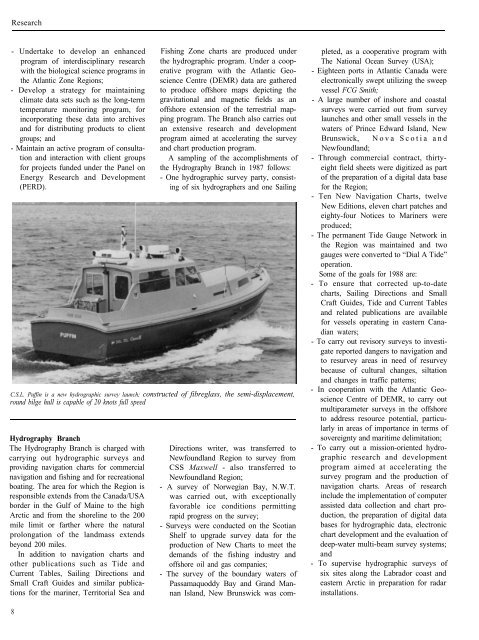
C.S.L. Puffin is a new hydrographic survey launch; constructed <strong>of</strong> fibreglass, the semi-displacement,<br />
round bilge hull is capable <strong>of</strong> 20 knots full speed<br />
Hydrography Branch<br />
The Hydrography Branch is charged with<br />
carrying out hydrographic surveys and<br />
providing navigation charts for commercial<br />
navigation and fishing and for recreational<br />
boating. The area for which the Region is<br />
responsible extends from the Canada/USA<br />
border in the Gulf <strong>of</strong> Maine to the high<br />
Arctic and from the shoreline to the 200<br />
mile limit or farther where the natural<br />
prolongation <strong>of</strong> the landmass extends<br />
beyond 200 miles.<br />
In addition to navigation charts and<br />
other publications such as Tide and<br />
Current Tables, Sailing Directions and<br />
Small Craft Guides and similar publications<br />
for the mariner, Territorial Sea and<br />
8<br />
Directions writer, was transferred to<br />
Newfoundland Region to survey from<br />
CSS Maxwell - also transferred to<br />
Newfoundland Region;<br />
- A survey <strong>of</strong> Norwegian Bay, N.W.T.<br />
was carried out, with exceptionally<br />
favorable ice conditions permitting<br />
rapid progress on the survey;<br />
- Surveys were conducted on the Scotian<br />
Shelf to upgrade survey data for the<br />
production <strong>of</strong> New Charts to meet the<br />
demands <strong>of</strong> the fishing industry and<br />
<strong>of</strong>fshore oil and gas companies;<br />
- The survey <strong>of</strong> the boundary waters <strong>of</strong><br />
Passamaquoddy Bay and Grand Mannan<br />
Island, New Brunswick was com-<br />
pleted, as a cooperative program with<br />
The National Ocean Survey (USA);<br />
- Eighteen ports in Atlantic Canada were<br />
electronically swept utilizing the sweep<br />
vessel FCG Smith;<br />
- A large number <strong>of</strong> inshore and coastal<br />
surveys were carried out from survey<br />
launches and other small vessels in the<br />
waters <strong>of</strong> Prince Edward Island, New<br />
Brunswick, Nova Scotia and<br />
Newfoundland;<br />
- Through commercial contract, thirtyeight<br />
field sheets were digitized as part<br />
<strong>of</strong> the preparation <strong>of</strong> a digital data base<br />
for the Region;<br />
- Ten New Navigation Charts, twelve<br />
New Editions, eleven chart patches and<br />
eighty-four Notices to Mariners were<br />
produced;<br />
- The permanent Tide Gauge Network in<br />
the Region was maintained and two<br />
gauges were converted to “Dial A Tide”<br />
operation.<br />
Some <strong>of</strong> the goals for 1988 are:<br />
- To ensure that corrected up-to-date<br />
charts, Sailing Directions and Small<br />
Craft Guides, Tide and Current Tables<br />
and related publications are available<br />
for vessels operating in eastern Canadian<br />
waters;<br />
- To carry out revisory surveys to investigate<br />
reported dangers to navigation and<br />
to resurvey areas in need <strong>of</strong> resurvey<br />
because <strong>of</strong> cultural changes, siltation<br />
and changes in traffic patterns;<br />
- In cooperation with the Atlantic Geoscience<br />
Centre <strong>of</strong> DEMR, to carry out<br />
multiparameter surveys in the <strong>of</strong>fshore<br />
to address resource potential, particularly<br />
in areas <strong>of</strong> importance in terms <strong>of</strong><br />
sovereignty and maritime delimitation;<br />
- To carry out a mission-oriented hydrographic<br />
research and development<br />
program aimed at accelerating the<br />
survey program and the production <strong>of</strong><br />
navigation charts. Areas <strong>of</strong> research<br />
include the implementation <strong>of</strong> computer<br />
assisted data collection and chart production,<br />
the preparation <strong>of</strong> digital data<br />
bases for hydrographic data, electronic<br />
chart development and the evaluation <strong>of</strong><br />
deep-water multi-beam survey systems;<br />
and<br />
- To supervise hydrographic surveys <strong>of</strong><br />
six sites along the Labrador coast and<br />
eastern Arctic in preparation for radar<br />
installations.