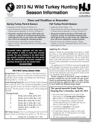
Landscape Project Version 3.1 - State of New Jersey
Landscape Project Version 3.1 - State of New Jersey
Landscape Project Version 3.1 - State of New Jersey

You also want an ePaper? Increase the reach of your titles
YUMPU automatically turns print PDFs into web optimized ePapers that Google loves.
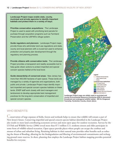
12 | <strong>Landscape</strong> <strong>Project</strong> <strong>Version</strong> <strong>3.1</strong> | CONSERVING IMPERILED WILDLIFE OF NEW JERSEY<strong>Landscape</strong> <strong>Project</strong> maps enable state, county,municipal and private agencies to identify importanthabitats and protect them in a variety <strong>of</strong> ways:Prioritize conservation acquisitions: The <strong>Landscape</strong><strong>Project</strong> is used to assist with prioritizing land parcels forpuchase through acquisition programs such as FarmlandPreservation and the USFWS’s refuge system.Guide regulators and planners: <strong>Landscape</strong> <strong>Project</strong> mapsprovide those who administer land use regulations and state,county and local planners with a crucial tool used to enhanceprotection and properly plan development through theregulatory and planning process.Provide citizens with conservation tools: The <strong>Landscape</strong><strong>Project</strong> provides a transparent and readily accessible tool tohelp guide citizen actions to protect imperiled and specialconcern species habitat at the local level.Guide stewardship <strong>of</strong> conserved areas: <strong>New</strong> <strong>Jersey</strong> hasmore than 400,000 hectares <strong>of</strong> open space. These lands aremanaged by a variety <strong>of</strong> agencies and organizations, bothpublic and private. <strong>Landscape</strong> <strong>Project</strong> maps identify importantimperiled and special concern species habitats on theselands. ENSP staff work closely with land managers andlandowners to develop appropriate best managementpractices for the long-term conservation <strong>of</strong> imperiled andspecial concern species.<strong>Landscape</strong> <strong>Project</strong> maps are widely used in municipal andcounty Environmental Resource Inventories (ERI) to documentthreatened and endangered wildlife habitat. ERI for KingwoodTownship, Hunterdon County, shown above.WHO BENEFITSConservation <strong>of</strong> large expanses <strong>of</strong> fields, forests and wetlands helps to ensure that wildlife will remain a part <strong>of</strong><strong>New</strong> <strong>Jersey</strong>’s future. Conserving imperiled and special concern species habitat identified in the <strong>Landscape</strong> <strong>Project</strong>also results in more land contributing ecosystem services and more open space for outdoor recreation. Surveys by theUS Fish and Wildlife Service (2006) reveal more than 87.5 million U.S. residents sixteen and older participate insome form <strong>of</strong> wildlife-related recreation. Open spaces provide places where people can escape the confines andstresses <strong>of</strong> urban and suburban living. Retaining habitats in their natural state provides other benefits such as reducingthe threat <strong>of</strong> flooding, allowing for the biodegradation and filtering <strong>of</strong> environmental contaminants and rechargingground water reserves. In short, planning that employs the <strong>Landscape</strong> <strong>Project</strong> habitat mapping provides potentialbenefits for everyone.