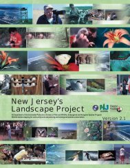
Landscape Project Version 3.1 - State of New Jersey
Landscape Project Version 3.1 - State of New Jersey
Landscape Project Version 3.1 - State of New Jersey

Create successful ePaper yourself
Turn your PDF publications into a flip-book with our unique Google optimized e-Paper software.
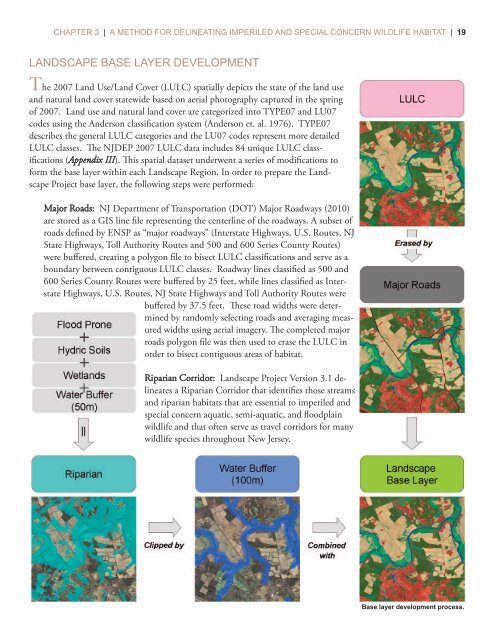
CHAPTER 3 | A METHOD FOR DELINEATING IMPERILED AND SPECIAL CONCERN WILDLIFE HABITAT | 19LANDSCAPE BASE LAYER DEVELOPMENTThe 2007 Land Use/Land Cover (LULC) spatially depicts the state <strong>of</strong> the land useand natural land cover statewide based on aerial photography captured in the spring<strong>of</strong> 2007. Land use and natural land cover are categorized into TYPE07 and LU07codes using the Anderson classification system (Anderson et. al. 1976). TYPE07describes the general LULC categories and the LU07 codes represent more detailedLULC classes. e NJDEP 2007 LULC data includes 84 unique LULC classifications(Appendix III). is spatial dataset underwent a series <strong>of</strong> modifications t<strong>of</strong>orm the base layer within each <strong>Landscape</strong> Region. In order to prepare the <strong>Landscape</strong><strong>Project</strong> base layer, the following steps were performed:Major Roads: NJ Department <strong>of</strong> Transportation (DOT) Major Roadways (2010)are stored as a GIS line file representing the centerline <strong>of</strong> the roadways. A subset <strong>of</strong>roads defined by ENSP as “major roadways” (Interstate Highways, U.S. Routes, NJ<strong>State</strong> Highways, Toll Authority Routes and 500 and 600 Series County Routes)were buffered, creating a polygon file to bisect LULC classifications and serve as aboundary between contiguous LULC classes. Roadway lines classified as 500 and600 Series County Routes were buffered by 25 feet, while lines classified as InterstateHighways, U.S. Routes, NJ <strong>State</strong> Highways and Toll Authority Routes werebuffered by 37.5 feet. ese road widths were determinedby randomly selecting roads and averaging measuredwidths using aerial imagery. e completed majorroads polygon file was then used to erase the LULC inorder to bisect contiguous areas <strong>of</strong> habitat.Riparian Corridor: <strong>Landscape</strong> <strong>Project</strong> <strong>Version</strong> <strong>3.1</strong> delineatesa Riparian Corridor that identifies those streamsand riparian habitats that are essential to imperiled andspecial concern aquatic, semi-aquatic, and floodplainwildlife and that <strong>of</strong>ten serve as travel corridors for manywildlife species throughout <strong>New</strong> <strong>Jersey</strong>.Base layer development process.