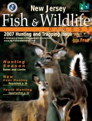
Landscape Project Version 3.1 - State of New Jersey
Landscape Project Version 3.1 - State of New Jersey
Landscape Project Version 3.1 - State of New Jersey

Create successful ePaper yourself
Turn your PDF publications into a flip-book with our unique Google optimized e-Paper software.
LITERATURE CITED | 27LITERATURE CITEDAnderson, J.R., E.E. Hardy, J.T. Roach, and R.E. Witmer. 1976. A land use and land coverclassification system for use with remote sensor data. U.S. Geological Survey Pr<strong>of</strong>essional Paper 964. 28 p.Fahrig, L., and T. Rytwinski. 2009. Effects <strong>of</strong> roads on animal abundance: an empirical review and synthesis. Ecologyand Society 14(1): 21.Hasse, J., and R. G. Lathrop. 2010. Changing <strong>Landscape</strong>s in the Garden <strong>State</strong>: Urban Growth and Open Space Loss in<strong>New</strong> <strong>Jersey</strong> 1986 thru 2007. Glassboro, NJ: Rowan University, Geospatial Research Lab. Retrieved fromhttp://gis.rowan.edu/projects/lulc/Hasse, J. and R. G. Lathrop. 2008. Tracking <strong>New</strong> <strong>Jersey</strong>’s Dynamic <strong>Landscape</strong>: Urban Growth and Open Space Loss1986-1995-2002. Glassboro, NJ: Rowan University, Geospatial Research Lab. Retrieved fromhttp://www.crssa.rutgers.edu/projects/lc/urbangrowth/index.htmlHasse, J, and R.G. Lathrop. 2001. Measuring urban growth in <strong>New</strong> <strong>Jersey</strong>. A report on recent land development patternsutilizing the 1986-1995 NJ DEP Land Use/Land Cover Dataset. Center for Remote Sensing and SpatialAnalysis. Rutgers University.Hasse, J., J. Reiser, and A. Pichacz. 2010. Evidence <strong>of</strong> Persistent Exclusionary Effects <strong>of</strong> Land Use Policy with Historicand <strong>Project</strong>ed Development Patterns in <strong>New</strong> <strong>Jersey</strong>: A Case Study <strong>of</strong> Monmouth and Somerset Counties. Glassboro,NJ: Rowan University, Geospatial Research Lab. Retrieved from http://gis.rowan.edu/labprojects/exclusionary/Hughes, M., and R. G. Lathrop. 2001. A Methodology for Defining and Characterizing the Health <strong>of</strong> Riparian Areasin the Musconetcong and Pohatcong Watersheds using Geographic Information Systems. Rutgers University GrantF. Walton Center for Remote Sensing and Spatial Analysis. CRSSA Technical Report 0101.Lathrop, R.G., P. Montesano, J. Tesauro, and B. Zarate. 2005. <strong>State</strong>wide mapping and assessment <strong>of</strong> vernal pools: A<strong>New</strong> <strong>Jersey</strong> case study. Journal <strong>of</strong> Environmental Management 76: 230-238.NatureServe. 2011. NatureServe Explorer: An online encyclopedia <strong>of</strong> life (web application). <strong>Version</strong> 7.1. Nature-Serve, Arlington, VA. Accessed: August 25, 2011 from http://www.natureserve.org/explorerSeiler, A. 2003. e toll <strong>of</strong> the automobile: wildlife and roads in Sweden. Dissertation, Swedish University <strong>of</strong> AgriculturalSciences, Uppsala, Sweden.U.S. Department <strong>of</strong> the Interior, Fish and Wildlife Service, and U.S. Department <strong>of</strong> Commerce, U.S. Census Bureau.2006. 2006 National Survey <strong>of</strong> Fishing, Hunting, and Wildlife-Associated Recreation.