DRAFT LTP book.indb - Hurunui District Council
DRAFT LTP book.indb - Hurunui District Council
DRAFT LTP book.indb - Hurunui District Council
Create successful ePaper yourself
Turn your PDF publications into a flip-book with our unique Google optimized e-Paper software.
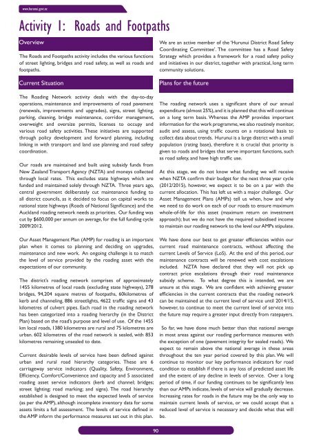
www.hurunui.govt.nzActivity 1: Roads and FootpathsOverviewThe Roads and Footpaths activity includes the various functionsof street lighting, bridges and road safety, as well as roads andfootpaths.Current SituationThe Roading Network activity deals with the day-to-dayoperations, maintenance and improvements of road pavement(renewals, improvements and upgrades), signs, street lighting,parking, cleaning, bridge maintenance, corridor management,overweight and oversize permits, licenses to occupy andvarious road safety activities. These initiatives are supportedthrough policy development and forward planning, includinglinking in with transport and land use planning and road safetycoordination.Our roads are maintained and built using subsidy funds fromNew Zealand Transport Agency (NZTA) and moneys collectedthrough local rates. This excludes state highways which arefunded and maintained solely through NZTA. Three years ago,central government deliberately cut maintenance funding toall district councils, as it decided to focus on capital works tonational state highways (Roads of National Signifi cance) and theAuckland roading network needs as priorities. Our funding wascut by $600,000 per annum on average, for the full funding cycle2009/2012.Our Asset Management Plan (AMP) for roading is an importantplan when it comes to planning and deciding on upgrades,maintenance and new work. An ongoing challenge is to matchthe level of service provided by the roading asset with theexpectations of our community.The district’s roading network comprises of approximately1455 kilometres of local roads (excluding state highways), 278bridges, 94,204 square metres of footpaths, 60kilometres ofkerb and channeling, 886 streetlights, 4622 traffi c signs and 43kilometres of culvert pipes. Each road in the roading networkhas been categorized into a roading hierarchy (in the <strong>District</strong>Plan) based on the road’s purpose and level of use. Of the 1455km local roads, 1380 kilometres are rural and 75 kilometres areurban. 602 kilometres of the road network is sealed, with 853kilometres remaining unsealed to date.Current desirable levels of service have been defi ned againsturban and rural road hierarchy categories. These are 6carriageway service indicators (Quality, Safety, Environment,Effi ciency, Comfort/Convenience and capacity and 5 associatedroading asset service indicators (kerb and channel; bridges;street lighting; road marking; and signs). The road hierarchyestablished is designed to meet the expected levels of service(as per the AMP), although incomplete inventory data for someassets limits a full assessment. The levels of service defi ned inthe AMP inform the performance measures set out in this plan.We are an active member of the ‘<strong>Hurunui</strong> <strong>District</strong> Road SafetyCoordinating Committee’. The committee has a Road SafetyStrategy which provides a framework for a road safety policyand initiatives in our district, together with practical, long termcommunity solutions.Plans for the futureThe roading network uses a signifi cant share of our annualexpenditure (almost 25%), and it is planned that this will continueon a long term basis. Whereas the AMP provides importantinformation for the work programme, we also routinely monitor,audit and assess, using traffi c counts on a rotational basis tocollect data about trends. <strong>Hurunui</strong> is a large district with a smallpopulation (rating base), therefore it is crucial that priority isgiven to roads and bridges that serve important functions, suchas road safety, and have high traffi c use.At this stage, we do not know what funding we will receivewhen NZTA confi rm their budget for the next three year cycle(2012/2015), however, we expect it to be on a par with thecurrent allocation. This has left us with a major challenge. OurAsset Management Plans (AMPs) tell us when, how and whywe need to do work on each of our roads to ensure maximumwhole-of-life for this asset (maximum return on investmentapproach); but we do not have the required subsidised incometo maintain our roading network to the level our AMPs stipulate.We have done our best to get greater effi ciencies within ourcurrent road maintenance contracts, without affecting thecurrent Levels of Service (LoS). At the end of this period, ourmaintenance contracts will be renewed with cost escalationsincluded. NZTA have declared that they will not pick upcontract price escalations through their road maintenancesubsidy scheme. To what degree this is intended, we areunsure at this stage. We are confi dent with achieving greatereffi ciencies in the current contracts that the roading networkcan be maintained at the current level of service until 2014/15,however, to continue to meet the current level of service intothe future may require a greater input directly from ratepayers.So far, we have done much better than that national averagein most areas against our roading performance measures withthe exception of one (pavement integrity for sealed roads). Weexpect to remain above the national average in these areasthroughout the ten year period covered by this plan. We willcontinue to monitor our key performance indicators for roadcondition to establish if there is any loss of predicted asset lifeand the extent of any decline in levels of service. Over a longperiod of time, if our funding continues to be signifi cantly lessthan our AMPs indicate, levels of service will gradually decrease.Increasing rates for roads in the future may be the only way tomaintain current levels of service, or we could accept that areduced level of service is necessary and decide what that willbe.90


