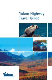
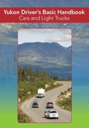
Highway Log - Highways and Public Works - Government of Yukon
Highway Log - Highways and Public Works - Government of Yukon
Highway Log - Highways and Public Works - Government of Yukon

You also want an ePaper? Increase the reach of your titles
YUMPU automatically turns print PDFs into web optimized ePapers that Google loves.
<strong>Yukon</strong> <strong>Highway</strong>s <strong>Log</strong> BookAlaska <strong>Highway</strong> (1)10/8/2008Kilometre Description Kilometre Description1414.0 Lorne Road/Old Mt. Sima Ski Hill Road1427.1 2-Lanes Ahead, 3-Lanes Behind1414.7 Pioneer RV Park1427.1 Turning/Acceleration Lane Ends Ahead1415.1 Mount Sima Ski Hill Road/Utah L<strong>and</strong>ing1427.2 90 km/h Ahead, 70 km/h Behind1416.2 Miles Canyon Road1427.7 Copper Belt Railway1416.5 Canyon Crescent1428.2 3-Lanes Ahead, 2-Lanes Behind1418.4 Shell Station1428.2 McIntyre Creek1418.9 Lobird Road1428.2 Turning/Acceleration Lane Begins Ahead1419.0 Rest Area1428.3 Fish Lake Road #1061419.3 Robert Service Way (South Access Road)1428.7 Dump Road/Rabbit Foot Canyon South End1419.7 80 km/h Ahead, 90 km/h Behind1428.9 Turning/Acceleration Lane Ends Ahead1420.0 4-Lanes Ahead, 2-Lanes Behind1429.5 70 km/h Ahead, 90 km/h Behind1420.0 Sign Bridge1430.0 Centennial Street/Rabbit Foot Canyon North End1420.4 Whitehorse Weigh Scale1430.5 3-Lanes Ahead, 2-Lanes Behind1420.8 2-Lanes Ahead, 4-Lanes Behind1430.5 Turning Lane Begins Ahead1422.0 Radar Road/Lodestar Lane1430.7 15th Avenue/Birch Street1422.2 4-Lanes Ahead, 2-Lanes Behind1430.7 2-Lanes Ahead, 3-Lanes Behind1422.3 Beringia Centre1430.7 Turning Lane Ends Ahead1422.4 2-Lanes Ahead, 4-Lanes Behind1431.0 4-Lanes Ahead, 2-Lanes Behind1422.5 70 km/h Ahead, 80 km/h Behind1431.2 17th Avenue1422.6 Electra Crescent1431.5 Wann Road1422.7 Hillcrest Drive1431.6 2-Lanes Ahead, 4-Lanes Behind1422.8 Roundel Drive/Barkley-Grow Rd/Whitehorse Airport (South Access)1431.9 Trails North1423.0 Otter Road/Whitehorse Airport (North Access)1432.1 3-Lanes Ahead, 2-Lanes Behind1423.1 Burns Road1432.1 LaBerge Road1423.4 Salvation Army Adult Rehabilitation Centre (South Access)1432.1 Turning/Acceleration Lane Begins Ahead1424.0 Salvation Army Adult Rehabilitation Centre (North Access)1432.2 MacDonald Road1424.5 60 km/h Ahead, 70 km/h Behind1432.4 Azure Road/Crestview South Access1424.6 Range Road/Valleyview1432.6 2-Lanes Ahead, 3-Lanes Behind1424.7 4-Lanes Divided Ahead, 2-Lanes Undivided Behind1432.6 90 km/h Ahead, 70 km/h Behind1425.3 Sign Bridge Ahead1432.6 Turning/Acceleration Lane Ends Ahead1425.5 Two Mile Hill1433.3 3-Lanes Ahead, 2-Lanes Behind1425.5 Whitehorse Maintenance Camp #35001433.5 4-Lanes Ahead, 3-Lanes Behind1425.7 Sign Bridge Behind1433.6 3-Lanes Ahead, 4-Lanes Behind1425.8 2-Lanes Undivided Ahead, 4-Lanes Divided Behind1433.6 Kathleen Road/Crestview North Access1425.9 Bethany Tabernacle/Adorna Flowers/Weather/Forestry1433.7 2-Lanes Ahead, 3-Lanes Behind1426.0 70 km/h Ahead, 60 km/h Behind1434.3 4-Lanes Ahead, 2-Lanes Behind1426.6 3-Lanes Ahead, 2-Lanes Behind1434.4 Golden Hill Ventures (YAT) Yard1426.9 Prospector Road/Kopper King1434.6 2-Lanes Ahead, Behind1426.9 Turning/Acceleration Lane Begins Ahead1435.2 Cee & Cee S<strong>and</strong> QuarryReportHwy<strong>Log</strong>Alaska #1 Km 1414 - 1435.2