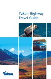
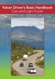
Highway Log - Highways and Public Works - Government of Yukon
Highway Log - Highways and Public Works - Government of Yukon
Highway Log - Highways and Public Works - Government of Yukon

Create successful ePaper yourself
Turn your PDF publications into a flip-book with our unique Google optimized e-Paper software.
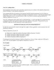
<strong>Yukon</strong> <strong>Highway</strong>s <strong>Log</strong> BookCampbell <strong>Highway</strong> (4)8/9/2004Kilometre Description Kilometre Description380.8 Gravel Ahead, BST Behind582.3 50 km/h Behind405.7 BST Ahead, Gravel Behind582.3 BST Behind406.5 Buttle Creek582.3 Carmacks Section Behind407.9 Gravel Ahead, BST Behind582.3 Eastern Region Behind414.3 BST Ahead, Gravel Behind582.3 Junction Klondike <strong>Highway</strong> #2 (Km 359.1)414.4 Junction Mitchell Road #15 - Km 0414.6 Drury Creek Section Ahead, Ross River Section Behind414.6 Rest Area417.4 Fish Eye Lake421.0 Faro Town Limits (West)433.9 Rest Area439.8 Creek445.3 Creek446.1 Airstrip - Ab<strong>and</strong>oned456.5 Gravel Ahead, BST Behind463.2 BST Ahead, Gravel Behind467.5 50 km/h Ahead, 90 km/h Behind468.1 Drury Creek Campground468.4 Drury Creek468.5 Drury Creek Maintenance Camp #5900469.0 90 km/h Ahead, 50 km/h Behind470.1 Rest Area479.0 Gravel Ahead, BST Behind493.3 Little Salmon Subdivision #152501.4 Little Salmon Lake Campground505.0 BST Ahead, Gravel Behind506.8 Bearfeed Creek508.0 Rest Area528.6 Carmacks Section Ahead, Drury Creek Section Behind528.6 Gravel Ahead, BST Behind542.7 Frenchman Lake Rd #310545.0 Little Salmon Village555.3 Eagle's Nest Bluff555.6 Rest Area - Colombian Disaster564.5 BST Ahead, Gravel Behind577.6 Airstrip - Carmacks580.4 Carmacks Village Limits (East)580.9 50 km/h Ahead, 90 km/h Behind582.3 2-Lanes BehindReportHwy<strong>Log</strong>Campbell #4 Km 380.8 - 582.3