Highway Log - Highways and Public Works - Government of Yukon
Highway Log - Highways and Public Works - Government of Yukon
Highway Log - Highways and Public Works - Government of Yukon

You also want an ePaper? Increase the reach of your titles
YUMPU automatically turns print PDFs into web optimized ePapers that Google loves.
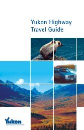
<strong>Yukon</strong> <strong>Highway</strong>s <strong>Log</strong> BookAlaska <strong>Highway</strong> (1)10/8/2008Kilometre Description Kilometre Description1652.8 Cottonwood RV Park <strong>Highway</strong> Lodge RHS1737.0 Kluane Village <strong>Highway</strong> Lodge1662.5 Rest Area1739.7 Swede Johnson Creek1666.1 Congdon Creek Campground RHS1753.8 Communications Tower RHS1666.6 Congdon Creek1755.5 Rest Area - Icefield Ranges1676.8 Nines Creek1761.6 Donjek River1677.5 Mines Creek1770.4 Destruction Bay section behind, Beaver Creek section ahead1680.2 Bock's Creek1770.4 Pull<strong>of</strong>f LHS; No Services1683.4 Shakwak Street Intersection1782.5 Edith Creek1683.6 70 km/h ahead, 90 km/h behind1783.1 Pine Valley <strong>Highway</strong> Lodge RHS1683.9 50 km/h ahead, 70 km/h behind1791.1 Lake Creek Campground LHS1684.3 Destruction Bay Maintenance Camp LHS1802.1 Pickh<strong>and</strong>le Lake Recreational Site1684.4 Historic Milepost 108 Point <strong>of</strong> Interest RHS1810.1 Koidern River Fishing Lodge <strong>Highway</strong> Lodge RHS1684.5 Talbot Arm <strong>Highway</strong> Lodge LHS1810.2 Koidern River #21684.7 Destruction Bay Lodge <strong>Highway</strong> Lodge LHS1817.6 White River <strong>Highway</strong> Lodge LHS1684.9 70 km/h ahead, 50 km/h behind1818.6 White River1685.1 Rest Area1832.4 Sanpete Creek1685.3 Cluett Creek1837.5 Dry Creek # 11685.4 90 km/h ahead, 70 km/h behind1840.8 Rest Area1689.9 Scrap Metal Dump RHS1841.9 Dry Creek # 21690.3 Lewis Creek1849.3 Snag Road Intersection1691.9 Destruction Bay Dump RHS1849.6 Snag Junction Campground RHS1695.4 Copper Joe Creek1858.4 Rest Area1695.5 Copper Joe Subdivision Intersection1860.4 Enger Creek1696.0 Communications Tower LHS1864.6 70 km/h ahead, 90 km/h behind1698.4 Communications Tower RHS1864.8 Start Permafrost Test Study Site1699.9 70 km/h ahead, 90 km/h behind1865.4 End Permafrost Test Study Site1700.0 50 km/h ahead, 90 km/h behind1865.6 90 km/h ahead, 70 km/h behind Study Site1700.3 50 km/h ahead, 70 km/h behind1870.0 50 km/h ahead, 90 km/h behind1700.8 Burwash Museum RHS1870.4 Beaver Creek Maintenance Camp LHS1701.2 70 km/h ahead, 50 km/h behind1870.5 <strong>Yukon</strong> Health Center Governement Building LHS1701.6 90 km/h ahead, 70 km/h behind1870.6 Visitor's Center Governement Building LHS1702.8 Burwash Airstrip RHS1870.8 Dayuse Picnic Area1709.5 Duke River1870.8 RCMP Governement Building RHS1717.0 Burwash Creek1871.6 70 km/h ahead, 50 km/h behind1724.7 Sakiw Creek1872.3 70 km/h ahead, 50 km/h behind1726.0 Rest Area - Kluane River Lookout1872.9 Rest Area1727.6 Intesection Quill Creek Mine Road LHS1873.6 30 km/h ahead, 70 km/h behind1728.9 Quill Creek1873.6 Beaver Creek Airstrip LHS1731.4 Glacier Creek1873.8 Customs Governement BuildingReportHwy<strong>Log</strong>Alaska #1 Km 1652.8 - 1873.8