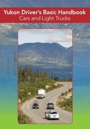
Highway Log - Highways and Public Works - Government of Yukon
Highway Log - Highways and Public Works - Government of Yukon
Highway Log - Highways and Public Works - Government of Yukon

You also want an ePaper? Increase the reach of your titles
YUMPU automatically turns print PDFs into web optimized ePapers that Google loves.
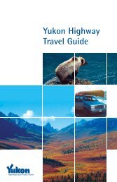
<strong>Yukon</strong> <strong>Highway</strong>s <strong>Log</strong> BookKlondike <strong>Highway</strong> (2)5/1/2007Kilometre Description Kilometre Description24.1 90 km/h Ahead77.2 2-Lanes Ahead, 3-Lanes Behind24.1 AK/BC Boundary77.2 Passing Lane Begins Behind24.1 Fraser Section Ahead79.8 Dall Creek24.1 Pavement Ahead80.0 Carcross Section Ahead, Fraser Section Behind24.1 USA/Canada Boundary80.3 BC/YT Boundary24.1 Western Region Ahead80.3 Rest Area25.0 BST Ahead, Pavement Behind81.3 3-Lanes Ahead, 2-Lanes Behind25.0 Rest Area81.3 Passing Lane Begins Ahead25.7 Avalanche Area Ahead81.5 2-Lanes Ahead, 3-Lanes Behind28.2 Avalanche Area Behind81.5 Passing Lane Ends Ahead29.3 Summit Creek83.4 Old Historic Mill Site36.0 Pavement Ahead, BST Behind84.5 Pooly Creek36.3 30 km/h Ahead, 90 km/h Behind86.7 Avalanche Area Behind36.5 Avalanche Gates86.7 Old Venus Mill Site36.5 Canada Customs88.9 Montana (Conrad) Creek36.5 Fraser Maintenance Camp #330089.0 Old Historic Tramway36.8 90 km/h Ahead, 30 km/h Behind95.0 Rest Area - Bove Isl<strong>and</strong> Viewpoint36.8 Fraser Viewpoint (South Access)98.3 Avalanche Gates36.9 Fraser Viewpoint (North Access)99.6 3-Lanes Ahead, 2-Lanes Behind37.0 BST Ahead, Pavement Behind99.6 Passing Lane Ends Behind37.4 Avalanche Area Ahead100.8 2-Lanes Ahead, 3-Lanes Behind42.5 Major Culvert100.8 Passing Lane Begins Behind42.6 Avalanche Area Behind104.5 50 km/h Ahead, 90 km/h Behind43.9 <strong>Log</strong> Cabin Parking Lot104.5 Waterfront Drive44.0 Railway Crossing104.7 Natasaheeni Village53.7 Campground104.9 Montana Mountain Road56.2 Avalanche Area Ahead105.2 Nares River60.4 Major Culvert105.6 Carcross Road64.3 Boat Ramp106.2 Airstrip - Carcross64.5 Avalanche Area Behind106.2 Carcross Campground65.0 Major Culvert106.3 Dump Road71.3 3-Lanes Ahead, 2-Lanes Behind106.4 Junction Tagish Road #8 (Km 54.0)71.3 Passing Lane Begins Ahead106.5 90 km/h Ahead, 50 km/h Behind73.7 4-Lanes Ahead, 3-Lanes Behind107.5 3-Lanes Ahead, 2-Lanes Behind73.7 Passing Lane Ends Behind107.5 Turning/Acceleration Lane Ends Behind74.3 3-Lanes Ahead, 4-Lanes Behind107.7 Rest Area - Carcross Desert Viewpoint74.3 Passing Lane Ends Ahead108.0 2-Lanes Ahead, 3-Lanes Behind74.4 Venus Mine Site108.0 Turning/Acceleration Lane Begins Behind74.9 Avalanche Area Ahead108.6 Watson River Subdivision Road #182ReportHwy<strong>Log</strong>Klondike #2 Km 24.1 - 108.6