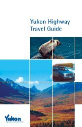
Highway Log - Highways and Public Works - Government of Yukon
Highway Log - Highways and Public Works - Government of Yukon
Highway Log - Highways and Public Works - Government of Yukon

Create successful ePaper yourself
Turn your PDF publications into a flip-book with our unique Google optimized e-Paper software.
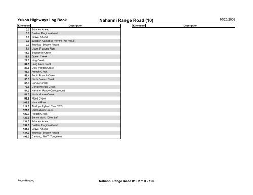
<strong>Yukon</strong> <strong>Highway</strong>s <strong>Log</strong> BookNahanni Range Road (10)10/25/2002Kilometre Description Kilometre Description0.0 2-Lanes Ahead0.0 Eastern Region Ahead0.0 Gravel Ahead0.0 Junction Campbell Hwy #4 (Km 107.8)0.0 Tuchitua Section Ahead8.1 Upper Frances River11.7 Sequence Creek18.7 Queen Creek21.0 King Creek34.5 Long Lake Creek38.6 Dolly Varden Creek45.7 French Creek52.4 South Branch Creek53.3 North Branch Creek65.3 Spruce Creek73.8 Conglomerate Creek84.0 Nahanni Range Campground84.5 North Moose Creek98.8 Flood Creek109.9 Hyl<strong>and</strong> River114.0 Airstrip - Hyl<strong>and</strong> River YTG121.5 Ostensibility Creek129.7 Piggott Creek129.9 Bench Mark 100 m Left134.0 2-Lanes Ahead134.0 Eastern Region Ahead134.0 Gravel Ahead134.0 Tuchitua Section Ahead196.0 Cantung, NWT (Tungsten)ReportHwy<strong>Log</strong>Nahanni Range Road #10 Km 0 - 196