October 2011 Bassetlaw District Local Development Framework
October 2011 Bassetlaw District Local Development Framework
October 2011 Bassetlaw District Local Development Framework
- No tags were found...
Create successful ePaper yourself
Turn your PDF publications into a flip-book with our unique Google optimized e-Paper software.
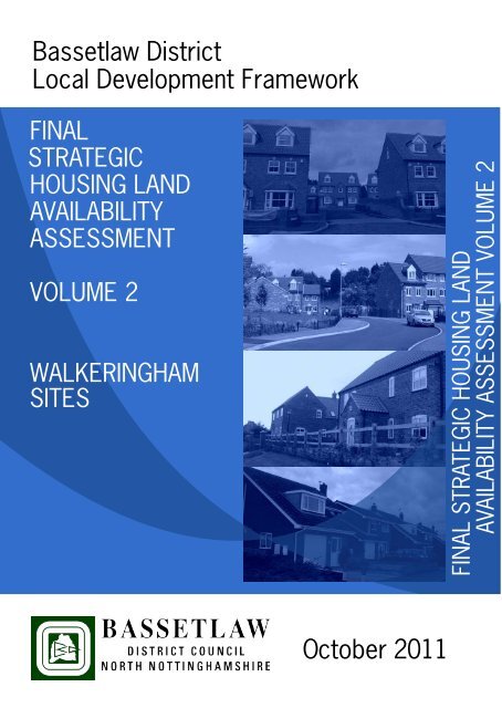
<strong>Bassetlaw</strong> <strong>District</strong><strong>Local</strong> <strong>Development</strong> <strong>Framework</strong>FINALSTRATEGICHOUSING LANDAVAILABILITYASSESSMENTVOLUME 2WALKERINGHAMSITESFINAL STRATEGIC HOUSING LANDAVAILABILITY ASSESSMENT VOLUME 2<strong>October</strong> <strong>2011</strong>
WalkeringhamKeySHLAA DevelopableSHLAA UndevelopableSHLAA DiscountedReproduced from Ordnance Survey mapping with the permission of Ordnance Survey. © Crown Copyright <strong>2011</strong> <strong>Bassetlaw</strong> <strong>District</strong> Council. Licence number 100019517Produced by <strong>Bassetlaw</strong> <strong>District</strong> Council GIS Team
Site number 280 Other site reference ii37House number House name Field to the rear of Brameld LoStreet name North Moor Road <strong>Local</strong>ity WalkeringhamTown Doncaster County South YorkshirePostcode DN10 4LW Parish WalkeringhamLocation Edge of settlement Grid reference 476622 392767Site area (ha) 0.91 Brownfield area (ha)Current use (s)Previous use (s)Surrounding landuse(s)House, garden and paddockNot knownNorth- residentialEast- agricultural then residentialWest- agriculturalSouth- agricultural then part residentialConservationdesignation 1CommentsConservationdesignation 2CommentsConservationdesignation 3CommentsConservationdesignation 4CommentsPhysical problem 1 AccessCommentsPhysical problem 2 Flood riskRESOLVED: Could be a potential development site subject to satisfactory details oflayout access, parking, turning facilities and servicing. A footway will need to beprovided across the site frontage. Requires visibility to be provided as standard, onsite highway layout to standard, planning contributions and off site improvements.CommentsCOMMENT: Site is identified as being within flood zone 1. Comments fromEnvironment Agency suggest that current greenfield runoff rate is maintained andSUDs are utilised to manage the surface water on site such as soakaways or rainwaterharvesting etc. Bounded by ordinary watercourse on all sides and the flood risk fromthis source should be considered.19 <strong>October</strong> <strong>2011</strong> Page 840 of 1704
Physical problem 3CommentsPhysical problem 4CommentsPotential impact 1CommentsPotential impact 2Protected TreesIDENTIFIED: Mature trees (not protected) on the site.CommentsBad neighbouringusesCommentsSuitability conclusionReasonedjustificationThe site MAY be suitableThe site is within the wider residential area and there are no known constraints whichwould prevent the site from being suitable for housing development provided that thehighway requirements can be met, flood risk issues are addressed and that the loss ofthe mature trees is acceptable.Application number N/A Type of applicationExpiry date N/A Dwelling numbers N/ALegal / Ownership Single ownershipCommentsKnown developerinterestNoCommentsSite for sale?CommentsDependent upon the outcomes of the studyAvailability conclusionThe site MAY be availableReasonedjustificationThe owners of the site is looking to sell the land for development. However, planningpermission has not been gained and the site is not allocated. Therefore, the site maynot be available for some time.Market factorsCost factorsDelivery factorsDemand for small infill plots locally.Existing house may need demolishing depending on the future use of the site.Assuming access provided by demolition of existing dwelling no delivery issues andlikely interest from local developers to built out over two years.Achievability conclusionThe site IS achievable19 <strong>October</strong> <strong>2011</strong> Page 841 of 1704
ReasonedjustificationMarket demand in good rural locations for infill plots and some larger plots. Goodregular shaped plot within village with good access points subject to possibledemolition of an existing dwelling.Expected start dat Total number of dwellings 25When will the site be delivered? 6-10 yearsComments Based on 90% of the gross area (0.91ha) at a density of 30 dwellings per hectare.Initial assessment DevelopableReasonedjustificationFinal assessmentcommentsThe site is suitable and if allocated could come forward for development.The site is adjacent to the built form of Walkeringham. There are no knownconstraints why the site should not be suitable for development, provided that thehighway requirements can be met, flood risk issues can be addressed and that theremoval of the mature trees is acceptable. The landowner of the site would sell theland if allocated for housing development and would be well received by the market,as there is demand for small infill plots locally.19 <strong>October</strong> <strong>2011</strong> Page 842 of 1704
Site number 286 Other site reference ii64House number House name The StablesStreet name Beckingham Road <strong>Local</strong>ity WalkeringhamTown Doncaster County South YorkshirePostcode DN10 4HZ Parish WalkeringhamLocation Edge of settlement Grid reference 477130 392129Site area (ha) 1.25 Brownfield area (ha) 0.00Current use (s)Previous use (s)Surrounding landuse(s)Stables and paddockSheep grazing and cutting for hayNorth and West- residentialEast- agriculturalSouth- farmstead and residentialConservationdesignation 1CommentsConservationdesignation 2CommentsConservationdesignation 3CommentsArchaeologyIDENTIFIED: Northern third of the site has been identified as an area ofarchaeological interest.Listed BuildingIDENTIFIED: The site is in close proximity to listed buildings (notably the church,vicarage and manor house). Comments from Conservation suggest that carefulconsideration would have to be given to the design, layout and massing of thedevelopment and its impact on the listed buildings.Conservationdesignation 4CommentsPhysical problem 1 AccessCommentsIDENTIFIED: DMRB would apply for this site but there does not appear to be thepossibility of a footway connection to the village. Would also require satisfactorydetails of layout access, parking, turning facilities, servicing, visibility to be providedas standard, on site highway layout to standard, planning contributions and off siteimprovements.Physical problem 2 Flood riskCommentsCOMMENT: Site is identified as being within flood zone 1. Comments fromEnvironment Agency suggest that a flood risk assessment is required that19 <strong>October</strong> <strong>2011</strong> Page 855 of 1704
Physical problem 3CommentsPhysical problem 4Commentsdemonstrates that the site will maintain the current greenfield runoff rate and canattenuate surface water on site utilising SUDS.Potential impact 1CommentsPotential impact 2Protected TreesIDENTIFIED: There are mature protected trees to the north and west of thesite.(B079).CommentsBad neighbouringusesCommentsSuitability conclusionReasonedjustificationThe site MAY be suitableThe site is on the edge of the wider residential area. There would need to be carefulconsideration given to developing this site and the potential impact it could have onthe nearby Listed Building. Furthermore, the highways requirements would have tobe met.Application number N/A Type of applicationExpiry date N/A Dwelling numbers N/ALegal / Ownership Single ownershipCommentsKnown developerinterestNoCommentsSite for sale?CommentsDependent upon the outcomes of the studyAvailability conclusionThe site MAY be availableReasonedjustificationThe owners of the site is looking to sell the land for development. However, planningpermission has not been gained and the site is not allocated. Therefore, the site maynot be available for some time.Market factorsCost factorsSite outside the village in countryside but a small plot of this size likely to be verypopular with local builders.There are a couple of buildings that would have to be demolished for a clear site, butthe majority of the site is greenfeld.19 <strong>October</strong> <strong>2011</strong> Page 856 of 1704
Delivery factorsNo negative factors other than demolitions. Delivery timescale would depend on unitnumbers and types - anticipated number unlikely to be realised and much smallernumbers will have a build out of 1 to 2 years.Achievability conclusionReasonedjustificationThe site IS achievable<strong>Local</strong> demand and an attractive countryside location.Expected start dat Total number of dwellings 34When will the site be delivered? 6-10 yearsComments Based on 90% of the gross area (1.25ha) at a density of 30 dwellings per hectare.Initial assessment DevelopableReasonedjustificationThe site is suitable and could come forward within 5-10 years provided that the site isallocated.Final assessmentcommentsThe site is on the edge of Walkeringham. There would need to be carefulconsideration given to developing this site and the potential impact it could have onthe nearby Listed Building. Furthermore, the highways requirements would have tobe met. If allocated the site could be delviered wihin two years and would receivemarket interest as there is local demand for such sites.19 <strong>October</strong> <strong>2011</strong> Page 857 of 1704
ReasonedjustificationMarket demand in good rural locations for infill plots and larger developments suchas this site have anticipated demand when market improves and main road frontagean advantage.Expected start dat Total number of dwellings 29When will the site be delivered? 6-10 yearsComments Based on 90% of the gross area (1.06ha) at a density of 30 dwellings per hectare.Initial assessment DevelopableReasonedjustificationThe site is suitable and could come forward within 5-10 years provided that the site isallocated.Final assessmentcommentsThe site is adjacent to the built form of Walkeringham. There are no knownconstraints why the site should not be suitable for development, provided that thehighway requirements can be met. The landowner of the site would sell the land ifallocated for housing development. The site is within a good rural locaiton and couldbe completed within 2 years of commencement.19 <strong>October</strong> <strong>2011</strong> Page 877 of 1704
Site number 294 Other site reference ii98House number House name Land offStreet name North Moor Drive <strong>Local</strong>ity WalkeringhamTown Doncaster County South YorkshirePostcode DN10 4LJ Parish WalkeringhamLocation Edge of settlement Grid reference 476736 392677Site area (ha) 0.96 Brownfield area (ha)Current use (s)Previous use (s)Unused fieldAgricultural landSurrounding landuse(s)Conservationdesignation 1CommentsConservationdesignation 2CommentsConservationdesignation 3CommentsConservationdesignation 4CommentsPhysical problem 1 InfrastructureCommentsIDENTIFIED: there is a drain on the eastern and southern boundary of the site.Physical problem 2 Flood riskCommentsPhysical problem 3 Location of pylonsCommentsPhysical problem 4 AccessCOMMENT: Site is identified as being within flood zone 1. Comments fromEnvironment Agency suggest that current greenfield runoff rate is maintained andSUDs are utilised to manage the surface water on site such as soakaways or rainwaterharvesting etc. Bounded by ordinary watercourse on all sides and the flood risk fromthis source should be considered.IDENTIFIED: Pylons are located along western boundaryCommentsIDENTIFIED: Could be a potential development site subject to satisfactory details of19 <strong>October</strong> <strong>2011</strong> Page 878 of 1704
layout access, parking, turning facilities and servicing. The ditch to the front of thesite would need culverting. Requires visibility to be provided as standard, on sitehighway layout to standard, planning contributions and off site improvements.Potential impact 1CommentsPotential impact 2CommentsBad neighbouringusesCommentsSuitability conclusionReasonedjustificationThe site IS suitableThe site is within the wider residential area and there are no known constraints whichwould prevent the site from being suitable for housing development provided that thehighway requirements can be met and the flood risk issues can be addressed.Application number N/A Type of applicationExpiry date N/A Dwelling numbers N/ALegal / Ownership Single ownershipCommentsKnown developerinterestNot sureCommentsSite for sale?CommentsNot sureAvailability conclusionThe site MAY be availableReasonedjustificationThe owners of the site is looking to sell the land for development. However, planningpermission has not been gained and the site is not allocated. Therefore, the site maynot be available for some time.Market factorsCost factorsDelivery factorsGood rural location with known demand for plots of this size. Attractive centralvillage location likely to generate interest.There are no exceptional cost factors that would be incurred when developing thissite.No negative factorsAchievability conclusionReasonedjustificationThe site IS achievableGood local demand and attractive site.19 <strong>October</strong> <strong>2011</strong> Page 879 of 1704
Expected start dat Total number of dwellings 26When will the site be delivered? 6-10 yearsComments Based on 90% of the gross area (0.96ha) at a density of 30 dwellings per hectare.Initial assessment DevelopableReasonedjustificationThe site is suitable and could come forward within 5-10 years provided that the site isallocated.Final assessmentcommentsThe site is adjacent to the built form of Walkeringham. There are no knownconstraints why the site should not be suitable for development, provided that thehighway requirements can be met. The landowner of the site would sell the land ifallocated for housing development. The site is within a good rural location and wouldbe attractive to the market.19 <strong>October</strong> <strong>2011</strong> Page 880 of 1704
Site number 349 Other site reference ii259House number House name Land south of, 1Street name Brickenhole Lane <strong>Local</strong>ity WalkeringhamTown Doncaster County South YorkshirePostcode Parish WalkeringhamLocation Edge of settlement Grid reference 476687 392394Site area (ha) 0.16 Brownfield area (ha) 0.00Current use (s)Previous use (s)Surrounding landuse(s)Agricultural land, surrounded by hedgerowsNot knownNorth- residentialEast and South- open countrysideWest- Garden landConservationdesignation 1CommentsConservationdesignation 2CommentsConservationdesignation 3CommentsConservationdesignation 4CommentsPhysical problem 1 Flood riskCommentsCOMMENT: Site is identified as being within flood zone 1. Comments fromEnvironment Agency suggest that it will have to demonstrated that the site willmaintain the current greenfield runoff rate and can attenuate surface water on siteutilising SUDS.Physical problem 2 AccessCommentsPhysical problem 3IDENTIFIED: DMRB standards would apply for this site as outside of the 30mphzone. Could be a possible site if visibility can be achieved at the access point, alongwith satisfactory details of layout access, parking, turning facilities, servicing,visibility to be provided as standard, on site highway layout to standard, planningcontributions, off site improvements and traffic statement.19 <strong>October</strong> <strong>2011</strong> Page 1010 of 1704
CommentsPhysical problem 4CommentsPotential impact 1CommentsPotential impact 2Protected TreesIDENTIFIED: Few large mature trees/hedges on the boundaries of the site (notprotected).CommentsBad neighbouringusesCommentsSuitability conclusionReasonedjustificationThe site IS suitableThe site is within the wider residential area and there are no known constraints whichwould prevent the site from being suitable for housing development, provided that thehighways requirements can be met and the mature trees and hedges can beincorporated within any future scheme.Application number N/A Type of applicationExpiry date N/A Dwelling numbers N/ALegal / Ownership Single ownershipCommentsKnown developerinterestNot sureCommentsSite for sale?CommentsNot sureAvailability conclusionThe site MAY be availableReasonedjustificationThe owner of the site is looking to bring the site forward for development, andcurrently has planning permission and therefore is available for development.However, the landowner are unsure if development on the site will commence as theyare looking for other land uses.Market factorsCost factorsDelivery factorsSmall infill plot just outside village boundary likely to be of interest to local builders.There are no exceptional cost factors that would be incurred when developing thissite.Good access from road and any development would be market led but with the optionto split into two or three single plots.19 <strong>October</strong> <strong>2011</strong> Page 1011 of 1704
Achievability conclusionReasonedjustificationThe site IS achievable<strong>Local</strong> demand for small infill plots such as this.Expected start dat Total number of dwellings 5When will the site be delivered? 6-10 yearsComments Based on 100% of the gross area (0.16ha) at a density of 30 dwellings per hectare.Initial assessment DevelopableReasonedjustificationThe site is suitable and could come forward within 5-10 years provided that the site isallocated.Final assessmentcommentsThe site is within the wider residential area and there are no known constraints whichwould prevent the site from being suitable for housing development, provided that thehighways requirements can be met and the mature trees and hedges can beincorporated within any future scheme. If allocated, the landowner would sell theland for development and there is local demand for such plots.19 <strong>October</strong> <strong>2011</strong> Page 1012 of 1704
Site number 353 Other site reference ii266House number House name HomefieldsStreet name Beckingham Road <strong>Local</strong>ity WalkeringhamTown Doncaster County South YorkshirePostcode DN10 4HZ Parish WalkeringhamLocation Edge of settlement Grid reference 477143 392065Site area (ha) 0.84 Brownfield area (ha)Current use (s)Previous use (s)Surrounding landuse(s)House and gardenNot knownNorth- house and garden landEast, South and West- open countrysideConservationdesignation 1CommentsListed BuildingIDENTIFIED: The site is in close proximity to listed buildings (notably the church,vicarage and manor house). Comments from Conservation suggest that carefulconsideration would have to be given to the design, layout and massing of thedevelopment and its impact on the listed buildings.Conservationdesignation 2CommentsConservationdesignation 3CommentsConservationdesignation 4CommentsPhysical problem 1 AccessCommentsIDENTIFIED: DMRB would apply for this site but there does not appear to be thepossibility of a footway connection to the village. Would also require satisfactorydetails of layout access, parking, turning facilities, servicing, visibility to be providedas standard, on site highway layout to standard, planning contributions and off siteimprovements.Physical problem 2 Flood riskCommentsIDENTIFIED: Site is identified as being within flood zone 1. Comments fromEnvironment Agency suggest that current greenfield runoff rate is maintained andSUDs are utilised to manage the surface water on site such as soakaways or rainwaterharvesting etc. Bounded by ordinary watercourse to the south and the flood risk from19 <strong>October</strong> <strong>2011</strong> Page 1020 of 1704
this source should be considered.Physical problem 3CommentsPhysical problem 4CommentsPotential impact 1CommentsPotential impact 2Protected TreesIDENTIFIED: Protected trees to the north of the site.CommentsBad neighbouringusesCommentsSuitability conclusionReasonedjustificationThe site MAY be suitableHighway requirements, flood risk issues, archaeology and conservation concernsshould be addressed before the site can be considered as suitable and that the existingbuilding can be incorporated within the scheme or demolished.Application number N/A Type of applicationExpiry date N/A Dwelling numbers N/ALegal / Ownership Single ownershipCommentsKnown developerinterestNoCommentsSite for sale?CommentsDependent upon the outcomes of the studyAvailability conclusionThe site MAY be availableReasonedjustificationThe owners of the site is looking to sell the land for development. However, planningpermission has not been gained and the site is not allocated/within the developmentboundaries. Therefore, the site may not be available for some time.Market factorsCost factorsDelivery factorsSite outside the village in countryside but a small plot of this size likely to be verypopular with local builders.There are a couple of buildings that would have to be demolished for a clear site, butthe majority of the site is greenfeld.No negative factors other than demolitions. Delivery timescale would depend on unitnumbers and types - anticipated number unlikely to be realised and much smallernumbers will have a build out of 1 to 2 years.19 <strong>October</strong> <strong>2011</strong> Page 1021 of 1704
Achievability conclusionReasonedjustificationThe site IS achievable<strong>Local</strong> demand and an attractive countryside location.Expected start dat Total number of dwellings 23When will the site be delivered? 6-10 yearsComments Based on 90% of the gross area (0.84ha) at a density of 30 dwellings per hectare.Initial assessment DevelopableReasonedjustificationFinal assessmentcommentsThe site may be suitable and would be developed within 6-10 years if allocated.The site is adjacent to the built form of Walkeringham. Highway requirements, floodrisk issues, archaeology and conservation concerns should be addressed before thesite can be considered as suitable and the existing land uses can be incorporatedwithin the scheme. The landowner of the site would sell the land if allocated forhousing development and would be attractive to the market.19 <strong>October</strong> <strong>2011</strong> Page 1022 of 1704
Site number 436 Other site referenceHouse number House name Land south ofStreet name North Moor Road <strong>Local</strong>ity WalkeringhamTown Retford County NottinghamshirePostcode Parish WalkeringhamLocation Edge of settlement Grid reference 476394 392693Site area (ha) 1.44 Brownfield area (ha) 0.00Current use (s)Previous use (s)Surrounding landuse(s)Two agricultural pieces of landNot knownNorth- road and residentialEast- residentialSouth- open countrysideWest- residentialConservationdesignation 1CommentsConservationdesignation 2CommentsConservationdesignation 3CommentsConservationdesignation 4CommentsPhysical problem 1 AccessCommentsRESOLVED: Could be a potential development site subject to satisfactory details oflayout access, parking, turning facilities and servicing. A footway will need to beprovided across the site frontage. Requires visibility to be provided as standard, onsite highway layout to standard, planning contributions, off site improvements andtraffic statement.Physical problem 2 Flood riskCommentsCOMMENT: Site is identified as being within flood zone 1. Comments fromEnvironment Agency suggest that a phased scheme should be considered, along witha FRA to demonstrate that the site will maintain the current greenfield runoff rate andcan attenuate surface water on site utilising SUDS over the different phases.19 <strong>October</strong> <strong>2011</strong> Page 1251 of 1704
Physical problem 3CommentsPhysical problem 4CommentsPotential impact 1CommentsPotential impact 2CommentsBad neighbouringusesCommentsSuitability conclusionReasonedjustificationThe site IS suitableThe site is within the wider residential area and there are no known constraints whichwould prevent the site from being suitable for housing development, provided that thehighway requirements can be met.Application number N/A Type of applicationExpiry date N/A Dwelling numbers N/ALegal / Ownership Not knownCommentsKnown developerinterestCommentsSite for sale?CommentsLandowner is not known and therefore this information is unavailable.Not knownLandowner is not known and therefore this information is unavailable.Not knownLandowner is not known and therefore this information is unavailable.Availability conclusionThe site is NOT availableReasonedjustificationLandowner is not known and therefore this site cannot be considered as available fordevelopment.Market factorsCost factorsDelivery factorsLinear site following length of N Moor Road within village boundary. Presently nodemand for sites of this size but smaller infills have been developed indicatingdemand likely when market improves significantly and site could be developed instages.There are no exceptional cost factors that would be incurred when developing thissite.No negative factors noted - good shape for phased development and main roadfrontage. Delivery would be market led.19 <strong>October</strong> <strong>2011</strong> Page 1252 of 1704
Achievability conclusionReasonedjustificationThe site IS achievableAssumed demand will increase to include larger sites as market improves. Nonegative delivery or cost factors.Expected start dat N/A Total number of dwellings 0When will the site be delivered?CommentsInitial assessmentReasonedjustificationFinal assessmentcommentsThe site is not available therefore the associated timescales are not needed. If basedon 90% of the gross area (1.44ha) at a density of 30 dwellings per hectare then thiscould have meant 39 dwellings.Not developableThe landowner is not known and therefore the site is currently unavailable.The site is adjacent to the built form of Walkeringham. The site is considered suitablefor development provided that the highway requirements can be met. However, thelandowner is not known and therefore the site cannot be considered as available. Therelease of this site may depend on splitting the site or waiting until the market picksup.19 <strong>October</strong> <strong>2011</strong> Page 1253 of 1704
Site number 437 Other site referenceHouse number House name Land north ofStreet name North Moor Road <strong>Local</strong>ity WalkeringhamTown Retford County NottinghamshirePostcode Parish WalkeringhamLocation Edge of settlement Grid reference 476792 392936Site area (ha) 2.85 Brownfield area (ha) 0.00Current use (s)Previous use (s)Surrounding landuse(s)Agricultural land with a public footpath running through the site (south/northdirection)Not knownNorth- open countrysideEast- open countrysideSouth- residentialWest- residentialConservationdesignation 1CommentsConservationdesignation 2CommentsConservationdesignation 3CommentsConservationdesignation 4CommentsPhysical problem 1 AccessCommentsPhysical problem 2 Flood riskRESOLVED: Could be a potential development site subject to satisfactory details oflayout access, parking, turning facilities and servicing. A footway will need to beprovided across the site frontage. Requires visibility to be provided as standard, onsite highway layout to standard, residential travel plan, planning contributions, offsite improvements and traffic assessment.CommentsCOMMENT: Site is identified as being within flood zone 1. Comments fromEnvironment Agency suggest that a FRA would be required that demonstrates thatthe current greenfield runoff rate can be maintained and SUDs are utilised to managethe surface water on site. Flood risk from the adjacent watercourses must also be19 <strong>October</strong> <strong>2011</strong> Page 1254 of 1704
Physical problem 3CommentsPhysical problem 4Commentsconsidered. Should this form part of a phased development then a holistic approachmust be taken to drainage.Potential impact 1CommentsPotential impact 2CommentsBad neighbouringusesCommentsSuitability conclusionReasonedjustificationThe site IS suitableThe site is within the wider residential area and there are no known constraints whichwould prevent the site from being suitable for housing development, provided that thehighway requirements can be met and the public footpath can be incorporated withinany future scheme.Application number 51/04/00023 Type of application FullExpiry date Refused Dwelling numbers 2Legal / Ownership Single ownershipCommentsKnown developerinterestYesCommentsSite for sale?CommentsDependent upon the outcomes of the studyAvailability conclusionThe site MAY be availableReasonedjustificationThe owners of the site is looking to promote the land for development. However,planning permission has not been gained and the site is not allocated. Therefore, thesite may not be available for some time.Market factorsCost factorsCurrently no market demand for sites of this size in locations such as this, however ifmarket improves significantly the better rural locations such as this may be attractiveto developers.There are no exceptional cost factors that would be incurred when developing thissite.19 <strong>October</strong> <strong>2011</strong> Page 1255 of 1704
Delivery factorsNo noted negative factors - good road frontage and access.Achievability conclusionReasonedjustificationThe site MAY be achievableNo demand at present but potential if a significant improvement in future years.Expected start dat Total number of dwellings 68When will the site be delivered? 11-15 yearsComments Based on 90% of the gross area (2.85ha) at a density of 30 dwellings per hectare.Initial assessment DevelopableReasonedjustificationThe site is suitable and could come forward within 5-10 years provided that the site isallocated.Final assessmentcommentsThe site is adjacent to the built form of Walkeringham. The site is considered suitablefor development provided that the highway requirements can be met. The site ifallocated would be sold for development. The release of this site may depend onsplitting the site or waiting until the market picks up.19 <strong>October</strong> <strong>2011</strong> Page 1256 of 1704
Site number 438 Other site referenceHouse number House name Land north ofStreet name Mill Baulk Road <strong>Local</strong>ity WalkeringhamTown Retford County NottinghamshirePostcode Parish WalkeringhamLocation Edge of settlement Grid reference 476988 392786Site area (ha) 3.04 Brownfield area (ha) 0.00Current use (s)Previous use (s)Surrounding landuse(s)Agricultural land with a public footpath on the western boundary (running insouth/north direction)Not knownNorth- open countrysideEast- open countrysideSouth- road and then open countrysideSouthwest- primary schoolWest- residentialConservationdesignation 1CommentsConservationdesignation 2CommentsConservationdesignation 3CommentsConservationdesignation 4CommentsPhysical problem 1 AccessCommentsPhysical problem 2 Flood riskRESOLVED: Could be a potential development site subject to satisfactory details oflayout access, parking, turning facilities and servicing. A footway will need to beprovided across the site frontage. Requires visibility to be provided as standard, onsite highway layout to standard, residential travel plan, planning contributions, offsite improvements and traffic assessment.CommentsCOMMENT: Site is identified as being within flood zone 1. Comments fromEnvironment Agency suggest that a flood risk assessment is required thatdemonstrates that the site will maintain the current greenfield runoff rate and can19 <strong>October</strong> <strong>2011</strong> Page 1257 of 1704
attenuate surface water on site utilising SUDS.Physical problem 3CommentsPhysical problem 4CommentsPotential impact 1CommentsPotential impact 2CommentsBad neighbouringusesCommentsSuitability conclusionReasonedjustificationThe site IS suitableThe site is within the wider residential area and there are no known constraints whichwould prevent the site from being suitable for housing development, provided that thehighway requirements can be met.Application number N/A Type of applicationExpiry date N/A Dwelling numbers N/ALegal / Ownership Single ownershipCommentsKnown developerinterestYesCommentsSite for sale?CommentsDependent upon the outcomes of the studyAvailability conclusionThe site MAY be availableReasonedjustificationThe owners of the site is looking to promote the land for development. However,planning permission has not been gained and the site is not allocated. Therefore, thesite may not be available for some time.Market factorsCost factorsDelivery factorsCurrently no market demand for sites of this size in locations such as this, however ifmarket improves significantly the better rural locations such as this may be attractiveto developers-adjacent smaller site appears to be under development.There are no exceptional cost factors that would be incurred when developing thissite.No noted negative factors -good road frontage and access.19 <strong>October</strong> <strong>2011</strong> Page 1258 of 1704
Achievability conclusionReasonedjustificationThe site MAY be achievableNo demand at present but potential if a significant improvement in future years.Expected start dat Total number of dwellings 82When will the site be delivered? 11-15 yearsComments Based on 90% of the gross area (3.04ha) at a density of 30 dwellings per hectare.Initial assessment DevelopableReasonedjustificationThe site is suitable and could come forward within 5-10 years provided that the site isallocated.Final assessmentcommentsThe site is adjacent to the built form of Mattersey. The site is considered suitable fordevelopment provided that the highway requirements can be met. The site ifallocated, could come forward within 5 years.19 <strong>October</strong> <strong>2011</strong> Page 1259 of 1704
Site number 439 Other site referenceHouse number House name Land south ofStreet name Mill Baulk Road <strong>Local</strong>ity WalkeringhamTown Retford County NottinghamshirePostcode Parish WalkeringhamLocation Edge of settlement Grid reference 476972 392634Site area (ha) 1.91 Brownfield area (ha) 0.00Current use (s)Previous use (s)Surrounding landuse(s)Agricultural land with a public footpath on the western boundary (running insouth/north direction)Not knownNorth- road and then open countrysideEast- agricultural landSouth- agricultural landWest- residentialConservationdesignation 1CommentsArchaeologyIDENTIFIED: The land to the south of the site is identified as an area ofarchaeological interest.Conservationdesignation 2CommentsConservationdesignation 3CommentsConservationdesignation 4CommentsPhysical problem 1 AccessCommentsPhysical problem 2 Flood riskRESOLVED: Could be a potential development site subject to satisfactory details oflayout access, parking, turning facilities and servicing. Note that there is a 40mphzone adjacent to the site. Requires visibility to be provided as standard, on sitehighway layout to standard, planning contributions, off site improvements and trafficassessment.CommentsCOMMENT: Site is identified as being within flood zone 1. Comments fromEnvironment Agency suggest that current greenfield runoff rate is maintained andSUDs are utilised to manage the surface water on site. Flood risk from the adjacent19 <strong>October</strong> <strong>2011</strong> Page 1260 of 1704
Physical problem 3CommentsPhysical problem 4Commentswatercourse to the west of the site should be considered. Should this form part of aphased development then a holistic approach must be taken to drainage.Potential impact 1CommentsPotential impact 2CommentsBad neighbouringusesCommentsSuitability conclusionReasonedjustificationThe site IS suitableThe site is within the wider residential area and there are no known constraints whichwould prevent the site from being suitable for housing development, provided that thehighway requirements can be met.Application number N/A Type of applicationExpiry date N/A Dwelling numbers N/ALegal / Ownership Not knownCommentsKnown developerinterestCommentsSite for sale?CommentsLandowner is not known and therefore this information is unavailable.Not knownLandowner is not known and therefore this information is unavailable.Not knownLandowner is not known and therefore this information is unavailable.Availability conclusionThe site is NOT availableReasonedjustificationLandowner is not known and therefore this site cannot be considered as available fordevelopment.Market factorsCost factorsDelivery factorsCurrently no market demand for sites of this size in locations such as this, however ifmarket improves significantly the better rural locations such as this may be attractiveto developers-adjacent smaller site appears to be under development.There are no exceptional cost factors that would be incurred when developing thissite.No noted negative factors -good road frontage and access.19 <strong>October</strong> <strong>2011</strong> Page 1261 of 1704
Achievability conclusionReasonedjustificationThe site MAY be achievableNo demand at present but potential if a significant improvement in future years.Expected start dat N/A Total number of dwellings 0When will the site be delivered?CommentsInitial assessmentReasonedjustificationFinal assessmentcommentsIf based on 90% of the gross area (1.91ha) at a density of 30 dwellings per hectarethen this could have meant 52 dwellings. The site is not available therefore theassociated timescales are not needed.Not developableThe landowner is not known and therefore the site is currently unavailable.The site is adjacent to the built form of Walkeringham. The site is considered suitablefor development provided that the highway requirements can be met. However, thelandowner is not known and therefore the site cannot be considered as available.19 <strong>October</strong> <strong>2011</strong> Page 1262 of 1704
Site number 440 Other site referenceHouse number House name Land north ofStreet name Mill Baulk Road <strong>Local</strong>ity WalkeringhamTown Retford County NottinghamshirePostcode Parish WalkeringhamLocation Edge of settlement Grid reference 475634 396745Site area (ha) 1.43 Brownfield area (ha) 0.00Current use (s)Previous use (s)Surrounding landuse(s)Agricultural land with a public footpath on the western boundary (running insouth/north direction)Not knownNorth- road and then agricultural landEast- two properties and then a recreational groundSouth- road and then agricultural landWest- agricultural landConservationdesignation 1CommentsConservationdesignation 2CommentsConservationdesignation 3CommentsConservationdesignation 4CommentsPhysical problem 1 AccessCommentsPhysical problem 2 Flood riskRESOLVED: Could be a potential development site subject to satisfactory details oflayout access, parking, turning facilities and servicing. A footway will need to beprovided across the site frontage. Requires visibility to be provided as standard, onsite highway layout to standard, planning contributions, off site improvements andtraffic statement.CommentsUNRESOLVED: Site is identified as being within flood zone 2. Comments from theEnvironment Agency states that a FRA will be required which looks at flooding fromall sources and mitigates against any risk. The FRA should also demonstrate that thedevelopment will maintain the current greenfield runoff rate and must attenuate19 <strong>October</strong> <strong>2011</strong> Page 1263 of 1704
surface water on site utilising SUDs.Physical problem 3CommentsPhysical problem 4CommentsPotential impact 1CommentsPotential impact 2CommentsBad neighbouringusesCommentsSuitability conclusionReasonedjustificationThe site is NOT suitableThe site is not suitable as it is within flood zone 2, and a detailed flood riskassessment would need to be done, along with a sequential test to demonstrate thesuitability of the site.Application number N/A Type of applicationExpiry date N/A Dwelling numbers N/ALegal / Ownership Single ownershipCommentsKnown developerinterestYesCommentsSite for sale?CommentsDependent upon the outcomes of the studyAvailability conclusionThe site MAY be availableReasonedjustificationThe owners of the site is looking to promote the land for development. However,planning permission has not been gained and the site is not allocated. Therefore, thesite may not be available for some time.Market factorsCost factorsDelivery factorsCurrently no market demand for sites of this size in locations such as this, however ifmarket improves significantly the better rural locations such as this may be attractiveto developers.There are no exceptional cost factors that would be incurred when developing thissite.No noted negative factors -good road frontage and access.19 <strong>October</strong> <strong>2011</strong> Page 1264 of 1704
Achievability conclusionReasonedjustificationThe site MAY be achievableNo demand at present but potential if a significant improvement in future years.Expected start dat N/A Total number of dwellings 0When will the site be delivered?CommentsInitial assessmentReasonedjustificationFinal assessmentcommentsIf based on 90% of the gross area (1.43ha) at a density of 30 dwellings per hectarewould have meant 39 dwellings. The site is not available therefore the associatedtimescales are not needed.Not developableThe site is within flood zone 2 and therefore considered not suitable.The site is adjacent to the built form of Walkeringham. The site is not suitable as it iswithin flood zone 2, and a detailed flood risk assessment would need to be done,along with a sequential test to demonstrate the suitability of the site. Highwaysrequirements would also need to be met. The site if allocated, could come forwardwithin 5 years.19 <strong>October</strong> <strong>2011</strong> Page 1265 of 1704
Site number 441 Other site referenceHouse number House name Land adjacent to Home FarmStreet name Stockwith Road <strong>Local</strong>ity WalkeringhamTown Retford County NottinghamshirePostcode Parish WalkeringhamLocation Edge of settlement Grid reference 477478 392577Site area (ha) 0.78 Brownfield area (ha)Current use (s)Previous use (s)Surrounding landuse(s)Agricultural landNot knownNorth- residentialNortheast and East- open countrysideSouth- residentialWest- residentialConservationdesignation 1CommentsConservationdesignation 2CommentsConservationdesignation 3CommentsConservationdesignation 4CommentsPhysical problem 1 AccessCommentsRESOLVED: A161 junction visibility does not appear to be able to supportadditional development, and a traffic assessment would need to show otherwise,along with satisfactory details of layout access, parking, turning facilities andservicing. A footway will need to be provided across the site frontage. Requiresvisibility to be provided as standard, on site highway layout to standard, planningcontributions, off site improvements and traffic assessment.Physical problem 2 Flood riskCommentsIDENTIFIED: Site is identified as being within flood zone 1. Comments fromEnvironment Agency suggest that a phased scheme should be considered, along witha FRA to demonstrate that the site will maintain the current greenfield runoff rate andcan attenuate surface water on site utilising SUDS over the different phases.19 <strong>October</strong> <strong>2011</strong> Page 1266 of 1704
Physical problem 3CommentsPhysical problem 4CommentsPotential impact 1CommentsPotential impact 2CommentsBad neighbouringusesCommentsSuitability conclusionReasonedjustificationThe site IS suitableThe site is within the wider residential area and there are no known constraints whichwould prevent the site from being suitable for housing development, provided that thehighway requirements can be met.Application number N/A Type of applicationExpiry date N/A Dwelling numbers N/ALegal / Ownership Not knownCommentsKnown developerinterestCommentsSite for sale?CommentsLandowner is not known and therefore this information is unavailable.Not knownLandowner is not known and therefore this information is unavailable.Not knownLandowner is not known and therefore this information is unavailable.Availability conclusionThe site is NOT availableReasonedjustificationLandowner is not known and therefore this site cannot be considered as available fordevelopment.Market factorsCost factorsDelivery factorsInfill developments of this size still have some demand locally though plots typicallydeveloped for larger individual units.There are no exceptional cost factors that would be incurred when developing thissite.No noted negative factors -reasonable road frontage and access.Achievability conclusionThe site IS achievable19 <strong>October</strong> <strong>2011</strong> Page 1267 of 1704
ReasonedjustificationSimilar sites indicate demand and viability in the local market.Expected start dat N/A Total number of dwellings 0When will the site be delivered?CommentsInitial assessmentReasonedjustificationFinal assessmentcommentsIf based on 90% of the gross area (0.78ha) at a density of 30 dwellings per hectarethen this could have meant 21 dwellings. The site is not available therefore theassociated timescales are not needed.Not developableThe site cannot be adequately access and the landowner is not known.The site is adjacent to the built form of Walkeringham. The site cannot be consideredsuitable for development as the site cannot be adequately accessed at this time.However, the landowner is not known and therefore the site cannot be considered asavailable. There is known market demand for such sites locally.19 <strong>October</strong> <strong>2011</strong> Page 1268 of 1704
Site number 442 Other site referenceHouse number House name Land north ofStreet name Station Road <strong>Local</strong>ity WalkeringhamTown Retford County NottinghamshirePostcode Parish WalkeringhamLocation Edge of settlement Grid reference 477479 329590Site area (ha) 5.15 Brownfield area (ha) 0.00Current use (s)Previous use (s)Surrounding landuse(s)Agricultural land and allotmentsNot knownNorth- open countrysideEast- residential and then railway then open countrysideSouth- residentialWest- residentialConservationdesignation 1CommentsArchaeologyIDENTIFIED: The land to the southwest of the site is identified as an area ofarchaeological interest.Conservationdesignation 2CommentsConservationdesignation 3CommentsConservationdesignation 4CommentsPhysical problem 1 AccessCommentsRESOLVED: Could be a potential development site subject to satisfactory details oflayout access, parking, turning facilities and servicing. A footway will need to beprovided across the site frontage. Requires visibility to be provided as standard, onsite highway layout to standard, residential travel plan, planning contributions, offsite improvements and traffic assessment.Physical problem 2 Flood riskCommentsCOMMENT: Site is identified as being within flood zone 1. Comments fromEnvironment Agency suggest that a FRA would be required that demonstrates thatthe site will maintain the current greenfield runoff rate and can attenuate surfacewater on site utilising SUDs Should this be a phased development then a FRA which19 <strong>October</strong> <strong>2011</strong> Page 1269 of 1704
considers the whole site, with a holistic approach taken to drainage will be required.Physical problem 3CommentsPhysical problem 4CommentsPotential impact 1CommentsPotential impact 2CommentsBad neighbouringusesCommentsSuitability conclusionReasonedjustificationThe site IS suitableThe site is within the wider residential area and there are no known constraints whichwould prevent the site from being suitable for housing development, provided that thehighway requirements can be met.Application number N/A Type of applicationExpiry date N/A Dwelling numbers N/ALegal / Ownership Single ownershipCommentsKnown developerinterestYesCommentsSite for sale?CommentsDependent upon the outcomes of the studyAvailability conclusionThe site MAY be availableReasonedjustificationThe owners of the site is looking to promote the land for development. However,planning permission has not been gained and the site is not allocated. Therefore, thesite may not be available for some time.Market factorsCost factorsDelivery factorsNo demand for sites of this size and to be viable all other potential sites wouldrequire to be built out first - the locality is therefore unlikely to support large scaledevelopment in the forseeable future.There are no exceptional cost factors that would be incurred when developing thissite.Likley to be phased development or even site splitting depending on access withbuild out over 2 - 3 years.19 <strong>October</strong> <strong>2011</strong> Page 1270 of 1704
Achievability conclusionReasonedjustificationThe site MAY be achievableNo demand at present or anticipated for at least 15 years for sites of this size.Expected start dat Total number of dwellings 139When will the site be delivered? 11-15 yearsComments Based on 90% of the gross area (5.15ha) at a density of 30 dwellings per hectare.Initial assessment DevelopableReasonedjustificationThe site is suitable and could come forward within 5-10 years provided that the site isallocated.Final assessmentcommentsThe site is adjacent to the built form of Walkeringham. The site is considered suitablefor development provided that the highway requirements can be met. The site ifallocated, could come forward within 5 years.19 <strong>October</strong> <strong>2011</strong> Page 1271 of 1704
Site number 443 Other site referenceHouse number House name Land south ofStreet name Station Road <strong>Local</strong>ity WalkeringhamTown Retford County NottinghamshirePostcode Parish WalkeringhamLocation Edge of settlement Grid reference 477356 393631Site area (ha) 0.69 Brownfield area (ha) 0.00Current use (s)Previous use (s)Surrounding landuse(s)Agricultural landNot knownNorth- road and residentialEast- residentialSouth- open countrysideWest- residentialConservationdesignation 1CommentsConservationdesignation 2CommentsConservationdesignation 3CommentsConservationdesignation 4CommentsPhysical problem 1 AccessCommentsPhysical problem 2 Flood riskRESOLVED: Could be a potential development site subject to satisfactory details oflayout access, parking, turning facilities and servicing. A footway will need to beprovided across the site frontage. Requires visibility to be provided as standard, onsite highway layout to standard, planning contributions, off site improvements.CommentsCOMMENT: Site is identified as being within flood zone 1. Comments fromEnvironment Agency suggest that current greenfield runoff rate is maintained andSUDs are utilised to manage the surface water on site such as soakaways or rainwaterharvesting etc. Bounded by ordinary watercourse surround the site and the flood riskfrom this source should be considered.19 <strong>October</strong> <strong>2011</strong> Page 1272 of 1704
Physical problem 3CommentsPhysical problem 4CommentsPotential impact 1CommentsPotential impact 2CommentsBad neighbouringusesCommentsSuitability conclusionReasonedjustificationThe site IS suitableThe site is within the wider residential area and there are no known constraints whichwould prevent the site from being suitable for housing development, provided that thehighway requirements can be met.Application number N/A Type of applicationExpiry date N/A Dwelling numbers N/ALegal / Ownership Not knownCommentsKnown developerinterestCommentsSite for sale?CommentsLandowner is not known and therefore this information is unavailable.Not knownLandowner is not known and therefore this information is unavailable.Not knownLandowner is not known and therefore this information is unavailable.Availability conclusionThe site is NOT availableReasonedjustificationLandowner is not known and therefore this site cannot be considered as available fordevelopment.Market factorsCost factorsDelivery factorsSome demand for smaller infill plots up to sites of this size.There are no exceptional cost factors that would be incurred when developing thissite.Some demand for smaller infill plots up to sites of this size.Achievability conclusionReasonedjustificationThe site IS achievableCurrent demand indicates some interest locally and this regular shaped plot with goodroad access likley to be of interest.19 <strong>October</strong> <strong>2011</strong> Page 1273 of 1704
Expected start dat N/A Total number of dwellings 0When will the site be delivered?CommentsInitial assessmentReasonedjustificationFinal assessmentcommentsIf based on 100% of the gross area (0.44ha) at a density of 30 dwellings per hectarethen this could have meant 21 dwellings. The site is not available therefore theassociated timescales are not needed.Not developableThe landowner is not known and therefore the site is currently unavailable.The site is adjacent to the built form of Walkeringham. The site is considered suitablefor development provided that the highway requirements can be met. However, thelandowner is not known and therefore the site cannot be considered as available.There is known market demand for such sites locally.19 <strong>October</strong> <strong>2011</strong> Page 1274 of 1704
Site number 444 Other site referenceHouse number House name Land south ofStreet name Station Road <strong>Local</strong>ity WalkeringhamTown Retford County NottinghamshirePostcode Parish WalkeringhamLocation Edge of settlement Grid reference 477347 392427Site area (ha) 0.96 Brownfield area (ha) 0.00Current use (s)Previous use (s)Surrounding landuse(s)Agricultural landNot knownNorth- road and residentialEast- residentialSouth- open countrysideWest- open countrysideConservationdesignation 1CommentsConservationdesignation 2CommentsConservationdesignation 3CommentsConservationdesignation 4CommentsPhysical problem 1 AccessCommentsRESOLVED: Could be a potential development site subject to satisfactory details oflayout access, parking, turning facilities and servicing. A footway will need to beprovided across the site frontage. Requires visibility to be provided as standard, onsite highway layout to standard, planning contributions, off site improvements andtraffic assessment.Physical problem 2 Flood riskCommentsCOMMENT: Site is identified as being within flood zone 1. Comments fromEnvironment Agency suggest that current greenfield runoff rate is maintained andSUDs are utilised to manage the surface water on site such as soakaways or rainwaterharvesting etc. Should this form part of a phased development then a holisticapproach must be taken to drainage. Flood zone 2 to south if development is to be19 <strong>October</strong> <strong>2011</strong> Page 1275 of 1704
located here then a robust FRA may be required.Physical problem 3CommentsPhysical problem 4CommentsPotential impact 1CommentsPotential impact 2CommentsBad neighbouringusesCommentsSuitability conclusionReasonedjustificationThe site IS suitableThe site is within the wider residential area and there are no known constraints whichwould prevent the site from being suitable for housing development, provided that thehighway requirements can be met.Application number N/A Type of applicationExpiry date N/A Dwelling numbers N/ALegal / Ownership Not knownCommentsKnown developerinterestCommentsSite for sale?CommentsLandowner is not known and therefore this information is unavailable.Not knownLandowner is not known and therefore this information is unavailable.Not knownLandowner is not known and therefore this information is unavailable.Availability conclusionThe site is NOT availableReasonedjustificationLandowner is not known and therefore this site cannot be considered as available fordevelopment.Market factorsCost factorsDelivery factorsSome demand for smaller infill plots up to sites of this size.There are no exceptional cost factors that would be incurred when developing thissite.No negative factors and good access.Achievability conclusionThe site IS achievable19 <strong>October</strong> <strong>2011</strong> Page 1276 of 1704
ReasonedjustificationCurrent demand indicates some interest locally and this regular shaped plot with goodroad access likley to be of interest.Expected start dat N/A Total number of dwellings 0When will the site be delivered?CommentsInitial assessmentReasonedjustificationFinal assessmentcommentsIf based on 100% of the gross area (0.45ha) at a density of 30 dwellings per hectarethen this could have meant 26 dwellings. The site is not available therefore theassociated timescales are not needed.Not developableThe landowner is not known and therefore the site is currently unavailable.The site is adjacent to the built form of Walkeringham. The site is considered suitablefor development provided that the highway requirements can be met. However, thelandowner is not known and therefore the site cannot be considered as available.There is known market demand for such sites locally.19 <strong>October</strong> <strong>2011</strong> Page 1277 of 1704
Site number 445 Other site referenceHouse number House name Land south ofStreet name Station Road <strong>Local</strong>ity WalkeringhamTown Retford County NottinghamshirePostcode Parish WalkeringhamLocation Edge of settlement Grid reference 477345 392324Site area (ha) 3.18 Brownfield area (ha) 0.00Current use (s)Previous use (s)Surrounding landuse(s)Agricultural landNot knownNorth- road and residentialEast- one residential property and then agricultural landSouth- open countrysideWest- residentialConservationdesignation 1CommentsConservationdesignation 2CommentsConservationdesignation 3CommentsArchaeologyIDENTIFIED: The land to the west of the site is identified as an area ofarchaeological interest.Heritage aspectsIDENTIFIED: One local listed building (heritage asset) has been identified to thesouthwest of the site. Under PPS5 this heritage asset is a material consideration inany application and/or allocation process.Conservationdesignation 4CommentsPhysical problem 1 AccessCommentsRESOLVED: Could be a potential development site subject to satisfactory details oflayout access, parking, turning facilities and servicing. A footway will need to beprovided across the site frontage. Requires visibility to be provided as standard, onsite highway layout to standard, planning contributions, off site improvements andtraffic assessment.Physical problem 2 Flood riskCommentsCOMMENT: Site is identified as being within flood zone 1. Comments fromEnvironment Agency suggest that current greenfield runoff rate is maintained and19 <strong>October</strong> <strong>2011</strong> Page 1278 of 1704
Physical problem 3CommentsPhysical problem 4CommentsSUDs are utilised to manage the surface water on site such as soakaways or rainwaterharvesting etc. Should this form part of a phased development then a holisticapproach must be taken to drainage. Flood zone 2 to south if development is to belocated here then a robust FRA may be required.Potential impact 1CommentsPotential impact 2CommentsBad neighbouringusesCommentsSuitability conclusionReasonedjustificationThe site IS suitableThe site is within the wider residential area and there are no known constraints whichwould prevent the site from being suitable for housing development, provided that thehighway requirements can be met.Application number N/A Type of applicationExpiry date N/A Dwelling numbers N/ALegal / Ownership Single ownershipCommentsKnown developerinterestLandowners would be willing to cosndier a part or full allocation of the site and arehappy to provide a detailed development proposal for the site if required.NoCommentsSite for sale?CommentsDependent upon the outcomes of the studyLandowners would sell if the land was allocated or had planning permission.Availability conclusionThe site MAY be availableReasonedjustificationThe owners of the site are promoting the land for development (either in part or infull) and would be willing to provide a detailed proposal for the site if required.However, planning permission has not been gained and the site is not allocated. Ifthis was to change then the landowners would sell the land. Therefore, the site maynot be available for some time.Market factorsSome demand for smaller infill plots up to sites of this size.19 <strong>October</strong> <strong>2011</strong> Page 1279 of 1704
Cost factorsDelivery factorsThere are no exceptional cost factors that would be incurred when developing thissite.No negative factors and good access.Achievability conclusionReasonedjustificationThe site IS achievableCurrent demand indicates some interest locally and this regular shaped plot with goodroad access likley to be of interest.Expected start dat Total number of dwellings 86When will the site be delivered? 6-10 yearsComments Based on 90% of the gross area (3.18ha) at a density of 30 dwellings per hectare.Initial assessment DevelopableReasonedjustificationThe site is suitable and could come forward within 5-10 years provided that the site isallocated.Final assessmentcommentsThe site is adjacent to the built form of Walkeringham. The site is considered suitablefor development provided that the highway requirements can be met. The owners ofthe site are promoting the land for development (either in part or in full) and wouldbe willing to provide a detailed proposal for the site if required. However, planningpermission has not been gained and the site is not allocated. If this was to changethen the landowners would sell the land. There is known market demand for suchsites locally.19 <strong>October</strong> <strong>2011</strong> Page 1280 of 1704
Site number 446 Other site referenceHouse number House name Land south ofStreet name Gringley Road <strong>Local</strong>ity WalkeringhamTown Retford County NottinghamshirePostcode Parish WalkeringhamLocation Edge of settlement Grid reference 476883 392205Site area (ha) 0.98 Brownfield area (ha)Current use (s)Previous use (s)Surrounding landuse(s)Agricultural landNot knownNorth- road and open countrysideEast- residentialSouth- open countrysideWest- open countryside and treesConservationdesignation 1CommentsArchaeologyIDENTIFIED: The land to the east of the site is identified as an area ofarchaeological interest.Conservationdesignation 2CommentsConservationdesignation 3CommentsConservationdesignation 4CommentsPhysical problem 1 AccessCommentsIDENTIFED: Road improvements would be required. As it is a 60mph zone visibilitysprays would be important consideration along with satisfactory details of layoutaccess, parking, turning facilities and servicing. Requires visibility to be provided asstandard, on site highway layout to standard, planning contributions and off siteimprovements.Physical problem 2 Flood riskCommentsCOMMENT: Site is identified as being within flood zone 1. Comments fromEnvironment Agency suggest that current greenfield runoff rate is maintained andSUDs are utilised to manage the surface water on site such as soakaways or rainwaterharvesting etc. Should this form part of a phased development then a holistic19 <strong>October</strong> <strong>2011</strong> Page 1281 of 1704
approach must be taken to drainage.Physical problem 3CommentsPhysical problem 4CommentsPotential impact 1 Protected TreesComments IDENTIFIED: Protected trees on the southwest corner of the site (TPO B88)Potential impact 2CommentsBad neighbouringusesCommentsSuitability conclusionReasonedjustificationThe site IS suitableThe site is within the wider residential area and there are no known constraints whichwould prevent the site from being suitable for housing development, provided that thehighway requirements can be met.Application number N/A Type of applicationExpiry date N/A Dwelling numbers N/ALegal / Ownership Not knownCommentsKnown developerinterestCommentsSite for sale?CommentsLandowner is not known and therefore this information is unavailable.Not knownLandowner is not known and therefore this information is unavailable.Not knownLandowner is not known and therefore this information is unavailable.Availability conclusionThe site is NOT availableReasonedjustificationLandowner is not known and therefore this site cannot be considered as available fordevelopment.Market factorsCost factorsDelivery factorsSome demand for smaller infill plots up to sites of this size.There are no exceptional cost factors that would be incurred when developing thissite.No negative factors and good access.Achievability conclusionThe site IS achievable19 <strong>October</strong> <strong>2011</strong> Page 1282 of 1704
ReasonedjustificationCurrent demand indicates some interest locally and this regular shaped plot with goodroad access likley to be of interest.Expected start dat N/A Total number of dwellings 0When will the site be delivered?CommentsInitial assessmentReasonedjustificationFinal assessmentcommentsIf based on 90% of the gross area (0.98ha) at a density of 30 dwellings per hectarethen this could have meant 26 dwellings. The site is not available therefore theassociated timescales are not needed.Not developableThe landowner is not known and therefore the site is currently unavailable.The site is adjacent to the built form of Walkeringham. The site is considered suitablefor development provided that the highway requirements can be met. The site ifallocated, could come forward within 5 years. There is known market demand forsuch sites locally.19 <strong>October</strong> <strong>2011</strong> Page 1283 of 1704
Site number 447 Other site referenceHouse number House name Land north ofStreet name Gringley Road <strong>Local</strong>ity WalkeringhamTown Retford County NottinghamshirePostcode Parish WalkeringhamLocation Edge of settlement Grid reference 476856 392285Site area (ha) 2.03 Brownfield area (ha) 0.00Current use (s)Previous use (s)Surrounding landuse(s)Unused landNot knownNorth- open countrysideEast- residentialSouth- road then open countrysideWest- road and then open countrysideConservationdesignation 1CommentsHeritage aspectsIDENTIFIED: One local listed building (heritage asset) has been identified to thesoutheast of the site. Under PPS5 this heritage asset is a material consideration in anyapplication and/or allocation process.Conservationdesignation 2CommentsConservationdesignation 3CommentsConservationdesignation 4CommentsPhysical problem 1 AccessCommentsIDENTIFED: Road improvements would be required. As it is a 60mph zone visibilitysprays would be important consideration along with satisfactory details of layoutaccess, parking, turning facilities and servicing. Requires visibility to be provided asstandard, on site highway layout to standard, planning contributions, off siteimprovements and traffic assessment.Physical problem 2 Flood riskCommentsCOMMENT: Site is identified as being within flood zone 1. Comments fromEnvironment Agency suggest that current greenfield runoff rate is maintained andSUDs are utilised to manage the surface water on site. Flood risk from the adjacent19 <strong>October</strong> <strong>2011</strong> Page 1284 of 1704
Physical problem 3CommentsPhysical problem 4Commentswatercourse to the west of the site should be considered. Should this form part of aphased development then a holistic approach must be taken to drainage.Potential impact 1CommentsPotential impact 2CommentsBad neighbouringusesCommentsSuitability conclusionReasonedjustificationThe site IS suitableThe site is within the wider residential area and there are no known constraints whichwould prevent the site from being suitable for housing development, provided that thehighway requirements can be met.Application number 51/80/00012 Type of application OutlineExpiry date Refused Dwelling numbers N/ALegal / Ownership Not knownCommentsKnown developerinterestCommentsSite for sale?CommentsLandowner is not known and therefore this information is unavailable.Not knownLandowner is not known and therefore this information is unavailable.Not knownLandowner is not known and therefore this information is unavailable.Availability conclusionThe site is NOT availableReasonedjustificationLandowner is not known and therefore this site cannot be considered as available fordevelopment.Market factorsCost factorsDelivery factorsSome demand for smaller infill plots suggest if available larger regular shaped plotssuch as this would generate interest.There are no exceptional cost factors that would be incurred when developing thissite.No negative factors and good access.19 <strong>October</strong> <strong>2011</strong> Page 1285 of 1704
Achievability conclusionReasonedjustificationThe site IS achievableCurrent demand indicates some interest locally for smaller plots and this regularshaped plot with good road access likley to be of interest if available and based ondevelopments in other similar sized villages.Expected start dat N/A Total number of dwellings 0When will the site be delivered?CommentsInitial assessmentReasonedjustificationFinal assessmentcommentsIf based on 90% of the gross area (2.03ha) at a density of 30 dwellings per hectarethen this could have meant 55 dwellings. The site is not available therefore theassociated timescales are not needed.Not developableThe landowner is not known and therefore the site is currently unavailable.The site is adjacent to the built form of Walkeringham. The site is considered suitablefor development provided that the highway requirements can be met. However, thelandowner is not known and therefore the site cannot be considered as available.There is known market demand for such sites locally.19 <strong>October</strong> <strong>2011</strong> Page 1286 of 1704
Site number 448 Other site referenceHouse number House name Land north ofStreet name South Moor Road <strong>Local</strong>ity WalkeringhamTown Retford County NottinghamshirePostcode Parish WalkeringhamLocation Edge of settlement Grid reference 476477 392869Site area (ha) 2.74 Brownfield area (ha) 0.00Current use (s)Previous use (s)Surrounding landuse(s)Agricultural landNot knownNortheast- agricultural landEast- agricultural landSouth- road then open countrysideWest- road and then residentialConservationdesignation 1CommentsHeritage aspectsIDENTIFIED: Two local listed buildings (heritage assets) have been identified to thewest of the site. Under PPS5 this heritage asset is a material consideration in anyapplication and/or allocation process.Conservationdesignation 2CommentsConservationdesignation 3CommentsConservationdesignation 4CommentsPhysical problem 1 AccessCommentsIDENTIFIED: Road improvements should include a footway and the access pointshould be carefully considered along with satisfactory details of layout access,parking, turning facilities and servicing. Requires visibility to be provided asstandard, on site highway layout to standard, residential travel plan, planningcontributions, off site improvements and a traffic assessment.Physical problem 2 Flood riskCommentsCOMMENT: Site is identified as being within flood zone 1. Comments fromEnvironment Agency suggest that current greenfield runoff rate is maintained andSUDs are utilised to manage the surface water on site such as soakaways or rainwater19 <strong>October</strong> <strong>2011</strong> Page 1287 of 1704
Physical problem 3CommentsPhysical problem 4Commentsharvesting etc. Should this form part of a phased development then a holisticapproach must be taken to drainage.Potential impact 1CommentsPotential impact 2CommentsBad neighbouringusesCommentsSuitability conclusionReasonedjustificationThe site IS suitableThe site is within the wider residential area and there are no known constraints whichwould prevent the site from being suitable for housing development, provided that thehighway requirements can be met.Application number N/A Type of applicationExpiry date N/A Dwelling numbers N/ALegal / Ownership Not knownCommentsKnown developerinterestCommentsSite for sale?CommentsLandowner is not known and therefore this information is unavailable.Not knownLandowner is not known and therefore this information is unavailable.Not knownLandowner is not known and therefore this information is unavailable.Availability conclusionThe site is NOT availableReasonedjustificationLandowner is not known and therefore this site cannot be considered as available fordevelopment.Market factorsCost factorsDelivery factorsSome demand for smaller infill plots suggest if available larger regular shaped plotssuch as this would generate interest.There are no exceptional cost factors that would be incurred when developing thissite.No negative factors and good access19 <strong>October</strong> <strong>2011</strong> Page 1288 of 1704
Achievability conclusionReasonedjustificationThe site IS achievableCurrent demand indicates some interest locally for smaller plots and this regularshaped plot with good road access likley to be of interest if available and based ondevelopments in other similar sized villages.Expected start dat N/A Total number of dwellings 0When will the site be delivered?CommentsInitial assessmentReasonedjustificationFinal assessmentcommentsIf based on 90% of the gross area (2.74ha) at a density of 30 dwellings per hectarethen this could have meant 74 dwellings. The site is not available therefore theassociated timescales are not needed.Not developableThe landowner is not known and therefore the site is currently unavailable.The site is adjacent to the built form of Walkeringham. The site is considered suitablefor development provided that the highway requirements can be met. However, thelandowner is not known and therefore the site cannot be considered as available.There is known market demand for such sites locally.19 <strong>October</strong> <strong>2011</strong> Page 1289 of 1704
Site number 468 Other site reference Additions 18House number House name Land north ofStreet name South Moor Road <strong>Local</strong>ity WalkeringhamTown Doncaster County South YorkshirePostcode Parish WalkeringhamLocation Edge of settlement Grid reference 476599 392584Site area (ha) 2.10 Brownfield area (ha) 0.00Current use (s)Previous use (s)Surrounding landuse(s)Agricultural landNot knownNortheast- residentialEast- residentialSoutheast- residentialSouthwest - open countrysideWest - open countrysideNorthwest- open countrysideConservationdesignation 1CommentsConservationdesignation 2CommentsConservationdesignation 3CommentsConservationdesignation 4CommentsPhysical problem 1 AccessCommentsPhysical problem 2 Flood riskIDENTIFIED: Some improvements are likely to be required along Southmoor Roadincluding the provision of footway. Should the proposal exceed 70 dwelling thetraffic impact of the development must be assessed by way of Transport Assessmentproduced in accordance with the DfT document 'Guidance on Transport Assessment'which shall identify improvements to pedestrian, cycling, public transport facilitiesand appropriate mitigation where traffic issues are identified including travel planprovisions. A Section 106 or CIL contribution to enable mitigation of the trafficimplications is likely to be sought.19 <strong>October</strong> <strong>2011</strong> Page 1346 of 1704
CommentsPhysical problem 3CommentsPhysical problem 4CommentsCOMMENT: Site is identified as being within flood zone 1. Comments fromEnvironment Agency suggest that current greenfield runoff rate is maintained andSUDs are utilised to manage the surface water on site. Ordinary watercoursesurround the site and flood risk from these sources should be considered. Should thisform part of a phased development then a holistic approach must be taken to drainage.Potential impact 1CommentsPotential impact 2CommentsBad neighbouringusesCommentsSuitability conclusionReasonedjustificationThe site IS suitableThe site is within the wider residential area and there are no known constraints whichwould prevent the site from being suitable for housing development, provided that thehighway improvements can be met.Application number N/A Type of applicationExpiry date N/A Dwelling numbers N/ALegal / Ownership Single ownershipCommentsKnown developerinterestNoCommentsSite for sale?CommentsDependent upon the outcomes of the studyAvailability conclusionThe site MAY be availableReasonedjustificationThe owners of the site is looking to promote the land for development. However,planning permission has not been gained and the site is not allocated. Therefore, thesite may not be available for some time.Market factorsCost factorsSsome demand for smaller infill plots suggest if available larger regular shaped plotssuch as this would generate interest.There are no exceptional cost factors that would be incurred when developing thissite.19 <strong>October</strong> <strong>2011</strong> Page 1347 of 1704
Delivery factorsNo negative factors and good access.Achievability conclusionReasonedjustificationThe site MAY be achievableCurrent demand indicates some interest locally for smaller plots and this regularshaped plot with good road access likley to be of interest if available and based ondevelopments in other similar sized villages.Expected start dat Total number of dwellings 57When will the site be delivered? 11-15 yearsComments Based on 90% of the gross area (2.10ha) at a density of 30 dwellings per hectare.Initial assessment DevelopableReasonedjustificationThe site is suitable and could come forward within 5-10 years provided that the site isallocated.Final assessmentcommentsThe site is adjacent to the built form of Walkeringham. There are no knownconstraints which would prevent the site from being suitable for housingdevelopment, provided that the highway requirements can be met. If allocated, thesite could come forward within 5 years. The site is within a good rural location andwould be attractive to the market.19 <strong>October</strong> <strong>2011</strong> Page 1348 of 1704
Site number 485 Other site reference add 44House number House name Land south ofStreet name Station Road <strong>Local</strong>ity WalkeringhamTown Doncaster County South YorkshirePostcode Parish WalkeringhamLocation Edge of settlement Grid reference 477743 392165Site area (ha) 2.96 Brownfield area (ha) 0.29Current use (s)Previous use (s)Surrounding landuse(s)Unused farm yard. Drain running through the site.Agricultural landNorth and west- residentialEast- railway line and then open countrysideSouth- open countrysideConservationdesignation 1CommentsConservationdesignation 2CommentsConservationdesignation 3CommentsConservationdesignation 4CommentsPhysical problem 1 AccessCommentsIDENTIFIED: Connecting footways will be required to existing facilities from thesite frontage and Station Road will potentially require widening to allow two waytraffic to a point passed the site access.Physical problem 2 Ground conditionsThe traffic impact of the development must be supported by a Transport Assessmentproduced in accordance with the DfT document 'Guidance on Transport Assessment'which shall identify improvements to pedestrian, cycling, public transport facilitiesand appropriate mitigation where traffic issues are identified including travel planprovisions. A Section 106 or CIL contribution to enable mitigation of the trafficimplications is likely to be sought.CommentsIDENTIFIED: Stream crosses the site19 <strong>October</strong> <strong>2011</strong> Page 1397 of 1704
Physical problem 3 Flood riskCommentsIDENTIFIED: Site is identified as being within flood zone 2 (medium risk zone).Comments from Environment Agency suggest that a robust FRA will be requiredwhich considers flood risk from all sources. Furthermore, it will have todemonstrated that the site will maintain the current greenfield runoff rate and canattenuate surface water on site utilising SUDS.Physical problem 4CommentsPotential impact 1CommentsPotential impact 2Protected TreesMature trees run along the railway borderCommentsBad neighbouringusesCommentsSuitability conclusionReasonedjustificationThe site is NOT suitableThe site is within flood zone 2 and therefore considered not suitable.Application number N/A Type of applicationExpiry date N/A Dwelling numbers N/ALegal / Ownership Single ownershipCommentsKnown developerinterestNoCommentsSite for sale?CommentsDependent upon the outcomes of the studyAvailability conclusionThe site MAY be availableReasonedjustificationThe owners of the site is looking to promote the land for development. However,planning permission has not been gained and the site is not allocated. Therefore, thesite may not be available for some time.Market factorsCost factorsDelivery factorsCurrently no demand for this size plot and it has layout / configuration issues whichmay make an appropriate density ratio to achieve viability difficult.Flood area and existing buildings may need demolishing.Some demolitions and flood related issues. Linear layout restricts development.19 <strong>October</strong> <strong>2011</strong> Page 1398 of 1704
Achievability conclusionReasonedjustificationThe site MAY be achievableA poorly configured plot and presently no demand.Expected start dat N/A Total number of dwellings 0When will the site be delivered?CommentsInitial assessmentReasonedjustificationFinal assessmentcommentsIf based on 90% of the gross area (2.96ha) at a density of 30 dwellings per hectarewould have meant 80 dwellings. The timeframe is not required as the site is notsuitable.Not developableThe site is in flood zone 2 and therefore is not suitbale.The site is adjacent to the built form of Walkeringham. The site is on the edge of thewider residential area. The site would be considered suitable provided that thehighways requirements would have to be met. The release of this site may depend onsplitting the site or waiting until the market picks up.19 <strong>October</strong> <strong>2011</strong> Page 1399 of 1704
Site number 487 Other site referenceHouse number House name Land north ofStreet name Marsh lane <strong>Local</strong>ity WalkeringhamTown Doncaster County South YorkshirePostcode Parish WalkeringhamLocation Edge of settlement Grid reference 477929 392472Site area (ha) 5.63 Brownfield area (ha) 0.00Current use (s)Previous use (s)Surrounding landuse(s)Arable farmlandNot knownNorth- open countrysideEast- open countrysideSouth- road and then open drain and then open countrysideWest- railway line and then residentialConservationdesignation 1CommentsConservationdesignation 2CommentsConservationdesignation 3CommentsConservationdesignation 4CommentsPhysical problem 1 AccessCommentsPhysical problem 2 Flood riskCommentsPhysical problem 3CommentsPhysical problem 4IDENTIFIED: Marsh Road is not of a sufficient standard to provide access todevelopment without significant improvement.UNRESOLVED: Site is entirely within flood zone 3. Comments from theEnvironment Agency suggest that development at this location must be avoided. Siteis also not defended by major defences and is located in an undefended floodplain.19 <strong>October</strong> <strong>2011</strong> Page 1403 of 1704
CommentsPotential impact 1CommentsPotential impact 2CommentsBad neighbouringusesCommentsSuitability conclusionReasonedjustificationThe site is NOT suitableThe site is not suitable as it is within flood zone 3, and a detailed flood riskassessment would need to be done, along with a sequential test to demonstrate thesuitability of the site. Furthermore, the highway concerns would have to be addressedbefore the site can be considered as suitable, and the site is removed from the villageby the railway line.Application number N/A Type of applicationExpiry date N/A Dwelling numbers N/ALegal / Ownership Single ownershipCommentsKnown developerinterestNot sureCommentsSite for sale?CommentsNot sureAvailability conclusionThe site MAY be availableReasonedjustificationThe owners of the site is looking to promote the land for development. However,planning permission has not been gained and the site is not allocated. Therefore, thesite may not be available for some time.Market factorsCost factorsDelivery factorsCurrently no market demand for sites of this size in locations such as this, however ifmarket improves significantly the better rural locations such as this may be attractiveto developers.Flood risk areaSite severed from village by railway line level crossing..Achievability conclusionReasonedjustificationThe site MAY be achievableNo demand for sites of this size either presently or historically but given the attractiverural location future demand can be anticipated if the market and demandsignificantly increases. The severing by the railway line may make this less attractive19 <strong>October</strong> <strong>2011</strong> Page 1404 of 1704
in the longer term than other sites locally.Expected start dat N/A Total number of dwellings 0When will the site be delivered?CommentsInitial assessmentReasonedjustificationFinal assessmentcommentsIf based on 90% of the gross area (5.63ha) at a density of 30 dwellings per hectarewould have meant 152 dwellings. The timeframe is not relevant as the site is regardedas not suitable.Not developableThe site is within flood zone 3 and therefore considered not suitable.The site is not suitable as it is within flood zone 3, and a detailed flood riskassessment would need to be done, along with a sequential test to demonstrate thesuitability of the site. Furthermore, the highway concerns would have to be addressedbefore the site can be considered as suitable, and the site is removed from the villageby the railway line. If allocated, the site could come forward within 5-10 years. Therelease of this site may depend on splitting the site or waiting until the market picksup.19 <strong>October</strong> <strong>2011</strong> Page 1405 of 1704
Site number 547 Other site referenceHouse number House name The LaurelsStreet name Station Road <strong>Local</strong>ity WalkeringhamTown Doncaster County South YorkshirePostcode DN10 4JB Parish WalkeringhamLocation Edge of settlement Grid reference 477231 392390Site area (ha) 0.34 Brownfield area (ha) 0.05Current use (s)Previous use (s)Surrounding landuse(s)House and gardenNot knownNorth- road and then residentialEast- open countryside (BAS0445)South- gardensWest- residentialConservationdesignation 1CommentsConservationdesignation 2CommentsConservationdesignation 3CommentsConservationdesignation 4CommentsPhysical problem 1 AccessCommentsPhysical problem 2 Flood riskIDENTIFIED: Birdcroft Lane is unlikely to be of an adequate standard to serve thissite. Footways will be required across this site frontage and connecting to existingfacilities on Station Road. Some hedgerow may be lost to achieve adequate visibility.CommentsCOMMENT: Site is identified as being within flood zone 1. Comments fromEnvironment Agency suggest that a flood risk assessment is required thatdemonstrates that the site will maintain the current greenfield runoff rate and canattenuate surface water on site utilising SUDS.IDENTIFIED: Site is identified asbeing within flood zone 1. Comments from Environment Agency suggest that a floodrisk assessment is required that demonstrates that the site will maintain the currentgreenfield runoff rate and can attenuate surface water on site utilising SUDS.19 <strong>October</strong> <strong>2011</strong> Page 1582 of 1704
Physical problem 3CommentsPhysical problem 4CommentsPotential impact 1CommentsPotential impact 2CommentsBad neighbouringusesCommentsSuitability conclusionReasonedjustificationThe site IS suitableThe site is within the wider residential area and there are no known constraints whichwould prevent the site from being suitable for housing development, provided that thehighway requirements can be met.Application number N/A Type of applicationExpiry date N/A Dwelling numbers N/ALegal / Ownership Single ownershipCommentsKnown developerinterestNot sureCommentsSite for sale?CommentsNot sureAvailability conclusionThe site MAY be availableReasonedjustificationThe owners of the site is looking to promote the land for development. However,planning permission has not been gained and the site is not allocated. Therefore, thesite may not be available for some time.Market factorsCost factorsDelivery factorsSome demand for smaller infill plots suggest if available larger regular shaped plotssuch as this would generate interest.There are no exceptional cost factors that would be incurred when developing thissite.No negative factors and good access.Achievability conclusionThe site IS achievable19 <strong>October</strong> <strong>2011</strong> Page 1583 of 1704
ReasonedjustificationCurrent demand indicates some interest locally for smaller plots and this regularshaped plot with good road access likley to be of interest if available and based ondevelopments in other similar sized villages.Expected start dat Total number of dwellings 2When will the site be delivered? 6-10 yearsComments Based on 100% of the gross area (0.05ha) at a density of 30 dwellings per hectare.Initial assessment DevelopableReasonedjustificationThe site is suitable and could come forward within 5-10 years provided that the site isallocated.Final assessmentcommentsThe site is adjacent to Walkeringham. There are no known constraints which wouldprevent the site from being suitable for housing development, provided that thehighway requirements can be met. If allocated, the site could come forward within 5-10 years. There is known market demand for such sites locally.19 <strong>October</strong> <strong>2011</strong> Page 1584 of 1704


