EMIS - UN-Habitat
EMIS - UN-Habitat
EMIS - UN-Habitat

Create successful ePaper yourself
Turn your PDF publications into a flip-book with our unique Google optimized e-Paper software.
Building an Environmental Management Information System<br />
An Environmental Management Framework (EMF)<br />
An EMF refers to the geographic interpretation and aggregation<br />
of strategies. By mapping and overlaying the geographic<br />
distribution of critical environmental resources, areas<br />
can be classified or ranked by their degree of exposure<br />
to environmental risks, and their sensitivities to particular<br />
development activities. This ranking or categorisation of<br />
areas allows the determination of development activities<br />
compatible with specific areas, and the articulation of rules<br />
and principles applicable to development taking place in the<br />
different areas.<br />
Action Plan Map<br />
An Action Plan Map shows the site where a demonstration<br />
project is planned which is intended to improve the environmental<br />
situation at this particular “hot spot”. These maps<br />
show clearly the existing situation of a particular site.<br />
To help you to keep<br />
track of your decisions<br />
for your Basic Maps,<br />
take a look at Tool 13:<br />
Creating a Basic Map.<br />
B2<br />
Creating a Basic Map<br />
38<br />
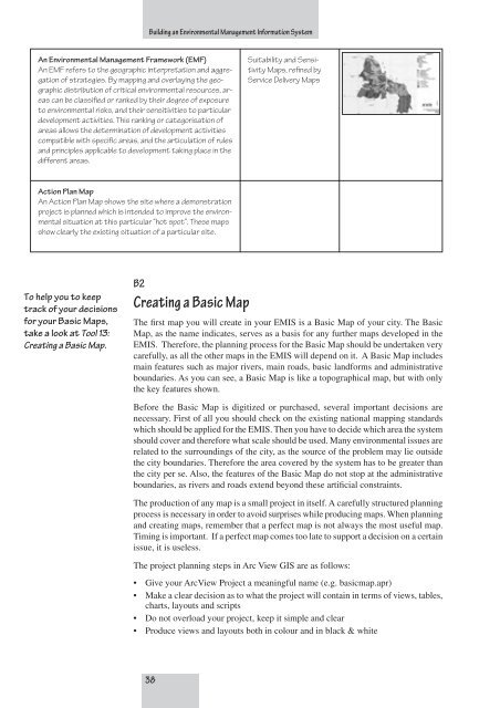
Suitability and Sensitivity<br />
Maps, refined by<br />
Service Delivery Maps<br />
The first map you will create in your <strong>EMIS</strong> is a Basic Map of your city. The Basic<br />
Map, as the name indicates, serves as a basis for any further maps developed in the<br />
<strong>EMIS</strong>. Therefore, the planning process for the Basic Map should be undertaken very<br />
carefully, as all the other maps in the <strong>EMIS</strong> will depend on it. A Basic Map includes<br />
main features such as major rivers, main roads, basic landforms and administrative<br />
boundaries. As you can see, a Basic Map is like a topographical map, but with only<br />
the key features shown.<br />
Before the Basic Map is digitized or purchased, several important decisions are<br />
necessary. First of all you should check on the existing national mapping standards<br />
which should be applied for the <strong>EMIS</strong>. Then you have to decide which area the system<br />
should cover and therefore what scale should be used. Many environmental issues are<br />
related to the surroundings of the city, as the source of the problem may lie outside<br />
the city boundaries. Therefore the area covered by the system has to be greater than<br />
the city per se. Also, the features of the Basic Map do not stop at the administrative<br />
boundaries, as rivers and roads extend beyond these artificial constraints.<br />
The production of any map is a small project in itself. A carefully structured planning<br />
process is necessary in order to avoid surprises while producing maps. When planning<br />
and creating maps, remember that a perfect map is not always the most useful map.<br />
Timing is important. If a perfect map comes too late to support a decision on a certain<br />
issue, it is useless.<br />
The project planning steps in Arc View GIS are as follows:<br />
• Give your ArcView Project a meaningful name (e.g. basicmap.apr)<br />
• Make a clear decision as to what the project will contain in terms of views, tables,<br />
charts, layouts and scripts<br />
• Do not overload your project, keep it simple and clear<br />
• Produce views and layouts both in colour and in black & white