

Brown and Chilton Candover - Basingstoke and Deane Borough ...
Brown and Chilton Candover - Basingstoke and Deane Borough ...
Brown and Chilton Candover - Basingstoke and Deane Borough ...

You also want an ePaper? Increase the reach of your titles
YUMPU automatically turns print PDFs into web optimized ePapers that Google loves.
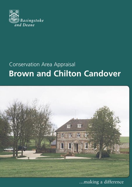
Conservation Area AppraisalConservation Area Appraisal<strong>Brown</strong> <strong>and</strong> <strong>Chilton</strong> C<strong>and</strong>over…making a difference<strong>Brown</strong> <strong>and</strong> <strong>Chilton</strong> C<strong>and</strong>over
Conservation Area AppraisalIntroductionThe <strong>Brown</strong> <strong>and</strong> <strong>Chilton</strong> C<strong>and</strong>over Conservation Area was designated in1981 by <strong>Basingstoke</strong> <strong>and</strong> <strong>Deane</strong> <strong>Borough</strong> Council in recognition of thespecial architectural <strong>and</strong> historic interest of the villages.Having designated the Conservation Area, the Local Authority has astatutory duty to ensure that those elements that form its particularcharacter, or appearance, should be preserved or enhanced, especiallywhen considering planning applications.Robeys Farm HouseIt is therefore necessary to define <strong>and</strong> analyse those qualities or elementsthat contribute to, or detract from, the special interest of the area <strong>and</strong>to assess how they combine to justify its designation as a ConservationArea. Such factors can include:• its historic development;• the contribution of individual or groups of buildings to thestreetscene <strong>and</strong> the spaces that surround them; <strong>and</strong>• the relationship of the built environment with the l<strong>and</strong>scape.They can also include the less tangible senses <strong>and</strong> experiences, suchas noise or smells, which can play a key part in forming the distinctivecharacter of an area.The Appraisal takes the form of written text <strong>and</strong> an Appraisal plan. Inboth respects every effort has been made to include or analyse thoseelements key to the special character of the area. Where buildings,structures or features have not been specifically highlighted it doesnot necessarily follow that they are of no visual or historic value to theConservation Area. The document is intended to be an overall framework<strong>and</strong> guide within which decisions can be made on a site-specific basis.This Appraisal of the <strong>Brown</strong> <strong>and</strong> <strong>Chilton</strong> C<strong>and</strong>over Conservation Areafollows its review in 2003 by <strong>Basingstoke</strong> <strong>and</strong> <strong>Deane</strong> <strong>Borough</strong> Council<strong>and</strong> explains what its designation means for those who live <strong>and</strong> work inthe area.This document was adopted as Supplementary Planning Guidance by the<strong>Borough</strong> of <strong>Basingstoke</strong> <strong>and</strong> <strong>Deane</strong> on 17 July 2003 <strong>and</strong> complements thepolicies of the <strong>Borough</strong> Local Plan (review).It has been subject to consultation with Councillors, the Parish Council <strong>and</strong>local amenity groups. A full list of consultees, copies of their responses,<strong>and</strong> details of the Council’s consideration of the issues raised during theconsultation period are available for inspection, by appointment, at the CivicOffices, during normal office hours.2<strong>Brown</strong> <strong>and</strong> <strong>Chilton</strong> C<strong>and</strong>over
Conservation Area AppraisalLocation <strong>and</strong> PopulationThe small villages of <strong>Brown</strong> C<strong>and</strong>over <strong>and</strong> <strong>Chilton</strong> C<strong>and</strong>over are situatedon the B3046, five miles to the north of Alresford, with <strong>Basingstoke</strong> sevenmiles to the north. The villages are half a mile apart, <strong>and</strong> lie within thebroad chalk C<strong>and</strong>over Valley.The population of the Conservation Area in 1998 was approximately 111(projection based on the Hampshire County Council Planning DepartmentSmall Area Population Forecasts 1995).Historic DevelopmentSettlement OriginsThe name C<strong>and</strong>over derives from ‘Caniodubri’, meaning ‘beautifulwaters’, after the stream that runs along the valley floor. <strong>Brown</strong> originatesfrom the local Brune family, from the 15th century, <strong>and</strong> <strong>Chilton</strong> is thoughtto derive from the old English word ‘cild’, meaning ‘young retainer’.Corner Cottage on the corner of the B3046<strong>and</strong> Gunners LaneThe Manor of <strong>Brown</strong> C<strong>and</strong>over belonged to the Crown until the 10th century,when it was granted to Hyde Abbey in Winchester, by Edward the Elder. Itthen passed to Sir William Paulet, at the Dissolution, <strong>and</strong> later returned to thefamily in the 17th century, following other sales. At the beginning of the 18thcentury, the manor was passed to the Worsley family, of the Isle of Wight.The Manor of <strong>Chilton</strong> C<strong>and</strong>over was held by Richere de Audley for theBishop of Winchester, at the time of the Domesday Survey. It passed tothe Bayntun family in the 14th century, <strong>and</strong> in 1562 was sold to JohnFysher, who oversaw the depopulation of the village. The manor changedh<strong>and</strong>s frequently during the 16th to 18th centuries. In 1818, it wasbought by Lord Ashburton, in whose family it remained until the 1930s,when it passed to the present owners.Settlement DevelopmentThe two villages have developed around the manor buildings <strong>and</strong>churches, <strong>and</strong> then along the main road. <strong>Brown</strong> C<strong>and</strong>over has grownaround St Peter’s Church, C<strong>and</strong>over House <strong>and</strong> three large farms. The firstchurch in the area, which was destroyed by fire in the 16th century, waslocated half a mile from the present church. A map of the village of 1588shows lines of plots extended along both sides of the road. They run fromthe present church site down to the l<strong>and</strong> at the fork in the road.At <strong>Chilton</strong> C<strong>and</strong>over, the shrunken village was built around the former StNicholas Church, sited on the south-east facing side of the valley. ManorFarm lies close to the former church, <strong>and</strong> earthworks mark the site of theearlier settlement. There has been little development in the village since the18th century. Both villages grew within a predominantly agricultural area.<strong>Brown</strong> <strong>and</strong> <strong>Chilton</strong> C<strong>and</strong>over 3
Conservation Area AppraisalAn Appraisal of the Conservation AreaAn OverviewThe Appraisal plan identifies those buildings, views, <strong>and</strong> key features thatare considered essential to the special character or appearance of theConservation Area. In addition to listed buildings it also includes unlistedbuildings of particular individual or group value, which are indicatedon the plan as notable. This is not to undermine the value of otherunmarked buildings or structures that reflect the historic development ofthe village without detracting from its special qualities.10 <strong>and</strong> 12 on the corner of the B3046<strong>and</strong> Dundridge LaneIndividual hedgerows have not been included on the Appraisal plan.However, their contribution to the character of the Conservation Areashould not be underestimated <strong>and</strong> their significance is implicit in theAppraisal.The two settlements within the Conservation Area share somecharacteristics, but are distinctive in many other respects. Both are essentiallyrural in character, with buildings lining the main road along the C<strong>and</strong>overValley. Both contain a variety of building types <strong>and</strong> styles <strong>and</strong> other specialfeatures, such as open spaces, topography <strong>and</strong> formal l<strong>and</strong>scapes.May CottageThe special interest of <strong>Brown</strong> C<strong>and</strong>over lies in the strong linear space,along which are several significant buildings <strong>and</strong> inter-related spaces.Large farm complexes <strong>and</strong> polite buildings still predominate, <strong>and</strong> arelinked by a series of important public <strong>and</strong> private spaces. Most notable ofthese are the setting to C<strong>and</strong>over House, <strong>and</strong> the sports field in front ofSt Peter’s Church.<strong>Chilton</strong> C<strong>and</strong>over contains fewer buildings <strong>and</strong> is, therefore, of specialinterest more because of the topography <strong>and</strong> position of individualbuildings in the l<strong>and</strong>scape. The main road winds through this part of theConservation Area, creating short views around its bends <strong>and</strong> anticipationof buildings <strong>and</strong> features beyond. The earthworks <strong>and</strong> former churchon the hill rising behind Manor Farmhouse are particularly distinctivefeatures.This Appraisal divides the Conservation Area into two sub-areas thatcharacterise the distinctive qualities of <strong>Brown</strong> C<strong>and</strong>over (Area 1) <strong>and</strong><strong>Chilton</strong> C<strong>and</strong>over (Area 2).Built FormThere are 18 buildings located within <strong>Brown</strong> <strong>and</strong> <strong>Chilton</strong> C<strong>and</strong>overConservation Area included on the Statutory List of Buildings of SpecialArchitectural or Historic Interest. They all listed as being of local orregional special interest (Grade II), apart from the St Peter’s Church in<strong>Brown</strong> C<strong>and</strong>over, which is of national importance (Grade II*).4<strong>Brown</strong> <strong>and</strong> <strong>Chilton</strong> C<strong>and</strong>over
Conservation Area AppraisalThere are various building types, mainly dating between the 16th <strong>and</strong>19th centuries dispersed throughout the villages. Often located at keyvisual points in the streetscene, they make a significant contributionto the special qualities of the Conservation Area. Some older buildingshave been altered over successive periods, to accommodate changesin their use or contemporary architectural fashions. The re-fronting inbrick of existing timber-framed buildings was particularly common in the18th century. Another popular alteration was the insertion of carefullyarranged sash windows to produce a polite elevation. Other buildingshave retained more completely their vernacular form <strong>and</strong> materials.The villages are predominantly residential in character, although largeagricultural buildings dominate part of <strong>Brown</strong> C<strong>and</strong>over. The large farmcomplexes at Moth Farm <strong>and</strong> Robey’s Farm are prominent features alongthe main road. Manor Farm, at <strong>Chilton</strong> C<strong>and</strong>over, occupies a similarlyprominent location. They all provide clear reminders of the importanceof the agricultural industry in the purpose <strong>and</strong> development of theConservation Area, as well as special intrinsic architectural interest.Old School BuildingsThere are also small cohesive groups of buildings. Examples are the 19thcentury brick <strong>and</strong> flint faced cottages (Nos 39-46, on the B3046) <strong>and</strong> theOld School buildings in <strong>Brown</strong> C<strong>and</strong>over. Generally, there is little patternof cohesion in the built form of the Conservation Area.There are several unlisted buildings that contribute positively to thespecial character of the Conservation Area. These buildings date mainlyfrom the 19th <strong>and</strong> early 20th centuries <strong>and</strong> are scattered among thelisted buildings representing the expansion of the village. They arepredominantly constructed of vernacular materials <strong>and</strong> strongly reinforcethe street pattern of the new village. Some possess features of particularinterest, however it is their group value, in association with adjacentlisted buildings, that significantly contributes to the overall special interestof the Conservation Area.View across sports fields toSt Peter’s ChurchKey Individual BuildingsArea 1 - <strong>Brown</strong> C<strong>and</strong>overThe medieval St Peter’s Church was demolished in 1844. The presentbuilding (Grade II*), dating from 1845, was designed by Thomas HenryWyatt in a Gothic Revival style. It has an aisleless nave, a chancel, <strong>and</strong> awestern tower with a lead broach spire. The building is constructed ofsquared flintwork with stone dressings to windows, <strong>and</strong> has a red claytile roof. The church, which sits in a small churchyard above the sportsground below, makes an important contribution to the character of thearea. It dominates the sports ground <strong>and</strong> is visible along the main road.<strong>Brown</strong> <strong>and</strong> <strong>Chilton</strong> C<strong>and</strong>over 5
Conservation Area AppraisalC<strong>and</strong>over House (Grade II) dates from the 18th century <strong>and</strong> has asymmetrical east front with sash windows. Constructed of red brickwalling in Flemish bond, it has rubbed flat arches over the windowopenings <strong>and</strong> a hipped slate roof with a brick dentil course at theeaves. This is a large, attractive gr<strong>and</strong> house within its original parkl<strong>and</strong>setting, complete with 19th century stables, outbuildings <strong>and</strong> a ParkLodge (all also Grade II listed). Like the church opposite, the house<strong>and</strong> its group of outbuildings sit well back from the main road, butdominate the surrounding formal l<strong>and</strong>scaped space.Peg’s Cottage on Gunners LaneBoundary wall of former St Nicholas’ Churchfrom the southTo the north of the main road st<strong>and</strong> three further listed buildings.Mulberry Cottage (Grade II), dating from the 18th century with 20thcentury alterations, is of one-storey with a thatched roof. ManorFarmhouse (Grade II) dates from the 17th century, with 18th <strong>and</strong> 20thcentury alterations. The L-shaped building is constructed of red brick inEnglish bond, except for the west elevation, which is of timber-framewith herring-bone brickwork infill. It is concealed by a high brick wallbut is important to the historical development of the village. However,its granary <strong>and</strong> shed (both Grade II) are visible across the fields, fromthe main road.Moth House (Grade II) dates from the 18th century, with 19th centuryalterations. It is a two-storey building with a steep hipped slate roof,rendered walling, sash windows <strong>and</strong> two large chimney stacks. A highgarden wall, panel fence <strong>and</strong> beech hedge allows only glimpses of thehouse from the road.Peg’s Cottage (Grade II) dating from the 18th century, has painted brickwalls <strong>and</strong> a thatched roof.These four dwellings demonstrate the difference in wealth to be foundin this village. The influence this had on the type <strong>and</strong> construction ofthe housing throughout the historical development of <strong>Brown</strong> C<strong>and</strong>overis also apparent.<strong>Chilton</strong> House <strong>and</strong> buildings fromManor FarmArea 2 - <strong>Chilton</strong> C<strong>and</strong>overThere are five listed buildings in this sub-area. The remains of StNicholas Church (Grade II) are set on the northern hillside within theearthworks. The structure dates from around 1100 but the church,above ground, was largely demolished in 1876. The remains of thischurch (only the flint boundary wall is now visible from a distance) arethe only surviving remnants of this medieval deserted village.South-east of these remains is Manor Farmhouse (Grade II), datingfrom the 17th century, with 18th <strong>and</strong> 19th century alterations. Thebuilding is constructed of colour washed brick, with some flint, <strong>and</strong> hasa steeply-pitched, hipped slate roof. There is some evidence of timberframeto the rear, indicating that the original building may have hadmore of this type of construction. A high, red brick garden wall extends6<strong>Brown</strong> <strong>and</strong> <strong>Chilton</strong> C<strong>and</strong>over
Conservation Area Appraisala short distance on the south side of the house, <strong>and</strong> is included withinthe curtilage of the listed building. The farmhouse is prominent fromthe sweep in the main road.Across the valley lies <strong>Chilton</strong> House (Grade II), formerly The Old Rectory, <strong>and</strong>outbuildings. The house dates from the 18th century <strong>and</strong> has a symmetricalfront with sash <strong>and</strong> Venetian windows. The building is constructed ofpainted brickwork <strong>and</strong> a red clay tile roof. It lies on the sweep of the mainroad, <strong>and</strong> is revealed from behind a group of mature trees to the north,<strong>and</strong> the tall brick <strong>and</strong> flint wall to the south. The brick <strong>and</strong> flint outbuildingsto the south-west of the house, together with the boundary wall, form acohesive group. This adds visual interest to the view along the main road onthe southern approach to the house.<strong>Chilton</strong> Manor viewed from Dundridge LaneIn the south-west of the Conservation Area, on Dundridge Lane, lies<strong>Chilton</strong> Cottage (Grade II), which dates from the 17th century with18th century alterations. It is a long narrow timber-framed house, the centrepart being the oldest, with later outshots to either side. The timber-framehas red brick infill, <strong>and</strong> the building has a thatched roof with eyebrows <strong>and</strong>small dormers.In the north of the Conservation Area is <strong>Chilton</strong> Manor, a largeimpressive building, built in 1937, which looks out across the valley <strong>and</strong>earthworks. Constructed of red brick with a red clay tile roof, it has asymmetrical façade with large sash windows. Adjacent is a small lodgehouse, dating from 1935, with a symmetrical façade, red brickwork <strong>and</strong>a red clay tile roof. This was occupied by the owner of the manor beforethe large house was completed.Moth Farm House <strong>and</strong> BarnIn <strong>Chilton</strong> C<strong>and</strong>over, there are other buildings of visual interest alongthe main east/west road <strong>and</strong> in the north of the Conservation Area. Tothe east is a converted complex of farm buildings, remaining within atraditional, unspoilt rural setting.There are two attractive late 19th century estate cottages in the west ofthe Conservation Area. These are constructed of flint, with brick dressings<strong>and</strong> clay tile roofs. They form an important grouping along with the 20thcentruy buildings in this area. This contributes to the special character of theConservation Area <strong>and</strong> demonstrates later development in the village.Farm buildings, Robey’s Farm<strong>Brown</strong> <strong>and</strong> <strong>Chilton</strong> C<strong>and</strong>over 7
Conservation Area AppraisalSignificant Groups of BuildingsAn important feature of <strong>Brown</strong> C<strong>and</strong>over is the contribution made to theoverall character of the village by small groups of buildings of similar form<strong>and</strong> style.Nos 29 to 32 on the B3046View across Manor Farm <strong>and</strong> <strong>Chilton</strong> Housefrom St Nicholas ChurchMoth Farm is a notable group of farm <strong>and</strong> ancillary buildings centred ona large, attractive 16th century farmhouse (Grade II). It is constructed ofan upper timber-framed storey resting on a flint <strong>and</strong> brick wall, with ared clay tile roof. This building is located within its farmyard setting, withsurrounding 18th <strong>and</strong> 19th century farm buildings. These include a cartshed, constructed of a flint <strong>and</strong> brick wall with arched braced posts on theopen side, <strong>and</strong> a timber-framed granary resting on eight staddle stones(both Grade II). An extensive cob wall st<strong>and</strong>s to the west of the farmcomplex, enclosing a walled garden. The farmhouse is prominent on themain road <strong>and</strong>, together with the church, helps define the sports groundopposite.Robey’s Farm House (Grade II) is a large, polite building set in a large,open plot off the main road. The house is constructed of flint with brickdressings, has a red clay tile roof, <strong>and</strong> a large brick porch on the frontelevation. This building is set back from the road <strong>and</strong> adjoins the farmcomplex it serves. This group includes two very large buildings <strong>and</strong> a lower,long range of buildings that dominate the space in front adjoining the mainroad.The group of buildings immediately east of Robey’s Farm House is also ofnote. Nos 29-32, on the B3046, comprise a pair of large, detached red brick<strong>and</strong> slate roofed buildings with tall chimney stacks <strong>and</strong> a vernacular,white-painted brick cottage with large tiled roof. The latter, CornerCottage, occupies an important place in the streetscene. It punctuatesthe long view east, along the main road, <strong>and</strong> defines the junction withGunners Lane.To the north of the sports ground, in front of the church, are the 19thcentury Old School House <strong>and</strong> school buildings. These are constructedof flint with brick dressings <strong>and</strong> red clay tile roofs, with large chimneystacks. They are also important because of the role they have played inthe village community.On either side of the main road to the west of Robey’s Farm House is afurther group of buildings of interest. These houses are all small cottagesof similar construction, with flint walls, red brick dressings <strong>and</strong> slateroofing in the prevalent style. On Bryces Lane, Thornydown Cottage <strong>and</strong>Willowbrook Cottage (both of 17th century origin) help form a cluster ofsmaller scale, domestic buildings, that contrast with the more formal, <strong>and</strong>larger, farm <strong>and</strong> estate buildings further along the main road.8<strong>Brown</strong> <strong>and</strong> <strong>Chilton</strong> C<strong>and</strong>over
Conservation Area AppraisalIn <strong>Chilton</strong> C<strong>and</strong>over, the key buildings are isolated in the l<strong>and</strong>scaperather than lying in groups. There are, however, important visual linksbetween them, such as the relationship between <strong>Chilton</strong> House <strong>and</strong>Manor Farmhouse.The Character <strong>and</strong> Importance of Public <strong>and</strong>Private SpacesThe open spaces in the Conservation Area are extremely important, asthey help define the development of the two villages.In <strong>Brown</strong> C<strong>and</strong>over, the open space around C<strong>and</strong>over House allows thebuilding to retain its planned parkl<strong>and</strong> setting. Of similar importance isthe sports ground. This provides a valuable setting to the church, <strong>and</strong>to Moth Farm, the spaces in front of Robey’s Farm House, <strong>and</strong> the largefarm buildings immediately to its south.View north-east along the main road toManor FarmTo the north <strong>and</strong> south of the main road, open spaces enable extensiveviews across the valley <strong>and</strong> surrounding countryside, <strong>and</strong> allow ManorFarm to retain its rural context in the l<strong>and</strong>scape. In the west of theConservation Area, between the main road <strong>and</strong> Bryces Lane to the north,is an important area of river <strong>and</strong> marsh habitat.The most important open space in the village of <strong>Chilton</strong> C<strong>and</strong>over is thecentral area containing the earthworks of the deserted medieval village.This area comprises the historic origins of the present village, <strong>and</strong> theopenness conveys the size of the area. This open space allows extensiveviews across the immediate village <strong>and</strong> west, across the C<strong>and</strong>over Valley.To the east of Manor Farm is a large open area, including the convertedfarm buildings. This enables these complexes to remain within theirtraditional context in the l<strong>and</strong>scape.Building MaterialsIn <strong>Brown</strong> C<strong>and</strong>over, the prevalent traditional building materials are redbrick, flint with red brick dressings, <strong>and</strong> some timber-frame. Roofingmaterials include slate, red clay tile <strong>and</strong> thatch, while many buildingshave large chimney stacks.The prevalent traditional building materials in <strong>Chilton</strong> C<strong>and</strong>over includered brick, timber-frame with brick infill, <strong>and</strong> flint with brick dressings.Roofing materials include red clay tiles, thatch <strong>and</strong> slate. Large chimneystacks, central or to one end, are found on all the older houses in thevillage.<strong>Brown</strong> <strong>and</strong> <strong>Chilton</strong> C<strong>and</strong>over 9
Conservation Area AppraisalGiven the domestic scale <strong>and</strong> simple vernacular architecture of thebuildings in the Conservation Area, historic joinery (such as sash orcasement windows, doors <strong>and</strong> door hoods) are often the features thatdefine the appearance of properties. Although some buildings have beenmodernised, the use <strong>and</strong> overall effect of inappropriate replacementwindows <strong>and</strong> doors is limited.C<strong>and</strong>over House from the B3046View down the avenue of tree south-eastof St Nicholas ChurchOther Features of Architectural or HistoricInterestA special feature of both villages is the use of brick, flint <strong>and</strong> chalk cobin extensive boundary walls. Most notable, given its prominence in thestreetscene or the l<strong>and</strong>scape, is the long, tall brick boundary wall toManor Farm in <strong>Brown</strong> C<strong>and</strong>over. This frames the long view east towardsthe church, <strong>and</strong> the chalk cob walls to the south-east of Moth Farm. Thelow retaining wall separating the churchyard from the sports ground isprominent when viewed across this space, <strong>and</strong> helps define the change inlevels.There are also several older walls in <strong>Chilton</strong> C<strong>and</strong>over, including thegarden walls to Manor Farmhouse <strong>and</strong> <strong>Chilton</strong> House. An attractive ironpark fence, now a rare survival in the countryside, surrounds some of theManor farml<strong>and</strong> north of the main road.10<strong>Brown</strong> <strong>and</strong> <strong>Chilton</strong> C<strong>and</strong>over
Conservation Area AppraisalGreen Spaces, Trees, Hedges <strong>and</strong> otherNatural or Cultivated FeaturesThe green spaces in these Conservation Areas are very important. Theyillustrate the development of the settlements, as well as providing vistasthroughout both villages, for example the view up to Thorneydown atthe western entrance to <strong>Brown</strong> C<strong>and</strong>over.The tree cover in <strong>Brown</strong> C<strong>and</strong>over is fairly sparse with broad-leavedtrees predominant. Limes, in particular, appear to be quite numerous<strong>and</strong> yews, a feature of this part of the C<strong>and</strong>over Valley, are also wellrepresented. There is a small plantation of white willows, between theB3046 <strong>and</strong> Bryces Lane, <strong>and</strong> several, more mature specimens, adjacent toMoth Farm Cottages. An avenue of young lime trees leads to C<strong>and</strong>overHouse. The verges are generally hedge-lined.Glimpse of Moth House from the B3046The isolated buildings in <strong>Chilton</strong> C<strong>and</strong>over are set in quite extensive <strong>and</strong>well-kept gardens, enhancing the rural character of the ConservationArea. The tree cover is mainly broad-leaved, with many limes. <strong>Chilton</strong>House has an important group of mature beech, horse chestnut <strong>and</strong>sycamores, a fine copper beech <strong>and</strong> a young Indian bean tree. There isa fine avenue of yews leading from the B3046 up to <strong>Chilton</strong> Down, <strong>and</strong>also several in gardens in the village. Dundridge Lane running to thenorth is hedge-lined, with many hedgerow trees in evidence. Howeverthe main east/west road has few verge hedges, allowing extensive viewsthroughout the Conservation Area.The Setting of the Conservation AreaThe Conservation Area of <strong>Brown</strong> <strong>and</strong> <strong>Chilton</strong> C<strong>and</strong>over is dominated byopen arable l<strong>and</strong>. It has large fields, divided by well-managed hedges,with few trees or copses. The settlements in this broad chalk valley areaccentuated by a higher degree of tree cover <strong>and</strong> enclosure.The Conservation Area boundary includes extensive areas of opencountryside. These provide the immediate setting to the groups ofbuildings <strong>and</strong> large individual buildings along the valley floor. The fieldsbeyond the boundary complement these open areas, providing a moreextensive rural setting for the villages.<strong>Brown</strong> <strong>and</strong> <strong>Chilton</strong> C<strong>and</strong>over 11
Conservation Area AppraisalAreas of Archaeological SignificanceEvery settlement contains within it archaeological evidence of its origins<strong>and</strong> development, of the economy <strong>and</strong> industry of the community <strong>and</strong> ofthe lives <strong>and</strong> life-styles of past inhabitants.Lock’s Barn from the B3046It is in the Areas of High Archaeological Potential (AHAP) that it is mostlikely that such archaeological remains will be encountered. Wherea development is proposed, the impact that it might have on theseremains is a material consideration within the planning process. This mayoccasionally result in the need for archaeological recording in the case ofsome developments.An Area of High Archaeological Importance (AHAI) covers the buildingline on the southern side of the main road through <strong>Brown</strong> C<strong>and</strong>over. Italso includes the northern side of the road, from the junction with GravelClose in the north-east, to the junction with Gunners Lane near Robey’sFarm. Along the southern side of the road there is some evidence thatcertain areas of the street frontage may have been occupied. Howevermost of this had disappeared by the late 16th century.It is possible that <strong>Brown</strong> C<strong>and</strong>over is a deserted medieval village. Thismay have been caused by emparking (carving out parkl<strong>and</strong> from existingwoodl<strong>and</strong> mainly to create deer parks in the middle ages) but it is notclear how much of the 16th century village was destroyed. Evidence ofearthworks in several areas indicates this former, much more intense,settlement. The AHAI continues to the south-east to include threebarrows on the southern boundary of the village. The large barrowadjacent to the road is a Scheduled Monument, <strong>and</strong> is regarded as a siteof national importance.An Area of Archaeological Importance (AAI) covers the l<strong>and</strong> behind theAHAI, as evidence may survive to show the division of the l<strong>and</strong> intostrips or plots. The site of the former Parsonage at Robey’s Farm also fallswithin the AAI, but archaeological evidence may have been damaged bythe construction of farm buildings. The AAI continues south-west alongthe northern side of Bryces Lane, where evidence of less intensive 16thcentury settlement may survive.Much of <strong>Chilton</strong> C<strong>and</strong>over lies in a large AHAI covering the remains ofthe deserted area of the village. This extends to the south of the mainnorth-east/south-west road through the settlement. It also includesthe remains of the church, Manor Farm <strong>and</strong> <strong>Chilton</strong> Manor. Two AAIscover the north-east <strong>and</strong> south-west of the village. These AAIs coverearthworks that exist in these areas, <strong>and</strong> may be evidence of moreintense settlement between the present day village centres in the valley.12<strong>Brown</strong> <strong>and</strong> <strong>Chilton</strong> C<strong>and</strong>over
Conservation Area AppraisalConservation Area Planning ControlsThe following controls apply within the Conservation Area in addition tonormal planning controls:• Conservation Area Consent is normally required for the demolitionof buildings or structures over a certain size withina Conservation Area.• The Council must be given six weeks notice of any intentionto undertake works to, cut down or uproot any trees over a certainsize in the Conservation Area.• Planning applications which, in the opinion of the <strong>Borough</strong> Council,would affect the special character of the Conservation Area must beadvertised <strong>and</strong> the opportunity given for public comment. This mayinclude proposals outside the Conservation Area which neverthelessaffect its setting.Statutory policies relating to Conservation Areas <strong>and</strong> listed buildingsare set out in the adopted <strong>Basingstoke</strong> <strong>and</strong> <strong>Deane</strong> <strong>Borough</strong> Local Plan.These policies reflect the statutory duty on the Local Planning Authorityto have regard to the preservation of historic buildings or their setting,<strong>and</strong> to the enhancement of areas designated as being of special interest.These policies seek to ensure that particular attention will be paid tothe scale, height, form, materials <strong>and</strong> detailing of proposals includingboundary treatments <strong>and</strong> other features of note. In order to consider theimplications of development <strong>and</strong> given the detail required, the <strong>Borough</strong>Council will normally require proposals within the Conservation Areato be submitted in the form of a full, <strong>and</strong> not outline, application. The<strong>Borough</strong> Council’s conservation officers are available for advice <strong>and</strong>information on all matters relating to development proposals in theConservation Area.GrantsThe <strong>Borough</strong> Council provides grants for various types of work. Theseinclude Historic Buildings Grants, Environment <strong>and</strong> Regeneration Grants,<strong>and</strong> Village <strong>and</strong> Community Hall Grants. Leaflets are available explainingthe purpose <strong>and</strong> criteria for each grant <strong>and</strong> an approach to the Council isrecommended for further information on any grant.<strong>Brown</strong> <strong>and</strong> <strong>Chilton</strong> C<strong>and</strong>over 13
Conservation Area Appraisal - <strong>Brown</strong> <strong>and</strong> <strong>Chilton</strong> C<strong>and</strong>over Historical OS Map14<strong>Brown</strong> <strong>and</strong> <strong>Chilton</strong> C<strong>and</strong>over
Conservation Area Appraisal - <strong>Brown</strong> <strong>and</strong> <strong>Chilton</strong> C<strong>and</strong>over Tithe Map<strong>Brown</strong> <strong>and</strong> <strong>Chilton</strong> C<strong>and</strong>over 15
Conservation Area Appraisal - <strong>Brown</strong> C<strong>and</strong>over Archaeological MapCourtesy of Hampshire County CouncilCourtesy of Hampshire County Council16<strong>Brown</strong> <strong>and</strong> <strong>Chilton</strong> C<strong>and</strong>over
Conservation Area Appraisal - <strong>Chilton</strong> C<strong>and</strong>over Archaeological MaprleCourtesy of Hampshire County Council<strong>Brown</strong> <strong>and</strong> <strong>Chilton</strong> C<strong>and</strong>over17
Conservation Area Appraisal<strong>Brown</strong> <strong>and</strong> <strong>Chilton</strong> C<strong>and</strong>over…making a difference<strong>Basingstoke</strong> <strong>and</strong> <strong>Deane</strong> <strong>Borough</strong> CouncilCivic Offices London Road <strong>Basingstoke</strong> Hants RG21 4AHTelephone 01256 844844 Fax 01256 845200www.basingstoke.gov.ukProduced by Graphics/Corporate Information Division April 20045162


