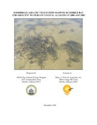
Wolf Bay Plan Final - Mobile Bay National Estuary Program
Wolf Bay Plan Final - Mobile Bay National Estuary Program
Wolf Bay Plan Final - Mobile Bay National Estuary Program
- No tags were found...

You also want an ePaper? Increase the reach of your titles
YUMPU automatically turns print PDFs into web optimized ePapers that Google loves.
that frees up tax dollars into spendable income without causing any disruption in lifestyle. Taxes,insurance, and normal maintenance remain ones responsibility.c. Gift by WillA charitable contribution of a conservation easement or gift of property can be made by will. Thefull value of the gift is deductible from estate taxes.There is a current move, primarily on behalf of media and civic groups, to promote constitutionalreform. A large portion of this movement is to do away with the current property tax assessmentwhich is based on current use and set tax rate based on potential use. Such a change could leavemany farmers unable to pay taxes and would increase the potential for conversion to urbandevelopment. The rules already require rollback taxes for the previous three years. Estate taxproblems also exist because many heirs are left farmland and sell because they can’t pay thetaxes.5. Citizen InvolvementThe <strong>Wolf</strong> <strong>Bay</strong> Watershed Project (WBWW) has developed a variety of education and publicparticipation programs to encourage stakeholders to take the steps necessary to protect theirwatershed. WBWW hosts an active volunteer water quality monitoring program. <strong>Program</strong>s,such as the Clean Water Guardian <strong>Program</strong> and Backyard Wildlife Habitat, are also recommendedto include a variety of audiences, namely agricultural interests, builders and contractors, educators,students, homeowners and elected officials.6. Baldwin County Wetland Conservation <strong>Plan</strong> (BCWCP)Baldwin County estimates 470 square miles of wetlands exist in Baldwin County. In 1995, BaldwinCounty began mapping and assessing wetlands as part of EPA’s Advance Identification (ADID)of wetlands program. The ADID project mapped portions of south Baldwin County based on its“suitability for fill.” In 1999, the Baldwin County Commission developed the Baldwin CountyWetland Conservation <strong>Program</strong> to:1. Further develop a Wetlands Protection Overlay District (WPOD) and incorporate into theBaldwin County <strong>Plan</strong>ning and Zoning Regulations.2. Develop a Geographic Information System (GIS) wetlands data layer containing informationon wetland locations, types, and functional capacity for wetlands in Baldwin County.3. Research, design, and implement wetland restoration/construction projects at selected sitesthroughout the County.4. Develop a wetlands education/outreach program for area stakeholders.29