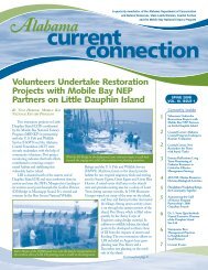
Wolf Bay Plan Final - Mobile Bay National Estuary Program
Wolf Bay Plan Final - Mobile Bay National Estuary Program
Wolf Bay Plan Final - Mobile Bay National Estuary Program
- No tags were found...

Create successful ePaper yourself
Turn your PDF publications into a flip-book with our unique Google optimized e-Paper software.
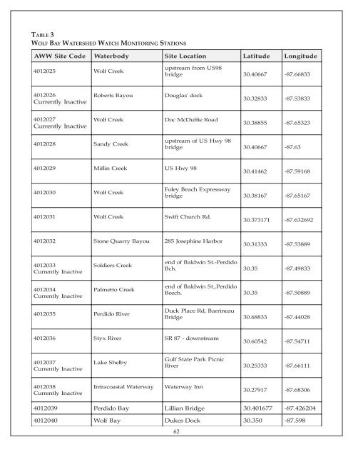
TABLE 3WOLF BAY WATERSHED WATCH MONITORING STATIONSAWW SiteCodeWaterbodySiteLocationLatitudeLongitude4012025<strong>Wolf</strong> Creekupstream from US98bridge30.40667-87.668334012026Currently InactiveRoberts<strong>Bay</strong>ouDouglas' dock30.32833-87.538334012027Currently Inactive<strong>Wolf</strong>CreekDoc McDuffie Road30.38855-87.653234012028Sandy Creekupstream of US Hwy 98bridge30.40667-87.634012029Miflin CreekUS Hwy 9830.41462-87.591684012030<strong>Wolf</strong> CreekFoley Beach Expresswaybridge30.38167-87.651674012031W olf CreekSwift Church Rd.30.373171-87.6326924012032StoneQuarry <strong>Bay</strong>ou285 Josephine Harbor30.31333-87.538894012033Currently InactiveSoldiers Creekend of Baldwin St.-PerdidoBch.30.35-87.498334012034Currently InactivePalmetto Creekend of Baldwin St.,PerdidoBeech.30.35-87.508894012035Perdido Rive rDuck Place Rd, BarrineauBridge30.68833-87.440284012036StyxRive rSR 87 - downstrea m30.60542-87.547114012037Currently InactiveLake ShelbyGulf State Park PicnicRiver30.25333-87.661114012038Currently InactiveIntracoastalWaterwayWaterway Inn30.27917-87.683064012039Perdido <strong>Bay</strong>4012040<strong>Wolf</strong><strong>Bay</strong>Lillian Bridge30.401677-87.426204DukesDock30.350-87.59862