Westerly - State of Rhode Island: Division of Planning
Westerly - State of Rhode Island: Division of Planning
Westerly - State of Rhode Island: Division of Planning
You also want an ePaper? Increase the reach of your titles
YUMPU automatically turns print PDFs into web optimized ePapers that Google loves.
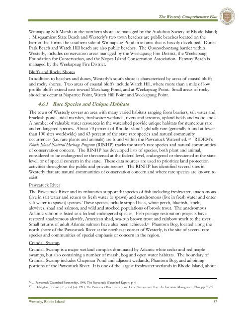
The <strong>Westerly</strong> Comprehensive PlanWinnapaug Salt Marsh on the northern shore are managed by the Audubon Society <strong>of</strong> <strong>Rhode</strong> <strong>Island</strong>;. Misquamicut <strong>State</strong> Beach and <strong>Westerly</strong>’s two town beaches are public beaches located on thebarrier that forms the southern side <strong>of</strong> Winnapaug Pond in an area that is heavily developed. DunesPark Beach and Watch Hill beach are also public beaches. The Quonochontaug barrier within<strong>Westerly</strong>, includes conservation areas managed by the Weekapaug Fire District, the WeekapaugFoundation for Conservation, and the Nopes <strong>Island</strong> Conservation Association. Fenway Beach ismanaged by the Weekapaug Fire District.Bluffs and Rocky ShoresIn addition to beaches and dunes, <strong>Westerly</strong>’s south shore is characterized by areas <strong>of</strong> coastal bluffsand rocky shores. Two areas <strong>of</strong> coastal bluffs include Watch Hill, where more than a mile <strong>of</strong> lowpr<strong>of</strong>ile bluffs extend east toward Maschaug Pond, and at Weekapaug Point. Small areas <strong>of</strong> rockyshoreline occur at Napatree Point, Watch Hill Point and Weekapaug Point.4.6.1 Rare Species and Unique HabitatsThe town <strong>of</strong> <strong>Westerly</strong> covers an area with many varied habitats ranging from barriers, salt water andbrackish ponds, tidal marshes, freshwater wetlands, rivers and streams, upland fields and woodlands.A number <strong>of</strong> valuable water resources in the watershed provide unique habitats for numerous rareand endangered species. About 70 percent <strong>of</strong> <strong>Rhode</strong> <strong>Island</strong>’s globally rare (generally found at fewerthan 100 sites worldwide) and 63 percent <strong>of</strong> the state rare species and natural communityoccurrences (i.e. rare plants and animals) are found within the Pawcatuck Watershed. 42 RIDEM’s<strong>Rhode</strong> <strong>Island</strong> Natural Heritage Program (RINHP) tracks the state’s rare species and natural communities<strong>of</strong> conservation concern. The RINHP has developed lists <strong>of</strong> species, both plant and animal,considered to be endangered or threatened at the federal level, endangered or threatened at the statelevel, or <strong>of</strong> special concern in the state. These data sources are used to prioritize land protectionactivities throughout the public and private sectors. The RINHP has identified several sites in<strong>Westerly</strong> that are natural communities <strong>of</strong> conservation concern and where rare species are known toexist.Pawcatuck RiverThe Pawcatuck River and its tributaries support 40 species <strong>of</strong> fish including freshwater, anadromous(live in salt water and return to fresh water to spawn) and catadromous (live in fresh water and entersalt water to spawn) species. These species include striped bass, white perch, bluefish, smelt,alewives, shad and salmon, and wild and stocked populations <strong>of</strong> brook trout. The anadromousAtlantic salmon is listed as a federal endangered species. Fish passage restoration projects haverestored anadromous alewife, American shad, sea-run brown trout and rainbow smelt to the river.Small returns <strong>of</strong> adult Atlantic salmon have also been achieved. 43 Phantom Bog, located along thenorth shore <strong>of</strong> the Pawcatuck River at the northeast corner <strong>of</strong> <strong>Westerly</strong>, is the site <strong>of</strong> several rarespecies and communities <strong>of</strong> special emphasis or concern in the region.Crandall SwampCrandall Swamp is a major wetland complex dominated by Atlantic white cedar and red mapleswamps, but also containing a number <strong>of</strong> marsh, bog and open water habitats. The boundary <strong>of</strong>Crandall Swamp includes Chapman Pond and adjacent wetlands, Phantom Bog, and adjoiningportions <strong>of</strong> the Pawcatuck River. It is one <strong>of</strong> the largest freshwater wetlands in <strong>Rhode</strong> <strong>Island</strong>, about42 …Pawcatuck Watershed Partnership, 1998, The Pawcatuck Watershed Report, p. 443 …Dillingham, Timothy P., et al, July 1993, The Pawcatuck River Estuary and Little Narragansett Bay: An Interstate Management Plan, pp. 70-72<strong>Westerly</strong>, <strong>Rhode</strong> <strong>Island</strong> 57


