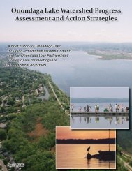
Habitat Plan 2 - Onondaga Lake Partnership
Habitat Plan 2 - Onondaga Lake Partnership
Habitat Plan 2 - Onondaga Lake Partnership

You also want an ePaper? Increase the reach of your titles
YUMPU automatically turns print PDFs into web optimized ePapers that Google loves.
DRAFTFreshwater Wetlands Classification System) freshwater palustrinewetland. A jurisdictional wetland delineation of the SYW-19 area wasconducted in the summer of 2000 and summer of 2003 as part of theHarbor Brook Site Remedial Investigation/Feasibility Study (O’Brien &Gere, 2004). Wetland delineation findings are reported in JurisdictionalWetland Delineation Report, Harbor Brook Site (O’Brien & Gere, 2003)and summarized below.The SYW-19 area consists of four wetland areas (WL1, WL2, WL3, andWL4) located along the <strong>Onondaga</strong> <strong>Lake</strong> shoreline. WL1 and WL2 arelocated near the mouth of Harbor Brook, and WL3 and WL4 are locatednear the mouth of the Lower East Flume. Since these four wetlandareas are contiguous with the lake, the transitional area between thepalustrine and lacustrine habitats consist mostly of gravel-cobbleshoreline and Solvay waste shoreline, as further described below.Wetland 1 (WL1) runs along the southern shoreline of <strong>Onondaga</strong> <strong>Lake</strong>near the eastern end of Wastebed B and borders the eastern bank ofHarbor Brook. WL1 comprises approximately 7.1 acres. <strong>Onondaga</strong><strong>Lake</strong> forms the northern border and an abrupt rise in topography (i.e.,berm and railroad bed) defines the southern and eastern borders of thiswetland. WL1 is vegetated primarily with a monoculture stand ofPhragmites. Wetland soils were indicated via the presence of low matrixchroma and high organic content of the soil strata. Wetland hydrologywas indicated by the presence of saturated soils (O’Brien & Gere, 2003).Wetland 2 (WL2) is on the western side of Harbor Brook, opposite WL1.WL2 comprises approximately 2.8 acres. <strong>Onondaga</strong> <strong>Lake</strong> forms thenorthern border and a gentle rise in topography toward Wastebed Bdefines the western and southern borders of this wetland. Similar toWL1, the dominant vegetative species present at WL2 is common reed;however, portions of WL2 also contain grapevine (Vitis sp.), buckthorn(Rhamnus cathartica), box elder (Acer negundo), black willow (Salixnigra) and Eastern cottonwood (Populus deltoides). Low matrix chromaand organic streaking indicated wetland soils. Significant amounts ofSolvay waste were observed in the soil strata. Wetland hydrology wasindicated by the presence of saturated soils in the upper 1 ft of the soil(O’Brien & Gere, 2003).Wetland 3 (WL3) is just north of Wastebed B on the southern shore of<strong>Onondaga</strong> <strong>Lake</strong>. WL3 comprises approximately 1.7 acres. <strong>Onondaga</strong><strong>Lake</strong> forms the northern border and the Lower East Flume forms thewestern border of this wetland. The former bulkhead that wasconstructed to retain the material deposited into Wastebed B primarilydefines its southern border of WL3 (O’Brien & Gere, 2003). WL3 isvegetated primarily with common reed. Other vegetative speciesobserved include purple loosestrife (Lythrum salicara), buckthorn, andbox elder. Significant amounts of Solvay waste were observed withinthe soil strata. Wetland hydrology was indicated by the presence ofsaturated soils within 1 foot of the ground surface (O’Brien & Gere,2003).Wetland 4 (WL4) is an approximately 0.5-acre depression that isbounded to the west and south by the Lower East Flume and to thePARSONS | Remedial Design Elements for <strong>Habitat</strong> Restoration 47