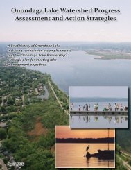
Habitat Plan 2 - Onondaga Lake Partnership
Habitat Plan 2 - Onondaga Lake Partnership
Habitat Plan 2 - Onondaga Lake Partnership

You also want an ePaper? Increase the reach of your titles
YUMPU automatically turns print PDFs into web optimized ePapers that Google loves.
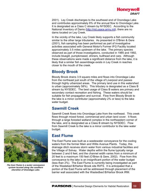
DRAFTThe East Flume is a water conveyancesystem located along the southernshoreline of <strong>Onondaga</strong> <strong>Lake</strong>.2001). Ley Creek discharges to the southeast end of <strong>Onondaga</strong> <strong>Lake</strong>and contributes approximately 8% of the annual flow to <strong>Onondaga</strong> <strong>Lake</strong>.It is designated as a Class C stream by NYSDEC. According to theNational Inventory of Dams (http://nid.usace.army.mil), there are nodams located on Ley Creek.In the vicinity of the lake, Ley Creek likely supports a fish communitysimilar to the other large tributaries. As presented in O'Brien & Gere(2001), fish sampling has been performed as part of investigativeactivities associated with General Motor's Former IFG Facility locatedapproximately 3.5 miles upstream of the lake. The primary speciesobserved as part of those investigations, conducted in 1985 and 1992,include bluegill, pumpkinseed, shiners, bullhead and carp. Althoughthese observations were made a significant distance from the lake, it islikely that a similar fish assemblage exists in Ley Creek in reachescloser to the mouth of the creek.Bloody BrookBloody Brook drains 3.9 square miles and flows into <strong>Onondaga</strong> <strong>Lake</strong>from the northeast just south of the village of Liverpool and passesthrough highly urbanized areas. The primary land use in this watershedis urban (approximately 58%). This tributary is designated as a Class Bstream by NYSDEC. The best usage of Class B waters are primary andsecondary contact recreation and fishing. These waters should besuitable for fish propagation and survival. Flow from Bloody Brook tothe lake is a minor contributor (approximately 2% or less) to the lakewater budget.Sawmill CreekSawmill Creek flows into <strong>Onondaga</strong> <strong>Lake</strong> from the northeast. This creekflows through mixed forest, commercial and urban land cover. It flowsthrough a large forested wetland complex in the northeastern corner ofthe lake, and is designated as a Class B stream by NYSDEC. Flowfrom Sawmill Creek to the lake is a minor contributor to the lake waterbudget.East FlumeThe East Flume was built as a wastewater conveyance for the coolingwaters from the former Main and Willis Avenue <strong>Plan</strong>ts. Today, thisdrainage ditch receives storm water from various industrial facilities andthe Village of Solvay. Water depths within the flume typically rangebetween 2 and 6 feet, and the channel width varies from a minimum of20 feet to a maximum 150 feet (O’Brien & Gere, 2002). Flow from thisconveyance to the lake is an insignificant portion of the water budget(less than 2%). The East Flume is currently being investigated as partof the Wastebed B/Harbor Brook site RI/FS. It is anticipated that aportion of the East Flume will be addressed through placement of thebarrier wall associated with the Wastedbed B/Harbor Brook IRM.PARSONS | Remedial Design Elements for <strong>Habitat</strong> Restoration 59