Habitat Plan 2 - Onondaga Lake Partnership
Habitat Plan 2 - Onondaga Lake Partnership
Habitat Plan 2 - Onondaga Lake Partnership

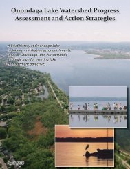
You also want an ePaper? Increase the reach of your titles
YUMPU automatically turns print PDFs into web optimized ePapers that Google loves.
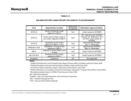
ONONDAGA LAKEREMEDIAL DESIGN ELEMENTS FORHABITAT RESTORATIONTABLE 2.3DELINEATED WETLANDS WITHIN THE HABITAT PLAN BOUNDARYAreaSYW-10SYW-12Approximate LocationMouth of Ninemile Creekadjacent to SMU 4North corner of lake, south ofLey Creek, adjacent to SMU 6DelineationConductedYes 1Yes 2Delineation Approval StatusUnder review by NYSDECWL1 approved per NYSDECFebruary 28, 2008 letter; WL2and WL3 under review byNYSDECApproved per NYSDECJuly 17, 2006 letterApproved per NYSDECMay 14, 2009 letterSYW-19Southeast corner of lakeadjacent to SMUs 1 and 7Yes 3Wetlands A & BWastebeds 1 through 8 Siteadjacent to SMU 3Yes 4BR-4Adjacent to where SMUs 4 and5 meetYes 2 Under review by NYSDECBR-7/SYW-6Northwest corner of lake,adjacent to SMU 5Yes 2 Under review by NYSDECFloodplain <strong>Lake</strong>shore No 5 Not applicableNotes:1 Geddes Brook/Ninemile Creek Feasibility Study Report (Parsons 2005); boundaries confirmed October 20082 Wetlands/Floodplain Assessment Revised Report (O’Brien & Gere and Parsons 2009)3 Jurisdictional Wetland Delineation Report, Harbor Brook Site (O’Brien & Gere 2003)4 Wetland Delineation and Floodplain Assessment Final Report, Wastebeds 1 through 8 Site (O’Brien & Gere 2009)5 Boundaries presented based on FEMA’s Flood Insurance Study (1981)BR = Boat ReconnaissanceNYSDEC = New York State Department of Environmental ConservationSMU = Sediment Management UnitSYW = Syracuse West USGS QuadrangleP:\Honeywell -SYR\445112 - <strong>Habitat</strong> And CPP III\09 Reports\9.2 Revised <strong>Habitat</strong> <strong>Plan</strong>\Tables\Table 2.3 12-09.DocPARSONSPage 1 of 1