Habitat Plan 2 - Onondaga Lake Partnership
Habitat Plan 2 - Onondaga Lake Partnership
Habitat Plan 2 - Onondaga Lake Partnership

You also want an ePaper? Increase the reach of your titles
YUMPU automatically turns print PDFs into web optimized ePapers that Google loves.
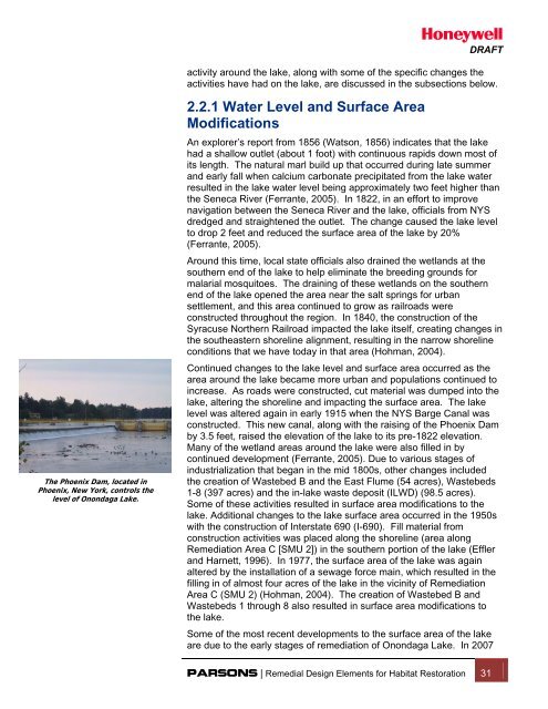
DRAFTactivity around the lake, along with some of the specific changes theactivities have had on the lake, are discussed in the subsections below.The Phoenix Dam, located inPhoenix, New York, controls thelevel of <strong>Onondaga</strong> <strong>Lake</strong>.2.2.1 Water Level and Surface AreaModificationsAn explorer’s report from 1856 (Watson, 1856) indicates that the lakehad a shallow outlet (about 1 foot) with continuous rapids down most ofits length. The natural marl build up that occurred during late summerand early fall when calcium carbonate precipitated from the lake waterresulted in the lake water level being approximately two feet higher thanthe Seneca River (Ferrante, 2005). In 1822, in an effort to improvenavigation between the Seneca River and the lake, officials from NYSdredged and straightened the outlet. The change caused the lake levelto drop 2 feet and reduced the surface area of the lake by 20%(Ferrante, 2005).Around this time, local state officials also drained the wetlands at thesouthern end of the lake to help eliminate the breeding grounds formalarial mosquitoes. The draining of these wetlands on the southernend of the lake opened the area near the salt springs for urbansettlement, and this area continued to grow as railroads wereconstructed throughout the region. In 1840, the construction of theSyracuse Northern Railroad impacted the lake itself, creating changes inthe southeastern shoreline alignment, resulting in the narrow shorelineconditions that we have today in that area (Hohman, 2004).Continued changes to the lake level and surface area occurred as thearea around the lake became more urban and populations continued toincrease. As roads were constructed, cut material was dumped into thelake, altering the shoreline and impacting the surface area. The lakelevel was altered again in early 1915 when the NYS Barge Canal wasconstructed. This new canal, along with the raising of the Phoenix Damby 3.5 feet, raised the elevation of the lake to its pre-1822 elevation.Many of the wetland areas around the lake were also filled in bycontinued development (Ferrante, 2005). Due to various stages ofindustrialization that began in the mid 1800s, other changes includedthe creation of Wastebed B and the East Flume (54 acres), Wastebeds1-8 (397 acres) and the in-lake waste deposit (ILWD) (98.5 acres).Some of these activities resulted in surface area modifications to thelake. Additional changes to the lake surface area occurred in the 1950swith the construction of Interstate 690 (I-690). Fill material fromconstruction activities was placed along the shoreline (area alongRemediation Area C [SMU 2]) in the southern portion of the lake (Efflerand Harnett, 1996). In 1977, the surface area of the lake was againaltered by the installation of a sewage force main, which resulted in thefilling in of almost four acres of the lake in the vicinity of RemediationArea C (SMU 2) (Hohman, 2004). The creation of Wastebed B andWastebeds 1 through 8 also resulted in surface area modifications tothe lake.Some of the most recent developments to the surface area of the lakeare due to the early stages of remediation of <strong>Onondaga</strong> <strong>Lake</strong>. In 2007PARSONS | Remedial Design Elements for <strong>Habitat</strong> Restoration 31