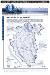
Habitat Plan 2 - Onondaga Lake Partnership
Habitat Plan 2 - Onondaga Lake Partnership
Habitat Plan 2 - Onondaga Lake Partnership

Create successful ePaper yourself
Turn your PDF publications into a flip-book with our unique Google optimized e-Paper software.
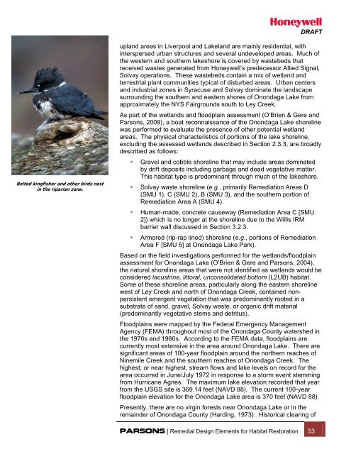
DRAFTBelted kingfisher and other birds nestin the riparian zone.upland areas in Liverpool and <strong>Lake</strong>land are mainly residential, withinterspersed urban structures and several undeveloped areas. Much ofthe western and southern lakeshore is covered by wastebeds thatreceived wastes generated from Honeywell’s predecessor Allied Signal,Solvay operations. These wastebeds contain a mix of wetland andterrestrial plant communities typical of disturbed areas. Urban centersand industrial zones in Syracuse and Solvay dominate the landscapesurrounding the southern and eastern shores of <strong>Onondaga</strong> <strong>Lake</strong> fromapproximately the NYS Fairgrounds south to Ley Creek.As part of the wetlands and floodplain assessment (O’Brien & Gere andParsons, 2009), a boat reconnaissance of the <strong>Onondaga</strong> <strong>Lake</strong> shorelinewas performed to evaluate the presence of other potential wetlandareas. The physical characteristics of portions of the lake shoreline,excluding the assessed wetlands described in Section 2.3.3, are broadlydescribed as follows:• Gravel and cobble shoreline that may include areas dominatedby drift deposits including garbage and dead vegetative matter.This habitat type is predominant through much of the lakeshore.• Solvay waste shoreline (e.g., primarily Remediation Areas D(SMU 1), C (SMU 2), B (SMU 3), and the southern portion ofRemediation Area A (SMU 4).• Human-made, concrete causeway (Remediation Area C [SMU2]) which is no longer at the shoreline due to the Willis IRMbarrier wall discussed in Section 3.2.3.• Armored (rip-rap lined) shoreline (e.g., portions of RemediationArea F [SMU 5] at <strong>Onondaga</strong> <strong>Lake</strong> Park).Based on the field investigations performed for the wetlands/floodplainassessment for <strong>Onondaga</strong> <strong>Lake</strong> (O’Brien & Gere and Parsons, 2004),the natural shoreline areas that were not identified as wetlands would beconsidered lacustrine, littoral, unconsolidated bottom (L2UB) habitat.Some of these shoreline areas, particularly along the eastern shorelinewest of Ley Creek and north of <strong>Onondaga</strong> Creek, contained nonpersistentemergent vegetation that was predominantly rooted in asubstrate of sand, gravel, Solvay waste, or organic drift material(predominantly vegetative stems and detritus).Floodplains were mapped by the Federal Emergency ManagementAgency (FEMA) throughout most of the <strong>Onondaga</strong> County watershed inthe 1970s and 1980s. According to the FEMA data, floodplains arecurrently most extensive in the area around <strong>Onondaga</strong> <strong>Lake</strong>. There aresignificant areas of 100-year floodplain around the northern reaches ofNinemile Creek and the southern reaches of <strong>Onondaga</strong> Creek. Thehighest, or near highest, stream flows and lake levels on record for thearea occurred in June/July 1972 in response to a storm event stemmingfrom Hurricane Agnes. The maximum lake elevation recorded that yearfrom the USGS site is 369.14 feet (NAVD 88). The current 100-yearfloodplain elevation for the <strong>Onondaga</strong> <strong>Lake</strong> area is 370 feet (NAVD 88).Presently, there are no virgin forests near <strong>Onondaga</strong> <strong>Lake</strong> or in theremainder of <strong>Onondaga</strong> County (Harding, 1973). Historical clearing ofPARSONS | Remedial Design Elements for <strong>Habitat</strong> Restoration 53