pprust - SRK Consulting
pprust - SRK Consulting
pprust - SRK Consulting

You also want an ePaper? Increase the reach of your titles
YUMPU automatically turns print PDFs into web optimized ePapers that Google loves.
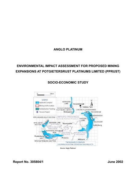
ANGLO PLATINUMENVIRONMENTAL IMPACT ASSESSMENT FOR PROPOSED MININGEXPANSIONS AT POTGIETERSRUST PLATINUMS LIMITED (PPRUST)SOCIO-ECONOMIC STUDYSource: Anglo PlatinumReport No. 305804/1 June 2002
Anglo PlatinumEnvironmental Impact Assessment for Proposed MiningExpansions at Potgietersrust Platinums Limited (PPRust)Socio-Economic StudyBy:Nic BoersemaFelix MotsiriReviewed by:Allison Burger-PinterReport No. 305804/1 June 2002Steffen, Robertson and Kirsten (South Africa) (Pty) Ltd P O Box 55291265 Oxford Road NorthlandsIllovo 21162196 South AfricaSouth Africa Tel: (011) 441-1111Registration Number: 1995.012890.07 Fax: (011) 880-8086
CONTENTS1 INTRODUCTION ................................................................................................................. 21.1 Terms of Reference ............................................................................................................. 41.2 Scope of Work ..................................................................................................................... 31.3 Study Method ...................................................................................................................... 42 PROJECT ENVIRONMENT................................................................................................. 62.1 Regional Setting .................................................................................................................. 62.2 Mining Operations ............................................................................................................... 72.3 Project alternatives .............................................................................................................. 72.4 Replacement Land .............................................................................................................. 82.5 Employment Creation .......................................................................................................... 92.6 Demographic Profile ............................................................................................................ 92.7 Land Use and Settlement Pattern ........................................................................................ 92.8 Economic Activity .............................................................................................................. 102.9 Development Planning ....................................................................................................... 113 THE LOCAL CONTEXT ..................................................................................................... 123.1 Introduction ........................................................................................................................ 123.2 Historical Background ........................................................................................................ 133.3 Affected Population ........................................................................................................... 143.4 Community Services and Facilities .................................................................................... 143.5 Local Economic Activity…………………………………………………………………………...153.6 Cultural Resources………………………………………………………………………………...154 SOCIAL ASPECT IDENTIFICATION ................................................................................. 174.1 Introduction 154.2 Impact Receptors 165 SOCIAL IMPACT ASSESSMENT 196 MANAGEMENT RECOMMENDATIONS 287. CONCLUSION 31Appendix A: Demographics
List of Tables:Table 2.1.1: Local councils incorporated under the Mogalakwena MunicipalityTable 2.9.1: Location of closer settlements in and around the project areaTable 3.1.1: List of adjacent surface landowners and current land usesTable 3.3.1: Number of households per affected villageTable 3.3.2: Summary of housing categories per settlement (2001)Table 3.4.1: School Facilities in Mohlotlo Ward (Overysel-Zwartfontein combined)Table 4.2.1: Impact ReceptorsTable 4.3.1: Socio-Economic Variables and areas of impactTable 5.1.1: Summary of potential social impacts according to activity and/or surfaceinfrastructure categoryTable 5.2: Summary of Socio-Economic Impacts and Proposed Management measures
BOEN/MOTF Report No 305804/1 June 2002Environmental Impact Assessment for Proposed Mining Expansionsat Potgietersrust Platinums Limited (PPRust)Socio-Economic Study1 INTRODUCTIONPotgietersrust Platinums Limited (PPRust) is proposing to expand its current Sandslootmining operation to include two further open pit areas and associated overburden dumps, aprocessing plant and a tailings dam on the farms Overysel (815LR), Zwartfontein (818LR)and Blinkwater (820LR). The proposed mining expansion is part of Anglo Platinum’s R12.6billion plan to increase production to 3.5 million ounces from the current 2 million ounces bythe year 2006.The proposed mining expansion, known as the PPRust North Mine, falls within PPRust’scurrent surface lease area. The neighbouring villages of Ga-Sekhaolelo, Ga-Puka, Ga-Tshaba and Sekuruwe are likely to be impacted by the proposed expansion. The extent ofimpacts on Ga-Puka and Ga-Sekhaolelo (i.e. blasting, vibrations, noise and, primarily,overburden disposal) will probably result in these two villages being relocated. In addition,current planning for the new tailings dam on the farm Blinkwater, as well as newoverburden dumps and/or infrastructure, will impact on the settlements of Ga-Tshaba andSekuruwe and may, in time, result in further population resettlement.
<strong>SRK</strong> <strong>Consulting</strong> 41.1 Terms of ReferenceAnglo Platinum Limited has requested <strong>SRK</strong> <strong>Consulting</strong> (<strong>SRK</strong>) to undertake the necessarystudies in support of environmental authorisation for the above project.The EMPR Amendment commenced with a scoping exercise consisting of desk studies andsite visits to (a) review secondary data, (b) consult with local and regional stakeholder, (c)identify project issues and possible fatal flaws, and (d) share project information with IAPsand elicit their concerns.Subsequently, a scoping report, including a Plan of Study for EIA and a Comments Report,was submitted in April 2002 for approval by the regulating authorities. The current phase ofthe EMPR study includes specialist studies to address the identified environmental issues.1.2 Scope of WorkInitial instructions from the client excluded scoping of project issues relating to the villagesof Ga-Tshaba and Sekuruwe, as impacted by the overburden dump and proposed tailingsdam respectively. Both project components have subsequently been added to <strong>SRK</strong>’s scopeof services. This socio-economic report consolidates the findings of the scoping exercise forthe PPRust North EMPR Addendum.The objectives of the socio-economic study are to:Augment the scoping study and stakeholder profiles for Ga-Puka and Ga-SekhaoleloUndertake scoping meetings in Ga-Tshaba and Sekuruwe to identify concerns/issuesAssess impact of proposed mining expansion on existing social systems or structuresAugment data on the socio-economic environment of the proposed projectIdentify socio-economic management measures.In terms of the Minerals Act of 1991 affected communities may not reside within 500 metersof mining operations. Due to past experience, PPRust has taken the decision to extend thissafety margin to 1000 meters and, as a result, the two affected villages, Ga-Sekhaolelo andGa-Puka, may have to be resettled. Both communities have, reportedly, indicated that theydo not support partial resettlement of their villages.This socio-economic study excluded an assessment of the anticipated population relocationof Ga-Puka and Ga-Sekhaolelo. This is in line with the final decision by lead stakeholders toBOENG:\347793 Mokgalekwena 2010\7Reports\Draft EIR\<strong>SRK</strong> website - electronic upload\Appendices\Appendix I3_Socio economicreport\PPRust SIA Final (Rev-1).doc June 2002
<strong>SRK</strong> <strong>Consulting</strong> 5commission separate studies for the EMPR Amendment and Relocation EIA, respectively.The decision was supported by the preferences of both PPRust and the affected populationfor complete resettlement at village level.Legally, population relocation is not required to manage the impacts of the new tailings damon Blinkwater (Sekuruwe) and/or the overburden dump adjacent to Ga-Tshaba. Further,current planning indicates that mining expansion will proceed without relocating Ga-Tshabavillage. The socio-economic study, therefore, does not address this potential futureresettlement.1.3 Study MethodDesk StudyIn addition to several site visits and one-on-one interviews with selected respondents, thisreport included a desktop review of the following secondary sources: Greater Potgietersrus Transitional Local Council: Land Development Objectives Ga-Pila Resettlement Project: Social Audit and Impact Assessment (RDC, 1997) Potgietersrus and Naboomspruit Regional Water Augmentation Study (DWAF/WSM) Relocation of Langa-Ndebele from Ga-Mapela: Archaeological Report (Pistorius, 1997) Land Development Objectives: Bakenberg Rural TLC 1998 - Bakenberg Rural TLC Web pages of national and provincial departments (SALGA, DWAF, Provincial) Draft specialist studies for the current PPRust North EMPR Amendment Greater Potgietersrus Integrated Development Plan 1997 (Draft Report) South African Municipal Demarcation Board (Internet web page) Liaison with Cultural Heritage Management Consultant.Community EngagementInformation sharing meetings were held with the Ga-Puka and Ga-Sekhaolelo communitiesduring the scoping phase of the EMPR study. The Ga-Tshaba and Sekuruwe communitieswere not involved in the scoping phase, as the proposed sites for the new tailings dam andoverburden dumps had not been finalised. The latter two communities were, subsequently,provided with an opportunity to input into the environmental studies.Social Impact AssessmentIn addition to augmenting the scoping exercise, an initial Social Impact Assessment (SIA)was undertaken so as to provide a broad overview of social impacts associated with theBOENG:\347793 Mokgalekwena 2010\7Reports\Draft EIR\<strong>SRK</strong> website - electronic upload\Appendices\Appendix I3_Socio economicreport\PPRust SIA Final (Rev-1).doc June 2002
<strong>SRK</strong> <strong>Consulting</strong> 6proposed mining expansion. The initial SIA is based solely on an analysis of project issuesand concerns listed in the Scoping Report and subsequent public scoping meetings.The SIA includes an identification of social aspects, likely areas of impact (impact variables)and the anticipated positive and negative social impacts of the proposed mining expansion.The following assessment criteria were used in determining the extent and significance ofthe identified socio-economic aspects: MAGNITUDE: The extent of impacts in spatial terms (spatial scope) PROBABILITY: The likelihood that an impact will materialise. DURATION: The length of time that impacts could be felt (temporal scope) SIGNIFICANCE: The importance of anticipated impactsIt is emphasised that the project-affected population were not consulted in the Social ImpactAssessment. Moreover, the impact management measures proposed in Section Six have tobe reviewed in terms of its feasibility within the broader context of the Relocation EIA.2 PROJECT ENVIRONMENT2.1 Regional SettingPotgietersrust Platinums Limited (PPRust) is situated in the Mogalakwena Municipal Areaof the Limpopo Province, about 25 km northwest of the town of Mokopane (Potgietersrus)on the R35 national road to Limburg and Groblershoop. The town of Mokopane representsan important urban service centre and economic growth point for the south-western part ofthe province. Greater Potgietersrus had a population of 90 000 in 1995 (DWAF, 2001).The Limpopo Province covers an area of around 123 910 square km and about 89% of theprovince is rural in nature. It is the fifth largest province in South Africa, with a population ofapproximately 5 million in 1996. The Limpopo Province is the second lowest contributor tothe GDP and job creation in South Africa. Unemployment stands at 46% while some 40% ofemployed people earn R500 or less per month (Growth and Development Strategy, 1997).The Limpopo Province is divided into four regions: the Capricorn region, Bushveld region,Soutpansberg region and the Valley of Olifants. Situated in the Waterberg Mountain Range,the Bushveld region is, reportedly, one of the most mineralised regions in the world.BOENG:\347793 Mokgalekwena 2010\7Reports\Draft EIR\<strong>SRK</strong> website - electronic upload\Appendices\Appendix I3_Socio economicreport\PPRust SIA Final (Rev-1).doc June 2002
<strong>SRK</strong> <strong>Consulting</strong> 7The Waterberg Savannah Biosphere, which was established in 1996, was recently awardedinternational status as the first savannah biosphere in Southern Africa, following recognitionby UNESCO in terms of its interdisciplinary ‘Man and Biosphere Reserve Programme’.The PPRust Mine is located in the Waterberg District Municipality of the Limpopo Province.The local municipality is the Mogalakwena Municipality, which covers a geographical areaof around 6184 square kilometres. The municipality consists of 31 wards represented by 62councillors (SA Municipal Demarcation Board, 2002). After the local government electionsin 1995/1996 Ga-Mapela was incorporated into the Bakenberg TRC. Currently, Ga-Mapelaforms part of the Mogalakwena Municipal Area (Table 2.1.1).Table 2.1.1: Local councils incorporated under the Mogalakwena MunicipalityNew Municipality Existing Municipality Category Whole/PortionNP367 Potgietersrus TLC Local WholeNP367 Naboomspruit/ Roedtan/Thusang Local PortionNP367 Moletje/Matlala RLC Local PortionNP367 Koedoesrand-Rebone RLC Local PortionNP367 Bakenberg RLC Local WholeSource: South African Municipal Demarcation Board2.2 Mining OperationsPotgietersrust Platinums Limited was set up as a public company in 1991 with the aim toexploit the Platreef deposits. The Platreef ore body was briefly mined in the 1920s but onlyexploited on a large scale since 1992. A key role-player in the recent mining development isPPRust. Other companies with interests in the Platreef deposits include Impala Platinum,Anooraq Resources Corporation, African Minerals Limited and Pan Palladium Limited.Following a significant expansion of concentrator capacity during 1997, Platinum Open CastServices (POCS) was formed in 1998 to run the actual mining operation. PPRust’s currentoperations at the Sandsloot pit will reach its economic limit in seven years time. Potentialexpansion of PPRust over the next 20 years will be in a south-easterly and a north-westerlydirection and may necessitate further population relocation. (Current Sandsloot operationsresulted in the relocation of Ga-Pila village to Sterkwater farm.)The proposed expansions at PPRust North entail open pit mining methods. Conventionalopen pit technology will be used, but the new pits are designed to accommodate currentand future technologies without compromising safe working conditions. A new pit is plannedBOENG:\347793 Mokgalekwena 2010\7Reports\Draft EIR\<strong>SRK</strong> website - electronic upload\Appendices\Appendix I3_Socio economicreport\PPRust SIA Final (Rev-1).doc June 2002
<strong>SRK</strong> <strong>Consulting</strong> 8on Overysel and Zwartfontein farms, stretching in a north-south direction along the Matlotlohills.Overburden dumps will be established to the east and west parallel to the new pits. Othersurface infrastructure include a processing plant and a main store on Zwartfontein farm, aswell as a magazine, crusher and conveyer network on the Overysel farm and a new tailingsdam on Blinkwater farm. The tailings dam will cover a surface of about 380 hectares.2.3 Project AlternativesSeveral alternative mining options were considered during the PPRust North feasibilitystudy for the proposed expansion. These included continuation versus expansion options,as well as a combination of open pit and underground mining methods. (The “no project”option will result in the non-realisation of an important and unique economic developmentopportunity in the region.) Potential risk factors playing an important role in the final choicefor both site options and mining method included:Cost, Mining Rate and Production Levels: Selective open pit mining methods offerlower costs with a high degree of ore selectivity and rapid start-up.Mineral Rights and Surface Leases: Unexploited mineral rights (or prolonged lack ofaction) may lead to the loss of these rights under the proposed new mining legislation.Environmental Health: Open pit mining methods normally have lower health risks withregards occupational diseases and tuberculoses.Water Supply: The supply of treated sewage effluent from Polokwane represents thelowest risk option given the nature of social impacts associated with the pipeline route.Resettlement: Social risks and economic costs related to population relocation couldincrease with time due to raising expectations, frustrations and political manipulation.2.4 Replacement LandThe Langa Ndebele (of Mapela) has occupied numerous settlements scattered throughoutthe broader project area for the past three centuries. Until recently, the Black Areas LandRegulations (Proclamation R188 of 1969) dealt with land administration in communal areas.Allocation of land rights takes place through the local tribal chief. However, it is noted thatthe White Paper on Land Policy indicates that a decision regarding land ownership is validonly if it reflects the view of the majority of “co-owners” (legitimate land users).There is agreement between the Department of Land Affairs, the Mapela Tribal Authorityand PPRust that relocations will entail a land-swap, whereby tribal land that will be used byBOENG:\347793 Mokgalekwena 2010\7Reports\Draft EIR\<strong>SRK</strong> website - electronic upload\Appendices\Appendix I3_Socio economicreport\PPRust SIA Final (Rev-1).doc June 2002
<strong>SRK</strong> <strong>Consulting</strong> 9PPRust for mining expansion, will need to be replaced by other land not currently under thejurisdiction of tribal authorities. Anglo Platinum has purchased privately owned farms in thearea for the purpose of land-swaps in support of relocation.The scoping study reported that PPRust and community leaders from Ga-Sekhaolelo andGa-Puka visited the farms Armoede, Groenfontein and Mooihoek in 1998 for the purpose ofhost site selection. The people of Ga-Sekhaolelo then chose Armoede farm as a preferredoption for resettlement. The choice is motivated, in the words of the community, by the factthat this community was resettled from Armoede in 1932. The people of Ga-Puka indicatedan interest in the farm Rooibokfontein (281LR) during the scoping study.2.5 Employment CreationThe proposed PPRust North Mine could create an estimated 2000 employmentopportunities. The total number of employees will depend on different production levels andwould increase as production increases. The provisional employment will increase asfollows: 300ktpm: 805 workers and 600ktpm: 1056 workers (after 2 years).Employment at the current Sandsloot operations was as follows (July 2001): Mining Section(470), Process Section (431) and Services Section (187).2.6 Demographic ProfileThe 1991 census results confirm that the then Greater Potgietersrus was characterised bya spontaneous urbanisation process, high population growth rate and a young population interms of age distribution (resulting in an above average pressure on job creation and socialservices). In the age group 20 to 64 years females predominated, reflecting a relatively highrate of absenteeism by male migrant workers and an associated high dependency ratio.Although still prevalent, the situation seems to be gradually changing. This observation isbroadly supported by the data provided by the SA Demarcation Board (see Table 2.6.1 inAppendix A). The population of Bakenberg TRC (including Ga-Mapela) was estimated at153 333 in 1995 and 164 000 in 1997. Population density was estimated at 30 people persquare kilometre for this year (Greater Potgietersrus Integrated Development Plan, 1997).2.7 Land Use and Settlement PatternBOENG:\347793 Mokgalekwena 2010\7Reports\Draft EIR\<strong>SRK</strong> website - electronic upload\Appendices\Appendix I3_Socio economicreport\PPRust SIA Final (Rev-1).doc June 2002
<strong>SRK</strong> <strong>Consulting</strong> 10Numerous “rural” settlements are scattered throughout the region northwest of Mokopanetown. Although most settlements represent a formal zoned layout, there are little signs of aformalised urbanisation process and associated public infrastructure, services and facilities.Two prominent rural concentrations (growth nodes) in this area are the Greater Mapela andBakenberg tribal areas, each with a population of around 10,000 people in 1995.A variety of land uses and economic activities are evident in the broader Mokopane region.These include commercial estates, intensive farming, mining operations, game farming andtourism.2.8 Economic ActivityIn his budget speech in March 2002, the Member of the Executive Council for the provincialDepartment of Finance, Economic Affairs, Tourism and Environment (DFEAT) reported thatthe provincial economy has grown at an average of 5,5% in real terms between 1995 and2000, with encouraging signs in trade and services. The provincial economic growth ratewas 3,9% in 2000 and the Gross Geographic Product (GGP) was around R39 billion. Thetrade sector has produced the fastest growth “…reflecting a strong local demand for goodsand services, as well as growth in the tourism sector. …Mining is showing signs of recoveryfrom 18.5% of the GGP to 19% over the period 1998 to 2000” (DFEAT, Limpopo Province).The provincial unemployment growth rate has, reportedly, been reduced from an average16,3% during 1980 to 1996 to a current average of 6,2%. During the 2001/02 financial year,4,870 new jobs were created in the Limpopo Province, with the highest number of new jobsin the mining (2,900) and agricultural (1,615) sectors.Greater Mokopane forms part of the Bushveld Igneous Complex, an area rich in minerals,with the mining of platinum, diamonds and granite as main activities. The Mokopane area isa fertile agricultural area producing wheat, tobacco, cotton, beef, maize, peanuts and citrus.General economic involvement outside Mokopane is in the commercial agriculture, miningand public sectors, but is mostly evident in the subsistence and informal economic sectors.Boreholes with poor quality potable water mostly serve the study area. Greater Mokopaneand surrounding rural settlements have suffered severe water shortages during the first halfof the 1990s. Subsequent concerns about the affordability of water resources developmentin the sub-region have resulted in water requirements being scaled down.Recent feasibility studies (2000) have concluded that it would require several phased wateraugmentation options to meet the long-term requirements of Greater Mokopane (DWAF,BOENG:\347793 Mokgalekwena 2010\7Reports\Draft EIR\<strong>SRK</strong> website - electronic upload\Appendices\Appendix I3_Socio economicreport\PPRust SIA Final (Rev-1).doc June 2002
<strong>SRK</strong> <strong>Consulting</strong> 112001). The recent approval by DWAF for the development of the proposed Rooipoort Damon the Olifants River and the raising of the Flag Boshielo Dam wall, will partly address thewater demands of the region.In summary, PPRust North is surrounded by a large ‘semi-urban’ and/or rural populationwith high levels of unemployment, marginal involvement in formal economic activities andlow levels of disposable income.2.9 Development PlanningIn South Africa the vast majority of the poor live in rural areas that are characterised by ahighly unbalanced and uneven distribution of people, services and economic opportunities.While access to employment, infrastructure and services is limited, barriers to improvingproductivity in the rural areas are overwhelming.The 1998 White Paper on Local Government provides a framework for developmental localgovernment, while the Municipal Systems Act (2000) establishes a legal framework for newmunicipal systems, including the development of Integrated Development Plans.A number of government grants provide direct assistance to district and local municipalitieswith the formulation or preparation of integrated development plans and municipal servicedelivery. The Consolidated Municipal Infrastructure Programme (CMIP), for example, aimsto promote infrastructure development and basic levels of services at the local level.During 1996 the Northern Province Department of Local Government and Traditional Affairsappointed a consortium to compile an Integrated Development Plan (IDP) for Potgietersrus.The Interim IDP document (May 2002) will include formulation of land development optionsand local economic development initiatives in compliance with the Development FacilitationAct (1995) and subsequent legislation on the developmental role of local government.The IDP Programme has established various planning forums at district level in an attemptto co-ordinate sub-regional and/or local development planning. The programme provides animportant vehicle for the integration of development initiatives such as mining development,with regional planning objectives.In particular, the proposed PPRust North expansion provides an ideal opportunity forassistingneighbouring communities (see Table 2.9.1) in meeting their developmental needs and/orpriorities.BOENG:\347793 Mokgalekwena 2010\7Reports\Draft EIR\<strong>SRK</strong> website - electronic upload\Appendices\Appendix I3_Socio economicreport\PPRust SIA Final (Rev-1).doc June 2002
<strong>SRK</strong> <strong>Consulting</strong> 12Table 2.9.1: Location of closer settlements in and around the project area< 1 km from mine 1 – 5 km from mineSekuruwe Village (E)Ga-Tshaba Village (W)Ga-Sekhaolelo (E)Ga-Puka (E)Ga-Molekana Village (S)Ga-Masenya (SW)Ga-Mosoga (NW)Ga-Maloka (N)Skiming (SW)Source: Visual Impact Specialist Study (adapted)Sustainable services and infrastructure delivery in the so-called rural areas is hampered bya lack of administrative skills, financial capacity and expertise in local government - and inthe communities themselves, In this regard, there is a definite role for “big business” to playin providing financial and technical support on the basis of partnerships and co-ownership.3 THE LOCAL CONTEXT3.1 IntroductionTribal (communal) farms under the administration of the Mapela Tribal Authority, surroundsthe existing PPRust mining operation (Table 3.1.1).Hunting, subsistence agriculture and stock farming were for decades the primary economicactivities of the Langa Ndebele (the Mapela). Agricultural lands already existed before thesecond half of the 20 th century on Blinkwater farm. The communal land tenure system (withPermission to Occupy from the chief) is the prevailing practice on the Mapela tribal farms.A large percentage of the de facto available labour force in the immediate project area isinvolved in subsistence agriculture and informal sector activities. Participation of the localpopulation in the formal economy is mostly as farm labourers (especially to the northwest ofthe study area on the Marken road) and employment on various mines in the area (mainlyplatinum and granite). Table 3.1.1 summarises current land uses at various infrastructurelocations for the proposed mining activities.BOENG:\347793 Mokgalekwena 2010\7Reports\Draft EIR\<strong>SRK</strong> website - electronic upload\Appendices\Appendix I3_Socio economicreport\PPRust SIA Final (Rev-1).doc June 2002
<strong>SRK</strong> <strong>Consulting</strong> 13Table 3.1.1: List of adjacent surface landowners and current land usesFarm Direction from PPRust Land Tenure Approximate land useOverysel(815LR)Zwartfontein(818LR)Blinkwater(820LR)Moordkopje(813LR)North, north-west Mapela Tribal land Rural residential (20%)Arable subsistence (60%)Grazing & rocky area (20%)North Mapela Tribal land Rural residential (20%)Arable subsistence (25%)Rocky area (15%)Grazing land (40%)North, north-east Mapela Tribal land Rural residential (15%)Arable subsistence (15%)Grazing land (70%)North-west Mapela Tribal land Rural residential (20%)Arable & grazing land (75%)Rocky area (5%)3.2 Historical BackgroundThe Mapela Tribal Authority (MTA) was established by way of Government Notice in 1954under Kgoshi (Chief) Johannes Masibi Langa. The tribal council was given jurisdiction overportions of the farms Knapdaar, Sandsloot and Vaalkop.The Langa Ndebele (or Bagamapela) of the Mapela Tribal Authority area, trace their originsto the Hlubi clan and the legendary chief, Langa, who lived in KwaZulu-Natal during the 17 thcentury. On arrival in their present location the Langa Ndebele group settled on the farmsBultongfontein and Zuid-Holland (at Mokgokong). Subsequently, the Langa Ndebele unitedunder Kgoshi Mapela and incorporated several smaller Sotho clans into the Langa group.During the early 1800s Kgoshi Mapela moved to the present day Moordkopje where he diedin 1825. In 1854 the Langa and Kekana were involved in clashes with the Voortrekkers atFothane Hills (Moordkopje) and Moorddrif. During 1858 the Langa moved to Thutlwane Hill(Kromkloof) where another clash with the Voortrekkers took place in 1868 (Pistorius, 1997)Some sources state that, immediately prior to 1830, the supreme chief in the Bakenbergarea was Kgoshi Bakebela. After arrival of the Voortrekkers around 1830, the area allegedlybecame known as Bakenberg. (See specialist Archaeological Study by J. Pistorius, 2002.)Kgoshi Mankopane of the Langa Ndebele died in 1877 and was succeeded by Masebe III.An internal succession dispute and subsequent split was followed by a period of sporadicconflicts between the Kekana Ndebele, the Langa Ndebele of Bankeberg (Bakenberg) andBOENG:\347793 Mokgalekwena 2010\7Reports\Draft EIR\<strong>SRK</strong> website - electronic upload\Appendices\Appendix I3_Socio economicreport\PPRust SIA Final (Rev-1).doc June 2002
<strong>SRK</strong> <strong>Consulting</strong> 14the Ndebele of Kgoshi Hans Langa. The section under Kgoshi Hans Langa became knownas the Bagamapela. The present leader is Kgoshigadi AR Langa.3.3 Affected PopulationAccurate population figures for the affected population could not be established during thecurrent study. Table 3.3.1 gives a rough estimate of the number of households per villagefor those villages that may be impacted in terms of dwelling units and public facilities.Table 3.3.1: Number of households per affected villageVillageGa-Puka(Zwartfontein 818LR)Ga-Sekhaolelo(Overysel 815LR)Ga-Tshaba(Moordkopje 813LR)Households (approx) 210 500 650Source: Village elders – personal communicationDuring 2001, PPRust undertook a survey of housing categories in affected villages as partof the PPRust North Feasibility Study. The results are presented in Table 3.3.2.Table 3.3.2: Summary of housing categories per settlement (2001)Item Description Ga-Puka Ga-Sekhaolelo Ga-Tshaba Total1 50 m 2 (1 – 49.9) 107 135 39 2812 60 m 2 50 – 59.9) 30 48 23 1013 70 m 2 (60 – 69.9) 33 45 12 904 80 m 2 (70 – 79.9) 18 31 14 635 90 m 2 (80 – 89.9) 22 35 4 616 100 m 2 (90 - 99.9) 15 31 12 587 110 2 m (100 – 109.9) 15 28 10 538 120 m 2 (110 – 119.9) 20 27 13 609 130 m 2 (120 – 129.9) 14 24 13 5110 140 m 2 (130 – 139.9) 9 27 6 4211 150 m 2 (140 – 149.9) 4 15 6 2512 Larger than 150 m 2 50 56 40 146Total (stands) 337 502 192 1031Source: Potgietersrust Platinums Limited3.4 Community Services and FacilitiesVillages in and around the project area have the general appearance of closer settlementsserved by gravel roads. The Mapela settlement some 5 to 8 km to the west, boasts a smallindustrial area and community poultry farm on the outskirts of this village.Local businesses include general dealers, fruit and/or vegetable stores, tuck shops, bottlestores and beer halls (or taverns). There are no post offices in the directly affected villages -BOENG:\347793 Mokgalekwena 2010\7Reports\Draft EIR\<strong>SRK</strong> website - electronic upload\Appendices\Appendix I3_Socio economicreport\PPRust SIA Final (Rev-1).doc June 2002
<strong>SRK</strong> <strong>Consulting</strong> 15only public post boxes and a few public telephones. Electricity is supplied by ESKOM andparticipating households use a pre-paid card system. Sport and recreational facilities seemnon-existent apart from makeshift soccer fields.Boreholes, some of which were provided (and are serviced) by PPRust, mainly supply thevillages. Existing water reticulation systems are under severe strain, especially in Ga-Pukawhere frequently households have to fetch water from Ga-Sekhaolelo or buy water locally.The project area has two secondary schools and three primary schools (Table 3.4.1). TheSeritarita Secondary School has been “adopted” by PPRust and receives financial supportfrom the mine.The project area falls within the Mapela circuit; one of five circuits under the MahhwelerengEducation District. Ga-Puka and Ga-Sekhaolelo communities share Seritarita and MphunyeSecondary schools, as well as the Cornelius Masebe Primary School.Table 3.4.1: School Facilities in Mohlotlo Ward (Overysel-Zwartfontein combined)School Name Pupils Educators FacilitiesMphunye Secondary School 460 13 Classrooms: 15 Water and electricity Pit latrines FencedCornelius Masebe Primary 402 11 Classrooms: 16School Water and electricity Pit latrines FencedSeritarita Secondary School 786 22 Classrooms: 17 Water and electricity(Adopted by PPRust) Pit latrines FencedJacob Puka Primary School 300 8 Classrooms: 8 (4 shacks) Electricity but no water No fencing, no toiletsJan Malebana Primary325 9 7 classrooms (1 shack)School Electricity but no water Pit latrines, not fencingSource: Mapela Circuit manager – personal communicationResidents of the affected villages use the Mapela and Phafola clinics, while a mobile clinicvisits the villages every two weeks. The nearest hospital is the George Masebe Hospital inBakenberg and the nearest police station is at ‘Tin Myne’ on the Marken road. The followingreligious denominations are present in the study area: the Dutch Reformed Church, RomanCatholic Church, Assembly of God, and the Zion Christian Church (ZCC).BOENG:\347793 Mokgalekwena 2010\7Reports\Draft EIR\<strong>SRK</strong> website - electronic upload\Appendices\Appendix I3_Socio economicreport\PPRust SIA Final (Rev-1).doc June 2002
<strong>SRK</strong> <strong>Consulting</strong> 16Residential areas are zoned and most sites (stands) are fenced. Brick-and-mortar houses,most with outbuildings and pit latrines, are the norm. Community structures and committeesinclude the development forum, women’s league, pensioners’ association, taxi association,youth forums, policing forums, savings clubs and burial societies.Village headmen and ward councillors, respectively, represent the Mapela Tribal Authorityand the Mogalakwena Municipality at village level. Resettlement committees were recentlyestablished in both Ga-Puka and Ga-Sekhaolelo in anticipation of possible future relocation.3.5 Local Economic ActivityAll ‘registered’ households, reportedly, have access to arable land and communal grazing.Fields are used for subsistence farming, and crops planted include maize, sorghum, beansand watermelon. The majority of households also maintain a small maize plot or vegetablegarden, as well as fruit trees, on the residential site.Livestock farming remains an important local economic activity (cattle, goats and donkeys).The provincial Department of Agriculture used to provide extension services to these localfarmers, operating from a small office on the farm Overysel. However, this service has beendiscontinued some 6 months ago due to a shortage of staff. (A DWAF maintenance camp issituated adjacent to the agricultural office.)Unemployment appears to be high in the broader project area. In addition to employment atPPRust, those economically active are generally employed in and around Mokopane town,as migrant workers in the urban centres of Gauteng, or as farm labourers on surroundingcommercial farms. Apparently, significant numbers of potentially affected households relyon temporary work (or ‘piece jobs’), pensions and subsistence farming for survival. Loss oflocal productive assets and income sources would be devastating for these households.3.6 Cultural ResourcesLarge parts of Overysel and Zwartfontein farms, where the new open pits would be located,have been used for subsistence agriculture in the past and contain no heritage remains ofhigh significance. A number of dwellings with associated infrastructure (kraals, fields, etc.)were identified and could qualify as historical structures. Numerous graves and cemeteriesare located on the above two farms.BOENG:\347793 Mokgalekwena 2010\7Reports\Draft EIR\<strong>SRK</strong> website - electronic upload\Appendices\Appendix I3_Socio economicreport\PPRust SIA Final (Rev-1).doc June 2002
<strong>SRK</strong> <strong>Consulting</strong> 17The proposed new tailings dam would be situated on the farm Blinkwater (820LR). Severalvillages that seemingly have been abandoned during the 1950’s, occur near the proposedtailings dam. The majority of these villages are associated with individual graves and smallfamily cemeteries (Pistorius, 2002).4 SOCIO-ECONOMIC ASPECT IDENTIFICATION4.1 IntroductionProject issues and IAPs’ concerns identified during the scoping exercise were presented inthe April 2002 Scoping Report. Subsequent to the submission of the Scoping Report, threemeetings were held with representatives from Ga-Tshaba and Sekuruwe villages to shareproject information, elicit concerns and identify specific issues.The concerns raised during the above meetings, together with the project issues identifiedduring the scoping stage, formed the basis for the identification of social aspects and likelyareas of impact described below.4.2 Impact ReceptorsThe identification of project-related social aspects was done taking the following likely areasof impact into consideration: affected population (including livestock and domestic animals),regional and local institutional structures, natural resources/assets, physical infrastructure,social services and facilities, trade/retail services, community development projects, culturalresources and historical sites. A list of receptors and resources is provided in Table 4.2.1.In addition to project location, design parameters have a direct bearing on the magnitude ofsocio-economic and/or environmental impacts. PPRust provided the study team with mapsand drawings indicating surface infrastructure, cemeteries and graves. In some instancesthe planning and design of surface infrastructure placement have not been finalised.BOENG:\347793 Mokgalekwena 2010\7Reports\Draft EIR\<strong>SRK</strong> website - electronic upload\Appendices\Appendix I3_Socio economicreport\PPRust SIA Final (Rev-1).doc June 2002
<strong>SRK</strong> <strong>Consulting</strong> 18Table 4.2.1: Impact ReceptorsReceptorsAffected population: Social categories, cultural associations, economic user groupsResidential structures: Dwelling units, outbuilding, toilet, outside kitchen, refuge dumpsCommunity services/facilities: Schools, offices, crèche, clinics, post boxes, telephonesCommercial facilities: Shops, fruit stores, bottle stores, butcheries, taverns, tuck shopsWater supply infrastructure: Reservoirs, pumps, boreholes, pipelines, stand pipes, tapsCultural resources: Graves and tombstones, churches, architectural designs (houses)Access roads, transport routes, footpaths, public transport services, private taxisSport and recreation: Community hall, soccer fieldsResourcesIrrigated land (historical): Offices, canals, pipelines, pumps, boreholes, reservoirsLivestock infrastructure: Stock watering dams, cattle kraals, dipping tanks, fencingArable land (subsistence): Standing crops (and/or root damage), fencingIrrigated land (subsistence): Vegetable gardens, orchards, fruit treesWoodland: Building/handcraft material, fuel wood, medicinal plantsCommercial development projects: Poultry farmGrazing land and natural vegetationThe identification of social aspects was primarily based on findings from selected interviewsand personal observations made during the site visits. A consolidated summary of identifiedsocial aspects is presented in Table 4.3.1 below. These social aspects are listed in relationto broad social variables and likely areas of impact. (Social aspects relating to populationresettlement are not addressed in any detail.)BOENG:\347793 Mokgalekwena 2010\7Reports\Draft EIR\<strong>SRK</strong> website - electronic upload\Appendices\Appendix I3_Socio economicreport\PPRust SIA Final (Rev-1).doc June 2002
<strong>SRK</strong> <strong>Consulting</strong> 19Table 4.3.1: Socio-Economic variables and areas of impactSocial Variable/Area of ImpactSocial Stability and community organisationPopulation demographics and resettlementEmployment creation and income stabilityNatural and cultural resource baseCommunity services and facilitiesRegional economic developmentHealth and social welfareLocal production systemsEducation and trainingConstructionAspects IdentifiedChange in income and expenditure patternsChange in employment and social statusSocial networks and support systemsCompetition for job opportunitiesPresence of foreign workforceSocial pathologiesTribal conflictChange in housing and settlement patternPotential for informal settlementLand value and statusPermanent employment opportunitiesTemporary work; labour stabilitySkills trainingAccess to arable and grazing landAccess to ground or surface waterGround water depletion/pollutionAccess to fuel wood/vegetationDisturbance of gravesLand capabilityPhysical infrastructureAccess and mobilitySafety and securityMunicipal servicesTraffic volumesRoad networkProduction assets and resourcesInstitutional capacityTrade and industryMultiplier effectDiversificationLand tenureOccupational health and safety hazardsMining and construction activitiesAmbient noise levelsPersonal safetyVisual impactAir qualityDependence on subsistence agricultureCommunal rightsFood securityImproved educational and training facilitiesAccess to services and facilitiesTechnology transferSkills trainingEarthworks, blasting, clearingBusiness opportunitiesTemporary accessStructural damageAir/noise pollutionAccommodationTraffic volumesInconvenienceSafetyBOENG:\347793 Mokgalekwena 2010\7Reports\Draft EIR\<strong>SRK</strong> website - electronic upload\Appendices\Appendix I3_Socio economicreport\PPRust SIA Final (Rev-1).doc June 2002
<strong>SRK</strong> <strong>Consulting</strong> 205. SOCIAL IMPACT ASSESSMENTAn Initial Social Impact Assessment (SIA) was done, based primarily on an interpretation ofinformation gathered during the scoping study. The assessment did not include a ranking ofimpacts or an analysis of development options and alternatives.As was mentioned earlier in the report (Section 1.2) the lead stakeholders for the proposedPPRust North mining expansions have agreed to separate studies for the EMPRAmendment and Relocation EIA, respectively. Therefore, the current study excludes asocial assessment of the anticipated population relocation of Ga-Puka and Ga-Sekhaolelo.Similarly, PPRust has indicated that mining expansion would proceed without relocating theGa-Tshaba village. Hence, the social assessment does not address this potential futureresettlement.A summary of potential social impacts - in relation to mining activities and the placement ofsurface infrastructure - is provided in Table 5.1.1. As a general comment probably valid foreach of the new pits and new surface infrastructure, is overall temporary disruption duringconstruction. The following community infrastructure, services and facilities may be affectedduring construction: health services, businesses, boreholes, and graves, access to schools,soccer fields, agricultural fields and neighbouring villages.The assessment in this section addresses the significance of anticipated socio-economicimpacts before mitigation. Chapter 6 of this report deals with the identification of potentialmitigation and/or management measures.BOENG:\347793 Mokgalekwena 2010\7Reports\Draft EIR\<strong>SRK</strong> website - electronic upload\Appendices\Appendix I3_Socio economicreport\PPRust SIA Final (Rev-1).doc June 2002
<strong>SRK</strong> <strong>Consulting</strong> 21Table 5.1.1: Summary of potential socio-economic impacts according to activity and/or surface infrastructure categoryCATEGORY FARM NAME AFFECTED COMMUNITY DURATION IMPACT IDENTIFIEDOpen PitsLoss of grazing and Zwartfontein 818 LR Ga-PukaConstruction The proposed open pits may result in a loss of landarable landOverysel 815 LRGa-SekhaoleloOperationcurrently available for subsistence agriculture)Zwartfontein SouthBlasting Zwartfontein SouthSeritarita Secondary SchoolConstructionBlasting from mining operations on new open pitsMoordkopje 813 LRGa-TshabaOperationmay cause damage to houses or improvements.Personal safety Zwartfontein 818 LRGa-PukaOperationFly rocks as a result of blasting at open pits couldOverysel 815 LRGa-Sekhaoleloendanger people’s livesZwartfontein SouthSeritarita Secondary SchoolInconvenience Zwartfontein 818 LRGa-PukaConstructionBlasting may cause personal inconvenience (e.g.:Overysel 815 LRGa-SekhaoleloOperationevacuation of the elderly, pregnant women or sickZwartfontein Southpeople)Increased dust Zwartfontein 818 LRGa-PukaConstructionThe drilling and blasting associated with open pitsOverysel 815 LRGa-SekhaoleloOperationmay give rise to severe dust problems which couldZwartfontein SouthSeritarita Secondary Schoolbe harmful to people’s healthIncreased noise Zwartfontein 818 LRGa-PukaConstructionMining activities may give rise to increase in noiseOverysel 815 LRGa-SekhaoleloOperationlevels (trucks, drilling, blasting, conveyers, etc).Zwartfontein SouthSeritarita Secondary SchoolDisruption of graves Zwartfontein 818 LRGa-PukaConstructionOpen pit development may result in disturbance ofOverysel 815 LRGa-SekhaoleloOperationgraves and cemeteriesZwartfontein SouthGa-TshabaMoordkopje 813 LRWater pollution orZwartfontein 818 LR• Ga-PukaOperationThe proposed open pit may result in depletion ofdepletion of sourcesOverysel 815 LR• Ga-Sekhaoleloground or surface water used by communitiesZwartfontein South• Ga-TshabaAvailable water sources may be polluted as resultMoordkopje 813 LRof mining activitiesImpaired access Zwartfontein 818 LRSekuruweConstructionThe proposed open sites may cut off access routesOverysel 815 LRSurrounding villagesOperationbetween communities and/or facilitiesMoordkopje 813 LRGa-TshabaBOENG:\347793 Mokgalekwena 2010\7Reports\Draft EIR\<strong>SRK</strong> website - electronic upload\Appendices\Appendix I3_Socio economic report\PPRust SIA Final (Rev-1).doc June 2002
<strong>SRK</strong> <strong>Consulting</strong> 22Overburden DumpsSoil sterilisation Moordkopje 813 LR Ga-Tshaba Operation Overburden dumps may sterilise the land and soilswith agricultural potentialLoss of arable and Moordkopje 813 LR Ga-Tshaba Operation Overburden dumps may result in the loss of landgrazing landcurrently available for agriculture and grazing.Impaired access Moordkopje 813 LR Ga-Tshaba Operation Fencing of overburden dump may cut-off accessfor both people and livestock (grazing)Increased dust Moordkopje 813 LR Ga-Tshaba Operation Overburden dump may result in increased dust forneighbouring communities, plants and livestockIncreased visual Moordkopje 813 LR Ga-Tshaba Operation Overburden dump may negatively alter topographyimpactof the area and may cause visual intrusionIncreased noise Moordkopje 813 LR Ga-Tshaba Operation Overburden rock dump may result in increasednoise due to truck traffic to and from the siteTailings DamLoss of arable and/or Blinkwater 820 LR Sekuruwe Operation The proposed tailings dam site may result in a lossgrazing landof arable and grazing landLoss/disturbance of Blinkwater 820 LR SekuruweOperation The proposed site may result in the disturbance ofgraves/ cultural sites Ga-Pukagraves and potential cultural heritage sitesMining Construction and OperationEmploymentConstruction Mining expansion could provide increasedopportunitiesOperation employment opportunities for local communitiesTension betweenConstruction Mining expansion may attract foreign workforcelocals and outsidersOperation and job seekers with potential for conflict betweenlocals and outsiders competing for opportunitiesInformal settlementConstruction The proposed mine may result in an influx of jobOperation seekers causing potential for informal settlementImproved servicesConstruction The proposed expansions may result in improvedand/or facilitiesOperation services such as access roads and health facilitiesDecreased safetyConstruction Trucks and vehicle movement during constructionOperation and operation may impact on traffic / road safetySocial pathologiesConstruction Increased incidence of social pathologies such asOperation STDs, HIV/AIDS, prostitution, alcohol abuse, etc.BOENG:\347793 Mokgalekwena 2010\7Reports\Draft EIR\<strong>SRK</strong> website - electronic upload\Appendices\Appendix I3_Socio economic report\PPRust SIA Final (Rev-1).doc June 2002
<strong>SRK</strong> <strong>Consulting</strong> Page 23Impact Description: Increase in employment opportunities and income generationAnticipated benefits accruing from the proposed mining expansions include both temporaryand permanent employment opportunities. It is anticipated that the mine will, at least partly,draw the required labour from surrounding villages. Further opportunities exist through theemployment of local contractors (using local labour) where possible, during the constructionphase, as well as through the outsourcing of non-core activities during the operation phase.The creation of an estimated 2000 new jobs and the associated improvement in annual percapita and household income of these workers and their families would contribute positivelytowards local income stability, increased buying power and improved standards of living.The proposed mining expansion and resettlement are likely to create a positive climate forlocal employment through related construction and business opportunities associated withhousing, services and infrastructure provision. Moreover, local employment at the mine willcontribute towards skills training and the transfer of technological know-how.Finally, the temporary demand for goods, supplies and services by construction teams islikely to supplement local income sources from informal sector activities. However, creatinga short-term boost to the local informal economy (through temporary housing and increasedbuying power during the construction phase) could increase local levels of dependence.Impact Assessment: Increase in employment opportunities and income generationProbability: DefiniteSeverity:Spatial scope: Local, regionalModerateTemporal scope: Short term (construction) to long term (operation)Receptors: Affected communities, foreign workforce, the unemployedImpact summary: Positive, with high significanceImpact Description: Accelerated regional economic growth and developmentThe proposed PPRust North expansions would make a significant positive contribution toregional and local economic development. Contribution to the regional (and indirectly to thenational) economy includes a substantial boost to Gross Geographical and Gross DomesticProducts through the creation of new jobs, as well as through increased exports andcontributions to tax revenue. In addition, likely multiplier effects of mining expansionsthrough new business opportunities, trade, services and physical infrastructure, underlinethe significant potential long-term positive impact the proposed project may have on localBOEN/MOTFG:\347793 Mokgalekwena 2010\7Reports\Draft EIR\<strong>SRK</strong> website - electronic upload\Appendices\Appendix I3_Socioeconomic report\PPRust SIA Final (Rev-1).doc May 2002
<strong>SRK</strong> <strong>Consulting</strong> Page 24(district) socio-economic structures and public services provision, as well as on the regionaleconomy in general.In contrast, the combined cumulative effect of water, air, noise and visual pollution will havea negative effect on tourist activities and the potential for tourism development in the area.Impact Assessment: Accelerated regional economic growth and developmentProbability: HighSeverity:Spatial scope: Local, district, regionModerateTemporal scope: Short term (construction) to long term (operation)Receptors: Affected and adjacent population, Greater Mokopane: DevelopersImpact summary: Positive, with high significanceImpact Description: Loss of Livelihoods (natural resources and productive assets)The proposed open pit development will result in a loss of land currently available and usedfor subsistence agriculture. Arable land amounts to 20% of the project area, grazing land to48.3% and wilderness land to 11.6% (Soil Survey, 2002). The surrounding communities areat least partially dependent on local natural resources and assets and, therefore, extremelyvulnerable if access to these local resources is lost.The loss of natural and/or productive assets often implies increased risk of impoverishmentand this could in the longer term negatively affect health and educational levels, as well asgeneral community well being. Eventual disruption of social networks and support systemswill have a serious negative impact on marginal households and vulnerable individuals.Unmitigated, the loss of access to primary productive resources will contribute to the furtherimpoverishment of the affected rural population and set in motion processes that underminefood security and household stability, worsened by an additional disruption of social supportnetworks and survival strategies. During construction, the affected households could suffertemporary loss of subsurface material (crops), restricted mobility or impeded access. Lossof access to natural vegetation (e.g. fuel wood) will have a short-term negative impact.If unmanaged, the proposed project may have a negative impact on the local economy as aresult of the increased use (depletion/pollution) of available water sources and a reductionin land for subsistence agriculture. A negative impact on property values for the surroundingagricultural land is expected.Impact Assessment: Loss of Livelihoods (natural resources and productive assets)Probability: DefiniteSeverity: MajorSpatial scope: Local, extra localBOEN/MOTFG:\347793 Mokgalekwena 2010\7Reports\Draft EIR\<strong>SRK</strong> website - electronic upload\Appendices\Appendix I3_Socioeconomic report\PPRust SIA Final (Rev-1).doc May 2002
<strong>SRK</strong> <strong>Consulting</strong> Page 25Temporal scope: Short term (construction) to long term (operation)Resources: Land, soils, vegetation and water sourcesReceptors: Affected population, marginal households/social groups, landownersImpact summary: Negative, with high significanceImpact Description: Increase in social instability and community disturbanceSome temporary social disturbance is to be expected during the construction phase, mainlydue to actual construction work, the presence of foreign workers, job seekers and contractstaff (including visiting relatives/friends) and associated increase in contact between peopleof different backgrounds, Likely causes of community disturbance over the longer term are:Increased traffic volumes, dust, noise, safety hazards and visual impactIncreased competition for job opportunities, contracts and local resourcesIncrease in the use of community facilities, services and infrastructureIncreased demand for goods, supplies, sport and entertainment servicesIncreased pressure on institutional arrangements and political systemIncrease in prostitution, related health hazards, illegal sale of liquor, etc.Increase in vandalism, crime and theft (e.g. stock theft and poaching)Increase in loitering, illegal refuse disposal, uncontrolled fires, etc.Thus the proposed mining expansion may put pressure on public services and facilities dueto impaired access, increase/decrease in local facility use (schools, clinics) and availabilityof transport as a result of population movement (resettlement; foreign influx, squatting, etc).General community disruption will be aggravated by perceived threats by local communitiesto existing safety or security levels. These perceptions are often supported by real incidentsof disturbances caused by construction workers, the development of informal settlements,increase in social pathologies (e.g. prostitution), competition for employment opportunities,and conflict between locals and outsiders.The anticipated medium term disruption of the local community could increase the potentialfor social dislocation and/or tribal conflict if underestimated. Actual labour sourcing, locationof construction camps, employment selection criteria and the demarcation of labour supplyareas, for example, are potential burning issues that could lead to overt conflict betweensocial groups, villages, organised labour, local administrations and even ‘tribal’ groups.Impact Assessment: Increase in social instability and community disturbanceProbability: Definite Severity:Spatial scope: LocalModerateBOEN/MOTFG:\347793 Mokgalekwena 2010\7Reports\Draft EIR\<strong>SRK</strong> website - electronic upload\Appendices\Appendix I3_Socioeconomic report\PPRust SIA Final (Rev-1).doc May 2002
<strong>SRK</strong> <strong>Consulting</strong> Page 26Temporal scope: Short term (construction) to medium term (operation)Resources: Natural resources (e.g. firewood)Receptors: Affected and host populations, foreign workforce and families, job seekersImpact summary: Negative, with high significanceImpact Description: Disturbance of graves, cemeteries and cultural heritage sitesOpen pit development and associated infrastructure will result in the disturbance of graves,cemeteries and “historical” remains. Several sites with graves and ruins of dwellings, datingfrom the (relatively) recent past, occur in or near the proposed new open pit areas. Thesesites vary in size but are highly significant, while the ruins of dwellings, reportedly, have littlesignificance (see Archaeological Specialist Study).Impact Assessment: Disturbance of graves, cemeteries and cultural heritage sitesProbability: DefiniteSeverity:Spatial scope: Local (on site)ModerateTemporal scope: Short term (construction) to long term (operation)Resources: Historical landmarksReceptors: Affected population and their familiesImpact summary: Negative, moderate to high significanceImpact Description: Increase in dust pollutionEarthworks, drilling and blasting associated with the open pit development will give rise toan increase in dust, which could be harmful to people’s health. Overburden dumps (as wellas trucks) will contribute to increased dust pollution affecting neighbouring communities andlivestock (see Air Quality Study). The long-term cumulative impact of dust pollution resultingfrom intensive mining is regarded as highly significant from a public health perspective.Impact Assessment: Increase in dust pollutionProbability: DefiniteSpatial scope: LocalTemporal scope: Short term (construction) to long term (operation)Receptors: Affected population, workforce, job seekersImpact summary: Negative, high significanceSeverity: MajorImpact Description: Decrease in health statusTwo potential negative health impacts are associated with the proposed mining expansions.These are dust inhalation and noise exposure. Furthermore, increased incidences of socialpathologies such as prostitution (and associated STD, HIV/AIDS) and substance abuse arelikely further impacts.BOEN/MOTFG:\347793 Mokgalekwena 2010\7Reports\Draft EIR\<strong>SRK</strong> website - electronic upload\Appendices\Appendix I3_Socioeconomic report\PPRust SIA Final (Rev-1).doc May 2002
<strong>SRK</strong> <strong>Consulting</strong> Page 27General public health and community well being may decline over the long term as a resultof stressed or inadequate public services, facilities and infrastructure (following populationinflux), as well as deteriorating political stability and an increase in conflict and violence.Impact Assessment: Decrease in health statusProbability: DefiniteSpatial scope: LocalTemporal scope: Short term (construction) to long term (operation)Receptors: Local population, newcomersImpact summary: Negative, moderate significanceSeverity:ModerateImpact Description: Increase in ambient noise levelsOverall mining operations (especially during construction) will cause an increase in ambientnoise levels. The village of Ga-Tshaba and Seritarita School, in particular, will be adverselyaffected (see Noise Impact Specialist Study). Ambient noise levels may normalise after theconstruction phase but will continue to impact on the above receptors. Moreover, increasednoise levels may, over the long term, reflect negatively on public health indicators.Impact Assessment: Increase in ambient noise levelsProbability: DefiniteSpatial scope: Local, extra-localSeverity: MajorTemporal scope: Short term (construction) to long term (operation)Receptors: Local populationImpact summary: Negative, with moderate significanceImpact Description: Visual effect and sensitivityThe proposed mining expansions will have a definite and permanent negative visual effecton surrounding areas in terms of overall aesthetics (see Visual Impact Specialist Study.)Impact Assessment: Visual effect and sensitivityProbability: DefiniteSpatial scope: Local; extra localTemporal scope: PermanentReceptors:Affected local population; travellers, touristsImpact summary: Negative, with moderate to low significanceSeverity:ModerateImpact Description: Mine closureThe eventual mine closure will have an almost certain impact on the local labour force andsurrounding communities. Rehabilitation of land occupied by mining is unlikely. However, itseems inappropriate to predict the cumulative impacts of mine closure in the distant future.BOEN/MOTFG:\347793 Mokgalekwena 2010\7Reports\Draft EIR\<strong>SRK</strong> website - electronic upload\Appendices\Appendix I3_Socioeconomic report\PPRust SIA Final (Rev-1).doc May 2002
<strong>SRK</strong> <strong>Consulting</strong> Page 28Impact Assessment: Mine closureProbability: HighSeverity:Spatial scope: Local; extra localUncertainTemporal scope: PermanentReceptors: Affected employees, their households, local community and businessesImpact summary: Uncertain6. MANAGEMENT RECOMMENDATIONSThe identification of ‘social’ management measures at the level of an initial assessment canonly be of a general nature. Similarly, socio-economic management measures can only bemeaningfully integrated into the final Environmental Management Plan (EMP) after analysisof measures recommended by other specialist studies. Accordingly, the management of airand noise pollution, and impacts on graves are addressed in the relevant specialist studies.a) Increase in employment opportunities and income generation:The proposed PPRust North mining expansion is expected to have an overall positiveimpact on general labour force indicators. However, appropriate employment andrecruitment policies must be formalised and given substance in terms of practicalimplementation to ensure that affected households will proportionally share in the benefitsof proposed mining expansion. The following management measures are recommended insupport of this key objective:Recruitment should favour local employment and skills development. The mine shouldestablish skills training programmes for locals to address the mine’s future needs and topromote SMME development. Appoint Labour Control Officer to monitor this process.Local recruitment should take place through mutually agreed community structures andrecruitment channels/mechanisms. The mine should assist with the establishment andadministration of a local (community) recruitment office. This includes the facilitation oflocal skills audits, baseline data and the development of socio-economic databases.The mine should develop policies and criteria for the employment and accommodationof local labour by sub-contractors and related local small business agreements.The mine must keep records of numbers of local people employed, place of residence,recruitment office, job description and employment contract conditions. Sub-contractorsto the mine should keep similar records for all placements of local people.BOEN/MOTFG:\347793 Mokgalekwena 2010\7Reports\Draft EIR\<strong>SRK</strong> website - electronic upload\Appendices\Appendix I3_Socioeconomic report\PPRust SIA Final (Rev-1).doc May 2002
<strong>SRK</strong> <strong>Consulting</strong> Page 29Sub-contractors should sign a compliance agreement with regard to local employmentand they must submit labour returns to verify local recruitment where possible Successful applicants for employment at the mine must provide proof of residence andwork permits (where applicable). Relevant documentation must be recorded.b) Accelerated regional economic growth and developmentConsultation and active co-operation should be pursued with the provincial government,as well as with the local and district municipalities with regard to housing and temporaryaccommodation for mine employees and sub-contractors, recruitment and employmentprocedures within the framework of current local government planning with regards theprovision of municipal services and facilities.Mine management must actively participate in provincial and local development forumsand establish appropriate communication mechanisms with local agricultural institutionsand tourism bodies to promote sub-regional and local empowerment partnerships.As one of the dominant water users in the sub-region, PPRust North should activelycontribute towards the establishment of the envisaged Catchment Management Agency(CMA) for the region concerned, supported by the required formulation of an integratedcatchment management strategy and Regional Water Resource DevelopmentProgramme.PPRust North should actively pursue existing (and create viable new) opportunities forpublic-private partnerships with the local and/or district municipalities concerned withthe aim to meet sub-regional water needs and contribute towards local communitydevelopment through the mine’s Corporate Social Investment Programme.Underlying the above broad management objectives, is the fundamental prerequisite touphold and develop constructive relationships with neighbouring communities.c) Loss of livelihoods (access to natural resources and assets)Fair and equitable compensation must be negotiated with all impacted landowners andlegitimate land users whose arable and grazing rights are affected by mine expansions.Identify replacement land in full consultation with affected communities and households.BOEN/MOTFG:\347793 Mokgalekwena 2010\7Reports\Draft EIR\<strong>SRK</strong> website - electronic upload\Appendices\Appendix I3_Socioeconomic report\PPRust SIA Final (Rev-1).doc May 2002
<strong>SRK</strong> <strong>Consulting</strong> Page 30Support income stability and the creation of sustainable livelihoods through local smallbusiness development programmes, local sub-contracting of mine-related services, andgeneral skills development programmes. Recruitment policies should favour local employment and skills training (see above).Expand bursary programme to focus on local candidates.d) Increase in social instability and community disturbanceEmployment selection criteria, the location of construction camps and the demarcationof labour supply areas are three critical factors in the maintenance of both communitycohesion and social stability. It is strongly recommended that PPRust Northaddress the above key issues through negotiated agreements between the mine,organised labour, local authorities and legitimate community structures.In addition, the following management measures are recommended:The mine, its contractors, local authorities and the neighbouring communities shouldcommunicate regularly and complaints must be treated seriously. This will require thejoint formulation of compliance contracts and grievance procedures and project-specificcommunication mechanisms (for example keeping of a complaints register).The appointment of a full-time (resident) Community Liaison Officer is recommended tonegotiate aspects such as the location of temporary housing and informal markets.Suitable accommodation and security should be provided for mine contractors and theirworkers during construction. The mine should provide concrete policies and procedureswith regard to employee accommodation and related subsistence allowances.Accommodation allowances should be granted for approved accommodation only andrecords must be kept of approved residential areas and/or addresses. Waiting lists andapplication schedules should be introduced.New construction sites should be fenced and access must be controlled. No loiteringshould be allowed close to mine infrastructure outside working hours.Mine management should promote passenger safety through establishing the requiredroad signs and marked passenger crossing, as well as bus and taxi stops.BOEN/MOTFG:\347793 Mokgalekwena 2010\7Reports\Draft EIR\<strong>SRK</strong> website - electronic upload\Appendices\Appendix I3_Socioeconomic report\PPRust SIA Final (Rev-1).doc May 2002
<strong>SRK</strong> <strong>Consulting</strong> Page 31The mine should formulate joint safety and security measures with local stakeholders,support community policing forums and assist in policing surrounding public spaces. If incidences of squatting as result of mine expansion are encountered, the mine shouldreport this to the relevant authorities.e) Decrease in health statusThe mine should financially support community-based health research and monitoringprogrammes through Anglo Platinum’s corporate social investment initiatives.Implement and develop worker and community HIV/AIDS awareness programmes.Facilitate regular medical examinations for mine employees through local health careservices, andSupport the development of primary health care services in the area (e.g. mobile clinic).f) Mine closureWhile it is deemed inappropriate to predict the impacts of mine closure in the distant future,a concerted effort towards integrated and complementary planning, will certainly contributeto lessening the impacts of eventual mine closure. In particular, PPRust North mustundertake to:Establish joint implementation monitoring policies, procedures and mechanisms with thelead stakeholder groups.Commission an independent closure assessment (at least) 15 years before scheduledmine closure.7. CONCLUSIONMining in South Africa is regarded as an optimal land use activity and, unmistakably, takesprecedence over other, equally viable, land uses. Particular attention should, therefore, bedirected towards the socio-economic impact on local productive assets and income sourcesof the affected population. The most suitable vehicle for this is clearly employment creationBOEN/MOTFG:\347793 Mokgalekwena 2010\7Reports\Draft EIR\<strong>SRK</strong> website - electronic upload\Appendices\Appendix I3_Socioeconomic report\PPRust SIA Final (Rev-1).doc May 2002
<strong>SRK</strong> <strong>Consulting</strong> Page 32and income generation. The isolated employment of a few local applicants will, however,not contribute to the optimal and sustainable development of the mine or its neighbours.The proposed mine expansion is expected to have an overall positive impact on both localand regional growth performance indicators. For the optimal utilisation of any new economicand development opportunities mining development must complement and actively promotecurrent efforts by government towards integrated development planning and local economicdevelopment.Source: Anglo PlatinumBOEN/MOTFG:\347793 Mokgalekwena 2010\7Reports\Draft EIR\<strong>SRK</strong> website - electronic upload\Appendices\Appendix I3_Socioeconomic report\PPRust SIA Final (Rev-1).doc May 2002