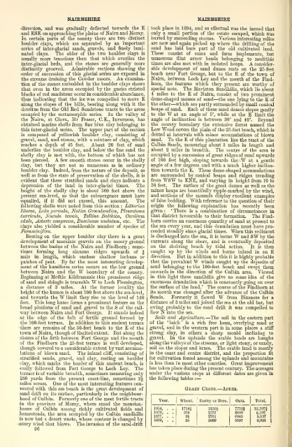
Wheat.—NAIRNSHIREdirection, and was gradually deflected towards the Eand ESE on approaching the plains <strong>of</strong> Nairn and Moray.In certain parts <strong>of</strong> the county there are two distinctboulder clays, which are separated by an importantseries <strong>of</strong> inter-glacial sands, gravels, and finely laminatedclays. The older <strong>of</strong> the two boulder clays isusually more tenacious than that which overlies theinter-glacial beds, and the stones are generally moredistinctly grooved. Admirable sections showing theorder <strong>of</strong> succession <strong>of</strong> this glacial series are exposed inthe streams draining the Cawdor moors. An examination<strong>of</strong> the stones embedded in the boulder clays showsthat even in the areas occupied by the gneiss striatedblocks <strong>of</strong> red sandstone occur in considerable abundance,thus indicating that the ice was compelled to move Ealong the slopes <strong>of</strong> the hills, bearing along with it thedetritus from the Old Red Sandstone tracts to the areasoccupied by the metamorphic series. In the valley <strong>of</strong>the Nairn, at Clava, Mr Eraser, O.E., Inverness, hasobtained marine shells from fine blue clay belonging tothis inter-glacial series. The upper part <strong>of</strong> the sectionis composed <strong>of</strong> yellowish boulder clay, consisting <strong>of</strong>gravel, sand, and stones, with a mixture <strong>of</strong> clay, whichreaches a depth <strong>of</strong> 45 feet. About 20 feet <strong>of</strong> sandunderlies the boulder clay, and below the fine sand theshelly clay is met with, the bottom <strong>of</strong> which has notbeen pierced. A few smooth stones occur in the shellyclay, but they are not so numerous as in ordinaryboulder clay. Indeed, from the nature <strong>of</strong> the deposit, aswell as from the state <strong>of</strong> preservation <strong>of</strong> the shells, it isevident that these stratified sands and clays indicate adepression <strong>of</strong> the land in inter-glacial times. Theheight <strong>of</strong> the shelly clay is about 500 feet above thepresent sea-level, so that the submergence must haveequalled, if it did not exceed, this amount. Thefollowing shells were noted from this section : Littorinalitorea, Lcda 'pernula, Natim Groenlandica, PUurotomaturriada, Nuciila tenuis, Tellina Balthica, Cardiumedule, Astartc com^nessa, Bucciniim imdatum, etc. Theclays also yielded a considerable number <strong>of</strong> species <strong>of</strong>Foraminifera,Resting on the upper boulder clay there is a greatdevelopment <strong>of</strong> moraiuic gravels on the moory groundbetween the basins <strong>of</strong> the Nairn and Findhorn ; sometimesforming long sinuous ridges upwards <strong>of</strong> Jmile in length, which enclose shallow lochans orpatches <strong>of</strong> peat. By far the most interesting development<strong>of</strong> the kamiform series occurs on the low groundbetween Nairn and the W boundary <strong>of</strong> the county.Beginning at Meikle Kildrummie this prominent ridge<strong>of</strong> sand and shingle is traceable W to Loch Flemington,a distance <strong>of</strong> 3 miles. At the former locality theheight <strong>of</strong> the kames is about 100 feet above the sea-level,and towards the W limit they rise to the level <strong>of</strong> 140feet. This long kame forms a prominent feature on thebroad platform <strong>of</strong> sand and gravel to the S <strong>of</strong> the railwaybetween Nairn and Fort George. It stands indeedat the edge <strong>of</strong> the belt <strong>of</strong> fertile ground formed bythe 100-feet ten'ace. In addition to this ancient terracethere are remains <strong>of</strong> the 50-feet beach to the E <strong>of</strong> thetown <strong>of</strong> Nairn, though <strong>of</strong> limited extent. But along theshores <strong>of</strong> the firth between Fort George and the mouth<strong>of</strong> the Findhorn the 25-feet terrace is well developed,though covered to a considerable extent by vast accumulations<strong>of</strong> blown sand. The inland cliff, consisting <strong>of</strong>stratified sands, gravel, and clay, resting on boulderclay, which marks the border <strong>of</strong> this ancient beach, iseasily followed from Fort George to Loch Loy. Theterrace is <strong>of</strong> variable breadth, sometimes measuring only200 yards from the present coast-line, sometimes 2Jmiles across. One <strong>of</strong> the most interesting features connectedwith this sea beach is the great development <strong>of</strong>sand drift on its surface, particularly in the neighbourhood<strong>of</strong> Culbin. Formerly one <strong>of</strong> the most fertile tractsin the province <strong>of</strong> Moray, where stood the mansionhouse<strong>of</strong> Culbin among richly cultivated fields andhomesteads, the area occupied by the Culbin sandhillsis now but a desert waste, whose contour is changed by«very wind that blows. The invasion <strong>of</strong> the sand-drift96NAIRNSHIREtook place in 1694, and so effectual was the inroad thatonly a small portion <strong>of</strong> the estate escaped, which wasburied by succeeding storms. Various interesting reHcsare now and again picked up where the drifting <strong>of</strong> thesand has laid bare part <strong>of</strong> the old cultivated laud.These consist <strong>of</strong> coins and farm implements, butnumerous flint arrow heads belonging to neolithictimes are also met with in isolated heaps. A considerabledevelopment <strong>of</strong> sand dunes rests on the 25-feetbeach near Fort George, but to the E <strong>of</strong> the town <strong>of</strong>Nairn, between Loch Loy and the mouth <strong>of</strong> the Findhorn,the features which they present are worthy <strong>of</strong>special note. The Maviston Sandhills, which lie about4 miles to the E <strong>of</strong> Nairn, consist <strong>of</strong> two prominentdome-shaped masses <strong>of</strong> sand—the one lying to the E <strong>of</strong>the other—which are partly surrounded by small conicalheaps <strong>of</strong> sand. Each <strong>of</strong> these sand domes slopes gentlyto the W at an angle <strong>of</strong> 5°, while at the E limit theangle <strong>of</strong> inclination is between 30° and 40°. Beyondthe county boundary the extensive forest named theLow Wood covers the plain <strong>of</strong> the 25-feet beach, which isdotted at intervals with minor accumulations <strong>of</strong> blownsand. To the E <strong>of</strong> this plantation lies the tract <strong>of</strong> theCulbin Sands, measuring about 3 miles in length andabout 2 miles in breadth. The centre <strong>of</strong> the area isoccupied by a succession <strong>of</strong> great ridges <strong>of</strong> sand upwards<strong>of</strong> 100 feet high, sloping towards the W at a gentleangle <strong>of</strong> a few degrees and with a much higher inclinationtowards the E. These dome-shaped accumulationsare surrounded by conical heaps and ridges trendingfrom WSW to ENE, and var3'ing in height from 10 to30 feet. The surface <strong>of</strong> the great domes as well as theminor heaps are beautifully ripple-marked by the wind,and sections <strong>of</strong> the mounds display excellent examples<strong>of</strong> false bedding. With reference to the question <strong>of</strong> theirorigin the following explanation has recently beengiven :'There is a combination <strong>of</strong> circumstances inthat district favourable to their- formation. The Findhorncarries an enormous quantity <strong>of</strong> sand at present tothe sea every year, and this denudation must have jjroeeededsteadily since glacial times. When this sedimentis discharged into the sea, it is borne W and SW by thecurrents along the shore, and is eventually depositedon the shelving beach by tidal action. It is thencaught up by the winds and borne inland in an Edirection. But in addition to this it is highly probablethat the prevalent W winds caught up thedeposits <strong>of</strong>sand belonging to the 100-feet beach and swept themonwards in the direction <strong>of</strong> the Culbin area. Viewedin this light these sandhills give us some idea <strong>of</strong> theenormous denudation which is constantly going on overthe surface <strong>of</strong> the land. ' The course <strong>of</strong> the Findhorn atits mouth was changed after the advance <strong>of</strong> the CulbinSands. Formerly it flowed W from Binsness for adistance <strong>of</strong> 3 miles and joined the sea at the old bar, butowing probably to the sand drift it was compelled t<strong>of</strong>low N into the sea.Soils and Agriculture.—The soU in the eastern part<strong>of</strong> the laich ' ' is a rich free loam, overlying sand orgravel, and in the western part is in some places a stiffstrong clay, in others a sharp mould inclining togravel. In the uplands the arable lands are haughsalong the valleys <strong>of</strong> the streams, or light stony, or sandy,soU on the slopes and braes. The arable land is mostlyin the coast and centre district, and the proportion fitfor cultivation found among the uplands and mountainsis less than in most other counties. Great improvementhas taken place during the present century. The acreagesunder the various crops at different dates are given inthe following tables :Year.|1854, . .1870, . .1877, . .1883, . .Graik Crops.— Acres.Barley or Bere. Oats. Total.1714J26691353130i2237'270130997752160896045B89712,597i8,6928,8379,031
—Year.1S54. . .1S67, . .1877, . .1SS3, . .NAIRNSHIREGrass, Root Crops, etc.— Acres.Hay, Grass, andPermanent Pasture.10,69411,75812,418Turnips.44673S9340854133Potatoes.1642666785672while there are about 300 acres on an average annuallyunder beans, rye, vetches, fallow, etc. The permanentpasture not broken up in rotation is a little over 2000acres. There has been, as in most <strong>of</strong> the other northerncounties, a very great decrease in the area under wheat,and if the return for 1854 be correct, there has within thelast 30 years been a decrease <strong>of</strong> 3000 acres in the area undercultivation. The farms are mostly worked on the fiveshift system, and the average yield <strong>of</strong> wheat per acre is28 bushels ; barley, 32 to 40 bushels ; oats, 28 to 40bushels ; turnips, from 12 to 20 tons ; and potatoes, from4 to 5 tons, but the latter two are very variable.The agricultural live stock in the county at differentdates is shown in the following table :Tear. Cattle. Horses. Sheep. Pigs. Total.1854, . .1870, . .1877, . .1883, . .8304650665135676182611231247129228,23017,27816,97116,799148973393292639,84924,64025,66324,693The early returns seem again faulty. Not much attentionis given to the breeding <strong>of</strong> pure stock, and thecattle are mostly crosses. The sheep in the lowlandsare mostly Leicesters, though Cheviots are also kept ;those in the uplands are blackfaced. The farms aregenerally held on leases <strong>of</strong> 19 years. There were in thecounty, in 1881, 259 farmers employing 354 men, 90boj's, 67 women, and 147 girls. There were at the sametime 31 farms under 15 acres, 55 between 15 and 60acres, 59 between 50 and 100 acres, 92 between 100 and500 acres, and 21 <strong>of</strong> larger size. There are in theparishes <strong>of</strong> Ardclach, Auldearn, Cawdor, and Nairn, 15proprietors holding each an annual value <strong>of</strong> £500 orupwards, 23 holding each between £500 and £100, 30holding each between £100 and £50, and 63 holdingeach between £50 and £20. The principal mansions,most <strong>of</strong> which are separately noticed, are Achareidh,Boath, Cawdor Castle, Coulmony, Delnies House, FirHall, Geddes House, Glenferness House, Househill, Ivybank,Eilravock Castle, Kinsteary, Lethen House, Millbank,Nairngrove, Nairnside, Newton, and Viewfield.Manufactures there are practically none, except atBrackla Distillery, 3| miles SW <strong>of</strong> the town <strong>of</strong> Nairn ;and besides agriculture, and those connected with thetown and the coast fishings, the only industries are thesandstone and granite quarries—the latter at Kinsteary,opened up in 1872.Soads, etc.—The Perth and Forres section <strong>of</strong> theHighland railway touches the E border <strong>of</strong> the firstdetached section described, and the Forres and Invernesssection <strong>of</strong> the same system traverses the wholemain part <strong>of</strong> the county from E to W near the coastfor a distance <strong>of</strong> 8J mDes. The main coast road fromInverness to Aberdeen passes along near the line <strong>of</strong>railway from the town <strong>of</strong> Nairn ; a good road strikessouth-westward to Croy, and another south-eastward byBridge <strong>of</strong> Logie (Findhorn) to the road from Forres toGrantown. From a point 1 mile S <strong>of</strong> Bridge <strong>of</strong>Logie a branch goes <strong>of</strong>f to the NE and joins the Forresroad, while another passes S by W to Duthil. GeneralWade's military road from the Highland road to FortGeorge enters the county i mile W by S <strong>of</strong> LochanTutach, and, crossing the Findhorn at Dulsie, passesthrough the centre <strong>of</strong> the county in a north-westerlydirection till it enters Inverness-shire, 1 furlong SE <strong>of</strong>Fort George railway station. There are also a largenumber <strong>of</strong> good district roads.NAIRNSHIREThe only royal or police burgh is Nairn ; the onlyburgh<strong>of</strong> barony or village with more than 300 inhabitantsis Auldearn ; and the principal smaller villages are-Cawdor, Delnies, and Newton. The civil county comprisesthe three entire quoad dvilia parishes <strong>of</strong> Nairn,Auldearn, and Ardclach, the greater part <strong>of</strong> Cawdor(shared with Inverness-shire), and smaller portions <strong>of</strong>the parishes <strong>of</strong> Dyke (shared with Elginshire), Moy,Croy, Petty and Daviot (also shared with Invernessshire),and Urquhart (shared with Eoss-shire). Theparishes <strong>of</strong> Ardclach, Auldearn, Cawdor, Croy, andNairn are ecclesiastically in the presbytery <strong>of</strong> Nairn,in the synod <strong>of</strong> Moray ; the portions <strong>of</strong> Daviot, Moy,and Petty, in the presbytery <strong>of</strong> Inverness and the synod<strong>of</strong> Moray ; the portion <strong>of</strong> Dyke, in the presbytery <strong>of</strong>Forres and the synod <strong>of</strong> Moray ; and the part <strong>of</strong>Urquhart, in the presbytery <strong>of</strong> Dingwall, in the synod <strong>of</strong>Ross. Within the limits <strong>of</strong> the county there are 5-places <strong>of</strong> worship connected with the Established.Church, 4 in connection with the Free Church, 1 in connectionwith the U.P. Church, 1 in connection with theScottish Episcopal Church, 1 in connection with theEnglish Episcopal Church, and 1 in connection with theRoman Catholic Church. In the year ending Sept. 1882there were 16 schools (15 public), which, with accommodationfor 2047 children, had 1590 on the rolls, and.an average attendance <strong>of</strong> 1173. Their staff consisted<strong>of</strong> 20 certificated and 8 pupil teachers. Nairnshire,with a constituency <strong>of</strong> 300 in 1883-84, unites with Elginin returning a member to serve in parliament. Thecounty is governed by a lord-lieutenant, 13 deputylieutenants, and 31 justices <strong>of</strong> the peace. It forms apart <strong>of</strong> the sheriffdom <strong>of</strong> Inverness, Elgin, and Nairn,but there is now no resident sheriff-substitute, the <strong>of</strong>ficebeing conjoined with that <strong>of</strong> Elginshire. Ordinary andsmall debt courts are held at Nairn weekly on Fridayduring session;justice <strong>of</strong> peace courts are held as required;and quarter-sessions are held at Nairn on thefirst Tuesdays <strong>of</strong> March, May, and August, and on thelast Tuesday <strong>of</strong> October. There is a police force <strong>of</strong> 7men (1 to each 1493 <strong>of</strong> the population) under a chiefconstable, with a salary <strong>of</strong> £135 a year. In 1883 thenumber <strong>of</strong> persons tried at the instance <strong>of</strong> the policewas 109, convicted 99, committed for trial 5, not dealtwith 38. The number <strong>of</strong> registered poor on the roll at14 May 1883 was 273, and <strong>of</strong> casual poor 43. Theexpenditure for Poor Law purposes in the sameyear was £2641. The Poor-law combination has beennoticed under the parish <strong>of</strong> Nairn. The proportion <strong>of</strong>illegitimate births averages about 10 per cent. Thedeath-rate averages about 13 per thousand. Valuation(1674) £1264, (1815) £14,902, (1849) £20,156, (1S62)£25,982, (1884) £37,143, <strong>of</strong> which £2085 is for therailway. Pop. <strong>of</strong> registration county, which takes in thepart <strong>of</strong> Croy in Inverness-shire, but gives <strong>of</strong>f all the otherportions <strong>of</strong> parishes, (1871) 8372, (1881) 8847 ; <strong>of</strong> civilcounty (1801) 8322, (1811) 8496, (1821) 9286, (1831)9354, (1841) 9217, (1851) 9956, (1861) 10,065, (1871)10,225, (1881) 10,455, <strong>of</strong> whom 4979 were males, 5476females, and 1980 Gaelic-speaking. In 1881 thenumber <strong>of</strong> persons to each square mile was 58, thenumber <strong>of</strong> families 2368, the number <strong>of</strong> houses 2094,and the number <strong>of</strong> rooms 8578. Of the whole population1288 men and 237 women were, in 1881, engagedin occupations connected with farming and fishing, <strong>of</strong>whom 950 men and 128 women were connected withfarming alone, whOe 992 men and 212 women wereengaged in industrial occupations ; and there were 1435boys and 1463 girls <strong>of</strong> school age.The county <strong>of</strong> Nairn seems to have been separatedfrom Inverness in the second half <strong>of</strong> the 13th century.Such separate history as the district has is noticed forgeneral purposes in the article Moray and separateincidents ;and the antiquities are noticed in the articleson the separate parishes, as well as in those on-CuLLODEN and Kilravock. During the clan periodthe ' laich ' was held by the Earl <strong>of</strong> Moray, and theupper districts by the Mackintoshes. In the middle <strong>of</strong>the 17th century Nairnshire was celebrated for its97
- Page 3 and 4:
AOaf^Q^^' C^S
- Page 8 and 9:
HO;^o
- Page 12 and 13:
Beauly Priory, Inverness-shire.^.^
- Page 16 and 17:
Colonel Gardiner's House, near Pres
- Page 19 and 20:
ORDNANCE JOHN BARTHOLOMEW EDINBURGH
- Page 21 and 22:
-} I ^^-v' IStKiUWidieORDNANCEJOHN
- Page 27 and 28:
;LIBERTONA short way E of it is Hun
- Page 29 and 30:
—LILLIESLEAFconsiderable diversit
- Page 31 and 32:
——;LINDSAY TOWERfurlongs from S
- Page 33 and 34:
'LIKLITHGOW;—Calder, Crofthead, F
- Page 35 and 36:
:;LINLITHGOWsidering how undecent i
- Page 37 and 38:
—LINLITHGOWentrance is on the S s
- Page 39:
LINLITHGOW BRIDGEOctober. Under an
- Page 43 and 44:
-^^'^^ -3/"''"""Vlr„rn,,l„Ul\f.
- Page 45 and 46:
—;LINLITHGOWSHIRECanal enters the
- Page 47 and 48:
;LINTONstation, Broomlee or West Li
- Page 49 and 50:
————;LINWOODLinwood, a vill
- Page 51 and 52:
LOCH-A-BHEALAICHLOCHARof its bounda
- Page 53 and 54:
———;LOCHCARRONof Jeantown or
- Page 55 and 56:
—;——;LOCHGOILHEADLOCH INDALCr
- Page 57 and 58:
LOCHINVERthe theme of Latly Heron's
- Page 59 and 60:
'LOCHMABEN\varcl the view is only s
- Page 61 and 62:
:every parish of Annandale, what wa
- Page 63 and 64:
———;LOCHNELLtownsliire 1856-6
- Page 65 and 66:
—LOCHWOOD TOWER'entire other lake
- Page 67 and 68:
;—LOGIELOGIE-EUCHANscliool, \vith
- Page 69 and 70:
• of);LOGIERAIT.:louce beiii body
- Page 71 and 72:
—'—LOMONDof wonder. Of the floa
- Page 73 and 74:
'—';LOMONDtooli: place of each ot
- Page 75 and 76:
;LONGFORMACUSBenvie in Forfarshire,
- Page 77 and 78:
—LONG SPROUSTONchurch, beside the
- Page 79 and 80:
——LOSSIEMOUTHLOTH£1?.00 previo
- Page 81 and 82:
———;LOUISBUEGHsecond son of S
- Page 83 and 84:
Sar., sh. 33, 1863. See John Small'
- Page 85 and 86:
;LUNAN WATERfrequently shallow on t
- Page 87 and 88:
—;'—';LUTHERMTTIRland Christian
- Page 89 and 90:
— —,ORDNANCE'AAM-RATAGAIN, a mo
- Page 91 and 92:
BIACHERMOBE CASTLE150 square miles.
- Page 93:
——;——MALLENTliving is worth
- Page 97 and 98:
;MARYCULTERold churchyard is near t
- Page 99 and 100:
J—;MARYWELLBIAUCHLINE'leaving a l
- Page 101 and 102:
——MAUDwhole course of Ayr, is c
- Page 103 and 104:
;;'MAYBOLEinfluence — passed unpu
- Page 105 and 106:
——;—;MAYVILLEthe Isle of May
- Page 107:
MEIGLE HILLestates, noticed separat
- Page 110 and 111:
——aMELROSEmELBOSEcamps between
- Page 112 and 113:
:;MELBOSEthe Scottish border ; in 1
- Page 114 and 115:
——;——;:—MELBOSEMELEOSEThe
- Page 116 and 117:
— —;iiEivinsMemus, a place, wit
- Page 118 and 119:
);METHVENlibrary (1790), curling an
- Page 120 and 121:
— —;——;MIDSANNOXtacLed). It
- Page 122 and 123:
———;MILNHEADMINGARY CASTLE•
- Page 124 and 125:
——;MINNISHANTwhom 425 were in C
- Page 126 and 127:
—;MOFFATvthieh was opened in Apri
- Page 128 and 129:
•;MOFFATfreeholders, and heads of
- Page 130 and 131:
———'MONBODDO HOUSEMONIFIETHth
- Page 132 and 133:
MONIMAILand tlie synod of An^ns and
- Page 134 and 135: —1;—;IMONKLAND, NEW1807, when a
- Page 136 and 137: —'-;—MONKLAND WELLwhile little
- Page 138 and 139: ;;—;MONTEITH, PORT OFfrom E to W
- Page 140 and 141: ———MONTROSEthe Montrose and A
- Page 142 and 143: ;MONTROSEMONTROSEThe church became
- Page 144 and 145: — a;MONTBOSEnecessary certificate
- Page 146 and 147: MONTROSEwith a superintendent, whos
- Page 148 and 149: ——;MONZIEVAIRD AND STROWANMOONZ
- Page 150 and 151: —MORAY. PROVINCE OF289,292 barrel
- Page 152 and 153: '—MORAY, PROVINCE OF-at Forres, w
- Page 154 and 155: ''—MORAY, PROVINCE OF* The inscri
- Page 156 and 157: ;MOEAYLAWSof St Gernadius, St Moran
- Page 158 and 159: —'—noBNurasiDE£1325 per annum.
- Page 160 and 161: —MOETLACHMORTONthe Columban Churc
- Page 162 and 163: —;——;;MOSSarea on the top of
- Page 164 and 165: ————;MOUNDunfortunate Scott
- Page 166 and 167: MOY AND DALAROSSIEof tlie valley is
- Page 168 and 169: ——MUCKAIRNnarrow channel, which
- Page 170 and 171: —;MUIRHEAD OF LIFFFife, adjacent
- Page 172 and 173: ———————mjLU SOUND OFo
- Page 174 and 175: MUSSELBUKGHon the links. Every year
- Page 176 and 177: MTTSSELBURGHcovers, was commenced i
- Page 178 and 179: 'MUTHILL•Corryaur, 969 at Dunruch
- Page 180 and 181: NAIRN'other hand, Shaw, in his Hist
- Page 182 and 183: ;NAIRNSHIREboundary of the main par
- Page 186 and 187: ——thouNANT, LOCHwitches, the pl
- Page 188 and 189: ———NEISH ISLANDOld Statistica
- Page 190 and 191: ——NETHANthe post-town, Lens'ick
- Page 192 and 193: ;—;—:'NEW ABERDOUENEWBATTLE£75
- Page 194 and 195: ——'NEWBIGGINGlated front. In th
- Page 196 and 197: —;;—NEWBURNWalter Scott lias ma
- Page 198 and 199: ——NEWHOLMEthe Dee. The surface,
- Page 200 and 201: ———NEWTONforty years between
- Page 202 and 203: NEWTOWNpoint at the northern extrem
- Page 204 and 205: —NI6QNIGGparish is traversed by t
- Page 206 and 207: ——NITHSDALEand traversed by the
- Page 208 and 209: ,NORTH BRITISH RAILWAYthe city. The
- Page 210 and 211: NORTH BRITISH RAILWAYNORTH BRITISH
- Page 212 and 213: —;NUNGATEBuxar (1764) placed Hind
- Page 214 and 215: OBANmore hotels in proportion to it
- Page 216 and 217: J'OCHILTREEOCHTEETYREpresent rich g
- Page 218 and 219: ———OLDNEYThe coast, only Ig m
- Page 220: ORD-OF-CAITHNESSacres are under woo
- Page 224 and 225: — ——;——;ORKNEYor July tra
- Page 226 and 227: ORKNEYseries of the lower division.
- Page 228 and 229: OEKNEYnow been driven away to the d
- Page 230 and 231: ORKNEYORKNEYpoortouse near Kirkwall
- Page 232 and 233: —ORKNEYHis daughter Lad married M
- Page 234 and 235:
—;ORMISTONpassed to the Lindsays,
- Page 236 and 237:
——OVERTOWNmiles ENE of Dumbarto
- Page 238 and 239:
;PAISLEYsite the station is Old Sne
- Page 240 and 241:
;PAISLEYsays that This hurgh has 'a
- Page 242 and 243:
;—'—PAISLEYthe reference librar
- Page 244 and 245:
—PAISLEYand granted to him and hi
- Page 246 and 247:
'—;PAISLEYpolice in 1881 was 553,
- Page 248 and 249:
———PANNANICH WELLS65, 1870.Pa
- Page 250 and 251:
———PAVILIONPavilion, a mansio
- Page 252 and 253:
;;:Seal of Peebles.PEEBLESAlthough
- Page 254 and 255:
PEEBLESPEEBLESa charter of confirma
- Page 256 and 257:
;:PEEBLESSHIREof their statuesque b
- Page 258 and 259:
aPEEBLESSHIREstone, and the Kilbucl
- Page 260 and 261:
..—PEEBLESSHIREFEEBLESSHIBEmining
- Page 262:
PEEBLESSHIItEFEEBLESSHIBEparishes o
- Page 266 and 267:
PEIECETONwestward to Aberlady Bay,
- Page 268 and 269:
;PENIELHEU6Hwooded ascents, by swel
- Page 270 and 271:
TheFEITSEIELeither record or any di
- Page 272 and 273:
theextremity'PERTNNW of Blairgowrie
- Page 274 and 275:
;PERTHcarved pilasters and surmount
- Page 276 and 277:
;PEETHdated 1400, and St John the B
- Page 278 and 279:
——PERTHmade a tead port, and as
- Page 280 and 281:
——:PERTHthen ty a flood ; and w
- Page 282 and 283:
';PERTH, DISTRICT OFPERTHSHIREdirec
- Page 284 and 285:
;PEKTHSHIBEBen Chonzie (3048) ; and
- Page 286 and 287:
FERTHSHIBEFEETHSHIREAllan, a specim
- Page 288 and 289:
,PERTHSHIREand on the NW point of t
- Page 291 and 292:
——PERTHSHIREtached portions as
- Page 293 and 294:
——;PERTHSHIREmentary constituen
- Page 295 and 296:
;PETERHEADPETERHEADas ' Peterhead G
- Page 297 and 298:
——PETERHEADan Act of parliament


