Coastal Resource Guide Pleasant Bay and Chatham Harbor
Coastal Resource Guide Pleasant Bay and ... - Town to Chatham
Coastal Resource Guide Pleasant Bay and ... - Town to Chatham

You also want an ePaper? Increase the reach of your titles
YUMPU automatically turns print PDFs into web optimized ePapers that Google loves.
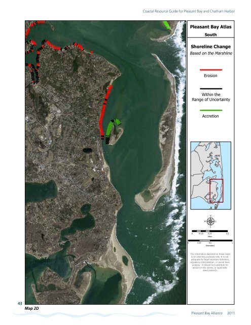
<strong>Coastal</strong> <strong>Resource</strong> <strong>Guide</strong> for <strong>Pleasant</strong> <strong>Bay</strong> <strong>and</strong> <strong>Chatham</strong> <strong>Harbor</strong><br />
<strong>Pleasant</strong> <strong>Bay</strong> Atlas<br />
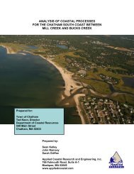
South<br />
Shoreline Change<br />
Based on the Marshline<br />
Erosion<br />
Within the<br />
Range of Uncertainty<br />
Accretion<br />
µ<br />
0 0.125 0.25 0.5<br />
Miles<br />
0 0.25 0.5 1<br />
Kilometers<br />
The information depicted on these maps<br />
is for planning purposes only. It is not<br />
adequate for legal boundary definition,<br />
regulatory interpretation, or parcel level<br />
analysis. It should not substitute for<br />
actual on-site survey, or supersede<br />
deed research.<br />
43<br />
Map 2D<br />
<strong>Pleasant</strong> <strong>Bay</strong> Alliance 2011