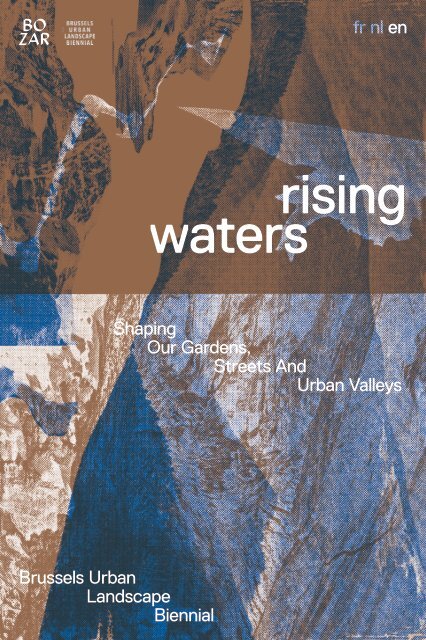
Rising Waters (en)

You also want an ePaper? Increase the reach of your titles
YUMPU automatically turns print PDFs into web optimized ePapers that Google loves.
fr nl <strong>en</strong><br />
rising<br />
waters<br />
Shaping<br />
Our Gard<strong>en</strong>s,<br />
Streets And<br />
Urban Valleys<br />
Brussels Urban<br />
Landscape<br />
Bi<strong>en</strong>nial
Shaping<br />
Our Gard<strong>en</strong>s,<br />
Streets And<br />
Urban Valleys<br />
rising<br />
waters<br />
Architecture Workroom Brussels,<br />
Bureau Bas Smets,<br />
JNC International,<br />
Latitude Platform,<br />
Taktyk<br />
Brussels Urban<br />
Landscape<br />
Bi<strong>en</strong>nial<br />
2018
Foreword Bozar<br />
Paul Dujardin<br />
An iconic edifice of the Brussels area, the C<strong>en</strong>tre<br />
for Fine Arts is the embodim<strong>en</strong>t of a covered<br />
urban landscaping system that has be<strong>en</strong> placed<br />
in the valley of the Mont des Arts. Part of a city<br />
for decades and on a daily basis, it is home to<br />
the unique hustle and bustle of urban life. It is a<br />
place for constant comings and goings, but also<br />
a place for meetings and discussions, op<strong>en</strong> to the<br />
inhabitants of the Brussels Region and visitors<br />
alike, in a region that is in constant evolution.<br />
Through a programme that is very closely linked<br />
to architectural, urban and social questions,<br />
we are rethinking what a city can be, and its new<br />
chall<strong>en</strong>ges. We are looking to get closer to an<br />
increasingly diverse public, so that everyone can<br />
find a space in which local issues, not to m<strong>en</strong>tion<br />
Belgian and international ones, can be brought to<br />
the table.<br />
For the second edition of the Brussels Urban<br />
Landscape Bi<strong>en</strong>nial (BULB), BOZAR is delighted to<br />
play host to the exhibition and a multitude of linked<br />
activities; demonstrating the new style of bi<strong>en</strong>nial<br />
ev<strong>en</strong>t this has now become. The exhibition <strong>Rising</strong><br />
<strong>Waters</strong> — Shaping Our Gard<strong>en</strong>s, Streets And Urban<br />
Valleys takes a closer look at the, at times alarming,<br />
situation of water managem<strong>en</strong>t and its cycles in<br />
the Brussels Region, and investigates new ways of<br />
introducing long-term concrete solutions to the<br />
continued developm<strong>en</strong>t of the urban landscape and<br />
its inhabitants.<br />
4 5
BOZAR is once again staging this exhibition at<br />
the initiative of the Ministry of the Environm<strong>en</strong>t<br />
and the Quality of Life. We hope that there will be<br />
future editions to awak<strong>en</strong> awar<strong>en</strong>ess and stimulate<br />
fascinating debates on the numerous questions<br />
raised by the urban <strong>en</strong>vironm<strong>en</strong>t in which we live:<br />
Brussels and the construction of its territory, at<br />
the heart of Europe.<br />
Foreword Curator<br />
Joachim Declerck<br />
Water turns this 'blue' planet into a unique and<br />
liveable ecosystem, especially for humans. But it<br />
also repres<strong>en</strong>ts one of the biggest and most visible<br />
threats: there is too little, too much and too<br />
polluted water. With global warming, the frequ<strong>en</strong>cy<br />
and int<strong>en</strong>sity of heavy rainfall and periods of<br />
drought increases, like this summer. This requires<br />
a transformation of our cities and landscapes to<br />
<strong>en</strong>sure they can cope with those extreme fluctuations<br />
in rainfall and temperature. The task is ess<strong>en</strong>tially<br />
simple: we have to make room for water throughout<br />
the city. A city like Brussels, built over brook valleys<br />
and the marsh of the S<strong>en</strong>ne, must once again be able<br />
to work like a 'sponge'. By slowing the drainage of<br />
water and allowing more water to infiltrate into the<br />
soil, we avoid heavy rainfall leading to flooding, and<br />
we provide a reservoir in periods of drought.<br />
As with the transition to r<strong>en</strong>ewable <strong>en</strong>ergy or to<br />
a circular economy, it is much easier to formulate<br />
and decide what needs to be done than to actually<br />
implem<strong>en</strong>t it. We have come to live in the illusion<br />
that there will always be an additional technological<br />
or infrastructural solution, and we therefore do not<br />
have to adjust our living <strong>en</strong>vironm<strong>en</strong>t and lifestyle<br />
to respond to major changes and chall<strong>en</strong>ges. Today,<br />
it is clear that the space needed for a healthy and<br />
resili<strong>en</strong>t water system can only be made in places<br />
where we now have gard<strong>en</strong>s, streets, parking<br />
lots, squares and parks. There is no other space.<br />
The transition to a water-s<strong>en</strong>sitive city therefore<br />
6 7
equires a new g<strong>en</strong>eration of street, neighbourhood<br />
and urban projects, for which vision, examples and<br />
forms of cooperation must be developed and tested<br />
in practice.<br />
A bi<strong>en</strong>nial is ideal for making cultural change<br />
possible. From Rotterdam to Bordeaux, and more<br />
and more explicitly in Brussels, bi<strong>en</strong>nials for<br />
architecture, urban design and landscape pres<strong>en</strong>t<br />
themselves as workshops to develop new visions<br />
and projects, and as forums for social debate and<br />
coalition building around the future of the city. As<br />
<strong>en</strong>gaged cultural free spaces, they push forward<br />
policy, practice and civil society. For example,<br />
this exhibition does not pres<strong>en</strong>t a best of existing<br />
projects concerning city and water. During the past<br />
few months, Atelier BULB invited four r<strong>en</strong>owned<br />
Brussels landscape design offices to explore<br />
which new urban water projects are necessary and<br />
possible. Their vision and proposals to prepare the<br />
Brussels valleys, neighbourhoods and streets for the<br />
changing climate, form the core of this exhibition.<br />
Along with international refer<strong>en</strong>ce projects, works of<br />
art, graphic material, and docum<strong>en</strong>tation of curr<strong>en</strong>t<br />
policies and projects, they create a narrative and<br />
ag<strong>en</strong>da for the future. More than just a retrospect,<br />
<strong>Rising</strong> <strong>Waters</strong> offers a preview and a call to action.<br />
8<br />
Introduction Exhibition<br />
Shaping<br />
Our Gard<strong>en</strong>s,<br />
Streets And<br />
Urban Valleys<br />
rising<br />
waters<br />
01. Faced with the increasing risk of floods and their<br />
associated impact on the quality of life for inhabitants, there is a<br />
need for a more innovative approach to water managem<strong>en</strong>t which<br />
must also be integrated into urban planning. On the one hand,<br />
there are still many projects underway aimed at improving water<br />
quality, with a primary objective of meeting local and international<br />
quality norms. On the other hand, climate change, fed by periods<br />
of both int<strong>en</strong>se rainfall and drought, is creating a whole new scale<br />
of problems for our cities. Over the past decades there has be<strong>en</strong> an<br />
over-reliance on <strong>en</strong>gineering works ‘protecting’ our urban areas<br />
through complex drainage systems and underground reservoirs for<br />
flood waters. However, over the past c<strong>en</strong>turies, the growing city has<br />
covered, forgott<strong>en</strong> and ev<strong>en</strong> destroyed large portions of the natural<br />
water network fed by marshland, streams and rivers. It is now<br />
incontestable that the technical solutions are no longer suffici<strong>en</strong>t,<br />
and it is necessary to rediscover these aqueous systems within our<br />
modern cities. However, this redefining of the urban landscape will<br />
require continued support, working in close partnership with local<br />
authorities, experts, citiz<strong>en</strong>s and landscape architects. The multitude<br />
of projects in the parks, the resid<strong>en</strong>tial areas, the streets,<br />
the public spaces and the landscaped axes has now become the new<br />
playing field for furthering this approach.<br />
Sculpting the form of the valleys through which it flows,<br />
a waterway draws and creates a dynamic system which spreads<br />
over a vast area, including its tributaries, from the source itself<br />
to the delta and coastal estuaries. Rivers have always supported<br />
inhabitants through providing a means of transport, fertile soil ideal<br />
for agriculture, or ev<strong>en</strong> strong curr<strong>en</strong>ts to be used as an <strong>en</strong>ergy<br />
source. Whilst demographic growth in urban areas leaves less and<br />
less space for the natural water cycle to occur, it is also creating<br />
9
01.01<br />
The trio of Danish artists<br />
‘Superflex’ (Rasmus Niels<strong>en</strong>,<br />
Jakob F<strong>en</strong>ger et Bjørnstjerne<br />
Christians<strong>en</strong>) depict a critique<br />
of the rising tide of consumerism<br />
that has overrun our daily lives.<br />
Stripped of any human pres<strong>en</strong>ce,<br />
this 20-minute video, first<br />
pres<strong>en</strong>ted at the South London<br />
Gallery (UK), combines humour<br />
with a disturbing atmosphere.<br />
A work that marks the slow<br />
destruction of a site as the water<br />
comes rushing in.<br />
Flooded McDonald’s, film, 20 min,<br />
Superflex, 2009<br />
02.01<br />
The Brussels hydrographic<br />
network is part of the S<strong>en</strong>ne River<br />
basin, whose source is close to the<br />
commune of Soignies and flows<br />
for about 100km until it joins the<br />
River Dyle in Z<strong>en</strong>negat. Whereas<br />
the Canal appears at S<strong>en</strong>effe,<br />
crosses Brussels and Willebroek<br />
and finally flows into the Escaut<br />
at Wintam in Flanders. In the<br />
Brussels-Capital Region, it is their<br />
tributaries that shape the valleys<br />
from which the urban fabric rises,<br />
including the sewerage network<br />
and two wastewater treatm<strong>en</strong>t<br />
plants, as well as the distribution<br />
network whose clear water supply<br />
comes almost <strong>en</strong>tirely from<br />
Wallonia.<br />
The S<strong>en</strong>ne basin, rivers and<br />
catchm<strong>en</strong>t areas, hydrographic<br />
network, hazards and risk of<br />
flooding, pot<strong>en</strong>tial rainwater<br />
infiltration areas, topography,<br />
drainage and water supply network<br />
of the Brussels-Capital Region,<br />
series of maps, print, Architecture<br />
Workroom Brussels, 2018<br />
(source: Bruxelles Environnem<strong>en</strong>t,<br />
SBGE-BMWB, Vivaqua)<br />
02.02<br />
In Brussels, incid<strong>en</strong>ts of heavy<br />
rain, steep slopes, an increase in<br />
impermeable ground surfaces and<br />
an inadequate drainage network<br />
are failing to contain runoff<br />
waters, creating an increased<br />
risk of flooding, and disrupting<br />
the balance of the natural water<br />
cycle. The negative impact of<br />
non-integrated water managem<strong>en</strong>t<br />
from the source is particularly felt<br />
at the bottom of the valleys, with an<br />
impact on the ecological quality of<br />
rivers and groundwater.<br />
Brussels Water Managem<strong>en</strong>t –<br />
A Landscape of Problems, print,<br />
Architecture Workroom Brussels,<br />
2018<br />
02.03<br />
The Pacco-test was implem<strong>en</strong>ted<br />
in order to allow everyone to<br />
control water quality in the city<br />
and to be able to interv<strong>en</strong>e in<br />
the ev<strong>en</strong>t of worrying pollution<br />
levels. The developm<strong>en</strong>t of an<br />
innovative device to measure water<br />
quality became a social urban<br />
experi<strong>en</strong>ce that brought together<br />
people from the community,<br />
politics, the world of business,<br />
the ‘maker community’ and the<br />
sci<strong>en</strong>tific sector. This allowed<br />
the formulation of an innovative<br />
vision of water policy: collective<br />
<strong>en</strong>vironm<strong>en</strong>tal managem<strong>en</strong>t.<br />
This prototype is part of an<br />
experim<strong>en</strong>tal process that is still<br />
being fine-tuned.<br />
Pacco-test, prototype,<br />
City Mine(d), 2016<br />
02.04<br />
The control of groundwater is<br />
conducted through sampling<br />
and artificial groundwater repermeation.<br />
Since the <strong>en</strong>d of the<br />
1980s, groundwater aquifers<br />
have be<strong>en</strong> regularly monitored<br />
under the <strong>en</strong>tire surface of the<br />
Brussels region. In 2012, no fewer<br />
than forty-eight piezometers<br />
(an instrum<strong>en</strong>t used to measure<br />
the compressibility of liquids)<br />
make up a network for measuring<br />
underground aqueous ph<strong>en</strong>om<strong>en</strong>a.<br />
On the surface and<br />
since 2015, the POOL IS COOL<br />
organisation – a platform made up<br />
of citiz<strong>en</strong>s and experts – has be<strong>en</strong><br />
developing its own research in<br />
parallel in order to assess op<strong>en</strong>-air<br />
swimming opportunities in the<br />
Brussels Region, but also to raise<br />
public awar<strong>en</strong>ess of issues related<br />
to the biodiversity of the local<br />
<strong>en</strong>vironm<strong>en</strong>t.<br />
Quality test samples,<br />
glass and water vials, IBGE, 2018<br />
Soon we will swim together under<br />
the blue sky!, bathing cap with silk<br />
scre<strong>en</strong> print, POOL IS COOL, 2017<br />
<strong>Rising</strong> <strong>Waters</strong> – Shaping Our Gard<strong>en</strong>s, Streets And Urban Valleys<br />
a greater need for landscaping services. Climate change, and the<br />
associated extreme weather ev<strong>en</strong>ts, are forcing us to rethink the<br />
way in which we build our cities and the ways in which we consume,<br />
treat, store and drain our water within urban spaces.<br />
The transition towards a “united valley” will require new<br />
approaches and working methods. Water managem<strong>en</strong>t cannot<br />
stop at a border (national, regional or local) nor at the edge of a<br />
neighbourhood or private land. It requires collective action.<br />
Trans‐national coordination is needed, in addition to local cooperation<br />
betwe<strong>en</strong> the differ<strong>en</strong>t parties involved: public authorities and<br />
network operators, resid<strong>en</strong>ts directly affected by water problems<br />
and, of course, all those who b<strong>en</strong>efit from the water in their daily<br />
lives. Water is everyone’s business; a source of problems as well as<br />
a provider of solutions. It is about collectively transforming it into<br />
an opportunity to create a better understanding and managem<strong>en</strong>t<br />
of water across urbanised areas, aiming for a united valley.<br />
02. In Brussels, floods are a frequ<strong>en</strong>t ph<strong>en</strong>om<strong>en</strong>on,<br />
being caused by periods of exceptionally int<strong>en</strong>se rainfall (particularly<br />
in summer) as well as hard soil sealing, due to an increasing<br />
urbanisation. The drainage system, partially in disrepair and<br />
insuffici<strong>en</strong>t in scale, and the lack of a network separating clean<br />
and dirty water, increases the risk of overflow as well as increasing<br />
the volumes that need to pass through treatm<strong>en</strong>t plants. Waste<br />
products, discharges and substances which leak into clean water<br />
and seep into the ground are polluting our waterways, lakes and<br />
underground aquifers and putting the balance of <strong>en</strong>tire ecosystems<br />
in danger. The S<strong>en</strong>ne River is one of the most effected, suffering<br />
the mounting repercussions of insuffici<strong>en</strong>t ingress and ret<strong>en</strong>tion of<br />
the rainwater runoff into the lakes and reservoirs feeding the river.<br />
Actions to improve the quality of the <strong>en</strong>tire hydrographic basin will<br />
have to focus on the tributaries in the surrounding hills, designating<br />
the valley as the defining elem<strong>en</strong>t of the urban space.<br />
11
03.01<br />
03.03<br />
The rainwater tank is on the Inhabited by these objects;<br />
second floor on a mur mitoy<strong>en</strong> streets, squares, parks,<br />
in Forest (Brussels) and has industrial, commercial and<br />
a capacity of 510 litres. It is household lots turn into devices<br />
repl<strong>en</strong>ished by rainwater that that can detain, retain, and<br />
falls on the roofs of the two process (rain) water as much<br />
neighbouring households. After as possible before adding it to<br />
storms, the buffered water is the supply system or allowing it<br />
slowly released: one half feeds a to flow into the waste system.<br />
storage tank in Eric and Anne’s They are the urban elem<strong>en</strong>ts<br />
basem<strong>en</strong>t and the other half of Brussels that outline what<br />
refills the inflatable tank located transformations each recurr<strong>en</strong>t<br />
under the patio of François and space type and the space<br />
Pernilla’s gard<strong>en</strong>.<br />
handler should undergo in<br />
This rainwater tank relation to the treatm<strong>en</strong>t of<br />
was designed in the frame of Ilot water.<br />
d'Eau, a collaborative design Elem<strong>en</strong>ts, 6 drawings printed<br />
project developed into a series on paper, Latitude Platform, 2018.<br />
of workshops organised by Elaboration from Ranzato,<br />
Latitude Platform. It operates as M. Aragone, A., and Verbeir<strong>en</strong>,<br />
pilot for other similar situations B. (eds.) (2017) Wet City<br />
in Brussels and elsewhere. Elem<strong>en</strong>ts. Elem<strong>en</strong>tary Design, 1<br />
Making a visible source, together, (originally worked out at<br />
photograph, Bruno Dias V<strong>en</strong>tura, the Faculty of Architecture<br />
2018<br />
La Cambre Horta, ULB)<br />
03.02<br />
Storm water ret<strong>en</strong>tion tanks,<br />
storage tanks, rain gard<strong>en</strong>s,<br />
ponds, natural pools,<br />
constructed wetlands, wetlands,<br />
rainwater flowerbeds, trees,<br />
watercourses, drainage ditches,<br />
swales, infiltration tr<strong>en</strong>ches,<br />
parking spot dams and water<br />
ret<strong>en</strong>tion paving, tr<strong>en</strong>ches,<br />
roofs. These are the samples<br />
of objects that are spreading<br />
across the Brussels landscape,<br />
all of them created for slowing,<br />
retaining, and processing the<br />
region’s rainwater.<br />
Objects, 18 drawings printed<br />
on paper, Latitude Platform, 2018<br />
03.04<br />
The proliferation of wet city<br />
elem<strong>en</strong>ts across the landscape<br />
of Brussels is progressing<br />
rapidly. Square kilometres of<br />
urban space (both in the public<br />
and private domain) and a<br />
multitude of land owners are<br />
involved. This exceptional<br />
product stands as an imaginary<br />
force of a shared urban care<br />
for water: it is this common<br />
understanding that water is an<br />
invaluable resource that holds<br />
the fragm<strong>en</strong>ted socio-ecological<br />
geography together.<br />
Brussels’ Wet City Elem<strong>en</strong>ts,<br />
map printed on paper,<br />
Latitude Platform, 2018<br />
Elaboration from Ranzato,<br />
M. Aragone, A., and Verbeir<strong>en</strong>,<br />
B. (eds.) (2017) Wet City<br />
Elem<strong>en</strong>ts. Elem<strong>en</strong>tary Design,<br />
1 (originally worked out at<br />
the Faculty of Architecture<br />
La Cambre Horta, ULB)<br />
03.05<br />
Shrinking, expanding, splitting,<br />
multiplying, hybrids, pairing,<br />
objects and elem<strong>en</strong>ts that<br />
slow, retain and process<br />
water in the Maelbeek valley,<br />
specifically in Place Flagey and<br />
the surrounding area, can take<br />
many forms. Beyond technical<br />
aspects, new partnerships<br />
and synergies thrive alongside<br />
hard work of individuals,<br />
corporations, public institutions<br />
and other parties. This new<br />
(obsessive) practice of water<br />
care is unfolding, redefining<br />
the conception, form, and<br />
experi<strong>en</strong>ce of the urban scape.<br />
Water vs. Urban, drawings printed<br />
on paper, Latitude Platform, 2018<br />
Elaboration from Ranzato,<br />
M., Marcon, A., Conz, S., Siyu,<br />
L., and Yang, Z. (2017) ‘Brussels’<br />
Visible Water’ in Ranzato, M. (ed.)<br />
Water vs. Urban Scape. Berlin:<br />
Jovis, pp. 185-201 (originally worked<br />
out at the Faculty of Architecture<br />
La Cambre Horta, ULB)<br />
03.06<br />
The key developm<strong>en</strong>t for the<br />
Maelbeek basin is its evolution<br />
an urban landscape of visible<br />
water, once again: drainage<br />
ditches and watercourses across<br />
urban areas and along the<br />
streets; stormwater ret<strong>en</strong>tion<br />
tanks, storage tanks, and<br />
rain gard<strong>en</strong>s in households;<br />
det<strong>en</strong>tion tr<strong>en</strong>ches, and<br />
det<strong>en</strong>tion roofs in industrial and<br />
commercial lots; infiltration<br />
tr<strong>en</strong>ches and parking spot<br />
dams, and swales by the<br />
street sides; det<strong>en</strong>tion paving,<br />
infiltration tr<strong>en</strong>ches, rainwater<br />
flowerbeds, and natural pools<br />
in the squares; constructed<br />
wetlands, wetlands, and ponds<br />
in the parks; trees everywhere.<br />
The geography of the Maelbeek<br />
surface water mirrors that<br />
of a city <strong>en</strong>tirely focused on<br />
managing its water.<br />
Endless Maelbeek, drawing printed<br />
on paper, Latitude Platform, 2018<br />
Every<br />
Space<br />
Counts<br />
Every Space Counts is our adage to speak<br />
about the value of the <strong>en</strong>tire inhabited<br />
space of the Brussels Capital Region wh<strong>en</strong><br />
water is called into question. It resounds<br />
the more known Every Drop Counts 1 .<br />
However, it reverses the perspective while<br />
amplifying the field of vision regarding<br />
water. The standpoint flips and becomes<br />
the one of water. What is the pot<strong>en</strong>tial<br />
intake of Brussels’ urban landscape if we<br />
would strive for this precious resource?<br />
The mobilisation that the socio-ecological<br />
physiography of the region can provide<br />
to detain, retain, and process water is put<br />
under investigation. After all, rainwater still<br />
falls around the Brussels Capital Region out<br />
of our (human) control. Every c<strong>en</strong>timetre<br />
of the region is a pot<strong>en</strong>tial catalyst. Every<br />
spatial handler is a pot<strong>en</strong>tial stakeholder.<br />
Every Space Counts is a project by Latitude<br />
Platform based on the postdoctoral<br />
research of Marco Ranzato at the Faculty<br />
of Architecture La Cambre Horta (ULB)<br />
with the support of the Institut Bruxellois<br />
pour la Recherche Sci<strong>en</strong>tifique, under the<br />
grant Prospective Research for Brussels<br />
2012. During the research, Latitude<br />
Platform has supported the progress of<br />
the academic investigation. Elem<strong>en</strong>tary<br />
Design 1 – Wet City Elem<strong>en</strong>ts and Water<br />
vs. Urban Scape are the two mainstays<br />
of this academic research that Latitude<br />
has reworked to bear the abovem<strong>en</strong>tioned<br />
adage.<br />
Elem<strong>en</strong>tary Design 1 – Wet City Elem<strong>en</strong>ts<br />
is a transdisciplinary exploration on<br />
sc<strong>en</strong>arios of micro-scale water-flow<br />
dec<strong>en</strong>tralisation for the Brussels Capital<br />
Region. 2 This work builds upon the<br />
Landscape Elem<strong>en</strong>ts Water Managem<strong>en</strong>t<br />
Strategy, an elem<strong>en</strong>tary cognitive strategy<br />
deployed to tackle the pres<strong>en</strong>t complexity<br />
of the landscape and unfold the pot<strong>en</strong>tial<br />
intake that each landscape compon<strong>en</strong>t can<br />
Latitude Platform<br />
provide with regard to water 3 . The five main<br />
stages of the strategy (Preconditions/<br />
Sc<strong>en</strong>ario/Guiding Model/Mapping and<br />
Computation/Area-Flow-Actor Sheet) have<br />
made it possible to work out a demontage<br />
of Brussels and draw up a taxonomy of<br />
its landscape types or elem<strong>en</strong>ts (streets,<br />
squares, permeable public spaces,<br />
industrial and commercial lots, household<br />
rooftops, and private gard<strong>en</strong>s). The goal<br />
was to hypothetically reorganise water<br />
inflows and outflows, supplies and<br />
discharges related to each single elem<strong>en</strong>t<br />
via the incorporation of micro-scale waterflow<br />
solutions–or objects–that detain,<br />
retain and process water; to id<strong>en</strong>tify the<br />
practices or recurr<strong>en</strong>t sequ<strong>en</strong>ces of actions<br />
that the handler(s) of each prototypical<br />
elem<strong>en</strong>t is required to take in order to make<br />
the new <strong>en</strong>gines for water operational; to<br />
visualize the by-product of the reiteration<br />
of objects, elem<strong>en</strong>ts, and practices at the<br />
scale of the region; to appreciate the macro<br />
implications of this elem<strong>en</strong>tary operations<br />
on the water budget of the Brussels<br />
Capital Region. Wet City Elem<strong>en</strong>ts does not<br />
exclude systemic solutions per se. Focusing<br />
on the single basic elem<strong>en</strong>t, it produces a<br />
know-how to reinvest and reinterpret wh<strong>en</strong><br />
looking for synergies among the various<br />
parts of the landscape.<br />
Water vs. Urban Scape is a book and a<br />
research on the curr<strong>en</strong>t urbanisation and<br />
the pres<strong>en</strong>t and pot<strong>en</strong>tial arrangem<strong>en</strong>t<br />
of its waters. 4 It is inspired by the<br />
international workshop Water vs.<br />
Urban Scape? Exploring Integrated and<br />
Dec<strong>en</strong>tralised Arrangem<strong>en</strong>ts of Water in<br />
the Brussels Capital Region mastered by<br />
Latitude Platform and held at the Faculty<br />
of Architecture La Cambre Horta (ULB)<br />
in July 2013. This work explores pot<strong>en</strong>tial<br />
future water-urban arrangem<strong>en</strong>ts of the<br />
Maelbeek Valley, one of the six watersheds<br />
crossing and giving form to the landscape<br />
of Brussels. The glorious bodies of water of<br />
a bygone era (rivers, fish ponds, wetlands,<br />
etc.) function as inspiration at most.<br />
The urban/colonised-nature–to recall the<br />
notorious expression ‘second nature’ by<br />
Cronon (1991) 5 –of the Maelbeek is deemed<br />
13
Latitude Platform<br />
to be the abundant hand that feeds the<br />
imaginary. Through design, its socioecological<br />
physiography is reinterpreted to<br />
explore water-urban arrangem<strong>en</strong>ts that are<br />
complem<strong>en</strong>tary and sometimes alternative<br />
to the existing underground, invisible,<br />
c<strong>en</strong>tralised, monopolistic ones. By contrast,<br />
visible, dec<strong>en</strong>tralised, heterog<strong>en</strong>eous,<br />
inclusive, socially-diversified water<br />
arrangem<strong>en</strong>ts populate the Maelbeek<br />
like parasites, giving shape to new forms<br />
of living with water. These tableaux<br />
stand for the true cultural shift that the<br />
incorporation of water at any level of the<br />
Brussels landscape brings with it.<br />
compon<strong>en</strong>ts can synergise on a transect of<br />
the Maelbeek Valley. The complex ‘project<br />
of water’ multiplies pervading the <strong>en</strong>tire<br />
watershed of the Maelbeek and beyond.<br />
The urbanised landscape of Brussels proves<br />
not to be ‘wrong’. It is on the contrary<br />
a great canvas that could be activated<br />
by the pervasive ‘project of water’ and<br />
its assemblages of objects, elem<strong>en</strong>ts,<br />
and practices. Do not forget: Every Space<br />
Counts.<br />
The exhibition conceived for BULB<br />
reinterprets the abovem<strong>en</strong>tioned works–<br />
Elem<strong>en</strong>tary Design 1–Wet City Elem<strong>en</strong>ts<br />
and Water vs. Urban Scape. Latitude<br />
Platform aims at striking the imaginary of<br />
the visitor displaying objects, elem<strong>en</strong>ts,<br />
and practices for the det<strong>en</strong>tion, ret<strong>en</strong>tion<br />
and processing of water at any level of<br />
the Brussels-scape and their interlinkages<br />
across the scales. The first part, Brussels’<br />
Wet City Elem<strong>en</strong>ts, shows the ‘project<br />
of water’ for the recurr<strong>en</strong>t landscape<br />
compon<strong>en</strong>ts alone. It th<strong>en</strong> describes<br />
what is the pot<strong>en</strong>tial intake that they can<br />
provide altogether at the regional scale.<br />
The second part, Water vs. Urban Scape,<br />
shows how the diverse socio-ecological<br />
1 Schultze, T., Tjallingii, S.P.<br />
(eds.) (2008) Every Drop<br />
Counts: Environm<strong>en</strong>tally Sound<br />
Technologies for Urban and<br />
Domestic Water Use Effici<strong>en</strong>cy.<br />
Delft/Osaka: TUDelft/UNEP.<br />
2 Latitude Platform (Andrea<br />
Aragone) offered support to<br />
the implem<strong>en</strong>tation of the<br />
sc<strong>en</strong>arios. To know more about<br />
this research, see Ranzato, M.,<br />
Aragone, A., and Verbeir<strong>en</strong>,<br />
B. (eds.) (2017) Wet City<br />
Elem<strong>en</strong>ts. Elem<strong>en</strong>tary Design, 1.<br />
3 To know more about<br />
this research, see Ranzato,<br />
M. (2017) ‘Landscape elem<strong>en</strong>ts<br />
as a basis for Integrated<br />
Water Managem<strong>en</strong>t’,<br />
Urban Water Journal, 14(7),<br />
pp. 694‐703.<br />
4 Ranzato, M. (ed.) (2017)<br />
Water vs. Urban Scape. Berlin:<br />
Jovis, pp. 320.<br />
5 Cronon, W. (1991) Nature’s<br />
Metropolis: Chicago and<br />
the Great West. New York:<br />
W. W. Norton.<br />
14
JNC International<br />
New<br />
Ukkelbeek<br />
Valley<br />
Situation:<br />
The Ukkelbeek Valley, a network of<br />
streams that have disappeared b<strong>en</strong>eath<br />
the streets, and a forgott<strong>en</strong> terrain.<br />
Historically, the landscape of the Ukkelbeek<br />
Valley, along which lies the anci<strong>en</strong>t village<br />
of Uccle, consisted of a sequ<strong>en</strong>ce of<br />
ponds, meadows and wetlands through<br />
which the Ukkelbeek stream meandered,<br />
while an agricultural landscape covered<br />
the plateaus on either side. A network of<br />
sunk<strong>en</strong> paths linked the inhabited bottom<br />
of the valley and the cultivated plateaus.<br />
Transit traffic mainly passed along the<br />
ridges on either side of the floodplain.<br />
Over the course of the 19 th and 20 th<br />
c<strong>en</strong>turies, urbanisation developed along<br />
new av<strong>en</strong>ues and causeways, going<br />
against the grain of the topography and<br />
the logic behind the first core settlem<strong>en</strong>ts.<br />
The effect of this has be<strong>en</strong> to erase<br />
perceptions of the valley from the<br />
image of the new neighbourhoods, while<br />
gradually replacing the natural hydraulic<br />
network with a single unified network<br />
channelling all the waters together into<br />
the sewer. And yet, under the asphalt<br />
and the bricks of these new resid<strong>en</strong>tial<br />
neighbourhoods, the waters of the<br />
Ukkelbeek continue to flow unnoticed,<br />
making occasional appearances through<br />
the fr<strong>en</strong>etic pace of urban life that has<br />
tak<strong>en</strong> root in the valley.<br />
Proposal:<br />
The JNC – Petizon team proposes a<br />
set of complem<strong>en</strong>tary strategies for an<br />
alternative managem<strong>en</strong>t of rainwater,<br />
while revealing a new urban landscape for<br />
the Ukkelbeek Valley.<br />
This landscaping work along the course of<br />
the Ukkelbeek Valley is developed in three<br />
complem<strong>en</strong>tary strategies:<br />
1 Filter Gard<strong>en</strong>s<br />
Or how to reintegrate the water cycle into<br />
the city.<br />
Strategy:<br />
infiltration at block level.<br />
The approach is based around a series<br />
of blocks on the plateaux on either side<br />
of the Ukkelbeek Valley, by developing<br />
infiltration gard<strong>en</strong>s, adapting to the<br />
context and the differ<strong>en</strong>t typologies of the<br />
urban fabric. Five typologies have be<strong>en</strong><br />
id<strong>en</strong>tified: continuous terraced blocks,<br />
semi-detached blocks, blocks of detached<br />
resid<strong>en</strong>tial buildings, blocks of detached<br />
empty buildings, and industrial blocks.<br />
The implem<strong>en</strong>tation of a participatory<br />
process involving the inhabitants of each<br />
block would th<strong>en</strong> allow collective decisionmaking<br />
for the implem<strong>en</strong>tation of a vast<br />
project of shared gard<strong>en</strong>s at the <strong>en</strong>d of<br />
each block, which would contribute to a<br />
shared living experi<strong>en</strong>ce while offering<br />
hydraulic solutions on an appropriate scale.<br />
Filter gard<strong>en</strong>s consist of a combination<br />
of gre<strong>en</strong> roofs and communal gard<strong>en</strong>s<br />
within blocks made up of hollows and<br />
troughs. The total capacity of the FILTER<br />
GARDENS should allow for absorption and<br />
contain 70% of so-called ‘normal’ rains,<br />
as well as exceptional rains (with a return<br />
time of tw<strong>en</strong>ty years), with a discharge<br />
to the sewer of less than one litre per<br />
second. This b<strong>en</strong>chmark, which takes into<br />
account the latest observations of the<br />
evolution of rainfall ev<strong>en</strong>ts in rec<strong>en</strong>t years,<br />
is the one curr<strong>en</strong>tly proposed by Brussels<br />
Environm<strong>en</strong>t.<br />
2 New Urban Streams<br />
Or how to maximise biodiversity and<br />
ecological pot<strong>en</strong>tial in public spaces.<br />
Strategy:<br />
collection of runoff water through a gre<strong>en</strong><br />
and blue network.<br />
This second approach takes place around<br />
a network of public spaces made up of<br />
streets and some urban parks connecting<br />
17
JNC International<br />
Taktyk<br />
the Uccle plateau and the Ukkelbeek<br />
Valley. This has gradually covered up the<br />
old hydraulic network, once made up of<br />
valleys, embankm<strong>en</strong>ts and sunk<strong>en</strong> paths<br />
which allowed runoff water to flow into the<br />
Ukkelbeek. Today, the hydraulic network<br />
has gradually be<strong>en</strong> transformed into an<br />
urban infrastructure of wide asphalted<br />
streets, covering a sewer network mixing<br />
wastewater and rainwater.<br />
The objective of NEW URBAN STREAM,<br />
which follows in the footsteps of this old<br />
hydraulic network, is twofold: on the one<br />
hand, it aims to restore into the public<br />
space a network of plant gullies that can<br />
absorb, slow down and partially infiltrate<br />
the rainwater, which in stormy weather<br />
flows down both sides of the Ukkelbeek<br />
Valley; on the other hand, it seeks to offer<br />
a network of linear gre<strong>en</strong> spaces, aiming<br />
to ecologically reconnect the natural<br />
spaces that have be<strong>en</strong> fragm<strong>en</strong>ted by<br />
urbanisation, in order to support a better<br />
biodiversity through the urban fabric.<br />
3 New Wasterscapes<br />
Or how to restore access to water as a<br />
common right in a shared space, while<br />
raising public awar<strong>en</strong>ess of solidarity in<br />
water managem<strong>en</strong>t.<br />
Strategy:<br />
Raising clear water from the bottom<br />
of the valley in quality public spaces,<br />
allowing water to express itself in all<br />
its forms.<br />
This third approach, complem<strong>en</strong>tary to the<br />
first two, focuses on the bottom of the<br />
Ukkelbeek Valley, both on public spaces<br />
and adjac<strong>en</strong>t private spaces, as well as on<br />
certain institutional sites. The Ukkelbeek<br />
may have almost completely disappeared<br />
from the landscape of the bottom of the<br />
valley, but it still flows b<strong>en</strong>eath several<br />
layers of urbanisation, more or less<br />
disconnected from the unitary network<br />
that it runs alongside for the l<strong>en</strong>gth of its<br />
course.<br />
The objective of these NEW WATERSCAPES<br />
is to bring the Ukkelbeek stream back into<br />
the op<strong>en</strong> through a new urban space at<br />
the bottom of the valley, collecting the<br />
waters of the blue network developing<br />
on either side of the latter. We propose<br />
the redevelopm<strong>en</strong>t of the Rue de Stalle,<br />
Av<strong>en</strong>ue De Fré segm<strong>en</strong>t, thus allowing the<br />
Ukkelbeek to regain its rights in the public<br />
space (including the right of the Haute<br />
Ecole de Bruxelles De Fré, the square in<br />
front of the Moulin Rose, the squares of<br />
Les Héros and Marlow, the site of the<br />
Moulin Blanc, the Raspail Park…), while<br />
allowing it to expand following the flow of<br />
meteorological ev<strong>en</strong>ts, offering the public<br />
the full range of functions and services–<br />
playful and recreational, educational,<br />
ecological and climatic–provided by water<br />
in an urban landscape.<br />
Water Catchers<br />
design<br />
strategies for<br />
emerging<br />
landscapes<br />
Aims and Objectives<br />
The topography in Forest is regularly<br />
exposed to flooding, ev<strong>en</strong>ts that reveal<br />
what is g<strong>en</strong>erally invisible. The threat of<br />
water becomes a subject, an opportunity<br />
for the emerg<strong>en</strong>ce of an ambitious and<br />
collective project. In order to adapt to<br />
the projected rainfall forecast by 2100,<br />
rainwater managem<strong>en</strong>t capacity in Forest,<br />
curr<strong>en</strong>tly focused on the streets in the<br />
‘lower’ part of Forest, will need to be<br />
multiplied at least fivefold and cover all<br />
its drainage basins, including the ‘upper’<br />
part of Forest. This mainly ‘technical’<br />
and quantitative chall<strong>en</strong>ge can rapidly<br />
become a lever and a major opportunity<br />
to act on a specific landscape at the<br />
<strong>en</strong>trance to the Brussels Region.<br />
Following the example of the Design for<br />
London approach, included as a refer<strong>en</strong>ce<br />
project in the exhibition, we consider the<br />
meeting point betwe<strong>en</strong> the Forest hillside,<br />
a remnant of the Soignes forest, and the<br />
S<strong>en</strong>ne Valley, as a possible showcase for<br />
landscape innovation in Brussels, se<strong>en</strong><br />
every day by thousands of pass<strong>en</strong>gers<br />
using national and international rail<br />
networks.<br />
Hypothesis<br />
The hypothesis of the WATER CATCHERS<br />
project is to test the degree to which<br />
Forest’s op<strong>en</strong> spaces can evolve towards<br />
managem<strong>en</strong>t of surface rainwater, support<br />
for nature and new uses of space.<br />
Methods<br />
The methodology followed starts from<br />
a detailed analysis of the existing<br />
situation, and begins by zooming out.<br />
An intermediate scale of interv<strong>en</strong>tion<br />
is proposed that is neither that of<br />
neighbourhood contracts, nor that of<br />
metropolitan strategic studies. Based on<br />
the historical, geological, climatic, spatial<br />
and planning specificities of the area,<br />
four landscape typologies were quite<br />
quickly id<strong>en</strong>tified. For each one of them,<br />
there is a confirmed concrete impact of<br />
the research, a project promoter exists,<br />
a public or private actor can become a<br />
partner, groups of stakeholders have<br />
an interest in the space… In order to be<br />
able to act immediately and prepare the<br />
ground for 2100, three strategies are<br />
proposed.<br />
Proposals<br />
Water mesh<br />
One of the curr<strong>en</strong>t approaches at<br />
communal level–in particular with the<br />
‘Tracé de l’eau’ project (taktyk, 2016)<br />
–is to start with op<strong>en</strong>-air rainwater<br />
managem<strong>en</strong>t in public spaces. This<br />
preface to a full ‘water mesh’ is a strategy<br />
that could over time be ext<strong>en</strong>ded to<br />
all streets. As has be<strong>en</strong> highlighted,<br />
in case of heavier thunderstorms, this<br />
approach would be insuffici<strong>en</strong>t to manage<br />
the rainwater discharged into public<br />
spaces. Three types of spaces requiring<br />
complem<strong>en</strong>tary strategies are therefore<br />
necessary; we consider the WATER<br />
MESH to be the web binding these<br />
together.<br />
Sponge parks<br />
At the top of the Forest hillside is an<br />
unusual urban ph<strong>en</strong>om<strong>en</strong>on, a system<br />
of parks set in the slope over an area of<br />
around fifty hectares. We have questioned<br />
the evolution of this space: how can we<br />
<strong>en</strong>able the infiltration of water into a<br />
soil that is particularly deep and sandy<br />
here? How can we expand the pot<strong>en</strong>tial<br />
of the panoramic view over the S<strong>en</strong>ne<br />
Valley, make more of the pleasure of the<br />
slope? How can this woodland heritage<br />
evolve? A ‘sponge park’ evokes ideas of<br />
rediscovering water in many differ<strong>en</strong>t<br />
forms… water as a trace, water as an<br />
<strong>en</strong>vironm<strong>en</strong>t, water contributing to playful<br />
experi<strong>en</strong>ces. This hypothesis is relevant<br />
for fifte<strong>en</strong> heritage parks in Brussels.<br />
18 19
Taktyk<br />
Porous dam<br />
We are convinced that some of the<br />
abandoned railway tracks can define new<br />
and unusual linear landscapes. Crossing the<br />
Forest hillside, the no. 124 railway line acts<br />
on the surface as a barrier to water coming<br />
down from the upper town to the lower<br />
town, and b<strong>en</strong>eath the surface as a place<br />
for water to seep betwe<strong>en</strong> the sandy and<br />
clay layers. How can we turn this particular<br />
characteristic into a lever for a landscape<br />
project? The feasibility study for the ‘parc<br />
des deux rives’ spanning the two sides<br />
of the railway track (taktyk, 2017) began<br />
this process of reflection, the railway<br />
infrastructure which today is considered<br />
as creating an urban divide, can tomorrow<br />
become a support for biodiversity, multiple<br />
forms of mobility, can at times host urban<br />
programmes, new and original facilities.<br />
On a more regional scale, this hypothesis<br />
concerns many railway lines that act<br />
as both urban and hydraulic barriers, in<br />
particular line 28.<br />
Cooling marsh<br />
At the foot of the hillside, the “productive<br />
town” is built on the old marsh.<br />
It forms a very large heat island, mainly<br />
impermeable and mono-functional, which<br />
discharges dirty water into the S<strong>en</strong>ne and<br />
contributes in no way to the “park city”.<br />
The “productive” town lies at the <strong>en</strong>trance<br />
to Brussels, along a corridor of prevailing<br />
winds. How can we take advantage of<br />
this opportunity? Industrial and logistical<br />
activities could become a basis for<br />
industrial water recycling to g<strong>en</strong>erate air<br />
cooling along the valley. The idea of a<br />
‘cooling marsh’ has particular significance<br />
in the continuity of the Metropolitan<br />
Landscapes study, which examined this<br />
typology of landscape through the prism of<br />
<strong>en</strong>ergy.<br />
required adaptation of curr<strong>en</strong>tly “froz<strong>en</strong>”<br />
landscapes, such as Forest’s listed parks,<br />
into prototypes of innovative op<strong>en</strong> spaces.<br />
The research examines conditions for the<br />
relevant replication of these strategies<br />
on a regional scale and id<strong>en</strong>tifies those<br />
stakeholders likely to be affected by this<br />
proposal.<br />
Lessons<br />
This exercise, which is neither academic<br />
nor commissioned, is far too brief to bring<br />
about real tangible results. It contributes<br />
above all to the public debate, to sharing<br />
an <strong>en</strong>light<strong>en</strong>ed aspiration and, we hope<br />
to much-needed action on the Brussels<br />
landscape. The WATER CATCHERS<br />
proposal takes advantage of this rare<br />
freedom of reflection. Through a reading<br />
of neglected spaces, infrastructures, parks<br />
and roads, it id<strong>en</strong>tifies an assortm<strong>en</strong>t of<br />
landscape typologies that have neither<br />
be<strong>en</strong> questioned nor linked together in<br />
the past. While this robust spatial model<br />
may not strictly correspond to regional<br />
planning tools (blue and gre<strong>en</strong> networks,<br />
rain, leisure…), it repres<strong>en</strong>ts in fact an<br />
ambitious roadmap shared by the Forest<br />
commune. The strategies examined for<br />
each typology aim to be replicable. To do<br />
so, we propose the outline of a toolbox for<br />
water managem<strong>en</strong>t at regional level, which<br />
will of course have to be am<strong>en</strong>ded over<br />
time. In this pre-operational perspective,<br />
the WATER CATCHERS proposal is based<br />
on possible synergies among stakeholders,<br />
in the resources and the actions that we<br />
have begun to id<strong>en</strong>tify. BULB’s approach<br />
today, in 2018, comes at the right time<br />
for Brussels, to stimulate the desire to<br />
go further, to g<strong>en</strong>erate pilot projects and<br />
innovative and fertile partnerships betwe<strong>en</strong><br />
public players, players from civil society<br />
and the private players directly concerned.<br />
Results<br />
The research through the project<br />
id<strong>en</strong>tifies differ<strong>en</strong>t landscape typologies,<br />
develops action strategies that prioritise<br />
action on “lat<strong>en</strong>t” landscapes, such as<br />
railway network infrastructures and<br />
industrial areas, and which call for the<br />
20
Bureau Bas Smets<br />
Augm<strong>en</strong>ted<br />
landscapes<br />
In search<br />
of a Biospheric<br />
Urbanism<br />
“We are not inhabitants of earth;<br />
we inhabit the atmosphere”<br />
Emanuele Coccia<br />
1 Brussels And Its <strong>Waters</strong><br />
In the course of the last two decades, the<br />
natural network of streams and marshes<br />
in the Brussels area has gradually be<strong>en</strong><br />
transformed into a technical system<br />
of pipes and storm basins. The c<strong>en</strong>tral<br />
river, the S<strong>en</strong>ne, has found itself buried<br />
under the city c<strong>en</strong>tre, while most of its<br />
eight tributaries have be<strong>en</strong> channelled.<br />
The river’s annual fluctuations betwe<strong>en</strong><br />
its riverbed and its floodplain have be<strong>en</strong><br />
replaced by a constant and minimal<br />
water course, with an ever-accelerating<br />
evacuation. While channelling the water<br />
has allowed a technical control of its<br />
flow, its capacity to r<strong>en</strong>ew groundwater<br />
reserves has largely be<strong>en</strong> lost. Rainwater<br />
and runoff are no longer a source of life,<br />
but have become a factor in flooding.<br />
The urban sprawl continues to reduce<br />
permeable areas, increasing the volume<br />
of water that needs to be evacuated.<br />
A differ<strong>en</strong>t model for inhabiting the<br />
territory must be developed, one that can<br />
reduce the risks of water, while allowing<br />
us to exploit its resources.<br />
2 Geology And Meteorology<br />
In 1926, Vladimir Vernadski developed<br />
the notion of the “biosphere” as the<br />
outer layer of planet Earth, created by<br />
plants. Thanks to the Earth’s gravitation,<br />
the biosphere functions as a closed<br />
system, fed by solar radiation that<br />
plants transform into terrestrial <strong>en</strong>ergy<br />
through photosynthesis. The biosphere is<br />
distinct from the mass of the Earth, and<br />
repres<strong>en</strong>ts a geological force capable of<br />
transforming the planet.<br />
The space inhabited by mankind is<br />
limited to a thin layer of the biosphere,<br />
located betwe<strong>en</strong> the substrate and the<br />
atmosphere. Too oft<strong>en</strong>, urbanisation<br />
has tak<strong>en</strong> into account neither what lies<br />
below, nor what is above the built layer.<br />
Urbanisation needs to be redefined as an<br />
intellig<strong>en</strong>t interface betwe<strong>en</strong> the geological<br />
realities below and the meteorological<br />
impacts from above. Like a plant which<br />
s<strong>en</strong>ds down its roots into the soil to better<br />
capture solar <strong>en</strong>ergy, so Man should<br />
be able to settle intellig<strong>en</strong>tly in the<br />
underground of his territory to better take<br />
advantage of the meteorological elem<strong>en</strong>ts<br />
above, such as the sun, rain and wind.<br />
3 Mol<strong>en</strong>beek Prototype<br />
The Mol<strong>en</strong>beek, one of eight tributaries of<br />
the S<strong>en</strong>ne, has its source in Flanders, and<br />
crosses four communes of Brussels before<br />
flowing into the S<strong>en</strong>ne. Defined by the<br />
terrain, the drainage basin is the area that<br />
collects all the rain that falls there.<br />
A study of the geological composition<br />
of its subsoil reveals three very differ<strong>en</strong>t<br />
layers: first in the valley, the c<strong>en</strong>tral river<br />
runs along a clay bed to which all the<br />
basin’s rainwater is drawn; th<strong>en</strong>, along its<br />
periphery, a layer of alluvium forms a very<br />
fertile soil; finally, going up towards the<br />
ridges, a sandy layer allows the infiltration<br />
of water into the slopes.<br />
A specific approach for each of these<br />
strips would maintain the quality of its<br />
ecosystem while allowing the design of an<br />
urban project responding to the needs of<br />
population growth. We propose a longterm<br />
transformation for a radical change<br />
in 2100. The actions that would be focused<br />
on these three strips, drawn along the<br />
drainage basin like three horizons, would<br />
allow for the emerg<strong>en</strong>ce of a new urbanism<br />
rooted in the geological layer in order to<br />
better respond to climate issues.<br />
The Clay Riverbed<br />
The anci<strong>en</strong>t floodplain is marked by<br />
an impermeable clay cover, formed by<br />
23
Bureau Bas Smets<br />
<strong>Rising</strong> <strong>Waters</strong> – Shaping Our Gard<strong>en</strong>s, Streets And Urban Valleys<br />
sedim<strong>en</strong>t deposits. This strip should be<br />
dedicated to the storage and natural<br />
purification of water. No new building<br />
should be allowed, and existing buildings<br />
should not be repaired. The creation<br />
of riverine forests, marshes and<br />
wet grasslands would restore a wetland<br />
ecosystem and prev<strong>en</strong>t flooding.<br />
Hydroponic agriculture could optimise<br />
water storage. The existing parks along<br />
the Mol<strong>en</strong>beek would be integrated into<br />
a large linear park system, linked by foot<br />
and cycle paths.<br />
The Alluvial Borders<br />
This strip is characterised by silty alluvium<br />
deposited by the river over time. The<br />
alluvium makes the soil extremely fertile,<br />
providing an opportunity to develop<br />
urban agriculture. As a transitional<br />
space betwe<strong>en</strong> the main riverbed and<br />
its urban surroundings, this strip could<br />
have an important community and social<br />
dim<strong>en</strong>sion. Outdoor sports facilities and<br />
new public buildings on stilts could be<br />
built there, taking into account the risk<br />
of flooding.<br />
The Sandy Hillsides<br />
Located on the hillsides, this strip<br />
corresponds to the outcrop of a<br />
geological layer made up of fine sands<br />
and gravel. Particularly permeable,<br />
it plays a key role in the r<strong>en</strong>ewal of<br />
groundwater reserves and in supplying<br />
the Mol<strong>en</strong>beek. Curr<strong>en</strong>t urbanisation has<br />
failed to take into account the infiltration<br />
capacity of this strip. A new construction<br />
programme could be designed that<br />
would allow an increase in living<br />
space, while reducing the construction<br />
footprint.<br />
This strip could focus on the construction<br />
of higher buildings, freeing up permeable<br />
surfaces on the ground. Planting gre<strong>en</strong><br />
strips along the contours would capture<br />
rainwater and infiltrate it into the soil.<br />
The vegetation would filter runoff water<br />
and capture pollutants. Such a system<br />
would also reduce soil erosion and the<br />
overloading of the sewerage system.<br />
4 Biospheric Urbanism<br />
Like so many other cities, Brussels<br />
grew up around a river, on land that<br />
the river had shaped. The fertile<br />
soil fed its inhabitants, while water<br />
connected them to the territory<br />
beyond. The transformation of the city<br />
into a metropolis led to an expansion<br />
of the building footprint. Water was<br />
pushed back, and the soil was made<br />
impermeable. Today, the design of the<br />
metropolis must rethink its cohabitation<br />
with water and its substrate.<br />
A new “Biospheric Urbanism” must<br />
position itself betwe<strong>en</strong> geology and<br />
meteorology. The Mol<strong>en</strong>beek drainage<br />
basin project is an illustration of this<br />
urbanism betwe<strong>en</strong> the sky and the<br />
earth, improving the eco-systemic<br />
performances of the landscape while<br />
increasing its living space.<br />
24<br />
03. Everyone has a role to play in the reintegration<br />
of water in the urban landscape. Whereas ret<strong>en</strong>tion of rainwater<br />
traditionally occurs via large scale works within the infrastructure<br />
(such as storm water basins), there is a need for alternative and<br />
complem<strong>en</strong>tary approaches (such as rainwater harvesting tanks),<br />
or those linked to individual buildings and land (such as a gre<strong>en</strong>/<br />
living roofs). For Latitude Platform, every c<strong>en</strong>timetre of space<br />
counts as every drop of rainwater counts. Combining the analysis of<br />
ground permeability with information on its usage has allowed them<br />
to analyse the <strong>en</strong>tire surface of the Brussels Region as if it were<br />
being used to drive storage, ret<strong>en</strong>tion and treatm<strong>en</strong>t of rainwater.<br />
This hypothesis has led them to imagine, within the Maelbeek<br />
valley, what would happ<strong>en</strong> if rain was a tangible object that fell on<br />
the landscape and lived within the urban <strong>en</strong>vironm<strong>en</strong>t in the manner<br />
of a transmitted virus. New partnerships, in particular social and<br />
ecological, and aspects of the urban wetlands would come to the<br />
fore as part of a real collective drive for water.<br />
04. The "Blue Network", launched by the Brussels<br />
Region in 1999, aims to recognise the importance of water within its<br />
territory, notably through the reconnection of watercourses, lakes<br />
and wetlands which all form part of the historical hydrographic<br />
network. The meandering waterways, betwe<strong>en</strong> which Broucsella<br />
(‘bruoc’ meaning ‘swamp’, and ‘sella’ meaning ‘habitation’) was<br />
built in the Middle Ages, led to the rural village becoming the<br />
prosperous city we know today. Over the past c<strong>en</strong>turies, the natural<br />
watercourses gradually disappeared from the landscape, for sanitary<br />
and economic reasons. The S<strong>en</strong>ne, which was transformed into<br />
a canal to help ease navigation, helped drive the developm<strong>en</strong>t of<br />
trades and commerce which led to the industrialisation of the city.<br />
In order to support the continued developm<strong>en</strong>t of urban activities,<br />
the covering of the S<strong>en</strong>ne and the construction of the canal were<br />
conducted in parallel to projects for water drainage and distribution<br />
networks, at a time wh<strong>en</strong> this posed a threat from both a sanitation<br />
and flooding point of view. It is only with todays’ increasing<br />
ecological knowledge that the restoration of historical networks<br />
is now recomm<strong>en</strong>ded. This repres<strong>en</strong>ts a real impetus for the completed<br />
projects and future operations. This can only happ<strong>en</strong> within<br />
the constraints of integration into the social and spatial realities of<br />
the modern city, where inevitably both the natural and artificial are<br />
combined.<br />
25
04.01<br />
In 1878, Scottish author Robert<br />
Louis Stev<strong>en</strong>son travelled<br />
by canoe down the canals<br />
linking Antwerp and Paris in a<br />
journey that would culminate<br />
in one of his first travelogues.<br />
In the first part of his account,<br />
Stev<strong>en</strong>son describes the heavily<br />
industrialised areas that<br />
marked the Belgian landscape at<br />
the time. A c<strong>en</strong>tury later, Peter<br />
Lombaert travelled down the<br />
S<strong>en</strong>ne by kayak and condemned<br />
the appalling levels of pollution<br />
in the rivers.<br />
An Inland Voyage, Robert<br />
Louis Stev<strong>en</strong>son, CreateSpace<br />
Indep<strong>en</strong>d<strong>en</strong>t Publishing Platform,<br />
2014 (or.1878)<br />
Desc<strong>en</strong>te de la S<strong>en</strong>ne, Peter<br />
Lombaert, with images from "TV<br />
Brussels: compilatie afvaart van<br />
de Z<strong>en</strong>ne’, film, 21 mins 40 secs,<br />
Coordination S<strong>en</strong>ne & Escaut sans<br />
frontières, 1998<br />
04.02<br />
First dug in the 16 th c<strong>en</strong>tury,<br />
the Willebroek Canal attracted<br />
industry to the region and<br />
contributed to the economic<br />
and demographic growth of<br />
the country. Three c<strong>en</strong>turies<br />
later, it was ext<strong>en</strong>ded towards<br />
Charleroi th<strong>en</strong> Antwerp, thus<br />
connecting Brussels to the sea.<br />
For sanitary and urban planning<br />
reasons, and in order to fight<br />
against flooding; swamps and<br />
ponds were gradually drained,<br />
rivers were turned into op<strong>en</strong>-air<br />
sewers, th<strong>en</strong> covered, before<br />
finally <strong>en</strong>ding up as the reduced<br />
and fragm<strong>en</strong>ted water network<br />
that we know today.<br />
The evolution of the Brussels<br />
river system, set of maps,<br />
print, Architecture Workroom<br />
Brussels, 2018 (source: Bruxelles<br />
Environnem<strong>en</strong>t)<br />
04.03<br />
Être galet is a work made up of<br />
objects found and assembled<br />
by the artists on the bank of<br />
the River Rhone. These are<br />
fragm<strong>en</strong>ts of man-made materials<br />
(polyurethane foam, siporex,<br />
polystyr<strong>en</strong>e, light concrete, etc.),<br />
which, once carried and reshaped<br />
by the river, bl<strong>en</strong>d in with the<br />
small stones. The domestication<br />
of the river–in particular<br />
through its system of dams and<br />
locks–has curtailed its str<strong>en</strong>gth,<br />
reduced the speed of the waters,<br />
and its capacity to form new<br />
pebbles. Like fossils, the real<br />
pebbles bear witness to a river<br />
landscape that no longer exists.<br />
The artificial stones are therefore<br />
paradoxically the “real” stones of<br />
the contemporary landscape of<br />
the Rhone.<br />
Être galet, found objects, Andrea<br />
Caretto & Raffaella Spagna, 2011<br />
4.04<br />
The landscape of the Rhone<br />
Valley dep<strong>en</strong>ds to a large ext<strong>en</strong>t<br />
on something that we never see<br />
because it lies underground.<br />
A tube made of mud bricks<br />
(adobe), the traditional building<br />
technique of typical houses<br />
of the Rhone Valley, is the<br />
keystone of the vast invisible<br />
infrastructure (pipeline)<br />
managed by SPMR (Société du<br />
Pipeline Méditerranée Rhône),<br />
connecting Marseille and Lyon<br />
underground, and shaping the<br />
landscape of the Rhone Valley.<br />
Essai de rectification_tuyau <strong>en</strong> terre<br />
crue, clay, sand, gravel, rice straw,<br />
Andrea Caretto & Raffaella Spagna,<br />
2011<br />
05.01<br />
The Water Square is a project<br />
that was developed in close<br />
collaboration with the local<br />
community: many stakeholders<br />
such as stud<strong>en</strong>ts and local<br />
resid<strong>en</strong>ts took part in three<br />
workshops which examined<br />
the possible uses of the square,<br />
the desired atmosphere, and the<br />
way in which rainwater would<br />
impact it.<br />
Three pools collect the<br />
rainwater: two shallow pools<br />
collect water for the nearby<br />
<strong>en</strong>vironm<strong>en</strong>t as soon as it rains,<br />
while a deeper pool only fills<br />
up wh<strong>en</strong> it rains over a longer<br />
period. After rain, the water of<br />
the two shallow pools flows into<br />
a system that gradually infiltrates<br />
underground. The groundwater<br />
supply is therefore maintained,<br />
ev<strong>en</strong> during dry periods.<br />
Waterplein Rotterdam,<br />
De Urbanist<strong>en</strong>, photograph,<br />
Ossip van Duiv<strong>en</strong>bode, 2013<br />
05.02<br />
The JNC–Petizon team proposes<br />
to create a new urban landscape<br />
through a valley whose river has<br />
long since disappeared b<strong>en</strong>eath<br />
the streets. The chall<strong>en</strong>ge of this<br />
landscape project is threefold:<br />
to reintegrate the cycle of water<br />
into the city by infiltrating at a<br />
city block level; to maximise the<br />
ecological pot<strong>en</strong>tial of public<br />
spaces through a gre<strong>en</strong> and blue<br />
network; to restore access to<br />
water in public spaces by <strong>en</strong>abling<br />
clear water to surge up from the<br />
bottom of the valley.<br />
New Ukkelbeek Valley, model,<br />
video mapping and sound installation,<br />
JNC International in collaboration<br />
with Landscale, Yannick Jacquet and<br />
Thomas Vaquié, 150 × 400cm, 2018<br />
<strong>Rising</strong> <strong>Waters</strong> – Shaping Our Gard<strong>en</strong>s, Streets And Urban Valleys<br />
05. In its curr<strong>en</strong>t fragm<strong>en</strong>ted and reduced form,<br />
Brussels’ hydrographic network can no longer fulfil its full natural<br />
role of promoting increased biodiversity and the ess<strong>en</strong>tial processes<br />
of evacuation or, conversely, ret<strong>en</strong>tion of water during rainstorms.<br />
The JNC – Petitzon team has proposed the developm<strong>en</strong>t of a technical<br />
system which is complem<strong>en</strong>tary to the natural network, and<br />
which would operate like a machine, protecting the Ukkelbeek valley<br />
from floods and increasing the quality of water, all whilst creating<br />
new urban areas. The Ukkelbeek River has long since disappeared<br />
underground, but the historical river network can still be traced<br />
through the path tak<strong>en</strong> by certain roads and urban parklands.<br />
This landscaping approach aims at reintegrating the water network<br />
into the city by uncovering the positive elem<strong>en</strong>ts of the slopes and<br />
riverbeds of the historic valley. This approach elicits a very differ<strong>en</strong>t<br />
conception of what a city can be, demonstrating that freeing up<br />
space for a technical system can actually lead to a radical improvem<strong>en</strong>t<br />
in the quality of urban <strong>en</strong>vironm<strong>en</strong>ts.<br />
06. Whereas the traditional approach to water managem<strong>en</strong>t<br />
led to the "everything in the gutter" approach for rainwater<br />
and wastewater, curr<strong>en</strong>t methods seek ways in which innovative<br />
solutions can be integrated into sustainable city construction.<br />
The area being built upon, watercourses and natural def<strong>en</strong>ces are all<br />
considered holistically. The planning of urban and landscaped <strong>en</strong>vironm<strong>en</strong>ts<br />
is ess<strong>en</strong>tial in achieving the objectives, in terms of quality<br />
and quantity, of subterranean and permeable surface waters fixed by<br />
European directives. This would also create a reduction in the risk<br />
of floods, outside of extreme ev<strong>en</strong>ts. Ambitious, integrated projects<br />
are required. Alternative approaches are already being drawn up,<br />
and <strong>en</strong>couraged, on the one hand by governm<strong>en</strong>t programmes<br />
such as the Water Managem<strong>en</strong>t Plan (PGE) by the Brussels-Capital<br />
Region or the Regional Urbanism Rules (RRU), and also through<br />
the raised awar<strong>en</strong>ess, and involvem<strong>en</strong>t, of citiz<strong>en</strong>s thanks to the<br />
valuable work conducted by numerous local associations active in<br />
the field.<br />
07. In order to build a more resili<strong>en</strong>t city, changing<br />
gard<strong>en</strong>s, streets and town squares will not be <strong>en</strong>ough. It is ess<strong>en</strong>tial<br />
to <strong>en</strong>sure the inclusion of larger urban spaces, parks, infrastructures,<br />
unused land and dormant city areas, which repres<strong>en</strong>t a<br />
significant opportunity to create new landscaping corridors on a<br />
regional scale. The hydrographic characteristics and the traces<br />
27
06.01<br />
The Water Managem<strong>en</strong>t Plan<br />
aims to respond to the chall<strong>en</strong>ges<br />
of water managem<strong>en</strong>t in Brussels.<br />
On the basis of the latest findings,<br />
it sets the <strong>en</strong>vironm<strong>en</strong>tal<br />
objectives to be met at local and<br />
regional level. The plan is updated<br />
every six years. It can moreover<br />
be consulted by any member of<br />
the public, who can draw up a list<br />
of comm<strong>en</strong>ts for submission to<br />
the regional authorities. Many<br />
local associations in the region<br />
in particular have tak<strong>en</strong> part in<br />
discussions concerning certain<br />
issues in the docum<strong>en</strong>t.<br />
Plan de Gestion de l’Eau de la<br />
Région de Bruxelles-Capitale<br />
2016-2021 (PGE), print, Brussels<br />
Environm<strong>en</strong>t Water Departm<strong>en</strong>t,<br />
2017<br />
06.02<br />
In the wake of repeated flooding<br />
incid<strong>en</strong>ts in the town of Berchem-<br />
Sainte-Agathe, an innovative<br />
solution is being considered<br />
to counter the consequ<strong>en</strong>ces<br />
of impermeable soils and<br />
inadequate drains. A process<br />
of cooperation betwe<strong>en</strong> the<br />
commune, the region and its<br />
resid<strong>en</strong>ts is being organised in<br />
order to develop a proposal for a<br />
New Urban River, which aims to<br />
connect the rainwater network<br />
to the blue and gre<strong>en</strong> networks<br />
by creating a new riverbed to<br />
channel clear water towards the<br />
Mol<strong>en</strong>beek.<br />
Le projet de Nouvelle Rivière<br />
Urbaine du Cognassier à Berchem-<br />
Sainte-Agathe, interviewees: Daniel<br />
Delvaux, Eric Mannes, Dominique<br />
Nalpas, film, 4 mins, Architecture<br />
Workroom Brussels, Jonathan<br />
Ortegat, 2018<br />
06.03<br />
Flor<strong>en</strong>ce underwater, from (well<br />
above) head to toe. In 1966,<br />
behind this dystopian, almost<br />
provocative image, lies the<br />
memory of a decisive natural<br />
disaster that, in a way, provided<br />
the backdrop for the historical<br />
creation of a group of Flor<strong>en</strong>tine<br />
architects, Superstudio. The<br />
flooding of the birthplace of the<br />
R<strong>en</strong>aissance was experi<strong>en</strong>ced<br />
as a traumatic ev<strong>en</strong>t, a paradigm<br />
change in the relation betwe<strong>en</strong><br />
Italians and their cultural and<br />
territorial heritage.<br />
Salvataggi di c<strong>en</strong>tri storici italiani<br />
(Italia vostra), collage, Superstudio,<br />
1972<br />
07.01<br />
Through the Design for London<br />
approach, Greater London has<br />
set landscaping at the heart of its<br />
developm<strong>en</strong>t plans. The aim is<br />
to create a gre<strong>en</strong> infrastructure<br />
that mitigates the impact of<br />
climate change and meets local<br />
demand for landscape features.<br />
The success of this approach<br />
dep<strong>en</strong>ds on significant investm<strong>en</strong>t<br />
in the involvem<strong>en</strong>t of strategic<br />
planning professionals, and in<br />
the setting up and monitoring of<br />
multi-stakeholder projects.<br />
Lea River Park: a combination of<br />
spatial, property and programmatic<br />
opportunities in East London has<br />
made it possible, with a limited<br />
budget, to rediscover a forgott<strong>en</strong><br />
valley through the creation of a<br />
235ha network of parks, illustration,<br />
5th Studio, 2007<br />
07.02<br />
During a research workshop,<br />
whose cont<strong>en</strong>t is included in the<br />
workbook on display, the model<br />
was a decisive tool, that can<br />
be read in at least three ways:<br />
the first is to assess its fragm<strong>en</strong>ts<br />
as the prototypes of emerging<br />
landscapes; the second is to<br />
consider them as samples that<br />
evoke the implacable elem<strong>en</strong>ts<br />
of each landscape; the last is<br />
to assimilate them as a global<br />
network that invites visitors to<br />
understand the interconnections<br />
and desired interdep<strong>en</strong>d<strong>en</strong>ce<br />
betwe<strong>en</strong> each space.<br />
WATER CATCHERS – Sponge<br />
Parks, Porous Dam, Cooling Marsh,<br />
Water Mesh, conceptual model,<br />
cardboard, plaster, copper wire and<br />
plexiglas, Taktyk, 160x280x60cm,<br />
2018<br />
07.03<br />
WATER CATCHERS,<br />
drawing printed on paper,<br />
Taktyk, 2018<br />
07.04<br />
A careful observation of the op<strong>en</strong><br />
space typologies in Forest leads<br />
Taktyk to develop four landscape<br />
typologies of refer<strong>en</strong>ce. Climate<br />
change adaptation strategies are<br />
tested for each of them, next to<br />
a toolbox for water managem<strong>en</strong>t<br />
at regional level, which will have<br />
to be am<strong>en</strong>ded over time by<br />
exploring other opportunities.<br />
In this pre-operational<br />
perspective, the WATER<br />
CATCHERS proposal is based<br />
on possible synergies amongst<br />
stakeholders, resources and<br />
actions that Taktyk has begun<br />
to id<strong>en</strong>tify in the course of this<br />
research.<br />
WATER CATCHERS – Design<br />
strategies for emerging landscapes,<br />
drawing printed on paper, Taktyk,<br />
2018<br />
07.05<br />
Regional mapping has three<br />
objectives: it firstly quantitatively<br />
measures the spatial footprint<br />
of the id<strong>en</strong>tified landscape<br />
typologies; secondly it proposes<br />
a fresh vision of the pot<strong>en</strong>tial<br />
of empty urban spaces within<br />
the first ring, and shows the<br />
importance of railway networks<br />
and parks; and finally, it<br />
recomm<strong>en</strong>ds the inclusion of the<br />
productive town in the mapping<br />
of water, gre<strong>en</strong> and nature<br />
networks.<br />
WATER CATCHERS – Regional<br />
replicability, drawing printed on<br />
paper, Taktyk, 2018<br />
07.06<br />
The Workbook records all<br />
the main steps of the research<br />
process, as well as the resources<br />
consulted to conduct it. Its aim<br />
in the exhibition is to show the<br />
use of a daily tool employed in the<br />
work of Taktyk.<br />
WATER CATCHERS – Workbook,<br />
publication, Taktyk,<br />
42 × 29,7cm, 2018<br />
<strong>Rising</strong> <strong>Waters</strong> – Shaping Our Gard<strong>en</strong>s, Streets And Urban Valleys<br />
of industrial and cultural heritage can be used to develop locally<br />
adapted solutions. Through their research, Taktyk started thinking<br />
about these spaces which, once interwov<strong>en</strong> across the city, become<br />
a sizeable resource, capable of absorbing problems linked to the<br />
rainwater cycle. The proposal id<strong>en</strong>tifies differ<strong>en</strong>t topological landscapes<br />
(the railway infrastructure, industrial zones, historical parks)<br />
in the Forest hillsides as well as strategies for climatic adaptation<br />
tested on this scale. Finally, they have also looked at the conditions<br />
required to reproduce this on a regional scale and have created an<br />
evolving toolbox which id<strong>en</strong>tifies the possible partnerships which<br />
could create immediate opportunities for pilot projects resulting in<br />
synergies betwe<strong>en</strong> ‘city park’ and ‘productive city’.<br />
08./09. A better understanding of the valleys, inhabited<br />
areas and built-up areas will create the foundation upon which<br />
tomorrow's urban planning will be based. Population growth<br />
and <strong>en</strong>vironm<strong>en</strong>tal conservation, both inevitable in urban areas,<br />
create conflict and a need for negotiation. Rather than focus on the<br />
difficult debates betwe<strong>en</strong> urban growth and spaces dedicated for<br />
nature, Bureau Bas Smets suggests using the forces of urbanisation<br />
and population growth to build a new urban planning method<br />
which effectively donates a structural space which maximises the<br />
permeability of the ground, stimulates the biodiversity of waterways<br />
and reduces the consumption of natural resources. Bureau<br />
Bas Smets has created an alternative model for living, through a<br />
landscaping proposal covering the Mol<strong>en</strong>beek basin in its <strong>en</strong>tirety.<br />
The geographical scope of the project places high-d<strong>en</strong>sity buildings<br />
on the outskirts and clears a c<strong>en</strong>tral wetland in order to offer new<br />
recreational and commercial possibilities for an adapted and shared<br />
usage. The proposal focuses on the interface betwe<strong>en</strong> climatic<br />
effects and the geological aspects of the valley, with an objective of<br />
creating a new "Urban Biosphere".<br />
10. What role will water have in Brussels in the future,<br />
not only as a driver of local urban and landscape developm<strong>en</strong>t,<br />
but equally as a key factor in positioning the European capital as a<br />
model city, from one of the most d<strong>en</strong>sely constructed areas of the<br />
contin<strong>en</strong>t? The answer will not only be found in technical solutions<br />
for water managem<strong>en</strong>t, nor in a purely local solution, but also in<br />
private and public spaces. Methods for capturing, retaining or<br />
filtering as well as solutions covering <strong>en</strong>tire plots and construction<br />
planning for built up areas are the key constitu<strong>en</strong>ts for starting new<br />
29
08.01<br />
Realised for the exhibition Agora<br />
2017 – Augm<strong>en</strong>ted Landscapes<br />
in collaboration with landscape<br />
architect Bas Smets, Christian<br />
Barani’s filmed sequ<strong>en</strong>ces dive<br />
the visitor in the Mol<strong>en</strong>beek<br />
valley. In search of a resili<strong>en</strong>t<br />
territory, the film suggests<br />
that the city’s capacity of<br />
transformation could stem<br />
from a precise projection of the<br />
landscape, that stays however<br />
ungraspable in its <strong>en</strong>tirety.<br />
The image of a metropolitan<br />
city emerges from the linear<br />
structure of the valley g<strong>en</strong>erated<br />
by its parks, forests, swamps and<br />
farmland.<br />
BRUXELLES 50°N – 4°E, film,<br />
10 min 55 secs, Christian Barani<br />
& Bas Smets, 2017<br />
09.01<br />
In the United States in the 19 th<br />
c<strong>en</strong>tury, Frederick Law Olmsted<br />
inv<strong>en</strong>ted the ‘parks system’<br />
by connecting natural elem<strong>en</strong>ts<br />
around city c<strong>en</strong>tres into one<br />
continuous park. The example<br />
of Minneapolis, as in many other<br />
American cities, shows that<br />
these park systems are now at<br />
the c<strong>en</strong>tre of the urban sprawl,<br />
helping to solve hydrology<br />
problems while providing<br />
a qualitative gre<strong>en</strong> space.<br />
Providing for parks has made<br />
it possible to create coher<strong>en</strong>t<br />
and connected spaces offering<br />
opportunities to multiple users,<br />
while combining aesthetic and<br />
ecological functions. The links<br />
that now exist on both a<br />
small and large scale follow a<br />
philosophy of inclusion and<br />
accessibility that is firmly<br />
rooted in the urban character of<br />
everyday life.<br />
Parc system of Minneapolis,<br />
Minnesota, United States, satellite<br />
image, print, unknown, 2018<br />
09.02<br />
Geological map of Belgium –<br />
Brussels-Nivelles,drawing printed<br />
on paper, Bureau Bas Smets, 2001<br />
Ferraris map of Brussels in 1777,<br />
drawing printed on paper based on<br />
historical map, Bureau Bas Smets,<br />
2018<br />
Satellite view of the Brussels-<br />
Capital Region, drawing printed on<br />
paper, Bureau Bas Smets, 2018<br />
09.03<br />
The capillary hydrography<br />
of Brussels’ territory,<br />
drawing printed on paper,<br />
Bureau Bas Smets, 2012<br />
Brussels, a city of secondary<br />
valleys, drawing printed on paper,<br />
Bureau Bas Smets, 2012<br />
Eight catchm<strong>en</strong>t bassins as eight<br />
linear parks, drawing printed on<br />
paper, Bureau Bas Smets, 2012<br />
09.04<br />
Research on pot<strong>en</strong>tial<br />
landscapes of the Brussels<br />
metropolitan region <strong>en</strong>ables<br />
us to create a new vision of<br />
the future. This is structured<br />
around the four underlying<br />
landscapes that define<br />
the territory: the Valley of<br />
Parallel Infrastructures,<br />
the Network of Constructed<br />
Parks, the Protected Forests<br />
and Productive Fields and<br />
the Landscape of Tributaries.<br />
Together, they form an<br />
exemplary landscape that<br />
plays an active role in the<br />
develop m<strong>en</strong>t of the city.<br />
The Exemplary Landscape of<br />
Brussels, drawing printed on paper,<br />
Bureau Bas Smets, 2016<br />
09.05<br />
Valley of Parallel Infrastructures,<br />
drawing printed on paper,<br />
Bureau Bas Smets, 2016<br />
Network of Constructed Parks,<br />
drawing printed on paper,<br />
Bureau Bas Smets, 2016<br />
Protected Forests and Productive<br />
Fields, drawing printed on paper,<br />
Bureau Bas Smets, 2016<br />
Landscape of Tributaries,<br />
drawing printed on paper,<br />
Bureau Bas Smets, 2016<br />
09.06<br />
Principle of Biospheric Urbanism,<br />
drawing printed on paper,<br />
Bureau Bas Smets, 2018<br />
Aerial view of the territorial project<br />
for the Mol<strong>en</strong>beek catchm<strong>en</strong>t<br />
bassins, drawing printed on paper,<br />
Bureau Bas Smets, 2018<br />
09.07<br />
Principles for the developm<strong>en</strong>t of<br />
the 3 zones, drawing printed on<br />
paper, Bureau Bas Smets, 2018<br />
09.08<br />
A study of the geological<br />
composition of the Mol<strong>en</strong>beek<br />
catchm<strong>en</strong>t basin reveals three<br />
differ<strong>en</strong>t layers. In the valley,<br />
the c<strong>en</strong>tral river runs along a clay<br />
bed to which all the rainwater<br />
is drawn. Around it, a layer of<br />
alluvium forms a very fertile soil.<br />
On the hillsides, a sandy layer<br />
allows the infiltration of water.<br />
These three strips, drawn along<br />
the catchm<strong>en</strong>t basin like three<br />
horizons, allow the emerg<strong>en</strong>ce<br />
of a new urbanism rooted in<br />
the geological layers in order to<br />
better respond to climate issues.<br />
Masterplan of the Mol<strong>en</strong>beek<br />
catchm<strong>en</strong>t bassins by 2100,<br />
drawing printed on paper,<br />
Bureau Bas Smets, 2018<br />
The Clay Riverbed,<br />
drawing printed on paper,<br />
Bureau Bas Smets, 2018<br />
The Alluvial Borders,<br />
drawing printed on paper,<br />
Bureau Bas Smets, 2018<br />
The Sandy Hillsides,<br />
drawing printed on paper,<br />
Bureau Bas Smets, 2018<br />
09.09<br />
The Clay Riverbed: A linear<br />
park with ponds and wetlands,<br />
drawing printed on paper<br />
Bureau Bas Smets, 2018<br />
09.10<br />
The Alluvial Borders: Urban<br />
agriculture and public am<strong>en</strong>ities,<br />
drawing printed on paper,<br />
Bureau Bas Smets, 2018<br />
09.11<br />
The Sandy Hillsides: Parks and<br />
plantations on the permeable soil,<br />
drawing printed on paper,<br />
Bureau Bas Smets, 2018<br />
<strong>Rising</strong> <strong>Waters</strong> – Shaping Our Gard<strong>en</strong>s, Streets And Urban Valleys<br />
planning methods. However, it should not be forgott<strong>en</strong> that civil and<br />
political partnerships at differ<strong>en</strong>t levels within the region, also have<br />
an ess<strong>en</strong>tial role to play in the effective execution of the differ<strong>en</strong>t<br />
proposals. Awar<strong>en</strong>ess and collaboration are two of the keywords to<br />
the success of the forthcoming visions and proposals.<br />
The chall<strong>en</strong>ge pres<strong>en</strong>ted by water requires us to create a new<br />
cultural standard for urban transformation projects: like the many<br />
layers of a Russian doll, an interdep<strong>en</strong>d<strong>en</strong>ce of scale is required.<br />
In reality, small projects cannot guarantee a viable global network<br />
in the same way that a project on the scale of a city (or valley)<br />
cannot provide for the specific needs of individual parks or streets.<br />
Understanding the importance of the valley as the underlying structure<br />
of the urban landscape, it appears necessary to pres<strong>en</strong>t projects<br />
and solutions which aim to resolve water-s<strong>en</strong>sitive issues in a<br />
systematic and integrated way: from the water tank on a patio to the<br />
gre<strong>en</strong> roof, from gard<strong>en</strong>s <strong>en</strong>circling inhabited areas to recreational<br />
fountains in public spaces, from river basins to lost rivers that have<br />
finally be<strong>en</strong> uncovered. All of these elem<strong>en</strong>ts, and no doubt others<br />
in the future, garner their str<strong>en</strong>gth from their synergetic capabilities<br />
and their role as effective and sustainable methods in a near future.<br />
Faced with climate change, protecting op<strong>en</strong> spaces dedicated<br />
to natural biotopes is ess<strong>en</strong>tial within d<strong>en</strong>sely populated urban<br />
settlem<strong>en</strong>ts in order to guarantee the future prosperity of living<br />
conditions. Urban projects that demonstrate their innovation and<br />
understanding of the chall<strong>en</strong>ges are required in order to develop a<br />
true expertise that <strong>en</strong>ables to preserve the quality and quantity of<br />
waterways and groundwater aquifers, a first step towards attaining<br />
regional and European calls. It is now urg<strong>en</strong>t to take ownership of<br />
water, to start a process of learning by doing, in all its forms and at<br />
multiple scales, in order to launch pilot projects that are capable of<br />
scaling up through a kind of viral transformation. No doubt the key<br />
to success for a sustainable city, resili<strong>en</strong>t to the chall<strong>en</strong>ges of the<br />
future, lies in the combined effects of the application and accumulation<br />
of this <strong>en</strong>semble of small projects.<br />
31
10.01<br />
In the wake of increased<br />
flooding risks and the impact<br />
on our resid<strong>en</strong>ts’ quality of<br />
life, water managem<strong>en</strong>t that<br />
is innovative and integrated<br />
with urban developm<strong>en</strong>t is<br />
ess<strong>en</strong>tial. Technical solutions<br />
that were used in the past are<br />
no longer suffici<strong>en</strong>t. Preserving<br />
the biodiversity that is ess<strong>en</strong>tial<br />
to our <strong>en</strong>vironm<strong>en</strong>t requires<br />
innovative spatial strategies<br />
supported by proactive<br />
cooperation betwe<strong>en</strong> differ<strong>en</strong>t<br />
stakeholders at differ<strong>en</strong>t levels<br />
of interv<strong>en</strong>tion in our gard<strong>en</strong>s,<br />
plots, streets, resid<strong>en</strong>tial blocks,<br />
public spaces and the major<br />
landscape axes that define our<br />
cities.<br />
Illustration of the opportunities<br />
for integrated water managem<strong>en</strong>t<br />
in Brussels, print, Architecture<br />
Workroom Brussels, 2018<br />
10.02<br />
In 2015, H<strong>en</strong>k Ovink was<br />
appointed by the Dutch Cabinet<br />
as the first Watergezant<br />
(the Dutch governm<strong>en</strong>t’s<br />
special <strong>en</strong>voy on water affairs).<br />
As ambassador for water,<br />
he is charged with raising<br />
international awar<strong>en</strong>ess of the<br />
major importance of waterrelated<br />
issues, particularly<br />
in urban areas. As indicated<br />
in the rec<strong>en</strong>t report of the<br />
Nederlands Planbureau voor de<br />
Leefomgeving (Dutch Federal<br />
Environm<strong>en</strong>t Plan Bureau),<br />
there is an urg<strong>en</strong>t need for an<br />
integrated approach to water<br />
managem<strong>en</strong>t in order to limit<br />
climate and water-related risks.<br />
Portrait: H<strong>en</strong>k Ovink, film, 4 mins<br />
47 secs, a Storyrunner production<br />
commissioned by Architecture<br />
Workroom Brussels, 2018<br />
10.03<br />
In an attempt to define an<br />
unstable landscape through the<br />
introduction of a rigid geometry,<br />
Oushoorn is working on an<br />
installation designed for the<br />
Thorntonbank wind farm, 19km<br />
off the Belgian coast. This longterm<br />
project stems from the<br />
artist’s visual fascination with<br />
a specific mom<strong>en</strong>t experi<strong>en</strong>ced<br />
while cleaning a wheelbarrow<br />
containing water that was<br />
swirling around in the bottom.<br />
In order to capture and define<br />
this volume of water, he installed<br />
a metal grate and filmed the<br />
movem<strong>en</strong>t of the liquid. Pursuing<br />
his investigation, Oushoorn<br />
placed a metal grate in a chest<br />
of drawers, each one of which<br />
contained a grate with a differ<strong>en</strong>t<br />
pattern. The unpredictability<br />
of water is confronted with<br />
the rigidity of what the human<br />
mind requires to put order into<br />
something it cannot organise.<br />
Grid (Plan chest A1), metal and<br />
water, Gauthier Oushoorn, 2018<br />
Biographies<br />
Andrea Caretto & Raffaella Spagna<br />
Andrea Caretto (Turin, Italy, 1970, degree in<br />
Natural Sci<strong>en</strong>ces) and Raffaella Spagna (Rivoli,<br />
Italy, 1967, degree in Architecture) explore the<br />
profound relationships linking human beings<br />
to other living organisms and inorganic matter<br />
developing projects that evolve over the long<br />
term. In the last years they have be<strong>en</strong> working<br />
on the idea that the form of things (objects,<br />
organisms, society, landscape, artworks…)<br />
could be int<strong>en</strong>ded as an emerg<strong>en</strong>t property,<br />
expression of a relational and morphog<strong>en</strong>etic<br />
field with which the artist has to confront.<br />
They have be<strong>en</strong> working together on a regular<br />
basis since 2002, exhibiting in public and<br />
private institutions in Italy and abroad.<br />
Architecture Workroom Brussels<br />
Architecture Workroom Brussels is a thinkand-do<br />
tank for innovation in architecture,<br />
urban planning and other fields relating to<br />
spatial developm<strong>en</strong>t. As a platform for<br />
project research and knowledge sharing,<br />
AWB contributes to wider societal debate,<br />
architectural practice, and urban planning and<br />
developm<strong>en</strong>t. Brussels, a modest cosmopolitan<br />
city and the capital of Europe, is the ideal<br />
starting point for AWB (oft<strong>en</strong> also a laboratory)<br />
to fuel the (inter)national debate on the<br />
conception of the urbanised world in which<br />
we live.<br />
Bureau Bas Smets<br />
Bas Smets op<strong>en</strong>ed his office in Brussels in 2007.<br />
Today, the Bureau Bas Smets (BBS) employs<br />
eighte<strong>en</strong> architects, landscape architects and<br />
<strong>en</strong>gineers and has carried out projects in twelve<br />
countries. BBS oft<strong>en</strong> works with sci<strong>en</strong>tists and<br />
artists who are seeking landscape projects<br />
capable of producing a climate through the use<br />
of plants. The bureau has won numerous prizes<br />
and competitions. In 2018 Bas Smets received<br />
the Fr<strong>en</strong>ch Architecture Academy Award for<br />
Urbanism and Landscaping.<br />
Christian Barani<br />
Christian Barani builds a practice that combines<br />
the field of docum<strong>en</strong>tary with that of Visual<br />
Arts. His research is based on a performative<br />
device that <strong>en</strong>gages a body / camera walking<br />
in space. He defines a rule of the game that<br />
composes with chance and improvisation and<br />
g<strong>en</strong>erates images without a-priori. No previous<br />
sc<strong>en</strong>ario. From this experi<strong>en</strong>ce came a protean<br />
work of films, films made in space, performance<br />
projections and photographs.<br />
Gauthier Oushoorn<br />
Gauthier Oushoorn (1986) lives and works<br />
in Brussels. Oushoorn's practice originates<br />
from historical structures (wether or not<br />
controversial) and focuses on craftsmanship,<br />
location, impact (cultural and economic),<br />
but also on its relevance. This anthropological,<br />
sometimes archaeological approach gives<br />
the possibility of providing a new light to<br />
the subject and results in film, sculptures,<br />
interv<strong>en</strong>tions, publications, etc.<br />
JNC International<br />
Over the course of its fifty years of exist<strong>en</strong>ce<br />
JNC (Joining Nature & Cities) International<br />
has developed an expertise in terms of urban<br />
analysis at a neighbourhood level, in Belgium<br />
and abroad, notably through blueprints of<br />
public spaces which always put the inhabitants<br />
and <strong>en</strong>vironm<strong>en</strong>t first. The work of JNC falls<br />
within the scope of sustainable developm<strong>en</strong>t<br />
c<strong>en</strong>tred around three key pillars; urban<br />
and landscape integration, socio-cultural<br />
integration and integration of the <strong>en</strong>vironm<strong>en</strong>t.<br />
Latitude Platform<br />
Gathering scholars and professionals<br />
from differ<strong>en</strong>t domains, Latitude Platform<br />
is a dynamic working group that aims at<br />
understanding space in its multiple dim<strong>en</strong>sions<br />
focusing on emerg<strong>en</strong>ces, space-place issues,<br />
the everyday, and the unexpected. Through<br />
the use of qualitative research, ethnography,<br />
participatory methods, research by design<br />
and sc<strong>en</strong>arios, the platform has developed a<br />
methodology that combines precise spatial<br />
and <strong>en</strong>vironm<strong>en</strong>tal analysis with ad hoc<br />
understanding of social ph<strong>en</strong>om<strong>en</strong>a.<br />
Superflex<br />
Superflex is a Danish artists' group founded<br />
in 1993 by Jakob F<strong>en</strong>ger, Rasmus Niels<strong>en</strong><br />
and Bjørnstjerne Christians<strong>en</strong>. Their projects<br />
are related to economic forces, democratic<br />
production conditions and self-organisation.<br />
Superflex has gained international recognition<br />
for this. They have had solo exhibitions all<br />
around the world, among others, like at the<br />
Kunsthalle Basel (CH), GFZK in Leipzig (DE),<br />
Schirn Kunsthalle in Frankfurt am Main (DE),<br />
the REDCAT Gallery in Los Angeles (USA) and<br />
the Mori Museum in Tokyo (JP).<br />
Taktyk<br />
The TAKTYK ag<strong>en</strong>cy is a multidisciplinary<br />
ag<strong>en</strong>cy established in Paris and Brussels<br />
which interacts as an urban planner in<br />
several differ<strong>en</strong>t forms: project managem<strong>en</strong>t,<br />
teaching, practical research, publication<br />
and exhibition. In Brussels, the ag<strong>en</strong>cy is a<br />
platform for both reflection and action which<br />
questions the future role of metropolitan op<strong>en</strong><br />
spaces. Thierry Kandjee is an urban gard<strong>en</strong>er<br />
and champions a holistic and performative<br />
approach to landscapes. Since 2018, he has<br />
held the Landscape chair at the La Cambre<br />
Horta Architecture Faculty in Brussels.<br />
33
Programme - BULB 2018<br />
Exhibition<br />
21.09–11.11.2018<br />
RISING WATERS<br />
Shaping<br />
Our Gard<strong>en</strong>s,<br />
Streets And<br />
Urban Valleys<br />
BOZAR — C<strong>en</strong>tre for Fine<br />
Arts, Brussels<br />
21.09—11.11.2018<br />
EXHIBITION<br />
Exhibition Director:<br />
Sophie Lauwers<br />
Architecture Programme:<br />
Iwan Strauv<strong>en</strong><br />
Curator:<br />
Joachim Declerck (AWB)<br />
Assisted by:<br />
Alice Haddad (AWB)<br />
CENTRE FOR FINE ARTS<br />
CEO — Artistic Director:<br />
Paul Dujardin<br />
Director of Operations:<br />
Albert Wastiaux<br />
Director Arts & Policy:<br />
Sophie Lauwers<br />
Director of Finances:<br />
Jérémie Leroy<br />
Keynote Lecture<br />
20.09<br />
Symposium 21.09<br />
Curated Walks<br />
22.09<br />
This visitor's guide has be<strong>en</strong><br />
published for the exhibition<br />
<strong>Rising</strong> <strong>Waters</strong> — Shaping<br />
Our Gard<strong>en</strong>s, Streets And<br />
Urban Valleys, produced<br />
by the C<strong>en</strong>tre for Fine Arts<br />
(BOZAR), Brussels, as part of<br />
the Brussels Urban Landscape<br />
Bi<strong>en</strong>nial (BULB), created by<br />
the Brussels Minister for the<br />
Environm<strong>en</strong>t and Quality of<br />
Life.<br />
Texts: under the direction<br />
of Francelle Cane and Alice<br />
Haddad<br />
Authors: Paul Dujardin,<br />
Joachim Declerck, Architecture<br />
Workroom Brussels, Bureau<br />
Bas Smets, JNC International,<br />
Latitude Platform and Taktyk<br />
Graphic design:<br />
LOOP Studio (Alexis Jacob and<br />
Nicolas Storck)<br />
Exhibition Coordinator:<br />
Francelle Cane<br />
Guest architects and landscape<br />
designers: Architecture<br />
Workroom Brussels, Bureau<br />
Bas Smets, JNC International,<br />
Latitude Platform, Taktyk<br />
Guest artists:<br />
Christian Barani, Andrea<br />
Caretto & Raffaella Spagna,<br />
Gauthier Oushoorn, Superflex<br />
Exhibition design:<br />
Francelle Cane<br />
Graphic design:<br />
LOOP Studio (Alexis Jacob and<br />
Nicolas Storck)<br />
Production Manager:<br />
Evelyne Hinque<br />
Technical coordinator: Nicolas<br />
Bernus and Youssef Meftah<br />
With the valuable aid of Axelle<br />
Ancion, Oriane Brabants,<br />
Francis Carp<strong>en</strong>tier, Axel<br />
Co<strong>en</strong><strong>en</strong>, Emma Dumartheray,<br />
Ko<strong>en</strong>raad Imp<strong>en</strong>s, Joëlle<br />
Massau, Barbara Porteman,<br />
Guilliana V<strong>en</strong>let, Sylvie<br />
Verbeke, not to m<strong>en</strong>tion the<br />
hosts, technicians and art<br />
handlers at BOZAR.<br />
Director of Human Resources:<br />
Ignace De Breuck<br />
Head of Music:<br />
Ulrich Hauschild<br />
Head of Cinema:<br />
Juliette Duret<br />
Head of Marketing & Com:<br />
Johan Van Roy<br />
Head of Artistic Developm<strong>en</strong>t:<br />
Anna Vondracek<br />
Commercial Manager:<br />
Luc Préaux<br />
ICT Manager:<br />
François Pettiaux<br />
Facility Manager:<br />
Guillaume Creusat<br />
Director of Investm<strong>en</strong>ts,<br />
Safety & Security:<br />
Stéphane Vanreppel<strong>en</strong><br />
Secretary G<strong>en</strong>eral:<br />
Didier Verboom<strong>en</strong><br />
Bâtim<strong>en</strong>t<br />
Appartem<strong>en</strong>ts<br />
& Constructions<br />
Gard<strong>en</strong> Tales<br />
22–23.09<br />
www.bulb.brussels<br />
We would also like to thank the members<br />
of the workshop support committee: Serge<br />
Kemp<strong>en</strong>eers, Eric Mannes and Stéphane<br />
Vanwijnsberghe.<br />
Cover : © LOOP Studio<br />
And finally we would like to thank Marc Aerts,<br />
Michaël Antoine, Elise Beke, Gaëtan Cuartero<br />
Diaz, Magali Da Cruz, Daniel Delvaux, Catalina<br />
Dobre, Giulia Lazzara, Dragos Olea, Erika<br />
Olea, David Kuborn, Emilie Lav<strong>en</strong>der, Geoffroy<br />
Marinus, Dominique Nalpas, Marco Ranzato,<br />
Yves Smidts, Paul Steinbrück, Valérie Stoop,<br />
Alice Thi<strong>en</strong>pont and Diana Vázquez.<br />
Architecture Workroom<br />
Brussels
01.<br />
10.<br />
02.<br />
09.<br />
03.<br />
04.<br />
08.<br />
05. 06. 07.<br />
www.bulb.brussels