Water as Leverage - Wadden Sea Region
- No tags were found...

Create successful ePaper yourself
Turn your PDF publications into a flip-book with our unique Google optimized e-Paper software.
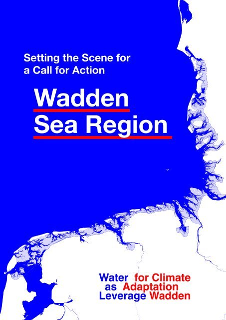
Setting the Scene for<br />
a Call for Action<br />
<strong>Wadden</strong><br />
<strong>Sea</strong> <strong>Region</strong><br />
<strong>Water</strong> for Climate<br />
<strong>as</strong> Adaptation<br />
<strong>Leverage</strong> <strong>Wadden</strong>
Setting the Scene for<br />
a Call for Action in<br />
Ribe<br />
<strong>Water</strong> for Climate<br />
<strong>as</strong> Adapatation<br />
<strong>Leverage</strong> <strong>Wadden</strong> <strong>Sea</strong><br />
<strong>Water</strong> for Climate<br />
<strong>as</strong> Adaptation<br />
<strong>Leverage</strong> <strong>Wadden</strong>
The <strong>Wadden</strong> <strong>Sea</strong> is one of the forefronts where climate challenges<br />
become a dev<strong>as</strong>tating reality. In order to reverse course, we need<br />
to tackle many challenges at the same time. <strong>Water</strong> As <strong>Leverage</strong> is a<br />
pre-project approach geared towards integral and pro-active project<br />
proposals that can cope with such a challenge. It aims to enable the<br />
needed exchanges between different stakeholders to formulate and<br />
develop resilient solutions that prevent crises, rather than react to them.<br />
“Numerous challenges come together<br />
in the <strong>Wadden</strong> <strong>Sea</strong>. Tackling them one<br />
by one makes no sense. We will have<br />
to deal with them in an integrated way.”<br />
Karin Lochte<br />
Chair of the <strong>Wadden</strong> <strong>Sea</strong> Board (2018 - 2022)<br />
In collaboration with the Rich <strong>Wadden</strong> <strong>Sea</strong> Program, the trilateral<br />
<strong>Wadden</strong> <strong>Sea</strong> Board and local partners in the <strong>Wadden</strong> islands and<br />
co<strong>as</strong>tal cities of Texel, Terschelling, Harlingen, Emden, Esbjerg, Ribe<br />
and Fanø, we are exploring how this approach can unfold into resilient<br />
and implementable climate adaptation projects for the <strong>Wadden</strong> <strong>Sea</strong>.<br />
This booklet is the introduction to the <strong>Water</strong> As <strong>Leverage</strong> <strong>Wadden</strong><br />
project. In a first part, we summarize the <strong>Water</strong> As <strong>Leverage</strong> approach.<br />
In a second part, we dive into the many shared challenges and their<br />
interdependencies across the <strong>Wadden</strong> <strong>Sea</strong> and thus literally set the<br />
scene for all the c<strong>as</strong>es.<br />
W A D D E N
<strong>Water</strong> <strong>as</strong> <strong>Leverage</strong> for Climate Adaptation: <strong>Wadden</strong> <strong>Sea</strong> <strong>Region</strong><br />
4<br />
Call for action
Setting the scene for a Call for Action<br />
5
<strong>Water</strong> <strong>as</strong> <strong>Leverage</strong> for Climate Adaptation: <strong>Wadden</strong> <strong>Sea</strong> <strong>Region</strong><br />
6<br />
Call for action
Setting the scene for a Call for Action<br />
P. 10<br />
P. 12<br />
P. 09 PART 1<br />
<strong>Water</strong> <strong>as</strong> <strong>Leverage</strong><br />
1.1 <strong>Water</strong> can be a<br />
threat, but also a<br />
leverage<br />
1.2 From a nonresponsive<br />
to a<br />
pro-active approach<br />
P. 21 PART 2<br />
Say Wad?!<br />
P. 14<br />
P. 16<br />
1.3 Time and space<br />
for collective preproject<br />
preparation<br />
by design<br />
1.4 Integration,<br />
inclusivity,<br />
complementarity,<br />
and learning<br />
P. 22<br />
P. 24<br />
P. 34<br />
2.1 The wealth and<br />
values of the <strong>Wadden</strong><br />
<strong>Sea</strong><br />
2.2 Numerous<br />
challenges ahead,<br />
across the national<br />
borders!<br />
2.3 Families of<br />
challenges in the<br />
<strong>Wadden</strong> <strong>Sea</strong> <strong>Region</strong><br />
P. 46<br />
Sources & Colophon<br />
7
<strong>Water</strong> <strong>as</strong> <strong>Leverage</strong> for Climate Adaptation: <strong>Wadden</strong> <strong>Sea</strong> <strong>Region</strong><br />
8<br />
Call for action
Setting the scene for a Call for Action<br />
PART 1<br />
<strong>Water</strong> <strong>as</strong><br />
<strong>Leverage</strong><br />
1.1<br />
1.2<br />
1.3<br />
1.4<br />
<strong>Water</strong> can be a threat, but<br />
also a leverage<br />
From a non-responsive to a<br />
pro-active approach<br />
Time and space for<br />
collective pre-project<br />
preparation by design<br />
Integration, inclusivity,<br />
complementarity,<br />
and learning<br />
9
<strong>Water</strong> <strong>as</strong> <strong>Leverage</strong> for Climate Adaptation: <strong>Wadden</strong> <strong>Sea</strong> <strong>Region</strong><br />
1.1<br />
<strong>Water</strong> can be a<br />
threat, but also a<br />
leverage<br />
Why? The tide is high!<br />
What we see, what we read, what we hear<br />
and only start to feel: our vulnerability<br />
in facing the consequences of climate<br />
change keeps incre<strong>as</strong>ing, and the way in<br />
which we deal with these challenges today<br />
only contributes to that incre<strong>as</strong>e.<br />
As the IPCC reports tell us: we must<br />
dr<strong>as</strong>tically change our course now to<br />
avoid irreversible damage. Yet while<br />
there are inspiring examples of effective<br />
projects, the world lacks a steady flow of<br />
investment into truly sustainable programs.<br />
Reversal is hard: we are stuck in static and<br />
outdated systems of working. Our vision<br />
competes with traditional approaches<br />
that lead to counterproductive, single-use<br />
infr<strong>as</strong>tructure investments.<br />
Many project dynamics today are often not<br />
systemic enough (either reactive to one<br />
problem or fragmented in implementation),<br />
are socially too disruptive, are not at the<br />
right level of scale to have real impact,<br />
or are too slow for the ever more rapidly<br />
recurring problems we are facing. If we<br />
continue replicating the p<strong>as</strong>t, we will end<br />
up more vulnerable, on even less equal<br />
footing, and in a more fragile state than<br />
before.<br />
How? By a new approach!<br />
The development of the <strong>Water</strong> <strong>as</strong> <strong>Leverage</strong><br />
approach started from the observation<br />
that current water-related projects and<br />
mechanisms (planning or implementation<br />
instruments and financing mechanisms)<br />
fall short of realizing the long-term<br />
strategic climate goals. And that is<br />
because water is considered a separate<br />
sector, a silo among many others. Reality,<br />
however, shows otherwise.<br />
<strong>Water</strong> is a connecting factor, since<br />
it relates to many of the Sustainable<br />
Development Goals (figure 1) . Social conflicts<br />
can often be traced back to unfair<br />
access to high-quality water. There is a<br />
direct causal link between the demise of<br />
biodiversity or a loss in agricultural value<br />
and the quality and quantity of our water<br />
supply. Damage claims throughout the<br />
world compensate (in)directly natural<br />
dis<strong>as</strong>ters. In these dis<strong>as</strong>ters, water is<br />
often the most destructive force. If we<br />
map the water hazards mortality risk<br />
and the population density (figure 2) , many<br />
regions come to the fore <strong>as</strong> vulnerable<br />
are<strong>as</strong>, where this destructive water force<br />
manifests itself heavily. Turned around,<br />
this makes water also a binding element.<br />
<strong>Water</strong> can be a threat, but also a leverage.<br />
Opportunities around water can catalyse<br />
necessary changes, inspire sustainable<br />
development, l<strong>as</strong>ting partnerships and<br />
transformative climate action.<br />
10<br />
Call for action
Setting the scene for a Call for Action<br />
We can create a positive and<br />
sustainable investment c<strong>as</strong>cade if<br />
we tackle water issues at the source.<br />
Such an approach, in which water<br />
serves <strong>as</strong> a leverage for climate<br />
action, is crucial for that success.<br />
Figure 1 - Infographic showing Sustainable Development<br />
Goals related to water, from “The Geography of Future<br />
<strong>Water</strong> Challenges”, PBL – Netherlands Environmental<br />
Assessment Agency)<br />
Figure 2 - For centuries, the fertile sedimentary soils<br />
of the Asian co<strong>as</strong>tal are<strong>as</strong> have been ideal for food<br />
production and urbanisation. The ‘World at risk’ map<br />
shows that at the same time they are among the most<br />
vulnerable regions in the world.<br />
© Architecture Workroom Brussels for <strong>Water</strong> As<br />
<strong>Leverage</strong>, 2018<br />
Part 1 11
<strong>Water</strong> <strong>as</strong> <strong>Leverage</strong> for Climate Adaptation: <strong>Wadden</strong> <strong>Sea</strong> <strong>Region</strong><br />
1.2<br />
From a<br />
non-responsive to a<br />
pro-active approach<br />
Future trends for the <strong>Wadden</strong> <strong>Sea</strong><br />
Climate change is heavily impacting many<br />
(figure 3)<br />
regions in the world. As the graph<br />
on the next page indicates, this is true<br />
on many levels for the <strong>Wadden</strong> <strong>Sea</strong>. The<br />
lines of the graph show the different trends<br />
leading to plausible crises the <strong>Wadden</strong> <strong>Sea</strong><br />
will have to deal with. In short, we will face<br />
twice the pressure we are facing today by<br />
2100.<br />
The first trend is the incre<strong>as</strong>e in moments<br />
of extreme rainfall. It is commonly thought<br />
that the climate will get drier because of<br />
climate change, but in fact the average<br />
rainfall in Northern Europe is incre<strong>as</strong>ing.<br />
However, the rain falls more heavily on<br />
shorter periods of time, making it more<br />
difficult to infiltrate, buffer, or store water.<br />
The incre<strong>as</strong>e of the temperature of the air<br />
also causes the rain to evaporate f<strong>as</strong>ter<br />
thus leading to extreme droughts.<br />
The second trend that we observe are the<br />
heatwaves and the rise in temperature.<br />
The temperature during the heat waves is<br />
incre<strong>as</strong>ing much more than the average<br />
rise in temperature, <strong>as</strong> shown on the<br />
graph. The rise in temperature is what<br />
causes a chain effect of reactions such<br />
<strong>as</strong> the incre<strong>as</strong>e in evaporation and thus<br />
rainfall, the decline in biodiversity, and the<br />
rise of the sea level.<br />
The sea level rise is the final trend<br />
visualised on the graph. Because of the<br />
sedimentation process in the <strong>Wadden</strong><br />
<strong>Sea</strong>, the sea level rise is much less<br />
tangible. The sea level rise of the North<br />
<strong>Sea</strong> is incre<strong>as</strong>ing steadily but is fluctuating<br />
dr<strong>as</strong>tically; when there is a strong North-<br />
West wind the sea level rise could go up<br />
to three to four metres. The islands of<br />
the <strong>Wadden</strong> <strong>Sea</strong> <strong>Region</strong> feel this duality:<br />
they are exposed with their northern or<br />
e<strong>as</strong>tern part to the North <strong>Sea</strong>, while their<br />
southern or western side touches the<br />
<strong>Wadden</strong> <strong>Sea</strong>. The co<strong>as</strong>t of the mainland<br />
is currently impacted by the sea-level rise,<br />
since the sedimentation process is not<br />
happening along the co<strong>as</strong>tline: the land is<br />
not ‘growing’ like the islands do.<br />
Be pro-active!<br />
Reacting to these trends, the graph<br />
imagines three types of approaches to<br />
deal with the challenges ahead. Either<br />
we do not or cannot react aptly and are<br />
non-responsive (1). We move from one<br />
crisis to another more serious crisis while<br />
our way of living is heavily impacted. A<br />
second approach is to be reactive (2) to<br />
the one critical crisis in front of us. Facing<br />
the crisis, we fall back on known solutions<br />
from the p<strong>as</strong>t. This might work, but this<br />
approach often only offers temporary<br />
solutions since the challenges ahead are<br />
only incre<strong>as</strong>ing. A third approach is to be<br />
radically pro-active (3), not waiting for a<br />
crisis to occur before responding. We start<br />
pre-crisis, giving ourselves the space to<br />
come to comprehensive solutions that are<br />
truly resilient and future-proof.<br />
12<br />
Call for action
Setting the scene for a Call for Action<br />
The <strong>Water</strong> As <strong>Leverage</strong> approach<br />
radically positions itself in the<br />
“pro-active” category. It aims to<br />
enable the needed exchanges<br />
between different stakeholders<br />
to formulate and develop resilient<br />
solutions that prevent crises.<br />
Figure 3 - Towards a pro-active approach, adapted to<br />
the predictions for the <strong>Wadden</strong> <strong>Sea</strong><br />
© Architecture Workroom Brussels for <strong>Water</strong> As<br />
<strong>Leverage</strong>, 2018-2022<br />
Part 1 13
<strong>Water</strong> <strong>as</strong> <strong>Leverage</strong> for Climate Adaptation: <strong>Wadden</strong> <strong>Sea</strong> <strong>Region</strong><br />
1.3<br />
Time and space for<br />
collective pre-project<br />
preparation by design<br />
Process of pre-project preparation<br />
In every sector – nature, water<br />
management, agriculture, residential<br />
development and so on – there are<br />
investments to deal with climate change.<br />
Today’s climate-related challenges are<br />
fundamentally interdependent, <strong>as</strong> the<br />
opportunities for development and progress.<br />
Yet every sector formulates its own projects,<br />
from one perspective, leading to mutually<br />
counteractive effects on the ground and<br />
often when processes have evolved too far.<br />
There is no time, space or process for the<br />
ph<strong>as</strong>e of integration of the different sectoral<br />
needs into resilient, win-win solutions. That<br />
is precisely what <strong>Water</strong> As <strong>Leverage</strong> brings<br />
in: a common workroom where different<br />
stakeholders are involved in the pre-project<br />
preparation ph<strong>as</strong>e of integrated waterrelated<br />
projects. At the same time, it is not<br />
a theoretical environment: financing parties<br />
participate from the start in order to develop<br />
the fundability of the implementation.<br />
A workroom supported by design<br />
The approach brings in the capacity of<br />
design to act <strong>as</strong> an integrator between<br />
different levels of innovation. It is able to<br />
combine technical innovation (integrated,<br />
nature-b<strong>as</strong>ed and climate resilient<br />
solutions), social innovation (an inclusive<br />
process), and financial innovation<br />
(bankability of the implementation). As such,<br />
it aims to formulate solutions that will be<br />
replicable on many places facing the same<br />
type of challenges (focus on scalability).<br />
The example on the right (figure 4) is a<br />
school pilot in Chennai designed by<br />
OOZE architects & urbanists, City of 1000<br />
Tanks team. Within the free space of <strong>Water</strong> <strong>as</strong><br />
<strong>Leverage</strong>, OOZE chose to start working on the<br />
renovation of a school complex in which water<br />
forms an integral part of the design. As a result,<br />
they realize three interesting breakthroughs.<br />
First, by choosing a concrete and ambitious<br />
pilot project, they could move very quickly to<br />
implementation, generating the confidence that<br />
the trajectory can deliver. The result is a school<br />
for 800 pupils, of which 300 resident students<br />
and staff, that uses 27,000 liters water per day.<br />
Secondly, this ambition is inscribed in the city’s<br />
broader m<strong>as</strong>ter plan (A City of 1000 Tanks).<br />
The school is a first stepping stone in a broader<br />
implementation project that can generate water<br />
for 70,000 inhabitants and contributes to a citywide<br />
plan with 14 million beneficiaries. Thirdly,<br />
the project is also a pilot project <strong>as</strong> a school.<br />
When scaling up this typology to the urban<br />
education programme, 415 schools can e<strong>as</strong>ily<br />
be reconverted. Scaled up to the national level,<br />
the proposal even h<strong>as</strong> a potential impact on 260<br />
million students. M<strong>as</strong>ter plans made within the<br />
water sector or within the national department<br />
of education have never led to concrete projects<br />
so quickly and have never incorporated shared<br />
objectives in its design before.<br />
By this design approach, <strong>Water</strong> <strong>as</strong> <strong>Leverage</strong><br />
avoids sectoral silos and vested interests.<br />
Instead, it organizes innovation, transformation,<br />
and effective climate adaptation impact through<br />
the tools of broad collaboration, organized<br />
deliberation, and design. The program identifies<br />
needs and opportunities while building<br />
partnerships across all layers of society, all<br />
relevant institutions, and all programmes.<br />
14<br />
Call for action
Setting the scene for a Call for Action<br />
<strong>Water</strong> As <strong>Leverage</strong> projects <strong>as</strong>pire<br />
to be integrated, inclusive, bankable,<br />
innovative and scalable.<br />
Figure 4 - One school pilot <strong>as</strong> a leverage for<br />
transforming both the National School Programme and<br />
the City’s M<strong>as</strong>terplan<br />
© OOZE Architects for <strong>Water</strong> As <strong>Leverage</strong><br />
Part 1 15
<strong>Water</strong> <strong>as</strong> <strong>Leverage</strong> for Climate Adaptation: <strong>Wadden</strong> <strong>Sea</strong> <strong>Region</strong><br />
1.4<br />
Integration, inclusivity,<br />
complementarity,<br />
and learning<br />
Reformulating the question<br />
The <strong>Water</strong> <strong>as</strong> <strong>Leverage</strong> approach is about<br />
opening up and (re-)formulating the local<br />
question. If the question is from the start<br />
ignoring the overlap and interaction of<br />
challenges on the ground, how can we<br />
ever end up with integrated solutions?<br />
That requires collective capacity. However,<br />
vested interests and a history of distrust<br />
can hold back the processes. <strong>Water</strong> <strong>as</strong><br />
<strong>Leverage</strong> is all about creating a safe space<br />
to rebuild trust so all stakeholders can<br />
tap into each other’s knowledge from the<br />
start of the project process. That means<br />
organizing a level playing field where all<br />
types of knowledge are considered <strong>as</strong> equal<br />
within the development team and building<br />
collective capacity to formulate integrated<br />
solutions. This approach differs from the<br />
(figure 5)<br />
traditional project approach.<br />
Complementary knowledge<br />
Offering a free space for pre-project<br />
preparation does not mean open-ended<br />
or not committed to deliver. The approach<br />
is about bringing together all parties<br />
needed for implementation, starting with<br />
those that have the local knowledge, are<br />
committed to take on the challenges ahead<br />
and have the (perspective of a) mandate<br />
to impact the local context. This local<br />
or indigenous knowledge of what truly<br />
happens on the ground is key, because it<br />
secures implementation on the long term.<br />
Within every <strong>Water</strong> As <strong>Leverage</strong> project<br />
preparation, the question is (1) who are<br />
the local stakeholders already active and<br />
committed, (2) how can they be better<br />
connected to each other and (3) can we<br />
thus pin-point what is locally lacking to<br />
organize to be able to add the most needed,<br />
complementary expertise, whether that<br />
is about design, engineering, financial<br />
expertise, participation, anthropology, …<br />
Interlocal learning environment<br />
<strong>Water</strong> As <strong>Leverage</strong> supports a shared and<br />
collective learning environment for different<br />
c<strong>as</strong>es that face the same interaction of<br />
challenges. Recognition of others in the<br />
same boat gives inspiration, energy and,<br />
sometimes even leverage to operate in<br />
their own context. The learning environment<br />
is about facilitating practice-b<strong>as</strong>ed and<br />
collective knowledge exchange – <strong>as</strong><br />
opposed to sectoral knowledge exchange<br />
which is more common in regular settings,<br />
and e<strong>as</strong>ier because everybody speaks<br />
the same language. An urban manager,<br />
a hydrologist, a meteorologist, a financial<br />
advisor, and so on all speak their own<br />
language and have different positions. The<br />
learning environment is managed centrally,<br />
to make sure every expertise understands<br />
each other’s language and stakes and,<br />
actively helps drawing the needed<br />
constellation.<br />
16<br />
Call for action
Setting the scene for a Call for Action<br />
As such, <strong>Water</strong> <strong>as</strong> <strong>Leverage</strong> is at the<br />
same time a free space from regular<br />
processes of project implementation,<br />
and their complementary to them by<br />
bringing all stakeholders into a<br />
long-term and pro-active approach.<br />
<strong>Water</strong> <strong>as</strong> <strong>Leverage</strong><br />
Rethinking the approach for<br />
urban climate resilience<br />
WATER<br />
AS LEVERAGE<br />
The World Economic Forum ranked water crises number one in its 2015 <strong>as</strong>sessment of global risks. Traditional project<br />
management cannot keep pace with the impact of climate change on global water supplies. A new approach is needed.<br />
THE TRADITIONAL APPROACH<br />
STAKEHOLDER<br />
International<br />
Organisations<br />
Government<br />
NGO<br />
Civil Society<br />
Climate related challenge<br />
Research & analysis of problem<br />
Fe<strong>as</strong>ibility study of solutions<br />
Project development<br />
Multiple stakeholders involved<br />
at different times<br />
Long project preparation<br />
timescales with narrow focus<br />
on short term solutions<br />
Difficult to respond to change<br />
once project is underway<br />
Solution only available at the<br />
end of the project<br />
Finance<br />
Financing<br />
Private Sector<br />
Implementation<br />
Inadequate solution<br />
User<br />
Confidence is very high that the window of opportunity – the period when significant change<br />
can be made, for limiting climate change within tolerable boundaries – is rapidly narrowing.”<br />
IPCC report August 2019<br />
Figure 5 - Infographic <strong>Water</strong> <strong>as</strong> <strong>Leverage</strong>:<br />
rethinking the approach for urban climate<br />
resilience.<br />
THE WATER AS LEVERAGE APPROACH<br />
All stakeholders involved from day one<br />
Responsive to changing<br />
environment<br />
Scalable and<br />
replicable<br />
in multiple<br />
environments<br />
Risk of failure<br />
reduced<br />
SOLUTION DEVELOPMENT<br />
CLIMATE RELATED<br />
CHALLENGE<br />
FINANCE<br />
IMPLEMENTATION<br />
RESEARCH & DEVELOPMENT<br />
ALL<br />
STAKE<br />
HOLDERS<br />
ENGAGED<br />
<strong>Water</strong> <strong>as</strong> <strong>Leverage</strong> is an initiative of the Government of the Netherlands<br />
INTEGRATED APPROACH<br />
PROBLEM DEFINITION<br />
FUTURE-PROOF<br />
SOLUTION<br />
People<br />
Combine the world’s best<br />
expertise with local talent.<br />
R&D<br />
Catalyze innovative processes<br />
to understand vulnerabilities to<br />
future risks and uncertainties.<br />
Integration<br />
Co-ordinate closely with local<br />
communities and governments<br />
in an agile working environment.<br />
Process<br />
Ensure Government and community<br />
stakeholders work closely<br />
with experts from day one.<br />
Finance<br />
Source innovative project<br />
funding through public private<br />
partnerships, blended and<br />
private finance initiatives.<br />
<strong>Water</strong> <strong>as</strong> <strong>Leverage</strong> ©2019 www.water<strong>as</strong>leverage.org<br />
Part 1 17
<strong>Water</strong> <strong>as</strong> <strong>Leverage</strong> for Climate Adaptation: <strong>Wadden</strong> <strong>Sea</strong> <strong>Region</strong><br />
18<br />
Call for action
Setting the scene for a Call for Action<br />
Part 1 19
<strong>Water</strong> <strong>as</strong> <strong>Leverage</strong> for Climate Adaptation: <strong>Wadden</strong> <strong>Sea</strong> <strong>Region</strong><br />
20<br />
Call for action
Setting the scene for a Call for Action<br />
PART 2<br />
Say Wad?!<br />
2.1<br />
The wealth and values of the<br />
<strong>Wadden</strong> <strong>Sea</strong><br />
2.2<br />
Numerous challenges ahead,<br />
across the national borders!<br />
2.3<br />
Families of challenges in the<br />
<strong>Wadden</strong> <strong>Sea</strong> <strong>Region</strong><br />
21
<strong>Water</strong> <strong>as</strong> <strong>Leverage</strong> for Climate Adaptation: <strong>Wadden</strong> <strong>Sea</strong> <strong>Region</strong><br />
2.1<br />
The wealth and<br />
values of the<br />
<strong>Wadden</strong> <strong>Sea</strong><br />
Why test the <strong>Water</strong> As <strong>Leverage</strong> approach<br />
in the <strong>Wadden</strong> <strong>Sea</strong>? Because <strong>as</strong> largest<br />
tidal flat ecosystem in the world, it is a<br />
region with unique qualities. At the same<br />
time, these values are jeopardised because<br />
of climate change. Or <strong>as</strong> John Frederiksen<br />
describes the <strong>Wadden</strong> <strong>Sea</strong> region, “an area<br />
where for thousands of years nature and<br />
human enterprises have been characterized<br />
by an almost symbiotic relationship between<br />
wind and water, paired with innovative<br />
human thinking and entrepeneurship.<br />
[...] Climate change will surely become<br />
the dominant external factor in the future<br />
appearance of the <strong>Wadden</strong> <strong>Sea</strong> area, and<br />
it will transform human constraints and<br />
opportunities.” Thus the question is: how<br />
can we steer the inevitable transformation of<br />
the <strong>Wadden</strong> <strong>Sea</strong> so to not only conserve but<br />
also strengthen the values that make the<br />
wealth of the <strong>Wadden</strong> <strong>Sea</strong>?<br />
Landscape value<br />
The very specific physical and biological<br />
factors have shaped the <strong>Wadden</strong> <strong>Sea</strong> <strong>as</strong> a<br />
complex tapestry of tidal channels, sandy<br />
shoals, sea-gr<strong>as</strong>s meadows, mussel beds,<br />
sandbars, mudflats, salt marshes, estuaries,<br />
beaches, dunes, quaint towns and harbours,<br />
high quality agricultural land productive<br />
polder landscapes and large industry<br />
and port complexes and windmills.<br />
flooding, erosion, island displacement and<br />
salinization. It h<strong>as</strong> forged the locals <strong>as</strong> a<br />
strong, marine folk. For visitors, the <strong>Wadden</strong><br />
are an attractive sensory escape of wide<br />
landscapes to contemplate, fresh air to<br />
breath, and the strength of wind and sea to<br />
hear.<br />
Strategic value<br />
The <strong>Wadden</strong> <strong>Sea</strong> co<strong>as</strong>t is shaped by its<br />
bays and many river mouths, such <strong>as</strong> the<br />
Lauwers, the Ems, the Jade, the Weser and<br />
the Elbe. Important harbours, positioned<br />
along delt<strong>as</strong> of these longer inland river systems<br />
play an important role in international<br />
trade and ensure the connection between<br />
inland cities and the North <strong>Sea</strong>.<br />
Natural value<br />
It is of little suprise that the transnational<br />
area h<strong>as</strong> become an UNESCO world<br />
heritage area of ‘Outstanding Universal<br />
Value’.The specific, unbroken and largescale<br />
landscape of undeep and relatively<br />
warm waters makes the area ideal <strong>as</strong> a<br />
breeding ground for natural processes<br />
to function and biodiversity to thrive.The<br />
<strong>Wadden</strong> <strong>Sea</strong> plays a crucial role in the<br />
international marine and aerial migratory<br />
routes of many species. Changes in the<br />
biotopes of the <strong>Wadden</strong> <strong>Sea</strong> thus have an<br />
effect on many other places in the world.<br />
Cultural values<br />
For centuries, human activity h<strong>as</strong> settled<br />
itself in the <strong>Wadden</strong>, living and working<br />
with the threat of the sea, dealing with<br />
22<br />
Call for action
Setting the scene for a Call for Action<br />
Climate change is inevitable. How<br />
can we adapt the <strong>Wadden</strong> <strong>Sea</strong><br />
so to not only conserve but also<br />
strengthen the values that make the<br />
wealth of the <strong>Wadden</strong> <strong>Sea</strong>?<br />
Part 2 23
<strong>Water</strong> <strong>as</strong> <strong>Leverage</strong> for Climate Adaptation: <strong>Wadden</strong> <strong>Sea</strong> <strong>Region</strong><br />
2.2<br />
Numerous challenges<br />
ahead, across the<br />
national borders!<br />
Climate change and its consequences<br />
cause many challenges at the same time.<br />
It is about climate adaptation challenges,<br />
but also biodiversity issues, economic<br />
and touristic development, the energy<br />
transition and social issues typify the<br />
difficulties of the region’s future.<br />
The next pages of this chapter give a<br />
systemic reading of the <strong>Wadden</strong> <strong>Sea</strong>’s<br />
trilateral region, built up according to the<br />
many challenges and characteristics that<br />
are at stake.Firstly, the globally rising<br />
temperature presents itself in the <strong>Wadden</strong><br />
<strong>Sea</strong> <strong>Region</strong> with more frequent periods of<br />
heavy rainfalls and droughts, leading to<br />
more salinization of waterways and soils.<br />
Secondly, this higher temperature causes<br />
a rising sea level, which will first affect the<br />
co<strong>as</strong>t of the mainland, and later also the<br />
islands. However, the discharge of water is<br />
already becoming more and more difficult,<br />
leading to flooding along the waterways.<br />
Thirdly, the challenges mentioned above<br />
affect highly the precious biodiversity<br />
of the <strong>Wadden</strong> <strong>Sea</strong> <strong>Region</strong>, both locally<br />
<strong>as</strong> well <strong>as</strong> globally, and both on the tidal<br />
flatlands <strong>as</strong> well <strong>as</strong> the mainland and<br />
islands. L<strong>as</strong>tly, the beautiful landscape of<br />
the <strong>Wadden</strong> <strong>Sea</strong> attracts many tourists,<br />
which puts a high pressure on the<br />
environment, while other social challenges<br />
are occuring: unattractive living are<strong>as</strong><br />
close to industry, rising housing prices and<br />
lack of jobs.<br />
The symbols on the next page will be<br />
used <strong>as</strong> a reading guide to show these<br />
challenges’ complexity and interrelation.<br />
Together, these form the climate<br />
adaptation narratives for the region,<br />
and an ideal breeding ground for future<br />
discussions in <strong>Water</strong> <strong>as</strong> <strong>Leverage</strong>: <strong>Wadden</strong><br />
<strong>Sea</strong> <strong>Region</strong>.<br />
24<br />
Call for action
Setting the scene for a Call for Action<br />
<strong>Water</strong> challenges<br />
Incre<strong>as</strong>ing Temperature<br />
Fresh <strong>Water</strong> Scarcity<br />
Salinization<br />
Saltwater Intrusion<br />
River Floods<br />
Biodiversity challenges<br />
Biodiversity Loss<br />
Importance for Bird Migration<br />
Importance for Fish Migration<br />
Land Subsidence<br />
Natural and Landscape Heritage<br />
Difficult Fresh <strong>Water</strong> Discharge<br />
<strong>Sea</strong> Floods<br />
Type of Co<strong>as</strong>tal Protection: Dunes<br />
Type of Co<strong>as</strong>tal Protection: Dykes<br />
<strong>Sea</strong> Level Rise<br />
<strong>Water</strong> Pollution or Eutrophication<br />
Economy and energy challenges<br />
Military Imago<br />
Development for Renewable Energy<br />
Important Harbour Activities<br />
Agriculture under Pressure<br />
Fragile Industry<br />
Social challenges<br />
Dredging for Transport<br />
Valuable Heritage and Identity<br />
Lack of Job Opportunity<br />
Demographic Trends &<br />
Social Vulnerability<br />
Rising Housing Prices<br />
Touristic Pressure<br />
Part 2 25
<strong>Water</strong> <strong>as</strong> <strong>Leverage</strong> for Climate Adaptation: <strong>Wadden</strong> <strong>Sea</strong> <strong>Region</strong><br />
Droughts, floods and saltwater<br />
intrusion are becoming ever<br />
more common throughout the<br />
<strong>Wadden</strong> <strong>Sea</strong>.<br />
Rising temperature<br />
Several different challenges in the<br />
<strong>Wadden</strong> <strong>Sea</strong> can be related to the<br />
continuing incre<strong>as</strong>e in temperature<br />
caused by climate change, which<br />
goes relatively f<strong>as</strong>t in Northwest<br />
Europe. This incre<strong>as</strong>e in temperature<br />
h<strong>as</strong> two main effects with a chain<br />
reaction of socio-economic<br />
issues. Firstly, the higher average<br />
temperature causes an incre<strong>as</strong>ed<br />
evaporation, leading to droughts<br />
(even at higher average rainfall!),<br />
which in turn lead to salination<br />
of the dry lands in the region and<br />
evaporation of the underground<br />
freshwater reserves. Secondly, the<br />
high temperature and evaporation<br />
causes sudden and high peaks in<br />
rainfall, leading to the flooding of<br />
waterways, polders and valleys.<br />
Lack of fresh water on the islands<br />
The droughts, salinization and loss<br />
of freshwater reserves are especially<br />
felt on the <strong>Wadden</strong> islands. These<br />
islands have a very limited surface<br />
on which the rain falls and there<br />
is no incoming water from higher<br />
regions. The runoff of fresh water<br />
into the sea needs to be prevented<br />
<strong>as</strong> much <strong>as</strong> possible. This means<br />
the islands need to infiltrate, buffer<br />
and store their fresh water for later<br />
use in agriculture, industries or <strong>as</strong><br />
drinking water. Storing rain water is<br />
not only important for further use,<br />
but this fresh water is also needed<br />
to ‘push away’ the saline water<br />
further underground, thus protecting<br />
the soil, crops, animals, and nature<br />
from the salinization. Today, some<br />
of the islands are connected to the<br />
mainland with pipelines to import<br />
fresh water, but the incre<strong>as</strong>e in<br />
droughts, agriculture production, and<br />
tourism put pressure on this system.<br />
Becoming self-sufficient in terms<br />
of fresh water is a more resilient<br />
alternative.<br />
H 2<br />
0<br />
26<br />
Call for action
Setting the scene for a Call for Action<br />
Freshwater flooding<br />
The extreme amount of rainfall in<br />
short periods of time is complicating<br />
the storage of fresh water, and<br />
also causes flooding at the co<strong>as</strong>tal<br />
cities since they receive a major<br />
inflow from the upstream mainland.<br />
At moments of high sea water, the<br />
disposal of fresh water becomes<br />
even more complicated, which<br />
makes the flooding of the lower<br />
plains is often unavoidable. The<br />
co<strong>as</strong>tal cities and their hinterland<br />
have to organize buffer capacity in<br />
order to avoid flooding.<br />
Salinization<br />
Being surrounded by the sea,<br />
the <strong>Wadden</strong> region is incredibly<br />
vulnerable to incre<strong>as</strong>ing<br />
salinization caused by droughts<br />
and evaporation. Agriculture and<br />
horticulture are strongly affected<br />
and might need to look into different<br />
types of crops that can deal with the<br />
salinization. Gr<strong>as</strong>slands and cattle<br />
are less vulnerable. Industries that<br />
need a high amount of fresh water<br />
are however vulnerable <strong>as</strong> well.<br />
Part 2 27
<strong>Water</strong> <strong>as</strong> <strong>Leverage</strong> for Climate Adaptation: <strong>Wadden</strong> <strong>Sea</strong> <strong>Region</strong><br />
<strong>Sea</strong> level rise challenges in the<br />
<strong>Wadden</strong> <strong>Sea</strong> are only becoming<br />
acute in the long term, but<br />
problems do arise.<br />
<strong>Sea</strong> level rise in the long term<br />
<strong>Sea</strong> level rise in the <strong>Wadden</strong> <strong>Sea</strong><br />
forms a challenge in the long term: it<br />
is generally expected to be relatively<br />
moderate in the whole North <strong>Sea</strong><br />
<strong>Region</strong> until ca. 2050. As long <strong>as</strong> it<br />
remains moderate, sedimentation in<br />
the open <strong>Wadden</strong> <strong>Sea</strong> (littoral and<br />
sublittoral) and at its natural edges<br />
(beaches, dunes, salt marshes) can<br />
keep up with this sea level rise.<br />
However, current implementation<br />
of longterm projects should take<br />
this into account and be enough<br />
futureproof in their design.<br />
Current threats from the sea<br />
Infr<strong>as</strong>tructure that lie outside the<br />
dykes or that have no natural<br />
systems such <strong>as</strong> dunes to protect<br />
them, will feel the sea level rise<br />
already now! In the Netherlands<br />
there are 12 locations with<br />
infr<strong>as</strong>tructure laying outside dikes,<br />
such <strong>as</strong> West-Terschelling. Because<br />
of this peculiar situation these<br />
locations urgently need strategies<br />
to deal with the rising sea level.<br />
The challenges the sea level rise<br />
brings are often intertwined with the<br />
accessibility of the harbours, which<br />
function <strong>as</strong> logistical nodes where<br />
all the imported and exported goods<br />
p<strong>as</strong>s by.<br />
28<br />
Call for action
Setting the scene for a Call for Action<br />
Discharge of water<br />
L<strong>as</strong>tly, the slow but continous<br />
sea level rise of the <strong>Wadden</strong> <strong>Sea</strong><br />
complicates the discharging of<br />
fresh water at the co<strong>as</strong>tal cities of<br />
the mainland and puts pressure on<br />
the polder systems. The polders<br />
are already laying lower than the<br />
sea level and need to continuously<br />
drain their fields. With the sea level<br />
rise this pumping and discharging<br />
becomes ever more difficult.<br />
Part 2 29
<strong>Water</strong> <strong>as</strong> <strong>Leverage</strong> for Climate Adaptation: <strong>Wadden</strong> <strong>Sea</strong> <strong>Region</strong><br />
Rising temperature causes<br />
declining biodiversity throughout<br />
the whole <strong>Wadden</strong> <strong>Sea</strong>.<br />
Declining habitats<br />
The rise in average temperature<br />
and the occurrence of extreme<br />
heat waves puts a lot of stress on<br />
the natural system of the <strong>Wadden</strong><br />
<strong>Sea</strong>. Especially the tidal flats in the<br />
<strong>Wadden</strong> <strong>Sea</strong> warm up very f<strong>as</strong>t<br />
during heat waves, causing mortality<br />
of shellfish (especially Macoma and<br />
cockles). This affects in its turn<br />
the bird populations that migrate<br />
across the <strong>Wadden</strong> region, since the<br />
<strong>Wadden</strong> <strong>Sea</strong> is an essential foraging<br />
stop on the E<strong>as</strong>t Atlantic Flyway, the<br />
migratory route between the Arctic<br />
and South Africa.<br />
Fish migration<br />
A second effect of incre<strong>as</strong>ing<br />
droughts is that freshwater<br />
discharges from the mainland to<br />
the <strong>Wadden</strong> <strong>Sea</strong> tend to decre<strong>as</strong>e,<br />
especially during the summer<br />
period. This affects water life, since<br />
fresh water contains the nutrients<br />
they need for growing. In addition,<br />
freshwater gradients are important<br />
to maintain fish p<strong>as</strong>sages and to<br />
protect shellfish from predation.<br />
NATURA2000<br />
NA<br />
NATURA2000<br />
30<br />
Call for action
TURA2000<br />
Setting the scene for a Call for Action<br />
Natura2000 versus human activity<br />
The nature of the <strong>Wadden</strong> <strong>Sea</strong> is one<br />
of the main attractors for tourism,<br />
which is an important economic<br />
sector. The whole region is part of<br />
the Unesco World Heritage and<br />
comes with a strong regulation<br />
of what can and cannot be done.<br />
These regulations might complicate<br />
innovative solutions, even some of<br />
those which are b<strong>as</strong>ed on design by<br />
nature. How can the strict regulation<br />
of the Natura2000 not be seen<br />
<strong>as</strong> an obstacle, but form a help<br />
in discovering and implementing<br />
nature-inclusive adaptive strategies<br />
to climate change?<br />
Biodiversity loss<br />
Overall, many parts of the landscape<br />
are over the l<strong>as</strong>t years, decades<br />
or centuries altered for human<br />
use and created thus new kinds<br />
of landscapes, following different<br />
logics. Rivers where straightened<br />
to e<strong>as</strong>e the boats to the sea, but<br />
h<strong>as</strong> shown a loss of biodiversity<br />
over time. In the salt marshes,<br />
mankind made ditches to drain the<br />
water, but this h<strong>as</strong> led to the slow<br />
disappearance of these important<br />
landscapes.<br />
Part 2 31
<strong>Water</strong> <strong>as</strong> <strong>Leverage</strong> for Climate Adaptation: <strong>Wadden</strong> <strong>Sea</strong> <strong>Region</strong><br />
Housing prices, lack of job<br />
opportunities or unattractive<br />
living environments put pressure<br />
on the local population.<br />
Lack of opportunities, affordable<br />
housing and livability<br />
There is an incre<strong>as</strong>e in emigrating<br />
youth throughout the whole <strong>Wadden</strong><br />
region, but for a diverse range of<br />
re<strong>as</strong>ons. The <strong>Wadden</strong> islands are<br />
doing socio-economically well<br />
because of the touristic sector,<br />
which will probably incre<strong>as</strong>e. This<br />
h<strong>as</strong> a negative effect on the housing<br />
prices of the islands, making it<br />
impossible for young starters to buy<br />
a house and stay in the region. The<br />
emigration of young people out of<br />
co<strong>as</strong>tal cities is also often related<br />
to the lack of job opportunities<br />
and unattractiveness of the living<br />
environment.<br />
Attractiveness of co<strong>as</strong>tal cities<br />
Co<strong>as</strong>tal cities, and especially<br />
harbour cities, often have a<br />
vulnerable population with a low<br />
income. This is the c<strong>as</strong>e in Harlingen,<br />
Esbjerg, Wilhelmshaven, Delfzijl,<br />
Emden and so on. There is a need<br />
for attractive job opportunites and<br />
affordable, good-quality housing.<br />
These low income families are often<br />
less included in the development of<br />
their living environment and require<br />
therefore extra attention to make<br />
their voices heard.<br />
€€ €€€<br />
€€€<br />
32<br />
Call for action
Setting the scene for a Call for Action<br />
Touritstic pressure<br />
The <strong>Wadden</strong> <strong>Sea</strong> <strong>Region</strong> is a<br />
touristic hotspot. The islands of<br />
the <strong>Wadden</strong> <strong>Sea</strong> have to deal with<br />
a big amount of tourists. This puts<br />
pressure on the local inhabitants: it<br />
gets, for instance, very busy during<br />
high se<strong>as</strong>on periods and housing<br />
prices are going up. The co<strong>as</strong>tal<br />
cities, which provide the connection<br />
to these islands by ferry, have to<br />
deal with a big flow of tourists just<br />
p<strong>as</strong>sing through.<br />
Renewable energy<br />
Some of the harbours in the <strong>Wadden</strong><br />
<strong>Sea</strong> are strategically located in their<br />
connection to the growing offshore<br />
windmill parks. However, this<br />
positive trend for new renewable and<br />
clean energy could be challenging<br />
for the <strong>Wadden</strong> <strong>Sea</strong>: the natural<br />
process of sedimentation h<strong>as</strong> to be<br />
countered by dredging to ensure the<br />
naval connectivity of these windmill<br />
parks and the mainland.<br />
€€ €€€<br />
€€€<br />
!!!<br />
!!!<br />
Part 2 33
<strong>Water</strong> <strong>as</strong> <strong>Leverage</strong> for Climate Adaptation: <strong>Wadden</strong> <strong>Sea</strong> <strong>Region</strong><br />
2.3<br />
Families of challenges<br />
in the <strong>Wadden</strong> <strong>Sea</strong><br />
<strong>Region</strong><br />
As outlined in the previous chapter,<br />
the challenges in the <strong>Wadden</strong> <strong>Sea</strong> are<br />
numerous. <strong>Water</strong> <strong>as</strong> <strong>Leverage</strong> strongly<br />
believes that the solutions for the water<br />
problems can be used <strong>as</strong> a leverage<br />
to tackle these other threats that the<br />
<strong>Wadden</strong> <strong>Sea</strong> is facing. What’s more, those<br />
challenges are also interdependent and<br />
hence, a solution for one issue is — or<br />
should be, if we work in an integrated<br />
way — an answer to other challenges.<br />
<strong>Water</strong> projects should thus also structure<br />
urbanization, organize urban growth or<br />
shrinkage, protect unique biodiversity<br />
and deal with related socio-economic<br />
issues. This integrated approach entails an<br />
enormous systemic complexity, but also<br />
offers opportunities. Because if we can<br />
link different dynamics together, we also<br />
strengthen the synergies between different<br />
users, interest groups, economic and<br />
policy are<strong>as</strong>, and financing.<br />
The next page displays five ‘families<br />
of challenges’. These are five recurring<br />
problems that we can detect in the<br />
<strong>Wadden</strong> <strong>Sea</strong>, already attempting to<br />
combine many thematic challenges into<br />
one integrated approach. They reflect the<br />
ambition to tackle the many challenges in<br />
the most efficient, integrated and pertinent<br />
way. These also reveal that we can no<br />
longer solve water issues <strong>as</strong> merely a part<br />
of a natural system. It is also, incre<strong>as</strong>ingly,<br />
an urban issue. While tackling multiple<br />
challenges together seems to incre<strong>as</strong>e<br />
complexity, it actually forms an opportunity<br />
for government and partners to develop<br />
solutions that connected the different<br />
problems and opportunities in new local<br />
and integrated development projects and<br />
in new local, integrated economic chains.<br />
<strong>Water</strong> problems are, therefore, not<br />
solely the responsibility of water<br />
experts; designers, urban planners and<br />
policymakers in the field of spatial planning<br />
in general also have the crucial t<strong>as</strong>k of<br />
examining how (se<strong>as</strong>onal) demographic<br />
concentration relates spatially to water<br />
supply and management, and how the<br />
consequent water problems correlate with<br />
global environmental issues.<br />
Seen through this lens, water-related<br />
processes become a driver for innovative<br />
planning strategies. Learning from <strong>Water</strong><br />
<strong>as</strong> <strong>Leverage</strong>’s experience with exemplary<br />
practices that succesfully link water issues<br />
to urban dynamics and tailoring this to the<br />
<strong>Wadden</strong> <strong>Sea</strong>, we can identify five recurring<br />
solutions or perspectives. Combining<br />
these perspectives in an adequate<br />
way leads to sustainable development<br />
strategies and qualitative urban projects<br />
that, at the same time, solve water and<br />
climate issues.<br />
34<br />
Call for action
Setting the scene for a Call for Action<br />
Aqua Landscape<br />
Portal to the Wad<br />
Hospitable Harbour<br />
<strong>Water</strong>-autonomous islands<br />
Living with <strong>Water</strong><br />
Part 2 35
<strong>Water</strong> <strong>as</strong> <strong>Leverage</strong> for Climate Adaptation: <strong>Wadden</strong> <strong>Sea</strong> <strong>Region</strong><br />
Aqua Landscape<br />
Description<br />
The landscape around a water<br />
system becomes a ‘sponge’.<br />
Different me<strong>as</strong>ures from source to<br />
sea make the landscape, both in<br />
urban and non-urban are<strong>as</strong>, resilient<br />
for both periods of little and heavy<br />
rain. In this way, pressing challenges<br />
like flooding, drought, water<br />
discharge in sea, and salinization can<br />
be tackled in a coherent way.<br />
Exemplary c<strong>as</strong>es<br />
Ribe (Denmark)<br />
Harlingen (the Netherlands)<br />
36<br />
Call for action
Borkum<br />
Setting the scene for a Call for Action<br />
Challenges<br />
<strong>Sea</strong> Level Rise<br />
<strong>Sea</strong> Floods<br />
Difficult Fresh <strong>Water</strong> Discharge<br />
Fresh <strong>Water</strong> Scarcity<br />
Esbjerg<br />
River Floods<br />
Rømø<br />
Ribe<br />
Salinization<br />
Fanø<br />
Cuxhaven<br />
Amrum<br />
Föhr<br />
Sylt<br />
Saltwater Intrusion<br />
Bremerhaven<br />
Agriculture Under Pressure<br />
Importance for Fish Migration<br />
Wangerooge<br />
Spiekeroog<br />
Langeoog<br />
Norderney<br />
Juist<br />
Emden<br />
Schiermonnikoog<br />
Delfzijl<br />
Ameland<br />
Groningen<br />
Terschelling<br />
Vlieland<br />
Harlingen<br />
Texel<br />
Part 2 37
<strong>Water</strong> <strong>as</strong> <strong>Leverage</strong> for Climate Adaptation: <strong>Wadden</strong> <strong>Sea</strong> <strong>Region</strong><br />
Portal to the Wad<br />
Description<br />
Villages and cities along the co<strong>as</strong>t<br />
and on the islands are gateways<br />
to the heritage landscape of the<br />
<strong>Wadden</strong> <strong>Sea</strong>. They are hotspots for<br />
tourism and can thus showc<strong>as</strong>e to a<br />
broad public the innovative solutions<br />
for the pressing societal challenges<br />
and how ambitions for nature and<br />
mankind can coincide.<br />
Exemplary c<strong>as</strong>es<br />
Harlingen (the Netherlands)<br />
Harlesiel (Germany)<br />
38<br />
Call for action
Borkum<br />
Setting the scene for a Call for Action<br />
Challenges<br />
Touristic Pressure<br />
Rising Housing Prices<br />
Valuable Heritage and Identity<br />
Natural and Landscape Heritage<br />
Esbjerg<br />
Type of Co<strong>as</strong>tal Protection: Dykes<br />
Rømø<br />
Ribe<br />
Dredging for Transport<br />
Fanø<br />
Cuxhaven<br />
Amrum<br />
Föhr<br />
Sylt<br />
Bremerhaven<br />
Wangerooge<br />
Spiekeroog<br />
Langeoog<br />
Norderney<br />
Juist<br />
Emden<br />
Schiermonnikoog<br />
Delfzijl<br />
Ameland<br />
Groningen<br />
Terschelling<br />
Vlieland<br />
Harlingen<br />
Texel<br />
Part 2 39
<strong>Water</strong> <strong>as</strong> <strong>Leverage</strong> for Climate Adaptation: <strong>Wadden</strong> <strong>Sea</strong> <strong>Region</strong><br />
Hospitable Harbour<br />
Description<br />
In order to shake off the current<br />
negative image that harbour cities<br />
deal with, these cities find solutions<br />
to reconnect again to the waterfront<br />
of its co<strong>as</strong>t, canals, and waterways.<br />
The city becomes greener and<br />
more blue, and attracts all kinds of<br />
workers and inhabitants due to the<br />
innovative projects and practices to<br />
the climate and societal challenges<br />
in the harbour.<br />
Exemplary c<strong>as</strong>es<br />
Harlingen (the Netherlands)<br />
Esbjerg (Denmark)<br />
40<br />
Call for action
Borkum<br />
Setting the scene for a Call for Action<br />
Challenges<br />
Important Harbour Activities<br />
Development for Renewable Energy<br />
Military Imago<br />
Demographic Trends & Social Vulnerability<br />
Esbjerg<br />
Lack of Job Opportunity<br />
Rømø<br />
Ribe<br />
Type of Co<strong>as</strong>tal Protection: Dykes<br />
Fanø<br />
Cuxhaven<br />
Amrum<br />
Föhr<br />
Sylt<br />
Bremerhaven<br />
Wangerooge<br />
Spiekeroog<br />
Langeoog<br />
Norderney<br />
Juist<br />
Emden<br />
Schiermonnikoog<br />
Delfzijl<br />
Ameland<br />
Groningen<br />
Terschelling<br />
Vlieland<br />
Harlingen<br />
Texel<br />
Part 2 41
<strong>Water</strong> <strong>as</strong> <strong>Leverage</strong> for Climate Adaptation: <strong>Wadden</strong> <strong>Sea</strong> <strong>Region</strong><br />
<strong>Water</strong>-autonomous islands<br />
Description<br />
The islands of the <strong>Wadden</strong> <strong>Sea</strong> often<br />
get (drinking) water via pipelines from<br />
the co<strong>as</strong>t. The high maintenance<br />
cost mainland the overall water<br />
scarcity due to climate change <strong>as</strong>ks<br />
for new me<strong>as</strong>ures that make the<br />
islands water-autonomous. In order<br />
to secure enough (drinking) water for<br />
the inhabitants, tourists, agriculture<br />
and industry uses, an overall mindset<br />
of ‘every drop counts’ is in place and<br />
pushes for new projects to capture,<br />
store, and reuse water.<br />
Exemplary c<strong>as</strong>es<br />
Texel (the Netherlands)<br />
Fanø (Denmark)<br />
42<br />
Call for action
Borkum<br />
Setting the scene for a Call for Action<br />
Challenges<br />
Touristic Pressure<br />
Fresh <strong>Water</strong> Scarcity<br />
Salinization<br />
Biodiversity Loss<br />
Esbjerg<br />
Fragile Industry<br />
Rømø<br />
Ribe<br />
Agriculture Under Pressure<br />
Fanø<br />
Cuxhaven<br />
Amrum<br />
Föhr<br />
Sylt<br />
Bremerhaven<br />
Wangerooge<br />
Spiekeroog<br />
Langeoog<br />
Norderney<br />
Juist<br />
Emden<br />
Schiermonnikoog<br />
Delfzijl<br />
Ameland<br />
Groningen<br />
Terschelling<br />
Vlieland<br />
Harlingen<br />
Texel<br />
Part 2 43
<strong>Water</strong> <strong>as</strong> <strong>Leverage</strong> for Climate Adaptation: <strong>Wadden</strong> <strong>Sea</strong> <strong>Region</strong><br />
Living with <strong>Water</strong><br />
Description<br />
Urban are<strong>as</strong> transform themselves<br />
into futureproof and resilient living<br />
are<strong>as</strong>. Public spaces are designed<br />
<strong>as</strong> green-blue spaces, where there<br />
is a balance between hardened<br />
and desealed spaces. Also on<br />
private grounds, new typologies are<br />
developed to restore this balance.<br />
Exemplary c<strong>as</strong>es<br />
Terschelling (the Netherlands)<br />
Esbjerg (Denmark)<br />
44<br />
Call for action
Borkum<br />
Setting the scene for a Call for Action<br />
Challenges<br />
Valuable Heritage and Identity<br />
Rising Housing Prices<br />
Touristic Pressure<br />
Fresh <strong>Water</strong> Scarcity<br />
Esbjerg<br />
River Floods<br />
Rømø<br />
Ribe<br />
Biodiversity Loss<br />
Fanø<br />
Cuxhaven<br />
Amrum<br />
Föhr<br />
Sylt<br />
Bremerhaven<br />
Wangerooge<br />
Spiekeroog<br />
Langeoog<br />
Norderney<br />
Juist<br />
Emden<br />
Schiermonnikoog<br />
Delfzijl<br />
Ameland<br />
Groningen<br />
Terschelling<br />
Vlieland<br />
Harlingen<br />
Texel<br />
Part 2 45
<strong>Water</strong> for Climate<br />
<strong>as</strong> Adaptation<br />
<strong>Leverage</strong> <strong>Wadden</strong><br />
Commissioner<br />
Netherlands Enterprise Agency (RVO.nl) on<br />
behalf of the Ministry of Infr<strong>as</strong>tructure and <strong>Water</strong><br />
Management<br />
Program Towards a Rich <strong>Wadden</strong> <strong>Sea</strong><br />
<strong>Water</strong> <strong>as</strong> <strong>Leverage</strong> <strong>Wadden</strong> Initiative<br />
Province of Fryslân (the Netherlands)<br />
Program Towards a Rich <strong>Wadden</strong> <strong>Sea</strong><br />
Henk Ovink, Special Envoy for International<br />
<strong>Water</strong> Affairs<br />
Common <strong>Wadden</strong> <strong>Sea</strong> Secretariat<br />
Prospective research<br />
Emma Bierens, Lene De Vrieze,<br />
Vincent Van Praet, Bram Vandemoortel<br />
(Architecture Workroom Brussels)<br />
Editorial team<br />
Sandra Schoof (RVO Netherlands Enterprise<br />
Agency)<br />
Jeroen Van Herk (Program Towards a Rich<br />
<strong>Wadden</strong> <strong>Sea</strong>)<br />
Stephanie Janssen (Deltares)<br />
Titian Oterdoom (Program Towards a Rich<br />
<strong>Wadden</strong> <strong>Sea</strong>)<br />
Emma Bierens, Lene De Vrieze, Vincent Van<br />
Praet, Bram Vandemoortel (Architecture<br />
Workroom Brussels)<br />
This document is co-authored by many local<br />
stakeholders and c<strong>as</strong>e-owners. With this,<br />
we want to thank all for participating in this<br />
process.<br />
Trilateral research<br />
Hein S<strong>as</strong> (Program Towards a Rich <strong>Wadden</strong> <strong>Sea</strong>)<br />
Bernard Baerends (Common <strong>Wadden</strong> <strong>Sea</strong><br />
Secretariat)<br />
Texel<br />
Francine Giskes (Fresh Future Texel)<br />
Jan-Berend Stuut (Fresh Future Texel)<br />
Paul Rutten (Fresh Future Texel)<br />
Terschelling<br />
André Toet (Gemeente Terschelling)<br />
Wim van Schoonhoven (Gemeente Terschelling)<br />
Harlingen<br />
Niels Debruijn (Provincie Fryslan)<br />
Froukje Grijpstra (Wetterskip Fryslan)<br />
Ellen Bruins Slot (Gemeente Harlingen)<br />
Esbjerg & Ribe<br />
Bodil Ankjær Nielsen (Esbjerg Kommune)<br />
Peer Munksgaard Rexen (Esbjerg Kommune)<br />
Pernille Daugaard Muus (Esbjerg Kommune)<br />
Publisher<br />
Netherlands Enterprise Agency (RVO.nl) on<br />
behalf of the Ministry of Infr<strong>as</strong>tructure and <strong>Water</strong><br />
Management<br />
Fanø<br />
Anne Hammer Lauridsen (Fanø Kommune)<br />
Emden<br />
Frank Gaupels (Ökowerk Emden)<br />
Rainer Kinzel (Municipality of Emden)<br />
Collective Workshops<br />
7-8th of February, 2022, Digital trilateral meeting<br />
9-10th of May, 2022, Trilateral meeting at<br />
Carolinensiel, Germany<br />
28-29th of November, 2022, attendance<br />
at the trilateral <strong>Wadden</strong> <strong>Sea</strong> Conference,<br />
Wilhelmshaven, Germany
Further reading<br />
Planet Texel (la4sale & Faro, 2014)<br />
De Bosatl<strong>as</strong> van de <strong>Wadden</strong> (Noordhoff<br />
Atl<strong>as</strong>producties, 2018)<br />
Setting the Scene for a Call for Action, <strong>Water</strong> <strong>as</strong><br />
<strong>Leverage</strong> for Resilient Cities: Asia (Architecture<br />
Workroom et. al., RVO, 2018)<br />
Too big: rebuild by design: a transformative<br />
approach to Climate Change (Henk Ovink & Jelte<br />
Boeijenga, nai010, 2018)<br />
<strong>Water</strong> <strong>as</strong> <strong>Leverage</strong>: Challenge, Opportunity,<br />
Change (Henk Ovink & Cynthia van Elk, RVO &<br />
nai010, 2020)<br />
<strong>Water</strong> <strong>as</strong> <strong>Leverage</strong>r Reflect (RUGroningen, OECD<br />
& Architecture Workroom, Government of the<br />
Netherlands, 2021)<br />
Climate Resilient Urban Are<strong>as</strong>: Governance,<br />
design and development in co<strong>as</strong>tal delta cities<br />
(Rutger de Graaf-van Dinther & Henk Ovink (eds),<br />
Palgrave Studies in Climate Resilient Societies,<br />
2021)<br />
The <strong>Wadden</strong> <strong>Sea</strong> — nature and cultural heritage<br />
(John Fredriksen (ed), Gyldendal A/S & John<br />
Fredriksen, 2022)<br />
Sources<br />
Data<br />
Maps<br />
figure 3<br />
Global Risk Data Platform e.a.<br />
figure 1<br />
Global Risk Data Platform e.a.<br />
all other maps<br />
TOP10NL, Open Street Map, data<br />
provided by the Municipalities of Esbjerg<br />
satellite images<br />
Google Maps, Bing Maps
Image Credits<br />
All graphic material h<strong>as</strong> been made by<br />
Architecture Workroom Brussels, except for the<br />
following images:<br />
p. 4-5<br />
p. 6<br />
p. 8<br />
W<strong>as</strong>abi Film/NAKUWA (source: <strong>Wadden</strong> <strong>Sea</strong><br />
World Heritage brandspace)<br />
CWSS/Schwender (source: <strong>Wadden</strong> <strong>Sea</strong><br />
World Heritage brandspace)<br />
Jan Sohler/NAKUWA (source: <strong>Wadden</strong> <strong>Sea</strong><br />
World Heritage brandspace)<br />
p. 11<br />
figure 1<br />
PBL – Netherlands Environmental<br />
Assessment Agency (source: https://www.pbl.<br />
nl/en/news/2018/incre<strong>as</strong>ing-water-risks-are-abarrier-to-sustainable-development)<br />
p. 15<br />
p. 17<br />
figure 4<br />
OOZE Architects for <strong>Water</strong> As <strong>Leverage</strong><br />
figure 5<br />
Infographic <strong>Water</strong> <strong>as</strong> <strong>Leverage</strong>: rethinking<br />
the approach for urban climate resilience.<br />
(source: www.water<strong>as</strong>leverage.org)<br />
p. 20<br />
Christian Wiedemann/NAKUWA (source:<br />
<strong>Wadden</strong> <strong>Sea</strong> World Heritage brandspace)<br />
p. 23<br />
top picture<br />
CWSS/Schwender (source: <strong>Wadden</strong><br />
<strong>Sea</strong> World Heritage brandspace)<br />
bottom picture<br />
Jan Sohler/NAKUWA (source:<br />
<strong>Wadden</strong> <strong>Sea</strong> World Heritage brandspace)<br />
p. 36<br />
top picture<br />
Ribe: Destination <strong>Wadden</strong> <strong>Sea</strong> (source:<br />
https://www.vadehavskysten.dk/ribe-esbjergfanoe/ribe-esbjerg-fanoe/transport-i-ribeslokalomraade-gdk1111982)<br />
bottom picture<br />
Harlingen: Port of Harlingen (source:<br />
https://www.i-marina.eu/jachthaven/port-ofharlingen)<br />
p. 38<br />
top picture<br />
Harlingen: Port of Harlingen (source:<br />
https://www.i-marina.eu/jachthaven/port-ofharlingen)<br />
p. 40<br />
top picture<br />
Harlingen: picture by Niels de<br />
Vries (source: https://frieschdagblad.<br />
nl/regio/Harlinger-haven-wordt-vakerafgesloten-26803240.html)<br />
bottom picture<br />
Esbjerg: MEDVIND/Bent Sørensen<br />
for Port of Esbjerg (source: https://www.<br />
projectcargojournal.com/offshore/2020/11/26/<br />
rystad-shortage-of-installation-vessels-<strong>as</strong>early-<strong>as</strong>-2025/)<br />
p. 42<br />
p. 44<br />
top picture<br />
Texel (source: www.pixabay.com)<br />
bottom picture<br />
Fanø: municipality of Fanø<br />
top picture<br />
Terschelling: municipality of Terschelling<br />
bottom picture<br />
Esbjerg: municipality of Esbjerg<br />
Disclaimer<br />
The editorial staff of this document h<strong>as</strong> tried <strong>as</strong> carefully <strong>as</strong><br />
possible to identify all copyright holders of visual material<br />
(photos, videos) or articles for publication. If despite this,<br />
you come across content of which you are the copyright<br />
holder and you have been wrongly omitted or have not given<br />
permission for publication, ple<strong>as</strong>e address this and contact us<br />
via ebierens@architectureworkroom.eu
<strong>Water</strong> for Climate<br />
<strong>as</strong> Adaptation<br />
<strong>Leverage</strong> <strong>Wadden</strong> <strong>Sea</strong>
Setting the Scene for<br />
a Call for Action<br />
Texel<br />
<strong>Water</strong> for Climate<br />
<strong>as</strong> Adaptation<br />
<strong>Leverage</strong> <strong>Wadden</strong>
<strong>Water</strong> <strong>as</strong> <strong>Leverage</strong> for Climate Adaptation: <strong>Wadden</strong> <strong>Sea</strong> <strong>Region</strong><br />
Setting the Scene for<br />
a Call for Action in<br />
Ribe<br />
<strong>Water</strong> for Climate<br />
<strong>as</strong> Adapatation<br />
<strong>Leverage</strong> <strong>Wadden</strong> <strong>Sea</strong>
Setting the Scene for a Call for Action<br />
The <strong>Wadden</strong> <strong>Sea</strong> is one of the forefronts where climate challenges<br />
become a dev<strong>as</strong>tating reality. In order to reverse course, we need<br />
to tackle many challenges at the same time. <strong>Water</strong> As <strong>Leverage</strong> is a<br />
pre-project approach geared towards integral and pro-active project<br />
proposals that can cope with such a challenge. It aims to enable the<br />
needed exchanges between different stakeholders to formulate and<br />
develop resilient solutions that prevent crises, rather than react to them.<br />
“Numerous challenges come together<br />
in the <strong>Wadden</strong> <strong>Sea</strong>. Tackling them one<br />
by one makes no sense. We will have<br />
to deal with them in an integrated way.”<br />
Karin Lochte<br />
Chair of the <strong>Wadden</strong> <strong>Sea</strong> Board (2018 - 2022)<br />
In collaboration with the Rich <strong>Wadden</strong> <strong>Sea</strong> Program, the trilateral<br />
<strong>Wadden</strong> <strong>Sea</strong> Board and local partners in the <strong>Wadden</strong> islands and<br />
co<strong>as</strong>tal cities of Texel, Terschelling, Harlingen, Emden, Esbjerg, Ribe<br />
and Fanø, we are exploring how this approach can unfold into resilient<br />
and implementable climate adaptation projects for the <strong>Wadden</strong> <strong>Sea</strong>.<br />
This booklet on Texel is part of a series, literally setting the scene<br />
for every local exploration. It summarizes the specific context, the<br />
challenges at stake and their interdependencies. The booklet ends<br />
with a call for action, calling for expertise complementary to the local<br />
knowledge to develop resilient climate adaptive projects.<br />
<strong>Water</strong> for Climate<br />
<strong>as</strong> Adaptation<br />
<strong>Leverage</strong> <strong>Wadden</strong>
<strong>Water</strong> <strong>as</strong> <strong>Leverage</strong> for Climate Adaptation: <strong>Wadden</strong> <strong>Sea</strong> <strong>Region</strong><br />
4<br />
Texel
Setting the Scene for a Call for Action<br />
Texel 5
<strong>Water</strong> <strong>as</strong> <strong>Leverage</strong> for Climate Adaptation: <strong>Wadden</strong> <strong>Sea</strong> <strong>Region</strong><br />
Texel<br />
Context<br />
Living between fresh<br />
and salt water<br />
It is every islander’s greatest<br />
resource: fresh water. Every drop<br />
of rain water that falls from the<br />
sky must be collected, stored and<br />
used. So too on Texel, where the<br />
landscape is an embodiment of<br />
various fresh-salt gradients. It<br />
produces unique biotopes, such<br />
<strong>as</strong> De Muy, Bleekersvallei and<br />
Bollekamer, specific agricultural<br />
landscapes, such <strong>as</strong> the saline<br />
gr<strong>as</strong>slands in the South and the<br />
reclaimed arable fields of Eierland,<br />
and pioneering villages such<br />
<strong>as</strong> De Cocksdorp. Pumping up<br />
ground water is prohibited to not<br />
incre<strong>as</strong>e salinity and until the early<br />
1990s, Texel even had its own<br />
water factory, where yearly around<br />
700.000 litres of sea water could<br />
be converted into drinking water.<br />
The population growth caused<br />
such an incre<strong>as</strong>e in water demand<br />
that the water factory could no<br />
longer meet it, so the necessary<br />
drinking water guarantees were<br />
translated into two pipelines<br />
between Den Helder and the<br />
island. This infr<strong>as</strong>tructural<br />
relationship with the mainland<br />
requires substantial maintenance<br />
and constant reinvestment.<br />
dune are<strong>as</strong>. The dunes serve <strong>as</strong><br />
a natural protection against the<br />
rising sea level. Sand suppletion<br />
of the co<strong>as</strong>t is therefore crucial to<br />
maintain the water safety.<br />
The peculiar landscape makes<br />
Texel a preferred tourist<br />
destination and h<strong>as</strong> a positive<br />
impact on the resilience of<br />
agricultural activities. The nature<br />
h<strong>as</strong> a positive impact on the<br />
regional economy, allowing many<br />
businesses, entrepreneurs and<br />
employees to earn an income.<br />
However, since more and more<br />
“mainlanders” are buying<br />
(vacation) homes, it is becoming<br />
incre<strong>as</strong>ingly difficult for young<br />
people on Texel to buy a home<br />
which puts the quality of life under<br />
pressure.<br />
The island consists of a high<br />
diversity of nature. It contains<br />
wetlands, mud flats and salt<br />
marshes with unique vegetation,<br />
deciduous forests and pine forests<br />
such <strong>as</strong> ‘de Dennen’, and large<br />
6<br />
Texel
Setting the Scene for a Call for Action<br />
Geography<br />
Municipality<br />
Province<br />
Country<br />
Land use<br />
Surface area<br />
Nature<br />
Agriculture<br />
Urbanisation<br />
Recreation<br />
Infr<strong>as</strong>tructure<br />
Other<br />
Texel<br />
North Holland<br />
Netherlands<br />
Municipality<br />
162 km 2<br />
30 %<br />
62 %<br />
2 %<br />
3 %<br />
2 %<br />
1%<br />
Peculiarities<br />
><br />
><br />
><br />
><br />
><br />
There are 45 000 accomodations<br />
allowed on the island<br />
Largest Dutch <strong>Wadden</strong> island<br />
Most urban area of all islands<br />
Home to the Royal Netherlands<br />
Institute for <strong>Sea</strong> Research<br />
14.000 Texel sheep<br />
People<br />
Resident population<br />
Visitors per year<br />
Population density<br />
Average age<br />
Economy<br />
Housing price<br />
National housing price<br />
Agriculture & fishery<br />
Industry & energy<br />
Retail & restaurants<br />
Transport<br />
Financial services<br />
Business services<br />
Culture & recreation<br />
Municipality<br />
13.687 (2022)<br />
4,1 million<br />
84 inh/km 2<br />
46,8 yr<br />
Municipality<br />
307 154 € (WOZ-value) (2021)<br />
290 000 € (WOZ-value) (2021)<br />
13 %<br />
15 %<br />
28 %<br />
6 %<br />
10 %<br />
18 %<br />
11 %<br />
Texel 7
<strong>Water</strong> <strong>as</strong> <strong>Leverage</strong> for Climate Adaptation: <strong>Wadden</strong> <strong>Sea</strong> <strong>Region</strong><br />
8<br />
Texel
Setting the Scene for a Call for Action<br />
Texel 9
<strong>Water</strong> <strong>as</strong> <strong>Leverage</strong> for Climate Adaptation: <strong>Wadden</strong> <strong>Sea</strong> <strong>Region</strong><br />
Texel<br />
Challenges<br />
Every drop counts!<br />
INCREASING DROUGHTS<br />
Agriculture and nature are at stake<br />
on Texel <strong>as</strong> well <strong>as</strong> the rest of the<br />
Netherlands. Texel farmers are<br />
renowned for how they cope with<br />
whatever water that falls down from<br />
the skies, but climate change is<br />
causing the traditional practices of<br />
retaining water to be inadequate.<br />
Warmer days are causing more<br />
evaporation of rain water (before<br />
it can be used), and persistent<br />
drought is causing a loss of fresh<br />
groundwater tables, leading to<br />
surface salinization. This further puts<br />
the available fresh water resources<br />
under pressure. The lack of fresh<br />
water of good quality puts pressure<br />
on the nature and the landscape,<br />
which in turn h<strong>as</strong> negative<br />
consequences for all the different<br />
types of economic activities.<br />
In order to ensure water availability<br />
for all these activities, other kinds of<br />
water retention and storing need to<br />
be found. However, above-ground<br />
storage is a hard land use question<br />
and there is a limit to how individual<br />
farmers can respond to (incre<strong>as</strong>ingly<br />
longer) periods of drought without<br />
additional resources.<br />
MORE INTENSIVE RAINFALL<br />
On the other hand, the island also<br />
h<strong>as</strong> to deal with more intensive<br />
rainfall. Incre<strong>as</strong>ingly heavy rain<br />
showers occur, which does rele<strong>as</strong>e<br />
a lot of fresh water onto the island,<br />
but in such large quantities that<br />
it h<strong>as</strong> no time to infiltrate into the<br />
soil and runs off at an accelerated<br />
rate (with erosion <strong>as</strong> an additional<br />
consequence). Currently, this adds<br />
up to about 44 million m3 fresh<br />
water lost annually. The intensive<br />
rainfall also brings risks of erosion<br />
and flooding for the agricultural<br />
fields, the housing, businesses,<br />
and recreational or natural are<strong>as</strong>.<br />
The current sewage system cannot<br />
handle these big amounts of rainfall.<br />
All of this leads to higher economic<br />
risks.<br />
SEA LEVEL RISE AND INTENSIVE<br />
STORMS<br />
The incre<strong>as</strong>ing sea level puts<br />
pressure on water protection<br />
me<strong>as</strong>ures such <strong>as</strong> dunes or dikes.<br />
Extra attention is needed to reinforce<br />
them so they can be future proof.<br />
The dunes are naturally heightened<br />
by the sediment flows, but this<br />
natural process needs to be given<br />
enough space. <strong>Sea</strong> level rise is also<br />
incre<strong>as</strong>ing saltwater seepage in the<br />
subsurface which leads to risk of<br />
salinization of nature are<strong>as</strong> and the<br />
agricultural lands.<br />
TOURISTIC PRESSURE<br />
Another effect of the worldly<br />
temperature rise is the possible<br />
incre<strong>as</strong>e in tourists, since Northwest<br />
Europe is slowly becoming more<br />
attractive thanks to warmer<br />
summers. Texel needs to prepare<br />
itself to take advantage of these<br />
se<strong>as</strong>onal visitors, because they<br />
bring an even higher infr<strong>as</strong>tructural<br />
pressure.<br />
10<br />
Texel
Setting the Scene for a Call for Action<br />
Projects<br />
ONGOING STRATEGIES ON<br />
WATER<br />
A variety of initiatives is already<br />
trying to deal with the water scarcity<br />
on the island. Firstly, the ‘Texel<br />
<strong>Water</strong> M<strong>as</strong>terplan’ w<strong>as</strong> initiated<br />
ten years ago to retain more fresh<br />
water in the western forests and<br />
dunes. In this way, fresh water<br />
remains available for the agricultural<br />
hinterland while re-naturalizing the<br />
dune landscape. Secondly, the<br />
Dutch <strong>Water</strong> Board (HHNK) h<strong>as</strong><br />
created a very intricate system of<br />
gauged water compartments on<br />
the island, so that fresh rainwater<br />
can be used <strong>as</strong> efficiently <strong>as</strong><br />
possible and only the real surplus<br />
of fresh water is flushed into the<br />
<strong>Wadden</strong> <strong>Sea</strong>. Smart barrages ensure<br />
that each section of the island<br />
receives the water it needs, and<br />
recently ‘fresh barrages’ can allow<br />
freshwater retention while discarding<br />
salt water. Thirdly, future-oriented<br />
design research formulated the Texel<br />
Principles, a Texel Toolbox and<br />
a series of Outlooks for themes<br />
and are<strong>as</strong> to be tackled on the<br />
island of Texel, which intertwine<br />
the water issue with general spatial<br />
development.<br />
intervention, it does challenge the<br />
position of water <strong>as</strong> a shared resource.<br />
The project raises questions about<br />
the ownership, redistribution and<br />
commonality of the water, the costbenefit<br />
of the works and the most apt<br />
cooperative organisational model.<br />
A special Foundation Fresh Future<br />
Texel w<strong>as</strong> developed to deal with<br />
this. However the puzzle is more<br />
complicated. The coming years, the<br />
Texel partnership wants to work on<br />
this in an integrated way with the<br />
freshwater problems <strong>as</strong> the main<br />
focus.<br />
TOWARDS A FRESH FUTURE<br />
The ‘Fresh Future’ project, launched<br />
in 2020, started experimenting<br />
with underground water storage.<br />
Under four agricultural plots in the<br />
Eierland Polder, water is injected<br />
to a depth of 13-25m in order to be<br />
able to pump it back up in c<strong>as</strong>e of<br />
severe drought. To this end, research<br />
h<strong>as</strong> been carried out into the<br />
composition of the soil, the technical<br />
elaboration of the necessary<br />
infr<strong>as</strong>tructure and the possible<br />
environmental impact. While it may<br />
appear to be a purely technical<br />
Texel 11
water storage above ground difficult!<br />
ferry to<br />
<strong>Water</strong> <strong>as</strong> <strong>Leverage</strong> for Climate Adaptation: <strong>Wadden</strong> <strong>Sea</strong> <strong>Region</strong><br />
biodiversity suffers from drought<br />
naturally growing dunes<br />
salinization of underground<br />
erosion and flooding<br />
water scarcity on island<br />
high touristic pressure<br />
sea level rise protection<br />
for the whole island<br />
pilot project in the Dennen<br />
ferry to Den Helder<br />
buildings industry roads railways water wetlands floodings beach and dunes<br />
12<br />
Texel
drinkwater pipe from mainland<br />
pilot project in polder Eierland<br />
44 million m3 flows yearly into the <strong>Sea</strong><br />
m 3<br />
Setting the Scene for a Call for Action<br />
Vlieland<br />
dyke protection<br />
nagriculture needs 8 millio<br />
gauged water compartments<br />
agricultural land heath meadows forest 0 1000 2000 3000 4000 m<br />
Texel 13
<strong>Water</strong> <strong>as</strong> <strong>Leverage</strong> for Climate Adaptation: <strong>Wadden</strong> <strong>Sea</strong> <strong>Region</strong><br />
Texel<br />
Call for Action<br />
Learning by doing<br />
The main focus of the c<strong>as</strong>e of Texel<br />
in <strong>Water</strong> <strong>as</strong> <strong>Leverage</strong> lies on the<br />
self-sufficiency in terms of fresh<br />
water, adapting to and anticipating<br />
on ongoing climate change and<br />
aiming to maintain and improve the<br />
socio-economic conditions for the<br />
inhabitants and visitors of the island:<br />
1) Fresh water: how to become<br />
self-sustainable and climate<br />
resilient in relation to fresh water?<br />
How can we store fresh water<br />
in surface- and groundwater<br />
systems? How can we prevent<br />
floodings by cluster rains and<br />
crop failures during droughts?<br />
How can we limit the use of fresh<br />
water in both the recreational and<br />
agricultural sectors?<br />
In addition, freshwater solutions can<br />
tackle interdependent challenges<br />
such <strong>as</strong>:<br />
2) <strong>Water</strong> safety: how to improve<br />
the water safety/security<br />
conditions of the dune are<strong>as</strong> both<br />
in terms of water aquifer and <strong>as</strong><br />
co<strong>as</strong>tal defence?<br />
3) Biodiversity & landscape: how<br />
can we strengthen the biodiversity<br />
in dunes and forest and secure<br />
the typical landscape qualities of<br />
the island?<br />
4) Sustainable energies: how<br />
can we make use of the unique<br />
potential energy sources (sun,<br />
wind, tides) to become selfsustainable<br />
not only in terms of<br />
fresh water but also in terms of<br />
energy?<br />
These challenges will also demand<br />
strategies in terms of organisation<br />
and financing:<br />
5) Island-Partnership: how<br />
can we develop a community<br />
of actors and organisations that<br />
are part of the new fresh future<br />
and are willing to participate and<br />
invest in it?<br />
6) Fresh Groundwater<br />
Cooperation: how can we<br />
develop a joint model for the<br />
sustainable management and<br />
distribution of the freshwater<br />
resources (foundation,<br />
cooperation, etc.)?<br />
7) Finance <strong>as</strong> a transitional<br />
engine: how can we gather<br />
and organise public and private<br />
funding in such a way that it<br />
works <strong>as</strong> a transitional engine<br />
towards a fresh future?<br />
14<br />
Texel
Setting the Scene for a Call for Action<br />
In order to work on these questions,<br />
the development of the c<strong>as</strong>e of Texel<br />
can be formulated by the following<br />
steps.<br />
1. Freshwater Vision Texel<br />
Develop a complete freshwater<br />
strategy for the island with a focus<br />
on climate resilience, economic<br />
development and social inclusion.<br />
This strategy focuses on being selfsustainable<br />
in relation to fresh water<br />
and addresses business models<br />
and innovative concepts concerning<br />
agriculture, recreation, water safety,<br />
nature and saline agriculture. It also<br />
aims to generate more awareness<br />
with inhabitants and visiting tourists,<br />
specifically since the high se<strong>as</strong>on<br />
overlaps with the dry summer period.<br />
2. New pilot projects and<br />
partnerships <strong>as</strong> a part of a social<br />
movement<br />
Formulate and develop four or five<br />
diverse pilot projects and business<br />
models within the Freshwater Vision<br />
Texel. Examples are:<br />
- The Dennen (nature)<br />
- Saline crops (agriculture)<br />
- <strong>Water</strong> villages (housing)<br />
- Tidal turbines (energy)<br />
- Knowledge hub (knowledge)<br />
It is crucial to develop pilot<br />
partnerships which have the<br />
intention and capacity to develop<br />
and implement the projects in the<br />
following ph<strong>as</strong>e.<br />
3. Elaborate and scale up the<br />
existing pilot project Eierland<br />
How can this experiment be<br />
developed on the four farms (from<br />
an organisational, legal, financial,<br />
technical but also from a policy<br />
perspective)? And then, taking into<br />
account soil composition, spatial<br />
differentiation, organisational and<br />
financial issues, how can it be scaled<br />
up to other agricultural are<strong>as</strong> on the<br />
island or beyond?<br />
4. Joint cooperational model to<br />
manage water resources<br />
The development of an innovative<br />
social model to jointly manage the<br />
(underground) water resources of the<br />
island.<br />
To do so, the c<strong>as</strong>e of Texel <strong>as</strong>ks for<br />
multi-disciplinary teams consisting of<br />
experts in:<br />
• Process facilitation;<br />
• (Landscape) Design and regional<br />
planning of climate adaptation;<br />
• Soil and water management<br />
for agriculture (fresh and saline<br />
water) and climate adaptation in<br />
urban are<strong>as</strong>;<br />
• Recreational development;<br />
• Nature and restoration of<br />
ecosystems;<br />
• Technical engineering;<br />
• Cooperative organisation models,<br />
water allocation planning issues<br />
and legal agreement frameworks;<br />
• Energy production (on land and<br />
possibly in the <strong>Wadden</strong> <strong>Sea</strong>).<br />
Texel 15
<strong>Water</strong> for Climate<br />
<strong>as</strong> Adaptation<br />
<strong>Leverage</strong> Texel<br />
C<strong>as</strong>e owner<br />
Foundation Fresh Future Texel (FFF-TX)<br />
C<strong>as</strong>e partners<br />
Staatsbosbeheer (SBB), Nationaal Park Duinen<br />
van Texel, LTO, Province of North Holland, <strong>Water</strong><br />
Authority HHNK, <strong>Wadden</strong>fonds<br />
C<strong>as</strong>e supporters<br />
Krim recreational entrepreneurs, Texels Eigen<br />
Stoomboot Onderneming (TESO), TX-fonds,<br />
Municipality of Texel<br />
Contact<br />
Francine Giskes, Jan-Berend Stuut & Paul Rutten<br />
(Fresh Future Texel)<br />
Commissioner<br />
Netherlands Enterprise Agency (RVO.nl) on<br />
behalf of the Ministry of Infr<strong>as</strong>tructure and <strong>Water</strong><br />
Management<br />
Program Towards a Rich <strong>Wadden</strong> <strong>Sea</strong><br />
<strong>Water</strong> <strong>as</strong> <strong>Leverage</strong> <strong>Wadden</strong> Initiative<br />
Province of Fryslân (the Netherlands)<br />
Program Towards a Rich <strong>Wadden</strong> <strong>Sea</strong><br />
Henk Ovink, Special Envoy for International<br />
<strong>Water</strong> Affairs<br />
Common <strong>Wadden</strong> <strong>Sea</strong> Secretariat<br />
Prospective research<br />
Emma Bierens, Lene De Vrieze,<br />
Vincent Van Praet, Bram Vandemoortel<br />
(Architecture Workroom Brussels)<br />
Disclaimer<br />
The editorial staff of this document h<strong>as</strong> tried <strong>as</strong> carefully <strong>as</strong><br />
possible to identify all copyright holders of visual material<br />
(photos, videos) or articles for publication. If despite this,<br />
you come across content of which you are the copyright<br />
holder and you have been wrongly omitted or have not given<br />
permission for publication, ple<strong>as</strong>e address this and contact us<br />
via ebierens@architectureworkroom.eu<br />
Editorial team<br />
Sandra Schoof (RVO Netherlands Enterprise<br />
Agency)<br />
Jeroen Van Herk (Program Towards a Rich<br />
<strong>Wadden</strong> <strong>Sea</strong>)<br />
Stephanie Janssen (Deltares)<br />
Titian Oterdoom (Program Towards a Rich<br />
<strong>Wadden</strong> <strong>Sea</strong>)<br />
Emma Bierens, Lene De Vrieze, Vincent Van<br />
Praet, Bram Vandemoortel (Architecture<br />
Workroom Brussels)<br />
Publisher<br />
Netherlands Enterprise Agency (RVO.nl) on<br />
behalf of the Ministry of Infr<strong>as</strong>tructure and <strong>Water</strong><br />
Management<br />
Further reading<br />
Planet Texel (la4sale & Faro, 2014)<br />
De Bosatl<strong>as</strong> van de <strong>Wadden</strong> (Noordhoff<br />
Atl<strong>as</strong>producties, 2018)<br />
The <strong>Wadden</strong> <strong>Sea</strong> — nature and cultural heritage<br />
(John Fredriksen (ed), Gyldendal A/S & John<br />
Fredriksen, 2022)<br />
Sources<br />
Data: De Bosatl<strong>as</strong> van de <strong>Wadden</strong> (Noordhoff<br />
Atl<strong>as</strong>producties, 2018) , Texel in Cijfers, www.<br />
eerlijkewoz.nl<br />
Maps: TOP10NL, Open Street Map<br />
Image Credits<br />
All graphic material h<strong>as</strong> been made by<br />
Architecture Workroom Brussels, except for the<br />
following images:<br />
p. 4-5: Satellite images of Google Maps, Bing<br />
Maps<br />
p. 8-9: Foundation Fresh Future Texel (FFF-TX)
<strong>Water</strong> for Climate<br />
<strong>as</strong> Adaptation<br />
<strong>Leverage</strong> <strong>Wadden</strong> <strong>Sea</strong>
Setting the Scene for<br />
a Call for Action<br />
Terschelling<br />
<strong>Water</strong> for Climate<br />
<strong>as</strong> Adaptation<br />
<strong>Leverage</strong> <strong>Wadden</strong>
<strong>Water</strong> <strong>as</strong> <strong>Leverage</strong> for Climate Adaptation: <strong>Wadden</strong> <strong>Sea</strong> <strong>Region</strong><br />
Setting the Scene for<br />
a Call for Action in<br />
Ribe<br />
<strong>Water</strong> for Climate<br />
<strong>as</strong> Adapatation<br />
<strong>Leverage</strong> <strong>Wadden</strong> <strong>Sea</strong>
Setting the Scene for a Call for Action<br />
The <strong>Wadden</strong> <strong>Sea</strong> is one of the forefronts where climate challenges<br />
become a dev<strong>as</strong>tating reality. In order to reverse course, we need<br />
to tackle many challenges at the same time. <strong>Water</strong> As <strong>Leverage</strong> is a<br />
pre-project approach geared towards integral and pro-active project<br />
proposals that can cope with such a challenge. It aims to enable the<br />
needed exchanges between different stakeholders to formulate and<br />
develop resilient solutions that prevent crises, rather than react to them.<br />
“Numerous challenges come together<br />
in the <strong>Wadden</strong> <strong>Sea</strong>. Tackling them one<br />
by one makes no sense. We will have<br />
to deal with them in an integrated way.”<br />
Karin Lochte<br />
Chair of the <strong>Wadden</strong> <strong>Sea</strong> Board (2018 - 2022)<br />
In collaboration with the Rich <strong>Wadden</strong> <strong>Sea</strong> Program, the trilateral<br />
<strong>Wadden</strong> <strong>Sea</strong> Board and local partners in the <strong>Wadden</strong> islands and<br />
co<strong>as</strong>tal cities of Texel, Terschelling, Harlingen, Emden, Esbjerg, Ribe<br />
and Fanø, we are exploring how this approach can unfold into resilient<br />
and implementable climate adaptation projects for the <strong>Wadden</strong> <strong>Sea</strong>.<br />
This booklet on Terschelling is part of a series, literally setting the<br />
scene for every local exploration. It summarizes the specific context,<br />
the challenges at stake and their interdependencies. The booklet ends<br />
with a call for action, calling for expertise complementary to the local<br />
knowledge to develop resilient climate adaptive projects.<br />
<strong>Water</strong> for Climate<br />
<strong>as</strong> Adaptation<br />
<strong>Leverage</strong> <strong>Wadden</strong>
<strong>Water</strong> <strong>as</strong> <strong>Leverage</strong> for Climate Adaptation: <strong>Wadden</strong> <strong>Sea</strong> <strong>Region</strong><br />
4<br />
Terschelling
Setting the Scene for a Call for Action<br />
Terschelling 5
<strong>Water</strong> <strong>as</strong> <strong>Leverage</strong> for Climate Adaptation: <strong>Wadden</strong> <strong>Sea</strong> <strong>Region</strong><br />
Terschelling<br />
Context<br />
The outer-dike village<br />
of West-Terschelling<br />
Terschelling is the third inhabited<br />
island of the <strong>Wadden</strong> <strong>Sea</strong>, counted<br />
from the west. In June it is a<br />
well-known attraction because<br />
of the theater and music festival<br />
Oerol, which takes place annually<br />
throughout the island. In addition,<br />
the island also h<strong>as</strong> the important<br />
nautical school Willem Barentsz,<br />
after the explorer who gave the<br />
Barents <strong>Sea</strong> its current name.<br />
About 80% of the island consists<br />
of natural dune landscape and<br />
salt marshes, culminating in<br />
the valuable Boschplaat nature<br />
reserve at the e<strong>as</strong>tern end. The<br />
western side of the island forms<br />
the main gateway to the island,<br />
with West-Terschelling <strong>as</strong> an<br />
important port. But while the other<br />
islands are protected by dikes,<br />
the village of West-Terschelling is<br />
at le<strong>as</strong>t partially located outside<br />
the dikes (buitendijks) leaving<br />
important logistical infr<strong>as</strong>tructure<br />
and some homes unprotected<br />
from rising sea levels. In the<br />
majority of the Netherlands,<br />
higher authorities are responsible<br />
for flood protection and climate<br />
adaptation, but because the area<br />
is ‘buitendijks’ the Municipality<br />
of Terschelling is responsible,<br />
making it a specific c<strong>as</strong>e.<br />
Next to that, Terschelling is one<br />
of the <strong>Wadden</strong> Islands faced with<br />
challenges such <strong>as</strong> freshwater<br />
supply, energy production, circular<br />
building, or providing affordable<br />
housing.<br />
6<br />
Terschelling
Setting the Scene for a Call for Action<br />
Geography<br />
Municipality<br />
Province<br />
Country<br />
Land use<br />
Surface area<br />
Nature<br />
Agriculture<br />
Urbanisation<br />
Recreation<br />
Infr<strong>as</strong>tructure<br />
Other<br />
Terschelling<br />
Fryslân<br />
Netherlands<br />
Municipality<br />
87 km 2<br />
78 %<br />
17 %<br />
1 %<br />
2 %<br />
1 %<br />
1%<br />
Peculiarities<br />
> One of the twelve municipalities<br />
which lies outside the dykes<br />
‘buitendijks’<br />
> Manmade sediment plate part of<br />
Natura2000<br />
> Due to the presence of the<br />
nautical college, there is an<br />
overrepresentation of men on<br />
Terschelling (factor 3:1)<br />
People<br />
Resident population<br />
Visitors per year<br />
Population density<br />
Economy<br />
Housing price<br />
National housing price<br />
Agriculture & fishery<br />
Industry & energy<br />
Retail & restaurants<br />
Transport<br />
Financial services<br />
Business services<br />
Culture & recreation<br />
Municipality<br />
4.859 (2019)<br />
± 15.000<br />
58 inh/km 2<br />
Municipality<br />
345.488 € (WOZ-value) (2021)<br />
290 000 € (WOZ-value) (2021)<br />
5 %<br />
14 %<br />
37 %<br />
6 %<br />
8 %<br />
17 %<br />
13 %<br />
Terschelling 7
<strong>Water</strong> <strong>as</strong> <strong>Leverage</strong> for Climate Adaptation: <strong>Wadden</strong> <strong>Sea</strong> <strong>Region</strong><br />
Terschelling<br />
8<br />
Terschelling
Setting the Scene for a Call for Action<br />
Terschelling 9
<strong>Water</strong> <strong>as</strong> <strong>Leverage</strong> for Climate Adaptation: <strong>Wadden</strong> <strong>Sea</strong> <strong>Region</strong><br />
Terschelling<br />
Challenges<br />
Working towards a<br />
Safe Haven<br />
FLOODING IN WEST-<br />
TERSCHELLING<br />
While other islands are protected<br />
by dykes, the village of West-<br />
Terschelling is located outside<br />
the dyke perimeter (buitendijks).<br />
This leaves important logistical<br />
infr<strong>as</strong>tructure and some homes<br />
unprotected from rising sea levels.<br />
In the majority of the Netherlands,<br />
higher authorities are responsible<br />
for flood protection and climate<br />
adaptation, but because the area<br />
is ‘buitendijks’ the Municipality of<br />
Terschelling is responsible, making it<br />
a specific c<strong>as</strong>e.<br />
REDEVELOPMENT OF THE<br />
HARBOURFRONT<br />
The harbour is a very important part<br />
of the island because it forms the<br />
entrance for the inhabitants, the<br />
tourists and the cargo. Because<br />
the harbour is in urgent need for<br />
maintenance, a design team h<strong>as</strong><br />
already made a proposal for the<br />
Redevelopment of the Harbourfront<br />
of Terschelling (see appendix) that<br />
would result in the vitality of the<br />
entire area by providing permanent<br />
accessibility, water protection,<br />
traffic safety and an attractive living<br />
environment. This includes solutions<br />
to protect West-Terschelling, but<br />
these alternatives each have their<br />
advantages and disadvantages.<br />
An additional difficulty is that land<br />
ownership of the harbour front<br />
and mudflats is fragmented. The<br />
municipality of Terschelling owns<br />
most of the harbour front, but<br />
Rijkswaterstaat is responsible for<br />
maintaining the outer edge of the<br />
ferry port site where p<strong>as</strong>sengers<br />
arrive. Secondly, they also own the<br />
straight side of the breakwater and<br />
should therefore be involved in the<br />
process.<br />
THE HISTORICAL MUDFLAT<br />
The harbour is protected by a<br />
mudflat. The mudflat is formed<br />
by a historical technical structure<br />
of breakwaters that, by using the<br />
current of the <strong>Wadden</strong> <strong>Sea</strong>, h<strong>as</strong><br />
been trapping sediment for years<br />
to avoid extensive dredging in<br />
the bay of West-Terschelling. This<br />
artificial plate w<strong>as</strong> included in the<br />
Natura2000 protection of which the<br />
legal framework must approve any<br />
adjustments. Today, the mudflats<br />
contain little biodiversity and are<br />
populated by an inv<strong>as</strong>ive exotic<br />
species, the Japanese oyster.<br />
LACK OF HOUSING<br />
There is a lack of houses on the<br />
island and the high demand causes<br />
the housing prices to incre<strong>as</strong>e,<br />
which makes it difficult for younger<br />
households to obtain a home at<br />
Terschelling.<br />
HARBOUR ACCESSIBILITY<br />
The rising sea level brings extra<br />
challenges to protect the harbour<br />
10<br />
Terschelling
Setting the Scene for a Call for Action<br />
and the area outside the dikes.<br />
The accessibility of the harbour is<br />
further compromised due to the<br />
sedimentation which is making the<br />
<strong>Wadden</strong> <strong>Sea</strong> more shallow in the<br />
coming thirty to forty years. This<br />
process, also known <strong>as</strong> ‘opzanden’<br />
in Dutch, is an effect of the closure<br />
of large sea arms in the l<strong>as</strong>t century,<br />
on the borders of the current<br />
<strong>Wadden</strong> <strong>Sea</strong>. This requires extensive<br />
dredging, and thus a higher<br />
commitment and investment, to<br />
maintain the shipping routes through<br />
the <strong>Wadden</strong> <strong>Sea</strong>.<br />
The main focus of the project is on<br />
creating a safe, well functioning<br />
<strong>Wadden</strong> <strong>Sea</strong> harbour at Terschelling<br />
for people and cargo <strong>as</strong> a<br />
cornerstone for the liveability of the<br />
island. Specific goals are:<br />
• How to address accessibility<br />
for inhabitants and visitors of<br />
the island and the transport of<br />
people and goods in a future<br />
proof sustainable way?<br />
• How to create a safe, flourishing<br />
and future proof West<br />
Terschelling in the face of climate<br />
change?<br />
• How to improve the quality of<br />
nature of the <strong>Wadden</strong> <strong>Sea</strong> –<br />
specifically the dredged fairways<br />
- and the harbour front in the<br />
face of climate change?<br />
Other <strong>as</strong>pects to take into<br />
consideration are:<br />
• freshwater supply;<br />
• energy production;<br />
• circular building;<br />
• providing affordable housing.<br />
Terschelling 11
ferry to Harlingen and Vlieland<br />
<strong>Water</strong> <strong>as</strong> <strong>Leverage</strong> for Climate Adaptation: <strong>Wadden</strong> <strong>Sea</strong> <strong>Region</strong><br />
€?<br />
lack of (cheaper) houses<br />
?<br />
B<br />
C<br />
A<br />
fragmented ownership<br />
A<br />
D<br />
B<br />
C<br />
village located outside dyke<br />
redevelopment of harbour<br />
flooding due to rising sea<br />
buildings industry roads railways water wetlands floodings beach and dunes<br />
12<br />
Terschelling
protected but little biodiversity?<br />
dredging to maintain access<br />
breakwater technical structure<br />
Setting the Scene for a Call for Action<br />
earth dyke<br />
concrete dyke<br />
agricultural land heath meadows forest 0 125 250 375 500 m<br />
Terschelling 13
<strong>Water</strong> <strong>as</strong> <strong>Leverage</strong> for Climate Adaptation: <strong>Wadden</strong> <strong>Sea</strong> <strong>Region</strong><br />
Terschelling<br />
Call for Action<br />
Harmonising the<br />
different objectives<br />
through a natureinclusive<br />
vision<br />
1. In need of a long term vision<br />
A long term vision on the village,<br />
harbour and transport of people<br />
and goods is needed. The regional<br />
vision is needed for the further<br />
development and densification of<br />
West-Terschelling wherein the water<br />
issues are linked to the challenge<br />
of providing affordable starter<br />
homes. There are plans to build<br />
135 homes with extra attention<br />
for affordable homes for starters<br />
because the housing prices on<br />
the island are incre<strong>as</strong>ing. This new<br />
densification should be developed<br />
in an integral way, which may<br />
involve disconnecting the rainwater<br />
discharge, providing maximum<br />
rainwater collection, applying<br />
sufficient infiltration or adapting to<br />
sea level rise. Although high water<br />
protection is the most urgent issue,<br />
we also need to think about selfsufficiency<br />
in freshwater, building<br />
materials or renewable energy. There<br />
is a need for a regional vision that<br />
uses the water problematics <strong>as</strong> a<br />
leverage for the different challenges<br />
of Terschelling.<br />
Important actors that should be<br />
included are the municipality, the<br />
province, ‘Rijkwaterstaat’ and SOS-<br />
Terschelling. SOS-Terschelling is<br />
a local organisation forming the<br />
voice of many residents. Since the<br />
design of the harbourfront h<strong>as</strong> a<br />
major impact on the experience of<br />
the <strong>Wadden</strong> <strong>Sea</strong> for the residents<br />
and the visitors, it is crucial that they<br />
are sufficiently involved and can<br />
participate in the redesign.<br />
2. A future proof design for the<br />
harbour<br />
Terschelling already h<strong>as</strong> a redesign<br />
of the harbourfront on the table,<br />
but the challenge of providing flood<br />
protection that is viable in the long<br />
term is not adequately addressed.<br />
The project team needs to work with<br />
the existing design and propose a<br />
fe<strong>as</strong>ible and integrated project where<br />
a static wall is replaced by a natureinclusive<br />
process that provides longterm<br />
protection.<br />
3. Creating solutions to work on<br />
climate adaptation in Natura2000<br />
are<strong>as</strong><br />
Terschelling strives towards an<br />
integrated plan, including nature<br />
improvement. This can be done both<br />
on the island, in the harbour and<br />
fairways in the <strong>Wadden</strong> <strong>Sea</strong>. Working<br />
with nature b<strong>as</strong>ed solutions needs to<br />
be a cornerstone in the approach.<br />
Nature b<strong>as</strong>ed solutions are<br />
specifically needed to deal with<br />
the are<strong>as</strong> under the protection<br />
of Natura2000. The principle of<br />
14<br />
Terschelling
Setting the Scene for a Call for Action<br />
‘nature for nature’ h<strong>as</strong> already been<br />
applied elsewhere in the wadden<br />
region and means that the existing<br />
nature could be changed by another<br />
type of nature. Terschelling sees<br />
potential in using the mudflats for<br />
the protection of the harbour or by<br />
strengthening its biodiversity with<br />
the help of seaweed or seafood<br />
crops. An integral solution could<br />
possibly be found by using the<br />
artificial mudflats and using them <strong>as</strong><br />
protective dunes by dropping sand<br />
on top of the breakwaters. These<br />
kinds of solutions require ecological,<br />
technical and juridical expertise to<br />
be implemented.<br />
To make the solutions realistic to<br />
implement and to form an example<br />
for other cities, it is also necessary<br />
to look into the financial fe<strong>as</strong>ibility.<br />
This situation of a town lying outside<br />
the dikes (buitendijks) occurs in 11<br />
more locations in the Netherlands. A<br />
nature-inclusive flood protection for<br />
Terschelling could form an example<br />
for them and for many co<strong>as</strong>tal towns<br />
where this problem will arise in the<br />
future. This means that the proposal<br />
must be financially fe<strong>as</strong>ible so<br />
that other municipalities can apply<br />
similar principles. It h<strong>as</strong> already been<br />
suggested that a large artificial dike<br />
could be too expensive, making it<br />
more realistic to shift the logistical<br />
path, to make the homes floodadaptive<br />
or to even relocate the<br />
housing towards a safer area. These<br />
decisions have to be supported by a<br />
cost-benefit analysis.<br />
4. Pilot projects and partnerships<br />
Develop four or five pilot projects<br />
which are needed and envisage the<br />
vision for the future.<br />
The pilot projects need to be<br />
integral, fe<strong>as</strong>ible, inclusive and<br />
scalable. It is crucial to develop<br />
pilot partnerships which have the<br />
intention and capacity to develop<br />
and implement the projects in the<br />
following ph<strong>as</strong>e.<br />
To do so, the c<strong>as</strong>e of Terschelling<br />
<strong>as</strong>ks for multi-disciplinary teams<br />
consisting of experts in:<br />
• Climate proof regional planning<br />
of harbours and housing are<strong>as</strong>;<br />
• Hydromorphology and sediment<br />
movements;<br />
• Juridical regulations on<br />
Natura2000;<br />
• Nature-inclusive design;<br />
• Technical engineering;<br />
• Bankability and costs-benefits<br />
analysis;<br />
• Process facilitation (and<br />
participation).<br />
Terschelling 15
<strong>Water</strong> for Climate<br />
<strong>as</strong> Adaptation<br />
<strong>Leverage</strong> Terschelling<br />
C<strong>as</strong>e owner<br />
Municipality of Terschelling<br />
C<strong>as</strong>e partners<br />
Province of Friesland and Wetterskip<br />
Contact<br />
André Toet (Gemeente Terschelling)<br />
Wim van Schoonhoven (Gemeente Terschelling)<br />
Commissioner<br />
Netherlands Enterprise Agency (RVO.nl) on<br />
behalf of the Ministry of Infr<strong>as</strong>tructure and <strong>Water</strong><br />
Management<br />
Program Towards a Rich <strong>Wadden</strong> <strong>Sea</strong><br />
<strong>Water</strong> <strong>as</strong> <strong>Leverage</strong> <strong>Wadden</strong> Initiative<br />
Province of Fryslân (the Netherlands)<br />
Program Towards a Rich <strong>Wadden</strong> <strong>Sea</strong><br />
Henk Ovink, Special Envoy for International<br />
<strong>Water</strong> Affairs<br />
Common <strong>Wadden</strong> <strong>Sea</strong> Secretariat<br />
Prospective research<br />
Emma Bierens, Lene De Vrieze,<br />
Vincent Van Praet, Bram Vandemoortel<br />
(Architecture Workroom Brussels)<br />
Editorial team<br />
Sandra Schoof (RVO Netherlands Enterprise<br />
Agency)<br />
Jeroen Van Herk (Program Towards a Rich<br />
<strong>Wadden</strong> <strong>Sea</strong>)<br />
Stephanie Janssen (Deltares)<br />
Titian Oterdoom (Program Towards a Rich<br />
<strong>Wadden</strong> <strong>Sea</strong>)<br />
Emma Bierens, Lene De Vrieze, Vincent Van<br />
Praet, Bram Vandemoortel (Architecture<br />
Workroom Brussels)<br />
Publisher<br />
Netherlands Enterprise Agency (RVO.nl) on<br />
behalf of the Ministry of Infr<strong>as</strong>tructure and <strong>Water</strong><br />
Management<br />
Further reading<br />
Proposal design team for the ‘Redevelopment of<br />
the Harbourfront of Terschelling’<br />
De Bosatl<strong>as</strong> van de <strong>Wadden</strong> (Noordhoff<br />
Atl<strong>as</strong>producties, 2018)<br />
The <strong>Wadden</strong> <strong>Sea</strong> — nature and cultural heritage<br />
(John Fredriksen (ed), Gyldendal A/S & John<br />
Fredriksen, 2022)<br />
Sources<br />
Data: De Bosatl<strong>as</strong> van de <strong>Wadden</strong> (Noordhoff<br />
Atl<strong>as</strong>producties, 2018), www.eerlijkewoz.nl<br />
Maps: TOP10NL, Open Street Map<br />
Image Credits<br />
All graphic material h<strong>as</strong> been made by<br />
Architecture Workroom Brussels, except for the<br />
following images:<br />
p. 4-5: Satellite images of Google Maps, Bing<br />
Maps<br />
p. 8-9: Municipality of Terschelling<br />
Disclaimer<br />
The editorial staff of this document h<strong>as</strong> tried <strong>as</strong> carefully <strong>as</strong><br />
possible to identify all copyright holders of visual material<br />
(photos, videos) or articles for publication. If despite this,<br />
you come across content of which you are the copyright<br />
holder and you have been wrongly omitted or have not given<br />
permission for publication, ple<strong>as</strong>e address this and contact us<br />
via ebierens@architectureworkroom.eu
<strong>Water</strong> for Climate<br />
<strong>as</strong> Adaptation<br />
<strong>Leverage</strong> <strong>Wadden</strong> <strong>Sea</strong>
Setting the Scene for<br />
a Call for Action<br />
Harlingen<br />
<strong>Water</strong> for Climate<br />
<strong>as</strong> Adaptation<br />
<strong>Leverage</strong> <strong>Wadden</strong>
<strong>Water</strong> <strong>as</strong> <strong>Leverage</strong> for Climate Adaptation: <strong>Wadden</strong> <strong>Sea</strong> <strong>Region</strong><br />
Setting the Scene for<br />
a Call for Action in<br />
Ribe<br />
<strong>Water</strong> for Climate<br />
<strong>as</strong> Adapatation<br />
<strong>Leverage</strong> <strong>Wadden</strong> <strong>Sea</strong><br />
2<br />
Harlingen
Setting the Scene for a Call for Action<br />
The <strong>Wadden</strong> <strong>Sea</strong> is one of the forefronts where climate challenges<br />
become a dev<strong>as</strong>tating reality. In order to reverse course, we need<br />
to tackle many challenges at the same time. <strong>Water</strong> As <strong>Leverage</strong> is a<br />
pre-project approach geared towards integral and pro-active project<br />
proposals that can cope with such a challenge. It aims to enable the<br />
needed exchanges between different stakeholders to formulate and<br />
develop resilient solutions that prevent crises, rather than react to them.<br />
“Numerous challenges come together<br />
in the <strong>Wadden</strong> <strong>Sea</strong>. Tackling them one<br />
by one makes no sense. We will have<br />
to deal with them in an integrated way.”<br />
Karin Lochte<br />
Chair of the <strong>Wadden</strong> <strong>Sea</strong> Board (2018 - 2022)<br />
In collaboration with the Rich <strong>Wadden</strong> <strong>Sea</strong> Program, the trilateral<br />
<strong>Wadden</strong> <strong>Sea</strong> Board and local partners in the <strong>Wadden</strong> islands and<br />
co<strong>as</strong>tal cities of Texel, Terschelling, Harlingen, Emden, Esbjerg, Ribe<br />
and Fanø, we are exploring how this approach can unfold into resilient<br />
and implementable climate adaptation projects for the <strong>Wadden</strong> <strong>Sea</strong>.<br />
This booklet on Harlingen is part of a series, literally setting the scene<br />
for every local exploration. It summarizes the specific context, the<br />
challenges at stake and their interdependencies. The booklet ends<br />
with a call for action, calling for expertise complementary to the local<br />
knowledge to develop resilient climate adaptive projects.<br />
<strong>Water</strong> for Climate<br />
<strong>as</strong> Adaptation<br />
<strong>Leverage</strong> <strong>Wadden</strong><br />
Harlingen 3
<strong>Water</strong> <strong>as</strong> <strong>Leverage</strong> for Climate Adaptation: <strong>Wadden</strong> <strong>Sea</strong> <strong>Region</strong><br />
4<br />
Harlingen
Setting the Scene for a Call for Action<br />
Harlingen 5
<strong>Water</strong> <strong>as</strong> <strong>Leverage</strong> for Climate Adaptation: <strong>Wadden</strong> <strong>Sea</strong> <strong>Region</strong><br />
Harlingen<br />
Context<br />
Gateway to the Wad<br />
For more than five centuries,<br />
Harlingen h<strong>as</strong> been the biggest<br />
harbour city in the province of<br />
Fryslân. With its strategic position<br />
at the co<strong>as</strong>t of the <strong>Wadden</strong> <strong>Sea</strong> it<br />
w<strong>as</strong> historically an important node<br />
between Fryslân and overse<strong>as</strong><br />
places such <strong>as</strong> England, France,<br />
the Mediterranean <strong>Sea</strong> and so<br />
on. Harlingen h<strong>as</strong> become a<br />
spot where knowledge and skills<br />
meet, thanks to the many people<br />
and innovations that intertwined<br />
trough trade and transport.<br />
Nowadays, Harlingen functions<br />
<strong>as</strong> an important gateway between<br />
the mainland, the intertidal sand<br />
and mud flats and the islands<br />
of the <strong>Wadden</strong> <strong>Sea</strong>, especially<br />
to Terschelling and Vlieland.<br />
Harlingen h<strong>as</strong> become an<br />
infr<strong>as</strong>tructural knot: the highway<br />
and railway, the ferry terminal<br />
and its parkings, the canal with<br />
its sluice, the piers, dykes and<br />
bridges. The historic harbour city<br />
h<strong>as</strong> thus become a gateway city:<br />
a place to go through instead of<br />
a touristic hotspot, nevertheless<br />
it h<strong>as</strong> a rich history, attractive<br />
city centre and strong visible<br />
connection to the sea. Harlingen<br />
struggles with this current image.<br />
Next to that, Harlingen h<strong>as</strong> a<br />
precarious social context <strong>as</strong><br />
poverty is incre<strong>as</strong>ing.<br />
Research shows that if you were<br />
born in certain neighbourhoods<br />
of Harlingen, your income lags<br />
behind the national average.<br />
Lower-income people are known<br />
to live less healthy lives and<br />
experience a lower living quality<br />
for a longer period of their lives.<br />
On the other hand, there is the<br />
Frisian paradox: although Frisians<br />
earn less than average, they are<br />
happier than average. This can be<br />
related, among other things, to the<br />
peace and space still experienced<br />
in Fryslân.<br />
6<br />
Harlingen
Setting the Scene for a Call for Action<br />
Geography<br />
Municipality<br />
Province<br />
Country<br />
Harlingen<br />
Fryslân<br />
Netherlands<br />
Peculiarities<br />
> City with the most cultural<br />
heritage in Fryslân<br />
Land use<br />
Surface area<br />
Nature<br />
Agriculture<br />
Urbanisation<br />
Recreation<br />
Infr<strong>as</strong>tructure<br />
Other<br />
People<br />
Resident population<br />
Population density<br />
Economy<br />
Housing price<br />
National housing price<br />
Agriculture & fishery<br />
Industry & energy<br />
Retail & restaurants<br />
Transport<br />
Financial services<br />
Business services<br />
Culture & recreation<br />
Municipality City<br />
387,67 km 2 15,43 km 2<br />
78 %<br />
17 %<br />
1 %<br />
2 %<br />
1 %<br />
1%<br />
Municipality City<br />
15.804 (2021) 14.715 (2021)<br />
633 inh/km 2 1.001 inh/km 2<br />
Municipality<br />
178.772 € (WOZ-value) (2021)<br />
290 000 € (WOZ-value) (2021)<br />
5 %<br />
21 %<br />
23 %<br />
13 %<br />
7 %<br />
20 %<br />
12 %<br />
Harlingen 7
<strong>Water</strong> <strong>as</strong> <strong>Leverage</strong> for Climate Adaptation: <strong>Wadden</strong> <strong>Sea</strong> <strong>Region</strong><br />
Harlingen<br />
8<br />
Harlingen
Setting the Scene for a Call for Action<br />
Harlingen 9
<strong>Water</strong> <strong>as</strong> <strong>Leverage</strong> for Climate Adaptation: <strong>Wadden</strong> <strong>Sea</strong> <strong>Region</strong><br />
Harlingen<br />
Challenges<br />
Towards an Inclusive<br />
<strong>Wadden</strong> Lighthouse<br />
DYKES AND SLUICES IN NEED OF<br />
REFURBISHMENT<br />
The city of Harlingen and its<br />
functions is facilitated by large<br />
infr<strong>as</strong>tructure such <strong>as</strong> dykes,<br />
sluices and a commercial harbour.<br />
In order to protect Harlingen and its<br />
hinterland from (future) challenges<br />
like climate change and touristic<br />
pressure, the many infr<strong>as</strong>tructures<br />
have to be upgraded or renewed in<br />
the coming decade.<br />
The sea dyke – which is running<br />
through the city and the harbour -<br />
needs to be upgraded <strong>as</strong> it no longer<br />
meets the safety standards. The<br />
current piers and the configuration<br />
of the harbour create a bottleneck<br />
for ships nowadays, and poses<br />
the question if the position of the<br />
dykes and piers should be rethought<br />
entirely.<br />
A new sluice complex is needed<br />
<strong>as</strong> the current one is at the end of<br />
its life cycle. Special attention is<br />
needed to diminish the incre<strong>as</strong>ing<br />
sedimentation when the fresh water<br />
is flowing into the sea in the harbour,<br />
in order to not have to constantly<br />
dredge the harbour. At the same<br />
time, the sluice should decre<strong>as</strong>e the<br />
salinization of the canals inland and<br />
guarantee the current fish migration.<br />
Additionally there is a need to look<br />
into the future water management<br />
of the hinterland. Discharge of<br />
water – naturally or with pumps – at<br />
Harlingen is needed to safeguard the<br />
hinterland from flooding.<br />
The recreational use of the harbour<br />
for swimming is also on the wishlist,<br />
in order to make the city more<br />
attractive. And moreover, there is<br />
a need for a bigger parking area to<br />
handle the big tourist flow. Each of<br />
these complex projects is thought<br />
out by different instances, although<br />
they are closely connected spatially<br />
and functionally.<br />
BUNDLING FORCES TO BECOME<br />
A WADDEN LIGHTHOUSE TOWN<br />
The goal of the partners is to bundle<br />
the momentum of the need to act<br />
to make the overall city climate<br />
resilient, attractive, livable and a<br />
touristic hotspot.<br />
In order to do so, an integral<br />
plan is needed that connects the<br />
challenges, ambitions, and solutions<br />
to one another. In this plan, special<br />
attention should go to four transition<br />
lines: the recovery of biodiversity,<br />
sustainable energy & climate, circular<br />
economy and an inclusive society.<br />
Harlingen wants to become in this<br />
way a ‘lighthouse town’: a co<strong>as</strong>tal<br />
city where both climate-related,<br />
social, economic, and touristic<br />
challenges are handled in an<br />
integrated and innovative way. The<br />
city then becomes a best practice<br />
and sets a new standard for area<br />
development in co<strong>as</strong>tal zones.<br />
10<br />
Harlingen
Setting the Scene for a Call for Action<br />
Specific goals are:<br />
• How to develop a safe, attractive,<br />
climate resilient, economically<br />
viable and social inclusive city<br />
and harbour at Harlingen?<br />
• How to address futureproof<br />
transport flows of people and<br />
goods in relation to dredging in<br />
the <strong>Wadden</strong> <strong>Sea</strong> in a sustainable<br />
way?<br />
• How to address future proof<br />
water management of the<br />
hinterland?<br />
• How to involve the inhabitants,<br />
local businesses and stakeholders<br />
in a successful way in<br />
the process?<br />
Harlingen 11
dredging to maintain access<br />
<strong>Water</strong> <strong>as</strong> <strong>Leverage</strong> for Climate Adaptation: <strong>Wadden</strong> <strong>Sea</strong> <strong>Region</strong><br />
renewal of sea dyke<br />
ferry to Terschelling and Vlieland<br />
csedimentation due to slui<br />
e<br />
Renovation of dyke and sluice<br />
!<br />
!<br />
?<br />
bottleneck in configuration<br />
swimming in harbour?<br />
rich city history<br />
buildings industry roads railways water wetlands floodings beach and dunes<br />
12<br />
Harlingen
imago of a go through city<br />
bottleneck in fish migration<br />
salinization of canal<br />
Setting the Scene for a Call for Action<br />
sea dyke<br />
commercial harbour<br />
highway to Leeuwarden<br />
canal to Leeuwarden<br />
railway to Leeuwarden<br />
discharge of water?<br />
of lower income<br />
neighborhoods<br />
€<br />
agricultural land heath meadows forest 0 250 500 750 1000 m<br />
Harlingen 13
<strong>Water</strong> <strong>as</strong> <strong>Leverage</strong> for Climate Adaptation: <strong>Wadden</strong> <strong>Sea</strong> <strong>Region</strong><br />
Harlingen<br />
Call for Action<br />
Making an integral<br />
and innovative vision,<br />
for and together with<br />
the local community<br />
1. An overarching and integrated<br />
vision<br />
In order to heighten the ambitions<br />
of the many upcoming projects<br />
in Harlingen and to diminish<br />
possible negative external effects<br />
of each project, an overarching and<br />
integrated vision is needed. Taking<br />
all challenges and ambitions into<br />
account, this plan formulates a<br />
future vision and forms a framework<br />
for the many stakeholders to work<br />
together beyond the current sectoral<br />
approach of each initiative.<br />
In the vision the following key<br />
elements are to be tackled:<br />
• Upgrade seawall/dyke;<br />
• Replace and upgrade locks<br />
• <strong>Water</strong> management of the<br />
waterways to the hinterland and<br />
discharge point<br />
• Improving quality of tourism &<br />
futureproof transport people and<br />
cargo<br />
The partners have the ambition to<br />
set a new standard at the borders of<br />
the <strong>Wadden</strong> <strong>Sea</strong> and aim to include<br />
the implementation of the following 4<br />
lines of transition:<br />
1. Recovery biodiversity<br />
2. Energy transition<br />
3. Circular economy<br />
4. Inclusive society<br />
The vision must be made concrete in<br />
a spatial plan fit for the future.<br />
2. Innovative solutions for the<br />
upcoming, concrete projects<br />
In this integral plan, there is a need<br />
for new innovative approaches and<br />
solutions for the many upcoming<br />
projects. The local experts want to<br />
be challenged to think of different<br />
solutions. In that way, there is a<br />
need for capacity building inside<br />
the project development, since<br />
these experts will have to be the<br />
people that support the visions<br />
and the connected projects in the<br />
future, from the fe<strong>as</strong>ibility to the<br />
implementation ph<strong>as</strong>e.<br />
Practically four or five pilot projects<br />
need to be developed which<br />
envisage the vision for the future.<br />
The pilot projects need to be<br />
integral, fe<strong>as</strong>ible, inclusive, and<br />
scalable. It is crucial to develop<br />
pilot partnerships which have the<br />
intention and capacity to develop<br />
and implement the projects in the<br />
following ph<strong>as</strong>e.<br />
3. Working with the local people<br />
In order to formulate fe<strong>as</strong>ible,<br />
bankable and supported solutions<br />
for the future of Harlingen, the<br />
local community of civilians,<br />
stakeholders and experts should be<br />
included in the open process. The<br />
new knowledge and approaches<br />
formulated in the integral plan,<br />
should be embedded and supported<br />
by the local community.<br />
14<br />
Harlingen
Setting the Scene for a Call for Action<br />
To do so, the c<strong>as</strong>e of Harlingen<br />
<strong>as</strong>ks for multi-disciplinary teams<br />
consisting of experts in:<br />
• Integrated regional planning on<br />
city development, water safety,<br />
harbour development, water<br />
management, climate adaptation,<br />
nature and recreational<br />
development at the borders of<br />
the <strong>Wadden</strong> <strong>Sea</strong>;<br />
• Participation processes with local<br />
and regional stakeholders and<br />
inhabitants;<br />
• Hydromorphology and sediment<br />
movements, water management<br />
and technical engineering;<br />
• Nature-inclusive design;<br />
• Bankability and cost-benefit<br />
analysis.<br />
Harlingen 15
<strong>Water</strong> for Climate<br />
<strong>as</strong> Adaptation<br />
<strong>Leverage</strong> Harlingen<br />
C<strong>as</strong>e owner<br />
Municipality of Harlingen, Province of Friesland,<br />
Wetterskip Fryslân<br />
C<strong>as</strong>e partners<br />
Rijkswaterstaat, the executive agency of the<br />
Ministry of Infr<strong>as</strong>tructure and <strong>Water</strong> Management<br />
Contact<br />
Niels Debruijn (Provincie Fryslan)<br />
Froukje Grijpstra (Wetterskip Fryslan)<br />
Ellen Bruins Slot (Gemeente Harlingen)<br />
Commissioner<br />
Netherlands Enterprise Agency (RVO.nl) on<br />
behalf of the Ministry of Infr<strong>as</strong>tructure and <strong>Water</strong><br />
Management<br />
Program Towards a Rich <strong>Wadden</strong> <strong>Sea</strong><br />
<strong>Water</strong> <strong>as</strong> <strong>Leverage</strong> <strong>Wadden</strong> Initiative<br />
Province of Fryslân (the Netherlands)<br />
Program Towards a Rich <strong>Wadden</strong> <strong>Sea</strong><br />
Henk Ovink, Special Envoy for International<br />
<strong>Water</strong> Affairs<br />
Common <strong>Wadden</strong> <strong>Sea</strong> Secretariat<br />
Prospective research<br />
Emma Bierens, Lene De Vrieze,<br />
Vincent Van Praet, Bram Vandemoortel<br />
(Architecture Workroom Brussels)<br />
Editorial team<br />
Sandra Schoof (RVO Netherlands Enterprise<br />
Agency)<br />
Jeroen Van Herk (Program Towards a Rich<br />
<strong>Wadden</strong> <strong>Sea</strong>)<br />
Stephanie Janssen (Deltares)<br />
Titian Oterdoom (Program Towards a Rich<br />
<strong>Wadden</strong> <strong>Sea</strong>)<br />
Emma Bierens, Lene De Vrieze, Vincent Van<br />
Praet, Bram Vandemoortel (Architecture<br />
Workroom Brussels)<br />
Publisher<br />
Netherlands Enterprise Agency (RVO.nl) on<br />
behalf of the Ministry of Infr<strong>as</strong>tructure and <strong>Water</strong><br />
Management<br />
Further reading<br />
De Bosatl<strong>as</strong> van de <strong>Wadden</strong> (Noordhoff<br />
Atl<strong>as</strong>producties, 2018)<br />
The <strong>Wadden</strong> <strong>Sea</strong> — nature and cultural heritage<br />
(John Fredriksen (ed), Gyldendal A/S & John<br />
Fredriksen, 2022)<br />
Sources<br />
Data: CBS, <strong>Region</strong>ale Kerncijfers Nederland,<br />
www.eerlijkewoz.nl, De Bosatl<strong>as</strong> van de <strong>Wadden</strong><br />
(Noordhoff Atl<strong>as</strong>producties, 2018)<br />
Maps: TOP10NL, Open Street Map<br />
Image Credits<br />
All graphic material h<strong>as</strong> been made by<br />
Architecture Workroom Brussels, except for the<br />
following images:<br />
p. 4-5: Satellite images of Google Maps, Bing<br />
Maps<br />
p. 8-9: picture by Niels de Vries (source: https://<br />
frieschdagblad.nl/regio/Harlinger-haven-wordtvaker-afgesloten-26803240.html)<br />
Disclaimer<br />
The editorial staff of this document h<strong>as</strong> tried <strong>as</strong> carefully <strong>as</strong><br />
possible to identify all copyright holders of visual material<br />
(photos, videos) or articles for publication. If despite this,<br />
you come across content of which you are the copyright<br />
holder and you have been wrongly omitted or have not given<br />
permission for publication, ple<strong>as</strong>e address this and contact us<br />
via ebierens@architectureworkroom.eu
<strong>Water</strong> for Climate<br />
<strong>as</strong> Adaptation<br />
<strong>Leverage</strong> <strong>Wadden</strong> <strong>Sea</strong>
Setting the Scene for<br />
a Call for Action<br />
Emden<br />
<strong>Water</strong> for Climate<br />
<strong>as</strong> Adaptation<br />
<strong>Leverage</strong> <strong>Wadden</strong>
<strong>Water</strong> <strong>as</strong> <strong>Leverage</strong> for Climate Adaptation: <strong>Wadden</strong> <strong>Sea</strong> <strong>Region</strong><br />
Setting the Scene for<br />
a Call for Action in<br />
Ribe<br />
<strong>Water</strong> for Climate<br />
<strong>as</strong> Adapatation<br />
<strong>Leverage</strong> <strong>Wadden</strong> <strong>Sea</strong>
Setting the Scene for a Call for Action<br />
The <strong>Wadden</strong> <strong>Sea</strong> is one of the forefronts where climate challenges<br />
become a dev<strong>as</strong>tating reality. In order to reverse course, we need<br />
to tackle many challenges at the same time. <strong>Water</strong> As <strong>Leverage</strong> is a<br />
pre-project approach geared towards integral and pro-active project<br />
proposals that can cope with such a challenge. It aims to enable the<br />
needed exchanges between different stakeholders to formulate and<br />
develop resilient solutions that prevent crises, rather than react to them.<br />
“Numerous challenges come together<br />
in the <strong>Wadden</strong> <strong>Sea</strong>. Tackling them one<br />
by one makes no sense. We will have<br />
to deal with them in an integrated way.”<br />
Karin Lochte<br />
Chair of the <strong>Wadden</strong> <strong>Sea</strong> Board (2018 - 2022)<br />
In collaboration with the Rich <strong>Wadden</strong> <strong>Sea</strong> Program, the trilateral<br />
<strong>Wadden</strong> <strong>Sea</strong> Board and local partners in the <strong>Wadden</strong> islands and<br />
co<strong>as</strong>tal cities of Texel, Terschelling, Harlingen, Emden, Esbjerg, Ribe<br />
and Fanø, we are exploring how this approach can unfold into resilient<br />
and implementable climate adaptation projects for the <strong>Wadden</strong> <strong>Sea</strong>.<br />
This booklet on Terschelling is part of a series, literally setting the<br />
scene for every local exploration. It summarizes the specific context,<br />
the challenges at stake and their interdependencies. The booklet ends<br />
with a call for action, calling for expertise complementary to the local<br />
knowledge to develop resilient climate adaptive projects.<br />
<strong>Water</strong> for Climate<br />
<strong>as</strong> Adaptation<br />
<strong>Leverage</strong> <strong>Wadden</strong>
<strong>Water</strong> <strong>as</strong> <strong>Leverage</strong> for Climate Adaptation: <strong>Wadden</strong> <strong>Sea</strong> <strong>Region</strong><br />
Emden<br />
Context<br />
A port city on the<br />
German-Dutch border<br />
Before the river Ems flows into the<br />
<strong>Wadden</strong> <strong>Sea</strong>, it p<strong>as</strong>ses through<br />
the Eems Dollard Bay. It is at this<br />
location, on the German side of<br />
the bay, that the city of Emden is<br />
located. At the other side of the<br />
bay, the Dutch port city of Delfzijl<br />
and the port Eemshaven are<br />
positioned. The port of Emden is<br />
an important gateway between<br />
inland Germany and the North<br />
<strong>Sea</strong>, due to this strategic location.<br />
Due to air raids in the Second<br />
World War, the city w<strong>as</strong> almost<br />
completely destroyed and h<strong>as</strong><br />
since been rebuilt. This makes<br />
the overall character of the city<br />
of Emden quite new, with an<br />
industrial port development in<br />
between the location of the old<br />
city of Emden – the current city<br />
centre- and the Ems.<br />
A first settlement of Emden<br />
w<strong>as</strong> formed around 800 (A.C.)<br />
and it gradually developed into<br />
an important harbour for the<br />
economy of Ost-Friesland. At<br />
the end of the 16th century the<br />
city and the port had its golden<br />
period, since it became the most<br />
important port at the North <strong>Sea</strong><br />
due to economic and political<br />
struggles at other ports. This<br />
l<strong>as</strong>ted until the start of the 17th<br />
century, when the Ems gradually<br />
changed its course, and the city of<br />
Emden w<strong>as</strong>n’t anymore positioned<br />
at the river. Only big and very<br />
expensive infr<strong>as</strong>tructural works<br />
could reroute the river, a cost<br />
which the city couldn’t pay.<br />
4<br />
Call for action
Setting the scene for a Call for Action<br />
Geography<br />
Municipality<br />
Province<br />
<strong>Region</strong><br />
Country<br />
Land use<br />
Surface area<br />
Nature<br />
Agriculture<br />
Urbanisation<br />
Recreation<br />
Infr<strong>as</strong>tructure<br />
People<br />
Resident population<br />
Visitors per year<br />
Population density<br />
Emden<br />
Landkreis Aurich<br />
Niedersachen<br />
Germany<br />
Municipality<br />
112 km 2<br />
800 ha<br />
5800 ha<br />
3500 ha<br />
500 ha<br />
400 ha<br />
Municipality<br />
50.000<br />
2.100.000, ca 300.000 overnight<br />
stays<br />
441 inhabitants per km 2<br />
Emden 5
<strong>Water</strong> <strong>as</strong> <strong>Leverage</strong> for Climate Adaptation: <strong>Wadden</strong> <strong>Sea</strong> <strong>Region</strong><br />
6<br />
Call for action
Setting the scene for a Call for Action<br />
Emden 7
<strong>Water</strong> <strong>as</strong> <strong>Leverage</strong> for Climate Adaptation: <strong>Wadden</strong> <strong>Sea</strong> <strong>Region</strong><br />
Emden<br />
Challenges<br />
Emden<br />
The city and the region of Emden are<br />
facing different challenges in relation<br />
to climate change.<br />
The city<br />
The centre of the city of Emden is<br />
regularly flooded leading to physical,<br />
financial and emotional damage.<br />
The floods appear when there is a<br />
combination of high water on the<br />
river Ems and intensive rainfall in the<br />
city of Emden and/or region. The risk<br />
of floods will incre<strong>as</strong>e due to climate<br />
change, resulting from higher sea<br />
levels and more intensive rainfall.<br />
The challenge is to create a more<br />
climate resilient city with on the one<br />
hand a limited risk of flooding and on<br />
the other hand more efficient use of<br />
water resources.<br />
The second key challenge for the<br />
future of the city to improve the<br />
social-economic situation, the<br />
liveability and attractiveness. The<br />
unemployment rate is relatively<br />
high and it is not a very interesting<br />
touristic location. The quality of the<br />
city could be improved to make<br />
it a more attractive city to live in<br />
and to visit. This could be done by<br />
improving the relation with the river<br />
Ems and the <strong>Wadden</strong> <strong>Sea</strong>.<br />
The port<br />
The port is located on the sea<br />
side, at the Eems Dollard. There<br />
is a railway connection with the<br />
hinterland. In the l<strong>as</strong>t decades<br />
different economic activities were<br />
re-located to Wilhelmshaven. The<br />
main activity in the harbour is<br />
transportation of building materials<br />
and (parts of) cars. The Volkswagen<br />
Company h<strong>as</strong> a large factory located<br />
in the port. Furthermore the ferry to<br />
the island of Borkum departs from<br />
the port.<br />
The challenge for the future<br />
is to have an economic viable<br />
harbour with a clear and strong<br />
business proposal. The ambition<br />
for the future is to focus more on<br />
sustainable energies and supply and<br />
maintenance of offshore windmills.<br />
Furthermore, it h<strong>as</strong> a challenge<br />
to deal with the problem an<br />
sedimentation in the harbour and the<br />
Ems Dollard.<br />
The region<br />
First of all the city of Emden lies<br />
at the Ems-Dollard Bay which is<br />
an important estuary embarking<br />
in the <strong>Wadden</strong> <strong>Sea</strong>. The quality of<br />
the bay needs to be improved <strong>as</strong><br />
it faces problems with too large<br />
amounts of sludge/sediment in the<br />
water. This negatively impacts fish,<br />
birds and plants and is the result<br />
of an unbalanced river and estuary<br />
ecosystem. There is a need for a<br />
better balance between nature and<br />
industry for the future.<br />
The river system is the Ems is<br />
deepened and the water levels are<br />
controlled by the Emssperrwerk<br />
(translated: Weir of the Ems). About<br />
8<br />
Call for action
Setting the scene for a Call for Action<br />
40 kilometres upstream of the Ems<br />
lies the port of Papenburg, were<br />
the large ship production company<br />
Meyer Werft is located. They build<br />
large cruise and cargo ships and are<br />
an important socio-economic factor<br />
for the region. The delivered ships<br />
use the Ems between Papenburg<br />
and the Ems-Dollard Bay to get to<br />
sea and the Ems w<strong>as</strong> broadened and<br />
deepened for this purpose.<br />
The Emssperrwerk at the mouthing<br />
of the Ems into the Dollard is both<br />
a weir to allow the large ships to<br />
p<strong>as</strong>s through <strong>as</strong> well <strong>as</strong> a flood<br />
barrier for floods comings from the<br />
sea. Its construction w<strong>as</strong> contested,<br />
<strong>as</strong> the rapid rise and fall of the<br />
water impacts the biodiversity in<br />
the Dollard and Ems, for example<br />
flooding bird’s nests along the<br />
shores. The challenge is to improve<br />
the natural conditions of the river<br />
Ems and the Ems Dollard estuary<br />
and at the same time maintain the<br />
profitable economic conditions for<br />
the shipping industry.<br />
and risk of flooding. The challenge<br />
here is to create a climate proof rural<br />
landscape with improved and/or<br />
innovative business models.<br />
And l<strong>as</strong>tly, the ambition on a regional<br />
scale is make the water management<br />
climate proof. This means to retain<br />
more water in surface and ground<br />
water systems and to feed the<br />
groundwater. The issue of drought<br />
however is not yet felt very much<br />
by agriculture due to the heavy clay<br />
soils.<br />
Thirdly, the north west side of the<br />
region is a polder area with a water<br />
drainage system (with pumps) and<br />
protected by a dike from the sea.<br />
Furthermore it is an interesting<br />
region for wind energy production.<br />
A bit more north there are different<br />
old interesting villages where rural<br />
tourism is on the rise. Due to climate<br />
change the area will be under stress<br />
due to sea level river, salinization<br />
Emden 9
<strong>Water</strong> <strong>as</strong> <strong>Leverage</strong> for Climate Adaptation: <strong>Wadden</strong> <strong>Sea</strong> <strong>Region</strong><br />
Emden<br />
Call for Action<br />
Resilience strategy for<br />
Emden<br />
The city of Emden is in need of a<br />
strategy and regional plan that is<br />
climate proof on the one hand and<br />
strengthens the socio-economic<br />
position and attractiveness of<br />
the city on the other hand. In this<br />
strategy long term thinking and short<br />
term action need to be included. This<br />
needs to be done in an integrated<br />
way in which the key elements are<br />
included.<br />
This strategy needs to be developed<br />
with professionals, stakeholders and<br />
people for the region on the b<strong>as</strong>is<br />
of the most prominent challenges. A<br />
coalition of organisations and people<br />
that want to positively support the<br />
strategy for the future needs to be<br />
developed. For this a participatory<br />
approach with the people from the<br />
region is needed.<br />
Learning community and<br />
improving skills<br />
Emden is very interested to<br />
develop and participate in an<br />
(international) <strong>Wadden</strong> Climate<br />
Adaptation Community where<br />
people and organizations can learn<br />
from each other and improve their<br />
skills. This can be done with the<br />
partner organizations and <strong>as</strong> well<br />
with a wider group of involved<br />
organizations and stakeholders. In<br />
this way organisations from the city<br />
of Emden and region profit from the<br />
developed knowledge and skills.<br />
Develop and start inspiring pilot<br />
projects<br />
After the deepening of the<br />
challenges and the development<br />
of a resilience strategy, concrete<br />
inspiring pilot projects need to be<br />
developed. In these c<strong>as</strong>es different<br />
challenges need to come together.<br />
At this moment there is a focus on<br />
developing 2-3 specific pilot projects<br />
concerning climate proof water<br />
management, an environmental<br />
educational program and sustainable<br />
tourism (water, <strong>Wadden</strong> <strong>Sea</strong>, boats<br />
and bikes). The ambition is to<br />
develop the pilot projects and start<br />
with the execution of them to act,<br />
to create leverage and develop<br />
examples for future.<br />
10<br />
Call for action
Setting the scene for a Call for Action<br />
To do so, the c<strong>as</strong>e of Emden <strong>as</strong>ks for<br />
multi-disciplinary teams consisting of<br />
experts in:<br />
• Urban and rural design and<br />
regional planning in relation to<br />
climate adaptation;<br />
• <strong>Water</strong> management and<br />
ecosystems of rivers, estuaries<br />
and the <strong>Wadden</strong> <strong>Sea</strong>;<br />
• Recreational development in the<br />
<strong>Wadden</strong> <strong>Sea</strong> <strong>Region</strong>;<br />
• Participation process with<br />
stakeholders and people;<br />
• Set-up of a multi years<br />
development programs and<br />
initiation of concrete pilot<br />
projects.<br />
Emden 11
<strong>Water</strong> for Climate<br />
<strong>as</strong> Adaptation<br />
<strong>Leverage</strong> Emden<br />
C<strong>as</strong>e owner<br />
Ökowerk Emden, Municipality of Emden<br />
Contact<br />
Frank Gaupels (Ökowerk Emden)<br />
Rainer Kinzel (Municipality of Emden)<br />
Commissioner<br />
Netherlands Enterprise Agency (RVO.nl) on<br />
behalf of the Ministry of Infr<strong>as</strong>tructure and <strong>Water</strong><br />
Management<br />
Program Towards a Rich <strong>Wadden</strong> <strong>Sea</strong><br />
Image Credits<br />
All graphic material h<strong>as</strong> been made by<br />
Architecture Workroom Brussels, except for the<br />
following images:<br />
p. 4-5: Satellite images of Google Maps, Bing<br />
Maps<br />
Disclaimer<br />
The editorial staff of this document h<strong>as</strong> tried <strong>as</strong> carefully <strong>as</strong><br />
possible to identify all copyright holders of visual material<br />
(photos, videos) or articles for publication. If despite this,<br />
you come across content of which you are the copyright<br />
holder and you have been wrongly omitted or have not given<br />
permission for publication, ple<strong>as</strong>e address this and contact us<br />
via ebierens@architectureworkroom.eu<br />
<strong>Water</strong> <strong>as</strong> <strong>Leverage</strong> <strong>Wadden</strong> Initiative<br />
Province of Fryslân (the Netherlands)<br />
Program Towards a Rich <strong>Wadden</strong> <strong>Sea</strong><br />
Henk Ovink, Special Envoy for International<br />
<strong>Water</strong> Affairs<br />
Common <strong>Wadden</strong> <strong>Sea</strong> Secretariat<br />
Prospective research<br />
Emma Bierens, Lene De Vrieze,<br />
Vincent Van Praet, Bram Vandemoortel<br />
(Architecture Workroom Brussels)<br />
Editorial team<br />
Sandra Schoof (RVO Netherlands Enterprise<br />
Agency)<br />
Jeroen Van Herk (Program Towards a Rich<br />
<strong>Wadden</strong> <strong>Sea</strong>)<br />
Stephanie Janssen (Deltares)<br />
Titian Oterdoom (Program Towards a Rich<br />
<strong>Wadden</strong> <strong>Sea</strong>)<br />
Emma Bierens, Lene De Vrieze, Vincent Van<br />
Praet, Bram Vandemoortel (Architecture<br />
Workroom Brussels)<br />
Publisher<br />
Netherlands Enterprise Agency (RVO.nl) on<br />
behalf of the Ministry of Infr<strong>as</strong>tructure and <strong>Water</strong><br />
Management
<strong>Water</strong> for Climate<br />
<strong>as</strong> Adaptation<br />
<strong>Leverage</strong> <strong>Wadden</strong> <strong>Sea</strong>
Setting the Scene for<br />
a Call for Action<br />
Esbjerg<br />
<strong>Water</strong> for Climate<br />
<strong>as</strong> Adaptation<br />
<strong>Leverage</strong> <strong>Wadden</strong>
<strong>Water</strong> <strong>as</strong> <strong>Leverage</strong> for Climate Adaptation: <strong>Wadden</strong> <strong>Sea</strong> <strong>Region</strong><br />
Setting the Scene for<br />
a Call for Action in<br />
Ribe<br />
<strong>Water</strong> for Climate<br />
<strong>as</strong> Adapatation<br />
<strong>Leverage</strong> <strong>Wadden</strong> <strong>Sea</strong>
Setting the Scene for a Call for Action<br />
The <strong>Wadden</strong> <strong>Sea</strong> is one of the forefronts where climate challenges<br />
become a dev<strong>as</strong>tating reality. In order to reverse course, we need<br />
to tackle many challenges at the same time. <strong>Water</strong> As <strong>Leverage</strong> is a<br />
pre-project approach geared towards integral and pro-active project<br />
proposals that can cope with such a challenge. It aims to enable the<br />
needed exchanges between different stakeholders to formulate and<br />
develop resilient solutions that prevent crises, rather than react to them.<br />
“Numerous challenges come together<br />
in the <strong>Wadden</strong> <strong>Sea</strong>. Tackling them one<br />
by one makes no sense. We will have<br />
to deal with them in an integrated way.”<br />
Karin Lochte<br />
Chair of the <strong>Wadden</strong> <strong>Sea</strong> Board (2018 - 2022)<br />
In collaboration with the Rich <strong>Wadden</strong> <strong>Sea</strong> Program, the trilateral<br />
<strong>Wadden</strong> <strong>Sea</strong> Board and local partners in the <strong>Wadden</strong> islands and<br />
co<strong>as</strong>tal cities of Texel, Terschelling, Harlingen, Emden, Esbjerg, Ribe<br />
and Fanø, we are exploring how this approach can unfold into resilient<br />
and implementable climate adaptation projects for the <strong>Wadden</strong> <strong>Sea</strong>.<br />
This booklet on Esbjerg is part of a series, literally setting the scene<br />
for every local exploration. It summarizes the specific context, the<br />
challenges at stake and their interdependencies. The booklet ends<br />
with a call for action, calling for expertise complementary to the local<br />
knowledge to develop resilient climate adaptive projects.<br />
<strong>Water</strong> for Climate<br />
<strong>as</strong> Adaptation<br />
<strong>Leverage</strong> <strong>Wadden</strong>
<strong>Water</strong> <strong>as</strong> <strong>Leverage</strong> for Climate Adaptation: <strong>Wadden</strong> <strong>Sea</strong> <strong>Region</strong><br />
4<br />
Esbjerg
Setting the Scene for a Call for Action<br />
Esbjerg 5
<strong>Water</strong> <strong>as</strong> <strong>Leverage</strong> for Climate Adaptation: <strong>Wadden</strong> <strong>Sea</strong> <strong>Region</strong><br />
Esbjerg<br />
Context<br />
A new port city<br />
The port city of Esbjerg is one<br />
of the larger cities in Denmark,<br />
though also one of the youngest.<br />
Due to the presence of the port,<br />
the city predominantly developed<br />
during the beginning of the 20th<br />
century. This port is nowadays the<br />
biggest (in terms of area) — and<br />
still expanding — port in Denmark.<br />
It is an important node for freight<br />
transport in the North European<br />
network and, <strong>as</strong> one of the world’s<br />
largest shipping ports for wind<br />
turbines, a true hotspot for the<br />
development of renewable energy,<br />
partly due to its good connection<br />
for Danish and Norwegian offshore<br />
activities. Today this connection<br />
is still used for the oil platforms.<br />
However, they are expected to<br />
become of far less importance in<br />
the coming years. Furthermore,<br />
the port houses a big biom<strong>as</strong>s<br />
centre, where the heat is used for<br />
district warming, will invest now<br />
in green hydrogen projects and is<br />
at the brink of becoming a hub for<br />
NATO.<br />
The presence of the port w<strong>as</strong> the<br />
catalysator to establish the city of<br />
Esbjerg, where we can currently<br />
divide the city centre into two<br />
different neighbourhoods. The<br />
railway and station are the main<br />
division, with limited connection<br />
between the two sides of the city.<br />
The western side is considered <strong>as</strong><br />
the older city centre, built in a grid<br />
structure on a sandy soil and lying<br />
a bit higher than its surroundings.<br />
The e<strong>as</strong>tern side is a mixed area<br />
with different kinds of housing,<br />
varying from single family houses<br />
to social housing are<strong>as</strong>. Several<br />
urban renewal projects have been<br />
implemented improving the quality<br />
of the city and contributing to<br />
a more vibrant, innovative city.<br />
Sadly, these have not yet been<br />
able to turn around the perception<br />
of Esbjerg <strong>as</strong> a “fishing town that<br />
smells of fish” with an industrial<br />
port and a lack of historical<br />
character compared to other<br />
co<strong>as</strong>tal cities. This perpetuates<br />
the trend of inhabitants leaving the<br />
city, resulting in more and more<br />
vacant buildings in the city centre.<br />
Luckily, there are currently<br />
dynamics happening to shift<br />
this image. “Esbjerg Beach” is<br />
an ongoing new development<br />
of the western side of the<br />
port, consisting of different<br />
developments by known<br />
architecture firms like Snøhetta,<br />
WERK Arkitekter and BIG<br />
architects, with new future-proof<br />
typologies and with different<br />
social functions like education<br />
and recreation. Next to that,<br />
an architectural competition is<br />
happening for the renewal of the<br />
south-western area — the city<br />
centre — which also investigates<br />
the possibilities to reconnect the<br />
e<strong>as</strong>tern and western side better.<br />
The c<strong>as</strong>e study of Esbjerg in the<br />
<strong>Water</strong> <strong>as</strong> <strong>Leverage</strong> trajectory<br />
wants to inscribe itself in this<br />
renewal process and wants to<br />
literally use the current water<br />
challenges to redevelop the<br />
e<strong>as</strong>tern part of the city into an<br />
attractive neighbourhood.<br />
6<br />
Esbjerg
Setting the Scene for a Call for Action<br />
Geography<br />
Municipality<br />
<strong>Region</strong><br />
Country<br />
Land use<br />
Surface area<br />
Nature<br />
Agriculture<br />
Urbanisation<br />
Recreation<br />
Infr<strong>as</strong>tructure<br />
Other<br />
People<br />
Resident population<br />
Population density<br />
Average age<br />
Visitors per year<br />
Economy<br />
Housing price<br />
National housing price<br />
Agriculture & fishery<br />
Industry & energy<br />
Retail & restaurants<br />
Transport<br />
Financial services<br />
Business services<br />
Culture & recreation<br />
Esbjerg<br />
Southern Denmark (Syddanmark)<br />
Denmark<br />
Municipality<br />
(c<strong>as</strong>e contour)<br />
E<strong>as</strong>tern part of city<br />
742,5 km 2 5,4 km 2<br />
40 % 0 %<br />
46 % 0 %<br />
10 % 80 %<br />
2 % 14 %<br />
1 % 6 %<br />
1 % 0 %<br />
Municipality<br />
115.748 (2021)<br />
152 inh/m 2<br />
42,8 years<br />
1.600.000<br />
Municipality<br />
(c<strong>as</strong>e contour)<br />
E<strong>as</strong>tern part of city<br />
2.160 euro/m 2 1.545 euro/m 2<br />
postal code 6700 postal code 6702<br />
2.323 €/m 2 (2021)<br />
7 %<br />
27 %<br />
16 %<br />
3 %<br />
17 %<br />
11 %<br />
19 %<br />
Esbjerg 7
<strong>Water</strong> <strong>as</strong> <strong>Leverage</strong> for Climate Adaptation: <strong>Wadden</strong> <strong>Sea</strong> <strong>Region</strong><br />
8<br />
Esbjerg
Setting the Scene for a Call for Action<br />
Esbjerg 9
<strong>Water</strong> <strong>as</strong> <strong>Leverage</strong> for Climate Adaptation: <strong>Wadden</strong> <strong>Sea</strong> <strong>Region</strong><br />
Esbjerg<br />
Challenges<br />
<strong>Water</strong> District in E<strong>as</strong>t<br />
Esbjerg<br />
WITH WET FEET IN THE GROUND<br />
The e<strong>as</strong>tern neighbourhood of<br />
Esbjerg is facing different water<br />
issues, due to various re<strong>as</strong>ons.<br />
Firstly, the neighbourhood w<strong>as</strong> a<br />
former wetland area, but the stream<br />
h<strong>as</strong> been covered up, and housing<br />
h<strong>as</strong> been built on the wetlands<br />
surrounding this stream. The exact<br />
course of the stream is nowadays<br />
largely unknown but can be traced<br />
back in the natural topography. It<br />
is clear that the draining function<br />
of the stream for the bigger water<br />
catchment area is gone. The other<br />
water catchment area in the e<strong>as</strong>t<br />
currently h<strong>as</strong> a river that can still flow<br />
into the sea — however, the current<br />
port expansion could compromise<br />
the discharge of this river in the<br />
future.<br />
Secondly, the soil consists of an<br />
impermeable clay layer, creating a<br />
high groundwater table and limited<br />
percolating capacity. This forms an<br />
issue for the neighbourhood: some<br />
buildings have to pump up to 70.000<br />
litres of ground water per year out of<br />
the b<strong>as</strong>ement.<br />
Thirdly, the port is a very hardened<br />
surface and doesn’t allow any water,<br />
both ground and surface water, to<br />
percolate or flow into the sea. The<br />
port is literally a ‘bath plug’ for the<br />
water catchment area of this e<strong>as</strong>tern<br />
neighbourhood.<br />
The combination of the lost stream,<br />
the built-up wetlands, the high<br />
groundwater table, the impermeable<br />
soils and the considerable amount<br />
of hardened surfaces, especially in<br />
the port area, leads to flooding in a<br />
big part of the neighbourhood when<br />
heavy rains occur. This pluvial flood<br />
calls for a re-design of this area of<br />
Esbjerg and its water system in order<br />
to prevent flooding damage.<br />
A MIXED NEIGHBOURHOOD WITH<br />
SPECIFIC SOCIAL CHALLENGES<br />
The e<strong>as</strong>tern neighbourhood consists<br />
of a variety of housing typologies<br />
and living conditions, which pose<br />
different challenges. Historically,<br />
this area of the city consisted<br />
of allotment gardens with small<br />
summer houses on the inexpensive<br />
grounds of riverbanks and wetlands.<br />
Then gradually, from the station<br />
towards the e<strong>as</strong>t, more freestanding<br />
vill<strong>as</strong> were built on these low-priced<br />
plots. This makes the district a very<br />
mixed area that evolved differently<br />
over the l<strong>as</strong>t decades.<br />
Firstly, the utmost e<strong>as</strong>tern part of the<br />
neighbourhood shifted from being<br />
a very attractive neighbourhood<br />
towards a roughened and neglected<br />
area. It struggles with a negative<br />
identity: it is seen <strong>as</strong> a low-income<br />
part of the city and with historical<br />
issues (what issues?). It is telling<br />
that the social housing area (name?)<br />
is currently on the observe list of<br />
ghetto districts* and the northe<strong>as</strong>tern<br />
housing area ‘Stengårdsvej’, just<br />
outside the inner ring road of<br />
10<br />
Esbjerg
Setting the Scene for a Call for Action<br />
Esbjerg, is currently on the ghetto<br />
list. The government puts a lot of<br />
demands for these districts on<br />
the ghetto list: extreme me<strong>as</strong>ures<br />
need to be taken, like tearing down<br />
buildings. It is clear that the area<br />
(name?) needs urgent me<strong>as</strong>ures<br />
to prevent further deterioration, in<br />
order to better the living conditions<br />
of its inhabitants but also to make<br />
the whole neighbourhood more<br />
attractive. It is not only a social<br />
challenge here: it is also in this<br />
area that lots of pumping keeps<br />
the b<strong>as</strong>ements dry and temporary<br />
solutions are being explored to keep<br />
the buildings in a good enough<br />
condition. However, long term<br />
solutions become more and more<br />
urgent.<br />
The more western part of the district<br />
with the single-detached housing<br />
attracts more younger families and<br />
the renovation of certain buildings<br />
is occurring more and more. The<br />
area h<strong>as</strong> a big potential, since it<br />
is close to the city centre and the<br />
station. The perception of the area<br />
needs to be shifted to make it a<br />
more attractive place to live. The<br />
municipality is working on several<br />
projects, making the city centre<br />
more vibrant and attractive, and this<br />
district could be a part of it.<br />
AN EXPANDING PORT AND A<br />
RISING SEA<br />
The city of Esbjerg is a seaport<br />
city, which w<strong>as</strong> and is on the one<br />
hand an important leverage for the<br />
development of the city and its<br />
socio-economic context. On the<br />
other hand, it also poses a difficult<br />
question: how can the city be<br />
reconnected again with the <strong>Wadden</strong><br />
<strong>Sea</strong>, since the port is literally a v<strong>as</strong>t,<br />
hardened and rather inaccessible<br />
area, cutting off the aquatic<br />
experience of the city? Esbjerg’s<br />
relation to the sea is compromised<br />
even more in the coming years, <strong>as</strong><br />
the port is expanding to the north<br />
and south side. New infr<strong>as</strong>tructures<br />
are foreseen, for example, to<br />
ensure the energy delivery to the<br />
companies in and outside of the<br />
port, and towards the islands and<br />
hinterland. Next to that, the EU<br />
Flood Directive stipulates that a new<br />
storm surge barrier must be built by<br />
the municipality to tackle the rising<br />
sea level. The question is how this<br />
new barrier will be embedded in the<br />
existing waterfront of Esbjerg, and if<br />
it will cut off even more the city from<br />
the sea.<br />
* Explanation criteria ghetto<br />
The five parameters on which the residential<br />
are<strong>as</strong> are me<strong>as</strong>ured are the proportion of<br />
residents with a non-Western background,<br />
proportion of residents outside the labour<br />
market, proportion of residents with a<br />
conviction for breaching the Penal Code,<br />
the Act on euphoric substances or the<br />
Weapons Act, proportion of residents with<br />
primary school <strong>as</strong> the highest education and<br />
residents’ income compared to the average.<br />
Esbjerg 11
flooding due to high groundwater<br />
<strong>Water</strong> <strong>as</strong> <strong>Leverage</strong> for Climate Adaptation: <strong>Wadden</strong> <strong>Sea</strong> <strong>Region</strong><br />
ferry to Fanø<br />
no connection with<br />
the sea<br />
harbour <strong>as</strong> a bathplug<br />
important<br />
buildings industry roads railways water wetlands floodings beach and dunes<br />
12<br />
Esbjerg
Expanding port<br />
Setting the Scene for a Call for Action<br />
single houses<br />
stream is covered up<br />
social housing<br />
former wetland<br />
groundwater in b<strong>as</strong>ements<br />
negative identity<br />
windmill hotspot<br />
new storm surge barrier<br />
discharge via stream<br />
agricultural land heath meadows forest 0 250 500 750 1000 m<br />
Esbjerg 13
<strong>Water</strong> <strong>as</strong> <strong>Leverage</strong> for Climate Adaptation: <strong>Wadden</strong> <strong>Sea</strong> <strong>Region</strong><br />
Esbjerg<br />
Call for Action<br />
Bringing Esbjerg and<br />
its water to the front<br />
The e<strong>as</strong>tern neighbourhood can take<br />
up its different water challenges and<br />
use these <strong>as</strong> a leverage to redevelop<br />
this part of the city. Both the<br />
vulnerability on the socio-economical<br />
level <strong>as</strong> well <strong>as</strong> the flooding issues<br />
can be tackled together, thus<br />
heightening the overall liveability of<br />
the area and reconnecting it with<br />
the sea. An integrated approach<br />
is needed to think out innovative<br />
solutions, looking beyond technical<br />
means, towards more resilient and<br />
nature-b<strong>as</strong>ed concepts, where water<br />
takes the leading role.<br />
Concretely, the opening up and<br />
rehabilitation of the absent stream is<br />
the provocation for the renewal and<br />
transformation of the entire area.<br />
This is a complex and expensive t<strong>as</strong>k<br />
that requires dr<strong>as</strong>tic me<strong>as</strong>ures and<br />
brings many considerations to the<br />
fore: what is the role that different<br />
owners can play in this project, what<br />
are the municipal instruments that<br />
can be activated, what does this<br />
mean for land management… Next<br />
to that, solutions need to be found<br />
to tackle the high groundwater table<br />
in a sustainable way — pumping<br />
is not a long-term resilient solution<br />
and climate change with more<br />
heavy rainfall will only worsen the<br />
situation. The discharge of the water<br />
catchment area through the port is<br />
another complex question: how can<br />
a middle ground be found between<br />
maintaining the harbour <strong>as</strong>pects<br />
and the much needed reconnection<br />
of both the water system with the<br />
sea for the discharge <strong>as</strong> well <strong>as</strong><br />
the co<strong>as</strong>tal experience of the city<br />
with the uniqueness of the <strong>Wadden</strong><br />
<strong>Sea</strong>. L<strong>as</strong>tly, the narrative of the<br />
whole neighbourhood needs to<br />
shift towards a positive story, where<br />
solutions need to be developed that<br />
take the different socio-economic<br />
contexts of the neighbourhood into<br />
account — ranging from low-income<br />
to higher income.<br />
To develop Esbjerg into a more<br />
attractive city, these needs and<br />
dreams need to be formulated<br />
into realistic projects. This <strong>as</strong>ks<br />
for the involvement of the different<br />
stakeholders present in the area,<br />
with each of them having their own<br />
goals, solutions, approaches, and<br />
financing principles. Actors like the<br />
port authority of Esbjerg, the utility<br />
company of Esbjerg, the other public<br />
actors, the citizens… need to be<br />
involved in the redevelopment of the<br />
neighbourhood, where the exchange<br />
and bundling of forces h<strong>as</strong> to lead to<br />
integrated solutions. A good process<br />
and participation are needed to<br />
involve investors from the beginning.<br />
The redevelopment of the e<strong>as</strong>t<br />
part of the city can be used <strong>as</strong> a<br />
pilot project, where the principles<br />
and approaches could be used in<br />
other parts of the city — or even<br />
in other cities. It is important to<br />
take the scalability, fundability and<br />
integral character into account<br />
when investigating and developing<br />
solutions.<br />
14<br />
Esbjerg
Setting the Scene for a Call for Action<br />
To do so, the c<strong>as</strong>e of Esbjerg<br />
<strong>as</strong>ks for multi-disciplinary teams<br />
consisting of experts in:<br />
• Hydrologists: need for<br />
calculations for water plan,<br />
knowledge on surface water and<br />
groundwater levels<br />
• Design team + technical: develop<br />
intelligent solutions for the<br />
e<strong>as</strong>tern part of the city (opening<br />
old river)<br />
• Juridical: legal part<br />
• Economical: how to combine<br />
funding<br />
• Social: participation of local<br />
stakeholders (public services,<br />
inhabitants, companies) of the<br />
neighbourhood<br />
Esbjerg 15
<strong>Water</strong> for Climate<br />
<strong>as</strong> Adaptation<br />
<strong>Leverage</strong> Esbjerg<br />
C<strong>as</strong>e owner<br />
Municipality of Esbjerg / Esbjerg Kommune<br />
Contact<br />
Bodil Ankjær Nielsen (Esbjerg Kommune)<br />
Peer Munksgaard Rexen (Esbjerg Kommune)<br />
Pernille Daugaard Muus (Esbjerg Kommune)<br />
Commissioner<br />
Netherlands Enterprise Agency (RVO.nl) on<br />
behalf of the Ministry of Infr<strong>as</strong>tructure and <strong>Water</strong><br />
Management<br />
Program Towards a Rich <strong>Wadden</strong> <strong>Sea</strong><br />
<strong>Water</strong> <strong>as</strong> <strong>Leverage</strong> <strong>Wadden</strong> Initiative<br />
Province of Fryslân (the Netherlands)<br />
Program Towards a Rich <strong>Wadden</strong> <strong>Sea</strong><br />
Henk Ovink, Special Envoy for International<br />
<strong>Water</strong> Affairs<br />
Common <strong>Wadden</strong> <strong>Sea</strong> Secretariat<br />
Further reading<br />
The <strong>Wadden</strong> <strong>Sea</strong> — nature and cultural heritage<br />
(John Fredriksen (ed), Gyldendal A/S & John<br />
Fredriksen, 2022)<br />
Sources<br />
Data: Boligsiden, data provided by Municipality<br />
of Esbjerg<br />
Maps: data provided by Municipality of Esbjerg,<br />
Open Street Map<br />
Image Credits<br />
All graphic material h<strong>as</strong> been made by<br />
Architecture Workroom Brussels, except for the<br />
following images:<br />
p. 4-5: Satellite images of Google Maps, Bing<br />
Maps<br />
p. 8-9: MEDVIND/Bent Sørensen for Port of<br />
Esbjerg (source: https://energycities.org/sharingknowledge-sharing-success/attachment/fotophoto-medvind-bent-sorensen)<br />
Prospective research<br />
Emma Bierens, Lene De Vrieze,<br />
Vincent Van Praet, Bram Vandemoortel<br />
(Architecture Workroom Brussels)<br />
Editorial team<br />
Sandra Schoof (RVO Netherlands Enterprise<br />
Agency)<br />
Jeroen Van Herk (Program Towards a Rich<br />
<strong>Wadden</strong> <strong>Sea</strong>)<br />
Stephanie Janssen (Deltares)<br />
Titian Oterdoom (Program Towards a Rich<br />
<strong>Wadden</strong> <strong>Sea</strong>)<br />
Emma Bierens, Lene De Vrieze, Vincent Van<br />
Praet, Bram Vandemoortel (Architecture<br />
Workroom Brussels)<br />
Disclaimer<br />
The editorial staff of this document h<strong>as</strong> tried <strong>as</strong> carefully <strong>as</strong><br />
possible to identify all copyright holders of visual material<br />
(photos, videos) or articles for publication. If despite this,<br />
you come across content of which you are the copyright<br />
holder and you have been wrongly omitted or have not given<br />
permission for publication, ple<strong>as</strong>e address this and contact us<br />
via ebierens@architectureworkroom.eu<br />
Publisher<br />
Netherlands Enterprise Agency (RVO.nl) on<br />
behalf of the Ministry of Infr<strong>as</strong>tructure and <strong>Water</strong><br />
Management
<strong>Water</strong> for Climate<br />
<strong>as</strong> Adaptation<br />
<strong>Leverage</strong> <strong>Wadden</strong> <strong>Sea</strong>
Setting the Scene for<br />
a Call for Action<br />
Ribe<br />
<strong>Water</strong> for Climate<br />
<strong>as</strong> Adaptation<br />
<strong>Leverage</strong> <strong>Wadden</strong>
<strong>Water</strong> <strong>as</strong> <strong>Leverage</strong> for Climate Adaptation: <strong>Wadden</strong> <strong>Sea</strong> <strong>Region</strong><br />
Setting the Scene for<br />
a Call for Action in<br />
Ribe<br />
<strong>Water</strong> for Climate<br />
<strong>as</strong> Adapatation<br />
<strong>Leverage</strong> <strong>Wadden</strong> <strong>Sea</strong><br />
2<br />
Ribe
Setting the Scene for a Call for Action<br />
The <strong>Wadden</strong> <strong>Sea</strong> is one of the forefronts where climate challenges<br />
become a dev<strong>as</strong>tating reality. In order to reverse course, we need<br />
to tackle many challenges at the same time. <strong>Water</strong> As <strong>Leverage</strong> is a<br />
pre-project approach geared towards integral and pro-active project<br />
proposals that can cope with such a challenge. It aims to enable the<br />
needed exchanges between different stakeholders to formulate and<br />
develop resilient solutions that prevent crises, rather than react to them.<br />
“Numerous challenges come together<br />
in the <strong>Wadden</strong> <strong>Sea</strong>. Tackling them one<br />
by one makes no sense. We will have<br />
to deal with them in an integrated way.”<br />
Karin Lochte<br />
Chair of the <strong>Wadden</strong> <strong>Sea</strong> Board (2018 - 2022)<br />
In collaboration with the Rich <strong>Wadden</strong> <strong>Sea</strong> Program, the trilateral<br />
<strong>Wadden</strong> <strong>Sea</strong> Board and local partners in the <strong>Wadden</strong> islands and<br />
co<strong>as</strong>tal cities of Texel, Terschelling, Harlingen, Emden, Esbjerg, Ribe<br />
and Fanø, we are exploring how this approach can unfold into resilient<br />
and implementable climate adaptation projects for the <strong>Wadden</strong> <strong>Sea</strong>.<br />
This booklet on Ribe is part of a series, literally setting the scene<br />
for every local exploration. It summarizes the specific context, the<br />
challenges at stake and their interdependencies. The booklet ends<br />
with a call for action, calling for expertise complementary to the local<br />
knowledge to develop resilient climate adaptive projects.<br />
<strong>Water</strong> for Climate<br />
<strong>as</strong> Adaptation<br />
<strong>Leverage</strong> <strong>Wadden</strong>
<strong>Water</strong> <strong>as</strong> <strong>Leverage</strong> for Climate Adaptation: <strong>Wadden</strong> <strong>Sea</strong> <strong>Region</strong><br />
4<br />
Ribe
Setting the Scene for a Call for Action<br />
Ribe 5
<strong>Water</strong> <strong>as</strong> <strong>Leverage</strong> for Climate Adaptation: <strong>Wadden</strong> <strong>Sea</strong> <strong>Region</strong><br />
Ribe<br />
Welcome to the oldest<br />
city of Scandinavia<br />
Context<br />
Ribe is the oldest city in<br />
Scandinavia, with a rich history<br />
and many valuable heritage<br />
buildings. For centuries, starting<br />
from the Viking-Age around<br />
AD 700, it w<strong>as</strong> an important<br />
commercial hub for the co<strong>as</strong>tal<br />
region of the <strong>Wadden</strong> <strong>Sea</strong>. It is<br />
situated in the estuarium of the<br />
Ribe Å, where the river flows<br />
via four branches through the<br />
city center of Ribe, and p<strong>as</strong>ses<br />
then the open landscape of<br />
wetlands, before it flows via<br />
the Kammerslusen into the salt<br />
marshes and the <strong>Wadden</strong> <strong>Sea</strong>.<br />
The city w<strong>as</strong> its own municipality<br />
until 2006 and is still very proud of<br />
its identity. It h<strong>as</strong> the appearance<br />
of being a local capital, with many<br />
known inhabitants and highly<br />
educated people. But also outside<br />
its own and national borders, Ribe<br />
is a known city. Yearly, around one<br />
million tourists visit Ribe and enjoy<br />
its history.<br />
However, many water issues come<br />
to the fore in the city, and climate<br />
change will only worsen these<br />
challenges. The identity of the city<br />
is under pressure, since the old<br />
buildings risk to deteriorate due<br />
to unstable soil humidity, while the<br />
frequency and impact of flooding<br />
is also getting higher.<br />
The c<strong>as</strong>e study of Ribe in the<br />
<strong>Water</strong> <strong>as</strong> <strong>Leverage</strong> trajectory<br />
wants to investigate solutions<br />
to maintain the valuable identity<br />
of the city, while also being<br />
futureproof considering climate<br />
change and sustainability, all this<br />
in respect with the wonderful<br />
landscape.<br />
6<br />
Ribe
Setting the Scene for a Call for Action<br />
Geography<br />
Municipality<br />
<strong>Region</strong><br />
Country<br />
Land use<br />
Surface area<br />
Nature<br />
Agriculture<br />
Urbanisation<br />
Recreation<br />
Infr<strong>as</strong>tructure<br />
People<br />
Resident population<br />
Visitors per year<br />
Economy<br />
Housing price<br />
National housing price<br />
Agriculture & fishery<br />
Industry & energy<br />
Retail & restaurants<br />
Transport<br />
Financial services<br />
Business services<br />
Culture & recreation<br />
Esbjerg<br />
Southern Denmark (Syddanmark)<br />
Denmark<br />
Municipality<br />
742,5 km 2 9,3 km 2<br />
40 % 12 %<br />
46 % 0 %<br />
10 % 72 %<br />
2 % 13 %<br />
1 % 3 %<br />
Municipality<br />
115.748 (2021)<br />
1.250.000<br />
(c<strong>as</strong>e contour)<br />
Ribe<br />
Municipality<br />
(c<strong>as</strong>e contour)<br />
Ribe<br />
2.160 euro/m 2 2.323 euro/m 2 (2021)<br />
postal code 6700 postal code 6702<br />
2.323 €/m 2 (2021)<br />
7 %<br />
27 %<br />
16 %<br />
3 %<br />
17 %<br />
11 %<br />
19 %<br />
Ribe 7
<strong>Water</strong> <strong>as</strong> <strong>Leverage</strong> for Climate Adaptation: <strong>Wadden</strong> <strong>Sea</strong> <strong>Region</strong><br />
8<br />
Ribe
Setting the Scene for a Call for Action<br />
Ribe 9
<strong>Water</strong> <strong>as</strong> <strong>Leverage</strong> for Climate Adaptation: <strong>Wadden</strong> <strong>Sea</strong> <strong>Region</strong><br />
Ribe<br />
<strong>Water</strong> threats<br />
from all sides<br />
Challenges<br />
HERITAGE IN DANGER!<br />
In the city of Ribe, the stream<br />
is raised via four stems (small<br />
sluices). This heightened water<br />
table heavily affects the humidity<br />
and groundwater level of the soil,<br />
which consists of a high percentage<br />
of organic material. How come?<br />
Historically, new buildings were<br />
always built on the debris of the old<br />
ones (often in wood), creating a soil<br />
which contains organic materials.<br />
In short, they call this kind of soil a<br />
‘cultural swamp’. It renders the soil<br />
very sensitive to changing humidity<br />
conditions. As such, the current<br />
water table must be maintained or<br />
sometimes even kept high enough<br />
<strong>as</strong> to not compromise the structural<br />
characteristics of the old buildings.<br />
Changes in the urban fabric have<br />
proven to be dangerous — for<br />
example, the recent repavement<br />
of the square around the church<br />
affected the water table and the<br />
consistency of the soil, which<br />
impacted the stability of some<br />
old buildings, <strong>as</strong> cracks started to<br />
appear. Climate change is bringing<br />
periods of more extreme rainfall and<br />
drought, thus surely impacting these<br />
soil conditions even more, putting<br />
the valuable built heritage of the city<br />
at risk.<br />
WATER FROM THE EAST,<br />
WATER FROM THE WEST<br />
Each year, Ribe h<strong>as</strong> to deal with<br />
flooding, coming from different parts<br />
of the water catchment area. There<br />
is an excess of water coming from<br />
the whole catchment area in the<br />
e<strong>as</strong>t, which spans over 960 km 2 . In<br />
winter times, the land more upstream<br />
becomes too saturated with water,<br />
which causes a sudden fl<strong>as</strong>h flood<br />
— or flom — to arrive in the urban<br />
center of Ribe. The stems, which<br />
regulate the water level, cannot<br />
handle this huge amount of water,<br />
and the river exceeds its borders.<br />
The waterways in the city center are<br />
literally bottlenecks, and flooding<br />
happens regularly.<br />
From the west, the water threat<br />
is coming from the sea. The sea<br />
dyke with the sluice Kammerslusen<br />
w<strong>as</strong> built in 1912 and is currently 7<br />
meters high. This infr<strong>as</strong>tructure is<br />
a critical point in the whole water<br />
protection of Ribe on two levels. On<br />
the one hand, the dyke and sluice<br />
need to be renewed in the future in<br />
order to deal with the predicted sea<br />
level rise. On the other hand, there<br />
are currently floods happening when<br />
the discharge of water through the<br />
sluice into the sea is not possible.<br />
There is a build-up of water at the<br />
level of the sluice, and when heavy<br />
rains occur, this huge amount of<br />
water reaches the city center of<br />
Ribe. The area between the dykes<br />
and Ribe city is covered by the water<br />
every year during winter months.<br />
More and more often, the water<br />
even reaches the city center... It is<br />
inevitable that this will only worsen<br />
in the future, when heavy rains occur<br />
more frequently. This two-fold threat<br />
in the west poses a lot of questions<br />
related to the renewal of the dyke<br />
and sluice.<br />
10<br />
Ribe
Setting the Scene for a Call for Action<br />
TOURISTIC PRESSURE<br />
On average there are a million<br />
people a year visiting Ribe. While the<br />
housing market is protected from<br />
this demographic flow by Danish<br />
legislation, it still puts quite some<br />
pressure on the livability of the city,<br />
for example in terms of traffic. On<br />
the other hand, a lot of economic<br />
activity relies on tourism.<br />
Ribe 11
shorter timeframe for discharge<br />
dyke and sluice built in 1912<br />
<strong>Water</strong> <strong>as</strong> <strong>Leverage</strong> for Climate Adaptation: <strong>Wadden</strong> <strong>Sea</strong> <strong>Region</strong><br />
urenovation of dyke and sl<br />
ice<br />
buildings industry roads railways water wetlands floodings beach and dunes<br />
12<br />
Ribe
need for constant groundwater table<br />
tourist mobility pressure<br />
raised water table via 4 stems<br />
Setting the Scene for a Call for Action<br />
flooding from the West<br />
‘cultural swamp’<br />
flooding from the E<strong>as</strong>t<br />
agricultural land heath meadows forest 0 250 500 750 1000 m<br />
Ribe 13
<strong>Water</strong> <strong>as</strong> <strong>Leverage</strong> for Climate Adaptation: <strong>Wadden</strong> <strong>Sea</strong> <strong>Region</strong><br />
Ribe<br />
From source to sea<br />
Call For Action<br />
1. Understanding the causes and<br />
detecting the potentialities<br />
In order to give an answer to the<br />
many challenges of Ribe, there is<br />
a need for a better understanding<br />
of the different dynamics behind<br />
these challenges, and especially the<br />
potential solutions.<br />
The different water issues cannot be<br />
solved in the center of Ribe itself, but<br />
are dependent on the whole water<br />
system of the water catchment area.<br />
The issue of flooding can probably<br />
only be solved when me<strong>as</strong>ures are<br />
also taken further upstream, and<br />
in the landscape on the e<strong>as</strong>tern<br />
side, and by intervening in the area<br />
between the city and the dyke<br />
on the western side. Today, the<br />
question lives whether or not a new<br />
dyke is needed according to the<br />
Risk and Climate Adaptation Plan<br />
in development, whether this is the<br />
best option and what this means<br />
for the possible land use. What if<br />
the position of the dyke would be<br />
moved more inland towards the city<br />
of Ribe? How would this affect the<br />
water level balance of the city? What<br />
about the landowners of the now<br />
flooded land? Could a double dyke<br />
system be implemented, creating a<br />
new kind of agriculture in this inbetween<br />
area? How does this affect<br />
the natural values?<br />
Next to that, the water level balance<br />
of the soil is fragile and there is a<br />
need for a better understanding of<br />
its conditions and possible solutions,<br />
in respect to the heritage value but<br />
also in light of being sustainable<br />
and futureproof. Moreover, there is<br />
a need to improve the conditions<br />
for fish p<strong>as</strong>sage from the se<strong>as</strong>ide<br />
of Ribe through the stems of the<br />
river system. This might call for<br />
more water on the western part.<br />
The city of Ribe h<strong>as</strong> a unique and<br />
important historical value that<br />
needs to be maintained. However,<br />
this <strong>as</strong>set is under pressure due<br />
to the touristic attractivity and the<br />
maintaining of the fragile water<br />
balance of both soil and river, all this<br />
while considering current and future<br />
climate dynamics and the impact of<br />
new developments. Making the p<strong>as</strong>t<br />
more sustainable is a very delicate<br />
question, which <strong>as</strong>ks for innovative<br />
solutions.<br />
In short, different scenarios need<br />
to be considered on how these<br />
multiple threats and challenges<br />
could be solved in an integrated<br />
way, since they are all dependent<br />
on each other. Future investments<br />
should be done by bundling forces<br />
and by diminishing unwishful effects.<br />
Next to the participation of experts<br />
to understand the issues better,<br />
this <strong>as</strong>ks for the participation of<br />
the many local stakeholders in the<br />
area: inhabitants, actors of tourism,<br />
heritage organizations, farmers, the<br />
sportfishing <strong>as</strong>sociation, inhabitants,<br />
industry, the municipality, the<br />
w<strong>as</strong>tewater company, Natura2000,<br />
and so on.<br />
2. Detecting design principles for a<br />
sustainable ‘p<strong>as</strong>t’<br />
The possible scenarios for tackling<br />
the challenges of Ribe in an<br />
integrated way should lead to the<br />
14<br />
Ribe
Setting the Scene for a Call for Action<br />
formulation of design principles<br />
that are in respect with the local<br />
context but which are futureproof<br />
and integrated. How can the city<br />
be redesigned to maintain the<br />
presence and identity of the heritage<br />
buildings, while being adaptive<br />
for climate change? How can the<br />
natural landscape be rethought <strong>as</strong> a<br />
sponge to be more resilient for future<br />
flooding and drought? What kind of<br />
design principles are needed? How<br />
can nature-b<strong>as</strong>ed solutions help<br />
maintain the heritage, while giving<br />
it a new attractive face, and help<br />
strengthen the wonderful landscape?<br />
3. Integrated plan from source to<br />
sea<br />
Next to the design principles, there is<br />
a need for a plan which looks both to<br />
the city of Ribe <strong>as</strong> well <strong>as</strong> beyond its<br />
borders. The different issues cannot<br />
be solved in the city itself but <strong>as</strong>k<br />
for an integrated approach for the<br />
whole water catchment area, from<br />
source to sea. Which action should<br />
be taken where, to give an answer to<br />
the different challenges? This <strong>as</strong>ks<br />
for an integration of the different<br />
wishes of each actor and the various<br />
thought-out design principles. That<br />
is the contribution that the <strong>Water</strong> As<br />
<strong>Leverage</strong> trajectory will bring to Ribe,<br />
and which will be taken into account<br />
within the development of the local<br />
Risk and Climate Adaptation that<br />
is being developed in the coming<br />
years.<br />
To do so, the c<strong>as</strong>e of Ribe <strong>as</strong>ks for<br />
multi-disciplinary teams consisting of<br />
experts in:<br />
• Hydrology: understanding the<br />
water system from source to<br />
sea and on the characteristics of<br />
the ‘cultural swamp’ in the city<br />
centre<br />
• Design: thinking out new<br />
solutions to combine p<strong>as</strong>t and<br />
future together<br />
• Biodiversity: impact of solutions<br />
on the ecosystems, with special<br />
attention to birds and fish<br />
• Technology: understanding and<br />
thinking out new solutions, with<br />
a preference for nature-b<strong>as</strong>ed<br />
solutions<br />
• Heritage: how to maintain the<br />
historical value of the city and<br />
landscape?<br />
• Juridical matters: understanding<br />
the different constellations of<br />
land ownership and thinking of<br />
new innovative approaches<br />
• Participation: how to get<br />
everybody on board, with each<br />
of the stakeholders having<br />
their own mindset, values, and<br />
wishes?<br />
Ribe 15
<strong>Water</strong> for Climate<br />
<strong>as</strong> Adaptation<br />
<strong>Leverage</strong> Ribe<br />
C<strong>as</strong>e owner<br />
Municipality of Esbjerg<br />
Contact<br />
Bodil Ankjær Nielsen (Esbjerg Kommune)<br />
Peer Munksgaard Rexen (Esbjerg Kommune)<br />
Pernille Daugaard Muus (Esbjerg Kommune)<br />
Commissioner<br />
Netherlands Enterprise Agency (RVO.nl) on<br />
behalf of the Ministry of Infr<strong>as</strong>tructure and <strong>Water</strong><br />
Management<br />
Program Towards a Rich <strong>Wadden</strong> <strong>Sea</strong><br />
<strong>Water</strong> <strong>as</strong> <strong>Leverage</strong> <strong>Wadden</strong> Initiative<br />
Province of Fryslân (the Netherlands)<br />
Program Towards a Rich <strong>Wadden</strong> <strong>Sea</strong><br />
Henk Ovink, Special Envoy for International<br />
<strong>Water</strong> Affairs<br />
Common <strong>Wadden</strong> <strong>Sea</strong> Secretariat<br />
Further reading<br />
The <strong>Wadden</strong> <strong>Sea</strong> — nature and cultural heritage<br />
(John Fredriksen (ed), Gyldendal A/S & John<br />
Fredriksen, 2022)<br />
Sources<br />
Data: Boligsiden, data provided by Municipality<br />
of Esbjerg<br />
Maps: data provided by Municipality of Esbjerg,<br />
Open Street Map<br />
Image Credits<br />
All graphic material h<strong>as</strong> been made by<br />
Architecture Workroom Brussels, except for the<br />
following images:<br />
p. 4-5: Satellite images of Google Maps, Bing<br />
Maps<br />
p. 8-9: Destination <strong>Wadden</strong> <strong>Sea</strong> (source: https://<br />
www.vadehavskysten.dk/ribe-esbjerg-fanoe/ribeesbjerg-fanoe/transport-i-ribes-lokalomraadegdk1111982)<br />
Prospective research<br />
Emma Bierens, Lene De Vrieze,<br />
Vincent Van Praet, Bram Vandemoortel<br />
(Architecture Workroom Brussels)<br />
Editorial team<br />
Sandra Schoof (RVO Netherlands Enterprise<br />
Agency)<br />
Jeroen Van Herk (Program Towards a Rich<br />
<strong>Wadden</strong> <strong>Sea</strong>)<br />
Stephanie Janssen (Deltares)<br />
Titian Oterdoom (Program Towards a Rich<br />
<strong>Wadden</strong> <strong>Sea</strong>)<br />
Emma Bierens, Lene De Vrieze, Vincent Van<br />
Praet, Bram Vandemoortel (Architecture<br />
Workroom Brussels)<br />
Disclaimer<br />
The editorial staff of this document h<strong>as</strong> tried <strong>as</strong> carefully <strong>as</strong><br />
possible to identify all copyright holders of visual material<br />
(photos, videos) or articles for publication. If despite this,<br />
you come across content of which you are the copyright<br />
holder and you have been wrongly omitted or have not given<br />
permission for publication, ple<strong>as</strong>e address this and contact us<br />
via ebierens@architectureworkroom.eu<br />
Publisher<br />
Netherlands Enterprise Agency (RVO.nl) on<br />
behalf of the Ministry of Infr<strong>as</strong>tructure and <strong>Water</strong><br />
Management
<strong>Water</strong> for Climate<br />
<strong>as</strong> Adaptation<br />
<strong>Leverage</strong> <strong>Wadden</strong> <strong>Sea</strong>
Setting the Scene for<br />
a Call for Action<br />
Fanø<br />
<strong>Water</strong> for Climate<br />
<strong>as</strong> Adaptation<br />
<strong>Leverage</strong> <strong>Wadden</strong>
<strong>Water</strong> <strong>as</strong> <strong>Leverage</strong> for Climate Adaptation: <strong>Wadden</strong> <strong>Sea</strong> <strong>Region</strong><br />
Setting the Scene for<br />
a Call for Action in<br />
Ribe<br />
<strong>Water</strong> for Climate<br />
<strong>as</strong> Adapatation<br />
<strong>Leverage</strong> <strong>Wadden</strong> <strong>Sea</strong>
Setting the Scene for a Call for Action<br />
The <strong>Wadden</strong> <strong>Sea</strong> is one of the forefronts where climate challenges<br />
become a dev<strong>as</strong>tating reality. In order to reverse course, we need<br />
to tackle many challenges at the same time. <strong>Water</strong> As <strong>Leverage</strong> is a<br />
pre-project approach geared towards integral and pro-active project<br />
proposals that can cope with such a challenge. It aims to enable the<br />
needed exchanges between different stakeholders to formulate and<br />
develop resilient solutions that prevent crises, rather than react to them.<br />
“Numerous challenges come together<br />
in the <strong>Wadden</strong> <strong>Sea</strong>. Tackling them one<br />
by one makes no sense. We will have<br />
to deal with them in an integrated way.”<br />
Karin Lochte<br />
Chair of the <strong>Wadden</strong> <strong>Sea</strong> Board (2018 - 2022)<br />
In collaboration with the Rich <strong>Wadden</strong> <strong>Sea</strong> Program, the trilateral<br />
<strong>Wadden</strong> <strong>Sea</strong> Board and local partners in the <strong>Wadden</strong> islands and<br />
co<strong>as</strong>tal cities of Texel, Terschelling, Harlingen, Emden, Esbjerg, Ribe<br />
and Fanø, we are exploring how this approach can unfold into resilient<br />
and implementable climate adaptation projects for the <strong>Wadden</strong> <strong>Sea</strong>.<br />
This booklet on Fanø is part of a series, literally setting the scene<br />
for every local exploration. It summarizes the specific context, the<br />
challenges at stake and their interdependencies. The booklet ends<br />
with a call for action, calling for expertise complementary to the local<br />
knowledge to develop resilient climate adaptive projects.<br />
<strong>Water</strong> for Climate<br />
<strong>as</strong> Adaptation<br />
<strong>Leverage</strong> <strong>Wadden</strong>
<strong>Water</strong> <strong>as</strong> <strong>Leverage</strong> for Climate Adaptation: <strong>Wadden</strong> <strong>Sea</strong> <strong>Region</strong><br />
4<br />
Fanø
Setting the Scene for a Call for Action<br />
Fanø 5
<strong>Water</strong> <strong>as</strong> <strong>Leverage</strong> for Climate Adaptation: <strong>Wadden</strong> <strong>Sea</strong> <strong>Region</strong><br />
Fanø<br />
Context<br />
The Northernmost<br />
<strong>Wadden</strong> Island<br />
Fanø is the northernmost island of<br />
the <strong>Wadden</strong> <strong>Sea</strong>, just off the co<strong>as</strong>t<br />
of Esbjerg, and Denmark’s second<br />
smallest municipality.<br />
The island h<strong>as</strong> three main towns.<br />
The most northern urban center,<br />
the port town of Nordby, is the<br />
gateway to the mainland. Here, the<br />
ferry to and from Esbjerg arrives.<br />
Secondly, the sommerhusområde<br />
or summerhouse town of Rindby<br />
is the main touristic area in the<br />
middle of the island, with newer<br />
houses built against the dunes.<br />
The third village, Sønderho, lies<br />
at the southern tip of the island. It<br />
is considered the most beautiful<br />
village of Denmark and h<strong>as</strong> a<br />
long-standing maritime history,<br />
which it h<strong>as</strong> in common with<br />
Nordby. Both towns are dotted<br />
with its typical brick-and-straw<br />
thatched roofed vernacular<br />
architecture, all following the<br />
e<strong>as</strong>t-west orientation, since it is<br />
the most dominant wind direction.<br />
Sometimes people speak of a<br />
fourth village: the beach town of<br />
Fanø Vesterhavsbad.<br />
A large amount of nature<br />
surrounds the urban centers of<br />
the island. On the western side,<br />
there is a large compacted sand<br />
beach — even accessible by car —<br />
followed by dunes. Overall, nature<br />
consists predominantly of heath,<br />
with some small trees that never<br />
grow tall due to the North <strong>Sea</strong>’s<br />
western winds. Around 80 % of<br />
Fanø is protected by Natura2000<br />
while more than half of its area is<br />
protected by Danish nature law<br />
(Naturbeskyttelsesloven §3) to<br />
preserve certain types of nature.<br />
Most of the Southern part of the<br />
island (1.400 hectare) is preserved<br />
through maintenance of the<br />
landscape. However, some parts<br />
of nature are reclaimed for other<br />
purposes, like golf terrains and<br />
summer houses. Scattered on the<br />
island, different bunkers from the<br />
second World War can be found.<br />
The island is only connected by<br />
the mainland by means of a ferry<br />
to Esbjerg, which is currently<br />
going back and forth 3 times an<br />
hour during the day, taking 12<br />
minutes to reach the other side.<br />
6<br />
Fanø
Setting the Scene for a Call for Action<br />
Geography<br />
Municipality<br />
<strong>Region</strong><br />
Country<br />
Land use<br />
Surface area<br />
Nature<br />
People<br />
Resident population<br />
Visitors per year<br />
Population density<br />
Average age<br />
Fanø<br />
Southern Denmark (Syddanmark)<br />
Denmark<br />
Municipality<br />
55,78 km 2<br />
52,73 km2 Natura2000 area<br />
Municipality<br />
3.427 (2022)<br />
850.000<br />
61,44 inh/km 2<br />
50,3<br />
Peculiarities<br />
> Hosts the yearly Kite Fliers<br />
Meeting (with more than 5.000<br />
attendees)<br />
> Of the municipalities of Denmark,<br />
Fanø h<strong>as</strong> the largest share of<br />
nature<br />
> 29% of the houses on Fanø are<br />
built before the year 1900<br />
Economy<br />
Housing price<br />
National housing price<br />
Municipality<br />
1.964 €/m 2 (2021)<br />
2.323 €/m 2 (2021)<br />
Fanø 7
<strong>Water</strong> <strong>as</strong> <strong>Leverage</strong> for Climate Adaptation: <strong>Wadden</strong> <strong>Sea</strong> <strong>Region</strong><br />
8<br />
Fanø
Setting the Scene for a Call for Action<br />
Fanø 9
<strong>Water</strong> <strong>as</strong> <strong>Leverage</strong> for Climate Adaptation: <strong>Wadden</strong> <strong>Sea</strong> <strong>Region</strong><br />
Fanø<br />
Challenges<br />
From Dykes to Dunes<br />
THE PROTECTION OF NORDBY<br />
As a <strong>Wadden</strong> island, Fanø is a dynamic<br />
island whose edges will always be<br />
under the influence of constant erosion<br />
and sedimentation processes. The<br />
western co<strong>as</strong>tal strip grows naturally,<br />
but is subjected to severe erosion<br />
during stormy weather and spring<br />
tide, balancing out the process. The<br />
e<strong>as</strong>tern co<strong>as</strong>t, by contr<strong>as</strong>t, h<strong>as</strong> a<br />
constant chronic erosion sensitivity.<br />
In the south of the island, a project<br />
is already underway to extend the<br />
dyke of Sønderho — potentially with<br />
local building materials —, taking<br />
into account the ongoing nature<br />
conservation me<strong>as</strong>ures. In the north,<br />
Nordby is currently protected by a<br />
semi-circular dyke; a concrete quay<br />
wall that runs from the ferry terminal to<br />
the marina, extending into an earthen<br />
dyke both to the north and south. The<br />
2021 risk management plan for Nordby,<br />
however, stipulates that this dyke<br />
will be insufficient when considering<br />
climate change and corresponding sea<br />
level rise, putting the whole town of<br />
Nordby at a high flood risk. This calls<br />
for a renewal of the protection strategy<br />
that is very strongly felt by the maritime<br />
population of Fanø. This strategy must<br />
be done with respect for the entire<br />
Natura2000 area of the <strong>Wadden</strong> <strong>Sea</strong>.<br />
A raised dyke also makes the docking<br />
of the ferry more difficult, so organizing<br />
the ferry inside the concrete part of<br />
the dyke is being considered. Within<br />
this project, too, consideration is being<br />
given to using local building materials<br />
to limit emissions, but this also<br />
appears to be in conflict with nature<br />
conservation. Dredging material from<br />
the Esbjerg harbor channel could be<br />
used on both dykes.<br />
HOUSING (RE)DEVELOPMENT<br />
Like any larger <strong>Wadden</strong> island, Fanø’s<br />
population sways according to two<br />
se<strong>as</strong>ons. In the summer, the number<br />
of island residents incre<strong>as</strong>es tenfold<br />
and the summer houses and holiday<br />
facilities are well stocked. In winter, the<br />
permanent island population shrinks<br />
to a minimum. This also makes the<br />
housing supply on the island equally<br />
divided: rentable holiday facilities<br />
versus permanent housing supply.<br />
To counteract extremes, Denmark<br />
h<strong>as</strong> strict legislation on acquiring<br />
property—you can only buy real<br />
estate if you hold your permanent<br />
residence there or have lived there for<br />
five years. Foreigners are even further<br />
restricted by “bopælspligt” which<br />
means that you have to live at your<br />
residence for at le<strong>as</strong>t 180 days per<br />
year. This is one of the re<strong>as</strong>ons why<br />
Fanø does not have extremely high<br />
housing prices nor any large residential<br />
expansion plan in place compared to<br />
other <strong>Wadden</strong> islands. Another is the<br />
strong commuter relationship with<br />
the mainland. On average 24,6% of<br />
the people working on Fanø are not<br />
living on the island, while 47,4% of<br />
the islanders work elsewhere, typically<br />
in Esbjerg. It remains therefore a<br />
challenge to keep the island attractive<br />
and lively through all-year-round job<br />
creation, diversification of tourism,<br />
10<br />
Fanø
Setting the Scene for a Call for Action<br />
high quality infr<strong>as</strong>tructure and also<br />
housing. Small explorations are<br />
underway that look at where tiny<br />
houses could be located or what the<br />
possibilities are for reprogramming<br />
old institutional buildings into<br />
collective housing facilities. This is<br />
the c<strong>as</strong>e, for example, in the innerdyke<br />
area in the north of Nordby.<br />
In addition, the pressure of tourism<br />
development also incre<strong>as</strong>es. A<br />
spatial study arose in response to a<br />
specific request to develop a hotel<br />
on the west co<strong>as</strong>t. Next to that,<br />
the Udviklingsplan is researching<br />
the desired development potential<br />
of the area along the Strandvejen<br />
(from Nordby, over Rindby, to Fanø<br />
Vesterhavsbad) which is currently<br />
dominated by summer house<br />
development in the western dune<br />
area.<br />
FOSSIL-BASED MOBILITY<br />
PRESSURE<br />
Old vintage posters from the<br />
1910s-1930s show a unique feature<br />
of Fanø: the driveable beach on the<br />
west co<strong>as</strong>t of the island. Although the<br />
legendary motorcycle and car races<br />
have not been organized for almost a<br />
century, driving your car on the beach<br />
is still a must-do for every island visitor.<br />
And although Fanø w<strong>as</strong> also lauded for<br />
its bicycle-friendly infr<strong>as</strong>tructure, it is<br />
mainly that car idyll that still resonates<br />
in collective memory. It means that<br />
many tourists drive their car onto the<br />
ferry and explore the island, many<br />
of them arriving at peak moments<br />
of the Dragon, Music or Knitting<br />
Festivals. Also commuters are largely<br />
dependent on car ownership or bus<br />
frequencies. This puts great pressure<br />
on the infr<strong>as</strong>tructure and sometimes<br />
generates long waiting times (and<br />
accompanying traffic queuing) to get<br />
back to the mainland. Both in Fanø<br />
and Esbjerg, the waiting are<strong>as</strong> for the<br />
crossing are not the most attractive<br />
places in the village and harbor. The<br />
municipality of Fanø is making efforts<br />
to significantly reduce the <strong>as</strong>sociated<br />
emissions by promoting bike use (free<br />
of charge on the ferry), car sharing<br />
and having the first electric ferry make<br />
the crossing. However, the current<br />
energy crisis prevents this investment<br />
from being scaled up. And the shift to<br />
more electrical vehicles often does not<br />
reduce the pressure on infr<strong>as</strong>tructure<br />
and spatial needs.<br />
Fanø 11
<strong>Water</strong> <strong>as</strong> <strong>Leverage</strong> for Climate Adaptation: <strong>Wadden</strong> <strong>Sea</strong> <strong>Region</strong><br />
LOCAL DRINKING WATER<br />
PRODUCTION<br />
Fanø is one of the only <strong>Wadden</strong> islands<br />
that can still produce its own drinking<br />
water. The central dune m<strong>as</strong>sif southe<strong>as</strong>t<br />
of Rindby is the main source and<br />
reserve area exploited by the public<br />
limited company Fanø Vand A/S<br />
according to the water supply plan of<br />
the municipality. Fanø Vand extracts<br />
ground water from a depth of 40<br />
meters and pumps the water to three<br />
separate pipeline networks, owned by<br />
Fanø Vand, Fanø Vesterhavsbad and<br />
the cooperative Rindby Vand. Due to<br />
the recent reduction of the allowed<br />
PFAS treshold in drinking water by the<br />
European Union, the local water turned<br />
out to contain too much PFAS. An<br />
ion exchange plant w<strong>as</strong> added to the<br />
water treatment plant of FanøVand this<br />
year to achieve the reduction of PFAS.<br />
Sewage water is handled through a<br />
sewage system or through seepage.<br />
Sewage water from the different are<strong>as</strong><br />
is gathered at the main pump station<br />
in Nordby and pumped through a<br />
pipeline to Esbjerg to be cleansed.<br />
The protection of the dune m<strong>as</strong>sif will<br />
remain essential in the long term so<br />
that, like a number of other islands in<br />
the <strong>Wadden</strong> <strong>Sea</strong>, Fanø does not have<br />
to rely on an infr<strong>as</strong>tructural connection<br />
with the mainland.<br />
SALTY MEADOWS<br />
With its open landscape prone to<br />
strong winds and nutrient-poor<br />
soils on its heaths, beaches and<br />
dunes, Fanø h<strong>as</strong> always faced harsh<br />
conditions, the extremes of which<br />
will only incre<strong>as</strong>e under the influence<br />
of climate change. Recent periods<br />
of drought already resulted in low<br />
levels of water in the meadows in<br />
springtime. Endangered bird species<br />
breeding there are dependent on these<br />
conditions to secure sufficient fodder<br />
for their offspring. In summer, species<br />
like heather (hedelyng) are especially<br />
under threat. Farming takes up about<br />
18% of Fanø’s surface area and is<br />
predominantly extensive. As there are<br />
no pig farms or biog<strong>as</strong> plants on the<br />
island, the majority of livestock is cattle<br />
for meat production. The large salt<br />
meadows are mainly used for grazing,<br />
while fields a little bit higher up yield<br />
the cultivation of spring barley and<br />
potatoes. As large are<strong>as</strong> are frequently<br />
flooded, these fields are not part of a<br />
rotation scheme, though to prevent<br />
subsequent drought, many drainage<br />
ditches have been closed in recent<br />
years. Rise in the sea level, however,<br />
is considered a threat to the salt<br />
meadows. This becomes an issue for<br />
the farmers if their cattle cannot graze<br />
in the area <strong>as</strong> frequently <strong>as</strong> today. It<br />
could also be an opportunity, <strong>as</strong> more<br />
extensive grazing in are<strong>as</strong> that are not<br />
being grazed today can counteract<br />
unwanted overgrowth of the meadow<br />
into a boggy landscape. Appropriate<br />
farm management can be instrumental<br />
in maintaining Fanø’s fragile flora and<br />
fauna in a dynamic manner.<br />
12<br />
Fanø
Setting the Scene for a Call for Action<br />
Fanø 13
maintaining drinking water prodction<br />
summer houses in du<br />
ea<br />
<strong>Water</strong> <strong>as</strong> <strong>Leverage</strong> for Climate Adaptation: <strong>Wadden</strong> <strong>Sea</strong> <strong>Region</strong><br />
drought a<br />
study on connecting road<br />
waterfront development<br />
development<br />
camping<br />
buildings industry roads railways water wetlands floodings beach and dunes<br />
14<br />
Fanø
tourist mobility pressure<br />
Setting the Scene for a Call for Action<br />
ffects nature<br />
need for approprate farm management<br />
earth dyke<br />
nes<br />
an attractive and lively island<br />
ferry to Esbjerg<br />
risk of flooding (>2m)<br />
rth dyke<br />
urenovation of dyke and sl<br />
ice<br />
concrete dyke<br />
sites<br />
in respect with Natura2000<br />
agricultural land heath meadows forest 0 250 500 750 1000 m<br />
Fanø 15
<strong>Water</strong> <strong>as</strong> <strong>Leverage</strong> for Climate Adaptation: <strong>Wadden</strong> <strong>Sea</strong> <strong>Region</strong><br />
Fanø<br />
Call for Action<br />
Sustainable<br />
Se<strong>as</strong>onal Growth<br />
1. From infr<strong>as</strong>tructural protection<br />
to climate resilience, c<strong>as</strong>e 2030<br />
Dyke<br />
The biggest short-term challenge<br />
is Nordby’s future-proof co<strong>as</strong>tal<br />
protection. Local ambitions<br />
push forward the goal of having<br />
implemented a new active protection<br />
system by 2030. The challenge<br />
here is to find maximum integration<br />
between civil engineering me<strong>as</strong>ures<br />
and nature-b<strong>as</strong>ed solutions, between<br />
the accessibility of the ferry and<br />
marina and the extension potential<br />
and quality of the first series of<br />
inner-dyke homes, and between<br />
the financial pragmatics of shortterm<br />
solutions versus long-term<br />
resilience. The design issue will<br />
also have to weigh up the different<br />
climate scenarios that are included<br />
in the existing risk management plan<br />
and translate these into a fe<strong>as</strong>ible<br />
and financeable solution. There is<br />
also a local desire to realize this<br />
implementation <strong>as</strong> low-emission <strong>as</strong><br />
possible, with the possibility of using<br />
local materials (<strong>as</strong> is currently being<br />
considered in Sønderho). Finally,<br />
the new protection system cannot<br />
jeopardize the conservation of the<br />
Natura2000 area.<br />
2. Long-term transformation vision<br />
for Rindby<br />
In the framework of the<br />
Udviklingsplan Fanø, a short<br />
participatory trajectory focused<br />
on the desired future tourism<br />
development of the area between<br />
Nordby and Fanø Vesterhavsbad.<br />
This exercise could be expanded<br />
and lead to a long-term development<br />
vision for the northern half of<br />
the island. Here, water can quite<br />
literally be a leverage for residential<br />
development. The soil quality, the<br />
surface water and the ground water<br />
in the dune m<strong>as</strong>sif must remain<br />
of high quality, for example, in<br />
order to sustainably maintain the<br />
local drinking water production. In<br />
addition, there is also an irrigation<br />
problem in Rindby because the<br />
high groundwater table and poorly<br />
maintained private irrigation systems<br />
cause local seepage problems. A<br />
participatory total plan could link<br />
high-quality residential renovation<br />
and residential development (for<br />
both permanent homes and summer<br />
houses) to the maximum functioning<br />
of the natural and biodiverse<br />
landscape.<br />
3. Slow mobility planning<br />
Emission reduction is one of the core<br />
themes of Fanø’s climate plan, but<br />
it is not e<strong>as</strong>y to translate this into<br />
practice. Limited imagination leads<br />
to a disbelief that it will be possible<br />
to evolve from the current situation<br />
to a future where a radical modal<br />
shift h<strong>as</strong> taken place that also entails<br />
a real reduction in infr<strong>as</strong>tructural<br />
pressure. Therefore, through analysis<br />
and participatory discussion, a<br />
number of very concrete imaginaries<br />
were developed that form the<br />
b<strong>as</strong>is for the development of an<br />
infr<strong>as</strong>tructure and mobility plan<br />
(which the municipality does not<br />
yet have). Behavioral change,<br />
public transport, the expansion and<br />
promotion of the cycling and walking<br />
network, <strong>as</strong> well <strong>as</strong> the logistical<br />
dependence on Esbjerg (and the<br />
<strong>as</strong>sociated facilities) must be taken<br />
into account.<br />
16<br />
Fanø
Setting the Scene for a Call for Action<br />
To do so, the c<strong>as</strong>e of Fanø <strong>as</strong>ks for<br />
multi-disciplinary teams consisting of<br />
experts in:<br />
• Climate adaptation and<br />
development in harbour planning<br />
• Harbour building<br />
• Nature-b<strong>as</strong>ed dyke design<br />
• Valorisation of social and cultural<br />
<strong>as</strong>pects<br />
• Process facilitation and<br />
participation<br />
• Design<br />
Fanø 17
<strong>Water</strong> for Climate<br />
<strong>as</strong> Adaptation<br />
<strong>Leverage</strong> Fanø<br />
C<strong>as</strong>e owner<br />
Municipality of Fanø / Fanø Kommune<br />
Contact<br />
Anne Hammer Lauridsen (Fanø Kommune)<br />
Commissioner<br />
Netherlands Enterprise Agency (RVO.nl) on<br />
behalf of the Ministry of Infr<strong>as</strong>tructure and <strong>Water</strong><br />
Management<br />
Program Towards a Rich <strong>Wadden</strong> <strong>Sea</strong><br />
<strong>Water</strong> <strong>as</strong> <strong>Leverage</strong> <strong>Wadden</strong> Initiative<br />
Province of Fryslân (the Netherlands)<br />
Program Towards a Rich <strong>Wadden</strong> <strong>Sea</strong><br />
Henk Ovink, Special Envoy for International<br />
<strong>Water</strong> Affairs<br />
Common <strong>Wadden</strong> <strong>Sea</strong> Secretariat<br />
Prospective research<br />
Emma Bierens, Lene De Vrieze,<br />
Vincent Van Praet, Bram Vandemoortel<br />
(Architecture Workroom Brussels)<br />
Editorial team<br />
Sandra Schoof (RVO Netherlands Enterprise<br />
Agency)<br />
Jeroen Van Herk (Program Towards a Rich<br />
<strong>Wadden</strong> <strong>Sea</strong>)<br />
Stephanie Janssen (Deltares)<br />
Titian Oterdoom (Program Towards a Rich<br />
<strong>Wadden</strong> <strong>Sea</strong>)<br />
Emma Bierens, Lene De Vrieze, Vincent Van<br />
Praet, Bram Vandemoortel (Architecture<br />
Workroom Brussels)<br />
Further reading<br />
The <strong>Wadden</strong> <strong>Sea</strong> — nature and cultural heritage<br />
(John Fredriksen (ed), Gyldendal A/S & John<br />
Fredriksen, 2022)<br />
Risikostyringsplan for Nordby (2021)<br />
Klimatilp<strong>as</strong>ningsplan (2022)<br />
Udviklingsplan (2023, if approved)<br />
Sources<br />
Data: Boligsiden, Risikostyringsplan for Nordby<br />
(2021), Klimatilp<strong>as</strong>ningsplan (2022), data<br />
provided by Municipality of Fanø<br />
Maps: data provided by Municipality of Esbjerg,<br />
Open Street Map<br />
Image Credits<br />
All graphic material h<strong>as</strong> been made by<br />
Architecture Workroom Brussels, except for the<br />
following images:<br />
p. 4-5: Satellite images of Google Maps, Bing<br />
Maps<br />
p. 8-9: Municipality of Fanø<br />
Disclaimer<br />
The editorial staff of this document h<strong>as</strong> tried <strong>as</strong> carefully <strong>as</strong><br />
possible to identify all copyright holders of visual material<br />
(photos, videos) or articles for publication. If despite this,<br />
you come across content of which you are the copyright<br />
holder and you have been wrongly omitted or have not given<br />
permission for publication, ple<strong>as</strong>e address this and contact us<br />
via ebierens@architectureworkroom.eu<br />
Publisher<br />
Netherlands Enterprise Agency (RVO.nl) on<br />
behalf of the Ministry of Infr<strong>as</strong>tructure and <strong>Water</strong><br />
Management
<strong>Water</strong> for Climate<br />
<strong>as</strong> Adaptation<br />
<strong>Leverage</strong> <strong>Wadden</strong> <strong>Sea</strong>