- Page 1 and 2: MONTANA’S DAR MARKERS: HONORING W
- Page 3 and 4: Dedication This book is a 200-page
- Page 5 and 6: This book is organized by the area
- Page 7 and 8: Preface At Montana State DAR’s 21
- Page 9 and 10: Sponsoring DAR Chapters by Marker a
- Page 11 and 12: TABLE II - MARKERS BY Y EAR INITIAL
- Page 13 and 14: ACKNOWLEDGEMENTS This book has been
- Page 15 and 16: Livingston Lolo Miles City Miles Ci
- Page 17 and 18: xv
- Page 19 and 20: 1. LEWIS AND CLARK Y ELLOWSTONE RIV
- Page 21 and 22: SOURCES • Historic monument recor
- Page 23 and 24: 2. WORLD WAR I MEMORIAL TREES Billi
- Page 25 and 26: At the entrance to the drive is a b
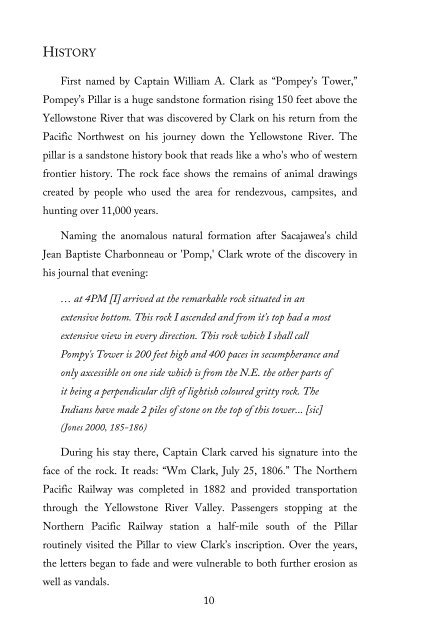
- Page 27: 3. POMPEY’S PILLAR/CAPTAIN CLARK
- Page 31 and 32: May 25, 1928, Billings Gazette news
- Page 33 and 34: 4. FORT ELLIS Near Bozeman GPS coor
- Page 35 and 36: Augustus Van Horn Ellis of the 124
- Page 37 and 38: 5. LINDLEY PARK Bozeman GPS coordin
- Page 39 and 40: Can you identify this DAR marker ce
- Page 41 and 42: 6. FOUNDER’S HOUSE Butte GPS coor
- Page 43 and 44: It was on a snowy Saturday, October
- Page 45 and 46: 7. PAY GOLD 10 miles west of Butte
- Page 47 and 48: “Pay gold was discovered in Silve
- Page 49 and 50: August 25, 1931, Montana Standard n
- Page 51 and 52: 8. SPANISH-AMERICAN WAR VETERANS ME
- Page 53 and 54: The chapter abandoned the fountain
- Page 55 and 56: 9. DILLON’S FOUNDING Dillon GPS c
- Page 57 and 58: Historic photo of the two-story woo
- Page 59 and 60: 10. PATHFINDER TRIBUTE Dillon GPS c
- Page 61 and 62: the Montana State Normal College, a
- Page 63 and 64: 11. HISTORIC BANNACK 25 miles south
- Page 65 and 66: “Grasshopper Diggins.” Many fol
- Page 67 and 68: Dedication of DAR historical marker
- Page 69 and 70: 12. SACAJAWEA MEMORIAL- ARMSTEAD 20
- Page 71 and 72: present.” The senator arrived via
- Page 73 and 74: The Butte Miner newspaper, November
- Page 75 and 76: 13. SOUTHERN GATEWAY 8 miles south
- Page 77 and 78: Copper Mining Company, installed in
- Page 79 and 80:
1935 dedication program for Souther
- Page 81 and 82:
14. OLD FORT BENTON BLOCKHOUSE Fort
- Page 83 and 84:
American Fur Company's agent at For
- Page 85 and 86:
In May 1908, as part of its efforts
- Page 87 and 88:
• American Monthly Magazine (DAR)
- Page 89 and 90:
15. OLD FORT PECK Near town of Fort
- Page 91 and 92:
July 14, 1879, due to river erosion
- Page 93 and 94:
16. MONTANA REAL DAUGHTER ORPHA ZIL
- Page 95 and 96:
92. Her mother, Elizabeth Ford Park
- Page 97 and 98:
Orpha Zilpha Parke Bovee grave site
- Page 99 and 100:
17. GIANT SPRINGS Six miles northea
- Page 101 and 102:
This springs, originally called a f
- Page 103 and 104:
18. VETERANS MEMORIAL TREE Great Fa
- Page 105 and 106:
Old postmarks—Fort Custer 1895 (a
- Page 107 and 108:
19. FORT CUSTER Hardin GPS coordina
- Page 109 and 110:
By the time the fort was establishe
- Page 111 and 112:
20. ROSEBUD BATTLEFIELD 40 miles so
- Page 113 and 114:
Woman, who rescued her brother, Chi
- Page 115 and 116:
21. BEAR PAW BATTLEFIELD 16 miles s
- Page 117 and 118:
The west-facing tablet tells that t
- Page 119 and 120:
• The Montana Standard newspaper,
- Page 121 and 122:
22. FORT ASSINNIBOINE 6 miles south
- Page 123 and 124:
Over its 32 years as a military pos
- Page 125 and 126:
23. GATES OF THE MOUNTAINS North of
- Page 127 and 128:
Captain Clark never saw the Gates o
- Page 129 and 130:
State Historian David Hilger, Gover
- Page 131 and 132:
24. REED AND BOWLES STOCKADE TRADIN
- Page 133 and 134:
In the summers of 1874 and 1875, lo
- Page 135 and 136:
Reed and Bowles Stockade and Tradin
- Page 137 and 138:
25. REED’S FORT POST OFFICE Lewis
- Page 139 and 140:
uildings that still stand in North
- Page 141 and 142:
Article in Great Falls Tribune, Sep
- Page 143 and 144:
26. TEIGEN SCHOOL Lewistown GPS coo
- Page 145 and 146:
Daughters of the American Revolutio
- Page 147 and 148:
27. FIRST LEWIS AND CLARK TRAIL MAR
- Page 149 and 150:
The 1908 dedication of this monumen
- Page 151 and 152:
28. TRAVELERS’ REST Lolo GPS coor
- Page 153 and 154:
Travelers’ Rest marker is the onl
- Page 155 and 156:
National Register of Historic Place
- Page 157 and 158:
29. BOOT HILL CEMETERY Powderville,
- Page 159 and 160:
Dedication of DAR historical marker
- Page 161 and 162:
30. FORT KEOGH OFFICER QUARTERS Mil
- Page 163 and 164:
Powder River Chapter whose members
- Page 165 and 166:
31. MONTANA REAL DAUGHTER CAROLINE
- Page 167 and 168:
Spokane with a grandchild. She then
- Page 169 and 170:
Laura Tolman Scott article in The D
- Page 171 and 172:
32. SACAJAWEA MEMORIAL- THREE FORKS
- Page 173 and 174:
On the day of the 1914 dedication,
- Page 175 and 176:
• The Dillon Examiner newspaper,
- Page 177 and 178:
33. FORT LOGAN BLOCKHOUSE Northwest
- Page 179 and 180:
a sub-post of Fort Benton and was s
- Page 181 and 182:
• Historical Sites Preserved and
- Page 183 and 184:
34. LOST DAR MARKERS As might be ex
- Page 185 and 186:
As the Lewis and Clark Expedition c
- Page 187 and 188:
ended in December 1975 when the 30-
- Page 189 and 190:
• MSSDAR 1982-1984 Pictorial Supp
- Page 191 and 192:
to navigate. On August 17, 1805, th
- Page 193 and 194:
egent, the chapter placed numerous
- Page 195 and 196:
(Gov. Sidney Edgerton), the first s
- Page 197 and 198:
HISTORY This was Mount Hyalite Chap
- Page 199 and 200:
35. OTHER DAR COMMEMORATIONS Some o
- Page 201 and 202:
… stepped into the lot in front o
- Page 203 and 204:
Since the spade has been put on pub
- Page 205 and 206:
Sacajawea Recreation Area, Lemhi Pa
- Page 207 and 208:
wildflower admirer and collector. (
- Page 209 and 210:
George Washington Bicentennial DAR
- Page 211 and 212:
HISTORY The dedication of a bronze
- Page 213 and 214:
We thank Thee, Lord, for this far-s
- Page 215 and 216:
The tree chosen for the site was a
- Page 217 and 218:
Index 10 th U.S. Cavalry, 105 11 th
- Page 219 and 220:
Custer, General George Armstrong, 1
- Page 221 and 222:
Long, Mrs. E.A., 120 Love, Mrs. R.V
- Page 223 and 224:
Smith, Rev. Edward, 53 Sons of the