

The Soils of The Regional Municipality of Ottawa=Carleton
The Soils of The Regional Municipality of Ottawa=Carleton
The Soils of The Regional Municipality of Ottawa=Carleton

Create successful ePaper yourself
Turn your PDF publications into a flip-book with our unique Google optimized e-Paper software.
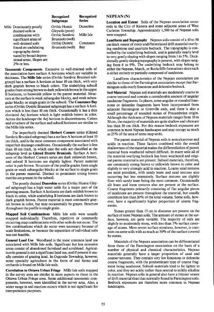
Recognized Recognized<br />
Subgroups Series<br />
M16 : Dominantly poorly Orthic Humic Dunrobin<br />
drained soils in Gleysols (poor)<br />
combination with OrthicSombric Mille Isle<br />
significant areas <strong>of</strong> Brunisols (well)<br />
well-drained soils Orthic Dystric Constance<br />
found on undulating<br />
topography dominatedby<br />
broad depressional<br />
areas . Slopes are<br />
2% or less .<br />
Brunisols (well) Bay<br />
Taxonomic Components Excessive to well-drained soils <strong>of</strong><br />
the association have surface A horizons which are variable in<br />
thickness . <strong>The</strong> Mille Isle series (Orthic Sombric Brunisol subgroup)<br />
has a surface A horizon at least 10 cm thick, with very<br />
dark grayish brown to black colors . <strong>The</strong> underlying subsoil<br />
grades from strongbrown to dark yellowish brown inthe upper<br />
B horizons, to brownish yellow in the parent material . Structure<br />
at the surface is weak subangular blocky, and weak subangular<br />
blocky or single grain in the subsoil. <strong>The</strong> Constance Bay<br />
series (Orthic Dystric Brunisol subgroup) has a surfaceA horizon<br />
which is less than 10 cm thick . Occasionally it has a thin<br />
eluviated Aej horizon which is light reddish brown in color.<br />
Across the landscape the Aej horizon is discontinuous . Colors<br />
and structure <strong>of</strong>the surface and subsoil horizons are similar to<br />
the Mille Isle series.<br />
<strong>The</strong> imperfectly drained Herbert Corners series (Gleyed<br />
Sombric Brunisol subgroup) has a surface A horizon at least 10<br />
cm thick, and is the most common component associated with<br />
imperfect drainage conditions . Occasionally the surface is less<br />
than 10 cm thick, in which case the soils are classified at the<br />
subgroup level as Gleyed Dystric Brunisols . Surface A horizons<br />
<strong>of</strong> the Herbert Corners series are dark yellowish brown,<br />
and subsoil B horizons are slightly lighter. Parent material<br />
color is pale brown . Structure <strong>of</strong>the pr<strong>of</strong>ile grades from single<br />
grain or weak subangular blocky at the surface to single grain<br />
in the parent material . Distinct to prominent strong brown<br />
mottles are present inthe subsoil .<br />
<strong>The</strong> poorly drained Dunrobin series (Orthic Humic Gleysol<br />
subgroup) has a high water table for a major part <strong>of</strong> the<br />
growing season. Surface A horizons are dark reddish brown to<br />
black in color, while underlying B horizons are dark brown to<br />
dark grayish brown . Parent material is most commonly grayish<br />
brown in color, but may occasionally be grayer. Structure<br />
throughout the pr<strong>of</strong>ile is single grain .<br />
Mapped Soil Combinations Mille Isle soils were usually<br />
mapped individually. <strong>The</strong>refore, repetitive or commonly<br />
occurring map combinations with other soils do not occur. <strong>The</strong><br />
few combinations which do occur were necessary because <strong>of</strong><br />
scale limitations, or because the separation <strong>of</strong> individual soils<br />
was not feasible .<br />
General Land Use Woodland is the most common land use<br />
associated with Mille Isle soils . Significant but less extensive<br />
areas consist <strong>of</strong> abandoned farmland and scrubland . Agriculture<br />
in general is not a significant land use, and if present it usually<br />
consists <strong>of</strong> grazing land . In Osgoode Township, however,<br />
some specialty agriculture in the form <strong>of</strong> sod farms and<br />
orchards is found on Mille Isle soils .<br />
Correlation to Ottawa Urban Fringe Mille Isle soils mapped<br />
in the survey area are similar in most aspects to those in the<br />
Ottawa Urban Fringe area . Some additional taxonomic components,<br />
however, were identified in the survey area . Also, a<br />
wider range in soil reaction occurs which is not significant for<br />
interpretation purposes .<br />
NEPEAN (N)<br />
Location and Extent <strong>Soils</strong> <strong>of</strong> the Nepean association occur<br />
only in the City <strong>of</strong> Kanata and some adjacent areas <strong>of</strong> West<br />
Carleton Township. Approximately 1,500 ha <strong>of</strong> Nepean soils<br />
were mapped .<br />
Landform and Topography Nepean soils consist <strong>of</strong> a 10 to 50<br />
cmthickveneer <strong>of</strong>stony undifferentiated driftmaterial overlying<br />
sandstone and quartzite bedrock . <strong>The</strong> topography is controlled<br />
by the underlying bedrock, and is generally nearly level<br />
to very gently sloping with slopes ranging from I to 5016 . Occasionallygently<br />
sloping topography is present, with slopes ranging<br />
from 6 to 9% . <strong>The</strong> underlying bedrock may belong to<br />
either theNepean, March, orRockcliffe formations since each<br />
is either entirely or partially composed <strong>of</strong> sandstone.<br />
Landform characteristics <strong>of</strong> the Nepean association are<br />
similar to those <strong>of</strong> the Farmington association except that Farmington<br />
soils overly limestone and dolomite bedrock .<br />
Soil Material Nepean soil materials are moderately coarse to<br />
coarse textured and contain a considerable amount <strong>of</strong> angular<br />
sandstone fragments . In places, some angular or rounded limestone<br />
or dolomite fragments have been incorporated from<br />
adjacent Farmington or Grenville soils, and there is also a<br />
small percentage <strong>of</strong> rounded stones <strong>of</strong> Precambrian origin .<br />
Although the thickness <strong>of</strong> Nepean materials ranges from 10 to<br />
50cm, the majority<strong>of</strong>materials are quite shallow and<strong>of</strong>ten are<br />
less than 30 cm thick . For this reason bedrock exposures are<br />
common in most Nepean landscapes and may occupy as much<br />
as25% <strong>of</strong>the area<strong>of</strong> some map units .<br />
<strong>The</strong> parent material <strong>of</strong>Nepean soils is noncalcareous and<br />
acidic in reaction . <strong>The</strong>se factors combined with the overall<br />
shallowness <strong>of</strong>the material makes the differentiation <strong>of</strong> parent<br />
material from weathered subsoil difficult . In many soils all <strong>of</strong><br />
the material overlying bedrock has been weathered and original<br />
parent material is not present . Subsoil materials, therefore,<br />
are commonly strong brown to yellowish brown in color and<br />
slightly to very strongly acid in reaction . Loamy sand textures<br />
are most prevalent, with sandy loam and sand textures also<br />
occurring but less extensively. Surface textures are slightly<br />
finer with sandy loam being the most common . Occasionally<br />
silt loam and loam textures also are present at the surface.<br />
Coarse fragments primarily consisting <strong>of</strong> flat angular pieces<br />
<strong>of</strong> sandstone are present throughout the material, but usually<br />
constitute less than 20% <strong>of</strong> the total volume. Some soils, however,<br />
have a significantly higher proportion <strong>of</strong> coarse fragments<br />
.<br />
Stones greater than 15 cm in diameter are present on the<br />
surface <strong>of</strong> most Nepean soils . <strong>The</strong> amount <strong>of</strong>stones at the surface,<br />
however, are quite variable . <strong>The</strong> majority <strong>of</strong> soils are<br />
slightly to moderately stony, with less than 3% surface coverage<br />
<strong>of</strong> stones . More severe surface stoniness, however, is common<br />
on some soils with as much as 50% <strong>of</strong> the surface covered<br />
by stones .<br />
Materials <strong>of</strong> the Nepean association can be differentiated<br />
from those <strong>of</strong> the Farmington association on the basis <strong>of</strong> a<br />
number <strong>of</strong> physical and chemical characteristics . Nepean<br />
materials generally have a larger proportion <strong>of</strong> sand and<br />
coarser textures . <strong>The</strong>y contain very few limestone or dolomite<br />
coarse fragments, with the predominant type <strong>of</strong> coarse fragment<br />
being sandstone . Subsoil materials tend to be lighter in<br />
color, and they are acidic rather than neutral to mildly alkaline<br />
in reaction. Nepean soils in general also have a thinner veneer<br />
<strong>of</strong> drift material thanthat normally found in Farmington soils .<br />
Bedrock exposures are therefore more common in Nepean<br />
landscapes .


