antiquarian bookseller - Peter Harrington
antiquarian bookseller - Peter Harrington
antiquarian bookseller - Peter Harrington

Create successful ePaper yourself
Turn your PDF publications into a flip-book with our unique Google optimized e-Paper software.
<strong>Peter</strong> <strong>Harrington</strong> Antiquarian Bookseller<br />
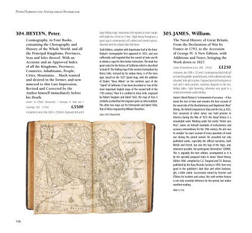
304.HEYLYN, <strong>Peter</strong>.<br />
Cosmography, in Four Books,<br />
containing the Chorography and<br />
History of the Whole World: and all<br />
the Principal Kingdoms, Provinces,<br />
Seas and Isles thereof. With an<br />
Accurate and an Approved Index<br />
of all the Kingdoms, Provinces,<br />
Countries, Inhabitants, People,<br />
Cities, Mountains… Much wanted<br />
and desired in the former, and now<br />
annexed to this Last Impression,<br />
Revised and Corrected by the<br />
Author himself immediately before<br />
his Death.<br />
London: for P[hilip] C[hetwynde], T. Passenger, B. Tooke and T.<br />
Sawbridge, 1682 [17764] £3500<br />
4 volumes in one, folio (360 × 235mm). Engraved title and 4<br />
large folding maps, Imprimatur leaf repaired at inner margin<br />
with slight loss of text on 5 lines. Slight foxing throughout, a<br />
good copy in contemporary calf, rubbed and scored in places,<br />
rebacked with the original label laid down.<br />
Sixth Edition, complete with Imprimatur leaf at the front.<br />
Heylyn’s Cosmographie first appeared in 1652, and was<br />
sufficiently well regarded that the council of state saw fit<br />
to obtain a copy for their better instruction. The book has<br />
great value for the history of California which is described<br />
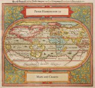
in book IV. The folding map of the western hemisphere by<br />
Henry Seile, reissued by his widow Anna, is of the Goos<br />
type, based on the 1627 Speed map, with the addition<br />
of Drake’s “Nova Albion” on the northern part of the<br />
“Island” of California. It has been described as “one of the<br />
most important English maps of the second half of the<br />
17th century.” Here it is credited to Anna Seile, engraved<br />
by Robert Vaughan and dated 1663, the map of Asia is<br />
similarly ascribed but the engraver given as John Goddard.<br />
The other two maps are for Chetwynde and dated 1666,<br />
that of Africa engraved by William Trevethen.<br />
Sabin 31655: Wing H1696.<br />
305.JAMES, William.<br />
The Naval History of Great Britain,<br />
From the Declaration of War by<br />
France in 1793, to the Accession<br />
of George IV. A New Edition, with<br />
Additions and Notes, bringing the<br />
Work down to 1827.<br />
London, Richard Bentley & Son, 1886 [39242] £1250<br />
6 volumes, 8vo (188 × 125 mm). Contemporary black half calf<br />
on matching pebble-grained boards, a little rubbed and neatly<br />
rebacked, titles gilt to spines. Engraved portrait frontispiece to<br />
each and 5 other portraits, numerous diagrams to the text,<br />
folding tables. Light browning, otherwise very good in a<br />
simple and entirely usable binding.<br />
James’s Naval History is “a monument of accuracy – it has<br />
stood the test of time and remains the best account of<br />
the naval side of the Revolutionary and Napoleonic Wars”<br />
(Kemp, The Oxford Companion to Ships and the Sea, p. 425).<br />
First conceived of when James was held prisoner in<br />
America during the War of 1812 the Naval History is a<br />
remarkable work. Working under the motto “Verité sans<br />
Peur”, James set himself standards of inclusiveness and<br />
accuracy extraordinary for the 19th century. His aim was<br />
to compile “an exact account of every operation of naval<br />
war during the period named. He consulted not only<br />
published works, especially the official narratives, both<br />
British and French, but also the logs of the ships, and,<br />
whenever possible, the participants themselves” (ODNB).<br />
This is arguably the best edition, accompanied as it is<br />
by the specially prepared Index to James’ Naval History,<br />
Edition 1886, compiled by C.G. Toogood and T.A. Brassey,<br />
published by the Navy Records Society in 1895; here very<br />
good in the publisher’s dark blue and white buckram,<br />
gilt, a little soiled. Successively mined by Forester and<br />
O’Brian for incident and colour, this well-written history<br />
is not only essential reference for the period, but makes<br />
excellent reading.<br />
NMM, V, 2158.<br />
306.JENKINS, James.<br />
The Naval Achievements of Great<br />
Britain. From the Year 1793 to 1817.<br />
London, for J. Jenkins, [not before 1833] [25503] £12,500<br />
Folio (351 × 285 mm). Finely bound in full blue crushed<br />
morocco by the Chelsea Bindery, covers with gilt panelled<br />
border, anchors in corners, spine with 5 raised bands, lettered<br />
gilt in second compartment, others ruled around in gilt and<br />
Catalogue 57: Travel Section 7: Mapping, Navigation and Naval History<br />
with central naval ornaments gilt, turn-ins ruled and bordered<br />
in gilt, purple watered silk doublures and endpapers, top edge<br />
gilt. Housed in matching slipcase. With 55 hand-coloured<br />
aquatints of naval battles and ships on Whatman paper, 1<br />
uncoloured plate, plan of the Bombardment of Algiers and<br />
plan of the Battle of Trafalgar, hand-coloured title vignette.<br />
Excellent condition, with the plates in good impressions and<br />
skilfully coloured.<br />
FIRST EDITION. This magnificent publication, illustrating<br />
the high-water mark of Britain’s maritime hegemony, was<br />
disappointingly slow to sell on its first issue in 1817 and<br />
Jenkins chose to issue copies as demand necessitated. The<br />
plates in this copy are variously watermarked, the latest<br />
dated 1833. The book was reprinted as late as 1840, copies<br />
having been seen with watermarks of the date. The very<br />
earliest issues can be identified by the title-page vignette<br />
remaining uncoloured; otherwise, the key consideration<br />
for collectors is the quality of the colouring, which is<br />
excellent in the present copy.<br />
156 157<br />
Abbey, Life 337.