Bradford District Local Infrastructure Baseline Study - working draft ...
Bradford District Local Infrastructure Baseline Study - working draft ...
Bradford District Local Infrastructure Baseline Study - working draft ...

Create successful ePaper yourself
Turn your PDF publications into a flip-book with our unique Google optimized e-Paper software.
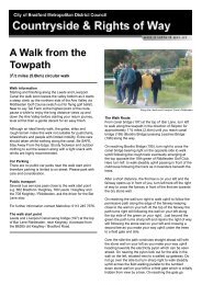
1.7 Public Rights of Way<br />
Within the <strong>District</strong> there are 687 miles (1,100kms) of public rights of way, made up of 5,123<br />
individual path links. A path link is defined as the length of path between a junction with<br />
another path or road.<br />
Not all of the <strong>District</strong> is subject to a definitive map (the legal record of public rights of way).<br />
The former County Borough of <strong>Bradford</strong> was originally excluded from definitive map<br />
coverage and many routes on our records for that area are awaiting legal orders to formally<br />
record them on a definitive map. This means that approximately 162 miles (260kms) of the<br />
total network is non-definitive, whilst 525 miles (845kms) is included on the definitive map. In<br />
practice this does not mean that the paths within this area are unprotected. The Countryside<br />
and Rights of Way Service maintains files on the 162 miles of non-definitive routes and, as<br />
public rights are believed to exist on these, the Service protects them as it would a definitive<br />
route.<br />
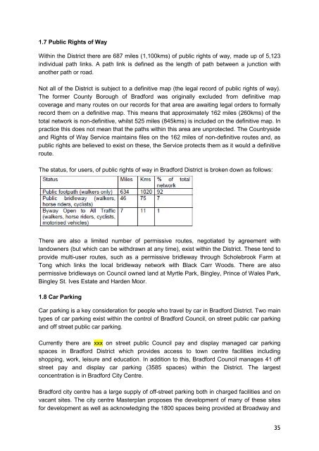
The status, for users, of public rights of way in <strong>Bradford</strong> <strong>District</strong> is broken down as follows:<br />
There are also a limited number of permissive routes, negotiated by agreement with<br />
landowners (but which can be withdrawn at any time), exist within the <strong>District</strong>. These tend to<br />
provide multi-user routes, such as a permissive bridleway through Scholebrook Farm at<br />
Tong which links the local bridleway network with Black Carr Woods. There are also<br />
permissive bridleways on Council owned land at Myrtle Park, Bingley, Prince of Wales Park,<br />
Bingley St. Ives Estate and Harden Moor.<br />
1.8 Car Parking<br />
Car parking is a key consideration for people who travel by car in <strong>Bradford</strong> <strong>District</strong>. Two main<br />
types of car parking exist within the control of <strong>Bradford</strong> Council, on street public car parking<br />
and off street public car parking.<br />
Currently there are xxx on street public Council pay and display managed car parking<br />
spaces in <strong>Bradford</strong> <strong>District</strong> which provides access to town centre facilities including<br />
shopping, work, leisure and education. In addition to this, <strong>Bradford</strong> Council manages 41 off<br />
street pay and display car parking (3585 spaces) within the <strong>District</strong>. The largest<br />
concentration is in <strong>Bradford</strong> City Centre.<br />
<strong>Bradford</strong> city centre has a large supply of off-street parking both in charged facilities and on<br />
vacant sites. The city centre Masterplan proposes the development of many of these sites<br />
for development as well as acknowledging the 1800 spaces being provided at Broadway and<br />
35