Download (1.95 MB) - Conservation Strategy Fund
Download (1.95 MB) - Conservation Strategy Fund
Download (1.95 MB) - Conservation Strategy Fund
- No tags were found...

You also want an ePaper? Increase the reach of your titles
YUMPU automatically turns print PDFs into web optimized ePapers that Google loves.
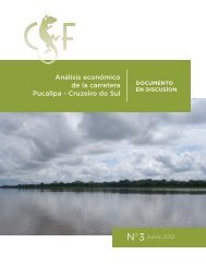
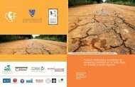
CASO 3/CASE 3Caso 3un camino desde San Buenaventura hasta PerúCase 3a road from San Buenaventura to PeruLa segunda carretera analizada es la construcción de unaruta pavimentada desde la ciudad de Buenaventura hastaPuerto Heath, en la frontera con Perú. Actualmente, unacarretera de grava de buena calidad conduce al Noroestedesde San Buenaventura, siguiendo el curso de las serraníasdel Bala, Mamoque y Cuñaca. La carreteraatraviesa más de 110 corrientes de agua y ríos antes dellegar a Ixiamas. Muchas de estas corrientes de aguapueden ser vadeadas en todas las condiciones climáticas, yalgunas tienen puentes y alcantarillas en construcción,mientras otras, particularmente el Tequeje, detienen el tráficocada vez que precipitaciones abundantes ocasionancrecidas. Después de Ixiamas, la carretera se reduce a unpar de caminos de tierra que sirven para la extracción demadera. Uno conduce al Norte atravesando un paisajemixto de pampas y bosque lluvioso. El otro continúa haciael Oeste, al pie de las serranías, rumbo al Alto Madidi.La ruta que suele proponerse para la carretera SanBuenaventura-Perú es la segunda, que llega hasta una coloniaabandonada de prisioneros en el Alto Madidi antes deenfilarse rumbo al Norte hacia Puerto Heath, en donde elrío Heath se une al Madre de Dios. Desde allí se puede continuarel viaje por vía fluvial, 65 kilómetros ríos arriba por elMadre de Dios, hasta llegar a la ciudad peruana de PuertoMaldonado que, a pesar de la ausencia de una carreteradesde la frontera boliviana, es básicamente el punto final deesta ruta. Algunas versiones anteriores de este proyecto tambiénhan incluido un tramo de Puerto Heath hasta Cobija, lacapital de Pando, otros 150 kilómetros más.The second road analyzed is construction of a pavedroute from the town of San Buenaventura to PuertoHeath, on the Peruvian border. At the moment, a high-qualitygravel road heads northwest from San Buenaventura, followingthe foot of the Mamoque and Cuñaca ridges (serranías).The road intersects more than 110 streams andrivers on its way to Ixiamas. Many of these watercoursescan be forded in all weather and some have bridges andculverts under construction, while others, particularly theTequeje, stop traffic when swelled by heavy rains. BeyondIxiamas, the road degenerates into a couple of dirt loggingtracks. One leads north through a mixed landscape ofpampas and rain forest. The other continues west, close tothe ridges, in the direction of Alto Madidi.The most commonly proposed route for the SanBuenaventura-Peru road would follow the latter track as faras Alto Madidi, an abandoned prison colony, then headnorth to Puerto Heath, where the Heath River flows into theMadre de Dios. From there one can travel by river 65 kilometersup the Madre de Dios to the large Peruvian town ofPuerto Maldonado, which, despite the absence of a roadfrom the Bolivian border, is essentially the endpoint of thisroute. Some past versions of this project have also includeda section from Puerto Heath as far as Cobija, the capital ofPando, which adds another 150 km.33